Pagosa Country sees more record-breaking heat — The #PagosaSprings Sun #SanJuanRiver #ColoradoRiver #COriver #aridification

Click the link to read the article on the Pagosa Springs Sun website (Clayton Chaney). Here’s an excerpt:

March 26, 2026

It was warmer last week in Pagosa Country than any other time on record, as the area saw five consecutive days of record high temperatures set from March 18-22. According to forecasts posted by Shawn Prochazka with Pagosa Weather, a new record high for the month of March was set on Wednesday, March 18, at 74 degrees and again on Thursday, March 19, at 76 degrees. The previous record high for the month of March was set in 1907 and 1940 at 73 degrees. Record highs for the month continued on Friday, March 20, with temperatures reaching 79 degrees. The previous record for that date was 68 degrees, set in 1997. Prochazka also notes that record high temperatures were set on Saturday, March 21, at 77 degrees, and on Sunday, March 22, at 74 degrees…

Snowpack

According to data from the Natural Resource Conservation Services (NRCS), as of 11 a.m. on Wednesday, March 25, Wolf Creek Pass at 10,930 feet had a snow water equivalent of 12 inches, compared to that date’s median of 27.3 inches. That amount is 44 percent of that date’s median snow water equivalent. The San Miguel, Dolores, Animas and San Juan river basins as a whole are listed at 21 percent of its 30-year median snowpack. The Wolf Creek summit had the second highest current snow water equivalent in the San Miguel, Dolores, Animas and San Juan river basins, and the Upper Rio Grande basin, behind the Black Mesa site with 12.2 inches of snow water equivalent as of press time Wednesday…

Colorado Drought Monitor map March 24, 2026.

Drought

According to the most recent map released by the U.S. Drought Monitor on Thursday, March 19, 100 percent of Archuleta County remains in moderate drought stage, with 22.04 percent of the county being in a severe drought stage. Areas that are in a severe drought stage lie along the eastern border of the county with Conejos County. Meanwhile, 12.88 percent of the state is in an extreme drought stage, and less than 1 percent of the state is in an exceptional drought stage. That includes portions of Pitkin, Eagle, Summit, Lake and Park counties…

River flows

According to the U.S. Geological Survey (USGS), as of 11 a.m. on Wednesday, March 25, the San Juan River in downtown Pagosa Springs had a flow rate of 595 cubic feet per second (cfs). The record high flow for that date was recorded in 2004 at 860 cfs, while the record low was recorded in 1964 at 42 cfs. The median flow for that date is 165 cfs, and the mean flow is 239 cfs. The Piedra River near Arboles was flowing at a rate of 434 cfs as of 11 a.m Wednesday, March 24, according to the USGS. The median flow for that date is 339 cfs, and the mean flow is 457 cfs. The record high flow for that date was recorded in 1993 at 1,400 cfs, while the record low was recorded in 1964 at 45 cfs.

Navajo Dam Operations Meeting [Virtual] – April 21, 2026 1-3pm — Reclamation #SanJuanRiver #ColoradoRiver #COriver #aridification

The San Juan River near Navajo Dam, New Mexico, Aug. 23, 2015. Photo credit: Phil Slattery Wikimedia Commons

From email from Reclamation:

March 20, 2026

Reclamation conducts Public Operations Meetings three times per year to gather input for determining upcoming operations for Navajo Reservoir. Input from individuals, organizations, and agencies along with other factors such as weather, water rights, endangered species requirements, flood control, hydro power, recreation, fish and wildlife management, and reservoir levels, will be considered in the development of these reservoir operation plans. In addition, the meetings are used to coordinate activities and exchange information among agencies, water users, and other interested parties concerning the San Juan River and Navajo Reservoir. The next meeting will be held virtually on April 21st


Microsoft Teams

Join the meeting now

Meeting ID: 247 128 548 928 44

Passcode: Yn6ih2Q6


Dial in by phone

+1 202-640-1187,,923961898# United States, Washington

(833) 436-1163,,923961898# United States (Toll-free)

Find a local number

Phone conference ID: 923 961 898#

Join on a video conferencing device

Tenant key: teams@conferencing.doi.gov

Video ID: 114 427 248 3

More info

The (new) water year of our discontent: The record low #snowpack is likely to lead to record low streamflows — Jonathan P. Thompson (LandDesk.org) #runoff

Click the link to read the article on The Land Desk website (Jonathan P. Thompson):

March 20, 2026

It was early June, and we sat out in the shade in our backyard in Silverton, Colorado, wearing short-sleeves and shorts and drinking cold beverages under a cloudless blue sky. That, in itself, made the day memorable. Blizzards are as likely on Memorial Day as barbecues in this mountain town, elevation 9,318 feet, and sweater-free days usually don’t come along until July.

The winter of 2001-2002 had been unusually mild and a warm April and May had melted what little snow had fallen; the Animas River’s spring runoff had peaked at historically low levels a couple weeks earlier. I, for one, wasn’t too worried. By then it was understood that the climate was warming, and that it could wreak havoc on the planet, but the idea of rising sea levels and devastating heat waves felt pretty abstract in the Colorado high country. Besides, as an amateur historian, I had read accounts of similarly dry and warm winters from the San Juan Mountains’ past: In 1879, the snow was all melted from the highest peaks by May (giving way to the Lime Creek Burn that summer); sleighing was impossible” on Silverton’s streets during the 1890-91 winter; and the newspaper ran a photo of a water wagon suppressing dust on Greene Street on New Year’s Day, 1918, during “one of the most delightful winters ever experienced.”

Vallecito Reservoir during Missionary Ridge Fire via George Weber Environmental.

This, it seemed, was just another one of those occasional weird years, so we figured we might as well enjoy it. Then someone noticed what looked like puffy cumulonimbus cloud rising up in the gap formed by the Animas River gorge. It wasn’t a cloud at all, but a billowing tower of smoke from the Missionary Ridge Fire, ignited that afternoon on a slope about 35 miles south of where we sat. Over the coming weeks, the blaze would eat through 73,000 acres of parched scrub oak and aspen and conifer forest, along with 83 structures. It eclipsed the 26,000-acre Lime Creek Burn as the state’s largest wildfire on record, but lost the title to the Hayman Fire (138,114 acres) that was burning at the same time across the state.

Aerial view from the south of Hayman Fire June 30, 2002. Road traversing from left to right is U.S. Highway 24. Town of Manitou Springs is in lower part of photo, Colorado Springs to the right. Garden of the Gods park defined by three upright orange rock formations in right center just below smoke line. Creative Commons Attribution-Share Alike 4.0 International license.

And it was then that we realized this was no normal abnormality, and that 2002 would go down as the Water Year of our Discontent: dry, smoky, and catastrophic for irrigators and river rafters alike.

This year is shaping up to be even more dire. Indeed, with temperatures in Silverton climbing into the 60s this week, I’m sure a few people have shed some layers and soaked up the sun — in March. Now, however, we know that this is no anomaly, but part of a long-term trend toward aridification, most likely caused or at least exacerbated by climate change. Call it the “new normal” if you’d like, but just remember the words of Bruce Cockburn: “The trouble with normal is it always gets worse.”

I wanted to wait until April to give this assessment, on the off chance that the weather might shift radically in the last days of March in a way that might give us all some hope. While anything’s still possible, I’ve seen enough to bet that, unfortunately, we may already have seen peak snowpack in many places, making this the driest water year on record by far. And besides, I wanted to get the spring runoff “predict the peak” streamflow contest going before, well, the streamflows actually peaked.

A crappy snow year does not necessarily lead to a nasty fire season, since so many other factors come into play. The same can sort of be true about the peak of the spring runoff. That’s more about timing: A fast melt after a dry winter can result in a bigger, albeit short-lived, peak, than a slow melt of a relatively abundant snowpack. The river’s average flows across the entire water year are much more closely tied to snowpack, but those can also be affected by a big monsoon season.

Still, looking back at similar years in the past can help with predicting flows this year. I’m going to focus on the Animas River in Durango, because it’s my home river, it is unimpeded by dams or major upstream diversions, and it is a good proxy for a lot of other Southwestern rivers, since its headwaters are located in the same mountain range as those of the Rio Grande, the Gunnison, the Dolores, the San Miguel, the San Juan, and the Uncompahgre rivers. If the runoff is weak in the Animas, it is also likely to be weak in all of those other rivers.

The snowpack graph shows that the current heat wave has really taken a toll, and probably launched the spring runoff.

Here’s the temperature graph for the Animas watershed. You can see that it reached a record high for the date of 42.8° F. That doesn’t seem too warm until you consider that the median temperature for March 18 is about 25° F. Probably more significant than this one little blip is the fact that daily temperatures have far exceeded “normal” on dozens of days this winter. Also note the contrast with 2002 (the darker green line).

When you talk to Colorado climate folks and old-timers with good memories, you’ll often hear that the 1977 water year was even drier than 2002. Unfortunately, SNOTEL records typically go back only to the early 1980s, so it’s difficult to make a good apples-to-apples comparison. But by looking at the “natural flow” of the Colorado River, which is the calculated estimate of how much the river would carry without any human intervention, it appears that 1977 was, indeed, the driest winter across the Upper Colorado River Basin since at least 1900. 

However, historic Animas River flow data suggest that 2002 was actually drier in southwestern Colorado. 

Here’s the average annual daily flow for the Animas. Note that there are several years missing between 1898 and 1911; apparently the USGS did not record flows during those years.

Average stream flows on the Animas River have trended downward over the last century and some, but the river has struggled through extreme dry years in the past. Source: USGS.

Because that graph isn’t so easy to read, here’s a table showing the eleven lowest average daily flow water years. Note that in 1927 they only had 92 records, potentially skewing the results. The 2002 and 2018 water years were lower than in 1977. If snowpack levels correlate with annual average flows, then we could expect this year’s to be around 200 cfs, which is pretty damned dismal.

When I took a look at the peak streamflows for the Animas, I was a bit taken aback to see that in 2002 it topped out above 1,000 cfs, which is more than I would have expected.

Then I saw the date: It peaked in September, after the monsoon arrived, not in the spring. The 2002 spring runoff actually topped out on May 21 at 880 cfs, which was far lower than the 1977 spring peak. 

Based on all of that, my Animas River peak streamflow prediction is a bit wacky, but I’m standing by it: It will top out at 700 cfs on April 15.

The rest of the Land Desk community will have a chance to predict the peak starting next week, when I’ll announce the terms, the river gauges in the contest, and the prizes for the winner(s). Most likely it will only be open to paid subscribers, so the time to upgrade is now!

We might as well get even more depressed. Here’s the snowpack graph for the Upper Colorado River Basin, showing 2026, 2002, and 2018 — i.e. the dismal years. Note that the spring melt has begun in earnest. If it continues at this rate, runoff will be over by early May.

And here’s the natural flow graph for Lees Ferry on the Colorado River. Natural flow is the calculation of how much water would be in the river at that point if there were no human diversions or consumptive use upstream. If you compare this to the historic streamflows on the Animas River, you’ll notice that there is a correlation, but it’s not direct. For example, 1977 was the driest year on record for the Colorado River as a whole, with a total volume of just 5.4 million acre-feet, which is about half what the Lower Basin alone was using throughout the 1990s.

The ten lowest years on record are:

  1. 1977: 5.4 MAF
  2. 2002: 5.9 MAF
  3. 1934: 6.6 MAF
  4. 2021: 7.2 MAF
  5. 1954: 8.3 MAF
  6. 2012: 8.4 MAF
  7. 2018: 8.5 MAF
  8. 2025: 8.5 MAF (provisional)
  9. 1981: 8.6 MAF
  10. 1931: 8.9 MAF

It looks like we could be in that 5.4 MAF territory once again. That wasn’t a huge deal in 1977, since it was an anomaly. It is a big deal now.


And just so you know, it’s not just the Colorado River watershed that’s in trouble. Even California, which got pummeled by atmospheric rivers, is losing its snow rapidly.


📖 Reading (and watching) Room 🧐

The Upper Basin and Lower Basin may not have come up with a deal yet on how to save the Colorado River’s massive plumbing system, but they are looking for solutions. One of them is creating an Upper Basin conservation pool. Like a lot of issues related to the rivers, it’s a slightly complicated one. But Heather Sackett of Aspen Journalism gives a really great rundown. She’s always a must-read for those looking to understand what’s going on with the Colorado. 

🗺️ Messing with Maps 🧭

The current heat wave is breaking records across the West. Here’s a little sampling:

If you want a quick and comprehensive look where those records were broken during the last day, week, or month, check out coolwx.com/record. In the side panel you can click on the United States and the time period you wish to see and it will show an animation of all of the records. It looks kind of like this:

Area sees record heat, Governor Polis stands up #Drought Task Force — The #PagosaSprings Sun #SanJuanRiver

Colorado Drought Monitor map March 17, 2026.

Click the link to read the article on the Pagosa Springs Sun website (Clayton Chaney and Randi Pierce). Here’s an excerpt:

March 19, 2026

Shawn Prochazka is also predicting more record high temperatures to have been set Wednes- day, March 18 (the high temperature reached was not available by press time that day); today, Thursday, March 19; and tomorrow, Friday, March 20. Prochazka predicted temperatures being 25 degrees above normal. Prochazka also notes that the record high for the month of March is 73 degrees, which was set March 19, 1907, and March 23 and 25, 1940. Warm and dry weather is expected to stick around throughout the weekend and into next week, with Prochazka indicating the next chance for precipitation possibly starting around March 25…Temperatures are expected to stay above freezing throughout the weekend in Pagosa Springs as a high of 82 degrees is forecast for Friday, March 20, with a low of 37 degrees and clear skies in the evening…

The drought conditions in the area have also worsened, with the U.S. Drought Monitor showing that 100 percent of Archuleta County was in moderate drought as of March 10, up from 47.89 percent of the county being in moderate drought and 100 percent of the county being abnormally dry the previous week…Snowpack also continues to fall below median levels in the region and across the state. As of Wednesday, the San Miguel, Dolores, Animas and San Juan river basins sat at 45 percent of the March 18 median. The Wolf Creek summit SNOTEL site, which sits at an elevation of 10,930 feet, was at 56 percent of the day’s median, while the Upper San Juan site, which sits at 10,140 feet, was at 49 percent of the day’s median.

On Tuesday, due to the recordbreaking warm temperatures and low snowpack across Colorado, Governor Jared Polis activated the state’s Drought Task Force and Phase 2 of Colorado’s Drought Response Plan. Acting on recommendations from the state’s Water Conditions Monitoring Committee and partner agencies, the task force will help the state bet- ter understand and elevate the local, regional and sector-specific impacts of worsening drought conditions, a press release from the state explains.

“Colorado is experiencing thewarmest year so far in our 131-year record, and one of the driest,” Polis said. “Activating the Drought Task Force will help ensure we are protecting one of our most precious resources by closely tracking impacts, supporting communities and coordinating better as we prepare for the year ahead.”

The Drought Task Force, last activated in 2020, brings together senior leadership from key state agencies, including the Colorado Department of Natural Resources, Colorado Department of Agriculture, Department of Local Affairs, and the Division of Homeland Security and Emergency Management, according to the press release. It further explains that the group assesses drought conditions statewide, elevates local impacts to state leadership, and can convene regional or sector-specific workgroups to gather information and share resources…

As of noon on Wednesday, March 18, the San Juan River at Pagosa Springs was running at a flow of 286 cubic feet per second (cfs), above the median flow for March 18 The median flow for March 18 sits at 121.5 cfs, with a historical low for the date being 39 cfs and the historical high being 1,040 cfs.

San Juan River Basin. Graphic credit Wikipedia.

#ColoradoRiver Upper Basin states test methods to fill #LakePowell pool: States say automatically turning to agriculture isn’t always reliable — Heather Sackett (AspenJournalism.org) #COriver #aridification

Lake Powell, on the Colorado River, is seen from the air in 2019. The Upper Basin states are planning how to potentially fill a dedicated pool in the nation’s second largest reservoir. CREDIT: ECOFLIGHT

Click the link to read the article on the Aspen Journalism website (Heather Sackett):

March 19, 2026

With a Lake Powell conservation pool nearly guaranteed for the future of Colorado River management, the four Upper Basin states are exploring and refining the ways they could fill it.

Conservation by those states (Colorado, New Mexico, Utah and Wyoming) could be one of the keys to reaching a deal among the seven states that share the Colorado River and an important part of the framework for managing the drought-stricken river after this year. The water saved by the Upper Basin states could be stored in Lake Powell as a means of maintaining higher water levels and as an insurance policy against drastic cuts.

This type of pool isn’t yet being used in Lake Powell; it would have to be established by an agreement among the seven states. An agreement in the 2019 Drought Contingency Plan allowed for a 500,000 acre-foot Upper Basin storage pool in Lake Powell, but so far, the states have not utilized this and the agreement expires this year.

The Upper Basin and Lower Basin (California, Arizona and Nevada) have been at an impasse for more than two years about how the nation’s two largest reservoirs — Lake Powell and Lake Mead — will be managed and shortages shared in the future. The situation has never been more dire: The current guidelines for river management expire at the end of the year, while record-low snowpack is expected to push reservoir levels below critical thresholds. The seven states have blown past two deadlines to come up with a plan, and the federal government is gearing up for emergency actions to manage reservoirs.

The crux of the disagreement between the two basins has been over who should take shortages in drought years. The Lower Basin has committed to 1.5 million acre-feet of reductions annually and wants cuts beyond that to be shared by the Upper Basin. The Upper Basin says its water users already take cuts in some years because streams run dry by midsummer and any contributions they make must be voluntary.

TThe main boat ramp at Wahweap Marina was unusable due to low water levels in Lake Powell in December 2021. The U.S. Bureau of Reclamation is projecting that the reservoir will fall below critical thresholds later this year. CREDIT: HEATHER SACKETT/ASPEN JOURNALISM CREDIT: HEATHER SACKETT/ASPEN JOURNALISM

Contribution not conservation

Some Upper Basin officials have made a slight shift in the way they now talk about a pool in Lake Powell. No longer referred to as a conservation pool, it is called a “contribution” pool, reflecting the different methods — not only conservation of agricultural water — of contributing water to a Lake Powell pool.

Traditionally, the Colorado River basin states have turned to programs that pay irrigators to voluntarily leave fields dry for a season or two as the primary way to cut water use. With agriculture representing the majority of water use in the Upper Basin, it’s often the low-hanging fruit when it comes to water savings. 

But at least two Upper Basin states are turning to other methods to contribute water to a Lake Powell pool. 

For example, New Mexico can contribute water from Navajo Reservoir that it leases from a tribe. In Colorado, the method is less straightforward, but officials say the state is prioritizing and expanding existing programs and projects that save water. 

“When you talk about things like turf removal, water-loss prevention, watershed restoration, forest-health efforts that are happening on the ground, those are benefits not only to Colorado but to the entire system,” said Becky Mitchell, Colorado’s lead negotiator in talks among the seven states that share the Colorado River. “So we’re trying to figure out: How do we acknowledge all of that work?”

Raymond Langstaff, a rancher and president of the Bookcliff Conservation District, irrigates a parcel north of Rifle. The state of Colorado explored the feasibility of a demand management program that would pay irrigators to cut back, but did not implement one. CREDIT: HEATHER SACKETT/ASPEN JOURNALISM

Utah touts pragmatic approach

Over its run in 2023 and 2024, the federally funded System Conservation Pilot Programdoled out $45 million to Upper Basin irrigators to cut their use by about 100,000 acre-feet. Utah water users received about $15 million of that in exchange for temporarily forgoing about 37,000 acre-feet of Colorado River water. The state put lessons learned with SCPP to use and is now in the second year of its own demand management pilot program, funded by $5 million from the state legislature and run by the Colorado River Authority of Utah. 

The pilot program lets water users temporarily participate in a conservation program, and pays them $390 an acre-foot of water to do it. In 2025, Utah sent about 8,000 acre-feet downstream to Lake Powell under this pilot program, according to Marc Stilson, deputy director and principal engineer of the authority. There are a couple industrial water users and one municipal water user among the participants, but the majority are agricultural, he said.

“The pilot program is trying to iron out all these issues so that if we end up with some type of post-2026 commitment to do these types of voluntary conservation programs, we’re ready to do it,” Stilson said. “There is a very pragmatic approach in Utah looking at the big picture, and I think generally there is a sense that we have to adapt to changing conditions.”

Whether the program will continue after this year is unclear and could depend on whether the states reach a deal.

“We were anticipating that we’d have an agreement and that these types of programs would be part of that agreement,” Stilson said. “I think we just have to take a wait-and-see approach.”

Wyoming is also looking to traditional programs: State lawmakers are establishing a voluntary water conservation program. Wyoming state engineer and lead negotiator Brandon Gebhart did not respond to phone calls, emails or a list of questions from Aspen Journalism.

Boater on the San Juan River in May 2023. New Mexico officials say they can contribute water to a pool in Lake Powell through releasing water they lease in Navajo Reservoir. CREDIT: HEATHER SACKETT/ASPEN JOURNALISM

New Mexico seeks ‘more diverse’ ways to contribute water

The state of New Mexico plans to contribute to a Powell pool mostly through 20,000 acre-feet of Navajo Reservoir water, which it leases from the Jicarilla Apache Nation and can be released down the San Juan River. Along the way to Lake Powell, it boosts flows for endangered fish. Officials say because they can control when they release the water, it can be tracked with certainty to the reservoir. 

“We all need to focus on more diverse ways of contributions, not just the classic conserved consumptive use,” said Ali Effati, Colorado River basin bureau chief for the New Mexico Interstate Stream Commission. 

Water managers say that automatically turning to agricultural water isn’t always reliable because as climate change continues to rob rivers of flows, even if senior water users want to participate in these types of conservation programs, they may not have any water to spare in dry years.

“That doesn’t mean that we have shied away from those sorts of activities, but to the extent that we can do our part without having to ask our agricultural community to cut water where they already take significant cuts almost annually, that’s just a preferable perspective,” said Estevan Lopez, lead negotiator for New Mexico.

Lopez said the likelihood of seeing a future Upper Basin contribution pool in Lake Powell is nearly 100% and that New Mexico will be ready, willing and able to contribute its share of water when the time comes.

“We have our percentage easily covered, plus a significant amount more,” he said.“We have our percentage easily covered, plus a significant amount more,” he said.

TThese hay bales stand ready to be collected on a ranch outside of Carbondale in July 2024.  Upper Basin states have traditionally looked to agricultural to conserve water, but some are now turning to other ways to contribute water. CREDIT: HEATHER SACKETT/ASPEN JOURNALISM

Colorado points to programs already in place

Colorado water users participated in both years of SCPP, but the state has been reluctant to take the leap into setting up its own program, despite being an early leader of the conservation conversation among the Upper Basin states.

In 2019, Colorado convened nine workgroups to explore the feasibility of a demand management program. The process included Colorado River water users from across the state and in multiple water-use sectors, who looked at how to set up a temporary, voluntary, compensated state program. But in 2022, the state water board shelved the studies without implementing a program, in favor of focusing on drought-resiliency initiatives. 

Mitchell said the demand management feasibility investigation was an incredibly valuable exercise, but that there are still a number of open questions. Inaction on a demand management program doesn’t mean inaction on conservation overall, she said.

“The CWCB board voted to pause that investigation until there was clarity about whether any such program would be achievable, worthwhile and advisable and until there’s evidence that a demand management-esque program would benefit Colorado,” Mitchell said.

In 2023, Colorado lawmakers created a task force to again examine how the state could implement demand reduction and conservation programs. Water managers punted the issue again, failing to make recommendations to lawmakers on this topic, with some members saying conservation programs were “premature.” 

The state still does not seem to have the policies in place to implement a large-scale, traditional conservation program in the near future. Mitchell said Colorado’s plan to contribute water to a Lake Powell pool is through the programs and projects already in place, many of which are funded through the state’s Water Plan grants.

At its March meeting, the CWCB approved more than $13 million for 38 projects across the state, according to a press release. They include things like urban turf replacement, creek and wetland restoration, outdoor water budgeting and wildfire ready action plans.

“Our strategy is to continue on with the programs that are already in existence, continue to fund conservation efforts that benefit all Coloradans as well as the entire system, continue to live within the means of the river and adapt our uses to align with available supply,” Mitchell said. “Because of all those programs already set up, we believe we have the majority of the structure in place.”

But Mitchell would not put a number on the amount of water that Colorado could contribute.

“We want to be a part of the solution when and how we are able to, but no, I’m not going to say we can do 100,000 acre-feet in a year like this,” she said.

Colorado River watchers may soon get some clarity around exactly how — and how much — Upper Basin states plan to contribute to a Lake Powell pool. On March 24, the Upper Colorado River Commission plans to consider projects to include in a “provisional accounting” memorandum of understanding (MOU) with the U.S. Bureau of Reclamation, according to UCRC Director Chuck Cullom. 

Some Upper Basin projects that are not traditional agricultural conservation programs may be counted under the MOU, allowing the states to “get credit” for the water they save through unconventional means. Cullom said the UCRC and Bureau of Reclamation will also soon have an accounting report of water-saving activities undertaken in 2025. 

Mitchell said Colorado is still committed to a seven-state consensus agreement and wants to avoid litigation. But acknowledgement of what the Upper Basin is already doing to cut back on water use will be important.

“The MOU is one component where we would like to see some sort of real acknowledgement of what is occurring in terms of the way that we live within the means of the river and what our strict administration is doing,” Mitchell said. “As long as we are not acknowledged in what’s happening on the ground, I think we’re going to have struggles.”

Map of the Colorado River drainage basin, created using USGS data. By Shannon1 Creative Commons Attribution-Share Alike 4.0

Navajo Dam operations update March 13, 2026: Bumping down to 250 CFS Monday #SanJuanRiver #ColoradoRiver #COriver #aridification

Navajo Lake

From email from Reclamation (Conor Felletter):

Due to the increasing severity of the ongoing drought, and in an effort to conserve as much water as possible, the Bureau of Reclamation will decrease the release from Navajo Dam to 250 cubic feet per second (cfs) on Monday, March 16, at 8:00 AM.

West Drought Monitor map March 10, 2026.

This change provides an opportunity to conserve approximately 1,500 acre-feet of stored water during the remainder of March while downstream targets are being met by side inflows.

Releases from Navajo Dam are made for the authorized purposes of the Navajo Unit and to support base flows through the endangered fish critical habitat reach of the San Juan River (Farmington to Lake Powell). The San Juan River Basin Recovery Implementation Program recommends a target base flow of between 500 cfs and 1,000 cfs through the critical habitat area. The target base flow is calculated as the weekly average of gaged flows throughout the critical habitat reach from Farmington to Lake Powell.

This scheduled release change is subject to adjustment based on river flows and weather conditions.

If you have any questions, please contact Conor Felletter (cfelletter@usbr.gov or 970-637-1985), or visit Reclamation’s Navajo Dam website at https://www.usbr.gov/uc/water/crsp/cs/nvd.html

Map of the San Juan River, a tributary of the Colorado River, in Arizona, Colorado, New Mexico and Utah, USA. Made using USGS National Map data. By Shannon1 – Own work, CC BY-SA 4.0, https://commons.wikimedia.org/w/index.php?curid=47456307

#PagosaSprings looks at engaging in engineering contract for new #wastewater treatment facility: To explore declaring state of emergency for sewer — The Pagosa Springs Sun

Wastewater Treatment Process

Click the link to read the article on the Pagosa Springs Sun website (Derek Kutzer)

On March 3, 2026, the Pagosa Springs Town Council, which also sits as the board of the Pagosa Springs Sanitation General Improvement District (PSSGID), gave town staff direction to continue in its current relationship with Roaring Fork Engineering, while also engaging in a new separate contract to design and build a new wastewater treatment facility plant downtown. The council also gave town staff direction to explore the possibility of declaring its sewer system “a state of emergency.”

[…]

Roaring Fork has identified four major project goals for the downtown treatment facility:

  • Design a wastewater treatment facility which can serve the entire town population, including the ability for future expansion for either acceptance of a larger service area or PAWSD sewage.
  • The wastewater treatment facility should be a community-centric facility, which includes the ability for students and community members, to interact with the site safely and learn more about wastewater treatment and operations.
  • The building should be LEED (Leadership in Energy and Environmental Design) certified, integrate into the natural landscape (green roof ), include renewable energy when possible and be designed by a local architect who understands the community’s infrastructure.
  • The treatment processes should be progressive, forward-thinking and regulatory resilient, energy-efficient, and long-term sustainable for a small community to operate. This shall include the ability to treat wastewater to nonpotable reuse standards for localized irrigation on properties nearby.

Yikes! #LakePowell likely to receive half or less of its normal water supply this year — Shannon Mullane (Fresh Water News) #ColoradoRiver #COriver #aridification

The Bureau of Reclamation’s latest forecast for the Colorado River predicts Lake Powell will “most probably” drop below the critical minimum power pool level before the end of this year, jeopardizing Glen Canyon Dam’s structural integrity. In the worst-case scenario, it would do so before summer’s end. This could force the feds to operate the dam as a “run-of-the-river” operation to preserve the dam’s infrastructure and hydropower output, which would significantly diminish downstream flows and threaten Lower Basin water supplies.

Click the link to read the article on the Water Education Colorado website (Shannon Mullane):

February 19, 2026

Lake Powell could receive only half the normal amount of water from upstream rivers and streams this year, according to a recent federal study.

The U.S. Bureau of Reclamation releases a monthly study that forecasts good, bad and most likely storage conditions for the Colorado River Basin’s key reservoirs over the next two years. The February forecast expects about 52%, or about 5 million acre-feet, of the normal amount of water to flow into Lake Powell by September. The more grim outlook says Powell’s inflows could be 3.52 million acre-feet or 37% of the average from 1991 to 2020.

It’s enough to spike concerns about hydropower generation at Glen Canyon Dam — which controls releases from Powell — prompt discussions about emergency releases from upstream reservoirs and trigger federal actions to slow the pace of water out of the reservoir.

“I think they’re going to be nervous about operating the turbines,” said Eric Kuhn, former general manager for the Colorado River Water Conservation District.

In January, about 79% of the 30-year average flowed into Lake Powell — which is on the Utah-Arizona border — from upstream areas of Arizona, Colorado, New Mexico, Utah and Wyoming, according to the federal February 24-month study, released Friday.

The February projections also showed even less water flowing into Lake Powell, a decline of about 1.5 million acre-feet since January.

One acre-foot is enough water to support two or three households for a year. Colorado used an average of 1.96 million acre-feet of Colorado River water between 2021 and 2025.

The Colorado River Basin, which provides water to 40 million people, has been plagued by a 25-year drought that drained its main reservoirs — the largest in the nation — to historic lows amid unyielding human demands.

And that stress is going to continue. The most probable forecast shows nothing but below-average flows in February — 71% of the 30-year average — and for April through July, when flows are likely to be 38% of the norm.

Feds take action to boost Powell

Upstream states like Colorado do not get a drop of water from Lake Powell, Kuhn said. Coloradans rely mostly on local reservoirs to help pace the spring runoff and support year-round water use.

But the reservoir’s status can impact whether upstream reservoirs, like Flaming Gorge in Wyoming and Blue Mesa in Colorado, will have to make emergency releases to elevate water levels in Lake Powell.

In response to the dry and warm winter, the federal government is trying to keep the water in the reservoir above certain critical water levels, according to the study.

At 3,490 feet in elevation, Glen Canyon Dam can no longer send Powell’s water through its penstocks and turbines to generate hydroelectric power — that would remove a cheap, renewable and reliable power source for communities across the West.

Lake Powell is projected to drop below the critical elevation by December, or as soon as August in one scenario, according to the 24-month study.

Federal officials are likely to call for emergency water releases from upstream reservoirs to keep Powell’s water level from falling to that point. They’re working to maintain a cushion by keeping Powell’s water level above 3,525 feet, or at the very least 3,500 feet in elevation, according to the study.

Lake Powell’s elevation was just over 3,532 feet as of Monday, but it’s expected to drop to 3,497 feet by Sept. 30 under the most likely forecast. (The minimum forecast puts it closer to 3,469 feet.)

Putting himself in the Bureau of Reclamation’s shoes, Kuhn would be looking upstream to fill that gap.

“Where do they plan for it?” he said. “I would be looking to get a lot of water if I’m going to keep Lake Powell above 3,500. … 3,525 may not be possible. There just may not be enough water in the system.”

Facing new lows

That is partly because the Bureau of Reclamation is required by a 2007 agreement, which expires this fall, to release certain amounts of water each year based on reservoir elevations. Replacing these rules is the focus of ongoing high-stakes — and deadlocked — negotiations among states.

Powell’s releases are expected to be 7.48 million acre-feet between Oct. 1, 2025, and Sept. 30, according to the February 24-month study.

To try to keep reservoir levels up, the Bureau of Reclamation has adjusted its normal releases since December to keep about 600,000 acre-feet of water in the reservoir. That water will eventually be released downstream as required by the 2007 rules.

Federal officials could also release less than 7.48 million acre-feet this year to keep more water in Lake Powell, according to the study. A 2024 short-term agreement allows the officials to release as little as 6 million acre-feet of water this year to avoid Lake Powell falling below 3,500 feet.

Lake Powell’s lowest release was about 2.43 million acre-feet in 1964, when the reservoir was first being filled. Since 2000, when the basin dipped into the ongoing 25-year drought, Powell’s average annual release has been 8.69 million acre-feet, according to The Sun’s analysis of water release data.

“I don’t think they’re going to release 7.48 this year. I think they have to cut the flow down to 7 (million acre-feet) or even below,” Kuhn said.

More by Shannon Mullane

Map of the Colorado River drainage basin, created using USGS data. By Shannon1 Creative Commons Attribution-Share Alike 4.0

Navajo Unit operations update February 10, 2026: Bumping down to 300 cfs

The outflow at the bottom of Navajo Dam in New Mexico. Photo: Brent Gardner-Smith/Aspen Journalism

From email from Reclamation Western Colorado Area Office:

The Bureau of Reclamation has scheduled a decrease in the release from Navajo Dam from 350 cubic feet per second (cfs) to 300 cfs for Tuesday, February 10th, at 8:00 AM. 

Releases are being made through the 4×4 gates while the powerplant is down for maintance.

Releases are made for the authorized purposes of the Navajo Unit, and to attempt to maintain a target base flow through the endangered fish critical habitat reach of the San Juan River (Farmington to Lake Powell). The San Juan River Basin Recovery Implementation Program recommends a target base flow of between 500 cfs and 1,000 cfs through the critical habitat area. The target base flow is calculated as the weekly average of gaged flows throughout the critical habitat area from Farmington to Lake Powell.

This scheduled release change is subject to changes in river flows and weather conditions.  If you have any questions, please reply to this message, call 970-385-6500, or visit Reclamation’s Navajo Dam website at https://www.usbr.gov/uc/water/crsp/cs/nvd.html

Map of the San Juan River, a tributary of the Colorado River, in Arizona, Colorado, New Mexico and Utah, USA. Made using USGS National Map data. By Shannon1 – Own work, CC BY-SA 4.0, https://commons.wikimedia.org/w/index.php?curid=47456307

Aging Vallecito Reservoir needs a serious makeover: Emergency overflow remains unusable until fixes can be made — The #Durango Herald #VallecitoCreek #LosPinosRiver

Vallecito Lake via Vallecito Chamber

Click the link to read the article on The Durango Herald website (Jessica Bowman). Here’s an excerpt:

February 2, 2026

Vallecito Dam is due for some serious upkeep…But aging materials and erosion have caused significant damage to the dam’s emergency support structures, and a major repair project is coming down the pipeline sometime in the next several years.

“We’ve got this issue and we know it’s here. It hasn’t been clandestine; we’ve told people about it forever,” said Ken Beck, superintendent of the Pine River Irrigation District. “But it’s a nail-biter for a superintendent and dam tender.”

PRID operates, maintains and manages Vallecito Dam and Reservoir, which holds and delivers supplemental irrigation water to 65,000 acres of land downstream – the lifeblood for ranchers and farmers who hold water rights with the district…The repair project – about which little has been decided beyond the fact that it must happen – will be a massive undertaking. Beck estimated it could take roughly two to four years to complete once ground is broken, likely changing some of the regular operations of the reservoir. There is the potential that irrigators, ranchers and farmers who rely on consistent water deliveries would feel some impact – but Beck said how much and if at all is dependent on a variety of factors, like the weather and the time of year when the construction is done…The project is also important from the standpoint of the Southern Ute Indian Tribe, which is entitled to one-sixth of the reservoir’s total storage capacity. That water is used primarily for tribal agriculture and water management…

The primary issue is the dam’s upper spillway, a critical safety structure designed to release water during extreme runoff or flood events. Vallecito’s upper spillway includes three radial gates and a concrete chute that carries water to be released downstream safely without damaging the dam itself. Any damage to that infrastructure is a critical issue, and can compromise the dam’s ability to manage high water and protect downstream communities…In 2017, PRID conducted a dye test to assess the spillway’s integrity, Beck said. Dye placed upstream later appeared in areas downstream where it should not have surfaced if the structure were intact, confirming that water was migrating beneath the concrete spillway.

That process – known as “piping” – can carry sediment out from under the structure and weaken its foundation. After the dye test, the Bureau of Reclamation launched a series of investigations that revealed large underground voids – some as large as 4 by 10 feet – beneath portions of the spillway. Beck said it was determined the upper spillway is unsafe to use except in dire emergencies, because uncontrolled flows could accelerate erosion and threaten the dam’s integrity.

San Juan River Basin. Graphic credit Wikipedia.

#SanJuanRiver sees record flows amidst #drought conditions — The #PagosaSpringsSun #ColoradoRiver #COriver #aridification

Click the link to read the article on the Pagosa Springs Sun website (Clayton Chaney and Randi Pierce). Here’s an excerpt:

January 7, 2026

Snowpack and stream flow

According to data from the Natural Resource Conservation Services (NRCS), as of 1 p.m. on Wednesday, Jan. 7, the Wolf Creek Pass site at 10,930 feet had a snow water equivalent of 7.6 inches, compared to that date’s median of 15.5 inches. This is up from the Dec. 31, 2025, report of 7 inches. The current amount is 49 percent of that date’s median snow water equivalent…The San Miguel, Dolores, Animas and San Juan River basins were measured to be at 49 percent of its 30-year median snowpack as of December 31, 2025, and at 56 percent on January 7, 2026…

In Pagosa Springs, U.S. Geological Survey for the San Juan River at Pagosa Springs has showed record flows multiple times since the start of the year. For example, at 9 a.m. on Jan. 2, the river was running at 128 cubic feet per second (cfs), which compares to a median of 53 cfs and a previous high of 118 in 1986. At 11 a.m. on Jan. 5, the river was running at 119 cfs, which compares to a median for that date of 54.5 cfs and a previous max value of 116 in 1987. By 11 a.m. on Wednesday, Jan. 7, the river was flowing at 111 cfs. The Jan. 7 median is 55, and the record high is 116 cfs, which was recorded in 1987. According to the U.S. Drought Monitor’s most recent map released on Dec. 31, 2025, 100 percent of Archuleta County is in an “abnormally dry” drought stage.

Colorado Drought Monitor map January 6, 2026.

Town council presented with flood recovery funding scenarios after FEMA denies funds — The #PagosaSprings Sun #SanJuanRiver

Total precipitation (inches) from 9-15 October 2025 with gridded data from the PRISM Climate Group and observations from the Community Collaborative Rain, Hail, and Snow (CoCoRaHS) network.

Click the link to read the article on the Pagosa Springs Sun website (Derek Kutzer). Here’s an excerpt:

January 7, 2026

On January 6, 2026 Town of Pagosa Springs staff informed the Pagosa Springs Town Council about the town’s ongoing flood recovery funding efforts in the wake of the Federal Emergency Management Agency’s (FEMA’s) denial of the town’s request for $5.7 million to aid cleanup efforts. Development Director James Dickhoff and Projects Manager Kyle Rickert were both on hand to walk the council through various other funding opportunities, with Dickhoff stating, “We are not counting on FEMA money to come through to us” after the denial on Dec. 21, 2025. Dickhoff stated that staff just wanted to inform the council “on where we are at” regarding the town’s relief funding efforts from the October 2025 flooding…

The total project cost of river cleanup and restoration following the October flood event is estimated to be just shy of $6 million, stated Town Manager David Harris in correspondence.  Rickert explained that, with the FEMA funding off the table, the town is pursuing several state grants, and possibly a state loan, as well as two other federal funding programs. Dickhoff added that if the town wanted to pursue “the loan opportunity through the Colorado Water Conservation Board (CWCB),” the council would need to put it before the voters in an upcoming spring election to be legally eligible to take out the loan…

Rickert explained that the federal Emergency Watershed Protection had awarded the town about $3.3 million and the Colorado Office of Emergency Management awarded $463,504 in funds.  These funds will go toward embankment stabilizations near the Pagosa Springs History Museum and near 6th Street, pedestrian bridge abutment stabilization at Centennial Park, restoring the River Center ponds, as well as Apache Street bridge repairs and log jam removals, all coming with a total project price tag of $4,178,038, the slideshow states…

He added, “The river is an important part of our tourism portfolio and we need to get it cleaned up” and make it safe for those recreating in the river before summer hits. Rickert then informed the council about a Colorado Parks and Wildlife (CPW) Fishing is Fun grant that the town has requested in the amount of $328,603.  This grant would go toward dredging the River Center ponds, a headgate replacement at Pond #1 (the east pond), ditch restoration, debris and sediment removal upstream of town limits to the future 1st Street pedestrian bridge, as well as rebuilding rock structures in the same area. Rickert noted that the town was also awarded $15,000 from History Colorado Emergency Grant for its ongoing efforts to stabilize the river bank near the museum…One or possibly two water gauge stations would give the town an estimated two hours of warning time as water levels rise during another flood event, providing historic data as part of the U.S. Geological Survey monitoring system, she noted. This grant application would be due by Jan. 31, so she asked the council to pass a resolution supporting the CWCB river gauge grant, which the council passed unanimously. 

The San Juan River has peaked above 8,000 cfs twice in the last several days, reaching the highest levels seen since the 1927 flood. Source: USGS.

Warm weather boosts fishing, hurts skiing and water reserves in Southwest #Colorado — The #Durango Herald #snowpack #drought

Westwide SNOTEL basin-filled map January 3, 2025.

Click the link to read the article on The Durango Herald website (Jessica Bowman). Here’s an excerpt:

December 30, 2025

All it takes is a quick step outside to confirm that, so far, winter in La Plata County – and across much of Southwest Colorado – is unseasonably warm. Durango set record-breaking highs on Dec. 24 and Dec. 25, when the temperature climbed to 60 degrees, 5 degrees warmer than previous records for those dates, according to in-town data from the National Weather Service. The warm temperatures have been accompanied by a drier-than-normal December and scarce early season snowfall. While it has impacted and raised concerns across sectors like cattle ranchers, water management and tourism – sectors largely dependent on winter weather – no one is throwing out hope for a good winter. [ed. emphasis mine]

Local businesses have been impacted by the weather differently – good or bad, dependent on the seasonal recreation it sells. Scant snowfall is bad news for powder hounds, and bad business for ski shops that depend on winter recreation business…And while ski-related businesses wait for snow, Durango’s fishing industry has seen increased activity, as warmer temperatures keep rivers accessible later into the season…If warm, dry conditions persist long-term, Glenn said, the outlook could shift. Low river levels and heightened wildfire risk would pose serious challenges for the fishing industry in future seasons…

For the region’s ranching community, winter precipitation is closely tied to long-term water security. Low snowpack can mean less water available once irrigation ditches reopen in the spring. Although the warm weather has limited snowfall so far, heavy rains in the fall helped replenish local reservoirs, providing some reassurance heading into summer, said Wayne Jefferies, president of the Archuleta Cattlemen’s Society…Lemon and Vallecito reservoirs are now nearly three-quarters full – a significant improvement from projections at the end of last summer…

Colorado Drought Monitor map December 30, 2025.

Still, Jefferies said a lack of snowfall remains concerning. If dry conditions persist into early 2026, reservoir levels alone may not be enough to offset reduced snowmelt. Ranchers – who often joke that they are “grass farmers” – rely heavily on snowmelt to recharge underground moisture that supports healthy forage growth. Beneath the surface, soil and gravel layers act like a sponge, [Wayne] Jefferies said. Snowmelt is needed to saturate that sponge before irrigation water and rain can effectively reach grasses. Without sufficient snow and spring runoff, those underground layers remain dry, he said. When irrigation begins, much of the water is absorbed below ground, leaving less available for grasses to grow. The result can be weaker forage, reduced grazing capacity and added strain on ranching operations. Jefferies added this isn’t new. Southwest Colorado has experienced persistent drought conditions for much of the past two decades, punctuated by only brief periods of relief…

Water managers, meanwhile, are entering winter in a stronger position than usual thanks to the fall floods. The October flooding caused reservoirs to rise rapidly. Vallecito Reservoir, which stores water for the Pine River Irrigation District, rose 25 feet in just a few days, said Ken Beck, PRID superintendent. The surplus of water reserves after a dry summer is a good buffer for next year, and has eased the stress of relying solely on winter precipitation, Beck said, although water supply is always subject to some degree of uncertainty.

Massive Energy Storage Project Eyed for Four Corners Region — Brett Walton (circleofblue.org)

A large elevation differential is a crucial feature of the proposed Carrizo Four Corners project. The project’s upper reservoir would be located near the top of the Carrizo Mountains, seen here on Navajo Nation land near Beclabito, New Mexico. Photo © Brett Walton/Circle of Blue

Click the link to read the article on the Circle of Blue website (Brett Walton):

December 22, 2025

Colorado River water could enable a pumped storage hydropower project intended to make the region’s electric grid more resilient.

KEY POINTS

One of the longest-duration pumped storage hydropower projects in the country is proposed for Navajo Nation land in the Four Corners region.

The project received a $7.1 million Department of Energy grant this year for feasibility studies.

Pumped storage hydropower is the largest form of energy storage in the U.S.

 Standing in a breezy parking lot on Navajo land in the state’s far northwest corner, Tom Taylor looked toward the western horizon and then upwards at the furrowed mass of the Carrizo Mountains less than 10 miles away.

If all goes to plan, the infrastructure that could one day spill from the mountain’s flanks and through its core will become an essential piece of the region’s electric grid, able to store surplus electricity from renewable energy and other power sources for when it is needed later.

Fighting the wind that chilly November morning, Taylor used both hands to pin a detailed map against the hood of his Porsche Macan. A jumble of dashed lines and blue splotches representing proposed power lines, reservoirs, a water-supply pipeline, and access roads were printed atop the real-world geography on display in front of us.

“This will be a battery that lasts a long time,” Taylor said, holding tightly to the map.

JOAN CARSTENSEN

The project is the $5 billion Carrizo Four Corners Pumped Storage Hydro Center, which is designed to be one of the largest long-duration energy storage projects in the country. Pumped storage moves water between two reservoirs at different elevations. Water is pumped uphill when excess electricity is available and released to generate electricity when power demand warrants it.

Taylor, a former mayor of Farmington and a state House representative from 2000 to 2014, is employed by Kinetic Power, the three-person, Santa Fe-based outfit behind the Carrizo proposal. The company sees the project as a way to make the region’s electric grid more durable and cost-effective, not only by smoothing the intermittent nature of wind and solar but also as a bulwark against energy emergencies like the winter storm in 2021 that caused blackouts and 246 deaths in Texas. The twinned reservoirs, using water sourced from a Colorado River tributary nearby, would have the capacity to generate 1,500 megawatts over 70 hours – a form of battery that could provide the equivalent output of a large nuclear plant for nearly three days.

“We believe that the key is delivering economic value,” said Thomas Conroy, Kinetic Power’s co-founder, who has four decades of experience developing energy projects.

What seems straightforward when placing lines on a map is much less so in three dimensions. Carrizo Four Corners, which is still in the exploratory stage and is at least five years away from breaking ground, has nearly as many questions as answers at this point. What is the geology within the Carrizo Mountains? Will it support a 3,300-foot-deep shaft, a subterranean powerhouse, and dam abutments? How will drought affect the water supply? What cultural sites and wildlife might be at risk from construction? What are the power market dynamics? 

Answering those questions is the goal of a $7.1 million, two-and-a-half-year Department of Energy grant that Kinetic and its six university and research partners secured in August. (The state of New Mexico and the research partners are also contributing $7.1 million.) On the political side, will future Navajo administrations feel as favorably toward Carrizo as current president Buu Nygren?

The technical questions are but one piece of an ambitious project that touches many of the most pressing questions about natural resources in the American West today: energy development, water use, and the relationship between federal law and tribal law.

Connecting Water and Energy

Though the details are still to be worked out, the project can be described in broad strokes.

The Federal Energy Regulatory Commission, which oversees federal hydropower licensing, granted Kinetic a preliminary permit in 2021. In February 2025 FERC extended the permit, which allows for site investigations but no construction work, for another four years.

The company envisions two “off-channel” reservoirs that would not dam a flowing river. The lower reservoir will be near Beclabito. The upper, in the high reaches of the Carrizo Mountains. Both are on Navajo land, but on different sides of the Arizona-New Mexico border.  

Tom Taylor of Kinetic Power displays a map of the proposed Carrizo Four Corners Pumped Storage project. In the background are the Carrizo Mountains, where the project’s upper reservoir would be located. Photo © Brett Walton/Circle of Blue

The powerhouse that holds the electricity-generating turbines will be located underground, some 3,300 feet below the upper reservoir. Some of the longest pumped storage tunnels in the country will be required to connect the reservoirs and the powerhouse. 

Despite the geotechnical challenges, Conroy is particularly enthused by the site, which he said is the most optimal in Arizona and New Mexico – and possibly the entire country – to locate a pumped storage hydropower project.

The site stands out for four reasons, he said. It is near existing transmission corridors and grid connections due to the region’s legacy of enormous coal-fired power plants. And it will have a comparatively low capital cost for the energy it will produce. 

The other two reasons relate to water. Because of the extreme height differential between the upper and lower reservoirs – almost three Empire State Buildings – less water will be required to produce a unit of energy than for reservoirs with a gentler gradient. And because the upper reservoir site is a deep canyon, surface area and thus evaporation will be minimized. 

“Water is just top of mind here in the Southwest,” Conroy said. “And our project is as water-efficient as can be made.”

Water to fill the reservoirs would be drawn from the San Juan River, a tributary of the Colorado, via pipeline. The water would come from the Navajo Nation’s San Juan rights, which have been quantified but are not fully used.

How much water? In its FERC permit application, Kinetic estimated that the initial fill, which will take one and a half to two years, would require 38,300 acre-feet. To cover subsequent evaporation losses, the reservoirs would need to be topped up with 2,635 acre-feet per year. Those numbers will be refined in the feasibility studies.

“It’s what, about 1,300 acres of corn?” Taylor said, doing a rough mental calculation of the equivalent water consumption for the annual evaporation loss. “I think this is more valuable than 1,300 acres of corn.”

Saving for Tomorrow

So far the project has threaded the federal government’s fraught energy politics. The Trump administration is hostile to wind and solar, which in their eyes reek of liberal values. Two water-based technologies – hydropower and geothermal – have escaped condemnation and are listed in the administration’s energy dominance documents. The DOE grant that Carrizo secured is a holdover from the Biden administration’s infrastructure bill, which provided up to $10 million for feasibility studies for pumped storage projects that would store renewable energy generated on tribal lands.

Storage is the holy grail of renewable energy. Human civilization has advanced, from the dawn of agriculture to the artificial intelligence revolution today, by being able to carry a surplus from one season and one year to the next. So it is with wind and solar. To maximize their utility and counteract their intermittent nature, engineers have been searching for cost-effective ways to store energy when the sun shines and when the wind blows for the days when neither of those things happen.

“If you want to improve the resiliency of the system, you either build more firm capacity instead of more renewable, or you build longer storage,” said Fengyu Wang, a New Mexico State University assistant professor who is the principal investigator for the DOE grant.

Water for the Carrizo Four Corners project would come from the San Juan River, seen here near Shiprock, New Mexico, about 20 miles from the proposed diversion site. The San Juan is a tributary to the Colorado River. Photo © Brett Walton/Circle of Blue

Storage has taken many forms. Some are fantastic mechanical configurations – lifting heavy objects and dropping them, or forcing air into caverns and releasing it. Thermal options use molten salt to trap the sun’s heat. The most familiar are batteries, which leverage chemical energy. But the most common, at least in the U.S., is pumped storage hydropower.

The 43 pumped storage facilities in the U.S. represent the bulk of the country’s utility-scale energy storage. They accounted for 88 percent of the total in 2024, according to Oak Ridge National Laboratory. That is changing quickly, however, as more battery storage comes online. The share for pumped storage was 96 percent in 2022.

Still, long-duration storage is where pumped storage shines. According to Oak Ridge, the median battery storage is two hours. For pumped storage, it is 12 hours. Longer duration provides more buffer, not only from day to day but also season to season.

In that regard, Carrizo would signify a huge leap. The only comparable pumped storage project under consideration in the U.S. is Cat Creek, in Idaho. Even though its duration is 121 hours, its generating capacity is less than half, at 720 megawatts. 

Carrizo will have a different use case than other U.S. pumped storage projects, Conroy said. Many facilities have one customer and one generator. A nuclear plant, for instance, might be paired with a pumped storage system so that the nuclear plant can run continuously.

For Carrizo, there might be a consortium of utilities that have multiple generating sources feeding into this project and moving the water uphill. They would take delivery of that power across a large region with different climatic conditions and different needs for when and how they use the stored power. That means operating the facility will be more complicated than a traditional pumped storage project. One thing is certain, Conroy said: the Navajo will have an equity stake.

Tribal Outlook

Caution on the part of the Navajo would be understandable. The tribe’s lands have long been the center of energy developments with environmentally ruinous but economically helpful outcomes.

Uranium mining to fuel the Manhattan Project and then the nation’s reactors polluted rivers and groundwater, as did the coal mines that fed Four Corners Power Plant and the now-shuttered Navajo Generating Station and San Juan Generating Station. On the other hand, these developments provided employment and income. Navajo Mine, which supplies Four Corners Power Plant, accounts for about 35 percent of the Navajo Nation’s general fund.

Navajo and other tribal lands in the Four Corners region have been the target for a handful of pumped storage proposals in recent years. The Navajo Nation opposed three projects proposed for the Little Colorado River watershed, which were either withdrawn by the developer or denied a permit by FERC. Two other projects – Carrizo and Sweetwater, both using San Juan River water – are still in development. Sweetwater, a smaller project with eight hours duration, is being co-developed with the Ute Mountain Ute Tribe. A third project, Western Navajo Pumped Storage, which would be located near the former Navajo Generating Station, received a FERC preliminary permit in August.

The Carrizo project would be located partly on lands in the Beclabito chapter of the Navajo Nation. Photo © Brett Walton/Circle of Blue

Carrizo has not run into the same level of opposition as the other proposals. In part that is due to the proposed use of the San Juan River instead of groundwater, said Erika Pirotte, an assistant attorney general in the Navajo Nation’s water rights unit. Many Navajo communities rely on groundwater, and using it for pumped storage was viewed as unreasonable.

The lack of strong opposition is also because of Kinetic’s engagement with the Navajo Nation. The company has held meetings with the Beclabito, Red Valley, and Teec Nos Pos chapters, in addition to meetings with Navajo Nation agencies and Buu Nygren, the Navajo Nation president. Kinetic has a memorandum of understanding with Nygren, who also signed a letter of support for the project’s DOE grant application. 

“We have the support of the council,” Conroy said. “We have a very high level of support from the president, and he is just extraordinarily interested in this project and seeing that it moves forward.”

From the Navajo perspective, what is interesting are the “ancillary benefits” that could come from the water supply pipeline, Pirotte said. Once the reservoirs are filled and the pipeline’s full capacity is not needed, the extra space could be repurposed for tribal water supply uses.

“That’s why the feasibility studies are really important for the Nation, because they help us understand to what extent Navajo Nation resources would be used for the project,” Pirotte said.

None of this is immediately around the corner, Conroy cautions. The DOE grant extends for more than two years. The FERC permitting process could be another two to four years. With Congress and the Trump administration talking about faster permitting and better coordination, that timeline is a best guess. 

And then there is the question of tribal authority in the permitting process, not just for the Carrizo project but for other such developments. Will FERC abide by its 2024 stance that preliminary permits for hydropower projects on tribal lands require tribal consent? The Trump administration would like to see that policy scrapped. If FERC approves a project must a tribe assent to all the associated infrastructure? Will the Navajo be allowed to conduct reviews and issue permits?

And then there is construction, the biggest component. That will take four to six years, Conroy said. 

Even on an ambitious timeline, Carrizo is not operating until the mid-2030s.

“I’m 77,” Taylor said. “I probably won’t see it.”

This story was produced by Circle of Blue, in partnership with The Water Desk at the University of Colorado Boulder’s Center for Environmental Journalism.

Map of the San Juan River, a tributary of the Colorado River, in Arizona, Colorado, New Mexico and Utah, USA. Made using USGS National Map data. By Shannon1 – Own work, CC BY-SA 4.0, https://commons.wikimedia.org/w/index.php?curid=47456307

State ramps up water measurement on Western Slope: Grant program will fund measuring devices as state anticipates compact administration, further scarcity — Heather Sackett (AspenJournalism.org)

This Parshall flume measures the water in the Alfalfa Ditch on Surface Creek near Cedaredge. The Colorado Division of Water Resources estimates there are 2,800 diversions of more than 1 cfs without measuring devices across the Western Slope. CREDIT: HEATHER SACKETT/ASPEN JOURNALISM

Click the link to read the article on the Aspen Journalism website (Heather Sackett):

December 5, 2025

The state of Colorado is ramping up an effort to measure water use on the Western Slope, developing rules and standards and rolling out a grant program to help water users pay for diversion measurement devices.

With input from water users, officials from the Colorado Division of Water Resources are creating technical guidance for each of the four major Western Slope river basins on how agricultural water users should measure the water they take from streams. The state is now doling out $7 million from the U.S. Bureau of Reclamation to eligible water users with faulty or missing devices to install structures such as flumes, weirs and pumps at their point of diversion. 

Map of the Gunnison River drainage basin in Colorado, USA. Made using public domain USGS data. By Shannon1 – Own work, CC BY-SA 4.0, https://commons.wikimedia.org/w/index.php?curid=69257550
Colorado River Basin in Colorado via the Colorado Geological Survey
Yampa River Basin via Wikimedia.
San Juan River Basin. Graphic credit Wikipedia.
Dolores River watershed
White River Basin. By Shannon1 – Own work, CC BY-SA 4.0, https://commons.wikimedia.org/w/index.php?curid=69281367
Green River Basin

Twenty-five percent of the funding is earmarked for each of the four river basins: Gunnison (Division 4); Colorado River mainstem (Division 5); Yampa-White-Green (Division 6); and San Juan-Dolores (Division 7). The first round of funding will go to Divisions 6 and 7, and applications close at the end of January. The goal is to have all the projects complete by 2029.

Measurement rules for Divisions 6 and 7 have been finalized and are in effect; rules for Division 4 are in the draft phase, and state officials are accepting comments until Dec. 19 on the draft rules in Division 5.

With thousands of diversions from small tributaries across rural, remote and mountainous areas, figuring out precisely how much water is used in Colorado has historically been challenging. According to state officials, there are about 2,800 diversions of more than 1 cubic foot per second from Western Slope rivers and streams that are not currently being measured. Historically, the state has required measuring devices on only diversions that have been involved in calls. When a downstream senior water rights holder is not getting the full amount of water they are entitled to, they can place a “call,” which forces junior upstream water users to cut back.

This Parshall flume measuring device is being installed on a ditch on Morrisania Mesa near Parachute. The state of Colorado has $7 million in federal funds to distribute to water users to install measuring devices on their diversions from waterways. CREDIT: HEATHER SACKETT/ASPEN JOURNALISM

Compact compliance

The push for more-accurate measurement comes at a time when there is increasing competition for dwindling water supplies, as well as growing pressure on the Colorado River’s Upper Basin states (Colorado, New Mexico, Utah and Wyoming) to conserve water. Whether through forced cuts under the terms of the 1922 Colorado River Compact or through a voluntary conservation program that pays water users to cut back, the state will almost certainly face future cuts to its water use.   

According to Jason Ullmann, who is the state engineer and director of the division of water resources, accurate and consistent water measurement is a prerequisite for making basinwide cuts related to the compact.

“While we’ve always been in compliance with the [1922 Colorado River] compact, we haven’t had to do a West Slope-wide administration,” Ullmann said. “We just don’t want to be in the position of having to do that on an emergency basis. We want to be proactive and provide people consistent and reliable standards for what we expect and work with them to get to a point where we do have that more accurate measurement network before that happens.”

Although the Colorado River Compact splits the river’s water evenly between the Upper Basin and the Lower Basin (California, Arizona and Nevada) with 7.5 million acre-feet each annually, the agreement says nothing about what happens when there’s not enough water to meet these allocations. A “compact call” is a theoretical legal concept, whose definition is hotly debated among water managers. 

One way it could play out is that the Upper Basin states would have to cut off some water users in order to send enough water downstream to meet their obligations to the Lower Basin. If that happens, Colorado would need a plan for who gets cut off first. Under the strict application water law known as prior appropriation, the oldest water rights get first use of rivers and junior water rights are the first to be cut. 

Michael Cohen, a senior fellow at the Pacific Institute, where he has written about the uncertainties of water use and measurement in the Upper Basin, said collecting better data will help water managers figure out where cuts should come from.

“Moving forward, it looks more and more likely that there’s going to be some kind of compact call,” Cohen said. “Then the state of Colorado, as well as the other Upper Basin states, need to figure out how they’re going to enforce that kind of call.”

This Parshall flume was installed in the Yampa River basin in 2020 and replaced the old rusty flume seen in the background. The state of Colorado is working toward creating measurement rules and installing measurement devices across the Western Slope. CREDIT: HEATHER SACKETT/ASPEN JOURNALISM

Managing scarcity

But compact compliance is not the only reason that water measurement is needed. Scientists have shown that climate change has contributed to a 20% decline in flows from the 20th century average, and that every 1 degree Celsius of warming results in a 9% reduction in flows. The combination of climate change and a historic drought means that rivers that had never before experienced shortages or calls have started experiencing them in recent years. In the past few years, the Yampa and White rivers, in the northwest corner of the state, have had first-ever calls and have been designated “over-appropriated,” meaning there’s more water demand than supply at certain times. 

“Even if you toss the compact situation out, it’s just the practical reality that we’re seeing less snowpack and we have more calls,” Ullmann said. “We’re just in need of improving that measurement accuracy because of the need for administration.”

John Cyran, an attorney who worked on developing the measurement rules for the South Platte River basin and is now a senior attorney with the Healthy Rivers department of Boulder-based environmental group Western Resource Advocates, uses the analogy of a pizza party with too-few pizzas where hungry partygoers are allowed only two slices each to illustrate how measurement is needed in times of scarcity. 

“Just like sharing a shrinking pizza or Thanksgiving pie, our water supply is declining,” Cyran said. “The pie is getting smaller. So it is increasingly important to make sure that people don’t take more than their share. But we can’t manage what we don’t measure.”

Tightening up water measurement across the Western Slope could also help Upper Basin water managers as they grapple with a future conservation program that pays water users to cut back and then stores that water in a pool in Lake Powell. A criticism of past pilot programs was that the saved water was not tracked to Lake Powell. Water users downstream of a conservation project could pick up the extra water, with no guarantee that any of it reached the reservoir. Measurement rules and devices could help ensure that this conserved water is “shepherded” to Lake Powell.

Measurement is the first step toward management of a scarce public resource, Cyran said.

“The first step is measuring how much water is being diverted,” Cyran said. “The next step is management – making sure that folks only divert their share and that water we conserve stays in the stream and is not diverted by another user.”

Colorado River Basin map via the Babbit Center for Land and Water Policy/Lincoln Institute of Land Policy

A weird water year so far: Abundant rain, sparse snow: Plus: National park shenanigans in #Utah — Jonathan P. Thompson (LandDesk.org) #snowpack

The drought situation has improved markedly in the Southwest since the end of the last water year, especially in the Four Corners area. Source: National Drought Monitor.

Click the link to read the article on The Land Desk website (Jonathan P. Thompson):

December 2, 2025

⛈️ Wacky Weather Watch⚡️

We are now two months into the water year — and a couple of days into meteorological winter — and so far both are pretty weird. On the one hand, much of the West is covered by one of the scantest snowpacks for early December in decades. On the other, it’s also been one of the wettest beginnings to the water year in recent memory.

Graph of 2026 water year snowpack levels for the Animas River watershed (which this year reflects that for most of western Colorado and the Upper Colorado River Basin), along with every year since 2000 that has started as sparsely or more so than this year. Note that the 2008 snowpack in the Animas was just as meagre in early December as it is this year. Then the snows came with a vengeance, leading to one of the biggest winters on record as well as a very healthy spring runoff that lasted well into July.
While snow levels are paltry, the weather gods have delivered plenty of precipitation to the region. While that has helped ease drought conditions, it is no substitute for a healthy snowpack.

Adding to the uncanniness has been the wave of generous storms that have dumped up to a foot of snow on Colorado ski areas and snarled traffic, leading to at least two multi-car pileups on I-70 and shutting down other arteries — yet still failing to bring snowpack levels to anywhere near “normal.”

It’s a big ol’ mixed bag, in other words. The big October deluges eased the drought in much of the region, but the warm temperatures and snow drought don’t bode well for next spring’s runoff. Meagre early winter snowpacks can make and have made dramatic comebacks (e.g. water year 2008 in southwestern Colorado), and another storm is moving into the region as I write this, yet the National Weather Service’s is predicting an abnormally warm and dry winter for much of the Southwest.


🌵 Public Lands 🌲

The Grand County commissioners’ “Access and Capacity Enhancement Alternative” plan aimed at increasing visitation at Arches National Park was just the tip of an iceberg, it seems. Yesterday (Dec. 1), Commissioner Brian Martinez presented the plan to a group of state and federal officials at a closed State of Utah and National Park Service Workshop in Salt Lake City.


Moab seeks bigger crowds? — Jonathan P. Thompson


The meeting’s purpose, according to the official agenda, is:

This may sound fairly innocuous (and maybe it is). But given some of the players, it may also be the latest volley in Utah’s long-running effort to seize control of public lands. The meeting was run by the Interior Department’s associate deputy secretary, Karen Budd-Falen, and Redge Johnson, who leads Utah’s Public Lands Policy Coordinating Office.

Budd-Falen built her legal career on fighting federal agencies, including the Interior Department, and was part of the Sagebrush Rebellion and the Wise Use movements that endeavored to turn federal land over to states and counties and to weaken regulations on the extractive industries. Johnson, meanwhile, was a driving force behind the state’s effort to take control of 18.5 million acres of Bureau of Land Management land in the state.


A Sagebrush Rebel returns to Interior — Jonathan P. Thompson

An anti-BLM sticker (referring, presumably, to the federal land agency, not the Black Lives Matter movement) at another Phil Lyman rally against “federal overreach” and motorized travel closures in southeastern Utah back in 2014. Photo credit: Jonathan P. Thompson/The Land Desk

It’s not clear what is meant when they say the meeting is aimed at achieving Trump’s agenda. As far as national parks go, the administration has been rather chaotic: Freezing hiring, laying off thousands of staff (only to rehire some of them), slashing budgets, and allowing visitors to run roughshod over the parks during the government shutdown.

It sure looks like they are trying to cause the parks to fail, which would give them an excuse to further privatize their functions. Private for-profit corporations already run the lodges, campgrounds, and other services inside many parks. That’s why, during the shutdown, concessionaire-run campgrounds within parks continued to operate, while all of the government-run functions, such as entrance-fee-collection, were shuttered. In this way a false contrast was created between the functional privately-run operations and the dysfunctional public ones; visitors during that time would be excused for preferring the former.

The timing of this meeting, purportedly to receive input from gateway communities, is kind of odd. I have to wonder whether the Interior Department consulted local elected officials before raising entry fees for foreign visitors to $100 at Zion and Bryce Canyon National Parks in Utah, along with Grand Canyon, Acadia, Everglades, Glacier, Grand Teton, Rocky Mountain, Sequoia & Kings Canyon, Yellowstone, and Yosemite National Parks.

The Southwest’s tourism industry is highly reliant on international visitors. Visitation from abroad is already down, thanks mostly to the Trump administration’s “America First” creed and its general hostility to the rest of the world. Singling out foreign travelers for these higher fees — even if only at the most popular parks — is likely to dampen visitation from abroad even more, which will ripple through Western economies.

Grand County’s bid to cram even more visitors into Arches National Park won’t be too effective if would be visitors don’t even make it to the United States …


🗺️ Messing with Maps 🧭

This is just another old map that caught my attention, in part because it’s a reminder of how extensive the railroad network was, even in the rugged parts of Colorado, back in the late 1800s and early 1900s. This one shows the Denver & Rio Grande rail lines in 1893.

Autumn Rains Delay Basin-wide Reservoir Depletion — Jack Schmidt (Center for #ColoradoRiver Studies) #COriver #aridification

Click the link to read the article on the Center for Colorado River Studies website (Jack Schmidt):

In Brief
Unusually wet conditions in the Basin in October and November 2025, combined with reduced releases from some reservoirs, led to a basin-wide increase in storage for the two-month period. The combined contents of Lake Powell and Lake Mead increased during the two months for only the second time since 2010, and storage in the San Juan River basin increased by 19%, especially in Vallecito and Navajo Reservoirs. These changes were a welcome respite from the relentless depletion of storage that has dominated the last few years. Nevertheless, the upcoming winter snow season is predicted to be below average, and total active storage in the Basin is less than a 2 year supply when compared with recent Basin-wide consumptive uses and losses.

Total precipitation (inches) from 9-15 October 2025 with gridded data from the PRISM Climate Group and observations from the Community Collaborative Rain, Hail, and Snow (CoCoRaHS) network. Credit: Russ Schumacher/Colorado Climate Center
The Details

The rains of October and November 2025 slowed depletion of the Colorado River’s reservoirs due to increases in stream flow and reduced reservoir releases in some places. Water levels rose in a few reservoirs, and autumn’s rains provided a small bit of flexibility for water managers at the beginning of what is likely to be a below-average winter snow season.

As of November 30, the Basin’s 46 reservoirs held 24.63 million af (acre feet) of active storage[1], of which 90% was in 12 federal reservoirs,[2] including 15.00 million af in Lake Powell and Lake Mead (hereafter, Powell+Mead) and 4.88 million af in 8 federal reservoirs upstream from Lake Powell (Fig.1). This amount of storage is similar to conditions in early 2022, a situation that was described at that time as a crisis. If we divide the total active storage in the Basin’s 46 reservoirs by the basin-wide total annual rate of consumptive use and loss that was 12.7 million af in 2024, the basin-wide reservoir water supply would sustain Basin-wide use for less than 2 years. We continue to live at the doorstep of crisis.

Figure 1. Graph showing active storage in Colorado River basin reservoirs between January 1, 2021, and November 30, 2025. Credit: Jack Schmidt/Center for Colorado River Studies

Basin-wide reservoir storage stabilized in October and November, because Powell+Mead storage stabilized and storage in the San Juan River basin increased. Total Inflow to Lake Powell exceeded releases for more than one week between October 11 and October 18, when Lake Powell increased by 105,000 af[3]  which is a 1.6% gain (Fig. 2). Approximately 40% of the total inflow came from the San Juan River, and the monthly October inflows were the largest since 2015. The gain in storage in Lake Powell during this weeklong period exceeded depletions during the rest of the month, and Lake Powell gained approximately 52,000 af during the month. Lake Powell lost 147,000 af in November.

Figure 2. Graph showing inflow and outflow from Lake Powell and active storage between October 1 and November 30, 2025. Total monthly flow at Lees Ferry, representing the total releases from Lake Powell, were 490,000 af in October and 501,000 af in November. Credit: Jack Schmidt/Center for Colorado River Studies

In contrast, the autumn rains did not significantly increase inflow to Lake Mead, because most of the inflows come from scheduled releases from Lake Powell. These reservoir releases were supplemented by 101,000 af of inflows downstream from Lees Ferry[4] and 8000 af from the Virgin River.[5] The most significant changes in Lake Mead occurred at the end of November when releases from Hoover Dam were significantly reduced (Fig. 3).

Figure 3. Graph showing inflow and outflow from Lake Mead and active storage between October 1 and November 30, 2025. Total monthly flow inflow of the Colorado River, representing the total releases from Lake Powell and inflows within Grand Canyon, were 574,000 af in October and 550,000 af in November. Reservoir releases from Hoover Dam were 485,000 af in October and 415,000 af in November. Withdrawals and return flows of the Southern Nevada Water Authority were not included in these data. Credit: Jack Schmidt/Center for Colorado River Studies

Together, total active storage in Powell+Mead increased by 63,000 af during October,[6] and decreased by only 38,000 af in November (Fig. 4).[7]  More significant than the gains, however, was that the the pace of reservoir depletion was significantly slowed. Storage in Powell+Mead increased by approximately 25,000 af in October and November, only the second time since 2010 that total storage in these two reservoirs increased during these two months.[8]

Figure 4. Graph showing active storage in Lake Powell, Lake Mead, and in Powell+Mead between January 1, 2023, and November 30, 2025. Credit: Jack Schmidt/Center for Colorado River Studies

Reservoir storage in the San Juan River basin increased more than in any other part of the Colorado River Basin. Five San Juan basin reservoirs increased by 197,000 af in October and November, mostly in Navajo and Vallecito Reservoirs.[9] Not much happened elsewhere, however. The 21 reservoirs of the upper Colorado River watershed lost 57,000 af during October and November, and 16 reservoirs in the Green River watershed lost 10,000 af during the same period.

  • [1] Active storage in 46 reservoirs are reported by Reclamation at https://www.usbr.gov/uc/water/hydrodata/reservoir_data/site_map.html.
  • [2] Taylor Park, Blue Mesa, Morrow Point, Crystal, Fontenelle, Flaming Gorge, Vallecito, Navajo, Lake Powell, Lake Mead, Lake Mohave, and Lake Havasu.
  • [3] Inflow to Lake Powell was computed as the sum of mean daily discharge of the Colorado River at Gypsum Canyon near Hite (gage 09328960), Dirty Devil River above Poison Springs near Hanksville (09333500), Escalante River near Escalante (09337500), and San Juan River near Bluff (09379500), as reported by the U.S. Geological Survey. Outflow from Lake Powell was computed as the mean daily discharge of the Colorado River at Lees Ferry (09380000), because stream flow is measured 15 miles downstream from the dam and includes ground-water seepage around the dam.  Lake Powell storage increased between October 10 and October 20, as reported by Reclamation.
  • [4] Inflows within Grand Canyon were calculated as the difference between measurements of the Colorado River at Lees Ferry (09380000), Colorado River above Diamond Creek near Peach Springs (09420000), and Diamond Creek nr Peach Springs (09404208).
  • [5] Virgin River below confluence Muddy River near Overton (09419530)
  • [6] Between October 1 and November 1, 2025, active storage in Lake Powell increased 52,000 af and 11,000 af in Lake Mead.
  • [7] Between November 1 and November 30, active storage in Lake Powell decreased by 147,000 af and increased by 109,000 af in Lake Mead.
  • [8] During the previous 15 years between 2010 and 2024, total storage in Powell+Mead increased by 36,000 af in 2011. During the other 14 years of that period, the median depletion of Powell+Mead was 436,000 af.
  • [9] Storage in Navajo Reservoir increased 126,000 af between October 9 and November 8 and increased by 114,000 af in October and November. Active storage in Vallecito Reservoir gained 68,000 af in October and November. At the end of November, Navajo Reservoir was 60% of its 1.65 million af capacity. Vallecito Reservoir was 77% of its 125,400 af capacity.
Map of the San Juan River, a tributary of the Colorado River, in Arizona, Colorado, New Mexico and Utah, USA. Made using USGS National Map data. By Shannon1 – Own work, CC BY-SA 4.0, https://commons.wikimedia.org/w/index.php?curid=47456307

President Trump picks Steve Pearce to run Bureau of Land Management: Also: Drill, baby, drill continues during shutdown; appropriately sited #solar — Jonathan P. Thompson (LandDesk.org)

Stone and evening light, Bears Ears National Monument, Utah. Jonathan P. Thompson photo.

Click the link to read the article on The Land Desk website (Jonathan P. Thompson):

November 7, 2025

🌵 Public Lands 🌲

The Trump administration has nominated Steve Pearce, a hard-right Republican and former congressman from New Mexico, to lead the Bureau of Land Management. Pearce’s political career was infused with hostility toward public lands and the BLM, so, as one would expect for these guys, Trump chose him to oversee those lands and head up the same agency.

Pearce has opposed new national monument designations, is a fan of drilling public lands, has tried to weaken or eliminate the Endangered Species Act, lied about wolves in an effort to defund the Mexican wolf recovery program, received a 4% score from the League of Conservation Voters. … the list goes on.

A hat button expresses a sentiment common in parts of the rural West — and among the folks the Trump administration picks to run the Bureau of Land Management. Jonathan P. Thompson photo.

You may remember that Trump’s first pick to helm the BLM didn’t work out so well. Soon after his inauguration, he nominated oil and gas lobbyist Kathleen Sgamma to fill the post and carry out his “energy dominance” agenda on public lands. But Sgamma pulled out after it was revealed that in the days following the Jan. 6, 2021, riots and invasion of the U.S. Capitol, Sgamma wrote that she was “disgusted by the violence” and “President Trump’s role in spreading misinformation that incited it.”

Meanwhile, Trump’s first-term pick, William Perry Pendley, was never confirmed due to his checkered past, and was found to unlawfully be serving as acting director.

If confirmed, Pearce would probably be involved in determining whether the Trump administration will revoke a ban on new oil and gas leasing within 10 miles of Chaco Culture National Historical Park’s boundary. The Biden administration implemented the ban on the urging of Pueblo leaders to keep drilling away from the park and Chacoan-era Great Houses that surround it, but to which the national park protections do not extend.

The Navajo Nation initially supported the leasing moratorium, as well, but under the Buu Nygren administration reversed itself after allotment owners within the buffer zone protested, saying the ban would indirectly hamper drilling on their allotments and cut into their royalty income.

Project 2025, the extreme right-wing’s playbook for the Trump administration, called for revoking the leasing moratorium, and doing so certainly fits with Trump’s “energy dominance” and “drill, baby, drill” agenda. Late last month the Interior Department informed tribal leaders it was moving forward with and sought their input on possibly re-opening the land to the oil and gas industry.


Indigenous leaders call for oil and gas leasing reform — Jonathan P. Thompson


Meanwhile, the BLM is busy auctioning off oil and gas leases on public land in the Greater Chaco Region just outside the buffer zone around the park.

This week (yes, during the government shutdown), the agency leased about 3,100 acres of land to oil and gas companies in the San Juan Basin. This was regardless of multiple formal and informal protests opposing the lease sale, including ones from environmental groups, the Torreon/Star Lake Chapter of the Navajo Nation, and Sovereign Energy, a Pueblo women-led organization committed to advancing tribal energy sovereignty and protecting sacred landscapes.

“The BLM’s continued approval of lease sales in and around the Ojo Encino, Torreon/Star Lake, and Counselor Chapters not only perpetuates harm to frontline communities,” Sovereign Energy wrote, “but also demonstrates a systemic failure to uphold federal trust and treaty responsibilities. These lands are not vacant or disposable — they are the living homelands of Indigenous peoples with profound cultural and ceremonial importance.”

One parcel received no bids, while the bidders on five others will pay just $10 to $12 per acre for the exclusive right to drill them. A seventh parcel, in Rio Arriba County, received a high bid of $501 per acre.

The agency is planning a June auction to lease a 160-acre parcel and a 671-acre parcel in the Greater Chaco Region. The larger tract is a few miles northeast of Lybrook and the other one is about seven miles southeast of Lybrook in piñon-juniper-strewn hills.

***

The federal government shutdown may be depriving thousands of workers of paychecks, imperiling food stamps and other benefits, and leading to delayed and cancelled flights nationwide, but it isn’t stopping the Trump administration from implementing its “drill, baby, drill” agenda.

The BLM has issued 628 drilling permits for federal lands since the shutdown began, according to the Center for Western Priorities’ oil and gas tracker, including 530 in New Mexico, of which seven were issued by the Farmington Field Office for drilling in the San Juan Basin (the rest were for the much busier Permian Basin).

Rig counts remain relatively low, which indicates that oil and gas companies are snatching up as many drilling permits as they can while the getting is good, but may not use them anytime soon.


A Delta County hayfield (freshly cut in early November(!!!!), with the Garnet Mesa Solar Project in the background.

🔋 Notes from the Energy Transition 🔌

Parts of the agriculture-heavy Delta County in western Colorado could certainly be described as pastoral or idyllic, with the rows of vineyards and fruit orchards beautifully framing the West Elk and Ragged Mountains in the background. In summer (and even in November, this year), hay bales sit in freshly cut green fields and sparkling yellow and flame-orange cottonwoods rise up along stream and ditch banks. 

So when I heard a couple years back that the Delta County commissioners had put the kibosh on a proposed utility-scale solar project, in part because it would defile prime agricultural land and views, I was somewhat sympathetic. It would, indeed, be atrocious to wipe out a viable orchard to make way for a sea of solar panels. That said, I was a bit flabbergasted, too, since Delta County is normally pro-private property rights to a fault (I doubt they’d deny an industrial-scale feedlot or chicken farm or, for that matter, a coal mine), and because the region needs new, clean energy sources to replace and displace natural gas and coal generation. 

Eventually the county relented — in part because the proponents agreed to design the project to allow for sheep grazing — and approved the project. Now the Garnet Mesa solar project is complete. I went and checked it out last week, and it wasn’t until I actually saw it that I understood where, exactly, it is — and how my concerns about it wrecking idyllic farmland were misplaced.

Don’t get me wrong: Garnet Mesa has a distinct, spare sort of beauty to it. Its wide-open spaces afford lovely views of Grand Mesa and the other mountains in the distance, and there is an occasional irrigated hayfield here and there (along with patches of the aforementioned cottonwoods). But the ash-gray soil has very high levels of selenium, making growing things difficult, and the whole area has long been a sort of sacrifice zone and dumping place for dilapidated single-wides, old cars, and various other detritus. 

It is the kind of place, in other words, that a developer might expect to be able to put up a solar project — even a really big one — without much resistance, especially on private land that hadn’t been in agriculture for years, if ever. But these days it seems that there’s a sort of knee-jerk opposition to almost any solar development, large or small, on relatively undisturbed public lands or long-abused private lands. And that’s really too bad.


Meditations on solar, Joshua trees, and the movement to kill clean energy — Jonathan P. Thompson


Certainly developers, even of “clean energy,” should not be given carte blanche to build wherever they see fit. And they absolutely should look to brownfields, industrial rooftops, parking lots, and other already-developed areas to put their energy installations, first. But the fact is, we’re never going to be able to generate enough clean energy to displace coal and natural gas without some utility-scale installations on land that isn’t a rooftop or a parking lot. 

Admittedly, the Garnet Mesa project is striking looking, and I have to agree with a friend’s description of it as “totally industrial.” But it’s also got its own aesthetic appeal to it, it doesn’t mar the long-distance vistas, and the fact that those panels are generating enough power to electrify some 18,000 homes without burning or emitting anything is super cool, if you ask me.

Garnet Mesa solar project. Photo credit: Jonathan P. Thompson

📖 Reading (and watching) Room 🧐
  • Krista Langlois has a nice and heartbreaking piece in High Country News reflecting on the ICE raids in Durango, the subsequent protests, and the violent response to the protesters. 
  • Jerry Redfern continues his strong reporting for Capital & Main on oil and gas industry misdeeds in New Mexico’s San Juan Basin with a story about the Hodgson ranching family that is butting heads with Hilcorp Energy. The Hodgsons used to have a decent working relationship with the oil companies, but when Hilcorp moved in and acquired ConocoPhillips’ assets, things went downhill. Now, the Hodgsons — along with their neighbors Don and Jane Schreiber — are pushing back and trying to get Hilcorp to clean up their act. It isn’t an easy row to hoe by any means.
  • NM LAWS coalition is hosting a screening of Annie Ersinghaus’s new documentary, The Land of Sacrifice: The Burden of New Mexico’s Oil and Gas Extraction on Nov. 22, from 5 p.m. to 6:30 p.m. at the Totah Theater in Farmington. After the film, there will be a Q&A with a panel of local experts and advocates. Check out the trailer below.
  • I just finished watching The LowdownSterlin Harjo’s new tv series, and I gotta say: It’s really damned good. I highly recommend it.

⛏️ Mining Monitor ⛏️

I recently joined Kate Groetzinger and Aaron Weiss of Center for Western Priorities to talk uranium mining and the so-called nuclear renaissance. You can listen to our discussion here or, if you don’t mind looking at my made-for-radio mug, you can watch it by clicking on the image below.

📸 Parting Shot  🎞️
A climber enjoys an unusually warm late-October day in Unaweep Canyon. Jonathan P. Thompson photo.

Unofficial election results: Town sales tax increase passes — The #PagosaSprings Sun

Near Pagosa Springs. Photo credit: Greg Hobbs

Click the link to read the article on the Pagosa Springs Sun website (Randi Pierce). Here’s an excerpt:

November 6, 2025

The unofficial results of Tuesday’s election are in, with Town of Pagosa Springs voters voting in favor of a 1 percent sales tax rate increase for sewerage and wastewater reuse facilities beginning Jan. 1, 2026. The following vote totals were accurate as of late Wednesday morning, Nov. 5. Election results will remain unofficial until Nov. 26, which is the deadline for county canvass boards to complete the canvass and submit the official election abstract to the Colorado Secretary of State’s Office.

“The voters confirmed loud and clear that we need to fix our ailing sewer collection and forced main system and to provide a long-term solution,” Pagosa Springs Town Manager David Harris wrote in a statement to The SUN. “We appreciate those who understand the necessity of this system and how it relates to the economic vitality of our community and region.”

According to the ballot issue, the increase is to “construct, reconstruct, improve, repair, better, extend, operate and maintain sewerage and wastewater reuse facilities to serve the town, including facilities of the Pagosa Springs Sanitation General Improvement District.

President Biden’s ban on mining claims near #Arizona national park could be revoked — AZCentral.com

An image of the ruins of Chetro Ketl in Chaco Canyon (New Mexico, United States); shown is the complex’s great kiva. By National Park Service (United States) – Chaco Canyon National Historical Park: Photo Gallery, Public Domain, https://commons.wikimedia.org/w/index.php?curid=1536637

Click the link to read the article on the AZCentral website (Arlyssa D. Becenti). Here’s an excerpt:

November 7, 2025

Key Points

  • The Bureau of Land Management informed Navajo President Buu Nygren that it intends to revoke a ban on new mining claims and mineral leases on more than 300,000 acres surrounding Chaco Canyon.
  • Then-President Joe Biden withdrew the land from mining and mineral activity in 2023, a move meant to protect land and cultural resources in the region.
  • The ban on new activity upset many people who live near the canyon and who rely on mineral leases or mining claims for income. The issue has also divided tribal leaders in Arizona and New Mexico.

The Bureau of Land Management is moving to revoke a 2023 order that had prevented new mining claims and mineral leases for 20 years on more than 300,000 acres of public land surrounding Chaco Culture National Historical Park. In a letter to Navajo Nation President Buu Nygren, the BLM’s Farmington Field Office said it would initiate government-to-government consultation to fully revoke Public Land Order 7923, which was issued under former President Joe Biden. The order withdrew approximately 336,404 acres of public land in a 10-mile radius surrounding Chaco Culture National Historical Park in New Mexico from new mining claims and mineral leasing, while preserving valid existing rights. It has been controversial among many Navajo Nation members living near the area who rely heavily on gas and oil leasing of their property…That decision has also created tension between the Navajo Nation and Pueblo tribes that share deep cultural and ancestral connections to Chaco Canyon.

Dinosaurs, big rains, thin #snowpack, oh my — Jonathan P. Thompson (LandDesk.org)

Bisti Badlands in the San Juan Basin of northwestern New Mexico. The area has yielded many important fossil finds. Jonathan P. Thompson photo.

Click the link to read the article on The Land Desk website (Jonathan P. Thompson):

November 4, 2025

The San Juan Basin in northwestern New Mexico and southwestern Colorado is known for producing oodles of fossil fuels over the last century. But it is really so, so much more than that: An epicenter of cultures, lovely landscapes, and geological wonders. It is also a hotspot for fossils, some of which recently have yielded new information about the dinosaurs’ last days on earth. 

While it’s generally accepted that non-avian dinosaurs were wiped out by an asteroid some 66 million years ago, researchers have long debated whether the big reptiles were doing well leading up to the cataclysmic event, or were already in decline and headed for extinction. A study published last month in Sciencebased on the fossil record of the San Juan Basin, finds that a diverse array of dinosaurs were actually flourishing at the end of the Cretaceous period. Had it not been for that asteroid, they might have stuck around for quite a bit longer. 

The authors sum up their findings:

Pretty cool stuff. Read the study here


And that’s not all for San Juan Basin dinosaur news! In September, a team of researchers announced they had identified a new species of duck-billed dinosaur in northwestern New Mexico. The Ahshiselsaurus, an herbivore, weighed up to nine tons and spanned up to 35 feet from bill to tail. 

In a news release, the New Mexico Department of Cultural Affairs notes that the bones that led to the identification were unearthed in 1916 in what is now the Ah-shi-sle-pah Wilderness in San Juan County. “In 1935, the fossils were classified as belonging to another hadrosaurid called Kritosaurus navajovius. However, this new research identified distinctions between these fossils and all known hadrosaurids, including several key differences in the animal’s skull.”


Cottonwood trees in full autumn splendor in the Paradox Valley, Colorado. Jonathan P. Thompson photo.

🥵 Aridification Watch 🐫

This past weekend, my sister held the annual garlic-planting and apple cider-making ritual at her farm in the North Fork Valley in western Colorado. Folks from all around gather to help put thousands of garlic cloves into the ground. At the same time, a handful of us crank the handle and toss apples into the 125-year-old cider press that my ancestors brought to the Animas Valley from Pennsylvania in the early part of the century. 

It was a lovely day, with an intensely blue, cloudless sky and high temperatures in the 60s. We felt lucky to have such conditions in early November, but they weren’t wildly abnormal. Though a few places in the region set daily high temperature records, at least as many also set daily low temperature records as the mercury dipped down to around 22° F, even in the lowlands, overnight.

More striking to me was when I stopped in Silverton on the trip back to Durango to take a bike ride on the new trails on Boulder Mountain. That mountain biking is even an option in Silverton in early November is a little odd. That the trails were bone dry at 10,600 feet in elevation is even odder. And that I was not just warm, but downright hot and sweaty in just short sleeves and shorts felt downright weird.

A cursory look at the data reveals that this has been one of the wettest — and least snowiest — starts to a water year on record, at least in southwestern Colorado. The huge, flood-spawning rains of October pushed the accumulated precipitation levels up into record high territory. But most of that liquid abundance fell as rain, not snow, even at high elevations. And the warm temperatures that followed has deteriorated what little snowpack existed. It’s striking to see only a thin layer of white painting its designs on north-facing slopes at 12,000 or 13,000 feet. And without a radical shift in weather (which is certainly possible), it’s hard to imagine ski areas opening by Thanksgiving.

Still, we’re only about one month into the 2026 Water Year, so it’s far too early to draw any conclusions from the data. Last year started out as one of the snowier seasons on record, before fading out into a pretty sparse snow year.

North-facing peaks in the San Juan Mountains, late October 2025. There’s snow, but a lot less than one would expect. Jonathan P. Thompson photo.

📖 Reading Room 🧐

  • Nick Bowlin and ProPublica just published an extensive investigation into oil and gas field “purges,” which is when injecting produced wastewater underground forces toxic water to spew out of old wells in mind-blowing volumes, killing vegetation and trees and contaminating the earth.|
    Bowlin’s investigation focuses on Oklahoma — where regulators are doing little to address it — but these purges occur anywhere that produced wastewater is injected into the ground as a way to dispose of it, which is to say every oil and gas field from Wyoming to New Mexico. Each barrel of oil pulled from the ground is accompanied by anywhere from three to 30 barrels of brackish wastewater that can be contaminated with an assorted soup of hazardous chemicals. This means that hundreds of billions of this stuff must be disposed of each year, usually by deep injection.
    As oil production continues, and as more and more wells are “orphaned” or abandoned without being plugged, the purge problem will only grow worse. 
  • KUNC’s Alex Hagar has a nice, good-news piece on how beavers are returning to Glen Canyon and its tributary canyons as Lake Powell’s water levels recede. It’s yet more evidence that if — when — Lake Powell disappears, the canyons it and ecosystems it drowned will eventually recover, and may do so far more quickly than might be expected.

🔋Notes from the Energy Transition 🔌

Those of you who watch Denver television will certainly recognize longtime Denver 7 weather forecaster. He retired a little while back and has taken on a sort of second career advocating for a Super Grid — an integrated, nationwide, direct current, underground power grid designed to move power from where it’s generated to where it’s needed when it’s needed. 

It’s a cool idea, but also a very, very ambitious one. Instead of rehashing all of the details, I’ll let you watch this video of his presentation, which gives a very informative overview of the whole energy situation.

The Weminuche Wilderness at 50 — and a way forward for public lands: The creation of Colorado’s wilderness area was remarkably nonpartisan — Jonathan P. Thompson (LandDesk.org)

A photo illustration of the Grenadier Range in the Weminuche Wilderness. Jonathan P. Thompson photo.

Click the link to read the article on The Land Desk website (Jonathan P. Thompson):

October 28, 2025

Editor’s note: Last week I had the pleasure of speaking at the San Juan Citizens’ Alliance celebration of 50 years of the Weminuche Wilderness, Colorado’s largest wilderness area at nearly 500,000 acres. Congress passed the legislation establishing the Weminuche in 1975, and it now covers some of the most spectacular landscape in the nation. This is an adapted version of the talk I gave (with a lot fewer umms and uhhs in it).

As I’m sure you all are aware, our public lands have been under attack for a while now, but especially in the last nine months, from both the Trump administration and from the Republican-dominated Congress.

This all out assault has given me many reasons to worry about the fate of some of my favorite places. I have worried about Sen. Mike Lee, the MAGA adherent from Utah, selling off Animas Mountain or Jumbo Mountain to the housing developers; I have fretted about Trump shrinking or eliminating Bears Ears, Grand Staircase-Escalante, or Ancestral Footprints of the Grand Canyon national monuments and opening them to the latest uranium mining rush; and I worry that regulatory rollbacks and the administration’s “energy dominance” agenda will make the San Juan Basin and the Greater Chaco Region more vulnerable to a potential new natural gas boom driven by data center demand for more and more power.

But one place I haven’t worried (as much) about being attacked by the GOP and Trump is the Weminuche Wilderness. That’s not because I think Trump or Lee are above messing with wilderness areas. They aren’t. In fact, just this week they opened the Arctic National Wildlife Refuge up to oil and gas leasing. Still, the Wilderness Act is one of the few major environmental laws these guys haven’t gone after directly — at least so far.

But more than that, the reason I feel the Weminuche is less vulnerable to MAGA attacks is because I am confident that even the most die-hard anti-environmentalist sorts understand that an attack on the Weminuche would be an attack on this region and its identity. The Weminuche has simply become ingrained in the collective psyche of southwest Colorado and beyond. If the feds were to try to open it to logging or drilling or mining or any other sort of development, there would be a widespread, deep revolt from this entire region, even from many a Trump voter.

In part, that’s because of how special the place is, with or without a wilderness designation. But it also has to do with the way the wilderness was established, and the widespread local support it ultimately garnered.

Not long after the Wilderness Act of 1964 was signed into law, federal and state agencies and residents of southwestern Colorado began talking about establishing a wilderness area in the remote San Juan Mountains. Areas such as the Silverton Caldera had been heavily mined, and no longer qualified for wilderness designation (even if the mining industry and local communities would have allowed it).

But the heart of the San Juans in and around the Needle and Grenadier ranges certainly fit the bill. In 1859, Macomb expedition geologist J.S. Newberry described the San Juans as a “thousand interlocking spurs and narrow valleys, [which] form a labyrinth whose extent and intricacy will at present defy all attempts at detailed topographical analysis. Among these are precipices, ornamented with imitations of columns, arches, and pilasters, which form some of the grandest specimens of nature’s Gothic architecture I have ever beheld. When viewed from some nearer point they must be even awful in their sublimity.”

“Awful” might be a bit harsh, but sublime? Indeed. That this should become a wilderness must have seemed like a no-brainer.

Nevertheless, the process to designate the Weminuche was no slam dunk. It took a half decade of wrangling and debate and boundary adjustments and congressional committee sausage-making. What to me is most remarkable, however, looking back on the process from our current, politically polarized era, is that the debates were not partisan. And even though there were differing opinions on where the boundaries should be drawn or even whether there should be any wilderness at all, the conversation was just that: a conversation, and a civil one at that.

Proposals were forwarded by the Forest Service and the Colorado Game & Fish Department. Meanwhile, the Citizens for the Weminuche Wilderness — made up of local advocates, ranchers, scientists, business people, and academics — came up with its own proposed boundaries.

My father chronicled some of the back and forth in an insert he put together and edited for the Durango Herald in 1969 called “The Wilderness Question.” It includes his editorials and news stories, but also opinion pieces from a variety of residents.

Looking back, it is a truly striking document. First off, there’s the fact that the Forest Service’s original proposal would have excluded Chicago Basin — now considered the heart of the wilderness area and a Mecca for backpackers and peak-baggers (and their attendant impacts) — and the City Reservoir trail and surrounding areas. They were left out, in part, because there were hundreds of mining claims in those areas, and the mining industry remained interested in them, despite their remoteness and difficult access.

The citizens group, however, was having none of that, and demanded that both areas be included in the wilderness area. Carving these areas out would be like cutting the soul from the place. Ranchers weighed in, as well. James Cole, who was described as a “prominent Basin rancher,” wrote this for the Herald supplement: “The La Plata County Cattlemen are in favor of the proposed Weminuche Wilderness Area … We would like to see Weminuche Creek and Chicago Basin, which the forest service would like to exclude, included in the Wilderness Area.”

It may seem odd, today, to see a livestock operators’ group advocating for morewilderness than even the feds wanted, but it makes a lot of sense. Not only are many ranchers conservation-minded, but their operations were unlikely to be affected by wilderness designation, since grazing is allowed in wilderness areas. It’s actually far stranger to see southeastern Utah ranchers become some of the most zealous opponents of Bears Ears National Monument, since its establishment didn’t ban or restrict current grazing allotments.

Fred Kroeger, a lifelong Republican1 and local water buffalo, who for years pushed for the construction of the Animas-La Plata water project, supported wilderness designation because it would protect the region’s water. (My grandparents, who were Animas Valley farmers and Republicans also supported the designation).

John Zink was a rancher, businessman, fisherman, and hunter and member of the citizens’ committee. In the Herald supplement he wrote that the proposed Weminuche Wilderness, “offers outdoor lovers an opportunity to support another sound conservation practice.”

He continued:

“For me it won’t be many years until slowed feet and dimmed eyes make the south 40 the logical place to hunt, and when the time comes, I expect to enjoy it. But a new and younger generation of outdoor lovers will then be climbing the peaks and wading the icy streams. I ask all outdoor enthusiasts to support the proposed Weminuche Wilderness Area, so each new generation may enjoy it much as it was when Chief Weminuche led his braves across this fabled land.”

That’s not to say everyone was in favor of the citizens’ proposal, but opposition was almost always on pragmatic, not political or ideological grounds. Probably the most strident opposing opinion piece in the Herald supplement came from an engineer at the Dixilyn Mine outside of Silverton, who didn’t want his industry shut out of any potentially mineralized areas, including Chicago Basin. Less than two decades later, the mining industry would be all but gone from the San Juans — and it had nothing to do with wilderness areas or other environmental protections.

John Zink’s son, Ed, who would go on to become a prominent businessman, pillar of the community, and the driving force establishing Durango as a cycling hub, asked that some areas, including the trail to City Reservoir, be excluded from the wilderness to accommodate the rights of “riders of machines.” He was talking about motorbikes back then, but would later focus more on mountain bikes. Zink, a staunch Republican, was undoubtedly bummed when the City Reservoir trail was included in the wilderness area, per the citizens’ proposal.

Nevertheless, a few years later, when I was about eight years old, I went on one of my earliest backpacking trips up the trail with Zink (who was my dad’s cousin), along with his sons Tim and Brian, nephew Johnny, and my dad and my brother. We hiked for hours without seeing anyone else — and without hearing the buzz of any motorized vehicles. Ed didn’t seem to miss his motorcycle one bit, nor did he or other motorized groups file lawsuits to try to block or shrink the wilderness, as is common practice today.

Ed would later be instrumental in establishing the Hermosa Creek wilderness area north of Durango, a compromise bill that left Hermosa Creek trail open to mountain bikes and motorbikes. Again, he worked from a pragmatic mindset: He wanted to protect the watershed from which his irrigation and drinking water came, and the forests that sustained game and wildlife, while also retaining recreational access.

When Congress finally passed the bill establishing the Weminuche, it went with the citizens’ group proposal and then some, designating 405,000 acres of federal land as a wilderness area and including Chicago Basin and City Reservoir. The Weminuche Wilderness was expanded in 1980 and again in 1993.

In the years since, public lands protection and conservation have become more and more politicized, along with just about everything else. The pragmatism of the 1970s has been abandoned in favor of ideology; public lands, somehow, have become a pawn in the culture wars. I’m sure both parties share some of the blame, but judging from their actions of late, the MAGA Republicans have become the staunchly anti-public lands conservation party — and bear absolutely no resemblance to the old school Republicans who fought for wilderness designation 50 years ago. Hell, for that matter, some Republican politicians don’t even resemble their selves from just a couple of decades ago.


The death of the pragmatic Western Republican: Extremism is killing the old-school GOP — Jonathan P. Thompson


Trump’s going to go away some day, and the attacks on public lands will probably ease off. But they won’t stop altogether. Humans’ hunger for more stuff and minerals and energy will undoubtedly put pressure on the places we hold dear, maybe even on the Weminuche. But polarization and political partisanship will only hamper our ability to save these places. Our only hope is to, somehow, recover some of the civility, the non-partisanship, and the pragmatism that fueled the designation of the Weminuche in 1975.

I have no idea how we’ll get there, but I do hold out hope. I really have no choice. I’ll leave you with some words written by my father, Ian Thompson, in the “Wilderness Question” insert in 1969:

“The Wilderness effort we are engaged in at the time is, in one respect, a pitifully futile struggle. Earth’s total atmosphere is human-changed beyond redemption, Earth’s waters would not be recognizable to the Pilgrims. Earth’s creatures will never again know what it is to be truly “wild.” The sonic thunder of man’s aircraft will increasingly descend in destructive shock waves upon any “wilderness area” no matter how remote or how large. No, there is no wilderness, and throughout the future of humanity, there will be no wilderness. We are attempting to save the battered remnants of the original work of a Creator. To engage in this effort is the last hope of religious people.

“The child seen here and there in “The Wilderness Question” would have loved Wilderness. There is tragedy in that knowledge. Hopefully we will leave him a reasonable facsimile of Wilderness. In the last, tattered works of Creation this child might find the source of strength necessary to love America and the works of man. If we care enough to act.”

*Nowhere in the several-page insert are political parties mentioned, most likely because people were less inclined to identify themselves according to political party, but also because environmental preservation was not at all partisan at the time. I mention their affiliations here to further demonstrate the way the discussion transcended party politics.


Speaking of the Weminuche: It looks like wolves may have made their way into the wilderness area. Colorado Parks and Wildlife’s most recent Collared Gray Wolf Activity map shows that the wolves have been detected in the San Juan, Rio Grande, Uncompahgre, and Gunnison River watersheds in the southwestern part of the state. Since the minimum mapping unit is the watershed, it’s not clear that the wolves have for sure ventured into the Weminuche. But it is certain that they have been recorded in the San Juan Mountains. It seems only a matter of time before they cross into New Mexico and maybe even Utah.


When Trump was elected for the second time, I figured there was no way he could make public lands grazing any less restrictive. After all, presidential administrations of all political persuasions have famously — or infamously — done very little to restrict grazing or to get it to pay for itself (the BLM’s grazing fee has remained at $1.35 per AUM, the mandated minimum) for decades. But, alas, the U.S. Agriculture Department recently announced its plan to “Fortify the American Beef Industry: Strengthening Ranches, Rebuilding Capacity, and Lowering Costs for Consumers.” 

The plan, as you may imagine, looks to expand public lands grazing, among other things. And it was released at about the same time as Trump encouraged folks to eat Argentinian beef, since he seems to have developed a sort of crush on Argentina President Javier Milei. 

I’ll get into the details of the USDA plan and offer some thoughts on it in the next dispatch. In the meantime, you can dive into my deep dive on public lands grazing here, though you have to be a paid subscriber (or sign up for a free trial) to get past the paywall.


The West’s Sacred Cow Public land grazing makes it through another administration unreformed — Jonathan P. Thompson

West’s Sacred Cow part II: Indian Creek case study Plus: Monarchs in trouble, Wacky weather, Living in f#$%ed up times — Jonathan P. Thompson

Windom, Eolus, and Sunlight — Weminuche Wilderness via 14ers.org
Coyote Gulch enjoying a lunch break at the top of Windom Peak or Sunlight Peak in the Weminuche Wilderness with a hiking buddy, 1986ish.

Damage now estimated at $26 million as flood assessments continue — The #PagosaSprings Sun #SanJuanRiver

River stage for the San Juan River at Pagosa Springs from October 9-17, 2025. From https://water.noaa.gov/gauges/pspc2.

Click the link to read the article on the Pagosa Springs Sun website (Randi Pierce and Clayton Chaney). Here’s an excerpt:

October 30, 2025

Assessments of the damages caused by and the impacts of the historic floods on Oct. 11 and Oct. 14 continue, with estimates of public infrastructure damage now nearing the $26 million mark, up from a preliminary estimate of about $13 million. Pagosa Country experienced two historic floods in four days thanks to moisture from the remnants of a pair of tropical storms, Priscilla and Raymond. The flooding for the San Juan River at Pagosa Springs peaked at 8,270 cubic feet per second (cfs) and 12.66 feet at 6 p.m. on Oct. 11 and again at 8,560 cfs and 12.82 feet at 5:15 a.m. on Oct. 14, putting the two events as the fourth and third highest on record, behind floods in October 1911 and June 1927. Other area river levels were also significantly impacted, including the Piedra and Blanco rivers. During a work session held by the Archuleta County Board of County Commissioners on Tuesday, Oct. 28, Commissioner Veronica Medina provided an update on the damage assessments being conducted throughout the county and the potential total cost of damage.

San Juan River Basin. Graphic credit Wikipedia.

Flood damage estimated at $13 million — The #PagosaSprings Sun

Click the link to read the article on the Pagosa Springs Sun website. Here’s an excerpt:

October 23, 2025

Assessments and discussions have followed the historic floods that took place on Oct. 11 and 14, with several governmental entities continuing to work to determine the extent of the damage caused by the floods and their effects on the area. Pagosa Country experienced two historic floods in four days thanks to moisture from the remnants of a pair of tropical storms, Priscilla and Raymond. The flooding for the San Juan River at Pagosa Springs peaked at 8,270 cubic feet per second (cfs) and 12.66 feet at 6 p.m. on Oct. 11 and again at 8,560 cfs and 12.82 feet at 5:15 a.m. on Oct. 14, putting the two events as the fourth and third highest on record, behind floods in October 1911 and June 1927. Other area river levels were also significantly impacted, including the Piedra and Blanco rivers.

Area river levels have continued to decline since Oct. 14, with the San Juan River at Pagosa Springs running at 537 cfs and 5.52 feet as of noon on Wednesday, Oct. 22. That compares to a median of 88.00 cfs for the same date and a mean of 143.67 cfs. The increased moisture has also led to a significant increase in the level of Navajo Lake Reservoir. On Oct. 9, Navajo was at 6,020.44 feet elevation. By Oct. 21, that had increased by 12.10 feet to 6,032.54, according to the Lake Navajo Water Database. It remains 52.46 feet below full pool, or 6,085 feet elevation. It remains down 8.51 feet from a year prior. The database shows that total inflows for water year 2026, which began on Oct. 1, are at 421.49 percent of the average, and the rivers feeding Navajo are running at 147.04 percent of average.

Colorado Drought Monitor map October 21, 2025.

The storms also helped area drought. As of Oct. 14, the last update available by the U.S. Drought Monitor, 65.53 percent of the county was abnormally dry or above, with 3.71 percent of the county falling into moderate drought. A week, prior, 100 percent of the county was in moderate drought or above, with 30.18 percent being in severe drought or above, with 0.31 percent of that being in extreme drought…

On Oct. 21, Town Manager David Harris updated the Pagosa Springs Town Council on the damages to town infrastructure caused by the recent flooding along the San Juan River, with an early “thumbnail sketch” assessment showing around $9 million worth of damages. The major costs are associated with debris removal, riverbank stabilization, inflow and infiltration of unwanted water into the sewer system, 10th Street culvert replacement, sewer line replacement on the 1st Street bridge after the line was damaged by debris, and damages to a river restoration project that the town invested in some years ago, he explained…[Riley Frazee] noted total damages in the county based off of initial assessments is around $13 million. Of that $13 million, about $8.125 million is from the Town of Pagosa Springs and about $4 million is from damage to public roadways in Archuleta County. Archuleta County Sheriff Mike Le Roux noted that there are still about 200 miles of secondary roadways to be assessed. During the Oct. 18 tour with Bennet, Le Roux noted about 30 miles of primary county roads require “total reconstruction” and about 60 miles require significant patching and repair. Frazee also mentioned that the San Juan River Village Metro District sustained sewer system and roadway damage of about $2 million, which also qualify as infrastructure.

San Juan River Basin. Graphic credit Wikipedia.

Western Water Assessment has produced a rapid assessment about the extreme flooding event that affected southwestern #Colorado on October 10-14, 2025

Click the link to access the report on the Western Water Assessment website:

Purpose of the report: This rapid assessment, produced by the Western Water Assessment (WWA), serves as a scientific resource for understanding drivers and impacts of the flooding events that occurred from October 10th -14th, 2025 in southwest Colorado. The report is designed to support local resilience building efforts and hazard planning for communities in the region. It provides the longterm and recent historical context for the flooding, hydrologic characteristics of the flood event, and an assessment of the local probability of an event of this magnitude. 

Key Findings: 

• The October 10th-14th, 2025 floods were the 3rd largest on record for Pagosa Springs, CO, with river levels reaching a maximum gauge height of 12.82 feet and peak flow rates of 8,570 cubic feet per second 

• A total of 12.5 inches of precipitation fell at a high-elevation observation site in the watershed over 5 days, saturating the watershed and driving the river to reach Major Flood stage twice in that period 

• Flood frequency analysis based on historical observations of runoff in Pagosa Springs suggests this flood has a return period of 25 to 40 years, meaning that there is a 2.5-4% likelihood of a flood of similar magnitude occurring in any given year. 

• Early reports following the flooding suggest that hundreds of residents and households were evacuated in Pagosa Springs and surrounding rural communities and many structures were damaged or destroyed by the floods including homes, bridges, and roadways. 

• Nearly two decades of exposure to drought conditions, increasing wildfire activity, and now the recent flooding collectively highlight the geographically unique and increasingly frequent natural hazard risks that rural mountain communities face in southwest Colorado. 

Supporting future resilience: Understanding the drivers, characteristics, and likelihood of extreme events like the floods of October 2025 is crucial for effective resilience planning. Scientific analysis that is tailored to local communities, like this assessment for Pagosa Springs and Vallecito, provides specific, actionable information that planners and residents can use to understand their unique exposure to hazards. The Western Water Assessment (WWA) is committed to providing usable science to support hazard planning and response in communities across Colorado, Utah, and Wyoming. 

For further information on how WWA can support your community, please reach out to our team at wwa@colorado.edu.

October rains stopgap worst flows: #RioGrande Water Conservation District quarterly meeting reviewed unexpected October rains, irrigation year end seems to be on schedule — AlamosaCitizen.com

Rio Grande in Del Norte, CO on October 14, 2025. Credit: Ryan Scavo

Click the link to read the article on the Alamosa Citizen website:

October 22, 2025

The October rains that changed this water year in the San Luis Valley came at a particularly critical time.

In September the closely-watched unconfined aquifer hit its lowest level ever recorded since monitoring of the troubled aquifer began in January 2002, according to the Davis Engineering report given at Tuesday’s quarterly meeting of the Rio Grande Water Conservation District.

Knowing that, now imagine the conversations that would be happening in the Valley’s farming and ranching community had there been diminished or no October rains. The year was shaping up to be among the worst for flows on the Upper Rio Grande and readings on the unconfined aquifer reinforced it.

Then October delivered heavy rains across the southwest, which resulted in historic fall seasonal flows on the San Juan and into the Rio Grande and Conejos River systems. The Rio Grande grew by 80,000 acre-feet and the Conejos River by 20,000 acre-feet as a result of the rains, said Craig Cotten, division engineer for the Colorado Division of Water Resources.

Colorado is now estimating a total annual flow of 470,000 acre-feet on the Upper Rio Grande, up from its earlier estimates for the year at 390,000 acre-feet. Still, the irrigation year on the Rio Grande will likely end on Nov. 1 as scheduled, said Cotten.

“That’s a big amount of water in just a short amount of time,” he said in noting the latest accounting for Rio Grande Compact purposes.

2026 budget hearing set

The Rio Grande Water Conservation District set a 2026 budget work session for Nov. 24; then a public hearing to adopt next year’s budget on Dec. 11. The water conservation agency is proposing a year-over-year increase to its mill levy. It is proposing a 1.75 mill levy property tax, up from 1.6 mills in 2025.

Rio Grande and Pecos River basins. Map credit: By Kmusser – Own work, Elevation data from SRTM, drainage basin from GTOPO [1], U.S. stream from the National Atlas [2], all other features from Vector Map., CC BY-SA 3.0, https://commons.wikimedia.org/w/index.php?curid=11218868

Could Good Samaritans Fix America’s Abandoned Hardrock Mine Problem? — Daniel Anderson (Getches-Wilkinson Center)

Photo credit: Trout Unlimited

Click the link to read the article on the Getches-Wilkerson Center website (Daniel Anderson):

October 20, 2025

Until the passage of the Comprehensive Environmental Response, Compensation, and Liability Act (CERCLA) in 1980, miners across the American West extracted gold, silver, and other valuable “hardrock” minerals—and then simply walked away. Today, tens of thousands of these abandoned hardrock mines continue to leak acidic, metal-laden water into pristine streams and wetlands. Federal agencies estimate that over a hundred thousand miles of streams are impaired by mining waste. Nearly half of Western headwater streams are likely contaminated by legacy operations. Despite billions already spent on cleanup at the most hazardous sites, the total cleanup costs remaining may exceed fifty billion dollars.

So how did we end up here? In short, the General Mining Law of 1872 created a lack of accountability for historic mine operators to remediate their operations, but CERCLA and the Clean Water Act (CWA) arguably add an excess of accountability for third parties trying to clean up abandoned mines today.

The Animas River running orange through Durango after the Gold King Mine spill August 2015. Photo credit: Jonathan P. Thompson/The Land Desk

The first legislation to address this problem was introduced in 1999. Many iterations followed and failed, even in the wake of shocking images and costly litigation due to the Gold King Mine spill that dyed the Animas River a vibrant orange in 2015. Finally, in December, 2024, Congress passed the Good Samaritan Remediation of Abandoned Hardrock Mines Act of 2024 (GSA).

The GSA is a cautious, bipartisan attempt to empower volunteers to clean up this toxic legacy. The law creates a short pilot program and releases certain “Good Samaritans” from liability under CERCLA and the CWA, which has long deterred cleanup by groups like state agencies and NGOs. EPA has oversight of the program and the authority to issue permits to Good Samaritans for the proposed cleanup work.

Despite the promise of this new legislation, critical questions remain unanswered about the GSA and how it will work. Only time will tell whether EPA designs and implements an effective permitting program that ensures Good Samaritans complete remediation work safely and effectively. EPA now has the opportunity as the agency that oversees this program to unlock the promise of the GSA.

The GSA left some significant gaps unanswered in how the pilot program will be designed and directed EPA to issue either regulations or guidance to fill in those gaps. EPA missed the statutory deadline to start the rulemaking process (July, 2025) and is now working to issue guidance on how the program will move forward. EPA must provide a 30-day public comment period before finalizing the guidance document according to the GSA. With EPA’s hopes of getting multiple projects approved and shovels in the ground in 2026, the forthcoming guidance is expected to be released soon. While we wait, it’s worth both looking back at what led to the GSA and looking ahead to questions remaining about the implementation of the pilot program.

A Century of Mining the West Without Accountability

The story begins with the General Mining Law of 1872, a relic of the American frontier era that still governs hardrock mining on federal public lands. The law allows citizens and even foreign-based corporations to claim mineral rights and extract valuable ores without paying any federal royalty. Unlike coal, oil, or gas—which fund reclamation through production fees—hardrock mining remains royalty-free.

As mining industrialized during the 20th century, large corporations replaced prospectors. Until 1980, mines were often abandoned without consequences or cleanup once they became unprofitable. The result: an estimated half-million abandoned mine features will continually leach pollution into American watersheds for centuries.

CERLCA Liability Holds Back Many Abandoned Mine Cleanups

Congress sought to address toxic sites through CERCLA, also known as the Superfund law, which makes owners and operators strictly liable for hazardous releases. In theory, that ensures accountability. In practice, it creates a paradox: if no polluter can be found at an abandoned site, anyone who tries to clean up the mess may be held responsible for all past, present, and future pollution.

The Clean Water Act’s Double-Edged Sword

Even state agencies, tribes, or nonprofits that treat contaminated water risk being deemed “operators” of a hazardous facility. That fear of liability—combined with enormous costs—has frozen many potential Good Samaritans in place. Federal efforts to ease this fear have offered little more than reassurance letters without real protection.

The Clean Water Act compounds the problem. Anyone who discharges pollution into a surface water via any discernible, confined and discrete conveyance must hold a point source discharge permit. By requiring these permits and providing for direct citizen enforcement in the form of citizen suits, the CWA has led to significant improvements in water quality across the country. That said, courts have ruled that drainage pipes or diversion channels used to manage runoff from abandoned mines may also qualify as point sources. As a result, Good Samaritans who exercise control over historic point sources, like mine tunnels, could face penalties and other liabilities for unpermitted discharges, even when they improve overall conditions.

The 2024 Good Samaritan Act Steps onto the Scene

After decades of failed attempts, the Good Samaritan Remediation of Abandoned Hardrock Mines Act was signed into law in December, 2024. The GSA authorizes EPA to create a pilot program, issuing up to fifteen permits for low-risk cleanup projects over seven years. Most importantly, permit holders receive protection from Superfund and Clean Water Act liability for their permitted activities. This legal shield removes one of the greatest barriers to cleanup efforts.

Applicants can seek either a Good Samaritan permit to begin active remediation or an investigative sampling permit to scope out a site for potential conversion to a Good Samaritan permit down the road.

In either case, applicants must show:

  • they had no role in causing, and have never exercised control over, the pollution in their application,
  • they possess the necessary expertise and adequate funding for all contingencies within their control, and
  • they are targeting low-risk sites, which are generally understood to be those that require passive treatment methods like moving piles of mine waste away from streams or snowmelt or diverting water polluted with heavy metals below mine tailings toward wetlands that may settle and naturally improve water quality over time

Under the unique provisions of the GSA, each qualifying permit must go through a modified and streamlined National Environmental Policy Act (NEPA) review process. EPA or another lead agency must analyze the proposed permit pursuant to an Environmental Assessment (EA). If the lead agency cannot issue a Finding of No Significant Impact (FONSI) after preparing an EA, the permit cannot be issued. The GSA therefore precludes issuance of a permit where the permitted activities may have a significant impact on the environment.

The pilot program only allows for up to fifteen low risk projects that must be approved by EPA over the next seven years. Defining which remediations are sufficiently low-risk becomes critical in determining what the pilot program can prove about the Good Samaritan model for abandoned mine cleanup. To some extent, “low risk” is simply equivalent to a FONSI. But the GSA further defines the low-risk remediation under these pilot permits as “any action to remove, treat, or contain historic mine residue to prevent, minimize, or reduce (i) the release or threat of release of a hazardous substance, pollutant, or contaminant that would harm human health or the environment; or (ii) a migration or discharge of a hazardous substance, pollutant, or contaminant that would harm human health or the environment.”

This excludes “any action that requires plugging, opening, or otherwise altering the portal or adit of the abandoned hardrock mine site…”, such as what led to the Gold King mine disaster. Many active treatment methods are also excluded from the pilot program, therefore, because they often involve opening or plugging adits or other openings to pump out water and treat it in a water treatment plant, either on or off-site. As a result, the Good Sam Act’s low-risk pilot projects focus on passive treatment of the hazardous mine waste or the toxic discharge coming off that waste, such as a diversion of contaminated water into a settlement pond.

The GSA requires that permitted actions partially or completely remediate the historic mine residue at a site. The Administrator of EPA has the discretion to determine whether the permit makes “measurable progress”. Every activity that the Good Samaritan and involved permitted parties take must be designed to “improve or enhance water quality or site-specific soil or sediment quality relevant to the historic mine residue addressed by the remediation plan, including making measurable progress toward achieving applicable water quality standards,” or otherwise protect human health and the environment by preventing the threat of discharge to water, sediment, or soil. The proposed remediation need not achieve the stringent numeric standards required by CERCLA or the CWA.

Furthermore, it can be challenging to determine the discrete difference between the baseline conditions downstream of an acid mine drainage prior to and after a Good Samaritan remediation is completed. Not only do background conditions confuse the picture, but other sources of pollution near the selected project may also make measuring water quality difficult. This may mean that the discretion left to the EPA Administrator to determine “measurable progress” becomes generously applied.

Finally, once EPA grants a permit, the Good Samaritan must follow the terms, conditions, and limitations of the permit. If the Good Samaritan’s work degrades the environment from the baseline conditions, leading to “measurably worse” conditions, EPA must notify and require that the Good Samaritantake “reasonable measures” to correct the surface water quality or other environmental conditions to the baseline. If these efforts do not result in a “measurably adverse impact”, EPA cannot consider this a permit violation or noncompliance. However, if Good Samaritans do not take reasonable measures or if their noncompliance causes a measurable adverse impact, the Good Samaritan must notify all potential impacted parties. If severe enough, EPA has discretion to revoke CERCLA and CWA liability protections.

Recently, EPA shared the following draft flowchart for the permitting process:

Disclaimer: This is being provided as information only and does not impose legally binding requirements on EPA, States, or the public. This cannot be relied upon to create any rights enforceable by any party in litigation with the United States. Any decisions regarding a particular permit will be made based upon the statute and the discretion granted by the statute, including whether or not to grant or deny a permit.

Challenges Facing the Pilot Program Implementation

Despite its promise, the pilot program’s scope is limited. With only fifteen Good Samaritan permits eligible nationwide and no dedicated funding, the law depends on states, tribes, and nonprofits to provide their own resources. The only guidance issued so far by EPA detailed the financial assurance requirements that would-be Good Samaritans must provide to EPA to receive a permit. Definitions provided in this financial assurance guidance raised concerns for mining trade organizations and nonprofits alike with EPA’s proposed interpretations of key terms including “low risk” and “long-term monitoring”. Crucial terms like these, along with terms impacting enforcement when a permitted remediation action goes awry, like “baseline conditions”, “measurably worse”, and “reasonable measures” to restore baseline conditions, are vague in the GSA. How EPA ultimately clarifies terms like these will play a large role in the success of the GSA in its ultimate goal: to prove that Good Samaritans can effectively and safely clean up abandoned hardrock mine sites. The soon-to-be-released guidance document will therefore be a critical moment in the history of this new program.

Funding the Future

Funding remains the greatest barrier to large-scale remediation efforts. Coal mine cleanups are funded through fees on current production under the Surface Mining Control and Reclamation Act. Current hardrock mining, however, still pays no federal royalty. A modernized system could pair Good Samaritan permitting with industry-funded reclamation fees, ensuring that those profiting from today’s mining help repair the past. Without this reform, the burden will remain on underfunded agencies and nonprofits. However, this General Mining Law reform remains politically unlikely. In the meantime, the GSA creates a Good Samaritan Mine Remediation Fund but does not dedicate any new appropriations to that fund. Grants under Section 319 of the CWA (Nonpoint Source Pollution) and Section 104(k) of CERCLA (Brownfields Revitalization) programs may help, but funding opportunities here are limited.

The GSA includes provisions that allow Good Samaritans to reprocess mine waste while completing Good Samaritan permit cleanup work. These provisions include a key restriction: revenue generated from reprocessing must be dedicated either to the same cleanup project or to the GSA-created fund for future cleanups. A January 20, 2025 executive order to focus on domestic production of critical minerals led to a related Interior secretarial order on July 17, 2025, for federal land management agencies to organize opportunities and data regarding reprocessing mine waste for critical minerals on federal lands. Shortly after these federal policy directives, an August 15, 2025, article in Science suggested that domestic reprocessing of mining by-products like abandoned mine waste has the potential to meet nearly all the domestic demand for critical minerals. Legal and technical hurdles might prevent much reprocessing from occurring within the seven-year pilot program. Reprocessing projections aside, the political appetite for dedicated funding for the future may still grow if the GSA pilot projects successfully prove the Good Samaritan concept using a funding approach reliant on generosity and creativity.

Despite Significant Liability Protections, Good Samaritans Face Uncertainties

While the new law should help to address significant barriers to the cleanup of abandoned mines by Good Samaritans, uncertainties remain. The GSA provides exceptions to certain requirements under the Clean Water Act (including compliance with section 301, 302, 306, 402, and 404). The GSA also provides exceptions to Section 121 of CERCLA, which requires that Superfund cleanups must also meet a comprehensive collection of all relevant and appropriate standards, requirements, criteria, or limitations (ARARs).

In States or in Tribal lands that have been authorized to administer their own point source (section 402) or dredge and fill (section 404) programs under the CWA, the exceptions to obtaining authorizations, licenses, and permits instead applies to those State or Tribal programs. In that case, Good Samaritans are also excepted from applicable State and Tribal requirements, along with all ARARs under Section 121 of CERCLA.

However, Section 121(e)(1) of CERCLA states that remedial actions conducted entirely onsite do not need to obtain any Federal, State, or local permits. Most GSA pilot projects will likely occur entirely onsite, so it is possible that Good Samaritans might still need to comply with local authorizations or licenses, such as land use plans requirements. While it appears that GSA permitted activities are excepted from following relevant and applicable Federal, State, and Tribal environmental and land use processes, it is a bit unclear whether they are also excepted from local decision making.

The liability protections in the GSA are also limited by the terms of the statute. Good Samaritans may still be liable under the CWA and CERCLA if their actions make conditions at the site “measurably worse” as compared to the baseline. In addition, the GSA does not address potential common law liability that might result from unintended accidents. For example, an agricultural water appropriator downstream could sue the Good Samaritan for damages associated with a spike in water acidity due to permitted activities, such as moving a waste rock pile to a safer, permanent location on site.

Finally, the GSA does not clearly address how potential disputes about proposed permits may be reviewed by the federal courts. However, the unique provisions of the GSA, which prohibit issuance of a permit if EPA cannot issue a FONSI, potentially provide an avenue to challenge proposed projects where there is disagreement over the potential benefits and risks of the cleanup activities.

Measuring and Reporting Success of the Pilot Program

The Good Samaritan Act authorizes EPA to issue up to fifteen permits for low-risk abandoned mine cleanups, shielding participants from Superfund and Clean Water Act liability. Applicants must prove prior non-involvement, capability, and target on low-risk sites. Each permit undergoes a streamlined NEPA Environmental Assessment requiring a FONSI. To be successful, EPA and potential Good Samaritans will need to efficiently follow the permit requirements found in the guidance, identify suitable projects, and secure funding. The GSA requires baseline monitoring and post-cleanup reporting for each permitted action but does not require a structured process of learning and adjustment over the course of the pilot program. Without this structured, adaptive approach, it may be difficult for Good Samaritan proponents to collect valuable data and show measurable progress over the next seven years that would justify expanding the Good Samaritan approach to Congress. EPA’s forthcoming guidance offers an opportunity to fix that by publicly adopting a targeted and tiered approach in addition to the obligatory permitting requirements.

The EPA’s David Hockey, who leads the GSA effort from the EPA’s Office of Mountains, Deserts, and Plains based in Denver, has suggested taking just such a flexible, adaptive approach in public meetings discussing the GSA. EPA, working in coordination with partners that led the bill through Congress last year, like Trout Unlimited, intends to approve GSA permits in three tranches. EPA currently estimates that all fifteen projects will be approved and operational by 2028.

The first round will likely approve two or three projects with near-guaranteed success. If all goes according to plan, EPA hopes to have these shovel-ready projects through the GSA permit process, which includes a NEPA review, with the remedial work beginning in 2026. These initial projects will help EPA identify pain points in the process and potentially pivot requirements before issuing a second round of permits. This second tranche will likely occur in different western states and might increase in complexity from the first tranche.

Finally, the third tranche of permits might tackle the more complex projects from a legal and technical standpoint that could still be considered low risk. This may include remediation of sites in Indian Country led by or in cooperation with a Tribal abandoned mine land reclamation program. Other projects suited for the third tranche might include reprocessing of mine waste, tailings, or sludge, which may also require further buy-in to utilize the mining industry’s expertise, facilities, and equipment. These more complex projects will benefit most from building and maintaining local trust and involvement, such as through genuine community dialogue and citizen science partnerships. The third tranche projects should contain such bold choices to fully inform proponents and Congress when they consider expanding the Good Samaritan approach.

EPA appears poised to take a learning-by-doing approach. But the guidance can and should state this by setting public, straightforward, and measurable goals for the pilot program. This is a tremendous opportunity for EPA and everyone who stands to benefit from abandoned mine cleanup. But this is no simple task. Each permit must be flexible enough to address the unique characteristics at each mine site, sparking interest in future legislation so more Good Samaritans can help address the full scale of the abandoned hardrock mine pollution problem. But if EPA abuses its broad discretion under the GSA and moves the goalposts too much during the pilot program, they may reignite criticisms that the Good Samaritan approach undercuts bedrock environmental laws like the Clean Water Act. If projects are not selected carefully, for instance, the EPA could approve a permit that may not be sufficiently “low risk”, or that ultimately makes no “measurable progress” to improve or protect the environment. Either case may invite litigation against the EPA under the Administrative Procedure Act’s arbitrary and capricious standard or bolster other claims against Good Samaritans.

While the GSA itself imposes only a report to Congress at the end of the seven-year pilot period, a five-year interim report to Congress could help ensure accountability. If all goes well or more pilot projects are needed, this interim report could also provide support for an extension before the pilot program expires. The guidance issued by EPA should only be the beginning of the lessons learned and acted on during the GSA pilot program.

Seizing the Window of Opportunity

The GSA represents a breakthrough after decades of gridlock. It addresses the key fears of liability that stymied cleanup. Yet its success will depend on how effectively the EPA implements the pilot program and the courage of Good Samaritans who are stepping into some uncertainty. If it fails, America’s abandoned mines will continue to leak toxins into its headwaters for generations to come. But if the program succeeds, it could become a model for collaborative environmental restoration. For now, the EPA’s forthcoming guidance could mark the first steps toward success through clear permitting requirements and by setting flexible yet strategic goals for the pilot program.

If you are interested in following the implementation of the Good Samaritan Act, EPA recently announced it will host a webinar on December 2, 2025. They will provide a brief background and history of abandoned mine land cleanups, highlight key aspects of the legislation, discuss the permitting process, and explain overall program goals and timelines. Visit EPA’s GSA website for more information.

Download a PDF of the paper here. 

Map of the San Juan River, a tributary of the Colorado River, in Arizona, Colorado, New Mexico and Utah, USA. Made using USGS National Map data. By Shannon1 – Own work, CC BY-SA 4.0, https://commons.wikimedia.org/w/index.php?curid=47456307

How the #VallecitoCreek event compares to the devastating flood of 1911: ‘It’s good to see the extremes,’ meteorologist says — The #Durango Herald

Durango flood of 1911 river scene. Photo credit Center of Southwest Studies, Fort Lewis College.

Click the link to read the article on The Durango Herald website (Christian Burney). Here’s an excerpt:

October 17, 2025

The flooding that breached the levees of Vallecito and Grimes creeks on Oct. 11 and forced the evacuation of 390 Vallecito homes has been described as “unprecedented.” Record flow rates fueled by record rains left the little valley awash, with recovery efforts expected to continue for months. The event – which owed its debut to Tropical Storm Priscilla and, to a lesser extent, Tropical Storm Raymond – is a striking reminder of the power of Mother Nature. But when compared with another destructive flood that inundated towns, drowned fields of crops and washed out miles of railroad tracks, the Vallecito flood hardly made a splash…

The 1911 Flood occurred 114 years ago on Oct. 5, 1911 on the Animas River. According to the Animas Museum in Durango, “1911 was a wet year for southwest Colorado with heavy snows in the high country and heavy rains through the summer.” A gentle rain began Oct. 5, the museum’s summary said. By morning, 2 inches of rain had fallen and the storm showed no sign of letting up. The Animas Museum described the Animas River’s waters as “unstoppable.”

[…]

The river flowed at an estimated rate of 25,000 cubic feet per second, washing out railroad tracks and shutting the stretch of Denver & Rio Grande Western Railway’s railroad for nine weeks. By comparison, the Animas River reached 4,860 cfs on Tuesday, less than a fifth the amount in 1911. Matt Aleksa, meteorologist for the National Weather Service in Grand Junction, said the 1911 Flood was “way worse” than the flood that washed through Vallecito last weekend. The only real comparable details, he said, are both events were caused by tropical storm systems that resulted in consecutive days of heavy rainfall. He said 1911 opened with a strong winter and heavy snowpack. In the summertime, runoff combined with a strong monsoon season, and disaster finally struck in October when a tropical storm rolled through. The soils were already saturated, meaning moisture from rain wasn’t absorbed into the ground and instead flowed over it. In 1911, Durango received almost 3.5 inches of rain over 36 hours. Silverton received 4 inches of rain. Gladstone north of Silverton received 8 inches of rain, Aleksa said. Between 2 and 4 inches of rainfall was measured in the Animas River Basin and 4 to 6 inches was measured at higher, mountain elevations. He said the Durango area probably received half the precipitation last weekend as it did during the 1911 Flood.

Track of the October 1911 hurricane, along with rainfall measurements in the southwestern US. From the National Weather Service report “THE EFFECTS OF EASTERN NORTH PACIFIC TROPICAL CYCLONES ON THE SOUTHWESTERN UNITED STATES”, https://www.weather.gov/media/wrh/online_publications/TMs/TM-197.pdf . h/t Jeff Lukas for pointing out this report.

#Durango Public Works proposes water, sewer rate hikes — The Durango Herald

Lake Nighthorse and Durango March 2016 photo via Greg Hobbs.

Click the link to read the article on The Durango Herald website (Christian Burney). Here’s an excerpt:

October 20, 2025

Infrastructure funds teetering above red line

There is no way around it: The city of Durango must increase water and sewer rates next year and follow up with annual rate increases going forward, according to city officials. For water rates, the city proposes an average monthly increase of $2.80 for residential accounts and $16.76 for commercial accounts. For sewer rates, the city proposes an average monthly increase of $9.18 for residential accounts and $78.14 for commercial accounts. The city, which has a number of significant water infrastructure projects planned for the next decade – including a $35 million to $40 million replacement of the pipeline that delivers Durango’s drinking water – expects its water fund to be $3 million in the red by the end of 2030, officials said. The sewer fund requires a rate increase just to meet operational expenses, which are projected to exceed revenues next year…

The Public Works Department is recommending 10% and 20% increases to water and sewer rates, respectively, to be followed by annual increases yet to be determined. What residents should expect of annual rate increases will be informed by a rate study outlined in pending water and sewer master plans to be completed in 2027, said Bob Lowry, interim Public Works director…Had the city incrementally raised rates annually “since Day 1,” current rates would be significantly higher. If rates aren’t raised soon, larger increases will be necessary later on, and utility customers will feel them all the more in their pocketbooks. Lowry said it’s best practice to review water and sewer rates annually and to adjust them no less frequently than every other year.

Map of the San Juan River, a tributary of the Colorado River, in Arizona, Colorado, New Mexico and Utah, USA. Made using USGS National Map data. By Shannon1 – Own work, CC BY-SA 4.0, https://commons.wikimedia.org/w/index.php?curid=47456307

More on the October 2025 rain and floods in southwest #Colorado — Russ Schumacher (Colorado #Climate Center)

Click the link to read the article on the Colorado Climate Center website (Russ Schumacher):

October 17, 2025

Our post from over the weekend highlighted the first round of heavy rainfall and flooding in southwest Colorado. There was a break in the rain on Sunday, October 12, and then a second round of heavy rain on Monday the 13th associated with moisture from remnant Tropical Storm Raymond. That’s right, a one-two punch of tropical moisture from the larger Priscilla and then from Raymond a couple days later. Here are some observations of the total precipitation over the entire event.

Total precipitation (inches) from 9-15 October 2025 with gridded data from the PRISM Climate Group and observations from the Community Collaborative Rain, Hail, and Snow (CoCoRaHS) network.

With soils already saturated and rivers and creeks running high, the Monday rainfall led to even more flooding in La Plata and Archuleta Counties. The San Juan River at Pagosa Springs actually peaked slightly higher on Tuesday morning than it did on Saturday, once again reaching major flood stage.

River stage for the San Juan River at Pagosa Springs from October 9-17, 2025. From https://water.noaa.gov/gauges/pspc2.

The high elevations of the San Juan mountains received another 3-4″ of precipitation on Monday (a bit of it as snow on the higher peaks), with 1-3 additional inches at lower elevations around Pagosa Springs, Bayfield, and Durango. This brought the 7-day total precipitation to a remarkable 10.2 inches at the Upper San Juan SNOTEL station, with over 9″ at several other sites.

7-day precipitation at southwestern Colorado SNOTEL stations from 9-15 October 2025. From the USDA NRCS interactive map

Volunteer observers from the Community Collaborative Rain, Hail, and Snow network (CoCoRaHS) recorded over 7 inches of rainfall in 7 days north of Bayfield and northwest of Pagosa Springs. These are huge rainfall totals for this part of the state!

CoCoRaHS precipitation observations for the period from 10-16 October 2025 in La Plata and Archuleta Counties. From https://maps.cocorahs.org/

Updating the table from the previous post to show seven-day precipitation accumulations at the Upper San Juan SNOTEL station, we see that the 10.2″ from the recent storm is surrounded only by huge winter snowstorm cycles. In the years since that station was established in 1978, there aren’t any fall rainstorms that come anywhere close to rivaling it.

Ranking of the top 7-day precipitation totals at the Upper San Juan SNOTEL station since 1978, with overlapping periods removed. Data from ACIS.

The hurricane and flood of October 1911

Looking back farther in history, however, there is one event that surpassed this one in terms of the level of flooding in the southwestern US (including Colorado): the “Sonora hurricane” of October 1911. This caused the flood of record on many rivers in southern Colorado, including the San Juan at Pagosa Springs (the 17.8 feet shown on the graph at the beginning). Jonathan Thompson of the Land Desk had a great summary a few years ago about that flood along with other historic floods in the region. (h/t John Orr for pointing me to this). 

The track of the 1911 hurricane appears to be somewhat similar to what happened with Priscilla this year, with tropical moisture streaming ahead of the decaying circulation. (Animations below are from this year, the map below that is the track of the 1911 hurricane.)

Animation of precipitable water fin GFS model initializations, every 6 hours between 9-15 October 2025. Images from https://schumacher.atmos.colostate.edu/weather/gfs.php
Animation the standardized anomaly of precipitable water (right) from GFS model initializations, every 6 hours between 9-15 October 2025. Images from https://schumacher.atmos.colostate.edu/weather/gfs.php
Track of the October 1911 hurricane, along with rainfall measurements in the southwestern US. From the National Weather Service report “THE EFFECTS OF EASTERN NORTH PACIFIC TROPICAL CYCLONES ON THE SOUTHWESTERN UNITED STATES”, https://www.weather.gov/media/wrh/online_publications/TMs/TM-197.pdf . h/t Jeff Lukas for pointing out this report.

There are a lot more rainfall observations available now than there were during the 1911 storm (thank you, CoCoRaHS observers and SNOTEL network, among others!), but from the available data, the rainfall totals over 1-2 days in the 1911 storm were greater than those in the 2025 event, but the fact that there were *two* tropical cyclone remnants in 2025 made the total precipitation over 5-7 days much greater. The break in the rainfall on Sunday in between the two waves of heavy rain was certainly important, or the flooding could have been closer to what happened in 1911. 

And it turns out there was a particularly controversial rainfall observation in October 1911 — I was not really aware of this previously, but my predecessor Nolan Doesken was involved in many of the debates surrounding the chart shown here.

Photo of the cooperative observer form from Gladstone, Colorado, October 1911.

This is the observation form from Gladstone, Colorado, north of Silverton, at around 10,500 feet elevation. It shows 8.05″ on October 5, 1911. There’s no question that a lot of rain fell in southwestern Colorado during that storm based on the floods that happened, but if it’s possible for over 8″ of rain to fall in one day at 10,500 feet, that has major implications for the robustness of infrastructure that is needed. A later study of the flooding near Gladstone by Pruess, Wohl, and Jarrett found that it was not consistent with such large rainfall accumulations (or at least not within 24 hours), and the Gladstone observation is now generally deemed to be unreliable.(Thanks to Jeff Lukas for pointing this paper out.) Even so, Silverton recorded 4.05″ on October 5, 1911, and flooding on the Animas and San Juan Rivers reached record levels (at least since measurements have been in place)

The good news: improvements in drought conditions

The flooding in southwestern Colorado led to the destruction of multiple homes and to major disruptions around the region. But the flip side is that all the rain will help to ameliorate the lingering drought in the area. Everyone would prefer that the water arrive more steadily rather than in a huge burst like this, but as noted in this Colorado Sun story, small reservoirs like Vallecito saw big boosts in their storage from the storm. On this week’s US Drought Monitor, there were widespread two-category improvements in southwestern Colorado, going either from D2 (severe drought) to D0 (abnormally dry), or from D1 (moderate drought) to nothing on the map. Two-category improvements in one week are very rare for the Drought Monitor, typically only applied when there are major rain events associated with tropical systems.

Summary of US Drought Monitor changes for the week ending October 14, 2025. Courtesy of Allie Mazurek, Colorado Climate Center.

Both the Animas and Rio Grande Rivers saw huge increases in streamflow, with 7-day average flows near record levels for the fall, and close to the average early-summer peak from snowmelt runoff. On the Rio Grande, only the peak from October 1911 is higher than the current average flow for the period between October and April. [Daily data is missing for the Animas in October 1911, but it surely peaked even much higher than shown on the graph.]

Flows on the Animas River at Durango. Water Year 2026 is shown in black in comparison to past years. From https://climate.colostate.edu/drought/#streamflow
Flows on the Rio Grande near Del Norte. Water Year 2026 is shown in black in comparison to past years. From https://climate.colostate.edu/drought/#streamflow

Other than around the San Juan Mountains, this event didn’t end the drought that goes back to last winter (or even longer, depending on how you define it) across western Colorado, but did put a nice dent into the precipitation deficits that had mounted over that period. Now it’s time to look ahead to the snow accumulation season and see what arrives in the usual source of water in western Colorado: the mountain snowpack.

We got pulled in to analyzing this major storm, along with some other activities this week, but we will be finalizing and releasing our recap of Water Year 2025 within the next week or so, so please stay tuned for that! [Subscribe here if you want to get it delivered straight to your inbox. And use the ‘subscribe’ box here on the blog if you like these posts and want to get them in your email — it’s a different mailing list.]

Flooding in the Four Corners Country: The #SanJuanRiver in #PagosaSprings hits major flood level for the second time in days — Jonathan P. Thompson (LandDesk.org)

The San Juan River has peaked above 8,000 cfs twice in the last several days, reaching the highest levels seen since the 1927 flood. Source: USGS.

Click the link to read the article on The Land Desk website (Jonathan P. Thompson):

October 16, 2025

Just after the Southwest suffered through one of the drier summers on record, the remnants of cyclone Priscilla barreled through the region and dumped enormous amounts of rain in the San Juan Mountains and other areas. Previously dry arroyos became raging torrents, and the rivers swelled up and, in many cases, jumped their banks and wreaked havoc and destruction. And it happened not once, but twice — so far — with the first wave hitting over the weekend of Oct. 11, and the second wave underway as I write this on Tuesday morning. 

Priscilla favored — if that’s the right word here — the high country, depositing more than four inches of rain during the first wave at Columbus Basin in the La Plata Mountains, more than five inches at the Vallecito SNOTEL station, and more than six inches at Wolf Creek Pass. Interestingly, Molas Pass south of Silverton received “only” three inches during the first wave.

Rain totals for select locations from the first wave of the storm (Oct. 10-12). Source: National Weather Service.

The moisture on Wolf Creek and surrounding areas made its way into the San Juan River, which ballooned into a roiling monster that inundated parts of downtown Pagosa Springs, including sections of the hot springs resort. During the first wave, the river’s flow reached 8,270 cubic feet per second, which was the highest level since the flood of 1927. And during the second wave, it reached a whopping 8,450 cfs.

Note that this is for water years (which is why today’s flows appear under 2026), that several years are missing prior to 1935, and that the 1911 number is an estimate and the 1927 number may be as well. Source: USGS.

While today’s high waters pale in comparison to those that raced through Pagosa (destroying homes and infrastructure) in 1911, it is notable that they far exceed those during the flood of 1970, which was the largest flooding to hit the region in more recent memory. Here’s my take on the 1911 flood in Pagosa:

Clearly all the water will relieve some drought conditions, though certainly not cure them yet. And it is a huge start to the 2026 water year, as can be seen in this graph of accumulated precipitation at Wolf Creek Pass. The station has received 9.9 inches of rain in just two weeks, the highest amount on record.

The San Juan wasn’t the only river to rage. Vallecito Creek above the reservoir hit a mind-blowing 6,980 cubic feet per second on Oct. 11, forcing the evacuation of hundreds of homes in the area. The second wave was substantial, as well, but so far isn’t as extreme as the first wave.

The Animas River through Durango, meanwhile, also grew tremendously, but did not reach flood stage during the first wave, topping out at just under 5,000 cfs. Levels are still increasing as I write this, but it doesn’t appear that they will go much higher this time around. Stay safe everyone!


And, if you want to read more about the history of flooding in the Four Corners Country, check out my long-read from a few years back. I’ve taken down the paywall for a limited time on this one, so everyone can read it — even you free-riders! (And if you like it, maybe you’d consider subscribing).

The 1911 Flood: Could it happen again? — Jonathan P. Thompson


Colorado Drought Monitor one week change map ending October 14, 2025.

Navajo Dam operations update: Bumping down to 525 cfs on Saturday, October 4, 2025

From email from Reclamation (Conor Felletter):

October 3, 2025

The Bureau of Reclamation has scheduled a decrease in the release from Navajo Dam to 525 cubic feet per second (cfs) for Saturday, October 4, at 4:00 AM. 

Releases are made for the authorized purposes of the Navajo Unit, and to attempt to maintain a target base flow through the endangered fish critical habitat reach of the San Juan River (Farmington to Lake Powell).  The San Juan River Basin Recovery Implementation Program recommends a target base flow of between 500 cfs and 1,000 cfs through the critical habitat area.  The target base flow is calculated as the weekly average of gaged flows throughout the critical habitat area from Farmington to Lake Powell.  

This scheduled release change is subject to changes in river flows and weather conditions. If you have any questions, please contact Conor Felletter (cfelletter@usbr.gov or 970-637-1985), or visit Reclamation’s Navajo Dam website at https://www.usbr.gov/uc/water/crsp/cs/nvd.html

Pipeline that delivers Durango’s drinking water in ‘critical need of replacement’: City Council approves $2.8 million in additional design funding — The #Durango Herald

Lake Nighthorse and Durango March 2016 photo via Greg Hobbs.

Click the link to read the article on The Durango Herald website (Christian Burney). Here’s an excerpt:

September 28, 2025

The 9-mile pipeline that delivers the city of Durango’s drinking water is in “critical need of replacement,” according to Public Works. The project has become more expensive than first thought because of easements and rights-of-way complications requiring the replacement pipeline to be built significantly farther from the original pipeline that was first laid in the early 1900s. Shelly Bellm, interim Public Works administrative manager, the original pipeline was originally intended to be repaired by slip lining, but engineers determined it needed to be replaced. Design for the replacement is slated to cost nearly $3.4 million. City Council approved a budget amendment of $2.8 million last week to pay for the design…It’s more feasible to build the new pipe along the same route as the original pipe while keeping the original pipe active, [Shelly Bellm] said. Otherwise, the water supply to the city’s reservoir would be cut while sections of the pipeline are shut down for weeks at a time.

What do fens do? Make peat, store water and help combat #ClimateChange: Meet the researchers restoring these unique wetlands high in #Colorado’s San Juan Mountains — Anna Marija Helt (High Country News)

Scientists secure jute netting over mulch on a newly planted section of the Ophir Pass fen in Colorado’s San Juan Mountains. Anna Marija Helt/High Country News

Click the link to read the article on the High Country News website (Anna Marija Helt):

September 28, 2025

The resinous scent of Engelmann spruce wafted over a shallow, mossy pool surrounded by lush sedges near the 11,800-foot summit of Ophir Pass, in southwestern Colorado’s rugged San Juan Mountains. This type of wetland, known as a fen, forms when perennial water saturates the ground, limiting plant decomposition and allowing organic matter to accumulate as peat. 

Just downhill, however, on that hot, sunny July day, another part of the fen was visible: a degraded area, bare soil exposed on a steep slope. 

Peatlands — fens and bogs — are key climate regulators. (Bogs are maintained by precipitation, but fens, which, in North America, occur in the Northeast, Midwest and Mountain West, depend on groundwater.) Their peat retains plant carbon that would otherwise decompose and be released as carbon dioxide. Despite covering only about 4% of Earth’s land area, peatlands store a third of the world’s soil carbon — twice the amount trapped in forest biomass. “Fens are old-growth wetlands,” said Delia Malone, a recently retired field ecologist with the Colorado Natural Heritage Program. Some of Colorado’s fens are over 10,000 years old. 

In relatively dry southern Colorado, they also provide a secondary round of water storage. The first round is Colorado’s snowpack, which, as it melts, feeds groundwater that fens’ spongy peat captures and later releases to dwindling waterways and drying landscapes after the snow is gone. 

But the steep and degraded bare patch at Ophir Pass no longer functions. Where sedges, mosses, bog birch and other wetland species should be thriving, white PVC groundwater testing wells dot the ground, and heavy straw tubes called wattles reduce water and sediment runoff into the creek below. 

“This is the steepest peatland we’ve ever tried to restore, as far as I know,” said wetland ecologist Rod Chimner, a professor at Michigan Tech. In the Rockies, fens lie at high elevations, which complicates restoration. Approximately 2,000 fens have been mapped so far in the San Juans, and about 200 need work. Chimner’s Ph.D. advisor, David Cooper, began restoring the area’s fens decades ago, and together they’ve literally written the book on mountain peatland restoration. Now, Chimner and staff from Mountain Studies Institute (MSI) — a local nonprofit research and education center — are restoring an ecosystem born from the last ice age but damaged by bulldozing in the 1970s. 

Dams, road-building and other human activities harm Colorado’s fens, which can take 1,000 years to build just 8 inches of peat soil. The Ophir Pass fen is a rare iron fen, fed by groundwater rendered acidic by iron pyrite. The resulting chemistry supports unique plant communities — and leaves iron and other minerals incorporated in the peat or deposited in hardened layers. This fen was likely damaged by bog iron mining, which has degraded several iron fens in the San Juans. 

Wattles on a steep degraded section of the fen. Anna Maria Helt/High Country News
Lenka Doskocil examines roots in peat that could be centuries old. Anna Maria Helt/High Country News
A restored pool flanked by sedges. Anna Maria Helt/High Country News

CLOUDS STARTED TO BUILD as workers used hand saws to extract plugs of sedge and soil from a healthy, already restored part of the fen. Like Goldilocks’ bed, the plugs have to be just right: Too large or too many, and digging them up disturbs the soil surface; too small, and they won’t survive transplantation. “As long as it has at least one rhizome, it will plant and spread,” said Lenka Doskocil, a research associate with MSI’s Water Program and Chimner’s graduate student. She split a plug, revealing rhizomes embedded in the rusty-brown peat, then nestled it into a bucket of plugs. Sometimes, workers plant nursery plugs or greenhouse starts from seeds collected in the area. 

Chimner and Doskocil hauled the first bucket of plugs up to the bare patch, began digging small, regularly spaced holes, then gently inserted one sedge plug per opening. A stiff breeze provided relief as several other people joined in. “Take your time and do it right,” Chimner said encouragingly as he stepped back to observe. Otherwise, the plugs wouldn’t take.

Doskocil spotted an older plug protruding from the soil. But it wasn’t from rushed planting: Frost heave, a freeze-thaw cycle that thrusts soil upwards, had kicked it out of the ground, she said, tucking it back in. Frost heave complicates planting and breaks rhizomes, preventing nearby plants from colonizing bare soil. But Chimner’s past research has yielded a solution: Team members insulated the surface around each newly transplanted sedge with Excelsior, a shredded aspen mulch tough enough to withstand several winters. “We’re giving them little down jackets,” Chimner said.

A rhythm of extract-portage-dig-plant-mulch ensued as the iron-painted ridge of Lookout Peak towered to the north. A passenger yelled “thank you” from a truck descending the pass. Doskocil broke open a handful of peat, revealing roots that were hundreds of years old, if not older.

Planting the steepest quarter acre here has been difficult, and a 2021 fire didn’t help. “We’re kind of starting all over again” in that section, Chimner explained. They’re experimenting with direct seeding, which is common in wetland restoration, but challenging at the high-elevation site. “I’ve seeded here three times,” said Haley Perez, a community science program assistant with MSI. 

Conservation biologist Anthony Culpepper, associate director of MSI’s Forest Program, gestured uphill toward what used to be a bare “Mars slope.” He listed the challenges: timing, winds that blow seeds away, variable winter and monsoonal precipitation, a short growing season, a sunbaked slope and animals that eat the seeds. Still, over many seasons and with multiple collaborators — several federal agencies, San Juan National Forest, Purgatory Village Land, the National Forest Foundation, San Juan Citizens Alliance and others — they’ve made great progress. That former Mars slope is now covered with mat-forming, soil-stabilizing wetland plants, including rare species. 

The fen is wetter from strategic placement of wattles and check dams, wooden slats that slow surface water flow so that it soaks into the ground instead of running straight downhill. In turn, more groundwater has enabled transplantation and spread of thousands of plants. Much of the fen is now green, with mosses and other vegetation colonizing on their own. “This is the first time I’ve seen arnica at the site,” said Culpepper, who also noted the lack of invasives, a promising sign. 

MSI takes an adaptive approach to restoration: Research guides planning and execution, and outcomes are carefully monitored to guide future work. That’s important in a region and state where rising temperatures and declining snowpack are predicted to lower water tables, which could disrupt new peat formation and even promote peat decomposition, potentially shifting some fens from carbon storage to carbon release. “How do we get our systems to a spot where they’re resilient enough to withstand the challenges that are going to continue to come?” asked Doskocil. MSI and its collaborators are working on it — at Ophir Pass; at Burrows Fen, a new project north of Silverton; and elsewhere throughout the San Juans. 

Fat raindrops landed as the group debated whether to secure the mulch with a layer of jute netting. A wind gust decided it; they added the netting and then, just as the sun returned, trooped uphill to their vehicles to head home. Someone asked Chimner if he was satisfied with the day. “When I can look down and see all green, I’ll be satisfied,” he replied.   

We welcome reader letters. Email High Country News at editor@hcn.org or submit a letter to the editor. See our letters to the editor policy.

This article appeared in the October 2025 print edition of the magazine with the headline “Fen fixers.”

Navajo Dam operations update September 23, 2025: Bumping up releases to 650 cfs #SanJuanRiver

The San Juan River near Navajo Dam, New Mexico, Aug. 23, 2015. Photo credit: Phil Slattery Wikimedia Commons

From email from Reclamation (Conor Felletter):

The Bureau of Reclamation has scheduled an increase in the release from Navajo Dam to 650 cubic feet per second (cfs) from the current release of 500 cfs for Tuesday September 23, at 4:00 AM. 

Releases are made for the authorized purposes of the Navajo Unit, and to attempt to maintain a target base flow through the endangered fish critical habitat reach of the San Juan River (Farmington to Lake Powell).  The San Juan River Basin Recovery Implementation Program recommends a target base flow of between 500 cfs and 1,000 cfs through the critical habitat area.  The target base flow is calculated as the weekly average of gaged flows throughout the critical habitat area from Farmington to Lake Powell.  

This scheduled release change is subject to changes in river flows and weather conditions. If you have any questions, please contact Conor Felletter (cfelletter@usbr.gov or 970-637-1985), or visit Reclamation’s Navajo Dam website athttps://www.usbr.gov/uc/water/crsp/cs/nvd.html

Navajo Dam operations update September 16, 2025: Bumping releases down to 650 cfs

The San Juan River’s Navajo Dam and reservoir. Photo credit: U.S. Bureau of Reclamation

From email from Reclamation (Conor Felletter):

The Bureau of Reclamation has scheduled a decrease in the release from Navajo Dam to 500 cubic feet per second (cfs) from the current release of 650 cfs for Tuesday September 16, at 4:00 AM. 

Releases are made for the authorized purposes of the Navajo Unit, and to attempt to maintain a target base flow through the endangered fish critical habitat reach of the San Juan River (Farmington to Lake Powell).  The San Juan River Basin Recovery Implementation Program recommends a target base flow of between 500 cfs and 1,000 cfs through the critical habitat area.  The target base flow is calculated as the weekly average of gaged flows throughout the critical habitat area from Farmington to Lake Powell.  

This scheduled release change is subject to changes in river flows and weather conditions. If you have any questions, please contact Conor Felletter (cfelletter@usbr.gov or 970-637-1985), or visit Reclamation’s Navajo Dam website athttps://www.usbr.gov/uc/water/crsp/cs/nvd.html

Town approves taking proposed sales tax increase to voters — The #PagosaSprings Sun

Near Pagosa Springs. Photo credit: Greg Hobbs

Click the link to read the article on the Pagosa Springs Sun website (Derek Kutzer). Here’s an excerpt:

August 27, 2025

This November, voters in the Town of Pagosa Springs will decide if they want to raise the sales tax within town limits to fund critical sewer repairs and a wastewater treatment plant. On Aug. 19, the Pagosa Springs Town Council approved the second reading of an ordinance calling for the coordinated election and setting the language appearing on the ballot…

The town’s Public Works Department, in conjunction with an assessment by Roaring Fork engineering, has concluded that the overall system is rated as “poor” to “fair,” with the challenges including an aging pipe system (50 years of age on average) with one-third of the total system rated as needing “critical repairs or failing.” Most of the challenges stem from the 500-foot elevation gain the sewage must travel before it arrives for treatment at PAWSD’s Vista plant, the website indicates. The town has estimated that it will cost between $80 million and $100 million to make the system healthy and efficient, with $15 million needed “immediately” to repair the aging pipes just to keep the current system operational. After considering other options to fund the needed repairs and upgrades, such as raising rates on wastewater customers or raising property taxes, both town staff and the council determined that the sales tax option was “the most efficient” way to obtain the funding needed. Town Manager David Harris has stated that a 1 percent sales tax increase within the town would generate an estimated $3.6 million in the first year and take an estimated 25 years to generate all the funds necessary to complete the project, if the town decides to build its own treatment plant.

Republicans are still waging war on public lands — Jonathan P. Thompson (LandDesk.org)

Jonathan P. Thompson photo.

Click the link to read the article on The Land Desk website (Jonathan P. Thompson):

September 5, 2025

🌵 Public Lands 🌲

Can I just make a little confession: I don’t like constantly writing about the Republicans’ relentless attacks on Americans’ public lands, the agencies that oversee them, and the regulations designed to protect them. I’d much rather be delivering some good news, or pondering some historical mystery or old maps, or explaining the complicated workings of the Colorado River’s plumbing, the power grid, or oil and gas drilling.

And yet, the Trump administration and the GOP simply won’t let up, so neither can I. For those of you who come here for not-so-gloomy content, please stick around. The nightmare has to end sometime. Doesn’t it? (And just to be clear, much more heinous things are happening outside the public lands/environmental sphere like, you know, the loss of democracy and the rapid slide into authoritarianism — but this is the Land Desk, so I’ll stick to land coverage, mostly.)

The latest developments include:

  • In an unprecedented move, House Republicans this week voted to wield the Congressional Review Act to “disapprove” Bureau of Land Management Resource Management Plans in Alaska, Montana, and North Dakota. It is the first time the CRA — which allows Congress to revoke recently implemented administrative rules — has been used to eviscerate an RMP. That’s in part because RMPs are not considered “rules,” according to a January opinion by the Interior Department’s Solicitor. The Senate is expected to vote on the resolutions soon.
    These plans provide a framework for managing large swaths of land and authorize the BLM to permit mining, drilling, grazing, and other activities. They endeavor to balance the agency’s multiple-use mandate with environmental protections, guiding resource extraction and development away from sensitive areas and toward more appropriate ones, for example. They can take years to develop, and incorporate science, legal considerations, court orders, tribal consultation, and input from local officials and the general public. 

    Overturning the three RMPs in question would reopen: 2 million acres in Montana’s Miles City Field Office planning area to future coal leasing; 4 million acres to coal leasing and 213,000 acres to oil and gas leasing in North Dakota; and 13.3 million acres in Alaska’s Central Yukon planning area to oil and gas leasing and mining claims. The Alaska move would also revive the Ambler Access Project, a proposed 211-mile road through the Brooks Range foothills and the Gates of the Arctic National Park and Preserve that would provide mining companies access to copper and zinc deposits. 

    But it also throws management of these planning areas, covering some 30 million acres, into question. While the Miles City resolution only targets a court-ordered, coal leasing-specific amendment to the RMP, the others include the entire RMPs, and don’t say anything about whether the agency is supposed to revert back to the older — sorely outdated (the 2024 Central Yukon RMP replaced a 1986 version) — RMPs, or simply try to manage the land without RMPs (which they are not authorized to do). The CRA not only revokes the “rules,” but also bans the agency from issuing a rule in “substantially the same form.” That will severely limit the BLM in efforts to replace the revoked RMPs, and could hinder it from issuing any permits or authorizations at all. 

    Using the CRA in this way (as if RMPs were “rules”) also blows a cloud of uncertainty over every other RMP implemented since 1996, when the CRA was passed. First off, it makes other Biden-era RMPs subject to being revoked by Congress. More broadly, if Resource Management Plans are deemed subject to the CRA, wrote Interior Solicitor Robert Anderson in January, it would create “uncertainty as to whether post-1996 RMPs have ever gone into effect, which also raises questions as to the validity of implementation decisions issued pursuant to these plans …” 

    Prior to the House vote, 31 law professors and public land experts called on Congress to refrain from using the CRA to revoke RMPs. “The resulting uncertainty could trigger an endless cycle of litigation,” they wrote, “effectively freezing the ability of the BLM and other agencies to manage public lands for years, if not decades to come.”
  • The Interior Department has been on a bit of a tear recently, especially when it comes to blocking solar and wind projects and encouraging fossil fuel extraction, especially coal. Over the last month, the department has:
    • Fast-tracked the environmental impact statement for Canyon Fuel Company’s application to expand the Skyline Mine in Utah via lease modifications.
    • Approved Navajo Transitional Energy Company’s bid to expand its Antelope Coal Mine in the Powder River Basin to an additional 857 federal acres.
    • Accelerated its review of the proposed Black Butte Mine expansion in southwestern Wyoming.
    • Moved forward with coal lease sales in Utah (the Little Eccles tract as requested by Canyon Fuel Company) and Montana (at the Navajo Transitional Energy Company’s Spring Creek Mine).
  • The Trump administration is moving to rescind the 2001 Roadless Rule, which limits new roadbuilding in parts of the National Forest that are currently roadless. It would open up nearly 45 million acres of public land to new roadbuilding and, by extension, new logging, mining, and drilling, including in the Tongass National Forest in Alaska. Colorado’s and Idaho’s state-specific roadless rules would be spared from this move. At least for now. 

    It’s important to remember that this rule didn’t and doesn’t shut down roads — of which there are already far too many criss-crossing our public lands — it just keeps new ones from being built. That’s important because roads are, well, pretty darned bad for forests and deserts and everywhere else. 

    Roads fragment landscapes, they enhance erosion, and liberate dust to be carried away by the wind, degrading air quality. Vehicles traveling on the roads leak oil and other nasty fluids, while also spewing exhaust and disrupting the natural sounds of the wild. A study found that a toxicant used to protect car-tires is winding up in streams, killing salmon. Most problematic: a backcountry road serves as a giant hypodermic syringe, injecting humanity and accoutrements deep into the backcountry, where they can do more damage to otherwise difficult-to-access, sensitive areas. 

    You can comment here until Sept. 19.
  • Interior Secretary Doug Burgum issued new restrictions on the Land and Water Conservation Fund yesterday, possibly hampering the program’s effectiveness.Still, it could have been worse.

    Congress established the LWCF in 1964 to further conservation and enhance recreation by using offshore oil and gas drilling revenues to acquire private land in or near national parks, wilderness areas and forests, and then making it public. It has been popular with both parties, and in 2020, Congress passed the Great American Outdoors Act with bipartisan support, permanently funding the LWCF to the tune of $900 million annually and creating a separate account for national park and public lands maintenance. After the bill’s sponsor, Sen. Cory Gardner, R-Colo., showed Trump a photo of a spectacular parcel acquired by the fund in Black Canyon of the Gunnison National Park, the president agreed to sign the bill into law.

    Initially Trump and Burgum wanted to divert hundreds of millions of dollars from the fund and use it to maintain infrastructure in national parks and other public lands. But they backed off, perhaps because they knew congressional Republicans would bear the brunt of the backlash. Instead, Burgum tacked a bunch of restrictions on how the funds can be used, which could slow or nix proposed land acquisitions.

I wrote about the fund and the threats for High Country News.


On an entirely unrelated note, I happened upon this quote the other day while reading How to Blow Up a Pipeline, by Andreas Malm:

📖 Reading Room 🧐

There’s a nice piece in the New York Times Magazine about Rose Simpson, a fabulous artist from Kha’p’o Owingeh, aka Santa Clara Pueblo, in New Mexico. I’ve long admired Simpson’s work, along with that of her mother, Roxanne Swentzell, and grandmother, Rina Swentzell (best known as a scholar and architect). It’s great to see her get this kind of recognition. Rose’s figurines are striking, while her beautifully painted El Camino (yeah, the car) is simply bad ass. Check out the article, and her website and Instagram

🥵 Aridification Watch 🐫

A while back I mentioned the new surfing wave on the Animas River in Farmington and how that has been rendered un-surfable by low streamflows. I don’t have any good news to report on that, but I do have a link to a live webcam of the surf wave, which is pretty cool and a good way to check in on the lower Animas River from anywhere at anytime!

🤖 Data Center Watch 👾

Some readers have asked what they can do about data centers, AI, and their profligate energy and water use. There aren’t any easy answers. You can’t exactly boycott data centers unless you’re willing to remove yourself from the modern age. After all, virtually the entire digital world requires data centers to operate, including me sending you this newsletter. Abstaining from AI might be a little easier, except that you’re often using it without knowing, simply because the tech companies employ it as a default (try doing a Google search and you’ll see that the first result is usually an AI-generated answer; you can opt out by adding “-ai” after your search query, but you’re still using a data center). 

I would recommend learning as much as you can about the technology and how much water and power each one uses. This piece from The Conversation provides a good breakdown of some of these things, and is a good place to start.


Data Centers: The Big Buildup of the Digital Age — Jonathan P. Thompson


Here’s a crazy one: Texas firm BorderPlex Digital Assets is looking to build what they say will be a $165 billion data center complex in Doña Ana County, New Mexico. Holy frijole, that’s a lot of cash (all of the property in neighboring El Paso County is currently valued at $95 billion, according to El Paso Matters

The developers are claiming Project Jupiter, as it’s called, would create 750 new jobs, use minimal amounts of water, and would be powered by a dedicated, on-site microgrid. But the details are sparse on exactly how they would cool the facilities (which is the where most of the water use comes from) and what their electricity generation sources would be. Solar? Natural gas? Nuclear?

Seems like these details should be made public before the county commissioners enter into a deal with the developers in which they would issue industrial revenue bonds and exempt the facility from property taxes in exchange for a $300 million payment. El Paso Matters has more on the plan.


A Dog Day Diatribe on AI, cryptocurrency, energy consumption, and capitalism — Jonathan P. Thompson


📸 Parting Shot 🎞️

Aneth Oil Field. Jonathan P. Thompson photo.

Summer’s over; and it was a dry one: #Drought covers about 82% of the Western U.S. — Jonathan P. Thompson (LandDesk.org)

Click the link to read the article on The Land Desk website (Jonathan P. Thompson):

September 2, 2025

🥵 Aridification Watch 🐫

Summer’s officially over. Meteorological summer, that is. And damn what a dry and hot and smoky summer it was. It wasn’t one of those summers with superlative maximum temps: The mercury in Death Valley only climbed to 124 on a couple of occasions this summer, for example, far off the record high. But in most places the average temperatures for the months of July and August were far higher than normal.

Phoenix’s max temp hit 118°F on two occasions this summer and 117°F once. More significant, though, was the relentlessness of the heat, and the lack of much monsoon relief. The result was significantly higher average temperatures than normal. National Weather Service.

Meanwhile, almost everywhere in the West was cursed with below normal precipitation. The monsoon was late, and when it finally did arrive, it was a dud. At least it has been so far. Not only were rainfall amounts lower than usual, but the soil was so dry that it sucked up a lot of the moisture before it reached the rivers. That has meant that the typical August streamflow jumps never really materialized, especially in the Colorado River Basin. The fish aren’t doing so well. Heather Sackett of Aspen Journalism reports that the Crystal River, along with the rest of the Roaring Fork, Gunnison, and White/Yampa River Basins are hurting, prompting officials to institute voluntary fishing and floating closures.


The trouble with normal … — Jonathan P. Thompson


About 82% of the West is in drought, with about 47% suffering from severe to exceptional drought. The hardest hit areas include northwestern Colorado and southwestern Wyoming (aka the Colorado River headwaters), southeastern Arizona and southwestern New Mexico, and the Idaho panhandle.

The combination of factors has resulted in low inflows into and steep declines in water storage in Lake Powell. The reservoir — which is both a barometer of the Colorado River’s health and the Upper Basin’s savings account — is now at about the same level as it was in early September of 2021. It both complicates and adds urgency to negotiations over how to split up the Colorado River in a warmer, dryer world.

Let’s look at some graphics:

What a difference a year makes. At the end of last summer, most of the West was fairly healthy, moisture-wise, and a wet September, October, and November further improved the situation. But after that, things started drying out and warming up, desiccating large swaths of the region, with only northern California, southern Oregon, and the plains getting a reprieve. Source: U.S. Drought Monitor.

These hydrographs for the Animas River in Durango, the Chaco River just above its confluence with the San Juan, and the Rio Grande through Albuquerque, show that the monsoon did, in fact, arrive, albeit dreadfully late and bringing nothing but chips and cheap bean dip (a potluck metaphor, by the way). The Chaco River ballooned from bone dry to raging river (off the charts!) in a matter of hours, but was nothing but a muddy trickle a couple days later. The Animas also got a boost, but nothing close to as big as it normally gets this time of year. For once, the Rio Grande looks the best, with flows jumping from zero to about 300 cfs, before plateauing around 120 cfs for several days now.

A couple of decent storms basically kept the Animas from drying up entirely, but not much more than that.
It looks like the Chaco River went from very, very dry to about 600 cfs (it literally jumped off the chart at 460 cfs, so….) and did so in the form of a wall of water.
The Rio Grande in Albuquerque was dry until the monsoon managed to kick it up to a not-dry 120 cfs or so.

Of course, these charts could turn around at any time. The monsoon may just be getting started, and will end up bringing steady, autumn rain and sustained higher streamflows with it. The biggest floods of the region have typically come in September and October, usually as tropical storms make their way inland and dump their load on the Interior West, think Oct. 1911 or Sept. 1970. That could happen again.

Even multiple deluges won’t reverse the Lake Powell deficit that’s built up this year, however. This water year’s actual inflows into the reservoir have been below normal for nearly every month, and were especially low in August. But more alarming are the unregulated inflows, which are an estimate of how much water would be flowing into the reservoir if there were no diversions or reservoirs upstream. This can look a bit weird, since in some months the estimate is a negative number.

During August, about 255,000 acre-feet ran into Lake Powell. This was just 58% of normal. But that’s more than 254,000 acre-feet more than it would have been without upstream reservoir releases.
Note that the unregulated inflow volume tends to be higher than the actual inflow volumes during spring runoff (when upstream reservoirs are holding water back) and lower during the summer (when upstream reservoirs are releasing water for irrigation and so forth). The unregulated inflows have been lower than normal all water year so far.
The negative numbers shouldn’t be taken literally — I don’t know what that would look like. It’s just showing that without upstream reservoir releases, the flows would have gotten pretty meager in August during the pre-dam days.
Lake Powell’s storage is at its second lowest level ever for the end of August. An average or below average winter could further drain it to critical levels by next year.

Ten years after a mine spill turned the #AnimasRiver yellow, basin awaits wider cleanup. ‘Doing things right takes time.’ — The #Denver Post

This image was taken during the peak outflow from the Gold King Mine spill at 10:57 a.m. Aug. 5, 2015. The waste-rock dump can be seen eroding on the right. Federal investigators placed blame for the blowout squarely on engineering errors made by the Environmental Protection Agency’s-contracted company in a 132-page report released Thursday [October 22, 2015]

Click the link to read the article on The Denver Post website (Elise Schmelzer). Here’s an excerpt:

August 31, 2025

Three million gallons of acidic mine drainage flooded into the Animas River basin 10 years ago, turning the southern Colorado river a mustard yellow and making international headlines. Caused by federal contractors working to treat pollution from the Gold King Mine, the accidental release of water laden with heavy metals prompted the creation of a Superfund site and a reckoning with lingering environmental harms from the area’s mining legacy, including hundreds of abandoned mines high in the San Juan mountains. A decade later, community members and Environmental Protection Agency staff are still grappling with the long-term cleanup of the area’s mines and tailings piles. Forty-eight of them now make up the Bonita Peak Mining District Superfund site outside Silverton. They continue to leak heavy metals into local waterways and soils.

“We’re pleased that the EPA is at the point where in the next 18 months, we’re going to see some decisions made about how those sites are cleaned up,” said Chara Ragland, the chair of the site’s community advisory group.

Cement Creek photo via the @USGS Twitter feed

Studies have since shown that the Aug. 5, 2015, Gold King spill had little long-term environmental impact because the water already contained so many heavy metals from runoff and other mines. Locals hope the federal Superfund cleanup process will improve water quality in the Animas River basin so that it will be cleaner than before the Gold King incident.

The “Bonita Peak Mining District” superfund site. Map via the Environmental Protection Agency

#AnimasRiver running low at 35% normalcy: Rafting companies shifting routes to accommodate water level, overgrowth of harmful algae possible — The #Durango Herald

Click the link to read the article on The Durango Herald website (Elizabeth Pond). Here’s an excerpt:

August 12, 2025

As of Tuesday, the Animas River was running noticeably low – at 35% normalcy for this time of year, according to a recent SnoFlo report. According to U.S. Geological Survey data, the streamflow on Tuesday was at 153 cubic feet per second, and its gauge height was measured at 2.17 feet. Last week, the flow sat around 199 cfs, with the water height resting near the 2.24-foot level, representing a small piece of a larger decline seen historically across the river’s history…

Aquatic wildlife can be impacted by low river levels, said John Livingston, spokesman with Colorado Parks and Wildlife. One effect of low water levels is an overgrowth of riverbed vegetation. Algae, in an attempt to get closer to the sun, may grow thicker and taller than usual, Livingston said. In the Animas River, blue-green algae blooms, also called cyanobacterial harmful algal blooms, are the most likely culprits of this overgrowth, he said.

San Juan River Basin. Graphic credit Wikipedia.

Western #Colorado is at the ‘epicenter of #drought’ as a hot, dry summer saps water supplies — and fuels wildfires: Streamflows are at less than half of normal levels statewide — The #Denver Post

Colorado Drought Monitor map August 12, 2025.

Click the link to read the article on The Denver Post website (Elise Schmelzer). Here’s an excerpt:

August 15, 2025

Drought and long, hot summer days are sucking Western Colorado’s rivers dry, parching farm fields and fueling the massive wildfires proliferating across the region. A chunk of northwestern Colorado in the last week plunged into exceptional drought — the most dire category recorded by the U.S. Drought Monitor. The swath of affected land represents 7% of the state and covers most of Garfield and Rio Blanco counties, as well as parts of Moffat, Mesa, Delta, Routt and Pitkin counties…Exceptional drought is expected to occur once every 50 years, [Russ] Schumacher said. So far this summer, the afternoon monsoon rains that provide relief have been largely absent from the Western Slope. The higher-than-normal temperatures and a lack of rain have sapped the rivers in the Western half of Colorado. Streamflows statewide are at only half of the median recorded between 1991 and 2020, according to National Water and Climate Center data. The lack of water has limited fishing and rafting opportunities, reduced agricultural irrigation and threatened river environments…Nearly half of Colorado is experiencing some level of drought, according to new data released Thursday by the U.S. Drought Monitor. More than 1.4 million people live in that drought-impacted area, which encompasses the entire western half of the state, parts of metro Denver and some areas of southern Colorado…

This summer has been one of the driest on record for the state’s critical Colorado River basin, similar to 2018 and 2021, said Calahan of the Colorado River District. Drought in those years made the Colorado River look more like a creek than a river and prompted a 120-mile-long fishing ban on its mainstem…Streamflow in the basin is worst on its western flank and best on its eastern side near the headwaters, he said…The [Colorado River] district is speaking weekly with irrigators across the region to best divvy up the water that remains. Low flows are being supplemented by releases from reservoirs…A lack of water in the Eagle River near Vail prompted local water authorities to warn of a potential coming water shortage. Flows on the river near Avon were about half of normal — and the third-lowest recorded on the stream gauge’s 26-year record, said Siri Roman, the general manager of the Eagle River Water and Sanitation District…Thirteen of the 14 stream gauges with historic data in the Upper San Juan basin were reporting flows below or extremely below normal on Wednesday. The Animas River in Durango was flowing at 153 cubic feet per second — a fraction of the median of 499 cfs for the day across 113 years of data, and close to the historic low for that date of 137 cfs…Several stream gauges in the basin were recording record daily lows, like the San Juan River in Pagosa Springs and on Vallecito Creek…On the opposite side of the state, the Yampa River basin, too, is struggling. The river above Stagecoach Reservoir was flowing at less than half of the 36-year median.

Navajo Unit operations update August 12, 2025

The outflow at the bottom of Navajo Dam in New Mexico. Photo: Brent Gardner-Smith/Aspen Journalism

From email from the Bureau of Reclamation (Conor Felletter):

The Bureau of Reclamation has scheduled an increase in the release from Navajo Dam to 850 cubic feet per second (cfs) from the current release of 800 cfs for Tuesday, August 12, at 4:00 AM. 

Releases are made for the authorized purposes of the Navajo Unit, and to attempt to maintain a target base flow through the endangered fish critical habitat reach of the San Juan River (Farmington to Lake Powell).  The San Juan River Basin Recovery Implementation Program recommends a target base flow of between 500 cfs and 1,000 cfs through the critical habitat area.  The target base flow is calculated as the weekly average of gaged flows throughout the critical habitat area from Farmington to Lake Powell.  

This scheduled release change is subject to changes in river flows and weather conditions. If you have any questions, please contact Conor Felletter (cfelletter@usbr.gov or 970-637-1985), or visit Reclamation’s Navajo Dam website athttps://www.usbr.gov/uc/water/crsp/cs/nvd.html

Reclamation conducts Public Operations Meetings three times per year to gather input for determining upcoming operations for Navajo Reservoir. Input from individuals, organizations, and agencies along with other factors such as weather, water rights, endangered species requirements, flood control, hydro power, recreation, fish and wildlife management, and reservoir levels, will be considered in the development of these reservoir operation plans. In addition, the meetings are used to coordinate activities and exchange information among agencies, water users, and other interested parties concerning the San Juan River and Navajo Reservoir. The next meeting will be held Tuesday, August 19th at 1:00 PM. This meeting is open to the public with hybrid options, in person at the Civic Center in Farmington, NM (200 W Arrington St, Farmington, NM 87401, Rooms 4&5) and virtual using Microsoft Teams. Register for the webinar at this link

The Pagosa Area Water and Sanitation District enacts #drought restrictions amid dry conditions — The #PagosaSprings Sun #SanJuanRiver #ColoradoRiver #COriver #aridification

Click the link to read the article on the Pagosa Springs Sun website (Josh Pike). Here’s an excerpt:

August 7, 2025

The Pagosa Area Water and Sanitation District (PAWSD) Board of Directors voted at a July 31 special meeting to immediately enter stage two drought under the district’s drought management plan due to low water levels in area rivers and other concerns. At the meeting, PAWSD District Engineer/Manager Justin Ramsey explained that drought stages for PAWSD are based on water levels in Hatcher Reservoir, which is used to supply water to the uptown Pagosa Springs area; water levels in the San Juan River, which is used to supply water to the downtown area; and what the state drought stage for the area is. He stated that the heaviest weight in the drought calculation is on the level of Hatcher Lake, the second heaviest weight is on the San Juan River and the third heaviest is on the state drought stage.

Ramsey noted that Hatcher is in “really good shape…However, Ramsey commented that the San Juan River is “low” at 48 cubic feet per second (cfs) as of the day of the meeting and that the state drought stage for the area is stage two, which indicates severe drought.

West Drought Monitor map August 5, 2025.

The Southern Ute tribe has finally tapped #LakeNighthorse water. Why did it take 60 years? — Shannon Mullane (Fresh Water News) #AnimasRiver

Lake Nighthorse and Durango March 2016 photo via Greg Hobbs.

Click the link to read the article on the Water Education Colorado website (Shannon Mullane):

July 31, 2025

This summer, the Southern Ute Indian Tribe rolled out miles of temporary rubber water lines. The above-ground tubes had one job: carrying water to oil and gas operations on the reservation.

But the pipelines also represent something else: a historic moment in a drawn-out, arduous debate over water in southwestern Colorado.

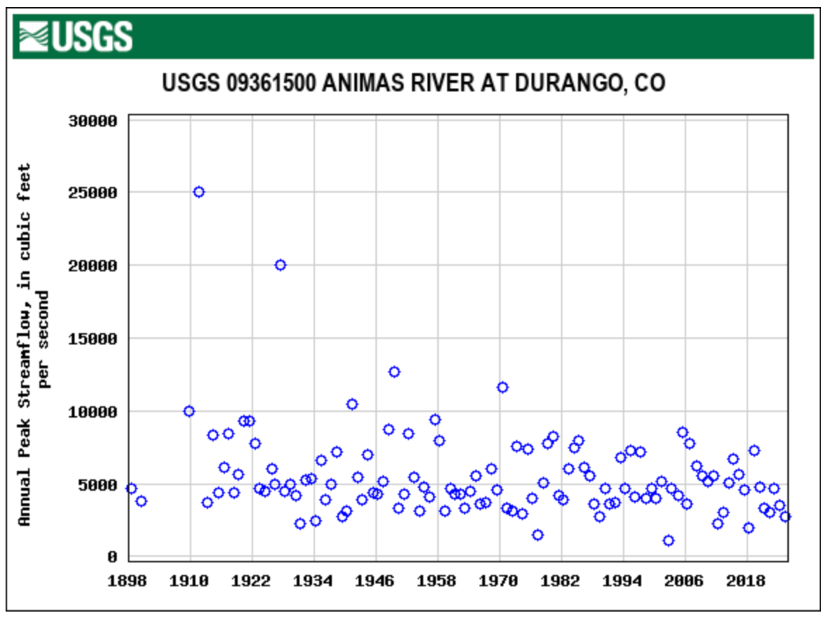
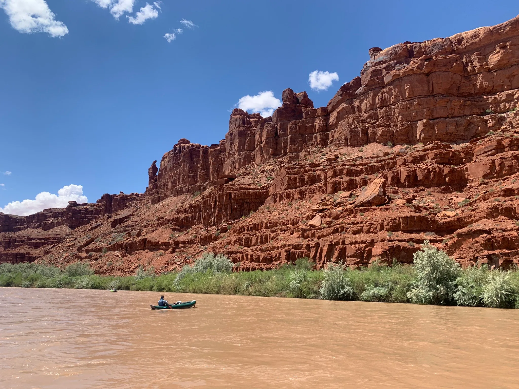
In May, the Southern Ute Indian Tribe tapped into its water in the controversial Animas-La Plata Project, the first time a tribe has used its water from the project since it was authorized in 1968.

The Animas-La Plata Project has come to encapsulate long-held dreams to develop Western water — and the decades of debates, environmental concerns, local objections and Congressional maneuvering that almost made the project fail.

At the center of it all were tribal nations and the chance to, once and for all, settle all of the tribal water claims in Colorado. It took until 2011 to fill Lake Nighthorse, the main feature of a heavily scaled-down federal water project located just south of Durango. Then 14 more years for a tribe to be able to use a small slice of its water.

More barriers — tied to interstate laws, finances and infrastructure — still stand in the way of tribes and other Animas-La Plata water users taking full advantage of the multimillion-dollar project. 

“This has taken the hard work of many Tribal leaders and Tribal staff over many decades to get to where we are at now,” the Southern Ute Indian Tribe said in a prepared statement.

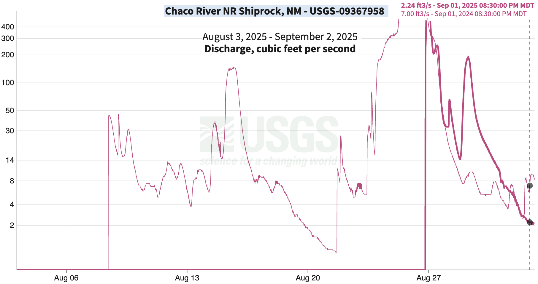
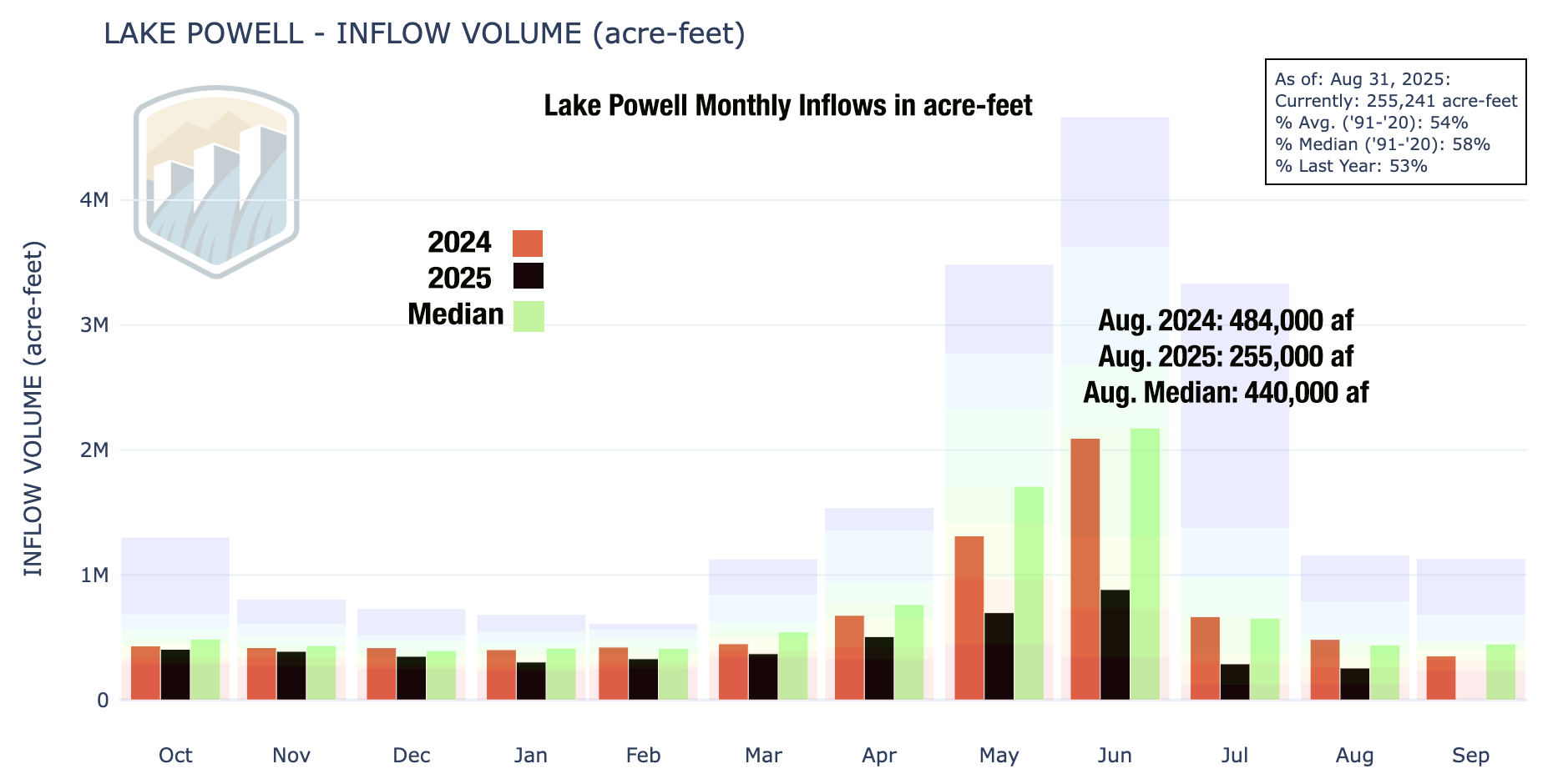
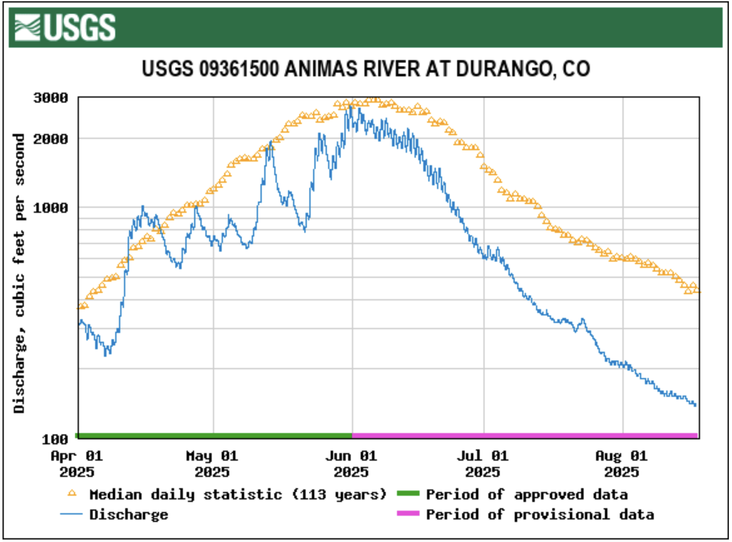
All Animas-La Plata Project water users can access water both in the reservoir, Lake Nighthorse, and the Animas River, but they draw from the river first. The reservoir functions like a savings account, said Russ Howard, the general manager for the Animas-La Plata Project.

This year, the tribe used water from the Animas River for oil and gas well completion activities, which wrapped up in mid-July. The tribe declined to provide more details.

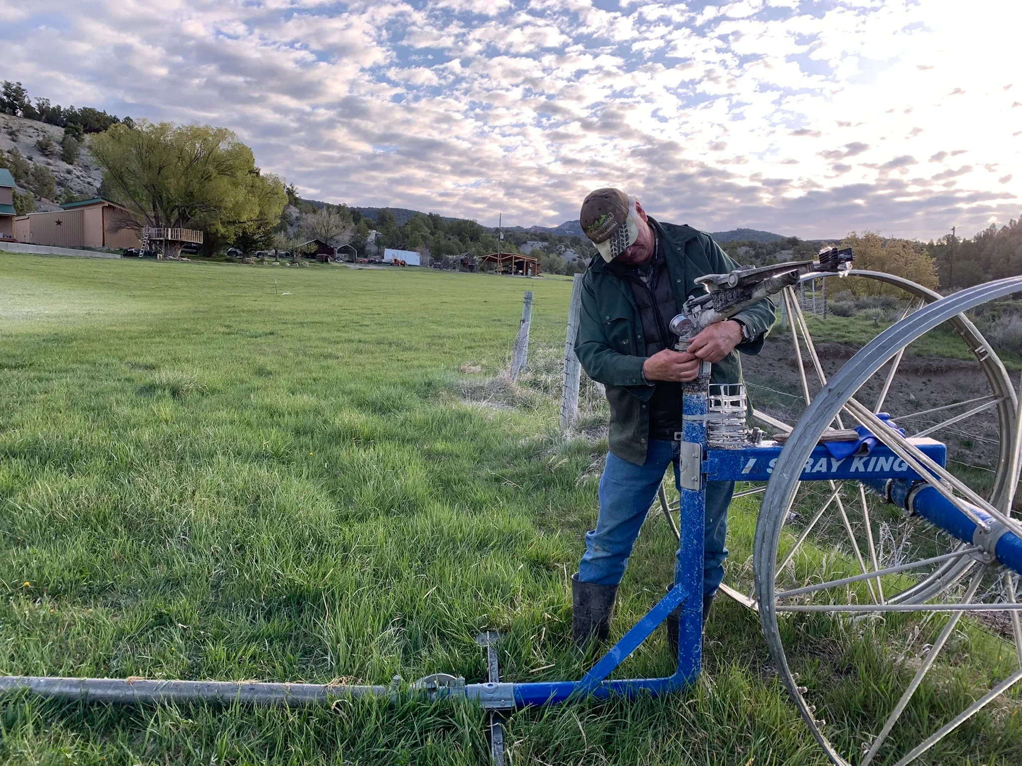
It plans to use the revenue from the project to upgrade dilapidated irrigation systems, like the deteriorating federal Pine River Indian Irrigation Project, or other water-related projects, like infrastructure to access its Animas-La Plata Project water.

The Southern Ute Indian Tribe and its sister tribe in Colorado, the Ute Mountain Ute Tribe, have repeatedly brought up their lack of access to the Animas-La Plata Project in high-level conversations about tribal water access in the broader Colorado River Basin and how to manage the basin’s overstressed water supplies once key management rules expire in 2026.

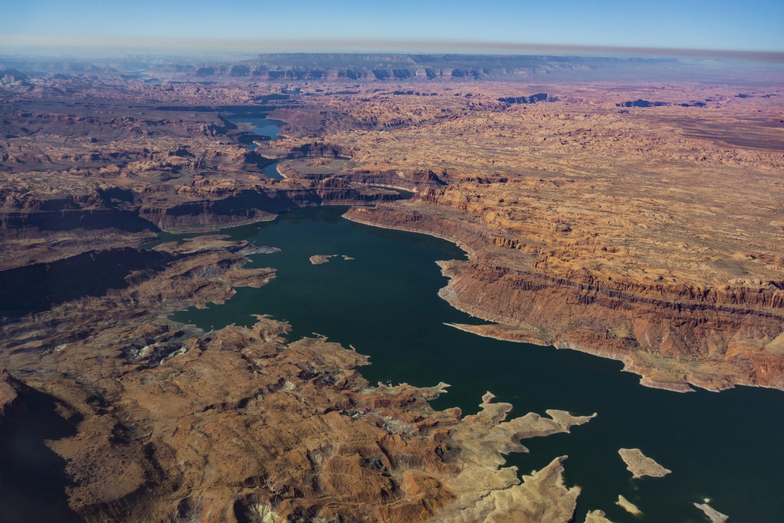
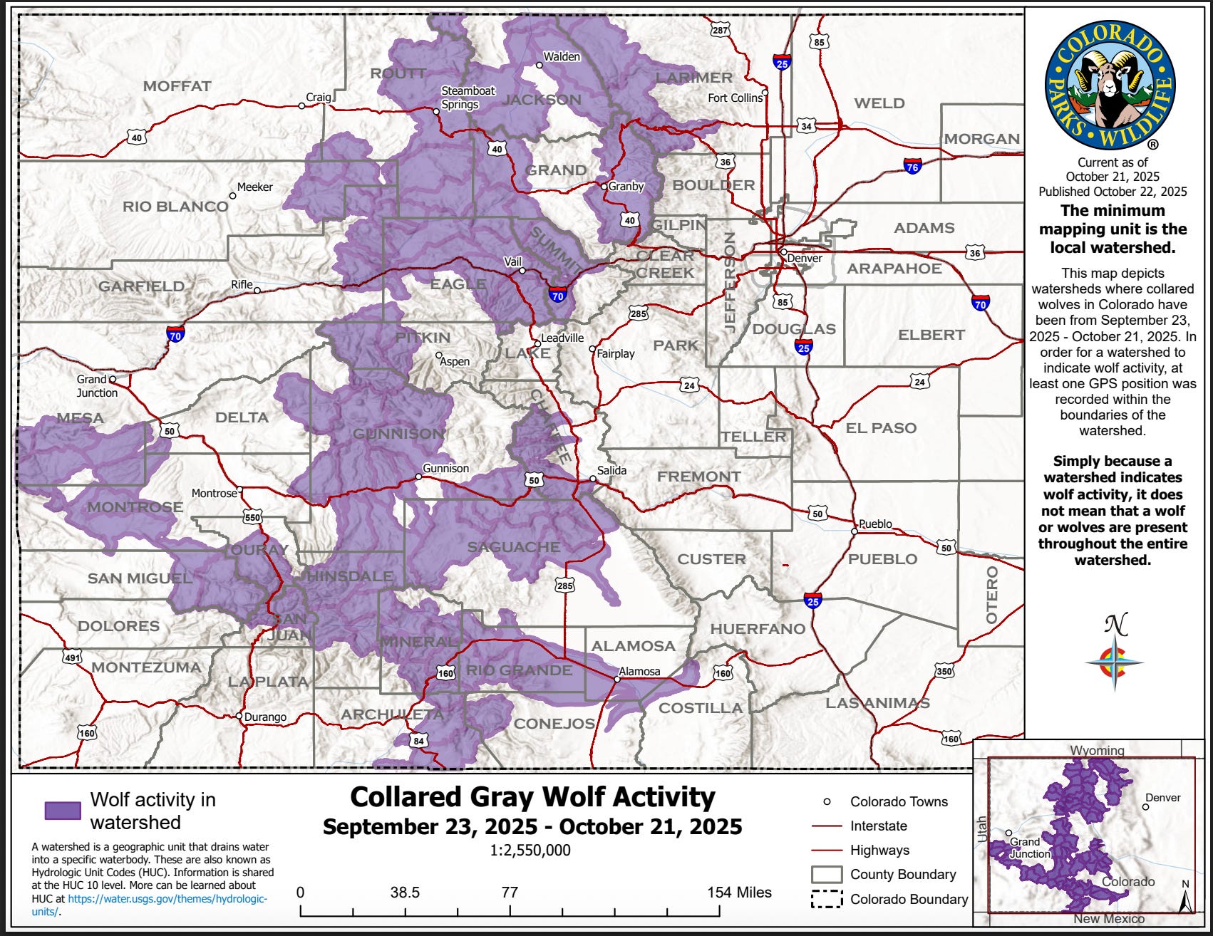
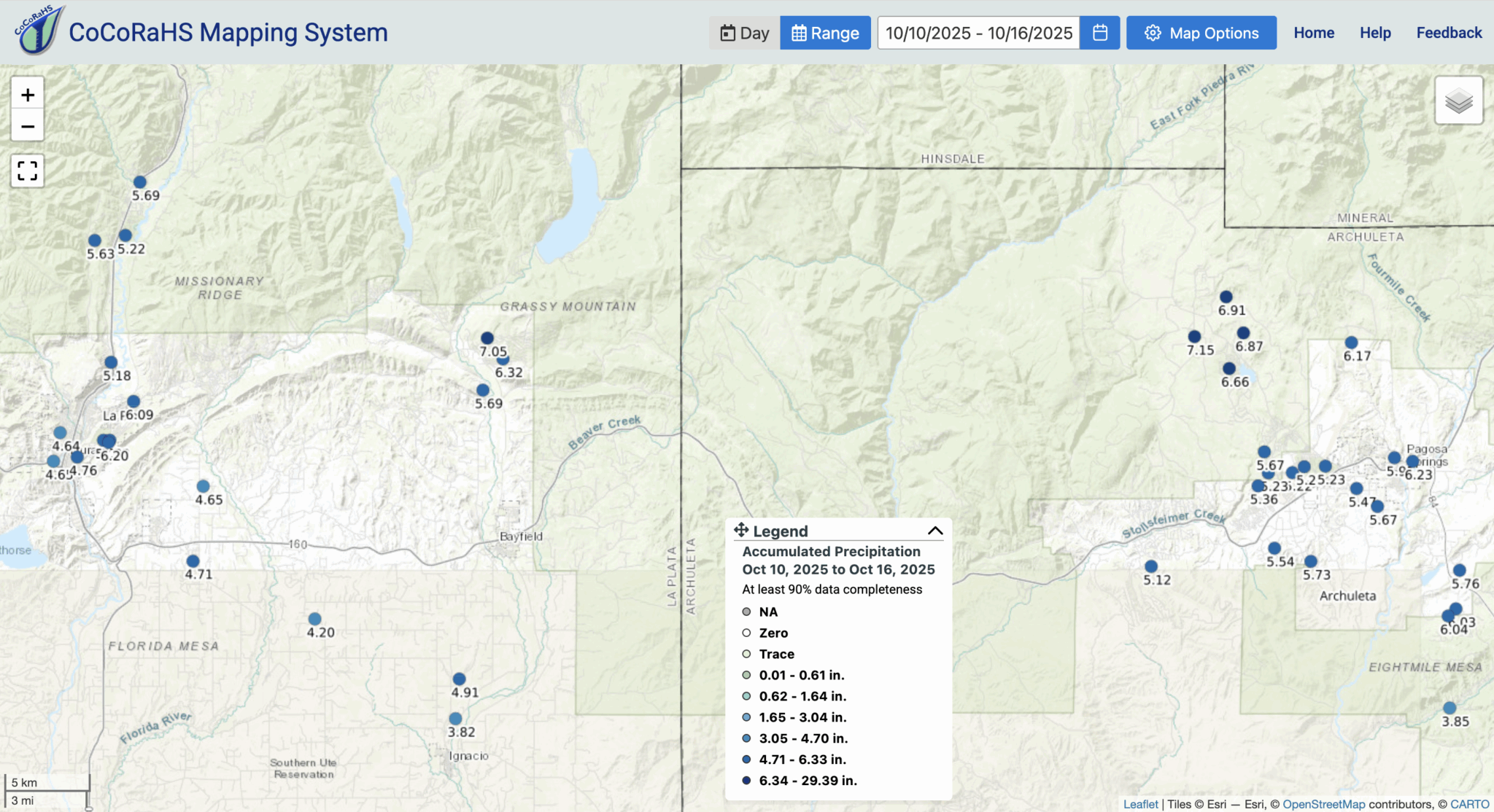
The Colorado River Basin is the lifeblood of the American Southwest, providing water to 40 million people, cities from Denver to Los Angeles, industries and a multibillion-dollar agriculture industry. The Colorado River’s headwaters are in western Colorado, but its water finds its way to faucets, ditches and hoses in every corner of the state.

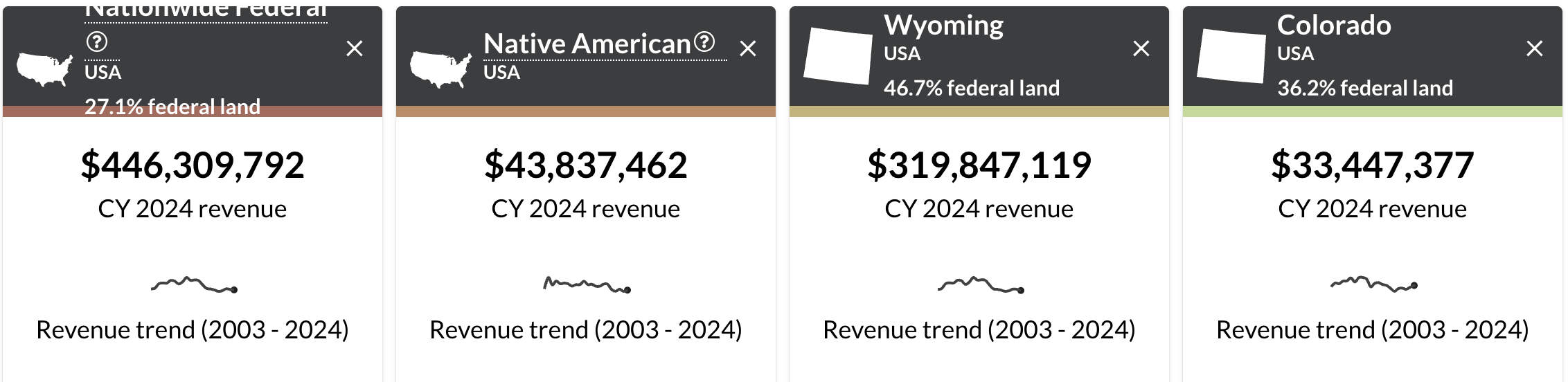
Tribal nations have federally recognized rights to about 26% of the Colorado River’s average flow between 2000 and 2018. But they’re not using all of this water. In some cases, they’re still going through legal processes to finalize their rights. In others, they are working on finding funding for new pipes, reservoirs and canals to access their water.

In some cases, downstream water users have become reliant on water while tribes are sorting out their water rights. But tribes say they are actively working on ways to put their water to use, which could push nontribal water users down the priority list.

“The Tribe wants everyone to understand that there currently is a reliance on undeveloped tribal water,” the Southern Ute statement said. “It is important for everyone to understand that the Southern Ute Indian Tribe has the right to develop its water resources and plans to do so.”

A big dream for the Southwest

People have been crafting different versions of an Animas-La Plata Project since at least 1904.

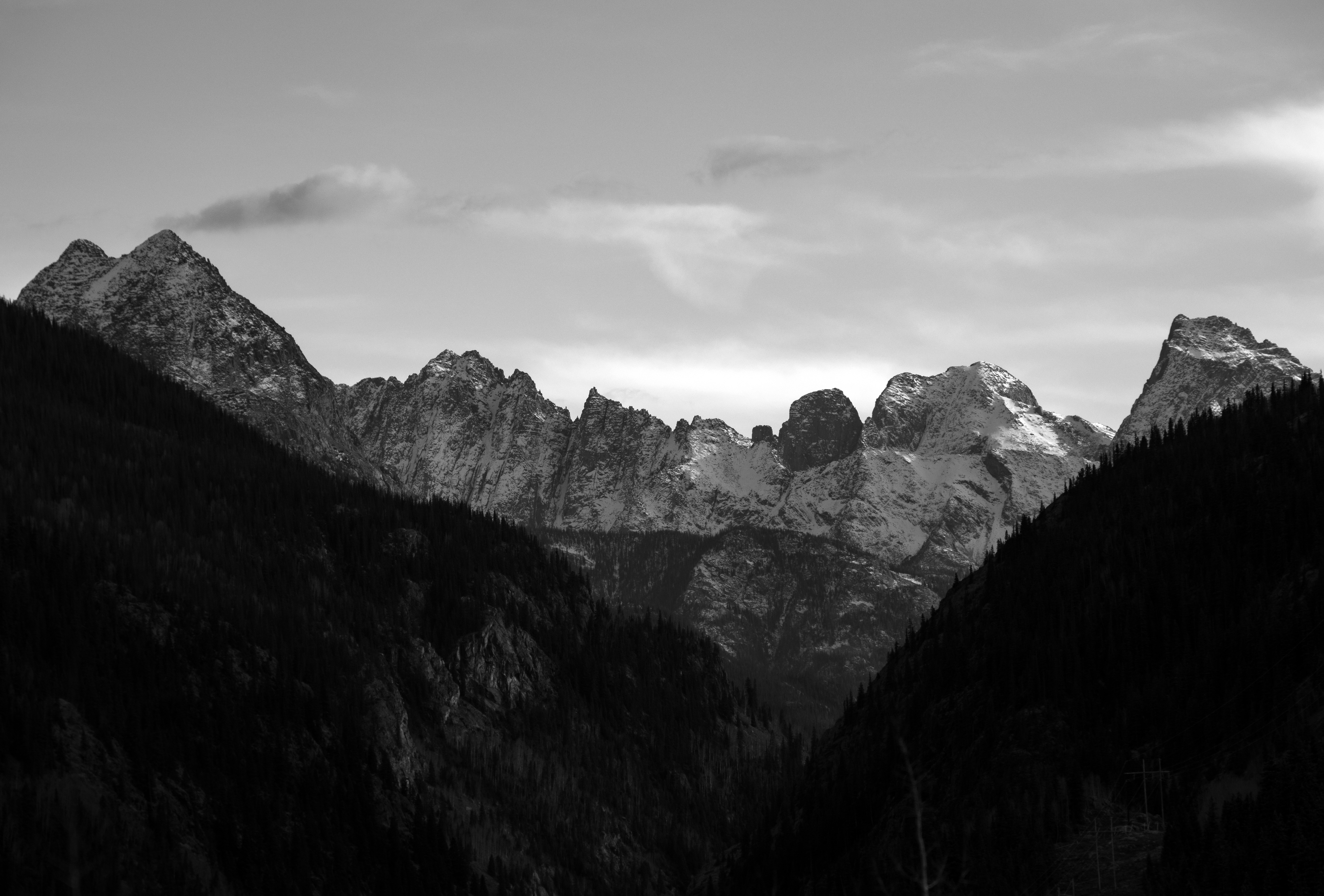
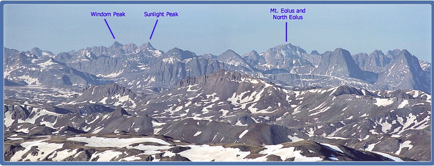
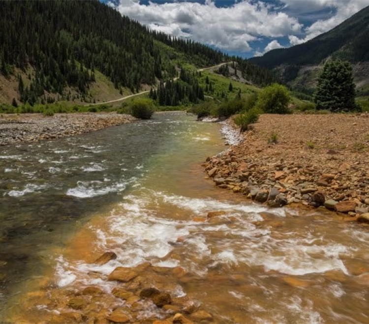
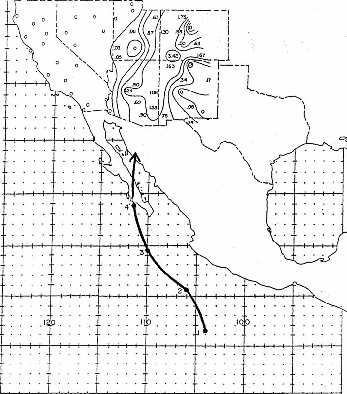
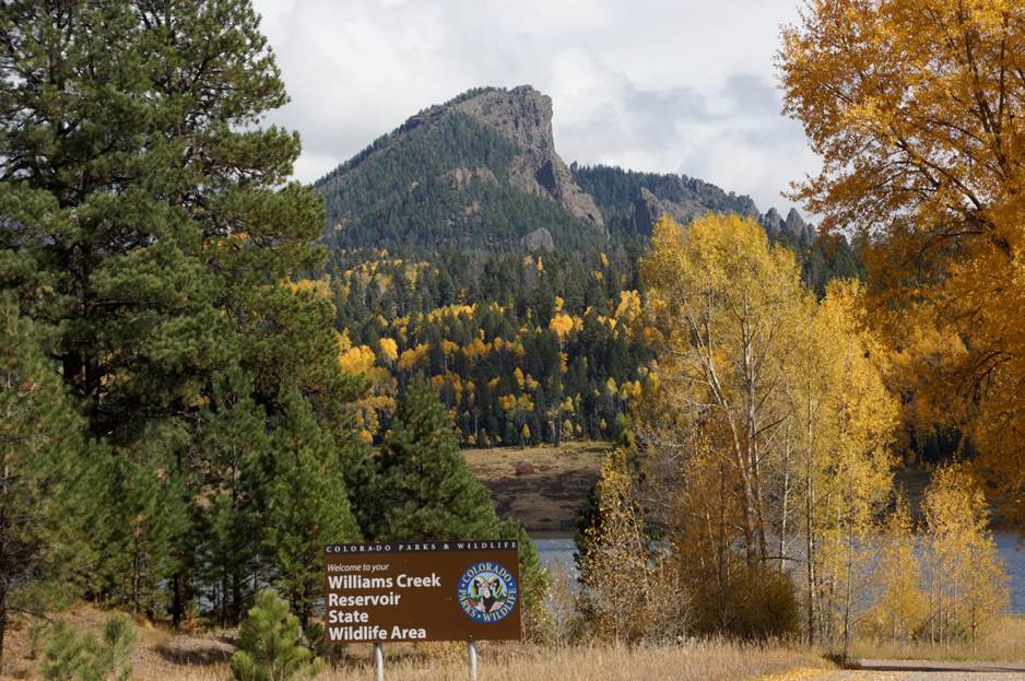
In the 1970s, they were drawing up maps showing a dam across the Animas River, also called El Río de las Ánimas Perdidas or the River of Lost Souls, to create the Howardsville Reservoir north of Durango. Other new reservoirs, plus hundreds of miles of canals and ditches, would provide irrigation water for both Native and non-Native farmers. The “Animas Mountain Reservoir” would provide drinking water for Durango. There would be plenty of water for irrigation, municipal and industrial users in the Southwest.

It was the age of water development in the West, led by the U.S. Bureau of Reclamation, and anything seemed possible.

Only, none of that happened.

That’s according to piles of manila folders, labeled in scrawling cursive, in the archives at Fort Lewis College’s Center of Southwest Studies. There, thousands of pages of documents reveal how, exactly, the big dream fell apart and a small, but vital, version survived.

In the 1960s, lawmakers, like Colorado Democrat Wayne Aspinall, fought in Congress to get the Animas-La Plata Project into the Colorado River Basin Project Act of 1968.

Congress authorized the project alongside others in the Upper Colorado River Basin, like the Dolores Project in southwestern Colorado, and Lower Basin goals, like the Central Arizona Project. They were supposed to be developed on the same timeline to avoid showing favoritism to one basin or another.

The Central Arizona Project came online and started sending water to growing cities, like Phoenix. The Dolores Project launched to help farmers and ranchers.

But the Animas-La Plata Project remained snared in issue after issue.

Decades of challenges

In the 1980s, the Southern Ute and Ute Mountain Ute tribes saw the Animas-La Plata Project as a way to settle their water rights in Colorado.

They agreed to stop 15 years of water-related lawsuits against the federal government — and to give up water rights claims in other local streams — in exchange for the Animas-La Plata Project and the tribal water rights that came with it.

The idea turned into the Colorado Ute Indian Water Rights Final Settlement Agreement of 1986. Getting the agreement approved by Congress, however, took two years.

Some farmers supported it: If the tribes pursued their powerful water rights on the streams, their claims would likely have priority over nontribal farmers, meaning they might not get as much water in drier years. And people in the dry Southwest needed the stability of guaranteed water storage.

Drought conditions have at times forced the Ute Mountain Ute Tribe Farm & Ranch Enterprise in southwest Colorado to operate on a fraction of the water needed to grow crops, resulting in dormant fields and irrigation systems. On a day in late May [2022] when wildfire smoke obscured the throat of an ancient volcano called Shiprock in the distance, I visited the Ute Mountain Ute farming and ranching operation in the southwestern corner of Colorado. Photo credit: Allen Best/Big Pivots

Rafting companies feared a project would hurt business. Environmentalists said it was one of the last free-flowing rivers in the Colorado River Basin. It didn’t make sense to pump water out of the Animas, over a hill and into a valley to create a reservoir, they said. That valley held protected elk habitat. It also included waste material from uranium mining. (This was eventually removed in a remediation project.)

For years, local groups fought the project’s costs, the electricity its pumps would require and the burden more irrigation water use would put on the Animas.

“I’ll actually tell you a little bit about it,” said Lew Matis, one of the volunteers organizing railroad photos in the Center of Southwest Studies on a Wednesday in July. “I was involved with the taxpayers against the Animas Project.”

Matis, a self-described “old fart of old Fort Lewis,” even wrote to The Durango Herald in the 1980s, saying the $586.5 million price tag was “approaching pie-in-the-sky aspects.”

Then there was the classic Colorado River tug-of-war between the Lower Basin and the Upper Basin: The Upper Basin tribes wanted to be able to lease their water off-reservation. Lower Basin states, like Arizona, California and Nevada, said it would conflict with state and interstate laws. They’d kill legislation that included leasing. Tribal officials said the states didn’t want to have to pay for tribal water they were already getting for free.

(Whether and how tribes can lease water between the Lower Basin and Upper Basin is still an issue today. It was one of the central problems that held up a $5 billion Arizona-tribal settlement that is languishing in Congress.)

Tribal officials traveled to Washington, D.C., to push for the settlement to pass.

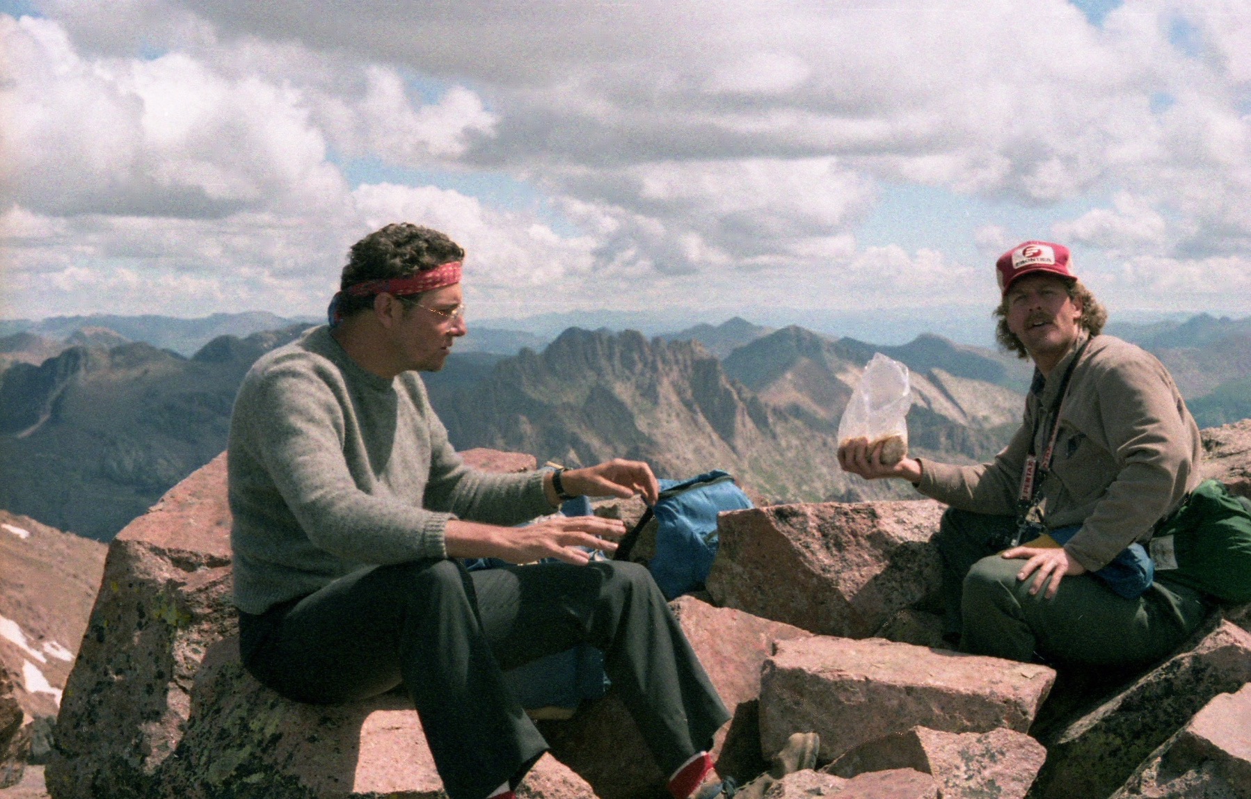
“I’ve been moving this Animas-La Plata Project through, the people say well it’s not going to get funded,” said Leonard Burch, former Southern Ute Chairman, in an interview from the 1980s. “But we insist.”

A big dream and a (much) smaller reality

By 1988, Congress approved the settlement agreement with the Animas-La Plata Project at its center.

It solved all the tribal water rights claims in Colorado in one go, something that states like Arizona are still trying to do. The Ute Mountain Ute Tribe, which also has land in New Mexico and Utah, is still working to finalize some of its water claims.

Then U.S. Rep. Ben Nighthorse Campbell, in a press release from 1988, likened the settlement to “winning a gold medal.” (And he would know. Campbell won a gold medal in judo in the 1963 Pan-American Games.)

Then, in the early 1990s, the U.S. Fish and Wildlife Service found an endangered fish species, the Colorado pikeminnow, downstream from the potential project site. And the Animas-La Plata Project started to crumble.

The Colorado pikeminnow, renamed to remove a slur, can grow to nearly 6 feet in length and was the main predator in the Colorado River system. But by the late 20th century, it occupied about 25% of its natural range, and federal wildlife officials said dams and river depletions were one of its biggest threats.

The findings opened the door to questions about impacts to other species, like peregrine falcons, rare plants, bald eagles and razorback suckers.

The federal government started to question whether the project’s costs matched the benefits. The U.S. Bureau of Reclamation’s fervor for enormous Western water projects had waned, and former President Bill Clinton’s administration did not support the larger version of the Animas-La Plata Project authorized in the 1960s.

That project would have cost $744 million and built two reservoirs, 240 miles of pipelines and canals, seven water-pumping plants and 34 miles of electric transmission lines, according to local news coverage from the ’90s. It would also require the careful collection and removal of hundreds of years of cultural artifacts from different Native American bands, which was done for the final project.

After years of intense political maneuvering and fighting among all sides, Congress finally approved the final project: a dam to create a reservoir in Ridges Basin — now called Lake Nighthorse — and a pumping plant and pipes to suck up Animas River water and push it into the reservoir.

The La Plata River, which would have received Animas River water in the original version (hence its name), was left alone. The irrigation water — part of the original goal of the project — was removed from the agreement. The size of the dam shrank to 217 feet from 313 feet above the streambed. Congress dropped reservoirs and delivery pipelines for tribes. The final cost estimates ranged from $250 million to $340 million.

Looking at a description of the project from the 1980s, the project’s current manager Howard said hardly any of the plan actually happened.

“It’s unfortunate. That was the vision. Everybody was excited, and everybody supported what it was trying to do,” he said. “But ultimately, we ended up with a very, very small portion of what you’re showing in that document.”

“A whole bunch of work left” 

The final Animas-La Plata Project did achieve some of its original goals.

It settled water rights in Colorado for the Southern Ute and Ute Mountain Ute tribes.  It included about 132,000 acre-feet of water and a new recreation spot for locals. Officials responded to environmental concerns (although some may still argue that point). It secured municipal and industrial water for the Navajo Nation near Shiprock, three New Mexico communities, Durango and rural residents in the Southwest. And tribes had funding to help them develop their water resources.

But “there’s a whole bunch of work left to do,” Howard said.

So far, four of the 11 entities that have water rights in the Animas-La Plata Project have been able to put that water to use, he said. The Southern Ute Tribal Council approved the use of up to 2,000 acre-feet annually of its Animas-La Plata Project water, according to the tribe’s statement.

“It’s long overdue,” said Becky Mitchell, the state’s commissioner to the Upper Colorado River Commission. She has advocated for tribes in Colorado River negotiations. “They’ve been trying to get access and infrastructure help and be able to access water that they have rights to. This is a step in that direction.”

The Ute Mountain Ute Indian Tribe, which is located farther from the Animas River and Lake Nighthorse, is still looking for ways to access its water. Whether that is new, expensive infrastructure — pipes and reservoirs that were formerly included in the Animas-La Plata Project — or other options is still to be determined.

Simple geography is one of the biggest barriers in using their project water, said Peter Ortego, a long-time lawyer for the Ute Mountain Ute Tribe.

The Animas-La Plata Project is right next to the Colorado-New Mexico border, but it must be used within Colorado. The tribes have too much municipal water for the area’s population, and too much industrial water for the potential mining uses so close to the border. Hydraulic fracturing, the main oil and gas water use, doesn’t use much, he said.

“When it comes to the health of the Tribe’s water system, I think taking the irrigation out of that was really bad,” Ortego said. “It hurt the farmers. It hurt the Tribe.”

The Ute Mountain Ute Tribe took a major step forward in December when they finalized their repayment contract with provisions that make it easier to participate in conservation projects and to afford the federal operations and maintenance fees that are triggered upon first water use, he said.

Ben Nighthorse Campbell, now 92 and living about 25 miles from the reservoir that bears his name, still thinks the project was a success. He remembers the bitter fights with environmentalists, recalling a passing car with a bumper sticker that said, “Don’t dam the Animas, damn Campbell.”

When the project finally passed, it passed overwhelmingly, and that was the thing the opposition hated most of all, he said.

“I don’t like to be vindictive, but I felt like, ‘Gotcha, you bastards,’” Campbell said in an interview with The Colorado Sun. “It became kind of personal, you know? They threw so many barbs at me, so many shots, and I was just ready to fight back.”

Colorado has come a long way, but going forward, water managers need to focus on more ways to reuse water, said Campbell, who also served as Colorado’s U.S. Senator.

“We’ve got to find better ways of using what we have. Not producing more water that doesn’t exist,” he said.

More by Shannon Mullane

MAGA continues to pillage public lands: Plus: President Trump issues oodles of drilling permits; national park visitation; inane coal policy — Jonathan P. Thompson (LandDesk.org)

An idle drill rig with Raplee Ridge in the background near Mexican Hat, Utah, an oil and gas hotspot back in the early 1900s. Jonathan P. Thompson photo

Click the link to read the article on The Land Desk website (Jonathan P. Thompson):

July 22, 2025

🌵 Public Lands 🌲

Remember back in the pre-Trump II days, when every six months or so the environmental community would harp on Biden for issuing more oil and gas drilling permits than Trump did during his first term? If so, you probably also remember the Land Desk harping on the greens for making the comparison in the first place, saying it doesn’t really mean anything.

Well, it looks like it does mean something to Trump. And, wanting to demonstrate his fondness for those big fat drill rigs, his administration has been handing out drilling permits at a mind-bending rate. Between Jan. 21 and Jul. 21 of this year, the BLM has issued 2,660 permits, or about 524 per month. And since everyone likes comparisons: That eclipses Biden’s biggest year of 2023, when he issued 317 per month.

But do you know who likes drill rigs more than Trump? George W. Bush and Dick Cheney, who issued a whopping 569 per month in 2007. Yet this is a good example of why these comparisons are not really meaningful.

Most of George W.’s APDs (approved permit to drill) were for coalbed methane wells (which is just natural gas extracted from coal seams) in places like New Mexico’s and Colorado’s San Juan Basin, Wyoming’s Sublette County, or Colorado’s Piceance Basin. They are smaller and lower-producing than the horizontal “fracking” wells that sparked the “shale revolution” in about 2008, altering the industry and the geography of oil and gas extraction. Most new wells are aiming for oil rather than gas with drilling centered in the Permian Basin. The Farmington office of the BLM has issued just 48 APDs in the past six months, while the Carlsbad office has handed out 2,565.

Whether these permits are ever used is another question altogether. So far this year, the rig count is down from last year. There certainly are not enough rigs operating to burn through all of these new permits anytime soon, meaning the companies will just sit on them until oil prices increase again and then go on a frenzy.

Back in the San Juan Basin, where the natural gas industry pretty much collapsed in 2009 and has stayed that way since, rig activity is beginning to pick up just a bit, according to Hart Energy. But it’s all relative: There are only about six rigs operating in the basin currently, compared to more than 90 in the Permian.


Fresh off legislatively pillaging the public lands — and so much else — in the “One Big Beautiful” law, MAGA is looking to rub a little bit of acid in those wounds with the House’s 2026 fiscal year budget. Last week, they released their appropriations bill for Interior, environment, and related agencies, and it robs the public lands of cash and environmental protections, while handing concessions to the extractive and fossil fuel industries. It is, like so much that this administration and its lackeys do, straight out of Project 2025, the radical right wing’s roadmap for crushing democracy and turning America into a a corporate-run oligarchy.

Basically every public lands and environment related agency is getting its funding cut, not out of some sort of fiscal responsibility (Defense and Homeland Security are getting massive infusions of additional taxpayer funding), but because today’s GOP is dead set on taking out their resentment on the planet and in offsetting a small portion of tax cuts for corporations and the wealthy. The only good news is that some of the cuts are less than what Trump asked for. Some examples:

  • The Bureau of Land Management would take a $110.4 million cut below fiscal year 2025’s level, or an 8% decrease.
  • The U.S. Geological Survey’s budget will be slashed by 5.6%, or $82 million.
  • The National Park Service will see it’s budget cut by about $176 million, a 6% decrease.
  • The Environmental Protection Agency will have its funding slashed by $2.12 billion, or a whopping 23%. That includes huge cuts to Science and Technology, Environmental Programs and Management, and State and Tribal Assistance Grants.
  • The U.S. Forest Service’s budget will be reduced by $16.8 million.
  • The National Institute of Environmental Health Science will see a budget cut of $27.9 million, or 35%.
  • Some good news: The Indian Health Service would get a $182 million increaseunder the bill and the Bureau of Indian Affairs is getting about the same funding as last year, in defiance of Trump’s request to slash its budget by more than 30%.
  • Also taking deep cuts under the Interior et al appropriations bill: Smithsonian, National Gallery of Art, National Endowment for the Arts, National Endowment for the Humanities, and the Woodrow Wilson International Center for Scholars. The Presidio Trust’s funding will be totally eliminated, after receiving $90 million last year. This could open the way for the Presidio to be developed or become a “Freedom City.”

But this is more than just about bean counting. It’s also a way for lawmakers to exert their will over federal agencies by way of funding.

For example, since the Trump administration has yet to shrink or eliminate any national monuments, congressional Republicans are doing some de facto national monument shrinkage of their own. The appropriation bill would freeze funding for Grand Staircase-Escalante National Monument’s new management plan, forcing the relevant agencies to revert back to the February 2020 plan enacted under the previous Trump administration and applying only to the vastly reduced, Trump I-era monument boundaries. This effectively voids Biden’s restoration of the monument’s original boundaries and trashes the new management plan and all of the work that went into it.

The GOP’s bill also would suffocate the BLM’s 2024 Conservation and Landscape Health Rule, aka the Public Lands Rule, which aims to put conservation on a par with drilling, mining, and grazing on public lands.


Can a new rule fix the Bureau of Livestock and Mining? (Jonathan P. Thompson)


The appropriation bill is also a sort of MAGA love letter to the fossil fuel industry, including provisions such as:

  • Cutting off funding for — and thereby killing — the Biden administration’s Fluid Mineral Leasing rule, which increased oil and gas royalty rates from 12.5% to 16.67% to reflect modern times and give taxpayers a slightly better deal; increased minimum leasing bids to $10 per acre; established an “expression of interest” fee for leases; eliminated non-competitive leasing; increased minimum reclamation bonds for oil and gas wells from $10,000 to $150,000 and eliminated blanket nationwide operator bonds. It also directed leasing towards areas with high oil and gas potential and away from more sensitive cultural, wildlife, and recreation resources. In other words: All very common sense, some might say watered-down, provisions.
  • Cutting off funding for and killing the Biden administration’s methane fee aimed at incentivizing oil producers to sell natural gas — a byproduct of oil drilling — on the market rather than simply venting or flaring the potent greenhouse gas into the atmosphere. The bill would also eliminate the greenhouse gas reporting system for the oil and gas industry.
  • Mandating quarterly oil and gas leases on public lands in nine states (WY, NM, CO, UT, MT, ND, OK, NV, AK) and expanding the definition of lands eligible for leasing.
  • Cutting off all funding for the Biden administration’s environmental protections in the National Petroleum Reserve-Alaska.
  • Cuts off funding for a 2024 coal combustion waste disposal rule that had been in the works for decades as part of an effort to tackle one of the nation’s largest and nastiest solid waste streams.

The GOP isn’t too fond of wildlife. The bill takes aim at numerous endangered species — from the lesser prairie chicken and grizzly, to the gray wolf, wolverine, and long-eared bat — and blocks funding for bans or restrictions on lead ammunition, even though that’s a leading killer of condors and some birds of prey.


The condors of Marble Canyon — Jonathan P. Thompson


I’ve been really curious about how the Trump administration’s policy chaos might affect visitation at national parks. Would the threat to privatize public lands through various means (from selling it off to turning reservation systems over to private concessionaires) inspire folks to get to their parks while they’re still around? Would the administration’s hostility towards non-Americans (tariffs and trade wars, deportations) keep international tourists at bay? Or would the declining value of the U.S. dollar bring more foreign tourists to America?

We’re six months in to this nightmare … er … administration, and there aren’t any obvious trends in the year-to-date visitation statistics. A lot of parks have actually seen an increase in visitation over the last couple of years so far. Drill down a bit, however, and something else becomes apparent: While visitation was unusually high in the winter and spring in Zion, Grand Canyon, Arches, Bryce Canyon, Capitol Reef, Chaco Canyon, and other parks, it dropped off relative to previous years in May and June.

This may be due to heat and drought, but it also may be tied to the drop in international tourism into the U.S. Federal data show that incoming international air travel during the first half of the year is down 3.6% from the same period last year. (Meanwhile, more U.S. citizens are flying overseas, despite the weak U.S. dollar. Perhaps they are fleeing something?).

I’ve always been interested in visitation patterns at Glen Canyon National Recreation Area, as well. It seems like it used to correlate with water levels: No one wants to visit Lake Powell when many of the boat ramps are high and dry, the shores are mudflats, and Rainbow Bridge isn’t accessible by boat. Or that’s what I used to think. But more recently it seems that visitation rates are driven by other factors, perhaps because people are coming to the recreation area for different reasons, such as the spectacular landscape that surrounds the reservoir. 

That said, visitation this year is down again along with the water levels.


Yes, the Department of Energy’s social media account did tweet this stupidity, I’m sorry to say.

🤯 Annals of Inanity 🤡

Dumb, dumb, dumb, dumb … One of the many, many stupid, ugly provisions in the Big Beautiful (I cringe every time I write it) law was a royalty reduction for coal production on federal lands. The rate has been at 12.5% for about a century. If you think of that as the wholesale price that Peabody, Arch, Oxbow, and other corporations have been paying to purchase Americans’ coal, then you could say they are marking the product up by about 800%. 

It seems like a pretty good deal for the corporations — and a crappy one for us taxpayers. But it wasn’t enough, apparently, so the Republicans lowered the royalty rate to a measly 7%. And just so you understand, this isn’t just for new coal leases, it’s for all existing and future coal leases on public lands and for the public’s coal. 

What that means is that all of those coal mines in the Powder River Basin, Colorado, and Utah are now paying the federal government only about 56% as much as they paid before the bill was signed into law. So that means if production levels remain flat and coal prices remain steady — which is not a given — then the federal government will bring in about $250 million from coal royalties this year, which is about $200 million less than last year. What about that is fiscally responsible, may I ask?

But here’s the kicker: The states where the coal is mined get 50% of that royalty revenue back. This means Wyoming will receive something like $50 million less per year from coal royalties, according to a report by Wyoming Public Radio’s Caitlin Tan. That’s My estimates say Wyoming could take an even bigger hit of more like $80 million annually, depending on the price of coal and production levels. That’s $50 million to $80 million less for the state to spend on schools, public services, roads, and so forth. Heck, it may even spur Wyoming to finally implement a corporate and individual income tax!

Federal coal royalty revenues from calendar year 2024. This is from a 12.5% royalty rate. Congressional Republicans just dropped it to 7%, meaning the taxpayers are going to be shorted about $200 million per year.

The pushers of this plan claim to be doing it to boost production, which would then offset some of the losses. But that’s not how it works. Coal mines aren’t going to produce more just because it’s cheaper to do so; they produce more when demand goes up. Production will remain the same or, more likely, drop, since fewer and fewer utilities are interested in burning coal. The corporations will make more profit. Everyone else will get screwed.

La Plata Electric Association secures 10-year deal for local #hydropower from Vallecito Dam

Vallecito Lake via Vallecito Chamber

Click the link to read the release on the La Plata Electric Association website:

July 14, 2025

La Plata Electric Association (LPEA) has signed a new 10-year power purchase agreement (PPA) with Ptarmigan Resources and Energy Inc. for locally generated hydropower from the Vallecito Dam, reinforcing the cooperative’s commitment to clean, reliable, and community-focused energy. 

Effective April 1, 2026, through March 31, 2036, the agreement will provide approximately 5.8 megawatts of renewable capacity onto LPEA’s system – enough to power around 2,500 homes per year. It’s the first time LPEA has been able to purchase power directly from Vallecito, thanks to new flexibility under its evolving power supply strategy. 

“This is a win for our members and our mission,” said LPEA CEO Chris Hansen. “For the first time, we’re contracting directly with a local hydropower provider right in our backyard.” 

The hydropower facility at Vallecito Dam, located northeast of Bayfield, has long provided clean energy to the regional grid. However, LPEA’s previous long-term wholesale power contract limited its ability to work with independent producers like Ptarmigan. 

“This project is exactly what we envision for the future of energy for our members: affordable, responsibly generated power produced right here in our community,” said Nicole Pitcher, LPEA Board President. “It’s meaningful that the same water sustaining our ranches and farms and bringing joy to recreationists will also be generating clean energy for homes across our service territory.” 

“Selling power locally is a win-win,” said Sam Perry, CEO of HydroWest (contracted by Ptarmigan to oversee plant operations). “With this new partnership, Vallecito can provide consistent, renewable energy and grid stability to LPEA.” 

This PPA follows LPEA’s launch of a competitive Request for Proposals (RFP) earlier this year, seeking additional long-term energy resources to serve its load after 2028. 

San Juan River Basin. Graphic credit Wikipedia.

Weak monsoons could ‘ramp up,’ #drought remains — The #PagosaSprings Sun #SanJuanRiver #ColoradoRiver #COriver #aridification

Click the link to read the article on the Pagosa Springs Sun website (Randi Pierce). Here’s an excerpt:

July 9, 2025

Pagosa Country could see above-normal temperatures and above-normal precipitation in mid-July, according to the National Weather Service (NWS) Climate Prediction Center’s outlook for July 14-18.

That aligns with Pagosa Weather’s July 8 forecast that suggests, “Weak monsoon activity will ramp up next week,” though the organization notes later in its forecast, “The 8-14 day period… Weak monsoon activity will ramp up. We’ll see more showers and thunderstorms most afternoons, but I don’t see any big soakings on the horizon.”

Drought

According to the U.S. Drought Monitor, all of Archuleta County continued to be in drought as of July 1 — the most recent drought map available. The northwest portion of the county is listed as being in moderate drought, most of the county in severe drought and 10.64 percent of the eastern portion of the county in extreme drought…

Colorado Drought Monitor map July 8, 2025.

River conditions

The San Juan River in Pagosa Springs was running at 41.9 cubic feet per second (cfs) as of noon on Wednesday, July 9, according to the U.S. Geological Survey (USGS). The July 9 median streamflow for July 9 is 255 cfs, according to the USGS, with the mean flow for the same date being 447 cfs. According to 89 years of data, the lowest river flow on July 9 came in 2002, when the river’s streamflow was at 16.4 cfs. The highest streamflow for that date came in 1995, when the river was at 2,290 cfs. Pagosa Weather’s Shawn Prochazka notes the current river conditions can be fatal for fish.

Southern Utes to tap #LakeNighthorse water: Tribe holds rights to 38,108 acre-feet annually — The #Durango Herald #AnimasRiver

Lake Nighthorse and Durango March 2016 photo via Greg Hobbs.

Click the link to read the article on The Durango Herald website (Christian Burney). Here’s an excerpt:

June 10, 2025

The Southern Ute Indian Tribe plans to begin drawing water from Lake Nighthorse this summer, becoming the first entity to use the reservoir for non-testing purposes since the reservoir’s completion in 2009. The Southern Ute Tribal Council approved the annual use of a portion of its Animas-La Plata Project water in Lake Nighthorse for “future industrial uses,” including energy development, in February 2024, according to the tribal newspaper, The Southern Ute Drum.

“This is a historic and exciting moment for the Southern Ute Indian Tribe – the Tribe is finally utilizing some of its ALP water rights that it has fought for over a long period,” the Drum reported. “The Tribe plans to continue developing its water resources for the benefit of the Tribe and its members in the future.”

[…]

Lake Nighthorse stores 123,541 acre-feet of water. The tribe holds a 44,662 acre-foot annual allocation from the A-LP, with 38,108 acre-feet stored in Lake Nighthorse, according to a U.S. Bureau of Reclamation spokesperson. The tribe’s claim represents about 35% of the water stored in the reservoir, according to the Drum…The tribe currently uses 6,553 acre-feet annually from its Animas River allocation under the A-LP, according to the Bureau of Reclamation.

Navajo Dam operations update June 24, 2025

The San Juan River near Navajo Dam, New Mexico, Aug. 23, 2015. Photo credit: Phil Slattery Wikimedia Commons

From email from Reclamation (Conor Felletter):

June 23, 2025

The Bureau of Reclamation has scheduled an increase in the release from Navajo Dam from 350 cubic feet per second (cfs) to 450 cfs for Tuesday, June 24th, at 4:00 AM. 

Releases are made for the authorized purposes of the Navajo Unit, and to attempt to maintain a target base flow through the endangered fish critical habitat reach of the San Juan River (Farmington to Lake Powell).  The San Juan River Basin Recovery Implementation Program recommends a target base flow of between 500 cfs and 1,000 cfs through the critical habitat area.  The target base flow is calculated as the weekly average of gaged flows throughout the critical habitat area from Farmington to Lake Powell.  

This scheduled release change is subject to changes in river flows and weather conditions.  If you have any questions, please reply to this message, call 970-385-6500, or visit Reclamation’s Navajo Dam website at https://www.usbr.gov/uc/water/crsp/cs/nvd.html