Buena Vista fifth annual Paddlefest May 28

A picture named kayaker.jpg

From the Salida Citizen:

Paddlefest acts as the “Kick Off” to the Arkansas River paddling season, drawing hundreds of river enthusiasts to Chaffee County for a weekend filled with boating, on water instruction, kayak competitions, river education, seminars, sales and entertainment. Paddlefest is a unique event that offers educational opportunities for folks with a variety of interests – there will be something for everyone – families, individuals just learning about water sports to hard core professional kayakers. Free demos and basic instruction on Stand Up Paddle boards and recreational kayaks will be offered on the Buena Vista Town Pond. As well as, free whitewater demos on the river.

More whitewater coverage here.

Wiggins: Residents warned that nitrates in supply are too high for infants under 6 months old

A picture named waterfromtap.jpg

From The Fort Morgan Times (Dan Barker):

The Northeast Colorado Health Department gave the town notice that its water had nitrates at an unacceptable level for such young children to be drinking, Mayor Mike Bates said. Water nitrate levels reached 13.98 milligrams per liter, which is above the standard of 10 milligrams, a notice to the town said. According to health officials, healthy adults generally excrete nitrates, but infants younger than six months are sensitive to nitrate poisoning, which may result in serious illness or death. Nitrates are converted into nitrites, which reduce oxygen in the child’s blood, causing shortness of breath and blueness of the skin. This has given the condition the name of “blue baby syndrome.” A child’s health can deteriorate over a period of days in extreme cases. The notice sent to the town said people should not give Wiggins water to infants under six months or use it to make infant formula, juice or cereal.

More water treatment coverage here.

South Platte River: Ducks Unlimited is restoring and creating habitat for water fowl

A picture named wetlandspondgrass.jpg

From the Greeley Tribune (Dan England):

The idea for Ducks Unlimited is to recharge and in some cases recreate wetlands, and while the idea isn’t entirely new, it has water officials wondering whether it’s the wave — no pun intended — of the future. The organization siphons off excess flows from rivers in the spring through a diversion or a pump installed at the river. It then runs the water off either right next to the river or maybe as far as a few miles away. The water creates wetlands duck habitat. The water then sinks into the ground, where it eventually returns to the river in the summer, when water is needed the most. Underground pipelines carry the water to the location if it’s far away. “We prefer to do restorations,” said Greg Kernohan, manager of conservation programs in Colorado and Wyoming, “but on occasion we can basically create these wetlands out of nowhere.” Areas that seem to fit best include naturally occurring sandhills and basins, flood plain meadows from irrigation and marginal farmland, Kernohan said. Ducks Unlimited sees unlimited potential along the South Platte in Weld because marginal farmland tends to work fairly well. The organization has done several projects in Weld, including the relatively new Centennial State Wildlife Area, but really is just now taking a hard look at the county to see what else it can accomplish.

Part of the reason for that is the organization believes the best way to create wetlands is to appeal to farmers in the area to get them to “fowl” a portion of their property. They agree not to irrigate as much land and use those credits to flood another area to create the wetlands habitat, Kernohan said. Ducks Unlimited will help with this and in some cases helps cover the costs associated with it as long as the farmer maintains the land once it’s been “fowled.” Those decisions can be profitable for farmers, who discover they can charge up to $3,500 per gun to hunt on their new waterfowl habitat.

More restoration coverage here.

Energy policy — nuclear: Colorado orders Cotter to start treating the water at the Schwartzwalder mine

A picture named uranium.jpg

From the Associated Press via The Durango Herald:

The Colorado Division of Reclamation Mining and Safety said Thursday it doesn’t believe the plan would prevent uranium from contaminating Ralston Reservoir, which supplies some of the Denver area’s drinking water. Loretta Pineda, the agency’s director said Cotter has been directed to resume treating the water and submit a new plan within two weeks.

From The Denver Post:

The state Division of Reclamation Mining and Safety rejected the protection plan Cotter submitted last month and instructed the Denver-based company to submit a water-treatment plan within two weeks, the agency said in a news release…Cotter had proposed a man-made wetland and a chemical filter to capture uranium leaking from the mine.

More nuclear coverage here and here.

H.R. 2288, The Endangered Fish Recovery Programs Improvement Act of 2010 passes U.S. House of Representatives

A picture named coloradopikeminnow.jpg

From The Grand Junction Daily Sentinel (Gary Harmon):

The Endangered Fish Recovery Programs Improvement Act of 2010, H.R. 2288, is intended to authorize annual base funding for the upper Colorado and San Juan fish recovery programs through fiscal year 2023. A Congressional Budget Office report estimated annual costs of the program will be about $3 million a year through 2015 and $3 million to $4 million a year from 2016 to 2023. The budget office based its estimates on reports from the Bureau of Reclamation and the Western Area Power Administration. Passage of the bill “will help ensure that the vital restoration work these programs have started can be accomplished,” said the bill’s sponsor, U.S. Rep. John Salazar, D-Colo. The program aimed at recovering the Colorado pikeminnow, humpback chub, bonytail and razorback sucker is scheduled for funding reduction in 2011.

More endangered species coverage here.

Pitkin County: Healthy Rivers and Streams program embarks on nonconsumptive use study

A picture named roaringfork.jpg

From the Glenwood Springs Post Independent (Scott Condon):

The Healthy Rivers and Streams program is in the process of hiring a consultant to determine the appropriate flow for each of the seasons, said Pitkin County Attorney John Ely. The study will concentrate on the stretch of river from the intake to Salvation Ditch, just east of Aspen, to its confluence with Castle Creek. That stretch can be heavily stressed because of numerous diversions. A minimum streamflow of 32 cubic feet per second was established on the Roaring Fork in the mid-1980s by the Colorado Water Conservation Board, Ely said. That legal decree often isn’t met during dry times. Diverters with senior rights are still entitled to take their fair share of water, so the river flow can drop below 32 cfs…

The 32 cfs in-stream flow reflects a level where fish can survive, but it doesn’t necessarily accommodate a healthy river, Ely said. The Healthy Rivers and Streams Citizen Advisory Board wants to determine what the healthy flows would be, keeping in mind the natural seasonal fluctuations. The board put out a request for proposals for the study this spring and will likely select a consultant by the end of June. Conditions on the river will be studied throughout one full year. Once complete, the goal will be to find ways to achieve what are determined to be the healthy flows, Ely said. He wouldn’t speculate on what those methods might be.

Pitkin County set a precedent last year by becoming the first holder of water rights to donate water to a river to augment the flow. The Colorado Water Conservation Board approved the county’s request to donate 4.2 cfs it can divert from Maroon Creek back to the Roaring Fork River. The water trust agreement was the first big accomplishment of the Healthy Rivers and Streams program. Pitkin County voters authorized the program in November 2008 and approved a 0.1 percent sales to fund the effort. Those revenues will fund the study of healthy river flows.

Ely said the goal of the effort isn’t to restore historic flows of the river. That’s impractical because it would flood out much of the riverside development. It is also impractical because there are 20 “decent-sized” diverters between the headwaters of the Roaring Fork River and its confluence with Maroon Creek, Ely said. About 37 percent of the headwaters of the Roaring Fork is diverted to the Eastern Slope, according to the Roaring Fork Conservancy, a Basalt-based nonprofit that monitors water quality and quantity issues in the Roaring Fork watershed. Numerous smaller diversions are made to supply ditches within the valley.

More Roaring Fork coverage here.

Adiós Chips

A picture named firstwaterovercheesman.jpg

From The Denver Post (Yesenia Robles):

Instead of roasting Chips Barry on Friday night at a farewell banquet, nearly a thousand people gathered to pay their last respects. The memorial event at the Wells Fargo Theater at the Colorado Convention Center was originally scheduled to celebrate and joke about Barry’s retirement, and many of the speakers had a head start on their speeches. Some admitted they were instructed by Barry on which stories to tell.

From the Denver Business Journal (Kathy Proctor):

During Barry’s tenure at Denver Water, the utility implemented a water conservation program, built a recycled water distribution system, invested millions of dollars in improvements at its treatment facilitieis, monitored recovery from devasting wildfires in the utility’s watershed and led the work to recover from one of the worst droughts in the state’s history.

On Friday, Barry was lauded for his humor, his golf and squash game, and the empathy he felt for the people he worked with and befriended.

Stories were told, including his idea for pushing water conservation by sitting on a new, low-flow toilet for newspaper and TV cameras. Laughter was shared over Barry’s ties, described as “so loud they could talk.” Proclamations in his honor came from Denver Mayor John Hickenlooper and Colorado Gov. Bill Ritter.

More Denver Water coverage here.

Flaming Gorge pipeline: Lower Arkansas Valley Water Conservancy District looks favorably on the project

A picture named flaminggorgepipelinemillion.gif

From The Pueblo Chieftain (Chris Woodka):

The [Lower Ark] district board voted to back a plan by Fort Collins entrepreneur Aaron Million to build a 560-mile pipeline that could bring water into the Arkansas River basin. The U.S. Army Corps of Engineers is evaluating the project under the National Environmental Policy Act. “This is a letter indicating interest, and there is no commitment to the project,” said Pete Moore, chairman of the Lower Ark board…

Million came to the board seeking endorsement at its April meeting. Million Resource Conservation Group is raising $18 million to finance permits for the project, and has already put $2 million into the effort. Investors are being lined up for the second phase of the project, which would begin in 2013, if the environmental impact statement is complete at that time. Million’s plan is to build a project that would deliver 165,000-250,000 acre-feet of water from the Green River and Flaming Gorge at a cost of $2.5 billion-$3.4 billion.

A request for a water supply contract was made to the Bureau of Reclamation, which operates Flaming Gorge, in 2006. Million filed for a water rights permit in Wyoming in 2007.

Meanwhile, Steve Witte, Water Division 2 engineer briefed the Lower Ark on the proposed Arkansas Valley irrigation efficiency rules water court case on Wednesday. Here’s a report from Chris Woodka writing for The Pueblo Chieftain. From the article:

After the consumptive use rules were filed in September, more than 20 statements of opposition were filed in Division 2 Water Court at Pueblo. That resulted in a case management order to attempt to work out issues identified in the objections, Witte said. The state met with attorneys in the case on April 29, and with technical advisers of the objectors on May 3 to sort through the issues. “The discussion was good, and helped to resolve the misunderstanding of the rules by some of those who were not on the advisory committee,” Witte said. The committee changed the rules as Witte originally proposed them in 2006, more closely defining which on-farm or canal changes would be addressed.

Basically, surface-fed sprinklers or drip irrigation systems on farms are regulated, while canal lining or pipes ditchwide are subject to regulation. The rules are meant to avoid violation of the Arkansas River Compact with Kansas as well as to protect senior water rights in Colorado, Witte said.

At the meetings, Witte also explained how compliance plans outlined in the rules would work, and clarified that the state’s model of consumptive use, called the Irrigation Systems Analysis Model, would only be one way by which use is calculated.

More Flaming Gorge pipeline coverage here and here. More Arkansas Valley consumptive use rules coverage here and here

Energy policy — nuclear: Colorado orders Cotter to start treating the water at the Schwartzwalder mine

A picture named uranium.jpg

From the Colorado Independent (David O. Williams):

The mining division required Cotter to begin water treatment at its Schwartzwalder uranium mine west of Arvada by July 31.

“The mining division took bold and decisive action to protect our drinking water,” Jefferson County Commissioner Kathy Hartman said in a release. “I am pleased to see immediate action to protect Ralston Reservoir.”

Uranium levels at the mine itself exceeded 1,400 times Colorado water quality standards.

“Thousands of people depend on clean water from Ralston Reservoir, and we can’t afford for Cotter to drag its feet cleaning up their mess,” said Matt Garrington, program advocate with Environment Colorado and a Jefferson County resident. “The mining division deserves praise for taking strong action.”

More nuclear coverage here and here.

CWCB: Water Availability Task Force meeting recap

A picture named measuringwithweir.gif

Below are my notes from today’s meeting:
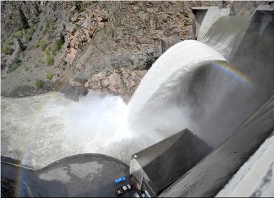
Flood risk

Tom Brown (CWCB) said that there is a new timeline for the proposed floodplain rules. The new timeline and the current proposed rules are available at:

http://cwcb.state.co.us/WatershedProtectionFloodMitigation/FloodRulesRegs.htm

Mr. Brown says that they are not too worried about flooding from snowmelt. He took the opportunity to remind everyone that most Colorado flood damage is the result of heavy rain and flash flooding.

The CWCB has some federal funding available to help local communities update their floodplain maps. This is in cooperation with FEMA.

State Drought Plan

CWCB staff expects to have a draft of their revised drought plan available by early July.

The Colorado River Water Availability Study comments have been extended through July 15.

Jeff Brislawn said that the CWCB is shooting for submitting their updates to the state emergency management office by the end of September. Updates to the plan are mandated by federal authorities and can affect funding. The revisions to the plan are to make the plan more in line with the national framework. They are planning a future table top exercise when the drought plan revisions are made

They are also revising the state Impact Task Forces. The current plans call for a Water Availability Task Force, Agricultural Impact Task Force, Tourism Impact Task Force, Energy Impact Task Force, Municipal Water Impact Task Force, Wildfire Impact Task Force and Wildlife Impact Task Force. All proposed task forces will include economic impact analysis.

They now have a guidance framework for local government drought planners.

State Climatologist’s report

Wendy Ryan said that most areas in Colorado have experienced below average temperatures over the past month. There was good April moisture across the state. The Upper Colorado Basin and Northwestern Colorado are in D1 drought. The plains are doing really well for precipitation. May, so far, “has been really wet,” she said.

Grand Lake’s precipitation is below their historical minimum for the water year. The northeastern plains range from average (Akron area) to, “really good precipitation,” in Burlington, she said. Fort Collins is above average with Boulder well above average.

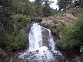
Snowpack and streamflow forecast

Mike Gillespie (NRCS) said that there has been a shift in moisture the last couple of months from south to north but that, “it could be too little too late,” for the northwestern part of Colorado. The cool temperatures and moisture have, “dragged out the snowmelt almost a month.” Most snowpack charts are showing 3 snowpack peaks for the water year. He also told the group that, “The percent of average snowpack is not the best measure this time of year.”

The Colorado River Basin snowpack is melting out and they currently have about half the annual year snowpack on the ground. Reservoir storage is at 116% of average in the basin and is the best since 2001. Streamflow forecast for the Colorado Basin is below average everywhere. At the end of the session Karen Rademacher from the Northern Colorado Water Conservancy District reported that they will not have to bring water from the Colorado Basin via the Adams Tunnel to fill Horsetooth Reservoir. Their Front Range reservoirs are going to fill with their east slope water rights.

Snowpack in the South Platte Basin was below average on May 1 (81%) according to Gillespie. By May 16 it was sitting at 91%. April precipitation in the basin was good and May is already at average. “Things have really turned around in the South Platte Basin,” he said. Reservoir storage is at 106% — not quite as good as last year. The forecast is looking at below average streamflow in the basin.

In the Gunnison Basin Gillespie said that there was a, “pretty rapid melt out,” over April and May due to warmer temperatures and dust on snow events. April precipitation was good. Reservoir storage in the basin is at 129% of average. Streamflow forecasts call for below average runoff consistently across the basin.

The southwestern Colorado basins are similar to the Gunnison, said Gillespie. The same dust conditions and warmer temperatures have combined to reduce what was a great snowpack earlier in the year to 77% of average on May 1. April precipitation was below average and May has been, “very dry,” he said. Reservoir storage in the area is at 100% of average. Streamflow forecasts are for below average conditions with the exception of the San Juan River (91% of average).

The Rio Grande Basin snowpack was at 90% on May1. It peaked at 112% of average on April 3. They’ve had a very dry May. Reservoir storage is at 89% of average. Streamflow forecasts for the basin are amongst the best in the state.

Gillespie said that the Arkansas Basin snowpack peaked at 104% of average on April 5. They are at 96% of average for precipitation for the water year. The reservoir storage is the best since 2001. Streamflow in the headwaters should be average with many of the tributaries below Pueblo Reservoir expected to have above average runoff.

Weather forecast

Klaus Wolter (NOAA) told the task force that we can say, “goodbye to El Niño and hello to La Niña.” He said, “Enjoy the spring weather,” for the next two weeks as temperatures are forecast to be near normal adding that Colorado, “will dry out a bit.” He expects daytime temps in most of the lower elevations to get to the 80s and stay there. He forecasts a dry summer in the South Platte Basin.

Tamarisk control: The Lower Arkansas Valley Water Conservancy District ponies up $36,000 for herbicide operations

A picture named tamarisk.jpg

From The Pueblo Chieftain (Chris Woodka):

One of the largest tamarisk removal projects in the Arkansas River basin apparently was successful last year and sponsors are ready to go after some more. The Lower Arkansas River Water Conservancy District board voted unanimously Wednesday to contribute $36,000 toward this year’s $130,000 project to use helicopter spraying to kill tamarisk in Prowers County. Last year, 1,414 acres of mostly private land was sprayed at a cost of $117,000 in the Arkansas River flood plain, said Nolan Daskam, of the Natural Resources Conservation Service. The estimate for the cost of the project was $200 per acre, but was completed for $84 per acre. The price of the chemical used, Habitat, dropped because of competition from a generic brand, Daskam explained. The project also pinpointed spraying through use of global positioning system technology, he added. “I think if we get a handle on this, we can keep it in control,” Daskam said. “We can make progress up to the county line and into Bent County…

The project’s goals include restoring native vegetation, improving wildlife habitat and reducing the flood hazard from clogged river and stream channels, Daskam said. There are other methods of tamarisk removal in Prowers County as well, including grinding and bulldozing, with follow-up hand spraying to kill plants that regenerate. “Mechanical control still has its place,” Daskam said. “For some landowners, it’s the only option.”

About 45,000 beetles that eat tamarisk leaves have been released in Prowers County. “In October, we found them (beetles released earlier in the year), and they were thriving,” Daskam said. “We’re waiting to see how they over-wintered. It’s the cheapest method, so we’re hoping they’re successful.”

More tamarisk control coverage here and here.

Evergreen: Flushing the pipes

A picture named flushingfirehydrant.jpg

From the Canyon Courier:

The Evergreen Metropolitan District will begin the annual water-main flushing program the first week of June and continue through the summer. Affected areas will be Tanoa, El Pinal, Wah Keeney Park, Hiwan Hills and Hiwan. The purpose of water-main flushing is to remove fine particles that settle in the water mains that cause color, taste and odor issues. If you have any questions, contact the Evergreen Metropolitan District at 303-674-4112.

More infrastructure coverage here.

Energy policy — oil shale: Judge Kane allows ninth delay in conservation group lawsuit

A picture named tarsandstrucks.jpg

From the Associated Press via The Durango Herald:

U.S. District Court Judge John Kane granted the request last week, extending the deadline to July 16. But Kane said he’s not inclined to approve any more delays, noting that the two lawsuits were filed nearly 17 months ago. Federal officials made the latest request because of the oil spill in the Gulf of Mexico. Kane said while he is sympathetic to the “existence of factors beyond Defendants’ control which have contributed to the delay of this proceeding,” settlement negotiations have been under way for nearly eight months. “I strongly urge the parties to either resolve this controversy or prepare to litigate,” Kane said.

The lawsuits by conservation groups claim the Interior Department and Bureau of Land Management violated environmental laws by curtailing public comment and failing to consider impacts on wildlife or the potential effects on climate change. The 13 groups suing also argue that regulations setting the royalty rates for oil shale violate federal law requiring fair-market value for public resources.

More oil shale coverage here and here.

Endangered Species Day

A picture named whoopingcranes.jpg

The U.S. Fish and Wildlife Service has set today as endangered species day, so take a whooping crane or humpback chub to lunch. Here’s a report from Julie Sutor writing for the Summit Daily News. From the article:

The Fish and Wildlife Service (FWS) and the National Oceanic and Atmospheric Association share responsibility for administering the Endangered Species Act. In its 37 years, the law has helped prevent the extinction of hundreds of species. “The Endangered Species Act is the nation’s premier law protecting biodiversity today,” said Rowan Gould, acting FWS director. “The bald eagle, the American alligator and the gray wolf are all species which once found themselves on the list, facing the brink of extinction, but have successfully rebounded.” The Fish and Wildlife Service works with other federal agencies, state, local and tribal governments, environmental organizations, industry groups, academia, the scientific community and members of the public to help conserve the nation’s imperiled fish, wildlife and plants.

More endangered species coverage here.

Fryingpan-Arkansas Project 2010 allocations

A picture named fryingpanarkansasproject.jpg

From The Pueblo Chieftain (Chris Woodka):

The Southeastern Colorado Water Conservancy District board voted Thursday to allocate 48,276 acre-feet from the project, based on its anticipated yield. Municipal allocations will be 17,606 acre-feet, with 30,670 acre-feet for agriculture. Another 10,114 acre-feet of agricultural return flows will be allocated, mostly to well owners associations. Total revenues from both allocations are about $400,000…

In particular, Colorado Springs requested far less water than it would be entitled to under the principles, just 2,000 acre-feet. Its partners in the Fountain Valley Authority — Fountain, Security, Stratmoor Hills and Widefield — have requested another 3,200 acre-feet. Colorado Springs also will receive a repayment of 700 acre-feet for water it “loaned” to the district to lower the elevation of Lake Pueblo in the Safety of Dams program. The Fountain Valley Authority would be entitled to about 12,000 acre-feet under the principles. In contrast, the Pueblo Board of Water Works requested 5,000 acre-feet, a little more than its 10 percent allocation…

The water will come in two allocations, 80 percent as soon as water begins moving and another 20 percent in July. While the district has made two allocations in previous years, this setup will give water users a guarantee of most of the water, with a provision for a cash refund if supplies fall short. “The two-allocation procedure is a new process because it’s very difficult to predict what imports are going to be,” said board member Greg Johnson, a member of the allocations committee. “Allocations would be simpler if we knew up front what the water supply will be.” Monthly forecasts on the available water by the Bureau of Reclamation have fluctuated each month as weather conditions changed from heavy snow early, to dry conditions in April, to renewed snowpack this month. Reclamation estimates that 54,700 acre-feet will be brought over. Of that, 3,000 acre-feet is owed to Twin Lakes through an exchange of West Slope water. Another 500 acre-feet goes to the Pueblo Fish Hatchery, and 15 percent is set aside for transit loss and evaporation. That leaves 43,776 acre-feet for allocation.

More Fryingpan-Arkansas Project coverage here and here.

El Jebel: Taylor River rafting rift sufaces at the Colorado River District’s ‘State of the River’ meeting

A picture named roaringfork.jpg

From the Aspen Daily News (David Frey):

State Rep. Kathleen Curry said she “didn’t get it right” in trying to craft a right-to-float bill on Colorado rivers, but strong emotions on both sides of the issue suggest crafting any kind of bill to address the issue will be tricky. “It creates a situation with not a lot of room or even motivation for middle ground,” said Curry, speaking at a State of the River conference hosted by the Colorado River Water Conservation District on Tuesday night…

“We met a great deal of opposition, really from all sides,” Curry said. “I didn’t get it right. We thought we had basically gone down a path of trying to create a compromise.” With no legislation passed, 20 proposed ballot initiatives are pending to resolve the issue on the November ballot. Sixteen were proposed by landowners. Four were proposed by river outfitters. Two of those include language for anglers. Two don’t…

Glenwood Springs water attorney Scott Balcomb argued that if the state wants access through landowners’ properties, it should pay for rights of way, much as governments do for roads. “I’m not against the boating industry. You can tell,” Balcomb said, pointing to a boating logo on his shirt. “I am for respecting the constitutional rights of landowners and getting it done in a proper organized way. Both sides of this controversy badly need to know what the rules are so that the incidents that Ken brought out stop.”[…]

Sitting in the audience, Frying Pan Anglers’ Warrick Mobray said he understood both sides of the argument. As an angler, he wants floating rights. As a landowner, he wants protections. The two sides should sit down and hammer out a compromise, Mobray said, but he admitted, that’s not very likely. “Both sides are nuts,” he said…

Water experts said Tuesday night that Ruedi Reservoir will fill completely, thanks to spring showers which have helped maintain the snowpack.

Meanwhile, here’s an update on the agreement between Wilder on the Taylor and the two outfitters that will allow them to run the river this season, from Seth Mensing writing for the Crested Butte News. From the article:

The offer: follow six rules ranging from timing of the trips to respecting water levels in the Taylor, and take a few trips through the property this summer. Then the two sides can take time to talk about the future…

…Gunnison Rep. Kathleen Curry, who championed the bill in the state house, said she probably will not pursue a similar bill next year, if she is re-elected. “I don’t plan to run legislation next year because … the issue was so contentious the personal toll this bill took was too high. I don’t see the point in working on a ‘compromise’ proposal just to have it killed next year in the legislature by the big money landowner interests,” she says. “If both sides were willing to agree to a solution and then stick by their word when the time came, then I think it would be worth pursuing this issue further. But, based on what happened this year, I have little hope for that.”

Now, outside of ongoing mediation, Shaw is saying he won’t press trespass charges against either Three Rivers or Scenic River Tours if the rafters limit the timing and number of trips, cover Wilder’s liability in the event of an injury and keep their angling flies out of the water. In a statement Shaw said, “While mediation between Jackson-Shaw and the two Taylor River rafting companies continues, Jackson-Shaw recognizes that Three Rivers and Scenic are at the threshold of their commercial rafting season and that it will take time to finalize any formal agreement. Accordingly, as a show of good faith, Jackson-Shaw has decided to give Three Rivers and Scenic permission to float through Wilder on the Taylor this summer.”

As long as boaters have been running the Taylor freely, they have had to take out and portage around a bridge on the Wilder property. Shaw’s offer gives them the permission to continue doing that. The two rafting companies will have to decide how to share the four commercial trips that will be allowed through the property each day, with two going through between 9:30 and 11 a.m., followed by the others between 1:30 and 3 p.m. And even inside the three-month window, Shaw says the rafters shouldn’t float through Wilder when the water level is below 200 cubic feet per second below the Taylor Dam…

According to the release, scheduling conflicts have delayed a second mediation meeting at the Judicial Arbiters Group in Denver, which was started at Governor Bill Ritter’s request. The two groups will meet again May 26. “So long as Three Rivers and Scenic are willing to accept Jackson-Shaw’s permission and follow these simple terms, Jackson-Shaw will allow the rafting companies to conduct rafting trips through the property this summer,” Shaw concluded. “Acceptance by these two rafting companies of these terms will not prevent mediation from continuing. However, it will give the two companies some certainty as the rafting season begins.”

More Colorado River Basin coverage here. More whitewater coverage here.

High flow regime for Black Canyon necessitates Crystal Dam spill

A picture named crystaldamspill052009.jpg

From the Montrose Daily Press:

During the 24-hour release, up to 4,300 cubic feet per second poured out of the lake and into the river…The water was released by the U.S. Bureau of Reclamation under a 2008 court decree that provides Black Canyon National Park with a federal reserve water right to protect riparian resources. The release is beneficial to river life downstream and helps the Gunnison to revert to flows and conditions more in keeping with the natural environment before construction of the Aspinall Unit, which encompasses Crystal Reservoir, Blue Mesa Reservoir and Morrow Point Reservoir.

Check out this very cool video of the event from William Woody and The Grand Junction Daily Sentinel.

More Aspinall Unit coverage here.

Pagosa Springs: San Juan River Workgroup meeting May 27

A picture named sanjuan.jpg

From the Pagosa Sun (Kathy Sherer):

The San Juan River Workgroup will meet at 5:30 p.m. Thursday, May 27, at the Ross Aragon Community Center cafeteria. Everyone is welcome. The meeting will focus on discussing and editing a values statement; starting to develop a list of “Issues, Concerns and Opportunities,” planning a summer field trip; and a beginning review of river and watershed protection tools. To learn more and to find all the meeting handouts, schedule and minutes, go to: http://ocs.fortlewis.edu/riverprotection/ (click on San Juan River Workgroup on the left side) or call the Southwestern Water Conservation District at 247-1302 or call the San Juan Citizens Alliance at 259-3583.

More San Juan Basin coverage here.

Pueblo Conservancy District fee structure revamp

A picture named puebloleveearkansasriver.jpg

From The Pueblo Chieftain (Chris Woodka):

The Pueblo Conservancy District is raising funds to maintain Pueblo’s levees through fees, but still needs to figure out its fee structure.
The district petitioned for reinstating fees in district court two years ago as a plan to generate $300,000 a year. “The problem we ran into was that the land use has changed over the years,” said Gus Sandstrom, president of the district.

More Arkansas Basin coverage here.

Grand County ‘State of the River’ meeting recap

A picture named coloradorivergranby.jpg

From the Sky-Hi Daily News (Tonya Bina):

Colorado River Basin snowpack levels are at 77 percent of average, in line with statewide averages this year, according to information shared at the annual State of the River Meeting. “It’s been a poor year until recently,” said Senior Water Resources Engineer Don Meyer of the Colorado River District to a roomful of water stakeholders Tuesday at the Mountain Parks Electric meeting room in Granby…

Forecasted elevation of Lake Granby is expected to be at 8,268 feet, according to Andrew Gilmore, hydraulic engineer with the Bureau of Reclamation, the agency that operates the Colorado-Big Thompson project. That level equates to about 12 feet from full. But Don Carlson of the Northern Colorado Water Conservancy District, the agency that delivers water to Northeastern municipalities, water districts, industries and farms, had a slightly less conservative prediction for Granby Reservoir. Because of moisture on the East Slope, Northern may be able to use some of its low priority rights for water, he said, which will take some pressure off of West Slope supplies this year. Granby Reservoir may be closer to 4 to 5 feet below full, he said…

Snowpack has “been behind all year, although did make a nice recovery recently,” said Bob Steger, Denver Water’s manager of raw water supply. “The good news is, we think we’re going to fill all of our reservoirs anyway, despite the low snowpack.”[…]

State of the River

The Colorado River District, which operates Wolford Mountain Reservoir is extending its offering of bounty for anglers who catch northern pike, a predator to native species. Anglers will be awarded $20 for each Pike caught.

• Northern and the Bureau of Reclamation are planning to replace the dam structure between Shadow Mountain Reservoir and Grand Lake this year. The dam/bridge at the eastern end of the canal is old, doesn’t perform well and poses safety concerns to boaters, said Northern’s Don Carlson. To avoid Grand Lake’s heavy summer traffic season during which many boaters use the canal, work on the dam project is planned for 30 days during the month of October.

• Pumping started at Windy Gap near Granby on April 29 to send 15,000 acre feet for storage to partners in northeastern Colorado, with another 40,000 acre feet from Lake Granby for their use.

• During the 25-year anniversary of the Windy Gap Reservoir, water will be taken down in mid-July through the end of September to address sediment build-up. Although sediment has been building up through the years, the reservoir was further impacted by a pond breach last year at the Orvis Shorefox property, which added silt to the reservoir.

• Denver Water customers are conserving more water due to a tiered rate structure that increases with increased water use per gallon. Graphs show that since Denver Water implemented its new rate structure, water use has plateaued even though the utility’s customer base has increased.

• Denver Water is redoing the outlet works at Williams Fork Reservoir and constructing a new auxiliary power plant at a cost of $17 million. The new outlet works should increase the capacity from 275 cfs to 750 cfs when completed. In the meantime, this summer the dam will operate with temporary outlet works with limited release capabilities, at 125 cfs. “We’ll get through this year as best we can with the limited release capabilities,” said Denver Water’s Steger.

• At the Vasquez Canal, Denver Water is replacing 1,500 feet of covered canal with pipe.

• There were several temperature exceedances in the Fraser River last year, according to the Grand County Water Information Network. They were upstream from Windy Gap and at the conjunction of Ranch Creek, she said. As many as 32 temperature monitoring sites will be in place again this year. Through partnerships, algae toxin monitoring and gathering of water clarity data will also continue at reservoirs and lakes this summer.

More Colorado River Basin coverage here.

Vail kayak park open for the season

A picture named kayaker.jpg

From the Vail Daily:

ade in Vail Village is ready for action. Although water levels have not yet reached the preferred 400 cubic feet per second, the town has activated the park to take advantage of rising water levels. Free demos at the park will begin Tuesday and continue Tuesday evenings from 5 p.m. to 7 p.m. through June 22. The demos are run by Alpine Quest Sports and instructors will be on hand to demonstrate their skills and to show kayakers how to freestyle. The park has an adjustable whitewater wave that allows kayakers to experience maximum conditions during peak flows. The system will operate into late-June or as runoff allows…

The park’s computer controlled system is being programmed to read the water level each morning, and then automatic adjustments will be triggered to produce the best wave possible throughout the day. Kayakers are asked to leave feedback for the town about any additional adjustments that can be made to the park throughout the season. Feedback forms are available on site or by e-mail at whitewater@vailgov.com.

More whitewater coverage here.

Colorado Springs: Utilities board okays water supply regional partnerships

A picture named denveraquifer.jpg

From The Colorado Springs Gazette (Eileen Welsome):

Mayor Lionel Rivera and Utilities CEO Jerry Forte hailed the decision as a historic vote, saying it would benefit not only the utility’s ratepayers, but other water consumers throughout the county. “It’s a win-win for everybody,” Forte said…

Under the new policy, which still has many details to be worked out, the regional partners would be charged a premium for water service that would be higher than what the utility’s current customers pay. A portion of that would go to the city’s general fund and another portion to Utilities.

The Utilities board, which consists of members of the City Council, voted 6-2 to move ahead with the regional partnerships. Councilmen Randy Purvis and Tom Gallagher cast dissenting votes. “I’m opposed to using our water,” Gallagher said, questioning whether Utilities would have an adequate water supply to meet demand during times of drought. Gallagher said he was also concerned about whether the utility would be able to accurately assess the hidden costs associated with delivering the water — such as electricity used to drive pumps — to the regional partners.

But Rivera insisted that the regional partnerships will be a good deal for the city and the utility. “If we have excess capacity that we’re not using, then we’re not being good stewards of our resources,” he said. “It will be a huge benefit to be able to sell water that we don’t need.”

More infrastructure coverage here.

Snowpack/runoff news: Recent storms help the outlook

A picture named snowpack05182010.jpg

From the Boulder Daily Camera (Jenn Fields):

In the South Platte River basin — which is basically the Front Range — the snowpack is at 113 percent of average as of Tuesday, said Matthew Kelsch, a hydrometeorologist with University Corporation for Atmospheric Research. “The storms we had last week definitely helped catch us up to average,” Kelsch said. It was a welcome boost at higher elevations, said Dan Gottas, a Boulder meteorologist who writes the mountain forecast for climbinglife.com. “Before the storminess set back in during late April, the snowpack water content over the higher elevations along the northern Front Range was around 75 percent of normal for that time of the year,” Gottas said. Now, he said, snow-water content measurements at some sub-alpine locations along the Front Range are at anywhere from 100 percent to 130 percent of average for this time of the year. The snowpack typically declines rapidly after peaking in late April, he said, but the combination of cooler temperatures preventing the spring run-off and more snow are now keeping the snowpack at or above average.

From the Longmont Ledger:

“River flows can increase dramatically, without warning. Flooding is the number one weather-related killer in the United States,” said a press release from the city. “Citizens are advised to not play in or near the Saint Vrain Creek, and especially do not allow any pets or small children near the water.” Due to the recent drought, it has been a number of years since there has been a significant streamflow through Longmont, the release said. Rivers and creeks therefore may be more dangerous than normal as logs and other material that have accumulated over the past few years break loose and become part of the flow. Nearly all area reservoirs are currently full. Therefore, with the exception of area ditches diverting water for irrigation purposes, all snowmelt and future rainfall events will flow through Longmont via the Saint Vrain and Left Hand Creeks.

From email from Reclamation (Vern Harrell):

The mid month forecast decreased by 20,000 acre-feet from the May 1 forecast. With the current forecast, it doesn’t look like McPhee Reservoir will fill this year.

Lower Arkansas Valley Water Conservancy District board meeting recap

A picture named arkansasriverbasin.jpg

From The Pueblo Chieftain (Chris Woodka):

The Arkansas River basin has the highest number of acres infested with tamarisk in Colorado, and much of it is in the upland areas, Edelmann said. “The [recent U.S. Geological Survey scientific assessment] doesn’t mean there weren’t water savings from tamarisk removal, just that they couldn’t be detected,” Edelmann said. “That’s not to say there could be some savings in the upland areas of the Arkansas River basin.”

Tamarisk consumptive use was reported as high as 9 feet per year in studies from the 1940s-70s, but the scientific methods did not take into account weather factors. Newer studies show the probable consumptive use is closer to 3-4 feet per year…

There could be a savings to the river by increasing the amount of water available to the Arkansas River, but any measurement would have to look at all components of the water budget — the water table, canal leakage and weather factors. “The river is a drain, so you should be able to see a net difference,” Edelmann said. “A lot of variables come into play.” So far, there have not been comprehensive studies showing the water-saving benefits of tamarisk removal in the Arkansas River basin. There is some anecdotal evidence,” Edelmann said. “The wetlands returned at Bent’s Fort when the tamarisk was cleared.” There are other benefits, such as improved flood protection in the river channel and improved wildlife habitat, Edelmann said.

More tamarisk control coverage here and here.

Energy policy — nuclear: Arvada and Denver officials are pressuring state mining regulators to force Cotter to cleanup the Schwartzwalder mine

A picture named nukeplantcattenomfrance.jpg

From The Denver Post (Bruce Finley):

The latest water-quality tests showed that Ralston Creek below Schwartzwalder mine carried as much as 390 parts per billion of uranium, which is 13 times higher than the 30 ppb health standard. Contamination of groundwater at the source — inside the mine — exceeded the standard by 1,000 times. Drinking water remains safe, Denver Water and Arvada authorities said, because uranium is removed from Ralston Reservoir water by municipal water treatment plants. Still, even after treatment, uranium levels appear to be rising in some systems. In Arvada, reservoir water tested at 7.2 ppb before treatment. Uranium in drinking water sent to the city’s household customers increased to 1.2 ppb in April from 0.9 ppb in January.

“We’re urging the state to take immediate action,” said James McCarthy, Arvada’s chief of regulatory and environmental compliance. “We’re not retooling for uranium removal. That’s not just something you can turn a switch and do. That’s why Cotter has to do something about this. Why didn’t they make it known sooner?”

Jefferson County officials said they’ve been in regular contact with state regulators. The reservoir’s owner, Denver Water, “would like to see immediate and aggressive steps to ensure that reclamation of the mine is completed in a timely manner,” spokeswoman Stacy Chesney said.

Colorado’s top water-quality overseer sent a memo May 10 to the mining regulators recommending swift action. “If a permanent solution cannot be implemented in a very short time frame, then an interim solution, such as pumping and treating as much contaminated water as possible, should be launched immediately,” wrote Steve Gunderson, director of water quality control for the state health department. Cotter’s mine “is causing a violation of stream standards. That’s the thing we’re waiting to get addressed. They cannot have a discharge that is violating stream standards,” Gunderson said Wednesday.

More Schwartzwalder coverage here. More nuclear coverage here and here.

Pueblo: Fountain Creek foundation public meeting recap

A picture named fountaincreek.jpg

From The Pueblo Chieftain (Chris Woodka):

The meeting attracted about 40 people, even a few children and teens, to discuss how recreational opportunities could be expanded. Under a $75,000 Great Outdoors Colorado grant, Pueblo and numerous other partners are developing the plan with the guidance of the Fountain Creek Foundation and THK Associates, consultants for the project.

More Fountain Creek coverage here and here.

Colorado Springs area waterfalls

A picture named helenhuntfalls.jpg

Here’s an article celebrating four Colorado Springs area waterfalls, from R. Scott Rappold writing for The Colorado Springs Gazette. From the article:

“Small, straight, new, treeless,” [writer Helen Hunt Jackson] said of the young city in 1878, after coming here in search of a healthier climate than 19th-century big-city life offered.

“One might die of such a place alone,” she remarked bitterly. “Death by disease would be more natural.”

But she came to love Colorado Springs, in large part because of her frequent visits to rugged Cheyenne Cañon, beyond the jagged pinnacles of rock, to where glistening waterfalls rush down like gifts from the mountains. The falls today bear her name, and have been a popular spot since the canyon became a city park 125 years ago.

More Arkansas Basin coverage here.

Rocky Mountain National Park officials embarking on restoration project near the Grand Ditch

A picture named grandditch.jpg

From the Fort Collins Coloradoan (Bobby Magill):

…after the settlement of a years-long federal lawsuit against the ditch company, Fort Collins-based Water Storage and Supply Co., and plenty of study, the Park Service is beginning a two-year process of creating a plan to restore the area damaged by the breach. The plan, which will be outlined in an environmental impact study of possible ways to restore the area, will take two years to complete. The project itself will continue for up to three years after that. Park officials are looking for the public’s ideas for how to restore the area, keeping in mind that the project might use heavy equipment and helicopters inside a federally designated wilderness area where motorized equipment is otherwise prohibited. The point of the project is to balance ecosystem restoration against the project’s short-term impact from the possible use of earthmoving equipment in a wilderness area, said Paul McLaughlin, Grand Ditch Breach restoration coordinator for Rocky Mountain National Park.

More Grand Ditch coverage here and here.

Front Range Water Council economic study fails to impress west slope water wonks

A picture named coloradotransmountaindiversions.jpg

From The Grand Junction Daily Sentinel (Gary Harmon):

The reaction was harsh enough that a representative of Denver Water, one of the agencies that sought the study, said it seemed instead to undermine the main point the Front Range Water Council sought to illustrate: the interdependence of various regions in Colorado. The interdependence was “diluted” in the report, Greg Fisher, Denver Water’s manager of demand planning, said at the meeting of the Mesa County Water Association, which drew about 60 people.

Mesa County rancher Carlyle Currier said it was inflammatory, and Club 20 Executive Director Reeves Brown called the conclusion that the Front Range generates $132,000 from an acre of water compared to $7,200 on the West Slope “unnecessarily provocative.” “It exacerbates existing feelings” of distrust of the Front Range, Jim Spehar, a former Grand Junction mayor and Mesa County commissioner, said of the report. “What was your point? I think you shot yourself in the foot.”

The idea, [Greg Fisher, Denver Water’s manager of demand planning] said, was to show a different perspective than the way water issues are usually framed by suggesting that Colorado’s other regions — the eastern plains, San Luis Valley and central mountains, as well as the Front Range — benefit from a thriving Front Range economy…

Economist Paul Rochette of Summit Economics and the Adams Group, said the study was limited by the characterizations of available data, such as the economic value of feedlots in Greeley and wine sales in Denver that depend on Western Slope agriculture. “It can be very easy for one area to get credit for the foundational value of something made in another region,” Rochette said.

Here’s the Coyote Gulch coverage of the report.

Snowpack news: Slow start to the runoff season

A picture named snowpack05182010.jpg

From The Pueblo Chieftain (Chris Woodka):

… the southwest corner of the state, Gunnison and Rio Grande basins have fallen far below average after an early runoff, dust and winds battered a hefty snowpack left by storms in the winter months. “That doesn’t mean there is lots more water in the state,” said Nolan Doesken, state climatologist. “There’s been some increase, but it’s mostly been a shutoff of snowmelt.”

The plains are still soaked from weekend storms, and the snow that fell in the mountains has added to the snowpack. More rain and snow are forecast for later in the week. As El Nino has weakened, the storms have been hitting further north. The snow in the southwestern areas of the state melted early, according to Snotel sites maintained by the Natural Resources Conservation Service. Streamflows throughout that region are now at or below normal. In the Colorado River basin, streamflows have fallen far below normal, showing that a runoff that occurred in April has stopped, with colder temperatures holding snow longer in the high country. In the South Platte River basin, streamflows were well above average Monday because of the heavy rainfall over the weekend. The Arkansas River basin has seen above-average precipitation so far this year — Pueblo has seen 4.35 inches, about 20 percent above normal — but river flows and snowpack are both in the average range.

From the Aspen Daily News (David Frey):

The spring storms helped boost the snowpack in the mountains and slowed spring runoff, Kanzer said, keeping more moisture in storage as snow. “Snowpack is our greatest reservoir,” Kanzer said, speaking to a group of about 20 people at a State of the River presentation at the El Jebel community center. Forecasters expect local stream flows to be 70-90 percent of average. The Roaring Fork is predicted to be 82 percent of average at the mouth in Glenwood Springs. Ruedi Reservoir above Basalt is expected to fill, at least for a few weeks, this summer.

U.S. House Subcommittee on Water and Power hearing recap

A picture named glencanyonconst.jpg

From The Greeley Tribune (Bill Jackson):

The formal hearing last more than two hours and was chaired by Rep. Grace Napolitano, D-Calif., who said the meeting was brought to Greeley at the request of Rep. Betsy Markey, D-Colo. Rep. John Salazar, D-Colo., also joined on the congressional side. Two panels were invited to address the formal hearing, one primarily composed of federal, state and local government officials, and another featuring farmers and agricultural and municipal water experts. The purpose of the meeting, Napolitano said, was to look at managing water for the future and how federal, state and local entities are supporting agriculture. For the most part, the answer the politicians got was not very good.

All panel members agreed conservation is part of the puzzle to meeting future water needs of the state, but they said it’s not the only — or even the most important — part. “If Two Forks (pdf) had been built, this hearing today would not have been necessary,” said Bob Sakata, who began farming in Adams and Weld counties 65 years ago…

Sakata was joined by several others on the panels in urging the construction of the Northern Integrated Supply Project, paid for by the 15 municipalities and water and irrigation districts, which is currently undergoing environmental studies. That project, like others planned in the state, is tied up in the federal bureaucracy, several panelists said…

Colorado Commissioner of Agriculture John Stulp and Doug Rademacher, who farms in southwest Weld County and chairs the board of county commissioners, stressed that water is the lifeblood of the state. “Buy out and dry up is not acceptable to our future here in Colorado,” Stulp said, while Rademacher noted that Weld is ranked No. 8 in the nation in terms of receipts for agricultural products. “If you take all the nuts and fruits out of California, we’d be No. 1,” Rademacher said, which got the attention of the two California lawmakers in attendance. Stulp, in response to a question, said agriculture remains either No. 2 or No. 3 in terms of importance to the state’s economy…

Sakata, who farms 3,000 acres of vegetables in the two northern counties, said if more storage is not constructed, future farmers will be impacted. “If something doesn’t get done, my heirs will be forced to sell out or quit,” he said.

More infrastructure coverage here.

Snowpack/runoff news: Cool April to lead to a gangbuster season for whitewater sports?

A picture named kayaker.jpg

From The Denver Post (Joey Bunch):

Recent cold and snow have meant a slow start to the snowmelt, as most rivers are running below normal, according to the U.S. Geological Survey. The Roaring Fork River at Glenwood Springs was flowing at 962 cubic feet per second Sunday. The 30- year median for this time of year is 1,930 cfs. Rafters on the Colorado River, however, got an earlier start because of dam releases, said Sandra Winslow, manager at Whitewater Rafting LLC, a 36-year-old business in Glenwood Springs. As a result, the Colorado River was running at 2,200 cfs Sunday, she said. The normal peak of the season is late May, but delayed snowmelt could mean a gangbuster season with the fast stream flow later this month.

From the Summit Daily News (Julie Sutor):

Denver Water, which supplies water to about 1.3 million people in the Denver Metro area, has 10 major reservoirs, including Dillon Reservoir, in its water-storage system. “They’re all going to fill, so that’s good news,” Denver Water’s Bob Steger said.

As of May 15, snowpack in the Upper Colorado River basin, which includes Summit County’s Blue River, was 89 percent of average; year-to-date precipitation in the basin totaled 92 percent of average on Saturday. The Colorado River Basin’s peak snowpack this year was 83 percent of the 1971-2000 average peak. Snowpack in the South Platte basin was 106 percent of average on May 15, and year-to-date precipitation was 91 percent of average, which is good news for Summit County. Denver Water gets about half its water from the South Platte basin, and about a quarter from the Blue River basin. So when the South Platte is dry, the agency draws more water from the Blue, including Dillon Reservoir.

As for the quality of kayaking, rafting and fishing on the Blue River below Dillon Dam, that will depend on the next few months’ weather on both sides of the Continental Divide. If wet weather persists, Steger predicts the Lower Blue will have five to six weeks of good rafting and 14 to 15 weeks of good fishing. If the weather turns dry for the next few months, the Blue River will only be conducive to rafting for one or two weeks. But fishing, which is better at lower flows, will be good for 18 to 19 weeks during late spring and summer…

Denver Water is now conducting research to quantify how dust storms affect the timing of snowmelt and peak river flows and the implications the storms have on its operations. Several dust storms have come through Summit County this spring. Drought and human development are the major causes of dust storms, as disturbances to soil allow it to be picked up more easily by winds.

Boulder: Summit on Nitrogen pollution May 18-20

A picture named gulfhypoxicdeadzone.jpg

From the Public News Service (Eric Mack):

Scientists call it the biggest environmental disaster no one’s heard of, and they are gathering this week in Colorado to try to change that. Nitrogen pollution from fertilizers and other sources can be detrimental to both water and air quality, experts say, leading to major health and environmental problems ranging from the onset of Alzheimers to the notorious “dead zones” at the mouth of the Mississippi River. University of Colorado professor Alan Townsend with CU’s Institute of Arctic and Alpine Research says this meeting aims to create the first national nitrogen assessment. “On one hand, we depend on fertilizer to grow our crops, and one of the key ingredients in that fertilizer is nitrogen. On the other hand, in general the world tends to use too much of it and use it too inefficiently.”[…]

Nitrogen pollution has had documented impacts on Colorado’s alpine lakes, and Townsend adds that nitrogen is a key component in those “ozone alert” days that Coloradans are familiar with. “Nitrogen that we end up emitting to the atmosphere through driving cars or running factories or putting fertilizers on fields is one of the key ingredients in making that ozone happen.”[…]

The nitrogen assessment meeting will be held 8 a.m.-5 p.m. May 18-20 at Millennium Harvest House, 1345 28th St., Boulder. More information is available at www.nitrogennews.com.

More water pollution coverage here.

Snowpack/runoff news: McPhee spill looking iffy

A picture named mcpheeconstruction.jpg

From the Cortez Journal (Shannon Livick):

“If there is going to be a spill, it is going to be small and short,” said Mike Preston, general manager of the Dolores Water Conservancy District. The Dolores River peaked at 2,530 cubic feet per second Monday and then dropped to about 1,810 cfs Tuesday along with the cold weather. McPhee Reservoir was at an elevation of 6,917 feet Wednesday. When full, the lake is 6,924 feet. In the 24 hours previous, the lake rose about 8 inches. So if there is a spill, so that rafters and kayakers can enjoy the Lower Dolores, it will be within a week or so, but only if the weather cooperates. “It really depends on the temperature,” Preston said. “And the wind, too.” Wind blows snow up in the air, and the snow evaporates, Preston said. Wind also creates a dust layer over the snow that can make it melt faster…

Preston said he hopes, if there is a spill this year, to be able to give community members 48 hours notice so they can plan any rafting trips accordingly. To keep tabs on this, go to http://www.doloreswater.com and click on “releases” to the left of the page. If the cool weather continues and irrigation use goes up, there likely won’t be a spill…

Last year, there was a 10-day spill with an average flow of 1,400 cfs. On Wednesday, the Lower Dolores was running at about 60 cfs.

From The Summit County Voice (Bob Berwyn):

[Blue River Basin water commissioner Scott Hummer] said the snowpack at lower elevations is going fast, with automated SNOTEL sites in the Blue River Basin reading 69.5 percent of average basin-wide. Above Dillon Reservoir, the snowpack is about 77 percent of average, but a station at Summit Ranch, in the Lower Blue, is only reading at 4 percent of the historic average. Streamflows in the basin are also below average because of the cool weather, Hummer said, adding that there is very little chance of runoff flooding this year. But as always, flash flooding can become a concern if there is a big rain event while streams are running high. Despite the low snowpack, reservoir storage in Summit County and across the state is higher than average, so Hummer is not expecting any severe shortages this summer. Right now, most of the water from the Blue River Basin is being captured for storage in Dillon Reservoir and Green Mountain Reservoir, which should help bring both the reservoirs up to optimum levels for recreation as the summer boating season approaches…

Ron Thommason, of the federal Bureau of Reclamation, explained how Green Mountain Reservoir fits into the overall water management scenario in Colorado. “When we divert water out of Granby and Willow Creek … we offset the amount with water from Green Mountain Reservoir,” Thommason said, adding that one-third of the water in Green Mountain is set aside for that purpose. Green Mountain was built specifically as a storage bucket to help water managers meet all the diverse needs at the right time, including irrigation and domestic use, and even upstream snowmaking at Summit County’s ski areas. Some of the reservoir’s water is also used to enhance habitat for the Colorado River’s endangered fish in what’s known as the 15-mile reach near Grand Junction, he said…

We’re getting close to where we need to be for me to feel comfortable releasing a little extra water from Green Mountain,” he said. “We’ve got another couple of weeks to see what happens … For the near term, we’re going to be releasing about 100 cubic feet per second from Green Mountain,” he said, adding that outflows will likely be ramped up as runoff increases. “We’re going to plan on filling the reservoir by the end of June. I usually aim for July 4,” he said. After that, a gradual draw-down begins. By the end of the fishing season in late October, the reservoir will have dropped by 45 feet, he concluded…

Denver Water’s Bob Steger said he’s confident that Dillon Reservoir will fill this spring. Six of Denver Water’s 10 major reservoirs are already full, Steger said. “They’re all going to fill, that’s the good news.” Water levels in Dillon Reservoir already are high enough to allow full marina operations as soon as the ice melts, Steger said, adding that it should be great year for flat-water recreation on the reservoir.

Conditions for rafting and kayaking below Dillon Reservoir are still weather-dependent, Steger said. “If things dry out, we’ll start spilling sooner,” he said. If the weather is dry the next few months, there will only be a window of a few weeks with raftable flows in the Lower Blue, he said. If the weather is wet from now on, the rafting season could be extended by several weeks, he said, explaining how Denver Water tries to balance various factors, including optimum flows for fishing, protecting Silverhorne from potential flooding and making sure storage in Dillon Reservoir stays at an optimum level.

Bureau of Reclamation: Rural water program funding opportunity now available

A picture named watertreatment.jpg

Here’s the release from Reclamation (Peter Soeth):

The Bureau of Reclamation announces the availability of the funding opportunity announcement for the Rural Water Supply Program to assess their potable water supply needs and identify options to address those needs. The grant announcement is available on http://www.grants.gov using funding opportunity number R10SF80458.

Reclamation will make at least $2 million available for conducting appraisal investigations and feasibility studies through grants and cooperative agreements. For this fiscal year, Reclamation anticipates awarding grants to initiate one or two feasibility studies and five to eight appraisal investigations.

Eligible applicants include states and political subdivisions of states, such as departments, agencies, municipalities, counties, and other regional or local authorities, Indian tribes or tribal organizations, and entities created under state law that have water management or water delivery authority such as irrigation or water districts, canal companies and any combination of the entities listed above.

Reclamation’s work with the selected entities is on a cost-shared basis. For an appraisal study, Reclamation will pay 100-percent up to $200,000 and 50-percent for all costs above that amount. Funding for feasibility studies is cost-shared with Reclamation paying 50-percent of the cost to complete the study. The non-Federal cost-share may be provided in the form of money or in-kind services that Reclamation determines are necessary and reasonable for the conduct and completion of the investigation or study.

A statement of interest is due by May 28, 2010, at 4 P.M. M.D.T., and if it is determined that you meet the eligibility and prioritization criteria, full proposals are due by July 13, 2010, at 4 P.M. M.D.T.

To learn more about Reclamation’s Rural Water Program and this Funding Opportunity Announcement please visit www.usbr.gov/ruralwater.

More Reclamation coverage here.

Beaver numbers are up across the Rockies

A picture named beaverbwdrawing.jpg

From the Glenwood Springs Post Independent (Julie Sutor):

By the mid 1800s, American beavers were on the brink of being wiped out, and their salvation and eventual recovery hinged on the whims of fashion: In the 1840s, silk top hats replaced beaver-felt hat as the must-have headwear. By the 1870s, beaver populations began to slowly rebound in Colorado. However, their return was slowed by mining and agriculture, which infringed on their habitat and diverted and polluted their waters. “Beavers have always had a tough time in Colorado, whether from trapping for their pelts or from development,” said Randy Hampton of the Colorado Division of Wildlife. In the last 50 years, as environmental regulations improved water quality and habitat, beavers at last staged their comeback in the Rockies. “Beavers have responded fairly well, and now they’re found pretty much everywhere around the state where there’s water,” Hampton said.

Beavers are a keystone species, meaning that their presence will dictate the overall health of their ecosystem. Their incessant activity in creating dams along streams and rivers fundamentally alters riparian areas, leading to the formation of pools, ponds, wetlands and meadows, which all serve as habitat for other species, including fish, plantlife, amphibians, deer and other wildlife on up the food chain. Without beavers, fish lose important breeding and spawning areas, as waters run too cold and fast for reproductive activity. That impact to fish then cascades throughout the entire ecosystem. “Beavers do more to shape their landscape than any other mammal except for human beings,” [Alice Outwater] wrote.

More conservation coverage here.

Mesa County: Residential irrigation workshops May 18, May 20 and June 8

A picture named watersprinkler.jpg

From The Grand Junction Daily Sentinel (Curtis Swift):

We will be conducting a workshop on May 18 from 9 to noon at the First Congregational Church at 5th and Kennedy designed to teach you how to identify and correct sprinkler system problems. Low head drainage, spacing of sprinklers, using the correct nozzles, correcting the arc and throw, replacing heads and correcting broken pipes will all be covered. You can register by calling 244-1834. Registering will ensure we have adequate handouts and staff available for the workshop. You can either pay the $5 per person registration fee at the CSU Extension office at the Mesa County Fairgrounds or when you show up at the workshop.

On May 20, we will be doing a workshop at Bill Heddles Recreation Center in Delta for those who want to learn how to properly water their lawns. You will learn how to determine the water pressure at critical locations in your system, and how to determine the proper irrigation schedule for each month of the season for each sprinkler zone in your system. We will conduct an audit of a sprinkler zone so you will know how to audit your own lawn. This session will be held from 1:30 to 3:30 at the Rec Center. Preregister is through the Delta CSU Extension office on Dodge Street – 874-2195. A $5 registration fee is being charged for this session.

An even longer and more in-depth session on how to audit your lawn will be held in Grand Junction on Tuesday, June 8 at the Sagebrush Room at the Mesa County Fairgrounds. We’ll start at 9 a.m., break for lunch between noon and one and continue until 3. If you install sprinklers, work for a municipality, school district, college or other agency and are responsible for sprinkler system maintenance and scheduling or simply want to learn more about how to conduct irrigation audits and develop a watering schedule this is the session you should attend. We will show you how to audit your system to determine water application rate and efficiency and how to use that data so ensure your lawn receives the proper amount of water for each month of the season. We will provide everyone who attends this session a CD containing a program you can use to develop a watering schedule based on an audit. The June 8 session will cost $10 to attend. Please register by calling the CSU Extension office in Grand Junction at 244-1834. Irrigation audit kits will be available for rent at the CSU Extension offices in Grand Junction, Delta and Montrose for those who want to conduct lawn irrigation audits.

If you are interested in learning more about drip irrigation we will be conducting a workshop on this topic at Pioneer Village in Cedaredge on Saturday May 29, from 10 a.m. to 4 p.m. While this session may not take all this time, I want to ensure we cover everyone’s questions. We will cover the different types of drip tubing and which one should be used based on soil texture. How to determine the water holding capacity of the soil, how much water plants use and how often and how long the system should be run will be covered. We will be testing several different types of drip systems to determine pressure needs, filtration requirements, emitter spacing and flow rates and spacing between drip lines. For our hands-on exercise we will design and install a drip system in one of the flower beds at the village. A $10 per person registration fee is being charged for this session. We will take time out for lunch. You may want to bring your own lunch or eat at one of the local eateries. I would appreciate it if you would register for this session by calling the Delta Extension office at 874-2915. Paying ahead of time is preferred but you can always pay the fee when you arrive at the site.

More Mesa County coverage here.

Gunnison high flow regime through the Black Canyon of the Gunnison National Park update

A picture named gunnisonblackcanyon.jpg

From The Grand Junction Daily Sentinel:

Remember trout have dealt with high water for millennia. They probably don’t like high flows, preferring to minimize energy spent and maximize calories gained, but they still need to eat. The flows wash more feed into the stream, which can make terrestrial insect patterns more effective for fly anglers. The faster water and the debris carried along also tend to dislodge aquatic insects, and on the Gunnison that means tossing a large nymph, especially something resembling a large stonefly nymph, during high water.

More Gunnison River Basin coverage here.

Energy policy — hydroelectric: The San Luis Valley Irrigation District is looking at a hydroelectric retrofit for Rio Grande Reservoir

A picture named riograndereservoir.jpg

From The Mineral County Miner:

“We wanted to ask the basic questions first,” Irrigation District Superintendent Travis Smith told the Rio Grande Interbasin Roundtable on Tuesday. He said the results of two previous hydro feasibility studies completed on the reservoir in the last 40 years showed that hydro would not pay for itself without reservoir repair and other changes…

Technical Consultant Kelly DiNatale discussed the hydropower feasibility analysis performed so far. He looked at the potential for generating 500 kilowatts and 2 megawatts . The 500 KW hydro generation would supply enough power for the local area through the existing transmission line while 2 MW would provide for local needs plus power that could be exported via Rural Electric Cooperative, DiNatale said. He said the Rio Grande Reservoir has about 90 feet of net head to work with when it is full (54,000 acre feet), and if 70 cubic feet per second (cfs) were released from the reservoir at that capacity, it would generate 500 kilowatts. Releasing 300 cfs would generate 2.1 megawatts…

To get that kind of flow, the reservoir would need to be full, and the reservoir reach its full capacity without rehabilitation, DiNatale explained. Increasing the amount of water in the reservoir would take cooperation from various entities, he added. For example, the reservoir could store water for the Rio Grande Compact, Division of Wildlife, sub-districts and other groups. Reservoir rehab would cost about $22 million, Smith said. Reservoir rehabilitation would involve construction of a new outlet, enhancement of the spillway and correction of a seepage problem. With another approximately $8 million the rehabilitated reservoir capacity could be expanded by another 10,000 acre feet, according to Smith.

More hydroelectric coverage here and here.

Victor: New water meter installations should be finished by the end of June

A picture named fountainpavementdrawing.jpg

From the Pikes Peak Courier (Norma Engeberg):

We have a large number of broken meters in this town and we’re losing a lot of revenue,” said City Clerk Sandy Honeycutt. The new meters will be read using radio signals and utilities workers will be able to drive around and read meters in 45 minutes without getting out of their vehicles. Honeycutt said it used to take workers several days each month to read meters. The meter work is being paid for in large part by a state grant. Work is also continuing on the installation of back-flow preventers for commercial water meters as required by state law. The installers are finishing surveys and will be ordering the types of back-flow preventers needed by each business.

More infrastructure coverage here.

Taylor River: Rafting rift leads to agreement for this season

A picture named raftingarkriver.jpg

From the Associated Press (Steven K. Paulson) via the Summit Daily News:

Property owners have declared a temporary truce in a dispute with commercial rafters and will allow rafting on their property this summer. Jackson-Shaw, the company that owns the Wilder on the Taylor fishing reserve, said Friday it will grant the two Taylor River rafting companies, Three Rivers Outfitting and Scenic River Tours, permission to float through its property this summer…

Lewis Shaw, chairman of the company, said it will take time to work out a permanent agreement and he wanted to give rafters a chance to begin their season. “While mediation between Jackson-Shaw and the two Taylor River rafting companies continues, Jackson-Shaw recognizes that Three Rivers and Scenic are at the threshold of their commercial rafting season and that it will take time to finalize any formal agreement. Accordingly, as a show of good faith, Jackson-Shaw has decided to give Three Rivers and Scenic permission to float through Wilder on the Taylor this summer,” Shaw said.

Bob Hamel, chairman of the Colorado River Outfitters Association, said it was a nice gesture but rafters believe they don’t need Shaw’s permission to raft the river. Rafting companies were already going ahead with their new season, he said. “Jackson-Shaw is not entitled to grant permission. The permission is in the Forest Service permit. I think this is premature because we’re still in negotiations,” Hamel said.

Mediation between the two rafting companies and Jackson-Shaw began on April 22 and remains ongoing. Both sides have agreed to keep the details of their negotiations secret. Shaw imposed several conditions, including limits on rafting between May 15 and Aug. 15 if there is sufficient water. The companies will be allowed four trips each day between 9:30 a.m. and 11 a.m. and 1:30 p.m. to 3 p.m. so fishermen can also enjoy their sport. Rafters will be allowed on the property to carry their rafts across a bridge…

Rep. Kathleen Curry, an unaffiliated state representative from Gunnison, said she believes voters will side with rafters, who have exercised their rights to use Colorado rivers for decades and have become a symbol of Colorado’s outdoor life. Eric Anderson, who represents a coalition of property owners, including fishermen who barred rafting this year on their property, said he believes fishermen will win in the court of public opinion because their property rights are being threatened.

More coverage from the Colorado Independent (David O. Williams). From the article:

The company that prompted one of the more hotly contested bills of the legislative session – House Bill 1188 dealing with commercial river rafting – announced Friday it would allow two outfitters to float the Taylor River through its property this summer. Officials for Jackson-Shaw, owner of the Wilder on the Taylor fishing reserve, said they will continue mediation efforts with Three Rivers Outfitting and Scenic River Tours while allowing the two companies to continue navigating the river through the private property…

Jackson-Shaw won’t allow rafters to fish the Taylor through the preserve, but they can portage a bridge (go around on land) as long they are “respectful” of the property, and the boaters must also limit the number of trips and stick to certain times and dates. “We believe that these rules are reasonable and will allow the rafting companies to meet demand, operate profitable businesses, and conduct far more commercial trips through the property this summer than last summer,” Jackson-Shaw Chairman and CEO Lewis Shaw said in a release.

Gov. Bill Ritter Thursday said he will work with landowner groups and the commercial rafting industry to resolve differences and avoid a looming ballot measure on the contentious issue.

More HB 10-1188 coverage here. More 2010 Colorado elections coverage here.

Fountain Creek update

A picture named fountaincreek.jpg

From The Pueblo Chieftain (Chris Woodka):

Under a Great Outdoors Colorado grant, the City of Pueblo, along with several partners, is developing a master plan for redevelopment of the Historic East Side that ties in parks, recreation, community activities, connections to Downtown Pueblo and improvement of Fountain Creek.

More coverage from Chris Woodka writing for The Pueblo Chieftain. From the article:

Pueblo County will consider buying an abandoned railroad bridge on Fountain Creek as an alternative to dredging as a way for Colorado Springs to comply with its permit conditions for the Southern Delivery System. In a work session Wednesday, commissioners heard a proposal recommended by the city of Pueblo and Colorado Springs Utilities to buy and remove the bridge as a more effective way to restore flood capacity to Fountain Creek than dredging. “Every- body ought to realize dredging is a one-time operation that can be short-lived,” said Dennis Maroney, Pueblo stormwater consultant. “After a storm event, you may have to go back and do it over again.”

More coverage from Chris Woodka writing for The Pueblo Chieftain. From the article:

At least eight projects are contemplated along the Fountain in Pueblo County alone, creating both challenges and opportunities, [Gary Barber, interim director of the Fountain Creek Watershed Flood Control and Greenway District] said. Four identified projects are bringing in more than $2 million to Fountain Creek, which others are just taking shape. “I see our role as a district to coordinate activity on Fountain Creek and move things along,” Barber told Pueblo County commissioners this week, as the county tried to sort out who’s doing what along the waterway.

The county is looking at a proposal by Colorado Springs Utilities and the city of Pueblo to buy and remove an abandoned railroad bridge, rather than have Colorado Springs dredge Fountain Creek. Removal of the bridge is seen as a more permanent solution than dredging, which would have to be done periodically after each flood deposits more sediment in the approaches leading to the bridge. That particular project is the main interest for the commissioners, who required the dredging as a condition for allowing Colorado Springs to build part of the $2.3 billion Southern Delivery System in Pueblo County…

A $500,000 sediment-removal demonstration project using technology developed by Streamside Systems is scheduled to be conducted near the railroad bridge. A 20-foot collector will be placed in Fountain Creek to remove bedload sediment — the particles that are carried along by day-to-day flows in Fountain Creek. The Colorado Water Conservation Board contributed $225,000 toward operation of the 90-day trial, which will be matched by $75,000 from the Pueblo stormwater fee, as well as in-kind work by the city. The outcome could help the city of Pueblo deal with sediments in the reach between Fourth and Eighth streets, where five storm-drain culverts frequently plug up, requiring constant maintenance. The project also will involve analysis of the sediments by the Colorado Department of Public Health and Environment, which is contributing $250,000 to projects on Fountain Creek.

Part of the state health money also will look at results from a side detention pond being built on the north end of Pueblo, which will create wetlands while reducing the severity of small floods. It would be built behind the North Side Walmart. The $700,000 project includes a $485,000 contribution from the Natural Resources Conservation Service, as well as analysis of water-quality indicators by Colorado State University-Pueblo.

Those projects are an outgrowth of a $1-million partnership between Colorado Springs Utilities and the Lower Arkansas Valley Water Conservancy District, which jointly are spending four years to develop the Corridor Master Plan, which covers Fountain Creek south of Colorado Springs. The master plan is the result of a 2007 agreement in which each contributed $150,000 a year toward the effort. The Fountain Creek District, formed in 2009, joined as a partner this year after Colorado Springs and the Lower Ark district agreed to contribute $100,000 annually toward funding the district.

Colorado Springs, as part of its agreement with Pueblo County, also is paying $300,000 over three years for study of a dam on Fountain Creek. The Fountain District has made no plans for how to spend that money. If SDS is completed in 2016, Colorado Springs would contribute another $49.4 million over five years to the Fountain Creek district, under its agreement with Pueblo County.

Another effort, by the city of Pueblo and the Fountain Creek Foundation is using a $75,000 Great Outdoors Colorado planning grant to develop a greenway park from Eighth Street to the Fountain Creek confluence at the Arkansas River. The project ties into a business-district redevelopment project on the Historic East Side.

More Fountain Creek coverage here and here.

CDOW is drawing down Beaver Creek Reservoir for dam inspection

A picture named beavercreekreservoir.jpg

From The South Fork Tines:

Water is being released slowly, and releases could increase significantly later this week. In addition, a road is being built on the water side of the dam to accommodate the inspection work. The DOW’s engineering staff is working with engineers from the Colorado Division of Water Resources to bring the water level down safely and to inspect the structures. The Rio Grande County Sheriff’s Office and the Rio Grande National Forest are also working in cooperation with the state agencies. The DOW owns the dam and the reservoir which holds about 5,000 acre feet of water. The reservoir is located on U.S. Forest Service property about 8 miles southwest of the town of South Fork. Water from the reservoir flows into the South Fork of the Rio Grande River.

More Rio Grande Basin coverage here.

Justice Hobbs: ‘The water ditch is the basis of civilization’


Farview Reservoir Mesa Verde NP

Here’s a recap of Justice Hobbs’ keynote this week up in Breckenridge, from Julie Sutor writing for the Summit Daily News. From the article:

Hobbs took his audience on a tour of the waters of the Americas, from the agricultural terraces of the Peruvian Andes to ancient reservoirs of Mesa Verde to the irrigated fields of the San Luis Valley, illustrating that water — and the ways we use it, divert it, store it, regulate it and fight over it — shapes human societies. “They were great civil works people,” Hobbs said of the ancient Incas. “You can’t walk down the great staircase of Machu Picchu without hearing the water sing.”

More Colorado River Basin coverage here.

Orchard City: South Grand Mesa Source Water Protection Plan

A picture named grandmesa.gif

From the Delta County Independent (Hank Lohmeyer):

The plan was compiled with input from area water providers and other domestic water stakeholders in the Surface Creek and Ward Creek drainages. The purpose of the plan is to identify the domestic water supply point sources so they can be protected from possible contamination by currently known and possible future threats. The plan focuses on using informed project planning, incident response, inter agency communication, and other measures. It is generally agreed that the biggest threat to pristine, mountain raw water supplies in the two drainages is from wild land fire that would have devastating consequences on the local watershed.

More Gunnison River Basin coverage here.

Arkansas Basin Roundtable meeting recap

A picture named flatheadchub.jpg

From The Pueblo Chieftain (Chris Woodka):

“I’m dismayed by the lack of progress [with the roundtable process],” said Jeris Danielson, a former state water engineer, consultant to Aaron Million’s Flaming Gorge pipeline project and director of the Purgatoire Water Conservancy District. “The discussion degenerated into, ‘There’s not enough water on the Western Slope,’ instead of talking about any projects.”

The IBCC’s meeting in Denver in April was mostly spent with members taking fallback positions that have stifled much discussion since the group was formed in 2005, he said. The group was initially seen as a way to develop guidelines for interbasin transfers, but most of the state’s nine roundtables are still wrestling with needs assessments with the basins…

The Arkansas Basin Roundtable will meet with the Gunnison Basin Roundtable at Salida on June 7 to discuss each basin’s concerns. It will be the second one-on-one meeting between the two roundtables.

More coverage from Chris Woodka writing for The Pueblo Chieftain. From the article:

A $42,000 project would attempt to develop a management plan to accommodate the needs of fishermen or boaters and water providers. “When you bring down water from the upper reservoirs into Lake Pueblo, when can you do that to meet all of the needs,” Jim Broderick, executive director of the Southeastern Colorado Water Conservancy District, told the Arkansas Basin Roundtable Wednesday. The guidelines developed would give all parties an idea of how much water would be released in wet, average or dry years in an attempt to head off complaints or potential lawsuits, Broderick said. The Roundtable agreed to pass its recommendation for approval along to the Colorado Water Conservation Board for a $33,000 grant for the project. Southeastern and the Upper Arkansas Water Conservancy District will equally split the balance of the costs.

More coverage from Chris Woodka writing for The Pueblo Chieftain. From the article:

A proposal to study the spawning habits of the flathead chub — which is found throughout the West — on Fountain Creek was bait for both skeptical comments and passionate defense among the normally placid roundtable members. Colorado Springs Utilities would use the study as part of its plan to build a fish ladder around its diversion at Clear Springs Ranch, located south of Colorado Springs in El Paso County. It would cost $144,000, with $109,000 through research efforts by the Division of Wildlife, Colorado State University, the U.S. Geological Survey and the Army Corps of Engineers. The remaining $35,000 is being sought through a state grant, said Merle Grimes, a consultant for the Fountain Creek Master Plan, which is a joint project of Colorado Springs, the Lower Arkansas Valley Water Conservancy District and the Fountain Creek Watershed Flood Control and Greenway District. “No one has attempted to do this study in the past,” Grimes said. “It has great value to the agencies who are participating.” The flathead chub is listed as a species of special concern, but not endangered or threatened, in Colorado. It’s not listed on the national endangered species list.

More Arkansas Basin coverage here.

Nebraska reaches accord with Colorado over the proposed Republican River compliance pipeline

A picture named republicanriverbasin.jpg

From The Yuma Pioneer (Stan Murphy):

The States agreed on a schedule for Pipeline deliveries that will avoid deliveries during the irrigation season to the maximum extent possible, which is consistent with the schedule developed by the RRWCD’s engineer. Colorado also agreed to support Nebraska’s proposed resolution of its Crediting Issue (which is to give Nebraska credit for the payment of damages in the running averages used to determine Compact compliance if Nebraska is required to pay damages to Kansas). The stipulation does not resolve Kansas’ issues with the Pipeline, but it removes one road block to completion of the Pipeline. The arbitration before the arbitrator selected by the States, Martha O. Pagel, an attorney from Portland, Oregon, is scheduled for July 12-14, 2010, in Kansas City, Kansas.

Second, on May 4, Kansas filed a motion with the U.S. Supreme Court for leave to file a petition to hold Nebraska in contempt for violating the Decree in Kansas v. Nebraska and Colorado. Kansas said in the petition that no relief is sought against Colorado, but Kansas reserves the right to seek relief at a later time against Colorado for its violations of the Decree. In the petition, Kansas asked that Nebraska be adjudged in contempt and enjoined from further violations of the Compact, that Nebraska be ordered to pay over to Kansas the amount of Nebraska’s profits or Kansas’ losses resulting from Nebraska’s violations, whichever is greater, that Nebraska be ordered to pay preset sanctions in the event of future violations, that Nebraska be ordered to reduce groundwater pumping, and that a river master be appointed to monitor and ensure Nebraska’s compliance with the Decree.

The filing of the petition underscores the need for the Compact Compliance Pipeline to bring Colorado into compliance with its Statewide Compact allocations. Kansas continues to insist that Colorado is in violation of the sub-basin non-impairment requirement in the South Fork sub-basin. Colorado views that as a separate issue and has filed a motion to dismiss that issue from the arbitration.

More Republican River Basin coverage here and here.

The Animas-La Plata Water Conservancy District board gets a look at the economics of recreation at Lake Nighthorse

A picture named zebramusselinfestation.jpg

From The Durango Herald (Dale Rodebaugh):

Board members of the Animas-La Plata Water Conservancy District got the news Tuesday. The water district took on the job of creating a recreation master plan for the lake a year ago when Colorado State Parks, the logical sponsor of outdoor activities, said it was broke. Colorado State Parks manages recreation at a number of properties owned by the Bureau of Reclamation, including Mancos State Park and Navajo State Park. “We got into this by default,” said Bob Wolff, the water district board president. “We have an incredible resource here but when no one stepped up, we needed to figure out how to get into recreation.”

Lake Nighthorse -covering about 1,500 surface acres – is taking shape as water from the Animas River fills a basin over the ridge to the southwest from Bodo Industrial Park. The Bureau of Reclamation, the federal agency that owns the project that will supply drinking water to three Native American tribes and others, estimates filling will top out sometime in 2011.

Water district members would like to have a recreation master plan in place by then.

More San Juan Basin coverage here.

Watercraft inspections to prevent the spread of invasive aquatic species now mandatory in Colorado

A picture named zebramusselinfestation.jpg

Click here for the mandatory boat inspection page at the Colorado Department of Wildlife. Thanks to The Grand Junction Daily Sentinel for the heads up.

More invasive species coverage here and here.

Snowpack/runoff news: Crystal dam to spill later this month during the high flow regimen for the Gunnison through Black Canyon

A picture named blackcanyoninnercanyonnps.jpg

From The Grand Junction Daily Sentinel (Dave Buchanan):

The peak flows and accompanying shoulder flows are components of the Black Canyon reserved water right. That 2008 settlement includes annual peak flows and shoulder flows — tied to natural inflow — plus a year-round base flow of 300 cubic feet per second. Collectively, these elements were considered to mimic natural flows prior to the construction of the Aspinall Unit dams and deemed critical to the health of the park and the Gunnison River. Once the peak flows are finished, the river will be ramped down by 400 cfs per day to around 800 cfs for the rest of the summer, [Dan Crabtree, lead hydrologist for the Bureau’s Grand Junction office] said. The peak flow and its timing were decided once the May 1 runoff forecast for the Gunnison basin was available, Crabtree said…

The peak flows will be produced by increasing flows from Blue Mesa into Crystal Dam and then opening the outlets on Crystal. That will boost flows to around 4,150 cfs. It take an additional spill of around 800 cfs to make the peak flow target. While it’s not preferable to see water go over the dam instead of through the hydropower generators, there’s little choice when it comes to meeting the Black Canyon water right. “We always want to use the water in the most efficient way possible,” Crabtree said, “whether it’s for hydropower, storage against future drought or for recreational purposes.”

More Aspinall Unit coverage here.