Energy policy — hydroelectric: The San Juan County Historical Society plans hydroelectric plant at Mayflower Mill restoration site

A picture named microhydroelectricplant.jpg

From The Durango Herald (Dale Rodebaugh):

These days, the Mayflower Mill operates as a self-guided tour for visitors interested in the area’s rich mining history. But power demands at the mill made electricity extremely expensive, Rich said. When Sunnyside Gold ceased operations in 1991, the cost of power could run as much as $30,000 a month. “It costs us $600 a month to turn on the lights there,” Rich said. “Since the mill is open for touring only three days a week, four months of the year, and we’re going to generate power 12 months a year we could sell our hydro production to San Miguel Power Co. and buy electricity.”

The Mayflower Mill, which produced 1.9 million ounces of gold, 30 million ounces of silver and 1 million tons of combined base metals in 49 years of operation, owned two water rights on Arrastra Creek totaling slightly more than 1 cubic foot of flow per second – year round. Water rights in Colorado are worth gold no matter the quantity. Now, the hydroelectric plant will sit on the west side of the Animas River just downstream from its confluence with Arrastra Creek. A one-mile pipeline draws water from upper Arrastra Creek for the Mayflower Mill. A new pipeline, parallel to the current one, will feed the hydroelectric plant, which will recycle the water into the Animas. Telluride Energy will install an 8-kilowatt hydro turbine adjacent to the site of the former Mears Wilfley Mill, which recycled tailings from nearby mines. The State Historical Society this month put up $105,000 for the hydro project. The local society will contribute $30,000, and $20,000 from the United States Department of Agriculture’s rural development fund, $10,000 from the Colorado Water Resources and Power Development Authority and $4,000 from the state Division of Reclamation, Mining and Safety…

The Mayflower Mill, the single longest-operating ore mill in the San Juan Mountains, is a National Historic Landmark. The mill operated for 49 of its 61-year life (1930-1991). “There aren’t many ore mills left in the United States – and none like the Mayflower,” Rich said. “It’s intact. We could throw a switch, and it would operate.”

More hydroelectric coverage here and here.

Southern Delivery System: Colorado Springs Utilities offers Pueblo County $2.2 million in lieu of dredging Fountain Creek

A picture named fountaincreek.jpg

From The Pueblo Chieftain (Chris Woodka):

Under its 1041 agreement with Pueblo County commissioners for the Southern Delivery System, Colorado Springs is obligated to dredge Fountain Creek through Pueblo to maintain the effectiveness of flood-control levees. Commissioners are looking at the purchase of an out-of-service railroad bridge, combined with sediment collection and removal systems, as an alternative to dredging…

Earlier this year, Pueblo’s stormwater consultant, Dennis Maroney, told commissioners that the out-of-service Union Pacific railroad bridge sits too low in the Fountain Creek channel and could act as a dam during high flood flows. Removing it, then improving the approach to the bridge, would be a more effective solution than continually dredging the channel, he said.
Commissioners have not decided how to proceed or how the money would be spent.

Meanwhile the Bureau of Reclamation is assuring residents below Pueblo Dam that the structure is safe despite recent warnings from a group — Consumer Advocates, Inc. Here’s a report from Chris Woodka writing for The Pueblo Chieftain. From the article:

A group called Consumer Advocate Inc., run by Michael Satterfield, raised questions of the dam’s safety based on a 1977 report by W.A. Wahler. The report found safety flaws in the dam just two years after it was completed. In an open letter in the Colorado Springs Gazette earlier this month, Satterfield wrote: “It has gone on to become one of the most safety modified dams in the country. Several of the problems cannot be fixed by additional engineering. Wahler’s report states that the soil under the dam is unstable and undermines the stability of the dam itself.” The same report has been cited by Colorado Springs Councilman Tom Gallagher in his claims that Pueblo Dam cannot be operated for its designated purposes, much less for the proposed Southern Delivery System, which Gallagher opposes.

Reclamation has updated its publication, “Safe Then; Safe Now, a Summary of Pueblo Dam’s history.” It addresses the Wahler report, saying that two terms in the report have been “widely misused and misunderstood.” The Wahler report calls Pueblo Dam a “high hazard dam” and talks about “seepage.” Reclamation responded:

– “ ‘High hazard dam’ is a classification term used in reference to dams located above populated areas, such as Pueblo, and does not indicate anything about a dam’s overall performance.

– “ ‘Seepage’ describes the water that moves through all dams. Pueblo Dam has features to control and collect the seepage in a safe manner and equipment that monitors seepage through the structure.”

In a 2000 updated study on the safety of dams, Reclamation concluded that 17,000 Puebloans could be at risk if Pueblo Dam were to fail. The scenario would involve a “probable maximum flood” that would be many times greater than the largest recorded flood on the Arkansas River in 1921. Since 1977, several improvements have been made on the dam, Reclamation said. In 1981, a stability berm was added to the base of the northern earthen embankment. In 1998, drain pipes were installed downstream of the north embankment to collect and monitor seepage that occurs at high water elevations. In 1998-99, Reclamation added a massive concrete “door stop” in the stilling basin and tied the foundation of Pueblo Dam into underlying rock with long metal rock bolts to prevent possible slippage of the concrete buttresses in the middle of the dam. The Reclamation report also notes that the full capacity of the dam, almost 350,000 acre-feet, is not used in order to provide flood protection for Pueblo.

More Southern Delivery System coverage here and here.

Restoration: Agriculture Secretary Vilsack announces programs in nine states for reforestation and watershed improvment

A picture named mountainpinebeetles.jpg

Update: More coverage from The Telluride Watch:

The Uncompahgre Plateau Project will receive $446,000 this year and $9.6 million total over the next 10 years to fund a comprehensive effort to treat 160,000 acres of land at various locations. Projects include prescribed burns, mechanical treatments, timber harvests, invasive species treatments, native plant establishment, trail and road relocations to reduce sediment, riparian restoration, and improvements for Colorado River cutthroat trout. The intent of the project is to enhance the resilience, diversity and productivity of the Uncompahgre Plateau landscape, according to Lee Ann Loupe, communications staff officer for GMUG headquarters in Delta. Multi-party monitoring efforts are proposed for 68,000 acres. Approximately 750 part-time/seasonal jobs are anticipated to be created as a result of project implementation and will hopefully provide local youth with work opportunities, job skill training and educational opportunities.

Here’s the release from the USDA:

Agriculture Secretary Tom Vilsack today announced the selection of Collaborative Forest Landscape Restoration projects in nine states that promote healthier, safer and more productive public lands. The projects include partnership efforts on forest restoration treatments that reduce wildfire risk, enhance fish and wildlife habitats, and maintain and improve water quality.

“Working collaboratively with partners at the state, local and private level is an important part of the all-lands approach to improving the health our nation’s forests,” said Vilsack. “These projects will address forest restoration across landscapes, irrespective of ownership boundaries and helping create not only healthy forests and waterways and create green jobs and economic opportunity in rural communities.”

The projects, funded at $10 million, were selected based on the recommendations of a 15-member Advisory Committee. Advisory committee members were selected based on their technical expertise, the points-of-view represented, which geographic region of the country they represent and diverse backgrounds.

“With the announcement of these selections, this valuable restoration work can begin to promote healthier, resilient, and more productive forested landscapes,” said Forest Service Chief Tom Tidwell. “We look forward to working with our community partners to achieve this vitally important work.”

Additional information about the program can be found at: http://www.fs.fed.us/restoration/CFLR/index.shtml.

Project List:

4 Forest Restoration Initiative – $2 million Arizona

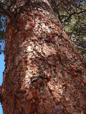
This initiative, located on the Apache-Sitgraeves, Kaibab, Coconino and Tonto National forests, focuses on the restoration of the southwestern ponderosa pine ecosystem and will treat up to 50,000 acres per year. The work will include prescribed fire and management of natural fires for restoration objectives. Mechanical thinning will also engage new industry to insure that nearly all of the cost of removal of the thinning byproducts is covered by the value of the products.

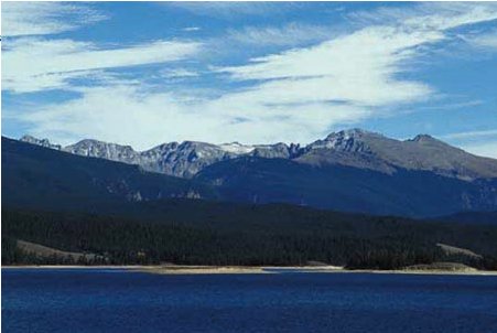
Colorado Front Range – $1 million Colorado

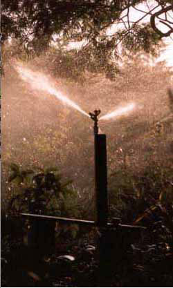
The Colorado Front Range Landscape Restoration Initiative, located in the Arapaho, Roosevelt, Pike and San Isabel National forests, seeks to increase resilience and lower wildfire risk in a ponderosa pine forest ecosystem. Prescribed burns will result in lower severity of future wildland fires, increased resistance to insects and disease, reduced threats to communities and watersheds, and improved habitat for fish and wildlife species. These more resilient forests will also have increased capacity to adapt to the impacts of a changing climate.

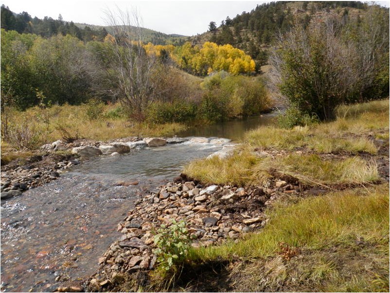
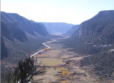
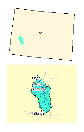
Uncompahgre Plateau – $446,000 Colorado

The Uncompahgre Plateau includes restoration of seven plant types on 160,000 treatment acres and includes key watersheds that feed the Colorado River. Three separate weed management plans use multiple techniques to control the spread of invasive noxious weeds, including chemical and biological control measures critical to restoration and preventive measures to control invasive species.

Selway-Middle Fork Clearwater – $1 million Idaho

The Selway-Middle Fork Clearwater Project is a joint effort between the Clearwater Basin Collaborative and the Nez Perce and Clearwater National Forests. The restoration project will protect communities from wildfire and restore land and water ecosystems. The basin is renowned for pristine waters, fisheries, big game species and scenic vistas. The project work includes: 2,600 acres of commercial harvest and prescribed burning, application of prescribed fire to approximately 10,000 acres, replacement of a culvert to restore fish passage, and the decommissioning of 75 miles of road.

Accelerating Longleaf Pine Restoration -$1.171 million Florida

This project in Northeast Florida is comprised of 234,995 acres in the Osceola National Forest. The proposal seeks to restore forest ecosystems that have been significantly altered by fire exclusion and hydrologic alteration. The work includes: increasing prescribed fire acreage, reducing hazardous fuel loads while harvesting the woody biomass, thinning small diameter trees, restoring historic groundcover, and decommissioning trails and roads.

Southwestern Crown of the Continent $1.029 million Montana

The Southwestern Crown covers 1,449,670 acres, 70 percent of which is public land. It is one of the most biologically diverse and intact landscapes in the western U.S. It supports 250 bird species, 63 species of mammals, five species of amphibians, and six species of reptile. Restoration will focus on stream and forest habitats using prescribed fire and natural ignitions as tools to restore species composition and structure. Removal of exotic species followed by planting of native species will be used to restore the landscape. Bridge and culvert replacements and upgrades, road restoration and upgrades, removal of fish barriers, and stream channel manipulation are also included.

Southwest Jemez Mountains – $392,000 New Mexico

The Southwest Jemez Mountains area is 210,000 acres, 93 percent of which is divided between the Santa Fe National Forest and the Valles Caldera Trust-Valles National Preserve. The project will improve the resilience of ecosystems to recover from wildfires and other natural disturbance and sustain healthy forests and watersheds. This will be accomplished by thinning and prescribed burning to restore more natural fire regimes. Additional project components include streambank stabilization, invasive plant control, road and trail decommissioning, riparian and wildlife habitat improvement, conservation education, and rehabilitation, closure, and improvement of roads.

Deschutes Skyline – $500,000 Oregon

This project is located on 97,000 acres in the Deschutes National Forest. The majority of the landscape is ponderosa pine and dry mixed conifer forest types. The goal of the project is to restore forest ecosystems to be resilient to natural processes. This will also help to achieve a variety of community goals such as job creation, reduced risk of high-severity fire in Wildland Urban Interface residential areas, protection of drinking water source watersheds, preservation of the scenic and environmental quality of extremely high use recreational areas, and wood fiber for local economic benefit.

The Dinkey Landscape Restoration Project $829,900 California

The Project includes 130,000 acres on the Sierra National Forest and 20,000 acres of private land. Targeted ecosystems include coniferous forest, foothill hardwood and chaparral vegetation, montane meadows and riparian forests. The project aims to create resilient ecosystems and enhance the ability to adapt to wildfire. It will promote fire resilience, public and firefighter safety, key habitat for sensitive species, proper watershed function, healthy ecosystem processes, and landscape diversity.

Tapash – $1.63 million Washington

The Tapash Sustainable Forest Collaborative aims to enhance the resilience and sustainability of forests by treating 168,617 acres over ten years. This project is a joint effort between the Okanogan-Wenatchee National Forest, the Yakama nation, the Washington State Department of Natural Resources and the Washington State Department of Fish and Wildlife. The restoration strategy uses a diverse array of treatment methods including pre-commercial and commercial thinning (including biomass removal), prescribed fire of natural and activity fuels, and trail management activities.

The mission of the USDA Forest Service is to sustain the health, diversity, and productivity of the Nation’s forests and grasslands to meet the needs of present and future generations. The Agency manages 193 million acres of public land, provides assistance to State and private landowners, and maintains the largest forestry research organization in the world.

Thanks to the Ag Journal for the heads up.

More restoration coverage here.

The Lower Arkansas Valley Water Conservancy District approves conservation easement rules

A picture named irrigation.jpg

From The Pueblo Chieftain (Chris Woodka):

The district has more than 60 conservation easements throughout the Arkansas River basin, and uses them to protect water resources. The state is adopting new policies after abuses of a tax-credit law led to improper valuations on some properties, many in Southeastern Colorado. In one Weld County lawsuit, landowners who claimed $160,000 in tax credits are facing repayment of $250,000, said Jay Winner, Lower Ark general manager. The new policies would make sure the easements are valued properly and executed according to standards that align with the new state policies. They also spell out legal actions to deal with violations of easement agreements…

“We’re doing this already, but have not adopted these specific measures,” said attorney Bart Mendenhall. “This gets our policies in line with state policies.”

More conservation easements coverage here and here.

Grand County ponies up $78,000 to pay for 3,000 acre-feet to be released from Granby Reservoir

A picture named granbyreservoirindianpeaks.jpg

From the Sky-Hi Daily News (Tonya Bina):

In accordance with federal guidelines, existing flows during these late-season months are maintained at a minimum of 40 cubic feet per second (cfs) in late August, and 20 cfs from early September to mid-October.

With the county’s purchased pumping of free water at times of the year when rivers are most stressed, flows on the Upper Colorado will increase to 65 cfs late August to mid-September, 50 cfs in the second half of September and 35 cfs in early October, aiding downstream users and overall river health.

Grand County Manager Lurline Underbrink Curran relayed to county commissioners at a county meeting on Aug. 17 that the surplus water the county pumps in agreement with the Northern Water Conservancy District shows that “Grand County taxpayers are willing to try and help the environment.”

This year’s arrangement will leave a balance of 240 acre-feet of Grand County water that can be carried over for release in 2011.

More Colorado River Basin coverage here.

Saguache County: The EPA and Trout Unlimited reach agreement for cleanup on Kerber Creek

A picture named kerbercreek.jpg

From The Pueblo Chieftain (Matt Hildner):

The agreement with the U.S. Environmental Protection Agency would cover the group in its efforts to reclaim scattered tailing piles and waste rock on private land in a 17-mile stretch of the creek. The creek and the Bonanza Mining District, which sits at its headwaters, have been the subject of reclamation efforts since 1993 that aim to reduce metals in the creek and restore aquatic life. Water in several stretches of the stream does not meet federal standards for cadmium, silver, lead, copper, zinc and pH.

Since 2008, Trout Unlimited, the federal Bureau of Land Management and the Natural Resource Conservation Service have spent $1.5 million cleaning up the stretch of creek, which includes both public and private lands. Elizabeth Russell, who manages Trout Unlimited’s efforts on Kerber Creek, said the mine tailings the group encountered on private lands were hazardous enough that it wanted protection from liability. That led to a year of negotiations that resulted in the draft, she said. If finalized, the agreement would cover Trout Unlimited’s past actions…

The agreement is designed to address the group’s work on pollutants that are regulated by the EPA under the Comprehensive Environmental Response, Compensation and Liability Act. It would not cover the cleanup efforts of acid mine drainage that are regulated under the Clean Water Act…

The draft agreement is subject to public comment through Sept. 20. Comments or requests for a copy of the agreement may be sent to William G. Ross, EPA Enforcement Specialist/SEE (8ENF-RC), Technical Enforcement Program, 1595 Wynkoop Street, Denver, CO 80202-1129, and should reference the Kerber Creek Site AOC in Saguache County, Colo.

More restoration coverage here.

Boulder: Public meeting tomorrow about floodplain rules

A picture named cherrycreekflood08031933castlewooddamfailure.jpg

From the Boulder Daily Camera (Heath Urie):

Because it’s considered the Front Range city most at-risk from flash floods, Boulder officials are floating a new proposal that would require certain new buildings to be better protected from floods. Utility planners are beginning work on the Critical Facility and Mobile Population Ordinance with a public meeting on Tuesday to solicit input on the proposal, which seeks to keep the city’s most important infrastructure dry during the types of floods that happen about once every 100 or 500 years. “We’ve learned form past flood events that certain facilities … need to remain operational during flooding,” said Christie Coleman, Boulder’s utility project manager. “When we don’t protect critical pieces of our infrastructure, we think it’s going to take the community longer to recover from a flood.”[…]

What: Open-house meeting on proposed Critical Facility and Mobile Population ordinance

When: 4 p.m. Tuesday

Where: Boulder Municipal Services Center, 5050 East Pearl St.

Arkansas Valley ag future

A picture named rockyfordditch.jpg

From The Pueblo Chieftain (Chris Woodka):

In the two years he’s been butting heads with the state Division of Water Resources, [Dan Henrichs, superintendent of the High Line Canal] has not been able to reconcile how irrigating with sprinklers could increase water use. There are so many variables — the market price of crops, the type of crop planted, how much water is running down the ditches, whether it just rained, how much water your neighbor is using, whether he’s just cut hay and is bypassing flows, whether it’s raining on the hay just cut, whether a hail storm has wiped out more valuable crops …

“This is not about a bunch of old farmers who want to sell their water and move to an island,” Henrichs said. He ticked off the names of a dozen young farmers who’ve bought farms in the 10 years he’s been superintendent on the High Line.

It’s getting harder to buy land because speculation has driven water prices up. Land under the High Line has sold for as much as $5,700 an acre, more than double what it was a decade ago.
Circumstances vary, but it’s usually farmers “born and bred into the life” who are purchasing the land with the intent to farm far into the future…

The High Line board has given Henrichs unusual latitude as superintendent to travel widely and represent it on water issues. Henrichs is a member of the citizens advisory group for the Fountain Creek Watershed Flood Control and Greenway District and on the Arkansas Basin Roundtable.
He was a forceful presence in the Vision Task Force that led to the Fountain Creek district. He constant registered complaints as part of the task force looking at consumptive use rules.
There’s a reason for all that. “Where are they going to come next?” Henrichs said, reviewing the Pueblo Board of Water Works foray into the Bessemer Ditch, Aurora’s purchases on the Rocky Ford Ditch and water grabs that sucked Crowley County dry. “They’re going to come to the High Line.”[…]

The events since the historic drought of 2002 bear that out. Rather than sell their water rights after the worst rain year in history, the High Line farmers worked out a lease agreement to sell water to Aurora in 2004-05. Colorado Springs joined in the second year of that deal. Most farmers on the High Line will tell you that the Aurora deal was nothing but a blessing. It allowed them to pay off debt or make needed improvements after a farming season that could have bankrupted them. Soon after, High Line and Aurora jointly filed in Division 2 Water Court to make exchange rights permanent so that if the need for another lease deal arose, they could avoid a time-consuming substitute water supply plan. The High Line-Aurora deal set the stage for the Arkansas Valley Super Ditch, a water lease-fallow land program that includes shareholders from seven ditches, including the High Line. High Line countered with its own leasing program and plans that could include a pipeline to the thirsty cities of the north. This year, a new wrinkle was added when the Woodmoor Water and Sanitation District contracted to buy several farms at the end of the High Line Canal. Moving the water would require a change in the ditch company bylaws, so for now the High Line board will not approve the transfer.

Many High Line farmers do not oppose the sale of water rights — they see it as their right as property owners to sell to whomever they want and bristle when outsiders tell them they cannot. Still, they are wary that taking water out of the ditch could reduce the flows that carry water to their own headgates, and will do what it takes to protect the ditch.

More coverage from Chris Woodka writing for The Pueblo Chieftain. From the article:

…Vernon John Proctor, is a board member of the High Line Canal and takes a longer view of the problems agriculture has faced. The current recession began in 2008, but farmers hardly noticed, other than when fuel prices increased, Proctor said. “We’ve been in a suppressed economy for years. Everything we buy is at retail, and everything we sell is at wholesale,” he said…

Proctor was among farmers who leased water to Aurora in 2004-05, and was a member of the board that negotiated the details. He said the lease prevented him from having to sell the water rights. “I’m not looking at selling, I plan to pass everything on to my sons if possible,” Proctor said. “When you can’t produce a crop, you need something to fall back on. As long as you can stay above water, it’s a good life. You are your own boss. “But if you get into trouble, the land and the water are your only assets.”

More Arkansas Basin coverage here.

Pacific Ocean: La Niña strengthening

A picture named elninolanina.jpg

From the Summit County Citizens Voice:

The cyclical swing in Pacific Ocean sea surface temperatures could bring above-normal temperatures to much of the rest of U.S. in the next six to 12 months, with exception of the Pacific Northwest and the Southeast. For the southern Rockies, including Summit County, the statistical links between La Niña and temperature and precipitation records are not very clear, so don’t let anyone (especially the ski resort marketing departments) tell you that La Niña means killer dumps. Some records suggest that a strong La Niña does slightly increase the odds for decent snow in our area, but there are many other factors in play, including the positioning of the jet stream, which drives weather systems across the country…

La Niña often features drier than normal conditions in the Southwest in late summer through the subsequent winter. Drier than normal conditions also typically occur in the Central Plains in the fall and in the Southeast in the winter. In contrast, the Pacific Northwest is more likely to be wetter than normal in the late fall and early winter with the presence of a well-established La Niña. On average, La Niña winters are warmer than normal in the Southeast and colder than normal in the Northwest. La Niña conditions typically last approximately 9-12 months. Some episodes may persist for as long as two years.

The Highlands Ranch Metropolitan District Board is looking at implementing a stormwater fee

A picture named stormwateroutlet.jpg

From the Highlands Ranch Herald:

Federal and state regulations for municipal stormwater systems have redefined the responsibilities associated with owning and maintaining facilities such as surface drainages, detention and water quality management ponds, and storms sewers and culverts. As the permit holder under the Clean Water Act, the metro district is responsible for public education and outreach, as well as participation.

Money from Centennial Water and Sanitation District, developers and the Urban Drainage and Flood Control District have for years helped fund the initial stormwater management projects in Highlands Ranch. However, the long-range plan for stormwater infrastructure, including capital and maintenance costs, requires approximately $30 million over the next 30 years. It is anticipated that UDFCD will continue to partner with the district, but will require matching funds for capital projects. “It is important that the metro district identify a reliable funding source to allow us to stabilize the channels in our natural open space lands and meet our requirements as the holder of the Clean Water Act permit,” a press release from the district says.

Metro district staff will conduct a public workshop at 6 p.m. Sept. 1 at the district office at South Broadway and Plaza Drive to explain the financial implications and the alternatives.

Those with questions should visit http://www.highlandsranch.org or contact director of public works Jeff Case at jcase@highlandsranch.org or at 303-791-0430.

More stormwater coverage here and here.

Southern Delivery System: Fourth round of negotiations between Reclamation and Colorado Springs Utilities Tuesday

A picture named sdspreferredalternative.jpg

From The Colorado Springs Gazette (Eileen Welsome):

The session is the fourth – and possibly final — in a series of talks over how much the utility should pay to store and convey water through Pueblo Reservoir. Although the utility has managed to whittle down the federal government’s demands, the two sides are still millions of dollars apart. Reclamation wants Utilities to pay about $41.56 per acre foot to store and convey water in Pueblo Reservoir, or about $76.6 million, over the life of a 38-year contract. The utility has countered with an offer to pay $25.31 per acre foot, or about $38.3 million. “We will continue to advocate for a fair and equitable rate for our customers,” John Fredell, SDS project director, said Friday…

Utilities officials want to reach an agreement with Reclamation on pricing before construction begins on the 62-mile pipeline, which will transport water from Pueblo Reservoir to Colorado Springs. The first phase of the project is expected to cost roughly $2.3 billion in construction and financing costs over the next four decades.

The federal government is a key player in the negotiations because Pueblo Dam is part of the federally owned Fryingpan-Arkansas Project, a complex series of dams, reservoirs, tunnels and conduits that deliver water from the Western Slope to the Front Range. The Arkansas River is the main delivery vehicle, and Pueblo Reservoir is the final reservoir in the system. The entities that get to store water in the reservoir, how much water they can store, and whose water spills first in the event the reservoir is full are spelled out in complex rules and regulations.

Colorado Springs, as one of the original beneficiaries of the Fry-Ark Project, has 56,000 acre feet of what’s called firm storage in the reservoir…What the utility is seeking through the current negotiations is the right to store an additional 28,000 acre feet under what’s called “excess capacity storage contracts,” if and when space is available.

More coverage from Chris Woodka writing for The Pueblo Chieftain. From the article:

A little more than a month ago, Colorado Springs Utilities asked the U.S. Bureau of Reclamation for quick action on its proposal for rates for contracts associated with SDS. But in that month, letters from Colorado Springs Councilman Tom Gallagher to Interior Secretary Ken Salazar have brought up concerns about how the proposed pipeline from Pueblo Dam to El Paso County was evaluated and the costs to Colorado Springs residents…

Tuesday’s session will be in Pueblo West, a community caught in the crossfire over SDS since it joined the project three years ago. Pueblo West hopes to tap into the proposed pipeline as it travels 50 miles from Pueblo Dam to serve Colorado Springs, Fountain and Security. The connection would expand the capacity of its water system from 12 million gallons per day — a figure already nearly reached on the hottest summer days — by 18 million gallons per day. The pipeline could carry 78 million gallons per day to El Paso County, and there have been discussions about letting other communities to the north use the pipeline when space is available. Colorado Springs has not made any deals, however, and would require any future users to secure their own contracts with Reclamation and comply with all Pueblo County 1041 regulations. Pueblo West needs the higher capacity to serve the number of homes that could be built one day…

As for the contract itself, Reclamation last offered to store and convey water for SDS at $41.56 per acre-foot annually, the rate Aurora pays less a 10 percent discount because all of the pipeline participants are members of the Southeastern Colorado Water Conservancy District, which serves the Fryingpan-Arkansas Project. Colorado Springs last offered to pay $25.31 per acre-foot annually, with an annual adjustment fee of 1.79 percent, about 1 percent lower than Reclamation’s proposal. SDS would use 42,000 acre-feet of excess-capacity storage in Lake Pueblo over a 40-year period: Colorado Springs, 20,000 acre-feet increasing to 28,000 acre-feet over the first 10 years; Pueblo West, 10,000 acre-feet; Fountain, 2,500 acre-feet; and Security, 1,500 acre-feet. Colorado Springs also is requesting an exchange of up to 10,000 acre-feet annually from Pueblo to Turquoise and Twin Lakes, where it could use water through the Homestake Project’s Otero pipeline and pumping station. Colorado Springs would trade space in the Fountain Valley pipeline to Fountain for space in the SDS pipeline.

More Southern Delivery System coverage here and here.

Hoover Dam retrospective

A picture named coloradoriverhooverdam.jpg

Here’s a look at Hoover Dam’s past, present and future, from Michael Hiltzik writing for The Arizona Republic. Click through and read the whole article. Here’s an excerpt:

The promise of abundant water and power took the brakes off the growth of Los Angeles, San Diego, Phoenix and many other Western cities; it encouraged farmers to complacently plant the most water-thirsty crops; and it gave us city dwellers the impression that we can water our lawns every day without worrying about waste and runoff.

Yet the world Hoover Dam made is now facing the era of limits. There isn’t enough water in the Colorado to serve all the demands we place on the river, and there never was. This was evident to some people, like the great Western explorer John Wesley Powell, who at an irrigation congress in 1893 announced, “Gentlemen, you are piling up a heritage of conflict and litigation over water rights, for there is not sufficient water to supply the land.”

Nor did the project assauge all the mutual suspicions that had raged for decades in the seven states of the Colorado basin. What [President Franklin Roosevelt] glossed over in his dedication speech was that only six of the seven basin states had signed the 1922 interstate treaty that enabled the dam to be built. Arizona, whose seven-term governor, George Hunt, was convinced the project was a plot by California to steal its water, had refused to ratify – and would not fall into line until 1944.

More Colorado River Basin coverage here.

Arkansas Valley Conduit: Reclamation scoping meetings recap

A picture named puebloreservoir.jpg

From The Pueblo Chieftain (Chris Woodka):

“I was struck by the widespread support for the project. I’ve never been in a situation where there wasn’t opposition to a project. . . . At a couple of the meetings, we actually got applause,” said Signe Snortland, environmental specialist for the U.S. Bureau of Reclamation. “People have waited a long time for this — since 1962.”

Reclamation officials and consultants spent last week hearing public comments as it develops the scope of an environmental impact study for the conduit and a 28,200 acre-foot excess-capacity storage contract for the Southeastern Colorado Water Conservancy District…

During all previous discussions of the conduit, it was assumed it would connect to the South Outlet Works, where Pueblo, Pueblo West and the Fountain Valley Conduit already draw water. However, one option could be taking water downstream from Pueblo Dam, Snortland said. Nothing has been decided, and there is still capacity at the dam for 30 cubic feet per second — enough to meet the peak capacity of about 20 million gallons per day. With moderate growth, the conduit is expected to pump an average of 14 million gallons per day by 2050. There also are choices to make on where a filter plant will be built and where the 40 communities involved in the project will connect. While the pipeline is largely gravity-fed, pumping stations would be needed at key points.

After last week’s meetings, Reclamation plans to consolidate and analyze the comments that were made, and develop a scope of what will be studied. Comments are being accepted through mid-September. Through its website and a newsletter, the agency will keep participants and interested parties informed about the progress of the EIS, which is expected to take more than two years to complete.

More Arkansas Valley Conduit coverage here and here.

2010 Colorado elections: Michael Bennet in Greeley

A picture named waterdrop.jpg

From The Greeley Tribune (Nate A. Miller):

“We have managed to acquire $13 trillion of debt on our balance sheet,” he said. “In my view we have nothing to show for it. We haven’t invested in our roads, our bridges, our waste-water systems, our sewer systems. We haven’t even maintained the assets that our parents and grandparents built for us.”

More 2010 Colorado elections coverage here.

Energy policy — hydroelectric: How will Aspen’s proposed hydroelectric plant on Castle Creek effect streamflow?

A picture named microhydroelectricplant.jpg

From The Aspen Times (Aaron Hedge):

Now, with a deal pending to build a new hydropower plant on the same property that would take 52 cubic feet per second (cfs) from both streams, environmentalists and property owners along the affected shoreline say there’s no way to be certain the streams will sustain fish populations and thus remain healthy. If the City Council approves the project, the city plans to divert 25 cfs from Castle Creek, and 27 cfs from Maroon Creek…

As part of the city’s Canary Initiative — an ambitious effort to become carbon-neutral by 2020 — the hydro project is expected in the next decade to save the city $41,000 a year in energy that it would no longer have to purchase from other power authorities. After that decade, when the $3.92 million in bonds for the project are paid off, the city would save twice that amount, said project director David Hornbacher…

Currently, Castle Creek stays at about 14 cfs in February and March, before starting to rise in the spring. The plant would shut down during winter to maintain the minimum flow, and other power resources, including the Ruedi Reservoir hydropower plant and electricity Aspen buys from a Nebraska power authority, would pick up the load. During other times of the year, Castle Creek typically runs between 50 and 70 cfs. But if the project is implemented, the diversions could extend Castle Creek’s low-water period by four months, calling into question how long the stream can sustain itself, and sustain all the creatures that depend on it, at that level…

The city has yet to apply for permission from the Federal Energy Regulatory Commission, which requires an environmental impact study, to construct the line. In a statement to the City Council this month, project staff recommended that the city not apply for a FERC license because, “Preparation of a an EIS would … delay the project, add to the cost of the project, and jeopardize the project economics.”

More coverage from The Aspen Times (Aaron Hedge). From the article:

City funding for a drainage line from Thomas Reservoir to Castle Creek could go away for the second phase of the construction next year if the Aspen City Council denies the proposed Castle Creek hydropower project, said Phil Overeynder, the city’s public works director. The approximate $2.3 million for the line comes partially from $5.5 million in bonds the city applied for after voters approved the construction of the hydropower plant in 2007. Approximately $126,700 of that money will come from utilities department coffers. The project’s total cost is nearly $6.2 million. The remaining funds will come from a grant of $400,000 and various other sources, Overeynder said. There is no guarantee that the project will stay within that budget, but about $800,000 has been added to it for unforeseen expenditures, according to the City Council application…

The city would have to buy less coal energy from a Nebraska power authority if the plant is approved, project manager David Hornbacher said last week. If the project is not approved, the line will simply empty into Castle Creek just below the Power Plant Road bridge. Efforts to finish the drain line have to wait on approval of the hydropower project because if it is approved, the end of the drain will undergo a completely different construction process, Overeynder said. Either way, the water returns to the stream, through the Penstock drain line if the project is struck down, or through a square concrete tube from the plant to Castle Creek if it is approved. None of the water taken from Maroon Creek will return to it. The hydropower plant is part of the city’s Canary Initiative, a goal to reduce carbon emissions from the city’s energy consumption to zero by 2020. It would draw 52 cubic feet per second from Castle and Maroon creeks. But the drain line will be completed either way, Overeynder said, because the Thomas Reservoir dam poses a threat to the Twin Ridge residential development just down the hill from it. A safety study of the dam, conducted in 1989, said the reservoir posed no public hazard. The Twin Ridge development was not yet built.

More hydroelectric coverage here and here.

Energy policy — nuclear: Cotter, Corp. intends to keep its license for the mill at the Lincoln Park/Cotter Mill superfund site and they may reopen

A picture named cottercontamination.jpg

From The Denver Post (Bruce Finley):

Accelerated efforts to close down contaminated facilities at the Superfund cleanup site are aimed at clearing a path for possible uranium processing in the future and do not indicate Cotter plans to leave the 2,600-acre site, vice president John Hamrick said. “We can decommission parts of the facility without moving towards license termination,” Hamrick said. “Our intention is to clear the path for new construction in the future.”[…]

EPA officials are reviewing Cotter’s letter arguing that the company can stop radon testing at the site as it decommissions it. Federal air-quality overseers “haven’t had that letter very long. They are evaluating the letter and determining what our response will be,” EPA spokeswoman Sonya Pennock said. “Our bottom line is, before this cleanup is complete, it’s going to have to meet all of the Superfund standards,” she said.

Fremont County Commissioner Mike Stiehl pointed out that Cotter’s current license to operate is a “standby” license that would have to be amended to allow any new processing of uranium. “If they were going to operate again, they would need to make it safer,” Stiehl said. “We would have plenty of concerns that they not repeat past practices. I still would prefer that they would do it in a different place. But we don’t have very much control over that.”[…]

Cotter’s dismantling will involve placing dirt on top of existing contaminated uranium tailings ponds. New construction of pads for chemically leaching concentrated uranium from ore could be constructed on top of the capped ponds, Hamrick said. Contaminated processing buildings and offices at the site will be dismantled, he said.

More nuclear coverage here and here.

The Lower Arkansas Valley Water Conservancy District is finalizing their compliance plan for the new ag rules in the valley

A picture named dripirrigation.jpg

From The Pueblo Chieftain (Chris Woodka):

The board heard the first draft of the plan at its monthly meeting, but won’t decide whether to adopt it or how to set fees until its Sept. 15 meeting. The rules are being sought by State Engineer Dick Wolfe to ensure that improvements like canal lining, sprinklers and drip irrigation do not increase consumptive use. They are primarily aimed at avoiding future claims by Kansas that Colorado is violating the Arkansas River Compact…

The Lower Ark is developing a compliance plan that would provide water to make up deficiencies when they occur and would allow payment to farmers when they save water by changing structures…

[Heath Kuntz of Leonard Rice Engineering] made suggestions for fee schedules that would require $500 per farm unit to sign up and $25 per acre-foot for replacement water, based on estimates that it would cost $131,000 to sign up 100 farms and replace water in the first year. That also includes a $75,000 grant from the Colorado Water Conservation Board to get the program off the ground. The fee would be adjusted in subsequent years, because the Lower Ark board wants the program to be revenue-neutral. Enrollment would begin in November, assuming the rules are adopted, and be finalized in January. There would be additional fees for late signups or for re-entering the program after dropping out.

More Arkansas Valley consumptive use rules coverage here.

Summit County: USFS — ‘Respect the River’ program update

A picture named fens.jpg

From the Glenwood Springs Post Independent (Julie Sutor):

Through a program called Respect the River, the Dillon Ranger District of the White River National Forest is restoring disturbed riparian zones (areas flanking rivers and streams) and teaching campers, hikers and riders to protect these invaluable lifelines…

When people camp, park or drive alongside streams, the soil becomes compacted and vegetation is disturbed, turning once-rich ground into hard, dry dirt. And plant root systems that once held stream banks in place wither, leaving streamsides ripe for erosion. Without vegetative cover, a thunderstorm can rip right through an area, sending thousands of pounds of sediment into the river over the course of a summer. “The biggest problem is increased sediment in the water and increased turbidity. If there’s too much dirt in the creek, it can cause damage to gills, fish can’t forage as well, and they leave the area. That’s a stress on them,” Lewellen said. Furthermore, when sediment covers clean, gravely stream bottoms, it interferes with fish reproduction. Local fish, including the threatened greenback cutthroat trout and the sensitive Colorado River cutthroat trout, deposit their eggs in gravel. But fish won’t do so if the gravel is coated in sediment. When sediment covers eggs that have already been deposited, they lose their oxygen supply and die…

The Forest Service is beginning a two-pronged plan to combat recreation’s impact on riparian habitat.

First, crews are conducting restoration work in the areas that have seen the worst damage. They bring in dozers to rake compacted soil, loosening and aerating it, and then scatter native grass seed for revegetation. Some riverside campsites and roads are fenced off. In other places, crews construct water bars to reroute runoff away from disturbed soil, thereby preventing sediment from ending up in the stream. And White River National Forest officials are taking a fresh look at dispersed camping to consider what changes may be in order for existing regulations.

Second, Lewellen and others in the Dillon Ranger District are launching a public education campaign to make outdoor enthusiasts aware of potential impacts to rivers and streams. Signs are going up in popular spots, urging people to camp, drive and park no closer than 100 feet from the edges of streams and rivers.

More restoration coverage here.

Aspinall Unit Operations meeting September 2

A picture named aspinallunitdescription.jpg

From email from Reclamation (Dan Crabtree):

The next Aspinall Operations meeting will be held Thursday, September 2nd at the Blue Mesa Reservoir Elk Creek Visitors Center starting at 1:00 p.m. We will be discussing past and future operations, hydrologic forecasting and other activities related to the Gunnison River. Elizabeth Brown, invasive species coordinator for the Colorado Division of Wildlife will be giving a presentation on mussel monitoring, inspections, and control. We hope to see you there. If you have any questions or suggestions for the meeting please reply to this email or call Dan Crabtree at 970-248-0652.

Current releases from the Unit are about 1,600 cfs. Flow in the Black Canyon and Gunnison Gorge is 600 cfs and is anticipated to stay in that range through September.

More Aspinall Unit coverage here and here.

Nonstationarity, Hydrologic Frequency Analysis, and Water Management Workshop Proceedings Available

A picture named watercyclewikipedia.jpg

From email from Reclamation (Peter Soeth):

The Proceedings for the “Workshop on Nonstationarity, Hydrologic Frequency Analysis, and Water Management” are now available online at
http://www.cwi.colostate.edu/NonstationarityWorkshop/proceedings.shtml

The workshop, held Jan. 13-15 in Boulder, Colo., brought together researchers and practitioners from the United States and international institutions. The workshop was sponsored by the International Center for Integrated Water Resources Management, Colorado State University and five federal water agencies involved in the Climate Change and Water Working Group – U.S. Army Corps of Engineers, U.S. Geological Survey, Bureau of Reclamation, National Oceanic and Atmospheric Administration, Environmental Protection Agency.

An underlying assumption of traditional hydrologic frequency analysis is that climate, and hence the frequency of hydrologic events, is stationary, or unchanging over time. Anthropogenic climate change and better understanding of decadal and multi-decadal climate variability present a challenge to the validity of this assumption. The workshop discussed possible alternatives to the assumption of stationarity in hydrologic frequency analysis and water management.

The workshop objectives were (1) to discuss in detail how water management agencies should plan and manage water resources in the face of nonstationarity, and (2) to form a coordinated action plan to help the agencies move forward. The workshop was organized into several main themes:

• Introduction to the problem nonstationarity poses for water management
• Understanding nonstationarity through data analysis and statistical methods
• Forecasting future hydrologic frequency through the use of climate model information
• Decision making with a highly uncertain future
• International perspectives on nonstationarity
• Summary and conclusions

The workshop program included presentations by five Nobel Peace Prize laureates who were lead authors for Intergovernmental Panel on Climate Change reports. International participants came from Canada, the United Kingdom, Japan, Poland, Greece, and Italy. Other information about the workshop including presentations is available on the workshop website at http://www.cwi.colostate.edu/NonstationarityWorkshop.

More climate change coverage here and here.

Water Research Foundation: Water rate hikes help drive conservation

A picture named squeezingmoney.jpg

From The Pueblo Chieftain (Chris Woodka):

At a recent meeting, the Arkansas Basin Roundtable debated how to reduce lawn irrigation demands in urban areas as a way to conserve water.

The [Water] Research Foundation, an international non-profit organization with offices in Denver, surveyed 6,000 residential customers, interviewed water agencies, analyzed billing and reviewed utility literature to measure the effectiveness of conservation communications campaigns in changing customer behavior. The study, Customer Behavior and Effective Communication, released this month also found that many customers feel they are already conserving as much water as they can. Saving money was closely followed by the idea that it’s the right thing to do and water availability as reasons to conserve.

More conservation coverage here.

Energy policy — nuclear: Is Cotter, Corp. going to shutter the mill at the Lincoln Park/Cotter Mill superfund site?

A picture named cottercontamination.jpg

From The Pueblo Chieftain (Tracy Harmon):

“They are working toward closing the impoundments and have been dewatering (drying out) the impoundments for years,” said Jeannine Natterman, public information officer for the Colorado Department of Health. “They have not officially notified us they are closing the (entire) facility.”[…]

The mill and the neighboring Lincoln Park neighborhood have been part of a U.S. Environmental Protection Agency Superfund clean up site since 1984…

“They have planned to close the impoundments all along and they have been taking old structures down. What the letter means is that they are close to permanently capping the impoundments,” Natterman explained. “Even once capped, the primary impoundment can be used for new, more contemporary operations because it would not have the same material going in. If it is appropriately capped and appropriate materials are used for the cap, the primary impoundment could be used again,” Natterman said.

From The Pueblo Chieftain (Tracy Harmon):

In late 2005, Cotter ceased normal operations and stabilized the facility to go into a “stand down” condition. Cotter Corp. executives said the company sought to evaluate operational changes to the mill and assess the feasibility and costs for restart of a re-engineered mill.
Mill operations have released radioactive materials and metals into the environment. These releases contaminated soil and groundwater around the mill and the Lincoln Park area, according to the Colorado Department of Public Health.

The Cotter/Lincoln Park Site was added to the U.S. Environmental Protection Agency’s National Priorities List in 1984, making it a Superfund site. Cleanup activities to date have focused on eliminating the mill site as a source of contamination to Lincoln Park, and eliminating exposures to Lincoln Park residents.

Cleanup activities since 1988 have caused the contaminated groundwater plume in Lincoln Park to shrink in size. However, in 2008, Cotter Corp. received a notice of violation from the state health department indicating a contaminated plume of groundwater exists underneath the uranium mill’s neighbor — the Shadow Hills Golf Course, because new groundwater analytical results provide a better definition of the plume of radioactive material north and west of the mill.

More nuclear coverage here and here.

Avon: 16th Annual Eagle River Cleanup is September 18

A picture named eagleriver.jpg

From the Vail Daily:

This countywide event is organized by the Eagle River Watershed Council. Teams will head out to their pre-assigned stretch of river from 9 a.m. to noon to pick up litter along the banks of the Eagle River. New this year, Gore Creek and possibly Beaver Creek will be added, depending on participation levels. Including the tributaries, this brings the distance cleaned to nearly 70 miles of river. Following the cleanup, volunteers and their families are invited to the Wolcott Yacht Club from noon to 2 p.m. for a barbecue hosted by Beaver Creek Mountain Dining with music, entertainment and awards for the entire family.

Once again, Sue Mott will be the volunteer coordinator. Assemble your team and call her at 970-926-3956 or send an email to the Eagle River Watershed Council at volunteer@erwc.org for your river segment assignment. Volunteers meet on the river at assigned locations on the day of the event, so you must pre-register in order to know where you’re needed most.

More coverage from the Eagle Valley Enterprise. From the article:

Teams will head out to their pre-assigned stretch of river from 9 a.m. to noon to pick up litter along the banks of the river. For the first time this year, the clean up has officially added stretches of Gore Creek and possibly Beaver Creek, depending on participation levels. Including the tributaries, this brings the distance cleaned to nearly 70 miles of river.

Following the cleanup, volunteers and their families are invited to the Wolcott Yacht Club from noon to 2 p.m. for a lively BBQ hosted by Beaver Creek Mountain Dining with music, entertainment and awards for the entire family.

More Eagle River watershed coverage here and here.

Gunnison River Basin: Union Park Reservoir

A picture named unionpark.jpg

Every so often Dave Miller surfaces with his hopes to build Union Park Reservoir high up in the Taylor River watershed in Gunnison County. The plan is to move water out of the Gunnison River Basin to satisfy some of the projected need east of the Great Divide.

Mr. Miller has penned a letter to the editor that is running in the Ag Journal. From the article:

Since these late 1980s studies, an innovative Blue Mesa-Aspinall high altitude storage alternative was conceived and evaluated between 2004 and 2007. It is called the Central Colorado Project. CCP is designed to pump and store several years of the Bureau’s unused Aspinall Pool rights in the Gunnison National Forest’s off-river Union Park Reservoir site, near the Continental Divide. Advanced modeling can quickly confirm CCP’s unprecedented capabilities throughout multiple river basins. CCP’s 1.2 million acre-feet of storage at 10,200 feet altitude can integrate and selectively multiply the productivity of limited water and energy resources, throughout five southwestern river basins – Gunnison, Colorado, [South] Platte, Arkansas and Rio Grande – and the western power grid.

More Union Park Reservoir coverage here.

Energy policy — hydroelectric: Project 7 Water Authority reduces energy bill by 86% after hydroelectric generator installation

A picture named microhydroelectricplant.jpg

From the Montrose Daily Press (Kati O’Hare):

About a year ago, Project 7 installed a hydroelectric system at its Montrose County water treatment facility. A year later, the savings and energy credits are adding up. Two hydroelectric generators started moving the plant’s electric meter backwards in September 2009, and the system was running 24/7 in December. “I am just more than pleased,” said Dick Margetts, Project 7 manager.

More hydroelectric coverage here and here.

Green Mountain Reservoir update

A picture named greenmountainreservoir.jpg

From email from Reclamation (Kara Lamb):

If you’ve been watching the gage, you most likely noticed that yesterday we bumped releases from Green Mountain to the Lower Blue up by 150 cfs, bringing it to 550 cfs. This morning, Thursday, we bumped releases up again by another 150 cfs. Currently, we are releasing 700 cfs to the Lower Blue. This release is anticipated to remain through the weekend and into next week.

More Colorado-Big Thompson Project coverage here.

Energy policy — nuclear: Is Cotter, Corp. going to shutter the mill at the Lincoln Park/Cotter Mill superfund site?

A picture named cottercontamination.jpg

From the Cañon City Daily Record (Karen Lungu):

John Hamrick, vice president of Cotter mill operations, sent a letter to the director of Air and Toxics Technical Enforcement Program Office of Enforcement Compliance and Environmental Justice, dated July 23, stating, “On June, 30, 2010, Cotter Corporations (N.S.L.) submitted a letter to Mr. Steve Tarlton of the Hazardous Materials and Waste Management Division of Colorado Department of Public Health and Environment notifying him of a change in status of the Primary Impoundment at the Cañon City Milling Facility near Cañon City.” The letter stated that Cotter will “close both the primary and secondary impoundments as soon as reasonably achievable.” Hamrick goes on to say the Cañon City milling facility began dismantling structures and facilities no longer considered useful to the CCMF. The company no longer will carry out radon flux testing, Hamrick said, at the primary impoundment, because the primary impoundment no longer is an active facility that is subject to 40 CFR Part 61, Subpart W requirements.

Previously stating the mill would reopen, Cotter took local lawmakers by surprise when they told regulators it would discontinue testing for radon emissions at the site because it is no longer an active facility subject to regulation. The mill south of Cañon was designated a Superfund site in 1984, making Cotter responsible for continued monitoring of radon emissions at the milling facility, as well as neighboring Lincoln Park.

More Lincoln Park/Cotter Mill coverage here and here.

Southern Delivery System: Colorado Springs City Councillor Tom Gallagher wants Reclamation to redo the project EIS

A picture named sdspreferredalternative.jpg

From The Colorado Springs Gazette (Eileen Welsome):

In a 27-page letter sent last month to Interior Secretary Ken Salazar, Councilman Tom Gallagher, a longtime critic of the SDS project, asked that negotiations be suspended and the environmental review process be re-opened to address numerous questions. “It’s time to put the brakes on this and look at alternatives that don’t use Pueblo Reservoir,” he said Thursday…

In his July 7 letter, Gallagher argued that major events have occurred since the environmental review process was completed in 2009, including the abolishment of the stormwater enterprise by Colorado Springs voters and the imminent construction of another pipeline, the Arkansas Valley Conduit, which will be built to serve communities east of the Pueblo Reservoir in the Arkansas Valley.

CSU spokesperson Janet Rummel pointed to letters from the Environmental Protection Agency, the Army Corps of Engineers and U.S. Bureau of Reclamation stating that CSU will still be able to meet its commitment to protect water quality in Fountain Creek, despite the loss of the stormwater enterprise. The construction of the Arkansas Valley Conduit will not affect the storage space that SDS will need in Pueblo Reservoir, she added.

Michael Connor, head of the Bureau of Reclamation, rejected Gallagher’s request on Aug. 3, saying that the environmental review process was complete and that issues raised by Gallagher had been adequately addressed. He added, however, that Reclamation, an agency within the Interior Department, was continuing to monitor this “local and regionally significant” project.

Gallagher’s letter has drawn fire from Mayor Lionel Rivera, who penned his own letter to Salazar, telling him the dissident council member “does not represent the official position of the Colorado Springs City Council on the SDS project.”

More Southern Delivery System coverage here and here.

Arkansas Valley Conduit: New report says that the project may end up serving 80,000 customers and cost $400 million

A picture named pipeline.jpg

From The Pueblo Chieftain (Chris Woodka):

Updated figures were presented Thursday to the Southeastern Colorado Water Conservancy District, sponsors of the conduit. The district received the final report produced in preparation for the National Environmental Policy Act review now being conducted by the U.S. Bureau of Reclamation…

The 500-page report also revises cost estimates of four alternatives for the 135-mile conduit. Construction costs range from $330 million to $396 million — up from $300 million in 2006 — depending on the alignment of the conduit, said Kevin Meador of Black and Veatch Engineering…

In addition to the population increase, the amount of water needed for the conduit on average each year would increase to 14,000 acre-feet — or 12.3 million gallons per day from current levels of about 10,000 acre-feet, the report revealed. While there could be 42 communities in the project, the nine largest participants would use 80 percent of the water, Meador said.

More Arkansas Valley Conduit coverage here and here.

Lower Arkansas Valley Water Conservancy District board meeting recap

A picture named lowerarkansasriver.jpg

From The Pueblo Chieftain (Chris Woodka):

“In 2002, everyone changed their thought patterns, and more people are holding onto their water,” Jim Broderick, executive director of the Southeastern Colorado Water Conservancy District told the Lower Arkansas Valley Water Conservancy District board Wednesday. “This means you will see a full Pueblo Reservoir more of the time.” Broderick explained the timing of a request for a master storage contract by the Southeastern district coincides with an application to build the Arkansas Valley Conduit in an effort to save money on both projects. Because they both use parts of the Fryingpan-Arkansas Project, authorized by Congress in 1962, both require environmental impact statements…

By combining the two studies, the costs of the master contract EIS could be reduced to $500,000 from an estimated $2 million in 2001, Broderick said. The master contract would allow long-term storage at a locked-in rate, which particularly helps cities within the Southeastern district plan for the future, Broderick said…

Colorado Springs dropped out of the master contract process, but the remaining SDS partners have continued. Pueblo West, not in the original group, is in the current master contract. The Lower Ark district, which was formed by a 2002 vote, is among newcomers to the master contract as well, and indicated a need for 15,000 acre-feet of storage…

The Southeastern district also is requesting space not in the original plan, 5,000 acre-feet, primarily for future use in the conduit. Conduit participants La Junta and Crowley County both want space through the master contract, but Lamar dropped its request. Salida, Florence, Canon City and the Upper Arkansas Water Conservancy District remain in the contact and were among the original users. Other new users include Poncha Springs, Penrose, Widefield and Stratmoor Hills, which joined at various times in the past decade. In all, the contract totals 28,200 acre-feet of storage.

More Arkansas Basin coverage here.

Colorado River Basin: Alexandra Cousteau and Expedition Blue Planet explore the headwaters of the Colorado River

A picture named coloradorivergranby.jpg

Click here to view a short film from Expedition Blue Planet via the Mother Nature Network that talks about the challenges that the Colorado River is facing from over-appropriation.

Coyote Gulch reader Kara Lamb makes an appearance explaining the Colorado-Big Thompson project.

Energy policy — nuclear: Is Cotter, Corp. going to shutter the mill at the Lincoln Park/Cotter Mill superfund site?

A picture named cottercontamination.jpg

Cotter, Corp. has decided to permanently close the mill at the Lincoln Park/Cotter Mill superfund site. Here’s a report from Bruce Finley writing for The Denver Post. From the article:

Cotter Corp. has informed regulators it will close two toxic-waste impoundment ponds at the mill “as soon as reasonably achievable,” according to a letter Cotter sent to the U.S. Environmental Protection Agency. Cotter, which had previously said the mill would be reopened, now has told state regulators it will stop testing for radon emissions at the site because it is “no longer an active facility” subject to regulation.

The apparent reversal, and Cotter’s decision to stop testing for radon emissions, caught local leaders by surprise. The site has been designated a polluted Superfund site and Cotter has been responsible for monitoring to make sure cancer- causing radon was not escaping the facility.

Fremont County Commissioner Mike Stiehl questioned whether Cotter can stop tests. “That
doesn’t sound right to me.”

More coverage from Tracy Harmon writing for The Pueblo Chieftain. From the article:

“They are working toward closing the impoundments and have been dewatering (drying out) the impoundments for years,” said Jeannine Natterman, public information officer for the Colorado Department of Health. “They have not officially notified us they are closing the (entire) facility.”[…]

Manager John Hamrick said the company will close both the primary and secondary waste impoundments, “as soon as reasonably achievable.” The letter goes on to indicate that radon testing will not be carried out on the primary impoundment this year and in subsequent years because it is no longer an active impoundment. “They have planned to close the impoundments all along and they have been taking old structures down. What the letter means is that they are close to permanently capping the impoundments,” Natterman explained. “Even once capped, the primary impoundment can be used for new, more contemporary operations because it would not have the same material going in. If it is appropriately capped and appropriate materials are used for the cap, the primary impoundment could be used again,” Natterman said.

More nuclear coverage here and here.

Energy policy — hydroelectric: Uncompaghre River hydroelectric plant update

A picture named microhydroelectricplant.jpg

From The Durango Telegraph (Allen Best):

The electrical production will be relatively small, 22 kilowatts, but enough to power the pumps used to circulate water at the nearby Ouray Hot Springs Pool. It is, in the eyes of Bob Risch, the mayor of Ouray, a start of what he hopes to see more broadly – not just in Ouray, but across the San Juans and beyond. “A bunch of small facilities like this can add up to a significant contribution,” says Risch, an astronomy teacher now retired in Ouray, where he was born and raised…

With access to seed money through the federal stimulus program, many small governments and some individuals have been taking a new look at small hydro across the Colorado Rockies and more broadly across the West. A forum held in Ouray during June drew 100 people, and a similar session held in Durango recently attracted 50 participants.

The potential is great. In a broad-brushed survey conducted several years ago, the Idaho National Laboratory concluded that 1,800 megawatts of electricity could be produced within Colorado without invading wilderness, roadless or other sensitive areas. This compares with the 1,500 megawatts output from the proposed Desert Rock coal-fired plant in New Mexico. More selectively, Colorado energy officials did a quick study of 100 sites, with potential for 100 megawatts – without building new dams, they hasten to add.

Congress has also started paying attention. A subcommittee of the House Natural Resources Committee held a hearing in July to find out what the federal government could do to expedite development of what Grace F. Napolitano, chairwoman of the subcommittee, characterized as low-hanging fruit. “Small hydropower is not the sole answer to generating enough renewable energy to meet our future needs, but it should be an important part of the solution,” she said in an opening statement…

A small hydro installation in Cortez had been identified as feasible even 20 years ago. But federal money administered through the Governor’s Energy Office recently tipped the scale. The project harnesses the power of water flowing year round in a canal from McPhee Reservoir to the town’s water-treatment plant. The unit produces 240 kilowatts of electricity, more than enough to operate the water-treatment plant and enough to feed back into the electrical grid. The extra power is sold to Empire Electric…

Silverton, too, may get a small hydro plant. There, the San Juan County Historical Society has received $140,000 in grant funding and hopes for another $50,000 to build a generating plant at its Mayflower Mill, located two miles east of Silverton. Even with the low flows of fall and winter, production would more than pay group’s $500 to $600 monthly electrical bills for the historical society’s museum in Silverton. “This is huge for our little old historical society,” says Beverly Rich, the president. “We don’t get any other subsidies or tax moneys.”

More hydroelectric coverage here and here.

NIDIS Weekly Climate, Water and Drought Assessment Summary of the Upper Colorado River Basin

A picture named usdroughtmonitor01122010

Here are Henry Reges’ notes from yesterday’s webinar.

More Colorado River Basin coverage here.

Uncompahgre Plateau: West Creek monitoring project update

A picture named unaweepcanyon.jpg

From The Grand Junction Daily Sentinel (Dave Buchanan):

What you might see, once or twice a year, are members of the Grand Valley Anglers Chapter of Trout Unlimited continuing a creek-monitoring project begun 13 years ago. While there’s no doubt this long-lived project is volunteer citizen science at its best, please don’t think that “citizen” means unscientific. If anything, the project might be one of the most scientific undertakings a volunteer group can take on.

The West Creek project started and continues thanks to the innate scientific curiosity of geologists John Trammell and the late Dan Powell, whose love of knowledge and all things in nature might have made him the complete naturalist. From the start, the project coordinators kept exacting records of things such as water flows and temperatures, presence of contaminants and even the level of brush along the creek, since that has a large impact on the creek habitat in general. The monitoring has been adopted by the Grand Valley Anglers as a twice-yearly event, with the latest round two weeks ago led by Bill and Mary Graham of Grand Junction…

Those early years of monitoring revealed what Trammell and Powell suspected: that the drought and cattle grazing were the creek’s greatest threats. While ranchers were content to see the cattle chew down the creekside brush, that clearing, plus the muddy, beaten-down banks, left the creek hot and murky, something not conducive to viable trout populations. Trammell said that once the drought forced ranchers to cut back cattle grazing (the BLM still allows one grazing permit for the area), the stream’s trout habitat improved quickly. “The brush (willows, alders and a variety of forbs) rebounded dramatically,” Trammell wrote. “In recent years, we’ve seen cattle return, but I’ve not yet tried to quantify their effect.”

Other questions the monitoring examines include the possibility of pollution from increased development upstream as well as impacts on streamflow from increased domestic use of groundwater that feeds the creek.

More restoration coverage here.

Arkansas Valley Conduit: Reclamation scoping meeting recap

A picture named fountainpavementdrawing.jpg

From The Pueblo Chieftain (Chris Woodka):

“Water quality is the main concern in the Lower Arkansas Valley, this represents a supplemental supply that will help us stay in compliance,” said Otero County Commissioner Kevin Karney. Karney also is a member of the Southeastern Colorado Water Conservancy District board, sponsors of both the conduit and a master contract for water storage that are being evaluated by the Bureau of Reclamation during a series of meetings this week.

Of the 40 communities that could participate in the conduit, 12 have elevated levels of radionuclides and must begin to take action in thenext few years to reach compliance. Without the conduit, they will be looking at even more expensive solutions to purify water…

La Junta and Las Animas already are using reverse osmosis systems and discharging brine into the Arkansas River. In the future, those communities could face more costly disposal of the brine, Karney noted. “The conduit also is needed for economic development in the lower valley,” he said…

The environmental impact study, which will determine the best route for the conduit as well as locations of filter plants or pumping stations, is expected to be complete in two years, said Reclamation Environmental Specialist Signe Snortland…

Snortland said population projections will be a part of the impact study.
One environmental impact statement and record of decision will be issued for the conduit and the master contract.

More Arkansas Valley Conduit coverage here and here.

Southern Delivery System: Pueblo County commissioners make offer to settle Pueblo West lawsuit over facilities

A picture named sdspreferredalternative.jpg

From The Pueblo Chieftain (Chris Woodka):

The settlement agreement was worked out last month by attorneys for Pueblo County, Pueblo West and other water agencies as a way to settle a lawsuit brought by Pueblo West in District Court in April 2009.
In the lawsuit, Pueblo West claimed it would lose water over time if forced to comply with conditions in the county’s 1041 permit that would allow the Southern Delivery System to be built.

In the settlement agreement, the county, Colorado Springs Utilities and the Pueblo Board of Water Works would allow Pueblo West to maximize return flows down Wild Horse Creek through a pipeline return. In return, Pueblo West would shelve its plan for a pumpback into Lake Pueblo through a wash behind the golf course…

Commissioners acted on the resolution Monday to preserve both the Pueblo flow management program created under 2004 intergovernmental agreements and Pueblo West’s participation in the SDS, according to the resolution.

Pueblo West is expected to take up the agreement on Aug. 24, said Director Jerry Martin. “Conceptually, we’re on board with it, but we haven’t heard it at a public meeting,” Martin said. “The lawyers have been preparing it, since there are more parties involved than just Pueblo County and Pueblo West.”

Meanwhile not all property owners along the SDS right-of-way have signed agreements with Colorado Springs Utilities. Here’s a report from Chris Woodka writing for The Pueblo Chieftain. From the article:

The Maxwells were offered $2,100 by Colorado Springs Utilities for the easement on the back of the property, a sum they consider too small when thinking about the noise and dust construction will bring. The cleanup, upkeep and taxes on the property will still be their responsibility. “They don’t want to work with us,” Helen Maxwell said. “They think $2,100 is enough for us to suffer the inconvenience.”[…]

“My concern is that there is such a vacancy of property in Pueblo West that we’re going to lose value,” said Pam Williams, who doesn’t intend to sell the easement at the price she was offered and is now being told Colorado Springs City Council could begin condemnation procedures in September. The homeowners were sent letters saying they have until Wednesday to settle or risk legal action. They feel like they’ve been picked off, since Utilities rejected the Maxwell’s suggestion for a joint meeting.

[Darlene Garcia, land acquisition manager for Colorado Springs Utilities] said condemnation through eminent domain is a last resort, but will be used if settlements can’t be reached. “We have to make our construction schedule and that requires a clear right of way for the pipeline proposal,” Garcia said.

Colorado Water Wise 2nd Annual Conservation Workshop September 24

A picture named watersprinkler.jpg

Here’s the webpage for registration.

From email from the Colorado Water Conservation Board (Ben Wade):

The Colorado WaterWise (CWW) is hosting its 2nd Annual Water Conservation Workshop on September 24, 2010 in Denver. The CWW partnered with the CWCB, through a CWCB Water Efficiency Grant, to put on this workshop, titled “From the Mountain Top to the Tap: Using Tools and Policy to Make Every Drop Count”. Please save the date and sign up.

More conservation coverage here.

Arkansas Valley Conduit: Recap of Reclamation open house in Salida

A picture named pipeline.jpg

From The Pueblo Chieftain (Chris Woodka):

The U.S. Bureau of Reclamation kicked off a week of meetings dealing with the Arkansas Valley Conduit and a master storage contract sought by the Southeastern Colorado Water Conservancy District. “Most of the impacts are below Pueblo Reservoir, but storage in Pueblo benefits us because we can release water for downstream calls,” said Terry Scanga, general manager of the Upper Arkansas Water Conservancy District. “Where the excess-capacity contract will help is if we have to spill Twin Lakes water and store it in Pueblo.”[…]

[Salida City Councilman Jay Moore] said Salida’s interest in an excess-capacity contract is to strengthen an already diverse water portfolio. “The main thing is that we can have an absolute surplus by storing water in Lake Pueblo and releasing it when needed,” Moore said.

Greg Smith, public works director for Poncha Springs, agreed.
“It’s a way for us to acquire and maintain additional storage,” Smith said…

At Monday’s open house, Signe Snortland, environmental specialist for Reclamation, clarified that only one Environmental Impact Statement and record of decision will be issued for the conduit and the master contract.

More Arkansas Valley Conduit coverage here and here.

Uncompahgre Watershed Partnership meeting August 25

A picture named uncompahgrewatershed.jpg

From the Montrose Daily Press (Katie O’Hare):

The Uncompahgre Watershed Partnership (UWP) will begin to take shape at a meeting next week open to agricultural, mining, recreational, community and any other entities with an interest in the river. That meeting will be from 5 to 7 p.m. Aug. 25 at DMEA headquarters in Montrose.

Those who attend can review a new water-quality report on the entire river, funded by the Colorado Nonpoint Source Pollution Program of the state Department of Public Health and Environment. “From my knowledge, this is the first report that has looked at the whole of the river, from metals to e-coli,” said Sarah Sauter, project coordinator for the UWP. She wants to review the report with the stakeholders to ensure its accuracy before releasing it to the public. The new group will monitor not only water quality, but also “the thoughts and priorities of the agricultural and mining communities and the bigger water players,” Sauter said.

More Uncompahgre watershed coverage here.

Southern Delivery System: Fourth public contract negotiation session August 24

A picture named puebloreservoir.jpg

Here’s the release from Reclamation (Kara Lamb):

The Bureau of Reclamation invites the public to attend the fourth contract negotiation session for excess capacity contracts related to the proposed Southern Delivery System Project on Tuesday, August 24 and possibly continuing on Wednesday, August 25.

Reclamation is negotiating with the participants of the Southern Delivery System, including Colorado Springs and Fountain, the Security Water District, and the Pueblo West Metropolitan District.

The negotiation sessions will be held at the Pueblo Shrine Club, 1501 West McCulloch Blvd., Pueblo West, Colo., 81007.

Each session will begin at 9 a.m. There will be a designated time during each session for public comments. Reclamation is also accepting written comments on the draft contract.

For more information, to obtain a copy of the draft contract, or to submit written comments, please contact Kara Lamb (970) 962-4326 or klamb@usbr.gov.

More Southern Delivery System coverage here and here.

U.S. Bureau of Reclamation ‘WateSMART’ program updates

A picture named bluegreenalgaebloom.jpg

Here’s the release from Reclamation (Peter Soeth):

Reclamation Selects Research Grants to Develop Climate Analysis Tools through WaterSMART Program

Bureau of Reclamation Commissioner Michael Connor announced the selection of $773,483 in research grant proposals to develop climate analysis tools. This money will be leveraged to fund $1,624,396 in climate change research.

“The science is quite clear that climate change will add to the challenges we face today in managing our water supply, water quality, flood risks, wastewater, aquatic ecosystems, and energy production,” said Commissioner Connor. “Improving our knowledge about how climate change will impact water resources in the west will improve our ability to manage water into the future.”

The research grants to develop climate analysis tools are new this year. This grant program was developed to fund research projects that will lead to enhanced management of western water resources in a changing climate. It was open to universities and non-profit research institutions as well as organizations with water or power delivery authority.

Five grants selected this year for funding. Those scheduled to receive grants are:

Climate Central, Inc., a non-profit, collaborative group of scientists will receive $200,000 in Reclamation funding with a total project cost of $400,000. They will create a comprehensive and new historical climate data set for the western United States. The project will also create an associated set of downscaled projections of future climate for the region in a complementary manner to temperature and precipitation projections currently in existence by including descriptions of solar radiation and wind speed, for example.

The University of Colorado Regents, through the Center for Advanced Decision Support for Water and Environmental Services, will receive $150,000 in Reclamation funding with a total project cost of $372,418. They will develop a set of tools to facilitate robust water management decision-making. The project will add new capabilities to RiverWare, an existing water management tool, so that adaptation strategies can be evaluated to reduce the risk and impacts associated with climate change to future water systems operations.

The Oklahoma Water Resources Board and the Oklahoma Climatological Survey will receive $84,647 in Reclamation funding for a total project cost of $174,293. They will provide practical methodologies and tools to assist with the incorporation of climate change impacts into water resources planning efforts within the State of Oklahoma and beyond. It will explore multiple methods for translating climate projections into estimates of water supply availability through explicit and implicit hydrological modeling.
Dr. Bridget R. Scanlon of the University of Texas at Austin – Bureau of Economic Geology -will receive $199,999 in Reclamation funding with a total project cost of $399,999. The University of Texas will study the impacts of past droughts and potential future droughts with the geographic area of the High Plains aquifer. It will explore the relationship between the climate of the 20th Century, the High Plains Aquifer, and the droughts of the 1930’s and 1950’s.

The Arizona Board of Regents through the University of Arizona will receive $138,837 in Reclamation funding with a total project cost of $277,686. This project will study the impacts of climate change and climate variability on the water demand of growing cities as demands are compounded by the “urban heat island” effect, which is an increase in temperatures relative to the surrounding environment resulting from the infrastructure in urban environments.

WaterSMART is a program of the U.S. Department of the Interior that focuses on improving water conservation and sustainability, and helping water-resource managers make sound decisions about water use. It identifies strategies to ensure that this and future generations will have sufficient supplies of clean water for drinking, economic activities, recreation, and ecosystem health. The Program also identifies adaptive measures to address climate change and its impact on future water demands.

More Reclamation coverage here.

Denver: Green sludge coming out of storm sewer and flowing to the South Platte River near Globeville Landing is algae from City Park lake

A picture named bluegreenalgaebloom.jpg

From 9News.com:

9NEWS received multiple newstips from hikers and bicyclists near Globeville Landing Park wondering about the green substance, which flowed from a box culvert near 38th St. and Arkins Ct. in Central Denver…

Denver Wastewater employee Al Ortiz said his crew had to pull about 30 manhole covers along the storm drain line to determine the origin of the green substance. Ortiz was unaware whether anyone from Denver Parks and Recreation had notified his division about the draining of the lake.

More water pollution coverage here.

Energy policy — oil and gas: COGCC commission issues record fine in tainted spring case near Parachute

A picture named benzene

From The Grand Junction Daily Sentinel (Dennis Webb):

State regulators Thursday unanimously signed off on a record $423,300 fine against Williams for benzene contamination of a spring that led to a man becoming ill in 2008…

The previous record fine by the commission was $390,000, imposed in April against Oxy USA for another case of spring contamination, also northwest of Parachute.

The same day, the commission levied another fine of $257,400 against Oxy for yet another case of spring contamination in the same area.

The state is investigating Oxy as the possible source of contamination of a second spring on the Prather property, although the Prather family has sued another company, Nonsuch, contending it’s to blame in that case. The Prathers also have sued Williams in connection with the first case.

More oil and gas coverage here and here.

Wiggins: Water Court application update

A picture named southplattewatershed.jpg

From The Fort Morgan Times (Dan Barker):

Wiggins officials had expected to hear from the USDA by now about the letter of conditions which would allow the project to begin, but that has not happened, said Wiggins Town Administrator Bill Rogers during Wednesday`s meeting of the Wiggins Town Council. Now it seems like it will be the end of September before that will happen, said Tim Holbrook of Industrial Facilities Engineering, which is organizing the project. He is working on exhibits for easements for the pipeline for the USDA officials, he said…

Wiggins could probably begin construction on the project and start receiving water next spring, and it would be good to begin with the augmentation ponds on the property from which the town bought the water shares as soon as possible, Kuntz said. That would make it easier to get a temporary water supply plan. [water attorney Rick Fendel] said that legal fees will exceed $100,000, but it is difficult to say by how much. That is partly determined by how long Wiggins has to wrangle with other water users, although sometimes these cases are pretty clean and easy, Kuntz said. There is very little chance the overall plan will be rejected by the water court, Fendel said. Costs of Kuntz` engineering will probably cost about $10,000, he said. Since the court case is just beginning, and the town has already spent more than half the money originally estimated for the legal fees, how is the town to pay for them, asked council member Karol Kopetzky. The pipeline costs should be less expensive than estimated, since they wee based on $40 a foot and a recent estimate for another project came in at $26 a foot, Rogers said. Also, contingency funds should be built into the USDA loan, he said.

More Wiggins coverage here and here.

Moffat Collection System Project: What will mitigation look like?

A picture named fraservalleycollection.jpg

Here’s a look at the potential impacts of Denver Water’s Moffat Collection System Project from the Grand County point of view, from the Summit County Citizens Voice. Click through to read the whole thing and while you’re there check out the photo essay describing impacts from the current diversion system. From the article:

“We want to protect the resource, which is our economy,” said Grand County Commissioner James Newberry, addressing a small group of journalists during a lunch break on a day-long tour of the diversion system, which already gulps more than half the river’s native flows from the crystal-clear tributaries in the Fraser River Valley. And Newberry made it clear that it’s not only the impacts from the proposed new diversions that are under scrutiny. Before Grand County gives up another drop willingly, Denver Water needs to address cumulative impacts from existing projects. “We have a hole in the river from past diversions,” he said.

More Moffat Collection System Project coverage here.

Steamboat Springs: Rate payers are facing $70 million in maintenance and build out costs

A picture named steamboatlake.jpg

From Steamboat Today (Mike Lawrence):

City Public Works Director Philo Shelton said Thursday that a water-main replacement in the Indian Trails area, across U.S. Highway 40 from the Stock Bridge Transit Center west of downtown, is out to bid and could begin at the end of this month…

Next on the city’s list, Shelt on said, are water-line improvements on 13th Street, toward the Fairview neighborhood.

Two sewer-line replacements — in the alley between City Hall and Lincoln Avenue near 10th Street, and from West Lincoln Park to the Dream Island area — are designed and ready to go when funds allow, he added.

More infrastructure coverage here.

Gunnison River Basin: Many eyes are on the basin’s available water

A picture named gunnisonriverbasin.jpg

From The Pueblo Chieftain (Chris Woodka):

Discussions started in June after the two groups met in Salida to look at common interests that also would meet a statewide goal to provide 200,000 acre-feet of water from the Aspinall Unit — Blue Mesa, Morrow Point and Crystal reservoirs — for use in Colorado. “We agreed conceptually that the state should have a pool of 200,000 acre-feet to reserve against a call by the Lower Basin states that would benefit both the East Slope and the West Slope,” said Jeris Danielson, a water consultant and former state engineer.

Details of the agreement are still being worked out. If successful, it would be a rare instance of roundtables working together to achieve an “interbasin compact,” which is the chief purpose of the 2005 legislation that created the roundtables.

More Aspinall Unit coverage here.

Arkansas Valley: Southern Delivery System and Arkansas Valley Conduit open meetings this week

A picture named arkansasbasinalluvialaquifersubregions.jpg

From The Pueblo Chieftain (Chris Woodka):

The Bureau of Reclamation will conduct the meetings as it prepares for environmental impact statements for both projects: the Arkansas Valley Conduit and a master contract for excess-capacity storage in Fryingpan-Arkansas Project reservoirs. “Each open house will consist of informational displays, a brief presentation and opportunities for providing comments,” said Kara Lamb, Reclamation spokeswoman. The open houses are Monday in Salida, Tuesday in La Junta, Wednesday in Lamar and Thursday in Fountain and Pueblo.

More Southern Delivery System coverage here and here. More Arkansas Valley Conduit coverage here and here.

Cañon City: Replacement well for Park Center Well comes in

A picture named typicalwaterwell.jpg

The well is now contained after surprising everyone with high flows. Here’s a release from the Bureau of Land Management:

Hydro Resources Colorado successfully contained the water flow from the new Park Center Well late Saturday afternoon. Water had been flowing from the well at a rate of 1,600-2,000 gallons per minute when Hydro Resources hit an unexpected high pressure during drilling operations on August 1. The drill site is located near the original 80-year old Park Center Well, five miles north of Cañon City off the Garden Park Road (County Road 9).

Fremont County assisted the BLM by constructing a bypass road around the project site to provide a sufficient working area for several pieces of large equipment. Traffic is one-way and travelers should expect some delays.

Additional review of the current condition of the existing well is planned over the next several days. The BLM is also in the process of reviewing any potential impacts caused by the excess water flow and any sedimentation into the adjacent Fourmile Creek.

In April, the BLM Royal Gorge Field Office awarded a $1,176,000 contract under ARRA to Hydro Resources Colorado, LLC. to drill a new well to replace the deteriorating 80-year old Park Center Well near Cañon City, Colorado. This well has provided municipal water for more than 40 years to Park Center Water District users. The BLM also uses this well for fire emergencies and other administrative uses.

More Arkansas River Basin coverage here.