
From Associated Press via the Columbus Republic:
The Colorado Flood Task Force meets Wednesday morning in Denver to exchange data and discuss ideas. Later in the day, the Larimer County Sheriff’s Department and other agencies will talk to northern Colorado residents in LaPorte about flooding.
Here’s the link to the Colorado Water Conservation Board’s online applications Flood DSS. Here’s the link to the USGS’ Water Watch website where you can get a graphical view of all their gages across the state. Here’s the link to the Colorado Division of Water Resources Surface Water page where you can track your favorite gages.
From the Summit County Citizens Voice (Bob Berwyn):
“Effects of the runoff are already being reported around [Summit County],” said Sheriff John Minor. “We’re seeing rising waters in those low-lying areas that typically experience springtime flooding, like the Lakeview Meadows and South Forty subdivisions.”[…]
“We haven’t seen these conditions since 1984, 1995 or 1996, all years where we saw significant flooding issues throughout the county,” said county emergency manager Joel Cochran. Just because your property hasn’t experienced flooding before, don’t automatically assume you’ll stay dry this year, Cochran said. As of Tuesday afternoon, some streams just north of Summit County were already at near-flood levels, with the Colorado River, Troublesome Creek, Muddy Creek and Willow Creek all flowing at, or just above, bank-full levels. “Considerable inundation of low-lying areas can be expected in and around Kremmling … and also along Troublsome, Muddy and Willow creeks,” the National Weather Service wrote in its May 31 flood advisory.
From The Denver Post (Joey Bunch):
A flood advisory is in effect until 9:30 tonight for much of the state northwest of Georgetown, as a snowpack two to three times its normal depth for this time of year faces its first sustained dose of spring weather…
Numerous waterways could flood by the weekend, including the Colorado, Yampa, Gunnison, Crystal, Elk, Little Snake and Illinois rivers, as well as Fortification, Troublesome, Muddy and Willow creeks. Several were already at or above their banks Tuesday, with more snowmelt on its way, the Weather Service said. The Colorado River near Kremmling was at 348 percent of its seasonal flow Tuesday, with a depth of more than 14 feet, according to the U.S. Geological Survey. Flood stage is 15 feet. Front Range and foothills rivers and streams were still running at or below normal Tuesday, including Clear Creek, which was at 76 percent of normal flow at just over 5 feet deep near Golden. Flood stage is 10 feet. In Steamboat Springs, homes and businesses along the Yampa River were seeing troublesome evidence Tuesday, as several driveways off U.S. 40 were already under a foot of water.
From The Greeley Tribune (Sharon Dunn):
The slow rush could begin today, with a high-mountain sun glaring down like a magnifying glass on a record snowpack that is more than 260 percent above normal; 80- and 90-degree temperatures are expected the rest of the week. Already this week, Poudre River flows are 50 percent higher than they were last week, topping out Monday at 1,220 cubic feet per second at the mouth of the Poudre Canyon. By Tuesday morning, flows were at 1,150 cfs, which had dipped further to 1,000 by 5:30 p.m. From the canyon mouth in west Fort Collins, the water typically takes 12 hours to reach Greeley…
Last year, water escaped the banks of the Poudre — which traverses Greeley on its north side before a southward switchback moves it through east Greeley along 8th Street — at a high point of 4,770 cubic feet per second. Several areas along the Poudre flooded, from residences out west to businesses due east. The city closed streets and bridges throughout town. The county monitors flooding further east at the confluence of the Poudre and South Platte rivers…
But several factors could slow the tide. City and water officials throughout northern Colorado stand ready to divert water into Horsetooth Reservoir west of Fort Collins or irrigation ditches. The city of Greeley recently drained Poudre Ponds to make room for extra water.
From NBC11News.com (Kelly Asmuth):
“…by the end of this week we’ll see the Colorado River at flood stage,” according to Mesa County Emergency Manager Andrew Martsolf. Currently, a flood advisory is out for the Colorado River near the Utah border…
The main areas of concern are Cameo and other Plateau Valley communities, Rosevale Road and parts of I-70 like near Skipper’s Island by mile marker 17…
There’s a wet ride ahead, as the Colorado River rushes into summer.
From TheDenverChannel.com (Ryan Budnick):
Lake Estes acts as a collection point for much of the snow pack melting in neighboring Rocky Mountain National Park. Also part of the Colorado River is also drawn into the lake as part of the Big Thompson project. Kara Lamb with the Bureau of Reclamation said 98 percent of the water in Lake Estes is collected from the Colorado River and sent to the east side of the Continental Divide via the Alva B. Adams Tunnel. Lamb said if runoff gets to be too much, they can close the tunnel to partially regulate how much water Lake Estes collects…
“Everybody was projecting an easy runoff last year,” Lamb said. “Every year is different. There is a ton of snow up there, and we don’t know how it is going to come down.” The Big Thompson River runs from Lake Estes downhill toward Loveland and Larimer County and eventually meets up with the South Platte River.
From NorthernColorado5.com (Tom Livingston):
There has been a lot of concern around flooding lately. The Bureau of Reclamation does not have the authority for flood control which means they’ll have to pass that water down the canyon, and with the anticipation of a record, or near record run off, that means a lot of water. “So we could see releases this year from the Olympus Dam to the Big Thompson Canyon upwards of 1100 cubic feet per second,” said Lamb…
From The Pueblo Chieftain (Chris Woodka):
“We’re thinking it’s about ready to pop, everywhere at once,” said Roy Vaughan, manager of the Fryingpan-Arkansas Project for the Bureau of Reclamation. “It’s going to really start rolling, especially toward the end of the week.”[…]
The flow of the Arkansas River at Parkdale, west of Canon City, climbed to 1,800 cubic feet per second on Tuesday and is at the seasonal average for the first time this year…
Ironically, the Southeastern corner of the state remains in severe to extreme drought, which has already prompted several counties to be listed as agricultural disaster areas and created an early, intense fire season.
From The Mountain Mail (Joe Stone):
The National Weather Service Weather Forecast Office in Pueblo reports expected warm temperatures over the next several days will produce high stream flows along the Arkansas River near Leadville because of above-average snowpack in the area. The latest forecasts from the River Forecast Center indicate the Arkansas River near Leadville may reach minor flood stage of seven feet by Saturday or Sunday. If the river reaches minor flood stage, considerable lowland flooding would occur…
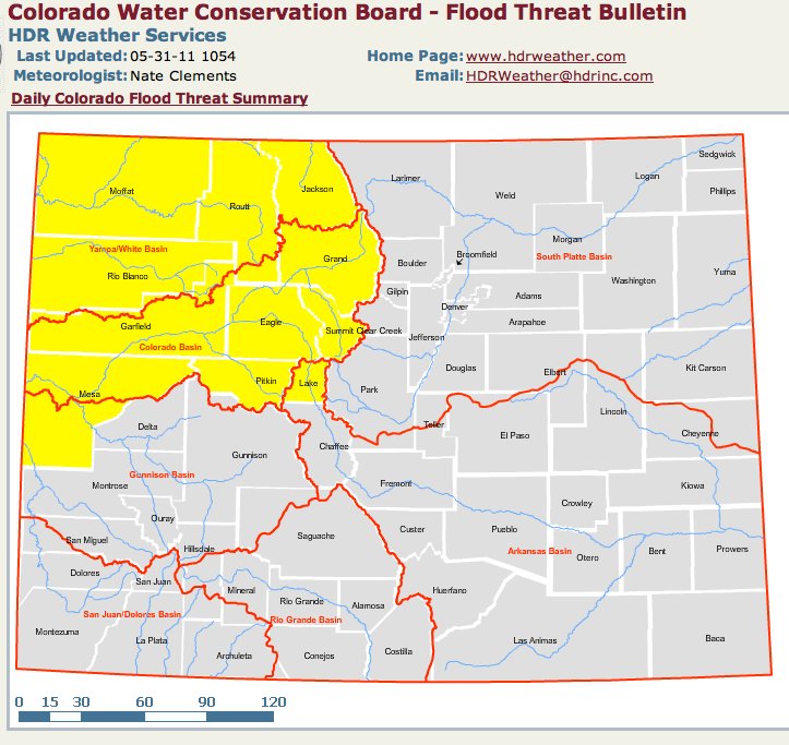
The Colorado Water Conservation Board “Flood Threat Bulletin” also warns of an “appreciable uptick” in snowmelt and accelerating increases in streamflow during the next seven to 15 days.
The U.S. Natural Resources Center lists average snow depth in the Arkansas River basin at 95 percent of average but snow-water equivalent at 138 percent of average. At the Fremont Pass snow-telemetry weather station, snow depth remains at 66 inches with a snow-water equivalent of 25.5 inches…
For the latest forecasts and flood warnings, visit the National Weather Service in Pueblo at www.weather.gov/pueblo.