Click here to go to the Colorado Water 2012 blog post about last Tuesday’s shindig. They’re running the video.
More Colorado Water 2012 coverage here.

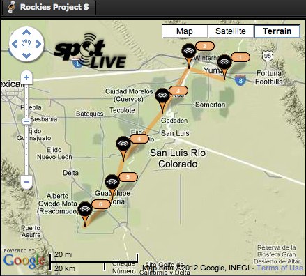
Click on the thumbnail graphic to the right for the SPOT map of their location.
From email from Jon Pushkin (Pushkin Public Relations):
Just a quick update. Will and Zak are nearly at the end of their four-month, Source to Sea journey down the Colorado River. You can see their new videos and photos here: http://coloradosourcetosea.coloradocollege.edu/[…]
The final two programs in the speaker series: On January 30 the program will look at how water issues are impacting the Native American and Mexican communities. On Feb. 6 the program will feature Harris Sherman talking about the impact of deforestation in the region: http://www2.coloradocollege.edu/stateoftherockies/speakerseries.html
More Colorado River basin coverage here.

Here’s the release from Denver Water (Stacy Chesney):
Cheesman Reservoir is closed to visitors until July 1, 2012, as Denver Water completes essential upgrades to the dam, which was built in 1905. Upper and lower Gill Trail remains open to hikers who want to access Cheesman Canyon.
The reservoir has been closed to visitors since Jan. 1, 2010. During the first phase of the project, crews completed upgrades to valves inside the dam hundreds of feet below the reservoir’s surface. Denver Water hoped to have the reservoir reopened this spring, but the second phase of the project — removing the original valves from inside the dam — requires extensive rock excavation that is more challenging than anticipated.
Cheesman Dam is more than 100 years old and is considered the “workhorse” of Denver’s supply system. The underwater valves were installed when the dam was first completed in 1905, and more were added in and the late 1920s.
More Denver Water coverage here.
From email from the Colorado Water Conservation Board (Ben Wade):
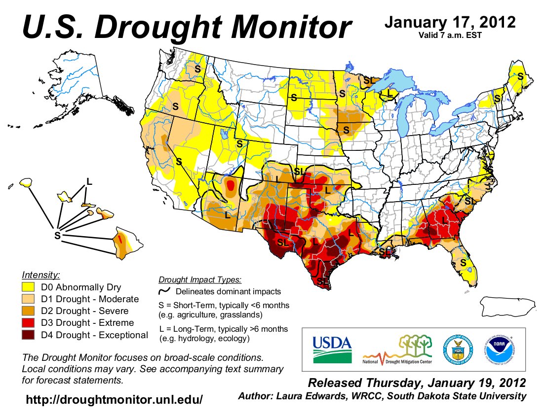
Attached is the January 2012 Drought Update which is a summary of the information presented at the Water Availability Task Force Meeting onJanuary 18, 2012. All of the presentations from the meeting can be found on the CWCB website…
The next Water Availability Task Force Meeting is scheduled on February 16 from 9:30a-11:30a at the Colorado Parks & Wildlife Headquaters, 6060 Broadway, Denver, CO in the Bighorn Room.
More CWCB coverage here.
From The Grand Junction Daily Sentinel (Dennis Webb):
Hydraulic fracturing of oil and gas used consumed than a tenth of a percent of water used in Colorado in 2010, a new report shows.That amount could increase by about 4,800 acre-feet in 2015 from 13,900 acre-feet in 2010, but that still would represent just a little more than a tenth of a percent of the state total, according to the study, prepared by Colorado Oil and Gas Conservation Commission staff with the help of the state Division of Water Resources.
The Commerce City council plans a vote on a six month moratorium on hydraulic fracturing tonight. Here’s a report from Monte Whaley writing for The Denver Post. From the article:
The city also set up a committee to specifically examine fracking and its implications. The committee’s recommendations are expected to be considered at tonight’s [6:30 PM] meeting. The meeting will be held at the Commerce City Council chambers at 7887 East 60th Ave. The council building is located just west of Dick’s Sporting Goods Park.
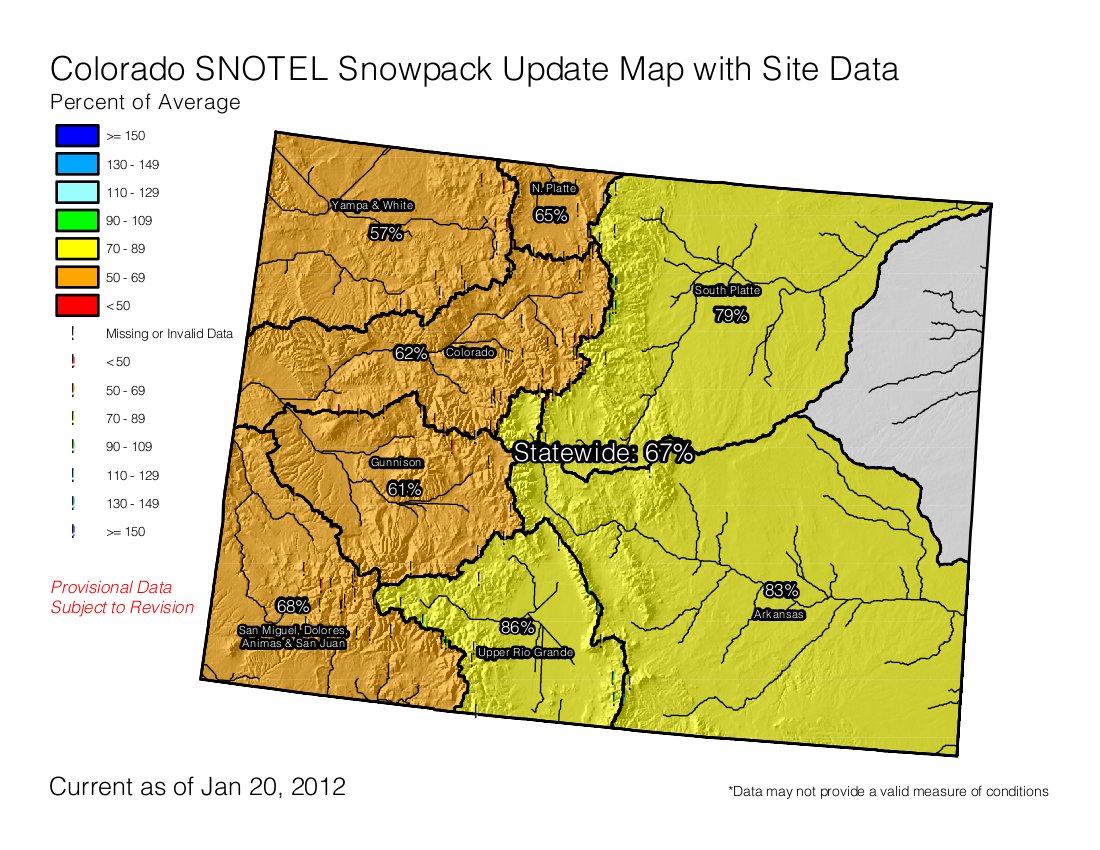
Click on the thumbnail graphic to the right for the snowpack map from last Friday. The beautiful snow over the weekend is not reflected in the map.
From the Summit County Citizens Voice (Bob Berwyn):
A wet Pacific storm delivered widespread snow across the entire state, with many ski areas reporting more than a foot of snow, including 17 inches at Crested Butte, 16 inches at Telluride and six to 10 inches at the resorts along the I-70 corridor.
From the Las Vegas Review-Journal (Henry Brean):
One year removed from near-record snow levels that sent 4 trillion gallons of much-needed meltwater into Lake Mead, winter has gotten off to a terrible start in the mountains that feed the Colorado River. Conditions are so dry that water supply forecasters have slashed their projections for Lake Mead by a whopping 2.45 million acre-feet in the past month alone. That’s 24 vertical feet of water gone — poof! — from what had been a promising forecast for the valley’s primary source of water…
Randy Julander summed up this year’s snowpack in two words: “It stinks.” From his office in Salt Lake City, Julander supervises the federal snow survey program in Nevada, Utah and California for the U.S. Department of Agriculture. The measurements collected by Julander’s team are used to predict floods and forecast the water supplies for farms and cities across the West. January is a month that “typically puts down a lot of snow,” Julander said, but conditions so far across much of the West have been “drier than the Sahara Desert.” “And December was even worse,” he said. “The whole upper Colorado River basin is in really terrible shape in terms of snowpack.”[…]
Julander said this winter so far ranks as one of the worst on record, but it’s still not quite as bad as 1977, the so-called “year without snow.”[…]
Based on current conditions, forecasters now expect roughly 5 million acre-feet of water to flow into Lake Powell over the entire season. Last year, the reservoir on the Utah-Arizona border collected more water than that in June alone…
A series of winter storms is expected to sweep across the region over the next week or so. With any luck, the weather will turn cold and wet and stay that way for a while, Julander said. “As we say in this business, every day without snow is just another stinking day of sunshine.”
From Steamboat Today (Matt Stensland):
“Where you have mountains, you have a lot more micro climates than you have in the flat terrain like the Midwest,” said Jim Pringle, a National Weather Service meteorologist. Gratz said Steamboat Springs in particular is one of the more challenging areas to forecast for…
There are two major factors for predicting storm totals at Steamboat, Gratz said. The first is the wind direction. Steamboat is favored by storms that produce a wind coming from the west and northwest, Gratz said. To produce large amounts of snow, you need wind to hit the mountain directly and force air into the atmosphere…
The second big factor in producing big snow totals at the ski area is whether there is cold air trapped in the valley.

From The Pueblo Chieftain (Chris Woodka):
“I really want to work on getting a mill levy proposal before voters in the next 12 to 24 months,” [Jeff Chostner, chairman of the Fountain Creek Watershed Flood Control and Greenway District] said. The district can assess property in El Paso and Pueblo counties at up to a 5-mill rate under the legislation, but it would require approval from voters in both counties. No decisions have been made on the size of mill levy that would be initially requested, and that would be one of the purposes of establishing a committee to look at the issue, Chostner said. The district has primary land-use authority in the 100-year flood plain from Fountain to Pueblo, and an advisory role in decisions throughout the watershed.
Chostner, a Pueblo County commissioner, was elected chairman at the Friday meeting of the district’s board, replacing El Paso County Commissioner Dennis Hisey. The chairmanship rotates between the two counties, and goes to an elected official under bylaws. The board also reappointed Larry Small, a former Colorado Springs councilman, as executive director.
Here’s a report about the possible effects on senior rights from proposed Fountain Creek projects from Chris Woodka writing for The Pueblo Chieftain. From the article:
“If you change the timing, you change the water right,” Bill Tyner, assistant division engineer, told the Lower Arkansas Valley Water Conservancy District board last week. The state Division of Water Resources denied a substitute water supply plan for a side detention pond in Pueblo last fall because a wave of water that roared down Fountain Creek showed the pond did not work as intended. Tyner showed a slide of water still in the pond one month after mid-September rains inundated the pond. “This was not the intent of the original design,” he said…
All water rights in the Lower Arkansas Valley could be satisfied if flows at Avondale gauge on the Arkansas River were maintained at 6,000 cubic feet per second, Tyner said. Right now, the gates at Pueblo Dam are used to reduce flows above the Fountain Creek confluence to reduce flooding risk when flows at Avondale reach the 6,000 cfs mark. Fountain Creek structures in the future might detain flows as well, reducing the likelihood of downstream flooding. However, artificially prolonging that level could change the relationship of junior and senior water rights, as well as having an impact on the river call upstream from Pueblo, Tyner said.