Uncompahgre Valley water tour September 25

uncompahgrevalleylookingsouthtowardsneffels.jpg

From Colorado Mesa University:

Uncompahgre Valley Water Tour
September 25, 2012
7:30am – 5pm

Meet at the Bill Heddles Recreation Center at Confluence Park in Delta, CO

Co-hosted by the Uncompahgre Valley Water Users, the Delta-Montrose Electric Association and the Water Center at Colorado Mesa University.

Learn about the history of the Uncompahgre Valley Project, the South Canal Hydro Project, and current irrigation issues and practices. See complete itinerary below.

Cost: $40 – includes transportation, breakfast and lunch; $30 if you drive your own vehicle.

To register and pay on-line, click here.

More Uncompahgre River watershed coverage here and here.

Drought news: Finally, a beautiful rain here in the Denver area

urbandrainage25hourprecip09122012.jpg

nexradflooddss09122012.jpg

Click on the thumbnail graphic for the 24 hour precipitation map from the Urban Drainage and Flood Control District map as of 5:10 AM. The station nearest Gulch Manor has recorded 51 hundredths and it is still raining.

I’ve also posted a screenshot of the Nexrad from the Colorado Water Conservation Board’s Flood DSS website. Click on the thumbnail to see the map at 5:20 AM.

Here’s the 5 to 10 day outlook, issued Monday, from the CWCB’s Flood Threat Portal:

Mid-level monsoonal moisture returns on Tuesday. This moisture along with afternoon heating could allow storms to become strong enough to warrant a Low Flood Threat. Storms that develop over the west slope could create up to 1.00” in 30-45 minutes. For the lower elevations, a strong cold front will move into the state Wednesday morning. This frontal passage along with overrunning monsoon moisture should present a LOW FLOOD THREAT to the Front Range burn areas. Foothills thunderstorms could drop a 0.75” to 1.50” inches of rain. This threat will exist both during the passage on Wednesday and post passage on Thursday afternoon. This cold front and disturbance could create a Low Flood Threat for West Slope with some mountain peaks possibly seeing some snow. This front will drop temperatures dramatically with afternoon highs only expected in the 60s over the plains. No other organized flood threats are on the horizon for this period.

More from Twitter:

Brush: Council raises stormwater rates

chyennewyomingflood08011985.jpg

From the Brush News-Tribune (Katie Collins) via The Fort Morgan Times:

Stormwater rates will experience a three-cent hike as of October 1, meaning that owners or occupants of any real property in Brush will see an increase to their city bill near the end of October. The rate hike follows on the heels of the city’s Stormwater Activity Enterprise, established by a previous ordinance that assigned that enterprise the fiscal responsibility for both street cleaning and stormwater system maintenance and operation. With Brush looking to tackle not only drainage issues downtown, but in four other areas of the municipality, the increase will sufficiently aid in providing funding for such projects. Although the City of Brush did not raise stormwater rates in 2011, the three-cents per lineal foot hike has generally been an annual increase and this move will set rates from the previous $.16 per month per lineal foot of a property’s frontage to $.19 cents.

More stormwater coverage here and here.

CU-led mountain forest study shows vulnerability to climate change

howardforkthetrustfolandrestoration.jpg

Here’s the release from the University of Colorado at Boulder (Noah Molotch/Jim Scott):

A new University of Colorado Boulder-led study that ties forest “greenness” in the western United States to fluctuating year-to-year snowpack indicates mid-elevation mountain ecosystems are most sensitive to rising temperatures and changes in precipitation and snowmelt.

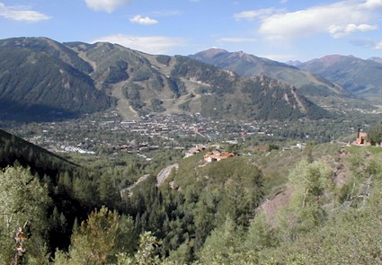
Led by CU-Boulder researcher Ernesto Trujillo and Assistant Professor Noah Molotch, the study team used the data — including satellite images and ground measurements — to identify the threshold where mid-level forests sustained primarily by moisture change to higher-elevation forests sustained primarily by sunlight and temperature. Being able to identify this “tipping point” is important because it is in the mid-level forests — at altitudes from roughly 6,500 to 8,000 feet — where many people live and play in the West and which are associated with increasing wildfires, beetle outbreaks and increased tree mortality, said Molotch.

“Our results provide the first direct observations of the snowpack-forest connections across broad spatial scales,” said Molotch, also a research scientist at CU-Boulder’s Institute of Arctic and Alpine Research. “Finding the tipping point between water-limited forests and energy-limited forests defines for us the region of the greatest sensitivity to climate change — the mid-elevation forests — which is where we should focus future research.”

While the research by Molotch and his team took place in the Sierra Nevada mountain range in California, it is applicable to other mountain ranges across the West, he said. The implications are important, since climate studies indicate the snowpack in mid-elevation forests in the Western United States and other similar forests around the world has been decreasing in the past 50 years because of regional warming.

“We found that mid-elevation forests show a dramatic sensitivity to snow that fell the previous winter in terms of accumulation and subsequent melt,” said Molotch, also a scientist at NASA’s Jet Propulsion Laboratory in Pasadena, Calif. “If snowpack declines, forests become more stressed, which can lead to ecological changes that include alterations in the distribution and abundance of plant and animal species as well as vulnerability to perturbations like fire and beetle kill.”

A paper on the subject was published online Sept. 9 in Nature Geosciences. Co-authors on the study include Ernesto Trujillo of INSTAAR and the Ecole Polytechnique Fédérale de Lausanne in Switzerland, Michael Golden and Anne Kelly of the University of California, Irvine, and Roger Bales of the University of California, Merced. The National Science Foundation and NASA funded the study.

Molotch said the study team attributed about 50 percent of the greenness in mid-elevation forests by satellites to maximum snow accumulation from the previous winter, with the other 50 percent caused by conditions like soil depth, soil nutrients, temperature and sunlight. “The strength of the relationship between forest greenness and snowpack from the previous year was quite surprising to us,” Molotch said.

The research team initially set out to identify the various components of drought that lead to vegetation stress, particularly in mountain snowpack, said Molotch. “We went after snowpack in the western U.S. because it provides about 60 to 80 percent of the water input in high elevation mountains.”

The team used 26 years of continuous data from the Advanced Very High Resolution Radiometer, a space-borne sensor flying on a National Oceanic and Atmospheric Administration satellite, to measure the forest greenness. The researchers compared it to long-term data from 107 snow stations maintained by the California Cooperative Snow Survey, a consortium of state and federal agencies.

In addition, the researchers used information gathered from several “flux towers” in the southern Sierra Nevada mountain range, which measure the exchanges of carbon dioxide, water vapor and energy between terrestrial ecosystems and the atmosphere. Instruments on the towers, which are roughly 100 feet high, allowed them to measure the sensitivity of both mid-level and high-level mountainous regions in both wet and dry years — data that matched up well with the satellite and ground data, he said.

“The implications of this study are profound when you think about the potential for ecological change in mountainous environments in the West in the not too distant future,” said Molotch, an assistant professor in the geography department. “If we take our study and project forward in time when climate models are calling for warming and drying conditions, the implication is that forests will be increasingly water-stressed in the future and thus more vulnerable to fires and insect outbreaks.

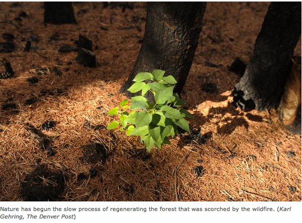
“When you put this into the context of recent losses in Colorado and elsewhere in the West to forest fire devastation, then it becomes something we really have to pay attention to,” he said. “This tipping-point elevation is very likely to migrate up the mountainsides as the climate warms.”

Silverthorne takes top honors in tap water taste test — next up national competition

silverthornecitydata.jpg

From 9News.com (Matt Renoux):

Five judges in all took part in the 2013 American Water Works Association Water Tasting Competition in Copper Mountain. The judges sniffed, checked the clarity and tasted water samples from 16 cities in Colorado, Wyoming and New Mexico. After more than an hour of drinking the water, judges turned in their results. This year Colorado swept the top three with Aurora taking third, Basalt second, and Silverthorne won out with the best-tasting water. Mellissa Elliott with Denver Water says that means Silverthorne will move on to represent Colorado in a National contest…

…National competition will be held in Denver next June. Denver Water took second in the nation last year. It will get to compete again because it gets an automatic entry in the national competition for being the host city.

From The Aspen Times (Scott Condon):

Basalt came in second out of 16 cities and towns in Colorado, Wyoming and New Mexico that entered water for a taste testing at an American Water Works Association conference at Copper Mountain. Silverthorne won the competition and will represent Colorado in a national water-tasting contest later this year.

More water treatment coverage here and here.

Colorado Water Trust’s lease of 4,000 acre-feet of water from Stagecoach Reservoir helps the Yampa River

stagecoachreservoir1.jpg

From Steamboat Today (Michael Schrantz):

The drought conditions that plagued Northwest Colorado and large parts of the nation put businesses, recreation and the health of the river in peril. The Colorado Water Trust’s lease of 4,000 acre-feet of water from Stagecoach Reservoir was the first-ever use of a 2003 state law that allows temporary leases of water to protect rivers threatened by low water years. That lease put 26 cfs into the Yampa for a large part of summer, salvaging some recreational use and bolstering the health of the river.

While noting there were other factors that the led to the rebound of the Yampa in July, Van De Carr said the Colorado Water Trust’s release “benefitted any person who lives in or visits this town this summer.”

Chatfield Reallocation Project: Littleton plans to take streamflow protection lead

chatfieldreservoirreallocationprojectalternatives.jpg

From the Littleton Independent (Jennifer Smith):

“I think it’s appropriate for Littleton to take the lead, because we are probably the most impacted by this,” said City Manager Michael Penny. City staff has reached out to Denver Water, the state, Centennial Water and Sanitation, Colorado Water Conservancy and Aurora, among others. Penny said there’s been general willingness to come together to discuss how to keep maximum flow running through the river should the project come to fruition…

Council noted that the Corps says a minimum of 10 cubic feet per second of water flowing north through the South Platte River would benefit the fish habitat, but the number of days that would happen would be reduced under the proposal.

Additionally, the study was designed to predict levels during months and years rather than hours and days; council believes that could mask the real impacts. Council is also perplexed as to why the Corps didn’t take measurements between the dam and Denver, where point several tributaries raise water levels.

More Chatfield Reservoir coverage here and here.

Grand Junction: Drought as Disaster seminar — Monday at CMU

historicdowntowngrandjunction.jpg

Here’s the link to the fall speakers series at Colorado Mesa University.

The series is open to the public.

More education coverage here.

Denver Public Works to Co-Host Colorado Rotary Water Symposium featuring USAID Executive

cityparksunrise.jpg

Here’s the release from Denver Public Works.

In conjunction with Rotary International District 5450, Denver Public Works Wastewater Management division will co-host the first annual Colorado Rotary Water Symposium this fall. The water quality conference will feature Chris Holmes, head of International Water Programs within the U.S. Agency for International Development (USAID). The conference will take place on October 13, 2012 in the Wastewater Management Building at 2000 W. 3rd Avenue.

Representatives from the public, private and educational sectors will provide an update on Colorado’s current water situation and its challenges for the next 50 years, followed by a presentation on Rotary International’s projects in developing countries. This one-day event will conclude with a call to action for participants to act quickly on solutions for the future of Colorado’s water.

Featured speaker at the event, Chris Holmes, is responsible for the coordination and implementation of key global water policy initiatives and the integration of USAID water programs and policies. Mr. Holmes, who is the first USAID executive to serve in this position, brings years of experience in international economic development, environmental protection and humanitarian assistance sectors.

Exhibitors will include non-profit organizations working on water issues in Colorado and around the world. The conference is open to the public. To register for the event, please see http://www.Rotary5450.org.

Colorado Water 2012: Willow Creek restoration illustrates the challenges for overcoming a mining past

willowcreekusgs.jpg

From the Valley Courier (Guinevere Nelson):

The Willow Creek Reclamation Committee (WCRC) was created to find solutions to these problems. To change the effects of historic mining practices, the committee needed to know how these metals interacted with water. To solve these problems, the committee takes water samples twice a year, coinciding with seasonal high and low flows.

Water samples are taken in two methods; the first method involves taking water directly from the stream to the bottle, the second method involves forcing water through a small (0.45 micron) filter. The WCRC is interested what this second, filtered, method indicates. The filtered sample takes larger undissolved molecules out and reveals molecules that are hooked to water and thereby biologically available to whatever may be swimming around in the creek. Through examination the committee has considered pH and heavy metals, fish and zinc, and the creek’s hydrology.

More Colorado Water 2012 coverage here.

New growth sprouting from root systems in the High Park burn area as summer winds down

highparkfireregrowthsummer2012.jpg

From The Denver Post (Bruce Finley):

This rapid emergence of new life — less than two months after the flames — hints at the potential for future aspen forests that state and federal experts say could be more diverse, healthy and resilient. “That sprouting would not be happening without the fire,” Lebeda said.

The ecological benefits of wildfires are a bright side of the burning that ravaged more than 116,000 acres of forest this year and destroyed more than 600 homes along Colorado’s Front Range. Six people died in this year’s wildfires. It’s largely a matter of letting in light where forests previously were unnaturally dense. Wildfires also release nutrients to the soil.

More restoration coverage here and here.

Fort Collins: The city is waiting until later this month to start blending Poudre river flows into it’s water supply

watertreatment.jpg

From the Fort Collins Coloradoan (Bobby Magill):

The city of Fort Collins is planning to mix Poudre River water into the city water supply later this month, most likely after a rush of silty water moves downstream and out of Poudre Canyon.

Fort Collins gets its drinking water from both the Poudre River and Horsetooth Reservoir, the water for which is pumped beneath Rocky Mountain National Park from the Colorado River.

Ash, silt and debris washing off the Hewlett and High Park fire burn areas prompted the city to stop taking water from the Poudre River in early June, and no Poudre water has been used since then because of poor water quality.

More Cache la Poudre River watershed coverage here and here.

Douglas County aims to file an appeal of the recent ruling about the Sterling Ranch development

denverbasinwellsandpumping.jpg

From the Denver Business Journal (Cathy Proctor):

“The board will appeal the judge’s decision directly to the Court of Appeals,” county spokeswoman Wendy Holmes said Tuesday. The board voted unanimously to appeal 18th Judicial District Judge Paul King’s decision and has 45 days to file the appeal, she said.

Meanwhile, here’s an analysis of the reality of growth and development along the Front Range, from Bart Taylor writing for the Planet Profit Report. Here’s an excerpt:

Despite protests of the Denver Post, King’s decision isn’t an indictment of Sterling Ranch, but a reasonable reading of a statute.

The proposed community southwest of Denver has been lauded as a water-efficient, sustainable community of the future, but it’s also a poster child for the challenge facing the south metro area of Colorado’s Front Range. Most Douglas County communities south of Denver rely on non-renewable, diminishing aquifers. By Douglas County standards, Sterling Ranch has lined up a diverse supply, including an agreement to buy 190 million gallons of water annually from close neighbor Aurora to support the 12,000 or so homes planned for the community. King said it wasn’t enough.

As a result, Colorado’s business leaders would do well to contemplate a pro-business water platform around which economic interests can rally.

Harold Smethills, the development’s managing partner, promised to move ahead. King’s decision seemed to surprise others. David Tschetter, chairman of the Colorado Association of Homebuilders, told the Denver Post the ruling “will have a negative impact on development, no question…Who knows what water-usage needs are going to be 30 years from now?”

But if pressed, Tschetter would agree that Douglas County’s water problem is spooking development, King’s ruling notwithstanding. Despite membership in a loose coalition called the South Metro Water Supply Authority, most communities in DC are pursuing their own water plans. Some are faring better than others. Aurora, in a position to sell water to Smethills, may be the region’s most innovative water operator. None, arguably, have developed a comprehensive program that guarantees residents and business renewable (non-ground water), affordable, sustainable supplies – and mitigates regional concerns.

More South Platte River Basin coverage here and here.

Arctic sea ice falls to record low extent

arcticseaiceextent09082012.jpg

articseaiceextentmap09082012.jpg

Click on the thumbnail graphics for yesterday’s extent map and the chart for this season. From the National Snow and Ice Data Center:

Throughout the month of August, Arctic sea ice extent tracked below levels observed in 2007, leading to a new record low for the month of 4.72 million square kilometers (1.82 million square miles), as assessed over the period of satellite observations,1979 to present. Extent was unusually low for all sectors of the Arctic, except the East Greenland Sea where the ice edge remained near its normal position. On August 26, the 5-day running average for ice extent dropped below the previous record low daily extent, observed on September 18, 2007, of 4.17 million square kilometers (1.61 million square miles). By the end of the month, daily extent had dropped below 4.00 million square kilometers (1.54 million square miles). Typically, the melt season ends around the second week in September.

From the Christian Science Monitor (Pete Spotts):

As of Sept. 7, the Arctic Ocean’s expanse of summer ice this month spanned less than 1.54 million square miles, nearly six times the size of Texas and some 45 percent less than for the average for the same month through the 1980s and ’90s, according to the National Snow and Ice Data Center in Boulder, Colo. And the ice is still retreating; the summer melt season typically ends in mid to late September.

The previous record low was set in 2007, a result of an unusual set of conditions – clear skies during most of the summer and wind patterns that drove large amounts of ice past Greenland and into the North Atlantic. This summer, no such “perfect storm” for ice loss appeared.

Instead, much of the ice left over from winter – coming out of a summer that until now had been the second lowest melt-back in the satellite record – was thin enough to break no matter which way the wind blew, according to NSIDC researchers.

2012 Colorado November election: 3rd District candidates Pace and Tipton square off at the Club 20 summer meeting

Click here to read The Denver Post (Lynn Bartels) recap.

Joe Hanel (@joehanel) — who writes for The Durango Herald — live-Tweeted from the meeting using Twitter hashtag #copolitics.

More 2012 Colorado November election coverage here.

Aspen: Locals form group to promote the proposed Castle Creek hydroelectric generation plant

castlepeak.jpg

From the Aspen Daily News (Curtis Wackerle):

The “Backyard Energy Campaign” is set to kick off Monday with a press conference at the Marolt Barn at 2 p.m. The group is pushing for a “yes” vote on the recently approved ballot question asking voters if they want the city to continue pursuing the project, which would use water from Castle and Maroon creeks to generate hydropower.

Longtime Aspenite Jim Markalunas, who ran the city’s historic Castle Creek hydropower plant before it shutdown in the late 1950s, is chair of the committee. Ruthie Brown, a member of Pitkin County’s Healthy Rivers and Streams Board whose family pioneered hydropower in the region, is a co-chair, along with climate change expert Randy Udall. Aspen Skiing Co. environmental sustainability vice president Auden Schendler also has signed on in support, according to a press release the group issued Thursday.

“The committee message is clear: Aspen has the opportunity to stop burning 6 million pounds of dirty coal and instead can produce clean, renewable energy in our own backyard while ensuring healthy stream flows,” the group’s statement says, referring to the amount of coal-fired power currently purchased by Aspen the city claims the hydro project would supplant.

More hydroelectric coverage here and here.

Drought news: Eagle River Water and Sanitation is going to use Vali Resorts snow-making infrastructure to supplement streamflow in Gore Creek

gorecreekwinter.jpg

From the Vail Daily (Lauren Glendenning):

In the agreement signed Aug. 23, the Water District can pump water out of the Eagle River, until Oct. 15, at Dowd Junction via Vail Mountain’s snowmaking pipeline and then through the resort’s on-mountain snowmaking system and into Mill Creek. In return, Vail Mountain will have access to as much as 100 acre-feet of water in Black Lakes, atop Vail Pass, for snowmaking through Dec. 31.

The Water District wants to pump the water through Vail Mountain’s snowmaking system and into Mill Creek because it will help flows in Gore Creek, which is experiencing low streamflows that could negatively affect river health.

Rick Sackbauer, chairman of the Water District’s board of directors, told the Vail Town Council Tuesday night the agreement is “historical.”[…]

He said the movement of the water — which makes a loop by going through Vail’s snowmaking pipes from Dowd Junction to the Water District building in Lionshead, and then up through the resort’s on-mountain snowmaking system before entering Mill Creek near Manor Vail and eventually Gore Creek and on to the Eagle River — helps Gore Creek’s overall health.

More Eagle River watershed coverage here and here.

The San Miguel County Commissioners alert the CDPHE to four concerns with respect to the proposed Piñon Ridge uranium mill

telluridevalleyfloororg.jpg

From The Telluride Daily Planet (Heather Sackett):

The county’s four issues are: Whether the claimed socio-economic benefits of the project would outweigh the negative socio-economic impacts; if the milling and mining would result in the accumulation of airborne radioactive contaminants in the surrounding high mountain basins; if the company would be able to cover the cost of decontamination, decommissioning, reclamation and long term monitoring of the facility and whether the company could protect the public from the hazards of accidents when hauling radioactive yellowcake on Highway 141…

County commissioner Art Goodtimes said air quality is a concern since Telluride and much of San Miguel County is downwind from the proposed mill site. But Goodtimes said the mill itself is not as much of a concern to him as the many mines from which the mill will get its uranium.

“The mill can operate without bringing a large amount of dust into the air, but when you have a lot of different mines, the small outfits may or may not have sufficient controls to control dust,” Goodtimes said. “The regulatory agencies don’t consider that when licensing a mill like this.”

In anticipation of Piñon Ridge becoming operational, the county has begun collecting snow samples from near Alta Lakes, Ophir and Telluride Ski Resort to get baseline data about radioactive particles in the area.

More nuclear coverage here and here.

South Park: Richard Hamilton, et al., are seeking ‘sole source aquifer’ protection from the EPA

aspenssouthpark0909.jpg

From the Summit County Citizens Voice (Bob Berwyn):

The designation would require more in-depth review of any proposed activities that could affect water supplies. Of special concern is uranium mining near Hartsel, as well as potential development of oil and gas resources. The designation could also result in buffers and other protective measures.

Gaining the EPA designation is a multi-step process beginning Sept. 11 with a meeting of the local environmental advisory board. Citizens will offer a petition requesting the South Park county commissioners to sponsor a formal request for the designation to regional, state and federal authorities. Get an overview of the regional sole source aquifer program at this EPA website. To qualify, an aquifer must supply at least 50 percent of the drinking water consumed in the area overlying the aquifer. EPA guidelines also stipulate that these areas can have no alternative drinking water source that could physically, legally, and economically supply all those who depend upon the aquifer for drinking water.

As part of the petitioning process, South Park residents are also asking for an immediate moratorium on all mineral leasing activity until there are comprehensive studies on the relationship between ground water and mineral resource development.

There are currently no designated sole source aquifers in Colorado, but there are several in surrounding states, including Montana and Utah. For example, the Missoula Valley aquifer is protected because it provides 100 percent of Missoula’s drinking water. Information on regional sole source aquifers is online here.

Drought news: The North American Monsoon blessed Breckenridge over the summer

percentofnormalprecipitationa07192012to08172012.jpg

From the Summit County Citizens Voice (Bob Berwyn):

Breckenridge-based weather watcher Rick Bly reported 4.21 inches of rain in July, well above the average 2.32 inches. That moisture boosted the year-to-date total to 92 percent of average, amazing considering the widespread drought conditions in Colorado.

More than 1 inch of that rain came in a single 24-hour period during a particularly heavy mid-month downpour. “It’s only the sixth or seventh time I’ve recorded over an inch of 24-hour moisture in July,” Bly said. “It seems like we’re having bigger events.Bly’s observation ties in with global weather patterns, which have been trending to more extreme events — heavier rainfall, sustained blizzards, cold spells and drought — all believed to be linked with a warming climate.

Even with the dip back down to below normal totals in August, year-to-date precipitation was still at 91 percent of average in Breckenridge, a small regional anomaly in the statewide picture.

Drought news: Lake Loveland — Drought and wildfire leaves the lake showing a lot of bottom

Drought news: Driest August on record for Greeley #CODrought

usdroughtmonitor08282012.jpg

From The Greeley Tribune:

The average month of rainfall that Weld County producers and residents finally got in July was apparently too good to be true. In August, it was back to bone dry. According to numbers provided by Wendy Ryan with the Colorado Climate Center in Fort Collins, Greeley experienced its driest August on record, and — despite the normal precipitation in July — 2012 remains on track to be the driest, as well as the hottest, year on record for the city. While August rainfall in Greeley historically amounts to 1.46 inches, the city received 0.03 inches of rain in August this [year].

Councillor questions asking Colorado Springs Utilities rate payers to foot $25,0000 bill for water facilities tour cost

oteropumpstation.jpg

The invitation-only water tour from Colorado Springs to Leadville, which included an overnight stay Thursday in Salida, needs to be reevaluated along with every other expense at Utilities and the city government, City Councilwoman Angela Dougan said.

“This is just some more of the examples of expenditures that keep eking out and leaking out that we need as the Utilities Board to truly say, ‘Is this something that is a benefit to our ratepayers or is it not?’” Dougan said. “Could we put the information out on a DVD and hand it out to these 74 people instead?”

The tour is designed to inform “key stakeholders” about the city’s large and complex water system, Utilities spokesman Eric Isaacson said in an email.

“It would be difficult to give these stakeholders this level of information and insight in another forum,” he said.

Isaacson also said “most of the other major water providers in the state” host annual water tours, too.

More Colorado Springs Utilities coverage here and here.

The latest ENSO Discussion is hot off the press from the Climate Prediction Center

elninolanina.jpg

Here’s the September 6, 2012 discussion:

Synopsis: El Niño conditions are likely to develop during September 2012.

ENSO-neutral conditions continued during August 2012 despite above-average sea surface temperatures (SST) across the eastern Pacific Ocean. Reflecting this warmth, most of the weekly Niño index values remained near +0.5°C. The oceanic heat content (average temperature in the upper 300m of the ocean) anomalies also remained elevated during the month, consistent with a large region of above-average temperatures at depth across the equatorial Pacific. Possible signs of El Niño development in the atmosphere included upper-level easterly wind anomalies and a slightly negative Southern Oscillation Index. Despite these indicators, key aspects of the tropical atmosphere did not support the development of El Niño conditions during the month. In particular, low-level trade winds were near average along the equator, and the pattern of tropical convection from Indonesia to the central equatorial Pacific was inconsistent with El Niño with the typical regions of both enhanced and suppressed convection shifted too far west. Because of the lack of clear atmospheric anomaly patterns, ENSO-neutral conditions persisted during August. However, there are ongoing signs of a possibly imminent transition towards El Niño in the atmosphere as well as the ocean.

Most of the dynamical models, along with roughly one-half of the statistical models, now predict the onset of El Niño beginning in August-October 2012, persisting through the remainder of the year. The consensus of dynamical models indicates a borderline moderate strength event (Niño 3.4 index near +1.0°C), while the statistical model consensus indicates a borderline weak El Niño (+0.4° to +0.5°C). Supported by the model forecasts and the continued warmth across the Pacific Ocean, the official forecast calls for the development of most likely a weak El Niño during September 2012, persisting through December-February 2012-13.

Fryingpan-Arkansas Project update: 222 cfs in the river below Ruedi Dam

fryingpan.jpg

From email from Reclamation (Kara Lamb):

Just a quick note to let you know we are dropping the release from Ruedi Dam by about 25 cfs this afternoon [September 5]. This will put flows in the ‘Pan by the Ruedi gage around 222 cfs by 5:30 this afternoon.

More Fryingpan-Arkansas Project coverage here and here.

Pagosa Water and Sanitation scores a $2 million loan for wastewater pipeline

wastewaterliftstation.jpg

From the Pagosa Sun (Ed Fincher):

Phil Starks, of the Pagosa Springs Sanitation General Improvement District, reported to town council the approval of a $2 million loan from the Colorado Water Resources and Power Development Authority for a project that would allow sewage to be pumped from downtown Pagosa Springs to the Pagosa Area Water and Sanitation District’s Vista treatment plant, enabling the clean-up of the old sewage lagoon site near Yamaguchi Park…

Although Stark reported success in getting a vote of approval from the water authority, he went on to say, “We have to still do a lot of paperwork. One thing is getting the legal opinion of Mr. Cole (town attorney Bob Cole).” Another is getting the approval of town council, but the sewer line project is still moving forward…

Ken Charles, from the Colorado Department of Local Affairs, which, along with the state water authority, had a say in whether or not to approve the loan, said, “When I took that proposal back and it had changed from a wastewater treatment plant to this pipeline project, everyone said this was a completely different project and we should ask them to re-apply to the program. I just told them this is a prudent decision in all sorts of ways. You’re saving money in the long run, and you’re avoiding another discharge point into the river. It was a win-win situation, and you let your staff work out the details.”

More wastewater coverage here and here.

The Center for Resource Conservation seeks to ‘Slow the Flow’

weathermaticsmartlineirrigationcontroller.jpg

Here’s a guest commentary about the CRC irrigation audit program from Justin Patrick running in The Denver Post. Here’s and excerpt:

The auditors travel to residences in the Denver area, each averaging four per day, to evaluate participating homeowners’ sprinkler systems. Their job is to identify any technical ailments in the system, optimize its efficiency, and, if the system is sound, to recommend a scientifically calculated irrigation schedule. The result? Hundreds of thousands of gallons of water per year are saved from pointless waste, and most homeowners end up saving a few—or a few hundred—dollars on their water bill.

During their employment from June through August, irrigation auditors consulted with 1,700 homeowners and sixty Homeowners Associations (HOAs). Their services come without a fee and implementing their suggestions is optional. Their evaluations represent a chance for homeowners to know more about what their sprinklers are doing and what they can do to reduce their water usage…

The program is one of several conservation initiatives launched by the Center for Resource Conservation, and its success has not gone unnoticed. The Boulder-based non-profit receives some funding from grants and donations, but most of its operating budget is generated by its innovative social services. “We’re not a typical non-profit in the way that we’re funded,” said Kate Gardner, Water Programs Manager. “It’s all about contracting with local governments.” In other words, the CRC must consistently perform to the standards of discriminating public organizations that must justify spending choices.

The auditors’ time, for example, is billed to the water provider that services the home where the audit is performed. The CRC maintains contracts with water providers in nearly all of the populated counties outside Denver (Denver proper is the only exception; it oversees its own conservation efforts). If expectations were not met, contracts would be cancelled. That has not yet happened. In fact, Slow the Flow is expanding by two or three cities per year. The program began in Boulder in 2004 and immediately caught on. Throughout the years counties and municipal water providers eager to better organize and more efficiently utilize available water resources have included funding for the CRC’s assistance in their annual budgets.

More conservation coverage here.

Gunnison County files application to continue cloud seeding program for another ten years

cloudseedingexplained.jpg

From The Chaffee County Times (Casey Kelly):

North American Weather Consultants has filed an application with the Colorado Water Conservation Board for a 10-year renewal of its cloud seeding program in Gunnison. According to the group, Chaffee County could benefit from additional water from the program.

Since 1950, NAWC has been conducting weather modification programs in the western United States and has been cloud seeding in the Gunnison area for the past 10 years. The purpose of the operation is to increase precipitation and snowpack in the area for agriculture, municipal water, recreation and tourism.

Current cloud seeding programs in Colorado:

Central Colorado Rocky Mountains Program (Denver Water and Winter Park)
Upper Roaring Fork Basin Program (Colorado Springs Utilities)
Vail/Beaver Creek Program (Vail/Beaver Creek Ski Areas)
Gunnison River Basin Program (Gunnison County, Upper Gunnison River WCD)
Grand Mesa (Water Enhancement Authority which is comprised of Collbran WCD, Fruitland Mesa WCD, Crawford WCD, Grand Mesa Pool)
Western San Juan Mountains Program (Southwestern WCD, City of Durango, Animas La Plata WCD, Durango Mountain Resort, Dolores WCD)
Eastern San Juan Mountains Program (Pagosa Area Water and Sanitation District, San Juan WCD, Southwestern WCD)

More cloud seeding coverage here and here.

Colorado-Big Thompson Project update: Releases to the Big Thompson River draw down Pinewood Reservoir

pinewoodreservoirberthoudrecorder.jpg

From email from Reclamation (Kara Lamb):

You’ve likely noticed that Pinewood has dropped down low again, similar to its activity a week or so ago. The same situation applies: we continue to adjust operations of the Colorado-Big Thompson Project to meet on-going demands for water along the Big Thompson River.

Just as before, we have run water directly from Pinewood to the Big Thompson River to meet the continued downstream demand. Boyd, Lake Loveland, and others have been using their C-BT water.

We will continue to balance distribution of project water across the facilities as we move into late summer/early fall. As a result, residences near and visitors to Pinewood might see the water level elevation continue this range of fluctuation for a while.

As of this evening [September 6], though, the water level at Pinewood should begin to rise again.

More Colorado-Big Thompson Project coverage <a href="

Greeley: The next Interbasin Compact Committee meeting is September 11

irrigationditchgreeleyhistoricalresources.jpg

Here’s the link to the notice. Here’s the link to the agenda.

More IBCC — basin roundtables coverage here.

Denver: The Metro Roundtable is meeting September 12

uppercoloradoriverbasinstatesultimatum09011925denverpost.jpg

Here’s the link to the notice. Here’s the link to the agenda.

More IBCC — basin roundtables coverage here.

2012 Colorado November election: City of Aspen hydroelectric project on the November ballot

aspen.jpg

From The Aspen Times (Andre Salvail):

One [ballot question], arguably the most controversial, is a referendum question that asks voters whether the city should continue with a hydroelectric project on Castle Creek…

With regard to the hydroelectric plant, the city’s voters will be asked the following “advisory” question: “Shall the city of Aspen complete the hydroelectric facility on Castle Creek, subject to local stream health monitoring and applicable government regulations, to replace coal-fired energy with renewable energy?” The council and city staff agreed to the ballot language at an Aug. 28 work session, and no members of the audience spoke up to oppose it.

So far, the city has spent about $7 million on the hydroelectric project, which aims to take a portion of the water flowing from Castle and Maroon creeks to generate enough power to cover 8 percent of the city electric utility’s needs. In 2007, when voters approved a bond-issue referendum that set the hydroelectric project into motion, the project cost was estimated at $6.2 million. Cost overruns have resulted in a revised estimate of $10.5 million to complete the plant.

A petition drive led by local residents Ward Hauenstein and Maurice Emmer early this year set off a chain of events leading to the referendum question. The petition sought to overturn the council’s December rezoning decision allowing public land off Power Plant Road to be used for the plant. The proposed plant has drawn fierce opposition from some Castle Creek property owners as well as the nonprofit group American Rivers.

More hydroelectric coverage here and here.

Fort Morgan: The current market for electricity will not support a hydroelectric generation facility

microhydroelectricplant.jpg

From The Fort Morgan Times (Jenni Grubbs):

The hydro project, we’ve looked at it for quite a long time,” Northern Colorado Water Conservancy District Project Manager Carl Brouwer told the council.

He pointed out that due to the nearly 1,300-foot elevation difference on the water pipeline between Carter Lake and Fort Morgan, “there is great potential for power generation.”

The big question the council has had for years is whether it would be feasible from a cost-benefit standpoint to put in a hydroelectric system in that pipeline. The council had asked Northern to look into this for both the district and the city, and Brouwer presented the results of the feasibility study to the council Tuesday night.

There would not be a problem with installing a small, in-line hydropower generation unit, he said, but with prices being where they are, it would cost more than the revenue it created. The project would cost a little more than $1.2 million, and the return on the project would be dependent upon the rates the city could get for putting electricity back into the power grid.

Right now, those rates are running less than eight cents per kilowatt hour, which is the minimum the city would need for a system that would barely do more than break even. Historically, the rate had been 4 cents, but it changes with the energy market.

More hydroelectric coverage here and here.

Runoff contamination in the Cache la Poudre River from the High Park Fire is causing a supply problem for Greeley Water

cachelapoudrehighparkpollutionusdaseptember2012.jpg

From KUNC (Kirk Siegler):

John McCutchan of Greeley Water says since the High Park Fire, area water managers have had to throw out the book on how they treat water coming from the Poudre River.

“It’s new for us to have to be watching the Poudre night and day. We’re all faced with the same situation.”

Many Northern Colorado water utilities are tied to the Poudre. And McCutchan says Greeley’s water rights on the river are too important to “Let go down stream. Especially in a drought period.”

McCutchan is the Superintendent of Greeley’s Bellevue Water Treatment Plant which filters water from the Poudre River -a key source for Greeley’s drinking supply.

The normally “pristine” Poudre is the cleanest source of water in the country, McCutchan says. But since the recent fires, the river has been running black with ash and other contaminants. And that has the potential to clog up the Bellevue Plant…

But runoff from the scorched-black earth around the Poudre has sent large particles of ash along with increased levels of iron and manganese swirling down the river.

If massive amounts of these contaminates were allowed to enter the filtration system, it could render the holding ponds useless because they’d quickly fill up with sludge and sediment.

To help mitigate any damage and very costly repairs, Greeley has limited its intake of Poudre River water to just 5 percent after the fire compared to an average of 25 percent for this time of year…

This means the city of Greeley and John McCutchan are going to have to take a hard look at what’s going to happen when they’re forced to rely more heavily on the contaminated Poudre.

“Everyone has had the same kind of problems. You can remove most of the contaminates, but some of the compounds that bring the taste and odor issues, the smoky flavor, are very difficult to remove.”

The city of Fort Collins has just started blending water from the Poudre back into its supplies. Each water utility knows that things will change depending on rain and the subsequent runoff into the Poudre. They’re also looking ahead to next spring and the annual winter snow melt, and what that runoff will mean for the river and next year’s water supply.

More Cache la Poudre River coverage here and here.

A growing thirst for water in the arid west complicated by shale gas exploration and production

hydraulicfracturingwaterislostwaterwrs.jpg

From The New York Times (Jack Healey):

A single such well can require five million gallons of water, and energy companies are flocking to water auctions, farm ponds, irrigation ditches and municipal fire hydrants to get what they need.

That thirst is helping to drive an explosion of oil production here, but it is also complicating the long and emotional struggle over who drinks and who does not in the arid and fast-growing West. Farmers and environmental activists say they are worried that deep-pocketed energy companies will have purchase on increasingly scarce water supplies as they drill deep new wells that use the technique of hydraulic fracturing.

And this summer’s record-breaking drought, which dried up wells and ruined crops, has only amplified those concerns.

“It’s not a level playing field,” said Peter V. Anderson, who grows corn and alfalfa on the parched plains of eastern Colorado. “I don’t think in reality that the farmer can compete with the oil and gas companies for that water. Their return is a hell of a lot better than ours.”

But industry officials say that critics are exaggerating the effect on water supplies. [ed. emphasis mine]

Energy producers do not — and cannot — simply snap up the rights to streams and wells at the expense of farmers or homeowners. To fill their storage tanks, they lease surplus water from cities or buy treated wastewater that would otherwise be dumped back into rivers. In some cases, they buy water rights directly from farmers or other users — a process that in Colorado requires court approval.

“This is an important use of our water — to produce energy, which is the foundation of all we do,” said Tisha Schuller, president of the Colorado Oil and Gas Association. “Think about the big users of water — agriculture, industrial development. All these things require energy.”

More oil and gas coverage here and here.

The Colorado Watershed Assembly scores a $42,000 WaterSMART Cooperative Watershed Management Program grant from Reclamation

wyutcopreciptationaugust2012nidis.jpg

Here’s the release from Reclamation (Peter Soeth):

Bureau of Reclamation Commissioner Michael L. Connor announced today the selection of eight entities to receive $333,500 in grants under the WaterSMART Cooperative Watershed Management Program. These grants will aid in the establishment and expansion of local watershed management groups.
“Developing and supporting local watershed management groups ensures local communities are involved in decisions and is vital to create healthy watersheds,” said Commissioner Connor. “This funding will enable local communities to partner with Reclamation to conserve water in the West and will help Reclamation advance the goals of WaterSMART and the National Blueways System.”

The eight entities recommended for funding are:

– Armand Bayou Nature Center in Texas ($22,000)
– Colorado Watershed Assembly in Colorado ($42,000)
– Crooked River Watershed Council in Oregon ($39,500)
– Deschutes River Council in Oregon ($50,000)
– Ojai Valley Land Conservancy in California ($50,000)
– Spanish Peaks/Purgatoire River Conservation District in Colorado ($50,000)
– Sun River Watershed in Montana ($30,000)
– Upper Verde River Watershed Protection Coalition in Arizona ($50,000)

One of the selected entities is the Ojai Valley Land Conservancy in California, a 25-year-old nonprofit organization. It proposes a two year project to expand the watershed group, assess watershed issues and develop a management plan to promote sustainable use. Its proposal includes increasing outreach efforts and the expansion of its website and videos, to be available in English and Spanish.

A complete description of all projects is available at: www.usbr.gov/WaterSMART/cwmp/.

Each award is limited to $50,000, although a second year of funding, up to $50,000, may be awarded to successful applicants if sufficient progress is demonstrated and funding is available. No cost-share was required.

The purpose of the Cooperative Watershed Management Program is to improve water quality and ecological resilience and to reduce conflicts over water through collaborative conservation efforts in the management of local watersheds. Its primary goal is to address two major concerns synonymous with watershed groups—1) the need for funding to pay the salary of a full-time coordinator and 2) the limited funding available for project management. The Cooperative Watershed Management Program provides financial incentives to mitigate these concerns and to encourage diverse stakeholders to continue to work together.

The Cooperative Watershed Management Program also supports Secretary of the Interior Ken Salazar’s National Blueways System. The National Blueways System highlights and supports river and watershed strategies for sustainable watershed resources that are led by stakeholder communities and organizations.

WaterSMART is a program of the U.S. Department of the Interior that focuses on improving water conservation and sustainability and helping water resource managers make sound decisions about water use. It identifies strategies to ensure this and future generations will have sufficient supplies of clean water for drinking, economic activities, recreation and ecosystem health. The program also identifies adaptive measures to address climate change and its impact on future water demands. The SMART in WaterSMART stands for “Sustain and Manage America’s Resources for Tomorrow.”

For more information on the WaterSMART program, visit www.usbr.gov/WaterSMART/.

More Bureau of Reclamation coverage here and here.

NIDIS Weekly Climate, Water and Drought Assessment Summary of the Upper Colorado River Basin

wyutcopreciptationaugust2012nidis.jpg

Click on the thumbnail graphic for the precipitation summary for August. Here’s the link to the summaries for this week.

More Colorado River Basin coverage here.

Reclamation to collect core samples at Blue Mesa Dam

bluemesa.jpg

Here’s the release from Reclamtion (Justyn Hock):

Bureau of Reclamation drilling crews will be working on the crest of Blue Mesa Dam, starting on September 12, 2012, and continuing through about October 2, 2012. Workers will drill three sample holes and install instrumentation in one of the holes to monitor the dam.

The information gleaned from the core samples and instrumentation will be used by Reclamation for consideration of short and long-term performance of the dam related to dam safety and security measures. Studies like these are an ongoing effort by Reclamation to protect the public investment in water and hydropower projects. To varying degrees these, and similar tests, occur on all Reclamation dams throughout the West.

The work will have minimal impact to travel across the dam via Colorado Highway 92. Knowing that this roadway is one of Colorado’s most scenic routes, connecting the north and south rims of the Black Canyon, workers will maintain one lane of traffic throughout the drilling operation. There will be warning signs and stop lights on the approaches to both ends of the dam to control traffic. The delay in any direction should be less than five minutes. Fall activities relying upon Highway 92, including hunting, camping, and scenic viewing of the fall colors, should not be impacted by the drilling work.

More Aspinall Unit coverage here.

Acequia culture documentary by filmaker Jean-Pierre Larroque

acequiadelcerro.jpg

The documentary filmaker has broken up his history of San Antonia de Padua, New Mexico settled in 1819. Here’s part one — Introduction and part two — Historia. Scroll down for the links on the Taos Valley Acequia Association website. Most of them are not working this morning but here’s the link to Mr. Larroques’s video listings on YouTube. Here’s the link to the Media for Social Change website.

More Rio Grande River basin coverage here and here.

Drought news: Lake Pueblo at five year low #CODrought

puebloreservoir.jpg

From The Pueblo Chieftain (Chris Woodka):

…Lake Pueblo is at its lowest level in five years as drought conditions continue in the Arkansas River basin.
There are approximately 167,000 acre-feet of water stored in Lake Pueblo, about 35,000 acre-feet less than at the same time last year, and 65 percent of capacity.

Answers to the ‘Top American Science Questions’ from President Obama and Mitt Romney

articseaice08262012.jpg

General scientific knowledge is not the purview of Coyote Gulch. We try to confine ourselves to Colorado water issues, including the entire Colorado River Basin, with little opinion or editorializing. However, the presidential candidates’ answers to the questions posed by ScienceDebate.org are important. The collapse of whole ecosystems is imminent with climate change yet our political process disallows discussion of the science. Instead we have polarized factions arguing issues that have been largely settled in the science community. Shameful.

Here’s a breath of fresh air. Both candidates this year have answered the Top American Science questions for 2012. Click through and read them for yourself. Here’s an excerpt:

[ScienceDebate.org Question] 2. Climate Change. The Earth’s climate is changing and there is concern about the potentially adverse effects of these changes on life on the planet. What is your position on cap-and-trade, carbon taxes, and other policies proposed to address global climate change—and what steps can we take to improve our ability to tackle challenges like climate change that cross national boundaries?

We’ll let President Obama go first:

Climate change is the one of the biggest issues of this generation, and we have to meet this challenge by driving smart policies that lead to greater growth in clean energy generation and result in a range of economic and social benefits. Since taking office I have established historic standards limiting greenhouse gas emissions from our vehicles for the first time in history. My administration has made unprecedented investments in clean energy, proposed the first-ever carbon pollution limits for new fossil-fuel-fired power plants and reduced carbon emissions within the Federal Government. Since I took office, the U.S. is importing an average of 3 million fewer barrels of oil every day, and our dependence on foreign oil is at a 20-year low. We are also showing international leadership on climate change, reaching historic agreements to set emission limits in unison with all major developed and developing nations. There is still more to be done to address this global problem. I will continue efforts to reduce our dependence on oil and lower our greenhouse gas emissions while creating an economy built to last.

And now, challenger Mitt Romney’s answer:

I am not a scientist myself, but my best assessment of the data is that the world is getting warmer, that human activity contributes to that warming, and that policymakers should therefore consider the risk of negative consequences. However, there remains a lack of scientific consensus on the issue — on the extent of the warming, the extent of the human contribution, and the severity of the risk — and I believe we must support continued debate and investigation within the scientific community.

Ultimately, the science is an input to the public policy decision; it does not dictate a particular policy response. President Obama has taken the view that if global warming is occurring, the American response must be to slash carbon dioxide emissions by imposing enormous costs on the U.S. economy. First he tried a massive cap-and-trade bill that would have devastated U.S. industry. When that approach was rejected by Congress, he declared his intention to pursue the same course on his own and proceeded through his EPA to impose rules that will bankrupt the coal industry.

Nowhere along the way has the President indicated what actual results his approach would achieve — and with good reason. The reality is that the problem is called Global Warming, not America Warming. China long ago passed America as the leading emitter of greenhouse gases. Developed world emissions have leveled off while developing world emissions continue to grow rapidly, and developing nations have no interest in accepting economic constraints to change that dynamic. In this context, the primary effect of unilateral action by the U.S. to impose costs on its own emissions will be to shift industrial activity overseas to nations whose industrial processes are more emissions-intensive and less environmentally friendly. That result may make environmentalists feel better, but it will not better the environment.

So I oppose steps like a carbon tax or a cap-and-trade system that would handicap the American economy and drive manufacturing jobs away, all without actually addressing the underlying problem. Economic growth and technological innovation, not economy-suppressing regulation, is the key to environmental protection in the long run. So I believe we should pursue what I call a “No Regrets” policy — steps that will lead to lower emissions, but that will benefit America regardless of whether the risks of global warming materialize and regardless of whether other nations take effective action.

For instance, I support robust government funding for research on efficient, low-emissions technologies that will maintain American leadership in emerging industries. And I believe the federal government must significantly streamline the regulatory framework for the deployment of new energy technologies, including a new wave of investment in nuclear power. These steps will strengthen American industry, reduce greenhouse gas emissions, and produce the economically-attractive technologies that developing nations must have access to if they are to achieve the reductions in their own emissions that will be necessary to address what is a global issue.

So there you have it. Click through and enjoy the rest of the answers. I also want to thank Mr. Romney for his answer, it will not sit well with his base.

Meanwhile, here’s an editorial from The Denver Post on the subject. Here’s and excerpt:

According to scientists at the National Snow and Ice Data Center (NSIDC) in Boulder, the ice cap has shrunk to a record extent and likely will continue to do so. An area of ice equivalent to the size of South Carolina is melting each day. That’s about twice the rate observed since 1979.

“As far as the larger scale, when you’re heating up a region of the world, compared to what it used to be, you’re changing the balance of the climate system,” NSIDC research scientist Walt Meier said during a conference call. “Now, your air conditioner is losing coolant, so to speak. It’s not as efficient as it used to be.”

It’s bad news, and it deserves more attention than it has gotten.

Earlier this month, a study co-authored by NASA climate scientist James Hansen concluded that a jump in the number of very hot summers can only be attributable to human-caused global warming.

Hansen linked several severe heat waves and droughts to global warming via statistical analysis.

In an op-ed piece that appeared in The Washington Post, Hansen wrote: “There is still time to act and avoid a worsening climate, but we are wasting precious time.”

Patty Limerick’s ‘A Ditch in Time: The City, the West, and Water’ book signing Wednesday on the CU campus

aditchintimepattylimerick.jpg

Limerick is a terrific speaker and writer so I’ve been looking forward to her book about Denver Water for a while now. Here’s the book description from the Tattered Cover website.

“The history of water development…offers a particularly fine post for observing the astonishing and implausible workings of historical change and, in response, for cultivating an appropriate level of humility and modesty in our anticipations of our own unknowable future.”

Tracing the origins and growth of the Denver Water Department, this study of water and its unique role and history in the West, as well as in the nation, raises questions about the complex relationship among cities, suburbs, and rural areas, allowing us to consider this precious resource and its past, present, and future with both optimism and realism.

Patricia Nelson Limerick is the faculty director and board chair of the Center of the American West at the University of Colorado, where she is also a professor of history and environmental studies. She currently serves as the vice president for the teaching division of the American Historical Association. Her most widely read book, “The Legacy of Conquest,” is in its twenty-fifth year of publication.

Here’s a review of the book from Jane Earle writing for Your Colorado Water Blog. Here’s an excerpt:

The line [for a history of Denver Water] went back in the budget and, backed by Chips Barry, then Manager of Denver Water, it was passed by the Board. This time, the proposal was to ask Patricia Limerick, Colorado’s McArther prize winning historian, to write the history. And that was my idea. This time, it was [Charlie Jordan] who was incredulous. After all, Professor Limerick was not always kind to the white builders in her history of the West, “The Legacy of Conquest.” But that was why I wanted her: No one could accuse Denver Water of commissioning a coffee table book about the glories of its past if Patricia Limerick was the author. Chips was beguiled by the idea. The rest is history, as they say. This time, literally.

Professor Limerick doesn’t call her book a history of Denver Water. She subtitles it, “The City, the West, and Water.” It’s well named. She has set the story of some of the major events in the development of Denver’s water system in their proper geographic and historic context. The contributions of the people who built the water system and their legacy are stories that needed to be told. They were men of vision who could imagine a great city on the treeless plain next to the (mostly dry) South Platte River.

Here’s an interview with Ms. Limerick from the Colorado Water 2012 website.

More Denver Water coverage here and here.

Drought news: Horsetooth Reservoir at 36% of capacity and dropping

usdroughtmonitor08282012.jpg

From CBS Denver:

According to the Northern Colorado Water Conservancy District, Horsetooth Reservoir is at 36 percent of capacity and continuing to dwindle…

[Glen Werth] has owned the marina for 15 years. This is the first year he’s ever had to close down in the middle of summer because of a lack of water.

Meanwhile, the City of Fort Collins is blending Colorado-Big Thompson Project water from Horsetooth Reservoir with water from the Cache La Poudre River. The latter source has experienced fouling from mudslides and ash since the High Park Fire earlier in the summer. Here’s a report from the the city via the Fort Collins Coloradodan. Here’s an excerpt:

Fort Collins Utilities is again blending water from the Cache la Poudre River with water from Horsetooth Reservoir to provide city drinking water.

The city temporarily stopped using Poudre River water this summer, as runoff from the High Park Fire turned the river black with sediment at times. The water goes through the city’s treatment process and will be treated to assure it is in full compliance with all safe drinking water rules and regulations, according to a city release.

Activated carbon also will be added to the blend to remove potential taste and odor compounds due to fire damage in the Poudre watershed, and the city will continue to monitor effects of fire-related runoff on the water.

The city is also monitoring weather conditions in the burn area and can shut off the Poudre River supply if a storm or other event affects water quality. The water supply will remain shut down until water quality returns within normal limits, according to the city release.

From the Longmont Times-Call (Scott Rochat):

As of Friday, McIntosh Lake was only 45 percent full. By itself, that’s not unusual; farmers own 55 percent of the lake and don’t hesitate to use it for irrigation. But it is unusual to have Burch Lake down at the same time — at 57 percent of capacity, according to city officials.

Now that’s a dry year…

How dry is it? Put it this way. From June through August, Longmont saw just a trickle above 2 inches of moisture — less than half what a normal summer would bring. The parched month now coming to an end is the fourth driest August ever recorded, according to Times-Call weather expert Dave Larison…

And there may be some relief later in the year — if your idea of relief includes a snow blower, that is. According to Larison, long-range conditions appear to be setting up for an El Niño season, a Pacific Ocean climate pattern that usually means more rain and snow along the Front Range. Some of Longmont’s heaviest snowfalls have come in El Niño seasons, most recently in the winter of 2009-2010, which dumped 72.3 inches of snow on the city.

Colorado River Basin: Denver Water, et al., are operating under the Shoshone Outage Protocol

shoshoneglenwoodcanyon.jpg

From the Sky-Hi Daily News:

Even though the Colorado River Cooperative Agreement has not been executed by all parties, Denver Water and the Colorado River Water Conservation District have provided some of the benefits promised.

The U.S. Forest Service “bypass” flows to the Fraser River can be reduced if Denver Water institutes restrictions. In April, Denver Water enacted a Stage 1 drought calling for customers to voluntarily reduce their water use.

Under the Cooperative Agreement, Denver Water has agreed not to reduce Forest Service bypass flows unless it institutes “in-house” only restrictions. The Cooperative Agreement is not in force yet, awaiting execution by a few remaining parties, but regardless, Denver Water, in the spirit of a new way of doing business, did not reduce bypass flows. As a result, more water stayed in the Fraser River.

In this year of historically low runoff, the Colorado River Water Conservation District, Denver Water and the Bureau of Reclamation are cooperating to add flows to the Colorado River for the benefit of irrigation, fish and rafting from the Williams Fork confluence with the Colorado River beyond the Grand County boundary. The additional water is the result of the Shoshone Outage Protocol, a part of the Cooperative Agreement .

The Protocol is designed to add water to the Colorado River when the Shoshone Hydro Plant in Glenwood Canyon is not using its senior water right due to operational issues. The Shoshone water right normally would have the river flowing at 1,250 cubic feet per second (cfs) at Dotsero.

The week of June 10, the three reservoir operators (Denver Water, the Conservation District, Bureau of Reclamation) increased river flows by about 450 cfs through releases from Williams Fork Reservoir, Wolford Mountain Reservoir, and Green Mountain Reservoir.

Flows in Glenwood Canyon were boosted to around 1,100 cfs. The 71-year average of flows for this time of the year in Glenwood Canyon is more than 6,000 cfs.

The additional flows provided by the Outage Protocol helped lower water temperature levels in the river to help trout survive.

“The Shoshone Outage Protocol made a real difference in the river,” said Colorado River District general manager Eric Kuhn. “Since we started, you can see by the gauge that the temperature of the water has come down 4 degrees Fahrenheit.”

More Colorado River Basin coverage here and here.

CWCB: Statewide Drought Conference September 19-20

usdroughtmonitor08282012.jpg

From the Sky-Hi Daily News:

The Colorado Water Conservation Board is holding a two-day drought conference with discussion themed around “Building a Drought Resilient Economy through Innovation.” The conference, September 19 and 20 at the History Colorado Center in Denver, will highlight the research and experiences of professionals working in regions and economies impacted by drought. Participants will share new and innovative approaches to drought preparedness across various industries and sectors. The conference will also present information on what drought may look like under future climate change conditions.

Colorado Governer John Hickenlooper will be speaking at the event as well as Mike King, executive director for the Department of natural Resources in the state of Colorado, and Jennifer L. Gimbel, Colorado Water Conservation Board director.

More CWCB coverage here.

Drought news: Reservoirs ‘are working as planned’ — Jim Pokrandt

transmountaindiversionscoloradostateengineer2011.jpg

From the Summit Daily News (Jim Pokrandt):

So how are the reservoirs holding up in this drought year? They are working as planned, but water levels are being drawn down. Green Mountain Reservoir is currently about half full, well below the August average. Clearly it is going to need a good snow year this winter…

But Lake Powell is the big game. Its long-term health will determine in future decades whether Colorado and the other states just mentioned have to curtail water use in order keep required flows heading to Arizona, California and Nevada. In 1922, when negotiators from the seven states divided the river for human use, the Lower Basin States got the better half. They get theirs before we get ours. Powell has made sure that this day of reckoning has never come, and hopefully never will.

But we need more than hope. That’s why the Colorado River District and many of its constituents in Western Colorado are discussing risk management when it comes to future water development projects such as the Flaming Gorge pumpback, for example. Water providers on the Front Range are also engaged. Nobody knows for sure where we cross the line of developing too much water and forcing a curtailment on the Colorado River system that nobody wants, no matter which side of the Continental Divide. The Front Range has a big stake. Colorado River water in amounts between 450,000 and 600,000 acre-feet goes to the east in any given year, depending on conditions. Those transmountain flows are taken under water rights that would be subject to compact curtailment.

Risk management means trying to understand steps that can be taken to right-size a project or even forestall a project until more information is known about water supply and climate change.

More Colorado River Basin coverage here and here.

The Colorado Water 2012 September newsletter is hot off the press

coloradowater2012.jpg

Click here to snag a copy for yourself.

National Weather Service: A Statistical Preview of Denver’s September Weather

sunsetberkeleyhill0706.jpg

Click here to read their September preview.

Roberts Tunnel turns fifty

robertstunnelholethrough02241960dwd.jpg

From the Summit County Citizens Voice (Bob Berwyn):

In Park County, the water [delivered from the Roberts Tunnel] empties into the South Platte River, feeding the Front Range Reservoirs that have enable Denver to grow into a thriving metropolis at the cusp of the Great Plains and Rocky Mountains. Water diverted from the Blue River Basin in Summit County provides nearly 40 percent of Denver Water’s supply.

The tunnel turns 50 this year, and Denver Water is commemorating the birthday with an invitation-only two-hour ceremony at the Roberts Tunnel headquarters near Grants. Denver Water employees, retirees who worked at the tunnel and Park County commissioners will take a journey through the history of the Roberts Tunnel, with presentations and discussions highlighting the past 50 years.

More Blue River watershed coverage here and here.

Grand Lake: Reclamation lays out alternatives to help restore the lake’s historical clarity

grandlake.jpg

From the Sky-Hi Daily News (Reid Tulley):

Some of the alternatives for improving the clarity of Grand Lake that are discussed in the report include: Stopping pumping at the Farr Pumping Plant in July, August, and September; modify pumping at the plant during these three months; bypass Grand Lake with a buried pipeline and pump flows directly to Adams Tunnel; or bypass both Grand Lake and Shadow Mountain Reservoir with a buried pipeline and pump flows directly to Adams Tunnel…

Two standards for the clarity of Grand Lake were adopted by the Colorado Water Quality Control Commission in 2008.

The first standard is a narrative clarity standard requiring “the highest level of clarity attainable, consistent with the exercise of established water rights and the protection of aquatic life,” according to the report.

The second standard is a numerical clarity standard of a 4 meter Secchi disk depth that will be assessed by comparing 85 percent of available recordings from the months of July, August, and September. That means at least 85 percent of the measurements taken during those three months must meet the 4 meter Secchi disk depth standard, while 15 percent can be below the minimum requirement.

More Colorado River Basin coverage here and here.