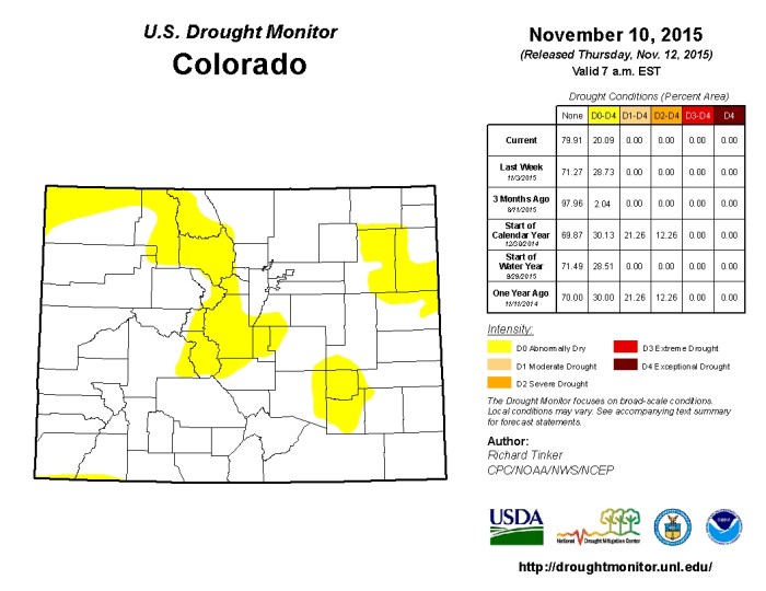
Click here to read the update:
Following a very warm and dry start to the fall, November to-date has seen more seasonal temperatures west of the divide and increased precipitation on the west slope and northeastern plains. This has helped to alleviate abnormally dry conditions over parts of the state. Storage levels in some basins are at the highest levels since the turn of the 21st century and water providers have no immediate concerns going into the snow accumulation season.
- September ended water year (WY) 2015 well above average for temperature across Colorado, ranking as the warmest September on record. The start of WY 2016 began much the same with October ranking the 3rd warmest on record. Both months saw average temperatures more than 50F above the long term monthly average, setting the state up to see the warmest three month September/October/ November period on record.
- Overall precipitation during the October 2014- September 2015 water year was above average and the wettest water year since WY1999. Evapotranspiration rates were also some of the lowest recorded, since record keeping began 23 years ago.
- Statewide water year-to-date precipitation is near average across most of the state. Recent storms resulted in increases in many basins including the basins of the southwest, Upper Rio Grande, Gunnison, Upper Colorado and South Platte which are all above average for the water year to-date at 140, 105, 113, 110 and 121 percent of average, respectively.
- Reservoir Storage statewide is at 109 percent of average as of November 1st . The Arkansas basin has the highest storage levels in the state at 132 percent of average; this is the highest reservoir levels have been in the Arkansas in more than 15 years.
- The Upper Rio Grande has the lowest storage levels at 87percent of average; this is also the only basin with below average storage. However, the Rio Grande levels are 28 percent greater now than this time last year and the highest they have been since 2009.
- The Surface Water Supply Index (SWSI) is highly variable across the state with sub-basins ranging from extremely dry to extremely wet. At this time of year the index reflects reservoir storage, which is largely above normal statewide, streamflow forecasts will be incorporated into the index beginning in January.
- El Niño conditions remain strong, and are projected to continue into early spring. Strong events do not favor increased precipitation during the winter months in the central and northern mountains of Colorado, as storm tracks tend to move in a more southerly pattern. However, the likelihood of good spring snowfall in this region is better, especially along the Front Range. The best combination would be for the El Niño to weaken over the winter, and then come back strong in spring.

