Who really killed Keystone? — The High Country News

Here’s a report from Cally Carswell writing for The High Country News. Click through and read the whole article. Here’s an excerpt:

An unusual coalition is fighting new fossil fuel infrastructure, and they’re starting to win.

On Earth Day 2014, a group of farmers, ranchers and Native Americans who live along the proposed Keystone XL pipeline route marched and rode horseback through Washington, D.C., wearing cowboy hats and feather headdresses. On the National Mall, they erected tipis and held ceremonies; a couple of days later, they gave a hand-painted tipi to the Smithsonian National Museum of the American Indian, in President Barack Obama’s honor. They gave the tipi the same names that the Lakota and Crow gave Obama in 2008 — “Man Who Helps the People” and “One Who Helps People Throughout the Land.” The message was implicit: The man who helps the people rejects the Keystone pipeline. This month, Obama did just that, handing the climate movement its clearest political victory yet.

The fight over Keystone XL gained national attention when prominent environmentalists like Bill McKibben positioned it as a litmus test of Obama’s commitment to fighting climate change. The pipeline would have connected the Canadian tar sands to Gulf Coast refineries, and most environmentalists argued that it shouldn’t be built because it would lock in the continued exploitation of one of the dirtiest fuels on earth.

But for those who marched on Washington last year, the battle was more personal. Farmers and ranchers in Nebraska feared the pipeline would leak, polluting their land and water and jeopardizing their livelihoods. Tribes worried about water contamination, disturbances to treaty lands, and the possibility of man camps popping up near their communities and increasing crime. Many landowners said TransCanada, the company behind Keystone, tried to bully them into signing easements. “They didn’t like that a private corporation could use eminent domain for their own gain,” says Jane Kleeb, who organized opposition in Nebraska. “And they really didn’t like that it was a foreign corporation.”

Together, the self-described cowboys and Indians and the climate crusaders proved a potent political force. Here was a project that could be framed as a high-stakes climate issue that got regular folks fired up, too — something the 2010 effort to pass federal carbon legislation achieved only insofar as it provoked rabid opposition from Tea Partiers. That cap-and-trade bill was designed by a handful of big green groups to be palatable to big business, but included little to inspire popular support, and environmentalists made scant effort to build a broad coalition to fight for it.

Check out Allen Best’s story about Keystone from November, 15, 2015 running on The Mountain Town News.

Ski areas win water fight with feds — The Aspen Times

Photo via Bob Berwyn

From The Aspen Times (Randy Wyrick):

The latest potential federal water grab may have dried up died Wednesday morning when the Forest Service threw in the towel…

The Forest Service insisted that water rights established on national forest land should be tied to the land, and that the federal government should own those water rights. The Forest Service says the policy is designed to keep ski areas from selling water rights for other purposes.

“By the Forest Service Chief’s own admission, there has not been an instance of ski area water rights being sold off for other uses,” said Rep. Scott Tipton, R-Colo, who represents western Eagle County and the rest of Western Colorado in the U.S. House of Representatives.

Ski areas should use water for skiing, the Forest Service said in publishing its directive Wednesday.

“Because water for snowmaking and other uses is critical to the continuation of ski areas on NFS lands, the Forest Service has a strong interest in addressing the long-term availability of water to operate permitted ski areas, the Forest Service statement said…

DEFEATING THE FEDS

The National Ski Areas Association took the Forest Service to federal court, saying the Forest Service’s policy was an illegal taking, that no federal law gives the Forest Service the authority to take water rights, and the U.S. Supreme Court has ruled repeatedly that water is regulated by the states, said Geraldine Link, public policy director with the National Ski Areas Association.

Because it’s a federal issue, they landed in federal court where the NSAA got an injunction against the Forest Service. The federal judge told the Forest Service to go to back to the drawing board.

The Forest Service entered its Ski Area Water Clause into the federal record Wednesday morning. The directive was expected by the end of the year, and the Forest Service made it with a day and a half to go in 2015.

“We’re happy about this approach. It protects the ski areas in water rights. At the same time it protects the Forest Service’s commitment for winter recreation in the long term,” Link said.

Now, instead of giving water rights to the federal government, ski areas remain at the helm of their water rights for the future, Link said.

“We’re partners with the Forest Service, and together we deliver a recreation package that’s unparalleled in the world,” Link said. “It’s not only good for the Forest Service and ski areas, it’s good for the public.”

HOW ALL THIS STARTED

Oregon rancher Tim Lowry started it all when the BLM tried to curtail his family’s grazing rights. He spent 10 years and $800,000 in legal fees, finally winning a verdict from his state’s Supreme Court. Lowry testified that he had purchased those water rights, and the feds refused to compensate him for them.

Colorado Sen. Michael Bennet called the Forest Service’s directive “balanced.”

“Water is a precious resource on which Colorado’s ski areas rely for economic sustainability and growth. We are lucky to live in a state with world class skiing right in our back yard and we want to keep it that way,” Bennet said.

According to Colorado Ski Country USA, Colorado’s ski industry generates $4.8 billion each year for our economy and supports more than 46,000 year-round equivalent jobs.

From The Denver Post (Jason Blevins):

The U.S. Forest Service will not require ski resorts to transfer water rights to the federal government as a condition of operating on public land. Instead, the agency will require ski areas to prove there is enough water to sustain skiing for the future.

The ski industry applauded the final decision Wednesday, as the agency released its final directive on the issue of water rights at ski areas on federal land.

In 2011, the Forest Service, which oversees 122 ski areas that count 23 million visits a year, proposed a clause in its permitting process that would require ski resorts to transfer water rights to the federal government.

The Forest Service had argued that the clause would assure the water would never be separated from the land. The agency feared that as the value of water rights climbs in the arid West, ski areas might see more economic benefit in selling water rights than in using the water for snowmaking and ski operations. The National Ski Areas Association sued the Forest Service in January 2012 over what it called an illegal taking of private property. In late 2012, a U.S. District Court judge overturned the new water rule and the Forest Service vetted it in a series of public meetings…

“The final directive focuses on sufficiency of water to operate ski area on NFS lands,” reads the directive. “This final directive will promote the long-term sustainability of ski areas on NFS lands by addressing the long-term availability of water to operate ski areas before permit issuance.”

The agency acknowledged how ski resorts in Colorado and New Mexico often spend millions of dollars on water projects. Many Western resorts consider water rights to be business assets.

In an important point raised by the ski resort industry since the water clause was proposed in 2011, the Forest Service acknowledges that water rights, especially in the West, are a matter of state law.

The decision protects ski areas’ investment in water and the Forest Service’s commitment of natural resources to winter recreation, said Geraldine Link, director of public policy at the National Ski Areas Association.

“In the bigger picture, this benefits the recreating public,” Link said. “The goal here is improving the long-term sustainability for ski areas on federal land. This will encourage further investment by ski areas in water resources and that provides stability and certainty for the local communities in which they operate.”

More USFS coverage on Coyote Gulch here.

#Snowpack news: El Niño delivers gift of snowfall — The Grand Junction Daily Sentinel

Westwide snowpack map December 30, 2015 via the NRCS

From The Grand Junction Daily Sentinel (Dennis Webb):

Mother Nature’s gift of a Christmas-season storm has resulted in an above-average early season Colorado snowpack, a head start that could prove important to ensuring there’s an adequate water supply waiting to melt in the high country come next spring.

Statewide snowpack was at 121 percent of median as of Wednesday, according to federal Natural Resources Conservation Service data.

That’s consistent with forecasters’ expectations for the start of a snow season dominated by a big El Niño weather system in the United States. Such weather systems derive from above-average water temperatures in the eastern Pacific Ocean near the equator.

“What it tends to do is produce a wet fall for us here in western Colorado, and that has definitely happened,” said Joe Ramey, a forecaster for the National Weather Service in Grand Junction.

And the importance of that early wet season comes from the fact that stronger El Niños also have historically resulted in generally drier mid-winters, at least in northern Colorado.

So while the storm in the days leading up to Christmas certainly helped the ski industry, “it also put important water into the mountains that we’ll be drinking during the warm season,” Ramey said.

He said such storms make or break a season, and this one “had a big impact on us, bringing snowpack up quite a bit, to well above normal across the state, especially in southwestern Colorado.”

The Upper Colorado River Basin was at 101 percent of median on Dec. 20, Ramey said. By Wednesday, it was at 114 percent.

Basins in southwest Colorado are at 134 percent, the highest statewide, in a welcome start to the year in a part of the state that has especially lagged behind in snowpack in recent years. Ramey noted that Arizona and New Mexico also have seen significant amounts of badly needed precipitation.

El Niños typically result in more moisture in the southwestern United States, with the benefit reaching up into southwestern Colorado but not necessarily extending farther north. The Yampa and White river basins in northwest Colorado currently are at 103 percent of median, the lowest of any basin in the state.

The Gunnison River Basin stands at 121 percent of median.

This week, the website opensnow.com has been showing a deeper snow base at Powderhorn Mountain Resort than in major resort areas such as Vail and Aspen. The Mesa Lakes snowpack measurement site on the Grand Mesa currently is at 123 percent of median.

“It’s snowing right now,” Jeff Kieper, owner of Thunder Mountain Lodge on the Grand Mesa, said Wednesday. “We just got another seven inches in the last two days.”

He said the lodge has gotten a whopping 71 inches of snow over eight days — more than he’d ever seen over such a span after living in the Vail area and spending four winters on snowmobile tours across the West.

[…]

Ramey said it’s important to remember that it’s early in the season, with much of the season’s snowpack typically developing in January through March. Also remaining to be seen is whether the El Niño pattern can deliver a wet spring to the state, as has occurred in some past El Niño seasons.

From 9News.com (Victoria Sanchez):

Meteorologist Kyle Fredin with the National Weather Service in Boulder said the wetter-than-average conditions are fueling storms.

“If you can get moisture at the surface and cold air aloft mixing together, you know game’s on,” he said…

There’s potential for more strong storms through next year. Fredin said the ocean should cool back down into the summer and into early fall but until then, there is potential for more extreme weather.

“Whether it’s extreme weather event or whether it’s an average day, nature is trying to balance.”

Webinar: #Colorado, we have a #COWaterPlan — Western Rivers Action Network

From email from the Western Rivers Action Network:

You’re Invited: January Lunchtime Webinar Series
Noon January 6

The final Colorado Water Plan, released November 2015, is an important step forward for Colorado on future water management. The plan reflects many Coloradan’s values and water priorities. The plan shows important progress by setting water conservation goals, proposing funding for healthy rivers, and making a large new trans-mountain diversion less likely. But, what does the plan say about funding, storage, permitting, or criteria for state water project support?

Find out by joining water experts on January 6 from noon 1 p.m. MT for an engaging webinar about what the final Water Plan means for Colorado today and tomorrow.

Our list of presenters and topics include:

  • Abby Burk, host and Western Rivers Outreach Specialist for Audubon Rockies, will discuss stream management plans and environmental resilience.
  • Aaron Citron, Water Program Manager for Environmental Defense Fund, will present on agricultural efficiencies and alternative transfer methods.
  • Drew Beckwith, Water Policy Manager for Western Resource Advocates, will report on the first statewide water conservation goal, and storage plans.
  • Melinda Kassen, Interbasin Compact Committee member, will present on the Conceptual Framework, criteria for state supported projects, and funding for the water plan.
  • Theresa Conley, Water Advocate for Conservation Colorado, will discuss legislative possibilities and next steps to taking the plan from paper to on the ground work.
  • We will follow up these must see presentations with opportunities for Q&A. Don’t miss out! Our rivers and all they support depend upon our next steps structured by the Water Plan. Register today.

    A screenshot from the website for Colorado's Water Plan.
    A screenshot from the website for Colorado’s Water Plan.

    #Snowpack news: Here are the latest Basin High/Low graphs from the NRCS

    Click on a thumbnail graphic below to view a gallery of snowpack data from the Natural Resources Conservation Service.

    USFS Final Notice: Ski Areas Water Clause

    Copper Mountain snowmaking via ColoradoSki.com
    Copper Mountain snowmaking via ColoradoSki.com

    In “Prior Appropriation” states like Colorado the USFS is requiring a hydrological analysis of water rights that will be used to operate the ski area under its permit. The analysis must demonstrate adequacy for the needs under the permit. Also, before severing any part of a right dedicated to the permit another hydrological analysis must show that no harm to the needs under the permit. The rule also covers what can be done with a right if the permittee sells the ski area.

    They’ve backed off on the transfer of title for rights to the United States.

    Click here to read the the permit language in prior appropriation states.

    Click here to read US Representative Tipton’s statement:

    Today, Congressman Scott Tipton (R-CO) issued this statement in response to the U.S. Forest Service’s publication of the final directive for the Ski Area Water Clause in the federal record.

    “The Forest Service’s conditional use of permit for ski areas has been one of the Administration’s most onerous attempts to hijack private water rights. While the latest version of the directive is improved from the original that sought to outright force the transfer of private water rights to the federal government, there still is room for improvement. The latest rendition of this ill-fated directive places unnecessary restrictions on private water rights holders, in an attempt to solve a problem that doesn’t exist. By the Forest Service Chief’s own admission, there has not been an instance of ski area water rights being sold off for other uses. Furthermore, there is still ongoing concern that while the Forest Service may not require the outright transfer of private water rights in this directive, it is still enforcing manuals that do.

    “Western water users are right to be wary of any action on water rights by this Administration, which has been dead set on slowly expanding federal control over water in the Western U.S. We continue to work on getting legislative protections in place to codify state water law and defend private water rights users from federal taking and interference as our Water Rights Protection Act seeks to do.”

    Despite the Forest Service’s insistence that under the new ski area permit condition it will no longer require the transfer of water rights, Forest Service manual 2441.32 (Possessory Interests), which is currently being enforced, instructs the agency to continue to claim water rights of permittees. It is unclear if or how the Forest Service plans to reconcile the conflicting instructions.

    Section 2541.32 of the 2007 Forest Service Water Uses and Development Manual directs:

    “Claim possessory interest in water rights in the name of the United States for water uses on National Forest System lands as follows:

    “Claim water rights for water used directly by the Forest Service and by the general public on the National Forest System.

    “Claim water rights for water used by permittees, contractors, and other authorized users of the National Forest System, to carry out activities related to multiple use objectives. Make these claims if both water use and water development are on the

    “National Forest System and one or more of the following situations exists:

    a. National Forest management alternatives or efficiency will be limited if another party holds the water right.

    b. Forest Service programs or activities will continue after the current permittee, contractors or other authorized user discontinues operations.”

    See the full manual HERE.

    Tipton has led the charge in Congress to protect private water rights users from federal takings and interference. He is the sponsor of the Water Rights Protection Act, H.R. 1830, which would provide water users with a line of defense from federal attempts, such as the Forest Service Groundwater Management Directive and ski area permit clause, to take private water rights without compensation or restrict user access to them. H.R. 1830 has passed the House in the 113th and 114th Congresses, and has wide support from local, state and national stakeholders including the National Ski Areas Association.

    More coverage of the USFS on Coyote Gulch here.

    Weekly Climate, Water and Drought Assessment of the Upper #ColoradoRiver Basin

    Upper Colorado River Basin month to date precipitation December 1 through December 27, 2015
    Upper Colorado River Basin month to date precipitation December 1 through December 27, 2015

    Click here to read the current assessment. Click here to go to the NIDIS website hosted by the Colorado Climate Center.

    #Snowpack news: “Our winters really seem to be made or broken by the presence of one or two big storms” — Joe Ramey

    Westwide SNOTEL December 29, 2015 via the NRCS.
    Westwide SNOTEL December 29, 2015 via the NRCS.

    From The Colorado Springs Gazette (Ryan Maye Handy):

    A Christmas snowstorm in Colorado triggered hundreds of avalanches and closed several mountain passes, but it also left much of the state with a sizable boost in snowpack, a key to ensuring communities will have enough water reserves come summer.

    “Our winters really seem to be made or broken by the presence of one or two big storms … and this was one of those big storms for us,” said Joe Ramey, a meteorologist with the National Weather Service in Grand Junction. “It was a season-defining event for us.”

    The storm brought much-needed moisture to southwestern Colorado, which for years has been drier than the Front Range, but drastically improved snowpack measurements around the state. Colorado’s water comes mostly from mountain snowpack accumulated during the winter and spring. In a few weeks, federal and local agencies will start monitoring that snowpack and its equivalent amount of water to forecast water reserves for the year.

    “It is still early season, but we got a lot of moisture out of this,” Ramey said. “That’s important for Colorado.”

    […]

    Ramey said a veritable “river of moisture” blew in Colorado on Dec. 20 from the central Pacific, bringing heavy snow and wind. The wind in particular might have set up the mountain areas for high avalanche risk, since wind-loaded slopes are more prone to slides.

    San Luis Valley groundwater rules responses

    San Luis Valley Groundwater
    San Luis Valley Groundwater

    Click here to read the first article in Ruth Heide’s series about responses to the San Luis Valley groundwater rules.

    Here’s the second article in Ruth Heide’s series about the responses to the San Luis Valley groundwater rules running in the Valley Courier:

    Some well users in the San Luis Valley are asking the water court to reject a portion of the Rio Grande Basin groundwater rules regarding sustainability .

    In its statement of opposition to the rules, SLV Confined Aquifer Sustainability, Inc. (CAS), a group founded in 2014 and representing water users with wells in the confined aquifer system in the Alamosa-La Jara and Conejos Response Areas, asked the court to reject the section of the rules regarding sustainability on the basis that section is “arbitrary, confiscatory, inconsistent with Colorado statutes and the Colorado Constitution, speculative, and unsupported by sound science and existing data.”

    CAS members were part of the group assisting the state engineer in developing the rules and commended the state engineer for the process he followed in including many diverse interests and groups. CAS supported much of the rules but had concerns about some portions.

    “These response areas face significant challenges in meeting the proposed rules,” the group’s response stated. “Not only must they replace injurious well depletions to multiple streams; they are presented with onerous sustainability requirements that may not be achievable.”

    One of the objectives of the rules is to bring artesian pressures back (and maintain them) to the level they were between 1978 and 2000, and CAS argued that there is not enough data from that time period to know reliably what the pressure levels were then.

    CAS argued the information regarding that time period was incomplete, limited or nonexistent.

    The state plans to gather data from monitoring wells from the present forward in order to estimate pressure levels from 1978-2000 , and CAS supported the data collection as useful but stated, “attempting to determine the pressure levels that existed between 1978 and 2000 on the basis of data from 2015 forward cannot provide reliable results.”

    Many of the monitoring wells did not exist before this year, “and the reliability of the data to be gathered is untested,” CAS argued. “It is and will be unknown how these monitoring wells can be used in determining and protecting sustainability until they have been in operation for a longer time.”

    The state plans to conduct a 10-year study of these new monitoring wells, and CAS argued that any cutbacks on well usage before the 10 years were up would “result in the taking of vested property rights without compensation.”

    The only pressure levels that could be relied on at this time, CAS argued, are the ones in existence before this year, so the state engineer should only focus on preserving and improving the pressure levels of 2015.

    CAS argued that the state engineer does not have the information he needs to promulgate the sustainability rules at this time, so the court should reject that portion of the rules.

    CAS also argued that the rules maintain the confined aquifer can be controlled by limiting withdrawals when there are other factors that can affect aquifer pressures such as climate, geologic conditions, inflows and outflows and the location of withdrawals.

    CAS stated, “The pressure levels within the confined aquifer system during the period of 1978 through 2000, upon which the sustainability provisions of the proposed rules are based, may be impossible to restore through curtailment of withdrawals from confined aquifer wells without an improvement in climatic conditions and water supply.”

    Other complaints the group had with the groundwater rules included:

    • the method used to estimate groundwater withdrawals , which CAS argued was inaccurate and would deprive well owners of their legitimate property rights;
    • requirements differing for confined aquifer wells depending on where they are located in the basin, which CAS argued was a violation of state statute (” aquifers of the same type in the same water division shall be governed by the same rules regardless of where situated);
    • the confined aquifer system wells were inappropriately grouped and that wells outside a given response area could still affect aquifer pressures within that response area;
    • the rules should have allowed for a sub-district for the confined aquifer wells in the basin, as a group, which CAS stated retired Chief District/Water Judge O. John Kuenhold had required when the sub-district process began
    • under the rules, estimated reduction in water withdrawals for confined aquifer irrigators would be disproportionately high, for example approximately 35 percent in the Conejos Response Area, contrary to state statute standards that “any reduction in underground water usage required by such rules shall be the minimum necessary to meet the standards “” CAS stated in its protest to the rules that 35 percent reduction would not be the minimum required to meet the standards and senior water rights would be protected and sustainability standards met by a reduction of much less than 35 percent.
    • time limits for complying with the 1978-2000 sustainability requirement are too short and too “onerous.” Rather than a 10-year time frame as set in the rules, CAS argued a 20-year time frame would be more appropriate.

    Here’s the third article in Ruth Heide’s series about the responses to the San Luis Valley groundwater rules running in the Valley Courier:

    While some well users objecting to the Rio Grande Basin groundwater rules argue they went too far, some surface water users objecting to the rules argue they do not go far enough.

    Collaborating on one statement of opposition, several Conejos County farmers and ranchers asked the water court not to approve the state engineer’s rules until the groundwater model used to determine how much well users should “pay back” injured surface water rights was “correctly designed and calibrated.”

    Specifically , the Conejos County landowners maintained the computer groundwater model did not accurately reflect the injurious depletions well users have caused residents with surface water rights on Arroya Springs and Arroya Creek. Namely, the groundwater model does not show any injuries on those streams because they were dried up as a result of well pumping before the model was developed, objectors stated.

    That does not mean well users shouldn’t make up for those injuries, the Conejos County surface water right owners added.

    “Groundwater withdrawals from the confined aquifer predominantly by wells junior in priority to the protestors’ water rights have caused the potentiometric head of the confined aquifer in the vicinity of Arroya Springs and Arroya Creek to decrease,” the objectors stated.

    They estimated that the aquifer potentiometric head had declined in the vicinity of Arroya Springs 25 feet between 1970 and 2014, adding, “There is a strong inverse correlation between groundwater withdrawals in the vicinity of Arroya Springs and the flow of water from Arroya Springs.”

    As more water was diverted by wells from the 1930s to the early 1970s, the Conejos County water users stated , the flow from Arroya Springs decreased. From 1916-1923 , the flows in Arroya Springs ranged from 22-58 .3 cubic feet per second (cfs), they stated, but by 1967, the flow had decreased to 7 cfs, by 1975 to 3 cfs, by 2009 to 1 cfs and by 2013 the Arroya was dry.

    To put it another way, annual diversions from Arroya Creek and Arroya Springs declined from more than 9,000 acre feet in 1937 to 655 acre feet in 1964.

    Objectors said Arroya Springs was recharged by precipitation, seepage from La Jara Creek and irrigation ditch seepage and return flows . Even though the development of irrigation ditches may have increased the amount of water that discharged at Arroya Springs, the springs existed and discharged water prior to that development, the objectors stated. The groundwater rules will not preserve the priority water system and replace injurious depletions caused by well usage, as they are set up to do, if they rely on a groundwater model that does not take into account depletions to the Arroya Creek and Springs, objectors stated. They added it would be unlikely groundwater users would voluntarily develop an alternative model showing depletions to Arroya because then they would have to replace water to those streams.

    Objectors argued that the proposed rules violate state statute because the model the rules rely on “does not preserve the priority system of water rights.” The rules should not become effective until the model is correctly designed and calibrated , the objectors stated.

    Those listed in this statement of opposition to the rules included: 2 J Ranches Inc.; Charles and Valerie Finnegan; Colin and Karen Henderson; Donald Larsen; Joseph A. Martinez; LeRoy and Rosalie Martinez; Querina Martinez; Edon Ruybal; Dick and Georgann Smith; and Armando and Jessica Valdez. Their surface water rights date back to appropriation dates of 1889 and 1902.

    Colin and Karen Henderson , El Sagrado Farm, filed a separate protest urging the state to take into consideration well monitoring data already available in determining what will be required to replenish the aquifer and replace injuries to senior water users. They did not object to further data gathering but said where there is already data available, the state should use it.

    “We demand the rules state the data available from monitoring wells collected between 1978 and 2000 be used immediately in subdistrict reparation plans and our water rights be returned to us,” the Hendersons said in their statement of opposition.

    They also argued that the state should close down wells, starting with the most junior well rights, until the Arroya Springs flow again. Those closest to the springs should be curtailed first , they added.

    The Hendersons attached a well readings graph as documentation for the injuries they and other Conejos County senior water users had sustained. The graph showed measurements between 1983 and 2013. When the water level in the well was above 7628 feet, the Arroya Springs flowed , the Hendersons pointed out, but when the drought of the early 2000’s began, there was less water replenishing the aquifer, but the wells continued to pump, the aquifer level dropped, and the springs stopped flowing.

    “This is hard data that can- not be refuted and demands the state take immediate action to repair our water rights,” the Hendersons stated.

    In a similar statement of opposition, a group of Conejos County senior water users on the El Codo Ditch, Llano Ditch, Las Sauces Ditch and Chavez Ditch also argued that the groundwater model relied upon by the state engineer’s rules was not correctly designed or calibrated and the rules should not become effective until the model is corrected.

    This group also argued that the rules should include additional provisions to require the demonstration of aquifer sustainability progress on an annual basis. They stated that while the rules refer to a 10-year period when the engineer will gather data to determine what the aquifer sustainability requirements should be, during that 10 years well users would be continuing to injure senior water rights “without remedy to an already depleting water source.”

    The objectors added, “The lack of a more concise governance to address immediate injury must be addressed to improve current aquifer sustainability levels.”

    The protestors stated that groundwater withdrawals had already lowered aquifer levels over time, which negatively affected surface water rights, some of which dated back to 1855 and 1867.

    The objectors also stated that they were curtailed in the amount of water they could use from their ditches in order for the state to meet its Rio Grande Compact obligation to downstream states, but well users had no similar curtailment. That essentially meant that the junior groundwater rights superseded the more senior surface rights, they added.

    “Groundwater withdrawals have not been subject to curtailment for compact obligations . Meanwhile, groundwater withdrawals have been reducing the aquifer sustainability levels contributing to streams losses and depletions forcing surface water users to contribute increasing amounts of water from their respective decreed water rights to satisfy compact obligations, in lieu of its intended consumptive use,” objectors stated.

    As well usage increased from the late 1930s to early 1970s, the objectors stated, the number of days they were curtailed for compact obligations increased.

    “The manner in which groundwater withdrawals have been administered have allowed superseding rights to those groundwater withdrawals over the senior priority right of which prior appropriation allows ” Lack of comprehensive rules improperly reallocates to junior wells the water that was previously appropriated by senior surface water rights, including the protestors’ water rights.”

    Here’s the fourth article in Ruth Heide’s series about the responses to the San Luis Valley groundwater rules running in the Valley Courier:

    This is the fourth and final of a series focusing on the responses filed to the Rio Grande Basin groundwater rules.

    Longwater warrior Kelly Sowards said a mouthful in a few handwritten lines in his statement of opposition to the Rio Grande Basin groundwater rules.

    Sowards from Conejos County and Norman Slade from Rio Grande County filed individual statements with concerns about the rules.

    Without an attorney or typewriter, Sowards told the water judge the rules should be granted “only in part.” He specifically objected to the 1978-2000 period that the rules and state legislature use as the goal for sustainability in the basin, which encompasses the San Luis Valley. Sowards objected to the “lack of history and facts” for that period and said this time period was “years after the Conejos system lost all of its return flows and artesian springs flows.”

    Sowards also found the rules lacking in that they do not require irrigation wells to pay their fair share of Rio Grande Compact requirements ; “administration of water to comply with Colorado obligation under Rio Grande Compact; “the conjunctive use of surface and groundwater by state not enforcing groundwater usage” ; and the use of Closed Basin Project water for the water management sub-districts .

    Slade, who retained attorney John Cyran, generally supported the rules and was present during the many meetings occurring over several years to develop the rules. However, Slade stated he believed the rules could be firmed up in a few areas:

    • provisions to require the curtailment of wells that are not replacing injurious depletions or operating under augmentation or sub-district plans, which are the measures permitted under the rules. Groundwater irrigators who are not replacing injuries to surface water rights through sub-districts or individual augmentation plans are to be curtailed or even shut off. Slade argued that the rules do not include sufficient provisions to require wells to be curtailed if they do not follow the rules.
    • provisions to provide additional flexibility by recognizing methods such as prepayment, banking or advance dedication of water to satisfy sustainability requirements.
    • clarity in what the rules mean by allowing water users to replace injurious stream depletions by contractual remedy. “The proposed rules are unclear as to what types of contractual arrangements are acceptable ‘remedies,” Slade’s statement read, “and it is not clear that such ‘remedies’ are acceptable under Colorado law.”
    • provisions to monitor the effectiveness of the rules and to modify them if they prove ineffective. Slade’s statement argued that the rules should require the state engineer to prepare a report concerning the rules’ effectiveness no later than five years after operation. Based on that report, the state engineer should propose modifications to the rules identifying sources of water for aquifer sustainability or demonstrating why no modification is necessary , Slade stated.
    • reporting requirements for those operating under sub-districts or augmentation plans should include an annual report regarding sustainability, and the rules should require reporting regarding credit allowed under the groundwater model for phreatophytes (plants soaking up groundwater) “or for other depletions that are determined noninjurious.”
    • better define/explain “proportional responsibility” for maintaining a sustainable water supply. Slade concluded by questioning whether the rules would be sufficient in achieving their goal of sustainability in this basin.

    “The proposed rules generally may be insufficient to ensure sustainability of the Division 3 surface and ground water supply.”

    The groundwater rules also incorporate the irrigation season, and the only objection to that portion came from the San Luis Valley Irrigation Well Owners, La Jara, who said the portion setting the beginning and ending of the irrigation season should not be approved the way it is written.

    These irrigators operate at the southern end of the San Luis Valley and receive some of their water supply from Los Pinos, which travels through northern New Mexico, as well as the San Antonio River, which has divertible flows earlier than other rivers in the Valley. These irrigators also rely on water associated with the Taos Valley Canal No. 3, which historically diverts water in March.

    If San Luis Valley Irrigation Well Owners are not allowed to begin irrigating until April 1, the start date designated in the rules, it might deprive them “of a significant and important portion of their vested water rights,” the group stated.

    Diversions in March, they argued, are especially important to them in dry years “due both to the fact that the San Antonio will begin running earlier in the year, the need for augmentation water may be greater in driver years and the relative priority of the water right may result in it being called out earlier in the season.”

    The water users stated the irrigation season portion of the rules should be revised to take into account situations like theirs.

    They also objected to the compliance time in the rules, maintaining it was too short and should be extended because developing augmentation plans, negotiating agreements and building infrastructure is a lengthy process.

    Needing more time may not be the strongest argument of any of the statements of opposition to the rules, since the state engineer has been working on these rules in full view of the public and with public participation since 2009.

    R.I.P Fred Kroeger

    Fred Kroeger via the Southwestern Colorado Water Conservation District
    Fred Kroeger via the Southwestern Colorado Water Conservation District

    From The Durango Herald (Ann Butler):

    Whether you call him the epitome of the Greatest Generation or the man who would not give up, former Durango Mayor Frederick V. Kroeger, who died Saturday at 97, left a legacy for generations of Southwest Coloradans to come.

    The most visible parts of that legacy? Lake Nighthorse, Kroeger Hall and the Community Concert Hall at Fort Lewis College and the business he founded in 1967, Kroegers Ace Hardware, an expansion of his family’s Farmers Supply that dates back to 1921…

    “He had a huge talent for leadership and was always positive and forward-looking,” Short said, “He never gave up. When I think about all the support, rallying and lobbying he did for the (Animas-La Plata Project) … he wasn’t going to stop until he saw it through.”

    Water conservation and storage were key issues for Kroeger most of his life, in part because of his family’s connection to the agricultural sector through Farmers Supply and in part because extended family members lived in southwest La Plata County, where water is scarce. Kroeger made countless trips to Washington, D.C., and Denver to lobby federal and state agencies on behalf of Southwest Colorado.

    “What more can I say? He’s one of the great figures in Colorado water history,” said former Colorado Supreme Court Justice Greg Hobbs, who told the Herald in 2009 he’d been inspired by his Southern Colorado counterparts while serving as the counsel for the Northern Colorado Water Conservancy District…

    “He was from that Greatest Generation, and he did everything with the highest integrity and ethics,” [Sheri Rochford Figgs] said. “I admired all of them so much – Fred Kroeger, Robert Beers, Morley (Ballantine) – because if they said they were going to do something, they did it, and they did it with gusto and enthusiasm.”

    Snowpack news

    Statewide snowpack map December 28, 2015 via the NRCS.
    Statewide snowpack map December 28, 2015 via the NRCS.

    From the Cortez Journal (Jim Mimiaga):

    McPhee Reservoir, the Dolores Water Conservancy District, and its farmers are getting a double dose of holiday cheer.

    Snowpack is piling up early in the San Juan Mountains, the best start to winter in a couple of years.

    Preliminary snowfall totals from the Dec. 22-23 storm in the San Juan Mountains are 24 inches of fresh powder, according to the National Weather Service.

    Snotels – devices placed throughout the Dolores Basin measuring snowpack in real time – are reporting above-average snowfall. They are used to predict runoff into McPhee Reservoir, which ended the irrigation season with decent carryover storage.

    The El Diente Snotel is at 145 percent of normal, the Lizard Head Snotel is at 130 percent of normal, and the Scotch Creek Snotel is at 135 percent of normal.

    Those numbers will climb even higher as updates comes in, said NWS meteorologist Andrew Lyons.

    “Plus we’re tracking another storm for Christmas Eve that is expected to be a real snow maker for the Western Slope,” he said. “It’s stronger to the north, but will likely bring snowfall your way as well.”

    Another gift for the district is the award of up to $3 million in grants from the Bureau of Reclamation to overhaul several pumping stations in time for the 2016 farming season.

    Ruin Canyon, Pleasant View, Cahone, and Dove Creek pumping stations are all having critical infrastructure replaced. The pumps are 25 years old.

    2015 #COleg: Sen. Coram plans #GoldKing relief bill

    Animas River through Durango August 9, 2015 photo credit Grace Hood
    Animas River through Durango August 9, 2015 photo credit Grace Hood

    From The Durango Herald (Peter Marcus):

    State legislation has been drafted in an effort to pressure the federal government into quickly settling damage claims stemming from the Gold King Mine spill.

    Rep. Don Coram, R-Montrose, said he will carry the bill at the start of the legislative session, which begins next month.

    The bill would allow the state to file lawsuits against the federal government on behalf of individuals financially impacted by the Gold King Mine spill.

    “It’s authorizing the state of Colorado to sue the EPA in case they renege on their obligation,” Coram said.

    He added, “The idea behind the bill is that it encourages them to settle this in a gentlemanly manner.”

    The legislation is directed at the Federal Tort Claims Act, which allows individuals to sue the United States in federal court for damages caused by federal employees acting on behalf of the country. With Coram’s legislation, the state would be allowed to sue on behalf of individuals.

    He stressed that the bill was in its initial drafting stages and that the language would become more specific.

    Reservoir evaporation a big challenge for water managers in West — Univ. of #Colorado

    Here’s the release from the University of Colorado at Boulder (Peter Blanken, Justin Huntington, Jim Scott):

    Water managers in Colorado and the West scrambling to meet the growing demand for increasingly scarce water supplies caused by large populations far from water resources, climate change and drought need to focus more effort on conserving water, including addressing reservoir evaporation, say University of Colorado Boulder researchers.

    While reducing water consumption has been successful in places like Denver and much of California, the loss of water from reservoir evaporation is an issue already affecting the growing population of the West, said CU-Boulder Associate Professor Katja Friedrich. The reservoir water loss is becoming even more important as broad uncertainties in precipitation projected by climate change and early snowmelt require more reservoir storage, she said.

    “Evaporation of water from open reservoirs in the arid western U.S. cannot be neglected any more, especially with the possibility of precipitation decreases occurring as a result of a changing climate,” said Friedrich, a faculty member in the Department of Atmospheric and Oceanic Sciences (ATOC). “We need to try to plan for both short-term needs and to make sure we have enough water over the coming decades.”

    A recent workshop on campus convened by researchers at CU-Boulder and the Desert Research Institute (DRI) in Reno, Nevada, brought together experts in atmospheric science, hydrology, land use and water resource management from the western U.S. and Canada, said Friedrich.

    One of the US Class A evaporation pans installed at the King’s Park Meteorological Station in Kowloon, Hong Kong.
    One of the US Class A evaporation pans installed at the King’s Park Meteorological Station in Kowloon, Hong Kong.

    Water managers have little information on evaporative loss, relying on outdated methods like “pan evaporation,” developed in the 1920s and still in use today. In pan evaporation, a 4-foot-in-diameter, 10-inch deep pan is set next to selected reservoirs where water managers fill the pan and measure water evaporation in 24-hour increments and extrapolate the results to corresponding reservoirs. The method is used today in many Colorado reservoirs as well as major Colorado river impoundments.

    The problem in part is not all reservoirs are equal in terms of location, elevation, shape or evaporation. Attendees of the CU-Boulder-hosted reservoir evaporation workshop in October proposed the use of high-resolution weather models coupled with sophisticated reservoir models, which could be used not only to estimate evaporation but also to forecast it, a method not previously considered by water managers.

    Little research has been done on quantifying evaporation with instrumentation and numerical models, Friedrich said. “We need to better understand evaporation, which will require continuous measurements of wind direction and speed, air and reservoir temperatures, humidity, solar radiation and vegetation at individual reservoirs.”

    Evaporation is a large and continuing problem in the Colorado River basin, including Lake Mead and Lake Powell where about 5 billion gallons of water evaporate annually, according to CU-Boulder Assistant Professor Ben Livneh of the Department of Civil, Environmental and Architectural Engineering.

    This represents roughly 10 percent of the total natural flow of the Colorado River Basin said Liveneh, who also is also a fellow at the Cooperative Institute for Research in Environmental Sciences — about five to 10 times the amount of Denver’s annual water use.

    “We can no longer afford to lose this amount of water. Once it is lost it is gone,” said retired ATOC scientist Bob Grossman, who helped organize the conference on reservoir evaporation. “The neglect of evaporative loss as the cost of doing business in a water-abundant world will likely cut into the bottom line as scarcity looms.”

    Proposed “geo-engineering” techniques for reducing reservoir evaporation include covering surface water with thin films of organic compounds, reflective plastics or extremely lightweight shades. Other proposals include moving reservoir water underground into new storage areas or aquifers or relocating or building new storage reservoirs at higher elevations where less evaporation occurs.

    “One thing we do know is that you can only reduce evaporation and not eliminate it unless you store it underground,” said Friedrich. “But that has its own set of problems. Our intention is to help water managers reduce evaporation for current and future reservoirs.”

    To study evaporation differences in different reservoirs, a team of scientists, water managers and federal and state agency representatives led by DRI researcher Justin Huntington deployed high-tech buoys at reservoirs in California, Idaho and Nevada to better understand the water evaporation process. In addition, there is ongoing research on evaporation from the Great Lakes by CU-Boulder geography Professor Peter Blanken and his Canadian and U.S. colleagues.

    Participants in the October evaporation workshop included a number of universities and federal and state agencies like the U.S. Bureau of Reclamation, the Colorado Water Conservation Board, Environment Canada and the National Center for Atmospheric Research. The researchers hope to test new techniques and tools related to evaporation on a Front Range reservoir starting next year, said Friedrich.

    Phoenix: Business of Water Summit 2016, March 30-31, 2016

    First Train in Phoenix. Image Courtesy of the Arizona Historical Society.
    First Train in Phoenix. Image Courtesy of the Arizona Historical Society.

    From the Protect the Flows website:

    Register Now!

    Please join Protect the Flows, Change the Course and senior executives from leading companies, water & power utilities and dignitaries for the third Business of Water summit, March 30-31, 2016 in Phoenix, Arizona.

    AGENDA HIGHLIGHTS INCLUDING SESSIONS ON:

  • Water Partnerships: Plowing New Ground
  • Using your Brand to Move the Water Needle: Building Internal Buy-In and External Communications
  • Water Policy Priorities and Principles
  • Market-Based Solutions for Maximizing Liquid Assets
  • Multiple Benefit River Restoration: Partnering to Keep the Water Flowing
  • Reuse and Recycling
  • Speakers Confirmed from these Businesses & Organizations:

    Arizona Chamber of Commerce and Industry
    City of Phoenix Water Services Department
    Colorado River District
    Gammage and Burnham
    Intel Corporation
    Miller Coors
    Nestle
    New Belgium Brewing
    PepsiCo
    Salt River Project
    Squire Patton Boggs
    Think Parallax Plus more coming on board every day!

    CLICK HERE FOR A FULL DRAFT AGENDA FOR THE 2 DAY SUMMIT

    Hayfield message to President Obama 2011 via Protect the Flows
    Hayfield message to President Obama 2011 via Protect the Flows

    SDS — American Infrastructure Magazine “Water Project of the Year”

    Colorado Springs circa 1910 via GhostDepot.com
    Colorado Springs circa 1910 via GhostDepot.com

    From American Infrastructure Magazine (Genevieve Smith):

    Not many cities can claim their infrastructure was of leading concern from the beginning, but Colorado Springs is one of them. Concrete evidence was left in a time capsule by one of the city’s founding engineers, Edwin W. Sawyer, via documents dated in 1901 which state, “It seems to me that nothing except the lack of water can stop the growth of a city so desirable for residence as this…Our people are becoming aroused to the need of securing at once all the available reservoir sites and water rights…”

    Southern Delivery System route map -- Graphic / Reclamation
    Southern Delivery System route map — Graphic / Reclamation

    Continuing in the same water-conscious spirit as those earlier citizens, three different mayors and at least eight previous city councils have been involved and invested in the planning of the Southern Delivery System, American Infrastructure magazine’s Water Project of the Year.

    Awarded for its forward-thinking and comprehensive approach to water management, the regional project will be built in phases through 2040 based on customer demands, and will bring water from Pueblo Reservoir to Colorado Springs and partner communities, Fountain, Security, and Pueblo West.

    The project is more than a simple fix for major pipelines that are now over 50-years-old and nearing capacity; Jerry Forte, the current CEO of Colorado Springs Utilities, hopes that this project “will serve as an engine, driving more efficiency, effectiveness, and reliability in our system.”

    The new north outlet works at Pueblo Dam -- Photo/MWH Global
    The new north outlet works at Pueblo Dam — Photo/MWH Global

    Phase I, which is now under construction, will transport water from Pueblo Reservoir through approximately 50 miles of underground pipeline, and is on schedule for April 2016. The project is estimated to cost $841 million at completion (thus far, under budget by $156 million)…

    The four-part Water Resource Plan, of which the SDS is the major component, includes conservation, non-potable water development, existing system improvements, and major water delivery systems (the SDS itself). After the 2002 drought heightened public awareness of water scarcity, Colorado Springs has been able to make improvements to increase the efficiency of the existing water system before constructing SDS. Today, their per capita residential water use is among the lowest in the region. Colorado Springs also has the second-largest nonpotable water system in the state and has expanded their use of non-potable water in recent years.

    Fountain Creek Watershed
    Fountain Creek Watershed

    Like any other project, this process hasn’t gone without headaches. However, clearing some of these hurdles was no easy feat, including dozens of permits and an Environmental Impact Statement that took almost six years to complete. In order to mitigate concerns that the proposed SDS would cause damage to Fountain Creek and surrounding wetland areas, a significant portion of the $1.4 billion overall cost of the project is a $75 million in wastewater system improvements to help prevent wastewater spills into Fountain Creek, a $50 million payment to the newly formed Fountain Creek Watershed Flood Control and Greenway District; additional payments will be allocated towards various mitigation and flow maintenance programs on Fountain Creek in the future.

    @BrendansWeather: Every severe thunderstorm warning (yellow), tornado warning (red), and preliminary tornado report (white) of 2015

    thunderstormandtornados2015brendansweather

    @BrendansWeather sends this link to a higher resolution image.

    For Colorado’s Reservoir Caretakers, Work Is A Calling And A Challenge — Colorado Public Radio

    From Colorado Public Radio (Grace Hood):

    Many people start their work day with a computer log-in screen. For Doug Billingsley, a reservoir caretaker for Greeley Water and Sewer, it begins with a snowmobile ride that feels like a bucking bronco. “This is the fun part,” the 57-year-old said…

    Billingsley looks after about a half dozen northern Colorado reservoirs that feed the city of Greeley’s water supply. The city may be located on the plains, but it has substantial water rights located far away in the mountains. On a typical day, Billingsley may test snowpack levels or dig into the ice to make sure reservoir levels are holding steady.

    One thing he always checks are the dams.

    “Do I see any bulges? Do I see any rises, do I see any dips? Anything out of the ordinary. Because I know what the dam is supposed to look like. Summer and winter,” said Billingsley.

    In the world of 24/7 automation, there are routine tasks that some water districts don’t have the resources or desire to automate. This is where reservoir caretakers come in. About 75 people across the state work in remote areas tending the state’s water supply. The job is time consuming and challenging. The reward during the summer is breath-taking scenery out your front door.

    The power of a trained eye

    Colorado has come a long way since its worst dam failure in 1933 when Castlewood Canyon dam burst spilling water into Cherry Creek and into parts of Denver. Back then it was dam caretaker Hugh Paine who rushed 12 miles to the nearest phone. With no text or cell phones, Paine was able to initiate a phone tree credited with saving many lives.

    Across Colorado, the need for a physical presence near dams and reservoirs remains for many water districts. The Bureau of Reclamation can do most of its operations remotely, and relies on about 15-20 workers stationed remotely across its system.

    Some of Colorado’s dams and reservoirs aren’t as automated. Older gauges and equipment need to be manually operated. Then there’s the role of the human eye in detecting dam problems. Many water managers believe it’s still one of the best diagnostic instruments.

    “The human eye is the best tool to be able to recognize the subtle changes that might indicate a problem happening at a dam,” said Bill McCormick, dam safety chief for Colorado.

    Take for example earthen dams. Automated tools monitor water seepage—small amounts are common. But McCormick said there can be subtle changes instruments don’t pick up.

    “A caretaker’s eyes will catch that where the instrument would never see it,” said McCormick.

    McCormick’s dam inspectors train reservoir caretakers on what problems to look for. The highest hazard dams are inspected every year.

    A Calling
    One of the state’s largest employers of reservoir caretakers is Denver Water. It positions two, sometimes three caretakers at its more remote reservoirs. One of the biggest challenges — and benefits — of the job is the variety of tasks.

    “The best part about it is that you never do the same thing twice — unless it’s shoveling snow,” joked Ryan Rayfield, head caretaker of Williams Fork Reservoir in Grand County for Denver Water.

    Rayfield said caretakers have to be a jack of all trades. Regular tasks include painting, carpentry and fixing lawnmowers. Rayfield even repairs and operates the hydroelectric plant. Rayfield lives with his wife and young daughter at the reservoir. Denver Water has stories of caretakers who have raised their entire families at reservoirs…

    Tomorrow’s Water
    Despite the harsh winter conditions, most reservoir caretakers say the job is challenging and rewarding. That’s true for Doug Billingsley. He stayed put at his home at the Milton Seaman Reservoir during the High Park Fire in 2012 to watch over vital equipment. He hunkered down during the 2013 floods.

    The events didn’t cause direct problems for Milton Seaman Reservoir. But Randy Gustafson, city of Greeley water resource administrator, said having a presence in the backcountry was key — especially during the flood.

    “It was critical on the aspect of just being able to assure everybody that the reservoir was operating as it should,” he said.

    Milton Seaman Reservoir outlet July 2011
    Milton Seaman Reservoir outlet July 2011

    Lake Nighthorse water-rights settlement pushed to Jan. 15 — The Durango Herald

    Lake Nighthorse via the USBR
    Lake Nighthorse via the USBR

    From The Durango Herald (Jessica Pace):

    A ruling on the settlement agreement reached last month in the years-long Animas-La Plata Project legal battle over water rights to Lake Nighthorse was continued to Jan. 15.

    Chief District Judge Gregory Lyman’s ruling was postponed until next month because a signed agreement to the settlement is still needed from several federal parties involved, including the Department of Justice.

    Last month, stakeholders reached the settlement, which saved all parties from an arduous trial over whether the Southwestern Water Conservation District’s continued use of the water from Lake Nighthorse for irrigation is consistent with state and federal law.

    The SWCD had conditional rights to the water through a temporary permit.

    The litigation sprang from groups, including the Animas Conservancy District, San Juan Water Commission, Southern Ute Indian Tribe and Ute Mountain Ute Indian Tribe, that were opposed to the SWCD’s continued use of water from Lake Nighthorse, which was designated to fulfill the water needs of native communities and water districts in Colorado and New Mexico.

    Snowpack news: 4 days of snow in SW #Colorado = great numbers

    Click on a thumbnail graphic below to view a gallery of snowpack data from the Natural Resources Conservation Service.

    Tribes hold wild card in high-stakes supply game — E&E Publishing

    Many Indian reservations are located in or near contentious river basins where demand for water outstrips supply. Map courtesy of the Bureau of Reclamation.
    Many Indian reservations are located in or near contentious river basins where demand for water outstrips supply. Map courtesy of the Bureau of Reclamation.

    Here’s a report from Nnie Snider writing for E&E Publishing. Click through and read the whole article, here’s an excerpt:

    It’s not just modern engineering that made Arizona’s desert bloom.

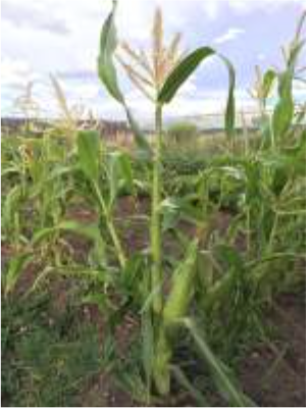
    Thirty miles south of downtown Phoenix sits dusty land that was once farmed by one of the most advanced agricultural civilizations of prehistoric times. As far back as 300 B.C., the Hohokam people hand-dug a network of canals through the Gila River’s rich floodplains, diverting spring runoff to nourish their fields.

    But by the end of the 19th century, their descendants’ fields were parched and dead, thanks to upstream diversions by white settlers.

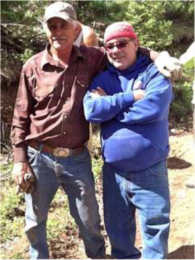
    “That era among our people is called the time of starvation,” said Gov. Stephen Roe Lewis, the top elected official at the Gila River Indian Community, home of the Hohokam’s descendants, the Pima, and the Maricopa tribe.

    “Not only had our crops dried up because of lack of water, we were known as ranchers and a lot of our animals died because of lack of water,” he said. “We were really on the brink of extinction.”

    Over the next century, the federal government put its financial and engineering might to work developing water projects around the reservation to benefit surrounding communities, but rarely the tribes.

    Their fields dry, the Pima and Maricopa shifted from their traditional diet to a Western one, and the community’s diabetes rate skyrocketed to one of the highest in the country.

    Traditional ways — weaving baskets of marsh grasses, using herbal medicines made from river sediment — were lost, too.

    The painful irony: The tribes were technically the first in line for water.

    Thanks to a 1908 Supreme Court ruling, tribes almost always have the most senior claim to water in the West, where water rights are prioritized based on when the resource was first put to beneficial use and reservations dot the landscape.

    Rights mean little without a lawyer to defend them, though, and for generations, tribes were too poor to afford representation.

    But in recent years, in part because of groundwork laid by the Native American civil rights movement, tribes are increasingly heading to court to assert their rights.

    There’s a problem: While the high court was clear that tribes have rights to water, it did not say to how much.

    In many cases, tribes claim a share large enough that it could crowd out neighboring cities’ and farmers’ water supplies and stanch future development.

    Tribes along the main stem of the Colorado River in the Lower Basin have some of the few court-determined rights because of a 1963 Supreme Court decision covering larger battles over the river between California and Arizona. Today, just those few tribes have rights to roughly 20 percent of the Lower Basin’s flow — an amount that is more than five times the allocation for the entire state of Nevada…

    Now, as booming populations and extended droughts have stoked competition for water supplies across the West, the uncertainty around tribes’ potentially massive claims to water in already overstretched river basins is posing real constraints on communities and businesses.

    “It’s a very significant set of claims that tribes have on very limited and critical water supplies across the West,” said Deputy Interior Secretary Mike Connor, who has worked on tribal water issues throughout his career. “It’s uncertainty — that’s what water managers don’t want.”

    But lawsuits have largely proved fruitless for all sides.

    When tribes win, they receive only a legal right to the water — dubbed a “paper water right” — often without the infrastructure or funding needed to get the water to the reservation and put it to use.

    Meanwhile, endless appeals offer certainty for no one.

    Instead, many tribes and communities have opted to sit down at the negotiating table in an effort to hash out an agreement that can get the tribes what they most need — wet water and sometimes other support for economic development — while protecting nontribal users and absolving the federal government of liability for failing to protect tribes’ rights.

    Moreover, with all parties at the table, settlements are increasingly providing an opportunity to take a holistic look at issues across the basin and address other sticky issues like endangered species management or land ownership.

    “I think generally we kind of look at these things as an opportunity to figure out how water in a particular basin’s going to be used in the future because in these negotiations, everything’s on the table, everybody’s involved,” Echohawk said.

    “The question is, how do we get that peace in the valley? How do we learn to live together in a sustainable basin?” he said. “It comes down to a master plan for water in a particular basin for time in eternity.”

    But settlements tend to rely on an infusion of federal cash to help make the pie larger for everyone, and that funding is getting harder to fight for in Congress…

    Complex legal landscape

    Two legal concepts drive conversations about tribal water rights.

    The first, known as the Winters doctrine, stems from a 1908 Supreme Court case, Winters v. United States, relating to water rights at the Fort Belknap American Indian Reservation in central Montana.

    It holds that when Congress set aside land for an Indian reservation, it also intended to reserve the water necessary to make that land a permanent homeland. The same doctrine has also been applied to other federal reservations, like national parks.

    But how much water does a homeland need?

    Courts have generally looked to the purpose that Congress identified in establishing the reservation, which was often agricultural, even for tribes with no history of farming.

    So to come up with a water right, experts would calculate how much reservation land could be farmed and how much water it would take to irrigate it — a complicated, time-consuming process that can result in a large amount of water for the tribe.

    The second key legal concept relates to the federal government’s responsibility to tribes.

    In a “trust responsibility,” the government, through the Interior Department, has a legal obligation to protect tribal treaty rights, land and other assets, and carry out federal laws relating to tribes.

    Court rulings have made it clear that trust obligation includes protecting tribes’ water rights in the face of outside development — something the government frequently failed to do.

    Meanwhile, some experts contend that the lack of infrastructure development for tribes is also a breach of that trust responsibility.

    On the Navajo Nation, the country’s largest, poorest reservation, which spans a broad swath of Arizona, New Mexico and Utah, an estimated 40 percent of households lack access to running water.

    There, families must travel dozens of miles to haul water from centralized wells or wait for the once-a-month delivery from a local church. Without water, economic development is nearly impossible.

    But exactly what that federal liability means in dollars and cents is another major open question.

    One of the highest-profile cases over breach of trust was a long-running class-action lawsuit relating to the Interior Department’s mismanagement of income from tribal trust lands. That case, Cobell v. Salazar, settled in 2009 for a whopping $3.4 billion.

    But for water rights, there’s no solid precedent.

    In part, that’s because neither side has wanted to take the risk to get a definitive answer.

    For one thing, due to a 1952 appropriations rider, federal water rights like tribes’ can be adjudicated in state courts, which tribes tend to see as hostile to their interests.

    Meanwhile, the country’s highest court is also seen as becoming less favorable to tribes.

    The last major Indian water rights case to land before the Supreme Court was an appeal of a Wyoming state court’s decision that granted the Wind River Indian Reservation a large water right.

    Then-Justice Sandra Day O’Connor recused herself from the case at the last moment, having discovered that her family’s ranch was part of a water adjudication that involved tribal water rights.

    Without her, the high court reached a split, 4-4 decision that left the state court’s ruling in place.

    But when Justice Thurgood Marshall’s papers were made public after his death, lawyers found a “ghost opinion” from O’Connor that would have overturned the Wyoming ruling and significantly revised the Winters doctrine.

    All that leaves tribes gun-shy about a return trip to the high court.

    “Tribes don’t want to be litigating these and going to the Supreme Court because they came within a whisper of losing it all in ’89, and in my view the Supreme Court has become a lot more hostile to tribal interests than the court we had at that time,” said Stanley Pollack, assistant attorney general for the Navajo Nation and a leading expert on tribal water rights.

    #COWaterPlan: “…it includes elements that everyone both likes and dislikes. That’s the nature of compromise” — Jack Bombardier

    Town of Gypsum via Vail.net
    Town of Gypsum via Vail.net

    Here’s a column from Jack Bombardier writing in The Grand Junction Daily Sentinel:

    On Nov. 19, the final draft of the Colorado Water Plan was delivered to Gov. John Hickenlooper. In the future, this might be looked back upon as a watershed moment for Colorado (pun intended).

    Since our fair state was first settled, water disputes have been a constant source of controversy. And now, after 14 years of drought and a never-ending flow of people wanting to live here, the challenge to supply enough water to keep everyone happy has never been more urgent.

    The governor was smart to understand that water drives Colorado’s economy and our quality of life more than anything else, including 200,000 sustainable jobs in our tourism and recreation economy. His emphasis on ensuring that the recreation and tourism economy tied to healthy rivers is taken into account in the plan is welcomed by the Colorado business community and environmental stakeholders alike.

    As I see it, there are two main water issues underlying all of the others. The first is supply and demand; drought is chipping away at the supply and more folks moving here all the time are increasing demand. The second is the fact that 89 percent of Colorado’s population lives on the Front Range, and 84 percent of our water flows west. These realities make it impossible for everyone to get everything they want. However, the new water plan represents a good first step toward reaching that ideal.

    I live beside the Colorado River, and with only a slight turn of my head I can see it flowing past my window as I write this. For most of the year, I run a float fishing business called Confluence Casting and take people from all over the world down the river. From my perspective, I see a precious resource, one that not only provides me with income but that helps people connect to the natural world in a very deep and almost spiritual way. River corridors like the Colorado and others are why people come here to live or visit in the first place. Quality of life is a hard value to define, but you know when you have it, and when you don’t. And here in Colorado, we definitely do.

    As much work as it took to get the water plan completed, now is when the heavy lifting begins. The plan outlines the main issues we face, and a number of different methods that we might use to help ensure our water supplies for the next 50 years or longer. But there is nothing in the plan that is really mandated. It’s sort of an “all of the above” wish list of things. Since all of the state’s Basin Roundtables and other varied stakeholders were involved in crafting the plan, it includes elements that everyone both likes and dislikes. That’s the nature of compromise.

    Colorado transmountain diversions via the State Engineer's office
    Colorado transmountain diversions via the State Engineer’s office

    From my narrow perch, I don’t want to see any more trans-basin diversions or dams, and not a drop more water going east. But even if we consider diverting water to the Front Range, let’s first consider smarter solutions that maximize water that is already available. For sure, available water could be managed a lot better than it is now, whether by reducing waste at the municipal or agricultural level, or by amending outdated water law. Colorado water rights have a “use it or lose it” provision that discourages landowners from keeping water in the rivers when they don’t need to take it. It can also be in a farmer’s short-term interest to sell their water rights to a city. Why not make it easier to lease it instead?

    I’m as pleased as everyone else that the Colorado Water Plan is now a real, living document. It is heartening to see the governor has placed conservation values at the center. The most cost effective and easily implementable way to ensure our businesses and communities have enough water to thrive is to improve urban and agricultural water conservation.

    The Colorado Water Plan may only be a first step, but every great journey begins with that. Now the plan needs to be implemented. The positive momentum we’ve created must be continued with robust and detailed criteria for project selection and adequate funding to protect our rivers, outdoor recreation industry, agricultural heritage, businesses and thriving cities. May we all look back in the coming years and say that Colorado’s great and successful journey towards a comprehensive water policy began on Nov. 19, 2015.

    Jack Bombardier is the owner of Confluence Casting, based in ​Gypsum, Colorado.

    Ike enjoying the Fraser River back in the day
    Ike enjoying the Fraser River back in the day

    #COP21: The Paris Agreement — An “Incremental Advance” for International Recognition of the Rights of Indigenous Peoples — International Indian Treaty Council

    Here’s the release from the International Indian Treaty Council (Robert Borrero):

    The 21st Conference of the Parties of the United Nations Framework Convention on Climate Change (UNFCCC-COP21) officially adopted the Paris Agreement on Saturday, December 12, 2015. The Agreement, with the legal force of a UN Treaty, was agreed to by all the 195 States (countries) present. Once ratified by at least 55 States, it will go into legal force in 2020. It commits all countries, for the first time ever, to cut their carbon emissions while also recognizing the special circumstances of developing countries. The States also adopted the “Paris Decision” which is not legally binding, but commits States to immediately begin the process of reducing greenhouse emissions that cause climate change.

    Some commentators are denouncing the Paris Agreement as a failure while others are hailing it as an historic triumph. But for Indigenous Peoples, the Paris Agreement can be seen as another step forward for the recognition of their rights in international law.

    The International Indigenous Peoples Forum of Climate Change (IIPFCC) and the Indigenous Peoples Caucus representing over 200 indigenous delegates attending this session from around the world, was invited to make a formal statement at the COP21 closing plenary. The IIPFCC closing statement, presented by elder Frank Ettawageshik (Little Traverse Bay Bands of Odawa Indians), highlighted the three key messages advocated by Indigenous Peoples during the two-week session. These included a call for the rights of Indigenous Peoples [to] be recognized, protected, and respected within a broad human rights framework in both the preamble and the operative sections of the Agreement; a temperature goal of no more than 1.5 degrees Celsius increase over pre-industrial levels; and recognition, respect for and use of Indigenous Peoples’ traditional knowledge, with their free, prior, and informed consent, in measures for adaption to climate change. The IIPFCC statement, while expressing that Indigenous Peoples were “keenly disappointed” at the shortfalls in meeting these calls, noted that all three Indigenous Peoples messages were “addressed to some degree” in the final Agreement.

    In particular, the inclusion of “the rights of Indigenous Peoples” in the preamble paragraph of the Agreement, achieved despite the consistent opposition of some States throughout the process, is a significant and unprecedented step forward. This is the first time this phrase has appeared unqualified in a legally binding UN Treaty, environmental or otherwise. The same phrase was included the preamble of the Paris Decision, although both say that States “should consider”, while Indigenous Peoples and human rights advocates called for the use of the stronger word “shall”.

    As noted by hereditary Chief Damon Corrie, Lokono Arawak of Barbados, “strong support by a group of States including Philippines, Mexico, Costa Rica, Peru, Chile, Tuvalu, Indonesia, Canada and others, standing in solidarity with Indigenous Peoples throughout the negotiations, was required to achieve these inclusions in the final Agreement.

    Despite disappointment that the phrase ‘rights of Indigenous Peoples’ and Human Rights in general did not also appear in the Agreement’s operative section, International Chief, attorney and member of the UN Expert Mechanism on the Rights of Indigenous Peoples (EMRIP) Wilton Littlechild, Ermineskin Cree Nation, clarified that “the preamble of a Treaty provides the context and framework for interpreting and implementing the entire document.” The Vienna Convention on the Law of Treaties supports his assessment. On this basis, Chief Littlechild called the Paris Agreement an “incremental advancement for recognition of the rights of Indigenous Peoples in international law.”

    The Paris Agreement also calls on State parties (countries) to hold “the increase in the global average temperature to well below 2°C above pre-industrial levels and to pursue efforts to limit the temperature increase to 1.5°C above pre-industrial levels.” The 1.5 temperature goal was a core position not only of Indigenous Peoples, but the Small Island Developing States.

    Article 7 of the Agreement addressing Adaptation affirms the need for a participatory, transparent, gender-sensitive approach based on science and “as appropriate, traditional knowledge of indigenous peoples and local knowledge systems”. UN Special Rapporteur on the Rights of Indigenous Peoples Victoria Tauli Corpuz noted that Indigenous Peoples’ traditional knowledge, innovations and practices are recognized in both the Agreement and the Decision, and stated that moving forward “the challenge is how to operationalize this decision.”

    The inclusion of Indigenous Peoples’ core positions both in the Paris Agreement and Decision was the result of the monumental, coordinated and unified efforts by the Indigenous Peoples Caucus throughout COP21. Despite the shortfalls, the inclusion of “the rights of Indigenous Peoples” in both preambles provides a basis for future advocacy to ensure that all programs addressing Climate Change are carried out with respect for the rights of Indigenous Peoples as affirmed in the UN Declaration for the Rights of Indigenous Peoples, including land and resource rights, free prior and informed consent, traditional knowledge and Treaty rights.

    While the near foot of snow that came in with the early morning storm may have altered the Our Lady of Guadalupe procession into town, the dance troupe did not disappoint as they performed in sub-freezing temperatures at Annunciation Church in Leadville on December 12. Thanks for your dedication! Photo: Leadville Today/Brennan Ruegg
    While the near foot of snow that came in with the early morning storm may have altered the Our Lady of Guadalupe procession into town, the dance troupe did not disappoint as they performed in sub-freezing temperatures at Annunciation Church in Leadville on December 12. Thanks for your dedication! Photo: Leadville Today/Brennan Ruegg

    #LWCF: Federal Funding Bill Marks Progress for Land and Water Conservation — The Nature Conservancy

    LWCFHeaderphotocpw

    Here’s the release from The Nature Conservancy (Heather Layman):

    Congress has released its omnibus federal spending package, which sets funding levels for government agencies for Fiscal Year 2016. It also contains a number of conservation and environmental provisions that will affect America’s lands, waters, and wildlife, including a three-year reauthorization of the Land and Water Conservation Fund (LWCF) and funding that program at $450 million next year. The House and Senate are expected to vote on the bill later this week.

    The Nature Conservancy released the following statement from its global Managing Director for Public Policy Lynn Scarlett in response to the omnibus bill:

    “The omnibus bill shows promise on many of the top conservation issues facing our nation today. The bill includes greater overall funding for critical land and water conservation work that supports secure and prosperous communities across America, and we are grateful for that commitment.

    “We are particularly eager to see the Land and Water Conservation Fund continue its critical work for conservation and recreation. The short-term reauthorization of LWCF in the omnibus is helpful progress that will allow continued investment in the lands and waters that sustain our communities, boost our economy and safeguard our environment. And, it will do so with higher funding next year than the program has had for many years. We’re happy to see this vital and successful 50-year-old program continue to deliver important economic, recreation, and natural resource benefits to the American people.

    “However, we—and many other Americans from coast to coast—believe we must continue to work toward a fully funded and permanent future for LWCF. Conserving our nation’s lands and waters is not a short-term need; it is a long-term foundation for our future. Congressional leaders on LWCF fought hard for a permanent reauthorization, and we are grateful for their dedication and persistence. We’ll do everything we can to support that continued effort to make a sustainable, long-term future for LWCF become reality.

    “In another positive development, the omnibus bill makes enhanced tax deductions for conservation easement donations permanent. This ensures that one of the most effective tools for conserving private working lands across the country will be available for future generations. In addition, dozens of harmful riders that would have undermined environmental law were originally under consideration, but were dropped from the final bill. We appreciate the efforts of members of Congress who steadfastly opposed the riders.

    “But we are disappointed this bill did not include a fix for the wildfire funding problem that has plagued forest health and restoration efforts for years. This was a missed opportunity, despite bipartisan support, a great deal of effort from congressional champions and broad consensus that action is urgently needed. We will continue to work with Congress to provide a solution next year.”

    “In all, the omnibus bill advances the critical benefits that conservation of lands and waters provide to American communities and families. We are grateful for all of the hard work of our champions in Congress who made this possible. This omnibus is a hopeful signal for the even greater conservation policy progress we believe is necessary and possible in the very near future.”

    Impacts of #ClimateChange on the Occurrence of Harmful Algal Blooms

    Click here to read the publication from the Environmental Protection Agency. Here’s the summary:

    Climate change is predicted to change many environmental conditions that could affect the natural properties of fresh and marine waters both in the US and worldwide. Changes in these factors could favor the growth of harmful algal blooms and habitat changes such that marine HABs can invade and occur in freshwater. An increase in the occurrence and intensity of harmful algal blooms may negatively impact the environment, human health, and the economy for communities across the US and around the world. The purpose of this fact sheet is to provide climate change researchers and decision–makers a summary of the potential impacts of climate change on harmful algal blooms in freshwater and marine ecosystems. Although much of the evidence presented in this fact sheet suggests that the problem of harmful algal blooms may worsen under future climate scenarios, further research is needed to better understand the association between climate change and harmful algae.

    Microcystis bloom in Lake Neatahwanta, NY, August, 2010. Courtesy of James Hyde, NYS DOH.
    Microcystis bloom in Lake Neatahwanta, NY, August, 2010. Courtesy of James Hyde, NYS DOH.

    CDOT gives local bats a warm holiday gift this season

    Here’s the release from the Colorado Department of Transportation:

    December 22, 2015 – Northeastern Colorado/CDOT Region 4 – Local mosquitoes won’t be so pleased with boxes built under new bridge on US 34.

    As the project to permanently repair US 34 east of Greeley finishes up, the Colorado Department of Transportation installed a special gift under the bridge for area bats!

    Four large bat box houses were installed under the new bridge on US 34, each one capable of housing hundreds of bats. The installation is not a requirement, but it is something CDOT tries to do when possible in areas that are suitable for bat populations.

    The boxes were built using scrap material, but it’s the thought that counts. And according to Larry Rogstad, Colorado Parks and Wildlife manager, this is a gift that will keep on giving.

    “A single brown bat can eat over 1,000 mosquito-sized insects per hour. Just think what a colony of 100 bats could do in a night,” he said. “This is typical of CDOT, an agency that is always mindful of good stewardship in natural resources, including wildlife. CPW is proud of the relationship we have with CDOT on many habitat protection projects along our public highways.”

    Frequently when CDOT replaces older wood bridges, bat boxes are installed to provide new homes for the local bats. The US 34 project, east of Greeley, is a particularly good one for the bat boxes. First, there was no bridge in the area previously. This section of road was wiped out during the flood of 2013 and the bridge was put in place to ensure that doesn’t happen in future high-water events.

    Just like with humans, bat “real estate” is all about location. And bats love to have a safe, dry area near readily available water supplies where their main food (those annoying mosquitoes and biting gnats) hang out.

    Ryan Idler, the CDOT project engineer on US 34 east, said, “If you have ever been out in this area in the spring or summer, you know there are a lot of bugs out here and that made me think about the bats. I mentioned it to our contractor (Flatirons Constructors) and they found the time to build and install the houses.”

    Crews working on the US34 project installed the boxes and even added a little Batman decoration to help the new occupants feel more at home. Previous bat box installations are visited to see if there is any evidence that anyone has moved in and the results have been so successful that future installations will be planned as well.

    Click here to listen to Little Brown Bat calls.

    #AnimasRiver: Are the bulkhead plugs at the Sunnyside Mine affecting water levels at the #GoldKing?

    General view of the Sunnyside Mine, southwestern Colorado photo via the Denver Public Library
    General view of the Sunnyside Mine, southwestern Colorado photo via the Denver Public Library

    From The Denver Post (Bruce Finley):

    An EPA hunt for potentially responsible parties (PRPs) is required after environmental disasters where damage is severe. EPA and state authorities have documented tens of thousands of inactive mines around Colorado and the West that leak toxic, metals-laced waste into headwaters of the nation’s rivers, with overall cleanup costs estimated as high as $70 billion. Mine owners deemed liable — if also found to be financially “viable” — can be forced to pay portions of cleanup costs so taxpayers alone aren’t stuck with the bills.

    However, in this case, the EPA already has taken responsibility. An EPA crew digging into the mine set off the deluge.

    Funding for cleanup has emerged as a key issue as Silverton and San Juan County leaders explore, in closed talks with the EPA and Colorado Department of Public Health and Environment, whether to seek a possible disaster designation for a federal Superfund cleanup.

    Local officials say they’re reluctant to begin a Superfund process if adequate funds aren’t available to get cleanup done, possibly including a permanent water treatment plant on Hennis’ property at Gladstone.

    This month, Hennis granted the EPA access to the Gladstone land until March 2016. EPA crews already installed a temporary water treatment system there to filter metals draining from the Gold King. On Nov. 25, Hennis also granted consent by San Juan Corp. to let EPA crews work at the mine until December 2016.

    “The EPA has been in discussions, and expects to continue discussions, with Mr. Hennis and his counsel regarding access and Mr. Hennis’ status at the site,” an EPA spokeswoman said.

    EPA officials otherwise declined to discuss the Hennis dispute and funding available for cleanup of the Animas River headwaters.

    An EPA contractor recently determined the Gold King portal may be located on federal Bureau of Land Management Land, not on Hennis’ property, according to Casey Carroll, San Juan Historical Society archive director, who helped the contractor find records.

    That means the BLM could be considered potentially responsible.

    Hennis claims his land is valuable because it is near the Silverton Mountain ski area.

    His mining ventures in the once-lucrative district above Silverton began in 1996 when he bought the Mogul Mine. He later obtained, from foreclosure in 2005, the Gold King. It contains “one of the largest tellurium deposits on the planet,” Hennis said, referring to the metal used in solar panels and other applications.

    “I want to see mining back in Silverton. Beyond my narrow economic interest, I want to see it back for the community. It needs good, high-paying jobs. I want to see it for our country as well. Mining can be done in an environmentally responsible fashion. The countries of the West need to bring it back. If we want to have a high-tech industry, we need to produce our own high-tech metals.”

    For years, Hennis has been battling Sunnyside Gold Corp., now owned by the Canada-based conglomerate Kinross. He contends the state-backed plugging of the nearby Sunnyside Mine years ago, to reduce contamination of Animas headwaters, filled up other connected mines in the area.

    Concrete bulkhead plugs inside Sunnyside created conditions where blowouts at many mines are likely, as seen in the Gold King disaster, Hennis said.

    The Sunnyside closed in 1991 and, after installation of the bulkheads, Colorado officials released Sunnyside Gold from liabilities for damage to waterways. Sunnyside reclamation manager Larry Perino said the plugs aren’t to blame for the Gold King blowout.

    Snowpack news: Most of the Western US is doing pretty well so far this water year

    Westwide SNOTEL December 24, 2015 via the NRCS
    Westwide SNOTEL December 24, 2015 via the NRCS
    California snowpack December 24, 2015 via Twitter and Paul Rogers
    California snowpack December 24, 2015 via Twitter and Paul Rogers

    #Drought news: Half an inch to 2 inches of precipitation fell across the mountains of Utah and Colorado in the last week

    Click here to go to the US Drought Monitor website. Here’s an excerpt:

    Summary

    Strong troughs moving in a fast westerly flow dominated the weather across the CONUS this U.S. Drought Monitor (USDM) week. The troughs brought Pacific cold fronts and low pressure systems which pounded the Pacific Northwest coast. Some of the troughs formed closed lows over the West which blanketed the coastal ranges to Rocky Mountains with welcomed snow. As they moved east, the low pressure systems drew in Gulf of Mexico moisture to dump heavy rain and snow over parts of the Great Plains to East Coast. The precipitation largely missed Arizona and New Mexico in the Southwest, much of the Southern Plains to Kansas, and parts of the Northern Plains in western North Dakota, eastern Montana, and north central Wyoming. At least 2 inches of precipitation fell in parts of the West and Southeast – from San Francisco Bay to the Canadian border and from the Cascade Mountains to the west coast; and from southern Mississippi and Alabama to central North Carolina. Heavier amounts fell in favored upslope areas – more than ten inches fell along the Oregon and northern California coast, with 13.27 inches of precipitation reported for the last 7 days at the CoCoRaHS station at Brookings, Oregon and 10.10 inches at Crescent City, California; five inches or more of precipitation was widespread across California’s Sierra Nevada range. Half an inch to two inches fell across parts of the Great Basin to much of the interior Pacific Northwest and Northern Rockies; across parts of the Northern Plains; and across much of the country east of the Mississippi River. A thick blanket of new snow was laid down from Nebraska to Minnesota, with up to 13 inches of snow measured in parts of North Dakota. The precipitation was enough to contract drought and abnormal dryness in the Pacific Northwest and western Montana, Northern Plains, and Southeast. But drought or abnormal dryness was added in areas where precipitation has been deficient over the last 30 to 90 days, including the Big Horns in Wyoming, northeast Ohio, western New York, and coastal Texas…

    Great Plains to Mississippi Valley

    The fronts that moved across the central part of the country dropped locally heavy precipitation across parts of Nebraska and the Dakotas, but were mostly dry from southeastern Nebraska to most of Texas. Parts of the Mississippi Valley received half an inch to an inch of precipitation, with the Lower Mississippi, from eastern Texas to Louisiana, getting locally 2 to 3 inches. D0 was pulled back in northwest Nebraska, the Dakotas, and western Minnesota, and D1 trimmed in North Dakota. The precipitation in northern Minnesota helped recharge the topsoil moisture, but subsoil moisture was still short, so the D0 was contracted but not eliminated there. D0 was added to coastal Texas to reflect dry conditions for the last 30 days to 6 months…

    Southwest

    Half an inch to 2 inches of precipitation fell across the mountains of Utah and Colorado, but Arizona and New Mexico were mostly dry this week. Local authorities received reports of poor range conditions in the D-Nothing area of La Paz County in southwest Arizona, and precipitation deficits were evident in AHPS and SPI indicators, so this area was filled in with D0. In New Mexico, many of the indicators show normal to wet conditions, except the reservoirs which continue to be below normal. D0 was kept in place in western New Mexico to reflect the poor reservoir conditions.

    The Pacific Northwest, California, Great Basin, and Northern Rockies

    A series of Pacific weather systems slammed into the Pacific Northwest this USDM week, bringing heavy rain along the coast and windward side of the coastal mountain ranges, with beneficial snow to the higher elevations. SNOTEL station reports of precipitation for the month to date totaled more than 200% of the monthly normal across much of Washington, Oregon, and Idaho, and were above normal for most stations for the water year to date (October 1-December 22, 2015) (WYTD). Some stations in the Washington Cascades had 150-200% of normal precipitation for the WYTD and were among the wettest 5% in the historical record. But this is still early in the wet season, with the precipitation totals so far at most stations not even halfway to the normal total for the entire seasonal. Most Pacific Northwest SNOTEL stations gained several inches of snow this week, with some Washington and northern Idaho stations gaining 2 to 3 feet of new snow. The snow water content of many Pacific Northwest stations was above normal, with some in the wettest 5% of the historical record. But, it should be pointed out again that this is early in the snow season and virtually all of the stations are below the seasonal peak value, with most not even halfway there.

    Reservoirs responded slowly, but did see some improvement. In the Yakima River Basin in Washington, reservoir levels improved a few percentage points, with December 21 Bureau of Reclamation reports indicating Cle Elum was 48% full, Kachess 45% full, Keechelus 60%, and Rimrock 56%. These are near to above average for the date. Reservoir levels improved slightly but were still well below average in Oregon – only 10-20% full in the Umatilla River Basin and 5-35% full in the eastern Oregon basins. In Oregon’s Crooked and Deschutes River Basins, Prineville Reservoir was 31% full and Wickiup 48%. In southwest Oregon, the Emigrant reservoir was 16% full, Hyatt 11%, Howard Prairie 16%, and Fourmile Lake 14%. Reservoirs in western Idaho continued below average.

    With improved mountain snowpack, improving reservoirs, and precipitation deficits erased out to the last 9 months, D0-D2 were pulled back along the Washington Cascades and into the Yakima River Valley. The D2 was kept in place across southeast Washington where precipitation deficits are notable at the 6 to 24 month time scales. In Oregon, D0-D1 were pulled back along the coast and some areas of the windward side of the Cascades, and D2 was trimmed in Josephine County, but no change was made elsewhere.

    Well-above-normal precipitation prompted the pullback of D0-D2 in western Montana and in Judith Basin and Fergus counties east of the divide. But the Big Horn area of northern Wyoming has missed the beneficial precipitation of recent storm systems. Low streamflows, below-normal precipitation and Standardized Precipitation Evapotranspiration Index (SPEI) values for the last week to 6 months, dry soils, and SNOTEL snow water equivalent values in the lowest 5% of the historical record prompted the addition of D1 over this part of north central Wyoming.

    In California, 4 inches or more of precipitation fell along the northern coast and along the Sierra Nevada, with precipitation amounts dropping off rapidly further south. Some Sierra Nevada SNOTEL stations gained 1 to 2 feet, or more, of new snow, with many above normal for this time of year. But it must be stressed that this is still early in the snow season and we have many months to go before a sufficient snowpack is built up to meet spring and summer meltwater needs. The California Department of Water Resources (DWR) noted that, on a statewide average basis, the average snow water equivalent of mountain snowpack increased to 9 inches by December 22, an increase of 3 inches compared to a week ago, but it was still only 32% of the April 1 peak value. DWR reservoir levels barely changed in the last week, but the precipitation has increased the level of Lake Tahoe along the California-Nevada border, with about 13,300 acre-feet or 4.3 billion gallons of new water added. However, the lake is still 1.4 feet below reservoir gate level and another 6 feet below the fill level. With this week’s precipitation having minimal impact on the water resources of California and Nevada, no change was made to the USDM depiction in California and most of Nevada, except to change the impacts label to L in northern California and southern Oregon to reflect short-term wetness.

    D0-D1 were pulled back in Elko County in northeast Nevada, and in adjacent southern Idaho, where streamflow was near normal and snowpack above normal. Precipitation was above normal for the week, month, and WYTD, and the moisture deficits for much of the last 6 years have been eliminated in this area according to the SPEI. Improving conditions along the northeast Nevada-Utah state line prompted pullback of D2…

    Looking Ahead

    During the next 5 days (December 24-29), an upper-level trough will set up over the West with a ridge over the eastern CONUS. Along the trough/ridge boundary, a strong low pressure and frontal system will generate widespread precipitation which will spread across the eastern half of the CONUS. Half an inch of precipitation, or more, is forecast from the Plains to the East Coast, with 3+ inches from eastern Oklahoma to the Ohio Valley. A tenth to half an inch are forecast across much of the West, with 1 to 3 inches expected along the coast from northern California to Washington. Exceptions include the interior Pacific Northwest, much of the northern Plains, southern California to southwest Arizona, and Florida, where little if any precipitation is predicted. Below-normal temperatures are expected over the West with above-normal temperatures from the Plains eastward.

    For the ensuing 7 days (December 30-January 5), temperatures will remain cooler than normal beneath the trough in the West and above normal beneath the eastern ridge. The odds favor below median precipitation across the West, the northern and central Plains, and Ohio Valley to Great Lakes. Above-median precipitation is expected from the southern Plains to the Southeast and up along the Eastern Seaboard. The outlook is for wetter- and warmer-than-normal weather for much of Alaska.

    USGS: From aquifer to zooplankton – your source for water resource glossaries

    Click here to go to the USGS Water Glossaries webpage. (You know you want to spend most of the afternoon there.)

    #ClimateChange: “Right now, we have islands of [agricultural] data collected by individuals” — David Gustafson

    From ClimateWire (Niina Heikkinen) via Scientific American

    This wasn’t just an academic exercise. Midwestern farmers grow the majority of the country’s corn and soybeans, and scientists had predicted that yields could take a substantial hit from changing weather patterns, with potential impacts on food prices and farmers’ earnings. Even though lots of researchers have studied how climate change could affect agriculture in the country’s “bread basket,” discussions have been siloed. Agronomists talk to other agronomists, soil scientists to other soil scientists, and agricultural economists talk to agricultural economists.

    The researchers suggested a different approach — one that would integrate data across disciplines to build a much more comprehensive picture of how a changing climate could alter farming in the region. Over the following weeks, they developed their idea further. The interdisciplinary group of researchers proposed the creation of a network of field research sites that would collect data on current and future crops, different cropping systems and farm-level management practices. It would emphasize collecting field data to better inform climate modeling in the region, and participating facilities would conduct experiments to test different adaptation and mitigation strategies.

    Their proposal, titled “Pharaoh’s Dream Revisited: An Integrated U.S. Midwest Field Research Network for Climate Adaptation,” was recently published in BioScience.

    “We really wanted to step back and ask the big question of what could we do that would advance the response [to climate change], and we really felt that this was the thing that needs to be done,” said David Gustafson, director of the International Life Sciences Institute Research Foundation’s Center for Integrated Modeling of Sustainable Agriculture and Nutrition Security and lead author of the article.
    So far, Midwestern farmers have managed to escape major losses from climate change-related events, but that high productivity may change in just a few decades, researchers say.

    Today, average yields for corn and soybeans in the Midwest are about 173 bushels per acre. By 2050, researchers predict, yields could fall by as much as a quarter. Yield losses in the Midwest aren’t just bad for American consumers. The region provides the largest share of globally traded corn and soybeans.

    How do you plant ‘big data’ among farmers?

    Farmers are already responding to more variable weather by installing drainage systems to keep their fields from becoming waterlogged during heavy rains and expanding irrigation to ward off the effects of drought. Some farmers are reducing tillage to increase soil carbon content and reduce erosion. Others are buying larger equipment so they can complete planting faster when the conditions are favorable.

    But all these measures may not be enough to prepare Midwestern farmers for the dramatic environmental changes ahead. By between 2035 to 2065, temperatures in Illinois will be more like those in the mid-South, with rainfall patterns ranging between today’s East Texas and the Carolinas. While higher temperatures may make certain regions more hospitable for growing, other problems like low soil quality or not enough rainfall could make shifting production there more unlikely.

    The effect on food prices is much less certain; studies suggest global food prices could stay relatively unchanged or increase by more than 60 percent.

    These projections could become more accurate with broader access to relevant data on things like soil health, plant growth and farm management, the researchers said.

    According to Gustafson, one of the first steps to encourage more data sharing will be to get partners like the Department of Agriculture’s Midwest Climate Hub, land grant universities and extension programs to collaborate more closely. The network would even include farmers and private-sector data, though that would raise more issues around proprietary information.

    “Right now, we have islands of data collected by individuals; there really aren’t uniform standards for collection and curation of data,” said Gustafson. “We believe there ought to be research accessible across the entire Midwest.”

    Richard Robertson, a research fellow with the International Food Policy Research Institute and co-author of the paper, agreed. As a crop modeler, Robertson said he could use more specific information about real-world farming practices to make his simulations more accurate.

    “When should I get the fake seed into the fake soil under the fake sunshine?” he asked.

    The answer isn’t always that obvious from the data. A mathematically ideal time to plant from a modeler’s perspective might not work for a farmer who is trying to keep his corn from being eaten by pests. But without communication, there is no way for people working with models to accurately reflect that kind of information in their predictions, he said.

    “I think the vision outlined is brilliant and spot-on,” said J. Gordon Arbuckle, a sociologist at Iowa State University who has done extensive research on Midwestern farmers’ views on climate change and who was not involved in the study. “Bringing the many relevant disciplines and stakeholders together would be a challenging but ultimately most effective way to improve the resilience of Midwest agriculture.”

    A long-discussed problem becomes crucial

    The idea that scientists should do more to work together is not new, and calls for more open data have been getting louder since the early 2000s, said Gerald Nelson, a professor emeritus at the University of Illinois, Urbana-Champaign, and co-author of the paper.

    “In the last 10 years, the push for open data has been inexorable,” he said. “That’s the direction everyone is headed. What you do have to do is make it easy for people to make data available.”

    He said that more communication would help researchers identify what kind of data would be useful to colleagues in other disciplines.

    Robertson said that in his own personal experience, he has seen limited progress in how much researchers from different disciplines work together.

    “I remember sitting in a room 13 years ago talking about the same thing. This goes back a long ways. Over these 13 years, we haven’t been able to get people in the same room at all. As a grad student, I could tell people were talking right past each other,” he said.

    Data-sharing networks similar to what the researchers are proposing already exist in other scientific fields. Climate scientists make weather and temperature data widely available to their colleagues. In genomics, open data initiatives like the Human Genome Project helped to quickly advance research in the field.

    There are also smaller-scale examples of cooperation within climate change and agriculture research, such as the Sustainable Corn and Useful to Usable projects, which are funded by the Department of Agriculture, said Arbuckle.

    “[These projects] have shown that integrated, transdisciplinary approaches that bring physical and social scientists together with farmers and agricultural advisors can have powerful results. Scaling such approaches up, as the authors envision, could help us meet adaptation and mitigation objectives more effectively and on a much larger scale,” he wrote in an email.

    Who pays for the experiments?

    How do you get soil scientists, agricultural economists, hydrologists and climate scientists to work together across disciplines at the scale this paper proposes?

    “Lock them in a room and shove pizza under the door,” Robertson said, laughing.

    While he’s joking about that part, Robertson said that getting everyone to sit down in the same room, and to keep doing that over an extended period time, is important for building communication across different research fields.

    “For people to work together, there has to be something to work on, and there has to be support, i.e., money to make this happen. It would need somebody somewhere with a big pile of money to say, ‘Hey, let’s do something for the taxpayers,'” he said.

    That support would most likely come from public sources like the Department of Agriculture and from private business like Monsanto Co. and Kellogg Co.

    As for how to make this integrated system work on a practical level, it’s still much too early to say, but the researchers hope that the development of such a system would encourage similar collaborations across the United States and internationally.

    “[The project] has to be big enough that it matters; we don’t know exactly how it’s going to happen. We need to be testing things out in a wide variety of different experiments,” Robertson said.

    Graphic via wamda
    Graphic via wamda

    #AnimasRiver: For enviro groups, #GoldKing spill intensifies mission — The Durango Herald

    animasriver

    From The Durango Herald (Jonathan Romeo):

    For a handful of local environmental groups, operations have vastly changed since the national spotlight turned on Southwest Colorado on Aug. 5 when the Environmental Protection Agency triggered the release of 3 million gallons of acid mine drainage 10 miles north of Silverton. The spill turned the Animas orange and, ultimately, affected three states…

    Animas River Stakeholders Group

    Peter Butler, a coordinator for ARSG, said stakeholders had never worked on any sites around Gold King, yet when the blowout occurred, the group became a focal point for communication and public information.

    “We probably, literally, answered several hundred phone calls,” Butler said. “My wife counted and said I had 126 phone calls in four days, and that’s not including my cellphone.”

    In the past, the group’s meetings were sparsely attended, and usually dealt with technical details. Butler said the ARSG’s first meeting after the spill, on Aug. 25, garnered unprecedented attendance.

    “We probably ended up having at least 100 people show up in August,” he said. “Because we had people who had never attended before, we couldn’t go into a lot of the other aspects we work on. We spent a lot of time just bringing people up to speed.”

    The past few months, Butler said, has been dominated by work concerning Gold King. He said now the group regularly receives calls from people who claim they have the latest technology to solve water quality issues in the basin. That’s nothing new, he said, but what is unique is they now present on their own dime.

    “Everyone wants to be the entity that can say, ‘We treated the Gold King spill,’” Butler said. “We had one group from Texas that just put their whole machine on a trailer and just showed up. We’ve been working with them for a few months, and they may really have something.”

    Butler said the ARSG is eyeing closely how the Superfund designation plays out. The group has never taken a stance either way on the listing, but if the EPA and state health officials take over the mining district, it could affect how ARSG operates.

    “We’re not quite sure what our role is going to be,” he said.

    Trout Unlimited

    “The simple truth is that TU, more than any organization in town, has long been working on mine remediation problems,” said Ty Churchwell, Trout Unlimited’s Animas River coordinator…

    Recently, Trout Unlimited added objectives related to the blowout to the initiative-driven San Juan Clean Water Coalition, a group of local business and environmental groups and individuals banding together for the health of the Animas. Those actions include reforming Good Samaritan legislation and the 1872 Mining Law, building a permanent water treatment plant in Upper Cement Creek and instituting a long-term water monitoring program.

    “We’ve been in this basin for well over 30 years working on fishery-related issues, and number one is water quality,” Churchwell said. “Very little has changed in that respect, but certainly the spill has galvanized our organization around the work we already do.”

    Mountain Studies Institute

    MSI earned a contract with the city of Durango to test the Animas River, and its staff members are still analyzing heavy metal concentrations in storm water data collected in September and October, which was actually funded by the EPA. The group is also taking tissue samples and monitoring macroinvertebrate communities.

    Executive Director Marcy Bidwell said operations at MSI have definitely changed since Aug. 5, evidenced by more community involvement, even holding public hearings…

    “We have worked very hard, and its got all our staffers excited,” she said. “It’s passion as much as a work of labor. Other work has been delayed in order to make way for the effort on the Animas, but we’re very adaptable.”

    San Juan Citizens Alliance

    “We have struggled,” Olson said. “This incident highlighted our desire to be involved in the discussion of the Animas headwaters, primarily to ensure that the benefit of the whole watershed is being represented.”

    As a result, Olson said the alliance, which has a staff of six, is looking to hire a full-time riverkeeper in 2016, tasked solely with protecting the health of the Animas.

    “I don’t feel like (SJCA) has been as vocal as we’d like to be,” Olson said. “And that’s an issue we’re solving by planning for this hire.”

    In the meantime, Olson and his staff are using the spill to see what good can come of the event and how to educate the public now that all eyes are focused on cleaning up mine waste…

    “The spill was an all-consuming, all-hands-on-deck exercise,” he said. “Once we realized the severity, we also quickly realized it was important for us not to just respond to the spill, but also use it as an educational moment to highlight the fact tremendous volumes of contaminated water are entering the Animas River every day.”

    None of the groups reported a major uptick in donations since the spill. However, when the Gold King Mine released its torrent of orange wastewater down the Animas and eventually into Lake Powell, a new consciousness awoke in the public mind. And that’s made a difference.

    La Plata County tests for elements not previously sampled at #GoldKing Mine — The Durango Herald

    Gold King Mine entrance after blowout August 2015
    Gold King Mine entrance after blowout August 2015

    From The Durango Herald (Shane Benjamin):

    The study was done in September by Wright Water Engineers on behalf of La Plata County government. The analysis found results similar to those reached by the Environmental Protection Agency, but the independent analysis screened for elements that had not been sampled by the EPA, including radium and uranium.

    Both the EPA and Wright Water Engineering collected surface water and sediment samples in September at a location about 50 feet inside the Gold King Mine. At the request of La Plata County government, Wright Water Engineering analyzed EPA’s samples to see if it drew similar results.

    Overall, water quality and sediment sampling results were consistent with EPA findings…

    Wright Water Engineering’s sediment sample detected not even one part (0.149 pCi/g) of uranium-238, which is the most common uranium isotope found in nature and can be used in nuclear weapons. By comparison, the EPA regional screening level for residential exposure for uranium is 155 pCi/g, according to the Wright Water Engineers report.

    Radium concentrations also did not exceed the 1.1 pCi/g national average found in soil across the country, the report concluded.

    Neither the EPA nor Wright Water Engineers found detectable amounts of cyanide, dioxins, furans, PCBs, volatiles, semivolatiles, thallium or chromium.

    EPA samples contained concentrations of lead and arsenic above national drinking water standards, but the samples were taken upstream from a water treatment plant near the mine. The water treatment facility appears to be effectively treating discharged water, as water quality in the Animas River has generally returned to “pre-spill” conditions, the Wright Water Engineers report says.

    “As expected, there are elevated concentrations of metals in the adit water and sediment samples, many of which exceed regulatory screening levels,” the report concludes. “However, the non-metal and radionuclide parameters analyzed in this report do not occur in concentrations exceeding regulatory limits.”

    USGS: Carbon in Water must be Accounted for in Projections of Future Climate

    Here’s the release from the United States Geological Survey:

    USGS scientists have documented that the carbon that moves through or accumulates in lakes, rivers, and streams has not been adequately incorporated into current models of carbon cycling used to track and project climate change. The research, conducted in partnership with the University of Washington, has been published this week in the Proceedings of the National Academy of Sciences.

    The Earth’s carbon cycle is determined by physical, chemical, and biological processes that occur in and among the atmosphere (carbon dioxide and methane), the biosphere (living and dead things), and the geosphere (soil, rocks, and water). Understanding how these processes interact globally and projecting their future effects on climate requires complex computer models that track carbon at regional and continental scales, commonly known as Terrestrial Biosphere Models (TBMs).

    Current estimates of the accumulation of carbon in natural environments indicate that forest and other terrestrial ecosystems have annual net gains in storing carbon — a beneficial effect for reducing greenhouse gases. However, even though all of life and most processes involving carbon movement or transformation require water, TBMs have not conventionally included aquatic ecosystems — lakes, reservoirs, streams, and rivers — in their calculations. Once inland waters are included in carbon cycle models, the nationwide importance of aquatic ecosystems in the carbon cycle is evident.

    Speaking quantifiably, inland water ecosystems in the conterminous U.S. transport or store more than 220 billion pounds of carbon (100 Tg-C) annually to coastal regions, the atmosphere, and the sediments of lakes and reservoirs. Comparing the results of this study to the output of a suite of standard TBMs, the authors suggest that, within the current modelling framework, carbon storage by forests, other plants, and soils (in scientific terms: Net Ecosystem Production, when defined as terrestrial only) may be over-estimated by as much as 27 percent.

    The study highlights the need for additional research to accurately determine the sources of aquatic carbon and to reconcile the exchange of carbon between terrestrial and aquatic environments.

    Here’s the abstract:

    Inland water ecosystems dynamically process, transport, and sequester carbon. However, the transport of carbon through aquatic environments has not been quantitatively integrated in the context of terrestrial ecosystems. Here, we present the first integrated assessment, to our knowledge, of freshwater carbon fluxes for the conterminous United States, where 106 (range: 71–149) teragrams of carbon per year (TgC⋅y−1) is exported downstream or emitted to the atmosphere and sedimentation stores 21 (range: 9–65) TgC⋅y−1 in lakes and reservoirs. We show that there is significant regional variation in aquatic carbon flux, but verify that emission across stream and river surfaces represents the dominant flux at 69 (range: 36–110) TgC⋅y−1 or 65% of the total aquatic carbon flux for the conterminous United States. Comparing our results with the output of a suite of terrestrial biosphere models (TBMs), we suggest that within the current modeling framework, calculations of net ecosystem production (NEP) defined as terrestrial only may be overestimated by as much as 27%. However, the internal production and mineralization of carbon in freshwaters remain to be quantified and would reduce the effect of including aquatic carbon fluxes within calculations of terrestrial NEP. Reconciliation of carbon mass–flux interactions between terrestrial and aquatic carbon sources and sinks will require significant additional research and modeling capacity.

    Aerial view of Beaver Creek, Alaska. Credit: Mark Dornblaser, USGS.
    Aerial view of Beaver Creek, Alaska. Credit: Mark Dornblaser, USGS.

    The latest eNews from Northern Water is hot off the presses

    Click here to read the latest newsletter from the Northern Colorado Water Conservancy District. Here’s an excerpt:

    January water-related meetings

    January is a busy month for water-related meetings throughout Colorado. The Four States Irrigation Council’s joint annual meeting with the Ditch and Reservoir Company Alliance (DARCA) is Jan. 13-15, 2016 at the Fort Collins Hilton. The Colorado Farm Show is Jan. 26-28, 2016 at Island Grove Regional Park in Greeley. Northern Water will have a booth at the farm show. It’s a good time to stop by and learn about what Northern Water is all about, receive project updates and grab some popcorn. The Colorado Water Congress 2016 Annual Convention is Jan. 27-29 at the Hyatt Regency Denver Tech Center. The Colorado Water Congress Annual Convention is the premier water industry event in the state, attracting 500+ attendees that convene to network and collaborate on the important water issues of the day. Northern Water will also have a booth at the convention.

    Colorado-Big Thompson Project Map via Northern Water
    Colorado-Big Thompson Project Map via Northern Water

    Keeping the Roan Plateau wild — Conservation Colorado

    From Conservation Colorado (Scott Braden):

    The Roan Plateau is one of my favorite places in Colorado; a Western Slope public lands treasure that is truly too wild to drill. But not too long ago, it narrowly escaped just that. In the mid-2000s, the BLM auctioned off tens of thousands of acres of this former naval shale reserve, which was a wilderness populated by herds of elk, genetically pure cutthroat trout, and a few in-the-know hunters and adventurers. Fortunately, people from across Colorado and the whole nation stood up and refused to see the Roan turned into an industrial park. Conservation groups sued the BLM on their faulty analysis of the environmental impacts of the leases. After a decade in the courts, the lawsuit to protect the Roan was settled last year in a way that would protect the top of the plateau, while allowing drilling (with stringent environmental safeguards) to move forward around its base. A win-win solution for all parties.

    During the past five years, I’ve been lucky enough to be able to acquaint myself personally with the Roan Plateau – doing field work and tours of the area. I can attest to the sense of wild and free country, teeming with wildlife, that characterizes the top of the mesa. There are few other people up there, and although it is accessible to anyone with a two-wheeled drive vehicle (in dry conditions), it’s the kind of place you have to work to get to. The solitude is well beyond some of the formal wilderness areas in Colorado.

    Now, the BLM has released a new draft version of the plan that will govern the Roan Plateau after the settlement. I am happy to report that the proposed alternative in the plan will, as the settlement stipulates, keep the top of the plateau free from industrial drilling and increase protections for the sides and base of the plateau. Right now, the BLM is seeking comment on the plan and hosting a series of open houses on the Western Slope. The meetings will be as follows:

    Speak Up for the Roan Plateau: Silt
    January 12, 2016
    4:00 P.M.–7:00 P.M.
    BLM Colorado River Valley Field Office
    2300 River Frontage Road
    Silt, CO 81652

    Speak Up for the Roan Plateau: Battlement Mesa
    January 13, 2016
    4:00 P.M.–7:00 P.M.
    Grand Valley Recreation Center
    398 Arroyo Drive
    Battlement Mesa, CO 81636

    Speak Up for the Roan Plateau: Rifle
    January 14, 2016
    4:00 P.M.-7:00 P.M.
    Rifle Branch Library
    207 East Avenue
    Rifle, CO 81650

    YOU can help weigh in to protect the Roan. Make a comment today to tell the BLM to adopt their proposed alternative, and keep the Roan wild and free for the next generation!

    Flood control project in the works by the North La Junta Water Conservancy District

    Arkansas River Basin -- Graphic via the Colorado Geological Survey
    Arkansas River Basin — Graphic via the Colorado Geological Survey

    From the La Junta Tribune-Democrat (Bette McFarren):

    Jeanette Meyers appeared before the City Council on Monday night to ask the support of the City of La Junta for the North La Junta Water Conservancy District project for flood control on the Arkansas River. The project already has the support of the Lower Arkansas Valley Water Conservancy District ($40,000), Otero County ($10,000), Arkansas Valley Round Table ($25,000). Malouff said the value to the City of La Junta manifests itself in lowering the ground water table during the flooding conditions, helping relieve storm sewer backup and improving issues with wastewater. Meyers said the Bureau of Reclamation and the Corps of Engineers are in favor of the project.

    Basically, the islands in the river need to be removed so the river may flow more smoothly downstream. A pinch point exists just east of the bridge at La Junta which contributes to flooding in North La Junta, La Junta in the lower areas and downstream. Meyers pointed out this is a matter of some urgency, since the Pueblo Reservoir is now at 200,000 acre-feet and at 250,000 acre-feet will have to start releasing water. All of the reservoirs except Queens are full or half full and the Fort Lyon Ditch is out of commission because of repairs. On the motion of Ed Vela, the council took the matter under advisement until the next meeting, for the purpose of working out the finances. The work must be completed by the end of March.

    Bud Quick, who has helped North La Junta dodge some of the worst flooding the last couple of years, explained that we are sitting on top of an aquifer. If we can let the river widen out, it will flush itself out and slow down.

    Engineering Department Director Dan Eveatt asked permission to accept a $50,000 grant from the Colorado Department of Local Affairs. The grant is for the purpose of comprehensive planning for the city along the lines discussed with Downtown Colorado in recent public meetings. The council agreed to accept the grant.

    Weekly Climate, Water and Drought Assessment of the Upper #ColoradoRiver Basin

    Upper Colorado River Basin  month to data precipitation December 1 through December 20, 2015
    Upper Colorado River Basin month to data precipitation December 1 through December 20, 2015

    Click here to read the current assessment. Click here to go to the NIDIS website hosted by the Colorado Climate Center.

    Snowpack news: “Deep greens and blues are the colors I choose” — James Taylor

    Westwide SNOTEL December 23, 2015 via the NRCS
    Westwide SNOTEL December 23, 2015 via the NRCS

    Click on a thumbnail below to view a gallery of snowpack data from the Natural Resources Conservation Service.

    Colorado NRCS Encourages Private Landowners to Sign Up for EQIP Funding by January 15, 2016

    Here’s the release from the Natural Resources Conservation Service:

    Producers in Colorado who are interested in implementing conservation practices to improve natural resources on their private agricultural land have until Friday, January 15, 2016, to submit applications for FY 2016 funding through the Natural Resources Conservation Service’s (NRCS) Environmental Quality Incentives Program (EQIP).

    Eligible applications that are received after January 15 will be considered during a later time and will be processed throughout the fiscal year as needed.

    EQIP is a voluntary incentives program that provides financial assistance for conservation systems such as animal waste management facilities, irrigation system efficiency improvements, fencing, and water supply development for improved grazing management, riparian protection, and wildlife habitat enhancement.

    “EQIP places a priority on water quality, water conservation, and promotes soil health practices by offering financial and technical assistance to address these resource concerns on eligible agricultural land,” said Clint Evans, NRCS State Conservationist, Denver. “We encourage all landowners who are interested in this limited funding opportunity to apply now.”

    Applications can be taken at all Colorado NRCS offices and USDA Service Centers. To locate an office near you, please click on this link: USDA Service Center. Applications MUST be received in your local Service Center by 4:00 p.m. on Friday, January 15, 2016.

    NRCS continually strives to put conservation planning at the forefront of its programs and initiatives. Conservation plans provide landowners with a comprehensive inventory and assessment of their resources and an appropriate start to improving the quality of soil, water, air, plants, and wildlife on their land.

    Conservation planning services can also be obtained through a Technical Service Provider (TSP) who will develop a Conservation Activity Plans (CAP) to identify conservation practices needed to address a specific natural resource need. Typically, these plans are specific to certain kinds of land use such as transitioning to organic operations, grazing land, or forest land. CAPs can also address a specific resource need such as a plan for management of nutrients. Although not required, producers who first develop a CAP for their land use may use this information in applying for future implementation contracts.

    To find out more about financial and technical assistance available to help Colorado farmers and landowners improve and protect their land, visit the Colorado NRCS website.

    dronecowpopularscience

    Costilla County introduces ordinance establishing a GMO-free zone to protect traditional farmers’ varieties — Devon G. Peña

    Selection of the 2015 native heirloom maize harvest of the seed library of The Acequia Institute in Viejo San Acacio, CO Photo by Devon G. Peña
    Selection of the 2015 native heirloom maize harvest of the seed library of The Acequia Institute in Viejo San Acacio, CO
    Photo by Devon G. Peña

    From TaosAcequias.org (Devon G. Peña):

    THE CENTER FOR FOOD SAFETY (CFS) has issued a press release this morning [November 12, 2015] announcing support for a new ordinance introduced today in Costilla County, Colorado that would establish a “Center of Origin” GMO-Free Zone of Protection to preserve the county’s unique agricultural products and traditional farming systems. The ordinance is intended to protect the county’s traditional acequia (community irrigation ditch) farmers and their land race heirloom maize varieties that are unique to the Upper Rio Grande watershed. The GMO-Free Zone will help traditional and organic farmers avoid the serious risk of transgenic contamination from nearby genetically engineered (GE) crops, particularly GE corn.

    Delmer Vialpando and Devon G. Peña on La Sierra common lands, the 80,000-acre restored land grant of the Culebra acequia farmers. Photo by The Acequia Institute
    Delmer Vialpando and Devon G. Peña on La Sierra common lands, the 80,000-acre restored land grant of the Culebra acequia farmers.
    Photo by The Acequia Institute

    “We have the oldest water rights in Colorado and the oldest heirloom seeds. We are working to make sure both are protected,” says Delmer Vialpando, a local farmer and President of the Sangre de Cristo Acequia Association, one of the local partners that developed the ordinance and supports passage.

    Current estimates show that the short and longer term value of GMO-free native heirloom seed stocks developed by Culebra watershed acequia farmers will contribute an additional $3-5 million in annual economic, ecosystem, and amenity values to the local economy. As the GMO-free branding of local acequia crops develops and is further marketed these values are expected to increase significantly.

    “Cultural and biological diversity are closely related and this is especially evident in the ‘Centers of Origin’ where indigenous farmers still develop varieties derived from uncontaminated parent lines of maize,” explains Dr. Devon G. Peña, a farmer and President of The Acequia Institute, a non-profit that operates a grassroots extension service and agroecology acequia farm on 181 acres in San Acacio, CO.

    Local farmers in Costilla County are known for their adobe oven-roasted white flint corn (maíz de concho) which are called ‘chicos’ when prepared this way. Slow Food USA includes chicos in the Ark of Taste. Photo by Devon G. Peña
    Local farmers in Costilla County are known for their adobe oven-roasted white flint corn (maíz de concho) which are called ‘chicos’ when prepared this way. Slow Food USA includes chicos in the Ark of Taste. Photo by Devon G. Peña

    The acequia farmers of the Culebra watershed are celebrated as multi-generational seed savers and plant breeders. For over 170 years, they have developed unique land race varieties of maize, including maíz de concho (a native white flint corn) used to produce chicos del horno and pozol. The land race varieties of local corn are part of the North American “Center of Origin” for native populations of maize. These local center of origin varieties possess several unique and invaluable genetic characteristics including: adaptation to a very short growing season, adaptation to daily temperature extremes, and resistance to the desiccating effects of intense UV radiation at Costilla County’s high elevation.

    Center for Food Safety has long supported local regulation and prohibition of GE crop cultivation in order to preserve the rights of non-GE farmers and has provided legal and scientific counsel for the Costilla County ordinance.

    Maiz de concho growing at The Acequia Institute seed library patch, El Rito, CO. Photo by Devon G. Peña
    Maiz de concho growing at The Acequia Institute seed library patch, El Rito, CO.
    Photo by Devon G. Peña

    “Traditional farmers’ rights and seed choice must be protected and that means preventing transgenic contamination of their crops. We fully support Costilla County farmers in their effort to protect their livelihoods and autonomy,” said Amy van Saun, attorney at Center for Food Safety.

    Center for Food Safety previously worked with local residents and farmers to implement GE crop bans in several states, including two Oregon counties, one of which CFS defended in court. CFS also worked with the Oregon State Senate to ban GE canola in the Willamette Valley until 2019 in order to protect organic growers. GMO-free zones similar to the one proposed in Costilla include Jackson and Josephine Counties, OR, Santa Cruz County, CA, Trinity County, CA, Marin County, CA, Mendocino County, CA, Humboldt County, CA, San Juan County, WA, Maui County, HI, Hawaii County, HI, and numerous cities

    #AnimasRiver: La Plata County OKs agreement with EPA on mine spill remediation — The Durango Herald

    This image was taken during the peak outflow from the Gold King Mine spill at 10:57 a.m. Aug. 5. The waste-rock dump can be seen eroding on the right. Federal investigators placed blame for the blowout squarely on engineering errors made by the Environmental Protection Agency’s-contracted company in a 132-page report released Thursday [October 22, 2015]
    This image was taken during the peak outflow from the Gold King Mine spill at 10:57 a.m. Aug. 5. The waste-rock dump can be seen eroding on the right. Federal investigators placed blame for the blowout squarely on engineering errors made by the Environmental Protection Agency’s-contracted company in a 132-page report released Thursday [October 22, 2015]

    From The Durango Herald (Jessica Pace):

    A 10-year cooperative agreement in which the Environmental Protection Agency provides $2.4 million for remedial efforts related to the Aug. 5 Gold King Mine spill received unanimous support from La Plata County Board commissioners on Tuesday.

    EPA officials have until Feb. 1 to sign off on the agreement, which includes eight tasks for ensuring the future health and safety of the county’s residents and environment. Those include continued work with Wright Water Engineers, which has conducted for the county an analyses on the Animas River’s health, independent of the EPA.

    Other initiatives include a real-time water-monitoring system to alert the county of changes in water quality, developing a response plan for future environmental incidents and hiring a contractor for community outreach – to explain pre- and post-spill data to the public.

    The county has accomplished one of the tasks, which is to investigate the feasibility of a Superfund designation for the Silverton area.

    County Manager Joe Kerby will serve as recovery manager and oversee, with other county staff, the implementation of the agreement.

    A complete draft of the cooperative agreement can be found on the La Plata County website.

    The $2.4 million, to be spent over 10 years as the plan is carried out, is an estimate, and it would be allocated as needed.

    The EPA has reimbursed about $200,000 to the county for expenditures between Aug. 12 and Sept. 11.

    Cement Creek aerial photo -- Jonathan Thompson via Twitter
    Cement Creek aerial photo — Jonathan Thompson via Twitter

    Commissioners unanimously agreed Tuesday to postpone until January a vote on an official statement of support of a Superfund designation for the Upper Cement Creek Basin.

    “I’d like to continue this pending action from Silverton and San Juan County,” Commissioner Julie Westendorff said…

    Silverton and San Juan County officials will meet again with the EPA and the Colorado Department of Public Health and Environment in early January.

    A “get well soon” balloon floats in the contaminated waters of the Animas River flowing through Durango on Monday afternoon August 10, 2015 -- photo The Durango Herald, Shane Benjamin
    A “get well soon” balloon floats in the contaminated waters of the Animas River flowing through Durango on Monday afternoon August 10, 2015 — photo The Durango Herald, Shane Benjamin

    Report card shows which states are best prepared for #climatechange — Science News

    REPORT CARD  Some states aren’t prepared for extreme events such as wildfires and droughts expected to result from climate change, a new survey suggests. Arkansas, Texas and Nevada were among those that scored a failing grade.
    REPORT CARD Some states aren’t prepared for extreme events such as wildfires and droughts expected to result from climate change, a new survey suggests. Arkansas, Texas and Nevada were among those that scored a failing grade.

    From Science News (Thomas Sumner):

    The report cards are out and some U.S. states are better prepared for climate change threats than others. Eighteen states got an overall D or worse.

    America’s Preparedness Report Card, released in November, rates U.S. states on factors such as extreme heat, summer droughts, wildfires and flooding. The letter grades are tabulated by comparing what precautionary steps a state has taken relative to the climate threats it is expected to face in the future. Getting a high ranking doesn’t mean states can slack off, though, climate scientist Rita Yu of Climate Central, which coproduced the report, explained December 15 at the American Geophysical Union’s fall meeting.

    “An A doesn’t mean California is fully prepared for climate change and doesn’t need to do any more and can relax,” Yu said. “What it means is California is well ahead of other states … but there’s always room for improvement.”

    California was the only state with a far-above-average level of preparedness for coastal flooding as sea levels rise. The top five states on the list are:

    California
    New York
    Massachusetts
    Pennsylvania
    Connecticut

    Arkansas earned itself a dunce cap, with three F grades and a D. The state has taken fewer actions to prepare for wildfires than any state studied despite having more than 1.3 million residents living in areas with an elevated wildfire risk.

    The five states with the lowest grades:

    Missouri
    Mississippi
    Nevada
    Texas
    Arkansas