#AnimasRiver: New @EPA rules for working around mines like #GoldKingMine should be final Friday, June 16, 2017

From the Associated Press (Dan Elliott):

Like previous investigations, the inspector general’s report said the EPA knew the Gold King — one of scores of inactive mines in the mountains around Silverton, Colorado — posed a risk of a blowout. Even before the Aug. 5, 2015, spill, the mine was spewing out 200 gallons of wastewater per minute, or about 3 million gallons every 10 days, the report said.

Despite the risk, the EPA had “no specific standards for the level of care to be taken or how to assess a collapsed mine portal,” the report said. It said the EPA gives its employees in charge of such operations, known as on-scene coordinators, wide latitude in deciding how to work on old mines, and that both coordinators assigned to the Gold King were experienced and highly trained.

The inspector general’s report disputed one key element in a previous review of the Gold King spill, by the U.S. Bureau of Reclamation, which was assigned to conduct an independent, outside assessment of what went wrong.

The Bureau of Reclamation said the EPA-led crew was attempting to insert a drain pipe through a debris pile blocking the entrance of the mine, and that the on-scene coordinator had pushed that work ahead despite the reservations of the other on-scene coordinator, who was not present that day.

But the EPA inspector general said the crew was excavating loose rock around the mine entrance to see if the underlying rock was solid, not trying to insert a drain pipe. The inspector general said the crew did only work that had been planned for that day and was not rushing the schedule.”

From The Denver Post (Bruce Finley):

Office of Inspector General investigators, working independently within the EPA, found that EPA officials and their contractor were qualified and “had identified concerns about the water level and the potential for blowout of the blockage.”

The EPA-led team was at the mine not to open it but to evaluate conditions, investigators wrote. “Based on interpretation of mine-site conditions, the lead OSC (on-scene coordinator) did not believe direct testing of water behind the blockage was necessary.”

Colorado Department of Natural Resources officials had been working with EPA officials at the site, above Silverton in southwestern Colorado. And the group’s work plan included a warning that “conditions may exist that could result in a blowout of the blockages and cause a release of large volumes of contaminated mine waters and sediment from inside the mine, which contain concentrated heavy metals.”

As the EPA crew and state partners worked at the Gold King, “there was an assumption that because the mine was draining, it was not under pressure. The EPA’s approach…. was to proceed with caution.”

Investigators said they “found it reasonable that the EPA had not conducted direct testing of the water level or pressure during the removal site evaluation at Gold King by the time of the release on Aug. 5, 2015. This was reasonable because of the interpretation of site conditions by the team, and because of safety risks, engineering challenges, unknown benefits and high costs associated with drilling at the site.”

The OIG conducts audits aimed at improving the EPA.

There have been other reviews. EPA leaders and the U.S. Department of Interior Bureau of Reclamation also conducted reviews after the disaster. They recommended improvements to reduce risk of future blowouts at other toxic mines.

Federal prosecutors also looked into what happened. The U.S. Attorney in Denver declined to press charges after looking at evidence that an EPA employee might have made false statements and violated the Clean Water Act…

“The OIG identified no additional actions EPA needs to take to address the concerns raised beyond those already identified by the EPA and the Bureau of Reclamation. Thus, no recommendations were made in the report,” OIG spokesman Jeff Lagda said in an emailed response to queries.

Job Posting for Executive Director of the Colorado Water Trust @COWaterTrust

Amy Beatie is leaving her position at the Colorado Water Trust. They’ve asked me to post information about the recruitment. Click here to view the announcement and to get the information to apply.

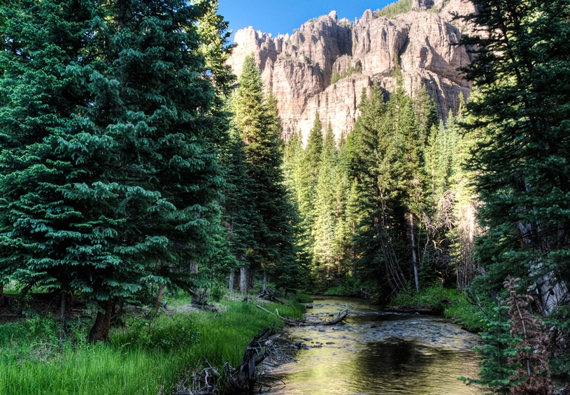
Little Cimarron River via the Western Rivers Conservancy

The Colorado River District’s take on Aspen’s conditional storage rights — @AspenJournalism

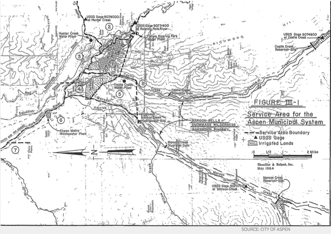
This map from 1984 is one of the few ever published that puts the Maroon and Castle creek reservoirs into the context of the city’s overall water system.

From Aspen Journalism (Brent Gardner-Smith):

Given the ongoing discussion in Aspen about the city’s conditional water storage rights tied to two reservoirs on Castle and Maroon creeks, we thought it would be informative to interview Chris Treese, the external affairs manager of the Colorado River Water Conservation District, which works to protect Western Slope water supplies.

Treese oversees the River District’s legislative and regulatory governmental relations in Denver and Washington, D.C. Treese, who has a master’s degree in economics, describes his current job responsibilities “as everything you don’t want lawyers and engineers doing,” but he still spends much of his time discussing the finer points of existing and proposed water law.

The city of Aspen filed two due diligence applications on Oct. 31 in Division 5 Water Court in Glenwood Springs, seeking to extend the conditional storage rights for Castle and Maroon creek reservoirs until 2022. The city originally filed for the rights in 1965. Ten opposers have filed statements of opposition in the two resulting diligence cases, and the next status conference among the parties is set for August 10, 2017.

We spoke with Treese on April 25 in the River District’s conference room in Glenwood Springs.

The resulting transcript has been edited for clarity.

BGS: Chris, thanks for doing this. It seems like the River District is well-positioned to shed some light on conditional water storage rights. The River District both holds conditional water rights and it also has walked away from conditional water rights, including on the Crystal River in 2013 which were part of the West Divide Project. And the River District is not involved in either of the two water court cases now underway in response to Aspen’s due diligence filings for the two reservoirs.

CT: Correct.

BGS: People have drawn parallels with the Crystal River rights that the River District abandoned, which were tied in part to two large dams, and the option, if you will, for Aspen to do the same. What’s similar and what’s different about the River District’s former rights on the Crystal and Aspen’s conditional storage rights on Castle and Maroon creeks?

CT: One of the similarities is they are both conditional water rights and simply by virtue of being conditional, they are what a conditional water right is, a placeholder in the priority system. But frankly, the differences leap to mind.

One difference is the ownership, as Aspen is a municipality, and municipalities have a different standard for diligence. The West Divide Project did not have a municipal purpose. It was originally, and remains, part of a federal project. And it was an out-of-basin diversion with its own impacts and concerns. I think those differences are significant.

The advantage, if you will, of having a municipal right, is you benefit from what’s known as the great and growing cities doctrine. In contrast to an agricultural or an industrial right with some fixed parameters around acreage or location and purpose of use, the courts have recognized that municipalities grow. And the responsibility of a municipal water provider is to provide water for present as well as the future.

As such municipalities have enjoyed almost unfettered ability to hold on to water rights and to perfect their conditional rights as part of their portfolio, either because they are growing or because they may grow. So the great and growing cities doctrine has provided an essentially unconstrained ability for municipalities to hold large quantities of water rights.

BGS: Wasn’t that latitude more closely defined by the two recent Supreme Court decisions known as the Pagosa decisions?

CT: Yes. So now you can’t say you will need the water in 100 years, but you can project need out 50 years. The Supreme Court found that 50 years is a reasonable planning horizon, and it recognizes that water projects take a long time to develop and water rights can be evermore critical during a period like 50 years. It also said that there has to be some common sense, some historical reality, to the projections over that 50-year period.

BGS: You mean you can’t just say Aspen’s population is going to from 7,000 to, say, 100,000 people, because, maybe it could.

CT: The applicant in the Pagosa cases – Pagosa Water and Sanitation District – were projecting 8% annual compounded growth for 100 years, and that was seen as overly aggressive by the court.

BGS: So there is a great and growing cities doctrine, which Aspen presumably can benefit from, but there’s also now some limitations placed on it from the Pagosa cases, primarily concerning reasonable growth projections.

CT: Right.

BGS: It strikes me that one of the similarities is the absurdist factor in both the Crystal River and the Maroon Creek situations. The dam forming Osgood Reservoir on the Crystal River would have flooded the town of Redstone, and Maroon Creek Reservoir requires a 155-foot-tall dam within view of the Maroon Bells. How should someone consider the relative impossibility of building such projects?

CT: One of the challenges to conditional water rights is that you have to prove diligence on the conditional right as filed. In the case of the Crystal it was a conditional water right for a reservoir that would have flooded a large part of the town of Redstone, if built exactly where and to the size as filed.

But the fact is that a water right, conditional or otherwise, can be changed, can be modified. It still would need to meet some of its basic purposes, but you could go into the water court and say, “There’s now a town of Redstone there and before there wasn’t a town of Redstone. And now the highway is there” and seek changes.

In fact, when the River District and its West Divide District partners looked at the Crystal conditional rights, we looked at how those conditional rights could be useful to the Crystal River valley, in contrast to their originally decreed purpose of transferring water out of the Crystal basin. But we knew we would still have to file diligence on the project as originally decreed.

BGS: So how flexible, how portable, are conditional water rights and their priority dates? There’s been ideas floated with the Castle and Maroon rights – that a smaller reservoir could be built, that they could be transferred to an underground storage facility on the city golf course, etc.

CT: What you can’t do is come in to a diligence filing and say, “We’ve talked about this.” That’s not diligence. You would have had to do more than talk about it, you would have had to at least study it.

BGS: Have studied moving it, for example?

CT: Yes, having studied moving it or using it for a different purpose at a different location. But it’s always up to the water court to find what’s adequate diligence, and they can look back at the original project and say, ” I think you’re talking about a new and different project. You need to file for a new water right.” That’s a risk.

BGS: Is there a threshold for what constitutes a new project?

CT: No.

BGS: Can we explore the standards of diligence? It seems there is a difference in what the water court might consider as diligence and what the average person might understand as diligence.

CT: There is a definition of diligence. It’s broad, and fairly non-specific in the legislation.

BGS: Is the diligence standard excused because you’re a municipality? Or does it still apply?

CT: It absolutely still applies. You must demonstrate to the satisfaction of the court that you are moving diligently toward development of the conditional water rights.

BGS: In the last clause of the city’s diligence application for the Maroon Creek Reservoir, it says, “applicant city of Aspen having demonstrated that it has steadily applied effort to complete the appropriation of the Maroon Creek reservoir conditional water right in a reasonably expedient and efficient matter under all the facts and circumstances … ” should be allowed to hang on to the rights for another six years.

So if someone has “steadily applied effort” to complete the appropriation of a conditional storage water right, does that means they’ve steadily applied effort towards storing the water in question?

CT: Yes.

BGS: Which also means they’re steadily applying effort toward building the structures, or dams, that would actually store the water in question?

CT: Well, the courts recognize that developing a reservoir is not as simple as getting a bunch of spray-painted shovels and having a ground-breaking ceremony. There are a lot of studies, and permits, and financing, and there’s a lot that goes into the early conditional period when planning for a reservoir.

BGS: But “steadily” applying effort means you’re moving towards actually storing the water some day, right?

CT: Yes.

BGS: It’s doesn’t mean you’re just hanging on to the water right for the sake of hanging on to the water right?

CT: Colorado water law prohibits speculation.

BGS: To be clear, if you’ve steadily applied effort to “complete the appropriation” of the conditional water right, then you’re moving towards storing the water. And if you are moving toward storing water, you need to be moving toward building a structure, a dam.

CT: Yes, right.

BGS: That’s what “complete the appropriation” ultimately means, right?

CT: Yes it does. Storage is clearly the end game, but diligence doesn’t specifically mean you’ve applied for a permit, or that you’ve hired bond counsel. There are a lot of early steps that may qualify as diligence.

BGS: Aspen, for example, does not claim it has been studying the reservoirs themselves, but instead it says that work on any part of integrated water management system counts as work on the whole system. So something like repairing pipes in downtown Aspen can count as steadily applying effort toward building the dams and reservoirs?

CT: Every water system is an integrated system in one form or another.

BGS: So what’s a citizen to make of that? In Aspen’s case, there appears to be little, if any, actual diligence on aspects of the projects that commonly comprise a feasibility study, such as water supply and demand studies, geological studies, construction analysis, permitting review, etc.

CT: I don’t know that.

BGS: Well, I’ve asked for such studies, and none have been forthcoming. What the city has told the court is that the reservoirs are part of their integrated water management system, they’ve been working on other parts of the system first, and work on one part of the system is work on all parts of the system.

That strikes me as a bit of a loophole, or at least a low bar. But how bulletproof of a legal argument is the integrated water management argument? Is that all the state requires? If you develop a reuse system at a wastewater plant, say, you can legitimately say you’ve also made progress on building two reservoirs?

CT: Nothing’s bulletproof, it’s up to the water court. And I’ll keep saying that. It’s to the satisfaction of the judge in water court. Or, actually, to the water referee and then, if necessary, the water court judge.

I can tell you the history of the integrated water system provision. The oil shale sector was the primary proponent for the amendment to that section of the law. And they said if they were working on other aspects of a system, such as a pump station and a pipeline, then those were physical manifestations of diligence toward developing their overall system.

If say, a pump station was for 20 cubic feet per second, but their conditional right allowed for 100 cfs, they didn’t wish to see the larger amount challenged, as they were simply working in a steady and progressive manner toward eventual development of the entire system and perfection of the conditional right.

BGS: So does a judge have to decide, in a claim of being in an integrated water management system, whether there’s actual progress being made in that claim?

CT: Yes. I think the court would ask, is there a reasonable nexus to the diligence application for the water right in question? Is one action leading to another? The other part of steady progress is that it cannot just be in the last week before you filed. You do have to show you were engaged in steady application of diligence efforts.

BGS: So even though it’s within the confines of an integrated water management system, there still has to be a nexus to the ultimate development of completing the appropriation.

CT: Yes.

BGS: So can Aspen claim it worked on one part of our system, even though it bares little relationship to the actual potential reservoirs, and still claim that as steady effort?

CT: That’s up to the water judge.

BGS: There is no clear standard?

CT: Well, in the diligence applications that I’m familiar with, you include all of the efforts that you feel are relevant. For example, when the River District files for diligence on conditional water rights, we often include details of our work on the recovery program for endangered fish, because it’s critical to the way the river system works today. It may not have a geographic nexus to the conditional filing in question, but it has a hydrologic nexus. And so we hope the water court recognizes our work is a necessary element to be able to ultimately develop the water right.

For example, if a city was going to build a reservoir someday they could look forward to having to go through a NEPA (National Environmental Policy Act) review. As such, they will need to study a range of alternative measures they could take, such as making sure they don’t have leaks, water conservation efforts, pricing, all of that.

You have to accept that water development is an enormous challenge, and you’re going to have to show that you’re using your existing supply to its maximum benefit and efficiency before seeking permits. So a water provider might include in an application for diligence the work done today on those types of activities, even though they don’t appear to be physically linked to the reservoirs. And they can count it as work toward a future reservoir, because it’s related.

BGS: Do you think the city should have been more actively studying its two potential reservoirs?

CT: You have to allow any conditional water right owner to decide what their own timing is that leads to development.

BGS: Okay, but is there any requirement for work to be done on a specific site or project basis? Even if you’re doing other stuff, do you still have to study the project at some basic level?

Because, in this case, it doesn’t appear Aspen has done much, or is doing much, investigating of the feasibility of the reservoirs themselves. And if the city thinks it might actually need the reservoirs, shouldn’t city officials be studying them?

CT: Not necessarily. You have to allow that Aspen has accepted from 1965 that these reservoirs may be necessary. And what they have asserted is that what they’re doing is working on the other elements of their integrated system that require immediate work, and in the succession of development and maintenance of their system, those are their priorities.

The fact that I filed for a reservoir, say, on Three Mile Creek, doesn’t mean that I have to keep drilling every six years to see what the soils look like on Three Mile Creek.

BGS: Yes, but should you have drilled once? No drilling, for example, has ever been done on the location of the Maroon Creek Reservoir, that I can find or that the city can produce.

CT: Eventually you will, but there are many other things required before eventual storage construction. Personally, I don’t know what the order is of when drilling or soils testing is required.

BGS: Wouldn’t you want to know what a drill test says about a key factor in a reservoir, which is where the bedrock is?

CT: Yes. You will.

BGS: Not now?

CT: Maybe not yet. This is probably not the first thing I need to know. Not everything is a study for fatal flaws, especially if you accept that they have a premise around their original filing that this is necessary and appropriate someday. That’s exactly what a conditional water right is.

BGS: It just strikes me as a profound lack of curiosity.

CT: I understand. I think you have a legitimate question as long as you’ll acknowledge that there is a whole series of studies, and hard and soft science steps, that have to be followed before you can get to application, let alone development. Then I think it’s a legitimate question.

BGS: So what’s the average person to make of the larger situation? The city can, in effect, say they are making progress but really, at least in terms of how most people might see the question, they are really not?

CT: Yes.

BGS: I understand then that someone can technically say in water court they are making progress, given the integrated system provision, but it seems to lack a certain integrity from a street corner or real-world perspective.

CT: Well, for example, for the Osgood Reservoir on the Crystal River, the River District didn’t feel we could tell the court “Rest assured, we’re not going to flood the town of Redstone” when the water right as decreed would have done so.

We were, in fact, looking at alternatives, but then it would no longer have been the West Divide project as conditionally decreed. And we would have admitted that to most anybody, except the court. Because if we weren’t going to flood the town of Redstone, by moving the storage right to a more acceptable location, it might be considered a different right by the court.

BGS: So that suggests there is an integrity gap in Aspen’s approach, because they are saying, in effect, “We don’t want to build the dam near Maroon Bells” and yet they are still pursuing the same rights that are tied to the dam.

CT: When you are filing for diligence, you’re filing to maintain the water right’s priority date. And it’s not a secret, and it’s not a lie, that the water right may in fact be developed someday in another fashion for another purpose in another location.

BGS: Well, then, how low are the state’s standards for diligence? If you simply say you’re making progress, and want to keep all your options open, does the court just say, “Okay, carry on.”

CT: Let me acknowledge that conditional water rights are typically not contested. You usually don’t have objectors in a diligence case. And until relatively recently, if a filing didn’t have an objector, including the state of Colorado or anyone else, water courts tended to say, “Nobody’s upset, so no harm, no foul. Continue. Your diligence application is approved.”

Now the bigger filings have had objectors. We’ve had objectors on the Western Slope from eastern Colorado for large filings that were senior to some of the junior aspects of their transmountain diversions. They have had a clear self-interest in attacking these conditional rights, because they would improve the seniority of their junior rights by removing the threat, if you will, of a senior conditional.

But most filings aren’t contested, and uncontested filings are generally approved by the court without much analysis. Admittedly, the court might take exception to that.

BGS: Switching gears, what is the harm in walking away from a water right?

CT: It depends. We maintained the rights on the Crystal because we thought storage in that basin could have been a significant benefit to western Colorado. And our choice to abandon those rights was not as simple as concluding we didn’t need storage there.

We were being challenged in court, and the challenge was to the entire West Divide project. And our partners in that project, the West Divide Water Conservancy District, still intended to pursue aspects of that project that are outside of the Crystal River drainage.

We didn’t want the tail – the potential dams on the Crystal – to wag the dog – the other parts of the project. So we looked at number one, the opposition and the risk to the other water rights outside of the Crystal River basin. And, two, we recognized that if, in the future we still wanted to pursue storage on the Crystal then a new junior storage right would accomplish largely the same goals as those senior rights associated with the conditional filing would have.

BGS: Okay, so the River District made a call to walk away from two large dams. But the city of Aspen seems to always pour cold water on that option by suggesting if they abandon them someone else is going to come in and claim them, and their decreed date of 1971, apparently.

CT: Impossible.

BGS: So if someone else comes in and claims a storage right on Castle and Maroon creeks, it’s going to have a new junior priority date? They can’t come in and claim a 1971 right?

CT: Correct.

BGS: And someone could always still come in and file for a new junior right, whether or not the city abandoned its rights?

CT: Yes, but it’s a very different water right if you’re behind a senior conditional right. And there is the “can and will” test. You may not be able to develop the new junior right if it’s in line behind a senior conditional right. It depends upon the hydrology and how much water is available to store during runoff.

BGS: So if by retaining a conditional senior storage right, you make it less likely that someone’s going to come in and file for a junior right, isn’t that an advantage for a senior rights holder, like Aspen, in this case? If so, that suggests there is value in just sitting, if you will, on a senior conditional right as a preemptive move against future interlopers.

CT: Aspen, or anyone else, may see a strategic value in that approach. But that’s not sufficient diligence. There were a number of people in the Crystal basin who were in favor of water development. Not in favor of flooding Redstone, but who were in favor of water development. And they saw our conditional water rights as a strategic card and said if we didn’t hang onto that water right, then someone like Denver Water could come in and file. But we never said that; we never saw that. It’s not a legitimate or feasible threat. Nor did we see it as a sufficient to present as diligence.

BGS: You mean you can’t protect your water rights unless you’re actually making progress towards completing the appropriation? You can’t just be doing it for strategic purposes?

CT: Correct. You have to be diligently moving toward development. Remember, though, that oil shale has largely maintained its water rights from the 1940s by researching oil shale development. Some would argue there’s no way that they’re moving toward development or perfection of those rights. But the courts so far largely have found that they are.

BGS: Ah, yes, it’s always the court’s call. But how unusual is it to have ten opposers, as Aspen does, in a diligence case? Doesn’t that change things?

CT: It’s certainly uncommon to have opposers in diligence cases. And it’s worth noting that while a city cannot hold onto water rights solely to suit their strategic priorities, opposers can challenge the city’s rights based on their own strategic priorities

BGS: In other words, as an opposer you don’t need to prove standing, you don’t have to show injury.

CT: Essentially right.

BGS: Another outstanding question I have is about storage. The Castle Creek Reservoir would hold 9,000 acre feet of water and the Maroon Creek Reservoir would hold about 4,500 acre feet.

And recently, Aspen City Manager Steve Barwick told the Pitkin County Healthy Rivers and Streams Board, and I quote, “All of this, this whole notion of how much water do we need and how much water do we need to store, and all of that, has been based upon very preliminary analysis. And now it’s time to tighten up the whole analysis and do a rational set of studies so we can have a rational discussion with the entire valley about what are we going to do here. How much storage do we need, and where do we want to put it?”

Given that, why is the city telling the state it needs 14,000 acre-feet of storage if they aren’t sure how much storage they need? How hard is it to determine how much storage a city needs? A recent raw water supply analysis from Wilson Water found the city could meet future needs without storage, even after aggressive climate change projections.

CT: I would suggest that it’s not particularly easy to look 50 years down the road and try to figure out exactly what your needs are going to be.

BGS: So, again, what should a citizen make about the duality in the situation, where the city is telling the state it’s making progress while telling citizen’s it’s the last thing they want to do?

CT: I will say I feel the city’s pain, because while they may not have any actual intent to build that size reservoir in that location, they apparently see a need and a purpose for additional storage. As we did on the Crystal. Were we going to flood the town of Redstone? Not in this day and age. We knew that. Could we admit that anywhere but the water court? Sure. But in the water court, that’s not what you’re able to do.

BGS: So does that speak to the failing of the water court? Or to an issue of integrity?

CT: You keep suggesting that this is an issue of integrity.

BGS: Well, I keep asking.

CT: I think the city recognizes the value, the purpose, and the benefit of storage at large. Storage of some size. Storage in their water supply planning.

BGS: Storage of some size, somewhere, at some point, in some location.

CT: Yes, and that’s what a conditional water right may provide. But it’s not a failing of the court, because it doesn’t, in fact, allow for unfettered flexibility. The court would likely reject a suggestion, say, that a conditional storage right on Castle Creek might be used on Hunter Creek.

BGS: But the city is studying and positioning various potential alternatives, suggesting the rights are quite portable and flexible.

CT: The conditional water right system does allow for movement. But it would likely have to have a junior right if moved too far.

BGS: But no one knows for sure until they go through the process? There’s no standard?

CT: Well there is a standard for that. If you go too far, say if you try to exchange that right to Hunter Creek, it’s going to end up being a new junior right.

BGS: So there’s generally limited flexibility?

CT: Yes. But you never know until you go through water court.

BGS: Can we discuss why the River District has not taken a position, or really, said anything, one way or the other, about Aspen’s conditional water rights? The district is not an opposer, so it apparently doesn’t oppose them, but it hasn’t said, for example, that they think those reservoirs might be valuable for any reason.

CT: Well, we’ve never been asked.

BGS: The city has not come to you? They’ve never consulted with you?

CT: No. Aspen has not asked for help.

BGS: Or sat down and asked you about your experiences on the Crystal?

CT: No. Nor do I find that odd that they didn’t. Montrose hasn’t, and Grand Junction hasn’t. Ute Water is working on developing and permitting storage on the Grand Mesa. They haven’t asked for our help. Others have. Eagle River and Water Sanitation asked for our help in putting together multi-party agreements that years ago resulted in the Eagle River memorandum of understanding, or MOU. Now we’re working on fulfillment of the MOU to develop joint-use, mutually beneficial East Slope-West Slope water.

BGS: Do you feel there’s any harm done if the city’s water rights are abandoned, from a Western Slope water rights perspective?

CT: We have not looked at them.

BGS: With respect, why not? It seems like something the River District would do.

CT: Well, this is what individual utilities do within our 15 county district. They develop their water rights.

BGS: But Aspen suggests there are threats from a Front Range bogeyman, and I wonder if you think a bogeyman is lurking, waiting for the city to give up its rights?

CT: We don’t see this as the bargaining chip that we need to, or have been asked to, help preserve. It’s a tool in the toolbox, perhaps, but we haven’t analyzed exactly how these water rights might be used in the ongoing poker game.

BGS: I’m trying to discern the significance of the River District’s neutrality and silence about the Castle and Maroon creek reservoirs.

CT: I find our position unremarkable. There are many entities that are pursuing diligence or perfection of their water rights. We have no interest in jumping into a situation that has already divided our shared constituents. And Aspen has not asked for our help in their diligence filing, or their studies. So we have no direct dog in this fight.

BGS: So, again, is there a downside to Aspen giving up the rights, as the River District did on the Crystal?

CT: I think it may be important to ask what the opposers are seeking. Are they concerned about a dam in that particular location? If the dam were somewhere else, would they have the same concerns? Are their concerns really about growth? Is the concern that Aspen has, or may have, a vision of its future, that is more crowded than some may accept? I don’t know the answer. Is it that Aspen has said that they want to maintain the instream flow rights? Is it the idea that storage can be used for meeting an instream flow, or enhancing an environmental benefit? What are their motivations? And perhaps most importantly, what happens if they succeed?

BGS: Well, fair enough. I’ll follow-up with the opposers, and they have articulated many of their concerns for the water court referee. But that’s why I asked you what harm the River District sees if the rights are abandoned. Apparently you don’t see any, which says something about the size of the bogeyman.

CT: What does Aspen see? Are there any competing conditional rights in between that if Aspen drops out, somebody moves up the line? If there’s an intervening conditional water right on the Roaring Fork, that would be pertinent.

These water rights may be a bar, or a deterrent, to another conditional rights that couldn’t be developed if these rights were senior. So I think it’s a legitimate inquiry as to whether, say, Pitkin County Healthy Rivers and Streams, has considered what the full implications are to not having these water rights. I don’t know the answer. I’m just saying it’s a reasonable question.

BGS: I agree it is a reasonable question. And a reasonable question to ask the River District, too.

CT: We haven’t looked at it.

BGS: Again, with respect, why not?

CT: Nobody’s asked us, nobody’s suggested it. It’s not a problem.

BGS: But isn’t that in your mission? I have to think that if the River District thought that if these rights were to go away it would harm the Western Slope, you would have said something.

CT: If we thought so yes, if we had looked at it and come to that conclusion. But you’re giving us too much credit.

BGS: I guess so.

CT: We haven’t looked at it. I think if they were pre-compact, or pre-1922, rights I guess it would be more interesting to us.

BGS: Do you think there’s a bogeyman out there as it relates to Castle and Maroon?

CT: I think there’s a much bigger bogeyman in the upper Roaring Fork. Castle and Maroon, hard to picture, but the upper Roaring Fork, easy to see. The evidence is all there.

Who pays for water infrastructure? — @HighCountryNews

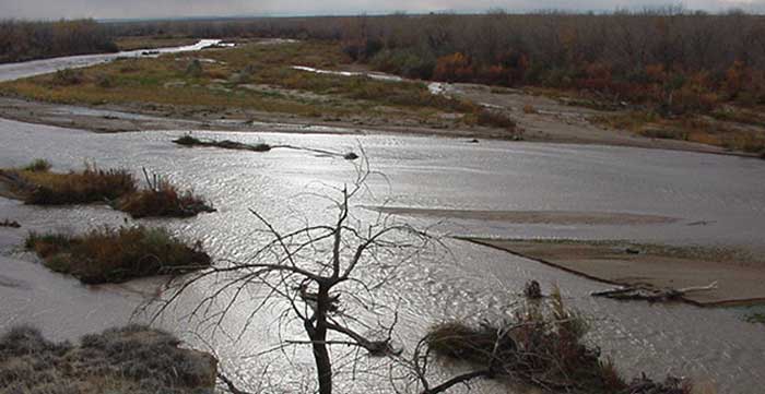
Paradox Valley via Airphotona.com

Here’s a report from Emily Benson writing for The High Country News. Here’s an excerpt:

Water infrastructure, for both drinking and irrigation, is especially in need of improvement in the arid West. Amid a wave of aging reservoirs, treatment plants and pipelines, and a Congress unwilling to pony up funding to fix them, the Bureau of Reclamation is considering private investment as a possible solution. While some municipalities in the U.S. have partnered with private companies on water projects, such deals are almost non-existent on the federal level.

Critics note that there’s a significant potential downside — private companies are beholden to their bottom line, and their goals may not always line up with the public interest. If the company goes bankrupt, for example, public-private partnerships can end up being costly for the public.

The Bureau of Reclamation recently held a meeting with industry representatives and asked for their feedback on five water infrastructure projects in the West that the agency says might benefit from private involvement or even ownership. The exchange was intended to gauge industry interest in this type of arrangement, and while the Bureau may ask for development bids in the future, it hasn’t yet done so.

@CFWEwater — Barr Milton Urban Waters Tour

This slideshow requires JavaScript.

I rode along with the Barr Lake and Milton Reservoir Watershed Association and the Colorado Foundation for Water Education on their Urban Waters Tour of the South Platte River last Wednesday. These rides are educational and fun and well worth the time. It was great to meet some new folks from the water community. Thanks to Amy Conklin for organizing the ride.

We started at Johnson Habitat Park where the Greenway Foundation has located their SPREE outdoor school. We learned about efforts to increase the volume of water in the river through the Chatfield Reallocation Project which will provide environmental flows through the City of Denver. Joe Shoemaker, Jr. explained the genesis of the Greenway Foundation and how the area we were in was one of Denver’s dumps during his youth. The educational effort was in full swing with young students plying the waters for macro-invertebrates and other life.

A representative from Trout Unlimited conveyed his excitement about landing big carp from the river. He also told us that a fisherman recently pulled a 24 inch rainbow from the river just upstream from the park.

Further downstream at Weir Gulch the focus was on widening the channel to more a more natural flood plain to help manage stormwater and improve river and riparian health. The South Platte through here, back in the day, was a braided, meandering stream with a flood plain that was sometimes as wide as a mile.

A Denver Parks representative explained the big project at Confluence Park — the replacement of the original structures from the first project in the South Platte revitalization effort. Kudos to the contractor that stayed with the project as their profit dried up due to the discovery of coal tar on site. The Denver representative said that the company believed in the project and the benefits to the community.

The last stop was at the site of Globeville Landing Park. There was a lot of construction going on to build an outfall for stormwater management. Denver is building their Platte to Park Hill Project to mitigate flooding caused by construction and development over the years.

I highly recommend these tours. You’ll learn a lot, get a bike ride in, and meet some interesting folks. The South Platte River through Denver is a great ride. What a success story.

Lincoln Park/Cotter Mill superfund site update

Lincoln Park/Cotter Mill superfund site

From KOAA.com:

The uranium mill was declared a Superfund environmental disaster more than 20 years ago after contamination was discovered in both well water and soil in Cañon City.

We weren’t allowed to film or take pictures on the tour but we did get to ask some questions.

The site manager says they’re trying to determine the usability of the mill in the future and are waiting on a quality assurance plan. Next, they’ll have to draft what’s called a remedial investigation report.

Before they’re able to recommend a clean-up plan which would be in 2020 at the earliest.

Fountain Creek: #Colorado Springs budget calls for reestablishment of stormwater enterprise

Fountain Creek photo via the Fountain Creek Watershed Flood Control and Greenway District

From The Colorado Springs Gazette (Jakob Rodgers):

Colorado Springs Mayor John Suthers pitched a sweeping vision Friday of bolstering the city’s short-staffed police force by 100 officers and modernizing its aging and increasingly-decrepit vehicle fleet.

It hinges, however, on voters agreeing to resurrect the city’s controversial and defunct stormwater enterprise fee in November.

Calling it “basic to our financial viability,” Suthers pitched the fee’s return during his annual summit with City Council – framing it as a means to restore several flagging or aging city services while offering Colorado Springs a powerful bargaining chip in battling a federal lawsuit over years of neglected stormwater needs.

“We have a legal obligation (to fund stormwater projects),” Suthers said. “The question is whether we’re going to fund it at the expense of other things, or are we going to fund it separately.”

Even if a fee is approved by voters in November, the outcome would not be legally binding. But, it would provide a political mandate for future Colorado Springs leaders and lawmakers to follow, Suthers said.

From KRDO.com (Mike Carter):

“Every other large city in America has a stormwater enterprise where they charge a fee to property owners and that money is what’s used for stormwater,” said Mayor Suthers.

It’s a plan that was rejected by springs voters in 2009, but as the city continues its legal battle with the EPA and the state health department, city council members like Bill Murray say continuing to fund stormwater improvements through the city’s general fund simply won’t work.

“It’s taken a big bite out of our general fund. And I’m sure that the citizens, once they’re given the opportunity, to understand it’s either the EPA or us, that they’ll select us because we actually have the solution and they don’t,” Murray said.

The city pays $17 million a year out of its general fund for storm water obligations.

“And that means we have less money available for police officers,” Suthers said. “We need as many as a hundred additional police officers probably over the next 5 to 10 years.”

Suthers says snowplow equipment also comes out of the general fund, leaving the city strapped for cash in three crucial areas.

The stormwater fee based under the previous stormwater enterprise was based in part on a percentage of total impervious area on a property—think sidewalks and driveways. But the city says that can change over time and what used to be a front law under one homeowner change to a concrete driveway under another.

“And so you would have a residential, a tiered residential structure and it would be based on the size of the lot would equate to a specific monthly fee,” said Springs Public Works Director Travis Easton.

#ColoradoRiver: An irrigation works blowout created the #SaltonSea, folks are searching projects that will mitigate current problems

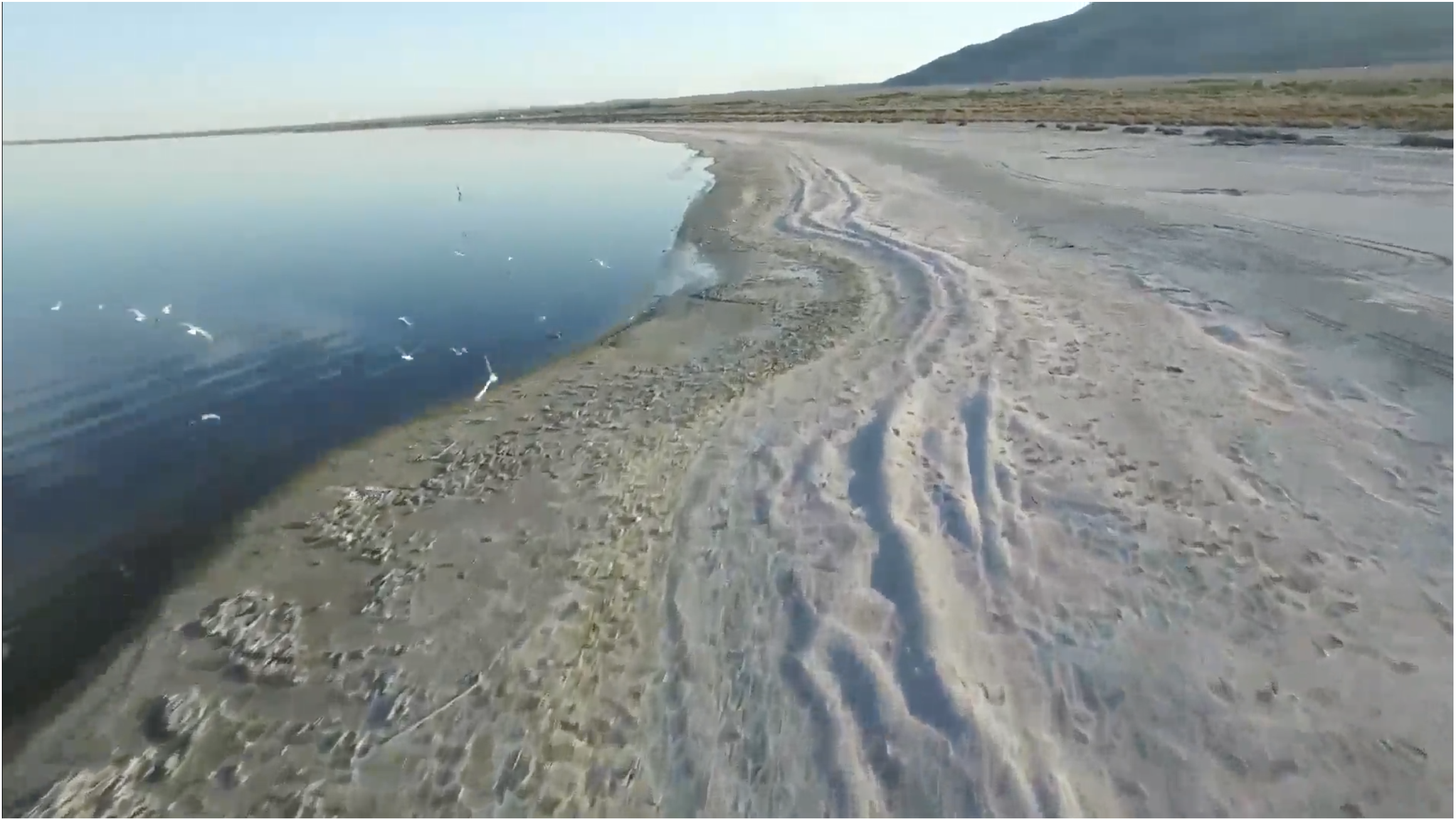
Screen shot of drone video June 11, 2016. Credit Palm Springs Desert Sun.

Here’s a deep dive into the current state of the Salton Sea from Ian James and Sammy Roth writing for the Las Vegas Desert Sun. Click through to view the drone tour of the shoreline, the cool graphics, and to read the whole thing. Here’s an excerpt:

The Salton Sea has been shrinking for years, and fish and birds have been dying. The dry lakebed already spews toxic dust into the air, threatening a region with hundreds of thousands of people. And the crisis is about to get much worse.

The water flowing into the Salton Sea will be cut dramatically at the end of this year, causing the lake to shrink faster than ever and sending more dust blowing through low-income, largely Latino farming communities.

The Salton Sea covers 350 square miles in the desert southeast of Palm Springs. For more than a century, the lake has been sustained by water from the Colorado River.

Southern Pacific passenger train crosses to Salton Sea, August 1906. Photo via USBR.

But under a farm-to-city water transfer deal, more river water has been flowing to cities in San Diego County and the Coachella Valley — and less water has been flowing into the Salton Sea.

In 2003, California lawmakers promised to restore the lake. So far, state officials have done hardly anything, even as the Salton Sea has shrunk.

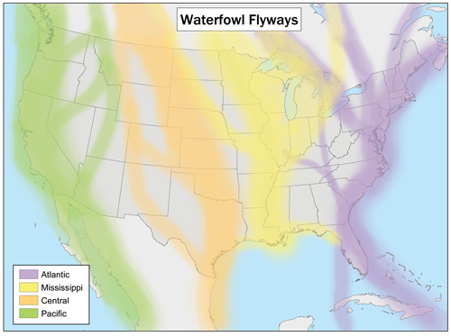
The Salton Sea has become an important stop on the Pacific Flyway, as birds and insects are opportunists.

Credit Wikimedia.com.

#NM and #Colorado invasive mussel regulations

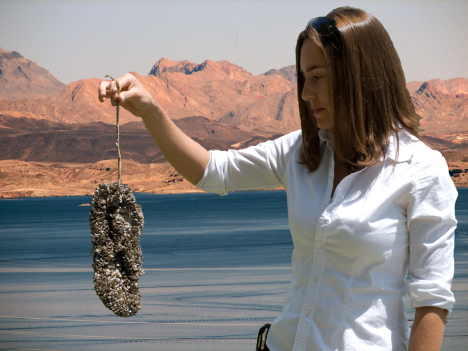
Quaggas on sandal at Lake Mead

From KOB.com (J.R. Oppenheim):

“All it takes is one boat that is infested with the species that goes in the water body and infests the water body. Once they get in the water body there is really nothing to do to get rid of them,” said Robert Walters, CPW invasive species specialist.

It is Zebra and Quagga Mussels that the crews are trying to get rid of. The boat they worked on came from Lake Powell, an infected body of water, and the mussels are apparent in many places that the boat has been in in the water.

“If these were to get into one of these water, the cost would impact everyone not just the users of the water but people using the electricity and facilities,” Walters said.

Colorado and New Mexico both are aggressively inspecting boats before they hit the water this season. It’s to prevent all the trouble the mussels could cause in pipes and infrastructure, even eventually killing native fish.

CPW said money spent inspecting and decontaminating boats is a drop in the bucket compared to fighting mussels after they take hold.

“We couldn’t do this without the participation of the boat owners,” Walters said.
The key is clean, drain and dry. All boat owners are encouraged to do that every time they take the boat out of the water. For boats in infected waters, both states require disinfection services, which is available at many major waterways.

New Mexico has rules in places that:

  • Require all watercraft arriving from out of state must receive an inspection prior to launch.
  • All watercraft when on a New Mexico roadway must have their boat plugs pulled.
  • Inspections stations for 2017 can be found at:

  • Navajo Reservoir (Pine and Sims Ramps)
  • Conchas Reservoir (Main entrance)
  • Ute Lake (North Ramp & Logan Park Marina)
  • Elephant Butte Reservoir (Marina del Sur)
  • Any NMDGF office (Monday through Friday, 8 a.m. to 5 p.m.)
  • Typical times are 6 a.m. to 8 p.m.
  • To learn more, see these websites:

    http://www.wildlife.state.nm.us/ais
    http://cpw.state.co.us/thingstodo/Pages/BoatInspection.aspx

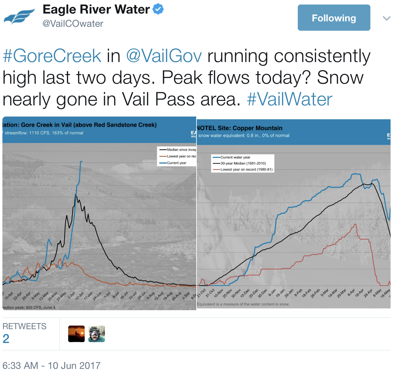
    #Runoff news: “Go outdoors!” — @VailCOwater

    From The Colorado Springs Gazette (Ellie Mulder):

    [The Arkansas River] was flowing at 3,770 cubic feet per second late Friday afternoon at Parkdale, just west of Royal Gorge, according to the United States Geological Survey. Colorado Parks and Wildlife issues a high water advisory and recommends not rafting when flows reach 3,200 cubic feet per second level in the gorge, known for its whitewater rapids.

    The high river flow wasn’t unexpected and isn’t out of the ordinary, said Bill Banks with USGS.

    “A great deal of water is moving downstream right now because we’ve had a pretty abundant snowfall,” Banks said. “This is just the normal cycle.”

    Colorado has seen a relatively slow, steady snowmelt this year, he said.

    “That’s what we like – a long, controlled runoff,” Banks said. “That’s the best for the environment, best for stakeholders in the region. It’s best all around.”

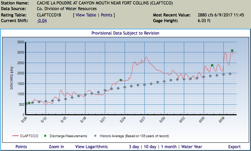
    #Runoff news: Flood advisory for the Cache la Poudre

    From The Fort Collins Coloradoan (Miles Blumhardt):

    Our hottest weather of the season toady through the weekend will increase snowmelt and prompted the National Weather Service to issue a flood advisory for the Poudre River.

    The advisory runs today through 4 p.m. Monday from the mouth of the Poudre Canyon through Fort Collins. The hot weather in the mountains is expected to accelerate melting of an abundant snowpack, resulting in minor flooding of bike paths and trails in low-lying areas around Fort Collins…

    Flood stage is 7.5 feet on the river. At 4:45 a.m. Friday, the river was at 6.2 feet. The forecast is for the river to rise to near 6.3 feet Saturday morning. At 6 feet, water spills into low-lying areas.

    The Poudre was running at 2,310 cubic feet per second Friday morning through Fort Collins, which is strong enough to carry people downstream.

    The June 1, 2017 Water Supply Outlook Report is hot off the presses from the NRCS

    Click here to read the report. Here’s the summary:

    #Runoff news: Twin Lakes should fill next week — more water for the Roaring Fork River

    Twin Lakes collection system

    From Aspen Public Radio (Elizabeth Stewart-Severy):

    Water levels on the Roaring Fork River are expected to rise next week as Twin Lakes Reservoir reaches capacity.

    Officials at the Twin Lakes Canal Company expect the reservoir to fill between Tuesday and Thursday next week. That means that the 625 cubic feet per second of water that is typically diverted to the Front Range through a tunnel on Independence Pass will instead flow down the Roaring Fork River.

    That, in addition to peaking snowmelt, means flows on the river could nearly triple next week. It is expected that the North Star Nature Preserve will flood. This is healthy for the wetlands.

    Officials at the Bureau of Reclamation said releases from Ruedi Reservoir into the Fryingpan River will decrease over the weekend. This reduces the risk of flooding at the confluence of the Fryingpan and Roaring Fork in Basalt. Ruedi Reservoir is about 80 percent full.

    From TheDenverChannel.com (Oscar Contreras):

    Medano Creek is now approaching what’s called “surge flow,” a phenomenon where creek water flows in waves across the sand.

    The combination of a sufficiently steep channel, a sandy creek bottom and plenty of flowing water only exists in a few places on Earth, according to the spokesperson, “and Medano Creek is considered the best place in the world to experience surge flow!”

    Because of the unusually cold and wet conditions in May, peak flow is occurring a little later than average this year, the spokesperson said.

    You can follow detailed creek conditions and forecast flow on the National Park Service website.

    The video below, courtesy of the Great Sand Dunes National Park and Preserve, shows you exactly what happens during surge flow:

    #Snowpack news: Mid-May storm benefits South Platte Basin

    Statewide snowpack Basin High/Low graph June 7, 2017 via the NRCS.

    From The Grand Junction Daily Sentinel (Dennis Webb):

    In water circles, May 2015 came to be known as Miracle May due to the huge boost in snowpack storms that month provided in Colorado. This May’s snow also left the state in decent condition as the snowpack season winds down…

    A mid-May storm particularly benefited the South Platte basin, while delivering precipitation to much of the state, the NRCS says.

    After what’s been an up-and-down year for snowfall accumulations in the state, the NRCS said that May precipitation “provided a boost to water supplies, reassuring water managers that this year’s snowpack could provide ample water supplies entering the summer months.”

    Reservoir storage statewide was at 109 percent as of the start of June, the agency reports. That’s also where things stand for storage in the Colorado River basin, while storage in the Gunnison basin is at 103 percent.

    From The Boulder Daily Camera (Charlie Brennan):

    The South Platte River basin, which encompasses Boulder County, was the largest benefactor of a mid-May storm that dumped snow at most elevations, and provided a significant boost to water supplies, according to the June snowpack and reservoir storage report from the Natural Resources Conservation Service.

    May totaled 135 percent of normal precipitation statewide, after a less productive March and April. May also brought more precipitation than May of last year, or May 2014. Some Snow Telemetry (SNOTEL) sites reported 200 percent or more of monthly precipitation, according to a news release.

    The Boulder County area was pummeled on May 18 and 19 with as many as 42 inches of snow in some mountain locations near Allenspark and Ward.

    With help from that storm, water year-to-date precipitation across Colorado trended upward from 108 percent of average last month to 111 percent of average this month. Those numbers provide reassurance to water managers that this year’s snowpack could provide ample water supplies entering the summer months.

    South Platte River Basin High/Low graph June 7, 2017.

    2017 #COleg: Gov. Hickenlooper signs HB17-1306 (Test Lead In Public Schools’ Drinking Water)

    Roman lead pipe — Photo via the Science Museum

    From the Colorado General Assembly website:

    Concerning the financing of testing for lead in public schools’ drinking water, and, in connection therewith, making an appropriation.

    The bill directs the department of public health and environment (department) to establish a grant program to test for lead in public schools’ drinking water. The department will give the highest priority to the oldest public elementary schools, then the oldest public schools that are not elementary schools, and then all other public schools. The department may also consider ability to pay in administering the program. The department is directed to use its best efforts to complete all testing and analysis by June 30, 2020. The public school must provide at least 10% local matching funds and give the test results to its local public health agency, its supplier of water, its school board, and the department. The department may use up to $300,000 per year for 3 years for grants beginning on or after July 1, 2017, from the water quality improvement fund if there is money available after fully funding existing programs. The department shall provide 4 annual reports to the general assembly regarding implementation of the grant program, including any legislative proposals that may be warranted.

    The bill appropriates $431,803 and 1.3 FTE to the department of public health and environment for the implementation of the act.

    From The Denver Post (Monte Whaley):

    House Bill 1306 received bipartisan backing and plenty of support from school and health officials. Lead in drinking water can lead to long-term health problems in children.

    The measure is aimed primarily at older elementary schools with the hope that all public schools will be tested and the results analyzed by June 30, 2020. The bill authorizes the state Department of Public Health and Environment to establish a grant program to test the drinking water in public schools that use a public water system.

    As much as $300,000 in grants could be awarded each year for three years, and another $140,000 would be spent to implement the program. The measure also requires school districts that test for lead to contribute 10 percent in local matching funds and give the test results to the local public health agency, water supplier, school board and CDPHE.

    Just seven of Colorado’s 178 school districts have tested their water for lead, and in those districts 100 schools were found to have some lead in their water, health officials said.

    #ColoradoRiver: Reclamation Announces Completion of Orchard Mesa Irrigation Disrict Regulating Reservoir @USBR #COriver

    Graphic credit US Bureau of Reclamation.

    Here’s the Here’s the release about using a small reservoir to change the timing of direct flow irrigation water (Justyn Liff):

    The Bureau of Reclamation announced today that construction is complete, except for seeding this coming fall, on Orchard Mesa Irrigation District’s 74 acre-foot regulating reservoir on Orchard Mesa, Colo. The $8.86 million reservoir was built for the District on behalf of the Upper Colorado River Endangered Fish Recovery Program and is the latest feature of the District’s Canal System’s Improvement Project.

    Major features of the project include: construction of the regulating reservoir, upgraded check structures in canals, installation of remote monitoring systems, canal interconnect pipeline, improved operational procedures, and potential replacement of some open earth laterals with pressurized pipeline.

    The improvements will provide a more reliable water supply throughout the canal system and conserve approximately 17,000 acre-feet of water per year. This water will also benefit endangered fishes, wildlife and river recreation in the important “15-Mile” reach of the Colorado River downstream of Palisade, Colorado.

    A media tour of the reservoir will be held at 9:30 a.m. on Wednesday, June 14, 2017. Officials from Reclamation, Orchard Mesa Irrigation District and the Colorado River District will be on site to answer questions. To attend the media tour, please RSVP by noon on Tuesday, June 13, to Justyn Liff at 970-248-0625. If no media RSVP’s for the tour, the tour will be cancelled.

    Small Steps Add Up to a Secure Water Future for Colorado — @wradv @WaterBart

    Colorado Water Plan website screen shot November 1, 2013

    From Western Resource Advocates (Bart Miller):

    Steady progress means that Colorado can achieve the big goals set out in its Water Plan.

    One step in front of the other—and milestones to see progress along the way. For a journey of any length, we need waypoints and measurements to understand how far we’ve come. And, just as importantly, we need enough energy to continue making steady progress.

    This is equally true about our collective progress toward meeting the objectives of Colorado’s Water Plan. The Plan, a final version of which was released 18 months ago, has now entered its most important phase—implementation—putting the Plan into practice.

    Stepping forward to achieve big goals

    The Plan has many excellent objectives, including those for stream health, urban conservation, land use planning, and more flexible arrangements for irrigators to get paid to share water to meet a range of other needs. I encourage you to check them out—they’re clearly articulated in the Plan’s Chapter 10—Action Plan. But, because many of these objectives have due dates many decades into the future, we need milestones to make sure we’re moving fast enough down the path.

    Take municipal water conservation as a good example. The Plan spells out the goal of saving 400,000 acre-feet annually by 2050. An acre-foot of water is enough to cover one acre (about the size of a football field) with one foot of water, equivalent to one third of a million gallons. In other words, the 400,000 acre-feet goal is saving a football field of water stacked 75 miles high, every year. That’s a lot of water.

    Reducing water use by 1% per year is a great step

    The good news is we can get there by hitting key milestones along the way. Reaching the goal means reducing water use by roughly 1% each year, something that many customers, encouraged by their water utilities, already have been doing for more than a dozen years. Continuing this active municipal conservation will include replacing indoor fixtures with more efficient ones, encouraging the replacement of some of our outdoor landscaping with more xeric (i.e., drought-tolerant) options, and incentivizing water savings by charging less per gallon when water customers are water-thrifty.

    Connecting water conservation to land use and new development

    A couple other keys pieces to the puzzle. First, we need to accelerate making the connection between water use and land use. Many communities have figured out that it saves water and money when new residential and commercial growth embed water efficiencies from the outset, being “water-smart from the start.” New growth can have a smaller water footprint, thereby placing less of a burden on our rivers and less pressure on cities to build expensive new water supply projects.

    We’re all in this together

    Second, and just as important, is to make sure funding is made available for communities all around the state to become able to save water. Smaller and mid-size communities usually have fewer financial and human resources to deploy, and so need more assistance. We really need additional public funding to give all communities the ability to set their conservation goals and implement the programs to meet them. In the end, we all benefit, because we’re all in this together.

    Aspinall Unit operations update: 4,500 cfs in Black Canyon — @USBR

    Sunrise Black Canyon via Bob Berwyn

    From email from Reclamation (Erik Knight):

    The spring peak operation is nearing completion. Releases are currently being made to sustain half bankfull flow levels at the Whitewater gage, as well as to manage the forecasted runoff into Blue Mesa Reservoir. Releases from the Aspinall Unit have been around 5,500 cfs during the past week and that release rate will continue through Sunday, June 11th. Flows in the Gunnison River through the Black Canyon are currently around 4,500 cfs and can be expected to stay near this level through Sunday, June 11th. Starting on Monday, June 12th flows will begin to ramp down towards the summertime release level. This should result in flows in the Gunnison River through the Black Canyon around 900 cfs to 1,000 cfs once the ramp down is completed on Monday, June 19th.

    #Drought news: Slight increase in D0 (Abnormally Dry) in W. #Colorado

    Click here to go the US Drought Monitor website. Here’s an excerpt:

    Summary

    Above-normal rainfall fell across the southern and eastern portions of the country. The rainfall eliminated the lingering abnormally dry areas in the Northeast and helped to alleviate drought conditions across parts of Texas, Georgia, and Florida. Due to variations in totals, pockets of dryness remain in the Texas Panhandle and southeastern Oklahoma; this has led to the expansion of abnormally dry conditions in small areas. Warm, dry weather combined with high winds in the northern Plains continued to dry out vegetation and deteriorate drought conditions while drought persisted across the Southwest. Note that the effects of rainfall falling after 8 AM EDT on Tuesday, June 6, will be reflected on next week’s map…

    West

    Drought conditions persist in the Southwest as the dry season continues. Eastern New Mexico saw rainfall over this past week, resulting in a small reduction in abnormally dry (D0) conditions. Eastern Utah and western Colorado saw a slight expansion in abnormally dry (D0) conditions as above-average temperatures and a lack of rainfall dried out the region. Farther north, warm and dry weather continued in Montana. Pasture and crop conditions further deteriorated, resulting in the westward expansion of abnormal dryness (D0) and the introduction of moderate drought (D1) in the eastern part of the state…

    High Plains

    The lack of precipitation combined with near record temperatures and high winds has created very dry growing conditions across the Dakotas, with little to no hay production expected. The U.S. Department of Agriculture rates more than half of the top soil in these two states as short to very short. Moderate drought (D1) was expanded so that it now covers the majority of North Dakota as well as northern South Dakota, and severe drought (D2) was introduced…

    Looking Ahead

    The National Oceanic and Atmospheric Administration’s Weather Prediction Center forecast calls for continued rain June 7-14 across the South and eastern portions of the United States. Average predictions range from ¼ of an inch across the Lower Mississippi and Tennessee River valleys to more than 5 inches along the coastal Carolinas and in Florida. Widespread rainfall is also expected across the Rockies and the central United States. Most locations are forecast to receive less than an inch of rain. However, if the forecast holds true, drought-stricken areas of eastern Montana, North Dakota, and Minnesota could see over 2 inches of rain. Finally, a frontal system in the Northwest is expected to bring unseasonable rainfall from northern California to western Montana.

    Generous May Precipitation Ends #Snowpack Season — NRCS

    Here’s the release from the NRCS (Brian Domonkos):

    Precipitation during the month of May has failed to disappoint in recent years. While Colorado’s mountains did not receive the same amounts seen during May of 2015, May 2017 totaled 135 percent of normal precipitation after a lackluster combined March and April. This May also brought more precipitation than last year and in 2014. As a result, water year-to-date precipitation trended upward from 108 percent of average last month to 111 percent of average this month.

    About 25 percent of this year’s snowpack remains and is currently melting out slightly later than normal. Brian Domonkos, from the U.S. Department of Agriculture’s Colorado Snow Survey Program, adds “For Colorado it is normal to see snow fall at all elevations during the month of May, however sun and warm temperatures often follow 24 to 48 hours later.” Sun and warm temperatures often prevail in May melting the snowpack and causing streams to rise.

    Statewide snowpack time series June 5, 2017 via the NRCS.

    Looking more broadly across the western U.S., Domonkos highlights, “Colorado and more particularly the Front Range and Sangre de Cristo Mountains were the epicenter of heavy mountain precipitation during May, relative to normal amounts.” Some SNOTEL sites reported 200 percent of normal or more monthly precipitation. The South Platte River basin was the largest benefactor of a mid-May storm that dropped snow at most elevations and delivered precipitation to much of Colorado. After a turbulent winter, May provided a boost to water supplies, reassuring water managers that this year’s snowpack could provide ample water supplies entering the summer months.

    Reservoir operators have continued to maintain encouraging storage levels across most areas, such as the South Platte and Arkansas watersheds, which are at 112 percent and 119 percent of average respectively. Statewide, reservoirs decreased slightly from 113 percent to 109 percent of average over the last month, due in large part to planned spring peak outflows of the Aspinall Unit on the Gunnison River. Despite these simulated seasonal flows, combined reservoir levels in the Gunnison River basin remain above normal at 103 percent of average.

    Although there are extremes of both high and low volumes, most water supply forecasts are within 20 percent of normal for future runoff volumes. Current forecasts range from 167% of average on the Los Pinos River near Ortiz to 58% of average on Elkhead Creek above Long Gulch. For more specific forecast values and water supply prospects view the Colorado Water Supply Outlook Report.

    For more detailed and the most up to date information about Colorado snowpack and supporting water supply related information, refer to the Colorado Snow Survey website at: http://www.nrcs.usda.gov/wps/portal/nrcs/main/co/snow/ Or contact Brian Domonkos – Brian.Domonkos@co.usda.gov – 720-544-2852

    #Runoff news: Streamflow will peak soon


    From The Vail Daily (Scott N. Miller):

    A cool month of May suppressed local runoff and streamflows. But recent warm weather, with more sunshine in the forecast, may bring streams to peak runoff in the next several days.

    The runoff picture is good news for the GoPro Mountain Games, set to begin today with the Steep Creek Championship on Homestake Creek…

    While runoff will be good for the games’ boating events, this year’s so-so snowpack ensures there’s little danger of flooding. That also means boating events will almost certainly go on as scheduled…

    Keeping safe on local streams is an all-the-time thing. Current conditions should soon turn more friendly for casual float trips.

    Boyd, a valley native, said he looks every day from his home in Avon up to Game Creek Bowl on Vail Mountain. The bit of snow remaining on that slope means there should be a little more room for higher streamflows, he said.

    Pete Wadden is the town of Vail’s water quality education specialist. Unsurprisingly, Wadden is also a boating enthusiast. Wadden has only lived in the valley for a few years, but looking at this year’s snowpack — bolstered by a large May snowfall — as well as the weather forecast for the next several days, he believes local streamflows should peak soon.

    Boyd said he thinks streams will peak during the weekend. Wadden thinks the peak will come within the next 10 days or so.

    May precip — the dry side of #Colorado loves upslope storms @ColoradoClimate

    Upper Colorado River Basin May 2017 precipitation as a percent of normal via the Colorado Climate Center.

    Click here to read the current assessment. Click here to go to the NIDIS website hosted by the Colorado Climate Center.

    @CFWEWater’s Southwest Basin Tour Next Week! Scholarship Opportunity and Optional Whitewater Rafting Add-On

    This slideshow requires JavaScript.

    Click here for the inside skinny and to register.

    From email from the Colorado Foundation for Water Education:

    The itinerary for this year’s annual river basin tour in Colorado’s Southwest is full of exciting site visits and informative speakers!

    We’ll be covering a wide range of local municipal, recreational, industrial, agricultural and ecological projects and priorities. This is an opportunity you don’t want to miss.

    But hurry, the tour is next week and there are just eight seats left, including one scholarship spot!

    Get on the bus for this year’s Southwest Basin Tour, hosted in Colorado’s beautiful San Juan mountains June 13-14. Share a unique educational experience with other tour participants, including the Colorado legislative Interim Water Resources Review Committee, and get an in-depth look at how the Southwest Basin Implementation Plan is being put into action in the San Miguel and Dolores watersheds. Review the draft agenda here, find some highlights below, and register now to reserve your spot.

    On Day 1, we’ll make exciting stops at sites along the lower San Miguel watershed and part of the Dolores, hearing from agency reps, nonprofits, and civic leaders about topics such as:

    • Blending a local ag and recreational economy, and balancing the needs of multiple users
    • Using instream flow appropriations as a tool to protect Wild and Scenic Outstandingly Remarkable Values plus alternative Wild and Scenic stakeholder processes
    • Native fish restoration and the Dolores River Dialogue
    • A local municipal raw water project
    • Other Southwest Basin Implementation plan priorities
    • Plus tour the Paradox Salinity Unit and Indian Ridge Farm

    On Day 2, we’ll concentrate on the upper San Miguel and explore topics including:

    • Ski industry concerns in the face of climate change and unpredictable snowpack
    • Regional cloud-seeding efforts to stimulate precipitation
    • Creative and collaborative municipal water management in conjunction with local mining and power supply
    • The evolution of watershed planning and incorporation of stream management plans
    • Plus tour the Valley Floor Project restoration site and view a special showing of the film that debuted at the Telluride Mountain Film Festival

    BONUS: Participants now have the option to add on an optional whitewater rafting trip at the end of the tour and will receive a 40% discount off of normal rates. Find out more here.

    *Interested in a scholarship? Email Jennie@yourwatercolorado.org to let us know what you do and why you need a scholarship to attend.

    Navajo/Hopi mediation session recap

    Grand Falls of the Little Colorado River.

    From the Navajo-Hopi Observer:

    Navajo Nation President Russell Begaye said the Nation would continue to pursue an agreement to protect all water rights it has to the Little Colorado River and all its tributaries during a mediation session with the Hopi Tribe.

    The mediation session about the Little Colorado River (LCR) Water Settlement was held May 31 and came at the recommendation of Sen. John McCain (R-AZ) who recognized the two tribes were at an impasse in negotiations. McCain solicited the assistance of the Udall Institute to facilitate the mediation.

    “We appreciate the opportunity to have this meeting and I hope we can move these negotiations forward,” Begaye said. “We need to be further along in our negotiations at this point. This agreement is the catalyst to moving both nations forward in resolving water rights in Arizona.”

    On behalf of the Udall Institute, Brian Manwaring, acting director for the U.S. Institute of Environmental Health, noted that the two tribes had come together in early 2016 with the goal of reaching agreement on a perspective of “Two Tribes, One Voice” in addressing a potential LCR Settlement.

    “Sen. McCain is wanting both tribes to re-engage in their discussion,” Manwaring said. “We are here to work with the tribes to figure out what’s happening. Our responsibility is to assist both tribes.”

    Manwaring said he realizes that each tribe holds strong opinions in what they feel they deserve in a settlement. The role of the mediator is to look at what is behind each side’s position to bring forth a consensus or agreement.

    “If both sides are going to haggle, neither party is going to reach an agreement,” he said. “We need to look at the structure of the positions, the communication going forth and to ensure that we have the right people at the table.”

    In addressing the totality of the settlement, Begaye asked the Udall Institute and the Hopi Tribe to keep in mind that both tribes comprise only two stakeholders in the settlement.

    “Coming to a resolution is just the beginning,” Begaye said. “We have to keep in mind that we also face opposition from non-Native interests. There will be a bigger fight as we move into discussion with non-Native stakeholders and then onto Congress.”

    The president said it’s unfortunate that the Navajo Nation was left out of the original negotiations in 1922 when water distribution was first being determined. Because of that, Begaye said the Nation will now ensure that it’s always at the table whenever water is being discussed.

    “We want to make sure that we fight for every ounce of water that belongs to us,” he said.

    The president extended his appreciation for the opportunity to work with the Udall Institute in addressing any of the disagreements causing the impasse.

    “The Navajo Nation understands how important water is in everything we do, which is why we will do everything to protect our water,” Begaye said. “This includes protecting it against contamination and misuse. Water is life and it gives life to all our land, livestock and people.”

    The Udall Institute scheduled a follow-up meeting for June 29, at a location to be determined. The trial for the LCR adjudication will commence in September 2018.

    “Timing in moving the settlement forward is critical at this point,” Begaye said.

    Lower Ark pens letter to @EPA chief Pruitt in support of lawsuit

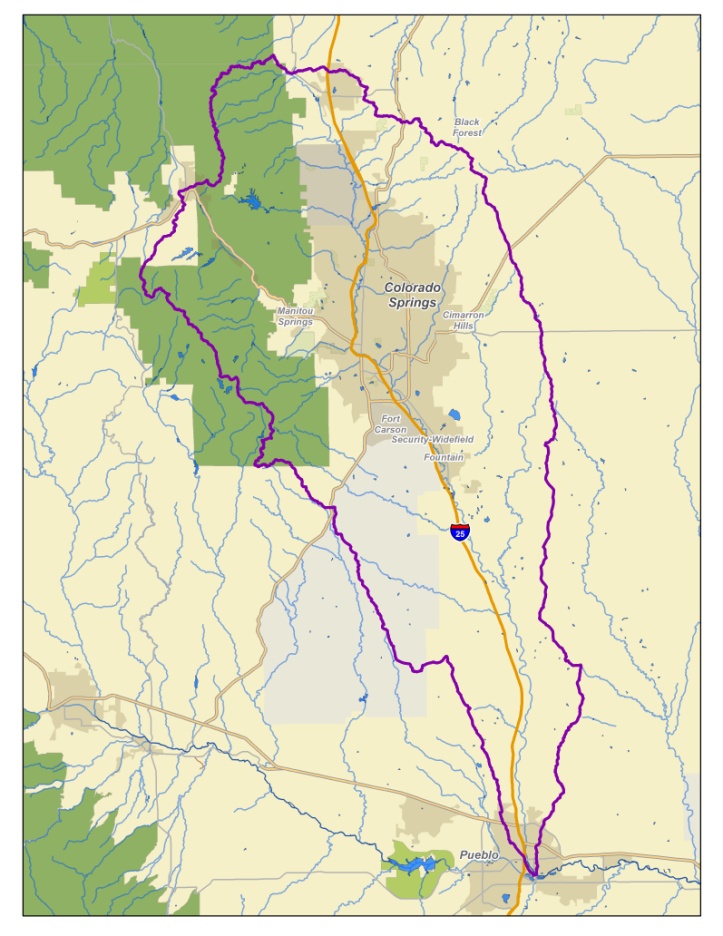
    The Fountain Creek Watershed is located along the central front range of Colorado. It is a 927-square mile watershed that drains south into the Arkansas River at Pueblo. The watershed is bordered by the Palmer Divide to the north, Pikes Peak to the west, and a minor divide 20 miles east of Colorado Springs. Map via the Fountain Creek Watershed Flood Control and Greenway District.

    From The Pueblo Chieftain (Jon Pompia):

    The lower district recently submitted a letter to EPA administrator Scott Pruitt, reminding him that far from “picking on” Colorado Springs — as Lamborn and Colorado Springs Mayor John Suthers contend — the “EPA is carrying out its statutory responsibility to enforce the Clean Water Act against a permittee that district has sought for nearly a decade to get to live up to its stormwater obligations.”

    The dispatch comes on the heels of letters sent by the Pueblo County commissioners to members of the state’s federal congressional delegation, urging the EPA to follow through on its suit, which was filed in conjunction with the state in U.S. District Court in November 2016.

    Signed by Lynden Gill, the lower district’s board chair, the letter goes on to highlight efforts, dating back to at least 2008, in getting Colorado Springs to comply with its stormwater permit. Those efforts extended to the lower district filing a notice of intent to file a citizen’s suit pursuant to the Clean Water Act in November 2014.

    The lower district, along with Pueblo County, became parties of interest along with the EPA and the state in the lawsuit charging Colorado Springs with illegally discharging pollutants into Fountain Creek and the Arkansas River.

    “In short,” the letter continues, “the lower district appreciates EPA’s enforcement action against the city, action the lower district had felt compelled to undertake on its own before EPA sued the city, and can now jointly pursue with EPA and the State of Colorado.”

    The letter concludes with a plea for EPA not to abandon the lower district but pursue enforcement of Colorado Springs’ stormwater violations.

    Jay Winner, general manager of the lower district, expressed hope the letter will serve its purpose…

    Winner said that while the EPA may choose to withdraw from the lawsuit, it cannot halt it.

    “That’s why Pueblo County, the lower district and the state intervened — because if they withdraw, we’re still in,” Winner said.

    Chatfield Storage Reallocation Project update

    Proposed reallocation pool — Graphic/USACE

    From The Castle Rock News-Press (Alex DeWind):

    The $130 million project, called the Chatfield Storage Reallocation Project, approved in 2014will allow water storage for eight municipal water providers and agricultural organizations across the Denver metro area and northeast Colorado. Construction is expected to begin late this year and will take up to two years to complete.

    “The ability to store in that much space gives Highlands Ranch new surface water supplies,” said Rick McCloud, water resources manager of Centennial Water and Sanitation District in Highlands Ranch, one of eight participants. “We can use that water instead of non-tributary (non-renewable) groundwater.”

    Chatfield Reservoir Mitigation Co., formed in 2015 to implement the project, hosted a May 30 open house at ThunderRidge High School in Highlands Ranch for the public to learn about upcoming changes at Chatfield Reservoir and the surrounding state park, which is a major recreational draw for Front Range residents.

    The following are five things to know about the reallocation project.

    History

    In 1975, the U.S. Army Corps of Engineers built Chatfield Reservoir at the confluence of the South Platte River and Plum Creek to control flooding following the disastrous 1965 flood.

    The main purpose of the reservoir, which currently has the ability to store more than 350,000 acre-feet of water, is flood control, but it also provides space for multiuse water and maintains fisheries and wildlife habitat.

    In response to a growing demand for water — the Statewide Water Supply Initiative, commissioned by the state Legislature, estimates by 2030 Front Range water demand will exceed supply by 22 percent — the corps determined Chatfield Reservoir could accommodate additional storage space.

    “We are taking advantage of an existing federal structure,” said Colleen Horihan, the corps’ project manager.

    Who will benefit

    The project is a partnership among eight water providers and environmental organizations: Colorado Water Conservation Board, Centennial Water and Sanitation District, Central Colorado Water Conservancy District, Castle Pines North Metro District, Colorado Parks and Wildlife, Castle Rock, Center of Colorado Water Conservancy District and Castle Pines Metro District.

    Participants will fund upward of $130 million over the next two years for construction of the project. Each provider will receive a varying amount of the additional 20,600 acre-feet of storage space for surface water in Chatfield Reservoir once the reallocation is complete.

    The project allows participants to have access to renewable water supplies at an existing water storage reservoir, according to Chatfield Reservoir Mitigation Co. It also provides renewable water supplies for paying customers in several communities, such as Highlands Ranch, Castle Pines and Castle Rock.

    Recreational impact

    In order to prepare for the reallocation project, many recreational facilities will be modified in phases starting this fall. Most modifications include moving and elevating public areas for increased flood protection and updating existing structures, including picnic structures and bathrooms. A list of detailed designs is available at chatfieldreallocation.org/recreation.

    Chatfield Reservoir Mitigation Co. encourages park users to follow the project on Facebook and Twitter and to ask questions and receive updates on closures and construction schedules.

    “Social media channels are critical platforms,” said Ben Waymire, social media consultant of the project. “These are channels for residents to engage.”

    Environment

    On-site and off-site environmental mitigation will be done at Chatfield State Park to address impacts of storing more water in the reservoir, according to Chatfield Reservoir Mitigation Co.

    Mitigation will include an adaptive tree-management plan for the reservoir to remove dead trees and debris along the shoreline and to identify a long-term tree-monitoring program. A $424,000 budget is set aside for pre-construction weed control. Off-site mitigation is being explored for bird and Preble’s meadow jumping mouse habitats. Depleted water channels and wetlands will be restored using vegetation and structures.

    “We are creating more wetland habitat than we are impacting with the project,” said Barbara Biggs, project manager.

    Timeline

    The reallocation project will begin in fall of this year and is expected to be complete by 2020, after which the reservoir will be able to store up to 20,600 acre feet of additional water.

    Construction will be done in 12 phases, starting with the north boat ramp of the reservoir, to minimize impact on Chatfield State Park — the most visited state park in Colorado with more than 1.6 million visitors per year, according to the mitigation company. The final phase will be wetland and bird habitat mitigation of Mary Gulch, an eastern tributary of the South Platte River.

    Newly identified chemicals in fire-fighting foam pose filtration challenge

    Photo via USAF Air Combat Command

    From The Colorado Springs Gazette (Jakob Rodgers):

    An Air Force-supplied filter being given to Fountain to strain out toxic chemicals from drinking water appears susceptible to a host of newly discovered compounds, a new study shows.

    That type of device – called a granular activated carbon filter – wasn’t too effective at removing more than two dozen chemicals derived from a toxic firefighting foam used for decades at Peterson Air Force Base.

    That means cities relying on those kinds of filters – in this case, Fountain – must replace them more often if they choose to account for the growing list of perfluorinated chemicals, some of which have only been discovered in the last year, said Christopher Higgins, a Colorado School of Mines researcher and the study’s author.

    And that could mean higher costs for ratepayers.

    “The carbon filters will work – you just have to change them more frequently,” Higgins said.

    At issue is the danger posed by a military-grade firefighting foam that is suspected of fouling the Widefield aquifer – a key source of drinking water for the Security, Widefield and Fountain areas…

    None of the area’s three largest districts still use untreated water from the aquifer.

    But Higgins and other researchers across the nation have identified more than two dozen other similar chemicals derived from the firefighting foam – 13 of them in last six months.

    And granular activated carbon filters are quickly overwhelmed by those other chemicals, according to Higgins’ study published Tuesday in the journal Environmental Science & Technology.

    “This study basically is a way of confirming what we suspected,” Higgins said. “Which was that some of those compounds, if they get out into the environment, will likely come through carbon filters much more quickly than PFOA and PFOS do.”

    The danger posed to residents by these additional chemicals remains unclear, said Jamie DeWitt, a toxicologist at East Carolina University. They include similar chemicals to those touted by the Air Force as safe for replacing its decades-old toxic foam.

    “I think the first question anybody should ask is: ‘Are these truly safe for me to drink at these concentrations?’ ” DeWitt said. “And honestly, I don’t think anybody at this point can really answer that.”

    After-hours calls by The Gazette to Peterson and Air Force Civil Engineer Center spokespeople were not returned.

    Higgins’ study comes as Fountain leaders work to install two Air Force-supplied granular activated carbon filters this summer.

    The research hasn’t changed those plans, said Curtis Mitchell, Fountain’s utilities director.

    “We’ll certainly work with him (Higgins) on how long the filter run times will be, and just look at what his data is showing,” Mitchell said.

    Mitchell downplayed concerns about moving forward with installation, because the Air Force’s filters can be easily substituted for a different type of treatment system – such as ion-exchange devices.

    Widefield Water and Sanitation District recently became the first water district in the nation to use an ion-exchange system to treat water for perfluorinated compounds.

    A six-month pilot program showed promise over the winter, and recent test results on the system after it began servicing houses in May showed no trace of six types of perfluorinated compounds, said Brandon Bernard, the Widefield district’s general manager.

    “This stuff’s pretty effective,” Bernard said.

    Higgins, however stopped short of endorsing such devices. They have yet to undergo the same tests as those Higgins just finished on granular activated carbon filters.

    “I don’t know how well they work at removing all of these other chemicals,” he said.

    Twilight Garden Series offers three summer programs for gardeners — @ColoradoStateU

    Photo credit Colorado State University.

    Here’s the release from Colorado State University:

    Topics of interest to Front Range gardeners are the focus of the 2017 Twilight Garden Series, which will feature three informative presentations this month: “Celebrating Native Plants,” “Promoting Pollinators” and “Bringing the Trial Gardens Home.”

    The series is offered annually by CSU’s Department of Horticulture and Landscape Architecture, CSU Extension and The Gardens on Spring Creek. The Twilight Garden Series is an outreach effort that provides Front Range gardeners with research-based knowledge and strategies for success.

    Each session will be presented by experts in the field.

    The Twilight Garden Series is open to the public, will be held 6-8 p.m. on consecutive Tuesday evenings, and will be held outside, rain or shine. Registration is available from 5:30 to 6 p.m. at each event location. Cost to attend is $10 per session, or $25 for all three sessions. Refreshments and door prizes will be provided.

    For more information about Twilight Garden Series, call (970) 491-7019 or visit the website.

    The latest “The Current” newsletter is hot off the presses from the Eagle River Watershed Council

    Spring Creek Ditch

    Click here to read the newsletter. Here’s an excerpt:

    New Bill Clarifies Water Uses for Eagle County

    Colorado water law received some needed clarification in the 2017 session of the Colorado Legislature.

    The legislature, this session, passed a bill in response to the 2015 Colorado Supreme Court decision in the case of St. Jude’s Co. v. Roaring Fork Club LLC. That decision held that direct diversions of water from a river to a private ditch for “aesthetic, recreational and piscatorial” purposes are not “beneficial uses” under state water law.

    “Beneficial use” is a much-used term in state water law and originally encompassed primarily to agricultural and municipal uses. That definition has been evolving throughout the years — through both court decisions and legislation — to protect recreational uses, too, and the new legislation makes that clearer.

    THE DEBATE CONTINUES

    According to a summary on the legislature’s website, “The bill provides that the decision in the St. Jude’s Co. case interpreting section 37-92-103 (4) does not apply to previously decreed absolute and conditional water rights or claims pending as of July 15, 2015.”

    What this means is that those who hold water rights from a stream can legally divert that water for purposes other than agriculture or municipal use.

    The bill was sponsored in the House of Representatives by Democrat K.C. Becker and co-sponsored in the Senate by Republican Jerry Sonnenberg. In a statement after Gov. John Hickenlooper signed the bill, Becker said the law “provides the needed certainty for water rights holders in Colorado.”

    Eagle River Watershed Council Executive Director Holly Loff agreed. In an email, Loff wrote that the group is celebrating the bill’s passage.

    “It protects the tools that local governments have at their disposal to protect flows — both recreational and environmental — which were threatened by the broad language in the (Supreme Court) case. Recreational and piscatorial uses are most definitely beneficial and we are happy to see those protected.”

    #Runoff news: Coordinated releases for #ColoradoRiver endangered fish #COriver

    From the U.S. Fish and Wildlife Service via The Los Alamos Daily Post:

    Coordinated releases from a series of Upper Colorado River Basin reservoirs began Saturday, June 3, and are anticipated to continue through this week as part of the Coordinated Reservoirs Operations Program.

    The US Bureau of Reclamation, the Colorado River District, Denver Water and Northern Colorado Water Conservancy District as owners and operators of upper Colorado River reservoirs have mutually agreed to modify their operations to benefit the endangered fish of the Upper Colorado River Basin.

    The Coordinated Reservoir Operations (CROS) program was established in 1995 as part of the Upper Colorado River Endangered Fish Recovery Program. The purpose of the Coordinated Operations is to enhance spring peak flows in a section of the Colorado River upstream of Grand Junction, Colo. Determined to be critical to the survival of four endangered fish species: the Humpback Chub, Razorback Sucker, Bonytail and the Colorado Pikeminnow. The higher peak flows remove more fine sediment from cobble bars that serve as spawning habitat for the endangered fish. In years with sufficient snowpack, surplus inflows to the reservoirs can be passed downstream to benefit these fish without impacting reservoir yields or future beneficial water uses.

    Coordinated Reservoir Operations were most recently conducted in 2016, 2015 and 2010. In 2011 and 2014, wet conditions caused streamflows in certain areas of the basin to approach or exceed levels associated with minor flooding, so CROS was not performed. In 2012 and 2013, reservoirs did not have surplus inflow to contribute due to extremely dry conditions.

    Managers of the reservoirs completed a conference call June 2, agreeing to voluntarily run the program this year. Planned reservoir operations as of June 2 are described below. Release and flow amounts are approximate. Most reservoirs will step up releases over the next several days, hold at a constant rate for 3-7 days, and then wind down releases.

    Green Mountain Reservoir, operated by the Bureau of Reclamation, will increase releases from 418 cubic feet per second (cfs) to powerplant capacity of around 1400 cfs. Releases from Green Mountain include inflows bypassed by Dillon Reservoir, operated by Denver Water, that will be increased by approximately 100 cfs during CROS.

    Denver Water also operates Williams Fork Reservoir, which is releasing 200 cfs. Releases will likely increase to approximately 600 cfs over the coming week to bypass increasing inflows.

    Willow Creek Reservoir, operated by the Bureau of Reclamation and Northern Colorado Water Conservancy District, is releasing 90 cfs. Releases will increase this week to roughly 600 cfs by curtailing pumping operations to Granby Reservoir and bypassing those inflows instead.

    Wolford Mountain Reservoir, operated by the Colorado River District, is passing inflows of 350 cfs. Outflows will be increased to around 600 cfs for approximately five days.

    Ruedi Reservoir, operated by the Bureau of Reclamation, is releasing 182 cfs and will increase releases to approximately 600 cfs over the next few days.

    The Colorado Basin River Forecast Center (CBRFC) will incorporate these planned reservoir operations into their streamflow forecasts. Based on weather forecasts and planned reservoir operations, flows in the Colorado River near Cameo (upriver of Palisade, Colo.) are anticipated to be approximately 14,000 – 17,500 cfs, June 7 through June 12, with the highest flows Thursday or Friday June 8 or 9. Flows in the forecasted range are still below defined “bankfull” and flood stages for the area.

    More detailed information about forecasted streamflows in the Colorado River basin are available from the CBRFC website at http://www.cbrfc.noaa.gov. A map-based interface allows viewing of hydrographs detailing recent, current and anticipated flows.

    For more information, contact Don Anderson, U.S. Fish & Wildlife Service, at 303.236.9883, donald_anderson@usfws.gov, Michelle Garrison, Colorado Water Conservation Board, at 303.866.3441, ext. 3213, michelle.garrison@state.co.us or James Bishop, Bureau of Reclamation, at 970.962.4326, jbishop@usbr.gov.

    The Upper Colorado River Endangered Fish Recovery Program is a cooperative partnership of local, state and federal agencies, water developers, power customers and environmental groups established in 1988 to recover the endangered fishes while water development proceeds in accordance with federal and state laws and interstate compacts.

    From The Summit Daily News (Kevin Fixler):

    Through both natural and man-made activities, the area’s waterbodies will ramp back up to seasonal heights this week. The National Oceanic and Atmospheric Administration anticipates the Colorado River and its primary Summit County tributaries will reach their highest 2017 levels this Wednesday, June 7.

    The volume-based flow rates, measured as cubic feet per second, on North Tenmile Creek, for example, will rise from about 600 to 900 cfs and the Blue River north of Dillon should grow in the next two days by another couple hundred cfs from its present 600. To offset forthcoming supply, Denver Water, which owns and oversees Dillon Reservoir, stated that it plans to up flows from Dillon Dam into the Lower Blue River from its Monday total of 380 cfs to 600 no later than Tuesday morning, and between 1,400 and 1,800 cfs by the end of the week.

    “The snowpack up on the mountain, it’s now warmed up and is starting to come off,” said Jim Pokrandt, spokesman for the Colorado River District, a public policy agency that closely monitors the region’s major waterway. “It’s fast water, but shouldn’t flood anybody out. All streams will be quicker-paced than people are used to, but the flooding is not the danger.”

    […]

    North of Silverthorne, additional releases at Green Mountain Reservoir also allow the Bureau of Reclamation to increase power plant capacity and generate more electricity. Those levels could reach approaching 1,400 cfs from the current 418.

    Estimating that 40 percent of the winter’s snowpack still remains above Dillon, Denver Water is comfortable increasing the flows from Dillon Reservoir into the Lower Blue River that ultimately head to northern Arizona’s Lake Powell. That result is threefold, preventing wasteful overflow of the reservoir, maintaining ideal recreational heights on the lake, as well as fulfilling the demands of Lower Basin states based on senior water rights.

    “Our experts are monitoring conditions carefully with the goal of ending runoff season with a full reservoir,” Matt Wittern, Denver Water Summit County liaison, wrote by email. “That way, we’re able to meet our customers’ needs while providing locals and tourists alike with valued summer recreation activities that have a positive impact on the local economy.”

    A standup surfer in the Arkansas River at Salida during Fibark, the river celebration held in late June. Photo/Allen Best

    From The Mountain Town News (Allen Best):

    Where spring runoff has been something like average—and where it hasn’t

    Spring runoff of the Yampa River likely peaked on May 14 this year as it flowed through northwestern Colorado. That makes it an anomaly in the precipitation-dripping mountains of the West.

    In most other locations, the peak runoff—the time when the largest volume of water in rivers occurs as winter’s snow melts—more normally occurs in early June after temperatures finally warmed. This year looks to be more or less normal, despite a trend to earlier runoff in many locations during the last several decades.

    “The Yampa did have an early runoff, and that was the result of the warm temperatures and below-average snowpack,” said Ashley Nielson, senior hydrologist with the Colorado Basin River Forecast Center in Salt Lake City, when interviewed last week by Mountain Town News. The Yampa, she noted, will probably rise again in the next week or so, if not to the same high mark.

    But elsewhere, the show is now, not a month ago. Peak runoff of the Green River was expected this week or next. It originates in the Wind River Range of west-central Wyoming. Unlike the Yampa, that basin still has a significant snowpack. That was also reported to be the case in Jackson Hole, at the headwaters of the Snake River. The snowpack there was 181 percent of average in late May, not a record but “up there,” in the words of one water official cited by the Jackson Hole News&Guide.

    Peak runoff in the upper Colorado River at its headwaters along the Continental Divide in Colorado was also expected to occur in early June.

    Winter had wild swings: barren until late fall, then torrents of snow in December and January. Temperatures were unseasonably warm in February and almost hot in March. It looked like an early runoff everywhere. Then May turned cold and snowy.

    What explains the Yampa’s aberrant behavior? Karl Wetlaufer, a hydrologist with the Natural Resources Conservation Service in Denver, said the peak snowpack in northwestern Colorado arrived about a month earlier than usual. That snowpack around Steamboat Springs occurred on March 12, compared a more typical April 10.

    Instead of mid-May for the Yampa, he says that rafters floating through Dinosaur National Monument more often experience the highest water flows of the year in early June.

    The Dolores River in southwestern Colorado on Memorial Day in 2009. Photo/Allen Best

    Flows in the Animas River through Silverton and Durango have had some “pretty wild swings,” Wetlaufer says. The Arkansas River has been slow to get started with runoff.

    The Snake River of Wyoming and Idaho has a very different story than the Yampa, with around 200 percent of snowpack this year. The Snake originates in Jackson Hole and picks up water from the Big Wood River, which originates in the Sawtooth Mountains above Ketchum and Sun Valley, before joining the Columbia at the Idaho-Washington border.

    “My takeaway is that this year is pretty normal” in terms of timing, says Bruce Anderson, the senior hydrologist at the Northwest River Forecast Center, in Portland, Ore. It was cooler and wetter in spring, but the big story was the amount of precipitation that fell during winter. “We are hugely above normal for precipitation.”

    In the Tahoe-Truckee area of California’s Sierra Nevada, the snowpack was among the deeper ones on record after three bad drought years and then a so-so winter in 2015-16. Snowfall this winter was not a record, but it was a record for total precipitation. Being somewhat lower and closer to the coast than Colorado, the Sierra Nevada gets more rain during winter. This year it got a lot of rain.

    Colorado, too, had rain on snow, which is not unprecedented. But it happened frequently this winter. The result was telling for travelers on I-70 who crossing Vail Pass.

    “In general, there was less snow than you would expect,” says Klaus Wolter, a research scientist at the National Oceanic and Atmospheric Administration in Boulder.

    Were those rain on snow storms of this past winter a result of accumulating greenhouse gas emissions? Wolter told Mountain Town News that thinks this is “probably partially climate change.”

    Wolter, whose focus is empirical climate research, using statistical methods to solve climate problems, is reluctant to pin climate change on much of what we have seen this year. True, he says, one storm during May left 42 inches of fresh snow in the foothills above Boulder, a storm unprecedented since the 1920s. As extreme as that storm was, proving causality is difficult, he says.

    A scientist in Oregon also shared the difficulty of proving causality. John Stevenson of Oregon State University told the Idaho Mountain Express in Ketchum that it’s “really difficult to judge any one year” to be a result of rising global temperatures.

    “That’s one of the challenges we run into in the science world where people say, ‘Oh, it’s climate change.’ We’re not at the point where we can take any one random event and say it’s climate change.”

    That said, his 2015 study concluded that the point each spring when half of the water year’s streamflow had run off was occurring an average 1.9 days earlier per decade.

    But more extreme events are happening with greater frequency, said Mark Davidson, director of conservation initiatives with The Nature Conservancy. He pointed out that the Big Wood River has had two 100-year floods in the last 15 years.

    Warm temperatures in the Ketchum and Sun Valley area were 6 to 13 degrees warmer than normal for early May, producing a flood in the Big Wood River that peaked on May 8. It was regarded as the largest in 101 years of recorded history, reports the Idaho Mountain Express.

    But more warm weather was producing another surge in early June that threatened to surpass that peak of a month before, the newspaper reported last week.

    Heather Dutton appointed to @CWCB_DNR

    Heather Dutton

    From Governor Hickenlooper’s office via the The Alamosa News (Ruth Heide):

    Gov. John Hickenlooper appointed Heather Dutton of Del Norte to the Colorado Water Conservation Board.

    The Colorado Water Conservation Board (CWCB) aids in the protection and development of the waters of the state. The board is responsible for water project planning and finance, stream and lake protection, flood hazard identification and mitigation, weather modification, river restoration, water conservation and drought planning, water information and water supply protection.

    Appointed as a representative from the Rio Grande drainage basin and as a Republican, Dutton will serve a term expiring Feb. 12, 2020.

    Travis Smith formerly served as the basin’s representative on the state board.

    Dutton, 31, is the district manager of the San Luis Valley Water Conservancy District and formerly directed the Rio Grande Restoration Project with which she is still involved. She is also active on the Rio Grande Roundtable board and was heavily involved in developing the basin’s portion of the Colorado Water Plan.

    About a year ago she was honored with the 2016 Emerging Leader Award from the Colorado Foundation for Water Education.

    Dutton earned a master’s of science in agriculture in 2010 from Colorado State University-Fort Collins where she graduated from the natural resources management program with a concentration in restoration ecology.

    A San Luis Valley native, Dutton is the daughter of Doug and Julie Messick and is married to Tanner Dutton who is a range management specialist for the U.S. Forest Service’s sheep and cattle grazing program.

    Aftermath: What happens once the water recedes? – News on TAP

    Denver Water pays over $145,000 to help property owners recover after water main break floods Highland neighborhood.

    Source: Aftermath: What happens once the water recedes? – News on TAP

    @OWOW_MSUDenver: Center Upcoming Events: Shed ’17, Student Water Field Conference, Water Conflict

    Click here to read the newsletter. Here’s an excerpt:

    “Shed ’17” Watershed Summit

    The Watershed Summit is rapidly becoming the region’s top event for water industry leaders. The event’s focus on “Water Is Your Business” seeks to add new voices to the discussion, introduce innovative ideas, and break down silos. Topics include water conservation, watershed health, climate change, water’s economic impacts, and agriculture – including emerging trends and opportunities.

    Registration scholarships are available to qualified participants. Please note that the scholarship deadline has been extended to June 16th. Scholarship Application

    Registration and More Shed ’17 Information

    #Snowpack news: Streamflow up, snowpack down

    Click on a thumbnail graphic to view a gallery of snowpack data from the NRCS. Please note that despite the blueness of the basin-filled map much of the snowpack has melted-out. Statewide Snow Water Equivalent left approximately = four inches.

    Here’s the Westwide SNOTEL basin-filled map.

    Westwide SNOTEL basin-filled map June 4, 2017 via the NRCS.

    From The Montrose Daily Press (Katharhynn Heidelberg):

    The massive reservoirs that store Colorado River water critical to several states and Mexico run the risk of being drained and so, require careful management.

    “We do not want to drain the system,” Eric Kuhn, the retiring general manager of the Colorado River District, told local water users Wednesday.

    Kuhn and several others spoke during the Gunnison River Basin State of the Rivers annual public meeting in Montrose.

    Kuhn spoke of Lake Powell and Lake Mead, which collectively store 50 million acre-feet of the 60 million acre-feet of stored water from within the Colorado River Basin, and which supply the water needs of multiple states.

    Draining down the two lakes would affect everything from several compacts governing water rights between states, to power generation.

    The district is developing and implementing contingency plans to “keep enough in our savings account,” Kuhn said. For Lake Powell, that means keeping at least enough in it to generate power — a cushion, but a cushion that’s a little low, he said.

    At Lake Mead in the Lower Colorado River Basin, the goal is to equalize; in order to do that, demand must be reduced by a staggering 20 percent.

    The contingency plan will help the millions who depend on water from Powell and Mead weather droughts. “If we were to go into drought, we would be prepared,” Kuhn said.

    The Colorado Basin is having a good year so far — but not necessarily great, he said earlier.

    “It’s a really, really busy time right now on the Colorado River. … We’re trying to figure out how we’re going to live with a developed river,” Kuhn said, but added water rights will be honored as required by legal agreements.

    Projected runoff is overall normal: While some parts of the Colorado River Basin are approaching record runoff, others are only hitting average runoff. It’s a good year “but not a great year,” Kuhn said.

    The river basin is the lifeblood of farming and municipal uses.

    “Every drop of water is used in the Colorado River Basin. … We’re basically at a zero-sum (operation),” Kuhn said.

    After agricultural usage, the biggest use of Colorado River water is evaporation, which takes 2 million acre-feet a year — more than all municipal uses combined, he said.

    The Gunnison River is a main tributary of the Colorado. The Gunnison River Basin is among those within the Colorado River Basin showing an above-average year.

    Bob Hurford, the division engineer for the Colorado Division of Water Resources, pointed to readings from the North Fork, which showed above-average snowpack, while, he said, the Uncompahgre River also showed “another good snowpack year.”

    Ridgway Reservoir is 118 percent of seasonal peak, and runoff could extend into July, Hurford said, telling users to expect peak flow above 1,000 cubic feet per second.

    “The big dog is the Upper Gunnison Basin. It was a big, big, big year,” Hurford said. The basin is 143 percent of seasonal peak.

    Good soil moisture also is helping, as is average to above-average precipitation, leading to an overall good supply for irrigation water in the Gunnison River Basin.

    Plus: “You can expect a decent monsoon season again,” Hurford said.

    Monsoonal moisture, which usually arrives in July, is critical to growers during hot summer months.

    The basin is experiencing an “average wet” category year, said Ryan Christianson, water operations manager for the U.S. Bureau of Reclamation. The federal body manages stored water in the Gunnison River Basin as part of the Aspinall Unit.

    The Gunnison Tunnel should be taking on its full amount later in summer, Christianson said.

    The meeting wound down with honors for Kuhn’s years of service. State Rep. Marc Catlin, R-Montrose, presented him with beans grown in the Uncompahgre Valley and Russell Stover’s candies, while Colorado Water Conservation Board Director John McClow gave him a basket of “Gunnison Basin goodies” — food and drink items produced thanks in part to river water.

    Kuhn and the Colorado River District, said Catlin have “saved this valley” more than once.

    Kuhn’s segment of the meeting also was filmed by a PBS crew for inclusion in “This American Land.”

    Gunnison Tunnel via the National Park Service

    Antero, we’ve missed you so – News on TAP

    Antero Reservoir opening to recreation Monday, June 5, for the first time since 2015.

    Source: Antero, we’ve missed you so – News on TAP

    Mesa Verde piñon-juniper forests struggle to return after wildfires #ActOnClimate

    Pinon and juniper forests that burned in the early 2000s show little sign of regeneration. Pony Fire area photo credit AWeekOrAWeekend.com.

    From The Durango Herald (Jonathan Romeo):

    From 2000 to 2003, a series of wildfires ripped through Mesa Verde National Park, burning about 24,000-acres – nearly half of the park’s old growth forest.

    Now, almost two decades later, park managers and biologists are concerned that the piñon-juniper woodland is showing virtually no signs of growing back, posing the tough question: Will Mesa Verde’s iconic forests ever be the same?

    “We’re very concerned about the park’s woodlands,” said George San Miguel, Mesa Verde’s natural resource manager. “Because if we lose the park’s forests entirely, or if we have only scattered remnants, it won’t tell the same story.”

    Mesa Verde is both a national park and World Heritage site, home to more than 4,300 archaeological sites of the ancestral Puebloan people, and most notably known for the 600 cliff dwellings within the park’s 52,485-acre boundary…

    Yet as researchers rediscovered Mesa Verde in the late 19th century, leading to a national park designation in 1906, it became abundantly clear the original inhabitants of the area used the piñon-juniper woodland in ingenious ways.

    “The people that lived here learned to be part of the ecosystem, part of woodland,” San Miguel said.

    Ancestral Puebloans not only harvested wood to endure harsh winters, build structures and make tools, they also relied heavily on the protein-rich piñon nuts as a staple of their diet…

    A vulnerable forest
    In the mid-to-late 1990s, the invasive Ips beetle found its way into Mesa Verde and wiped out the old-growth piñon in its path, the oldest of which ranged from 500 to 1,000 years old.

    Then, a severe drought in the 1990s caused perfect fire conditions – dead, dry trees – so when a lightning strike hit private property near the entrance of Mesa Verde at about 1:30 p.m. July 20, 2000, it wasn’t long before a fire spread, ultimately consuming 19,607 acres within the park.

    Though this fire, called the Bircher Fire, consumed the greatest amount of forest, several other fires in the ensuing years, notably the Pony and Long Mesa fires, also took their toll in the park. Both were also caused by lightning strikes.

    “If you fly over, there’s fire scars everywhere,” said Steve Underwood, park fire-management officer. “You’re seeing these forests change, and it’s very startling. And it’s happened not just over the course of my lifetime, but my career.”

    Piñon and juniper woodlands thrive in high-elevation deserts, usually between 4,500 to 7,500 feet. And while the hardy plants can survive a mere 7 to 25 inches of rain a year, they are terribly ill equipped to deal with wildfire.

    “These trees evolved not to deal with fire,” said Renee Rondeau, a conservation biologist with Colorado Natural Heritage Program. “They can go without fire and it would not affect them, which tells you the places they grow did not, historically, have a lot of fires.”

    Yet with the introduction of Western civilization in the American Southwest, and the impacts associated with climate change, such as drier years and an increased risk of wildfire, the new reality is that piñon-juniper woodlands may not be adapted for future survival.

    Conditions inhibit regrowth
    Even in perfect natural conditions, piñon and junipers take a long, long time to grow.

    Piñon, for instance, don’t produce germinating seeds until they reach 75 years in age. And even then, the plants only produce seeds every seven to eight years, requiring non-drought conditions and proper dispersing by animals.

    According to National Park Service data, piñon-juniper woodlands cover as much as 15 percent of land in Arizona, Colorado, Nevada, New Mexico and Utah.

    “How can something that’s that picky be that common?” Rondeau said. “That just tells you the climate has been fairly stable for quite a while.”

    Yet now a multitude of factors seem to be inhibiting piñon-juniper regeneration in the burned areas of Mesa Verde.

    Warmer and drier conditions, associated with the impacts of climate change, and therefore increased fire risk, seem to be directly affecting the woodland’s regrowth, researchers said.

    And then enter issues with more competitive Gambel oak and invasive species, such as cheat grass, and the question surfaces whether the piñon-junipers can ever gain a stronghold again.

    The issue is not specific to Mesa Verde.

    At Bandelier National Monument, another ancestral Puebloan site in New Mexico, a series of high-severity wildfires consumed the predominately ponderosa forests, which are now overtaken by a variety of shrubs.

    “We’re researching that question right now: Why aren’t we getting pine regeneration?” said chief of resource management Jeremy Sweat. “And we may have to redefine recovery, because we’re not sure some of these forest types will ever return.”

    Last year, the Los Alamos National Laboratory released a study that suggested piñon-junipers could be wiped out of the American Southwest by the end of this century as a result of climate change.

    Rondeau said models of different scenarios of piñon-juniper habitat in 2035 and 2065 found that while there may be some refuges for the woodland, suitable habitat will significantly diminish over time.

    “If we can get our carbon emissions down and … keep (these forests) from burning, maybe our grandkids will be able to have piñon here,” Rondeau said.

    What about the future?
    “One of the most common questions we get is when and why was there a burn,” Underwood said of Mesa Verde’s visitors, which hit 583,527 last year. “We’ve added signs around the park, delineating each fire.”

    San Miguel said there are indications in the park that piñon-junipers can grow back. A 200-acre area known as the Glades that burned around 1700 or so does have a patch of young piñon-juniper trees, about 200 years old.

    “That’s our reference,” San Miguel said. “That’s what happens with fire and natural regeneration under good conditions.”

    But if global temperatures continue to rise at their current pace and increase 5 to 7 degrees by the end of this century as scientists predict, San Miguel said, and fires continue to plague the arid desert landscape, it may be time to rethink what Mesa Verde will look like.

    Carbon dating conducted a few years ago in the park of sediment deposits went back tens of thousands of years, finding that Mesa Verde at one time supported ponderosa and Douglas fir in wetter years, and was absent of piñon-juniper in drier years.

    These are indications that Mesa Verde’s forests have changed over time, San Miguel said. But human impacts are creating a complication of unknowns in the process.

    “What we’re heading for now is not necessarily unprecedented,” San Miguel said, “but you throw in invasive plants and fires, and then you have a wild card that throws everything into question.”

    #Drought news: D1 (Abnormally Dry) in Park and Mesa counties


    From The Fort Morgan Times (Jeff Rice):

    Weather forecasters believe El Nino activity could result in a cooler, moister summer than is normal, and state officials have officially declared the 2016-2017 drought over. The Colorado Department of Natural Resources issued a statement earlier this week saying that recent moisture “have resulted in widespread elimination of drought conditions ….”

    “(A)bnormally dry conditions are present in Mesa and Park counties and will continue to be monitored,” the statement said. “Water providers have no immediate concerns and expect reservoirs to fill.”

    That matches the U.S. Drought Monitor, a collaboration of the National Drought Mitigation Center at the University of Nebraska-Lincoln, the United States Department of Agriculture, and the National Oceanic and Atmospheric Administration…

    That is a dramatic change from three months ago when eastern Colorado was in the grip of one of the worst droughts in recent memory. Wildfire destroyed thousands of acres of crop and rangeland, hundreds of head of livestock, and four homes in Phillips and Logan counties. It looked to be a long, hot summer. Wide swaths of eastern Colorado were parched. While Logan and Phillips counties smoldered, the Denver Post was reporting that drought conditions were worsening over the eastern third of the state. By late March the drought had spread to the entire I-25 corridor, and fire departments there were dispatching SCAT trucks with almost every call, just in case…

    Chris Fenimore, an environmental scientist at USDM, said cooler temperatures have slowed down snowmelt in the high country, especially in the Colorado and Yampa River basins. For eastern Colorado basins, Fenimore said, snowpack remains…high for this time of year, and abnormal amounts of moisture in May have helped to end drought conditions here.

    “The small pocket of abnormal dryness in central Colorado is reflective of drier-than-normal areas of vegetation and soils,” Fenimore said.

    Climatologists caution, however, that the reprieve is temporary. Mother Earth remains in the grip of gradual warming, and in eastern Colorado that translates to less water being available as time goes on.

    The puzzling push to allow pollution and waste on federal lands — The Mountain Town News @MountainTownNew

    A drilling rig in the Piceance Basin, southeast of Rangely, Colo. Photo/Allen Best

    From The Mountain Town News (Allen Best):

    Donald Trump, in running for president, vowed to make public lands more accessible for oil-and-gas drilling. He also promised to roll back regulations. When it came to methane emissions, his anti-regulation agenda failed thanks to three Republicans in the U.S. Senate who walked across the partisan divide to preserve the Methane Waste Prevention Rule.

    The rule, adopted by the Obama administration last November after three years of public review, requires companies operating on federal and Indian lands to look for and repair leaks, allows only minimal burning, and prohibits direct venting into the atmosphere. Proponents said the regulations can result in 40 to 45 percent of the gas otherwise wasted being captured.

    What motivated this push to allow a valuable public resource to be wasted in a way that pollutes? Are we really desperate for the energy? The stock market was barreling along even before the election, and after the election it became delirious.

    Energy is cheap. A decade ago, the peak oil argument was credible. A book about the same time was called “High Noon for Natural Gas.” It looked like end times for our fossil fuel-enabled civilization. Natural gas ran as high at $14.50 per million Btu and the gas we buy to fuel our cars ran over $4 in metropolitan Denver.

    Now natural gas is running a little over $3 and the oil prices are running about $50 a barrel, meaning gas prices at Denver-area stations run about $2.30 per gallon for standard unleaded. Hydrocarbons have become so plentiful globally that OPEC continues to hold back production in an effort to raise prices.

    Cheap energy enables waste. I see it almost every day. As I live near a busy commercial area, strangers park in front of my house constantly. Returning from yoga or shopping or the bar, many get in cars, turn on the engine, and then just sit there, idling, while scrolling through Facebook or whatever. Sometimes they sit idle for a half-hour while stinking up the neighborhood.

    More unnerving was my recent visit to a nature-science school in Eagle County. The building housing the school has a LEED platinum certification, the very highest attainment for environmental performance. But in the parking lot was the very worst of environmental performance. A Cadillac Escalade pulled up next to me. It gets 15 miles per gallon in the city, 22 on the highway. Idling in a parking space, it gets even worse: zero miles per gallon. But that is what the driver was doing, thumbing through her smart phone on the best of spring days, neither warm nor cold. Cost was no issue.

    In winter, on even the chilliest days, I see store doors constantly left wide open, to make them more inviting to shoppers. Ditto in summer, when the air conditioner is blasting. We heat the great outdoors in winter and cool it in summer.

    The federal regulations were modeled on those adopted by Colorado in 2014. [ed.emphasis mine] A survey by Keating Research issued in April 2016 found that 8 of 10 oil and gas company representatives interviewed said that they were profiting, coming out even, or paying out just a little more than they collected in new revenue. Certainly not onerous.

    I consume both natural gas and oil, and I recognize that all energy extraction and production has impacts. So does renewable energy. But to let methane be wasted to pollute the atmosphere when we’re awash in cheap energy is puzzling.

    Why did Congress nearly repeal these regulations? The disagreement seems to be over whether states should make the rules, even those on federal lands. It’s similar to the dispute about water.

    But what a bizarre flag to battle under, the right to allow waste and pollution. Whatever were Rep. Mike Coffman, Sen. Cory Gardner and Colorado’s other Republicans in Congress thinking?

    Thanks goodness for the three senators who crossed the aisle: John McCain of Arizona, Lindsey Graham of South Carolina and Susan Collins of Maine.

    @USGS: Landsat live

    Screen shot of the LandSat live feed June 3, 2017 over Russia.

    Click here to go to the website:

    Watch Landsat LIVE!

    A recent release of the EarthNow! Landsat Image Viewer displays imagery in near real-time as Landsat 7 and Landsat 8 orbit the Earth. Along with the near real-time video stream, EarthNow! also replays acquisition recordings from a list of previous Landsat overpasses. When Landsat 7 or Landsat 8 are out of viewing range of a ground station, the most recent overpass is displayed. EarthNow! can also display current satellite positions and footprints.

    EarthNow! is based on the FarEarth Global Observer tool (developed by Pinkmatter Solutions) to help visualize incoming data for Landsat’s International Ground Stations, including the USGS-acquired imagery shown on EarthNow!.

    How NISP works — @Northern_Water

    Glen Haven to rebuild town hall

    Glen Haven October 2013 via NBC News

    From The Longmont Times-Call (Pamela Johnson):

    Nearly four years ago, floods reduced the Glen Haven Town Hall to a pile of debris, unrecognizable as the community center it had been for more than 70 years.

    Thursday, community members gathered across the main street from that site, on land outside the floodplain, and celebrated the upcoming construction of a new town hall — a center that will be built all with donated funds, made a reality by the drive of the small mountain community…

    those residents pulled together again and raised the money to build the new town hall. So far, their efforts have brought in $300,000 of the needed $500,000.

    Donations are still being accepted, and two fundraising events are planned this summer — a barbecue and music festival on June 24 and a tour of historic cabins on July 30. Tickets and donation information are available online at http://www.glenhaventownhall.org.

    Shimon expects the community association board to choose a contractor within the next week and construction to be complete by next March.

    The original town hall, built in 1939, was washed off its foundations during the 1976 flood, according to information from Steve Green, who is on the board of the association and on the steering committee for the new town hall.

    Residents then pushed it back onto its foundation and raised the building about 2 feet higher, according to Green.

    During the second flood, the town hall was pulverized, and county rules around rebuilding in a floodplain prevented anything from being rebuilt on the existing site. So, community members chose a location less than a block away, from which you can see the old town hall location.

    Architect Michael Tavel, who is also a Glen Haven resident, designed the new structure to look much like the old, with the same “historic main street character” as the original building. However, it will be slightly larger, will have room for town archives, will have a kitchenette for potlucks and, unlike the old space, will include a bathroom.

    His vision is a place where residents, and future generations, can make memories as they did for more than 70 years in the old town hall.

    President #45 starts process to take the U.S. out of the Paris Climate Agreement #COP21

    Indigenous people #cop21 via the Department of Interior.

    From the Associated Press (Jill Colvin and Julie Pace) via The Aurora Sentinel:

    Many Colorado politicians were quick to respond, including Rep. Mike Coffman who issued a somewhat neutral response to Trump’s decision. While he talked about a desire to reduce pollution, Coffman didn’t mention climate change.

    “President Obama should have submitted the Paris climate agreement to the Senate for ratification as a treaty. Now President Trump should do what his predecessor failed to do – follow Article II, Section 2 of the U.S. Constitution and take it before the Senate for a debate and a vote,” Coffman said in a statement on Twitter. “I hope we can be part of a renegotiated climate treaty, ratified by the United States Senate, to continue our nation’s efforts to reduce greenhouse gas emissions.”

    Unsurprisingly, Sen. Michael Bennet, Rep. Ed Perlmutter and other state Democrats slammed the decision by Trump, calling it a blow both to the environment and to the country’s ability to conduct diplomacy moving forward.

    “The President made a catastrophic mistake by putting a misguided campaign promise before the needs of our economy and the credibility of American diplomacy,” Bennet said in a statement. “Before this decision, the United States was on track to achieve energy independence, reduce its carbon footprint, and create good-paying jobs in rural communities-with Colorado leading the way. Withdrawing from the Paris Agreement attempts to undercut the progress we have made.”

    “President Trump’s decision to withdraw the United States from the Paris Climate Agreement is wrong and takes our country and Colorado backwards not forward. I’m disappointed and frustrated by this decision,” Perlmutter said in a statement. “Clearly climate change is a threat to our way of life in Colorado.

    “Colorado is a proven leader in developing technologies that reduce harmful greenhouse gas emissions,” he added. “I will continue to fight for the progress we’ve made in Colorado and push to reduce the impact of climate change in our communities.”

    Gov. John Hickenlooper pledged that Colorado would continue its work on reducing pollution and promoting clean energy production in the state.

    “It is a serious mistake to back out of the Paris Accord. This is a historic global agreement between almost every nation on earth to address the single most pressing issue facing humanity. Abandoning this climate deal is like ripping off your parachute when you should be pulling the ripcord. America’s greatness has always been demonstrated by our moral leadership,” Hickenlooper said in a statement. “Today, we break ranks with 190 nations who are working together to stop the worst effects of climate change, which the scientific community agrees would devastate the global economy and our planet, and the defense community agrees would destabilize vulnerable nations that have served as breeding grounds for international terrorism.”

    Colorado Democratic Party Chair Morgan Carroll echoed the sentiment of many Democrats in the state when she slammed Trump’s decision and how it would affect Colorado’s environment.

    “Trump’s decision today is a global embarrassment, taking our nation backwards in the battle to preserve our environment and reduce our carbon footprint. By withdrawing from the Paris agreement, Trump has disregarded the scientific consensus of climate change, ignored local businesses that rely on a healthy environment and jeopardized our nation standing as a strong world leader,” Carroll said. “As Democrats, we will continue to resist Trump’s blatant attacks against science to help preserve our planet for the future of our children and protect American jobs as we fight sustainable energy solutions.”

    Under former President Barack Obama, the U.S. had agreed under the accord to reduce polluting emissions by about 1.6 billion tons by 2025. But the targets were voluntary, meaning the U.S. and the nearly 200 other nations in the agreement could alter their commitments.

    Trump said that he would begin negotiations to re-enter the agreement or establish “an entirely new transaction” to get a better deal for the U.S. But he suggested re-entry was hardly a priority. “If we can, great. If we can’t, that’s fine,” he said.

    By abandoning the world’s chief effort to slow the tide of planetary warming, Trump was fulfilling a top campaign pledge. But he was also breaking from many of America’s staunchest allies, who have expressed alarm about the decision. Several of his top aides have opposed the action, too, as has his daughter and adviser, Ivanka Trump.

    Scientists say Earth is likely to reach more dangerous levels of warming sooner as a result of the president’s decision because America contributes so much to rising temperatures. Calculations suggest withdrawal could result in emissions of up to 3 billion tons of additional carbon dioxide in the air a year — enough to melt ice sheets faster, raise seas higher and trigger more extreme weather.

    Trump’s decision marked “a sad day for the global community,” said Miguel Arias Canete, climate action commissioner for the European Union.

    At home in America, the U.S. Conference of Mayors said it strongly opposed the decision and said mayors will continue efforts to reduce greenhouse gas emissions blamed for global warming. The group’s vice president, New Orleans Mayor Mitch Landrieu said the action “is shortsighted and will be devastating to Americans in the long run.” In fact, he said, sea level rise caused by unchecked climate change could mean that cities like his “will cease to exist.”

    Trump, however, argued the agreement had disadvantaged the U.S. “to the exclusive benefit of other countries,” leaving American businesses and taxpayers to absorb the cost.

    “This agreement is less about the climate and more about other countries gaining a financial advantage over the United States,” he said, claiming that other countries have laughed at the U.S. for agreeing to the terms.”

    Investors seemed pleased, with stock prices, already up for the day, bumping higher as he spoke. The Dow Jones industrial average rising 135 points for the day

    As for the mechanics of withdrawal, international treaties have a four-year cooling off period from the time they go into effect. That means it could take another three-and-half years for the U.S. to formally withdraw, though Trump promised to stop implementation immediately.

    Major U.S. allies, business leaders and even the Pope had urged the U.S. to remain in the deal. The decision drew immediately backlash from climate activists and many business leaders.

    The U.S. is the world’s second-largest emitter of carbon, following only China. Beijing, however, has reaffirmed its commitment to meeting its targets under the Paris accord, recently canceling construction of about 100 coal-fired power plants and investing billions in massive wind and solar projects.

    White House aides have been divided on the question of staying or leaving the accord and had been deliberating on “caveats in the language” as late as Wednesday, one official said. But Trump’s statement was clear and direct.

    So was opposition from environmental groups, as expected.

    “Generations from now, Americans will look back at Donald Trump’s decision to leave the Paris Agreement as one of the most ignorant and dangerous actions ever taken by any President,” Sierra Club executive director Michael Brune said in a statement.

    Here’s Governor Hickenlooper’s statement:

    Gov. John Hickenlooper today released the following statement on President Trump’s decision to withdraw from the Paris Accord:

    “It is a serious mistake to back out of the Paris Accord. This is a historic global agreement between almost every nation on earth to address the single most pressing issue facing humanity. Abandoning this climate deal is like ripping off your parachute when you should be pulling the ripcord.

    “America’s greatness has always been demonstrated by our moral leadership. Today, we break ranks with 190 nations who are working together to stop the worst effects of climate change, which the scientific community agrees would devastate the global economy and our planet, and the defense community agrees would destabilize vulnerable nations that have served as breeding grounds for international terrorism.

    “The U.S. is letting go the reins of world leadership, allowing other countries like Russia, India, and China to take our seat at the international table. Our economic and technological competitiveness will suffer. Isolationism is not leadership.

    “Colorado’s commitment to clean air and clean energy will continue. Clean energy is abundant, home-grown, and creates 21st century jobs for our modern workforce across every part of our state. We renew our commitment to pursue cleaner energy at a lower cost. To do otherwise would be governmental malpractice.”

    For background

    Colorado ranks among the nation’s largest clean energy employers. As of 2015, 2,070 clean technology companies operate in Colorado, supporting more than 62,000 jobs in both rural and urban communities. These clean tech jobs provide Coloradans $3.6 billion in wages. Colorado’s renewable energy industry is poised for significant growth in the years ahead, which will help improve Colorado’s air, reduce consumers’ electricity bills, and support well-paying jobs.

    Fruita: Public meeting regarding 3 reservoirs

    Piñon Mesa Fall Colors photo credit Adventr.co.

    From The Grand Junction Daily Sentinel (Amy Hamilton):

    Until the early 1980s, the city of Fruita piped its domestic water down from Piñon Mesa, south of Glade Park.

    Fruita still maintains four lakes in the alpine area above Glade Park, but the area is used mostly for recreation as locals flock to the high country to escape summer’s grip.

    The city now is seeking public input as it looks to the future, considering the high costs of maintaining its mountain water storage. A public meeting is scheduled tonight.

    “The whole goal is to educate the public and residents and develop a long-term plan on disposing of them or selling them if someone has a use for them,” said Ken Haley, Fruita public works director. “We definitely want to get some public feedback before we go any further.”

    Fruita spends about $90,000 a year maintaining three reservoirs and Enoch Lake. Reservoir No. 2 is failing and in need of a fix estimated at $1 million. Reservoir No. 1 was repaired in 2009 with the help of the Colorado National Guard. The city owns five parcels, a total of 263 acres, Haley said.

    Historically the city wanted to keep its 240 water shares associated with the lakes — a buffer for Fruita residents in the event of water shortages. However, Fruita now receives domestic water from Ute Water and it currently has 2,400 shares of unused city-owned shares it can utilize. A wooden pipeline built in 1907 that traverses Colorado National Monument hasn’t been used since 1983, and is unusable today, Haley said.

    “As the city grew, it wasn’t quite enough (water) to keep up with the city’s needs,” he said of the reservoirs. In the past few years, the city’s workload has increased by sending public works employees up the hill several times a week. This detracts from duties that need to be done in Fruita, Haley said. Starting this year, the city decided to only send crews up once a week for maintenance duties in an effort to curb labor costs.

    In addition, last year Fruita cancelled its overnight camping option at Enoch Lake after the city fielded an increasing number of complaints and campers appeared to be using the area for extended stays. Garbage cans that previously had been emptied once a week by city crews would fill every day, the city said.

    Haley said much of the problems associated with Enoch Lake have subsided since overnight camping was prohibited.

    Fruita will rely on legal advice about whether it can sell the assets without a vote.

    If the city decides not to divest its properties, it would have to figure out a way to invest more money into the area to fix the failing reservoir and continue to maintain the area, Haley said.

    “It’s a great resource,” Haley said. “We need to figure out how to manage it or better utilize it.”

    #Runoff news: Cool temps have dampened snowmelt

    From 9News.com (Matt Renoux):

    Usually peak runoff hits sometime during the first week of June but cool weather has kept snow from melting on the higher peaks with the states snowpack 191 percent of normal on June 1.

    “It’s been a slow start to the season with the cold weather we have had this year,” said McGrath…

    The Colorado River near Glenwood and Clear Creek near Georgetown are all below average, and Dustin Doss with Breckenridge Outfitters says the Blue River near Breckenridge is also flowing below average.

    2017 #coleg: Gov. Hickenlooper signs HB17-1170 — Concerning the limited applicability of the Colorado supreme court’s decision in St. Jude’s Co. v. Roaring Fork Club, LLC, 351 P.3d 442 (Colo. 2015)

    Here’s the bill summary from the legislature’s website:

    Limited Applicability Of St. Jude’s Co. Water Case

    Concerning the limited applicability of the Colorado supreme court’s decision in St. Jude’s Co. v. Roaring Fork Club, LLC, 351 P.3d 442 (Colo. 2015).

    In the case of St. Jude’s Co. v. Roaring Fork Club, LLC, 351 P.3d 442 (Colo. 2015) ( St. Jude’s Co. ), the Colorado supreme court held that direct diversions of water from a river to a private ditch for aesthetic, recreational, and piscatorial purposes on private property, without impoundment, are not beneficial uses of water under Colorado water law.

    The bill provides that the decision in the St. Jude’s Co. case interpreting section 37-92-103 (4) does not apply to previously decreed absolute and conditional water rights or claims pending as of July 15, 2015. The interpretation of section 37-92-103 (4) in St. Jude’s Co. applies only to direct-flow appropriations, without storage, filed after July 15, 2015, for water diverted from a surface stream or tributary groundwater by a private entity for private aesthetic, recreational, and piscatorial purposes.

    From The Vail Daily (Scott N. Miller):

    Colorado water law received some needed clarification in the 2017 session of the Colorado Legislature.

    The legislature, this session, passed a bill in response to the 2015 Colorado Supreme Court decision in the case of St. Jude’s Co. v. Roaring Fork Club LLC. That decision held that direct diversions of water from a river to a private ditch for “aesthetic, recreational and piscatorial” purposes are not “beneficial uses” under state water law.

    “Beneficial use” is a much-used term in state water law and originally encompassed primarily to agricultural and municipal uses. That definition has been evolving throughout the years — through both court decisions and legislation — to protect recreational uses, too, and the new legislation makes that clearer…

    The bill was sponsored in the House of Representatives by Democrat K.C. Becker and co-sponsored in the Senate by Republican Jerry Sonnenberg. In a statement after Gov. John Hickenlooper signed the bill, Becker said the law “provides the needed certainty for water rights holders in Colorado.”

    Eagle River Watershed Council Executive Director Holly Loff agreed. In an email, Loff wrote that the group is celebrating the bill’s passage.

    “It protects the tools that local governments have at their disposal to protect flows — both recreational and environmental — which were threatened by the broad language in the (Supreme Court) case. Recreational and piscatorial uses are most definitely beneficial and we are happy to see those protected.”

    #Runoff news: McPhee fills, rafting releases next week on the Dolores River

    From The Cortez Journal (Jim Mimiaga):

    McPhee Reservoir managers have announced that rafting flows on the Dolores River below the dam will start up again for at least a few days next week.

    On Monday, June 5, flows will begin ramping up by 100 cubic feet per second every three hours. By Tuesday noon, flows will be 800 cfs and continue until Thursday or Friday, possibly longer…

    Record winter snowpack easily filled the reservoir and provided for a 52-day rafting season that ended May 25 so the reservoir could be topped off. But lingering high-mountain snows continue to provide ample runoff that is more than the reservoir can hold, so another release is necessary.

    Curtis said the three-day release could extend to five or longer depending on inflows and weather. Managers will be giving daily updates beginning Monday on the release schedule.

    The Colorado Basin River Forecast Center is predicting an increase of inflows into McPhee this weekend. Depending on actual volume, the latest rafting release could be up to a week or 10 days, officials said.

    To accommodate boaters on multiday trips, ramp-downs for this release will be slower than usual, dropping 100 cfs per day to allow time for boaters to get off the river.

    #Drought news: #Colorado is drought free

    Click here to go to the US Drought Monitor website. Here’s an excerpt:

    Summary

    The USDM week (May 23‐30) was characterized by above normal precipitation across much of the Southeast and Mid‐Atlantic. Soaking rains fell in the eastern half of the country during the first half of the week, providing drought relief in the hardest hit areas of Georgia and northern Florida. By the time the system had moved out on May 27, much of the region had received more than double the rainfall (2 inches or more) of what is typically expected for the week. Drought and dryness continued in the High Plains, parts of the South and much of the Southwest. Temperatures across much of the country were at or below normal for the period. However, the Northwest was 5‐10 degrees above normal…

    High Plains

    Objective short‐term blends indicated conditions quickly deteriorating in the Dakotas and eastern Montana. Less than one‐half inch of precipitation has fallen (50 percent of normal) during the last 30‐ days and percentiles were in the D1‐D3 range. This prompted the expansion of both D0 and D1 in the area. Based on USDA’s crop progress report released on May 30, North Dakota’s pasture and range conditions are rated 21 percent poor to very poor while its topsoils and subsoils were rated at 36 percent and 23 percent, respectively. South Dakota’s pasture and range conditions are rated 26 percent poor to very poor and subsoils were rated at 38 percent and 39 percent, respectively. Montana’s pasture and range conditions are rated 17 percent poor to very poor while its topsoils and subsoils were rated at 34 percent and 20 percent, respectively.

    In Colorado, cooler‐than‐normal temperatures have slowed the snow melt resulting in below average streamflow conditions in the Yampa, White and Colorado Rivers. Streams are particularly sensitive to these patterns as the flows normally begin to peak this time of year. The remaining snowpack across the region remains above normal across the Upper Colorado River Basins and eastern Colorado for this time of year. The small pocket of abnormal dryness in central Colorado is reflective of drier‐than‐normal areas of vegetation and soils…

    West*

    Temperatures in the West during the last 7 days have generally been 4‐8 degrees above normal. Coolerthan‐ normal temperatures were observed for the central California coast, southeast Idaho and northeast Utah. Drought changes in California remain curbed as the dry season marches on. Further north, D0 was expanded in eastern Montana. Percent of normal precipitation is 5 percent or less in the area during the last 14 and 30 days.

    *For details on Colorado and Wyoming, refer to the High Plains region.

    Looking Ahead

    For days 1‐3 (June 1‐4) the heaviest precipitation will be confined along the Gulf Coast, much of Oklahoma, eastern Missouri and northern Illinois. Parts of Florida are also forecasted to receive 1 inch of rain or more. Meanwhile, temperatures will begin warmer than normal in the West and cooler than normal in the Midwest. The abnormal warmth will quickly spread eastward affecting the Northern Plains on June 2 and the Midwest by June 3. By June 4, much of the CONUS will be warmer than normal with a few exceptions in the Deep South and parts of the Northeast.

    According to NOAA’s 6‐10 day outlook, odds are in favor of warmer than normal conditions west of the Rockies, while cooler than normal conditions dominate the east. Odds are in favor of below‐normal precipitation in the Northwest and Midwest while the probability of above‐normal precipitation is high along the eastern seaboard.

    @CWCB_DNR: May 2017 #Drought Update

    Click here to read the update:

    Cool and wet conditions across much of Colorado throughout May have resulted in widespread elimination of drought conditions, abnormally dry conditions are present in Mesa and Park counties and will continued to be monitored. Water providers have no immediate concerns and expect reservoirs to fill. Some crops have been lost as a result of freeze, but will be replanted.

  • Statewide water year- to- date snowpack as of May 25th is at 149% of normal, however this time of year small amounts of snow accumulation can result in large percentile increases. All basins have seen their peak accumulation for the year and begun to melt out.
  • Reservoir storage statewide remains high at 112% of normal and all basins are at or above normal, with the highest storage levels in the Gunnison (126 percent) and the lowest in the Upper Rio Grande (98 percent).
  • While the higher elevations were a bit drier in April (89% of average precipitation), the statewide average April precipitation was 117% of average, primarily due to the large amounts that accumulated at the end of the month in southeast Colorado.
  • Given recent precipitation both streamflow forecasts and the Surface Water Supply Index (SWSI) are expected to rise in the June 1 update.
  • The June-August forecast from the Climate Prediction Center (CPC) supports the possible development of an El Nino with more moisture than average through the growing season. The temperature outlook indicates warm conditions in the south and west with equal chances of below, normal and above average temperatures in the east and north.
  • The Flood Threat Bulletin began May 1st and can be found at http://www.coloradofloodthreat.com/
  • Colorado Drought Monitor May 29, 2017.