
Click the link to read the report on the NOAA website. Here’s an excerpt:
1.2.2 Water Year 2025 Snowpack Accumulation and Water Supply Forecast Evolution
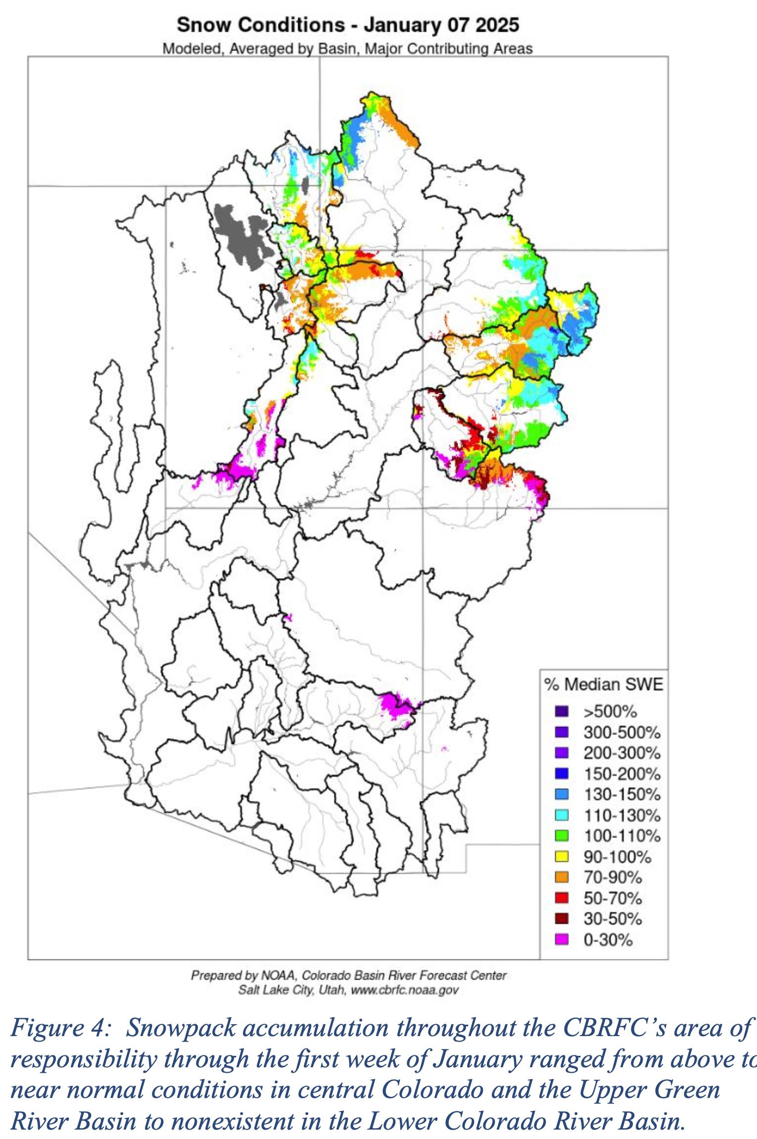
Early season snowpack accumulation through the first week of January throughout the Upper Colorado River Basin and Great Basin ranged from near to slightly above normal throughout much of central Colorado and the headwaters of the Green River Basin and much of far northwestern Utah. Snowpack accumulation values were below normal in the San Juan and Dolores River Basins. In the Lower Colorado River Basin, early season snowpack accumulation was essentially non-existent, with the highest snowpack amounts observed in the northern portion of the Virgin River Basin at 10% of average. Other areas were at, or very close to, 0% of normal (Figure 4).
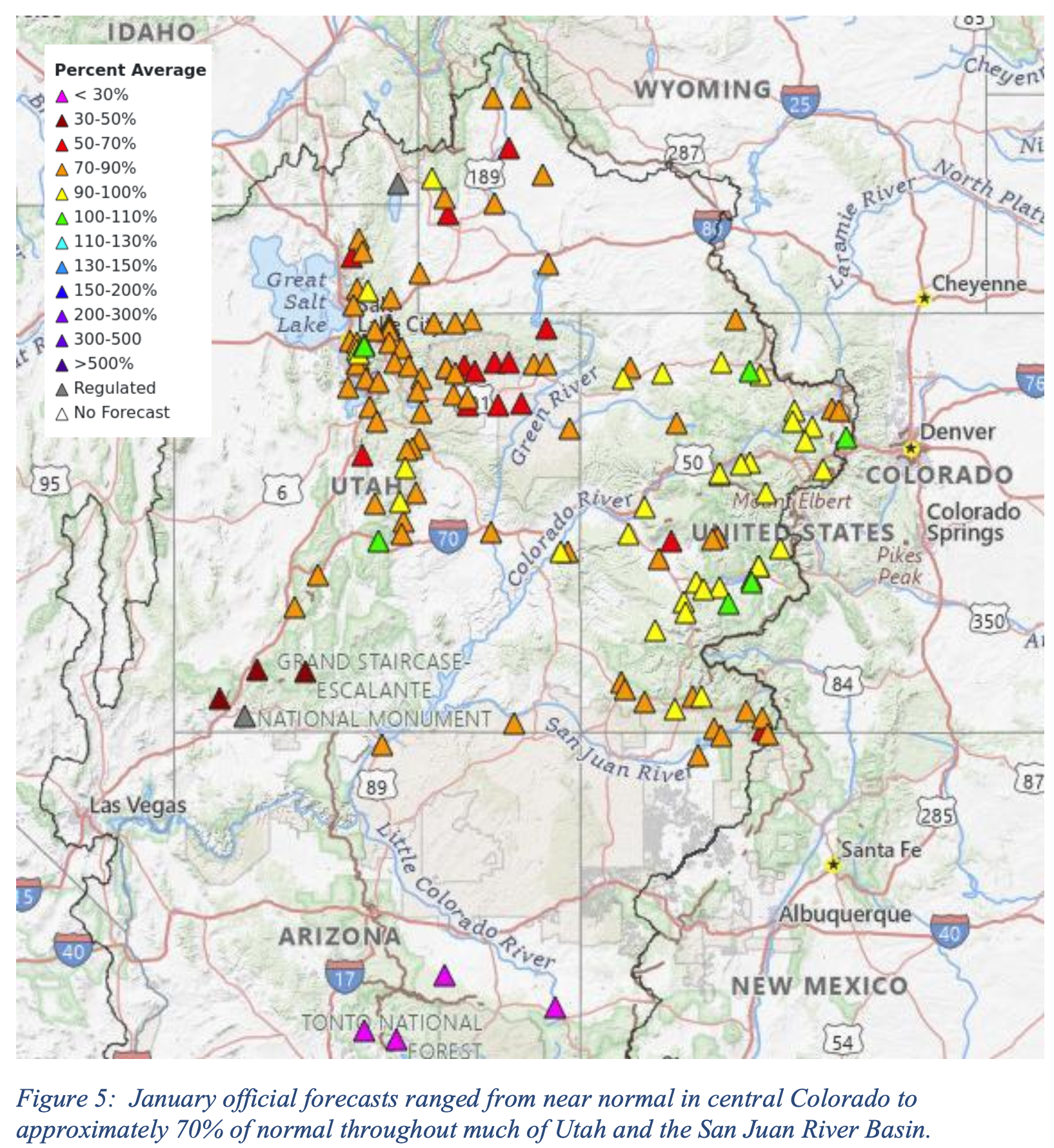
Snowpack is a dominant driver of seasonal water supply forecasts. As a result of relatively near normal snowpack conditions throughout much of the Upper Colorado River Basin and Great Basin regions and generally dry soil moisture conditions, official January Forecasts ranged from near average throughout much of the wetter portions of Colorado to approximately 70% of average throughout much of Utah and the San Juan River Basin (Figure 5).
Generally dry conditions continued through February, with numerous NRCS SNOTEL stations located in the southern portion of the Upper Colorado River Basin and Great Basin regions their lowest precipitation accumulation on record for the December through February period. These record setting conditions corresponded with generally well below average water year precipitation values from October through February (Figure 6).

It is important to note that while some areas saw beneficial It is important to note that while some areas saw beneficial precipitation, particularly in the Green River Basin, warmer than normal temperatures at the end of January and into early February resulted in snowmelt at lower elevation zones (Figure 7).

These generally dry conditions resulted in below normal water supply forecasts throughout the CBRFC’s area of responsibility. Snowpack accumulation over the Colorado River Basin and Great Basin region typically peaks near April 1st. Snowpack conditions varied throughout the Colorado River and Great Basin regions, but were generally near to slightly above average in the northern portions of the Green and Yampa River Basins, and Colorado River headwaters. Drier conditions were apparent throughout much of the Gunnison and San Juan River Basins, as well as central and southern Utah. Lower Colorado River Basin snowpack conditions remained essentially at zero. Many NRCS SNOTEL locations indicated snow water equivalent (SWE) amounts that were near average (Figure 8).

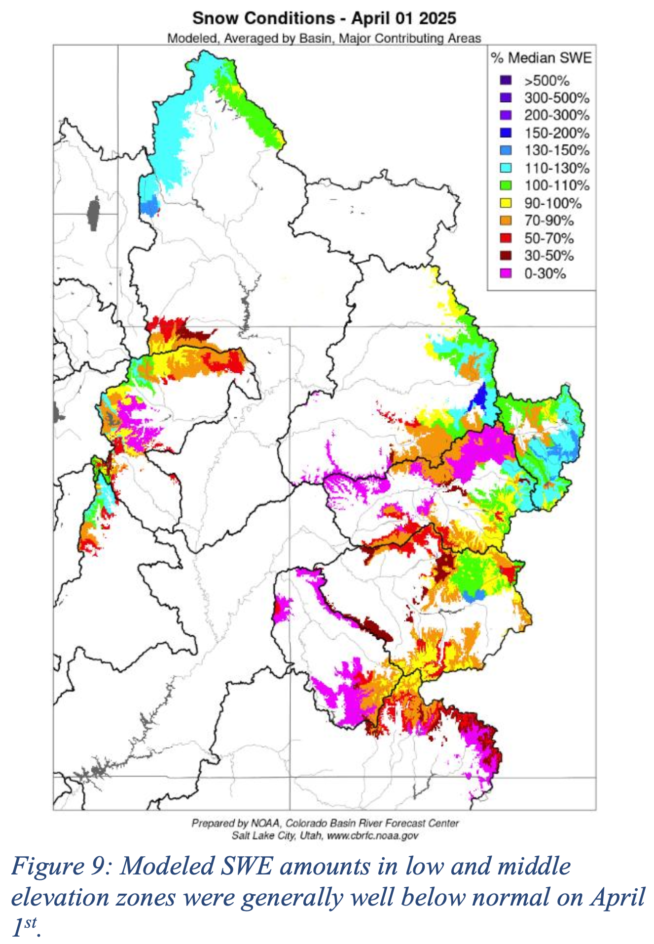
However, while peak SWE values at NRCS SNOTEL locations generally located at higher elevations indicated near normal peak snowpack conditions, CBRFC modeled SWE at lower and middle elevation zones over major contributing areas showed below to well below normal SWE conditions (Figure 9).
As a result of generally below normal SWE conditions and dry soil moisture conditions, April official forecasts ranged from near normal in portions of the Colorado River Headwaters, to approximately 50% of normal in the Dolores and San Juan River Basin. The official April forecast for Lake Powell was 67% of normal.
