The big data center buildup: An AI server farm tsunami threatens to overwhelm the West’s power grid and water supplies — Jonathan P. Thompson (High Country News)

Welcome to the Landline, a monthly newsletter from High Country News about land, water, wildlife, climate and conservation in the Western United States. Sign up to get it in your inbox. Screenshot from the High Country News website.

Click the link to read the article on the High Country News website (Jonathan P. Thompson):

November 25, 2025

This is an installment of the Landline, a monthly newsletter from High Country News about land, water, wildlife, climate and conservation in the Western United States. Sign up to get it in your inbox.

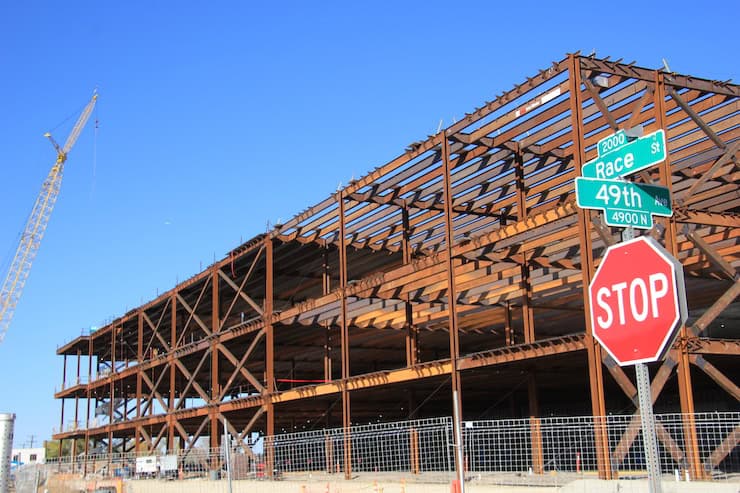
In early November, Texas-based New Era Energy & Digital announced plans to build a “hyperscale,” meaning massive, AI-processing data center complex in Lea County, New Mexico, the epicenter of the Permian Basin oil and gas drilling boom. The campus will be so big, and use so much power, that, if and when it is built, it will come with its own nuclear and gas power plants, with a mind-blowing combined generation capacity of about 7 gigawatts. That’s like piling the West’s largest nuclear and natural gas plants — Palo Verde and Gila River, both near Phoenix — on top of one another, and then adding another 800 megawatts. That kind of power could electrify something like 5.3 million homes, though these power plants’ output presumably will all go toward more pressing requirements: processing movie streaming, doomscrolling, social media posting and, especially, AI-related activities. [ed. emphasis mine]

Despite the enormity of this proposal, it has received very little news coverage. This is not because anyone is trying to keep it secret, but rather because such announcements have become so common that it’s hardly worth mentioning every new one. New Era’s hyperscale server farm and others like it are still a long way from generating and then devouring their own electricity. But even if only a fraction of the current proposals succeed, they will transform the West’s power grid, its landscapes and its economies as significantly as the post-World War II Big Buildup, when huge coal plants and hydroelectric dams sprouted across the region to deliver power to burgeoning cities via high-voltage transmission lines.

Data center construction at 49th & Race, Denver. Photo credit: Allen Best

In fact, this transformation is already underway. A new report from the nonprofit NEXT 10 and University of California Riverside found that, in 2023, data centers in California pulled 10.82 terawatt-hours of electricity — 1 terawatt equals 1 trillion watts — from the state’s grid, or about enough to power 1 million U.S. households. This resulted in about 2.4 million tons of carbon emissions, even with California’s relatively clean energy mix. (On more fossil fuel-reliant grids, the emissions would have been twice that, or even more.) These same centers directly and indirectly consumed about 13.2 billion gallons of water for cooling and electricity generation. In Silicon Valley, more than 50 data centers accounted for about 60% of one electricity provider’s total load, prompting the utility to raise its customers rates to fund the transmission and substation upgrades and new battery energy storage the facilities required.

These facilities are also colonizing cities and towns far from Big Tech’s Silicon Valley epicenter. Over 100 data centers — structures that resemble big-box stores overflowing with row after row of computer processors — have already sprung up in Phoenix-area business parks, and the planned new ones could increase Arizona’s total power load by 300% over current levels, according to utilities. Recently, Arizona Public Service announced it would keep burning coal at the Four Corners Power Plant beyond its scheduled 2031 retirement to help meet this growing demand.

Data center developments around the West include:

  • NorthWestern Energy signed on to provide up to 1,000 MW of power — or nearly all of the utility’s generating capacity — to Quantica Infrastructure’s AI data center under development in Montana’s Yellowstone County.
  • The 290-mile Boardman-to-Hemingway transmission project under development in Idaho and Oregon was initially designed to serve about 800,000 PacifiCorp utility customers. But in October it was revealed that the line now will deliver all of its electricity to a single industrial customer in Oregon, most likely a new data center.
  • In September, an NV Energy executive told a gathering in Las Vegas that tech firms are asking the utility to supply up to 22,000 megawatts of electricity for planned data centers. Since the utility has largely moved away from coal, this new load would likely be met by generation from existing and planned natural gas facilities, along with proposed utility-scale solar installations.
  • Xcel Energy expects to spend about $22 billion in the next 15 years to meet new data centers’ projected power demand in Colorado, potentially doubling or even tripling legacy customers’ rates. Xcel and the state’s public utilities commission are currently working to reverse the planned closure of a coal plant due to projected data center-associated electricity shortages.
  • Wyoming officials are doing their best to lure data centers and cryptocurrency firms to the state, and it seems to be working. This summer, Tallgrass proposed building an 1,800 MW data center, along with dedicated gas-fired and renewable power facilities, near Cheyenne. It would add to Meta’s facility in Cheyenne and the 1,200 MW natural gas-powered Prometheus Hyperscale data center under development in Evanston. Observers say electricity demand from these centers could transform the physical and regulatory utility landscape and potentially drive up costs for “legacy” customers.
  • New Mexico utilities are struggling to meet growing demand from an increasing number of data centers while also complying with the state’s Energy Transition Act’s requirements for cutting greenhouse gas emissions.
  • Doña Ana County approved tax incentives for Project Jupiter, a proposed $165 billion data center campus in Santa Teresa in the southeastern corner of New Mexico. Developers have indicated they plan on building dedicated power generation, though they have not yet disclosed the energy sources.
  • Numerous companies are eyeing Delta, Utah, as a site for new data centers, drawn by the area’s relatively cheap land, existing agricultural water rights and the fact that it’s home to the Intermountain Power Project, a colossal coal plant built during the original Big Buildup in the years after World War II. The plant is scheduled to be converted to run on natural gas and, ultimately, hydrogen, but Utah lawmakers want at least one of its units to continue to burn coal. They just need a buyer for the dirty power it would produce, and data centers could fit the bill. Fibernet MercuryDelta is looking to construct the 20 million-square-foot Delta Gigasite there, and Creekstone Energy plans to manage 10 gigawatts of capacity there, with power coming from coal, solar and natural gas.
The Intermountain Power Project plant in Delta, Utah. The plant was scheduled to be converted away from coal, but Utah lawmakers want it to continue to burn coal. They need a buyer for the dirty power, and data centers could fit the bill. By Doc Searls from Santa Barbara, USA – 2014_11_21_lhr-lax_330, CC BY 2.0, https://commons.wikimedia.org/w/index.php?curid=38536818

The Western power grid is interconnected but also divided into 38 balancing authorities, or grid operators. Nearly every one of them is expected to see an increase in data center-driven demand over the next decade or so as the Big Digital Buildup gains steam, and few of them are currently equipped to meet that demand. In fact, the North American Electricity Reliability Corp. warned this month that growing data center-driven power demand is increasing the risk of outages this winter in parts of the West. Therefore, many of the largest data centers are going to need to generate their own power, while utilities also will have to scramble to add generating capacity and associated infrastructure as quickly as possible to serve the region’s on-grid facilities. The costs of that new infrastructure will be borne by each utility’s ratepayers.

How will the needed power be generated?

There’s simply no way utilities and developers can meet the projected demand with solar and wind, alone. So, utilities are already making plans to keep existing coal plants running past previously scheduled retirement dates, and to build new natural gas plants and even nuclear reactors. Yes, nukes: Google, Switch, Amazon, Open AI and Meta are all looking to power proposed facilities with the new — so new they have yet to be developed — crop of small, modular and advanced reactors, if and when they are finally up and running.

Can data centers be “sustainable”?

These developments will have environmental consequences, some more than others. Fossil fuel burning feeds climate change and pollutes the air, and oil and gas drilling and coal mining ravage landscapes; utility-scale solar and wind facilities can harm wildlife habitat and often require hundreds of miles of new transmission lines to move the power around; and nuclear power comes with unique safety hazards and a nagging radioactive waste problem, while the uranium mining and milling industry risks reenacting its deadly Cold War legacy. Even a facility that gets all of its power from solar and batteries is still using resources that, without the extra demand, would otherwise be replacing fossil fuels on the grid. And, unless it has a closed-loop air-cooled system, the data center will still consume water for cooling, usually from municipal drinking water systems.

Wyoming-based Prometheus Hyperscale has made waves with its ambitious and seemingly visionary talk of building “sustainable” data centers with dedicated clean energy generation, water recycling and efficient cooling systems that would capitalize on the cold in the Northern Rockies. It’s even talked about harnessing the heat from the servers to warm greenhouses and shrimp-farming operations. Maybe, one day, the power will be supplemented by nuclear micro-reactors. But so far, the company’s walk is not exactly matching its talk. In the beginning, at least, the facility will run on natural gas, and Prometheus says it will offset carbon emissions by paying another company to capture and sequester carbon dioxide from biofuel plants in Nebraska.

Is resistance futile?

Resistance to the imminent server farm tsunami and its outsized energy and water use is widespread, but because these are local projects considered on local levels, battling them can feel a bit like playing whack-a-mole. After Tucson-area residents defeated the city’s plan to annex the proposed Project Blue data center, which would have enabled it to use treated wastewater for cooling, the developers simply moved the project into the county and planned to use an air-cooling system, which requires less water but more energy. When opposition continued, the firm committed to investing in enough renewable energy on Tucson Electric Power’s grid to offset all of its electricity use.

Also working against the resistance is the fact that many local governments and utilities actually welcome the onslaught. Data centers can bring jobs and tax revenues — assuming the state, county or municipality doesn’t exempt them from taxes — to economically distraught areas. Meanwhile, utilities are champing at the bit to sell more of their product and raise rates to pay for the needed additional infrastructure. When announcing all the data centers headed for Nevada, NV Energy executive Jeff Brigger noted that the utility is “excited to serve this load.”

While much of the opposition to data centers is based on their environmental impacts and the effects they might have on utility rates and on the communities where they’re built, the notion of AI itself is also a factor. It’s one thing to see a lot of water or power used to grow food, for instance, but quite another to see coal power plants continue to run simply so that a computer can write a high school essay or answer an inane question or draw a picture or even serve as a companion of sorts. To be fair, AI does have potentially significant and positive applications, such as diagnosing medical conditions and crunching large quantities of data to find, say, possible cures for cancer or solutions to geopolitical problems.

But before it goes about changing the world, maybe AI ought to start with itself and figure out how to do its thing without using so much energy and water.

No quick fix for #Aspen #drought conditions — The Aspen Daily News

West Drought Monitor map November 25, 2025.

Click the link to read the article on the Aspen Daily News website (Lucy Peterson). Here’s an excerpt:

November 18, 2025

The city of Aspen’s drought response committee is recommending the city maintain a stage 2 water shortage that was declared in August. Monsoonal moisture and cooler temperatures that came since Aspen City Council activated the stage 2 restrictions have helped drought conditions, but not changed them, according to an information memo sent to city council this week. As of Nov. 6, Aspen and Pitkin County remained in severe and extreme drought categories, according to the U.S. Drought Monitor.

“Pitkin County has experienced its second driest year to date (January — September 2025) in 131 years of record with a precipitation deficit of 6.84 inches from normal,” the memo states. 

Data collected from a National Weather Service station at the city’s water treatment facility recorded 1.52 inches of rain in August and 1.89 inches of rain in September. It brought the city’s precipitation deficit to 3.43 inches. Water demand typically decreases in Aspen during the winter when irrigation systems are turned off, but it is when streams are at their lowest point in the year, according to the memo. Councilman John Doyle, a staunch supporter of water conservation, said restrictions are especially important now as ski seasons get shorter and less snow falls…The stage 2 water shortage declaration came two months after the city declared a stage 1 water shortage with a goal to cut overall water consumption by 10% within city limits. Well below-average stream flows led the city to enact the second stage of water shortage, which represents severe drought conditions…The city relies primarily on streamflow from Castle and Maroon creeks for its water supply. It depends on consistent release of water from snowmelt. The city’s stage 2 water restrictions are mandatory. Watering of any lawn, garden, landscaped area, tree, shrub or other plant is prohibited from 9 a.m. to 6 p.m. Household watering schedules are also mandatory.

Map of the Roaring Fork River drainage basin in western Colorado, USA. Made using USGS data. By Shannon1 – Own work, CC BY-SA 4.0, https://commons.wikimedia.org/w/index.php?curid=69290878

A drying-up #RioGrande basin threatens water security on both sides of the border — The Associated Press

For the second time in the 21st century, this segment of the Rio Grande in Albuquerque went dry, leaving this image of cracked sediment on a blistering afternoon on Aug. 7, 2025. Photo (and copyright)/WWF-us, Diana Cervantes

Click the link to read the article on the Associated Press website (Susan Montoya Bryan). Here’s an excerpt:

November 20, 2025

Research published Thursday says the situation arguably is worse than challenges facing the Colorado River, another vital lifeline for western U.S. states that have yet to chart a course for how best to manage that dwindling resource. Without rapid and large-scale action on both sides of the border, the researchers warn that unsustainable use threatens water security for millions of people who rely on the binational basin. They say more prevalent drying along the Rio Grande and persistent shortages could have catastrophic consequences for farmers, cities and ecosystems…The study done by World Wildlife Fund, Sustainable Waters and a team of university researchers provides a full accounting of the consumptive uses as well as evaporation and other losses within the Rio Grande-Bravo basin. It helps to paint the most complete — and most alarming — picture yet of why the river system is in trouble…The research shows only 48% of the water consumed directly or indirectly within the basin is replenished naturally. The other 52% is unsustainable, meaning reservoirs, aquifers and the river itself will be overdrawn…

Irrigating crops by far is the largest direct use of water in the basin at 87%, according to the study. Meanwhile, losses to evaporation and uptake by vegetation along the river account for more than half of overall consumption in the basin, a factor that can’t be dismissed as reservoir storage shrinks…The irrigation season has become shorter, with canals drying up as early as June in some cases, despite a growing season in the U.S. and Mexico that typically lasts through October. In central New Mexico, farmers got a boost with summer rains. However, farmers along the Texas portion of the Pecos River and in the Rio Conchos basin of Mexico — both tributaries within the basin — did not receive any surface water supplies…The analysis found that between 2000-2019, water shortages contributed to the loss of 18% of farmland in the headwaters in Colorado, 36% along the Rio Grande in New Mexico and 49% in the Pecos River tributary in New Mexico and Texas.  With fewer farms, less water went to irrigation in the U.S. However, researchers said irrigation in the Mexican portion of the basin has increased greatly.

Rio Grande and Pecos River basins. Map credit: By Kmusser – Own work, Elevation data from SRTM, drainage basin from GTOPO [1], U.S. stream from the National Atlas [2], all other features from Vector Map., CC BY-SA 3.0, https://commons.wikimedia.org/w/index.php?curid=11218868

In headwaters of the Upper Arkansas, the river “drives everything” — Jason Blevins (Fresh Water News) #ArkansasRiver

Browns Canyon National Monument protects a stunning section of Colorado’s upper Arkansas River Valley. The area is a beacon to white water rafters and anglers looking to test their skills at catching brown and rainbow trout. Photo by Bob Wick / @BLMNational

Click the link to read the article on the Water Education Colorado website (Jason Blevins):

November 25, 2025

Andre Spino-Smith scoots his Waka kayak into the trickling Arkansas River. It’s barely flowing at 350 cubic-feet-per-second in the river above the Pine Creek stretch. The rapids below are meek, far from the raging rowdiness of a couple months earlier when the steep section of Class V rapids here peaked at nearly 1,700 cfs.

“You know, it doesn’t matter what the flow is,” says Spino-Smith, a former professional kayaker who has probably paddled this stretch more than anyone else in the last quarter century. “I always have fun on this river.”

Today, the Upper Arkansas River between Leadville and Pueblo is the source of a lot of fun. While it primarily serves as a source of urban water, that tumbling snowmelt delivers a secondary but critical benefit of countless good times.

The river boasts one of the most vibrant trout populations in the land and floats more paying rafters than any stretch of river in the country. The Upper Arkansas River’s modern-day role of floating rubber and sating cities has evolved over many centuries.

The Arkansas River from Leadville down to Pueblo sustained Indigenous people for most of that time. Then came the miners and railroad builders and high country settlers. The waterway was a thoroughfare for floating beaver pelts and fresh hewn lumber to market. Then it was a dumping ground for miners scouring deep holes for gold and silver. Its meandering path through craggy gorges marked an easy route for railroad builders who breathed new life into former mining towns at the dawn of the 20th century.

The Upper Arkansas River continues to feed its communities, but residents extract less from the endlessly rolling water. Before reaching taps in thirsty cities and sprinklers on the arid plains, the river is celebrated for being, well, a river. Recreation in the water has expanded to trails above the canyons, anchoring economies that are increasingly dependent on natural beauty.

That embrace of the lifeblood of the Upper Arkansas Valley continues to evolve as communities grapple with larger and larger crowds and new residents flocking to a place where water runs and stars sparkle.

“National models for what people want”

Mike Harvey leans on his shovel, whistles and points.

Tommy Garcia, piloting a John Deere 345 excavator in the middle of the Arkansas River, turns his head and swings his boulder-pinching bucket toward Harvey. Garcia, with Lowry Construction, deftly drops a massive stone in the river, right where Harvey is pointing.

“That machine is pretty impressive to watch, isn’t it?” says Harvey, standing atop a gently sloping, freshly poured slab of concrete in September.

In a few days, Garcia will shift more boulders and the Arkansas River will flow over that slab, creating a glassy standing wave. Even with super-low fall flows, the surfers will flock, just as they do downstream at Harvey’s slab-formed Scout Wave in his hometown of Salida.

This is the third time in more than a decade that Harvey has tinkered with the Pocket Wave in the Buena Vista Whitewater Park. Buena Vista locals — led by the Friends of the Buena Vista River Park — raised more than $150,000 to support this year’s $240,000 rebuild of the Pocket Wave.

Harvey and the park builders at the pioneering Recreational Engineering and Planning firm have deployed the heavy equipment operators from Lowry Construction to build both the Buena Vista and Salida parks. Piloting quarter-million-dollar excavators, they nimbly pluck giant boulders as if they were pepper shakers, twisting and turning them to fit so just in the river puzzle. Harvey directs the rocky Tetris like a maestro, pointing and whistling over the machine’s rumbling diesel engine.

A standup surfer in the Arkansas River at Salida during Fibark, the river celebration held in late June 2017. Photo/Allen Best

Two decades ago, nascent whitewater parks on Colorado rivers were largely about economics and luring visitors. Now they are more about local amenities and community-based recreation. That resonates with communities in the Midwest, says Harvey, who has designed and built more than a dozen river parks in Colorado as well as parks in Arkansas, Iowa, Nebraska, Ohio, Michigan, Pennsylvania and Texas.

“Salida and Buena Vista are national models for what people want,” says Harvey, noting the cooperation of the local South Main developer, a nonprofit and the Buena Vista recreation department in designing and building the Buena Vista Whitewater Park and miles of hiking and biking trails spiderwebbing above the river.

Mike Harvey has worked with many communities to successfully guide whitewater park, dam modification and river corridor improvement projects through planning, permitting, public-process, funding, design and construction phases. Mike Harvey Badfish SUP and Whitewater Park Designer at REP from his LinkedIn feed.

Salida and Buena Vista are “making their river the focal point of their community in a way that drives economics and works for locals.” And other riverside communities are watching.

“For towns in the Midwest, we are seeing communities trying to figure out how to keep young people around and they want to make their town as attractive as possible,” Harvey says. “And younger generations don’t necessarily want golf courses. They want bike trails and surfable waves.”

Harvey said river parks have “democratized the river” for the recreation generation, the growing demographic of young and old championing outdoor play as a sort of life purpose. Being able to safely play in swift water once required years of practice with wise mentors. Now, river park lineups, like at the Scout Wave in Salida, include school kids carving potato-chip surfboards next to middle-aged moms and land-locked surfer bros.

“I think there’s going to be a profound impact in the coming decades as these kids grow older and start businesses and families here,” says Harvey, whose son, Miles, grew up surfing his dad’s waves in Salida and now ranks as one of the world’s top river surfers. “These kids are going to be business leaders who clearly recognize the value of the river.”

Private investment, public reward

Like Harvey, Brice Karsh has spent long days improving his stretch of the Arkansas River. Karsh just dropped about $100,000 to improve riparian habitat along 300 yards of Arkansas River at his 262-acre Rolling J Ranch at the confluence of the river and the Lake Fork of the Arkansas and Halfmoon Creek. He hosts anglers and is planning another $200,000 to improve the fishing on the property downstream of Leadville he bought in 2016.

“There are 300 head of elk in the willows outside my window right now,” he says on a warm Tuesday in late October.

He’s used mapping technology to plan his million-dollar restoration effort on nearly 2.5 miles of riverfront. His ranch is just downstream from the 30-year, $40 million Superfund project in the 18-square-mile California Gulch, where federal cleanup of more than 2,000 mine waste piles and miles of toxin-leaking underground mines dating back to the 1860s is nearing its end.

His property, Karsh says, has been transformed “from outhouse to penthouse.”

“The people who do have access to the public areas below me and above me, just below Turquoise Lake, they catch my fish all the time,” he says of prized golden palomino trout he’s released into the river. “Private land owners who put a lot of money into their watersheds should not be forgotten when we celebrate trophy waters in the Arkansas and elsewhere. When we invest, everyone wins.”

Photo credit: Rolling J Ranch

“Every pan is a scratch ticket”

Kevin Singel is a guardian of one definitively old-school use of the Arkansas River. The Silverthorne resident and guidebook author is highly respected among the thousands of recreational gold panners who poke through eddies in Colorado rivers every year, sifting through sediment in search of shiny flakes swirling in their ridged pans.

“It doesn’t take a very big piece to be exciting,” Singel says, poking a shovel into a pile of rocks just below a shack-sized boulder on the Arkansas River. “I’ve had some amazing experiences just downstream of big rocks.”

Singel has more than 28,000 members who follow his Facebook posts detailing how to find gold in Colorado. His 2018 “Finding Gold in Colorado: Prospector’s Edition” details 186 sites he’s visited in his search for gold. His 2023 “Finding Gold in Colorado: The Wandering Prospector” details 270 legal-to-pan locations where Singel suspects there could be gold.

Not much has changed for how placer mining prospectors pan for gold. But everything else around the rivers has changed.

The 1859 gold rush in Colorado followed economic distress back East that sent countless young people West in search of fortune waiting in rocky landscapes. Many mountain communities were established during that rush as miners stuck around after scouring the hills.

“The history is powerful. We all feel it,” says Singel.

After many decades of poking and prodding through the rivers, the frequency of finding life-changing nuggets has faded. A full day of panning typically yields flecks that make up a fraction of a gram. It’s been many years since a Colorado panner scored big.

Most panners count a win with tiny hydrophobic grains that flicker in a swirl of sandy sediment.

Panning for gold in a creek bed. CC BY-SA 3.0, https://commons.wikimedia.org/w/index.php?curid=300765

“We call it flour gold or even fly-poop gold,” Singel says. “You just never know. This is like scratch lottery tickets. Every pan is a scratch ticket.”

Suddenly, the sun glints in black sand swirling in his blue pan.

“There we go. That’s what we are chasing,” he says, scooping the speckles into a tiny vial.

After a couple decades of prospecting, Singel tips his vials of gold flakes into jeweler melting pots. He turns his bits of gold collected from a couple dozen rivers across Colorado into wedding rings and pendants for his wife, nieces and nephews.

“I make them come digging with me too,” Singel says. “It’s become a thing for our family.”

A 100-mile video map of the Ark

Brian Ellis and his team at Wilderness Aware recently floated the Arkansas River from Granite through Cañon City with a 360-degree camera. The uploaded photos provide a foot-by-foot Google Street View of more than 100 miles of the river and its rapids. Ellis hopes the video can expose more potential rafters to the thrills of whitewater.

“We are thinking this could open the river to a lot more people,” says Ellis, who started guiding on the Arkansas River in 1999 and he bought the venerable Wilderness Aware rafting company in 2019.

In the late 1990s, whitewater rafting was on the edge; “kind of an extreme sport,” says Ellis, sitting on a rock down by the Wilderness Aware boat ramp.

Today, it’s much more mainstream and there are a lot more folks paddling their own rafts. Wilderness Aware, on the banks of the Arkansas River at the put-in for the easy Milk Run downstream of Buena Vista, offers boaters private river access and a parking lot. Back in the 1990s, there were maybe 100 boaters using that put-in every season. Today, more than 100 boaters pass through the Wilderness Aware boat ramp every summer weekend.

And that growth in private traffic has accompanied a general flattening and even a decline in the number of commercial rafters. Still, the more than 200,000 paying customers rafting with 45 outfitters every year makes the Arkansas River the most commercially rafted stretch of water in the country.

The Arkansas River Headwaters Recreation Area, which spans 152 miles and 5,355 acres along the Arkansas River between Leadville and Florence, hosted 1.13 million visitors in 2024. That’s up314,000 — or 40% — from 2014.

The management system for the AHRA is a national blueprint for regional and federal collaboration. The recreation area is managed by Colorado Parks and Wildlife and covers four counties as the river winds through Forest Service and BLM land and a national monument.

In the early 1990s, rafting outfitters proposed a one-of-a-kind arrangement with the federal Bureau of Reclamation, the Colorado Department of Natural Resources and the powerful Southeastern Colorado Water Conservancy District, which manages the complex Fryingpan-Arkansas Project that diverts water from the Western Slope into the Arkansas River drainage to water some 900,000 users along the growing Front Range.

Since the early 1990s, the Voluntary Flow Management Program has rafts floating on about 700 cfs every day between early July and the middle of August by timing the release of up to 10,000 acre-feet of water each year from Twin Lakes. The program gives the Arkansas River one of the most reliable boating seasons in the state. In 2022, nearly 200,000 commercial rafters on the Arkansas River spent about $39 million, supporting 498 jobs and creating a $50 million economic impact in the region. Almost all of that impact is delivered in June, July and August.

“The folks who have the biggest interests in this river — the owners of all the water rights and the Front Range municipalities— they have a much greater understanding of what this resource means to recreation now than they did 20 years ago,” Ellis says.

Harvey, standing in the Arkansas a few miles upstream of Ellis’ rafting company headquarters, agrees. He too is seeing a bit of a local pushback on development that draws tourists to the Arkansas River when tax funds could maybe be better spent on things like housing and infrastructure. That’s certainly the case across most of Colorado, where a growing number of communities are redirecting lodging tax dollars once dedicated to tourism marketingtoward things like early education, housing and trails.

“It’s funny how you can actually kick out the other side of the economic development argument into a place where people are saying ‘Hey pump the brakes,’” Harvey says.

But it’s coming from a deepening local attachment to the Arkansas River, Harvey says.

“What’s changed here is the level of collaboration,” he said. “What’s impressive here and probably is a model for other places is how these varied interests work together to meet their own needs while protecting the resource. I’m not sure other communities have such an impressive coalition around their river.”

Both Harvey and Ellis appreciate the renewed vigor in supporting the river but they fret the accompanying shift that is scrutinizing the visitors who flock to the valley.

The summer months are, obviously, exceptionally busy along the Arkansas River. And that is stirring a bit of a shift in communities hosting all that traffic. While lots of people visit the Arkansas River, today, a lot of people are moving closer to the river. The population in Chaffee and Fremont counties is up 20% in the last decade. That growth has shifted public sentiment around the river.

“People have moved here to better appreciate the river and its resources. But back in the 1990s and early 2000s, that often meant a lot of support for rafting. But that’s changing now,” says Ellis, who employs 40 workers at the height of summer. “That’s a little bit of backlash against rafting and visitors. Some people want town to be quieter in the summer because the restaurants are too full and the streets are too crowded. It’s an interesting dynamic, with a growing number of folks who are maybe not in the working world around them. And maybe they don’t recognize how badly we need that tourism flow to support the local economy.”

In the dark

Browns Canyon National Monument, nearly a decade after it was designated by President Barack Obama, secured International Dark Sky Park certification in December 2024. The campaign was organized by the nonprofit Friends of Browns Canyon, which regularly hosts night-sky gatherings and hired tech-equipped light measuring scientists to earn the recognition by DarkSky International.

The Friends of Browns Canyon group also was instrumental in forcing the Surface Transportation Board to scrutinize a plan to revive railroad traffic over Tennessee Pass and along the Arkansas River through Browns Canyon, the Royal Gorge and Cañon City. The board in 2021 nixed a request for expedited approval of trains on the Tennessee Pass Line, which has not seen trains since 1997.

While that 2021 decision was a victory for communities vehemently opposed to restoring train traffic along the Arkansas River, the threat is not dead. The Tennessee Pass plan was proposed by Colorado Midland & Pacific, which promised it would only transport people and perhaps construction materials, but not crude oil on the mountain route owned by Union Pacific.

The company that owns Colorado Midland & Pacific is the planned operator of the Uinta Basin Railway in Utah. That controversial 88-mile railroad was approved by the Surface Transportation Board in 2021 but a federal appeals court overturned that approval in 2023. The U.S. Supreme Court overturned that 2023 court decision earlier this year, resuscitating a plan that would route 2-mile-long trains loaded with Uinta Basin waxy crude along the Colorado River and through the Moffat Tunnel and metro Denver en route to Gulf Coast refineries. A secondary route for that eastbound crude could be over Tennessee Pass; a possibility that galvanizes communities who fear oil-train traffic along the Arkansas River would be a step back to that industrial use of their quiet, natural waterway.

“We have come such a long way from the mining and the railroads being economic drivers to the rafters and anglers, who pioneered recreation as the new economy in this valley,” said Michael Kunkel, who cofounded Friends of Browns Canyon and has lived in Chaffee County for more than 25 years.

“Depending on how the chips fall with the Uinta Basin Railway, I think trains on Tennessee Pass could come back. And we’ve got to fight that. There is no more precious resource than water.”

That water — for drinking, farms, fish and fun — has shaped unique communities along the Arkansas River. And those communities are increasingly ready to step up and protect the lifeblood of their valley.

“It’s still the river that is driving everything here,” Kunkel said.

More by Jason Blevins

Arkansas River Basin — Graphic via the Colorado Geological Survey