Click the link to read the discussion on the USBR website:
The Colorado Basin River Forecast Center (CBRFC) geographic forecast area includes the Upper Colorado River Basin (UCRB), Lower Colorado River Basin (LCRB), and Eastern Great Basin (GB).
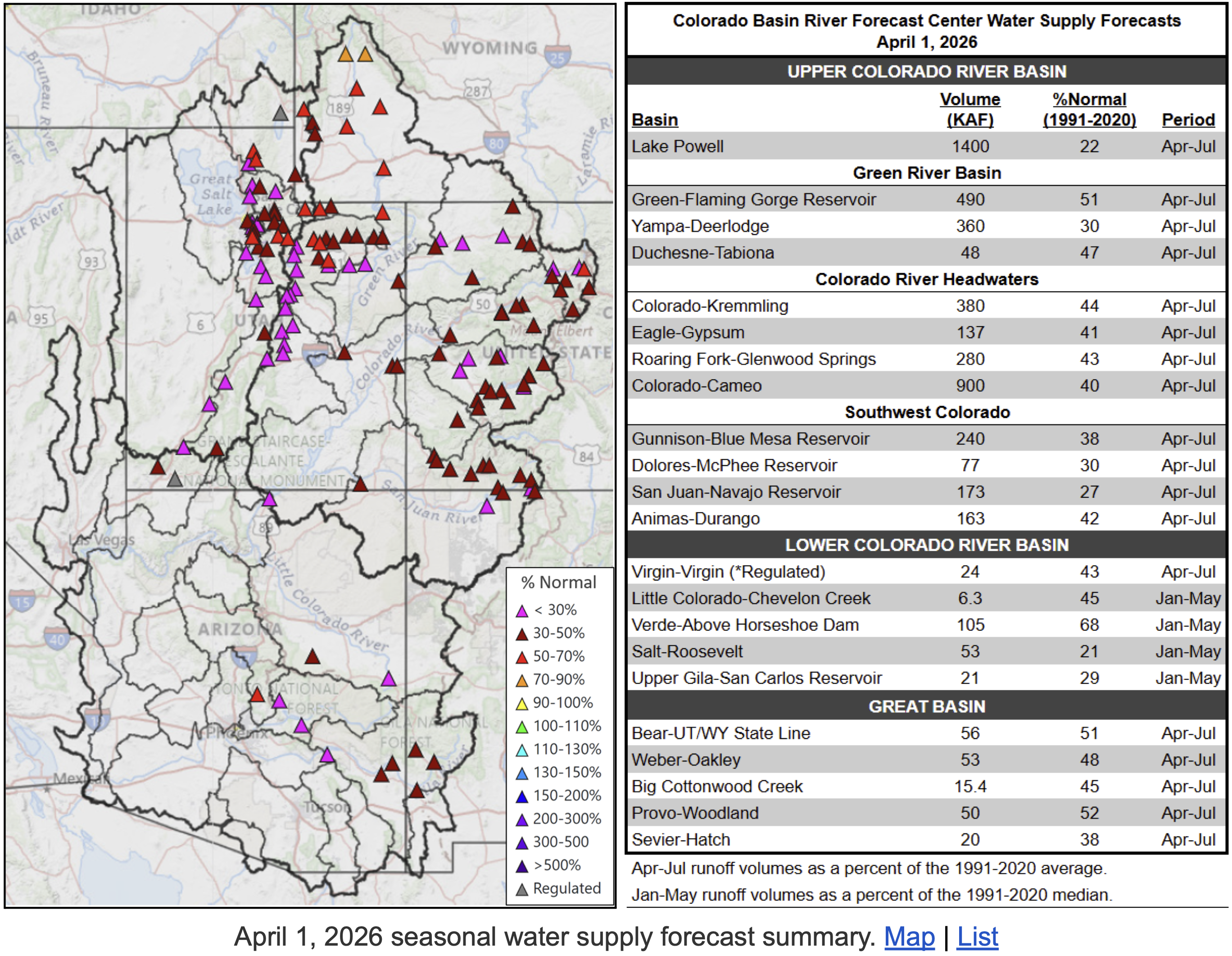
Water Supply Forecasts
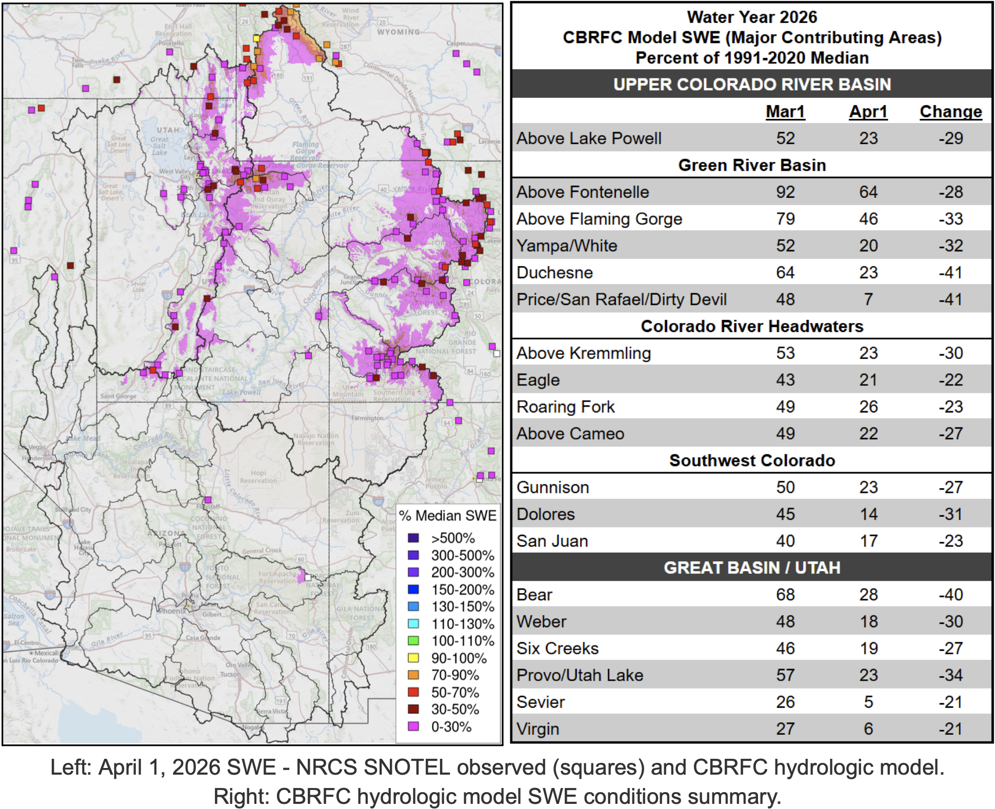
April 1 water supply forecasts are well below normal and summarized in the figure and table below. Snowpack and soil moisture are the primary hydrologic conditions that impact the water supply outlook, while future weather is the primary source of forecast uncertainty.
Water Year Weather
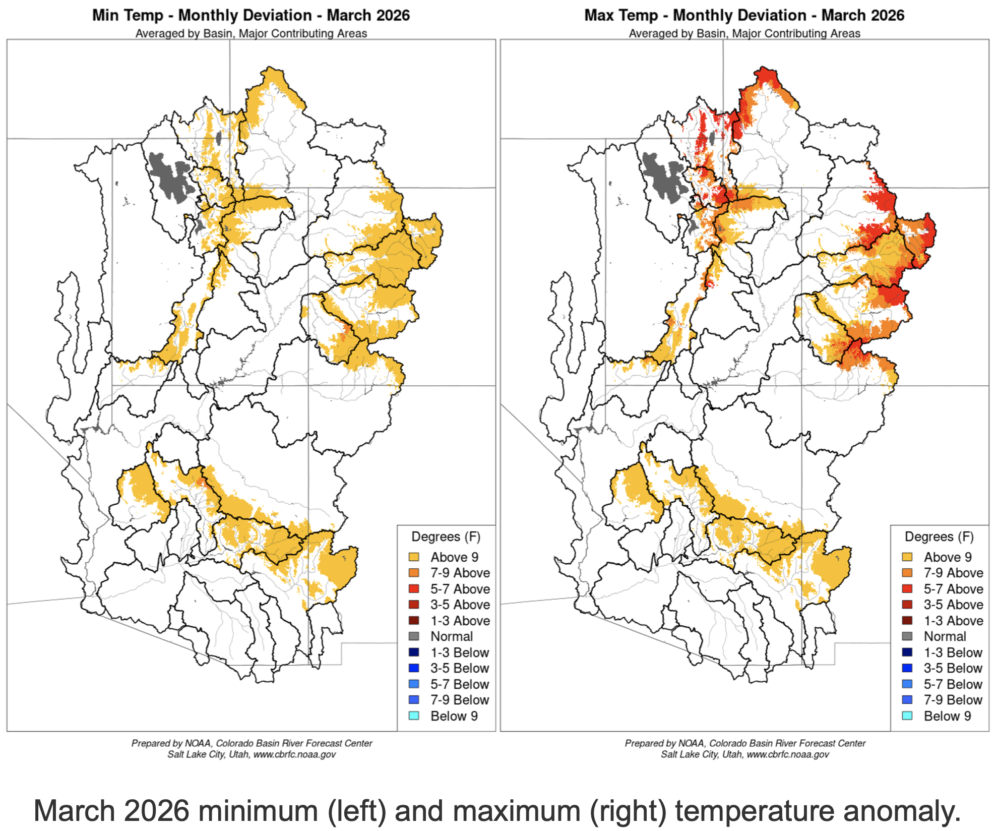
The 2025–26 meteorological winter (December–Februrary) was the warmest winter on record for vast swaths of the CBRFC area. In March, an extraordinarily anomalous high pressure system — of a strength that is more typical of July — impacted the Southwest. This ridge brought summertime temperatures at a time when most mountainous areas are usually still building a snowpack.
Across the region in mid-to-late March, temperature records were smashed for several days on end. In Flagstaff, AZ, 11 days reached or surpassed the previous March high temperature record of 73°. Shockingly, on two days the mercury climbed to 83° and 84° , significantly surpassing the April high temperature record of 80° . At 8,710 feet above sea level in Alta, UT, where March high temperatures average in the 30s, temperatures reached at least 60° on eight days. Nine days of at least 100° were observed in Phoenix, AZ, including the earliest 100° day on record. The depth and duration of this heat wave was unprecedented in the period of record. It will likely go down as one of the most extreme weather events to ever impact the CBRFC area.
The same ridge of high pressure that brought searing temperatures to the low elevations and snowmelt across high elevations also resulted in very dry air and no precipitation. Numerous SNOTEL sites across the CBRFC area observed their driest March on record.
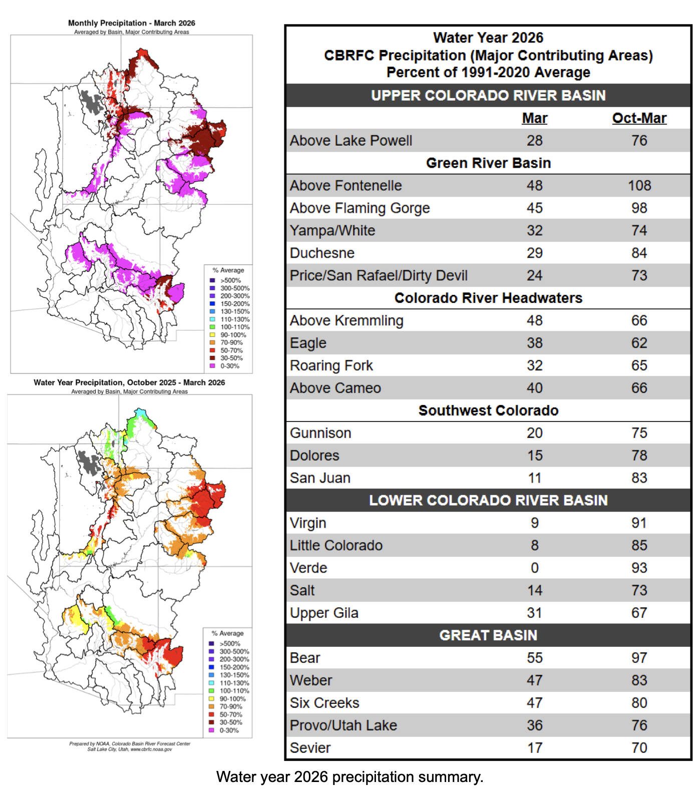
The water year as a whole tells a different story. In October, several rounds of heavy rain tied to decaying tropical storms brought record flooding to portions of AZ, southern UT, and southwest CO — making it one of the wettest Octobers on record. Water year-to-date (October–March) precipitation is highly variable, ranging from well below normal across much of Colorado and Utah’s mountains, to near/above normal in the Upper Green River Basin and portions of the LCRB. The figures and table below summarize March temperatures and water year 2026 precipitation.
Snowpack Conditions
Snow water equivalent (SWE) has been tracking at or near record low much of the season. An extremely dry March and significant snowmelt during the last half of the month led to historically low April 1 snow water equivalent conditions across the region. An NRCS-Utah Snow Survey Special Report states that “at no time since systematic snowpack measurements began around 1930 has April 1 snowpack been this low in the state of Utah, and 2026 SWE is roughly five times lower than the previous record low”. A similar analysis performed by the Colorado Climate Center concluded that “this has been the worst year for Colorado snowpack in recorded history, and most locations have less than half of the previous record low”.
UCRB and GB April 1 snow covered area is 25-30% of the 2001-2025 median, which is also the lowest on record for early April dating back to 2001. 1 April 1 CBRFC model SWE conditions are generally less than 30% of normal across the UCRB and GB. SWE conditions are summarized in the figure and table below.
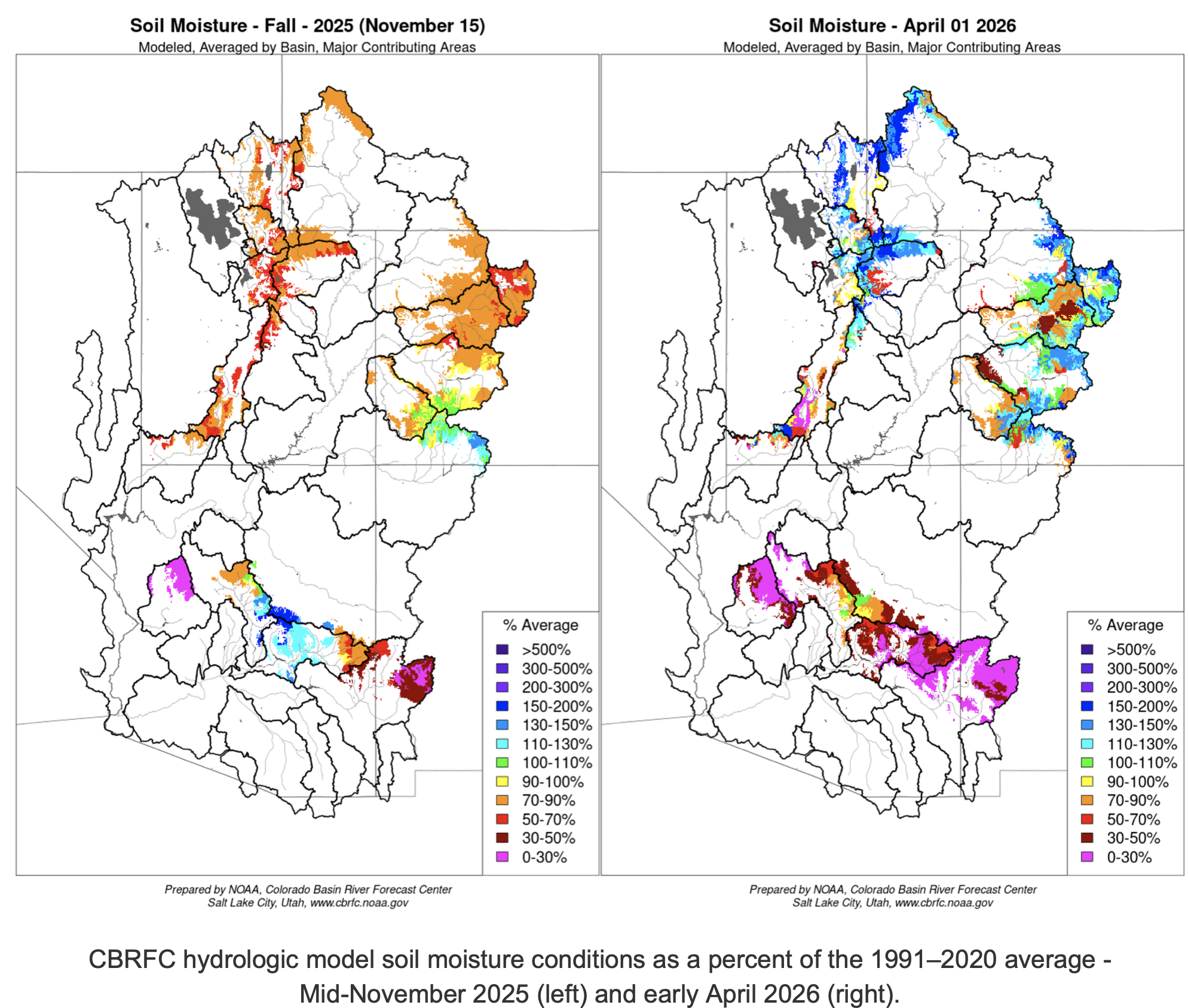
Soil Moisture
CBRFC hydrologic model soil moisture conditions impact water supply forecasts. Basins with above average soil moisture conditions can be expected to experience more efficient runoff from rainfall or snowmelt while basins with below average soil moisture conditions can be expected to have lower runoff efficiency until soil moisture deficits are fulfilled. The timing and magnitude of spring runoff is impacted by snowpack conditions, spring weather, and soil moisture conditions.
Mid-November 2025 soil moisture conditions were below normal across most areas as a result of warmer and drier than normal weather during the 2025 water year. Higher elevation soil moisture/baseflow conditions typically don’t change much during winter months as snow is accumulating. However, this has not been the case this winter. Model soil moisture conditions as a percent of average have improved across most basins as a result of snowmelt and precipitation falling as rain instead of snow. CBRFC hydrologic model soil moisture conditions are shown in the figures below.
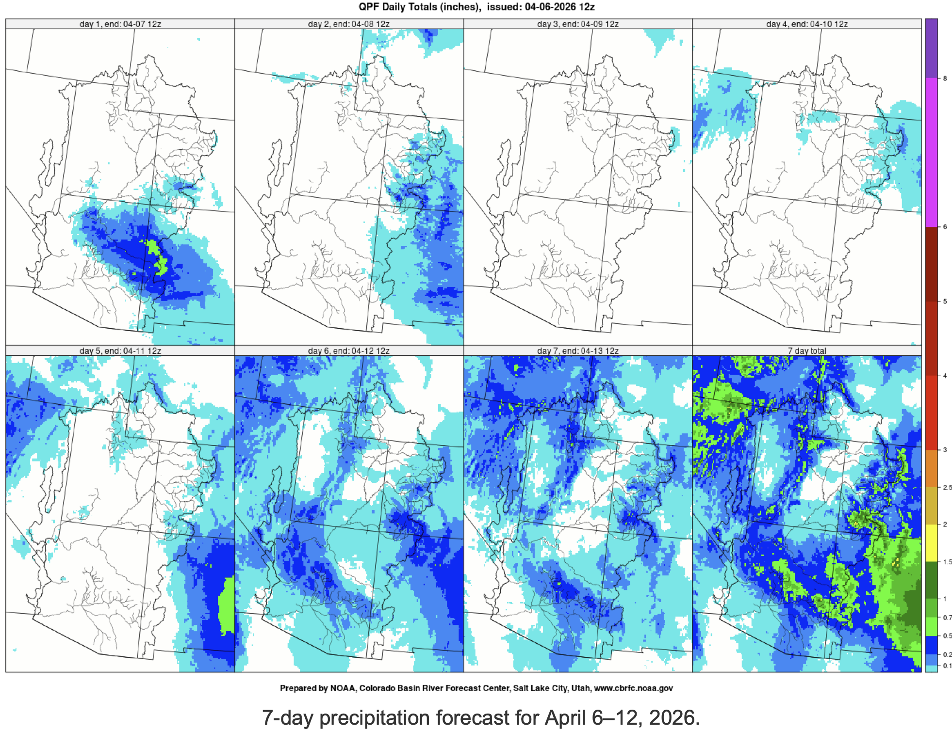
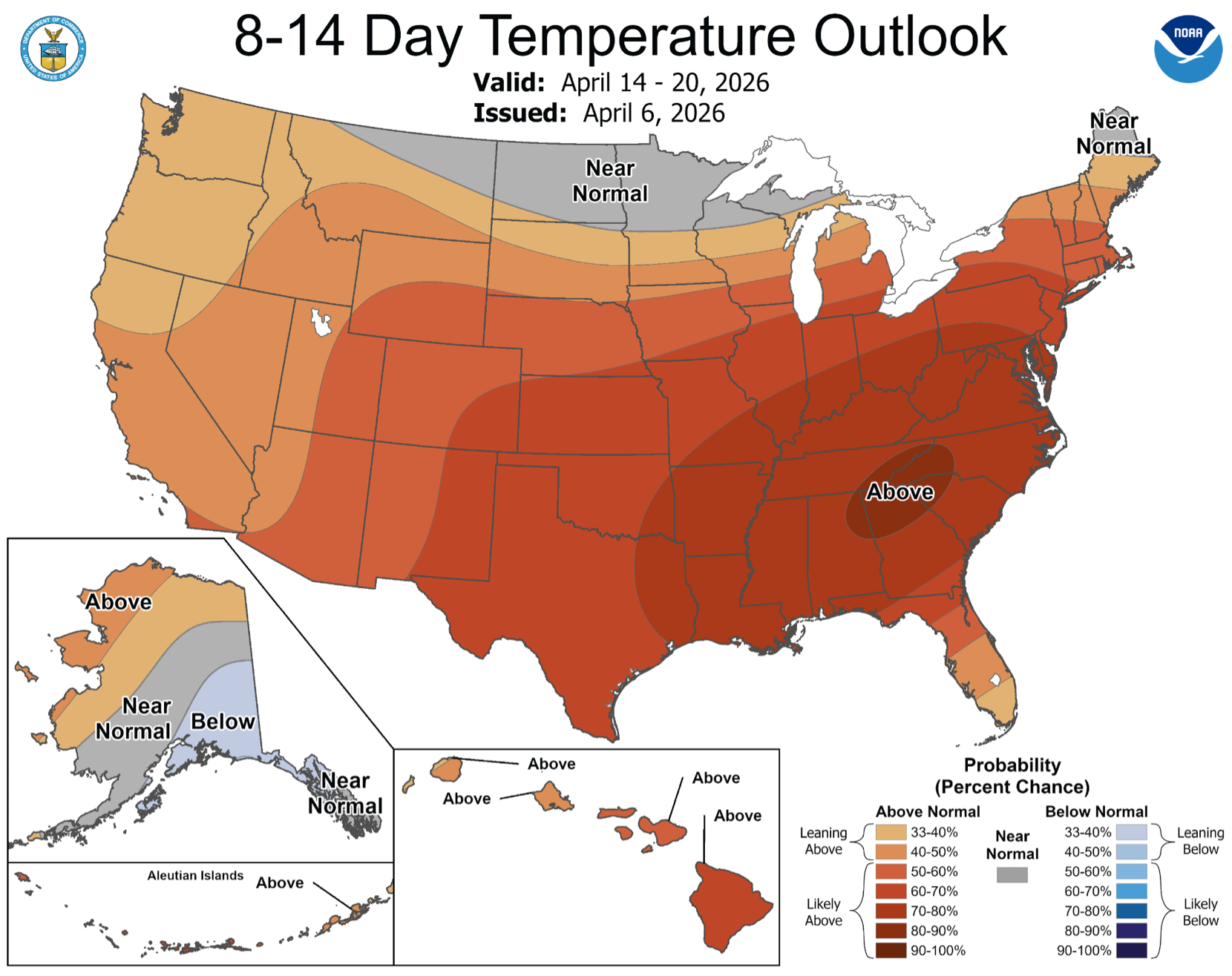
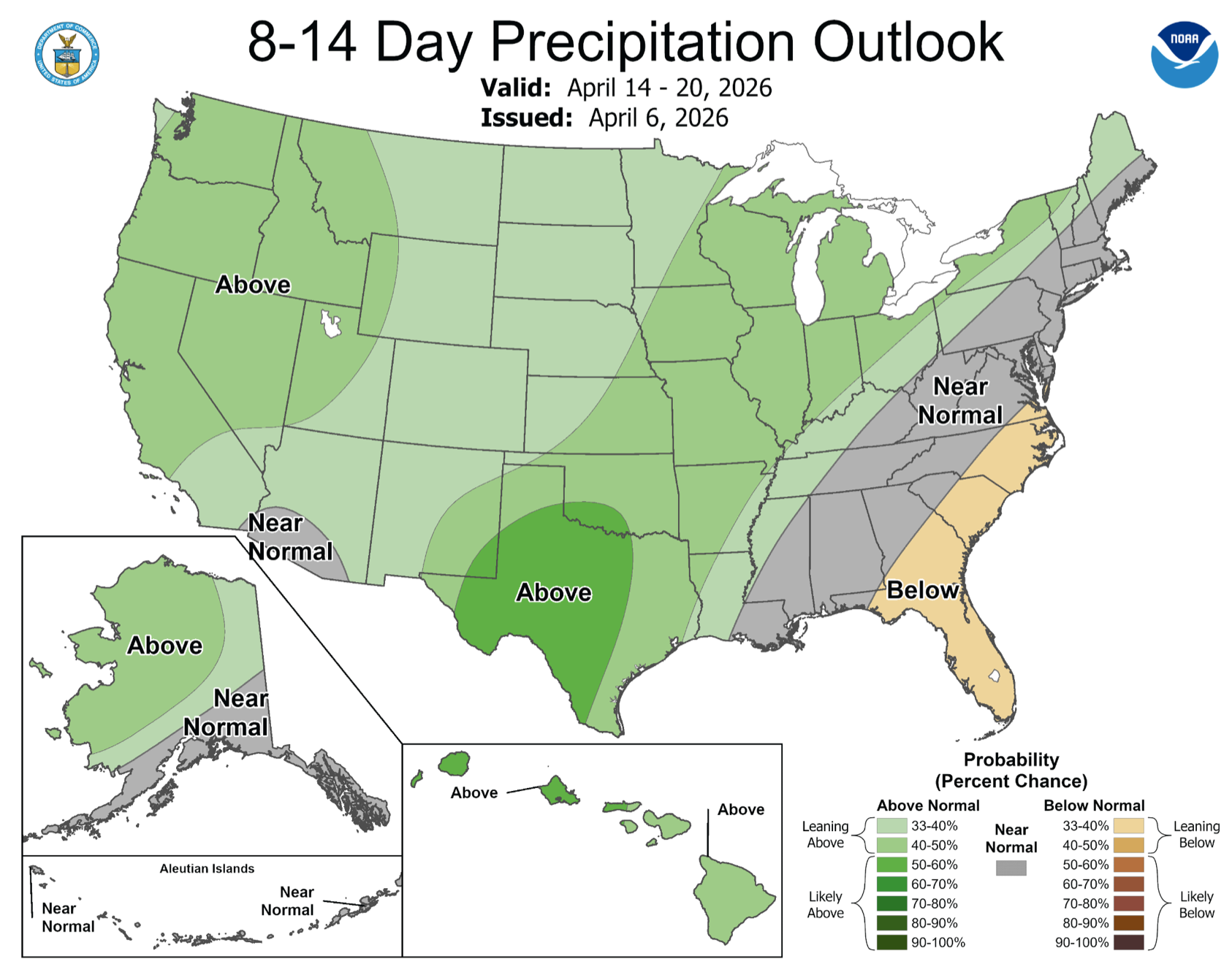
Upcoming Weather
Mild and unsettled weather is expected over the CBRFC area into the middle of April, with a few chances for rain showers and very high elevation snowfall. Above average temperatures will dominate the period. The 7-day precipitation forecast and the Climate Prediction Center (CPC) 8–14 day temperature and precipitation outlooks are shown in the figures below.