
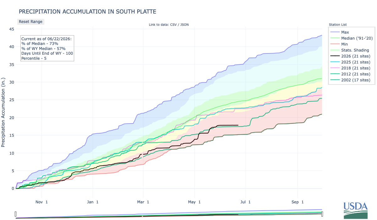
Below is the Precipitation Accumulation in South Platte graph from the NRCS for June 15, 2026. Precipitation is at 73% of the median (down 1% one week) and 57% of the water year median (down 1% one week), this morning. There are 100 days left in the water year.
There is a chance for thunderstorms Thursday and Friday in the central mountains. There is a s slight chance for thunderstorms today, a chance for thunderstorms Tuesday and Wednesday, showers are likely Thursday, with a chance for thunderstorms Friday in the northern mountains. There is a chance for thunderstorms today through Friday down here about 80 miles from Grand Lake, where The Grand Lake Shootout of 1883 took place, on July 4, 1883. From Grand Chalet: “In the 1880s, Grand County, Colorado, was embroiled in a heated political contest over which town would serve as the county seat. The two contenders were the town of Grand Lake and Hot Sulphur Springs. In 1882, a closely contested election saw Grand Lake win by a narrow margin of 93 to 71 votes. The outcome of the election further deepened existing divisions within the county government. As the dust settled, tensions grew within the political landscape. A Grand County commissioner resigned, and another was arrested for murder. The aftermath left only Commissioner J.G. Mills to oversee county matters. The governor, aiming to restore order, appointed two new commissioners: E.P. Webber and Barney Day…The tension reached its boiling point during the Commission’s next scheduled meeting on July 4, 1883. The meeting was to be held in Grand Lake, but as the commissioners prepared to convene, violence ensued. Sheriff Royer, Bill Redman, and Commissioner J.G. Mills had secretly plotted an ambush to prevent Webber, Day, and County Clerk Thomas Dean from reaching the courthouse. Royer, Redman, and Mills donned black bandanas and positioned themselves by the west edge of the lake, hiding behind boulders as their political rivals approached. As Webber, Day, and Dean neared the ambush site, shots rang out. A chaotic shootout followed, leaving Webber and Day fatally wounded. Dean was also struck, but managed to escape amid the gunfire. Mills, one of the key conspirators, was killed during the shootout—likely shot by one of his own allies in the chaos. His death would mark the end of the ambush, but the consequences of the event would continue to reverberate throughout Grand County.”

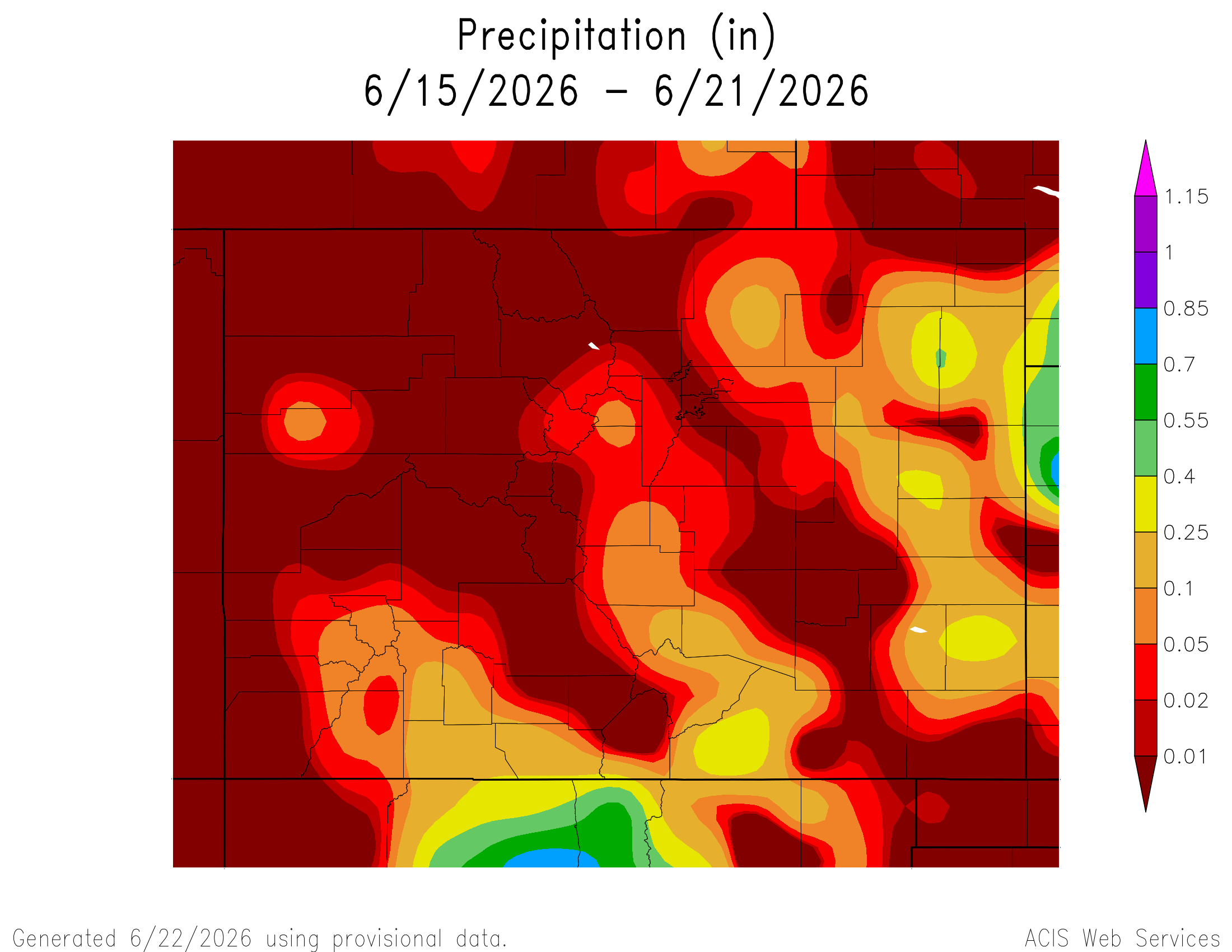
Here’s a look at the 7-Day Colorado precipitation map through June 21, 2026 from the High Plains Regional Climate Center. Precipitation in the South Platte Basin along the Continental Divide of the Americas ranged from 0.00” to 0.25”.
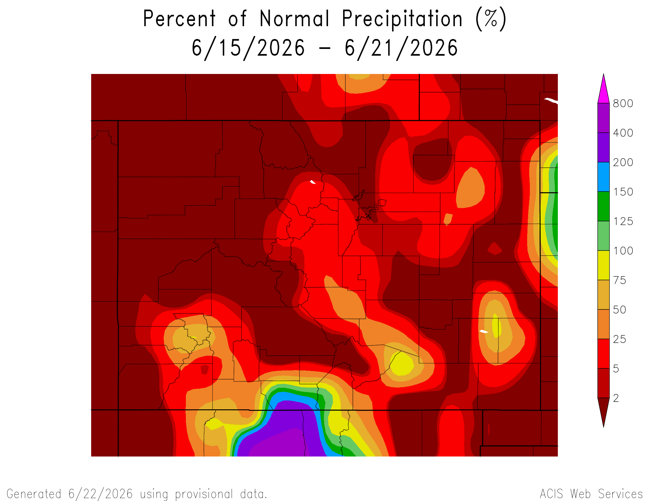
Here’s the 7-Day percent of normal precipitation map through June 21, 2026 from the High Plains Regional Climate Center. Precipitation in the South Platte River Basin along the Continental Divide of the Americas ranged from 0% to 25% of normal.
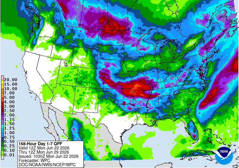
Here’s the 7-Day Quantitative Precipitation Forecast issued June 22, 2026 by NOAA. Precipitation is anticipated for the mountains of the South Platte River Basin and may total 0.50”.
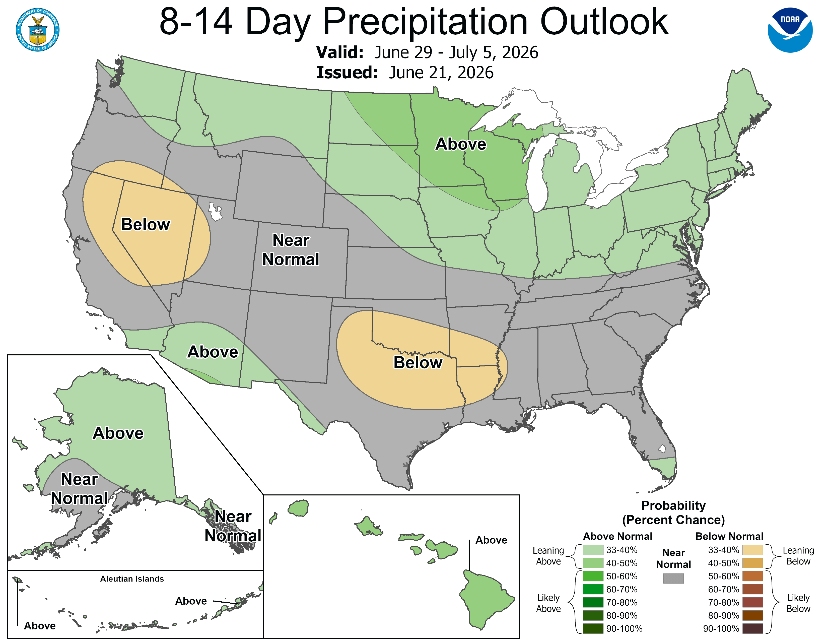
Below are the 8-14 day outlooks from the Climate Prediction Center, issued June 15, 2026, for temperature and precipitation, for the week starting June 22, 2026. The CPC expects above normal temperatures and near normal precipitation for the mountains of the South Platte River Basin.

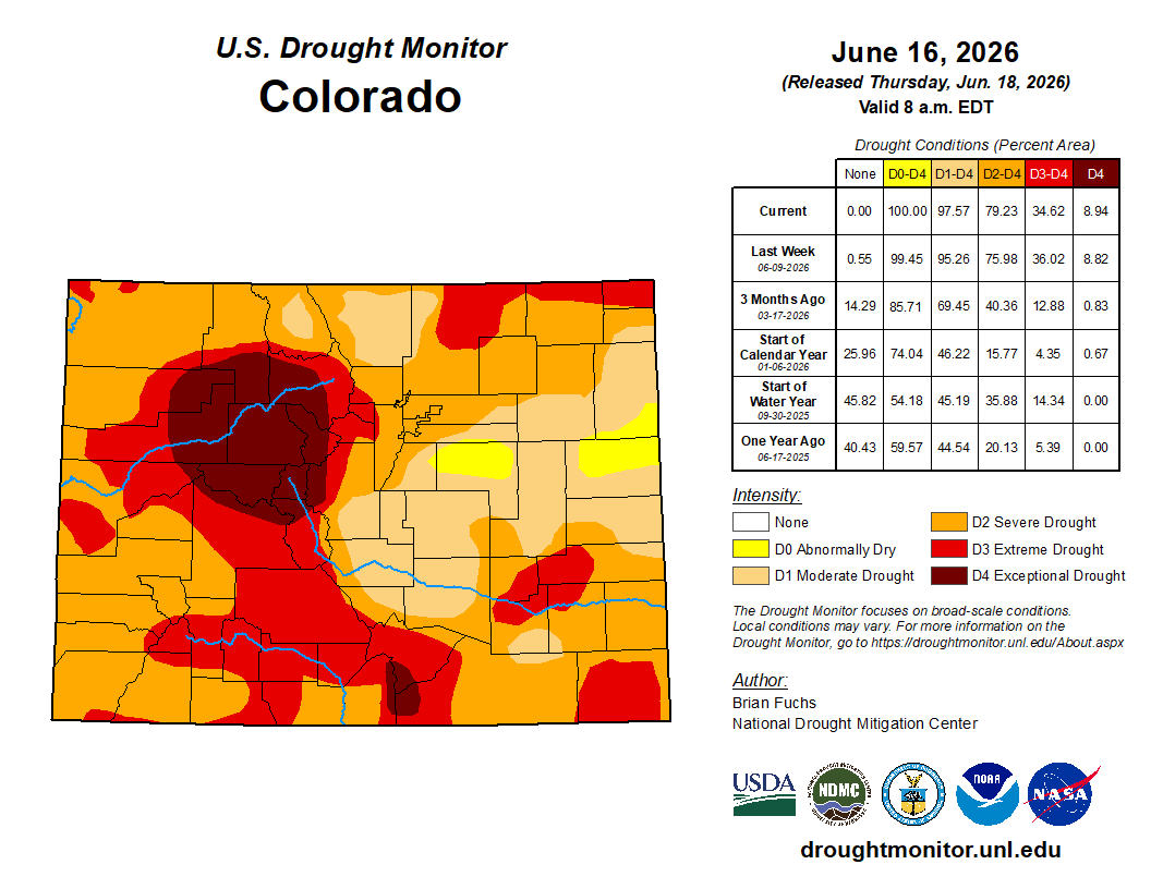
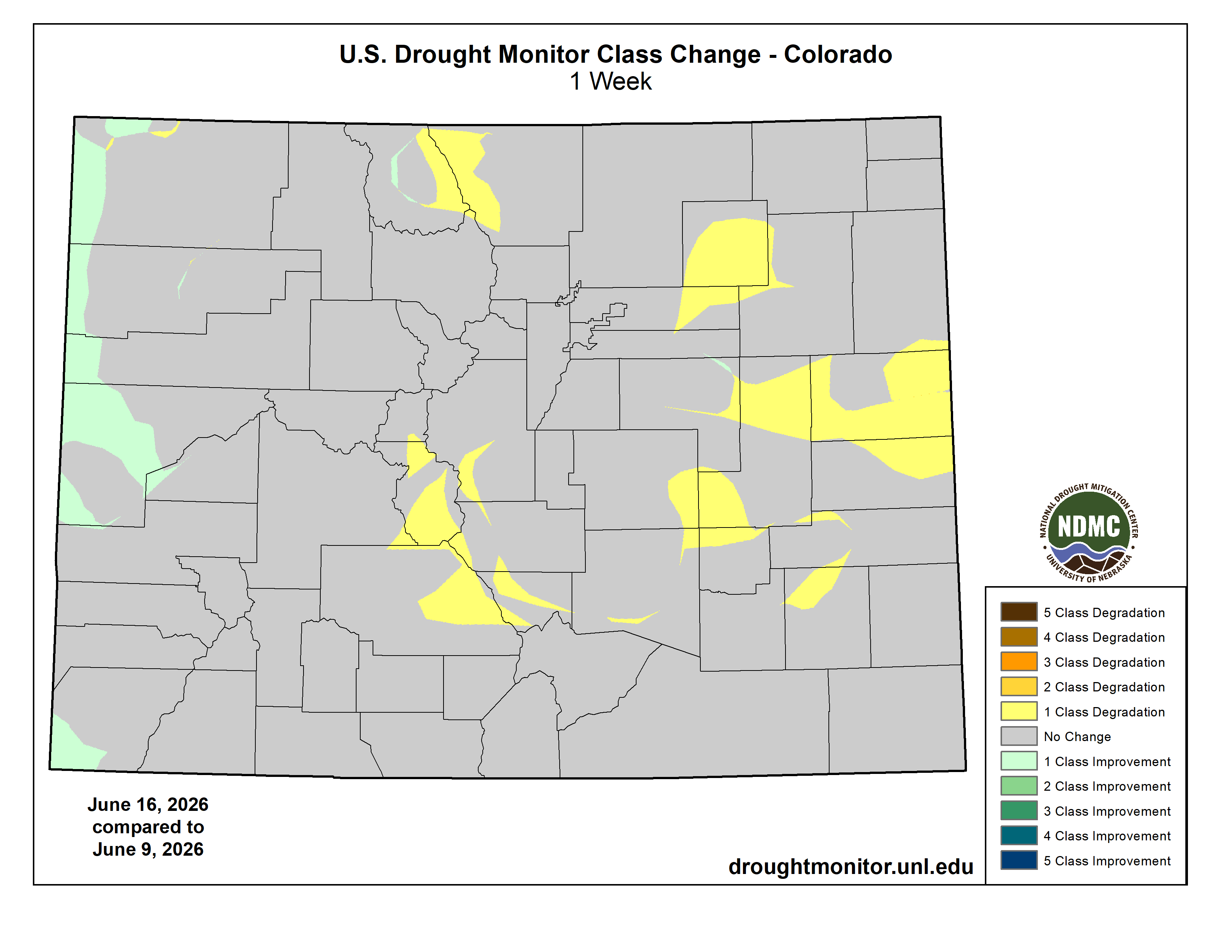
Below is the Colorado Drought Monitor map from June 16, 2026. There were one class degradations in Larimer, Morgan, Adams, Arapahoe, Elbert, and Park counties, and a very small one class improvement in Elbert County. Drought and abnormal dryness covers 100% of Colorado. The South Platte Basin is experiencing Abnormally Dry, Moderate, Severe, Extreme, and Exceptional drought conditions.
Below is the Colorado Drought Monitor one week change map ending June 9, 2026.
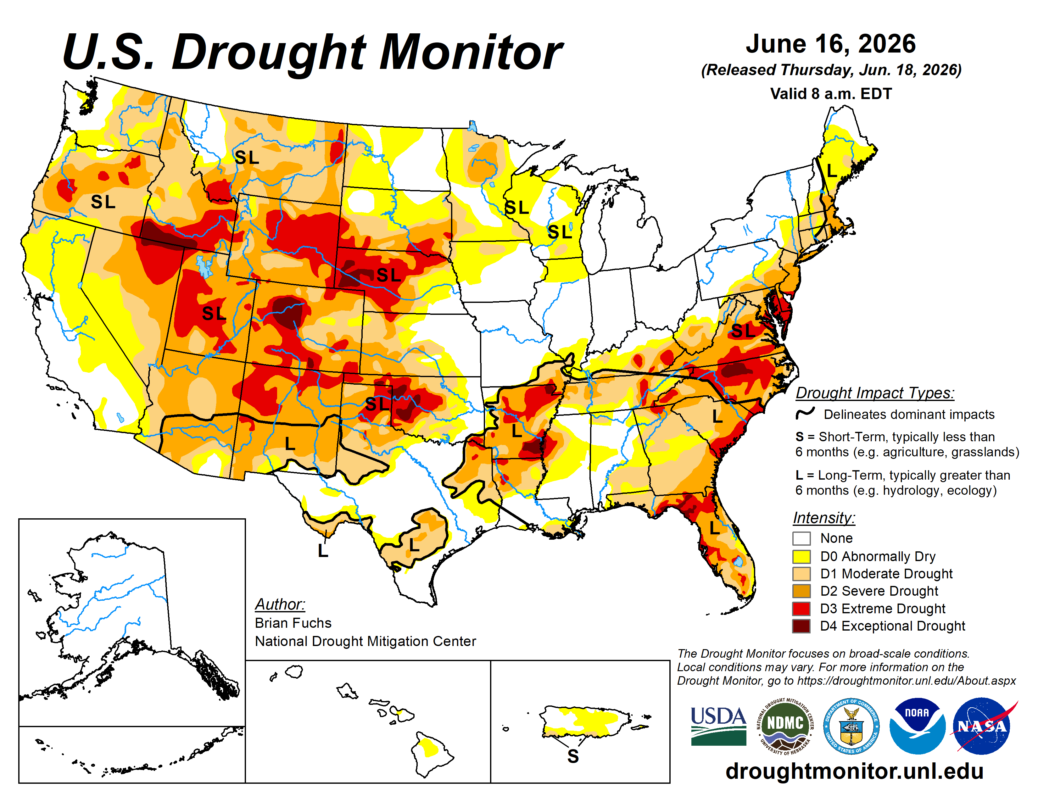
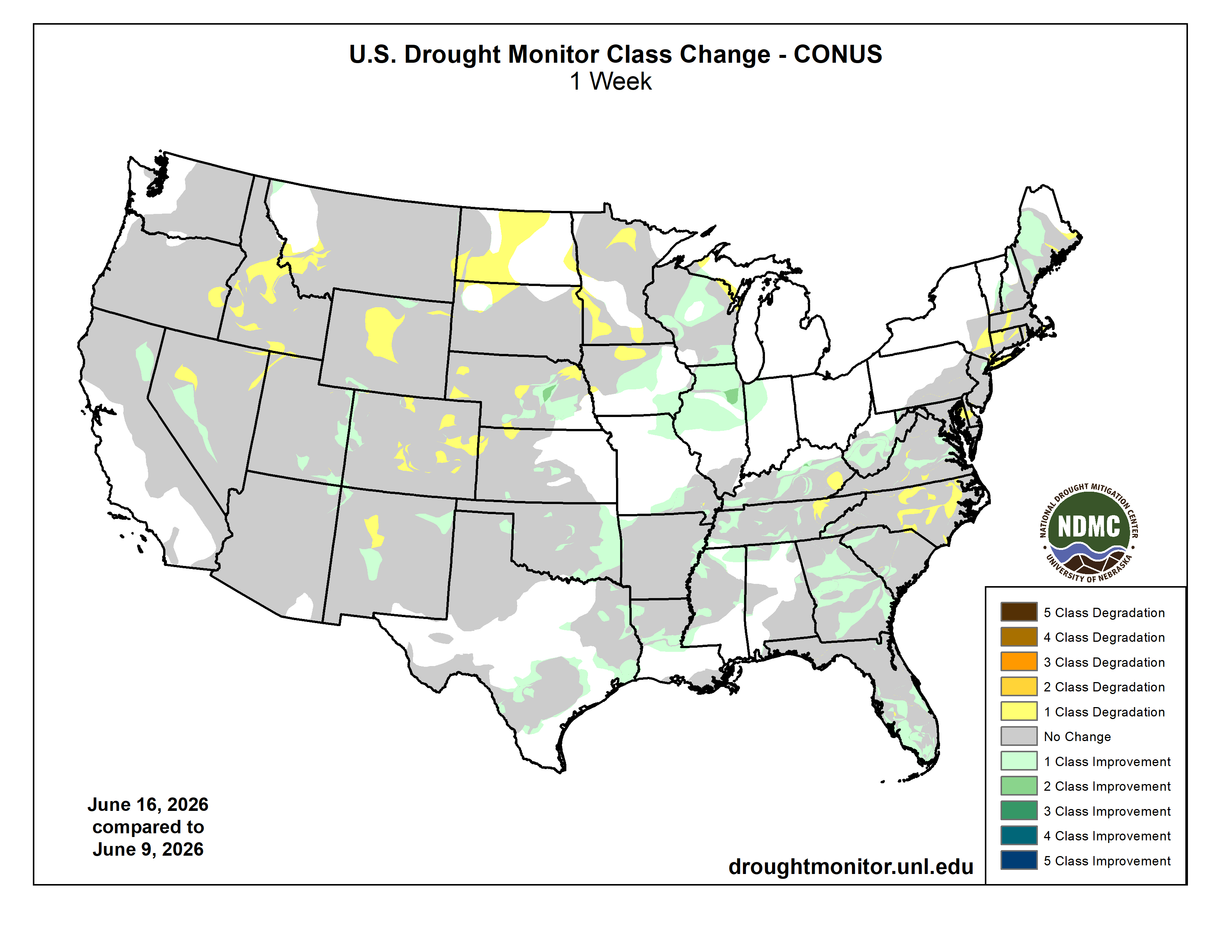
Here’s the US Drought Monitor Map from last week along with the one week U.S. change map.
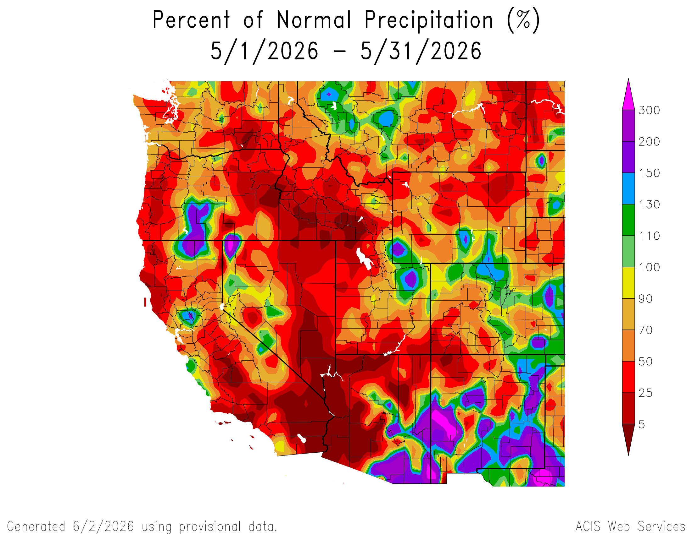
Finally, Western Water Assessment published their May Intermountain West Briefing on June 9, 2026. They write: “May precipitation was generally below average, except for portions of northern and eastern Colorado, and temperatures were slightly above average. Snowpack conditions continued to deteriorate compared to average during May, and June 1 SWE conditions were near record-low in Colorado (14% of median), Utah (11%), and the Upper Colorado River Basin (9%). Except for northern Wyoming river basins, April – July streamflow volume forecasts are less than 50% of average, and record-low streamflow volumes are forecasted for the Bear, Upper Colorado, White, and Yampa River Basins.
May precipitation was below average for much of the region, with large areas receiving less than half of average precipitation. Southwestern Colorado, southern and western Utah, and northern Wyoming were the driest locations during May. Above average precipitation fell in northeastern Utah and southwestern Wyoming, as well as across a broad swath of northern and eastern Colorado.
