Arkansas Basin Snowpack Telemetry (SNOTEL) site readings for snow-water equivalent range from 36% of median at the Apishipa site near the Spanish Peaks to 127% at St. Elmo in western Chaffee County. The Brumley SNOTEL site, near Independence Pass, reports 91% of median, while Fremont Pass reports 94%. Glen Cove, north of Pikes Peak, is at 108%. Buckskin Joe in South Park reads 62%. In the Sangre de Cristo Range, Hayden Pass reads 49% of median.
From email from Joe Stone:
On behalf of ARWC, the latest Arkansas River Report is available online at https://www.arkcollaborative.org/river-reports. As always, the information in the River Report is free to use as you wish, and all sources of information are linked to in the report.
ARWC is the nonprofit organization for the Arkansas Basin Roundtable, a group of water managers and stakeholders working to find solutions to water-related issues in the basin. Roundtable members serve as the ARWC Board of Directors.
Today [January 23, 2023], Colorado U.S. Senators Michael Bennet and John Hickenlooper urged the Bureau of Reclamation (BOR) to consider allocating additional funding from the recent omnibus funding bill for Fiscal Year 2023 (FY23) or the Bipartisan Infrastructure Law (BIL) for the Arkansas Valley Conduit (AVC).
The AVC is a planned 130-mile water-delivery system from the Pueblo Reservoir to communities in Bent, Crowley, Kiowa, Otero, Prowers, and Pueblo counties. The Conduit is the final phase of the Fryingpan-Arkansas Project, which Congress authorized in 1962.
“[T]he Conduit has been one of Colorado’s top priorities for nearly six decades,” wrote the senators. “Continuing to invest in this project will allow the project’s stakeholders to plan for more effective construction and delivery of clean drinking water throughout Southeast Colorado.”
In the letter, the senators highlight the $60 million allocated for the construction of the AVC from the BIL last fall, and ask BOR to allocate additional funds, which could be immediately applied to help advance different components of the AVC.
“For years, this project languished due to insufficient funding and a prohibitive cost-share agreement,” continued the senators. “Congressional appropriations over the past decade coupled with BOR’s recent $60 million award will finally enable the construction of this long-promised project. More investment, from the FY23 omnibus or future BIL awards, would accelerate the construction timeline and improve planning efficiency.”
Bennet and Hickenlooper have consistently advocated for increased funding for the AVC. The FY23 omnibus spending bill, which was signed into law in December, included $10.1 million for the Conduit after Bennet and Hickenlooper urged the Senate Appropriations Committee to continue to fund the project last May. In October, the senators visited Pueblo to celebrate the announcement of $60 million in BIL funds for the Conduit. The senators and U.S. Representative Ken Buck (R-Colo.) urged the OMB and BOR in July to allocate these funds. In March, Bennet and Hickenlooper secured $12 million for the Conduit from the FY22 omnibus bill. Prior to FY22, Bennet helped secure more than $70 million for the AVC. Bennet and Hickenlooper will continue working in Washington to ensure Colorado has the resources needed to complete this vital project for the region.
In 2009, Congress passed legislation Bennet worked on with former U.S. Senator Mark Udall (D-Colo.) to authorize a federal cost share for the construction of the Arkansas Valley Conduit. In 2013, Bennet and his colleagues sent a letter to the BOR to quickly approve the Conduit’s Environmental Impact Study (EIS) in order to expedite the project’s pre-construction process. In 2014, following Bennet and Udall’s efforts to urge the BOR to quickly approve the Conduit’s EIS, the Record of Decision was signed in February. Bennet joined the groundbreaking for the project in October 2020.
The text of the letter is available HERE and below.
There is a critical connection between clean drinking water and forests. For 80 percent of Coloradans, their water starts in the state’s forests before making its way downstream to their taps.
Given this connection, it is important for Colorado to protect its forested watersheds from the ever-present threat of wildfire to ensure residents and communities have water for drinking, agriculture and other uses. The Colorado Legislature recognizes this need and passed House Bill 22-1379 during the 2022 legislative session to fund projects that reduce wildfire fuels around high-priority watersheds and water infrastructure.
Today, the Colorado State Forest Service announces three projects funded through HB22-1379 that will reduce the risk wildfire poses to water supplies for more than a million Coloradans.
“We are excited to put these funds provided by the legislature to work in high-priority areas where an uncharacteristic wildfire could significantly impact water supplies and infrastructure,” said Weston Toll, watershed program specialist at the CSFS. “All three projects connect to prior fuels reduction work completed by the CSFS and our partners, so we can make an impact on a large scale in our forests.”
The CSFS received $3 million through HB22-1379 to fund forest management in critical watersheds and has allocated $1 million each to three projects in these locations:
Staunton State Park, Colorado. CSFS Photo.
Staunton State Park, Park and Jefferson counties
The project in Staunton State Park will build upon more than 800 acres of prior fuels treatments to reduce the impact a wildfire could have to water resources, communities, outdoor recreation areas and wildlife habitat. Creeks running through the park feed into the North Fork South Platte River, which flows into Strontia Springs Reservoir. Eighty percent of Denver Water’s water supply moves through Strontia Springs Reservoir.
This area, about 6 miles west of Conifer, is noted as a priority for action in assessments by the CSFS, Denver Water, Upper South Platte Partnership, Elk Creek Fire Protection District and in local Community Wildfire Protection Plans. It is also in a focus area for the Rocky Mountain Restoration Initiative.
“This project will allow us to get into areas of the park we haven’t been able to treat yet,” said Staunton State Park Manager Zach Taylor, “to reduce the risk of a wildfire spreading from the park to adjacent neighborhoods. The project also reduces wildfire risk to creeks in the park and the entirety of the drainage.”
Taylor said that the park has worked alongside neighbors in the area, including private landowners and the U.S. Forest Service, to address wildfire fuels since the park was acquired in the 1980s.
“Staunton State Park lies between all of these communities,” he said. “This project could set up the park for the next 5 to 10 years in helping us meet our goals for fuels reduction.”
Teller County, Colorado. CSFS photo.
North Slope of Pikes Peak, Teller County
The project on the North Slope of Pikes Peak will help protect essential drinking water and water infrastructure for the City of Colorado Springs. Reservoirs on the North Slope provide about 15 percent of the city’s drinking water supply. Work there will add to more than 3,500 acres of prior fuels treatments on Colorado Springs Utilities’ municipal lands and fill an important gap in treated areas around North Catamount Reservoir and the headwaters of North Catamount Creek. It will also help protect infrastructure that conveys water from the utility’s Blue River collection system to the reservoir.
The Pikes Peak Watershed is noted as a high priority area in plans by the CSFS, U.S. Forest Service and Colorado Springs Utilities. It is also in a focus area for the Rocky Mountain Restoration Initiative.
“Colorado Springs Utilities’ 34-year-long partnership with the Colorado State Forest Service has enabled many beneficial forest management activities that reduce the risks and impacts of wildfire in and adjacent to our watersheds,” said Jeremy Taylor, forest program manager with Colorado Springs Utilities. “Through the Pikes Peak Good Neighbor Authority (GNA), we’ve expanded this collaboration to include the U.S. Forest Service for cross-boundary work, and we’re now embarking on the Big Blue project on the North Slope of Pikes Peak. It’s a valued partnership that prioritizes working together to improve forest health and protect our water resources, public lands and neighboring private lands.”
Sheep Mountain, Grand County, Colorado. CSFS Photo.
Fraser Valley, Grand County
The project in the Fraser Valley will lower the risk of wildfire to water supplies for Denver and the towns of Fraser and Winter Park by reducing fuels on U.S. Forest Service, Denver Water and private lands. It connects to several prior treatment areas to establish a connected, large-scale fuel break that could allow firefighters to engage a wildfire in the event of a fire. During the William’s Fork Fire in 2020, the project area was identified as where a wildfire could spread into the densely populated Fraser Valley.
The Grand County Wildfire Council identified the project area as a high priority through planning efforts by the CSFS, USFS, Bureau of Land Management, Denver Water, Grand County and local fire departments.
“These projects are critical for watershed health and source water protection for Denver Water and our 1.5 million customers. Healthy forests equal healthy watersheds,” said Christina Burri, watershed scientist with Denver Water. “Denver Water is so grateful for the partnerships and collaboration that make these projects possible.”
The CSFS expects work on these projects to begin in 2023 and will monitor the project work in future years to evaluate its impact and efficacy. All three projects allow the CSFS and its partners to achieve goals and enact strategies identified in the 2020 Colorado Forest Action Plan and are in areas identified as priorities in the plan.
“Governor Polis and the Colorado legislature have made tremendous investments to protect our watersheds from the increasing threat of wildfires and the Colorado State Forest Service is at the forefront in moving these projects forward”, said Dan Gibbs, executive director of the Colorado Department of Natural Resources. “The three projects announced today build on existing efforts to increase resiliency and make impactful investments in key watersheds to create healthier forests and reduce the threat of future wildfires.”
“Thank you to the Colorado Legislature for making the $3 million available for this important work and to our many partners for working alongside the Colorado State Forest Service on these projects,” Toll said. “Together, we are making a landscape-level impact and leveraging our collective resources toward the goal of lowering wildfire risk to water supplies and protecting one of our state’s most precious resources.”
Colorado Springs with the Front Range in background. Photo credit Wikipedia.
Click the link to read the article on the KOAA website (Bill Folsom), Here’s an excerpt:
The ongoing drought in the west motivated a request from Colorado Springs Utilities for an update to city ordinances on annexing new developments into the city. With five in favor and four against, City Council approved the change saying for any development annexations to be considered, the city’s water supply has to be at 130% of what is needed for existing residents. Mayor John Suthers supported the change saying tough decisions are being forced by the current water crisis along the Colorado River Basin.
“Our citizens are asking a simple question, ‘Can you ensure we’ll have enough water?’ This ordinance acts in the public interest and answers that question loud and clear,” said Suthers…
Many developers from the community spoke against the change saying it will make large developments outside the city almost impossible.
Suthers Tweeted, “If we do nothing to maintain a buffer between our water supply and our water usage, and the city suffers a major curtailment of our Colorado River water, further drought will put us in an untenable situation, and we will be responsible for a failure of public policy.”
Colorado Springs Utilities (CSU) recommended the 130% number following an in-depth review of the organization’s capacity and ability to provide water to the city’s citizens. Utilities maintain that the city’s 30% margin buffer allows CSU to consistently provide water year in and year out.
Contracted crews will remove trees across 300 acres to reduce the high risk of catastrophic wildfire near North Catamount Reservoir south of U.S. 24, said Luke Cherney, a forester with the State Forest Service. The area on U.S. Forest Service land was prioritized for fire mitigation because of the dense trees, damage from pests and proximity to drinking water infrastructure. The goal is to ensure when the forest burns, it will not be as extreme and hot as some of the state’s most destructive fires, such as the Waldo Canyon fire, that run through the crowns of trees, blackening the landscape and killing nearly all the vegetation. This type of fire can hurt the watershed and water infrastructure because without living plants the ash and sediment will wash into reservoirs and intake pipes, creating major problems for water managers. Areas hit by intense fire also can see major debris flows without any vegetation to hold back soils. Thinning trees will help create conditions where fires will burn at a lower intensity through the underbrush, leaving many trees alive…
View of Pikes Peak from the South Catamount Reservoir. Photo: Andy Schlosberg, CSFS
The parcel, adjacent to areas that Colorado Springs Utilities already has mitigated, never has been mitigated for fire risk, said Jeremy Taylor, Utilities’ forestry program manager, and the work will protect pipelines, electrical lines and the overall watershed. Runoff from a healthy watershed is also far cleaner and easier to treat.
“We are restoring the landscape to a more historic and healthy condition that previously would have been achieved by wildfire,” he said in an email.
The project will remove about half the trees in an area where western spruce budworm and Douglas-fir beetle have damaged the forest, Cherney said. The work will increase the space between trees and allow each tree more access to water and nutrients to improve their health, putting them in a better position to fend off pests, he said.
Bobcat® Compact Track Loader with Masticating Attachment. Photo credit: Wilderness Forestry, Inc.
The crews may use masticators to thin trees, Cherney said. The masticators, similar to front-end loaders, are equipped with large drums loaded with metal teeth to remove and mulch trees. In steep areas, crews may also need to use chain saws.
FORT CARSON, Colo. – 4th Combat Aviation Brigade, 4th Infantry Division receives first CH-47 Chinook helicopters at Butts Army Airfield on Fort Carson, Colo., Jan. 22, 2013. Crew members conduct their post flight checks. The Chinooks are the first CH-47s to arrive to the new combat aviation brigade. (Photo by Sgt. Jonathan C. Thibault, 4th Combat Aviation Brigade, 4th Infantry Division Public Affairs NCOIC/Released)
For over a century, the U.S. Army has been plagued by the lasting consequences of its negligent use, storage and disposal of hazardous chemicals. As a result, countless troops and dependents residing on contaminated bases regularly came into contact with toxins known to trigger adverse health effects and deadly diseases.
In high-profile cases like North Carolina’s Camp Lejeune, nearly 1 million service members and their families were exposed to deadly toxins for over 30 years (1953-1987), including health hazards like benzene, vinyl chloride, trichloroethylene, perchloroethylene, and per/polyfluoroalkyl substances — PFAS.
Also known as “forever chemicals,” PFAS are a group of over 12,000 artificial compounds that represent a distinct environmental concern due to their resilient molecular structure, which prevents natural decomposition, allowing them to easily permeate the soil and contaminate drinking water sources. Exposure to PFAS has been linked to testicular cancer, organ damage (liver, kidneys), high cholesterol, decreased vaccine efficiency in children, and impaired reproduction.
On Camp Lejeune and more than 700 army bases across the US, PFAS contamination is directly linked to aqueous film-forming foam used since the early 1970s to extinguish difficult fuel blazes. In 2016, the EPA established a health advisory of 70 parts per trillion for PFOA and PFOS, the main PFAS compounds.
Although service members and their relatives are the most burdened, contamination originating from military sources plays a larger role in an insidious pattern of discrimination that affects marginalized minority communities.
Due to discriminatory redlining policies, land in minority neighborhoods was significantly undervalued and became a cost-efficient solution to situate army bases, industrial facilities, landfills, traffic routes, and other sources of toxic pollution. The higher toxic burden that vulnerable minority communities experience due to systemic prejudice is better known as “environmental racism.”
A 2021 report notes that Colorado has the highest PFAS footprint in the country, with approximately 21,000 sites suspected of using or storing such compounds. Although industrial activities are the primary driver of PFAS’ prevalence, frontline communities also have to contend with contamination from several military sources.
(Widefield aquifer via the Colorado Water Institute.)
Nine army bases in Colorado are known to have been affected by PFAS due to aqueous film-forming foam, with the most contaminated including Schriever Air Force Base (870,000 ppt), Buckley Space Force Base (formerly Buckley Air Force Base, 205,000 ppt), Fort Carson (156,000 ppt), U.S. Air Force Academy (72,000 ppt) and Peterson Space Force Base (formerly Peterson Air Force Base, 15,000 ppt). Significantly, PFAS from Peterson has previously contaminated the drinking water sources of downstream communities, with a CDC study finding PFAS compounds in the blood of residents in one exposed community registering concentrations 1.8 to 8.1 times the national average.
While the Air Force and Department of Defense have been involved in some remediation efforts, from distributing bottled water to installing filters and building treatment plants, their contributions are considered limited by Coloradans, given the lack of actual PFAS cleanup projects. Unlike Camp Lejeune, none of the contaminated Colorado bases are listed as Superfund sites.
Frontline communities exposed to higher health risks due to environmental racism’s lingering effects rely on state and federal authorities to establish a legal framework that keeps polluters accountable and protects vulnerable citizens. Since 2020, Colorado has enacted some of the country’s most stringent PFAS laws and adopted a PFAS narrative policy that closely follows the EPA’s 2016 advisories.
Federally, the National Defense Authorization Act will see aqueous film-forming foam phased out by 2024 and finance PFAS cleanup projects on contaminated installations, while the Bipartisan Infrastructure Law will provide impacted communities with crucial investments to address pollution and other causes of environmental injustice. The Honoring Our PACT Act will provide improved health benefits and compensation for veterans and military families exposed to toxins in highly contaminated locations like Camp Lejeune.
Despite these encouraging developments, the DoD has yet to commence cleanup on any of the most affected bases in the country per NDAA’s provisions, and diseases resulting from exposure to PFAS aren’t recognized as presumptive conditions under HOPA. Moreover, while Colorado adopted the EPA’s 2016 guidelines, it falls behind other states that employ even stricter standards.
Still, Colorado has the opportunity to stay ahead of the game by implementing more effective PFAS standards that align with the EPA’s most current efforts to regulate these toxic compounds. With the goal of setting enforceable maximum contaminant levels in drinking water, the EPA has drastically reduced its non-binding advisories for PFOA and PFOS in June 2022 to a paltry 0.004 ppt and 0.02 ppt, respectively, illustrating the dangers these substances represent even at exceedingly low concentrations.
Products that contain PFAS. Graphic credit: Riverside (CA) Public Utilities
Fryingpan-Arkansas Project water from the headwaters of the Colorado River flows into Turquoise Lake in the Arkansas Basin via the Boustead Tunnel (photo by Klambpatten, U.S. Bureau of Reclamation https://commons.wikimedia.org/wiki/File:Turquoise_Reservoir.JPG).
As part of a new water conservation program, the Upper Colorado River Commission “is seeking proposals immediately for the voluntary, compensated, and temporary water conservation projects for 2023.”
Colorado, New Mexico, Utah and Wyoming are Commission members, and the U.S. Bureau of Reclamation is a partner in the new conservation program, according to a statement issued Wednesday, Dec. 14, at the Colorado River Water Users Association meeting in Las Vegas, Nevada.
To be considered for funding, proposals for conservation projects will need to be submitted by Feb. 1, 2023. Details are available here.*
The Commission touts the new program as “a key component of the Upper Division States’ 5-Point Plan to address the impacts of the ongoing drought and depleted (water) storage in the Upper Colorado River Basin.”
The new conservation program is relevant here in the Arkansas River Basin because about 130,000 acre-feet of water per year, up to 23 percent of Arkansas River flows, are imported from the Colorado Basin according to Colorado Division of Water Resources data.
The Bureau of Reclamation operates the Fryingpan-Arkansas Project, which imports an average of 57,000 acre-feet of water per year. Colorado Springs, Pueblo and Pueblo West combine to import the other 73,000 acre-feet. Fry-Ark Project water supports local agriculture, cities, towns and industry.
Fry-Ark water and infrastructure also underpin the Voluntary Flow Management Program, which supports the multimillion-dollar recreation economies of Upper Ark communities as well as the Arkansas River’s Gold Medal fishery.
Colorado Water Conservation Board Director Becky Mitchell expressed support for the new program in a statement Wednesday. She emphasized, “The most impactful thing that can be done to manage the Colorado River System is to reduce uses in dry years.”
Mitchell noted that Colorado’s “strict administration of water rights based on hydrology” effectively achieves drought-year water-use reductions. “In 2021, administration impacted water use on over 203,000 acres within the Colorado River Basin in Colorado.”
Mitchell cited preliminary data from the Upper Colorado River Commission showing that the four Upper Basin states used 25% less water in 2021 than in 2020” in response to limited water availability.
“We must continue to live within the means of what the river provides year to year,” Mitchell said, “and we ask others to do the same. This is the only way the system will continue as we know it into the future.”
In requesting that others “live within the means of what the river provides,” Mitchell implicates the three Lower Colorado River Basin states – California, Arizona and Nevada.
The 1922 Colorado River Compact divided Colorado River water between the four Upper Basin states and the three Lower Basin states. The Compact requires the Upper Basin states, where most of the precipitation falls, to deliver a 10-year rolling average of 7.5 million acre-feet (maf) of water to Lees Ferry, Arizona, just south of the Utah state line. Of that water, California is entitled to 4.4 maf, Arizona, 2.8 maf, and Nevada, 0.3 maf.
The Compact also established a benchmark of 16.5 million acre-feet (maf) of water per year for Colorado River flows. However, data from NOAA show that average flows from 2000 to 2021 have dropped to 12.3 maf per year.
To date, the Upper Basin states have consistently met the 7.5-maf Compact requirement. At a meeting of Colorado’s Interbasin Compact Committee earlier this year, Mitchell shared statistics showing that Upper Basin states have significantly reduced water usage while Lower Basin states have not.
Colorado River Consumptive use graphic credit: Heart of the Rockies Radio
As the numbers reveal, Lower Basin states’ water usage – more than 2 maf per year beyond the 7.5 maf delivered by the Upper Basin – has trended higher, even as the 10-year rolling average dropped to 11.78 maf for 2012-21.
Specifically, 2019 saw Colorado River flows of 17.75 maf, a rare yearly surplus of 3.8 maf. In 2020, flows dropped to 9.6 maf, 4.5 maf less than the water used that year.
In 2021, flows dropped further, to 7.1 maf. Even with Upper Basin states reducing their water use by more than a million acre-feet in 2021, total water use in the Basin exceeded Colorado River flows by 6.4 maf, dropping water levels in lakes Mead and Powell to record low levels.
* The Upper Colorado River Commission’s Dec. 14 statement notes that full implementation of the water conservation program “is contingent on the passage of pending legislation in Congress” and finalization of an funding agreement between the Commission and the Bureau of Reclamation.
With soil sampling 98% complete at the Colorado Smelter Superfund Site, the Environmental Protection Agency seeks to finish its residential cleanup by spring 2024, if not sooner.
Since 2015, the EPA has conducted outdoor soil and indoor dust samplings of lead and arsenic levels at residences near the former Colorado Smelter. When samples taken from residences show harmful levels of contaminants, the properties are then earmarked for EPA cleanup.
Due to the COVID-19 pandemic, the EPA’s progress on dust sampling has trailed behind its soil sampling efforts. The agency has sampled dust at 73% of the properties it’s targeted in Pueblo’s Bessemer, Eilers and Grove neighborhoods.
As of Oct. 28, about 44% of the 1,833 properties that have received soil sampling have required cleanup, according to the EPA, as have about 36% of the 1,361 dust-sampled properties.
After additional funds were approved by Pueblo City Council on Monday night, a total of $3 million in American Rescue Plan Act funds will be allocated to a 6,200-foot sanitary sewer line on Pueblo’s west side…Funded by ARPA and the Pueblo Wastewater Department, the project will cost an estimated $6.8 million, according to the city of Pueblo.
“We have been in the process of designing that sewer line,” Pueblo Mayor Nick Gradisar said. “There are a couple of arroyos. Some of that sewer line is going to be 13 to 30 feet deep. It turns out to be much more expensive.”
The multi-million dollar project is expected to benefit several developments, including Southern Colorado Clinic, the Pueblo YMCA, the Wildhorse Annexation, the proposed WL Annexation and the incoming Pueblo County detention center.
“This really is a major trunk line that will collect waste from a number of areas,” said Andrew Hayes, the city’s director of public works. “As the rest of the West Side develops in the vicinity of Southern Colorado Clinic, the YMCA— those areas will also feed into this very same line.”
These meetings will be held at the Lamar Elks Lodge No. 1319, 28157 US Highway 287, Lamar, CO 81052, on December 7th and 8th. We are planning on an in-person meetings with a virtual option. That being said, we cannot guarantee effective technology to facilitate listening in on these meetings at this point though we will do our best. A Zoom meeting link can be requested by contacting Stephanie Gonzales at arca.co.ks@gmail.com on December 6th.
As of now, there are no restrictions that would affect having these meetings in person, but that is subject to change. These are public meetings, between the States of Colorado with other local, State, and federal agencies participating. There may be restrictions for those attending and we hope that you can respect those restrictions. If you are unable to do so, please consider participating in the virtual meeting option.
This is the final notice for the upcoming Arkansas River Compact Administration Annual and Committee Meetings. Please note that the meeting dates and location were changed at the ARCA Annual Meeting held in December 2022.
The 2022 Annual Meeting of the Arkansas River Compact Administration (ARCA) will be held on Thursday, December 8, 2022.The Engineering, Operations, and Administrative/Legal Committees of ARCA will meet onWednesday, December 7, 2022. These meetings are to be held at Lamar Elks Lodge No. 1319, 28157 US Highway 287, Lamar, CO 81052. The meetings are intended to be in person, but as noted above there will be a virtual option.
Meetings of ARCA are operated in compliance with the federal Americans with Disabilities Act. If you need a special accommodation as a result of a disability please contact Stephanie Gonzales at (719) 688-0799 at least three days before the meeting.
This and additional information can be found on ARCA’s website, please check back often since the meeting information will be added as it becomes available:
If you have any questions please feel free to contact Andrew or myself.
New research could help pinpoint “forever chemicals” exposure — giving communities a roadmap for cleanup and individuals direction on what to avoid.
Downstream of a Chemours fluorochemical manufacturing plant on the Cape Fear River in North Carolina, people living in Brunswick and New Hanover counties suffer from higher-than-normal rates of brain tumors, breast cancers and other forms of rare — and accelerated — diseases.
Residents now know this isn’t a coincidence. It’s from years of PFAS contamination from Chemours.
It wasn’t easy to make the connection. More than a decade of water testing and lawsuits identified the link between aggressive cancers and per-and polyfluoroalkyl substances, or PFAS – a class of more than 9,000 toxic and persistent man-made compounds known informally as “forever chemicals.” They’re commonly found in nonstick cookware, water-resistant clothing, firefighting foam, cosmetics, food packaging and recently in school uniforms and insecticides.
The difficulty of tracing these chemicals to a specific source is that Americans — 97% of us, by one estimate — are exposed to potentially thousands of PFAS.
New research published in Science of the Total Environment now finds that tracing models can identify sources of PFAS contamination from people’s blood samples. Instead of using environmental measures of PFAS as a proxy for how people are exposed, the methods use blood samples as a more direct way to map people’s exposure.
“If this works, it would allow us to identify, without any prior knowledge, what people are being exposed to and how they’re being exposed to it,” Dylan Wallis, a lead author of the paper and toxicologist formerly at North Carolina State University, told EHN.
The research, while not yet perfect, marks the beginning of what could become a wide-scale method of determining where the PFAS in our blood came from—such as our food, drinking water or use of nonstick cookware—and how much of it came from each source. But its effectiveness hinges on the need to collect more comprehensive data on where PFAS occurs in people’s bodies, the environment and sources. If scientists can collect this data, then these methods would be able to draw a roadmap for people’s exposure, allowing us to pinpoint problem areas, avoid contamination and implement regulatory changes.
PFAS in blood samples
For this tracing method to work, scientists need an idea of which compounds exist in air, water, food and everyday products in a determined community. First, they have to know where to look for PFAS. This study used data from previous research to identify the types of PFAS in drinking water. Then, they test blood samples for which PFAS are in people’s bodies—although using blood alone gives us only part of the contamination picture, Carla Ng, a chemical and biological engineer at University of Pittsburgh, told EHN. Once they match PFAS proportions in blood to what’s in their drinking water, as in this study, they can gain clues to which sources contributed the chemicals showing up in people’s blood.
“You start to build this picture of what are the inputs, what’s the material they’re getting their exposure from, and then what’s in their blood,” Ng, who was not involved in the study, explained.
Widefield aquifer via the Colorado Water Institute.
The new study analyzed blood samples taken in 2018 and 2020 from residents in Wilmington, North Carolina, and three towns in El Paso County, Colorado. Both communities are near well-known PFAS polluters: the Chemours facility in North Carolina, which manufactures fluoropolymers for nonstick and waterproof products, and the Peterson Space Force Base in Colorado, which uses PFAS-containing firefighting foam, also called AFFFs.
The team used computer models to identify 20 PFAS compounds from residents’ blood samples and then grouped them in categories representing different sources. Some are easy to identify because manufacturers often use a specific type of PFAS. For example, the compounds found in firefighting foam have a unique signature, like a fingerprint, making Peterson Space Force Base the obvious culprit. But more diffuse sources of PFAS, such as those in dust or food, are harder to pin down because scientists aren’t sure which PFAS are in them or where they come from.
In North Carolina and Colorado, the sources were more obvious, allowing the research team to test models’ ability to identify sources. However, to conduct similar research on a national scale is not so simple. The U.S. Centers for Disease Control and Prevention’s National Health and Nutrition Examination Survey has tested levels of PFAS in blood samples nationwide since 1999, but it only tests for a specific list of PFAS, which could overlook the full spectrum of compounds.
Drinking water in both locations in the study shows high levels of fluoroethers and fluoropolymers, many of which are “legacy” PFAS, meaning they have been phased out of production for at least a decade but are still found in drinking water. Because the chemical bonds are so strong, they persist in the environment for years, which is why they show up in blood samples long after companies have stopped using or manufacturing them. Long-chain PFAS like PFOA and PFOS, which are the most-studied compounds with a longer structure of carbon-fluorine bonds, are harder to break down, and they bond to proteins in the blood more easily than short-chain compounds.
“These last a really long time,” Wallis said of long-chain PFAS, which were recorded at levels several times higher than national averages. “If you were drinking a really high level of it 40 years ago, you would still have really high levels of it 40 years later.”
A pollution snapshot
Wallis said they were surprised the models worked because they have never been used for PFAS before. They were built to trace other contaminants in the environment, like particles in air pollution, rather than in people.
Tracing PFAS is more challenging than tracing air pollution for several reasons, Xindi Hu, a lead data scientist at the research organization Mathematica, told EHN. Hu conducted earlier research using a different type of computer analysis of blood samples to identify the main sources of PFAS contamination in the Faroe Islands.
Many PFAS lack distinct chemical fingerprints to tell researchers exactly where a particular compound came from, Hu said. But in the study led by Wallis, the chemical fingerprints from the Space Force base in Colorado and fluorochemical facility in North Carolina are well-known.
“When you take a blood sample, it’s really just a snapshot,” she said. “So how do you translate this snapshot of concentration back to the course of the entire exposure history?”
That’s partly why the new paper’s authors conducted this study: The more compounds that are correctly linked to a source, the better these models will work, Wallis said. In essence, they need a better database of PFAS compounds so the models know how to connect the dots.
PFAS also react differently in the human body than in the environment, and scientists still don’t fully understand how we metabolize different compounds. Shorter-chain PFAS, for example, are more likely to appear in urine samples than in blood because they are water-soluble, said Pittsburgh’s Ng, who studies how PFAS react in humans and wildlife.
“If you’re doing everything on the basis of blood levels, it may not tell you everything you need to know about exposure and potential toxicity,” she said, adding that PFAS could also accumulate in the liver, brain, lungs and other locations where it’s difficult to take samples.
Worse, more modern PFAS with carbon-hydrogen bonds can actually transform into other types of compounds as the body metabolizes them, which could give a false impression of what people are exposed to.
“The key to identifying a good tracer is a molecule that doesn’t transform,” Ng said. Some PFAS are great tracers, she added, but “the more transformable your PFAS is in general, the poorer the tracer is going to be.”
That’s why newer PFAS compounds like GenX were not detected in blood samples or used as tracers in the recent study.
“These models aren’t going to account for everything,” Wallis said. “No model is.”
Stopping the contamination
Wallis and their co-authors said they hope the models can become more accurate for less exposed communities in the future. With more data, it would be easier to suggest what to avoid instead of guessing where PFAS exposures come from, Wallis said, adding that it could lead to more protective regulations.
Although these models can vaguely help identify where compounds might come from in a particular community, it’s not a definitive solution, Alissa Cordner, an environmental sociologist and co-director of the PFAS Project Lab who was not involved in the recent study, told EHN. Even if there’s no immediate application of these methods, identifying where PFAS are is the first step.
“Everybody can point their fingers at other possible sources of contamination,” Cordner said. “The best way to address this is not to try to, after the fact, link people’s exposure to a contamination source. It’s to stop the contamination.”
Finding and paying for water is no easy task for these developers and their communities, leading to potential water restrictions as existing resources are stretched to the limit. In addition, as communities seek to encourage lower water usage increased costs are often times passed on to the residents. As a result of these costs, many homebuyers have shifted their focus to water and affordability. Wise homebuyers understand how important the precious resource of water is to the sustainability and survival of their community and are seeking places to live that have water supply plans and water demand management systems in place that serve as a foundation for the community as a whole…
Some of the things homebuyers should consider when looking for a community with a strong water demand management foundation include:
Innovate land planning: Look for a community with thoughtful lot sizes and focused landscape areas. Each of the new homes should be designed with landscaped yard that come with a water budget, water efficient landscaping and irrigation system that is designed to minimize the use of water. Each home should also come with installation specifications that require all new construction to be equipped with water efficient fixtures and appliances linked to new technologies.
Dual water metering: Seek out modern technology that puts the homeowner in charge of the water needs and water usage. This includes separate meters for indoor (less expensive water) and outdoor (more expensive water). This takes the guess work out of how much water that a homeowner is using. The homeowner is provided technology, and a phone app, that provides real-time feedback of their water use. This tool empowers residents to monitor their water usage, it also allows them to differentiate the water that is being used outside and the water being used inside.
Smart irrigation control systems: New homes should come equipped with a smart irrigation controller (Rachio Smart Irrigation System is an example) that integrates a dual water metering system into each home. These controllers help to optimize outdoor watering patterns and gives the plants in the yard the water they need to be healthy. The systems also monitor the weather and automatically adjust the outdoor watering schedule based on local and current weather conditions, so you are not watering your lawn during a rainstorm. The smart irrigation system also alerts a homeowner to water leaks and the homeowner can shut off the water remotely to avoid a flood.
Drought tolerant plant selections and landscape guidelines: In conjunction with the Denver Botanic Gardens, some Colorado communities have identified a set of outdoor plants for use by residents that are attractive, require less water and are drought tolerant (bird friendly options are also available). Landscape reviews by community districts also provide residents with ways to manage their home’s water budget to avoid use of more expensive water without compromising landscaping design that can be enjoyed by residents. Some communities will also provide classes to educate residents on gardening and water management.
Investing in resources: Forward thinking communities have invested extensive resources in home builder and customer education about water use, installed WaterSense approved fixtures and have implemented an innovative water budget-based rate structure that provides incentives to customers to manage their outdoor water use within a water budget.
The Green Mountain Falls Board of Trustees approved plans last week for a new vastly expanded water pump station, being developed by Colorado Springs Utilities.
According to a town staff report, “the new pump station will be located at 10685 Hondo Ave. and will ensure reliable water service for residents and businesses in Green Mountain Falls. It will also provide a safer and more readily accessible working space for CSU, enabling more efficient maintenance and repair activities. CSU is currently finalizing an easement agreement with the property owner to allow the pump station to be built on the site.”
The project was recently discussed by the planning commission. At last week’s trustees meeting, the elected leaders had an extensive discussion with representatives of the project applicant, Dewberry Engineers. The trustees support the project goals, with the need for better infrastructure and the fact that the current pump station, located at the base of several prime trail areas, is outdated. The main concern dealt with a staging area for the preliminary construction efforts. Following considerable discussion, the staging area will occur at intersection of Ute Pass Avenue and Olathe Street. Not all the trustees were on board with the details, especially with the pre-construction staging area, which could involve a number of vehicles. But the Dewberry representatives stressed that they had limited options in GMF due to the small roadways.
Palmer Lake water customers will likely see their bills increase in the near future as the town looks to boost revenues to its self-sustaining water enterprise, which is projected to have inadequate funding in 2023. “Inadvertent” incorrect billing of 15 water accounts and the town’s failure to increase water rates by 3% annually starting in January 2020, as stipulated by a 2019 town resolution, have caused the budget shortfall, according to administrative and financial documents. Staff are now “working on the issues” and will “bring options to the (Board of Trustees) to consider,” Deputy Town Clerk Julia Stambaugh said by email this week…
Stambaugh reported in a Sept. 29 town memo the water account billing issues had been resolved. It was unclear how long the town had incorrectly billed the water accounts in question. But now, ballooning loan repayments upcoming in 2024 and the “significant rise” in the cost of materials for infrastructure mean the town’s water fund won’t have enough money in its projected 2023 budget, finance documents show.
The outfall of the Bousted Tunnel, which delivers water from the Roaring Fork and Fryingpan rivers to the East Slope.
Click the link to read the article on the Ark Valley Voice website (Jan Wondra). Here’s an excerpt:
The Bureau of Reclamation (BoR) announced on Monday that it will direct $60 million in federal funding from the Infrastructure Investment and Jobs Act (IIJA) towards advancing the construction of the Arkansas Valley Conduit (AVC), a 130-mile pipeline project from Pueblo Reservoir east to Eads, Colorado that will deliver safe, clean drinking water to 50,000 people in 40 communities. The Colorado Water Conservation Board (CWCB) has supported this project with $100 million in grants and loans. The Arkansas Valley Conduit project is the final element of the larger Fryingpan-Arkansas Project, which Congress authorized in 1962. The project has literally been decades in the making.
“The SECWCD is thrilled with the announcement by the Bureau of Reclamation that $60 million from the bipartisan Infrastructure Investment and Jobs Act has been allocated for construction of the Arkansas Valley Conduit. This follows on the heels of the award of the first construction contract for the Boone reach,” said Southeastern Colorado Water Conservancy District Senior Policy and Issues Manager Chris Woodka.
“This commitment from BoR is a clear indication of their intent to move this project forward to completion, and to direct resources to it so that clean drinking water will be delivered sooner than originally planned,” he added. “We thank each and every one of you for your patience, and your ongoing support.”
The 5.5 mile Boustead Tunnel transports water from the Fryingpan River drainage into the Arkansas by way of Turquoise Lake (pictured here).
Today [October 17, 2022], Colorado U.S. Senators Michael Bennet and John Hickenlooper welcomed an announcement from the Bureau of Reclamation (BOR) of the distribution of $60 million in funds from the Bipartisan Infrastructure Law to support the completion of the Arkansas Valley Conduit (AVC), providing Coloradans with a secure and safe supply of water. In July, the senators and U.S. Colorado Representative Ken Buck urged the Office of Management and Budget (OMB) and BOR to allocate funds from the infrastructure law for the AVC. The Weeminuche Construction Authority, an enterprise of the Ute Mountain Ute Tribe, has been awarded the contract for this phase of construction of the AVC.
“Sixty years ago, President Kennedy came to Pueblo and promised to build the Arkansas Valley Conduit to deliver clean drinking water to families in Southeastern Colorado. Since I’ve been in the Senate, I’ve fought to ensure the federal government keeps its word to Colorado and finishes this vital infrastructure project,” said Bennet. “One of the first bills I passed helped to jumpstart and fund construction on the Arkansas Valley Conduit, and with this announcement, we’ve delivered more than $140 million to help complete construction and deliver on this decades-old promise.”
“Thanks to the Bipartisan Infrastructure Act, long-stalled projects like the Ark Valley Conduit are moving forward. Today, we’re bringing this 60 year project over the finish line,” said Hickenlooper.
Arkansas Valley Conduit map via the Southeastern Colorado Water Conservancy District (Chris Woodka) June 2021.
The AVC is a planned 130-mile water-delivery system from the Pueblo Dam to communities throughout the Arkansas River Valley in Southeast Colorado. This funding will expedite the construction timeline for the Conduit and allow for federal drinking water standards to be met more quickly. The Conduit is the final phase of the Fryingpan-Arkansas Project, which Congress authorized in 1962.
Bennet and Hickenlooper have consistently advocated for increased funding for the AVC. In May, the senators sent a letter to the Appropriations Committee to include funding for the AVC in the FY23 spending bill. In March, Bennet and Hickenlooper helped secure $12 million for the Conduit from the FY22 omnibus bill. Bennet and Hickenlooper will continue working in Washington to ensure communities have the resources needed to complete this vital project for the region.
“We have been working hard to move this project from planning to construction. This announcement follows the first construction contract award, and is a clear indication that the District and Reclamation will continue to partner in this long-time effort to bring clean drinking water to the Lower Arkansas Valley. Our Senators were key to obtaining more than $8 billion for the Bureau in the IIJA, and our delegation’s long-standing bipartisan support along with support from the State of Colorado have put the conduit on Reclamation’s front line for construction,” said Southeastern Colorado Water Conservancy District board president Bill Long.
“The Ute Mountain Ute Tribe and its construction enterprise are honored to be a partner in delivering safe drinking water to the Lower Arkansas Valley. Like other projects Weeminuche Construction Authority has been a part of, the Arkansas Valley Conduit has been a long time coming, but will provide enormous benefit. The infrastructure dollars for the Bureau of Reclamation, making this possible, are a credit to Senator Bennet’s efforts to build support for Western water infrastructure,” said Michael Preston, Board President, Weenuch-u’ Development Corporation of the Ute Mountain Ute Tribe.
“As a regional leader in water issues in southern Colorado, Pueblo Water is proud to help push the Arkansas Valley Conduit forward. Our strong relationship with the Southeastern Colorado Water Conservancy District, the Bureau of Reclamation, and other partners helped make it possible for this project to come to fruition. Through this partnership, communities in Southeastern Colorado will have access to clean water faster than thought possible,” said Seth Clayton, Executive Director of Pueblo Water.
Background:
Prior to this announcement, Bennet has helped secure over $80 million for the AVC.
In 2009, Congress passed legislation written by Bennet and former U.S. Senator Mark Udall (D-Colo.) to authorize a federal cost share and the construction of the Arkansas Valley Conduit. Bennet then worked to secure $5 million in federal funding for the project.
In 2013, Bennet and his colleagues sent a letter to the BOR to quickly approve the Conduit’s Environmental Impact Study (EIS) in order to expedite the project’s completion. In 2014, following Bennet and Udall’s efforts to urge the BOR to quickly approve the Conduit’s EIS, the Record of Decision was signed in February. After President Obama’s budget included an insufficient level of funding for the project, Bennet led a bipartisan letter urging the administration and the House and Senate Appropriations Committees to allow the Conduit’s construction to move ahead as planned. Bennet successfully urged the Department of Interior to designate $2 million in reprogrammed funding from FY14 for the Conduit. Bennet secured language in the FY15 Senate Energy and Water Development Appropriations Act that sent a clear signal to the BOR that the Conduit should be a priority project.
In 2016, Bennet secured $2 million from the BOR’s reprogrammed funding for FY16, after the project had initially received only $500,000. Bennet then secured $3 million for the AVC as part of the FY17 spending bill. Bennet secured $3 million for the Conduit for FY18.
In April 2019, Bennet and former U.S. Senator Cory Gardner (R-Colo.) wrote to then-Senate Appropriations Committee Chairman Lamar Alexander (R-Tenn.) and Ranking Member Feinstein, urging them to provide funding for the Conduit. Bennet, Gardner, former U.S. Congressman Scott Tipton (R-Colo.), and Buck wrote to the Department of the Interior urging the Department to support the project. Bennet secured approximately $10 million each year for the Conduit in the FY19 and FY20 spending bills. In 2020, Bennet welcomed $28 million from the BOR to begin construction on the AVC to help bring clean drinking water to Colorado communities. He secured $11 million for the AVC in FY21. He joined the ground breaking in October 2020.
Arkansas River Basin via The Encyclopedia of Earth
The Colorado Water Conservation Board awarded a $500,000 grant to the Upper Arkansas Water Conservancy District and Round Mountain Water and Sanitation District for construction of a new reservoir near Westcliffe.
Upper Ark Project Manager Gracy Goodwin reported the grant award during the Thursday meeting of the Upper Ark board of directors in Salida.
Upper Ark General Manager Terry Scanga said the total cost of the project is estimated at $3 million and that the Upper Ark District is responsible for a third of the cost under its agreement with Round Mountain.
Round Mountain provides water water and sanitation services to the towns of Westcliffe and Silver Cliff, serving a population of approximately 1,000.
As previously reported, the Upper Ark District and Round Mountain began collaborating on the project to address the need for a source of augmentation water on Grape Creek upstream from DeWeese Reservoir. The 7-acre reservoir will have a storage capacity of approximately 150 acre-feet.
Goodwin reported that Engineering Analytics, the firm hired to design the reservoir, recently completed a topographic survey for the intake infrastructure and the dam. The company is also finalizing the reservoir design and starting work on the construction drawings.
The Colorado Water Conservation Board also provided funding for an initial feasibility study and the design work, and Goodwin said Upper Ark staff are investigating additional sources of funding to help pay for construction costs.
In addition to its augmentation water needs, Round Mountain faces significant wastewater treatment challenges.
Citing an “overtaxed wastewater treatment plant” that “cannot adequately process additional effluent,” the Round Mountain board of directors enacted a moratorium on the sale of water and sewer taps Jan. 1., effectively halting new construction in Westcliffe and Silver Cliff.
Information on the Round Mountain website indicates the district’s wastewater treatment plant “is 46 years old, built with a technology that cannot meet current environmental standards and receiving considerably more sewage than it can fully process.”
The proposed Round Mountain Reservoir would provide a much-needed source of augmentation water in Custer County.
A nearly $43 million contract was awarded to a Colorado construction company marking the “first giant step” in the Arkansas Valley Conduit project designed to bring clean drinking water to eastern Pueblo County and southeastern Colorado. The federal Bureau of Reclamation awarded the inaugural contract for the conduit to WCA Construction LLC, for $42.9 million to cover construction of the first 6-mile section of the 30-inch trunk line that extends from the eastern end of Pueblo Water’s system toward Boone. Located in Towaoc, the construction company is owned by the Ute Mountain Ute Tribe and as a tribal enterprise the company employs a workforce that is 70% indigenous…
Since 2020 the federal government has appropriated $51 million toward the project, with those funds paying for the trunk line construction. Pueblo County has awarded $1.2 million in American Rescue Plan Act funding to connect the communities of Avondale and Boone to the trunk line, Woodka said. Work under the initial contract will begin in the spring of 2023 and is expected to be completed in 2024. “We are now in the process of designing those connection lines, then we will be putting those lines in. We hope everything is connected to Boone and Avondale by the end of 2024,” [Chris] Woodka said. That will bring water to about 1,600 Avondale residents and 230 Boone residents. Currently, many people in the areas that will be served by the conduit rely on groundwater supplies that may be contaminated by naturally occurring radionuclides, such as radium and uranium, or use shallow wells that contain harmful microorganisms and pollutants.
Arkansas Valley Conduit map via the Southeastern Colorado Water Conservancy District (Chris Woodka) June 2021.
From email from Reclamation (Elizabeth Smith):
The Bureau of Reclamation awarded the inaugural contract of the Arkansas Valley Conduit (AVC) to WCA Construction LLC, for $42,988,099.79. This contract funds construction of the first Boone Reach trunk line section, a 6-mile stretch of pipeline that extends from the eastern end of Pueblo Water’s system toward Boone, Colorado.
The AVC project will use Pueblo Water’s existing infrastructure to treat and deliver AVC water from Pueblo Reservoir to a connection point east of the City of Pueblo along U.S. Highway 50. The water will be either Fryingpan-Arkansas Project water or from participants’ water portfolios, not from Pueblo Water’s resources. Work under this contract will begin in spring of 2023. This section is expected to be completed in 2024.
“Now more than ever, people in the Arkansas River Valley understand the immense value of the Fryingpan-Arkansas Project and the Arkansas Valley Conduit,” said Jeff Rieker, Eastern Colorado Area Manager. “We look forward to the day when these residents can open the faucet and know that their drinking water is safe and healthy.” As the AVC project moves forward, under existing agreements, Reclamation will construct the trunkline, a treatment plant and water tanks while the Southeastern Colorado Water Conservancy District will coordinate with communities to fund and build AVC delivery pipelines. Eventually, the AVC will connect 39 water systems along the 130-mile route to Lamar, Colorado.
The AVC is a major infrastructure project that, upon completion, will provide reliable municipal and industrial water to 39 communities in Southeastern Colorado. The pipelines will bring water from Pueblo Reservoir to Bent, Crowley, Kiowa, Otero, Prowers, and Pueblo counties. It is projected to serve up to 50,000 people in the future (equivalent to 7,500 acre-feet per year).
John F. Kennedy at Commemoration of Fryingpan Arkansas Project in Pueblo, circa 1962.
The AVC was authorized in the original Fryingpan-Arkansas Project legislation in 1962 (Public Law 87-590). The AVC would not increase Fry-Ark Project water diversions from the Western Slope of Colorado; rather, it was intended to improve drinking water quality.
Currently, many people in the areas that will be served by the AVC rely on groundwater supplies that may be contaminated by naturally occurring radionuclides, such as radium and uranium, or use shallow wells that contain harmful microorganisms and pollutants. Alternatives for these communities consist of expensive options such as reverse-osmosis, ion exchange, filtration, and bottled water.
This contract continues many years of hard work by Reclamation, Southeastern, Pueblo Water and other project partners to improve the lives of residents and provide opportunities for economic development and job creation.
If you have any questions or need more information, please contact Anna Perea, Public Affairs Specialist at the Bureau of Reclamation’s Eastern Colorado Area Office, at (970) 290-1185 or aperea@usbr.gov. If you are deaf, hard of hearing or have a speech disability, please dial 7-1-1 to access telecommunications relay services.
Lincoln Creek is one of several drainages that flow into Grizzly Reservoir, a collection pool for Twin Lakes Reservoir and Canal Company. Drainage from defunct upstream mines may be partly responsible for the water’s yellow color. Photo credit: Heather Sackett/Aspen Journalism
State, local and federal agencies are working to figure out what is causing changes to the waters and streambed of Lincoln Creek.
In recent days, the water in Lincoln Creek below Grizzly Reservoir has turned a milky green color and a sediment — yellow in some places, white in others — has settled on the streambed. The water flowing into the reservoir from upper Lincoln Creek ran yellow on Saturday.
According to Andrew Wille, a concerned citizen and educator who has done a field study in the area, the discolored stream is not totally unusual.
“I would say (Lincoln Creek above the reservoir) is always like that, but it might be a little worse this year,” said Wille, who is also a member of Pitkin County’s Healthy Rivers board but clarified he was not speaking on the group’s behalf.
What is unusual, Wille said, is that the issue extends below the reservoir to the water flowing down Lincoln Creek to its confluence with the Roaring Fork River.
“I was just kind of concerned and upset it made its way into the Roaring Fork,” he said.
Prior to mining, snowmelt and rain seep into natural cracks and fractures, eventually emerging as a freshwater spring (usually). Graphic credit: Jonathan Thompson
A culprit could be defunct mines in the area, where prospectors mined gold, silver, lead and copper in the early 1900s. It includes the well-known Ruby Mine near the ghost town of the same name.
Bryan Daugherty, an environmental health specialist with Pitkin County, took samples of the water in the creek last week.
“It could be that we have had significant weather up there and it has opened up some of the channels or something that expose more of the mining waste,” Daugherty said. “We just don’t have a great answer as to why it looks different than it has in the past years.”
Officials may have more answers after Tuesday, when a team of water quality experts from different agencies, including the U.S. Environmental Protection Agency, the Roaring Fork Conservancy and others, are scheduled to test the waters of Lincoln Creek. It is part of an ongoing water quality monitoring program.
Water from the Ruby Mine adit — which is the mine’s opening — mixes with water from Lincoln Creek in late August. Defunct mines in the area could be affecting water quality downstream. CREDIT: ANDRE WILLE
Mines could be a cause
Jeff Graves, program director for the Colorado Inactive Mine Reclamation Program, said the Ruby Mine was brought to his attention last year when there was a fish die-off in Grizzly Reservoir. His agency, the Colorado Division of Reclamation, Mining and Safety, joined other agencies in water quality sampling in early summer. Those results are not back yet.
But Graves said the problem may not be caused solely by the Ruby Mine.
“There’s obviously some legacy mining up there; that includes the Ruby Mine,” he said. “But there’s also a significant geologic component unrelated to mining. So there are a couple different things going on that we need that sampling data back to clarify what the actual cause of any potential problems are downstream.”
Graves estimated there are about 400 mines across Colorado that are discharging into waterways and potentially creating a water quality issue downstream. He said there has not been any reclamation done on the Ruby Mine and that it would not have fallen under any regulatory authority at the time it was mined around the turn of the 20th century.
Grizzly Reservoir will be drained next summer for a rehabilitation project on the dam, tunnel gates and outlet works. The reservoir serves as the collection bucket for water from the surrounding drainages before it’s diverted through the Twin Lakes Tunnel to the Front Range. CREDIT: HEATHER SACKETT/ASPEN JOURNALISM
Much of the water collected in Grizzly Reservoir from the high mountain drainage of Lincoln Creek is sent through the Twin Lakes Tunnel under the Continental Divide to be used in Front Range cities. Colorado Springs Utilities owns the majority of the water from the Twin Lakes system, which represents the city’s largest source of West Slope water and about 21% of its total supply.
Twin Lakes Reservoir and Canal Company Manager Bruce Hughes said on Monday that the Twin Lakes system was operating normally, which at this time of year means not diverting to the Front Range and instead letting the water from Grizzly Reservoir flow down Lincoln Creek.
Graves said in general, the environmental concerns associated with mines involve aquatic life like fish and the bugs they eat. The orange color of the water and stained streambed is from iron; the white is from aluminum, he said.
“Generally speaking, there is very little human health concerns associated with the sites,” he said. “Most of the time, it is aquatic life concerns and the specific concern is zinc. Fish are very intolerant to high levels of dissolved zinc in the water.”
As of Saturday [September 24, 2022], there were still plenty of fish swimming in Grizzly Reservoir.
Aspen Journalism covers rivers and water in collaboration with The Aspen Times.This story ran in the Sept. 27 edition of The Aspen Times.
Cattle of the Bow & Arrow herd, graze in a frosted corn field on the 7,770 acre Ute Mountain Ute Farm & Ranch Enterprise near Towoac, Colorado. About 700 head of cattle, graze on the farm and ranch lands during the winter. During the summer the herd is moved to mountain pastures. (Dean Krakel photo, special to EWC)
At Spring Born, a greenhouse in western Colorado near Silt, you see few, if any, dirty fingernails. Why would you? Hands never touch soil in this 113,400-square-foot greenhouse.
You do see automation, long trays filled with peat sliding on conveyors under computer-programmed seeding devices. Once impregnated, the trays roll into the greenhouse.
Thirty days after sprouting, trays of green and red lettuce, kale, arugula, and mustard greens slide from the greenhouse to be shorn, weighed and sealed in plastic clamshell packages. Hands never touch the produce.
Spring Born says it needs 95% less water compared to leafy greens grown using Colorado River water a thousand miles downstream in Arizona and California. That region supplies more than 90% of the nation’s lettuce. At Silt, the water comes from two shallow wells that plumb the riverine aquifer of the Colorado River, delivering about 20 gallons per minute. The water is then treated before it is piped into the greenhouse. This is agriculture like nowhere else.
he all-mechanized operations at Spring Born’s large greenhouse near Silt, Colo., produce leafy greens by maximizing the use of water. Spring Born says it needs 95% less water compared to greens grown using Colorado River water 1,000 miles downstream in Arizona and California. From the Hip Photo courtesy of Spring Born
Great precautions are taken to avoid contamination and prevent the spread of pathogens. Those entering the greenhouse must don protective equipment.
There’s no opportunity for passing birds or critters to leave droppings. As such, there is no need for chlorine washes, which most operations use to disinfect. Those washes also dry out the greenery, shortening the shelf life and making it less tasty. The Spring Born packages have an advertised shelf life of 23 days.
Spring Born likely constitutes the most capital-intensive agricultural enterprise in Colorado. Total investment in the 250-acre operation, which also includes traditional hay farming and cattle production, has been $30 million. The technology and engineering come from Europe, which has 30 such greenhouses. The United States has a handful.
Agribusiness in Colorado generates $47 billion in economic activity but it ties to one reality: The future is one of less water. So how exactly can agriculture use water more judiciously?
The Thirsty Future
A Desert Research Institute study published in April 2022 concluded that the warming atmosphere is a thirstier one. Modeling in the study suggests that crops in some parts of Colorado already need 8% to 15% more water than 40 years ago. Agricultural adaptations to use less water are happening out of necessity.
Grahic credit: Colorado Climate Center
Colorado has warmed about 2.5 degrees Fahrenheit in the last 120 years. Warming has accelerated, with the five hottest summers on record occurring since 2000.
Higher temperatures impact the amount of snowfall and amount of snowpack converted to water runoff. “As the climate warms, crops and forested ecosystems alike use water more rapidly,” says Peter Goble, a research associate at the Colorado Climate Center. “As a result, a higher fraction of our precipitation goes into feeding thirsty soils and a lower fraction into filling our lakes, streams and reservoirs. Essentially, a warmer future is a drier future.”
This year was a good example of the drying trend.
Dolores River watershed
Snowpack was around average in the San Juan Mountains, but spring arrived hot and windy. Snow was all but gone by late May, surpassed in its hurried departure only in 2018 and 2002. Farmers dependent on water from the Dolores River, still reeling from last year’s meager supplies, were required to accept lesser supplies yet again as the growing season began this year.
The Ute Mountain Ute Farm and Ranch Enterprise, the most southwesterly agriculture operation in Colorado, expected less than 30% of its regular water delivery from McPhee Reservoir. This was on top of a marginal year in 2021, too. Simon Martinez, general manager of the operation, said just 15 of the 110 center pivots had crops under cultivation in early June. Employment was cut in half, and the 650-head cow-calf operation had been slimmed to 570.
Pressured by compacts
The warming climate is not alone in spurring adaptations. In many river basins, irrigators must also worry about delivery of water to downstream states specified by interstate compacts.
Water conservation districts formed in the last 20 years are paying farmers to decrease pumping and planting to save the water that remains in the aquifers, comply with compacts, and transition to less water use.
Directors of the Republican River Water Conservation District, in northeastern Colorado were successful in voluntarily retiring 4,000 acres by June 2020. They are confident about retiring 10,000 acres in the area between Wray and Burlington before 2025. They’re less sure of achieving the 25,000 acres that compact compliance will require by 2029.
Rio Grande Water Conservation District directors in south-central Colorado have an even greater lift. They must figure out how to retire 40,000 irrigated acres by 2029. They’re at 13,000.
High commodity prices have discouraged farmer participation. The pot of local, state and federal money hasn’t been sufficient to fund high enough incentives to compete with commodity pricing. A bill, SB22-028, Groundwater Compact Compliance Fund, which passed in the Colorado Legislature in May, will allocate $60 million to both the Republican and Rio Grande basins to help them comply with interstate river compacts by reducing the acreage outlined above. The law says that if voluntary reductions cannot be attained, Colorado may resort to mandatory reductions in groundwater extraction.
From Sprinklers to New Crops
Even as center-pivot sprinklers are removed in the Republican River Basin and San Luis Valley, they are going up in the Grand Valley of western Colorado. There, instead of drafting groundwater, they are distributing Colorado River water, because they are reducing labor costs and reducing water use.
The geography of the valley from Palisade to Fruita and Loma does not immediately favor center pivots. They work best as a pie within a square, a full 40 or 160 acres. Parcels in the Grand Valley tend to be more rectangular. That means a pivot can arc maybe three-quarters of a circle. That slows the payoff on investment.
Why the pivot, so to speak, on pivots? Perry Cabot, a water resource specialist with Colorado State University’s Western Colorado Research Center near Fruita, sees two, sometimes overlapping, motivations. (Cabot also serves on the Water Education Colorado Board of Trustees.)
The greater motivation is the desire to save labor. That itself is good, he says, because the investment reflects an intention to continue farming. “People are obviously doing it for the long haul,” he says.
The other motivation appears to be water related. “The feedback I get is, to paraphrase the farmers, at some point in the future we are going to have less water to farm with and so we must prepare for that,” Cabot says.
Incremental improvements have improved efficiency. Experiments at the CSU research center in Walsh have shown conclusively the advantage of long-drop nozzles that spray the water just a couple feet off the ground, reducing evaporation.
Jason Lorenz with Agro Engineering talks about irrigation, soil moisture and chemistry during a soil workshop for students in Colorado’s San Luis Valley.Courtesy of AgroEngineering
Technology can help perfect a producer’s irrigation set up. Consider work in the San Luis Valley by Agro Engineering, crop consultants who seek to assist growers in producing maximum value with minimum water application. Potatoes, the valley’s largest cash crop, thrive in warm, but not hot, days and cool nights. They need 16 to 18 inches of water per year, of which 13 to 15 inches comes from irrigation. This includes two inches applied during planting, to moisten soils sufficiently for germination. They do not do well with too much water, explains Jason Lorenz, an agricultural engineer who is a partner in the firm. That, and the need to align use with legal requirements, gives growers compelling reason to closely monitor water.
The company uses aerial surveys conducted from airplanes to analyze whether the desired uniformity is being achieved. The latest advancement, multispectral aerial photography, enables the detection of green, red and near-infrared light levels. These images indicate the amount of vegetative biomass, vegetative vigor, and the greenness of the leaves. Variations show where crops are healthier and where there are problems, including insects and diseases, water quality, or soil chemistry problems.
Any discussion of water and agriculture in Colorado must include a focus on corn. In 2021, according to the U.S. Department of Agriculture, almost 1.4 million acres in the state were devoted to corn, with well more than half of that irrigated.
Corn is also thirsty. So far, efforts to produce corn with less water have come up short, says Colorado State University water resources specialist Joel Schneekloth. But if corn still needs the same amount of water, researchers have succeeded in producing greater yields.
How about alternatives to corn? Sunflowers, used to make cooking oil but also for confections, came on strong, but acreage shrank from 132,000 acres to 59,000 acres statewide between 2010 and 2019. For farmers, corn pays far better.
Quinoa may be possible. It consumes less water. But no evidence has emerged that it’s viable in eastern Colorado. The demand is small. Demand also remains small for black-eyed peas, which a bean processing facility in Sterling accepts along with pinto, navy and other beans.
“We can find low-water crops, but they just don’t have huge markets,” explains Schneekloth who conducts studies for the Republican and South Platte basins at a research station in Akron. There has to be enough production to justify processing facilities, he said. One such processing facility proximate to the Ogallala aquifer in Colorado—it was in Goodland, Kansas—closed because it didn’t have enough business.
Nearly all of the corn in Colorado is grown to feed livestock. What if, instead of eating beef or pork, we ate plant-based substitutes? The shift, says Schneekloth, would save water. It takes seven pounds of forage and grain to produce one pound of meat. For a meat substitute, it’s closer to one for one. But that tradeoff isn’t that simple in most places. Much of the cattle raised in Colorado start on rangeland, feeding off of unirrigated forage, which is not suitable for crop production.
Besides, Schneekloth says he has a hard time imagining a mass migration to meat substitutes in the near future. Plant-based substitutes cost far more and the product, to many people, remains unsatisfactory. “Mass migration will be a hard one to sell,” he says. “Maybe eventually, but it won’t happen for a long time, I don’t think.”
Healthier Soils
Soil health has emerged as a lively new frontier of research and practice and the integration of livestock and crop production is one of its tenets—manure adds nutrients to the soil and builds organic matter, improving soil health.
Soil, unlike dirt, is alive. It’s full of organisms, necessary for growing plants. Wiggling worms demonstrate fecund soil, but most networking occurs on the microscopic level. This organic matter is rich with fungi and bacteria. Iowa’s rich soils have organic content of up to 9%. The native soils of Colorado’s Eastern Plains might have originally had 5%. The farms of southeastern Colorado now have 1% to 3%.
Derek Heckman is on a quest to boost the organic matter of his soil to 5% or even higher. It matters because water matters entirely on the 500 acres he farms in southeastern Colorado, just west of Lamar.
Derek Heckman, who farms near Lamar in eastern Colorado, is implementing various soil health practices to build the organic matter of his soil, improve water retention, and stretch limited water supplies farther.Allen Best
“Water is the limiting factor for our farms a majority of the time,” he explains. “We are never able to put on enough water.”
Heckman’s water comes from the Fort Lyon Canal, which takes out from the Arkansas River near La Junta. In a good year, he says, his land can get 25 to 30 runs from the ditch. Last year he got 16 runs. This year? As of early May, Heckman was expecting no more than 10 runs.
“The more organic matter there is, the more the moisture-holding capacity of the soil,” he explains. This is particularly important as water supplies dwindle during the hot days of summer.
“Let’s say we have 105 degrees every day for two weeks,” says Heckman. “Organic content of your soil of 3% might allow you to go four additional days without irrigation and without having potential yield loss or, even worse, crops loss.”
Heckman, 31, practices regenerative agriculture.
In explaining this, Heckman shies away from the word sustainable. It’s too limiting, he says. “I don’t want to just sustain what I’m doing. Regenerative is bringing the soil back to life.”
Growing corn in the traditional way involved plowing fields before planting. The working of the field might involve five passes by a tractor, compacting the soil and reducing its porosity. The plows disrupt microbial life.
For several decades, farmers and scientists have been exploring the benefits of less intrusive tilling of the soil. Beginning about 20 years ago, Heckman’s father was one of them. The scientific literature is becoming robust on the benefits of what is generically called “conservation tillage.”
Irrigated corn fields of eastern Colorado can require 10% less irrigation water depending upon tillage and residue management practices, according to a 2020 paper published by Schneekloth and others.
Heckman experiments continuously, trying to find the best balance of cover crops, minimal tilling, and the right mix of chemicals.
“A lot of guys are comfortable with what grandpa did and what dad did, and that’s what they do,” he says. “I want to see changes in our operation.”
On the Western Slope, soil health restoration is being tested in an experiment on sagebrush-dominated rangelands south of Montrose. Ken Holsinger, an ecologist with the U.S. Bureau of Land Management, says the intent is to restore diversity to the lands and improve the water-holding capacity of the soil.
Holsinger says the federal land was likely harmed by improper livestock grazing, particularly prior to adoption of the Taylor Grazing Act in 1934, but may well have continued until the 1970s prior to implementing modern grazing practices.
This experiment consists of a pair of one-acre plots that have lost their topsoil and have become dominated by sagebrush and invasive vegetation. Such lands produce 200 to 300 pounds of forage per acre but should be producing 800 to 1,000 pounds per acre of native grasses. The soil will be amended with nutrients to restart the carbon cycle. Afterward, 50% of the sagebrush will be removed.
“We are looking at restarting the carbon cycle and ultimately holding more water in the soil profile,” says Holsinger.
One way these enhanced, restored soils help is by preventing the monsoonal rains that western Colorado typically gets in summer from washing soil into creeks and rivers, muddying the water. If the experiment proves successful, then the task will be to cost-effectively scale it up, ideally to the watershed level.
Back in Silt, at the site of Spring Born, Charles Barr, the company’s owner, speaks to the need for innovation. “That will be the model going forward for all of these agricultural areas,” he says. “They have to find new sources of revenue, they have to find new ways of doing business, and they have to find new ways to conserve water.”
An earlier version of this article appeared in the Summer 2022 edition of Headwaters magazine.
Allen Best grew up in eastern Colorado, where both sets of grandparents were farmers. Best writes about the energy transition in Colorado and beyond at BigPivots.com.
The second wave at River Run Park, Benihanas, is a high-speed, dynamic wave that gives up great rides but can be challenging to surf for beginners. Once you have it dialed, it’s one of the best high-performance waves in the state. It features a wave shaper – a set of three adjustable plates underneath the water that allow the wave to be dialed for particular flows. At higher flows (from 250 cfs to over 750 cfs) the wave creates a large A-Frame wave that can run from waist to chest high. Under 180 cfs, the wave is usually too weak to hold a surfer. Photo credit: EndlessWaves.net
Click the link to read the article on the Westword website (Catie Cheshire). Here’s an excerpt:
People who use the South Platte River for recreation, particularly river surfers, are hoping the next iteration of the Colorado Water Plan will include stronger language about the importance of recreation on the river. An updated version of the plan originally developed in 2015 during the John Hickenlooper administration will take effect in 2023, and the public can currently weigh in on the Colorado Department of Natural Resources draft. David Riordon, an avid river surfer in Denver, says he was pleasantly surprised that the draft indicated a positive approach to recreation, but hopes there will be more specifics regarding the use of the South Platte in the final document. While Riordon recognizes that the plan must tackle big issues across the state, he points out that river surfers keep a close eye on the South Platte’s status in metro Denver when they spend time on the waves at River Run Park in Englewood. “We see what comes by us or what doesn’t come by us,” Riordon says. “That could be water. It could be people. It could be fish, it could be trash. It could be plants. All kinds of stuff comes by us.”
Currently, river surfers gauge several factors, such as the discharge from Chatfield Reservoir and the City of Englewood, to see if the water is running at enough cubic feet per second to surf, generally 180 cfs. Riordon thinks the flow of the South Platte should be controlled the way it is on the Arkansas River, where a voluntary flow management program ensures that the Arkansas will be high enough for recreation during summer months, including rafting and fishing…Although the agreement guiding the Arkansas River program is between the Colorado DNR, Colorado Parks and Wildlife, Trout Unlimited, the Southeastern Colorado Water Conservancy District and the Arkansas River Outfitters Association, the U.S. Bureau of Reclamation actually operates it, measuring the reservoirs and controlling the outlet gates to ensure a constant flow of at least 700 cfs from July 1 to August 15. It also maintains a 250 cfs level during fall and winter months to improve conditions for trout. To create something similar on the South Platte, Riordon, who’s president of the Colorado River Surfers Association, hopes to connect with other stakeholders to apply for a grant from the Metro Basin Roundtable to determine if the idea would be feasible…
The new iteration [of the Colorado Water Plan] includes goals for protecting and enhancing both environmental and recreational attributes of the South Platte. Compared to the first version, completed before the original 2015 Colorado Water Plan, it takes a stronger stance on social justice and ensuring equitable access to recreation on the river, [Sean Chambers] continues.
The South Platte River Basin is shaded in yellow. Source: Tom Cech, One World One Water Center, Metropolitan State University of Denver.
Click the link to read the article on the CSU Extension Pueblo County website (Sherie Shaffer):
We have been getting a lot of questions lately from homeowners wanting to replace their lawns with more water wise, and beneficial plants. This is a fantastic trend, seeing as how water is a very limited resource, and that lawns do not have much to offer to our native pollinators.
If lawn replacement has been on your mind, here are some things to think about. The first thing to consider is, how much of your lawn are you actually using? Looking into lawn replacement does not have to mean getting rid of all lawn but reducing your lawn to the areas that are being used. Children use lawns to run and play, as do pets. Keeping lawn areas that are being used is great, but if you have lawn areas that are not being used, you may want to consider replacing them with something else.
Once you identify areas of lawn that you would like to replace, the next step is getting rid of the lawn. There are a few options. One option is to cover the areas of undesired lawn with a thick layer of newspaper or cardboard for about 2 months. This will suffocate the lawn and kill it leaving you with a blank slate. You can also till the area several times over a period. A quicker, albeit less environmentally friendly way of getting rid of the lawn would be to use a nonselective herbicide. If you go this route, be sure to read the label and follow all instructions. Never apply herbicides to flowering plants being visited by pollinators (such as dandelions) and avoid spraying when it is windy or over 80° F to avoid drift, which could harm desirable plants.
Once the lawn is gone, I would suggest looking into getting a soil test. If you are going to put in the effort to plant something new and beautiful, you may as well see what is going on in your soil and what you can do to make it optimal for your new plants. If you don’t want to get your soil tested, you can simply add some plant-based compost and mix it in with the native soil. This will help with soil texture, which will improve drainage and moisture retention.
Now for the exciting part, what should you plant?? If you want to keep the same type of look as your lawn, you can go for a groundcover plant. Creeping thyme, Veronica, creeping jenny, sedum, or oregano are some low growing options that you can investigate. A whole list of water wise groundcovers can be found here: https://extension.colostate.edu/topic-areas/yard-garden/xeriscaping-ground-cover-plants-7-230/.
The Master Gardener help line is open Mondays, Wednesdays, and Fridays from 9 am to 11 am and 2 pm to 4 pm if you would like to seek further advice on replacing your lawn from a trained volunteer.
Large water providers from across the Colorado River Basin announced today a commitment to substantially expand existing efforts to conserve water, reduce demands and expand reuse and recycling of water supplies.
The agreement includes water providers in both the upper and lower basins of the Colorado River, stretching from Colorado’s Front Range to Las Vegas and Los Angeles. The providers invite other utilities in the basin to join in the commitment to increasing water-use efficiency and reducing the demand for water.
The agreement comes amid a two-decade drought on the river that affects 40 million people who rely on it for drinking water, agriculture, power production, landscape irrigation, recreation and more. Demands for water in the basin have exceeded available supply, reducing storage levels in lakes Mead and Powell to critically low levels.
The water providers are outlining their commitments in a Memorandum of Understanding that was delivered to Bureau of Reclamation Commissioner Camille Touton today. Some providers have committed to pursuing the MOU’s intent while awaiting final approval through their various governing boards.
“We are developing prudent municipal water conservation actions that every community that relies on the Colorado River should be using,” water providers said in the letter to Touton. Moving forward, “We will describe the steps our organizations will take now and codify our commitment to continued effort as we work to ensure our river and the communities it serves continue to thrive. We sincerely hope our commitment to action inspires other stakeholders that share the river to do the same.”
Specifically, the agreement will focus on several key areas as pathways to cutting water use, including:
Develop programs to replace non-functional or passive cool weather turf grass (grass that serves primarily a decorative role and is otherwise unused) with drought- and climate-resistant landscaping, while maintaining vital urban landscapes and tree canopies where appropriate.
Increase water reuse and recycling programs where feasible.
Continue and expand conservation and efficiency programs to accelerate water savings.
“Achieving the protection storage volumes needed to preserve water and hydropower operations within the Colorado River basin cannot be met by a singular country, basin, state, or water use sector,” continued the letter to BOR. “While municipal water use represents only a small fraction of total Colorado River water use, progress begins with one and then many until we are all moving in the same direction.”
While not all the conservation strategies under consideration may make sense for each community, utilities say the agreement demonstrates the commitment that municipal water providers have not only to coordinating and collaborating on strategies to conserve and manage water demands, but to also help protect the Colorado River system.
“The water supply challenges we are facing on the Colorado River are accelerating at an alarming pace. Everyone who relies on the Colorado River must take bold and immediate action to reduce their use on this vital water source,” said Adel Hagekhalil, general manager of the Metropolitan Water District of Southern California. “This agreement represents our commitment to working with our municipal partners on the river to come up with innovative, collaborative approaches to better manage our Colorado River supplies and promote a more sustainable future for our communities.”
“With climate change and aridification affecting the entire Basin, improving the health of the Colorado River system requires a swift and collective effort of all water users — in all sectors — to reduce water use and implement actionable strategies, policies and programs to protect this vital resource and balance water supplies with demands,” said John Entsminger, Southern Nevada Water Authority general manager.
“Climate change and overuse of the Colorado River have put us squarely within the crisis we long saw coming. The bottom line now: We all need to work on solutions, no matter our individual impacts on river flows,” said Jim Lochhead, CEO of Denver Water. “While we have long been a conservation leader, Denver Water has consistently said it is prepared to do even more, and the commitments contained in this agreement reflect our readiness to take further important steps to keep more water in the Colorado River Basin.”
“Water issues in the arid west are accelerating,” stated Aurora Water General Manager Marshall Brown. “Aurora is embracing these conservation pathways through Colorado’s largest potable reuse system, an aggressive turf replacement rebate program and a new ordinance that prohibits nonfunctional turf in new developments. We’re doing what needs to be done to ensure a reliable water supply for our community in unpredictable times and we challenge other municipalities to do the same.”
“Colorado Springs Utilities is committed to conservation programming that ensures a clean, reliable water supply for years to come. Building on our customers’ successful 41% reduction in per capita use since 2001, we continue to pursue and implement water efficiency and reuse initiatives that support our vibrant community and make wise use of this valuable resource,” said Colorado Springs Utilities CEO Aram Benyamin.
“The Southeastern Colorado Water Conservancy District supports the efforts of the Upper Colorado River Commission (UCRC), the State of Colorado, and municipal and agricultural water providers in the basin, to collaborate in bringing the system into balance,” said Jim Broderick, executive director of the district.
Grizzly Reservoir will be drained next summer for a rehabilitation project on the dam, tunnel gates and outlet works. The reservoir serves as the collection bucket for water from the surrounding drainages before it’s diverted through the Twin Lakes Tunnel to the Front Range. CREDIT: HEATHER SACKETT/ASPEN JOURNALISM
Grizzly Reservoir, the high-mountain lake above Aspen formed by damming Lincoln and Grizzly creeks, will be drained next summer for repairs to the dam, tunnel and outlet works.
After spring runoff next year, Twin Lakes Reservoir and Canal Company will draw down the reservoir so workers can install a membrane over the steel face of the dam, which was constructed in 1932 and is corroded and thinning, according to a May report on the feasibility of the dam rehabilitation.
The report, by RJH Consultants, Inc. of Englewood, included an inspection and evaluation of the infrastructure, and presented different options for rehabilitation. Half the cost of the study — $50,000 — was funded by the Colorado Water Conservation Board.
The project will also replace the gates that control the flow of water into the Twin Lakes Tunnel and repair the outlet works that release water down Lincoln Creek. According to the report, the outlet works have issues with cracks, holes and seepage, and the more-than-80-year-old tunnel gates have problems with leakage, are difficult to operate and require significant maintenance every year.
“The purpose of the rehabilitation of the dam is to address dam safety concerns associated with the corroded and thinning upstream-slope steel facing, uncontrolled seepage, and operational problems with the outlet works,” the report reads.
Twin Lakes officials expect the project to be completed in October 2023. They will also draw down the reservoir this month to weld a small test portion of the dam membrane to see how it fairs through the harsh winter at 10,500 feet. That work is scheduled to begin Aug. 22 and the reservoir will be refilled in October.
“That infrastructure is aging and it’s time to do some rehab work on it,” said Twin Lakes Reservoir and Canal Company Board President Kalsoum Abbasi.
Grizzly Dam is considered a high hazard dam by the Division of Water Resources. That does not mean it’s likely to fail, but it means loss of life would be expected if the dam did fail. The last state inspection in 2021 found the dam satisfactory — the highest rating — and said full storage capacity was safe.
The report estimated a nearly $7 million price tag for the rehabilitation work. Twin Lakes plans to get a CWCB loan for some of the cost and will pay the remainder with money raised from assessments on its water users.
Two decades of drought conditions in the Colorado River Basin have prompted dire warnings and alarming headlines about climate change and the Colorado River water crisis. Critically low water levels in lakes Mead and Powell now threaten the ability to generate electricity at Glen Canyon and Hoover dams and spurred Bureau of Reclamation Commissioner Camille Touton to issue an ultimatum: On June 14, Touton announced that Colorado Basin states would have 60 days to come up with a plan to reduce water use by 2-4 million acre-feet per year. (An acre-foot of water is the amount needed to cover an acre of land with one foot of water.)
If Colorado, Wyoming, Utah, New Mexico, Arizona, Nevada and California can’t agree on a plan, the bureau will use its emergency authority to make the cuts, Touton said.
Fryingpan-Arkansas Project via the Southeastern Colorado Water Conservancy District (Click to enlarge)
The Arkansas Basin receives about 130,000 acre-feet of water per year from the Colorado Basin – up to 23 percent of Arkansas River flows, according to Colorado Division of Water Resources data. The Bureau of Reclamation operates the Fryingpan-Arkansas Project, which imports an average of 57,000 acre-feet of water per year. Colorado Springs, Pueblo and Pueblo West combine to import the other 73,000 acre-feet. Fry-Ark Project water supports local agriculture, cities, towns and industry. Fry-Ark water and infrastructure also underpin the Voluntary Flow Management Program, which supports the multimillion-dollar recreation economies of Upper Ark communities as well as the Arkansas River’s Gold Medal fishery.
Water imports to the Arkansas Basin already face risks. Worsening drought conditions could impede Fry-Ark water imports as the project is required to meet minimum streamflows on the West Slope. A call for water on the Colorado River could also curtail water imports.
‘Living within our means’
The 1922 Colorado River Compact divided Colorado River water between Upper Basin states – Colorado, Wyoming, Utah and New Mexico – and Lower Basin states – Arizona, Nevada and California. The compact requires the Upper Basin states, where most of the precipitation falls, to deliver a 10-year rolling average of 7.5 million acre-feet, or maf, of water to Lees Ferry, Arizona, just south of the Utah state line. Of that water, California is entitled to 4.4 maf, Arizona 2.8, and Nevada 0.3. The compact also established a benchmark of 16.5 million acre-feet (maf) of water per year for Colorado River flows. However, data from the National Oceanic and Atmospheric Administration show that average flows from 2000 to 2021 have dropped to 12.3 maf per year.
To date, the Upper Basin states have consistently met the 7.5-maf compact requirement. At a recent meeting of the Interbasin Compact Committee, Colorado Water Conservation Board Director Rebecca Mitchell shared statistics showing that Upper Basin states have significantly reduced water usage while Lower Basin states have not.
As the numbers reveal, Lower Basin states’ water usage – more than 2 maf per year beyond the 7.5 maf delivered by the Upper Basin – has trended higher, even as the 10-year rolling average dropped to 11.78 maf for 2012-21. Specifically, 2019 saw Colorado River flows of 17.75 maf, a rare yearly surplus of 3.8 maf. In 2020, flows dropped to 9.6 maf, 4.5 maf less than the water used that year. In 2021, flows dropped further, to 7.1 maf.
Even with Upper Basin states reducing their water use by more than a million acre-feet, total water use in the basin exceeded flows by 6.4 maf in 2021.
Colorado officials have indicated they have no plans to make additional cuts to meet the federal mandate. Amy Ostdiek, a section chief with the CWCB, told the Colorado Springs Gazette that sending water downstream from Blue Mesa, Flaming Gorge and Navajo reservoirs represents a significant sacrifice in water security for the Upper Basin states. At a recent Upper Arkansas Water Conservancy District meeting, Ostdiek observed that, while the Upper Basin states have always lived with the need to limit water use to whatever is available, the Lower Basin states have “drawn down reservoirs instead of limiting usage. … We are living within our means in the Upper Basin, but that’s not happening in the Lower Basin.”
Ostdiek acknowledged that Arizona and Nevada are taking cuts to their Colorado River water allocations “for the first time ever,” but what about California, the most prodigious user of Colorado River water? All seven basin states signed on to the 2019 Drought Contingency Plan, agreeing to reduce their use of Colorado River water, but the Imperial Irrigation District in Southern California’s Imperial Valley refused to compromise, according to an Aug. 27, 2021, story by ProPublica. With 3.1 million acre-feet of Colorado River water rights, the Imperial District accounts for 70% of California’s compact allotment and is by far the largest single water rights holder in the Colorado Basin.
Imperial District Board President James Hanks expressed the district’s refusal to compromise when state officials gathered in Phoenix to sign the 2019 plan.
“As champagne is being prepared for debauched self-congratulation in Phoenix, remember this: The IID is the elephant in the room on the Colorado River as we move forward. And like the elephant, our memory and rage is (sic) long,” Hanks said.
As the Bureau of Reclamation’s mandate now makes clear, the 2019 plan proved insufficient to avert the current crisis and the Imperial District is indeed the elephant in the room, refusing to recognize the current reality on the Colorado River.
Growing cotton in a desert
The Imperial Valley lies within the Sonoran Desert and receives less than 3 inches of rain per year. It was uninhabited until 1901, when the Imperial Canal brought Colorado River water into the valley from Mexico. Because of the desert climate and poor groundwater quality, virtually all water demand in the Imperial Valley is satisfied with Colorado River water. The Imperial Irrigation District delivers that water, and 97% goes to agriculture.
Food production is a critical use of water, but not all agricultural water uses produce food. Growing cotton is one example, and the Imperial District supplies Colorado River water to 463,721 acres of cotton fields, according to the District’s most recent crop report. Arizona also uses Colorado River water to grow cotton in the desert. U.S. Department of Agriculture data show that Arizona farmers grew 258,000 acres of cotton in 2021.
Water consumption data from the University of Arizona shows that growing cotton in the desert requires 41.2 inches of water per year. In other words, cotton grown in the Imperial District and Arizona requires about 2.8 million acre-feet of water per year. But while one area of the federal government (Bureau of Reclamation) calls for reduced water use in the basin, another (Department of Agriculture) subsidizes those cotton fields, providing more than $4 billion between 1995 and 2015.
Not a sudden crisis
Mitchell and Colorado Attorney General Phil Weiser recently penned an editorial pointing out that Colorado is one of the few U.S. states that administers water rights based on “the availability of water supply in a particular location at a particular time.” Colorado’s water management system was key to the Upper Basin reducing water usage by 25% in 2020, “a huge reduction in water use of almost one million acre-feet.” When added to the “661,000 acre-feet of water provided from Upper Basin reservoirs in 2022, the Upper Basin is providing roughly 43% of its annual water use to help protect Lake Powell.”
In spite of the disparities between Upper and Lower Basin water use, officials in Lower Basin states – like Tom Buschatzke, director of Arizona Department of Water Resources, and Adel Hagekhalil, general manager of the Metropolitan Water District of Southern California – responded to the bureau’s mandate by urging collaboration. As the numbers show, the Upper Basin states, especially Colorado, have done much more to conserve water than the Lower Basin states, which have consistently taken more than their share of water under the 1922 compact.
Another example of Colorado’s leadership in responsible water use is groundwater management. Since 1969, Colorado has recognized the physical connection between surface waters and most groundwater aquifers. The Lower Basin states have not. For example, rivers deposit rocks and sand along their channels and floodplains. River water fills the spaces between the rocks and sand, forming alluvial aquifers. These aquifers are an integral part of streams and rivers; pumping water from them reduces surface-water flows.
In general, Arizona law does not recognize the physical connection between groundwater and surface water. From a legal standpoint, Arizona allows groundwater pumping that reduces streamflows to the detriment of senior water rights. California is just beginning to legally recognize the connection between surface water and groundwater, but groundwater extraction continues to deplete aquifers and cause subsidence, a gradual sinking of land. Ground currently is sinking more than a foot per year in some parts of California, according to ongoing research and multiple news reports.
Finally, anyone reading the alarming headlines would be tempted to believe that the Colorado River crisis is a sudden, unprecedented result of accelerating climate change, but a report published in the May 2007 issue of Geophysical Research Letters indicates otherwise. The authors used paleo-climate data to reconstruct Colorado River flows at Lees Ferry dating back to the year 762. They document multiple “multi-decadal (Upper Colorado River Basin) droughts” during the past 1,260 years, including one “in the mid-1100s” that persisted for “about six decades.”
This means that 15 years ago scientists demonstrated that, even without the effects of climate change, the current 20-year drought was not uncommon and the situation can get much worse, a reality that the Lower Basin states ignored.
“It should be obvious to anyone: Trying to fill a bathtub with the drain wide open is foolish,” wrote Terry Scanga, general manager of the Upper Arkansas Water Conservancy District. “This is precisely what the operators of the Colorado River system (lakes Powell and Mead) have been attempting to do for the past 20 years. They have disregarded the increased withdrawals by the Lower Basin states and the ubiquitous arid nature of the Southwest.”
Unfortunately, the situation on the Colorado River is not unique. Colorado’s mountains are the headwaters of four major river systems: the Colorado, the Platte, the Arkansas and the Rio Grande. Each river provides critical water supplies for the present and future needs of our state; each is being impacted by the effects of climate change; and under Interstate water compacts signed decades ago, Colorado must share each with its neighboring downstream states. Climate change, or what scientists are now referring to as aridification, has caused all of Colorado to be hotter and drier. The combined effects of climate change, interstate water compact obligations and intense competition for the available water among different communities and water use sectors within our state means that future Coloradans will have to learn to do more with less water. This will take bold action, compromise and a new era of innovation and cooperation among competing water interests within Colorado and among Colorado and its neighboring states.
Rio Grande through the eastern edge of Alamosa July 5, 2022. Photo credit: Chris Lopez/Alamosa Citizen
Already, the farmers in Colorado’s fertile Rio Grande Basin are struggling to maintain an aquifer by restricting pumping. They face an awful choice — reduce their collective uses of the aquifer to a sustainable level so that some farms can survive, or they all fail. At the same time, the surface water supply from the Rio Grande River, which must be shared with New Mexico and Texas, has diminished and most likely will continue to do so.
The Republican River’s South Fork near Hale, Colorado, with the region’s seemingly endless fields. Credit: Wikimedia Commons/Jeffrey Beall
The Republican River Basin, a small but agriculturally important river system that originates on the plains and flows east to its confluence with the Missouri River, is also stressed by overuse of the river supply. Productive farm fields are being fallowed so that Colorado can comply with the Republican River Compact. Fortunately for the Rio Grande and Republican river basins, the General Assembly set aside $60 million to buy out farms in order to leave water in the aquifers and river systems. That amount is a drop in the bucket for what will be needed to recover and sustain those systems.
Photo shows Tennessee Creek near the confluence of the East Fork Arkansas River in winter with snow on the Continental Divide of the Americas. The report evaluates current and emerging snow measurement technologies for the Western United States. Photo: Reclamation
The South Platte River runs near a farm in Henderson, Colorado, northeast of Denver. Henderson is the site of one of the possible reservoirs for the regional water project proposed by SPROWG. Photo credit: Lindsay Fendt/Aspen Journalism
The Arkansas River and South Platte River systems also have significant challenges. These basins are home to 85% of Colorado’s population and to most of its commercial agriculture. The farm economy in the Arkansas has already suffered when the Colorado State Engineer had to cut back the use of alluvial wells, which were depleting flows to the Arkansas River and causing Colorado to be out of compliance with the Arkansas River Compact. The South Platte River system, which relies on return flows to sustain the river past the state line, is seeing much higher demands. The current return flow regime is threatened by Nebraska reinvigorating the proposed Perkin’s Ditch, a century-old feature provided for in the 1923 South Platte Compact. Both these basins are being hammered by the combined impacts of Front Range cities rushing to buy and dry existing farms to provide water for future growth while their water supplies imported from the Colorado River Basin have become less reliable due to climate change caused drought and compact obligations.
Colorado’s future economy will depend on implementing innovative methods to sustain, deliver and treat water supplies while leaving enough water in our streams to maintain healthy and thriving aquatic ecosystems. Water delivery entities need to think broader to collaborate with others on ways to manage and share their supplies and their systems.
Glen Canyon Dam creates water storage on the Colorado River in Lake Powell, which is just 27% full in June 2022. Bureau data on the reservoir’s water-storage volume showed a loss of 443,000 acre-feet. Credit: U.S. Bureau of Reclamation
It should be obvious to anyone; trying to fill a bathtub with the drain wide open is foolish. This is precisely what the operators of the Colorado River System (Lake Powell and Lake Mead) have been attempting to do for the past 20 years. They have disregarded the increased withdrawals to the Lower Basin states (California, Arizona, and Nevada) and the ubiquitous arid nature of the Southwest.
The Colorado River system and the Colorado Compact Administration were set up with a series of reservoirs recognizing the aridity of the region and the unpredictable amount of annual precipitation. With reservoirs, when water is more abundant the excess can be stored for later use when the inevitably drier periods arrive. In recent years, instead of reserving excess flows in the reservoirs, this excess was released to the lower basin states with the resultant excess draw-down of the vital storage system.
Most of the water supply for the Colorado River System is supplied by the Upper Basin States, Colorado, Wyoming, Utah, and New Mexico. As planned, these states have continuously supplied the required 75-million-acre feet in 10 years, or an average of 7.5 million per year.
The amount of water that each of these states uses each year is completely dependent upon precipitation and in Colorado is allocated strictly by the prior appropriation system without the benefit of a storage system to draw upon for leaner years except for water saved under the prior appropriation system. As such Colorado’s prior appropriation system automatically operates as a forced reduction in water use—a built-in “conservation brake”.
In contrast, the Lower Basin States, California, Arizona, and Nevada receive their Colorado River supply from reservoirs and have the luxury of taking any excess deliveries in wetter years or drawing previously saved water from storage in drier years.
The prudent regime would be to reserve the excess amounts in storage for use during drier periods. Instead of this exercise of prudence, the Lower Basin states have continuously gambled those wetter periods would arrive and replenish the reservoirs.
In the chart below, we clearly see how Colorado and the Upper Basin states have reduced their use during drought while the Lower Basin states have increased their use during the same period.
The primary purpose of Lake Powell and Lake Mead is for hydro-power production and secondarily for drinking and irrigation. The falling levels of these reservoirs spell disaster for power production and now the Bureau of Reclamation is sounding the alarm.
Unfortunately, unless drastic measures are taken that significantly reduce the annual draw by the Lower Basin States for the foreseeable future, all Colorado River reservoirs will be jeopardized. Blue Mesa and Flaming Gorge have already been lowered to rescue the Lower Basin reservoirs. The present crisis is more about having allowed the Lower Basin to over appropriate water from the system than the impact of the drier period of the past 20 years.
In Colorado, the Arkansas Basin and the entire Eastern portion of Colorado depend on a significant portion of its water from Colorado River system imports. In the Arkansas, about 15 percent of all river flows are derived from this system.
In drier periods these flows have always been reduced since they are regulated by the prior appropriation system. However, further reductions could come if the Lower Basin is not forced to comply with the Compact. It is possible that political forces could reduce the amount of water exported to the Eastern portion of Colorado — and that includes the Arkansas Basin.
By: Ralph “Terry” Scanga, General Manager. Upper Arkansas Water Conservancy District
This view is from the top of John Martin Dam facing west over the body of the reservoir. The content of the reservoir in this picture was approximately 45,000 acre-feet (March 2014). By Jaywm – Own work, CC BY-SA 4.0, https://commons.wikimedia.org/w/index.php?curid=37682336
Here’s the release from the Colorado Division of Water Resources:
The Arkansas River Compact Administration (ARCA) passed a resolution on July 1, 2022 establishing a 20,000-acre feet multi-purpose storage account in John Martin Reservoir. This new account is intended to benefit water users in Colorado and Kansas and promote commonly held interests not directly related to the Kansas-Colorado Arkansas River Compact such as water quality improvements.
This is a pilot project to determine how a multi-purpose storage account could operate, document benefits, and determine if there are any adverse impacts from such an account. The account will be operated in accordance with an operating plan agreed to by the states and will terminate on March 31, 2028, unless extended by ARCA. This account is in addition to other accounts that are present in John Martin Reservoir.
The need for a multi-purpose storage account was recognized by municipalities, well augmentation and surface irrigation improvement replacement groups, water conservancy districts, and other water users within the Arkansas River Basin in Colorado. The concept of a multi-purpose account was brought to ARCA in 2013. The Lower Arkansas Valley Water Conservancy District with funding support from the Colorado Water Conservation Board helped further develop this account for the states to consider. Kansas and Colorado worked through issues and negotiated for much of the past decade to agree upon establishing this account in John Martin Reservoir as a pilot project through March 2028.
ARCA administers provisions of the Compact, including operations of the John Martin Reservoir. Colorado has three representatives who serve on ARCA: Rebecca Mitchell, director of the Colorado Water Conservation Board; Lane Malone, Holly, Colorado; and Scott Brazil, Vineland, Colorado. Kansas has three representatives who serve on ARCA: Earl Lewis, chief engineer of the Kansas Department of Agriculture’s Division of Water Resources; Randy Hayzlett, Lakin, Kansas; and Troy Dumler, Garden City, Kansas. Jim Rizzuto, Swink, Colorado, serves as the federal chair.
A helicopter drops water on the fire as firefighters continued to battle the blaze that burned into the evening hours in Waldo Canyon on the U.S. Air Force Academy June 27, 2012. The fires, which have burned more than 15,000 acres, began spreading to the southwestern corner of the Academy in the early morning, causing base officials to evacuate residents. (U.S. Air Force Photo by: Master Sgt. Jeremy Lock) (Released)
The Waldo Canyon fire started in the mountains west of Colorado Springs ten years ago on June 23. Smoke was actually first reported on June 22, 2012 but it wasn’t located until the next day. Just days later it roared into the city, killing two people and destroying hundreds of homes in the Mountain Shadows neighborhood. It also burned the Flying W Ranch.
Tony Cheng leads the Colorado Forest Restoration Institute and the Southern Rockies Fire Science Exchange Network at Colorado State University-Fort Collins. He visited the area with KRCC’s Shanna Lewis and reflected on the significance of the Waldo Canyon fire for Colorado.
Here’s an excerpt from their conversation, which has been edited for clarity.
Shanna Lewis: How does the Waldo Canyon fire fit into the historical context of wildfires in Colorado?
Tony Cheng: Wildfires in Colorado have always been around. So it shouldn’t be surprising that we had an event like Waldo. What was unique about Waldo was how it got into the suburban communities of Colorado Springs and transformed from a wildland fire into an urban conflagration. We really had never seen that in Colorado, nothing that really was of the magnitude of destruction.
Now, we’ve seen similar kinds of transitions from wildland fire into urban fire in places like California, but when it happened here, I think it was a real wake up call, especially at that time.
The other thing (is) that Waldo Canyon came on the heels of other fires, such as the Hayman fire in 2002, that burned almost 138,000 acres. There was definitely some loss of homes and structures, but not of the magnitude of Waldo. Subsequent to that, we’ve seen more and more of these fires that transitioned from a wildland fire into an urban conflagration.
Colorado River Basin states will succeed in complying with an emergency federal order that came just last week to slash water use by millions of acre-feet, experts said, but it will take time plus major deals with farm interests and tribal communities, and will likely require that the basin, whose flows and operational structure were divided by the 1922 Colorado River Compact, be united and managed as one entity.
“The world has shifted under our feet this week,” said Doug Kenney, former director of the Western Water Policy Program at the University of Colorado Boulder. “We are all being asked to innovate at a pace and scale that I don’t think we were thinking of. Sometimes a big threat from the federal government is what you need.”
The states have 60 days to come up with a water reduction plan.
Kenney’s comments came June 17 at the Getches-Wilkinson Law Conference on Natural Resources at the University of Colorado Boulder.
Kenney was referring to a June 14 emergency request from the U.S. Bureau of Reclamation Commissioner Camille Touton, telling the seven states that comprise the Colorado River Basin that they will need to find 2 million to 4 million acre-feet of water use reductions in the next 18 months to stave off a potential collapse in the Colorado River system.
Colorado, New Mexico, Utah and Wyoming, in comparison, use roughly 3.5 million acre-feet (maf) annually.
Lake Powell, which can store roughly 26 maf of water when full, and its sister reservoir, Lake Mead, with 29.4 maf of storage, are two of the largest reservoirs in the United States.
A 20-year megadrought, considered to be the worst in 1,200 years, including two back-to-back intense drought periods during 2020 and 2021, has left each of the reservoirs well below their former levels, with Lake Mead just 24% full, and Lake Powell down to about 27% of capacity.
Touton’s order came just six weeks after the federal government and the states approved two other major agreements, one to hold 500,000 acre-feet of water in Lake Powell that would normally have been released to Lake Mead for Arizona, California and Nevada, and another releasing 500,000 acre-feet from Flaming Gorge Reservoir on the Utah-Wyoming state line to further boost levels in Lake Powell.
Under the terms of the 1922 Colorado River Compact, the Upper Basin is made up of Colorado, New Mexico, Utah and Wyoming, while the Lower Basin comprises Arizona, California and Nevada and Mexico.
Map credit: AGU
Each basin was given the rights to 7.5 million acre-feet of water, with an additional 1.5 million acre-feet of water for Mexico. But the river has generated much less than that for decades, and since the megadrought began in the early 2000s, the river’s flows have declined and stored water supplies in Powell and Mead have shrunk as well.
How the new reduction orders will affect supplies in Colorado and other Upper Basin states, who have never used their full entitlements to the river’s flows, isn’t clear yet.
To find ways to cut 2 million to 4 million acre-feet of water will require intense negotiations, and maybe even legal action, according to Bill Hasencamp, who manages Colorado River supplies for the Los Angeles-based Metropolitan Water District of Southern California, which serves 19 million people in Los Angeles, San Diego and elsewhere.
Under the terms of the 1922 compact and subsequent agreements, California was entitled to use 4.4 million acre-feet of Colorado River Water, but because supplies were abundant and the river generated millions of acre-feet of extra water every year, California routinely used more than its share. That changed in 2003, when the federal government ordered it to cut back.
With last week’s announcement, Hasencamp said, “It feels like I am going through 2003 again. The lessons are still applicable today. Having a federal threat is a pretty good motivator.”
Despite the enormity of the challenge, Hasencamp said he was optimistic that the states would reach a deal, just as they did 20 years ago.
“It’s going to be painful,” Hasencamp said. “Some people will lose their jobs. These are such tough decisions that there could be fallout…but we have some pretty smart people in the basin. Let them be creative.”
Twenty years ago, California was able to reduce its use by arranging intermittent land fallowing deals with major agricultural irrigators, such as the Imperial Irrigation District. It also made deals with Arizona and Utah to stabilize its water supplies.
Now, Hasencamp said, California is down to using just 4.2 million acre-feet of Colorado River water annually, below its formal allocation.
From the 2018 Tribal Water Study, this graphic shows the location of the 29 federally-recognized tribes in the Colorado River Basin. Map credit: USBR
Tribal concerns will have to be addressed to reach a deal, said Lorelei Cloud, a council member with the Southern Ute Tribe in southwestern Colorado.
Even now, she said, “Tribes are not compensated for their water that is in Lake Powell and Lake Mead. Everybody is depending on tribes not to use their water. But the federal government needs to fulfill its trust responsibilities to the tribes.”
James Eklund, a water attorney and former director of the Colorado Water Conservation Board, said that the federal government and the states will have to relax or eliminate the divisions between the upper and lower basins, because they sharply limit flexibility in managing the drought-strapped river system.
“We are in a crisis and we have an opportunity to reexamine [the 1922 compact]. Even five years ago, I would have said that is too much. That’s going too far.
“But a whole-basin approach is much more appropriate than continuing this fiction of an artificially bifurcated basin,” Eklund said.
Colorado officials have said repeatedly that they have always had to live with cutbacks as a result of lower flows that naturally occur in the system when you’re up high in the headwaters and don’t have substantial water storage to fall back on.
They also point to the two emergency releases from Flaming Gorge in 2021 and 2022, and releases from Colorado’s federally owned Blue Mesa Reservoir, as evidence of their having already given plenty of water to help stabilize the system.
And though Lower Basin states have already begun implementing cutbacks involving hundreds of thousands of acre-feet of water, this new ask is much larger and must be answered quickly, experts said.
Because farm interests control roughly 80% of the river’s water supplies, farmers are going to be asked to fallow land and to put a price on how much that will cost other water users and federal government.
Peter Nichols is a Colorado water attorney who helped craft a large-scale farm fallowing program in the Lower Arkansas Valley that was modeled after work that California’s Metropolitan District did in the early 2000s. Rather than buying farm land and drying it up, what’s known as the Super Ditch project allows farmers to lease their water when it is convenient and in times of drought.
The Super Ditch took years in water court and three trips to the Colorado legislature to finally implement, but it serves as an example of what can be done through the seven-state basin to achieve the federally mandated cutbacks, Nichols said.
“Irrigators are going to be willing to do this,” Nichols said. “But they’re going to be interested in three things: price, price and price.”
“They are also interested in flexibility,” Nichols said. “They don’t want to be tied in forever. If the price of onions goes through the roof, they will want out. They will want to be able to grow onions.”
Still the framework is out there and is workable, he said.
“[California’s] Metropolitan proved you can do this. But you can’t do it quickly. Reclamation has drawn a couple of lines in the sand and it has changed what we have to do and the amount of time we have to do it in,” he said.
Jerd Smith is editor of Fresh Water News. She can be reached at 720-398-6474, via email at jerd@wateredco.org or @jerd_smith.
THE IRS. Head lice. Bill Cosby. Nickleback. Congress.
Every member of this unlikely group has one thing in common: Each is more popular than the Renewable Water Resources plan to pump water from the San Luis Valley to the Front Range of Colorado.
According to the Alamosa Citizen survey of voter attitudes in the San Luis Valley, the RWR plan is supported by less than 1 percent of local voters. It is opposed by 91 percent. Eight percent said they had no opinion of the water export project proposed by former Gov. Bill Owens and several other leaders of his administration.
Widespread opposition to RWR was one of the major findings on natural resource issues to come from the random survey, which was directed by the Alamosa Citizen and financed, in part, by the Rio Grande Water Conservation District.
The survey also yielded many other strong local opinions on the health of the Rio Grande (pessimistic), climate change (it’s hurting the river), and the impact of drought on local farms and businesses (not good.) More on those issues below.
Still, it’s hard to find anything in modern American life liked less than RWR’s approval rating of 0.7 percent. Among the things with better approval ratings among voters than the RWR project: head lice, colonoscopies, used car salesmen, and dental root canal procedures, according to one national poll.
Anchovies on pizza, as well as turnips and brussel sprouts for dinner, get higher ratings than RWR. Disgraced comedian Bill Cosby is 20 times more popular in the U.S. than RWR is in the San Luis Valley. The Internal Revenue Service, Immigration and Customs Enforcement, and Congress all get higher marks, according to another poll.
RWR backers said their own polling showed better numbers, but they declined to release the poll.
“From day one to today, our team has never wavered in visiting the San Luis Valley, meeting with individuals and educating them about what we aim to do,” said Renewable Water Resources spokeswoman Monica McCafferty in a statement. “We are naturally suspect of this survey (Alamosa Citizen) that is likely agenda-driven. We stand by our proposal, which took years to craft and presents numerous advantages for the San Luis Valley.”
The Alamosa Citizen conducted a 48-question survey which included questions on water and environmental issues. The survey was mailed to a random sampling of registered voters in each of the six counties of the San Luis Valley and was conducted by Nebraska-based rural survey specialist Craig Schroeder, who has surveyed attitudes of more than 60,000 people in 47 states over the past 20 years.
RWR proposes to pump out 22,000 acre-feet of water per year from a deep aquifer in the San Luis Valley while buying and retiring 31,000 acre feet of water currently used in the Valley for irrigated agriculture. As a result, RWR says a “surplus of 9,000 acre-feet will go back into the San Luis Valley’s shallow section of the aquifer.”
Local water officials have disputed RWR’s ability to export supplies from the Valley without harming existing farmers, wildlife, and the Great Sand Dunes National Park. The region faces increasing water restrictions after two decades of drought.
RWR had been wooing suburban Douglas County as a destination for the water, but the Alamosa Citizen reported last month that county commissioners there backed away from the proposal after their attorney highlighted several legal and engineering hurdles.
The company told Douglas County it is pursuing a “legislative strategy” for some of those issues.
“People here have been hearing about these water export proposals for 60 years now, and we’re just tired of it,” said state Sen. Cleave Simpson, who also serves as general manager of the Rio Grande Water Conservation District. “When it happened in other places, the outcome of selling your water rights for export has not turned out well for the community.”
HE Alamosa Citizen survey showed citizen awareness of the water project is extremely high. Nearly 94 percent of respondents said they had heard of a project to export water from the San Luis Valley to the Front Range of Colorado.
About two-thirds of respondents said they had heard specifically of Renewable Water Resources.
Of the residents who were familiar with RWR, 63 percent said they disapproved of the company. Eight percent approved. The remainder said they had no opinion about the company.
“Leave our water here,” one survey respondent wrote. “If Denver can’t handle their needs, then they need to control growth.”
“Exporting SLV water will devastate the valley – farming, wildlife, and habitat,” wrote another.
“Water export to Douglas County would be an economic death sentence for the San Luis Valley and the communities it sustains,” said another respondent.
The Alamosa Citizen survey showed the RWR plan comes at a tough time for water users in the San Luis Valley.
When asked whether the Rio Grande aquifer had enough water to share with growing areas of Colorado that need more water, Valley residents responded with a resounding no – 89 percent disagreed.
Eight of every 10 survey respondents agreed that the Rio Grande is “diminishing from severe drought.” By a 48 to 35 percent margin, Valley residents disagreed with this statement: “The Rio Grande is a healthy river.”
Two-thirds of Valley residents agreed that climate change is negatively affecting the Rio Grande. Only 14 percent agreed that the Rio Grande can “withstand climate change.”
In some ways, this means the San Luis Valley is more concerned about climate change than other regions, especially rural areas where voters have been more skeptical about the issue. The most recent national poll by Gallup on environmental issues found that 59 percent of Americans believe that the effects of climate change have already begun to happen.
The Valley’s belief in climate change is unusual especially when politics are considered. Nationally, only 11 percent of Republicans say they believe climate change will pose a serious threat in their own lifetimes. But in the San Luis Valley, most survey respondents say the threat is already here.
Only one in 10 local respondents agree that the Valley has enough water to meet local needs for the next 30 years. Nearly 85 percent of respondents say the Valley will face cutbacks in irrigation water in the next five years.
“Farmers are out of time to self-regulate,” wrote one respondent. “The state should start imposing harsh restrictions now instead of kicking the can down the road.”
“The San Luis Valley has become a desert because of climate change and the farmers / ranchers who have drained the aquifer by installing sprinkler systems,” wrote another respondent.
“Farmers don’t need bossy legislators telling them how to use their water,” wrote another. “Most farmers are already on the brink of fiscal disaster. They need help, not more laws curtailing their use of water.”
Almost every resident said there was a chance they would be personally impacted by drought.
About seven of 10 Valley residents agreed with this statement: “We need to act now to reduce water use to continue to grow the San Luis Valley’s economy in the future.”
Only 8 percent disagreed with this statement: “Rising temperatures will impact the San Luis Valley’s future water needs.”
“Climate change is bigger than we are,” wrote one respondent.
Wetter weather patterns have tempered drought conditions in the upper Arkansas Basin and boosted snowpack, but the latest U.S. Drought Monitor report shows Extreme to Exceptional drought (D3-D4) across Baca, Bent and Prowers counties with Extreme drought extending into four adjoining lower-basin counties.
Colorado Drought Monitor map May 31, 2022.
Snowpack
As the National Resources Conservation Service (NRCS) map shows, Arkansas Basin snowpack was at 101% of median as of May 29. The Fremont Pass SNOTEL site is reporting 90% of median.
Reservoir Storage
May 29 reservoir data from the U.S. Bureau of Reclamation showed 205,838 acre-feet of water stored in Pueblo Reservoir and 63.7% full. Twin Lakes Reservoir is 76.8% full at 108,219 acre-feet. Turquoise Lake is currently 58.1% full with 75,227 acre-feet in storage. U.S. Army Corps of Engineers data show 30,014 acre-feet of water currently stored in John Martin Reservoir. In spite of low water levels, the Colorado Parks and Wildlife website shows the east boat ramp at John Martin State Park is still open.
River Flows
Arkansas River flows are 202 cfs near Leadville, 690 cfs at Granite, 1,380 cfs at Wellsville and 1,570 cfs at Cañon City. Below Pueblo Dam and near Avondale, flows are 1,090 cfs and 1,390 cfs, respectively. The Rocky Ford gauge is reporting 495 cfs. Below John Martin Reservoir flows are 610 cfs, and at Lamar, 58.8 cfs.
Voluntary Flow Management Program
Flow management targets to support recreational boating are slated to begin July 1 after spring runoff.
River Calls
Currently, the Arkansas Basin has 14 calling water rights, including four on the mainstem – the Fort Lyon Canal (1887 priority), the Hyde Ditch (1887), the X-Y Irrigating Ditch (1889) and the Arkansas River Compact for flows at the Colorado-Kansas state line. The most senior calling right is the Model Ditch with an 1865 priority date on the Purgatoire River. The 1866 Gonzales Ditch right continues to call for Apishapa River water. Other tributary calls include the RB Willis Ditch on Wahatoya Creek, a Cucharas River tributary, the Reservoir and the Pedro Gomez ditches on the Huerfano River and the Tremayne Ditch No.1 on Fourmile Creek. The most junior calling water right on Ark River tributaries is the Waggoner Ditch on Stout Creek with an 1880 priority date.
Potential Water Delivery Routes. Since this water will be exported from the San Luis Valley, the water will be fully reusable. In addition to being a renewable water supply, this is an important component of the RWR water supply and delivery plan. Reuse allows first-use water to be used to extinction, which means that this water, after first use, can be reused multiple times. Graphic credit: Renewable Water Resources
THE Renewable Water Resources proposal runs counter to the Colorado Water Plan, would likely trigger a federal review under the Wirth Amendment for the harm it could do to the Great Sand Dunes National Park and Baca National Wildlife Refuge, and doesn’t have a developed augmentation plan to meet the required one-for-one replacement within the same Response Area to get the plan through state water court.
Those are some of the findings Attorney Steve Leonhardt laid out in confidential memorandums released Tuesday by Douglas County. The problems Leonhardt sees with the proposal convinced Commissioner Abe Laydon to not support RWR’s request for investment by using federal American Rescue Plan Act money.
However, Laydon and Commissioner George Teal remained open to Renewable Water Resources coming back to them if they can solve the concerns spelled out by Leonhardt, who Douglas County hired on contract to review the RWR plan. Commissioner Lora Thomas, who’s been opposed to RWR, said she did not want Douglas County to spend any more of its time and tax dollars on the RWR plan.
“This is good news for the San Luis Valley and it speaks to the hundreds and perhaps thousands of people who spoke out against this unviable proposal,” state Sen. Cleave Simpson, general manager of the Rio Grande Water Conservation District, said in a released statement.
The problems detailed by Leonhardt are many, particularly as the water exportation proposal relates to the required augmentation plan and the need for Renewable Water Resources to solve that problem by changing existing state rules that govern groundwater pumping in the Valley.
RWR told Douglas County it’s developing a “legislative strategy” to address the requirement.
“In the San Luis Valley, an augmentation plan for wells must not only prevent injury to water rights on the stream system, but must also maintain the sustainability of both the Confined Aquifer and the Unconfined Aquifer,” Leonhardt said in a bulleted memorandum.
“This requires, at a minimum, providing one-for-one replacement for all water pumped, either by retiring historical well pumping or by recharging the aquifer.”
The attorney said not only does the RWR proposal lack a developed augmentation plan but that it cannot meet the state rule that requires “one-for-one replacement within the same ResponseArea.”
“RWR cannot meet this requirement, even if it were to acquire and retire all wells within its Response Area. Therefore, RWR’s plan cannot succeed without an amendment to this rule. RWR is developing a legislative strategy to address this issue.”
Leonhardt’s memo concluded that “the two reasonable options would be to (1) reject the proposal; or (2) continue discussions with RWR (and perhaps other interested parties in Douglas County and/or the San Luis Valley) to see if agreement can be reached on an acceptable proposal.”
Laydon and Teal chose option 2. Thomas wanted Douglas County to walk away altogether.
“Douglas County welcomes ongoing discussions with RWR, should they be able to provide new information or otherwise overcome these hurdles,” said a statement released by Douglas County.
Simpson, during a recent taping of The Valley Pod, told Alamosa Citizen that changing the rules and regulations governing groundwater pumping in the Valley would be a difficult challenge.
“To change the rules and regs, they’d have to go to court as well,” Simpson said. “They would be seeking authorization to change the rules that we all live by. Those are confined aquifer new-use rules and rules and regulations for groundwater withdrawals that everybody else here lives with.
“I’ve highlighted this from the very beginning, that’s a pretty tough hill for them to climb. The money behind this though, I suspect if Douglas County wants to participate in this we’ll see them in court.”
Potential Water Delivery Routes. Since this water will be exported from the San Luis Valley, the water will be fully reusable. In addition to being a renewable water supply, this is an important component of the RWR water supply and delivery plan. Reuse allows first-use water to be used to extinction, which means that this water, after first use, can be reused multiple times. Graphic credit: Renewable Water Resources
The Douglas County commissioners have decided not to use American Rescue Plan Act dollars on a controversial water supply project but may consider it again in the future. Commissioner Abe Laydon, the decisive vote on the issue, announced his vote during a May 24 work session…
Laydon said his decision was because the county’s outside legal counsel concluded that the project was not eligible for ARPA funds and recommended the county not participate…
One issue outlined in the memo is that Renewable Water Resources has not formed an augmentation plan — as would be required by law — showing how they will avoid injury to other water rights through their project. Commissioner Lora Thomas has been against the proposal since it was brought before the county and said she is not in support of continuing any conversations with RWR or paying for outside legal counsel to continue assessing it.
Roy Vaughan relaxes with his family at the Salida Steam Plant shortly after receiving the Bob Appel Friend of the Arkansas Award at the 26th annual Arkansas River Basin Water Forum Thursday, April 28, 2022. Photo credit: Southeastern Colorado Water Conservancy District
Here’s the release from the Southeastern Colorado Water Conservancy District (Chris Woodka):
Roy Vaughan, who retired as the Bureau of Reclamation manager of the Fryingpan-Arkansas Project in 2021, was awarded the Bob Appel Friend of the Arkansas Award Thursday at the 26th annual Arkansas River Basin Water Forum.
“I had no idea I would be getting the award,” Vaughan said. “I really need to thank all of the people I worked with for this great honor.”
Vaughan was surprised by his wife, Stasi, and grown sons Chaz and Colton at the event as they walked onto the stage at the Salida Steam Plant, noting that the day was the 38th anniversary of their wedding.
Pueblo Dam
Vaughan began working for Reclamation in 1992 as dam superintendent at Pueblo Dam, which led him to an interest in all of the water operations of the Arkansas Valley, and water operations such as the Fry-Ark Project that import water from the western slope. He became manager of the Fry-Ark Project in 2008.
Last year’s recipient, Upper Arkansas Water Conservancy District Manager Terry Scanga, presented the Appel award and read excerpts from 14 people who worked with him during his career in all parts of the Arkansas River basin. He helped bring people together over such controversial issues as the Preferred Storage Options Plan, Southern Delivery System and Voluntary Flow Management Program. He was always eager to patiently explain water operations with a quick wit and great sense of humor.
“He felt the weight of occasionally failing to satisfy everyone’s wishes far more than he enjoyed the buoyancy of the many times he did indeed satisfy them,” wrote Chaffee County Commissioner Greg Felt. “Perhaps this is the price of being a conscientious public servant. Certainly, it is evidence of a deep regard for all of the envisioned benefits of the Fry-Ark Project.
The Appel Award is named for Bob Appel, who promoted the Arkansas River as coordinator of the Southeast Colorado Resource Conservation and Development Council until his death in 2003.
For more information, contact Jean van Pelt, Forum Coordinator, at arbwf1994@gmail.com.
Here’s the release from the Southeastern Colorado Water Conservancy District Board (Chris Woodka):
One newcomer is joining five returning members on the Southeastern Colorado Water Conservancy District Board of Directors. The appointments were made by a panel of District Judges in early April, and all six members were sworn into office Thursday, April 21, 2022.
Joining the Board is Matt Heimerich, 64, of Olney Springs, representing Crowley County. He will fill the four-year term of Carl McClure, who served for 17 years before retiring in 2022. The term will expire in 2025.
Heimerich is following in the footsteps of his father-in-law, Orville Tomky, who served on the Southeastern Board from 1988-2005.
Heimerich praised both McClure and Tomky at his first Board meeting for their contributions to Crowley County in dealing with the aftermath of water transfers of water from Crowley County that threatened to devastate the small rural county.
“Trying to bring a transmountain water diversion to the Arkansas Valley started in the 1920s and 1930s, and the need is as strong or stronger today,” Heimerich said. “What else can the Fryingpan-Arkansas Project deliver to meet the challenges faced by the people who live here? On the municipal side of the Project, what a difference it will make when the Arkansas Valley Conduit is completed.”
A New York native, Heimerich married Tomky’s daughter Karen in 1985, and began working in the family’s farming operation in 1987. The family continued farming after water from many of their neighbors’ farms had been sold to municipalities. He is a member of the Colorado Canal and Lake Meredith boards. He plans to make agricultural a priority while on the Southeastern Board.
Heimerich served from 1999-2011 as a Crowley County Commissioner, was on the Arkansas River Compact Administration board from 2007-2013, worked for the Palmer Land Trust in the Arkansas Valley office from 2014-2021, and is a member of the Water Education Colorado advisory board.
Reappointed, and serving four-year terms that expire in 2026 are:
Bill Long, President, a businessman from Las Animas, representing Bent County, first appointed in 2002.
Curtis Mitchell, Vice President, retired Fountain Utilities Director, representing El Paso County, first appointed in 2014.
Ann Nichols, Treasurer, retired General Manager of Finance for Colorado Springs Utilities, representing El Paso County, first appointed in 2006.
Alan Hamel, retired Executive Director of Pueblo Water, representing Pueblo County, first appointed in 1988.
Tom Goodwin, retired from the Forest Service and USDA, representing Fremont County, first appointed in 2011.
The Southeastern District was formed in 1958 to administer the Fryingpan-Arkansas Project, which was approved by Congress in 1962. The District includes parts of nine counties in the Arkansas River basin and brings water into the basin from the Fryingpan River basin on the western slope. There are a total of 15 Directors on the Board.
Douglas County Commissioner Abe Laydon, right, with attorney Steve Leonhardt, who Douglas County has hired to help it work through RWR’s water exportation proposal. Photo credit: Alamosa Citizen
RIO Grande County Commissioner John Noffsker made Douglas County Commissioner Abe Laydon a counter-offer to the Renewable Water Resources exportation proposal: Douglas County gives the San Luis Valley its annual sales tax collections from Park Meadows Mall in exchange for some water.
Noffsker’s point? That the Valley has no more right to sales tax dollars collected by Douglas County than Douglas County has to water in the San Luis Valley aquifers.
Pleasantries were exchanged Saturday [April 23, 2022] between Laydon and a few mostly elected officials during a two-hour exchange at Nino’s Restaurant in Monte Vista. The conversation didn’t reveal anything new or anything Laydon and Douglas County haven’t heard over the past four months as Douglas County weighs whether to invest in the Renewable Water Resources water exportation plan.
“You’re the tip of the spear on this one,” Noffsker said in making Laydon aware that people watching Douglas County’s deliberations know Laydon holds the deciding vote on the three-member commission, with Commissioner Lora Thomas dead set against RWR and Commissioner George Teal in support.
“Once you start putting a straw in this body of water, there’s no end game,” Noffsker said.
“You’re basically saying to us, much as what happened to the Native Americans, that you have something we want and we can do more with it than you can, and that is wrong,” said Noffsker. “It’s morally wrong. When we have to sit here and defend how we use our water, we shouldn’t have to do that. This water belongs to the Valley. It should not be taken out of here to benefit somebody else.”
The meeting at Nino’s with Noffsker and other local elected officials was Laydon’s second of the day. Earlier Laydon and Special Counsel Steve Leonhardt met privately with farmers who Laydon said expressed a variety of concerns, from lack of knowing what’s going on in the subdistrict formations of the Rio Grande Water Conservation District to concerns about their small operations and whether small farms would survive the period of persistent drought and climate change.
With the local elected officials, which included Monte Vista Mayor Dale Becker and Alamosa Mayor Ty Coleman and Commissioner Lori Laske, Laydon raised the idea of a community fund that Renewable Water Resources has touted as part of its proposal. The Douglas County commissioner was told the community fund was a slap in the face to residents of the San Luis Valley.
“It’s not about money, it’s about keeping the (water) resource here,” said Alamosa City Councilman Mike Carson. Carson works at the Rio Grande Water Conservation District and is coordinating the Protect San Luis Valley campaign fighting the RWR exportation proposal.
Karla Shriver, president of the Rio Grande Water Conservation Subdistrict 2 board, said additional financial relief for Valley farmers is on the way through legislation currently moving through the state legislature. A bill sponsored by state Sen. Cleave Simpson would create a new compact compliance fund and would have around $30 million of American Rescue Plan Act money awarded to Colorado in it to help farmers in the San Luis Valley meet groundwater compliance targets set by the state. Read more about the legislation HERE.
Renewable Water Resources has voiced opposition to the legislation. It sees the bill as a government bailout for San Luis Valley farmers at a time when RWR is asking for money from Douglas County and dangling those tax dollars in front of Valley farmers to buy them out.
San Luis garden. Photo credit: The Alamosa Citizen
Noffsker said the RWR proposal is only about making a return on investment, while the Valley fights for its economic livelihood.
“I don’t mean any urban/rural fights,” said Noffsker. “But what’s happening is an urban area that apparently wants to grow more, wants to take from us to do it. If we do something like this, we are being dictated to by the Front Range on what our lives are going to be. That is not correct.”
Laydon, as he’s said in other meetings, told the group that Douglas County only wants to partner with communities that welcome Douglas County and that want to partner with it. He didn’t find that broad support on his weekend trip to the San Luis Valley, and he hasn’t heard any outpouring of support in the months he and his colleagues have been studying the Renewable Water Resources exportation plan.
Unless, of course, Douglas County wants to give up its retail sales tax revenues. Sacrificing a golf course or two might help as well.
Zephyr Minerals’ Dawson Gold Mine permitting process has been extended by at least a year after they’ve been told by the Colorado Division of Reclamation Mining and Safety that they need to drill five groundwater monitoring wells and monitor them for five quarters, as well as one compliance well. This pushes out the potential approval of the mining permit to late 2023. Under current regulations, DRMS must respond, by approving or denying the mining permit application, within one year from the date on which DRMS considered the application to be complete, July 15, 2021.
“Clearly, it is impossible timewise to do five quarters of monitoring between now and the 15th of July 2022,” said Will Felderhof, who is the executive chairman for Zephyr Minerals. “That’s why we withdraw the application, do our monitoring and then resubmit the application to address these questions regarding the information they are requesting with the water wells.”
[…]
Additionally, the decision to ask for a two-month extension will allow for more time to get more exact locations for the additional water monitoring wells. Once those are approved, he said, Zephyr will withdraw the application in order to move forward with the five quarters of water monitoring.
Interior Secretary Deb Haaland, at the microphone, speaks during a visit to Heil Valley Ranch in Boulder County on April 11, 2022. Sens. John Hickenlooper, left, and Michael Bennet, third from left, Rep. Joe Neguse, second from left, U.S. Forest Service Chief Randy Moore, second from right, and regional forester for the Rocky Mountain Region Frank Beum, right, also joined. (Sara Wilson/Colorado Newsline)
Colorado will receive over $18 million this fiscal year from the federal government to treat thousands of acres susceptible to increasingly damaging wildfires, part of a strategy leaders hope will emphasize lowering fire risk before disaster strikes.
The Colorado Front Range is one of 10 landscapes selected by the U.S. Department of Agriculture and U.S. Forest Service to benefit from an initial $131 million investment with funding from last year’s Bipartisan Infrastructure Law.
In Colorado, money will head to nine identified projects in the Arapaho and Roosevelt National Forests and four projects in the Pike and San Isabel National Forests. It will treat up to 10,000 acres this year.
GET THE MORNING HEADLINES DELIVERED TO YOUR INBOX
“At this point, there is no margin for error. We must and we will continue to stay coordinated, because the reality is that these days, as everyone has said, fire season is now fire years,” Interior Secretary Deb Haaland said during a visit to Heil Valley Ranch on Monday, with trees still blackened from the 2020 CalWood Fire on a hillside behind her.
“Climate change is making the fire seasons more intense, as our firefighters deal with hotter, drier conditions and more extreme fire behavior. The increased frequency in urban areas is impacting more homes, businesses and communities every year,” she said.
Colorado faced a record-year for wildfires in 2020 with the CalWood, East Troublesome and Pine Gulch fires. In December, the Marshall Fire burned over 6,000 acres and destroyed entire neighborhoods in Boulder County.
Colorado also faces harsh, ongoing drought.
“It is all the more reason and motivation for us to take wildfire mitigation and resiliency seriously,” Rep. Joe Neguse, a Democrat who represents the state’s 2nd Congressional District, said during the press conference with Haaland.
Climate change has increased the risk of dangerous wildfires in Colorado, and it has contributed to a drought in the Southwest that has lasted more than two decades. Rising concentrations of greenhouse gasses in the Earth’s atmosphere, largely due to human activity, have caused many parts of the state to warm by an average of more than 4 degrees Fahrenheit above pre-industrial levels.
Haaland said the financial investments enabled by last year’s bipartisan legislation will facilitate a “collaborative, multi-jurisdictional approach” to reducing wildfire risk. Wildfires, after all, do not discriminate between land managed by the county, private citizens, the Forest Service or the National Park Service, and experts say the best approach is informed by all land managers.
Those projects are about reducing the grasses, shrubs, trees, dead leaves and fallen pine needles that increase the chances of a catastrophic wildfire, forest supervisor for the Arapaho and Roosevelt National Forests Monte Williams said.
“It’s about fuel,” he said. “And not just the fuel that’s standing up, but about the fuel that is actually laying on the ground. For a long time, we thought all we needed to do was go thin the forest, and that would create a place where the fire would hit, slow down and stop because there would be nothing left to burn. The truth is we recognize it’s a lot more than that.”
In addition to forest thinning, Williams said prescribed burns are crucial in wildfire mitigation. It’s a similar strategy that he said prevented the 2020 Cameron Peak fire from spreading on two of its largest days. In that case, it was coordinated treatments on local, state and federal lands that stopped the fire in its tracks.
“The actual results of this have already been shown,” he said of the type of projects the incoming money will fund.
A view from the highway of the massive East Troublesome wildfire smoke cloud near Rocky Mountain National Park in Colorado on October 16, 2020. Photo credit: Inciweb
The beginning of a long process
U.S. Forest Service Chief Randy Moore said it is necessary to combat the scale of recent wildfires with an appropriately large response. A 10-year strategy from the Forest Service calls for the treatment of tens of millions of acres across the country. This fiscal year’s investment will begin the implementation of that ambitious strategy.
“This is an opportunity for us to come from a place of want into a place of have,” Moore said. “For a long time, we’ve known what to do, but we have not had the ability to do it at a scale that made a difference on the landscape.”
Sen. Michael Bennet said there’s still a chance Congress could pass a reconciliation bill — what was known as the Build Back Better Act — that has $27 billion in additional investments for wildfire risk reduction. That would be the largest investment into forestry in United States history. Build Back Better was stalled after holdout from Sen. Joe Manchin, D-W.Va.
“That may or may not pass now,” Bennet said. “But what we’ve been able to do this year, with the 5.6 (billion dollars) we’ve been able to put in the bipartisan bill, is demonstrate that the country, for the first time, really recognizes the scale of the challenge that we have.”
It will take much more money to implement the full 10-year plan, but Bennet said the financial puzzle is well worth it, comparing an estimated $50,000 per acre cost to fight a wildfire versus a $1,500 per acre to do mitigation work.
“I am optimistic that we will figure out how to do it over the long haul,” he said.
Sen. John Hickenlooper also attended the event.
Agriculture Secretary Tom Vilsack was slated to join the visit to Heil Valley Ranch with Haaland and members of the congressional delegation, but he is quarantining after testing positive for COVID-19.
The other regions that will benefit from this initial investment are in Arizona, California, Idaho, Montana, New Mexico, Oregon and Washington.
GET THE MORNING HEADLINES DELIVERED TO YOUR INBOX
Colorado Newsline is part of States Newsroom, a network of news bureaus supported by grants and a coalition of donors as a 501c(3) public charity. Colorado Newsline maintains editorial independence. Contact Editor Quentin Young for questions: info@coloradonewsline.com. Follow Colorado Newsline on Facebook and Twitter.
We write to you today, on behalf of our organizations and tens of thousands of supporters across the American West, to express extreme concern over Renewable Water Resources’ proposal to develop a groundwater pumping project in the San Luis Valley that would then export water to the Colorado Front Range. This project represents a serious threat to the water security of the San Luis Valley and to the plant, wildlife, and human communities that depend on this water source. As downstream neighbors we have grave concerns over the cascading effects of this project throughout the entire Rio Grande Basin, and we urge the Commission to reject this proposal.
The Rio Grande Basin cannot afford for any water to be exported out of the Valley.
This project would be the first pipeline built in the San Luis Valley with the intent to export water. But the idea of taking water out of the San Luis Valley for use in other basins is not new. Renewable Water Resources’ proposal is the most recent in a string of such schemes that began in the 1980s. Similar proposals have been decidedly shut down by Colorado courts, which have noted the adverse effects these proposals would have on the aquifer and to surface water rights. In fact, surface waters in the Valley have been recognized as over appropriated since the early 20th century, meaning every drop that flows through the Valley and more is promised to someone. It is incredibly clear that the San Luis Valley has no water to spare.
Sandhill Cranes West of Dunes by NPS/Patrick Myers
Exporting water from the San Luis Valley will threaten hope for a sustainable aquifer.
In addition to surface waters, groundwater is also over appropriated in the Valley. We have serious concerns over the effects of the proposed pumping on overall groundwater levels and their impacts to surrounding wetlands and streams. Of particular concern are potential effects to the Great Sand Dunes National Park and Preserve and the Baca National Wildlife Refuge. Farmers in the Valley are already working together and making sacrifices to reduce water demand through the sub-district project, which was created following decades of drought conditions. This voluntary project facilitates farmers within the Valley combining efforts to ensure groundwater levels are maintained. Renewable Water Resources’ proposal undermines years of this difficult work. The demands for water and challenges associated with allocating it equitably will only increase as the impacts of climate change continue to intensify, this proposal will make an already challenging situation worse and undo years of community-driven efforts to find solutions.
Rio Grande and Pecos River basins. Map credit: By Kmusser – Own work, Elevation data from SRTM, drainage basin from GTOPO [1], U.S. stream from the National Atlas [2], all other features from Vector Map., CC BY-SA 3.0, https://commons.wikimedia.org/w/index.php?curid=11218868
Exporting water from the San Luis Valley will have consequences for the entire Rio Grande Basin.
The concerns over this project expand beyond the San Luis Valley. The project also has the potential to threaten the downstream communities and the environment in the Rio Grande Basin for thousands of miles. The Rio Grande Compact and the 1944 treaty with Mexico define how much water must flow from the Rio Grande’s headwaters in Colorado to New Mexico, Texas and Mexico. As a headwaters state, Colorado has a significant responsibility to its neighbors and it is keenly felt downstream when those responsibilities are ignored. For example, during the twentieth century, Colorado consumed more water than it was allotted under the Compact and subsequently accrued a nearly one-million-acre-foot debt to downstream states. This overuse had consequences to downstream communities, agricultural production, and ecosystems. It resulted in lawsuits that ultimately ended with the U.S. Supreme Court requiring Colorado to repay this debt over time. Luckily for Colorado, a wet period of hydrology that filled downstream reservoirs triggered a provision of the Compact that forgave the prior debt and wiped the slate clean for better management going forward. With projected precipitation regime shifts under climate change, we are unlikely to see such a wet period again.
The water challenges we are facing within the Rio Grande Basin make it painfully obvious that a repeat of this situation would be catastrophic for water users across all three states and Mexico. We must think more holistically about the river systems on which we all depend. The San Luis Valley is an integral part of the Rio Grande Basin, a river that runs nearly 1,900 miles and sustains municipal and irrigation uses for more than six million people and two million acres of land across three states and two countries. We urge the Commission to not further complicate this situation by taking vital water from the San Luis Valley and threatening it and others’ water futures.
The communities of the San Luis Valley are working to address their water scarcity challenges in collaborative and inclusive ways. Although there is still much work to do to create a sustainable aquifer and healthy Rio Grande for people and the environment, Renewable Water Resources’ proposal flies in the face of these efforts. Please do the right thing for the communities within the San Luis Valley and those that depend on the water, also vital downstream, by rejecting this ill-advised project.
2022 Ark Basin Water Forum returns to the Salida Steam Plant “Risk and Resilience in the Arkansas Basin” restores in-person event after 2-year pandemic pause”
The 26th episode of the Arkansas River Basin Water Forum, the basin’s premiere water event, will feature the state’s top water experts discussing critical issues facing all segments of water users – agriculture, municipal, recreation, environmental and industrial – and engage attendees in seeking solutions to the many challenges faced in planning for a secure water future for the largest of Colorado’s river basins.
Taking place Thursday and Friday, April 28-29, the 2022 Arkansas River Basin Water Forum will focus on “Risk and Resilience in the Arkansas Basin,” exploring topics that include the effect of Colorado River policies on the Arkansas River, ongoing drought and potential aridification in the southwestern United States, the impact of wildfires on water supplies, and much more (see attached draft program).
Keynote presentations will be provided by Dan Gibbs, Executive Director of the Colorado Department of Natural Resources, and Chris Sturm, Watershed Program Director, Colorado Water Conservation Board.
The Forum format continues to evolve, influenced by attendee needs and the resources available to provide interactive experiences for attendees. In addition to expert presentations and panel discussions in the morning sessions, a variety of outdoor field trips will be offered on the afternoons of both days of the Forum. Full information on registering for the Forum, including afternoon field trips, is online at http://www.arbwf.org.
Registration costs for the Forum remain an excellent value:
Two-day full registration, including lunches – $200
One-day registration, either Thursday or Friday, including lunch – $100
Percolation and Runoff networking dinner – $20
Plan on joining us Thursday evening for what is, hands-down, one of the funnest parts of the Forum. Not to be missed, the Percolation and Runoff social networking event is designed to raise money for our college scholarship fund. The $20 cost includes a delicious dinner, drinks and sparkling conversation. You won’t find a better dinner and drinks deal in Salida. All proceeds from this event support the scholarship fund, helping us to help students and working professionals in their education and research in water resources, watershed studies, hydrology, natural resources management and other water-related fields.
For more information, contact Jean van Pelt, Forum Coordinator, at arbwf1994@gmail.com
Click the link to read the article on the Pueblo Chieftain website (Tracy Harmon). Here’s an excerpt:
New water tap sales in Pueblo West could be limited to 400 this year to try to slow explosive growth in the face of a dwindling water supply, Pueblo West Metro District officials said at a meeting Tuesday.
The district’s water team proposed that around 1,050 water taps should be sold over the next three years, a middle-ground figure between FCS Group consultant Jason Mumm’s estimate that Pueblo West will have enough water to serve about 2,771 new water taps and a more conservative estimate from Alan Leak at RESPEC who estimated the district has enough water for about 695 new taps. District water officials recommended the sale of 400 water taps this year, 400 next year and just 100 in 2024. The remaining 150 taps should be “held in reserve for sale at the board’s discretion,” they proposed.
Last year, Pueblo West sold 538 water taps, said Jeffrey DeHerrera, deputy director of utilities. The recommendation to scale back sales isn’t set in stone and can be reevaluated as the district obtains more water resources, he said. Director of Utilities Jim Blasing agreed, pointing out his team is aggressively seeking what water rights it can get on behalf of Pueblo West. The board will reach a recommendation when it meets Monday and water tap sales could resume the next day, after being suspended since Jan. 24…
Pueblo West Metro District Board President Doug Proal said staff are working on a plan to roll out taps fairly. The board’s recommendations, along with what new water taps will cost and by how much water and sewer rates will increase, are expected to be decided on at the board’s meeting on Monday at 5 p.m. at Fire Station 3, 729 E. Gold Drive.
Construction workers build a single family home in Castle Rock. The community needs new surface water supplies to reduce its reliance on non-renewable groundwater. Credit: Jerd Smith
Castle Rock’s building boom has barely slowed over the past 20 years and its appetite for growth and need for water hasn’t slowed much either.
The city, which ranks No. 1 in the state for water conservation, will still need to at least double its water supplies in the next 40 years to cope with that growth. It uses roughly 9,800 acre-feet of water now and may need as much as 24,000 acre-feet when it reaches buildout.
With an eye on that growth and the ongoing need for more water, Douglas County commissioners are debating whether to spend $10 million in federal American Rescue Plan Act funding to help finance a controversial San Luis Valley farm water export proposal.
Thirteen Douglas County and South Metro regional water suppliers say they have no need or desire for that farm water, according to Lisa Darling, executive director of the South Metro Water Supply Authority. [Editor’s note: Lisa Darling is president of the board of Water Education Colorado, which is a sponsor of Fresh Water News]
“It is not part of our plan and it is not something we are interested in,” said Mark Marlowe, director of Castle Rock Water. “We have invested hundreds of millions of dollars in our long-term plan and we are pursuing the projects that are in that plan. The San Luis Valley is not in the plan.”
Renewable Water Resources, a development firm backed by former Colorado Gov. Bill Owens and Sean Tonner, has spent years acquiring agricultural water rights in the San Luis Valley. It hopes to sell that water to users in the south metro area, delivering it via a new pipeline. In December, RWR asked the Douglas County commissioners for $10 million to help finance the $400 million plus project.
Tonner did not respond to a request for comment for this article, but he has said previously that the water demands in south metro Denver will be so intense in the coming decades, that the San Luis Valley export proposal makes sense.
Opposition to the export plan stems in part from concern in the drought-strapped San Luis Valley about losing even a small amount of its water to the Front Range. But RWR has said the impact to local water supplies could be mitigated, and that the proposed pipeline could help fund new economic development initiatives in the valley.
Stakes for new water in Douglas County and the south metro area are high. In addition to demand fueled by growth, the region’s reliance on shrinking, non-renewable aquifers is putting additional pressure on the drive to develop new water sources.
Denver Basin Aquifer System graphic credit USGS.
Marlowe and other water utility directors in the region have been working for 20 years to wean themselves from the deep aquifers that once provided clean water, cheaply, to any developer who could drill a well. But once growth took off, and Douglas County communities super-charged their pumping, the aquifers began declining. Because these underground reservoirs are so deep, and because of the rock formations that lie over them, they don’t recharge from rain and snowfall, as some aquifers do.
At one point in the early 2000s the aquifers were declining at roughly 30 feet a year. Cities responded by drilling more, deeper wells and using costly electricity to pull water up from the deep rock formations.
Since then, thanks to a comprehensive effort to build recycled water plants and develop renewable supplies in nearby creeks and rivers, they’ve been able to take pressure off the aquifers, which are now declining at roughly 5 feet per year, according to the South Metro Water Supply Authority.
The goal among Douglas County communities is to wean themselves from the aquifers, using them only in times of severe drought.
Ron Redd is director of Parker Water and Sanitation District, which serves Parker and several other communities as well as some unincorporated parts of Douglas County.
Like Castle Rock, Parker needs to nearly double its water supplies in the coming decades. It now uses about 10,000 acre-feet annually and will likely need 20,000 acre-feet at buildout to keep up with growth.
Parker is developing a large-scale pipeline project that will bring renewable South Platte River water from the northeastern corner of the state and pipe it down to the south metro area. Castle Rock is also a partner in that project along with the Lower South Platte Water Conservancy District in Sterling.
Redd said the San Luis Valley export plan isn’t needed because of water projects, such as the South Platte Water Partnership, that are already in the works.
“For me to walk away from a project in which we already have water, and hope a third party can deliver the water, just doesn’t make sense,” Redd said.
The costs of building two major pipelines would also likely be prohibitive for Douglas County residents, Redd said.
“We would have to choose one. We could not do both.”
Steve Koster is Douglas County’s assistant planning director and oversees new developments, which must demonstrate an adequate supply of water to enter the county’s planning approval process.
Koster said small communities in unincorporated parts of the county reach out to his department routinely, looking for help in establishing sustainable water supplies.
He said the county provides grants for engineering and cost studies to small developments hoping to partner with an established water provider.
“All of them are working to diversify and strengthen their water systems so they are sustainable. Having a system that encourages those partnerships is what we’re looking at,” Koster said.
Potential Water Delivery Routes. Since this water will be exported from the San Luis Valley, the water will be fully reusable. In addition to being a renewable water supply, this is an important component of the RWR water supply and delivery plan. Reuse allows first-use water to be used to extinction, which means that this water, after first use, can be reused multiple times. Graphic credit: Renewable Water Resources
Whether an RWR pipeline will play a role in the water future of Douglas County and the south metro area isn’t clear yet.
Douglas County spokeswoman Wendy Holmes said commissioners are evaluating more than a dozen proposals from water districts, including RWR, and that the commission has not set a deadline for when it will decide who to fund.
Jerd Smith is editor of Fresh Water News. She can be reached at 720-398-6474, via email at jerd@wateredco.org or @jerd_smith.
El Paso County is accepting applications for its American Rescue Plan Act Water and Wastewater Infrastructure Grant funding opportunity. According to a news release, “[t]he county has allocated $20 million in ARPA funding for necessary investments in water and wastewater infrastructure, to include improvements to drinking water infrastructure, upgrading facilities, managing sewage and other eligible uses.”
“The community has expressed great interest in this particular grant, and it truly is going to be a once-in-a-lifetime opportunity for many communities and projects,” Commissioner Holly Williams said in the release. “This grant will have a monumental impact for decades to come, as it increases peoples’ access to clean drinking water, and replaces many aging infrastructures.”
According to the release, “[a]ll levels of infrastructure have seen increased demands during the pandemic, and our water and wastewater infrastructures are no exception. This $20 million allocation will help El Paso County preserve and be better stewards of our most precious and scarce resource, and is an investment directly allowed under ARPA guidance.”
The application opens Monday, March 28, 2022, and will remain open through 5 p.m. Friday, April 22.
Application Eligibility:
All projects must meet federal eligibility requirements, which include 17 project categories under guidelines published through the Environmental Protection Agency’s Clean Water State Revolving Fund and the Drinking Water State Revolving Fund.
Projects must be located in El Paso County.
The entire allocation for this funding is $20 million and the county expects to fund several projects, the release said, adding a portion of the funding will be reserved specifically for smaller communities and projects.
El Paso County will be hosting a pre-application webinar at 11:30 a.m. on April 4 to answer specific application related questions. To participate in the webinar, join using this link. Participants are encouraged to send questions ahead of time to ARPArequests@elpasoco.com. If you require accommodations or need a translator, send an email to JyotsnaKhattri@elpasoco.com by March 30.
The application is a fillable PDF available here and on El Paso County’s ARPA page. All completed applications and supporting documentation must be submitted electronically to ARPArequests@elpasoco.com. For more information, visit http://admin.elpasoco.com/arpa.
Thousands of people in the Lower Arkansas Valley who’ve struggled to deal with contaminated water for more than 20 years will have access to clean water by 2024 under a new agreement signed by the federal government and two Colorado water agencies last week.
The Arkansas Valley Conduit (AVC), as the clean water delivery project is known, will bring water from Pueblo Reservoir through the city of Pueblo and out to communities on the Eastern Plains, such as Avondale and Boone, by 2024, and other communities, such as La Junta, as soon as 2027.
Arkansas Valley Conduit map via the Southeastern Colorado Water Conservancy District (Chris Woodka) June 2021.
Water officials said the entire pipeline should be completed by 2035 if not sooner. The project will ultimately serve 50,000 people, officials said.
Under the agreements, signed by the U.S. Bureau of Reclamation, the Pueblo Water Board, and the Southeastern Colorado Water Conservancy District March 18, some $40 million in federal and local funding will be available to launch construction, with subsequent funding for the $600 million project anticipated to come from Congress and local water agencies.
In addition, the agreement allows Reclamation and Southeastern to pipe the water through the city of Pueblo’s water system, rather than building a separate system to move the water out to the Eastern Plains. Officials said this new agreement will shave costs and several years off the project.
“This contract signing marks one of the most significant milestones to date towards making the AVC a reality and bringing clean water to communities that desperately need it. It advances the project over 14 miles east from Pueblo Reservoir which puts us much closer to our first participants in Avondale and Boone,” said Brent Esplin, regional director of the Missouri Basin and Arkansas-Rio Grande-Texas Gulf regions for Reclamation, in a statement.
Naturally occurring selenium and lead, as well as radionuclides, have dogged the region’s water systems since the 1960s. Many of the communities face enforcement actions from the state health department because they don’t have the financial resources to treat the water for drinking and then to treat it again for discharge into the wastewater systems that discharge to the Lower Arkansas River and its tributaries, according to Chris Woodka, senior policy manager with the Southeastern Colorado Water Conservancy District. Southeastern operates the federal Fryingpan-Arkansas Project’s Pueblo Reservoir.
“This project will relieve some of the pressures that they face. They will get better quality drinking water and they will see improvements to their discharged water,” Woodka said.
Pueblo Reservoir
The idea is to deliver clean water from Pueblo Reservoir directly to the communities via the 34-mile pipeline, reducing and sometimes eliminating the contaminants that the water now picks up when it travels through streams and irrigation ditches.
The conduit has been on planning boards for more than 50 years but it wasn’t until a new federal law was approved in 2009 stipulating that the federal government would pick up 65% of the costs that the plan began to advance, Woodka said.
Since then the region has wrestled with getting federal cash to start work and convincing local water agencies and the communities who need the water to cooperate on design issues and costs, Woodka said.
“People are convinced it will get built,” Woodka said. “Now the questions are about affordability.”
And for small towns, those are big questions.
Tom Seaba is La Junta’s director of utilities. His city has comparatively clean water, with no radionuclides and a selenium issue that it is treating via reverse osmosis.
“It could be the silver bullet that everyone would like to take care of the contaminants that are in the water. The flip side is the cost,” Seaba said.
La Junta charges customer $2.50 per thousand gallons for water now, which includes treatment costs. The new water will cost $2.19 per thousand gallons, untreated, and La Junta will still have to find a way to recoup the cost to disinfect and treat the water.
“Now that we’re getting down to brass tacks, we need to see if the underlying reality will do for us what everyone hopes it will. If we can connect and that takes care of the problems we have, sign us up. But if it doesn’t, we will have to do something else,” Seaba said.
Jerd Smith is editor of Fresh Water News. She can be reached at 720-398-6474, via email at jerd@wateredco.org or @jerd_smith.
THIS was supposed to be the week that the three Douglas County Commissioners, Lora Thomas, Abe Laydon and George Teal, visited the San Luis Valley to host a community meeting on Douglas County’s consideration of the Renewable Water Resources proposal to export water out of the Valley north.
There’s still an expectation that Laydon and Teal will find their way down, on their own, away from the public spotlight in their own pursuit of reasons to support or not the Renewable Water Resources plan.
For her part, Thomas has been opposed from the outset and prefers that Douglas County focus on a water project in its own backyard – the Platte Valley Water Project with Parker Water & Sanitation and Castle Rock Water.
She’s also been troubled by what she sees as conflicts of interest among her fellow commissioners for their public positioning of RWR and their perceived coziness with Republican moneyman Bill Owens, a former governor of Colorado, and his entourage at Renewable Water Resources.
It would have been those dynamics, a split and at times feuding Douglas County commission, that would have arrived at the Ski Hi Regional Events Complex in Monte Vista to hear from Valley residents. But after Teal made comments that there was nothing to gain from such a meeting since Valley residents didn’t seem interested in finding a deal with Douglas County and supporters of RWR felt threatened and silenced, the commissioners punted.
That doesn’t mean Douglas County – and Laydon and Teal, specifically – has lost interest in RWR. Quite the contrary. What’s puzzling is nobody outside RWR understands why, particularly since Douglas County is not a provider of water services and would find itself entangled in years of litigation at a minimum.
“I have zero ulterior motives, other than wanting to secure proactive win/win water solutions for both communities,” Laydon said to Alamosa Citizen. “I’m persuaded by facts, not noise or propaganda. We have engaged in a deep-dive water series and study with a hydrologist and water attorney who have yet to compile their findings into final recommendations.”
The three commissioners huddled in executive session for two hours Monday to hear from Stephen H. Leonhardt with the law firm Burns Figa & Will, and Tom Hatton from Applegate Group, Inc. Leonhardt and Burns Figa & Will have been retained as special counsel to help Douglas County understand the legal issues surrounding the Renewable Water Resources proposal, while Applegate Group, Inc., has been retained to consult on engineering and hydraulic aspects of the RWR plan, according to public files.
Both the special legal counsel and Applegate consultants had their contracts recently amended to include more money and more time on the RWR plan. Douglas County also this month issued a request for qualifications (RFQ) for additional water consultant services. The RFQ has an April 8 deadline.
Following Monday’s lengthy executive session, the commissioners will receive a confidential memo summarizing what they heard. Where they are with a decision on RWR is harder to determine. Since Thomas is opposed and Teal is in support of RWR, the past weeks have become the Abe Laydon show to see where he lands.
“I don’t know where we’re headed,” said State Sen. Cleave Simpson, who is also general manager of the Rio Grande Water Conservation District and is a farmer and rancher in the San Luis Valley.
San Luis Valley Groundwater
Like others who have made presentations to help Douglas County commissioners understand the ever-declining water conditions of the San Luis Valley aquifers – the unconfined and confined – and threats to the Valley’s ecosystem from 20 years of drought and loss of wetlands, Simpson is frustrated at the spectacle Douglas County has created.
“To make this thing work they have to change the rules and regulations that we all have lived under and crafted over the last 20 years,” he said of the Renewable Water Resources proposal.
It’s not simply Laydon casting the deciding vote to move the RWR proposal forward. If he were to take that gamble for Douglas County, RWR then would have to ask State Engineer Kevin Rein to change the rules governing water to meet the intent of their proposal, said Simpson.
“If I was Douglas County I’d say ‘I’m not going to give you a dime until you get the rules changed’ and the likelihood of them changing the rules here is nearly zero percent from my perspective,” Simpson said.
Coming out of Monday’s executive session with their special counsel and hydrologist consultant, Laydon said he was happy to hear the expertise and “objective facts” that were discussed. He and Teal have made it a point to say Valley representatives and residents they’ve heard from are not objective and instead overfilled with emotion.
“I very intentionally have taken the emotion out of my presentations and conversations with them,” said Simpson. “And honestly, even the folks at RWR from the very beginning, I said ‘I appreciate this is a business proposition from your perspective, I’m happy to sit down with you and let’s debate the pros and cons, but you can’t put out false information.’
“They claim we’re putting out false information and I can say with absolute certainty none of the stuff that I’ve presented or the meetings I’ve been in with them is false information. It’s all 100 percent accurate and quite the contrary from the other perspective. I can demonstrate without doubt that the information they’re getting is false.”
Rio Grande River basin drought monitor map March 22, 2022.
Simpson has sat with Laydon and extended invitations to bring in others like Ken Salazar, the U.S. ambassador to Mexico and one of Colorado’s foremost experts in water law, to help Laydon better grasp the drought conditions and over pumping situation in the Valley. Former Alamosa County Commissioner Darius Allen is another person Laydon has been invited to hear from.
For Laydon, he’s focused on the consultants that Douglas County has hired to help him make a decision. Presumably he heard some of what he’s looking for in Monday’s closed meeting. Following it he, Thomas and Teal sat through their first presentation on the Platte Valley Water Project.

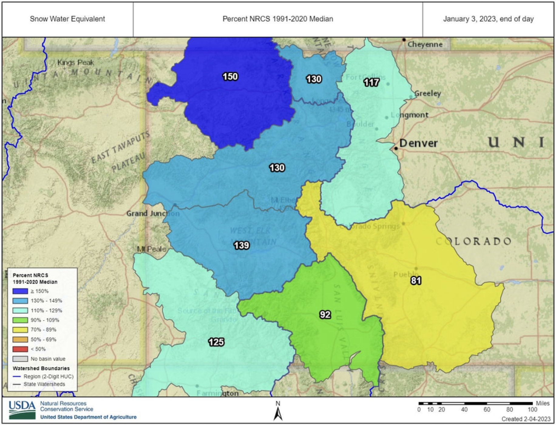


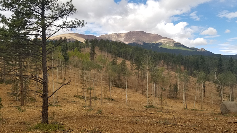


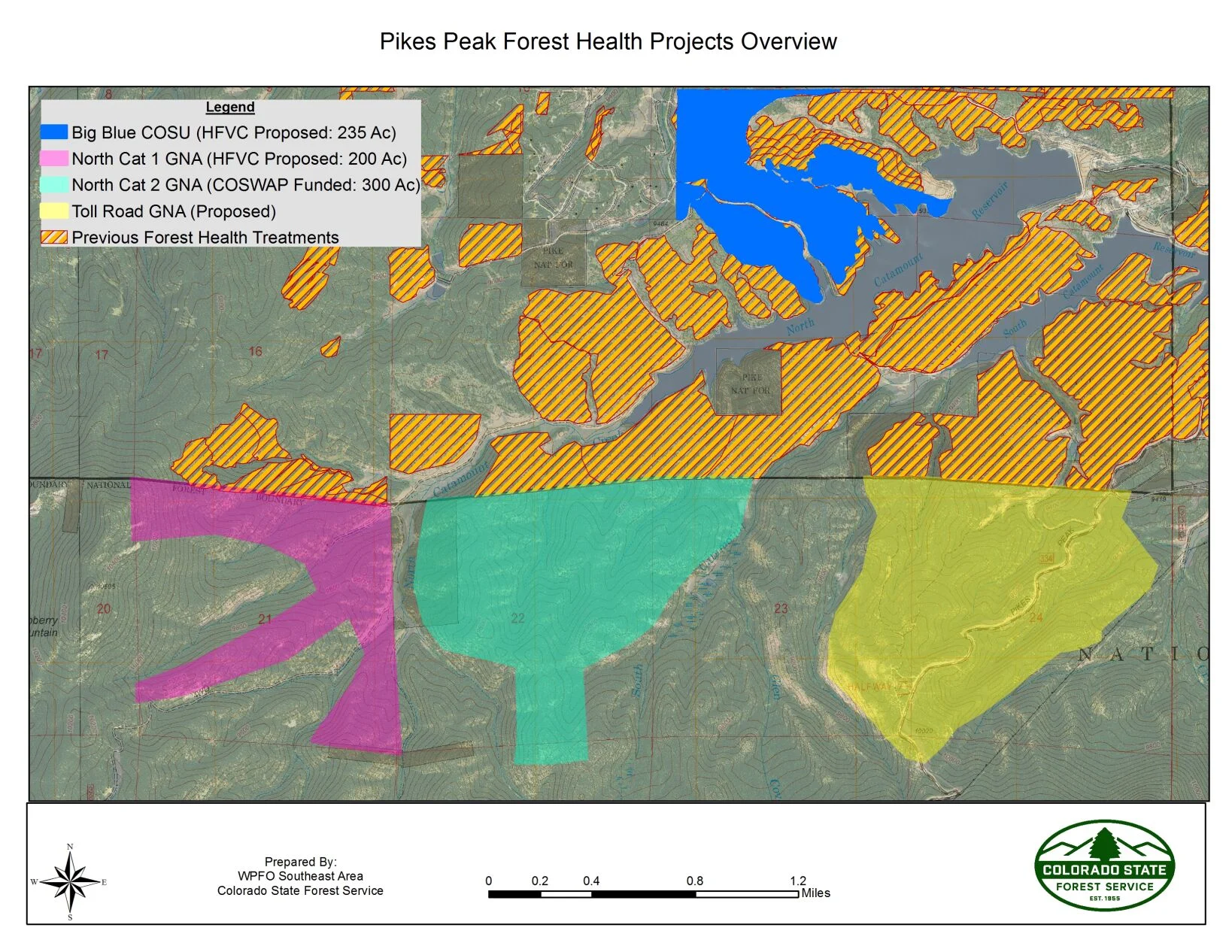
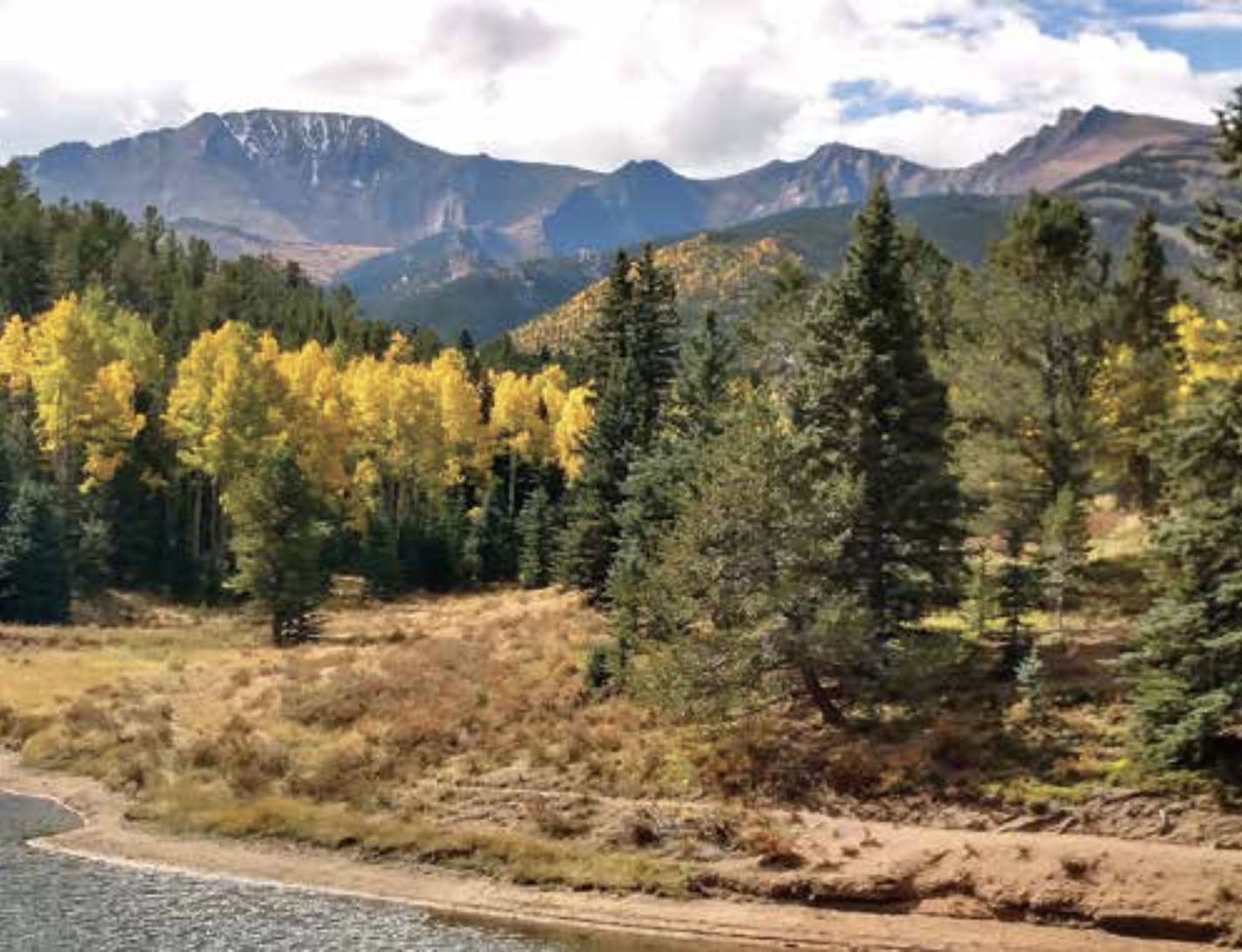


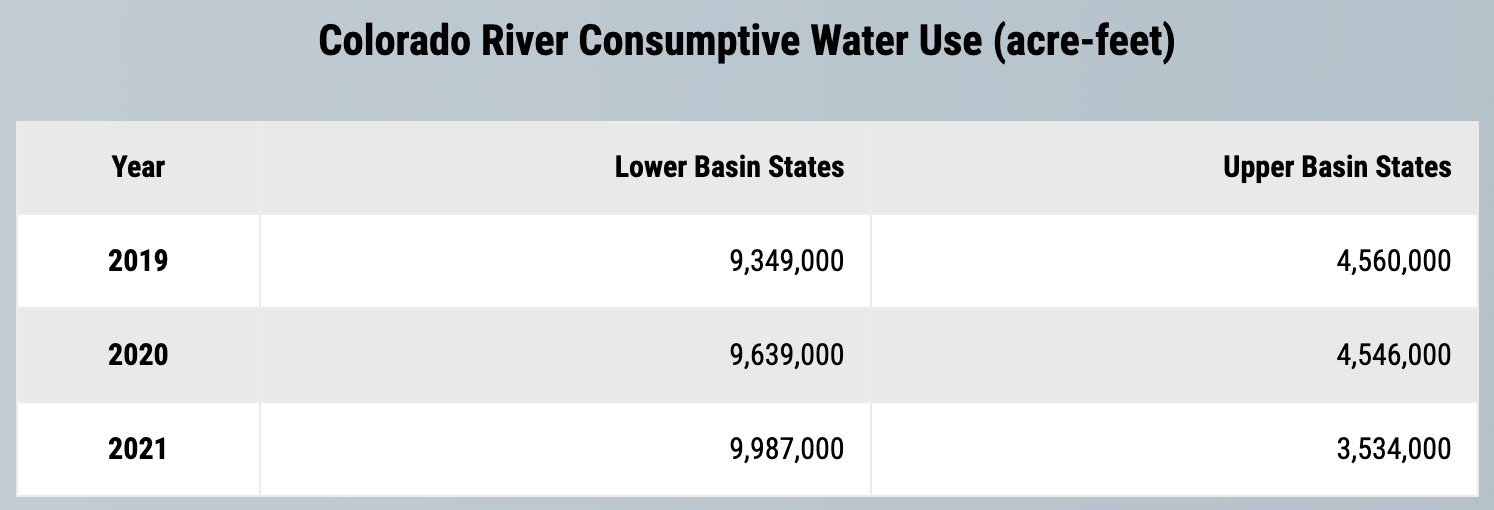


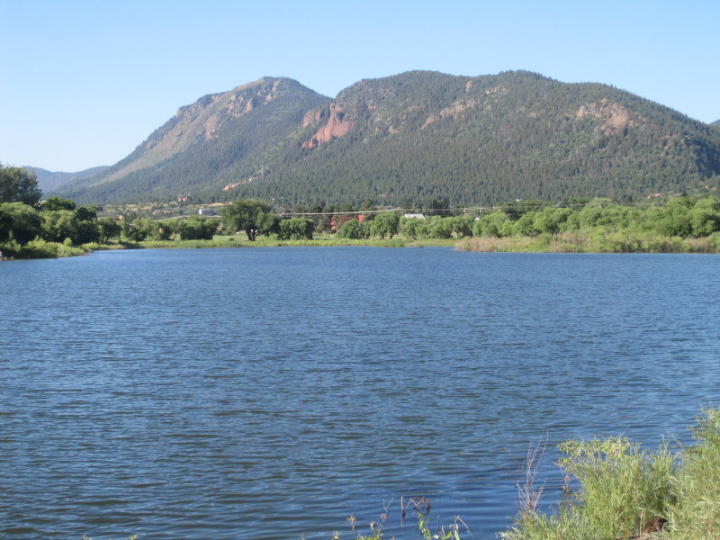
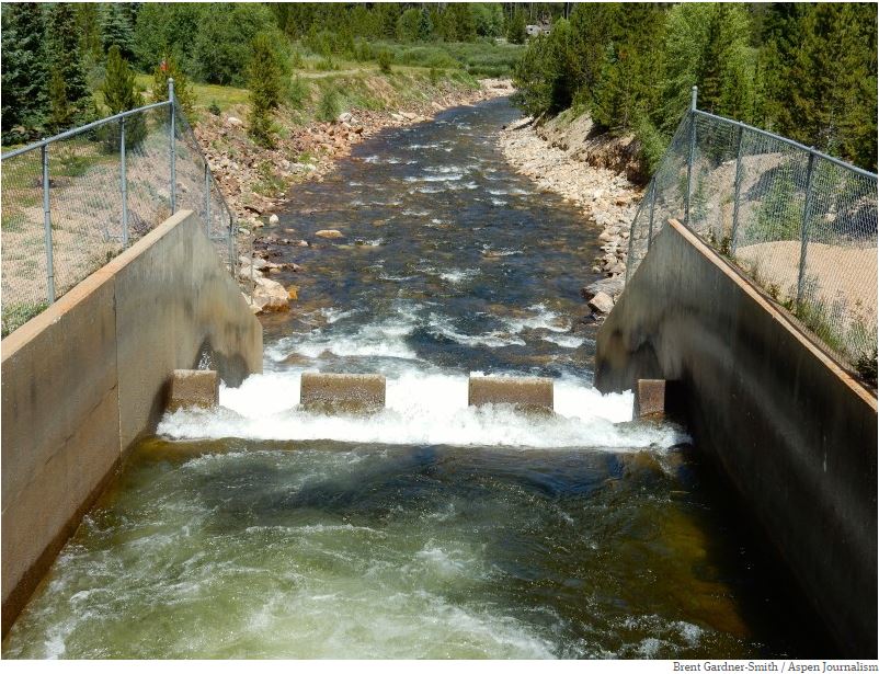


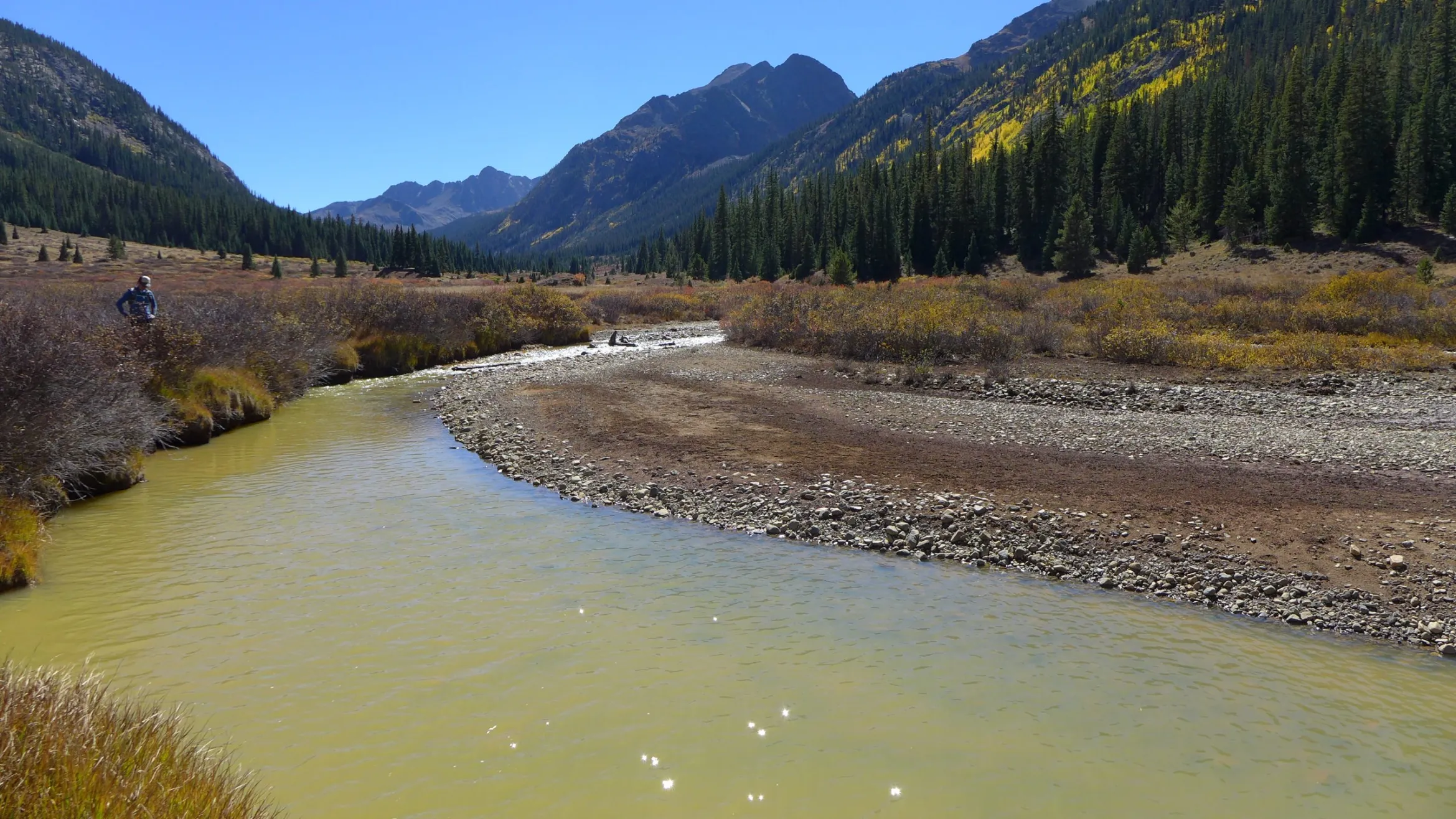

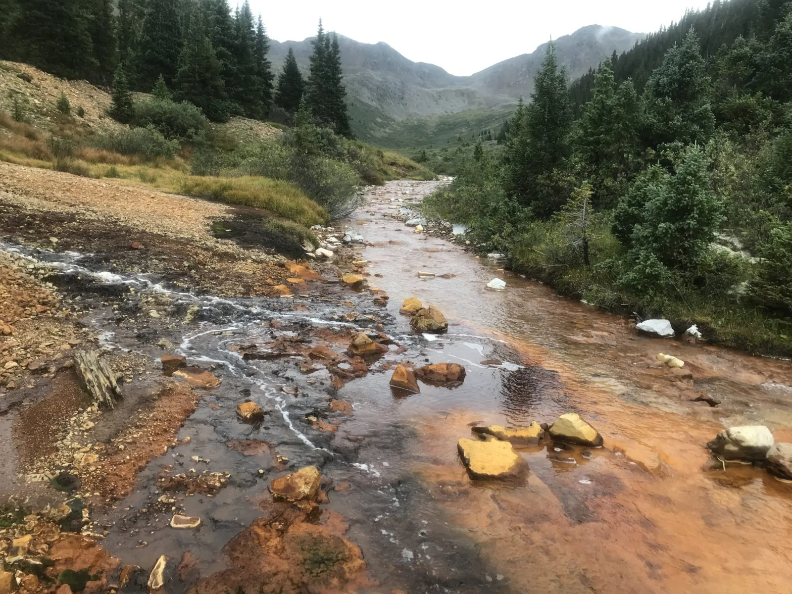
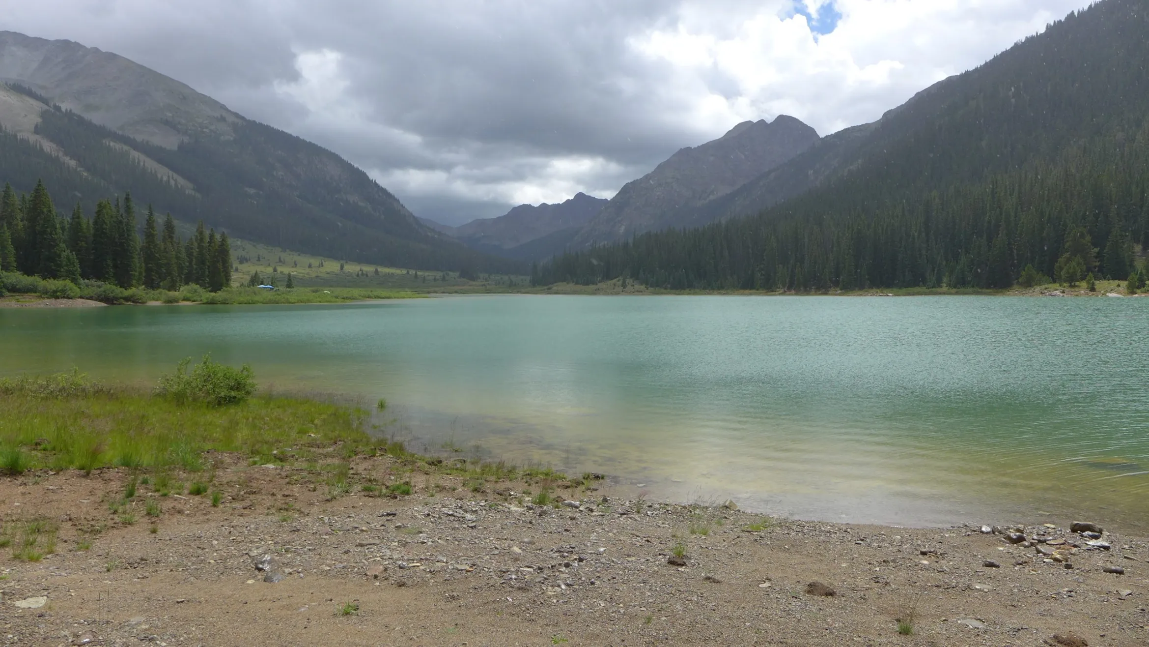

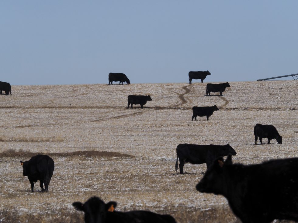

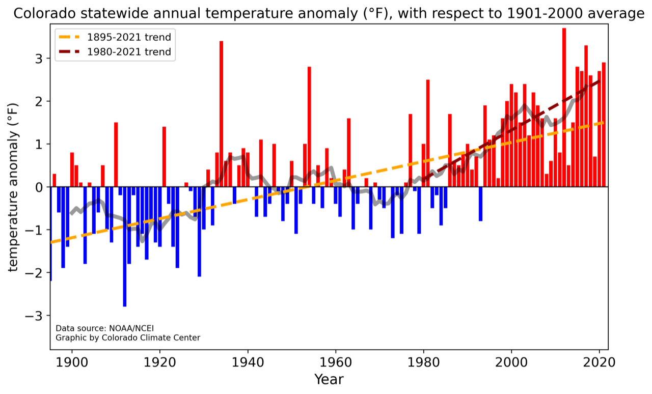


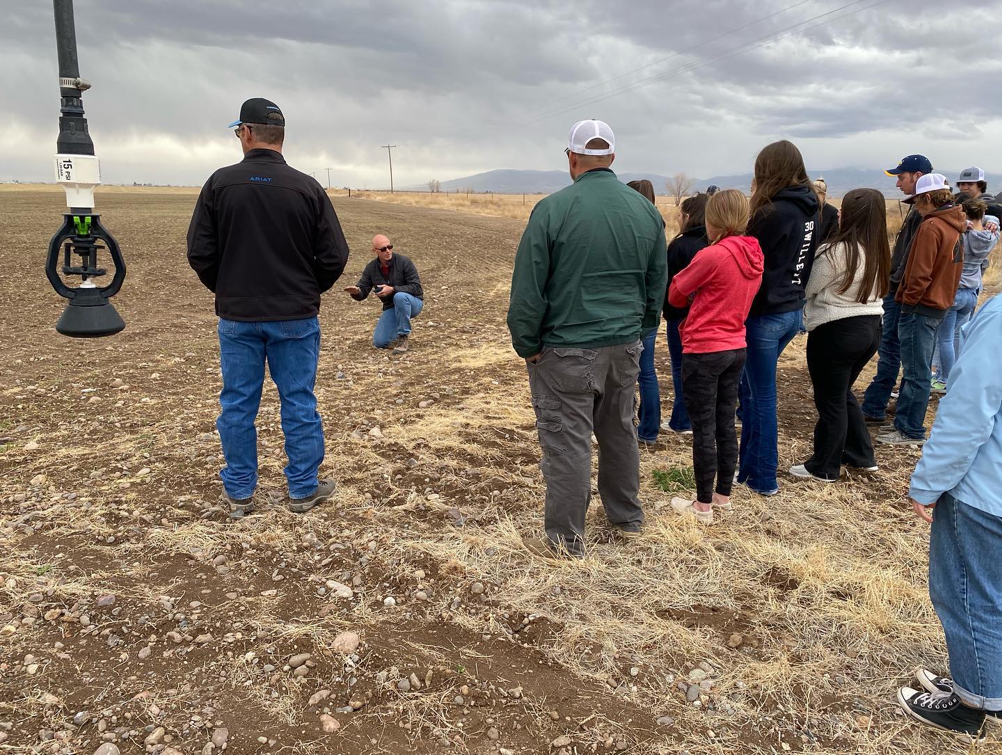
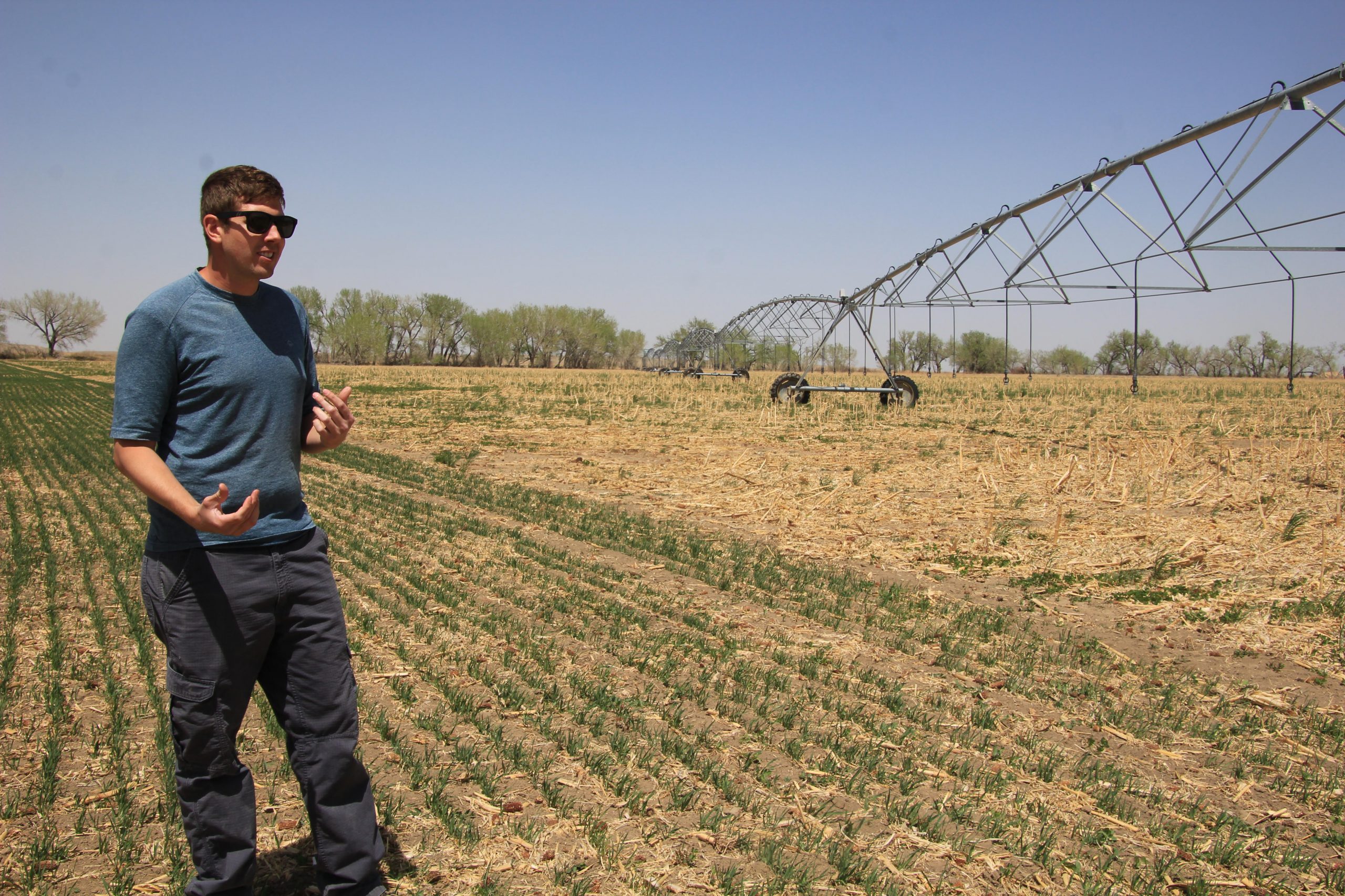


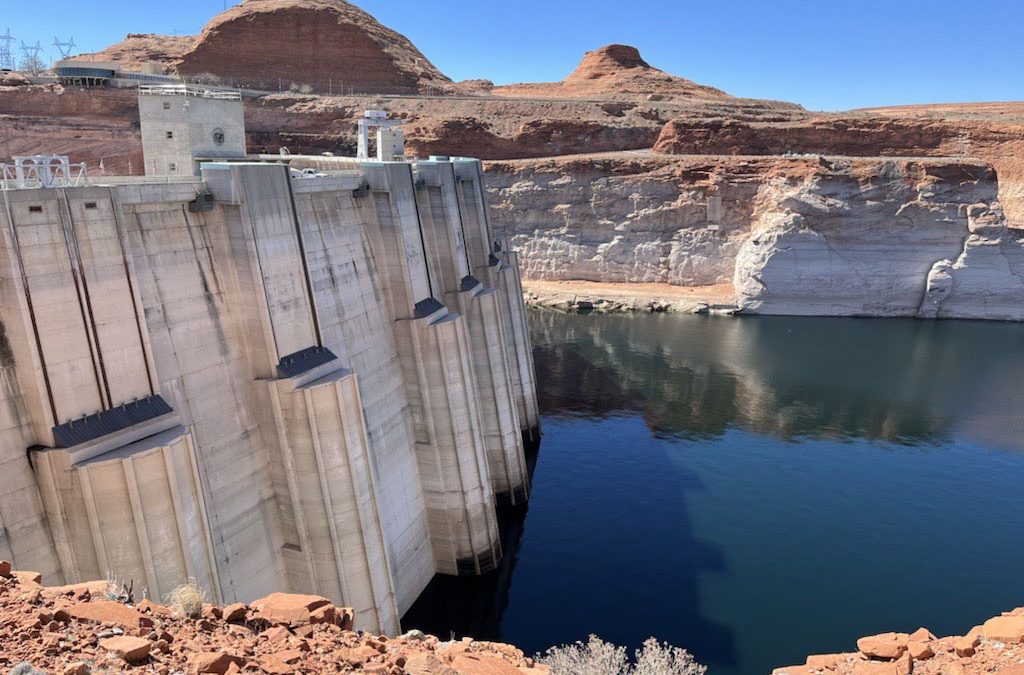
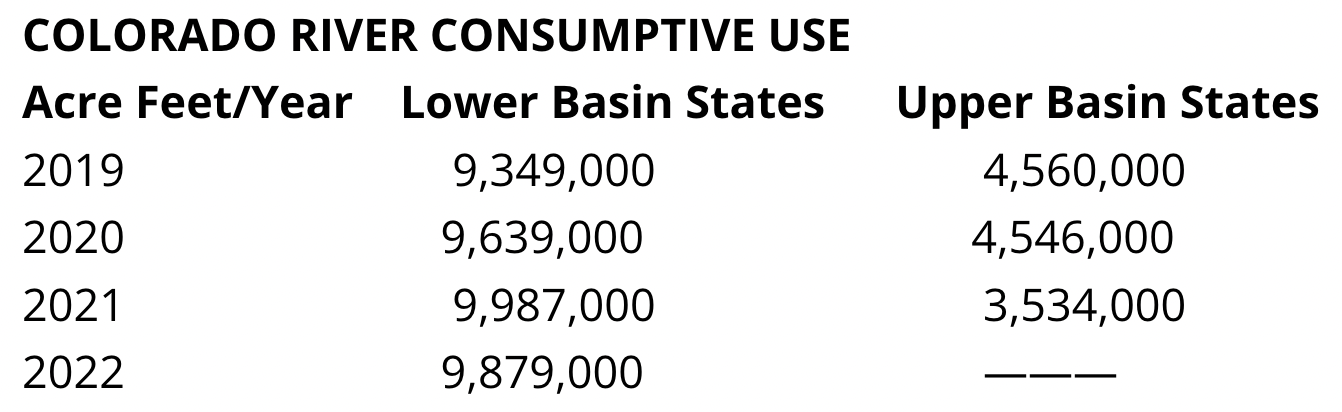


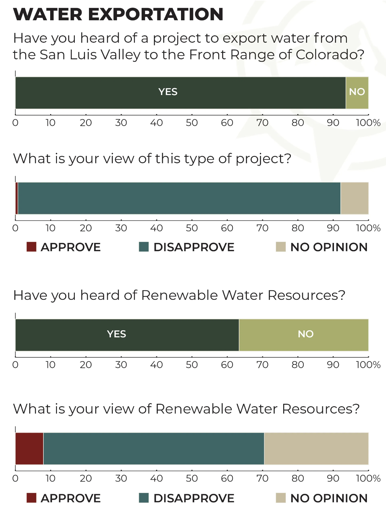


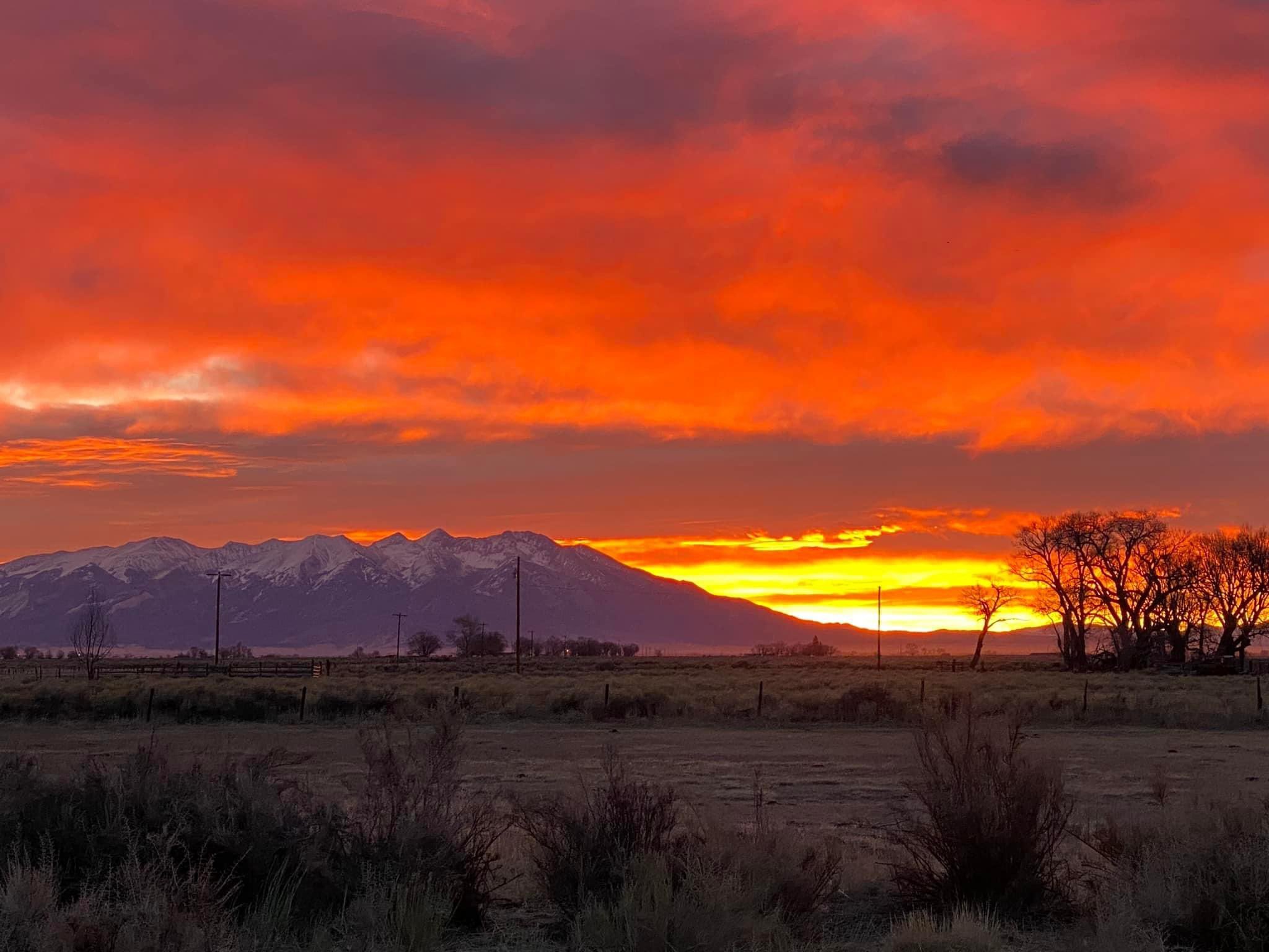
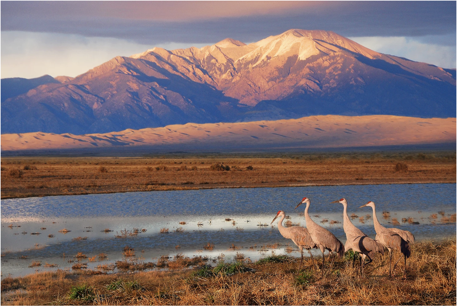


