Study: Something’s gotta give on the #RioGrande: #ClimateChange and overconsumption are drying up the Southwest’s “other” big river — Jonathan P. Thompson (LandDesk.org)

Sandhill cranes and some mallard ducks roost on a sandbar of the Rio Grande River at sunset on Jan. 22, 2025 in Albuquerque, New Mexico. Copyright Credit ยฉ WWF-US/Diana Cervantes.

Click the link to read the article on The Land Desk website (Jonathan P. Thompson):

November 21, 2025

๐Ÿฅต Aridification Watch ๐Ÿซ

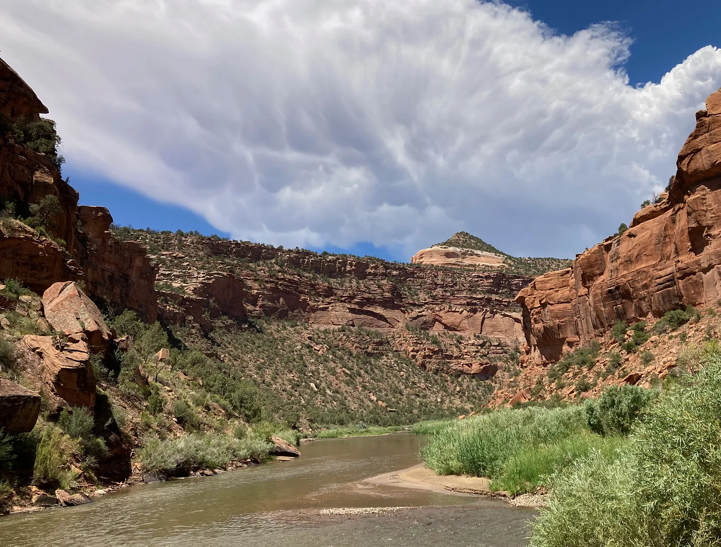
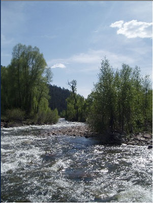
The Colorado River and its woes tend to get all of the attention, but the Southwestโ€™s โ€œotherโ€ big river, the Rio Grande, is in even worse shape thanks to a combination of warming temperatures, drought, and overconsumption. Thatโ€™s become starkly evident in recent years, as the river bed has tended to dry up earlier in the summer and in places where it previously had continued to carry at least some water. Now Brian Richter and his team of researchers have quantified the Rio Grandeโ€™s slow demise, and the conclusions they reach are both grim and urgent: Without immediate and substantial cuts in consumption, the river will continue to dry up โ€” as will the farms and, ultimately, the cities that rely on it.
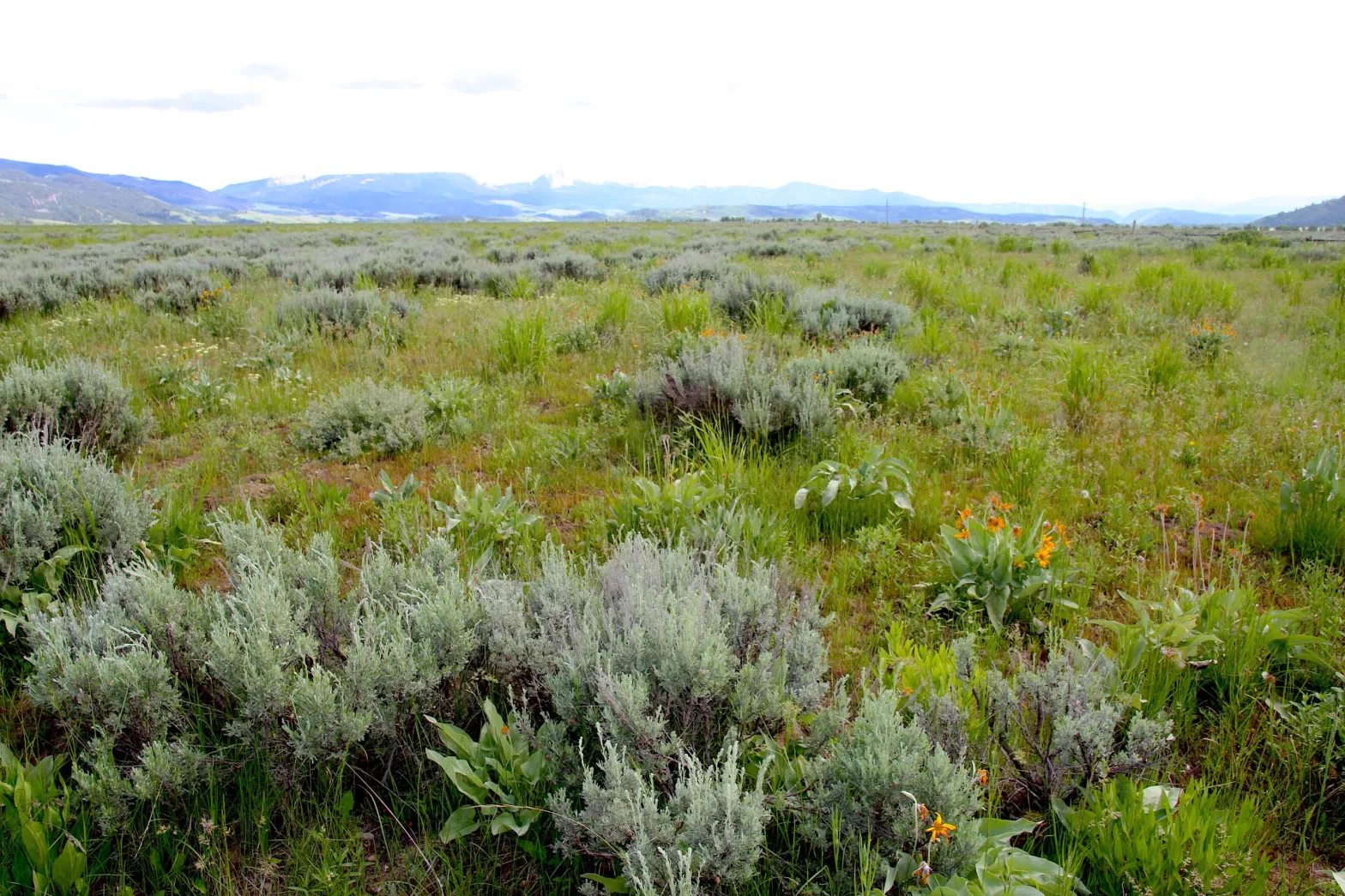
The Rio Grandeโ€™s problems are not new. Beginning in the late 1800s, diversions for irrigation in the San Luis Valley โ€” which the river runs through after cascading down from its headwaters in the San Juan Mountains โ€” sometimes left the riverbed โ€œwholly dry,โ€ wrote ichthyologist David Starr Jordan in 1889, โ€œall the water being turned into these ditches. โ€ฆ In some valleys, as in the San Luis, in the dry season there is scarcely a drop of water in the riverbed that has not from one to ten times flowed over some field, while the beds of many considerable streams (Rio la Jara, Rio Alamosa, etc.) are filled with dry clay and dust.โ€


Rio Grande Streamflow Mystery: Solved? — Jonathan P. Thompson


San Luis Valley farmers gradually began irrigating with pumped groundwater, allowing them to rely less on the ditches (but causing its own problems), and the 1938 Rio Grande Compact forced them to leave more water in the river. While that kept the water flowing through northern and central New Mexico, the Rio Grandeโ€™s lower reaches still occasionally dried up.

Then, in the early 2000s, the megadrought โ€” or perhaps permanent aridification โ€” that still plagues the region settled in over the Southwest. [ed. emphasis mine] Snowpack levels in the riverโ€™s headwaters shrank, both due to diminishing precipitation and climate change-driven warmer temperatures, which led to runoff and streamflows 17% lower than the 20th century average, according to the new study. And yet, overall consumption has not decreased.
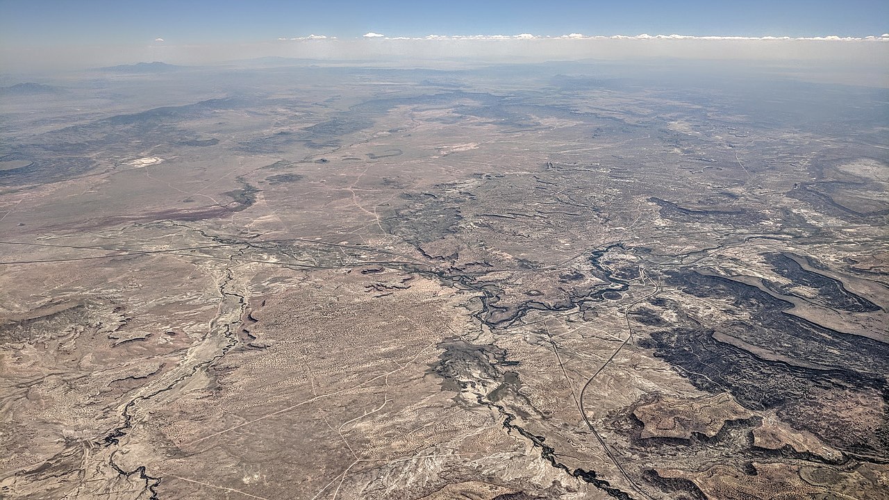
โ€œIn recent decades,โ€ the authors write, โ€œriver drying has expanded to previously perennial stretches in New Mexico and the Big Bend region. Today, only 15% of the estimated natural flow of the river remains at Anzalduas, Mexico near the riverโ€™s delta at the Gulf of Mexico.โ€ Reservoirs, the riverโ€™s savings accounts, have been severely drained to the point that they wonโ€™t be able to withstand another one or two dry winters. As farmers and other users have increasingly turned to groundwater pumping, aquifers have also been depleted. The situation is clearly unsustainable.

Somethingโ€™s gotta give on the Rio Grande, and while we may be tempted to target Albuquerqueโ€™s sprawl, drying up all of the cities and power plants that rely on the river wouldnโ€™t achieve the necessary cuts.

Source: โ€œOverconsumption gravely threatens water security in the binational Rio Grande-Bravo basinโ€ by Brian Richter et al.

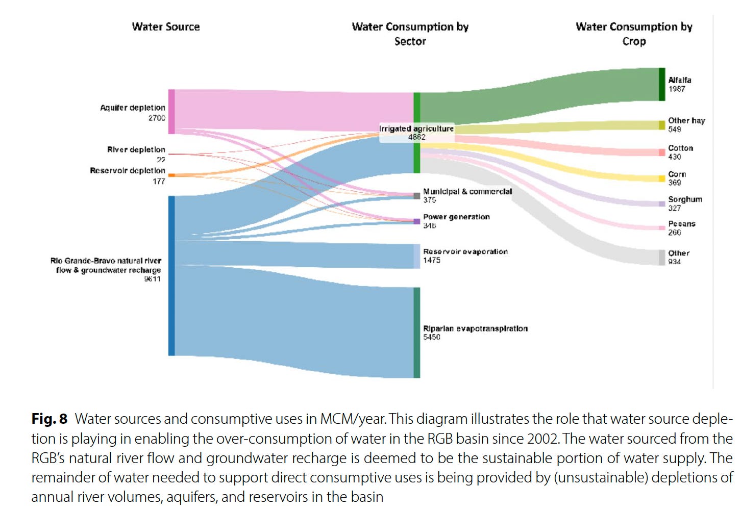
It will come as little surprise to Western water watchers that agriculture is by far the largest water user on the Rio Grande โ€” taking up 87% of direct human consumption โ€” and that alfalfa and other hay crops gulp up the lionโ€™s share, or 52%, of agricultureโ€™s slice of the river pie. This isnโ€™t necessarily because alfalfa and other hays are thirstier than other crops, but because they are so prevalent, covering about 433,000 acres over the entire basin, more than four times as much acreage as cotton.

Source: Overconsumption gravely threatens water security in the binational Rio Grande-Bravo basin

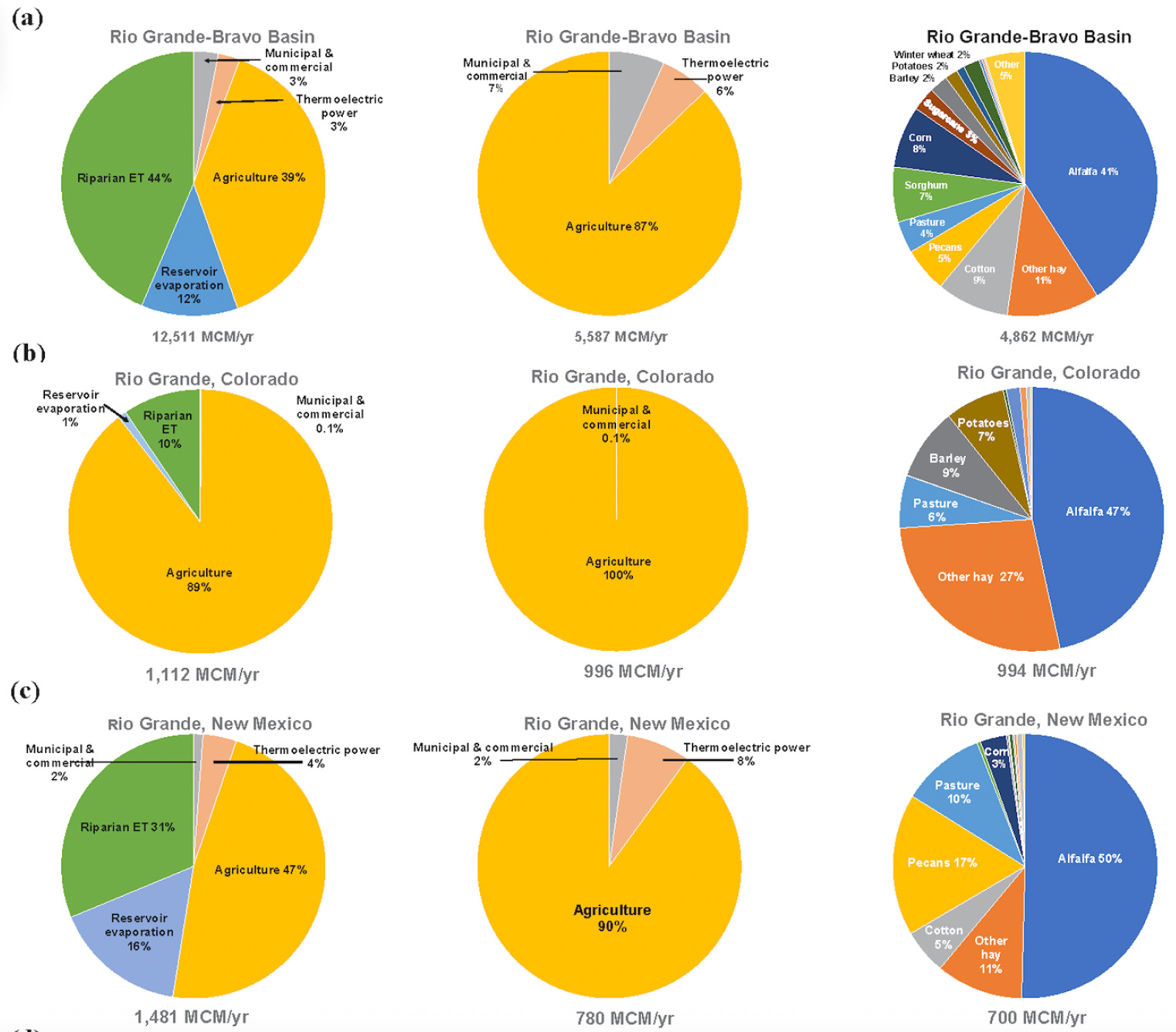
This kind of math means farmers are going to have to bear the brunt of the necessary consumption cuts โ€” either voluntarily or otherwise. In fact, they already have: Between 2000 and 2019, according to the report, Colorado lost 18% of its Rio Grande Basin farmland, New Mexico lost 28%, and the Pecos River sub-basin lost 49% (resulting in a downward trend in agricultural water consumption). Some of this loss was likely incentivized through conservation programs that pay farmers to fallow their fields. But it was also due to financial struggles.

Yet even when farmers are paid a fair price to fallow their fields there can be nasty side effects. Noxious weeds can colonize the soil and spread to neighborsโ€™ farms, it can dry out and mobilize dust that diminishes air quality and the mountain snowpack, and it leaves holes in the cultural fabric of an agriculture-dependent community. If a fieldโ€™s going to be dried up, it should at least be covered with solar panels.


Think like a watershed: Interdisciplinary thinkers look to tackle dust-on-snow — Jonathan P. Thompson


Another possibility is to switch to crops that use less water. This isnโ€™t easy: Farmers grow alfalfa in the desert because itโ€™s actually quite drought tolerant, doesnโ€™t need to be replanted every year, is less labor-intensive than other crops, is marketable and ships relatively easy, and can grow in all sorts of climates, from the chilly San Luis Valley to the scorching deserts of southern Arizona.


Alfalfaphobia? Jonathan P. Thompson


Still, it can be done, as a group of farmers in the San Luis Valley are demonstrating with theย Rye Resurgence Project. This effort is not only growing the grain โ€” which uses less water than alfalfa, is good for soil health, and makes good bread and whiskey โ€” but it is also working to create a larger market for it. While itโ€™s only a drop in the bucket, so to speak, this is the sort of effort that, replicated many times across the region, could help balance supply and demand on the river, without putting a bunch of farmers out of business.

Photo credit: The Rye Resurgence Project

***

Oh, and about that other river? You know, the Colorado? Representatives from the seven states failed to come up with a deal on how to manage the river by the Nov. 15 deadline. The feds had mercy on them, giving them until February to sort it all out. Iโ€™m not so optimistic, but weโ€™ll see. Personally, I think the only way this will ever work out is if the Colorado River Compact โ€” heck, the entire Law of the River โ€” is scrapped, and the states and the whole process is started from scratch, this time with a much better understanding of exactly how much water is in the river, and with the tribal nations having seats at the table.


โ›๏ธ Mining Monitor โ›๏ธ

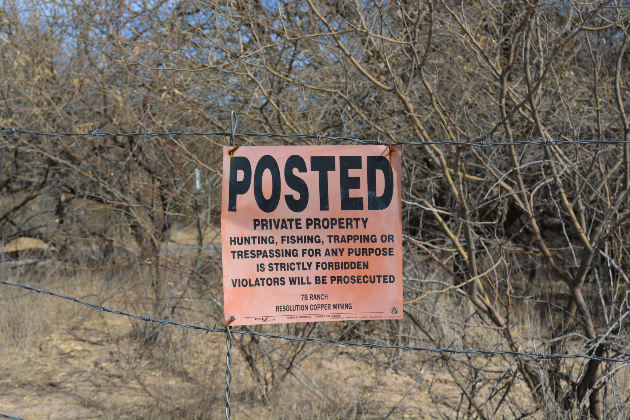
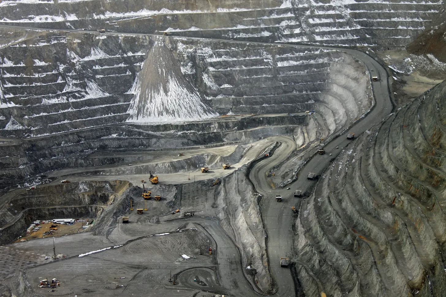
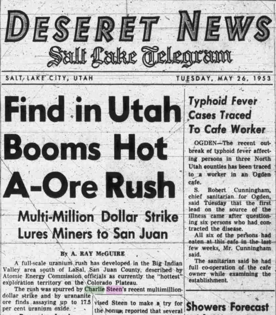
There are a bunch of wannabe uranium mining companies out there right now, locating claims and acquiring and selling claims and touting their exploratory drilling results. But there are only a small handful of firms that are actually doing anything resembling mining. One of them is the Canada-based Anfield, which just broke ground on its Velvet-Wood uranium mine in the Lisbon Valley, even without all of the necessary state permits. 

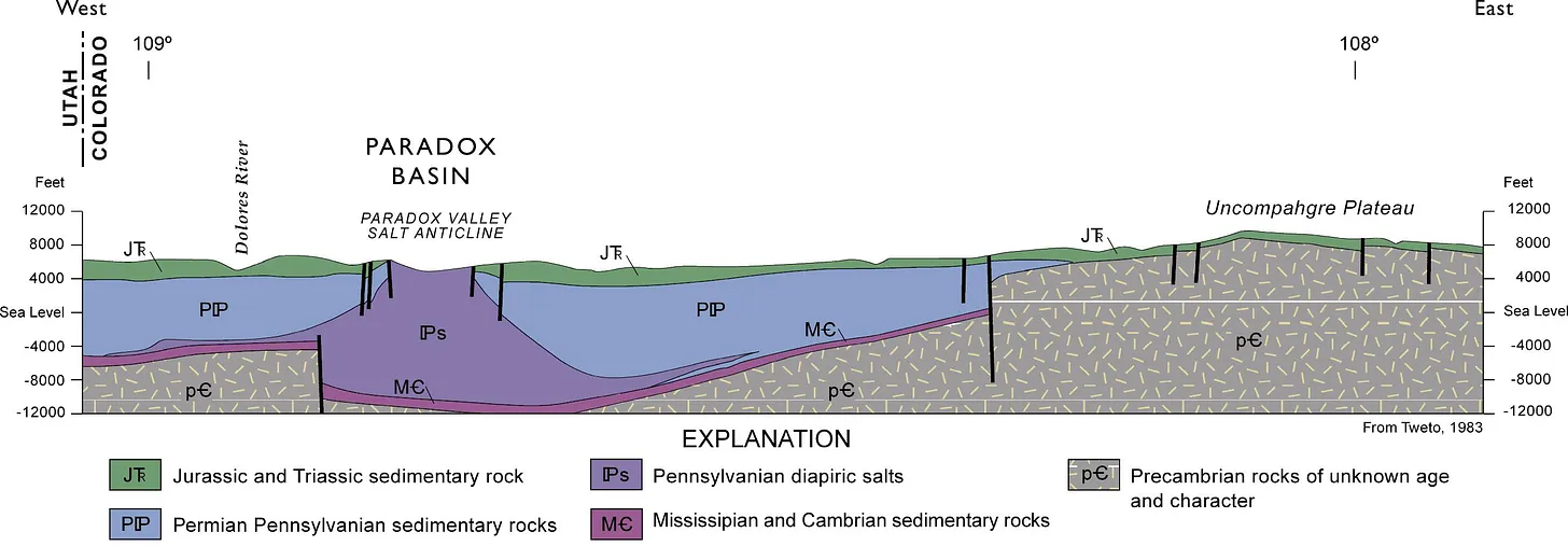
Now Anfield says it has applied for a Colorado permit to restart its long-idle JD-8uranium mine. The mine is on one of a cluster of Department of Energy leases overlooking the Paradox Valley from its southern slopes, and was previously owned and operated by Cotter Corporation. The mine has not produced ore since at least 2006. Anfield says it will process the ore at its Shootaring Mill near Ticaboo, Utah, which has yet to get Utahโ€™s green light.


๐Ÿ  Random Real Estate Room ๐Ÿค‘

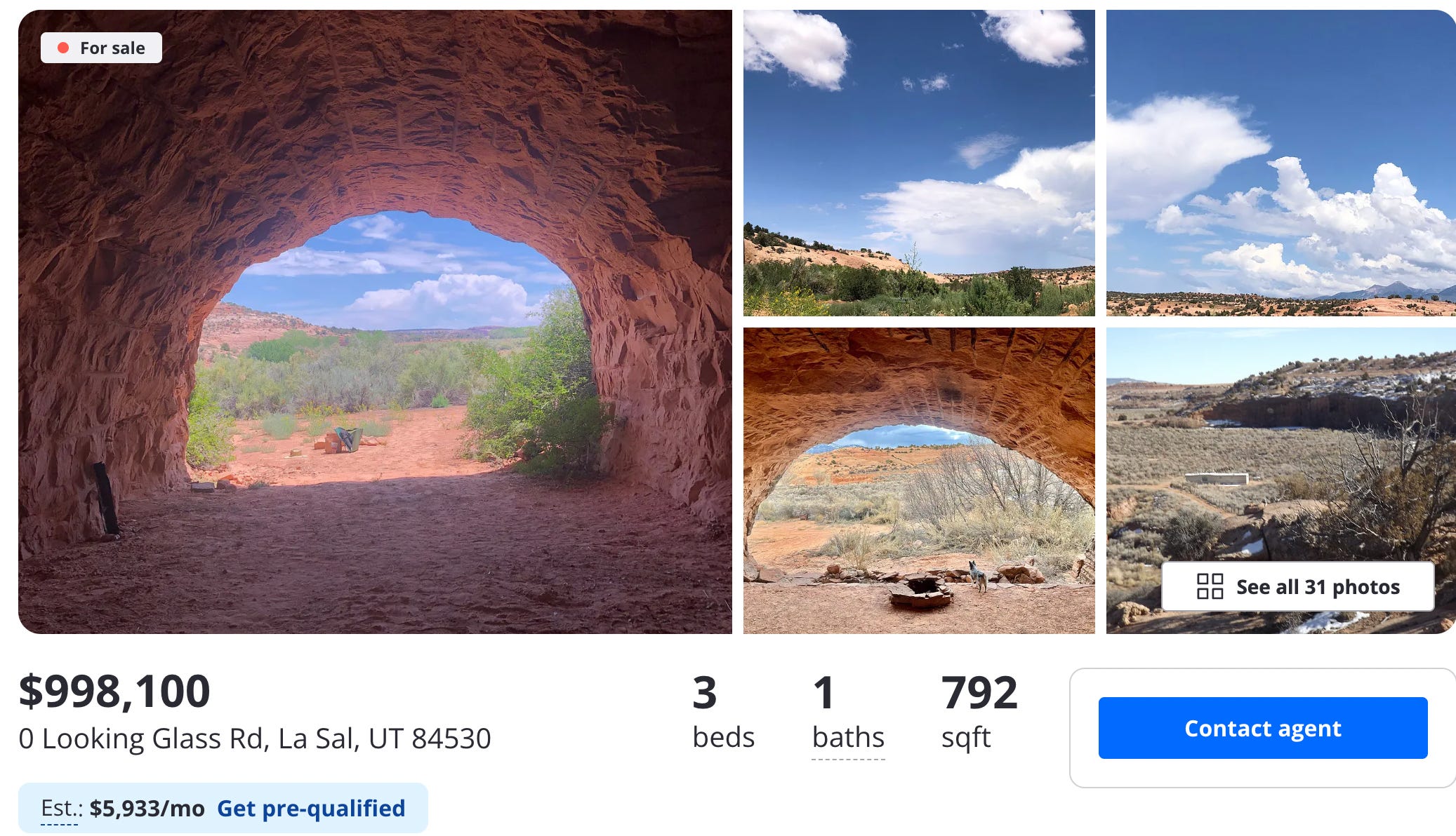
Look! Affordable housing near Moab! Sure, itโ€™s a cave, but itโ€™s only $99,000. Oh, whatโ€™s that? $998,000? Theyโ€™re selling a cave for a million buckaroos? But of course they are. To be fair, itโ€™s not just a cave. Itโ€™s several of them, plus a trailer. Crazy stuff.
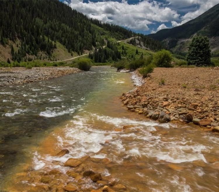
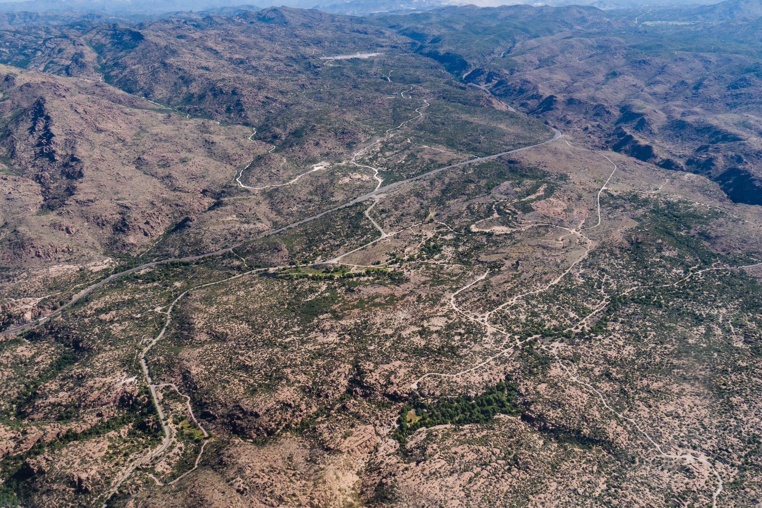
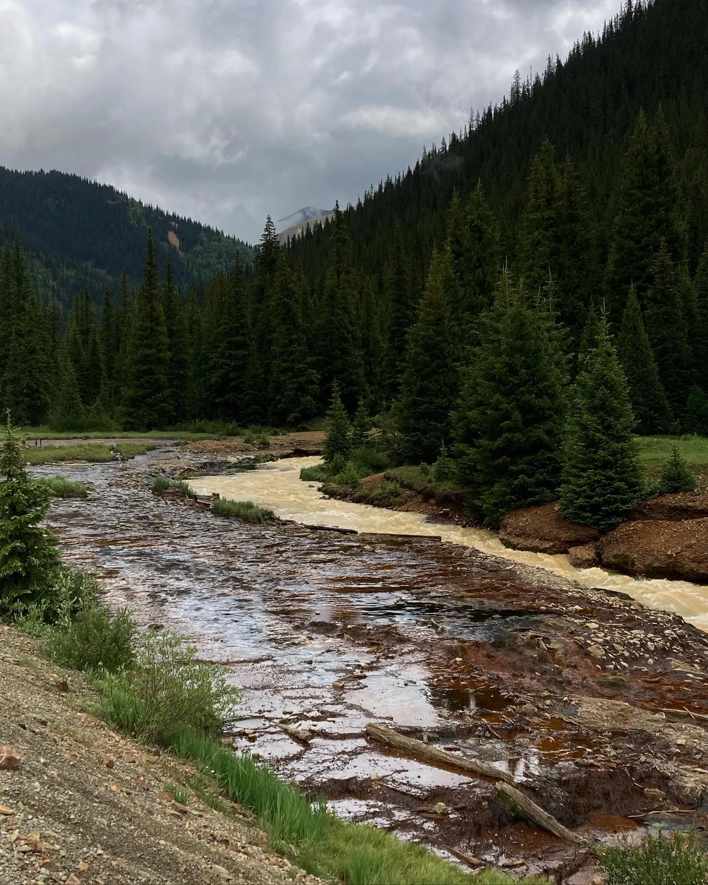
๐Ÿ“ธย Parting Shotย ๐ŸŽž๏ธ

A work train in the Animas River gorge just below Silverton. Jonathan P. Thompson photo.
Rio Grande and Pecos River basins. Map credit: By Kmusser – Own work, Elevation data from SRTM, drainage basin from GTOPO [1], U.S. stream from the National Atlas [2], all other features from Vector Map., CC BY-SA 3.0, https://commons.wikimedia.org/w/index.php?curid=11218868

#Coloradoโ€™s #UncompahgreRiver project turns problems into opportunities — Hannah Holm (AmericanRivers.org)

Uncompahgre River, Colorado | Hannah Holm

Click the link to read the article on the American Rivers website (Hannah Holm):

November 12, 2025

The Uncompahgre River flows from Coloradoโ€™s San Juan mountains through the towns of Ouray and Ridgway and then into Ridgway Reservoir, which stores water for farms and households downstream. The river is beautiful, but also troubled; runoff from old mines carries heavy metals into the river, and it is pinched into an unnaturally straight and simple channel as it passes from mountain canyon headwaters into an agricultural valley.

As the river moves through the modified channel, it carves deeper into the valley floor and less frequently spills over its bank. As a result, the local water table has dropped, and riverside trees such as cottonwoods have died, impoverishing this important habitat. Water users on the Ward Ditch at the top of the valley were also struggling with broken-down infrastructure, making it difficult to access and manage water for irrigation. This confluence of challenges created a landscape of opportunity for the Uncompahgre Multi-Benefit Project, which addresses environmental problems along the river and water usersโ€™ needs, while also improving water quality and reducing flood risks downstream. 

Uncompahgre River, Colorado | Hannah Holm

The Project, managed by American Rivers, took an integrated approach to restoring a one-mile stretch of the river, which included replacing and stabilizing the Ward Ditch diversion, notching a historic berm to reconnect the river to its floodplain, and placing rock structures in the river that both protect against bank erosion and improve fish habitat. Meanwhile, ditch and field improvements make it easier to spread water across the land for agriculture and re-establish native vegetation.

Photo credit: American Rivers

In addition to the direct benefits this project delivers for on-site habitat and landowners, the enhanced ability of the river to spread out on its floodplain, both through the ditch diversion and natural processes, also provides downstream benefits. As the water slows and spreads across the floodplain during high flows, its destructive power to erode banks and damage infrastructure downstream is diminished. The same dynamics enable pollutants and sediment from upstream abandoned mines or potential wildfires to settle out before the river flows into the downstream reservoir.

Uncompahgre River, Colorado | Hannah Holm

With construction wrapping up in November 2025, the transformation of this stretch of river and its adjacent floodplain is nearly complete.ย  Fields of flowers and fresh willow plantings are replacing invasive species and dead cottonwoods, and new pools, sandbars, and riffles are providing instream habitat, complementing other organizationsโ€™ work to remediate old mines upstream.ย As a bonus, when the water level is right, the reach has become an inviting run for skilled whitewater boaters.

Map of the Gunnison River drainage basin in Colorado, USA. Made using public domain USGS data. By Shannon1 – Own work, CC BY-SA 4.0, https://commons.wikimedia.org/w/index.php?curid=69257550

Could Good Samaritans Fix Americaโ€™s Abandoned Hardrock Mine Problem? — Daniel Anderson (Getches-Wilkinson Center)

Photo credit: Trout Unlimited

Click the link to read the article on the Getches-Wilkerson Center website (Daniel Anderson):

October 20, 2025

Until the passage of the Comprehensive Environmental Response, Compensation, and Liability Act (CERCLA) in 1980, miners across the American West extracted gold, silver, and other valuable โ€œhardrockโ€ mineralsโ€”and then simply walked away. Today, tens of thousands of these abandoned hardrock mines continue to leak acidic, metal-laden water into pristine streams and wetlands. Federal agencies estimate that over a hundred thousand miles of streams are impaired by mining waste. Nearly half of Western headwater streams are likely contaminated by legacy operations. Despite billions already spent on cleanup at the most hazardous sites, the total cleanup costs remaining may exceed fifty billion dollars.

So how did we end up here? In short, the General Mining Law of 1872 created a lack of accountability for historic mine operators to remediate their operations, but CERCLA and the Clean Water Act (CWA) arguably add an excess of accountability for third parties trying to clean up abandoned mines today.

The Animas River running orange through Durango after the Gold King Mine spill August 2015. Photo credit: Jonathan P. Thompson/The Land Desk

The first legislation to address this problem was introduced in 1999. Many iterations followed and failed, even in the wake of shocking images and costly litigation due to the Gold King Mine spill that dyed the Animas River a vibrant orange in 2015. Finally, in December, 2024, Congress passed the Good Samaritan Remediation of Abandoned Hardrock Mines Act of 2024 (GSA).

The GSA is a cautious, bipartisan attempt to empower volunteers to clean up this toxic legacy. The law creates a short pilot program and releases certain โ€œGood Samaritansโ€ from liability under CERCLA and the CWA, which has long deterred cleanup by groups like state agencies and NGOs. EPA has oversight of the program and the authority to issue permits to Good Samaritans for the proposed cleanup work.

Despite the promise of this new legislation, critical questions remain unanswered about the GSA and how it will work. Only time will tell whether EPA designs and implements an effective permitting program that ensures Good Samaritans complete remediation work safely and effectively. EPA now has the opportunity as the agency that oversees this program to unlock the promise of the GSA.

The GSA left some significant gaps unanswered in how the pilot program will be designed and directed EPA to issue either regulations or guidance to fill in those gaps. EPA missed the statutory deadline to start the rulemaking process (July, 2025) and is now working to issue guidance on how the program will move forward. EPA must provide a 30-day public comment period before finalizing the guidance document according to the GSA. With EPAโ€™s hopes of getting multiple projects approved and shovels in the ground in 2026, the forthcoming guidance is expected to be released soon. While we wait, itโ€™s worth both looking back at what led to the GSA and looking ahead to questions remaining about the implementation of the pilot program.

A Century of Mining the West Without Accountability

The story begins with the General Mining Law of 1872, a relic of the American frontier era that still governs hardrock mining on federal public lands. The law allows citizens and even foreign-based corporations to claim mineral rights and extract valuable ores without paying any federal royalty. Unlike coal, oil, or gasโ€”which fund reclamation through production feesโ€”hardrock mining remains royalty-free.

As mining industrialized during the 20th century, large corporations replaced prospectors. Until 1980, mines were often abandoned without consequences or cleanup once they became unprofitable. The result: an estimated half-million abandoned mine features will continually leach pollution into American watersheds for centuries.

CERLCA Liability Holds Back Many Abandoned Mine Cleanups

Congress sought to address toxic sites throughย CERCLA, also known as the Superfund law, which makes owners and operators strictly liable for hazardous releases. In theory, that ensures accountability. In practice, it creates a paradox: if no polluter can be found at an abandoned site, anyone who tries to clean up the mess may be held responsible for all past, present, and future pollution.

The Clean Water Actโ€™s Double-Edged Sword

Even state agencies, tribes, or nonprofits that treat contaminated water risk being deemed โ€œoperatorsโ€ of a hazardous facility. That fear of liabilityโ€”combined with enormous costsโ€”has frozen many potential Good Samaritans in place. Federal efforts to ease this fear have offered little more than reassurance letters without real protection.

The Clean Water Act compounds the problem. Anyone who discharges pollution into a surface water via any discernible, confined and discrete conveyance must hold a point source discharge permit. By requiring these permits and providing for direct citizen enforcement in the form of citizen suits, the CWA has led to significant improvements in water quality across the country. That said, courts have ruled that drainage pipes or diversion channels used to manage runoff from abandoned mines may also qualify as point sources. As a result, Good Samaritans who exercise control over historic point sources, like mine tunnels, could face penalties and other liabilities for unpermitted discharges, even when they improve overall conditions.

The 2024 Good Samaritan Act Steps onto the Scene

After decades of failed attempts, the Good Samaritan Remediation of Abandoned Hardrock Mines Act was signed into law in December, 2024. The GSA authorizes EPA to create a pilot program, issuing up to fifteen permits for low-risk cleanup projects over seven years. Most importantly, permit holders receive protection from Superfund and Clean Water Act liability for their permitted activities. This legal shield removes one of the greatest barriers to cleanup efforts.

Applicants can seek either a Good Samaritan permit to begin active remediation or an investigative sampling permit to scope out a site for potential conversion to a Good Samaritan permit down the road.

In either case, applicants must show:

  • they had no role in causing, and have never exercised control over, the pollution in their application,
  • they possess the necessary expertise and adequate funding for all contingencies within their control, and
  • they are targeting low-risk sites, which are generally understood to be those that require passive treatment methods like moving piles of mine waste away from streams or snowmelt or diverting water polluted with heavy metals below mine tailings toward wetlands that may settle and naturally improve water quality over time

Under the unique provisions of the GSA, each qualifying permit must go through a modified and streamlined National Environmental Policy Act (NEPA) review process. EPA or another lead agency must analyze the proposed permit pursuant to an Environmental Assessment (EA). If the lead agency cannot issue a Finding of No Significant Impact (FONSI) after preparing an EA, the permit cannot be issued. The GSA therefore precludes issuance of a permit where the permitted activities may have a significant impact on the environment.

The pilot program only allows forย up toย fifteenย low riskย projects that must be approved by EPA over the next seven years. Defining which remediations are sufficiently low-risk becomes critical in determining what the pilot program canย proveย aboutย theย Goodย Samaritanย modelย for abandoned mine cleanup. To some extent, โ€œlow riskโ€ is simply equivalent to a FONSI. But the GSA further defines the low-risk remediation under these pilot permits as “anyย actionย toย remove,ย treat,ย orย containย historicย mineย residueย toย prevent, minimize, or reduce (i) the release or threat of release of a hazardous substance, pollutant, or contaminant that would harm human health or the environment; or (ii)ย aย migrationย orย dischargeย ofย aย hazardousย substance,ย pollutant,ย orย contaminant that would harm human health or the environment.”

This excludes โ€œany action that requires plugging, opening, or otherwise altering the portal or adit of the abandoned hardrock mine siteโ€ฆโ€, such as what led to the Gold King mine disaster. Many active treatment methods are also excluded from the pilot program, therefore, because they often involve opening or plugging adits or other openings to pump out water and treat it in a water treatment plant, either on or off-site. As a result, the Good Sam Actโ€™s low-risk pilot projects focus on passive treatment of the hazardous mine waste or the toxic discharge coming off that waste, such as a diversion of contaminated water into a settlement pond.

The GSA requires that permitted actions partiallyย orย completelyย remediateย theย historic mine residue at a site. The Administrator of EPA has the discretion to determine whether the permit makes โ€œmeasurable progressโ€. Every activity that the Good Samaritan and involved permitted parties take must be designedย to โ€œimprove or enhance water quality or site-specific soil or sediment quality relevant to the historic mine residue addressed by the remediation plan, including making measurable progress toward achieving applicable water quality standards,โ€ or otherwise protect human health and the environment by preventing the threat of discharge to water, sediment, or soil.ย The proposedย remediation need not achieve the stringentย numeric standardsย requiredย byย CERCLAย orย theย CWA.

Furthermore, it can be challenging to determine the discrete difference between the baseline conditions downstream of an acid mine drainage prior to and after a Good Samaritanย remediationย isย completed.ย Notย onlyย doย backgroundย conditionsย confuseย the picture, but other sources of pollution near the selected project may also make measuring water quality difficult. This may mean that the discretion left to the EPA Administrator to determine โ€œmeasurable progressโ€ becomes generously applied.

Finally, once EPA grants a permit, the Good Samaritan must follow the terms, conditions, and limitations of the permit. If the Good Samaritanโ€™s work degrades the environment from the baseline conditions, leading to โ€œmeasurably worseโ€ conditions, EPA must notify and require that the Good Samaritantake โ€œreasonable measuresโ€ to correct the surface water quality or other environmental conditions to the baseline. If these efforts do not result in a โ€œmeasurably adverse impactโ€, EPA cannot consider this a permit violation or noncompliance. However, if Good Samaritans do not take reasonable measures or if their noncompliance causes a measurable adverse impact, the Good Samaritan must notify all potential impacted parties. If severe enough, EPA has discretion to revoke CERCLA and CWA liability protections.

Recently, EPA shared the following draft flowchart for the permitting process:

Disclaimer: This is being provided as information only and does not impose legally binding requirements on EPA, States, or the public. This cannot be relied upon to create any rights enforceable by any party in litigation with the United States. Any decisions regarding a particular permit will be made based upon the statute and the discretion granted by the statute, including whether or not to grant or deny a permit.

Challenges Facing the Pilot Program Implementation

Despite its promise, the pilot programโ€™s scope is limited. With only fifteen Good Samaritan permits eligible nationwide and no dedicated funding, the law depends on states, tribes, and nonprofits to provide their own resources. The only guidance issued so far by EPA detailed the financial assurance requirements that would-be Good Samaritans must provide to EPA to receive a permit. Definitions provided in this financial assurance guidance raised concerns for mining trade organizations and nonprofits alike with EPAโ€™s proposed interpretations of key terms including โ€œlow riskโ€ and โ€œlong-term monitoringโ€. Crucial terms like these, along with terms impacting enforcement when a permitted remediation action goes awry, like โ€œbaseline conditionsโ€, โ€œmeasurably worseโ€, and โ€œreasonable measuresโ€ to restore baseline conditions, are vague in the GSA. How EPA ultimately clarifies terms like these will play a large role in the success of the GSA in its ultimate goal: to prove that Good Samaritans can effectively and safely clean up abandoned hardrock mine sites. The soon-to-be-released guidance document will therefore be a critical moment in the history of this new program.

Funding the Future

Funding remains the greatest barrier to large-scale remediation efforts. Coal mine cleanups are funded through fees on current production under the Surface Mining Control and Reclamation Act. Current hardrock mining, however, still pays no federal royalty. A modernized system could pair Good Samaritan permitting with industry-funded reclamation fees, ensuring that those profiting from todayโ€™s mining help repair the past. Without this reform, the burden will remain on underfunded agencies and nonprofits. However, this General Mining Law reform remains politically unlikely. In the meantime, the GSA creates a Good Samaritan Mine Remediation Fund but does not dedicate any new appropriations to that fund. Grants under Section 319 of the CWA (Nonpoint Source Pollution) and Section 104(k) of CERCLA (Brownfields Revitalization) programs may help, but funding opportunities here are limited.

The GSA includes provisions that allow Good Samaritans to reprocess mine waste while completing Good Samaritan permit cleanup work. These provisions include a key restriction: revenue generated from reprocessing must be dedicated either to the same cleanup project or to the GSA-created fund for future cleanups. A January 20, 2025 executive order to focus on domestic production of critical minerals led to a related Interior secretarial order on July 17, 2025, for federal land management agencies to organize opportunities and data regarding reprocessing mine waste for critical minerals on federal lands. Shortly after these federal policy directives, an August 15, 2025, article in Science suggested that domestic reprocessing of mining by-products like abandoned mine waste has the potential to meet nearly all the domestic demand for critical minerals. Legal and technical hurdles might prevent much reprocessing from occurring within the seven-year pilot program. Reprocessing projections aside, the political appetite for dedicated funding for the future may still grow if the GSA pilot projects successfully prove the Good Samaritan concept using a funding approach reliant on generosity and creativity.

Despite Significant Liability Protections, Good Samaritans Face Uncertainties

While the new law should help to address significant barriers to the cleanup of abandoned mines by Good Samaritans, uncertainties remain. The GSA provides exceptions to certain requirements under the Clean Water Act (including compliance with section 301, 302, 306, 402, and 404). The GSA also provides exceptions to Section 121 of CERCLA, which requires that Superfund cleanups must also meet a comprehensive collection of all relevant and appropriate standards, requirements, criteria, or limitations (ARARs).

In States or in Tribal lands that have been authorized to administer their own point source (section 402) or dredge and fill (section 404) programs under the CWA, the exceptions to obtaining authorizations, licenses, and permits instead applies to those State or Tribal programs. In that case, Good Samaritans are also excepted from applicable State and Tribal requirements, along with all ARARs under Section 121 of CERCLA.

However, Section 121(e)(1) of CERCLA states that remedial actions conducted entirely onsite do not need to obtain any Federal, State, or local permits. Most GSA pilot projects will likely occur entirely onsite, so it is possible that Good Samaritans might still need to comply with local authorizations or licenses, such as land use plans requirements. While it appears that GSA permitted activities are excepted from following relevant and applicable Federal, State, and Tribal environmental and land use processes, it is a bit unclear whether they are also excepted from local decision making.

The liability protections in the GSA are also limited by the terms of the statute. Good Samaritans may still be liable under the CWA and CERCLA if their actions make conditions at the site โ€œmeasurably worseโ€ as compared to the baseline. In addition, the GSA does not address potential common law liability that might result from unintended accidents. For example, an agricultural water appropriator downstream could sue the Good Samaritan for damages associated with a spike in water acidity due to permitted activities, such as moving a waste rock pile to a safer, permanent location on site.

Finally, the GSA does not clearly address how potential disputes about proposed permits may be reviewed by the federal courts. However, the unique provisions of the GSA, which prohibit issuance of a permit if EPA cannot issue a FONSI, potentially provide an avenue to challenge proposed projects where there is disagreement over the potential benefits and risks of the cleanup activities.

Measuring and Reporting Success of the Pilot Program

The Good Samaritan Act authorizes EPA to issue up to fifteen permits for low-risk abandoned mine cleanups, shielding participants from Superfund and Clean Water Act liability. Applicants must prove prior non-involvement, capability, and target on low-risk sites. Each permit undergoes a streamlined NEPA Environmental Assessment requiring a FONSI. To be successful, EPA and potential Good Samaritans will need to efficiently follow the permit requirements found in the guidance, identify suitable projects, and secure funding. The GSA requires baseline monitoring and post-cleanup reporting for each permitted action but does not require a structured process of learning and adjustment over the course of the pilot program. Without this structured, adaptive approach, it may be difficult for Good Samaritan proponents to collect valuable data and show measurable progress over the next seven years that would justify expanding the Good Samaritan approach to Congress. EPAโ€™s forthcoming guidance offers an opportunity to fix that by publicly adopting a targeted and tiered approach in addition to the obligatory permitting requirements.

The EPAโ€™s David Hockey, who leads the GSA effort from the EPAโ€™s Office of Mountains, Deserts, and Plains based in Denver, has suggested taking just such a flexible, adaptive approach in public meetings discussing the GSA. EPA, working in coordination with partners that led the bill through Congress last year, like Trout Unlimited, intends to approve GSA permits in three tranches. EPA currently estimates that all fifteen projects will be approved and operational by 2028.

The first round will likely approve two or three projects with near-guaranteed success. If all goes according to plan, EPA hopes to have these shovel-ready projects through the GSA permit process, which includes a NEPA review, with the remedial work beginning in 2026. These initial projects will help EPA identify pain points in the process and potentially pivot requirements before issuing a second round of permits. This second tranche will likely occur in different western states and might increase in complexity from the first tranche.

Finally, the third tranche of permits might tackle the more complex projects from a legal and technical standpoint that could still be considered low risk. This may include remediation of sites in Indian Country led by or in cooperation with a Tribal abandoned mine land reclamation program. Other projects suited for the third tranche might include reprocessing of mine waste, tailings, or sludge, which may also require further buy-in to utilize the mining industryโ€™s expertise, facilities, and equipment. These more complex projects will benefit most from building and maintaining local trust and involvement, such as through genuine community dialogue and citizen science partnerships. The third tranche projects should contain such bold choices to fully inform proponents and Congress when they consider expanding the Good Samaritan approach.

EPA appears poised to take a learning-by-doing approach. But the guidance can and should state this by setting public, straightforward, and measurable goals for the pilot program. This is a tremendous opportunity for EPA and everyone who stands to benefit from abandoned mine cleanup. But this is no simple task. Each permit must be flexible enough to address the unique characteristics at each mine site, sparking interest in future legislation so more Good Samaritans can help address the full scale of the abandoned hardrock mine pollution problem. But if EPA abuses its broad discretion under the GSA and moves the goalposts too much during the pilot program, they may reignite criticisms that the Good Samaritan approach undercuts bedrock environmental laws like the Clean Water Act. If projects are not selected carefully, for instance, the EPA could approve a permit that may not be sufficiently โ€œlow riskโ€, or that ultimately makes no โ€œmeasurable progressโ€ to improve or protect the environment. Either case may invite litigation against the EPA under the Administrative Procedure Actโ€™s arbitrary and capricious standard or bolster other claims against Good Samaritans.

While the GSA itself imposes only a report to Congress at the end of the seven-year pilot period, a five-year interim report to Congress could help ensure accountability. If all goes well or more pilot projects are needed, this interim report could also provide support for an extension before the pilot program expires. The guidance issued by EPA should only be the beginning of the lessons learned and acted on during the GSA pilot program.

Seizing the Window of Opportunity

The GSA represents a breakthrough after decades of gridlock. It addresses the key fears of liability that stymied cleanup. Yet its success will depend on how effectively the EPA implements the pilot program and the courage of Good Samaritans who are stepping into some uncertainty. If it fails, Americaโ€™s abandoned mines will continue to leak toxins into its headwaters for generations to come. But if the program succeeds, it could become a model for collaborative environmental restoration. For now, the EPAโ€™s forthcoming guidance could mark the first steps toward success through clear permitting requirements and by setting flexible yet strategic goals for the pilot program.

If you are interested in following the implementation of the Good Samaritan Act, EPA recently announced it will host a webinar on December 2, 2025. They will provide a brief background and history of abandoned mine land cleanups, highlight key aspects of the legislation, discuss the permitting process, and explain overall program goals and timelines. Visit EPAโ€™s GSA website for more information.

Download a PDF of the paper here. 

Map of the San Juan River, a tributary of the Colorado River, in Arizona, Colorado, New Mexico and Utah, USA. Made using USGS National Map data. By Shannon1 – Own work, CC BY-SA 4.0, https://commons.wikimedia.org/w/index.php?curid=47456307

Federal Water Tap, October 20, 2025: Abandoned Mine Cleanup Application Review to Begin This Fall, EPA Says — Brett Walton (circleofblue.org)

The โ€œBonita Peak Mining Districtโ€ superfund site. Map via the Environmental Protection Agency

Click the link to read the article on the Circle of Blue website (Brett Walton):

The Rundown

  • Democrats on budget committees tell EPA and Interior to halt potentialย staff cutsย during the shutdown.
  • White House budget office says $11 billion inย Army Corps infrastructure projectsย will be paused.
  • BLM will begin an environmental analysis of a proposed expansion of aย Mojave Desert gold mineย that will need more groundwater to operate.

And lastly, EPA prepares to permit abandoned hardrock mine cleanups under a new Good Samaritan law.

โ€œIf you were a nonprofit or a county with a serious water pollution issue coming out of an old set of mine tailings, you could not work on that problem. The moment you touched it, you accepted total liability for the pollution going downstream. So nobody would ever do anything about all these 140,000 abandoned mines. Almost every one of them having some environmental problem. Almost all of it connected to water.โ€ โ€“ Sen. John Hickenlooper (D-CO) speaking with the Western Governorsโ€™ Association podcast about the problem of cleaning up abandoned mines in the western United States.

Last year the Good Samaritan Remediation of Abandoned Hardrock Mines Act was signed into law. It requires the EPA to permit 15 pilot cleanup projects to be completed within seven years. The projects can be located on private, federal, or state land.

David Hockey, acting director of the EPA Office of Mountains, Deserts, and Plains, said the agency will review project applications starting this fall. He hopes to have the first projects under construction next year and all 15 in progress by summer 2028.

By the Numbers

$11 Billion: Army Corps infrastructure projects that will be โ€œpaused,โ€ Russell Vought, the director of the White House budget office, wrote on X. Vought blamed the government shutdown for the freeze. The targeted projects are mostly in states where Democrats are in power, E&E News reports.

News Briefs

Potential Shutdown Staff Cuts
Leading Democrats sent letters to the heads of EPA and Interior asking them to halt potential job cuts at their agencies during the shutdown.

Sen. Jeff Merkeley and Rep. Chellie Pingree are the ranking Democrats on the budget committees that oversee spending by those agencies.

Their concern is over the administrationโ€™s use of โ€œreduction in forceโ€ during the shutdown to pare the federal workforce closer to President Trumpโ€™s vision of a diminished bureaucracy, even though Congress is supposed to set funding levels.

โ€œThis coordinated, government-wide approach to implementing RIFs during a lapse in appropriations appears designed to circumvent the appropriations process,โ€ they wrote in their letter to Lee Zeldin, EPA administrator.

Of particular concern, they wrote, are proposed changes and reductions to the EPAโ€™s science assessment and research division.

Similar concerns were raised in the letter to Doug Burgum, the interior secretary.

Studies and Reports

State Revolving Fund Audits
The EPA Office of Inspector General reviewed the financial documents for the state revolving fund programs, the main federal vehicle for water infrastructure funding.

The review found that 42 state drinking water programs and 43 clean water programs had an independent financial audit.

Audited financial statements help to identify wasteful and fraudulent spending.

On the Radar

Shutdown Continues
Nineteen days and counting, as of this writing.

Proposed Mojave Mine Expansion
The Bureau of Land Management will do an environmental impact analysis for a proposed expansion of the Castle Mountain open-pit gold mine in Californiaโ€™s part of the Mojave Desert.

The expansion would extend the mineโ€™s life by 30 years and would entail construction of a 32-mile pipeline to supply 2,250 acre-feet of groundwater per year.

The mine is part of FAST-41, a federal program to accelerate project permitting and environmental reviews through close interagency coordination. The project dashboardsuggests that permitting for the Castle Mountain expansion will be completed by December 2026.

Public comments are being accepted through November 20. Submit them via the above link.

A virtual public meeting will be held on November 5 to outline the project and collect public input. Register here.

Federal Water Tap is a weekly digest spotting trends in U.S. government water policy. To get more water news, follow Circle of Blue on Twitter and sign up for our newsletter.

The US Supreme Court today [October 6, 2025] has refused to reconsider Apache legal efforts to stop the copper mine project at sacred #OakFlat — Apache Stronghold

Photo credit: Apache Stronghold

Read the release below:

Once again, corporate greed tramples the Earth and Native spiritual rights.

What do fens do? Make peat, store water and help combat #ClimateChange: Meet the researchers restoring these unique wetlands high in #Coloradoโ€™s San Juan Mountains — Anna Marija Helt (High Country News)

Scientists secure jute netting over mulch on a newly planted section of the Ophir Pass fen in Coloradoโ€™s San Juan Mountains. Anna Marija Helt/High Country News

Click the link to read the article on the High Country News website (Anna Marija Helt):

September 28, 2025

The resinous scent of Engelmann spruce wafted over a shallow, mossy pool surrounded by lush sedges near the 11,800-foot summit of Ophir Pass, in southwestern Coloradoโ€™s rugged San Juan Mountains. This type of wetland, known as a fen, forms when perennial water saturates the ground, limiting plant decomposition and allowing organic matter to accumulate as peat. 

Just downhill, however, on that hot, sunny July day, another part of the fen was visible: a degraded area, bare soil exposed on a steep slope. 

Peatlands โ€” fens and bogs โ€” are key climate regulators. (Bogs are maintained by precipitation, but fens, which, in North America, occur in the Northeast, Midwest and Mountain West, depend on groundwater.) Their peat retains plant carbon that would otherwise decompose and be released as carbon dioxide. Despite covering only about 4% of Earthโ€™s land area, peatlands store a third of the worldโ€™s soil carbon โ€” twice the amount trapped in forest biomass. โ€œFens are old-growth wetlands,โ€ said Delia Malone, a recently retired field ecologist with the Colorado Natural Heritage Program. Some of Coloradoโ€™s fens are over 10,000 years old. 

In relatively dry southern Colorado, they also provide a secondary round of water storage. The first round is Coloradoโ€™s snowpack, which, as it melts, feeds groundwater that fensโ€™ spongy peat captures and later releases to dwindling waterways and drying landscapes after the snow is gone. 

But the steep and degraded bare patch at Ophir Pass no longer functions. Where sedges, mosses, bog birch and other wetland species should be thriving, white PVC groundwater testing wells dot the ground, and heavy straw tubes called wattles reduce water and sediment runoff into the creek below. 

โ€œThis is the steepest peatland weโ€™ve ever tried to restore, as far as I know,โ€ said wetland ecologist Rod Chimner, a professor at Michigan Tech. In the Rockies, fens lie at high elevations, which complicates restoration. Approximately 2,000 fens have been mapped so far in the San Juans, and about 200 need work. Chimnerโ€™s Ph.D. advisor, David Cooper, began restoring the areaโ€™s fens decades ago, and together theyโ€™ve literally written the book on mountain peatland restoration. Now, Chimner and staff from Mountain Studies Institute (MSI) โ€” a local nonprofit research and education center โ€” are restoring an ecosystem born from the last ice age but damaged by bulldozing in the 1970s. 

Dams, road-building and other human activities harm Coloradoโ€™s fens, which can take 1,000 years to build just 8 inches of peat soil. The Ophir Pass fen is a rare iron fen, fed by groundwater rendered acidic by iron pyrite. The resulting chemistry supports unique plant communities โ€” and leaves iron and other minerals incorporated in the peat or deposited in hardened layers. This fen was likely damaged by bog iron mining, which has degraded several iron fens in the San Juans. 

Wattles on a steep degraded section of the fen. Anna Maria Helt/High Country News
Lenka Doskocil examines roots in peat that could be centuries old. Anna Maria Helt/High Country News
A restored pool flanked by sedges. Anna Maria Helt/High Country News

CLOUDS STARTED TO BUILD as workers used hand saws to extract plugs of sedge and soil from a healthy, already restored part of the fen. Like Goldilocksโ€™ bed, the plugs have to be just right: Too large or too many, and digging them up disturbs the soil surface; too small, and they wonโ€™t survive transplantation. โ€œAs long as it has at least one rhizome, it will plant and spread,โ€ said Lenka Doskocil, a research associate with MSIโ€™s Water Program and Chimnerโ€™s graduate student. She split a plug, revealing rhizomes embedded in the rusty-brown peat, then nestled it into a bucket of plugs. Sometimes, workers plant nursery plugs or greenhouse starts from seeds collected in the area. 

Chimner and Doskocil hauled the first bucket of plugs up to the bare patch, began digging small, regularly spaced holes, then gently inserted one sedge plug per opening. A stiff breeze provided relief as several other people joined in. โ€œTake your time and do it right,โ€ Chimner said encouragingly as he stepped back to observe. Otherwise, the plugs wouldnโ€™t take.

Doskocil spotted an older plug protruding from the soil. But it wasnโ€™t from rushed planting: Frost heave, a freeze-thaw cycle that thrusts soil upwards, had kicked it out of the ground, she said, tucking it back in. Frost heave complicates planting and breaks rhizomes, preventing nearby plants from colonizing bare soil. But Chimnerโ€™s past research has yielded a solution: Team members insulated the surface around each newly transplanted sedge with Excelsior, a shredded aspen mulch tough enough to withstand several winters. โ€œWeโ€™re giving them little down jackets,โ€ Chimner said.

A rhythm of extract-portage-dig-plant-mulch ensued as the iron-painted ridge of Lookout Peak towered to the north. A passenger yelled โ€œthank youโ€ from a truck descending the pass. Doskocil broke open a handful of peat, revealing roots that were hundreds of years old, if not older.

Planting the steepest quarter acre here has been difficult, and a 2021 fire didnโ€™t help. โ€œWeโ€™re kind of starting all over againโ€ in that section, Chimner explained. Theyโ€™re experimenting with direct seeding, which is common in wetland restoration, but challenging at the high-elevation site. โ€œIโ€™ve seeded here three times,โ€ said Haley Perez, a community science program assistant with MSI. 

Conservation biologist Anthony Culpepper, associate director of MSIโ€™s Forest Program, gestured uphill toward what used to be a bare โ€œMars slope.โ€ He listed the challenges: timing, winds that blow seeds away, variable winter and monsoonal precipitation, a short growing season, a sunbaked slope and animals that eat the seeds. Still, over many seasons and with multiple collaborators โ€” several federal agencies, San Juan National Forest, Purgatory Village Land, the National Forest Foundation, San Juan Citizens Alliance and others โ€” theyโ€™ve made great progress. That former Mars slope is now covered with mat-forming, soil-stabilizing wetland plants, including rare species. 

The fen is wetter from strategic placement of wattles and check dams, wooden slats that slow surface water flow so that it soaks into the ground instead of running straight downhill. In turn, more groundwater has enabled transplantation and spread of thousands of plants. Much of the fen is now green, with mosses and other vegetation colonizing on their own. โ€œThis is the first time Iโ€™ve seen arnica at the site,โ€ said Culpepper, who also noted the lack of invasives, a promising sign. 

MSI takes an adaptive approach to restoration: Research guides planning and execution, and outcomes are carefully monitored to guide future work. Thatโ€™s important in a region and state where rising temperatures and declining snowpack are predicted to lower water tables, which could disrupt new peat formation and even promote peat decomposition, potentially shifting some fens from carbon storage to carbon release. โ€œHow do we get our systems to a spot where theyโ€™re resilient enough to withstand the challenges that are going to continue to come?โ€ asked Doskocil. MSI and its collaborators are working on it โ€” at Ophir Pass; at Burrows Fen, a new project north of Silverton; and elsewhere throughout the San Juans. 

Fat raindrops landed as the group debated whether to secure the mulch with a layer of jute netting. A wind gust decided it; they added the netting and then, just as the sun returned, trooped uphill to their vehicles to head home. Someone asked Chimner if he was satisfied with the day. โ€œWhen I can look down and see all green, Iโ€™ll be satisfied,โ€ he replied.   

We welcome reader letters. Email High Country News at editor@hcn.org or submit a letter to the editor. See our letters to the editor policy.

This article appeared in the October 2025 print edition of the magazine with the headline โ€œFen fixers.โ€

Big Tech invades #Nevada’s power grid (and desert): Data Center Watch; President Trump Ticker; Messing with Maps — Jonathan P. Thompson (LandDesk.org)

Click the link to read the article on The Land Desk website (Jonathan P. Thompson):

September 23, 2025

๐Ÿค– Data Center Watch ๐Ÿ‘พ

Last week, Jeff Brigger, an executive with NV Energy, Nevadaโ€™s largest utility โ€” and a Berkshire Hathaway subsidiary โ€” told a gathering in Las Vegas that tech firms are asking the utility to supply up to 22,000 megawatts of electricity to support planned data centers.

That is an insanely enormous amount of generation capacity. Itโ€™s about two-and-a-half times NV Energyโ€™s current peak demand of 9,000 MW, according to a Las Vegas Review-Journal story. Itโ€™s enough to power about 11 million homes. And itโ€™s equivalent to the generating capacity of five Palo Verde generating stations, the nationโ€™s largest nuclear power plant.

Brigger noted, correctly, that these are โ€œunprecedented timesโ€ before going on to say that the utility is โ€œexcited to serve this load.โ€ I bet they are. Not only does it mean selling a hell of a lot more of their product, but it will also require investing in new infrastructure in a massive way, for which they can then recover the costs, with a profit, from all of their ratepayers. Warren Buffetโ€™s about to get even richer โ€” so long as power line-sparked wildfires donโ€™t drain his utilities of all their cash.

To its credit, NV Energy has largely moved away from coal generation, shutting down its heavily polluting Reid Gardner plant near Moapa and replacing it with battery storage and solar. It is in the process of shutting down its North Valmy coal plant, too, but instead of tearing it down, the utility will convert it to run on natural gas, adding to its already substantial fleet of the fossil fuel-burning facilities. Itโ€™s likely that a portion of that requested 22,000 MW will come from new methane-fired plants.

But a great deal of the new capacity will also come from solar power. NV Energy is currently constructing the $4.2-billion Greenlink West transmission line between Las Vegas and Reno. And it is seeking Bureau of Land Management approval for its Greenlink North line that will run along Highway 50, also known as the Loneliest Road in America. These lines will open up hundreds of square miles of public land to utility-scale solar development, with most or all of the power going to data centers in the Reno and Las Vegas areas.

Proposed path of the Greenlink North transmission project. Credit: BLM

Look, Iโ€™d much rather see a solar or wind facility than a coal or natural gas plant. No matter how you figure it, the environmental and human health toll from burning fossil fuels is far greater than solar or wind power. A solar plant doesnโ€™t spew sulfur dioxide and mercury and arsenic into the air (and bodies of those nearby); nor will it explode catastrophically, as a natural gas pipeline did this week in southern Wyoming, damaging a freight train and sending up flames visible from Colorado. Coal mining and natural gas extraction often occurs on public lands, damaging the ecosystem, fragmenting wildlife habitat, and polluting the water.

So itโ€™s one thing when a new giant solar installation leads to a fossil fuel generator being retired. Yet the Big Data Center Buildupโ€™s energy needs are so high that utilities end up deferring coal and gas plant retirements, building more gas plants, and carpeting public lands with solar. As the Center for Biological Diversityโ€™s Patrick Donnelly put it in an email: โ€œTurns out the destruction of the desert for renewable energy isn’t about displacing fossil fuels, it’s about feeding the big tech machine.โ€

Of course, at this point itโ€™s anyoneโ€™s guess whether those solar and wind installations are ultimately built. While some are already under development in Nevada along the Greenlink West line, the Greenlink North line has yet to garner BLM approval. And since it is intended to carry primarily solar-generated electrons, it could face added scrutiny from the Trump administration. Meanwhile, Trumpโ€™s โ€œBig Beautiful Billโ€ wiped out federal tax credits for solar and wind, making new developments less feasible.

Itโ€™s somewhat surprising that data centers continue to flock to the Las Vegas area given the water constraints. Nevada has butted up against the limits of its 300,000 acre-feet (down to 279,000 under current restrictions) Colorado River allotment for years. That has forced the Southern Nevada Water Authority to crack down on water consumption by banning new lawns, limiting pool sizes, and putting a moratorium on commercial and industrial evaporative cooling systems like those used by many data centers in arid regions.

As long as the moratorium stays in place โ€” a Nevada lawmaker unsuccessfully tried to ban the ban this year โ€” it will force new data centers in the Vegas-area to use less water-intensive, but more energy-intensive, cooling methods1. Still, the Las Vegas data centers that began operating prior to the 2023 ban use a lot of water: more than 716 million gallons, or about 2,200 acre-feet2, in 2024, according to Las Vegas Valley Water data obtained and reported by the Review-Journal.

Itโ€™s a bit overwhelming, especially since it all came on so fast. I looked back through the news and noticed that just five years ago talk about data centersโ€™ energy and water use was confined to a few cryptocurrency miners setting up shop in rural Washington to take advantage of cheap hydropower. While the impact was big locally, it wasnโ€™t yet throwing utilitiesโ€™ long-term plans into disarray. But here we are.

Stopping the Big Data Center Buildup may not be possible. But there are ways to mitigate the impacts, and the Great Basin Water Network has some good ideas for doing so.

***

In other data center news, the Doรฑa Ana County commissioners voted 4-1 to approve tax incentives for Project Jupiter, a proposed $165 billion data center campus in Santa Teresa in the southeastern corner of New Mexico. Once again itโ€™s a situation in which the community and region need the economic benefits and diversity the campus offered, but which is also short on water. As such, it sparked both opposition and support.

New Mexico journalist Heath Haussamen has the most in-depth rundown in a series of stories at haussamen.com.


๐Ÿคฏ Trump Ticker ๐Ÿ˜ฑ

You may wonder why a place would try to lure, welcome, or even allow data centers into their communities, given their hefty resource consumption.

Sometimes they donโ€™t: Tucsonโ€™s city council recently rejected a proposed data center after local residents raised concerns about water and power use and a lack of transparency. (The developers re-upped their proposal for a site outside the city, but opponents arenโ€™t backing down).

The answer, as is often the case, is for the economic shot in the arm they offer. These sprawling facilities each create hundreds of construction jobs, which offer relatively high wages (even if they are short lived). Then they need employees to operate the centers (although not nearly as many). And they pay property taxes.

Right now, Las Vegas and Nevada as a whole seem to need a little help, given that they are one of the nationโ€™s biggest victims of Trumponomics. Visitor volume to Las Vegas was down 11% in June and 12% in July compared to the same months in 2024, with hotel occupancy rates also taking a big hit. The state has lost 600 federal government jobs since Trump took office. And it has shed a whopping 7,300 construction jobs since January. Ouch.

On a similar note, Wyomingโ€™s mining and logging sector shed about 1,000 jobs since January, a 6% drop. Thatโ€™s surprising, given that this includes coal and uranium miners and oil and gas workers, who are supposed to be the main beneficiaries of Trumpโ€™s โ€œenergy dominanceโ€ agenda. Go figure.

๐Ÿ—บ๏ธ Messing with Maps ๐Ÿงญ

Hereโ€™s one more from the USGSโ€™sย Guidebook of the western United States: Part E – The Denver & Rio Grande Western route, published in 1922.ย This map shows a segment of the Wasatch Front in Utah. Iโ€™ve also included a Google Earth image of the same area now. Itโ€™s remarkable to me because back then Salt Lake City was a small city that stood on its own; now itโ€™s surrounded by a sea of sprawl. Salt Lake was a bit bigger then (or rather, the lake level was higher than it was when the Google Earth image was made; when the map was made in 1909 it was 4,203 feet, now itโ€™s about 13 feet lower). And Bingham Canyon still was a canyon, with little towns in it, rather than the gaping hole known as the Bingham Canyon copper mine.

U.S. Representative Paul Gosar looks to eliminate two #Arizona national monuments: Plus — Mining Monitor, Hydrocarbon Hoedown, Messing with Maps — Jonathan P. Thompson (LandDesk.org)

Rock fins jutting up at the south foot of the Henry Mountains laccolith in southern Utah. Jonathan P. Thompson photo.

Click the link to read the article on The Land Desk website (Jonathan P. Thompson):

September 19, 2025

๐ŸŒต Public Lands ๐ŸŒฒ

For the most part, President Donald Trump has done everything we feared the candidate would do and then some: following Project 2025 to a T, gutting environmental and public health protections, shredding the First Amendment (to the point of even losing Tucker Carlson), threatening political opponents, and generally embracing authoritarianism.

But when it comes to public lands, there is actually one act we expected the administration to do shortly after the inauguration, but that it hasnโ€™t yet attempted: Shrinking or eliminating national monuments, especially those designated during the Clinton, Obama, and Biden administrations. Even after Trumpโ€™s Justice Department opined (wrongly, Iโ€™d say) that the Antiquities Act authorizes a president to shrink or revoke national monuments, the administration didnโ€™t actually do it.

I suspect this is because they realize how deeply unpopular that would be. Sure, Trumpโ€™s first-term shrinkage of Grand Staircase-Escalante and Bears Ears national monuments may have garnered some support from a handful of Utah right-wingers, but theyโ€™d be behind him regardless. Meanwhile, it pissed off a lot of Americans who value public lands but might otherwise support Trumpโ€™s policies.

Thatโ€™s not to say the national monuments are safe. Itโ€™s just that the administration seems to be intent, for now, to outsource their destruction to their friends in Congress. The House Republicansโ€™ proposed budget, for example, would zero out funding for GSENMโ€™s new management plan โ€” a de facto shrinkage.

And now, Rep. Paul Gosar, a MAGA Republican from Arizona, has introduced bills that would nullify Baaj Nwaavjo Iโ€™tah Kukveni โ€“ Ancestral Footprints of the Grand Canyon National Monument and the Ironwood Forest National Monument northwest of Tucson. The former blocks new mining claims in an area that has been targeted for uranium extraction. And the latter, established by Bill Clinton in 2000, covers a 189,713-acre swath of ecologically rich Sonoran Desert near the gaping wound known as the Asarco Silver Bell copper mine. The national monument designation blocked new mining claims.

Ironwood Forest is immensely popular with locals, and the Marana town council in August voted unanimously to oppose efforts to reduce or revoke the monument designation.

Interestingly enough, neither of the national monuments are in Gosarโ€™s district, which covers the heavily Republican western edge of the state, so he wonโ€™t suffer from voter blowback if the legislation succeeds.

โ›๏ธ Mining Monitor โ›๏ธ

Congressional Republicans, with some Democratic support, are again trying to pass legislation that would allow mining companies to dump their waste on public lands.

The Mining Regulatory Clarity Act of 2025, introduced by Rep. Mark Amodei, R-Nevada, made it through the House Natural Resources Committee this week on a 25-17 vote. It would tweak the 1872 Mining Law to ensure that mining companies can store tailings and other mining-related waste on public land mining claims that arenโ€™t valid, meaning the claimant has not proven that the parcels contain valuable minerals. This was actually the norm for decades until 2022, when a federal judge ruled that the proposed Rosemont copper mine in Arizona could not store its tailings and waste rock on public land. That ruling was followed by a similar one in 2023, leading mining state politicians from both parties to try to restore the pre-Rosemont Decision rules.

The bill would supplement Trumpโ€™s executive order from March invoking the Defense Production Act to expedite mining on public lands, and his โ€œemergencyโ€ order that fast-tracks mining and energy permitting on public lands.

***

Photo credit: Jonathan P. Thompson/The Land Desk

IsoEnergy, the company that owns the controversial Daneros Mine just outside Bears Ears National Monument and the Tony M Mine, plans to begin exploratory drilling at its Flatiron claims in Utahโ€™s Henry Mountain uranium district. Last year, the Canada-based company staked a whopping 370 lode claims on federal land. Along with two Utah state leases, this adds up to about 8,800 acres south-southwest of Mt. Hillers.

๐Ÿ›ข๏ธ Hydrocarbon Hoedown

A peer-reviewed study out of UCLA recently found that pregnant women living near the Aliso Canyon natural gas storage facility in Los Angeles during the sustained blowout of 2015 experienced more adverse birth outcomes than expected. Specifically, the prevalence of low birthweight was 45% to 100% higher than those living outside the affected area. This should concern not only folks living near Aliso Canyon (which is still operational), but also anyone who lives near an oil and gas well or other facility.

Aliso Canyon is a depleted oil field in the hills of the Santa Susana Mountains in northern LA. Southern California Gas pipes in natural gas, pumps it into the oil field, and stores up to 84 billion cubic feet of the fuel there. In October 2015, one of the wells blew out and for the next 112 days spewed a total of about 109,000 metric tons of methane, a potent greenhouse gas and the main ingredient of natural gas.

Thatโ€™s bad. But also mixed into the toxic soup that erupted from the field were other compounds such as mercaptans including tetrahydrothiophene and t-butyl mercaptan, sulfides, n-hexane, styrene, toluene, and benzene. All really nasty stuff that you donโ€™t want in your air, and that is often emitted by oil and gas wells. The authors write:

โ€œThe emissions of BTEX and other HAP compounds are of particular concern as even at levels below health benchmarks they have been linked to health effects, including neurological, respiratory, and developmental effects.โ€

That appears to have been the case with the Aliso Canyon blowout, where โ€œlow birth weight and term low birth weight was higher than expected among women living in the affected area whose late pregnancy overlapped with the disaster.โ€

Itโ€™s simply more confirmation that fossil fuel development and consumption can take a big toll on the environment, the climate, and the people who live in or near the oil and gas patch or associated infrastructure. And that limits on methane emissions are important, even if you donโ€™t care about climate change.

***

Long-time Land Desk readers might remember my story about the Horseshoe Gallup oil and gas field and sacrifice zone in northwestern New Mexico. I wrote about how the area had been ravaged by years of drilling and largely unfettered development, how the wells had been sold or handed off to increasingly irresponsible and slipshod companies as they were depleted, and how that had left dozens of abandoned facilities, oozing and seeping nasty stuff, but were not cleaned up because state and federal regulators still considered them to be โ€œactive.โ€


A trip through a sacrifice zone: The Horseshoe Gallup oilfield — Jonathan P. Thompson

Saga of an Oil Well (The Horseshoe Gallup Field Sacrifice Zone Part II) — Jonathan P. Thompson


The field is still there, along with most of the abandoned wells. But Capital & Mainโ€™s Jerry Redfern reports that some of the worst sites, including the NE Hogback 53, are being cleaned up. Well, sort of. The extensive reclamation of the well and the tank battery was started, only to be halted in May at the end of the stateโ€™s fiscal year. It resumed in July, and is expected to cost about $650,000.

This highlights the need for stronger enforcement and, most importantly, adequate reclamation bond requirements. At prices like that, cleaning up just the Horseshoe Gallup could cost tens of millions of dollars, and the taxpayer will be left to shoulder most of the bill.

๐Ÿฅต Aridification Watch ๐Ÿซ

Clarification: In Tuesdayโ€™s dispatch on the Colorado River and Lake Powell, I wrote that another dry winter would put โ€œโ€ฆ the elevation of Lake Powell at 3,500 feet by this time next year. And, due to the infrastructureโ€™s limitations, Glen Canyon Dam would have to be operated as a โ€˜run of the riverโ€™ facility.โ€ That probably needs a bit more explanation. 

One smart reader pointed out that even after the surface level of Lake Powell drops below minimum power pool, or 3,490 feet in elevation, the dam can still release up to 15,000 cfs from its river outlets. Technically, managers would not be forced to go to run of the river until the surface level dropped below 3,370 feet, which is known as โ€œdead pool.โ€

However, the Bureau of Reclamation is very wary of relying on the river outlets, because they werenโ€™t designed for long-term use and could fail under those circumstances. So, BoR is intent on keeping the water levels above minimum power pool so that all releases can go through the penstocks and the hydroelectric turbines. โ€œIn effect,โ€ the authors of the paper wrote, โ€œat least for the short term, the engineering and safety issues associated with the ability to release water through Glen Canyon Dam mean that the amount of water actually available for release from Lake Powell is only that which exists above elevation 3500 feet.โ€

So, as long as this is the case, the BoR will need to go to run of the river as soon as the elevation drops to 3,500 feet. I hope that helps clear things up!

๐Ÿ—บ๏ธ Messing with Maps ๐Ÿงญ

Todayโ€™s map is less about the map than it is about the publication it comes from, the USGSโ€™s Guidebook of the Western United States Part E. the Denver & Rio Grande Western Route, published in 1922. This thing is super cool, and super detailed (itโ€™s 384 pages long). Itโ€™s got some great photos and maps, like this one (click on the image to see it in larger size on the website).

Besides having a cool, hand drawn style, this map struck me because it was made prior to the reservoirs on the Gunnison River. And it shows how the railroad tracks used to go into the Black Canyon at Cimarron and continue along the river all the way to Gunnison (most of that section is now under water). I suppose I should have known that was where the tracks went, but it never really occurred to me before. Credit: USGS

Related to that map were these two photos illustrating the miracle of irrigation.

Map of the Gunnison River drainage basin in Colorado, USA. Made using public domain USGS data. By Shannon1 – Own work, CC BY-SA 4.0, https://commons.wikimedia.org/w/index.php?curid=69257550

President Trump moves to nix Public Lands rule; Alfalfa exports data dump: Also re-upping and freeing-up a piece on political violence and rhetoric — Jonathan P. Thompson (LandDesk.org)

This field is irrigated with water from the Roaring Fork River, under a senior water right. CREDIT: BRENT GARDNER-SMITH/ASPEN JOURNALISM

Click the link to read the article on The Land Desk website (Jonathan P. Thompson):

September 12, 2025

๐ŸŒต Public Lands ๐ŸŒฒ

Itโ€™s not a surprise, but itโ€™s a bit disappointing and maddening nonetheless: Trump and Interior Secretary Doug Burgum have officially moved to rescind the Biden-era Public Lands rule that aimed to put conservation on a par with other uses on federal land, such as energy development, grazing, mining, and recreation. 

For a quick review, the main provisions of the rule are:

  • It directs the agency to prioritize landscape health in all decision making;
  • It creates a mechanism for outside entities (tribes, states, nonprofits) to lease public land for restoration projects, and allows firms to lease land for mitigation work to offset impacts from development elsewhere;
  • It clarifies the process for designating areas of critical environmental concern, or ACECs, where land managers can add extra regulations to protect cultural or natural resources.
  • And it directs the agency to incorporate Indigenous knowledge into decision-making, particularly when considering ACECs.

The rule was hailed by some conservationists as a โ€œgeneration-defining shiftโ€ in public land management, and lambasted by Sagebrush Rebel-wannabes as a โ€œmisguided land grab meant to prevent oil and gas production โ€ฆ <and> โ€ฆ an attack on our ranchers and farmers that will end grazing on federal lands and will also prevent Coloradans from accessing their public lands.โ€ 

I would say it is neither of those things, and did and would do little if anything to block drilling or grazing, and certainly hasnโ€™t stopped anyone from accessing public lands. After all, itโ€™s been in effect for over a year, and I certainly havenโ€™t heard of anyone taking any significant actions under it, and I bet Burgum hasnโ€™t either. In the end, the rule is essentially a reminder to the BLM that their job is not just to bend over for corporate and extractive interests, but to actually care for the land that belongs to all Americans. It is simply reinforcing the multiple-use charge Congress set forth when it passed the Federal Lands Policy and Management Act back in 1976. 

But Burgumโ€™s and the Trump administrationโ€™s entire raison dโ€™etre a la public land policy is to bend over for corporate and extractive interests, so I guess theyโ€™ve got to throw this rule out along with all of the other environmental protections. 

๐Ÿ“ˆ Data Dump ๐Ÿ“Š

By this time of year most hay farmers have had multiple cuttings, have scrambled to get the hay baled and bucked and under cover before the monsoon hits, and maybe sold a bunch. So I figured it was a good time to check in and see how hay exports are doing this year. The answer: Not so hot, at least compared to other years.

There are various reasons for this โ€” exports from Colorado River Basin states, especially California, have been falling for the last couple of years, perhaps in part because some farmers are being paid to stop irrigating, which cuts into overall production. But Trumpโ€™s tariffs โ€” and the retaliatory tariffs our trading partners hit back with โ€” are certainly having an effect. 

If youโ€™ve wondered where your stateโ€™s hay is going and how much itโ€™s worth, weโ€™ve got the answer in this series of charts. I just included Colorado River states, and left out New Mexico, Colorado, and Wyoming because exports were negligible. Keep in mind that these figures are thousands of U.S. dollars, meaning that in 2022, for example, California exported just over $200 million worth of hay to China, alone. Also, this is for all types of hay, including alfalfa. But most exported hay goes to dairy cattle, and so is mostly alfalfa. And, finally, the scales are different for each state. California exports far more hay than anyone else.


On the tragic occasion of the tragic assassination of Charlie Kirk, the right-wing commentator, I point you to a piece I wrote last year after the attempt on then-candidate Donald Trumpโ€™s life.ย (Kirk was killed in Utah andย lived in Arizona, making this a sort of Western story). The situation, the rhetoric, the players, and the reaction are so similar that to write about it again would be just to repeat myself. So here it is, removed from behind the paywall so even you free-riders can take a gander (but maybe youโ€™ll consider upgrading to paid so you can see ALL the archives all the time!).

A few thoughts on this fraught moment in time — Jonathan P. Thompson


๐Ÿ“ธ Parting Shot ๐ŸŽž๏ธ

An apt poem from Richard Shelton. This appeared in Selected Poems 1969-1981.

Arizona tribal leaders fire back after President Trump calls Oak Flat foes ‘Anti-American’ — AZCentral.com

Oak Flat, Arizona features groves of Emory oak trees, canyons, and springs. This is sacred land for the San Carlos Apache tribe. Resolution Copper (Rio Tinto subsidiary) lobbied politicians to deliver this National Forest land to the company with the intent to build a destructive copper mine. By SinaguaWiki – Own work, CC BY-SA 4.0, https://commons.wikimedia.org/w/index.php?curid=98967960

Click the link to read the article on the AZCentral website (Debra Utacia Krol). Here’s an excerpt:

August 20, 2025

Key Points

  • Hours after the 9th U.S. Circuit Court of Appeals blocked a land swap for a copper mine at Oak Flat, President Donald Trump called the mine’s critics “Anti-American.”
  • Tribal leaders reacted quickly, reminding the president that they are the first Americans and are trying to protect their sacred lands.
  • Trump reportedly met with mining executives at the White House and, in his Truth Social post, argued that the United States needed to protect its copper reserves.

Arizona tribal leaders struck back after President Donald Trump called opponents of a planned copper mine at Oak Flat “anti-American,” suggesting they were allied with other copper-producing countries like China. Trump posted comments on Truth Social on Aug. 19, hours after the 9th U.S. Circuit Court of Appealsย temporarily halted a land exchangeย that would allow Resolution Copper to build the mine on a site east of Phoenix held sacred by the Apache people and other Indigenous communities. “Those that fought (the mine) are Anti-American, and representing other Copper competitive Countries,” Trump wrote, while claiming that the 9th Circuit Court is “a Radical Left Court.” He did not include any evidence to support his claims…Currently,ย 10 of the judges on the 9th Circuit’s panel are Trump appointees;ย another three are Republican-appointed justices, while the remaining 16 judges in the circuit court are Democratic appointees, according to the legal news outlet Daily Journal. The president also said the U.S. needs copper now…

In aย Facebook postย on Aug. 20, San Carlos Apache Tribe Chairman Terry Rambler hit back: “As first Americans, the San Carlos Apache Tribe agrees on the importance of protecting Americaโ€™s interests,” he said, but “the Presidentโ€™s comments mirror misinformation that has been repeated by foreign mining interests that want to extract American copper.” Rambler also pointed out that a Chinese company, Chinalco, is the largest shareholder of Rio Tinto and BHP, the two British-Australian firms that jointly own Resolution Copper. “Of course their interest is in mining this copper and shipping it to China.” With just three smelters in the U.S., and one of those currently non-functional, mines have been shipping crushed ore to China for processing for years.

Court Temporarily Halts Land Transfer That Would Allow a Mine to Destroy Western Apache Sacred Land — Wyatt Myskow (InsideClimateNews.com)

An aerial view of Oak Flat in Arizona. Credit: EcoFlight

Click the link to read the article on the Inside Climate News website (Wyatt Myskow):

August 19, 2025

The San Carlos Apache Tribe and a coalition of environmental groups have fought for years against the Resolution Copper mine, which would become one of the countryโ€™s largest at the cost of a site revered by the tribe.

Just hours before the deal was set to go through, a federal appeals court temporarily blocked a land transfer in Arizona on Monday that would ultimately lead to the destruction of a site sacred to Western Apache people. 

The 9th U.S. Circuit Court of Appealsโ€™ temporary restraining order is the latest in a long-running saga in which the U.S. Forest Service has planned to transfer the land to a mining company, Resolution Copper, while the San Carlos Apache Tribe and a coalition of environmental groups have fought to protect the sacred site of Oak Flat, or Chรญโ€™chil Biล‚dagoteel in Apache. 

The company has worked for two decades to gain access to the 2,200 acres of land in Tonto National Forest that contains both the sacred site and one of the worldโ€™s largest untapped copper deposits. The restraining order halts the land transfer until the court can rule on two consolidated cases, which have argued in lower courts that approval of the land transfer and mine violates the National Environmental Policy Act and failed to adequately consult with the tribe.

โ€œThe Apache people will never stop fighting for Chรญโ€™chil Biล‚dagoteel,โ€ said San Carlos Apache Tribe Chairman Terry Rambler in a statement. โ€œWe thank the court for stopping this horrific land exchange and allowing us to argue the merits of our pending lawsuit in court.โ€

A spokesperson for Resolution Copper said in a written statement that the order is โ€œmerely a temporary pause so that the court of appeals can consider plaintiffsโ€™ eleventh hour motions,โ€ and that the company is โ€œconfident the court will ultimately affirm the district courtโ€™s well-reasoned orders explaining in detail why the congressionally directed land exchange satisfies all applicable legal requirements.โ€ 

U.S. District Judge Dominic W. Lanza on Friday denied the tribe and environmental groupsโ€™ challenges, which had cleared the way for the land transfer to go through. In his order, he acknowledged the mine would destroy the sacred area and use a massive amount of the regionโ€™s scarce groundwater. But he noted that the transfer was signed into law in 2014 by President Barack Obamaโ€”mandated by Congress in a rider attached to a defense billโ€”and that the Supreme Court declined to hear another case challenging the mine.

A spokesperson from the U.S. Department of Agriculture, which oversees the Forest Service, declined to comment on the latest court order, but said the bill authorizing the land transfer aligns with the Trump administrationโ€™s efforts โ€œto strengthen domestic mineral and energy production, advancing the nationโ€™s economic and strategic goals.โ€

In April, the Trump administration signaled it would approve the project. A years-long religious freedom case brought by Apache Stronghold, an Apache religious group, was denied by the Supreme Court in May. Then, the U.S. Forest Service postedthe final environmental impact statement and draft record of decision for the Resolution Copper project, setting the stage for Oak Flat to be transferred to the mining company by Aug. 19. 

Since then, the proposed mine has become one of the most high-profile environmental battles in the U.S. The 9th Circuitโ€™s order requires the tribe and environmental groups to file their opening brief by Sept. 9, with answering briefs from the Forest Service and Resolution Copper due by Sept. 29.

โ€œWeโ€™re thankful that the court has paused this ill-conceived land exchange that would destroy Oak Flat and all that makes it special, including the old Emory oak trees, endangered hedgehog cactus, and its significant cultural and recreational values,โ€ said Sandy Bahr, director of the Sierra Clubโ€™s Grand Canyon Chapter, in a statement. The Sierra Club is one of the plaintiffs. โ€œThere is still a lot to do to save this special place, but we remain committed to doing everything we can to ensure Oak Flat is here for future generations.โ€

As clock ticks on Oak Flat copper mine, judge considers late plea to block land swap — AZCentral.com

An aerial view of Oak Flat in Arizona. Credit: EcoFlight

Click the link to read the article on the AZCentral website (Debra Utacia Krol). Here’s an excerpt:

August 7, 2025

Key Points

  • The value of the copper beneath Oak Flat drew the attention of a judge hearing arguments to halt a land swap needed to build a huge mine.
  • The federal judge asked attorneys for Resolution Copper and the federal government what could stop the land exchange, which is required by law.
  • No timetable was given for a ruling in the case, but the land swap could occur as early as Aug. 19 if a court doesn’t block it.

U.S. District Court Judge Dominic W. Lanza heard arguments from the San Carlos Apache Tribe and a consortium of environmentalists on Aug. 6 as they seek to overturn a disputed land exchange between the U.S. Forest Service and Resolution Copper. Lanza likened the day’s “very complicated exercise” to pounding a square nail into a round hole. Much of the back-and-forth during the five-hour hearing centered around aย 2022 appraisalย of a 766-acre plot at Oak Flat, the Tonto National Forest campground at the heart of the struggle. Roger Flynn, who represented the environmentalists and inter tribal coalition, argued that the appraisal lacked one essential element: the value of the copper underneath the surface. Some estimates say that about 40 billion pounds of copper lie beneath Oak Flat, currently valued at $4.40 per pound…

Attorneys from the federal government and Resolution Copper, which has sought to obtain Oak Flat to mine for copper, squared off with lawyers from the Arizona Mining Reform Coalition and the San Carlos Apache Tribe, supported by the Inter Tribal Association of Arizona and several environmental organizations, including the Center for Biological Diversity and the Grand Canyon Chapter of the Sierra Club. Although there was no set date for Lanza to rule, he said he was cognizant of the need to rule soon as a 60-day review period nears an end. If no judge intervenes, the land exchange could be finalized as soon as Aug. 19.

‘So much has been taken’: Apache women sue to halt land swap for Oak Flat copper mine — AZCentral.com

Oak Flat, Arizona features groves of Emory oak trees, canyons, and springs. This is sacred land for the San Carlos Apache tribe. Resolution Copper (Rio Tinto subsidiary) lobbied politicians to deliver this National Forest land to the company with the intent to build a destructive copper mine. By SinaguaWiki – Own work, CC BY-SA 4.0, https://commons.wikimedia.org/w/index.php?curid=98967960

Click the link to read the article on the AZCentral website (Debra Utacia Krol). Here’s an excerpt:

July 29, 2025

Key Points

  • A group of Apache women has asked a court to stop a land exchange that would lead to a huge copper mine at Oak Flat.
  • The suit is the latest attempt to block Resolution Copper from building the mine on land east of Phoenix considered sacred to the Apache and other tribes.
  • A judge will hear arguments in a separate lawsuit next week as the date nears for the land swap to take place.

A group of Apache women asked a federal judge in Washington, D.C., to halt a disputed land exchange at the center of a long battle over plans to build a huge copper mine at Oak Flat. It’s the fourth lawsuit that seeks to stop the U.S. Forest Service from signing over title to the site, held sacred by Apache peoples and culturally significant by other tribes, to Resolution Copper in exchange for other plots of environmentally sensitive land in Arizona. The four women, who all have spiritual and cultural connections to the 2,200-acre campground inย Tonto National Forestย about 60 miles east of Phoenix, filed their suit in theย U.S. District Court for the District of Columbiaย July 24. Nelson Mullins, a law firm based in Washington, D.C., and South Carolina, outlined the case, which asks Judge Timothy J. Kelly, an appointee of President Donald Trump, to stop the exchange until the plaintiffs can have their day in court. The suit claims the exchange violates the Religious Freedom Restoration Act, the plaintiffs’ First Amendment-guaranteed religious rights protections and two environmental laws.

Visualizing Subsidence Through Block Cave Mining — Resolution Copper

San Carlos Apache Tribe asks a court to halt land deal for a copper mine at Oak Flat — AZCentral.com

dOak Flat, Arizona features groves of Emory oak trees, canyons, and springs. This is sacred land for the San Carlos Apache tribe. Resolution Copper (Rio Tinto subsidiary) lobbied politicians to deliver this National Forest land to the company with the intent to build a destructive copper mine. By SinaguaWiki – Own work, CC BY-SA 4.0, https://commons.wikimedia.org/w/index.php?curid=98967960

Click the link to read the article on the AZCentral website (Debra Utacia Krol). Here’s an excerpt:

May 15, 2025

Key Points

  • The San Carlos Apache Tribe wants a federal court to delay a land swap that would allow construction of a copper mine at Oak Flat.
  • A federal judge ordered a halt to the deal last week after hearing arguments by the grass roots group Apache Stronghold.

The San Carlos Apache Tribe hasย asked a federal courtย to block the Trump administration from finalizing a land exchange at Oak Flat Campground, following on the heels of a successful bid by grassroots groupย Apache Stronghold. The tribe suedย to stop the exchange in 2021ย after the U.S. Forest Service issued its final environmental impact statement. That opened a 60-day window during which the government could have finalized a deal with copper mining corporation Resolution Copper to take ownership of the site and begin construction on a huge copper mine that would eventually obliterate Oak Flat. San Carlos asked the U.S. District Court on May 14 to stop any progress on a plan that would allow Resolution to take ownership of Oak Flat and begin extracting copper on land considered sacred to Apache and other Native peoples. The tribe wants the order to stand until its own litigation was concluded…

โ€œThe Trump Administration is once again planning to violate federal laws and illegally transfer Oak Flat to the two largest foreign mining companies in the world,โ€ said San Carlos Apache Tribe Chairman Terry Rambler. โ€œOak Flat sits above one of the largest copper deposits in the world. Resolution Copper intends to export the copper while destroying Apache sacred lands that the federal government has a Trust responsibility to protect. We will not allow this to happen.โ€

U.S. District Judge Steven V. Logan has already ordered a halt to the land swap in an order May 9 that ordered the Forest Service to hold off on issuing the document until one day after the Supreme Court had either refused to take the case of after it had decided in the government’s favor…The struggle over a small plot of land in the mountains is also at the heart of an ongoing national debate about the conflict between First Amendment religious rights, public lands oversight and a 150-year-old mining law’s relevance in the 21st century. [ed. emphasis mine]

In this detailed computer animation, we take a look into the future of Oak Flat, meticulously illustrating the development of subsidence as a result of the block cave mining process over an extensive period of 40 to 50 years. Crafted with transparency and precision, this video is grounded in the findings of multiple technical studies, aiming to provide as realistic a projection as possible of the landscape changes that Oak Flat will undergo. Block cave mining, a method known for its efficiency and low cost, has significant impacts on the terrain above the extraction zone. Through state-of-the-art animation, viewers will gain an understanding of how and why these changes occur, presenting a clear picture of the subsidence process from start to finish. Join us as we explore the intricacies of block cave mining and its effects on Oak Flat, guided by the latest in animation technology and scientific research. Whether you’re a student, a professional in the field, or simply interested in the future of our landscapes, this video is an invaluable resource for grasping the challenges and considerations of modern mining practices. By offering a visual journey through time, we aim to foster a comprehensive understanding of the complexities involved in mining operations and their environmental impacts. Learn more at http://www.resolutioncopper.com

Public land sell-off amendment is a test: Will the GOP stand on principle, or bow to President Trump? — Jonathan P. Thompson (LandDesk.org)

La Sal Sunrise. Jonathan P. Thompson photo.

Click the link to read the article on The Land Desk website (Jonathan P. Thompson):

May 9, 2025

It appears that Republicans are actually serious about taking Americaโ€™s public lands out of the publicโ€™s hands.

During a late night-early morning move this week, Republican Reps. Mark Amodei of Nevada and Celeste Maloy of Utah sneakily added an amendment to the House reconciliation bill that would open the door to selling off thousands of acres of Bureau of Land Management parcels (and some U.S. Forest Service land) in Utah and Nevada. Revenues would be used to help offset proposed tax cuts for the wealthy. The bill passed through committee, despite strong opposition from Democrats, but has not been voted on by the whole House yet.

The amendment will serve as an important test for Republicans who have condemned or remained ambivalent about public land transfers in the past. Rep. Ryan Zinke, the Montana Republican and Interior Secretary under Trump I, has said public land sales are his โ€œred lineโ€ he refuses to cross, which makes sense since his constituents โ€” and the general public โ€” tend to be opposed to this sort of transfer1. Weโ€™ll see. The question is whether the GOPโ€™s urge to pass a โ€œbig, beautiful billโ€ for Trump will erase that line for him and others. And if the amendment does pass, it may break the seal, so to speak, and open the door to much larger land transfers.

The whole deal has been wrapped in confusion, due to the rush of adding the amendment and lack of transparency around it, along with its vague language, which points to parcels on maps that are also a bit unclear. But it appears that it includes about 11,000 acres of BLM land in Utah and 200,000 acres or more in Nevada.

At least some of the land earmarked for โ€œdisposalโ€ (bureaucratese for selling, giving away, or transferring public land) ostensibly would be used for housing. The amendment specifies that parcels in southern Nevada and in Washoe County be made โ€œavailable at less than fair market value for affordable housing.โ€ And parcels marked for disposal near Mesquite and Mormon Mesa in Nevada overlap with the American Enterprise Instituteโ€™s target areas for its Homesteading 2.0 and Freedom Cities initiatives. The Utah land is all in Washington and Beaver counties, the former of which is one of the nationโ€™s fastest growing areas. The land is all on the urban fringe, meaning developing it would lead to more sprawl.


Freedom Cities are back! Jonathan P. Thompson: Read full story


The Great Basin Water Network notes that some of the Washington County parcels also follow the path of the proposed $2 billion Lake Powell Pipeline, which would pull up to 28 billion gallons of water from the reservoir, use huge amounts of power to pump it across 141 miles of mesas and valleys to southwestern Utah, where it would water lawns and golf courses and irrigate alfalfa. Other parcels are long skinny segments that follow roads.

While some news reports and environmental groups have suggested that the proposed transfer is aimed at facilitating oil and gas drilling, itโ€™s highly unlikely, as none of the parcels are in oil and gas-rich areas.

I did a mashup of the various maps for the Washington County, Utah, parcels, with the maroon and fuchsia indicating transfers requested by Washington County and St. George, and the dark blue by the water conservancy district. (To see a larger version click on it and go to the Land Desk website).

The fuchsia parcels were apparently requested by Washington County, and include the proposed path of the Lake Powell pipeline as well as what look to be parcels intended for housing or commercial development, including one on the border of Zion National Park.
The pink indicates BLM parcels that would be disposed of under the amendment and total about 65,000 acres. If the land were transferred, it would allow for a major expansion of Searchlight, a small former mining town, and Mesquite. It would provide enough acreage for a whole new sprawling city in the Moapa Valley.

๐Ÿฅต Aridification Watch ๐Ÿซ

Thereโ€™s really no avoiding it now: This yearโ€™s spring runoff is going to be pretty piddly (in some cases this is in the past tense, since peak runoff has already come and gone). The winter started out pretty strong, and for some areas continued to be average into early spring, but then it all went to hell in a handbasket, despite early May storms.

Hopes for a continued recovery of Lake Powell levels this year are pretty much dashed. The Bureau of Reclamationโ€™s latest 2025 water year unregulated inflow forecast for the reservoir is a meagre 6.78 million acre-feet, or 71% of normal. That would mean Lake Powell will continue to shrink over the next 12 months.

๐Ÿ“ธ Parting Shot ๐ŸŽž๏ธ

I browse through old newspapers quite often to research the history of things. And lately, when I was looking into wolves in Colorado and Utah, I stumbled across a bunch of ads with a similar theme. And I couldnโ€™t help but be reminded of some of the crazy spam that clogs up my email and social media feeds. These are from the late 1800s and early 1900s, and here merely for your amusement.


1 Letโ€™s just be clear about something here: Zinke and others may express opposition to full-on land transfers, but they strongly support de facto land transfers, i.e. oil and gas and coal leases and mining claims. While they donโ€™t transfer title of the land to the lessee or claimant, they do transfer the American publicโ€™s minerals and hydrocarbons to the corporations for little or no cost. And access can be cut off from the land while itโ€™s being drilled or mined, and those activities can not only wreck the land, but also preclude future uses even after mining and drilling has ceased.

Federal judge temporarily halts land swap at Oak Flat copper mine site — AZCentral.com

Oak Flat, Arizona features groves of Emory oak trees, canyons, and springs. This is sacred land for the San Carlos Apache tribe. Resolution Copper (Rio Tinto subsidiary) lobbied politicians to deliver this National Forest land to the company with the intent to build a destructive copper mine. By SinaguaWiki – Own work, CC BY-SA 4.0, https://commons.wikimedia.org/w/index.php?curid=98967960

Click the link to read the article on the AZCentral.com website (Debra Utacia Krol). Here’s an excerpt:

May 9, 2024

Key Points

  • A federal judge temporarily blocked a procedural move that would allow a land exchange for a copper mine at Oak Flat, east of Phoenix.
  • The ruling was issued two days after lawyers for both sides argued the case in a Phoenix courtroom and will stand until the U.S. Supreme Court acts.

Judge Steven P. Logan issued the orderย May 9, two daysย after hearing the caseย in U.S. District Court in Phoenix. He ruled that the government cannot publish a final environmental review of a land swap between Resolution and the U.S. Forest Service, which manages a campground at the site 60 miles east of Phoenix. The order would remain in place until the day after the U.S. Supreme Court declines to take the case or, if it accepts it, rules against grassroots group Apache Stronghold, which filed a lawsuit to stop the exchange in 2021 and sought the temporary delay in the Phoenix court…

In his decision, Logan wrote that it was “abundantly clear that the balance of equities ‘tips sharply’ in Plaintiffโ€™s favor, and that even in the short term, they have established a likelihood of irreparable harm should the transfer proceed.” If the government reissued the environmental impact statement, the land swap could occur within 60 days.

Bureau of Land Management restores significant water right north of Silverton: Mineral Point Ditch once diverted 11 cubic feet per second from #AnimasRiver — The #Durango Herald

The โ€œBonita Peak Mining Districtโ€ superfund site. Map via the Environmental Protection Agency

Click the link to read the article on The Durango Herald website (Reuben M. Schafir) Here’s an excerpt:

April 29, 2025

The Bureau of Land Management is restoring up to 11 cubic feet per second of water previously diverted to the Uncompahgre River Basin back to the headwaters of the Animas River north of Silverton. Thatโ€™s a win for fish, other aquatic wildlife and mining remediation, said Trout Unlimitedโ€™s Mining Coordinator Ty Churchwell, because the water will dilute heavy metals to less toxic concentrations. Both the national organization of Trout Unlimited and the local Five Rivers chapter provided financial assistance with the acquisition. The 11-cubic-foot diversion is aboutย 10% of the riverโ€™s total current flowsย in Silverton before the confluence with Cement Creek…

The previous owner held the rights to divert the water through the Mineral Point Ditch โ€“ before it entered Burrows Creek โ€“ over into the Uncompahgre Basin for agricultural use. This resulted in a 100% depletion of that water from the Animas River…The BLM paid $297,000 โ€“ fair market value โ€“ to buy the water right from a willing seller, agency spokeswoman Katie Palubicki said in an email to The Durango Herald, using funding from the Land and Water Conservation Fund and the agencyโ€™s Abandoned Mine Lands program to acquire the right.

President Trump puts Oak Flat copper mine on permitting fast track. Tribes, opponents vow to fight — AZCentral.com

Oak Flat, Arizona features groves of Emory oak trees, canyons, and springs. This is sacred land for the San Carlos Apache tribe. Resolution Copper (Rio Tinto subsidiary) lobbied politicians to deliver this National Forest land to the company with the intent to build a destructive copper mine. By SinaguaWiki – Own work, CC BY-SA 4.0, https://commons.wikimedia.org/w/index.php?curid=98967960

Click the link to read the article on the AZCentral.com website (Debra Utacia Krol). Here’s an excerpt:

April 18, 2025

Key Points

  • The Trump administration put Resolution Copper’s proposed mine at Oak Flat on a priority list with nine other mining projects, declaring they were vital to the nation’s security.
  • A day earlier, the administration announced it would re-issue an environmental impact statement required to finish a land swap that would allow the mine’s construction.
  • Tribes and environmentalists say Trump has clearly decided not to wait for court rulings on the project, putting the sacred site in greater jeopardy.

The Trump administration has now put the Oak Flat copper mine on the fast track for permit approval, a day after moving to push ahead with a land swap. A federal agency that oversees and supports permits for public lands projects addedย Resolution Copper‘s proposed mine east of Phoenix to a new priority list on April 18, along with nine other mining projects. It is part of the administration’s push to increase domestic production of critical minerals through anย executive order issued March 20. The list was posted in the wake of anย announcementย by the U.S. government on April 17 that it would reissue the final environmental impact statement, clearing the way to transfer ownership of Oak Flat, a site considered sacred to Apache and other Native peoples, to Resolution Copper no earlier than June 17…

A petition attempting to stop the land swap is awaiting action at the U.S. Supreme Court. It was filed by grassroots group Apache Stronghold as part of ongoing litigation to stop the mine from turning Oak Flat into a huge crater through its mining process. The Becketย Fund for Religious Liberty, which is representing Apache Stronghold,ย filed a letterย April 18 with the Supreme Court calling for the high court to move quickly to accept Apache Stronghold’s case…The latest order put Oak Flat and nine other mining projects โ€” including the McDermitt and Silver Peak lithium mines in Nevada; the Stibnite open-pit gold mine in Idaho; and the Lisbon Valley copper mine in Utah โ€” on a faster schedule.

Oak Flat is Sacred to Western Apache. President Trump’s Administration Intends to Approve a Plan to Destroy It — Wyatt Myskow (InsideClimateNews.org)

An aerial view of Oak Flat in Arizona. Credit: EcoFlight

Click the link to read the article on the Inside Climate News website (Wyatt Myskow):

April 18, 2025

The fate of Arizonaโ€™s proposed Resolution Copper mine rested with the federal courts, but the administration announced Thursday it would move to approve the project before their rulings.

The Trump administration on Wednesday signaled it intends to approve a land transfer that will allow a foreign company to mine a sacred Indigenous site in Arizona, where local tribes and environmentalists have fought the project for decades and before federal courts rule on lawsuits over the project. 

Western Apache have gathered at Oak Flat, or Chiโ€™chil Biล‚dagoteel in Apache, since time immemorial for sacred ceremonies that cannot be held anywhere else, as tribal beliefs are inextricably tied to the land. The tribe believes the landscape located outside present-day Superior, Arizona, is a direct corridor to the Creator, where Gaanโ€”called spirit dancers in English, and akin to angelsโ€”reside. The site allows the Western Apache to connect to their religion, history, culture and environment, tribal members told Inside Climate News.

But beneath the ground at the site of Oak Flat lies one of the worldโ€™s largest untapped copper deposits. Resolution Copper, a subsidiary of two of the biggest mining companies in the world, Rio Tinto and BHP, has worked for decades to gain access to the location to utilize whatโ€™s called โ€œblock cave mining.โ€ 

The method, used to access low-grade ore, requires undermining the surface of the land so it collapses under its own weight to reveal the copper. At some point, the proposed mine would create an open pit 1.8 miles wide and 1,000 feet deep, big enough to fit the Eiffel Tower and nearly as large as the local town, according to environmental review documents for the project.

Three lawsuits against the project are still working their way through the courts. Apache Stronghold v. United States, decided by a federal appeals court in favor of the mine, was appealed by plaintiffs more than a year ago to the Supreme Court, which has not yet decided whether to take it up. That case argues the destruction of Oak Flat violates the Apacheโ€™s religious freedom, and is a threat to other religions.

The other two cases are awaiting the Supreme Court decision before they advance through the federal court system.

Environmentalists, local opponents and members of the San Carlos Apache Tribe lambasted the administrationโ€™s decision to move forward without a ruling from the court.

โ€œThe U.S. government is rushing to give away our spiritual home before the courts can even ruleโ€”just like itโ€™s rushed to erase Native people for generations,โ€ Wendsler Nosie Sr. of Apache Stronghold, the religious group leading the fight against the mine, and former chairman of the San Carlos Apache Tribe, said in a statement. โ€œThis is the same violent pattern we have seen for centuries. We urge the Supreme Court to protect our spiritual lifeblood and give our sacred site the same protection given to the holiest churches, mosques, and synagogues throughout this country.โ€

The Trump administration did not respond to a request for comment.

Thursdayโ€™s decision to move forward with the Resolution Copper mine is the latest in the Trump administrationโ€™s efforts to boost the U.S. domestic mining industry as part of its โ€œenergy dominanceโ€ agenda. 

Already this year, President Donald Trump has signed an executive order to streamline the permitting of mines across the country and make mineral extraction the top use of public lands that hold needed minerals. All mining projects for copper, uranium, potash, gold and any critical mineral, element, compound or material identified by the chair of the new National Energy Dominance Council are included under the order. One public comment period regarding an exploration plan for a lithium mine was already drastically reduced, but a fierce pushback from the public prompted an extension.

Mine Will Bring โ€œDevastation and Pollution,โ€ Opponents Say

The news about the mine came in legal filings for the three court cases and on the U.S. Forest Serviceโ€™s website for the project, which states that it intends to publish the final environmental impact statement and a draft decision for the land transfer and mine within 60 days.

The filing said that if the Supreme Court declines to hear the religious freedom case, federal authorities will move forward with approval of the project. If the court hears the case and rules against the federal approval, the government will reevaluate how to proceed, it says.

โ€œThe feds are barreling ahead to give Oak Flat to Resolution Copper, even as the Supreme Court considers whether to hear the case,โ€ Luke Goodrich, vice president and senior counsel at the Becket Fund for Religious Liberty, which is representing Apache Stronghold in its case, said in a statement. โ€œThis makes the stakes crystal clear: if the Court doesnโ€™t act now, Oak Flat could be transferred and destroyed before justice can be served.โ€  

Minerals like copper are critical to everything from transmission lines to batteries for electric vehicles. And mines for such minerals can bring coveted jobs to rural regions. But they often destroy local lands and waters

The federal governmentโ€™s initial environmental impact statement for Resolution Copperโ€™s mine concludes that the project will destroy sacred oak groves, sacred springs and burial sites, resulting in what โ€œwould be an indescribable hardship to those peoples.โ€ It would also use as much water each year as the city of Tempe, home to Arizona State University and 185,000 people. It would pull water from the same tapped-out aquifer the Phoenix metro area relies on, where Arizona has prohibited any more extraction except for exempted uses like mines. 

The proposed mine would also leave behind a 500-foot-tall pile of mine tailings filled with 1.5 billion tons of toxic waste that would have to be constantly maintained to prevent the contamination from spreading.

Though Superior town leaders have backed the mine, not every local is supportive of it. Henry Muรฑoz, a lifelong miner who worked at the townโ€™s previous copper mine until it shut down and is now the chairman of the Concerned Citizens and Retired Miners Coalition, said the administrationโ€™s decision is premature but that โ€œmoney talks in Washington.โ€

Henry Muรฑoz, a former miner and resident of Superior, Arizona, overlooks a portion of Oak Flatโ€”part of Tonto National Forest and a sacred site for the San Carlos Apache. Credit: Wyatt Myskow/Inside Climate News

One of the National Mining Associationโ€™s top priorities has been moving the stalled project forward.

โ€œRio Tinto and BHP, they have billions and billions of dollars,โ€ Muรฑoz said. โ€œThey couldnโ€™t care less about the environment, about the health and safety of people. Money is the motivator.โ€

In a statement, Vicky Peacey, general manager at Resolution Copper, said the company was โ€œencouraged to hearโ€ the Forest Service was proceeding with the project. 

โ€œThis world-class mining project has the potential to become one of the largest copper mines in America, adding up to $1 billion a year to Arizonaโ€™s economy and creating thousands of local jobs in a region of rural Arizona where mining has played an important role for more than a century,โ€ she said. โ€œA decade of feedback from local communities and Native American Tribes has shaped this project every step of the way, and we remain committed to maintaining an open dialogue to ensure the Resolution Copper project moves forward responsibly and sustainably as we transition into the next phase of the permitting process.โ€

All of the projectโ€™s impacts, Muรฑoz said, are out in the open, available for the public to read in the hundreds of pages of permitting documents. He likened Resolution Copperโ€™s public messaging of the project to the Devil telling someone not to read the Bible, as it would change how they felt about him. In this case, he said, the public would realize the project is not in the best interest of Americans.

โ€œTheyโ€™re talking a 40-year mine life,โ€ Muรฑoz said, questioning what will happen to Superior after that time. โ€œWeโ€™re going to be like all the other former mining towns. Weโ€™re going to have that big old toxic toilet on the hill. Weโ€™re going to have that big waste dump, and then weโ€™re going to end up wasting 250 billion gallons of water that was meant for the American taxpayer, for the benefit of two foreign mining companies. Thereโ€™s nothing good for us in this project that I can see. Nothing but temporary jobs. But at the end, devastation and pollution.โ€

A Decades-Long Fight

Since the 1950s, Oak Flat has been under the jurisdiction of the U.S. Forest Service and listed in the National Register of Historic Places. Legislators for years pushed to have the land made available for mining via a land transfer, where a company typically offers up environmentally important land it owns in exchange for lands better suited for extraction but unavailable for development. 

Each attempt failed until 2014, when the late Arizona Sen. John McCain and former Arizona Sen. Jeff Flake attached a last-minute rider to that yearโ€™s defense bill that required Oak Flat to be transferred to Resolution Copper. The transfer launched one of the countryโ€™s most controversial and high-profile environmental fights, with the San Carlos Apache and environmentalists fighting to stop the transfer and save the sacred land.

The land Resolution Copper would exchange for Oak Flat includes an old-growth mesquite forest located in southern Arizonaโ€™s San Pedro Valley, near the town of Mammoth. Although that 3,000-acre site is treasured by birders, critics of the transfer say the site is not enough to compensate for the loss of Oak Flat, which is also habitat for multiple species listed under the Endangered Species Act.

Outside the town of Mammoth, Arizona, is the site of a mesquite forest owned by the mining company Resolution Copper. The forest is the centerpiece of the companyโ€™s land exchange with the federal government to acquire land outside the town of Superior for a controversial mine that would destroy a sacred site for the Western Apache. Credit: Wyatt Myskow/Inside Climate News

The two other lawsuits over the mine that will go through the court system after the Apache Stronghold case reaches its final resolution include one from the San Carlos Apache tribe itself that argues, under a treaty between the tribe and the U.S. government, the land still belongs to the Apache tribe. 

The other lawsuit, filed by the Arizona Mining Reform Coalition, the Center for Biological Diversity, Earthworks, the Grand Canyon chapter of the Sierra Club and the Inter Tribal Association of Arizona, alleged the Forest Service failed to analyze and mitigate the proposed mineโ€™s potential damage to the environment and failed to comply with multiple laws and regulations. 

โ€œOnce we destroy this,โ€ Muรฑoz asked of Oak Flat, โ€œwhat do we have left?โ€ 

Oak Flat, Arizona features groves of Emory oak trees, canyons, and springs. This is sacred land for the San Carlos Apache tribe. Resolution Copper (Rio Tinto subsidiary) lobbied politicians to deliver this National Forest land to the company with the intent to build a destructive copper mine. By SinaguaWiki – Own work, CC BY-SA 4.0, https://commons.wikimedia.org/w/index.php?curid=98967960

Feds to move ahead on Oak Flat copper mine swap in #Arizona, despite pending Supreme Court case — AZCentral.com

Oak Flat, Arizona features groves of Emory oak trees, canyons, and springs. This is sacred land for the San Carlos Apache tribe. Resolution Copper (Rio Tinto subsidiary) lobbied politicians to deliver this National Forest land to the company with the intent to build a destructive copper mine. By SinaguaWiki – Own work, CC BY-SA 4.0, https://commons.wikimedia.org/w/index.php?curid=98967960

Click the link to read the article on the AZCentral.com website (Debra Utacia Krol). Here’s an excerpt:

April 17, 2025

Key Points

  • In a new court filing, the Trump administration says it will reissue an environmental impact statement that would allow the government to swap land with Resolution Copper at Oak Flat.
  • The land swap was put on hold during the Biden administration and the case has been working its way through the courts. The Supreme Court is still deliberating whether to hear the case.
  • Opponents say the court filing demonstrates that Trump doesn’t care about the land or the people who hold it sacred and only wants to hand Resolution Copper what it wants.

The Trump administration plans to reissue the final environmental impact statement for a long-delayed land swap that would hand over Oak Flat, a site considered sacred to Apache peoples and other Native peoples, to a copper mining company no earlier than June 17,ย according to a filing with the U.S. District Court of Arizona. The government issued the notice on April 17 even as the U.S. Supreme Court continues to deliberate over accepting a 4-year-old court case filed by grassroots group Apache Stronghold to prevent the 2,200-acre site from being obliterated by a copper mine. It’s the latest twist in a more than 20-year-old struggle over the fate of Oak Flat, between the Native communities who hold the site sacred and Resolution Copper, which wants access to one of the country’s remaining large copper deposits. For the leaders of the opposition, the court filing confirmed their worst fears.

โ€œThe U.S. government is rushing to give away our spiritual home before the courts can even rule โ€” just like itโ€™s rushed to erase Native people for generations,โ€ said Apache Stronghold leader Wendsler Nosie. โ€œThis is the same violent pattern we have seen for centuries. We urge the Supreme Court to protect our spiritual lifeblood and give our sacred site the same protection given to the holiest churches, mosques, and synagogues throughout this country.โ€

[…]

Oak Flat, or Chiโ€™chil Biล‚dagoteel, “the place where the Emory oak grows,” is at the heart of a dispute over what should happen to the land. In December 2014, Congressย authorized the U.S. Forest Service to trade the 2,200-acre site, currently a campground about 60 miles east of Phoenix, for parcels of environmentally sensitive private land owned byย Resolution Copper, a subsidiary of British-Australian mining companiesย Rio Tintoย and BHP…To obtain the copper ore, Resolution would use a method known asย block cave mining, in which tunnels are drilled beneath the ore body, and then collapsed, leaving the ore to be moved to a crushing facility. Eventually, the groundย would subside, leaving behind a crater about 1,000 feet deep and nearly 2 miles across where Oak Flat and its religious and environmental significance stand.ย 

In this detailed computer animation, we take a look into the future of Oak Flat, meticulously illustrating the development of subsidence as a result of the block cave mining process over an extensive period of 40 to 50 years. Crafted with transparency and precision, this video is grounded in the findings of multiple technical studies, aiming to provide as realistic a projection as possible of the landscape changes that Oak Flat will undergo. Block cave mining, a method known for its efficiency and low cost, has significant impacts on the terrain above the extraction zone. Through state-of-the-art animation, viewers will gain an understanding of how and why these changes occur, presenting a clear picture of the subsidence process from start to finish. Join us as we explore the intricacies of block cave mining and its effects on Oak Flat, guided by the latest in animation technology and scientific research. Whether you’re a student, a professional in the field, or simply interested in the future of our landscapes, this video is an invaluable resource for grasping the challenges and considerations of modern mining practices. By offering a visual journey through time, we aim to foster a comprehensive understanding of the complexities involved in mining operations and their environmental impacts. Learn more at http://www.resolutioncopper.com

President Trump hands public lands to the mining industry: Plus: Using public lands for housing — againย — Jonathan P. Thompson (LandDesk.org)

Click the link to read the article on The Land Desk website (Jonathan P. Thompson):

March 25, 2025

โ›๏ธMining Monitor โ›๏ธ

Satellite image of a portion of the Morenci Mine in Arizona. Source: Google Earth.

Last week, President Trump signed an executive order โ€” his 150th so far this term, by my rough count โ€” invoking the Defense Production Act to expedite mining on federal lands. The wording of the order suggests that the aim is not just to cut through some of the red tape hindering proposed projects, but to incite the industry to mine areas that it may not have been considering previously.

The order has understandably alarmed public lands advocates, but it has also spawned some misconceptions, particularly concerning the 1872 General Mining Law.

Green River Basin oil shale deposits via the Bureau of Land Management

While Trumpโ€™s attacks on the nation and public lands have been of unprecedented scope and scale so far, his use of the Cold War-era DPA is not unprecedented or even all that unusual. The Carter administration used it to justify pouring billions of dollars of subsidies into โ€œsynfuelโ€ production as part of its quest for โ€œenergy independence.โ€ This sparked massive oil shale operations in western Colorado (which crashed spectacularly). And Biden used the Act to encourage mining for so called โ€œgreen metals,โ€ such as lithium, boron, and manganese. He also streamlined permitting for the proposed Hermosa manganese mine in southern Arizona, and loaned the contested Thacker Pass lithium mine in Nevada $2.6 billion.

But Trumpโ€™s order goes much further than Bidenโ€™s. He is expanding the list of target minerals to just about everything, including โ€œcritical minerals, uranium, copper, potash, gold, and any other element, compound or material as determined by the Chair of the National Energy Dominance Council, such as coal.โ€ While Biden wanted a survey of the nationโ€™s mineral production capacity, and promised to adhere to all existing environmental laws and consult with tribal nations, Trump is ordering his agencies to:

  • Compile a list of all proposed mining projects โ€œin order to expedite the review of those projects in coordination with the National Energy Dominance Council.โ€
  • Amend or revise land use plans under the Federal Land Policy and Management Act as necessary to โ€œsupport the intent of this order.โ€
  • โ€œIdentify as many sites as possible that might be suitable for mineral production activities that can be permitted as soon as possible.โ€
  • Prioritize mineral production activities over other types of activities on federal lands.
  • Provide financing, loans, and investment for new mines, including from a โ€œdedicated critical minerals fund established through the U.S. International Development Finance Corporation.โ€
  • โ€œNew recommendations will be provided to Congress regarding treatment of waste rock, tailings, and mine waste disposal under the Mining Act of 1872.โ€

Instead of adhering to environmental laws, Trump would simply alter them to support mining. He not only wants to help out proposed projects with regulatory and financial subsidies, but also wants to spur on new projects on โ€œas many sites as possible.โ€ And he is prioritizing mineral extraction over all other activities on federal lands, a blatant violation of the Federal Land Policy Management Actโ€™s multiple-use mandate.

That would mean not only that mining would take precedence over conservation and recreation, but also livestock grazing and other extractive uses. The OHV crowd thatโ€™s worried about the BLM closing a few roads to motorized vehicles around Moab might just find themselves ousted from a lot more areas by potash ponds, uranium mines, or lithium operations.

Trumpโ€™s recommendations to Congress likely will be to tweak the 1872 Mining Law to ensure that mining companies can store waste on public land mining claims that arenโ€™t valid, meaning that they have not proven that the parcels contain valuable minerals. This was actually the norm for decades until 2022, when a federal judge ruled that the proposed Rosemont copper mine in Arizona could not store its tailings and waste rock on public land. That ruling was followed by a similar one in 2023, leading mining state politicians from both parties to try to restore the pre-Rosemont Decision rules.

Itโ€™s around the General Mining Law that misconceptions have arisen. The folks at More Than Just Parks say the new order โ€œdoesnโ€™t create a new legal framework. It exhumes an old one โ€” a fossil from the 19th century โ€ฆ Itโ€™s the Mining Act of 1872, back from the dead, and now wearing body armor.โ€ Which is a nice way to put it, but the Mining Act never died, so this order canโ€™t revive it.

The other misconception appeared in Lands Lost, another great Substack focusing on public lands, which wrote: โ€œโ€ฆ there are no meaningful environmental safeguards in place because public land mining is a free-for-all governed only by an 1872 law thatโ€™s never been modernized.โ€

Itโ€™s true that the 1872 Mining Law is inadequate, allows mining companies or individuals to stake a claim to any public land without public input or environmental review, conduct exploratory work with a minimum of review, and pay no royalties on hardrock minerals they extract. However, the federal agencies do have additional regulations governing mining. Before a company can do any actual mining, it must get an operating permit from the Bureau of Land Management, U.S. Forest Service, or Department of Energy (depending on the landโ€™s jurisdiction), which includes an environmental review (either an EA or a more extensive EIS, depending on the scope of the project). A mine may also need a Clean Water Act permit for any water discharges, including draining adits, and many states require additional permits as well.

By ordering the agencies to alter the FLPMA land-use plans to accommodate mining, Trump is essentially doing away with these additional safeguards, which really is scary. That would take us back to a time when the 1872 Mining Law was the only federal regulatory framework, which would give mining companies a free rein to trash public lands. However, Trump canโ€™t do much about state requirements, except to try to bully them out of existence. [ed. emphasis mine]

The order applies only to federal lands, so mining projects that are on patented mining claims โ€” which are entirely on private โ€” would not be affected (although they might be eligible for the government handouts). 

Proposed projects this fast-tracking could affect include:

  • Resolution Copperโ€™sย proposed massive copper mineย at Chiโ€™chil Biล‚dagoteel, aka Oak Flat, in central Arizona.
  • Copper World Complexย nรฉe Rosemont Mine in the Santa Rita Mountains south of Tucson, Arizona. After a judge kiboshed Canada-based Hudbayโ€™s plan to dump mine waste on U.S. Forest Service land, the firm decided to base the initial phase on patented, i.e. private, mining claims and later expand to public lands.
  • South32โ€™s proposedย Hermosa Mineย in the Patagonia Mountains of southern Arizona. Biden already fast-tracked permitting for this battery-grade manganese mine, but Trumpโ€™s order could speed it along even more.
  • Energy Fuelsโ€™ Roca Honda uranium mine and Laramide Resourcesโ€™ La Jara Mesa uranium project, both onย Forest Service landย near Grants, New Mexico.
  • Anson/A1โ€™sย proposed lithium extractionย projects and American Potashโ€™s lithium and potash projects on BLM land east and north of Moab and south of Green River, Utah.
  • Lithium, copper, and uranium projects on BLM land inย the Lisbon Valleyย in southeastern Utah.
  • Numerous proposed uranium mining projects on Energy Department leases and BLM land in the Uravan Mineral Belt in western Colorado.
  • Atomic Mineralsโ€™ uranium prospects onย Harts Point, just outside the boundaries of Bears Ears National Monument.
  • Metallic Minerals is only doingย exploratory drillingย on its mining claims in the La Plata Mountains of southwestern Colorado, and have yet to make any mining plans public, so itโ€™s not clear whether Trumpโ€™s order would affect this contested project.
  • Learn more about these and other projects with theย Land Deskโ€™s Mining Monitor Map.

Those links up ^^ there? A lot of them are to paywalled Land Desk archives. Break down the paywall and support oligarch-free journalism by becoming a paid subscriber now.


Satellite image of Phoenix-area sprawl and adjacent BLM land. Source: Google Earth.
๐ŸŒต Public Lands ๐ŸŒฒ

Also last week, in a short-on-details Wall Street Journal opinion piece, Interior Secretary Doug Burgum and Housing and Urban Development Secretary Scott Turner unveiled a plan to transfer or lease โ€œunderusedโ€ public lands to states or localities for affordable housing. An Interior official then told Bloomberg Lawโ€™s Bobby Magill that the Bureau of Land Management is considering selling about 400,000 acres of federal land within 10 miles of cities and towns with more than 5,000 people for housing development.

This isnโ€™t surprising: Republicans and Democrats have both been itching to grab some public land for housing for a while. And the stated intent, to add affordable housing to increasingly unaffordable public lands-gateway communities, is noble.

And yet, the plan โ€” as scant in particulars as it is โ€” is still riddled with problems.

Burgum has made it clear that he distinguishes between โ€œspecialโ€ and โ€œour most beautifulโ€ public lands, i.e. those that are in national parks or national monuments, and the remaining โ€œunderused,โ€ โ€œinhospitable or unoccupiedโ€ lands. The lands on the urban fringes he intends to take out of the American publicโ€™s hands belong to the latter category, apparently.

But those same lands are valuable, especially to the nearby communities. They provide an easy-to-access refuge โ€” for humans and wildlife โ€” from the urban din, as well as recreational opportunities. In fact, the close proximity of these public lands makes the communities more desirable and therefore more expensive: think Animas Mountain in Durango, the Slickrock Trail in Moab, Jumbo Mountain in Paonia, the Lunch Loop trails in Grand Junction, the Buckeye Hills near Phoenix, or the Juniper Woodlands trails outside Bend. Now imagine them covered in houses.

Because BLM lands are almost always outside the urban boundaries, developing them will lead directly to sprawl and all of its impacts, including more traffic and associated pollution and safety issues.

So far, the Interior Department hasnโ€™t given any indication that it would require the land to be used for affordable housing. And, as Center for Western Priorities points out in a statement on the plan, the administration hardly seems interested in fixing the housing crisis, given that it is planning to eviscerate HUD and has frozen some $60 million in funding for affordable housing. 

Which leads me to think they are using Sen. Mike Leeโ€™s stalled HOUSES Act, which also calls for putting houses on โ€œunderutilizedโ€ federal land, as a model. But that legislation has no affordability restrictions and its density requirement โ€” a mere four houses per acre โ€” is just more sprawl.

Thatโ€™s because Lee and company are going with the supply side theory, which posits that simply building more houses will lower costs enough to make them affordable. While this theory does hold in certain cases, it does not apply to most Western public lands-gateway, amenities communities, where seemingly unlimited demand is always bound to outpace supply. And that means this plan is just another scheme to take public lands out of Americansโ€™ hands and give them to the private sector.

On the housing supply-side theory JONATHAN P. THOMPSON SEPTEMBER 19, 2023: https://www.landdesk.org/p/on-the-housing-supply-side-theory


๐Ÿ“ธย Parting Shotย ๐ŸŽž๏ธ

LOVE windmill. Near Leupp, Arizona. Jonathan P. Thompson photo.

U.S. Supreme Court kills #Utah land grab — Jonathan P. Thompson

A bunch of Utah public lands. Jonathan P. Thompson photo.

Click the link to read the article on the Landdesk.org website (Jonathan P. Thompson):

January 14, 2025

The latest public-land grab attempt is dead โ€” at least for now. On Monday, the U.S. Supreme Court refused to hear Utahโ€™s lawsuit attempting to seize control of 18.5 million acres of โ€œunappropriatedโ€ federal lands in the state. This effectively ends Utahโ€™s bid to take its case directly to the Supreme Court1, albeit not before it had spent over $1 million of the state taxpayerโ€™s cash on legal expenses and a goofy PR campaign that included this bizarre ad aimed at inducing nostalgia for an era that never really was.

One might hope that this defeat at the hands of a conservative court would teach Utahโ€™s elected officials to give up and be grateful for the abundance of public land in their state, which is actually the envy of folks everywhere. But alas, I kind of doubt theyโ€™d be that wise, because, well โ€ฆ Utah. So after licking their wounds, theyโ€™re likely to come back with some other strategy for purloining public lands.

Perhaps theyโ€™ll follow the lead of the Wyoming legislature, which just introduced a resolution โ€œdemanding that the United States Congress โ€ฆ extinguish federal title in those public lands and subsurface resources in this state that derive from former federal territory.โ€ Which is to say that Wyoming is ordering the U.S. โ€” i.e. all Americans โ€” to surrender public lands within the state, with the exception of Yellowstone National Park, to the state, thus opening it up to be privatized.

Yes, the hard-right Freedom Caucus has taken control of the Wyoming legislature and, according to reporting by WyoFile, they plan to introduce โ€œbold policies that probably have never had the opportunity to see the light of dayโ€ and that are based upon โ€œgodly principles.โ€

This would include public land grabs and repealing gun-free zones because, you know, Jesus was all about AR-15s. And it includes the โ€” I kid you not โ€” โ€œMake Carbon Dioxide Great Againโ€ law that would bar the state from designating or treating carbon dioxide as a pollutant. It would also nix Gov. Mark Gordonโ€™s efforts to establish the state as a leader in carbon capture and sequestration technology and actually would relinquish any primacy over carbon storage to the feds. Go figure.

And just in case Congress isnโ€™t cowed by the threat of a Wyoming-lawmaker-led revolt, then Rep. Harriet Hageman will step in with her own federal legislation. While it doesnโ€™t attempt to transfer public land, it is aimed at neutering the Bureau of Land Management by nullifying management plans that have been years in the making. Hageman recently introduced a bill that would block implementation of the Rock Springs and Buffalo field office resource management plans.

Stay tuned. Iโ€™m sure we havenโ€™t heard the last of these shenanigans.


โ›๏ธ Mining Monitor โ›๏ธ

The Paradox Valley in western Colorado. The proposed Mustang, nรฉe Piรฑon Ridge, uranium mill would be located on the far side of the valley (center right in the picture). Jonathan P. Thompson photo.

For the past few years, Western Uranium & Vanadium, based in Canada and Nucla, Colorado, has been making a lot of noise about plans to bring its Sunday Mine Complex in the Uravan Mineral Belt into production. Itโ€™s also proposing to establish a new uranium mill just outside Green River, Utah โ€” thereby furthering the industrialization of the melon-farming town. So far, however, the mine has not produced any ore, nor has the mill progressed beyond the โ€œbaseline data collectionโ€ stage.

But that hasnโ€™t stopped the company from keeping the hype going. Yesterday it announced it would begin data collection at the former Piรฑon Ridge uranium mill site in the Paradox Valley, which itโ€™s now calling the Mustang Mineral Processing Facility.

You may recognize the Piรฑon Ridge name. Back in 2007, Energy Fuels โ€” the current owner of the White Mesa Uranium Mill โ€” purchased the site and proposed building a uranium mill there. At the time, George Glasier, who currently helms Western Uranium & Vanadium, was Energy Fuelโ€™s CEO. A lot of locals were not so psyched about having a new radioactive site in their midst, and opposition to the proposed mill was fierce.

Aย twisted saga ensued, finally ending when the state revoked the millโ€™s permit in 2018. In the interim, Glasier had stepped down from the helm of Energy Fuels, which had acquired the White Mesa Mill, started his own company, and purchased the Piรฑon Ridge project. Last year, Western U&V acquired the Piรฑon Ridge project from Glasierโ€™s company. And now Glasier seems to think he can get a newly designed mill permitted (he has yet to apply for a permit). Or maybe heโ€™s just fishing for more investorsโ€™ dollars. In any case, the folks who led the resistance to the mill last time are ready to push back once again if necessary.


๐Ÿ“– Reading Room ๐Ÿง

Here come those Santa Ana winds again โ€ฆ

The National Weather Service has issued an extreme fire danger bulletin for a good chunk of the greater Los Angeles metro area, including a โ€œparticularly dangerous situationโ€ alert, through tomorrow as the Santa Ana winds kick up again. This as the Palisades and Eaton fires continue to burn, having already taken 24 lives and an estimated 12,300 structures.

Itโ€™s been stunning to watch the destruction from afar and heartbreaking to imagine the collective sense of loss rippling across the sprawling metropolis of 18 million. The immensity of it all, the rate at which the fires spread, and the way the Santa Anas send flaming embers into the air to spawn their own blazes miles away is horrifying. Equally baffling is the way the tragedy seems to have opened up a firehose of stupidity, finger-pointing, and grandstanding, issuing forth from the President-elect, Elon Musk, political pundits, and and even Rep. Marjorie Taylor Greene, who asked: โ€œWhy donโ€™t they use geoengineering like cloud seeding to bring rain down on the wildfires in California? They know how to do it.โ€2

I considered spending a bunch of words explaining how and why these folks are wrong. But even acknowledging their existence and repeating their inane lies makes me vomit a bit in my mouth, and trying to debunk even a fraction of the claims is to play a futile game of whack a mole, though thatโ€™s not stopping Californiaโ€™s government from trying. As an antidote, Iโ€™ve been reading some smart things about the fires, the Santa Ana winds, and Los Angeles, and I figured it would be nice to share some of them with you.

Start out with Joan Didionโ€™sย essayย on the Santa Ana winds, in which she reminds us that this monthโ€™s raging Santa Anas arenโ€™t entirely unprecedented. A two-week long Thanksgiving-time Santa Ana event in 1957 included 100-mph gusts that toppled oil derricks, propelled heavy objects through the air (some of which killed people), and drove a blaze through the San Gabriels for well over a week.ย She writes:

Then check out the opening lines of Raymond Chandlerโ€™sย Red Windย (and how can you stop reading after this!?):

And the late Mike Davisโ€™s โ€œThe Case for Letting Malibu Burnโ€ should be required reading in these times. And yes, itโ€™s quite a bit more nuanced than the title might suggest. Davis gives a good history of post-colonial fires in the Malibu area and explains how in 1930 Frederick Law Olmsted, Jr., called for turning 10,000 acres there into a public park (that could have burned in natural cycles, without destroying homes).

Alas, that didnโ€™t happen. Instead, Malibu was developed, and fires roared through there in 1930, 1935, 1936, 1937, and 1938. The city had the opportunity to acquire 17,000 acres for just $1.1 million and turn it into a preserve in 1938 โ€” it passed up the chance. Housing came, instead, along with more destructive fires. He writes:

Each fire, then, was followed by reconstruction on a larger, more exclusive scale. Malibu went from being a ranching, rural area, to a bohemian enclave, to a high-end suburb. โ€œTwo kinds of Californians will continue to live with fire:,โ€ Davis writes, โ€œthose who can afford (with indirect public subsidies) to rebuild and those who canโ€™t afford to live anywhere else.โ€

Joshua Frank mentions Davisโ€™s essay in a poignant piece for CounterPunch in which he asks folks to stop their victim-blaming and have a bit of compassion, even if they donโ€™t like L.A.. He writes:

At hisย Public Lands Mediaย Substack, George Wuerthner talks about how these are really urban wildfires, not forest fires, and so the old mitigation and prevention techniques donโ€™t necessarily apply.

He argues that prescribed burns and thinning wouldnโ€™t have worked, because the fires started in the chaparral, which has a natural fire regime of about 30 to 100 years. Prescribed burns tend to eliminate native species that are then replaced by more flammable grasses.

In an interview with the Los Angeles Times, fire experts Jack Cohen and Stephen Pyne also talk about how these fires donโ€™t fit into conventional notions of wildfire. In both the Palisades and Eaton fires, there were unburned trees sitting right next to homes that had been totally destroyed. Cohen:

Hereโ€™s hoping for an ember-free day for Los Angeles.


1 This was corrected from saying it effectively ended their legal bid. As reader Slickrock Stranger pointed out, thatโ€™s not necessarily the case. Utah could still take its case to the lower courts and keep losing until it ends up at the Supreme Court (which could again decline to hear the case, or something else). But SCOTUS did shoot down this particular strategy of going straight to the Supreme Court for a decision.

2 Oh, thatโ€™s right, because โ€œtheyโ€ modified the weather so that Hurricane Helene would wreck the southeast and keep all those Republicans from voting. Yeah. No. First off, Marge, while the theory behind cloudseeding is legit, there is scant evidence that it significantly increases precipitation. And, even so, it only works if there are already moisture-laden clouds present to seed. Thus the name. Now, maybe ifย Theyย sent a hurricane to L.A. blowing inland from the Pacific, it would cancel out the Santa Anas, which blow toward the ocean, and then weโ€™d be fine. Alas,ย Theyย canโ€™t control the weather.

We must protect our sacred lands: To meet the crisis of our time and help address past wrongs, we need bold action from decision makers — Clark Tenakhongva (High Country News)

Gila National Forest Historic Photo Collection. The view from Mogollon Baldy. USFS photo by E. W. Kelley, 1923 FS # 175804

Click the link to read the article on the High Country News website (Clark Tenakhongva):

January 29, 2025

I write with a steadfast commitment to Hopi โ€“ the land, animals and people that have been in so-called Arizona since life began. We Hopi claim responsibility not just for Arizona life, but for biodiversity throughout the world, endowed to us by the Creator. In my political and nonprofit positions, Iโ€™ve worked to protect Bears Ears National Monument, Baaj Nwaavjo Iโ€™tah Kukveni-Ancestral Footprints of the Grand Canyon National Monument, and Chaco Canyon. In my current role as a consultant on land protection campaigns with WildEarth Guardians, I am engaged in the Greater Gila campaign, protecting Hopi ancestral homelands in the Gila National Forest and Apache-Sitgreaves National Forests. Unrelenting uranium mining, fracking, livestock grazing and recreational abuse have decimated the land as well as our sacred sites. Tribes, nonprofits and community members cannot afford to backslide during this second Trump administration, and we cannot give away our power by waiting four years. 

Through my work with environmental nonprofits and elected officials, I have witnessed small strides toward LandBack, tribal sovereignty and less extractive management of public lands. While I am certainly grateful for actions to protect places sacred to the Hopi and other tribes, I am deeply concerned about this second Trump administration, and the disturbing pattern of Democrats crafting campaigns that are disconnected from the poorest in this country โ€“ in rural America and on tribal lands. To address the polycrises of the current moment, we need bold action from decision makers. Standing in the middle of the road will only continue to perpetuate the harms of colonization.

The founding of the United States, and its subsequent accrual of wealth and power, were built on slavery and genocide. Most Native people have never fully recovered from this, continuing to live without access to running water, concerned about our water rights in general, and well aware that the federal government could break treaties at any time โ€“ a practice that has never stopped or been fully remediated. We do not need more apologies or statements. We need meaningful, direct action โ€“ legislative and community-led, before the Trump administration begins eviscerating the work we have done.

My work with WildEarth Guardians relies on decolonization and addressing past harms โ€“ including those done by the conservation movement โ€“ to ensure they are not repeated in the future. From the Native perspective, we have always cared about the land, through common teachings, oral history, ceremony and relationships. From the nonprofit perspective, conservation has historically been rooted in science and law. Steps towards honoring and uplifting traditional ecological knowledge and wisdom through co-stewardship, co-management and LandBack efforts must not be abandoned. Courageous allyship from our public servants โ€“ congressional and state officials alike โ€“ in dismantling an oligarchic takeover of both parties is imperative. We invite you to stand arm in arm with us in a bold renunciation of campaign contributions from entities that enable genocide (both at home and abroad), empower the fossil fuel industry, and generally create more poverty, climate change, racism and extinction. It will not be possible to achieve the continuation of life while also prioritizing re-election through corporate contributions and political vanity.

Clark Tenakhongva, former vice chairman of the Hopi Nation and former co-chairman of the Bears Ears Inter-Tribal Coalition via his Facbook page.

To protect our sacred lands and, at minimum, hold the line on what tribes have fought for (and won), there must be a bold alternative to Trumpโ€™s authoritarianism.To meet these trying times, members of Congress, federal and state agencies, and state legislatures must:

  • Protect and defendย the existing boundaries of the most vulnerable national monuments, including Bears Ears, Ancestral Footprints, Grand Staircase, and others targeted by the Trump administration.
  • Recognize that water is life.ย Contamination of our rivers and streams and underground aquifers are a perpetual problem. Hopi people have significant rates of cancer due to uranium poisoning.
  • Congress mustย reform the archaic 1872 Mining Law, which gives free reign to corporations (many of them foreign) to exploit our lands and poison our bodies.
  • Congress must alsoย ratify and fund the Northeastern Arizona Indian Water Rights Settlement Actย of 2024.ย This urgent matter has already cost our tribes millions of dollars as weโ€™ve searched for an agreement. Securing these water rights is potentially the most important thing Congress can do to immediately benefit the Hopi.
  • The U.S. government mustย fully fund agencies like the Bureau of Land Management, the National Parkย Service and the U.S. Forest Service. Lack of capacity and law enforcement has led to increased vandalism, looting and illegal ATV use, as well as recreational overuse. The Schultz Fire, in the Coconino National Forest, was started by an abandoned campfire. The 15,000-acre burn destroyed much of our sacred Douglas Fir that we use for ceremonies, and resulted in a new, bureaucratic process for Hopi with the U.S. Forest Service. Permits are now required in a place our ancestors had gathered freely for centuries. This is one example of how an underfunded, understaffed agency, coupled with a push for more tourism, had devastating and far-reaching consequences.
  • The Biden administrationโ€™s Executive Order 13175 mandatesthat federal agencies consult with tribes regarding land management.ย Congress shouldย uphold this mandate and, in fact, increase contact with tribal governments and communities in order to honor allย perspectives.ย This mandate has not yet resulted in deep or meaningful changes. Support and directives for agencies to meaningfully engage with tribes, even under a second Trump administration, is critical.
  • As a veteran, I support our troops andย responsible military behavior. But low-level military flights over current and ancestral Hopi lands have resulted in poor nesting conditions and survival outcomes for golden eagles and hawks. Military flights have increased over the tribal and ancestral lands of the White Mountain Apache, San Carlos Apache, Tohono Oโ€™odham, Hopi and others. We ask that Congressย continue to hold the Department of Defense accountable for reckless overflights, dropping flares (which have caused forest fires) and droppingย  chaff (toxic military training material which contains PFAS and other contaminants).

It is my hope that if elected officials, community members and agencies truly act out the values they purport, we can start down a path of healing. I close this letter with a sincere prayer and a reminder that life is precious.

The Donald Trump Burr Trail? Oy! Plus: More Biden public lands action; uranium mine safety violations — Jonathan P. Thompson (LandDesk.org)

The Burr Trail as it approaches the western boundary of Capitol Reef National Park. Jonathan P. Thompson photo.

Click the link to read the article on the Land Desk website (Jonathan P. Thompson):

January 17, 2024

๐Ÿคฏ Crazytown Chronicle ๐Ÿคก

You really canโ€™t make this stuff up: The Garfield County board of commissioners really wants to name a highway in their midst after President-elect Donald Trump. They will consider two options at their Jan. 27 meeting, with the first one being to change the โ€œBurr Trail Scenic Backwayโ€ to the โ€œDonald J. Trump Presidential Burr Trail Backway.โ€

Oy frigging vey.

The Burr Trail, which runs from Boulder, Utah, through Grand Staircase-Escalante National Monument, the Waterpocket Fold, and Capitol Reef National Park, ending up just outside Ticaboo, started out as a livestock trail in the 1880s and is named after rancher John Atlantic Burr. It is now not only a spectacularly scenic drive, but also one of the most controversial roads in the West.

Portions of the trail became a road in 1948, when the Atomic Energy Commission bulldozed the switchbacks through the Waterpocket Fold to provide motorized access to uranium mining claims. According to a National Park Service history, the road was widely used by uranium miners throughout the โ€˜50s and into the โ€˜60s. In 1967 the federal government funded improvements to the route as part of a project to provide road access to the new Bullfrog Marina on Lake Powell (which started filling up in 1963)

The Silver Bullet on the Burr Trail just above the switchbacks in Capitol Reef National Park. Jonathan P. Thompson photo.

Ever since, Garfield County has wanted to continue to improve the road and, ultimately, pave its entire 66 miles, thinking it would attract a more conventional, bigger-spending brand of tourists than the dirtbag backpackers that frequented the region in the 70s and 80s. The county was in tough shape economically, largely because market forces were crushing the uranium mining industry and small-scale ranching, and so it was looking to fill the void with tourism. In 1983, Wayne County Commissioner and paving advocate H. Dell LeFevre told the New York Times:

Coyote Gulch’s VW Bus South Park 1973.

Environmental groups and the National Park Service, however, have pushed back, saying paving the gravel, washboarded route would encroach on federal lands and increase access โ€” and impacts โ€” to the backcountry. Conservationists launched lawsuits countering county claims that it owns the road and should control how itโ€™s maintained.

The Burr Trail thus became yet another symbol in the long-running culture war over roads, federal land management, and an arcane federal mining law statute known as RS-2477.

In 1987, as an environmental lawsuit seeking to block blacktopping made its way through the courts, someone poured sugar into the fuel tanks of Garfield County bulldozers being used to work on the Trail, a la the Monkey Wrench Gang. A local uranium miner and founding member of what would become the Southern Utah Wilderness Alliance was charged with the crime but acquitted.

Shortly thereafter, a district judge ruled against the environmentalists and allowed the BLM to greenlight Garfield Countyโ€™s bid to blacktop the section of road from Boulder to the western boundary of Capitol Reef National Park.

That didnโ€™t end the battle, however. Garfield County has continued its crusade to pave the remainder of the route, and the Burr Trail has been featured in many a court case. In 1996, the National Park Service dragged the county to court after its crews bulldozed a hill to fix a blind corner. And in 2019, Trumpโ€™s Bureau of Land Management permitted it to chip-seal a seven-mile section on the other side of Capitol Reef NP; the county carried out the work before environmentalists had a chance to challenge it. A judge ultimately let the asphalt remain.2

The Burr Trail, in other words, is almost as polarizing as a certain president-elect, which could be one reason a rural Utah county wants to rename the backroad after a Manhattan real estate baron and reality TV show host who has never set foot in that part of the world and sure as hell couldnโ€™t tell a juniper from a piรฑon tree even if a giant coyote whacked him over his orange head with it.

But Garfield County Commissioner Leland Pollack says he wants to rename the route to show his appreciation for Trumpโ€™s first-term policies, including shrinking Grand Staircase-Escalante National Monument, telling KSL: โ€œThis is just a sign of appreciation. This guy right here was good to Garfield County and he was good to all of the Western public land counties.โ€ Sure, Leland.

The Grand Staircase-Escalante Partners opposes the renaming, even going so far as to refuse to utter the proposed new name in its press release. The statement notes:

๐ŸŒต Public Lands ๐ŸŒฒ

In its waning days, the Biden administration has been quite active on the public lands front. In a future post Iโ€™ll get into Bidenโ€™s environmental legacy, but for now hereโ€™s a quick rundown of some of the administrationโ€™s latter-day moves:

  • Bidenโ€™s designation of the Chuckwalla National Monument in southern California adds another link to what is now being called the Moab to Mojave Conservation Corridor, a strip of protected lands that follows the Colorado River from southeastern Utah to the Mojave Desert. Prior to Chuckwalla, Biden bolstered the corridor by restoring Grand Staircase-Escalante and Bears Ears national monuments and by establishing the Baaj Nwaavjo Iโ€™tah Kukveni and Avi Kwa Ame national monuments.
Source: National Parks Conservation Association
  • The administration finalized the management plans for both Grand Staircase-Escalante and Bears Ears national monuments. Iโ€™m not going to give a full rundown on the plans here, because they are so similar to the draft plans, which I detailed in earlier dispatches (GSENM & Bears Ears). There are a few modifications, however. Perhaps most significant is that a ban on recreational shooting throughout Bears Ears was scaled back to apply only to campgrounds, developed recreation sites, rock writing sites, and structural cultural sites. Meanwhile, both plans, especially Bears Ears, take an overly laissez faire approach to livestock grazing, perpetuating impacts on ecological and cultural resources.
  • The federal Bureau of Land Management terminated Utahโ€™s right of way for a proposed four-lane highway across the Red Cliffs Conservation Area outside St. George. The state and Washington County have been trying for years to build the road in order to โ€œaccommodateโ€ the areaโ€™s breakneck growth. In 2020, the Trump administration finally issued a right of way, but conservationists sued and forced the BLM to reconsider. In December, the agency sided with the conservationists, revoking the right of way and suggesting St. George expand the existing Red Hills Parkway rather than build a new road through desert tortoise habitat.
  • The Interior Department launched the process of banning new mining claims and mineral leases on about 270,000 acres of federal land (plus an additional 40,000 acres of private land the feds hope to acquire) near Ash Meadows National Wildlife Refuge in Nevada. Conservationists had been looking to get added protections on the area after lithium mining and geothermal energy companies began eyeing it.

***

Republican lawmakers have launched their latest bid to diminish a presidentโ€™s power to protect landscapes and cultural resources. This week, Rep. Celeste Maloy, of Utah (and who happens to be Ammon Bundyโ€™s cousin), and Rep. Mark Amodei, of Nevada, introduced the Ending Presidential Overreach on Public Lands Act, which would gut the 1906 Antiquities Act and end a presidentโ€™s power to establish national monuments. I doubt this will make it very far, since national monuments and parks are pretty damned popular, and Grand Canyon, Zion, Arches, and many other national parks were first established as national monuments under the Antiquities Act.

***

On that note, the Senate held hearings on Trumpโ€™s nominee for Interior Secretary, Doug Burgum. Burgum is the former governor of North Dakota, which, by the way, is not considered a public lands state. So itโ€™s a bit bizarre that heโ€™s even being considered for this position โ€” except he is big on fossil fuels and is clearly on board with Trumpโ€™s โ€œdrill, baby, drill-energy dominanceโ€ approach. In the clips I saw, Burgum displayed a lack of knowledge on the public lands he will probably soon oversee. For example, he talked about timber harvesting on public lands, when most public-land logging occurs on U.S. Forest Service land, which is overseen by the Agriculture Department, not Interior. Then he responded to a question about the aforementioned Antiquities Act, saying: โ€œThe 1905 Antiquities Act โ€ฆ itโ€™s original intention was to protect โ€ฆ antiquities โ€ฆ areas like Indiana Jones type archaeological protections.โ€ Uhhhโ€ฆ that would be the 1906 act, buddy. And what the hell are Indiana Jones type archaeological protections? Do we really want an Interior Secretary who gleans his knowledge from the movies? Oy.

During his confirmation hearing this AM, @dougburgum.bsky.social said the Antiquities Act was meant only for "Indiana Jones-type archeological protections."Does he know his hero Teddy Roosevelt used the AA to protect 800,000 acres in and around the Grand Canyon?

Center for Western Priorities (@westernpriorities.org) 2025-01-16T19:54:10.979Z

โ›๏ธMining Monitor โ›๏ธ

Energy Fuels โ€” the owner of the White Mesa uranium mill and the Pinyon Plain mine โ€” is perhaps the most active of all the uranium companies making a lot of noise about exploration and reopening long-idled facilities. They are also the most vocal, telling reporters that current safety and environmental standards and regulations and enforcement are far better than during the Cold War era when the industry ravaged lives and the landscape.

As if to prove the point, the federal Mine Safety & Health Administration recently issued 16 citations to Energy Fuels and its contractors working on the companyโ€™s La Sal Mines Complex in southeastern Utah. Violations related to radon concentration and radon monitoring requirements, worker training, personal protection equipment use, and explosive material storage.

Sarah Fields, of Uranium Watch, says sheโ€™s โ€œnever seen this many violations of this nature at an operating uranium mine from a single inspection.โ€

One of the contractors, Three Steps Resources, is run by Kyle Kimmerle, holder of numerous mining claims throughout southern Utah and a party to Utahโ€™s lawsuit seeking to revoke Bears Ears National Monument.


1 LeFevre would become an outspoken opponent of Bill Clintonโ€™s 1996 designation of Grand Staircase-Escalante National Monument. Interestingly, many opponents of that and the Bears Ears designation worried that they would increase industrial-scale tourism.

2 Garfield County also wants to pave a portion, at least, of the Hole-in-the-Rock road, which also crosses a section of GSENM near Escalante. Conservationists are also pushing back.

EPA takes unprecedented step to remove uranium waste from the Navajo Nation: The decision opens the door for new ways to manage uranium pollution on tribal land — Natalia Mesa (High Country News)

Red Water Pond Road Community leader, Larry King, addresses plans to relocate the Quivera Mine Waste Pile that is located about 1,000 feet from the closest residence. Shayla Blatchford

Click the link to read the article on the High Country News website (Natalia Mesa):

January 17, 2025

As a child, herding her grandmotherโ€™s sheep, Teracita Keyanna unknowingly wandered onto land contaminated with radioactive waste from three abandoned uranium mine and mill waste sites located near her home on the Navajo Nation. 

Keyanna and other Dinรฉ citizens have been living with the consequences of uranium mining near the Red Water Pond Road community since the 1960s. But now, uranium waste rock that has sat for decades at a Superfund site will finally be moved to a landfill off tribal land.

โ€œThis is a seismic shift in policy for Indigenous communities,โ€ said Eric Jantz, an attorney for the New Mexico Environmental Law Center. 

On Jan. 5, in a first-of-its-kind move, the Environmental Protection Agency signed an action memo to transport 1 million cubic yards of low-grade radioactive waste from the Quivira Mining Co. Church Rock Mine to a disposal site at the Red Rock Regional Landfill. The Northwest New Mexico Regional Solid Waste Authority owns and operates the landfill, which is located about 6 miles east of Thoreau, New Mexico. 

โ€œI feel like our community has finally had a win,โ€ Keyanna said. She is a member of the Red Water Pond Road Community Association, a grassroots organization made up of Dinรฉ families that have been advocating for the waste removal for almost two decades. โ€œItโ€™ll help the community heal.โ€

Companies extracted an estimated 30 million tons of uranium ore on or near the Navajo Nation from 1944 to 1986, largely to fuel the federal governmentโ€™s enormous nuclear arsenal. When the mines were abandoned in the 1980s, the toxic waste remained. Today, there are hundreds of abandoned mines in plain sight on the Navajo Nation, contaminating the water, air and soil. Altogether, there are an estimated 15,000 uranium mines across the West โ€” 1,200 of them on the Navajo Nation alone โ€” with the majority located in the Four Corners region. 

The impact of all this mining on Dinรฉ communities has been devastating. A 2008 study found uranium contamination in 29 water sources across the Navajo Nation, while other studies show that people living near waste sites face a high risk of kidney failure and various cancers. 

At Quivira, the cleanup is set to begin in early 2025 and will continue for six to eight years, according to an EPA news release. The permitting process, which will provide opportunity for public comment, will be overseen by the New Mexico authority that manages the proposed waste site and is responsible for its long-term safety monitoring.  

Mine Waste Area with Limited Vegetation. Photo credit: EPA

The EPA had considered multiple options for waste remediation. But for years, Red Water Pond Road advocates and other local organizations continually pushed it to simply remove the waste, a course of action that the EPA has never taken before, even though the Navajo Nation has repeatedly called for the federal government to move all uranium waste from Dinรฉ tribal land. 

Throughout the Navajo Nation, said Jantz, โ€œprior to this decision, EPAโ€™s primary choice in terms of remediation of mine was to bury the piles under some dirt and plant some grass seeds on top, called cap in place.โ€ But studies have shown that this approach is not effective at containing radioactive waste in the long term, he said. 

The agency took a similar approach when addressing the other uranium waste in the Church Rock area. In 2013, the EPA and the Nuclear Regulatory Commission, which oversees uranium mine-waste cleanup, dumped 1 million cubic yards of waste from the Northeast Church Rock Mine โ€” a different waste site, roughly 3 miles from the Quivira Mine โ€” on top of existing tailings located half a mile from the Red Water Pond Road communities. 

But the EPA plans to handle the Quivira Mineโ€™s waste differently, placing it in geoengineered disposal cells with a groundwater leak protection system after it is moved off-site, an approach that Jantz called โ€œstate-of-the-art.โ€

The Quivira Mine cleanup is part of the 2014 Tronox settlement, which provided $5.15 billion to clean up contaminated sites across the United States. The settlement allocated $1 billion of those funds to clean up 50 uranium mines across the Navajo Nation. 

There is a lot more to be done, said Susan Gordon, coordinator for the Multicultural Alliance for a Safe Environment, a grassroots organization led by uranium-impacted communities. Hundreds of abandoned mines pepper the Navajo Nation, and the EPA has not formulated a broader plan to clean up the majority of them. Funding is also an issue, she added. 

What the EPAโ€™s decision means for the future of uranium mine waste remediation is unclear. Under other circumstances, Jantz said that the decision would signal a sea change for the EPAโ€™s policy of removing waste from the Navajo Nation. But the incoming Trump administration has not indicated its policy on hazardous waste disposal.

As Jantz put it, โ€œAll bets are off.โ€

Graphic credit: Environmental Protection Agency

Beautiful Bears Ears is at risk, again — Jonathan P. Thompson (High Country News)

Valley of the Gods and Cedar Mesa in Bears Ears National Monument. Photo credit: Jonathan P. Thompson

Click the link to read the article on the High Country News website (Jonathan P. Thompson):

November 22, 2024

This story was originally published by The Land Desk and is republished here by permission.

On a mid-November evening I stood on a gravelly plain, shivering in the wind as clouds dangled their wispy fingers of snow onto Cedar Mesa to the north of me. The long sunset finally fizzled into darkness and I watched for the one-day-past-full moon to rise over the Valley of the Gods. But the dark horizon never yielded the anticipated orb. Instead, I was treated to evanescent shards of orangish light escaping through cracks in the clouds. 

I was in southeastern Utah on a nearly flat expanse of scrub-covered limestone some 1,200 feet above the winding and silty San Juan River. I was also just barely inside the boundaries of Bears Ears National Monument. At least for now. But the national monument protections on my little dispersed campsite, along with a good portion of the landscape I looked out upon, will likely go away shortly after President-elect Donald Trump takes office next year. 

Last week the New York Times reported that Trump will again shrink Bears Ears and Grand Staircase-Escalante National Monuments back to the diminished boundaries he established in 2017. The 1.36-million-acre Bears Ears โ€” which President Joe Biden restored in 2021 โ€” will become a 200,000 acre national monument divided into two discrete units. Left out will be Valley of the Gods, Cedar Mesa, the Goosenecks of the San Juan, the White Canyon and Dark Canyon regions, and portions of Butler and Cottonwood Washes.

Raplee Ridge in Bears Ears National Monument. Photo credit: Jonathan P. Thompson

The act is likely illegal, since the Antiquities Act only gives presidents the power to establish national monuments, not shrink or eliminate them. And it will revive lawsuits still pending since Trumpโ€™s previous shrinkage. But while the legal challenges wend their ways through the courts, Trumpโ€™s shrinkage will take hold (barring a court injunction). Theย draft management planย that federal officials and tribal representatives have worked on for years will be rendered obsolete before itโ€™s even approved, and about 1.2 million acres of public land will be re-opened to new mining claims and oil and gas and coal leasing.ย 

There are the conservation consequences to think of, which Iโ€™ll get to, but more importantly is the symbolic significance. Bears Ears was originally proposed and conceived of and pushed by five sovereign tribal nations โ€” with the backing of another two dozen tribes โ€” who were looking to protect lands that had been stolen from them and put into the โ€œpublic domain.โ€ Representatives from those tribes had a hand in crafting the new management plan, which uniquely incorporates Indigenous knowledge into decision-making. 

By overturning the national monument, Trump is thumbing his noses at those same tribal nations, essentially telling them that their efforts and ties to this land are meaningless. As I stood out there dissolving into the darkness, a question arose: Why? Why the hell would a Manhattan real estate developer and reality show personality, who probably had never set foot on the Westโ€™s public lands, make such a cruel and thoughtless gesture? What was he hoping to achieve?

Iโ€™ve posited potential motives for the initial shrinkage. Trump wanted to curry favor with the powerful Sen. Orrin Hatch, of Utah, so he could gut Obamacare and get tax cuts for the wealthy through Congress. He wanted to help out his friends in the uranium mining and oil and gas industries. He wanted to repay Utah voters for abandoning their principles and voting for him.

Snow virgas over Cedar Mesa. Photo credit: Jonathan P. Thompson

But the oil and gas industry isnโ€™t exactly champing at the bit to drill in the Bears Ears area. There are many other more accessible and profitable places to chase hydrocarbons. And in 2017 the domestic uranium mining industry was virtually nonexistent, and its 200 or so employees hardly made for a significant voting bloc. Mark Chalmers and Curtis Moore, the CEO and VP of Energy Fuels, probably the most viable uranium mining and milling company out there, didnโ€™t even donate to any of Trumpโ€™s presidential campaigns.

It really seems that Trump diminished Bears Ears and Grand Staircase-Escalante National Monuments for no other reason than to dismantle the environmental legacies of his rivals and predecessors, former Presidents Bill Clinton and Barack Obama. And given his cabinet picks so far, Trump is planning on more of the same in his second term. He โ€œgovernsโ€ out of greed and self-interest, first, followed closely by spite โ€” aimed at liberals, his political rivals, and Republicans who donโ€™t show enough fealty to him. 

The expected shrinkage wonโ€™t have an immediate impact on the landscape where the protections are lifted, which will simply revert back to federal land managed under the multiple-use mandate. Come Jan. 20, there will not be a battalion of drilling rigs marching upon the weird formations of Valley of the Gods or mines opening up in White Canyonโ€™s cliffs.

Yet there will be longer term consequences. All of the debate and back and forth over the national monument has attracted more visitors to the general area, and that has brought more impacts. Taking away national monument status from most of those lands will not reduce visitation, but it will take away resources for and opportunities to manage their impacts. The Trump-era management plan, which was hardly a plan at all and replaced the tribal commission with a bunch of monument opponents, will remain in place, rendering whatโ€™s left of the national monument almost meaningless.

After Trumpโ€™s first shrinkage, speculators and would-be mining firms staked a handful of claims in lands that had been taken out of Bears Ears national monument. That was when the uranium industry was moribund. Now, higher prices, a renewed interest in nuclear power, and a ban on enriched reactor fuel from Russia has given the industry new life. While uranium production remains minimal, exploration has kicked up significantly, including in lands just outside the Bears Ears boundary. This time around weโ€™re likely to see not only mining claims being staked soon after the shrinkage in places like White Canyon and Cottonwood Creek, but also exploratory drilling. Even if companies donโ€™t have any short-term interest in mining in the area, the drilling can help them establish the claimsโ€™ validity, thereby increasing the likelihood that the right to mine those parcels would be locked in if a future administration or the courts were to restore Bears Ears. 

Plus, the shrinkage will make the land removed from the national monument more vulnerable to Utahโ€™s attempt to seize control of all โ€œunappropriatedโ€ public lands within the stateโ€™s boundaries.

Just as night became complete, the moon emerged from behind the clouds and cast a pale light over everything. At the same time, I saw my friendsโ€™ truckโ€™s headlights bouncing up the road, so I trudged through the cold to guide them to the campsite. We laughed and talked and played music. One was still reeling from the shock of the presidential electionโ€™s outcome, the other, who works with rural communities across the West, had seen Trumpโ€™s victory as almost inevitable.

Eventually, I snuggled up in my sleeping bag in my little tent and emerged more than ten hours later, just as the moon was getting ready to set and the sun prepared to rise over the corner of the Carrizo Mountains along the New Mexico-Arizona border. The landscape around me slowly revealed itself as if awakening from slumber. Later, under the almost harsh blue sky, my friends and I made our way almost aimlessly across the scrub-covered plain, trying to avoid the Russian thistle that had proliferated after more than a century of cattle grazing and following the erratic cow paths when we encountered them.

At one point we heard the report of what sounded like a semi-automatic firearm being shot in the distance. It wasnโ€™t a hunter, Iโ€™m sure of that. More likely a recreational shooter looking to waste some ammo before the proposed shooting ban goes into effect โ€” though now itโ€™s not likely to. Maybe they were targeting cans, or petroglyphs, or a desert-varnish-covered boulder or grazing cattle. I involuntarily flinched at each bang.

Sunset in Bears Ears National Monument. Photo credit: Jonathan P. Thompson

I walked with gratitude for the beauty all around and the freedom to wander through it. I walked with sadness, too, and anger at those who would try to reduce this place, this living landscape, to a pawn in their petty and vindictive game, and who would try to open it back up to corporations looking to wring every last particle of profit from it. But I also found hope in the knowledge that powerful tribal nations, land protectors and nonprofits will continue their fight to protect this land and challenge the spiteful attempts to diminish this place.

We came to the edge of the San Juan River gorge and dropped into it, following a path forged by gold prospectors back during the โ€œBluff Excitementโ€ of the early 1890s, when folks thought they could get rich by scouring the San Juan Riverโ€™s banks for flakes of gold. The gold rush fizzled before it got started, but the trail endures. After reaching its terminus, we stopped our banter and sat quietly and listened to the silty waters gurgle by slowly and watched a red tail hawk frolic reassuringly in the updrafts far above. The future is uncertain, but this much I know: Beauty will persist regardless of who occupies the White House.

Congress passes mining cleanup bill, at last — Jonathan P. Thompson (LandDesk.org)

The Gold King Mineโ€™s level 7 adit and waste rock dump, boarding house, and other associated structures, circa 1906. Via the Land Desk

Click the link to read the article on the Land Desk website (Jonathan P. Thompson):

December 13, 2024

โ›๏ธMining Monitor โ›๏ธ

The News: After decades of trying, Congress finally passed a โ€œgood samaritanโ€ mine remediation bill that could help nonprofits and other non-governmental organizations clean up abandoned mining sites.

The Context: In 1994, the state of Colorado, with the help of Bill Simon and other volunteers, launched the Animas River Stakeholders Group to study and address abandoned mines in the upper Animas River watershed. It would be a collaborative approach โ€” without heavy-handed regulations or the dreaded Superfund designation. โ€œWe figured we could empower the people in the community to do the job without top-down management,โ€ Simon told me back in 2016. โ€œGiving the power to the people develops stewardship for the resource, and thatโ€™s particularly useful in this day and age.โ€

Their task was a monumental one: The US Geological Survey has catalogued some 5,400 mine shafts, adits, tunnels, and prospects in the upper Animas watershed. Nearly 400 of them were found to have some impact on water quality, about 60 of which were major polluters, contributing about 90% of the mining-related heavy metal loading in streams. Dozens of abandoned mine adits collectively oozed more than 436,000 pounds of aluminum, cadmium, copper, iron, and zinc into the watershed each year, with waste rock and tailings piles contributing another 80,000 pounds annually.1

The upper Animas isnโ€™t unusual in this respect. A 2020 Government Accountability Office report estimated that there are more than 500,000 abandoned mining-related sites and features across the Western United States. While most of those are hardly noticeable and have little effect on the environment, at least 100,000 of them were found to pose physical or environmental hazards.

Those hazards range from open mine shafts (that can swallow up an unsuspecting human or animal), to contaminated tailings or waste rock piles, to the big one: mine adits discharging heavy metal-laden acid mine drainage into streams. Federal and state programs exist to address some of these hazards. But the sheer number of problematic sites, and the fact that many are on private lands, makes it impossible for these agencies to remediate every abandoned mining site.

So, for the last few decades, nonprofits and collaborative working groups like the Animas River Stakeholders have taken up some of the slack. With funding from federal and state grants and mining companies, the Stakeholders removed and capped mine waste dumps, diverted runoff around dumps (and in some cases around mines), used passive water treatment methods on acidic streams, and revegetated mining-impacted areas.

This image was taken during the peak outflow from the Gold King Mine spill at 10:57 a.m. Aug. 5, 2015. The waste-rock dump can be seen eroding on the right. Federal investigators placed blame for the blowout squarely on engineering errors made by the Environmental Protection Agencyโ€™s-contracted company in a 132-page report released Thursday [October 22, 2015]

But the most pernicious polluters โ€” the draining adits โ€” were off limits. The volunteer groups couldnโ€™t touch them, because to do so would require a water discharge permit under the Clean Water Act, and that would make the Stakeholders liable for any water that continues to drain from the mine, and if anything went wrong. In other words, if some volunteers were trying to remediate the drainage from a mine, and it blew out Gold King-style, the volunteers would be responsible for the damage it inflicted โ€” which could run into the hundreds of millions of dollars.

For the last 25 years, the Animas River Stakeholders2, Trout Unlimited, other advocacy groups, and Western lawmakers have pushed for โ€œgood samaritanโ€ legislation that would allow third parties to address draining mines without taking on all of the liability. Despite bipartisan support, however, the bills struggled and ultimately perished.

Thatโ€™s in part due to concerns that bad actors might use the exemptions to shirk liability for mining a historic site. Or that industry-friendly EPA administrators might consider mining companies to be good samaritans. And back in 2015 Earthworks pointed out that good samaritan legislation wouldnโ€™t address the big problem: A lack of funding to pay the estimated $50 billion cleanup bill. So if a volunteer group did trigger a Gold King-like disaster, the taxpayers would likely end up footing the bill.

But last year, Sen. Martin Heinrich, a New Mexico Democrat, and 39 co-sponsors from both parties introduced the Good Samaritan Remediation of Abandoned Hardrock Mines Act, tightened up to alleviate most concerns. It passed the Senate in July of this year, and was sent to the House, where it also received support from Republicans and Democrats alike.

Assuming President Biden signs it into law, the new act will open the door to more cleanups โ€” but in a limited way. To begin with, the bill only authorizes 15 pilot projects nationwide, which will be determined via an application process. The proponents will receive special good samaritan cleanup permits and must follow a rigorous set of criteria. No mining activities will be allowed to occur in concert with a good samaritan cleanup. However, reprocessing of historic waste rock or tailings may be allowed, but only in sites on federal land, and only if all of the proceeds are used to defray remediation costs or are added to a good samaritan fund established by the act.

Rep. Frank Pallone, a New Jersey Democrat, opposed the bill nonetheless, saying it compromises federal environmental law and โ€œopens the floodgates for bad actors to take advantage of Superfund liability shields and loopholes.โ€ He added that it would give the incoming Trump administration โ€œunilateral power to decide which entities are good samaritans and which are not.โ€

This isnโ€™t, however, a blanket loophole, it only applies to 15 projects โ€” at least for now. While that limits the damage that could be done by bad actors abusing the liability shields, it also limits the benefits: Fifteen projects isnโ€™t going to go very far in addressing the 100,000 or so hazardous mine sites. The Animas River watershed may not benefit at all, since the 48 sites in the Bonita Peak Mining District Superfund site are not eligible for good samaritan remediation.

Still, the law will open the door for a handful of projects that could improve water quality in some watersheds. The challenge now is figuring out how to address draining mines in an economically feasible fashion. Simply plugging, or bulkheading, the mine adits often isnโ€™t effective, because the contaminated water ends up coming out somewhere else. And treating the draining water is an expensive, and never-ending, process.

The good news is that some funding was made available via the Infrastructure and Inflation Reduction laws passed during the last four years, and just this week the Biden administration gave mining cleanup a boost this week by offering states $3.7 million in grants to inventory, assess, and remediate abandoned hardrock mines.

The bad news is that the legislation thatโ€™s really needed โ€” genuine and substantial mining law reform โ€” probably is on hold for at least the next four years.

Primer: Acid Mine Drainage Jonathan P. Thompson

Dec 13, 2024

Bonita Mine acid mine drainage. Photo via the Animas River Stakeholders Group.

Acid mine drainage may be the perfect poison. It kills fish. It kills bugs. It kills the birds that eat the bugs that live in streams tainted by the drainage. It lasts forever. And to create it, one needs no factory, lab, or added chemicals. One merely needs to dig a hole in the earth. Read full story

Prior to mining, snowmelt and rain seep into natural cracks and fractures, eventually emerging as a freshwater spring (usually). Graphic credit: Jonathan Thompson

***

In other mining news, the Biden administration this week halted new mining claims and mineral leasing for the next two years on 165,000 acres in the upper Pecos River watershed west of Santa Fe, New Mexico. The โ€œsegregation,โ€ as the action is called, is designed to allow the Interior Department to determine whether to ban mining and drilling in the area for the next 20 years.

Included within the acreage are more than 200 active mining claims held by Comexico LLC, a subsidiary of Australia-based New World Resources. For the past several years, Comexico has been working its way through the permitting process to do exploratory drilling at what it calls its Tererro mining project. It has met with stiff resistance from locals and regional advocacy groups, partly because mining has a dark history in the Pecos River watershed. In 1991, a big spring runoff washed contaminated mine and mill waste from a long-defunct mine into the upper Pecos River, killing as many as 100,000 trout. That prompted a multi-year cleanup of various mining sites.

But the withdrawal wonโ€™t stop the project outright, because it doesnโ€™t affect existing, active, valid claims. Yet it can keep the company from staking more claims and may make it harder to develop the existing ones (especially if they havenโ€™t established validity).


๐Ÿ—บ๏ธ Messing with Maps ๐Ÿงญ

The federal government has started quantifying the economic contributions of outdoor recreation. It should come as no surprise that it is a big one in many Western states, as this map shows:

What was a bit more of a surprise to me is how it broke down into categories.


๐Ÿ“ธ (Not Quite) Parting Shot ๐ŸŽž๏ธ

The old Buick at Cow Canyon Trading Post and Cafe in Bluff, Utah, my favorite place to stop and get caffeinated and breakfast burritoโ€™d in Canyon Country. Jonathan P. Thompson photo.

1 These figures did not include the recently closed Sunnyside Mine/American Tunnel or the Gold King, since both were permitted mines at the time, meaning they werenโ€™t abandoned.

2 The ARSG disbanded after much of the watershed was designated a Superfund site.

Cleanup of abandoned mines could be getting easier in the West — KUNC

Prior to mining, snowmelt and rain seep into natural cracks and fractures, eventually emerging as a freshwater spring (usually). Graphic credit: Jonathan Thompson

Click the link to read the article on the KUNC website (Rachel Cohen). Here’s an excerpt:

December 12, 2024

More than 140,000 abandoned hardrock mines scatter federal lands in the Western U.S. Their cleanup could be getting easier, thanks to a bill that cleared its final hurdle in Congress this week…Finally, this week, the U.S. House of Representatives passed a bipartisan bill called theย Good Samaritan Remediation of Abandoned Hardrock Mines Act, which the Senate had already passed this summer. It creates a pilot program under the Environmental Protection Agency that allows nonprofits, governments or landowners to clean up old mines without taking on the risk…

โ€œHistorically, the fear of litigation and liability that might trail a would-be โ€˜good Samaritanโ€™ has kept us from doing a lot of that clean-up work,โ€ said Chris Wood, the president and CEO of Trout Unlimited, which works to remediate mine tailings to improve water quality. Wood said the organization faces obstacles to do as much cleanup as it would like because of the liability concerns. Heโ€™s been working to remove these hurdles for two decades.

#BearsEars final management plan drops as lawsuit drags on — Jonathan P. Thompson (LandDesk.org)

The Bears Ears. Jonathan P. Thompson photo.

Click the link to read the article on The Land Desk website (Jonathan P. Thompson):

October 8, 2024

๐ŸŒต Public Lands ๐ŸŒฒ

The BLM has released its final environmental review of the proposed Bears Ears National Monument management plan that will replace the existing, 2020 Trump-era plan. Like the draft plan, it places a strong emphasis on tribal co-management and incorporating traditional Indigenous knowledge into decision making, education, and interpretation. Tribal input will mostly come via the Bears Ears Commission, made up of representatives from each of the five tribal nations that initially proposed the national monument in 2015.

And, as with the draft plan, the preferred alternative is less restrictive than the preservation-focused one in most respects. Livestock grazing, for example, will continue on largely as it has in the past; firewood harvesting as well as gathering of ceremonial plants will be allowed; motorized travel will still be allowed on designated routes through much of the monument; and dispersed camping will continue, with some limits.  

The final plan drops even as the state of Utah and its co-plaintiffs press on with their lawsuit seeking to eviscerate or eliminate the national monument โ€” and diminish the Antiquities Act as a whole. The plaintiffs assert that Congress intended the Antiquities Act to apply only to specific objects, not landscapes or the context in which those โ€œobjectsโ€ exist. The lawyers who devised this argument apparently have not seen the Grand Canyon, one of the first national monuments established under the Antiquities Act, which is clearly a landscape, not a discrete โ€œobject.โ€ (I further refute their arguments here).

The landscape-scale designation allegedly imperils the plaintiffs โ€” a rancher, a miner, an off-road lobbying group, and a Ute Mountain Ute tribal member โ€” because the accompanying restrictions would โ€œupend traditions and existing ways of life across the areaโ€ by making it impossible to continue ranching, mining, off-road riding, and harvesting ceremonial plants across all 1.36 million acres. 

In fact, the proposed management plan allows all of those activities to continue, thereby further weakening the plaintiffsโ€™ already feeble argument. Even mining can occur on existing, active, valid claims, which Iโ€™ll get to in a moment. A judge tossed the lawsuit last August, and last week the plaintiffs gave it another try in a federal appeals court; a decision isnโ€™t expected for months. 

So far, environmental groups have tentatively supported the plan. Meanwhile, the strongest opposition has come from the NSSF, or the Firearm Industry Trade Association, which balked at the decision to ban recreational shooting throughout the monument. More on that below.  

Here are some of the key provisions in the final plan that stood out (in no particular order):

  • The national monument will be divided into four zones: Front Country (21,407 acres along paved highways where visitor infrastructure would be concentrated); Passage (26,000 acres along other travel routes and throughways); Outback (542,361 acres that would โ€œprovide an unsupported backcountry experienceโ€ with dispersed camping), and Remote (775,000 acres for a โ€œnatural and undeveloped experience for non-motorized and non-mechanized recreation with an emphasis on protecting the most fragile and least-accessible areasโ€ฆโ€)ย 
  • Dispersed camping would be allowed in much of the monumentย except around streams, developed recreation areas, and wherever else itโ€™s necessary to protect the national monumentsโ€™ resources. Agencies and the Bears Ears Commission would work to determine which areas would allow dispersed camping and which would be limited to designated sites. ย 
  • Under the draft plan, no commercial filming would be allowed. In the final plan the agencies backed off on that and changed it toย allow filming unless it โ€œcauses an appreciable disturbance to BENM resources or takes place in Tribal Nationsโ€™ sacred sites.โ€ย 
  • Pets would need to be leashed throughout the monumentย and would not be allowed in the Cedar Mesa Backpacking Sub-Area, Doll House, and potentially some other sites.
  • Climbing:ย Replacement of existing bolts/anchors/etc. would be allowed on existing routes as needed for safetyย and any new climbing or canyoneering routes that require fixed gear would need approval from agencies.ย 
  • Hunting would be allowed within the monument in accordance with state laws, butย recreational shooting would be banned. This will protect the soundscape, make it safer for other visitors, and protect rock art panels and other cultural sites. As disturbing as it may be, many if not most petroglyph panels in the Bears Ears area have been marred by gunshots. This ban is aimed at providing a further level of protection. The NSSF, a firearm industry lobbying group,ย balked at the ban, claiming that it amounts to blocking access to federal land and is therefore illegal. This is simply false, obviously. Recreational shooters can access the monument; they just canโ€™t shoot recreationally while theyโ€™re on it.
A petroglyph panel in Bears Ears National Monument irreparably damaged by recreational shooters. Jonathan P. Thompson photo.
  • While mechanical methods would be allowed for vegetation management,ย chaining would be banned.
  • Travel Management: Under the existing, Trump-era plan, about 436,000 acres of the national monument are closed to off-highway vehicles. The proposed plan would close 637,615 acres to OHVs.ย While itโ€™s an increase, it still leaves about 727,000 acres open to OHV travel on thousands of miles of designated routes. Thatโ€™s a heck of a lot of territory that remains open to the likes of the Blue Ribbon Coalition, one of the lawsuit plaintiffs. And while the draft plan would have banned all motorized travel in Arch Canyon, the final proposal backs off on that and would allow OHV travel along the sensitive canyon floor with a permit. The permit system has yet to be developed.ย 
  • Bicycles would be limited to routes where OHV use is allowed and to trails specifically designated for bikes.

Running cattle near Valley of the Gods in Bears Ears National Monument. Jonathan P. Thompson photo.
  • Livestock grazing will be prohibited on 162,217 acres, meaning that the remaining 1.2 million acres will be available to the likes of Zeb Dalton, a livestock operator, federal grazing allotment holder, and plaintiff in the stateโ€™s lawsuit seeking to revoke the monument. Dalton claims that if his efforts to rescind the monument designation were to fail, heโ€™d be forced to go out of business due to the โ€œtremendous regulatory burdens and compliance costs.โ€ Yet Dalton provides no evidence that the monumentโ€™s establishment or restoration of the original boundaries has in any way increased these burdens, nor does the proposed management plan increase restrictions on grazing. And under the current regime, while there are nearly 60,000 permitted animal unit months, or AUMs, on the monument, only about 34,000 of those have been billed, meaning ranchers are only using about 58% of the available spaces for cattle โ€” voluntarily, not because of any restrictions. The proposed plan wouldย increaseย the number of available AUMs, potentially allowing even more cattle on the national monument.
    • There is one major change that could affect livestock operations:ย If a rancher were toย voluntarilyย relinquish their federal grazing allotment within the national monument, that allotment would be retired permanently, meaning the BLM or USFS would not be able to lease it out to another operator. This may mean that grazing is phased out from the monument over the very long term. But it also opens the door forย conservation groups to purchase grazing allotments from willing sellersย so they can retire them. This can be very lucrative for the livestock operator who is looking to get out of the public lands grazing business.ย 
  • Another plaintiff in the lawsuit is Ute Mountain Ute tribal member Suzette Morris. According to the complaint, the national monument has restricted Morrisโ€™ ability to practice her traditions because she โ€œdepends on having ready access to these lands so that she can remove certain resources from them (e.g., cedar post, firewood, medicinal herbs).โ€ Under the proposed management plan, Morris wouldย continue to be able to harvest cedar posts, firewood, medicinal herbs, and other plants and trees for traditional or ceremonial purposes. Furthermore, the agencies would work with tribal nations to โ€œprovide for the monitoring, management, protection, and access to vegetation types import to Indigenous ceremonial or other traditional uses.โ€
A map showing some active mining claims within and adjacent to Bears Ears National Monument. The Kimmerle claims mentioned below are indicated by the A. A rundown on the other claims can be found here.

The national monument designationย withdrew all 1.36 million acres from new mining claims and oil and gas leases. However, it does not block development of existing, active, valid mining claims and leases. The trickย here is with the โ€œvalidโ€ part. A mining claim can be active so long as the claimant keeps up on their yearly maintenance fees. The validity of a claim, on the other hand, depends on the discovery of a valuable mineral deposit there, which must be demonstrated.ย Active claims within the monument donโ€™t go away, but they also canโ€™t get an operation permit unless they are also valid claims. Kyle Kimmerle, yet another plaintiff in the lawsuit, claims that the estimated $100,000 cost of demonstrating validity is blocking him from mining his uranium claims in the White Canyon area โ€” and earning $2 million to $3 million in profit. And thus, he has destroyed his own argument, for if he is so sure of that bonanza, then he should have no problem laying down $100,000 up front, since he would get a 2,000% to 3,000% return on his investment. Kimmerle holdsย hundreds of mining claimsย in southeastern Utah, most of them in uranium-rich areas such as the Lisbon Valley. And yet he chose one in a national monument to apply for an operating permit, shortly before joining up as a plaintiff in this lawsuit. Kinda makes you wonder about motives, doesnโ€™t it?

Iโ€™ve barely scratched the surface of thisย document and the plan it lays out. Iโ€™d strongly encourage yโ€™all to give it a gander yourself. It has interesting chapters on the tribal nationsโ€™ ties to the landscape, on the wildlife that lives there, and even on the economic effects of the plan. The planning process now enters its final phase and the agencies are expected to make a final decision and adopt the plan in coming months.ย Read it here.

Big win for Bears Ears, Grand Staircase-Escalante — Jonathan P. Thompson

ยทAugust 15, 2023

Big win for Bears Ears, Grand Staircase-Escalante

Sacred lands, public lands, tribal nations, and the Antiquities Act all scored a huge victory last week when a federal judge dismissed a lawsuit seeking to rescind President Bidenโ€™s 2021 restoration of Bears Ears and Grand Staircase-Escalante National Monuments.

Read full story


๐Ÿ“ธย Parting Shotย ๐ŸŽž๏ธ

Some very cool Puebloan architecture at Hovenweep National Monument. Jonathan P. Thompson photo.

#Wyoming backs #Utahโ€™s quest to seize BLM land, may want other federal property: Cheyenne says its support for Western states to take over federal land could extend to national parks, forests and wilderness areas — Angus M. Thuermer Jr. @WyoFile

An oil and gas drilling rig in Wyoming BLMโ€™s High Desert District. (Wyoming BLM/FlickrCC)

Click the link to read the article on the WyoFile website (Angus M. Thuermer Jr.):

October 25, 2024

Wyoming is backing an effort by Utah to wrest ownership of U.S. Bureau of Land Management land from the federal government, arguing that states could โ€œdevelop the land to attract prospective citizens.โ€

In an amicus brief filed Tuesday, Wyoming, Idaho, Alaska and the Arizona Legislature expressed support for Utahโ€™s quest to take its case straight to the U.S. Supreme Court. Utah wants to own BLM land thatโ€™s currently the property of all Americans, saying among other things that the federal holdings deprive the Beehive State of an equal footing with other states.

Gov. Mark Gordon announced the Wyoming plea this week. Wyomingโ€™s U.S. Rep. Harriet Hageman lent her name to a separate amicus brief supporting Utah, teaming with U.S. Sens. Mitt Romney, Mike Lee and other Western members of Congress.

Twenty-six Wyoming legislators also asked Tuesday to join the action if the Supreme Court agrees to take up the issue. Those 10 state senators and 16 representatives (see list below) say they might not stop after gaining state ownership of BLMโ€™s property which is largely sagebrush and desert prairie steppe.

Wyoming legislatorsโ€™ could extend their claims to โ€œall former federal territorial lands โ€ฆ now held by the United States โ€ฆ [including] parks, monuments, wilderness, etc.,โ€ their brief states.

Oregon Buttes near South Pass are in a BLM wilderness study area in Sweetwater County. (Ecoflight)

The federal government has until Nov. 21 to respond to what conservationists call a โ€œland grab.โ€

โ€œThis lawsuit is as frivolous as they come and a blatant power-grab by a handful of Utah politicians whose escalating aggression has become an attack on all public lands as we know them,โ€ Jocelyn Torres, an officer with the Conservation Lands Foundation, a Colorado nonprofit, said in a statement.

Unappropriated

Utah and its allies argue that BLM lands are โ€œunappropriatedโ€ and should be the property of Western States. Because of the federal governmentโ€™s โ€œindefinite retentionโ€ of 18.5 million BLM acres, โ€œUtah is deprived of basic and fundamental sovereign powers as to more than a third of its territory,โ€ its bill of complaint states.

Sagebrush rebellion efforts like Utahโ€™s legal gambit have popped up โ€” and fallen short โ€” repeatedly since the movement arose in the 1970s. Theyโ€™ve been countered in part by western states ceding โ€” in their constitutions at statehood โ€” ownership of federal property to the government and all Americans.

โ€œThe people inhabiting this state do agree and declare that they forever disclaim all right and title to the unappropriated public lands lying within the boundaries thereof,โ€ the Wyoming Constitution states. Further, Western states received federal property at statehood โ€” two square miles in many surveyed 36-square-mile townships in Wyoming โ€” to support schools and other institutions.

โ€œOnly Congress can transfer or dispose of federal lands,โ€ the Lands Foundation said.

Gov. Gordon sees it differently.

โ€œWyoming believes it is essential for the states to be recognized as the primary authority when it comes to unappropriated lands within our borders,โ€ he said in a statement Thursday.

The BLM manages 28% of the land in Wyoming, the brief states, most of it โ€œunappropriated.โ€

Leaving vexing legal complexities to Utah, Wyomingโ€™s brief focuses on โ€œharms that federal ownership of unappropriated lands uniquely imposes on western States on a daily basis,โ€ the amicus filing states. โ€œIn short, western Statesโ€™ sovereign authority to address issues of local concern is curtailed, and billions of dollars are diverted away from western States.โ€

A ruling in favor of Utah would โ€œbegin to level the playing field โ€ฆ and restore the proper balance of federalism between western States and the federal government,โ€ the brief states.

If Utah prevails, Western states โ€œwould then have a fair chance to develop the land to attract prospective citizens,โ€ Wyoming contends. Ownership of federal BLM land would let Wyoming and its allies โ€œuse and develop land โ€ฆ and reinvest more of the revenue generated.โ€

Wyomingโ€™s 29-page brief concludes with the assertion that โ€œ[g]ranting the relief requested in Utahโ€™s bill of complaint would make clear that western States are not second-class sovereigns.โ€

Legislators may want more

Wyoming lawmakers say that Wyoming expected at statehood that Congress would some day โ€œdisposeโ€ of the BLM lands in question as it had done with other states. Instead, lawmakers argue the federal government is exercising an unconstitutional police power in holding onto the property.

Turning the BLM land over to Wyoming would create a boom, lawmakers assert. โ€œDeveloping natural resources in Wyoming could create thousands of jobs, generate billions of dollars in economic activity, and significantly boost the Stateโ€™s economy,โ€ the 10-page brief states.

Hageman and her D.C. legal allies say the U.S. Supreme Court has no choice but to hear the case.

The federal government denies Utah โ€œbasic sovereign powers,โ€ Hageman and the other statesโ€™ congressional delegates say. 

โ€œ[W]hat the United States is doing to Utah is not directly analogous to one sovereign nationโ€™s physical invasion of another, the brief states.โ€ But existing federal control is just as serious as war, the brief contends, and needs to be addressed now.

The Supreme Court has never required states โ€œto make a showing that war is actually justified,โ€ when considering whether to immediately address a complaint like Utahโ€™s,โ€ Hagemanโ€™s brief states. โ€œInstead, the standard is whether the federal governmentโ€™s actions would amount to an invasion and conquest of that land if โ€ฆ Utah were a separate sovereign nation.โ€

Hereโ€™s a list of the Wyoming legislators who filed a brief in support of Utah.

Senators

Bo Biteman (R-Ranchester), Brian Boner (R-Douglas),

Tim French (R-Powell), Larry Hicks (R-Baggs), Bob Ide (R-Casper), John Kolb (R-Rock Springs), Dan Laursen (R-Powell), Troy McKeown (R-Gillette), Tim Salazar (R-Riverton), Cheri Steinmetz (R-Lingle).

Representatives

Bill Allemand (R-Midwest), John Bear (R-Gillette), Jeremy Haroldson (R-Wheatland), Scott Heiner (R-Green River), Ben Hornok (R-Cheyenne), Christopher Knapp (R-Gillette), Chip Neiman (R-Hulett), Pepper Ottman (R-Riverton), Sarah Penn (R-Lander), Rachel Rodriguez-Williams (R-Cody), Daniel Singh (R-Cheyenne), Allen Slagle (R-Newcastle), Scott Smith (R-Lingle), Tomi Strock (R-Douglas), Jeanette Ward (R-Casper), John Winter (R-Thermopolis).

Sagebrush has succesfully matured in one of Grand Teton National Parkโ€™s oldest reclamation sites, pictured. (Mike Koshmrl/WyoFile)

Mining Policy Must Be Reformed: Current plans to update our 152-year-old mining laws fail to redress centuries of mineral-extractive colonialism — The Revelator

A Nevada mine. Photo: Flowcomm/Flickr (CC BY 2.0)

Click the link to read the article on The Revelator website (Sam Orndorff):

September 25, 2024

The first time I visited Peehee Muโ€™huh, mining for lithium had already begun.

I was there in the fall of 2023 as part of my work with People of Red Mountain, descendants of the Fort McDermitt Paiute-Shoshone Tribe who lead the movement against extraction on this sacred landscape. We gathered at the valley in northern Nevada, known as Thacker Pass, to commemorate the massacre of 31 Paiute-Shoshone people there by the U.S. Cavalry on Sept. 12, 1865.

Historic violence underlies the importance of Peehee Muโ€™huh, a site whose name means โ€œrotten moonโ€ in Paiute โ€” a reference to the massacre. Yet the placeโ€™s spiritual significance to Great Basin Indigenous peoples runs deeper. They have long come here to hunt, gather food and medicine, workshop, fish, and sojourn for ceremony and family gatherings.

None of these connections were included in Tribal consultations for the Thacker Pass Lithium Mine โ€” because, essentially, there were no consultations.

Sure, the government said it consulted the Tribes. As part of the standard environmental impact statement process โ€” which is intended to mitigate ecological and cultural harms on Bureau of Land Management public lands โ€” three local reservations each received a letter outlining the plans to mine lithium. Unfortunately this occurred during COVID-19 lockdowns when Tribal councils closed and many Tribal members were ill. Still, those unanswered letters were considered โ€œinputโ€ by native community members on the 18,000-acre mine slated to produce electric vehicle batteries out of their ancestral homelands.

After that, a social movement emerged to challenge the lack of consent, affirm the significance of this space, and resist the sacrifice of Indigenous sacred landscapes to extract โ€œenergy transition mineralsโ€ like lithium โ€” over 50% of which lie within Indigenous lands.

It was that movement that brought me to Thacker Pass.

On the first night after I arrived, the sun set to reveal a radiant orange-sorbet sky. Below our perch on the ridge, everyone could see miners scraping the surface and hear diesel trucks and engines droning ominously.

Peehee Muhuh showing early phases of mine development, September 2023 photo by Sam Orndorff

That winter I made further visits while producing a documentary with People of Red Mountain. Snow crunched underfoot as we took in the landscape changes: a pipeline siphoning water from Quinn River, electric lines, and ancillary facilities for the open-pit mine.

To picture the other major impact to come โ€” a planned 1,300-acre waste dump โ€” I would have to use my imagination.

Waste and the Courts

To dig up every pound of lithium, the mine will remove thousands of pounds of rock, soil, and other minerals, most of which will not be used and are considered waste.

Thatโ€™s the secret of mining: It requires significant space to dump its byproducts.

Mine waste is no longer in the forefront for the environmental movement as it was when coal and nuclear power had their heyday, but it remains a key issue activists and scholars should be following. At Thacker Pass the 1,300 acres of wasteland will occupy the space indefinitely. Arsenic, antimony, and other hazards from the refining process to get lithium from the clay will pile up in this backfill pit and leach into the soils, watersheds, and air.

Efforts to handle the threat of mining waste like this seemed to improve for a brief stint a few years ago. In 2019 a federal appeals court ruled that Rosemont Copper Company, which was digging copper on U.S. Forest Service lands in Arizona, was required to prove the existence of minerals on all of the ground they covered, including an area sited for waste โ€œtailingsโ€ dumps but under which they had not proven minerals. This would prevent them from dumping waste on nearby land not part of the actual mining. Having to prove the existence of minerals on land that would be used to dump mine waste became a cumbersome precedent for the industry.

An appeals court upheld that policy in 2022. Through these cases ambiguity in mining law was supposedly clarified, and a modest victory in halting the loss of Forest Service lands to mining seemed to have been won.

But eventually the Rosemont ruling turned out to be ineffectual: The company whose public-lands waste heap had been blockedย simply moved its mine to another side of the mineral-rich area, this time on private land.

A federal judge found the Rosemont decision to be applicable in a 2023 appeals against the Thacker Pass Lithium Mine, but ultimately this held no sway. Citing Rosemont, the judge miraculously admitted that BLM had erred in permitting the 1,300-acre tailings area without verifying that the mine company had proven mineral resources underneath. Despite this the court refused to vacate the mineโ€™s approval and assured Lithium Americas Corporation that the agency would patiently walk them through amending their claims to be compliant without stopping work. Mining that had been paused restarted.

The Need for Reform

So what did Rosemont, supposedly the โ€œmost significant federal court decision on mining in decades,โ€ amount to? Nothing substantial. Yet Rosemont is still widely reported as a critical, threatened precedent. This shows the need not only for better information about mining (more minerals, and a broader variety of them, are used in renewables), but also for mining reform. It illustrates that we must pay attention to the landscapes being sacrificed in a โ€œjust transitionโ€ from fossil fuel energy and transportation.

A new bill before Congress aims to strip away even the baby-steps reform of Rosemont. The Mining Regulatory Clarity Act (HR2925) passed the House in May and awaits Senate approval (S1281). One would assume a bipartisan effort with such a name would offer progress, but the bill guts Rosemont by removing the requirement of claimants to prove minerals before using and dumping waste on public land.

A competing bill, the Green Energy Minerals Reform Act, would introduce requirements such as paying mineral royalties and funding cleanup โ€” basic protections that should have already been in force. Congress held hearings about this proposed legislation in late 2023, but it has not moved forward since.

Colonialism Run Amok

Historically miners have faced minimal oversight. Any individual could venture onto public lands and stake a claim to the minerals they contained โ€” rights to occupy the land were established merely by proving a mineralโ€™s presence and getting there first. Unlike loggers on public land, miners donโ€™t pay any royalties; mine leases on public lands cost as little as $3 dollars per acre.

You might be forgiven for thinking this scenario sounds like something out of the 1800s prospector and โ€˜49ers era โ€” and in fact, it is. Mining law was last meaningfully legislated under the 1872 General Mining Act.

Just as with the Black Hills gold rush in the Dakota Territory and those in Oregon and California, mine fervor during the gold and silver rushes that white settlers led on the red-colored mountains of Paiute-Shoshone lands in the 1850s-60s was violent and met by Indigenous resistance.

Gold Dust, Gold Point Ghost Town, Esmeralda County Nevada September 2020. Photo credit: James Marvin Phelps via Flickr

That resistance was crushed. Many noncombatants were killed and others forcibly displaced to Washington; the destruction continued for decades and hasnโ€™t stopped yet.

Today the land base of the Paiute, Shoshone, and Bannock peoples of the area โ€” collectively known as Atsawkoodakuh wyh Nuwu or Red Mountain Dwellers โ€” is permeated by both abandoned and active mines. Gold and tungsten mining waned in the early to mid-1900s, but then companies started extracting uranium and mercury at the McDermitt and Cordero mines across the road from Fort McDermitt. According to Department of the Interior archives, this was the nationโ€™s largest mercury mine from the 1930s to the 1970s. After the Cordero mine closed, crews spread arsenic-contaminated waste from the mine around the town and reservation as a fill dirt. The region was later declared a Superfund site, and the contaminants were removed between 2009 and 2013.

But the toxic waste caused decades of harm in the community before that removal. In a brazen environmental injustice, many Tribal members who worked there perished of cancer. Sunoco and Barrick Gold, the companies that exploited the quicksilver lode, simply โ€œdeclinedโ€ the EPAโ€™s order to clean up the area and escaped culpability.

Now the sacred landscape of Peehee Muโ€™huh will become the countryโ€™s largest lithium bounty.

In an attempt to distance themselves from past mining injustices, spokespeople for Lithium Nevada Corporation present a new story, saying they use mitigation and undertake community engagement. In a June 2023 appeal hearing, they even claimed that, after mitigation, only five acres of the 17,933-acre project area would have โ€œpermanent disturbance for wildlife and habitat.โ€ Indeed, they would leave a โ€œnet conservation gainโ€ using the stateโ€™s conservation credit scheme.

But far from bringing a โ€œgain,โ€ this will devastate local ecology. Scientists have documented that greater sage grouse (Centrocercus urophiasanus) live in the area and return to their mating grounds, or leks, in the same spot. Once that land is gone, the birds are gone. Plans to reseed native plants or number-crunch to make habitat materialize on paper cannot change that fact. As scholars have shown, theoretical (i.e. empty) habitat is not the same thing as a population, but the system for healing post-mine lands mandates such scams to justify ecosystem destruction.

Due to livestock production, sprawling car-centered urbanization, and other factors, the sagebrush steppe biome is one of the most threatened ecosystems in the western United States. Near-threatened species like greater sage grouse and Lahontan cutthroat trout (Oncorhynchus clarkii henshawi) face encroachments and irreversible change.

Meanwhile the McDermitt Caldera, the extinct volcanic hotspot where Peehee Muโ€™huh rests, now contains four more proposed lithium and uranium mines. Whether these resources will enact a profound cut in fossil fuel pollution remains to be seen.

What is easy to envision, however, is mining that continues wiping out carbon-sequestering sagebrush, the further suppression of mass transit by the fossil-fuel lobbies, and the dominance of cars. Last year General Motors invested $650 million in Thacker Pass, surpassed by the Department of Energyโ€™s $2.26 billion loan to the mine company in March. The People of Red Mountain face new barriers and constrictions on their own homeland at the expense of EV-mobility for well off consumers afar.

Moving Forward

The social movement has shifted toward broadly protecting McDrmitt Caldera as a cultural landscape and critical habitat, as well as supporting the creation of a nearby Owyhee Canyonlands National Monument to pause new extraction in the northern stretch of Paiute-Shoshone lands.

Yet the proposed national monument โ€” like other Forest Service, designated wilderness areas, and even national park lands โ€” does not ban extraction outright. The proposed monument boundary also excludes McDermitt Caldera, where sage grouse dance on their mating grounds and Lahontan cutthroat trout swim through the canyon streams.

Conservation easements are one option that may bring more land into Tribal resource management and protection. Another key method to protect sacred landscapes is for all entities to respect Tribesโ€™ consent โ€” and fundamental right โ€” to accept or decline development projects on their lands, per the United Nations Declaration on the Rights of Indigenous Peoples.

Perhaps whatโ€™s needed at a broader scale is awareness that Indigenous peoples are guardians of biodiversity. Mining and car companies are unlikely to lead the way to equitable, low-emissions futures since they focus on profit. We must reconnect the struggle for climate justice in our atmosphere to the quest for Indigenous land rights on the ground.

Left unchecked, colonial extraction patterns will undermine a โ€œjust transition,โ€ leading instead to an unjust continuation of familiar forms of environmental oppression.

Map of Nevada’s major rivers and streams via Geology.com.

#Coloradoโ€™s Water Resources and Agriculture Review Committee advances bill to clean up legacy mines and improve water quality: Proposed legislation to establish new permit process, potentially speeding up local initiatives — The #Telluride Daily Planet

Prior to mining, snowmelt and rain seep into natural cracks and fractures, eventually emerging as a freshwater spring (usually). Graphic credit: Jonathan Thompson

Click the link to read the article on the Telluride Daily Planet website (Sophie Stuber). Here’s an excerpt:

September 24, 2024

Across the state, Colorado has 23,000 abandoned mines awaiting cleanup. Untreated, these mines spread acid mine drainage into an estimated 1,800 streams. Many of these legacy mines โ€” inoperational areas with historic mining activity โ€” leach heavy metals into watersheds, harming aquatic ecosystems. Cleaning up mines could help improve water quality and contribute to healthier watersheds. Coloradoโ€™s Water Resources and Agriculture Review Committee recently advanced a bill to help remove dangerous mining waste. Bill 4 would establish a new permit process through the Division of Reclamation, Mining, and Safety in the Department of Natural Resources (DNR) to facilitate the removal of mining waste. The permits are intended for projects that would improve water quality by cleaning up mines that are no longer operational. Currently, Colorado laws make some cleanup efforts challenging due to strict regulations that are intended to protect the ecosystem from mining operations โ€” not reclamation of legacy mines. The new permit type would focus on areas that are โ€œsources of discharge,โ€ leaking acid mine drainage or heavy metals into the watershed. Permit applicants would still be required to comply with any applicable surface or groundwater water quality conditions. If approved, the bill would help expedite โ€œreclamation-onlyโ€ permits issued starting in July 2025…

The โ€œBonita Peak Mining Districtโ€ superfund site. Map via the Environmental Protection Agency

Locally, the regionโ€™s history of mining still affects water quality today. Critical headwaters in the San Juans are surrounded by old mining areas. On Red Mountain Pass between Ouray and Silverton, Red Mountain Creek runs orange. Both natural minerals and ceased mining operations contribute to the creekโ€™s hue. Heaps of mine tailings also funnel the river in a straight line into the Uncompahgre River and down into Ridgway. Bill 4 is intended to incentivize clean up of some of these 23,000 abandoned mines across the state, while improving water quality.

Thousands of abandoned mines in #Colorado are leaking toxic water, but Congress finally has a solution in sight — The #Denver Post

Bonita Mine acid mine drainage. Photo via the Animas River Stakeholders Group.

Click the link to read the article on The Denver Post website (Elise Schmelzer). Here’s an excerpt:

September 24, 2024

Organizations and local governments that want to fix the acidic drainage from a mine outside of Alma โ€” and the hundreds of thousands of other abandoned mines across the West โ€” are hopeful aboutย new legislation under consideration in Congress. By removing liability burdens,ย the bill would finally give them more leeway to stop the pollution seeping into the streams relied upon for drinking water, recreation, and fish and animal habitat.

โ€œThis is a problem that is generally unseen to the general public,โ€ said Ty Churchwell, a mining coordinator with Trout Unlimited who has worked for more than two decades to create better policy for abandoned mine cleanup. โ€œAs long as they can walk over to their tap and turn it on and clean water comes out, too often people donโ€™t think about whatโ€™s happening at the top of the watersheds. โ€œBut itโ€™s a horribly pervasive problem, especially in the West. Itโ€™s hurting fisheries, tourism and recreation, domestic water โ€” itโ€™s a problem that needs to be solved.โ€

Acidic drainage pollutes at least 1,800 miles of Coloradoโ€™s streams,ย according to a 2017 report from state agencies. About 40% of headwater streams across the West are contaminated by historical mining activity, according to the Environmental Protection Agency…But nonprofits, local governments and other third parties interested in fixing the problem are deterred by stringent liability policies baked into two of the countryโ€™s landmark environmental protection laws: Superfund and the Clean Water Act. Anyone attempting to clean up sources of pollution at a mine could end up with permanent liability for the site and its water quality…State officials, nonprofit leaders and lawmakers for decades have worked to find a solution that allows outsiders โ€” called โ€œgood Samaritansโ€ โ€” to mitigate the pollution infiltrating thousands of miles of streams. That work may finally bear fruit as Congress considers a solution that advocates believe has a good chance of passing. Federalย legislation to address the problemย cleared the Senate with unanimous support, and on Wednesday it passed out of the House Transportation and Infrastructure Committee โ€” the farthest any good Samaritan mine cleanup bill has proceeded.

The Animas River running orange through Durango after the Gold King Mine spill August 2015. Photo credit: Jonathan P. Thompson/The Land Desk

Itโ€™s officially over! The fight to save Red Lady (Mt. Emmons) is over — The #CrestedButte News

Mount Emmons

Click the link to read the article on The Crested Butte News website (Mark Reaman). Here’s an excerpt:

August 29, 2024

The paperwork officially putting a close to the Red Lady mining fight on Mt. Emmons was filed the morning of Thursday, August 29, ending a battle that has lasted almost five decades. The documents finalized a so-called Mineral Extinguishment agreement, conservation easements on Mt. Emmons, and a major land exchange agreement between the Mount Emmons Mining Company (MEMC), a subsidiary of global mining giant Freeport McMoRan, and the US Forest Service were all signed, sealed and delivered Thursday…Groups, organizations and government entities including the High Country Conservation Advocates, the town of Crested Butte, the Crested Butte Land Trust, the Red Lady Coalition, Gunnison County, the state of Colorado, US senator Michael Bennet and others, all played a role in the outcome. And so did the mining company that made the collaborative decision to work with the local community to basically walk away from its mining rights and focus on reclamation and maintaining water quality on the site that sits in the townโ€™s watershed. The MEMC water treatment plant is on Red Lady and treats water from the old Keystone mine.

โ€œThis victory is an incredible testament to the staying power of the greater Gunnison Valley community. To say that not many mine fights end in a collaborative solution eliminating the potential to mine is an understatement,โ€ said Julie Nania, Red Lady Program Director for HCCA.

Hualapai Tribe sues feds over lithium mining project near sacred spring — #Utah News Dispatch

Exploratory wells have damaged the water flow at Haโ€™ Kamweโ€™ in Wikieup, Arizona, seen here on Saturday, March 5, 2022. Ha โ€˜Kamwe is a hot spring sacred to the Hualapai Tribe, which says an Australian companyโ€™s proposed lithium mining project threatens. (Photo by Ash Ponders/Earthjustice)

Click the link to read the article on the Utah News Dispatch website (Shondin Silversmith):

August 19, 2024

For years, the Hualapai Tribe tried to work with the U.S. Bureau of Land Management by actively voicing their concerns about a lithium exploration project near Wikieup, in northern Arizona.

The project allows a mining company to drill and test over 100 sites across BLM land that surrounds one of the Hualapai Tribeโ€™s cultural properties, among them Haโ€™Kamweโ€™, a medicinal spring sacred to the tribe.

Haโ€™Kamweโ€™ is featured in tribal songs and stories about the history of the Hualapai people and their connection to the land. The historic flow and spring temperature are important attributes for its traditional uses, according to the tribe.

Out of concern for Haโ€™Kamweโ€™, the tribe submitted multiple public comments, sent several letters of concern and participated in tribal consultations with BLM throughout the planning phase for the Big Sandy Valley Lithium Exploration Project. Big Sandy, Inc., a subsidiary of Australian mining company Arizona Lithium, leads the project.

โ€œIt doesnโ€™t feel like the BLM really heard us or took our comments into full consideration,โ€ said Ka-voka Jackson, the director of the Hualapai Department of Cultural Resources, adding that the tribe often felt as if it was โ€œnever taken seriously.โ€

Big Sandy, Inc. has been seeking approval for its project since 2019, and the Hualapai Tribe has been voicing its concerns every step of the way. However, their efforts still fell flat, as BLM gave the project the green light on June 6.

BLMโ€™s approval of the Big Sandy Valley Project allows the mining company to drill and test up to 131 exploration holes across 21 acres of BLM-managed public land to determine whether a full-scale lithium mining operation could be viable.

Two months later, the Hualapai Tribe filed a lawsuit against the Bureau of Land Management, challenging its approval.

Lawsuit: BLM refused to consider alternatives

Haโ€™Kamweโ€™ is located within the Hualapai Tribes property known as Cholla Canyon Ranch, and the boundaries of the Big Sandy Valley project nearly surround the entire property.

Only one portion of the tribeโ€™s land does not border the drilling project. Jackson said itโ€™s โ€œsurprising, appalling and, frankly, disgustingโ€ that the BLM is trying to say there are no adverse effects on the tribeโ€™s cultural property or cultural resources.

โ€œThe tribe maintains that we are opposed to this project,โ€ she said. โ€œThis lawsuit is to make sure that BLM is going through the proper processes.โ€

โ€œThese exploratory wells โ€” some of which will be drilled close to Haโ€™Kamweโ€™ โ€” will penetrate deep below ground into the aquifer that supports the springโ€™s flows,โ€ the lawsuit states. โ€œThe Project will also create noise, light, vibrations, and other disturbances that will degrade Haโ€™Kamweโ€™s character and harm Tribal membersโ€™ use of the spring for religious and cultural ceremonies.โ€

The lawsuit claims that the project violated mandates under the National Environmental Protection Act and the National Historic Preservation Act. Haโ€™Kamweโ€™ is recognized as a traditional cultural property and is eligible to be listed on the National Register of Historic Places.

โ€œThe litigation is asking for full compliance with the National Historic Preservation Act (NHPA) and the National Environmental Policy Act (NEPA),โ€ said Earthjustice Senior Attorney Laura Berglan, who is part of the team representing the Hualapai Tribe.

This includes BLM taking a โ€œhard lookโ€ at the environmental impacts of the exploration activity, as well as considering the impact of its actions on historic properties, she said.

The lawsuit claims that BLM approved the mining project without appropriately considering a reasonable range of alternatives or taking a hard look at water resources under the NEPA and moved forward with the project without providing mitigation measures under the NHPA for Haโ€™Kamweโ€™ and other resources important to the tribe, thus violating both acts.

โ€œThis isnโ€™t a situation where the tribe wasnโ€™t engaged throughout,โ€ Berglan said, adding that the Hualapai Tribe had provided BLM with traditional Indigenous knowledge related to the project. Still, it was not fully taken into account.

Berglan said the tribe has been trying to work with BLM for years, and has committed a substantial amount of time and resources to review drafts of the environmental assessments and submit extensive comments.

โ€œA lot of time has gone into this process, and to be sort of disrespected by not taking into account their Indigenous knowledge that this (project) is going to have impacts on Haโ€™kamweโ€™ is troublesome,โ€ she added.

The lawsuit argues that the tribe even asked BLM to consider alternatives to the project โ€” such as drilling fewer wells or moving them farther from the spring โ€” to reduce its adverse effects. However, BLM refused to consider a reasonable range of alternatives to the project proposal.

โ€œBLM violated NEPA by failing to consider a middle-ground alternative that would address the tribeโ€™s concerns,โ€ the lawsuit states

The Arizona Mirror contacted BLM for comment on the lawsuit, but a representative said the bureau does not comment on pending litigation.

โ€˜We were ignoredโ€™

Jackson said that the Hualapai Tribe does not want this mining project to happen, and like many other tribes in Arizona, they are experiencing just how hard it is to stop mining operations in the state.

โ€œWe submitted all our comments,โ€ Jackson said. โ€œWe were ignored.โ€

Jackson said the tribe filed the lawsuit because it believes BLM did not follow the proper processes during the Sandy Valley projectโ€™s environmental analysis phase.

โ€œNot all of those comments were addressed, and when the (environmental assessment) had been finalized, the BLM said there were no adverse effects on historic property, which is very contradictory to all the tribeโ€™s comments that have been submitted to the BLM,โ€ Jackson said.

Jackson said that before BLM finalized the environmental assessment, the tribe tried to stay in constant communication with the bureau to stay current on the project and were hopeful the bureau would consider their comments, but did not hear back.

โ€œItโ€™s been very upsetting for us,โ€ Jackson said, adding that itโ€™s been hard for the tribe because they are going up against an agency that has a lot of their ancestral homelands in their legal possession.

Dolores Garcia, the public affairs specialist at the BLM Arizona State Office, said in an email to the Mirror that BLM conducted outreach to tribes for consultations over the past three years. Details on the type of outreach efforts were not provided.

The tribes include the Chemehuevi Indian Tribe, the Colorado River Indian Tribes, the Fort Mojave Indian Tribe, the Hopi Tribe, the Hualapai Tribe, the Navajo Nation, the Salt River Pima-Maricopa Indian Community, the Yavapai-Apache Nation and the Yavapai-Prescott Indian Tribe.

โ€œTribal consultation is considered confidential government-to-government communication, so we cannot discuss specific details related to consultation,โ€ Garcia said.

However, Garcia said that, based on input from the tribes and the public, BLM worked with the proponent to revise its exploration plan, which included removing the use of a groundwater well within a few hundred feet of Haโ€™Kamweโ€™ and a nearby staging area.

โ€œWater needed to support the drilling operations will be trucked to the site,โ€ Garcia said. โ€œThe proponent has also committed to providing the opportunity for the Hualapai Tribe and other descendant tribal communities to monitor ground disturbing activities onsite.โ€

Jackson said their experience with how BLM moved forward on this lithium project did not give the tribe much faith in potential future projects.

She said when projects like Big Sandy Valley get proposed in the area, the tribe hopes that the BLM will come to work with them and take their comments seriously because they have been the stewards of the land for generations.

โ€œWe still use Haโ€™Kamweโ€™ as a community,โ€ Jackson said. โ€œWhen people go there, they have this sense of being, a sense of place, a sense of belonging, and a really deep ancestral tie there.โ€

โ€˜Temporaryโ€™ disruptions donโ€™t need permanent fixes, BLM says

As part of its environmental assessment, BLM listed several short- and long-term effects, including the temporary disruption to cultural practices at or near Haโ€™Kamweโ€™ and the impact on native wildlife and vegetation of up to 21 acres.

Even with these effects included in the assessment, which are concerns the Hualapai Tribe has brought up multiple times, BLM concluded that the Big Sandy Valley project would not significantly impact the quality of the area and an environmental impact statement was not needed.

โ€œVisual, noise, and vibration effects from drilling activities would be temporary,โ€ the BLM wrote in its final report. โ€œCoordination with and providing notice to the Hualapai Tribe of drilling activities in the vicinity of the Haโ€™Kamweโ€™ may reduce impacts to cultural practices at or near the hot spring.โ€

Jackson said the tribe and its members have every right to be out at Haโ€™Kamweโ€™ utilizing the spring for prayer and healing because it is part of their spirituality and religion. Tribal members have full access to the property and can use it whenever necessary.

โ€œHaving that type of noise occurring is really disrupting,โ€ she said. โ€œIt takes away from a lot of the spirituality and ability to practice ceremony in peace.โ€

Jackson said the tribe will have to deal with the disruptions throughout the projectโ€™s 18-month duration.

โ€œThatโ€™s a long time for tribal members to be affected, and that disrupts all of our activities,โ€ she added. โ€œIt disrupts our spirituality.โ€

The drilling project threatens not only ceremonial ways of life but also natural resources the tribe relies on. Jackson said the community gathers native plants only found in the Big Sandy Valley area, including willows for basket making, traditional tobacco, and clay.

โ€œThose plants coming from that area have meaning,โ€ she said, and they are the same native plants their ancestors gathered from.

โ€œWhen we gather, weโ€™re not restricted to just the Hualapai property,โ€ Jackson said because tribal members gather on the public BLM land in the area, too.

โ€œThatโ€™s our right as people to be able to go out there and gather,โ€ she added, and the bulldozing that will occur to create the paths to the drilling sites will have an impact. โ€œThe desert will never recover from all that.โ€

Jackson said part of what makes the area sacred for the tribe is maintaining the integrity of the land, and the tribe feels that the mining operations will permanently change the location.

Theyโ€™re concerned about how the project will impact the spring because the drilling will occur so close to the site.

According to BLM, to minimize impacts on Haโ€™Kamweโ€™, a water source that was previously proposed to be used for the project has been removed from the plan, and a staging area that would have been set up near Haโ€™Kamweโ€™ has also been removed.

โ€œAnalysis of water resources has determined that the water source for Haโ€™Kamweโ€™ is located in a deeper aquifer,โ€ the report states. The proposed drilling is not anticipated to reach the aquifer, according to BLM, and if water is intersected during the drilling, the hole shall be plugged using cement grout or bentonite clay.

Jackson said the tribe does not think that is good enough because if the mining hits the water and does utilize bentonite clay or cement grout, there is no guarantee that it wonโ€™t have an adverse effect or potentially block off the underground water that flows through the spring.

โ€œIf the temperature were to be affected thatโ€™s changing the entire character of the spring and the integrity of it,โ€ Jackson said, which is a big deal for the tribe because Haโ€™Kamweโ€™ translates to โ€œwarm spring.โ€

โ€œWeโ€™re going to try every way we can to try and stop this operation,โ€ Jackson said, adding that this is the first lithium mining project of its kind on their homelands and theyโ€™ve opposed it the entire time.

โ€œItโ€™s kind of scary looking into the future, seeing how these mining companies can kind of get away with this and how the BLM is letting it happen, even when they know how it will negatively impact the tribes and the tribeโ€™s sacred lands,โ€ Jackson said.

On Trump’s dystopian Agenda 47, Freedom Cities — Jonathan P. Thompson (The Land Desk)

Even AI canโ€™t capture the absurdity of Agenda 47โ€™s โ€œFreedom Cities.โ€ Credi: Jonathan P. Thompson/The Land Desk

Click the link to read the article on The Land Desk website (Jonathan P. Thompson):

August 2, 2024

The News: Agenda 47 โ€” the Trump campaignโ€™s platform โ€” promises to develop 10 โ€œFreedom Citiesโ€ on โ€œemptyโ€ public lands in the Western United States if he is elected president.

Context: After Trump lost the 2020 election, the ultra-right-wing Heritage Foundation, along with help from dozens of former Trump administration staffers, set about to create Project 2025, a โ€œplaybookโ€ for Trump just in case he managed to win this Novemberโ€™s presidential election. 

Suffice it to say, Project 2025 is downright terrifying, as this excellent analysis by Michelle Nijhuis and Erin X. Wong reveals. In fact, itโ€™s so weird โ€” and so unpopular โ€” that Trump has scrambled to distance himself from the whole endeavor, even claiming he doesnโ€™t know anything about it or the people pushing it. Thatโ€™s despite having praised the plan during a speech to the Heritage Foundation in 2022, despite the fact that many of the planโ€™s architects were in his administration, and despite the fact that his VP candidate J.D. Vance wrote the foreword to Heritage Foundation President Kevin Robertsโ€™ new book. 

But it doesnโ€™t really matter, because Trump has his own authoritarian plan. Itโ€™s called Agenda 47, and serves as a template for the only slightly less creepy sounding Republican Party Platform. Agenda 47 is a bit shorter and less detailed than the 900-page Project 2025, which maybe makes it slightly more palatable to certain voters, but is equally nuts and just as scary. It vows to protect freedom of speech and cut funding for any school that teaches โ€œinappropriate racial, sexual, or political content.โ€ If elected, Trump and company would also โ€œdeport pro-Hamas radicals and make our college campuses safe and patriotic again.โ€ Nothing fascist about that! 

When it comes to public lands and the environment, Trump plans to do more of what he did last time he was in the White House โ€” which is to say eviscerate environmental, health, safety, and worker protections in the name of โ€œenergy dominanceโ€ and corporate profit. The GOP platform also calls for using federal land for housing development. In theory this would bolster supplies of housing, thereby reducing prices and alleviating the housing crisis. The theory is deeply flawed, however, and though it may sound well-intentioned, ultimately it is just another ploy to privatize public land.

On this and other initiatives both Agenda 47 and the GOP platform (which are near-mirrors of each other) are scant on details. Hoping to learn more, I delved into Trumpโ€™s Agenda 47 archives and โ€ฆ holy crapoli! I had to wonder if Trumpโ€™s running for president or for the mayor of Crazytown โ€” heโ€™s the hands-down favorite for the latter.

Last March the Trump campaign unveiled its Agenda 47. Apparently it wanted to modernize the old โ€œmake America great againโ€ slogan, so it went instead with:

Agenda47: A New Quantum Leap to Revolutionize the American Standard of Living.

Despite making no sense, you gotta give them credit for having a forward-looking slogan rather than the backward-looking one (which they have since reverted to, by the way). Indeed, itโ€™s so forward-looking that they would โ€œcreate a new American future.โ€ Silly olโ€™ me thought that the future was always new on account of being, you know, the future and all.

And what will this new future look like? Freedom Cities!  

Youโ€™re probably thinking: Why the hell would anyone want to build ten new cities in the drought-stricken West when thereโ€™s not enough water to go around now? Whatโ€™s the point anyway? To make a few real estate developers incredibly rich? To realize a megalomaniac demagogueโ€™s dream of building new cities to match some bizarre ideological vision? Will Trump resurrect Albert Speer to design the new cities?

Apart from the big picture flaws, this whole thing is riddled with wrong from start to finish. Letโ€™s break it down:

  • โ€œโ€ฆ open up the American frontier.โ€ Are you frigginโ€™ kidding me? Is this from the Trump campaign or the Andrew Jacksonโ€™s Corpse campaign? Referring to the Western U.S. as the โ€œfrontierโ€ was racist and ignorant in the 19th century. It was intended to portray the region โ€” and the Indigenous people who live there โ€” as a wild and savage place that needed to be tamed and/or killed by EuroAmerican invaders so they could steal the land and put it into the public domain so some dumbass could come along and build some Freedom Cities there a couple centuries later so they could create a new American future. Using the term now is still ignorant and racist and just downright stupid.ย 
  • โ€œHundreds of millions of these acres are empty.โ€ Oh, really? Well, letโ€™s see, the Bureau of Land Management oversees about 248 million acres and the Forest Service another 193 million acres. So, basically, Trumpโ€™s saying that at least half of Americaโ€™s public lands are โ€œempty.โ€ This is age old code (also see โ€œunderutilizedโ€) for describing landscapes that havenโ€™t been industrialized, drilled, mined, grazed to death, or otherwise ruined. Of course, none of the public lands are actually empty, but I think yโ€™all know that.ย 
  • Trump assures us these cities wonโ€™t be built on โ€œnational parks or other natural treasures.โ€ Thing is, if Trump and his ilk get their way, there will be precious few natural parks or monuments or โ€˜natural treasuresโ€™ remaining. Certainly you remember how the Trump administration eviscerated Bears Ears and Grand Staircase-Escalante National Monuments. Thereโ€™s zero reason to expect him not to do the same if he were elected again โ€” only to a further degree.

If this whole Freedom Cities thing sounds like something a couple sixteen year olds would dream up while getting stoned while sitting on some desert butte (Free Doritos for everyone, brah!), then just read on. Trump would also โ€œmodernize transportation,โ€ not by building trains and buses or even electric cars, but by bolstering efforts to develop โ€œvertical-takeoff-and-landing vehicles for families and individuals.โ€ And to help make these and all of Americaโ€™s cities โ€œbeautiful,โ€ theyโ€™ll build โ€œtowering monuments to our true American heroes.โ€ Does anyone else catch a whiff of Nicolae Ceausescu or even Albert Speer while reading this?

So these brand new cities, built on public land, would be swarming with people-carrying quad-copters swerving to miss one another and the monumental statues of Donald Trump and Andrew Jackson and Tucker Carlson. And how will they people these cities after carrying out the โ€œlargest deportation in American historyโ€? Theyโ€™ll offer โ€œโ€˜Baby Bonusesโ€™ for young parents to help launch a new baby boom.โ€

If that seems zany, now imagine having one of these metropolises plopped down smack dab in one of your favorite swaths of โ€œemptyโ€ public lands. Eek! Sounds like fodder for a dystopian horror film, working title: Agenda 47.


โ›๏ธMining Monitor โ›๏ธ

Sign in the Lisbon Valley of southeastern Utah. Jonathan P. Thompson photo.

When two trucks hauling uranium ore rumbled out of Energy Fuelโ€™s Pinyon Plain Mine near the Grand Canyon Tuesday on their way to the White Mesa Mill in Utah, Navajo Nation President Buu Nygren sent law enforcement officers to stop them. The trucks managed to get off tribal land before the police could catch them, but the next shipments are likely to be stopped. Itโ€™s the latest episode in a long-simmering battle between the tribe and the uranium industry โ€” and a test case for tribal sovereignty. 

Whether the U.S. uranium mining industry is experiencing a full-on renaissance or is merely having zombie-dream twitches isnโ€™t yet clear. But the ore shipments represent the clearest sign of life, yet, since it is the first time freshly mined ore will be processed in years. Tribal nations, advocates, and lawmakers have pushed back against both the mine and the mill for years due to the potential for contaminating groundwater aquifers. 

In 2012, the Navajo Nation banned uranium shipments across tribal lands. But it is not clear whether it applies to the federal and state highways used by Energy Fuelsโ€™ trucks.

Energy Fuels had previously agreed to give the Navajo Nation and other stakeholders a two-week notice before shipping any ore; they actually didnโ€™t notify anyone until after the trucks left the mine. Arizona Attorney General Kris Mayes got involved, and issued a statement reading: โ€œHauling radioactive materials through rural Arizona, including across the Navajo Nation, without providing notice or transparency and without providing an emergency plan is unacceptable.โ€

And now Arizona Gov. Katie Hobbs has helped broker a pause in shipments to give the Navajo Nation and Energy Fuels a chance to work things out. 

***

The Pinyon Plain Mine and White Mesa Mill get all of the attention, but the mining industry โ€” uranium and otherwise โ€” is also stirring elsewhere. Some quick hits:

  • Energy Fuels is also doing work at its Whirlwind Mine right on the Colorado-Utah border above Gateway and on its La Sal Complex, which sits less than a mile away from the community of the same name โ€” and a school. Energy Fuels is also looking to develop theย Roca Honda Projectย on Forest Service land near Mt. Taylor in New Mexico.ย 
  • Utah regulators haveย acceptedย Anfield Energyโ€™s application to restart its Shootaring Canyon mill near Ticaboo, Utah, which means the state can now begin its review. Anfield hasnโ€™t had as much luck with its operating plan for itsย Velvet-Wood Mineย in the Lisbon Valley: The BLMโ€™s Monticello Field Office deemed it incomplete, and wouldnโ€™t even consider it until Anfield filled in numerous blanks.ย 
  • Egad! The BLM is actually raising mining claim maintenance fees. Thatโ€™s the amount one has to pay when staking, or locating, a claim and once every year after that. It was $165. Next month it willย shoot up to $200 per claimย (plus a $25 processing fee and $49 location fee tacked onto the initial payment). Thatโ€™s a whopping 20% increase, but still seems to be a pretty darned good bargain and is unlikely to dissuade speculators.ย 
  • The Energy Permitting Reform Act, a bill making its way through Congress, would codify mining companiesโ€™ ability to stake mining claims on public lands to use as waste dumps and for other ancillary purposes. Itโ€™s just one of the ways the legislation, which is being pushed as a way toย speed up clean energy projects, would benefit the extractive and fossil fuel industries. Originally pushed by Sens. Joe Manchin and John Barrasso, some Democrats, including Sen. Martin Heinrich of New Mexico, have signed on in support.ย 
  • You can find most of these projects on theย Land Desk Mining Monitor Mapย and theย Land Deskโ€™s Uranium Mining in the Four Corners Map.

Project 2025โ€™s extreme vision for the West: The demolition of public lands, water and wildlife protections are part of conservativesโ€™ plan for a second Trump term — @HighCountryNews

An aerial view of Assignation Ridge in the Thompson Divide area of Colorado. Project 2025 calls to restore mining claims and oil and gas leases in the Thompson Divide withdrawal area. (Courtesy of EcoFlight)

Click the link to read the article on the HIgh Country News website (Michelle Nijhuisย andย Erin X. Wong:

If Donald Trump is re-elected president in November, a coalition of more than 50 right-wing organizations known as Project 2025 will be ready with a plug-and-play plan for him to follow, starting with a database of potential administration appointees carefully vetted by coalition members; an online โ€œPresidential Administration Academyโ€ run by coalition members to school new appointees; and a 920-page policy platform called Mandate for Leadership: The Conservative Promise.

Written by former members of the Trump administration and other conservative leaders, Mandate for Leadership exhorts its readers to โ€œgo to work on Day One to deconstruct the Administrative state.โ€ Among many other measures, it calls for radical reductions in the federal workforce and in federal environmental protections, and for advancing a โ€œTrump-era Energy Dominance Agenda.โ€

The full text of Mandate for Leadership is below, preceded by an agency-by-agency overview of the proposals that could have the greatest impact on Western land, water and wildlife โ€” as well as on Westerners themselves.

DEPARTMENT OF THE INTERIOR (p. 517)

The Project 2025 recommendations for the Department of the Interior were primarily authored by attorney William Perry Pendley, a vociferous opponent of protections for public lands and wildlife. As acting director of the Bureau of Land Management during the Trump administration, he transformed the agency into what one high-level employee described as a โ€œa ghost ship,โ€ in which โ€œsuspicion,โ€ โ€œfearโ€ and โ€œlow moraleโ€ abounded.

Energy Policy

Pendley notes that the energy section was written โ€œin its entiretyโ€ by Kathleen Sgamma of theย Western Energy Alliance, an oil and gas industry group; Dan Kish of theย Institute for Energy Research, a think tank long skeptical of human-caused climate change; and Katie Tubb of The Heritage Foundation. They recommend reviving the โ€œTrump-era Energy Dominance Agendaโ€ by:ย 

  • reinstating a dozen industry-friendly orders issued by the Trump administrationโ€™s secretaries of the Interior (p. 522);
  • expanding oil and gas lease sales onshore and offshore (p. 522);
  • opening the large portions of Alaska, including theย Alaska Coastal Plainย and most of theย National Petroleum Reserve, to oil and gas exploration and development (pp. 523, 524);
  • halting theย ongoing review of the federal coal-leasing programย and working โ€œwith the congressional delegations and governors of Wyoming and Montana to restart the program immediatelyโ€ (p. 523);
  • restoringย mining claims and oil and gas leasesย in theย Thompson Divide of the White River National Forest in Coloradoย and the 10-mile buffer around Chaco Cultural Historic National Park in New Mexico. (p. 523);
  • and expanding theย Willow Project, a ConocoPhillips oil-drilling operation on Alaskaโ€™s North Slope (p. 530).
William Perry Pendley. By Bureau of Land Management

Agency Operations

The projectโ€™s organizers plan to upend federal land-management agency operations by:

Land Conservation

The project aims to undo large landscape protections by:

The Cascade-Siskiyou National Monument was expanded via proclamation from President Obama in 2017, making the new monument approximately 112,000 acres. Bob Wick/Bureau of Land Management

Wildlife 

Pendley expresses particular hostility toward the U.S. Fish and Wildlife Service, whose work he described as โ€œthe product of โ€˜species cartelsโ€™ afflicted with group-think, confirmation bias, and a common desire to preserve the prestige, power, and appropriations of the agency that pays or employs them.โ€ He recommends:

  • delisting the grizzly bearย in the Greater Yellowstone and Northern Continental Divide Ecosystems (p. 534);
  • delisting the gray wolfย in the continental U.S. (p. 534);
  • putting states in charge of managing theย greater sage-grouse;
  • ending the reintroduction of โ€œexperimental populationsโ€ outside a speciesโ€™ historic range (p. 534);
  • abolishing the Biological Resources Division of the U.S. Geological Survey โ€” which will be difficult to do, as it no longer exists as such and is now part of theย National Park Service(p. 534);
  • and reinstating Trump-era limitations on theย Endangered Species Actย and theย Migratory Bird Treaty Actย (p. 524).ย 

DEPARTMENT OF AGRICULTURE (p. 289)

The free-market advocate behind Project 2025โ€™s section on the USDA has long railed against the subsidies and food stamp programs administered by the agency. As a fellow at The Heritage Foundation, Daren Bakst penned a lengthy report, Farms and Free Enterprise, that objects to many aspects of the farm bill, which funds annual food assistance and rural development programs. His vision, documented in the report, is present throughout Project 2025โ€™s proposed agency overhaul.

Agency Organization

Project 2025 seeks to limit regulation in favor of market forces by:

  • reducing annual agency spending, including subsidy rates for crop insurance andย additional programsย that support farmers for lost crops (p. 296);ย 
  • removingย protections for wetlands and erodible landย that farmers must comply with to participate in USDA programs (p. 304);ย 
  • eliminating theย Conservation Reserve Program, which pays farmers to enrich and protect parts of their land from agricultural production (p. 304);ย 
  • removing climate change and equity from the agencyโ€™s mission (p. 290, 293);ย 
  • and working with Congress to undo theย federal labeling law, which requires consumer products to disclose where they were made and what they contain, as well as encouraging voluntary labeling (p. 307).ย 

Forestry

The project will reduce forests on public lands by:

Logging within the Cougar Park timber sale in Kaibab National Forest in 2018. The timber project was part of an initiative intended to treat more than 2.4 million acres of ponderosa pine forest across northern Arizona. Dyan Bone/U.S. Forest Service

ENVIRONMENTAL PROTECTION AGENCY (p. 417) 

Prior to serving as the EPAโ€™s chief of staff during the Trump administration, Mandy Gunasekara was famous for handing Republican Sen. James Inhofe a snowball to disprove the existence of human-caused climate change. At the EPA, she played a key role in the United Statesโ€™ withdrawal from the Paris Agreement and in the dismantling of the Obama-era Clean Power Plan. Gunasekaraโ€™s vision for the EPA is characterized by staff layoffs, office closures and the embrace of public comment over peer-reviewed science. 

Agency Organization

The plan will diminish the agencyโ€™s scope of work by:

  • reducing full-time staff and cutting โ€œlow-valueโ€ programs (p. 422);
  • shuttering offices dedicated toย environmental justice and civil rights,ย enforcement and compliance,ย environmental education,ย childrenโ€™s healthย andย international and tribal affairs, and distributing their functions elsewhere (p. 421);ย 
  • eliminating all research that is not explicitly authorized by Congress (p. 436);
  • restructuring scientific advisory boards and engaging the public in ongoing scrutiny of the agencyโ€™s science โ€” potentially opening the door to a wave of pushback against theย international consensusย on climate change (p. 422, 436-438);
  • eliminating the use of catastrophic climate change scenarios in drafting regulation (p. 436);
  • relocating a restructured American Indian Office to the West (p. 440);
  • partially shifting personnel from headquarters to regional offices (p. 430);
  • and striking the regulations, including a program to reduce methane and VOC emissions, that enable the EPA to work with external groups to help enforce laws (p. 424).

Natural Resources

The project would jeopardize clean air and water by:

  • limiting Californiaโ€™sย effort to reduce air pollutionย from vehicles by ensuring that its standards and those of other states avoid any reference to greenhouse gas emissions or climate change (p.426);
  • supporting the reform of the Endangered Species Act to ensure a full cost-benefit analysis during pesticide approval (p. 434-435);ย 
  • repealing some regulations imposed by the Biden administration to limit hydrofluorocarbons, a particularly potent greenhouse gas (p. 425);
  • and undoing the expansion of theย Good Neighbor Program, which requires states to reduce their nitrogen oxide emissions, beyond power plants to include industrial facilities like iron and steel mills (p. 424).

Full text of Project 2025 via Document Cloud

Opinion: โ€˜#DoloresRiver Canyons very foundation of Ute Mountain Ute identityโ€™ — The #Durango Herald

Dolores River near the confluence with the San Miguel River. Photo credit: Jonathan P. Thompson

Click the link to read the guest column on The Durango Herald website (Regina Lopez-Whiteskunk). Here’s an excerpt:

The Dolores River Canyons represent a significant portion of the cultural heritage for the Ute People that serve as a place of spiritual connection, a place to connect with our ancestorsโ€™ stories and traditional practices. These lands are not merely scenery; they are the very foundation of the Ute Mountain Ute identity. Increased mining would not just disrupt the delicate balance of the ecosystem, it would sever the cultural ties that bind my people to part of our ancestral home.

The future of the Ute Mountain Ute Tribe, and Indigenous communities across the country, lies in the enduring strength of our cultural heritage. Protecting the Dolores River Canyons is not just about safeguarding the environment; itโ€™s about ensuring that future generations of Indigenous youth can grow up connected to their land, steeped in the traditions of their ancestors. Imagine the richness of a future where Ute children learn about their history by exploring the canyons, not by reading about the environmental devastation wrought by a bygone mining industry.

Let us choose the path that honors the past, protects the present and secures a brighter future for generations to come. Let us choose to leave a legacy of respect and cultural preservation, not one of environmental destruction and broken promises.

Some thoughts on the bid to protect the Lower #DoloresRiver — Jonathan P. Thompson (LandDesk.org)

Boulders in the Dolores River downstream from Bedrock. Jonathan P. Thompson photo.

Click the link to read the article on The Land Desk website (Jonathan P. Thompson):

July 30, 2024

The News:ย Western Coloradoโ€™s Mesa and Montrose countiesย propose a 30,000-acre national conservation areaย for the Lower Dolores River corridor as an alternative to the proposed 400,000-acre national monument.ย While this may look like a peace offering or compromise of sorts from counties that have opposed protections of any kind, it is just as likely an attempt to block any sort of designation and will probably only further fan the flames of controversy. Itโ€™s the latest volley in a half-century-long battle over the fate of the beleaguered river.ย 

The Context: The current controversy over the Dolores River takes me back to when I was a youngster in the early โ€˜80s. McPhee Dam was under construction on the Dolores River, its proponents having vanquished a movement that sought to block the dam and keep the river free. My parents had been on the losing side of the fight, and I can distinctly remember my father blaming the defeat, at least in part, on outsider environmentalists โ€” including Ed Abbey โ€” deriding the pro-dam contingent as a bunch of โ€œlocal yokels.

Iโ€™m sure my dad took it personally. He was a fourth-generation rural Coloradan, had graduated from Dolores High School, and his mom and sisters still lived in Dolores โ€” apparently making him a โ€œyokel,โ€ even though he opposed the dam. But also he saw it as a major strategic misstep. Not only were these people insulting locals, but they were falling into the pro-dam contingentโ€™s trap, bolstering the dam-building effort in the process.

More often than not, these land protection fights are framed as well-heeled elitist outsiders and Washington D.C. bureaucrats imposing their values on and wrecking the livelihoods of rural, salt-of-the-earth local ranchers and miners. And in almost every case it is a gross oversimplification, at best, and at worst is an inaccurate portrayal and a cynical attempt to disempower locals โ€” and anyone else โ€” who favor land protection. So when those anti-dam folks caricatured the pro-dam contingent as local yokels, they were not only alienating locals who may have been on their side, but also validating the false depiction of the situation. 

Fresh snow on Bears Ears. Photo credit: Jonathan P. Thompson/The Land Desk

We saw this play out in the battle over the Bears Ears National Monument designation and Trumpโ€™s shrinkage of it in a gross way. The anti-monument contingent insisted that all โ€œlocalsโ€ were opposed to the monument โ€” and the media largely bought into it โ€” never mind the fact that effort to establish a monument in the first place was driven by local Navajo Nation and Ute Mountain Ute citizens, and was taken up by tribal nations who have inhabited the landscape in question since time immemorial. Never mind that the anti-monument โ€œlocalsโ€ were backed by mining corporations, right-wing think tanks, and conservative politicians from all over (including a Manhattan real estate magnate and reality TV personality who became President). Utahโ€™s congressional delegation even had the gaul to attempt to disenfranchise and silence the voices of tribal leaders because they happened to be based on the other side of a state or county line that was arbitrarily drawn based on arbitrary grids by dudes in Washington D.C.  

The movement to protect the Dolores River has been portrayed in much the same way over the last several decades. It has its roots in 1968, when U.S. Rep. Wayne Aspinall, a Democrat from Coloradoโ€™s Western Slope, pushed through the Colorado River Basin Project Act, authorizing the construction of five Western water projects. One of them was the Animas-La Plata Project, a byzantine tangle of dams โ€” including one on the Animas River above Silverton โ€” along with canals, tunnels, and even power plants. Another was the Dolores Project, which included building McPhee Dam several miles downstream of the town of Dolores, which would impound water to lengthen the irrigation season for the Montezuma Valley and allow water to be sent, via canal, to the dryland bean farmers around Dove Creek. 

The Dolores River, below Slickrock, and above Bedrock. The Dolores River Canyon is included in a proposed National Conservation Area. Photo: Brent Gardner-Smith/Aspen Journalism.

The prospect of another river being stilled by another giant monolith sparked a movement to block the dam and to designate the Lower Dolores River corridor as a Wild and Scenic River, which would have prohibited mining and oil and gas leasing, while also ensuring enough water would be left in the stream to keep the river โ€œwild and scenic,โ€ which is to say a lot more water than zero, which was the lower riverโ€™s flow from mid-summer into fall due to irrigation diversions. 

Local farmers were generally in favor of the dam โ€” and against Wild & Scenic designation, since it would likely deprive them of some irrigation water during dry times. But their cause was also backed by powerful agricultural interests on the state level, the pugnacious Durango attorney Sam Maynes, Sen. Gary Hart, the Colorado Democrat, and, probably most importantly, the Ute Mountain Ute Tribe, which would receive a portion of the vast amounts of water to which they were entitled from the Dolores Project. The project was ultimately authorized (though I doubt the local yokel comment had all that much to do with it, really). Construction of McPhee Dam began in 1979 and the reservoir began filling in 1983. 

La Plata Mountains from the Great Sage Plain with historical Montezuma County apple orchard in the foreground.

No matter how one feels about dams, you have to admit it had some benefits. In 1978 the federally funded Dolores Archaeological Program was launched to survey, excavate, and study the rich cultural sites that were spread out across the area to be inundated by the reservoir. It was a huge project that brought a slew of researchers to the area, significantly advanced scientific knowledge of the Ancestral Puebloan people who inhabited the region for centuries, and provided the seeds for future archaeological work and organizations, including the Crow Canyon Archaeological Center.

And, contrary to opponentsโ€™ fears, the dam didnโ€™t kill the river. Rather it was like putting the riverโ€™s manic-depressive flows on lithium. The massive spring runoffs were tempered, but water managers released enough water in most years to scour beaches and preserve Snaggletoothโ€™s whitewater snarl. And for the first time in a century the lower Dolores didnโ€™t run dry in July. In fact, the year-round flows were enough to build and sustain a cold-water fishery for trout in the first dozen or so miles below the dam and a habitat for native fish below that. The Ute Mountain Ute Tribe got both drinking water from the project as well as enough to irrigate a major agricultural enterprise near the toe of Ute Mountain, providing much needed economic development. The Town of Dove Creek receives water from the project as do the formerly dryland farmers, allowing them to diversify their crops. The damโ€™s completion happened to coincide with the demise of the domestic uranium mining industry, meaning that threat mostly went away as well, along with the need for added protections.

The Dolores River at its confluence with the San Miguel River. Jonathan P. Thompson photo.

Unfortunately, drier times set in and the current megadrought, now going on a quarter century, has depleted the riverโ€™s flows and reservoir levels. In order to keep the irrigation ditches flowing as deep into the summer as possible, dam managers have released almost no water during 14 of the last 24 years, essentially desiccating the stream bed below the dam and throwing the riparian ecology out of whack. In the midst of it all the uranium industry made a short-lived comeback between 2006 and 2012. Now it seems to be emerging from its zombified state once again and is targeting numerous sites along the Dolores River. The river runs through the Paradox Formation, as well, meaning it could be targeted by lithium and potash miners. Meanwhile, visitation to the Lower Dolores River has ramped up โ€” along with the impacts โ€” as social media posts reveal the canyons to more people and as the Moab crowd seeks new places to play. 

Dolores River watershed

All of that spawned new Wild & Scenic campaigns for the Lower Dolores, but after it became clear they couldnโ€™t get past political hurdles, stakeholders came together to work on a compromise, resulting in a proposal to create a national conservation area on 60 miles of river corridor below the dam, which would withdraw the land from new mining claims and oil and gas leases, bring more attention to the plight of this sorrowful and spectacular river, and possibly more funding to river restoration efforts. But it would leave another 100 miles of the Lower Dolores unprotected, in part because Mesa and Montrose Counties withdrew their support for the plan. Thus the proposal for President Biden to designate 400,000 acres as a national monument.

That proposal, perhaps predictably, has sparked a backlash and an anti-national monument campaign partly fueled by disinformation. And, just as predictably, it’s being falsely framed as a fight pitting locals vs. outsiders. Itโ€™s true that a survey commissioned by Mesa County of about 1,200 registered voters in Mesa, Montrose, and San Miguel Counties found that 57% of respondents oppose the national monument proposal. That shows that more locals oppose it, but that quite a few support the initiative, as well. And Center for Western Priorities director Aaron Weiss found that the survey may be biased since its creators consulted with national monument opponents, but not proponents, about which questions to ask and how to word them. And it shows. 

For example, the survey precedes one set of questions with: โ€œCurrently, uranium mining in the Dolores River Canyon area in the west end of Montrose County impacts the local economy by providing tax dollars and jobs. The current national monument proposal would allow some but not all existing permit holders to continue to operate, but it has not been decided if the proposal would allow new permits or permit renewals in the future.โ€ But this is misleading, because the uranium mining industry remains virtually dead, so the economic impact is zero to negligible. Furthermore, a national monument grandfathers in all existing valid mining claims and has no effect on patented (private) claims. So even if there were operating mines, a monument wouldnโ€™t hamper operations. [ed. emphasis mine] Other questions were similarly misleading by implying that a national monument designation would remove management from the BLM or Forest Service.

Tellingly, the survey also found that 72% of respondents support existing national monument designations โ€œsuch as Browns Canyon, Chimney Rock, and Colorado National Monument.โ€ Why? Because they value conservation and theyโ€™ve seen that national monuments donโ€™t hurt the economy or agriculture or significantly restrict access. That they are less sure about a new national monument might have something to do with the opponentsโ€™ simplistic and unfounded argument against it, which is that it could โ€œimpose severe economic hardships,โ€ without explaining how.

Nevertheless, Mesa County used the survey to justify a resolution opposing the national monument and supporting its proposal for a vastly scaled down national conservation area. Again, this tactic is an echo of ones used by Bears Ears National Monument opponents. National Conservation Areas donโ€™t inherently offer more or less protections or restrictions than national monuments, but they do need to be passed by Congress. Given how dysfunctional our Congress is, that could take years or even decades. 

Yet the Lower Dolores River needs help now. No, a national monument wonโ€™t solve all its problems; it may not help the river, itself, at all. Already the fight over the proposal has shone a spotlight on a remote, largely unknown area, which will surely draw more visitors and more damage. A national monument designation at least would provide the possibility of protection against future development and burgeoning crowds.

Our River of Sorrow Jonathan P. Thompson October 27, 2021

Dolores River near Lizard Head Pass. Photo credit: Jonathan P. Thompson

Read full story

Abandoned mines cover the West — Jonathan P. Thompson (@HighCountryNews)

Berkeley Pit and Yankee Doodle tailings pond: Butte, Montana. By NASA – http://www.nasa.gov/multimedia/imagegallery/image_feature_697.html, Public Domain, https://commons.wikimedia.org/w/index.php?curid=20856275

Click the link to read the article on the High Country News website (Jonathan P. Thompson):

July 1, 2024

In 1953, the Anaconda Minerals Company leased nearly 8,000 acres of land in central New Mexico from the Pueblo of Laguna to mine uranium for nuclear weapons. The company gouged and blasted away at the earth, constructing the three massive holes known as the Jackpile-Paguate Mine.ย 

The Jackpile-Paguate became the worldโ€™s largest open-pit uranium mine, producing some 24 million tons of ore. It employed hundreds of Laguna Pueblo members and transformed the communityโ€™s economy. But mining companies and regulators gave little thought to the safety of miners and nearby residents. Miners were exposed to radioactive and toxic heavy metals daily, even spending their lunch breaks sitting on piles of radioactive ore. Blasting sent tremors through the puebloโ€™s adobe homes, and a cloud of poisonous dust drifted into the village of Paguate, just 2,000 feet from the mine, coating fruit trees, gardens, corn and meat that was set out to dry. 

In 1982, uranium prices plummeted, and Atlantic Richfield, Anacondaโ€™s successor, shut up shop, conducted a cursory reclamation and walked away.

Aerial view of Laguna Pueblo, Rio San Jose, and Interstate 40 in New Mexico. This file is licensed under the Creative Commons Attribution-Share Alike 4.0 International license.

But the pollution didnโ€™t end when the Jackpile closed. A toxic plume continued to spread through groundwater aquifers, and the Rio Paguate, a Rio Grande tributary, remains contaminated more than a decade after the facility became a Superfund site, despite millions of dollars in cleanup work. And Laguna residents and former mine workers still suffer lingering health problems โ€” cancer, respiratory illnesses and kidney disease โ€”  from the mine and its pollution. 

There are at least 250,000 abandoned mining โ€œfeatures,โ€ including at least 4,000 involving uranium, scattered across the Western U.S. โ€” mines, waste piles, prospect holes and other infrastructure. Some are harmless and invisible to the untrained eye. Others continue to threaten the environment, people and wildlife, even after millions of dollars have been spent attempting to clean them up. Mining is hard โ€” but healing the earth and the health of the communities affected by it is immeasurably harder.ย  [ed. emphasis mine]

Data visualization by Jennifer Di-Majo/High Country News

Data visualization by Jennifer Di-Majo/High Country News

Data visualization by Jennifer Di-Majo/High Country News

โถ The Iron Mountain Mine operated from the 1870s until it was abandoned in the 1960s. It was listed as a Superfund site in the 1980s and cleanup continues, including round-the-clock treatment of draining, heavily contaminated water so acidic it can devour a metal shovel blade in less than 24 hours.

โท Cold War-era uranium mining companies left behind more than 100 waste piles contaminated with radium and heavy metals in and around the Navajo Nation community of Cove. This March, some 50 years after mining ended, it was designated as the Lukachukai Mountains Mining District Superfund site. 

โธ The Formosa Mine โ€” shuttered and abandoned in the early 1990s โ€” discharges millions of gallons of acid mine drainage into the Umpqua River each year. It was designated a Superfund site in 2007, and cleanup efforts received additional Infrastructure Act funding in 2021. 

โน Mining ended and groundwater pumps shut down at theย Berkeley Pitย in the early 1980s, allowing the massive hole to fill with acidic, heavy metal-laden water. More than 3,000 snow geese died in 2016 after landing on the Berkeley โ€œlake,โ€ which is part of the Silver Bow Creek/Butte Area Superfund site.

โบ The Bonita Peak Mining District Superfund site โ€” nearly 50 abandoned mines and related features โ€” was designated following the 2015 Gold King Mine blowout, when some 3 million gallons of acid mine drainage spewed into the Animas River drainage. 

โป Mining occurred at the Questa Molybdenum Mine from 1920 until 2014, contaminating soil, surface- and groundwater. A water treatment plant operates in perpetuity to keep contaminants from streams at a cost of more than $5 million annually. 

โผ Thousands of uranium mines were abandoned after the Cold War in the Lisbon Valley, White Canyon, and Uravan Mineral Belt in Utah and Colorado. (The USGS labels many of this areaโ€™s uranium sites as โ€œunknown.โ€)

Data visualization by Jennifer Di-Majo/High Country News

Hardrock mining introduces oxygen and water to sulfide-bearing rocks, and the resulting reaction forms sulfuric acid. The now-acidic water dissolves and picks up naturally occurring metals such as zinc, cadmium, lead, arsenic, mercury and even uranium, ultimately depositing these harmful minerals in streams or lakes long after mining ceases. Acid mine drainage is miningโ€™s most insidious, pervasive and persistent environmental hazard. 

Data visualization by Jennifer Di-Majo/High Country News

SOURCES: U.S. Geological Survey, U.S. Environmental Protection Agency, Government Accountability Office, Congressional Research Service, University of New Mexico Native American Budget & Policy Institute, Mining and Environmental Health Disparities in Native American Communities, by Johnnye Lewis et al.

We welcome reader letters. Email High Country News at editor@hcn.org or submit a letter to the editor. See our letters to the editor policy.

This article appeared in the July 2024 print edition of the magazine with the headline โ€œAbandoned mines cover the West.โ€

Data Dump: #ColoradoRiver Consumption Drops — Jonathan P. Thompson (www.landdesk.org) #COriver #aridification

Click the link to read the article on The Land Desk website (Jonathan P. Thompson):

June 25, 2024

PLUS: Biden has not issued more drilling permits than Trump

๐Ÿฅต Aridification Watch ๐Ÿซ

Credit: Jonathan P. Thompson/The Land Desk

The latest Lower Colorado River Accounting Report is out from the Bureau of Reclamation, and it holds some good news: The biggest guzzlers of the riverโ€™s water are using less of it.

Last year, the Lower Basin states of California, Nevada, and Arizona consumed1 5.78 million acre-feet, or nearly 900,000 acre-feet less than in 2022. Thatโ€™s a huge amount of water thatโ€™s staying in โ€” or being returned to โ€” the river rather than getting gulped up by crops or lawns or power plants or swimming pools.

Still more impressive is that consumptive use has decreased by nearly 1.8 million acre-feet since 2003, or a 23% drop, even as the population of the region served by the river has ballooned. Both agriculture and municipal users appear to be taking a portion of the cuts. The predominantly agricultural Imperial Irrigation District, the riverโ€™s single biggest user, slashed consumption by 160,000 acre-feet from the previous year, indicating that federal compensation programs for fallowing fields are working. Nevada, where virtually no water is used for farming, is taking less of its already paltry share of the river by cracking down on waste.

The riverโ€™s largest water users have cut consumption over the past decade, some more dramatically than others. Source: USBR.

Whether these cuts will be enough isnโ€™t yet clear โ€” they donโ€™t include any changes in Upper Basin use. Federal officials have said 2 million to 4 million acre-feet of reductions will be necessary to offset the effects of climate change-exacerbated aridification and to keep Lake Mead and Powell viable. Others think even deeper cuts will be necessary if the river continues to shrink.

The river has carried less than 10 million feet during nine of the last 22 years. In 2002 and 2023 it only held about 5 million acre-feet โ€” which wouldnโ€™t have been enough to serve just the Lower Basin.

Estimated natural flow of the Colorado River at Leeโ€™s Ferry (the dividing line between the Upper Basin and the Lower Basin). The natural flow is basically the total amount of water the river delivers each year, or the volume that would pass by Leeโ€™s Ferry if there were no upstream diversions. Source: USBR.

***

On a related note: Those Summer Solstice storms and flash floods gave a bit of a boost to Lake Powell. On June 21, the average inflow to the reservoir was about 31,000 cubic feet per second โ€” a pretty good volume resulting from the tail-end of the spring runoff. Two days later, it popped up to more than 51,000 cfs, bringing the surface elevation up to 3,583 feet above sea level and a bit further out of the dead pool danger zone. Itโ€™s still a long, long ways from full, however.

From the Lake Powell Water Database.

Itโ€™s likely the floods delivered another gift to Lake Powell: a herd of rafts belonging to a boating party that happened to set up camp along the banks of the San Juan River above Mexican Hat just before the storm hit. They had tied up their boats and set up their tents right at the mouth of Lime Creek. Pretty soon a wall of hot chocolate-colored water came barreling down the wash, taking gear and all of the boats with it. Thankfully, no one was hurt…

๐ŸŒต Public Lands ๐ŸŒฒ

Credit: Jonathan P. Thompson/The Land Desk

Here we go again: Another media outlet is trying to make hay out of the question of who issued more oil and gas drilling permits, Biden or Trump. And here I go once again, allowing myself to get dragged into this little tiff, which has received so many words in the news and yet is ultimately about as consequential as a hypothetical Jell-O wrestling match between the two main presidential contenders. So why bother with it this time? Because people seem to care. Also, thereโ€™s a funny new twist.

As you may recall, about a year after Biden took office, environmental groups began scolding the administration for issuing more oil and gas drilling permits than the Trump administration did during its first year. The trope has been dusted off and repeated every January since, including early this year, as more evidence that Biden is still failing to live up to campaign-era statements that he would end drilling on federal land. Since this statistic is losing Biden support among young, climate-minded folks, the administration has generally played it down or denied it.

Now, the Washington Free Beacon, which is not exactly a legitimate news organization, is claiming that Biden, himself, is bragging about issuing more permits than Trump. Furthermore, the Beacon is arguing that Bidenโ€™s boasts are false and based on misleading data โ€” and that Trump actually issued more permits

So which is it? Before I get to the big reveal, let me say this: This whole comparison is stupid. Seriously. Itโ€™s all part of the horse-race politics our society has embraced. 

This is being portrayed almost as if Biden and Trump are sitting on opposite ends of the Oval Office in a race to sign the most (or least) drilling permits, with the winner (or loser) getting the most votes. Of course, thatโ€™s not how it works. Neither the president, nor their cabinet members, nor the director of the Bureau of Land Management actually sign off on these things. Theyโ€™re issued at the field or district office level. Those bureaucrats, sitting in Carlsbad or Farmington or Buffalo or what have you, can only approve a permit if an oil and gas company applies for one. And a lot of factors wholly unrelated to who is in the White House dictate whether a company wants to drill in a specific place or not.

So what Iโ€™m saying is that the numbers Iโ€™m about to present to you are less an indication of how oil and gas-friendly or climate-friendly a president is, than a sign of how healthy the oil and gas market is. So take them with a grain of salt. 

But for now, the โ€œwinnerโ€ โ€ฆ or, rather, the administration that issued the most drilling permits per month, on average, is โ€ฆ Donald J. Trump (by a hair). Which means (though it pains me to say it): The enviros were wrong and the Free Beacon is right. 

14,543: Total number of drilling permits issued by the Bureau of Land Management during the Trump administration (1/21/2017 to 1/20/2021)

302: Monthly average of drilling permits issued by the BLM under Trump (total permits/48 months).

11,964: Total number of drilling permits issued by the Bureau of Land Management during the first 41 months of the Biden administration. (1/21/2021 to 6/20/2024)

292: Monthly average of drilling permits issued by the BLM under Biden (total permits/41 months).

The bar for 2024 includes permits issued until 6/20/2024.Data is from the BLMโ€™s Approved APDs Report database. During fiscal year 2021, more than 5,000 permits were issued, 2,030 of which were handed out by the Trump administration between Oct. 1, 2020, and Jan. 20, 2021.

So there you have it. Bidenโ€™s BLM has issued 10 fewer permits per month, on average, than Trumpโ€™s. I suppose this is notable, given the extreme differences in approach and policy between the two: Trumpโ€™s โ€œEnergy Dominanceโ€ vs. Bidenโ€™s campaign pledge to end drilling on federal lands. 

But campaign promises, vapid slogans, and even the number of drilling permits issued are far less meaningful than actual policy. And in that realm, Biden has done pretty well on environmental and public lands issues, implementing new protections and pollution-fighting regulations, getting massive amounts of funding for clean energy and abandoned well cleanup from the Infrastructure and Inflation Reduction Acts, establishing new national monuments, extending Endangered Species Act protections to more critters in the path of energy development, and leasing less land to oil and gas companies than any administration in recent memory.  

And let me add that if youโ€™re a climate and/or environmentally minded person or just value public lands and are still on the fence when it comes to Biden or Trump, then youโ€™reย not paying attention. A second Trump administration will be a far bigger disaster for our lands, air, water, and climate than the first one. Last time, Trumpโ€™s and his cabinetโ€™s incompetence mitigated the damage, somewhat. This time right-wing think tanks (an oxymoron, perhaps?) areย preparing a โ€œplaybookโ€ย to guide a second Trump administration in eviscerating environmental and public health protections, rescinding national monuments, and generally opening up public lands to corporate pillaging and profiteering. [ed. emphasis mine]


1 Consumption = Consumptive Use = Total Diversions – Return Flows. So Nevada may pull more than 400,000 acre-feet from Lake Mead, but because it returns more than half of it to the reservoir in the form of treated effluent, its consumptive use is less than 200,000 acre-feet.

#ClimateChange: A serious downer for mountain streams: Also other stuff that you want to read — Jonathan P. Thompson (www.landdesk.org)

Click the link to read the article on The Land Desk website (Jonathan P. Thompson):

June 4, 2024

๐Ÿฅต Aridification Watch ๐Ÿซ

Climate change is a real bummer for mountain streams โ€” it depletes the groundwater that feed creeks and rivers and makes them dirtier, besides. Thatโ€™s the grim conclusion one reaches after reading two recently published papers. Letโ€™s take them one at a time:

The Colorado River region is in the grips of the most severe, multi-decadal drought in over a millennium. The most obvious signs of this are declining streamflows across the region. But these declines, the authors of the paper point out, โ€œcannot be explained solely by lower precipitation.โ€ In 2021, for example, the Upper Colorado River Basin received about 80% of the normal snowfall. But the riverโ€™s unregulated flow into Lake Powell was just 30% of normal โ€” indicating that some of that snow was going missing somewhere along the line.

Some of the vanishing act can be attributed to sublimation, or the direct conversion of snow to water vapor, skipping the in-between liquid state (so the snow evaporates into the atmosphere rather than into streams). Climate change-exacerbated warming temperatures and dust-on-snow (and the resulting decrease in albedo) can increase sublimation. But researchers suspected something else was also at play here, namely changes in groundwater storage. 

Scientists have long assumed that groundwater didnโ€™t play a significant role in streamflows in mountainous regions because the geology didnโ€™t support large underground storage. But newer research suggests that networks of fractures in crystalline and metamorphic rock can store more water at greater depths than previously believed. Perhaps that was what was stealing the water? 

The researchers focused their investigation on the drainage of the East River, a stream that flows from the mountains above Crested Butte, Colorado, and on whose banks the Rocky Mountain Biological Laboratory sits. They used a high-resolution hydrological model that maps whatโ€™s going on 400 meters underground. 

The East River Valley, northwest of the historic town of Gothic, home to the Rocky Mountain Biological Laboratory. The mountain with the pointed peak in the distance is Mount Crested Butte. Photo credit: Mark Stone/University of Washington

They found that, normally, groundwater storage can help stabilize streamflows during fluctuations between wet and dry years. Big snow recharges the aquifer, and the aquifer bolsters stream flows during droughts. But modeling shows that after just one extremely dry year, the groundwater storage does not recover, even after subsequent wet years. Higher temperatures, meanwhile, increase vegetationโ€™s evapotranspiration โ€” or consumption of groundwater โ€” which further diminishes groundwater storage recharge. Wintertime snowmelt actually increases groundwater recharge during the winter and early spring, but in doing so, steals water that would otherwise go to streamflow. 

So, yeah, not only does global warming diminish the snowpack, it also depletes groundwater storage, which ultimately leads to reduced Colorado River flows and more tension and conflict over how to divide up what little water โ€” that could be contaminated with metals (see below) โ€” remains. Iโ€™d recommend reading the whole paper, since my summary really doesnโ€™t do it justice. It has interesting insights into how mountain hydrology works. Hereโ€™s a diagram from the paper giving a good overview of the phenomenon:

As if that wasnโ€™t bad enough, now we learn that those depleted streams are also getting dirtier. That is, concentrations of potentially toxic metals are increasing in mountain streams. And, yes, itโ€™s thanks to human-caused climate change (though the metal-loading itself isnโ€™t necessarily human-caused). 

Itโ€™s important to note that this paper focuses on acid rock drainage as opposed to acid mine drainage. Both phenomena work the same: Water and oxygen react with sulfide minerals, usually pyrite, to form sulfuric acid. The acid then dissolves other minerals and โ€œloadsโ€ the water with those metals, such as lead, copper, aluminum, arsenic, cadmium, and zinc โ€” each of which can harm aquatic life in high concentrations. Acid rock drainage is the more overarching term, but generally refers to this reaction occurring naturally. Acid mine drainage is when mining catalyzes or exacerbates the phenomenon by introducing subterranean minerals to oxygen and water.

Cement Creek and an iron fen above Silverton, Colorado. Cement Creek is affected by both natural acid rock drainage and human-caused acid mine drainage. Jonathan P. Thompson photo.

An analysis of 40 years of water chemistry from 22 mineralized watersheds across Colorado found that sulfate, zinc, and copper concentrations were increasing by about 2% per year average โ€” and have nearly doubled over the last 30 years. Some of this may be due to declining streamflows, which carry less water to dilute the metals. But the researchers found that load โ€” or the amount of metals in the water โ€” is also increasing, and is on average โ€œat least an equal contributorโ€ as the dilution effect. They also found that loads began climbing more dramatically beginning in 2000, when the current mega-drought kicked in. 

And there appears to be a correlation between the mean annual air temperature, or MAAT, and the acid mine drainage load and concentration. This led researchers to theorize that warming temperatures are melting previously frozen ground, opening up new pathways for oxygenated groundwater flow (in the same way that mining does), which in turn leads to more formation of acid rock drainage. Similarly, declining groundwater storage could lower water tables, exposing more subterranean sulfides and minerals to oxygen, thus increasing groundwater acidity and metal loading. 

The authors conclude: โ€œOur correlation analysis therefore points to accelerating sulfide weathering rates from melting of frozen ground as perhaps the most important driving mechanism for observed regional increases in concentration and load at acidic sites.โ€


๐Ÿ“– Reading Room ๐Ÿง

In my teens and early twenties, I made a nearly annual springtime pilgrimage from Durango or Santa Fe to the Tucson area for some sunshine and desert time. One of my favorite things to do while there was to hike up Mt. Wrightson. The trailhead is at around 5,000 feet in elevation in the lush, jungle-like Madera Canyon, itself a stark contrast to the blazing cacti and scrub-smattered lowlands nearby. The well-worn trail takes you through a variety of eco-zones before topping out on the 9,456-foot summit where, inevitably, there would be snow. And, yes, I know that itโ€™s weird to hike back to the high country climate while on an escape from the same, but itโ€™s different when at the end of the day Iโ€™d be sitting in an open air cafe under a brilliant bougainvillea. 

Wrightson is in the Santa Rita Mountains, one of dozens of Madrean Sky Islands, or wildly biodiverse mountain ranges in southern Arizona and northern Mexico. The Arizona Republicโ€™s Brandon Loomis has a good and heartbreaking story about how the Sky Islands are threatened by climate change, development, and a new mining boom โ€” especially to extract so-called โ€œgreen metalsโ€ such as manganese, which is used in electric vehicle batteries. 


โ›๏ธ Mining Monitor โ›๏ธ

Defunct uranium mines and waste rock above the San Miguel River near the former townsite of Uravan in western Colorado. Jonathan P. Thompson photo.

Maybe uraniumโ€™s too hot to handle? In March we reported that Sassy Gold was set to acquire 345 uranium mining claims on 8,206 acres in La Sal Creek, the Lisbon Valley, the Uravan Mineral Belt, and on the San Rafael Swell from Kimmerle Mining and its associated firm, Three Step Partnership, both of Moab. Now Sassy is retracting its offer, saying it โ€œidentified a number of material political, environmental and technical risks associated with the propertiesโ€ that โ€œfundamentally altered the value of the proposed transaction.โ€ You donโ€™t say?

*** 

Congress continues to push legislation that would โ€œreformโ€ the 1872 General Mining Law. Good news, right? Wrong. These lawmakers โ€” which include both Democrats and Republicans from mining-heavy states โ€” are looking to codify an older interpretation of the law allowing mining companies to dump waste rock or mill tailings on federal mining claims that are not valid, i.e. they donโ€™t contain minerals of proven value. The bill passed the House and is now working its way through the Senate. Inside Climate News has more on that.

Meanwhile, efforts to actually reform the 152-year-old law to make it less of a giveaway to corporations appear to be at a standstill.

Plan to use cyanide to extract gold from #Leadville mining waste has residents concerned: Proposal has prompted locals to submit hundreds of comments in opposition — The #Denver Post #ArkansasRiver

California Gulch back in the day

Click the link to read the article on The Denver Post website (Elise Schmelzer). Here’s an excerpt:

A company in Leadville wants to truck 1.2 million tons of the waste to a mill on the southwestern edge of the high mountain city, use cyanide to extract gold and silver from the rocks, and then return the hills to a more natural state. CJK Milling says its proposed operation would be โ€œone of the largest, most innovative environmental cleanups of abandoned mine wasteโ€ in Leadville โ€” and a model for other historic mining areas.

But the companyโ€™s proposal has prompted skepticism and alarm in Leadville, with some locals opposing the additional trucks the project would put on roads in the area. Others fear the use of toxic cyanide โ€” up to 600 pounds a day โ€” so close to town and the Arkansas River. They worry about the projectโ€™s potential impacts on soil, water and air quality.

The proposal has also raised a broader question: What is the future of mining in a town that once relied on it but has cultivated a new identity as a high-altitude hub for tourism and recreation?

[…]

Company leaders, however, say their project is not a mining operation โ€” and instead is focused on removing the waste piles and returning the land they sit on to its natural state. The project could be an example of profitable, privately funded cleanup of mining waste, said Nick Michael of CJK Milling.

April is the cruelest month (to the #snowpack): Mining Monitor: Lithium operation gets water permit; some hype comes to fruition — Jonathan P. Thompson (SubStack)

Sprinkler, sky, snowy field. Jonathan P. Thompson photo.

Click the link to read the article on The Land Desk website (Jonathan P. Thompson):

May 3, 2024

๐Ÿฅต Aridification Watch ๐Ÿซ

What a difference a warm, dusty month can make. 

In early April, the Land Desk reported that the snowpack in most of the Southwest was at or above normal, and appeared to be peaking right on schedule, presaging a normal spring runoff. But April turned out to be the cruelest month, after all, sending snowpack levels into a free-fall and dashing hopes for a strong spring runoff on most of the regionโ€™s streams. 

Take the Gunnison River watershed: Snow water equivalent levels peaked on April 9 at a slightly higher than median level โ€” or about 107% of normal. Within a week, the levels had dropped below normal; and by May 1 were at about 75% of the median level for that date, putting it just about even with 2021, which was a horribly dry year. (More charts and graphs below the text).

A similar pattern is seen throughout Colorado, with northern areas (such as the Yampa) generally faring better than those in the southern part of the state (e.g. the Animas and Dolores). There are exceptions: Snowpack in the high La Plata Mountains in southwestern Colorado is still at about 90% of the median and isnโ€™t falling as quickly as in other areas, which is good news for the La Plata River and the โ€œDrysideโ€ farmers who rely on it for irrigation.

Part of the problem was that the spigot from the sky, after spewing generously for much of March, seemed to shut off in mid-April, with the exception of a single good storm near the end of the month. But a bigger factor was the combination of unusually high temperatures throughout the winter along with relentless spring winds and a series of dust events.

Overall, the United States experienced its warmest meteorological winter(Dec 1 – Feb. 29) on record, and Western states had unusually high temperatures. A sampling of average daily temperature data from individual and river-basin SNOTEL sites reveal that in most cases they were above median for the period of record (which usually reaches back to the late 1980s). 

Hastening the snowmelt have been a series of dust events in the late winter and early spring. The Center for Snow and Avalanche Studies, in its April 22 statewide report, observed dust layers across the Colorado mountains, with severe dust in the McClure Pass and Roaring Fork region, and with Wolf Creek Pass having the heaviest dust in the San Juan Mountains. โ€œPerhaps, besides the Roaring Fork region, overall dust severity is in the โ€˜averageโ€™ category,โ€ wrote CSAS director Jeff Derry, โ€œbut donโ€™t believe, combined with the weather, it canโ€™t have drastic affects on snowpack ablation. Without some meaningful precipitation snowmelt season could be over quickly.โ€

Dust in Western Colorado certainly isnโ€™t new. Old newspapers abound with tales of dusty woe, including this grisly one from May 1911.

In early April, the Dolores Water Conservancy District noted that it was unlikely theyโ€™d release enough water from McPhee Reservoir to enable boating in the Lower Dolores River โ€” even for a short period of time. The deteriorating snow situation makes the prospect of raftable flows above the confluence with the San Miguel River highly implausible. As I write this, the riverโ€™s flow below the dam is barely more than a trickle at 50 cubic feet per second (and around 500 cfs above the reservoir). 

At the beginning of April, the Bureau of Reclamation predicted Lake Powellโ€™s surface level would increase by about 30 feet from late March levels during spring runoff in June, before subsiding back to about 3,563 feet by the end of the year (It was at 3,560 feet on May 1). The agency hasnโ€™t released itโ€™s end of April projections yet, but theyโ€™re likely to be less optimistic now. 

The Animas River in Durango, where the water runs free and flows are influenced entirely by snowmelt, hit 1,600 cfs on April 25 before cooler temperatures brought it back down to 736 cfs. We can get a sense of when and how big peak runoff will be by considering that on May 1 of last year, the snow levels in the basin were about twice what they are now, and the river peaked at 4,500 cfs at the end of May. 

My guess: The Animas River will peak on May 18 at 2,400 cfs. What do you think? Leave your guess in the comments below.

The Animas River Basinโ€™s snowpack was tracking right around median after a wet March, but itโ€™s melting quickly enough that itโ€™s now on a par with 2021, when many a regional irrigator went without water.
Precipitation in the San Juan-Animas-Dolores Basin this water year has been pretty close to normal, but warm temperatures and dust have turned what fell as snow to water sooner than usual.
This shows the averages of the average daily temperatures for a number of SNOTEL stations across the San Juan Mountains in southwestern Colorado. Note that 2024 was warmer than the median for the period of record (beginning in 1987) and was significantly warmer than in the 1990s.
The Northern Rockies have had it tough, as far as snow goes, this year. Snowpack levels in the Upper Green were at their lowest on record in early January. They rebounded to close to normal before declining again in April.
Part of the reason for scant snow is relatively high temperatures. This water year has been the third warmest on record for the Upper Green.

โ›๏ธ Mining Monitor โ›๏ธ

NEWS: Utahโ€™s state engineer approves Blackstone Mineralsโ€™ (aka A1/Anson) proposal to withdraw about 13,755 acre-feet of water from groundwater wells near Green River, Utah, clearing the way for what would be the Four Corners regionโ€™s first direct lithium extraction project

CONTEXT: Australia-based Anson Resources and its subsidiaries โ€” A1 Lithium, Blackstone Minerals, and Blackstone Resources โ€” have staked more than 1,000 federal mining claims, acquired private land, and secured Utah state land leases in and around southeastern Utahโ€™s Paradox Formation over the last several years. They appear to be working on several projects, with their Paradox direct lithium extraction project the furthest along. 

Anson plans to drill 8,000- to 9,000-foot-deep wells just north of the town of Green River, pump brine to the surface, and use resin beads to extract the lithium from the water, without evaporation ponds. After the lithium is extracted, Anson claims theyโ€™ll inject the same amount of water back underground, which if true would mean their consumptive water use โ€” or the amount withdrawn minus the amount returned to the aquifer โ€” will be zero. Last year Anson applied for the right to withdraw water year-round at a rate of 19 cubic feet per second โ€” or about 12 million gallons per day โ€” for non-consumptive use. 

But concerned residents, advocates, and even federal and state regulators have expressed skepticism and concern. Not only is the zero-consumptive use claim somewhat dubious, but pumping that much groundwater could have an adverse effect on the Green River or freshwater aquifers. Plus, the wells will be drilled adjacent to a former uranium mill and current disposal site for radioactive and otherwise contaminated materials, and within the Department of Energyโ€™s โ€œarea of concernโ€ surrounding the site. And they will drill through an aquifer contaminated by those activities.

The red โ€œxโ€s mark the location of Ansonโ€™s wells. The dark rectangle is the radioactive waste disposal cell.

The state, however, felt that Anson adequately addressed these concerns, and granted the water right. It did, however, indicate that if Ansonโ€™s water use was not 100% non-consumptive, the company would be subject to enforcement and fines. The Great Basin Water Network and local residents have called for public meetings with regulators to address their concerns.


Alsoโ€ฆ 

  • Congress has passed legislation banning low-enriched uranium importsfrom Russia, sending it to President Bidenโ€™s desk for signing. While the U.S. does not import large amounts of the reactor fuel from Russia, the ban likely will cause uranium prices to rise and bolster efforts to reopen uranium mines in Utah, Colorado, New Mexico, and Wyoming. (World Nuclear News)
  • Navajo Nation leaders urge the Biden administration to block a mining company from shipping uranium across tribal land from the Pinyon Plain mine near the Grand Canyon to the White Mesa mill in southeastern Utah. (KNAU)
  • Anfield Energy applies for state and federal permits to reopen its Velvet-Wood uranium mine in the Lisbon Valley of southeastern Utah. (news release)
  • Anson Resources (yes, the lithium folks) is launching a uranium exploration project at its Yellow Cat claims just north of Arches National Park in a historically mined area. (proactive)
  • Donโ€™t forget to the visit the Land Desk Mining Monitor Map for more info on mining activity in the Four Corners Country.

A flurry of public land protections: Biden’s rushing to get new rules in place, just in case โ€ฆ — Jonathan P. Thompson (LandDesk.org)

Beeweed and pumpjack. San Juan Basin, New Mexico. Jonathan P. Thompson photo.

Click the link to read the article on The Land Desk website (Jonathan P. Thompson):

The public lands beat has been rather busy, to put it mildly, as the Biden administration rushes to finalize rules, orders, and protections as soon as possible to make them less vulnerable to being rolled back if Biden were to lose in November to, ummm, a more hostile candidate. Maybe Bidenโ€™s also working to more clearly distinguish himself on environmental issues from Trump in advance of the election โ€” as if the stark contrast isnโ€™t abundantly clear already. 

So much has happened that Iโ€™ve fallen behind. So forget the pre-amble, letโ€™s get to it:

In late March, the Bureau of Land Management finalized its methane waste prevention rule, which requires oil and gas operators on federal lands to find and repair leaks in their infrastructure and to phase out flaring and venting of methane โ€” a.k.a. natural gas. The rules complement the EPAโ€™s similar regulations finalized earlier this year. 

Methane is a potent greenhouse gas, having about 86 times the warming potential of carbon dioxide over the near-term (methane in the atmosphere breaks down into carbon dioxide and water over the long-term). While methane โ€” which occurs alongside oil in underground reservoirs โ€” can be captured and marketed as natural gas, oil drillers tend to vent or flare it and other associated gases, since it isnโ€™t as profitable as oil.ย 

Flaring and venting of methane and other gases shot up after horizontal drilling-multistage hydraulic fracturing opened up vast new stores of oil. Source: Bureau of Land Management.

Between 2010 and 2020, after the โ€œfrackingโ€-enabled shale revolution got underway, oil and gas operations on federal and tribal land vented and flared an average of 44.2 billion cubic feet of methane annually. Thatโ€™s as bad for the climate as burning around 9 million tons of coal. And since operators donโ€™t pay royalties on gas they throw away,  that cost American taxpayers some $166 million in lost revenue over a decade. 

The rules look to rein that in by gradually decreasing the maximum amount of methane that can be flared or vented and charging royalties on the gases that are wasted. It is expected to slash greenhouse gas emissions and result in about $50 million annually in added royalty revenue.ย 

Methane Madness: Part IJonathan P. Thompson

***

A few days later, the administration finalized its ban on new oil and gas leases and mining claims on about 220,000 acres along Western Coloradoโ€™s Thompson Divide. The protections cover a stretch of high-country BLM and USFS land between Glenwood Springs, Crested Butte, and Somerset. It does not affect valid, existing leases or claims. 

In the early 2000s an eclectic group of environmentalists, ranchers, and recreational users banded together to protect the Divide from the growing threat of oil and gas development. Their efforts goaded the feds to halt new development and cancel existing leases on much of the acreage, long before this springโ€™s move. Meanwhile, a similar uprising in the Crested Butte area blocked a proposed molybdenum mine on Mt. Emmons, or the Red Lady. 

The administrationโ€™s withdrawal bolsters these efforts and blocks new development for the next 20 years. By then, one would hope, the administrationโ€™s demand-side efforts to reduce fossil fuel consumption โ€” including encouraging clean energy development and pushing zero-emission cars โ€” will have kicked in.ย 

***

And Biden and Interior Secretary Deb Haaland raised royalty rates and reclamation bonding amounts for oil and gas drilling on federal land. This one was a long-time coming. The previous 12.5% royalty rate has remained unchanged since Congress passed the Mineral Leasing Act in 1920. And oil and gas drillers have been getting away with posting bonds for all of their wells in a state that donโ€™t get anywhere near covering the cost of cleaning up a single well. 

Environmentalists welcomed the reforms, but also criticized them for failing to address climate impacts of oil and gas development on public lands. Oh, and then thereโ€™s the thing about the faulty math: Mark Olalde and Nick Bowlin, for ProPublica and Capital & Main, found that even the new bonding amounts wouldnโ€™t cover clean up. The problem? A BLM staffer miscalculated the cost to plug and reclaim a single well, and the inaccurate figure got incorporated into the analysis and final rule. Whoops. 

***

The administration blocked new oil and gas leases on 13 million acres of the National Petroleum Reserve-Alaska. Thatโ€™s a huge amount of land and especially remarkable given that itโ€™s in a petroleum reserve and itโ€™s likely to result in some 50% less greenhouse gas emissions than Trumpโ€™s plan for the same area. Still, it may not be enough for the climate hawks who remain livid over the administrationโ€™s approval of a scaled-back, but still gargantuan, Willow (a.k.a. โ€œcarbon bombโ€) drilling project in the reserve. Meanwhile, Bidenโ€™s Willow approval is not enough to soothe the anger of Alaskaโ€™s congressional delegation โ€” including Democrat Rep. Mary Peltola โ€” who blasted Biden for ignoring Alaskaโ€™s love for fossil fuels and called it an โ€œillegalโ€ move that dealt a โ€œone-two punchโ€ to the stateโ€™s economy. You just canโ€™t win for losing, can you? 

***ย 

Light and texture. Big Gypsum Valley, Colorado. Jonathan P. Thompson photo.

And last, but certainly not least: The Bureau of Land Management finalized its public lands rule, designed to put conservation on a par with oil and gas development, grazing, and other extractive uses.

The ruleโ€™s main provisions include:ย 

  • It directs the agency to prioritize landscape health in all decision making, which is what itโ€™s already supposed to do when assessing grazing allotments. It hasnโ€™t done a very good job at that, so far.ย 
  • It creates a mechanism for outside entities โ€” states, tribes, or nonprofits โ€” to lease public land for restoration projects โ€” much as a rancher or oil and gas company might lease BLM land.ย 
  • It allows firms to lease land for mitigation work to offset impacts from development elsewhere.ย 
  • It clarifies the process for designating areas of critical environmental concern, or ACECs, where land managers can add extra regulations to protect cultural or natural resources.ย 
  • And it directs the agency to incorporate Indigenous knowledge into decision-making, particularly when considering ACECs.ย 

The rule is being hailed by conservationists as a โ€œgeneration-defining shiftโ€ in public land management, and lambasted by Sagebrush Rebel-wannabes as a โ€œmisguided land grab meant to prevent oil and gas production โ€ฆ <and> โ€ฆ an attack on our ranchers and farmers that will end grazing on federal lands and will also prevent Coloradans from accessing their public lands.โ€ (A gold star to whoever guesses which MAGA-loving congress member made the latter grossly misinformed quote!).

Honestly, Iโ€™m not sure either sideโ€™s hoohas are warranted. Itโ€™s hard to see how a couple new leasing categories will be generation defining, I kinda doubt the rules will affect oil and gas production, and Iโ€™m absolutely certain they wonโ€™t end grazing or otherwise block access to public lands. 

The rule doesnโ€™t add any new restrictions or put any land off-limits to development. It doesnโ€™t give greens the power to kick a legitimate drilling, mining or grazing operation off public land to do a restoration or mitigation project. The mitigation leases could actually facilitate energy development. As for grazing, the Biden administration has indicated it considers ranching to be a type of land conservation, a theory that is manifested in the BLMโ€™s policy of veering away from public lands grazing reform. Grazing is allowed in most ACECs. And the agency just set the 2024 grazing fee at $1.35 per animal unit month, the minimum Congress allows. I think the cows and their ranchers will be just fine under this new rule.

It seems to me that this ruleโ€™s provisions are fairly open to interpretation. That means the actual implementation โ€” and how it plays out on the ground โ€” will depend largely on BLM state, regional, and field-office managers. And those local-level bureaucrats can be swayed by the prevailing attitudes of the communities where they live and work, and by pressure from local or state officials.ย 

In the end, the rule is essentially a reminder to the BLM that their job is not just to bend over for corporate and extractive interests, but to actually care for the land that belongs to all Americans. It is simply reinforcing the multiple-use charge Congress set forth when it passed the Federal Lands Policy and Management Act back in 1976. Itโ€™s not that big of a deal. But then again, FLPMA helped spark the Sagebrush Rebellion in the late 1970s. So who knows what this rule might inspire now…

๐Ÿ“ธ Parting Shot ๐ŸŽž๏ธ

Eagles in a tree near Norwood, Colorado. Jonathan P. Thompson photo.

Feds publish “unprecedented” #BearsEars plan: Preferred alternative centers Indigenous knowledge, includes tribal co-management — Jonathan P. Thompson (@Land_Desk)

Fresh snow on Bears Ears. Photo credit: Jonathan P. Thompson/The Land Desk

Click the link to read the article on The Land Desk website (Jonathan P. Thompson):

March 12, 2024

The Bureau of Land Management and National Forest Service released the draft Bears Ears National Monument management plan last week and I donโ€™t think I exaggerate when I say it is potentially history-making. Thatโ€™s because the agenciesโ€™ preferred alternative โ€œmaximizes the consideration and use of Tribal perspectives on managing the landscapeโ€ of the national monument, and is intended to โ€œemphasize resource protection and the use of Traditional Indigenous Knowledge and perspectives.โ€ 

When it was established by President Obama in 2016, Bears Ears became the first national monument to be conceived of, proposed, and pushed to realization by Indigenous tribal nations. Now it is set to become the first to have a management plan centered around Indigenous knowledge. The Bears Ears Commission, made up of representatives from each of the five tribal nations that made up the inter-tribal coalition, will have an active managing role under the preferred alternative. 

National monument proclamations typically are overarching documents that set the general framework for what kind of protections they will offer the resources within their boundaries. The management plan, however, is where the rubber meets the road, as they say, and lays out more detailed regulations on recreation, grazing, off-road use, camping, and other activities. 

Creating a plan that covers 1.36 million acres of wildly varying landscapes is never going to be easy. But the Bears Ears process has been especially fraught. Before the agencies could even begin fashioning a framework for the Obama-era boundaries, the Trump administration eviscerated the national monument, dividing it into two separate units and shrinking the acreage substantially. A 2020 management plan functioned more like an anti-management plan, hardly bothering to protect what remained and replacing a tribal commission with a slate of vocal anti-national monument picks.

So, after President Biden restored the national monument in 2021, the agencies and the tribal commission had to start from scratch. The two-volume draft plan, covering about 1,200 pages, is the fruit of that labor. The agencies will accept public input for 90 days, after which they will finalize the plan. 

What the preferred alternative does โ€” and doesnโ€™t do

In February, Utah lawmakers nixed a proposed land exchange that would have swapped state lands within the national monument for more valuable federal lands outside the monument. Their stated reason: They had received โ€œsignalsโ€ that the Bears Ears management plan would be unduly restrictive. 

It appears that they were tuned into the wrong channel. 

In the draft plan, the agencies considered five alternatives, ranging from taking โ€œno action,โ€ or keeping the status quo, to Alternative D, the most restrictive, which would shut down grazing on about one-third of the monument, ban wood harvesting on another third, and close nearly 1 million acres to OHV use. And even that option doesnโ€™t go nearly as far as many environmentalists would like. 

The agenciesโ€™ preferred plan, or Alternative E, is decidedly less restrictive than Alternative D in most respects. Here are some of the details:

  • It wouldย manage recreation based on four zones: Front Country, Passage, Outback, and Remote.
    • Front Country, consisting of about 19,000 acres, would be the โ€œfocal point for visitation and located close to communities and along major paved roads.โ€ Visitor infrastructure development โ€” restrooms, trails, campgrounds, interpretive signs โ€” would be allowed there.
    • The 7,500 acres ofย Passage Zoneย would be along secondary travel routes such as maintained gravel roads. New facilities would be allowed here, but designed to be less obtrusive.ย 
    • Theย Outback Zoneย (265,299 acres) would โ€œprovide a natural, undeveloped, and self-directed visitor experience.โ€ New facilities or campgrounds would not be allowed.ย 
    • The 1.07 million acres in theย Remote Zoneย would emphasize โ€œlandscape-level protectionsโ€ and would include wilderness areas and other wilderness quality lands. No new sites, facilities, or trails would be developed here.ย 
  • Recreational shooting would be banned throughout the national monument. This may seem somewhat arbitrary. But based on my observations, shooting is the number one form of vandalism to rock art panels. Yes, some people actually use ancient paintings and etchings for target practice. Whether they do it out of depravity or because they have an IQ of a fence post, I do not know. (Apologies to fence posts.)ย 
  • Livestock grazing would be allowed on 1.2 million acres and will be banned on just under 170,000 acres. Ranchersโ€™ fears that a national monument would destroy their livelihood are clearly unfounded, as the preferred alternative represents very little change. Most of the non-grazing acreage under this plan was already off-limits to cattle prior to the monument designation. Livestock was banned in Arch Canyon, Fish Creek, and Mule Creek years ago, for example, after grazing cattle wrecked riparian areas and damaged cultural sites. And itโ€™s not allowed in Grand Gulch, Dark and Slickhorn Canyons and other areas, either. Those prohibitions will remain in place.
  • Two newย areas of critical environmental concernย โ€” including the Johnโ€™s Canyon Paleontological ACEC โ€” would be added under this alternative.ย 
  • Forest and wood product harvest would be allowed to continueย through an authorization system in designated areas. The managing agencies and the Bears Ears Commission would establish harvesting areas where cultural resources could be avoided, and where harvest could protect and restore vegetation, wildlife, and ecosystems. Certain areas might be closed permanently or seasonally if monitoring by the agencies and Bears Ears Commission determines they need a rest.ย 
  • Vegetation and fire management would emphasize traditional indigenous knowledgeย and fuels treatments would give precedence to protecting culturally significant sites.
  • Motorized aircraft takeoffs and landings would be limited to the Bluff Airport and Fry Canyon Airstrip. Drones (aka UASs) would generally be banned (with exceptions for formally permitted operations).ย 
  • About 570,000 acres would be managed as OHV closed areas and 794,181 acres as OHV-limited areas (where OHVs would be limited to designated routes, as is currently the case).ย This represents very little change from the status quo since nearly all of the new โ€œclosedโ€ areas would be in areas that donโ€™t have any designated routes now, meaning they are already effectively closed to motorized travel. The one significant exception isย Arch Canyon, which would be closed โ€” at last! โ€” to OHVs under the preferred alternative.ย 
  • Dispersed camping would continue to be allowed in most of the monument, but would be prohibited within one-fourth of a mile from surface water, except in existing or designated campsites. Camping would also be prohibited in cultural sites. Managers would be allowed to close additional areas to dispersed camping if it is found to be having an adverse effect on water bodies.ย Campfires would be limited to fire pans or restricted to metal fire rings when available.ย 
  • Swimming or bathing in โ€œin-canyon stream/pool habitatโ€ will be prohibited.ย 
  • Climbing will be allowed to continue on existing routes, but would not be permitted near cultural sites, to access cultural sites, or where it may interfere with raptor nests.ย 
The dark gray areas would be off-limits to grazing under the preferred alternative (E). Nearly all of these areas are already no-grazing zones. Alternative D, not shown, would nearly triple the acreage of no-grazing zones. Via Jonathan P. Thompson/The Land Desk
Motorized vehicle limited and closed zones under the preferred alternative. It marks a fairly minor shift from the status quo, but significantly closes Arch Canyon to OHVs. Note the squares scattered about: They are sections of state land that would be traded out in a land exchange. Right now it is on hold, however, thanks to Utah lawmakers. Via Jonathan P. Thompson/The Land Desk

This is merely a sampling of a few of the details of the preferred alternative, which is not necessarily the final choice. There are four other alternatives, as well, with varying levels of restrictions and different provisions, and they may be blended or borrowed from for the final plan. While plowing through the entire two volumes may not be your cup of tea, if youโ€™re interested in this kind of thing I would recommend skimming through and checking out the tables comparing the alternatives in volume 1. And then check out the maps in volume 2 which also compare alternatives cartographically. You have until early June to comment. 

Interested parties mayย check out the plan and related documentsย and submit comments through the โ€œParticipate Nowโ€ function on theย BLM National NEPA Registerย or mail input to ATTN: Monument Planning, BLM Monticello Field Office, 365 North Main, Monticello, UT 84535.


โ›๏ธ Mining Monitor โ›๏ธ

Remember how we wrote about a potential lithium extraction boom coming to Utah and how water protectors and advocates were concerned about its impacts? It turns out they were right โ€” to be concerned, that is. Last week one of A1/Anson/Blackstoneโ€™s exploratory drilling rigs encountered a subterranean pocket of carbon dioxide, leading to a bit of a blowout. Now water is apparently spewing from the drill hole and could wind up in the Green River. 

I learned about this incident from a new news outlet, the The Green River Observer, which comes in a print form and as a Substack e-mail newsletter. Iโ€™ve long thought the Substack platform would be a good one for hyperlocal coverage in so-called news deserts, and now Kenny Fallonโ€™s doing just that with the Observer. So far it has covered uranium and lithium mining, proposed water projects, housing, a local branding campaign, and more. Plus, it alerted readers to the blowout, complete with pictures and videos. Check it out!

Lithium in Paradox: aridity could nip a new #Utah mining rush in the bud — Jonatan P. Thompson @Land_Desk

Click the link to read the article on The Land Desk website (Jonathan P. Thompson):

Myriad proposals to tap lithium deposits in southeastern Utah are progressing from the conceptual to the exploratory phases. But they are running up against a familiar obstacle in these arid parts: concern about how the projects might affect diminishing water supplies in the Colorado River Basin. 

Lithium is the primary ingredient in lithium-ion batteries, which power everything from cell phones to electric vehicles to grid-scale energy storage. Demand for the stuff has shot up tremendously over the last decade, which has also elevated prices. That, in turn, has sparked interest in developing a domestic lithium industry, with projects sprouting in Nevada, at the Salton Sea and Great Salt Lake, in southern New Mexico, and in the Paradox Formation in the Four Corners Country.

The Paradox Basin and Anson/A1/Blackstoneโ€™s main target areas: A. Green River Project; B. Paradox Project; C. Wayne County water rights (and possible future processing plant?).

The Paradox Formation (or Basin), stretching from the northwestern edge of the San Juan Basin up to the town of Green River, Utah, contains oodles of lithium (along with potash and bromide and so on). Thatโ€™s because some 300 million years ago a sea covered the area, then evaporated, then flooded the area, then evaporated, repeating this cycle about 29 times over the course of 15 million years. The process left behind thick deposits of salts and other materials. Over the ensuing millennia, rock piled up atop the salt, squeezing it into fault lines, where the salt was pushed up into domes that shaped the overlying landscape.ย Those salt deposits contain lithium.

Geologic cross-section of a portion of the Paradox Basin showing a salt dome.

Companies have poked around in the Paradox Formation in search of potash for years. Now theyโ€™re going after lithium in a big way, with several firms staking claims in the Lisbon Valley and beyond. 

Anson Resourcesโ€™ Paradox and Green River Projects are probably the furthest along (if investor presentations are to be believed).  The Australian company and its subsidiaries โ€” A1 Lithium, Blackstone Minerals, and Blackstone Resources โ€” have been staking claims fervently among the sandstone formations northwest of Moab between the Green and Colorado Rivers over the last several years, amassing more than 1,000 federal mining claims. They also acquired private land surrounding the Department of Energyโ€™s uranium tailings disposal site on the southern edge of the town of Green River as well as securing leases on Utah state land.

Conventional lithium operations pump mineral-filled water to the surface, put it in shallow ponds, and allow the water to evaporate, concentrating the lithium and associated materials. Potash is extracted like this, as well โ€” a complex of potash evaporation ponds near Moab have gone viral as instagram targets due to their vivid colors. This method not only requires a lot of land for the ponds, but also is water-intensive, with as much as 200,000 gallons of water evaporating for each ton of material produced. Plus, the process can produce a lot of waste and takes a long time. 

Anson plans a different approach. They say they will partner with China-based Sunresin and use that firmโ€™s patented direct lithium extraction, or DLE, method. Anson would drill a well (or redrill an old oil and gas well), pump the brine to the surface, and use resin beads to extract the lithium from the water, without evaporation ponds. After the lithium is extracted, the water is injected back underground. That, in theory, makes it a non-consumptive use of the water, meaning it shouldnโ€™t have as much of an effect on water supplies.ย 

But direct lithium extraction is a largely unproven technology, and itโ€™s not clear that it will work in the Paradox Basin. The technique may require fresh water to be injected into the lithium deposits before pumping it to the surface, since the minerals may not be adequately saturated. In the 1950s and 1960s, a couple of facilities in Moab pumped up brine for use in the Atlas uranium mill; they had to pump fresh water into the subterranean salt beds, first, in order to dissolve the salts. Plus, any time you drill deep into the earth and remove or inject water, youโ€™re potentially screwing with the hydrology โ€” and even the geology.ย 

Paradox Valley via Airphotona.com

This has been shown in the oil and gas fields, where โ€œproduced water,โ€ or wastewater left over from the drilling and extraction process, is often reinjected deep underground. The process has induced seismic activity, or triggered earthquakes, in the Permian Basin and elsewhere. During the coalbed methane drilling boom in the San Juan Basin in the 1990s, all sorts of weirdness occurred, from methane flowing from water taps to a freshwater spring suddenly becoming hotter โ€” all likely the result of pumping billions of gallons of water from the coal beds to โ€œliberateโ€ the methane, and then shooting it back into the ground. And in the Paradox Basin, a project that captures salt before it can enter the Dolores River and then injects it 16,000 feet underground (to keep Colorado River salinity levels in check) also triggered tremors in western Colorado. 

In other words, while direct lithium extraction could be a โ€œgame changerโ€ for the industry, making it feasible to commercially extract lithium from geothermal brines under the Salton Sea, for example, many unknowns remain about the technology in general and this proposal specifically.  

What we do know is that Anson is looking to secure a bunch of water for its operations.ย Their water right applications seek:

Dead Horse State Park panorama via the State of Utah.
  • 19 cfs (13,755 acre-feet or 4.5 billion gallons per year)ย from wells located on Utah state land north of Dead Horse Point state park. The brine presumably would then be piped to a processing plant near the Colorado River, the lithium would be extracted, and the wastewater injected back underground. Intrepid Potash, the National Park Service, and a coalition of environmental groups protested the application, in part for its lack of detail and because, well, there really isnโ€™t any extra water available.

Green River Basin
  • Another 19 cfs from several 8,000- to 9,000-foot deep wellsย on the south end of Green River adjacent to the uranium tailings depository. After extracting the lithium from a plant on this property, they would inject the wastewater into 5,000- to 7,000-foot deep wells. The Bureau of Reclamation protested this application because of its close proximity to the Green River and the potential to affect surface water supplies and quality. They also worry about direct lithium extraction,ย writing: โ€œData shows the success of DLE is hard to predict, consumes both freshwater and brine water, contaminates aquifers, reduces the groundwater table, hurts wildlife, worsens soil conditions โ€ฆโ€ Ooof.

Hollow Mountain Store, Hanksville, Utah. By Bandgirl807 (talk) – I created this work entirely by myself., CC BY 3.0, https://en.wikipedia.org/w/index.php?curid=22790682
  • And theyย leased 2,500 acre-feetย (814 million gallons)ย per year from the Wayne County Water Conservancy District. This water may be used for processing, but itโ€™s not clear where, yet. Anson has indicated it could have processing facilities in Green River and on the Colorado River below Moab, neither of which is near Wayne County (home of Hanksville). Perhaps they also plan on having a processing plant there.

The water rights applications are still pending.

For more information, check out John Weisheitโ€™s post for FarCountry.org, the website of the Canyonlands Watershed Council.

Research by Kyle Roerink of the Great Basin Water Network informed this report.

An antiquated law rules mining in the West — @HighCountryNews

Click the link to read the article on the HIgh Country News website (Jonathan P. Thompson):

In October 2022, Canada-based Atomic Minerals Corporation announced it had โ€œacquired by stakingโ€ more than 6,500 acres of public land on Harts Point in southeastern Utah, a sandstone mesa just outside Bears Ears National Monument thatโ€™s bordered on one side by Indian Creek, a popular rock-climbing area. The companyโ€™s word choice was a bit off: It didnโ€™t actually acquire the land, it merely secured the right to exploit it: to mine it by locating โ€” or staking โ€” 324 lode claims. 

Atomic Minerals didnโ€™t need to get a permit from regulators or inform the public in order to do this. Nor did it have to consult with the tribal nations that had unsuccessfully urged the Obama administration to include Harts Point in Bears Ears. Nope; the uranium mining companyโ€™s American subsidiary merely needed to file the locations with the Bureau of Land Management and pay $225 per claim in processing, filing and maintenance fees. The BLM then gave the company the preliminary go-ahead to do exploratory drilling on the land, once again without public notice or rigorous review.

If the corporation decides to go forward with mining, the proposal will become subject to environmental analysis. But once it obtains the relevant permits, Atomic Minerals is free to ravage Harts Point and yank uranium and other minerals belonging to all Americans out of the ground, without paying a cent in royalties.

If this sounds like a scenario right out of the 19th century, thatโ€™s because it is. Hardrock mineral exploration on public lands is governed by the General Mining Law of 1872, which makes โ€œall valuable mineral depositsโ€ in public lands โ€œfree and open to exploration.โ€ The law hasnโ€™t fundamentally changed in 151 years, making it one of the most persistent of what the late scholar Charles Wilkinson dubbed the โ€œLords of Yesterday,โ€ the old and obsolete laws governing natural resource use and extraction.

Over the past couple of years, companies have staked a slew of new claims on public lands. The current land rush mirrors that of the late 1800s, when corporations used the law to profit from places like the Red Mountain region of Colorado, where the mining legacy lives on in the form of tainted water and torn-up landscapes. Only this time, theyโ€™re going after more than gold and silver; they also want the so-called โ€œgreen metalsโ€ โ€” the lithium, cobalt, copper and rare earth elements used in electric vehicles and other clean energy applications. At the same time, a recent push to start building advanced nuclear reactors appears to be rousing the domestic uranium mining industry from its decades-long slumber. 

That, in turn, has sparked a new push from lawmakers, environmentalists and the Biden administration to finally bring federal mining law into the 21st century. But can this Lord of Yesterday really be deposed? Or will corporate greed, profit and political inertia once again use their influence and money to prop up this rusty old framework?ย  ย 

Map: The Barry Lawrence Ruderman Map Collection/Stanford University Libraries

Prospectors flocked to the Red Mountain Mining District in the San Juan Mountains of Colorado in the 1880s and 1890s, staking claims on the iron-rich red-orange slopes that give the place its name.

The only thing a claimant needed was evidence that some minerals were present and the willingness to do $100 worth of work annually. Today, claimants merely have to pay an annual maintenance fee of $165 per claim in order to keep it active.

Most of these were 10-acre lode claims that follow a mineral vein. A few larger placer claims can also be seen on this map; they were usually staked along riverbeds for extracting minerals from gravel or sand. Scattered amid the chaos are also smaller mill sites, which are claims on non-mineral lands used to build mills or dispose of tailings.

This image was taken during the peak outflow from the Gold King Mine spill at 10:57 a.m. Aug. 5, 2015. The waste-rock dump can be seen eroding on the right. Federal investigators placed blame for the blowout squarely on engineering errors made by the Environmental Protection Agencyโ€™s-contracted company in a 132-page report released Thursday [October 22, 2015]

The typical claimant back then was an individual, like Olaf Arvid Nelson, who staked the Gold King claim over the hill from here in 1887. (It was the site of a notorious disaster in 2015.) Claimants then usually leased or sold their claims to corporations or investors with resources to develop the mine.

Then, as now, corporations could pull unlimited quantities of minerals from their claims without paying a cent of royalties to the mineralsโ€™ actual owner โ€” the American public. This amounts to a subsidy of hundreds of millions of dollars per year, mostly to multinational corporations. No one knows exactly how much, because no one keeps track of mineral production from federal lands.

The 1872 General Mining Law allows claimants to patent, or acquire, clear title to their claims, for a paltry fee just five years after staking it. This provision encouraged the privatization of thousands of acres of public lands, resulting in a chaotic land-ownership pattern โ€” and headaches for local officials โ€” in former mining zones like Red Mountain.

Then, in 1994, Congress put a moratorium on all new land patents. But it did so without changing the law itself, meaning that lawmakers must renew the moratorium on a yearly basis. Meanwhile, companies continue to stake and mine un-patented claims under the 151-year-old law.

The General Mining Law of 1872 contains no environmental provisions and no reclamation requirements, so corporations can simply walk away from their mines once theyโ€™re no longer profitable. Hundreds of thousands of legacy mining sites now dot the Western U.S.; many of them have never been cleaned up and continue to spew acid mine drainage into streams. Most of the claims on this map were part of the Idarado Mine Colorado Superfund cleanup in the 1990s.

Mining law by the numbers

11.36 million
Acres of public land staked with active mining claims at the end of the 2022 fiscal year. This is a 932,000-acre increase from the previous year. 

228,696
Number of active mining claims covering nearly 6 million acres of federal land in Nevada at the end of FY 2021.

267,535
Number of active mining claims on federal land in Nevada as of June 12, 2023, an increase of nearly 40,000 in just 18 months.

13
Minimum number of active mining claims staked within Bears Ears National Monument since 2016. These claims were located either in the months just before the national monument was established, or after it had been shrunk by then-President Donald Trump but before President Joe Biden restored the boundaries. National monument status bars new mining claims, but does not affect existing ones like these.

$34.4 billion
Value of non-fuel mineral production in 2019 on all lands in 12 Western states.

Unknown
Amount of that mineral production extracted from federal lands. The number is unknown because federal agencies do not track production. Earthworks, a mining watchdog group, has estimated that $2 billion to $3 billion worth of minerals is extracted from public lands annually.

12.5% to 18.75%
Royalty rate on oil, natural gas and coal extracted from public lands.

$14.8 billion
Royalties paid on oil and gas production from federal lands in 2022.

$0
Royalties paid on hardrock minerals extracted from mining claims on public land, including copper, gold, silver, lithium, uranium and various โ€œgreen metals,โ€ between 1872 and 2023.

SOURCES: Bureau of Land Management, Government Accountability Office, Congressional Research Service, Earthworks, Center for American Progress

Jonathan Thompson is a contributing editor atย High Country News. He is the author ofย Sagebrush Empire: How a Remote Utah County Became the Battlefront of American Public Lands.ย 

Abnormal snow conditions in the San Juan Mountains near Red Mountain Pass, January 2018. Photo: John Hammond/CSU

Is ‘responsible’ mining possible?: ย A conversation with the director of IRMA — The Land Desk @Land_Desk

Mining Monitor

Iโ€™ve got to admit that when someone suggested I talk to the director of a global initiative that has developed standards for โ€œresponsibleโ€ mining, I was a bit skeptical.ย Conceptually I get it, but whenever I try to imagine an environmentally โ€œresponsibleโ€ mine, visions of the Bingham Canyon Mine in Utah come to mind โ€” the largest human-made excavation on earth where more than 1,000 tons of explosives are used daily to blast loose about 150,000 tons of copper-bearing ore. How can that kind of destruction ever be labeled environmentally or socially โ€œresponsible?โ€

The Bingham Canyon mine in Utah. Jonathan P. Thompson photo.

So I hopped onto a Zoom call a few months ago and put the question to Aimee Boulanger, executive director of the Initiative for Responsible Mining Assurance, or IRMA, which, according to its mission statement, offers โ€œtrue independent third-party verification and certification against a comprehensive standard for all mined materials.โ€ 

It turns out Boulanger was initially even more doubtful than me. โ€œI hated the idea when I first heard it,โ€ Boulanger said, and even refused to take part in it. At the time she was working for Earthworks, a mining and oil and gas watchdog group, one stop in a now three-decade-long career in environmental and health advocacy. She thought the global mining industry was so far gone that a certification system would only serve to greenwash bad behavior. 

But, crucially, it wasnโ€™t the mining industry looking to clean up its image that catalyzed the effort, but rather the companies that buy mined materials wanting to do so responsibly. Tiffany, for example, did not want to support or be associated with blood diamonds. So its CEO at the time went to Earthworks, hoping the NGO would be able to direct him to more responsible suppliers. They didnโ€™t, but the request indicated a need for such a service, something analogous to theย Marine Stewardship Council, which certifies fisheries.

Such a system, if implemented correctly, helps consumers โ€” or downstream purchasers in this case โ€” make informed choices about sourcing materials for their products. Maybe all mining is somewhat destructive, but if you have to buy copper or gold or lithium to make your business run, wouldnโ€™t it be better to buy it from a more responsible operator? An independent audit can also incentivize mining companies to use best practices rather than running roughshod over the land, water, and communities. 

So in 2006, representatives from NGOs, including Earthworks, companies that purchase minerals, affected communities, mining companies, and labor unions came together to form IRMA. By the time Boulanger โ€” having come around to the idea โ€” joined up in 2011, the disparate group was still arguing over the meaning of โ€œresponsible mining.โ€ They wouldnโ€™t even bother with designing a logo or building a website until they found consensus on the basic principles. Most members assumed it would be impossible to get environmental groups on the same page as mining companies. 

But with Boulangerโ€™s help they were able to create 10 principle points of engagement, which enabled them to formulate a draft charter laying out what โ€œresponsibleโ€ means when applied to a mining operation. In 2014, they sent out their standards internationally and field tested them at the Stillwater platinum and palladium mine in Montana. They began actual audits shortly before the coronavirus pandemic hit and paused everything. Now theyโ€™re back at it.

By this point in the conversation I had become convinced that with enough buy-in, IRMA could push for major improvements in the way mining companies do business, especially in areas where government regulations are weak โ€” like on U.S. public lands. But I was still a bit blurry on one big point, so I asked Boulanger: โ€œWhat, exactly, does responsible mining look like?โ€

There isnโ€™t a simple or short answer. IRMAโ€™s Standard for Responsible Mining is now more than two-dozen chapters and hundreds of pages long. โ€œHereโ€™s this 26 chapters, that span everything from resettling community, to pre-informed consent with Indigenous communities, to water and waste management,โ€ Boulanger said. It covers noise and vibration, mercury and cyanide management, worker safety, and cultural heritage.

To even get on the scoring board, so to speak, the mine must meet 40 critical requirements. Dumping waste into natural bodies of water is a virtual deal-killer. Getting consent from the community is mandatory. Then the mine โ€” not the company โ€” is scored based on how many additional standards it achieves. Anglo Americanโ€™s Unki platinum mine in Zimbabwe, for example, met the 40 requirements plus 75% of the additional standards and received an IRMA score of 75

Initially the organization worked on a pass-fail system, as do most analogous organizations in other industries. This proved problematic when dealing with existing, legacy mines, which might find it easier to get a passing grade by constructing a new mine rather than upgrade the existing one โ€” which isnโ€™t the goal, obviously. So IRMA shifted to a scoring system, instead, because it leaves room for a mine to improve. 

โ€œIf youโ€™re a new mine, you should be able to demonstrate that youโ€™re 100%,โ€ Boulanger said. โ€œBut if youโ€™re a legacy mine like Bingham Canyon? Itโ€™s better to make Bingham Canyon better than cutting a new hole that is perfect.โ€

Not all mines are eligible for consideration. IRMA members from the labor sector wanted thermal coal to be included, because the average coal miner has been left behind and underground and in the dark. But the environmental sector pushed back, saying that labeling even the best coal mine โ€œresponsibleโ€ would further enable coal burning, which is fundamentally irresponsible. Same goes for uranium, Boulanger said. โ€œThere are too many โ€˜risk pointsโ€™ between cradle and grave,โ€ she added. โ€œEven if you say it (nuclear power) is a low greenhouse gas emissions source, it doesnโ€™t count all of the other stuff.โ€

Coal and uranium mining companies can use IRMAโ€™s self-assessment tool internally to grade themselves and find areas to improve. But they canโ€™t make their score public or use IRMAโ€™s name to burnish their image. And Earthworksโ€™ continued involvement in the Initiative helps ensure industry canโ€™t hijack the certification process for their own ends.

Since its inception, IRMAโ€™s focus has shifted toward so-called โ€œgreen metalsโ€ โ€” e.g. graphite, lithium, rare earths, nickel, and cobalt โ€” that are used in electric vehicles, batteries, and other clean energy applications. Six carmakers have now joined IRMA as members as they look to source these materials more responsibly.ย 

A large-scale evaporation pond at the Silver Peak lithium mine on Oct. 6, 2022. The evaporation process can take a year and a half to complete. (David Calvert/The Nevada Independent)

Some of the new lithium mining proposals may have a tough time getting on IRMAโ€™s scoreboard, however. Consent from the community, especially the Indigenous community, is paramount. And tribal nations are opposing some of the largest lithium proposals โ€” Thacker Pass in Nevada, for example. โ€œLetโ€™s say you have an average of 68% in all the chapters but did not have Indigenous consent,โ€ Boulanger said. โ€œYouโ€™re not going to get the IRMA 50 award.โ€

โ€œItโ€™s a train wreck right now,โ€ she said. โ€œYouโ€™ve got all these industries looking for materials and youโ€™ve got these communities saying, โ€˜Hell no!โ€™โ€ย 

The mining land rush is on: Lithium and uranium claims are staded en masse in southeastern Utah — @Land_Desk

Sign in the Lisbon Valley of southeastern Utah. Jonathan P. Thompson photo.

Click the link to read the article on The Land Desk website (Jonathan P. Thompson):

In the spring of 1951, a 31-year-old Texan geologist by the name of Charlie Steen staked 11 mining claims in the Lisbon Valley in southeastern Utah. He was guided to the spot not by a Geiger counterโ€™s readingโ€”he couldnโ€™t afford one of thoseโ€”but by intuition and his geological knowledge. He was convinced that the Valley, which follows a salt anticline between Moab and Monticello, contained rich uranium ore some 200 feet below the surface.

Steen finally was able to rustle up the funds to explore the claims in July of the following year. And as he drilled into the earth on his Mi Vida claim, he hit a dark gray rock: It turned out to be pitchblende, or high grade uranium ore.

Steen would ultimately become a millionaire, his find would lure prospectors from all over the nation to the Colorado Plateau, and Moab would be transformed from a sleepy Mormon town with a touch of tourism to a boisterous uranium boom town where, according to one account, millionaires were sleeping in Cadillacs and offering hundreds of dollars for lodging in the county jail.

Credit: The Land Desk

As demand for the minerals used in electric vehicles and other clean energy application soars and federal efforts to bolster domestic supply chains intensify, prospectors are again converging on the Western U.S. in search of the next big find. Some are sampling subterranean brines for lithium, others are reviving old copper mines, and still othersโ€”banking on geopolitical tensions driving up the price of uraniumโ€”are going after their own Mi Vida-like strike.

Passage from a story in the Moab Times-Independent, July 1956, referring to the way the Steen-inspired prospecting frenzy died off within a few years because making millions off uranium mining proved more difficult than it appeared from afar.

To get a sense of if and how this rush might be playing out in the Four Corners region, the Land Desk delved into a yearโ€™s worth of new mining claims staked in southeastern Utah and western Colorado. I limited the geographical scope so as not to be overwhelmed by the sheer number of claims, which turned out to be a wise choice: More than 1,200 mining claims were filed with the Bureau of Land Management in Utahโ€™s San Juan and Grand Counties alone over the past 12 months.

My research led me to two conclusions. One is that in a sort of rerun of the 1950s, the Lisbon Valley of southeastern Utah will be a focal point for this 21st century land rush. The other is that Bears Ears National Monument were restored just in the nick of time, as many of the new claims push right up against its boundaries.

While a few individual mining claims were staked, most of the filings were in bulk, where a single claimant located as many as 500 claims at one time. I focused on those for this report. Letโ€™s get into the biggest ones filed between Oct. 13, 2021 and Oct. 13, 2022:

URANIUM

Recoupment Exploration Co. LLCโ€”a wholly owned subsidiary of Atomic Minerals Corporationโ€”filed 324 claims totaling 6,500 acres on Harts Point, which borders Indian Creek outside the Needles District of Canyonlands National Park. The tribal nations that originally proposed the establishment of Bears Ears National Monument wanted Harts Point to be included. But the Obama administration ultimately left it out, most likely as a concession to uranium and oil and gas interests. Now it forms a sort of peninsula of un-protected land reaching into the national monument where mining claims and oil and gas leasing can continue. In an Atomic Minerals press release, CEO Clive Massey remarked: โ€œThe Harts Point area is an excellent exploration target. We staked the ground based on historical drill data indicating Chinle Formation sandstones with significant gamma ray kicks in three holes โ€ฆ โ€

White Canyon Uranium LLC filed 33 lode claims of 20.66 acres each on Wingate Mesa in San Juan County, Utah, just southwest of Fry Canyon. These claims lie just outside Bears Ears National Monument. This is another area that was proposed for national monument protection but did not receive it.

While White Canyon Uranium lists a Salt Lake City law firmโ€™s address on its claim filings, it appears to be a branch of Consolidated Uranium (which in August 2021 registered CUR White Canyon Uranium, LLC with the state of Utah). Canada-based Consolidated Uranium, according to its website, recently โ€œcompleted a transformational strategic acquisition and alliance with Energy Fuels Inc. โ€ฆ and acquired a portfolio of permitted, past-producing conventional uranium and vanadium mines in Utah and Colorado.โ€

That acquisition included the Daneros Mine, which is in the same area as the new claims. Energy Fuels runs the White Mesa Mill and lobbied both the Obama and Trump administrations to move or shrink the boundaries of Bears Ears National Monument.

Consolidated Uranium Sage Plain LLC filed 84 lode claims at 20.66 acres each in San Juan County. These are mostly on a mesa between Monticello and the Lisbon Valley and seem to be aimed at adding acreage to an existing Sage Plain and Rim Mine projects. Consolidated Uranium, which is allied with Energy Fuels, also owns the Tony M Mine at the foot of the Henry Mountains and the Daneros Mine in the White Canyon area. 

Clean Nuclear Energy Corp stakes 300 lode claims, each 20.66 acres, in San Juan County, for a total of 6,219 acres. The claims are on Wray Mesa, which is on the southern toe of the La Sal Mountains near the community of La Sal. A few months after the claims were filed, Basin Uranium entered into a letter of intent to acquire 100% interest in the Wray Mesa project. In its news release, Basin noted: โ€œThe Property is contiguous to and adjoins Energy Fuelโ€™s fully-permitted and production-ready La Sal projects which includes a number of past-producing uranium and vanadium mines.โ€ Energy Fuels owns the White Mesa Mill. The Vancouver-based company announced in September they received permits to begin exploratory drilling at the project.

Kimmerle Mining LLC out of Moab, which gained notoriety for staking uranium mining claims within Bears Ears National Monument after Trump shrunk the boundaries, filed 47 claims in San Juan and Grand Counties. The claims are scattered about, and some seem to be following or anticipating some of the big bulk claims noted here. At least one is on the northeast slope of the La Sal Mountains, others are west of the town of La Sal, and still others are in the Lisbon Valley. Kimmerle has claims all over the area and has leased some out and worked others in the past.

LITHIUM

Boxscore Brands of Las Vegas, Nevada, file 102 placer claims, at 20 acres each (2,040 acres total) in the Lisbon Valley in San Juan County, Utah. Boxscore Brands is โ€œAn American Lithium and New Energy Companyโ€ that is looking to extract lithiumโ€”used in EV and grid-scale batteriesโ€”from ancient subterranean brine deposits. They say their method is โ€œenvironmentally friendly.โ€ They are probably referring to a form of direct lithium extraction, which pulls geothermal brine from deep underground, filters out the lithium, then re-injects the water. The method requires no strip-mining or evaporation ponds.

The claims were staked for its Lisbon Valley Project, which is in the pre-exploration stages. The companyโ€™s website notes: โ€œThis asset provides access to the targeted brine deposits. Historical data show a substantial commercially viable concentration of lithium brine.โ€ Read the technical report for the project.

The oil and gas industry is also active in the Lisbon Valley and a copper mine is being revived there, too.

Blackstone Resources Corp. of Midvale, Utah, filed 294 lode claims, at 20.66 acres each, between Moab and Green River south of Dead Horse Point in Grand County. We werenโ€™t able to find much reliable information on Blackstone, in part because itโ€™s a very common name for companies. But it shares a Las Vegas address with A1 Lithium, which is the same as Anson Resources, which recently embarked on a lithium exploration project in the same area. These claims appear to add to existing claims owned by A1/Anson that are part of its Paradox Basin Lithium Project. Ansonโ€™s plan can be found here. The odd thing is that these lithium projects typically file placer claims, not lode claims.

OTHER/UNKNOWN

American Potash LLC (based in Vancouver BC) filed128 placer claims in Grand County, Utah, between Moab and Green River. These claims are an extension of the companyโ€™s Green River Project.

Potash evaporation ponds in the red rock outside Moab, Utah. Source: Google Earth.

Geobrines International filed 18 claims in Grand County, Utah, near the town of Thompson Springs (which is right off of I-70). Geobrines is a Colorado-based company that says it specializes in providing geothermally sourced brines for use for minerals extraction and geothermal energy applications. Plus, they do something with carbon capture and sequestration. Iโ€™m guessing theyโ€™re looking to do some lithium extraction on these claims.

TAKEAWAYS

By my estimates, this adds up to more than 20,000 acres of public land that has been โ€œclaimedโ€ by corporations for potential mining. But itโ€™s not a reason to panic. At least not yet. Itโ€™s so easy and cheap ($165 maintenance fee) to stake a mining claim, thanks to the 1872 Mining Law that still applies, that companies or individuals can literally do so just for the heck of it. And they canโ€™t do much without getting permits first.

That said, this apparent land rush on lithium- and uranium-bearing lands is an indicator in where the industry may be headed (more mining) and which regions it may be targeting (the West). Itโ€™s a wake-up call, in other words.

But itโ€™s also incomplete. I found very few new claims in western Colorado, even in the Uravan Mineral Belt. Thatโ€™s not due to a lack of interest. To the contrary, much of the prime mining land there has already been claimed and even patented, so it canโ€™t be claimed again (only bought or sold, which is something that wouldnโ€™t appear in BLM records). Also, uranium-bearing lands have been withdrawn from the public domain and put under the Department of Energyโ€™s leasing programโ€”those lands canโ€™t be โ€œclaimedโ€ under the 1872 Mining Law.

The most emphatic conclusion here is that the 1872 Mining Law should be scrapped and replaced with modern regulations. Itโ€™s unconscionable that an individual or corporation can simply claim public land without any advance notice, opportunity for public comment, or tribal consultation and that it can be done for a measly $165. Itโ€™s illogical and unfair that companies can rip open the land, extract and profit off Americansโ€™ minerals, and not pay a cent in royalties. Even the inadequate 122-year-old Mineral Leasing Act, which governs oil and gas and coal development on public lands, is an improvement.

A modern mining upsurge is already underway. Isnโ€™t it time to bring mining regulations into the 21st century?

The front sign of the White Mesa Mill located south of Blanding, Utah. It is a uranium ore processing facility operated by Energy Fuels Resources. Photograph taken on 2019-01-22T19:36:57Z. Steven Baltakatei Sandoval – Own work