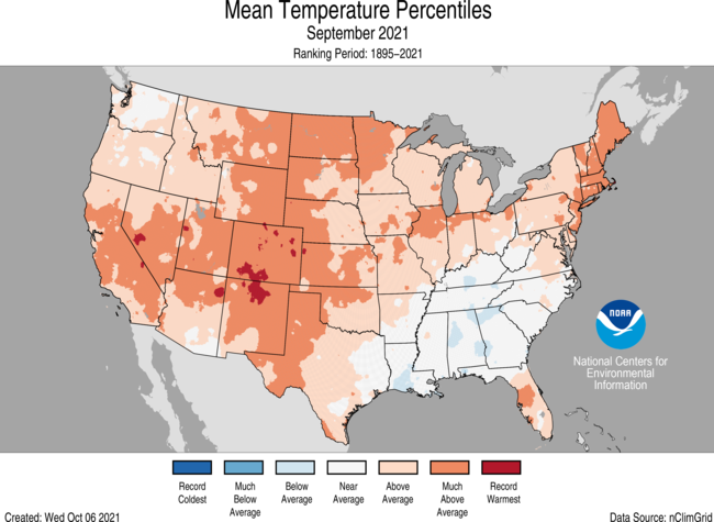
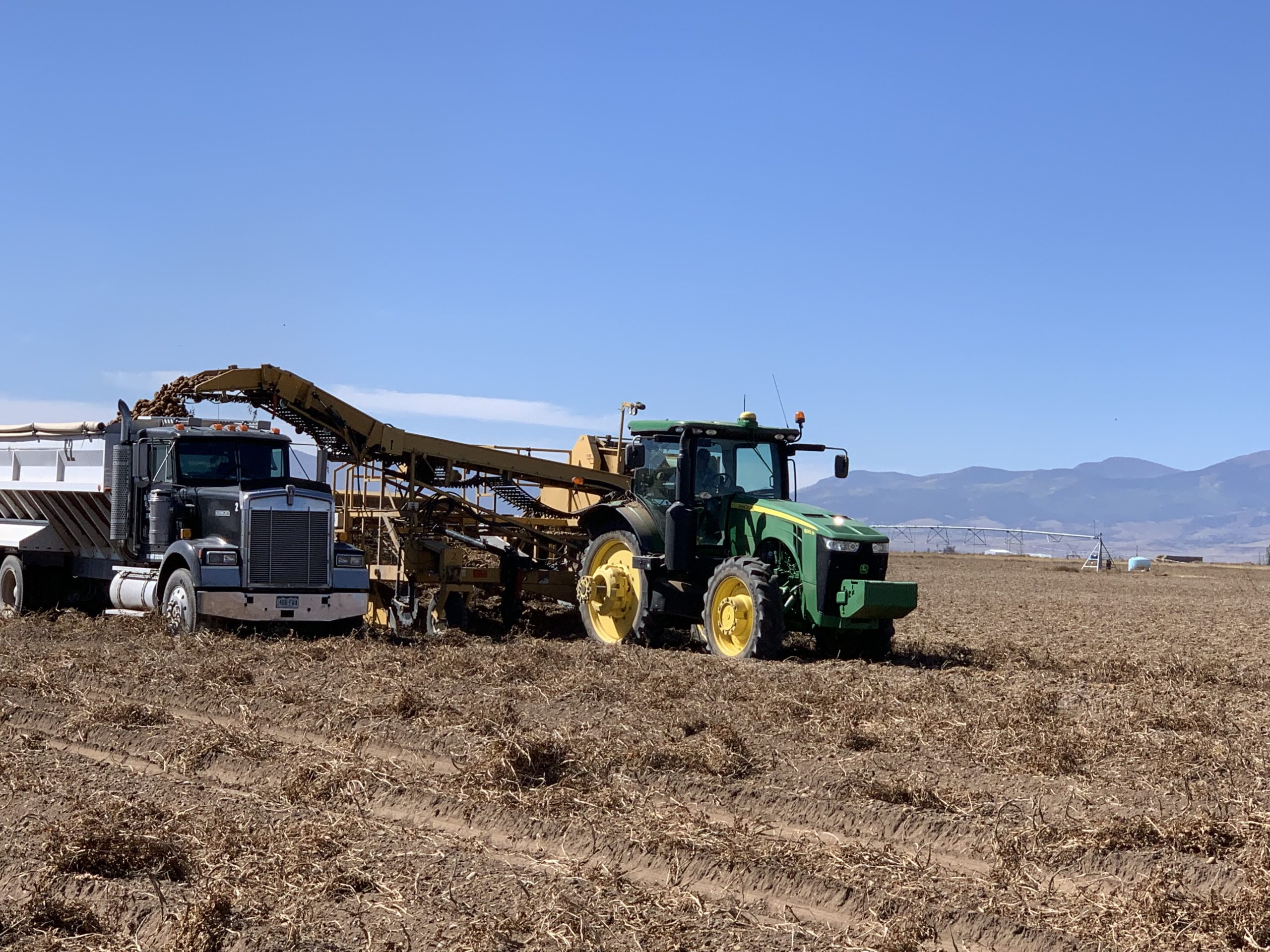
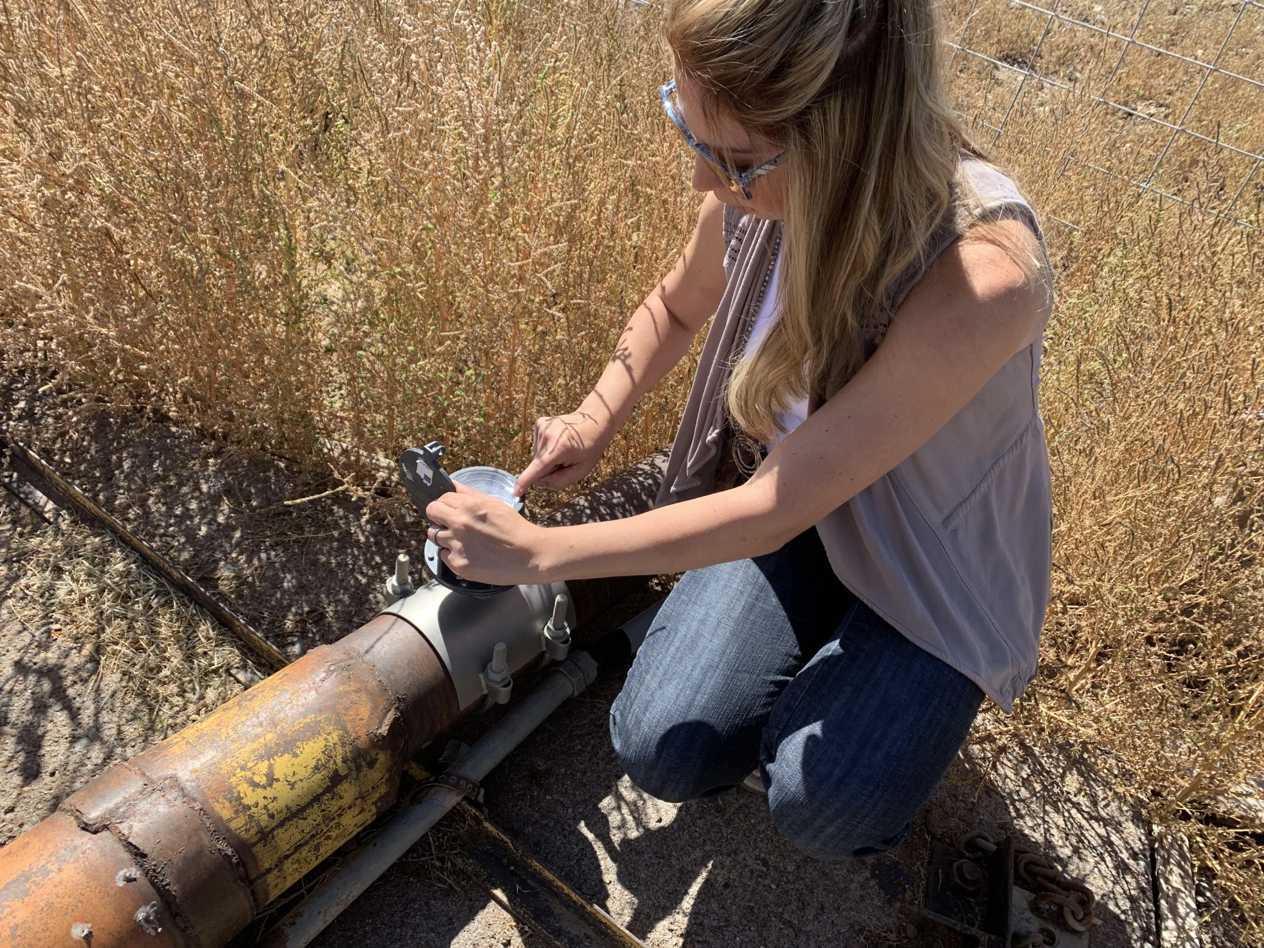
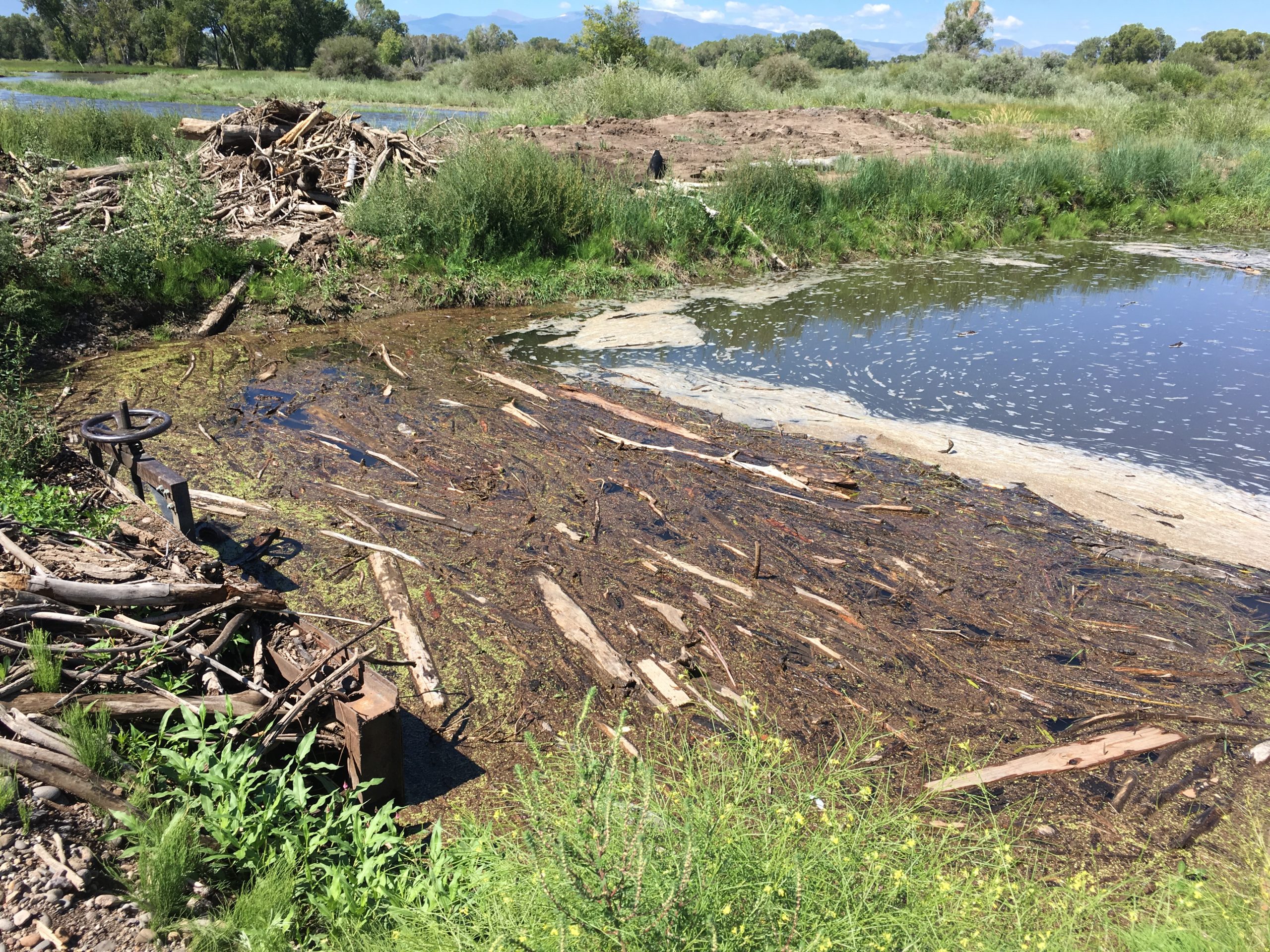
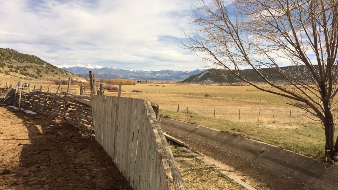
We write today to bring to your attention a matter in Colorado’s San Luis Valley where your agencies play an important and unique oversight role under Public Law 102-575. Through the attached letter from the Rio Grande Water Conservation District (the District), we have been alerted to a proposal called Renewable Water Resources which would transfer groundwater out of the basin from the confined aquifer beneath the Great Sand Dunes National Park, Baca National Wildlife Refuge, and Closed Basin Project. After hearing concerns from our San Luis Valley constituents about this proposal for months, the District’s letter from yesterday, and considering Colorado’s current exceptional drought, we both oppose this proposal. Further, we ask for your attention under the Wirth Amendment, if an opportunity for review comes before your agencies.
The San Luis Valley is experiencing unprecedented drought that has placed a severe demand on local water resources. Valley residents, including farmers, ranchers, and business owners, rely heavily on groundwater aquifers to support their economy and way of life. Since 2005, in response to this drought, local farmers have undertaken an ambitious, collaborative effort to reduce their own pumping with the goal of achieving sustainability. This export proposal continues to seek funding to move forward despite the fact it would exacerbate local water challenges, even with conservation efforts. In addition to concerns from the District, five San Luis Valley counties are opposed to this proposal.
Public Law 102-575, also called the “Wirth Amendment”, was passed in 1992 and provides a legal framework and elevated standard of environmental review for any transfer of groundwater out of the basin that may adversely affect these public resources. We highlight this law because of its relevance to the San Luis Valley and an elevated standard of review for any project that might adversely affect Great Sand Dunes National Park, Closed Basin Project, Baca National Wildlife Refuge. For your convenience, we have pulled out the relevant language on page 64 of P.L. 102-575 (Title XV, Section 1501-1504):
SEC 1501: PERMIT ISSUANCE PROHIBITED
(a) No agency or instrument of the United States shall issue any permit, license, right-of way, grant, loan or other authorization or assistance for any project or feature of any project to withdraw water from the San Luis Valley, Colorado, for export to another basin in Colorado or export to any portion of another State, unless the Secretary of the Interior determines, after due consideration of all findings provided by the Colorado Water Conservation Board, that the project will not:
(1) increase the costs or negatively affect operation of the Closed Basin Project;
(2) adversely affect the purposes of any national wildlife refuge or Federal wildlife habitat area withdrawal located in the San Luis Valley, Colorado; or
(3) adversely affect the purposes of the Great Sand Dunes National Monument, Colorado.
(b) Nothing in this title shall be construed to alter, amend, or limit any provision of Federal or State law that applies to any project or feature of a project to withdraw water from the San Luis Valley, Colorado, for export to another basin in Colorado or another State. Nothing in this title shall be construed to limit any agency’s authority or responsibility to reject, limit, or condition any such project on any basis independent of the requirements of this title.
The Colorado delegation previously raised similar concerns with your agencies. In 2014, Senator Bennet led a letter with Senator Udall, Congressmen Tipton and Gardner elevating these same responsibilities to your attention in the face of a similar groundwater export proposal.
On behalf of our San Luis Valley constituents and the water resources so critical to their economic future, we must oppose the Renewable Water Resources proposal. We thank you for your assistance when your agencies are presented with the opportunity to review this matter.
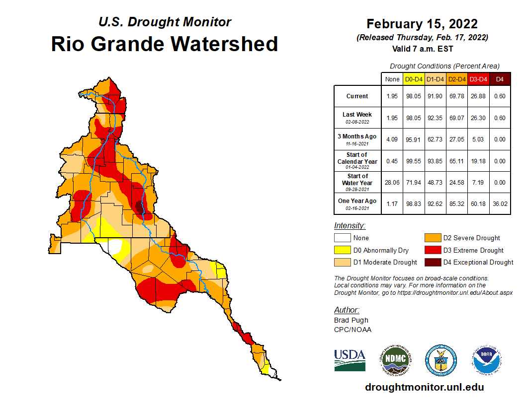
Rio Grande River Basin Drought Monitor map February 15, 2022.
A recent proposal by Renewable Water Resources (RWR) plans to divert 22,000 acre feet of water annually from the San Luis Valley to Douglas County through a transbasin diversion over Poncha Pass. Douglas County would utilize federal American Rescue Plan Act (ARPA) stimulus funds to partially pay for the acquisition and development of water rights in the San Luis Valley. In response, Water for Colorado has issued the following statement:
“This controversial proposal threatens the economy and way of life for those who live in the San Luis Valley, and demonstrates a harmful use of federal funds. Water for Colorado and its nine partner organizations representing diverse interests across the state stand with the residents of the San Luis Valley and Protect our Water Coalition and join state leaders, including Governor Jared Polis, in strong opposition to the proposal and encourage the Douglas County Commissioners to reject it. Our coalition urges collaborative solutions to Colorado’s water supply concerns that do not irrevocably harm one community in favor of another.
Water is the lifeblood of the San Luis Valley — from supporting the potato crops and grains that have grown on family farms for generations, to providing essential refuge for wildlife, to bolstering recreation at the Great Sand Dunes National Park and across the Valley. Water is everything to the Valley and its people.
With an average of only 7 inches of rain a year, there is no renewable water in the Valley to export. The proposed diversion hurts both the communities from which the water is taken and the sources from where the water comes. There are also no requirements for the cities that receive the water to apply more stringent water conservation standards in recognition of the valuable water resources being taken from the Valley.
Using ARPA funding to sap water from a region that plays home to countless species of wildlife including pronghorn, mountain lion, black bear, beavers and pika; supports over 300 bird species and 119,330 acres of wildlife habitat; and provides critical runs for Rio Grande cutthroat trout, is deeply harmful.
Additionally, the price tag could well exceed $2 billion, which would be borne primarily through water ratepayers. We know that we’re facing extreme water challenges now and in the future, but we must prioritize more cost-effective and immediately available conservation and sustainable water use over diversions. Proposals like this mark an irresponsible use of federal funding, and set a dangerous precedent. The recently-released State of the Rockies poll shows 81% of Westerners oppose these kinds of water diversions preferring, instead, projects that utilize water conservation, reduction in use, and increased water recycling.
It’s incumbent upon us all to use every drop wisely, and for every community in Colorado to achieve the highest conservation and water reuse standards possible. Colorado’s locally-based, collaborative approach to water management relies on us all working together rather than pitting basins against one another. When we start approving dangerous water proposals and short term investments like the ones discussed above, we’ve already lost the battle against drought and climate change.”
A morning tour of property owned by Renewable Water Resources, a tour of an irrigated farm, a meeting with elected officials and a community meeting at the Ski-Hi Regional Events Center in Monte Vista is how Douglas County commissioners plan to spend March 26 in the San Luis Valley.
The three Douglas County commissioners – Abe Laydon, George Teal and Lora Thomas – have scheduled the visit to help them decide if they should invest in Bill Owens’ Renewable Water Resources plan and pump groundwater from the Valley to the Denver suburb.
Laydon called it an opportunity to “listen and learn” when the commissioners discussed the visit and tentative agenda on Monday.
Thomas, who has been outspoken in her opposition to the RWR plan because of its impact on the Rio Grande Basin and the Valley communities, said it was important to show respect when Douglas County officials arrive at the end of March.
As for Teal, who supports the RWR plan, he is hoping to find compromise among the Valley’s elected officials to what otherwise has been what he called a lot of unfactual rhetoric coming from Valley residents toward the Renewable Water Resources plan, he said.
“Nine out 10 words we’ve heard is ‘You’re going to dry us to the bone,’” Teal said of the four meetings Douglas County has held so far to study the RWR plan, “while 10 percent has been ‘We’re only taking a little bit and we’re giving something back.’”
By meeting with local elected officials, “hopefully we can get to a workable deal that reasonable people can come to,” Teal said.
He said presentations and comments made to the Douglas County commissioners have been “very contrary to the facts of this case.” He thinks elected officials in the Valley will be more sensible in the conversations.
“What I was hoping for with the elected official lunch is being able to have elected officials talk beyond the simple rhetoric and maybe, yeah, come up with a compromise that could be an element in the town hall,” Teal said to his fellow commissioners as they discussed their visit.
Renewable Water Resources has approached Douglas County about partnering in its water exportation proposal as a way to bring water to the Front Range bedroom community noted for its golf courses and sprawling housing developments. Owens, the former governor of Colorado, is pushing the water exportation plan. Teal was heavily backed by RWR-affiliated money in his 2020 run for Douglas County commissioner.
The RWR plan continues to be met by opposition among Colorado elected officials. Colorado Attorney General Phil Weisner has voiced concerns and opposition to the plan, and so now has Colorado Gov. Jared Polis.
Polis, through a spokesperson, told Colorado Politics that he is opposed to the Renewable Water Resources plan. In a statement to Colorado Politics, the spokesman said Polis is “against any inter-basin transfer without local support of impacted communities. This is a proposed inter-basin transfer with deep concerns and opposition in the San Luis Valley and the governor is opposed.”
Visit our water archives to read more on the Rio Grande and Renewable Water Resources: https://www.alamosacitizen.com/slv-water-archives/.
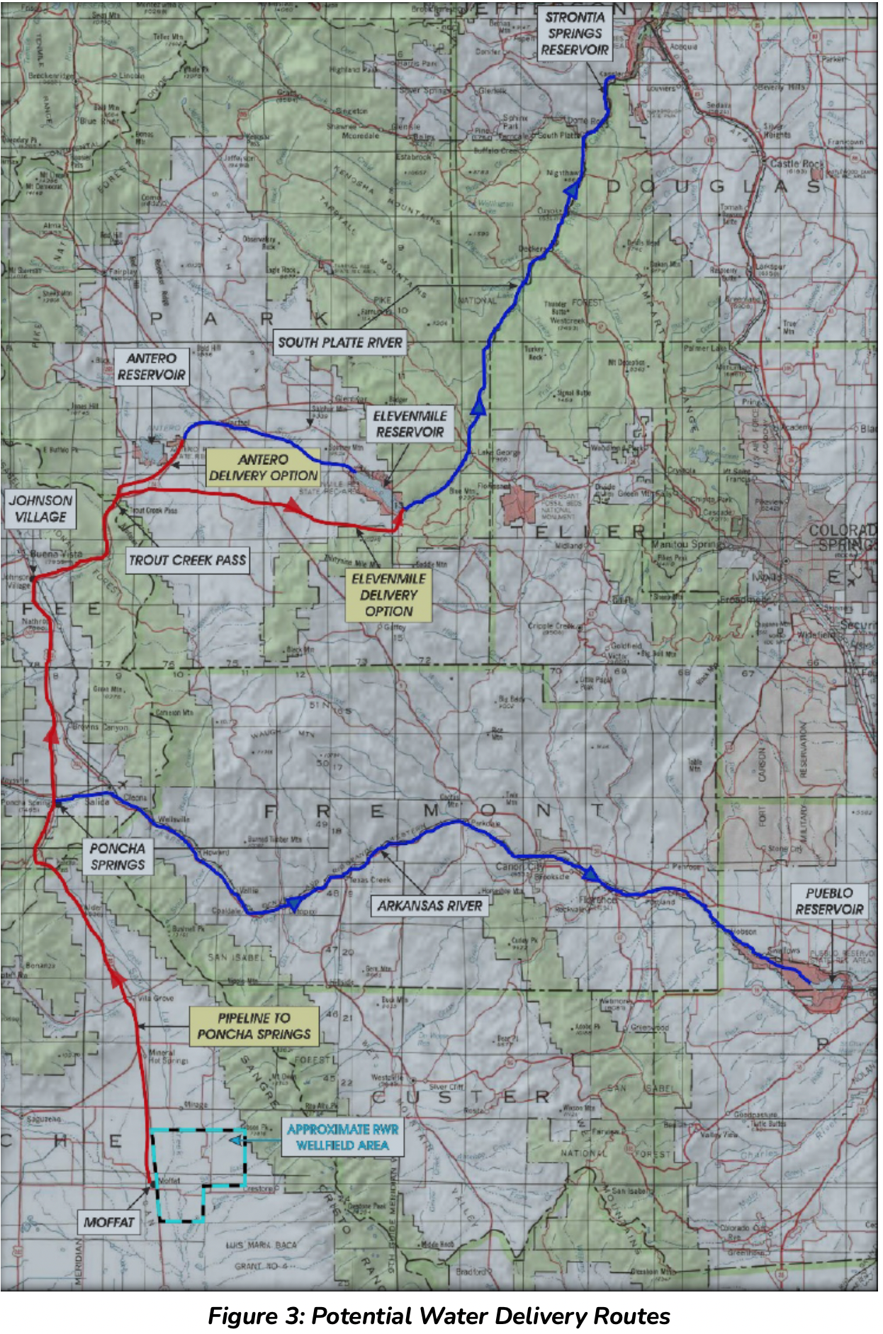
Potential Water Delivery Routes. Since this water will be exported from the San Luis Valley, the water will be fully reusable. In addition to being a renewable water supply, this is an important component of the RWR water supply and delivery plan. Reuse allows first-use water to be used to extinction, which means that this water, after first use, can be reused multiple times. Graphic credit: Renewable Water Resources
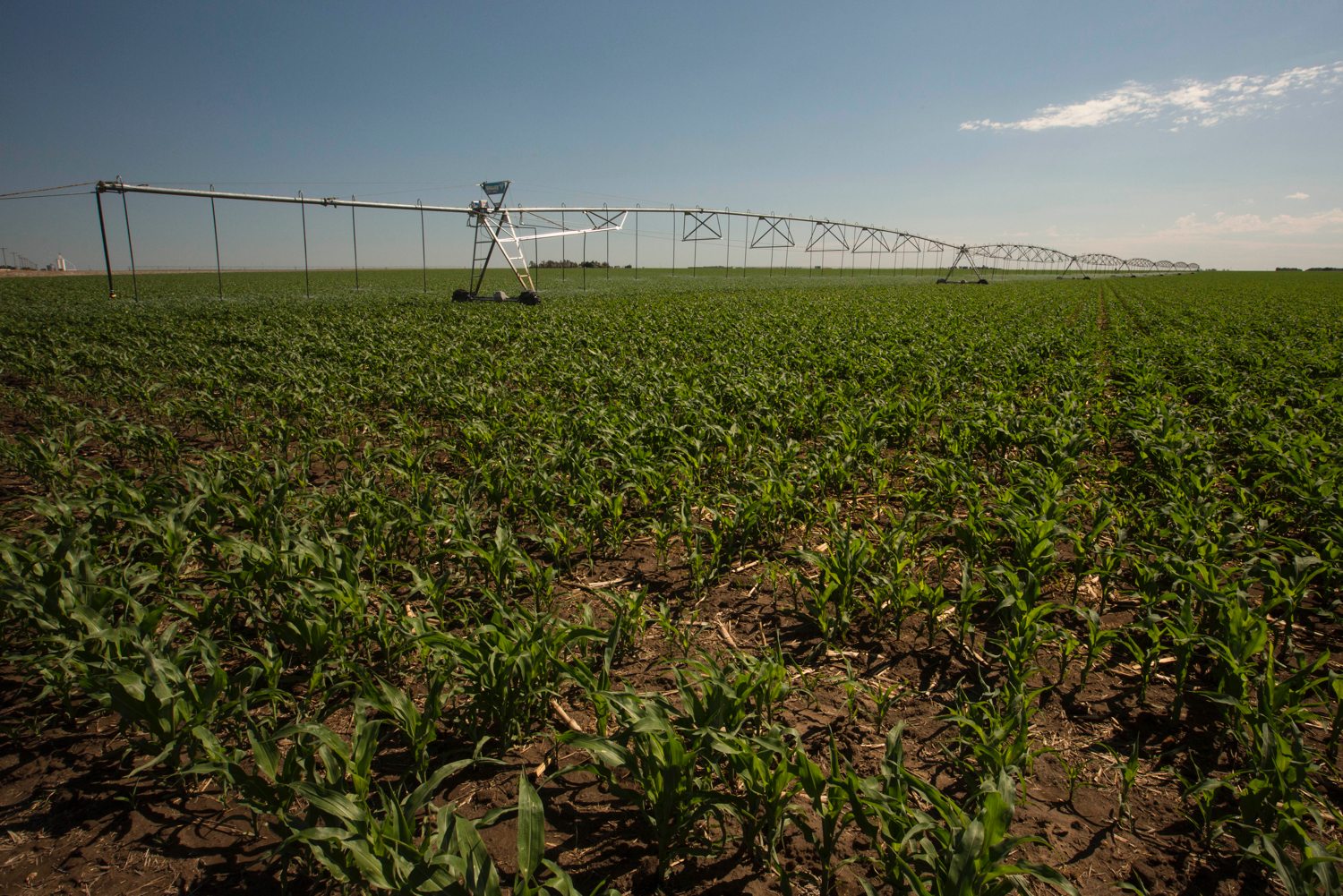
A powerful sprinkler capable of pumping more than 2,500 gallons of water per minute irrigates a farm field in the San Luis Valley June 6, 2019. Credit: Jerd Smith via Water Education Colorado
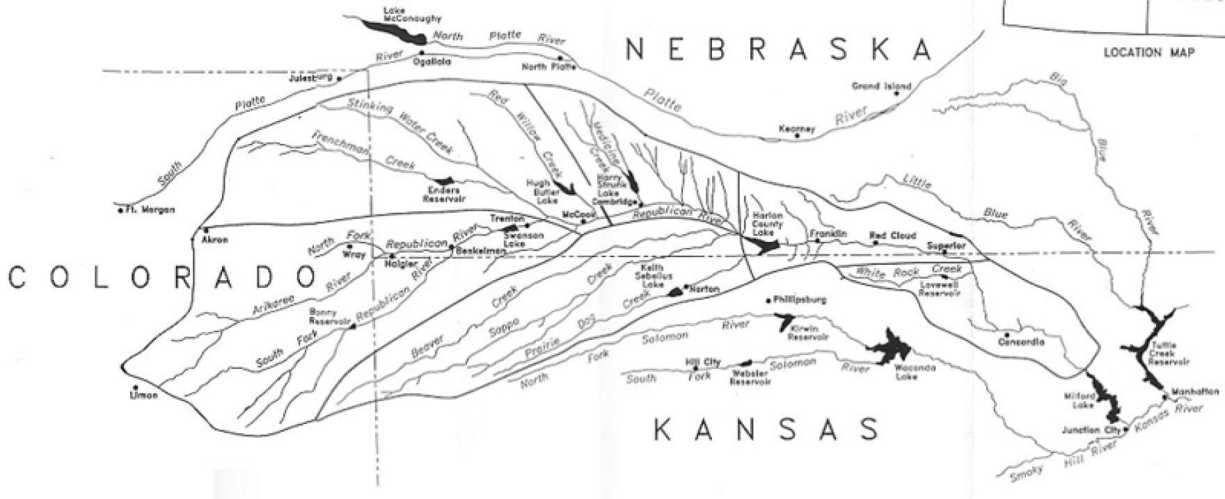
Colorado lawmakers have given initial approval to a bill that would provide millions of dollars to help two major water-short farm regions reduce water use and comply with legal obligations to deliver water to Kansas, Nebraska, Texas and New Mexico.
On Feb. 10 the Colorado Senate Agriculture & Natural Resources Committee unanimously approved [SB22-028 Groundwater Compact Compliance Fund: Concerning the creation of the groundwater compact compliance and sustainability fund] that creates a Groundwater Compact Compliance and Sustainability Fund to help pay to buy and retire farm wells and irrigated acreage in the Republican and Rio Grande basins in northeast and south-central Colorado. Colorado and federal tax revenue would bankroll the fund, and the Colorado Water Conservation Board would distribute the money based on recommendations from the Republican River Water Conservation District and the Rio Grande Water Conservation District, with approval by the state engineer.
The need
The fund is needed, according to proponents, to help reduce groundwater use that is depleting surface water flows in the Republican River and threatening Colorado’s ability to comply with a compact among Colorado, Kansas and Nebraska. It is also intended to help drought-stressed aquifers in the San Luis Valley recover and to meet aquifer sustainability standards required by the state in the Rio Grande Basin.
To achieve those goals, 25,000 acres of irrigated land must be taken out of production in the Republican basin, and 40,000 acres in the Rio Grande, by 2029. David Robbins, general counsel for both districts, noted that, “Both districts have received letters from the state engineer indicating that if they fail in the task they will receive orders shutting down the wells in each basin, which will have dramatic and very difficult consequences for everyone in both basins.”
The bill’s proponents hope to take advantage of a one-time funding opportunity—federal Covid-19 stimulus dollars under the American Rescue Plan Act of 2021 (ARPA). The General Assembly created the Economic Relief and Recovery Cash Fund last year to receive ARPA dollars and transferred nearly $850 million into it; investment in water infrastructure is among the eligible uses. It also established an Economic Recovery Task Force to recommend how to spend those funds. Sen. Cleave Simpson, R-Alamosa, who is also General Manager of the Rio Grande district and a co-sponsor of the bill, has requested $80 million from the task force to support the bill. The governor’s budget includes $15 million as a starting point.
Neither district is looking for a handout. The Republican has already assessed its water users $148.5 million to retire irrigated land, purchase or lease surface and groundwater, and pipe groundwater to the river near the Nebraska border to meet Colorado’s water delivery obligations. Aaron Sprague, a member of its board of directors, said the district had retired 42,000 acres of irrigated land since 2006 and thought they were in compliance, but then a court stipulation signed in 2016 by the three states, requiring 25,000 acres additional acres be retired, “effectively moved the goal posts on us.” The district has retired 3,000 acres of that additional land so far. Sprague figures the economic impact of well shutdowns to be $2.2 billion annually on local, regional and state economies.
Although the Rio Grande is also part of an interstate compact among Colorado, New Mexico and Texas, the issue there is reducing groundwater pumping to sustainable levels pursuant to state law. What constitutes sustainability is different in the shallow and deep aquifers that underlie the Rio Grande’s San Luis Valley, but it basically boils down to balancing inflows and outflows—precipitation, which averages less than 7” per year in that region, and return flows equaling groundwater withdrawals. As in the Republican basin, the Rio Grande district has taxed its farmers $69 million since 2006 to take irrigated land out of production and cut groundwater pumping, with 13,000 acres retired and well pumping reduced by a third in that period.
But 3,000 wells and 170,000 irrigated acres are at risk if the Rio Grande doesn’t meet the 2029 deadline. How would that affect the valley? Simpson emphasized that, “Irrigated agriculture in the San Luis Valley has about a $1 billion annual impact on our community…the culture, the economy were all built around it.”
The cost
So how much would it cost and where would the money come from? David Robbins suggests that each district would need at least $50 million “over and above” what they already have spent to achieve compliance. Sen. Jerry Sonnenberg, R-Sterling, another co-sponsor whose district includes the Republican River Basin, said he wasn’t sure $150 million total would be enough. “When commodity prices are where they are,” he noted, “it’s much more difficult to retire acres.” Corn now is selling at over $6/bushel, its highest level in years, making irrigated acreage more valuable.
The bill will go next to the Senate floor for debate. It has strong bipartisan support and is identical to a bill recommended by the interim Water Resources Review Committee last fall. But as Sen. Kerry Donovan, D-Vail, committee chair, pointed out, there is no appropriation attached. “This bill just creates an entity,” she cautioned, “and then we’ve got the real hard work to do of making sure we find money to put into it.”
Larry Morandi was formerly director of State Policy Research with the National Conference of State Legislatures in Denver, and is a frequent contributor to Fresh Water News. He can be reached at larrymorandi@comcast.net.
The bill creates the groundwater compact compliance and sustainability fund to help finance groundwater use reduction efforts in the Rio Grande River Basin and the Republican River Basin, including buying and retiring irrigation wells and irrigated acreage.
The Colorado Water Conservation Board administers the fund and can make expenditures based on recommendations from the board of directors of the Rio Grande Water Conservation District or the Republican River Water Conservation District. A conservation district’s recommendations must first be approved by the state engineer…
Clearly referencing the water development investment group Renewable Water Resources (RWR), Donovan wanted to know how to explain a group of people wanting to export water from the valley when it is clear water scarcity is already an issue. Robbins, who was testifying at the time, responded that it was something they “were trying to understand themselves” but said that the Rio Grande Water Conservation District is united in their resolve to fight the efforts with all they have.
Referencing the RWR proposal, Donovan then commented that being given money to build a senior citizen center or for law enforcement won’t help much if there are no senior citizens or communities left. She then commented that the General Assembly is receiving the message that the group “needs to look for water somewhere else.”
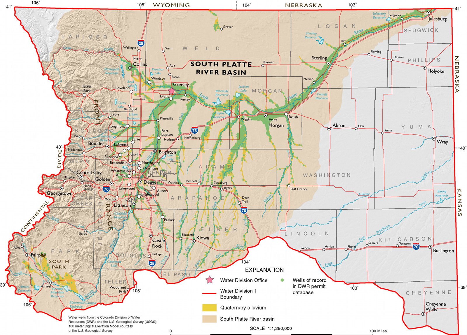
South Platte River Storage Study Area. Illustration shows water availability, in blue circles, compared with demand at various places along the South Platte River. The yellow area is the study area. (Illustration by Stantec).
Joe Frank, manager of the Lower South Platte Water Conservancy District based in Sterling, shared the bill with his board of directors during their regular meeting [February 8, 2022]. The board later voted to support the bill.
The bill specifically lists two intended purposes of the prioritization – to “(increase) the beneficial consumptive use of Colorado’s undeveloped waters to which Colorado is entitled under the South Platte River Compact,” and to “reduce reliance on transmountain diversions.”
According to the bill, the CWBC would create a construction fund into which any money appropriated by the General Assembly for water projects would be held. Interest on the investments from the fund would revert back into the fund, and unexpended funds would not be returned to the legislature at the end of the year.
In addition, when allocating money for water storage projects, CWBC would give projects in the South Platte Basin top priority.
Click the link to read the article on The Greeley Tribune (Ken Amundson). Here’s the excerpt:
Beginning in April, Firestone will begin to produce treated water from its new water-treatment facility, dubbed the St. Vrain Water Treatment Plant.
The plant is one part of a multi-million dollar investment into diversifying the town’s water supply that includes the water plant, surface reservoirs, subsurface water in alluvial wells, conversion of irrigation water to municipal use and reuse of some water resources…
Firestone, like several growing communities along the northern Front Range, was largely dependent upon water from the Colorado-Big Thompson water project, which draws water from the Colorado River on the Western Slope and transports it to reservoirs and a network of supply lines in Northern Colorado…
All of Firestone’s water, prior to the opening of the new treatment plant, is treated at the Carter Lake Filter Plant, which is jointly operated by regional water districts. In Firestone’s case, the Central Weld County Water District is under contract to treat and deliver C-BT water for Firestone…
The investment has not been cheap. The town has spent $76 million so far.
It issued bonds to build the treatment plant and build a storage system. Those bonds will be repaid by tap fees, a storage and infrastructure fee, and the usual monthly water bill payments from residents…
Developers who own irrigation water now can dedicate it to the town in satisfaction of the town’s water requirements for new development. The treatment plant will process that native water and reduce the town’s reliance on C-BT, he said.
Insteading of drawing the water from the creek, the town will draw water from alluvial wells — wells that are replenished from surface water — and also inject water when available back into the wells for storage, Teneyck said. The alluvial wells are relatively shallow at about 35 feet and are located north of the historic coal mines in the Carbon Valley.
The town also is a partner in the Windy Gap Firming Project and the Northern Integrated Supply Project — NISP. A reservoir to hold Windy Gap water is under construction near Carter Lake. The NISP project will include two large reservoirs when it is built…
The treatment plant, which will be operated by the St. Vrain Water Authority, an entity jointly controlled by Firestone and the Little Thompson Water District, will initially treat 1.5 million gallons of water a day. Two expansions are planned, the first of which will expand capacity to 2.25 million gallons per day, and the second expansion will bring it to 5 million gallons per day by 2050. Firestone uses 2.23 million gallons of treated water per day today…
All of this is being paid for with fee schedules meant to recover the costs of growth. Developers will pay storage and infrastructure fees while homebuilders and commercial building contractors will pay tap fees that currently sit at $13,000 each for a residential tap.
South Platte River Basin via the Colorado Geological Survey
Click the link to read the article on The Crestone Eagle (Lisa Cyriacks). Here’s an excerpt:
Colorado released a report in January that identified 282 new projects within the South Platte River Basin on their side of the border, at a total cost of $9.87 billion…
Nebraska Attorney General Doug Peterson, a Republican, said Colorado has been issuing water usage permits that would cut into Nebraska’s rightful share…
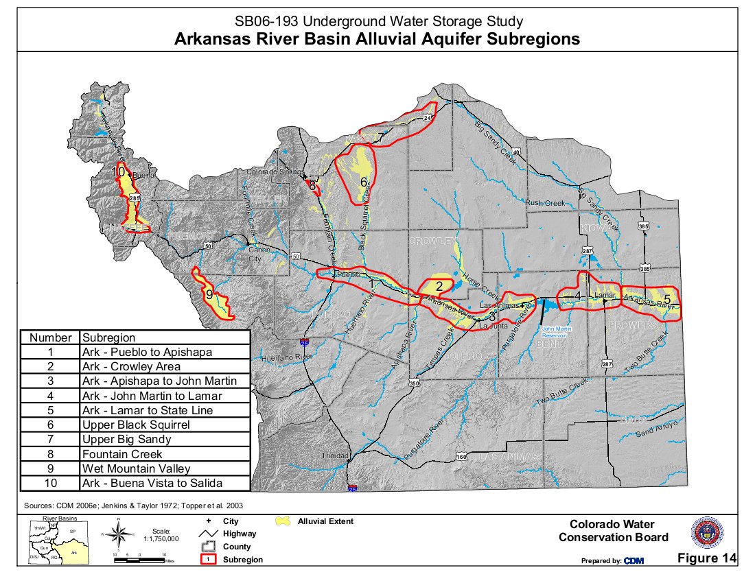
Douglas County Commissioners are currently considering a plan to supplement their water supply by bringing water from the San Luis Valley (SLV) to their county. Douglas County relies primarily on water from the Denver Basin. The South Platte serves as a principal source of water for the Colorado Front Range and the Eastern Plains.
Renewable Water Resources (RWR) is proposing to move 20,000 acre-feet of water annually from the San Luis Valley’s aquifer to Douglas County…
The unconfined aquifer, which provides irrigation water, has not recharged this winter as it typically does during the off-irrigation season.
Producers in Subdistrict 5 of the conservation district (western Saguache County) will likely face another irrigation season where groundwater wells are shut down…
Potential Water Delivery Routes. Since this water will be exported from the San Luis Valley, the water will be fully reusable. In addition to being a renewable water supply, this is an important component of the RWR water supply and delivery plan. Reuse allows first-use water to be used to extinction, which means that this water, after first use, can be reused multiple times. Graphic credit: Renewable Water Resources
The San Luis Creek runs through the middle of the wellfield and Rio Alto Creek through the southwestern side. Both these creeks supply the wetlands on the Baca National Wildlife Refuge created under the Great Sand Dunes National Park Act.
RGWCD plans to challenge RWR’s proposal in the Water Court. “We can’t see a path forward without injury or that would comply with rules and regulations as they exist today,” [Cleave] Simpson said.
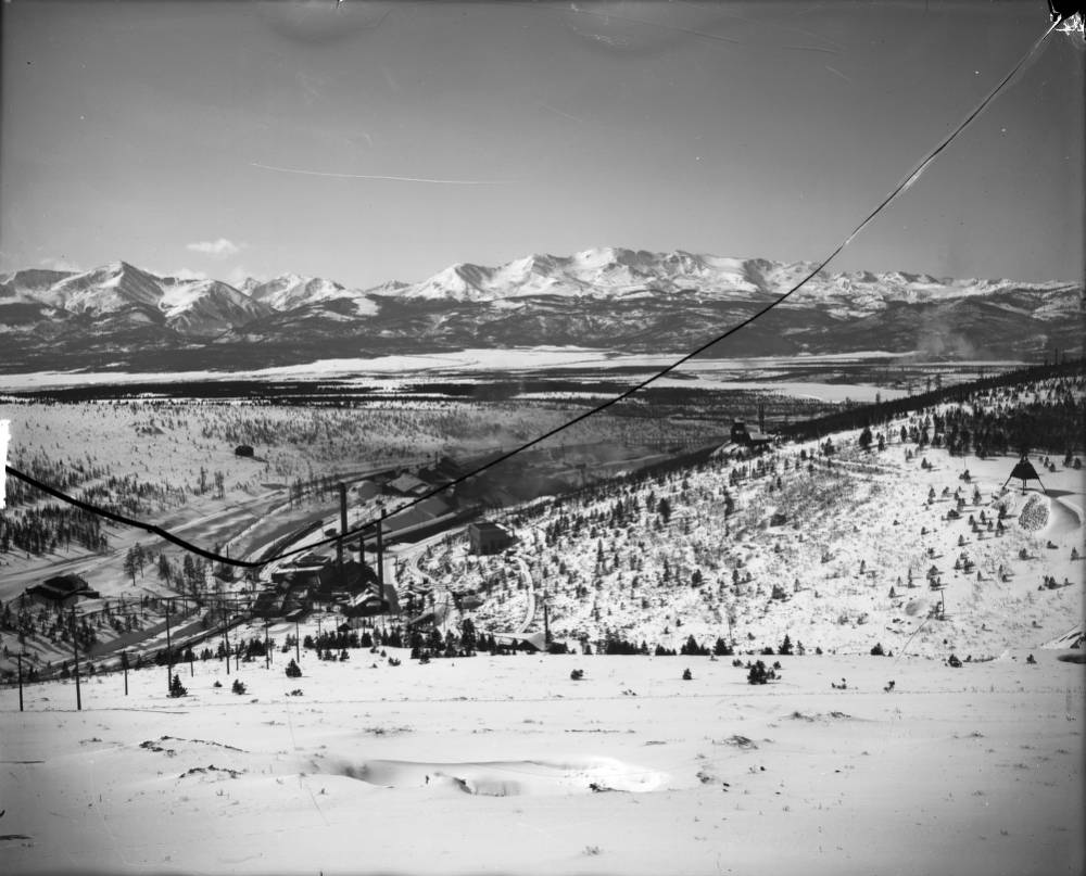
View of the Yak Tunnel and Mine Complex in California Gulch near Leadville, Colorado; shows mill buildings and ore car tracks. Mount Elbert, Mount Massive, and the Sawatch Range are in the background. Denver Public Library Special Collections Creator Beam, George L. (George Lytle), 1868-1935. Date: 1908
The Arkansas River Watershed Collaborative (ARWC), which also includes groups like Trout Unlimited, submitted an initial application last fall under the project title “Upper Arkansas Comprehensive Watershed Restoration Project.” The application requested $5 million from damages associated with the California Gulch Superfund Site for various initiatives, including culvert replacement and fuels mitigation…
Commissioner Sarah Mudge, who helped submit the application in December, said the group will submit a new request in February for consideration under a new round of funding. Mudge said ARWC has altered the scope of work slightly for the new application, but that culvert work and fuels mitigation will remain a priority.
Last September, the trustees, including Colorado Attorney General Phil Weiser, visited Lake County for a landmark tour of California Gulch, a Superfund site that was heavily impacted by mining operations. After the tour, the trustees heard proposals from groups like ARWC, which presented the “Upper Arkansas Comprehensive Watershed Restoration Project.”
[…]
Fuels mitigation will entail thinning efforts and the implementation of a county-wide slash management program. Mine impact mitigation refers to ongoing efforts to prevent soil and water pollution from old mine operations. And river restoration will include post-wildfire flood defense along waterways and culvert repair in four or five areas throughout Lake County.
Prior to mining, snowmelt and rain seep into natural cracks and fractures, eventually emerging as a freshwater spring (usually). Graphic credit: Jonathan Thompson
Click the link to read the article at the Las Vegas Review Journal (Blake Apgar). Here’s an excerpt:
But the Central Iron County Water Conservancy District, which serves Cedar City and the surrounding area, said the project is important to not just fuel growth in the city of about 35,000 people. It will ensure water can be delivered to people who already live there.
Cedar City, about 170 miles northeast of Las Vegas, gets its water from an aquifer in Cedar Valley. The city and its surrounding area uses about 28,000 acre-feet per year from an underground system that is only capable of producing about 21,000 acre-feet.
Last year, Utah adopted a groundwater management plan last year that will roll back water rights and reduce the amount of water that can be pumped out of Cedar Valley.
Because of this, municipalities in the area stand to lose about 75 percent of their water rights, Central Iron County Water Conservancy District General Manager Paul Monroe said…
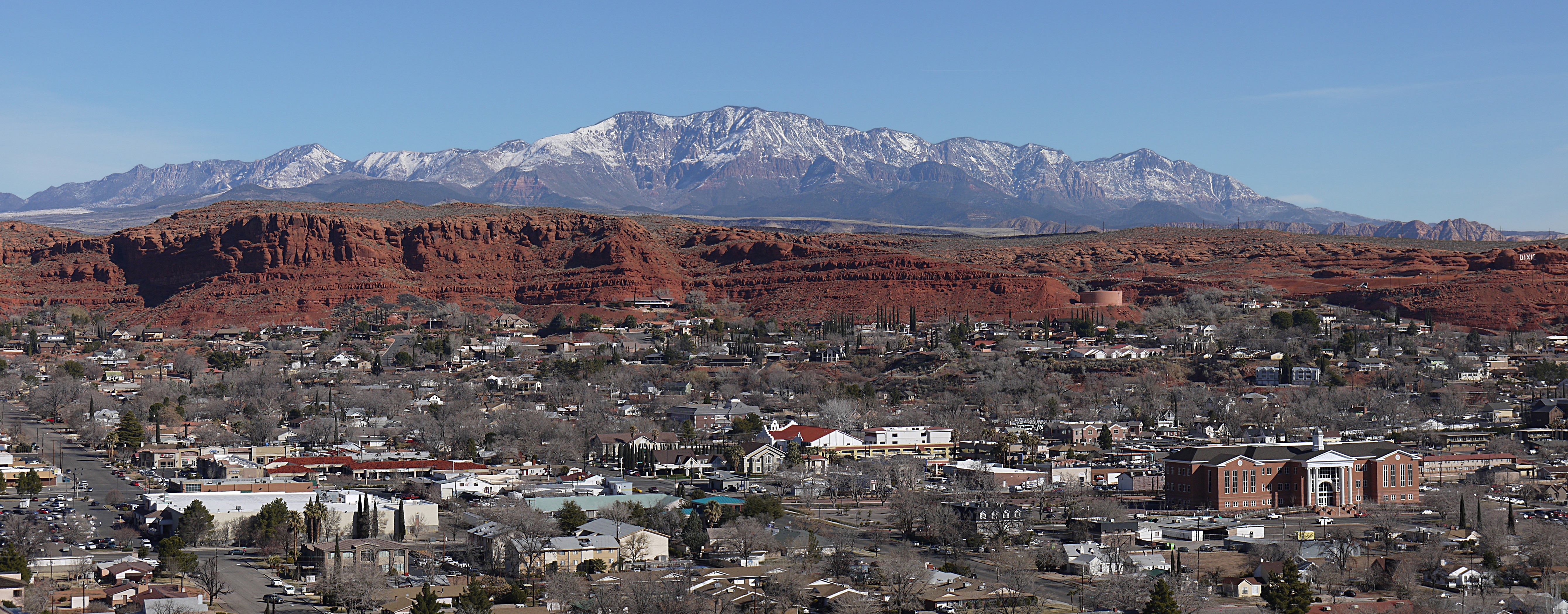
Pine Valley Mountains with St. George, Utah in the foreground. By Óðinn – Own work This image was created with Hugin., CC BY-SA 2.5 ca
To preserve water rights in Cedar City and pave the way for more growth, the water district wants to pump about 15,000 acre-feet of water it has rights to from nearby Pine Valley, a proposal that is under federal review.
Click the link to read an article on The Alamosa News (Priscilla Waggoner). Here’s an excerpt:
Senator Cleave Simpson’s bill “Groundwater Compliance Compact Fund” passed the Senate Agriculture and Natural Resources Committee by unanimous vote on [January 25, 2022].
If the bi-partisan, bi-cameral bill ultimately passes both the Senate and the House, SB22-028 will create a groundwater compliance and sustainability fund eligible to receive allocated funding to help both the San Luis Valley and the Republican River Basin in crucial efforts to achieve sustainability in valley aquifers and compact compliance, respectively…
Long before any other basins were addressing sustainability in managing groundwater, growers in the San Luis Valley were looking ahead and taking steps to reduce groundwater usage. In Subdistrict No. 1 alone, more than $70 million has been collected from growers and redistributed to growers in a myriad of ways including, but not limited to, the purchase of water rights and well permits. But the challenge remains.
The language in Simpson’s bill describes the current situation best. “Despite the conservation districts’ and the state’s diligent efforts to implement strategies to reduce groundwater use, including the creation of six groundwater management subdistricts in the Rio Grande River Basin and the use of various federal, state and local funding sources to incentivize the purchase and retirement of irrigated acreage, extensive groundwater use in the Rio Grande and Republican River Basins continues to threaten aquifer sustainability, senior water rights and compact compliance.”
[…]
The Treasury Department has ruled that projects related to water conservation qualify for expenditure of American Rescue Plan Act (ARPA) funding. In collaboration with the Colorado Water Conservation Board and the State Engineer, Senator Simpson developed a plan that would request allocation of $50 to $80 million for the purpose of supporting both the Republican River Basin and the Rio Grande River Basin in purchasing acreage to put out of production – all toward the end of reducing groundwater usage through, among other things, retiring irrigation wells and irrigated aces and ultimate compliance of requirements established either through compacts or state statutes that carry heavy consequences should groundwater usage not be reduced.
However, SB-028 is just the first step in this process. In order for $80 million to be allocated to the Groundwater Compact Compliance Fund, the fund itself must first be created by the legislature. And that is what Senator Simpson’s bill would accomplish.
Assuming SB22-038 passes and the fund is created, the next step will be to write the bill requesting the $80 million dollar allocation to the fund.
RENEWABLE Water Resources promoter Sean Tonner touted a $50 million community fund in his pitch to Douglas County commissioners Monday to support a plan to move water from the San Luis Valley to Douglas County.
San Luis Valley farmers countered with figures that showed an annual loss of $53 million, or 5 percent, to the Valley’s economy from dried-up irrigated land resulting from the acre-feet of water that RWR wants to pump out of the San Luis Valley on an in-perpetuity basis.
In their fourth work session studying a possible investment in the RWR plan, Douglas County commissioners heard differing views on the economic impact of pumping water from the San Luis Valley to Douglas County. At this point Douglas County isn’t sure how much of its federal COVID relief money it can invest in the RWR plan, or what it actually gets for the money.
The work session also raised questions around Douglas County’s motivation, since it is not a water utility and doesn’t have water customers, and why Douglas County is intently focused on the RWR plan rather than other water projects closer to Douglas County that also have been submitted.
“Why are you doing this and not talking about the Platte Valley Water Partnership with as much gusto?” said Heather Dutton, manager of the San Luis Valley Water Conservation District. She was referencing a proposal to Douglas County from neighboring Parker Water and Castle Rock Water on a renewable water supply through the Platte Valley Water Partnership.
“We are actively looking at all of the proposals,” said Douglas County Commissioner Abe Laydon.
Douglas County also received a letter from the San Luis Valley Board of County Commissioners voicing their opposition: “The proposal from RWR is a threat to the life we are already struggling to maintain. Frankly, we think the use of Federal funds to take the livelihood from an area whose median income is $37,663 to increase the population of Douglas County, median income $119,730, is insulting.”
The work session on the economic impact from the RWR proposal was similar to the previous work sessions covering other topics: Little agreement on the impact 70 years of groundwater pumping and 20 years of drought have had on the Upper Rio Grande Basin, and growing hostilities between RWR pitchmen and San Luis Valley farmers and water managers.
At one point, Douglas County Commissioner George Teal, who during his run for county commissioner benefited from RWR-related campaign donations and now supports the RWR plan, grew testy with Conejos County farmer James Henderson. Teal said he took offense at statements last week by Nathan Coombs, also from Conejos County, when Coombs said ag operations in the San Luis Valley were taking a back seat to unchecked growth in Douglas County.
“It’s almost like, ‘What makes the San Luis Valley more valuable than the agricultural interests in Douglas County?’” said Teal.
Tonner said the proposed community fund would bring a needed infusion of money to help address a myriad of problems he sees in the San Luis Valley, from the lack of restaurants and hotels to the distance he has to travel to find a gas station.
“I have to drive almost 40 minutes to get gas,” Tonner said. Finding a restaurant to eat at is another challenge of his, he said. “It gives you some context of what a community fund like this can do for everyone,” he said.
Henderson and Chad Cochran provided the commissioners with figures on the market value of the crops grown in the San Luis Valley to highlight the damage to the Valley’s ag economy that would come with exporting water from the drying Rio Grande.
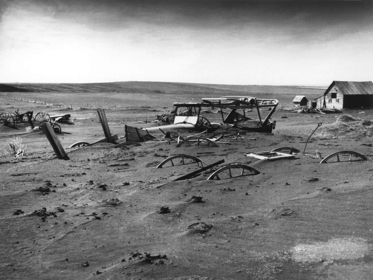
“How does the value of land go up when there’s not water,” said Cochran, challenging RWR’s assumption that its plan won’t harm the Rio Grande. “It’s a dust bowl.”
He wasn’t at the meeting with Douglas County commissioners, but retiring 12th Judicial District Court Judge Martín Gonzales perfectly framed what’s at stake in the San Luis Valley’s latest battle to stop a water exportation plan when he talked earlier to AlamosaCitizen.com.
“In my mind the seminal struggle for the Valley is water,” Gonzales said. “I think it’s important to keep agriculture alive. I think it’s important to have the water to keep it alive, kept in the Valley. That’s in my mind the seminal struggle by which I define as ‘If you don’t win that, you may not win anything else.’”
As a part of their process to evaluate a multimillion-dollar proposal to pump water into Douglas County, the Douglas County commissioners on Jan. 31 heard presentations from advocates and farmers from the place the water would come from: the San Luis Valley in south central Colorado.
Speakers from the San Luis Valley Conservancy District, the Conejos Water Conservancy District and the Rio Grande Water Conservation District spoke to the commissioners with one main message: this plan would damage their community.
“We are struggling to keep our ship correct and to try to recover our aquifer and then here comes this seemingly predatory-natured entity to exacerbate our problem when we’re in the middle of a hardship,” said Nathan Coombs, the district manager for the Conejos Water Conservancy District.
Representatives from Renewable Water Resources, a water developer, also sat in the room, defending the proposal at times. One of the representatives, Jerry Berry, is a farmer from the San Luis Valley and spoke in support of the proposal, which would ask some valley residents to sell their water rights and promises to contribute $50 million to the community to use as they see fit.
The two-hour meeting was one of seven that the board plans to hold to evaluate the controversial proposal, which would use a portion of the $68 million in federal money given to the county from the American Rescue Plan Act. In March, commissioners plan to travel to the San Luis Valley to hear from locals about the plan.
While RWR originally proposed that the county pay an initial fee of $20 million for the project followed by a cost of $18,500 per acre-foot for water, they recently revised that request.
In a letter to commissioners dated Jan. 27, RWR said that their attoreys recently informed them that “the rules and regulations governing the use of ARPA funds may not allow the county to spend $20 million on projects that are not completed by 2026,” according to the document provided to Colorado Community Media by the county.
If those restrictions remain, RWR suggests that the county instead pay an initial amount of $10 million from the general fund for the project with a cost of $19,500 per acre-foot. They say they believe the county could then use $10 million from ARPA to backfill the general fund.
During the meetings evaluating the project, proponents and opponents have sparred over whether or not the plan would be harmful to the San Luis Valley, a huge area that relies on agriculture as a primary source for its local economy.
So far, the commissioners have also heard presentations from RWR, the Colorado Division of Water Resources and from various water lawyers.
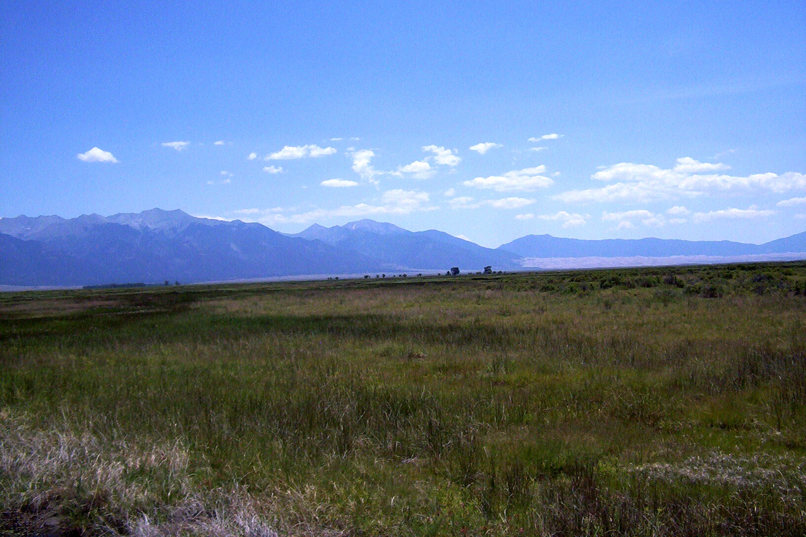
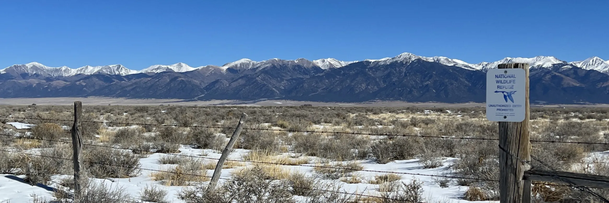
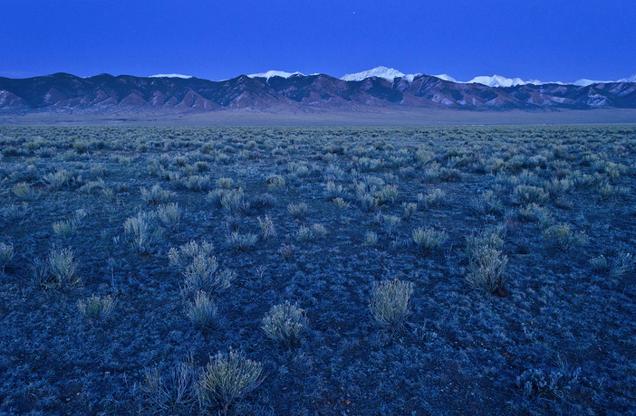
The northern end of Colorado’s San Luis Valley has a raw, lonely beauty that rivals almost any place in the North American West. Photo/Allen Best
The Good Samaritan Remediation of Abandoned Hardrock Mines Act introduced in the U.S. Senate on Thursday would allow “Good Samaritan” groups to assist in the cleanup of abandoned mines by limiting their legal and financial liability for mine pollution. Sen. Michael Bennet, D-Colo., co-sponsored the bill, which would drastically expand the capacity for communities to address toxic mine waste from hundreds of thousands of abandoned mines in the U.S…
The bill establishes a pilot program of 15 sites in which Good Samaritans – anyone from state mine reclamation agencies to local conservation groups – receive permits from the U.S. Environmental Protection Agency to carry out cleanups at abandoned mine sites.
The legislation has a seven-year sunset and is meant to test a more constructive approach to limiting the pollution from the hundreds of thousands of mines that don’t qualify for the EPA’s Superfund status.
For years, conservation groups and local governments have argued that the Clean Water Act, though critical for protecting water, limits their involvement in mine cleanups.
The Clean Water Act characterizes the pollution from abandoned mines in two different ways. One is “nonpoint source,” which means there is no single identifiable source actively emitting pollution. Solid waste rock at an abandoned mine would qualify as a nonpoint source because it releases toxic materials only when rain and snow wear down the rock.
Nonprofits and other Good Samaritans have been able to clean up nonpoint source abandoned mine pollution since at least 2007 after the EPA issued a policy that protected these groups from any liability for the pollution.
The Clean Water Act also identifies “point source” pollution, which is actively emitted by a single source such as a pipe. Under the Clean Water Act, any entity that wants to clean up the infrastructure of an abandoned mine that discharges pollution, such as a tunnel, must assume liability for that pollution permanently.
To comply with the Clean Water Act, these entities would have to undertake costly efforts to ensure that any water released by the mines during their work meets stringent standards.
This issue of liability prevented state agencies, local governments and conservation organizations from cleaning up tens of thousands of abandoned mine sites that spew toxic chemicals.
Prior to mining, snowmelt and rain seep into natural cracks and fractures, eventually emerging as a freshwater spring (usually). Graphic credit: Jonathan Thompson
It’s late fall 2021 and I’m at the Tuba City Chapter House on the Navajo Nation for one of several community meetings that American Rivers, the Grand Canyon Trust, and local communities are hosting to explore ways to safeguard and sustain the Little Colorado River. The air is crisp and the sun peeks above the eastern horizon as we set up an outdoor meeting space designed to respect necessary Covid-19 precautions. Because this type of grassroots organizing has been nearly impossible for over a year, there is a tangible feeling of excitement as people gather to engage in conversations about this lifegiving watershed that supports much of present-day northern Arizona.
Little Colorado River community outreach meeting at the Tuba City Chapter House on the Navajo Nation; Credit: Mike Fiebig
The Little Colorado River (LCR) is essentially a misnomer—“little” only in title and by comparison to the Colorado River. The LCR basin is 27,000 square miles of high deserts, mesas, and mountains near the center of the Colorado Plateau. Its grandeur can be understood from various angles. As part of the larger Colorado Plateau, the LCR basin has the highest agricultural and ethnolinguistic diversity north of the Tropic of Cancer. The river itself originates in the White Mountains where its headwater springs have been designated as a sacred site by the White Mountain Apache Tribe. From there, the river drops over 5,000 feet as it flows northwest to its Confluence with the Colorado River deep within Grand Canyon. As it nears the mainstem Colorado, the LCR cuts steeply into limestone and sandstone, creating the spectacular lower LCR gorge. Springs in the lower gorge provide the cerulean baseflow of the LCR, which at the Confluence with the Colorado is approximately 158,000 acre feet annually—equivalent to over half of Nevada’s allocation of Colorado River water.
Lower Little Colorado River Gorge; Credit: EcoFlight
With monsoon and spring runoff events, the LCR can swell to over 400 times its baseflow. The river is a primary contributor of sediment to the Grand Canyon and critical habitat for the threatened humpback chub. In truth, the cultural and ecological significance of the LCR and its watershed is difficult to overstate. It is the ancestral or present-day homelands of at least eight tribes, including Hopi, Zuni, Diné, Southern Paiute, Cibecue and White Mountain Apache, Havasupai, and Hualapai, each of whom have maintained relationships with the LCR since time immemorial.
The uniqueness of this high desert river and watershed is also demonstrated by its resilience. Until the early 20th century, the LCR flowed year-round for its entire 340-mile course. It is now intermittent except for three short stretches. Sixty years of industrial groundwater withdrawal has impacted aquifers critical to springs, tributaries, and drinking water in an increasingly arid region. The Grand Canyon Escalade project proposed a massive tourist attraction at the remote and sacred Confluence of the LCR and Colorado River, which led American Rivers to list the Colorado River in the Grand Canyon as America’s Most Endangered River in 2015. Coal-fired generating stations polluted the air and drove strip mining in the basin. Uranium mining and milling contaminated water sources and continues to impact human, animal, and plant health.
Now, hydroelectric dam proposals threaten the lower LCR. With total disregard for tribal sovereignty, Pumped Hydro Storage LLC applied for three preliminary permits in 2019 and 2020 from the Federal Energy Regulatory Commission (FERC) to dam the LCR and its tributaries. While two of the permits have been surrendered, the company is awaiting a preliminary permit for the Big Canyon project. Despite objection from the Navajo Nation and Hopi Tribe, the Big Canyon project proposes four dams and four reservoirs that would be filled with groundwater from the same aquifer that sustains the sacred springs and iconic milky-blue waters of the lower LCR.
Little Colorado River near the Confluence; Credit: Sinjin Eberle
The concentrated harm to the LCR caused by colonization, coupled with the ongoing uncertainty of what threat will have to be fought off next, makes the LCR a poster child for environmental injustice. But the river and LCR communities persist. Save the Confluence stopped the Grand Canyon Escalade and continues to advocate for the Confluence as a sacred area. Black Mesa Trust advocates for the ancient aquifers in the LCR basin and their related springs that are central to Hopi religion. Tó Nizhóní Ání protects the sacred lands and waters of Black Mesa, a central recharge area for the LCR. And Tolani Lake Enterprises rebuilds the Indigenous food sovereignty movement on the banks of the LCR.
Such grassroots efforts hold the barrage of threats to the LCR at bay while also highlighting the need for durable and permanent protections for this remarkable river and the life it supports. Building on our previous work in the basin, in the Spring of 2020 American Rivers joined LCR communities and allies, like the Grand Canyon Trust, to explore ways to safeguard the river’s cultural and natural resources—with particular focus on the lower LCR—in ways that align with the needs and wants of local communities. For a year and a half, we’ve been working collaboratively to identify pathways to protect the LCR while upholding local autonomy and traditional land uses. This includes preventing commercial and industrial developments in the area, such as the Big Canyon proposal, that are unwanted by local communities. Our guiding belief is that thoughtful community engagement and collective management approaches can help protect the lower LCR, surrounding sacred sites, and all living beings for years to come. By engaging individual community members through in-depth conversations, hosting in-person and virtual community meetings, and providing information on possible protective pathways, we are collaborators in a growing movement to protect the LCR. Looking ahead, we are committed to supporting this movement through expanded community engagement and leadership until permanently protecting the LCR simply becomes inevitable.
LCR advisor, Larry Foster, discussing options for safeguarding the LCR; Credit: Amanda Podmore
As I drive away from the meeting in Tuba City, I am reminded that despite overuse, unregulated groundwater withdrawal, impacts from industrial energy production, and the increasing effects of climate change, the LCR is alive. It is sustained as much by monsoons, ancient groundwater, and high elevation snow as it is by the collective stories, ceremonies, and traditions of its Indigenous communities. Often described as an umbilical cord, the LCR is a literal lifeway in the region and, as such, it deserves more than simply being resilient. It deserves to thrive.
Confluence of the Little Colorado River and the Colorado River. Climate change is affecting western streams by diminishing snowpack and accelerating evaporation. The Colorado River’s flows and reservoirs are being impacted by climate change, and environmental groups are concerned about the status of the native fish in the river. Photo credit: DMY at Hebrew Wikipedia [Public domain]
Jill Morrison of the Powder River Basin Resource Council and rancher Kenny Clabaugh discuss the impacts of coal-bed methane gas on ranching operations in the Powder River Basin in 2006. (Dustin Bleizeffer/WyoFile)
The coal-bed methane gas boom that dotted northeast Wyoming with rigs and workers in the 2000s and left a legacy of bankruptcies and orphaned wells will also have lingering impacts on groundwater for up to 144 years, according to a new study by the Wyoming State Geological Survey.
Some sandstone aquifers in the Powder River Basin have declined by more than 100 feet due to the industry’s preferred method of pumping large volumes of water from coal seams to release the microbial-formed coal-bed methane gas, according the study, “Groundwater Level Recovery in the Sandstones of the Lower Tertiary Aquifer System of the Powder River Basin, Wyoming.”
The industry has pumped about 1 million acre-feet of water from coal seams since 2001 and discharged it onto the surface, partially depleting coal aquifers as well as associated sandstone aquifers. That’s enough water to fill Alcova Reservoir to maximum capacity more than five times.
“The calculated times of recovery, which vary from 20-144 years with a mean value of 52 years, probably represent best-case estimates because the calculations assume that environmental and hydrological conditions will largely remain unchanged from those of the last decade,” the study states.
This map depicts the location of 39 Bureau of Land Management sandstone and coal seam monitoring well sites in the Powder River Basin of Wyoming. (U.S. Geological Survey)
“Furthermore,” the study continues, “slowing recovery rates commonly observed in some coal seam aquifers may impede the return to predevelopment water levels in the proximal sandstones.”
The most severely drawn down aquifers are within 20 miles of the Powder River, both north and south of Interstate 90, study co-author Karl Taboga said. That’s also the area where much of the remaining active coal-bed methane wells are located. While the geographic coverage of the monitoring wells used to measure water tables is limited, it’s believed the industry’s impact to aquifers elsewhere in the Powder River Basin is less severe.
“It appears to be localized,” Taboga said. “In a couple of cases, a little farther east in the Powder River, you may have a site that has a significant groundwater decline, but five or six miles away you have another site where you’re not seeing a significant decline.”
Ongoing groundwater monitoring in the Powder River Basin provides “a unique opportunity to study long-term groundwater changes,” State Geologist and WSGA Director Erin Campbell said in a press statement. “Understanding how subsurface systems relate to groundwater recovery allow us to best plan future development.”
But there are perhaps even more critical lessons to learn, according to longtime critics of the industry’s dewatering practice.
“The big question is: Will we learn the lesson that we live in a high desert and pumping and dumping and wasting water is the height of greed and ignorance?” the Powder River Basin Resource Council’s former Executive Director Jill Morrison said.
Landowner group: The state was warned
The massive dewatering of groundwater resources has been a point of contention since the beginning of the coal-bed methane gas play in the Powder River Basin in the mid-1990s. In some cases, it sapped water from wells used for livestock and drinking water for homes. While the practice of discharging the water on the surface provided new stock watering ponds for ranchers, it also flooded critical grazing areas and loaded the surface with salts, wreaking havoc on native grasses.
The Sheridan-based landowner advocacy group Powder River Basin Resource Council pressured the state to minimize pumping groundwater and discharging it on the surface. Instead, it urged the state to insist on forcing operators to reinject the water “in a staged fashion.”
Most coal-bed methane wells bring up large volumes of water along with the methane. This 2006 photo shows a water-discharge facility on a Johnson County ranch near the Powder River. (Dustin Bleizeffer/WyoFile)
But the state didn’t take any actions to limit groundwater pumping and surface discharge until 2007 as the development began to decline.
There’s no agenda. WyoFile aims to provide you with the tools to make informed decisions by producing independent, unbiased reporting that is free and accessible to all. Donate today to help keep Wyoming empowered and informed.
“These aquifers took eons to establish and [coal-bed methane] development has significantly dewatered them in less than two decades,” Morrison said Wednesday, adding that she is “not at all surprised” by the report’s findings. “You can’t pump this gigantic volume of water out of aquifers that took eons to be created, and then expect that it’s going to regenerate.”
The diminished aquifers and long-term recovery rates represent potentially higher costs for rural landowners and agricultural operations to access groundwater, as well as municipalities that might rely on groundwater resources in the future, Morrison said.
Many in the Powder River Basin have already felt those types of impacts, Morrison added.
Diagram of a coal-bed methane well. (Wyoming State Geological Survey)
“The state said industry is responsible and they just have to drill you another water well that’s deeper,” Morrison said. “But that didn’t solve the problem because that [deeper] water isn’t as good, it costs more to pump and they didn’t pay for the extra electricity charges.”
For years, hydrologists have speculated at the potential rate that both coal and sandstone aquifers might replenish. Early estimates included a rate of 1 inch per year, Morrison said. The new WSGS study estimates a faster rate and notes that recovery rates will vary widely depending on geology.
“Typically, groundwater levels in the affected sandstone aquifers briefly rise by several feet for a few months after [coal-bed methane gas] production ceases,” according to the study. “But this rapid recovery frequently decreases to one foot or less annually after a year or two.”
Recharge and climate change
Climate change may also play a significant role in the rate of aquifer recovery in the Powder River Basin.
The WSGS study notes that its estimated recovery rates “represent best-case estimates because the calculations assume that environmental and hydrological conditions will largely remain unchanged from those of the last decade.”
But Wyoming’s precipitation and snowmelt dynamics are quickly changing due to human-caused climate change, according to National Oceanic and Atmospheric Administration data. While much of Wyoming could see more overall precipitation, less of it will come in the form of snow that drives annual springtime melt.
However, since 2000, the Powder and Tongue River Basins have experienced their longest and deepest droughts compared to the last 100 years, based on the Palmer Drought Severity Index, University of Wyoming Department of Geology and Geophysics professor J.J. Shinker said.
“The increase in temperatures coincides with prolonged and deepening regional drought conditions and the trend of increasing temperatures (globally and regionally) is likely to continue well into the projected recovery timeframe,” Shinker told WyoFile via email.
Wyoming’s evolving climate conditions make it extremely difficult to predict aquifer recharge cycles, Shinker said.
WyoFile is an independent nonprofit news organization focused on Wyoming people, places and policy.
A view of public lands around the Sangre de Cristo Mountains and just south from the area Renewable Water Resources has proposed a wellfield for water exportation. Photo credit: Alamosa Citizen
CALLING it a “carefully crafted plan,” former Colorado Gov. Bill Owens defended efforts by Renewable Water Resources to export water from the San Luis Valley in a pointed opinion published Sunday.
Owens is leading the RWR plan and called out “status-quo politicians who are stoking fear doubling down on one valid reality: the San Luis Valley is one of the most economically challenged areas of our state.”
“When the attorney general and state Sen. Cleave Simpson claim they will do all they can to stop the voluntary selling of water rights, they are saying to Coloradans that they know better than you do what to do with your private property,” Owens penned in the op/ed published in ColoradoPolitics.com.
Simpson responded during Monday’s Douglas County commissioners work session on the RWR plan. Douglas County is vetting the proposal for a $20 million investment, using its federal COVID relief money to potentially buy into the RWR plan and pump groundwater in perpetuity to Douglas County from the Valley.
“Myself and the Rio Grande Water Conservation District very intentionally have not tried to implement any type of rule or legislation that would interfere with private property rights,” Simpson said. “If folks are interested in selling water rights to Renewable Water Resources we’ve not stood in the way. We certainly would challenge that a change in the water right and the proposal as crafted isn’t good for the community, and likely our position would be ‘I’m not sure you can do it without injuring other water rights.’”
Simpson was joined by other Valley water managers who briefed Douglas County commissioners on the most current groundwater withdrawals and condition of the unconfined and confined aquifers in the Upper Rio Grande Basin. The RWR groundwater pumping and exportation plan draws from the confined aquifer in Saguache County and is in a part of the Rio Grande Basin considered not sustainable due to current withdrawals.
Owens, making a point in his opinion piece that there is water in the San Luis Valley available for exportation, said “the San Luis Valley pumps over 600,000 acre-feet of water from the aquifers every year.” Actual water flow meter readings show Valley farmers pumped 458,000 acre-feet in 2020, according to data presented to Douglas County commissioners.
The commissioners also saw figures that show the Rio Grande with an average flow of 550,000 acre-feet over the past 20 years, down 15 percent from the Rio Grande’s historical average going back to 1890 when water flows on the Rio Grande started to be measured.
“We’re not guessing at the numbers that we pump. We’re not guessing at the amount of water we’re withdrawing, and we’re not guessing at what it takes to farm in the San Luis Valley,” said Conejos County farmer Nathan Coombs. He is on the board of the Rio Grande Water Conservation District’s Subdistrict 3.
San Luis garden. Photo credit: The Alamosa Citizen
“We don’t have different points of view on the same subject, we have different interests on the same subject,” Coombs said. “The San Luis Valley, we’re needing just to survive in our agriculture economy and with our neighbors. The Renewable Water proposal is just about money. It’s about an exportation of a cash commodity.
“We are struggling to keep our ship correct and to try to recover our aquifer, and then here comes this seemingly predatory-natured entity to exacerbate our problem when we’re in the middle of a hardship.”
Coombs showed Douglas County commissioners where he farms in Conejos County and how it’s 53 miles away from Renewable Water Resources’ proposed wellfield. He said it’s incomprehensible to think the RWR groundwater pumping and exportation of water to Douglas County wouldn’t impact his operations and farming operations in the Valley as a whole.
Denver Basin Aquifer System graphic credit USGS.
“Those of us who have voluntarily worked our tails off to become sustainable, it’s a slap in the face. Who am I? I’m expendable? Denver Basin aquifer should be sustained, San Luis Valley should not? We should import water so unsustained growth on the Front Range continues to expand, where I have to limit the size of my operation because I have to live within my means?
“Why are we trading one aquifer for the other? I think we all matter don’t we? Why can’t agriculture interests in the San Luis Valley matter as much as the Denver aquifer?”
For Owens, the former governor of Colorado, it’s a “false assertion that there is ‘no water’ available in the SLV.”
Potential Water Delivery Routes. Since this water will be exported from the San Luis Valley, the water will be fully reusable. In addition to being a renewable water supply, this is an important component of the RWR water supply and delivery plan. Reuse allows first-use water to be used to extinction, which means that this water, after first use, can be reused multiple times. Graphic credit: Renewable Water Resources
FromColorado Politics (Marianne Goodland) via The Colorado Springs Gazette:
The project by Renewable Water Resources, a water developer, proposes to tap 25 new groundwater wells in a “confined” aquifer in the valley. That would bring 22,000 acre feet of water to the South Platte River and eventually to a yet-to-be unidentified water provider in Douglas County.
The Renewable Water Resources proposal, which has been underway since 2017, claims a billion acre-feet of water exists in the larger of two San Luis Valley aquifers, a figure disputed by San Luis Valley water experts…
San Luis Valley Groundwater
Renewable Water Resources’ project wants to tap the confined aquifer, which is larger both by geographic footprint and by water volume. The company argued the project is needed to ensure water reliability for Douglas County, and maintained that the plan is sustainable — both for residents of the county and the valley.
Under the proposal, the wells would be situated on land either owned or controlled by RWR, which currently owns approximately 9,800 acres and has options to acquire approximately 8,000 additional acres.
The 22,000 acre-feet of water represents 2.5% of the aquifer’s annual recharge, defined as water pumped back into the aquifer through precipitation, and a volume that RWR claims would not affect diminish the base.
The proposal noted that Colorado’s water law mandates that, in order to develop water, it must be “retired at the same rate,” a doctrine informally known as the “one-for-one” law in the water community. That means every drop of water removed must be replaced by the same amount.
As it turns out, Division 3 Water Court in in Alamosa, where RWR plans to submit its proposal, is the only water court that uses that law…
Under the plan, Douglas County would kick in $20 million from American Rescue Plan federal money, which is already raising questions about whether that’s a legitimate use of the federal relief funds, and whether years of legal battles would run out the clock for using those dollars, which, under federal guidelines, must be spent by December 2024…
Bruce Lytle of Lytle Water Resources, who is working with RWR, told commissioners the aquifer has the water needed for the project. That’s in stark contrast to what they heard from State Deputy Engineer Mike Sullivan, who told the commissioners the aquifer’s water is over-appropriated, meaning there’s nothing left for Douglas County…
Colorado Politics asked most of the 47 water districts, including the dozen largest ones, whether they intend to participate in the project, either as the end user, or, in the case of Denver, allow the reservoirs the county manages to hold that water.
The answer was “no” from all but one potential end-user. Denver Water, which manages the reservoirs, also shot down the idea…
Greg Baker, a spokesman for Aurora water, answered similarly: RWR has not engaged in discussions with Aurora Water regarding storage or conveyance and does not plan to participate in the RWR acquisition…
That Dominion and Sterling Ranch could be the end users — both entities vigorously deny any interest in San Luis Valley water and maintain their supply is sufficient to meet needs — is bolstered by RWR’s proposal, which says the project “will maximize use of existing infrastructures, ultimately supporting the county’s goals of enhancing solutions along the I-85 corridor.”
[…]
Teal said it could be Sterling Ranch, Castle Rock or Parker Water. Regarding Castle Rock, Teal explained that the town provides water to customers outside of its boundaries, part of an I-85 partnership between Castle Rock and Dominion.
The Smethills, in a Jan. 24 letter to Colorado Politics, disputed the story, saying any depiction of Sterling Ranch as a recipient of water from the RWR project or that it is short on water is factually inaccurate…
Castle Rock Water spokeswoman Mary Jo Woodrick said in an email that “at this time, we do not intend to acquire water from RWR’s San Luis Valley project.”
[…]
The state engineer
Among RWR’s claims in its proposal is that State Engineer Kevin Rein “recently urged Denver Metro water providers, including those located in Douglas County, to seek renewable sources of water other than the Denver Aquifer.”
That comes as news to Rein. He told Colorado Politics there have been no new rulings that apply to what RWR describes.
“We are a regulatory agency but we have made no ruling relevant to what the report describes,” Rein said in an email.
The advice to limit the use of the Denver aquifer, he pointed out, came out in 1996, although a memo in 2020 provided guidance to the staff of the engineer’s office that is “a recitation” of the 1996 memo…
RWR has promised valley residents $50 million for economic development, which the company claims is far more than farmers and ranchers would ever get from agriculture. That “community fund” would assist local communities with schools, broadband or food banks, senior services or job training, the company said, adding a separate pool of money, about $68 million, would pay farmers and ranchers who agree to sell their water rights, known in agriculture circles as “buy and dry.”
[…]
In addition, Weiser and Simpson wrote, the proposal will not comply with rules from the State Engineer or the state Supreme Court. The RWR proposal seeks to change the rules, which would undermine Colorado’s compliance with the Rio Grande compact, they said.
Little to no water flows from the Republican River’s South Fork in southeast Yuma and northern Kit Carson counties into Kansas and Nebraska, where it merges with the main river. Officials have a plan that could cost about $40 million to save the fork.
Between the 1950s and 1970s, the South Fork sent 10 and 5-year averages of over 30,000 acre-feet of water across the border with Kansas and then to Nebraska. In the last 20 years, it’s only hit 5,000 acre-feet or more a few times.
There’s more to the issue than just numbers. At one point, the South Fork and the attached, now practically empty Bonny Reservoir made a very popular recreational state park. People in the surrounding communities still mourn losing that…
Silt and trees, like the invasive, water-sucking Russian olive, worsened an already bad situation for this channel. They cover the river bed in southeast Yuma County, stopping what little water flow remains after years of overuse, drought and little rainfall…
A mostly local coalition, including the Kit Carson and Yuma County governments, Three Rivers Alliance, Nature Conservancy, Colorado Parks and Wildlife and the Republican River Water Conservation District, aim to turn things around for this part of the river.
They want to boost flows by digging up all of the silt, Russian olives and other trees and plants that have grown into this riverbed.
Officials hope doing this will restore the river and help the flora and fauna that rely on it.
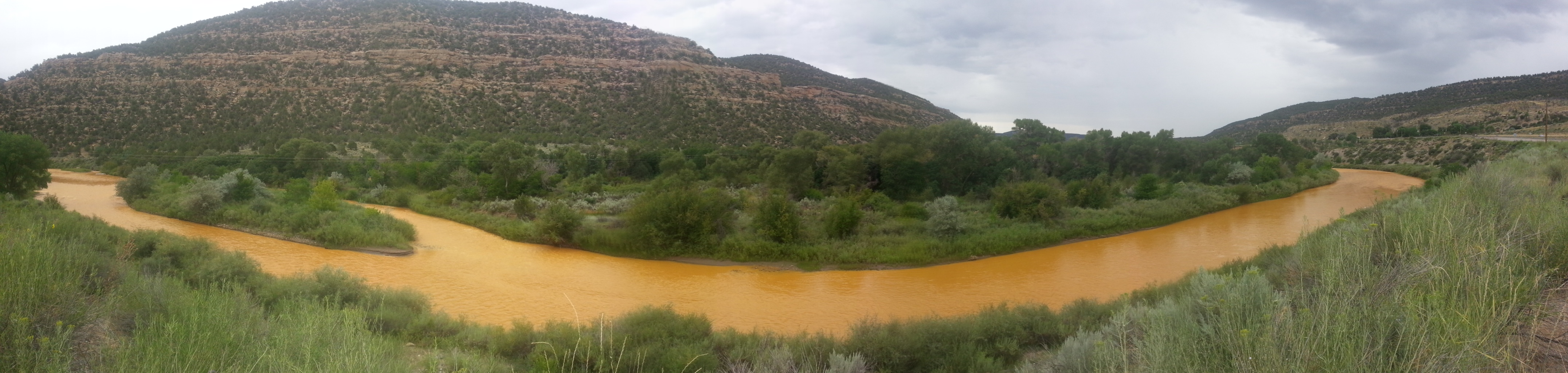
Last week’s $90 million settlement relating to the 2015 Gold King Mine Blowout that turned the Animas and San Juan Rivers TANG-orange for over 100 miles downstream did not bring an end to the legal saga that has dragged on for more than six years (lawsuits against the federal government are still pending). But when the agreement is finalized, Sunnyside Gold Corp—the owner of the nearby, now-shuttered Sunnyside Mine—will finally be free of the mess. Extricating themselves from any further liabilities has cost them about $67.6 million: $40.5 million to the feds; $6.1 million to the State of Colorado; $11 million to the State of New Mexico; and $10 million to the Navajo Nation, not to mention the tens of millions they’d already spent cleaning up a century’s worth of mining mess.
In agreeing to the payments, Sunnyside and its parent company, Canada-based global mining giant Kinross, have made it clear that they are not admitting wrongdoing or liability. They don’t own the Gold King Mine and never did. So why did the company fork out so much money?
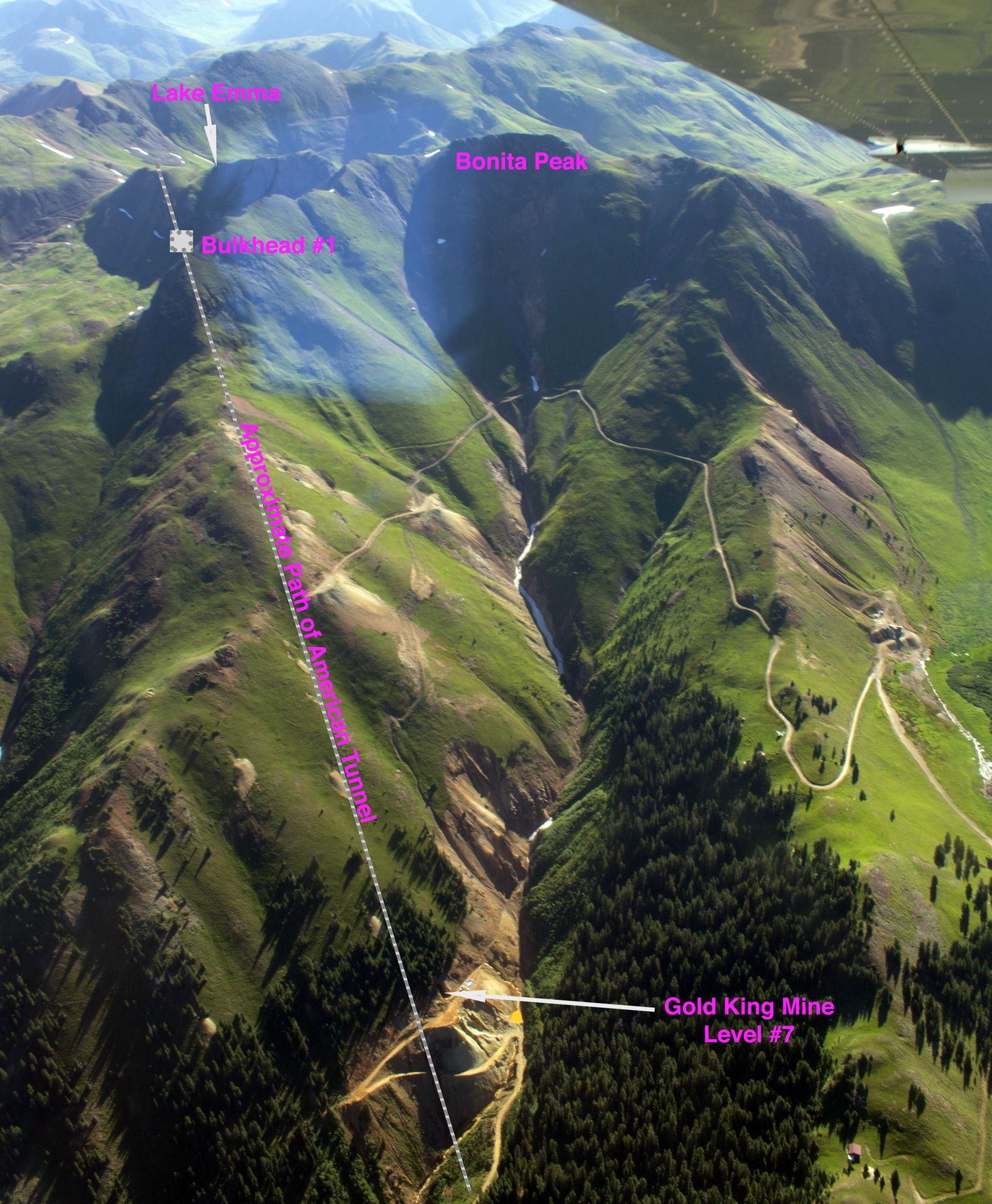
The simple answer is that the bulkheads Sunnyside installed in the American Tunnel in the 1990s and early 2000s caused water to back up inside Bonita Peak and make its way into the Gold King Mine, resulting in the 3 million-gallon blowout. The truth is a bit more complicated.
Bulkheads, like this one at the Red and Bonita Mine, help stop mine water discharges and allow engineers to monitor the mine pool. Credit: EPA.
The real question is not whether Sunnyside’s bulkheads backed up water into the Gold King Mine. That’s pretty much a given. More important is exactly where the water came from in the first place. And to get at that answer, we need to go back in time a century and some to the days when the Gold King Mine was one of the most profitable operations in Colorado.
To see the photos in full resolution, please view this at http://LandDesk.org.
A Timeline of the American Tunnel
1887 Olaf Arvid Nelson, while working at the nearby Sampson Mine, surreptitiously locates the original Gold King claim on the slopes of Bonita Peak, and goes to work on it immediately. He eventually digs a 50-foot shaft and a 50-foot drift, but never makes money from it.
1891 Nelson dies, perhaps from pneumonia, silicosis or just overwork. A year later his widow, Louisa, patents the Gold King claim, taking title to it. And in 1894 Louisa sells the Gold King claim to Northeastern capitalists Cyrus W. Davis and Henry Soule, for a mere $15,000. They hire local Willis Z. Kinney to run the mine.
1897 About 40 employees pull ore from the Gold King mine’s 2,000 feet or so of underground workings and ships it down a 5,600-foot long tramway from the mine opening’s lofty perch on Bonita Peak’s slope to a new mill at Gladstone for processing.
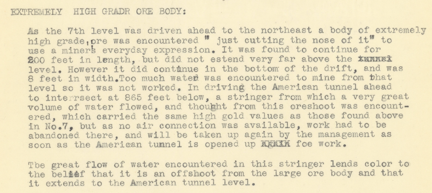
1898 The Gold King owners form the American Mining and Tunnel Co. and begin construction on a lower-elevation, safer access to the Gold King Mine several hundred feet below the current access adit (Gold King Level #1). They originally name the lower access point the American Tunnel, but after it is completed in 1903 and becomes the mine’s primary portal, it will be renamed the #7 Level of the Gold King Mine. This is level that will blowout in 2015 and is not the same American Tunnel in which Sunnyside placed its bulkheads many years later.
1900 USGS geologist Frederick Ransome visits the Gold King Mine, noticing that the main adit—or opening to the mine—is not draining any water, which is highly unusual for the area. He hypothesizes that the American Tunnel #1 (aka Gold King Level #7)—which at the time was under construction—is “deep draining” the water from the Gold King’s upper operations.
1900 The Gold King Mine owners begin construction on another American Tunnel (still known by that name today) at Gladstone. They plan to burrow into Bonita Peak until they are directly below the Gold King workings, then connect the two via a 1,000+ foot shaft. This will enable them to bring ore directly to the Gladstone mill, obviating the need to move it by tram across avalanche-prone terrain. But the project is abandoned after only 700 feet of tunneling (they need to go more than a mile underground before they will be in position to link with the Gold King).
1906 (or thereabouts) A photo of the Gold King Mine #7 Level appears to show about 200 to 300 gallons of water draining from the mine adit.
Gold King Mine drainage. Photo via The Land Desk
1908 The structures at the mouth of the Gold King #7 Level catch fire, destroying the tram terminal, boardinghouse, compressor house, carpenter shop, and stables, killing six. The mine rebuilds, but it will never be the same. In 1909 the new boardinghouse burns, killing a waiter, and in 1911 an avalanche hits the boardinghouse, killing four people. After that operations are on-again, off-again and profits hard to come by.
1921 The Gold King miners are working again to open the Gladstone tunnel, aka. the American Tunnel, that goes from the Gold King mill at Gladstone into Bonita Peak and under the Gold King Mine, about 860 feet below the Gold King #7 Level. The intent is to provide a long haulage tunnel for Gold King ore, thereby rendering the treacherous trams obsolete, but the connection to the upper mine is never made. A later report indicates that the American Tunnel is 6,233 feet deep when work is finally halted. The tunnel “deep drains” the groundwater of Bonita Peak, leaving the Gold King mine virtually dry.
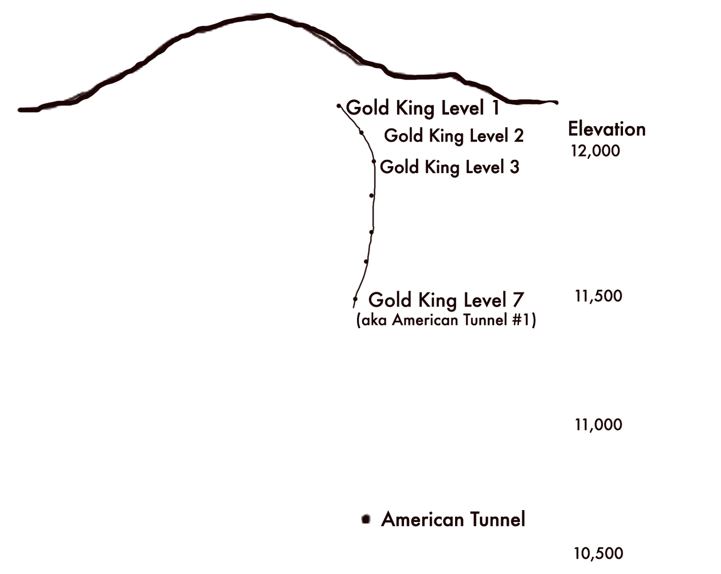
This shows the relative elevations of different levels of the Gold King and the American Tunnel. The Gold King was accessed via adits (mine openings) on Level 1 and Level 7. The other levels were mined, but did not have their own adits. Gold King Level 7 was called the American Tunnel when it was first built in the late 1890s, but the name was transferred to the far lower and longer American Tunnel that was originally built to link Gladstone with the Gold King Mine workings. The link was never completed and Standard Metals later took over the American Tunnel to access the Sunnyside Mine. Credit: The Land Desk
1922 The Gold King Mine’s parent company goes bankrupt, leaving the Sunnyside Mine, on the opposite side of Bonita Peak, as one of the region’s biggest mines. But it struggles because the mine opening is above the workings, meaning water and ore must be pulled up and out of the mine, against gravity, which increases operational expenses.
Text from a 1918 proposal to extend the Gold King Mine to meet up with the Sunnyside Mine workings. Credit: The Land Desk
1960 Standard Metals takes over the dormant Sunnyside Mine and plans to revive it by extending the unused, partially complete American Tunnel to access it. The tunnel will provide gravity-assisted ore-haulage and water drainage for the Sunnyside by way of Gladstone. When it’s finished, the tunnel is 11,000 feet long, and brings mining, and prosperity, back to Silverton.
General view of the Sunnyside Mine and Lake Emma, southwestern Colorado photo via the Denver Public Library
1978 On a Sunday, when no miners are working, the floor of Lake Emma collapses into the Sunnyside Mine, sending tens of millions of gallons of water shooting out the American Tunnel at Gladstone and shutting the mine down for months. To this day some folks remain suspicious of the collapse, theorizing that it was planned by a beleaguered company looking for an insurance payout: Miners had warned management about increasing amounts of water pouring into the mine and worried that they were getting too close to the lake’s floor. Ultimately, Standard Metals received $9 million, but they had to drag the insurance company to court to get it. The company will go bankrupt in the early 1980s and sell the Sunnyside Mine to Echo Bay, a Canadian company, doing business as Sunnyside Gold Corp.
1986 Meanwhile, a company called Gerber Minerals takes over the Gold King and sets about to re-open it. They apply for a mining permit for the Gold King, but not a discharge permit, because: “No drainage occurs from any of the portals—the district is deep-drained by the American Tunnel located at Gladstone.” As a result, the American Tunnel flows with about 1,600 gallons per minute of acidic, heavy-metal laden water draining into Cement Creek and, ultimately, the Animas River. Note: The first mile and some of the American Tunnel runs through Gold King Mine patented claims, meaning it belongs to the owners of the Gold King.
1987 Donald “Donnie” Goode killed when a 100-pound rock falls from the ceiling of Gold King #7 Level, about 2,500 feet underground, striking him in the head.
1988 Sunnyside overhauls the old American Tunnel water treatment plant. It uses one ton of lime per day to raise pH levels, causing toxic metals to precipitate out of solution and settle into ponds, cleaning the 1,600 gallons per minute of discharge to a level that can support sensitive fathead minnows. The process costs approximately $500,000 per year, and results in 365 tons per year of metal-laden sludge.
1991 The Sunnyside Mine closes for good. A year later the re-born Gold King suspends operations, as well, but holds onto its permits. In preparation for plugging, or bulkheading, the American Tunnel, Sunnyside Gold and Washington Mining Co. commission an exhaustive hydrological study of the Sunnyside, which concludes that bulkheads in the American Tunnel should not cause flooding of the Gold King, and that it would take 150 years for mine pool water to reach Cement Creek.
Cement Creek aerial photo — Jonathan Thompson via Twitter
1994 Animas River Stakeholders Group is formed as a citizen-led effort to study and address mining pollution in the watershed and propose realistic water quality standards. It’s seen as a collaborative alternative to Superfund. Bill Simon is chosen as coordinator. Other notable members include Peter Butler, who had just received his Ph.D. in natural resource management, Larry Perino of Sunnyside Gold, and Steve Fearn.
1996 Sunnyside enters into a consent decree with the state, a sort of pollution trading scheme. Sunnyside will install three bulkheads in the American Tunnel, one on its property to back up water into the Sunnyside’s workings, and two more on Gold King property nearer to the surface. They will also clean up a list of abandoned mines in the watershed in order to offset the increased heavy metal loading that will result when Sunnyside turns off its American Tunnel water treatment plant. At about the same time, the state division of minerals and geology inspects the Gold King and finds that it’s draining just one to two gallons of acidic, metal-laden water per minute, a mere trickle.
1996 The valve is shut on the first bulkhead over 6,000 feet into the American Tunnel, beyond the Gold King property line. Water backed up behind this will inundate the Sunnyside Mine workings and create what’s known as the Sunnyside mine pool. By robbing the system of oxygen, it should slow acid mine drainage reactions. Sunnyside also dumped 625 tons of lime in from the top of the mine to raise pH levels.
1991 The Sunnyside Mine closes for good. A year later the re-born Gold King suspends operations, as well, but holds onto its permits. In preparation for plugging, or bulkheading, the American Tunnel, Sunnyside Gold and Washington Mining Co. commission an exhaustive hydrological study of the Sunnyside, which concludes that bulkheads in the American Tunnel should not cause flooding of the Gold King, and that it would take 150 years for mine pool water to reach Cement Creek.
1997 A Gold King Mines environmental protection plan notes that the mine is discharging between 4 gpm and 30 gpm, with a pH as low as 2.25. However, the authors of the report theorize that it’s groundwater, not Sunnyside mine pool water, based on the 1992 hydrology report. A 1998 inspection finds that the Gold King #7 level portal had collapsed, just inside the portal, and is impassible. It does not say how much water is draining from the mine.
An aerial view of the Gold King Mine days after the 2015 blowout showing the approximate path of the American Tunnel, which runs beneath the Gold King. The Sunnyside Mine is beneath Lake Emma. Jonathan P. Thompson photo enabled by EcoFlight.org.
1999 A water analysis report of the Gold King Mine finds that the mine is discharging between 11 gpm and 30 gpm with a very low pH and very high concentrations of dissolved metals. The following year Steve Fearn buys the Gold King mine from CCTC, trustee for Pitchfork “M” Corp. The state inspection later that year notes: “Though this year has been abnormally dry, the No. 7 level discharge appears to have increased significantly … from around 30 gpm to around 45 gpm.”
2001 The Sunnyside Mine Pool is thought to have reached equilibrium, based on the findings of the 1992 hydrological study. The mine pool, some 1,200 feet deep, exerts nearly 500 psi on bulkhead #1. Sunnyside then installs bulkhead #2, which is closer to the surface and, in 2002, bulkhead #3, which is right at the surface, in preparation for its exit from the area. By now Sunnyside Gold has spent upwards of $25 million on cleanup and reclamation. Discharges from both the Gold King and the nearby Mogul Mine—which was also mostly dry prior to the first bulkhead installation—continue to increase.
2003 A byzantine agreement transfers ownership of the Sunnyside water treatment plant to Gold King owner Fearn, allowing Fearn to treat Gold King water, and allowing Sunnyside to leave—in theory. Also involved in the deal is Todd Hennis, owner of the Mogul Mine in the Cement Creek drainage, who acquires most of the Gladstone townsite. The deal will go bad a year later when Hennis evicts Fearn, and thus the water treatment plant, from his property at Gladstone, shutting down water treatment for good (proving detrimental to downstream fish populations). Meanwhile, Fearn’s mining ventures have gone broke. Hennis will acquire the Gold King and in coming years set about to mine it, first with a new company called Colorado Goldfields, and then on his own.
When treatment of water draining from the Gold King Mine ceased in 2004, downstream water quality—and fish populations—were negatively affected. Credit: The Land Desk
2005 Gold King mine discharges have increased to 200 gallons per minute or more. Animas River Stakeholders Group calls in the Environmental Protection Agency to help figure out the cause and potentially fund a solution. In its annual report to the Security Exchange Commission, Colorado Goldfields says it intends to re-open Gold King #7 Level, and that it hopes to enter into an agreement with the EPA allowing it to deal with increasing flows of acid mine drainage, which the company believes are coming from the “2150 vein workings of the Sunnyside Mine.” The report also notes the danger for a “blow out of potentially impounded mine waters.”
2009 The State Division of Mining Reclamation and Safety calls the Gold King, now dumping nearly 200,000 pounds of metals into the watershed per year, “one of the worst high quantity, poor water quality draining mines in the State of Colorado.” It backfills the mine portal, or opening, because it had collapsed, and installs drainage pipe.
2014 Sunnyside Gold Corp. offers $10 million towards water treatment and other upper Cement Creek cleanup—as long as Superfund isn’t declared.
2015 EPA contractors begin excavating dirt piled up at the opening of Gold King Mine #7 Level until the operator notices a “spring” spurting from the dirt. Within minutes, the tiny fountain has grown to a 3-million gallon torrent of electric-orange, acidic, heavy metal-laden water pouring into the North Fork of Cement Creek far below.
Prior to mining, snowmelt and rain seep into natural cracks and fractures, eventually emerging as a freshwater spring (usually). Graphic credit: Jonathan Thompson
So, yeah, I know: That made it about as clear as the Animas River was in the days following the blowout. This puzzle will never be solved definitively. Bonita Peak’s hydrology is all a tangled maze of fractures and faults and veins, a sort of lithic Swiss cheese comprised of hundreds of miles of drifts, shafts, crosscuts, and tunnels, creating innumerable potential paths the water could follow.
But from what we can glean from the history we can conclude:
• The Gold King Mine had water flowing through it early on. When the first American Tunnel, aka #7 Level, was dug, it deep drained the upper levels, making them appear to be dry.
• About 200 to 300 gallons of water per minute flowed out of the #7 Level adit until the new American Tunnel was drilled under the Gold King in the 1920s, deep draining the entirety of Bonita Peak.
• It wasn’t until after Sunnyside installed bulkheads in the American Tunnel that drainage returned to the Gold King #7 level (as well as to the Mogul Mine). It’s safe to conclude in this case that correlation is causation: The installation of the bulkheads caused drainage to return to the Gold King.
Not clear, though, is precisely where the water was coming from: Did the Sunnyside mine pool water back up, then find a pathway through to the Gold King Mine? If so, then it would seem that Sunnyside is at least partially responsible for the resulting 2015 blowout, since that nasty orange water originated on its subterranean property. Or did the lower two bulkheads—which are on Gold King property—simply return Bonita Peak’s hydrology to a pre-American Tunnel state of affairs, or a “natural flow regime,” as one Sunnyside employee put it in the early 2000s? In that case it is not Sunnyside Gold’s water, it’s the Gold King’s, which would absolve Sunnyside of responsibility.
While conclusive answers to those questions aren’t exactly forthcoming, a look at the timeline suggests that the water that spewed from Gold King #7 Level on Aug. 5, 2015, may have come from both sources. Drainage from the Gold King first started increasing—albeit only marginally—in 1997, after bulkhead #1 had been installed but before the next two were sealed. But flows remained pretty low until after the valves on bulkheads #2 and #3 were closed. It was only then that the Gold King became a major source of acid mine drainage and conditions established that would lead to the blowout.
But at this point maybe it doesn’t matter: Even if Sunnyside could prove that it’s not liable for what happened in 2015, it still would have been the last and only viable mining concern in the vicinity when it happened. Whether it’s culpable or just happened to be in the wrong place at the wrong time is probably irrelevant. In either case, the company would have had to take responsibility or else risk damaging its corporate image. That’s the price one pays for playing the mining game.
Yampa River. Photo credit: Yampa River Integrated Water Management Plan website
Here’s the memorandum from the Colorado Division of Water Resources (Kevin Rein):
Background
On March 17, 2021, Erin Light submitted a letter request to me on the subject of Designation of the Yampa River as Over-Appropriated (“Report”). The Report contains climate, hydrologic, and administrative call information to support a description of the Yampa River and its tributaries upstream of its confluence with the Little Snake River as over- appropriated and requests that I make a formal determination that the Division of Water Resources (“DWR”) designate that reach of the river and its tributaries as over-appropriated and treat them accordingly for the purposes of administration. For the purposes of the DWR’s administration and well permitting decisions, a stream is considered over-appropriated when “at some or all times of the year, the water supplies of said stream system are insufficient to satisfy all the decreed water rights within that system”1 (“Over-Appropriated”). The Report is comprehensive and shows that the Yampa River upstream of the confluence with the Little Snake River is Over-Appropriated. The Report is available for review at this link.
Yampa River Basin via Wikimedia.
Designation
Based on my review of the Report, I have determined that, effective March 1, 2022, the reach of the Yampa River upstream of the confluence with the Little Snake River, including all of its tributaries, as more clearly shown on Attachment A (“Affected Area”), is Over-Appropriated. My determination (”Designation”) recognizes the climate, hydrologic, and administrative call conditions that are now present on the Yampa River for the Affected Area. The Designation does not impact the legal ability to appropriate water from the Yampa River nor does it change administration of surface water rights on the Yampa River.
The purpose of the Designation is to provide the formal basis for DWR to consider the injurious impacts of wells during DWR’s evaluation of new applications for well permits.
Evaluation of Well Permit Applications
For applications for new well permits or permits to expand the use of existing wells.
Beginning March 1, 2022, DWR staff will treat the Affected Area as Over-Appropriated for the purpose of evaluating applications, filed on or after March 1, 2022, for new well permits or permits to expand the use of existing wells.
For applications to permit existing wells, where the well and its uses existed prior to March 1, 2022.
To allow a reasonable period of time for the owners of existing wells to obtain a well permit, for wells where the well owner can demonstrate that the well and its uses existed prior to this Designation date of March 1, 2022, DWR will accept applications to permit those existing wells and evaluate the applications without treating their impacts as injurious through December 31, 2022. Such wells may include but are not limited to pond wells or other structures that expose groundwater to the atmosphere. For applications for such existing wells filed on or after January 1, 2023, DWR staff will consider the injurious impacts from those existing wells for the purpose of evaluating the applications.
For these two categories of well permit applications, effective on the dates shown above, DWR staff will presume that the well will materially injure the vested water rights of others and the well permit application must be denied unless the well qualifies for a statutory presumption of no injury or other provision in statute, alone or in combination with State Engineer Policy and/or Guideline, or the well permit applicant has obtained a plan for augmentation decreed by the water court or a substitute water supply plan approved by the State Engineer.
Scott Hummer, water commissioner for District 58 in the Yampa River basin, points out how snowmelt flows from high elevation down to the valley where the water is used for irrigation. Hummer said most water users in the Yampa are complying with a state order issued nearly a year ago that requires measuring devices. Photo credit: Heather Sackett/Aspen Journalism
FromColorado Public Radio (Michael Elizabeth Sakas):
A growing demand for a shrinking water supply in northwest Colorado has led state water officials to officially declare most of the Yampa River as over-appropriated. The designation is a formal recognition there’s no longer enough water for everyone who wants it. That triggers changes in how the state will grant permits for new wells in the area.
Smaller sections of the upper Yampa and some of its tributaries have already been deemed over-appropriated, including the upper Yampa River when increased development in Steamboat Springs put more demand on the river. But as climate change and extended periods of drought continue to dry up the West, state engineer and director of the Colorado Division of Water Resources Kevin Rein said it was necessary to expand the designation to the lower part of the river, too.
A map of the new and existing areas along the Yampa River considered as over-appropriated. Courtesy of the Colorado Division of Water Resources
The declaration will change how permits for groundwater wells are approved but doesn’t affect how the water that flows on the surface of the Yampa River and its tributaries is managed and used, Rein said…
Augmentation plans are obtained through water court, a process Rein said can be difficult for individuals to navigate. Rein said the Great Northern Water Conservancy District plans to create a blanket augmentation plan that water users could sign up for, like the Upper Yampa River Conservancy District has done in recent years.
The decline in the Yampa River’s flows has also prompted the state to now require water users in the area to measure how much water they use, as decades of climate change-fueled drought have diminished supplies on the Western Slope.
ON Instagram Karen Lundquist asks, “Other than locally voting, what else can be done to oppose this horrible proposal?”
“What a crock,” writes Don Richmond on Facebook.
You can say the Valley is gearing up for another fight over its water.
“This fight has now come to the forefront in what would seem to be a David vs. Goliath scenario,” said Alamosa City Councilman Mike Carson, who used last week’s meeting to rally his fellow city council members to the urgent matter of the day – beating back the latest effort to move water out of the Upper Rio Grande Basin and the San Luis Valley. (Read his full statement HERE.)
“The current proposal ‘threat’ to the water security challenges in the San Luis Valley presented by Renewable Water Resources is once again a demonstration of self-serving financial speculation at the expense of others,” said Cleave Simpson, general manager of the Rio Grande Water Conservation District and state senator representing the San Luis Valley and counties east of the Valley.
The conservation district has launched ProtectSanLuisValleyWater.com as its public-facing strategy to address the RWR plan. You can go back through the decades to find other water exportation efforts, including American Water Development Inc.’s (AWDI) application to the Colorado Division 3 Water Court in the 1990s to pump groundwater from the Valley.
This past week Renewable Water Resources engineer Bruce Lytle presented the RWR plan to Douglas County commissioners. They’re weighing whether to use $20 million of Douglas County’s federal COVID relief funding to invest in the RWR plan as a way to bring additional water to the growing Denver-metro county.
Douglas County Commissioner Abe Laydon, who holds what appears to be the deciding vote on the three-member county commission, emphasized Douglas County’s growth and the importance of positioning Douglas County for the future as a basis for any decision he makes on whether to support the RWR plan.
“I have not made any decision whatsoever, nor will I without the input of the community and water experts,” Laydon told AlamosaCitizen.com. “We still have a lot to learn but I hope everyone that is interested will join us in these public meetings and provide their input along the way.
“What I can assure you of is that I will not do anything that is not a clear win/win for both our citizens and the people of the San Luis Valley. That is my commitment, on the record, and I will not deviate from that.”
Laydon is in a position to decide whether the RWR plan moves forward to a formal state review after one his colleagues, Douglas County Commissioner Lora Thomas, voiced opposition to taking water from the San Luis Valley and another, Commissioner George Teal, leaned to supporting it.
On Monday [January 24, 2022], the Douglas County commissioners are scheduled to meet with three attorneys who will talk to them about Colorado water law as it relates to the RWR plan. The attorneys are James Eklund of Eklund Hanlon LLC; John Lubitz, partner with Lewis Brisbois Bisgaard & Smith LLP; and Glen Porzak, managing partner with Porzak, Browning & Bushong LLP.
The backdrop for the RWR push to transfer 20,000 acre-feet of water per year from the confined aquifer of the Upper Rio Grande Basin is an over-appropriated, drought-stricken San Luis Valley that has fewer wetlands, lower stream flows, diminishing natural spring flows, and fewer irrigated acres as the result.
The San Luis Valley Ecosystem Council is raising concerns about damage to the Blanca Wildlife Habitat, among other environmental concerns. RWR’s proposal neighbors the Great Sand Dunes National Park on the northeastern end of the Valley, and RWR’s engineer Bruce Lytle emphasized in his presentation to Douglas County that the plan is “designed to take advantage of the rim recharge coming off the Sangre de Cristos.”
“It’s difficult to get your mind wrapped around the potential environmental impacts of the Renewable Water Resources proposal because effects are so numerous and far-reaching that to quantify on any practical level, we’d have to also keep in mind the exponential affects, because this RWR proposal is asking for perpetuity of ground water withdrawal, so the aquifers potentially won’t ever be able to recharge once the pumps are turned on,” said Chris Canaly, director of the SLV Ecosystem Council.
The San Luis Creek and Rio Alto Creek move through the preliminary wellfield of 22 to 25 groundwater wells that RWR showed to Douglas County.
“The environment in this area has already been changing over time,” said Canaly. “This area is now struggling, in terms of desertification, so RWR’s proposal is just adding fuel to an already burning fire.”
Baca National Wildlife Refuge
Just southwest of the RWR proposed wellfield is the Baca National Wildlife Refuge, where biologists for Colorado Parks and Wildlife and the US Fish and Wildlife Service (USFWS) have been working to conserve two native Rio Grande fish, according to Canaly. The Baca refuge is also home to one of only two aboriginal populations of Rio Grande sucker and Rio Grande chub in the state. Important fish habitat also resides in Crestone Creek, which runs through the refuge, and work in 2017 replaced old culverts to restore fish passage and enhance connectivity in the stream.
“This is the type of restoration work that the RWR project would likely undermine and dismantle,” Canaly said. She said, “if you look at the ‘impact maps’ that RWR Engineer Bruce Lytle displayed, that entire area of the Sangre de Cristo foothills watershed/alluvial fan will be impacted.”
Denver Basin Aquifer System graphic credit USGS.
Whether or not RWR makes it to the phase of well drilling and exportation, what remains is the growth of Colorado’s Front Range from Colorado Springs north and concerns with the Denver Basin.
“Many conversations have and are taking place as to why Front Range cities and towns are going to need to depend less on the Denver Aquifer,” said Monica McCafferty with Renewable Water Resources. “And, why water providers in the Front Range are scrambling to find non-Denver aquifer sources.”
In a world where water is becoming an even more scarce and sought-after natural resource, water exportation proposals like RWR’s only need to win one time in court to sink wells in the ground and pump water north. The San Luis Valley, on the other hand, has to win each and every time to protect one of the most unique ecosystems in North America.
The sandhill cranes are back in the San Luis Valley (2020) on their spring migration. Photo credit: Colorado Parks & Wildlife
[The North Fork of the Republican River] is one of the only channels in the Republican River basin in Colorado with consistent flows these days.
[Tracy Travis] part-time farmer and school bus driver works here seasonally as a water engineer. His job is to get water flowing from former agriculture irrigation wells north of here “and into a tank which flows over into a 42-inch pipeline that runs about 12 miles down to the river.”
“It’s not a good thing for the people in this area because we’re giving our water up,” Travis said.
There are a lot of mixed feelings about this pipeline among the people who spoke with KUNC. Nebraskan officials see it as a net positive. Ultimately, all agree it must exist. Explaining why requires going back to 1935…
Republican River Flood of May 30, 1935. Photo credit: NWS
Today, the Republican River in Colorado is described as not even “deep enough to drown in.” But in 1935, it flooded and killed over 100 people in Nebraska and around a dozen in Colorado (if not more) — including four of Republican River Water Conservation District Manager Deb Daniel’s relatives…
Up to that point, Colorado, Kansas and Nebraska had managed the river basin’s water within their borders independently.
“There was hardly any irrigation other than surface water irrigation from the rivers themselves and very little in Colorado,” said Yuma County Commissioner and farmer Robin Wiley. “The majority of it was downstream in Kansas and Nebraska.”
After the 1935 flood, the states needed dams and reservoirs to prevent future disasters. The federal government would help build them, but with one condition: the states needed to find a way to manage the river cooperatively.
After three years of negotiations, the Republican River Compact was approved in 1943.
The High Plains Aquifer provides 30 percent of the water used in the nation’s irrigated agriculture. The aquifer runs under South Dakota, Wyoming, Nebraska, Colorado, Kansas, Oklahoma, New Mexico and Texas.
During the three following decades, new technology made it easier to use groundwater. Development of irrigation wells exploded — from around 90,000 in 1949 to over 1 million in 1992 in Nebraska alone — increasing the viability of agriculture “especially in Yuma County, but throughout our entire basin,” Wiley said.
Wiley’s family has farmed here since the 1950s. He says it’s likely that his grandfather and father knew little about the compact, until the now-drained Bonny Reservoir was built right in their “backyard.”
“I think they realized that there was a compact, signed at the time, but no inclination on really how it was going to impact us,” he said.
Even if they had carefully gone through every page of the compact, his predecessors would have missed the part that impacts water users most today — because it wasn’t written in the original document.
The Ogallala aquifer, also referred to as the High Plains aquifer. Source: National Oceanic and Atmospheric Adminstration
“There was no inclination that the groundwater was tied to the surface water,” Wiley said.
If water wasn’t coming directly from the river or the ground immediately around it, Colorado assumed it didn’t affect the amount of water flowing across the border (a primary measurement for compact compliance). That assumption was challenged in 1998, when Kansas sued Nebraska over its groundwater use.
“And then Colorado got dragged into it,” he said. “That brought all this to the head.”
[…]
The state engineer manages multiple (but not all) interstate river compacts in Colorado. Dick Wolfe was in that position for about 10 years, until retiring in 2017.
As water levels dropped, the interstate agreements forced officials and local water users to make many sacrifices, like draining Bonny Reservoir on the river’s South Fork in 2011.
“Folks banded together, (and did), I think, a great job looking at everything they could to try to make the best of a bad situation,” Wolfe said. “But I think all in all, when I reflect back on it, I don’t know if there’s too much more we could have done differently.”
Colorado’s efforts to reduce groundwater use, including an agreement to shut down 25,000 irrigated acres in the basin by the end of this decade, didn’t guarantee the state couldn’t fall out of compliance in the meantime. And around 2007 to 2010, it very nearly did.
The Republican River’s South Fork near Hale, Colorado, with the region’s seemingly endless fields. Credit: Wikimedia Commons/Jeffrey Beall
To heavily simplify the way this compact’s complex math works: water naturally evaporating from Bonny Reservoir made Colorado get less credit for the water it actually sent across the border on the South Fork…
But, out of all the hard decisions made in 24 years of working with water in a state facing river crises in every corner, emptying that reservoir “was the toughest one,” Wolfe said.
The other reason Colorado almost fell out of compliance: quickly dropping North Fork flows.
Missouri River Reuse Project via The New York Times
“We were in the early stages, 2007, 2008 looking at what options are out there to get us back into compliance,” he said. Suggestions included importing water from the Missouri River. “Some of them just didn’t prove feasible.”
Ultimately, the decision was made to buy out irrigation wells from a producer and connect them to a pipeline. It drops the water right before a measurement gauge at the Nebraska-Colorado border.
Perrin duLac’s Map of the Banks of the Missouri River: “Carte du Missouri : levee ou rectifiée dans toute son etendue” Published the year before the Louisiana Purchase, this map records late-18th/early-19th century French names of the river branches and located settlements of the Missouri River. By Perrin du Lac, M. (François Marie) – Library of Congress, Public Domain, https://commons.wikimedia.org/w/index.php?curid=54698291
This image was taken during the peak outflow from the Gold King Mine spill at 10:57 a.m. Aug. 5, 2015. The waste-rock dump can be seen eroding on the right. Federal investigators placed blame for the blowout squarely on engineering errors made by the Environmental Protection Agency’s-contracted company in a 132-page report released Thursday [October 22, 2015]
We have just received word that the federal government and the owner of the Sunnyside Mine have agreed to pay a total of $90 million to settle claims relating to the 2015 Gold King Mine blowout. The proposed consent decree will be posted in the Federal Register and opened to public comment for 30 days prior to being finalized.
That consent decree will “resolve all claims, cross-claims, and counterclaims between the United States and Sunnyside Gold Corporation and Kinross Gold Corporation (the “Mining Defendants”) in this multidistrict litigation,” according to the U.S. District Court of New Mexico filing.
The Land Desk will have more details—along with a wonkfest explaining why Sunnyside is even involved with an incident that occurred at a mine it doesn’t own—next week.
The settlement by the numbers:
The “Bonita Peak Mining District” superfund site. Map via the Environmental Protection Agency
$40.95 million
Amount Sunnyside Gold Corp., a subsidiary of Canada-based Kinross Gold, will pay to the federal government under the settlement, all of which will be used to finance cleanup relating to the Bonita Peak Mining District Superfund site.
$4.05 million
Amount Sunnyside Gold will pay to the Colorado Dept. of Health and Environment.
$45 million
Amount the U.S. government, on behalf of federal settling agencies—the Environmental Protection Agency, the Bureau of Land Management, and the U.S. Forest Service—will pay to “appropriate federal accounts” under the settlement.
Prior to mining, snowmelt and rain seep into natural cracks and fractures, eventually emerging as a freshwater spring (usually). Graphic credit: Jonathan Thompson
The Environmental Protection Agency, Justice Department, Department of the Interior, Department Agriculture and state of Colorado announced Friday they have reached a settlement with Sunnyside Gold Corp. and its parent company Kinross Gold Corp. to fund remediation in the Bonita Peak Mining District near Silverton.
In the case of an old-fashioned standoff, the federal government will drop its claims against Sunnyside Gold Corp. and Canadian mining company Kinross Gold Corp. and the two companies will drop their claims against the federal government after the settlement.
Sunnyside Gold Corp. will pay $40.95 million to the federal government and the EPA and another $4.05 million to Colorado, while the United States will contribute $45 million to the cleanup of mining contamination in the area…
The agreement marks the end of Sunnyside Gold Corp.’s remediation work in the Bonita Peak Mining District. The EPA previously ordered the company to undertake a costly investigation of groundwater in the area in March 2018.
The state of Colorado has also released Sunnyside from its reclamation permit obligations, which require the company to clean up its past mining operations and meet the conditions of a reclamation plan approved by the Colorado Department of Reclamation, Mining and Safety, a branch of the state’s Department of Natural Resources.
In addition, the settlement limits the future liability of both Sunnyside Gold Corp. and its parent company…
The settlement was made as a matter of practicality with no admission of wrongdoing or liability, Myers said in an email to The Durango Herald.
Myers noted the federal government’s matching $45 million was a result of the federal government’s own liability for the Gold King Mine spill and damage to the surrounding area…
The Colorado and the federal governments have argued that Sunnyside Gold Corp. is partly at fault and responsible for funding remediation in the Bonita Peak Mining District after placing bulkheads in the 1990s to prevent the drainage of contaminated water.
Bulkheads, like this one at the Red and Bonita Mine, help stop mine water discharges and allow engineers to monitor the mine pool. Credit: EPA.
In legal filings, the state has said the bulkheads backed up waste in surrounding mines, including the Gold King Mine, which was released when EPA contractors accidentally caused a blowout…
The EPA has already spent more than $75 million to remediate the site.
The Bonita Peak Mining District Community Advisory Group is working to define water-quality targets and other environmental standards that will need to be met for the area to be considered decontaminated. Those targets will help guide the work of the EPA…
[Ty Churchwell] said a full cleanup of the site will likely take at least another decade. He pointed to similar Superfund sites near Leadville and Idaho Springs that each took about two decades.
The settlement is a step in that direction.
Silverton, Colo., lies an at elevation of 9,300 feet in San Juan County, and the Gold King Mine is more than 1,000 feet higher in the valley at the left side of the photo. Photo/Allen Best
FromThe Associated Press (James Anderson) via The Colorado Sun:
The agreement must be approved by the U.S. District Court in the District of New Mexico after a 30-day public comment period…
An EPA-led contractor crew was doing excavation work at the entrance to the Gold King Mine, another site in the district not owned by Sunnyside, in August 2015 when it inadvertently breached a debris pile that was holding back wastewater inside the mine.
Settling ponds used to precipitate iron oxide and other suspended materials at the Red and Bonita mine drainage near Gold King mine, shown Aug. 14, 2015. (Photo by Eric Vance/EPA)
An estimated 3 million gallons of wastewater poured out, carrying nearly 540 U.S. tons of metals, mostly iron and aluminum. Rivers in Colorado, New Mexico and Utah were polluted…
Monies will be used for water and soil sampling and to build more waste repositories. The EPA said in a statement Friday it has spent more than $75 million on cleanup work “and expects to continue significant work at the site in the coming years.”
The orange plume flows through the Animas across the Colorado/New Mexico state line the afternoon of Aug. 7, 2015. (Photo by Melissa May, San Juan Soil and Conservation District)
The proposed consent decree follows Sunnyside settlements with New Mexico and the Navajo Nation earlier this year. Sunnyside admits no fault in the agreement.
Cement Creek aerial photo — Jonathan Thompson via Twitter
Douglas County Commissioners hold work session as they decide on $20 million investment
DOUGLAS County Commissioners were told [January 18, 2022] that there is ample water in the San Luis Valley that can be exported to the Front Range and were shown a preliminary wellfield design for the northern end of the Valley.
Bruce Lytle, engineer for Renewable Water Resources’s proposal to move 20,000-acre feet of water a year to Douglas County, walked the three Douglas County commissioners through the Valley’s complex two-aquifer system and left them with the idea that there is water available for exportation.
“It doesn’t sound like there’s any controversy about the water being there. The water is there,” said Commissioner George Teal.
“I would agree with that,” said Lytle.
While Teal demonstrated interest in Douglas County partnering with Renewable Water Resources, Commissioner Lora Thomas voiced opposition to exporting water from the San Luis Valley. (You can read her letter to The Citizen explaining her position HERE.) That would leave Commissioner Abe Laydon as the deciding vote on whether Douglas County spends $20 million of its federal American Rescue Plan Act money, or COVID relief funds, to push the project forward into state water court.
Laydon said he’s planning to visit the San Luis Valley, including possibly having a community forum in mid-March at Adams State, to hear from Valley residents. RWR is dangling a $50 million community fund as part of its plan, and said it would also make a “$68 million investment to pay local San Luis Valley farmers and ranchers who voluntarily wish to retire their water rights above the market rate,” said spokesperson Monica McCafferty.
Colorado State Deputy Engineer Mike Sullivan offered the Douglas County Commissioners a starkly different picture of the Valley’s water situation.
“There’s no extra water,” Sullivan said, explaining that the groundwater supply is over-appropriated and actual Upper Rio Grande Basin streamflows in decline.
State Engineer Kevin Rein told AlamosaCitizen.com in an earlier story that RWR has misrepresented Douglas County’s reliance on the “Denver Aquifer” and a “proposed rule change” from the state engineer that RWR said would drastically affect Douglas County’s reliance on the Denver Basin.
“The cumulative effect of RWR’s statements is an inaccurate portrayal of the State Engineer’s actions and the facts,” said Rein.
San Luis Valley Groundwater
While Douglas County Commissioners were going through the RWR proposal in Castle Rock, the Rio Grande Water Conservation District Board of Directors was also in session. Board members heard little encouraging news about the Valley’s aquifers heading into the 2022 irrigation season:
The unconfined aquifer is at its lowest point since January 2013, with concerns that it hasn’t recharged as it typically does when there is little irrigation happening in the Valley.
Producers in Subdistrict 5 of the conservation district will likely face another irrigation season where groundwater wells are shut down.
The Great Sand Dunes National Park experienced its fourth hottest year on record and the SNOTEL station that measures the runoff expected from Medano Creek is at 50 percent of normal for the season.
RWR’s proposal neighbors the Great Sand Dunes on the northeastern end of the Valley. Lytle, the engineer for RWR, said they expect to have 22 to 25 groundwater wells pumping, with the well depth at 2,000 feet and wells spaced a mile apart.
The San Luis Creek runs through the middle of the wellfield and Rio Alto Creek through the southwestern side. “The orientation of the project is designed to take advantage of the rim recharge coming off Sangre de Cristos,” said Lytle.
Convinced that there is water available for Douglas County, commissioners Teal and Lytle played out the scenario.
“And so it would be the water court process that determines ‘Is that water available for us?’” said Teal.
“You have to follow the rules. To me, if we follow the rules, then you can get a decree augmentation plan,” said Lytle. “Now, there’s always issues. I’ve been in water court enough to know that nothing is a slam dunk in water court.
“But obviously your best chance of success is if there’s a set of rules, and you follow those rules, then it makes it more difficult for issues to be raised relative to injury.”
RENEWABLE Water Resources has made an “inaccurate portrayal of the State Engineer’s actions and the facts” in its pitch to Douglas County to partner in exporting water from the San Luis Valley, State Engineer Kevin Rein said.
Rein, in an email response to a series of questions from AlamosaCitizen.com, said RWR misrepresents Douglas County’s reliance on the “Denver Aquifer” and how a “proposed rule change” from the state engineer would drastically affect Douglas County’s relationship with the aquifer.
“The cumulative effect of RWR’s statements is an inaccurate portrayal of the State Engineer’s actions and the facts,” Rein said.
Kevin Rein, Colorado state water engineer, explains why Colorado needs stepped-up measuring of water diversions in the North Park and other rivers in Northwest Colorado while Erin Light, Division 6 engineer, looks on during a meeting in Walden on Oct. 22. Credit: Allen Best
Rein said his office has not taken a position on the RWR proposal because the project, led by former Colorado Gov. Bill Owens, has not been formally submitted for regulatory review to the State Engineer’s Office. RWR is courting Douglas County as an investor in its efforts to export water from the San Luis Valley to Colorado’s Front Range. To move the project to formal review both by Rein’s office and state Division 3 Water Court, RWR needs to identify an end user for its effort to export water from the Valley.
The project has created an uproar, with city officials from Monte Vista the latest to blast it as a “scheme to transport our valuable water resources out of the San Luis Valley.”
“The idea that there is an abundance of water for Douglas County suburbia to continue to sprawl at the San Luis Valley’s expense is shameless,” Monte Vista officials said in a letter to AlamosaCitizen.com. The full letter is here.
Denver Basin Aquifer System graphic credit USGS.
In its pitch, Renewable Water Resources said Douglas County is overly dependent on the Denver Aquifer as its main water supply, and remaining dependent on it threatens the Denver suburb’s property values, economic growth and quality of life.
“Additionally, a proposed rule change could drastically impact Douglas County’s relationship with the Denver Aquifer,” RWR states in its pitch to Douglas County for money. “Colorado’s State Water Engineer recently urged Denver Metro water providers, including those located in Douglas County, to seek renewable sources of water other than the Denver Aquifer. This new guidance will limit the use of the Denver Aquifer and essentially maintain the Aquifer as a ‘preserve.’”
Rein, when asked about the accuracy of RWR’s statements, said, “First, as a matter of hydrogeology, there is one hydrogeologic feature known by scientists and water users as the ‘Denver Basin.’ It stretches from approximately Greeley to Colorado Springs and from the foothills to Limon. Within the Denver Basin is a layering of discrete aquifers that for administration purposes are treated as separate sources. Those aquifers, from the top layer to the bottom layer are: the Dawson Aquifer, the Upper Dawson Aquifer, the Lower Dawson Aquifer, the Denver Aquifer, the Arapahoe Aquifer, the Upper Arapahoe Aquifer, the Lower Arapahoe Aquifer, and the Laramie-Fox Hills Aquifer.
“This information is relevant because the (RWR) report states that ‘Douglas County is currently overly dependent on the Denver Aquifer as its principal water supply…’ However, I know that Douglas County municipal water suppliers and private well owners rely on nearly all of the aquifers I’ve listed, from the Dawson to the Laramie-Fox Hills. Their reliance is not on only the Denver Aquifer.
“Second, the (RWR) Report states, ‘Additionally, a proposed rule change could drastically impact Douglas County’s relationship with the Denver Aquifer.’
“The Report does not cite the claimed ‘rule change.’ For your information, the Division of Water Resources recently proposed amended Statewide Nontributary Ground Water Rules, which rules we regard as consistent with the General Assembly’s statutorily-described allocation of nontributary ground water (see SB73-213; section 37-90-137(4), C.R.S.). To my knowledge, neither RWR nor those Douglas County entities have shown evidence that the State Engineer has ever shown a different application of the General Assembly’s intended allocation. Therefore, I find no support for RWR’s claim that ‘a proposed rule change could drastically impact Douglas County’s relationship with the Denver Aquifer.’ As the State Engineer I believe that RWR should account for this claim since it appears to have no basis.
“In summary, there has been no rule change. If RWR believes the State Engineer’s long-standing application of state statute ‘drastically impacts’ Douglas County, they should also be aware that the State Engineer has not changed its application of the statute in the last 48 years. I am not aware of any evidence to the contrary.”
Renewable Water Resources said it relied on information from a January 2021 environmental law and policy alert on a call for public comment around the proposed amended statewide nontributary groundwater rules.
“Many conversations have and are taking place as to why Front Range cities and towns are going to need to depend less on the Denver Aquifer. And, why water providers in the Front Range are scrambling to find non-Denver aquifer sources,” said spokesperson Monica McCafferty. “This is a known fact in the Front Range and likely to be discussed more in the Douglas County public hearings.”
Rein had a third rebuttal to RWR when the group said in the proposal to Douglas County that Rein had recently urged Denver Metro water providers “to seek renewable sources of water other than the Denver Aquifer,” and called it “new guidance” from the State Engineer.
“I see no basis for this claim,” Rein told Alamosa Citizen. “Since 1996, the State Engineer’s Office has included notes on our correspondence to Douglas County regarding subdivision water supplies that remind the county of the non-renewable nature of the Denver Basin as a water supply. We include the same information on Denver Basin well permits that we issue. We provide this information as a courtesy since we are an agency that knows the science and administrative aspects of the Denver Basin.
“The next statement in the report states that ‘(f)or Douglas County, this ruling is an imminent and practical challenge and catalyst for necessary change.’ The basis of this statement is confusing since there has been no ‘ruling.’ The non-renewable nature of the Denver Basin is the result of hydrogeologic events that occurred millions of years ago. Allocation directives that were put in statute in 1973 reflect that nature of the Denver Basin. Nothing that the State Engineer has done has made the challenge any more ‘imminent.’
“Each of these items may seem small,” Rein said, “but the cumulative effect of RWR’s statements is an inaccurate portrayal of the State Engineer’s actions and the facts.
“I have only commented on the aspects of the letter that portray the State Engineer and our actions in a way that I believe is inaccurate. I will not comment on RWR’s opinions or judgments of Douglas County’s ongoing efforts.”
RWR also misrepresents a Dec. 2018 letter from Rein to the Rio Grande Water Conservation District, Rein said. At that time, Rein had sent correspondence to General Manager Cleave Simpson on the amended Plan of Water Management for Subdistrict 1, and the legal authority he has to curtail groundwater diversions from Subdistrict 1 wells if the conservation district isn’t making progress toward restoring the unconfined aquifer to a sustainable level as ordered by the state water court.
RWR said in its proposal to Douglas County that Rein would shut down wells in the subdistrict for a minimum of three years, boosting its project since its efforts do not rely on the unconfined aquifer.
“Regarding RWR’s reference to my December 2018 letter, if the State Engineer is put in a position of curtailing wells, it would not be ‘…so the objective of the Subdistrict 1 groundwater management plan can be achieved…’ as I read in the proposal. Rather, it would be the result of a regulatory decision that would be necessary due to the fact that the Subdistrict’s Annual Replacement Plan does not meet the objectives of the Rules and the Groundwater Management Plan. This is stated in the December 2018 letter. My letter did not address the amount of time the wells would be curtailed and I don’t know the basis of RWR’s claim that the wells would be curtailed for a minimum of three years.
“As I noted earlier, for RWR’s concept to operate, among other things, they would need to demonstrate through a detailed court approved plan that they would have no impact on the basin as a whole. That is yet to be seen.”
If you look at a map of southeastern Yuma County, Colorado, you’ll find a bumpy blue line labeled “South Fork Republican River.” But, for the majority of the year, this channel contains little to no visible water flow.
“So, the thing is, if we were to go upstream four or five miles, there’s flow,” Deb Daniel said while driving along a dusty road, adjacent to the riverbed in what used to be known as Bonny Lake State Park. She points to a stretch of riverbed covered with invasive Russian Olive trees. “There’s so much trees grown up in that area, and it’s so filled in with silt, that (the South Fork) completely disappears.”
The Republican River basin sustained Daniel’s family’s farm when she was growing up. In 2017, the six Colorado counties relying most on this river’s basin brought almost $2 billion in agriculture sales — just under a third of the state’s total $7.5 billion production value.
“There is such joy when I see water flowing,” Daniel said. For the last 20 years, she’s watched over the river as its conservation district manager. “And on the North Fork, it flows year-round.”
The Republican River basin. The North Fork, South Fork and Arikaree all flow through Yuma County before crossing state lines. Credit: USBR/DOI
That’s up in Northern Yuma county. These two forks (and the also-barely-flowing Arikaree River in central Yuma County) are tributaries that start in different parts of northeast Colorado and combine in Nebraska to feed the main body of the river…
Water still flows for most of the Republican’s 453-mile stretch. But the North Fork is going down…
‘A losing battle’
With North Fork flows decreasing and the South Fork and Arikaree barely running, the ecosystem suffers, Colorado risks major legal trouble with Kansas and Nebraska and people who farm these plains stand to lose their livelihoods.
Center pivot sprinklers in the Arikaree River basin to irrigate corn. Each sprinkler is supplied by deep wells drilled into the High Plains (Ogallala) aquifer.
The Republican River’s water levels drop partially because water in the ground surrounding it and beneath it is being used up, mostly to irrigate farms. And, in turn, part of the reason that groundwater isn’t as replenished is because of the river’s limited water.
It’s a dynamic [Joyce] Kettelson has long been aware of, weighing the water longevity for the community against her family’s economic security…
Severe drought conditions plagued portions of Yuma County for the majority of the last two years. Parts of the county have experienced moderate drought during almost half of the last two decades.
According to the U.S. Drought Monitor, severe drought conditions often reduce river flows and harm farming operations. Yuma is the only county that all three main tributaries of the Republican River run through…
Running out of options
Most of the irrigation shuttering has to happen near the South Fork in Yuma and Kit Carson counties. Despite the river conservation district and federal government offering to pay farmers who participate, just a third of the 10,000-acre goal has been met as of Jan. 6, 2022.
A booming market for irrigated crops, like corn and wheat, over the last two years made it hard to convince farmers to exchange those profits for the irrigation-shutoff payments.
Last month, the river conservation district board voted to more than double yearly water use fees so that they could also significantly increase the amount they offer to farmers who stop irrigating around the South Fork. Several board members of the groundwater districts Midcap manages also sit on the river district board and helped make that decision.
So now, someone farming 100 acres would have to pay $45,000 to irrigate for 15 years instead of the $21,750 they paid before the fee increase. If that farmer’s land is within a mile of the South Fork and they enter the program to totally retire the land for 15 years, they would now get paid more than $67,000 instead of $52,875.
“They’ve known that they’ve needed to retire them for eight to 10 years,” Midcap said. “But the actual process of getting the fee increased has taken at least nine months.”
Part of the reason for the hold-up, several local officials told KUNC, is that the conservation board members are often farmers and ranchers themselves. So they struggle to make decisions that could hurt them and their neighbors financially…
[Note] Midcap later made a point to say that he has hope because the county can sustain itself on the remaining groundwater for at least another century…
Midcap is confident that enough irrigated acres will be shut down to keep the state in compliance with the 2024 deadline. But there’s a second deadline: another 15,000 acres must shut down by 2029. He’s less confident about that…
“But we’re between a rock and a sword. There is no other option,” said Deb Daniel, Republican River Water Conservation District manager. “If we don’t get this done, the state of Kansas could virtually force our state engineer to shut off irrigated ag in northeast Colorado, and we can’t let that happen.”
Interest in irrigation-shutoff programs has already sharply increased since the district increased the payments it offers, she added…
The actions needed to fulfill the compact, protect the river and keep the agricultural economic backbone of these communities strong can intersect, she said, but often end up at odds. There are a lot of hard decisions to be made…
She’s inspired by the producers changing their crops to ones that use less water, and by those finding ways to farm without irrigation at all. She’s helping the conservation district, county government and Colorado Parks And Wildlife working on a $40 million plan to get water flowing through the South Fork around Bonny Reservoir again.
But, Daniel admits, the river will likely never return to its former glory. At this point, it’s all just mitigating losses.
The country’s second largest potato producing region, is in its 18th year of drought in 2020. The San Luis Valley in Colorado is known for its agriculture yet only has 6-7 inches of rainfall per year. San Luis Valley via National Geographic
RWR’s proposal to Douglas County is, for an initial payment of $20 million, to build a pipeline that would bring 22,000 acre-feet of water from the San Luis Valley aquifer to the Front Range. If Douglas County agrees, the $20 million would come from ARPS stimulus money.
Struggling with water scarcity, changing climate, and aquifer depletion, San Luis Valley residents object to the proposal. A formidable group has organized around the belief that there is no water available to move outside the San Luis Valley.
Protect Our Water–San Luis Valley lists as members: 15 local water districts and entities; 22 cities and towns; 22 conservation and environmental groups; and two farm groups. On its website local governments in opposition to RWR’s proposal include the Rio Grande Water Conservation District and the Towns of Crestone and Saguache.
Despite their marketing assertions, RWR’s plan to export water from the San Luis Valley was not devised by locals nor will it benefit the entire valley.
RWR needs to find a customer like Douglas County to move its proposal forward. The plan relies on drawing water from the Upper Rio Grande Basin and exporting it to the Front Range. Without an identified end user for the exportation and sale of the water, RWR can’t file its plan in Colorado Water Court.
While the project has been in the works for some time, many questions remain unanswered.
RWR does not own municipal water rights, and RWR would need to buy wells and well rights before filing in court to convert irrigation water rights to municipal water rights.
Until recently, RWR executives asserted specifics about project locations, timetables, or costs were uncertain because they are focused on winning valley support and filing a legal case in Colorado’s water court, which could take three to five years to process. That case would help determine whether the San Luis Valley has enough water for RWR to legally export without hurting existing users.
In general, the proposal before Douglas County Commissioners reveals that RWR would build a wellfield northeast of Moffat. A pipeline would carry water north along state Highway 17, more than 1,000 feet up and over Poncha Pass to two access points along the South Platte River Basin, one at Antero Reservoir and another Elevenmile Reservoir, both in Park County.
In addition, a $50 million “community fund” would be developed under the RWR proposal to assist local communities with schools, broadband or food banks, senior services or job training. A separate pool of money, about $68 million, would pay farmers and ranchers who agree to sell their water rights, known in agriculture circles as “buy and dry.”
Those dollars will come from long-time private investors, according to Sean Duffy, a spokesman for RWR.
An agreement using stimulus money would give Douglas County access to needed water at less than half the typical rate of $40,000 to $50,000 per acre-foot, said RWR spokesman Sean Duffy…
Duffy also pointed out that both the water and economic status quo in the valley are not currently sustainable. Critics say the RWR project will only make the situation worse, while supporters argue it offers a more sustainable solution to the state’s water woes.
The San Luis Valley is described as one of the most arid regions in Colorado, receiving less than 9 inches of precipitation annually. In recent years snowfall on the Sangre de Cristos has been perceptibly less, resulting in reduced stream flows and reduced recharge of the two aquifers below the valley floor.
The shallow unconfined aquifer has been tapped with wells for crop irrigation for several generations and is over-appropriated. Below lies the confined aquifer which Renewable Water Resources believes holds a billion-acre foot of water.
That one-billion-acre foot estimate is highly disputed by local water managers, farmers and ranchers.
San Luis Valley Groundwater
Since 2012 many farms and ranches in the valley have already made self-imposed cuts in irrigation to try and prevent further depletion of the shallow aquifer. A number of subdistricts have been formed as local farmers’ only way of buying more time to solve depletions to the aquifer in their own way. Each subdistrict has until 2031 to replenish water to a predetermined level. Failure to meet those targets could result in the State Engineer’s office shutting down wells until the aquifer reaches that target through unimpeded recharge with no groundwater pumping.
RWR’s proposal is offering very similar benefits to those proposed by Stockman’s Water in 1998, a project that ultimately failed.
Stockman’s Water proposed to export at least 100,000 acrefeet annually, mitigating any water losses by offering, in exchange, 25,000 to 50,000 acre-feet of senior water rights.
Gary Boyce, the manager/ owner of Stockman’s Water, also promised a $3 million trust fund to be administered by Saguache County, and environmental benefits—more riparian and wetland habitat. Renewable Water Resources offers the potential opportunity to add over 3,000 acres to the Baca Wildlife Refuge located off of County Road T.
Cleave Simpson has met with the Douglas County Commissioners. Using federal American Rescue Plan Act funds for the RWR proposal is a twist he didn’t see coming.
“I think it’s unconscionable to use those federal dollars to diminish one community in support of another community,” he said. In addition to representing the San Luis Valley in the Colorado Senate, Simpson is the general manager of the Rio Grande Water Conservation District, which is leading the opposition to the RWR plan.
Simpson reminds us that there is a long history of legal fights over water export claims in the San Luis Valley. The Rio Grande Water Conservancy District already had money set aside to challenge the RWR proposal after the court awarded valley residents legal fees from a previous failed export case involving a developer in the 1970s, called American Water Development Incorporated.
A South Platte River Water Update will be held in Brush on Wednesday [January 12, 2022]. The half-day program includes updates on the Master Irrigator Program, the Northern Integrated Supply Project, salinity in the South Platte and the Platte Valley Water Partnership project.
The update will be held at the Riverview Event Center, 19201 County Road 24, near Brush. It will begin at 8:50 a.m. and run until noon. Lunch will be served.
The Colorado Master Irrigator program offers farmers and farm managers advanced training on conservation- and efficiency-oriented irrigation management practices and tools. The program is the product of efforts led by several producers, district management representatives, and others interested in conserving groundwater in eastern Colorado. The program is modeled on the award-winning Master Irrigator program created and run since 2016 by the North Plains Groundwater Conservation District in the Texas panhandle.
Greg Peterson of the Colorado Ag Water Alliance and Roxy McCormick, Master Irrigator in the Republican River Basin, will present the information.
[Brad] Wind, general manager of the Northern Colorado Water Conservancy District, will provide an update on NISP. Construction has been under way for several month on the project, which will provide about 40,000 acre-feet of new, reliable water supply. The project consists of two reservoirs, Glade and Galeton, a forebay reservoir, three pump plants, pipelines to deliver water for exchange with two irrigation companies and for delivery to participants, and improvements to an existing canal to divert water off the Poudre River near the canyon mouth.
Grady O’Brien, CEO of Neirbo Hydrology, will present information on salinity in the lower reaches of the South Platte River. Salinity has been a growing problem as urban development and agricultural irrigation have added to the river’s saltiness. The water doesn’t taste salty – it contains only 0.12 percent salts compared with ocean water’s 3.5 percent – but the increasing salinity does have a negative impact on the soil. Salt in the soil suppresses the level of potassium, which is necessary for plants to take up nitrogen and create new plant material.
Old-fashioned flood irrigation used to leach the salts out of the soil, but more efficient irrigation methods don’t put enough water on the ground to do that. And, while the amount of salt in the river at Sterling seems miniscule, it is nearly twice the amount in the Denver area, just above Broomfield, and more than six time the salinity of the river above Denver.
Joe Frank, general manager of the Lower South Platte Water Conservancy District, will talk about the Platte Valley Water Partnership. It is a joint water supply project by the LSPWCD and the Parker Water and Sanitation District to use a new water right that the two entities are developing along the South Platte River near Sterling.
The project will use new and existing infrastructure to store and transport water for agricultural use in northeastern Colorado and municipal use along the Front Range. The partnership involves the phased development of the water right. The early phases would involve a pipeline from Prewitt Reservoir in Logan and Washington counties to Parker Reservoir, which supplies the City of Parker. Later developments would see a 4,000-acre-foot reservoir near Iliff on land owned by Parker, and a 72,000-acre-foot reservoir near Fremont Butte north of Akron. A pipeline, pump stations, and treatment facility will also be built as part of the project.
Anyone wanting to attend the update presentations can register by contacting Madeline Hagan, morganconservationdistrict@gmail.com (970) 427-3362 or Amber Beeson, centennialcd1@gmail.com (970) 571-5296.
FromColorado Public Radio (Michael Elizabeth Sakas):
Farmers and ranchers in two different river basins in Colorado are facing rapidly approaching deadlines to reduce their water use. The reductions are necessary to maintain interstate river agreements preserve underground water supplies.
The state wants to pay farmers and ranchers to stop irrigating some of their acreages to help keep more water in the ground. Gov. Jared Polis’ budget proposal for next year includes $15 million of COVID relief funds to fund such a program.
These river basins have their own legal arrangements and are managed by different rules. State agriculture commissioner Kate Greenberg said the solution for both areas is fewer irrigated acres.
Greenberg said the northeastern region needs to stop irrigating 10,000 acres by the end of 2024 and a total of 25,000 acres by the end of 2029 to stay in compliance with the agreement. So far, only 3,000 acres have been retired, she said.
Farmers and ranchers in the San Luis Valley in southern Colorado also need to stop irrigating to preserve that region’s aquifer, said Kevin Rein is the director of the Colorado Division of Water Resources…
For both river basins, taking no action to reduce agricultural water use would mean “dire” consequences, said Kelly Romero-Heany, the assistant director for water at the Colorado Department of Natural Resources. In the San Luis Valley, thousands of well users could face water cuts if the river basins don’t meet their goals. Those cuts could include local water utilities.
Greenberg, the state agriculture commissioner, supports the funding outlined in Polis’s budget. But she doesn’t want the water cuts to hurt agricultural production.
Greenberg says some of that funding could also be used to teach, train and equip farmers and ranchers to use drought-resistant crops and other techniques to farm and raise livestock with less water.
Many Indian reservations are located in or near contentious river basins where demand for water outstrips supply. Map courtesy of the Bureau of Reclamation.
From3 Streams (Dr. Elizabeth Koebele and Max Robinson):
In August 2021, a first-of-its-kind water shortage was declared by federal officials on the Colorado River, a critical water source for the southwestern United States and northern Mexico. The declaration triggered water delivery reductions to Arizona and Nevada, as well as to Mexico, under a temporary policy called the Drought Contingency Plan (DCP). Policymakers have already begun negotiating new guidelines to take the DCP’s place in 2026, recognizing that climate change-induced water shortages will necessitate even stricter water management in the future. However, these policymakers have largely ignored another “critical uncertainty” that could undermine efforts to achieve water sustainability in the Colorado River Basin: Tribal water rights.
More than two decades of drought in the Colorado River Basin have left Lake Mead, the nation’s largest reservoir, at just 34 percent of capacity. (Source: U.S. Bureau of Reclamation)
In August 2021, a first-of-its-kind water shortage was declared by federal officials on the Colorado River, a critical water source for the southwestern United States and northern Mexico. The declaration triggered water delivery reductions to Arizona and Nevada, as well as to Mexico, under a temporary policy called the Drought Contingency Plan (DCP). Policymakers have already begun negotiating new guidelines to take the DCP’s place in 2026, recognizing that climate change-induced water shortages will necessitate even stricter water management in the future. However, these policymakers have largely ignored another “critical uncertainty” that could undermine efforts to achieve water sustainability in the Colorado River Basin: Tribal water rights.
There are 30 federally-recognized Indian Tribes in the Colorado River Basin, twenty-two of whom hold rights to over 20% of the river’s average annual flow. Because Tribal water rights are granted under a unique set of federal rules, they are typically more secure than water rights held by most other users, meaning they’re more likely to be fulfilled in times of shortage in the over-allocated Colorado River system. Additionally, several Tribes hold priority rights to portions of the basin’s groundwater, a water source on which users are becoming increasingly reliant as the basin becomes dryer. Taken together, Tribes in the western U.S. hold rights to around 10.5 million acre-feet of water annually, exceeding most of the western states’ individual withdrawals.
Yet, many Tribes are unable to access and use their water rights due to issues associated with long-standing political disenfranchisement and socio-economic marginalization. For instance, twelve Tribes in the Colorado River Basin have disputed water rights claims that remain unresolved today. And, even when Tribes can gather the resources necessary to enter into expensive and uncertain litigation processes to “quantify” their water rights, they may receive only “paper water.” This means that, despite holding enforceable water rights, a Tribe lacks the means to access and use part or all of their entitlement, contributing to high rates of water insecurity on reservations among other issues. Other water users directly benefit from these injustices, especially during times of shortage, by claiming “unused” Tribal water for their own needs.
Fortunately, many Tribes have begun to quantify their water rights via settlements, which allow them to negotiate with the federal government, states, water districts, and private water users to better control the outcome of their water rights. As settlements have become the go-to mechanism for quantification, federal settlement funding has steadily increased.
As of 2019, authorized settlement funding totaled approximately $5.2 billion; however, in 2016 it was reported that $1 billion in settlement funding had gone unfunded even though previously authorized. More recently, the newly passed HR 3684 $1.2 trillion “Infrastructure Investment and Jobs Act” includes funding to “satisfy long-neglected water rights obligations to Native American tribes.” The actual value of these planned funds is currently unknown, but previous trends indicate a seemingly promising future for rectifying disputes involving Tribal water rights through settlements.
Additionally, while Tribes have been historically excluded from most water policymaking processes, many are already positioning themselves as critical players in the future of the Colorado River Basin. For instance, although Tribes were not formally included in the process used to develop the DCP, they played a pivotal role in helping the states in the basin reach agreement on a plan. Specifically, Tribes agreed to lease water to states and conserve water by temporarily fallowing some of their agriculture in exchange for compensation to help prop up system reservoir levels. Now, Tribal coalitions, such as the Ten Tribes Partnership, are advocating for more formal inclusion of Tribal voices in a plethora of Colorado River decision-making venues. This could include actions like creating a seat for Tribes on the Upper Colorado River Commission and employing the types of sovereign-to-sovereign consultation processes used in other governance situations involving Tribes.
With more severe water shortages on the horizon, continuing to leave Tribal water issues unresolved not only perpetuates historical injustices, but also exacerbates uncertainty and increases the risk for policymakers, water managers, and other water users. The emerging Colorado River renegotiation process provides a critical opportunity to upend policies and practices that have excluded Tribal voices for far too long. Fortunately, the trend toward negotiated settlements for Tribal water rights and enhanced Tribal influence in recent policymaking provides guidance for how this could be achieved.
These slow, but important changes also emphasize that addressing long-ignored Tribal water rights issues is a win-win for all stakeholders in the Colorado River Basin: it can reduce water supply uncertainty, garner federal funding, open new pathways for communication and collaboration, catalyze the development of innovative and flexible water management strategies, and — most importantly — begin to rectify a history of injustice and disenfranchisement of Tribal communities in the western U.S.
North American Indian regional losses 1850 thru 1890.
FOR an initial payment of $20 million Douglas County can become a partner of Renewable Water Resources in its plan to export approximately 20,000 acre-feet of water per year from the San Luis Valley, according to an RWR proposal to the Douglas County Commissioners.
In its proposal to Douglas County, RWR said it currently owns approximately 9,800 acres in the San Luis Valley and has options to purchase an estimated 8,000 additional acres. “The Parties will enter into one or more agreements (the “Contract(s)”) governing the adjudication of approximately 22,000 acre feet of water per year (the “Water Rights”) in Water Division No. 3 (the “Water Case”),” according to the terms of agreement presented to Douglas County.
The proposal establishes terms of value for the water rights that Douglas County would own and how it would get a fixed per annual acre-foot rate below current water market rates that other Front Range communities are paying.
“In consideration for the Initial Payment, the Purchase Price for the water rights will be fixed at $18,500.00 per annual acre foot. At that Purchase Price, the Water Rights would be substantially below their current market value, especially for trans-basin water that can be used to extinction. Currently, metro districts and other water service providers in the Colorado Front Range are acquiring water rights for more than $40,000-$50,000 per acre foot for senior rights. With an early investment in RWR, the County can take a leadership role in securing renewable water rights at a significant discount.”
The three Douglas County Commissioners are split on the proposal, based on interviews Alamosa Citizen conducted Tuesday with the county commissioners…
Douglas County has been seeking community input on how to spend $68.2 million of federal funding received through the American Rescue Plan Act. Securing additional water rights to meet its growth is one of the priority areas Douglas County has identified for the federal funding.
Douglas County will host a Town Hall on Thursday to hear from residents on how to prioritize spending of the American Rescue Plan Act. The water rights proposal from RWR is one of the proposals expected to be discussed at the meeting…
Renewable Water Resources needs to find a customer like Douglas County to move its proposal forward. The plan relies on drawing water from the Upper Rio Grande Basin and exporting it to the Front Range. Without an identified end user for the exportation and sale of the water, RWR can’t file its plan in Colorado Water Court.
If Douglas County moves ahead with RWR, State Sen. Cleave Simpson of Alamosa said RWR would need to acquire the water rights and then file in district water court a change to the water rights decree to go from agricultural use to municipal use. He said land RWR owns doesn’t have irrigation well water rights and that RWR would need to buy wells and well permits for its exportation plan…
Simpson has met with the commissioners. He said that Douglas County thinking it can use money from the federal American Rescue Plan Act for the RWR proposal is a twist he didn’t see coming.
“I think it’s unconscionable to use those federal dollars to diminish one community in support of another community,” he said. In addition to representing the San Luis Valley in the Colorado Senate, Simpson is the general manager of the Rio Grande Water Conservation District, which is leading the opposition to the RWR plan.
Read more of Alamosa Citizen’s journalism on the Rio Grande Basin and the RWR project:
Tests at the Cross and Caribou mine that drains into drinking water supplies show elevated levels of lead, cadmium and other toxic minerals, as the state threatens high fines.
State water quality officials have issued a cease and desist order and threatened substantial fines against owners of the Caribou gold mine above Nederland because of heavy metals leaking into drinking water sources, hammering Grand Island Resources over repeated violations.
The dripping heavy metals are not a current threat to Middle Boulder Creek, Barker Reservoir or the parts of Boulder County downstream, state officials said. But they ordered the owners to build a new containment and cleanup system, and threatened to impose fines of up to $54,833 per day for each of multiple violations for the toxic metals and for failing to report test results.
“A notice of violation is one of the most serious actions we take, and I think this shows that we really are committed to protecting the resource up there,” said Kelly Morgan, an environmental protection specialist for water quality in the Colorado Department of Public Health and Environment. “This is a big deal to us.”
In a statement from a Nederland address, Grand Island Resources acknowledged the violations, and said that it had been moving since before the state’s notice to solve the problems and “replace the last 50 years of antiquated and obsolete water purification methods and treatments.”
“We are working hand in hand with federal, state and local agencies. . . to make all the necessary investments and capital improvements that were not made by previous operators of the Cross and Caribou Mines,” the statement said. The company said it has hired a top engineering team to design new water capture and treatment facilities as ordered by the state.
Nederland wants the Boulder County Commissioners to help monitor the situation, and is keeping careful track of water supplies fed by Coon Track Creek, where the mine discharges water, and downstream waters, town trustee Alan Apt said. Nederland over the summer passed a “natural rights of rivers” resolution for exactly this reason: protecting western Boulder County’s natural resources for the public, he noted…
The once-thriving mine is near popular backcountry attractions a few miles northwest and northeast of Nederland, including Eldora ski area, to the Rainbow Lakes and Fourth of July trailheads, to the Caribou Ranch Open Space playgrounds…
Apt said Grand Island wants to increase the amount of ore it mines at Cross and Caribou and hopes to build an ore crushing and processing plant at the site…
The company’s attorney Ed Byrne said Boulder County approved an ore processing facility in 2008 and Grand Island still plans to build it, which would save dozens of truck trips a day…
In terms of how high the eventual fines might be, Byrne said, “there was no chemical spill or release of ore processing water. The higher fine levels are typically reserved for damaging or reckless releases, not rare exceedances of stringent numerical aquatic life standards.”
[…]
The state’s cease and desist order says mine owners failed to make some required pollutant reports in March and April of this year. When the state looked deeper, it found pollutant violations in those months but also many more alleged violations before and after, spanning a period of December 2020 through August 2021.
In April, for example, Cross/Caribou self-reported copper traces of 50 micrograms per liter of water, when the state standard is a daily maximum of 20. In January, the mine reported lead of 10 micrograms per liter, when the state 30-day average limit was 3.8. The state’s order charges the mine with violating the Colorado Water Quality Control Act. The notice of violations and cease and desist order in early November say the state is continuing to investigate and may have “additional enforcement actions.”
[…]
Grand Island Resources must also answer to the state’s Division of Reclamation, Mining and Safety, and will be subject to a hearing in front of the division’s board in mid-December. The company was trying to make improvements in recent months, Morgan said, but the state hasn’t found them effective…
The violations related to failing to report tainted water were not intentional, Byrne, the company’s attorney, said. Some were “a misinterpretation on our part of the state reporting protocols,” he said, and others were related to weather delaying timely deliveries to a lab in Montana.
No amount of planning or legislation can make more water — but it can help the parched Western Slope make more use of the water it has.
The trillion-dollar Infrastructure Investment and Jobs Act authorizes, as part of an overall $55 billion for water infrastructure, $8.3 billion under its Western Water Infrastructure title for the Bureau of Reclamation between Fiscal Years 2020 — 2026.
On the laundry list of designated funds for Western Water Infrastructure are $3.2 billion for aging infrastructure, $1.5 billion for storage, $1 billion for the Drought Contingency Plan on the Colorado River and $400 million for WaterSMART and energy efficiency grants.
“All in all, it’s certainly the most meaningful investment in Western water resources that we’ve seen in my generation,” said Zane Kessler, director of Government Relations for the Colorado River District. The district sees an opportunity to fight for some of those dollars to flow into western Colorado, he said — and there are several meaningful investments that Colorado and the Western Slope are well-equipped to pursue…
The act provides additional funding to the Aging Infrastructure Account created in 2020’s Consolidated Appropriations bill. This funding helps the Bureau of Reclamation provide direct loans to finance the non-federal share of major, nonrecurring maintenance of water infrastructure owned by the bureau, in water projects across the West that require major upgrades or replacement.
“As those facilities, most of which are more than 50 years old, continue to age, the issue of storing and delivering water effectively, efficiently and in a timely matter only increases,” a summary from The Ferguson Group states. The Ferguson Group represents the Family Farm Alliance, of which the Colorado River District is a member.
Of the $3.2 billion, $100 million is to be available for dam rehabilitation, reconstruction or replacement. Another $100 million is to be available for reserved or transferred works that have suffered a critical failure, per the summary.
Water storage, groundwater storage and conveyance projects receive a $1.05 billion boost and of that, $100 million is to fund grants to plan and build small-surface water and groundwater storage projects.
There is $1 billion available for water projects authorized by Congress before July 1 of this year in accordance with the Reclamation Rural Water Supply Act of 2006.
The river district is pleased overall with the package of options the Infrastructure Investment and Jobs Act opens up, Kessler said, and it will be working to bring some of those dollars here.
The infrastructure act’s passage comes at a time of dire drought in the Gunnison Basin and Colorado.
The boat ramp at the Lake Fork Marina closed for the season on Sept. 2 due to declining reservoir levels. The Bureau of Reclamation is making emergency releases out of Blue Mesa Reservoir to prop up levels in Lake Powell and preserve the ability to make hydropower. CREDIT: HEATHER SACKETT/ASPEN JOURNALISM
Earlier this year, Blue Mesa Reservoir was drawn down a total of 36,000 acre-feet between August and October and Flaming Gorge in Utah released 125,000 acre-feet. Navajo Reservoir in New Mexico is set to have released 20,000 by December — a trio of infusions mandated by the Upper Basin Drought Response Operations Agreement to keep hydropower operational at Lake Powell…
The earlier drawdown at Blue Mesa took 17,000 acre feet from the reservoir in August; 16,000 acre feet in September and 3,000 acre feet in October, according to BuRec numbers.
That provided the requisite 36,000 acre feet to Powell from Blue Mesa, but at the end of October, Powell was 156 feet from full pool, with an elevation of 3,544.25 acre feet. It had 7.18 million acre feet in storage — 30% of live capacity, as Catlin noted.
He and others eye the weather and potential snowpack. They wait. They hope.
Catlin said that as it is, the entire Gunnison Basin is drying so much, it’s hard to say what the overall impact might be — but more than agriculture would suffer…
Taylor Park Reservoir
Blue Mesa has about 218,000 acre feet in storage, he said. Taylor Park, another pot of water in the BuRec-managed Aspinall Unit, sits “OK” at 59,000 acre feet in storage, Knight said. Ridgway Reservoir has 63,000 acre feet in storage, a bit low, but in light of how dry the year was, not as bad it could be, he also said…
Blue Mesa’s elevation sat at 7,431 this week — ideally, it would reach 7,490 by the end of December.
“We’ll be nowhere close to that,” [Erik] Knight said.
Some of the highest concentrations of radium-contaminated drinking water in the nation are clustered in rural southeast Colorado, according to a recent compilation of data.
The problem is hardly new. The presence of radium in the area’s groundwater, which is linked to an increased cancer risk particularly for children, has been known for decades. The newly compiled data shows that out of the 50,000 water systems included in the research, six of the ten worst radium levels in the nation are in Colorado.
The water providers are required to inform their customers of the contamination, and they say they’d like to fix the problem, but providing clean, radium-free tap water in the most remote areas comes with an untenable price tag.
A massive infrastructure project that promises to largely resolve the problem, the Arkansas Valley Conduit, broke ground this year, but its completion is years away and the bulk of its funding hasn’t materialized yet.
For now, most are hopeful that the conduit will be fully funded and fully built, but until then, the faucets in the area will still provide water with as much as four times the legal radium limit…
Radium poses a unique risk to children, because it is treated by the human body like calcium and deposited into developing bones, where it remains radioactive and can kill and mutate cells.
Although the area’s groundwater was known to have contaminants, high levels of radium in Colorado’s groundwater became a regulatory problem around 20 years ago, when the Environmental Protection Agency promulgated new radionuclide standards. Federal law allows up to 5 picocuries of radium-226 or radium-228, the most common versions of the element, per liter of water…
Rocky Ford Melon Day 1893 via the Colorado Historical Society
According to the Environmental Working Group’s new drinking water contamination data compilation, the worst radium content in the nation is found in Rocky Ford, where there was an average of 23 picocuries of radium per liter of water.
Eighteen other water systems in Colorado contain more than the legal limit. Most are clustered around the small rural towns of Rocky Ford, Swink and La Junta, about an hour’s drive east from Pueblo. The new data show one in every six Otero County resident has tap water above the federal limit.
After years of testing, studies and planning, the solution that‘s emerged is one proposed sixty years ago: The Arkansas Valley Conduit, the massive clean water delivery system proposal that stalled for decades over the project’s equally massive price tag.
Elsewhere in the state the Peak View Park mobile home park, situated on a wooded hillside along U.S. Route 24 in Woodland Park, registered more than twice the legal limit of radium for years, as the owners struggled to get the problem fixed…
But a key feature of the system Peak View Park installed is the access to Woodland Park’s sewer system. LaBarre said he had to make arrangements with the city’s wastewater treatment officials about the timing of their extraction system’s wastewater disposal, so that they can send the radium-saturated byproduct of the extraction process into the sewer when the system can adequately handle it…
The lack of a sewer system is what cripples any similar efforts in the more rural areas around La Junta. There, where many of the residents use septic tanks, storing an extraction byproduct would be prohibitively expensive…
Bill Long, the president of the Southeastern Colorado Water Conservancy District, said the towns along the first 12 miles of the [Arkansas Valley Conduit], Boone and Avondale, should be getting clean water from the conduit by 2024.
More funding will be needed to finish the project, and Long said he believes there will be money allocated from the recently passed federal infrastructure bill, and that the funds could help get the conduit finished, but that the details aren’t yet clear.
Arkansas River Basin alluvial aquifers via the Colorado Geological Survey
Based on recent breakthroughs in instruments and data modeling, researchers from the Department of Geoscience and the Department of Electrical and Computer Engineering at Aarhus University have collaborated to develop an effective technology to measure groundwater accurately from the surface.
The new technology sends very much cleaner signals than have so far been possible using NMR-based (nuclear magnetic resonance) measurements, and this enables the researchers to make a detailed map of the hydrogeological and geological structure of the subsurface, even in inaccessible areas.
The research has just been published in Geophysical Research Letters.
“Using this new technology, NMR measurements are now a cheap, fast and, above all, very accurate tool for mapping and characterizing groundwater systems. There are problems with groundwater all over the world, and the really good news is that, using this tool, we can better map the groundwater and thereby take better care of it,” says Assistant Professor Denys Grombacher from the Department of Geoscience.
Groundwater is a critical source of freshwater for many billions of people, but climate change, pollution and over-exploitation are making it more difficult to find suitable areas as a groundwater source.
NMR measurements are the only technique available today that enable direct non-invasive measurements of the water content and pore properties of the soil.
NMR is short for Nuclear Magnetic Resonance and in short it means that we influence the hydrogen atoms in water molecules in the subsurface using a man-made magnetic field on the surface.
Hydrogen atoms have a nuclear spin which, in principle, aligns with the magnetic field of the earth, either with or against the field—just like small magnets. A pulse from the artificially created magnetic field changes the spin direction of the hydrogen atoms, and when the pulse fades out, the atoms return to the direction they had before. This realignment emits an electromagnetic field that can be measured.
NMR measurements have a disadvantage, however, in that background noise from the electricity grid, for example, can interfere with the signals, and this can make it exceedingly difficult to measure the very weak electromagnetic field in the realignment.
Roughly speaking, the researchers are looking for a whisper-like voice among the audience at a Motörhead rock concert, and this is where the new technologies in the field of data transmission and modeling come into play.
“We can sort of direct the microphone towards the specific sound source we want to hear, and through a number of identical pulses almost ‘force’ a clear signal from the hydrogen atoms in the soil. The computer can piece together the signal we receive to an accurate reproduction of the original signal using data modeling,” says Associate Professor Jakob Juul Larsen from the Department of Electrical and Computer Engineering.
The research team sees the new technology as a breakthrough in groundwater modeling, and as a quick, stable, reliable and inexpensive alternative for mapping groundwater throughout the world.
The research is being headed by Associate Professor Jakob Juul Larsen from the Department of Electrical and Computer Engineering and support is from a grant from the Independent Research Fund Denmark of DKK 5.9 million.
This fall Colorado has launched two new programs, one aimed at removing firefighting foam containing so-called “forever chemicals” from fire departments, military bases and other properties and an emergency grant program aimed at helping communities where the chemicals have appeared in drinking water.
The chemicals, known broadly as PFAS or poly- and per-fluoroalkyl substances, have long lifespans and have been linked to certain cancers. Contained in such common substances as Teflon and Scotchguard, they are also widely used to fight fires, particularly those involving jet fuel.
“We’re learning more every day about PFAS and its exposure in our environment,” said Erin Garcia, a spokeswoman with the Colorado Department of Public Health and Environment (CDPHE).
Widefield aquifer via the Colorado Water Institute.
The unregulated substances were once thought to be rare, but since at least 2015 have shown up at alarming levels in communities such as Fountain and Security, where groundwater was contaminated by runoff from the nearby Peterson Air Force Base. Those two communities were forced to shut down their water systems, find temporary substitute supplies, and build new treatment systems.
The chemicals have also been found in groundwater wells that serve Commerce City and in areas near the Suncor Refinery in Adams County and Buckley Air Force Base in Aurora, among other sites.
Two years ago, as more testing revealed more contaminated sites, the CDPHE vowed to boost its oversight. Since then the Colorado Legislature has provided the health department with more authority and money to combat the problem, including conducting surveys to identify contaminated sites and drinking water systems, and providing as much as $8 million to buy contaminated firefighting foam and store it, and to help communities whose water has been tainted by the compounds.
Sugarloaf Mountain fire station.
Dozens of fire departments, military facilities, water utilities, and commercial properties as diverse as hotels and apartment complexes, are now monitoring and testing for the substances.
As Colorado has ramped up its oversight, last month the EPA announced it would begin work on a regulation that will, for the first time, set a limit on PFAS compounds in drinking water. It is set to be available for public review next fall and would be finalized by the fall of 2023.
Ron Falco, CDPHE’s safe drinking water program manager, said he’s pleased the EPA is moving to regulate PFAS, but he said fast action is critical.
“We want the EPA to hit that timeline,” he said.
The South Adams County Water and Sanitation District, which serves Commerce City, is watching the state’s progress carefully. It discovered PFAS contamination in 2018 when it began testing voluntarily for the substances after the crises in Fountain and Security.
It already had in place a carbon filtering system and was able to strengthen it to reduce PFAS contamination in its system to 35 parts per trillion (ppt), half of the EPA’s voluntary 70 ppt guideline. It also had to shut down wells whose contamination levels were so high, 2400 ppt, that no amount of carbon filtering could remove the chemicals fast enough to keep the drinking water safe.
“The key here is that we can treat the current levels,” said Kipp Scott, manager of drinking systems at the South Adams County district, but better treatment will be needed once the federal regulation takes effect.
And that means the district will need to install a new system that uses an ion exchange technology to remove the chemicals. Its estimated cost is $70 million. Scott said the district hopes the state’s emergency grant fund and new federal infrastructure dollars will help cover the cost.
“I hope this moves in the right direction, and we can continue to provide safe water to our customers,” Scott said.
Jerd Smith is editor of Fresh Water News. She can be reached at 720-398-6474, via email at jerd@wateredco.org or @jerd_smith.
FromThe High Country News [November 23, 2021] (Sarah Tory):
Every summer in Colorado’s San Luis Valley, a long, high desert valley ringed by mountains, Jose Martinez watches in admiration as water flows from an irrigation pipe across the contours of his land, feeding the eight acres of alfalfa he grows near his home in San Francisco, a town of less than 90 people. The water comes from a network of communal irrigation ditches, or acequias, which comes from an Arabic word meaning “water bearer.” The acequias were built in part by his ancestors who arrived in southern Colorado more than 150 years ago with other Hispanic families from what is now New Mexico, establishing seven villages around Culebra Creek.
“I get to thinking, back in the day, these men dug it all by what we call pico y pala — pickaxe and shovel,” Martinez, 76, told me when I visited recently. We were sitting in his kitchen on a cold October day with his wife, Junita, 70, while the two of them explained how acequias work.
Unlike normal irrigation ditches, acequias are a communal resource, collectively owned and governed by their parciantes, or members — the group of small-scale farmers with water rights to the ditch. Acequias are egalitarian, too: whether you irrigate one acre or 100 acres, you get one vote in decisions about the ditch in exchange for helping to clean and maintain the acequia. The parciantes elect a three-member commission to make decisions around ditch maintenance and operations, as well as a mayordomo to manage the irrigation infrastructure and tell people when they can irrigate and when they have to shut their gates.
Junita and Jose Martinez on their vara land, which is pipe irrigated with acequia water. Jose remembers when his family would plant vegetables on their plot, but now he plants hay, which requires less labor, and yields a larger profit. Luna Anna Archey
In Colorado, acequias are found in four of the southernmost counties and irrigate only a tiny fraction of the state’s agricultural output. But in a region where some water rights have been sold to the highest bidder and private gain is sometimes prioritized over collective well-being, acequias remain a powerful antidote to the forces threatening rural communities — a way of valuing local resources beyond their dollar amount and a catalyst for sharing them in times of scarcity. During dry years, acequias work to ensure that everyone weathers the shortages equitably; occasionally, Jose has opted to forego his water entirely when he sees no prospect of a decent crop, so that other parciantes can have more.
“Our concept is community,” Junita explains. “If I can’t get something, why should I hurt my neighbor, if I could just let him have my water — maybe he can grow something?”
The Culebra-Sanchez Canal, a feeder ditch in the acequia system in the San Luis Valley. Luna Anna Archey
THAT COMMUNAL MINDSET originates in part from the families who arrived in the southern San Luis Valley in the mid 19th century to settle the one-million-acre Sangre de Cristo Land Grant. Drawn by promises of land and resources, they established small farming communities on land where the Cuputa band of Ute people had roamed for thousands of years, until they were gradually killed or forced out by European colonizers beginning in the 1600s. The families settling the valley beginning in the 1850s were primarily from Mexico, which had sold the territory now known as New Mexico — including the southern end of the San Luis Valley — to the U.S. government a few years earlier at the conclusion of the Mexican-American War.
Families built acequias and shared access to a mountainous tract of land in the nearby Sangre de Cristo mountains, known locally as La Sierra, which they relied on for water, firewood and foraging. The land grant was eventually sold, but its subsequent owners honored the historical rights of local families to access La Sierra.
Growing up, Jose Martinez remembers how families built cellars to store the vegetables grown on the land nourished by the acequias, as well as meat from deer and elk hunted in La Sierra — food that would last them the winter. Although they live in what is now one of Colorado’s most impoverished counties, “we ate like kings,” he said.
That all changed in 1960, when John Taylor, a North Carolina timber baron, bought 77,500 acres of La Sierra, renaming it the Cielo Vista Ranch and closing it off to the local community to create a logging operation. Taylor’s logging wrought lasting damage on the land. Poorly constructed roads created erosion, reducing the amount of water that flowed from the mountains into the acequias, according to area residents.
One of many gates blocking public access to privately-owned Cielo Vista Ranch. Residents with ancestral rights to the land won access in a Supreme Court ruling. They now have keys to the gates, but are only able to use the land for specific purposes, like gathering firewood, and they often face harassment by Ranch employees. Luna Anna Archey
The water wasn’t the only resource reduced or eliminated as a result of Taylor’s actions. Without access to La Sierra for grazing, local families lost their herds and the culture of self-sufficiency that had sustained them for decades. Many, like Jose Martinez’s family, moved out of the valley. Those that stayed saw their health and well-being deteriorate. People went on food stamps and rates of diabetes soared. There were psychological impacts, too.
“You lose the relevance of what your land means,” said Shirley Romero Otero, the head of the Land Rights Council, which formed in the town of San Luis in the late 1970s to stop Taylor from denying access to the property. (A group of San Luis community members are participating in The Colorado Trust’s Community Partnerships strategy; Romero Otero previously was part of this effort.)
In 1981, the Land Rights Council mobilized local residents to sue Taylor for blocking their historical right to access the property. The ensuing legal battle lasted 40 years, fought by generations of the same families and leading to an April 2003 Colorado Supreme Court ruling, Lobato v. Taylor. The ruling granted people the right to graze their animals, cut timber and gather firewood on the land, if they could prove they were heirs to property that was part of the original Sangre de Cristo land grant.
The privately-owned Culebra Range in the background of San Francisco, Colorado. Residents call the mountains La Sierra. Luna Anna Archey
“WE’RE SUCH DIEHARDS,” Junita told me, pointing to an old black-and-white photo from the early days of the land rights struggle taped to their refrigerator. Her husband was among the roughly 5,000 people given keys to access the ranch gates after a nearly 15-year process of identifying the land grant descendants.
“We won’t let go,” Jose added.
The Martinezes owe their persistence in part to the acequias, which are the lifeblood of each village, binding people to the land and to each other. Every spring, acequia communities gather for an annual ritual called La Limpieza to clean the ditch in preparation for the irrigation season. For families, it serves as a de facto reunion — regardless if someone has moved to Denver or to California, people come back for La Limpieza.
For Junita, that communal aspect is why acequias are important: working together to cultivate a shared resource. It’s also why she feels so strongly about protecting those resources from wealthy outsiders who threaten that culture. “We’re a land- and water-based people,” Junita explained.
The current owner of the Cielo Vista Ranch is William Harrison, heir to a Texas oil fortune, who bought the Cielo Vista property in 2018. According to its real estate listing, the ranch was listed at $105 million and encompasses 23 miles of the Sangre de Cristo Mountains, including 18 peaks over 13,000 feet and one over 14,000 feet, Culebra Peak — the highest privately owned mountain in the U.S., and quite possibly the world.
Harrison’s ranch hands have intimidated and harassed local people who tried to access the property, according to court filings and residents — despite the legal rulings affirming the rights of the land grant heirs. With the threat of a violent confrontation growing, Jose and Junita’s children told their father they don’t want him going up onto the ranch alone to collect firewood, which he, like many locals, uses to heat their home.
A week before I visited, the Land Rights Council filed a motion in Alamosa Municipal Court to safeguard local residents’ rights to access the ranch. During a two-day hearing, a judge heard testimony about how the ranch’s aggressive surveillance tactics infringed on the community’s hard-won traditional land rights, including tracking people with drones and armed ranch hands approaching people with dogs. The ranch denied use of such tactics.
In an email, Harrison, through his lawyer, wrote that he believes that a few “bad apples” have abused those rights on occasion, illegally hunting, joy-riding ATVs and sneaking onto the property to fish. “That being said, we are fully committed to bringing the animosity of the past to a close, and are making a good-faith effort to bring healing and peace,” he added.
A sign in the town of San Luis provides notification of a community meeting about accessing La Sierra. Luna Anna Archey
IF ACEQUIAS are the seams holding communities together, they are also what makes them vulnerable: the stitching that can come undone. In recent years, developers have approached communities elsewhere in the San Luis Valley to buy their water rights and then move the water from the aquifer below the valley over Poncha Pass and into the Arkansas River for growing Front Range cities.
“Some of those places look like ghost towns because of that,” said Peter Nichols, a lawyer with the Acequia Project, a pro-bono legal assistance program supported by the University of Colorado Boulder Law School.
Thus far, acequia communities have resisted those efforts, ensuring their water stays with the land. With the help of the Acequia Project and Colorado Open Lands, an environmental nonprofit, acequias have adopted bylaws that protect acequias from outside buyers.
Still, like any collaboration, acequias are not perfect, said Sarah Parmar, the director of conservation at Colorado Open Lands. “It’s messy because there are human relationships involved, and anytime you have a community that goes back multiple generations, there are going to be grudges and things that have happened that they’re going to bring into those situations,” Parmar said.
But more than anything, acequia communities recognize that water is not just an asset; “it’s a piece of everything,” Parmar told me. “If you pull on that thread, the whole sweater unravels.”
Junita and Jose Martinez at their home in San Francisco, Colorado. Nana Ditch, the “mother ditch,” runs through their property. Luna Anna Archey
JOSE GRABBED JUNITA’S ARM to steady her as the two walked outside to show me the Nana Ditch, the “mother ditch” that gurgles beneath the willow trees in their backyard.
“It would kill me to see water flow by that doesn’t belong to us,” Junita said. “We’d have to go away.”
Today, abandoned houses are scattered amongst the roads and villages of the Culebra watershed — a reminder of how this community, like so many rural communities, has changed. North of the villages, giant agricultural operations have replaced the smaller family-run vegetable farms that once filled the San Luis Valley, while their high-tech center pivot irrigation systems are depleting the aquifers beneath the valley floor at an alarming rate.
Meanwhile, so many people have left, with the population of Costilla County nearly half what it was in 1950. When their children were growing up, Jose and Junita moved to Colorado Springs so the girls could get a better education. But people are returning to the valley, too, like Martinezes did in 2002. Jose began growing alfalfa on his family’s eight acres again, and a few years ago, two of the girls bought the lots on either side of their parents, where they hope to one day build their own homes.
In the Spanish dialect spoken in northern New Mexico and southern Colorado, there is a term called querencia, which translates roughly to “heart home or place.” Even after they left the valley, Jose and Junita would bring the girls back to San Francisco every summer to remind them: “This is where you come home.”
Junita and Jose Martinez’s land on the periphery of San Francisco, Colorado. Luna Anna Archey
This story was republished with permission from Collective Colorado, a publication of The Colorado Trust.
Sarah Tory writes from Carbondale, Colorado. Follow @tory_sarah
Acequia La Vida via Greg Hobbs.
Santa Cruz River, Acequia de La Puebla, Chimayo
Selection of the 2015 native heirloom maize harvest of the seed library of The Acequia Institute in Viejo San Acacio, CO Photo by Devon G. Peña
An acequia along the Las Trampas in northern New Mexico is suspended on a trestle. (Eddie Moore/Albuquerque Journal)
Fig. 2. Mexican Land Grants in Colorado and New Mexico. The Baumann map depicted here mislabels these Mexican land grants as “Spanish”. Source: Paul R. Baumann 2001. SUNY-Oneonta.
Water from acequias, a shared collection of gravity-fed irrigation ditches have been a historical part of irrigation in the San Luis Valley. Acequia San Antonio via Judy Gallegos
Acequia del Cerro, San Luis
Acequia cleaning prior to running the first water of the season
San Pedro Acequia. The headgate of the second oldest acequia in Colorado. Photo by Devon G. Peña
Bella Cruz has lived next to the People’s Ditch in San Luis for more than 60 years. Appropriated in 1852, it is the first surface water right in Colorado. Photo credit: Alamosa Citizen
San Luis People’s Ditch March 17, 2018. Photo credit: Greg Hobbs
San Luis People’s Ditch spanning the long lot system
Local youth participate in the production of chicos del horno at Corpus A. Gallegos Ranch. San Luis, CO Photograph by Devon G. Peña
San Luis People’s Ditch via The Pueblo Chieftain
The country’s second largest potato producing region, is in its 18th year of drought in 2020. The San Luis Valley in Colorado is known for its agriculture yet only has 6-7 inches of rainfall per year. San Luis People’s Ditch
The Suncor refinery in Commerce City is pictured on Sand Creek near where it meets the South Platte River. Both streams have highly challenged water quality, though many conservationists argue they can get still better. Photo credit: Suncor
Following repeated pollution violations this year and calls to shut down the Suncor Energy oil refinery in Commerce City, Colorado health officials are seeking to renew the facility’s water quality permit, albeit with tighter restrictions.
The refinery has been allowed to operate on expired permits because the company applied to renew them before they lapsed. And now officials with the Colorado Department of Public Health and Environment are considering a new water quality permit for the facility, spokeswoman Erin Garcia said in a release.
The new permit would be more restrictive than the old one, Garcia said, and aims to better protect Sand Creek and downstream waters. The permit would also require more transparency surrounding the refinery’s operations and impose more pollution monitoring requirements and limits for toxic metals and chemicals.
Suncor would be required to conduct “frequent” site inspections ensure that drinking water moving through its property remains safe, bolster its maintenance operations and alert people by text message if or when a spill occurs…
But the draft permit isn’t finished yet, so state officials are soliciting public input. The department will host a virtual meeting Thursday between 6:30 p.m. and 8 a.m. to review current details of the draft permit. In addition the department will accept public feedback on the draft through Feb. 10, 2022. Additional details and public comment sections can be found online at http://cdphe.colorado.gov.
The facility has repeatedly violated pollution standards, even after state health officials boasted last year of fining the company up to $9 million for violations in 2017. Between March 27 and April 22 of this year, the refinery exceeded pollution limits 15 times, emitting too-high levels of hydrogen sulfide, carbon monoxide and sulfur dioxide…
State officials are also currently considering an air quality permit for the refinery, which would allow more of some types of pollution and crack down on others, The Denver Post reported in May. That proposed permit would raise permissible limits of volatile organic compounds that form ground-level ozone by 138 tons per year and allow 11 tons more particulate soot a year. It would, however, reduce sulfur dioxide and carbon monoxide…
In the bigger picture, however, Suncor has pledged to invest $300 million in the refinery before 2023 to make the facility “better, not bigger.” To that end, Adesanya told The Post in September that the company installed an automated shutdown system in part of the plant last year and will upgrade the rest of the facility with similar technology by the end of next year.
Improved agricultural practices and widespread irrigation may stave off another agricultural calamity in the Great Plains. But scientists are now warning that two inescapable realities — rising temperatures and worsening drought — could still spawn a modern-day Dust Bowl.
Growing up in rural Iowa in the 1990s, Isaac Larsen remembers a unique herald of springtime. The snowbanks piled along roads, once white or gray, would turn black. The culprit was windblown dust, stirred from barren farm fields into the air.
Even as some of the region’s farmers have adopted more sustainable practices, the dust still flies. Not long ago, Larsen’s mother told her son about an encounter with a dust storm, saying “the soil was just blowing across the road — almost like a blizzard, but black.”
Larsen, a 42-year-old geoscientist at the University of Massachusetts-Amherst, recently published a paper on soil loss in the U.S. Corn Belt. Since farming began, Larsen and his coauthors estimate that more than one-third of the Corn Belt — nearly 30 million acres — has lost all of its nutrient- and carbon-rich topsoil. Similar processes also are taking place on the neighboring Great Plains, a sprawling region that includes Kansas, Nebraska, and the Dakotas, as well as parts of Texas, Oklahoma, Missouri, Montana, and Colorado.
Each dust storm represents a thin layer of the earth, exfoliated by the atmosphere and relocated. Over time, as countless such storms have swept across the Midwest and Great Plains, they have removed the legacy of thousands of years of plant life and death there. The most striking example was the 1930s Dust Bowl, the environmental and agricultural catastrophe that stripped topsoil from millions of acres across the American interior, plunging farmers into bankruptcy, destroying crops, and fundamentally reshaping the heartland.
Much has changed in the U.S. heartland since the 1930s, with widespread irrigation and — on some farms — improved agricultural practices. But given the rising temperatures and worsening droughts caused by gobal warming, some scientists are asking whether the U.S. breadbasket is headed for another Dust Bowl.
In a 2018 National Climate Assessment, U.S. scientists warned that under current warming scenarios, temperatures in the southern Great Plains could increase by 3.6 to 5.1 degrees F by 2050 and by 4.4 F to 8.4 F by 2100, compared to the 1976-2005 average. The region is projected to be hit by dozens more days with temperatures above 100 degrees F. Temperature increases are likely to be less severe in the northern part of the region, but the entire Great Plains is nevertheless expected to weather both more heatwaves and periods of extreme drought, according to the National Climate Assessment.
The seeds of the Dust Bowl were sown when farmers in the early 20th century tore out millions of acres of hardy native grasses to plant wheat and corn during a relatively wet period. Then, when a historic, multi-year drought and heatwave occurred in the 1930s, the crops died and the exposed topsoil was left dry and loose, ripe to be swept away by strong winds. The ensuing storms could be immense: On April 14, 1935, the “Black Sunday” dust storm lofted central plains topsoil all the way to the cities of the East Coast. By the time the Dust Bowl was over, millions of migrants had fled the once-promising Great Plains for California and other western states.
A buried barn lot in South Dakota at the height of the Dust Bowl in 1936. WIKIMEDIA COMMONS
But the catastrophe spurred innovation, too. In the midst of the Dust Bowl, the government acted quickly to establish the Soil Conservation Service, which helped promote more sustainable techniques like no-till agriculture and cover cropping, which reduce the amount of exposed soil. Many of the heartland’s industrial-scale farming operations, however, did not adopt these practices, though in recent years no-till agriculture has become more widespread.
The Ogallala aquifer, also referred to as the High Plains aquifer. Source: National Oceanic and Atmospheric Adminstration
Since the 1940s, many farmers on the Great Plains also have extensively irrigated their crops, allowing them to weather dry periods and further preventing topsoil erosion. But that reliance on irrigation has left the Great Plains open to new dangers. The Ogallala Aquifer — which makes up most of the High Plains Aquifer System and supplies the water for 30 to 46 percent of irrigated land in some Great Plains states — has been steadily overdrawn in recent decades; by some estimates, the Ogallala Aquifer could be 70 percent depleted within 50 years.
“There comes a point where if you’re not replenishing those resources like aquifers, then all you need is the next minor drought to come along, and if you don’t respond, then you run the risk of another Dust Bowl-like event,” says Tim Cowan, a senior research fellow at the University of Southern Queensland who studies the effects of climate change on precipitation and heatwaves.
Heat and drought are intimately linked, meaning that worsening heatwaves mean more droughts and vice versa. That one-two punch has many scientists concerned. “Dry soils have this exacerbating effect,” says Wim Thiery, a climate scientist at the University of Brussels. “There is this positive feedback where dry soils lead to more warmth.”
When the soil contains a lot of moisture, incoming energy from the sun gets absorbed by the water as it turns from a liquid into a gas. But when the soil contains little water, that energy is converted directly into heat. The result is that droughts lead to more severe heatwaves, and those heatwaves in turn lead to drier conditions.
Data shows that both drought and heat are becoming more common — and perhaps increasing the feedback effects between them. In a recent study in Nature, Cowan and his coauthors found that greenhouse gas emissions have made a period of Dust Bowl-like heatwaves more than two-and-a-half times more likely compared to the 1930s.
Ben Cook, a climate scientist at the NASA Goddard Institute for Space Studies, says the same goes for drought. “What we’re seeing in a lot of regions is this kind of amplified evaporation effect that’s making it … easier to get into drought, a little bit harder to get out of drought, and making the droughts themselves a bit more intense than they would have been in a colder world.”
Meanwhile, agriculture continues to thrive in the Midwest and Great Plains. The combined regions are top producers of crops like corn, wheat, and soybeans, as well as livestock. That level of agricultural intensity, paired with increasingly hotter weather, raises the stakes for the United States should another historic drought occur.
One paper in 2016 relied on computer simulations to model the effects of Dust Bowl conditions on modern agriculture. Corn and soy crop yields would decline by around 40 percent, the authors estimate, and wheat yields would drop 30 percent. And every one degree Celsius (1.8 F) increase in temperature would cause the effects to worsen by 25 percent.
In a world where drought and heatwaves become routine, the two might combine to tip the country into a situation where agriculture becomes increasingly threatened, with profound impacts on U.S. food supplies.
Projected changes are shown for the annual number of very hot days and heavy precipitation events in the mid-21st century. GLOBALCHANGE.GOVProjected changes are shown for the annual number of very hot days and heavy precipitation events in the mid-21st century. GLOBALCHANGE.GOV
The United State got a recent taste of Dust Bowl-like conditions. In 2012, the country experienced one of its worst droughts on record, along with a sizzling heatwave. La Niña conditions in the Pacific Ocean, combined with the lingering effects of a dry 2011, resulted in the driest summer in the U.S. since 1988. By July, nearly two-thirds of the country was in drought conditions, according to the U.S. Drought Monitor. Meanwhile, July 2012 was the second-hottest month on record at the time.
The effects on the nation’s farmers were substantial. Estimates put agricultural losses at around $30 billion, and corn yields declined by 26 percent. But even though the 2012 drought was similar in character to the Dust Bowl, billowing dust storms and wholesale agricultural collapse were absent. Similarly, a severe drought in the 1950s also failed to kick off another Dust Bowl.
“We’ve had bad droughts in the Central Plains since the Dust Bowl, but we haven’t had the same level of land degradation and dust storm activity,” Cook says. “And part of the reason for that is because our land use practices have changed.”
For the time being in the Great Plains, irrigation allows farmers to weather even severe droughts by drawing on water stored in underground aquifers. But the overuse of the High Plains Aquifer System, especially the Ogalalla Aquifer, is taxing the region’s groundwater supplies. Since 1987, the U.S. Geological Survey (USGS) has been gathering yearly data on water levels in the High Plains Aquifer by monitoring thousands of wells.
Though changes vary across the region, the overall picture is one of persistent decline, says Virginia McGuire, a hydrologist with the USGS who’s been monitoring the aquifer for more than two decades. The volume of water in the aquifer in 2015 had fallen by 273.2 million acre-feet since irrigation began in the 1940s, according to a USGS report she authored. A map in the report shows red blotches spread across Texas, Oklahoma, and Colorado, revealing stark declines in the amount of water infusing the soil. Water levels in some places are less than half of what they were a century ago, McGuire says.
“If that trend doesn’t change, at some point there’s going to have to be a reckoning,” she says.
So much irrigation is taking place on the Great Plains and in other global agricultural zones that the added water is actually cooling regional temperatures. In a 2020 paper in Nature Communications, Thiery and his colleagues compared average temperatures in heavily irrigated regions to those in the rest of the world. “We found that irrigation has a pretty pronounced cooling effect,” he says. Regions that were irrigated warmed on average by 0.8 C (1.5 F) less on hot days than the rest of the world, they found. But the cooling effect of large-scale irrigation is ultimately unsustainable.
“We are putting massive pressure on our groundwater resources by irrigating,” Thiery says. “At some point you will reach the point at which there is no more water coming from the wells.”
Water managers and farmers are already making changes to reduce water use, such as irrigating just half of their fields, or using multiple smaller wells to increase water yields from parched groundwater reserves, according to McGuire. But depleted aquifers take a long time to recharge, especially in areas like the southern Plains, where the water table is far below the surface. Meanwhile, dry years continue to stress the aquifer. During the three-year period between 2011 and 2013, the aquifer lost nearly as much water as it did between 1980 and 1995.
In 2012, says Cook, “the system was resilient enough to deal with a single year of really bad drought in the central U.S. Now, if that 2012 drought had lasted three, four, or five years, would our system have been able to handle that? That I don’t know.”
Eastern Colorado farmer Jay Sneller watches the mowing of his drought-ravaged corn crop during the drought of 2012. JOHN MOORE / GETTY IMAGES
A key reason for the resilience of U.S. agriculture is the government’s ability to provide aid to farmers when times are tough, Cook says. But climate change is affecting the entire world, with hotter, drier conditions predicted to increase in regions — such as South Asia and East Africa — that may have little ability to cope with more extreme weather. In the Indian state of Punjab, where more than 80 percent of the land is used for agriculture, water tables are dropping quickly. A 2019 heatwave in India saw temperatures climb above 120 F, while water shortages led to violent clashes.
A European drought has also strained groundwater resources across much of the continent. Data from NASA’s GRACE-FO satellite from June 2020 revealed dangerously dry soils in Germany, Poland, the Czech Republic, Ukraine, and parts of Russia. Similarly, a record-setting drought in Australia from 2017-2019 battered farmers, with extreme heat also sweeping across the country. Even if nations — particularly developing nations — adopt more sustainable irrigation and agricultural practices, a rapidly changing climate means they could still face crop failures that imperil food supplies.
The Dust Bowl is a uniquely American touchstone, a story of hardship and eventual triumph that has come to define both our country’s historical narrative and physical reality. But in a world where climate conditions grow steadily more extreme, that unparalleled disaster could become far more common.
The city of Fountain is on the hunt for more water to support growth and the most likely short-term option is an agreement with Colorado Springs Utilities.
“Fountain is coming to the ceiling of the treated water supply,” said Mike Fink, city water resources manager, during a recent board meeting.
While the city owns enough water rights to double its treated water capacity, enough to serve 8,800 taps, developing the infrastructure to treat that water will take time and purchasing water could provide a more immediate solution, Utilities Director Dan Blankenship said.
In the long-term, the town expects residents could consume about four times as much water as they do now, a recent water master planning process showed, Fink said. The study showed the town uses about 3,167 acre feet of water annually, or about 1 billion gallons and it will need 11,527 acre feet or about 3.75 billion gallons, he said. The town’s maximum daily demand for water could also increase four fold, he said…
The need for more water is not tied to a calendar date, rather it will be driven by the speed of growth within the city’s service area. Those developments will also be expected to pay for additional water infrastructure, Blankenship said.
The town’s service area is distinct from the town’s boundaries because five water providers serve homes and businesses within the city’s boundaries, Fink said.
To meet the need, Blankenship said he recently put in a formal request to Colorado Springs Utilities to purchase treated water and would like to have an agreement in two years, he said…
the water could be delivered to Fountain by way of a new water main line that could run from the Edward Bailey Water Treatment Plant south to the eastern side of Fountain, he said.
Blankenship would like to see an agreement to purchase water over 15 to 25 years until the water is needed to serve Colorado Springs, he said…
Fountain is also working on a new reservoir so it can use water rights it already owns. It has purchased gravel pits on the very southwest side of Fountain west of Interstate 25, just north of the Nixon power plant and has hired a consultant that is designing the new facility. However, the excavation company must complete reclamation on the property before the town can start work, Blankenship said.
Widefield aquifer via the Colorado Water Institute.
Town officials are also exploring other options, such as injecting the Widefield aquifer with surface water from Fountain Creek to store it, he said. When water is stored in existing aquifers none of it is lost to evaporation.
The Widefield aquifer is contaminated with chemicals from firefighting foam that used to be used on Peterson Space Force Base and all the water from the aquifer goes through extensive treatment to ensure its safe for consumption.
Still, Fountain, Security and Widefield are interested in the injection as a potential to increase water storage, Blankenship said…
“There’s science that indicates the aquifer could be cleaned over time,” he said.
Denver Basin Aquifer System graphic credit USGS.
Fountain could also become a partner in the project to recapture Denver basin groundwater water released into Fountain Creek by northern water users.
A map being shown around El Paso County by suburban water agencies traces the path of the Loop, a complex $134 million pipeline and pumping project that would allow northern and eastern communities in the county to reuse aquifer water returning to Fountain Creek, and pipe along water rights they have bought up on the southern side of the county. (Provided by Woodmoor Water and Sanitation District)
Colorado Springs Utilities, Monument and six groundwater districts are working together on the feasibility of capturing the water.
It’s possible the water could be diverted below Colorado Springs and may require new water storage, such as a reservoir or tank, Colorado Springs Utilities said in the past.
The Surface Atmosphere Integrated Field Laboratory (SAIL) near Crested Butte, Colo., will start collecting a vast range of weather data on September 1, when scientists flip the switch on a slew of machinery that has been amassed in the Upper Colorado River Basin. (Lawrence Berkeley National Laboratory)
The mobile observatory is manned by 100 scientists who hope to show how the West can get a better handle on where and when water will be available
Eight white shipping containers, instruments spouting from the tops of some and a generator humming away in another, sit in the East River valley, on the outskirts of this mountain town, pulling data out of the air.
The containers, a “mobile atmospheric observatory,” will gather bits of information over the next two years about the winds and clouds and rain and snow and heat and cold above the silvery and serpentine waterway as it slides past the gray granite dome of Gothic Mountain on its way to the Colorado River.
“It is like a satellite, but on the ground looking up,” said Heath Powers, who oversees the atmospheric observatory program operated by the U.S. Department of Energy. “It’s a traveling scientific carnival.”
Gothic mountain shrouded in clouds behind several cabins. Site of the Surface Atmosphere Integrated Field Laboratory. Gothic, Colorado, USA. By Charlie DeTar – Own workby uploader, CC BY-SA 3.0, https://commons.wikimedia.org/w/index.php?curid=4795644
Traveling, indeed. The last assignment for the observatory, now in the old mining town of Gothic, 9 miles north of Crested Butte, was on the deck of a German research vessel icebound in the Arctic…
The observatory, while in demand all over the world, is the centerpiece in an unprecedented effort to understand how — and how much — water moves from the sky to the rivers of the West. Three separate teams, nearly 100 scientists in all, are in the East River valley studying every facet of the question.
The researchers are employing an equally large array of instruments, from balloons to drones to aircraft to multiple kinds of radar to cloud chambers and flux sensors to stream gauges and rain buckets.
The goal is to better understand the “water story” so that water managers across the West can, from year to year, have a better handle on how much water will be available.
The Western United States has always relied on water resources that come from these rugged mountain systems,” said Dan Feldman, the principal researcher for the project using the mobile observatory.
Those systems, however, are not well understood, hobbling forecasting. “We know the list of physical, chemical and biological processes that affect water,” Feldman said. “The question is how do they fit together?”
It is more than just a theoretical question. As the climate changes, and the world gets warmer, the Rocky Mountain snowpack, which provides 75% of the water for the Colorado River Basin, has already declined by a fifth in the past 30 years and by 2050 the flow of the river, supplying water to 40 million people, could drop by as much as 20%…
And so, Feldman is leading a group of scientists in the Surface Integrated Atmosphere Laboratory project (SAIL), while Gijs de Boer, is heading the National Oceanic and Atmospheric Administration’s Study of Precipitation, the Lower Atmosphere and Surface for Hydrometeorology (SPLASH).
Both are seeking to better understand the atmospheric dynamics — clouds and rain, wind and snow…
Can studying a single, small watershed — with measurements from the size of raindrops to the amount of water finding its way deep into bedrock — tell the tale for the 1,450-mile-long Colorado River and its 246,000-square-mile basin?
“The East River shares characteristics with the vast majority of headwaters in the Rocky Mountains,” Williams said. “What we are learning in the East River will be translatable to other mountain systems.”
The switch was flipped on at DOE’s mobile observatory Sept. 1 and it will gather data through the next seven seasons…
Overseeing the operation is John Bilberry, 43, the lead project manager for SAIL. “I run the circus,” he said. Bilberry was with the mobile observatory in the Arctic (he had to hitch a ride on a Russian icebreaker to get there) and got stranded onboard by the outbreak of the COVID-19 pandemic…
SAIL, which is being run under the auspices of the Lawrence Berkeley National Laboratory, has deployed about 50 different instruments, some on the roofs or inside the shipping containers, some on valley hillsides.
The project also releases weather balloons twice a day and has a larger tethered balloon with an array of instruments that will be trucked around the watershed.
Those devices will gather detailed data on eight elements that affect the water cycle: the fine particles floating in the air called aerosols, clouds, rain and snow and the winds that drive them, sunlight, thermal energy and temperatures.
The total sky imager is tracking the horizontal distribution of clouds, microwave radiometers are measuring the water content of those clouds, doppler lidar radar is gauging the direction and speed of the wind, and a nephelometer is measuring the behavior of aerosols…
Other instruments will log ozone levels, the water content of falling snow, how much snowpack is lost to evaporation (known as sublimation) and the surface energy balance — heat coming in from the sun and that radiating back into the air.
Every hour a bank of computers, linked to the sensors, collects all the data and uploads it to the internet for use by SAIL and researchers around the world. “It is a virtual machine,” Bilberry said…
Fitting the data into a big picture will be a challenge as the behavior of any one element can be complex.
Aerosols, for example, can, in the form of soot, warm the air, while sulfate aerosols can cool it. Dust covering the snowpack leads to a quicker melt. Aerosols create the nucleus around which moisture in the air forms rain and snow. Too little aerosol, no rain, too much and the moisture is disbursed and again there is no rain or snow, until it builds up and leads to really heavy downpours or snows.
“Aerosols have all these different effects that they are exerting on these mountainous watersheds,” Feldman said. “Aerosols are impacting the way water is delivered downstream.”
While SAIL efforts are centered in Gothic, NOAA’s SPLASH gear will be arrayed over more than 10 miles and will be focused on gathering data to help improve the administration’s forecasting tools.
These include the Unified Forecast System, which makes up to 14-day forecasts, the Rapid Refresh Forecast System, which provides hourly updates, and the National Water Model, which predicts stream flows.
“SPLASH was born out of a desire to build upon SAIL and tune things to be more specific to NOAA needs,” said de Boer, a University of Colorado researcher who works at NOAA. “That has turned into a very significant investment from NOAA.”
The project is being led by NOAA’s Physical Science Laboratory in Boulder and CU, in collaboration with about a dozen other institutions, including Colorado State University and the National Center for Atmospheric Research.
Among SPLASH’s installations will be a 33-foot tower to measure winds, turbulence, radiation and temperatures. It will also deploy three drones to measure things such as soil moisture and snow reflectivity…
Some water near Gothic has been underground for 2,000 years
On a late summer morning, the SFA’s Williams was up on Snodgrass Mountain drilling a deep well into the mountaintop — SAIL’s white shipping containers could be glimpsed down below.
Granite dust billowed from the hole as the drill pounded away searching for groundwater.
Williams, a Berkeley Laboratory geologist, has drilled wells across the East River valley — into the shale beneath Aspen forests, the loose landslide deposits of Alpine meadows and hard granite of conifer forests — in search of groundwater.
That mixture of granite, shale and soils from mountainside erosion, and the spruce, aspen and evergreen forests, along with Alpine meadow sitting atop them, is a terrain widely shared by Rocky Mountain watersheds…
Williams’ wells have hit groundwater 15 to 20 feet below the surface, but in the well atop Snodgrass Mountain they found no water even at 300 feet. A dry hole. Williams lowered a borehole camera and found only fractures with seepage. Still, they are being monitored. “All data is useful data,” he said.
Once the water is found in a well, sensors are lowered to measure the soil moisture content at different depths. Samples are also taken for geochemical analysis, such as water dating. Some of the groundwater SFA has found has been down there for as long as 2,000 years.
Williams’ team of 55 scientists, buttressed by collaborators at universities around the country, is trying to write the last chapter in the mountain water story, how a mountainous watershed retains and releases water and how much actually gets to the river.
SFA researchers are trying to measure every drop from tree top to bedrock, down to the role microbes play…
Among the questions Watershed Function is trying to answer is how much of the precipitation is lost to trees and plants sucking it up. In one experiment flux meters have been attached to trees to chart the water flowing from roots to leaves and out as water vapor.
Another question is how much water ends up in aquifers and how long does it stay there? While snowpack runoff feeds the river in the spring, by late summer more than 50% of the East River’s flow is coming from ground water, Williams said.
All the SFA data is also being put up on the internet — so far 69 data sets containing millions of data points — although not by the hour.
Data for modeling for everything from next week’s weather to climate change
The tools for understanding the massive amounts of data being collected by the three projects are computer models that aim to reflect everything from how much water flows in a stream, to next week’s weather, to the future impact of climate change on the world.
The models, however, are vulnerable in two ways. First, they are based on assumptions about how the world works — how much water vegetation absorbs or how snow gathers on mountainsides — and then they are only as good as the data they crunch…
“There is a critical linkage between measurement and modeling,” Williams said. “The models need to be informed by the data being collected, to show they are anchored in reality.”
“It is data gathering not for the sake of data gathering, but to assure that our predictive models are as accurate as possible,” he said. Scientists call it “ground truthing.”
The data can aid in refining the assumptions and algorithms that run the model. “They can help improve our knowledge of the chemistry and physics of how the world works,” said Alejandro Flores, associate professor of geoscience at University of Idaho and a SAIL researcher focused on models.
Mountains have been particularly difficult to model…
SPLASH, de Boer said, is seeking a better understanding of the “physics of key processes,” such as sublimation of snow, snow crystals and rain-on-snow events, that govern how much water ends up in the river…
Those data and insights will be used to evaluate the performance of the Weather Service forecasting and other NOAA models.
Ultimately, the data and knowledge of chemical, biological and physical processes gleaned from the East River could inform the Earth Systems Models that project the world’s climate…
And it is not just a question of what happens in the West. Between 60% and 90% of the world’s water comes from mountainous watersheds. “Mountain environments are important and they are changing rapidly,” Flores said. “This is an important part of the world and it is important to focus on it.”
Here’s the release from the USGS (Camille Collett):
A new study projects that a hot and dry future climate may lead to a 29% decline in Upper Colorado River Basin “baseflow” at the basin outlet by the 2050s, affecting both people and ecosystems.
Baseflow is the movement of groundwater into streams and, on average, accounts for more than 50% of annual streamflow in the Upper Colorado River Basin. It is vital for sustaining flows in the Colorado River during dry periods. Scientists from the U.S. Geological Survey and the Bureau of Reclamation modeled temperature, precipitation and runoff data to understand more about how baseflow may change under three future climate scenarios.
“Many studies project streamflow and runoff response to climate change in the Upper Colorado River Basin, but this is the first to look at the baseflow component of total streamflow,” said USGS hydrologist Olivia Miller, lead author of the paper. “Understanding how baseflow may respond to climate change is particularly important for water managers when it comes to ensuring sufficient water supply outside the spring runoff period and has critical implications for ecosystem health.”
The Upper Colorado River Basin has a drainage area of about 114,000 square miles, covering portions of Colorado, Wyoming, Utah, Arizona and New Mexico. The Continental Divide marks the eastern boundary of the basin whereas the western boundary is defined by the Wasatch Mountains. The Wind River and Wyoming Ranges form the northern border and the southern portion includes the San Juan Basin. From 1984 to 2012, total streamflow deliveries from the upper basin’s outlet at Lees Ferry, Arizona, to the Lower Colorado River Basin averaged 10.3 million acre feet/year (maf/yr). Baseflow accounted for nearly a third of this (2.8 maf/yr).
The study predicts that baseflow deliveries to the Lower Colorado River Basin may decline overall by the end of the 21st century despite potential increases in precipitation and baseflow in some areas. Three climate scenarios were modeled: under a warm, wet scenario, total baseflow at Lees Ferry is projected to initially increase by up to 6% (0.162 maf/yr) in the 2030s but then level out in the 2050s and ultimately decline by 3% from today’s levels (0.089 maf/yr) by the 2080s. Under a hot, dry climate scenario, baseflow is predicted to decline by up to 23% (0.657 maf/yr) in the 2030s and continue to worsen over time, reaching 29% (0.835 maf/yr) in the 2050s and 33% (0.940 maf/yr) in the 2080s. An intermediate climate scenario also showed a steady decline over time.
The study authors hypothesize that baseflow declines would occur due to increases in stream water loss from processes such as evapotranspiration. The largest declines in the model occur in the Rocky Mountains and in the headwaters of the Green River.
Declines in baseflow have major downstream and basin-wide effects in an area where water demand often exceeds supply. In addition to the 40 million people that rely on the Colorado River for recreational, agricultural, municipal, spiritual and hydropower uses, baseflow decline has major impacts on riverbank, water and land ecosystems.
“This region is experiencing exceptional drought conditions and record-low reservoir levels at Lake Mead and Lake Powell,” said Katharine Dahm, USGS Rocky Mountain Region Senior Scientist. “Information from this study can be used by resource managers to understand impacts of water shortages and develop mitigation plans for both people and ecosystems.”
To learn more about drought in the Colorado River basin visit:
Colorado may have more locations where dangerous PFAS “forever chemicals” are stored and used than any other state in the U.S., according to a database released by the EPA after challenges from a watchdog group.
About 21,000 industrial sites in Colorado appear on the previously undisclosed EPA database of locations that “may be handling” PFAS, with more than 85% of those places related to oil and gas, and heavy concentrations of possible locations at the industry’s core in Weld County, according to Public Employees for Environmental Responsibility, which forced EPA to release the data.
PFAS chemicals repel water, lubricate, and prevent stains better than many other substances, and have been used in firefighting foam and thousands of common household and industrial products worldwide.
The national database includes more than 100,000 possible PFAS locations, according to the watchdog group that forced EPA to release it, far more in the most recent analyses of PFAS ubiquity throughout the country. A map released in July by the Environmental Working Group put the number of Colorado locations possibly handling and discharging PFAS (per- and polyfluoroalkyl substances) into the environment at 501.
State officials investigating PFAS contamination and solutions in Colorado said they are not surprised by the extent of the EPA PFAS listings…
Colorado starts foam buyback
Colorado in September launched a new program to help local fire departments replace stores of firefighting foam containing PFAS with a safer alternative, and store the chemicals until the state figures out a disposal method, Dani said. Municipal water supplies covering 90% of state residents have been tested for the chemicals, and the state now encourages anyone using private well water to sign up for testing.
PFAS, which encompasses thousands of chemicals with slight variations, can run off into groundwater and accumulate in fish, animals and humans. While federal and state officials are still establishing safe human consumption limits for PFAS, the EPA says studies show the chemicals cause “reproductive and developmental, liver and kidney, and immunological effects in laboratory animals,” as well as tumors. High cholesterol levels in those exposed are also common impacts.
The chemicals, also used as repellents or lubricants, and previously in nonstick pans, as well as thousands of other products including fast-food wrappers, do not appear to break down or lose their potency, thus earning their “forever” label.
A whistleblower and watchdog advocacy group used an EPA database of locations that may have handled PFAS materials or products to map the potential impact of PFAS throughout Colorado. They found about 21,000 Colorado locations in the EPA listings, which were uncovered through a freedom of information lawsuit. Locations are listed by industry category. (Source: Public Employees for Environmental Responsibility analysis of EPA database)
Physicians for Social Responsibility claimed in a July report that oil and gas companies in some states used PFAS or chemicals that break down into PFAS in fracking wells between 2012 and 2020. Colorado was not among the six states listed in that report.
California, a much larger state by population, is second in in the database’s total of “may be handling” sites, at about 13,000, with Oklahoma third, according to PEER, a nonprofit that provides legal and technical support to whistleblowers. PEER won release of the EPA’s PFAS registry and database through Freedom of Information Act requests.
The vast reach of PFAS chemicals and potential water contamination should put pressure on federal and state regulators to finally complete long-running studies on how to set a strict national drinking water standard, demand safer substitutes and force cleanups of spills, PEER advocates said.
“Colorado has become the PFAS capital of the United States,” said PEER’s Rocky Mountain director, Chandra Rosenthal. As EPA consistently delays moving its PFAS “guideline” to a specific cap in drinking water, Rosenthal said, “it is imperative that the state set a drinking water standard ASAP. Offering filters and bottled water to impacted communities isn’t sufficient.”
From Public Employees for Envinronmental Responsibility:
To address the threat posed by toxic PFAS chemicals, EPA announced a PFAS action plan almost three years ago. One of the steps in that plan was the development of an interactive map that would show sources and concentrations of PFAS in the environment.
When that map was never produced as promised, PEER sent a records request to EPA for data and information about the map. After months of delay and stonewalling by the Trump administration, PEER sued and finally began receiving documents. We felt EPA was hiding something, and we were determined to find it.
Under the Biden administration, we continued our records request. Finally, we received an EPA data set with information on some 120,000 industrial facilities “may be handling” PFAS, a figure that is over three times higher than outside experts had estimated. These figures show a scale of potential PFAS contamination in this country that is gargantuan.
The EPA figures indicate that the listed sites involving PFAS manufacture, import, handling, or storage –
Are in areas with more than 25% minority residents, with nearly 40% located within a three-mile radius of those communities;
Are found in all states and territories, but that three states, Colorado, California, and Oklahoma (in that order), house more than one-third of all the facilities listed; and
Include more than 6,000 facilities with a history of environmental violations.
The agency categorizes more than half of these facilities (around 57%) as active, with one-quarter (around 27%) categorized inactive, while the status of the balance (around 16% or more than 20,000 sites) is listed as “unknown.”
“PFAS” refers to a family of human-made chemicals called per- and polyfluoroalkyl substances. PFAS are used as non-stick coatings, firefighting foams, stain and water protection for fabrics, and protective coatings; more recently, they have been used in food packaging, cosmetics, medical devices, and other commercial products, like artificial turf.
Why was EPA sitting on this data?
Probably because these revelations have huge implications for our nation’s battle to contain PFAS pollution. PFAS are associated with a variety of ailments, including suppressed immune function, thyroid disease, testicular and kidney disease, cancers, and liver damage. Because PFAS have a strong carbon-fluorine bond, they do not easily break down in the environment and are called “forever chemicals.” As a result, they are virtually impossible to destroy and there is no know safe way to dispose of PFAS.
Despite the serious nature of this problem, EPA is taking a lax approach to regulating these chemicals, even as communities around the country are spending millions of dollars to clean up contaminated water supplies. This data is another indication that EPA is not doing its job and seems more worried about appeasing the chemical companies than protecting public health and the environment.
PEER is advocating regulation of PFAS as a class of chemicals, removing them from our drinking water and food supply, and removing them from consumer products. In addition, PEER has been asking EPA to treat PFAS as a hazardous waste from manufacture to disposal, employing a so-called cradle to grave approach.
List of facilities makes it clear that virtually no part of the US appears free from the potential risk of air and water contamination with the chemicals
The US Environmental Protection Agency (EPA) has identified more than 120,000 locations around the US where people may be exposed to a class of toxic “forever chemicals” associated with various cancers and other health problems that is a frightening tally four times larger than previously reported, according to data obtained by the Guardian.
The list of facilities makes it clear that virtually no part of America appears free from the potential risk of air and water contamination with the chemicals known as per- and polyfluoroalkyl substances (PFAS).
Colorado tops the EPA list with an estimated 21,400 facilities, followed by California’s 13,000 sites and Oklahoma with just under 12,000. The facilities on the list represent dozens of industrial sectors, including oil and gas work, mining, chemical manufacturing, plastics, waste management and landfill operations. Airports, fire training facilities and some military-related sites are also included.
The EPA describes its list as “facilities in industries that may be handling PFAS”. Most of the facilities are described as “active”, several thousand are listed as “inactive” and many others show no indication of such status. PFAS are often referred to as “forever chemicals” due to their longevity in the environment, thus even sites that are no longer actively discharging pollutants can still be a problem, according to the EPA.
The tally far exceeds a previous analysis that showed 29,900 industrial sites known or suspected of making or using the toxic chemicals.
Screenshot of Guardian website 10/18/2021.
People living near such facilities “are certain to be exposed, some at very high levels” to PFAS chemicals, said David Brown, a public health toxicologist and former director of environmental epidemiology at the Connecticut department of health…
A Guardian analysis of the EPA data set shows that in Colorado, one county alone – Weld county – houses more than 8,000 potential PFAS handling sites, with 7,900 described as oil and gas operations. Oil and gas operations lead the list of industry sectors the EPA says may be handling PFAS chemicals, according to the Guardian analysis.
In July, a report by Physicians for Social Responsibility presented evidence that oil and gas companies have been using PFAS, or substances that can degrade into PFAS, in hydraulic fracturing (“fracking”), a technique used to extract natural gas or oil…
The EPA said in 2019 that it was compiling data to create a map of “known or potential PFAS contamination sources” to help “assess environmental trends in PFAS concentrations” and aid local authorities in oversight. But no such map has yet been issued publicly…
The new data set shows a total count of 122,181 separate facilities after adjustments for duplications and errors in listed locations, and incorporation and analysis of additional EPA identifying information. The EPA facility list was provided to the Guardian by the non-profit Public Employees for Environmental Responsibility (Peer), which received it from the EPA through a Freedom of Information request. (Peer is currently representing four EPA scientists who have requested a federal inquiry into what they allege is an EPA practice of ignoring or covering up the risks of certain dangerous chemicals.)
Kokanee Salmon are another species we sometimes encounter in the fall on the Dream Stream (South Platte River in South Park). Photo credit: Colorado Trout Hunters
This stretch of the South Platte and its world-class fishing have been damaged by floods, but borrowed root wads and other material could repair and protect it for years to come
Situated at 8,700-feet elevation in one of the largest plateau basins in North America, cradled by hills with snow-dusted peaks in the distance, this stretch of the South Platte owes its reputation to a combination of circumstances that create ideal habitat for fish — largely brown and rainbow trout but also species like kokanee salmon. They not only breed in sustainable numbers but also live long and grow to eye-popping sizes.
The stretch of river meanders through easily accessible flatlands between two reservoirs, Spinney Mountain to the northwest and Eleven Mile to the southeast, for three miles as the crow flies, though anglers walk its winding path for closer to five miles. But multiple floods over the past several years have chipped away at the banks and vegetation that provided safe harbor and attractive spawning grounds for the fish, threatening the optimal conditions.
Last month, Colorado Parks and Wildlife workers launched a project to restore the banks of this picturesque and prolific fishery in South Park, about 45 minutes west of Colorado Springs. And in a unique twist, the project was linked with another several miles away, focused on improving habitat for elk and mule deer.
Matt Kondratieff, aquatic researcher and stream restoration manager, already had done significant restoration on the Dream Stream back in 2013, but the project took a major hit months after its 2015 completion when a major flood ripped through the river and undid much of the work…
This wasn’t just any stretch of river. The Dream Stream ranks in the highest tier of Colorado fisheries, called Gold Medal waters. Those areas can produce 60 pounds of trout per acre, including a dozen that measure 14 inches or larger. Of the state’s roughly 9,000 miles of trout streams, only 322 miles meet those criteria — and this section of the South Platte exceeds the standards significantly.
“When we look at the Dream Stream numbers, the number of pounds per acre, we are 4.25 times the Gold Medal standards for biomass,” says Tyler Swarr, a CPW aquatic biologist whose territory includes the waterway. “And we’re almost five times the Gold Medal standard for the number of quality trout. So it’s a very robust fishery — really phenomenal, especially the brown trout population.”
The portion of the river that connects Spinney and Eleven Mile reservoirs now lies within what since 2010 has been known as the Charlie Meyers State Wildlife Area, named for the longtime Denver Post outdoors writer whose combination of eloquence and policy-minded conservation advocacy defined Colorado’s landscape. A memorial near the parking area celebrates Meyers, who died at 72 of complications from lung cancer…
Reality behind the dream
It may fly-fish like a dream, but there are plenty of reasons — both biological and hydrological — for this waterway’s abundance.
Start with Eleven Mile Reservoir, built in 1970. Lake species like brown and rainbow trout do well in the deep (more than 100 feet) and cool habitat, where they remain largely safe from predators and reside for most of the year — until it’s time to spawn. Then, they head upriver into the South Platte, where undercut banks provide further refuge while they pursue their journey to deposit their eggs in the river’s riffle habitat.
Riffles are generally shallower, faster parts of a stream where protruding rocks churn and oxygenate the water — which in turn aids water-dwelling insects, which become a current-driven buffet for fish. The gravel beneath provides the ideal repository for trout eggs.
Spinney Mountain Reservoir formally opened in 1982, providing a bookend to a remarkable ecosystem. The standing water of Spinney, plus gravity, creates groundwater movement that eventually rises into the Dream Stream from below — and the gentle upwelling provides prime conditions for trout eggs.
Too much sediment in a stream can smother them, but the rising water essentially cleans the gravel where the eggs lie and tumbles them in oxygen to enhance their development. Hatcheries replicate that natural water movement.
But as flooding washed away the river banks, once-prime spawning areas began accumulating fine sediment that hindered egg development. Left unrepaired, the stream would continually widen and become shallower. Water temperature would rise — a detriment to cold-water species like trout — and crucial hiding spots would disappear, exposing fish to predators from above…
Since water is released into the South Platte from the depths of Spinney, not the surface, the temperature remains hospitably cool, even in the heat of summer…
While Spinney also provides water to Aurora, the city has been accommodating in scheduling releases so that they don’t impact fish health or spawning — especially for the large population of browns in the area, notes John Davenport, chapter president for Denver Trout Unlimited.
“The way it has been managed and improved,” he says, “and with Aurora such a good partner to keep water flowing and take into consideration fish health, those fish grow large. If you’re not from Colorado, the Dream Stream will look nothing like your preconceptions. This is a meandering stream through flat, dry, sagebrush desert. It’s more like you’re on the plains than into the mountains. But as soon as visiting fishermen hook into big fish, they forget all about that.”
[…]
An unusual repair project
When Matt Kondratieff started formulating a plan for restoring the Dream Stream, he huddled with the project’s primary architects: CPW engineers, aquatic researchers and biologists Swarr and Spohn — people with decades of experience in the watershed.
He also consulted with several outfitters and anglers — including Landon Mayer — to fine tune the plans…
The project’s primary goal was to repair damage resulting from record high runoff in 2015, and two years later from a storm cell over the drainage that produced flash flooding. The use of toewood — a technique that employs submerged wood to reinforce the stream bank — would be augmented by other materials like cobble (basically rocks ranging from baseball- to basketball-size), large gravel and sod transferred from upland areas.
The area has a history of periodic flooding, often from localized storms that drench the region. One particularly freak storm just a few years ago dumped 3 inches of rain in less than an hour. Then rain turned to heavy hail and triggered a wall of water estimated at 10 feet high on the river.
What made the Dream Stream project unusual is that it fed off another CPW land management effort several miles away to enhance habitat for elk and mule deer. As the proliferation of mature conifer trees began to crowd out stands of aspen, a favored food source, crews worked in the James Mark Jones State Wildlife Area to thin the conifer.
“Bottom line,” Kondratieff says, “we needed large trees with root wads. So they figured out where there was overcrowding, took those trees and trucked them down. We used the root wad with the stem to weave into the banks, leaving root wads toward the channel, which creates complex habitat trout love.”
In all, workers moved nearly 60 15-foot tall trees, root wads still in place, four that measured 35 feet, plus 102 logs and more than 200 cubic yards of slash. Those elements were woven into the banks, while 15 tons of rock and boulders were strategically placed to enhance riffles…
By repairing the Dream Stream’s banks, CPW also aims to maintain a narrower channel that will effectively transport the fine sediment that can threaten egg-laying areas farther down the river to the next reservoir…
CPW research has determined that adding in-stream wood more than doubles trout abundance, as the root wads in particular provide cover for the fish to avoid predators, Swarr explains. Aside from anglers, the fish also must be wary of predatory birds that patrol the area, including eagles, herons, pelicans and osprey.
The project was funded largely by insurance money from the 2015 flood — about $60,000 — along with about $40,000 from CPW’s capital construction fund. Swarr estimates that to pay a private contractor for the work would have cost about $1.2 million compared to a little over $100,000 that it cost CPW to keep the work in-house, source materials on its own and combine it with the work on the department’s high-country project…
The heavy equipment required for the bank repair work is gone, but tracks remain as lingering evidence of the short-term disruption of the Dream Stream. Although plant life requires time to take hold and flourish — it could be a decade before it matures — the fish adapt quickly to the changes. Often it takes only days or weeks for them to adjust to the river’s new design, to discover new safe havens and food-rich riffles.
Spinney Mountain Reservoir
Managed flows along the South Platte River in Eleven Mile Canyon have helped rainbow trout eggs and young fish survive during spring runoff.
WHILE Colorado remains largely an observer in the ongoing federal court case over the Rio Grande Compact, the issues that could increase its involvement have become clearer since Texas filed its initial complaint eight years ago.
Texas originally made no claims against Colorado as its arguments focused on New Mexico’s delivery obligations and the use of groundwater below Elephant Butte Reservoir. Colorado was named a party to the initial complaint simply because it is a signatory to the 1938 compact. But the state’s role in the proceedings could change, depending on whether the case impacts Colorado’s ability to manage Platoro Reservoir, the Upper Rio Grande Basin’s largest post-compact reservoir, and the debits the state is allowed to accrue under the compact. Likewise, court decisions might change how federal water compacts are interpreted, which could also spur greater involvement by Colorado.
In August, Special Master Michael J. Melloy ordered Texas to file a supplemental complaint with the U.S. Supreme Court because it raised issues distinct from the original complaint and had the potential to greatly expand the scope of the lawsuit. That supplemental complaint claimed, among other issues, that New Mexico violated the compact by not keeping a pool of water equal to the delivery debits it is allowed to accrue in reservoir storage.
While Colorado was not named directly in the complaint, Colorado sees that claim as an attack on how the state manages its reservoirs and the 100,000 acre-feet of debits it is allowed to accrue against its downstream delivery obligation. “It is a bigger concern because it directly affects us,” Division Engineer Craig Cotten said earlier this month.
Water users in Colorado’s section of the Rio Grande have also informed Attorney General Phil Weiser that they would seek amicus status to join the case should Texas prevail with its claim. “If Texas were to prevail on its claimed interpretation of Arts. VI-VIII, Platoro Reservoir would be rendered effectively useless to the Conejos District because it would be the only reservoir where Colorado could store debit water,” stated the memorandum signed by the Rio Grande Water Conservation District, the Conejos Water Conservancy District and the Rio Grande Water Users Association.
Platoro Reservoir has a storage capacity of only 53,571 acre-feet, which would put Colorado in the position of losing roughly half of its allowable debits under the compact. Those debits, as the memorandum noted, were intended to recognize that variations in stream flow would impact Colorado’s ability to strictly adhere to the delivery obligations laid out by the compact.
Colorado is also leery of the proceedings giving the Rio Grande Project, which is made up mainly of Elephant Butte and Caballo reservoirs in New Mexico, an authority not called for by the compact. Both the United States, which operates the reservoirs under the Bureau of Reclamation, and New Mexico have argued that the project and its contracts with downstream irrigation districts are silently incorporated into the compact. “They’re really trying to add a lot to the compact,” Cotten said. A brief by Colorado has asked the special master to rule as a matter of law that the Rio Grande Project is not incorporated into the compact and does not impose obligations to the states under the compact. The issue of obligations under those contracts should be addressed outside the compact, Colorado argued.
Virtual testimony in the case began last week, with in-person testimony coming later in Cedar Rapids, Iowa. Both Cotten and Deputy State Engineer Mike Sullivan are expected to testify as fact witnesses, although they may not take the stand until a second phase of the trial in spring.
“It’s a fluid situation,” Cotten said.
Rio Grande and Pecos River basins. Map credit: By Kmusser – Own work, Elevation data from SRTM, drainage basin from GTOPO [1], U.S. stream from the National Atlas [2], all other features from Vector Map., CC BY-SA 3.0, https://commons.wikimedia.org/w/index.php?curid=11218868
Wet meadows and riparian areas in sagebrush country only account for about 2% of the landscape. Trouble for these systems started when white settlers moved West. Instead of taking their wagons through the sagebrush where it was rocky and rough, they followed the edges of the meadows.
Seward said the wagon wheels created trenches that were reinforced by livestock trailing between water sources, and eventually off-road vehicles using the same paths. These trenches caused water to pool.
“When water gets captured in those trails it speeds up and becomes more erosive and it starts to downcut,” he said. “It starts actually washing away the topsoil and working its way until it finally hits the bedrock.”
Wet meadow in Rocky Mountain National Park. Photo credit: The Environmental Protection Agency
Sawyer said these impacts are being sped up by climate change.
“We are trying to prevent these systems from disappearing entirely from our landscape,” he said.
Wet meadows provide critical habitat for deer, elk, migratory birds, pollinators, livestock and the federally threatened Gunnison sage grouse.
Colorado Parks and Wildlife estimates there about 3,500 Gunnison sage grouse left, with a majority of the population living in the Gunnison Basin. In 2015, there were around 5,000.
The species suffers habitat loss due to human-driven growth and development. The birds need large swaths of healthy sagebrush habitat to thrive. Climate change also threatens what’s left of the species habitat. Wet meadows provide sage grouse with important brood-rearing habitat to raise chicks.
The Wet Meadows Restoration Resilience Building Project is a local effort to restore habitat for the threatened Gunnison sage grouse. It’s a collaboration by government agencies, nonprofits, private landowners and the public.
Wet meadows also act as natural sponges, holding water in the soil and slowly releasing it over time. Seward said the restoration work helps build resiliency into the ecosystem. That will only get more important as climate projections indicate the area will get warmer and drier.
“Everyone knows that water in the West is life,” he said. “All life needs water, so by holding more water here in the Gunnison Basin longer and putting it to good beneficial use for wildlife, for our agricultural industries, like ranching as well — really everyone benefits from this kind of work.”
Project organizers said the restoration is working in the Gunnison Basin. Overall, they’ve seen wetland vegetation double in treated areas since the program started in 2012.
This is just one of dozens of watershed restoration projects in Colorado and states across the West. Wet meadow restoration projects to benefit the Gunnison sage grouse are also happening in San Miguel, Montrose, Mesa and Delta counties.
Communities that rely on the Colorado River are facing a water crisis. Lake Mead, the river’s largest reservoir, has fallen to levels not seen since it was created by the construction of the Hoover Dam roughly a century ago. Arizona and Nevada are facing their first-ever mandated water cuts, while water is being released from other reservoirs to keep the Colorado River’s hydropower plants running.
If even the mighty Colorado and its reservoirs are not immune to the heat and drought worsened by climate change, where will the West get its water?
What many people don’t realize is how old – and how vulnerable – much of that water is.
Most water stored underground has been there for decades, and much of it has sat for hundreds, thousands or even millions of years. Older groundwater tends to reside deep underground, where it is less easily affected by surface conditions such as drought and pollution.
As shallower wells dry out under the pressure of urban development, population growth and climate change, old groundwater is becoming increasingly important.
Drinking ancient groundwater
If you bit into a piece of bread that was 1,000 years old, you’d probably notice.
Water that has been underground for a thousand years can taste different, too. It leaches natural chemicals from the surrounding rock, changing its mineral content. Some natural contaminants linked to groundwater age – like mood-boosting lithium – can have positive effects. Other contaminants, like iron and manganese, can be troublesome.
Older groundwater is also sometimes too salty to drink without expensive treatment. This problem can be worse near the coasts: Overpumping creates space that can draw seawater into aquifers and contaminate drinking supplies.
Flow timescales of groundwater through different layers. USGS
Ancient groundwater can take thousands of years to replenish naturally. And, as California saw during its 2011-2017 drought, natural underground storage spaces compress as they empty, so they can’t refill to their previous capacity. This compaction in turn causes the land above to crack, buckle and sink.
Yet people today are drilling deeper wells in the West as droughts deplete surface water and farms rely more heavily on groundwater.
What does it mean for water to be ‘old’?
Let’s imagine a rainstorm over central California 15,000 years ago. As the storm rolls over what’s now San Francisco, most of the rain falls into the Pacific Ocean, where it will eventually evaporate back into the atmosphere. However, some rain also falls into rivers and lakes and over dry land. As that rain seeps through layers of soil, it enters slowly trickling “flowpaths” of underground water.
Some of these paths lead deeper and deeper, where water collects in crevices within the bedrock hundreds of meters underground. The water gathered in these underground reserves is in a sense cut off from the active water cycle – at least on timescales relevant to human life.
In California’s arid Central Valley, much of the accessible ancient water has been pumped out of the earth, mostly for agriculture. Where the natural replenishment timescale would be on the order of millennia, agricultural seepage has partially refilled some aquifers with newer – too often polluted – water. In fact, places like Fresno now actively refill aquifers with clean water (such as treated wastewater or stormwater) in a process known as “managed aquifer recharge.”
Average turnover times for groundwater in the U.S. Alan Seltzer, based on data from Befus et al 2017, CC BY-ND
In 2014, midway through their worst drought in modern memory, California became the last western state to pass a law requiring local groundwater sustainability plans. Groundwater may be resilient to heat waves and climate change, but if you use it all, you’re in trouble.
One response to water demand? Drill deeper. Yet that answer isn’t sustainable.
First, it’s expensive: Large agricultural companies and lithium mining firms tend to be the sort of investors who can afford to drill deep enough, while small rural communities can’t.
Second, once you pump ancient groundwater, aquifers need time to refill. Flowpaths may be disrupted, choking off a natural water supply to springs, wetlands and rivers. Meanwhile, the change in pressure underground can destabilize the earth, causing land to sink and even leading to earthquakes.
Pumping accelerates groundwater flow to a well, delivering dissolved chemicals. USGS
Third is contamination: While deep, mineral-rich ancient groundwater is often cleaner and safer to drink than younger, shallower groundwater, overpumping can change that. As water-strapped regions rely more heavily on deep groundwater, overpumping lowers the water table and draws down polluted modern water that can mix with the older water. This mixing causes the water quality to deteriorate, leading to demand for ever-deeper wells.
Reading climate history in ancient groundwater
There are other reasons to care about ancient groundwater. Like actual fossils, extremely old “fossil groundwater” can teach us about the past.
Envision our prehistoric rainstorm again: 15,000 years ago, the climate was quite different from today. Chemicals that dissolved in ancient groundwater are detectable today, opening windows into a past world. Certain dissolved chemicals act as clocks, telling scientists the groundwater’s age. For example, we know how fast dissolved carbon-14 and krypton-18 decay, so we can measure them to calculate when the water last interacted with air.
Younger groundwater that disappeared underground after the 1950s has a unique, man-made chemical signature: high levels of tritium from atomic bomb testing.
The various components and properties of an unconfined aquifer. USGS
Other dissolved chemicals behave like tiny thermometers. Noble gases like argon and xenon, for instance, dissolve more in cold water than in warm water, along a precisely known temperature curve. Once groundwater is isolated from air, dissolved noble gases don’t do much. As a result, they preserve information about environmental conditions at the time the water first seeped into the subsurface.
The concentrations of noble gases in fossil groundwater have provided some of our most reliable estimates of temperature on land during the last ice age. Such findings provide insight into modern climates, including how sensitive Earth’s average temperature is to carbon dioxide in the atmosphere. These methods support a recent study that found 3.4 degrees Celsius of warming with each doubling of carbon dioxide.
Groundwater’s past and future
People in some regions, like New England, have been drinking ancient groundwater for years with little danger of exhausting usable supplies. Regular rainfall and varied water sources – including surface water in lakes, rivers and snowpack – provide alternatives to groundwater and also refill aquifers with new water. If aquifers can keep up with the demand, the water can be used sustainably.
Out West, though, over a century of unmanaged and exorbitant water use means that some of the places most dependent on groundwater – arid regions vulnerable to drought – have squandered the ancient water resources that once existed underground.
How water use and recharge fit into the hydrological cycle. State of California
A famous precedent for this problem is in the Great Plains. There, the ancient water of the Ogallala Aquifer supplies drinking water and irrigation for millions of people and farms from South Dakota to Texas. If people were to pump this aquifer dry, it would take thousands of years to refill naturally. It is a vital buffer against drought, yet irrigation and water-intensive farming are lowering its water levels at unsustainable rates.
As the planet warms, ancient groundwater is becoming increasingly important – whether flowing from your kitchen tap, irrigating food crops, or offering warnings about Earth’s past that can help us prepare for an uncertain future.
The San Juan Mountains and parts of Larimer County also had their hottest September on record, the data shows. Statewide, it was the third-warmest September in Colorado’s history, tying with September 1998…
It was also a drier month than usual for the Front Range and much of southern Colorado, according to state climatologists. After a wet spring and summer — the result of timely monsoon rains — moderate to severe drought conditions have started to return to eastern parts of the state. A swath of northwest Colorado remains under exceptional drought.
State officials anticipate fall will be warmer and drier than normal, stressing vegetation and soil that is already parched across the state, according to a report from the Colorado Department of Natural Resources.
San Luis Valley residents are currently fighting about how much water is available to them, McCracken said. Farmers growing potatoes, barley and alfalfa are pumping much of that water from wells, he said, all while the area’s snowpack is melting earlier than normal and evaporating before it can recharge local water sources.
OCTOBER 1 is a date virtually every farmer in the San Luis Valley’s ag-rich Subdistrict 1 has circled on their calendar. It’s when farm managers across Special Improvement District No. 1 of the Rio Grande Water Conservation District will go to their center pivot sprinkler and read their flow meter, and then record that number with the subdistrict’s program manager, Marisa Fricke.
The reading will tell the farm operator how many acre-feet of water they’ve used this irrigation season, and the total of all the meter readings that Fricke records will determine the next steps in the urgent efforts to replenish the shallowest aquifer in the Valley, the unconfined aquifer of Subdistrict 1.
“It’s the ‘hold your breath’ couple of months,” said Fricke, as she navigates her SUV through the subdistrict on a recent fall morning and gives lessons on the state of the Rio Grande. “Everything is riding on it.”
The number she’s looking for is 240,000-acre-feet of water or less. Remember that figure.
The last days of the potato harvest. Photo credit: The Alamaosa Citizen
The Valley’s Most Lucrative Corridor
Subdistrict 1 came into being in 2006 to “take action to help restore a balance between available water supplies and current levels of water use.” Remember, the unconfined aquifer had lost an estimated 1 million acre-feet of water to the changing climate from 2002 to 2004, and now efforts to replenish it have become vital to the Valley’s way of life, its $340 million annual ag economy, its growing tourist economy, and the quality of life, particularly in Alamosa, Saguache and Rio Grande counties where the boundaries of Subdistrict 1 largely lie.
Rio Grande River Basin via the Colorado Geologic Survey
It’s the biggest land subdivision in the San Luis Valley, with 3,000 water wells. When you think about Subdistrict 1, think of Coors and barley. Think about the Valley as the fifth-largest producer of potatoes in America. Think about lucrative ag contracts with Walmart and Safeway. Collectively the cash crops in the subdistrict are valued at approximately $400 million, said Fricke. Think about the farming communities of Center and Sargent and Mosca. Think about the Gator Farm, and the hot springs at the Sand Dunes Swimming Pool in Hooper. All of these attributes of the Valley reside in the Rio Grande Water Conservation District’s Subdistrict 1, and collectively they show what a devastating blow it would be to the Valley if the state of Colorado were to ever shut down wells in the subdistrict.
The state hinted at such a drastic step as recently as 2018 and 2019, when State Engineer Kevin Rein sounded the alarms about the importance of reducing groundwater withdrawals during a drought season and concerns about bringing the aquifer to sustainable levels by 2031. That’s what’s been agreed upon and what a state court-approved water plan calls for.
Subdistrict 1 program manager Marisa Fricke looks at a water meter. Photo credit: The Alamosa Citizen
ENTER Marisa Fricke. After she receives the October flow meter readings from approximately 310 farms in Subdistrict 1, she will analyze the figures and draft a report to the State Engineer and Colorado Water Resources Division on the status of the unconfined aquifer. Her report will tell the state the total amount of groundwater pumped out and the amount of surface water diverted and re-charged through ponds and irrigation ditches.
She’ll get around 1,800 meter readings in October, and she’ll then calculate how much groundwater was pumped, minus the amount of surface water that was diverted in. The net balance will reveal the amount of water that was truly over pumped from the aquifer.
She will also convey that it’s been yet another dry year in 2021 for the San Luis Valley, compounding an even drier 2020. Without consistent snowpack and summer monsoon seasons, the surest way the unconfined aquifer gets restored is through voluntary conservation efforts put in place by the Rio Grande Water Conservation District. Those efforts include:
A Conservation Reserve Enhancement Program (CREP) that pays producers to not use their well for 15 years.
Paying farmers not to plant a field.
Purchasing acres of farmland and retiring the water wells on that land.
Creating water credits so farmers who return more water to the aquifer than they took out can sell credits to other farmers who need more water for their fields.
All of these items will show up in Fricke’s report. “We are trying everything,” she said.
The odd thing is the unconfined aquifer, because of its unique hydrology and recharge decree, adds little injury to the Rio Grande Basin itself. The change in climate, though, means the aquifer struggles to restore itself naturally and farmers then must shoulder more of the burden.
“In my lifetime, I’ve seen the climate changes,” said Fricke, an Alamosa High and Adams State graduate. She was raised in Alamosa county, knows farming, understands the agricultural life of the San Luis Valley, and worries about what’s to come.
“Everyone is very concerned,” she said.
Nine years left to 2031
The subdistrict basically has nine years left to recover 864,000 acre-feet of water, maybe. If Rein determines that it has become evident that the goal to return the unconfined aquifer to a sustainable level by 2031 can’t be met, then the state could take action sooner.
Now you understand the importance of October 1. In 2020, 247,000 acre-feet of water was pulled out of the aquifer. While this year hasn’t been as dry, 2021 certainly has not been a good year for precipitation in the San Luis Valley, and the forecast for October, November and December shows a probability of more of the same – dry and little moisture, which likely translates into an earlier spring runoff in 2022 if snow arrives late in the winter.
This is how the changing climate affects the situation, and why the conservation efforts in Subdistrict 1 are critical to the Valley’s ag and farming industry. The Rio Grande Water Conservation District has purchased another 11 wells this year in an effort to retire groundwater and will offer the same program again in 2022.
Fricke will litter her report to the state with these types of facts to show all the work being done to preserve the aquifer. She describes the next few months as “the worst stress ever.” But then she smiles and flexes her determination to prove to the state that the water plan is working.
Asked what would be a good figure for 2021, she paused, gave it some thought, and said 240,000 acre-feet or less would signal some relief.
Asked when she’ll know, she turned and said, “December we’ll know the numbers.”
A powerful sprinkler capable of pumping more than 2,500 gallons of water per minute irrigates a farm field in the San Luis Valley June 6, 2019. Credit: Jerd Smith via Water Education Colorado
THE Colorado Water Conservation Board handed out roughly $2.8 million last week to five projects in the San Luis Valley, including a first-of-its kind conservation easement program aimed at protecting the region’s groundwater.
San Luis Valley Groundwater
Colorado Open Lands garnered $1.4 million for a voluntary conservation easement program, which would reduce groundwater pumping while allowing for continued agricultural use. The management plans accompanying the easements would draw on the experience of the Natural Resources Conservation Service. The total cost of the project is $8.2 million, the majority of which will come from the NRCS.
The Rio Grande Headwaters Restoration Project will use part of a recently awarded state grant to replace the Billings Ditch’s diversion structure and head gate, which are currently prone to debris and sediment buildup. Top photo: Daniel Boyes, program manager for restoration project, and Rick Davie and Steve Vandiver, both of whom sit on restoration project’s board, at the Ehrowitz Ditch, which will have the gravel push-up dam shown here replaced with a more efficient structure. It’s one of five irrigation ditches that will get improved diversions. Photos courtesy Rio Grande Headwaters Restoration Project. Photo credit: The Alamosa Citizen
CWCB granted $818,030 to the Rio Grande Headwaters Restoration Project for work on the Anaconda, Independent No. 2, Knoblauch, Ehrowitz, and Billings ditches. The project would improve diversions for the respective ditches, all of which are in Rio Grande County, while also including fish and boat passage. Work crews would also restore 3,960 linear feet of stream bank and enhance aquatic habitat through willow planting, channel and stream bank shaping, and the installation of rock clusters.
Farmer Erin Nissen with some of her cattle. Under Subdistrict 1’s fallowed field program, she is still able to utilize the land for grazing. Photo credit: Luna Anna Archey/High Country News
The board awarded $163,406 to the Rio Grande Water Conservation District to develop an in-basin water marketing strategy to secure the roughly 16,000 acre-feet needed by the Subdistricts to offset stream depletions. The program’s managers are eyeing tools such as temporary water leases or rotational fallowing toward that end. The Rio Grande Basin Cooperative Project, as the effort is known, also received $212,105 from the U.S Bureau of Reclamation, and roughly $163,000 from three other funders toward the $425,511 project cost.
Fig. 2. Mexican Land Grants in Colorado and New Mexico. The Baumann map depicted here mislabels these Mexican land grants as “Spanish”. Source: Paul R. Baumann 2001. SUNY-Oneonta.
The Sangre de Cristo Acequia Association received $24,500 to hold seminars around irrigation, soil health and cropping in 2022. Funds would also go toward developing a stakeholder group to implement projects and the association’s hosting of the Congreso de Acequias.
San Luis People’s Ditch spanning the long lot system
Colorado Master Irrigator, a nonprofit educational group, received $414,875 to expand trainings on water and energy conservation and other efficiency practices across the state. Part of those funds will focus on expanding offerings into the San Luis Valley through a partnership with the Colorado Ag Water Alliance and Subdistrict No. 1.
All of the funding for the Valley projects came from the Colorado Water Plan Grant Program. State lawmakers and Governor Jared Polis gave the grant program a boost in spring with $15 million from the state’s General Fund.
Rio Grande River Basin via the Colorado Geologic Survey