Change is the only constant, all around us at all times. In our natural, human, and political systems, the pace of change feels particularly intense right now. How will we participate in this change, appropriate to its scope and scale, to shape or be shaped by it?
For the past several years, the Colorado Farm & Food Alliance has focused on three broad “avenues” (or approaches) for local solutions regarding rural climate action. In each of these, the new federal administration and shift in Congress could impede or derail progress already made and potentially into the future.
Avenues for climate action that the CO Farm & Food Alliance has focused on are (1) meeting landscape-level conservation goals to secure water supplies and boost ecological and climate resilience; (2) producing more locally generated and community-centered clean energy; and (3) helping small-acreage agricultural producers benefit from and support the shift to more regenerative practices that increase climate mitigation and adaptation, and boost farm health.
In 2025, we expect ongoing attempts to rollback current environmental and conservation policy – based on stated intent from the new administration and Congress, along with early action and leadership changes in agencies and on committees – with a hard shift away from natural resource protection, environmental justice, and climate action.
The CO Farm & Food Alliance is troubled by this change in federal direction. We will work with partners to defend the progress made and seek opportunities to continue that progress.
With our model of local action and community-rooted solutions, the CO Farm & Food Alliance will work to prevent harm and continue to advance on all of these fronts in partnership with national and local allies.
meeting landscape-level conservation goals to secure our water supplies, wildlife, and quality of place
The Colorado Farm & Food Alliance began with the premise that healthy lands and clean water protect Colorado farms, food, and drink. At the time of our founding, we sought to unify as a local voice for farm and food leaders who supported the protection of the public lands and water source areas surrounding the North Fork Valley.
As our focus broadened to include food security and climate change, among other issues, we also recognized that land use, specifically the conservation and restoration of natural places and systems is a powerful way to help address climate anomalies.
The Colorado Farm & Food Alliance remains committed to working with our partners to secure and maintain protection for critical public and watershed lands in western Colorado. Protecting cherished places such as the Thompson Divide and Clear Fork area, the North Fork Valley, and Dolores Canyons enjoys broad public appeal.
Conservation also helps address the biodiversity crisis and makes watersheds and Colorado farms more resilient to drought. These iconic landscapes are foundational to the character of this place and its residents. They protect our water supplies, essential wildlife habitats, and popular hunting and recreation areas. This means we will join with others to defend public lands and conservation policies from rollbacks and other emerging threats in Washington. However, there will also be opportunities to champion the importance of public lands to Colorado and highlight their values.
producing more locally produced and community-centered clean energy
Rural communities’ powering of farms, businesses, and homes—and the growth of renewable energy projects in rural areas—can significantly improve people’s lives and livelihoods. However, rollbacks to clean energy, environmental justice, and other climate programs could set western Colorado back and be a “gut punch” we do not need.
The Colorado Farm & Food Alliance supports deploying more community-based renewable energy for farms and rural communities. We will closely monitor how Washington’s changes might impact local communities’ ability to develop their own home-grown power solutions.
For transitioning coal and power-plant communities, like the North Fork and other places in Colorado, environmental justice means supporting local solutions for front-line communities. This is recognized in climate funding laws passed during the last Congress, which directly benefit places like Craig, Naturita, and Pueblo, as well as communities in Delta County. However, a recent January 2025 White House Executive Order seeks to defund many of these programs.
Despite this, we will continue working with partners to help advance innovative community-based clean energy projects – like the Thistle Whistle Community Solar project. We will advocate for the preservation of funding that allows coal-mining and power-plant communities – whether rural or urban, red or blue – to envision and implement their own home-grown energy solutions.
The North Fork River valley. Photo credit: Colorado Farm & Food Alliance
supporting small-acreage agricultural producers in benefiting from a shift to more regenerative practices
The Farm Bill, which is central to agriculture in the United States, was recently extended for a third time. This has made a normally five-year bill into an eight-and-counting ordeal. It is not certain that it will be settled this year, but it will have a far-reaching impact when it is.
That’s because the Farm Bill touches many things, from nutrition to farming to clean energy. Even with an uncertain passage, the debate over this bill will continue in committees in both the House and the Senate, now under narrow Republican control.
The Farm Bill is one place rural renewables get funded, through the Rural Energy for America Program (REAP). This is another place where cuts might come to clean energy under a new Congress and priority shifts in the administration.
Clean energy is just one small part of the Farm Bill. Several vital programs funded by this legislation could be at risk of cuts or elimination. These include nutrition programs such as SNAP (“food stamps”) and Doubleup Foodbucks. This program, which could be targeted, addresses hunger in our communities and supports local farmers by increasing SNAP benefits at local farmers’ markets.
Farm and ranch conservation funding is another area likely to see proposed Farm Bill cuts. This includes helping small-acreage farmers implement more regenerative and climate-adapted practices. Programs that support small-acreage farmers are essential for conservation. In the U.S., the number of farmers is decreasing, but the average size of farms is increasing. Many small farms will be converted to other uses and will not stay in agriculture if farming becomes nonviable.
The loss of a farm is personally devastating and sends ripples through the local economy. It also limits the type and scope of nature-based climate solutions that can be implemented. In important headwaters and agricultural areas, like the Gunnison River basin, ensuring the viability of agriculture–which smaller and mid-sized farms and ranches dominate–and protecting our farm economies are critical strategies to support rural, farm-based climate action.
Conservation funding and nutrition programs that allow farmers to provide food directly into local markets are key tools that improve farm outputs, provide income, boost resilience, and address food insecurity in western Colorado.
The Colorado Farm & Food Alliance is sharing and we will continue to develop new and additional resources to help farmers and others navigate policy and program changes at the USDA and other agencies. We will also highlight growers and ranchers practicing techniques that make their farms and pastures more resilient, productive, and sustainable. Showcasing our successes and our shared work will be important in the years ahead.
A North Fork Orchard. Photo credit: Colorado Farm & Food Alliance
The Future is here: We are it.
Despite all these changes and challenges coming our way, we can find security in our community and shared endeavors. We can create something new, sustainable, and fair that emerges right here.
But first, we must persist. This means securing and defending what we have and value most. It means standing up for the vulnerable and those people and places that are targets of attack.
Still, that cannot be all we do. We should neither feel defeated nor content to just wait for a different time. We should imagine new ways to connect with each other now, to celebrate what we cherish and to replicate and share out what we do well.
The future is up to us, but we are mighty together. Now we must become the change we seek.
I write with a steadfast commitment to Hopi – the land, animals and people that have been in so-called Arizona since life began. We Hopi claim responsibility not just for Arizona life, but for biodiversity throughout the world, endowed to us by the Creator. In my political and nonprofit positions, I’ve worked to protect Bears Ears National Monument, Baaj Nwaavjo I’tah Kukveni-Ancestral Footprints of the Grand Canyon National Monument, and Chaco Canyon. In my current role as a consultant on land protection campaigns with WildEarth Guardians, I am engaged in the Greater Gila campaign, protecting Hopi ancestral homelands in the Gila National Forest and Apache-Sitgreaves National Forests. Unrelenting uranium mining, fracking, livestock grazing and recreational abuse have decimated the land as well as our sacred sites. Tribes, nonprofits and community members cannot afford to backslide during this second Trump administration, and we cannot give away our power by waiting four years.
Through my work with environmental nonprofits and elected officials, I have witnessed small strides toward LandBack, tribal sovereignty and less extractive management of public lands. While I am certainly grateful for actions to protect places sacred to the Hopi and other tribes, I am deeply concerned about this second Trump administration, and the disturbing pattern of Democrats crafting campaigns that are disconnected from the poorest in this country – in rural America and on tribal lands. To address the polycrises of the current moment, we need bold action from decision makers. Standing in the middle of the road will only continue to perpetuate the harms of colonization.
The founding of the United States, and its subsequent accrual of wealth and power, were built on slavery and genocide. Most Native people have never fully recovered from this, continuing to live without access to running water, concerned about our water rights in general, and well aware that the federal government could break treaties at any time – a practice that has never stopped or been fully remediated. We do not need more apologies or statements. We need meaningful, direct action – legislative and community-led, before the Trump administration begins eviscerating the work we have done.
My work with WildEarth Guardians relies on decolonization and addressing past harms – including those done by the conservation movement – to ensure they are not repeated in the future. From the Native perspective, we have always cared about the land, through common teachings, oral history, ceremony and relationships. From the nonprofit perspective, conservation has historically been rooted in science and law. Steps towards honoring and uplifting traditional ecological knowledge and wisdom through co-stewardship, co-management and LandBack efforts must not be abandoned. Courageous allyship from our public servants – congressional and state officials alike – in dismantling an oligarchic takeover of both parties is imperative. We invite you to stand arm in arm with us in a bold renunciation of campaign contributions from entities that enable genocide (both at home and abroad), empower the fossil fuel industry, and generally create more poverty, climate change, racism and extinction. It will not be possible to achieve the continuation of life while also prioritizing re-election through corporate contributions and political vanity.
Clark Tenakhongva, former vice chairman of the Hopi Nation and former co-chairman of the Bears Ears Inter-Tribal Coalition via his Facbook page.
To protect our sacred lands and, at minimum, hold the line on what tribes have fought for (and won), there must be a bold alternative to Trump’s authoritarianism.To meet these trying times, members of Congress, federal and state agencies, and state legislatures must:
Protect and defendthe existing boundaries of the most vulnerable national monuments, including Bears Ears, Ancestral Footprints, Grand Staircase, and others targeted by the Trump administration.
Recognize that water is life. Contamination of our rivers and streams and underground aquifers are a perpetual problem. Hopi people have significant rates of cancer due to uranium poisoning.
Congress must reform the archaic 1872 Mining Law, which gives free reign to corporations (many of them foreign) to exploit our lands and poison our bodies.
Congress must also ratify and fund the Northeastern Arizona Indian Water Rights Settlement Act of 2024.This urgent matter has already cost our tribes millions of dollars as we’ve searched for an agreement. Securing these water rights is potentially the most important thing Congress can do to immediately benefit the Hopi.
The U.S. government must fully fund agencies like the Bureau of Land Management, the National Park Service and the U.S. Forest Service. Lack of capacity and law enforcement has led to increased vandalism, looting and illegal ATV use, as well as recreational overuse. The Schultz Fire, in the Coconino National Forest, was started by an abandoned campfire. The 15,000-acre burn destroyed much of our sacred Douglas Fir that we use for ceremonies, and resulted in a new, bureaucratic process for Hopi with the U.S. Forest Service. Permits are now required in a place our ancestors had gathered freely for centuries. This is one example of how an underfunded, understaffed agency, coupled with a push for more tourism, had devastating and far-reaching consequences.
The Biden administration’s Executive Order 13175 mandatesthat federal agencies consult with tribes regarding land management. Congress should uphold this mandate and, in fact, increase contact with tribal governments and communities in order to honor all perspectives. This mandate has not yet resulted in deep or meaningful changes. Support and directives for agencies to meaningfully engage with tribes, even under a second Trump administration, is critical.
As a veteran, I support our troops and responsible military behavior. But low-level military flights over current and ancestral Hopi lands have resulted in poor nesting conditions and survival outcomes for golden eagles and hawks. Military flights have increased over the tribal and ancestral lands of the White Mountain Apache, San Carlos Apache, Tohono O’odham, Hopi and others. We ask that Congress continue to hold the Department of Defense accountable for reckless overflights, dropping flares (which have caused forest fires) and dropping chaff (toxic military training material which contains PFAS and other contaminants).
It is my hope that if elected officials, community members and agencies truly act out the values they purport, we can start down a path of healing. I close this letter with a sincere prayer and a reminder that life is precious.
Dillon Reservoir is Denver Water’s largest reservoir. It sends water to the Front Range via the 23-mile-long Roberts Tunnel under the Continental Divide. Photo credit: Denver Water.
On Friday, in the last hours of the Biden administration, the U.S. Bureau of Reclamation announced it would spend $388.3 million for environmental projects in Colorado and three other Colorado River Basin states.
Now that funding is in limbo.
The money was set to come from a Biden-era law, the Inflation Reduction Act. On Monday, President Donald Trump ordered federal agencies to halt spending money under the act. Lawmakers were still trying to understand whether the freeze applied to the entire Inflation Reduction Act or portions of it as of Wednesday afternoon.
Shoshone Falls hydroelectric generation station via USGenWeb
The new executive order focused on energy spending but also raised questions about funding for environmental projects in the Colorado River Basin, including $40 million for western Colorado’s effort to buy powerful water rights tied to Shoshone Power Plant on the Colorado River and 16 other projects in Colorado.
Past regulations have been burdensome and impeded the development of the country’s energy resources, according to the executive order.
“It is thus in the national interest to unleash America’s affordable and reliable energy and natural resources,” the order said. “This will restore American prosperity — including for those men and women who have been forgotten by our economy in recent years.”
Where spending is stalled, federal agencies will have 90 days to review their funding processes to make sure they align with the Trump administration’s policies.
The proposed projects focus on improving habitats, ecological stability and resilience against drought in the Colorado River Basin, where prolonged drought and overuse have cast uncertainty over the future water supply for 40 million people. Reclamation also awarded $100 million for Colorado River environmental projects in Arizona, California and Nevada.
Coloradans were promised up to about $135 million from the Inflation Reduction Act as part of the Upper Basin Environmental Drought Mitigation Program. It’s one of many buckets that have distributed money from the act to Colorado.
This map shows the 15-mile reach of the Colorado River near Grand Junction, home to four species of endangered fish. Map credit: CWCB
With the funding, people around the state hope to upgrade infrastructure to help protect 15 miles of key habitat near Grand Junction for endangered species on the Colorado River. They want to improve aquatic habitats along rivers in Grand County, where low flows threaten fish and aquatic life, and restore ancient, water- and carbon-storing fens.
“It wasn’t surprising, but we still need to wait to see how it gets interpreted, and what it’s going to apply to or not apply to,” said Steve Wolff, general manager of the Southwestern Water Conservation District. The district joined with local partners to apply for funding for 17 projects in southwestern Colorado and was awarded $25.6 million.
“We would all be very disappointed if any of this money was removed,” Wolff said. “These funds are really bipartisan and are meant to get put on the ground and do good work.”
One of those projects aims to restore ancient fens along Highway 550, known as the Million Dollar Highway, between Silverton and Ouray in southwestern Colorado.
These fens, between 6,000 and 14,000 years old, naturally store carbon and slow runoff from the mountains, helping to maintain flows into the summer when water runs low and demand outpaces supply. Drought, a history of mining, and human impacts in the area have degraded the fen ecosystems over time, said Jake Kurzweil, a hydrologist with Mountain Studies Institute in southwestern Colorado.
The project managers want to hire locally to help the rural economy. And the work would help restore river ecosystems where they begin — at their headwaters — if the funding actually comes through.
“Until there’s a contract in place, we won’t be including it in our budgets,” Kurzweil said. “We’re optimistically hopeful, but not counting our chickens before they hatch.”
Southern Ute Indian Tribe’s Pine River Environment Drought Mitigation Project: Up to $16.7 million: The funding would improve the health of the Pine River watershed, fish passage, deteriorating infrastructure, and water quality while addressing drought impacts.
Shoshone Hydroelectric Plant back in the days before I-70 via Aspen Journalism
Shoshone Water Rights Preservation Project: Up to $40 million: The funding would go toward the $99 million purchase of the Shoshone Power Plant’s water rights by the Colorado River Water Conservation District. The district says it will protect future water supplies for ecosystems, farms, ranches, communities and recreational businesses.
The Dolores River shows us what’s at stake in the fight to protect the American West — Conservation Colorado
Addressing Drought Mitigation in Southwestern Colorado: Up to $25.6 million: The funding would support 17 projects in the Dolores and San Juan river basins in southwestern Colorado. The projects aim to restore ecosystems and enhance biodiversity and water resources while supporting local communities and endangered species.
Tomichi Creek, a tributary of the Gunnison River, runs through the Peterson Ranch property. The Colorado Water Conservation Board holds an instream flow water right for 18 cfs on the creek in this stretch.
CREDIT: HEATHER SACKETT/ASPEN JOURNALISM
Grand Mesa and Upper Gunnison Watershed Resiliency and Aquatic Connectivity Project: Up to $24.3 million: The funding would restore watersheds to combat drought impacts to water quality and habitat in western Colorado.
Orchard Mesa circa 1911
Orchard Mesa Irrigation District Conveyance Upgrades for 15-Mile Reach Flow Enhancement: Up to $10.5 million: The funding would convert open canals into pressurized pipelines, improving water delivery efficiency and reducing environmental stressors. This upgrade aims to support endangered fish species by enhancing streamflow in a critical stretch of the Colorado River.
A man fishes along Blue River. The federal government Dec. 19, 2023, announced a $1.8 million grant for a habitat restoration on a section of the Blue River. Blue River Watershed Group/Courtesy photo
Enhancing Aquatic Habitat in Colorado River Headwaters: Up to $7 million: The funding would restore stream habitats along the Fraser, Blue and Colorado rivers in Grand County through channel shaping and bank stabilization.
Coyote Gulch on the Yampa River Core Trail August 24, 2022.
Yampa River/Walton Creek Confluence Restoration Project: Up to $5 million: The funding would restore river and floodplain habitat around Steamboat Springs.
Yellow-billed cuckoos have nearly been extirpated from the western U.S. Photo courtesy Rocky Mountain Bird Observatory.
Drought Resiliency on Western Colorado Conserved Lands: Up to $4.6 million: The funding would help improve wetlands, floodplains, erosion control structures and habitat for at-risk species like the yellow-billed cuckoo and Gunnison sage-grouse.
The Colorado River, which feeds into Lake Powell, begins its 1,450-mile journey in Rocky Mountain National Park near Grand Lake, Colorado. Denver Water gets half of its water from tributaries that feed into the Colorado River. Some of these tributaries include the Fraser River in Grand County and the Blue River in Summit County. Photo credit: Denver Water
Upper Colorado Basin Aquatic Organism Passage Program: Up to $4.2 million: The funding would restore stream habitat in Grand County to improve biodiversity, habitats, fish passage and drought resilience.
Palisade peach orchard
Conversion of Wastewater Lagoons into Wetlands: Up to $3 million: The funding would turn outdated sewer lagoons into wetlands to improve biodiversity and habitat for migratory waterfowl and endangered fish species in Palisade.
Fruita Reservoir Dam Removal: Up to $2.8 million: The funding would remove a dam on Piñon Mesa to restore wetlands, habitat and biodiversity.
Beaver dam analog. Photo: Juliet Grable
Monitoring and Quantifying the Effectiveness of Beaver Dam Analogs on Drought Influenced Streams in the Upper Colorado River Basin: Up to $1.9 million: The funding would restore degraded headwater meadows by implementing structures that mimic the natural functions of beaver dams.
Uncompahgre River Valley looking south
Uncompahgre Tailwater Rehabilitation Project: Up to $1.8 million: The funding would stabilize stream banks, restore aging infrastructure and improve the river habitat to help with ecological health and recreational opportunities.
Photo credit: Town of Gypsum
Eagle River Habitat Improvement, Gypsum Ponds State Wildlife Area: Up to $1.5 million: The funding would improve fish habitat and water quality along the Eagle River in Eagle County.
Bicycling the Colorado National Monument, Grand Valley in the distance via Colorado.com
Orchard Mesa and Grand Valley Metering Efficiency Project: Up to $1.5 million: The funding would improve water management in the Grand Valley through the installation of advanced metering technology and real-time remote monitoring systems.
Biologists say federal target numbers are too low to ensure recovery of the Gunnison sage-grouse, which is listed as threatened under the Endangered Species Act. The bird’s largest population is in the Gunnison basin. Photo credit: Colorado Parks and Wildlife.
Habitat Restoration in the Gunnison Basin: Up to $750,000: The funding would use low-tech restoration structures to restore habitat for the endangered Gunnison sage-grouse in the Gunnison River Basin.
Toxic-algae blooms appeared in Steamboat Lake summer of 2020. The lake shut down for two weeks after harmful levels of a toxin produced by the blue-green algae were found in the water. As climate change continues, toxic blooms and summer shutdowns of lakes are predicted to become more common. Photo credit: Julie Arington/Aspen Journalism
Cyanobacteria Monitoring and Treatment for Drought-driven Blooms in a High Elevation, Upper Colorado Reservoir to save Ecosystem Function: Up to $518,000: The funding would use real-time water quality monitoring tools and targeted treatments to combat algal blooms and restore aquatic health at Williams Fork Reservoir.
For the last several years, Utah’s lawmakers and environmental officials have made getting water to the Great Salt Lake a priority, through policies like letting the state lease water rights from farmers, or installing new equipment to measure water flows.
Now, a new report details the progress and impacts some of those policies are having, calling the work done so far “meaningful.”
On Tuesday, the Great Salt Lake Strike Team issued its 2025 data and insights summary, released just in time for lawmakers to review for the upcoming General Legislative Session, which starts next week.
The Great Salt Lake hit a historic low in 2022, bottoming out at 4,188.5 feet. Lawmakers and state officials prioritized the lake that following legislative session — then the winters of 2023 and 2024 brought above-average snowfall, causing the lake levels to rebound slightly. On Wednesday, both the north and south arms hovered around 4,192 feet, still several feet below the “ecologically healthy” level of 4,198 feet.
Formed in 2023, the Great Salt Lake Strike Team is made up of researchers from the University of Utah and Utah State University, working with officials from the Utah departments of Natural Resources, Agriculture and Food, Environmental Quality and more.
The data-heavy 28-page report released this week outlines everything from the economic benefit of the Great Salt Lake, to locations of the dust “hotspots” on the dry lakebed that pose a health risk to the Wasatch Front, to models for future scenarios, and more.
The shores of the Great Salt Lake near Antelope Island are pictured on Tuesday, May 21, 2024. (Photo by Spenser Heaps for Utah News Dispatch)
The report also details some of the progress made in the last year that delivered more water to the lake. Consider this:
More than 288,000 acre-feet of water has been approved to flow to the lake, through users either leasing or donating their water right to the state. That’s enough water to fill both Jordanelle and Rockport reservoirs, although the report notes that’s just what’s been approved, and doesn’t represent the actual amount of water that’s been delivered.
The Legislature is spending $1 million in one-time funds and $1 million in annual funds to install measurement infrastructure so the Utah Division of Water Rights can see exactly how much water is flowing to the lake. An additional $3 million from the U.S. Bureau of Reclamation and U.S. Geological Survey is also going toward measurement equipment.
In addition to funding for water monitoring, state and federal governments have thrown nearly $100 million at the lake for various projects, including $50 million from the U.S. Bureau of Reclamation for conservation; $5.4 million from the state for wetland conservation; $22 million from the state for Great Salt Lake water infrastructure projects; $15 million from the state to the Great Salt Lake Commissioner’s Office to help lease water; and $1.5 million to start a state-funded study exploring ways to deliver more water from Utah Lake to the Great Salt Lake.
Compass Minerals and Morton Salt, which both operate on the lake, donated a total of 255,298 acre-feet of water to the state. Compass Minerals is also relinquishing about 65,000 acres of leased land to the state for conservation purposes.
Lawmakers in 2024 passed a number of bills to help the lake, including tightened regulations and taxes on mineral extraction, allowing agricultural water users to sell leased water and restricting the use of overhead sprinklers for new government construction in the Great Salt Lake Basin.
There have also been some environmental wins. Brine shrimp populations are rebounding, with a 50% increase in egg numbers compared to last year. American white pelicans returned to their nesting sites on the lake. And the state removed 15,600 acres of phragmites, an invasive plant.
The report notes that the state has made “meaningful progress.” And while it clarifies that the report is purely data-focused and doesn’t make policy recommendations, it does lay out “potential policy levers.”
An American avocet is pictured at the Great Salt Lake near Antelope Island on Tuesday, May 21, 2024. (Photo by Spenser Heaps for Utah News Dispatch)
That includes greater incentives for water leasing. The state made several new options available for water right holders, including letting farmers lease water for a portion of the year, water banking (which gives water users more flexibility over leasing agreements) and applications allowing users to quantify water saved through optimization projects.
But according to the report, the state hasn’t yet received any applications for these three programs.
The Utah Legislature also recently subsidized the installation of secondary water meters, so water districts know how much they’re using — those meters are often associated with water savings. The report recommends water districts in the Great Salt Lake Basin donate or lease that saved water for the lake.
“All indications demonstrate that delivering more water to the lake is a far more cost-effective solution than managing the impacts of a lake at a perpetually low level,” said Brian Steed, the co-chair of the strike team and Great Salt Lake Commissioner. “We can invest time and financial resources now or pay much later. Fortunately, we have great data and a balanced and workable plan to succeed.”
Sunset from the western shore of Antelope Island State Park, Great Salt Lake, Utah, United States.. Sunset viewed from White Rock Bay, on the western shore of Antelope Island. Carrington Island is visible in the distance. By Ccmdav – Own work, Public Domain, https://commons.wikimedia.org/w/index.php?curid=2032320
Beavers have constructed a network of dams and lodges on this Woody Creek property. Pitkin County funded a two-year beaver inventory in the headwaters of the Roaring Fork and its tributaries. Credit: HEATHER SACKETT/Aspen Journalism
Thanks to Pitkin County, local land managers now have more information about beavers and their habitat, which could eventually lead to projects aimed at improving stream conditions.
Over the summers of 2023 and 2024, technicians with the U.S. Forest Service covered roughly 353,000 acres of land throughout the headwaters of the Roaring Fork River and its tributaries, surveying 296 randomly chosen sites on 66 streams for beavers, their dams and lodges or other signs they had once been there like chewed sticks. The surveys, which were funded with $100,000 from Pitkin County Healthy Rivers, found that 17% of the sites were currently occupied by beaver, 34% of the sites had some signs of beaver and 37% of sites had evidence of past beaver occupation.
Clay Ramey, a fisheries biologist with the White River National Forest, presented the findings of the two-year inventory to the Healthy Rivers board at its regular meeting Thursday evening.
“It would seem that while beaver were once common there, the vegetation has shifted from aspen to conifer and therefore that area doesn’t appear to have a lot of potential for beaver in its current state,” the inventory report reads.
Another interesting finding from the inventory is that there is less willow found in areas where cattle graze. But what that means for beavers is unclear.
“The beavers are occupying grazed areas and ungrazed areas basically to the same extent,” Ramey said. “So there was nothing to suggest that beavers are avoiding or being excluded from grazed areas.”
Samantha Alford, right, and Stephanie Lewis, technicians with the U.S. Forest Service, measure the slope and width of Conundrum Creek in summer 2023. A two-year inventory of beavers in the headwaters of the Roaring Fork watershed recorded where beavers currently live and where they lived in the past. Credit: HEATHER SACKETT/Aspen Journalism
The information gleaned from the inventory will now help the Forest Service decide where to do prescribed burns and stream restoration projects in an effort to create more and better beaver habitat. Ramey said the Forest Service is undergoing a National Environmental Protection Act process for projects on Fourmile Creek and Middle Thompson Creek. Both creeks had evidence of extensive use by beavers in the past, but Fourmile in particular is currently under-utilized by the animals, with only 3% of sites currently occupied by beavers. Growing more willows may entice beavers back.
Pitkin County Healthy Rivers, whose mission includes improving water quality and quantity, has been working over the past few years to educate the public about the benefits to the ecosystem of having North America’s largest rodent on the landscape. Funding the Forest Service beaver inventory is part of the organization’s “Bring Back Beavers” campaign.
Prized for their pelts by early trappers and later seen as a nuisance to farmers and ranchers, beavers were killed in large numbers and their populations have still not fully recovered. But there has been a growing recognition in recent years that beavers play a crucial role in the health of ecosystems. By building dams that pool water, the engineers of the forest can transform channelized streams into sprawling, soggy floodplains that recharge groundwater, create habitat for other species, improve water quality, and create areas resistant to wildfires and climate change.
Healthy Rivers Board Chair Kirstin Neff said the ultimate driver of the organization’s commitment to bringing back beavers is an interest in the health of the Roaring Fork watershed.
“Our goal is to get good habitat work done on the ground,” Neff said. “The things we’re concerned about are water availability for wildlife and downstream users and things like wildfire risk.”
Aspen Journalism, which is solely responsible for its editorial content, is supported by a grant from the Pitkin County Healthy Community Fund.
This story is provided by Aspen Journalism, a nonprofit, investigative news organization covering water, environment, social justice and more. Visit aspenjournalism.org.
Prairie dogs emerge from their burrow in a colony on American Prairie in Montana. Prairie dogs, once one of the most abundant animals on the prairie, now occupy 2% of their historic range.Louise Johns/High Country News
The prairie dog caught in Trap 69 was angry. And who could blame her? After waking up in her burrow on a mid-September morning, she’d waddled innocently outside for a breakfast of mini marshmallows and carrots, only to find herself stuck in a wire cage and carried across the prairie. Then a pair of human hands had gripped her like a burrito while two more hands put a black rubber tracking collar around her neck.
The situation was worse than she realized: Prairie dogs are among the most maligned and persecuted animal species in the Western U.S. So maligned, in fact, that a 2020 survey in northern Montana found that well over half the area’s landowners believed prairie dogs should not live on public land.
To make matters even grimmer, this particular prairie dog had fleas. And those fleas could have been carrying the bacteria that causes plague — the Black Death. “It’s not great,” commented researcher Jesse Boulerice as he adjusted his gentle grip around her midsection.
The rodent responded by biting into Boulerice’s leather glove, hanging on with her two front teeth while researchers swiped a black streak of Clairol’s Nice’n Easy hair dye down her back.
Though black-tailed prairie dogs have a long-standing reputation as pests, their ingenious tunnel systems and industrious prairie pruning make them one of the West’s primary ecosystem engineers. Some researchers call them the “chicken nuggets of the prairie”; if a prairie species eats meat, it almost certainly eats prairie dogs. Without prairie dogs, black-footed ferrets would never survive outside zoos and breeding facilities, and we would have far fewer mountain plovers, burrowing owls, swift foxes, and ferruginous hawks.
Before 1800, an estimated 5 billion prairie dogs lived from Canada to Mexico, covering the West with underground apartment complexes that shifted over the centuries like sand dunes. The Lakota, Dakota and other Indigenous peoples of the prairie shaped and depended on the ecosystems prairie dogs created. Some relied on prairie dogs for nourishment during thin times, or used them as a ceremonial food.
Prairie dogs still survive in many of their historic territories: Black-tailed prairie dogs, known for their especially large, dense colonies, persist in isolated pockets of the prairie east of the Rocky Mountains from Canada to Mexico. White-tailed prairie dogs live in parts of Montana, Wyoming, Utah and Colorado. Gunnison’s prairie dogs eke out an existence in southern Colorado, and Utah prairie dogs live in, well, Utah. Mexican prairie dogs still hang on in small slices of northern Mexico. But many of these populations are too small to serve their ecosystems as they once did.
Within this familiar story of colonization and species decline, however, are more hopeful stories of creativity and adaptation: Researchers are using pedometer-like devices to map prairie dogs’ underground tunnels, remote-controlled badgers to understand prairie dog alarm calls and Kitchen-Aid mixers to craft solutions to deadly disease. After decades of restoration work by tribal wildlife managers, prairie dogs, black-footed ferrets, swift foxes and bison are once again roaming the Fort Belknap Indian Reservation in north-central Montana, one of the few places in the world where all four species coexist. Some private landowners, meanwhile, are finding ways to tolerate the rodents. Together, these researchers, managers and landowners are striving to conserve the West’s remaining prairie dogs and the prairie that depends on them.
Jesse Boulerice, research ecologist with the Smithsonian’s National Zoo and Conservation Biology Institute, inspects a prairie dog his team trapped at American Prairie in Montana. The researchers aim to better understand prairie dog movements. Louise Johns/High Country News
ONCE THE COLLARED prairie dog was returned to her Tru Catch wire cage to await release, Boulerice reached into the next trap in line.
Boulerice is part of a team from the Smithsonian’s National Zoo and Conservation Biology Institute that is collaring and tracking prairie dogs at American Prairie — formerly the American Prairie Reserve — in central Montana. Each collar measures the animal’s acceleration and angle; by triangulating with locations picked up by sensors posted on poles throughout the colony, researchers can determine where and how far the prairie dogs travel both above and below ground. The Clairol dye patterns provide one more way to tell who’s who in a colony of look-alikes.
Though other researchers have studied prairie dogs’ aboveground lives, no one really knows what they do underground. Satellite imagery can be used to track Arctic terns over Alaska or grizzly bears deep in the wilderness, but it can’t penetrate the Earth. Decades ago, researchers laboriously excavated a white-tailed prairie dog burrow in southern Montana, revealing features like “sleeping quarters,” hibernacula, and a “maternity area” — but such work is invasive and yields little data on the animals’ movements.
At American Prairie in September, the Smithsonian team was joined by researchers from Swansea University in Wales who had developed the tracking collars Boulerice used. The collars were originally designed to study penguins underwater, an environment similarly resistant to conventional satellite tracking.
Prairie dogs aren’t the only occupants of prairie dog burrows. The mazes of tunnels and rooms also provide shelter for black-footed ferrets, swift foxes and untold numbers of insects. Burrowing owls shimmy their puffball bodies into the tunnels, where they raise their chicks on the plentiful bugs. Prairie rattlesnakes, tiger salamanders, horned lizards and badgers use them, too.
And as climate extremes become more common aboveground, these burrows may become even more important.
“By creating tunnels, they’re also creating a thermal refuge,” said Hila Shamon, the director of the Smithsonian’s Great Plains Science Program and principal investigator of the colony-mapping project. “The prairie can be so hot in the summer or brutally, brutally cold in the winter. You don’t have any shade or place to hide from the cold … and conditions in the tunnel systems are consistent.”
Prairie dogs spend much of the day and all night in their burrows, living in family coteries composed of one male, three or four females and the year’s young. Their tunnel systems, which can extend across an area larger than a football field, are like bustling apartment complexes where every family has its separate unit. Residents periodically pop out of doors to grab food, gossip about the neighbors and scan for danger.
“In the prairie,” Shamon said, “there’s a whole world that’s happening beneath the ground that we can’t see. But it exists, and it’s very deep, and it’s important.”
Aboveground, the effect of prairie dogs on the landscape is more obvious. “Prairie dogs create an entirely novel habitat type,” said Andy Boyce, a Smithsonian research ecologist. “They graze intensely. They increase the forbs and flowering plants, and they clip woody vegetation. They will eat and nibble on a new woody plant until it tips over and dies.”
The landscape created by prairie dogs may look barren, but the reality is more nuanced. A healthy prairie isn’t an uninterrupted sea of grass; it’s made up of grass and shrubs, wetlands and wildflowers and even large patches of bare dirt that allow prairie dogs — and other species — to spot approaching predators.
Bison like to wallow in the dirt exposed by prairie dogs, and graze on the nutritious grass and plants that resprout after a prairie dog pruning. Mountain plovers and thick-billed longspurs frequently nest on the grazed surface of prairie dog towns. (Both birds have declined along with prairie dogs; the mountain plover has been proposed for protection under the Endangered Species Act.)
Prairie dog colonies may also provide other species with a home-alarm system. “You have 1,000 little pairs of eyeballs constantly searching for predators all around you and then vocalizing loudly when they see them,” Boyce said. To test this hypothesis, Boyce’s Ph.D. student Andrew Dreelin attached a taxidermied badger to a remote-controlled car and drove it near long-billed curlew nests in Montana prairie dog colonies. He then measured how nesting curlews responded to the badger with and without a warning from the prairie dogs.
Results are pending, said Dreelin, but he’s certain that “we’ve only just started to scratch the surface on the multifaceted ways that prairie dogs could shape the lives of birds on the prairie.”
A prairie dog is collared by Smithsonian scientists at American Prairie. Louise Johns/High Country News
IN EARLY OCTOBER, about 500 miles south of American Prairie, Colten Salyer also donned thick leather gloves to protect himself from an angry mammal’s teeth. Then he opened a cat carrier filled with paper shavings and a member of a species once considered extinct.
The black-footed ferret is North America’s only native ferret and one of only three ferret species in the world. And if there’s one thing black-footed ferrets need, it’s prairie dogs. They eat them almost exclusively, and they use their tunnels to live, hunt and reproduce, slipping in and out of burrows as they move like water across the landscape.
Captive-bred ferrets have now been released across the West. But to survive long-term, they need prairie dog colonies. And prairie dogs aren’t popular with their human neighbors.
Because they eat the same grass cows do. And they make holes.
“I was running to rope a yearling once, and I stood up in the saddle and was about to open my hand — and all of a sudden the horse’s front end disappeared,” said Salyer, a ranch manager in Shirley Basin who volunteered to help with the releases. His horse had sunk a hoof into a prairie dog hole, a misstep that sent Salyer tumbling to the ground.
Both Salyer and his horse were fine, and he shrugged after telling the story.But most ranchers have, or have heard, similar stories, many of which end with a valued horse breaking a leg. There’s no way to know how frequently horses injure themselves in burrows, but the stories spread as fast as a prairie fire.
What’s certain is that prairie dogs eat grass. Quite a bit of grass: A single prairie dog can devour up to 2 pounds of green grass and non-woody plants every week, according to Montana State University. For ranchers who use that vegetation to feed their cows, prairie dogs look like competition. Researchers, however, say the effects of prairie dogs on livestock forage are mixed. Black-tailed prairie dogs’ propensity to clip and mow, for instance, results in plants with higher fat and protein and lower fiber. “Across years, enhanced forage quality may help to offset reductions in forage quantity for agricultural producers,” a study published in 2019 by Rangeland Ecology and Management reported.
This uncertainty has led to some bureaucratic contradictions. The Wyoming Department of Agriculture labels prairie dogs as pest species and offers training in properly using pesticides to kill them; at the same time, the Wyoming Game and Fish Department lists the black-tailed prairie dogas a species of greatest conservation need.
Smithsonian ecologist Jesse Boulerice holds one of the tracking collars used to study prairie dogs at American Prairie. Louise Johns/High Country News
A collared prairie dog waits to be released. Louise Johns/High Country News
A collared prairie dog is released through a tube that researchers use to check that the sensors on the collars are working properly. Louise Johns/High Country News
Until the 1990s, said Randy Matchett, a Fish and Wildlife Service biologist in central Montana, prairie dogs were so despised in places like Phillips County, Montana, that the Bureau of Land Management produced maps of their colonies designed for sport shooters. Attitudes haven’t changed much: In 2020, 27 years after an initial survey of attitudes toward black-tailed prairie dogs and black-footed ferrets in Montana, researchers found that feelings about them had barely budged.
Matchett said that when he tells his Montana neighbors that only 2% of prairie dogs remain, a common attitude is: “What the hell’s the holdup getting rid of that last 2%?”
Chamois Andersen, a Defenders of Wildlife senior field representative, has spent decades working with landowners in prairie dog-rich places, and she’s persuaded some to allow researchers to survey their land for black-footed ferrets in exchange for funds for noxious weed removal. She speculates that younger generations of ranchers are more open to prairie dog conservation and to partnerships with public agencies and wildlife groups.
Matchett is less optimistic. Even the U.S. Forest Service and National Park Service, which together manage one of the largest black-footed ferret colonies in the world in South Dakota’s Conata Basin, poison some prairie dogs on federal land to prevent the population from moving onto private property.
Not all prairie dogs are equally reviled. White-tailed prairie dogs like those in Shirley Basin live at lower densities and tend to clip plants farther up the stems, making them less obvious to the casual observer. Landowners, as a result, are often more tolerant of them than their black-tailed cousins, said Andrew Gygli, a small-carnivore biologist for Wyoming Game and Fish.
Bob Heward, whose family started ranching in Shirley Basin more than a century ago, understands that a disliked species can also be useful.
He invites recreational shooters to target prairie dogs on his land, but he won’t use poison to kill the rodents because he knows they provide food for other species. Prairie dogs are a “nuisance,” he said, but they’re also as inevitable as the wind: “We’ve learned to live with them. They’ve been here longer than I have.”
THE MALE SWIFT FOX at the end of the trap line was chunky, at least by swift fox standards: Though he weighed only about 5 pounds, his belly was round beneath his fluffy fur. His black eyes carefully followed Smithsonian researcher Hila Shamon as she loaded him into the backseat of her four-door pickup, covering the trap with a blanket as she prepared to transport him from this ranch north of Laramie, Wyoming, to a new home on the Fort Belknap Indian Reservation in Montana.
Unlike black-footed ferrets, swift foxes can survive without prairie dogs, but when prairie dogs are scarce they suffer from the loss of food, Shamon said, and are deprived of the shelter they find in prairie dog burrows. So they, too, declined as prairie dogs were exterminated and prairie habitat was converted into cropland. By the early 1900s, they had disappeared from Canada, Montana, North Dakota, Nebraska, Kansas and Oklahoma.
But swift foxes still live in parts of the West — and in some places, their populations are being restored. For the last five years, Shamon and her team have trapped swift foxes in Wyoming and Colorado and trucked them to Fort Belknap. This rectangle of grassland, buttes and prairie breaks near the Canadian border is home to the Nakoda (Assiniboine) and A’aninin (Gros Ventre), both Great Plains peoples. Today, it is one of the only places in the world where prairie dogs, swift foxes, black-footed ferrets and bison co-exist.
Montana State Sen. Mike Fox (Gros Ventre), D, who served as Fort Belknap’s director of Fish and Wildlife from 1991 to 2001, oversaw early efforts to restore buffalo, swift foxes and black-footed ferrets to the reservation. The goal was to “create a steady, healthy population of native animals that were driven to extinction because of the different uses of the land,” he said. “Like when they started poisoning the prairie dogs off in the ’30s and ’40s and wiped out the ferrets that were native here, and the same with the swift fox. We want to make as complete an ecosystem as we can, along with the buffalo.”
The tribes worked with the Fish and Wildlife Service to reintroduce black-footed ferrets, and, with researchers at the Smithsonian, World Wildlife Fund and other organizations, to bring back the swift fox. The collaborators spent two years planning the swift fox capture and translocation, Shamon said, considering factors like habitat quality, community attitudes and the overall risk to a re-established population.
Swift foxes had already been reintroduced in parts of Alberta and Saskatchewan and on the Blackfeet and Fort Peck reservations. The reintroduction at Fort Belknap continued the tribes’ restoration efforts and added a possible point of connectivity for other populations.
A Smithsonian researcher inspects a prairie dog her team trapped at American Prairie, a nature reserve in north-central Montana. Louise Johns/High Country News
Tribal members living on and near the Fort Belknap Reservation have largely supported the reintroduction of native prairie species, especially after prairie dog numbers were diminished by an outbreak of disease in the late ’90s, Fox said. Now that the population is recovering and has started to clear larger areas of grass, however, some tribal members who raise cattle have begun expressing frustration to the tribal council.
“Wildlife and cattle will graze prairie dog colonies because of the new growth coming back throughout the year,” said Fox. “It makes it look even worse because it’s attractive to wildlife and domestic cattle, and they do their part. When it starts looking like a moonscape is when we get people noticing the most.”
He tells people that the little grass-eating rodents are necessary, and notes that the “moonscapes” aren’t as widespread as they may seem. But like non-Native ranchers across the West, some tribal members equate abundant prairie dogs with fewer cows. Fox doesn’t believe the council will allow widespread prairie dog poisoning on tribal lands — especially since the reservation now hosts black-footed ferrets — but he does worry that opposition could intensify.
Bronc Speak Thunder (Assiniboine), director of the Fort Belknap Buffalo Program, has also heard people complain about prairie dogs, though he added that “people complain about a lot of stuff.”
The tribes aren’t actively restoring prairie dogs, he said; they’re simply refraining from poisoning and shooting them. He sees that prairie dogs benefit tribal land by creating more habitat for ground-nesting birds and serving as food for swift foxes, coyotes, hawks and eagles. They also encourage the growth of nutritious grass for bison. “Like life, it’s a big circle, and that’s where it fits,” he said. “They’re part of the ecosystem that exists, and if you take something out, it throws everything off.”
Jessica Alexander, wildlife biologist with the Smithsonian, releases a swift fox into the wild on the Fort Belknap Indian Reservation. Louise Johns/High Country News
WHEN I MET Randy Matchett, the Fish and Wildlife Service biologist, he sported a cowboy hat and graying horseshoe mustache and carried a handful of Smurf-blue flea-control pellets, each slightly smaller than a marble. The pellets, which Matchett produced in his workshop at the Charles M. Russell National Wildlife Refuge headquarters in Lewistown, Montana, are his latest attempt to protect prairie dogs from a fatal disease.
The pellets contain Fipronil, an insecticide used in treatments likeFrontline to keep fleas and ticks away from household pets, and are flavored with peanut butter and molasses to increase their chances of ending up in prairie dog bellies. Matchett dyes them blue because research shows prairie dogs are attracted to the color, and because the dye stains their feces, making it easy to estimate how many animals have consumed the pellets. Once ingested, Matchett hopes, his “FipBits” will kill the fleas that land on and bite prairie dogs, including the fleas carrying the bacteria that causes plague.
Yes, that plague. The bacte-ria Yersinia pestis causes bubonic plague, which became known as the Black Death after it killed at least 25 million Europeans during the 14th century.
In 1900, the disease arrived in North America via San Francisco, carried by rats stowed away on ships. During the following decades, the development of antibiotics controlled the disease in humans, but plague continued to spread among rodent species, affecting black-footed ferrets, rabbits and squirrels. First detected in prairie dogs in 1936, it devastated populations already hit hard by the conversion of the prairie to agriculture — and it remains a major threat to prairie dogs.
“Once colonies have plague, they can disappear in two weeks,” said Shamon. “There will be thousands of acres chirping with thousands or tens of thousands of animals and in two weeks, you will go map it, and they’re gone.”
A plague vaccine does exist, and is used to protect highly endangered species like black-footed ferrets. But it’s simply not possible to jab every prairie dog in the West. Matchett, who as a Fish and Wildlife biologist is responsible for conserving endangered species, got involved in plague prevention in the early 1990s, initially dusting prairie dog colonies for fleas. In 2013, he began testing oral vaccines in Montana colonies, working in parallel with researchers in seven other states. The first-generation vaccines were red, peanut-butter flavored cubes with a biomarker that tinted prairie dog whiskers pink. Matchett and his colleagues in Colorado also developed vaccine pellets that they mass-produced using a Lithuanian carp bait-making machine. Matchett helped craft a pellet shooter that could be bolted to the front of a four-wheeler.
With the new vaccines primed to launch, Matchett felt hopeful. The World Wildlife Fund, which helped fund some of the work, felt hopeful, too. But in 2018, after years of trials with thousands of prairie dogs, he and other researchers concluded that even when a colony was given oral vaccinations, the number of prairie dogs that survived a plague outbreak was too small to support a black-footed ferret population.
So Matchett pivoted. If he couldn’t inoculate prairie dogs against plague, maybe he could kill the fleas that carried the bacteria. What if he could persuade prairie dogs to eat Fipronil?
He made a new set of pellets with the same bait machine, this time using his wife’s grandmother’s Kitchen-Aid mixer to blend various types of flour, vital wheat gluten, peanut butter, molasses and other food-grade ingredients with a soupçon of flea killer. Early results have been promising: While adult fleas aren’t affected until they bite a prairie dog that’s ingested a pellet, not every flea needs to be killed; studies have shown that in general, fleas don’t trigger plague outbreaks until they reach a critical mass. And flea larvae appear to die when they crawl into or consume treated prairie dog poop, suggesting that the pellets could tamp down flea reproduction as well as kill the adult insects.
FipBits aren’t the only way to reduce the toll plague takes on prairie dogs, but Matchett believes they’re the most likely to work. In his office, perched on stacks of files, are the remnants of another of his many assaults on the problem: dozens of vials of alcohol, each containing bits of prairie dog ears. In 2007 and 2008, Matchett and his colleagues collected the snippets from prairie dogs that had survived plague outbreaks, hoping genetic analysis would explain their fortitude. The material has yet to be analyzed owing to a “combination of lack of funding, interest, time and capability,” Matchett said, but he hopes new funding will allow him and his collaborators to return to the project.
Despite the setbacks, Matchett believes researchers can find a way to control plague in prairie dogs. Human intolerance, as he sees it, is a more stubborn problem. Places like Fort Belknap and the Conata Basin of South Dakota — where prairie dogs are, at least for now, allowed to flourish — remain few and far between.
At his shop in Lewistown, Montana, U.S. Fish and Wildlife Service biologist Randy Matchett holds the flea-control pellets he hopes will help reduce the toll plague takes on prairie dogs. Louise Johns/High Country News
Matchett tests the pellet shooter he helped create (left to right). Louise Johns/High Country News
DRIVE SOUTH from Fort Belknap down Highway 191, head east on a straight gravel road, and you’ll find one more place where prairie dogs are left in peace.
American Prairie began in 2001 as an effort to protect and restore Montana’s grasslands. The nonprofit now manages more than 527,000 acres of private land and federal and state leases. Its ultimate goal is to connect 3.2 million acres of prairie, providing habitat for an array of species from bison to mountain plovers to black-footed ferrets. To the casual observer, American Prairie’s lands may already look like intact prairie, though ecologists like Daniel Kinka can’t help noticing the nonnative crested wheatgrass and the hundreds of miles of fencing.
“This is kind of like the Field of Dreams model: If you build it, they will come,” said Kinka, American Prairie’s director of rewilding. “A better habitat houses more wildlife, and the wildlife that are here are perfectly capable of restoring themselves.”
American Prairie prohibits the poisoning and shooting of prairie dogs on its land, and it regularly hosts research projects such as the Smithsonian’s burrow mapping — which may help explain how plague spreads within colonies — and Matchett’s tests of plague-mitigation tools. Prairie dogs, said Kinka, are the “unsung heroes of a prairie ecosystem,” important to all the other species American Prairie is trying to foster. And as researchers have found, the woody plants that prairie dogs chew down to clear their line of sight tend to be replaced by nutritious grasses and wildflowers, suggesting that even cattle may benefit from their presence.
The possibility that prairie dogs could be good for cattle, or at least not as bad as generally believed, is met with skepticism by American Prairie’s neighbors, many of whom see the nonprofit as a threat to ranching. Signs posted along highways in Phillips County, Montana, read “Save the American Cowboy. Stop American Prairie Reserve.” For now, Kinka isn’t trying to convince anyone to like or even appreciate prairie dogs, aiming instead for tolerance.
The black-tailed prairie dog complex studied by the Smithsonian team at American Prairie is a noisy place, filled with the barks and trills of hundreds of creatures. As I stood beside researcher Jesse Boulerice, listening, it was easy to imagine that the rodents were doing just fine. But they’re not. Will they ever be allowed to exist in numbers like this throughout their historic range?
Boulerice surveyed the surface of the colony, which was covered with dried plant nubs and bare mounds of dirt, and said he wasn’t sure.
Then he released a collared prairie dog who wagged her chubby butt in the air as she scurried into a nearby hole. She promptly popped back up, chirping out a message we’ll never understand. Perhaps she was warning her colony-mates to watch out for those marshmallows and carrots; they hide a nasty trap.
Or maybe she was scolding us — telling us exactly what she thought of our species before she disappeared into her burrow, leaving us to decide the future of hers.
Prairie dogs emerge from their burrows at American Prairie.
Louise Johns/High Country News
View of Shoshone Hydroelectric Plant construction in Glenwood Canyon (Garfield County) Colorado; shows the Colorado River, the dam, sheds, a footbridge, and the workmen’s camp. Creator: McClure, Louis Charles, 1867-1957. Credit: Denver Public Library Digital Collections
January 17, 2025—The Bureau of Reclamation announced this week nearly $177 million in funding for water projects in the Upper Rio Grande and Upper Colorado River basins in Colorado. These funds—awarded from Bucket 2 Environmental Drought Mitigation (B2E) and Inflation Reduction Act programs—will help Colorado better address the impacts to our water supplies and aquatic ecosystems from a hotter, drier future. The Colorado Water Conservation Board (CWCB) shares the excitement of all the organizations receiving funding—the awards are a testament to their hard work. The CWCB is proud to have supported several of the awardees with matching funds and technical assistance while developing their applications.
“We are thrilled to see this funding go towards these critical projects in Colorado. We are particularly proud to have played a role in assisting these projects in securing funding through CWCB’s grant programs including our Federal Technical Assistance Grant Program, Projects Bill Grants Program and Wildfire Ready Watershed Grants Program,” said Lauren Ris, CWCB Director. “By building upon the capacity of our local partners, we provide resources and guidance to navigate complex federal funding processes.”
The funded projects span a diverse range of initiatives that deliver impactful outcomes for Colorado communities. CWCB funding supported applications for:
Upper Rio Grande Basin Drought Resiliency Activities: CWCB provided a $195,000 Local Capacity Grant to the Rio Grande Headwaters Restoration Foundation, which helped secure a $24.9 million IRA award through the Bureau of Reclamation’s “Other Basins” Program. These projects are essential to addressing the long-term drought and water security in the basin.
Addressing Drought Mitigation in Southwest Colorado: CWCB provided a $156,706 Local Capacity Grant to the San Juan Resource Conservation and Development Council (in partnership with Southwestern Water Conservation District) which helped secure up to $25.6 million in B2E funding to enhance drought resilience and habitat restoration efforts in southwest Colorado.
Orchard Mesa Irrigation District Conveyance Upgrades for 15-Mile Reach Flow Enhancement: CWCB provided a $73,250 Local Capacity Grant to Farmers Conservation Alliance (in partnership with Orchard Mesa Irrigation District) which helped secure up to $10.5 million in B2E funding to modernize irrigation systems and improve water efficiency.
Shoshone Water Rights Preservation Project: CWCB provided a $20 million Projects Bill Grant to the Colorado River Water Conservation District which helped secure up to $40 million in B2E funding to acquire the Shoshone water right.
Drought Resiliency on Western Colorado Conserved Lands: CWCB provided a $434,130 Local Capacity Grant to the Colorado River Water Conservation District (in partnership with Shavano Conservation District) which helped secure up to $4.6 million in B2E funding to address drought challenges in western Colorado.
Forest Resiliency in the Headwaters of the Colorado: CWCB provided a $93,850 Wildfire Ready Watersheds Grant to Grand County which supported the development of the “Grand County Wildfire Ready Action Plan,” which helped secure up to $32.6 million in multistate B2E funding for wildfire mitigation efforts.
CWCB is committed to continuing to be a partner of communities statewide so that they are best positioned to secure federal funding and implement lasting solutions for Colorado water challenges. The 2024 Federal Technical Assistance Grant cycle is completed, and more information about 2025 applications will be announced this Spring.
WASHINGTON — The Bureau of Reclamation today announced initial selections under the Upper Colorado River Basin Environmental Program for a $388.3 million investment from President Biden’s Investing in America agenda to improve wildlife and aquatic habitats, ecological stability and resilience against drought. The funding supports 42 projects in Colorado, New Mexico, Utah, Wyoming, as well as Tribal initiatives that will provide environmental benefits or the restoration of ecosystem and natural habitats. To view a full list of projects, visit Reclamation’s website. Individualized criteria for some projects are included in the descriptions at the link.
Additionally, Reclamation announced approximately $100 Million funding opportunity for the companion program in the Lower Basin, which seeks to fund projects that provide environmental benefits in Arizona, Nevada, and California.
“These historic environmental investments will restore and improve natural resources supporting the long-term sustainability of the Colorado River Basin, which includes nine National Parks across the seven states and is an essential habitat for more than a dozen endangered species,” Commissioner Camille Calimlim Touton said. “As we continue to develop the drought resiliency of the basin through investments in water conservation and efficiency projects, we can’t forget that a sustainable basin can only exist if there is a healthy environment.”
This is the first round of projects funded from the Upper Basin Environmental Drought Mitigation Program through the Inflation Reduction Act. More announcements are expected in the coming months, including projects from the most recent Upper Basin environmental announcement, which closed Jan. 10, 2025. Reclamation will begin negotiations with successful applicants to ensure funding conditions are met before funding is obligated. Funding for the Shoshone Water Rights Preservation Project will not be obligated until the Colorado water court enters a final decree; in addition, the agreement will contain provisions requiring Reclamation’s written consent for any water right changes. The conditions precedent set by the State of Colorado for their funding of the Shoshone Water Rights Preservation Project must also be met prior to the obligation of federal funds. Funding for the Pine River Environment Drought Mitigation Project is subject to negotiation concerning operation, maintenance and replacement costs and other appropriate considerations.
Reclamation’s new funding opportunity for proposed ecosystem restoration or improvements projects in the Lower Colorado River Basin is also funded by the Inflation Reduction Act, and will consider projects that provide environmental benefits, or ecosystem and habitat restoration projects that address issues directly caused by drought in the Lower Colorado Basin Region under Phase 3 of the Lower Colorado River Basin System Conservation and Efficiency Program. Reclamation expects to announce projects by spring 2025 and award approximately $100 million for planning, design, construction, and/or implementation of projects. Project and applicant eligibility information is available on the Bureau of Reclamation website.
The Biden-Harris administration has led a comprehensive effort to make Western communities more resilient to climate change and address the ongoing megadrought across the region by harnessing the full resources of President Biden’s historic Investing in America agenda. As climate change has accelerated over the past two decades, the Colorado River Basin experienced the driest period in over one thousand years. Together, the Inflation Reduction Act and Bipartisan Infrastructure Law provide the largest investment in climate resilience in our nation’s history, including $15.4 billion for Western water across federal agencies to enhance the West’s resilience to drought and deliver unprecedented resources to protect the Colorado River System for all whose lives and livelihoods depend on it. This includes $5.35 billion for over 577 projects in the Colorado River Basin states.
Projects in Colorado
Shoshone Water Rights Preservation Project: Up to approximately $40m
Funding is provided to permanently protect the Shoshone Water Rights in the Upper Colorado River Basin to ensure a reliable water supply for ecosystem, agricultural, municipal, and recreational uses. Key components include maintaining the historical flow regime, eliminating risks of abandonment due to plant decommissioning, and facilitating instream flow use by the Colorado Water Conservation Board. Funds will not be obligated or expended until a final Colorado water court decree is entered confirming water rights and the agreement will contain provisions requiring written consent of Reclamation on any water right changes. The conditions precedent set by the State of Colorado for their funding of the Shoshone Water Rights Preservation Project must also be met prior to the obligation of federal funds.
Addressing Drought Mitigation in Southwest Colorado: Up to approximately $25.6m
Funding is provided for restoring ecosystems and improving river and connection of waterways in southwestern Colorado. It involves a collaborative effort to enhance biodiversity and water resources while supporting local communities and endangered species.
Grand Mesa and Upper Gunnison Watershed Resiliency and Aquatic Connectivity Project: Up to approximately $24.3m
Funding is provided to implement watershed restoration actions to combat drought effects in western Colorado. Through a variety of strategies, it enhances water quality, habitat resilience, and connectivity for aquatic species.
Orchard Mesa Irrigation District Conveyance Upgrades for 15-Mile Reach Flow Enhancement: Up to approximately $10.5m
Funding is provided to convert open canals into pressurized pipelines, improving water delivery efficiency and reducing environmental stressors. This upgrade supports the recovery of endangered fish species by enhancing streamflow in the critical 15-mile reach of the Colorado River.
Enhancing Aquatic Habitat in Colorado River Headwaters: Up to approximately $7m
Funding is provided to restore stream habitats along the Fraser, Blue and Colorado rivers in Grand County, enhancing aquatic ecosystems through channel shaping and bank stabilization through collaboration with key conservation partners.
Yampa River/Walton Creek Confluence Restoration Project: Up to approximately $5m
Funding is provided to restore river and wetland ecosystems in Steamboat Springs through restoration of river and floodplain habitat and the rehabilitation of riparian and wetland area thereby enhancing ecological health and promoting biodiversity. It addresses drought impacts by improving water quality, habitat complexity, and community resilience.
Drought Resiliency on Western Colorado Conserved Lands: Up to approximately $4.6m
Funding is provided to implement various ecological restoration strategies, including the restoration of wetlands, reconnection of floodplains, the installation of erosion control structures to reduce sediment transport and enhance water quality, while promoting habitat restoration for at-risk species like the yellow-billed cuckoo and Gunnison sage-grouse.
Upper Colorado Basin Aquatic Organism Passage Program: Up to approximately $4.2m
Funding is provided to restore stream habitat in Grand County, promoting biodiversity and resilience against drought conditions while enhancing habitat connectivity and improving fish passage for native species, particularly Colorado River cutthroat trout.
Conversion of Wastewater Lagoons into Wetlands: Up to approximately $3m
Funding is provided to transform outdated sewer lagoons into wetlands, enhancing biodiversity and providing habitat for migratory waterfowl and endangered fish species in the town of [Palisade]. Once completed, the wetlands will improve water quality and increase native plant diversity, recharging groundwater and supporting up to 75% of commercially harvested fish.
Fruita Reservoir Dam Removal: Up to approximately $2.8m
Funding is provided to remove a dam on Pinon Mesa, restoring wetlands and enhancing biodiversity and wildlife habitat while ensuring ecological resilience through water pooling, pipeline removal and comprehensive habitat restoration efforts.
Monitoring and Quantifying the Effectiveness of Beaver Dam Analogs on Drought Influenced Streams in the Upper Colorado River Basin: Up to approximately $1.9m
Funding is provided to restore degraded headwater meadows by implementing structures that mimic the natural functions of beaver dams. These interventions enhance ecosystem resilience, improve water retention, and support native species.
Uncompahgre Tailwater Rehabilitation Project: Up to $1.8m
Funding is provided to address habitat degradation, enhancing ecological health and recreational opportunities through rehabilitation of river habitat, restoration aging structures, and implementation of bank stabilization techniques.
Eagle River Habitat Improvement, Gypsum Ponds State Wildlife Area: Up to approximately $1.5m
Funding is provided to enhance Eagle River in Eagle County, improving fish habitat and increasing resilience to low flows and drought while supporting local ecosystems and enhancing water quality.
Orchard Mesa and Grand Valley Metering Efficiency Project: Up to approximately $1.5m
Funding is provided to enhance water management in the Grand Valley through the installation of advanced metering technology and SCADA systems. This project addresses drought conditions by improving water use efficiency and supporting local aquatic ecosystems.
Habitat Restoration in the Gunnison Basin: Up to approximately $750k
Funding is provided to restore stream habitats in the Gunnison Basin, implementing low-tech restoration structures to enhance ecosystem resilience and support habitat for the endangered Gunnison Sage-Grouse.
Cyanobacteria Monitoring and Treatment for Drought-driven Blooms in a High Elevation, Upper Colorado Reservoir to save Ecosystem Function: Up to approximately $518k
Funding is provided to restore aquatic health at Williams Fork reservoir by deploying real-time water quality monitoring tools and implementing targeted hydrogen peroxide treatments to combat algal blooms. It enhances water quality management to protect ecosystems and support community recreational activities.
Lafayette, CO — Today, House Assistant Minority Leader Joe Neguse, Co-Chair of the Colorado River Caucus, announced $2.4 million from the Bipartisan Infrastructure Law for two projects in Colorado’s 2nd District aimed at restoring and improving the ecological conditions of local waterways and aquatic habitat near the communities of Granby and Boulder. These investments were allocated by the Bureau of Reclamation’s WaterSMART Environmental Water Resources Projects program.
“Local communities are instrumental in protecting and restoring Colorado’s rivers and streams. This important funding will support locally driven projects that enhance watershed health and resiliency, restore ecological conditions, and embody the spirit of ecological stewardship,” said Assistant Leader Neguse.
“Colorado is focused on protecting our vital water sources so that there is plenty of clean water for our communities and environment. I applaud Rep. Neguse’s leadership in Congress to pass federal legislation that is delivering for Colorado, and thank our State agencies and Coloradans carrying out these important projects,” said Governor Jared Polis.
Projects in Colorado’s 2nd Congressional District include the Upper Colorado River Ecosystem Enhancement Project, managed by the Grand County Learning By Doing Cooperative Effort (LBD), and the Boulder Creek Headwaters Resiliency Project, led by the Boulder Watershed Collective. Additional information on both can be found HERE and below:
$1,425,859 for the Upper Colorado River Ecosystem Enhancement Project, to restore two stream reaches on the Fraser River and Willow Creek near the community of Granby.
$954,204 for the Boulder Creek Headwaters Resiliency Project, to restore and improve the ecological condition of 181 acres of degraded aquatic and riparian habitat, and 2.8 miles of wet meadow streams throughout the Boulder Creek Watershed near Boulder.
“This is just another great example of the successful collaboration taking place in Grand County across a wide range of stakeholders that is resulting in very tangible improvements in the ecological health of the Colorado River headwaters,” according to a statement from the Grand County Learning By Doing Management Committee.
“The projects selected are working through a collaborative process to achieve nature-based solutions for the health of our watersheds and river ecosystems to increase drought resiliency,” said Reclamation Commissioner Camille Calimlim Touton. “This historic investment from the Bipartisan Infrastructure Law gives Reclamation the opportunity to continue to collaborate with our stakeholders to leverage funds for these multi-benefit projects.”
“Denver Water is proud to support ongoing stream improvement projects like those to be funded in this latest round of federal funding. Congratulations to Grand County Learning by Doing on this award. We look forward to working with our partners on the upcoming restoration work to Willow Creek and the Fraser River to benefit the Colorado River Basin,” said Rick Marsicek, Chief of Water Resource Strategy at Denver Water.
As co-founder and Co-Chair of the Congressional Colorado River Caucus, Neguse has brought together a bipartisan mix of lawmakers each representing a state along the Colorado River Basin. The group is working to build consensus on critical issues plaguing the river and support the work of the Colorado River Basin states on how best to address the worsening levels of drought in the Colorado River Basin.
As I stood on a bridge and looked upstream along the Klamath River, I felt confused. For over 15 years, I had stood in the same stop and gazed on the earthen face of Iron Gate Dam. But on this day, I saw…space. Framing the edges of that space, I saw canyon walls, river bed, floodplains and terraces, and miles of vista.
I lost my dad last year, so I understand having the experience of noticing the absence of someone who had been monumental in my life – both physically and metaphorically. I understand the confusion that results from seeing a space where he used to be and being keenly aware of his absence. I noticed the absence of Iron Gate Dam in the same way – the loss of something that had been monumental in my life and in the lives of thousands of others. But unlike the absence of my dad, seeing the absence of Iron Gate Dam stirred feelings of wonder, joy, hope, and gratitude.
Undammed: The KLamath River Story
The history of water in the West has been shaped by conflict, greed, and scarcity, but in a remote pocket of Southern Oregon and Northern California, a different Western water story is taking shape. The largest dam removal in history is on the verge of completion on the Klamath River. This moment is the result of a historic decades-long Tribally-led campaign to free the Klamath River and restore salmon and steelhead populations, which are core to Native traditions and foodways. This is undoubtedly a huge triumph.
The first episode of this in-depth podcast dives into the past, present, and future of the world’s largest dam removal project and features Dr. Ann Willis, American Rivers’ California Regional Director.
An area chapter of Trout Unlimited recently partnered with a landowner to restore a portion of the West Fork of the Dolores River their property borders…Besides the West Fork’s beauty, it’s the largest tributary of the Lower Dolores. It’s also home to all four kinds of trout, including the only one native to Colorado, the cutthroat…
Over time, modern practices and a change of land use along the riverbanks – such as ranching, grazing, or simply cutting out big fields – has resulted in less and less “large woody debris” falling into the river, Rose said. That debris is not only a source of food, it also can be something of an anchor to slow down the water flow, and to offer fish and other critters a refuge.
In effect, the restoration project was in the name of something Rose called “structural complexity.”
“That’s the most important term you’ll pick up in this whole project,” Rose said. “If you don’t have complexity and have homogeneity, you don’t have the richness you need to accommodate all of the aquatic co-evolutions.”
To create this structural complexity – and put simply – the project involved strategically arranging big boulders in different ways and places along the stretch of river.
Some people say that the movement toward renewable energy cannot be stopped by a single regressive administration. But Colorado could be badly harmed if its efforts to transition to clean energy are put on hold. Millions of dollars in investments for rural co-ops, community-based solar, and grid hardening could be in jeopardy, striking a heavy blow to our more resilient future. Worse still, that’s only one piece of what could be coming under a new federal regime.
Colorado’s public lands and water supplies are also in grave peril under the incoming Congress and president. This is despite decades of hard, locally-driven work to secure protections for vital headwaters, hunting lands, forests and habitat, many from a century-long history of extraction. And it’s regardless of rapid warming, persistent drought and an imperiled Colorado River system with no good solutions in sight.
Healthy natural systems guard against ecological collapse. But now various environmental tipping points, that moment in a system where it moves into a new norm and change becomes irreversible, appear at their most precarious moments. During 2024 humans pumped out more climate-choking pollution than ever before. That’s almost 10 years after the acclaimed Paris Agreement, which our president-elect and his cabinet have vowed to abandon.
Global warming presents a clear and present danger to all our livelihoods and well-being. And the United States is already the No. 1 oil and gas producer in the world and a top polluter behind only China. 2024 is likely to be the hottest year ever recorded. Without the sufficient response we careen toward calamity. To meet this moment, the incoming administration and Congress have pledged to pollute more and care less.
That is bad news not only for our lands and water supplies, but for the economic future, too. Our ledgers will already never be free of climate risk. Which is why the debate at the global climate summits is now about who ends up with the bill for loss and damages done and coming. That matters here, too: A recent study correlates rising insurance costs with climate vulnerability and puts much of Colorado in the dark red hazard zone.
In a state where housing is increasingly unaffordable, putting science deniers in charge of our future is just a bad idea. Moving federal agency offices or installing Colorado-based cabinet-members won’t matter if the new administration is just rearranging deck chairs to ensure its patrons have the best seats to watch this escalating disaster.
In fact, fossil fuel “dominance” could make a mess of Colorado, as it does most places it asserts itself. This puts at risk our lands and communities with oil trains, backdoor schemes to subsidize legacy polluters, policies that favor extraction over conservation, and more pipelines for more fracked gas exports. The alternative to slamming head on into a worst future is to stop the harm now and to make systems more resilient to coming disruptions. That means less fossil energy and more conservation of natural places. [ed. emphasis mine]
Milkweed, sweet peas, and a plethora of other flora billow from Farmer’s Ditch in the North Fork Valley of western Colorado. Jonathan P. Thompson photo.
Standing up for Colorado’s liveable future means fighting the expansion of fossil fuel infrastructure and defending places Coloradans have fought for decades to protect – such as Thompson Divide, the Dolores River canyons, or the forests and public lands surrounding critical watersheds and farmlands in places like the North Fork Valley.
That will best limit the extent of further harm and will better secure our natural capital as a hedge against future disruption. By investing in ecological systems through resilient watersheds and healthy lands we guard against uncertainty. By defending these cherished places, we will keep intact critical sources of sustenance and enjoyment for the future and return dividends to those who live, work, and visit here today.
The Dolores River, below Slickrock, and above Bedrock. The Dolores River Canyon is included in a proposed National Conservation Area. Photo: Brent Gardner-Smith/Aspen Journalism.
A salmon on the Klamath River is captured just downstream from Wards Canyon, California, to have a radio-tag device attached to its fin on its way upstream. This device will transmit location data to scientists in the Upper Basin, demonstrating information about the salmon’s return to its historic reaches in the freed river. Paul Robert Wolf Wilson/High Country News
Click the link to read the article on The High Country News website (Kylie Mohr):
December 25, 2024
Climate change and encroaching development continue to threaten biodiversity. At the same time, Westerners saw dozens of success stories in 2024. Two national monuments were expanded in California, while conservation gained equal footing with mining and drilling under the Bureau of Land Management’s Public Lands Rule. Alaska saw half of the National Petroleum Reserve-Alaska protected from new oil and gas leases, and the previous approval for the Ambler Road project in the Brooks Range was rescinded. Elsewhere in the region, fish returned to their former habitats and swam off the Endangered Species List, while wolf and gray whale populations continued to grow.
Fall-run Chinook Salmon, Oct. 16, 2024, photo by Mark Hereford, ODFW.
Salmon return to once-dammed reaches of the Klamath River
For over a century, dams blocked salmon from returning to their spawning grounds near the headwaters of the Klamath River. But the removal of four of the river’s six dams was completed this year, and in October, biologists saw several hundred chinook salmon above the dam sites. While scientists had expected salmon to return eventually, the appearance of so many fish so soon surprised and delighted the tribes who had ardently campaigned to remove the dams.
Fences come down
Every year, migrating elk, deer, pronghorn and moose are slowed, injured, and even killed by the West’s thousands of miles of barbed-wire fencing. Groups like the National Wildlife Federation (NWF) are working hard to remove barbed wire or replace it with more permeable barriers. According to the Mountain Journal, since 2021, the NWF and its partners have removed 40 miles of fencing from the High Divide region along the Montana-Idaho border. Sublette County, Wyoming, another leader in the wildlife-friendly fencing movement, has worked with state and federal partners to remove or improve more than 700 miles of fencing since 2017.
Gray whale populations rebound
Between December 2023 and mid-February 2024, researchers from the National Oceanic and Atmospheric Administration estimated that 19,260 gray whales migrated along the Pacific Coast — a 33% increase from the previous season. “The numbers are trending up,” NOAA spokesman Michael Milstein told the Oregon Capital Chronicle. “The indications are consistent that the whales have gone from a decline to a recovery.”
The fence line separating sagebrush and historic pastureland marks the north end of of the state of Wyoming’s school trust parcel in Grand Teton National Park, a tract known as the Kelly Parcel. (Mike Koshmrl/WyoFile)
Wyoming parcel approved for sale to Grand Teton National Park
Last year, it looked like an iconic parcel of state trust land outside Jackson, Wyoming, might be sold to a developer, prompting outrage from locals and conservationists. Known as the Kelly parcel, the land offers panoramic views of the Tetons and provides important habitat for migrating pronghorn and other wildlife species. But by law, state trust land must generate revenue for public schools. In November, Wyoming’s top-five state elected officials approved the sale of the parcel to the adjacent Grand Teton National Park for $100 million. The state will likely use the proceeds to purchase oil and gas-rich land in the Powder River Basin.
Wolves part of the pack discovered last summer in Tulare County called the Yowlumni Pack. The pack was found in the Sequoia National Forest near the Tule River Tribe of California’s reservation and ancestral lands.California Department of Fish and Wildlife
Wolf populations boom
An estimated 70 wolves are now living in California, an increase of 26 animals from last year. Two new wolf packs formed in Northern California this year, too. Meanwhile, Colorado saw the formation of its first pack since wolves were reintroduced last year.
Washington river gets legal rights — and other ballot wins
In Everett, Washington, voters approved a ballot initiative that grants the Snohomish River watershed the rights to exist, regenerate and flourish. City residents, agencies and organizations can now sue on behalf of the watershed, and any recovered damages will be used to restore the ecosystem. Also in Washington, voters upheld the 2021 Climate Commitment Act by voting no on Initiative 2117. The act caps and reduces carbon emissions for the state’s largest carbon emitters and raises money for conservation, climate and wildfire resilience statewide. In California, voters passed a $10 billion climate bond that will fund climate resilience projects, protect clean drinking water and help prevent wildfires.
Bear River Massacre site restored
One of the deadliest massacres of Native people in U.S. history happened near what’s now Preston, Idaho, in January 1863. Over 150 years later, the Northwestern Band of the Shoshone Nation is reclaiming the site of the massacre, a place their people once lived, celebrated and danced. Along the Bear River, the tribe is replacing thirsty invasive vegetation with native plants and restoring degraded agricultural fields to wetlands. Eventually, they hope to return an estimated 13,000 acre-feet of water to the parched Great Salt Lake annually. “For thousands of years, this wasn’t a massacre site,” Brad Parry, the tribe’s vice chairman, told High Country News. “We want to make this a place to come to again.”
Volunteers plant native vegetation along the banks of Battle Creek at the Bear River Massacre site in Preston, Idaho. Russel Albert Daniels/High Country News
Apache trout removed from Endangered Species List
In September, after 50 years on the federal endangered species list, Arizona’s state fish — the Apache trout — was declared recovered and removed from the list. The first American sportfish to achieve delisting, it owes its recovery to the White Mountain Apache Tribe as well as to federal and state agencies and nonprofits. In a statement, Interior Secretary Deb Haaland paid tribute to “the transformational power that collaborative conservation efforts — grounded in Indigenous Knowledge — can have on fish and wildlife.”
Extra wetland habitat created for birds
California’s Central Valley is vital to migrating birds, but its wetlands have been almost destroyed by agricultural and urban development. BirdReturns, a program that started in 2014, pays the valley’s rice farmers to create “pop-up” wetland habitat by flooding fields earlier in the fall and leaving them flooded later in the spring. Since its inception, BirdReturns has created 120,000 acres of temporary bird habitat.
Tribally led projects win big
TheAmerica The Beautiful Challenge funds voluntary conservation and restoration projects around the country, consolidating funding from federal agencies and the private sector. Numerous projects led by tribes in the West received money from the program this year, including the Summit Lake Paiute Tribe, which received $2.5 million for fish passage and riparian restoration projects in Nevada; the Pueblo of Jemez, which received $2.1 million for stream and wetland restoration in New Mexico; the Native Village of Tazlina, which received $2 million to incorporate Indigenous knowledge of migratory birds into state and regional meetings and management in Alaska; the Hoopa Valley Tribe, which received $4.5 million to remove invasive barred owls across Northern California; and the Eastern Shoshone Tribe, which received $3 million to expand the Yellowstone Bison Conservation Transfer Program.
DENVER — Colorado Parks and Wildlife is seeking applications for wetland and riparian restoration, enhancement and creation projects to support the Wetlands for Wildlife Program.
This year, CPW will award over $1.1 million in funds from Great Outdoors Colorado (GOCO) and Colorado Waterfowl Stamps to projects in Colorado that support the Wetlands Program Strategic Plan’s two main goals:
Improve the distribution and abundance of ducks, and opportunities for public waterfowl hunting. Applications supporting this goal should seek to improve fall/winter habitat on property open for public hunting (or refuge areas within properties open for public hunting) or improve breeding habitat in important production areas (including North Park and the San Luis Valley in Colorado, and other areas contributing ducks to the fall flight in Colorado).
Improve the status of declining or at-risk species. Applications supporting this goal should seek to clearly address habitat needs of these species. See the identified threats, recommended conservation actions, and progress to date for these species in the Colorado State Wildlife Action Plan (SWAP) Conservation Dashboards.
Wetlands for Wildlife application guidance and instruction is available at: cpw.state.co.us/wetlands-wildlife-grants. The application deadline is Monday, Feb. 10.
About the program The Colorado Wetlands for Wildlife Program is a voluntary, collaborative and incentive-based program to restore, enhance and create wetlands and riparian areas in Colorado. Funds are allocated annually to the program and projects are recommended for funding by a CPW committee with final approval by the Director.
“Wetlands are so important,” said CPW Wetlands Program Coordinator Brian Sullivan. “They comprise less than two percent of Colorado’s landscape, but provide benefits to over 75 percent of the species in the state, including waterfowl and several declining species. Since the beginning of major settlement activities, Colorado has lost half of its wetlands.”
Since its inception in 1997, the Colorado Wetlands Program and its partners has preserved, restored, enhanced or created more than 220,000 acres of wetlands and adjacent habitat and more than 200 miles of streams. The partnership is responsible for more than $40 million in total funding devoted to wetland and riparian preservation in Colorado.
Swim class on the San Juan River. Photo: Brent Gardner-Smith/Aspen Journalism
Welcome to the Landline, a monthly newsletter from High Country News about land, water, wildlife, climate and conservation in the Western United States.Sign up to get it in your inbox. Screenshot from the High Country News website.
In mid-November, 10 days after 77 million of our fellow Americans chose Donald J. Trump to be their next president, I found myself at the old Navajo Bridge, which spans Marble Canyon and the Colorado River downstream from Lees Ferry in northern Arizona. I got out of my car, stretched and ambled toward the pedestrian bridge, which mirrors the newer one for automobiles.
As I reached the bridge, I noticed some onlookers looking intently downstream with binoculars. I followed their gaze to see a trio of giant, bald-headed, feathered creatures perched on the steel beams of the automobile bridge, looking a bit like the flying monkeys in the old Wizard of Oz film. They were California condors, maybe 10 in all, apparently waiting for an afternoon carrion snack to float by on the slow-moving emerald waters far below.
I wandered back and forth on the bridge for the next hour or so, stopping frequently to snap another photo, meditate vertiginously on the river and limestone cliffs or to gaze again in awe at the magnificent, uncanny creatures. Politics and the election results became irrelevant, at least for a moment, and it was with a newfound sense of serenity that I finally got back into the car and headed north.
Condors 6Y and 2A (I’m sure they have their own, more interesting names, but …) at the Navajo Bridge. According to condorspotter.com, 6Y is a male born in March 2019 at the Oregon Zoo. And 2A is a female hatched at the World Center for Birds of Prey in May 2021. Jonathan P. Thompson photo.
My mental calm was quickly shattered, however, as news trickled out about Trump’s Cabinet picks and plans. It is becoming increasingly clear that we are entering a perilous political era in which the federal government’s role is fundamentally altered. This includes a multi-pronged assault on our public lands and the rules, regulations, laws and agencies designed to protect them. Those condors on the Colorado River could be among the many victims.
Judging from the record of Trump’s first term, his campaign platform, his Cabinet picks so far and Project 2025, the right wing’s “presidential playbook,” it’s clear that he will once again attempt to dismantle the administrative state — and he’ll likely be better at it this time. The destruction will include gutting federal agencies, replacing experienced staffers with Trump loyalists and eviscerating protections for human health and the environment. The goal is to shrink the government, slash spending on safety nets and social programs to fund more tax cuts for the wealthy, and (of course) remove regulatory barriers standing in the way of ever-growing corporate profits. With the likes of Elon Musk buying his way into the administration, it promises to be a government of the billionaires, by the billionaires, and for the billionaires.
Trump actually summed up this ethos better than I ever could in a social media post, when he vowed to give anyone who invested at least $1 billion “in the United States of America … fully expedited approvals and permits, including, but in no way limited to, all Environmental approvals. GET READY TO ROCK!!!” He seemed to be responding to global mining corporation Rio Tinto, which is behind the proposed Resolution Copper Mine at Oak Flat in Arizona, urging the new administration to weaken environmental laws and expedite permitting for big mines.
During his first term, Trump made his hostility toward public lands clear as he reduced national monuments and rolled back regulations on fossil fuel extraction. This time, he promises a repeat performance, backed by a GOP-dominated Congress, a conservative-leaning Supreme Court and an army of professional ideologues who have been eagerly preparing for this moment for the last four years.
We can expect him to try to shrink or entirely rescind national monuments — particularly Bears Ears, Grand Staircase-Escalante and the Baaj Nwaavjo I’tah Kukveni-Ancestral Footprints of the Grand Canyon — potentially reopening hundreds of thousands of acres of uranium-rich lands to new mining claims during a time when the domestic uranium industry is experiencing a revival.
He will likely reward petroleum companies for donating generously to his campaign by implementing his “drill baby drill” policies. He’ll open up more public land to oil and gas leasing, including in the Alaskan Arctic, and rescind drilling bans on Thompson Divide in western Colorado and around Chaco Culture National Historical Park in New Mexico. He’ll roll back new EPA rules aimed at reducing greenhouse gas and mercury pollution from coal power plants.
If Trump’s hunger for “energy dominance” and corporate freedom don’t come for your public lands, the “Cult of Efficiency” probably will. Musk donated $277 million to Trump’s campaign. In return, he has been chosen to co-chair the so-called Department of Government Efficiency, or DOGE, where he has vowed to slash some $2 trillion in allegedly “wasteful” spending.
What this will actually mean remains unclear. But Trump’s suggestion that he may try to privatize the U.S. Postal Service because it’s not “profitable” and must be “subsidized” gives a good indication of what Musk’s quasi-department will be targeting. The USPS is designed to provide a public good, not a profit, and its priorities are fulfilling that mission, not maximizing efficiency. After all, how could delivering a letter to some remote rural backwater for some 50 cents ever be efficient?
And if the USPS is a problem, then what about public lands and the agencies that manage them? Sure, they provide ecological benefits, stewardship of and free access to millions of acres of stunning landscapes, wildlife habitat and so much more. And yet, they are “subsidized” to the tune of tens of billions of dollars each year, making them ripe for Musk’s chopping block. Utah, with the support of other conservative states, has offered to make Musk’s job easier with a lawsuit seeking to seize control of the “unappropriated” federal land in its midst. Because those states can’t afford to manage those lands at a loss, they would almost certainly sell them off to private interests.
And what about those condors? For years, industry and conservative politicians have tried to weaken the Endangered Species Act because it stood in the way of development and profits. Project 2025 calls for an escalation of these efforts, which now have more support in Congress — and from the efficiency cult.
The federal government has spent at least $35 million so far on the California condor program. It’s an effort that has so far paid off by helping to bring the species back from the brink of extinction; the wild population is up to almost 600 from an 1980s low of just 22 birds. Public goods such as species restoration simply don’t fit into narrow Musk’s profit-focused vision. And the condor remains fragile, threatened by lead poisoning, power lines, wind turbines and avian influenza, and it is not yet self-sustaining.
In the weeks since the election, I’ve seen a number of pundits, politicians and even advocates calling on land, water and air defenders to take a more conciliatory approach, to forge alliances with oil and gas companies, to abandon calls to “keep it in the ground,” to work with Republicans to speed up permitting reform in order to expedite renewable energy development, even if it does mean more fossil fuel development as well. Yet if ever there was a time not to give in, this is it. America’s public lands are under unprecedented attack from nearly every front. Now we need to be even more vigilant and fierce in our defense of it. [ed. emphasis mine]
Out on that bridge, something compelled me to hang my body a little too far over the rail so I could gaze straight through the empty space toward the river. My vertigo was overcome by the thrill of seeing, just below me on a steel girder, a juvenile condor, its pink beak jutting from a thatch of dark brown feathers. That, I thought, is certainly worth fighting for.
Condors perched on steel girders some 450 feet above the Colorado River. Jonathan P. Thompson photo.
CPW biologists hopeful as genetically unique cutthroat trout rescued from 2016 wildfire are found to be reproducing in SE Region streams
COALDALE, Colo. – Eight years after wildfire and flashfloods threatened to wipe out a genetically unique cutthroat trout from tiny Hayden Creek, Colorado Parks and Wildlife biologists are finding hopeful signs that their efforts to save the fish are succeeding.
Recent surveys of creeks where CPW has reintroduced the unique trout found evidence they are surviving multiple years – a huge milestone in any wildlife restoration project. Even more important, CPW biologists are finding newly hatched Hayden Creek cutthroat (HCC), meaning they are naturally reproducing in some streams and thriving.
“This is very exciting news for these fish and for the agency, considering the odds they faced back in 2016,” said Paul Foutz, senior aquatic biologist for CPW’s Southeast Region.
In July 2016, as a wildfire raged on Hayden Pass south of Coaldale, a small army of CPW aquatic biologists, hatchery staff, and U.S. Forest Service personnel donned fire-resistant suits, strapped on heavy electro-shocking backpacks, carried oxygen bottles, nets and water tanks and headed behind fire lines to pull off a daring rescue of a rare cutthroat trout from the south fork of Hayden Creek.
The dramatic effort was undertaken because massive wildfires like the Hayden Creek Fire, which charred 16,754 acres that summer, often produce ash and debris that wash into creeks and rivers, ruining water quality, choking off aquatic life and destroying habitat.
That day in 2016, CPW biologists found and removed 194 of the rare HCC trout, before the team returned to safety outside the fire zone. And their worst fears about the creek quickly came true when runoff from later rains overwhelmed Hayden Creek with a thick, black sludge that ultimately poured into the Arkansas River, damaging fish and habitat for miles in that waterway.
After the fire, surveys of Hayden Creek found no fish remained.
The only known survivors were 158 of the rare fish rescued by CPW staff and placed in an isolation unit at the Roaring Judy Hatchery near Gunnison. The other 36 had been released in nearby Newlin Creek, in the Wet Mountains about 10 miles southwest of Florence, in hopes they would survive in the wild.
Almost immediately, CPW aquatic biologists began the urgent task of finding new homes out on the landscape for the Hayden Creek cutthroat. The staff at Roaring Judy planned to keep the survivors as a brood stock and spawn new generations each spring. But they couldn’t all live in the hatchery.
So similar sized creeks within the Arkansas River drainage were scouted. Biologists wanted creeks that were comparable in size and habitat characteristics offering year-round flow and that were remote enough to protect the prized HCC trout from human interference.
The first creek deemed suitable was Newlin, where 36 were released during the fire. In October 2017, a team of 20 aquatic biologists, other staff and volunteers from CPW and the U.S. Forest Service (USFS) fanned out across the five drainages that make up Newlin Creek, which twists and turns through thick brush and rock in the rugged foothills.
The biologists split into six teams and bushwhacked up and down six miles, give or take, of the remote upper reaches of Newlin Creek, following the creek’s main stem and four branches. They snaked along treacherous cliffs, through jumbles of huge boulders and under fallen trees between Locke and Stull mountains.
The teams hiked for hours as the sun turned the day into short-sleeve weather, taxing some of the crew clad in rubber wading outfits and lugging 30-pound electrofishing units on their backs.
Anywhere that trickles of water pooled enough to offer fish habitat, the CPW/USFS teams stopped and probed the pools with their electrofishing units in hopes of catching a few of the 36 fish that were released during the fire.
They repeated the process dozens of times as they thrashed through the brush, scrambled over rocks, under felled trees and past caves and piles of bones from predator kills. At the end of a 10-hour marathon fish survey, the results were clear: none of the 36 HCC trout had survived.
But that day of scouting convinced the CPW team that Newlin Creek could serve as the new home for HCC trout spawned at Roaring Judy.
Biologists began the painstaking task of reclaiming Newlin of any existing fish that might compete with the HCC trout. Only then could stocking begin.
The work climaxed Oct. 24, 2018, when 900 HCC trout, each about 2 inches long, were carried in bags by CPW staff up Newlin Creek and released.
The restoration effort eventually expanded to 13 other streams across the Arkansas Drainage. Spreading them across the region makes them less vulnerable to extinction due to an isolated catastrophic fire or flood event.
Since that first stocking in 2018, more than 8,000 HCC trout have been released in Newlin along a 1.5-mile stretch of water. After years of observing survival of the HCC trout in Newlin, CPW biologists documented evidence of natural reproduction in surveying the creek in 2024.
On July 20, 2016, a team of Colorado Parks and Wildlife aquatic biologists and staff assembled and enter an active fire zone during the Hayden Pass Wildlife to rescue genetically unique cutthroat trout from the south prong of Hayden Creek. Photo credit: Colorado Parks & Wildlife
In October 2018, CPW began stocking Hayden Creek cutthroat fingerlings, spawned in the Roaring Judy Hatchery near Gunnison, into Newlin Creek. Hatchery staff delivered the fingerlings, which were separated into bags and hauled up the creek by CPW staff and released. Photo credit: Colorado Parks & WildlifeDuring a July 20, 2016, rescue effort, CPW aquatic biologists carried electrofishing backpacks, nets, oxygen tanks and coolers to haul out any of the rare cutthroat, now called Hayden Creek cutthroat, before ash and debris from the fire overwhelmed the drainage. Photo credit: Colorado Parks & WildlifeA CPW aquatic biologist displays a Hayden Creek cutthroat trout in a net during a July 20, 2016, rescue of fish during the Hayden Pass Wildfire. Photo credit: Colorado Parks & WildlifeIn October 2018, CPW began stocking Hayden Creek cutthroat fingerlings, spawned in the Roaring Judy Hatchery near Gunnison, into Newlin Creek. Hatchery staff delivered the fingerlings, which were separated into bags and hauled up the creek by CPW staff and released. Photo credit: Colorado Parks & WildlifeCPW Wildlife Officer Justin Krall leads his mule Jenny with panniers full of rare Hayden Creek cutthroat trout to be stocked into Cottonwood Creek in a 2019 stocking event. Photo credit: Colorado Parks & WildlifeHayden Creek cutthroat trout fingerlings swim in the current of Cottonwood Creek in this 2019 photo. Photo credit: Colorado Parks & Wildlife
This story was originally published by The Land Desk and is republished here by permission.
On a mid-November evening I stood on a gravelly plain, shivering in the wind as clouds dangled their wispy fingers of snow onto Cedar Mesa to the north of me. The long sunset finally fizzled into darkness and I watched for the one-day-past-full moon to rise over the Valley of the Gods. But the dark horizon never yielded the anticipated orb. Instead, I was treated to evanescent shards of orangish light escaping through cracks in the clouds.
I was in southeastern Utah on a nearly flat expanse of scrub-covered limestone some 1,200 feet above the winding and silty San Juan River. I was also just barely inside the boundaries of Bears Ears National Monument. At least for now. But the national monument protections on my little dispersed campsite, along with a good portion of the landscape I looked out upon, will likely go away shortly after President-elect Donald Trump takes office next year.
Last week the New York Timesreported that Trump will again shrink Bears Ears and Grand Staircase-Escalante National Monuments back to the diminished boundaries he established in 2017. The 1.36-million-acre Bears Ears — which President Joe Biden restored in 2021 — will become a 200,000 acre national monument divided into two discrete units. Left out will be Valley of the Gods, Cedar Mesa, the Goosenecks of the San Juan, the White Canyon and Dark Canyon regions, and portions of Butler and Cottonwood Washes.
Raplee Ridge in Bears Ears National Monument.
Photo credit: Jonathan P. Thompson
The act is likely illegal, since the Antiquities Act only gives presidents the power to establish national monuments, not shrink or eliminate them. And it will revive lawsuits still pending since Trump’s previous shrinkage. But while the legal challenges wend their ways through the courts, Trump’s shrinkage will take hold (barring a court injunction). The draft management plan that federal officials and tribal representatives have worked on for years will be rendered obsolete before it’s even approved, and about 1.2 million acres of public land will be re-opened to new mining claims and oil and gas and coal leasing.
There are the conservation consequences to think of, which I’ll get to, but more importantly is the symbolic significance. Bears Ears was originally proposed and conceived of and pushed by five sovereign tribal nations — with the backing of another two dozen tribes — who were looking to protect lands that had been stolen from them and put into the “public domain.” Representatives from those tribes had a hand in crafting the new management plan, which uniquely incorporates Indigenous knowledge into decision-making.
By overturning the national monument, Trump is thumbing his noses at those same tribal nations, essentially telling them that their efforts and ties to this land are meaningless. As I stood out there dissolving into the darkness, a question arose: Why? Why the hell would a Manhattan real estate developer and reality show personality, who probably had never set foot on the West’s public lands, make such a cruel and thoughtless gesture? What was he hoping to achieve?
I’ve posited potential motives for the initial shrinkage. Trump wanted to curry favor with the powerful Sen. Orrin Hatch, of Utah, so he could gut Obamacare and get tax cuts for the wealthy through Congress. He wanted to help out his friends in the uranium mining and oil and gas industries. He wanted to repay Utah voters for abandoning their principles and voting for him.
Snow virgas over Cedar Mesa. Photo credit: Jonathan P. Thompson
But the oil and gas industry isn’t exactly champing at the bit to drill in the Bears Ears area. There are many other more accessible and profitable places to chase hydrocarbons. And in 2017 the domestic uranium mining industry was virtually nonexistent, and its 200 or so employees hardly made for a significant voting bloc. Mark Chalmers and Curtis Moore, the CEO and VP of Energy Fuels, probably the most viable uranium mining and milling company out there, didn’t even donate to any of Trump’s presidential campaigns.
It really seems that Trump diminished Bears Ears and Grand Staircase-Escalante National Monuments for no other reason than to dismantle the environmental legacies of his rivals and predecessors, former Presidents Bill Clinton and Barack Obama. And given his cabinet picks so far, Trump is planning on more of the same in his second term. He “governs” out of greed and self-interest, first, followed closely by spite — aimed at liberals, his political rivals, and Republicans who don’t show enough fealty to him.
The expected shrinkage won’t have an immediate impact on the landscape where the protections are lifted, which will simply revert back to federal land managed under the multiple-use mandate. Come Jan. 20, there will not be a battalion of drilling rigs marching upon the weird formations of Valley of the Gods or mines opening up in White Canyon’s cliffs.
Yet there will be longer term consequences. All of the debate and back and forth over the national monument has attracted more visitors to the general area, and that has brought more impacts. Taking away national monument status from most of those lands will not reduce visitation, but it will take away resources for and opportunities to manage their impacts. The Trump-era management plan, which was hardly a plan at all and replaced the tribal commission with a bunch of monument opponents, will remain in place, rendering what’s left of the national monument almost meaningless.
After Trump’s first shrinkage, speculators and would-be mining firms staked a handful of claims in lands that had been taken out of Bears Ears national monument. That was when the uranium industry was moribund. Now, higher prices, a renewed interest in nuclear power, and a ban on enriched reactor fuel from Russia has given the industry new life. While uranium production remains minimal, exploration has kicked up significantly, including in lands just outside the Bears Ears boundary. This time around we’re likely to see not only mining claims being staked soon after the shrinkage in places like White Canyon and Cottonwood Creek, but also exploratory drilling. Even if companies don’t have any short-term interest in mining in the area, the drilling can help them establish the claims’ validity, thereby increasing the likelihood that the right to mine those parcels would be locked in if a future administration or the courts were to restore Bears Ears.
Just as night became complete, the moon emerged from behind the clouds and cast a pale light over everything. At the same time, I saw my friends’ truck’s headlights bouncing up the road, so I trudged through the cold to guide them to the campsite. We laughed and talked and played music. One was still reeling from the shock of the presidential election’s outcome, the other, who works with rural communities across the West, had seen Trump’s victory as almost inevitable.
Eventually, I snuggled up in my sleeping bag in my little tent and emerged more than ten hours later, just as the moon was getting ready to set and the sun prepared to rise over the corner of the Carrizo Mountains along the New Mexico-Arizona border. The landscape around me slowly revealed itself as if awakening from slumber. Later, under the almost harsh blue sky, my friends and I made our way almost aimlessly across the scrub-covered plain, trying to avoid the Russian thistle that had proliferated after more than a century of cattle grazing and following the erratic cow paths when we encountered them.
At one point we heard the report of what sounded like a semi-automatic firearm being shot in the distance. It wasn’t a hunter, I’m sure of that. More likely a recreational shooter looking to waste some ammo before the proposed shooting ban goes into effect — though now it’s not likely to. Maybe they were targeting cans, or petroglyphs, or a desert-varnish-covered boulder or grazing cattle. I involuntarily flinched at each bang.
Sunset in Bears Ears National Monument. Photo credit: Jonathan P. Thompson
I walked with gratitude for the beauty all around and the freedom to wander through it. I walked with sadness, too, and anger at those who would try to reduce this place, this living landscape, to a pawn in their petty and vindictive game, and who would try to open it back up to corporations looking to wring every last particle of profit from it. But I also found hope in the knowledge that powerful tribal nations, land protectors and nonprofits will continue their fight to protect this land and challenge the spiteful attempts to diminish this place.
We came to the edge of the San Juan River gorge and dropped into it, following a path forged by gold prospectors back during the “Bluff Excitement” of the early 1890s, when folks thought they could get rich by scouring the San Juan River’s banks for flakes of gold. The gold rush fizzled before it got started, but the trail endures. After reaching its terminus, we stopped our banter and sat quietly and listened to the silty waters gurgle by slowly and watched a red tail hawk frolic reassuringly in the updrafts far above. The future is uncertain, but this much I know: Beauty will persist regardless of who occupies the White House.
The Gold King Mine’s level 7 adit and waste rock dump, boarding house, and other associated structures, circa 1906. Via the Land Desk
Click the link to read the article on the Land Desk website (Jonathan P. Thompson):
December 13, 2024
⛏️Mining Monitor ⛏️
The News: After decades of trying, Congress finally passed a “good samaritan” mine remediation bill that could help nonprofits and other non-governmental organizations clean up abandoned mining sites.
The Context: In 1994, the state of Colorado, with the help of Bill Simon and other volunteers, launched the Animas River Stakeholders Group to study and address abandoned mines in the upper Animas River watershed. It would be a collaborative approach — without heavy-handed regulations or the dreaded Superfund designation. “We figured we could empower the people in the community to do the job without top-down management,” Simon told me back in 2016. “Giving the power to the people develops stewardship for the resource, and that’s particularly useful in this day and age.”
Their task was a monumental one: The US Geological Survey has catalogued some 5,400 mine shafts, adits, tunnels, and prospects in the upper Animas watershed. Nearly 400 of them were found to have some impact on water quality, about 60 of which were major polluters, contributing about 90% of the mining-related heavy metal loading in streams. Dozens of abandoned mine adits collectively oozed more than 436,000 pounds of aluminum, cadmium, copper, iron, and zinc into the watershed each year, with waste rock and tailings piles contributing another 80,000 pounds annually.1
The upper Animas isn’t unusual in this respect. A 2020 Government Accountability Office report estimated that there are more than 500,000 abandoned mining-related sites and features across the Western United States. While most of those are hardly noticeable and have little effect on the environment, at least 100,000 of them were found to pose physical or environmental hazards.
Those hazards range from open mine shafts (that can swallow up an unsuspecting human or animal), to contaminated tailings or waste rock piles, to the big one: mine adits discharging heavy metal-laden acid mine drainage into streams. Federal and state programs exist to address some of these hazards. But the sheer number of problematic sites, and the fact that many are on private lands, makes it impossible for these agencies to remediate every abandoned mining site.
So, for the last few decades, nonprofits and collaborative working groups like the Animas River Stakeholders have taken up some of the slack. With funding from federal and state grants and mining companies, the Stakeholders removed and capped mine waste dumps, diverted runoff around dumps (and in some cases around mines), used passive water treatment methods on acidic streams, and revegetated mining-impacted areas.
This image was taken during the peak outflow from the Gold King Mine spill at 10:57 a.m. Aug. 5, 2015. The waste-rock dump can be seen eroding on the right. Federal investigators placed blame for the blowout squarely on engineering errors made by the Environmental Protection Agency’s-contracted company in a 132-page report released Thursday [October 22, 2015]
But the most pernicious polluters — the draining adits — were off limits. The volunteer groups couldn’t touch them, because to do so would require a water discharge permit under the Clean Water Act, and that would make the Stakeholders liable for any water that continues to drain from the mine, and if anything went wrong. In other words, if some volunteers were trying to remediate the drainage from a mine, and it blew out Gold King-style, the volunteers would be responsible for the damage it inflicted — which could run into the hundreds of millions of dollars.
For the last 25 years, the Animas River Stakeholders2, Trout Unlimited, other advocacy groups, and Western lawmakers have pushed for “good samaritan” legislation that would allow third parties to address draining mines without taking on all of the liability. Despite bipartisan support, however, the bills struggled and ultimately perished.
That’s in part due to concerns that bad actors might use the exemptions to shirk liability for mining a historic site. Or that industry-friendly EPA administrators might consider mining companies to be good samaritans. And back in 2015 Earthworks pointed out that good samaritan legislation wouldn’t address the big problem: A lack of funding to pay the estimated $50 billion cleanup bill. So if a volunteer group did trigger a Gold King-like disaster, the taxpayers would likely end up footing the bill.
But last year, Sen. Martin Heinrich, a New Mexico Democrat, and 39 co-sponsors from both parties introduced the Good Samaritan Remediation of Abandoned Hardrock Mines Act, tightened up to alleviate most concerns. It passed the Senate in July of this year, and was sent to the House, where it also received support from Republicans and Democrats alike.
Assuming President Biden signs it into law, the new act will open the door to more cleanups — but in a limited way. To begin with, the bill only authorizes 15 pilot projects nationwide, which will be determined via an application process. The proponents will receive special good samaritan cleanup permits and must follow a rigorous set of criteria. No mining activities will be allowed to occur in concert with a good samaritan cleanup. However, reprocessing of historic waste rock or tailings may be allowed, but only in sites on federal land, and only if all of the proceeds are used to defray remediation costs or are added to a good samaritan fund established by the act.
Rep. Frank Pallone, a New Jersey Democrat, opposed the bill nonetheless, saying it compromises federal environmental law and “opens the floodgates for bad actors to take advantage of Superfund liability shields and loopholes.” He added that it would give the incoming Trump administration “unilateral power to decide which entities are good samaritans and which are not.”
This isn’t, however, a blanket loophole, it only applies to 15 projects — at least for now. While that limits the damage that could be done by bad actors abusing the liability shields, it also limits the benefits: Fifteen projects isn’t going to go very far in addressing the 100,000 or so hazardous mine sites. The Animas River watershed may not benefit at all, since the 48 sites in the Bonita Peak Mining District Superfund site are not eligible for good samaritan remediation.
Still, the law will open the door for a handful of projects that could improve water quality in some watersheds. The challenge now is figuring out how to address draining mines in an economically feasible fashion. Simply plugging, or bulkheading, the mine adits often isn’t effective, because the contaminated water ends up coming out somewhere else. And treating the draining water is an expensive, and never-ending, process.
The good news is that some funding was made available via the Infrastructure and Inflation Reduction laws passed during the last four years, and just this week the Biden administration gave mining cleanup a boost this week by offering states $3.7 million in grants to inventory, assess, and remediate abandoned hardrock mines.
The bad news is that the legislation that’s really needed — genuine and substantial mining law reform — probably is on hold for at least the next four years.
Prior to mining, snowmelt and rain seep into natural cracks and fractures, eventually emerging as a freshwater spring (usually). Graphic credit: Jonathan Thompson
***
In other mining news, the Biden administration this week halted new mining claims and mineral leasing for the next two years on 165,000 acres in the upper Pecos River watershed west of Santa Fe, New Mexico. The “segregation,” as the action is called, is designed to allow the Interior Department to determine whether to ban mining and drilling in the area for the next 20 years.
Included within the acreage are more than 200 active mining claims held by Comexico LLC, a subsidiary of Australia-based New World Resources. For the past several years, Comexico has been working its way through the permitting process to do exploratory drilling at what it calls its Tererro mining project. It has met with stiff resistance from locals and regional advocacy groups, partly because mining has a dark history in the Pecos River watershed. In 1991, a big spring runoff washed contaminated mine and mill waste from a long-defunct mine into the upper Pecos River, killing as many as 100,000 trout. That prompted a multi-year cleanup of various mining sites.
But the withdrawal won’t stop the project outright, because it doesn’t affect existing, active, valid claims. Yet it can keep the company from staking more claims and may make it harder to develop the existing ones (especially if they haven’t established validity).
What was a bit more of a surprise to me is how it broke down into categories.
📸 (Not Quite) Parting Shot 🎞️
The old Buick at Cow Canyon Trading Post and Cafe in Bluff, Utah, my favorite place to stop and get caffeinated and breakfast burrito’d in Canyon Country. Jonathan P. Thompson photo.
1 These figures did not include the recently closed Sunnyside Mine/American Tunnel or the Gold King, since both were permitted mines at the time, meaning they weren’t abandoned.
2 The ARSG disbanded after much of the watershed was designated a Superfund site.
he Rio Grande cutthroat trout, icon of Southern Colorado and New Mexico, after years of fighting for survival with the help of countless human hours, will not find itself on the endangered species list. The U.S. Fish and Wildlife Service recently announced the trout is not in danger of extinction or likely to become so in the foreseeable future, after two and half decades of review and conservation work.
After completing a final review, the Service concluded that the Rio Grande Cutthroat trout’s current status in the mostly remote water ways of Colorado and New Mexico doesn’t meet the definition of a threatened or endangered species, and won’t be listed under the Endangered Species Act.
“CPW staff have worked tirelessly for decades to ensure Rio Grande cutthroat trout continue to persist,” said Matt Nicholl, Colorado Parks and Wildlife’s assistant director of aquatic wildlife. “The responsibility of successfully managing this species deeply aligns with our mission, and we are thankful for the continued support and collaboration with all of the partners who have made this announcement possible.”
Photo credit: Colorado Parks & Wildlife
Over the course of the past three decades, biologists from Colorado have added 94 populations of pure Rio Grande cutthroats to 239 miles of stream, through chemical reclamations and habitat and connectivity enhancements related to these species.
The Rio Grande cutthroat trout is one of 14 subspecies of cutthroat trout. It lives in mostly remote, mountainous streams in New Mexico and southern Colorado. The fish is a colorful red, orange and yellow, peppered with dark spots.
Cutthroat trout historic range via Western Trout
Rio Grande cutthroat trout can be found in high-elevation streams and lakes of the Rio Grande, Canadian and Pecos River drainages in Colorado and New Mexico, making it the southern-most cutthroat trout. Currently, the fish only occupies 12 percent of its historic habitat in about 800 miles of streams. Biologists estimate that 127 conservation populations now exist in the two states, and 57 of those populations are considered to be secure.
“The Rio Grande cutthroat trout has been New Mexico’s state fish since 1955,” said Amy Lueders, the Service’s southwest regional director. “This fish is extremely important for recreational angling in New Mexico and Colorado and management efforts have focused on population restoration, habitat improvement and research. We are thankful to the Rio Grande Cutthroat Trout Conservation Team because their continued work, along with efforts by other partners, will support the health of both the subspecies and its habitat into the future.”
To complete its life cycle, the cutthroat trout needs a network of slow and fast streams with clear, cold, and highly oxygenated water and highly biodiverse streambeds.
Since 2003, Colorado Parks and Wildlife and multiple partners, including federal agencies, states, tribes, municipalities, non-government organizations and private landowners, have worked to conserve the species and implement long-term management actions to ensure its persistence and survival.
A series of collaborative frameworks of this group was updated in 2013 and again in 2023 with a conservation agreement and conservation strategy that aimed for long-term conservation.
“This decision is in response to all of our hard work between all of our partners,” said CPW aquatic biologist Estevan Vigil. “The whole Rio Grande Cutthroat Conservation Team, this is a win for all of us and shows we’re working hard to conserve the species without making that federal protection necessary and that we are making gains for the species. The decision to not list the Rio Grande cutthroat doesn’t mean we can stop. It just means we are on the right track.”
The past, present and future threats to the Rio Grande cutthroat trout have been monitored and evaluated closely. The primary factor impacting the survival of the subspecies is the presence of nonnative species of trout, including rainbow trout, brook trout and brown trout. The conservation populations of Rio Grande cutthroat trout, or populations with less than 10 percent genetic introgression from nonnative trout, occupy approximately 12 percent of the species’ historical range. Additional threats include habitat loss, reduced habitat connectivity and whirling disease.
Those other fish will outcompete, prey upon and hybridize with Rio Grande cutthroats. As a result, pure populations of Rio Grande cutthroat trout are restricted primarily to headwater streams to avoid an overbearing mix of disease and genetics.
View the U.S. Fish and Wildlife Service’s findings here.
Credit: Colorado Parks & Wildlife
The trout has had a specialized team focusing on its survival throughout the restoration effort. The Rio Grande Cutthroat Trout Conservation Team is made up of state agencies in New Mexico and Colorado, as well as federal agencies, tribes, and non-government organizations.
In the past 10 years, the conservation team has conducted 13 population restorations by removing nonnative trout and reintroducing Rio Grande cutthroat trout.
The Rio Grande Cutthroat Trout Conservation Team meets in January each year to coordinate rangewide goals and objectives. Vigil said the team serves to provide checks and balances to each other to make sure holistic goals are met.
“Following that meeting, we all go back to the areas we manage and divide and conquer all summer to meet the goals set of conserving this species,” Vigil said. “Through this shared commitment to collaborate and take actions, the future for this native species is bright throughout the Rio Grande Basin.”
The conservation team has conducted 13 reclamation projects to restore the fish to its native streams in the past decade, and additional projects in Colorado will soon lead to further conservation populations.
Recognizing declines, CPW began conservation efforts for this species in the early 1980s. Work included genetic testing, invasive species removal, habitat protection and enhancement, and broodstock development.
In Colorado, Rio Grande cutthroats are spawned in the wild by CPW biologists and eggs are raised at the Monte Vista Hatchery. Since 2020, CPW has stocked 24 waters with Rio Grande cutthroats raised at the hatchery.
A new conservation population of Rio Grande cutthroat trout was designated in 2023 when a survey revealed multiple age classes of the species following a successful 2015 restoration project on the Roaring Fork drainage upstream of Goose Creek in the Weminuche Wilderness.
Recent reclamation projects also have been conducted on the North Fork and South Fork of Trinchera Creek, Sand Creek, and Rito Hondo Reservoir, but those populations won’t count as conservation populations until future surveys reveal multiple age classes of Rio Grande cutthroats.
“We are continuing to reclaim waters for native cutthroat trout by removing non-native fish and restocking with natives,” Vigil said. “We have a lot of projects and some in the process of being rebuilt. We know we are making good progress on the conservation of the species, and this is confirmation we are doing our jobs correctly and making progress.”
Over the past two years, species experts from CPW have served on the Technical Advisory Team to support USFWS in developing a Species Status Assessment. This included thorough input on early drafts of the assessment and enhancing scientific accuracy and defensibility of this document to support the final decision.
“CPW biologists played a significant role in the writing of this strategy, which details specific conservation actions and collaborative approaches that will reduce and/or eliminate threats to the long-term viability of the species,” said CPW senior aquatic biologist Jim White. “Following this announcement from the USFWS, we look forward to continued partnership with the conservation team as we continue to advance conservation goals for these unique species.”
Rio Grande cutthroat trout via Colorado Parks and Wildlife
Kevin Terry, a project coordinator for Colorado Trout Unlimited, holds up a Rio Grande cutthroat trout at Upper Sand Creek Lake.Workers administer the plant-based chemical compound rotenone at Upper Sand Creek Lake in the Sangre de Cristo range. The chemical kills all fish in the waterway so that Rio Grande cutthroat trout, a native species, had be restored to the habitat. (Provided by Colorado Fish and Wildlife)The Rio Grande cutthroat trout has dwindled in its native habitat. A multi-agency effort to restore it still can inspire anger and concern. (Provided by Colorado Fish and Wildlife)A Rio Grande cutthroat trout is pictured in 2014. Photo courtesy of U.S. Fish & Wildlife ServicePhoto credit: Colorado Parks & Wildlife
Alamosa is continuing to piece together its Rio Grande recreation puzzle. With support from the city of Alamosa to pull back the levee to make way for a beach, the Alamosa Riverfront Project is taking a different shape. Support from the city will aid in helping bring the project to completion.
During a city council meeting earlier in November, councilors recognized that the project aids in the city’s “Activating the Rio Grande Corridor,” a top priority for the Parks and Recreation Department.
As the river’s oxbow loops lazily trickle ever southward to the Gulf of Mexico, deciphering how to ensure people can access the river, how the river can maintain its natural biodiversity, and how to prevent thousands from losing their homes in a “100-year” flood make it a daunting and sharp puzzle.
Proposed changes to levee location and riverfront access Credit: JUB Engineering
The Alamosa Riverfront Project is looking to expand recreation access and improve river restoration from the State Avenue Bridge, upstream of Alamosa’s Cole Park, to the West Side Ditch, downstream of Cole Park. It’s a multi-million dollar project that, so far, has received overwhelming support from the community, according to project planners and members of the community who showed up at a series of summer community meetings.
You may be able to take the town from the river, but the river will continue to flow through town.
The project is looking to connect people back to the Rio Grande, not through adrenaline-pumping white water, but instead by leveraging its natural geographic limitations.
Brian Puccerella, San Luis Valley Great Outdoor’s outdoor recreation manager, has been involved in this project since about 2016. That’s when the conversation about expanding access to paddlers, maybe adding a play wave, and just expanding recreation generally started making the rounds.
The conversation was about “what was possible in our stretch of river in town,” Puccerella said. “We didn’t know the answer to that.”
An engineering study was funded in 2017 to look at what was possible.
“The conclusion,” he laughed, “was not much. It’s pretty flat and we don’t have a lot of flow. That doesn’t mean there isn’t going to be recreational improvement.”
The study equates Alamosa’s stretch of low-flowing river, less than one mile per foot downhill through town, to a “skinny lake.”
Puccerella explained that Alamosa’s portion of the river doesn’t have the flows or drops to ever get whitewater, even in a good year. A lot of the water that flows from the mountains into the river is diverted to different systems throughout the San Luis Valley. By the time the river reaches Alamosa, its flows are quite slow.
What we do have, he said, is flatwater.
That’s not a negative, though. “It creates opportunity for family-friendly recreation.”
Construction is still a ways out. Alamosans can expect construction to begin sometime around fall 2026. A lot of money still needs to be raised, and a lot can happen between now and then. What planners won’t have to worry about is the Army Corps of Engineers’ levee recertification.
Credit: The Alamosa Riverfront Project
BEACHFRONT PROPERTY
When construction is finished, the western levee, the side of the river adjacent to Cole Park, will be pulled back and a highly accessible riverfront beach will be added. Right now there’s a fairly steep, unfriendly drop to the water. In the future, there will be easy access for everyone.
The Rio Grande Headwaters Restoration Project is heading up the funding and providing the support to engineers throughout the project’s timeframe. During the summer, the group held two community feedback meetings to both inform and learn. From those meetings, project planners were able to adjust the plans.
Final plans will be revealed to the public in early 2025. These preliminary renderings can give us a hint, however.
“We’re doing this because this is what the community wanted,” said Cassandra McCuen, program manager for the Rio Grande Headwaters Restoration Project. She called the project “amazing and transformative.”
McCuen and Puccerella joined Outdoor Citizen podcast host Marty Jones to talk more about the project and provide updates. You can listen to that episode here, or wherever you get your podcasts.
From those community meetings, project planners were able to incorporate community feedback. Two of the most important pieces of feedback for engineers and designers: ensuring as much of the project is ADA accessible as possible, and making sure the river and beachfront are safe.
Access from Cole Park will be a priority, as it will serve as a kind of hub. The project calls for a few more boat ramps, adding to the two Alamosa currently has. These boat ramps won’t be for motorboats, but personal watercraft such as paddle boards, tubes, kayaks, and canoes.
Increasing recreational potential increases recreational safety. Currently, Puccerella and McCuen said, floating south of Cole Park isn’t advised. The West Side Ditch Diversion and the railroad bridge are a bit of a snag of willows, rusty metal, and splintered wood.
Rio Grande at location of Alamosa Riverfront Project. Photo credit: Owen Woods
INSIDE THE LEVEE
“Inside the levee it’s more complicated,” McCuen said.
When it comes to changing the levee or potentially changing how water flows through town, you answer to the Army Corps of Engineers.
The Corps is responsible for ensuring that levees don’t fail during a proverbial “hundred-year flood.” Alamosa has a history of regular and devastating flooding. The levee system protects Alamosa proper and East Alamosa. Without a certified levee system, property owners are required to pay for flood insurance.
The recertification process is still many years out. The riverfront project is just a few years out. McCuen said the city has been an amazing partner in supporting the project.
With that in mind, project planners were able to meet with the Army Corps of Engineers and provide them with a full rundown of the project, plus the support of the city of Alamosa, and their proposal to pull the levee back.
McCuen said it was a real point of concern, because the project planners were unsure of how the Corps would react to the project’s proposal of pulling the levee back and the inner-levee restoration work.
McCuen said they were finally able to meet with the Army Corps in August. During that meeting, the Corps told the project planners they would be willing to work with them, “as long as you do not impact the flows through Alamosa negatively.”
Pulling the levee back to make way for a beach won’t impact flows in a noticeable way.
“Our project has worked seamlessly with the work that’s gone into levee recertification,” she said.
Fish species thought to be present at Cole Park, based on CPW fish surveys. Credit: The Alamosa Riverfront Project
FISH PASSAGE
People are not only getting an upgrade, but so are the wildlife. This project is unique and special to Alamosa through both its recreation and restoration efforts. McCuen said the attempt is to improve the natural condition of the Rio Grande through town alongside increasing its recreational value. From the planning phase onward, restoration has been at the forefront of the project.
In-town restoration work can be complicated due to the levee recertification, but also due to the geographical limitations Puccerella mentioned. The river is extremely confined, McCuen explained.
Part of that confinement is because the Rio Grande is a very developed river. For example, diverting the Rio Grande’s flow before it reaches Alamosa creates that low flow prime for paddling and floating, but it also makes the water warm.
Warm water is bad for the Rio Grande’s fish. “Super-duper low flows make the area hot,” McCuen said. So one of the major aspects of the restoration portion is creating a safe, cool fish passage.
“We want fish to be able to flow upstream and downstream.”
The fish passage would simply be deeper channels that fish would use as aquatic highways. Also needed are fish refuges, or backwater habitats that exist along the river to serve as places where native fish can take refuge from non-native carp and pike.
Restoring the Rio Grande will take time and effort, but connecting the people back to the river is a start.
“We really wanted to create a project that spoke to the culture of Alamosa, spoke to the community, is something the community wanted, and I think we’re gonna get there because people took time out of their day to be involved in all this,” McCuen said.
We can all agree that we literally can’t survive without water. The real controversy arises from how we should manage this precious resource.
Ultimately, it comes down to working together. That’s why the theme of the 2024 Water in the West Symposium was “Building Bridges: Collaborative Water Action.” The Nov. 14 event at the Colorado State University Spur campus in Denver brought together more than 150 stakeholders representing everything from the state and federal government to academia and tribal nations.
“We often overlook acres of common ground to focus on less significant differences,” CSU Chancellor Tony Frank said in his opening remarks. “I think with water and in conversations like this one … offer us a path toward unity.”
And during a day filled with panels discussing diverse topics, ranging from agriculture to state water planning and finance, one common theme rang through: progress through collaboration isn’t always easy, but it is possible.
Here are some of the key takeaways.
Teams should create spaces for listening and dissent
Keynote speaker Michaela Kerrissey, an assistant professor of management at the T.H. Chan School of Public Health, focuses much of her research on helping teams solve difficult problems.
“Part of it is about not getting stuck in the problem but figuring out what the solution is,” Kerrissey said.
Finding solutions to problems is a good common goal, and having this sense of purpose is a good anchor to a strong team, Kerrissey said. Another key? Creating a space where everyone feels empowered to speak up – including those who might disagree with the overall consensus.
“The idea behind this is that likely in all of our organizations and all of our teams, great ideas get left behind because the culture doesn’t come with a space to come forward, be heard, and be taken seriously,” she said.
Kerrissey was the first speaker of the day. Martin Carcasson, the founder and director of the CSU Center for Public Deliberation, was the last, and he too focused his remarks on how allowing for disagreement can ultimately lead to better results.
“For divergent thinking, we need to get beyond the usual suspects and status quo and hear all the voices,” he said.
That’s easier said than done. And in an at-times polarized world, his hope is that we create more spaces that allow this to happen.
“We have so many organizations that are designed to divide us, we need organizations that are designed to bring us together,” Carcasson said.
Solving grand problems requires empathy
Meagan Schipanski, an associate professor in the Department of Soil and Crop Sciences at CSU, said science is really good at defining problems. Solving them requires more of a human touch.
“As a biophysical scientist, I’ve become increasingly convinced that we need to lead with the humans, the stories, the contexts in all these situations,” she said.
Center pivot sprinklers in the Arikaree River basin to irrigate corn. Each sprinkler is supplied by deep wells drilled into the High Plains (Ogallala) aquifer.
She pointed to her efforts to engage with stakeholders working to preserve the Ogallala Aquifer, and the varying motivations and struggles of everyone involved.
Sunset September 10, 2024 in the San Luis Valley. Photo credit: Alamosa Citizen
Heather Dutton, the district manager for the San Luis Valley Water Conservation District, shared similar lessons from her efforts engaging with farmers and ranchers.
“We realized the environmental community and farmers have a lot in common – we rely on the river as one of the key economic drivers of our region, we rely on it for happiness,” she said. “The thread of realizing we all have so much in common has enabled us to have robust and collaborative projects to think about all the different uses and benefits.”
South of Hesperus August 2019 Sleeping Ute Mountain in the distance. Photo credit: Allen Best/The Mountain Town News
Manuel Heart, the chairman of the Ute Mountain Ute tribe in southwestern Colorado, also shared the importance of getting to know the people involved in different sides of a problem.
“I’m hoping to bring education to each of you, education about who we are as a native people, as a Ute Mountain tribe, and to have the respect to be able to speak freely and bring the challenges we face, and also gain trust and partnership,” he said. “You have to feel those feelings of not just one ethnic group, but other ethnic groups.
“You need that empathy to feel what is going on.”
Building strong relationships requires trust and a common goal
Nobody will be able to solve the water crisis alone. That’s why the Water in the West Symposium featured panelists representing everything from state-level water conservation groups to NGOs to private companies.
All of them shared stories about how they’ve worked together to solve problems in their region, and a common thread from all of these successes? Trust.
Autumn view of the wetlands and cottonwood groves in the Yampa River basin at Carpenter Ranch, located west of Steamboat Springs, Colorado. Photo courtesy of The Nature Conservancy
“I think that uncertainty leads to misinformation, and all the sudden it’s us against them, and you have disagreements between downstream water users versus upstream ones, and everything in between,” said John Ford, the water projects manager for agriculture at the Nature Conservancy Arizona. “When you can get people together and be really clear, you can mitigate some of the risk and distrust. That’s when collaborations happen.”
Russ Sands, the section chief for water supply planning at the Colorado Water Conservation Board, said it’s clear that something needs to be done – it’s just a matter of rallying people around that common goal.
West Fork Fire June 20, 2013 photo the Pike Hot Shots Wildfire Today
“We know water has a massive impact on the hazards in this state … the cycle of drought, more things catching on fire … it has devastating consequences, and that really stacks up on our impact and need for action,” he said. “We need to move to a place where we’re talking and need to take care of each other and work together.”
Jocelyn Hittle at CSU Spur Water in the West November 2024. Photo credit: CSU Spur
There’s a lot of room for hope
Working together isn’t always easy, but it is possible – and that lesson applies to so much more than water.
“We really liked the idea of bringing people together to talk about collaboration, to showcase what’s happening on the ground,” said Jocelyn Hittle, the associate vice president for CSU Spur. “Deliberation is what makes our American democracy experiment very strong, and very alive, and very dynamic.”
Carcasson, who speaks to groups across Northern Colorado about how to have collaborative conversations, said he was encouraged by hearing panels throughout the day and realizing that there was already a strong dialogue surrounding Water in the West.
Amy Bowers Cordalis is many things: an attorney, a mother, a conservationist. But before all that, she was a member of the Yurok Tribe of California who grew up fishing on the Klamath River. Bowers Cordalis served as her tribe’s general legal counsel in its charge to dismantle four hydroelectric dams that were choking the river and the Indigenous people that depend on it. She helped negotiate with the dams’ owner, PacifiCorp, to seal the $550 million deal to demolish the dams and let the river heal. The dam removal project, the largest of its kind in history, was completed in August. Bowers Cordalis’ Indigenous conservation group, Ridges to Riffles, is now working with the Yurok Tribe to restore the waterway’s once-thriving fish population. Photo credit: Water Foundation
Click the link to read the article on the Time Magazine website (Amy Bowers-Cordalis). Here’s an excerpt:
November 12, 2024
Time: What is the single most important action you think the public, or a specific company or government (other than your own), needs to take in the next year to advance the climate agenda?
Bowers-Cordalis: The most critical action in advancing the climate agenda is to work directly with Indigenous nations and peoples. Climate, biodiversity, and conservation are deeply intertwined; solutions to the climate crisis often lie in protecting biodiversity and embracing local, nature-based solutions. Indigenous territories hold 80% of the world’s remaining biodiversity because these lands, reserved for Indigenous use, have been shielded from development while allowing Indigenous stewardship practices to thrive. Indigenous peoples manage these resources with reverence, guided by traditional ecological knowledge passed down through generations and safeguarded by inherent tribal sovereignty.
Governments and corporations must move beyond the exploitation of Indigenous resources and conflict with Indigenous nations, and instead form partnerships that honor Indigenous legal rights, knowledge, and unique political status. This approach is strongly supported by tribal, U.S., and international law. Many tribes in the U.S. have sophisticated tribal law and court systems that codify ancient reciprocal relationships with nature and land management practices. U.S. treaties with tribes are the supreme law of the land, providing powerful legal tools to advance nature-based solutions to the climate crisis. Furthermore, the United Nations Declaration on the Rights of Indigenous Peoples (UNDRIP) affirms the indivisibility of human rights, sovereignty, natural resource stewardship, and planetary health. It underscores our responsibility to restore the environment for future generations and calls on governments to remedy past harms to both Indigenous peoples and the planet. To advance the arc of justice and healing, it is time for the United States and all countries to fully implement the UNDRIP, ensuring protection for Indigenous Peoples’ human rights and all of our responsibilities to future generations.
Klamath River dam removal, the largest river restoration project in U.S. history, is a prime example of the tremendous potential of supporting Indigenous-led, nature-based solutions. Indigenous grassroots activism and tribal leadership have driven history’s largest river restoration project. The $550 million agreement, made with one of the world’s largest power companies, resulted in the removal of four dams on the Klamath River. The agreement equally respects Indigenous rights, the rights of nature, business interests, and public needs. Removing the dams was less costly than upgrading them, resulting in lower power costs for consumers, restoring over 400 miles of spawning habitat, improving water quality, and reducing methane emissions. Importantly, it ensures that Indigenous peoples on the Klamath can continue their fishing way of life by restoring the lifeblood of our culture.
This type of collaboration shows that solutions honoring the rights of nature, Indigenous peoples, and business are not only possible but essential. Achieving this requires dismantling colonial systems that took lands and resources for profit, resulting in ecological destruction. By restoring balance through the mutual interests of Indigenous peoples, nature, and business, we can heal the planet.
As the fish swim back to places they haven’t reached for more than a century, scientists will watch for signs of the watershed’s recovery.
The removal of four hydroelectric dams on the Klamath River in southern Oregon and Northern California has been recognized as the largest dam removal in U.S. history. More notably, it’s also the largest salmon-restoration project to date.
In late September I watched an excavator take large bites out of the cofferdam at Iron Gate, the most downstream of the dams.
Final breach at site of Iron Gate Dam on the Klamath River. Photo: Juliet Grable
Just over two weeks later, a crew spotted a pair of salmon spawning in one of the tributaries above Iron Gate, where the fish had not previously been able to reach. On Oct. 16 biologists spied fall Chinook salmon at the mouth of a tributary in Oregon. This spot, 230 miles from the ocean, is above all four of the former dam sites.
The speed of the salmon’s return has astonished even the most seasoned biologists.
“Even though we’ve been anticipating the moment, it’s not until you see that first Chinook…I don’t know; I’m still in shock,” says Mark Hereford, project leader of the Klamath anadromous restoration program at Oregon Department of Fish and Wildlife, who found the fish in the Oregon tributary.
Photo: ODFW
News of the salmon’s return prompted a flurry of texts and excited phone calls among fish advocates. Their return is especially poignant to members of the Klamath Tribes, whose ancestral lands include the upper Klamath Basin above the dam sites. With the construction of the dams, salmon, or c’iyaals, had been absent from the Upper Basin for over 100 years.
Now attention is shifting from the massive dam-removal project to the equally enormous task ahead: restoring the Klamath watershed. Biologists will look to the fish themselves for guidance.
All Hands on Deck
The Klamath River supports fall and spring Chinook, coho, and steelhead, along with other important species like Pacific lamprey. All are expected to benefit from dam removal.
Biologists are using every means possible to detect and track salmon as they explore their new habitat. The California Department of Fish and Wildlife has installed “video weirs” to capture images of salmon in key tributaries; the agency also has crews on the ground surveying spawning salmon. Also in California, the nonprofit Cal Trout has installed a sonar monitoring station just above the former Iron Gate dam. Cal Trout is also leading a project to sample fish using special nets near the Iron Gate dam site; these hands-on surveys will provide a week-by-week snapshot of fish in the river. The crew are fitting some of these fish with radio tags and passive integrated transponders, or PIT tags, so they can track them as they move upstream.
In the upper basin, ODFW is working with the Klamath Tribes, university researchers, and other partners to conduct spawning surveys and set up monitoring stations to detect tagged fish.
“It will help us answer the question: Are fish moving into the new habitat, and if so, what species?” says Hereford.
This intensive monitoring will continue for at least four years. Besides informing restoration, the efforts will also reveal how fish respond to some of the challenging conditions in the upper basin.
Klamath River Basin. Map credit: American Rivers
The Klamath River starts in Upper Klamath Lake in southern Oregon and passes through two small dams before crossing into California.
Most of the vast wetlands surrounding Upper Klamath Lake were converted into farmland over a century ago. The lake is naturally productive, thanks to volcanic soils high in phosphorus, but the removal of filtering wetlands and channelization of tributaries above the lake let in a flood of nutrients. The lake is frequently plagued with large algae blooms and poor water quality.
There’s ideal habitat in the tributaries above Upper Klamath Lake, but to reach it, cold water-loving salmon must navigate an expanse of warm, shallow, and at times oxygen-poor water. How will they fare?
To get a jump on this question, fisheries biologists have been releasing young hatchery-bred spring Chinook into tributaries above the lake.
What they’ve witnessed is encouraging, says Hereford, who is leading the project, now in its third year. They’ve detected fish everywhere they’ve set up monitoring stations. What’s more, fish are finding cold, spring-fed pockets in the lake.
“Some of them are able to find that cold water refuge and staying there the whole summer, which is great,” says Hereford. There’s abundant food in these cold pockets, which allows the fish to grow nice and big before they head downstream toward the ocean. Bigger fish generally survive better, says Hereford.
The young spring Chinook they release later this fall will actually have the chance to reach the ocean.
“This year will be really interesting because it’s the first time we’ve released fish into a free-flowing river,” says Hereford.
Young fish moving downstream and adults swimming upstream will still have to navigate two small dams that were not removed. Both have fish ladders, but the openings in the ladders are too small for large adult salmon to pass through. (This problem will be fixed: A feasibility study is already underway.)
Radio-tagged and PIT-tagged juveniles will tell biologists how they’re getting through the dams and inform future solutions to improve passage.
Long-Term Recovery
Large dams have contributed to steep declines in salmon runs across the West.
“When we have dams in place, we have a lot of constraints on salmon,” says Shari Witmore, fish biologist, West Coast Region at NOAA Fisheries. “Layer on climate change, water management, and diversions, and that further constrains their ability to respond to local conditions and access different types of habitat. Overall, it’s more of a struggle to have sustainable, diverse populations.”
As the pioneering fall Chinook demonstrate, they’re good at finding cold, spring-fed streams. Now that the dams are gone, they can access more of them.
“When you’re talking about a large and diverse system like the Klamath, the tributaries and the main stem all work together like a family,” says Michael Belchik, senior fisheries biologist at the Yurok Tribe. “Some of the tributaries are cold-water refuges when the main stem Klamath gets warm.”
The dams on the Klamath didn’t just physically block fish; they starved downstream reaches of the sediment and gravel they need to construct their nests, or redds. The reservoirs also acted like giant heat sinks, altering temperatures downstream. They harbored massive algae blooms that compromised water quality and submerged cold springs that are ideal spawning grounds.
Already Belchik has noted the return of cooler temperatures to the river, which bodes well for the fall run of Chinook.
“If we’re seeing a couple fish here or there in certain tributaries, we’re going to see a lot more in the upcoming years as the river recovers, the clarity returns, and the spawning gravels are revealed,” says Belchik.
Dam removal is just the beginning. As exciting as it is to see the return of salmon to their historic habitat on the Klamath River, it will take several fish generations for them to establish sustainable populations, says Witmore.
Other large dam-decommissioning projects have shown that fish often respond quickly to removal of physical barriers. After two dams were removed from the Elwha River in southwest Washington between 2011 and 2014, steelhead returned to habitat above the dam sites almost immediately. Chinook salmon have also rebounded, albeit more slowly. Last year the Lower Elwha Klallam Tribe was able to open a small subsistence and ceremonial coho salmon fishery — an important milestone in the recovery of these fish populations.
Restoring Habitat
Jenny Creek is one of the first tributaries to flow into the Klamath River above the Iron Gate dam. Before and after photos illustrate the dramatic effects of dam removal.
My “before” picture, from September of 2023, was taken from a bridge that passes over the creek right before it entered the Iron Gate reservoir. Fat and sluggish, the backed-up creek is painted with swirls of green algae. You can’t smell the anaerobic rot, but it’s not hard to imagine.
Jenny Creek before dam removal. Photo: Juliet Grable
A year later, the water runs clear, dancing around boulders and past willows that have spontaneously sprouted along the banks.
Jenny Creek after dam removal. Photo: Juliet Grable
“If you look at Jenny Creek and the Klamath main stem itself in the Iron Gate reservoir footprint, you see thousands, tens of thousands of willows coming up,” says Belchik. “A whole riparian forest is being reborn even right now.”
This tributary is one of several targeted for restoration in this and the other reservoir footprints. Crews have already been sculpting floodplains and planting new vegetation on bare ground that was uncovered when the reservoirs were drained. They’re also placing whole trees, with their roots intact, across streams to help create pools and spawning habitat.
Restoration is taking place not just in the reservoir footprints but throughout the watershed. Even groups that have historically clashed over water are cooperating to get this work done. Just last month the Klamath Water Users Association and several Tribes announced they had agreed on 19 restoration projects throughout the basin.
The old tensions are still there: Water remains a scarce resource with too many demands on it. But there does seem to be a newfound understanding that we all benefit from a healthy Klamath watershed.
Meanwhile everything biologists and other scientists are learning on the Klamath will add to the body of knowledge around dam removal.
“What are the consequences? What happens to the fish afterward? What if there’s spawning areas below the dam? What happens with the sediment?” says Belchik. “We’re going to be able to answer these questions better and better as we move forward.”
A Triumphant Return
On Nov. 3 I took my husband Brint to see the Chinook spawning at one of the tributaries. By then biologists on spawning surveys had counted more than 100 fish on a single day in that stream alone.
We walked downstream. The creek is only calf-deep in places, but the 30-inch salmon were not easy to spot. We had to learn to see the dark, undulating torpedo shapes.
The landscape opened up as we neared the confluence with the Klamath. This part of the creek had been submerged under a reservoir less than a year ago. It was treeless, and the mud adjacent to the stream banks had dried and cracked into blocks.
As we walked we were joined by others curious to witness history — hunters who were camping nearby and families on a Sunday outing. Several kids tested their balance on the large logs that had been placed across the stream, looking for fish.
“Salmon!” a boy screamed, pointing. A startled Chinook breached with a splash, then darted downstream. The boy’s mom explained why it was important not to disturb the fish while they were hard at work making more salmon.
Chinook salmon. Photo: Juliet Grable
Brint and I grinned at each other. We too were screaming “salmon,” though silently: the simple thrill of seeing these big, beautiful fish amplified by the triumph of their homecoming.
Old rope swings hang from even older cottonwoods along the Middle Rio Grande in Albuquerque, New Mexico. The riverside forest, known as the bosque, has long been a shady oasis in the arid valley. “It’s where everyone would go,” said Shelby Bazan, who describes herself as a “born and raised Burqueña,” or native of Albuquerque. Her father grew up along the river in the ’70s, and both her parents remember summers when the river was alive with water and people.
Myron Armijo, the governor of Santa Ana Pueblo, shares those memories. “The Rio Grande was our playground,” he said. “Once we got our chores done, then we would get out there and play, a lot of the time pretty much all day long.” Now, water diversions, development and climate change leave more sections of the river dry each year. “If you jump, you’re just going to hit the dirt,” said Bazan. Nobody has bothered to replace the old swings.
Over the past two decades, restoration efforts large and small have removed introduced plants such as tamarisk and Russian olive, which can form impenetrable thickets, replacing them with native cottonwoods, willows and shrubs that support wildlife and are significant to the people with the deepest roots in the valley. “It means a lot to us, both traditionally, culturally,” Armijo said of the bosque.
But as the region warms — average temperatures since 2000 have been 1.8 to 2 degrees Fahrenheit higher than they were over the previous century — and the once-high water table drops, those who love the bosque have been forced to reconsider what can be realistically restored.
OVER MILLENNIA, the bosque’s mosaic of plant communities was maintained by a high water table, seasonal flooding and a meandering river channel. “You’d have grassy meadows, wetlands and understory shrubs over here; young cottonwoods over there; older cottonwoods over here,” said ecologist Kim Eichhorst, director of the community-science-based Bosque Ecosystem Monitoring Program (BEMP).
By the 1990s, 150 years of water- and land-use decisions had destroyed or degraded much of this historic mosaic. “Channelization, levees to protect communities, impoundments to store water for irrigation purposes — that all changed the river,” said Glenn Harper, who’s worked for Santa Ana Pueblo for over 25 years and oversees its 142,000 acres of grassland, shrubland and woodland habitat.
A cottonwood forest in Bosque del Apache National Wildlife Refuge. Credit: Matthew Schmader/Open Space Division
Cottonwoods that germinated in the 1930s and 1940s are now separated from the river and nearing the end of their lifespan. Without the seasonal floods that distributed seeds and nutrient-rich sediment, there are few young cottonwoods to replace them. At the same time, drier, hotter conditions have encouraged introduced plants, not only tamarisk and Russian olive but Siberian elm, Ravenna grass and many others.
In response, many Middle Rio Grande communities — at Santa Ana and Sandia pueblos, in Albuquerque and elsewhere — began restoration efforts along the river to bring back the bosque. Though much of the initial work was spearheaded and funded by local communities, many of the projects now have government agency support. For example, Albuquerque’s industrialized South Valley is now home to Valle del Oro National Wildlife Refuge, thanks to a collaboration between the local community and the U.S. Fish and Wildlife Service. Though bosque restoration isn’t the refuge’s sole purpose, it is a part of its plans for the land.
When Santa Ana Pueblo embarked on its ambitious bosque restoration plan, said Armijo, the tamarisk and Russian olive thickets under the mature cottonwoods were so dense that getting through them on horseback was impossible. After the pueblo’s Bosque Restoration Division cleared about 1,500 acres, the bosque began to resemble the open cottonwood forest that pueblo elders remembered from their youth.
Since then, though, falling groundwater levels have stressed the aging cottonwoods, and many are dying or dead. “Climate change,” said Nathan Schroeder, Santa Ana Pueblo’s Restoration Division manager. “That’s where I feel like the deck keeps getting shuffled.” And because the roots of young trees can no longer reach the water table, the pueblo’s original plan for planting new cottonwoods among the old is no longer tenable.
AS CONVENTIONAL restoration approaches become less reliable, advocates are asking how to move forward. “What we really need is to recognize what the system can support,” said Eichhorst. Instead of trying to restore the bosque to what it was, she envisions a mix of dryland plants and smaller pockets of “wet-loving” plants, cottonwoods or otherwise, wherever water is sufficient.
At the pueblo, the Restoration Division may plant some native drought-tolerant shrubs where it had planned to grow cottonwoods. Farther downstream in Albuquerque, said geographer and herbalist Dara Saville, some of these species are showing up on their own: “Now that the bosque is largely dry … you see the creeping in of plants from the mesa, from the foothills, from these higher, drier areas.”
Saville, the founder of the nonprofit Yerba Mansa Project (YMP), doesn’t mind shrubs. “They’re key components of my concept of restoration, resiliency and ongoingness.” The bosque will continue, she said, but as it changes to adapt to new conditions, tenacious, shrubby plant species will likely become more common. And while shrubs can’t provide a shady refuge for people, they do offer food and shelter to wildlife, and some are sources of traditional foods and medicines. Along the Middle Rio Grande, project staff and volunteers have planted native species, such as yerba mansa, pale wolfberry, golden currantand willow baccharis, all of which have medicinal uses.
Bazan, who works as a BEMP educator, said nonnative trees are another option: “If we don’t have the cottonwoods, would you rather have an exotic bosque that has Siberian elm that still provides shade — or would you rather have a native bosque, but of shrubs and dry grassland areas?” Though Siberian elms are classified as “noxious weeds” in New Mexico, their tolerance for a lower water table and their ability to provide habitat for local species such as porcupine have led restorationists to consider leaving them in place in some areas.
While the restoration projects are ecologically and culturally important, there are many competing uses for the Rio Grande’s water, including irrigation and the demands of an expanding urban population. Although riverside vegetation also uses river water, a new bosque mosaic is expected to use less water than extensive thickets of nonnative trees and shrubs.
In the pueblo, however, the focus remains on native plants and wildlife. To support young cottonwoods and willows, the restoration division, in partnership with federal agencies, used excavators to lower sections of the riverbank and bring back some limited flooding. The bosque planted in this new floodplain over the past 15-plus years is luring endangered southwestern willow flycatchers, threatened western yellow-billed cuckoos and, according to this year’s survey, yellow warblers, Harper said.
No matter its makeup, restoring and maintaining a more resilient bosque ecosystem will require cooperation and long-term maintenance. “It never ends,” said Harper. Eichhorst is encouraged by the region’s shared love of the bosque. “It isn’t something that’s just an older generation, but it’s something that younger students are actively participating in,” she said. “It’s not hopeless.”
Two-thirds of the world’s food comes today from just nine plants: sugar cane, maize (corn), rice, wheat, potatoes, soybeans, oil-palm fruit, sugar beet and cassava. In the past, farmers grew tens of thousands of crop varieties around the world. This biodiversity protected agriculture from crop losses caused by plant diseases and climate change.
Today, seed banks around the world are doing much of the work of saving crop varieties that could be essential resources under future growing conditions. The Svalbard Global Seed Vault in Norway supports them all. It is the world’s most famous backup site for seeds that are more precious than data.
Tens of thousands of new seeds from around the world arrived at the seed vault on Svalbard, a Norwegian archipelago in the Arctic Ocean, in mid-October 2024. This was one of the largest deposits in the vault’s 16-year history.
And on Oct. 31, crop scientists Cary Fowler and Geoffrey Hawtin, who played key roles in creating the Global Seed Vault, received the US$500,000 World Food Prize, which recognizes work that has helped increase the supply, quality or accessibility of food worldwide.
The Global Seed Vault has been politically controversial since it opened in 2008. It is the most visible site in a global agricultural research network associated with the United Nations and funders such as the World Bank.
These organizations supported the Green Revolution – a concerted effort to introduce high-yielding seeds to developing nations in the mid-20th century. This effort saved millions of people from starvation, but it shifted agriculture in a technology-intensive direction. The Global Seed Vault has become a lightning rod for critiques of that effort and its long-term impacts.
I have visited the vault and am completing a book about connections between scientific research on seeds and ideas about immortality over centuries. My research shows that the Global Seed Vault’s controversies are in part inspired by religious associations that predate it. But these cultural beliefs also remain essential for the vault’s support and influence and thus for its goal of protecting biodiversity. https://www.youtube.com/embed/luqHf5J-XLY?wmode=transparent&start=0 The Global Seed Vault gives scientists the tools they may need to breed crops that can cope with a changing climate.
Backup for a global network
Several hundred million seeds from thousands of species of agricultural plants live inside the Global Seed Vault. They come from 80 nations and are tucked away in special metallic pouches that keep them dry.
The vault is designed to prolong their dormancy at zero degrees Fahrenheit (-18 degrees Celsius) in three ice-covered caverns inside a sandstone mountain. The air is so cold inside that when I entered the vault, my eyelashes and the inside of my nose froze.
The Global Seed Vault is owned by Norway and run by the Nordic Genetic Resources Centre. It was created under a U.N. treaty governing over 1,700 seed banks, where seeds are stored away from farms, to serve as what the U.N. calls “the ultimate insurance policy for the world’s food supply.”
This network enables nations, nongovernmental organizations, scientists and farmers to save and exchange seeds for research, breeding and replanting. The vault is the backup collection for all of these seed banks, storing their duplicate seeds at no charge to them.
The seed vault’s cultural meaning
The vault’s Arctic location and striking appearance contribute to both its public appeal and its controversies.
In fact, however, the archipelago of Svalbard has daily flights to other Norwegian cities. Its cosmopolitan capital, Longyearbyen, is home to 2,700 people from 50 countries, drawn by ecotourism and scientific research – hardly a well-hidden site for covert activities.
Because of its mission to preserve seeds through potential disasters, media regularly describe the Global Seed Vault as the “doomsday vault,” or a “modern Noah’s Ark.” Singled out based on its location, appearance and associations with Biblical myths such as the Flood, the Garden of Eden and the apocalypse, the vault has acquired a public meaning unlike that of any other seed bank.
The politics of seed conservation
One consequence is that the vault often serves as a lightning rod for critics who view seed conservation as the latest stage in a long history of Europeans removing natural resources from developing nations. But these critiques don’t really reflect how the Global Seed Vault works.
The vault and its sister seed banks don’t diminish cultivation of seeds grown by farmers in fields. The two methods complement one another, and seed depositors retain ownership of their seeds.
Another misleading criticism argues that storing seeds at Svalbard prevents these plants from adapting to climate change and could render them useless in a warmer future. But storing seeds in a dormant state actually mirrors plants’ own survival strategy.
Dormancy is the mysterious plant behavior that “protects against an unpredictable future,” according to biologist Anthony Trewavas. Plants are experts in coping with climate unpredictability by essentially hibernating.
Seed dormancy allows plants to hedge their bets on the future; the Global Seed Vault extends this state for decades or longer. While varieties in the field may become extinct, their banked seeds live to fight another day.
Storing more than seeds
In 2017, a delegation of Quechua farmers from the Peruvian Andes traveled to Svalbard to deposit seeds of their sacred potato varieties in the vault. In songs and prayers, they said goodbye to the seeds as their “loved ones” and “endangered children.” “We’re not just leaving genes, but also a family,” one farmer told Svalbard officials.
The farmers said the vault would protect what they called their “Indigenous biocultural heritage” – an interweaving of scientific and cultural value, and of plants and people, that for the farmers evoked the sacred.
People from around the world have sought to attach their art to the Global Seed Vault for a similar reason. In 2018, the Svalbard Seed Cultures Ark began depositing artworks that attach stories to seeds in a nearby mine.
Pope Francis sent an envoy with a handmade copy of a book reflecting on the pope’s message of hope to the world during the COVID-19 pandemic. Japanese sculptor Mitsuaki Tanabe created a 9-meter-long steel grain of rice for the vault’s opening and was permitted to place a miniature version inside.
Seeds sleeping in Svalbard are far from their home soil, but each one is enveloped in an invisible web of the microbes and fungi that traveled with it. These microbiomes are still interacting with each seed in ways scientists are just beginning to understand.
I see the Global Seed Vault as a lively and fragile place, powered not by money or technology but by the strange power of seeds. The World Food Prize once again highlights their vital promise.
On October 14th, the Poudre Flows Project, a collaboration of Colorado Water Trust, the Colorado Water Conservation Board, Cache la Poudre Water Users Association, the cities of Fort Collins, Greeley, and Thornton, Northern Colorado Water Conservancy District, and Colorado Parks and Wildlife, began increasing flows in the Cache la Poudre River. During the week of October 14, Thornton added flows between the mouth of the Poudre River and the confluence with the South Platte.
The Poudre Flows Project aims to reconnect the Cache la Poudre River past numerous frequent dry-up locations between the mouth of the Poudre Canyon and the confluence with the South Platte River while still allowing water rights owners to use their water. Under a temporary plan approved by the State, water provided by the cities of Thornton and/or Greeley can be used in a trial run of the innovative Poudre Flows Project. As conditions allow, the temporary plan allows water provided by Thornton to be used to increase flows by up to 20 cubic feet per second (“cfs”) for up to two weeks this fall and again in the spring. As conditions allow, the plan will also allow water provided by Greeley to be used to increase flows between 3-5 cfs between the months of April to October.
“The Poudre Flows project has brought a cross section of water users and river advocates together to add and protect flows on the Poudre River,” said Emily Hunt, Deputy Utilities Director for the City of Thornton. “Thornton is proud to contribute the first deliveries of water in a trial run of this project and is excited to continue its work with the Colorado Water Trust and the Poudre Flows partners to achieve significant environmental benefits for the Poudre River.”
Fly fishing on the Poudre River west of Fort Collins. Photo credit: Colorado Water Trust
The Poudre Flows Project implements a new mechanism known as a Streamflow Augmentation Plan that was approved by the Colorado legislature to help restore depleted river flows. Generally, an augmentation plan is a tool used by water users to increase flexibility and maximize utilization of water supplies on a stream while still protecting other water users. While augmentation plans are typically used to replace water diverted from the river to meet water use needs, the Poudre Flows Project uses this same tool to meet environmental needs by releasing water to the river and protecting it from diversion by others as it flows downstream.
“The Colorado Water Conservation Board is proud to be a part of this critical effort to protect flows on the Cache La Poudre River,” said Lauren Ris, CWCB Director. “Through our agency’s Instream Flow Program, we are able to ensure that the river maintains its vital flows, supporting both the environment and the communities that depend on it. This collaboration highlights the importance of innovative solutions to protect Colorado’s water for generations to come.”
Historically, environmentalists and recreationalists have been at odds with water users who take water out of the river. The Poudre Flows Project is bringing together those who have previously been in conflict, including municipalities, water conservancy districts, state agencies and agricultural producers. This group will strategically leverage water rights to preserve and improve river flows in times of low flow. The Poudre Flows Project has a pending water court case; but in the meantime, Greeley and Thornton have obtained temporary approvals in October from the Colorado Division of Water Resources, via substitute water supply plans, to use their water rights in the Streamflow Augmentation Plan for one year. This is the first Streamflow Augmentation Plan in the state and could be a model for streamflow improvement in other river basins.
Playing in the Poudre River at the Fort Collins whitewater park. Photo credit: Colorado Water Trust
“Greeley is excited to see the Poudre Flows project going live after many years of regional collaboration, enabling legislation, and investment in this innovative water administration strategy,” said Sean Chambers, Director of Water Utilities for the City of Greeley. “The project will physically enhance the Cache la Poudre river, its aquatic habitat, and the administration of water rights, and Greeley appreciates the Colorado Water Trust’s leadership and project management.”
THE POUDRE FLOWS STORY: For more than a decade, the water community of the Poudre River Basin has been working on an innovative plan to reconnect one of the hardest working rivers in Colorado, the Cache la Poudre River. Since the Colorado gold rush in the mid-1800s, people have diverted water from the Cache la Poudre River for beneficial uses that have helped northeastern Colorado grow into the agricultural and industrial powerhouse it is today.
While the Poudre River flows are high during the spring runoff, there are times throughout the year when the river dries out entirely in places below some water-diversion structures. To combat dry conditions and improve river health, local communities have worked hard over the past decade with the goal of improving and bringing vitality to the Cache la Poudre River. The Poudre Flows Project is a perfect example of those efforts.
The Poudre River during a dry-up period. Photo credit: Colorado Water Trust
Colorado Water Trust, a statewide nonprofit organization with a mission to restore water to Colorado’s rivers, has been one small part of this process. Over a decade ago, Colorado Water Trust had an unorthodox, pioneering idea to reconnect the Poudre River, and the water community of the Poudre River Basin said, “Let’s get it done.” A broad collaboration of water providers, cities, state government, nonprofits, and a collective of farmers have worked tirelessly to make this novel idea a reality and rewater the Poudre River. Finally, this year, the Poudre Flows Project will be put into action through the generous contributions of water by the cities of Greeley and Thornton. This is the first step toward reconnecting the Poudre River both now and for future generations.
”The Poudre Flows Project is such a great example of collaboration and innovative thinking when it comes to water, and it shows a recognition of how important our streams are to us as Coloradans,” said Kate Ryan, Executive Director of Colorado Water Trust. “You have all different types of water users on the Poudre River coming together to take responsibility for the health and vitality of this river and to find ways to protect it for future generations. The success of this project could serve as a blueprint across the state for communities of water users to protect their own rivers and streams in the face of a changing climate.”
Colorado’s water landscape is very complex and the legal structure for this project is innovative. The Poudre Flows Project will provide water right owners a flexible opportunity to add their water to the plan on a temporary or permanent basis. This groundbreaking project has the potential to be replicated in other basins throughout Colorado. Lastly, one of the unique aspects of this project is that it doesn’t change the Poudre River from being the hardest-working river in Colorado. Instead, the Poudre Flows Project provides an avenue for optimal management of river water, to protect people’s livelihoods AND the river itself. The Poudre Flows Project proves that if we work together, we can maintain all that we love about Colorado, from the beauty and thrills of a flowing river to the local food and beer that river water helps provide, and the flourishing neighborhoods that depend on the river’s water in their homes.
“Partnerships are the key ingredient to the success of the Poudre Flows Project,” said Katie Donahue, Director of the City of Fort Collins Natural Areas Department. “Together we are launching a new chapter of river resiliency for our community.”
FUNDERS FOR THIS PROJECT INCLUDE: • Xcel Energy Foundation • City of Fort Collins • City of Greeley • City of Thornton • Northern Water • Gates Family Foundation • Eggleston Family Fund of the Community Foundation of Northern Colorado • New Belgium Brewing Company • Odell Brewing Company • Alan Panebaker Memorial Endowment of the Yampa Valley Community Foundation • Telluray Foundation • Colorado Water Conservation Board
Cache la Poudre River drop structure. Photo credit: Northern Water
Cache la Poudre River. Photo credit: Allen BestFort Collins community members kayak and sit on the shore of the Poudre River during the grand opening of the Poudre River Whitewater Park off of North College and Vine Drive Oct. 12. (Alyssa Uhl | The Collegian)Poudre River whitewater park. Photo credit: Rocky Mountain CollegianFort Collins community members kayak and sit on the shore of the Poudre River during the grand opening of the Poudre River Whitewater Park off of North College and Vine Drive Oct. 12. (Alyssa Uhl | The Collegian)Construction begins on Cache la Poudre River for fish ladder near Watson Lake. Photo credit: Jason Clay/Colorado Parks and WildlifeCache la Poudre tributaries cutthroat stocking event August 2020. Photo credit: Jason Clay via Colorado Parks and WildlifeCache la Poudre River May 2018. Photo credit: Greg Hobbs Ralph Parshall squats next to the flume he designed at the Bellevue Hydrology Lab using water from the Cache la Poudre River. 1946. Photo Credit: Water Resource Archive, Colorado State University, via Legacy Water News.Cache la Poudre River from South Trail via Wikimedia Foundation.Grand River Ditch gaging station. Photo credit Greg Hobbs.Cache la Poudre River
An oil and gas drilling rig in Wyoming BLM’s High Desert District. (Wyoming BLM/FlickrCC)
Click the link to read the article on the WyoFile website (Angus M. Thuermer Jr.):
October 25, 2024
Wyoming is backing an effort by Utah to wrest ownership of U.S. Bureau of Land Management land from the federal government, arguing that states could “develop the land to attract prospective citizens.”
In an amicus brief filed Tuesday, Wyoming, Idaho, Alaska and the Arizona Legislature expressed support for Utah’s quest to take its case straight to the U.S. Supreme Court. Utah wants to own BLM land that’s currently the property of all Americans, saying among other things that the federal holdings deprive the Beehive State of an equal footing with other states.
Gov. Mark Gordon announced the Wyoming plea this week. Wyoming’s U.S. Rep. Harriet Hageman lent her name to a separate amicus brief supporting Utah, teaming with U.S. Sens. Mitt Romney, Mike Lee and other Western members of Congress.
Twenty-six Wyoming legislators also asked Tuesday to join the action if the Supreme Court agrees to take up the issue. Those 10 state senators and 16 representatives (see list below) say they might not stop after gaining state ownership of BLM’s property which is largely sagebrush and desert prairie steppe.
Wyoming legislators’ could extend their claims to “all former federal territorial lands … now held by the United States … [including] parks, monuments, wilderness, etc.,” their brief states.
Oregon Buttes near South Pass are in a BLM wilderness study area in Sweetwater County. (Ecoflight)
The federal government has until Nov. 21 to respond to what conservationists call a “land grab.”
“This lawsuit is as frivolous as they come and a blatant power-grab by a handful of Utah politicians whose escalating aggression has become an attack on all public lands as we know them,” Jocelyn Torres, an officer with the Conservation Lands Foundation, a Colorado nonprofit, said in a statement.
Unappropriated
Utah and its allies argue that BLM lands are “unappropriated” and should be the property of Western States. Because of the federal government’s “indefinite retention” of 18.5 million BLM acres, “Utah is deprived of basic and fundamental sovereign powers as to more than a third of its territory,” its bill of complaint states.
Sagebrush rebellion efforts like Utah’s legal gambit have popped up — and fallen short — repeatedly since the movement arose in the 1970s. They’ve been countered in part by western states ceding — in their constitutions at statehood — ownership of federal property to the government and all Americans.
“The people inhabiting this state do agree and declare that they forever disclaim all right and title to the unappropriated public lands lying within the boundaries thereof,” the Wyoming Constitution states. Further, Western states received federal property at statehood — two square miles in many surveyed 36-square-mile townships in Wyoming — to support schools and other institutions.
“Only Congress can transfer or dispose of federal lands,” the Lands Foundation said.
Gov. Gordon sees it differently.
“Wyoming believes it is essential for the states to be recognized as the primary authority when it comes to unappropriated lands within our borders,” he said in a statement Thursday.
The BLM manages 28% of the land in Wyoming, the brief states, most of it “unappropriated.”
Leaving vexing legal complexities to Utah, Wyoming’s brief focuses on “harms that federal ownership of unappropriated lands uniquely imposes on western States on a daily basis,” the amicus filing states. “In short, western States’ sovereign authority to address issues of local concern is curtailed, and billions of dollars are diverted away from western States.”
A ruling in favor of Utah would “begin to level the playing field … and restore the proper balance of federalism between western States and the federal government,” the brief states.
If Utah prevails, Western states “would then have a fair chance to develop the land to attract prospective citizens,” Wyoming contends. Ownership of federal BLM land would let Wyoming and its allies “use and develop land … and reinvest more of the revenue generated.”
Wyoming’s 29-page brief concludes with the assertion that “[g]ranting the relief requested in Utah’s bill of complaint would make clear that western States are not second-class sovereigns.”
Legislators may want more
Wyoming lawmakers say that Wyoming expected at statehood that Congress would some day “dispose” of the BLM lands in question as it had done with other states. Instead, lawmakers argue the federal government is exercising an unconstitutional police power in holding onto the property.
Turning the BLM land over to Wyoming would create a boom, lawmakers assert. “Developing natural resources in Wyoming could create thousands of jobs, generate billions of dollars in economic activity, and significantly boost the State’s economy,” the 10-page brief states.
Hageman and her D.C. legal allies say the U.S. Supreme Court has no choice but to hear the case.
The federal government denies Utah “basic sovereign powers,” Hageman and the other states’ congressional delegates say.
“[W]hat the United States is doing to Utah is not directly analogous to one sovereign nation’s physical invasion of another, the brief states.” But existing federal control is just as serious as war, the brief contends, and needs to be addressed now.
The Supreme Court has never required states “to make a showing that war is actually justified,” when considering whether to immediately address a complaint like Utah’s,” Hageman’s brief states. “Instead, the standard is whether the federal government’s actions would amount to an invasion and conquest of that land if … Utah were a separate sovereign nation.”
Here’s a list of the Wyoming legislators who filed a brief in support of Utah.
Senators
Bo Biteman (R-Ranchester), Brian Boner (R-Douglas),
Tim French (R-Powell), Larry Hicks (R-Baggs), Bob Ide (R-Casper), John Kolb (R-Rock Springs), Dan Laursen (R-Powell), Troy McKeown (R-Gillette), Tim Salazar (R-Riverton), Cheri Steinmetz (R-Lingle).
Representatives
Bill Allemand (R-Midwest), John Bear (R-Gillette), Jeremy Haroldson (R-Wheatland), Scott Heiner (R-Green River), Ben Hornok (R-Cheyenne), Christopher Knapp (R-Gillette), Chip Neiman (R-Hulett), Pepper Ottman (R-Riverton), Sarah Penn (R-Lander), Rachel Rodriguez-Williams (R-Cody), Daniel Singh (R-Cheyenne), Allen Slagle (R-Newcastle), Scott Smith (R-Lingle), Tomi Strock (R-Douglas), Jeanette Ward (R-Casper), John Winter (R-Thermopolis).
Sagebrush has succesfully matured in one of Grand Teton National Park’s oldest reclamation sites, pictured. (Mike Koshmrl/WyoFile)
Students collect tree measurements on the Colorado State University campus on March 19, 2024. Tree surveys are one of the tasks funded by the Colorado IRA UCF grants. Photo: Field Peterson, CSFS
The Colorado State Forest Service announced awards for the first round of funding for the Colorado Inflation Reduction Act (IRA) Urban and Community Forestry (UCF) grant program. The CSFS created the new grant program with IRA funding from the U.S. Forest Service, and the money will be used to improve the tree canopy in communities in disadvantaged areas across Colorado. In total, the CSFS will award $1.6 million for 11 projects in 8 counties across Colorado.
“This infusion of funding for urban forestry into some of our most vulnerable communities is overdue,” said Matt McCombs, state forester and director of the CSFS. “This is a historic investment in trees and one that will transform the canopy in these communities. Healthy trees and a flourishing urban canopy will improve the lives of Coloradans by providing more shade, cleaner air, and more beautiful places to work, live and play.”
The funded projects include a variety of activities that will improve Colorado’s urban forests:
Planting hundreds of trees
City tree inventories
Community outreach events
Removal of hazard trees and storm-damaged trees
Hiring arborists, interns and tree stewards
“I’m excited to work closely with these communities as they make long-lasting investments to their urban trees,” said Cori Carpenter, tree equity specialist at the CSFS. “Many of these towns don’t have dedicated forestry staff, so this funding source is really the only way they can make much-needed improvements to their community’s tree canopy.”
For the first round of Colorado IRA UCF grants, the CSFS received 23 eligible applications requesting more than $4.7 million. Since $1.6 million was available for this round of grants, 12 projects totaling more than $3 million could not be funded. Another $1 million will be available through the grant program each year in 2025 and 2026.
These counties received Colorado IRA UCF funds during this funding cycle: Adams, Alamosa, Boulder, Chaffee, Las Animas, Mesa, Sedgwick and Yuma. Review a full list of awardees.
The CSFS will announce the next round of funding assistance through the Colorado IRA UCF grant program in spring 2025. Learn more about the Colorado IRA UCF grant program.
Full parking lots, like those at the base of Smuggler Mountain on a recent fall morning, can contribute to a sense of crowding on the trail, according to researchers with Utah State University who are conducting recreational surveys for the Roaring Fork Outdoor Coalition. The coalition is working to develop plans that strike a balance between recreation and conservation at a regional level. Credit: Elizabeth Stewart-Severy/Aspen Journalism
There’s a certain whiplash that accompanies conversations about trails, crowding and conservation in the Roaring Fork Valley.
Sure, the parking lots are full, but does that mean that trails are crowded? Maybe your answer depends on how recently you tried to hike or bike somewhere else, east of the Continental Divide or farther west, or how long ago your core memories of that particular trail were imprinted.
More broadly, are we making the right recreational choices at the right time of year to protect wildlife and the landscapes that draw so many people to the Roaring Fork Valley?
The 3-year-old Roaring Fork Outdoor Coalition, headed up by Pitkin County Open Space and Trails, is looking for expert and community involvement to help answer those questions and establish a plan for natural resource conservation and recreation in the Roaring Fork Valley.
The coalition, which includes representatives from six local governments, two federal land management agencies and Colorado Parks and Wildlife, has entered the third and final phase of a five-year process with a $125,000 grant from the state. Representatives from Pitkin and Eagle counties, the cities of Aspen and Glenwood Springs, and the towns of Basalt and Snowmass Village are working with the state wildlife agency, the Bureau of Land Management and the U.S. Forest Service to identify regional priorities and possible projects, and map out a guide for future decisions involving recreation and conservation.
The coalition will also include a community advisory group and is asking for participation from experts and stakeholders, including conservation-focused organizations such as Wilderness Workshop and American Rivers, local fire and ambulance districts, recreation heavy-hitters such as Aspen Skiing Co., outfitters and guides, and more.
Some of these groups have given feedback on the first two phases of the project, which included listening sessions, gathering data and building a framework for the coalition’s work. In the final phase, land managers aim to create a plan that helps anticipate current and future trends while exploring the best strategies to harmonize recreation and conservation.
Although there are many documents that guide recreation and conservation decisions around the valley, “We haven’t worked at the valleywide scale before,” said Carly O’Connell, senior planner and landscape architect for Pitkin County Open Space and Trails. Even when trails cross several jurisdictions, such as the Rio Grande Trail, recreation and conservation management “happens ad hoc, as needed, and there’s not a ton of coordination.”
O’Connell said the regional effort is not meant to replace any existing plans.
“We want this to be a strategic and higher level vision for the planning of recreation and conservation in the valley,” she said.
Colorado Gov. Jared Polis signed an executive order in 2020 that called for the creation of regional planning groups such as the Roaring Fork Outdoor Coalition and for funding to support those efforts.
“The state is looking for actions and priority projects to fund that have widespread support,” O’Connell said, so part of the coalition’s goal is to identify those projects in this area.
Winter is a critical time for elk and deer, since food is scarce and the animals are more sensitive to disturbance from recreation. Research from the Colorado Natural Heritage Program identified the best habitat quality for elk and deer in the winter; the data will help inform conservation and recreation decisions as the Roaring Fork Outdoor Coalition works on a regional plan. Credit: Courtesy CNHP and Watershed Biodiversity Initiative
Watershed biodiversity report informs conservation values and needs
Recreation and conservation are both at the heart of Roaring Fork Valley community values, and are simultaneously in tension and deeply reliant on each other.
“The region’s growing popularity threatens to overwhelm the very attributes that make it special,” the Roaring Fork Outdoor Coalition’s March 2024 vision framework notes. “The surrounding White River National Forest is the most heavily used National Forest with more than 18 million annual visitors. Land managers in various agencies and organizations are at capacity responding to growing recreational pressure at portals within their respective jurisdictions.”
It is less clear if the lands and trails themselves are at or near capacity. Two recent studies have worked to unpack the realities involving both recreation and conservation in the area, and the coalition will work to bring the studies together to inform future planning.
Beginning in 2018, the Watershed Biodiversity Initiative set out to identify and map the biodiversity and habitat quality for both wide-ranging, large animals such as deer and elk and rare species in the Roaring Fork Valley. The local nonprofit hired scientists with Colorado State University’s Colorado Natural Heritage Program (CNHP) to produce the Roaring Fork Watershed Biodiversity and Connectivity Study, which includes detailed mapping and ranking of habitat by conservation and restoration value.
“What we saw is that the overall conservation health or conservation index for the Roaring Fork Valley is really quite healthy. It really has a lot of conservation value,” said Renee Rondeau, conservation planner and ecologist at CNHP and a lead scientist on the report. Rondeau will serve as a biodiversity expert for the Roaring Fork Outdoor Coalition.
There are areas that are heavily impacted by development, particularly along Highway 82 and Highway 133.
“Those highways have a huge impact on large wildlife, especially deer and elk,” Rondeau said. “As density goes up, it impacts biodiversity. As our footprint increases, it impacts biodiversity.”
Researchers at the Colorado Natural Heritage Program studied the habitat quality and conservation values across the Roaring Fork watershed to identify the areas that are most critical for conservation and those with potential for restoration to protect local biodiversity. Red and orange areas on the map show spots – many along highways 82 and 133 – where restoration work could improve habitat connectivity for elk and deer. Credit: Courtesy CNHP and Watershed Biodiversity
As both Colorado’s population and the popularity of recreation grow, Rondeau expects to see human impact on biodiversity and habitat increase as well. A main concern is conserving low-elevation lands where deer and elk spend winters, a critical time for the animals’ health.
“How can we make sure that people have a place to live and thrive and enjoy life, but also protect all those things that people came here for?” Rondeau said. “Biodiversity is at the forefront.”
Certainly, recreation is not the only stressor for biodiversity and wildlife, and the impact that recreation has is both species- and timing-specific. For example, recreation during summer months in many popular areas does not impact elk and deer, but recreation can be highly disruptive in the spring months during calving season or in the winter when the animals are trying to conserve energy.
The biodiversity and connectivity report gives a general overview of the conservation values across the watershed, and its advanced mapping tools also can provide highly specific details about when and why some areas are critical to protect.
“I’m going to help [the Roaring Fork Outdoor Coalition] make sure that people know how to unpack this and use it wisely,” Rondeau said.
Rondeau anticipates helping the coalition identify a series of questions that will guide decision-making and plans for conservation and recreation, something like a dichotomous key for planning. And she will be an advocate for conservation as a top priority, because once land is used for other purposes, it’s very difficult to go back.
“Restoration is super, super expensive,” Rondeau said. “Conserving the land, if it’s in good shape, is the cheapest thing you could possibly do.”
Rondeau also sees the value in recreation, alongside measures to protect the best remaining lands for biodiversity and habitat.
“Recreation is super important for lots of reasons, from economics to our well-being, our joy, our children. We can’t say no to recreation,” Rondeau said. “Most conservation biologists understand that there are some compromises that we have to make, even for the benefit of some animals. The more people who get out and observe them, the more likely they are to want to protect them.”
Responses from surveys at trailheads show that trail users, including hikers and mountain bikers, do not feel that local trails are too crowded. The Roaring Fork Outdoor Coalition will use data from the surveys and a biodiversity report to generate a regional plan for recreation and conservation. Credit: Elizabeth Stewart-Severy/Aspen Journalism
Trailhead surveys show limited concerns about crowding, even at recreational hotspots
A series of surveys paid for by the coalition and begun in 2022 and are ongoing look closely at the motivations and experiences of people recreating in the Roaring Fork Valley. The coalition will use the survey responses alongside the biodiversity report and mapping data, working to bring the reports together for the first time. O’Connell said such an inquiry will help answer key questions for the coalition.
“Are these portals for recreation in the right spot? Are we managing for the right experiences in the right places?” she asked. “Are there places that are seeing high levels of use that maybe shouldn’t be? And are there places in the valley that could accommodate higher levels of use where we could be prioritizing recreation?”
Recreation experts from Utah State University conducted a series of surveys at 14 trailheads in the Roaring Fork Valley that they labeled as primitive, semiprimitive, concentrated, or urban-proximate and developed. At each location, the researchers looked to understand the visitors’ demographics, motivations and perceptions of crowding, as well as the use patterns of each spot.
Christopher Monz, who is with Utah State’s Recreation Ecology Lab, headed up the research and will serve as a recreation expert for the Roaring Fork Outdoor Coalition. He said the information is meant to provide a baseline from the perspective of visitors to local trails, but it is not meant to dictate what management should be.
Instead, it reveals what drives people to visit certain trails and what their experiences are like once there.
The report reveals some commonalities in why people visit certain areas, including a desire for exercise and fitness at trails such as the Ute Trail in Aspen and Arbaney Kittle near Basalt, and more focus on nature and tranquility at more remote trailheads such as Capitol Creek and Snowmass Creek.
“Visitors come to those locations with very different motivations,” Monz said. “We need to know that to be able to provide a fulfilling experience.”
With more people than ever recreating in Colorado, crowding has been a concern.
Monz’s team asked visitors to rate statements such as “trailhead parking is adequate” and “other people affected my recreation experience” on a scale of 1-5. Monz notes that visitor demographics – their age, where they live, how long they’ve been recreating in a particular location – all affect perceptions of crowding. Most of the 1,212 surveys indicated that people do not feel that local trails are very crowded.
“In a very broad brush, we’re not seeing strong signals from this group that crowding is at some sort of critical level,” Monz said.
Asked to rate if other people affect their recreational experiences, survey respondents had a mean score that fell near 2 on the scale – “somewhat disagree” – across primitive, semiprimitive and concentrated sites. At urban-proximate trails such as the Ute Trail and Smuggler, the mean was closer to 2.5 – between “somewhat disagree” and “neither agree nor disagree.”
Asked if parking is adequate, the same respondents had a mean score between 3.4 and 4.2 – between “neither agree nor disagree” and “somewhat agree.”
“If you can obtain a parking spot at your desired destination with relative ease, there’s a perception that it’s not very crowded,” Monz said. “If you can’t, then there’s this sense that it is highly crowded, regardless of the experience you have when you get out on the trail.”
Survey respondents reported using different trails, visiting trails during less busy times of the day or year and avoiding places with difficult parking; Monz and his team call such adjustments “coping behavior” that shows adjustment to growing crowds.
Surveys given at trailheads such as this are inherently limited — not only because people don’t want to spend much time filling out a survey, but also because they do not reach the very people who feel most impacted by crowds. Those who opt out of hiking the Ute because it’s too crowded will not be filling out a survey at the base of the trail.
“Everybody wants to turn the clock back 30 years or 40 years, but that’s not the reality. What we can do is try to manage the current conditions with the best information possible,” Monz said. “We have some responsibility to the contemporary visitor.”
The Utah State team also collected vehicle traffic data from 50 trailheads, including more remote locations, around the Roaring Fork Valley this year, and O’Connell said she expects an analysis of that data early next year.
O’Connell said the coalition is also planning to conduct both a statistically valid and an online opt-in survey about recreational use that will target more households in the Roaring Fork Valley.
Aspen Journalism is supported by a grant from Pitkin County’s Healthy Community Fund. Aspen Journalism is solely responsible for its editorial content.
Western science structures are embedded in a deeply rooted settler-colonial mindset. Indigenous traditional knowledge has the potential to overturn western systems destined for doom.
As a legislative policy fellow and anthropologist who studies women’s well-being in coastal communities of Chile and Indigenous salmon management in Alaska and Canada, I’ve witnessed how genocidal attempts to eradicate Indigenous peoples and their cultures have also damaged the environment. We see it in current management’s low returns in fish, high levels of runoff and nutrient input into ocean systems, and generally unsustainable levels of resource extraction.
I’ve also seen the opposite: I interviewed managers and biologists in Vancouver, Canada, who described the substantial improvements of Indigenous-led, bottom-up approaches to conservation. They see fish return and people fulfilling their well-being and nutrition needs. They see political and economic reform and a revitalization of social and cultural practices.
Unfortunately this is still not the norm, as we saw in a recent international agreement between the United States and Canada that placed a seven-year fishing moratorium on Chinook salmon to encourage fish populations to rebound. Most people would agree that this is a worthy goal for the conservation of both the species and the people who depend on Chinook. However, the new agreement fails to factor in Indigenous access to resources for ceremonial and subsistence harvest, which is mandated by law, nor did legislators acknowledge public comment that supported that access.
American Progress (1872) by John Gast is an allegorical representation of the modernization of the new west. Columbia, a personification of the United States, is shown leading civilization westward with the American settlers. She is shown bringing light from east to west, stringing telegraph wire, holding a book, and highlighting different stages of economic activity and evolving forms of transportation. By John Gast – This image is available from the United States Library of Congress’s Prints and Photographs division under the digital ID 09855, Public Domain, https://commons.wikimedia.org/w/index.php?curid=373152
The marginalization of Indigenous peoples today, as seen in this agreement’s failures, can be traced back to colonialism.
The history of colonialism is steeped in human-rights violations such as the outlawing of Indigenous salmon-management practices that settlers later appropriated for their own economic gain. Settler wealth was achieved only through the exploitation of resources and forced relocation of Indigenous peoples out of economically advantageous spaces and acculturation into oppressive colonial ones.
“Settler governments [are] primarily concerned with economic gain,” a British Columbia-based project manager focused on salmon restoration told me during an interview. “Their mandate is to work commercial fisheries or recreational ones that generate economic value for their states, provinces, or countries…That’s the starting point; when human well-being is the starting point — like it is with Indigenous people — then it leads to a very different kind of management.”
A Broader Worldview
Indigenous traditional knowledge incorporates a worldview that recognizes humans as a part of, rather than separate from, the animal family. As the restoration manager explained: “That changes everything if you really think it through, because we’re no longer in control. We’re not in charge, nature doesn’t exist to serve us, nature isn’t there to be exploited for our own benefit.”
For example, the Nisga’a Nation — whose treaty with the government of British Columbia and Canada protects their right to manage and harvest fish species and other resources — place value on what’s left behind, not how much is extracted. Here, colonial extractive ideologies are challenged by traditional regenerative strategies that have sustained fisheries and Indigenous societies for thousands of years.
Nisga’a Museum sign. Photo credit: Connie Azak via Flickr
Incorporating an embedded subsistence culture and traditional knowledge into ongoing and future reconciliation and restoration efforts would benefit from a concept called transformative conservation.
Transformative conservation recognizes environmental contexts as inextricably linked to cultural, social, economic, and political ones, confront issues as they arise, and therefore operate in less limited, binding boundaries.
As the project manager explained: “Epistemologically, western science is very naïve about how the world actually functions. Indigenous people have much more sophisticated (in my view) worldviews that are quite effective in actually integrating western science outputs into their management systems. Western science is by its nature a methodology that’s reductionist. It operates most effectively when it can reduce problems to very simple systems, models, variables and then test them out. It’s a very powerful knowledge creation system but it has real limitations when it comes to then building back up again, to develop an integrated view of ecosystems and how they function.”
We can see this at work in Canada’s Department of Fisheries and Oceans. On its website the agency says it “helps to ensure healthy and sustainable aquatic ecosystems through habitat protection and sound science. We support economic growth in the marine and fisheries sectors, and innovation in areas such as aquaculture and biotechnology.” In practice this appears to give little attention to the needs of Indigenous peoples.
My interviewee described the agency’s purpose as obsolete. “There are times when institutions are too far gone to rehabilitate, and DFO’s raison d’etre has ceased to hold true.”
For everything there is a season, and “government organization has a shelf life,” the manager said.
DFO is not alone. Structural change and institutional reform, not merely Indigenous inclusion, are necessary for true representation of Indigenous people in all forms of governance. Writing in the book Pathways of Reconciliation, scholars Melanie Zurba and John Sinclair argue “structural forms of oppression” in state-sanctioned, top-down forms of governance “inhibit meaningful First Nations participation” and wield “Indigenous people into becoming instruments of their own dispossession” — thus reproducing colonial violence and marginalization against Indigenous people while moving away from ecological resilience fulfilled only in tandem with Indigenous self-determination and agency in decision-making.
In addition to institutional reform, Indigenous self-determination requires capacity building made possible with funding and resources devoted to tangible improvements through bottom-up, grassroots co-management approaches within and between First Nations and Tribes. The Kuskokwim Intertribal Fish Commission is an example of successful co-management between Tribes and the U.S. Fish and Wildlife Service.
Change Is Necessary
These approaches would serve the needs of both Chinook and people. In this case, there’s great potential for DFO and the Alaska Department of Fish and Game to adopt co-management agreements similar to the Kuskokwim to reach holistic approaches to salmon management. My interviewee elaborated: “I’d suggest the best thing DFO and all those other orgs could do would be go to Indigenous scientists and managers and say: ‘You guys set up a system and tell us how we can feed into that, because we trust you.’ That’s how I do it.”
The unwillingness of settler governments to resign their power to Indigenous people has strained the potential of climate adaptation and species and habitat preservation. Complex, multiscale problems require complex solutions — discussion across geographical boundaries and multiple scales of formal and informal governance, a discourse around institutional reform, a sticky un-meshing and remeshing of knowledge systems, and an overall willingness for actors to learn, fail, re-learn, and think beyond self-imposed boundaries with enduring hope.
Current methods are simply not working. It’s time we look to those who view salmon survival through a holistic lens, those who are dependent on salmon both economically and culturally, and those Indigenous peoples who have successfully managed, protected, and cared for salmon for thousands of years. An active rather than passive representation of Indigenous voices and an incorporation of their worldviews into policy and management initiatives will not only establish a starting point to solve complex ecological problems such as climate change but also lead down a long-ignored path toward true reconciliation.
The opinions expressed above are those of the author and do not necessarily reflect those of The Revelator, the Center for Biological Diversity or their employees.
Melinda Adams lights a field of deergrass on fire during the Tending and Gathering Garden Indigenous fire Workshop at the Cache Creek Nature Preserve in Woodland, Calif. Photo: Alysha Beck/UC Davis
KLAMATH FALLS, Ore. – On October 16, a fall-run Chinook salmon was identified by ODFW’s fish biologists in a tributary to the Klamath River above the former J.C. Boyle Dam, becoming the first anadromous fish to return to the Klamath Basin in Oregon since 1912 when the first of four hydroelectric dams was constructed, blocking migration.
The salmon and others likely traveled about 230 miles from the Pacific ocean to reach the tributary only months after four Klamath River dams were removed to ensure fish passage from California to Oregon.
“This is an exciting and historic development in the Klamath Basin that demonstrates the resiliency of salmon and steelhead,” said ODFW Director Debbie Colbert. “It also inspires us to continue restoration work in the upper basin. I want to thank everyone that has contributed to this effort over the last two decades.”
A closer look at same fall-run Chinook Salmon seen on Oct. 16, 2024, in a tributary of the Klamath River after removal of the dams marking the first fish to return since 1916. Photo by Jacob Peterson, ODFW.
“The return of our relatives the c’iyaal’s is overwhelming for our tribe. This is what our members worked for and believed in for so many decades,” said Roberta Frost, Klamath Tribes Secretary. “I want to honor that work and thank them for their persistence in the face of what felt like an unmovable obstacle. The salmon are just like our tribal people, and they know where home is and returned as soon as they were able,” added Frost.
“c’iyaal’s are culture carriers,” said Natalie Ball, Klamath Tribes Council Woman. “I’m excited for their return home and for us to be in relation with them again.”
Fish biologists have been surveying the Klamath River and tributaries since dam removal as part of the agency’s responsibility to monitor the repopulation of anadromous fish species to the basin in collaboration with The Klamath Tribes.
Mark Hereford, ODFW’s Klamath Fisheries Reintroduction Project Leader, was part of the survey team that identified the fall-run Chinook. His team was ecstatic when they saw the first salmon.
“We saw a large fish the day before rise to surface in the Klamath River, but we only saw a dorsal fin,” said Hereford. “I thought, was that a salmon or maybe it was a very large rainbow trout?” Once the team returned on Oct. 16 and 17, they were able to confirm that salmon were in the tributary.
ODFW, The Klamath Tribes and other partners have been working together on this historic restoration project to monitor Chinook salmon, coho salmon, steelhead, and Pacific lamprey once they are able to repopulate habitat above the dams.
Underwater video of a fall-run Chinook Salmon on Oct. 16, 2024, in a tributary of the Klamath River after removal of the dams: https://youtu.be/uqHou-eHwDg
fall-run Chinook Salmon seen on Oct. 16, 2024, in a tributary of the Klamath River after removal of the dams marking the first fish to return since 1916. Photo by Mark Hereford, ODFW.
There’s a lot of anxiety about climate change shrinking Lake Powell, but it also means whitewater rapids upstream have re-emerged. Thrillseekers can now run them for the first time since the 1960s.
ARI SHAPIRO, HOST:
At the bottom of a deep, red rock canyon in the desert southwest, the Colorado River is restoring itself, or at least a part of itself, even as climate change shrinks its volume. And that has river enthusiasts celebrating. Long-forgotten whitewater rapids are reemerging upstream. Reporter Luke Runyon set out to find more.
LUKE RUNYON, BYLINE: Ah. We just docked our boats to scout Gypsum Canyon Rapid. The sky is blue. The sun is out. It’s hot, and you can hear the water roaring.
PETE LEFEBVRE: I’m just going to go down this main wave train and look for this doamer (ph) rock and tuck underneath that.
RUNYON: Professional river guide Pete Lefebvre has been down Cataract Canyon more than 130 times, but he’s never seen Gypsum Rapid. And it looks mean, a churning, roiling mess of water and boulders.
PETE LEFEBVRE: It’s steep. It’s sharp. It’s a must-make move. And I’m nervous (laughter).
RUNYON: Lefebvre has never seen this rapid because for more than 50 years, it’s been buried under mud. Cataract Canyon is a transition zone, where the dammed up waters of Lake Powell start backing up, and sediment buries whatever’s on the bottom. But since 2000, Lake Powell has dropped 100 feet. So here, the river is starting to behave like a river again, carving down and excavating these long-buried boulders. Mike DeHoff is another experienced river-runner.
MIKE DEHOFF: Cataract Canyon, I think, these days is like a friend that was in a car accident or had a terrible sickness that has come home from the hospital.
RUNYON: In 2019, he and Pete Lefebvre started the Returning Rapids Project. DeHoff’s wife, Meg Flynn, a librarian in nearby Moab, keeps its archive. Using old photos from before Lake Powell’s dam was built, they anticipate when and where new rapids might again show themselves.
MEG FLYNN: We see here how flowing water brings life and that the river, if you give it a chance, can recover at a rate that is really astounding to all of us.
American beaver, he was happily sitting back and munching on something. and munching, and munching. By Steve from washington, dc, usa – American Beaver, CC BY-SA 2.0, https://commons.wikimedia.org/w/index.php?curid=3963858
A beaver evangelist of sorts, Goldfarb has dived deep into the world of beavers in writing his 2018 book “Eager: The Surprising, Secret Life of Beavers and Why They Matter”. The volume explores the environmental consequences of losing the water-loving rodents that once inhabited lakes and rivers across the country at a population size between 100 to 200 million. Hunted for their fur, beavers were nearly extinct in North America by the late 1800s. The loss of their damming activities dramatically changed our landscapes, leading to the erosion of streams and the loss of wetlands and riparian habitat…While beaver populations are estimated to be only a tenth of what they once were, many projects are working to boost beaver populations including some locally in Park County. The rodents are even being revered as critical players in fighting complex environmental challenges including drought, flooding, wildfire, extinction and climate change. Some of these beavers have made their home at SCR, a 71-acre property owned and managed by the Mountain Area Land Trust (MALT) which hosts educational programming, high alpine research, publicly accessible walking trails and of course, beaver ponds. Hosted in collaboration with the local Mosquito Range Heritage Initiative, the evening’s beaver walk and talk with Goldfarb was well attended.
Goldfarb asked participants why the rodents can’t seem to get enough of creating wetlands, blocking streams and rivers with their signature dams to create wide still stretches of water.
“Beavers are tireless when it comes to repairing dams,” said Goldfarb. “If we tore some of those logs out and started to drain this pond, the beavers would be at that spot tonight.”
It didn’t take long to identify the need to create wetlands helps beavers protect themselves from predators like wolves, coyotes and mountain lions that would easily make a tasty treat out of a stay beaver. “They’re a fat, slow-moving meat packet,” said Goldfarb. With iron teeth that never stop growing, fur that traps air and a second set of lips, Goldfarb says if someone described a beaver, you probably wouldn’t think it was real.
The South Platte River Basin is shaded in yellow. Source: Tom Cech, One World One Water Center, Metropolitan State University of Denver.
Click the link to read the article on the AZCentral.com website (Debra Utacia Krol). Here’s an excerpt:
October 12, 2024
The vinyl decals, featuring salmon crying to get beyond the first of the dams, were wrinkled, the banner itself battle-scarred in places. But the message was still clear: “Un-dam the Klamath now!”
That message became fact at the end of September, when the final hunks of concrete were trucked away from the last of the four dams that had impeded fish migration for nearly a century. The world’s largest dam removal project to date was complete, and about 500 people came to a meadow about 10 miles south of the Klamath on Oct. 5 to celebrate and to look forward to the next phase of restoring an entire basin the size of West Virginia…The Klamath River Basin suffered a near-death experience after being subjected to more than 100 years of mismanagement and injustices against tribal communities. Governments and private industry built dams on ancestral Shasta Nation lands, replumbed the Upper Klamath Basin for agriculture and channelized a key tributary, resulting in massive amounts of phosphorus flowing into the Upper Klamath Lake and eventually, the lower river…
Immediately, he said, the tribe lost 25% of its food supply. In 1984, the tribe was forced to stop fishing altogether when their other two major fish species, the c’waam and koptu, plummeted in numbers, victim to toxic waters in Upper Klamath Lake and the depleted water supplies as farmers asked for more water to be diverted for crops where the Lower Klamath Lake once stood…The two sucker fish, a cultural touchstone for the Klamaths, were listed as endangered in 1988 and have yet to recover. The tribe is the only one in the basin that holds treaty rights, and has made several “water calls” to keep enough water in Upper Klamath Lake to support the dwindling c’waam and koptu stocks. But that hasn’t proved to be very successful, and [William] Ray said that he is “upset, concerned, angry and frustrated at the prospect of extinction.”
This photo shows the Thompson Creek drainage on the right as it flows into the Crystal River just south of Carbondale. A company with oil shale interests has voluntarily abandoned its conditional water rights for a reservoir on Thompson Creek. CREDIT: ECOFLIGHT
The Colorado Water Quality Control Commission on Aug. 21 unanimously designated roughly 385 miles of waterways across 15 rivers and streams in the upper and lower Colorado, Eagle, Yampa, and Roaring Fork River basins as Outstanding Waters. The Outstanding Waters designations are authorized by the Colorado Water Quality Control Act and the Clean Water Act…
“An Outstanding Waters designation is a protection that can be given to reaches of streams that offer water quality protection. It is the highest level of water quality protection that can be given by the state of Colorado,” Anderson said. “With the protection, future projects that may happen along these reaches have to ensure that the water quality will not be diminished.”
This designation can protect creeks and rivers from future developments and pollution. He noted that all existing industries, ranches, homes, and utilities along these sections of designations will be grandfathered in…For creeks, streams, and rivers to receive this designation, the water quality must already be of a high standard. Eleven respective criteria points must be met as it relates to water quality before this designation can be obtained.
There was a time you could catch tons of salmon in a single day at Kettle Falls, a series of pools cascading into each other on the Columbia River in northern Washington. That was before the U.S. government built Grand Coulee Dam in 1942. After 82 years, in June of this year, the Department of Interior published Historic and Ongoing Impacts of Federal Dams on the Columbia River Basin Tribes, an analysis that explores how 11 hydropower dams on the mainstem Columbia, Snake and North Fork Clearwater rivers have hurt Indigenous economies, cultures, spiritual practices, environments and health. Those historic and ongoing harms include the destruction of important cultural sites like Kettle, as well as Celilo Falls, another ancient fishery that was also a magnificent international marketplace. Dams are also famously driving the basin’s salmon stocks toward extinction. “Of sixteen once existing salmonid stocks, four have been extirpated — Mid-Columbia River Coho, Mid-Columbia River Sockeye, Upper Columbia River Coho, and Snake River Coho,” the report reads. All but five of the remaining stocks are now endangered or threatened.
Indigenous people have long known about the damage dams cause, but to hear the federal government admit it is another thing. HCN spoke to Shannon Wheeler, chair of the Nez Perce Tribe; Phil Rigdon, superintendent of the Natural Resources Department at the Confederated Tribes and Bands of the Yakama Nation; and Corinne Sams, who’s on the board of trustees for the Confederated Tribes of the Umatilla Indian Reservation and is also chair of the Umatilla Fish and Wildlife Commission and the tribal nation’s representative at the Columbia River Inter-Tribal Fish Commission. Here’s what they have to say about Interior’s report.
These conversations have been edited for brevity and clarity.
High Country News: What was tribal involvement in creating the Interior Department’s report?
Shannon Wheeler: We are the ones that submitted (it) to them. We had already completed this in the 1990s. We revamped it and gave them the newest version over the past eight months, and that’s what they have been working (from).
Corinne Sams: We’ve always been heavily engaged with the Department of Interior, along with the recent Columbia Basin Restoration Initiative, which is now being called the Resilient Columbia Basin Agreement, with the United States government. That was solidified in January of this year. Over the last three years, Umatilla Tribe and our staff have worked vigorously to ensure that the United States government understands the impacts and the losses that have occurred to salmon and other anadromous fish within the Columbia and Snake Basin. So we’ve played an enormous role.
Phil Rigdon: The Department of Interior came, and we did a consultation with the federal government on (the report). Our leadership expressed concerns (about) the impacts that the dams have had on our salmon, lamprey, sturgeon and fish species, but also the knowledge of our connection to the Columbia River. Our lives have changed forever, ever since those (dams) were in. But we continue to advocate and go fish and continue to practice our culture and our way of life. This report comes out in a manner that highlights a lot of broken promises to our people, but we continue to push and advocate on behalf of resources that we hope will be returned back to the levels they should be
HCN: Is there anything you think the report gets wrong or leaves out?
SW: No.
CS: No. This is the first time the federal government has ever recognized the true impacts to our people and to our ecosystem in regard to hydro systems, so we’re very optimistic and encourage individuals to read the report, to become informed. Because our ultimate goal is to decarbonize and replace the energy sector, which will eventually, hopefully, replace those hydro systems. We recognize that this isn’t only about fish. We have several other interests in the basin: transportation, recreation, irrigation. All of those components are important, and we don’t want to leave one out. We’re really pushing for everybody within the basin to remain whole.
PR: These reports are important. But sometimes (it’s) tough to understand the heart of it. Our people are still down (there) fishing right now. Our people continue to carry our way. But the report is an important step into highlighting those things that we consider problematic over the history of the dams.
HCN: What kinds of federal actions do you want to see based on this report?
SW: Consideration for breaching of the four Lower Snake River dams.
CS: There’s a billion-dollar backlog on infrastructure and hatchery maintenance, and we utilize those hatcheries as mitigation fish, for the loss of the abundant natural runs. But our ultimate goal is to get our natural runs back to healthy and harvestable levels. We’ve done a significant amount of work and have been co-managing these resources (with government agencies) for decades, but the tribes have been managing these resources for millennia. This isn’t just a tribal effort. This is for all Americans that live within the basin.
PR: There’s Bateman Island Causeway down at the mouth of the Yakima (River) that causes the thermal block that causes enormous problems for juvenile and adult fish migration up to the Yakima Basin. The small things really need to be invested in and done now. Some of these things that have been a problem for a long time are critical. And then to look at the big things, like the Lower Snake River dams, and really come up with solutions. But we also believe it can’t be like it was for us. We can’t leave people behind in the manner that we were left behind, putting the dams in for the energy development. There is a balance here that needs to be achieved through what these reports do, but also what we’re trying to do as a people.
HCN: Do you think any federal action hinges on Democrats winning the upcoming presidential election?
SW: Tribal nations across the country have all had impacts one way or another regardless of what type of administration is in. But I also believe that this administration understands that there’s impacts that the United States has had on its people.
CS: Absolutely. If we see a shift in administration, all of these agreements, all of these reports, become uncertain.
PR: I think it’s not important. Republicans fish, and Democrats fish, too. We need to come together to find solutions. I don’t think we should make it all dependent on who wins an election, but we should be thinking about how we solve long-term problems. The polarization that you see is sad, in a lot of ways, because I don’t think we’re getting to the right conversations. I don’t think we want to go political. I have red-state Republicans advocating for our work in the Yakima. That’s unique because of our partnerships, but also how we’re trying to build trust within our local communities. We’re from rural communities, rural America, tribal people. Sometimes we’re less concerned about the politics. We’re thankful for the Biden administration and the leadership they’re showing in doing these studies. I don’t want to discount that at all. But we want to make sure it’s not dependent upon who gets elected, but that we continue moving forward as a people.
Native salmon fishermen at Celilo Falls. Russell Lee, September 1941. By Russell Lee – This image is available from the United States Library of Congress’s Prints and Photographs divisionunder the digital ID fsa.8c22374.This tag does not indicate the copyright status of the attached work. A normal copyright tag is still required. See Commons:Licensing., Public Domain, https://commons.wikimedia.org/w/index.php?curid=3923525
HCN: Do you think there’s a path here to bringing back Celilo Falls?
CS: When they inundated Celilo Falls, several years after that they did sonograms. And they say the falls are still under there. I think deep in our hearts we always hope to see the return of that fishery, that place. Our ancestors and our old people talk about just the sound alone, the sound of those falls. They miss that sound.
PR: I would love to see that. I don’t want to get our hopes up, either.
As volunteers with Trout Unlimited Yampa Valley Fly Fishers, husband and wife Steve Randall and Kathy McDonald were happy to help with the release of some 20,000 rainbow trout fingerlings into the Yampa River on Monday…Randall and other volunteers helped Colorado Parks & Wildlife staff carry, release and disperse into the Yampa River many tubs of squirming 3-inch trout raised at the fish hatchery in Glenwood Springs. The small fish were dispersed where CPW supervised $500,000 is aquatic habitat improvement work this summer at the upstream reach of Chuck Lewis State Wildlife Area…
Randall called it “so cool” to see the newly restored section of the river that before was full of “old cars, junk and eroded streambanks silting in different places.”
[…]
CPW Aquatic Biologist Billy Atkinson said with rapid initial grown of young trout, the released fingerlings should be 10 inches and ready to challenge anglers in about two years. Standing along the river in waders, Atkinson explained that a previous restoration project in 2008 in the river section was not successful for sustained habitat for bigger fish and not structurally sound. The previous project failed so much so that the river was threatening to reroute and cut west away from the fixed point of a bridge downstream, he said. The redesigned restoration project that started in mid-July included constructing multiple rock structures to direct stream energy away from banks, adding bank full bench features with coir fiber wrapped sod and willow vegetation mats, adding an inner berm design feature to help fish during lower flows, regrading vertical eroding banks and removing transverse and mid-channel bars to reshape the channel bed to appropriate dimensions. The project is intended to prevent further degradation that would result in more costly maintenance, additional loss of habitat and continued contributions of excessive gravel to the river system, according to CPW.
A powerful sprinkler capable of pumping more than 2,500 gallons of water per minute irrigates a farm field in the San Luis Valley June 6, 2019. Credit: Jerd Smith via Water Education Colorado
You’ve heard the news: Farmers and ranchers use roughly 80% of the water in Colorado and much of the American West.
So doesn’t it make sense that if growers and producers could just cut a bit of that, say 10%, we could wipe out all our water shortages? We probably couldn’t water our lawns with wild abandon, but still, wouldn’t that simple move let everyone relax on these high-stress water issues?
Not exactly. To do so would require drying up thousands of acres of productive irrigated lands, causing major disruptions to rural farm economies and the agriculture industry, while wiping out vast swaths of open space and habitat that rely on the industry’s sprawling, intricate irrigation ditches, experts said.
Take a look at the numbers in Colorado. The state produces more than 13.5 million acre-feet of water every year, but only about 40% of that stays here, according to the Colorado Water Plan. The rest flows downhill to satisfy the needs of other states across the country.
Of the 5.34 million acre-feet that is used here at home, 4.84 million is used by ranchers and farmers to grow cows, lamb, pigs, corn, peaches, onions, alfalfa and a rich list of other items that produce the food we eat here in Colorado, the U.S. and internationally.
All told, the agriculture industry is one of the largest in the state, and includes 36,000 farms employing 195,000 people, according to the Colorado Department of Agriculture, and generates $47 billion annually in economic activity.
But here is the hard part. Thanks to crumbling infrastructure, chronic drought and climate-driven reductions in streamflows, the industry is already facing annual water shortages of hundreds of thousands of acre-feet. That number could soar as stream flows continue to shrink and populations continue to grow, according to the water plan.
An acre-foot equals enough water to serve two to four urban households, or a half acre of corn.
“Already, statewide there are irrigated crop producers who don’t receive water in some years,” said Daniel Mooney, a Colorado State University agricultural economist.
“If we had to cut another 10%, those people who are already at the margins would be impacted. I would say we can’t afford to do that.”
Out in the fields, just as cities are trying to cut water use inside and out, ranchers and growers are trying to cut back as well because they don’t have as much as they once did.
That too is challenging, according to Greg Peterson, executive director of the Colorado Agricultural Water Alliance.
These hay bales stand ready to be collected on a ranch outside of Carbondale. Upper Colorado River Basin officials are working on a memorandum of understanding with the U.S. Bureau of Reclamation so water saved as part of conservation programs can be tracked and stored in Lake Powell. Credit: Heather Sackett/Aspen Journalism
Despite years of work, the transition from farming and ranching in water-rich Colorado, to water-short Colorado is still evolving.
Peterson cites one crop experiment, where a new type of grass, or forage, was grown to replace alfalfa, a water guzzler.
Twenty farmers in the pilot program switched crops, saving an acre-foot of water per acre of land. Initially, they got $200 a ton for the new grass crop. Today, that same crop is selling for $90 a ton.
“We flooded the market,” Peterson said. “So now we need to look at hiring a marketer to find new markets. Changing what they grow might be the easiest thing to do.”
Finding funding to create new lines of production and new markets is also needed, Peterson said.
In the quest to help farmers stretch existing water supplies, the state and the federal government have spent millions of dollars helping pay for lining irrigation ditches and piping water underground, among other things. But that doesn’t create new water.
Delta County farmer Paul Kehmeier stands atop a diversion structure that was built as part of a project to improve irrigation infrastructure completed between 2014 and 2019. Kehmeier served as manager for the ditch-improvement project, which was 90% funded by the Bureau of Reclamation and serves 10 Delta County farms with water diverted from Surface Creek, a tributary of the Gunnison River. Lining and piping ditches, the primary methods used to prevent salt and selenium from leaching into the water supply, are critical to the protection of endangered fish in the Gunnison and Colorado river basins. Photo credit: Natalie Keltner-McNeil/Aspen Journalism
Colorado has lost roughly 32% of irrigated lands since 1997, according to the National Agricultural Statistics Service. New state policies designed to make it easier and more lucrative to share water between agricultural producers and cities through long-term, temporary leases, rather than having the water permanently removed, have done little to slow the loss of irrigated agriculture, according to Jim Yahn, manager of the North Sterling Irrigation Company in the northeastern corner of the state.
Such deals often require a trip to Colorado’s special water courts, where the legal right to use the water must be changed from agricultural to industrial or municipal use.
“We can recoup money from leasing,” Yahn said. “But it’s whether you want to take the step. It’s scary because when you go into water court, you never know how a judge might rule.”
Yahn was referring to the amount of water associated with water rights. If growers haven’t tracked their water use annually and lack adequate records, a judge could determine that there is less water associated with that water right than originally believed.
Perry Cabot, a Grand Junction-based agricultural research scientist, has been studying farm water use for decades, testing new ways to help growers stretch water supplies and examining leasing programs that pay growers well and slake the thirst of city dwellers and industry.
Leasing water almost always means drying up land, even if only on a temporary basis. Alfalfa, Cabot said, is one of the few crops that tolerates fallowing well, but it has to be done carefully.
“It is not unrealistic to expect a 10% reduction in use (in a growing season). But that means less hay,” he said.
Milkweed, sweet peas, and a plethora of other flora billow from Farmer’s Ditch in the North Fork Valley of western Colorado. Jonathan P. Thompson photo.
But then what do cows eat in the winter, Cabot asked. “They are not going to go to Florida. So then do you sell them and buy them back next year (when you have the water to grow hay again). No.”
Agriculture experts say the simplest and most destructive way to cut agricultural water use enough to make up for looming shortages would be to continue drying up large swaths of farm and ranch lands that are already struggling.
“Is it possible? Yes.” irrigator Jim Yahn said. “But is that more important than growing food and supporting local economies? And it’s not just food. What about the open spaces and habitat that our irrigation systems create?”
Sept. 20, at a Grand Junction water conference sponsored by the Colorado River District, Bob Sakata was handing out T-shirts that say “Without the farmer you would be hungry, naked and sober.” Sakata is agricultural water policy adviser to the Colorado Department of Agriculture.
He’s been thinking about ways to keep farmers whole even as water supplies shrink, including paying farmers for the benefits their open spaces and lush habitats provide all Coloradans.
And he warned against taking the cost of agricultural water cuts lightly. “We’ve lost 1 million irrigated acres in this state,” he said. “That is scary.”
More by Jerd Smith. Jerd Smith is editor of Fresh Water News. She can be reached at 720-398-6474, via email at jerd@wateredco.org or @jerd_smith.
Aquatic Biologist Jon Ewert stocks Trojan Male brook trout into Bobtail Creek during a historic stocking event in the headwaters of the Colorado River basin. Photo credit: Colorado Parks & Wildlife
On Tuesday, Sept. 17, in an effort to restore native cutthroat populations in the headwaters of the Williams Fork River, Colorado Parks and Wildlife stocked 480 Trojan male or YY brook trout into Bobtail and Steelman creeks.
“This is a pretty historic moment for Colorado and native cutthroat trout restoration across the state,” said CPW Aquatic Biologist Jon Ewert. “This is a combination of both the hard work and dedication of CPW biologists current and retired.”
“This is yet another example of the groundbreaking work done by CPW biologists and researchers to preserve native species,” said George Schisler, CPW Aquatics Research Section Chief. “While Bobtail and Steelman creeks are the first to be stocked with YY brook trout, they will not be the last. This is just the first of many for Colorado.”
In 2010, an alarming number of non-native brook trout were discovered after completing a fish survey in the headwaters of the Williams Fork River. While it is unknown when brook trout invaded these creeks, it was evident the thriving brook trout had nearly decimated the native cutthroat population over time.
Cutthroat trout found within these two creeks are some of the highest-valued native cutthroat populations in the headwaters of the Colorado River basin. Considered a species of special concern in Colorado, this subspecies of trout is genetically pure and naturally reproducing.
“In 2011 we found 123 cutthroat trout combined in both creeks. Today, after 13 years of hard work by dedicated biologists we are seeing a little more than 1,400 cutthroats in these creeks,” said Ewert.
Trojan male brook trout are often called YY because they have two Y chromosomes, unlike wild males with an X and Y chromosome. These trout are stocked into wild brook trout populations and reproduce with the wild fish, producing only male offspring. Without a reproducing population (male and female fish), the brook trout will eventually die out, allowing for native cutthroat trout to be restored.
Colorado Parks and Wildlife will continue to stock both streams with YY brook trout over the next several years to sustain the number of Trojan males in the population, eliminating the production of female brook trout in the creeks.
To learn more about Trojan male brook trout and cutthroat trout restoration project in the Upper Williams Fork drainage, read our latest Colorado Outdoors Online Magazine article.
In the last two posts here (one of which you got twice, my apology), I’ve been trying to ‘revision’ the Colorado River as the classic desert river that it is. All rivers are composed of runoff – water from precipitation that did not soak into the ground, collecting in streams that ‘run off’ to the next lower watershed. Humid-region rivers receive new water from unused precipitation all the way along their course to the sea, but a river in the arid lands obtains nearly all of its water as runoff from a highland area high enough to force water vapor to condense into precipitation. The resulting runoff from that precipitation then flows down into the arid lands where it receives very little additional moisture and thus starts to diminish through natural processes on its way to the sea – evaporation under the desert sun, riparian vegetation use, absorption into low desert water tables. When the deserts are large enough, and the rivers’ highland water supplies erratic enough, some desert rivers disappear entirely, seasonally if not year round, before they get to the ocean.
As a desert river, the Colorado River divides naturally into a water-producing region in mountains mostly above ~8,000 feet elevation (only about 15 percent of the basin area, mostly in the Southern Rockies), and a much larger water-consuming region of arid lands, both orographic ‘rain-shadow’ deserts and hot subtropical deserts. Because the majority of its surface water comes from snowmelt, the pre-20th-century Colorado River regularly sent an early summer flood of water down into the Gulf of California, but later in the water year, snowpack gone, it probably did not always make it all the way through its jungly delta to the sea. Today, with 35-40 million water users in the Colorado River’s water-consuming region as well as those natural processes, the highly controlled river only makes it (almost) to the ocean in an occasional planned release.
In the last post we began exploring the river’s Headwaters – its water-producing region. To refresh your memory, here’s is the set of maps that, in effect, show the river’s water producing region – the blue areas on the map on the left, which show the average quantities of water (snow water equivalent) held in the peak snowpack, usually late March or early April:
It’s important to note that the water-producing and water-consuming regions of the Colorado River region are not congruent with the Colorado River Compact’s Upper and Lower Basins (above and below the line dividing the area outlined in black). The water-consuming region consists of nearly all of the Lower Basin and most of the Upper Basin – and includes all the trans-basin consumptions via long canals and tunnels).
The river’s actual water-producing region (blue areas inside the black line) is barely a fourth of the Upper Basin and some Lower Basin uplands that produce water for the Gila, Virgin and Little Colorado Rivers. That region is our focus today.
I will begin by suggesting that the 35-40 million of us in the water-consuming region of the Colorado River Basin (plus extensions) should have an investment of at least interest and concern, if not (yet) a fiscal investment, in our river’s water-producing region.
Whoa! What’s that? In addition to doing everything we can to conserve and extend the water we use in our deserts – we arid-land river users have to be involved – maybe eventually financially – with the river’s water-producing Headwaters as well? Why shouldn’t the people that live there take care of that?
One obvious reason is the fact that comparatively very few people live in the Headwaters above 8,000 feet. Nearly all of it is public land, National Forests managed for the ‘multiple uses’ of all the people. But the larger reason for water users in the consumption region to be investing at least attention and political interest in the Headwaters is the fact that we – the 40 million of us consumptive users – are the people with the greatest direct interest in what happens in the mountains. We depend on those Headwaters for 90 percent of our water supply, and our concern ought to be apparent: we want as much water as possible making its way out of water-producing region into the region of consumption, especially as our river’s flow diminishes by the decade.
Because the border between the water-producing region and the water-consuming region is a natural rather than political boundary, it is not really a line at all (like the 8,000-foot contour), but more of a blurry edge zone, an ecotone with varying levels of both water production and consumption in it. In Gunnison where I live, for example, at 7,700 feet elevation, we receive on average just a little over 10 inches of precipitation annually – the upper edge of an arid region that continues down through the Colorado River Basin to the river’s end in the subtropical deserts. But 30 miles up the valley from Gunnison, the town of Crested Butte at 9,000 feet gets around 24 inches a year on average, a water-consuming community up in the water-producing region – and all of the valley floodplains between the two towns that are not yet subdivisions are in irrigated hay fields. This is the ecotone, the edge zone in which the net balance between water production and water consumption gradually shifts, over a mere 30 miles, from mostly production to mostly consumption, as precipitation diminishes to desert levels.
Mining and resort towns above 8,000 feet are, however, pretty minor consumers of precipitation-produced water, compared to consumption by natural forces at work in the area. In the last post we explored some of those natural forces in addressing a mystery posed by the Western Water Assessment’s report on the ‘State of Colorado River Science’: ~170 million acre-feet of precipitation fall on the Colorado River Basin every year on average, but only ~10 percent of that becomes the river’s water supply. What happens to the other 90 percent?
The perpetrators of this loss turn out to be the sun that originally ‘distills’ the freshwater from the salty ocean and the prevailing winds that carry it across a thousand miles of mountain and desert to condense it into a snowpack in the high Rockies. The sun and wind give, and the sun and wind take away – starting immediately after the giving.
The precipitation forced from water vapor in the air by our mountains is barely on the ground before the sun and wind are trying to return it again to vapor. Throughout the main water accumulation period, the winter, sublimation – the conversion of ‘solid water’ directly to water vapor by sun and wind – is eating away at the exposed snowpack every sunny or windy day, even at temperatures well below freezing.
Then once the mountains warm up enough for the snow to melt, the sun and wind evaporate what they can of the water that runs off on the surface, especially where it is pooled up or spread out on the streams’ floodplains. The snowmelt water that sinks into the ground goes into the root zone of all the vegetation on the land – grasses, shrubs, brush and trees – where it is sucked up by the thirsty plants, with most of that being transpired back into the atmosphere as water vapor to cool and humidify the working environment of the plants.
Sublimation, evaporation, transpiration – exactly how much water each of these activities of sun and wind convert back to water vapor is difficult to measure, but the end result is that less than a quarter of the water that falls on the mountains stays in the liquid state as runoff creating the streams that become the river flowing into the desert regions where 35-40 million of us depend on it, and less than five percent of what falls on the water-consuming desert regions augments the river there. The sun and wind give, and take away.
The question arises: are there not some ways in which we might retain or recover some of that lost water? That question may begin to sound like another charge for planet engineering – crystals in the stratosphere to reflect heat away from the planet, et cetera. I am not so ambitious as that.
But we know that the Colorado River has lost as much as 20 percent of its water over the past several decades from a combination of climate warming and drought, and even if the drought ends, we will lose morein the decades to come from the warming of the climate already made inevitable from our ongoing reluctance to do much about it. Scientists estimate that for every Fahrenheit degree of average temperature increase, we will lose 5-7 percent of our surface waters from heat- sublimation, evaporation and transpiration. So is there anything we can do – affordably, and undestructively – down here where the water is, to mitigate that loss, if only partially?
Obviously, the sun and wind rule unchallenged in the highest Headwaters, the treeless alpine tundra. But as one moves down into the treeline – another ecotone with the subalpine spruce-fir forest gradually becoming the dominant ecology over the miniature plants and windbeaten krumholz trees of the tundra. The forest shades the snow that makes it down to the snowpack from the sun, and shelters it from the wind. But the forest also catches a lot of snow on its branches, and that snow is prey to the sublimating sun and wind.
The shading trees also slow how fast the ground snowpack melts; in the deep forest, patches of dirty snow can last into the early fall. A slower melt means a higher ratio of water sinking into the ground over water running off to the 35-40 million of us waiting for it downriver. But the trees of the forest exact a high price for their protective efforts; the water sinking in is sipped up by the roots of all the forest vegetation, and the trees are heavy drinkers, transpiring most of what they drink.
Nearly all of the forests that run a wide belt through the Colorado River Headwaters region – the subalpine spruce-fir forests and the montane pine forests – are, as mentioned earlier, public lands designated National Forests, set aside to protect them.from the Early Anthropocene Age of Plunder. A huge number of them were designated by President Theodore Roosevelt, considered the Father of American Conservation, with forester Gifford Pinchot riding shotgun. Pinchot probably had a hand in crafting the 1897 Organic Act that created the National Forest concept out of scattered federal ‘Forest Reserves’ set aside under earlier legislation, but with no management or legally impowered managers explicit.
The Organic Act was fairly explicit in defining the purpose for creating National Forests:
Recognizing that just setting the land aside with no process for ‘improving and protecting the forest’ was, in the still pretty wild West, equivalent to hanging a sign on the reserve saying ‘Get it while you can, boys, because someday you might be banned,’ the Organic Act also provided for ‘such service as will insure the objects of such reservations’ – which ‘service’ became, under Roosevelt and Pinchot, the U.S. Forest Service.
Note that there are two fairly specific charges in the quotation from the Organic Act: ‘securing favorable conditions of water flows,’ and ‘furnishing a continuous supply of timber.’ Given the circumstances of a nation continually growing and building, with the American dream being a home of one’s own, it goes without saying which of those two tasks the evolving Forest Service has been mandated to prioritize. For much of their history, the Forest Service has been expected to fund themselves with a surplus to the U.S. Treasury through timber sales – always harvesting of course in ways that ‘improve and protect the forest’ (possible, but increasingly improbable when demand grows extreme and supply trudges along at nature’s unhurriable rate).
The charge to secure favorable conditions of water flows, however, has been given much less attention. Pinchot said that ‘the relationship between the forests and the rivers is like the relationship between fathers and sons: no forests, no rivers.’ That is clearly not the case; the forests are not the creators of rivers, they are instead just the first major user of the rivers’ waters; they protect the snowpack and slow the melt for their own needs. Pinchot was right in perceiving a relationship between forests and rivers, but had it backward: ‘No water, no forests’ is more accurate.
One might think, then, that in the Headwaters of the most stressed and overused river in the West, if not the world, the managers of the Headwaters forests might be expending serious effort to make sure that they are securing the most favorable flows possible from their forests.
What I am having trouble discerning is whether the Forest Service is paying any attention at all to any responsibility for a water supply that 35-40 million people are depending on. In my ‘home forest,’ for example, the Gunnison National Forest – now bundled together for management efficiency with two other National Forests as the ‘Grand Mesa Uncompahgre Gunnison National Forests (GMUG): the first draft of a GMUG Forest Management Plan being drafted over the past 2-3 years did not even mention the Colorado River Basin by name as a larger system they are part of, and hugely important to. Response letters from ecofreaks like me (I assume others also wrote them about this) got a paragraph about that larger picture into the final draft – but nowhere in the plan itself did I find explicit discussion of the larger mission that implied and of specific management strategies for making sure that the plan was fulfilling that organic charge of securing favorable – one might say ‘optimal’ – conditions of water flows.
Well – that launches into an exploration of National Forest management policies and activities that I am still trying to muddle through, but that can wait till next month. I’ve gone on long enough here for now, in this effort to peer over the edge of the box we’re all supposed to be trying to think outside of – the ‘Compact Box’ that all the water buffalo are still stalemated over, as we all try to envision river management after the expiration of the Interim Guidelines from 2007. Stay tuned.
Click the link to read the article on the Pagosa Springs Sun website (Danyelle Leentjes). Here’s an excerpt:
September 30, 2024
The Upper San Juan Watershed Enhancement Partnership (WEP) is inviting the public to attend a presen- tation and Q-and-A of the 60 percent designs of the Pagosa Gateway River Project on Oct. 10 from 5:30 to 7 p.m. at the Ross Aragon Community Center.
The public can also view and make comments on the designs on mypa- gosa.org.
The Pagosa Gateway Project is a vital restoration endeavor targeting approximately 2 miles of the San Juan River upstream of the Town of Pagosa Springs. A recent environmental and rec- reational water supply needs assess- ment, commissioned by the WEP, identified potentially significant changes in hydrology and limiting conditions for aquatic life in this sec- tion of the San Juan River. Assessment results suggest late summer and fall flows may restrict the availability and quality of aquatic habitat for fish and other aquatic species, as well as the number of days in a year when recreational craft can successfully navigate this segment of the San Juan mainstem.
A prescribed fire along the Colorado Trail near Buffalo Creek in June 2023 is an example of other fuel reduction treatments in the Pike National Forest. Photo credit: Andrew Slack, Colorado Forest Restoration Institute.
The San Juan National Forest is receiving $5 million to restore forest health on 3,000 acres of high-risk fireshed near homes outside Durango. The Wildfire Risk Reduction and Restoration Project will mechanically treat 3,000 acres of forest in the San Juan National Forest, enabling an additional 9,000 acres of future prescribed fire treatment. This project is located between Falls Creek and Durango Hills subdivisions, which are northwest and northeast of Durango, respectively. The treatment will be done in areas where the forest meets homes, called “wildland-urban interface,” said District Ranger for the Columbine ranger district of the SJNF Nick Glidden. The treatment ranges from thinning the trees out so fires spread slower to mechanical brush mastication, which is mulching of vegetation using heavy equipment. The funding is a part of a larger investment from the Biden administration to prepare forests for wildfires…
This project is important because healthy forest fires restore the forest by cleaning up dead material in the forest and increasing soil nutrients, Glidden said. In the past, the USFS has focused on fire suppression. Now, the agency’s wildfire crisis strategy places an emphasis on restoration by reducing the available fuels…On the SJNF, fire managers are striving to work with what they call “good fire.” Pat Seekins, fuels program manager for the SJNF told The Durango Herald last year that the SJNF needs “30,000 to 40,000 acres of prescribed fire” annually to restore lands. Glidden said this number would allow the forest to catch up to full restoration, but the USFS is prioritizing areas that are close to homes with this newly funded project. To put the funding in context, the USFS burned 9,528 acres in the SJNF from Oct. 1, 2022, to Sept. 30, 2023.
The Town of Palisade is pursuing a federal grant that would help it fund the remediation and regrading of its sewer lagoons and turn a portion of that property into a constructed wetlands for migrating waterfowl. Town Administrator Janet Hawkinson told the Palisade Board of Trustees at its Tuesday meeting that the grant is through the Bureau of Reclamation and could provide several million dollars without requiring a match.
“We are working right now with our town engineers on a cost estimate to look at if it’s $2 million, $3 million or $6 million we’ll request for this grant application,” Hawkinson said.
The town has a grant and loan from the Department of Agriculture to build a pipeline to the Clifton Sanitation District’s wastewater facility for its sewage. Once that is complete the current lagoons will be remediated. Palisade Community Development Director Devan Aziz said the proposed plan would improve water quality, mitigate health hazards and restore habitat in the area of the sewer lagoons. The lagoons are located along the Colorado River just east of Riverbend Park.
“The proposal would be to create a constructed wetlands for migratory waterfowl, as well as removing invasives like tamarisk and Russian olive and enhancing plant biodiversity,” Aziz said. “This project directly addresses drought related habitat loss while fostering environmental regeneration.”
Before and after photos show a drastic change to the landscape. Credit: National Forest Foundation
Click the link to read the article on the 9News.com website (Brianna Clark). Here’s an excerpt:
September 17, 2024
Wetlands play a major role in keeping our water clean. Yet, according to the National Forest Foundation, the U.S. has lost more than half of them in the lower 48 states because of infrastructure development and agricultural practices. The Soda Creek Restoration Project hopes to undo some of that loss in Colorado…The project is part of a larger effort to restore 40 acres of wetlands in the White River National Forest, reestablishing nearly 30 acres while rehabilitating another 12.5 acres. The NFF started the project last month and all the work is being done by hand with the help of volunteers. One of several things they’re doing is creating dams to slow down the water allowing it to spread out over the valley. NFF Colorado River Watershed Program Coordinator Adde Sharp said the historic wetland in Summit County was converted into a cabbage farm more than a hundred years ago, causing the area to dry up and the landscape to change. Sharp said turning the area back into a wetland is a big deal because Soda Creek is upstream of Dillon Reservoir, which provides drinking water to the Denver area.
“Wetlands dramatically improve water quality because they’re like sponges or filters that are filtering out sediment and different contaminants in the water, heavy metals, etc.,” said Sharp. “If you live downstream of a wetland- and we all do, there are wetlands upstream of all of us- this is really improving your water quality.”
Bonita Mine acid mine drainage. Photo via the Animas River Stakeholders Group.
Click the link to read the article on The Denver Post website (Elise Schmelzer). Here’s an excerpt:
September 24, 2024
Organizations and local governments that want to fix the acidic drainage from a mine outside of Alma — and the hundreds of thousands of other abandoned mines across the West — are hopeful about new legislation under consideration in Congress. By removing liability burdens, the bill would finally give them more leeway to stop the pollution seeping into the streams relied upon for drinking water, recreation, and fish and animal habitat.
“This is a problem that is generally unseen to the general public,” said Ty Churchwell, a mining coordinator with Trout Unlimited who has worked for more than two decades to create better policy for abandoned mine cleanup. “As long as they can walk over to their tap and turn it on and clean water comes out, too often people don’t think about what’s happening at the top of the watersheds. “But it’s a horribly pervasive problem, especially in the West. It’s hurting fisheries, tourism and recreation, domestic water — it’s a problem that needs to be solved.”
Acidic drainage pollutes at least 1,800 miles of Colorado’s streams, according to a 2017 report from state agencies. About 40% of headwater streams across the West are contaminated by historical mining activity, according to the Environmental Protection Agency…But nonprofits, local governments and other third parties interested in fixing the problem are deterred by stringent liability policies baked into two of the country’s landmark environmental protection laws: Superfund and the Clean Water Act. Anyone attempting to clean up sources of pollution at a mine could end up with permanent liability for the site and its water quality…State officials, nonprofit leaders and lawmakers for decades have worked to find a solution that allows outsiders — called “good Samaritans” — to mitigate the pollution infiltrating thousands of miles of streams. That work may finally bear fruit as Congress considers a solution that advocates believe has a good chance of passing. Federal legislation to address the problem cleared the Senate with unanimous support, and on Wednesday it passed out of the House Transportation and Infrastructure Committee — the farthest any good Samaritan mine cleanup bill has proceeded.
The Animas River running orange through Durango after the Gold King Mine spill August 2015. Photo credit: Jonathan P. Thompson/The Land Desk
Pitkin County’s Healthy Rivers Board voted unanimously to approve a $28,000 grant request from the Roaring Fork Valley Wildfire Collaborative to fund a project that will produce a wildfire action plan for the valley’s watershed. The project will identify high-risk areas and potential post-fire hazards in the Roaring Fork Valley’s water systems to create an action plan in the event of a wildfire. Several town and city water sources come from single streams. In the event of a wildfire, ash could contaminate stream water, degrading the quality of the water system, and potentially making it undrinkable, said Roaring Fork Valley Wildfire Collaborative Executive Director Angie Davlyn during her Thursday presentation to the board in Basalt…
While the Roaring Fork Valley is at significant risk for wildfires, a state evaluation also noted the high susceptibility of the Roaring Fork Watershed’s water infrastructure in the event of a wildfire. This leaves residents, property, and natural resources vulnerable to this disaster but also to other post-wildfire hazards, like flooding and mudslides, Davlyn said…Davlyn also said that the region has been pro-active in performing wildfire mitigation tasks, but there is a lack of a data-driven approach to identify the most critical threats and most opportune areas for a wildfire…To bridge this gap, the Wildfire Collaborative applied for funding from several sources, including Pitkin County. Last week, Wildfire Collaborative signed a contract with the Colorado Water Conservation Board for $224,000 and more than $150,000 in technical assistance for this project, which Davlyn said is the first of its kind in this area. These funds, however, require a 25% match before work can begin. The Wildfire Collaborative will provide half of the match through staff time, but the organization needs Pitkin County’s $28,000 to complete the match. Fire Adapted Colorado also awarded $5,000, the town of Carbondale awarded $3,000, Roaring Fork Conservancy awarded $500, Holy Cross Energy awarded $3,000, and other municipalities, counties, and the Colorado River District awarded $5,000. These funds, along with Colorado Water Conservation Board’s $374,000 and Pitkin County’s $28,000, totals $446,500.
Decades of drought and taking more water from the Colorado River than it can afford to give have put both the river and the $1.4 trillion economy it supports in jeopardy. Investing in water resilience is essential for companies operating in the region, but it requires a different approach than many are used to.
A tested and successful model can be found on the Verde River, a Northern Arizona tributary of the Salt River in the Colorado River Basin. The Verde River provides water for local farms and delivers up to 40 percent of in-state surface water for major urban locations in the Phoenix metro area. But its long-term health is at risk from withdrawals, groundwater pumping, a warming climate and drought.
Companies including Boeing, REI, Coca-Cola, Meta, Microsoft, Cox, PepsiCo, Google, Procter & Gamble, EdgeCore and Intel have partnered with groups such as The Nature Conservancy, Friends of the Verde River, National Forest Foundation and the Salt River Project to support dozens of resilience projects over the past decade in the Verde River. The Nature Conservancy (TNC) reports that over the past five years, projects spanning seven irrigation districts have saved nearly 50,000 acre-feet of water. That’s enough to support 100,000 U.S. households for a year.
These projects have focused on creating healthier streams and wetlands, reducing the risk of catastrophic wildfires and increasing the efficiency of water delivery systems. Here are some examples.
Reducing wildfire risk
An overabundance of small shrubs and trees in the Verde River’s forested headwater areas significantly increased the risk of devastating wildfires that would affect communities and regional water supplies and infrastructure. Partnerships that include agencies, nongovernmental organizations and corporate funders have scaled up projects that remove overgrowth and restore healthy forest conditions. This work has reduced fire risk, improved water availability and increased water security for the region. Corporate partners, including EdgeCore, PepsiCo, Apple, Meta and Google, were critical to the success of these projects.
“Meta’s water stewardship efforts include investing in projects that help put in place the enabling conditions for sustainable water management,” said Stefanie Woodward, water stewardship lead at Meta. “We’re proud to support projects that help to restore healthy forest conditions in the Verde and empower environmental nonprofits and communities to build long-term capacity in Arizona.”
Increasing water conservation
Outdated irrigation ditches convey water from the Verde River to farms across the middle Verde watershed. Leakage across many miles of the system increased the amount of water withdrawn from the river and made it difficult to irrigate farmland.
Multiple Verde River irrigation districts partnered with The Nature Conservancy to pipe more than 4 miles of irrigation ditch and improve water management by installing new water control structures. The work has increased water conservation and improved streamflows. Companies participating in the project include Swire Coca-Cola USA, Coca-Cola, Procter & Gamble, Meta, Coors Seltzer, Microsoft, PepsiCo, Advanced Semiconductor Materials (ASM) and Pulliam Trust.
“Together with The Coca-Cola Company, our support of conservation organizations along the Verde River aims to address the critical water challenges facing this vital ecosystem,” said Mike Bernier, director of sustainability at Swire Coca-Cola. “By funding projects like the piping of the Verde Ditch, we’re helping implement a long-term solution to reduce leakage, in turn improving water-efficiency and ensuring the sustainability of this water source for millions downstream.”
Shifting agricultural water demand
Many traditional crops in the Verde Valley are water-intensive and require significant irrigation during summer months when river flows are low. A partnership that includes Sinagua Malt, TNC and local farmers implemented an innovative program that replaced high-water-use crops, such as alfalfa, with barley, which requires less water in the summer season. The project delivered a solution that provides brewers with premium Arizona malt while improving water flows in the Verde River.
Tamarisk
Improving river flows
In addition to conservation and efficiency projects, removing invasive plant species can also improve water flows. Companies and funders including REI, Intel and Forever Our Rivers each funded work to remove invasive Arundo and Tamarisk plants from the middle Verde River and areas near the mouth of the Verde on the Salt River. These plants force out native vegetation and can use water at a higher rate. Removing them has helped restore habitat, improve biodiversity and keep more water flowing in the Verde River.
Setting the stage for success
Ready-to-fund water resilience projects that directly reinforce corporate goals are rare. Understanding the history and context for the Verde River work can help companies replicate success in other areas.
Social stronghold: Most projects in the Verde developed in areas where extensive groundwork had already been done by organizations that would later partner with corporations. Nonprofit groups and agencies spent time building relationships and credibility with landowners, agencies and partners prior to corporate investment. A foundation of social infrastructure was in place, or was positioned to expand.
Takeaway:Consider the need to support essential enabling actions such as planning, project design or outreach. It’s rare that “shovel-ready projects” are lined up in the right places and on the right timeline to perfectly align with corporate goals. Understanding and supporting pre-project strategies, including relationship building, can be essential.
Community relevance: A shared understanding of water challenges and solutions is necessary to achieve progress. There must be an overlap between community, corporate and conservation goals. On the Verde River, an analysis conducted by TNC and others of water issues, challenges and solutions helped identify areas where community interests intersected with corporate and conservation priorities.
Takeaway: Long-term, larger-scale resilience projects require significant community buy-in to succeed. Specific corporate stewardship, volume or replenishment goals should be based on a solid understanding of local priorities and context. This includes current public sentiment as well as the availability, likelihood, cost and timing of projects in a given location.
The long game: Many projects require years of preparation — for example, overhauling and improving centuries-old irrigation ditches that cross many land ownership boundaries required years of trust-building, engineering, problem-solving and fundraising. In the case of the Verde, several philanthropic organizations, including the Walton Family Foundation and the Nina Mason Pulliam Charitable Trust, provided early funding that allowed on-the-ground partners to build trust incrementally and set the stage for later success. It took 5-10 years to fully develop a pipeline of projects that could be funded and linked to corporate goals.
Takeaway: Be realistic and informed about the timeline and partnerships required for success. Corporate timelines should reflect real conditions and needs on the ground.
Setting flexible goals: Goals that rigidly define success metrics can create a scenario in which targets cannot be achieved — or where corporate goals do not address the real issues and concerns of local communities. For example, a narrow, inflexible goal such as “by 2030, our company will support projects that reduce water contaminants by at least 20 percent in all regions where we operate” will make it difficult to adapt to real conditions and needs that reflect evolving water challenges and community priorities across diverse locations.
Takeaway: Invest in multiple projects and set goals that are flexible enough to respond to local conditions, needs and context. Don’t expect a single project or narrow approach to meet both corporate water objectives and relevant regional needs.
On a cold, wet Monday morning, hidden away in a tall aspen stand, Rosalee Reese and Connor Born whisper so they don’t disturb the nearby rehabbing bears and bobcats. They walk into a large chain-link enclosure. In one corner sits a stock tank filled with murky water. In the other corner is a den-like structure of hay. A piece of plywood is laid over the top. Reese, Born and two employees of the Frisco Creek animal rehab center use sticks and their wits to corral five beavers into kennels.
Credit: Owen Woods
These beavers are part of the Beaver Translocation Program and are the third group this year to be relocated from the Valley floor to the Rio Grande National Forest. “Problem” or “nuisance” beavers are more often than not, just killed. When their dam building collides with agriculture or when they are perceived to be displacing water levels or threatening water rights, beavers are seen as pests and are treated as such. The hope is that this program will eventually lead to less conflict and more coexistence.
The future, Reese and Born say, is coexistence.
From Frisco Creek to Rios de los Piños
The Beaver Translocation Program is a part of the Rio Grande National Forest Wet Meadows Restoration Project. The Rio Grande Headwaters Restoration Project and the Forest Service have partnered on a new pathway for beavers to be placed higher in the mountains where they can have more direct influence on the watersheds and avoid the nuisance label. Projects like these have sprung up over the United States and in Canada, but work really didn’t start in Colorado until about two years ago.
“There’s always going to be conflicts on the Valley floor,” said Born, stewardship coordinator for the Rio Grande Headwaters Restoration Program. “I think of this as much a service to irrigators and water rights holders in the Valley as it is a benefit to the forest.”
Beavers play a vital role in watershed health; their impacts on the environment as a whole are widespread and well-known. However, where beavers excel in some places, they can be real problems in others. Particularly on the Valley floor, where their work and the work of farmers and ranchers collide.
“If you have suitable habitat for beaver, you’re going to continue to have problems with beavers,” said Reese, forest fisheries biologist for the Forest Service. “If we come and trap them out and move them, if you shoot them, the likelihood is that they’re going to come back at some point.”
She said that coexistence and making areas resilient against the beavers can “make your life easier because you’re not going to be dealing with the same issue over and over again. Because you’re not going to be able to eliminate beaver from the Rio Grande Basin.”
There are ways to create cohabitation, but it takes time and it takes money. The money, though, won’t come out of the pockets of those in conflict with the beavers. In fact, Born said, the approach is to offer funds to encourage people not to kill nuisance beavers and allow the animals to be relocated.
Credit: Owen Woods
Reese and Born, with two adult beavers, two yearlings and a kit, load into a Forest Service truck and drive the length of the Valley until they are high in the Rio Grande National Forest. For those few hours, the five beavers traveled faster and further than they ever have before.
Beavers are nature’s engineers, second perhaps only to humans. Yet there is an age-old tension between us and them that has forced us to think differently about what techniques can reduce conflicts and make sure that the Rio Grande National Forest’s watersheds and the Rio Grande stay healthy.
Overgrazing and drought are two factors at play that threaten watersheds and streams. The relocated beavers will call the Rios de los Piños home and even though their future is somewhat cloudy, they have been given another shot at life and an opportunity to do their jobs.
If there’s enough habitat, they’ll stay together as a multi-generation family unit. But if there’s limited food or habitat they’ll move away.
At the release site, Reese and Born pull on their waders. Reese comforts the beavers who at this point have huddled into the corners or against the gates of the kennels, eyes wide and hearts racing.
Credit: Owen Woods
Reese and Born tie two ratchet straps around the kennel and thread two wooden poles on either side. They take three trips from the truck to the drop off site, up to their thighs in water, carrying the beavers on makeshift gurneys.
The summer rains have created a swift and flowing rush of water.
The three kennels sit side by side. Reese and Born open the gates and coax the beavers with words of encouragement. Nothing happens for a moment. The animals are afraid and a little camera shy.
The kennels are tipped up and lightly shaken. The first beaver to take a swim is the baby. Then one by one, the other four beavers make their way into the water, where they slide in and slip under the surface.
And just like that, the job is done.
Credit: Owen Woods
The Forest
Beavers are considered an Aquatic Focal Species or Aquatic Priority Species. This means biologists and experts can look to them as an indicator of watershed health.
“So then we monitor a beaver and do the beaver relocation program as a metric of monitoring our watershed and riparian health and hopefully improving it in areas where we can re-establish them,” Reese said.
The beavers are being introduced to some areas they inhabited 20 to 30 years ago, but were pushed out due to drought or overgrazing, food and habitat pressures, or even simply by being killed.
In the short term, beavers are most threatened by predation, mostly by bears and mountain lions.
In the long term, besides climate change and overgrazing, human conflict remains the biggest threat to beaver populations.
Reese said that even when problem beavers are moved up into the mountains, they can still be seen as a problem and killed. And there’s not really a lot anyone can do about it.
“They’re just getting killed,” she said. “We have to change people’s perspectives on beavers. Humans are going to be one of the major issues for recovering larger beaver populations.”
Beavers are a protected species in Colorado, but if beavers are damaging property or causing problems to irrigation or agriculture they can be killed under state law.
Not all farmers and ranchers are so eager to kill beavers. Some are quite understanding of beavers’ role in nature, but just don’t want them gunking up agricultural gears. Born said that some landowners who are willing to participate in the relocation program are also willing to wait until next season to have their problem animals removed.
Understanding beavers’ role in the ecosystem is half the battle.
However, it doesn’t mean that people like Reese and Born won’t continue to try and give the watersheds and the beavers another shot. In the national forest, there’s no shortage of good places for beavers to be left alone to do their work. Particularly in meadows.
In the meadows that beavers occupy, their dams act like sponges, soaking up water and dispersing it far and wide. Born said, “You have this whole mini-aquifer of groundwater that if the beaver dam is there is just full. And that sponge is going to help release water longer into the season and keep the river wet. It’s just the same as the Rio Grande and the aquifers here.”
There’s a direct relationship between beavers and water health.
Credit: Owen Woods
“If the stream is cut off or forced to one side of the Valley,” he said, “that sponge is no longer fully wet so you’re more prone, if there’s no rainfall or low snowpack, then all of a sudden you lose flows completely or greatly reduced.”
On the car ride to the Rio Grande National Forest office in Del Norte, Born tells The Citizen that because of this mini-aquifer effect, some people may take it a step further and say that beavers and processed-based restoration have a potential to create a “second run off.”
“I don’t exactly like that terminology because I think it really overplays the potential,” he said.
Thinking on a stream-by-stream basis, he said, “we are so, so far from having any kind of meaningful influence on a river like the Rio Grande or Conejos. These are small streams that we’re doing habitat improvements for fish, for riparian habitat, and the groundwater recharge is almost secondary in these projects.”
On a statewide level, specifically through the Colorado Water Conservation Board, there is an effort to determine the exact influence that beaver structures have on streamflows.
Born said that would entail installing groundwater transducers and streamflow gauges before and after one of these restoration projects. That has never really occurred in the San Luis Valley before. The hope, he said, is to show that they are either increasing flows or doing very little.
The Valley Floor
Born said no one knows how many beavers live on the Valley floor. It would be a tough number to gauge. He thinks that there are far fewer beavers on the Valley floor than there are up in the national forest.
However, to give The Citizen an idea of just how often beaver conflicts occur, Born said that a farmer just a few miles upstream from Alamosa killed nearly 70 beavers in 2023. That number is normally around 30 to 40 a year.
“Alamosa proper might have a lot more beaver conflict if he wasn’t there. Ultimately, you have this philosophical issue of beavers are ecosystem engineers, we are the top ecosystem engineers. Beavers are pretty much number two. Which is really awesome. But we don’t like sharing.”
There are ways to create cohabitation. One of those methods is through the use of a “beaver deceiver.”
The most common and most frustrating headache beavers cause is building dams up against culverts. Using hog panel fencing, about six or so feet offset from the culvert, the beavers would be able to build a dam around that fence but wouldn’t limit the ability of the culvert to pass water.
Beaver deceivers aren’t always successful, Born said. “There’s always going to be a place for trapping and relocating.” He said there are many more beavers on the Valley floor than they are able to deal with, meaning they have to be “pretty choosy.”
That typically means establishing a priority list and going after the beavers giving people the most trouble and going after the largest colonies.
To do that, you’ve got to have someone who knows how to humanely trap beavers. Their trapper, who works through the USDA’s Animal and Plant Health Inspection Service, works pretty much alone and often has to trap animals other than beavers – like mountain lions, for example.
Because there is only one trapper, that priority list is important as the team doesn’t want to waste his time with beavers that aren’t quite a big enough problem.
Colorado Parks and Wildlife permits trapping beavers for this relocation program from June 1 to Sept. 1, but work doesn’t really kick off until closer to July. The team wants to make sure that the kits are grown enough to be able to survive and to make sure that mothers aren’t pregnant. Due to the Valley’s limited window of warm days, it leaves about eight weeks to trap, quarantine, and release.
Credit: Owen Woods
Beavers are good vectors. The Rio Grande Cutthroat trout is a threatened species and is currently seeing a resurgence in the Rio Grande’s watersheds, but it is a sensitive species, particularly to Whirling Disease. When beavers are taken from one water source to another they have to be quarantined for three days and have their water changed every 24 hours to ensure they won’t be carrying any diseases with them.
They are also quarantined to avoid the spread of Chytrid fungal disease, which affects amphibians.
All of these precautions are taking place because Reese and Born want to see these animals thrive and they want to ensure the health of the environment. Again, beavers are second only to humans in their ecosystem engineering. They are the water’s guides, and despite their conflict with humans, are a keystone species that we would sorely miss.
What comes out of this program has yet to be seen, but it’s promising. Whatever data and answers can be drawn will be shared for years to come.
Even if the success rate is 30 to 50 percent and not every beaver released doesn’t make it, Reese said she still feels “like the effort we’re putting in is worthwhile for the potential benefits of having more beaver on the landscape.”
Click the link to read the article on the Associated Press website (Hallie Golden). Here’s an excerpt:
August 30, 2024
Workers breached the final dams on a key section of the Klamath River on Wednesday [August 28, 2024], clearing the way for salmon to swim freely through a major watershed near the California-Oregon border for the first time in more than a century as the largest dam removal project in U.S. history nears completion. Crews used excavators to remove rock dams that have been diverting water upstream of two dams, Iron Gate and Copco No. 1, both of which were already almost completely removed. With each scoop, more and more river water was able to flow through the historic channel. The work has given salmon a passageway to key swaths of habitat just in time for the fall Chinook, or king salmon, spawning season.
Amy Cordalis brings in a salmon for processing at the family dock at Requa, California. Photo credit: Daniel Cordalis
Standing at Iron Gate Wednesday morning, Amy Bowers Cordalis, a Yurok tribal member and attorney for the tribe, cried as she watched water spill over the former dam and slowly flow back into the river. Bowers Cordalis has fought for the removal of the Klamath dams since 2002, when she saw some of the tens of thousands of salmon die in the river from a bacterial outbreak caused by low water and warm temperatures. She said watching the river return to its natural channel felt like she was witnessing its rebirth.


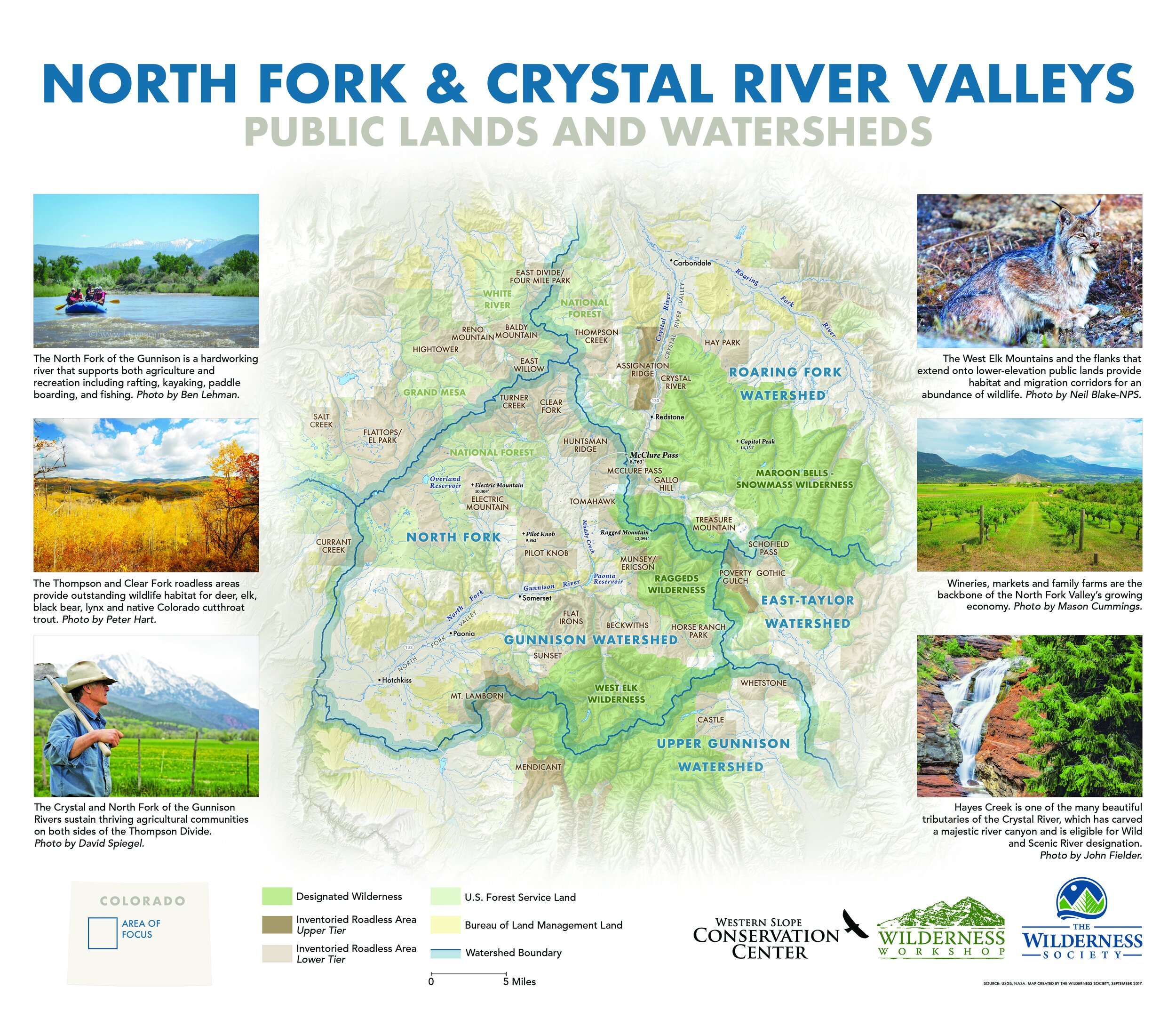

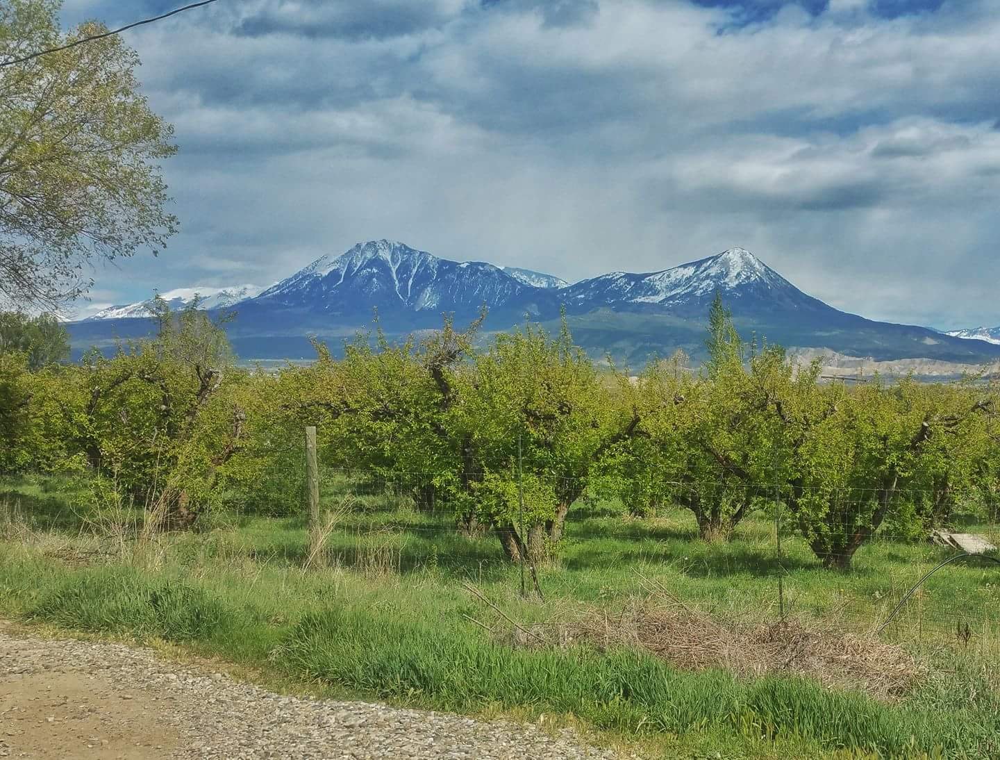


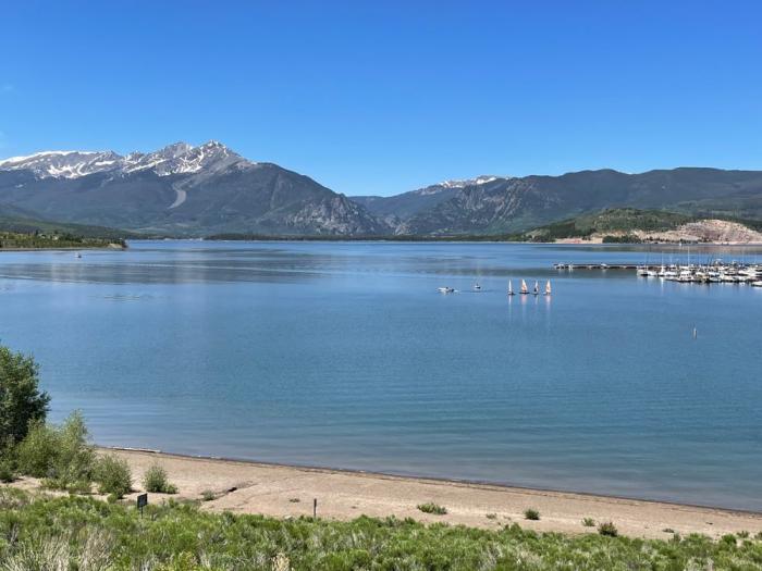


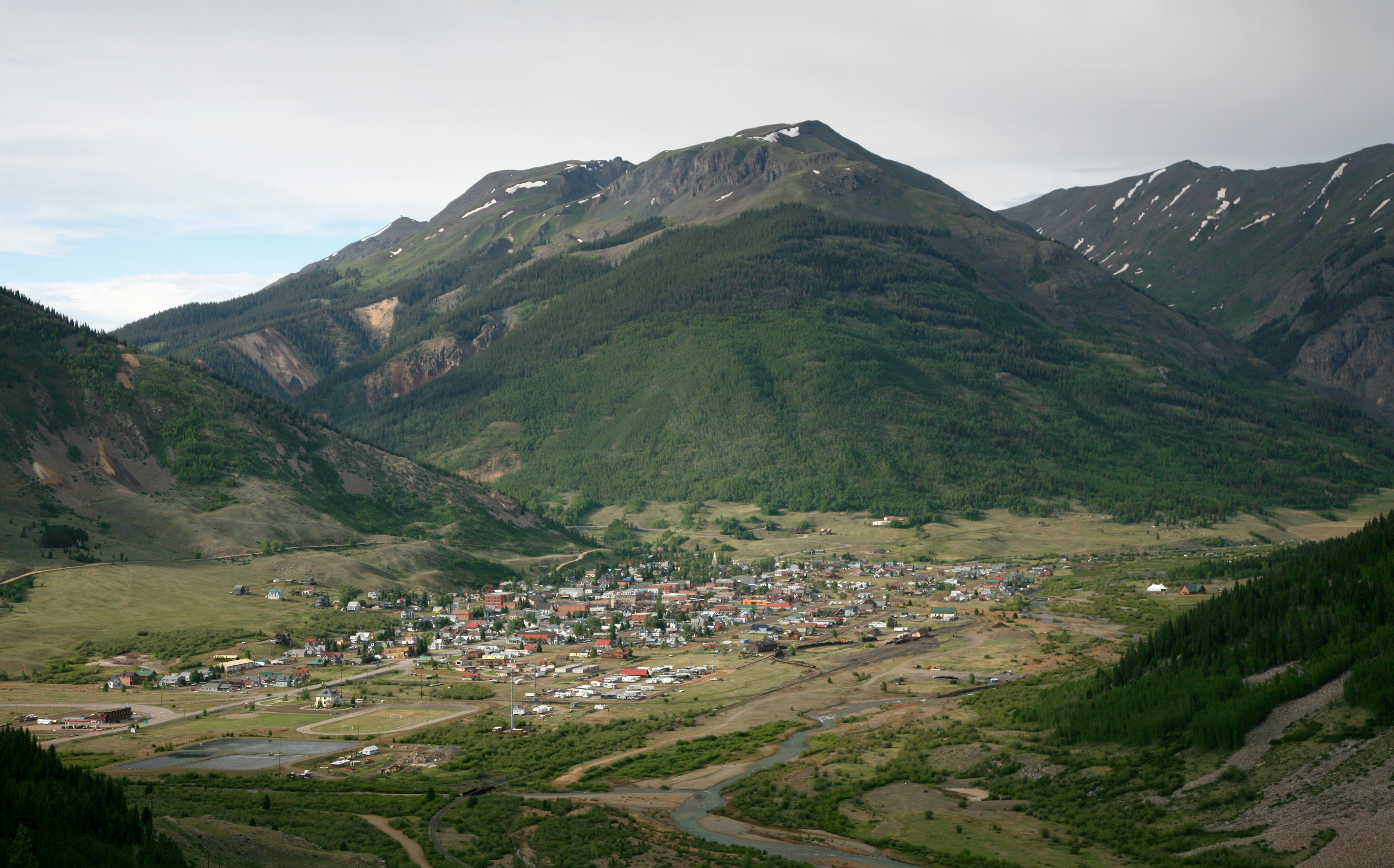


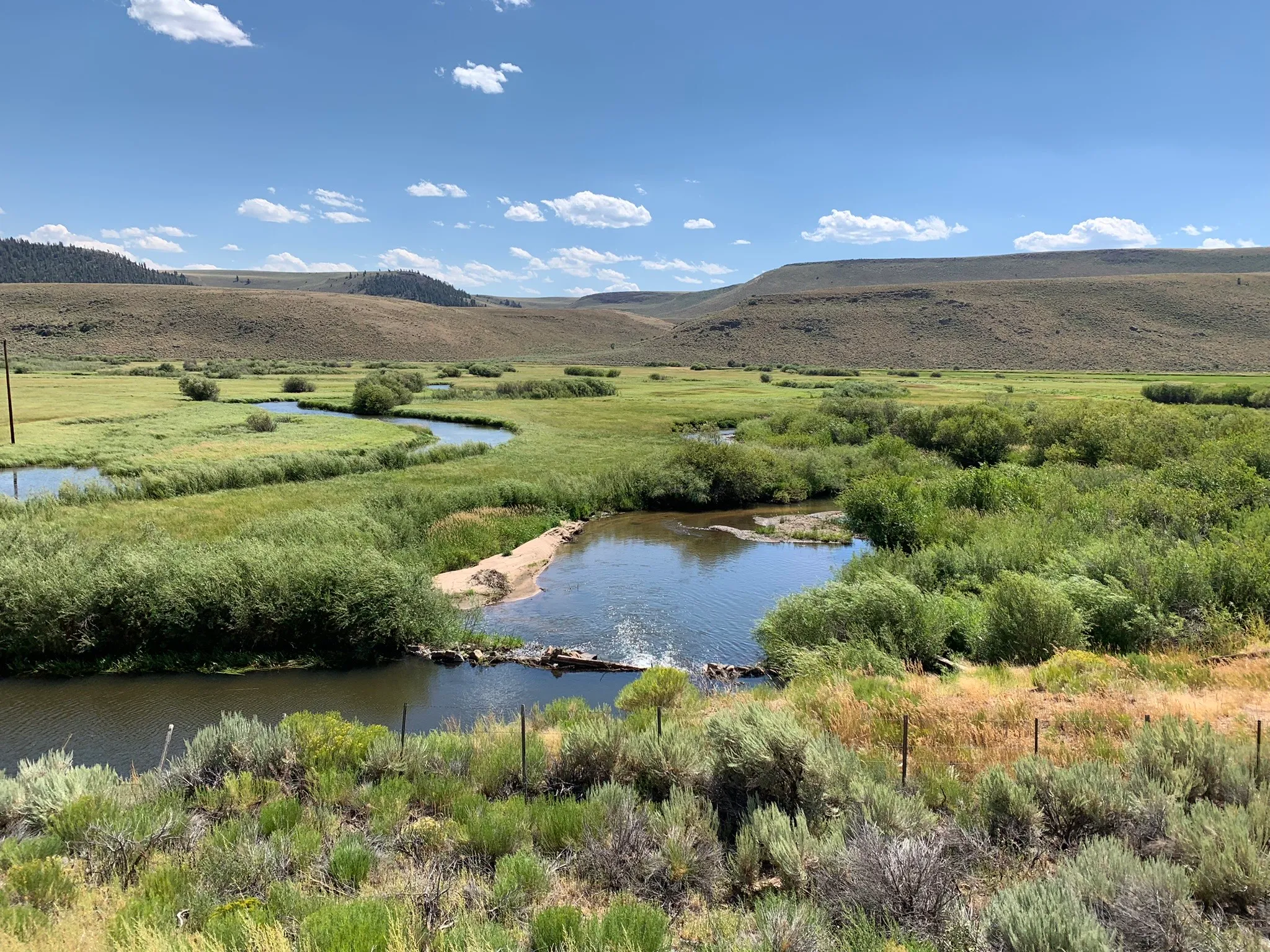


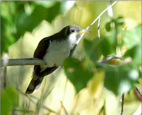
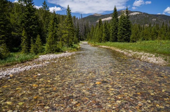


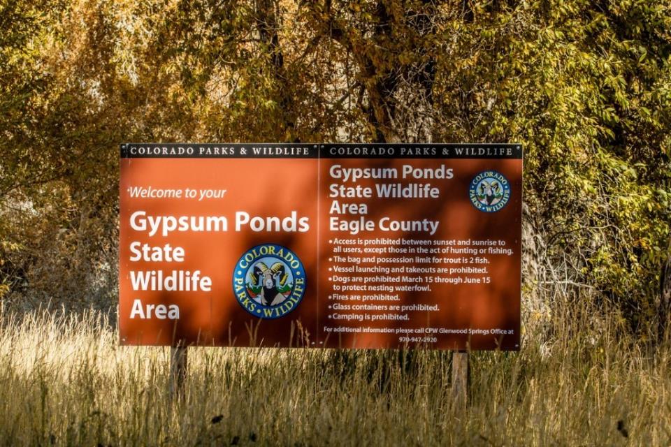

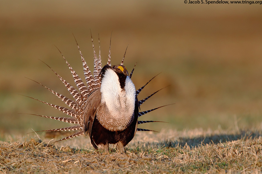


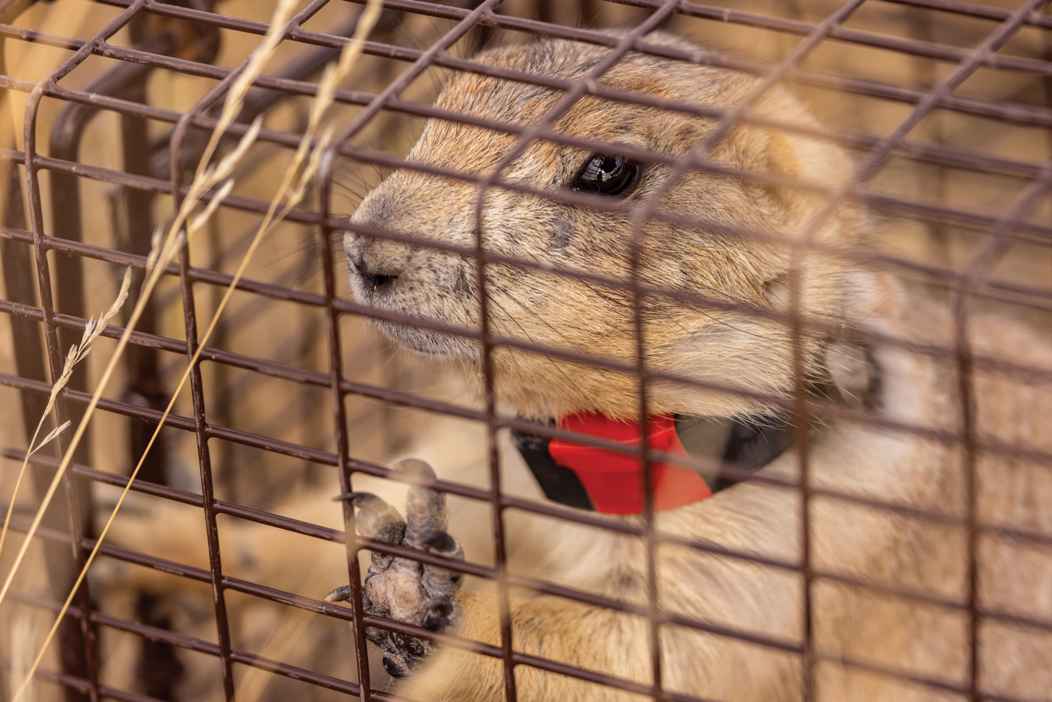
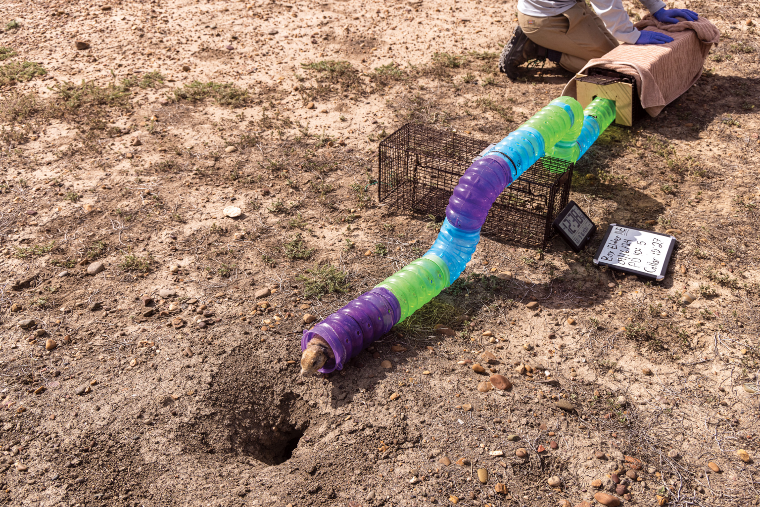
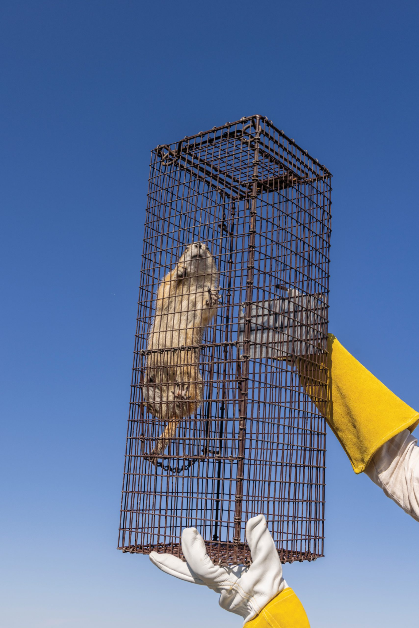
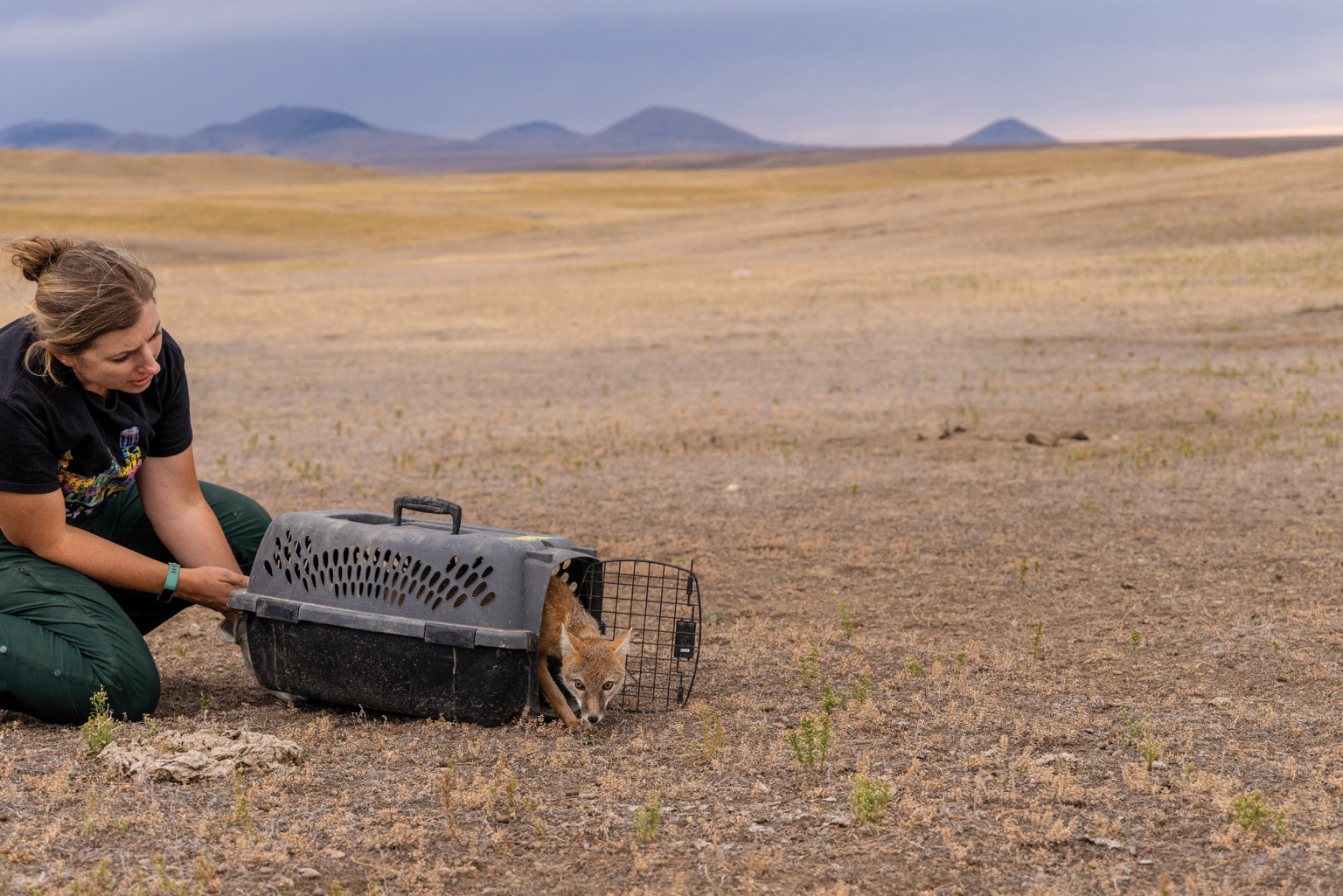
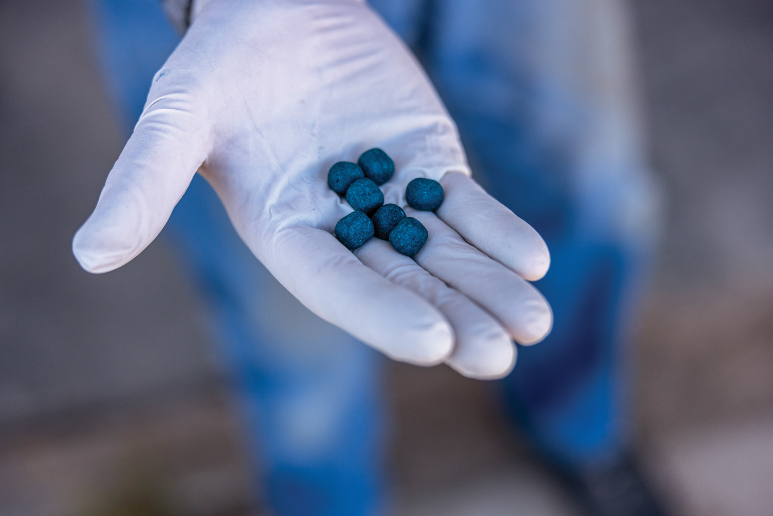


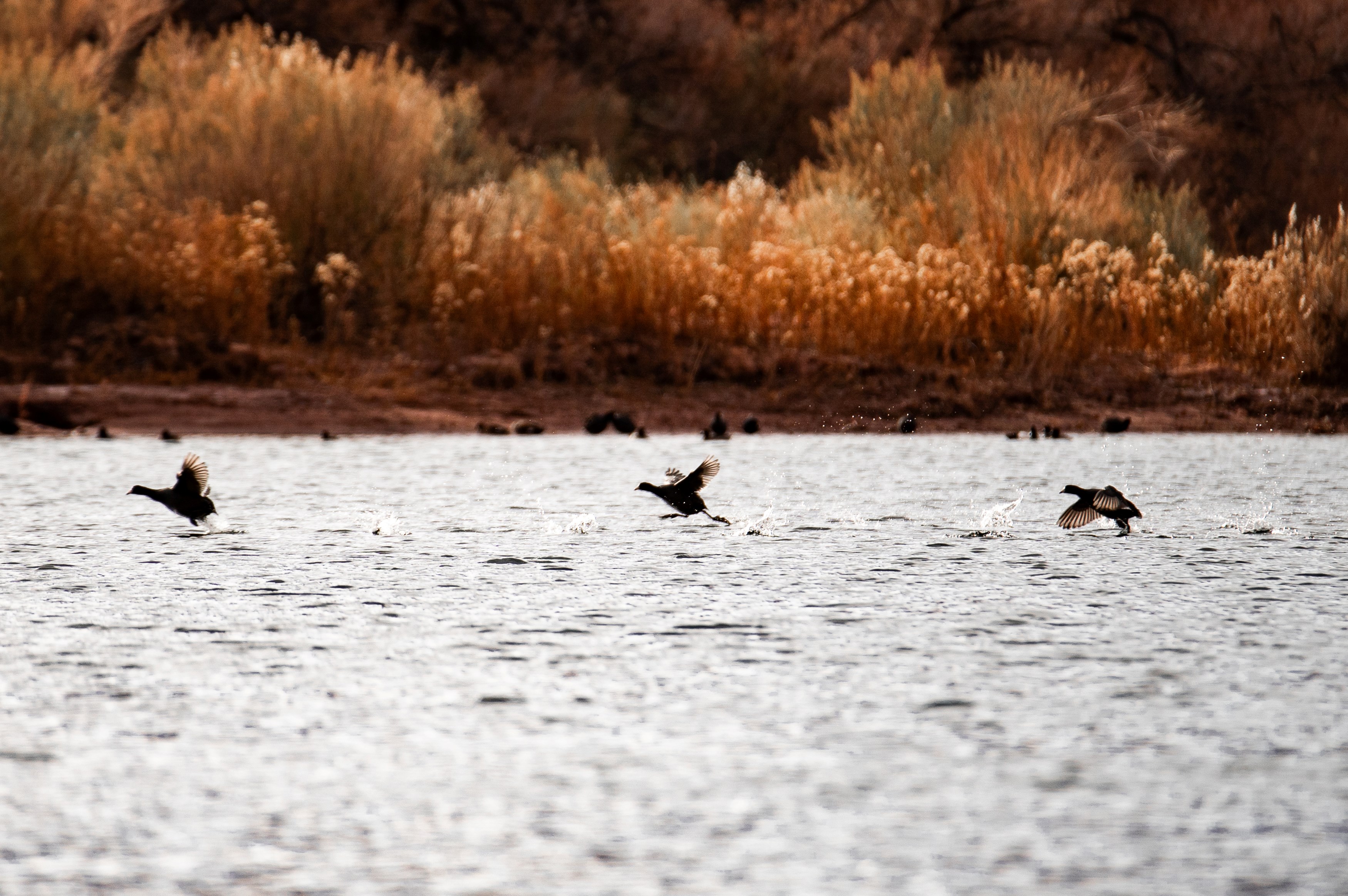

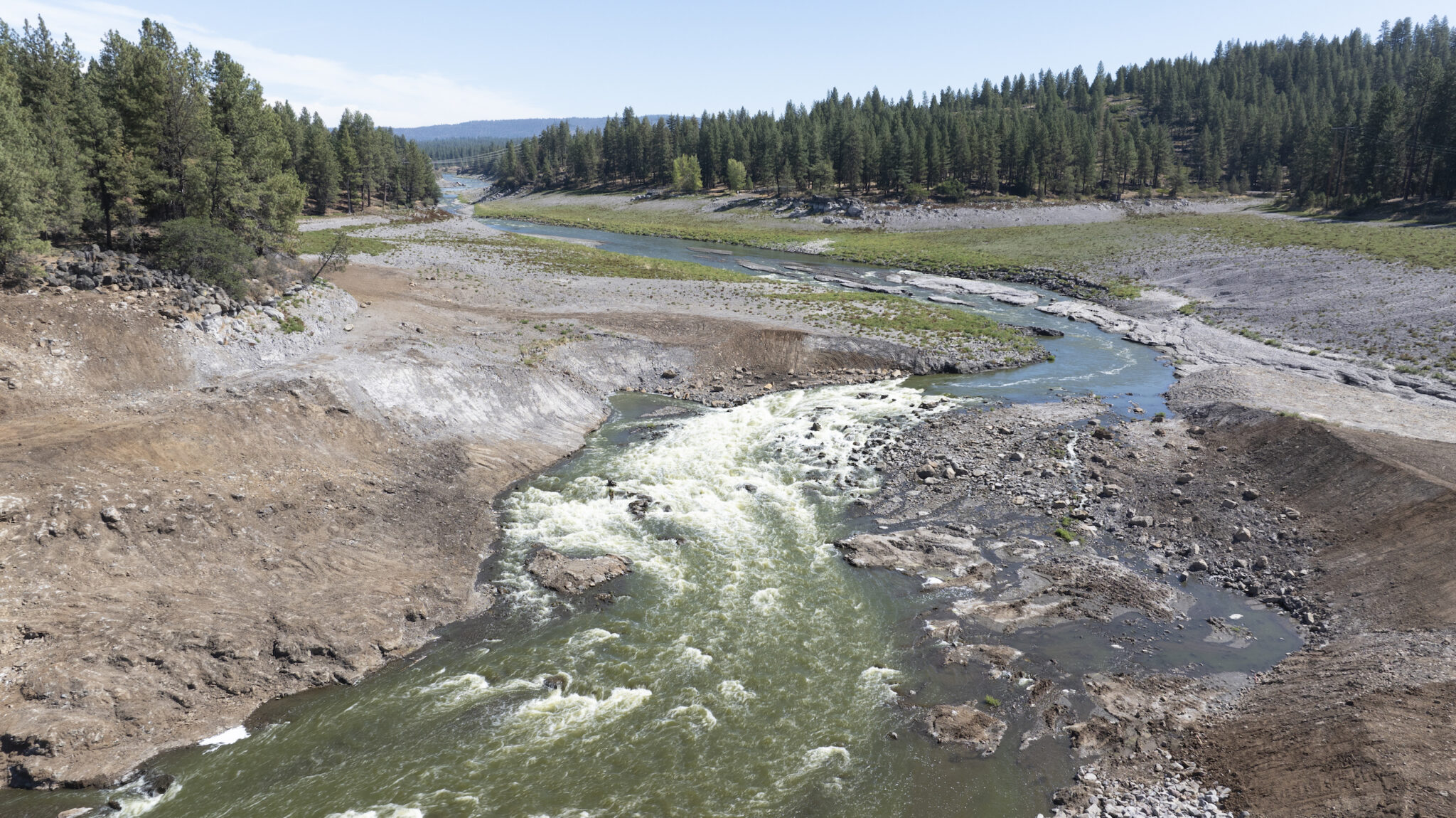


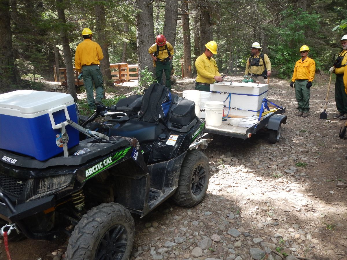


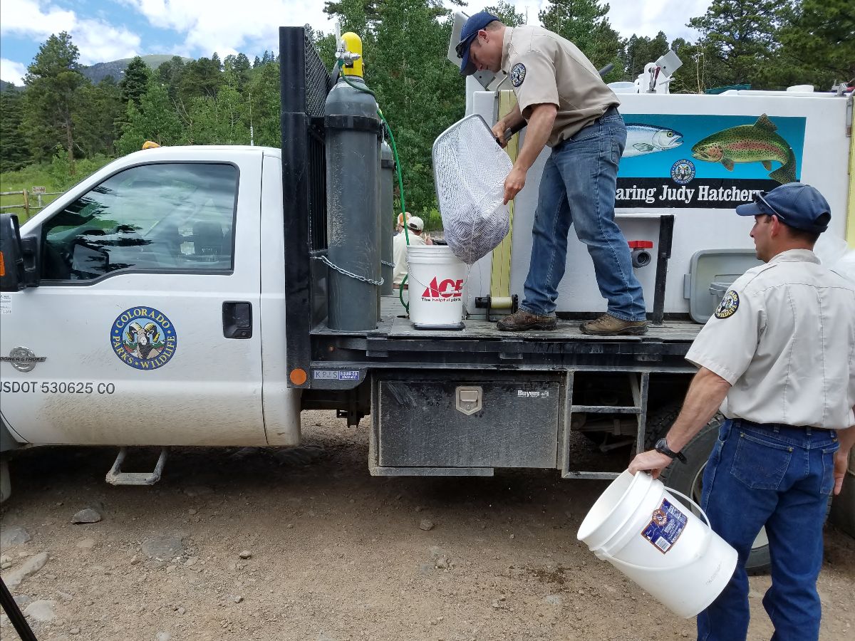
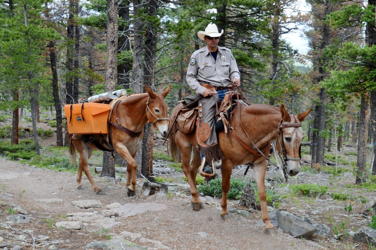
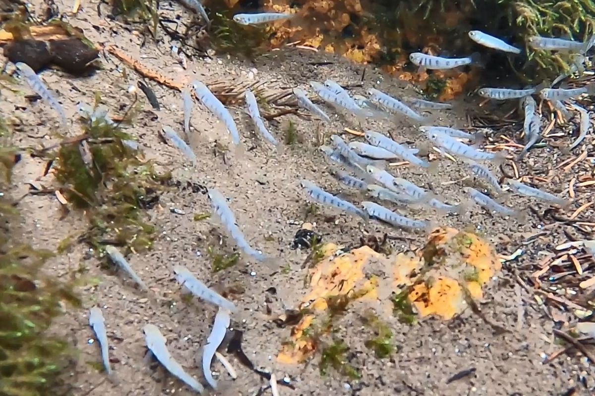


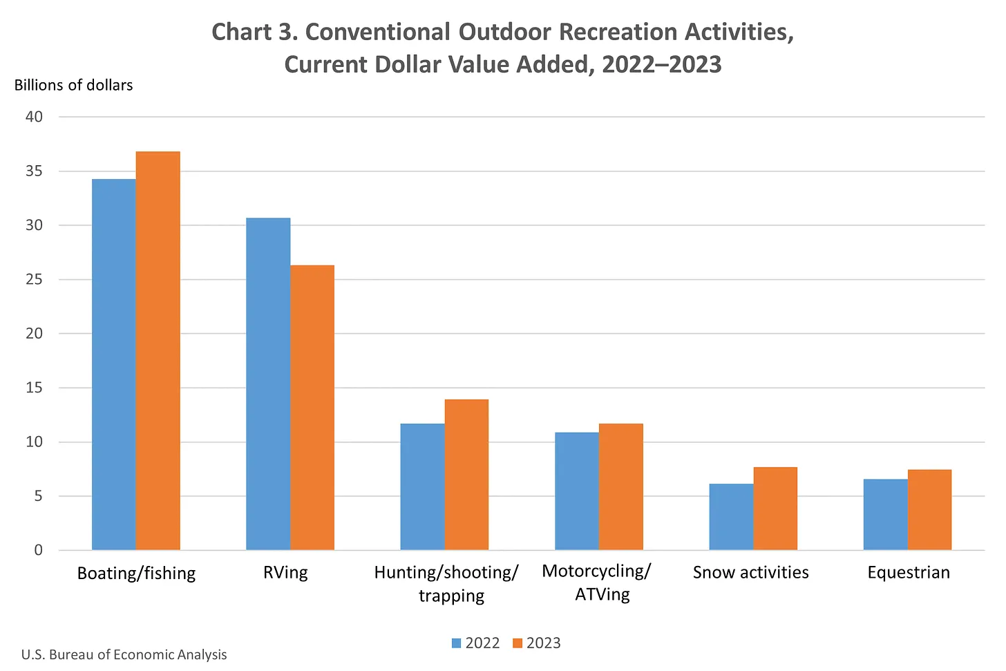


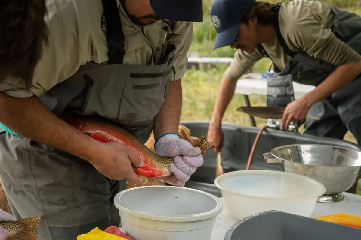


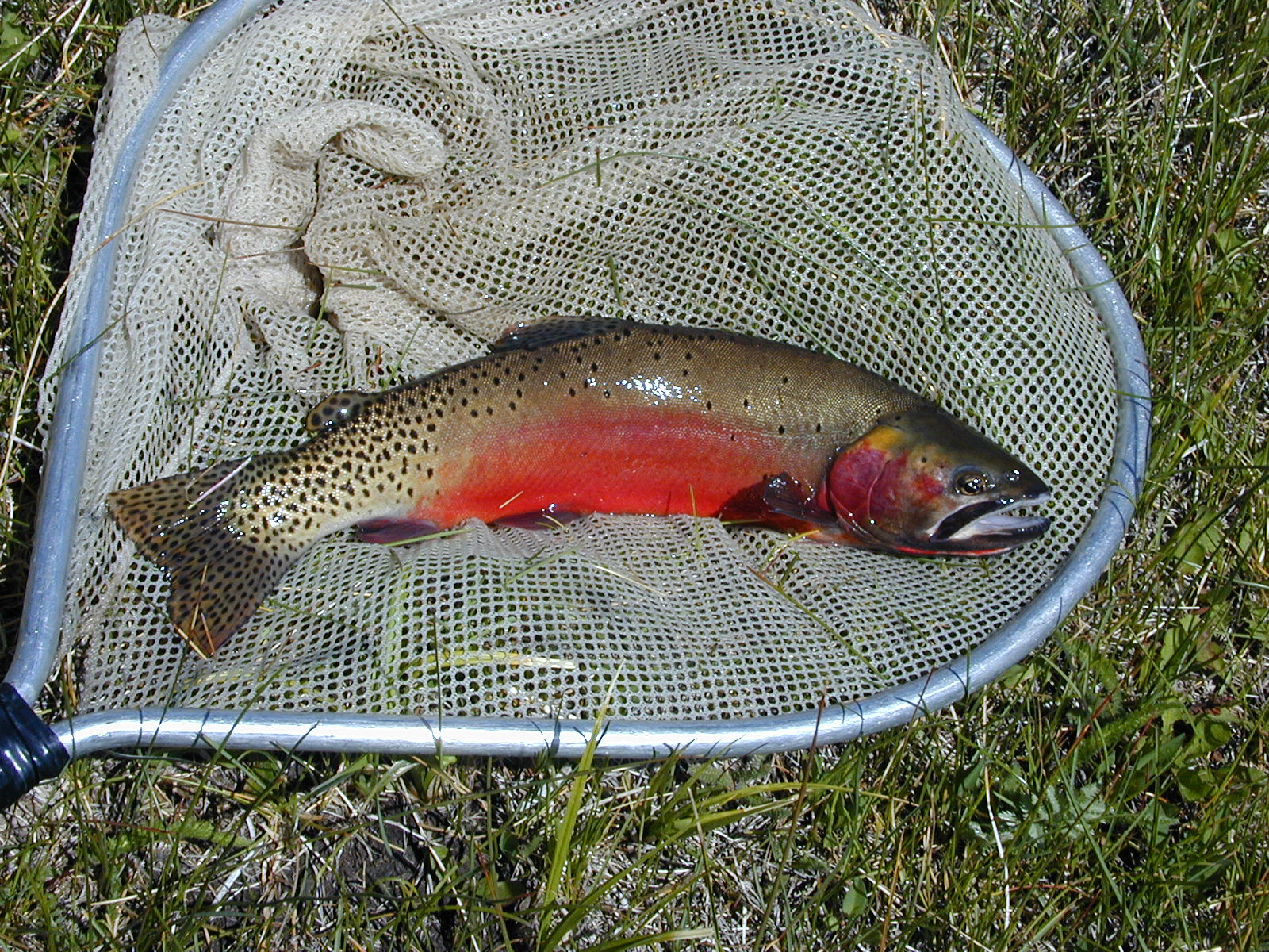


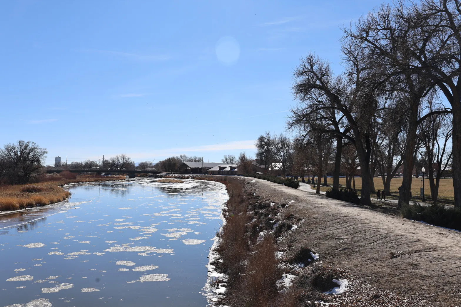


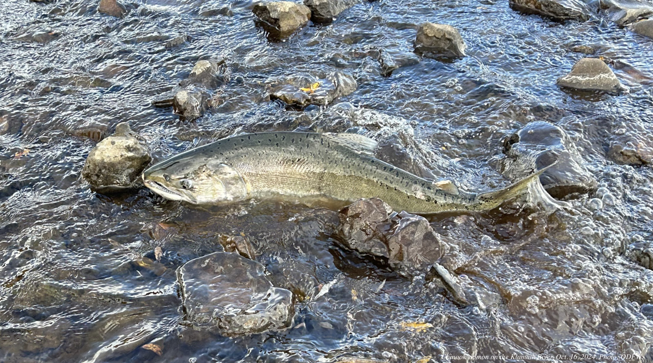


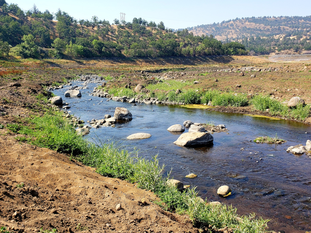


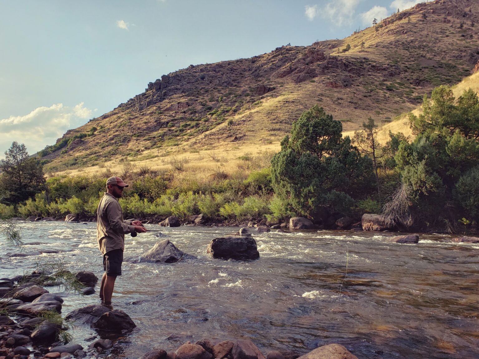
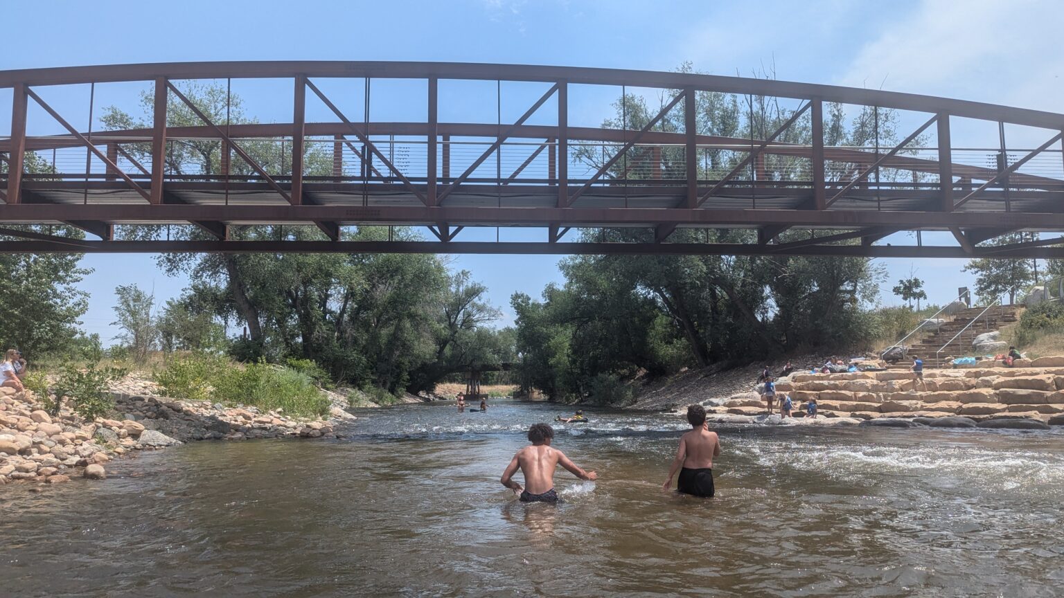


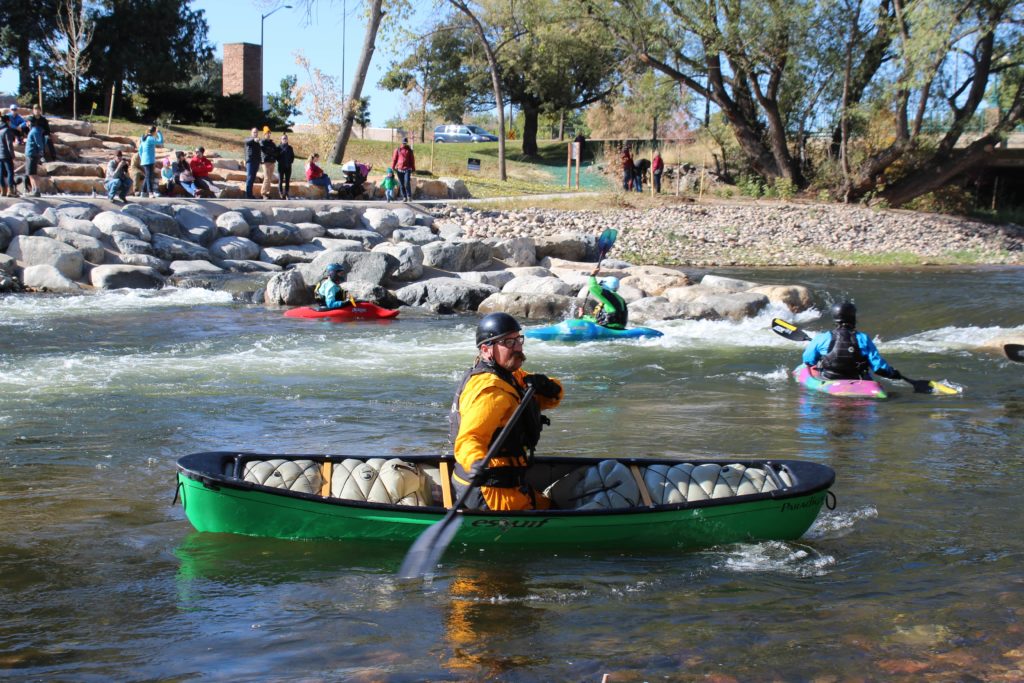


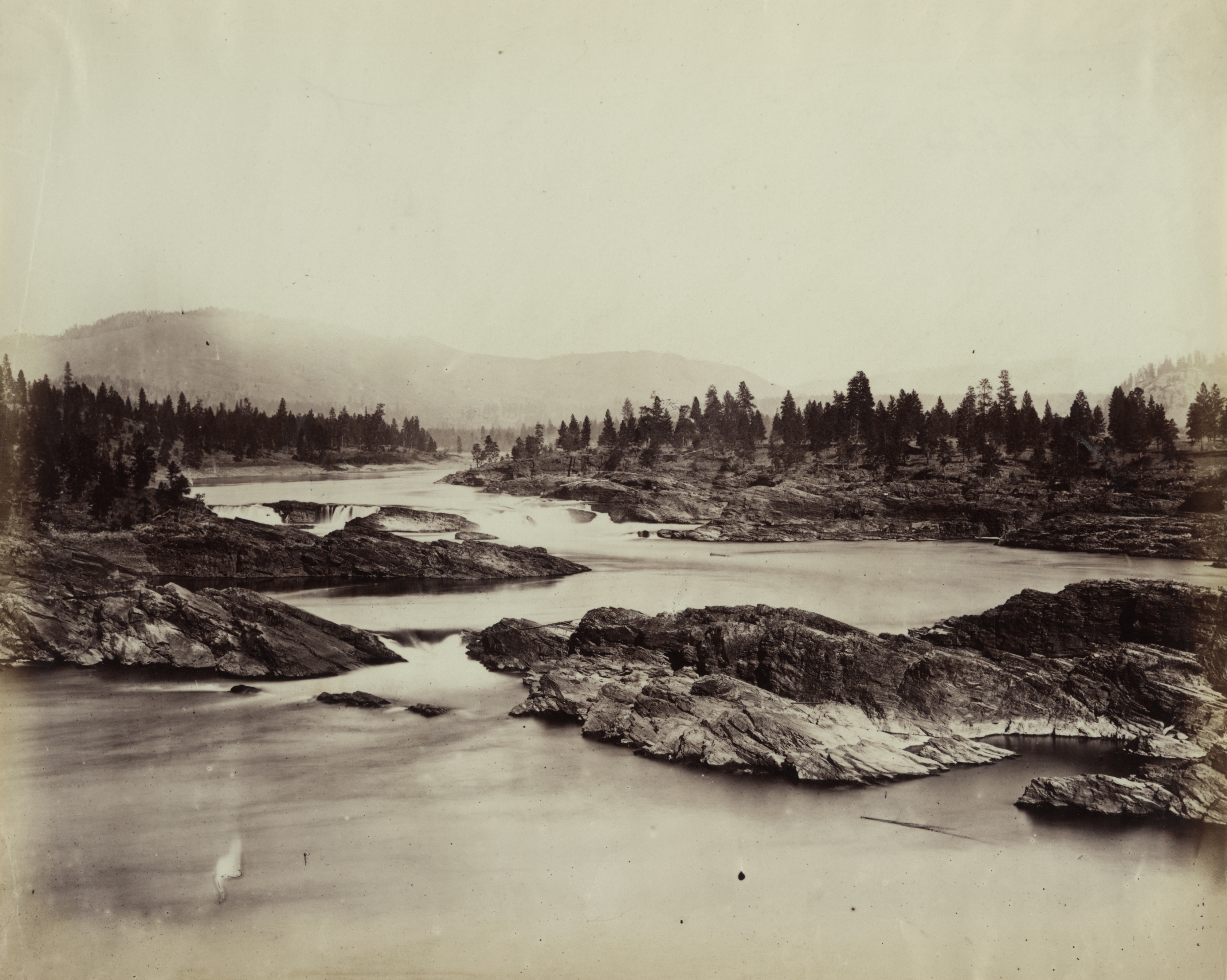


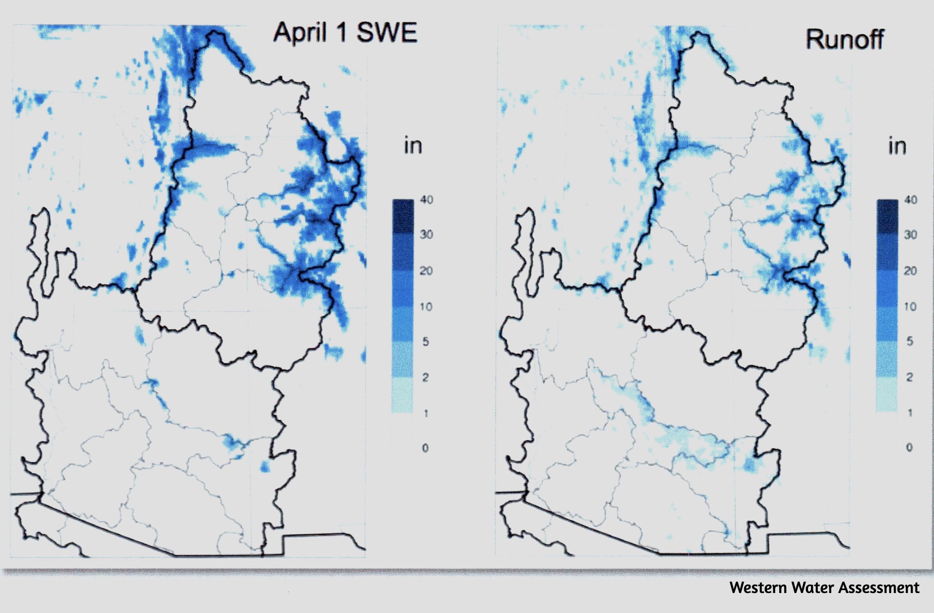


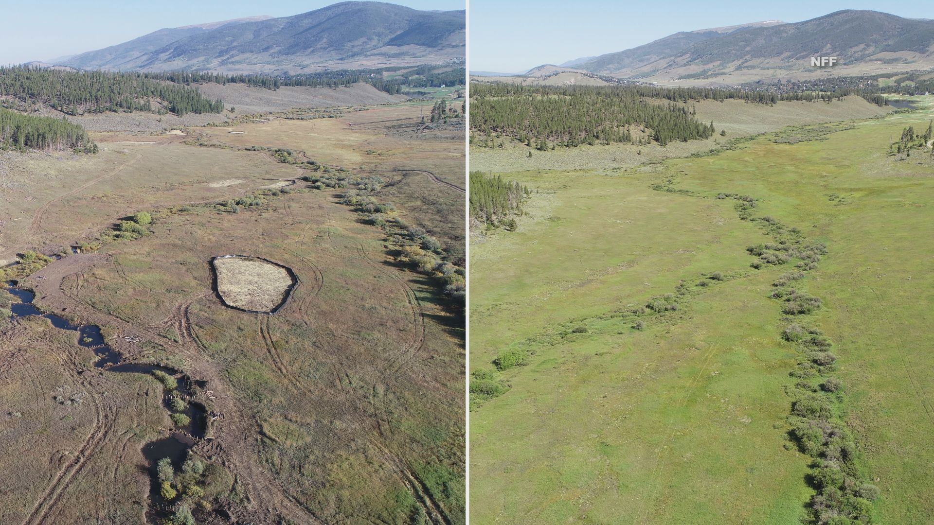

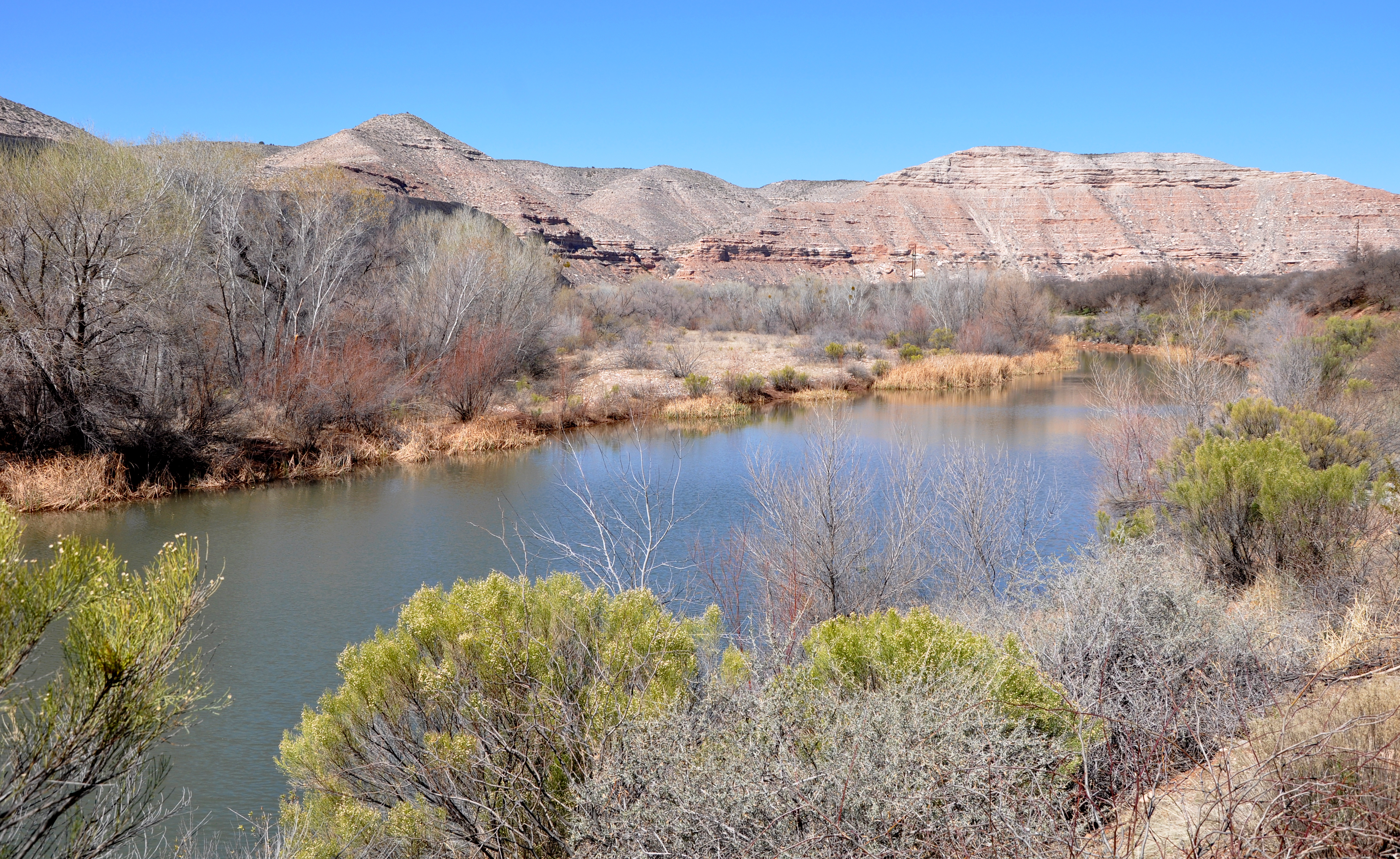


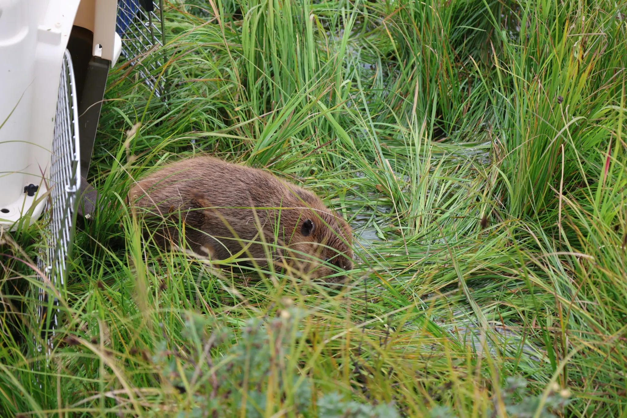
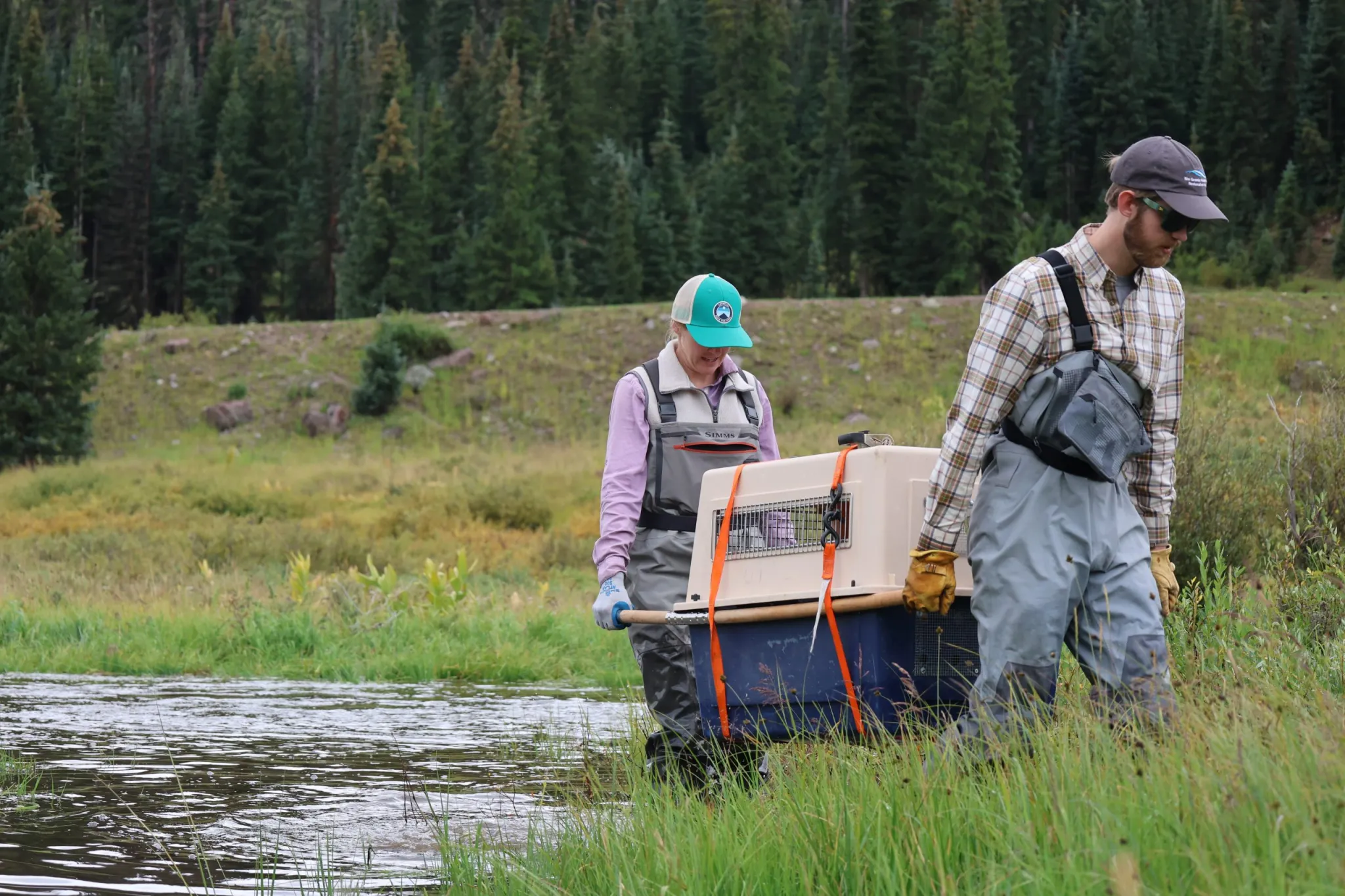

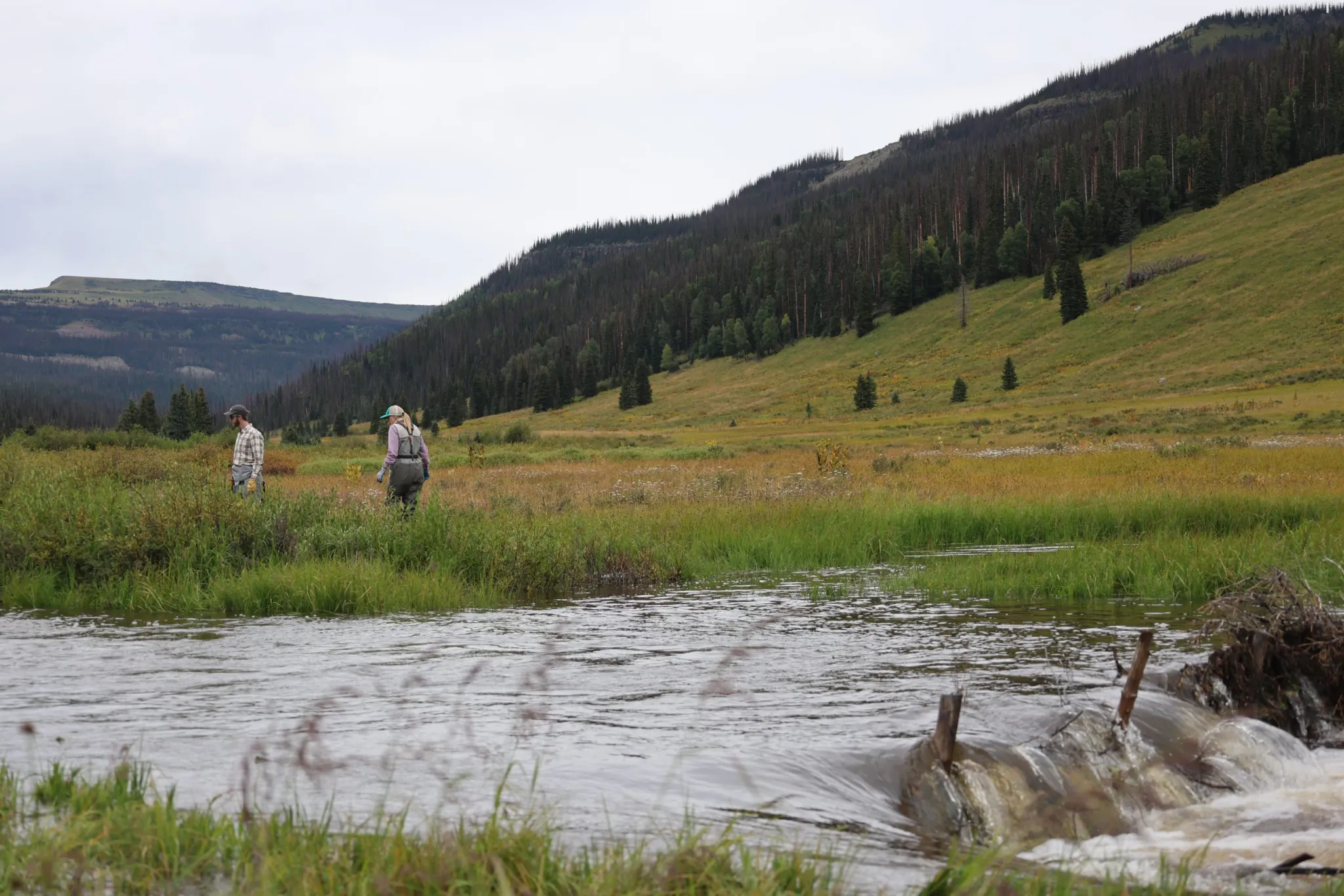

