Aquatic Biologist Jon Ewert stocks Trojan Male brook trout into Bobtail Creek during a historic stocking event in the headwaters of the Colorado River basin. Photo credit: Colorado Parks & Wildlife
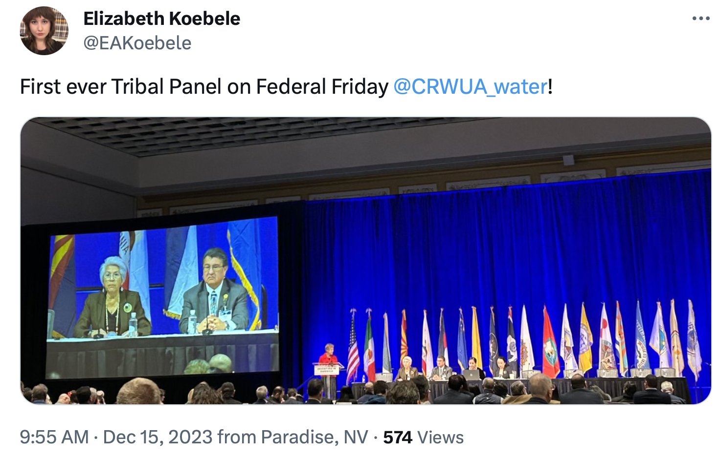
On Tuesday, Sept. 17, in an effort to restore native cutthroat populations in the headwaters of the Williams Fork River, Colorado Parks and Wildlife stocked 480 Trojan male or YY brook trout into Bobtail and Steelman creeks.
“This is a pretty historic moment for Colorado and native cutthroat trout restoration across the state,” said CPW Aquatic Biologist Jon Ewert. “This is a combination of both the hard work and dedication of CPW biologists current and retired.”
“This is yet another example of the groundbreaking work done by CPW biologists and researchers to preserve native species,” said George Schisler, CPW Aquatics Research Section Chief. “While Bobtail and Steelman creeks are the first to be stocked with YY brook trout, they will not be the last. This is just the first of many for Colorado.”
In 2010, an alarming number of non-native brook trout were discovered after completing a fish survey in the headwaters of the Williams Fork River. While it is unknown when brook trout invaded these creeks, it was evident the thriving brook trout had nearly decimated the native cutthroat population over time.
Cutthroat trout found within these two creeks are some of the highest-valued native cutthroat populations in the headwaters of the Colorado River basin. Considered a species of special concern in Colorado, this subspecies of trout is genetically pure and naturally reproducing.
“In 2011 we found 123 cutthroat trout combined in both creeks. Today, after 13 years of hard work by dedicated biologists we are seeing a little more than 1,400 cutthroats in these creeks,” said Ewert.
Trojan male brook trout are often called YY because they have two Y chromosomes, unlike wild males with an X and Y chromosome. These trout are stocked into wild brook trout populations and reproduce with the wild fish, producing only male offspring. Without a reproducing population (male and female fish), the brook trout will eventually die out, allowing for native cutthroat trout to be restored.
Colorado Parks and Wildlife will continue to stock both streams with YY brook trout over the next several years to sustain the number of Trojan males in the population, eliminating the production of female brook trout in the creeks.
To learn more about Trojan male brook trout and cutthroat trout restoration project in the Upper Williams Fork drainage, read our latest Colorado Outdoors Online Magazine article.
In the last two posts here (one of which you got twice, my apology), I’ve been trying to ‘revision’ the Colorado River as the classic desert river that it is. All rivers are composed of runoff – water from precipitation that did not soak into the ground, collecting in streams that ‘run off’ to the next lower watershed. Humid-region rivers receive new water from unused precipitation all the way along their course to the sea, but a river in the arid lands obtains nearly all of its water as runoff from a highland area high enough to force water vapor to condense into precipitation. The resulting runoff from that precipitation then flows down into the arid lands where it receives very little additional moisture and thus starts to diminish through natural processes on its way to the sea – evaporation under the desert sun, riparian vegetation use, absorption into low desert water tables. When the deserts are large enough, and the rivers’ highland water supplies erratic enough, some desert rivers disappear entirely, seasonally if not year round, before they get to the ocean.
As a desert river, the Colorado River divides naturally into a water-producing region in mountains mostly above ~8,000 feet elevation (only about 15 percent of the basin area, mostly in the Southern Rockies), and a much larger water-consuming region of arid lands, both orographic ‘rain-shadow’ deserts and hot subtropical deserts. Because the majority of its surface water comes from snowmelt, the pre-20th-century Colorado River regularly sent an early summer flood of water down into the Gulf of California, but later in the water year, snowpack gone, it probably did not always make it all the way through its jungly delta to the sea. Today, with 35-40 million water users in the Colorado River’s water-consuming region as well as those natural processes, the highly controlled river only makes it (almost) to the ocean in an occasional planned release.
In the last post we began exploring the river’s Headwaters – its water-producing region. To refresh your memory, here’s is the set of maps that, in effect, show the river’s water producing region – the blue areas on the map on the left, which show the average quantities of water (snow water equivalent) held in the peak snowpack, usually late March or early April:
It’s important to note that the water-producing and water-consuming regions of the Colorado River region are not congruent with the Colorado River Compact’s Upper and Lower Basins (above and below the line dividing the area outlined in black). The water-consuming region consists of nearly all of the Lower Basin and most of the Upper Basin – and includes all the trans-basin consumptions via long canals and tunnels).
The river’s actual water-producing region (blue areas inside the black line) is barely a fourth of the Upper Basin and some Lower Basin uplands that produce water for the Gila, Virgin and Little Colorado Rivers. That region is our focus today.
I will begin by suggesting that the 35-40 million of us in the water-consuming region of the Colorado River Basin (plus extensions) should have an investment of at least interest and concern, if not (yet) a fiscal investment, in our river’s water-producing region.
Whoa! What’s that? In addition to doing everything we can to conserve and extend the water we use in our deserts – we arid-land river users have to be involved – maybe eventually financially – with the river’s water-producing Headwaters as well? Why shouldn’t the people that live there take care of that?
One obvious reason is the fact that comparatively very few people live in the Headwaters above 8,000 feet. Nearly all of it is public land, National Forests managed for the ‘multiple uses’ of all the people. But the larger reason for water users in the consumption region to be investing at least attention and political interest in the Headwaters is the fact that we – the 40 million of us consumptive users – are the people with the greatest direct interest in what happens in the mountains. We depend on those Headwaters for 90 percent of our water supply, and our concern ought to be apparent: we want as much water as possible making its way out of water-producing region into the region of consumption, especially as our river’s flow diminishes by the decade.
Because the border between the water-producing region and the water-consuming region is a natural rather than political boundary, it is not really a line at all (like the 8,000-foot contour), but more of a blurry edge zone, an ecotone with varying levels of both water production and consumption in it. In Gunnison where I live, for example, at 7,700 feet elevation, we receive on average just a little over 10 inches of precipitation annually – the upper edge of an arid region that continues down through the Colorado River Basin to the river’s end in the subtropical deserts. But 30 miles up the valley from Gunnison, the town of Crested Butte at 9,000 feet gets around 24 inches a year on average, a water-consuming community up in the water-producing region – and all of the valley floodplains between the two towns that are not yet subdivisions are in irrigated hay fields. This is the ecotone, the edge zone in which the net balance between water production and water consumption gradually shifts, over a mere 30 miles, from mostly production to mostly consumption, as precipitation diminishes to desert levels.
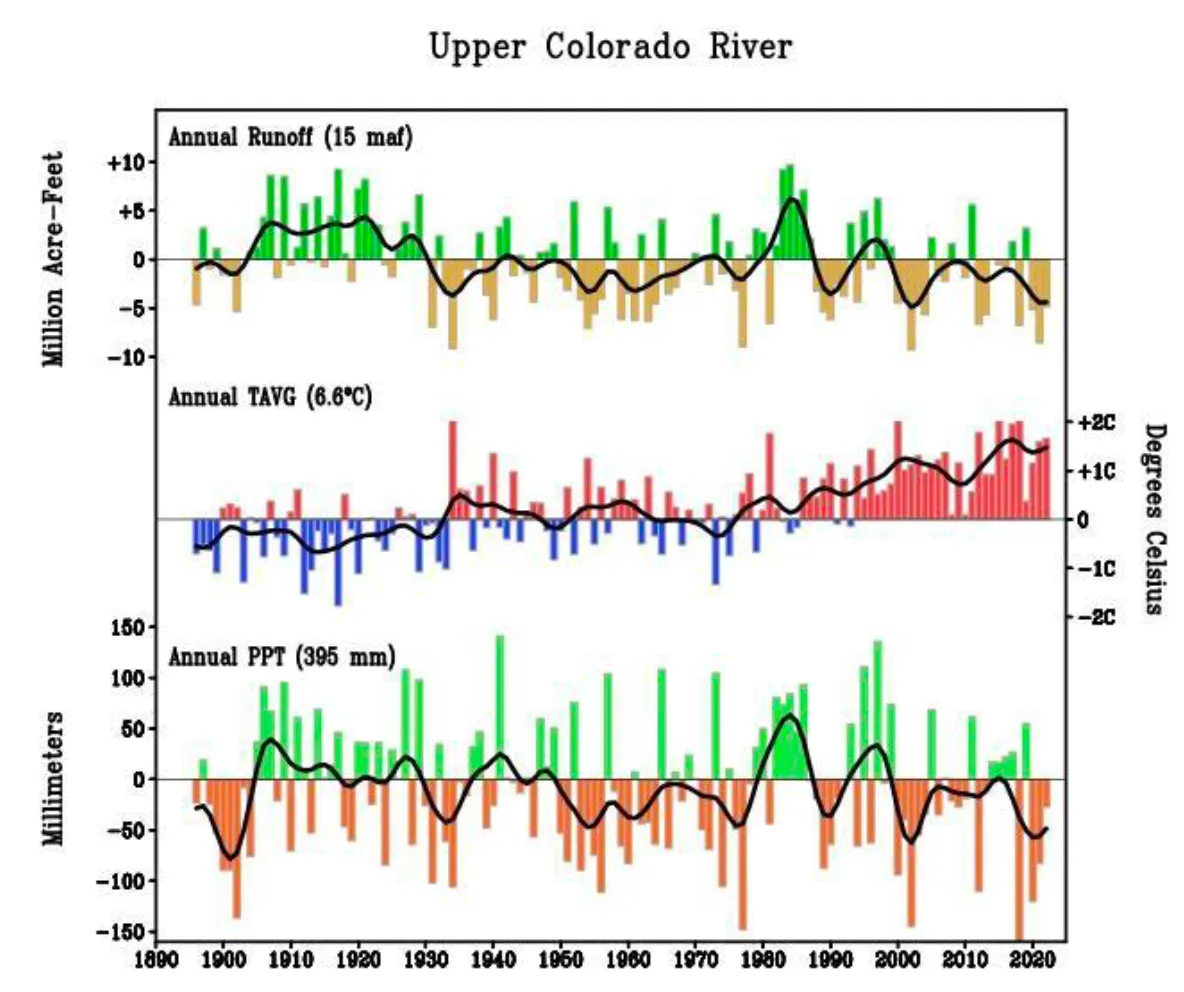
Mining and resort towns above 8,000 feet are, however, pretty minor consumers of precipitation-produced water, compared to consumption by natural forces at work in the area. In the last post we explored some of those natural forces in addressing a mystery posed by the Western Water Assessment’s report on the ‘State of Colorado River Science’: ~170 million acre-feet of precipitation fall on the Colorado River Basin every year on average, but only ~10 percent of that becomes the river’s water supply. What happens to the other 90 percent?
The perpetrators of this loss turn out to be the sun that originally ‘distills’ the freshwater from the salty ocean and the prevailing winds that carry it across a thousand miles of mountain and desert to condense it into a snowpack in the high Rockies. The sun and wind give, and the sun and wind take away – starting immediately after the giving.
The precipitation forced from water vapor in the air by our mountains is barely on the ground before the sun and wind are trying to return it again to vapor. Throughout the main water accumulation period, the winter, sublimation – the conversion of ‘solid water’ directly to water vapor by sun and wind – is eating away at the exposed snowpack every sunny or windy day, even at temperatures well below freezing.
Then once the mountains warm up enough for the snow to melt, the sun and wind evaporate what they can of the water that runs off on the surface, especially where it is pooled up or spread out on the streams’ floodplains. The snowmelt water that sinks into the ground goes into the root zone of all the vegetation on the land – grasses, shrubs, brush and trees – where it is sucked up by the thirsty plants, with most of that being transpired back into the atmosphere as water vapor to cool and humidify the working environment of the plants.
Sublimation, evaporation, transpiration – exactly how much water each of these activities of sun and wind convert back to water vapor is difficult to measure, but the end result is that less than a quarter of the water that falls on the mountains stays in the liquid state as runoff creating the streams that become the river flowing into the desert regions where 35-40 million of us depend on it, and less than five percent of what falls on the water-consuming desert regions augments the river there. The sun and wind give, and take away.
The question arises: are there not some ways in which we might retain or recover some of that lost water? That question may begin to sound like another charge for planet engineering – crystals in the stratosphere to reflect heat away from the planet, et cetera. I am not so ambitious as that.
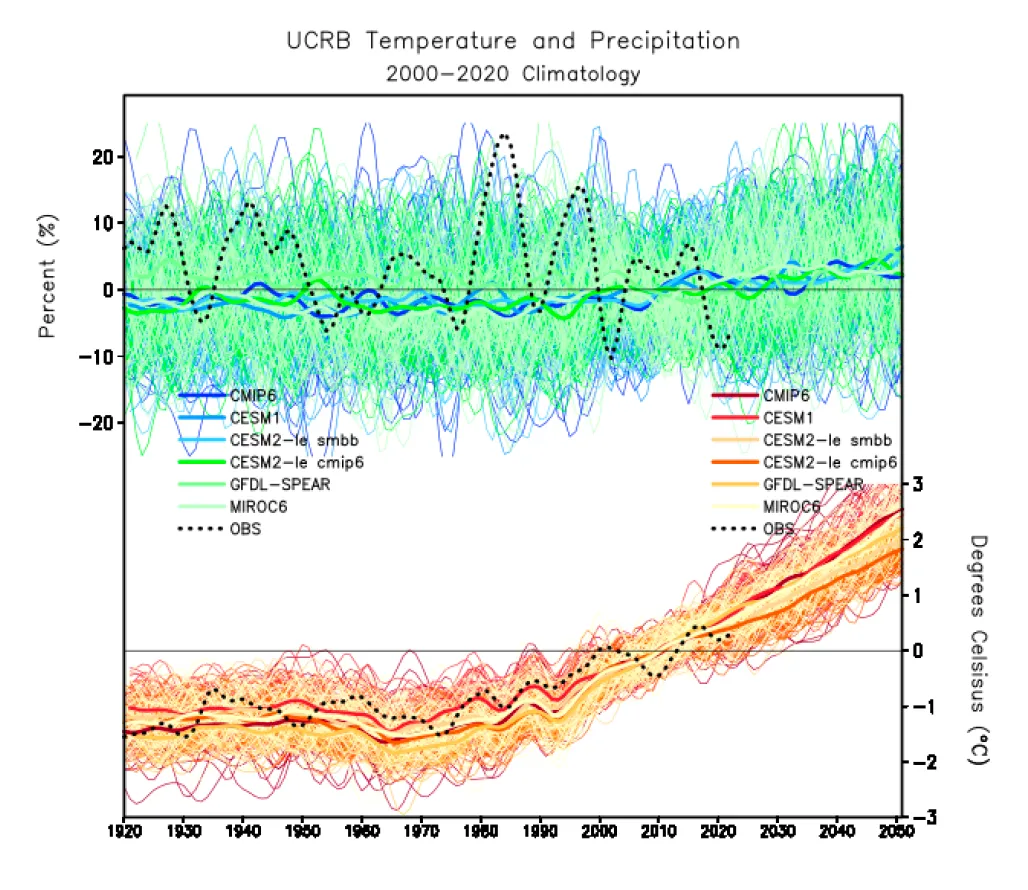
But we know that the Colorado River has lost as much as 20 percent of its water over the past several decades from a combination of climate warming and drought, and even if the drought ends, we will lose morein the decades to come from the warming of the climate already made inevitable from our ongoing reluctance to do much about it. Scientists estimate that for every Fahrenheit degree of average temperature increase, we will lose 5-7 percent of our surface waters from heat- sublimation, evaporation and transpiration. So is there anything we can do – affordably, and undestructively – down here where the water is, to mitigate that loss, if only partially?
Obviously, the sun and wind rule unchallenged in the highest Headwaters, the treeless alpine tundra. But as one moves down into the treeline – another ecotone with the subalpine spruce-fir forest gradually becoming the dominant ecology over the miniature plants and windbeaten krumholz trees of the tundra. The forest shades the snow that makes it down to the snowpack from the sun, and shelters it from the wind. But the forest also catches a lot of snow on its branches, and that snow is prey to the sublimating sun and wind.
The shading trees also slow how fast the ground snowpack melts; in the deep forest, patches of dirty snow can last into the early fall. A slower melt means a higher ratio of water sinking into the ground over water running off to the 35-40 million of us waiting for it downriver. But the trees of the forest exact a high price for their protective efforts; the water sinking in is sipped up by the roots of all the forest vegetation, and the trees are heavy drinkers, transpiring most of what they drink.
Nearly all of the forests that run a wide belt through the Colorado River Headwaters region – the subalpine spruce-fir forests and the montane pine forests – are, as mentioned earlier, public lands designated National Forests, set aside to protect them.from the Early Anthropocene Age of Plunder. A huge number of them were designated by President Theodore Roosevelt, considered the Father of American Conservation, with forester Gifford Pinchot riding shotgun. Pinchot probably had a hand in crafting the 1897 Organic Act that created the National Forest concept out of scattered federal ‘Forest Reserves’ set aside under earlier legislation, but with no management or legally impowered managers explicit.
The Organic Act was fairly explicit in defining the purpose for creating National Forests:
Recognizing that just setting the land aside with no process for ‘improving and protecting the forest’ was, in the still pretty wild West, equivalent to hanging a sign on the reserve saying ‘Get it while you can, boys, because someday you might be banned,’ the Organic Act also provided for ‘such service as will insure the objects of such reservations’ – which ‘service’ became, under Roosevelt and Pinchot, the U.S. Forest Service.
Note that there are two fairly specific charges in the quotation from the Organic Act: ‘securing favorable conditions of water flows,’ and ‘furnishing a continuous supply of timber.’ Given the circumstances of a nation continually growing and building, with the American dream being a home of one’s own, it goes without saying which of those two tasks the evolving Forest Service has been mandated to prioritize. For much of their history, the Forest Service has been expected to fund themselves with a surplus to the U.S. Treasury through timber sales – always harvesting of course in ways that ‘improve and protect the forest’ (possible, but increasingly improbable when demand grows extreme and supply trudges along at nature’s unhurriable rate).
The charge to secure favorable conditions of water flows, however, has been given much less attention. Pinchot said that ‘the relationship between the forests and the rivers is like the relationship between fathers and sons: no forests, no rivers.’ That is clearly not the case; the forests are not the creators of rivers, they are instead just the first major user of the rivers’ waters; they protect the snowpack and slow the melt for their own needs. Pinchot was right in perceiving a relationship between forests and rivers, but had it backward: ‘No water, no forests’ is more accurate.
One might think, then, that in the Headwaters of the most stressed and overused river in the West, if not the world, the managers of the Headwaters forests might be expending serious effort to make sure that they are securing the most favorable flows possible from their forests.
What I am having trouble discerning is whether the Forest Service is paying any attention at all to any responsibility for a water supply that 35-40 million people are depending on. In my ‘home forest,’ for example, the Gunnison National Forest – now bundled together for management efficiency with two other National Forests as the ‘Grand Mesa Uncompahgre Gunnison National Forests (GMUG): the first draft of a GMUG Forest Management Plan being drafted over the past 2-3 years did not even mention the Colorado River Basin by name as a larger system they are part of, and hugely important to. Response letters from ecofreaks like me (I assume others also wrote them about this) got a paragraph about that larger picture into the final draft – but nowhere in the plan itself did I find explicit discussion of the larger mission that implied and of specific management strategies for making sure that the plan was fulfilling that organic charge of securing favorable – one might say ‘optimal’ – conditions of water flows.
Well – that launches into an exploration of National Forest management policies and activities that I am still trying to muddle through, but that can wait till next month. I’ve gone on long enough here for now, in this effort to peer over the edge of the box we’re all supposed to be trying to think outside of – the ‘Compact Box’ that all the water buffalo are still stalemated over, as we all try to envision river management after the expiration of the Interim Guidelines from 2007. Stay tuned.
Click the link to read the article on the Pagosa Springs Sun website (Danyelle Leentjes). Here’s an excerpt:
September 30, 2024
The Upper San Juan Watershed Enhancement Partnership (WEP) is inviting the public to attend a presen- tation and Q-and-A of the 60 percent designs of the Pagosa Gateway River Project on Oct. 10 from 5:30 to 7 p.m. at the Ross Aragon Community Center.
The public can also view and make comments on the designs on mypa- gosa.org.
The Pagosa Gateway Project is a vital restoration endeavor targeting approximately 2 miles of the San Juan River upstream of the Town of Pagosa Springs. A recent environmental and rec- reational water supply needs assess- ment, commissioned by the WEP, identified potentially significant changes in hydrology and limiting conditions for aquatic life in this sec- tion of the San Juan River. Assessment results suggest late summer and fall flows may restrict the availability and quality of aquatic habitat for fish and other aquatic species, as well as the number of days in a year when recreational craft can successfully navigate this segment of the San Juan mainstem.
A prescribed fire along the Colorado Trail near Buffalo Creek in June 2023 is an example of other fuel reduction treatments in the Pike National Forest. Photo credit: Andrew Slack, Colorado Forest Restoration Institute.
The San Juan National Forest is receiving $5 million to restore forest health on 3,000 acres of high-risk fireshed near homes outside Durango. The Wildfire Risk Reduction and Restoration Project will mechanically treat 3,000 acres of forest in the San Juan National Forest, enabling an additional 9,000 acres of future prescribed fire treatment. This project is located between Falls Creek and Durango Hills subdivisions, which are northwest and northeast of Durango, respectively. The treatment will be done in areas where the forest meets homes, called “wildland-urban interface,” said District Ranger for the Columbine ranger district of the SJNF Nick Glidden. The treatment ranges from thinning the trees out so fires spread slower to mechanical brush mastication, which is mulching of vegetation using heavy equipment. The funding is a part of a larger investment from the Biden administration to prepare forests for wildfires…
This project is important because healthy forest fires restore the forest by cleaning up dead material in the forest and increasing soil nutrients, Glidden said. In the past, the USFS has focused on fire suppression. Now, the agency’s wildfire crisis strategy places an emphasis on restoration by reducing the available fuels…On the SJNF, fire managers are striving to work with what they call “good fire.” Pat Seekins, fuels program manager for the SJNF told The Durango Herald last year that the SJNF needs “30,000 to 40,000 acres of prescribed fire” annually to restore lands. Glidden said this number would allow the forest to catch up to full restoration, but the USFS is prioritizing areas that are close to homes with this newly funded project. To put the funding in context, the USFS burned 9,528 acres in the SJNF from Oct. 1, 2022, to Sept. 30, 2023.
The Town of Palisade is pursuing a federal grant that would help it fund the remediation and regrading of its sewer lagoons and turn a portion of that property into a constructed wetlands for migrating waterfowl. Town Administrator Janet Hawkinson told the Palisade Board of Trustees at its Tuesday meeting that the grant is through the Bureau of Reclamation and could provide several million dollars without requiring a match.
“We are working right now with our town engineers on a cost estimate to look at if it’s $2 million, $3 million or $6 million we’ll request for this grant application,” Hawkinson said.
The town has a grant and loan from the Department of Agriculture to build a pipeline to the Clifton Sanitation District’s wastewater facility for its sewage. Once that is complete the current lagoons will be remediated. Palisade Community Development Director Devan Aziz said the proposed plan would improve water quality, mitigate health hazards and restore habitat in the area of the sewer lagoons. The lagoons are located along the Colorado River just east of Riverbend Park.
“The proposal would be to create a constructed wetlands for migratory waterfowl, as well as removing invasives like tamarisk and Russian olive and enhancing plant biodiversity,” Aziz said. “This project directly addresses drought related habitat loss while fostering environmental regeneration.”
Before and after photos show a drastic change to the landscape. Credit: National Forest Foundation
Click the link to read the article on the 9News.com website (Brianna Clark). Here’s an excerpt:
September 17, 2024
Wetlands play a major role in keeping our water clean. Yet, according to the National Forest Foundation, the U.S. has lost more than half of them in the lower 48 states because of infrastructure development and agricultural practices. The Soda Creek Restoration Project hopes to undo some of that loss in Colorado…The project is part of a larger effort to restore 40 acres of wetlands in the White River National Forest, reestablishing nearly 30 acres while rehabilitating another 12.5 acres. The NFF started the project last month and all the work is being done by hand with the help of volunteers. One of several things they’re doing is creating dams to slow down the water allowing it to spread out over the valley. NFF Colorado River Watershed Program Coordinator Adde Sharp said the historic wetland in Summit County was converted into a cabbage farm more than a hundred years ago, causing the area to dry up and the landscape to change. Sharp said turning the area back into a wetland is a big deal because Soda Creek is upstream of Dillon Reservoir, which provides drinking water to the Denver area.
“Wetlands dramatically improve water quality because they’re like sponges or filters that are filtering out sediment and different contaminants in the water, heavy metals, etc.,” said Sharp. “If you live downstream of a wetland- and we all do, there are wetlands upstream of all of us- this is really improving your water quality.”
Bonita Mine acid mine drainage. Photo via the Animas River Stakeholders Group.
Click the link to read the article on The Denver Post website (Elise Schmelzer). Here’s an excerpt:
September 24, 2024
Organizations and local governments that want to fix the acidic drainage from a mine outside of Alma — and the hundreds of thousands of other abandoned mines across the West — are hopeful about new legislation under consideration in Congress. By removing liability burdens, the bill would finally give them more leeway to stop the pollution seeping into the streams relied upon for drinking water, recreation, and fish and animal habitat.
“This is a problem that is generally unseen to the general public,” said Ty Churchwell, a mining coordinator with Trout Unlimited who has worked for more than two decades to create better policy for abandoned mine cleanup. “As long as they can walk over to their tap and turn it on and clean water comes out, too often people don’t think about what’s happening at the top of the watersheds. “But it’s a horribly pervasive problem, especially in the West. It’s hurting fisheries, tourism and recreation, domestic water — it’s a problem that needs to be solved.”
Acidic drainage pollutes at least 1,800 miles of Colorado’s streams, according to a 2017 report from state agencies. About 40% of headwater streams across the West are contaminated by historical mining activity, according to the Environmental Protection Agency…But nonprofits, local governments and other third parties interested in fixing the problem are deterred by stringent liability policies baked into two of the country’s landmark environmental protection laws: Superfund and the Clean Water Act. Anyone attempting to clean up sources of pollution at a mine could end up with permanent liability for the site and its water quality…State officials, nonprofit leaders and lawmakers for decades have worked to find a solution that allows outsiders — called “good Samaritans” — to mitigate the pollution infiltrating thousands of miles of streams. That work may finally bear fruit as Congress considers a solution that advocates believe has a good chance of passing. Federal legislation to address the problem cleared the Senate with unanimous support, and on Wednesday it passed out of the House Transportation and Infrastructure Committee — the farthest any good Samaritan mine cleanup bill has proceeded.
The Animas River running orange through Durango after the Gold King Mine spill August 2015. Photo credit: Jonathan P. Thompson/The Land Desk
Pitkin County’s Healthy Rivers Board voted unanimously to approve a $28,000 grant request from the Roaring Fork Valley Wildfire Collaborative to fund a project that will produce a wildfire action plan for the valley’s watershed. The project will identify high-risk areas and potential post-fire hazards in the Roaring Fork Valley’s water systems to create an action plan in the event of a wildfire. Several town and city water sources come from single streams. In the event of a wildfire, ash could contaminate stream water, degrading the quality of the water system, and potentially making it undrinkable, said Roaring Fork Valley Wildfire Collaborative Executive Director Angie Davlyn during her Thursday presentation to the board in Basalt…
While the Roaring Fork Valley is at significant risk for wildfires, a state evaluation also noted the high susceptibility of the Roaring Fork Watershed’s water infrastructure in the event of a wildfire. This leaves residents, property, and natural resources vulnerable to this disaster but also to other post-wildfire hazards, like flooding and mudslides, Davlyn said…Davlyn also said that the region has been pro-active in performing wildfire mitigation tasks, but there is a lack of a data-driven approach to identify the most critical threats and most opportune areas for a wildfire…To bridge this gap, the Wildfire Collaborative applied for funding from several sources, including Pitkin County. Last week, Wildfire Collaborative signed a contract with the Colorado Water Conservation Board for $224,000 and more than $150,000 in technical assistance for this project, which Davlyn said is the first of its kind in this area. These funds, however, require a 25% match before work can begin. The Wildfire Collaborative will provide half of the match through staff time, but the organization needs Pitkin County’s $28,000 to complete the match. Fire Adapted Colorado also awarded $5,000, the town of Carbondale awarded $3,000, Roaring Fork Conservancy awarded $500, Holy Cross Energy awarded $3,000, and other municipalities, counties, and the Colorado River District awarded $5,000. These funds, along with Colorado Water Conservation Board’s $374,000 and Pitkin County’s $28,000, totals $446,500.
Decades of drought and taking more water from the Colorado River than it can afford to give have put both the river and the $1.4 trillion economy it supports in jeopardy. Investing in water resilience is essential for companies operating in the region, but it requires a different approach than many are used to.
A tested and successful model can be found on the Verde River, a Northern Arizona tributary of the Salt River in the Colorado River Basin. The Verde River provides water for local farms and delivers up to 40 percent of in-state surface water for major urban locations in the Phoenix metro area. But its long-term health is at risk from withdrawals, groundwater pumping, a warming climate and drought.
Companies including Boeing, REI, Coca-Cola, Meta, Microsoft, Cox, PepsiCo, Google, Procter & Gamble, EdgeCore and Intel have partnered with groups such as The Nature Conservancy, Friends of the Verde River, National Forest Foundation and the Salt River Project to support dozens of resilience projects over the past decade in the Verde River. The Nature Conservancy (TNC) reports that over the past five years, projects spanning seven irrigation districts have saved nearly 50,000 acre-feet of water. That’s enough to support 100,000 U.S. households for a year.
These projects have focused on creating healthier streams and wetlands, reducing the risk of catastrophic wildfires and increasing the efficiency of water delivery systems. Here are some examples.
Reducing wildfire risk
An overabundance of small shrubs and trees in the Verde River’s forested headwater areas significantly increased the risk of devastating wildfires that would affect communities and regional water supplies and infrastructure. Partnerships that include agencies, nongovernmental organizations and corporate funders have scaled up projects that remove overgrowth and restore healthy forest conditions. This work has reduced fire risk, improved water availability and increased water security for the region. Corporate partners, including EdgeCore, PepsiCo, Apple, Meta and Google, were critical to the success of these projects.
“Meta’s water stewardship efforts include investing in projects that help put in place the enabling conditions for sustainable water management,” said Stefanie Woodward, water stewardship lead at Meta. “We’re proud to support projects that help to restore healthy forest conditions in the Verde and empower environmental nonprofits and communities to build long-term capacity in Arizona.”
Increasing water conservation
Outdated irrigation ditches convey water from the Verde River to farms across the middle Verde watershed. Leakage across many miles of the system increased the amount of water withdrawn from the river and made it difficult to irrigate farmland.
Multiple Verde River irrigation districts partnered with The Nature Conservancy to pipe more than 4 miles of irrigation ditch and improve water management by installing new water control structures. The work has increased water conservation and improved streamflows. Companies participating in the project include Swire Coca-Cola USA, Coca-Cola, Procter & Gamble, Meta, Coors Seltzer, Microsoft, PepsiCo, Advanced Semiconductor Materials (ASM) and Pulliam Trust.
“Together with The Coca-Cola Company, our support of conservation organizations along the Verde River aims to address the critical water challenges facing this vital ecosystem,” said Mike Bernier, director of sustainability at Swire Coca-Cola. “By funding projects like the piping of the Verde Ditch, we’re helping implement a long-term solution to reduce leakage, in turn improving water-efficiency and ensuring the sustainability of this water source for millions downstream.”
Shifting agricultural water demand
Many traditional crops in the Verde Valley are water-intensive and require significant irrigation during summer months when river flows are low. A partnership that includes Sinagua Malt, TNC and local farmers implemented an innovative program that replaced high-water-use crops, such as alfalfa, with barley, which requires less water in the summer season. The project delivered a solution that provides brewers with premium Arizona malt while improving water flows in the Verde River.
Tamarisk
Improving river flows
In addition to conservation and efficiency projects, removing invasive plant species can also improve water flows. Companies and funders including REI, Intel and Forever Our Rivers each funded work to remove invasive Arundo and Tamarisk plants from the middle Verde River and areas near the mouth of the Verde on the Salt River. These plants force out native vegetation and can use water at a higher rate. Removing them has helped restore habitat, improve biodiversity and keep more water flowing in the Verde River.
Setting the stage for success
Ready-to-fund water resilience projects that directly reinforce corporate goals are rare. Understanding the history and context for the Verde River work can help companies replicate success in other areas.
Social stronghold: Most projects in the Verde developed in areas where extensive groundwork had already been done by organizations that would later partner with corporations. Nonprofit groups and agencies spent time building relationships and credibility with landowners, agencies and partners prior to corporate investment. A foundation of social infrastructure was in place, or was positioned to expand.
Takeaway:Consider the need to support essential enabling actions such as planning, project design or outreach. It’s rare that “shovel-ready projects” are lined up in the right places and on the right timeline to perfectly align with corporate goals. Understanding and supporting pre-project strategies, including relationship building, can be essential.
Community relevance: A shared understanding of water challenges and solutions is necessary to achieve progress. There must be an overlap between community, corporate and conservation goals. On the Verde River, an analysis conducted by TNC and others of water issues, challenges and solutions helped identify areas where community interests intersected with corporate and conservation priorities.
Takeaway: Long-term, larger-scale resilience projects require significant community buy-in to succeed. Specific corporate stewardship, volume or replenishment goals should be based on a solid understanding of local priorities and context. This includes current public sentiment as well as the availability, likelihood, cost and timing of projects in a given location.
The long game: Many projects require years of preparation — for example, overhauling and improving centuries-old irrigation ditches that cross many land ownership boundaries required years of trust-building, engineering, problem-solving and fundraising. In the case of the Verde, several philanthropic organizations, including the Walton Family Foundation and the Nina Mason Pulliam Charitable Trust, provided early funding that allowed on-the-ground partners to build trust incrementally and set the stage for later success. It took 5-10 years to fully develop a pipeline of projects that could be funded and linked to corporate goals.
Takeaway: Be realistic and informed about the timeline and partnerships required for success. Corporate timelines should reflect real conditions and needs on the ground.
Setting flexible goals: Goals that rigidly define success metrics can create a scenario in which targets cannot be achieved — or where corporate goals do not address the real issues and concerns of local communities. For example, a narrow, inflexible goal such as “by 2030, our company will support projects that reduce water contaminants by at least 20 percent in all regions where we operate” will make it difficult to adapt to real conditions and needs that reflect evolving water challenges and community priorities across diverse locations.
Takeaway: Invest in multiple projects and set goals that are flexible enough to respond to local conditions, needs and context. Don’t expect a single project or narrow approach to meet both corporate water objectives and relevant regional needs.
On a cold, wet Monday morning, hidden away in a tall aspen stand, Rosalee Reese and Connor Born whisper so they don’t disturb the nearby rehabbing bears and bobcats. They walk into a large chain-link enclosure. In one corner sits a stock tank filled with murky water. In the other corner is a den-like structure of hay. A piece of plywood is laid over the top. Reese, Born and two employees of the Frisco Creek animal rehab center use sticks and their wits to corral five beavers into kennels.
Credit: Owen Woods
These beavers are part of the Beaver Translocation Program and are the third group this year to be relocated from the Valley floor to the Rio Grande National Forest. “Problem” or “nuisance” beavers are more often than not, just killed. When their dam building collides with agriculture or when they are perceived to be displacing water levels or threatening water rights, beavers are seen as pests and are treated as such. The hope is that this program will eventually lead to less conflict and more coexistence.
The future, Reese and Born say, is coexistence.
From Frisco Creek to Rios de los Piños
The Beaver Translocation Program is a part of the Rio Grande National Forest Wet Meadows Restoration Project. The Rio Grande Headwaters Restoration Project and the Forest Service have partnered on a new pathway for beavers to be placed higher in the mountains where they can have more direct influence on the watersheds and avoid the nuisance label. Projects like these have sprung up over the United States and in Canada, but work really didn’t start in Colorado until about two years ago.
“There’s always going to be conflicts on the Valley floor,” said Born, stewardship coordinator for the Rio Grande Headwaters Restoration Program. “I think of this as much a service to irrigators and water rights holders in the Valley as it is a benefit to the forest.”
Beavers play a vital role in watershed health; their impacts on the environment as a whole are widespread and well-known. However, where beavers excel in some places, they can be real problems in others. Particularly on the Valley floor, where their work and the work of farmers and ranchers collide.
“If you have suitable habitat for beaver, you’re going to continue to have problems with beavers,” said Reese, forest fisheries biologist for the Forest Service. “If we come and trap them out and move them, if you shoot them, the likelihood is that they’re going to come back at some point.”
She said that coexistence and making areas resilient against the beavers can “make your life easier because you’re not going to be dealing with the same issue over and over again. Because you’re not going to be able to eliminate beaver from the Rio Grande Basin.”
There are ways to create cohabitation, but it takes time and it takes money. The money, though, won’t come out of the pockets of those in conflict with the beavers. In fact, Born said, the approach is to offer funds to encourage people not to kill nuisance beavers and allow the animals to be relocated.
Credit: Owen Woods
Reese and Born, with two adult beavers, two yearlings and a kit, load into a Forest Service truck and drive the length of the Valley until they are high in the Rio Grande National Forest. For those few hours, the five beavers traveled faster and further than they ever have before.
Beavers are nature’s engineers, second perhaps only to humans. Yet there is an age-old tension between us and them that has forced us to think differently about what techniques can reduce conflicts and make sure that the Rio Grande National Forest’s watersheds and the Rio Grande stay healthy.
Overgrazing and drought are two factors at play that threaten watersheds and streams. The relocated beavers will call the Rios de los Piños home and even though their future is somewhat cloudy, they have been given another shot at life and an opportunity to do their jobs.
If there’s enough habitat, they’ll stay together as a multi-generation family unit. But if there’s limited food or habitat they’ll move away.
At the release site, Reese and Born pull on their waders. Reese comforts the beavers who at this point have huddled into the corners or against the gates of the kennels, eyes wide and hearts racing.
Credit: Owen Woods
Reese and Born tie two ratchet straps around the kennel and thread two wooden poles on either side. They take three trips from the truck to the drop off site, up to their thighs in water, carrying the beavers on makeshift gurneys.
The summer rains have created a swift and flowing rush of water.
The three kennels sit side by side. Reese and Born open the gates and coax the beavers with words of encouragement. Nothing happens for a moment. The animals are afraid and a little camera shy.
The kennels are tipped up and lightly shaken. The first beaver to take a swim is the baby. Then one by one, the other four beavers make their way into the water, where they slide in and slip under the surface.
And just like that, the job is done.
Credit: Owen Woods
The Forest
Beavers are considered an Aquatic Focal Species or Aquatic Priority Species. This means biologists and experts can look to them as an indicator of watershed health.
“So then we monitor a beaver and do the beaver relocation program as a metric of monitoring our watershed and riparian health and hopefully improving it in areas where we can re-establish them,” Reese said.
The beavers are being introduced to some areas they inhabited 20 to 30 years ago, but were pushed out due to drought or overgrazing, food and habitat pressures, or even simply by being killed.
In the short term, beavers are most threatened by predation, mostly by bears and mountain lions.
In the long term, besides climate change and overgrazing, human conflict remains the biggest threat to beaver populations.
Reese said that even when problem beavers are moved up into the mountains, they can still be seen as a problem and killed. And there’s not really a lot anyone can do about it.
“They’re just getting killed,” she said. “We have to change people’s perspectives on beavers. Humans are going to be one of the major issues for recovering larger beaver populations.”
Beavers are a protected species in Colorado, but if beavers are damaging property or causing problems to irrigation or agriculture they can be killed under state law.
Not all farmers and ranchers are so eager to kill beavers. Some are quite understanding of beavers’ role in nature, but just don’t want them gunking up agricultural gears. Born said that some landowners who are willing to participate in the relocation program are also willing to wait until next season to have their problem animals removed.
Understanding beavers’ role in the ecosystem is half the battle.
However, it doesn’t mean that people like Reese and Born won’t continue to try and give the watersheds and the beavers another shot. In the national forest, there’s no shortage of good places for beavers to be left alone to do their work. Particularly in meadows.
In the meadows that beavers occupy, their dams act like sponges, soaking up water and dispersing it far and wide. Born said, “You have this whole mini-aquifer of groundwater that if the beaver dam is there is just full. And that sponge is going to help release water longer into the season and keep the river wet. It’s just the same as the Rio Grande and the aquifers here.”
There’s a direct relationship between beavers and water health.
Credit: Owen Woods
“If the stream is cut off or forced to one side of the Valley,” he said, “that sponge is no longer fully wet so you’re more prone, if there’s no rainfall or low snowpack, then all of a sudden you lose flows completely or greatly reduced.”
On the car ride to the Rio Grande National Forest office in Del Norte, Born tells The Citizen that because of this mini-aquifer effect, some people may take it a step further and say that beavers and processed-based restoration have a potential to create a “second run off.”
“I don’t exactly like that terminology because I think it really overplays the potential,” he said.
Thinking on a stream-by-stream basis, he said, “we are so, so far from having any kind of meaningful influence on a river like the Rio Grande or Conejos. These are small streams that we’re doing habitat improvements for fish, for riparian habitat, and the groundwater recharge is almost secondary in these projects.”
On a statewide level, specifically through the Colorado Water Conservation Board, there is an effort to determine the exact influence that beaver structures have on streamflows.
Born said that would entail installing groundwater transducers and streamflow gauges before and after one of these restoration projects. That has never really occurred in the San Luis Valley before. The hope, he said, is to show that they are either increasing flows or doing very little.
The Valley Floor
Born said no one knows how many beavers live on the Valley floor. It would be a tough number to gauge. He thinks that there are far fewer beavers on the Valley floor than there are up in the national forest.
However, to give The Citizen an idea of just how often beaver conflicts occur, Born said that a farmer just a few miles upstream from Alamosa killed nearly 70 beavers in 2023. That number is normally around 30 to 40 a year.
“Alamosa proper might have a lot more beaver conflict if he wasn’t there. Ultimately, you have this philosophical issue of beavers are ecosystem engineers, we are the top ecosystem engineers. Beavers are pretty much number two. Which is really awesome. But we don’t like sharing.”
There are ways to create cohabitation. One of those methods is through the use of a “beaver deceiver.”
The most common and most frustrating headache beavers cause is building dams up against culverts. Using hog panel fencing, about six or so feet offset from the culvert, the beavers would be able to build a dam around that fence but wouldn’t limit the ability of the culvert to pass water.
Beaver deceivers aren’t always successful, Born said. “There’s always going to be a place for trapping and relocating.” He said there are many more beavers on the Valley floor than they are able to deal with, meaning they have to be “pretty choosy.”
That typically means establishing a priority list and going after the beavers giving people the most trouble and going after the largest colonies.
To do that, you’ve got to have someone who knows how to humanely trap beavers. Their trapper, who works through the USDA’s Animal and Plant Health Inspection Service, works pretty much alone and often has to trap animals other than beavers – like mountain lions, for example.
Because there is only one trapper, that priority list is important as the team doesn’t want to waste his time with beavers that aren’t quite a big enough problem.
Colorado Parks and Wildlife permits trapping beavers for this relocation program from June 1 to Sept. 1, but work doesn’t really kick off until closer to July. The team wants to make sure that the kits are grown enough to be able to survive and to make sure that mothers aren’t pregnant. Due to the Valley’s limited window of warm days, it leaves about eight weeks to trap, quarantine, and release.
Credit: Owen Woods
Beavers are good vectors. The Rio Grande Cutthroat trout is a threatened species and is currently seeing a resurgence in the Rio Grande’s watersheds, but it is a sensitive species, particularly to Whirling Disease. When beavers are taken from one water source to another they have to be quarantined for three days and have their water changed every 24 hours to ensure they won’t be carrying any diseases with them.
They are also quarantined to avoid the spread of Chytrid fungal disease, which affects amphibians.
All of these precautions are taking place because Reese and Born want to see these animals thrive and they want to ensure the health of the environment. Again, beavers are second only to humans in their ecosystem engineering. They are the water’s guides, and despite their conflict with humans, are a keystone species that we would sorely miss.
What comes out of this program has yet to be seen, but it’s promising. Whatever data and answers can be drawn will be shared for years to come.
Even if the success rate is 30 to 50 percent and not every beaver released doesn’t make it, Reese said she still feels “like the effort we’re putting in is worthwhile for the potential benefits of having more beaver on the landscape.”
Click the link to read the article on the Associated Press website (Hallie Golden). Here’s an excerpt:
August 30, 2024
Workers breached the final dams on a key section of the Klamath River on Wednesday [August 28, 2024], clearing the way for salmon to swim freely through a major watershed near the California-Oregon border for the first time in more than a century as the largest dam removal project in U.S. history nears completion. Crews used excavators to remove rock dams that have been diverting water upstream of two dams, Iron Gate and Copco No. 1, both of which were already almost completely removed. With each scoop, more and more river water was able to flow through the historic channel. The work has given salmon a passageway to key swaths of habitat just in time for the fall Chinook, or king salmon, spawning season.
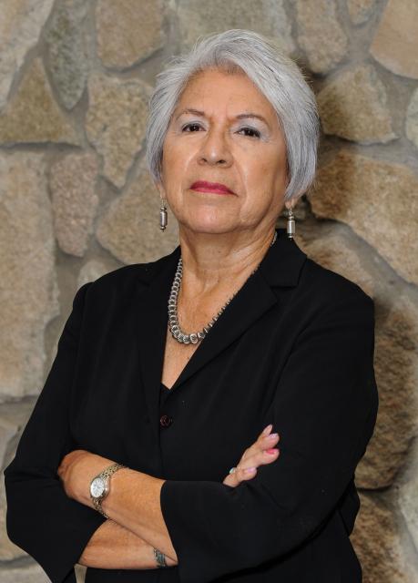
Amy Cordalis brings in a salmon for processing at the family dock at Requa, California. Photo credit: Daniel Cordalis
Standing at Iron Gate Wednesday morning, Amy Bowers Cordalis, a Yurok tribal member and attorney for the tribe, cried as she watched water spill over the former dam and slowly flow back into the river. Bowers Cordalis has fought for the removal of the Klamath dams since 2002, when she saw some of the tens of thousands of salmon die in the river from a bacterial outbreak caused by low water and warm temperatures. She said watching the river return to its natural channel felt like she was witnessing its rebirth.
American beaver, he was happily sitting back and munching on something. and munching, and munching. By Steve from washington, dc, usa – American Beaver, CC BY-SA 2.0, https://commons.wikimedia.org/w/index.php?curid=3963858
Beavers, Castor canadensis in North America and Castor fiber in Eurasia, are widely referred to as nature’s engineers due to their ability to rapidly transform diverse landscapes into dynamic wetland ecosystems. Few other organisms exhibit the same level of control over local geomorphic, hydrologic, and ecological conditions. Though freshwater ecosystems are particularly vulnerable to changing climate, beavers and their wetland homes have persisted throughout the Northern Hemisphere during numerous prior periods of climatic change. Some research suggests that the need to create stable, climate-buffered habitats at high latitudes during the Miocene directly led to the evolution of dam construction. As we follow an unprecedented trajectory of anthropogenic warming, we have the unique opportunity to describe how beaver ecosystem engineering ameliorates climate change today. Here, we review how beavers create and maintain local hydroclimatic stability and influence larger-scale biophysical ecosystem processes in the context of past, present, and future climate change.
The U.S. Forest Service has finalized a land exchange with Mt. Emmons Mining Company located in Gunnison and Saguache counties.
Under the agreement, finalized on Aug. 29, the Forest Service exchanged 539 acres of federal land located adjacent to the Keystone Mine for 625 acres of land owned by Mt. Emmons Mining Company located within the Grand Mesa, Uncompahgre and Gunnison National Forests and Rio Grande National Forest.
Iron Fen. Photo credit from report “A Preliminary Evaluation of Seasonal Water Levels Necessary to Sustain Mount Emmons Fen: Grand Mesa, Uncompahgre and Gunnison National Forests,” David J. Cooper, Ph.D, December 2003.
The land exchange allows the Forest Service to improve wildlife habitat and recreation opportunities by reducing private inholdings and creating more contiguous public land. The parcels acquired by the Forest Service include riparian and wet meadow habitats, which are vital to various bird and aquatic species.
Additional benefits of the land exchange include an established Conservation Easement and Mineral Extinguishment Agreement, prohibiting mining and allowing for non-motorized recreation in the future. It allows Mt. Emmons Mining Company to address mining remediation efforts, including water quality and facilitated the transfer of ownership and administration of the Kebler Winter Trailhead to Gunnison County.
“We are pleased to see this momentous exchange finalized,” said Dayle Funka, Gunnison district ranger. “This project was truly a collaborative effort with local non-profits, private landowners and local and federal governments working to benefit future generations. We encountered obstacles throughout the process but found ways to move forward in the spirit of collaboration. As a result of many people’s dedication and perseverance, this land exchange will enhance public access and enable future non-motorized recreational opportunities. I commend the Mt. Emmons Mining Company for their commitment to mining remediation efforts and water quality, while honoring the values of the community.”
Figure 1. A bridge where the Bear River used to flow into Great Salt Lake. Photo: EcoFlight.
Click the link to read the release on the Utah DWR website (Shaela Adams,Kelly Good, Wade Tuft):
September 16, 2024
SALT LAKE CITY—Great Salt Lake will benefit from 10,000 additional acre-feet of water thanks to a partnership between the National Audubon Society and The Nature Conservancy—as co-managers of the Great Salt Lake Watershed Enhancement Trust—in partnership with Jordan Valley Water Conservancy District, the Church of Jesus Christ of Latter-day Saints, the Utah Division of Wildlife Resources, and the Utah Division of Forestry, Fire and State Lands. The water will be delivered from upstream storage in Utah Lake, and flow through the Jordan River to Great Salt Lake’s Farmington and Gilbert Bays through mid-October.
Jordan Valley Water Conservancy District (Jordan Valley Water) is donating 5,300 acre-feet of water, the Church of Jesus Christ of Latter-day Saints (Church) is donating 1,700 acre-feet of water, and the Great Salt Lake Watershed Enhancement Trust (the Trust) is leasing 3,000 acre-feet of water, with all water sourced from Welby Jacob Water Users Company shares. The Utah Divisions of Wildlife Resources (DWR) and Forestry, Fire and State Lands (FFSL) will place the water to beneficial use at Great Salt Lake.
“Delivering new water to Great Salt Lake is essential to preserve the health of the lake and Utah communities, as well as protect the habitats for millions of birds that rely on it,” said Marcelle Shoop, Executive Director of the Trust and National Audubon Society’s Saline Lakes Director. “We are grateful for the vision and commitment of many partners, for this innovative late season water release to diversify benefits to the lake and its wetlands, as well as the Jordan River. We look forward to future opportunities to repeat these efforts in years to come.”
While the 2024 spring season flows increased Great Salt Lake water levels, ongoing flows are needed to reach healthy levels. Now the lake will receive additional flows this fall through this key collaboration.
“This release to Great Salt Lake is made possible by four key factors: water conservation efforts of residents and businesses in Salt Lake Valley, important changes to water rights laws adopted by the legislature over the last few years, Jordan Valley’s effective use of its existing water storage and conveyance infrastructure, and a strong snowpack,” says Alan Packard, General Manager of Jordan Valley Water.
Migrating shorebirds, waterfowl and other waterbirds will benefit as their habitats receive these additional flows. Increased water flows to the lake can also aid with salinity management in the South Arm, and in some cases improve capacity to control the spread of botulism and other diseases.
“Additional flows late in the water season are particularly beneficial during dry, warm conditions when there are risks of avian botulism,” DWR Director J Shirley said. “Over 12 million birds, represented by 339 species, utilize the Great Salt Lake and its associated wetlands. The ecosystem that the Great Salt Lake and its wetlands provide is crucial for these birds, and we applaud the ongoing efforts to conserve these habitat areas and the lake.”
The release will take place during Jordan River Commission’s Get To the River Festival, highlighting that in addition to the benefits to Great Salt Lake, these flows will benefit Jordan River and bordering communities, ecologically and recreationally, as the water moves down some 51 river miles.
“The Church continues to look for ways to care for the Great Salt Lake and the ecosystem that depends on it. This latest donation is another step in that effort. We consider it a divine responsibility to care for the earth and be wise stewards of God’s creation,” said Bishop W. Christopher Waddell, First Counselor in the Presiding Bishopric, The Church of Jesus Christ of Latter-day Saints.
In this undated photo, water flows through Glen Canyon Dam’s river outlet works. The pipes will undergo $9 million in repairs, but conservation groups want to see more permanent renovations at the dam, which holds back Lake Powell as Colorado River supplies shrink. Photo credit: Reclamation
Click the link to read the article on the KUNC website (Alex Hager):
September 9, 2024
This story is part of ongoing coverage of the Colorado River, produced by KUNC and supported by the Walton Family Foundation. KUNC is solely responsible for its editorial coverage.
Federal water managers will repair a set of little-used pipes within Glen Canyon Dam after discovering damage earlier this year. The tubes, called river outlet works, have been a focus for Colorado River watchers in recent years. If Lake Powell falls much lower, they could be the only way to pass water from the nation’s second-largest reservoir to the 25 million people downstream of the dam.
The Bureau of Reclamation will use $8.9 million from the Bipartisan Infrastructure Law to apply a new lining to all four pipes, which were originally coated more than 60 years ago. Conservation groups, however, say Reclamation should turn its attention and finances to bigger, longer-term fixes for the dam.
“Duct tape and baling wire won’t work in the long run,” said Kyle Roerink, executive director of the nonprofit Great Basin Water Network. “These short-term efforts are myopic in the grand scheme of things.”
The river outlet works were originally designed to release excess water when the reservoir nears full capacity. Now, Lake Powell is facing a different problem: critically low water levels.
After more than two decades of climate-change-fueled drought and steady demand, the reservoir is less than 40% full. It was only 22% full as recently as 2023.
Lake Powell key elevations. Credit: Reclamation
Currently, water passes through hydroelectric generators inside Glen Canyon Dam before flowing into the Colorado River. Water experts fear that shrinking supplies and unsustainably heavy demand will keep sapping Lake Powell, bringing the top of the reservoir below the intakes for the generators.
Bob Martin, who manages hydropower at Glen Canyon Dam, shows the effects of cavitation on a decommissioned turbine on Nov. 2, 2022. When air pockets enter the dam’s pipes, they cause structural damage. Similar damage is the focus of upcoming repairs. Photo credit: Alex Hager/KUNC
Not only would such a drop jeopardize power generation for about 5 million people across seven states, but it would leave the river outlet works as the only means of passing water from Lake Powell to the other side of the dam.
The pipes are only capable of carrying a relatively small amount of water. If they become the only means of passing water through the dam, the Colorado River’s Upper Basin states — Colorado, Wyoming, New Mexico, and Utah — could fail to meet a longstanding legal obligation to share a certain amount of water with their downstream neighbors each year.
That could mean less water for cities like Las Vegas, Phoenix and Los Angeles, as well as massive farm districts that put vegetables in grocery stores across the country.
Recent boosts in Lake Powell water levels are mostly due to back-to-back snowy winters, which climate experts say are becoming increasingly rare.
Conservation groups are putting pressure on policymakers to rein in demand. Some environmental advocates are asking them to consider draining Lake Powell altogether and storing its water elsewhere.
“We need to start planning for a river with less water,” said Eric Balken, executive director of the nonprofit Glen Canyon Institute. “That means drastically rethinking infrastructure that was built for a much bigger river. As climate change and overuse continue to put pressure on this river system, Glen Canyon Dam’s plumbing limitations will become more and more problematic.”
The back of Glen Canyon Dam circa 1964, not long after the reservoir had begun filling up. Here the water level is above dead pool, meaning water can be released via the river outlets, but it is below minimum power pool, so water cannot yet enter the penstocks to generate electricity. Bureau of Reclamation photo. Annotations: Jonathan P. Thompson
Click the link to read the article on The Denver Post website (Elise Schmelzer and Joe Rubino). Here’s an excerpt:
September 8, 2024
…after decades of revitalization and efforts to stabilize flows, sections of the urban South Platte still smell of decay and waste, and city officials discourage swimming. But cyclists also pedal along miles of paved trails on the riverfront. Kayakers and surfers play in the whitewater. Carp and trout lurk under bridges, while families of ducks paddle along the calmer waters. And strips of green parks border long stretches of the river where, in previous decades, factories spewed sludge and landfills leached pollutants. After a long era of neglect and abuse, city officials, nonprofit leaders and developers hope to build on that progress as they pose a question for the future: How can we turn the city toward the river — the waterway that made Denver’s existence on the High Plains possible — instead of putting it at our backs and ignoring it? More than a quarter of a billion federal dollars are flowing into ecosystem restoration and flood management along the South Platte. For the first time, the Denver City Council recently created a committee dedicated to issues on and development near the river…
Developers plan to invest hundreds of millions of dollars along the river in coming years, building as much as 15 million square feet of combined new residential and commercial space on the land where Elitch Gardens Theme and Water Park sits today. If completed, that square footage will be nearly five times larger than Denver International Airport’s terminal building. Should that and other ambitious projects reach their full potential, the Platte would serve as a focal point of brand new high-rise urban neighborhoods that expand the city’s skyline in a new direction…Property owners ranging from the Denver Housing Authority to Stan Kroenke, the billionaire owner of the Colorado Avalanche and Denver Nuggets, to the city itself will all play roles in determining how new construction capitalizes on a restored South Platte. The impending turnover of underutilized and unappreciated land has generated buzz and a glut of glossy renderings. At the same time, it’s inducing heartburn in some corners of the city that have seen new investment like that drive gentrification in nearby low-income and minority neighborhoods.
Still, establishing the river as an asset rather than a barrier to urban growth is a sea change that veteran Denver city-builders like architect Chris Shears have hoped for decades would come. His firm, Shears Adkins Rockmore, has its hands in nearly every landscape-shifting project being contemplated near the South Platte today. The plans include transforming the vast parking lots around Empower Field and Ball Arena into new mixed-use neighborhoods.
The National Fish and Wildlife Foundation (NFWF) today announced more than $1.5 million in grants to restore, protect and enhance aquatic and riparian species of conservation concern and their habitats in the headwaters of the Colorado River and Rio Grande watersheds. The grants will leverage over $1.8 million in matching contributions for a total conservation impact of more than $3.3 million.
The grants were awarded through the Southwest Rivers Headwaters Fund, a partnership between NFWF and the U.S. Department of Agriculture’s Natural Resource Conservation Service, U.S. Forest Service, U.S. Fish and Wildlife Service, Walton Family Foundation and the Trinchera Blanca Foundation, an affiliate of The Moore Charitable Foundation, founded by Louis Bacon.
“Communities in the Southwest have grappled with challenges to the long-term sustainability of their rivers,” said Jeff Trandahl, executive director and CEO of NFWF. “These grants demonstrate how investments in stream and meadow restoration in our headwaters can increase the climate resiliency of these critical water resources while supporting the Southwest’s many unique fish and wildlife species.”
The projects supported by the six grants announced today will address a key strategy for species and habitat restoration in headwaters streams of the Colorado River and Rio Grande: restoring and enhancing riparian and instream habitat.
“Consistent with the intent of the Inflation Reduction Act, the selected restoration projects within the forests, streams and riparian areas of the National Forests in Arizona, New Mexico and southern Colorado are a significant step to maintain and improve riparian and aquatic ecosystems into the future in the face of changing climates,” said Steve Hattenbach, Deputy Regional Forester, USDA Forest Service Southwestern Region. “Streams and riparian areas are key to ensuring sufficient water to maintain the ecological integrity of watersheds that support life in the beautiful Southwest.”
NFWF’s Southwest Rivers Program was launched in 2018 to fund projects that improve stream corridors, riparian systems and associated habitats from headwaters to mainstem rivers in the Southwest. Through the Southwest Rivers Headwaters Fund, the program funds projects that produce measurable outcomes for species of conservation concern in the wetlands and riparian corridors of the headwaters regions of major southwestern rivers. In 2022, the Fund expanded from the Rio Grande watershed to include to include priority headwaters watersheds of the Colorado River Basin in Arizona, New Mexico and Utah.
A complete list of the 2024 grants made through the Southwest Rivers Headwaters Fund is available here.
The humpback chub is one of four endangered fish species on the Colorado River. Photo credit: Utah Division of Wildlife Resources.
Click the link to read the article on the AZCentral.com website (Brandon Loomis). Here’s an excerpt:
August 25, 2024
A shot of cold water from Glen Canyon Dam appears to have stalled a smallmouth bass invasion of the Grand Canyon and protected rare Colorado River fish there, federal officials say. In early July, two years after first finding the predatory bass spawning below the dam and in threatened humpback chub territory, the U.S. Bureau of Reclamation began releasing cold water from deep in Lake Powell in an effort to chill the river past the temperature at which bass are known to reproduce. So far this summer, numerous netting, snorkeling and electrofishing trips on the river have turned up no newly hatched bass, biologists reported to an advisory committee meeting on Grand Canyon’s South Rim on Thursday.
“That’s huge,” said Kelly Burke, executive director at Wild Arizona and its Grand Canyon Wildlands Council, which had pushed for flow alterations from the dam to disrupt the bass invasion.
Cooler water was a must for preventing possible biological disaster this summer in particular, she said. “It couldn’t be better timed. We’re having an extraordinarily hot summer.”
The initial success also means the National Park Service will not dump a fish-killing chemical into spawning grounds a few miles downstream of the dam this year as it did last summer. Last year’s effort drew a rebuke from some tribal officials associated with Grand Canyon, who prefer nonlethal controls. Federal officials considered the bass invasion an emergency requiring quick action to prevent a population explosion that could devastate humpback chubs, 90% or more of which live in the Canyon. Cooling the river below 60 degrees Fahrenheit has at least stalled that explosion.
Researcher Seth Arens prepares to count plants in Glen Canyon on July 16, 2024. His study shows that many plants in areas once submerged by Lake Powell are the kind of native species that lived in the area before the reservoir. Alex Hager/KUNC
Click the link to read the article on the KUNC website (Alex Hager):
August 20, 2024
This story is part of ongoing coverage of the Colorado River, produced by KUNC and supported by the Walton Family Foundation. KUNC is solely responsible for its editorial coverage.
Seth Arens has all the adventurous swagger of Indiana Jones. His long hair is tied up in a bun, tucked neatly under a wide brimmed hat. His skin bears the leathery tan of someone who has spent the whole summer under the desert sun.
But as Arens pushed his way through a taller-than-your-head thicket of unforgivingly dense grasses, he explained why he doesn’t carry a machete, betraying his differences from the whip-cracking tomb raider.
“I guess, as an ecologist, I can’t quite bring myself to just hack down vegetation,” Arens said.
Arens is a scientist with Western Water Assessment and the Cooperative Institute for Research in Environmental Sciences, both environmental research groups headquartered at the University of Colorado Boulder.
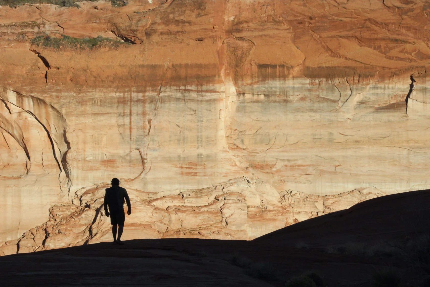
He has spent weeks traversing the smooth, twisting red rock narrows of Glen Canyon in search of his own kind of treasure: never-before-collected data about plants.
Glen Canyon is perhaps best known for the reservoir that fills it. Lake Powell, the nation’s second-largest reservoir, has kept much of the canyon underwater since the 1960s and 70s. The 21st Century has changed that. Climate change and steady demand have brought its water levels to record lows, putting once-submerged reaches of the canyon above water for the first time in decades.
Katie Woodward, Seth Arens and Eric Balken stand in a stream-fed pool in Glen Canyon on July 16, 2024. This area was once completely submerged by Lake Powell, but now thrives with native plants. Alex Hager/KUNC
What happens next is still up in the air. Some environmental advocates want to see the reservoir drained so plants, animals, and geologic features can come back. Boaters and other recreators want to maintain the status quo – keep storing water in Lake Powell and sustain a tourism site that brings in millions of visitors each year.
In the snaking side canyons that were once under Lake Powell, Arens is methodically counting plants at different sites over the course of multiple years. He is creating a record of which species are taking root, and what might be lost if the reservoir were to rise again.
“Nature has given us a second chance to reevaluate how we’re going to manage this place,” Arens said.
While the study is still underway, Arens said native species dominate the landscape alongside the area’s creeks. The same kinds of plants that lived in Glen Canyon before Lake Powell have taken root again — even after their habitats were drowned — filled in with towering piles of sediment deposits, and then shown the light of day once more.
“It turns out nature is doing a pretty good job by itself,” Arens said, “Of coming back and establishing thriving ecosystems.”
‘Old assumptions’ and new policies
The data produced by this study is going public during a pivotal time for the Colorado River and its major reservoirs.
Decisions made over the next two years will shape who gets how much water from the shrinking river, which supplies roughly 40 million people. Cities and farms from Wyoming to Mexico are all trying to make sure they get their fair shares, and environmental advocates are trying to make sure the region’s plants and animals aren’t an afterthought.
A killdeer stands in a spring-fed stream in Glen Canyon on July 17, 2024. The native plants alongside the canyon’s streams are host to a variety of birds and other animals such as beavers, toads, lizards and insects. Alex Hager/KUNC
The current guidelines for managing the river expire in 2026. Right now, policymakers are working on a set of replacements. Eric Balken, director of the nonprofit Glen Canyon Institute, wants those new rules to factor in the wellbeing of plants around Lake Powell.
“If the old assumption was that we can store water in Glen Canyon because there’s nothing there, that assumption is wrong,” he said. “There is a lot here. There is a serious ecological consequence to putting water in this reservoir, and we cannot ignore that anymore.”
Balken’s group, which advocates for draining Lake Powell and storing its water elsewhere, provided some funding for the plant study being conducted by Seth Arens. Glen Canyon Institute is hoping it will provide data that proves the value of the canyon’s plant ecosystems to policymakers.
That’s extra important, Balken said, because federal water managers aren’t doing enough for Glen Canyon’s plants right now.
The Bureau of Reclamation, the federal agency that manages the West’s reservoirs, outlined its current strategy for river management in an October 2023 document called the “Draft Supplemental Environmental Impact Statement.” Balken called that document’s assessment of Glen Canyon plants “demonstrably false.”
In short, Reclamation describes an environment dominated by invasive plants that only stand to cause problems.
“When I read that,” Balken said, sitting near a patch of native willow plants feet from Lake Powell’s edge. “I just thought, ‘Had these people even been to Glen Canyon?’” This place is a vibrant, burgeoning ecosystem.”
Reclamation’s report mentions some native species that form “unique ecosystems within the desert,” but appears to conclude that rising reservoir levels – which are partially the result of the agency’s own management decisions – would ultimately be good for plant life around Lake Powell.
Seth Arens pilots a boat across Lake Powell between research sites on July 17, 2024. Some environmental advocates want to see the reservoir drained and its water stored elsewhere, while proponents of Lake Powell hail its value as a recreation area. Alex Hager/KUNC
It highlights the presence of invasive plant species and says “any additional acreage of exposed shoreline around Lake Powell has the potential to be invaded by invasive plant species such as tamarisk and Russian thistle.”
Balken and Arens argue the opposite, pointing to early survey findings that include widespread native plant life in areas that have been exposed by declining reservoir levels.
Reclamation declined to be interviewed for this story, but a spokeswoman for the agency wrote in an email to KUNC, “Reclamation’s consideration of impacts to vegetation are primarily for resources downstream of Glen Canyon Dam that are affected by dam releases.”
The spokeswoman wrote that “most of the releases, even on the annual time scale, have negligible effects on lake levels and vegetation,” and pointed to inflows, such as annual snowmelt, as having a bigger impact on water levels in the reservoir than Reclamation’s releases of water from Glen Canyon Dam.
Balken suspects that Reclamation lacks data about Glen Canyon’s plants and hopes that the ongoing study will fill in those gaps and help shape management plans going forward.
The National Parks Service, which manages recreation on Lake Powell and gathers some data about the surrounding environment, was not able to provide comment for this story in time for publication.
‘A chance for survival’ around Lake Powell
While Arens’ study hasn’t produced any hard data yet, he is taking a mental tally of plants every time he trudges through the lush, winding creekbeds that channel spring-fed streams into Lake Powell.
These riverside ecosystems were shaped by their years spent underneath the reservoir, and little signs of that reality are everywhere.
Seth Arens looks at plants growing from crevices in a rock wall in Glen Canyon on July 16, 2024. These “hanging gardens” thrive in shady canyon bends where water seeps from the wall. Alex Hager/KUNC
Standing in the baking desert sun, Arens poked at a digital map on his phone screen while trying to find his next research site, and the map showed that he was standing underwater. Much of the canyon is lined with banks of sediment, sometimes more than a dozen feet tall, that were left behind by the still waters of Lake Powell. Those banks now provide heaps of soil for the roots of native plants.
Now that some of those areas have been left to grow for more than two decades, in some cases, they abound with life.
In one canyon, frogs and toads hop along the clear trickle just downstream of a beaver pond while birds flit in and out of tall, shady cottonwoods. In another, ferns sprout from crevices where water seeps onto a damp rock wall.
It’s a veritable oasis in the desert – the kind of cool, spring-fed Eden that populated the heat-induced daydreams of thirsty cowboys traversing the expanses of the Old West.
Katie Woodward, Arens’ research assistant, is finding inspiration in these canyons, too.
“It’s very obvious that nature can take care of its own and turn a highly disturbed landscape, a landscape that was disturbed because of the follies of man, and change that into something that is diverse and productive,” she said. “I would have never believed how possible that was until I came down here.”
The researchers hope their findings about that recovering landscape end up in front of policymakers, whose decisions could shape the future of Glen Canyon’s native ecosystems.
Katie Woodward takes notes on plant species in Glen Canyon on June 16, 2024. She and researcher Seth Arens trek through remote desert canyons to tally the plants within, and have found mostly native vegetation in the canyon’s riparian ecosystems. Alex Hager/KUNC
“As Glen Canyon resurfaces, there’s an incredible moment for species that are feeling the pressures of both human-induced and naturally driven change on water resources in riparian areas in the west, to have a chance for survival in a future that feels really unknown and kind of scary.”
Some of those unknowns might get settled soon, as the next rules for Colorado River management are likely to include new plans for storing water in Lake Powell. State water negotiators have projected optimism that policy meetings will result in a new agreement for water management before the 2026 deadline.
The News:Western Colorado’s Mesa and Montrose counties propose a 30,000-acre national conservation area for the Lower Dolores River corridor as an alternative to the proposed 400,000-acre national monument. While this may look like a peace offering or compromise of sorts from counties that have opposed protections of any kind, it is just as likely an attempt to block any sort of designation and will probably only further fan the flames of controversy. It’s the latest volley in a half-century-long battle over the fate of the beleaguered river.
The Context:The current controversy over the Dolores River takes me back to when I was a youngster in the early ‘80s. McPhee Dam was under construction on the Dolores River, its proponents having vanquished a movement that sought to block the dam and keep the river free. My parents had been on the losing side of the fight, and I can distinctly remember my father blaming the defeat, at least in part, on outsider environmentalists — including Ed Abbey — deriding the pro-dam contingent as a bunch of “local yokels.
I’m sure my dad took it personally. He was a fourth-generation rural Coloradan, had graduated from Dolores High School, and his mom and sisters still lived in Dolores — apparently making him a “yokel,” even though he opposed the dam. But also he saw it as a major strategic misstep. Not only were these people insulting locals, but they were falling into the pro-dam contingent’s trap, bolstering the dam-building effort in the process.
More often than not, these land protection fights are framed as well-heeled elitist outsiders and Washington D.C. bureaucrats imposing their values on and wrecking the livelihoods of rural, salt-of-the-earth local ranchers and miners. And in almost every case it is a gross oversimplification, at best, and at worst is an inaccurate portrayal and a cynical attempt to disempower locals — and anyone else — who favor land protection. So when those anti-dam folks caricatured the pro-dam contingent as local yokels, they were not only alienating locals who may have been on their side, but also validating the false depiction of the situation.
Fresh snow on Bears Ears. Photo credit: Jonathan P. Thompson/The Land Desk
We saw this play out in the battle over the Bears Ears National Monument designation and Trump’s shrinkage of it in a gross way. The anti-monument contingent insisted that all “locals” were opposed to the monument — and the media largely bought into it — never mind the fact that effort to establish a monument in the first place was driven by local Navajo Nation and Ute Mountain Ute citizens, and was taken up by tribal nations who have inhabited the landscape in question since time immemorial. Never mind that the anti-monument “locals” were backed by mining corporations, right-wing think tanks, and conservative politicians from all over (including a Manhattan real estate magnate and reality TV personality who became President). Utah’s congressional delegation even had the gaul to attempt to disenfranchise and silence the voices of tribal leaders because they happened to be based on the other side of a state or county line that was arbitrarily drawn based on arbitrary grids by dudes in Washington D.C.
The movement to protect the Dolores River has been portrayed in much the same way over the last several decades. It has its roots in 1968, when U.S. Rep. Wayne Aspinall, a Democrat from Colorado’s Western Slope, pushed through the Colorado River Basin Project Act, authorizing the construction of five Western water projects. One of them was the Animas-La Plata Project, a byzantine tangle of dams — including one on the Animas River above Silverton — along with canals, tunnels, and even power plants. Another was the Dolores Project, which included building McPhee Dam several miles downstream of the town of Dolores, which would impound water to lengthen the irrigation season for the Montezuma Valley and allow water to be sent, via canal, to the dryland bean farmers around Dove Creek.
The Dolores River, below Slickrock, and above Bedrock. The Dolores River Canyon is included in a proposed National Conservation Area. Photo: Brent Gardner-Smith/Aspen Journalism.
The prospect of another river being stilled by another giant monolith sparked a movement to block the dam and to designate the Lower Dolores River corridor as a Wild and Scenic River, which would have prohibited mining and oil and gas leasing, while also ensuring enough water would be left in the stream to keep the river “wild and scenic,” which is to say a lot more water than zero, which was the lower river’s flow from mid-summer into fall due to irrigation diversions.
Local farmers were generally in favor of the dam — and against Wild & Scenic designation, since it would likely deprive them of some irrigation water during dry times. But their cause was also backed by powerful agricultural interests on the state level, the pugnacious Durango attorney Sam Maynes, Sen. Gary Hart, the Colorado Democrat, and, probably most importantly, the Ute Mountain Ute Tribe, which would receive a portion of the vast amounts of water to which they were entitled from the Dolores Project. The project was ultimately authorized (though I doubt the local yokel comment had all that much to do with it, really). Construction of McPhee Dam began in 1979 and the reservoir began filling in 1983.
La Plata Mountains from the Great Sage Plain with historical Montezuma County apple orchard in the foreground.
No matter how one feels about dams, you have to admit it had some benefits. In 1978 the federally funded Dolores Archaeological Program was launched to survey, excavate, and study the rich cultural sites that were spread out across the area to be inundated by the reservoir. It was a huge project that brought a slew of researchers to the area, significantly advanced scientific knowledge of the Ancestral Puebloan people who inhabited the region for centuries, and provided the seeds for future archaeological work and organizations, including the Crow Canyon Archaeological Center.
And, contrary to opponents’ fears, the dam didn’t kill the river. Rather it was like putting the river’s manic-depressive flows on lithium. The massive spring runoffs were tempered, but water managers released enough water in most years to scour beaches and preserve Snaggletooth’s whitewater snarl. And for the first time in a century the lower Dolores didn’t run dry in July. In fact, the year-round flows were enough to build and sustain a cold-water fishery for trout in the first dozen or so miles below the dam and a habitat for native fish below that. The Ute Mountain Ute Tribe got both drinking water from the project as well as enough to irrigate a major agricultural enterprise near the toe of Ute Mountain, providing much needed economic development. The Town of Dove Creek receives water from the project as do the formerly dryland farmers, allowing them to diversify their crops. The dam’s completion happened to coincide with the demise of the domestic uranium mining industry, meaning that threat mostly went away as well, along with the need for added protections.
The Dolores River at its confluence with the San Miguel River. Jonathan P. Thompson photo.
Unfortunately, drier times set in and the current megadrought, now going on a quarter century, has depleted the river’s flows and reservoir levels. In order to keep the irrigation ditches flowing as deep into the summer as possible, dam managers have released almost no water during 14 of the last 24 years, essentially desiccating the stream bed below the dam and throwing the riparian ecology out of whack. In the midst of it all the uranium industry made a short-lived comeback between 2006 and 2012. Now it seems to be emerging from its zombified state once again and is targeting numerous sites along the Dolores River. The river runs through the Paradox Formation, as well, meaning it could be targeted by lithium and potash miners. Meanwhile, visitation to the Lower Dolores River has ramped up — along with the impacts — as social media posts reveal the canyons to more people and as the Moab crowd seeks new places to play.
Dolores River watershed
All of that spawned new Wild & Scenic campaigns for the Lower Dolores, but after it became clear they couldn’t get past political hurdles, stakeholders came together to work on a compromise, resulting in a proposal to create a national conservation area on 60 miles of river corridor below the dam, which would withdraw the land from new mining claims and oil and gas leases, bring more attention to the plight of this sorrowful and spectacular river, and possibly more funding to river restoration efforts. But it would leave another 100 miles of the Lower Dolores unprotected, in part because Mesa and Montrose Counties withdrew their support for the plan. Thus the proposal for President Biden to designate 400,000 acres as a national monument.
That proposal, perhaps predictably, has sparked a backlash and an anti-national monument campaign partly fueled by disinformation. And, just as predictably, it’s being falsely framed as a fight pitting locals vs. outsiders. It’s true that a survey commissioned by Mesa County of about 1,200 registered voters in Mesa, Montrose, and San Miguel Counties found that 57% of respondents oppose the national monument proposal. That shows that more locals oppose it, but that quite a few support the initiative, as well. And Center for Western Priorities director Aaron Weiss found that the survey may be biased since its creators consulted with national monument opponents, but not proponents, about which questions to ask and how to word them. And it shows.
For example, the survey precedes one set of questions with: “Currently, uranium mining in the Dolores River Canyon area in the west end of Montrose County impacts the local economy by providing tax dollars and jobs. The current national monument proposal would allow some but not all existing permit holders to continue to operate, but it has not been decided if the proposal would allow new permits or permit renewals in the future.” But this is misleading, because the uranium mining industry remains virtually dead, so the economic impact is zero to negligible. Furthermore, a national monument grandfathers in all existing valid mining claims and has no effect on patented (private) claims. So even if there were operating mines, a monument wouldn’t hamper operations. [ed. emphasis mine] Other questions were similarly misleading by implying that a national monument designation would remove management from the BLM or Forest Service.
Tellingly, the survey also found that 72% of respondents support existing national monument designations “such as Browns Canyon, Chimney Rock, and Colorado National Monument.” Why? Because they value conservation and they’ve seen that national monuments don’t hurt the economy or agriculture or significantly restrict access. That they are less sure about a new national monument might have something to do with the opponents’ simplistic and unfounded argument against it, which is that it could “impose severe economic hardships,” without explaining how.
Nevertheless, Mesa County used the survey to justify a resolution opposing the national monument and supporting its proposal for a vastly scaled down national conservation area. Again, this tactic is an echo of ones used by Bears Ears National Monument opponents. National Conservation Areas don’t inherently offer more or less protections or restrictions than national monuments, but they do need to be passed by Congress. Given how dysfunctional our Congress is, that could take years or even decades.
Yet the Lower Dolores River needs help now. No, a national monument won’t solve all its problems; it may not help the river, itself, at all. Already the fight over the proposal has shone a spotlight on a remote, largely unknown area, which will surely draw more visitors and more damage. A national monument designation at least would provide the possibility of protection against future development and burgeoning crowds.
The Dolores River between Rico and Dolores in southwestern Colorado on Memorial Day 2009. Photo credit: Allen Best/Big Pivots
Sources/Usage: Public Domain. View Media Details
The Dolores River, CO. (Olivia Miller, USGS).The historic flume hanging from a cliff above the Dolores River in western Colorado. This stretch would likely be included in a proposed national monument. Jonathan P. Thompson photo.Dolores River skeleton plant (Lygodesmia doloresensis). Photo by Peggy Lyon via Colorado Natural Heritage ProgramNathan Fey, seen here paddling the Lower Dolores River. The lower Dolores River depends on a deep snowpack for boating releases from McPhee Reservoir. (Photo courtesy Nathan Fey)A view of the Dolores River below Slickrock.The Dolores River in southwestern Colorado on Memorial Day in 2009. Photo/Allen BestPonderosa Gorge, Dolores River. Boating is popular on the Lower Dolores River, which is being considered as a National Conservation Area. Photo credit RiverSearch.com.St Louis Tunnel Ponds June 29, 2010 – view south towards Rico. Photo via the EPA.The Dolores River shows us what’s at stake in the fight to protect the American West — Conservation ColoradoPhoto via the Sheep Mountain AllianceLone Cone from the Dolores RiverDolores River south of Lizard Head PassDolores River above DoloresWestern San Juans with McPhee Reservoir in the foregroundDolores RiverDolores River near BedrockDolores River Canyon near Paradox
“What do you think about this?” My friend, Sonya Daw, had called out to me from where she was standing at the edge of Beaver Creek. I joined her. I had just scrambled over a massive log and was grateful for an excuse to catch my breath.
“Hmm,” I said, still breathing hard. In front of us, water burbled over some branches that had fallen across the creek. Had they fallen, though? Or had they possibly been placed there by beavers?
As one of 11 teams taking part in a “beaver scavenger hunt” across the Cascade-Siskiyou National Monument in southwest Oregon, we were looking for any sign of beavers — willow stumps, sticks with “corn-on-the-cob”-style teeth marks, or even scent mounds, which beavers use to mark territories. What we and the other teams discovered would help the nonprofit Project Beaver focus their beaver-restoration efforts.
My team included Sonya, who writes for the National Park Service, her husband Charlie Schelz, the former monument ecologist, and Barb Settles, a spry 78-year-old and avid naturalist.
Photo: Juliet Grable
Charlie joined us, and we contemplated the creek. “I don’t think that’s anything,” he said. “But look how the sediment is piling up behind the branches; how cool is that?”
It was June 1 — not just a beautiful time to be hiking through the forest but the ideal window for beaver activity. Beaver moms have their babies in late spring and then send their older offspring packing. These dispersing youngsters are on the move, exploring new creeks and sampling the buffet of plants.
We took our time in flatter areas, especially where willows or red osier dogwood — beaver “dessert plants” — grew in clumps near the banks. We weren’t likely to find beavers along this steep stretch, but it was still fun to look and marvel at the enormous sugar pines, Douglas firs, and incense cedars that had escaped loggers’ chainsaws last century.
Wanted: Ecosystem Engineers
The Cascade-Siskiyou National Monument encompasses 114,000 acres, mostly in southwest Oregon. The Klamath and Cascade Mountains converge here, creating a patchwork of oak woodlands, forests, grasslands, and wetlands support a dazzling array of butterflies, bees, birds, and plants, including many that are found nowhere else.
President Bill Clinton designated the monument in 2000, not for its stunning canyons or breathtaking vistas but its “outstanding biological diversity.” In 2017 President Barack Obama expanded the monument by another 48,000 acres.
Beavers undoubtedly once populated the many streams and meadows, but by the time the monument was designated, they had been all but eradicated — the case all over Oregon. Now there is only one known established beaver family in the entire monument, says Jakob Shockey, executive director at Project Beaver. There could be others; Shockey says he’s seen evidence of random individuals on several creeks.
The Bureau of Land Management manages the monument but has partnered with the nonprofit to help bring beavers back. The task has become more urgent in the face of recent drought, which has left its mark in swaths of dead conifers. This part of southwest Oregon is dry and hot in summer, and getting more so. Beaver dams could help hold more moisture on the landscape, attracting more birds in the process. Wet meadows engineered by beavers could even serve as a firebreak, helping tame the spread of catastrophic wildfires.
Friends of the Cascade-Siskiyou National Monument, the group that hosted the scavenger hunt, is a key player in the project.
“We see our role as letting people know what makes the monument special and what’s needed to support the ecological integrity of this special place,” says Friends’ executive director Collette Streight.
Friends has hosted several “bio-blitz” events, where volunteers fan out in search of butterflies or reptiles. Streight wanted to create an event with the “juicy” energy of a bio-blitz that produced data with practical applications. After talking with Schelz, Shockey, and others, she honed in on beavers.
Photo: Friends of Cascade-Siskiyou National Monument
Pond of Dreams
Ultimately, the key to attracting beavers — and more importantly, convincing them to stay and set up shop — is restoring habitat. This “build it and they will come” approach can attract beavers from miles away.
“One of the first steps is to get information: Where are the beavers, and what are they doing right now?” says Streight.
Last summer, they beta-tested the scavenger hunt with a “Hike and Learn” led by Shockey.
“We need to know this information, and it really will impact future restoration work,” says Shockey. “What I don’t have is the ability to walk a bunch of creeks by myself.”
We didn’t find any evidence of beavers on our steep stretch of creek, but after clambering back to the car, we had just enough time to check out a meadow on the upper portion of Beaver Creek, where last fall Project Beaver installed a series of post-assisted log structures, or PALS.
The broad, flat meadow was a totally different landscape from where we’d been searching. Our boots squished as we wandered through clumps of sodden grass. Soon Sonya and I were reaching for our binoculars. Birdsong filled the meadow: Lazuli buntings called from the willows; robins chortled from a massive pine at the meadow’s edge. I broke out the Merlin bird-identification app to sort through the confounding songs of warblers.
Charlie pointed out one of the PALS — several small posts pounded into the creek bottom, with willows woven between them. Water had pooled behind the structure, creating a shallow, murky pond full of bugs.
Photo: Juliet Grable
“This is great to see,” he said, as he bent low to admire butterflies dancing across the surface and examine willow stakes that had been planted there. They were starting to leaf out. It wasn’t difficult to imagine a beaver setting up shop here, and not just for the scenery.
“Beavers like to surround themselves with water; it helps keep them from being eaten,” Charlie told us. Without that buffer, beavers are an easy (and meaty) target for a host of predators, including cougars, bobcats, bears, coyotes, wolves, and of course, humans.
A Rebranding Campaign
Beavers, once pilloried as pests, have undergone an image makeover in the Beaver State, thanks in part to legislative champions. Last year Oregon’s governor signed the “Beaver Believer” bill, which recognizes the rodent’s potential role in mitigating climate change. Beavers, whom the state had perplexingly classified as predators (they’re vegetarians), have now been rebranded as furbearers. As of this July, private landowners must obtain a permit before they can trap or kill so-called “nuisance” beavers. For the first time, the Oregon Department of Fish and Wildlife will also begin collecting data on all beavers killed in Oregon.
Some conservationists have been lobbying the Biden administration to ban hunting and trapping of beavers on federal lands. More locally, advocates have pushed for a trapping ban within the monument’s borders. They hoped it would be included in a new draft “Resource Management Plan” released by the BLM this year, but it was nixed.
Shockey has mixed feelings about such a proposal.
“Traditionally, trapping bans have been used as a wedge issue between those who hunt and those who don’t,” says Shockey. Increasingly, anglers and hunters are coming to appreciate beavers’ good work in streams and meadows — the places they fish and hunt.
And, as Shockey points out, a trapping ban won’t matter if beavers are shot out of spite. Having more beaver advocates actively monitoring in the monument might be the most effective way to protect the animals. Events like the scavenger hunt help by elevating their profile, making more people aware of their presence and importance.
“Beavers are so interesting in the way that people relate them,” says Shockey. “They’re kind of a charismatic animal and they’re easy to find compared to a lot of wildlife that people care about, yet they’re still pretty invisible.”
Setting the Stage
Late in the afternoon, after the scavenger hunt had run its course, 50 or so tired but happy citizen scientists reconvened at the local elementary school to share their findings. A few teams had discovered fresh sign, including along one stretch of creek where Shockey had never detected beavers before. Teams that found no fresh beaver signs shared other sightings — a snake skin, a junco nest, blooming lilies, chewed willow stumps from years past.
Shockey was pleased. “The data are going to directly inform where we’re going to do restoration,” he said, after he’d thanked the volunteers.
“I’m incredibly proud about what we accomplished,” says Streight. From the fundraising campaign to last-minute scrambling when two team leaders cancelled, the scavenger hunt had required a huge amount of effort. Best of all, no one had twisted an ankle or succumbed to heatstroke.
She hopes to capitalize on the scavenger hunt’s momentum. “We feel we could have volunteers at the ready” to help Shockey’s crew monitor sites or plant willow stakes, she says. “They are really jazzed.”
Project Beaver and the BLM have secured $227,000 for beaver restoration, which is enough to support an eight-person crew for three years. Each spring and fall, they will spend two weeks building and repairing structures in creeks, with the ultimate goal of enticing beavers back. They hope to allow beavers to find the habitat on their own and start breeding.
“Can we increase the amount of beaver activity through our restoration work? That’s how we’re going to measure success,” says Shockey.
In May of 2018, USGS Hydrologic Technician Dave Knauer found a batch of zebra mussels attached to the boat anchor in the St. Lawrence River in New York. (Credit: John Byrnes, USGS. Public domain.)
Click the link to read the article on the Colorado Politics website (Thelma Grimes). Here’s an excerpt:
July 18, 2024
After years of taking steps to keep zebra mussels out of Colorado’s rivers and lakes, state officials said on Tuesday they are “devastated” to learn the invasive species has now made its way into the Colorado River, potentially affecting four states, and they are working on a rapid response to stop it from spreading…According to the Colorado Parks and Wildlife, the zebra mussel was found in the Colorado River and Government High Line Canal through routine testing in early July. On July 1, the state’s Aquatic Nuisance Species team collected a plankton sample from the Government Highline Canal near Clifton. The sample was evaluated at a lab in Denver, where a suspected single zebra mussel veliger was found, officials said.
Photo of a zebra mussel veliger discovered by CPW in the Colorado River near Grand Junction after routine testing in early July. A veliger is the mussel’s free-floating (planktonic) larval stage that can only be seen under a microscope. Photo Credit: CPW
A veliger is the free-floating larval stage of a mussel. At this stage in the life cycle, a zebra mussel can only be confirmed through a microscope. The mussels eat plankton, which takes away from fish that rely on it for food…After further analysis on July 9, the lab notified Invasive Species Manager Robert Walters that the sample was positive for zebra mussel DNA, officials said. Since the positive testing, the nuisance species team had collected plankton samples from two locations in the Colorado River upstream of the Grand Valley Water Users Canal. By July 11, both samples were confirmed for zebra mussel DNA.
Justyn Liff, the Bureau of Reclamation’s public affairs specialist, told Colorado Politics that sampling will increase upstream, and more meetings will be held between state and federal agencies to develop a solution to stop the species from spreading. Colorado Parks and Wildlife officials said that, with single detections in both waters, the areas are now designated as “suspect” for the presence of zebra mussels. The response must be rapid, with the state wildlife agency rolling out the Invasive Species Rapid Response Plan, which starts with taking more samples to determine if the official classification should be changed from “suspect” to “positive.”
The Government Highline Canal flows past Highline State Park in the Grand Valley. CREDIT: BETHANY BLITZ/ASPEN JOURNALISM
American beaver, he was happily sitting back and munching on something. and munching, and munching. By Steve from washington, dc, usa – American Beaver, CC BY-SA 2.0, https://commons.wikimedia.org/w/index.php?curid=3963858
From email from the Beaver Institute (Matt Moseley):
BOULDER, Colo – As drought, climate change and wildfires become more challenging around the country, the intriguing beaver has become a hot topic these days.
BeaverCON is the premier global gathering for knowledge-sharing and celebration of beavers. The Beaver Institute will host the third biennial global gathering on October 19-24 at the University of Colorado Boulder. It will feature presentations, science, field trips, panels, discussion, art and storytelling about the castor canadensis.
“Beavers are more important than ever in water management and creating habitat,” said Adam Burnett, executive director of the Beaver Institute. “This conference is an opportunity for multiple organizations, disciplines, and experiences to converge and learn how to create a future of ecological balance with beavers. We are thrilled with the speakers and energy around this unique and special conference.”
Highlights of BeaverCON:
Saturday, October 19: Cameron Peak Wildfire Field Trip with Dr. Emily Fairfax.
Sunday, October 20: Urban Beaver Field Trip
Monday, October 21: Opening Ceremony with Tribal Recognition, activating of Artist Commission; featured presenters include Dr. Emily Fairfax on wildfires, USDA FSA Administrator Zach Ducheneaux on beavers and farmers, Dr. Ellen Wohl on beavers in Colorado, California’s Natural Resources Secretary Wade Crowfoot on beaver reintroduction, Brock & Kate Lundquist on the Bring Back the Beaver Campaign, and Jim Vaile & Alicia Yellow Owl on Blackfeet Nation’s beaver management plan.
Tuesday, October 22: Multiple speakers on beaver-related restoration, coexistence, relational conservation, partnering with Tribal Nations, youth leadership, subsistence living, relocation, and policy. Leading voices in the field Molly Alves, Mark Beardsley, Dr. Roisin Campbell-Murphy, Janine Castro, Derek Gow, Dr. Chris Jordan, Dr. Jordan Kennedy, Sarah Marshall, Torrey Ritter, Gerhard Schwab, Dr. Colin Thorne, and Alexa Whipple, will present and participate in panels. A Beaver Storytelling Circle will be held at the Dairy Arts Center in the evening.
Wednesday, October 23: A sprawling “State of the Beaver Union” session, Low-Tech Process-Based Restoration (LTPBR) technical sessions, film screenings, and presentations on permafrost, rewilding, youth leadership, policy, and more.
Thursday, October 24: Wetland Field Trip and a beaver coexistence workshop with Mike Callahan (Beaver Solutions, Beaver Institute)
The Klamath River is experiencing an amazing transformation. The remaining 3 of 4 dams are coming down. This winter, Yurok crews hand planted 8.5 tons of native seeds in the former reservoirs. Now, an array of locally adapted wildflowers & grasses cover much of the clay soil. pic.twitter.com/WidDSihHxV
Rainbow and brown trout are free to move as they please through Eleven Mile Canyon once again, following the removal of an unused dam on the stretch of South Platte River near Lake George. The 1952 Colorado Springs Utilities diversion dam was removed last year as part of a $4.8 million project to unite 45 miles of river. The river and its surrounding ecosystems have already seen significant benefits, particularly for fish who make their home in the clear waters of the mountain canyon.
“We have photos of fish attempting to jump the dam when it was in place,” said Charles M. Shobe, a Research Geomorphologist with the Forest Service’s Rocky Mountain Research Station. “Now that they’re able to move upstream, they’re bringing their biomass upstream which provides a better distribution of nutrients throughout the watershed.”
[…]
Scientists from the Rocky Mountain Research Station along with members of the South Park Ranger District conducted river sampling on April 25, mapping the bottom of the riverbed to get information on the shape of the river channel, collecting sediment samples to look at the aquatic habitat of the riverbed and bagging insect larvae to get a measure on who’s there. Measuring in April was essential for the team, Shobe explained, as it was after the dam’s disassembly but before the river that was diverted through a spillway while the dam was taken down, filled the canyon once again. Another sampling will be taken likely in June and then annually through 2027…
Returning the stretch of the South Platte to its pre-dam state will likely first improve habitat for the little insects that live in the stream bed, which in term will revitalize the whole system as fish feed on the insects, and bigger animals like eagles feed on the fish. While the research is still in the works, Shobe said they’ve observed anecdotally a change in the former pond area from finer sediment like mud and sand to coarser, larger sediments like gravel which will be a positive change for the aquatic organisms that swim in the stream as they tend to not do as well in a muddier environment. The buildup of sediment is a unique aspect of the Eleven Mile Canyon dam removal project as unlike other dams where removal of the river obstruction has flushed a wave of collected sediment downstream, a lot of the sediment was able to be dug out from behind the dam before removal. For that reason, downstream impacts aren’t expected, and the scope of the ongoing research will only include a couple 200 feet downstream of the former dam.
Click the link to read the article on the USDA website (Jocelyn Benjamin):
June 13, 2024
A new study reveals that managing habitat for songbirds like the golden-winged warbler also benefits insect pollinators like the at-risk monarch butterfly.
Exploring the young forests and shrublands within the eastern deciduous forests of the United States, this study, which was highlighted in a Science to Solutions report by the Indiana University of Pennsylvania, thoroughly unravels the co-benefits that managing for early-successional habitat offers to both the golden-winged warbler and monarch butterfly. Managing for forest-age diversity improves the overall long-term health of forest communities and wildlife habitat. This research will help USDA strengthen conservation solutions for the Monarch butterfly and other pollinators.
Golden-winged Warbler Male and Female (Vermivora chrysoptera). By Louis Agassiz Fuertes. – 300 ppi scan of the National Geographic Magazine, Volume 31 (1917), page 308, panel C., Public Domain, https://commons.wikimedia.org/w/index.php?curid=167346
Common management solutions promoting early-successional communities like shrublands and young forests, are expensive, due to the management tools needed to simulate natural disturbances like wildfire, beaver activity, and severe weather that revert older sites to early-successional young forest conditions.
To combat these challenges, USDA’s Natural Resources Conservation Service (NRCS) offers cost-effective management tools and technical assistance to private landowners through the Working Lands for Wildlife (WLFW) initiative.
WLFW offers management planning to improve forest stand quality and structure while promoting conservation benefits for specific wildlife species, which may also impact non-focal species. In this case, the golden-winged warbler is a focal species for multiple NRCS working lands programs in the Appalachian Mountains and Great Lakes, and shares common habitat goals with pollinators, including butterflies and native bees.
The report outlines several recent studies that assessed how pollinator species respond to avian-focused early successional habitat management in the Great Lakes and provides evidence that breeding habitat management efforts for the Warbler not only benefit pollinators but also many other non-focal species of conservation concern, including the American Woodcock and Eastern Whip-poor-will.
The monarch butterfly populations have declined significantly over the past few decades due to critical population stressors, including reductions in milkweed and nectar plant availability, driven by the loss and degradation of habitat across its range.
This drastic decline has sparked concerted efforts to create and enhance monarch habitat. The studies found that abundant blooming plants within forested landscapes, with emergent herbaceous wetlands nearby, combine habitat components for pollinators by containing pollen and nectar at a single site. Given that many disturbance-dependent flowering herbaceous plants like goldenrod colonize recently managed golden-winged warbler sites, coupling insect pollinators with warbler habitat creation benefits multiple species.
NRCS continues to offer this multispecies benefits approach through its working lands initiative, which nets a win-win for songbirds, pollinators, and owners and operators of working forests.
NRCS will host a free, one-hour Conservation Outcomes Webinar during National Pollinator Week that shares findings on the value of voluntary conservation practices to support pollinators nationwide. Additional details are available on the Conservation Outcomes Webinar Series webpage.
A monarch caterpillar on a common milkweed leaf. (Image by Argonne National Laboratory/Lee Walston.)
Monarch butterfly on milkweed in Mrs. Gulch’s landscape July 17, 2021.Monarch butterfly. Photo: Jim Hudgins/USFWSPhotograph of a Male Monarch Butterfly. Photo by and (c)2007 Derek Ramsey (Ram-Man)Photograph of a Female Monarch Butterfly. By Kenneth Dwain Harrelson, CC BY-SA 3.0, https://commons.wikimedia.org/w/index.php?curid=14917505Photograph of a Female Monarch Butterfly. By Kenneth Dwain Harrelson, CC BY-SA 3.0, https://commons.wikimedia.org/w/index.php?curid=14917505
A beaver dam on the Gunnison River. Photo: Brent Gardner-Smith/Aspen Journalism
Click the link to read the article on the EPA website (Melissa Payne):
June 11, 2024
Considered nature’s engineers, beavers build dams across streams to create ponds. The lodges within these dams can only be accessed through underwater entrances, keeping beavers safe from predators like bears and wolves. After historical overhunting, beaver populations are growing—in part because of recent reintroduction programs—and are settling down in places they’ve never been found before, including Tierra del Fuego and the Arctic. Beavers are a keystone species because of their significant impact on streams, the movement of water, water quality, and the other animals that live there. Beavers can alter their environments in many ways, especially through dam construction. The effects of these dams can be different in geographical regions (also known as biomes), but scientists do not have a clear understanding of how they impact water quality, habitat, and sedimentation in floodplains.
“Due to limited study in many biomes, some research scientists and land use managers must make decisions on how the conservation, expansion, and reintroduction of beavers can alter their local streams based on findings from ecosystems that are more frequently studied and better understood,” said EPA researcher Ken Fritz.
The Scientific Question
Because stream ecosystems are complex, it can be difficult to understand how disturbances and changing environmental conditions will impact the ecosystem. Additionally, the impacts of beaver dams may vary widely across biomes because the underlying watershed characteristics are different.
EPA scientists Ken Fritz, Tammy Newcomer-Johnson, Heather Golden, and Brent Johnson, in collaboration with researchers from Miami University, Ohio, conducted a scientific literature review to better understand how beaver dams impact stream systems across different biogeographical regions. Their paper, “A global review of beaver dam impacts: Stream conservation implications across biomes,” used 267 peer-reviewed studies to quantify the effects of beaver dams. Literature reviews summarize the main points of scientific research already published on a specific topic, which helps determine future efforts. The paper provides a current understanding for environmental managers on how the conservation, expansion, and reintroduction of beavers can alter streams in different geographical locations.
Fig. 1. Distribution of beaver home ranges (A) and studies examined across biomes by category; B) morphology, C) hydrology, D) water chemistry, E) aquatic biota, F) habitat. Home range distribution data was attained from the International Union for Conservation of Nature (https://www.iucnredlist.org/).
What the Scientists Discovered
The literature review found that beaver dams had significant environmental effects across all studied biomes. The impacts on stream morphology (the shape of river channels and how they change in shape and direction over time) and stream hydrology (water movement) were similar across geographical regions. Stream integrity, or health, also appeared to improve with beaver conservation in all biomes. The geographical region influenced how water quality and plant and animal life changed in response to beaver dams.
Specifically, results show that while nitrate and suspended sediments (which block the sunlight that bottom-dwelling plants need to survive) decreased downstream from beaver dams, pollutants like methyl mercury, dissolved organic carbon, and ammonium concentrations increased. Total nitrogen and phosphorus concentrations tended to not be affected by beaver dams. The effects beaver dams have on pollutants vary depending on environmental conditions —like temperature, sunlight, water velocity and depth – that aid in changing and transporting certain pollutants. EPA scientist Heather Golden noted that “the effects of beaver dams on water quality can often vary with time of year, or season.”
On a larger scale, beaver dams slow water flow and increase sedimentation, and most pollutants likely settle out of the water into sediments upstream of the beaver dam. These areas could become zones of high concentration of some pollutants and harmful hotspots for exposed wildlife. For certain pollutants like nitrogen, this temporary storage can provide time for microbes to convert nitrate pollution into harmless nitrogen gas, a process known as microbial denitrification.
“When you clean your drinking water in your home, you throw away the dirty filter and put in a new one. This doesn’t happen with beaver dams,” said EPA researcher Tammy Newcomer-Johnson. “Dams slow the flow of water so that heavier particles settle out. Over time, storms and floodwaters can damage the dams and wash the sediments stored behind them downstream.”
The paper found that beaver dams can significantly influence the areas around them. These findings can be useful for stream conservation and restoration efforts that introduce or protect beavers. The review also found that the impacts of beaver dams were most often studied in temperate forests. Additional studies are needed in dry or cold biomes historically occupied by beavers and in new environments where beaver populations are currently expanding.
Ridgway’s Rail. Photo: Robert Groos/Audubon Photography Awards
Click the link to read the release on the Audubon website (Jennifer Pitt):
May 21, 2024
The Colorado River is flowing again in its delta. While this is welcome news for birds and people, the long-term progress to keep the Colorado River alive in Mexico with habitat restoration and water deliveries depends on high stakes negotiations currently underway.
For the third time since 2021, the United States and Mexico are collaborating to deliver water to improve conditions in the long-desiccated delta. Environmental water deliveries began mid-March and will continue into October, ensuring the river flows through the summer’s heat, making restored riverside forests and wetlands more hospitable to birds like Abert’s Towhees and Crissal Thrashers and other wildlife including beavers and lynxes. We know that birds rely on water in the Delta as they migrate to locations all over the United States.
Restoration in the Colorado River Delta is implemented by Raise the River, a coalition of NGOs including Audubon, in partnership with U.S. and Mexican federal agencies. Funds, water, and collaboration for this work were committed first in Minute 319 and again in Minute 323, the United States–Mexico treaty agreements that have been widely hailed for modernizing Colorado River management with a host of benefits to water users in both countries including rules for sharing water shortages, as well as work to use relatively small volumes of water to revive the delta for wildlife and people. The terms of Minute 323 sunset in 2026, but delta restoration efforts remain a work in progress.
The good news: the United States and Mexico are poised to negotiate a successor agreement to Minute 323 in parallel with new federal rulemaking in the United States for Colorado River management. Domestic Colorado River rules, like the binational agreements, have for decades been the result of consensus-based negotiations, in this setting between the seven Colorado River Basin States with concurrence of the U.S. Bureau of Reclamation. This domestic rulemaking also has a 2026 deadline.
The bad news: at the moment, the Colorado River Basin states appear to be nowhere near consensus, with disagreements about which states, and which water users, will cut back when there’s not enough to satisfy all. These are difficult and high stakes negotiations. Failure to reach agreement increases the risk of water supply crises and could even throw the dispute in front of the U.S. Supreme Court.
That brings me back to the Abert’s Towhees and Crissal Thrashers, the beavers and lynxes in the Delta. If the Colorado River Basin states fail to reach consensus, there’s considerable risk that the work of restoring the Colorado River in its delta comes to a halt. Delta restoration depends on binational consensus, and binational consensus depends on a U.S. domestic consensus. It’s an extraordinarily complex decision-making framework for governance of water supply for 40 million people. The failure to reach consensus may create problems for some people who use Colorado River water, but it is certain to create collateral damage in Colorado River ecosystems including the Delta.
American beaver, he was happily sitting back and munching on something. and munching, and munching. By Steve from washington, dc, usa – American Beaver, CC BY-SA 2.0, https://commons.wikimedia.org/w/index.php?curid=3963858
Beavers were once abundant in North America. Bringing them back could have serious climate benefits.
After a decade of work, the Tule River Tribe has released nine beavers into the nation’s reservation in the foothills of California’s southern Sierra Nevada mountains. The beavers are expected to make the landscape more fire and drought resistant. Beaver dams trap water in pools, making the flow of water slower so the surrounding ecosystem can reap the benefits of the moisture while making it more difficult for forest fires to start. They can also help a forest heal after a fire by rehydrating the area.
“We’ve been through numerous droughts over the years,” Kenneth McDarmet said, who is a Tule River tribal member and former councilman. “It’s going to be wonderful to watch them do their thing.”
Around 80 percent of the Tule River Reservation’s drinking water comes from the Tule watershed. Because the area is so important for the health of the community, the tribe has been preparing the area since 2014, building man-made dams to help the new beavers adapt more quickly.
Temperatures worldwide are expected to get hotter, increasing drought and creating conditions that make wildfires bigger and more deadly. In California, some of the worst wildfires on record have happened in the last five years partly due to drought. In 2020, three fires burned almost a million acres in the Sierra Nevada Forest, and in 2021 a wildfire burned an additional 1.5 million acres. Bringing beavers back may offer a break.
Prior to colonization, the North American beaver population was estimated to be around 200 million. But in the 1800’s, beavers were hunted for their pelts by settlers, decimating the population, while farmers and landowners viewed — and still view them — as pests. Today, the beaver population is estimated to be about 12 million.
But in recent years there has been a growing interest in traditional ecological knowledge from tribes, and the beaver has become celebrated as an ecological engineer.
In 2022, the California Department of Fish and Wildlife, or CDFW, secured funding for the Beaver Restoration Program, a program designed to restore the beaver population and support conservation efforts. In 2023, the CDFW recognized beavers as a keystone species, an animal that affects other animals on the landscape like bison or bees, and thus influences the ecosystem in major ways. Their absence typically has negative effects on the landscape and its interconnected ecosystems.
Today, the CDFW program partners with tribes, non-profit organizations, land-owners, and state and federal entities to restore beaver populations and habitats in an effort to improve climate change, drought, and wildfire resilience in California.
“We expect better habitat conditions for native critters on the land,” said Krysten Kallum, a public information officer with the CDFW. “It creates a refuge for plants and wildlife.”
More water means more plants that can attract other types of animals to the area. The CDFW expects to see better habitat development for amphibians like the western pond turtles, southern mountain yellow-legged frogs, and southwestern willow flycatchers, which will help increase biodiversity.
McDarment, of Tule River, said that tribal pictographs show beavers living in the area, and it’s good to see them here again.
“My hope is to have beaver throughout the reservation,” he said.
Map showing the Tulare Lake Basin in Central California, USA. Shaded relief data from USGS. Solid blue: Perennial streams Dashed blue: Seasonal streams Dashed light blue: Man-made aqueducts Beige: Dry lake beds. By Shannon1 – PNG version of File:TulareBasinMap.jpg, CC BY-SA 4.0, https://commons.wikimedia.org/w/index.php?curid=46989267
The Eagle River, left, flows into the Colorado River near Dotsero. The Eagle River Coalition recently completed its community water plan, which outlines environmental flow deficits, but does not make recommendations on how to get more water into rivers. CREDIT: BETHANY BLITZ/ASPEN JOURNALISM
In an effort to elevate the needs of the environment in water management, the state of Colorado is convening a new committee that is scheduled to begin meeting this summer.
The Colorado Water Conservation Board and Boulder-based nonprofit River Network are creating a pilot program known as the Environmental Flows Cohort, which will assess how much water is needed to maintain healthy streams and how to meet these flow recommendations. The cohort will include not just environmental advocates, but agricultural and municipal water users, who may initially feel threatened by environmental flow recommendations.
The goal of the program is to address the barriers that lead to these recommendations being excluded from local stream management plans. The cohort was one of the recommendations in a January 2023 analysis of SMPs by the River Network.
“The idea is how can the environmental and recreation side of things better partner with the agricultural users on trying to find win-win projects for keeping more water in the stream,” said Brian Murphy, director of the healthy rivers program at the River Network. “An emphasis on making sure stream management plans identify and prioritize projects that include environmental flows, that’s been kind of a shortfall.”
An objective of Colorado’s 2015 Water Plan was to create SMPs for most of the state’s important streams by 2030. SMPs are meant to focus on water for the environment and recreation, which are “nonconsumptive” needs where “using” the water means that it stays in streams. The idea is that these flow targets could then result in projects designed to get that agreed-upon amount of water in streams.
SMPs were originally intended as a tool to legitimize and enhance the role of environmental and recreation groups in water management, but a 2022 report by the River Network found that focusing on water to maintain a healthy environment was inconsistent, problematic and unpopular among the stakeholders who were creating the SMPs. Just 6% of project recommendations at the time focused on environmental flow targets and only 1% focused on recreation flow targets, even though SMPs were supposed to have been a tool specifically for the benefit of nonconsumptive water uses.
In some cases, the SMPs broadened in scope and morphed into Integrated Water Management Plans that included an agricultural water needs assessment and ditch inventories.
“One of the big challenges, it was found, was just a lot of perceived negativity regarding flow recommendations,” said Andrea Harbin Monahan, a watershed scientist with CWCB. “There’s a perceived animosity between the recreation community versus agriculture, for example. Figuring out a way to get all those people into one room and start those conversations early and build trust early in the process are hopefully the outcomes of this environmental cohort.”
Under the bedrock principle of Colorado water law, the oldest water rights, which belong to agriculture and cities, get first use of rivers and other user groups have historically had trouble making inroads. The actions of the biggest irrigators often have an influence on how much water is left flowing in the stream, and there are few ways to guarantee there is enough for ecosystems and wildlife. The CWCB holds instream flow water rights intended to “preserve the natural environment to a reasonable degree.” But the oldest of these date to the 1970s — about a century younger than the most powerful agricultural water rights, which limits their effectiveness.
As climate change squeezes water supply and creates shortages for all users, it also ratchets up the tension between groups that take water out of the river and groups that want to leave it in.
Homestake Creek is a tributary of the Eagle River. The Eagle River Coalition recently completed its community water plan, which outlines environmental flow deficits, but does not make recommendations on how to get more water into rivers. CREDIT: BRENT GARDNER-SMITH/ASPEN JOURNALISM
Eagle River Community Water Plan
The Eagle River Coalition is an organization dedicated to advocating for the health of the Eagle River. After five years of community meetings and technical work, the group recently released the Eagle River Community Water Plan. The plan provides an assessment of current conditions on the Eagle and its tributaries, and what conditions may look like with future risks such as climate change, more municipal water demands and new reservoir projects that take more water to the Front Range.
“The main takeaway to me is that we’re going to see low flows and less water in the river, so we as a community have to figure out how are we going to prioritize keeping our river flowing,” said James Dilzell, executive director of the Eagle River Coalition. “Figuring out how to have more water in the river is going to be absolutely critical.”
The plan is meant, in part, to provide an understanding of environmental and recreational needs gaps and how they are affected by high and low flows and increasing demands for water in Eagle County and on the Front Range.
But although the plan includes a section about environmental flow deficits, which is the amount of water that would be needed to meet the CWCB’s instream flow water right during a typical year, it — like most SMPs — does not set a target amount for flows.
This map in the Eagle River Community Water Plan shows the environmental flow deficits on the Eagle River and its tributaries. The EDFs reflect the amount of water that would be needed to meet the Colorado Water Conservation Board Instream Flow water right in a typical year. CREDIT: EAGLE RIVER COMMUNITY WATER PLAN
Seth Mason, a hydrologist with Carbondale-based Lotic Hydrological, helped author the Eagle River plan and will be participating in the cohort. He said putting a number on exactly how much water the river needs at different times of year under different future climate and development scenarios is complicated. For example, it might be the case that the only way for a section of river to meet a certain flow target is to build a reservoir to control releases, but a new reservoir project could be at odds with what the community wants.
“What we didn’t do was develop a prescriptive flow regime,” Mason said. “And that, I think, is what a lot of people end up looking for. … I think providing the nuance necessary for people to do critical thinking about trade-offs is more valuable than drawing the perfect stream flow regime, which there is no such thing.”
Dilzell said he is interested in learning more about flow recommendations on the Eagle River and its tributaries, and the completion of the community water plan is just the first step in local watershed management.
Still, river flows can be a proxy for ecosystem health, and some say target recommendations are essential. Bart Miller, healthy rivers director with environmental group Western Resource Advocates, said stream flow recommendations are the bedrock for protecting the environment. WRA is helping to facilitate the cohort.
“Flow has an impact on water quality, temperature, habitat — everything from spawning cues for fish to just keeping them alive when flows are getting low at the end of the summer,” Miller said. “There’s a wide range of benefits from having a clear picture of what stream needs are and articulating recommendations on how to improve or protect what the flows look like.”
Although they are not required in order to get state funding for SMPs, CWCB officials would still like the groups that develop SMPs to come up with flow recommendations. Harbin Monahan said the cohort will be a way to work through barriers, understand the contentious nature of the topic and build trust among stakeholders so that more SMPS can have flow recommendations in the future.
“The entire idea behind stream management plans was to help support the environment and recreation community and help them meet the flow needs for specific uses,” she said. “It’s OK if stream management plans don’t come out with a flow recommendation. It’s not typically required, but it is a desired outcome.”
The River Network and CWCB are taking applications for the Environmental Flows Cohort and plan to choose 15 to 20 participants to begin meeting in July. The cohort plans to meet five times between July and next spring and will develop a training program for local watershed groups to follow when they create SMPs.
Click the link to read the article on the Summit Daily website (Ryan Spencer). Here’s an excerpt:
June 8, 2024
The restoration work is proposed along a section of the Blue River near its confluence with the Colorado River in Kremmling
If a land exchange in Summit and Grand counties is completed, this ¾ mile stretch of the river could be Rosgen’s next project. The Bureau of Land Management approved the Blue Valley of Land Exchange last year. After dismissing public protests against the exchange last month, the federal bureau is now queuing up the final steps required to complete the land swap. The land exchange between the federal government and Blue Valley Ranch, which is owned by billionaire Paul Tudor Jones II, has been decades in the making. It was first proposed in some form in 2001 with the stated purpose of addressing the “checkerboard nature” of ownership in the area.
A map shows the existing public and private parcels, left, as well as how the land ownership would change if the Blue Valley Ranch land exchange goes through. `Bureau of Land Management/Courtesy illustration
As part of the deal, the federal government would convey nine parcels totaling 1,489 acres to Blue Valley Ranch, while the ranch would transfer nine parcels of private land totaling 1,830 acres to public ownership. Blue Valley Ranch has also agreed to provide Summit County with $600,000 for new open space acquisitions as well as to construct a seasonal takeout and rest stop near the Spring Creek River Bridge and another rest stop 3 miles downstream. But Rosgen said what makes the land exchange a “win-win,” in his eyes, is Blue Valley Ranch’s commitment to cover the costs of river restoration work on that ¾ mile stretch, and the creation of the Confluence Recreation Area, which would have more than 2 miles of new walking trails and offer wheel-chair accessible fishing.
The rolling hills southwest of Denver offer spectacular views of the Pike National Forest, and the land is as rugged as it is beautiful.
Tucked in among the ponderosa pines, hills and rock formations is Miller Gulch, a popular recreation area for bikers and hikers near Bailey, Colorado. To the casual observer, seeing a forest dense with trees looks healthy, but it’s actually cause for concern.
That’s why in 2022, the U.S. Department of Agriculture’s Forest Service and Denver Water launched a forest health project to thin 1,500 acres of ponderosa pine and Douglas fir trees in the area.
The goal was to help return the forest to its natural structure and composition. The project wrapped up in the spring of 2024.
A look at the Miller Gulch area of the Pike National Forest after thinning work was completed. The spacing between the trees leads to a healthier forest that is less prone to large, catastrophic wildfires. Photo credit: Denver Water.
“While small fires are beneficial to the forest, large wildfires can be devastating,” said Ryan Kolling, a Forest Service Supervisory Forester. “Thinning the forest helps reduce the risk of large wildfires and helps the trees become more resilient to disease and insect infestation.”
Improving the health of the forest protects nearby homes and recreation trails from large fires. A healthier forest also offers better protection for an area that supplies water to Denver and several surrounding suburbs.
The Miller Gulch area before tree thinning shows the overly dense forest that is susceptible to large wildfires. Photo credit: Denver Water.
“Denver’s source water begins as the snow and rain that travels across the forests west of Denver,” said Madelene McDonald, a watershed scientist at Denver Water.
“As the water flows downhill into rivers and streams, the forest acts as a natural filter for what will eventually become our drinking water. That’s why forest health is critical to Denver Water and our customers.”
Forest treatments
Improving the health of the forest is done through “treatments” that reduce the amount of vegetation, or “fuels,” that could catch fire. Treatments range from using machines to remove trees and thin the forest to using prescribed fires to burn away debris on the forest floor.
Before any treatments began in the Miller Gulch area, the Forest Service conducted an analysis of the area and created a “prescription” that outlined which trees should be removed and which ones would stay. The agency partnered with the nonprofit Stewardship West to streamline the process and complete the work.
The treatment work involved a multistep process to thin the forest.
The first step involved removing selected trees with a large feller-buncher cutting machine equipped with two saws and a large “claw.”
After the trees were cut down, a machine called a “skidder” dragged them to a collection area, where another machine called a “dangle-head processor” removed the branches.
The last step involved a bulldozer-like machine called a “masticator” that works like a lawnmower, chopping up any remaining debris and spreading it across the ground.
A cutting machine, known as a feller-buncher, saws the bottom of a tree, lifts it and sets it aside on the ground for removal. Photo credit: Denver Water.
A “skidder” grabs the downed trees and drags them to a collection area. Photo credit: Denver Water.
A dangle-head processor removes branches from the downed trees and stacks the trees in piles. Photo credit: Denver Water.
A mastication machine drives around the area where trees have been removed like a lawnmower. The machine’s blades chop up debris and spread it across the forest floor. Photo credit: Denver Water.
After the treatment is complete, the forest will have openings and meadows between groups of trees, so if one tree is hit by lightning and catches fire, it will be harder for flames to jump to other trees and spread.
The area in the foreground shows the treated areas of Miller Gulch. There is more space between the trees and the forest is less dense compared to the untreated areas in the background. Photo credit: Stewardship West.
“The forest land recovers quickly after treatments. As an example, in areas around here where we’ve done treatments in the past, there are now grasses, new trees and wildflowers already coming back,” Kolling said.
“Thinning also helps stimulate new growth and gives the forest more diversity in terms of the age of trees as older ones are removed and new ones take root.”
Putting debris to good use
A key part of forest management is to make sure the removed trees are put to beneficial use.
In the Miller Gulch area, the cut trees were separated into large and small piles. The larger trees are taken to sawmills in Colorado where they’re turned into materials such as two-by-four boards and wood pallets.
Some tree piles are left on-site for the public to cut into smaller pieces for use as their own firewood. (A permit is required.)
Large trees on the left are taken to sawmills and turned into various wood products. The smaller branches and trees on the right are turned into firewood and mulch to be sold in the community. Photo credit: Denver Water.
The smaller trees and branches are used for firewood or turned into mulch and sold in the community. Other debris is scattered across the forest in areas where work was done to help the land recover.
“We’ve worked hard over the years to make sure we’re getting added benefit from our forest treatments, so these projects help the community in many ways,” Kolling said.
“The Buffalo Creek, Hayman and Hi Meadow fires were all high-intensity fires that burned on the Pike National Forest, which is in our South Platte watershed,” McDonald said.
“When these types of wildfires occur, the exposed landscape can experience significant erosion that degrades our water quality and fills up our reservoirs with sediment.”
Downed trees and debris from the 1996 Buffalo Creek fire ended up in Strontia Springs Reservoir after a flood hit the burn scar. Denver Water is trying to prevent future disasters from happening by investing in forest health to prevent major wildfires. Photo credit: Denver Water.
Denver Water has prioritized treatment in the Miller Gulch area because of its proximity to the North Fork of the South Platte River, which flows into Strontia Springs Reservoir. The reservoir is where 80% of the utility’s water passes through before heading to water treatment facilities.
“It’s very important to reduce the wildfire risk above Strontia Springs,” McDonald said.
“We’ve seen several big fires here in the past three decades that have caused significant problems to our water treatment operations and water delivery infrastructure.”
Federal help
The Pike National Forest is located in the Colorado Front Range Landscape, an area of 3.6 million acres recently identified in the Forest Service’s Wildfire Crisis Strategy as one of 21 landscapes at high risk for large wildfires. This is due to the area’s fire history, current vegetation conditions, number of homes and importance to the water supply for people across metro Denver.
The Wildfire Crisis Strategy is a 10-year plan developed by the Forest Service to dramatically increase the pace, scale and scope of forest health treatments across the Western U.S. The plan addresses wildfire risks to critical infrastructure, protecting communities and making forests more resilient.
The original From Forests to Faucets plan for Miller Gulch called for treating 419 acres. However, since the project was already in progress, it was selected for additional federal funding in 2022 and received $3.3 million from the Bipartisan Infrastructure Law and the Inflation Reduction Act. This additional funding allowed for the treatment of an additional 1,102 acres.
A section of Miller Gulch in 2023 shows how quickly the land recovers after treatment as grasses and wildflowers grow back. Photo credit: Denver Water.
“For years, Denver Water and the Forest Service have leveraged resources through the From Forests to Faucets partnership. And with support from the Wildfire Crisis Strategy, we are able to continue this proven approach and essentially triple the number of acres treated in Miller Gulch,” McDonald said.
“All of the work expands our efforts to reduce the wildfire risk in the area and helps protect our water supplies.”
Connecting landscapes
The Miller Gulch project is one of many forest health efforts that in recent years have been done in the Upper South Platte River Basin on the Pike National Forest. May of those projects are in the area of Bailey, Buffalo Creek and the Colorado Trail.
A prescribed fire along the Colorado Trail near Buffalo Creek in June 2023 is an example of other fuel reduction treatments in the Pike National Forest. Photo credit: Andrew Slack, Colorado Forest Restoration Institute.
“The goal is to connect the dots of forest treatments across the landscape,” Kolling said.
“We try to combine our treatment efforts with our partners and work with natural features like roads and rivers. This creates fuel breaks which will help us bring large-scale fires down to fighting size if one breaks out.”
Stewardship Agreements and partnerships
The Miller Gulch project is a prime example of what partnerships can accomplish by using Stewardship Agreements.
In 1999, Congress created the Stewardship Agreement tool, which gave the Forest Service the authority to work with partners collaboratively across shared landscapes. The goal is to accomplish impactful work and achieve mutually beneficial goals for the national forests.
For Miller Gulch, the Forest Service partnered with Stewardship West to speed up the treatment process and achieve shared forest health goals. Stewardship West is a nonprofit organization that is dedicated to improving forest health across the Western U.S.
“We are a boots-on-the-ground, action-focused organization with a mission of engineering heathy and resilient forests,” said Kevin Zeman, president and CEO of Stewardship West.
“The Forest Service gives us the treatment plan and we do the coordination and implementation to make the project happen. This has allowed us to treat 1,500 acres in just 2.5 years, which is really unheard of in terms of land management.”
Ryan Kolling (right), a Forest Service supervisory forester, meets with Stewardship West’s Jennifer Baker (left) and Kevin Zeman to discuss the forest treatments in Miller Gulch. Photo credit: Denver Water.
As a neighboring water provider with shared wildfire risks, Aurora Water joined forces with Denver Water and the Forest Service in 2022 to help fund the Miller Gulch project. Aurora Water works with Denver Water and also uses Strontia Springs Reservoir to deliver water to its customers.
Denver Water’s collection system spans more than 4,000 square miles of forest land, so working with other agencies is critical, according to McDonald.
“We rely on our regional, state and federal partners to help protect our watersheds,” McDonald said.
“It really is a team effort, and the Miller Gulch project is a great example of how we can ensure a reliable water supply and improve the forest health at the same time.”
Tule Lake National Wildlife Refuge, located in far Northern California, harbors what remains of a once vast, shallow lake. On a recent April morning, I toured the area with John Vradenburg, supervisory fish and wildlife biologist for the Klamath Basin Refuges. A few months earlier, birds had all but abandoned Tule Lake. Now they were back in the thousands: clumps of eared grebes; dipping swallows; black-necked stilts with their impossibly spindly legs.
As we drove along the edge of the refuge’s largest wetland — evocatively called “Sump 1A” — pairs of Canada geese swam away from shore, followed by fluffy goslings. Vradenburg stopped the truck to rescue one that was trapped behind a headgate. He gently tossed the ball of fluff into the water, where it made a beeline for its two siblings.
A few yards later Vradenburg stopped again to point out a pair of western grebes. Facing each other, they took turns dipping their needle-like bills into the water, then shook them off. They were getting ready to dance, side by side, across the water — part of their spectacular courtship ritual.
“It’s just so good to see birds moving around in here again,” he said.
A Transformed Ecosystem
The Klamath Basin National Wildlife Refuges are a complex of six refuges straddling the Oregon-California border — remnants of vast wetlands that once expanded and contracted with the seasons, breathing an almost unfathomable abundance of life into the dry region. A century or so ago, flocks of geese and swans darkened the sky. There were masses of white pelicans; hordes of grebes, ducks, and ibises; eagles and hawks in profusion. On Lower Klamath Lake, which sprawled nearly 100,000 acres, boats conveyed tourists from the Klamath River to the lake’s southern tip.
In typical early 20th century fashion, the Bureau of Reclamation remade the basin into a network of dikes, canals, drains, sumps and pumps called the Klamath Reclamation Project. Both Lower Klamath Lake and Tule Lake were drained to feed new farms established by homesteaders, including veterans returning from both World Wars.
To preserve what remained of the shrinking habitat, President Theodore Roosevelt in 1908 established the Lower Klamath National Wildlife Refuge. At nearly 47,000 acres, it was the nation’s first wildlife refuge dedicated to waterfowl. The 39,000-acre Tule Lake refuge was established in 1928 to protect what was left of the drained expanse.
Though a fraction of their former splendor, these wetlands still serve as a vital stopover for the millions of birds that use the Pacific Flyway every year.
The region has always experienced periodic drought, but the past 20 years have been drier than usual, culminating in several years of extreme to exceptional drought. Between 2019 and 2022, the Lower Klamath and Tule Lake refuges received essentially no water. Wetlands like Sump 1A turned to cracked expanses of dry mud. The birds disappeared.
Now, thanks to two decent water years in a row and a surge of funding for restoration projects across the Klamath Basin, a new optimism about reconnecting this broken ecosystem has emerged.
Reconnecting the Pieces
On March 24 members of the Tulelake Irrigation District gathered in front of a blocky concrete building for an unlikely ceremony: the revving up of “D plant,” a series of pumps that route water from Tule Lake to the Lower Klamath refuge via a 6,000-foot tunnel. The plant used to run nearly continuously, moving some 80,000 acre-feet of water per year, but it had been silent since 2020. (One acre-foot of water is about 326,000 gallons.)
Ironically, this ecosystem now needs D Plant, says Brad Kirby, manager of the Tulelake Irrigation District. In this remade basin, the Lower Klamath refuge is cut off from the Klamath River; D Plant functions like a heart, powering an artificial artery that delivers lifeblood to the refuge. This water also helps recharge the aquifer and eventually drains back to the Klamath River underground.
Typically, irrigators want to conserve every drop. Encouraging the “flow through” of water among farmland, wetlands, and the river is a “new goal, counter to when I first started, when our goal was to minimize drainage,” says Kirby.
The Klamath Refuge system and farmers of the Klamath Project have long been intertwined. Farmland surrounds the refuges; in addition, 21,000 acres within the refuges are leased for agriculture.
Even though the refuges hold a senior water right — an older right with higher priority — they are the last to receive water.
First priority goes to three endangered species. The Bureau of Reclamation must manage flows in the Klamath River to protect coho salmon and levels in Upper Klamath Lake to ensure the survival of c’waam and koptu — sucker fish that are of critical importance to the Klamath Tribes.
Next the agency must fulfill contracts with irrigators. The refuges largely depend on drain water from the irrigation districts — and that’s in good years.
The Klamath Basin has a fraught history, with Tribes, irrigators, and wildlife advocates fighting over scarce and precious resources. The recent drought showed everyone — refuge staff, irrigators, tribes, hunters — the unthinkable: the “Everglades of the West” transformed into a desert. This vision scared stakeholders to the table to hammer out solutions that benefit the landscape as a whole, and, they hope, everyone.
“It’s the first time — at least since I’ve seen here — where you see everyone interested in what everyone else has going on, and everyone participating in a proactive, collaborative way,” says Vradenburg. “You hear a lot about co-benefits.” Wetlands absorb and slowly release water, filter out pollutants, recharge groundwater, and provide habitat for birds and fish.
“The thing that’s different from the historic Klamath Basin to today is the connectivity,” says Vradenburg. “Can we look at the infrastructure that we have in this highly modified system and bring that connectivity back?”
Across the basin working groups are looking at ways to restore wetlands and “re-wet the sponge.” Ducks Unlimited, which helped secure funding to run D Plant, is working with area irrigation districts to improve water conveyance and management. The nonprofit has secured funding from the U.S. Fish and Wildlife Service to install new pumping stations to deliver agricultural drain water to the Lower Klamath Wildlife Refuge. Money from that same pot will go to improve management of the wetlands — or “sumps” — on Tule Lake refuge.
The current infrastructure “is not set up to handle this new paradigm of less water,” says Amelia Raquel, a regional biologist at Ducks Unlimited.
It’s not just the quantity of wet ground that’s important — it’s the timing. Prolonged drying can be devastating, allowing invasive species to take root and even causing land to sink, or subside. But managing wetlands so they go dry for shorter periods “resets the whole health of that wetland,” says Raquel. “This allows the seedbank in wetland soils to germinate, starts succession [and] brings in invertebrates food for waterfowl and fish.”
The Klamath Drainage District has proposed modifying one of the main diversions that delivers irrigation water from the Klamath River so that it first enters a large wetland in the Lower Klamath Wildlife Refuge. This would provide important habitat for ducks and other waterfowl, especially during spring and summer molting and breeding seasons. It would also benefit fish, including salmon that will have access to the Upper Basin once dams on the Klamath River are removed this year.
“The reason we started thinking about this is we had a dry refuge,” says Scott White, general manager of the Klamath Drainage District. Birds need habitat in spring. “If they’re not going to the refuge, then they’re out in the fields as the little baby plants are starting to grow, munching away. They just wreak havoc on a crop.”
The district is also looking at using some of their private farmlands as floodplain habitat, similar to the way rice fields in California’s Central Valley function.
This project is one part of a new memorandum of understanding signed between the Klamath Water Users Association, Klamath Tribes, Yurok Tribe, and Karuk Tribe. In it the parties agreed to work together on projects that support their common goals, and the Department of Interior pledged to help secure funding.
Some of the old tension remains. Irrigators are disappointed with the Bureau of Reclamation’s latest water allocation, announced in April; they feel they should have received more water on the heels of such a wet winter. Clayton Dumont, chairman of the Klamath Tribes, is also worried about the allocation. He supports projects that restore wetlands and functionality of the ecosystem, but he also wants to make sure none of these projects further compromise c’waam and koptu in Upper Klamath Lake.
“We’re not interested in having the refuges fill at the expense of suckers in the upper basin,” he says.
And the shadow of the next drought is never far.
A Resilient Landscape
The refuge wetlands are still recovering from being dry for so long. At Tule Lake submerged aquatic vegetation is starting to return — a good sign, says Vradenburg. “That’s a really a big driver for a lot of our waterbird communities, especially diving ducks and grebes, those birds that like to nest on top of the water.”
On our way back to refuge headquarters, we stopped to watch a small flock of ibis pick through the mud, their glossy backs flashing green and rust. Then we stopped yet again to listen to the insistent murmur of hundreds, maybe thousands, of white-fronted geese. While the Canada geese are already rearing families, these birds still have to make it all the way to their breeding grounds in Alaska.
It’s a different landscape from just two years ago. During the drought going to work every day was heartbreak, says Vradenburg. “The refuge staff was so beaten down. Now people are grabbing keys to a work vehicle just so they can see the birds flying at sunrise.”
a Shows the surficial geology categories of the HRW by color classes in surficial geology legend, b shows the WIP probability gradient shown by yellow-blue shading indicated in WIP legend, c shows the predicted 1 m SOC stock across the HRW with purple-to-yellow shading that continues in inset maps showing fine scale SOC patterns overlain by estimated SOC shown by brown-teal shading from the harmonized National Wetland Condition Assessment and Soil Survey Geographic Database (NWCA-SSURGO) dataset in ref. 11 and additional current wetland extent from the National Wetland Inventory (NWI). We added a semi-transparent hill shade layer to highlight terrain and removed the river surface water shown in light blue for the final prediction map.
Inland wetlands are critical carbon reservoirs storing 30% of global soil organic carbon (SOC) within 6% of the land surface. However, forested regions contain SOC-rich wetlands that are not included in current maps, which we refer to as ‘cryptic carbon’. Here, to demonstrate the magnitude and distribution of cryptic carbon, we measure and map SOC stocks as a function of a continuous, upland-to-wetland gradient across the Hoh River Watershed (HRW) in the Pacific Northwest of the U.S., comprising 68,145 ha. Total catchment SOC at 30 cm depth (5.0 TgC) is between estimates from global SOC maps (GSOC: 3.9 TgC; SoilGrids: 7.8 TgC). For wetland SOC, our 1 m stock estimates are substantially higher (Mean: 259 MgC ha−1; Total: 1.7 TgC) compared to current wetland-specific SOC maps derived from a combination of U.S. national datasets (Mean: 184 MgC ha−1; Total: 0.3 TgC). We show that total unmapped or cryptic carbon is 1.5 TgC and when added to current estimates, increases the estimated wetland SOC stock to 1.8 TgC or by 482%, which highlights the vast stores of SOC that are not mapped and contained in unprotected and vulnerable wetlands.
Click the link to read the release on the NRCS website (Melvin J. Baker, Summer Begay, Petra Popiel):
May 31, 2024 – Southern Ute Indian Reservation – A historic partnership is forging between the Southern Ute Indian Tribe and the United States Department of Agriculture’s Natural Resources Conservation Service (NRCS). Through the USDA or NRCS Agency’s Conservation Stewardship Program (CSP), the entities have jointly entered an alternative funding arrangement (AFA) to improve rangeland resiliency and health on Tribal lands. This project is funded through the 2022 Inflation Reduction Act (IRA).
“The Southern Ute Indian Tribe is the first Tribe in the nation to enter into an AFA through CSP. We’re proud of what that means for future relations between NRCS and the Tribe. We also get to play a role and join them as they expand their natural resource conservation journey,” said Clint Evans, NRCS State Conservationist in Colorado.
CSP, a Farm Bill program, builds upon existing conservation efforts while strengthening agricultural operations. “The Southern Ute Indian Tribe’s forward thinking and resource conservation focused mindset made them the perfect candidate for a CSP AFA,” said Liz With, NRCS Assistant State Conservationist for Partnerships in Colorado. “They already implement top tier rangeland management and monitoring practices, and this agreement will assist in maintaining that high standard while also helping to more widely adopt and implement a strategic invasive noxious weed treatment plan over the next five years. That treatment will target species from Colorado noxious species list to improve rangeland health and resiliency in face of the increasing drought conditions.”
“This partnership will assist with improving our land, it will also honor the legacy of stewardship entrusted to us by our ancestors. By working together, we can ensure these rangelands remain healthy and productive for generations to come, all while setting a strong example of Tribal leadership in conservation”, said Chairman Melvin J. Baker of the Southern Ute Indian Tribe.
The scope and magnitude of this historic project is also noteworthy. The Southern Ute Indian Tribe has agreed to enroll all rangeland acres managed by its Department of Natural Resources, totaling approximately 125,000 acres. Conservation practices implemented will help improve and favor deep rooted, native perennial plants that can help sequester more carbon and build soil health. This partnership represents a tremendous opportunity for the Tribe, NRCS, producers, and the environment as a whole.
“This partnership and project will lead to additional opportunities with the Southern Ute Tribe,” said Astor Boozer, NRCS Regional Conservationist for the West. “We will have future opportunities to address other resource concerns together, the NRCS will learn from the Tribe about indigenous and other traditional ecological practices. We are excited for this great opportunity.”
For more information about the Natural Resources Conservation Service, its programs, benefits, and opportunities, please visit www.co.nrcs.usda.gov. For more information about this partnership, please contact the Southern Ute Department of Natural Resources at 970-563-2912.
In late August, Steve Rubin, a fish biologist with the United States Geological Survey, will dive into the frigid, briny water of the Strait of Juan de Fuca, roughly a mile from the mouth of the Elwha River. It will be Rubin’s 12th dive at the site since the Elwha Dam was breached in 2011, sending a century’s worth of accumulated sediment surging downstream.
The megatons of sediment that were released by the dam’s removal were expected to help rebuild the twists and turns of the Elwha River. But some feared that they might end up suffocating the coastal ecosystems near the delta.
During Rubin’s first post-removal dive, he documented kelp, algae, invertebrates and fish. The changes he saw were striking: Where there had been dense kelp forests, there was now bare ocean floor. The water was opaque with suspended sediment. At some dive sites near the delta, he could hardly see his outstretched hand. “It’s hard to describe. In some of our sites there was nothing — literally zero individuals of some of these kelp and algae species,” Rubin said.
Evolution of the shoreline around the Elwha River mouth before, during and after dam removal, from 2011 to 2017. Two large dams were removed from the Elwha River between 2011 and 2014, which released more than 20 million tons of sediment downstream. These images show the effects of new sediment depositing around the river mouth and being reworked by waves and currents.
Warrick and others/Scientific Reports
The kelp density near the river mouth decreased 77% in just a year, a worrisome development that the Seattle Times described as a “kelp Armageddon.” The removal of the Glines Canyon Dam, 8 miles upriver of the Elwha River and 14 miles from the delta, started in 2013, releasing even more sediment. Kelp continued to decline in 2013, decreasing by 95% since before dam removal.
That wasn’t the whole story, though. When Rubin returned in 2015, he saw that, in many of his survey sites, the kelp had started to rebound. In 2018, studies revealed that the density of kelp in these sites resembled pre-removal levels. Researchers believe that the initial die-off was due to suspended sediment blotting out much of the sunlight that kelp needs to grow. Once that sediment settled or washed away, the kelp recovered.
USGS divers Steve Rubin and Reg Reisenbichler lay out a survey transect. Rubin, a fish biologist with the United States Geological Survey, has dove the Strait of Juan de Fuca 11 times since the Elwha Dam was breached in 2011.
Ian Miller/USGS
More than a decade after the Elwha Dam’s removal, researchers are finally getting a fuller picture of its impact on coastal ecosystems. When the dams were breached, the coastline near the river’s mouth was completely remodeled. Sediment built stretches of sandy beaches and a series of swirling sand bars that peek above the water’s surface. These beaches and bars have allowed water to pool, forming a series of brackish lagoons. Plants and animals quickly colonized the new ecosystem. “It was like seeing a geologic event in a human timeframe,” said Anne Shaffer, executive director and lead scientist of the Coastal Watersheds Institute and affiliate professor at Western Washington University.
Though some of the early arrivals were invasive plants, like dunegrass, yearly surveys reveal that the beaches are now dominated by native plants. The increased turbidity of the water initially decimated invertebrate species, including insects and crabs. But preliminary research led by the Lower Elwha Klallam Tribe shows that since around 2018, invertebrate populations have rebounded, and the species diversity continues to increase.
In late 2023, Rubin, Miller and their team reported the results of their 11 years of SCUBA surveys in the journal Frontiers in Ecology and Evolution. At some of their survey sites along the delta, there have been lasting changes: The sediment released when the dam came down still covers the coarse, rocky seafloor. “As long as they’re buried, it’s a different kind of substrate with different species,” Rubin said.
But while such sites can’t support kelp, other species are finding a home. The Pacific sand lance, a silver, sword-shaped fish that buries into soft sediment and is a key food source for salmon, was not seen in these areas before dam removal. “Now, you dive there, and you can barely swing a cat without hitting a sand lance,” said Miller. Geoducks and Dungeness crabs have also settled into the sandy depths.
The Elwha shoreline has clearly changed, but it is also undeniably healthier as a whole, said Shaffer, noting that restoration is a long process that takes decades. The removal has reversed the erosion of beaches near the river’s mouth, and the river’s undamming has transformed them into “a beautiful deltaic habitat. It’s gorgeous,” she said. And the salmon have also likely benefited from more than just fish passage in the river: There’s been a noticeable increase in the number of surf smelt spawning on the delta’s beaches, Shaffer said.
A rainbow sea star and urchins seen during Elwha River Delta surveys in 2023. Preliminary research led by the Lower Elwha Klallam Tribe shows that since around 2018, invertebrate populations have rebounded, and the species diversity continues to increase. Photo credit: USGS
Rubin and Miller also noted that dam removal might not be responsible for all the changes seen in the delta since the dams came down. Around 2014, for example, sea star wasting disease decimated the region’s starburst-like sunflower sea stars, while a heat wave starting in 2014 disrupted dozens of marine species, including kelp.
Right now, other researchers are preparing to study the removal of four dams from the Klamath River in southern Oregon and Northern California. As with the Elwha removals, some locals worry that the sediment will harm the coastal ecosystem near the delta. But scientists don’t expect trouble: Since the Klamath flows into the open ocean, where the currents are strong and fast, the sediment is likely to wash away quickly. As the sediment moves south along the coast, however, it may help to rebuild and bolster beaches eroded by sea-level rise, making them more resistant to flooding.
This summer’s survey of the Elwha River Delta will be the last of its kind, as the project’s funding is set to expire. The delta is still changing and remodeling, so how its newly established communities will evolve in the long run remains uncertain. Even the most persistent sediment deposits may erode in the coming years, decades or centuries. “The key takeaway is if you remove a dam, you can change the marine ecosystem,” Miller said.
Shaffer noted that the Elwha River offers an important lesson for future dam removal projects: Conserving and restoring nearshore habitats should not be an afterthought. “The nearshore is a critical zone for fish like salmon and forage fish,” she said. “Include your nearshore (in restoration planning); don’t overlook it. When you restore it, things come back quickly.”
Westerners have begun looking at their homes differently these days. Are those trees too close? Should I move all that firewood stacked up next to the deck?
Meanwhile, in California, some fire insurers have lost so much money they’ve pulled out of the state. Overall, fire insurance is becoming as expensive and unpredictable as the natural disasters—not just wildfires but also hail and windstorms—that are driving up rate increases. In some places, increases are as much as 1,000% for houses and condos nestled close to trees.
In Colorado, Tiffany Lockwood said she was dropped twice by fire insurance carriers over the 10 years she’s lived in Evergreen, a heavily forested exurb of Denver.
A former Florida resident, Lockwood, 59, only has one way out in case of a wildfire—and even then she’ll have little warning. “When I lived in Florida,” she said, “we knew four days ahead when a hurricane was coming. Here we get 40 minutes.”
Lockwood thinks insurance companies are running scared and giving impossible directives. One insurer asked her to remove all the shrubs and trees within 30 feet of the house. But the plan meant taking down a lot of her neighbor’s trees, too.
Evergreen’s attraction is that residents live amidst towering conifer trees. But red zones on fire maps are being expanded all over Colorado after several recent large forest fires and the wind-driven Marshall grassfire outside of Boulder, in December 2021. It destroyed more than 1,000 suburban homes and was the state’s most expensive fire yet. Formerly “safe” places are now described as at-risk.
Jeff Geslin lives in high and dry La Plata County, in southwestern Colorado, surrounded by 35 acres of piñon and juniper trees. He and his wife Lorna are used to remediation plans, he said, and when their insurance increases, “I just pay it, no questions asked.”
But they were shocked when their condo association in Summit County, governing their second home, lost its insurance policy.
“It might be because we’re close to Forest Service land,” Geslin said, “which must be more risk.” Geslin was assessed $6,772 extra for the new policy the Homeowners Association managed to find—an increase of 1,000%.
Colorado State Senator Dylan Roberts is working on legislation to insure larger structures. “I’ve gotten calls about insurance for the last year if not two years,” he said. “The single-family upset has quieted down, but the big thing I hear about is HOA and condo buildings.”
The state already has what is called the Fair Access to Insurance Requirements (FAIR) Plan in place for smaller buildings when insurance companies refuse to underwrite traditional coverage. It’s backed by private insurers and administered by an appointed board of insurance professionals.
“We hope to insure no one,” said FAIR Plan board member Carole Walker. She’s the executive director of an insurance trade group covering, New Mexico, Colorado, Wyoming and Utah.
“This is insurance of last resort,” she said, “as we don’t want to compete with private insurers. They’re struggling after 10 straight years of unprofitability in property insurance.”
The FAIR Plan board, which plans to sell policies late next year, hired industry veteran Kelly Campbell as executive director this May. It will offer bare-bones coverage with high deductibles and low maximum amounts. The plan would offer coverage of $5 million per commercial structure and $750,000 per house.
“Everything has escalated,” said Walker. “Colorado is in that perfect storm of catastrophes. The number of claims and the cost to pay those claims is at a record pace. Add in the escalating number of events like hail and wildfire, and it’s the hardest insurance market in a generation.”
Walker says Colorado established a resiliency code board via state law in 2023, with a mandate of hardening structures with fire-resistant siding, metal roofs and landscaping. “We need confidence back in the marketplace,” she said about the board. “Ultimately, this is a life-safety issue because wildfire knows no boundaries. You’re dependent on your neighbor.”
David Marston. Photo credit: Writers on the Range
Kevin Parks, a State Farm insurer in Western Colorado, has some advice for Western homeowners: “Widen your driveway and road to 20 feet, install a turnaround big enough for fire vehicles, remove shrubs and trees close to your house, and add a perimeter of gravel all around your structure. Finally, hope you live where two roads lead to your house.”
In this new age of longer and meaner fire seasons, Parks added, “The fire is coming—now it’s a question of being ready.”
Dave Marston is the publisher of Writers on the Range, writersontherange.org, an independent nonprofit dedicated to spurring lively conversation about the West.
The Roaring Fork River just above Carbondale, and Mt. Sopris, on May 3, 2020. Photo credit: Brent Gardner-Smith/Aspen Journalism
Click the link to read the article on the Aspen Daily News website (Austin Corona). Here’s an excerpt:
May 21, 2024
Two groups of states submitted conflicting proposals in March describing how federal officials should manage reservoirs on the Colorado River after 2026. Former Colorado River Water Conservation District General Manager Eric Kuhn, along with two other water experts, have their own idea to pitch. Kuhn and his co-authors, University of New Mexico professor John Fleck and Utah State University professor Jack Schmidt want to add more flexibility to dam operations to address environmental and recreation concerns in the Grand Canyon below Glen Canyon Dam (the dam that forms Lake Powell). Kuhn presented what has been called the “academic proposal” during a Colorado Basin Roundtable meeting in Glenwood Springs on Monday. He said the document is not a “proposal” akin to the states’ proposals, describing it as more of an “approach” that can be incorporated with other proposals.
“What we’ve proposed is a one-speed bicycle with pedal-back brakes,” Kuhn said. “What all of the parties are likely to negotiate for an actual accounting system is more like a Mars rover.”
The two alternatives submitted by the states propose regulations that will layer on top of the 1922 Colorado River Compact to regulate how federal officials release water from major reservoirs after current regulations expire at the end of 2026. One proposal, submitted by the “Upper Basin” states (Colorado, Utah, New Mexico and Wyoming) would regulate releases from Lake Powell, while the “Lower Basin” states (California, Arizona and Nevada) proposal reaches farther to affect releases from Powell, Lake Mead and five other reservoirs spread across both basins…
Kuhn’s, Fleck’s and Schmidt’s solution, Kuhn said, is to allow the U.S. Secretary of the Interior to adjust Glen Canyon releases when necessary to address these diverse and changing issues. Every time managers adjust for environmental or other concerns, though, it will mean that Powell (which is in the Upper Basin) or Mead (in the Lower Basin) ends up with a different amount of water from what the guidelines officially dictate. To deal with this disparity, the authors propose setting up a special “account” of water in one reservoir that compensates for unexpected losses in the other. If managers choose to release more water from Powell than expected, it means the Upper Basin lets more water flow to the Lower Basin than is obligated. Therefore, that water would be held in an “account” in Lake Mead, and it would count against Powell’s future releases to the Lower Basin. The reverse would be true if managers release less water from Powell than expected — they would set up an account in Powell that would later add on top of future releases to Mead.
“New plot using the nClimGrid data, which is a better source than PRISM for long-term trends. Of course, the combined reservoir contents increase from last year, but the increase is less than 2011 and looks puny compared to the ‘hole’ in the reservoirs. The blue Loess lines subtly change. Last year those lines ended pointing downwards. This year they end flat-ish. 2023 temps were still above the 20th century average, although close. Another interesting aspect is that the 20C Mean and 21C Mean lines on the individual plots really don’t change much. Finally, the 2023 Natural Flows are almost exactly equal to 2019. (17.678 maf vs 17.672 maf). For all the hoopla about how this was record-setting year, the fact is that this year was significantly less than 2011 (20.159 maf) and no different than 2019” — Brad Udall
West Fork Fire June 20, 2013 photo the Pike Hot Shots Wildfire Today
Click the link to read the article on the USGS website:
May 21, 2024
Wildfires are a natural process in many ecosystems, but they are increasing in size, severity and frequency in many areas across the United States.
After a wildfire, loss of canopy vegetation and changes to soil properties can occur, which leads to more water flowing over land during rainfall. This can lead to flooding, erosion, and the movement of sediment, ash, pollutants and debris to surface water.
The range of water quality impacts after a wildfire varies, from no noticeable change to large increases in the amount of sediment, nutrients, metals and other constituents. This can result in decreased water quality, loss of reservoir storage capacity, stream habitat degradation and increased treatment costs for drinking water providers.
The most severe water quality impacts are often delayed until high-intensity rainstorms occur, which can happen months to years after a wildfire. This can complicate efforts to collect post-wildfire water quality data, as funding opportunities for data collection have likely diminished by the time the most severe impacts have occurred.
To improve understanding of how wildfires affect water supplies, USGS scientists developeda strategy for selecting water sampling locations and methodologies for data collection, in order to improve the identification of regional insights into wildfire impacts on water quality.
“We don’t currently have enough data to estimate how wildfires affect water quality in different regions,” said Sheila Murphy, USGS research hydrologist and lead author of the study. “Monitoring water quality after wildfires in a strategic, consistent way would help us assess and predict the impact of wildfires on surface waters, which is critical to human and ecosystem health.”
USGS Gallinas Creek near Montezuma, NM (08380500) streamgaging and water-quality monitoring station in August 2022 (watershed burned by Calf Canyon/Hermit Peak Fires April-August 2022) (photo showing Johanna Blake, USGS; photo by Jeannie Barlow, USGS)
A USGS streamgage at Gallinas Creek near Montezuma, NM in August 2022. The watershed was burned by the 2022 Calf Canyon/Hermits Peak Fire.
With hundreds of wildfires occurring in watersheds across the country each year, it would be difficult to monitor every stream within or downstream of a burned area. Collecting post-wildfire water quality data from sites that are diverse in climate, land use, geology and vegetation can build a foundation for distinguishing regional differences in impacts to water.
One of the study’s key insights is a list of important parameters to measure after a wildfire. These parameters are critical to understanding how post-wildfire water quality impacts humans, wildlife and the environment.
The parameters are divided into two tiers in order to help balance the collection of essential data with fiscal and practical constraints. Parameters in the first tier, which includes water temperature and turbidity are considered the highest priority for assessing impacts of wildfire on water quality. Parameters in the second tier, such as alkalinity, lay the groundwork for next-generation modeling capabilities but can also substantially increase monitoring costs.
This USGS research can provide water providers, reservoir operators, land managers and emergency response agencies with actionable guidance to prepare for and mitigate against wildfire impacts to water supplies.
Learn more about how the USGS is working to assist the water resources community in planning for and adapting to impacts on water resources after wildfires here.
Spawning Salmon in Becharof Stream within the Becharof Wilderness in southern Alaska, USA. By U.S. Fish and Wildlife Service – US Fish & Wildlife Service – [1], Public Domain, https://commons.wikimedia.org/w/index.php?curid=3525119
Click the link to read the article on the NOAA website:
May 22, 2024
NOAA is recommending nearly $240 million in funding for 46 fish passage projects this year, as well as an additional $38 million in funding in future years. The projects are funded under the Biden-Harris Administration’s Bipartisan Infrastructure Law and Inflation Reduction Act. With this historic level of funding, our partners will reopen migratory pathways and restore access to healthy habitat for fish across the country.
Twenty-one of these projects—more than $112 million in funding—will be led by tribes and tribal organizations. This will include projects for fish passage and for building tribal organizational capacity. In addition to projects led by tribes, more than half of the remaining projects will directly involve tribes and are aligned with tribal priorities. Across these projects, tribes will:
Play key roles in decision-making,
Build capacity to help recover tribally-important migratory fish
Provide community and economic benefits such as jobs and training opportunities
These projects will help recover endangered migratory fish and support the sustainability of commercial, recreational, and tribal fisheries. They will also support coastal communities by:
Removing derelict and unsafe dams
Removing contaminated sediments
Improving opportunities for recreation
Adapting to climate change by reducing flooding and improving threatened infrastructure
This funding builds on the more than $166 million awarded for 36 projects through our first round of fish passage awards, which will provide significant benefits to endangered migratory fish and sustainable fisheries.
Tribal Priority Fish Passage Projects Recommended for Funding
These projects will support tribes in their role as managers and stewards of tribal trust resources for cultural, spiritual, economic, subsistence, and recreational purposes. They will support tribally important fish passage barrier removal projects and help to increase tribal capacity to participate in developing current and future fish passage projects.
These projects will help restore access to healthy habitat for migratory fish across the country through efforts, including:
On-the-ground fish passage restoration
Engineering and design
Future project development
Building the capacity of new and existing partners to design projects and manage multi-faceted restoration efforts
Fish Passage and NOAA
Every year, millions of fish migrate to their spawning and rearing habitats to reproduce. Some fish need to swim thousands of miles through oceans and rivers to reach their destinations. They are often blocked from completing their journey by barriers like dams and culverts. When fish can’t reach their habitat, they can’t reproduce and maintain or grow their populations. As a result, many fish populations have declined. NOAA works to reopen these migratory pathways, restoring access to healthy habitat for fish.
NOAA’s Office of Habitat Conservation has a long history conducting habitat restoration efforts, including fish passage, with large-scale competitive funding opportunities and expert technical assistance through our Community-based Restoration Program. The Bipartisan Infrastructure Law and Inflation Reduction Act provide a historic opportunity for us to continue supporting fisheries, protected resources, and coastal communities. In our first round of funding opportunities, we awarded more than $480 million for 109 projects across the country through this funding.
Lincoln Creek flows into Grizzly Reservoir and is a source of drinking water for Colorado Springs. Experts say mineral concentrations are increasing in streams across Colorado due to climate change. CREDIT: HEATHER SACKETT/ASPEN JOURNALISM
Colorado’s mountains are pockmarked with orange tailings piles, adits, tunnels and rusted tramways, the remnants of a historic mining industry often blamed for fouling the state’s waterways.
But a recent study points the finger at a different culprit as the cause of increasing metals concentrations in Colorado’s high mountain streams: climate change. And these findings have implications for local ecosystems and the water supplies of mountain communities.
Scientists from the U.S. Geological Survey and the University of Colorado Boulder analyzed water chemistry data over the past 40 years for 22 stream sites throughout Colorado’s mountains. They found that concentrations of zinc and copper have doubled over the past 30 years, with melting of previously frozen ground being a likely major cause.
“These trends are concerning because, even at low concentrations, dissolved metals can negatively affect downstream ecosystem health and the quality of water resources,” reads the paper, which was published in Water Resources Research in late April.
Tanya Petach, a climate scientist at the Aspen Global Change Institute, worked on the study. She said the trend of increasing metals concentrations is relatively steep and widespread across Colorado’s mountains.
“There’s this theory that those increases in metal concentrations in these streams are really driven by a climate change signal,” Petach said. “We are really used to tying increases in metals to mining activities, but in this case, we’re only seeing a climate response.”
The process that causes metals leaching into streams can be both naturally occurring and caused by mining activities. In both cases, sulfide minerals in rock come in contact with oxygen and water, producing sulfuric acid. The acid can then leach the metals out of the rock and into a stream, a process known as acid rock drainage. As temperatures warm, rock that has long been encased in ice becomes exposed to weathering.
“These high-elevation streams, some of them have mean annual air temperatures right around freezing,” Petach said. “So you go from having permafrost to melting that permafrost. Once you lose the ice, you’ve created a phenomenal conduit for new water and oxygen to come into contact with sulfide minerals that have been blocked for centuries, if not millennia.”
Diane McKnight, an environmental engineering professor at CU Boulder’s Institute of Arctic and Alpine Research, has been measuring the pH levels of the upper Snake River in Summit County for decades. On a recent trip with students, a stream that usually had a pH level of about 4 measured 2.75, meaning the acidity had greatly increased.
“I said: Wait, the probe must be wrong, the probe must be broken,” McKnight said. “Guess what, the probe was not broken. … The public should be aware the world is changing and there are surprises.” [ed. emphasis mine]
The study says declining streamflows are also contributing to increasing metals concentrations, but not as much as the increase in acid rock drainage caused by climate change.
This map shows 22 stream sites throughout Colorado’s mountains where scientists from the U.S. Geological Survey and the University of Colorado Boulder analyzed water chemistry data over the past 40 years.
Lincoln Creek similarities
These findings on the Snake River and other sites in Colorado are important for the members of a workgroup trying to figure out how to address increasing metals concentrations in Lincoln Creek above Aspen. Although Lincoln Creek wasn’t one of the sites included in the study, the conditions in Lincoln Creek mirror many of the headwaters study sites.
“Lincoln Creek is very intriguing because it matches a similar pattern,” Petach said. “The Lincoln Creek system seems fairly similar to a lot of these other high-elevation headwaters catchments where this occurs.”
Water quality issues in Lincoln Creek have been a concern for years and have been getting worse. A November report by the U.S. Environmental Protection Agency showed that metals concentrations in Lincoln Creek are high enough to be toxic to fish and aquatic life. The creek above Grizzly Reservoir exceeds state water quality standards for aluminum, cadmium, copper, iron, lead, manganese and zinc, and aluminum and copper concentrations were higher than standards set by the Colorado Department of Public Health and Environment (CDPHE) in multiple locations.
The report found that the vast majority of the contamination was coming from a “mineralized tributary” to Lincoln Creek and not from the nearby Ruby Mine, where prospectors in the early 1900s dug for gold, silver and lead.
A workgroup dedicated to Lincoln Creek and composed of officials from state, local and federal agencies, nonprofit environmental groups and others has been meeting often since the EPA report was released. Since the EPA is authorized to address elevated metals concentrations only from human-caused activities like mining, it’s unclear how the contamination would be cleaned up or what agency is responsible for it.
But the workgroup is making headway on the issue, said member Karin Teague, executive director of the nonprofit environmental group Independence Pass Foundation.
“It could be a model for how a community might respond to contamination in its watershed,” Teague said. “We are really getting our arms around the problem, the extent of it, the nature of it, and then, of course, the million-dollar question being: What, if anything, can be done about it?”
Pitkin County Environmental Health Manager Kurt Dahl and Pitkin County Healthy Rivers Administrator Lisa Tasker gave an update on the group’s progress to county commissioners at a work session Tuesday. There are plans for four different water quality projects this summer: the U.S. Forest Service plans to collect water quantity and flow data; Colorado Parks and Wildlife will monitor metals concentrations in Lincoln Creek and the Roaring Fork River; the Roaring Fork Conservancy will take samples below Grizzly Reservoir to look for impacts related to a Grizzly Dam rehabilitation project; and scientists and students from CU’s INSTAAR program will look for rare earth metals in the water, sediment and bugs of Lincoln Creek. Pitkin County has approved grants for three of the four projects so far.
Grizzly Reservoir was a bright shade of turquoise in September 2022. The man-made alpine lake has high concentrations of metals that are toxic to fish, according to a report from the Environmental Protection Agency.
CREDIT: HEATHER SACKETT/ASPEN JOURNALISM
What about the water supply?
Lincoln Creek is one of seven streams in the Roaring Fork basin’s headwaters that feed the Twin Lakes Reservoir and Canal Co.’s Independence Pass transmountain diversion system, which provides drinking water sources for Front Ranges cities, including Colorado Springs, which owns a majority of the system’s water. Grizzly Reservoir, on Lincoln Creek below the contamination source, is used as a collection pool for water collected from the creeks, which is sent through the Twin Lakes Tunnel to the Arkansas River basin and eventually to the Front Range. The Snake River system where McKnight has conducted research flows into Dillon Reservoir, Denver Water’s biggest storage bucket.
A map of the Independence Pass Transmountain Diversion System, as submitted to Div. 5 Water Court by Twin Lakes Reservoir and Canal Co.
The EPA report said that in the case of Lincoln Creek, the dilution, the distance the water travels and the water-treatment process limit the impacts to drinking water. But since the issue is widespread across Colorado’s mountains, communities that get their drinking water from high-elevation streams could be impacted.
“These metal concentrations tend to be diluted when the small tributaries confluence with larger, cleaner streams, so we don’t tend to think of these as being a huge problem for large municipal water supplies,” Petach said. “But the place where it could impact the drinking water supply is in high-elevation mountain communities that are receiving waters from smaller tributaries.”
The city of Aspen gets the majority of its drinking water from Castle Creek, a mountainous tributary of the Roaring Fork River. Aspen’s Utilities Resource Manager Steve Hunter said that source water protection is a key concern for the city.
“After talking with our water treatment staff, they are not seeing a rise in these metals at the treatment plant and all treated water meets or exceeds CDPHE/EPA requirements,” Hunter said in a prepared statement. He added that the city has not done source water sampling for these compounds in either Castle or Maroon Creek watersheds as CDPHE/EPA does not require testing Aspen’s source water for these compounds.
Click the link to read the article on The Denver Post website (Elise Schmelzer). Here’s an excerpt:
A company in Leadville wants to truck 1.2 million tons of the waste to a mill on the southwestern edge of the high mountain city, use cyanide to extract gold and silver from the rocks, and then return the hills to a more natural state. CJK Milling says its proposed operation would be “one of the largest, most innovative environmental cleanups of abandoned mine waste” in Leadville — and a model for other historic mining areas.
But the company’s proposal has prompted skepticism and alarm in Leadville, with some locals opposing the additional trucks the project would put on roads in the area. Others fear the use of toxic cyanide — up to 600 pounds a day — so close to town and the Arkansas River. They worry about the project’s potential impacts on soil, water and air quality.
The proposal has also raised a broader question: What is the future of mining in a town that once relied on it but has cultivated a new identity as a high-altitude hub for tourism and recreation?
[…]
Company leaders, however, say their project is not a mining operation — and instead is focused on removing the waste piles and returning the land they sit on to its natural state. The project could be an example of profitable, privately funded cleanup of mining waste, said Nick Michael of CJK Milling.
An anti-BLM sticker (referring, presumably, to the federal land agency, not the Black Lives Matter movement) at another Phil Lyman rally against “federal overreach” and motorized travel closures in southeastern Utah back in 2014. Photo credit: Jonathan P. Thompson/The Land Desk
INANE ACT: Utah State Rep. and gubernatorial candidate Phil Lyman and Lynn Jackson, a candidate for Lyman’s seat in the legislature, turn a protest of the proposed closure of Arch Canyon to motorized vehicles and ban on target shooting within Bear’s Ears National Monument into a grievance and victimhood campaign rally and a lot of whining about “federal overreach.”
CONTEXT: Bears Ears National Monument is rightly named after the two Wingate-sandstone capped buttes that rise up from the middle of the 1.3-million-acre swath of public land in southeastern Utah. Yet if I were to pick a heart of the monument, I’d be more likely to lean toward Arch Canyon, which starts on Elk Ridge near the buttes and slices a deep, 12-mile-long gorge through Cedar Mesa before joining up with Comb Wash under a grove of tall cottonwoods. My family and I used to camp under those trees when I was a kid, and we’d hike up the canyon, following the perennial stream that was alive with flannelmouth suckers, tadpoles, and water striders, gazing up at cliff dwellings nestled in tiny alcoves high up on the sheer, desert varnish-streaked cliffs.
Back then cattle were allowed to graze in the canyon, trampling the stream banks and taking refuge in — and pooping on — an Ancestral Puebloan site near the canyon’s mouth. Thankfully, a hard fought legal battle eventually got the cattle removed from Arch Canyon and a few other nearby canyons. But there is also a road up the canyon bottom, and on those long-ago hikes we’d occasionally encounter a jeep or Land Cruiser. The road remains, allowing OHVs to roar eight miles up the canyon, crossing the creek multiple times in the process.
The draft Bears Ears National Monument management plan proposes closing Arch Canyon to motorized vehicles to protect the riparian corridor and the natural and cultural sites there, and because it just makes sense to do so. It’s the only significant motorized closure under the plan’s preferred alternative, meaning about 800,000 acres would remain open to motorized travel on designated routes. The plan would also ban target shooting throughout the monument. There would be almost no changes to the existing grazing regime.
Basically, land managers and the Bears Ears Commission are looking to close an eight-mile dead-end road to protect a spectacular canyon, one of the area’s only perennial streams, and imperiled native fish, while leaving hundreds of miles of other roads and trails open to OHVs. And they want to nix recreational shooting to prevent people from shooting up landforms and petroglyphs — hunting will still be allowed.
Not only is this Trump-esque rhetoric dangerous, but it’s also inaccurate. It willfully ignores the fact that the proposed management plan is itself a deep compromise, leaving out many of the protections Indigenous and environmental advocates want. In fact, the preferred alternative is remarkably unrestrictive and, some would say, miserably fails in its mission to protect this special landscape.
But admitting that land managers are far from overlords, and instead are bending over backwards to appease even the uncompromising likes of Lyman and Jackson, wouldn’t fit with Lyman’s preferred narrative of grievance and victimhood. Nor would it rile up his similarly minded base. And in the end this new breed of Republicans is far more interested in riling than in governing; in inciting anger and obstruction rather than in seeking solutions.
Could global heating actually increase precipitation in the Colorado River Basin? Perhaps, according to a new study out of the University of Colorado, and a forecasted uptick in snow and rain should partially offset the effects of warming temperatures on river flows. The researchers say that’s because “precipitation has, and will likely continue to be, the main driver of the river flow at Lee Ferry.”
“We find it is more likely than not that Lee Ferry flows will be greater during 2026-2050 than since 2000 as a consequence of a more favorable precipitation cycle,” said Martin Hoerling, the paper’s lead author, in a press release. “This will compensate the negative effects of more warming in the near term.”
The 1896–2022 departure time series of water-year Lee Ferry flow (top, maf), and Upper Colorado River Basin averaged temperature (middle, °C) and precipitation (bottom, mm). Departures are relative to the entire period mean (values indicated in the upper left).
This relatively rosy finding is based on a suite of climate models, including ones from the International Panel on Climate Change, that forecast a 70% chance of increased precipitation in the Upper Colorado Basin in coming decades. But water managers probably shouldn’t abandon efforts to cut consumption on the River just yet: 70% isn’t exactly a sure thing; the researchers acknowledge that there’s also a chance that precipitation could stay as miserably low as it has been for the past two decades, or even decline.
And Brad Udall, a CU climate scientist who was not involved in the study, told KUNC’s Alex Hager that he has a bit of “unease” regarding the projections, adding that modeling future precipitation is filled with uncertainty. Temperature modeling, meanwhile, uses different methods and is therefore more reliable: It’s going to keep getting warmer.
Time series of 1920–2050 Upper Colorado River Basin precipitation departures (%, top) and surface temperature departures (°C, bottom). Shown in the lighter curves are the individual member simulations of the 38 CMIP6 model simulations, and the 220 members from the 5 different large ensemble simulations. Departures are relative to a 2000–2020 reference. Observed departures for 1920–2020 are shown in dotted black curve. All curves smoothed with a 9-point running-mean.
And those higher temperatures can erase some of the gains from higher precipitation levels, as this winter and spring demonstrated. Even though there was a normal amount of snowfall in many places, this spring’s runoff is expected to be below normal thanks to a rapid snowmelt.
Water enters an irrigation canal on the Gila River Indian Reservation on May 7, 2021. The Gila River Indian Community is one of 19 tribes to co-sign a letter to the federal government asking for tribes’ priorities to be protected in the next round of rules for managing the Colorado River. Photo by Ted Wood/Water Desk
Click the link to read the article on the KUNC website (Alex Hager):
May 2, 2024
This story is part of ongoing coverage of the Colorado River, produced by KUNC in Colorado and supported by the Walton Family Foundation. KUNC is solely responsible for its editorial coverage.
Tribes that use the Colorado River want a say in negotiations that will reshape how the river’s water is shared. Eighteen of those tribes signed on to a letter sent to the Bureau of Reclamation, the federal agency that will finalize new rules for managing the river after 2026, when the current guidelines expire.
In the memo, tribal leaders urge the federal government to protect their access to water and uphold long-standing legal responsibilities.
The letter comes as other groups have also been sending the feds their ideas for managing a river that supplies 40 million people across the Southwest but is shrinking due to climate change. Reclamation is considering input from different Colorado River users, including competing proposals from two camps within the seven states that use its water.
The river’s Upper Basin states of Colorado, Utah, Wyoming and New Mexico banded together to send a proposal, and the Lower Basin states – California, Arizona and Nevada – did the same. A coalition of environmental nonprofits sent their own, and a group of high-profile water researchers published another.
The tribes’ letter aims to make sure that Indigenous people, who used the Colorado River before white settlers ever occupied the Western U.S., are not left behind as Reclamation considers those proposals.
“If you are not at the table, you are on the menu,” Jay Weiner, a water lawyer for the Quechan Indian Tribe, said.
Weiner, who helped craft the letter, said it aims to answer the complicated question: What do tribes want?
Each tribe in the Colorado River basin is unique and has interests that make it hard to land on one clear answer to that question, Weiner said, but this memo aims to coalesce a “critical mass” of tribes around broader ideas that are important to tribes.
“This is very much part of the effort of trying to be at the table and engaged so that there are meaningful opportunities for input, for engagement, for dialogue and, frankly, for fighting, when it comes to it,” Weiner said.
Three key principles
In the memo, the co-signing tribes address three main principles.
First, they ask the government to uphold its “trust responsibility” to the tribes.
This goes back to the very foundation of laws that guide relationships between the United States and tribes. When the federal government took property and assets from tribes, it also created a special designation for the tribes, calling them “domestic dependent nations.”
That designation also comes with the “responsibility to do right by those tribes forever,” explained Jenny Dumas, legal counsel on water for the Jicarilla Apache Nation and another architect of the tribal principles letter.
“The tribes gave up a lot of things when they entered into treaties with the federal government,” she said, “But what they did not give up was their right to a sufficient supply of water to provide for their people forever and ever in perpetuity.”
The letter urges federal water managers to fulfill that responsibility by rejecting any new water rules that would encroach on the government’s obligation to make sure tribes have access to water, and to adequately compensate any tribes that are forced to take water cuts in times of shortage.
First ever tribal panel federal Friday Colorado River Water Users Association December 15, 2023. Photo credit: Elizabeth Loebele
The letter also asks the feds for better ways to financially benefit off of the water they own.
Tribes hold rights to about a quarter of the river’s flow, but many lack the funding and infrastructure to use their full allocations and instead leave it in the river. The letter lays out a few specific ways the U.S. government could help change that.
One of those ways is to “maximize” tribes’ ability to participate in conservation programs. Armed with a $4 billion pool of money from the Inflation Reduction Act, the federal government has been funding programs to pay water users – often farmers and ranchers – to pause water use and leave some extra water in reservoirs. Some tribes are already receiving conservation payouts, but the letter advocates to expand tribal participation.
In addition, the memo asks feds to make it easier for tribes to market or lease their water rights to water users that reside outside of tribal land. That could open the door to new revenue streams, participation in conservation programs or the construction of new water infrastructure.
Finally, the letter asks the U.S. government to establish a permanent, formalized way for tribes to participate in talks about water use during ongoing negotiations and any other time Colorado River policy is discussed in the future.
Tribes have long been pushing for better representation in negotiations about the Colorado River. Indigenous people were excluded from talks that set the foundation for how water is shared in the Southwest over a century ago, and tribes say they’re still being left out now.
In the letter to Reclamation, tribal leaders wrote that river negotiations in 2007 had a “lack of formal tribal inclusion,” and reminded federal water managers that in 2023, federal officials made it a stated goal to enhance engagement and inclusion of tribes going forward.
The tribes are asking for something specific. Certain steps in negotiations about Colorado River water trigger the federal government to talk to states that use its water. The tribes want to make sure they are also consulted any time that trigger is hit.
Ultimately, the letter’s authors say tribes—and the legal infrastructure that governs tribal water use—are unique in a way that has to be considered when drawing up new rules that could have a big impact on the cities and farms of the Southwest.
“Tribal water rights are different,” Dumas said. “They’re not the same as non-Indian water rights. And for that reason, they deserve different protections and special treatment. And that’s what we’re asking for in this letter.”
‘Tribes have survived a whole lot worse’
While exclusion of tribes has been an undercurrent of Colorado River negotiations for at least a century, tribal leaders say times are changing.
Jason Hauter, legal counsel on water issues for the Gila River Indian Community who helped craft the letter, said the U.S. government faces “billions of dollars of potential liability” without the buy-in of Gila River and other tribes and that having unwilling water users could slow down the authorization and implementation of new water rules.
“Tribes are a key stakeholder,” said Hauter, who is a member of the Gila River Indian Community. “The days of being able to politically roll tribes and them not being sophisticated enough to put up strong challenges to federal rulemaking are over.”
Even after the letter’s submission, the number of tribes adding their support has grown. An early version of the memo was co-signed by 16 tribes. That number now stands at nineteen.
One of the late additions was the Gila River Indian Community, which holds lands in the Phoenix area. The tribe has been among the most prominent in Colorado River negotiations, and has become a high-profile partner to Arizona and the federal government in recent conservation programs.
Len Necefer, a member of the Navajo Nation, walks through Glen Canyon on April 10, 2023. This area used to be entirely submerged by Lake Powell. Management of the nation’s second-largest reservoir is a major focus of efforts to re-negotiate Colorado River management. The Navajo Nation is not among the tribes that signed a recent letter to the Bureau of Reclamation. Photo credit: Alex Hager/KUNC
In March, Gila River’s governor, Stephen Roe Lewis, announced the tribe did not support the Lower Basin proposal that Arizona signed on to, and that it planned to file its own. Instead, the community joined as a co-signer of the tribal principles letter in late April.
Indigenous leaders are quick to point out that each tribe is unique, and common ground can be hard to find amid the geographical, political and financial differences between them. This letter, however, is designed to focus on ideas so broad that they can find consensus among nearly two-thirds of all tribes that use Colorado River water.
“The goal should be having a stable system, not necessarily picking winners and losers,” Hauter said. “There’s a lot of posturing between the Upper and Lower Basin, and without really focusing on the ultimate goal: How do we make a better system? Given what the basin is facing, a recognition that there has to be shared pain among the basin states and among tribes. Finding ways to do that in a fair way, in a way that can make sense, that’s the challenge we all face.”
Conversations about Colorado River management have, for the past couple years, largely focused on the re-negotiation deadline in 2026. While it has been framed as a momentous juncture in the timeline of Western water management, tribes and their representatives say they’re focused on a longer view.
Jay Weiner, water lawyer for the Quechan Indian Tribe, said even if climate change makes the Southwest unpalatable for white people and other settlers, tribes plan to stay in their historic homelands.
“None of these things are single, one-off immutable events,” he said, “Because tribes have survived a whole lot worse than anything we’re gonna see coming out of post-2026 guidelines.”
Native America in the Colorado River Basin. Credit: USBR
Blanca Wetlands, Colorado BLM-managed ACEC Blanca Wetlands is a network of lakes, ponds, marshes and wet meadows designated for its recreation and wetland values. The BLM Colorado and its partners have made strides in preserving, restoring and managing the area to provide rich and diverse habitats for wildlife and the public. To visit or get more information, see: http://www.blm.gov/co/st/en/fo/slvfo/blanca_wetlands.html. By Bureau of Land Management – Blanca Wetlands Area of Critical Environmental Concern, Colorado, Public Domain, https://commons.wikimedia.org/w/index.php?curid=42089248
On May 6th, 2024 the Colorado Legislature passed HB24-1379 – a bill designed to protect the wetlands and streams at risk after the U.S. Supreme Court’s ruling in Sackett v. EPA (Environmental Protection Agency). The passage of the house bill saw overwhelming support from the regulated community, environmentalists, and concerned citizens.
HB24-1379 would not have been passed if not for the hard work and dedication of the bill sponsors; Speaker Julie McCluskie, Senator Dylan Roberts, Representative Karen McCormick, and Senator Barbara Kirkmeyer. These sponsors worked tirelessly to advocate for our state waters by compromising with and listening to stakeholders throughout the session.
Colorado is one of the first states in the country to pass legislation to restore protections to wetlands and streams from development activities. Other states will be able to model the stakeholder engagement process utilized by the bill sponsors to provide protections from unmitigated development.
The Protect Colorado Waters Coalition was the primary driver behind the campaign which helped HB24-1379 cross the finish line. Both Kristine Oblock, Campaign Manager with Clean Water for All and Josh Kuhn, Senior Water Campaign Manager with Conservation Colorado, upheld the coalition and worked behind the scenes to have foundational elements included in the legislation. For example, the coalition was successful in keeping the current definition of state waters. The bill sponsor went a step further to directly include wetlands within that definition to permanently expand the scope of covered waters. As we detailed in previous posts, the more comprehensive definition of state waters removes the need to quibble over jurisdiction and streamlines the permit process for applicants. Additionally, the coalition advocated for the federal 404(b)(1) guidelines to act as the floor rather than the ceiling for environmental review of permit decisions.
We, here at the Getches-Wilkinson Center, are ecstatic to see the coalition’s efforts result in meaningful legislation designed to protect our aquatic ecosystems for generations to come. Our mission is to promote the sustainability of the lands, air, and water in the Western United States and HB24-1379 aligns with that mission. We look forward to the rulemaking process where the Water Quality Control Commission within the Colorado Department of Public Health and the Environment will promulgate rules to establish how permits are issued, and the requirements applicants must follow.
Ephemeral streams are streams that do not always flow. They are above the groundwater reservoir and appear after precipitation in the area. Via Socratic.org
The structural deficit refers to the consumption by Lower Basin states of more water than enters Lake Mead each year. The deficit, which includes losses from evaporation, is estimated at 1.2 million acre-feet a year. (Image: Central Arizona Project circa 2019)
Much attention is focused right now on rewriting Colorado River operating rules, to replace the soon-to-expire 2007 reservoir operating guidelines. But there is a growing frustration that the struggle to solve that relatively narrow problem “mass balance” problem (how much water, and where?) leaves out a range of incredibly important issues:
We are mindful that much of what CRRG has been advocating for is directly on the table in the various proposals now being considered for post-2026 river management:
But there are so many other important issues left untouched by the P26 process (sorry, yes, some of us have started shortening it to “P26”) that the list we came up with among CRRG members is too long to blockquote here in a blog post – click through to read the white paper, it’s not too long.
What we advocate for in the paper is that the other issues not be lost in our rush to solve the mass balance problem.
“New plot using the nClimGrid data, which is a better source than PRISM for long-term trends. Of course, the combined reservoir contents increase from last year, but the increase is less than 2011 and looks puny compared to the ‘hole’ in the reservoirs. The blue Loess lines subtly change. Last year those lines ended pointing downwards. This year they end flat-ish. 2023 temps were still above the 20th century average, although close. Another interesting aspect is that the 20C Mean and 21C Mean lines on the individual plots really don’t change much. Finally, the 2023 Natural Flows are almost exactly equal to 2019. (17.678 maf vs 17.672 maf). For all the hoopla about how this was record-setting year, the fact is that this year was significantly less than 2011 (20.159 maf) and no different than 2019” — Brad Udall
(CN) — Conservationists lost an appeal to the Ninth Circuit on Wednesday as they attempted to force the federal government to reconsider climate change studies in managing the Glen Canyon Dam and Colorado River.
Save the Colorado, Living River and the Center for Biological Diversity initially asked the U.S. Department of the Interior to consider emerging climate science and the severe potential of climate change in updating its management plan in 2016 for the Glen Canyon Dam on Lake Powell, which has a water level 3,564 feet above sea level. Experts say the dam will lose hydropower if the water level drops below 3,490 feet.
During the groups’ February appeal hearing, Chief U.S. Circuit Judge Mary Murguia and U.S. Circuit Judge Anthony Johnstone, both Joe Biden appointees, questioned whether the Interior’s absent response violated the National Environmental Policy Act itself and scrutinized the Interior’s historical water flow modeling.
However, neither of the judges’ skepticisms outweighed their conclusion that the Interior did not violate environmental law when developing its 20-year plan for managing water releases from the dam or the plan’s accompanying environmental analysis.
“Appellants contend that Interior impermissibly elevated hydroelectric power generation in its purpose and need statement. We disagree,” the panel wrote in the unpublished memorandum.
The Bureau of Reclamation and the National Park Service, two sub-agencies of the Interior, eventually developed and considered seven alternative plans to manage water releases from Lake Powell through the Glen Canyon Dam. But the agencies ignored alternative proposals that the conservationists say better account for future climate change.
The conservationists sued in 2019, four months after sending the Interior a letter detailing new research, which still hasn’t been answered. In December 2022, a federal judge sided with the Interior in a summary judgment finding the groups didn’t prove the federal agency hadn’t analyzed the effects of climate change.
U.S. Circuit Judge Michael Hawkins, a Bill Clinton appointee, joined Judges Murguia and Johnstone in denying the groups’ appeal.
The panel found that the Interior selected a management plan that adequately juggled its obligations under the Grand Canyon Protect Act of 1992 with other relevant regulations, such as the Colorado River Storage Project Act of 1956.
The judges explained how the groups’ proposals would have either reduced or eliminated hydropower generation at the dam or run afoul of the long-term management plan’s limited purpose: to create monthly, daily and hourly water release schedules.
And since the Interior’s plan controls the timing of water releases from the dam — not the volume of water it must release annually — the panel ruled that the Interior “reasonably focused its climate-change analysis on comparing the performance and effect of each of the seven alternatives under various climate change conditions, rather than providing a full-fledged assessment of water availability in the Colorado River Basin.”
By ignoring the groups’ demand for a supplemental environmental analysis, the panel decided, the Interior made a harmless error.
“Because there is no indication that the studies contain information ‘not already considered’ or that would ‘materially affect the substance of [Interior’s] decision’ regarding the timing of water releases from Glen Canyon Dam, no prejudice resulted from Interior’s failure to respond to appellants’ letter.”
In an email on Wednesday, Center co-founder Robin Silver acknowledged the loss while indicating that the organization’s fight against federally operated dams is far from over.
Silver wrote, “We lost. But operations of Glen Canyon Dam still need to be modified, whether it’s by prevention of the movement of exotic fish (mostly bass) through the dam, and the dam’s dysfunction owing to the river outlet works falling apart resulting in the increasing need to use the penstocks which will further increase movement of exotic fish thus jeopardizing downstream native fish further.”
“Stay tuned,” he added, “there will obviously be more litigation as BuRec continues to ignore River health to provide for subsidized power production.”
Utah News Dispatch is part of States Newsroom, a nonprofit news network supported by grants and a coalition of donors as a 501c(3) public charity. Utah News Dispatch maintains editorial independence. Contact Editor McKenzie Romero for questions: info@utahnewsdispatch.com. Follow Utah News Dispatch on Facebook and Twitter.
Arizona’s Governor and ADWR Director joined with the Colorado River Indian Tribes and top federal officials on Friday in signing documents implementing an agreement allowing the tribes to market portions of their Colorado River allocation to water users off-reservation.
Both Governor Hobbs and Director Buschatzke participated in the signing ceremony.
In her remarks at the event, Governor Hobbs gave a gracious nod to Director Buschatzke “and your entire team” for the Department’s years of effort to help make the marketing agreements a reality.
From left: ADWR Director Tom Buschatzke, Bureau of Reclamation Commissioner Camille Calimlim Touton, and U.S. Sen. Mark Kelly. Photo credit: Arizona Department of Water Resources
“Director Buschatzke, I feel like this is the 100th time I’ve said this since I took office, but we are lucky to have you leading the Arizona Department of Water Resources and I want to thank you and your entire team who have spent years working on this,” the Governor said.
According to a statement released by the tribes, the agreements signed on Friday “will move CRIT one step closer to strengthening its sovereignty over its water resources to improve the lives of future generations of CRIT members while protecting the life of the river.”
Governor Hobbs observed that the agreements bring an end to “an outdated framework” that restricted the tribes from making choices about allocating their own water resources.
“The celebration today is the beginning of a new chapter for tribal sovereignty and self-determination, where tribal leaders have the freedom to manage their resources, and by extension, their futures,” said Governor Hobbs.
The CRIT reservation stretches along the Colorado River on both the Arizona and California side. It includes approximately 300,000 acres, with the river serving as the focal point and lifeblood of the area.
Native America in the Colorado River Basin. Credit: USBR
Adult Yellow-billed Cuckoo. Photo: Andy Reago and Chrissy McClarren/Flickr (CC-BY-2.0)
Click the link to read the release on the Audubon website (Jennifer Pitt):
March 29, 2024
Audubon has joined partner conservation organizations to propose “Cooperative Conservation” as an alternative for the federal Bureau of Reclamation (Reclamation) to study as they consider how to manage the Colorado River after 2026, when current management rules expire. Reclamation has initiated a process expected to assess multiple alternatives before they establish new operational rules.
In recent weeks the Upper Basin (Colorado, New Mexico, Utah and Wyoming) and Lower Basin (Arizona, California and Nevada) have each submitted proposals of their own. They appear to be in broad agreement that Colorado River water uses need to be reduced, not only because the Colorado River’s water is over-allocated, but also because climate change is shrinking the river. But alignment between the Upper Basin and Lower Basin ends there, with significant dispute over whose water uses should be reduced.
Cooperative Conservation has a different focus. It prioritizes stabilizing the Colorado River water supply, provides opportunities to make management more equitable, and creates mechanisms to improve environmental outcomes [ed. emphasis mine]:
Water supply reliability would be improved by consideration of recent trends as well as assessing the health of the entire system, departing from the current operations that have not kept up with changing conditions such that in 2022 federal managers were worried about the continued ability release water through the dams.
Ecosystem health would be addressed with stewardship and mitigation provisions. Today’s operations are based on a policy framework that has not prioritized Colorado River habitats, leaving many used by birds such as Yuma Ridgeway’s Rails and Yellow-billed cuckoos degraded and vulnerable.
Colorado River Delta habitats and flows have been restored in recent United – States Mexico agreements, and the opportunity for future binational agreements to extend and expand commitments to these resources would be preserved. Most of Colorado’s Delta was desiccated as the river was developed through the 20th century, and these agreements have developed a path towards restoring some of what was lost.
A Conservation Reserve program to incentivize water conservation, that improves on the current system of “Intentionally Created Surplus” by adding to the stability of water supplies, offering an opportunity for state and federal governments to forge an agreement with Colorado River Basin Tribes looking to realize greater benefits from their water rights, and create ecological benefits through flexible management that puts water where it is needed in the Colorado River.
These innovations could help the diversity of birds and wildlife and more than 35 million people who depend on the Colorado River. But Reclamation will not be able to move forward with them if the states cannot answer important questions about who should reduce water uses to bring demands into balance with supplies. Without consensus, Colorado River management could be headed to the courts, and opportunities for improved management will be lost. We remain optimistic that over the coming months the states will negotiate a solution, and urge them to recognize that reaching agreement on how to share water shortages is essential.
In the meantime, Audubon will be promoting Cooperative Conservation and all that it offers. Reclamation is expected to publish their analysis of Colorado River management alternatives by the end of 2024.
The public lands beat has been rather busy, to put it mildly, as the Biden administration rushes to finalize rules, orders, and protections as soon as possible to make them less vulnerable to being rolled back if Biden were to lose in November to, ummm, a more hostile candidate. Maybe Biden’s also working to more clearly distinguish himself on environmental issues from Trump in advance of the election — as if the stark contrast isn’t abundantly clear already.
So much has happened that I’ve fallen behind. So forget the pre-amble, let’s get to it:
In late March, the Bureau of Land Management finalized its methane waste prevention rule, which requires oil and gas operators on federal lands to find and repair leaks in their infrastructure and to phase out flaring and venting of methane — a.k.a. natural gas. The rules complement the EPA’s similar regulations finalized earlier this year.
Methane is a potent greenhouse gas, having about 86 times the warming potential of carbon dioxide over the near-term (methane in the atmosphere breaks down into carbon dioxide and water over the long-term). While methane — which occurs alongside oil in underground reservoirs — can be captured and marketed as natural gas, oil drillers tend to vent or flare it and other associated gases, since it isn’t as profitable as oil.
Flaring and venting of methane and other gases shot up after horizontal drilling-multistage hydraulic fracturing opened up vast new stores of oil. Source: Bureau of Land Management.
Between 2010 and 2020, after the “fracking”-enabled shale revolution got underway, oil and gas operations on federal and tribal land vented and flared an average of 44.2 billion cubic feet of methane annually. That’s as bad for the climate as burning around 9 million tons of coal. And since operators don’t pay royalties on gas they throw away, that cost American taxpayers some $166 million in lost revenue over a decade.
The rules look to rein that in by gradually decreasing the maximum amount of methane that can be flared or vented and charging royalties on the gases that are wasted. It is expected to slash greenhouse gas emissions and result in about $50 million annually in added royalty revenue.
A few days later, the administration finalized its ban on new oil and gas leases and mining claims on about 220,000 acres along Western Colorado’s Thompson Divide. The protections cover a stretch of high-country BLM and USFS land between Glenwood Springs, Crested Butte, and Somerset. It does not affect valid, existing leases or claims.
In the early 2000s an eclectic group of environmentalists, ranchers, and recreational users banded together to protect the Divide from the growing threat of oil and gas development. Their efforts goaded the feds to halt new development and cancel existing leases on much of the acreage, long before this spring’s move. Meanwhile, a similar uprising in the Crested Butte area blocked a proposed molybdenum mine on Mt. Emmons, or the Red Lady.
The administration’s withdrawal bolsters these efforts and blocks new development for the next 20 years. By then, one would hope, the administration’s demand-side efforts to reduce fossil fuel consumption — including encouraging clean energy development and pushing zero-emission cars — will have kicked in.
***
And Biden and Interior Secretary Deb Haaland raised royalty rates and reclamation bonding amounts for oil and gas drilling on federal land. This one was a long-time coming. The previous 12.5% royalty rate has remained unchanged since Congress passed the Mineral Leasing Act in 1920. And oil and gas drillers have been getting away with posting bonds for all of their wells in a state that don’t get anywhere near covering the cost of cleaning up a single well.
Environmentalists welcomed the reforms, but also criticized them for failing to address climate impacts of oil and gas development on public lands. Oh, and then there’s the thing about the faulty math: Mark Olalde and Nick Bowlin, for ProPublica and Capital & Main, found that even the new bonding amounts wouldn’t cover clean up. The problem? A BLM staffer miscalculated the cost to plug and reclaim a single well, and the inaccurate figure got incorporated into the analysis and final rule. Whoops.
***
The administration blocked new oil and gas leases on 13 million acres of the National Petroleum Reserve-Alaska. That’s a huge amount of land and especially remarkable given that it’s in a petroleum reserve and it’s likely to result in some 50% less greenhouse gas emissions than Trump’s plan for the same area. Still, it may not be enough for the climate hawks who remain livid over the administration’s approval of a scaled-back, but still gargantuan, Willow (a.k.a. “carbon bomb”) drilling project in the reserve. Meanwhile, Biden’s Willow approval is not enough to soothe the anger of Alaska’s congressional delegation — including Democrat Rep. Mary Peltola — who blasted Biden for ignoring Alaska’s love for fossil fuels and called it an “illegal” move that dealt a “one-two punch” to the state’s economy. You just can’t win for losing, can you?
***
Light and texture. Big Gypsum Valley, Colorado. Jonathan P. Thompson photo.
And last, but certainly not least: The Bureau of Land Management finalized its public lands rule, designed to put conservation on a par with oil and gas development, grazing, and other extractive uses.
The rule’s main provisions include:
It directs the agency to prioritize landscape health in all decision making, which is what it’s already supposed to do when assessing grazing allotments. It hasn’t done a very good job at that, so far.
It creates a mechanism for outside entities — states, tribes, or nonprofits — to lease public land for restoration projects — much as a rancher or oil and gas company might lease BLM land.
It allows firms to lease land for mitigation work to offset impacts from development elsewhere.
It clarifies the process for designating areas of critical environmental concern, or ACECs, where land managers can add extra regulations to protect cultural or natural resources.
And it directs the agency to incorporate Indigenous knowledge into decision-making, particularly when considering ACECs.
The rule is being hailed by conservationists as a “generation-defining shift” in public land management, and lambasted by Sagebrush Rebel-wannabes as a “misguided land grab meant to prevent oil and gas production … <and> … an attack on our ranchers and farmers that will end grazing on federal lands and will also prevent Coloradans from accessing their public lands.” (A gold star to whoever guesses which MAGA-loving congress member made the latter grossly misinformed quote!).
Honestly, I’m not sure either side’s hoohas are warranted. It’s hard to see how a couple new leasing categories will be generation defining, I kinda doubt the rules will affect oil and gas production, and I’m absolutely certain they won’t end grazing or otherwise block access to public lands.
The rule doesn’t add any new restrictions or put any land off-limits to development. It doesn’t give greens the power to kick a legitimate drilling, mining or grazing operation off public land to do a restoration or mitigation project. The mitigation leases could actually facilitate energy development. As for grazing, the Biden administration has indicated it considers ranching to be a type of land conservation, a theory that is manifested in the BLM’s policy of veering away from public lands grazing reform. Grazing is allowed in most ACECs. And the agency just set the 2024 grazing fee at $1.35 per animal unit month, the minimum Congress allows. I think the cows and their ranchers will be just fine under this new rule.
It seems to me that this rule’s provisions are fairly open to interpretation. That means the actual implementation — and how it plays out on the ground — will depend largely on BLM state, regional, and field-office managers. And those local-level bureaucrats can be swayed by the prevailing attitudes of the communities where they live and work, and by pressure from local or state officials.
In the end, the rule is essentially a reminder to the BLM that their job is not just to bend over for corporate and extractive interests, but to actually care for the land that belongs to all Americans. It is simply reinforcing the multiple-use charge Congress set forth when it passed the Federal Lands Policy and Management Act back in 1976. It’s not that big of a deal. But then again, FLPMA helped spark the Sagebrush Rebellion in the late 1970s. So who knows what this rule might inspire now…
📸 Parting Shot 🎞️
Eagles in a tree near Norwood, Colorado. Jonathan P. Thompson photo.


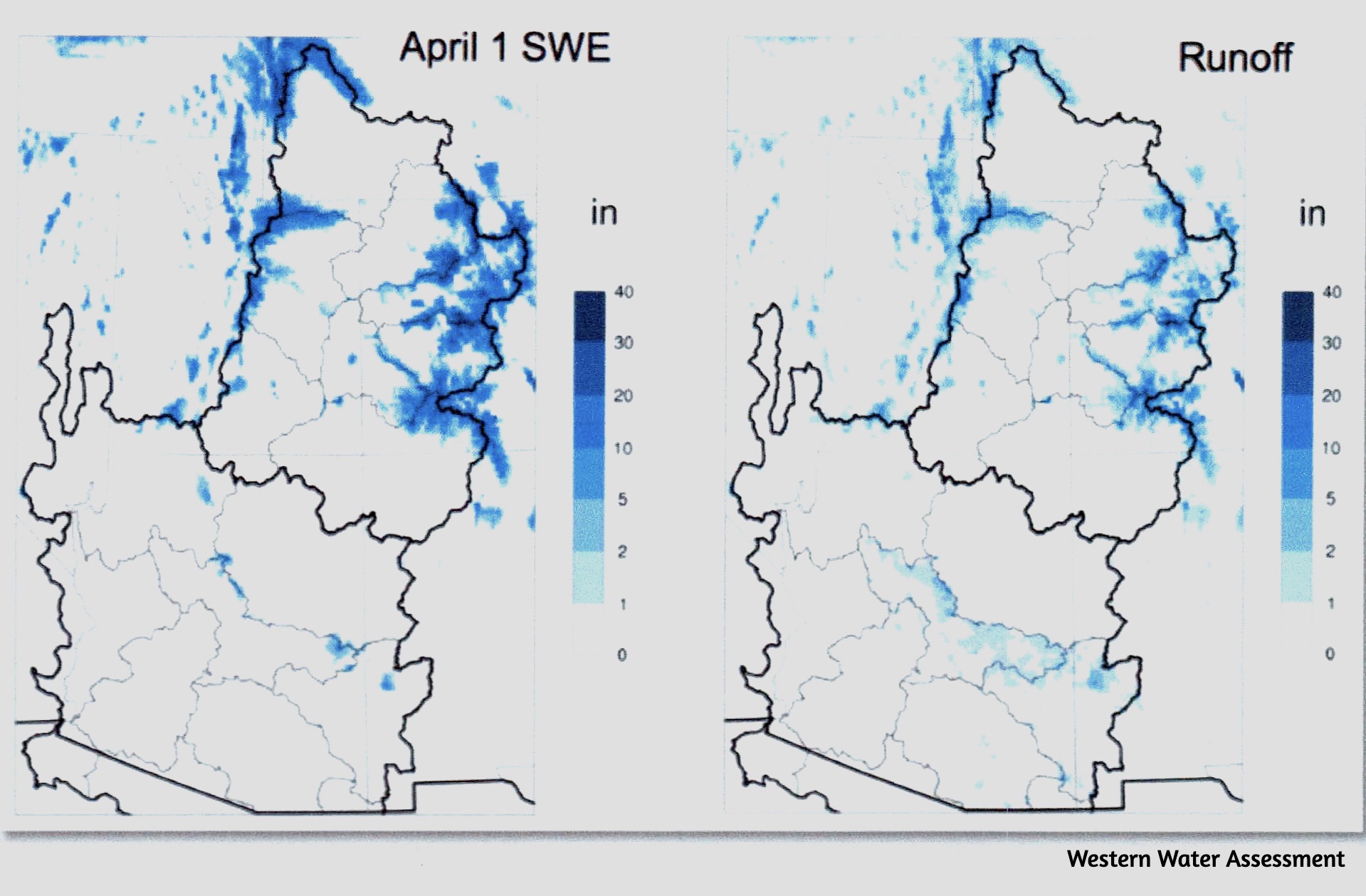


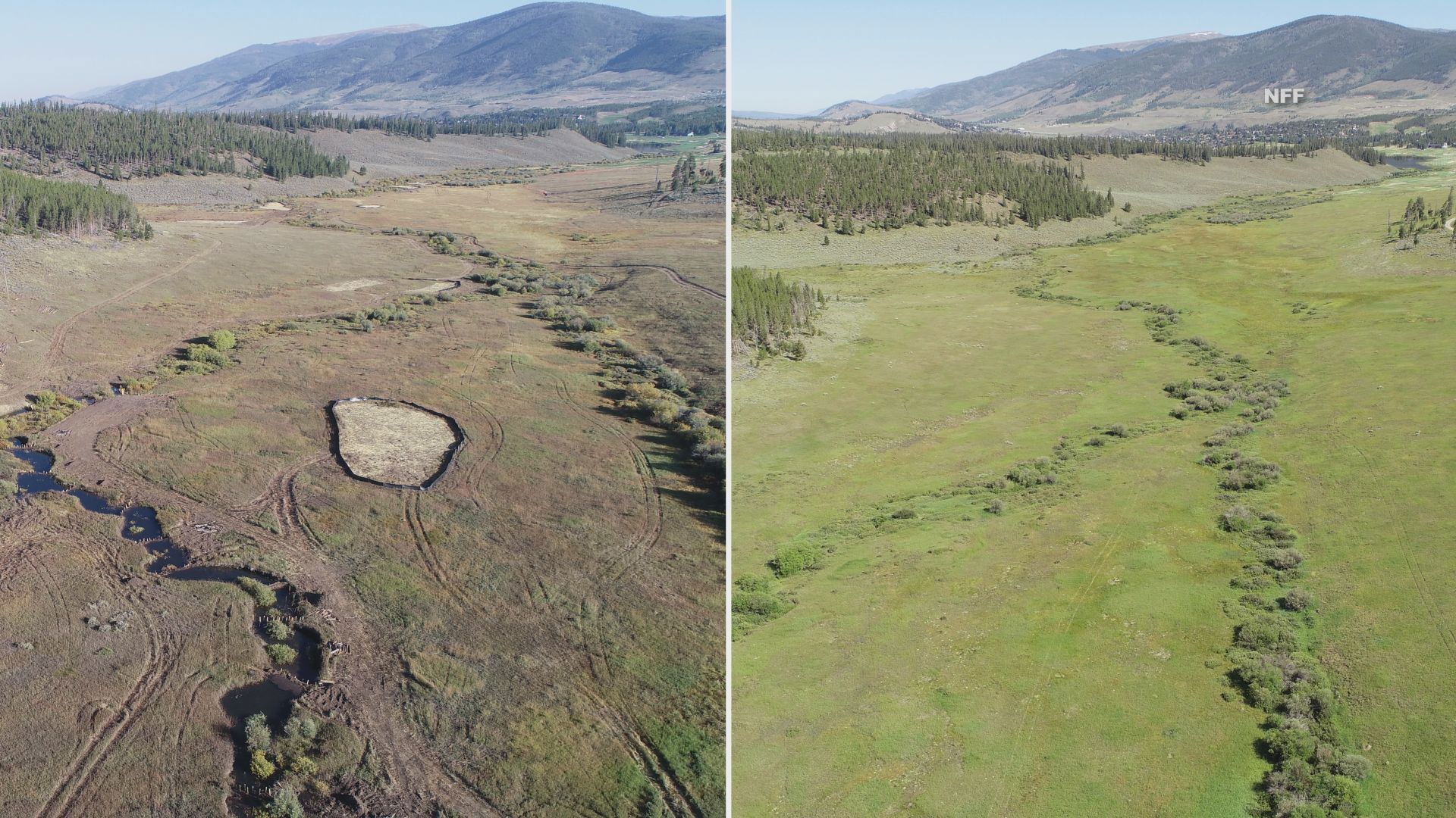


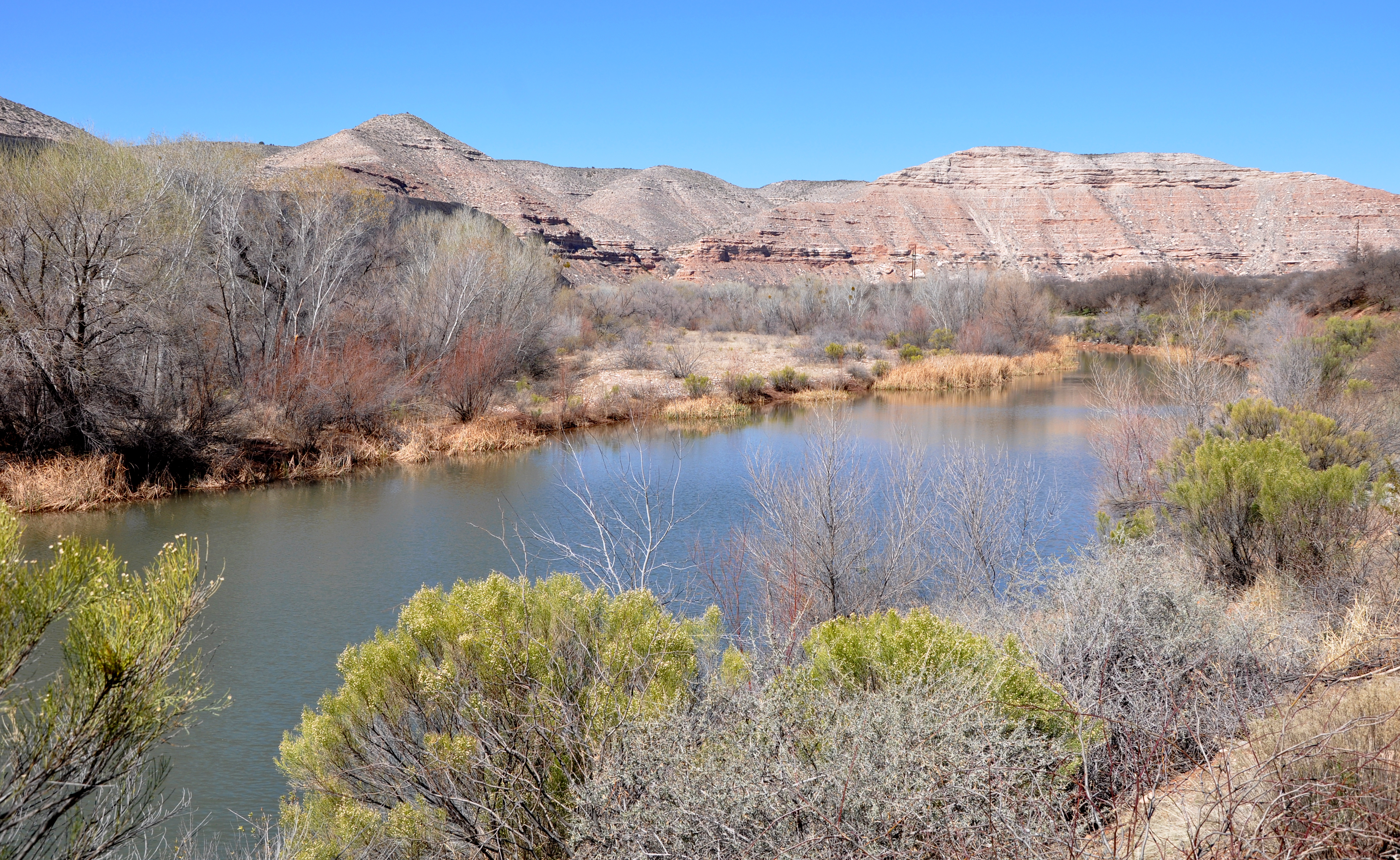


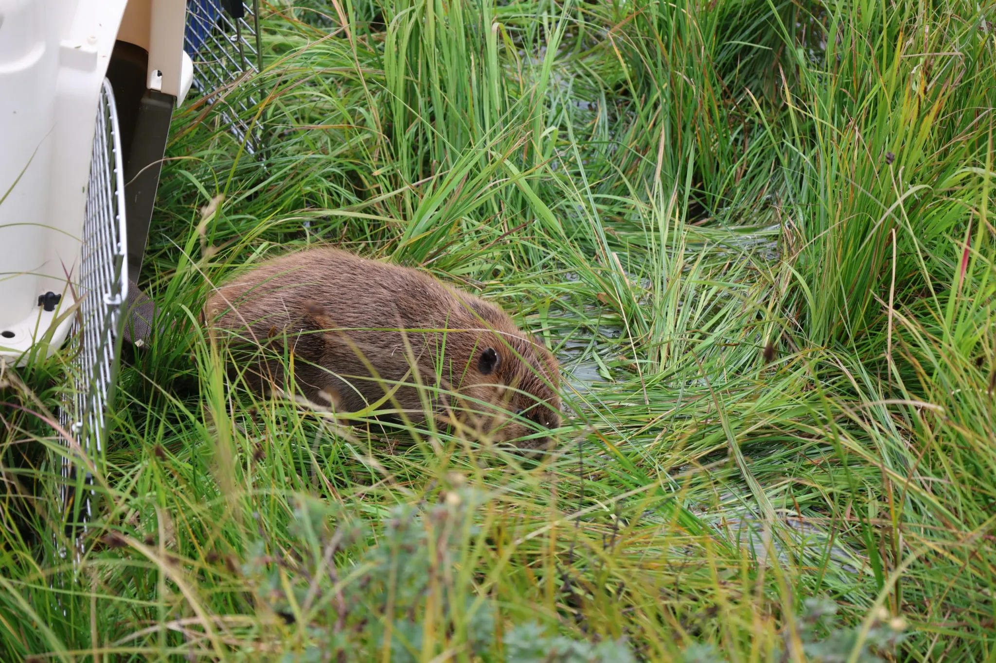
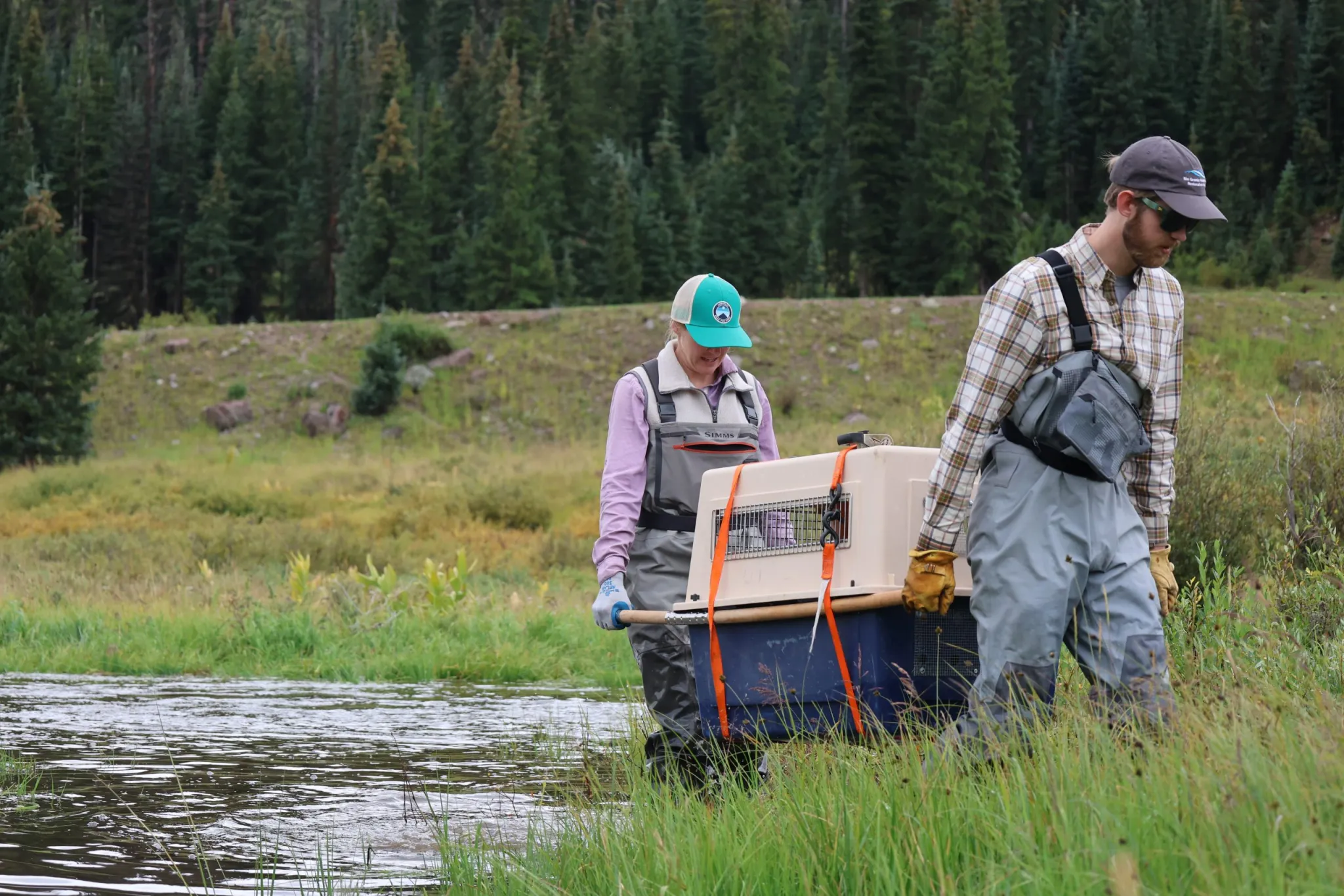

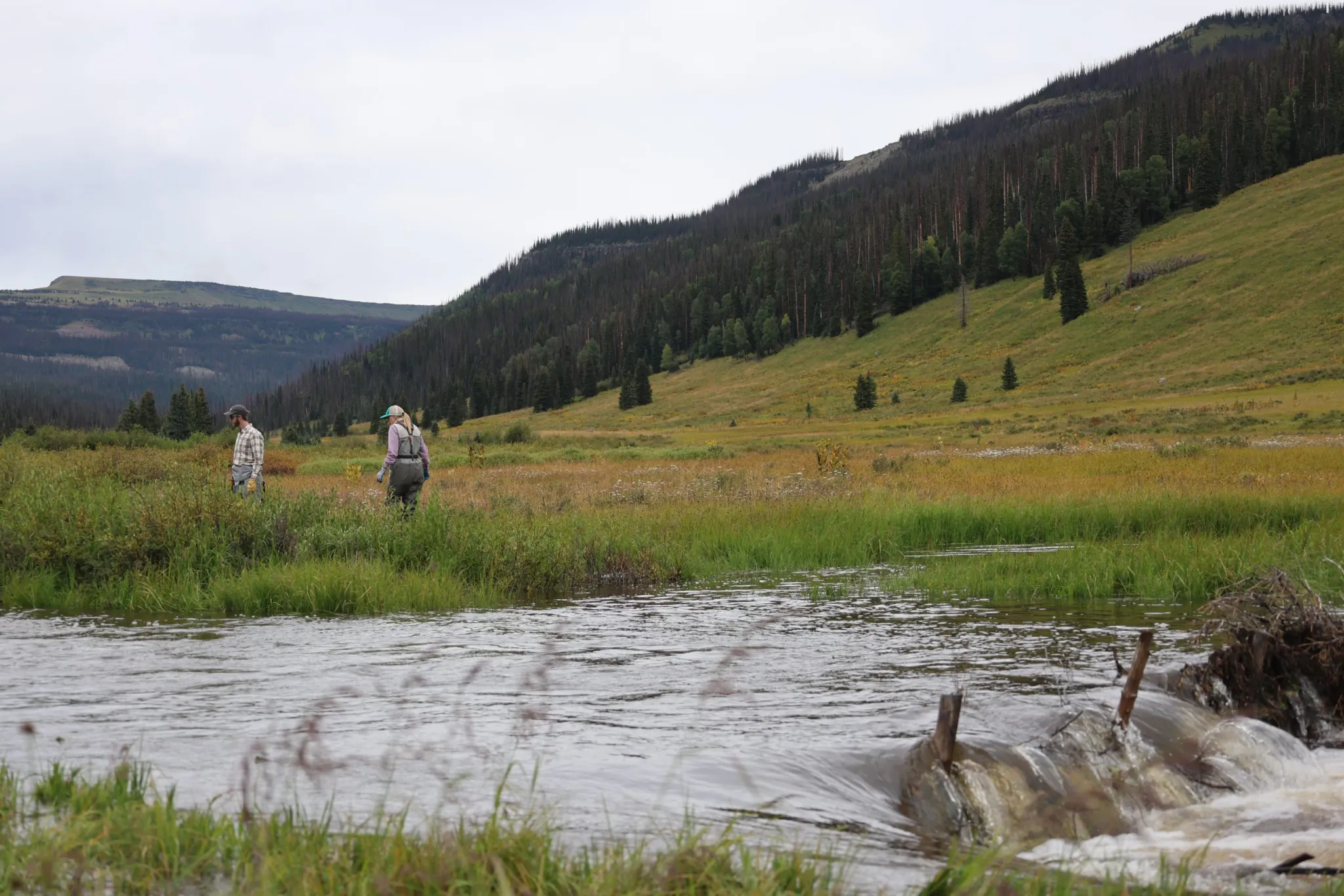


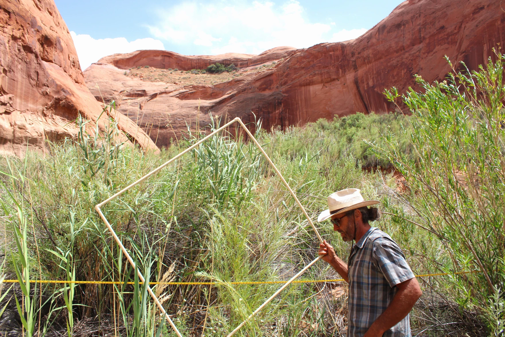
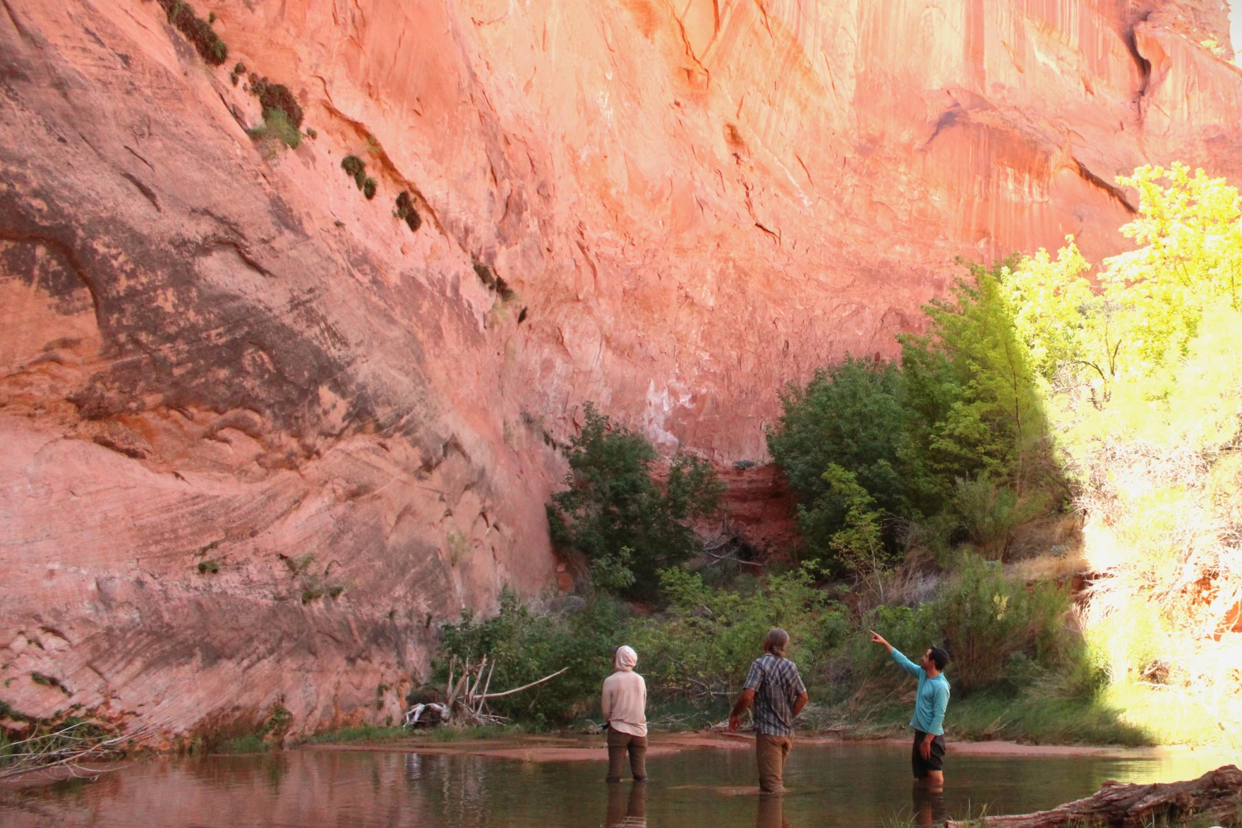
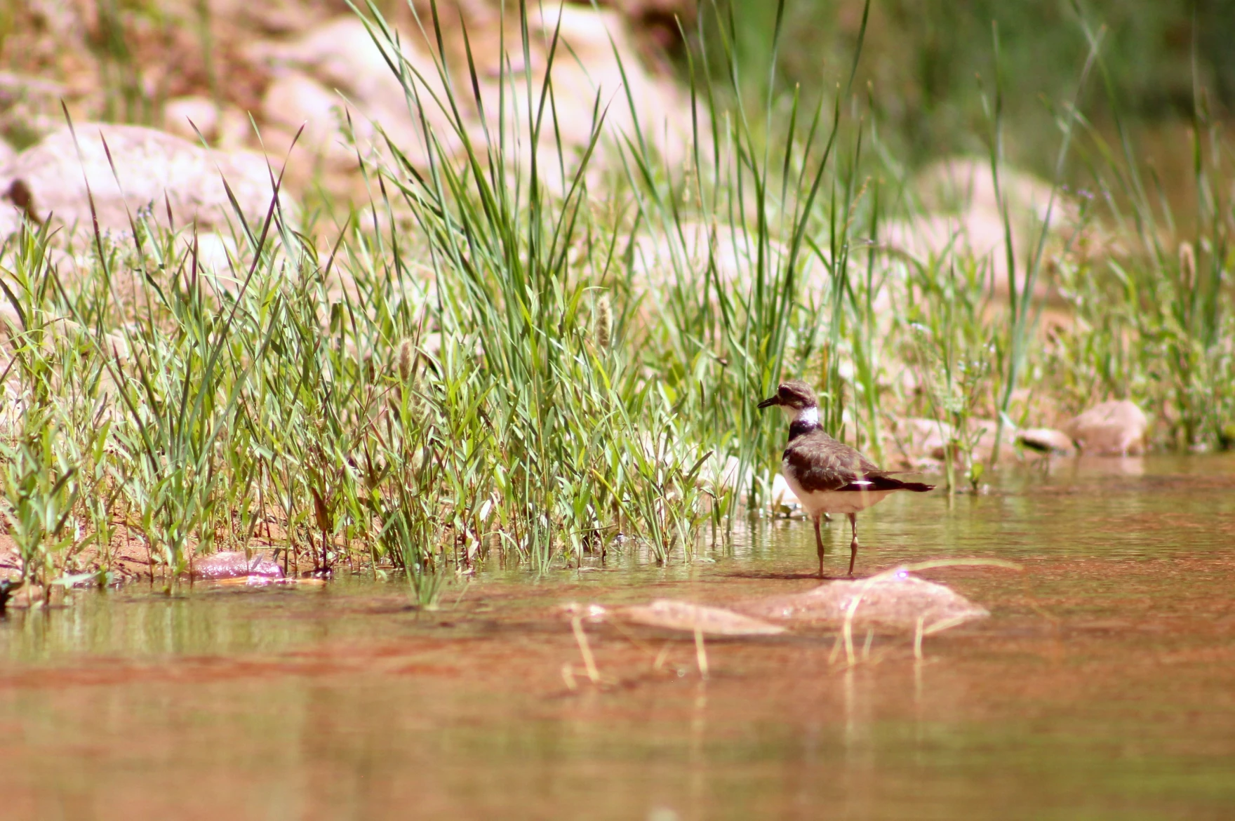
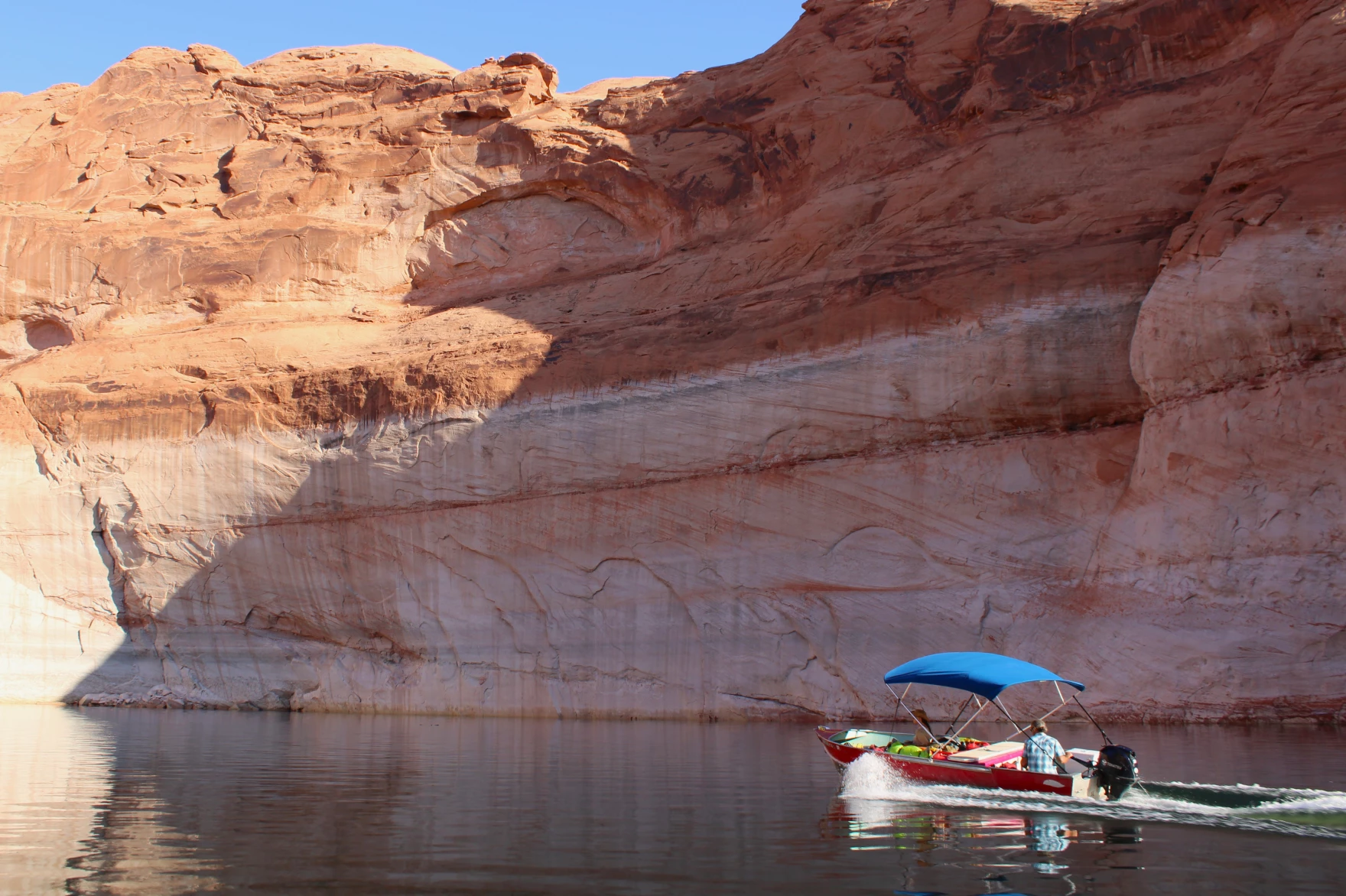


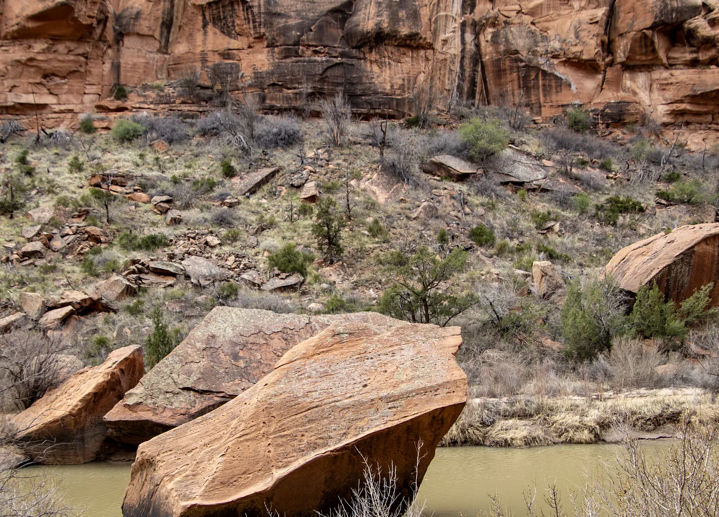


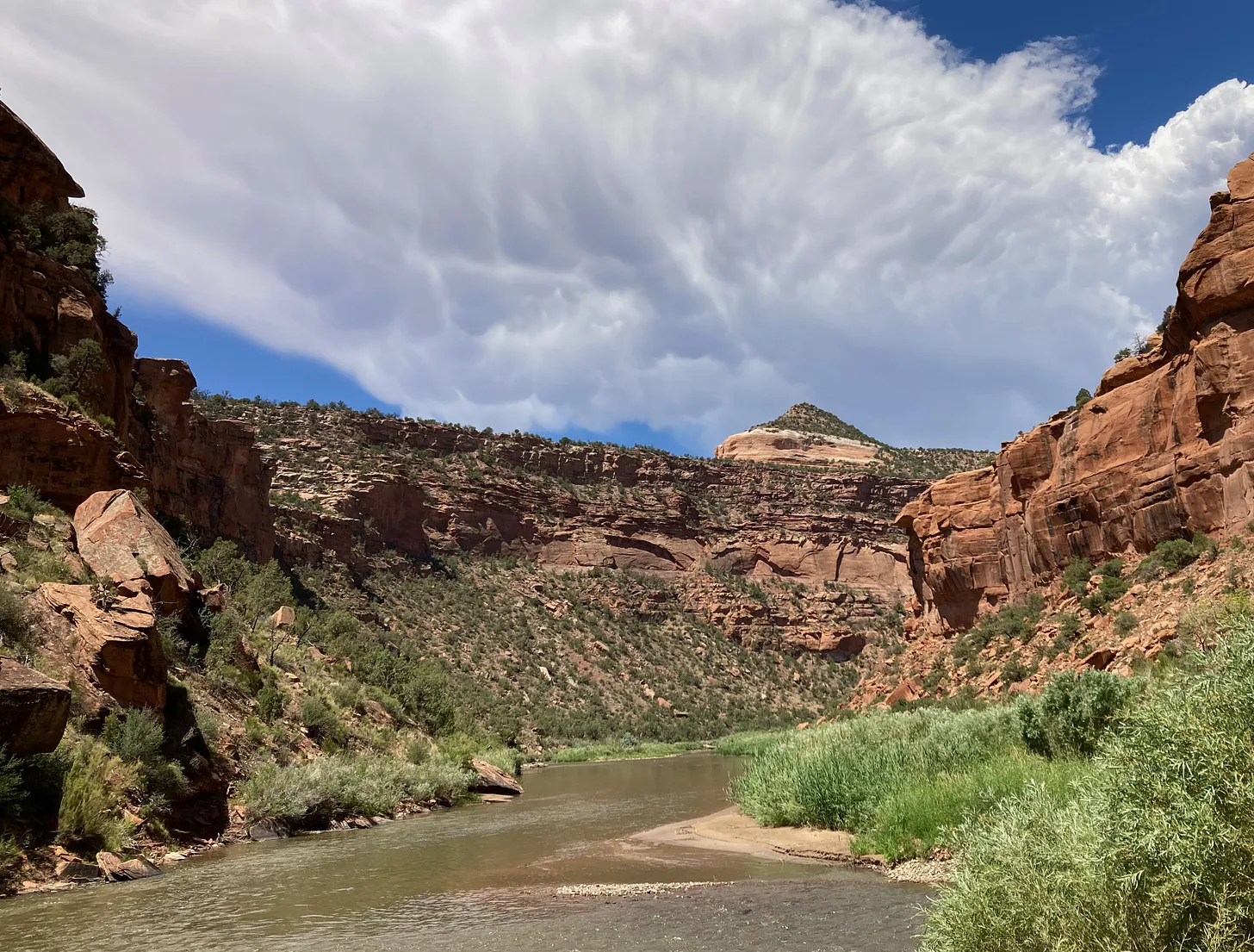


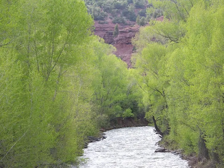


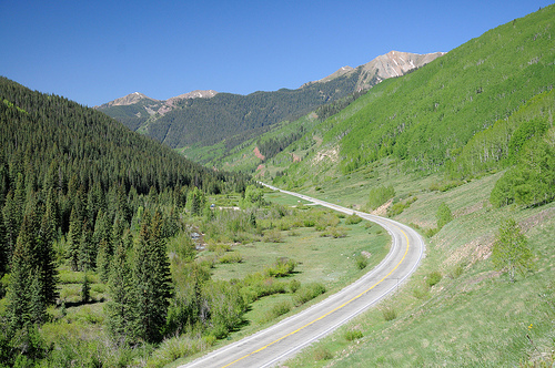


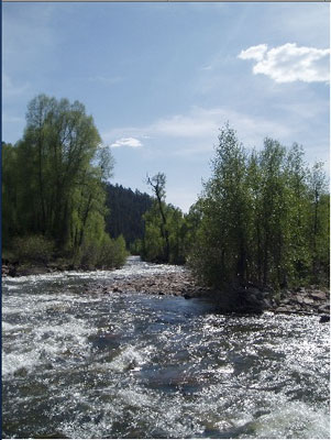


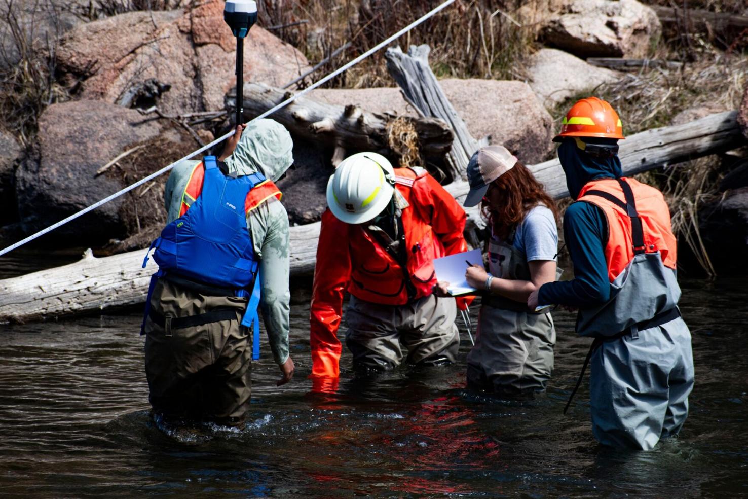
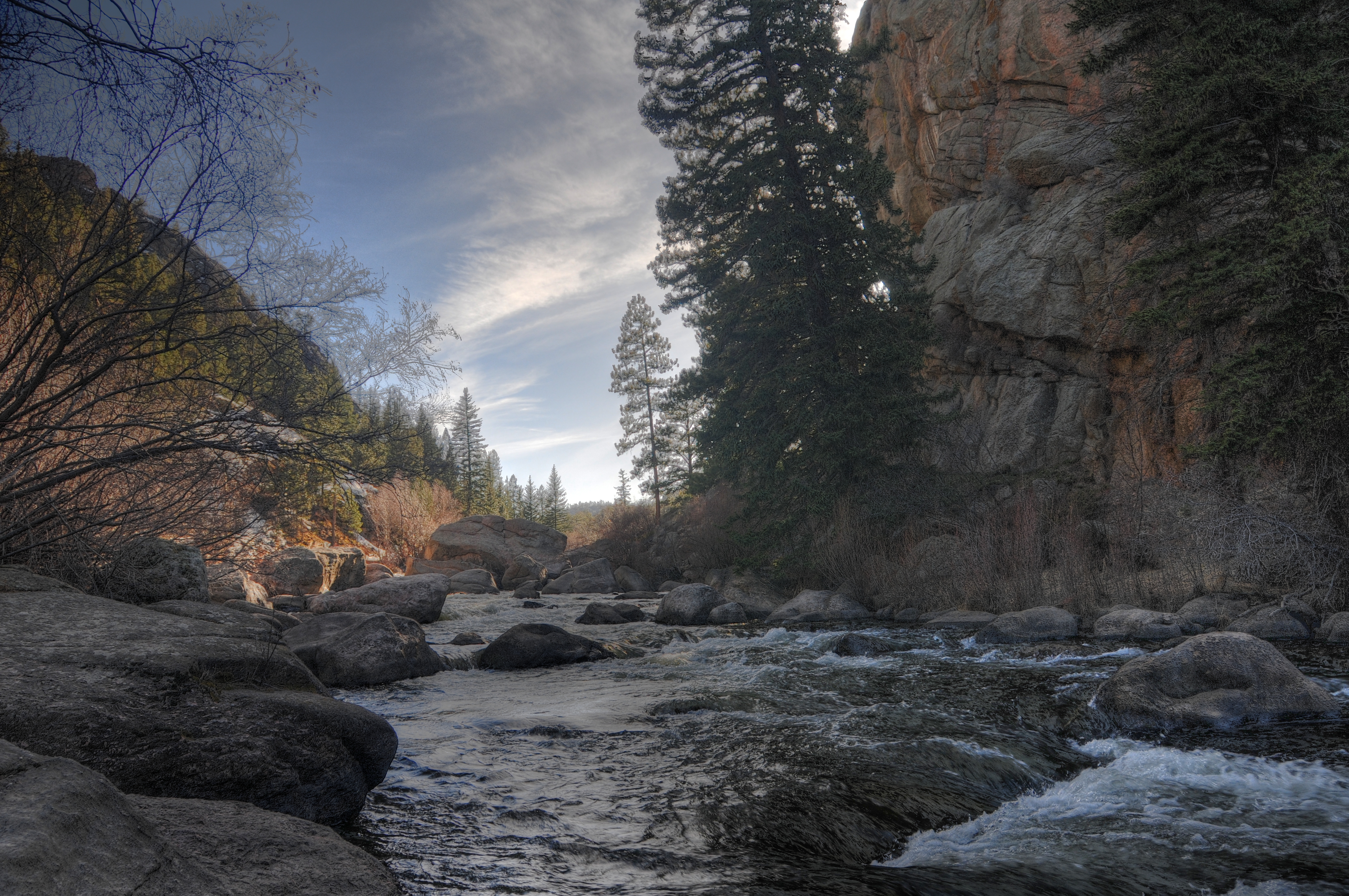


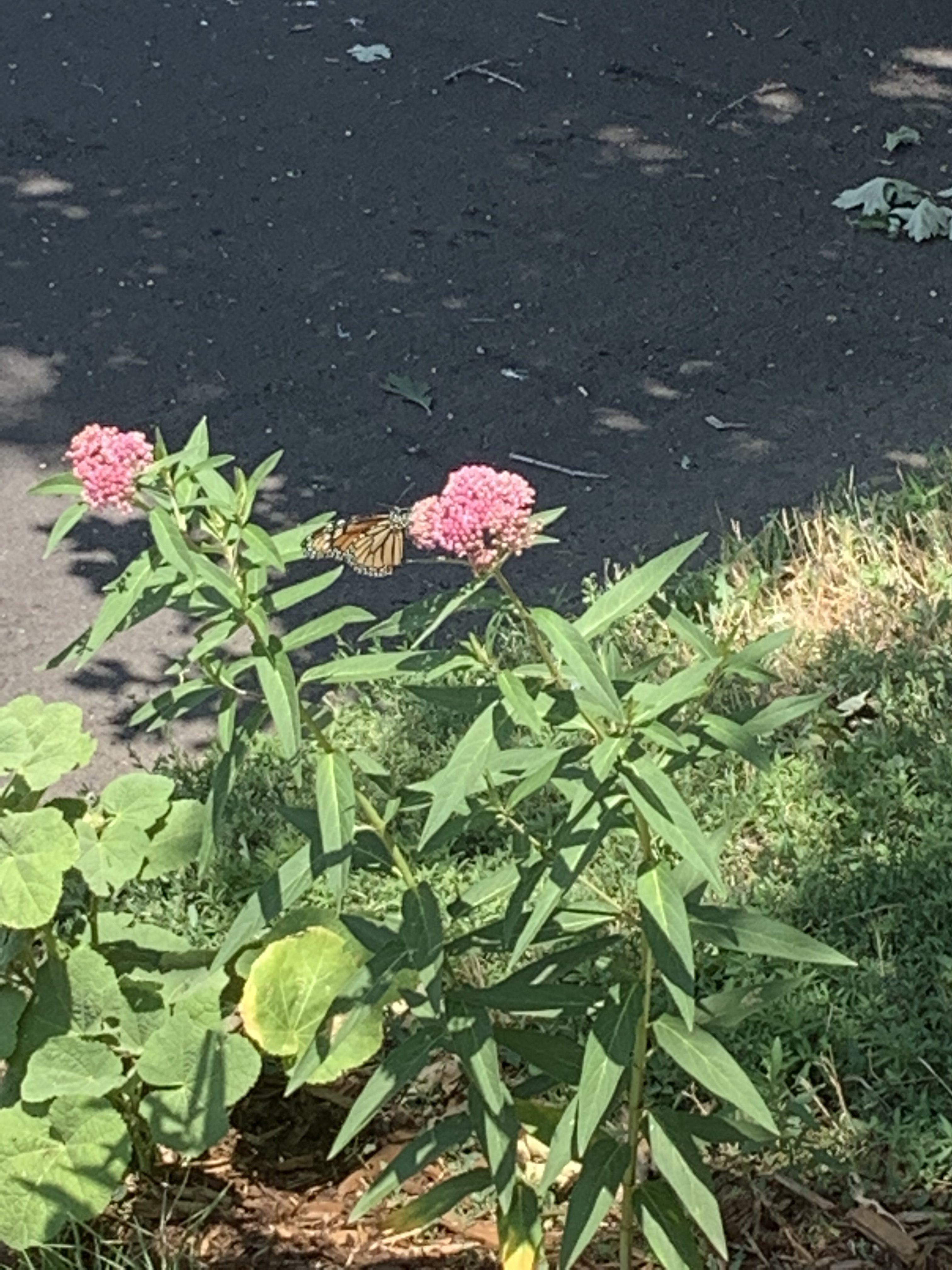
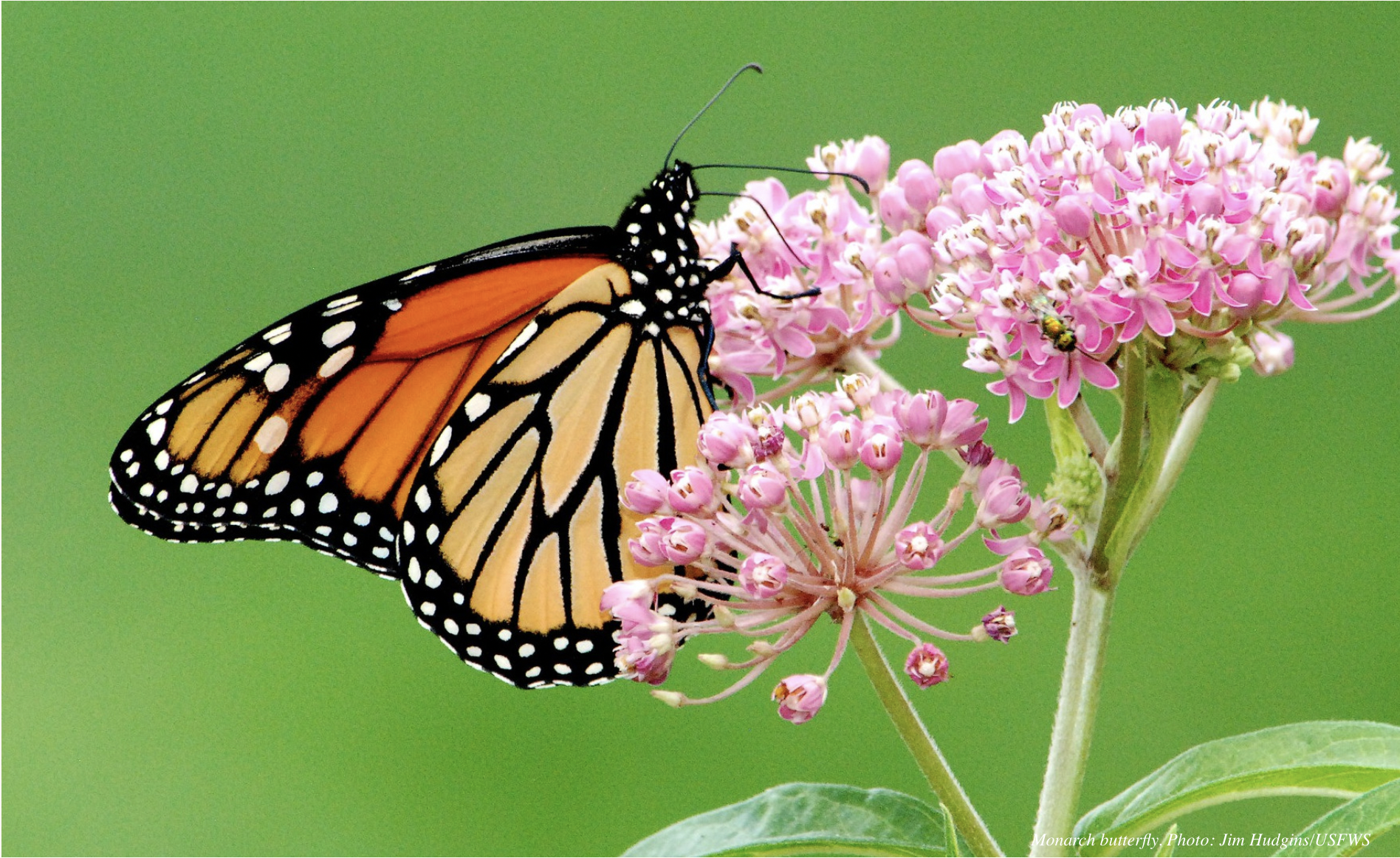


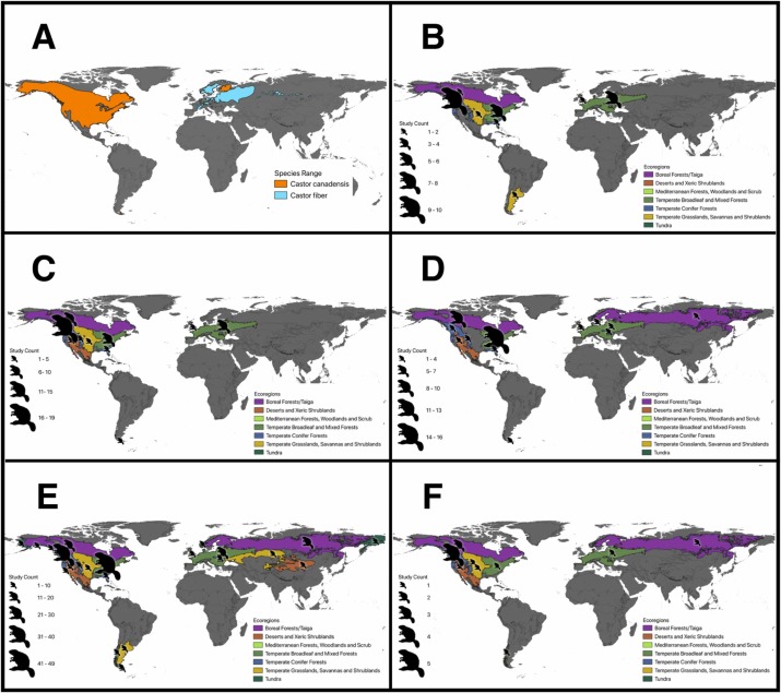


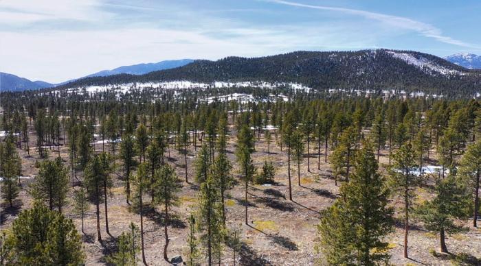
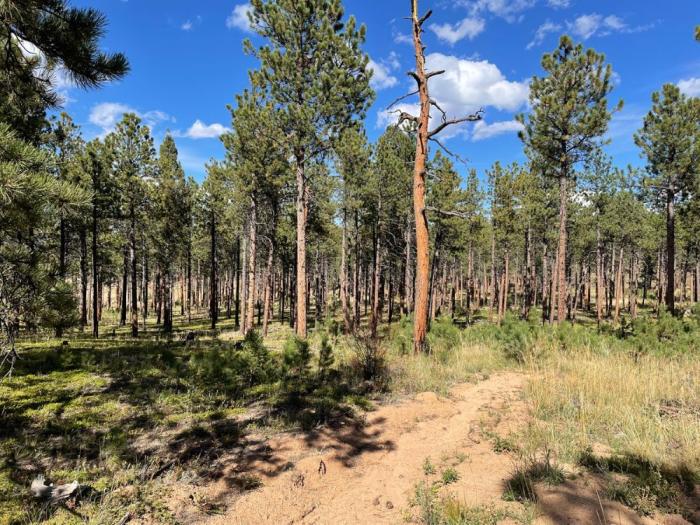
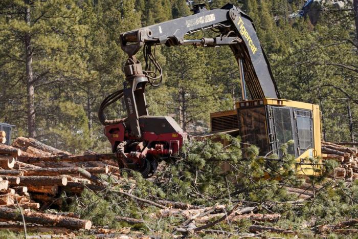
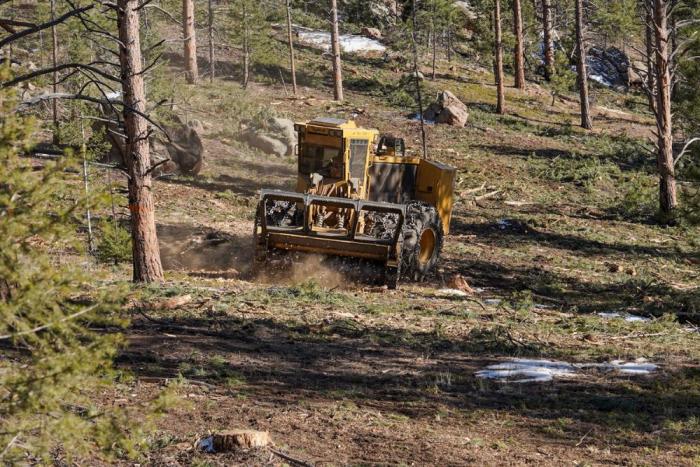
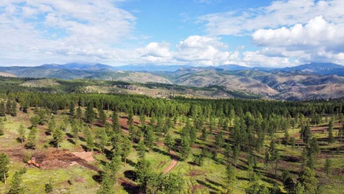


![[CALIFORNIA-J-0025] Tule Lake farms](https://live.staticflickr.com/65535/50376853913_f03ac52008_b.jpg)