Ten rivers. Ten solutions. Ten opportunities to protect the rivers on which all life depends. America’s Most Endangered Rivers® of 2024 shines a spotlight on threats to clean water, and how pollution impacts to our health and our communities.
#1: Rivers of New Mexico New Mexico is the state hardest hit by a recent Supreme Court ruling that slashed protections for streams, threatening drinking water sources and livelihoods across the state.
#2: Big Sunflower and Yazoo Rivers A massive pumping project would impact thousands of acres of wetlands vital to wildlife and the Mississippi Delta ecosystem.
#3: Duck River The drinking water source for 250,000 people and one of the richest rivers for biodiversity is threatened by excessive water withdrawals.
#4: Santa Cruz River This symbol of restoration and resilience is threatened by climate change and water scarcity.
#5: Little Pee Dee River A major highway project is putting clean water and wildlife habitat at risk.
#6: Farmington River A hydropower dam is threatening fisheries and harming water quality in this important drinking water source.
#7: Trinity River This important tributary to the Klamath River is at risk from excessive water withdrawals, threatening both salmon and people.
#8: Kobuk River Road development and mining threaten clean water, wildlife, and Iñupiat culture.
#9: Tijuana River Pollution is choking the river, causing sickness, forcing beach closures, and endangering local economies.
#10: Blackwater River A proposed highway project would be a disaster for water quality and fish and wildlife habitat.
Great Sage-Grouse. Photo: Evan Barrientos/Audubon Rockies
Click the link to read the release on the Audubon website (Jason Howe):
(Washington, DC-April 12, 2024) – The U.S. Bureau of Land Management (BLM) today announced a rule updating the cost of doing business on public lands and helping to balance the extraction of natural resources with the conservation of wildlife habitat and the preservation of landscapes sacred to Indigenous peoples.
In addition to siting oil and gas development away from wildlife habitat and cultural resources, the new regulations increase fees – including royalty and rental rates, and minimum bids associated with oil and gas development – bringing them in line with what many states require; and reduce so-called “speculative leasing”, where companies hold leases on land with little potential for development.
The BLM manages 245 million acres, nearly 40 percent of U.S. public lands. The agency is charged with balancing the protection of America’s natural legacy with managing the 30 percent of the nation’s mineral wealth that lies beneath the surface. But over the past 50 years, the agency has mainly focused on extractive uses (coal, and oil and gas), applying rules governing that extraction that have been unchanged for decades. An estimated 300 bird species spend at least part of their lives there, including Burrowing Owls and the Greater Sage-Grouse, which is already under stress across much of its range.
“When BLM oil and gas leasing policy was last updated, Gerald Ford was in the White House, the Bee Gees were on the radio and a gallon of gas cost an average of 59 cents,” said Christopher Simmons, senior manager of public lands policy for the National Audubon Society. “The BLM’s approach to oil and gas leasing has been the equivalent of a polyester leisure suit – painfully outdated. This is a big step forward towards the BLM fulfilling its mission, delivering common-sense policies that balance responsible development with land and wildlife conservation.”
For decades, oil and gas policies prioritized development on public lands over activities like hunting, fishing, birding, hiking, grazing and restoration. When oil and gas companies left behind a mess on public lands, American taxpayers were previously forced to foot the bill. Before today’s update, taxpayers could have been responsible for as much as $15 billion in clean-up costs.
Sediment forms when rocks and soil weather and erode. We think of rivers as something that moves water, but just as important is its ability to move and shape the earth.
One of the primary concerns when planning for dam removal is the impact of sediment transport on water quality, river health, and the communities that depend on healthy rivers. Sediment forms when rocks and soil weather and erode. We think of rivers as something that moves water, but just as important is its ability to move and shape the earth. Sediment comes in all shapes and sizes—everything from silts and clays to coarse sand and gravel. Each of these kinds of sediment mean different things for rivers and aquatic life. Coarser material like gravel and sand often makes up the bed of the river and help create and maintain complex habitat upon which many aquatic communities depend. The presence of dams can starve downstream reaches of sediment, which can lead to increased bank erosion.
Dams create reservoirs and reservoirs accumulate sediment over time—more than 100 years in the case of the four dams being removed from the Klamath River. The degree of sedimentation downstream following a dam removal depends on multiple factors, such as sediment volume, sediment management plans (i.e., phased removal of a dam and passive release of material, dredging), the river’s geomorphology, and the composition of the sediment itself (e.g., fine grain, mud, or coarse). Studies of previous dam removals have shown the resilience of rivers following dam removals. Rivers have the capacity to recover from the influx of sediment after dam removal within a period of days to a few years and tend to thrive afterward. After an initial phase of disturbance following a large removal, the geomorphology of the river stabilizes as the river begins to heal.
We can get a sense sense of how one day the Klamath River will thrive again by looking to other successful removals. The removal of Edwards Dam on the Kennebec River in 1999 is a story of restoration and revitalization. Its removal reconnected migratory corridors that had been cut off for 162 years, improving habitat for Sturgeon, alewife, eagles, and osprey. Millions of alewife now return to the Kennebec.
Edwards Dam on Kennebec River Pre-Removal | Photo by American Rivers
Another high-profile dam removal where passive release of sediment was utilized is the Condit Dam on the White Salmon River in Washington State. The 125-foot-tall Condit Dam impounded 2.4M cubic yards of sediment, 59% of which was comprised of silt, clay, and very fine sand. More than 60% of the reservoir sediment eroded within 15 weeks of breaching the dam Salmon and steelhead have rapidly recolonized the White Salmon River mainstem and tributaries thanks, in part, to natural river dynamics that allow these systems to recover quickly. In fact, according to the U.S. Fish and Wildlife Service, redds were found throughout the former lake area less than a year after the dam was initially breached.
The 2018 Bloede Dam removal on the Patapsco River in Maryland serves as another useful case study. The 34-foot-tall dam impounded approximately 186,600 m3 of stored sediment, 50% of which eroded within the first six months following removal. River herring were documented (via eDNA) upstream of the former dam site within the first year following removal, and American eel populations skyrocketed from 36 in 2018 to more than 36,500 in 2022. Like the Klamath River dam removals, each of these removals entailed a period of recovery and depended on cross-sector collaboration and advocacy.
Bloede Dam before removal on the Patapsco River | Jessie Thomas-Blate
Bloede Dam after removal on the Patapsco River | Jessie Thomas-Blate
While the impacts of dam removals vary significantly, the evidence of the last 20 years points to the effectiveness of dam removal and the long-term benefits for communities, fish, and wildlife. With more than 91,000 dams inventoried by the U.S. Army Corps of Engineers and several hundred thousand more low-head dams, aquatic ecosystems in steep decline (freshwater ecosystems are dealing with extinction at twice the rate of terrestrial ecosystems), and the impacts of climate change altering weather and precipitation patterns threatening the stability and durability of water infrastructure, dam removal has become an increasingly urgent priority in terms of ecological health, community safety, and climate resilience. Simply put, the fastest way to heal a river is to remove a dam.
Utah’s Bears Ears National Monument rarely leaves the news. The political tussle over this stunning expanse of red rock canyons exemplifies all the cultural dissonance in the rural West.
Three presidents have signed Bears Ears proclamations. Barack Obama established Bears Ears National Monument in 2016, but supporters were devastated when Donald Trump eviscerated the monument the following year, reducing its area by 85%. In 2021, President Joe Biden restored the original boundaries and then some.
Elders of the Bears Ears Inter-Tribal Coalition gather for an overnight ceremony.
Photo Credit: Dave Showalter
What’s clear is that Bears Ears remains reviled by Republican officials and cherished by Indigenous tribes and conservationists.
The monument, 1.36 million acres in southeast Utah, lies within San Juan County. The Navajo Nation covers 25% of the county, and Native people account for more than half of the 14,200-person population. Just 8% of the county is private land while another 5% is state trust land.
The rest — 62% of the county — is federal land owned by the people of the United States and administered by the Departments of Agriculture and Interior. This immense commons testifies to the sublime difficulty of the place — beautiful enough to warrant preservation as national parks, monuments and forests. But it’s also arid enough to attract only a few 19th-century settlers to what had been Indigenous homeland for millennia.
I think it’s fair to say that San Juan County’s white residents never envisioned challenges to their political power. But in 2009, the feds came down hard on generations of casual pothunting by local white families. Then, after a century of oppressing their Indigenous neighbors, lawsuits strengthened Native voting rights. The county commission became majority Navajo from 2018 to 2022.
Native influence keeps expanding. The five tribes of the Bears Ears Inter-Tribal Coalition first envisioned a national monument and became co-stewards for these 1.36 million acres. They have a champion in Secretary of the Interior Deb Haaland, an enrolled member of the Laguna Pueblo tribe, but such historic changes make the dominant culture uneasy.
In February, Utah Governor Spencer Cox dramatically withdrew from a Bears Ears land exchange poised for completion. This swap of state trust lands for Bureau of Land Management lands would hugely benefit the state. Details were already negotiated; each side compromised; the stakeholders were largely content.
But in 2024, Utah politics are stark, compounded by distrust and disinformation.
At statehood in 1896, Utah received four sections per township to support public schools and universities. The Utah Trust Lands Administration manages these scattered lands — blue squares on ownership maps — but blocking up these blue squares into manageable parcels means trading land with federal agencies.
Such trades aren’t rare and can be grand in scale. A 1998 negotiation between Interior Secretary Bruce Babbitt and Utah Governor Mike Leavitt traded Grand Staircase–Escalante National Monument’s 176,000 acres of school sections for BLM land elsewhere — along with a hefty $50 million payment to Utah from the U.S. Treasury. Utah Trust Lands still brags about the deal on its website.
Motorized vehicle limited and closed zones under the preferred alternative. It marks a fairly minor shift from the status quo, but significantly closes Arch Canyon to OHVs. Note the squares scattered about: They are sections of state land that would be traded out in a land exchange. Right now it is on hold, however, thanks to Utah lawmakers. Via Jonathan P. Thompson/The Land Desk
But the old guard is up in arms about the draft Bears Ears Resource Management Plan released for public comment on March 8. The BLM’s preferred alternative emphasizes traditional Indigenous knowledge and land health.
Any such gestures toward conservation elicit local outrage about the feds “destroying” the pioneer way of life. The subtext: the people long in charge don’t want to lose power.
Denouncing federal overreach is always a sure win for Utah politicians. In this year’s Republican primary, San Juan County-based legislator Phil Lyman is challenging the incumbent governor with fierce anti-public lands rhetoric. Governor Cox will need to protect his right flank.
Meanwhile, school trust lands within Bears Ears remain at risk. The tallest structure in Utah, a 460-foot telecom tower with blinking red lights, could rise on state land in the heart of the monument. It’s been approved by county planners, and the Trust Lands Administration could add poison pills on other lands proposed for exchange.
The elected leaders of Utah have decided that the monument’s integrity and the needs of the state’s children matter less than political gamesmanship.
Stephen Trimble: Photo credit: Writers on the Range
The five tribes of Bears Ears know better: “It is our obligation to our ancestors…and to the American people, to protect Bears Ears.” Their big hearts will win in the end.
Stephen Trimble is a contributor to Writers on the Range, writersontherange.org, an independent nonprofit dedicated to spurring lively conversation about the West. He lives in Utah and will publish the 35th anniversary edition of his book The Sagebrush Ocean: A Natural History of the Great Basin next winter.
From email from the Middle Colorado Watershed Council:
March 29, 2024
In February 2024, the final piece of funding needed for the construction of the Roan Creek Fish Barrier and Infrastructure Project was secured through Partnership Funding from the Colorado River District. The $41,000 award followed the announcement last November of a Bureau of Reclamation WaterSMART award for $746,412. Early funding was secured from CPW for construction materials, and a match was supplied through Colorado Basin Roundtables Water Supply Reserve Funds.
The project works with partners to provide native fish protection while upgrading irrigation infrastructure. Natural barriers like waterfalls or artificial constructed barriers protect unique and important populations of native fish species. The upper portion of Roan Creek contains a unique native fish assemblage comprised of Colorado cutthroat trout, bluehead sucker, Paiute sculpin, and speckled dace.
A fish barrier will effectively eliminates the upstream movement of non-native fish to protect these species. During the barrier construction, irrigation infrastructure upgrades and ditch lining will allow efficient delivery of water for agriculture purposes.
The project was developed through collaborative efforts of the Bureau of Land Management (BLM), Colorado Parks & Wildlife (CPW), MCWC, Garfield County, the land owner, and the water rights holder. Wright Water Engineers and GEI Consultantswere hired to complete the 90% design needed to pursue funding for construction.
The Department of the Interior and National Fish and Wildlife Foundation (NFWF) today announced $11.8 million for 10 projects in seven states that will help restore habitat connectivity and secure key migration corridors for wildlife in the American West. A total of $3 million in grants and $8.8 million in matching contributions will be invested to protect migratory species like elk, mule deer, and pronghorn and their habitats in Arizona, California, Colorado, Idaho, Montana, Oregon and Wyoming.
“Healthy habitats and interconnected spaces to live and roam are key for the sustainability of species,” said Secretary Deb Haaland. “The Biden-Harris administration is strengthening public-private partnerships and employing an all-of-government approach to ensure the conservation of fish and wildlife in the West and across America through the protection of key migration corridors and habitats.”
Bureau of Land Management (BLM) Director Tracy Stone-Manning and U.S. Fish and Wildlife Service (FWS) Director Martha Williams highlighted the announcement at the 89th North American Wildlife and Natural Resources Conference in Grand Rapids, Michigan.
The grants are made possible through the Western Big Game Seasonal Habitat and Migration Corridors Fund, which is administered by NFWF in-part through annual appropriations funding from the BLM, FWS, and the Department of Agriculture. The funding supports Secretary’s Order 3362, which seeks to enhance and improve the quality of big-game winter range and migration corridor habitat on federal lands. Today’s funding builds on nearly $25 million in funding the Department and NFWF announced in 2021, 2022 and 2023. This work supports the President’s America the Beautiful initiative, which aims to conserve, connect and restore 30 percent of our lands and waters by 2030.
Today’s announcement supplements historic funding through President Biden’s Investing in America agenda, which is supporting critical projects to restore habitats, strengthen landscape resilience, and put create good-paying jobs to restore America’s lands and waters in partnership with Tribes, private landowners, hunting and conservation organizations, and state wildlife management agencies.
Last month, Secretary Haaland announced more than $157 million from President Biden’s Investing in America agenda to restore our nation’s lands and waters through locally led, landscape-scale restoration projects. The funding from the Bipartisan Infrastructure Law will support 206 ecosystem restoration projects in 48 states, Washington, D.C., and the U.S. Territories and will advance the Department’s ongoing work across several restoration and resilience programs.
Projects receiving grants and matching contributions are listed below:
Managing Woody Invasives to Improve Habitat Quality on Perrin Ranch State Lands Grassland
Grantee: Arizona Elk Society
Grant Amount: $130,000
Matching Funds: $130,000
Total Project Amount: $260,000
Improve winter habitat quality for migrant and resident mule deer, elk and pronghorn. Project will restore a minimum of 650 acres of grasslands in Northern Arizona by managing the encroachment of woody invasives.
Restoring Beaver Creek Watershed to Improve Habitat Connectivity
Grantee: Salt River Project Agricultural Improvement and Power District
Grant Amount: $489,500
Matching Funds: $3,376,500
Total Project Amount: $3,866,000
Restore wildlife habitat and connectivity, reduce wildfire risk, protect water supplies, communities, infrastructure and improve forest resiliency. Project will restore approximately 3,920 acres by removing invading woody species from grasslands and former healthy woodlands that will allow native grass, browse, and forb species to return.
Christmas Elk via the Middle Colorado Watershed Council December 2013
CALIFORNIA
Restoring Steven’s Prairie to Enhance Elk Habitat and Establish New Herds
Grantee: Yurok Tribe
Grant Amount: $181,393
Matching Funds: $181,393
Total Project Amount: $362,786
Enhance meadow habitat for Roosevelt elk and provide a stopover site both for dispersing elk from saturated populations and for the establishment of new herds on Yurok lands. Project will survey and identify priority habitat in 160 acres; restore 80 acres of degraded prairie through removal of encroaching trees and invasive plants; establish a 25-acre fuel break along the perimeter of the restored site; and place 440 acres under various planning stages to improve management.
Aspen’s namesake trees, the quaking aspen, acts as a keystone species that sustains hundreds of other plants and animals. Aspens are also under stress from drier conditions, increased temperatures and over-browsing by large herbivores. Photo credit: Brent Gardner-Smith/Aspen Journalism
COLORADO
Enhancing Elk Habitat Through Vegetation Treatments in Hay Flats
Grantee: US Forest Service
Grant Amount: $200,000
Matching Funds: $199,896
Total Project Amount: $399,896
Enhance elk habitat through vegetation treatments in mountain shrub and aspen communities within the vicinity of Hay Flats. Project will improve 2.25 acres of fencing, treat 430 acres with mechanical methods would create a mosaic of snowberry regrowth and allow understory species to take hold, and treat 220 acres with mastication and hand felling to increase forage, cover, and movement opportunities for elk in spring production areas, summer and winter habitat, and movement corridors.
Protecting Migration Corridors via the Wolf Mountain VII Conservation Easement
Grantee: Rocky Mountain Elk Foundation
Grant Amount: $100,000
Matching Funds: $1,977,882
Total Project Amount: $2,077,882
Conserve vital aspen woodlands, sagebrush, and riparian habitat, as well as a migration corridor and pathway for two of Colorado’s largest migratory herds. Project will permanently protect approximately 1,630 acres of migration corridors for elk and winter range for mule deer, secure habitat connectivity through the valley bottom and highly developable lands near State Highway 40, protect five stream miles, and support a host of other wildlife, including greater sage grouse.
Mule deer buck. Photo credit: Greg Hobbs
IDAHO
Modifying Fencing to Improve the Migration Route Across Highway 28
Grantee: The Mule Deer Foundation
Grant Amount: $317,922
Matching Funds: $300,000
Total Project Amount: $617,922
Support passage-success of migratory mule deer and elk, reduce animal-vehicle collisions, and simultaneously increase safety for motorists. Project will extend a wildlife funnel fence project on Highway 28 by reconnecting three miles of corridor, improve 10 miles of fencing, remove two miles of fencing, and increase the passage success rate to 95%.
Grassland in Montana. Photo credit: Montana Fish Wildlife and Parks
MONTANA
Collaborating with Montana Grassland Partnership to Improve Big Game Migration
Grantee: Ranchers Stewardship Alliance, Inc.
Grant Amount: $275,000
Matching Funds: $275,000
Total Project Amount: $550,000
Support, connect, and contribute to the partnership of big game migration work being done under the umbrella of the Montana Grassland Partnership as part of the Ranchers Stewardship Alliance (RSA) Conservation Committee. Project will work to improve nine miles of fencing, remove nine miles of unneeded fencing, restore 1,000 acres of grassland for added habitat and add a Conservation Director position with RSA to better serve the RSA project area and collaborate within the Montana Grassland Partnership.
A male Sage Grouse (also known as the Greater Sage Grouse) in USA. By Pacific Southwest Region U.S. Fish and Wildlife Service from Sacramento, US – Greater Sage GrouseUploaded by Snowmanradio, Public Domain, https://commons.wikimedia.org/w/index.php?curid=12016910
OREGON
Protecting Migration Habitat via a Fee Title Transfer to the Warm Springs Indian Reservation
Grantee: Oregon Wildlife Heritage Foundation
Grant Amount: $199,998
Matching Funds: $716,350
Total Project Amount: $916,348
Protect migration corridors in high use areas in the Metolious winter range. Project will transfer 300-acre acquisition to the Confederated Tribe of the Warm Springs Indian Reservation.
Treating Invasives to Improve Migration Corridors for Elk and Nesting Habitat for Sage Grouse (OR)
Grantee: Crook County Soil and Water Conservation District
Grant Amount: $190,609
Matching Funds: $213,586
Total Project Amount: $404,195
Enhance understory conditions in sagebrush habitats, which will improve conditions for a host of species including sagebrush obligates and improve migration and seasonal habitat for a variety of wildlife species. Project will restore 415 acres of migration habitat for elk and mule deer as well as seasonal habitat for sage grouse through the removal of woody invasives.
Restoring Big Game Migration Corridors for Bates Hole, Dubois and Platte Valley Mule Deer Herds
Grantee: Wyoming Game and Fish Department
Grant Amount: $961,250
Matching Funds: $961,250
Total Project Amount: $1,922,500
Improve forage resources and connectivity between seasonal ranges for mule deer and a wide variety of other wildlife. Project will implement 13,530 acres of invasive weed treatments, modify 46 miles of fences and restore 150 acres of habitat.
The river ecosystem will be getting a health check up this year as part of the Grand Valley River Initiative, a planning effort for the river corridor being coordinated by One Riverfront, RiversEdge West and the Hutchins Water Center at Colorado Mesa University. RiversEdge West Executive Director Rusty Lloyd said Lotic Hydrological was recently selected to perform a riparian and floodplain assessment this year, which will help establish a baseline of the river ecosystem.
“This would really identify areas of restoration and conservation that would support native riparian vegetation, versus maybe areas where recreation or development might happen,” Lloyd said. “That riparian and floodplain assessment is really supposed to get at where are our good quality ecosystem values and habitat along our river in the valley. That assessment will feed into the decision making processes, hopefully.”
Lloyd said the state of the river has been changing in recent years with more recreation and development along the river. He said the initiative is intended to help local planners and policy makers as they make decisions about the future of the river corridor. OV Consulting has also been selected to coordinate communications with local municipalities and stakeholders about how to plan for the future of the river, Lloyd said. He said what that looks like could vary from a framework local governments could use to a signed agreement on planning around the river between local governments.
Wetlands, which are havens of biodiversity, offer priceless ecological benefits. As wetlands are lost to development nationwide, critics of the dam project worry about its local impact.
(Photo Credit: John Fielder via Writers on the Range)
Outrage over the Trump-packed U.S. Supreme Court rolling back federal reproductive rights has in some ways overshadowed the now 6-3 conservative majority’s relentless assault on environmental regulations that for decades protected Colorado’s clean air and water.
Former president and current GOP candidate Donald Trump’s recently installed SCOTUS (he appointed three of the six staunch conservatives in his last term), has consistently ruled against federal environmental regulation – from carbon-spewing power plants to downwind air pollution. And it’s likely to rule against President Joe Biden’s new vehicle emissions limits.
Last year’s Sackett v. Environmental Protection Agency (EPA) decision – in which an Idaho couple simply didn’t want to have to apply for a federal wetlands dredging permit — largely flew under the national outrage radar, but it stripped away Clean Water Act protections for fully two-thirds of Colorado’s wetlands and streams, according to an amicus brief filed in support of those federal protections by Colorado Attorney General Phil Weiser.
Now Colorado lawmakers are trying to step into that regulatory void with Wednesday’s filing of the Regulate Dredge and Fill Activities in State Waters bill (HB24-1379). If passed, it would require a rulemaking process by the Colorado Department of Health and Environment’s Water Quality and Control Division to permit dredge and fill activities on both public and private land.
“There’s no mistake that [the Sackett] decision came right after Trump appointed three new justices to the Supreme Court, where there’s a conservative majority who could issue an industry-favorable ruling on this issue,” Conservation Colorado Senior Water Campaign Manager Josh Kuhn said in a phone interview.
“It’s unfortunate that the Supreme Court ruled in favor of industry but now it does create an opportunity for Colorado to create regulatory certainty, and it’s imperative that we get this done the right way,” Kuhn added. “The Supreme Court’s decision ignores the science of groundwater. What it did is it said if you are standing in a wetland, and you don’t see surface water connecting that wetland to another covered [by EPA regulation] water body, it is no longer protected.”
Iron Fen. Photo credit from report “A Preliminary Evaluation of Seasonal Water Levels Necessary to Sustain Mount Emmons Fen: Grand Mesa, Uncompahgre and Gunnison National Forests,” David J. Cooper, Ph.D, December 2003.
Anyone who’s hiked Colorado’s backcountry knows there are all sorts of water bodies that are disconnected from rivers, streams and lakes, fed by springs and often only existing on the surface when it’s been raining or following a decent snow year. In fact, the Colorado Wetland Information Center identifies 15 different types of wetland ecological systems in Colorado.
Those wetlands and ephemeral (not continually flowing) streams provide critical habitat for Colorado’s dwindling wildlife, guard against increasingly devastating wildfires fueled by manmade climate change and filter pollutants from vital sources of drinking water.
“Colorado has already lost half of our wetlands since statehood, and they are super-important for ecosystem services, where they mitigate floods, decrease the severity of wildfire, help retain water like sponges and release that water to provide base flows in drier parts of the year, providing critical wildlife habitat for about 80% of wildlife,” Kuhn said.
Now, thanks to the right-leaning SCOTUS – including Colorado’s own Neil Gorsuch – 60% of those waterbodies are currently unprotected by the Clean Water Act’s 404 permit process administered successfully for five decades by the U.S. Army Corps of Engineers. Now the state of Colorado must attempt to fill that role.
“Water is a precious resource and is critical to our economy and way of life,” Colorado Gov. Jared Polis wrote in a press release Wednesday. “I am committed to protecting Colorado’s water today and building a more water-efficient, sustainable, and resilient future. Today, we further our commitment to protect Colorado’s water for the next generation of Coloradans.”
The Polis-backed bill is sponsored in the Colorado Senate by Dylan Roberts, D-Frisco, and in the Colorado House by state Rep. Karen McCormick, D-Longmont, and Speaker of the House Julie McCluskie, D-Dillon.
A competing bill (SB24-127) was introduced last month by Republican state Sen. Barb Kirkmeyer. That proposal, dubbed the Regulate Dredged & Fill Material State Waters bill, has the backing of the Colorado Association of Homebuilders – a development trade organization that did not return a call seeking comment on the Dem-backed bill.
“Now that [definition of] Waters of the U.S. is much more limited than it was, the things that [SCOTUS] said are not ‘Waters of the U.S.’ are ephemeral streams, disconnected wetlands and fens,” Eagle County Commissioner Kathy Chandler-Henry said in a phone interview. “So on the Western Slope, the mountains, nearly all of our streams are not year-round streams. They flow when there’s water. So if those are not protected anymore by the feds, then are they going to be protected by the state or not? That’s the question that’s going be answered in these two competing legislative bills.”
Chandler-Henry is currently the Eagle County representative for and president of both the Colorado River District and the Water Quality and Quantity (QQ) program of the Northwest Colorado Council of Governments. She said both groups are likely to weigh in on the new bill at some point.
Conservation Colorado’s Kuhn said the Kirkmeyer bill “basically draws a political line. It says that if waters are outside of 1,500 feet from the historical floodplain, they would be unprotected.”
That would make state regulation of dredge and fill more expensive, he argues, because the state would then have to physically survey and determine whether bodies of water outside of that boundary should be regulated. State regulation will primarily be paid for by permit fees and possibly some federal grants. Colorado is out front nationally on this contentious issue.
Blanca Wetlands, Colorado BLM-managed ACEC Blanca Wetlands is a network of lakes, ponds, marshes and wet meadows designated for its recreation and wetland values. The BLM Colorado and its partners have made strides in preserving, restoring and managing the area to provide rich and diverse habitats for wildlife and the public. To visit or get more information, see: http://www.blm.gov/co/st/en/fo/slvfo/blanca_wetlands.html. By Bureau of Land Management – Blanca Wetlands Area of Critical Environmental Concern, Colorado, Public Domain, https://commons.wikimedia.org/w/index.php?curid=42089248
“The Kirkmeyer bill houses the program in the Department of Natural Resources, and so that would also drive up the costs because you’d have to create a new division, and you’d also have to create a new commission and staff for that commission, whereas that expertise already exists within the [CDPHE’s] Water Quality Control Division and the Water Quality Control Commission.”
Kuhn thinks Colorado’s agriculture industry should support HB24-1379.
“We’re actually hopeful that ag will not be opposing this legislation because in the existing 404 program there are longstanding exemptions and exclusions,” Kuhn said. “One of those exemptions is for certain types of agricultural activity. That would be copied and pasted into legislation and that should appease concerns from the ag community.”
And Kuhn added that while the new law will mostly focus on development aimed at dredging and filling bodies of water on private land, there’s a concern about protections for wetlands on Forest Service and U.S. Bureau of Land Management (BLM) land facing development.
“The [SCOTUS] ruling does apply to both public and private land, but the majority of the development pressure is on private land,” Kuhn said. “That doesn’t mean if there was a mining claim on Forest Service land and they wanted to build a road or something – [in the past] they would have had to secure a 404 permit — but if those waters weren’t jurisdictional today, they could just go out and destroy it without a permit.”
Mark Eddy, representing the Protect Colorado Waters Coalition, cited AG Weiser’s contention that responsible industry should not fear reasonable regulation.
“That’s the way we look at this is it’s reasonable, it’s transparent, everybody knows what the rules are, and it protects a valuable resource,” Eddy said. “It is not saying you can never touch these places; it’s that there’s a process in place to determine which ones you can touch, and then, when you do have to develop them, what kind of mitigation needs to occur.”
Tom Caldwell, co-owner and head brewer at Big Trout Brewing Company in Winter Park, said in a press release that his company needs clean, cold water to craft award-winning beer.
“Our town depends on clean water for a multitude of tourist activities that bring people from all over the world,” Caldwell said. “We need to protect our waterways and wetlands. House Speaker Julie McCluskie and Senator Dylan Roberts’ bill is a needed remedy to a terrible decision by the U.S. Supreme Court.”
Colorado Rivers. Credit: Geology.com
Click the link to read “State lawmakers propose plan after half of Colorado’s waters lost federal protections: Bill would create state program to regulate dredging and filling waterways” on The Denver Post website (Elise Schmelzer). Here’s an excerpt:
March 21, 2024
Democratic lawmakers on Wednesday night introduced a bill that requires the state to create a permitting process for people who want to fill in, dredge or pave over waterways. Colorado has had no method to regulate these dredge-and-fill activities since the May court decision removed federal protection for more than half of Colorado’s waters…House Bill 1379 would require the Colorado Department of Public Health and Environment to develop a permitting process by May 1, 2025. That process would need to minimize harm to the environment when people want to dig up or fill in waterways while building housing developments, roads or utilities. The permitting process would mirror the federal process that no longer applies to wetlands and seasonal streams…
Both wetlands and seasonal streams serve critical roles in the state’s environment, conservation advocates said. Seasonal streams deliver snowmelt to larger streams during runoff season. Wetlands act like a sponge in the ecosystem — they absorb floodwaters, serve as critical animal habitat and act as a buffer to wildfire…Half of Colorado’s wetlands have disappeared or been destroyed since the late 1800s, according to the Colorado Wetland Information Center…“
Wetlands, headwater streams, and washes are profoundly connected like capillaries of the circulatory system to larger waters downstream,” Abby Burk, senior manager of the Western Rivers Program at Audubon Rockies, said in a news release. She called the waterways “essential for birds and vital natural systems,” which support the resilience of water supplies in Colorado’s drying climate.
Colorado River headwaters near Kremmling, Colorado. Photo: Abby Burk via Audubon Rockies
Click the link to read “Democratic leaders introduce bill to protect Colorado wetlands” on the Colorado Politics website (Marianne Goodland). Here’s an excerpt:
March 21, 2024
Nearly a million acres of wetlands in Colorado could gain state protection that lost federal oversight when the U.S. Supreme Court decided last year wetlands that lacked direct connection to bodies of water didn’t require Environmental Protection Agency preservations…Last summer, lawmakers heard from municipal and state officials that Colorado needed to develop its own protections for those wetlands…
Alex Funk, director of water resources and senior counsel for the Theodore Roosevelt Conservation Partnership, said in August that almost 90% of fish and wildlife in Colorado rely on the state’s wetlands at some point during their lifecycle. That includes species such as the Gunnison sage grouse, greenback cutthroat trout, and migratory birds. These ecosystems are also crucial to the state’s economy, Funk said. They provide other benefits, such as filtering pollutants from drinking water or regulating sedimentation that may otherwise clog up infrastructure and reservoirs…
The bill would apply to about 60% of Colorado’s wetlands and is intended to cover those wetlands that are not already federally protected. The permitting framework in HB 1379 “is based on well-established approaches already used by the Army Corps of Engineers and will provide clarity on when a permit is needed. Normal farming and ranching activities, such as plowing, farm road construction, and erosion control practices would not require a permit,” the statement said. Until Sackett, the Army Corps’ permitting program protected Colorado waters from pollution caused by dredge and fill activities.
“Dredge and fill activities involve digging up or placing dirt and other fill material into wetlands or surface waters as part of construction projects,” the statement explained.
The Cocopah Tribe and two other Arizona tribal communities are working with new money and tools to address climate change after receiving grants from the U.S. Department of the Interior and several private funders. In 2023, the 1,000-member Cocopah Tribe, whose lands lie along the Colorado River southwest of Yuma, received $5 million from the National Fish and Wildlife Foundation’s America the Beautiful Challenge to support two riparian restoration initiatives. During the four-year project, the tribe will remove invasive species and replant 45,000 native trees, like cottonwood, willow and mesquite to restore 390 acres of the river’s historic floodplain close to the U.S.-Mexico border. The Cocopah Tribe also received $515,000 from the U.S. Fish and Wildlife Service and the Bonneville Environmental Foundation for the restoration effort.
“These are places where habitat has been lost over the last century because of damming, rechanneling the river, overuse, and climate change,” said Jen Alspach, director of the Cocopah tribe’s environmental protection office.
The goal of these projects is to restore habitat for native wildlife and migratory birds that depend on the native plants that once prospered in the floodplain, she said…The tribe will recreate and rehabilitate 41 acres along the Colorado River that have become choked with invasive plants. It will also create a youth corps to support the restoration efforts, according to a release from the foundation…Restoring the river bottom is a priority as the tribe reintroduces plants and trees that have disappeared due to low river levels and invasive species, he said.
A Vermilion Flycatcher along the Laguna Grande Restauration Site in Baja California, Mexico. Photo: Claudio Contreras Koob
Wyoming Department of Environmental Quality acknowledges years of built-up pollution from Moneta Divide field but has no plan to remove black sludge 6 feet deep
Two creeks tainted by decades of dumping from Moneta Divide oilfield drillers are officially “impaired” and unable to sustain aquatic life, state regulators say in a new report.
Parts of Alkali and Badwater creeks in Fremont County are polluted to the point they don’t meet standards for drinking, consumption of resident fish or sustaining aquatic life, a report by the Wyoming Department of Environmental Quality states. The agency listed 40.8 miles of the creeks as impaired in a biannual report required by the U.S. Environmental Protection Agency.
The project is being developed by Aethon Energy Management and Burlington Resources Oil and Gas Company. Aethon Energy Management and its partner RedBird Capital Partners acquired the Moneta Divide assets from Encana Oil and Gas in May 2015. The environment impact assessment (EIA) process of the Moneta Divide field was commenced in 2011, while the final environmental impact statement (EIS) and resource management plan (RMP) for the project were released in February 2020. Photo credit: NS Energy
Parts of the creeks are polluted by oilfield discharges, including hydrogen sulfide, ammonia and chloride. The industrial activity is responsible for low levels of oxygen in the water, turbidity and a black sludge that critics say is up to 6 feet deep.
Arsenic also is present, but state monitoring couldn’t determine its origin.
The report catalogs pollution downstream of discharge points where produced water — effluent from natural gas and oil production — flows from the 327,645-acre energy field operated mainly by Aethon Energy Operating in Fremont and Natrona counties.
The “impaired” listings are a good thing that set the table for action, said Jill Morrison, who works on the pollution issue for the conservation group Powder River Basin Resource Council. But the listing comes only after years of badgering an agency that now should look to clean up the creeks.
“What we are saying is ‘thank you’ for stepping up to address these issues,” Morrison said. “We wish it was done sooner. You’ve got enforcement power; what steps are you taking to make Aethon clean this up?”
Wyoming rivers map via Geology.com
Environmental stewards
The DEQ issued a revised permit to the private Dallas company in 2020 allowing it to discharge oilfield waste into Alkali Creek, which flows into Badwater Creek and the Boysen Reservoir, a source of drinking water for the town of Thermopolis. The permit calls for monitoring and testing, among other things.
About a year ago, however, the DEQ sent the company a letter of violation for “reoccurring exceedances” of water quality standards for sulfide, barium, radium and temperature. That’s a violation of the Wyoming Environmental Quality Act, state rules and regulations, and the permit itself.
The April 28 letter states that the DEQ hopes to resolve the violation through “conference and conciliation.” DEQ wants Aethon “to show good faith efforts toward resolving the problem and to prevent the need for more formal enforcement action by this office.”
The alleged kid-glove treatment rankles Powder River’s Morrison. “They trade, back and forth, nice conversations and nothing happens,” she said.
An Aethon pump jack in the Moneta Divide oil and gas field east of Shoshoni. (Angus M. Thuermer Jr./WyoFile)
DEQ asked Aethon for a response within 30 days. WyoFile requested on March 6 that the agency provide a copy of Aethon’s response but had not received it by publication time. Aethon typically does not respond to media questions regarding regulatory enforcement and did not answer a recent request for comment.
The 2020 permit also requires Aethon to dramatically reduce the amount of chloride — salty water — it pumps onto the landscape. DEQ said the company is preparing to meet a late-summer deadline for that standard.
“Aethon continues to diligently work toward resuming treatment of effluent using the Neptune reverse osmosis treatment plant,” DEQ said in an email, “in accordance with the established chloride compliance schedule.”
Aethon’s website says the company has a “commitment to protect the environment and our people [and] operate responsibly.” The company is a “steward of the environment,” the website states.
Black sludge
The DEQ’s “impaired” listing addresses surface water in the two creeks through what’s known as a draft Integrated 305 (b) report. It is open for comments through March 25.
But there’s another issue that rankles critics, including the Wyoming Outdoor Council and the Powder River group — black sludge.
DEQ surveys of the creeks revealed “bottom deposits” containing mineral deposits, iron sulfides and dissolved solids, all contributing to low oxygen levels that kill aquatic life. After a phone conference with DEQ in February, Powder River’s Morrison said she learned that the bottom deposit of black sludge extends for about three miles and is from 6 inches to 6 feet deep.
A retired University of Wyoming professor who worked with the Powder River group analyzing Aethon’s permit called the sediments “totally loaded.” Harold Bergman said “that contaminated sediment will be leaching out contaminants into Boysen Reservoir for decades to come.”
He and Joe Meyer, a retired chemist who also worked with the conservation group, wrote that DEQ’s Aethon permit did not require enough testing for deleterious substances, did not consider what impact the mix of substances together has on aquatic life, and allowed as much as five times the proper amount of dissolved solids to flow out of the oilfield.
“You would not have that black gunk sediment if it weren’t for the Aethon discharge,” Meyer said.
A report of monitoring between 2019-’22 shows that aluminum exceeded discharge standards up to 17% of the time. Other than that, there’s still a question of what else is in the sludge.
This image of Alkali Creek shows flows downstream of the Frenchie Draw oil and gas field discharge point in October 2021, according to the image title. The Powder River Basin Resource Council obtained this and other public records through a request to Wyoming DEQ. (DEQ)
“We don’t know about individual organic chemicals,” Meyer said. Reports only mention “the gross measures of organic compounds,” he said.
“That doesn’t tell us about individual chemicals,” Meyer said. How much, if any, BTEX chemicals — Benzene, Toluene, Ethylbenzene and Xylenes that are harmful to humans — are in the sludge “we have no way of knowing.”
He stopped short of accusing DEQ of avoiding the question. For now, “they just wanted to get an overview analysis,” he said.
DEQ said it has a plan for the sludge. “DEQ’s Water Quality Division is monitoring any sediment flow in lower Badwater Creek to determine if there are any sediments that may mobilize towards Boysen Lake,” an agency official said in an email.
For Morrison, “the big question is what DEQ is going to require Aethon to do to clean up this mess,” she wrote in an email. Meyer and Bergman say simply dredging up the sludge is likely too dangerous because such an operation would dislodge substances and send them downstream. A more complex plan would be needed, they said.
Morrison criticized what she sees as the DEQ’s priorities. “They’re not putting the health and safety of these streams’ water quality, fish and downstream water users above the interests and profits of Aethon.”
The Bureau of Land Management and National Forest Service released the draft Bears Ears National Monument management plan last week and I don’t think I exaggerate when I say it is potentially history-making. That’s because the agencies’ preferred alternative “maximizes the consideration and use of Tribal perspectives on managing the landscape” of the national monument, and is intended to “emphasize resource protection and the use of Traditional Indigenous Knowledge and perspectives.”
When it was established by President Obama in 2016, Bears Ears became the first national monument to be conceived of, proposed, and pushed to realization by Indigenous tribal nations. Now it is set to become the first to have a management plan centered around Indigenous knowledge. The Bears Ears Commission, made up of representatives from each of the five tribal nations that made up the inter-tribal coalition, will have an active managing role under the preferred alternative.
National monument proclamations typically are overarching documents that set the general framework for what kind of protections they will offer the resources within their boundaries. The management plan, however, is where the rubber meets the road, as they say, and lays out more detailed regulations on recreation, grazing, off-road use, camping, and other activities.
Creating a plan that covers 1.36 million acres of wildly varying landscapes is never going to be easy. But the Bears Ears process has been especially fraught. Before the agencies could even begin fashioning a framework for the Obama-era boundaries, the Trump administration eviscerated the national monument, dividing it into two separate units and shrinking the acreage substantially. A 2020 management plan functioned more like an anti-management plan, hardly bothering to protect what remained and replacing a tribal commission with a slate of vocal anti-national monument picks.
So, after President Biden restored the national monument in 2021, the agencies and the tribal commission had to start from scratch. The two-volume draft plan, covering about 1,200 pages, is the fruit of that labor. The agencies will accept public input for 90 days, after which they will finalize the plan.
What the preferred alternative does — and doesn’t do
In February, Utah lawmakers nixed a proposed land exchange that would have swapped state lands within the national monument for more valuable federal lands outside the monument. Their stated reason: They had received “signals” that the Bears Ears management plan would be unduly restrictive.
It appears that they were tuned into the wrong channel.
In the draft plan, the agencies considered five alternatives, ranging from taking “no action,” or keeping the status quo, to Alternative D, the most restrictive, which would shut down grazing on about one-third of the monument, ban wood harvesting on another third, and close nearly 1 million acres to OHV use. And even that option doesn’t go nearly as far as many environmentalists would like.
The agencies’ preferred plan, or Alternative E, is decidedly less restrictive than Alternative D in most respects. Here are some of the details:
It would manage recreation based on four zones: Front Country, Passage, Outback, and Remote.
Front Country, consisting of about 19,000 acres, would be the “focal point for visitation and located close to communities and along major paved roads.” Visitor infrastructure development — restrooms, trails, campgrounds, interpretive signs — would be allowed there.
The 7,500 acres of Passage Zone would be along secondary travel routes such as maintained gravel roads. New facilities would be allowed here, but designed to be less obtrusive.
The Outback Zone (265,299 acres) would “provide a natural, undeveloped, and self-directed visitor experience.” New facilities or campgrounds would not be allowed.
The 1.07 million acres in the Remote Zone would emphasize “landscape-level protections” and would include wilderness areas and other wilderness quality lands. No new sites, facilities, or trails would be developed here.
Recreational shooting would be banned throughout the national monument. This may seem somewhat arbitrary. But based on my observations, shooting is the number one form of vandalism to rock art panels. Yes, some people actually use ancient paintings and etchings for target practice. Whether they do it out of depravity or because they have an IQ of a fence post, I do not know. (Apologies to fence posts.)
Livestock grazing would be allowed on 1.2 million acres and will be banned on just under 170,000 acres. Ranchers’ fears that a national monument would destroy their livelihood are clearly unfounded, as the preferred alternative represents very little change. Most of the non-grazing acreage under this plan was already off-limits to cattle prior to the monument designation. Livestock was banned in Arch Canyon, Fish Creek, and Mule Creek years ago, for example, after grazing cattle wrecked riparian areas and damaged cultural sites. And it’s not allowed in Grand Gulch, Dark and Slickhorn Canyons and other areas, either. Those prohibitions will remain in place.
Two new areas of critical environmental concern — including the John’s Canyon Paleontological ACEC — would be added under this alternative.
Forest and wood product harvest would be allowed to continue through an authorization system in designated areas. The managing agencies and the Bears Ears Commission would establish harvesting areas where cultural resources could be avoided, and where harvest could protect and restore vegetation, wildlife, and ecosystems. Certain areas might be closed permanently or seasonally if monitoring by the agencies and Bears Ears Commission determines they need a rest.
Vegetation and fire management would emphasize traditional indigenous knowledge and fuels treatments would give precedence to protecting culturally significant sites.
Motorized aircraft takeoffs and landings would be limited to the Bluff Airport and Fry Canyon Airstrip. Drones (aka UASs) would generally be banned (with exceptions for formally permitted operations).
About 570,000 acres would be managed as OHV closed areas and 794,181 acres as OHV-limited areas (where OHVs would be limited to designated routes, as is currently the case). This represents very little change from the status quo since nearly all of the new “closed” areas would be in areas that don’t have any designated routes now, meaning they are already effectively closed to motorized travel. The one significant exception is Arch Canyon, which would be closed — at last! — to OHVs under the preferred alternative.
Dispersed camping would continue to be allowed in most of the monument, but would be prohibited within one-fourth of a mile from surface water, except in existing or designated campsites. Camping would also be prohibited in cultural sites. Managers would be allowed to close additional areas to dispersed camping if it is found to be having an adverse effect on water bodies. Campfires would be limited to fire pans or restricted to metal fire rings when available.
Swimming or bathing in “in-canyon stream/pool habitat” will be prohibited.
Climbing will be allowed to continue on existing routes, but would not be permitted near cultural sites, to access cultural sites, or where it may interfere with raptor nests.
The dark gray areas would be off-limits to grazing under the preferred alternative (E). Nearly all of these areas are already no-grazing zones. Alternative D, not shown, would nearly triple the acreage of no-grazing zones. Via Jonathan P. Thompson/The Land Desk
Motorized vehicle limited and closed zones under the preferred alternative. It marks a fairly minor shift from the status quo, but significantly closes Arch Canyon to OHVs. Note the squares scattered about: They are sections of state land that would be traded out in a land exchange. Right now it is on hold, however, thanks to Utah lawmakers. Via Jonathan P. Thompson/The Land Desk
This is merely a sampling of a few of the details of the preferred alternative, which is not necessarily the final choice. There are four other alternatives, as well, with varying levels of restrictions and different provisions, and they may be blended or borrowed from for the final plan. While plowing through the entire two volumes may not be your cup of tea, if you’re interested in this kind of thing I would recommend skimming through and checking out the tables comparing the alternatives in volume 1. And then check out the maps in volume 2 which also compare alternatives cartographically. You have until early June to comment.
Interested parties may check out the plan and related documents and submit comments through the “Participate Now” function on the BLM National NEPA Register or mail input to ATTN: Monument Planning, BLM Monticello Field Office, 365 North Main, Monticello, UT 84535.
⛏️ Mining Monitor ⛏️
Remember how we wrote about a potential lithium extraction boom coming to Utah and how water protectors and advocates were concerned about its impacts? It turns out they were right — to be concerned, that is. Last week one of A1/Anson/Blackstone’s exploratory drilling rigs encountered a subterranean pocket of carbon dioxide, leading to a bit of a blowout. Now water is apparently spewing from the drill hole and could wind up in the Green River.
I learned about this incident from a new news outlet, the TheGreen River Observer, which comes in a print form and as a Substack e-mail newsletter. I’ve long thought the Substack platform would be a good one for hyperlocal coverage in so-called news deserts, and now Kenny Fallon’s doing just that with the Observer. So far it has covered uranium and lithium mining, proposed water projects, housing, a local branding campaign, and more. Plus, it alerted readers to the blowout, complete with pictures and videos. Check it out!
Bears Ears. Photo credit: Chris Winter/Getches-Wilkinson Center
Bears Ears National Monument in Utah. By Bob Wick – By the Bureau of Land Management published on Flickr under a CC licence., CC BY-SA 4.0, https://en.wikipedia.org/w/index.php?curid=52982968Elders of the Bears Ears Inter-Tribal Coalition gather for an overnight ceremony. Photo Credit: Dave ShowalterFour Corners potato (Solanum jamesii) growing in sand at the base of slick rock waterfall, just above site 42SA244, a two-story cliff dwelling in Bears Ears. The species reproduces only by tubers that have very limited dispersal capability. The situation repeats itself among archaeological sites in southern Utah, Arizona, and New Mexico. Photos by Kari Gillen via the paper “Plant species richness at archaeological sites suggests ecological legacy of Indigenous subsistence on the Colorado PlateauElk Ridge, Utah. Photo credit: Tim Peterson via the Bears Ears Inter-Tribal CoalitionFrom Bears Ears National Monument. Photo credit: Jonathan ThompsonButler Bridge. Photo credit: Jonathan ThompsonEnergy Fuels’ White Mesa Mill from inside Bears Ears National Monument. Photo credit: Jonathan ThompsonBears Ears Protest in Salt Lake December 2, 2017. Photo credit: Mother Jones MagazineProposed Bears Ears National Monument July 2016 via Elizabeth Shogren.
Click the link to read the article on the Water Education Colorado website (Alex Handloff):
March 18, 2024
When confronted with a challenge, whether it be in the natural world or even in a virtual one, we at Mountain Studies Institute (MSI) like to ask, “What would nature do?” This is not asking what we want nature to do, but rather what it already does, what it is perfectly suited to do. A good example is leap year which occurred this year. As humans, we count our journey around the sun in days so imperfectly that we have to add a day every four years. You may think that that’s pretty darn good, pretty darn accurate. However, does the moon not tell time perfectly? Or the seasons? Or the equinoxes? They never need to catch up with an extra day.
The reason I bring this up is that environmental challenges often arise from this misalignment, from doing things that aren’t in harmony with the way the natural world works. It shouldn’t come as a surprise that streams degrade, for example, when we extirpate beavers, channelize the stream, and divert water for irrigation. Too often, though, it does seem to hit us as a surprise, and our response is to collect information so that we can make adjustments. But we need to dig deeper than that and ask ourselves what the root problem is instead of constantly making leap year-like adjustments ad infinitum. We need to do what nature does.
That is the elusive idea of sustainability when it comes to stream restoration which asks us to make changes to ourselves, not to change the world around us.
We often don’t know the consequences of our actions or inactions on the more-than-human world until a critical piece of nature no longer functions, and we have to restore it, not replace it. Such is the case for a degraded stream that is no longer connected to the floodplain, cannot support wildlife habitat, whose streambanks erode, and often runs dry. If we want that restoration to last — and I mean last in a harmonious way, not in a concrete immovable way — it must align with the way nature already works. Nature is not a machine with replaceable parts, but rather an ecosystem of emergence, of dynamic balance. Sometimes that restoration means embodying the missing pieces themselves, where people must become beavers.
Want to know how healthy a stream is? Ask the beavers! If they aren’t there, ask the fish! If they aren’t there, ask the bugs! If they aren’t there, ask the plants! If they aren’t there, well you’ve got a pretty good answer about the stream’s health — not good. A healthy stream has all those features and more. Restoring it isn’t as simple as plopping fish in a stream, planting willows on the streambanks, and parachuting in some beavers — though those can certainly help.
There are quantitative ways to measure stream health, and those measurable pieces need to be paired with unmeasurable but equally important pieces. As we look at the presence or lack of things, the condition of things that exist, and the amount conditions that need to change to have a particular thing come back, we must look at the context in which those measurements are being made, the connections that are subtle and nuanced, and the system as a whole.
At Mountain Studies Institute, we explore a myriad of strategies, monitoring their effectiveness, and exploring questions and interventions that address our environmental challenges. In the case of stream restoration, we’ve adopted a strategy based on nature itself and its beautiful complexity, something called low tech process based restoration (Utah State University has exceptional resources on the subject). That includes beaver dam analogues (BDAs) and post assisted log structures (PALS) which create pools, eddies, riffles, log jams and turns. Those features help promote conditions that help plants establish, reduce erosion, raise water tables, provide wildfire refugia, and establish wildlife habitat.
We at MSI are intimately involved in several stream restoration projects across the San Juan Mountains of Colorado and in northern New Mexico in partnership with incredible organizations and collaboratives, an example of which has already been highlighted by Water Education Colorado in Headwaters Magazine article, Busy as a Beaver, discussing stream restoration on the Mancos River. Mancos River restoration is a long-term project at multiple sites for MSI and collaborative partners, including Ute Mountain Ute Tribe, Mancos Conservation District, Mesa Verde National Park, and private landowners along the river.
Claire Caldwell of Mountain Studies Institute stands atop a finished post assisted log structure in the Mancos River. Photo credit: Mountain Studies Institute
Additionally, MSI helps coordinate the 2 Watersheds – 3 Rivers – 2 States Cohesive Strategy Partnership, which works across 5 million acres in southern Colorado and northern New Mexico to make forests, watersheds, and communities more resilient. We went to the site of a project on the Rito Penas Negras to tell the story of restoration, beavers, and our relationship with nature.
Overhead view of 2-3-2 Partnership volunteers constructing a beaver dam analog in the Rito Penas Negras. Photo credit: Mountain Studies Institute
We encourage you to listen to that story — the story of stream restoration — in our podcast, The Dirt and Dust, in an episode entitled, Becoming Beavers, which explores the idea of imitating nature to help restore a stream system all in the hopes that beavers come back and do the work themselves, that the dynamism and complexity of the natural system is restored.
I don’t think we’ll be changing leap year anytime soon, but we can change the way we think about the natural world and the role we play as humans. We can strive to work alongside nature, not against it, and hope that someday waterways like the Rito Penas Negras and Mancos River have fish, bugs, plants and beavers.
A volunteer with the South Yuba River Citizens League tests the water quality and temperature of the river in the Sierra foothills northeast of Sacramento. Source: South Yuba River Citizens League
When residents of the Yuba River watershed northeast of Sacramento saw a stretch of the emerald-green river suddenly turn an alarming reddish-brown on a recent winter day, they knew immediately who to call.
Though water quality concerns are the purview of federal, state and county environmental agencies, they alerted the local South Yuba River Citizens League, confident its volunteers could get to the scene quicker and investigate the discoloration faster than any regulator.
Sure enough, the group found the likely culprit within hours. One of its trained river monitors took samples at the site near the Gold Rush-era town of Nevada City, ran a series of tests, then compared the results with those from samples volunteers had routinely collected for more than 20 years – from the same section of river and the same time of year.
“Our baseline data allows us to look back on how the river has behaved at certain points in time, and lets us quickly identify anomalies,” said Aaron Zettler-Mann, the league’s executive director, who develops stream-sampling tools for volunteers as part of his post-doctorate research in geography. “We worked backward and determined it was probably just a small landslide.”
The league is among dozens of volunteer organizations that monitor the health of their local waterways and native fish populations across California and the West.
As new threats emerge, the community stream stewards bring their data and observations to the attention of environmental enforcement agencies. Colorado takes the relationship a step further by formally partnering with streamkeepers and using their data to inform decision-making.
Often referred to as “streamkeepers,” the grassroots groups are meticulous chroniclers of river conditions – the Yuba league alone records water temperature, pH, dissolved oxygen and turbidity at 37 sites across 40 river miles – and are often the first to detect problematic trends.
Information from streamkeeper groups has influenced California policymakers in setting minimum stream flow requirements for native fish, establishing water quality standards for treated wastewater disposed in streams and designating stretches of rivers “wild and scenic” to keep them free of dams and diversions.
“These groups get the data from the ground level and make it real,” said Felicia Marcus, former chair of California’s State Water Resources Control Board, which polices water quality. “Their stories can be really important and powerful in the public policy arena.”
Versatile Volunteers
Andrew Rypel
Some larger groups like Los Angeles Waterkeeper have fundraising and public relations staff and are linked to larger networks while many of the smaller, more grassroots organizations like the Friends of the Shasta River monitor waterways in more remote areas.
Native American tribes are no less active in protecting their watersheds. Several tribes are the driving force behind the ongoing removal of four hydroelectric dams on the Klamath River. At Clear Lake, just north of Napa Valley’s wineries, the Big Valley Band of Pomo Indians and the Elem Indian Colony are taking the lead on spotting toxic algal blooms that harm fish and taint water supplies.
Streamkeeper groups share similar core goals: reduce pollution, monitor stream conditions and gather data that can help officials make informed water policy decisions.
Mostly comprised of trained volunteers, the groups lead river clean-ups, survey locations for habitat restoration, conduct routine water quality testing and educate the public on the importance of healthy watersheds. Retired biologists, ecologists, conservationists and former employees of natural resource agencies are common in the ranks of volunteers as are riverside property owners.
Andrew Rypel, director of the Center for Watershed Sciences at the University of California, Davis and former member of a streamkeeper group in Alabama, cast these volunteers as the “ultimate transdisciplinary water professional.”
“They tend to know something about science, ecology, agriculture, the people who live along the waterbody and the economics of the situation,” he said. “They’re in the middle of everything.”
Punching Above Their Weight
Some California streamkeepers wield their local knowledge to spur regulatory changes.
One of the preeminent streamkeeper success stories comes from Putah Creek, an 85-mile-long stream that winds through parts of Northern California’s wine country before draining into the Sacramento River.
Having a permanent, paid stream keeper has aided the ecological recovery of Utah Creek below Monticello Dam in Northern California’s wine county. Eight miles down a smaller dam divers much of the water south to Solano County cities, farms and industry. Source: UC Davis
In 1990, the volunteer-led Putah Creek Council sued the Solano Irrigation District and Solano County Water Agency to release more water from a dam to sustain chinook salmon and other native fish species downstream. The city of Davis and UC Davis later joined the council as plaintiffs.
After a protracted legal fight, a state judge ordered a new flow schedule for the creek that requires the water agency to provide more water when certain species are spawning or migrating out to the ocean. As part of a settlement over the lawsuit, the water agency agreed to create a permanent streamkeeper position on staff.
Having a dedicated, long-term funding source for the streamkeeper position has been key to the creek’s recovery, said Max Stevenson, who assumed the full-time job in December 2021. He added that some of his most important work is done off-stream, engaging with interest groups.
“Long-term relationship building is the key,” Stevenson said. “All the users – landowners, regulatory agencies, the public and cities – they have to get along.”
The lower Putah Creek, which commonly ran dry during drought and was a haven for illegal dumping, has seen a resurgence in its salmon and steelhead trout populations thanks to consistent flows and habitat restoration, according to UC Davis researchers.
A similar effort is underway in the San Joaquin Valley, where local streamkeeper groups are among those pressing the city of Bakersfield to keep more water in the lower Kern River for fish. A state judge has ordered the parties to come up with a plan that ensures “public trust flows” to benefit fish while the case is pending.
Los Angeles Waterkeeper has routinely filed lawsuits over the past 30 years, forcing the state and local governments to curb sewage spills and reduce the flow of toxic urban runoff into streams and along the Pacific coast.
“While no one likes to go to court, a lawsuit is often the only way to get polluters and regulators to do the right thing,” said Kelly Shannon McNeill, the Los Angeles group’s associate director.
Streamkeepers are also known for rallying against new dams.
The Yuba league was hatched in the 1980s primarily to fight proposals for more dams on the river. It swayed local politicians to fight against the projects and — after nearly 20 years of lobbying — state lawmakers gave the Yuba wild and scenic status, permanently banning new dams and diversions on nearly 40 river miles. The group now has about 3,500 members.
A chinook salmon prepares to spawn in the Shasta River below Mount Shasta. Petitions files by Friends of the Shasta River and other groups prompted state water officials to temporarily limit diversion ton the stream. Photo courtesy of Carson Jeffres.
Since then, stretches of several other rivers have been added to the state’s wild and scenic list, most recently a portion of the Mokelumne River in 2018.
Near the California-Oregon border, Friends of the Shasta River has had recent success in protecting salmon and other native species on a key Klamath River tributary.
The group formed in 2019 out of frustration over the lack of streamflow protections for a river that historically produced about 50 percent of the chinook salmon in the Klamath River basin. The group, comprised of local scientists, retired natural resource professionals and riverside property owners, documents water conditions and promotes the river’s values in rural Siskiyou County.
“The Shasta River is tiny, more of a creek running through a desert, but arguably for its size it was probably the most productive salmon-bearing stream on the face of the earth,” said David Webb, a Friends of the Shasta River board member.
The Shasta streamkeepers, the Karuk Tribe and other salmon activists filed petitions that prompted the state water board to temporarily limit water diversions during the last three years on the Shasta and nearby Scott River. Regulators are currently gathering scientific data and considering whether to adopt permanent minimum flow requirements to ensure the rivers don’t run dry during critical periods for native fish.
“We’ve waited long enough; we need permanent instream flows so that public trust resources are protected,” Webb said.
A River Turns Orange
For more than three decades, Colorado has relied on a virtual army of volunteers to track the health of the state’s more than 150 rivers.
Before 1989, conditions on most of the state’s 770,000 miles of river weren’t monitored. Important water decisions were made without reliable data. To better inform decision-makers, the state created a program that enlists streamkeepers, teachers and students to gather water quality data.
A reach of the Animas River in Southwestern Colorado turns orange following a wastewater spill from Gold King Mine in 2015. State officials used volunteers’ baseline data to track progress on the river cleanup. Source: Wikimedia Commons
Today, the River Watch program managed by Colorado Parks and Wildlife and the nonprofit River Science has about 100 volunteer groups that monitor hundreds of streams. Revenue from the state lottery helps pay for the program.
Megan McConville, who manages the program for the state, says the thousands of volunteers serve as eyes and ears for Colorado’s streams, spotting trends unseen by environmental regulators.
“These students, these volunteers, they know their rivers better than I ever will,” McConville said. “What I love about this program is that I can call a volunteer and ask them ‘Hey, could you expand your monitoring to include two more locations? We want to figure out whether a culvert is introducing zinc into a waterway.’”
Streamkeepers came in particularly handy in 2015 when 3 million gallons of orange sludge spilled from an abandoned mine and tainted the Animas River, a Colorado River tributary. The state used the volunteers’ baseline data to track its progress on the river cleanup.
‘They Can Have Your Flank’
While streamkeepers have had legal fights with water suppliers and regulators, partnerships between them are becoming more common in California.
Both the South Yuba River Citizens League and the Yuba Water Agency are working with a broader coalition to restore 275,000 acres of forest in the river’s upper Sierra watershed. They are also cooperating on habitat restoration projects and a proposal to create a channel that will allow threatened green sturgeon to get around a dam on the Yuba.
Willie Whittlesey, Yuba Water Agency general manager, credited the 2008 Yuba Accord for fostering ongoing partnerships on the Yuba.
“This is a new way of doing things,” Whittlesey said of the series of agreements among the agency, environmental groups, farmers and hydroelectric producers.
Meanwhile, in California’s capital city, streamkeepers are becoming effective advocates. Marcus, the former head of the state water board, said grassroots groups have figured out creative ways to draw attention to problems in ways that regulators can’t.
Joaquin Esquivel
She credited groups, such as those that brought jars of tainted drinking water to public hearings and press conferences, for winning legislative support for more water board staff and resources to regulate rural drinking water systems.
“They can have your flank,” said Marcus, who in 1985 co-founded the grassroots Heal the Bay group to fight pollution in Santa Monica Bay and elsewhere along Southern California’s coast. “Sometimes they highlight a problem and then the agency can get the resources needed to address it.”
Streamkeepers can also aid regulators by carefully reviewing pending orders and rules. During her stint as state water board chair, Marcus said the California Coastkeeper Alliance was particularly adept at articulating the pros and cons of draft documents and then working with the regulator on useful changes. “It makes it easier for you as a regulator,” she said.
Joaquin Esquivel, the current board chair, said volunteer groups have been submitting critical water quality data to the board’s citizen monitoring program for years. The program helps streamkeepers choose monitoring techniques, perform quality control and find funding sources.
“Their concern is genuine,” Esquivel said. “Collecting and bringing in data helps us see that a watershed or stream is impaired.”
Back on the south Yuba, Zettler-Mann and his group have started monitoring the watershed for signs of emerging threats, including long-lived synthetic compounds known as PFAS and a rubber preservative in tires that federal regulators are examining for potential harm to salmon.
UC Davis’ Rypel, a professor of coldwater fish ecology who advocates “a streamkeeper for every stream,” said having passionate volunteers filling data gaps and looking out for emerging threats to streams like the Yuba and Putah can inspire neighboring watersheds to do the same.
“Of all the different management things I’ve seen tried,” he said, ”the streamkeeper thing might be the one that’s worked best.”
Know someone who wants to stay connected to water in the West? Encourage them to sign up for Western Water and follow us on Twitter, LinkedIn, Facebook and Instagram.
On the coast, the Yurok Tribe’s ancestral territory stretches from the Little River in Humboldt County to Damnation Creek in Del Norte County. The tribe’s territory extends for 44 miles up the Klamath River to its confluence with the Trinity River. The Klamath and Trinity rivers are the lifeline of Yurok people, as the rivers provide the majority of the food supply including ney-puy (salmon), Kaa-ka (sturgeon), and kwor-ror (candlefish). Today, the tribe is the largest in California with more than 6,400 enrolled members. The Yurok Tribe was a signatory to the Amended Klamath Hydroelectric Settlement Agreement, which ultimately led to dam removal. The Yurok Tribe has played a pivotal role in every single aspect of Klamath River Dam Removal and restoration efforts.
The Yurok Fisheries Department and Yurok Tribe Construction Corporation are all at the forefront of these projects. The Yurok Fisheries Department collected a substantial volume of the approximately 20 billion native seeds that will be used to restore the 2,000-acre reservoir reach in between the four dams. Yurok Fisheries crews, RES and many project partners are now hand-sowing the seeds throughout the empty reservoirs. The Yurok Tribe is working on large-scale river restoration projects in other parts of California too. Informed by Traditional Ecological Knowledge and western science, the Yurok Fisheries Department and Yurok Tribe Construction Corporation transform severely degraded aquatic ecosystems into highly productive habitat for salmon as well as many other native fish and wildlife species. The Yurok Tribe has completed numerous projects on the Klamath and Sacramento Rivers and many smaller streams.
The Karuk Tribe lives in its ancestral homelands along the middle part of the Klamath River, between Weitchpec and Seiad, California. The Karuk Tribe was a signatory to the Klamath Hydroelectric Settlement Agreement, which ultimately led to dam removal.
As Karuk Tribal Chairman Russell “Buster” Attebery stated in a video shared by KRRC, “Having the dams come out and having the almost 400 miles of salmon spawning grounds, and better water quality, is going to be imperative to life along the Klamath River. I was born and raised along the Klamath River and the fish, the river, and the clean water provides a perfect way of life. We are looking forward to the opportunity to have clean water again, and spawning grounds so our children can again experience the opportunities to fish and provide a food source for their families. It will be a great benefit to everyone who lives along the Klamath River.
The Klamath Justice Coalition was founded by grassroots Indigenous leaders more than two decades ago. They created what is now known as the “Un-dam the Klamath Campaign”. The refrain “Undam the Klamath, bring the salmon home” was heard from fishing boats on the river all the way to Berkshire Hathaway’s shareholder meeting in Omaha, Nebraska. As one of the co-founders Molli Myers (Karuk) states, “this was a movement of the people”.
Berkshire Hathaway is the parent company of PacifiCorp, which owned and operated the four Klamath River dams. In 2020, Berkshire Hathaway played a pivotal role in securing the final dam removal accord: the company agreed to transfer operating licenses of the dams to the states of Oregon and California, and the Klamath River Renewal Corporation. Berkshire also agreed to share the burden of any cost overruns.
Ridges to Riffles is advancing Indigenous-led restoration efforts on the Klamath and other rivers. R2R works in partnership with Indigenous Peoples to advance their cultural and natural resource interests through legal and policy advocacy. In partnership with the Yurok Tribe, R2R is working on Klamath dam removal, habitat restoration, instream flows, and personhood rights for the Klamath River.
The Klamath River Renewal Corporation (KRRC) is a nonprofit organization formed by signatories of the amended Klamath Hydroelectric Settlement Agreement, to take ownership and oversee removal of the four hydroelectric dams on the river. Managing the biggest dam removal and river restoration project in history is no small feat. KRRC’s team has prioritized safety, community engagement, and helping the people of the basin take steps toward a shared, sustainable future.
Klamath River Basin. Map credit: American Rivers
States of Oregon and California
Bipartisan support was key to success on the Klamath: elected leaders from both parties saw the value of a restored Klamath River, with California Governor Schwarzenegger and Oregon Governor Kulongoski signing the original agreement to remove the dams in 2010. A decade later, California Governor Newsom and Oregon Governor Brown took a vital step, joining the Klamath River Renewal Corporation as a co-licensee, allowing PacifiCorp to relinquish the operating license for the dams. California Proposition 1 water bond funds combined with PacifiCorp ratepayer funds to make the project possible. Never before has a state contributed this much funding to a dam removal project.
A curriculum funded by the NMBCA combines taxonomy and traditional knowledge for Indigenous students from San Antonio del Chamí, Colombia. Photo: Andrés Estefan
Birds are everywhere at the school in Cañaveral, Colombia. Their songs fill the air. Their nests perch in flowerpots. And each Tuesday every classroom celebrates birds, from the short tales children write in Spanish class to science lessons about migratory journeys.
Since 2021 around 450 kids at 8 schools in Colombia’s coffee belt have been immersed in these lessons that seek to build support for conservation. “Kids now know about the worms that birds bring to their chicks and the birds’ scientific names,” says John Edison Martínez Delgado, academic coordinator at Cañaveral school. “They’re always drawing them in their notebooks.”
Audubon and a local university developed the curriculum for one of more than 700 projects funded through the U.S. Neotropical Migratory Bird Conservation Act (NMBCA), the only federal grant program dedicated to conserving birds across the Americas. Since 2002 it has pumped $89 million—$440 million, if you count matching funds—into habitat protection, research, and education in 43 countries. It has delivered three-quarters of that funding outside the United States to regions where some 390 long-distance migratory species spend much of their lives. And though the NMBCA is designed to benefit birdlife, advocates say it also supports people on the front lines of conservation, from Canada to Chile.
While the act’s geographic scale is vast, advocates say it needs more cash to help stem population declines driven by climate change, habitat destruction, and other threats. That’s why supporters are urging lawmakers to pass bipartisan legislation to increase funding and make it accessible to more communities. “It’s a perfect time to look back at this program, to work with Congress, and provide some options about how to address some of these steep declines,” says Erik Schneider, policy manager at Audubon.
Before Congress passed the NMBCA in 2000, wildlife managers across the Americas were alarmed by mounting evidence that development in migratory birds’ winter habitats was eroding populations. They saw the need for coordinated action—and for funding to make it happen.
To help foster that collaboration, the act required recipients to come up with $3 to match every $1 in U.S. government grants. As a result, organizations have banded together across borders to work with locals at key sites, says Ingrid Arias, development director at the nonprofit FUNDAECO. Using NMBCA funds, the group has partnered with the American Bird Conservancy (ABC) to purchase and protect more than 16,000 acres of forest habitat for Wood Thrush, Baltimore Oriole, and other species on Guatemala’s Caribbean Coast.
Setting aside protected areas, however, is not enough. Since many neotropical migrants winter on farms and other working lands that people rely on for their livelihoods, NMBCA projects also nurture connections with often remote communities, supporters say. Along with their work at schools in Colombia’s coffee belt, Audubon Americas and local partners have inked conservation agreements with growers there who commit to respect the biodiversity corridors running through their coffee farms. And in Guatemala, FUNDAECO and ABC have established native tree nurseries and bird-friendly cardamom farms run by community members.
The program also protects habitat in more urban areas. In Chile, Audubon Americas and nearly 80 partners used NMBCA funds to create the first conservation plan for a wetland, now being engulfed by the growing city of Concepción, where shorebirds like Baird’s Sandpiper and Hudsonian Godwit overwinter. Now another grant is helping to build support for the plan and to train locals as coastal stewards.
As effective as the act’s cost-share requirement has been at spurring teamwork, proponents argue that it could be lower and still serve that function—while opening the door to more partners. The proposed Migratory Birds of the Americas Conservation Enhancements Act would set the match at two-to-one, a change Arias says is especially needed today: “Since the pandemic, many environmental organizations’ fundraising ability has suffered a lot.”
What’s more, the bill would double the program’s annual budget to $10 million by 2028. That would be a big step, supporters say, toward the goal of making it a habitat-protecting force comparable to the North American Wetlands Conservation Act. That program has funded projects on more than 32 million acres, or nearly 10 times the scale of the NMBCA, and is widely credited with reversing declines in waterfowl populations. Other migratory birds desperately need—and could soon have a better shot at—a similar rebound.
This story originally ran in the Winter 2023 issue as “Ready for a Rebound.”
Map showing the global routes of migratory birds. Credit: John Lodewijk van Genderen via Reseachgate.net
Colorado lawmakers OK’d a measure this week backing efforts to restore Grand Lake, the state’s deepest natural lake once known for its clear waters.
Advocates hope the resolution will help fuel statewide support for the complicated work involved in restoring the lake and give them leverage with the federal government to secure funding for a new fix.
The resolution is largely symbolic and doesn’t come with any money, but it adds to the growing coalition of water interests on the Western Slope and Front Range backing the effort.
After more than a year of work, Mike Cassio, president of the Three Lakes Watershed Association, said he is hopeful the resolution will create a new path forward after years of bureaucratic stalemate. The association advocates on behalf of Grand Lake, Shadow Mountain and Lake Granby.
“It’s been a long process, but this resolution puts the state legislators in support of what we are trying to do and we will be able to take that to our congressional representatives,” Cassio said.
The measure was carried by Sen. Dylan Roberts, a Democrat from Frisco, and House Speaker Julie McCluskie, a Democrat from Dillon.
“I’m really encouraged with all the work that has been done in the past few months and I think it will hopefully lead to more progress,” Roberts said.
Colorado-Big Thompson Project map. Courtesy of Northern Water.
Owned by the U.S. Bureau of Reclamation and operated by Northern Water, what’s known as the Colorado-Big Thompson Project gathers water from streams and rivers in Rocky Mountain National Park and Grand County, and stores it in Lake Granby and Shadow Mountain Reservoir. From there it is eventually moved into Grand Lake and delivered via the Adams Tunnel under the Continental Divide to Carter Lake and Horsetooth Reservoir, just west of Berthoud and Fort Collins, respectively.
On the Front Range, the water serves more than 1 million people and thousands of acres of irrigated farmlands. But during the pumping process on the Western Slope, algae and sediment are carried into Grand Lake, clouding its formerly clear waters and causing algae blooms and weed growth, and harming recreation.
Advocates have long been frustrated at the failure to find a permanent fix to the lake’s clarity issues, whether it’s through a major redesign of the giant federal system or operational changes.
The Bureau of Reclamation, Northern Water, Grand County and other agencies and local groups have been working since 2008 to find a way to keep the lake clearer, and Northern Water and others have experimented with different pumping patterns and other techniques to reduce disturbances to the lake’s waters.
Now an even broader coalition has come together, Cassio said, led by Grand County commissioners and Northern Water’s board of directors.
“Northern Water is fully committed to the continued and collaborative exploration of options to improve clarity in Grand Lake and water quality in the three lakes,” said Esther Vincent, Northern Water’s director of environmental services.
Last year, a technical working group reconvened, and is now studying new fixes that may be possible, including taking steps to reduce algae growth and introduce aeration in Shadow Mountain, a shallow artificial reservoir whose warm temperatures, weeds and sediment loads do the most damage to Grand Lake, Cassio said.
Though much more work lies ahead, the work at the legislature is critical, he said.
“This resolution is one piece of the puzzle,” Cassio said. “We’re at the finish line and everybody is coming together. It’s a wonderful thing.”
More by Jerd SmithJerd Smith is editor of Fresh Water News. She can be reached at 720-398-6474, via email at jerd@wateredco.org or @jerd_smith.
Click the link to read the release on the USFS website:
In January 2022, the Forest Service launched a robust, 10-year strategy to address the wildfire crisis in the places where it poses the most immediate threats to communities. The strategy, called “Confronting the Wildfire Crisis: A Strategy for Protecting Communities and Improving Resilience in America’s Forests,” (leer en español) combines a historic investment of congressional funding with years of scientific research and planning into a national effort that will dramatically increase the scale and pace of forest health treatments over the next decade. Through the strategy, the agency will work with states, Tribes and other partners to addresses wildfire risks to critical infrastructure, protect communities, and make forests more resilient.
In early 2023, the USDA Forest Service added 11 additional landscapes. This announcement followed a year of progress in collaborating with partners across 10 initial landscapes to address wildfire risk to infrastructure and communities.
Year 3 – 2024 – nearly $500 million investment expands critical work to reduce wildfire risk.
Agriculture Secretary Tom Vilsack announced on February 20, 2024 that the United States Department of Agriculture is investing nearly $500 million to expand work on the USDA Forest Service’s Wildfire Crisis Strategy to reduce wildfire risk to communities, critical infrastructure and natural resources from the nation’s wildfire crisis.
Approximately $400 million of the Inflation Reduction Act and Bipartisan Infrastructure Law funds will be allocated to ongoing efforts on the 21 priority landscapes across the West. This work is beginning to reduce wildfire risk for some 550 communities, 2,500 miles of power lines and 1,800 watersheds.
An additional $100 million will be allocated through a collaborative process with tribes, communities, and partners as part of new agency-established program – the Collaborative Wildfire Risk Reduction Program. Inspired by past examples and the success of programs such as the Collaborative Forest Landscape Restoration Program, the new Collaborative Wildfire Risk Reduction Program expands work in high-risk wildfire areas outside the 21 priority landscapes.
These landscapes and efforts to expand the work under the Wildfire Crisis Strategy are determined using scientific research and analysis that considers the likelihood that an ignition could expose homes, communities, infrastructure, and natural resources to wildfire.
In 2023, the Forest Service and a wide-range of partners, communities, and tribes treated more than 4.3 million acres of hazardous fuels, including nearly two million acres of prescribed burning, on National Forest System lands across the nation – both are record highs in the agency’s 119-year history and over a million acres more accomplished than the previous year.
BRWG has partnered with Trout Unlimited to create an Integrated Water Management Plan (IWMP) for the Blue River Watershed, that will provide a comprehensive roadmap for future water use, restoration projects, and other solutions to the issues that currently threaten the health of the watershed. The IWMP will guide the strategic direction of BRWG for the next several years through ongoing scientific research and resource evaluation, planning of restoration projects and acquiring funds to sustain those projects, implementation of projects that have secured funding as well as evaluating and maintaining completed projects.
As the Stewardship Manager for Colorado Water Trust, I am lucky to have several interesting jobs outside of developing new projects. I write a monthly forecasting memo that helps our staff plan for the upcoming season’s operations. I travel around the state and visit our projects to ensure they are still operating as designed. I collect streamflow and water temperature data to inform project design. It’s all great work but there is one job that is arguably the most important; I maintain and update (read the next words in an important sounding voice) The Master Dashboard Accounting Spreadsheet.
This spreadsheet tallies the streamflow volumes and the number of river miles with improved flows. Volume and miles restored are the primary metrics that describe our impact. We must report accurate records to the Division of Water Resources, and our funders like to see our volume and mileage metrics, as well. Heck, the first thing you see on our website is a cool animation tallying up our volumes and stream miles. Just looking at the site now, I see that we have restored 73,242 acre-feet of water to 612 miles of Colorado’s rivers, which is very impressive… or is it? Honestly what do those numbers mean? Is our work important? Impactful? Let’s dig a little deeper to find a better way to highlight the benefits our work.
Let’s start with terms. Acre-feet is a weird one—it’s a very important term in the water world but doesn’t translate well to a general audience. Us water nerds often try to better explain the term. “An acre-foot of water is enough water to supply two average households for one year” we will say in a very serious tone. Great, so now we can visualize how many showers and toilet flushes the Water Trust has restored. Hmm… perhaps if we convert it to gallons it will make more sense. I see that we have restored 22.6 billion gallons—that sounds impressive! Let’s convert it to metric tablespoons to get a truly enormous number. Unfortunately, the human brain is epically bad at comprehending large numbers so perhaps we should look at this another way.
Rivers and streams are not simple units easily counted and categorized. Rivers are homes for fish, drinking water for towns, irrigation water for farmers, places of recreation, and focal points for communities in the arid west. Rivers are local and personal. Our Yampa River Project is a great example for examining the alternative metrics we can use to measure our impact on the river and the community that depends on it. Low summertime flows on the Yampa lead to high water temperatures that are unhealthy or even deadly to the trout who call the river home. To help protect the trout, Colorado Parks and Wildlife (CPW) is often forced to close the river to extremely popular recreational activities like angling and tubing. While the closures help keep fish alive, they severely impact summer tourism and the local economy. Since 2012, the Water Trust has partnered with the Upper Yampa Water Conservancy District, Colorado Water Conservation Board, City of Steamboat Springs, and the Yampa River Fund to release additional water from Stagecoach Reservoir 18 miles upstream of Steamboat. These releases help cool temperatures for the fish and keep the river open for recreation. Now, let’s take a closer look at some of the metrics that tell the story of our impacts to the Yampa and the Steamboat community.
Take a look at the plot below, which shows the flows in the Yampa River in Steamboat during the late summer of 2023. The blue shading shows the flows that the Water Trust released. Last summer, Water Resources Specialist, Blake Mamich, saw that dropping flows and high river temperatures were exceeding regulatory thresholds (which lead to river closures) so he acted quickly, coordinating releases to boost stream flows and keep the river cool.
Graphic credit: Colorado Water Trust
Let’s look at some of the metrics that help tell the story of this successful project. In 2023, the Yampa River Project:
Released water for 60 days, keeping the river cool to keep the city compliant with regulations.
Boosted flows for fish for nearly two months.
Averted 38 days of river closures, keeping the river open when it would have otherwise been closed for over a month during the busy tourism season.
Water Trust releases often accounted for over 30% of the entire flow in the Yampa River, and has accounted for over half of the flow in years past.
Now there are some metrics that show the impact of our work a little better than 3,288 acre-feet or one billion gallons. Let’s look beyond the flow numbers to see how the project is providing benefits to the upper Yampa community. A 2019 study by the Steamboat Chamber of Commerce found that summer tourism has a $166 million-dollar impact on the city which supports over 2,000 jobs. While I am not an economist, it’s not unrealistic to imagine that a 38-day closure of the river flowing through the heart of town would reduce those numbers. It’s also interesting to note that less than 2% of the economic benefits would easily pay for this project to run in perpetuity. Looking beyond the tourism impacts, the water continues to flow downstream of Steamboat where it is available to agricultural users along the length of the river. This project is also a long-term investment in sustainable river health as the Water Trust has operated this project in 10 of the last 12 years, providing a decade of benefits.
Digging more deeply into the impact of our projects really shows why our work is so important. They go beyond just putting flows into the river—they make tangible and long-term impacts on the habitats and communities that rely on healthy rivers across the state.
I will keep updating the Master Dashboard Accounting Spreadsheet and reporting our volume numbers since they are still very important to our work, but I promise to chime in here on occasion to highlight all of the benefits that our projects generate. So next year when you are reading the annual report and you see we have restored enough water to cover Manhattan Island to a depth of 5 feet*, know that there is a story behind the numbers.
*That is true by the way.
The Yampa River emerging from Cross Mountain Canyon in northwest Colorado had water in October 2020, but only the second “call” ever was issued on the river that year. Photo/Allen Best
The Bonneville Salt Flats west of the Great Salt Lake are so flat that racers can drive at mind-boggling speeds that break the sound barrier. But the expanse of salty crust began rapidly receding in the 1980s and hasn’t stopped. In just 30 years, the salt flats shrunk from 50 square miles to 35 square miles. They lost a third of their volume. The racing community pointed at nearby groundwater pumping for potash mining as the culprit, so in the late 1990s, land managers approved a process called “laydown” — mixing all the leftover mining salts with groundwater and flooding it across the flats in an effort to help the crust regrow…
Turns out, groundwater extraction — including the pumping done for brine laydown — has dramatically changed the aquifer beneath the salt flats. The subterranean water that built up the salt pan over thousands of years is now flowing away from the flats, carrying the salt away with it. Researchers published their findings in the Utah Geological Association Journal on Jan. 14. The site the potash company used to pump water for the laydown process was on the edge of the flats, next to the Silver Island Mountains. Supporters of the project may not have realized the water it extracted was linked to the aquifer beneath the shrinking salt crust.
The Dolores River flows more than 241 miles from south to north through Colorado and then into Utah where it joins the Colorado River, carving one of the country’s most stunning canyons.
In 1765, a Spanish explorer came across what he named “El Río De Nuestra Señora de Dolores,” or “The River of Our Lady of Sorrows.” Today, the Dolores River brings pleasure rather than sorrow, as a vibrant habitat for wildlife and a popular recreation destination.
Dolores River watershed
Why is the Dolores River important?
The water in the Colorado River is used for multiple purposes across many western states; including agriculture and drinking water. The river provides water to the cities of Cortez and Dove Creek as well as the Ute Mountain Ute Tribe and the Montezuma Valley through large, man-made canals. Importantly, the Dolores River flows into the Colorado River, which provides critical downstream benefits to some 40 million Americans.
Mcphee Reservoir
The Dolores River was dammed just southwest of the city of Dolores, Colorado, creating the McPhee Reservoir, which allocates all of its stored water for agriculture. Even though it is the second largest reservoir in Colorado, the McPhee does not have the capacity to support agriculture and to release enough water into the river to help recreation and wildlife thrive.
This watershed is an ideal habitat for large mammals, such as desert bighorn sheep, mule deer, and beavers as well as many migratory birds. The river is also home to three native fish; flannelmouth sucker, bluehead sucker, and roundtail chub.
The jaw-dropping scenic views make it a popular tourist destination year after year. Rafting, camping, hiking, fishing, hunting, bird watching and other activities are abundant. Visitors also come for the rich cultural history. The Dolores Canyon was home to ancient Ute peoples, Ancestral Puebloans, and Fremont peoples for thousands of years.
Dolores River Canyon. David Joswick | Used by permission
Because of the more intense drought conditions caused by climate change, there is often not enough water in the McPhee Dam left to release into the river after water has been allocated to agriculture. The river’s flow has decreased by 50% over the last 10 years. Not having enough water flowing can lead to dramatic increases in both water temperature and sediment and silt, leading to reduced water quality.
Nathan Fey, seen here paddling the Lower Dolores River. The lower Dolores River depends on a deep snowpack for boating releases from McPhee Reservoir. (Photo courtesy Nathan Fey)
The importance of snowpack to the river was demonstrated in 2016. Thanks to a healthy snowpack which released more water than past years, the river flowed at a “floatable” level for the first time in half a decade. The fully flowing river led to increased water recreation, such as rafting the technical rapids, exploring back hidden canyons, fly fishing for rainbow trout and spotting wildlife such as beavers. Camping even resumed, despite many campsites being overgrown and untended for years.
In addition to low water levels, the river is exposed to pollution from uranium tailings and runoff from historic mines at its headwaters. With the possibility of mining resuming, the Dolores could be exposed to even more pollution, threatening native fish species, potentially leading to population declines. Additionally, it decreases the quality and the safetyof drinking water across the country, potentially leading to public health risks.
Prickly Pear Dolores River Canyon. David Joswick | Used by permission
We must protect the Dolores River
We must ensure the water in the Dolores River is safe for drinking, wildlife, recreation, and agriculture. Designating the land surrounding the Dolores River in Mesa and Montrose counties as a national monument would help to protect endangered species, encourage sustainable and responsible recreation and protect the water that does flow in the river from future toxic pollution. A national monument will not address all of the challenges with water shortages in this area but it will give wildlife a better chance. This will allow people to continue to enjoy the unique beauty of this area without running the risk of overuse, and preserve it for future generations.
Dolores River skeleton plant (Lygodesmia doloresensis). Photo by Peggy Lyon via Colorado Natural Heritage ProgramThe Dolores River, below Slickrock, and above Bedrock. The Dolores River Canyon is included in a proposed National Conservation Area. Photo: Brent Gardner-Smith/Aspen Journalism.A view of the Dolores River below Slickrock.Ponderosa Gorge, Dolores River. Boating is popular on the Lower Dolores River, which is being considered as a National Conservation Area. Photo credit RiverSearch.com.Dolores River Campground September 2016.St Louis Tunnel Ponds June 29, 2010 – view south towards Rico. Photo via the EPA.The Dolores River shows us what’s at stake in the fight to protect the American West — Conservation ColoradoPhoto via the Sheep Mountain AllianceDolores River south of Lizard Head PassFriends of the Dolores River Fall Fest 2011 siteDolores River above DoloresDolores RiverDolores River Canyon near Paradox
Click the link to read the interview on the USDA website (Elizabeth Creech):
Dr. Joseph (Joe) Prenger is the Wetlands Lead for the Conservation Effects Assessment Project (CEAP), an effort led by USDA’s Natural Resources Conservation Service (NRCS) to quantify the effects of voluntary conservation across the nation’s working lands. In this Ask the Expert, Dr. Prenger answers questions about new CEAP findings on the capacity of wetlands to capture and store nutrients from cropland fields, associated water quality benefits, and NRCS resources to support wetlands on private and Tribal lands.
Dr. Joseph (Joe) Prenger is the Wetlands Lead for USDA’s Conservation Effects Assessment Project, CEAP. Photo Credit: Dr. Prenger
Let’s start with the basics: What are wetlands, and how do they improve local water quality?
Wetlands occur where water covers or is present near the soil’s surface, either seasonally or year-round. Wetlands in agricultural settings may capture and store sediment and nutrients from the surrounding environment, reduce flooding, contribute to climate change mitigation by serving as a carbon sink, increase biodiversity, and provide wildlife habitat.
This nutrient capture and storage component is key for local water quality. We know nutrients, namely nitrogen and phosphorus, support healthy, productive crops. When nutrients are lost from cropland fields and enter local waterbodies, however, they may contribute to harmful algal blooms and hypoxic or low oxygen zones, and compromise water quality.
Supporting farmers in making targeted, site-specific decisions to effectively manage nutrients is critical. It’s very difficult to achieve 100% crop uptake and 0% nutrient loss, though, even with strong planning. We need SMART Nutrient Management to reduce the amount of nutrients lost from cropland fields, plus a way to capture and store those nutrients that are lost before they reach local waterbodies. Wetlands in agricultural landscapes have the potential to serve this second function, particularly when restored or constructed with this goal in mind.
You recently published findings on increasing the water quality benefits of agricultural wetlands. What are the key takeaways for farmers?
We published a new Conservation Insight on this topic in January 2023. Findings pull from a literature review of studies reporting field measurements for prairie-pothole wetlands found throughout parts of Iowa, Minnesota, Montana, North Dakota, and South Dakota. In short:
Nitrogen retention by these wetlands ranged from 15% to 100%, and phosphorus retention ranged from 0% to 100%.
These are large ranges. An individual wetland’s effectiveness in capturing and storing nutrients depended largely on upland management practices.
Accumulation of sediment from agricultural fields, for instance, may eventually lead to infilling of wetlands and associated reductions in water storage capacity. A buffer between cultivated cropland and the adjacent wetland – such as a grass filter strip – may reduce this sedimentation and deliver significant improvements to water storage and nutrient capture.
Here is the bottom line for farmers: When strategically integrated in operation-wide conservation planning, wetlands can offer a suite of benefits. The key is to plan them as part of an overall strategy that carefully manages the contributing areas to reduce contaminant loading and preserve wetland functions. Wetlands can significantly reduce nutrient loss to waterways, supporting water quality goals both locally and in terminal waterbodies like the Great Lakes or Gulf of Mexico. In addition, wetlands can help reduce flooding and recharge groundwater supplies, serve as a carbon sink, increase biodiversity, and provide wildlife habitat.
Wetlands, like these in the Prairie-Pothole Region of North Dakota, may capture and store nutrient runoff from cropland fields. Photo Credit: U.S. Fish and Wildlife Service
Does USDA support farmers and other land managers in wetlands conservation efforts?
Absolutely, yes. Through NRCS, USDA offers financial assistance and one-on-one technical support for farmers and other land managers interested in wetlands conservation. Specifically:
NRCS supports land managers in implementing voluntary practices to conserve natural resources and strengthen working lands. This includes practices – such as filter strips – that capture nutrients and sediments prior to entering streams and wetlands, thus improving the potential for wetlands to store water and recycle nutrients over the long term. Filter strips are also a climate-smart mitigation activity, with the potential to increase soil carbon and sequester carbon in perennial biomass while improving water quality.
I encourage anyone interested in wetlands conservation across their working lands to contact the NRCS office at their local USDA Service Center.
Where can I learn more about CEAP assessments?
Through CEAP, USDA quantifies and reports on trends in conservation practices, and associated outcomes, over time. You may learn more about CEAP assessments by visiting our new webpage – nrcs.usda.gov/ceap. Our Wetlands Assessments webpage provides information on the effects of conservation efforts related to agricultural wetlands, including additional publications.
Dr. Joseph (Joe) Prenger is the CEAP Wetlands Lead for the NRCS Resource Inventory and Assessment Division. He can be reached at joseph.prenger@usda.gov.
Sitting around a fire at a campsite along the Colorado River in Utah, boater Mike DeHoff flips through old photos of the area. Scientists from the United States Geological Survey circle around him and peer interestedly over his shoulder. He points to an old picture of the North Wash boat ramp, where the group is camped. The ramp was built about 20 years ago as a temporary take out for boaters running Cataract Canyon, a popular section for whitewater rafting, flowing through Canyonlands National Park upstream of Lake Powell. But in the past few decades, the ramp has deteriorated rapidly as water levels receded in the lake and the river here cut away at the land.
DeHoff, a welder based in Moab, Utah, runs the Returning Rapids Project, which documents annual changes in a section of the Colorado river called Cataract Canyon. The project brings external scientists out to survey species, measure sediment changes in the riverbed and examine the geology of newly exposed rock formations. The team presents this information, along with their own observations, to various organizations across the region and to the public. DeHoff and his team do this work, in part, to help provide important information before officials make crucial water management decisions regarding the river.
DeHoff is helping coordinate this March sediment survey with the USGS’s Grand Canyon Monitoring and Research Center, in a portion of the river that was once part of Lake Powell, the nation’s second-largest reservoir. In the past few decades, drought, climate change and the overuse of water have caused the lake level to drop, spurring a crisis for the millions of people who rely on it for water and hydropower. But as the lake receded, DeHoff began noticing something unexpected: The river upstream flourished.
DeHoff helps USGS researchers take out their boat at the eroded North Wash ramp—a task that requires rollers, winches and a team of several people. Margaret Osborne
DeHoff started seeing changes in Cataract Canyon in 2002—about when the region’s drought started. Lower water levels led rapids to form. Cottonwoods and seep willows sprouted in areas that were once underwater. As Lake Powell shrunk, the river cut through the layers of sediment left behind—dams halt the flow of rivers and stop sediment from moving freely. Yet, despite these rapid changes, DeHoff saw little scientific research or public attention focused on this section of the river. Instead, he says, efforts went downstream to the Grand Canyon, on the other side of the lake.
Glen Canyon National Recreation Area map from the official brochure National Park Service via Wikimedia Commons / Public Domain
A brief history
Before engineers dammed the river, Cataract Canyon was notorious for its massive, churning rapids—earning it the nickname “The Graveyard of the Colorado.” In 1964, Glen Canyon Dam was built near what’s now Page, Arizona, to supply power to areas of the West and to form the Lake Powell reservoir. In the United States, the Lake Powell reservoir is second in size only to Lake Mead, which is located 360 river miles downstream.
Seventeen years after the construction of the Glen Canyon Dam was built, the reservoir hit full capacity—or “full pool”—and stretched 186 miles long. It inundated a stretch of river called Glen Canyon, which is sometimes referred to as “America’s lost national park.” The canyon was once home to a variety of plant and animal species as well as unique rock spires, arches, slot canyons and more than 3,000 ancient ruins. Just upstream of Glen Canyon, 65 percent of Cataract Canyon was also flooded, and many of its fearsome rapids disappeared.
The dam has also trapped millions of tons of sediment behind it in Lake Powell, which deprives the Grand Canyon downstream of sand and silt. The sediment holds critical nutrients for life and can form and replenish beach habitats that are important for plants and animals—and campsites for the 27,000 yearly Grand Canyon boaters.
“New plot using the nClimGrid data, which is a better source than PRISM for long-term trends. Of course, the combined reservoir contents increase from last year, but the increase is less than 2011 and looks puny compared to the ‘hole’ in the reservoirs. The blue Loess lines subtly change. Last year those lines ended pointing downwards. This year they end flat-ish. 2023 temps were still above the 20th century average, although close. Another interesting aspect is that the 20C Mean and 21C Mean lines on the individual plots really don’t change much. Finally, the 2023 Natural Flows are almost exactly equal to 2019. (17.678 maf vs 17.672 maf). For all the hoopla about how this was record-setting year, the fact is that this year was significantly less than 2011 (20.159 maf) and no different than 2019” — Brad Udall
States, tribes, legislators, the public and other stakeholders are all competing for the dwindling water in the Colorado River, which was originally divided up in the 1923 Colorado River Compact. This agreement among the federal government and Arizona, California, Colorado, New Mexico, Nevada, Utah and Wyoming was based on science that overestimated the amount of water that would be available in the years to come. And it left Native American tribes and Mexico out of the deal altogether. Over the years, subsequent agreements, court decisions and decrees have been added to the 100-year-old document to determine how water is split up. But at the end of 2026, some of these guidelines governing the system will expire and need to be renegotiated. Experts say deep cuts will need to be made to water usage. It may even mean drilling bypass tubes around the dam, which would essentially drain Lake Powell—one of the solutions the Bureau of Reclamation proposed lastyear.
The research facilitated by the Returning Rapids Project could help give officials a more holistic view of how their decisions will affect the entire river system. “Everybody knows that there’s going to have to be big decisions made about how we manage the Colorado River,” DeHoff says. “The way we’re using the river, and how we’re storing its water, is outdated.”
Environmentalists have proposed decommissioning Glen Canyon dam for decades to restore the health of the river and help conserve water. Some proponents, including the nonprofit Glen Canyon Institute, advocate to “Fill Lake Mead First,” a proposal that would combine the water from both reservoirs into Lake Mead. The proposal includes the construction of diversion tunnels around Glen Canyon Dam, allowing the river to flow freely through it and restoring Glen Canyon to its picturesque glory. According to a study commissioned by the institute, filling Lake Mead first would save about 300,000 acre-feet of water per year that would have otherwise been lost to ground seepage or evaporation in Lake Powell—about the amount allocated yearly to the state of Nevada. But a 2016 study from Utah State University has put this number closer to 50,000 acre-feet.
Record-breaking snowfall last winter in Utah has caused water levels to rise again. Lake Powell is now around 35 percent full. But scientists caution the drought is not over, and the precipitation is just a temporary fix to the region’s longstanding water shortage.
DeHoff chats with researchers about the river. Margaret Osborne
How the project formed
The shop DeHoff founded, Eddyline Welding in Moab, welds boats, frames and equipment for river runners. Private, commercial, USGS and National Park Service boaters gather there to swap stories and information.
Around 2017 or 2018, Peter Lefebvre, a longtime raft guide, began chatting with DeHoff about his observations in Cataract Canyon. “It was like, ‘Oh, so have you seen this rock sticking out of the river over here?’” Lefebvre says. The two formed the Returning Rapids Project with another local, Bego Gerhart. They wanted to investigate when the rapids would return to Cataract Canyon as Lake Powell receded. So far, they’ve documented the return of 11 rapids.
DeHoff and his partner, Meg Flynn, who’s the assistant director of the local library, have spent hours finding archival photos of the river upstream from Lake Powell. Project members pinpoint where the photos were taken and return to the same spots via raft, by motorboat or on foot to snap images, often at the same time of day and year, to compare the river and the landscape.
“It’s a treasure hunt,” Flynn says. “It’s super fun to figure out.”
Peter Lefebvre takes a photo to match an image taken previously. Margaret Osborne
The project soon grew, and in 2019, the Glen Canyon Institute, which advocates for a free-flowing river through the dam, took the Returning Rapids Project under its wing, allowing it to receive donations. The project now has four core part-time investigators: DeHoff, Flynn, Lefebvre and Chris Benson, a geologist, pilot and former raft guide. They’ve also recently involved some younger members in research and boat operations.
“All these government offices and agencies were kind of all doing their own thing and not really paying attention to this,” Benson says. “With all this change, all this worry about levels and drought, people weren’t really studying this.”
But scientists have now published multiple papers based on data collected with the help of the Returning Rapids Project.
Returning Rapids has also given presentations to various groups, including the Utah Geological Association, the Utah State University Center for Colorado River Studies, the Colorado Plateau River Guides and classes of university students. They’ve shared their findings with National Park superintendents, decision makers at the Bureau of Reclamation and Utah raft guides. In Moab, they’ve spoken at local events and even given a talk for visiting high school students from California.
The team’s observations, historical research and photo matching are published in yearly field binders for the public to read. Commercial river guides sometimes share the binders with passengers on their trips.
“It’s gone from having a conversation in the welding shop to being a part of meetings of every superintendent who has anything to do with the Colorado River with the National Park Service,” DeHoff says. “And trying to help them think about it, which is nuts.”
In the field
Back at the campsite, the USGS researchers listen as DeHoff chats more about the history of the area. In the morning, the scientists set up equipment and board research vessels, which will collect data on sediment in the riverbank that they can compare to previous surveys.
One boat carries a sonar device with 512 beams to map the floor of the river and a lidar instrument, which uses lasers to scan the riverbank. The team spends the day motoring up and down a section of the river—“mowing the lawn” they call it—near the Dirty Devil confluence. On two computer screens, raw data appears as textured images of the riverbed. “This mossy-colored, brown-looking texture is indicative of sand,” researcher Katie Chapman says, pointing to the screen.
Researchers Katie Chapman and Paul Grams collect data on the USGS boat. Margaret Osborne
Between 2020 and May 2022, USGS geomorphologist Paul Grams saw the river scour the riverbed 36 feet deeper, and the water is now encountering resistant bedrock. In this section, the river is flowing along a different path than its historical channel. Grams says a waterfall or rapid could form here if the water level continued to drop, which would change how sediment moves in the river and shift the river dynamics and ecosystems upstream. A waterfall could also act as a barrier for migrating fish and affect infrastructure decisions, such as where to build a boat ramp.
As the USGS group mows the lawn, Returning Rapids motors around the river to match photos and measure river depth using a fish-finder device.
In a follow-up survey in the early summer, Grams documented an even more dramatic scouring—about 33 feet in just six months—thanks to the season’s high water flows.
DeHoff uses a fish finder to figure out the depth of the river. Margaret Osborne
Making a big scientific impact
A few months before this trip, back in the library in Moab, DeHoff pulled out an 11-foot-long map of the Colorado River and laid it flat on the table in front of him. He pointed out areas that have changed over the years. “We’ve seen all kinds of like native flora and fauna come in and repopulate the areas where the river has restored itself,” he said.
Ecologist Seth Arens of the University of Colorado’s Western Water Assessment, who organized the first Returning Rapids science trip in 2019, says the region is a fascinating natural laboratory. Arens was inspired to research the Lake Powell area because of conversations with DeHoff on a private trip. He’s been conducting plant surveys in side canyons and says he’s the first to research the terrestrial landscape that was once underwater, an area that’s about 100,000 acres.
So far, Arens has documented shrubs, cottonwood trees, native grasses, wildflowers, early signs of cryptobiotic soil crusts and unique vertical ecosystems called hanging gardens—all of which have appeared in the last few years. He says this knowledge could be useful for understanding how landscapes change in arid regions as reservoirs dry and dams are removed.
A USGS boat “mows the lawn.” Margaret Osborne
Arens makes it clear he is not advocating for the removal of Glen Canyon Dam, but he says his research should be taken into account when officials make their decisions around future water management. Though he hasn’t published his data yet, he says he’s submitted comments to the Bureau of Reclamation. If Lake Powell refills, it will come at a cost, he adds.
“There will be ecological resources that are again submerged and lost,” he says. “I think it’s fair for that information to be part of that decision-making process.”
Cari Johnson, a geologist and geophysicist at the University of Utah, has also been on several Returning Rapids science trips. She says the Returning Rapids Project has made her research on sediments safer and more efficient. The group has helped her get permits, work with management agencies and provided practical knowledge about boating.
“I wouldn’t be able to do any of the science that I have done so far without [DeHoff],” she says. “He has been incredibly effective at getting smart people all together.”
The vegetation in this beaver wetland rebounded vigorously after the Cameron Peak Fire. Photo: Evan Barrientos/Audubon Rockies
Click the link to read the article on The Denver Post website (Elise Schmelzer). Here’s an excerpt:
When the Cameron Peak wildfire ripped across northern Colorado in 2020, it left hundreds of thousands of acres charred and dusty — except for a series of beaver ponds tucked inside Poudre Canyon. The wetlands survived the state’s largest recorded wildfire and acted as a buffer as the flames raged through the canyon. And after the flames were extinguished, they served as a sponge to absorb floodwaters sped by the lack of vegetation, minimizing flood damage downstream. But a U.S. Supreme Court decision last year left wetlands like the ones in Poudre Canyon — as well as thousands of miles of seasonal streams critical to the state’s water system — without protection under federal law. The court’s majority limited the coverage of the Clean Water Act, leaving protection gaps for more than half of Colorado’s waters that lawmakers, conservationists, developers and state water quality officials are rushing to fill…Colorado, like many states, relied on the federal government’s permitting process to regulate when people could dig up waterways or wetlands and fill them in — activities known as dredging and filling. Although Colorado has its own Water Quality Control Act that makes it illegal to pollute waters, there is now no process to vet proposed dredge and fill projects, or to issue permits allowing those projects to legally proceed…
Colorado House Speaker Julie McCluskie is crafting a bill this legislative session to give the CDPHE the authority to fill that gap. But key questions remain about how far lawmakers and state officials are willing to go in replacing federal protections…
In May, the high court’s justices ruled 5-4 that wetlands not connected on the surface to another body of federally protected water do not qualify for protection themselves under the Clean Water Act. The law also doesn’t protect wetlands connected to rivers or lakes via groundwater below the surface, the court found, and it doesn’t protect streams that flow seasonally or only after precipitation falls. The ruling left the protection of the newly exempt waters to the states, many of which do not have robust water protection laws…
Ephemeral streams are streams that do not always flow. They are above the groundwater reservoir and appear after precipitation in the area. Via Socratic.org
The Department of Public Health and Environment in July enacted an emergency rule to provide some oversight over dredge and fill activities in waters that lost federal protection…The state policy states that the department will not punish people who dredge or fill in waters if the person notifies the CDPHE, the impacted area is small and the activities comply broadly with the federal law that existed before the Supreme Court decision. The goal, said Nicole Rowan, director of CDPHE’s Water Quality Control Division, is to give developers and others a way to proceed with projects without fearing legal trouble because of ambiguity in the law.
Click the link to read the release on the USGS website:
The report provides specific and comprehensive reclamation guidance for surface oil and gas exploration and development.
The U. S. Geological Survey, in partnership with the Bureau of Land Management, recently published an oil and gas reclamation techniques and methods report that will, for the first time, give land managers and oil and gas operators specific tools to successfully reclaim disturbed lands during and after oil and gas activities.
Pronghorns using habitat near oil and gas infrastructure. Sources/Usage: Public Domain.
Resource inventory, monitoring and protection of oil and gas sites are mandated by federal statutes and regulations, yet this is the first publication defining standards and guidelines for how to reclaim, monitor, and successfully reclaim disturbed oil and gas sites available at a national level.
The report also emphasizes the importance of best management practices, clear standards, effective monitoring and minimizing surface disturbance for successful land reclamation.
Initiated through an interagency agreement with the BLM, USGS and BLM drew upon existing federal reclamation policy, scientific literature review, practical field experience and expertise from various sources such as federal and state agencies, oil and gas contractors, and academia to produce the document, intended to be used for each reclamation step from start to finish.
“The BLM’s land management experience and the USGS’s best available science come together to create this powerful tool in the toolbox for federal agencies working on surface management of oil and gas to ensure environmentally responsible outcomes,” said Benjamin Gruber, BLM Acting Assistant Director for Energy, Minerals and Realty Management. “We’re proud to partner with the USGS to produce this guide that is relevant for all parts of the process—from the time a company develops its drilling application to monitoring reclamation activities after wells are plugged.”
Successful oil and gas Pad reclamation established grass Utah May 17, 2022. Sources/Usage: Public Domain.
New, comprehensive guidelines
Prior to this report, the industry relied on a set of guidelines known as the ‘Gold Book’ for practical information about oil and gas leasing and permitting, operations, bonding and reclamation planning processes. However, the Gold Book lacks the type of precise guidance often found in instructional memorandums and handbooks produced by surface management agency offices, multi-jurisdictional groups or state agencies.
To maximize the efficacy of reclamation efforts, a set of national guidance and policies specific to oil and gas monitoring and assessment were needed.
This new USGS-BLM report supplements the Gold Book and other existing guidance by providing thorough and definitive steps and metrics for reclamation surface management. The report provides these kinds of uniform monitoring protocols and standards covering standardized soil and vegetation field monitoring methods, indicators, benchmarks, appropriate designs and analyses and electronic data capture and repositories supports planning procedures, leasing, permitting processes and bond release decisions.
While it was designed to be specific to the oil and gas industry, many of the report’s concepts and practices hold the potential to benefit reclamation of other fluid minerals development and land disturbance, including wind and solar energy development.
Vegetation data collection at a reclaimed wellpad April 26, 2021. Sources/Usage: Public Domain.
Leveraging ecological science to achieve success
Land reclamation, in essence, is aimed at techniques that set highly disturbed or degraded ecosystems on a trajectory that benefits native plants and animals and restores functioning habitats and ecological communities similar to surrounding, naturally occurring environments. During this process, the impacts of oil and gas development are minimized.
The report also provides guidance for developing quantitative benchmarks to determine if erosion and vegetation standards have been met, including indicators of erosion and site stability, species composition and community structure.
“This technical publication provides a solid foundation based on current ecological science. It is the product of a collaborative effort between leading ecologists and reclamation scientists at the BLM, USGS, other agencies, and private organizations,” said USGS Deputy Associate Director for Ecosystems Paul Wagner. “The report addresses the need for well-managed data collection to inform reclamation plans, operations, approval decisions, and adaptive management strategies.”
Factors such as climate change, drought, intense storms, swings in temperature and invasive species all affect seedling survival rates. Ensuring that seedlings survive is crucial for agencies and operators to meet federal requirements and achieve reclamation success.
Successful reclamation is achieved when the standards defining soil and vegetation recovery are met, and a self-sustaining, vigorous, diverse, native, or approved plant community that minimizes visual land disturbance, provides forage, stabilizes soils and prevents noxious weeds from taking hold is in place.
Near Farmington, New Mexico. Photo credit: USGS
Who does this report support?
In conjunction with the Gold Book, this report supports the BLM — the largest surface management agency in the U.S. — with tools to monitor oil and gas reclamation and ensure environmentally responsible outcomes. BLM field office staff guide operators to create reclamation plans and to ensure that reclamation goals and expectations are clear. They inspect reclamation projects’ progress and status, complete quality assessments and quality control of operators’ monitoring data, and provide feedback.
This report will also be particularly useful for operators and contractors who conduct oil and gas activities on U.S. federal or Tribal lands, surface management agencies who are responsible for advising and enforcing those activities, stewards of private lands and other landowner reclamation projects.
Reclamation has several phases, including interim and final reclamation, which each have differing overall goals. The report can help foster relationships between surface management agencies and operators, highlight timeframes, and provide operators with specific steps and goals in the reclamation process.
A solar-pollinator habitat, dominated by purple prairie clover and black-eyed susan flowering plants. (Image by Argonne National Laboratory/Lee Walston.)
Two solar facilities built on rehabilitated agricultural land were restored with native plants. Argonne researchers observed pollinators thrive.
Bumblebees buzz from flower to flower, stopping for a moment under a clear blue Minnesota sky. Birds chirp, and tall grasses blow in the breeze. This isn’t a scene from a pristine nature preserve or national park. It is nestled between photovoltaic (PV) solar arrays on rehabilitated farmland.
Researchers at the U.S. Department of Energy’s (DOE) Argonne National Laboratory and National Renewable Energy Laboratory wanted to understand the ecological value of PV solar energy sites planted with native grasses and wildflowers. They examined how vegetation would establish and how insect communities would respond to the newly established habitat. The five-year field study looked at two solar sites in southern Minnesota operated by Enel Green Power North America. Both sites were built on retired agricultural land.
Smart land use choices provide multiple benefits
Global insect biodiversity has been in decline due to habitat loss, pesticides and climate change. Restoration of insect habitat paired with smart land use changes toward renewable energy developments could help reverse the course.
For instance, as a carbon-neutral source of electricity, expanded PV solar energy development is critical to mitigating climate change. According to the DOE’s Solar Futures Study, approximately 10 million acres of land in the U.S. will be needed for large-scale solar development by 2050 in order to meet grid decarbonization and climate change goals. But some lands are better suited for PV solar development than others. Disturbed lands such as former agricultural fields are ideal locations to hold rows of solar panels compared to lands that have been previously undisturbed.
An Argonne scientist surveys for pollinators at a utility-scale solar facility. (Image by Argonne National Laboratory/Lee Walston.)
Even more strategies can be added to this winning combination to support insect conservation. Agrivoltaics is the combination of solar energy production with agricultural and vegetation management practices. One type of agrivoltaics focuses on the establishment of habitat for insect pollinators and other wildlife that can provide important ecosystem services, such as pollination. Pairing solar energy facilities on previously disturbed lands with habitat enhancement sounds like a logical win-win strategy to address energy and biodiversity challenges. To date, however, there has been little field data available to document the feasibility and the ecological benefits of this novel land use approach.
If you build it, will they come?
The two studied solar sites were planted with native grasses and flowering plants in early 2018. From August 2018 through August 2022, the researchers conducted 358 observational surveys for flowering vegetation and insect communities. They evaluated changes in plant and insect abundance and diversity with each visit.
“The effort to obtain these data was considerable, returning to each site four times per summer to record pollinator counts,” said Heidi Hartmann, manager of the Land Resources and Energy Policy Program in Argonne’s Environmental Sciences division, and one of the study’s co-authors. “Over time we saw the numbers and types of flowering plants increase as the habitat matured. [ed. emphasis mine] Measuring the corresponding positive impact for pollinators was very gratifying.”
By the end of the field campaign, the team observed increases for all habitat and biodiversity metrics. There was an increase in native plant species diversity and flower abundance. In addition, the team observed increases in the abundance and diversity of native insect pollinators and agriculturally beneficial insects, which included honeybees, native bees, wasps, hornets, hoverflies, other flies, moths, butterflies and beetles. Flowers and flowering plant species increased as well. Total insect abundance tripled, while native bees showed a 20-fold increase in numbers. The most numerous insect groups observed were beetles, flies and moths.
In an added benefit, the researchers found that pollinators from the solar sites also visited soybean flowers in adjacent crop fields, providing additional pollination services.
The benefits of solar-pollinator habitats
A monarch caterpillar on a common milkweed leaf. (Image by Argonne National Laboratory/Lee Walston.)
“This research highlights the relatively rapid insect community responses to habitat restoration at solar energy sites,” said Lee Walston, an Argonne landscape ecologist and environmental scientist who was lead author of the study. “It demonstrates that, if properly sited, habitat-friendly solar energy can be a feasible way to safeguard insect populations and can improve the pollination services in adjacent agricultural fields.” Walston also serves as head of the Ecology, Natural Resources, and Managed Systems department in Argonne’s Environmental Science division.
The research findings suggest two important implications of habitat-friendly solar energy. One is that habitat-friendly solar sites can play an important role in conserving biodiversity. Large amounts of ground-mounted solar is expected to be developed in the future, but if properly sited, habitat-friendly solar can offset the losses of natural areas to provide biodiversity benefits. Second, habitat-friendly solar sites can help mitigate land-use conflicts associated with the conversion of farmland for solar energy production. As approximately 80% of future ground-mounted solar development could occur on agricultural lands, the proper siting of habitat-friendly solar energy on marginal farmland can not only preserve prime farmland, but it could make prime farmland more productive through the pollination services provided by habitat-friendly solar energy.
Overall, additional research is needed to understand the feasibility of habitat-friendly solar across different regions and to meet different ecological goals such as conserving a target insect or wildlife species.
Funding was provided by the InSPIRE project through the DOE Office of Energy Efficiency and Renewable Energy’s Solar Energy Technologies Office.
In its second year of grant funding, the Windy Gap Environmental Fund (WGEF) has awarded four Grand County organizations funds for various environmental projects. The Northern Water Municipal Subdistrict contributed funding as part of the settlement to end the federal lawsuit over Chimney Hollow Reservoir. The WGEF Committee awarded $680,000 in 2023, in addition to $1,065,000 of grant funding allocated in 2022, for a total of nearly $1.75 million.
The largest grant awarded in December 2023 was for $401,179 to Learning by Doing for its final design and implementation of the Willow Creek Restoration Project. Learning by Doing is a solution-focused collaborative group of local, state, federal and nonprofit water stakeholders charged with safeguarding Grand County rivers and streams. Learning by Doing was also awarded another $25,000 grant for the design of a stream restoration project at Kaibab Park.
Additional grants awarded include:
$150,000 to the Town of Fraser to complete a stormwater infrastructure survey.
$104,144 to the Grand Lake Recreation Foundation for design of river restoration of the Colorado River in the vicinity of the Red Top Valley Ditch diversion.
The WGEF is administered by the Grand Foundation, while the WGEF Committee reviews proposals and allocates grant funding. The committee is composed of three representatives from the Municipal Subdistrict and three from the Upper Colorado Watershed Environmental Team.
Construction of Chimney Hollow Reservoir began in August 2021 after the Municipal Subdistrict won a federal lawsuit in the first round that challenged the permit issued by the Bureau of Reclamation and Army Corps of Engineers. The Municipal Subdistrict then settled during the appeal process, which required a $15 million contribution throughout the four-year construction timeline that will be administered by the Grand Foundation to pay for projects that enhance the Colorado River and its many tributaries in Grand County.
A new year brings a new opportunity for Colorado decision-makers to shore up water resource vulnerabilities and accelerate resilience and stewardship practices. Policy is born by addressing a solution to a problem. Impacts of climate change and unsustainable water demand bring uncertainty to Colorado’s birds, communities, watersheds, and waterways. Resilience and stewardship are top themes for 2024 legislation on water, our most valuable natural resource. Audubon Rockies is busy working with lawmakers, agencies, and partners to prioritize healthy, functioning, and resilient watersheds and river systems for people and birds—the natural systems that we all depend upon.
Below are the two top water priorities for Audubon in the 2024 Colorado legislative session. Please make sure you’re signed up to hear about opportunities to engage with them.
Healthy mountain meadows and wetlands are characteristic of healthy headwater systems and provide a variety of ecosystem services, or benefits that humans, wildlife, rivers and surrounding ecosystems rely on. The complex of wetlands and connected floodplains found in intact headwater systems can slow runoff and attenuate flood flows, creating better downstream conditions, trapping sediment to improve downstream water quality, and allowing groundwater recharge. These systems can also serve as a fire break and refuge during wildfire, can sequester carbon in the floodplain, and provide essential habitat for wildlife. Graphic by Restoration Design Group, courtesy of American Rivers
1. Clean Water Stewardship for Colorado
Speaker of the House McCluskie mentioned the need to restore protections removed from the Sackett vs. Environmental Protection Agency decision in her opening 2024 legislative session remarks:
“Water is intrinsic to the Colorado Spirit, and the lifeblood of our agriculture industry and tourism economies. The recent United States Supreme Court decision about the definition of Waters of the United States leaves many of our waterways in Colorado unprotected. In the wake of this difficult decision, we have an opportunity to take action to reestablish these critical protections.”
It is imperative to protect our waterways for all of Colorado to thrive. The United States passed the Clean Water Act (CWA) in 1972 for water quality and related public health protections, realizing the outsized importance of our rivers, streams, and wetlands to communities and wildlife. At the time when waterways were literally burning with industrial waste, Congress recognized the threat to public health and addressed the widespread problem with bipartisan support and passage of the CWA. The CWA aimed to restore and maintain the chemical, physical, and biological integrity of the nation’s waters and took a watershed approach due to the connectivity of waters from headwaters to lowlands. The CWA protects waterways and their many benefits by requiring certain activities such as the construction of highways to minimize or mitigate their impact.
Despite the CWA’s successes over the last 50 years, there has been a lot of litigation and legal interpretations over the years. Most recently, the United States Supreme Court, through the Sackett case decision, effectively rewrote the CWA by severely narrowing the scope of its protections. Before Sackett, the CWA provided for the protection of the majority of Colorado’s wetlands and streams at the federal level.
So what is the void created by the Sackett decision for Coloradospecifically? In Colorado, we no longer have a federal partner to help protect our waterways. The decision upended a regulatory system that protected water quality for public health. Wetlands and streams are crucial ecosystems, particularly in Colorado, where we are semi-arid to arid. Before Sackett, the CWA would have protected all Colorado waters with a significant affect on downstream water quality and availability. After the Supreme Court decision, protections were sharply reduced.
Here are some examples of waterways that now have reduced or no federal protections in Colorado:
These wetlands, located on a 150-acre parcel in the Homestake Creek valley that Homestake Partners bought in 2018, would be inundated if Whitney Reservoir is constructed. The Forest Service received more than 500 comments, the majority in opposition to, test drilling associated with the project and the reservoir project itself. Photo credit: Heather Sackett/Aspen Journalism
Wetlands that are not adjacent to a flowing river
Playa lakes, which are groundwater-dependent,
Iron Fen. Photo credit from report “A Preliminary Evaluation of Seasonal Water Levels Necessary to Sustain Mount Emmons Fen: Grand Mesa, Uncompahgre and Gunnison National Forests,” David J. Cooper, Ph.D, December 2003.
Fens, (a type of peat-accumulating wetland fed by mineral-rich ground or surface water)
Colorado River headwaters tributary in Rocky Mountain National Park photo via Greg Hobbs.
Headwater streams that flow only after precipitation events
In Colorado, 26 percent of streams only flow in response to rainfall, and 59 percent flow seasonally. By some estimates, as much as two thirds of Colorado’s waterways have lost protections.* Nationwide, approximately 63 percent of all wetlands are now unprotected.
With the loss of 3 billion birds in the past 50 years—in part due to dwindling wetlands and significant development of natural spaces—and Audubon science showing that two-thirds of North American bird species are at risk of extinction from climate change, action is needed at the state and federal levels to protect the water bodies and habitat that birds need to survive. Protecting water quality is a bipartisan stewardship issue and brings broad public support. We look forward to working with the state as it creates a wetlands and streams protection program for water quality protection that works for Colorado’s unique waterways. If Colorado does this right, it could be a model for other semi-arid Western states to follow suit.
Colorado snowpack basin-filled map April 16, 2023 via the NRCS.
2. Resilient tools to deal with long-term uncertainty in the Colorado River
Despite near-term optimism (and a momentary sigh of relief) from a heavy 2023 snowpack and recent January storms, climate change and unprecedented drought conditions in the Colorado River Basin for the last 24 years are threatening Colorado’s ability to satisfy water users, ecosystem needs, water-related recreation, and, potentially, interstate obligations. There are real consequences for people, birds, and every other living thing that depends on rivers in this region.
In 2023, the Colorado General Assembly determined that it is in the best interest of Colorado to form a task force to provide recommendations for programs to assist Colorado in addressing drought in the Colorado River Basin and the state’s interstate commitments related to the Colorado River and its tributaries (SB-295, Section 1). From August through December 2023, the Colorado River Drought Task Force and a sub-task force on Tribal matters, met to draft a report on recommendations for further actions. You can learn more about the recommendations here.
As Colorado contends with near-certainty of continued warming, severe drought, and declining river flows over the next several years, we need more flexible ways to manage and deliver water to support the Colorado River we love. Colorado needs tools and resources to proactively respond to drought conditions and maximize the benefits to the state, its water users, and river ecosystems from once-in-a-generation competitive federal funds available to address the Colorado River Basin drought. Audubon will be engaging this session for solutions that will provide new and innovative solutions to the water threats we face.
*The State is waiting for additional guidance from the United States Environmental Protection Agency and Army Corps of Engineers to determine exactly how many of Colorado waters may lose protection.
Embark on an exhilarating visual journey as we unveil the awe-inspiring transformation of the Klamath River over 5 months of meticulous deconstruction of Copco 2 dam. Immerse yourself in the grandeur of over 15,000 captivating images capturing the first and smallest of the four dams destined for removal by October 2024. Witness history in the making with the unveiling of the largest river restoration project ever undertaken! This mesmerizing time-lapse is just a glimpse into our ambitious 6-year independent feature film, “Undamming Klamath.” Join us as we bring this monumental river restoration story to life! This is an independent film and time-lapse project that needs your support. Tax-deductible donations through The Redford Center below:
Stateline run of Dolores River around the turn of the last century. Photo credit: Pete Kolbenschlag
From email from Pete Kolbenschlag (Colorado Farm & Food Alliance):
The North Rim of the Black Canyon, in the National Park, which is accessed from Fruitland Mesa near Crawford – a remote region of ranches at the base of the West Elk Mountains – showcases an especially dramatic feature. Even among many spectacular places in western Colorado it impresses, marking where the Southern Rockies transition into the mesas, deserts and canyons of the Colorado Plateau. This cherished national treasure is also a local North Fork favorite, found on the way to Blue Mesa and the city of Gunnison.
The Colorado Farm & Food Alliance is supportive of public lands conservation, for protecting the stunning landscapes near our home-base. Set into this amazing landscape are small towns like Crawford, Paonia and Hotchkiss, and scattered between and on the mesas all around are the farms, ranches, wineries and businesses that work hard to make it here.
As we consider how we can adapt rural communities to be resilient and prosperous in a changing climate and dynamic future, we think that land conservation and watershed health are two of the most important, and effective, strategies we can pursue. That is one reason, as we look even further west, across the Uncompahgre Plateau, into the heart of Colorado’s red rock canyon country along the Dolores River, we see opportunity.
Far less visited than Moab and Monticello, Utah which lie just on the other side of the La Sal Mountains and Paradox Basin, the looming Wingate cliffs along this tributary to the Colorado River, which it joins at Dewey Bridge just over the stateline, contain an unique, fascinating, often hardscrabble history.
Back in the North Fork Valley, the Black Canyon National Park is not the only nearby designated national park service or conservation area. Just downstream is the Gunnison Gorge National Conservation Area. And above it is the Curecanti National Recreation Area which includes not only Blue Mesa reservoir, Colorado’s largest water body, but seldom visited upper reaches of the Black Canyon itself, with sweeping vistas of the San Juan Mountains and the Uncompahgre Plateau. Protected public lands are critical components of the economy in this region.
So lately as talk has percolated up from people who love the red rock Dolores River country, about securing protections to conserve what is unique and important about it, we pay attention. Sen. Bennet has long championed a bill to establish a national conservation area for part of the Dolores Canyon region. And more recently, a growing coalition of businesses, conservation groups and local elected officials are calling on President Biden to designate a national monument for a part of the region as well.
We think this could be a great opportunity to ensure what is unique there remains intact and that local businesses benefit from growing visitation to the region. Given the rich history in the West End of Montrose County, like the Hanging Flume and the town of Uravan – a critical player in the Atomic Age – it’s no wonder community leaders are wanting to protect the area.
Towns like Naturita and Nucla, with their markets and cafes, can serve as hubs that support local farms and residents, as they always have, and play host to visitors and activities, provide guides and services, and be the jumping off and provisioning point for the more adventuresome.
For places as rooted in tradition as are the rural communities of western Colorado, public land conservation and protecting the health of our lands and watersheds is a solid strategy to preserve what we care about most. And to welcome new opportunities. This is the strongest connection we see with our friends on the West End: protected public lands protect a rural way of life – and can help us better prepare for and better prosper in the future.
As 2024 opens to new possibilities, we cannot think of a better conversation than how to secure a locally-rooted, sustainable, and prosperous future for the Dolores Canyon Country and the rural, western communities of our local and nearby watersheds. As President Biden looks for legacy projects to leave with future generations, now is the time for Colorado’s leaders like Senators Hickenlooper and Bennet, and Governor Polis to speak up and urge the president to act.
The Great Salt Lake Commissioner’s Office has released the state of Utah’s first strategic plan to get the Great Salt Lake to a healthy range and sustain it. In November 2022, the lake fell to a new record low level. During the 2023 Legislative General Session, HB491 was passed, creating the Office of the Great Salt Lake Commissioner and required the preparation of a strategic plan applying “a holistic approach that balances the diverse interests related to the health of the Great Salt Lake….”
“The plan represents an initial strategy to more effectively protect the lake while balancing the other ecological, economic and societal interests surrounding the lake,” Commissioner Brian Steed said. “Restoring the lake to a healthy range is not a one-year, one-policy, one-constituency solution. It will take a coordinated, data-driven approach so decision-makers can evaluate tradeoffs and balance competing interests.”
The lake is a dynamic system, and its management must also be dynamic. The plan will be revisited regularly and adjusted to reflect the latest data and meet new challenges and opportunities. The strategy includes short-, medium- and long-term actions.
As outlined in HB491, the Great Salt Lake Strategic Plan helps ensure coordination of the work taking place among the many stakeholders who work on lake issues and calls for:
Coordinating the efforts of a wide variety of agencies and stakeholders and ensuring robust public engagement on issues related to the lake
Utilizing the best available science and data when making decisions that impact the lake
Getting more water to the lake and ensuring a sustainable water supply while balancing competing needs, including human health and quality of life, a healthy ecosystem and economic development
Conserving water across different sectors (M&I, industrial and agricultural), including quantification of water savings and shepherding saved water to the lake
Protecting air and water quality
The release of the Great Salt Lake Strategic Plan is just the beginning. The hard work of implementing the plan builds off the work the state and others have already begun. As the plan states on page 15, “the actions identified in the plan’s first year largely build upon initiatives, partnerships, and programs that have already begun to help the Great Salt Lake. The short-term actions are designed to provide a foundation and guidance for longer term strategies and actions.” The plan also calls for additional detailed planning efforts to ensure enough water gets to the lake over the next 30 years and to maximize the investments that the Legislature has made for the benefit of the lake and everyone who relies upon it.
“Striking the right balance for the Great Salt Lake is no small task, especially among the pressures of continued growth, sustained drought and higher temperatures that threaten to increase demand and shrink available water supplies even further,” Steed said. “It will take all of us working together to protect and sustain the lake.”
The long drive between Salt Lake City, Utah and Reno, Nevada on Interstate 80 feels endless, the landscape timeless. But these basins and ranges of the Great Basin Desert are changing dramatically.
Wildfire, climate change and aridification are transforming plant communities, while animals, including humans, try to figure out how to respond. Meanwhile, the dwindling Great Salt Lake risks becoming a toxic dust bowl.
Sagebrush now covers only half the territory it did before European settlers arrived with their livestock in the 1800s. Exotic annual grasses, including cheatgrass, have increased eightfold here since 1990, accelerating the fire cycle, outcompeting native plants and decreasing the available forage for grazers, wild and domestic.
Cheatgrass is an annual invasive plant that crowds out native plants in sagebrush range. Near Elko, Nevada. Photo credit: The Sagebrush Initiative
I called this place “the sagebrush ocean” when I first wrote about it in the 1980s. Now, scientists mourn the loss of 1.3 million acres of healthy sagebrush each year, threatening animals that need sagebrush, like the Greater Sage Grouse and pygmy rabbit. Recent photographs of Nevada and Utah West Desert basins document a cheatgrass sea.
Researchers and federal lands staffers chant the management mantra for sagebrush ecosystems: “identify the core, protect the core, grow the core, mitigate impacts.”
But what is this dwindling core? Think intact ecosystems with abundant sagebrush and native understory, with minimal threats from invasive grasses, encroaching conifers or modification by people. Not much land fitting that description is left.
The core that’s left is rare and vulnerable. Although the Intermountain West is no longer the exclusive domain of the livestock industry, grazing continues to affect more acres than any other human use. Large expanses of sagebrush with grasses and wildflowers eaten down to nubs by cattle do not constitute “restoration.”
That is why land managers are hard put to save threatened animals that need sagebrush, like the greater sage grouse and pygmy rabbit.
But the dilemma is this: Saving sagebrush puts the aromatic shrublands at odds with piñon-juniper woodland—a landscape just as beloved, just as vital. Range ecologists believe that growing the sagebrush core means that half of the Great Basin woodlands need “treatment”—removing younger stands of trees while retaining old growth forest. Treatment means ripping the trees from the earth with a chain stretched between bulldozers or “masticating” trees to shreds.
A spree of “treatments” approved at the end of the Trump administration in 2020 opened millions of acres of woodland in the Great Basin and Colorado Plateau to destruction. I happened upon one such project in the Kern Mountains of easternmost Nevada last summer, where a crew had been contracted to thin a dense woodland. The crew created a firebreak, but I felt I’d entered a war zone, with the scattered corpses of hundreds of trees littering newly cleared ground.
Before 1860, two-thirds of Great Basin landscapes in woodland habitat were treeless. Today, less than one-third is treeless, as trees decrease the acreage and vitality of sagebrush. But it’s unclear if sagebrush animals will repopulate cleared habitat anytime soon.
No more than half of tree treatments result in the regrowth of native grasses. Meanwhile, flocks of Pinyon Jays that depend on the trees suffer steep declines.
Here’s the rub: both sagebrush and woodland landscapes harbor incredible biodiversity. Piñon or sagebrush—which matters most? To sage grouse, pygmy rabbits and piñon mice? To backcountry recreationists, to cattlemen? To Indigenous Great Basin Washoe, Paiute and Shoshone people—citizens of what ethnobotanist Gary Nabhan calls “Piñon Nut Nation?”
Piñon pine (Juniperus_occidentalis). Photo credit: Wikimedia
When you live in a piñon-juniper woodland, you live with the trees, not under them. “Tree” usually means tall, vertical, but these trees often are round, comforting. I have enormous affection for the “p-j,” my home territory. Yet who doesn’t love the smell of sagebrush after a rain and cherish its native wildlife?
As sweeping change comes to the Great Basin, federal managers need to address causes, not symptoms. Their challenge is huge: to confront invading cheatgrass and junipers and reverse the decline of sagebrush, nut harvests, native grass and birds. All this, while ensuring that mule deer and cows flourish.
If we want to heal the land and restore the balance between sagebrush and woodland, we need to treat these landscapes as we would with those we love—using every bit of wisdom from both western and Indigenous traditions for the benefit of our collective future.
Stephen Trimble is a contributor to Writers on the Range, an independent nonprofit dedicated to spurring lively conversation about the West, writersontherange.org. A 35th anniversary edition of his book, The Sagebrush Ocean: A Natural History of the Great Basin, will be published this year.
Map showing the Great Basin drainage basin as defined hydrologically. By Kmusser – Own work, Elevation data from SRTM, all other features from the National Atlas. Rand McNally, The New International Atlas, 1993 used as reference., CC BY-SA 3.0, https://commons.wikimedia.org/w/index.php?curid=12079426
In February 2020, Dave Herrero drove into the canyon country here in southeastern Utah to visit a slice of land that was up for sale — a 320-acre ranch that stretched deep into the red-rock canyon near the small town of Bluff…In July, his California-based employer, the nonprofit Wildlands Conservancy, purchased the ranch for $2.5 million from the family that owned it and began writing a deed that it hopes will become a model for working with tribes to protect wilderness in the American West from real estate developers, mining companies and oil drillers. In what would be a novel arrangement, the deed is expected to include a coalition of five tribes as co-owners and managers with Wildlands — an effort to acknowledge the history of the land, which the conservation group named Cottonwood Wash.
“There are once tribes that lived in these areas that were forcibly removed,” said Davina Smith, a member of the Diné, or Navajo, who has worked with different organizations to protect land in the Four Corners region. “We have to recognize that.”
[…]
The traditional model of conservation in the West has long followed the lead of environmentalists such as John Muir— the “father of the national parks” — who saw untracked wilderness as a sort of Eden that would fall to corruption under man’s influence. His model of conservation was simple: Keep people out…That school of thought feels foreign to Natives such as [Davina] Smith, 49.
“You have all these prominent writers writing about the West, but they focus on the landscape,” she said. “They don’t think about the Native tribes who have always actually been living in this landscape.”
[…]
In 2015, a coalition of five tribes — Hopi, Navajo, Uintah and Ouray Ute, Ute Mountain Ute and Zuni — sent a letter to then-President Obama proposing the creation of the Bears Ears National Monument in Utah on land known as the Colorado Plateau. Under a novel co-management scheme, the tribes would have direct say in ecological stewardship and how to regulate economic activity and recreation…Less than a year after Obama issued a presidential proclamation creating the monument on Dec. 28, 2016, then-President Trump undid it at the urging of the Utah state government, which wanted to leave the land open to uranium mining, oil drilling and cattle grazing. When President Biden took office in 2021, one of his first acts was reestablishing Bears Ears…The Cottonwood Wash lies within the boundaries of the Bears Ears Monument, but because it’s private property, it wasn’t included as part of the monument. That gave Wildlands a playbook. In 2022, its leaders approached the Bears Ears Inter-Tribal Coalition, the official alliance of the five tribes, to say they were considering buying the Cottonwood Wash and were interested in joint ownership and management. As part of their push, Herrero and Haney drove to four reservations to meet with tribal leaders. Some were suspicious at first. Anthony Sanchez, the head councilman for the Pueblo of Zuni, explained that non-Native groups will sometimes use supposed ties to tribes to boost their own PR.
Greetings in 2024, which promises to be an interesting year, along the Colorado River and beyond it too. May we come out of it affirmed nationally in our commitment to democratic governance, and improved in our execution of it on our river.
Back in the earlier part of the last century, the great conservationist and ecologist Aldo Leopold advised us to ‘think like a mountain’ – a large entity occupied by many life forms working together, sometimes cooperatively, sometimes competitively, but keeping the whole system in a living, dynamic balance. Remove any part – the wolves, in his story – and something else would start to go out of balance (the deer) and a kind of disorder would spread through the whole system. When intruding on an ecosystem, he was saying, tread carefully and move incrementally, stop often to observe your unfolding consequences….
“New plot using the nClimGrid data, which is a better source than PRISM for long-term trends. Of course, the combined reservoir contents increase from last year, but the increase is less than 2011 and looks puny compared to the ‘hole’ in the reservoirs. The blue Loess lines subtly change. Last year those lines ended pointing downwards. This year they end flat-ish. 2023 temps were still above the 20th century average, although close. Another interesting aspect is that the 20C Mean and 21C Mean lines on the individual plots really don’t change much. Finally, the 2023 Natural Flows are almost exactly equal to 2019. (17.678 maf vs 17.672 maf). For all the hoopla about how this was record-setting year, the fact is that this year was significantly less than 2011 (20.159 maf) and no different than 2019” — Brad Udall
Were Leopold here today, as we undertake the sobering Anthropocene task of more effective management strategies for the Colorado River we’ve created from the river we found here, he might advise us to ‘think like a river’ – being careful first to be sure we are working with the river we actually have today, not the river we thought we had a century ago when we began to develop the management strategies that finally crashed at their century mark in 2022. [ed. emphasis mine]
Am I suggesting that the river actually ‘thinks,’ like we humans (supposedly) think? No. I don’t pretend to know if anything else in the universe thinks like we think (when we choose to). But it ought to be evident, here in the Anthropocene Epoch, when we are altering – consciously or unconsciously – a lot of the planet’s systems, that we could be better at thinking things through than we seem to be, and we ought to be able to learn something about thinking things through from looking closely at the systemic behavior of things that have been working much longer at the challenge of surviving, even thriving, with a measure of sustainable grace…. Like our rambunctious river, before we went to work on it.
Illustration of the Hyporheic Zone, from D. Tonina and J. M. Buffington, 2009, Hyporheic Exchange in Mountain Rivers I: Mechanics and Environmental Effects. Geography Compass 3 (2009): 10.1111/j.1749-8198.2009.00226.x
Watching a river (one of my favorite occupations), the first superficial observation might be: this is a stream of water that is leaving, flowing away from land that was not able to put it to use, so it is leaving the premises – usually carrying some of the land with it. This is an accurate perception of one of the river’s functions (without which, there would be no ‘downstream’), but that is not to say that the flowing stream is nothing but a drainage ditch. The flowing stream actually interacts with the land it is moving through as much as it can, through what hydrologists call ‘hyporheic exchange’ – either moving some of its water into the land it is flowing through, or picking up groundwater trickling into the stream. And it isn’t just purely water that gets exchanged both ways: the water is full of micro-organisms and dissolved and particulate minerals and gases, nutrients that also move into or out of the land.
A river’s boundary does not end at the channel margins. Even when not in flood, the river’s water reaches out laterally, beneath the riparian forest and floodplain, and vertically, into the substrate beneath the channel.
This underground world, where water originating in the river channel is percolating, in darkness, through the spaces between grains of gravel and sand, is called the hyporheic zone. The term Hyporheic means, literally, “beneath the river.” The distinguishing feature of this underground world is that surface water percolates down into it, moves through it for a while, and then reemerges from the streambed, becoming part of the surface water again further downstream.
This exchange of surface and subsurface water happens all along the river channel, giving the hyporheic water a character distinct from ordinary groundwater. And in the process, the surface water becomes changed as well.
One of the changes that happens when water enters the hyporheic zone is that it becomes cooler. We have all had the experience of going into the basement of an old house on a hot day, and noticing how cool the air can be down there. Temperatures below ground are cooler in the summer time, and more constant throughout the day. The streambed is no different.
The water flowing in the hyporheic zone becomes cooled, and when it reemerges, it cools the surface water as it mixes. This is one of the ways that a stream can remain cool in the sunlight, and cool off again in the shade after flowing through blistering sunlight.
Since the water flowing into the hyporheic zone carries dissolved substances from the surface water, including oxygen, carbon dioxide, and other nutrient substances that nurture growth of plants and fungi, there is life in this underground world. Each grain of gravel and sand becomes coated with a living film of microbes, a “biofilm,” that is nurtured by this flowing water and thrives in the absence of sunlight. Microscopic creatures, and even larger creatures, big enough to be seen by our eyes, such as copepods, tardigrades, insect larvae, tube worms, roundworms, and even juvenile fish enter, and live in, the hyporheic zone.
It is this biological activity that leads to another important function of the hyporheic zone: water filtration and purification. The streambed acts as a sand filter, physically straining out tiny particles of silt and organic matter, helping keep the surface water clear. The biofilm absorbs chemicals out of the water. Some of these chemicals nourish the microbes making up the biofilm. Other chemicals, including toxins from human pollution like road runoff, are absorbed by the biofilm, and in some cases broken down into harmless substances by the microbes.
Hydrologists call a stream picking up water from the land it’s moving through a gaining stream, and a stream that is giving some of its water to the land a losing stream. I think the latter ought to be called a ‘giving stream,’ but I guess we’ve got to go with the hydrologist terminology. (It’s Trumpthink to call the stream a ‘loser’ for trying to be generous with its water.) Whether a stream loses or gains water from the land it is passing through depends on the level of the water table in the groundwater in the vicinity of the stream: if the water table near the stream is higher than the surface level of water in the stream, the stream gains from groundwater that trickles in. If the stream level is higher than the water table near the stream, the stream ‘loses’ (gives) water to the surrounding land.
Another observation about how a river behaves comes from looking at the material a stream is carrying, material it has cut, ground or otherwise eroded from its mountains, and realize that a river is both a creative and destructive force creating the landscape like a sculptor. Some sculptor – maybe Michelangelo? – said that his task was to remove the excess stone from a block of marble to reveal the beautiful figure within; so does the river create our magnificent vistas of mountains, couloirs, bowls and valleys by cutting into and moving stone.
Healthy mountain meadows and wetlands are characteristic of healthy headwater systems and provide a variety of ecosystem services, or benefits that humans, wildlife, rivers and surrounding ecosystems rely on. The complex of wetlands and connected floodplains found in intact headwater systems can slow runoff and attenuate flood flows, creating better downstream conditions, trapping sediment to improve downstream water quality, and allowing groundwater recharge. These systems can also serve as a fire break and refuge during wildfire, can sequester carbon in the floodplain, and provide essential habitat for wildlife. Graphic by Restoration Design Group, courtesy of American Rivers
This reductively creative, creatively destructive process is enhanced in our river basin by the fact that most of the river’s water supply comes from a winter snowpack that melts out quickly over a couple months in what passes for spring in the mountains, and most of the river’s water goes ripping and tearing down the mountains, far too fast for more than a fraction of it to sink in as groundwater. But what does sink in is important to the river after that fast runoff; the groundwater moves at a leisurely pace through the ground – ranging from days and weeks to as much as a century – making its way down to the low places where the surface streams flow, and arriving in the post-runoff time, late summer and fall, when the stream needs the gain. The US Geological Survey has determined, through sophisticated studies of isotopes, that roughly half of the water in the Colorado River below its steeper tributaries entered the river as groundwater.
When the downhill slope gentles, even surface flows slow and the streams begin to drop the debris they have torn out and are carrying, and they move that debris around – or move around the debris themselves: so doing, they create meadows and floodplains through which they loop and meander, generating a lot of hyporheic exchange. Much of this exchange may be only into immediate riparian areas; but when streams roll into their own created floodplains, they spreads their excess bounty more broadly, raising a water table that might nurture grassy meadows, cottonwood forests – or lots of agricultural land. A good runoff makes a stream’s floodplains live up to their name, with shallow floods spreading new layers of silt and nutrients over them.
In trying to ‘think like a river,’ we do have to think about land-based life too, and the relationship of land-based life to water – which of course is existential: without water, there is no life as we know it on the planet. And land-based life depends absolutely on freshwater, which – remember from the last post here – is less than one percent of the water on the planet. And two-thirds of that modest percent is bound up in the ice sheets on Greenland and Antarctica.
All the life on the planet depends on access to the remaining tiny fraction of freshwater – which, by the time it has accumulated in streams and rivers is on its way back to the salty seas, despite their efforts to slow the process by meandering and offering their waters in hyporheic exchanges. More freshwater will come – or at least it always has – as the sun distills it again from the salty seas and precipitates it over the land, but still…. All that freshwater, essential to life, just running off to the seas where it disappears into the salt water, freshwater’s equivalent of dying….
If one wanted to let the imagination fly like an untethered kite for a moment – land-based life itself might be described as a freshwater strategy for confounding gravity’s pull back into the ocean. We – all of us, plants, animals, fungi, bacteria – are made up of highly specialized little vessels whose chief component when we are alive, is water. This is true of aquatic life that stays in the water, but it is also true of the rest of the planet’s life project that came out of the water to live on the land, a diversity of stacks and arrays and mobile units of tiny specialized cells full of a mix of minerals and gases dissolved in water. The watery cells that arrange themselves as molecular bucket brigades in trees lift water as much as three hundred feet into the atmosphere, against gravity, profligately venting most of that water back into the atmosphere to maintain that upward flow. We animals carry water everywhere, against gravity, far from the rivers. In this flight of imagination, humans, around 70 percent water, could be described as water that stood up to look around and think and dream.
Beaver ponds and meadows. Photo Credit: Sarah Marshall via American Rivers
Reeling that kite in – land-based life does interact with surface freshwater in many ways, some of which facilitate water’s willingness to carry out hyporheic exchanges with the land and the water-using organisms on the land, and some of which work against such exchanges. Beavers work to slow the flow of water through the land, pooling it up in ways that slow but don’t stop the flow, and so doing, nurture wetlands and wet-meadow ecosystems. And we humans move water out back out onto the land to irrigate it, again and again with the same water in the arid lands, using it to grow life that would never grow there at all unassisted.
Many river stretches in Colorado have been impacted by human use. In her book “Virtual Rivers,” Ellen Wohl describes how rivers and headwater systems have been degraded over time. “As land-use changes have resulted in changes to the water and sediment entering stream channels, these channels may become unsightly, pose a hazard to human life and property because of excessive scouring or sediment filling, or no longer provide some desired function, such as fishing.”
Here we see an unhealthy system with an incised stream channel that is disconnected from its floodplain, resulting in reduced water storage, less groundwater recharge, and degraded water quality. Unlike in a wetland system, runoff and flood water flow quickly out of a degraded meadow because they cannot spread out and seep in. Increased flows cause further erosion, cutting deeper and wider channels that are less meandering and sending more sediment downstream. Graphics by Restoration Design Group, courtesy of American Rivers
We are also guilty of occasionally conspiring with the vagaries of nature to destroy the hyporheic exchange between streams and the land they run through, as when we unconsciously overgraze a wet meadow in a dry year – then a summer afternoon storm drops an inch or two of cloudburst rain on the meadow, and a raging torrent rushes down through the vulnerable sun-baked meadow, creating in an hour or so a gully that deepens in subsequent years, and draws down the water table of the former meadow, causing an ecosystemic change from a wetland ecology to a dryland ecology. Or a dam is built across the river, drowning the aquatic and riparian ecosystems above the dam and altering the ecosystems below the dam. Some of these kinds of changes are unfortunate; others are just unavoidable as we try consciously to make the planet more ‘fitting’ for human survival in ever-increasing numbers.
There are two further observations about these processes that seem almost confoundingly contradictory: the slower the flow, the more the stream or river gets to interact with the land. But at the same time, the more the water is spread out in those interactions, the more vulnerable the water is to the sun’s power. Among ourselves we say ‘use it or lose it.’ But in the bigger picture, it is ‘use it and lose it’ through increased evaporation and transpiration, as we ‘spread it out to dry.’
So given all of that – what can we say about ‘thinking like a river’ today, as we start planning for the operation and maintenance of our Colorado River in the hotter and probably drier Anthropocene? Given that it is only two-thirds the river we thought it was a century ago when we started to ‘develop’ it?
The most obvious thing from observing the river at its own work is to do what can be done to ‘slow the flow’ of water back to the sea – but to do it in ways that don’t just ‘spread it out to dry’ under the sun whose power is enhanced by our atmospheric changes.
One way to do this is to get more of the water underground but retrievable. Back in the 1930s, there was discussion about how best to bring the on-again off-again firehose of the Colorado River mainstem under a measure of control. The Bureau of Reclamation and the Army Corps of Engineers wanted big bold mainstem dams, like Hoover’s dam (already under construction), but the brand-new Soil Conservation Service favored a lot of small reservoirs and erosion-restoration projects up in the headwaters of the western rivers, followed by better farming, logging and mining methods. The idea was to raise water tables and increase the quantity of groundwater making its slow way downhill underground and out of the sun, before joining the river in its hyporheic games.
We know who won that discussion. But today, there is a growing movement to restore degraded landscapes by repairing gullied valleys and raising water tables, getting more water underground and out of the increasingly brutal sun. City utilities are cautiously exploring aquifer recharge, where over-pumping hasn’t already collapsed the aquifers. And we are moving toward consent about the fact that bypassing Glen Canyon Dam would increase the amount of water available for use by a third to half a million acre-feet, with no realistic loss of storage (put it all in Mead Reservoir). Had we given fewer resources to the Bureau of Reclamation and more to the Soil Conservation Service in the ‘30s, we would probably have more water in the river today.
I am not one of those who laments the fact that ‘the Colorado River no longer flows to the ocean,’ and don’t find that fact inconsistent with ‘thinking like a river.’ The amount of active freshwater on the planet is so relatively miniscule in the big picture that I think it would be just fine if land-based life figured out ways to put all of it to work on the care and maintenance of land-based life. That will of course never happen with a vast watershed like the Mississippi – although, given the dead zone its runoff is creating in the Gulf of Mexico, it might be better if it was all used up before New Orleans. I do realize that the lack of Colorado River water flowing into the Gulf of California has impacts on sea life there, but everything seems to involve choices, and in this one, I am inclined by nature to come down on the side of land-based life….
I think it would be nice if we could dedicate one percent of the river’s water to restoration of the beautiful old Colorado River delta – but it would be even better if we could figure out how to make the vast ‘desert delta’ we have created instead (Phoenix on the east through all the Lower Colorado ag lands to Los Angeles on the west) something we could love rather than dislike so much as we seem to…. Can we not build beautiful cities, desert ‘arcologies’ that we’d like to live in rather than ‘auto-urbs’ under a carbon-gas smog spreading out like a cow pooping on a flat rock? Or agricultural lands that aren’t rural industrial slums plagued by inequity?
Thinking like a river – water driven back to sea level by gravity (‘It’s the law!’) but doing what it can to slow its flow in places where it can give water back to the land as well as carry water off the land…. The water has systematic processes going on that we can participate in – have to, being water vessels ourselves needing constant replenishment. We’ve presumed, both consciously and unconsciously, to take charge of those systems along with a lot of other planetary systems; that’s what the Anthropocene Epoch is, and either we rise to the challenges there we’ve imposed on ourselves, or we will preside over our own slow and tedious unraveling. And maybe the first big challenge is slowing our own flow enough to begin to really think through the systems we’ve often just overrun in enthusiastic arrogance.
Melinda Adams lights a field of deergrass on fire during the Tending and Gathering Garden Indigenous fire Workshop at the Cache Creek Nature Preserve in Woodland, Calif. Photo: Alysha Beck/UC Davis
Click the link to read the article on the AZCentral.com website (Debra Utacia Krol). Here’s an excerpt:
While water managers from two countries, 30 tribes, seven states and countless other federal, state and local water managers discussed how to address the Colorado River’s structural deficit this week, Indigenous women were working to grow the next generation of water policy leaders. Some of those women were honored Wednesday [December 13, 2023] at the annual Tribes and Water Luncheon during the Colorado River Water Users Association meeting. The Indigenous Women’s Leadership Network was formed to connect emerging Native women working in environmental and natural resources fields to established women leaders, according to Daryl Vigil, co-chair of the Tribes and Water Initiative. The leadership network is part of the tribal water initiative. But to the women in the program, it’s not just about networking, learning leadership skills or scholarships. It’s a way to restore women’s rightful place in tribal societies, as leaders, culture holders and bearers, and nurturers.
Lorelei Cloud, the acting Southern Ute Indian Tribe Chairwoman, is the network’s current co-chair. The leadership positions change hands over time to give other women leadership opportunities, Cloud said. Other current co-chairs could be part of a Native Who’s Who: former Fort Mojave Indian Tribe Chairperson and environmental and cultural activist Nora McDowell; Gwendena Lee-Gatewood, the first woman chairperson of the White Mountain Apache Tribe who now serves as a policy manager for the American Indian Cancer Foundation; and Fort Yuma-Quechan Tribal Councilmember Darnella J. Melancon, who’s also a noted crisis intervention specialist.
“We wear different hats — mother, daughter, office staff, hydrologists and attorneys,” Cloud said. “But those roles don’t end when we get home.”
[…]
Colonization caused oftentimes catastrophic upheavals in social systems that had sustained communities and allowed them to thrive for millennia. Native women have labored to restore these systems ever since. Native women tend to be overlooked in a patriarchal mainstream society, Cloud said. But for more Indigenous women to enter leadership roles in tribal governments, environmental and water programs and the legal profession, women have a duty to help each other, she said…
[Autumn] Powell said her mother and aunts loomed larger than the men in the family. But when she left the nation to attend college, she learned that not everybody thinks having women in leadership roles is a good thing. “The patriarchy is misdirected,” said Powell, a geography major at the University of Maryland at Baltimore County who studies how place has value from the human perspective. She also learned that Native people on the East Coast have suffered greatly from colonial erasure. “‘They don’t live here,'” she recounted people saying about local Natives. “I said they were literally right here.”
CPW will award over $1.1 million in funds from Great Outdoors Colorado (GOCO) and Colorado Waterfowl Stamps to projects in Colorado that support the Wetlands Program Strategic Plan’s two main goals:
Improve the distribution and abundance of ducks, and opportunities for public waterfowl hunting. Applications supporting this goal should seek to improve fall/winter habitat on property open for public hunting (or refuge areas within properties open for public hunting), or improve breeding habitat in important production areas (including North Park and the San Luis Valley in Colorado, and other areas contributing ducks to the fall flight in Colorado).
Improve the status of declining or at-risk species. Applications supporting this goal should seek to clearly address habitat needs of these species. See species list on the Wetlands Priority Species page. Also see the identified threats, recommended conservation actions and progress to date for these species in the Colorado State Wildlife Action Plan (SWAP) Conservation Dashboards.
The application deadline is Monday, Feb. 12. The Wetlands Funding Request for Applications is available on our website, and can be downloaded by clicking here.
What’s new for 2024 For projects on CPW properties (State Wildlife Areas and State Parks), CPW’s Regional Water Specialist must be consulted before applying. For additional questions, contact CPW Wetlands Program Coordinator Brian Sullivan at brian.sullivan@state.co.us.
About the program The Colorado Wetlands for Wildlife Program is a voluntary, collaborative and incentive-based program to restore, enhance and create wetlands and riparian areas in Colorado. Funds are allocated annually to the program and projects are recommended for funding by a CPW committee with final approval by the Director.
“Wetlands are so important,” said CPW Wetlands Program Coordinator Brian Sullivan. “They comprise less than two percent of Colorado’s landscape, but provide benefits to over 75 percent of the wildlife species in the state, including waterfowl and many declining species. Since the beginning of major settlement activities, Colorado has lost half of its wetlands.”
Since its inception in 1997, the Colorado Wetlands Program and its partners has preserved, restored, enhanced or created more than 225,000 acres of wetlands and adjacent habitat and more than 210 miles of streams. The partnership is responsible for more than $50 million in total funding devoted to wetland and riparian preservation in Colorado.
Whitebark pines killed by a pine beetle epidemic that spanned from 2004 to 2012 blanket the steep face of Teewinot Mountain overlooking Jenny Lake. (Colin Wann/Creative Ascents/Northern Rockies Conservation Cooperative)
Vegetation ecologists monitoring the latest mountain pine beetle epidemic fear for the survival of the Teton Range’s remaining ancient whitebark pine stands.
A keystone species that gained Endangered Species Act protections early this year, whitebark pines were hit hard by a plague of mountain pine beetles that spanned from 2004 to 2012.
A cold snap ended that wave, giving the region’s embattled whitebark pine a temporary reprieve. Four years ago, however, scientists monitoring the gnarled high-elevation conifers started to see a larger concentration of “brood trees” harboring increasing numbers of the bark-boring insects.
“It’s just another beetle epidemic happening because they are not being slowed down by cold falls and springs — like they naturally were before,” said Nancy Bockino, a Northern Rockies Conservation Cooperative whitebark pine field ecologist who has long monitored the species in Grand Teton National Park. “And it’s getting worse.”
The red trees are whitebark pines that were recently killed by mountain pine beetles during an ongoing epidemic that started in 2019. More than a third of all beetle-killed trees in Grand Teton National Park were attacked over the last four years. (Colin Wann/Creative Ascents/Northern Rockies Conservation Cooperative)
Bockino wrote about the ongoing infestation in a publication called Nutcracker Notes, which is produced by the Whitebark Pine Ecosystem Foundation. Her paper was ominously titled — “Here we go again: The mountain pine beetle is killing our remaining old whitebark” — and in the article she referred to the repeat epidemic as a “grave situation.”
“First,” Bockino wrote, “the loss of any of the few remaining cone-bearing whitebark is a significant setback for conservation and restoration.”
Moreover, she added, “a second epidemic may result in so few whitebark pine that the delicate and obligate mutualism between the tree and the Clark’s Nutcracker could collapse.”
Clark’s Nutcracker (Nucifraga columbiana) photographed in Deschutes National Forest. By David Menke – This image originates from the National Digital Library of the United States Fish and Wildlife Service. Images from the United States Fish and Wildlife Service., Public Domain, https://commons.wikimedia.org/w/index.php?curid=266346
The Clark’s Nutcracker is a species of jay that whitebark pine depends upon to disperse its seeds. But dependency in the relationship is not entirely mutual: nutcrackers can subsist on other pine seeds when whitebark seed stocks are poor. In its rule listing whitebark pine as a threatened species, the U.S. Fish and Wildlife Service wrote that climate change could negatively affect nutcracker populations, potentially exacerbating whitebark decline.
Mountain pine beetle activity in the Greater Yellowstone Ecosystem from 2019 to 2022 from Forest Health Protection aerial surveys. Left, each blue dot is a severity-weighted polygon that represents up to 99 brood trees per acre. The right panel shows estimated mortality (low, moderate, severe) from Landscape Assessment System data 2003-2009. (Nutcracker Notes/Journal of the Whitebark Pine Ecosystem Foundation)
The Tetons and Wind River Range have historically been bright spots for whitebark pine conservation within the Greater Yellowstone Ecosystem.
Whitebark pine seeds are a major food source for grizzly bears, and during the height of the 2004-to-2012 epidemic, beetle-killed whitebark monitored by the Interagency Grizzly Bear Study Team amounted to 76% of all the trees being monitored. A higher percentage survived in Grand Teton National Park, however.
Bockino and others surveyed Teton Range whitebark pine in 2022 to try to get a grip on the scope of the epidemic. They found that 54% of the overstory was dead from pine beetles. Just more than a third of those dead trees — 35% — showed signs of beetle attack between 2019 and 2022.
The reemergent threat from mountain pine beetles is also hitting whitebark hard in other southern swaths of the Greater Yellowstone Ecosystem. Increasing beetle activity has been observed in the Wyoming, Salt River and Wind River Ranges and at sites on the Caribou-Targhee National Forest, according to Bockino.
Unlike the nonnative fungus blister rust — another threat to whitebark pine persistence — mountain pine beetles are a native species that the long-lived tree evolved alongside. What’s changed and made pine beetles an existential threat are the survival rates of the bark-boring insect. Extreme cold in the spring and fall can knock back beetle populations, but the subzero temperatures needed for beetle die-offs are happening evermore infrequently as the climate warms.
A pine beetle found in a whitebark pine stand in Grand Teton National Park. (Colin Wann/Creative Ascents/Northern Rockies Conservation Cooperative)
In the rule establishing whitebark pine as “threatened” under the ESA, the Fish and Wildlife Service used 60-year intervals between outbreaks for scenarios modeling how the species would fare. “Unfortunately,” Bockino wrote in her article, that interval is “in contrast to what is happening in the GYE,” where there have now been two epidemics in less than 20 years.
“Real-time management action is urgent,” she wrote. “The prioritization of retaining every possible existing seed tree at all costs is unquestionable.”
Grand Teton National Park vegetation managers aren’t standing idly by.
“We know that without intervention, the persistence of the species is in jeopardy,” said Laura Jones, the park’s chief of vegetation management. “We’ve been gearing up for restoration actions and we’ve continued doing work protecting trees. And we do have some new funding sources.”
Grand Teton crews will begin planting 4,000 whitebark pine seedlings in the fall of 2025, Jones said. And there are ongoing efforts, she said, to install beetle traps at the known blister rust-resistant whitebark stands.
In healthy stands of whitebark pine, Bockino and others have also continued hanging pouches of verbenone, a pheromone that signals to the beetles the trees are already occupied. There was talk of stopping the labor-intensive pouch-hanging efforts during the lull between beetle epidemics.
“Right about that time, I was like, ‘Wait a minute,’” Bockino said. “We were having this massive outbreak on Static Divide, with hundreds of trees getting killed over there. That was 2019. It just kept growing.”
egetation ecologist Nancy Bockino sizes up a giant living whitebark pine in Grand Teton National Park in 2020. (Colin Wann/Creative Ascents/Northern Rockies Conservation Cooperative)
Bockino has even gone so far as to ski up into the Tetons in the winter to strategically strip the bark off of beetle-infected trees. That fatally exposes the brooding insects to the sun and the cold, Bockino said.
At least one ecologist is committed to doing whatever it takes to keep old, gnarled whitebarks that remain alive.
“Think about it. A 700-year-old whitebark pine is beyond precious,” Bockino said. “That’s a long freaking time. Personally, I’m trying to do everything I can to save those.”
A man fishes along Blue River. The federal government Dec. 19, 2023, announced a $1.8 million grant for a habitat restoration on a section of the Blue River. Blue River Watershed Group/Courtesy photo
Click the link to read the article on the Summit Daily website (Ryan Spencer). Here’s an excerpt:
December 25, 2023
A tributary of the Colorado River, Summit County’s Blue River has seen fisheries decline due to unnatural conditions associated with the Dillon Reservoir, which provides water to Denver
The federal government earlier this month announced $1.8 million in grant funding for habitat restoration along a stretch of the Blue River downstream from the Dillon Reservoir in Summit County. The funding will support a local environmental group’s efforts to restore Gold Medal fishing on the Blue River, a status the river lost in 2016, according to Blue River Watershed Group advancement director Vanessa Logsdon.
“We’re incredibly excited,” Logsdon said. “This is one of the largest grants we’ve received, and this project is going to be an expensive project. It’s a large area of the river, and it’s basically bank-to-bank restoration.”
Blue River Watershed Group has partnered with Trout Unlimited to create an Integrated Water Management Plan for the Blue River watershed, Logsdon said. A tributary of the Colorado River, “the Blue River faces quite a few threats and issues because of the dam,” she said. On Dec. 19, the Biden Administration’s Department of the Interior announced $1,857,570 in funding to complete the engineering and design for a habitat restoration project laid out in the management plan. The stretch of river where the work will focus is impacted by its proximity to the outflow from the Dillon Reservoir, according to the Interior Department news release announcing the Bureau of Reclamation WaterSMART grant awards. In the Blue River, the dam has contributed to an unnatural flow regime, below-average water temperatures due to cold-water releases from the bottom of the reservoir, and a lack of natural sediment and nutrient transport, the release states. The Integrated Water Management Plan is the culmination of years of scientific studies and research that aims to provide a roadmap for solving environmental issues on the Blue River, Logsdon said. The plan focuses on the stretch of river from its release at the Dillon Reservoir to Columbine Campground north of Silverthorne, she said.
CPW’s Daniel Cammack, right, and Fred Bunch of Great Sand Dunes National Park transfer Rio Grande chub and sucker captured from Crestone Creek into a holding tank for transport to Big Spring Creek on Sept. 26, 2023 in the San Luis Valley. CPW photos/John Livingston
A decades-long effort to establish new populations of imperiled Rio Grande chub and Rio Grande sucker fish in Colorado’s San Luis Valley led to a historic day on the Medano Ranch of Great Sand Dunes National Park and Preserve.
Colorado Parks and Wildlife (CPW) collaborated with the U.S. Fish and Wildlife Service (USFWS) and National Park Service (NPS) on Sept. 26, 2023 to translocate a population of Rio Grande chub and sucker from Crestone Creek on the Baca National Wildlife Refuge to Big Spring Creek on the Medano Ranch.
More than 600 fish were collected from Crestone Creek and transported to Big Spring Creek, where aquatic biologists hope to create a new self-sustaining population of the native fishes. Currently, there are only seven known self-sustaining populations of Rio Grande sucker in the state.
“This is just a good collaboration between the National Park Service, U.S. Fish and Wildlife Service and CPW and shows good common-sense management to replicate this resource in newly acquired habitat,” said CPW Native Aquatic Species Biologist Daniel Cammack. “Using these fish from Crestone Creek and moving them to a habitat where they are likely to thrive and start another population is a really great effort.”
Rio Grande chub and suckers are currently petitioned to be listed as federally endangered. In Colorado, Rio Grande chubs are listed as a species of special concern and have lost as much as 80% of their historical range within the upper Rio Grande Basin. Rio Grande suckers are a state endangered species, whose occupancy has declined as much as 90%.
The NPS acquisition of Big Spring Creek and the Medano Ranch from The Nature Conservancy presented a unique opportunity to restore these fish to historic habitat in the low gradient creek. The creek is sustained by a perennial supply of spring water that averages 5 cubic feet per second, making it pristine habitat for the native fish species.
Through consistent monitoring of Big Spring Creek, the NPS determined conditions would be suitable for Rio Grande chub and sucker. As soon as it was deemed quality habitat, all three agencies worked together to quickly populate the stream.
“This is a great opportunity to replicate an imperiled population from 20 miles north of us on the Baca Refuge,” said Dewane Mosher, biologist for Great Sand Dunes National Park. “It’s important to secure those genetics from the wild fish here in the National Park.”
Crestone Creek exists on the Baca National Wildlife Refuge, adjacent to Great Sand Dunes National Park and is roughly 20 miles north of the Medano Ranch. Fish were first discovered in Crestone Creek in the early 2000s by Ron Garcia, manager of the Baca Refuge. CPW aquatic biologist John Alves identified the population of fish as Rio Grande chub and sucker, only the second known population of both species that existed at that time.
Since that important discovery, CPW has worked with USFWS to protect and expand the population on the refuge, which is considered one of the most important populations in the species’ range.
“This is an ideal opportunity and it was a historic day to restore some native fish into Big Spring Creek here at the Medano Ranch,” said Fred Bunch, Chief of Resources Management for the Great Sand Dunes National Park and Preserve. “We want to restore endangered species to their habitat. We are very optimistic about their chances of making it here. We want to help these species expand their habitat, and we want to be true to our word and do what we can to help these species.”
The translocation project also allowed CPW and the USFWS to salvage a portion of the population within Crestone Creek. The creek flowing through the Baca Refuge has fluctuating water flows and was running below 1 cfs in September. The Rio Grande chub and suckers occupied small pools where high densities could have led to natural mortality in the winter.
“Historically, Big Spring and Crestone would have been connected here in the Valley and fish may have migrated from one creek to another,” said USFWS Fish Biologist Cole Brittain. “However, with recent drying and lack of water from the abundance of agriculture and ranching related water use, we don’t have those same connections today.
“With the NPS acquiring this property, we can manually transport these fish, and that’s a unique opportunity. This project is 20 years in the making and one we wish we could replicate all over the place, but these properties don’t come by very often. It takes a lot of work from a bunch of agencies.”
Plans are in place to continue introducing more chub and suckers to Big Spring Creek in 2024 utilizing fish from CPW’s John W. Mumma Native Aquatic Species Restoration Facility and additional salvage of wild fish from Crestone Creek as opportunities are presented.
“Past experience with these reintroductions suggests that it can take anywhere from two to five years of stocking before a self-sustaining population is created,” Cammack said. “We will continue to monitor annually, hoping to detect young-of-year fish, providing evidence that natural reproduction is taking place.”
CPW, NPS and USFWS will remain committed to the protection and restoration of these fish to their native range, as projects such as Big Spring Creek align with their shared mission.
“They’re not the species people want to go out and catch on hook and line, but they are an important part of Colorado’s natural legacy,” Cammack said. “They evolved in this landscape, and if you want to consider the environment good as a whole, we want to keep all the pieces. It’s important we not only pay attention to sport fish but also these native species that historically haven’t been managed very well.”
CPW’s Daniel Cammack prepares to insert a pit tag in a Rio Grande chub after collecting it from Crestone Creek on the Baca National Wildlife Refuge. Credit: CPW/John Livingston
Fish are transfered from a net to a bucket to be stocked in Big Spring Creek by CPW’s Rachel Jones.Big Spring Creek flows at 5 cfs through Great Sand Dunes National Park land. Photo credit: CPW/John LivingstonA collection of Rio Grande chub and sucker are pictured in a holding tank ahead of being redistributed in Big Spring Creek. Photo credit: John Livingston/CPWCole Brittain of the USFWS holds a large Rio Grande chub captured in Crestone Creek on the Baca National Wildlife Refuge. The chub was relocated to Big Spring Creek on Great Sand Dunes National Park land. Photo credit: John Livingston/CPW
The Colorado River Project Coordinator (Coordinator) represents Colorado River water users in Colorado, Wyoming, and Utah in the implementation of the Upper Colorado River Endangered Fish Recovery Program (Recovery Program) (https://coloradoriverrecovery.org/uc/). A broad coalition of twenty-three water users in Colorado and Utah provide funding for a Coordinator through the Colorado Water Congress Colorado River Project (Project). Each contributing water user is a member of the Project’s Executive Committee and provides guidance and direction to the Project Coordinator and is kept informed of Recovery Program activities through regular meetings with and correspondence from the Coordinator.
The successful candidate will collaborate with the current Coordinator for sufficient time to gain a complete understanding of the Program and the responsibilities of the position. The water users have benefitted from having the current Coordinator since the inception of the Recovery Program with one point of contact and consistent, successful representation in all of the Recovery Program facets. The water users realize how unique the arrangement has been with the longevity and the waters users will have an ongoing need for a Coordinator as long as the Recovery Program exists. The Recovery Program or its successor is expected to be permanent. A candidate that has a vision to provide a way for historic knowledge learning, retention and application, along with the ability to look toward the future, for a time period of 10-years or more is desired.
Coordinator will be an independent contractor and not an employee of the Colorado Water Congress (CWC). Coordinator could be an individual or a company. If a company wishes to apply, please identify and provide qualifications of the primary person responsible for the scope of work and any additional supporting staff. The company must provide a commitment that one person will serve as Coordinator and that any change in staff must be approved by the Executive Committee. This does not preclude that person from other duties. The estimated time requirement averages 20 hours per week. The applicant must disclose any potential conflicts of interest.
Compensation range: $120 – $200 per hour, depending on knowledge, skills, and experience.
Minimum Qualifications: Bachelor’s Degree from an accredited college or university in Planning, Natural Resource Management, Environmental Science, Watershed Science, Engineering, or related field. Minimum 6 years of related work experience. Any equivalent combination of certifications, education, or experience that provides the required skills, knowledge, and abilities for the position.
Preferred Qualifications: A candidate with skills/experience in working with Congress on appropriations/authorizing legislation, a track record of successfully working with members of diverse groups to achieve consensus on difficult issues, ESA experience, and knowledge of the Recovery Program is preferred.
Please submit your letter of interest and resume or documents using the portal on the Colorado Water Congress website HERE.
The position will be open until filled. Initial interviews are anticipated to be conducted the week of January 29thcoordinated with the Colorado Water Congress Annual Convention, January 31 to February 2, 2024, in Aurora, Colorado.
In mid-1983, the U.S. Fish and Wildlife Service released a draft proposal to restrict future water development in the Upper Colorado River Basin in order to protect native fish species listed as endangered under the federal Endangered Species Act. The Colorado Water Congress (CWC) Colorado River Project was established on December 1, 1983 by a coalition of Colorado and Utah water users. The objective of the Project was to develop an acceptable administrative solution to resolve conflicts between protection of federally listed endangered fish species and development and management of water in the Upper Colorado River Basin. Negotiations among federal agencies, the states of Colorado, Utah and Wyoming, water interests, and environmental organizations between 1984 and 1987 resulted in establishment of the Upper Colorado River Endangered Fish Recovery Implementation Program (Recovery Program) on January 22, 1988 by agreement of the Secretary of the Interior, the Administrator Western Area Power Administration, and the governors of Colorado, Utah, and Wyoming. The Recovery Program has the objective of recovering endangered fish while water development and management activities proceed in compliance with the ESA, Reclamation project authorizations, and state water and wildlife law. This objective is being achieved.
Current participants in the Recovery Program include four federal agencies (U.S. Fish & Wildlife Service, Bureau of Reclamation, National Park Service, and Western Area Power Administration), the states of Colorado, Utah, and Wyoming, Upper Basin water users, Colorado River Storage Project power customers (Colorado River Energy Distributors Association), and environmental organizations (The Nature Conservancy, Western Resource Advocates).
Recovery Program actions taken to recover the species include construction of fish passages, fish screens, habitat improvements, non-native fish control, enhancing instream flows in accordance with state water law and interstate compacts, stocking, monitoring, and research. These actions provide the ESA compliance for water depletions and water management in the Upper Colorado River Basin for federal, non-federal, and tribal water projects. In entering the agreement to establish the Recovery Program, the United States agreed that any water needed for endangered fish would be acquired in accordance with state law and interstate compacts, and that there would be no taking of water or condemnation of water rights. The states, water users and the Bureau of Reclamation committed to finding ways to provide water for endangered fish in accordance with state law, interstate compacts and Reclamation project authorizations.
As of December 31, 2022, the Recovery Program has provided ESA compliance for 2,203 water projects depleting approximately 2.8 million acre-feet/year in Colorado, Wyoming, and Utah. This includes 1,262 projects in Colorado depleting 2.1 million acre-feet per year, 266 projects in Utah depleting 619,439 acre-feet per year, and 434 projects in Wyoming depleting 124,463 acre-feet per year. No lawsuits have been filed on ESA compliance provided by the Recovery Program.
Role of the CWC Colorado River Project in the Upper Basin Recovery Program
The CWC Colorado River Project (Project) plays a key role in Recovery Program implementation. The Project supports participation by the water users’ representative in the Recovery Program’s governing and technical committees. Participation ensures that the Recovery Program is implemented in accordance with existing agreements. The Coordinator confers with and seeks input from the Executive Committee on key Recovery Program issues and provides assistance to water users throughout the Upper Colorado River Basin when needed to assure that ESA Section 7 consultations on water projects are carried out in accordance with Recovery Program agreements.
Because the Project is not part of a federal or state agency, it has considerable latitude in dealing directly with the United States Congress and presidential administrations with respect to Recovery Program matters. Since its inception, the Project has been involved in successful efforts to secure federal funding for the Recovery Program. In 2000, the Project garnered Congressional support for and coordinated passage of federal legislation (P.L. 106-392) that authorized federal cost sharing for the Recovery Program and use of Colorado River Storage Project hydropower revenues for Recovery Program activities, and recognizes non-federal cost sharing. This legislation also authorized funding for the San Juan River Basin Recovery Implementation Program (https://coloradoriverrecovery.org/sj/). The Project has played a leading role in passage of subsequent amendments to expand federal cost-sharing as needed. Each year the Project works with other non-federal participants in both recovery programs to secure annual appropriations by Congress for the Recovery Program and the San Juan Recovery Program in accordance with the authorizing legislation. The annual appropriations are divided between the two programs pursuant to the authorizing legislation. As of September 30, 2023, Congress has appropriated $173,552,000 in support of the Recovery Program and authorized $115,774,000 in Colorado River Storage Project Colorado River Project hydropower revenues to support the Recovery Program. Total Recovery Program costs from FY 1989 through FY 2023 were $478,919,000, including non-federal contributions and credits to participants for various activities.
Some days I want to fill my pockets with everything I’m afraid of losing. How much milkweed to save the monarch? How many foil blankets to keep an ancient redwood alive?
I worry about finches. Smaller than a fist, wingspan no bigger than an open hand. I keep thinking of what it took for them to get here, flying all those miles up to Oregon. I keep thinking of heat. Cities hitting triple digits. London for god sake. Italy on fire.
There’s smoke again in Ashland, like the time Kay and I went for a getaway. All we had were bandanas, useless against that stench and ash. We walked the streets like grandmotherly bandits, drank gin with the Airbnb windows shut. By then I knew she was terminal. Still, it felt impossible she could die.
I worry about beetle kill and rivers missing their fish, the dry tinder of California as creeks in Kentucky rage. I read that finches can live on thistles, as if to say, There’s hope. The ancients thought finches carried souls to the afterlife, and the sound of one finch singing meant an end to grief.
Last week a brush fire ignited within sight of my porch — just like that — flames leapt from slash and grass to standing firs. Two thousand acres burned. Where did the birds go then?
I miss my friend. I want to know those finches are somewhere. Safe and singing. From meadow rush and ditch shrubs, calling to their kind.
Residents and river lovers may have noticed weeks of river cleanup and streambank restoration work that took place this fall along the Yampa River in south Steamboat Springs at the site of a former concrete batch plant of decades past. For about five weeks this fall, workers removed dozens of dump truck loads of concrete, rebar, debris and an old concrete truck, said Mitch Clark, owner of Snow County Nursery, who purchased the 10-acre site located off Dougherty Road just south of the current southern end of the Yampa River Core Trail. Heavy machinery could be seen in the river this fall moving huge boulders…
Clark purchased the land on either side of the Yampa River adjacent to his existing nursery, garden center and landscape company. The business owner received a floodplain development permit to clean up the river bank, stabilize the bank, prevent erosion, increase sediment transport and provide habitat, according to Alan Goldich with Routt County Planning. The river work was designed by Landmark Consultants in Steamboat..
“The floodplain permit does allow for that type of activity, and he did receive an Army Corps permit as well,” Goldich noted.
Clark received significant grant support for the restoration project through the USDA Natural Resources Conservation Services EQIP program, or Environmental Quality Incentives Program, which provides financial and technical assistance to agricultural producers, said Vance Fulton, NRCS engineering tech in Steamboat…Fulton said the Yampa River through the property was too wide and too shallow, so material was being deposited in that section of the river during high water runoff in the spring.
As we near the end of another impactful year, we are delighted to present our 2023 Annual Report, titled “Power of Progress.” This report embodies our focus on delivering results with a commitment to diverse and equitable outcomes for communities across the North American West.
Inside our 2023 Annual Report, you’ll learn how our more than two decades of work restoring and reconnecting communities to the Colorado River Delta is now a proposed state park that protect as much as 85,000 acres from the U.S.-Mexico border to the Upper Gulf of California for generations to come. Our $4.3 million partnership with California Water Boards promises to reshape the lives of more than 200,000 people in Mexicali and Calexico and improve water quality in the New River. Our award- winning program Growing Water Smart has expanded from Colorado and Arizona into California and along the U.S.-Mexico border to provide tools for the Colorado River communities to address the worst drought in modern history. Our One Basin initiative has assessed the water needs of 19 Tribal Nations, setting the stage for accessing much-needed capacity building partnerships. The Santa Cruz River Program’s three decades of restoration have revitalized the river, drawing diverse communities to a thriving ecosystem. In Tucson, volunteers collected 11,000 pounds of trash during river cleanups, turning these events into vibrant community celebrations.
Your support has been instrumental in these accomplishments. As the year ends, consider making a meaningful year-end gift to continue powering our progress and inspiring positive change.
Thank you for being a part of the Sonoran Institute’s journey and mission.
The Biden-Harris administration today announced $72 million from President Biden’s Investing in America agenda to accelerate restoration of the Salton Sea, California’s largest lake. The funding will expedite implementation of the state’s 10-year Salton Sea Management Plan by accelerating dust suppression, aquatic-restoration, and water conservation efforts needed to protect the important wildlife habitats and the surrounding communities.
Acting Deputy Secretary of the Interior Laura Daniel-Davis and Bureau of Reclamation Commissioner Camille Calimlim Touton announced the agreements during an event with leaders from the California Natural Resources Agency, Torres Martinez Desert Cahuilla Indians and other members of the Salton Sea Coordinating Committee.
“The Biden-Harris administration is committed to bringing every tool and resource to bear to help manage the drought crisis and provide a sustainable water system for families, businesses and our vast and fragile ecosystems,” said Acting Deputy Secretary Laura Daniel-Davis. “As we seek to stem the impacts of the drought crisis on wildlife, habitats and communities, historic investments from President Biden’s Investing in America agenda are helping to support the Imperial and Coachella Valley and the environment around the Salton Sea.”
“This funding is a critical step in our collective efforts to address the challenges at the Salton Sea and our important partnership with the State of California, the Imperial Irrigation District and the Coachella Valley Water District,” said Reclamation Commissioner Camille Calimlim Touton. “As we look to conserve critical water supplies in the Colorado River, we are united in our desire to preserve the Salton Sea, not only as a vital link in the Pacific Flyway but also as a valuable resource for the people of Southern California, in protecting their health, and in protecting the regional economy.”
Today’s agreements, funded by the Inflation Reduction Act, include:
$70 million to the state of California to fund expansion of the Species Conservation Habitat Project, which will create up to 7,000 acres of aquatic habitat for wildlife and cover exposed lakebed.
$2 million to the Torres Martinez Desert Cahuilla Indians over five years to expand the Tribe’s technical capacity by funding positions entrusted with supporting Salton Sea project implementation.
An additional $178 million of funding will be made available upon the implementation of voluntary conservation actions by the Imperial Irrigation District and Coachella Valley Water District under the Lower Basin System Conservation and Efficiency Program.
The Inflation Reduction Act investment complements the $583 million in state funding committed to date for Salton Sea projects.
Approximately 60 miles from Palm Springs, California, the Salton Sea has suffered from declining inflows of water in recent years because of the impacts of climate change, including reduced agricultural runoff. The exposed lakebed is contributing to dust emissions in the surrounding environment, and declining water levels have reduced important wildlife habitat.
Map of the Colorado River drainage basin, created using USGS data. By Shannon1 Creative Commons Attribution-Share Alike 4.0
The Colorado Department of Natural Resources (DNR) and the Colorado Department of Agriculture (CDA) would like to congratulate the Colorado River Drought Task Force, who voted today to recommend a number of drought mitigation concepts for consideration by the Colorado General Assembly for potential legislation.
“The 17 members of the task force, representing diverse interests throughout Colorado, worked diligently on a short timeline to come together and support thoughtful and impactful ideas on how we can protect Colorado’s most precious resource– our water,” said Dan Gibbs, Executive Director, Department of Natural Resources. “I want to thank the Task Force for their hard work and conscientious consideration of drought, water supply and infrastructure, and wildlife issues these past few months. I also want to thank the engagement and initiative of the Colorado legislators who formed the Task Force, particularly Senator Dylan Roberts and Speaker Julie McCluskie. Their leadership has elevated these critical issues and we look forward to working with them and continuing conversations on relevant legislative proposals in the upcoming 2024 legislative session.”
“The Colorado River Drought Task Force’s representation gave a voice to those who have and will be most directly affected by our challenges on the Colorado River,” said Kate Greenberg, Colorado Commissioner of Agriculture. “The grim hydrologic reality that Colorado’s farmers and ranchers in particular have been living with for the past several decades has now reached a crisis point for others. The agricultural community will continue to lead the effort to live within the means of the river. Along with the recommendations of the task force, we hope that their example and efforts will see tangible, impactful results in the coming years for the Colorado River Basin.”
In addition, the Sub-Task Force on Tribal Matters has worked collaboratively to understand the barriers preventing the Southern Ute Tribe and Ute Mountain Ute Tribe from fully developing their water rights.
“I want to thank Letisha Yazzie with the Ute Mountain Ute Tribe and Lisa Yellow Eagle with the Southern Ute Tribe for this valuable opportunity to identify solutions and funding that will undoubtedly benefit each Tribal Nation,” said Rebecca Mitchell, Colorado’s full-time Commissioner to the Upper Colorado River Commission, and member of the Sub-Task Force. “I look forward to when the Sub-Task Force finalizes its recommendations on Dec. 8.”
The work of the Drought Task Force comes at a time when the Colorado River faces significant challenges. Decades of unprecedented climate change-fueled drought, coupled with years of overuse in the Lower Basin States, means there’s now less water in the reservoirs. The Tribes and States that share this vital resource are confronted with the extraordinary challenge of creating new operating rules for Lake Powell and Lake Mead to sustain and share this dwindling resource.
Many final recommendations of the Drought Task Force align with the ongoing work of the Colorado Water Plan, which conserves and protects Colorado’s water for present and future generations. The Colorado Water Conservation Board oversees the Colorado Water Plan, and DNR is excited to see the Drought Task Force support items like prioritizing forest health and wildfire-ready watersheds, increasing funding for the state’s turf removal program, and expanding tools to support environmental streamflows.
The CWCB’s proposed 2024 Projects Bill, which makes recommendations to the legislature to support water projects and loans, includes more than $23.3 million for Water Plan Grants, $2 million for turf replacement efforts, $4 million for programs aimed at improving drought resiliency, and $1.8 million for high-tech water measurement.
For Rebecca Mitchell, it is clear that the responsibility to live within the means of the river, and to build healthy reservoirs to see us through dry years, starts with the states downstream of Lake Powell and Lake Mead. Last year, the three Lower Basin states used an estimated 10.3 million acre-feet of water from the Colorado River. The four Upper Basin States only used an estimated 4 million acre-feet. It is obvious that any durable solution needs to begin with addressing this systemic overuse.
At this critical juncture, Commissioner Mitchell is focused on negotiating a sustainable path forward for the post-2026 operations of Lake Powell and Lake Mead, one that is protective of both Colorado’s significant interests in the Colorado River and the 40 million people who rely on it. Commissioner Mitchell has developed priorities that will serve as her North Star throughout these negotiations. One of them is that water users in the Upper Basin are just as important as those in the Lower Basin. The hard work of the Drought Task Force has made this clear.
One of DNR’s top priorities is to help Colorado build resiliency in the face of challenging hydrologic conditions in the Colorado River Basin so that we have vibrant communities, robust agriculture, and thriving watersheds. We are better able to make long-term, viable decisions when we work together. DNR and CDA appreciate the Task Forces and legislature’s recognition that, to make this future a reality, we need to unite around consensus-based solutions that do not hinder Colorado’s ability to protect its interests in the Colorado River at this pivotal time.
DNR and CDA look forward to working with legislators, water providers, municipalities, agricultural interests, conservation organizations, and other stakeholders on drought resiliency solutions that provide for long-term sustainable solutions that benefit Colorado’s economy, communities, and environment.
Millions of acres of wetlands recently lost federal protection under the Clean Water Act after a U.S. Supreme Court ruling. Some states are attempting to fill the void, but permitting programs — and the staff needed to enforce them — have proven costly. Flickr/USDA NRCS TX
Earlier this year, the U.S. Supreme Court stripped federal oversight from millions of acres of wetlands long protected under the Clean Water Act. Now, erecting safeguards to ensure those waters are not polluted, drained or filled in by developers falls to the states.
They’re finding that it’s not easy.
“States and tribes already didn’t have enough funding to support the programs they have, and now they are being put in a position where they need to step up,” said Marla Stelk, executive director of the National Association of Wetland Managers, a nonprofit group that represents state and tribal regulators.
Wetlands play a crucial role in filtering pollution and nutrient runoff. They also absorb stormwater, help to recharge aquifers and provide essential habitat for many species. When wetland areas are lost, water managers say, communities may suffer from flooding, become more vulnerable to droughts or require expensive treatment plants to make water safe to drink.
In some states, the loss of federal rules means that many waters are now largely unregulated. Some lawmakers, mostly in Democratic-led states, are looking to craft rules to replace the lost Clean Water Act protections, but they expect a yearslong process just to get new regulations on the books.
Other states have had strong rules in place even without the federal coverage. But now they can no longer rely on federal partners such as the U.S. Environmental Protection Agency to help enforce those standards. Regulators in those states are asking lawmakers for millions of dollars to hire more staff to process permits and monitor water quality.
States and tribes already didn’t have enough funding to support the programs they have, and now they are being put in a position where they need to step up.
– Marla Stelk, executive director with the National Association of Wetland Managers
Meanwhile, some conservative states view the rollback as an opportunity for developers and industry. Soon after the court decision, North Carolina passed a law eliminating all state protections that exceeded the federal standard. Environmental advocates say other business-friendly states are unlikely to enact their own protections, and fear that some will follow North Carolina’s lead by cutting existing rules.
“It ought to help with regard to costs and predictability,” said Ray Starling, president of the NC Chamber Legal Institute, the legal strategy arm of the business advocacy group, in a June interview with Stateline. “The Supreme Court knew that this would end up yielding quite a bit more jurisdiction to the states. We would argue that’s actually good.”
State leaders say they remain unclear on exactly which waters have lost federal oversight following the Supreme Court decision and a subsequent EPA rule based on it. Officials expect plenty of litigation as they attempt to make sense of murky legal definitions from the feds. Some fear that developers may take advantage of the confusion, using states’ uncertainty as implicit permission to bulldoze wetlands.
“Every state’s risk has increased,” said Julian Gonzalez, senior legislative counsel for policy and legislation at Earthjustice, an environmental law group. “The whole point of the Clean Water Act was to ensure that there’s not a patchwork of regulations. Even when EPA had full jurisdiction, there were tons of enforcement issues all across the country. This is only going to exacerbate them.”
Staffing shortfalls
In May, the Supreme Court ruled that the Clean Water Act does not cover wetlands that lack a continuous surface connection to a larger body of water, which excludes many waters that connect underground. The court also narrowed the law to exclude from protection “ephemeral” streams that flow only seasonally.
Of the nation’s 118 million acres of wetlands, more than half could lose federal protection under the new definition, Earthjustice estimated. The EPA in August issued a new rule revising its regulation known as the “waters of the United States” rule to meet the court’s limitations.
“We still don’t know how [courts] are fully going to interpret what constitutes a surface connection, but we’re still assuming that at least 50% of [Washington’s] wetlands are no longer jurisdictional [under the Clean Water Act],” said Lauren Driscoll, manager of the wetlands program with the Washington State Department of Ecology.
With the feds bowing out, Driscoll’s agency may have to process an additional 50 to 100 permits a year, up from the 12 or so it currently handles. The agency is currently enforcing state wetland standards using a customized administrative order for each permit. Regulators are asking state lawmakers to enact a dedicated permit program that would create a standardized application process.
The agency also is seeking 10 more staffers to process permits, and three more temporary workers to help develop the new program. Once established, the permit program will cost about $2.2 million per year to administer, Driscoll said.
In California, regulators say they’ll also need more funding and staff to enforce state wetlands laws. For waters that are losing federal protection, states such as California will lose access to environmental analyses, expertise and staff capacity from federal partners such as the U.S. Army Corps of Engineers.
“We are anticipating no longer having support from the [U.S.] Army Corps of Engineers for things we’ve relied on them to do on the technical side” in waters that are no longer protected as waters of the United States, said Karen Mogus, deputy director of the Division of Water Quality within the State Water Resources Control Board. “We have protections in place, we have state authority, but we are certainly seeking additional resources to cover the gap that we have estimated is going to be opened up.”
While the agency’s specific funding request remains confidential, Mogus said, the loss of federal support could delay the issuance of permits. Regulators also might have to set up a state version of a federal pollution discharge program that covers wastewater plants and other industries.
GET THE MORNING HEADLINES DELIVERED TO YOUR INBOX
SUBSCRIBE
A few states already have passed laws that are broader than the federal standard, with well-established permit programs to uphold them. In Minnesota, for instance, state officials say their efforts will be largely unaffected by the court decision. But they acknowledge that other states may be hard-pressed to enact protections such as Minnesota’s 1991 Wetland Conservation Act.
“It would be very difficult to even consider doing something like that today,” said Dave Weirens, assistant director for programs and policy with the Minnesota Board of Water and Soil Resources. “Democrats and Republicans found it easier to find common cause to solve problems than they do today.”
Last year, New York lawmakers passed a measure to expand the wetlands covered by state regulators, in part because of the pending Supreme Court case. Officials with the state Department of Environmental Conservation did not grant an interview about that effort, but supplied a statement saying the expansion would protect an additional 1 million acres of wetlands.
Making investments
Other states are working to put firmer protections on the books. In New Mexico, officials already had been working prior to the ruling to establish a surface water permitting program.
While the state currently has standards to protect wetlands, it’s enforcing them via administrative orders rather than a well-defined program. Agency officials have been coordinating with counterparts in Washington state, which is also using administrative orders, even as both states work toward a more defined program.
“We’d like to get away from boutique permits, these individual one-off permits and standardize this,” said John Rhoderick, director of the Water Protection Division within the state Environment Department. “Each permit is an adventure to say the least.”
Rhoderick said it will take about five years to get the state program fully established, requiring an additional 35 to 40 staff members and $5 million to $6 million per year. He said state lawmakers have been supportive of that effort, and he anticipates they will empower his agency to begin a rulemaking process late next year.
Colorado is among the states without strong wetlands protections. Gov. Jared Polis, a Democrat, has proposed $600,000 in his budget request as an “initial investment” toward developing a program, spokesperson Katherine Jones said in an email. The governor’s office declined an interview request seeking more details on that proposed program. Developers in the state say they’re monitoring the process, while environmental advocates say they’re working with officials to craft laws that will restore protections for Colorado’s waters.
“We are fully intent, both advocates and the government, to get a program in place that will at a minimum return us to where we were at [with federal oversight],” said Ean Tafoya, Colorado state director with GreenLatinos, an environmental justice organization. “What’s frustrating is that we could have been taking these steps a few years ago.”
While Polis’ budget request may help to kick-start a rulemaking process, Tafoya said, establishing a full regulatory program will cost millions of dollars. While specific bill language hasn’t been released, he said he expects lawmakers to consider legislation that would direct the state Water Quality Control Division to establish standards by a certain date.
Illinois activists also are pushing for legislative action.
“Wetlands are one of the few natural tools we have to filter our nutrient pollution, and they have the capacity to hold water, which helps mitigate flooding,” said Eliot Clay, land use programs director with the Illinois Environmental Council. “They are going to help us get through some of the worst impacts of climate change.”
At present, Clay said, the state’s wetlands protections are vague, and the state Department of Natural Resources is understaffed. But he believes Democratic Gov. JB Pritzker is interested in bolstering the state’s standards, and advocates expect to see a bill in the legislature next year.
Pritzker’s office did not respond to a request for comment.
SUPPORT NEWS YOU TRUST.
DONATE
Stateline is part of States Newsroom, a nonprofit news network supported by grants and a coalition of donors as a 501c(3) public charity. Stateline maintains editorial independence. Contact Editor Scott S. Greenberger for questions: info@stateline.org. Follow Stateline on Facebook and Twitter.
Click the link to read the release on the AWWA website:
A collaborative agreement among several water partners will increase flows and improve the health of stretches of the Fraser River in Grand County, Colorado, popular for recreational activities.
Several years of discussion and analysis led to the agreement, which stipulates that Colorado Water Trust, a nonprofit organization, will pay Grand County Irrigated Land Company (GCILC) to release water from the Meadow Creek Reservoir to increase flows in a section of the Upper Fraser River. This 10-mile stretch, between the cities of Winter Park and Tabernash, is a popular spot for fly fishing and an area where brown trout spawn in the fall.
The water released from the reservoir will go to Denver Water’s Moffat Collection System. In exchange, Denver Water will divert about five cubic feet per second less water from the Jim Creek collection point. The Coca-Cola Company and Swire Coca-Cola (Coca-Cola’s distributor in the western United States) are funding the transaction.
The agreement is for one year, but all parties involved hope to extend the agreement as part of a long-term solution to increase Fraser River flows.
“Historically, the Upper Fraser River near Winter Park has seen low flows, particularly in August and September when resident trout are starting their fall spawning migration,” said Tony LaGreca, project manager for the Colorado Water Trust, in a press release. Since 2001, the nonprofit has restored nearly 21 billion gallons of water to 600 miles of Colorado’s rivers and streams by developing and implementing voluntary, water sharing agreements.
“Boosting flows at this time can help those fish have successful spawning runs and keep this valuable recreational fishery healthy,” LaGreca said. “We are fortunate to have an excellent partner in GCILC and we look forward to working with them long into the future to keep the Fraser River flowing strong.”
GCLIC, located in Granby, Colorado, operates an irrigation ditch that transports water to shareholders and leasing properties.
“By partnering with the Water Trust, GCILC hopes the releases of water from Meadow Creek Reservoir will, in a small way, help to mitigate the impacts to the watershed from the trans-mountain diversions, and be consistent with the Colorado River Cooperative Agreement,” said Mike Holmes, president of GCILC.
“Water in Colorado is complex, and this project has a lot of different entities involved to make sure Denver Water is kept whole in terms of water,” said Nathan Elder, manager of water supply at Denver Water. “Denver Water has the infrastructure to make it happen, Grand County Irrigators brought the water and Colorado Water Trust brought the money. All those made it work together.”
Colorado River Basin in Colorado via the Colorado Geological Survey
Today, the Polis administration released the first on-its-kind Climate Preparedness Roadmap that identifies ways Colorado can better understand, prepare for, and adapt to the impacts of climate change, and outlines actions the administration will take to protect Colorado’s future. The report looks at risks facing Colorado specifically and how the impacts of climate change will affect the future of the state.
Here is what leaders, experts, and organizations are saying about Colorado’s action to better prepare for the future impacts of climate change:
“The completion of Colorado’s first-ever climate adaptation-focused roadmap by the Office of Climate Preparedness and Disaster Recovery is a huge milestone, underscoring the state’s proactive stance in preparing for and addressing our climate challenges. This vital work not only signifies a commitment to resilience but also exemplifies Colorado’s leadership in taking tangible steps towards an adapted, sustainable and climate-ready future,” said Ben Livneh, Associate Professor, CU Boulder and Director, Western Water Assessment, a NOAA CAP/RISA Team.
“We know that climate change is impacting Coloradans and the state’s rich wildlife resources in substantial ways. The Climate Preparedness Roadmap is an important step in approaching these impacts proactively to ensure a future where people and nature thrive,” said Carlos Fernandez, Colorado State Director, The Nature Conservancy.
“It’s exciting to see the Polis administration building on its efforts to combat the impacts of climate change. The Climate Preparedness Roadmap does an excellent job identifying and prioritizing the most impactful actions that must be implemented in the future if we are to ensure that the most vulnerable communities are not subject to further environmental injustices,” said Luke Schafer, West Slope Director, Conservation Colorado. “While efforts to reduce emissions are critical, we must strive to have a more equitable Colorado and this means creating resilient systems that help communities across the state alongside the lands, waters and wildlife that make our state unique and beloved.”
Jeri Curry, Executive Director of Marshall ROC-Restoring Our Community, the Marshall Fire long term recovery group said “We are encouraged by the efforts of the Governor and the Office of Climate Preparedness and Disaster Recovery and their commitment to coordinating a multi-stakeholder and community level approach to wildfire mitigation and adaptation actions. The need to prepare for, and help to prevent, future catastrophic wildfires in Colorado is urgent.”
“Increasing our resilience in the face of climate-driven stresses and hazards is a major challenge. I’m excited for our state’s leadership in this arena and applaud the Governor’s office for tackling the challenge of improving coordination across various state efforts and with partners across Colorado,” said Courtney Schultz, Associate Professor of Forest and Natural Resource Policy, CSU and Director of the Climate Adaptation Partnership. “We look forward to continued partnership and work together as we collectively draw upon our strengths to build a climate-resilient future for Coloradoans.”
“Colorado has undertaken a monumental effort to engage communities statewide and coordinate action across agencies to address our climate challenges. Colorado now has a data-driven roadmap to build climate preparedness over the next critical few years. The commitment to revisiting this plan every three years shows that Colorado is serious about tracking progress and updating strategies on climate adaptation over time. This plan represents a strong step in the right direction,” said David Rojas-Rueda, MD, MPH, PhD, Assistant Professor, Epidemiology, Colorado State University, CDPHE Environmental Justice Advisory Board Member.
“The roadmap marks another great step for Colorado partners and our great outdoors,” said Great Outdoors Colorado (GOCO) Executive Director Jackie Miller. “Its focused, forward-thinking approach to climate adaptation will help inform Colorado’s Outdoors Strategy, a regionally rooted, statewide vision and action plan for conservation, recreation, and climate resilience,” said Jackie Miller, Executive Director, Great Outdoors Colorado (GOCO).
“This roadmap represents a proactive approach to the critical work of helping our communities adapt to climate change and become more resilient. It reflects the best-available science and data to inform management scenarios that are going to make Coloradoans better prepared for our future.” said Jennifer Balch, Associate Professor of Geography, CU Boulder and Earth Lab Director, fire ecology researcher.
“It is inspiring to see the State of Colorado take action and invest in projects like the Climate Preparedness Roadmap. Risk to communities—from hazards such as wildfires, floods, and drought—has grown substantially in the past decade. It is critical to apply the best science, evidence-based practice, and resources to prepare for, mitigate against, and adapt to the changing environment,” said Jennifer Tobin, Assistant Director, Natural Hazards Center, University of Colorado Boulder. “This Roadmap is building the foundation for a safer and more sustainable Colorado.”
“Acclimate Colorado, a health and climate initiative of the Colorado Health Institute, is honored to have partnered with the governor’s Office of Climate Preparedness and Disaster Recovery in the release of the state’s inaugural Climate Preparedness Roadmap,” said Karam Ahmad, Director, Acclimate Colorado, Colorado Health Institute. “The roadmap and its implementation signal a crucial step in advancing climate adaptation to safeguard Coloradans from the pressing impacts of climate change. These actions, led by state agencies, alongside the collaborative efforts of the Climate Preparedness Office, will lead to tremendous progress toward the preparedness and protection of Colorado’s communities.”
“Climate change is a real and growing threat to Colorado. We are experiencing longer and more severe heat waves, increased severity of wildfires, changing streamflows, and increased water stress all around our state. As someone who has helped document climate vulnerability and impacts on agriculture and other ecosystems, I believe we need to both respond now to current conditions and prepare for the continued changes that are projected over coming decades. This is why I am so excited to see the Governor and his team develop a climate preparedness roadmap for our state. Thinking ahead on a statewide level can help us adapt effectively, safeguard our communities, reduce risks to businesses and livelihoods, and protect the ecosystems and natural areas that are so important to all of us,” said Peter Backlund, Associate Director, School of Global Environmental Sustainability.
“The focused climate adaptation information in this Roadmap will help inform the Colorado Resiliency Framework update in 2025. Given the scale of the challenge, our partnership grows the state’s capacity to foster a more resilient Colorado,” said Anne Miller, Director of the Colorado Resiliency Office in the Colorado Department of Local Affairs
“Cities have unique challenges and opportunities when it comes to the impacts of the climate crisis, and Denver is proud to work hand in hand with the State of Colorado to ensure our communities are climate adaptive, resilient places where all Coloradans can thrive,” said Elisabeth Cohen, Adaptation and Resiliency Manager with Denver’s Office of Climate Action, Sustainability and Resiliency.
Here’s the executive summary from the roadmap:
Colorado will celebrate its 150th birthday in 2026 and urn 200 in 2076. As we imagine what we want Colorado to be like at those milestones, we recognize that better understanding, predicting, preparing for and adapting to the realities of a changing climate are foundational to a healthy and prosperous Colorado.
Colorado is already experiencing the impacts of climate change. These trends have been described for decades by the world’s foremost climate experts, many of whom call Colorado home. They have long described the realities we now see unfolding in real time. In both large and small ways, Coloradans are being affected by extreme heat and warming temperatures, wildfires, drought, flooding, and combinations of these events. These hazards have very real impacts on natural systems, the built environment, economic sectors, and people and communities, especially those communities that face higher vulnerabilities and disproportionate impacts.
Colorado has important differences from other states and regions. Our elevation, low humidity, topography, and other special characteristics significantly influence how we experience climate change and can provide some notable opportunities and benefits compared with other states or regions.
The Climate Preparedness Roadmap places a focus on climate adaptation — the state’s near-term actions to reduce risks and prepare for the future impacts of climate change. At the same time, Colorado continues to be a national leader in reducing Greenhouse Gas pollution, and is concurrently producing its second roadmap focusing on reducing the pollution that causes climate change through the deployment of clean technologies across all sectors of Colorado’s economy. While these efforts are coordinated, they maintain distinct areas of focus, analysis and outcomes.
This roadmap shares state government agencies’ actionable and achievable near-term steps toward climate adaptation. Included in this roadmap are next-step actions across multiple agencies and offices for near-term implementation. Where needed, these actions are coordinated with any other plans or actions to avoid duplication amongst ongoing state efforts. Updated every three years and based on iterative learning, the Climate Preparedness Roadmap charts the next steps on the path for a climate adapted, healthy, and prosperous future Colorado.
KEY TAKEAWAYS
Colorado statewide annual temperature anomaly (F) with respect to the 1901-2000 average. Graphic credit: Becky Bolinger/Colorado Climate Center
Colorado Faces Significant Climate Hazards and Risks
Colorado is already experiencing the impacts of climate change. A warming climate is projected to increase these impacts through hazards such as extreme heat, wildfire frequency, and drought, while decreasing snowpack and water availability. These are key hazards with high levels of certainty, and they pose high climate risk to Colorado.
Topographic map of the US. Credit: Epic Maps
Approaches to Climate Adaptation: Must Factor in Colorado-Specific Needs
Adaptation solutions should take into account Colorado-specific needs and Colorado-specific opportunities. Unique characteristics like elevation, dry air and topography will influence how Colorado experiences climate change impacts. Our understandings and interventions should take these into account to support better prioritization, efficiency, and Colorado-specific outcomes.
Denver City Park sunrise
Climate Risk is a Function of Multiple Interconnected Factors,and Varies Across Colorado
A climate risk assessment layers climate influenced hazards with types of exposure on top of areas of vulnerability to provide an aggregated view of the domains and geographic regions most at risk. By analyzing these interplays, we can better develop Colorado-tailored adaptation strategies and prioritize near-term actions. For instance, extreme heat will have the most pronounced effects on the Eastern Plains and specific areas of the Western Slope, as well as population centers when overlapped with urban heat island effects. The state’s overall aging population and disproportionately impacted communities face higher vulnerabilities and exposures to many types of climate impacts.
Lands in Northern Water’s collection system scarred by East Troublesome Fire. October 2020. Credit: Northern Water
Near-Term Progress on Climate Adaptation Requires: Identifying and Understanding Areas of Focus
The state has and continues to do a great deal on climate resilience and adaptation — even indirectly. This report found several areas that deserve prioritization or continued direct climate adaptation focus, including: extreme heat; adaptation within natural systems including biodiversity; drought and water scarcity; agriculture and outdoor workers; wildfire mitigation and preparedness; compounding impacts such as flood after fire; and areas home to disproportionately impacted and vulnerable communities. In addition, actions supporting improved coordination and collaboration, education and technical assistance, research and integration into existing programs, and community-centered approaches deserve proactive focus. While the state should and will continue to act and adapt to known climate risks throughout state government, new or increased coordinated efforts and focus are important for these priority areas.
A wetland area along Homestake Creek in Eagle County. A recent U.S. Supreme Court decision says only wetlands with a direct surface water connection to a stream or permanent body of water are now protected under the Clean Water Act. Photo credit: Brent Gardner-Smith/Aspen Journalism
Colorado lawmakers are expected to consider legislation next session aimed at providing project permits while still protecting wetlands, which were left vulnerable after a U.S. Supreme Court decision in May.
The Environmental Protection Agency’s Clean Water Act has protected the “Waters of the United States” (WOTUS) since 1972. But exactly which wetlands and water bodies fall under the definition of WOTUS has long been the subject of litigation and policy that changed with each presidential administration. In Sackett v. EPA, the U.S. Supreme Court found that the definition of WOTUS did not include wetlands adjacent to streams. Only wetlands with a direct surface water connection to a stream or permanent body of water are now protected under the Clean Water Act.
While it is not always clear whether a wetland has a direct surface connection to a qualifying stream, experts say the decision removed federal protections from at least half of Colorado’s wetlands. The ruling also excludes from protection many ephemeral streams that run only seasonally during spring runoff or summer monsoons.
Colorado Rivers. Credit: Geology.com
The state will have to decide how to protect the wetlands that now fall outside the purview of the Clean Water Act, which water policy experts are calling “gap waters.”
According to a policy brief by Andrew Teegarden, a water fellow at the Getches-Wilkinson Center for Natural Resources, Energy and the Environment at the University of Colorado Boulder, “the Supreme Court’s decision in Sackett created a gaping hole in Colorado’s program for protecting and regulating discharge and fill activities and the current state of the law in Colorado is inadequate to fill the gap.”
“Sackett was more devastating than anyone envisioned it being,” said Alex Funk, director of water resources and senior counsel at the Theodore Roosevelt Conservation Partnership. “Basically, if it’s not a continuously flowing stream or interstate river, it’s no longer protected.”
The main way many wetlands had federal protection under the Clean Water Act in the past was through a permitting process with the U.S. Army Corps of Engineers. Developers and property owners had to get a 404 permit — also known as a dredge-and-fill permit — if they wanted to undertake certain projects that involved wetlands. The corps applied guidelines and criteria for making sure the project would not destroy or degrade the waters.
The Colorado Department of Public Health and Environment is now expected to present to lawmakers a state-level permitting process that would step in to fill the regulatory gap left by Sackett v. EPA. Last summer, CDPHE enacted a new policy that requires notice of discharge into state waters and allows the agency to take enforcement actions when unpermitted discharges of dredge and fill materials takes place. This policy was intended to be temporary while the state comes up with a permanent program.
CDPHE has also been meeting with and taking input from stakeholders — including environmental groups, agriculture interests and water providers — to explore creating a more permanent regulatory program to protect Colorado’s streams and wetlands to the same extent they were protected before the Sackett v. EPA decision.
In August, Trisha Oeth, CDPHE’s director of environmental health and protection, told lawmakers at a meeting of the Water Resources and Agriculture Committee that the agency has been hearing from stakeholders that any program should have a clear scope and also avoid permitting delays. She said stakeholders want to maintain the status quo and do not have an interest in developing a program that goes beyond the scope of what was federally protected prior to Sackett v. EPA.
“We are going to need to be creative here in Colorado to address those concerns about balance — preserving the status quo with having an efficient program,” Oeth said. “We’ve also been hearing it’s really important to protect source waters.”
These wetlands along Homestake Creek in Eagle County may no longer be protected under the Clean Water Act after the Supreme Court decision in Sackett v. EPA. Colorado will now have to decide how to protect the wetlands without a direct surface connection to a stream, which water policy experts are calling “gap waters.” Photo credit: Heather Sackett/Aspen Journalism
Fens could be at risk
One example of those source waters is a type of sensitive, high-country wetland now potentially left vulnerable: fens. These are groundwater-fed wetlands that form peat over thousands of years, are home to rare plants and insects, and cannot be easily restored if destroyed. Fens are sometimes isolated with no stream as an outlet.
“All of our groundwater-fed wetlands are outside of the Clean Water Act regulation now,” said David Cooper, a senior research scientist at Colorado State University and a fen expert. “In the San Juan mountains, we did a project and I think we estimated there were about 10,000 fens, and most of them, because of the Sackett decision, would not be considered adjacent to navigable waters.”
Cooper said most of the water that feeds streams in Colorado goes through fens in the highest part of watersheds, which remove sediment and pollutants. They are also a key piece of the ecosystem that support biodiversity, he said.
“Fens occupy a 10th of 1% of our landscape, but they support probably 25% of species in Colorado,” Cooper said. “Their importance greatly exceeds their tiny presence on the landscape.”
Aaron Citron, a senior policy adviser for The Nature Conservancy, said any new state program should provide regulatory certainty, redirect development to less environmentally sensitive areas and be consistent with the best available wetlands science.
“Every presidential administration has kind of redefined the scope of the 404 program,” he said. “And that’s not good for regulated entities; it’s not good for the natural environment. It just makes everything more complicated. So, one of the goals is to just set a standard and decide that Colorado knows what’s best for Colorado waters.”
Photo credit from report “A Preliminary Evaluation of Seasonal Water Levels Necessary to Sustain Mount Emmons Fen: Grand Mesa, Uncompahgre and Gunnison National Forests,” David J. Cooper, Ph.D, December 2003.


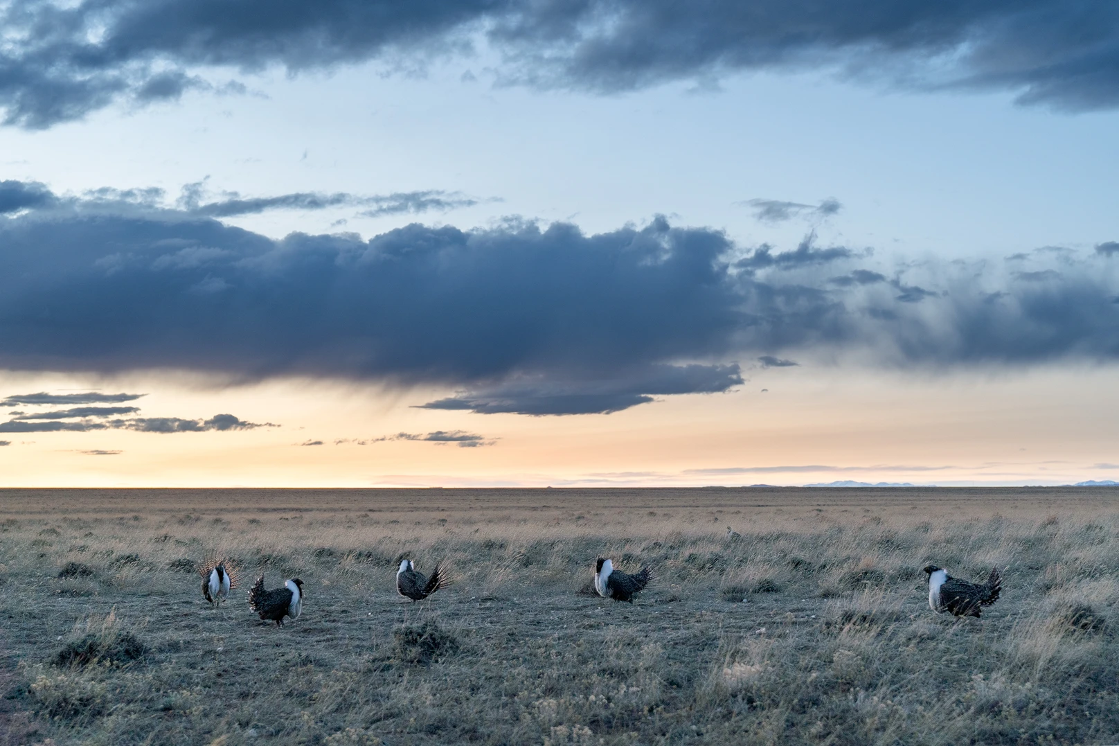
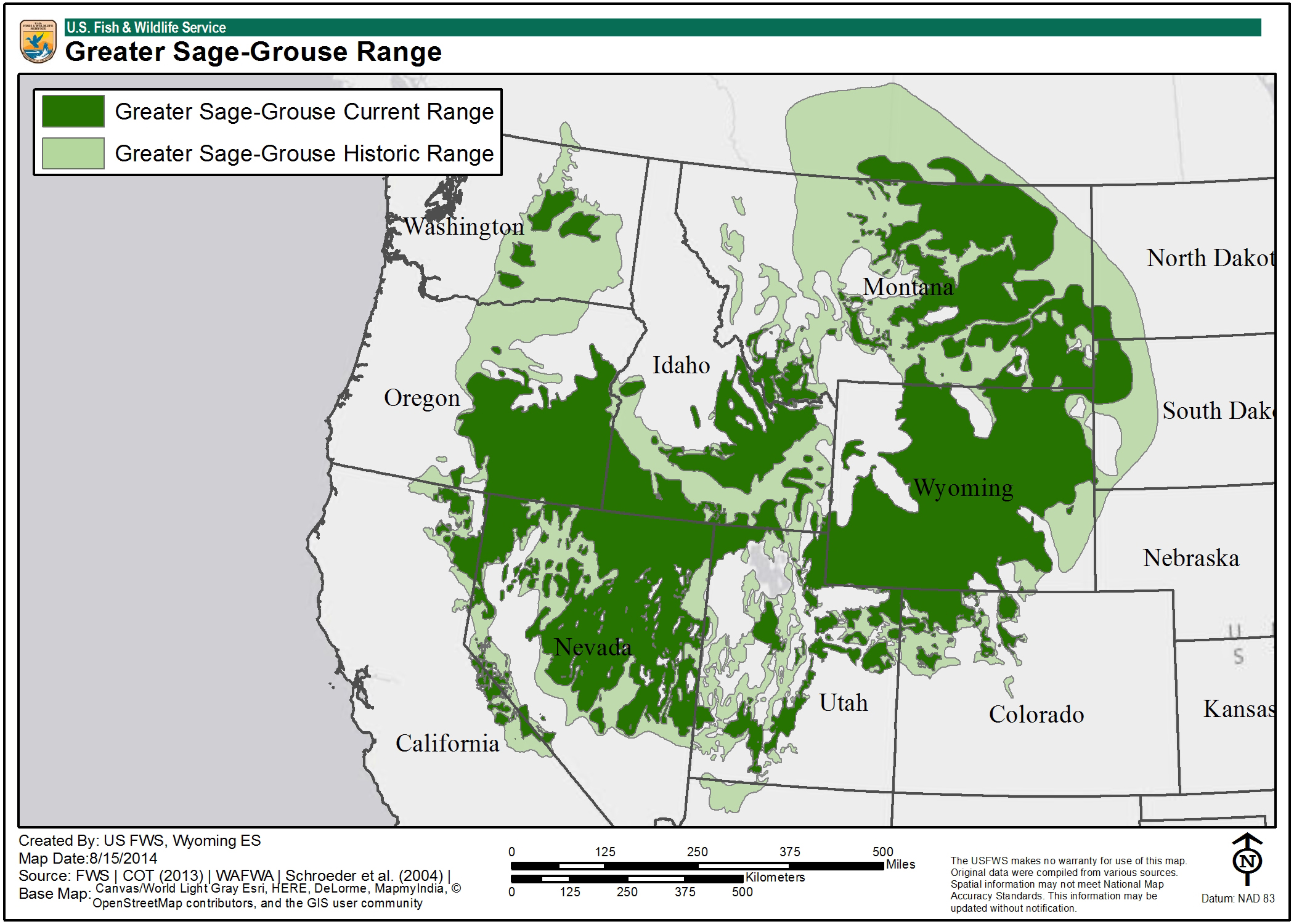

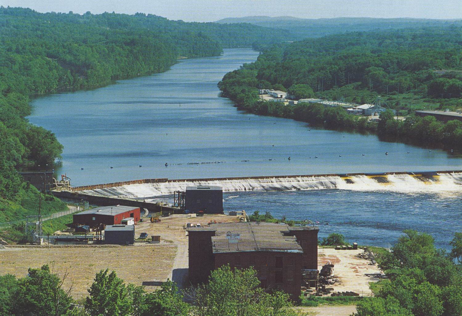


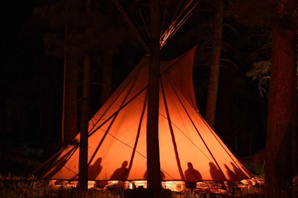
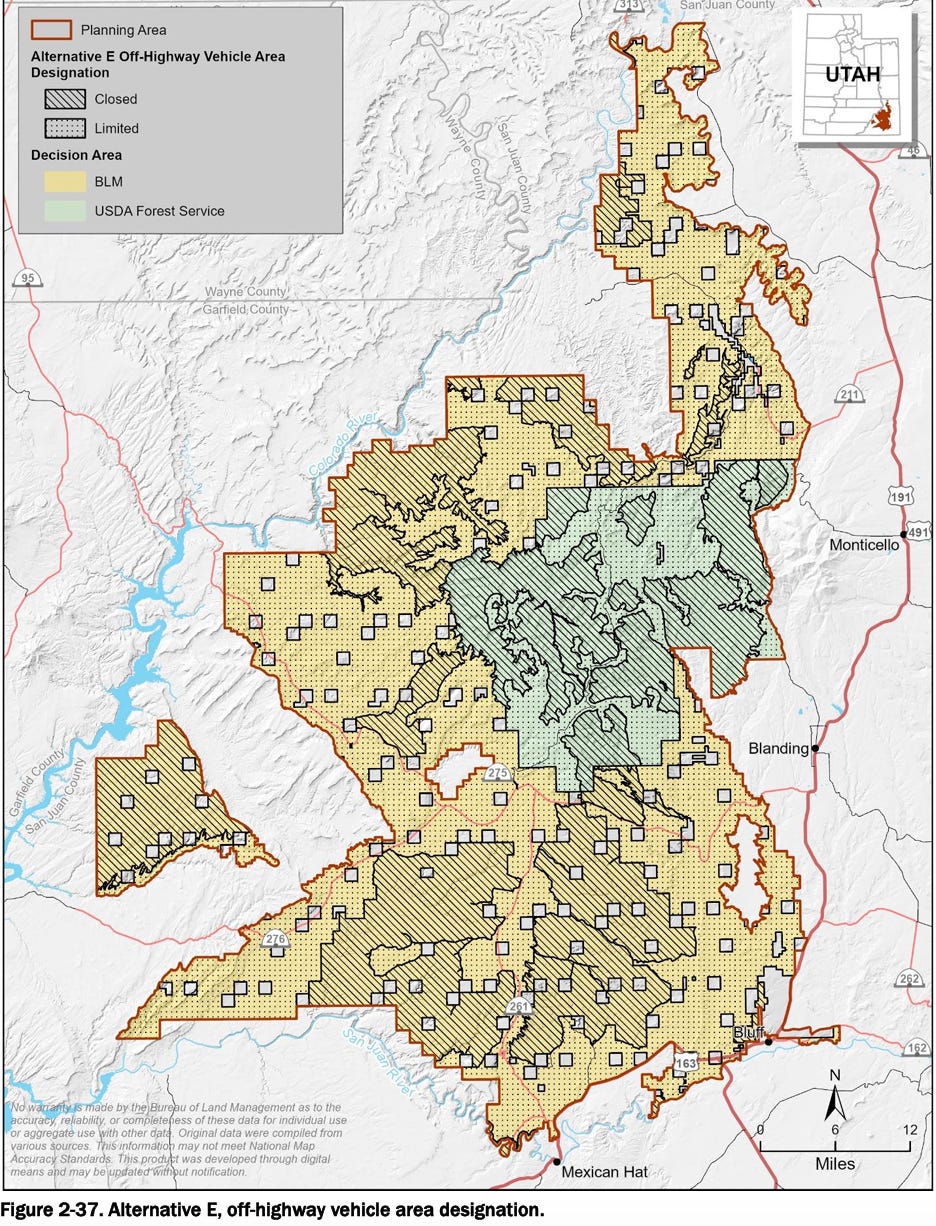


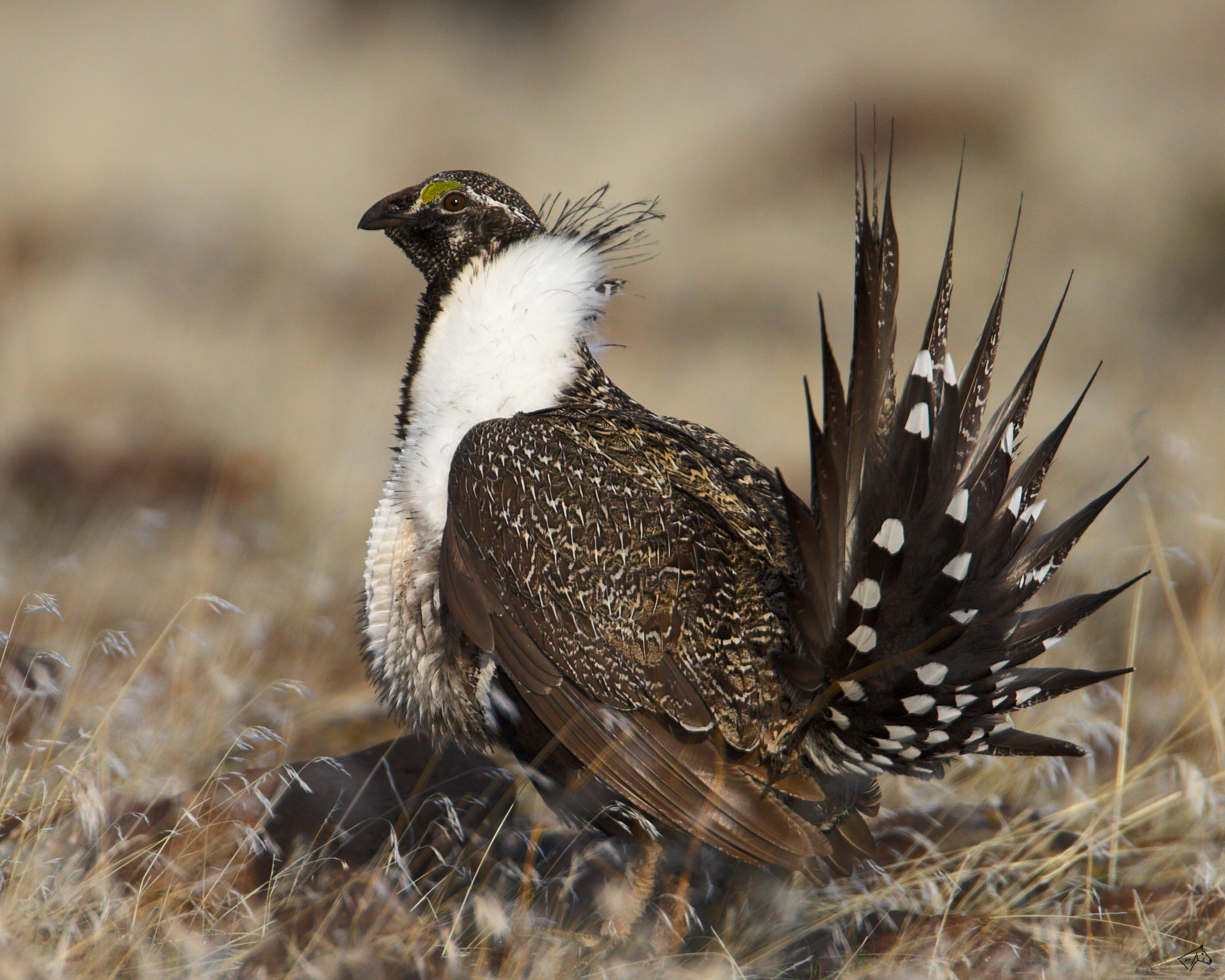
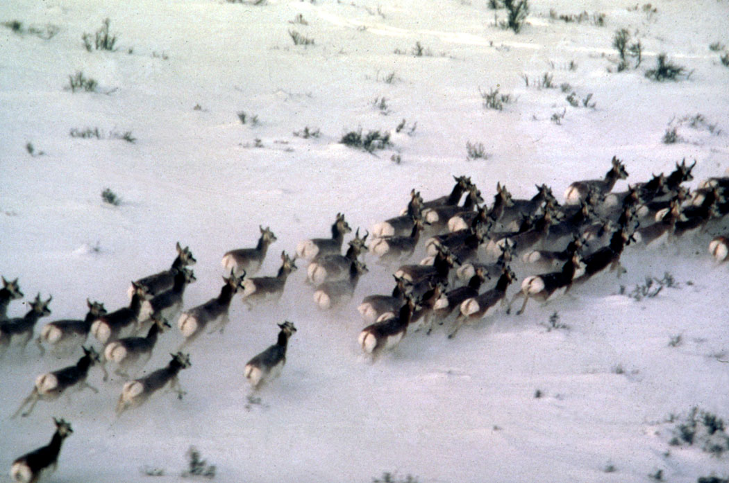


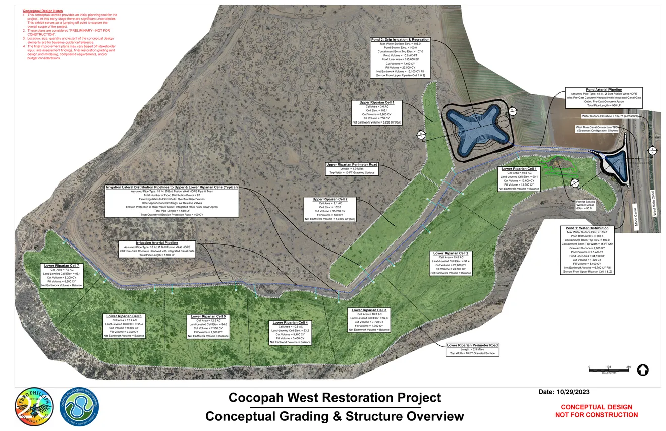


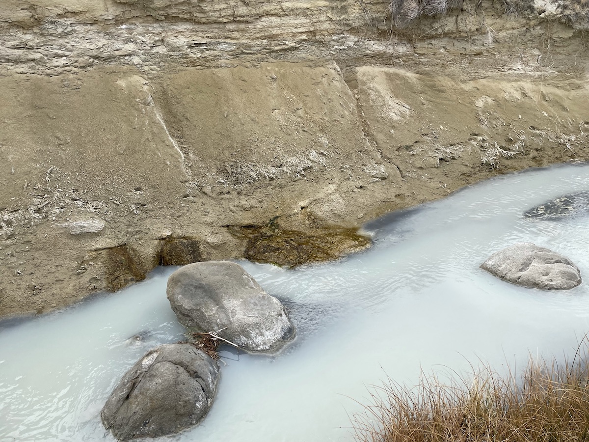

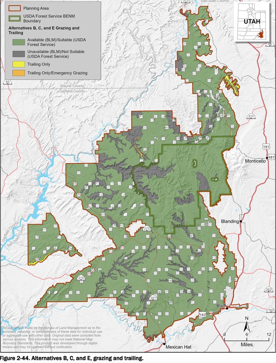

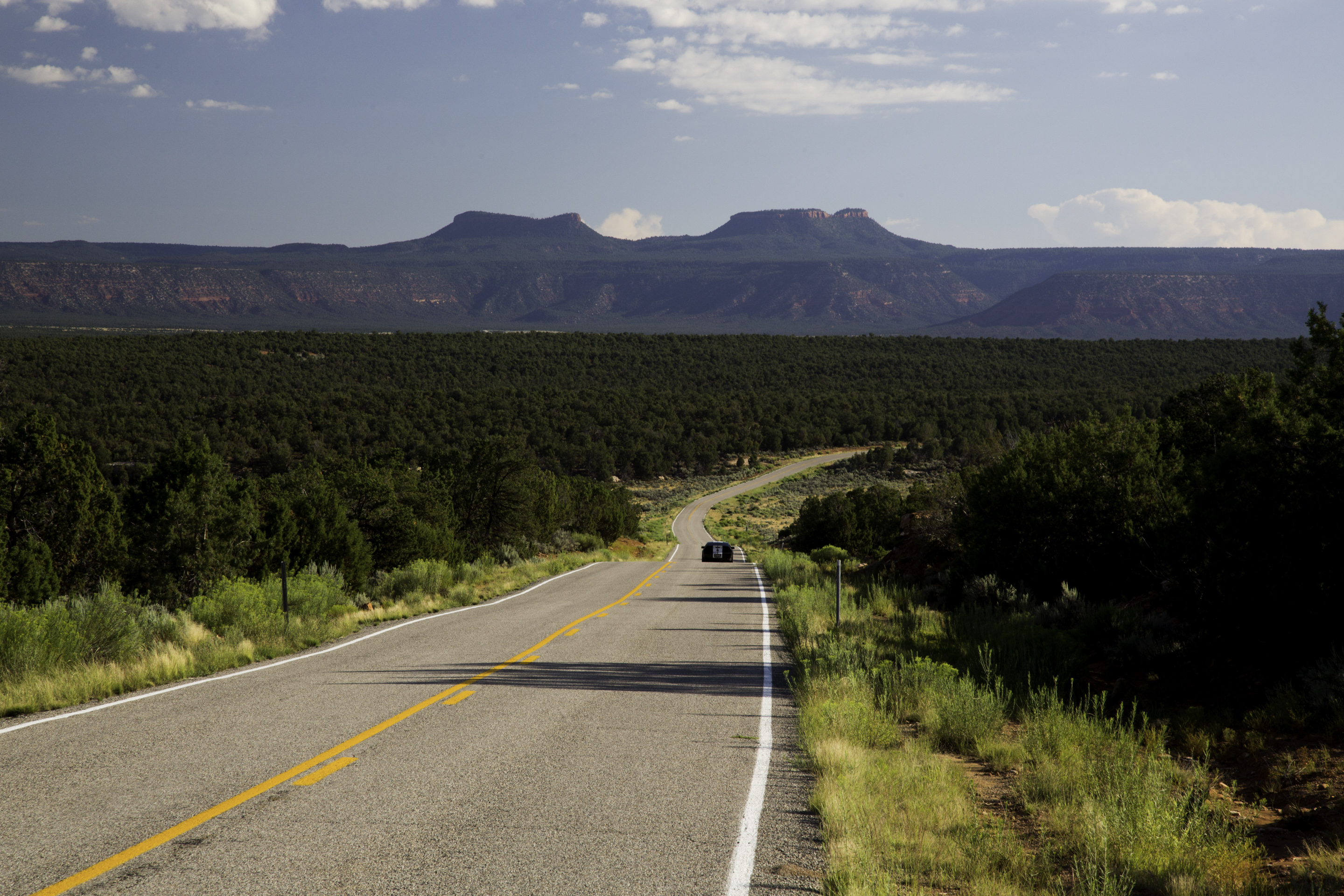
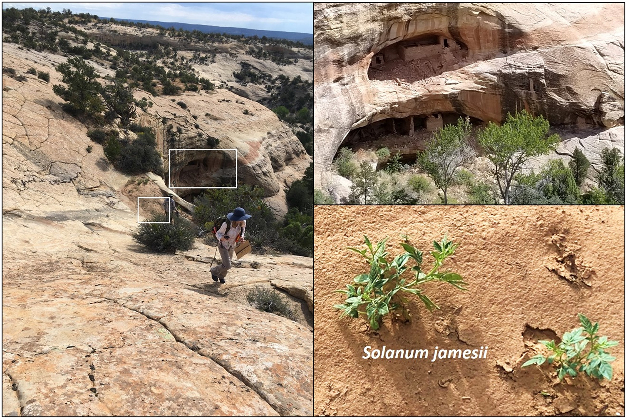

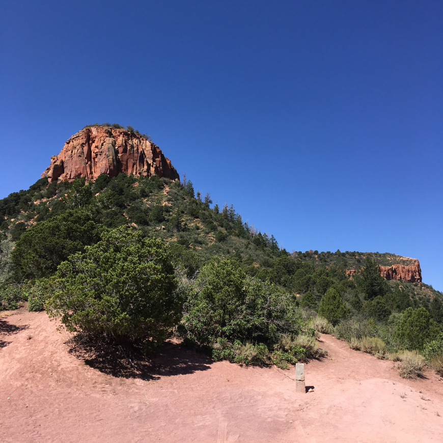
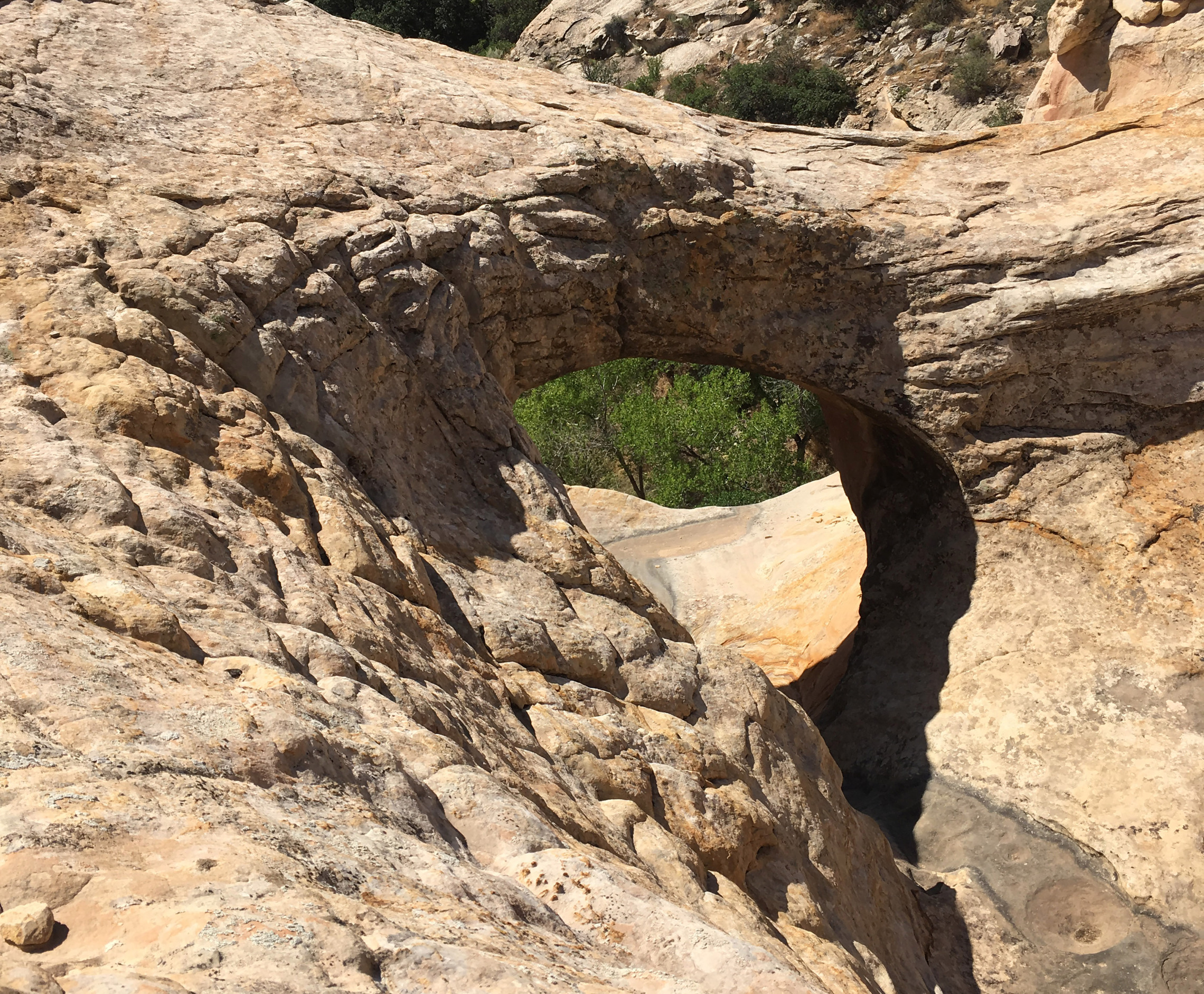

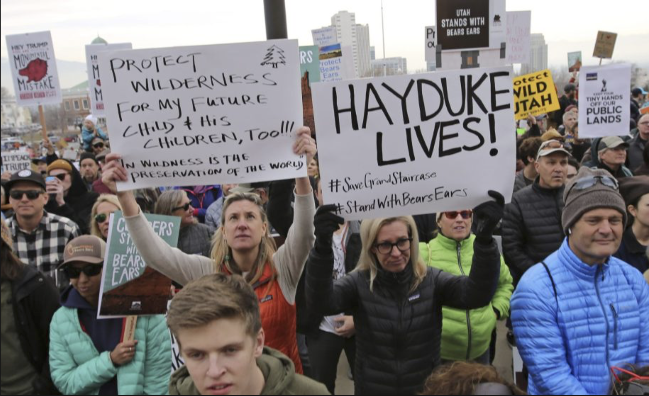
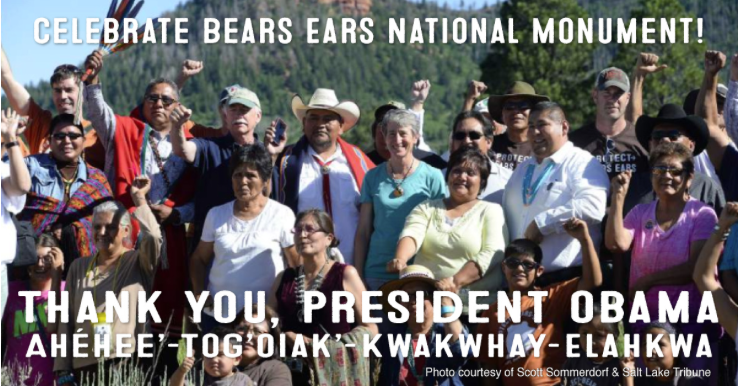
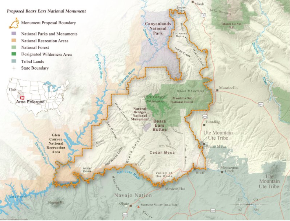

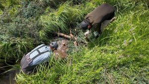


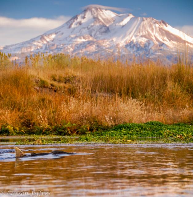
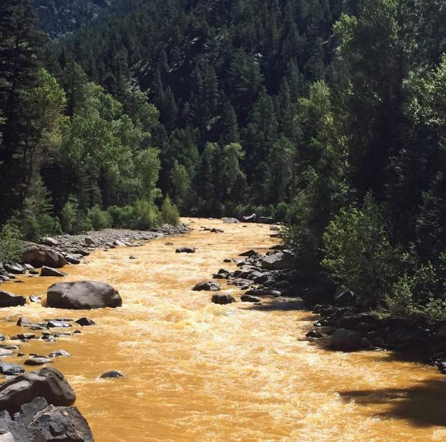


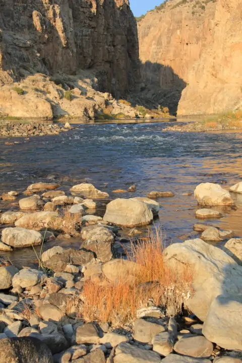
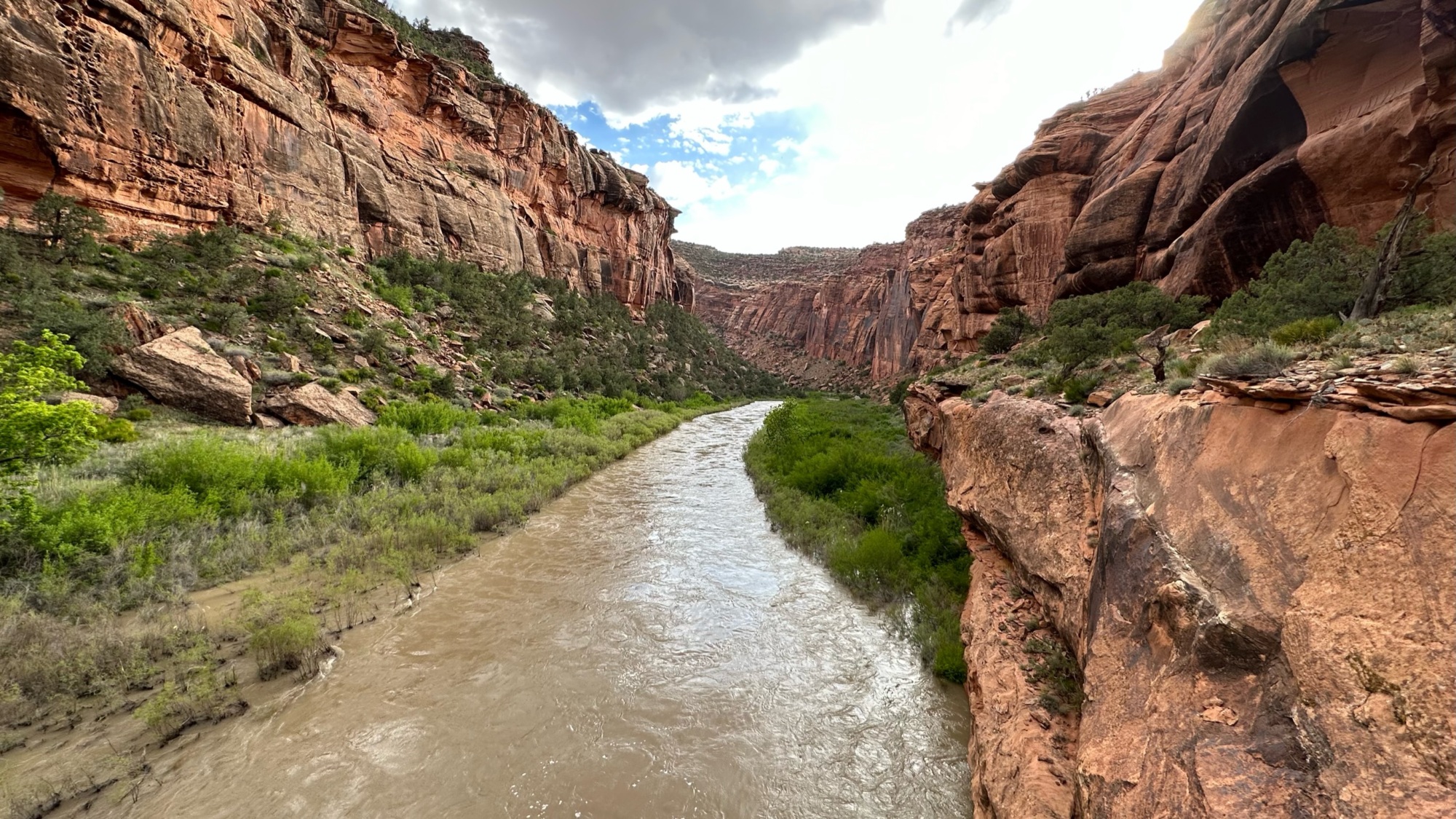


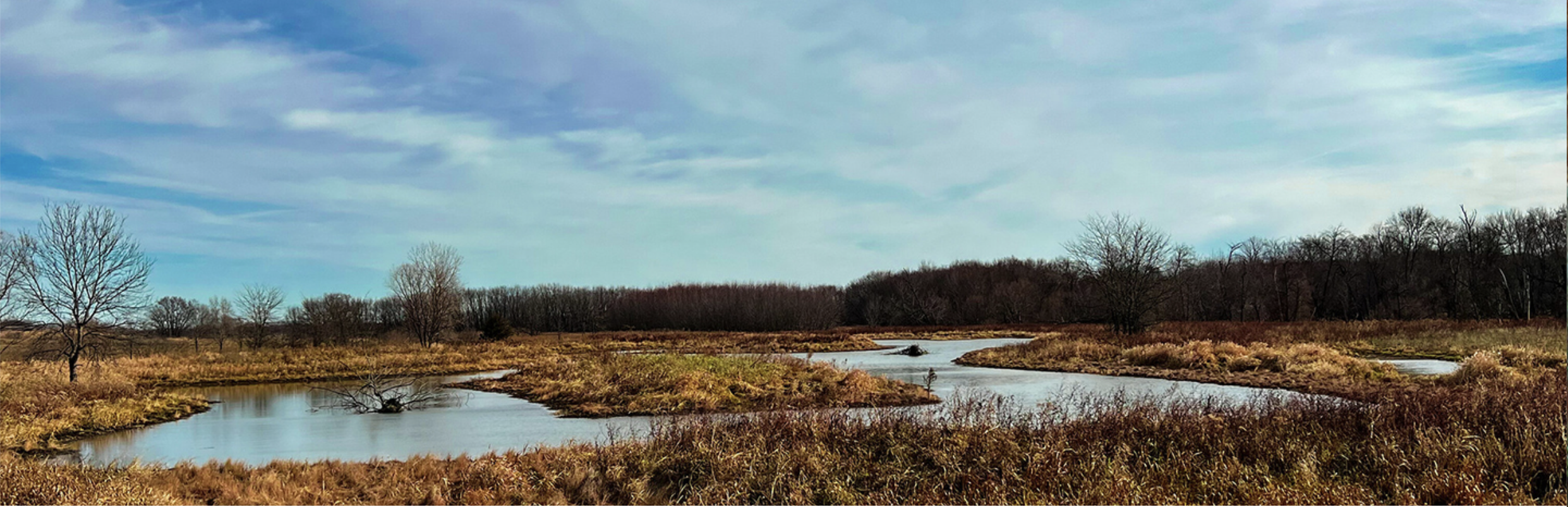


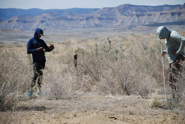

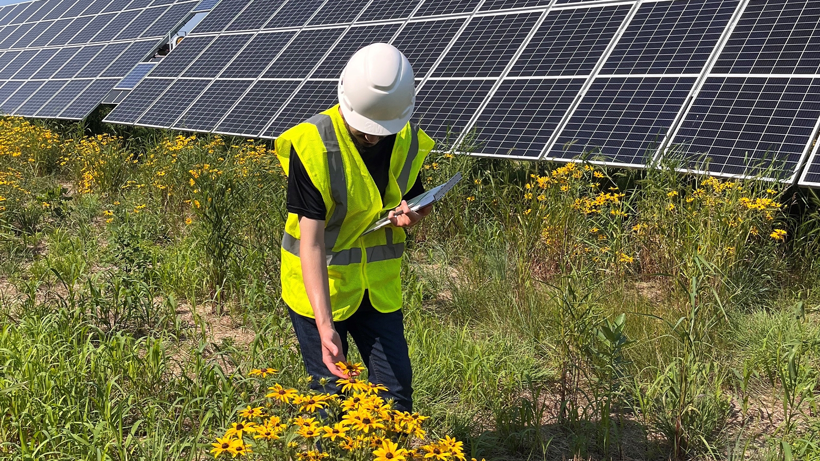


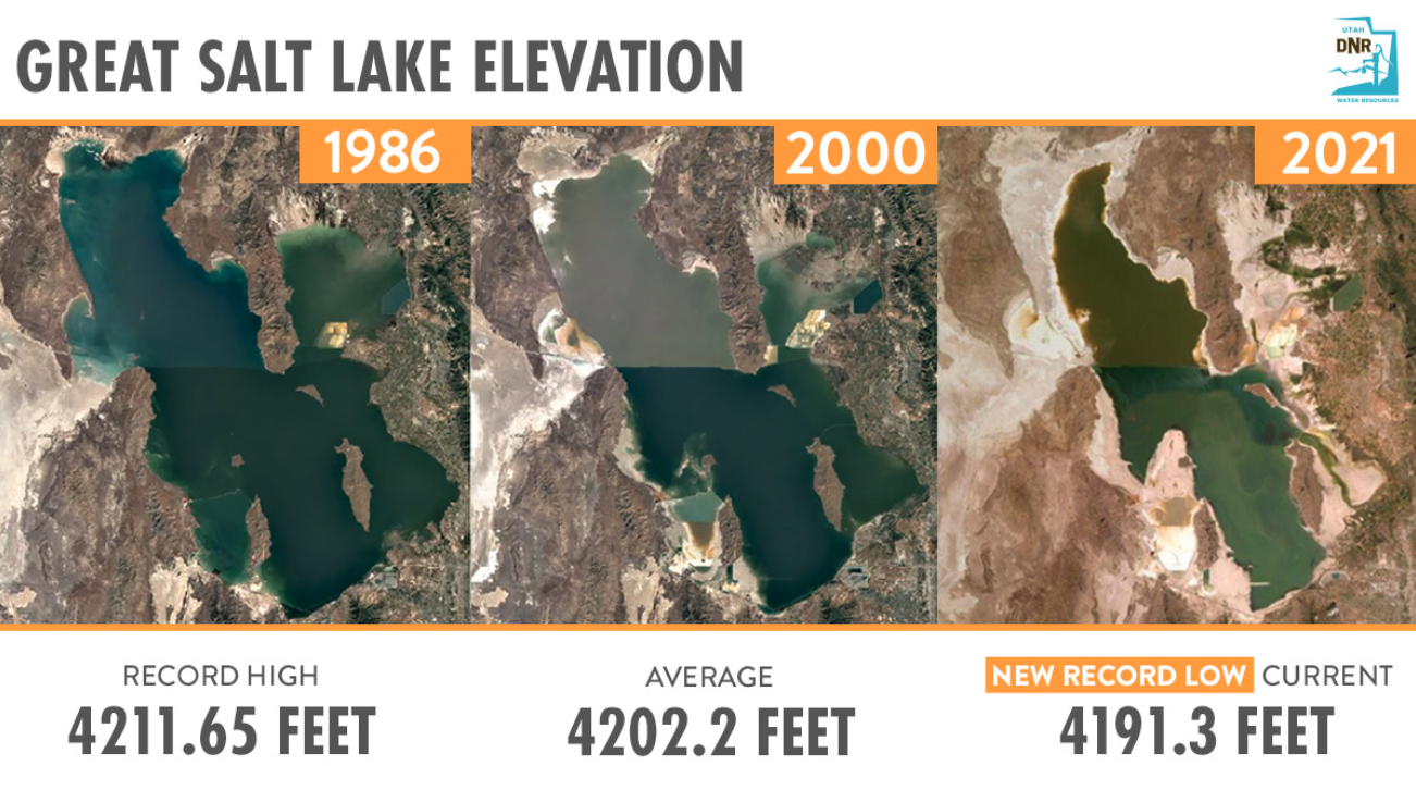

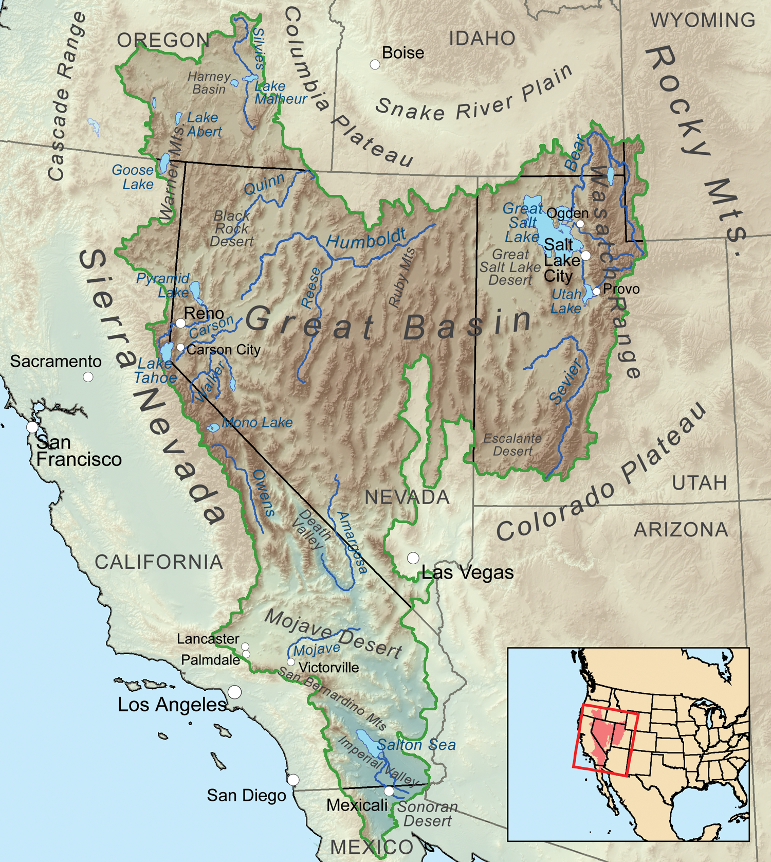


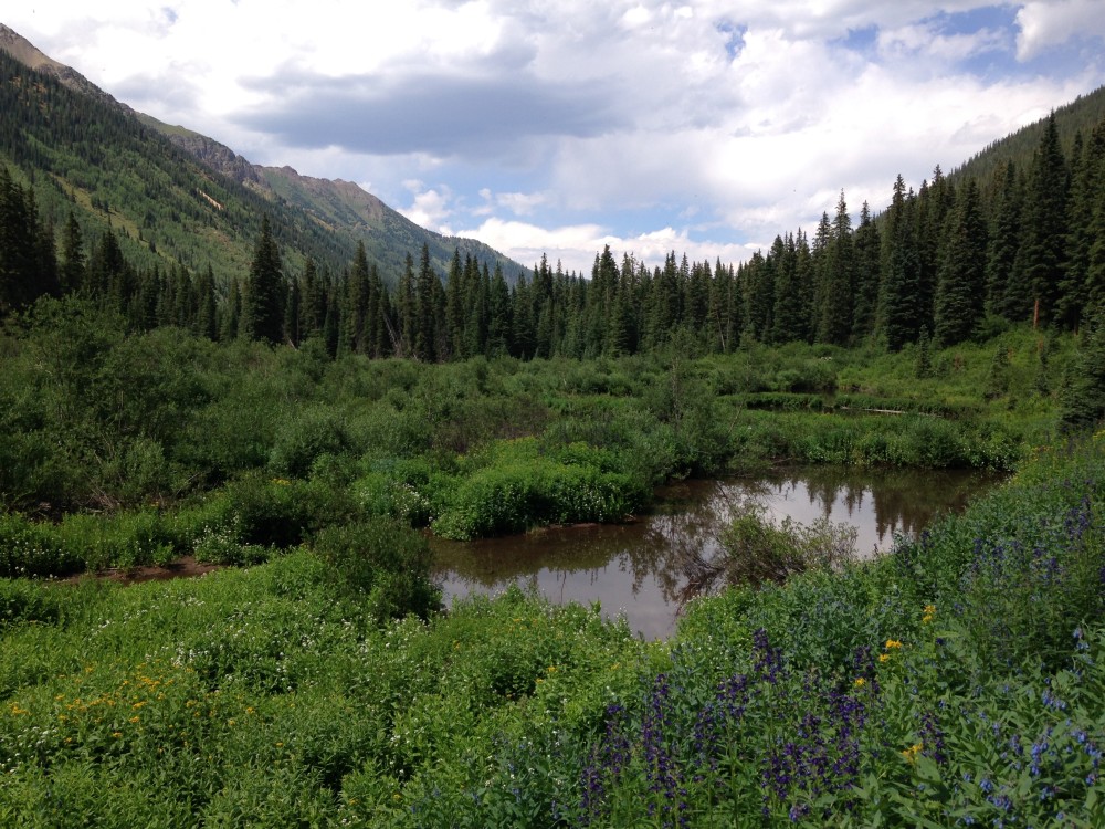
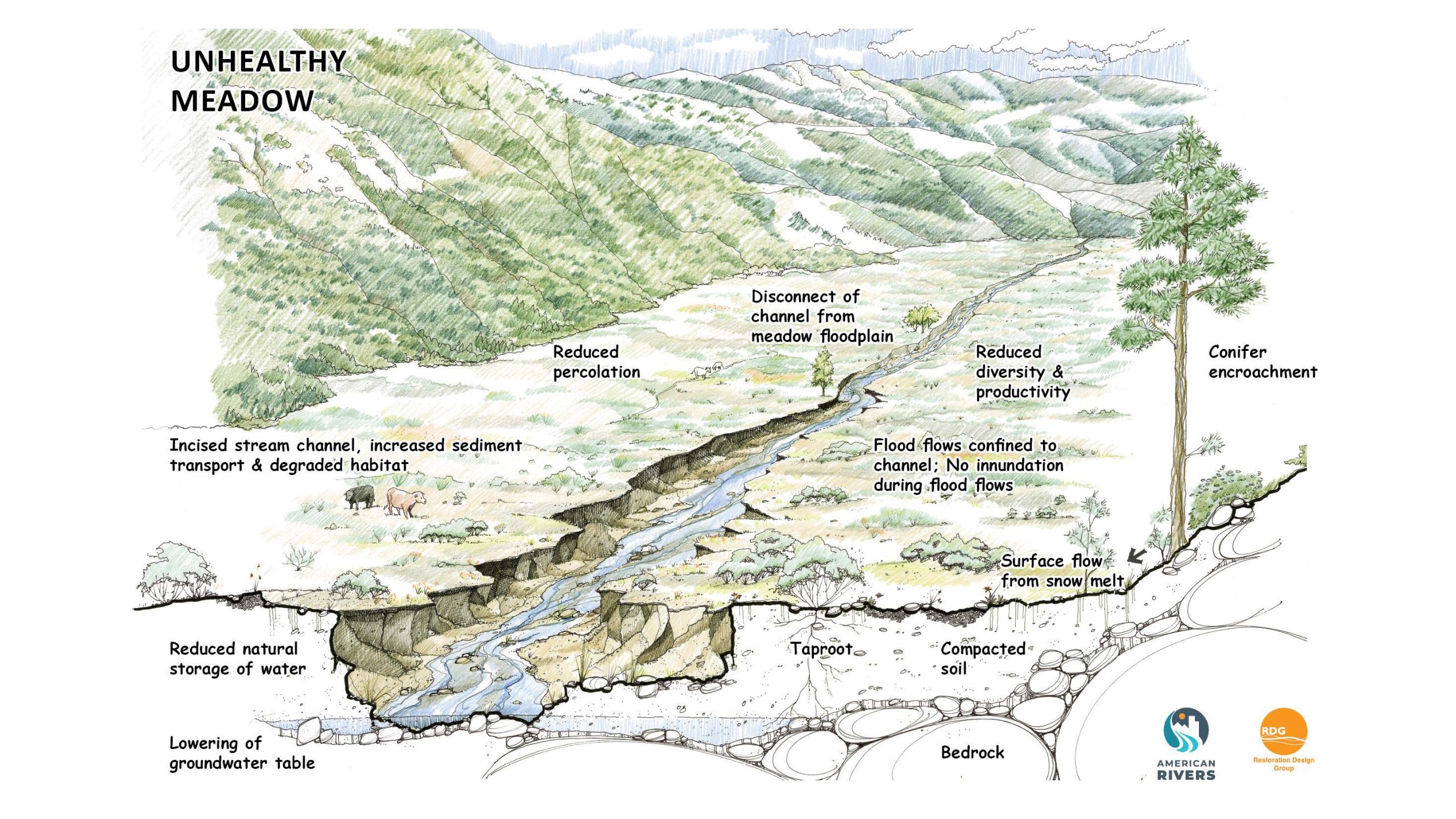


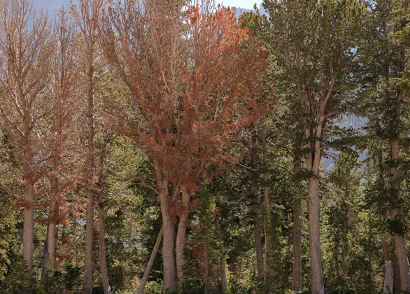
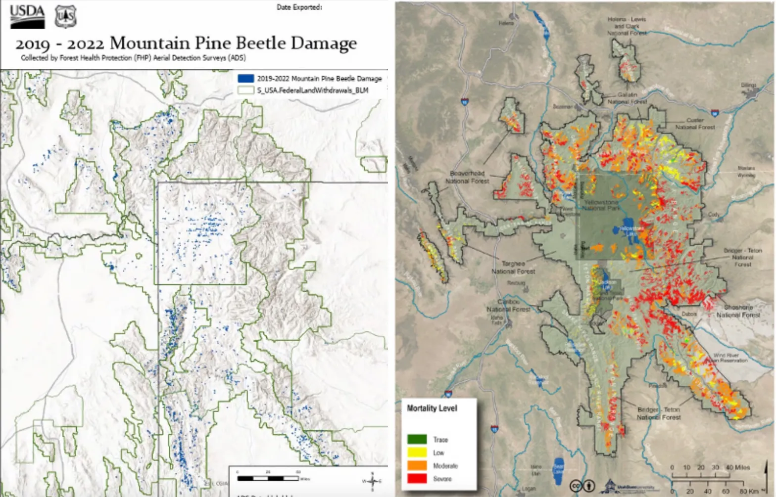
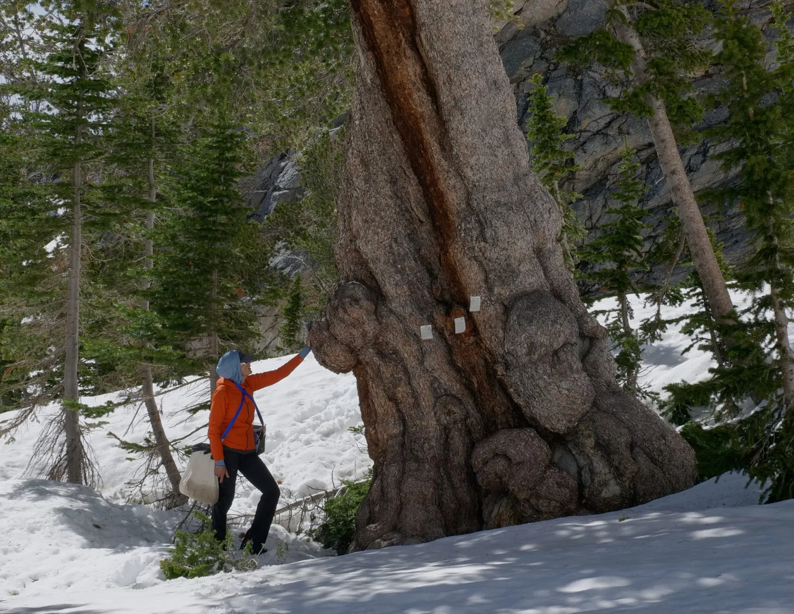

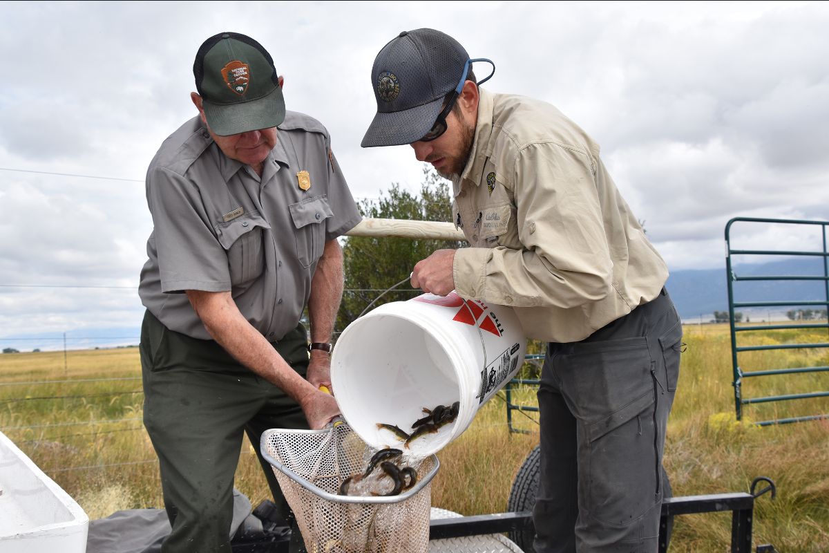
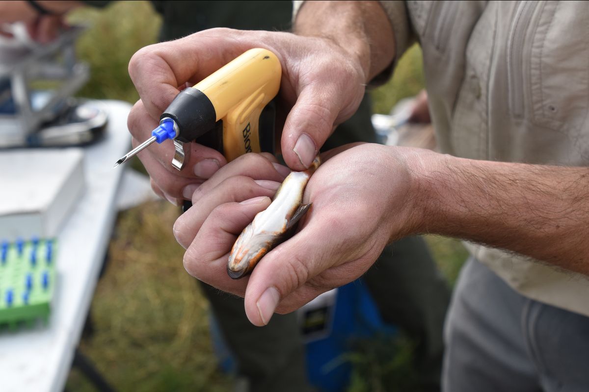


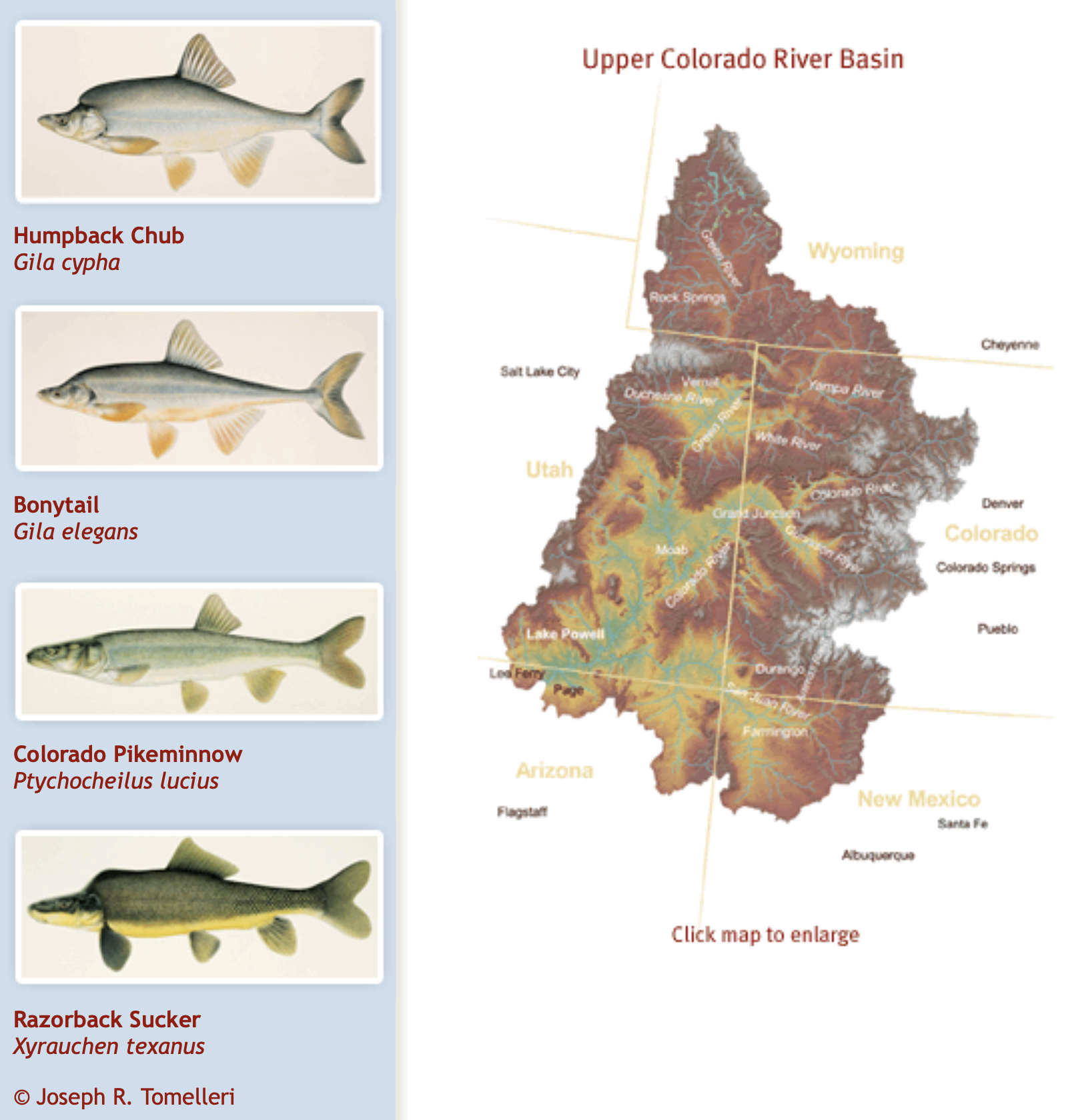


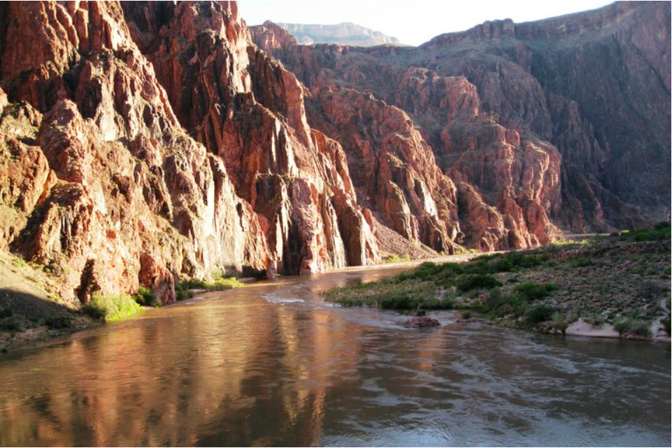

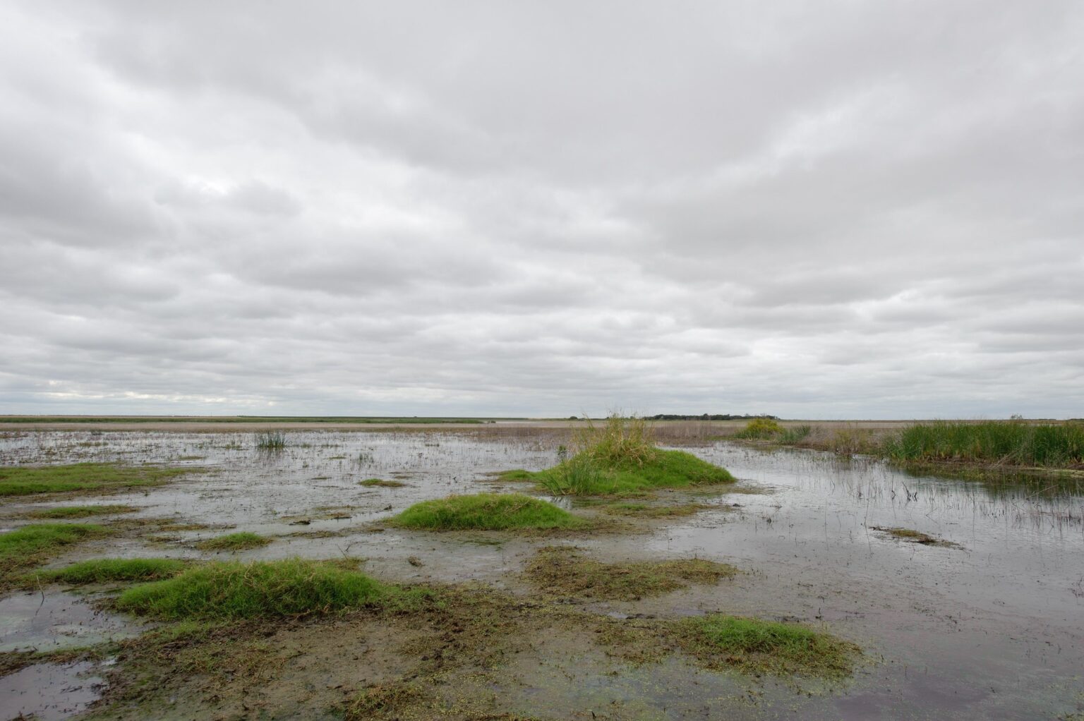


