Snowpack/runoff news

Click on a thumbnail graphic to view the Basin High/Low graph for your favorite river basin.

From The Colorado Springs Gazette (Chhun Sun):

With five days left in the month, Colorado Springs is less than half an inch from matching the rainfall total for the wettest May in the city’s history.

The Colorado Springs Airport received .26 inches of rain from 4 p.m. Tuesday to 10 p.m. Tuesday with no report of precipitation after that time, putting this month’s official rainfall total at 7.66 inches, said meteorologist Randy Gray of the National Weather Service in Pueblo.

That’s just .44 inches from the record of 8.1 inches, which was set in 1935.

“We’re keeping an eye on that record,” Gray said.

USGS: Evaluation of Groundwater Levels in the South Platte River Alluvial Aquifer, Colorado, 1953–2012

South Platte River Basin via Wikipedia

Here’s the abstract from the United States Geological Survey (Tristan P. Wellman):

The South Platte River and underlying alluvial aquifer form an important hydrologic resource in northeastern Colorado that provides water to population centers along the Front Range and to agricultural communities across the rural plains. Water is regulated based on seniority of water rights and delivered using a network of administration structures that includes ditches, reservoirs, wells, impacted river sections, and engineered recharge areas. A recent addendum to Colorado water law enacted during 2002–2003 curtailed pumping from thousands of wells that lacked authorized augmentation plans. The restrictions in pumping were hypothesized to increase water storage in the aquifer, causing groundwater to rise near the land surface at some locations. The U.S. Geological Survey (USGS), in cooperation with the Colorado Water Conservation Board and the Colorado Water Institute, completed an assessment of 60 years (yr) of historical groundwater-level records collected from 1953 to 2012 from 1,669 wells. Relations of “high” groundwater levels, defined as depth to water from 0 to 10 feet (ft) below land surface, were compared to precipitation, river discharge, and 36 geographic and administrative attributes to identify natural and human controls in areas with shallow groundwater.

Averaged per decade and over the entire aquifer, depths to groundwater varied between 24 and 32 ft over the 60-yr record. The shallowest average depth to water was identified during 1983–1992, which also recorded the highest levels of decadal precipitation. Average depth to water was greatest (32 ft) during 1953–1962 and intermediate (30 ft) in the recent decade (2003–2012) following curtailment of pumping. Between the decades 1993–2002 and 2003–2012, groundwater levels declined about 2 ft across the aquifer. In comparison, in areas where groundwater levels were within 20 ft of the land surface, observed groundwater levels rose about 0.6 ft, on average, during the same period, which demonstrated preferential rise in areas with shallow groundwater.

Approximately 29 percent of water-level observations were identified as high groundwater in the South Platte River alluvial aquifer over the 60-yr record. High groundwater levels were found in 17 to 33 percent of wells examined by decade, with the largest percentages occurring over three decades from 1963 to 1992. The recent decade (2003–2012) exhibited an intermediate percentage (25 percent) of wells with high groundwater levels but also had the highest percentage (30 percent) of high groundwater observations, although results by observations were similar (26–29 percent) over three decades prior, from 1963 to 1992. Major sections of the aquifer from north of Sterling to Julesburg and areas near Greeley, La Salle, and Gilcrest were identified with the highest frequencies of high groundwater levels.

Changes in groundwater levels were evaluated using Kendal line and least trimmed squares regression methods using a significance level of 0.01 and statistical power of 0.8. During 2003–2012, following curtailment of pumping, 88 percent of wells and 81 percent of subwatershed areas with significant trends in groundwater levels exhibited rising water levels. Over the complete 60-yr record, however, 66 percent of wells and 57 percent of subwatersheds with significant groundwater-level trends still showed declining water levels; rates of groundwater-level change were typically less than 0.125 ft/yr in areas near the South Platte River, with greater declines along the southern tributaries. In agreement, 58 percent of subwatersheds evaluated between 1963–1972 and 2003–2012 showed net declines in average decadal groundwater levels. More areas had groundwater decline in upgradient sections to the west and rise in downgradient sections to the east, implying a redistribution of water has occurred in some areas of the aquifer.

Precipitation was identified as having the strongest statistically significant correlations to river discharge over annual and decadal periods (Pearson correlation coefficients of 0.5 and 0.8, respectively, and statistical significance defined by p-values less than 0.05). Correlation coefficients between river discharge and frequency of high groundwater levels were statistically significant at 0.4 annually and 0.6 over decadal periods, indicating that periods of high river flow were often coincident with high groundwater conditions. Over seasonal periods in five of the six decades examined, peak high groundwater levels occurred after spring runoff from July to September when administrative structures were most active. Between 1993–2002 and 2003–2012, groundwater levels rose while river discharge decreased, in part from greater reliance on surface water and curtailed pumping from wells without augmentation plans.

Geographic attributes of elevation and proximity to streams and rivers showed moderate correlations to high groundwater levels in wells used for observing groundwater levels (correlation coefficients of 0.3 to 0.4). Local depressions and regional lows within the aquifer were identified as areas of potential shallow groundwater. Wells close to the river regularly indicated high groundwater levels, while those within depleted tributaries tended to have low frequencies of high groundwater levels. Some attributes of administrative structures were spatially correlated to high groundwater levels at moderate to high magnitudes (correlation coefficients of 0.3 to 0.7). The number of affected river reaches or recharge areas that surround a well where groundwater levels were observed and its distance from the nearest well field showed the strongest controls on high groundwater levels. Influences of administrative structures on groundwater levels were in some cases local over a mile or less but could extend to several miles, often manifesting as diffuse effects from multiple surrounding structures.

A network of candidate monitoring wells was proposed to initiate a regional monitoring program. Consistent monitoring and analysis of groundwater levels will be needed for informed decisions to optimize beneficial use of water and to limit high groundwater levels in susceptible areas. Finalization of the network will require future field reconnaissance to assess local site conditions and discussions with State authorities.

More South Platte River Basin coverage here.

Major Construction Set to Begin on WISE Water Project — South Metro Water Supply Authority

WISE System Map September 11, 2014

From email from the South Metro Water Supply Authority (Russ Rizzo):

Construction is set to begin on a regional water project that is a significant part of the South Denver Metro area’s plan to transition to a renewable water supply.

Western Summit Constructors, Inc. has been contracted to oversee design and construction of major infrastructure for the WISE (Water Infrastructure and Supply Efficiency) project. Construction will begin in Juneand continue into 2016, when water deliveries will begin.

WISE is a partnership among Aurora Water, Denver Water and the South Metro Water Supply Authority to combine available water supplies and system capacities to create a sustainable new water supply. Aurora and Denver will provide fully treated water to South Metro Water on a permanent basis. WISE also will enable Denver Water to access its supplies during periods when it needs to. All of this will be accomplished while allowing Aurora to continue to meet its customers’ current and future needs.

“This is a significant milestone in our long-term plan to transition to a renewable water supply,” said Eric Hecox, executive director of the South Metro Water, which represents 14 water providers comprising most of Douglas County and a portion of Arapahoe County. “With construction agreements now in place, we will break ground in coming weeks to begin connecting water systems throughout the Denver Metro area.”

Aurora’s Prairie Waters system will provide the backbone for delivering water from the South Platte when Aurora and Denver Water have available water supplies and capacity. The water will be distributed to the South Metro Denver communities through an existing pipeline shared with Denver and East Cherry Creek Valley Water and Sanitation District and new infrastructure that will be constructed over the next 16 months.

“By working together, the three major water entities serving the Denver Metro area have put the southern communities of Denver on a more secure and sustainable path while delivering benefits to the entire region as well as West Slope communities,” said Gov. John Hickenlooper. “The approach is a model for us to replicate as Colorado’s Water Plan is implemented.”

When WISE begins delivering water in 2016:

●The South Denver Metro area will receive a significant new renewable water supply;

●Denver will receive a new backup water supply;

●Aurora will receive funding from partners to help offset its Prairie Waters Project costs and stabilize water rates; and

●The West Slope will receive new funding, managed by the River District, for water supply, watershed and water quality projects.

South Metro Water and its 14 water provider members are executing a plan to transition to renewable supplies. The plan focuses on three areas: investments in infrastructure; partnership among local and regional water suppliers; and maximizing efficiency of existing resources through conservation and reuse.

The South Metro region has made tremendous progress over the past 10 years, reducing per capita water use by more than 30 percent and adding new renewable water supplies and storage capacity that have significantly decreased reliance on nonrenewable groundwater.

For details on the WISE project as well as South Metro Water’s plan to transition to renewable water supplies, visit http://www.southmetrowater.org/smwsa-projects/.

More WISE Project coverage here.

“Water is the foundation of life. What threatens that imperils us all” — NRDC

waterfromtap

From the Natural Resources Defense Council newsletter:

Today our country took one of its biggest steps ever to protect clean water with a new standard that restores safeguards to nearly two million miles of headwaters and streams and tens of millions of acres of wetlands.

Building on decades of successful water protections, the Clean Water Rule will defend sources of safe drinking water for one in every three Americans by clarifying protections that had come under challenge from some of the country’s biggest polluters.

The new rule is a victory for all of us, if we can keep it from being thwarted by its foes and their allies in Congress.

Republican leaders in the House and Senate have already teed up a showdown over this needed rule, a largely partisan battle that pits oil and gas companies, shopping center builders, Big Agriculture and others against the basic American right to clean water.

The Republican-led House sided earlier this month with the polluters.

We’re counting on the Senate to stand up for clean water.

For more than four decades, American waters have been protected by the Clean Water Act, passed by overwhelming Republican and Democratic majorities in both houses of Congress in 1972.

In recent years, though, this important law has come under withering attack by interests that stand to profit from weakening the protections the law provides.

In essence, these groups claim the Clean Water Act shouldn’t apply to vast reaches of streams and wetlands because these bodies of water are too remote, too small or too dependent on seasonal rains to count.

That, of course, is nonsense.

Even mighty rivers start small, taking on volume from wetlands and tributaries as water flows downhill.

Pollution at any point along the journey threatens all the waters downstream.

That’s why state and local officials, members of Congress, advocates for industry, agriculture, the environment and others, as well as members of the public at large, have asked the Environmental Protection Agency and the Army Corps of Engineers to clarify the reach of the Clean Water Act.

The agencies have participated in more than 400 meetings on the issue nationwide. Over just the past year, they’ve reviewed more than a million comments from people who depend on clean water for things like raising food, running their businesses, attracting tourism or fishing and hunting.

And here’s what they’ve found: 87 percent of the people who commented want the waters of America protected.

That’s exactly what the agencies have in mind with the Clean Water Rule, made final today.

Unless the polluters and their congressional allies get their way.

On May 12, the GOP-led House passed a bill to block the vital safeguards contained in the new Clean Water Rule — two weeks before the final rule was even issued.

The opponents didn’t need to see the final rule to vote against the measure, putting polluter profits first — and putting our drinking water at risk.

Similar legislation is pending in the Senate.

The Clean Water Rule, though, needs to go forward without further congressional obstruction or delay.

The rule’s protections will provide the country with up to $572 million worth of benefits every single year, the EPA estimates.

The wetlands and waterways this rule will defend help protect our communities from flooding. They filter industrial, agricultural and urban pollutants out of our water. They provide habitat for wildlife. And they help to recharge groundwater supplies.

Water is the foundation of life. What threatens that imperils us all.

We need our Senate to put our future first, put this pernicious legislation to bed and let the people who keep our water clean do the job we’re counting on them to do.

From email from American Rivers (Bob Irvin):

On Wednesday, thanks to the efforts of American Rivers and our partners and supporters, the Obama Administration released the Clean Water Rule, restoring protections to streams and wetlands that are drinking water sources for more than 1 in 3 Americans.

Few things are more fundamental to our health than clean water. You shouldn’t have to worry about pollution when you turn on the tap. This administration’s leadership in protecting our streams will benefit millions of Americans and our children and grandchildren.

Thank you for standing with American Rivers and speaking up for clean water. Because of your support, American Rivers was able to provide expert scientific analysis of the rule, educate key decision makers, and build a strong wave of public support nationwide.

The Clean Water Rule restores clear protection to 60 percent of the nation’s stream miles and millions of acres of wetlands that were historically protected by the Clean Water Act, but have lacked guaranteed safeguards for nearly a decade.

As we celebrate this victory we know our work isn’t done. Special interests and some members of Congress continue to try to dismantle the Clean Water Rule’s protections.

But we will do everything in our power to ensure these critical safeguards for our rivers remain. They are essential to the drinking water supplies for today’s communities, and future generations.

With your help, we will preserve this victory and build on our success, ensuring healthy rivers for all Americans nationwide.

More Environmental Protection Agency coverage here.

Can more plumbing save Colorado’s water? — The Colorado Independent #COWaterPlan

crocusbobberwyn

From The Colorado Independent (Bob Berwyn):

When Colorado’s tourism marketing gurus wanted to show the world what the state is all about, they used television spots evoking the powerful call of wild rivers — hikers gazing at waterfalls, anglers wading in still, dawn-lit waters and kayakers and rafters paddling through whitewater. But are those images more myth or reality?

Most of the state’s water is private property, under lock and key.

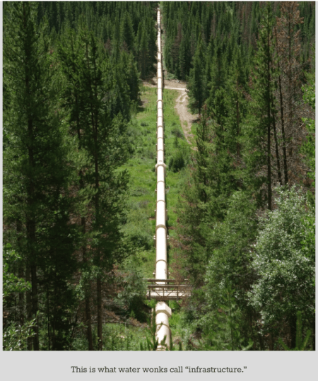
Thousands of diversions – canals and pipelines — move water to where it’s needed for crops, factories and drinking water. This intricately engineered plumbing system has fundamentally reshaped Colorado’s landscape. Water diversions allow millions of people to live in the semi-desert rain-shadow east of the Rockies, and enable vast emerald alfalfa fields to thrive in the otherwise dry sagebrush steppe of the Western Slope.
Colorado’s new water plan is in large part about deciding whether and when there will be new diversions, who will benefit and who will pay for them.

handwheelstraightcreekdillonbobberwyn

Colorado, by law and policy, has actively promoted water development for more than 100 years. Thousands of miles of streams and rivers have been dammed, diverted and polluted to provide water for factories, farms, cities, mines and oil and gas operations. As a result, Colorado’s environment has suffered.

dillondamspillwaybobberwyn

The evolving Colorado water plan talks about the importance of leaving waters in rivers, but finding the flexibility and “extra” water to account for environmental needs like native-Colorado-river fish won’t be easy.

streamgagetenmilecreekbobberwyn

Colorado, of course, is not alone. More than 30 percent of rivers in the United States are impaired or polluted. So much water is drawn from rivers that many no longer flow to the sea year-round. As a result, the extinction rate for freshwater animals like fish and mollusks is five time higher than for land animals.

moffattunneldiversionbobberwyn

The first draft of the new Colorado water plan recognizes that leaving water in rivers and streams is important, but it’s not clear whether the final version of the plan, due by the end of this year, will include any specific goals for for maintaining healthy streams.

jimcreekdiversionbobberwyn

All over the mountains and Western Slope, residents worry more water will be taken from rivers and streams to the Front Range. Many communities have allied themselves with conservation groups to ensure that streams aren’t dried up.

kirkklanckeericastockfraserriverbobberwyn

The evolving water plan acknowledges the environment, but when it comes to specific actions, water planners generally defer to Colorado water law, which puts few limits on using water for farms and towns, but says that rivers and streams can only get protection to “a reasonable degree,” a standard that is a moving target often subject to interpretation by courts.

pipelinediversionbobberwyn

Water development has enabled millions of Coloradans to water their lawns and golf courses, but at what cost? Conservation advocates decry calls for shipping more water from what’s left of mountain streams to irrigate grass in the dry plains of eastern Colorado, while Front Range cities, with more than 80 percent of the state’s population, seek to ensure sustainable water supplies for the future.

2002waterwastetowerroaddenverbobberwyn

How will Coloradans decide to use our state’s water? Read The Colorado Independent’s first few stories on the water plan here, and visit the Colorado Water Plan website to learn how you can get involved.

More Colorado Water Plan coverage here.

Granby: “State of the River” meeting recap #ColoradoRiver

Historical Colorado River between Granby and Hot Sulphur Springs

From the Sky-Hi Daily News (Hank Shell):

During the meeting, officials from the Upper Colorado River Basin’s biggest water interests including Northern Water, Denver Water and the U.S. Bureau of Reclamation spoke about some of the basin’s biggest issues, including the state of runoff and snowpack in the region and the movement at Ritschard Dam on Wolford Mountain Reservoir.

Though snowpack seemed to falter during what proved to be a rather dry March, it’s been building steadily over the last three to four weeks, explained Don Meyer with the Colorado River District.

The variations in snowpack have pushed the basin into “uncharted territory,” he said.

“I think the message here is think 2010 in terms of snowpack,” Meyer said.

Though he added that snowpack is not analogous to runoff, Meyer said 2015 “will likely eclipse 2010 in terms of stream flow.”

Victor Lee with the U.S. Bureau of Reclamation echoed Meyer, adding that recent cold temperatures across the region have allowed snowpack to persist.

Though snowpack is currently below average, it could linger past the point at which the average snowpack tends to drop…

If the current snowpack does translate into high runoff in Grand County, there may not be anywhere to put it, Lee said.

Front Range reservoirs are full, and storage in Lake Granby is the highest it’s ever been for this time of year, according to Lee’s presentation…

Though it could be a good runoff year for Grand County, Meyer said that snow-water equivalent above Lake Powell is still well below average, making it a dry year for the Upper Colorado River Basin overall.

RITSCHARD DAM

Officials aren’t sure when the settling and movement at Ritschard Dam will stop, but it poses no threat to safety, said John Currier with the Colorado River District.

“We really are absolutely confident that we don’t have an imminent safety problem with this dam,” Currier said…

ENDANGERED FISH

The Bureau of Reclamation will increase flows from the Granby Dam to 1,500 CFS around May 29 and maintain those flows until around June 8, Lee said.

The releases will be part of an endangered fish recovery program and will be coordinated with releases from other basin reservoirs to enhance peak flows in the Grand Valley where the plan is focused.

Wolford Mountain Reservoir will also participate in the coordinated releases, Meyer said.

The program hopes to re-establish bonytail chub, Colorado pikeminnow, razorback sucker and humpback chub populations to a 15-mile stretch of the Colorado River above Grand Junction.

WINDY GAP FIRMING

After receiving its Record of Decision last year, the Windy Gap Firming Project’s next major hurdle is acquiring a Section 404 permit from the Army Corps of Engineers for the construction of Chimney Hollow Reservoir, said Don Carlson with Northern Water.

The permit regulates dredged or fill material into water as part of the Clean Water Act.

Northern Water hopes to acquire the permit this year, with construction possibly beginning in 2016 or 2017, Carlson said.

The project seeks to firm up the Windy Gap water right with a new Front Range reservoir. The project currently stores water in Lake Granby.

Because it’s a junior water right, yield for the project is little to nothing in dry years.

Northern Water also hopes to establish a free-flowing channel of the Colorado River beside the Windy Gap Reservoir as part of the Windy Gap Reservoir Bypass Project.

The new channel would allow for fish migration and improve aquatic habitat along the Colorado River.

That project still needs $6 million of its projected $10 million cost.

MOFFAT TUNNEL FLOWS

Moffat Tunnel flows are hovering around 15 CFS as Denver Water is getting high yield from its Boulder Creek water right, said Bob Steger with Denver Water.

The increased yield from that junior water right means flows through Moffat Tunnel will remain low through early summer, Steger said.

“The point is we’ll be taking a lot less water than we normally do,” he said.

Denver Water expects its flows through the tunnel to increase in late summer as its yield from Boulder Creek drops, Steger said.

Williams Fork Reservoir, which is used to fulfill Denver Water’s obligations on the Western Slope, is expected to fill in three to four weeks, Steger said.

More Colorado River Basin coverage here.

Fountain Creek: High water is delaying assessment and mitigation in Pueblo

Fountain Creek Watershed

From The Pueblo Chieftain (Chris Woodka):

A project classified as an emergency will take more time to complete.

There’s no clear timetable for fortifying the Fountain Creek embankment at the 13th Street interchange of Interstate 25, where the river is continuing to cut at the ground under a Union Pacific Railroad track.

“We’re still waiting for the water to go down,” said Corinne O’Hara, project manager of the U.S. Army Corps of Engineers. “The flow had been diverted to a diversion ditch to reduce the attack of the water on the slope.”

But the Corps won’t know how successful that move was until Fountain Creek settles down, which could be months from now. The creek has been running above average for more than a month, and more than 2,000 cubic feet per second — normal is 50-100 cfs — for the past week after briefly topping 10,000 cfs on May 19. It dropped to about 1,750 cfs Thursday.

The Corps checked it at the high point, O’Hara said.

“It was in no worse shape than before the work started, but we haven’t been back to look at the damages since the last rains,” she said.

The Corps began emergency repairs after a flood in September 2013 washed out a rock gabion that was installed in 2009. However, the work did not begin until this April. While a channel to divert the flow had been cut, the berm that contained the flows broke last week. That sent the main flow of Fountain Creek back toward the rails.

As of Thursday, some water was flowing down the channel that was cut for the construction project, but the greater flow seemed to be toward the railroad tracks on the west side of the channel.

Meanwhile, all of the large trees have collapsed in that part of the channel, and some are stacked up against the Eighth Street bridge.

There appears to be no damage to any local bridges across Fountain Creek, said Jeff Bailey, Pueblo stormwater supervisor.

More Fountain Creek watershed coverage here.