Down in the comments for this post, Coyote Gulch reader Gunnar wrote:
Thanks as always for your tireless work. I would be interested in seeing a primer post from you explaining why “% of normal is misleading after runoff starts.”
You’ve mentioned this a few times in your posts, but I am unclear about why.
So here’s a dive into current conditions to make the case that % of normal can be misleading if you are hoping for adequate late-season water.
Below are the most recent Basin High/Low graphs for the South Platte River Basin and Arkansas River Basin in Colorado. You can click on either thumbnail to view the gallery.


Note that current snow water equivalent has blown through the median on both graphs.
South Platte diverters are confident that they will have some late season water, both because the snowpack peak just before melt-out started was close to average, and due to the current SWE volume being at 93% of that peak. The South Platte Basin still has 15 inches of SWE to melt-out and that’s a lot of water.
Down in the Arkansas it’s a different story. The current snowpack peak is 77% of the 2015 peak which was 88% of the median peak. The basin has 8 or so inches of SWE to melt-out and that’s a lot of water as well. It just depends on how fast in comes off.
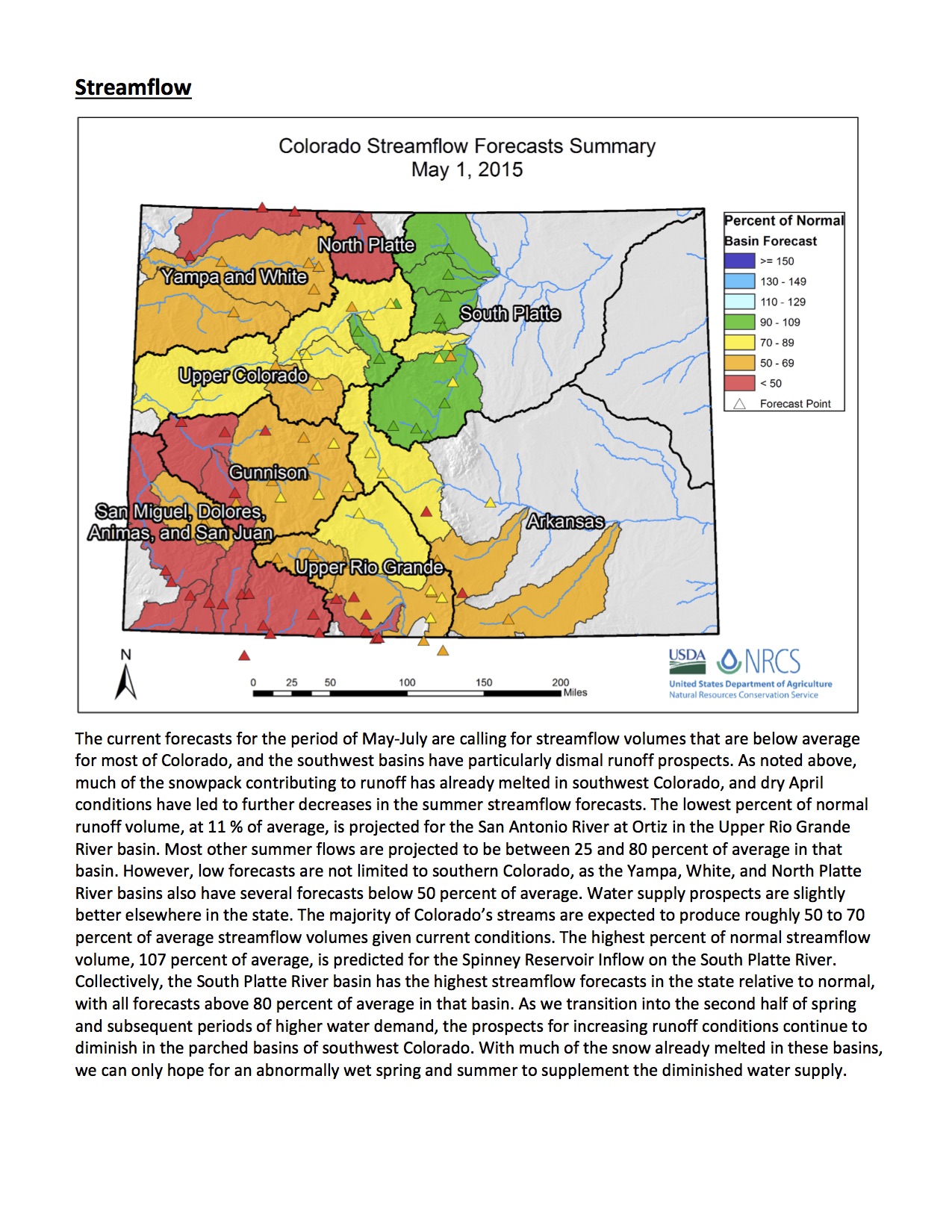
This time of year it makes sense to look at the Natural Resources Conservation Service streamflow forecast issued the first of each month. Below is the May 1 statewide map and narrative. You can click on the thumbnail for a readable view.