


Click the link to read the article on the Climate Becky website (Becky Bolinger):
February 16, 2026
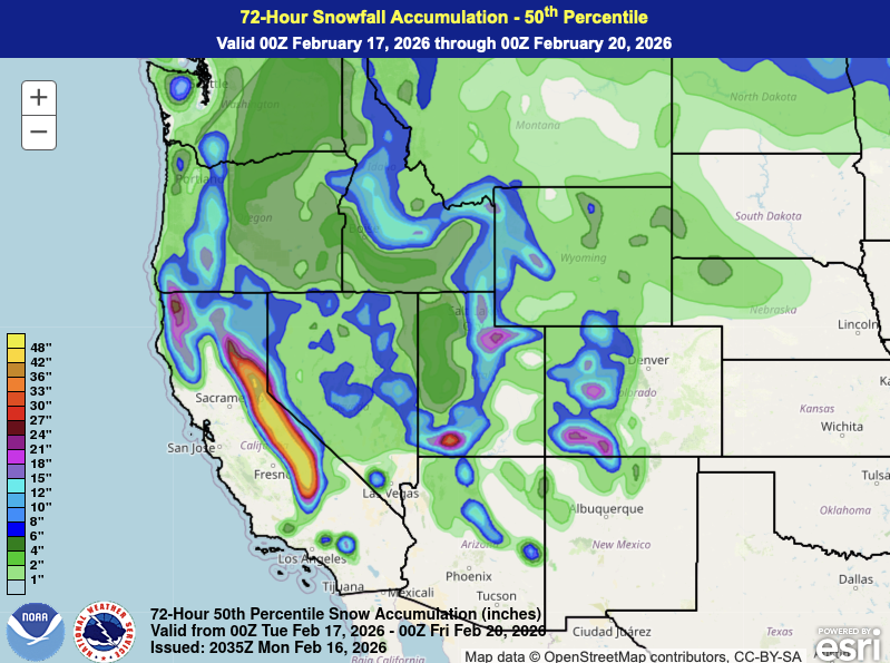
A multi-day storm system is dropping big totals across the western U.S. this week. The Sierra Nevadas are likely to get over 3 feet of new snow, while the Interior Rockies and Cascades will see between 1-2 feet.
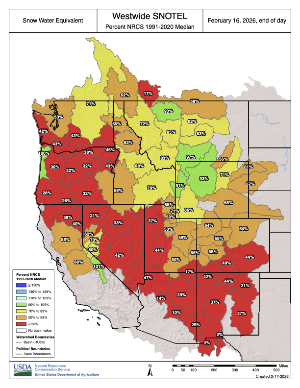
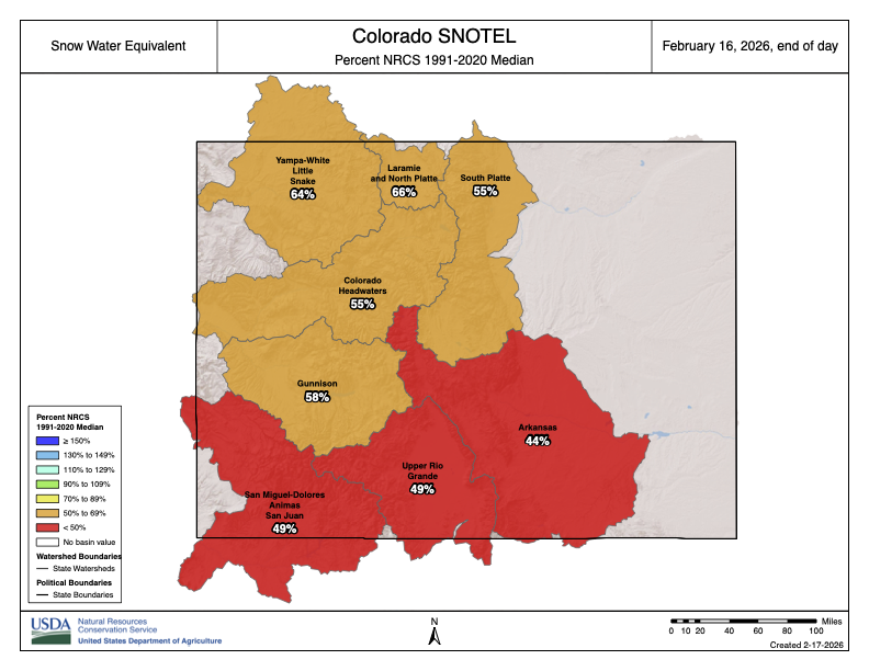
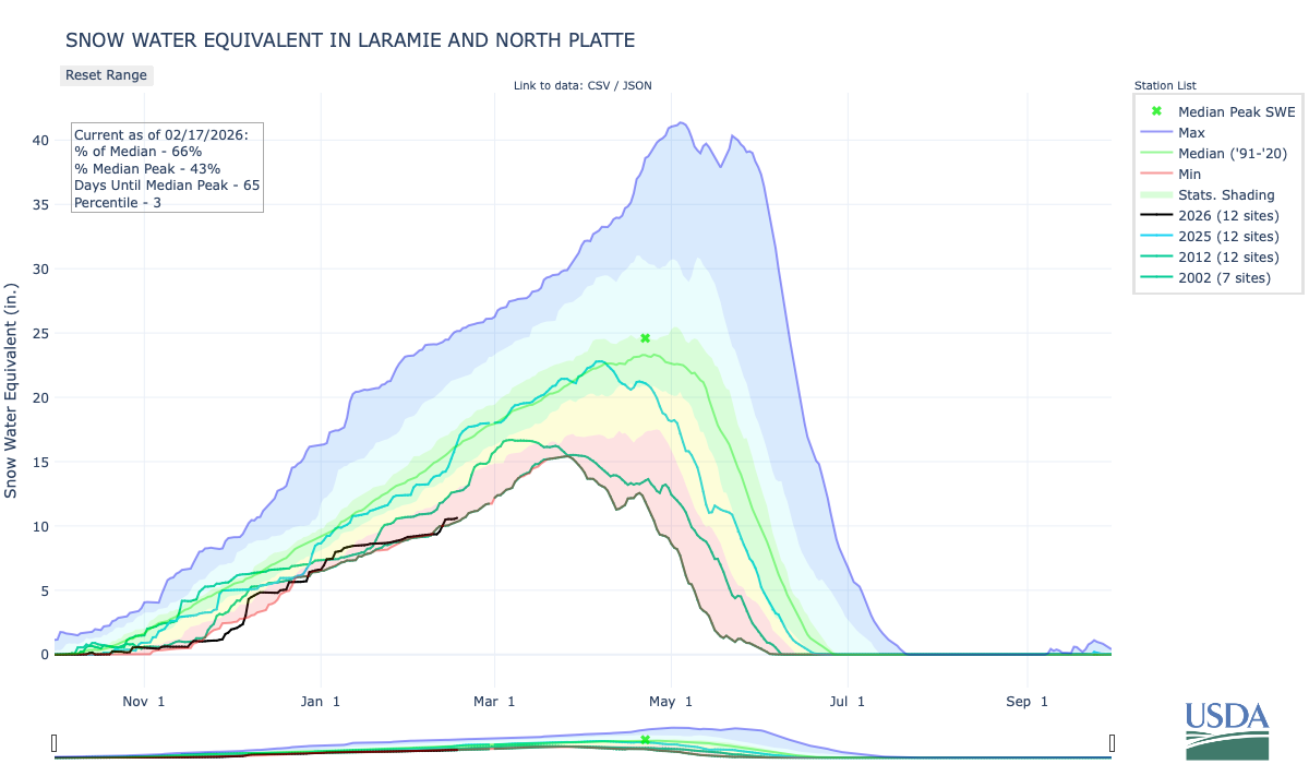
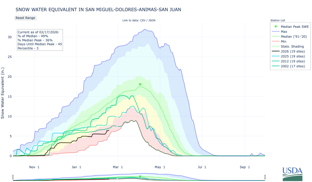
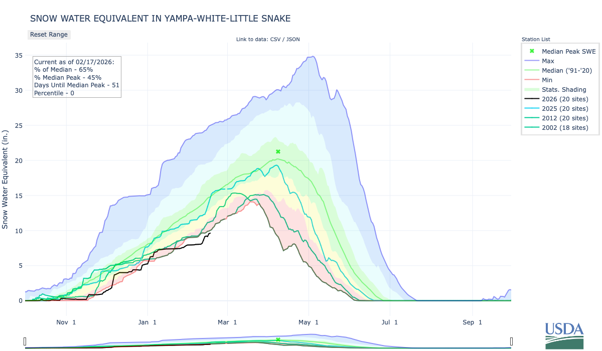
This storm is a welcome relief for many drought-stricken areas, especially given the near record low snowpack so far this season. NRCS snowpack is below to well-below average for most of the west. A startling number of SNOTEL sites in Colorado and Utah are reporting levels below the 5th percentile (meaning they are drier than 95% of historical records for this date).
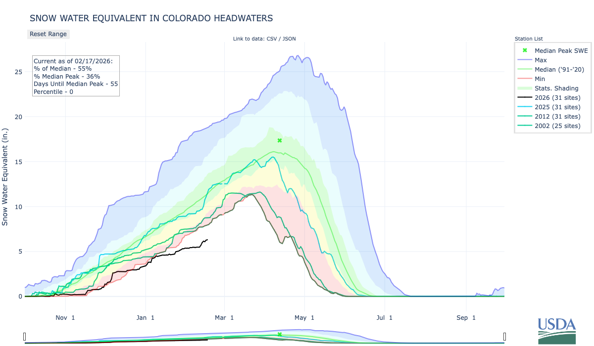
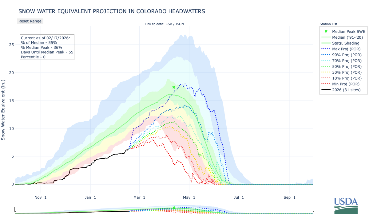
At the Colorado Headwaters, snowpack is record low for this time of year. With only 56 days to go till normal peak snowpack, new accumulations would have to be record-breaking to get the basin to near-average levels. A much below average peak and early melt are much more likely. This has major implications for water supply, agriculture, and wildfire risk across the region.
These concerningly low snowpack accumulations are evident in the Colorado Basin River Forecast Center’s water supply forecasts. The April-July runoff forecast for Lake Powell (the Upper Colorado River Basin’s largest reservoir) is 38% of average, about a 4-million acre-foot deficit.

While we can expect snowpack and forecasted runoff to improve with the current storm, the overall outlook for the season remains concerning. Additional late season snows and colder temperatures could minimize further deteriorating conditions and the risk of large wildfires this summer. Stay tuned over the next couple of months!