John Leary, RiversEdge West, and the White River Partnership

John Leary, Senior Restoration & GIS Project Manager at RiversEdge West.

by Robert Marcos, photojournalist

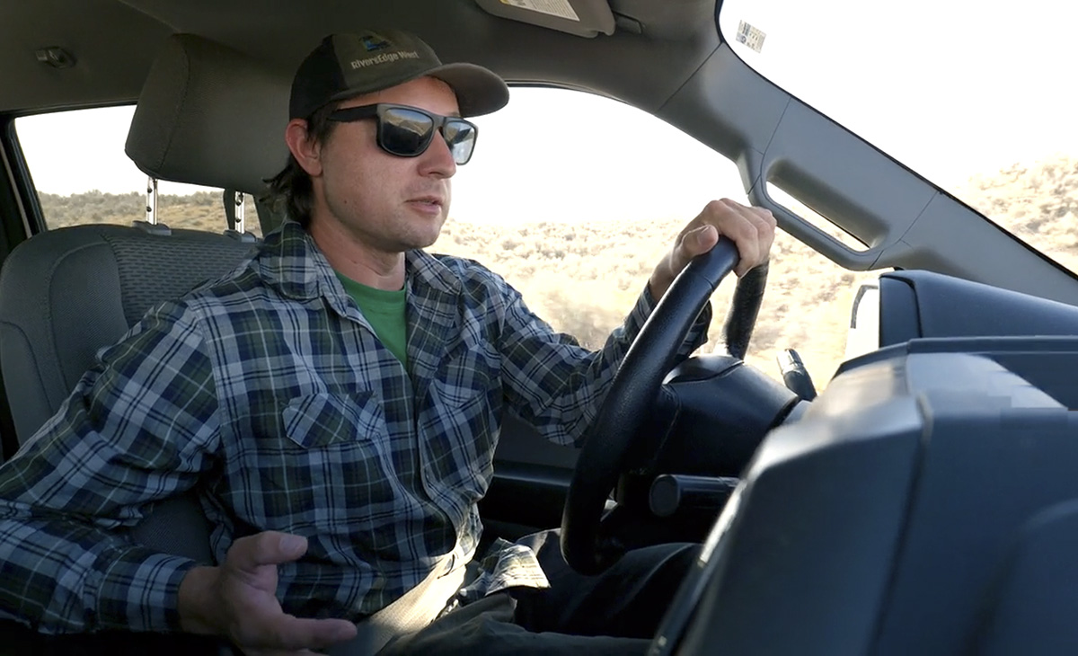
I met John Leary in the parking lot of a Tractor Supply in Rangely Colorado. There was something about the vehicles in that lot that made me think it might not be the best place to park a Toyota Yaris with California plates, so I parked around the corner, then moved my video gear into the back of John’s white utility truck.

John is a Senior Restoration & GIS Project Manager at RiversEdge West, a non-profit organization that’s leading the White River Partnership – a coalition of public, private, and nonprofit entities that are working to conserve and to restore riparian ecosystems along the White River and its tributaries.1

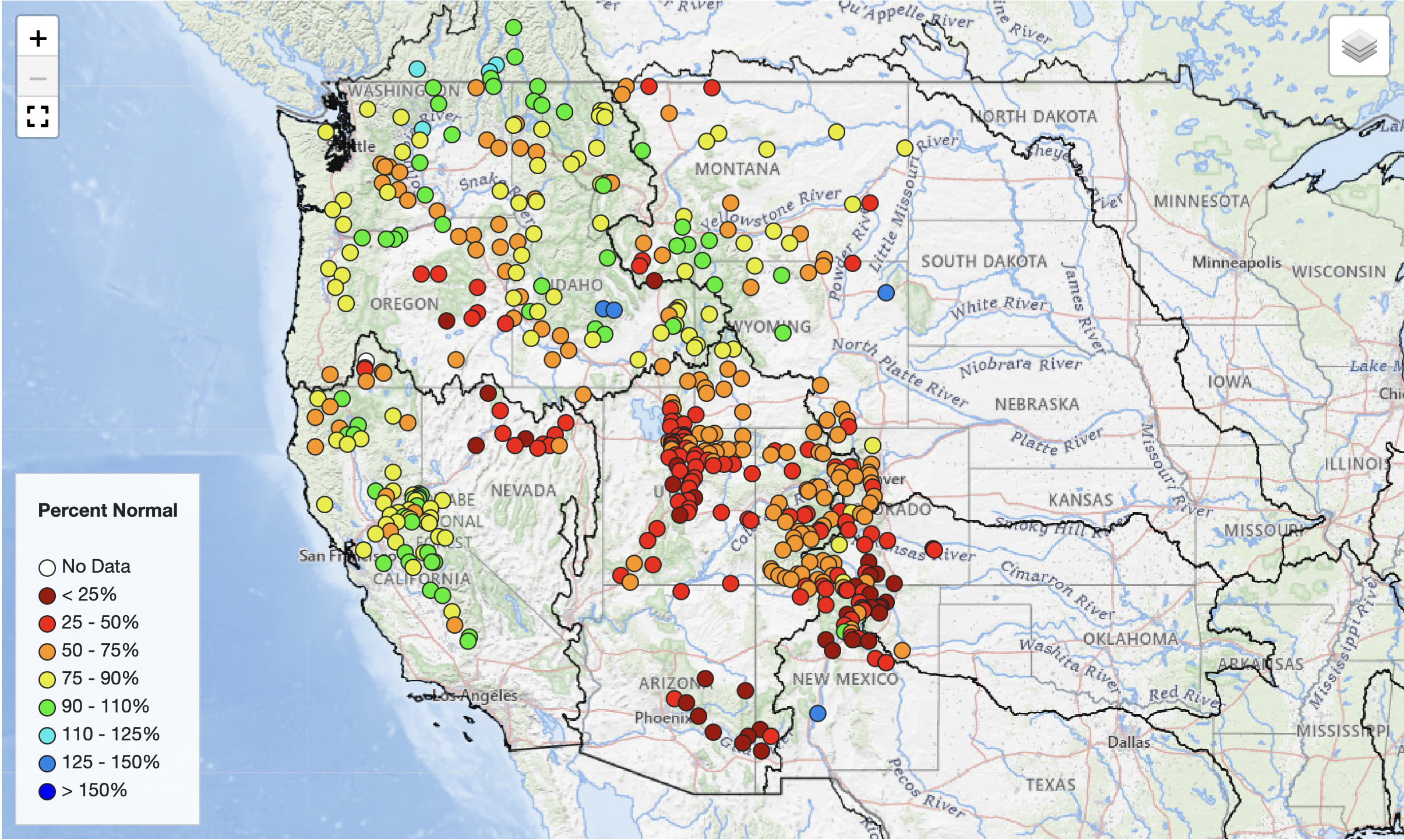
John had volunteered to show me some of the restoration work he and his teams had been doing on the riverbanks west of Rangely. The river had officially been designed as being “over-appropriated” in 2025. When a river is classified as being over-appropriated, it means that the total amount of water legally promised to water rights holders exceeds the supply of water that’s available in the river system at some or all times of the year.2 The designation acts as a formal recognition of water scarcity, where the demand for water is higher than the supply, often exacerbated by drought, climate change, and increased development.

John and his teams were working to reduce the number of invasive tamarisk and Russian olive trees that had crowded the White River’s banks, at the expense of wildlife and native vegetation like willows and cottonwoods. One of the methods John and his teams used was the application of tamarisk beetles. Tamarisk beetles originated in Eurasia – specifically central Asia, China, Kazakhstan, Greece, Uzbekistan, and Tunisia, and were introduced to North America as a biological control agent for invasive tamarisks. The beetles defoliate tamarisk trees by feeding on their leaves and on new growth, until the trees either weaken or die altogether.3

Since their introduction tamarisk beetles have spread across the Western U.S., including Nevada, Utah, Colorado, and even parts of Arizona, and in some areas have resulted in an 80% mortality rate for the invasive tamarisks.4 This removal method sounds better than what I witnessed in California’s Coachella Valley, where miles of tamarisk trees had been intentionally burned by the Southern Pacific Railroad – which planted the trees in the early 1900s to keep sand off their railroad tracks.5

John Leary showing young native cottonwoods that are growing in an area previously occupied by tamarisks. Video link.

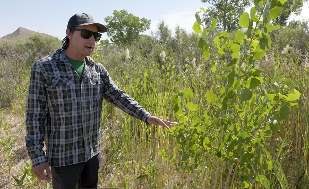
John and I drove west along the river and then finally parked. We hiked to a spot where John showed me a stand of native cottonwoods had sprouted up after his team removed tamarisks which had previously occupied that area. During the interview I filmed with John he repeatedly credited RiversEdge West and their partners in the White River Partnership, which included the Bureau of Land Management, Canyon Country Discovery Center, Colorado Northwestern Community College, Colorado Parks and Wildlife, State of Utah School and Institutional Trust Lands Administration, Town of Meeker, Colorado,Town of Rangely, CO, Uintah County Utah, Utah Conservation Corps, Utah Division of Wildlife Resources, Utah State University, Western Colorado Conservation Corps, the White River Alliance, and most importantly many ranchers and private land owners who supported the restoration efforts being carried out on their own riverfront property.6

February 2026 Most Probable 24-Month Study — USBR #ColoradoRiver #COriver #aridification

Western U.S. streamflow forecast February 14, 2026. Map credit: Colorado Basin River Forecast Center

Click the link to read the release on the USBR website:

Here’s the full package.

February 13, 2026

The operation of Lake Powell and Lake Mead in the February 2026 24-Month Study is pursuant to the December 2007 Record of Decision on Colorado River Interim Guidelines for Lower Basin Shortages and the Coordinated Operations of Lake Powell and Lake Mead (Interim Guidelines),1 the Supplemental Environmental Impact Statement for Near-term Colorado River Operations Record of Decision (2024 Interim Guidelines SEIS ROD),2 and reflects the 2026 Annual Operating Plan (AOP). Pursuant to the Interim Guidelines, the August 2025 24-Month Study projections of the January 1, 2026, system storage and reservoir water surface elevations set the operational tier for the coordinated operation of Lake Powell and Lake Mead during 2026.

The August 2025 24-Month Study projected the January 1, 2026, Lake Powell elevation to be less than 3,575 feet and at or above 3,525 feet and the Lake Mead elevation to be at or above 1,025 feet. Consistent with Section 6.C.1 of the Interim Guidelines, and Section 6.E of the 2024 Interim Guidelines SEIS ROD, the operational tier for Lake Powell in water year (WY) 2026 is the Mid-Elevation Release Tier and the water year release volume from Lake Powell is projected to be 7.48 million acre feet (maf). To protect a target elevation at Lake Powell of 3,525 feet, adjustments to Glen Canyon Dam monthly volume releases have been incorporated into the December 2025 24-Month Study and include an adjusted monthly

release volume pattern for Glen Canyon Dam that will hold back a total of 0.598 maf in Lake Powell from December 2025 through April 2026. 3 That same amount of water (0.598 maf) will be released later in the water year. Given the hydrologic variability of the Colorado River System, the actual WY 2026 operations, and being consistent with Section 6.E of the 2024 Interim Guidelines SEIS ROD, the projected release from Lake Powell in WY 2026 may be less than 7.48 maf. Consistent with Section 6.E of the 2024 Interim Guidelines SEIS ROD, Reclamation will consider all tools that are available during the interim period to avoid Lake Powell elevation declining below 3,500 feet. The August 2025 24-Month Study projected the January 1, 2026, Lake Mead elevation to be below 1,075 feet and above 1,050 feet. Consistent with Section 2.D.1 of the Interim Guidelines, a Shortage Condition consistent with Section 2.D.1.a will govern the operation of Lake Mead for calendar year (CY) 2026. In addition, Section III.B of Exhibit 1 to the Lower Basin Drought Contingency Plan (DCP) Agreement will also govern the operation of Lake Mead for CY 2026. Lower Basin projections for Lake Mead take into consideration additional conservation efforts under the LC Conservation Program.

Current runoff projections into Lake Powell are provided by the National Weather Service’s Colorado Basin River Forecast Center. The observed unregulated inflow into Lake Powell for the month of January was 0.265 maf or 79% of the 30-year average from 1991 to 2020. The February 2026 unregulated inflow forecast for Lake Powell is 0.260 maf or 71% of the 30-year average. The 2026 April through July unregulated inflow forecast for Lake Powell is 2.40 maf or 38% of average. The WY 2026 unregulated inflow forecast for Lake Powell is 5.02 maf or 52% of average.

Due to changing Lake Mead elevations, Hoover’s generator capacity is adjusted based on estimated effective capacity and plant availability. The estimated effective capacity is based on projected Lake Mead elevations. Unit capacity tests will be performed as the lake elevation changes. This study reflects these changes in the projections.

For questions on Upper Colorado River Basin (UCB) reservoir operations, please contact Alex Pivarnik, the UCB River Operations Group Supervisor at apivarnik@usbr.gov. For questions on Lower Colorado River Basin (LCB) reservoir operations, please contact Noe Santos, the LCB River Operations Manager at nsantos@usbr.gov.

Hoover, Davis, and Parker Dam historical gross energy figures come from Power, Operations, and Maintenance reports provided by the Lower Colorado Region’s Power Office,

Bureau of Reclamation, Boulder City, Nevada. Questions regarding these historical energy numbers can be directed to Rebecca Rogers (rrogers@usbr.gov) or Kyra Cubi(kcubi@usbr.gov).


1 For modeling purposes, simulated years beyond 2026 assume a continuation of the 2007 Interim Guidelines including the 2024 Supplement to the 2007 Interim Guidelines (no additional SEIS conservation is assumed to occur after 2026), the 2019 Colorado River Basin Drought Contingency Plans, and Minute 323 including the Binational Water Scarcity Contingency Plan. With the exception of certain provisions related to Intentionally Created Surplus recovery and Upper Basin demand management, operations under these agreements are in effect through 2026. Reclamation initiated the process to develop operations for post-2026 in June 2023, and the modeling assumptions described here are subject to change.

2 2024 Interim Guidelines SEIS ROD is available online at: https://www.usbr.gov/ColoradoRiverBasin/documents/NearTermColoradoRiverOperations/20240507-Near-termColoradoRiverOperations-SEIS-RecordofDecision-signed_508.pdf.

3 Consistent with the Drought Response Operating Agreement and Framework.

References

The 2026 Annual Operating Plan is available online at: https://www.usbr.gov/lc/region/g4000/aop/AOP26.pdf.

The Interim Guidelines are available online at: https://www.usbr.gov/lc/region/programs/strategies/RecordofDecision.pdf.

The Colorado River Drought Contingency Plans are available online at: https://www.usbr.gov/ColoradoRiverBasin/dcp/finaldocs.html.

The Upper Basin Hydrology Summary is available online at: https://www.usbr.gov/uc/water/crsp/studies/24Month_02_ucb.pdf.

Information on the LCB Conservation Program is available online at: https://www.usbr.gov/lc/LCBConservation.html.

Information on the 2024 Interim Guidelines SEIS ROD is available online at: https://www.usbr.gov/ColoradoRiverBasin/interimguidelines/seis/index.html.

Information on reservoir inflow observations and forecasts is available online at: https://www.cbrfc.noaa.gov/product/hydrofcst/hydrofcst.php

ten tribes
Graphic via Holly McClelland/High Country News.