A different kind of green — Marvin Nash (https://www.linkedin.com/in/marvin-nash/)

Credit: Marvin Nash

Click the link to read Marvin Nash’s post on LinkedIn:

Social media is one of the few communication platforms left that allows us to publish true, unfiltered scientific data regarding the success of refining industrial byproduct water—more commonly known as produced water.

Lately, we are seeing more positive coverage from both local and major media outlets. But unfortunately, there is always a “but.”

We cannot eliminate the critics, but we can change the narrative.

For too long, the industry’s response to passion-driven, negative articles—sprinkled with photos of salt on the ground, contaminated streams, or leaking orphan wells—has been to publish another defensive white paper.

It is not moving the needle fast enough.

While political adversaries battle, and NGOs clash with corporate interests, regulatory permits sit delayed. Meanwhile, our biggest collective challenge is being ignored: Stewardship.

We need a bridge, not another debate.

There are currently two US-issued patents that provide a proven, patented process from acquisition to destination for putting industrial byproduct water to beneficial use.

It faces resistance from both sides:

NGOs often push back because this patent provides a viable, structured pathway that actually supports energy production through strict guardrails.

Some in the energy industry hesitate due to licensing agreements or fees.

But let’s remember: innovation and entrepreneurship are what made America what it is today. It isn’t for the faint of heart. Maybe we weren’t missing the desire to do what’s right—maybe we were just missing the link to bring us together.

I often think of Keith Stelter’s passion to clean the roads (now the Stelter Initiative). Let’s put our call to Stewardship 1st . Let’s define Fit For Purpose 2100, and as I was recently challenged to add: Fit for YOUR Purpose. You now have a new tool in the toolbox besides a white paper. You have a proven process.

What do you have to lose by trying it? #Fit For Purpose 2100

#Sustainability #ProducedWater #WaterStewardship #EnergyInnovation #EnvironmentalSolutions #CleanTech

When people have less water, they seem to use less water — John Fleck (InkStain.net)

Click the link to read the article on the Ink Stain website (John Fleck):

October 13, 2026

Green acreage in non-Pueblo MRGCD irrigable parcels, summer 2026

Area of green land in the non-Pueblo Middle Rio Grande Conservancy District, summers 2017–2026. Bars give the area of 10 m Sentinel-2 pixels with median June–August NDVI ? 0.45, summed over the 10,551 parcels of the district’s 2021 irrigation survey (58,145 acres; right axis expresses area as a percentage of that total). Error bars show the same count at NDVI cuts of 0.50 (lower) and 0.40 (upper); they express sensitivity to the cut, not a statistical interval. The parcel boundaries are fixed at their 2021 extent in every year, so each bar is the green area within those parcels, not a survey of that summer. *2021 is the year the cut was calibrated against the survey’s recorded irrigation labels. NDVI cannot distinguish irrigation by canal, well or municipal supply from shallow groundwater or rainfall. 2026 is highlighted (17.3 thousand acres; 13.9–21.2 across the cut range, against 36.2 thousand acres in 2017). Data: Copernicus Sentinel-2 surface reflectance (ESA), scene-classification cloud mask, summer median composite; parcels from the MRGCD 2021 ISOlog. Methodology caption written by Claude.

2026 provided a remarkable convergence of a natural experiment on New Mexico’s Middle Rio Grande (a river and therefore irrigation system with little or no water) and the rapid advancement of what I’ve come to think of as “Curiosity Exploder Tools” (CETs, also more commonly known as LLMs or AI).

We’ve got European Space Agency satellites flying overhead every five-ish days hoovering up data, Google Earth Engine processing power in “the cloud,” and now tools like Codex and Claude Code to handle the fiddly bits of code writing, driving down the transaction costs of asking a question by orders of magnitude.

So I wondered: With little or no Middle Rio Grande Conservancy District ditch water for non-Prior and Paramount Pueblo land this year, what happened? As Robin Sloan said, “‘Ask for what you want’ is a key skill for the 21st century.”

We don’t have meters on irrigated land in the Middle Rio Grande, so remote sensing is the best we can do.

This uses MRGCD’s spatial mapping of irrigated parcels, with Normalized Difference Vegetation Index (NDVI), a measure of plant greenness, using observations from the European Space Agency’s Sentinel-2 satellites. 10 meter resolution roughly every five days. “Green” here is not an either/or, it’s a more-or-less thing. I chose an NDVI cutoff based on a reading of 0.45, benchmarked against an MRGCD dataset from 2021 of parcels either irrigated or fallowed. The cutoff is arbitrary (but sane based on my 2021 control set), the relative scale is what matters.

The satellite can’t tell us the difference among ditch water, wells (both irrigation and domestic), municipal water, and trees with their roots in the shallow aquifer. But as I wrote with a group of colleagues earlier this year, “Agencies don’t use water, people do.” All four can be present on these parcels. I checked precipitation, it’s not throwing off the numbers.

I’ve now got a stunning set of maps of this on my hard drive – MRGCD non-Pueblo land by division and sub-section, year by year – a record of how people are greening the valley ditch by ditch and parcel by parcel. As Robin Sloan said, ask for what you want. Curiosity Exploder Tools.

However you interpret it, the satellite data suggests a significant reduction in 2026 consumptive use of water on these parcels, a remarkable water conservation success story, if you will.

n.b. “Study” design by John Fleck in conversation with Claude Code, data processing pipeline by Claude Code with Google Earth Engine analysis.

Map of the Rio Grande watershed. Graphic credit: WikiMedia

Notes from the Road: Lees Ferry in the wind and the rain: And some images for Indigenous Peoples Day — Jonathan P. Thompson (LandDesk.org)

Click the link to read the article on The Land Desk website (Jonathan P. Thompson):

October 12, 2026

Note: I started writing this as the intro to today’s Newswire. Then it occurred to me that today is Indigenous Peoples Day, and some other holiday for certain cultures, and folks probably aren’t going to be into reading the news. So here’s a little impression of the current storm soaking parts of the Southwest, and some photos.

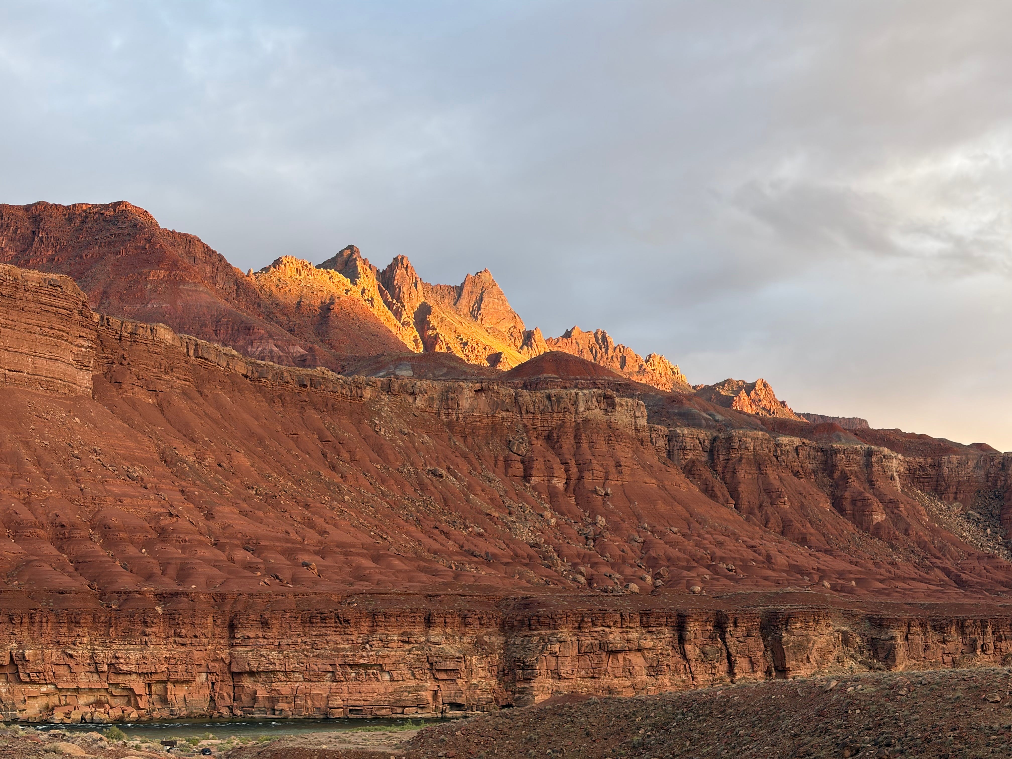
The rain finally eased up, giving way to magnificent evening light. Jonathan P. Thompson photo.

10/11/2026

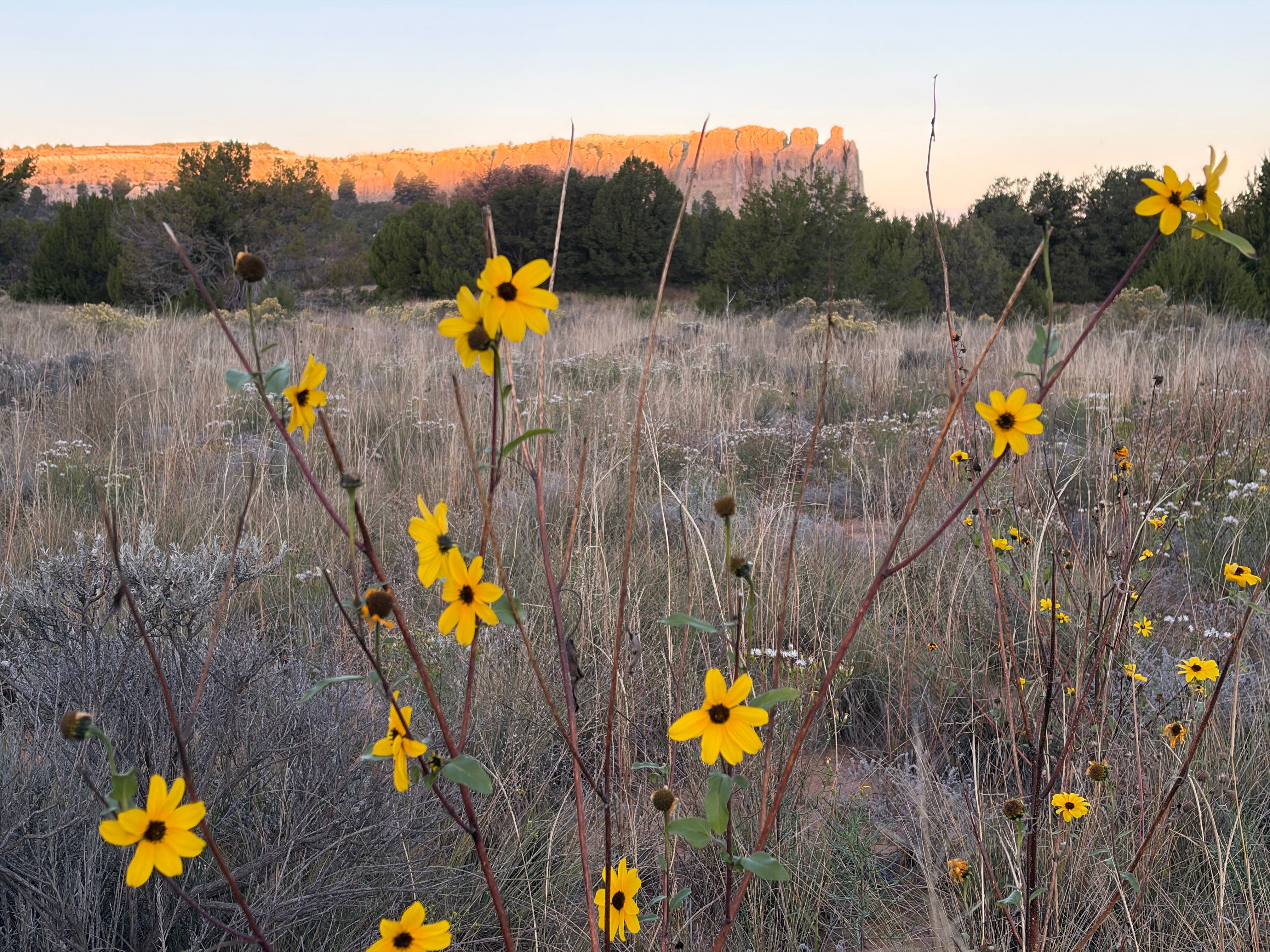
I woke up early this morning, before dawn, in my little tent in El Morro National Monument in west-central New Mexico. The skies, frogbelly gray the day before, had cleared up, the moon was new, and the stars and the milky way sprawled across the blue incomprehensibly. I crawled out before sunrise to see first light falling on the big bleached sandstone fin of A’ts’ina, aka El Morro, delighting as sunflowers and winterfat and daisies danced in the warm breeze.

Sunflowers and El Moro October 11, 2026. Photo credit: Jonathan P. Thompson

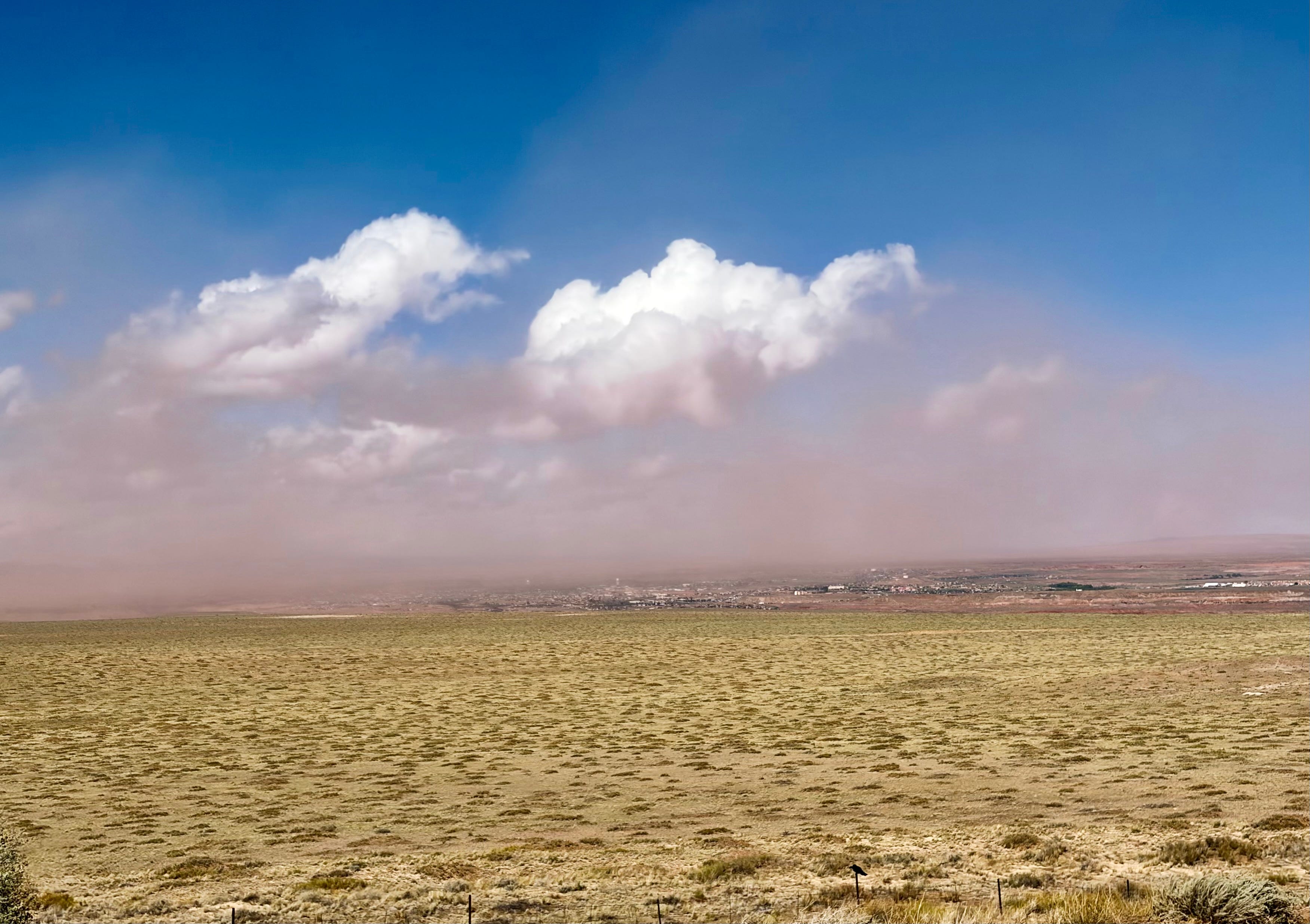
Then, because I’m not the sharpest tool in the shed, I broke camp, loaded up El Burro Blanco, and headed west about five hours, across the Navajo Nation and the Hopi Mesas, through a quasi-haboob in Tuba City, to Lees Ferry — and right into the brunt of the remnants of Tropical Storm Rachel. Now it’s Sunday evening and I’m sitting in the cab of the truck, which shudders with each forceful gust of wind, waiting for the rain to stop long enough to set up my tent, which of course won’t do much good if it is shredded by another one of these 50-mph gales.

Tuba City quasi-haboob October 11, 2026. Jonathan P. Thompson photo.

Yeah, the Southwest is getting battered again. So far, however, it hasn’t brought the expected abundance of moisture to Lees Ferry, which appears to be on the eastern fringe of the storm’s main path, which is veering diagonally in a northeasterly direction from San Diego. Presumably it’s raining harder to the west of here, in the Las Vegas-St. George area, and also north of here: The Moab 240 ultramarathon was cancelled Sunday due to heavy rain and flash floods, and about 70 runners and volunteers were stranded at an aid station near Bridger Jack Mesa and had to be evacuated.

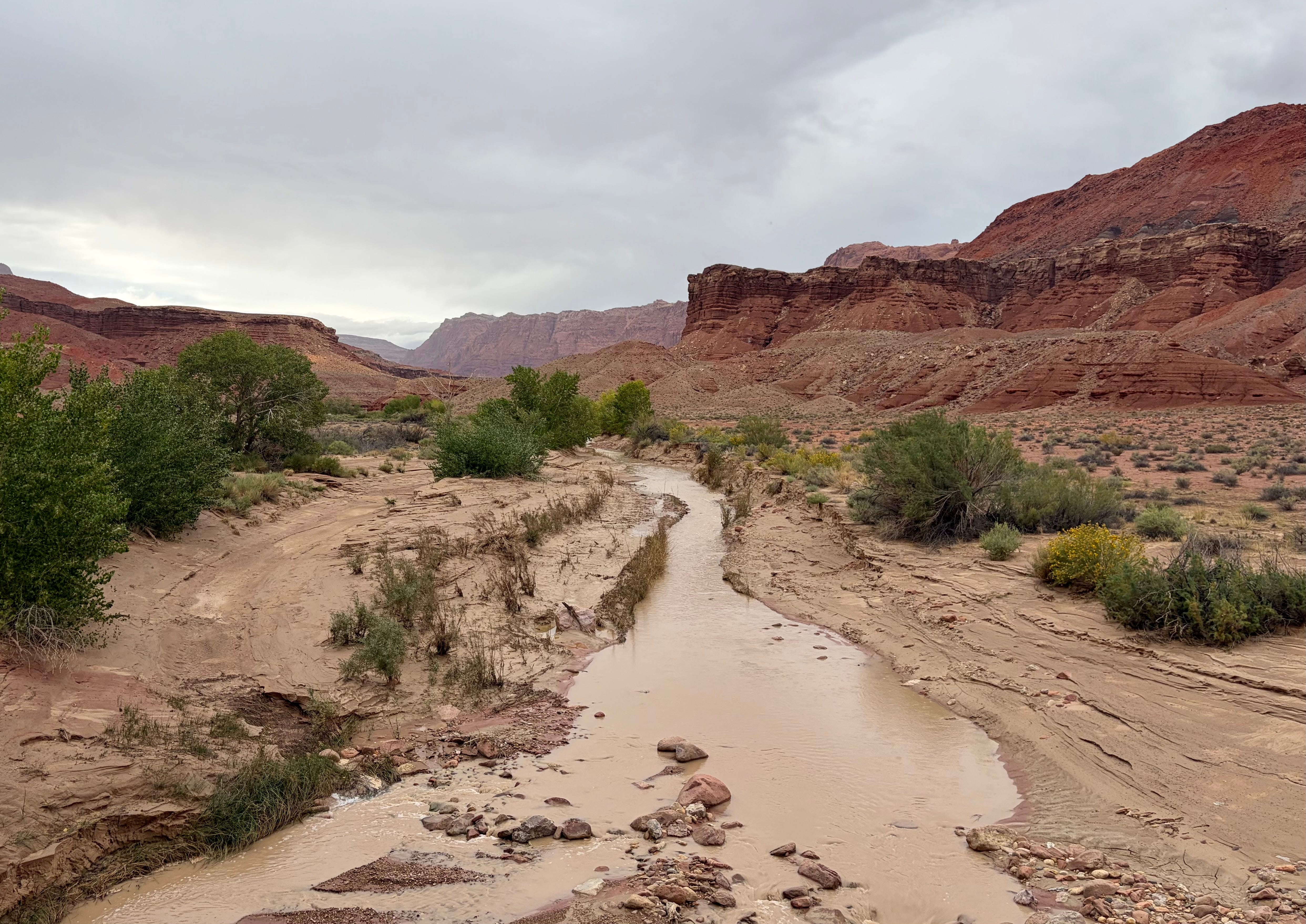
The Paria River at about 14 cfs on Sunday evening October 11, 2026. By the next morning, it would be almost 500 cfs. Jonathan P. Thompson photo.

The storm is not over, by any means. It’s supposed to keep up through Wednesday, at least, and may even bring substantial snow to the high country.

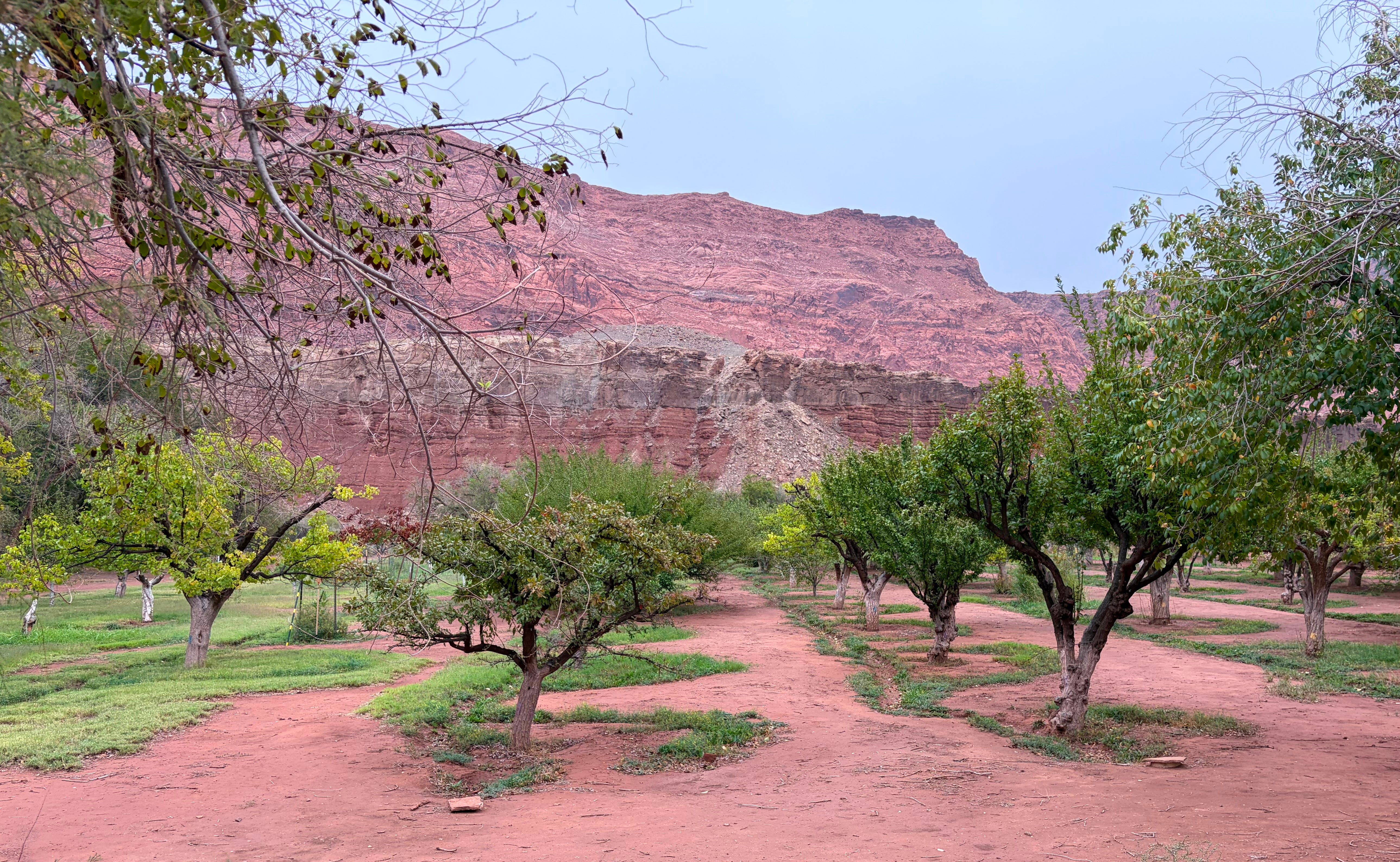
Fruit orchard at the Lonely Dell Ranch alongside the Paria River at Lees Ferry October 11, 2026. The pears are ready to pick. Jonathan P. Thompson photo.

10/12/2026

The rain stopped long enough for me to set up the tent, though the wind continued howling into the night. But when I awoke around 2 a.m., the air was still, the only noise the gurgle of the Colorado River, and the stars were everywhere.

This morning’s flash flood alert has yet to materialize, but it has been raining on and off for a couple of hours, and the Paria River is substantially larger than it was yesterday, growing from about 20 cubic feet per second to nearly 500 cfs overnight. If I were to wait around, I might see it rage even more, since the USGS streamflow gage at Kanab is recording 2,000 cfs. But that might be a pretty long wait, and I want to go up to Page and get a gander at Glen Canyon Dam and the great big Lake Powell bathtub ring.

For more on what to call Lees Ferry … :


To Lees or not to Lee’s; Mike Lee goes after roadless rule; Trump steps up oil and gas leasing — Jonathan P. Thompson


A’ts’ina, or Inscription Rock, at El Morro National Monument. Jonathan P. Thompson photo.
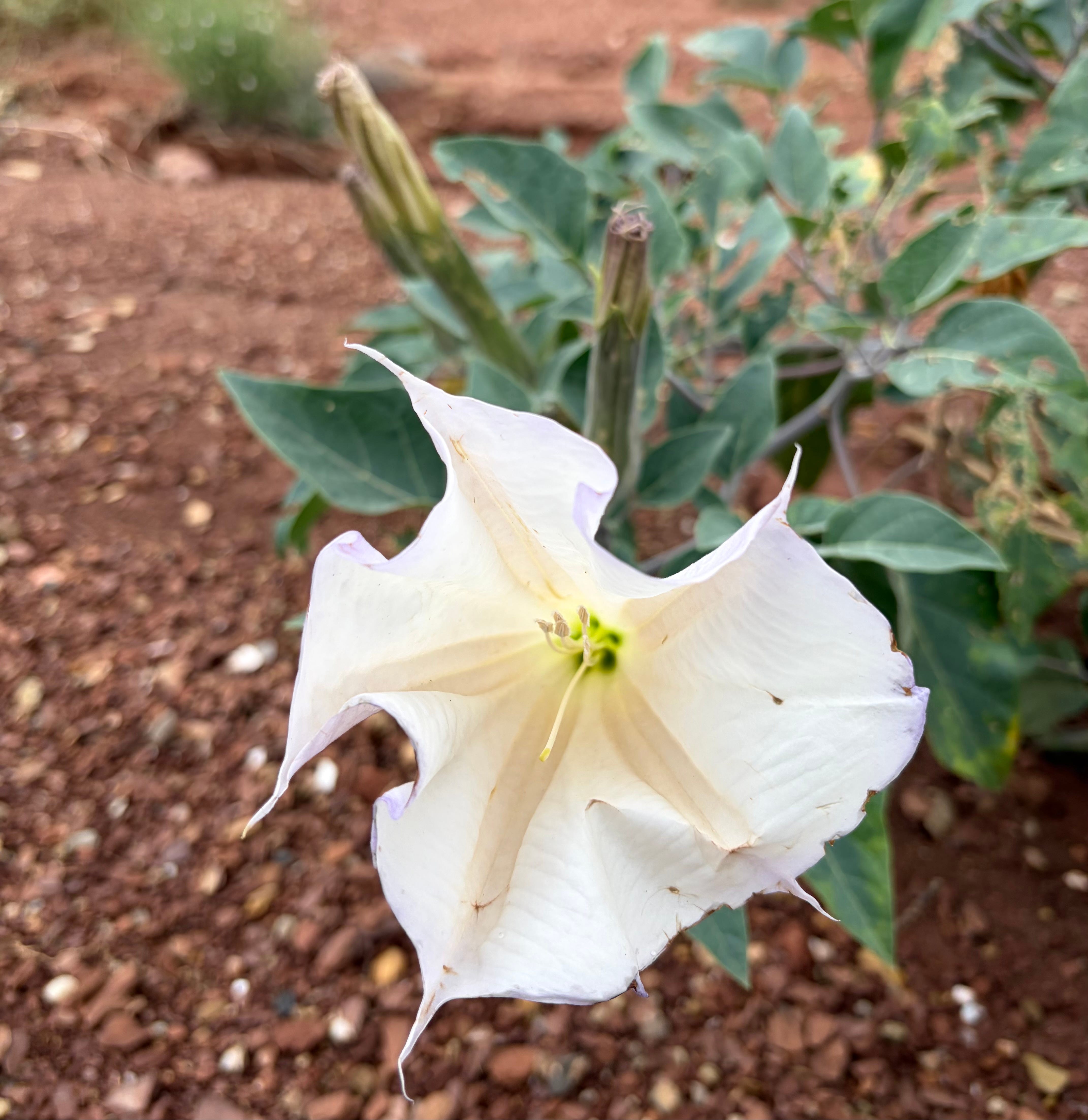
The datura are blooming everywhere, and going to seed, all at the same time. Jonathan P. Thompson photo.

Mrs. Gulch’s landscape October 15, 2026

Mrs. Gulch’s landscape October 15, 2026.
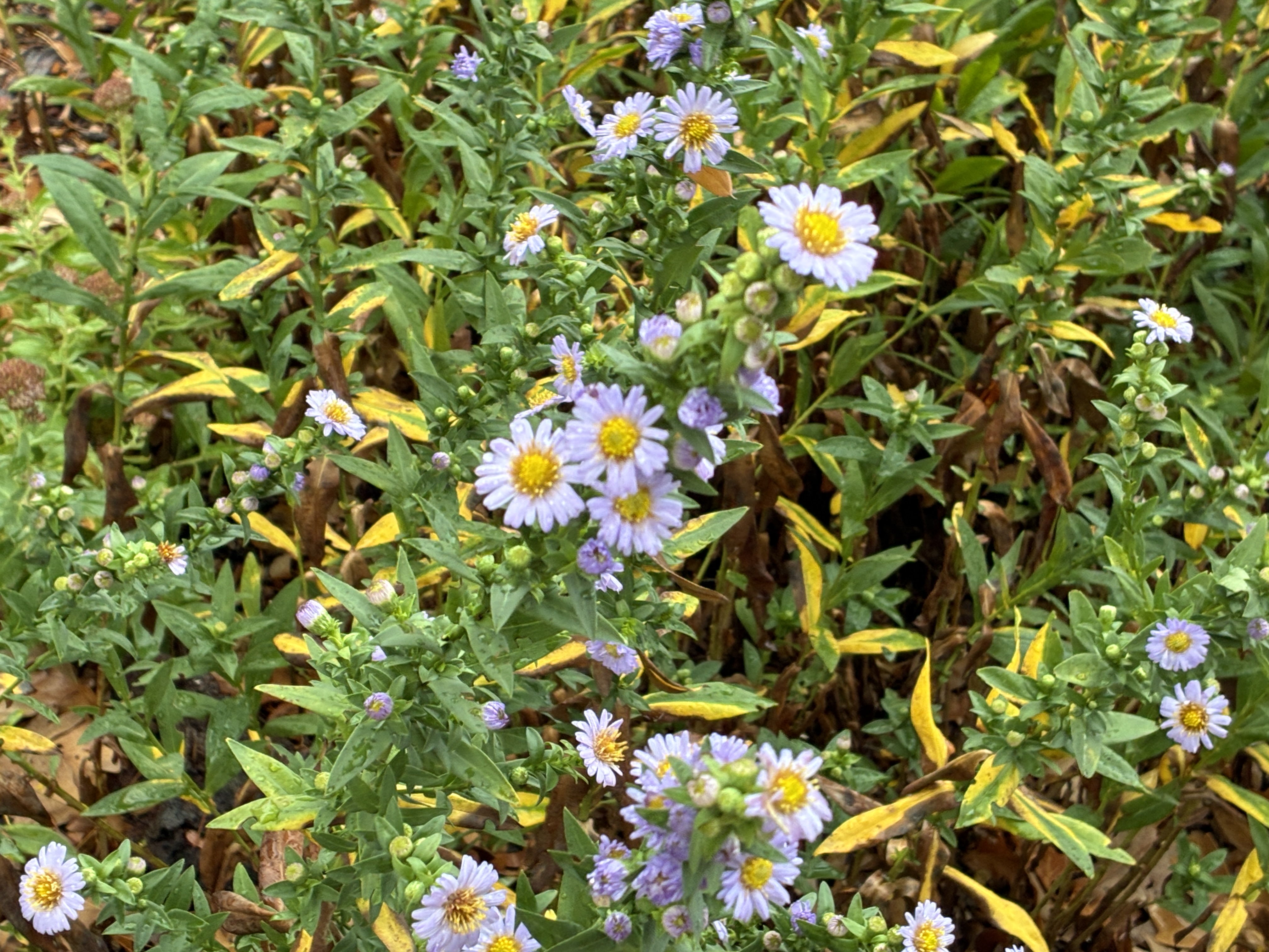
Late-blooming asters in Mrs. Gulch’s landscape October 15, 2026.

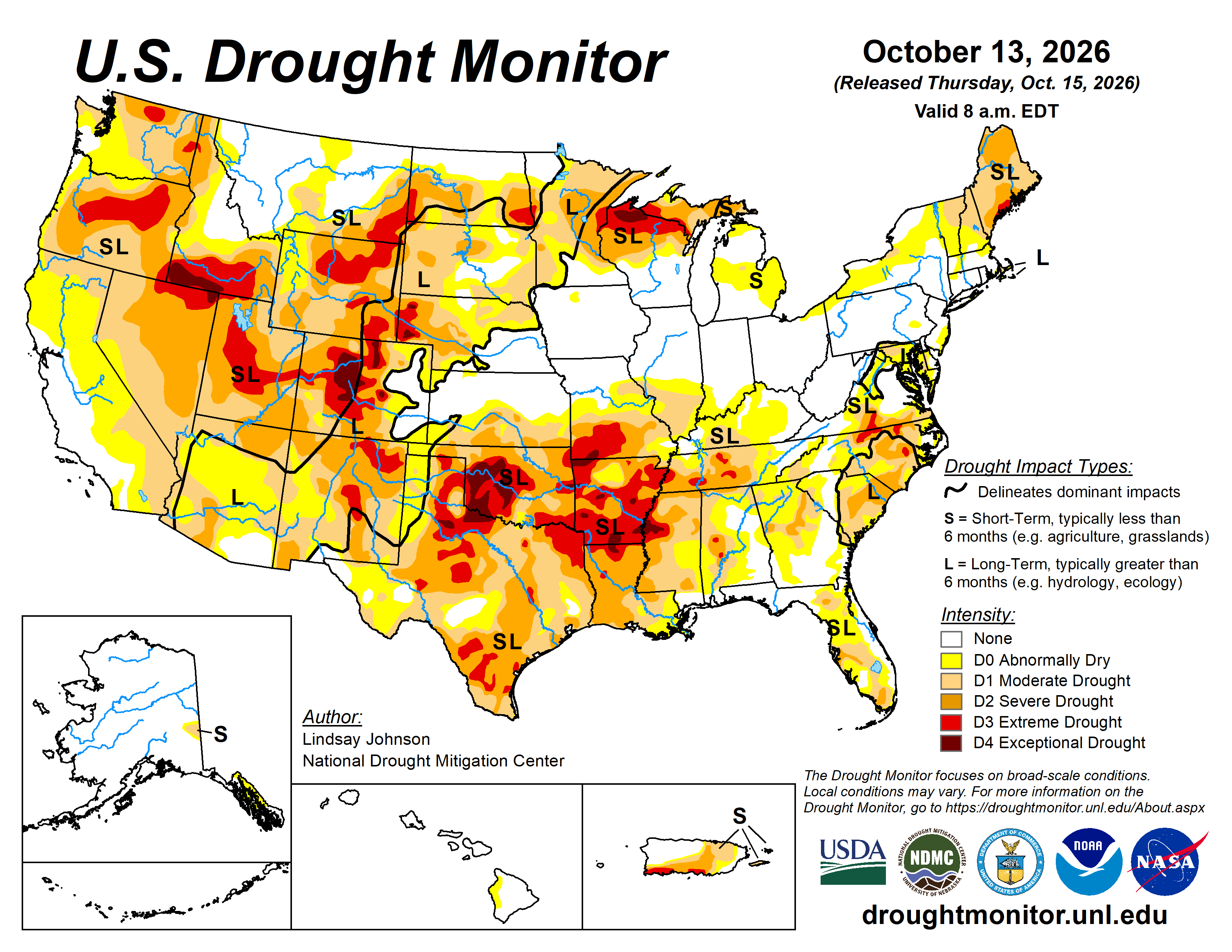
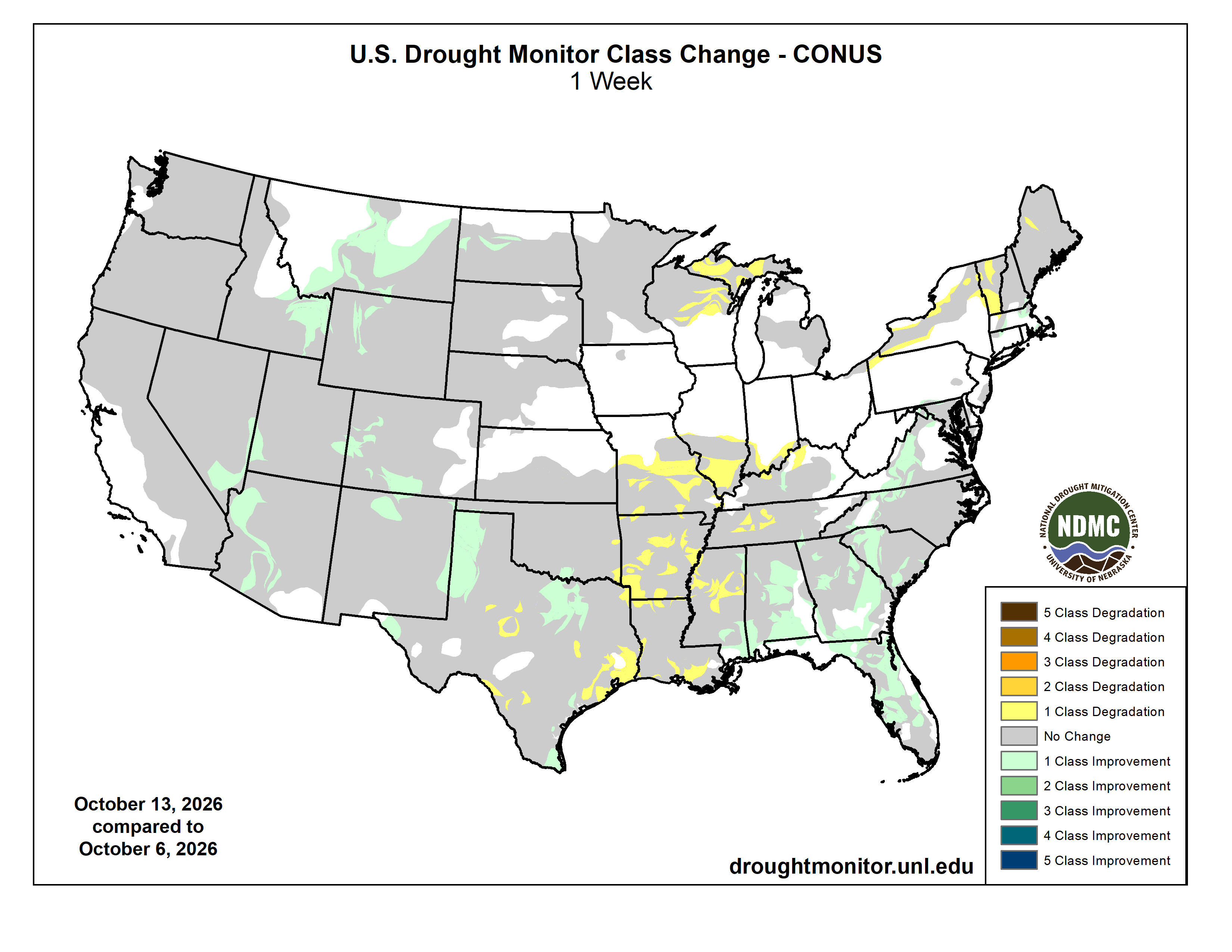
#Drought news October 15, 2026: Drought improvements were noted across portions of #Arizona, #NewMexico, #Utah and the Rocky Mountains of #Colorado and #Wyoming

Click on a thumbnail graphic to view a gallery of drought data from the US Drought Monitor website.

Click the link to go to the US Drought Monitor website. Here’s an excerpt:

This Week’s Drought Summary

Drought conditions changed considerably across the U.S. this week. Heavy rain and early-season snow brought relief to parts of the West and Southeast, while unusually warm and dry weather continued to worsen drought across portions of the Midwest and South. In the West, a strong storm system combined with moisture from the remains of Hurricane Rachel, bringing rain and mountain snow to parts of the region. Snowfall totals reached 11 inches near Philipsburg, Montana, and nearly 10 inches at Great Falls, Montana, while rain and snow also affected portions of Idaho, Wyoming and Utah. Additional precipitation across the Southwest helped improve drought conditions in parts of Arizona, New Mexico and the Rockies. Despite these improvements, significant drought persisted across portions of the Great Basin and Southwest.

Farther east, temperatures averaged 8 to 16 degrees above normal across portions of the Plains and Midwest. Combined with limited rainfall, the unusual warmth contributed to worsening drought across Wisconsin and the Upper Peninsula of Michigan. A broader area of drought deterioration extended from southern Illinois and Indiana through Missouri and Kentucky into the lower Mississippi Valley and Tennessee. Some of the most significant deteriorations occurred across southwestern Missouri, southern Arkansas and northern Louisiana, where persistent warmth and rainfall deficits continued to intensify drought conditions. In contrast, recent rainfall supported localized improvements across western and northern Texas, including portions of the Texas Panhandle.

The Southeast experienced some of the week’s most widespread improvements as Hurricane Isaias brought heavy rainfall to the region, with totals exceeding 12 inches in parts of the Florida Panhandle and southern Alabama. Although the rainfall caused localized flooding, it also helped ease drought from Virginia through the Carolinas, Georgia, Alabama and Florida, with some locations improving by more than one drought category. In the Northeast, drought changes were mixed and largely depended on where precipitation fell. Areas receiving beneficial rainfall experienced localized improvements, while drought persisted or worsened in locations that missed the heavier precipitation…

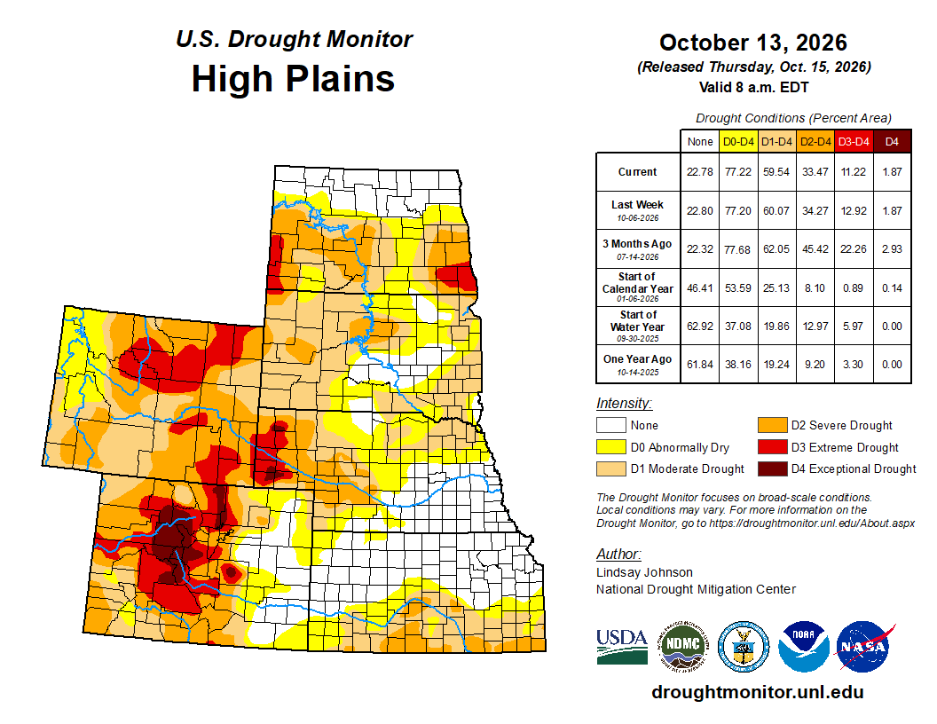
High Plains

Drought conditions remained largely unchanged across the High Plains, with localized improvements across portions of North Dakota, Wyoming and Colorado and limited deterioration in Kansas. Temperatures averaged 8 to 16 degrees above normal, with locally greater departures. The unusually warm conditions increased evaporative demand and contributed to continued moisture losses, particularly where precipitation was limited. Most of the Dakotas, Nebraska and Kansas received little precipitation during the week, with widespread areas recording less than 25 percent of normal. Localized precipitation occurred across portions of Wyoming and Colorado, but amounts were generally insufficient to produce widespread drought relief.

Localized improvements in North Dakota were supported by precipitation received during the current and preceding weeks, which helped ease short- and mid-term moisture deficits. Elsewhere, drought conditions remained largely unchanged across South Dakota, Nebraska, Kansas and much of the eastern plains of Wyoming and Colorado, where a lack of meaningful precipitation and lingering longer-term deficits supported existing classifications. In Kansas, localized degradations occurred across eastern border with Missouri, where continued dryness and above-normal temperatures contributed to worsening short-term conditions. Despite these changes, significant drought persisted across portions of the western High Plains, particularly in Wyoming and Colorado, where longer-term precipitation deficits and soil moisture shortages continued to limit recovery…

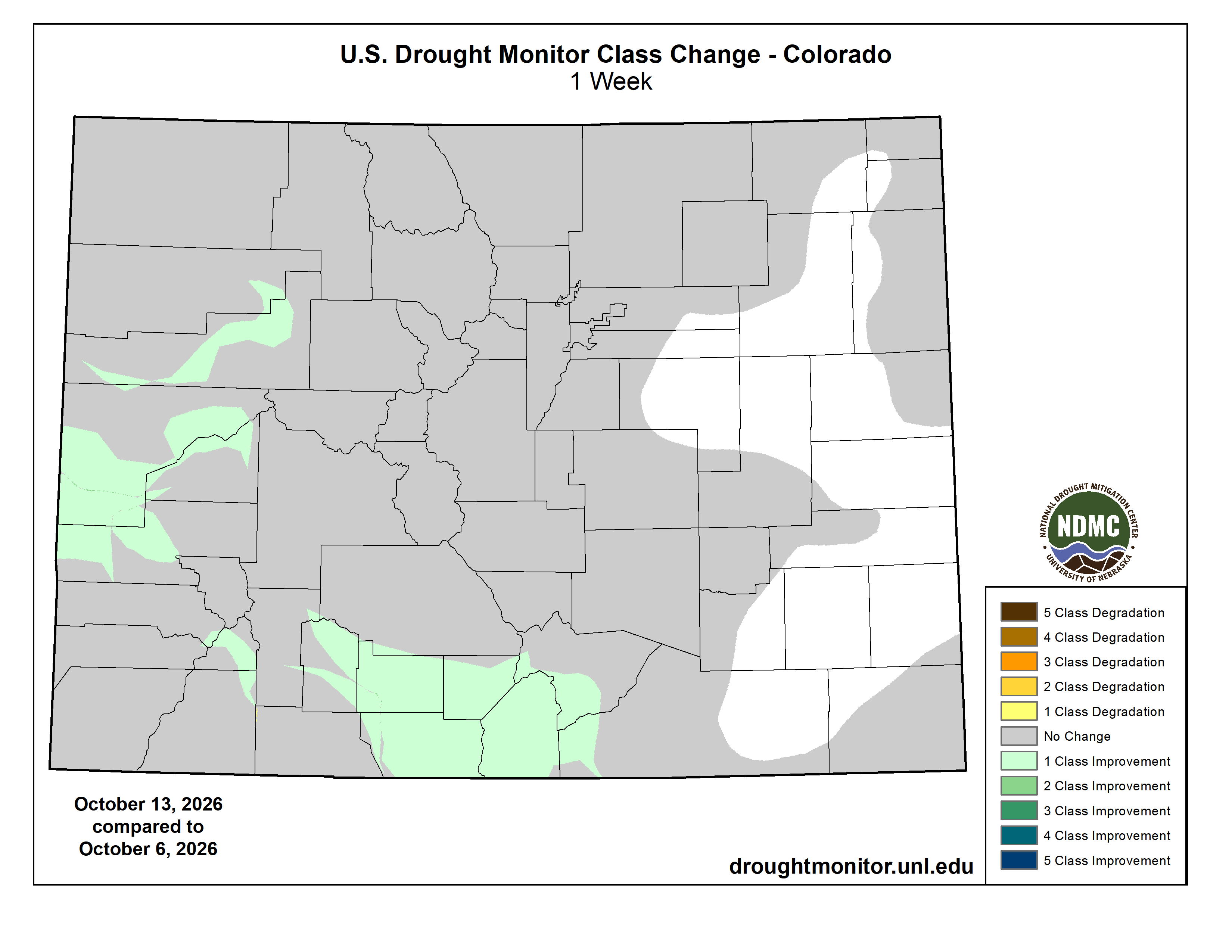
Colorado Drought Monitor one week change map ending October 13, 2026.

West

Drought conditions improved across portions of the West, with the most widespread improvements occurring across the Southwest and Intermountain West. A strong upper-level storm system interacting with moisture from the remnants of Hurricane Rachel brought beneficial precipitation to portions of the region Oct. 10–12. According to the National Hurricane Center, Rachel dissolved over the southwestern U.S. on Oct. 11, although its remnants continued to produce heavy rainfall and gusty winds across the Southwest. The storm system also brought early-season snow to portions of the northern Rockies, including Montana and higher elevations of Idaho, Wyoming and Utah. Temperatures were unusually warm ahead of the storm across portions of the northern Rockies before falling sharply as colder air moved into the region. In Great Falls, Montana, temperatures reached the lower 80s ahead of the storm before dropping into the upper 30s during its passage (NWS Great Falls, Montana). Farther south, Idaho Falls, Idaho, recorded a high of 47 degrees on Oct. 13, approximately 14 degrees below normal (NWS Pocatello, Idaho).

Significant snowfall occurred across portions of Montana Oct. 10–12, with reported totals including 11 inches at Black Pine SNOTEL near Philipsburg, Montana, 9.7 inches at Great Falls Airport in Montana, 9 inches near Bearmouth and 8 inches near Anaconda and Livingston, Montana. Higher-elevation observations included 1.50 inches of snow-water equivalent at Black Pine SNOTEL and 0.80 inches at Barker Lakes SNOTEL (NWS Missoula, Montana). In eastern Idaho, Idaho Falls recorded 1.30 inches of precipitation from Oct. 10–13, including 0.87 inches on Oct. 11 (NWS Pocatello, Idaho). Rain and higher-elevation snow also affected portions of Wyoming and Utah, while precipitation reached parts of Colorado and the Southwest. In contrast, much of the Pacific Northwest and portions of California remained relatively dry.

Drought improvements were concentrated across portions of Arizona, New Mexico, Utah and the Rocky Mountains of Colorado and Wyoming, where recent precipitation and improving short- and mid-term moisture conditions supported localized reductions in drought severity. In northern New Mexico, extreme drought (D3) was reduced, while portions of Utah experienced reductions in severe drought (D2) and extreme drought (D3). Additional improvements occurred across western and north-central Montana and portions of Idaho, where rain and mountain snow helped ease existing moisture deficits. In Arizona, localized improvements continued following substantial drought relief during the preceding week, although longer-term deficits persisted. Elsewhere, drought conditions remained largely unchanged across Washington, Oregon, California and much of Nevada. Despite these improvements, significant drought persisted across portions of the Great Basin, Southwest and northern Rockies…

South

Drought conditions were mixed across the South, with localized improvements in portions of Texas, Mississippi and Tennessee contrasting with widespread deterioration across the lower Mississippi Valley. Rainfall from Hurricane Isaias largely missed the region, with its precipitation only brushing portions of the Alabama-Mississippi border and leaving much of the drought-affected area without meaningful rainfall. Persistent precipitation deficits, unusually warm temperatures and elevated evaporative demand contributed to further drying across the region. These conditions followed record-breaking September warmth, when Texas, Oklahoma, Arkansas and Louisiana experienced their warmest September in 132 years of records, while Tennessee and Mississippi recorded their second- and third-warmest Septembers, respectively (NCEI).

Drought deterioration was concentrated along and near the Mississippi River Valley, extending from eastern Texas and southern Louisiana northward through central Mississippi, Arkansas and west-central Tennessee. Continued precipitation deficits and depleted soil moisture contributed to the expansion and intensification of drought, particularly across Arkansas and northern Louisiana, where exceptional drought (D4) expanded. In contrast, localized improvements occurred across western Texas, including portions of the Texas Panhandle near the New Mexico and Oklahoma borders, where lingering benefits from precipitation during preceding weeks supported reductions in drought severity. Additional improvements occurred across north-central Texas near the Oklahoma border. Farther east, localized improvements in Mississippi and Tennessee were associated with rainfall from Hurricane Isaias, although precipitation was insufficient to provide widespread relief across the lower Mississippi Valley…

Looking Ahead

Over the next five to seven days (Oct. 15-20), the Weather Prediction Center’s (WPC) five-day quantitative precipitation forecast shows a broad area of precipitation extending from the Southwest and southern Plains northeastward into the Midwest and Great Lakes. The heaviest precipitation is forecast from central and eastern Texas into Oklahoma, Arkansas and Missouri, where widespread totals of 2 to 5 inches are indicated, with localized amounts exceeding 5 inches. Additional precipitation of 1 to 3 inches is forecast across portions of the central Plains, Midwest, Ohio Valley and Great Lakes, with locally higher totals. Heavy precipitation is also forecast along the central Gulf Coast and offshore of Florida, while much of California, Nevada and the interior Southwest are expected to remain relatively dry.

The Climate Prediction Center’s 6-10 day temperature outlook (Oct. 19–23) favors above-normal temperatures across much of the central and eastern U.S., including the Great Plains, Midwest, Mississippi Valley, Southeast and Northeast. The strongest probabilities for above-normal temperatures are centered over portions of the central Plains and Mississippi Valley, where continued warmth could increase evaporative demand and contribute to additional drying in areas that miss significant precipitation. In contrast, below-normal temperatures are favored across portions of the western U.S., particularly along the West Coast and into the Great Basin and Southwest. The outlook favors near-normal temperatures, while above-normal temperatures are favored across portions of southeastern Alaska.

The Climate Prediction Center’s 6-10 day precipitation outlook (Oct. 19–23) favors above-normal precipitation across much of the western and central U.S., including portions of the West, northern and central Plains, Mississippi Valley and Upper Midwest. These areas may see additional opportunities for drought relief, particularly where recent precipitation has already improved short-term moisture conditions. In contrast, below-normal precipitation is favored across portions of the Northeast, Mid-Atlantic and Ohio and Tennessee Valleys, where continued dryness could reinforce existing precipitation deficits. Above-normal precipitation is also favored across much of Alaska, including portions of the Interior and Southeast Alaska.

US Drought Monitor one week change map ending October 13, 2026.

Romancing the River: The Real ‘Two Basins’ of a Desert River — George Sibley (SibleysRivers.com) #ColoradoRiver #COriver #aridification

Graphic credit: The Colorado River water crisis its origin and future Jack Schmidt, Eric Kuhn, Charles Yackulic.

Click the link to read the article on the Sibley’s Rivers website (George Sibley):

October 13, 2026

This will be my last post before what might be our last election – if our would-be tyrant doesn’t succeed in stopping it entirely. I encourage my handful of readers to vote early, and then be prepared to participate in public opposition – make a big noise – to the chaos our PINO will surely try to cause if he doesn’t like the outcomes.

The mainstream media (being mostly owned by billionaires) continue to try to portray this election as just another horse-race between ‘Democrats and Republicans.’ It is not that. This election may be out last chance to salvage what the Trumpsters haven’t yet undermined of our 250-year effort to work out a functional governance by, for and of the people – a representational governance, a form of democracy. At present nearly all of our supposed representatives in Congress who call themselves ‘Republicans’ and many of those who call themselves ‘Democrats’ are clearly ‘owned’ by those with the money to fund their campaigns – the oligarchs and kleptocrats who want to replace that 250-year effort with an authoritarian governance that they believe will be more ‘efficient’ in accommodating them.

The only hope for keeping our 250-year experiment in self-governance going is to replace the sellouts with representation in the mold of Bernie Sanders, Elizabeth Warren, Alexandria Octavio-Cortez and others who truly try to speak and act on behalf of us, rather than of those whom we have all helped make morbidly wealthy. And we will only be successful if it is a decisive victory for the people; one or two percent victories will be challenged and kept in chaos until – well, forever: nearly a third of the voting electorate still believe that Trump was cheated out of a 2020 election victory because Trump says so. He is determined to keep this election from being a conclusive victory against him because he knows that the only way to stay out of prison is to stay in the presidency with a compliant Congress.

So vote as if the future depended on it – because it does. We do not want to live in an oligarchic kleptocracy run by a semi-senile narcissist with his gang of thieves pillaging the people to pay for technologies of mass control, with his army of brownshirt ICE agents running rampant in our streets. If we don’t come out of the election with a Congress at least partially in control of representatives of the people (not just ‘Democrats’ – think of Fetterman), then it is all over.

Meanwhile, back on the banks of the bankrupt Colorado River system. Remembering first that the river system is not the river itself. The river itself is what it has always been: flows of water running through river-carved valleys and canyons because the surrounding land has not put those flows to use in service to living things. The flows move on to other valleys where sometimes they are put to use by plants, forests, wildlife including humans, and sometimes not, then flowing on to other valleys until they all eventually join up and get to sea level, reentering the seas from which they came. Those flows ebb and flow themselves, annually and year-to-year, at the whims of the global climate – which at this point has the human thumb on the scales pushing toward the hotter drier side.

That’s the river; the river system is the structures for storage and distribution we have imposed over the river to even out the natural flows, annually and year-to-year, in service to human life. But the system was designed for a river half again larger than the river we’ve had since the turn of the century; it is beyond rational denial that it was overbuilt for the river we now have (see the graph above), although many continue to deny it for reasons including plain desperation.

That suggestion will come in time, but first I think we need to define the current reality (which bears no resemblance to ‘Compact reality’). The first step is to acknowledge the nature of a desert river, then try to adapt our basic thinking and planning to that.

All rivers are water that the surrounding land and its diverse inhabitants have not managed to put to ‘beneficial use’ for the living ecologies the river runs through. That ‘left-over’ water flows on from its home watershed to larger multiple watersheds where it either gets put to use or doesn’t, and if not, it flows on even larger basins, et cetera. Hydrologists describe streams as ‘gaining’ or ‘losing’: a stream that adds surface and groundwater from a watershed with a high water table is a ‘gaining stream’; a stream that gives up some of it water to a watershed with a lower water table is a ‘losing stream’ (although I think it ought to be called a ‘giving stream’).

Many humid-region rivers continue to collect more water from precipitation that falls on them and their surrounding land, from its headwaters all the way to its ocean estuary. A desert river, on the other hand, gets nearly all the water it will ever have from its headwaters region, with mountains or plateaus high enough to force rising air to cool and release any water vapor it carries as precipitation – mostly winter snow in the case of the Colorado River. Most of the Colorado River headwaters are in the Southern Rockies, but the Wind River Mountains in the Central Rockies generate some of the Green River tributaries, the Colorado Plateau and New Mexico highlands generate the Gila River; smaller basin-and-range mountains the Virgin River, et cetera. But the precipitation that falls on those high places generates 85-90 percent of the water that will make its way into the Colorado River; once it leaves its headwaters and flows into its desert regions, it will gain very little new precipitation.

This transition from gaining streams to losing (giving) streams happens fairly quickly in the Colorado River’s natural basin. The majority of its water comes from highlands above ~8,000 feet elevation – about ten percent of the entire basin. In the Upper Gunnison River watersheds where I live, major Gunnison River tributaries leave the Crested Butte area at 9,000 feet elevation where the average annual precipitation is 23 inches (up to 40+ inches on upvalley); a mere 35 miles down the valley in Blue Mesa Reservoir, at 7,500 feet elevation, the average precipitation has dropped to 10-11 inches. In that short distance, the Gunnison River is already in the high deserts of the Colorado Plateau, and most of the valley below Crested Butte is under irrigation – the river already ‘giving.’. The Gunnison River gets larger as it flows west and north to its ‘grand junction’ with the Colorado River, but that is due to picking up other tributaries; very little precipitation water gets added – even in the summer monsoons, according to a hydrologist working in the Upper Gunnison.

Prior to the Euro-American presence in the basin, the Colorado River ran in extremes: a flood of water while the snowpack was melting in the high headwaters, then a comparative trickle in the late summer and fall after the snowmelt ends. The flood months nurtured riparian life throughout its course, from a narrow strip in some places to broad wetlands, meadows and cottonwood ‘oases’ in other desert places, culminating in a lush labyrinthian delta on a dyke it had built across the Gulf of California with debris from creating the Grand Canyon through the Colorado Plateau. Whatever was left in the stream after it made its way through the delta went back into the ocean from which it had come – and one imagines there were many drier years when there was not enough water left below the delta to go into the ocean after the early summer flood finished.

We tend to make a big deal about the Colorado River no longer flowing to the ocean now due to our heavy use, but there are many desert rivers around the world that don’t flow into the oceans; some forty streams flow into the Great Basin from surrounding mountains and plateaus – some of them respectable rivers like the Truckee, through Reno – and they all gradually disappear there, after nurturing riparian life (including some ranches and towns), enduring evapotranspiration, and sinking into aquifers. President Theodore Roosevelt, often called the father of American conservation, considered freshwater going unused into the ocean to be a ‘waste.’

But understanding the nature of the desert river, and how it is different from a humid-region river like the Mississippi, offers some clues about an intelligent river system for storing and distributing the river. The vast majority of the users of the river’s water, especially the modern human users, are in the desert lands below the headwaters region – the ‘losing’ (‘giving’) portion of the river: in the higher ‘cold deserts’ above the canyon region, and the subtropical ‘hot deserts’ below the canyons.

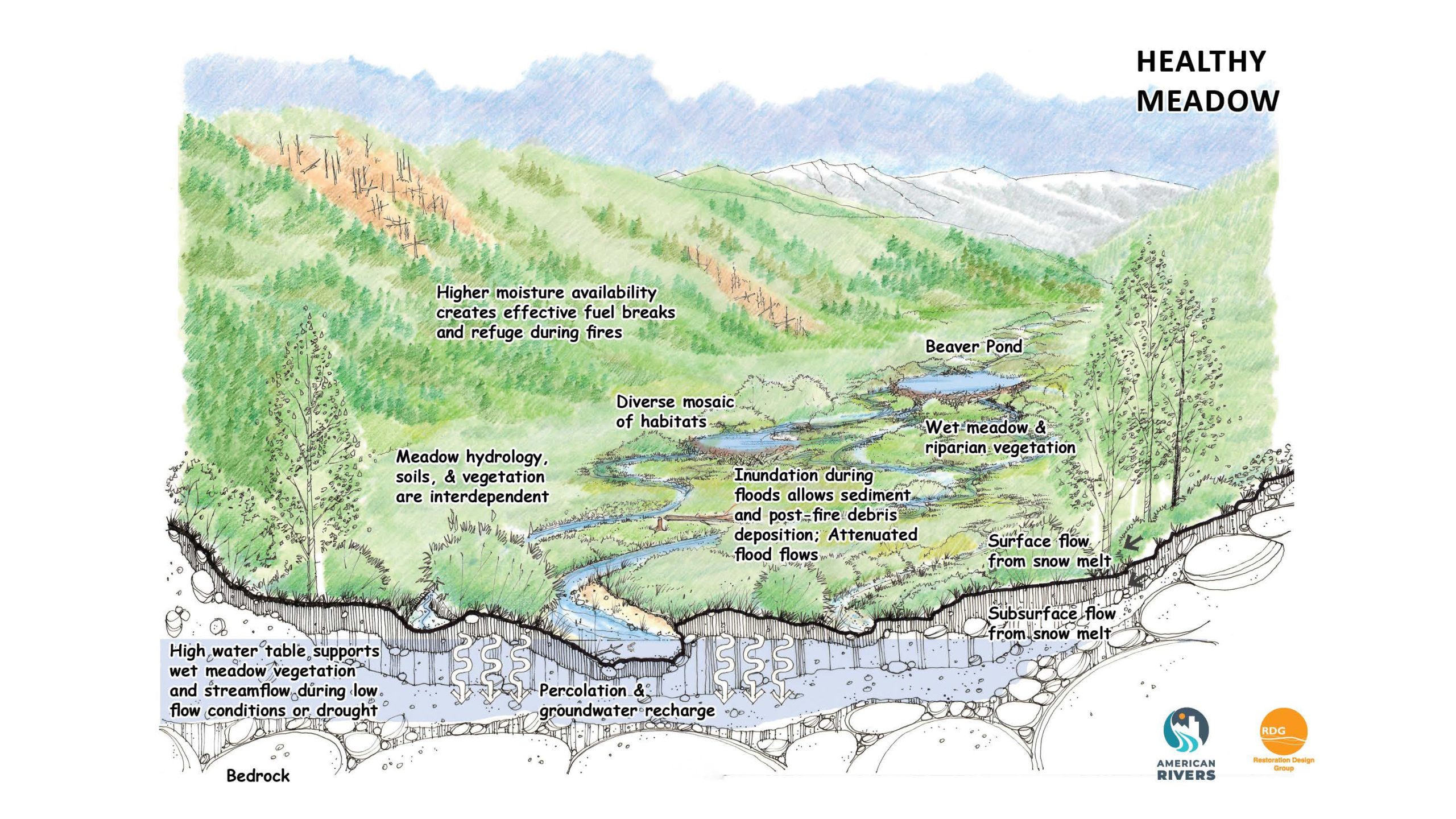
Healthy mountain meadows and wetlands are characteristic of healthy headwater systems and provide a variety of ecosystem services, or benefits that humans, wildlife, rivers and surrounding ecosystems rely on. The complex of wetlands and connected floodplains found in intact headwater systems can slow runoff and attenuate flood flows, creating better downstream conditions, trapping sediment to improve downstream water quality, and allowing groundwater recharge. These systems can also serve as a fire break and refuge during wildfire, can sequester carbon in the floodplain, and provide essential habitat for wildlife. Graphic by Restoration Design Group, courtesy of American Rivers

There are also water users in the headwaters region. Largest by far are the forests that ring most of the mountains, along with other plant and animal life inhabiting those mountain-forest regions. There are also humans in the headwaters, mostly in or near towns supporting mining or outdoor recreation, but what makes the most sense is to consider the human users as outliers of the ‘losing’ basin below the headwaters – which they are, literally, producing little of what they need to live there but importing moat of it from or through the desert economy. The forests, on the other hand – as we will see – are intimately involved in the river’s water production processes, in both positive and negative ways.

These two distinctly different parts of the river suggest a more natural division of the river into two ‘basins’ than the political division under the Compact: the ‘gaining river’ and the ‘losing/giving river,’ each to be managed toward a specific goal: for the gaining river, how to optimize the quantity of water flowing out of the headwaters; and for the losing/giving river, how to optimize the uses and minimize unnecessary losses.

This deliberately breaks up the current ‘two-basin division’ – a ‘temporary equitable division’ adopted in 1922 because the compact commissioners did not know enough about their the river or their own state futures to do the eight-way division (including Mexico) they had set out to do. The two-basin division was most basically an expedient way of persuading Congress that they were together in their search for an equitable division that would only become possible when there was ‘a greater fund of information’ that would enable those following them to do a proper division of the use of the river’s waters, but meanwhile – let’s build the big dam.

Dividing the river into its ‘water production’ basin and its ‘water consumption’ basin would have the potential benefit of starting again with nearly all of the users in a single ‘consumption’ basin, while giving them all joint responsibility for taking care of the ‘water production’ basin. It’s a potential start on at least perceiving the river as a single shared responsibility, as opposed to the current perception of each state in it for its own needs and yielding as little as possible to the other states.

That’s where we’ll start next time – with the big question for the losing/giving river, the desert part of the desert river: how to get beyond Compact fantasies, and divide the use of the diminishing river we actually have among the vast multitudes of users (see the graph at the beginning). That’s a point at which I think it would be smart to abandon the hydrologic term ‘losing’ for a more political term – not a ‘losing river’ but a ‘giving river’ -which is what it is once it leaves the headwaters. And the challenge of ‘dividing the gifts’ of the giving river at least starts with a more positive feel than ‘sharing out the losses’ from a losing river….

Meanwhile – vote! As if the future depended on it because it does. [ed. emphasis mine]

Map of the Colorado River drainage basin, created using USGS data. By Shannon1 Creative Commons Attribution-Share Alike 4.0