Click the link to read the article on the KOAA website (Liv Wood). Here’s an excerpt:
October 5, 2026
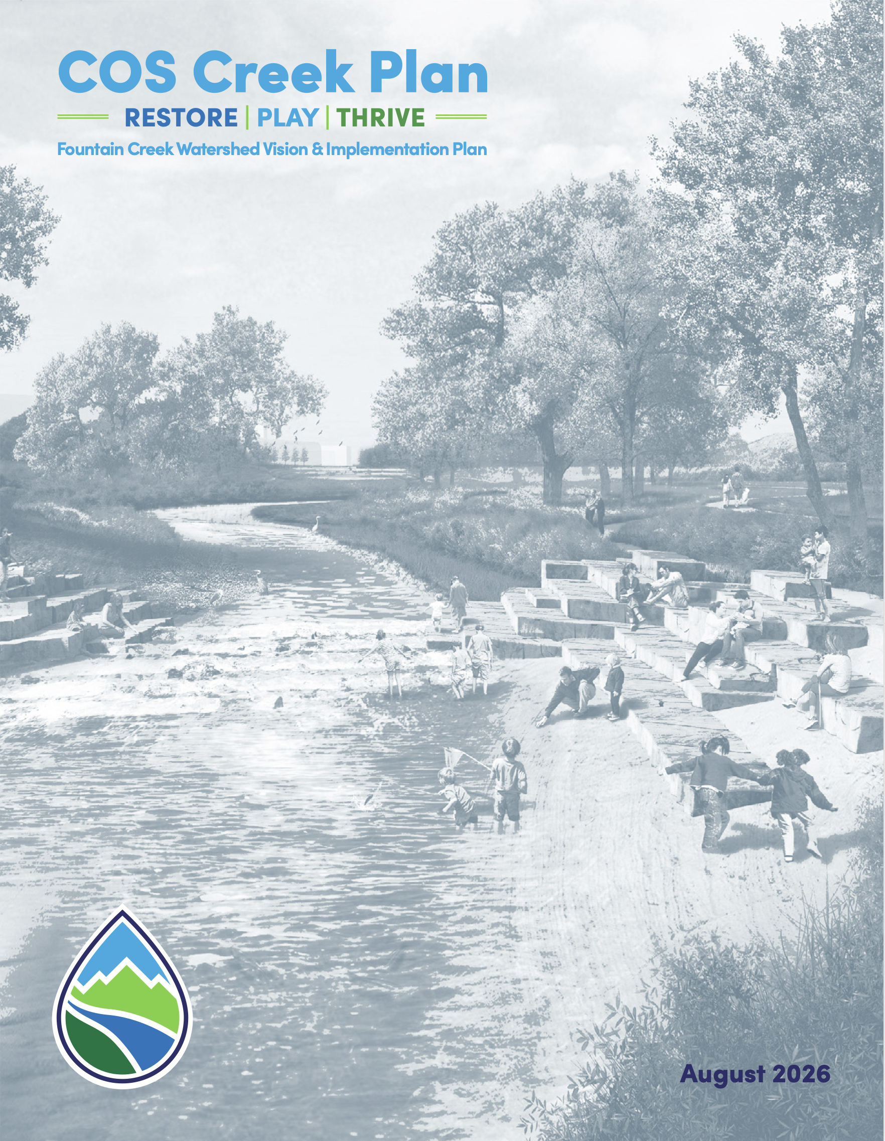
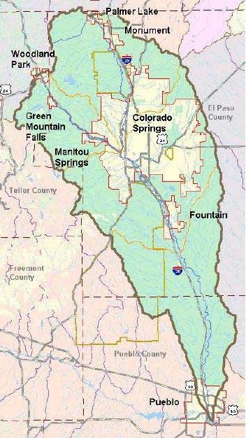
A plan to revitalize two of Colorado Springs’ major waterways is generating both excitement and anxiety among residents who would be most affected by the changes. Pikes Peak Waterways, the city of Colorado Springs, and Colorado Springs Utilities are partnering on the COS Creek Plan, a long-term effort to revitalize portions of Monument Creek and Fountain Creek. A feasibility study is currently underway to determine how the vision will come to life. President of Pikes Peak Waterways said the study will be complete in 2027. Other priorities include:
Nature and Habitat Restoration
Flood Resilience
Water Quality
Trails and Connectivity
Parks and Gathering Spaces
Recreation and Safe Creek Access
Economic Development
Neighborhood Revitalization
Public Art and Culture
At the end of a 20-year timeline, the hope is that eight new and revitalized parks will be established.
From email from Southeastern Water (Chris Woodka):
October 7, 2026
A contract to repay the federal government for the Arkansas Valley Conduit (AVC) was signed Wednesday, October 7, 2026, by the Southeastern Colorado Water Conservancy District and the Bureau of Reclamation.
“This is an incredibly important day for the District, Reclamation and all of our constituents for the AVC,” said Bill Long, president of the District Board of Directors. “We still have a long way to go, but we are moving forward. This is an important milestone.”
Long held up one of the golden frying pans that were sold up and down the Arkansas Valley in the 1950s to raise money to promote the Fryingpan-Arkansas Project, an effort that eventually led to President John F. Kennedy signing the Fry-Ark Project legislation. The AVC is the final project element of that original Fry-Ark project legislation.
“Without the Arkansas Valley Conduit, the Valley will not be developed as it would have been otherwise. You cannot attract industry without a supply of clean water,” Long said.
Kevin Karney, chairman of the District’s AVC Committee, was an Otero County Commissioner when the AVC was relaunched in 2000. Karney was a member of the group searching for a way to provide better quality water for the Lower Arkansas Valley.
“The only solution that has risen to the top is the Arkansas Valley Conduit,” Karney said.
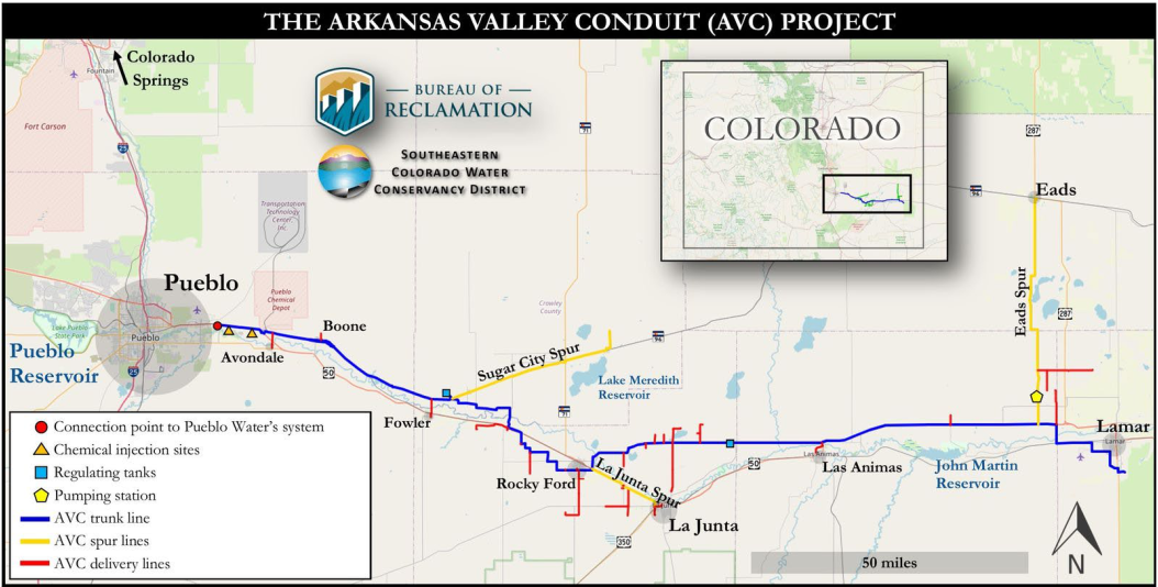
Arkansas Valley Conduit map via the Southeastern Colorado Water Conservancy District (Chris Woodka) June 2021.
Reclamation and the District are building the AVC in a collaborative project, with Reclamation building the 130-mile trunk line from Pueblo to Lamar and the District building spur and delivery lines to connect 38 water systems to the trunk line. The total cost of the project is estimated to be $1.4 billion.
The AVC will provide water to 50,000 people served by cities, towns, water districts and private water companies.
Participants are required under federal law to pay 35 percent of the AVC’s cost. Any costs incurred by the District for construction of spur and delivery lines will be credited to the 35 percent repayment. The The remainder will be repaid with miscellaneous revenues generated from the Fryingpan-Arkansas Project (mainly from excess storage capacity contracts in Pueblo Reservoir).
The contract defines the responsibilities for design and construction, facilities ownership, and when the repayment period will start with substantial completion of the AVC. Reclamation will retain ownership of the trunk line and related facilities it is building, as well as the SCADA (Supervisory Control and Data Acquisition) System that will be used to operate the AVC. The District will construct and own the delivery lines, and any SCADA system implemented must comply with federal cybersecurity requirements.
The Contract reaffirms Pueblo Water’s role for conveyance of AVC water using capacity in its system in accordance with the conditions outlined in the 2022 Three-Party Contract between Reclamation, the District and Pueblo Water.
Provisions are included that would allow delivery of AVC water to participants before the AVC Project is completed. The Contract defines how costs for water delivered, supplies, and various services will be divided between the District and Reclamation prior to completion of construction.
When the AVC is substantially complete, responsibility for all OM&R costs will be transferred to the District. The District is developing a cost model in order to provide reliable estimates of operation, maintenance and replacement (OM&R) at partial and full capacity.
Governor Stephen McNichols, President John F. Kennedy, and U. S. Senator John Carroll pose outdoors at the Pueblo Public School Stadium in Pueblo (Pueblo County), Colorado, at the Presidential authorization of the Fryingpan – Arkansas Rivers water reclamation project. Photo credit: Denver Public Library Special Collections
A new collaboration between state and local organizations in the San Luis Valley aims to conserve and protect the region’s water and lands. The San Luis Valley Conservation and Legacy Project’s objectives include leveraging the area’s natural assets and cultural heritage to create economic opportunity. A recent gathering of local and state leaders identified ways to support agriculture and outdoor recreation in the region and serve the long-term interests of communities. Priorities include safeguarding water resources in both the Rio Grande River and in the groundwater aquifers. That could include paying farmers to leave water in the river and its tributaries to help create and maintain healthy riparian environments for wildlife, fishing recreation and agriculture by potentially paying farmers to leave water in the river and its tributaries. Also among the goals are promoting a regional identity and cooperation among various stakeholders, as well as attracting responsible tourism that brings money to the area without increasing the risk of wildfire, trashing the environment or straining search and rescue teams.
Representatives of the Colorado River Water Conservation District (CRWCD) presented a detailed update about West Slope water, Shoshone water rights and more. Taking a look at water conservation proportionality, Lindsay DeFrates, CRWCD public information officer, later told The Sun that the CRWCD believes that proportionality is critical as the state investigates how to implement the Contribution Program, which allocates Colorado’s share of federal money awarded to the Upper Basin states to conserve water. “It will pay people to use less water,” she said. At Monday’s meeting, CRWCD General Manager Andy Mueller expressed concern regarding the disproportionate impact of water conservation on western Colorado agriculture. “If you don’t have state laws requiring proportionality from all Colorado River users, meaning the Front Range as well, all of that water not only comes off the West Slope, it comes out of West Slope [agriculture],” he said.
Colorado’s conservation goal is 100,000 acre-feet of water. “If all of that comes out of West Slope [agriculture], that’s a big hit to our local economies, to our small towns, to our agricultural industry, and it may be just the beginning of what we view as a permanent program,” Mueller added.
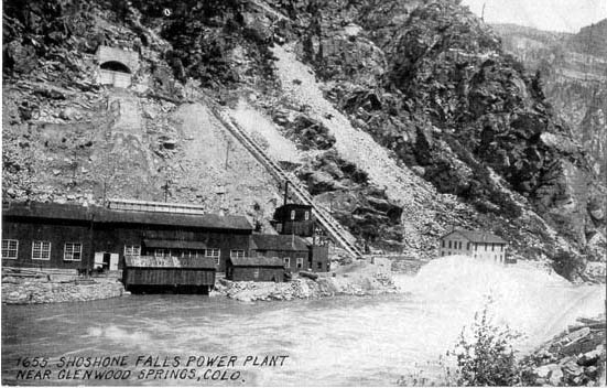
As for the Shoshone water rights issue, CRWCD’s Strategy Chief Amy Moyer told the BOCC that the purchase price is $99 million and all but $1.6 million has been raised from the CRWCD, the federal government and state and local governments, including $3 million from Garfield County. “Our plan is to continue working with communities up and down the river,” Moyer said. “But we may want to sit down with you as we look to close that $1.6 million gap.”
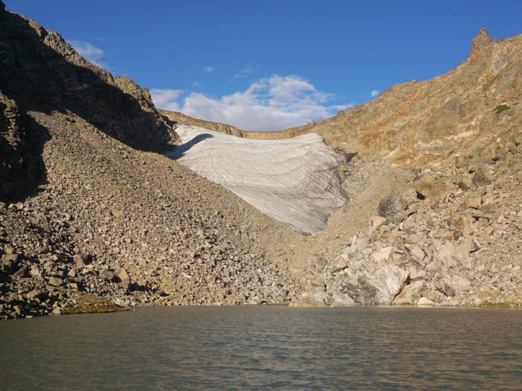
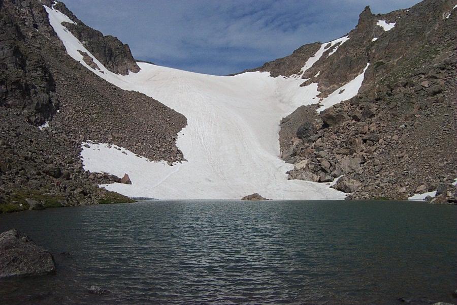
Andrews Glacier September 12, 2026. Photo credit: Harlan Ulmer/Colorado State UniversityAndrews Glacier viewed from the outlet of Andrews Tarn January 11, 2008. By Jmpenzone at English Wikipedia – Own work (Original text: self-made), Public Domain, https://commons.wikimedia.org/w/index.php?curid=10549123
Click the link to read the article on the Summit Daily website (Ryan Spencer). Here’s an excerpt:
October 10, 2026
Colorado State University Associate Professor of Geoscience Dan McGrath is a glaciologist who has studied glaciers all over the world, including in Greenland, Antarctica, Alaska, Asia and here in Colorado. Colorado’s mountains were carved by glaciers, which form cirques, or bowl-shaped valleys through erosion and are especially common across the Front Range and in places like Rocky Mountain National Park, McGrath said. But it is somewhat of an open question whether Colorado has any true glaciers left.
“I generally throw out that Andrews and Arapaho are the two most glacier-like features that we have left in the state,” McGrath said. “You would need to have evidence that they’re flowing to indicate that they’re still glaciers — and there have not been any kind of comprehensive surveys of their flow velocities or ice thickness that allows us to say definitively these are glaciers.”
The U.S. Geological Survey lists 16 glaciers in Colorado, but that includes places with perennial snowfields like St. Mary’s that “clearly have not been glaciers for a very long time and may no longer even have snow and ice in them,” McGrath said. These glaciers have been melting since what is known as the “Little Ice Age” from about 1750 to 1850, but until recent decades the melting had occurred slowly as winter snow accumulation and summer melt tended to balance out, he said. If any of Colorado’s snowfields are still glaciers, McGrath said they’re moving very, very slowly — especially as they melt at increasing rates, as the climate has steadily warmed due to human activities. Global temperatures have risen about 2 degrees Fahrenheit on average worldwide since 1850, with the warming trend increasing in recent decades, according to the National Atmospheric Administration. Statewide, the Climate Change in Colorado report found that annual average temperatures warmed by 2.3 degrees between 1980 and 2022 and are expected to warm another 1-4 degrees by 2025. After Colorado faced its worst snowpack and hottest summer on record, the state’s perennial snowfields have experienced rapid ice loss, and in cases like St. Mary’s — total disappearance.
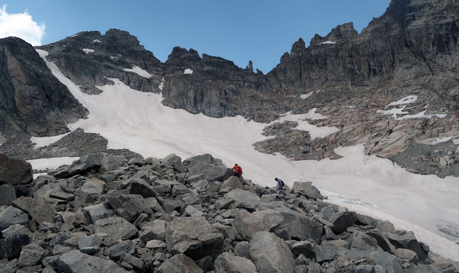
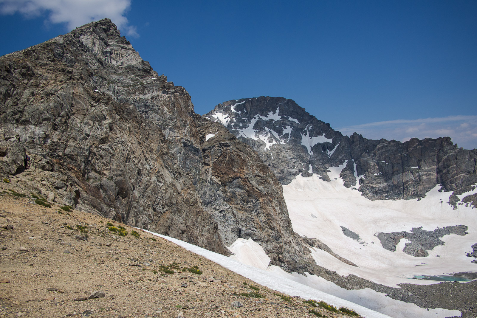
The upper slopes of the Isabelle Glacier, just beneath the Great Divide July 2021. Photo credit: DismalWilderness.comSouth Arapaho Peak (left) and North Arapaho Peak (right) with Arapaho Glacier July 19, 2014. By Greg Willis, CC BY-SA 3.0, https://commons.wikimedia.org/w/index.php?curid=58532938