What’s next for the Colorado River? — Page Buono (AmericanRivers.org) #ColoradoRiver #COriver #aridification

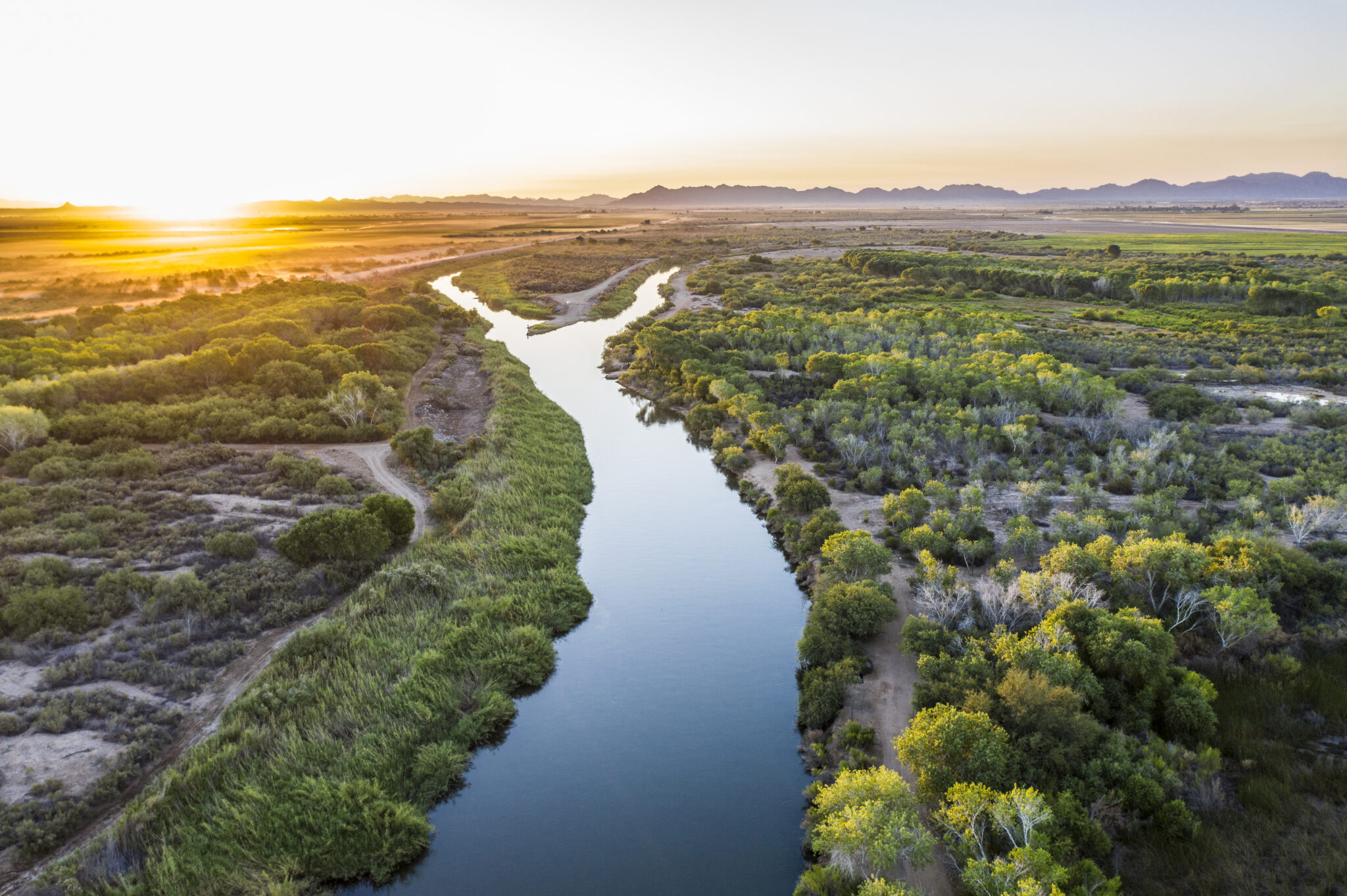
Yuma wetlands restoration, Colorado River, Arizona. Photo credit: Fred Phillips

Click the link to read the article on the American Rivers website (Page Buono):

September 9, 2026

For more than the last century, the flows of the Colorado River have been managed and dictated by the demands of a rapidly growing and changing West. There are founding legal documents, and then agreements stacked on those, often known as the “Law of the River.” These agreements are between states, between sovereign nations, including Tribal Nations and Mexico; between districts and companies and branches of the US Government. It’s hard to find the appropriate metaphor for how all of these agreements work together (and at times against one another) to manage the Colorado River system. But even fraught metaphors are sometimes the only way to get through something so complicated.

Imagine the web of agreements and founding legal documents that guide the management of the Colorado River as a body. The 1922 Colorado River Compact would be the skeleton, the framework upon which all the other functions of the body are built. The limbs could be the communities, farms, Tribes, businesses, ecosystems, and economies that rely on the river’s blood (Colorado River water).  The agreements that build on the framework of the Compact, such as the 2007 Interim Guidelines or the 2019 Drought Contingency Plan (DCP), act as nerves that facilitate or trigger movement and action. Perhaps the brain is the network of decision makers – the Bureau of Reclamation, the states, the Tribes, Mexico and others whose decisions and cooperation keep the system functioning, underscoring why coordination and consensus are so important: a body whose different parts are working at cross-purposes cannot function effectively. The blood then, of course, is the Colorado River water allocated to parts of the body. 

Continuing the body metaphor for the contemporary management of the Colorado River system, additional agreements (or the nerves that trigger certain action) were added to the body.
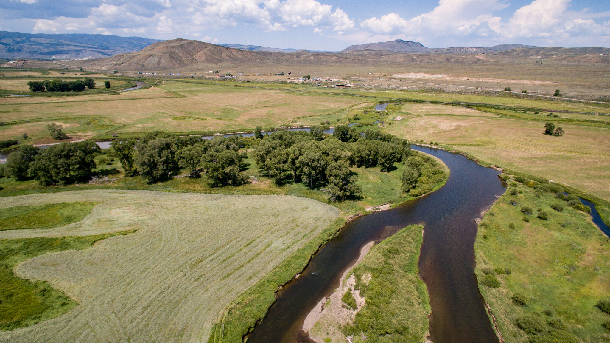
Colorado River, Colorado | Trout Unlimited Joshua Duplechian

On Friday, August 24, the Bureau of Reclamation released three documents outlining a 10-year framework for how the Colorado River will be managed for the next two years and how management decisions for the subsequent 8 years will be made. You can read the Bureau’s summary doc here.

  1. The Final Environmental Impact Statement (FEIS): evaluates the many proposed plans Reclamation considered for how the river should be managed going forward, and identifies a preferred alternative, a 10-year framework built on operating plans developed in at least two-year increments;
  2. The Record of Decision (ROD): adopts the 10-year operating framework and sets the principles and guardrails for future operations including how water can be stored, shortage sharing, critical infrastructure protection, consultation, and the movement of water between Lake Powell and Lake Mead; and
  3. The 2027-2028 guidelines: establish the specific operating approach for the first two years under the new framework.

While the two-year guidelines put real numbers and real movement on the table, the ultimate test is whether the guidelines, alongside the side agreements, investments, and management tools needed to support them, are put in place and function as intended – and whether, together, they can keep the body upright.

Six months from now, the more consequential questions will be whether the new guidelines:

  • provide more certainty and transparency, including clear pathways for addressing disputes and disagreements when they arise;
  • support flexible and adaptive management tools that can respond to changing hydrology and conditions;
  • meaningfully include Tribal Nations in both decision-making and implementation;
  • reduce reliance on emergency operations and short-term crisis response; and
  • create a workable path toward long-term resilience — one that can withstand disagreement, including litigation, without bringing implementation and collaboration to a halt.
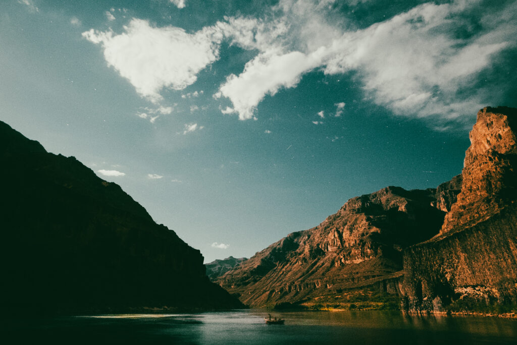
Colorado River flowing through the Grand Canyon National Park in Arizona. Photo credit: Nick Kelley

Finally, and critically, these new guidelines must recognize healthy rivers and watersheds as a core element of the Basin’s resilience infrastructure, because in the middle of all the agreements – at the core of all the collaboration and controversy, the skeleton and nerves and muscles that move it, there is a river – there is a heart; the whole reason blood moves through the system at all.

Healthy rivers and forests, connected floodplains, and intact watersheds are essential to the body, to the Basin. They support the reliability of our water supplies, reduce the risks and impacts of wildfire; they sustain fish and wildlife, support recreation, and strengthen the Basin’s ability to withstand drought and changing conditions. They are invaluable.

Which is to say, at the center of all the agreements and negotiations and collaboration and controversy, is the river. Has always been the river. And if we succeed at all in our management, if we have any hope of keeping this body upright, there will always be the river.

Colorado River “Beginnings”. Photo: Brent Gardner-Smith/Aspen Journalism

Much of Southwest #Colorado had the wettest September on record: Needed moisture was brought after a low-snow winter and dry summer — The #Durango Herald

Vallecito Lake back in the day via Vallecito Chamber

Click the link to read the article on The Durango Herald website (Jane Rooney). Here’s an excerpt:

October 2, 2026

“Much of the area reported the wettest September on record,” said David Byers, a meteorologist at the National Weather Service office in Grand Junction.

The late-September rainstorms delivered steady precipitation over several days, and Southwest Colorado reported no flash floods, he said. The NWS was particularly concerned about the Gold Mountain burn scar near Ouray because many homes are in the area. Because the rain came in steadily over time, no flash floods were recorded, he said…

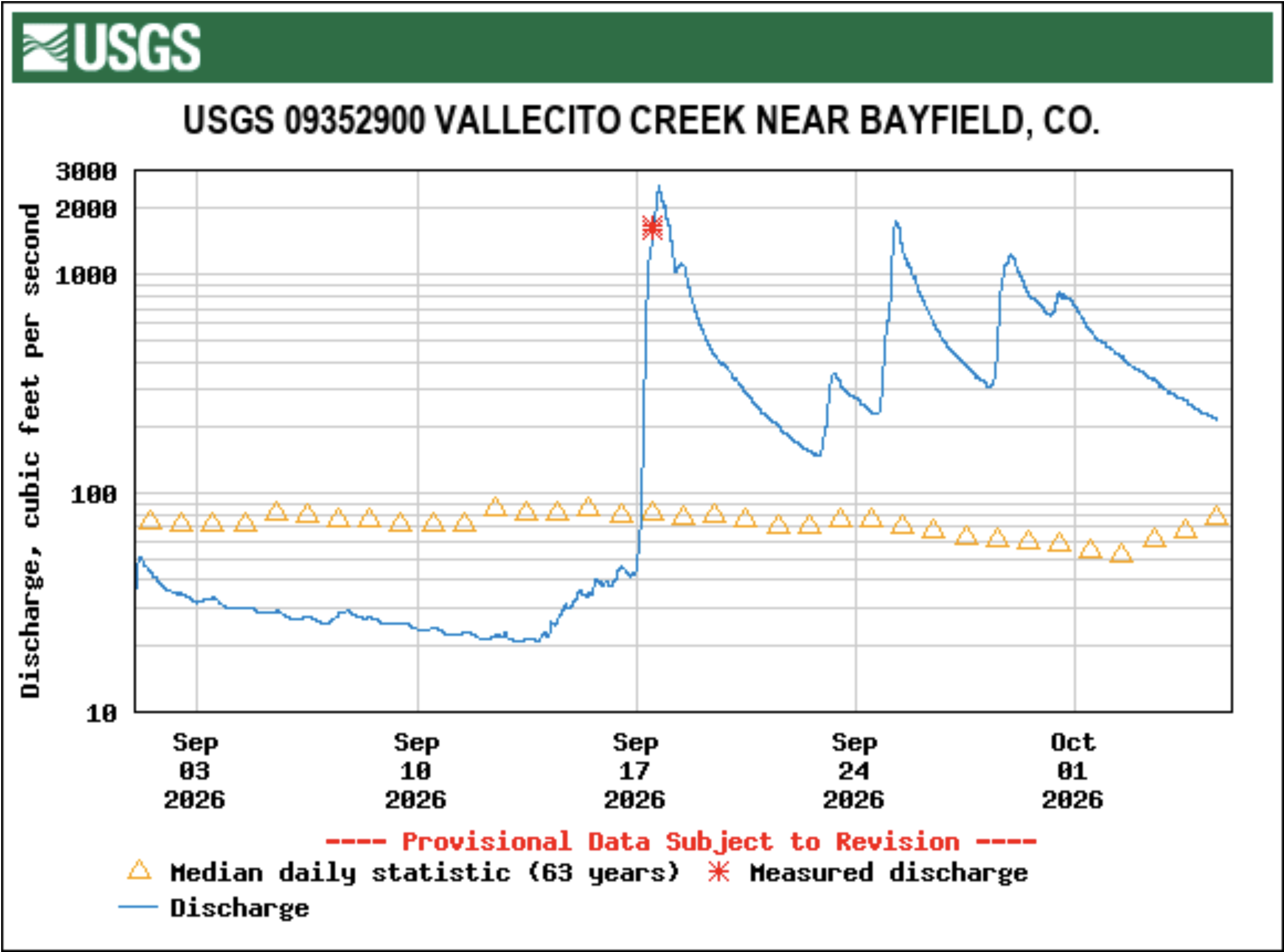
Durango-La Plata County Airport recorded rainfall totals of about 3.2 inches of rain from the late September storms, Byers said. In the mountains above 12,000 feet, that rain became snow. Vallecito Reservoir rose about 18 feet, or about 30,000 acre-feet, from this fall’s moisture. Although water levels have increased significantly, a decent winter is still important for the reservoir, said David Hofmann, superintendent of the Pine River Irrigation District…The water discharge of the Animas River, measured in cubic feet per second, went from about 230 cfs on Sept. 1 to a high of a little over 2,400 cfs on Tuesday after the storms. Vallecito Creek went from about 45 cfs on Sept. 1 to a peak of about 2,500 cfs on Sept. 17, according to USGS continuous data.

Now comes the test of the anticipated #ElNiño: Water resources personnel are closely watching weather forecasts to find out how much snow is predicted — AlamosaCitizen.com #RioGrande #aridification #ENSO

The view of Mt. Blanca from Blanca Vista Park in Alamosa on Friday, Oct. 2. Credit: The Citizen

Click the link to read the article on the Alamosa Citizen website:

October 2, 2026

hat will do it for now when it comes to moisture for the Upper Rio Grande Basin. 

The 2.3 inches of rain that fell in September, or 1.29 inches more than what’s normal for the month, felt like a godsend after a summer of intense heat, when fishermen were asked to leave their rods at home and bears wandered into the lower elevations seeking food and water.

Not to mention the odd spring that delivered a string of days that reached 80 degrees or higher in March and ruined the potatoes in storage.

No doubt 2026 has been warm, days and nights.

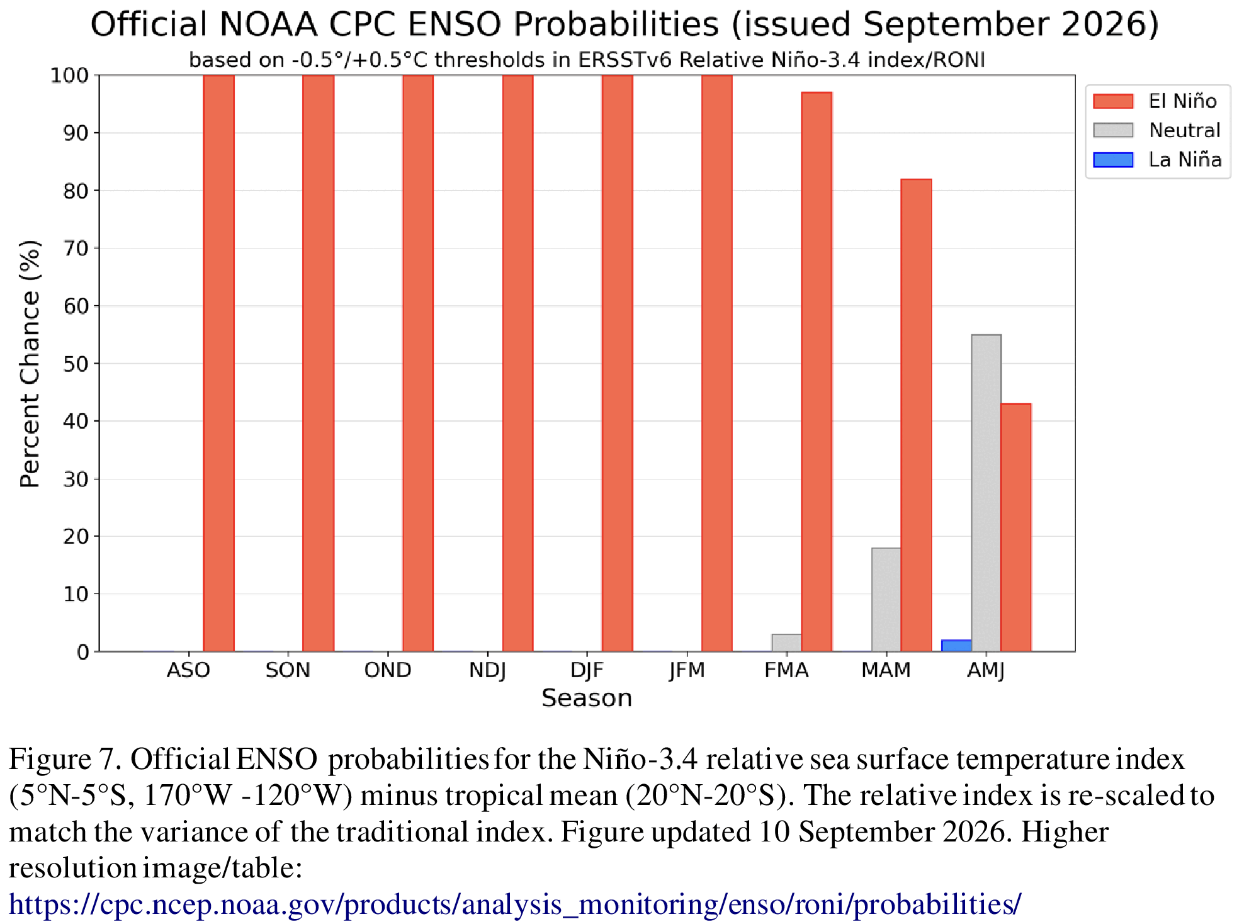
Now comes the test of the anticipated El Niño winter season, which is expected to peak in November and persist through February 2027. Winter doesn’t begin until Dec. 21, but for the Upper Rio Grande Basin it’s the snowpack from the San Juan Mountains that is vital, which translates into wanting to see a good amount of snow by Thanksgiving for the Wolf Creek area. Even better if Poncha Pass to the north and La Veta Pass to the east see the snow fly as well.

“If we don’t get an above normal, or at least normal snowpack this winter and subsequent runoff next spring, that will just exacerbate the dire condition that we are already in,” says Craig Cotten, San Luis Valley division engineer for the Colorado Division of Water Resources.

His office measures the water to determine Colorado’s obligations to neighboring New Mexico under the Rio Grande Compact. 

From January through August, Colorado has delivered 67,000 acre-feet of water to the state line with New Mexico to meet its obligations under the shared three-state water agreement. Cotten says the state Division of Water Resources is anticipating that the September through December deliveries will be more than enough to meet Colorado’s obligation, and likely significantly exceed it.  

“In a typical year, Colorado delivers around 80,000-90,000 acre-feet during the winter, non-irrigation season, so that is why we have not had any curtailment of ditches to provide specific compact deliveries,” he said.

It was mid-October a year ago when historic rains saved the Rio, a rare large precipitation event that dramatically increased the river flows, filled irrigation ditches, and helped ensure the planting fields went into winter wet and in good shape for spring.

Only it didn’t last because rain is no substitute for snow when it comes to the health of the Upper Rio Grande Basin.

Will El Niño deliver this year? Will late fall into the winter bring the needed freezing temperatures to sustain a long winter of snow pack?

If not, you don’t want to know what next spring and summer will mean.

South Platte River Basin #climate for the week ending October 5, 2026: Happy New Water Year! #SouthPlatteRiver

It’s the start of a new water year! I’m full of hope that Russ Schumacher is correct in pointing out that water year 2026 was an outlier and that a more normal water year can’t be ruled out for 2027.

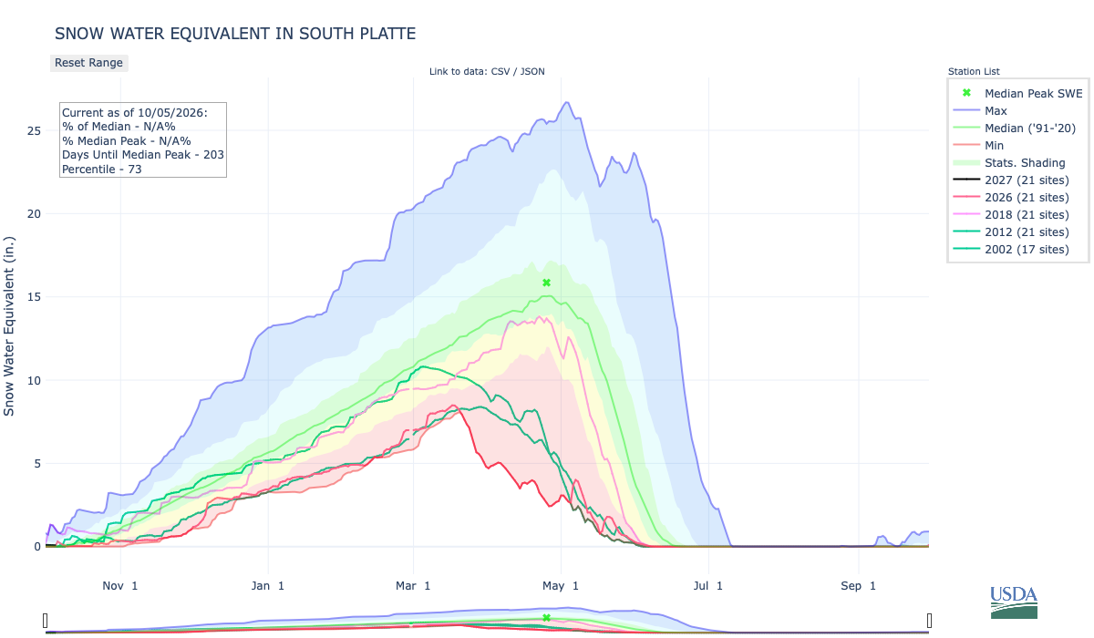
Below is the Snow Water Equivalent in South Platte graph from the NRCS for October 5, 2026. This morning’s snowpack numbers are N/A at the SNOTEL stations. There are 203 days until the median peak. I’ve added the lines for 2026, 2018, 2012, and 2002 since the statewide drought is still very pronounced.

Below is the Precipitation Accumulation in South Platte graph from the NRCS for October 5, 2026. This morning precipitation, at the SNOTEL stations, is at 5% of the median, and 0% of the water year median. There are 361 days left in the water year. I’ve added the lines for 2026, 2018, 2012, and 2002 since the statewide drought is still very pronounced.

There is a chance for showers Tuesday, with a slight chance for showers Wednesday, Thursday, and Sunday in the central mountains. There is a slight chance for showers Tuesday, a slight chance for thunderstorms Wednesday, and a chance for showers Sunday, in the northern mountains. It looks dry and sunny for the next week, down here, about 0.7 miles from Baker’s Crossing on Clear Creek, named for mountain man Jim Baker. From Wikipedia:

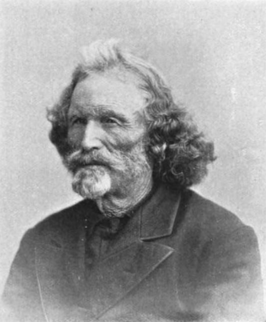
On July 3, 1859, Baker took up a homestead west of Denver along Vasquez Creek (now Clear Creek). The area became known as Baker’s Crossing, where he established several businesses, at what is now 53rd and Tennyson in [southwest Adams County]. He built an adobe house and raised cattle. He operated a stone coal (anthracite) mine, a toll bridge on the Denver Boulder Wagon Road, and a store operated by his two wives. His customers were European American settlers and Native Americans…known as “Honest Jim Baker”, [he] was a frontiersman, trapper, hunter, army scout, interpreter, and rancher. He was first a trapper and hunter. The decline of the fur trade in the early 1840s drove many trappers to quit, but Baker remained in the business until 1855. During that time he was a friend of Jim Bridger, Kit Carson and John C. Frémont…He had at least three Native American wives and fourteen children.

Along the Clear Creek Trail, east of Tennyson Street near Baker’s Crossing, June 2021.

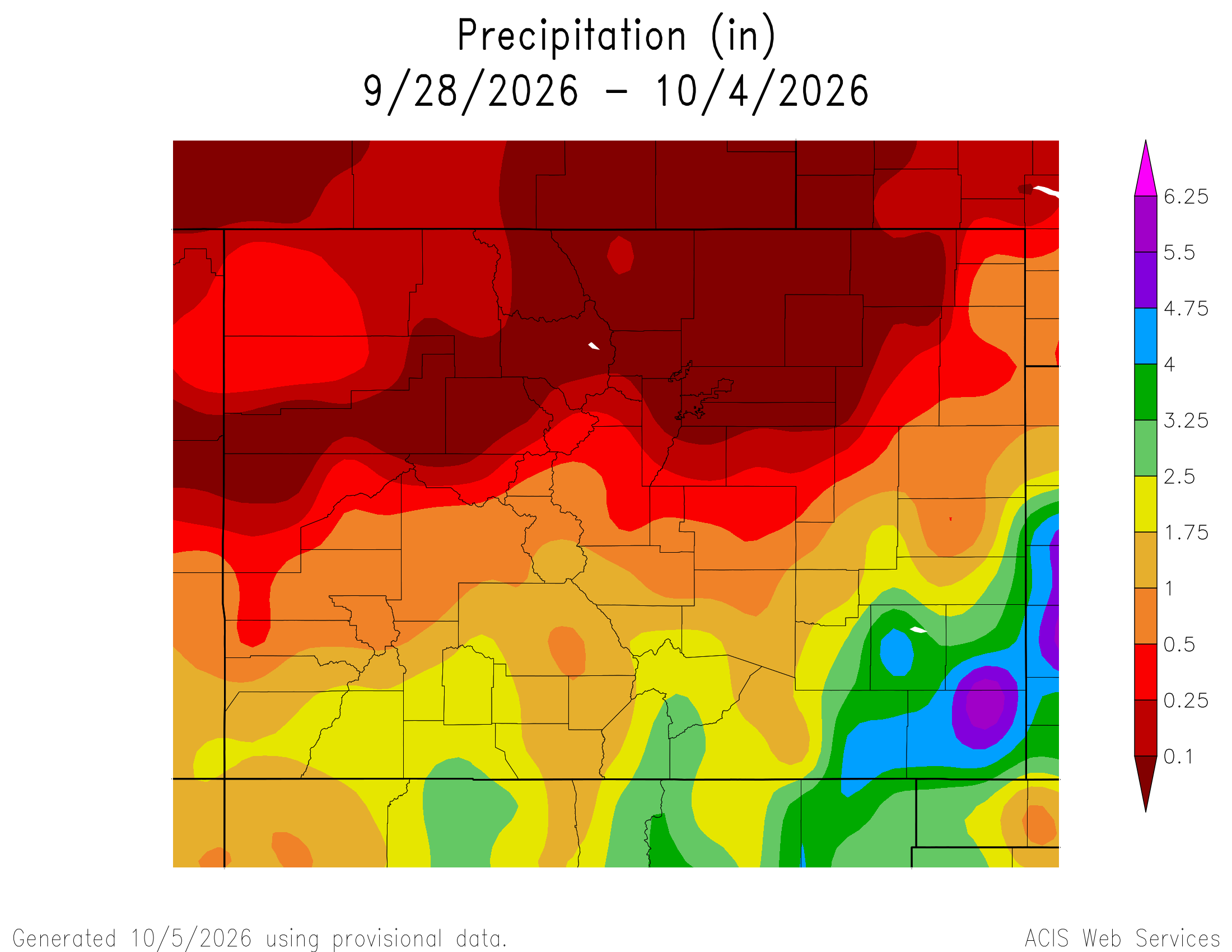
Here’s a look at the Colorado 7-Day precipitation map through October 4, 2026 from the High Plains Regional Climate Center. Precipitation in the South Platte Basin along the Continental Divide of the Americas ranged from 0.00” to 1.00″.

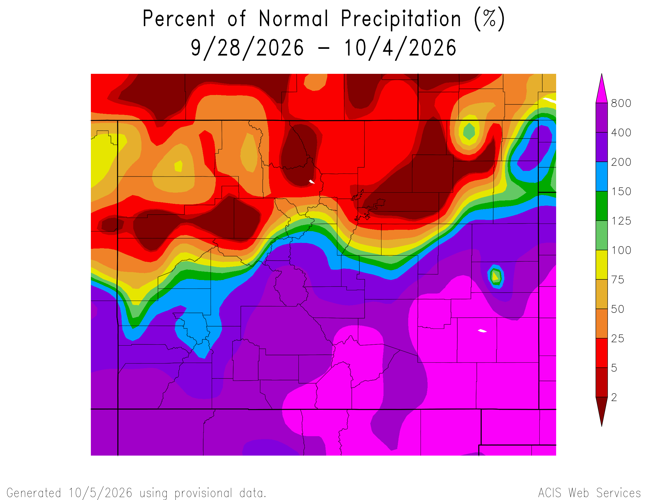
Here’s the Colorado 7-Day percent of normal precipitation map through October 4, 2026 from the High Plains Regional Climate Center. Precipitation in the South Platte River Basin along the Continental Divide of the Americas was 0% to 400% of normal.

Here’s the most recent 7-Day Departure from Normal Temperature (F) for Colorado through October 4, 2026 from the High Plains Regional Climate Center.

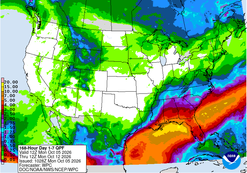
Below is the 7-day Quantitative Precipitation Forecast for the week of October 5, 2026. Precipitation is anticipated for the mountains of the South Platte River Basin and may total up to 0.25″.

Below are the 8-14 day outlooks from the Climate Prediction Center, issued October 4, 2026, for temperature and precipitation, for the week starting October 12, 2026. The CPC expects above normal temperatures and below normal precipitation for the mountains of the South Platte River Basin.

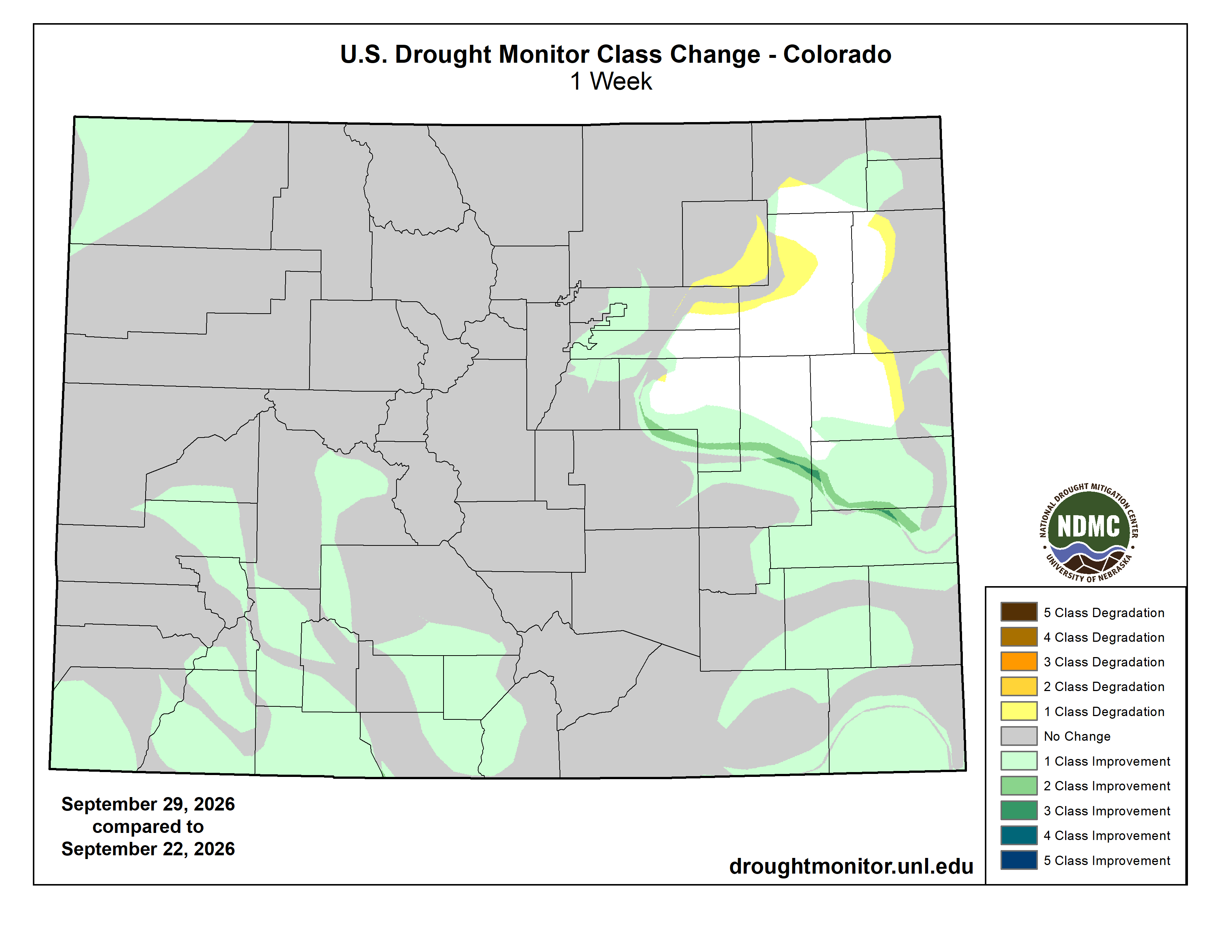
Below is the Colorado Drought Monitor map from September 29, 2026. There were one class improvements in Weld, Logan, Elbert, Arapahoe, Adams, Denver, and Sedgwick counties. There were one class degradations in Morgan, Logan, and Adams counties. Drought and abnormal dryness covers 91.06% of Colorado. The South Platte Basin is experiencing Abnormally Dry, Moderate, Severe, Extreme, and Exceptional drought conditions.

Below is the Colorado Drought Monitor one week change map ending September 29, 2026.

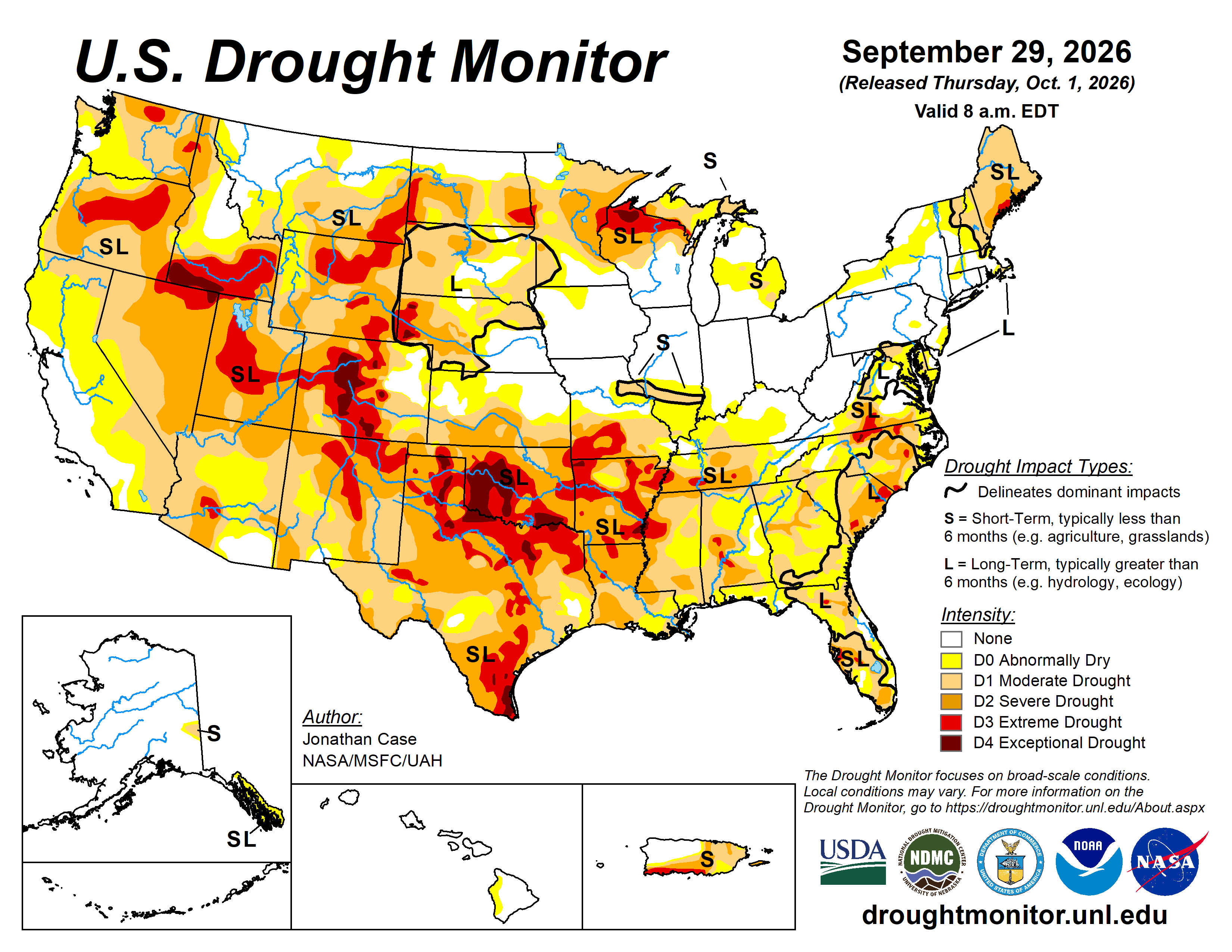
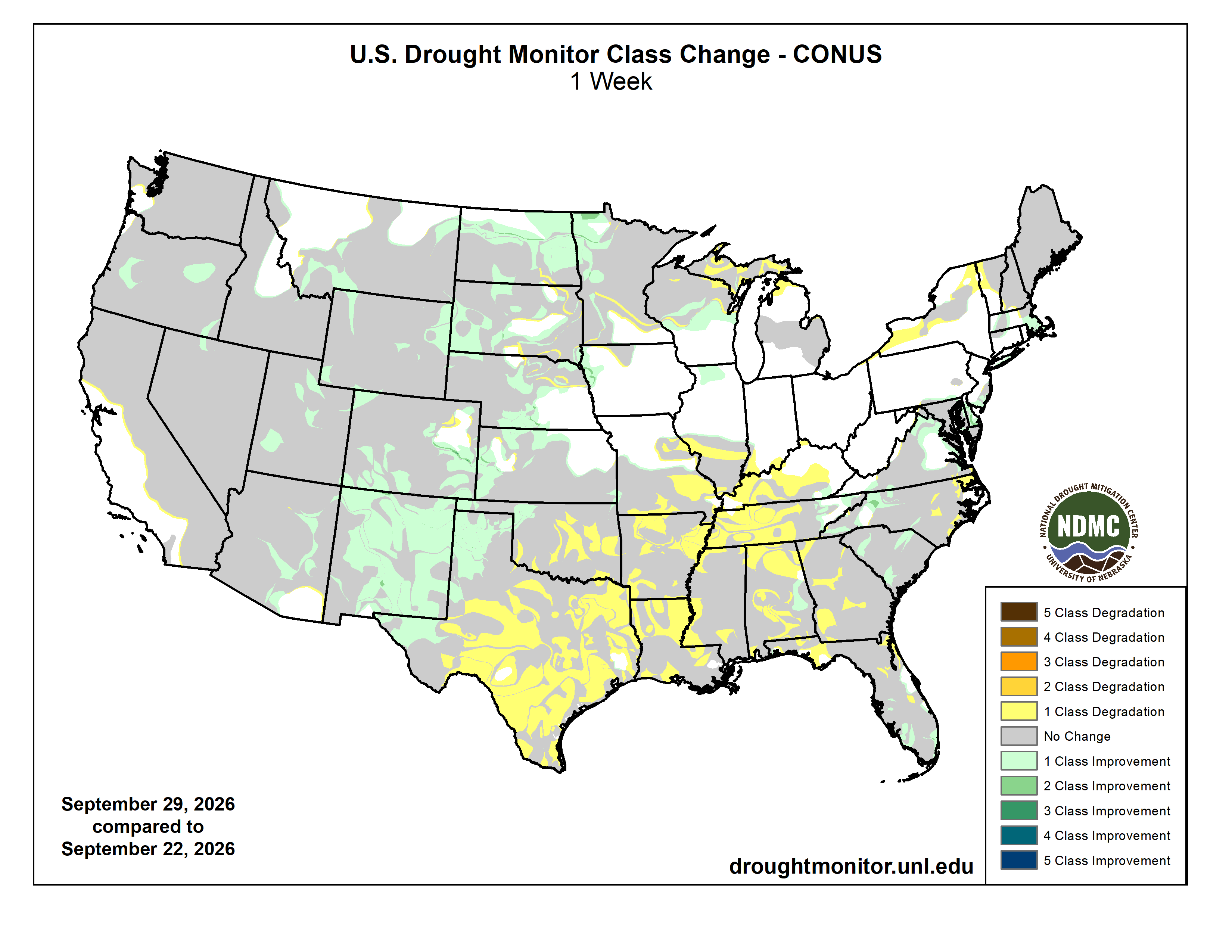
Here’s the US Drought Monitor Map from last week along with the one week U.S. change map.

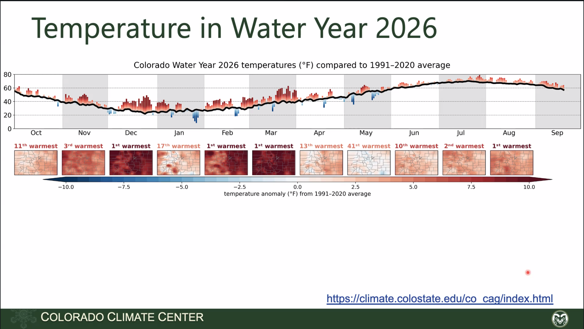
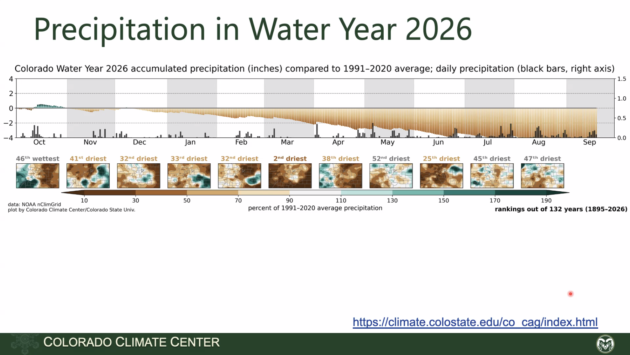
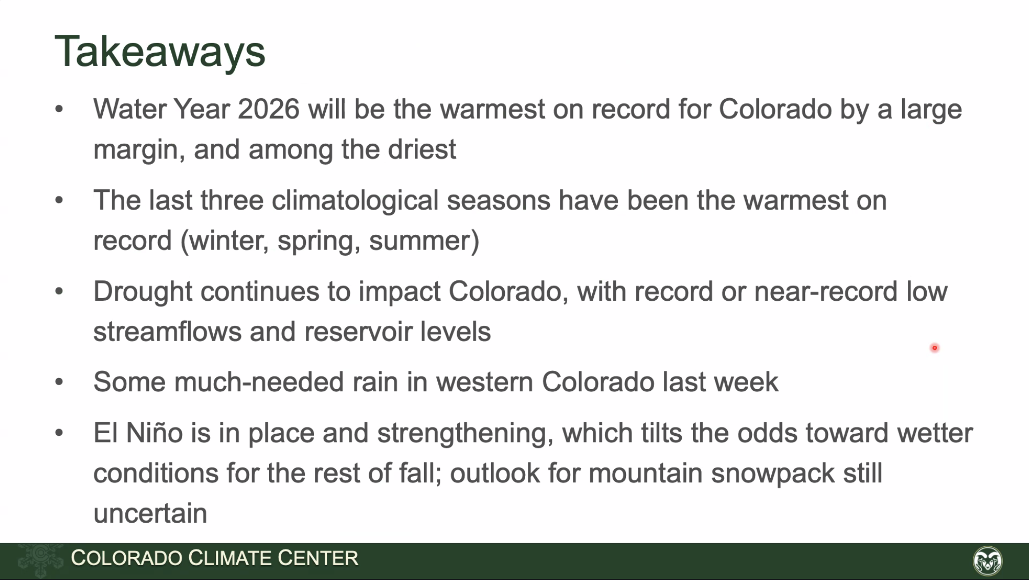
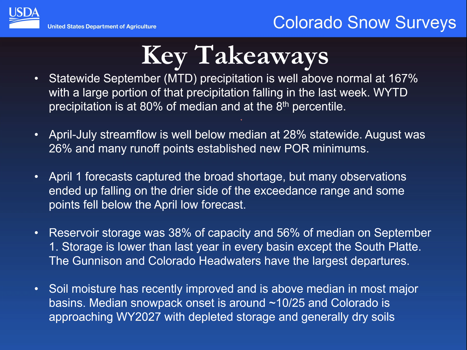
Finally, the Colorado Water Conservation Board hosts a briefing most months of the year, the Water Conditions Monitoring Committee. Regular participants are the Colorado Climate Center, with climate data and insight, and the NRCS, with snowpack and precipitation data from their SNOTEL network, and streamflow forecasts. Click here to view the recording of the September 22, 2026 webinar. Below are some screenshots from the meeting.