Click the link to read the article on The Salt Lake Tribune website (Brooke Larsen and David Condos). Here’s an excerpt:
October 20, 2026
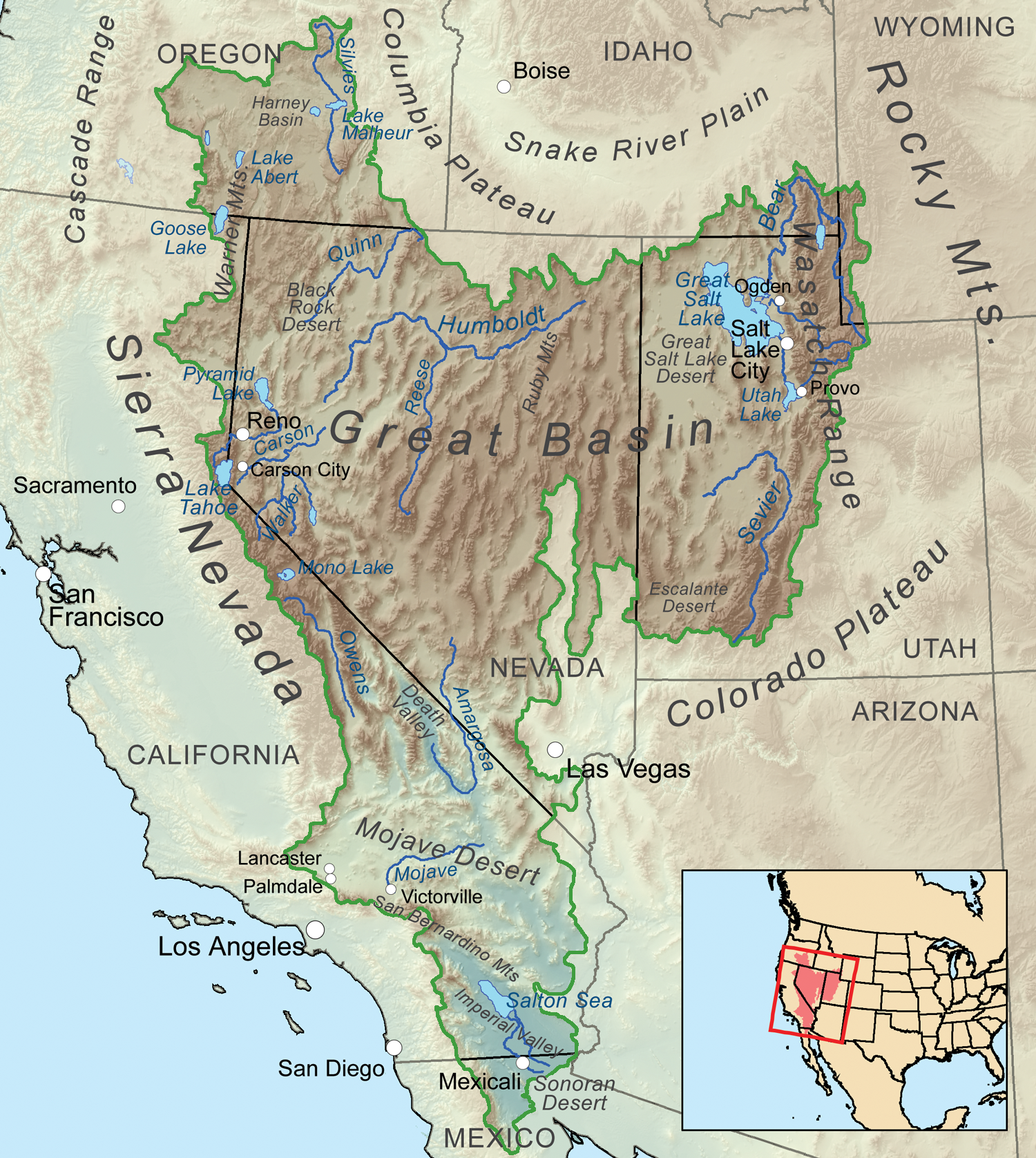
Transbasin diversions, such as the Central Utah Project, bring water from the Colorado River Basin to the Great Basin, where most Utahns live.
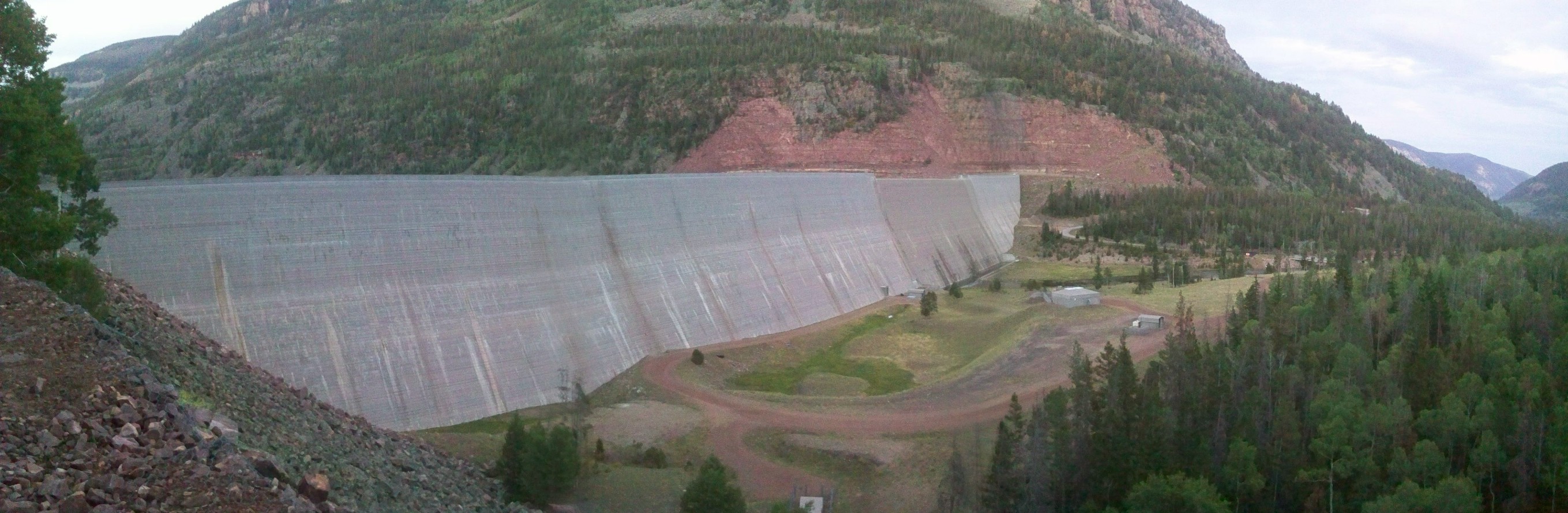
A massive concrete wall rises 200-feet above a trickling creek where Duchesne County’s tan plateaus transform into green forested slopes. Behind it, snowmelt from the Uinta Mountains pools into a dark blue reservoir, water lapping on red rock shores. At just over 8,000 feet in elevation, the Upper Stillwater Dam marks the start of the Central Utah Project, which conveys water from the Colorado River Basin to the Great Basin where around 90% of Utahns live…From Upper Stillwater, a drop of water, which otherwise would flow to the Duchesne River, then the Green River before meeting the Colorado, begins a journey west. It does that thanks to decades of engineering and over 100 miles of tunnels, pipelines and diversions that carry the water to the state’s biggest cities. After a pit stop at Strawberry Reservoir, it cuts through the mountains and flows into pipelines that deliver water to farms, lawns and taps across the Wasatch Front. Some of that water even makes it as far as the Salt Lake City International Airport…
Graphic credit: Central Utah Project
In all, just over a quarter of the water used in Salt Lake, Utah and Wasatch counties comes from the Colorado River Basin, according to Utah State University…In addition to the Central Utah Project, two other major transbasin diversions and a handful of small projects bring Colorado River water to the Great Basin. The Provo River Water Users Association diverts water from the Duchesne River to the Provo River for farms in the Heber and Kamas areas and cities such as Sandy and Orem. The Strawberry Valley Project, one of the oldest transbasin diversions in the West, brings water from the Strawberry Reservoir to farms and cities in Utah County. This project [predates] the Central Utah Project and distributes water to users separately, but aspects of the two projects’ operations have become integrated at Strawberry Reservoir…All the transbasin diversions combined diverted around 165,000 acre-feet of water in 2024 to the Great Basin, according to the Upper Colorado River Commission, making up around 15% of Utah’s total Colorado River consumptionthat year.
Map showing the Great Basin drainage basin as defined hydrologically. By Kmusser – Own work, Elevation data from SRTM, all other features from the National Atlas. Rand McNally, The New International Atlas, 1993 used as reference., CC BY-SA 3.0, https://commons.wikimedia.org/w/index.php?curid=12079426
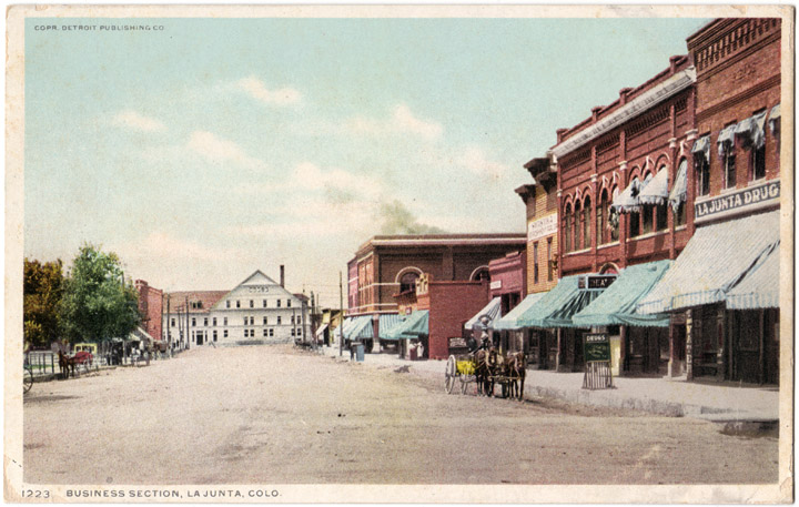
La Junta is receiving $29.15 million that will go toward upgrading water infrastructure to filter out PFAS, or Polyfluoroalkyl Substances, in wastewater. These substances are known as “forever chemicals” due to their longevity in the environment. They come from anything ranging from firefighting foam to non-stick cookware. The investment will also help bring the town in line with new federal regulations, set to take effect in 2027. The award, distributed over three years, represents approximately two-thirds of the total federal funding the state received to distribute…Tom Seaba is the town’s director of water. He said part of what drove this level of investment is the contaminants that flow into La Junta from the bigger cities north of the town of 7,000.
“If you kind of look at a map, La Junta really doesn’t have anything that would put PFAS into our waters, so we need to look further upstream,” Seaba said.
The town sits along the Arkansas River, and almost all the water that flows downstream first goes through Colorado Springs or Pueblo, or both. The contaminants “slowly infiltrated into our groundwater sources,” Seaba said. The utility pulls its water from shallow wells fed by the river. Seaba said the town’s water plant is able to remove contaminants, but the high concentration of contaminants overwhelms the wastewater system.
“We have just been blending it with (treated wastewater) and discharging it into the river where it basically matches what the natural occurring levels are, but it’s higher than what permit regulations allow,” Seaba said.
The utility is also upgrading its drinking water treatment infrastructure by adding extra filtration, but the residual byproduct from treatment will have more contaminants like PFAS. He said the town is focusing on building low-tech options like evaporative ponds.
For the second year in a row, fall precipitation has come in heavy following an extremely dry summer season. In a county work session update on October 13, Upper Gunnison River Water Conservancy District (UGRWCD) senior water program manager Beverly Richards described how the wet month of September helped close out the water year with a boost of moisture to streams and soils ahead of winter. However, warm temperatures have worked against the moisture boost, and reservoir storage and overall drought conditions remain a long-term concern for water experts along the Colorado and Gunnison River Basins. Richards said September precipitation in most of Gunnison County was about 110-190% of average, and other areas of the state saw similar conditions. It was the 9th wettest in 30 years and tied with 1940 for fifth wettest in a longer historical record.
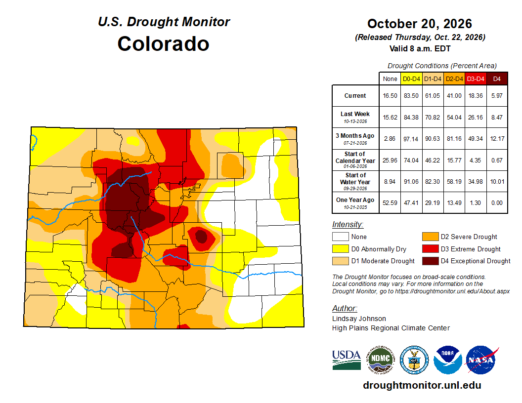
Unfortunately, despite that recent rainfall and even some snow, 100% of Gunnison County remains in severe to exceptional drought. “Areas to the south like Hinsdale and Sawatch County have seen some improvement in drought conditions due to the precipitation that occurred in September,” said Richards. While those southern areas saw one class of drought condition/soil moisture improvement, Gunnison County overall had one class of drought condition degradation. Richards reported that some southern areas received between three and six inches of rain during the early October precipitation events. The Upper Gunnison Basin was at 17% of the median amount of precipitation for the end of water year 2026 (which ended September 30) and temperature conditions for September were very warm—the second warmest in 132 years of record for the state. Richards said that was also 5.5 degrees warmer than the 20th century average…Temperatures in early October ranged from four to six degrees above normal based on the period of record…
Stream flows have been variable across the basin, including huge increases in flow at the Lake Fork, Slate and Taylor rivers around September 29. Richards said this helped make up for the low flows in August. The Slate River flow increased 129% in seven hours, and the Taylor increased by 153% in 16 hours. “So that precipitation event really helped stream flows quite a bit,” said Richards. Reservoir storage is at 47% of average for the entire basin and 33% of average for the upper basin (which includes Taylor and Blue Mesa reservoirs). Blue Mesa ended the water year at 143, 497-acre feet, which was 52% of the end of year levels in 2002, the next lowest year. Richards said Blue Mesa elevation has since declined another 1,030-acre feet and is 17% full. The current elevation of 7,413 feet is about 20 feet above the minimum power pool and 106 feet below the full pool. “We received communication on September 28 from the Bureau of Reclamation (BOR) that they were anticipating it may fall below power pool in April 2027 if conditions continue to decline,” reported Richards. “It’s in really dire condition.”
The 2026 water year smashed heat records across the state and was also one of the driest on record, according to an annual report published by the Colorado Climate Center on Tuesday, Oct. 20. The hot, dry conditions produced Colorado’s worst winter snowpack in history and severe drought conditions that had ripple effects across the state, from water shortages to economic impacts.
“The piece that stood out the most this year was the record-setting heat we had,” said Allie Mazurek, the engagement climatologist with the Colorado Climate Center. “It was just ridiculously warm the last 12 months. It wasn’t like we just had some one-off months — every month we experienced over the past 12 months was above-average.”
[…]
The months of December, February, March and August were all the hottest ever documented in Colorado, which has 131 years of records, according to the report. November went down as the third warmest November on record and both July and September were the second warmest…Statewide, the report found that temperatures during the 2026 water year were 4.5 degrees Fahrenheit above the 1991-2020 average — and more than 2 degrees warmer than the previous hottest water year on record. Amid climate change, Mazurek said it’s not surprising that Colorado experienced a year with above-average temperatures — but she said the water year was so hot that she expects it to stand out for years to come.
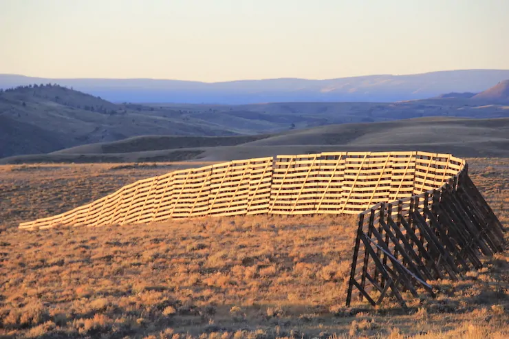
Snow fence Laramie River Valley. Photo credit: Allen Best/Big Pivots
Click the link to read the article on the Big Pivots website (Allen Best):
October 19, 2026
Winter in Colorado often has a shaky start. Skiing at Halloween? It has happened, even at places other than Arapahoe Basin or Loveland and before snowmaking arrived. It’s not the norm. Thanksgiving is more realistic, but even that should not be expected.
If the big storms don’t arrive by Christmas, though, people in ski towns get very nervous. Vail, the ski area, debuted in 1962 midway through an anomalously warm and dry December. To help things, co-founder Pete Seibert summoned Eddie Box Sr. from the Southern Ute tribe of southwestern Colorado to perform a snow ceremony.
Vail’s debut occurred three years before the first report about anthropogenic climate change was given to a U.S. president. It was in 1965 that the authors predicted an increase in atmospheric CO2 close to 25% by the year 2000. This, they said, “may be sufficient to produce measurable and perhaps marked changes in climate, and will almost certainly cause significant changes in the temperature and other properties of the stratosphere.”
They over-estimated the increase. By 2000, the atmospheric concentrations had grown by 15%. By now, however, they have increased 34%.
As for how much accumulating greenhouse gases impact our climate, that’s always a challenge to pin down. Without human-induced changes, climates have always had their ups and downs. That includes how much it snows — or does not.
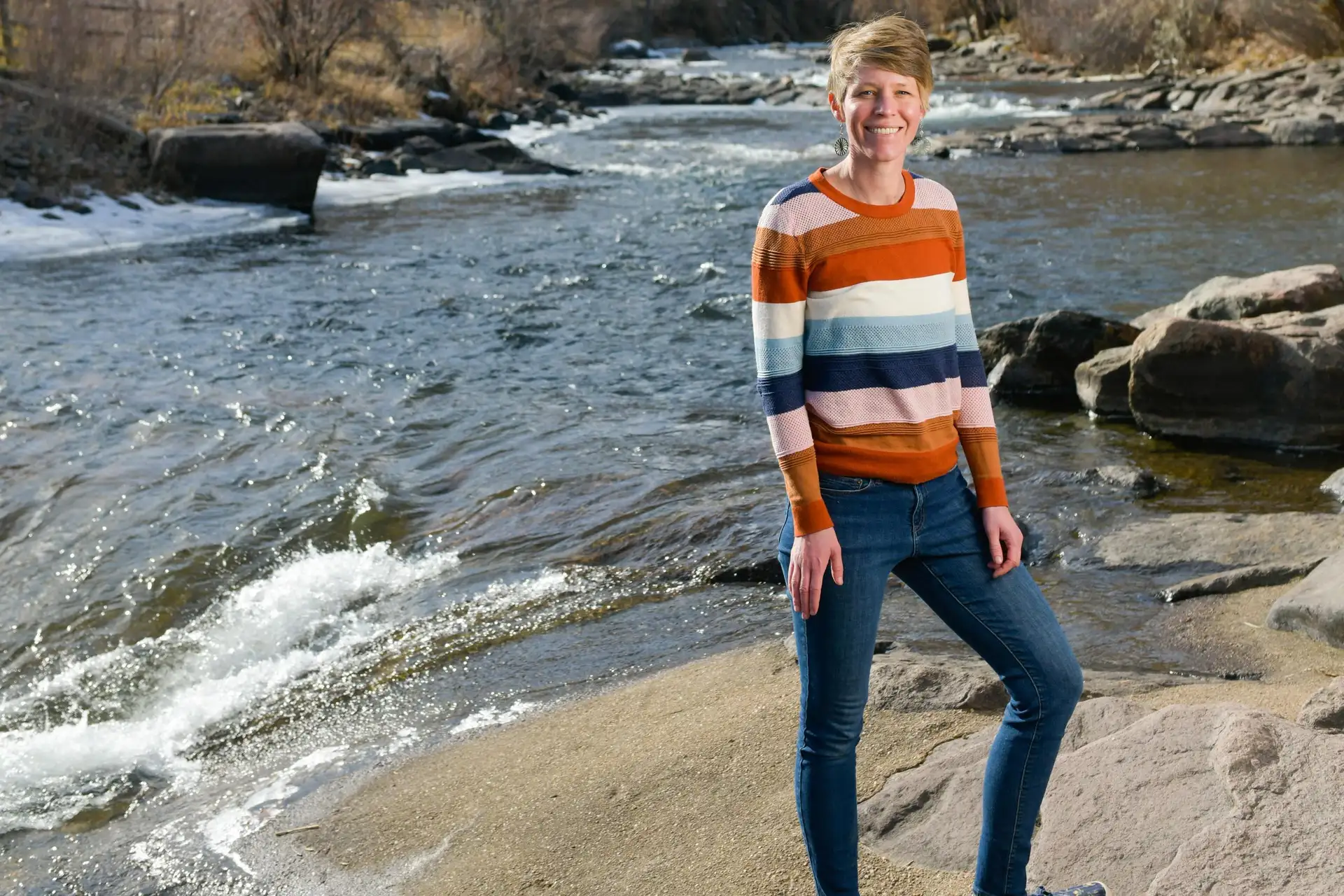
Adrienne Marshall is a “computational hydrologist” interested in snow, ecohydrology, permafrost, and hydropower. Her research interests are united by a desire to understand how climate change is altering water resources, and solutions to these problems from both adaptation and mitigation perspectives. Photo/Colorado School of Mines. Top, a snow fence near the Colorado-Wyoming border, but not during last winter. Photo/Allen Best
Enter Adrienne Marshall, an assistant professor of hydrologic sciences & engineering at the Colorado School of Mines. Last December she and three other scientists at universities in mountain states were toying with using relatively new methods for producing probabilistic models about snowfall.
The discipline is called extreme event attribution, and it was first used in the wake of the heat in 2003 that killed 70,000 people in Europe. The question, perhaps obviously, was how much was that heat caused by global warming? A study published in Nature in 2005, found, with a confidence level of 90%, that the greenhouse gases likely doubled the likelihood of heat of that intensity occurring.
This computer-aided work has also been used to analyze the role of human-caused greenhouse gas emissions in other extreme events during the last two decades. But not for snow.
In December 2025, Marshall and her colleagues decided they would do so, using some low snowfall winters of the past. But as the low- and no-snow winter moved through January and then February, they instead decided to use this technique given the snow-water equivalent of March 15.
They asked to what extent was the 2026 snow drought in the Western United States attributable to climate changes that have occurred since the preindustrial period?
The results are shocking. But then, so was the low-snow, very warm winter.
With 95% confidence, they concluded that the snow drought across the West — including California and the Columbia River drainage as well as the Colorado River Basin — was 4 times more likely than in pre-industrial times.
In the upper Colorado River Basin, the snow drought was approximately 14 times more likely. In that conclusion, though, there was greater uncertainty.
Marshall presented her findings in a session in the Geological Society of America conference in Denver on Oct. 14. The study was originally published in July by PNAS, a scientific journal.
Afterward, I talked with Marshall about the study approach and the findings. One question I had was whether the numbers were surprising.
Yes, said Marshall. “There really haven’t been, to my knowledge, snow drought attribution studies. We had no previous numbers guiding my expectations. I was surprised to see signals as strong as we get here.”
Why had nobody done such a study before?
Shaded relief map of the US via Learner.org
This field of extreme event attribution, still relatively new, is still evolving, she said, but in the case of snow there’s the added challenge of computer models that, while improving, struggle to reflect the topography of mountainous areas.
This is not a new challenge. I have been hearing about it for 15 to 20 years of my reporting in stories about impacts of warming temperatures to mountainous areas of Colorado. The global -scale computer models are easier in flatter areas.
Now, Marshall told me, the resolution of global-scale models has improved, but they still range from dozens to hundreds of kilometers. In other words, if the resolution has improved broadly, the improvements vary. Also keep in mind that the sharp edges of the San Luis Valley — the mountains east and west — would barely be suggested in a global climate model.
To overcome this, one of the researchers, the University of Wyoming atmospheric science professor Stefan Rahimi, downscaled the grid to a resolution of nine kilometers. That’s not enough to tell you about individual ski resorts, say Vail or Telluride. “But is fine enough to give us a good idea of how much snow we might expect in total in the mountains.”
Why the remaining uncertainty in the conclusions about the headwaters of the Colorado River? That, said Marshall, is because the snow-water equivalent of mid-March was so extreme. A less dramatic winter, in contrast, would have allowed greater certainty.
Using the same techniques, Marshall and her colleagues also conclude that across the West, the annual probability of a snow drought as severe as that of 2025-2026 would triple by the 2050s and become more common than not by the 2090s.
Even in February, the weather in Colorado was suitable for shorts and displays of mid-drift, as was the case on this Saturday afternoon in Olde Town Arvada. Then came March, with 90 degree weather and new heat records almost everywhere across Colorado. Photo/Allen Best
Of course, the snow year became more extreme yet with the heat dome that settled over Colorado after their chosen date of March 15. In late March, temperatures records across the state were shattered, in many places by wide margins and for multiple days. Fort Collins, for example, had a 91-degree day during that wave, a temperature that had never previously been recorded until May — and even then, rarely. (In early October, Fort Collins again had two 90-degree days — a first for that month).
The paper has been well received by other scientists, according to Marshall. However, some wondered why the study did not use a snow-water equivalent of mid-April, to reflect impacts of the heat dome that evaporated much snow.
The study results also got a lot of press, but Marshall saw that as a two-edged sword.
“It is gratifying that people are interested in understanding how climate change is affecting the world we ae living in,” she said.
But some people, she added, find it overwhelming, leading to a sense of hopelessness. That, Marshall told me, is exactly opposite of what she hopes. The outcomes are not predetermined. Greenhouse gas emissions can be tackled.
Addendum: Adrienne Marshall this summer received a National Science Foundation CAREER Awardof $737,140 to research how extreme snowpack conditions are evolving in the West. This work willdraw on measurements from as far back as 1950 to expand the picture of how snowpack has been affected by high and low extremes over long periods of time. “We really want to understand how snow is changing,” Marshall said. “It varies so much year to year that the longer record we can have, the better we can understand what’s happening.” See more here.
Click the link to read the article on the 9News website (Matt Renoux, Alexander Kirk). Here’s an excerpt:
October 20, 2026
Customers of the Eagle River Water and Sanitation District in western Colorado cut their water usage by 30% this summer. The savings is more than triple the 9% reduction achieved by Denver Water customers, thanks to a strong messaging campaign, strict fines, and a sharp drop in outdoor watering. Denver Water had asked customers to reduce use by 20%. Many Colorado water districts statewide saw drops of 10% to 20%…Vail Valley customers saved more than 1,000 acre-feet of water…Officials say the district faced an uphill battle because many residents are part-time, especially in summer, and may not know about restrictions. Staff took their message on the road, speaking with people face-to-face at events and festivals. Despite the savings, the district remains at high risk for low water storage and is keeping restrictions in place. Reservoirs and rivers will need help filling in the spring.