Click the link to read the article on the Big Pivots website (Allen Best):
October 23, 2026
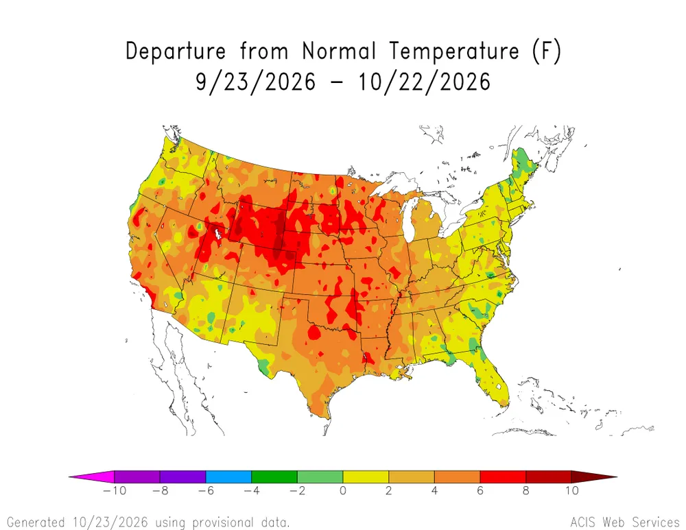
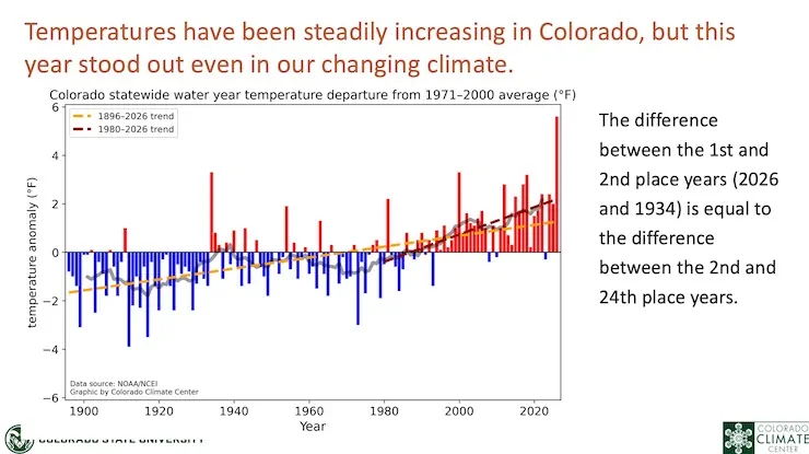
“Holy crap,” said one of my acquaintances in Colorado when I passed along the news that Colorado, during the last water year, had an average temperature of 2 degrees Fahrenheit above the previous record year of 1934.
For me, it wasn’t a great surprise. I remember all too well trying to write stories in 95 degree heat during summer in my former home/office. But it was a sucker punch nonetheless.
If you grew up in Colorado, particularly on the Great Plains, you likely grew up hearing about the Dust Bowl years. “I never saw a cloud that dark since the Dust Bowl,” my grandmother said at supper one evening in maybe 1960 at my grandparents’ farmhouse north of Sterling. The thunderstorm that afternoon had been memorable.
The 1930s were also very, very warm. This, many have said, is clear evidence that the current warming is just part of a phase.
But this new report from Colorado State University researchers speaks to just how extraordinary these times are. The report comes after the conclusion of the 2025-26 water year, which starts in October and ends in September.
“Water year 2026 was one for the record books in Colorado,” the report says. “It was our warmest on record by a substantial margin, and it was also one of our driest.”
The mountain snowpack, the lowest ever, had implications across many sectors, from agriculture and wildfire to human health and recreation, the report continues.
Once again, the temperatures continue to amaze. Colorado had four months — December and January, March and August — that were warmest ever. But 11 of the 12 months ranked among the top-15 warmest of those months on record.
The researchers found that, statewide, temperatures were 4.5 degrees Fahrenheit above the averages seen between 1991-2020.
Every year brings new records, both highs and lows. This past water year was no exception. But the CSU team found that daily warm records (both for record high temperatures and record warm lows) occurred with 21.7 times greater frequency than cold records (both record lows and cool highs). This, they reported, was the most unbalanced this ratio has ever been.
During my travels last summer, I saw evidence of this extraordinary warmth from Meeker to La Jara. In Meeker, a resident said that overnight low temperatures ordinarily killed the idea of trying to grow tomatoes. This year, nights stayed warm.
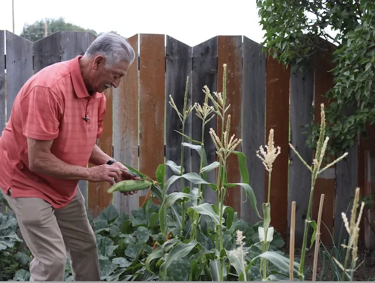
By early August, Larry Zaragoza was able to pick a few ears of corn in his backyard garden in La Jara.The town sits in the San Lis Valley at an elevation of 7,700 feet, a place usually too cool to grow corn.
At La Jara, in the San Luis Valley about 20 miles from the New Mexico border, I happened to once again meet Larry Zaragoza, then the town manager. He has since retired. He, too, spoke of the exceptional warmth. There, despite an elevation of 7,600 feet, it’s possible to grow some vegetables, but rarely corn.
It was still early in August, but already he had a robust crop of corn in his backyard garden. He had, he said, succeeded in that only one time before in the last 20 years.
Russ Schumacher, the Colorado state climatologist and a faculty member in CSU’s department of atmospheric science, said the key message is not that 2026 is the new normal. In another 10 to 20 years, this past year will likely still stand out as extreme. “At the same time, the chances for extremely warm years are increasing as warming continues.”
At a forum in Jefferson County last evening devoted to the Colorado River, Colorado State University’s Brad Udall warned that years like this will not only become common but they will be worse.
At his wheat farm near Wray, Gregg Stults shared that the exceptional heat has continued into autumn. “Several evenings in the last month it was over 90 degrees at 9 o’clock at night. That was just the ambient temperature outside.”
July was the hottest month, as it usually is. But July 27 set the record for the hottest single day for Colorado. The previous record? A year before, on July 21.
The warmest-ever days for October were set for October (one), December (2 days), and March (9 days). August had three warmest ever days, too.
Another way of looking at this heat is the number of 90 degree days during the water year. Boulder had 57 of those days, compared to the average of 33 during the last 30 or so years. Lamar had 97, compared to 73 for the longer-term record. Steamboat Springs had 29. The average was 6 for the 1991-2020 period.
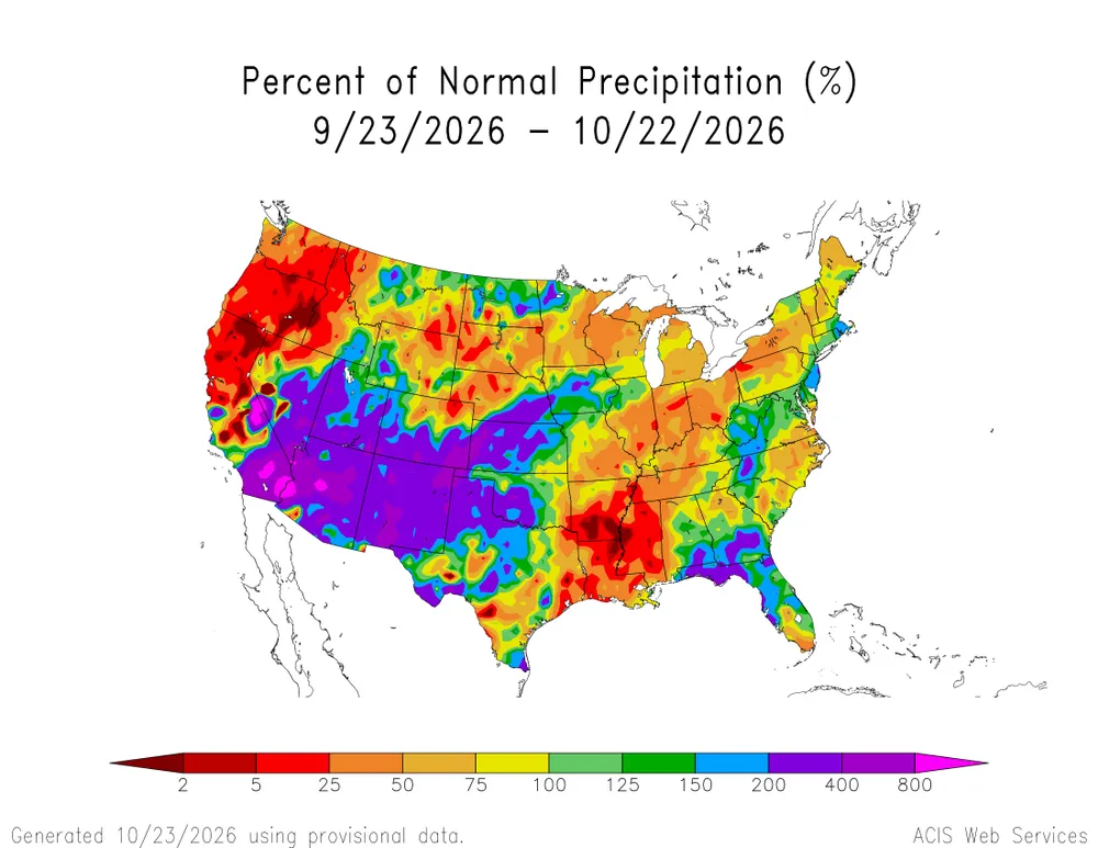
Precipitation across most of Colorado was below average during the water year. A few wetter periods balanced out drier stretches, especially in the San Juan Mountains and parts of the Eastern Plains.
For agriculture, though, timing can be everything. April precipitation is crucial for both crops and grazing ranges on the eastern plains, and it was way below average this year. “Coupled with much above-average temperatures, drought quickly developed and agricultural lands suffered severe impacts,” the report says.
Of note — but not in the report — is the amount of groundwater extracted, likely in part because of both drought but also the intense heat that dried out soils. This has had a huge impact on the declining aquifers of the San Luis Valley but also the Republican River Basin.
Drought was particularly significant in parts of Garfield and Pitkin counties. By one measure, those counties have suffered drought for 15 straight months.
In Aspen, bears have been commonplace on city streets for the last 15 or 20 years. This year, though, was exceptional. Greg Poschman, a nearly life-long resident of Aspen, attributes the omnipresent bears to the near total absence of food for them at higher elevations. Service berries were shriveled and chokecherries were non-existent. “Bears were coming into town because they had no choice.”
Even without bears, hiking around Aspen, producing crackling sounds when stepped on dried grass, was uncanny, he said.
As for the Roaring Fork River, it was nothing that the name implies. The streamflow reduced to 7 cubic feet per second this summer and the temperature of the water hit 70 degrees. Poschman hopes this does not become accepted as the new normal.
By one broad measure, the Palmer Drought Severity Index, this past year was the worst on record. At the end of August, it was only slightly worse than 2002, another memorable year for low precipitation. It was hot, too, but not near as hot as this year.
As for snowpack, it was the lowest on record for Colorado. The peak was 51% of average and about a month early, followed by rapid melting in the unprecedented March heat wave, the CSU research team reports.
You may remember that month. Above 90 degrees in Fort Collins but everywhere warm. Along the Elk River, Jay Fetcher has been carefully recording the earliest date at which snow had disappeared from the hay meadow on his ranch northwest of Steamboat Springs. This year that date was March 2, breaking the last record of March 24, which was set just a few years ago. See: “Along the Elk River, earlier springs and more uncertainty.” Big Pivots, June 5, 2026.
Spring has been rapidly advancing in a general way. Of course, there are exceptions. And even this year spring was cooler, especially compared with the crazy heat of the winter months. That coolness and marginal precipitation in April and May allowed Colorado to mostly escape the massive wildfires of some other years, said Udall at the forum sponsored by the Colorado Renewable Energy Society.
Along the White River, at Meeker, a retired physician and teacher has been tracking the earlier springs and declining flows. See: “A doctor, the data & Colorado’s White River.” Big Pivots, June 15, 2026.
What will this coming winter bring? Rain is falling, causing flooding around Telluride and other San Juan communities. The peaks have snow on them. But keep in mind, that’s how the last water year started out. While some hope that the El Niño brings the snows that last winter largely lacked, the records show many El Niño winters of the past have been yawns.
It only now occurs to me, six years into my half century of life and of roaming around the Four Corners Country, that the predominant autumnal color of the high desert is yellow. At least this year, when wacky weather and an altered climate have shuffled the phenological calendar, that is the case. Chamisa blooming madly, wild sunflowers dancing by the roadside, once-dusty fields turned golden by hundreds of clusters of añil del muerto — indigo of the dead — which I am told usually bloom after the monsoons in July and August.
And there, almost as if leaping from the deep cut banks of the Rio Puerto, the dazzling shock of quivering turned leaves of a cottonwood.
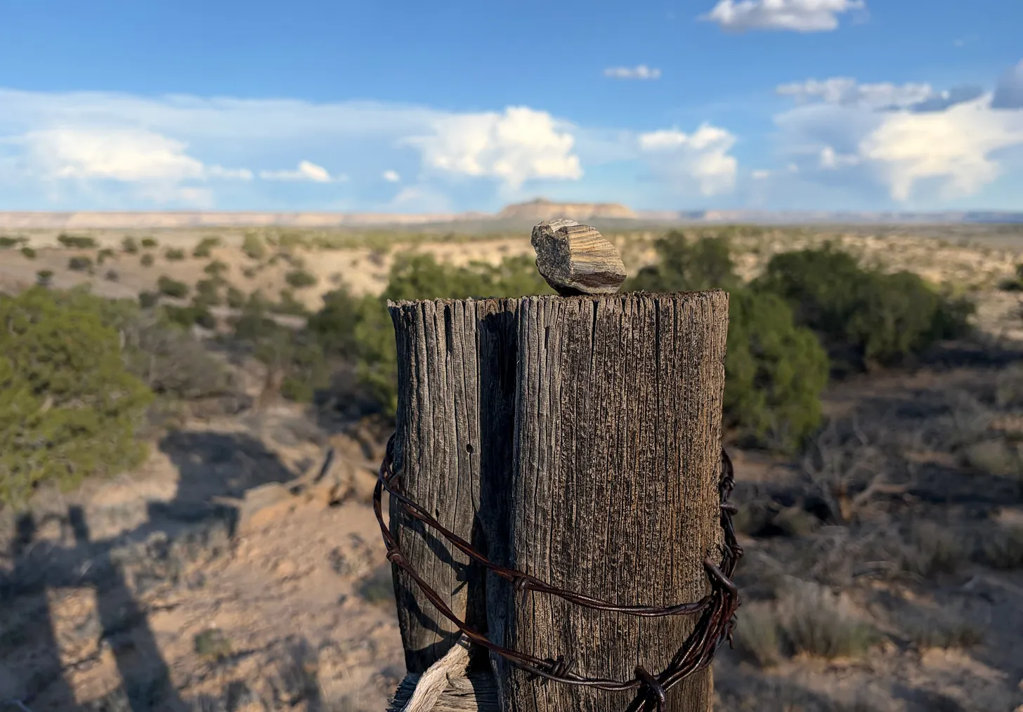
Stone, fencepost, and Huerfanito Peak in the San Juan Basin. Jonathan P. Thompson photo.
I spend the night in a small BLM campground in the heart of the San Juan Basin gas field. The sites are nice, it has some of the most spectacular views of any campground, and it’s free — subsidized by royalties from the gas wells that surround it. I used to have the place mostly to myself, but on this Thursday night it fills up. A couple of loners, like me, one guy in a converted school bus who probably lives here, at least until he gets rousted, a family, a German couple in a vanlife van (with German plates), who talk loudly enough that I can hear every word, and even understand a few. They’re headed down to Carlsbad next.
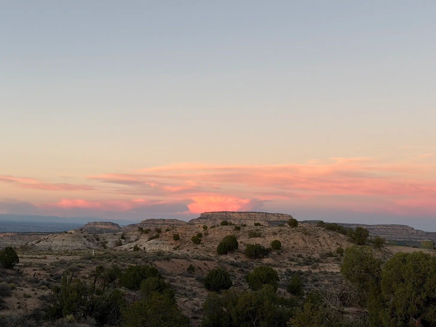
Near Angel Peak in the San Juan Basin. Jonathan P. Thompson photo.
A big yellow dump truck blazes across the gravel campground road ahead of me, trailing a cloud of dust, as it hauls a load from one side of Envirotech’s land farm to the other. A land farm is where hydrocarbon-contaminated soils, like those that have been soaked by an oil or produced water spill, are taken to be reclaimed and plowed back into the land farm’s “fields.” This one is special because Chaco’s Great North Road cuts right through the hydrocarbon-soaked fields. The owner of the facility apparently has some sensitivity and appreciation for archaeology and cultural sites, and left the “road” undisturbed, though it is abutted on both sides by the fields.
On this Friday morning the land farm is especially busy, my first indication that the oil and gas drilling boom in the Greater Chaco Region is back on, at least in a limited fashion. And given the number of trucks bringing in more crude-soaked soil, I’m guessing the number of spills is increasing, too.
The activity is heaviest between Nageezi and Counselors, where the highway suddenly gets busier and a higher percentage of the traffic is made up of large white trucks, tankers, and frack-sand haulers. A drilling rig juts out from behind a piñon and juniper studded hill near Twin Pines. A big orange sign: SAND TRUCKS.
The renewed activity brings urgency to the fight to keep the Chaco Cultural Protection Zone intact. And yet, it offers no protection for the people who live in Nageezi, Lybrook, Counselors, Twin Pines, Ojo Encino …
Outside Cuba, four hikers. Walking sticks, nice backpacks, incongruent. Then I remember the sign back at the store: Welcome Continental Divide Trail Hikers. It makes sense.
Handwritten sign along the road to Pueblo Pintado: No Dumping Trash or Dogs.
A hundred yards later a herd of goats in tight formation, brilliant white fur, shiny black fur, munching roadside chamisa.
Further on, an array of solar panels splayed out across the landscape, black and glimmering.
Building, Grants, New Mexico. Jonathan P. Thompson photo.
The urban architecture of Grants and Milan, two central New Mexico towns separated only by a couple hundred yards of liminal space, seems haunted by ghosts.Not in the supernatural or the ghost town sort of way. No, these ghosts are more of an economic sort, ones that linger in the streetscapes and the towns’ strange layout.
Grants, especially, is imbued with the specter of Route 66, of the glorious time when people made their way slowly across the country in those big ol’ American cars, stopping every couple hundred miles to eat dinner, have a few cocktails, stay the night, maybe even get dressed up and going dancing.
But there’s also what came next: The three-decade-long uranium boom that was ignited when a Navajo man named Paddy Martinez found a chunk of uranium ore near his home out beyond Ambrosia Lake in 1953. Grants’ population jumped from about 2,200 in 1950, to over 10,000 in 1960, to more than 11,000 in 1980, the boom’s peak. That growth is apparent in the architecture and the layout of the town, especially in where and how it sprawled away from the Route 66 thoroughfare and the interstate in a northeasterly direction. That probably made some sort of sense when it happened, as that’s where there was room for the town to grow. But now it seems odd to have to drive out to the fringe, beyond the defunct carpet and furniture place, to go to the grocery store. The strip mall across the street seems especially out of place.
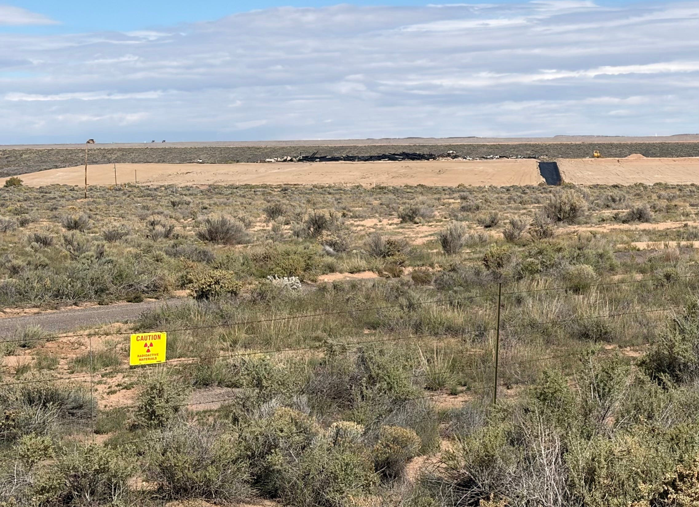
Of course, there’s a much more consequential shadow from those times clouding the neighborhoods and residents of Grants and Milan, namely the toxic wraith of the uranium industry itself. Just outside Milan, 22 million tons of uranium mill tailings, remnants of Homestake’s operations that were shuttered in 1990, sit in a mesa-like pile amid the sage and chamisa. The groundwater is indelibly contaminated and, 36 years later, cleanup continues. When I visited heavy machinery working the top of the pile kicked up huge clouds of dust. The work is potentially endless, and in recent years Homestake has turned to purchasing homes in contaminated areas to try to get out of cleanup requirements.
If you’re wondering why Homestake doesn’t just go belly up and whither away like so many other mining companies have done over the past 150 years, it’s because somewhere along the line, Barrick Gold — a multinational firm with big mines in Nevada and elsewhere — acquired Homestake, along with its liabilities.
Homestake’s uranium tailings depository, which contains 22 million tons of toxic and radioactive materials. Jonathan P. Thompson photo.
Homestake’s pile is just one of many toxic remnants of this area’s uranium boom. The Grants Mining District includes some 85 abandoned and defunct once-producing uranium mines, including the giant and notorious Jackpile-Paguate, and four mill sites, which are now marked by tomblike tailings depositories.
One might think Homestake’s long ordeal would serve as a warning to other firms looking to mine the Grants uranium belt: Best to just stay away. But no. High uranium prices and the promise of growing demand driven by a new generation of data center-powering reactors has sparked a slew of proposals for new mining projects around here. Laramide Resources is working on permitting for its La Jara Mesa underground mine on 156 mining claims, Energy Fuels Roca Honda underground mine is moving through Forest Service permitting process, and the Grants Energy in-situ extraction project is also progressing. All are being fast-tracked by the federal government.
Mt. Taylor and La Jara Mesa, where Laramide Resources is hoping to build a major uranium mine. Jonathan P. Thompson photo.
The two conventional mines would sit on public lands on the lower slopes of Mt. Taylor, or K’aweshtima in Acoma Pueblo’s Keres language, a volcanic cone that juts up from the sandstone mesas on the southern end of the San Juan Basin. Its prominent position on the Four Corners Country’s southern horizon has given it a significant role in Indigenous cosmologies. Some Chacoan structures are aligned with the peak and contain timbers from the mountain’s slopes, it remains sacred to Acoma, Laguna, and Zuni Pueblos, and is one of the Diné’s four mountains that demarcate their homeland. The proposals will serve as a test of New Mexico’s designation of Mt. Taylor as a traditional cultural property. The Grants Energy ISR project is in a sage- and chamise-strewn basin near the base of Mt. Taylor.
Grants Energy proposes to discharge up to 360,000 gallons of formation water per day into the ground here for aquifer testing related to its proposed in-situ uranium extraction project. The sight is a couple of miles west of San Mateo. Jonathan P. Thompson photo.
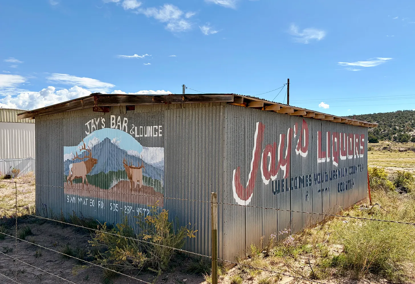
If a triangle was drawn between the three projects, somewhere near the center would be the village of San Mateo, nestled against the lower basaltic slopes of Mt. Taylor. It was once known as the Uranium Capital of the World because of its proximity to so many mines, including the Mt. Taylor underground mine, which produced nearly 700,000 tons of uranium during its short life in the late 1980s, and for which Gulf Mineral Resources Corporation dewatered three aquifers to keep its thousands of feet of workings dry.
Other than the mine, which sits a half mile from the village, and any contamination or dry wells it may have left behind, the remnants of the uranium boom aren’t apparent in San Mateo, itself. The cluster of modest homes and gardens with a riot of pink cosmos and winter squash and dried out stalks of already harvested corn feel much like the northern New Mexico villages near Taos or in the Chama River Valley. Spanish colonial activity dates back to the late 1500s, though the San Mateo wasn’t settled until the mid-1800s. It houses a morada, or church for the Penitente Brotherhood.
I’m sure there are plenty of people here who are rooting for the mines and their promises of hundreds of jobs and the sort of economic boost that brings more people and more strip malls, that fills up the restaurants, hotels, and bars, and awakens the dormant glory of days gone by. And who can blame them? But there’s at least as many folks, the ones whose wells are contaminated or who are sick or lost a family member to cancer or kidney disease, who not only would like to see the mining companies go elsewhere, but who wish that the previous boom never had happened.
And then there are those who just want to move on into the future, who want Grants to thrive economically, but also as a community. I saw glimmers of this: The well-manicured parks and playgrounds lining Route 66, the busy farmer’s market in one of those parks on a Saturday morning, the hikers and bike packers stopping at local businesses that are helping to make Grants a stopping point along the Continental Divide Trail, and who are capitalizing on the community’s proximity to Mt. Taylor and El Malpais and El Morro national monuments.
These are the ones who don’t want to be beholden to the old extractive boom bust cycle because they know that no matter how good it gets, always, always ends in abuse and then abandonment.
***
When I want to understand what life was like during the uranium boom in the Grants area, I don’t look to history books or old newspapers. Rather, I read the poetry of Simon Ortiz, of Acoma Pueblo, in the Grants Mining District. Ortiz worked in the mines and mills as a young man, and many of the poems in Fight Back: For the Sake of the People, For the Sake of the Land are inspired or derived from his time in the industry and the people he worked alongside, people from Acoma, Laguna, the Navajo Nation, or white folks from Oklahoma, Texas, Louisiana, Colorado, or Montana, who had come to the area seeking jobs.
The poems are all insightful and give a visceral sense of the place and the time and what it was like to be an Indigenous person working in the uranium industry. Some pieces expose the ever present, underlying racism in the industry, while others indict the companies’ greed for profit and disregard for the workers and the land. Every one is moving and enlightening in its own way, but “To Change in a Good Way,” a narrative poem centered on the friendship between Bill and Ida, an Oklahoma couple, and Pete and Mary, from Laguna Pueblo, is, to me, perhaps the most stirring and also illuminating of the bunch. I urge you to find it and read it, along with the other poems in that collection. All of these pieces can be found in Woven Stone, which is even available as an ebook.
There’s another piece of his, “It Was That Indian,” that manages to concisely capture the whole arc of the uranium boom in just a couple dozen lines. I’ve included it in its entirety here:
It Was That Indian by Simon Ortiz
Martinez from over by Bluewater was the one who discovered uranium west of Grants. That’s what they said. He brought that green stone into town one afternoon in 1953, said he found it by the railroad tracks over by Haystack Butte. tourist magazines did a couple spreads on him, photographed him in kodak color, and the Chamber of Commerce celebrated that Navajo man, forgot for the time being that the brothers from Aacqu east of Grants had killed that state patrolman, and never mind also that the city had a jail full of Indians. The city fathers named a city park after him and some even wanted to put up a statue of Martinez but others said that was going too far for just an Indian even if he was the one who started that area into a boom
Well, later on, when some folks began to complain about chemical poisons flowing into the streams from the processing mills, carwrecks on Highway 53, lack of housing in Grants, cave-ins at Section 33, non-union support, high cost of living, and uranium radiation causing cancer, they—the Chamber of Commerce—pointed out that it was Martinez that Navajo Indian from over by Bluewater who discovered uranium, it says so in this here brochure, he found that green stone over by Haystack out behind his hogan; it was that Indian who started that boom.
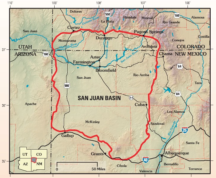
The San Juan structural basin is primarily in New Mexico in a corner of the Colorado Plateau. By US Geological Survey – Assessment of Undiscovered Oil and Gas Resources of the San Juan Basin Province of New Mexico and Colorado, 2002, USGS Fact Sheet FS-147-02, Public Domain, https://commons.wikimedia.org/w/index.php?curid=5749904