It’s the start of a new water year! I’m full of hope that Russ Schumacher is correct in pointing out that water year 2026 was an outlier and that a more normal water year can’t be ruled out for 2027.
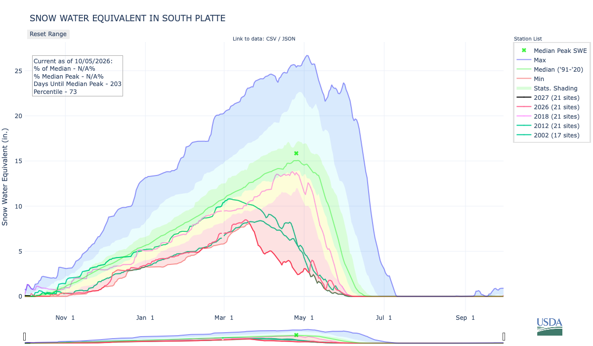
Below is the Snow Water Equivalent in South Platte graph from the NRCS for October 5, 2026. This morning’s snowpack numbers are N/A at the SNOTEL stations. There are 203 days until the median peak. I’ve added the lines for 2026, 2018, 2012, and 2002 since the statewide drought is still very pronounced.
Below is the Precipitation Accumulation in South Platte graph from the NRCS for October 5, 2026. This morning precipitation, at the SNOTEL stations, is at 5% of the median, and 0% of the water year median. There are 361 days left in the water year. I’ve added the lines for 2026, 2018, 2012, and 2002 since the statewide drought is still very pronounced.

There is a chance for showers Tuesday, with a slight chance for showers Wednesday, Thursday, and Sunday in the central mountains. There is a slight chance for showers Tuesday, a slight chance for thunderstorms Wednesday, and a chance for showers Sunday, in the northern mountains. It looks dry and sunny for the next week, down here, about 0.7 miles from Baker’s Crossing on Clear Creek, named for mountain man Jim Baker. From Wikipedia:
On July 3, 1859, Baker took up a homestead west of Denver along Vasquez Creek (now Clear Creek). The area became known as Baker’s Crossing, where he established several businesses, at what is now 53rd and Tennyson in [southwest Adams County]. He built an adobe house and raised cattle. He operated a stone coal (anthracite) mine, a toll bridge on the Denver Boulder Wagon Road, and a store operated by his two wives. His customers were European American settlers and Native Americans…known as “Honest Jim Baker”, [he] was a frontiersman, trapper, hunter, army scout, interpreter, and rancher. He was first a trapper and hunter. The decline of the fur trade in the early 1840s drove many trappers to quit, but Baker remained in the business until 1855. During that time he was a friend of Jim Bridger, Kit Carson and John C. Frémont…He had at least three Native American wives and fourteen children.

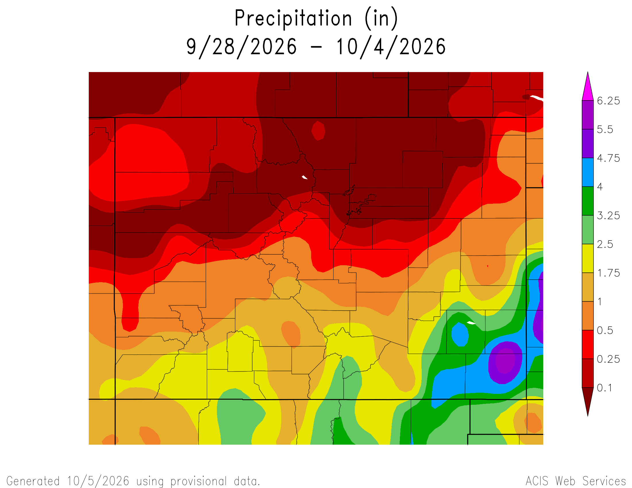
Here’s a look at the Colorado 7-Day precipitation map through October 4, 2026 from the High Plains Regional Climate Center. Precipitation in the South Platte Basin along the Continental Divide of the Americas ranged from 0.00” to 1.00″.
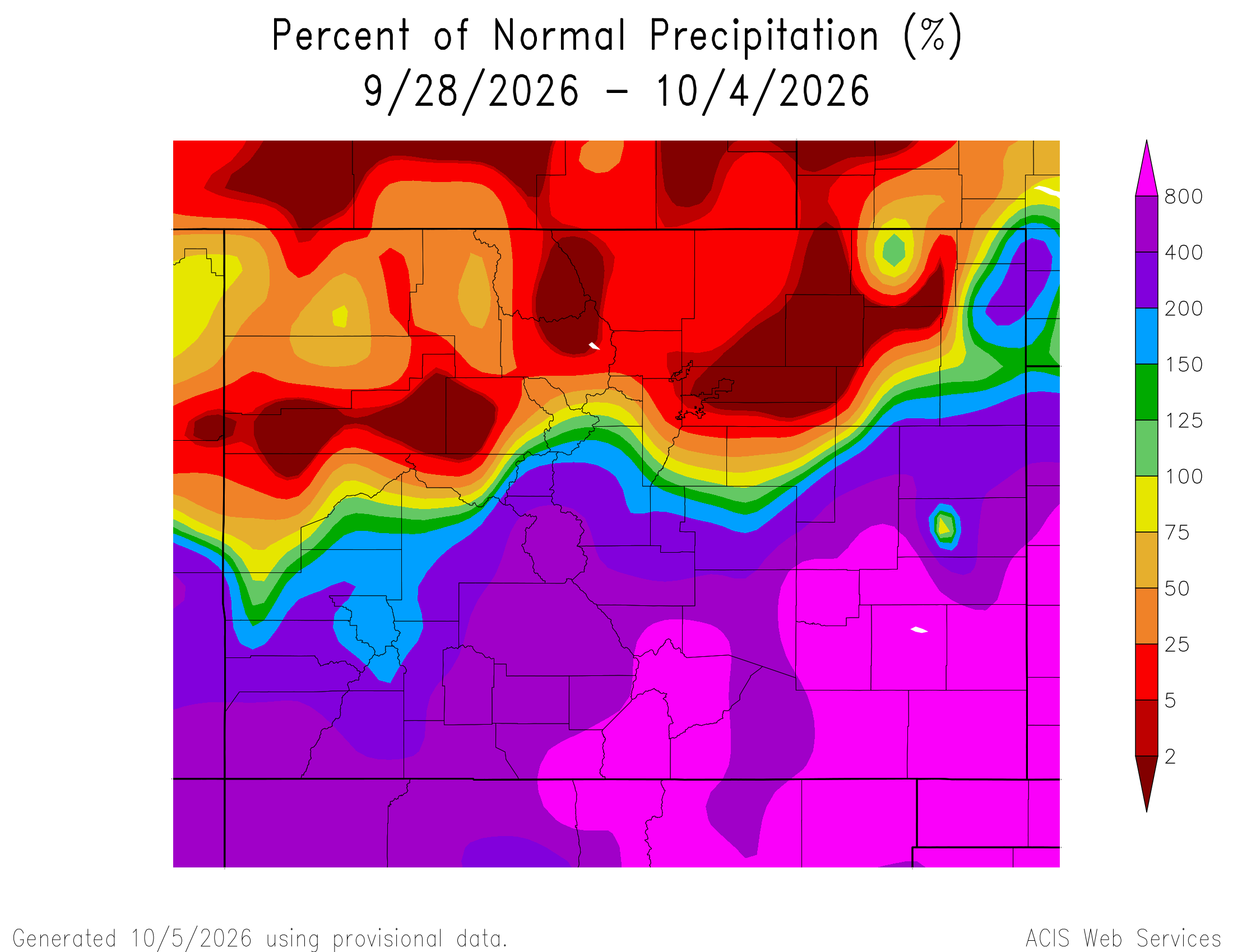
Here’s the Colorado 7-Day percent of normal precipitation map through October 4, 2026 from the High Plains Regional Climate Center. Precipitation in the South Platte River Basin along the Continental Divide of the Americas was 0% to 400% of normal.
Here’s the most recent 7-Day Departure from Normal Temperature (F) for Colorado through October 4, 2026 from the High Plains Regional Climate Center.

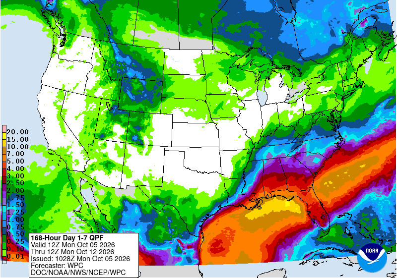
Below is the 7-day Quantitative Precipitation Forecast for the week of October 5, 2026. Precipitation is anticipated for the mountains of the South Platte River Basin and may total up to 0.25″.
Below are the 8-14 day outlooks from the Climate Prediction Center, issued October 4, 2026, for temperature and precipitation, for the week starting October 12, 2026. The CPC expects above normal temperatures and below normal precipitation for the mountains of the South Platte River Basin.


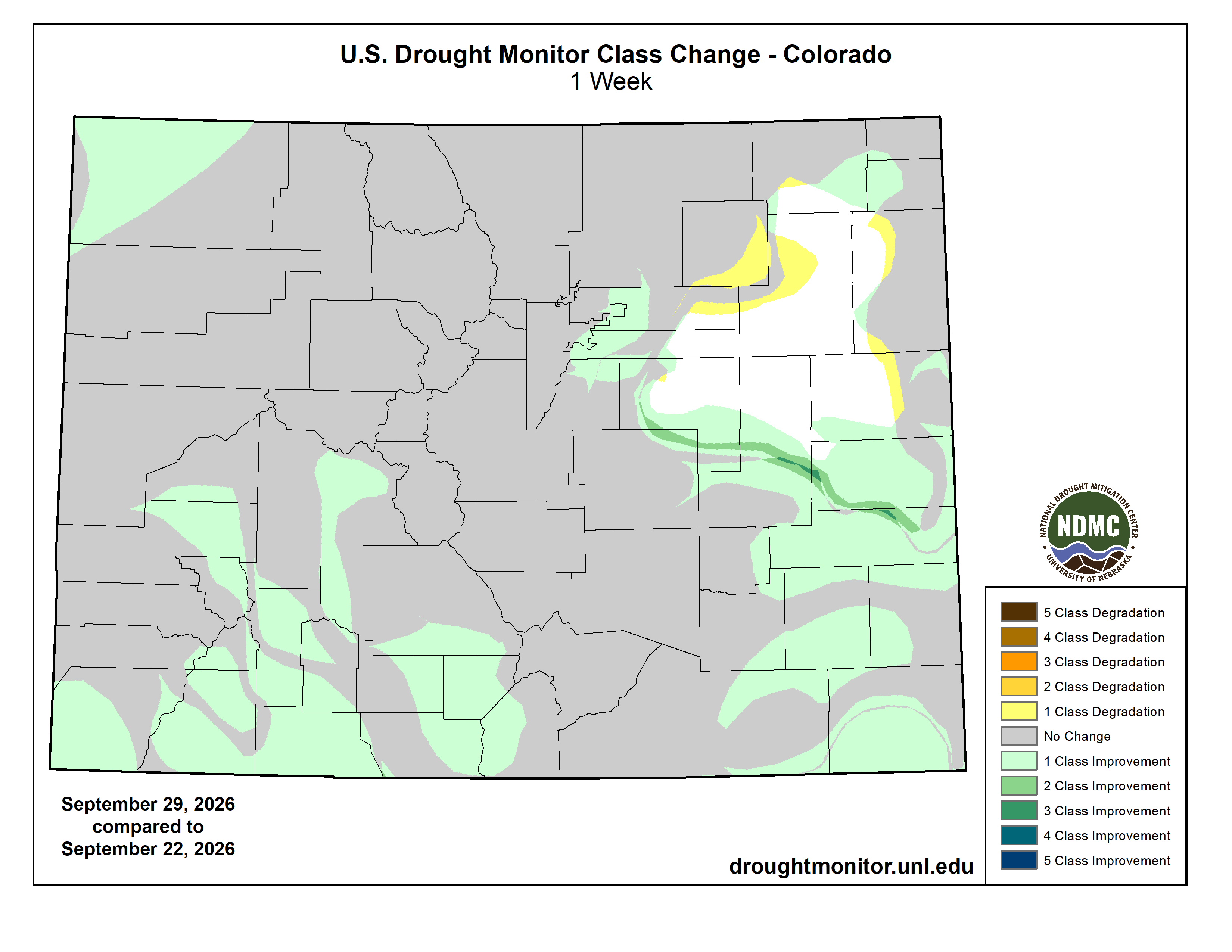
Below is the Colorado Drought Monitor map from September 29, 2026. There were one class improvements in Weld, Logan, Elbert, Arapahoe, Adams, Denver, and Sedgwick counties. There were one class degradations in Morgan, Logan, and Adams counties. Drought and abnormal dryness covers 91.06% of Colorado. The South Platte Basin is experiencing Abnormally Dry, Moderate, Severe, Extreme, and Exceptional drought conditions.

Below is the Colorado Drought Monitor one week change map ending September 29, 2026.
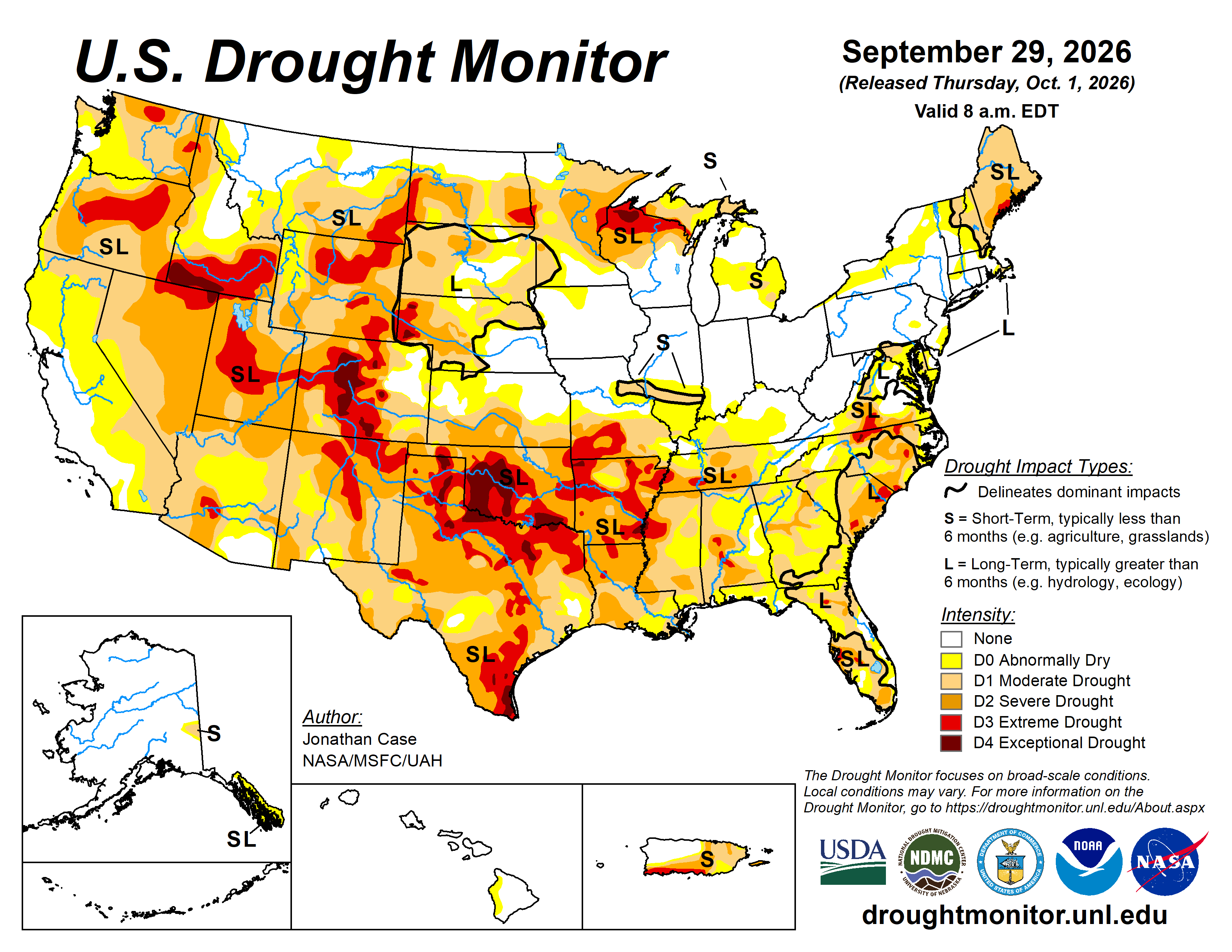
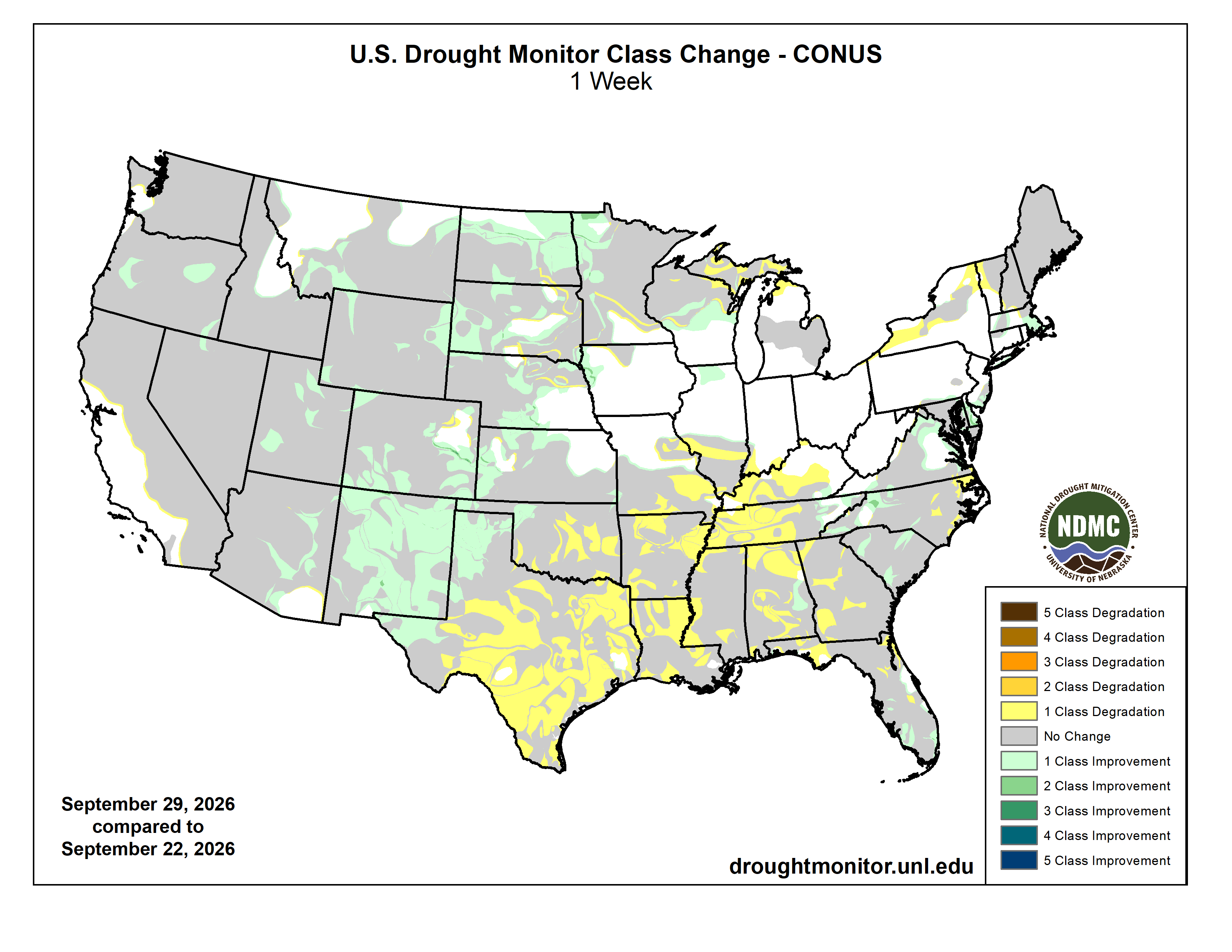
Here’s the US Drought Monitor Map from last week along with the one week U.S. change map.
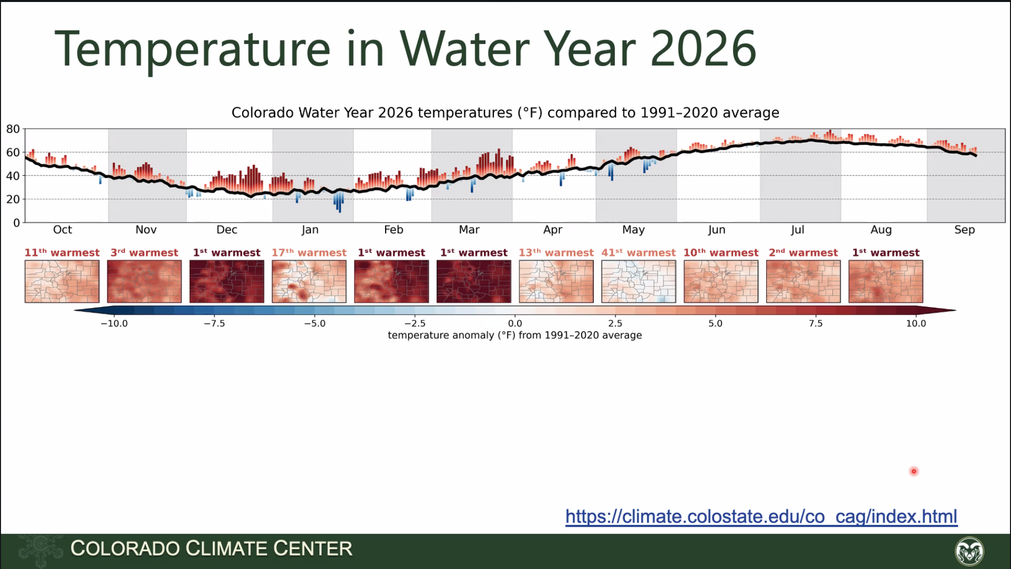
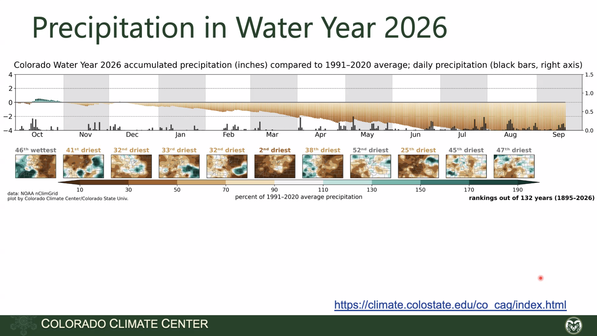
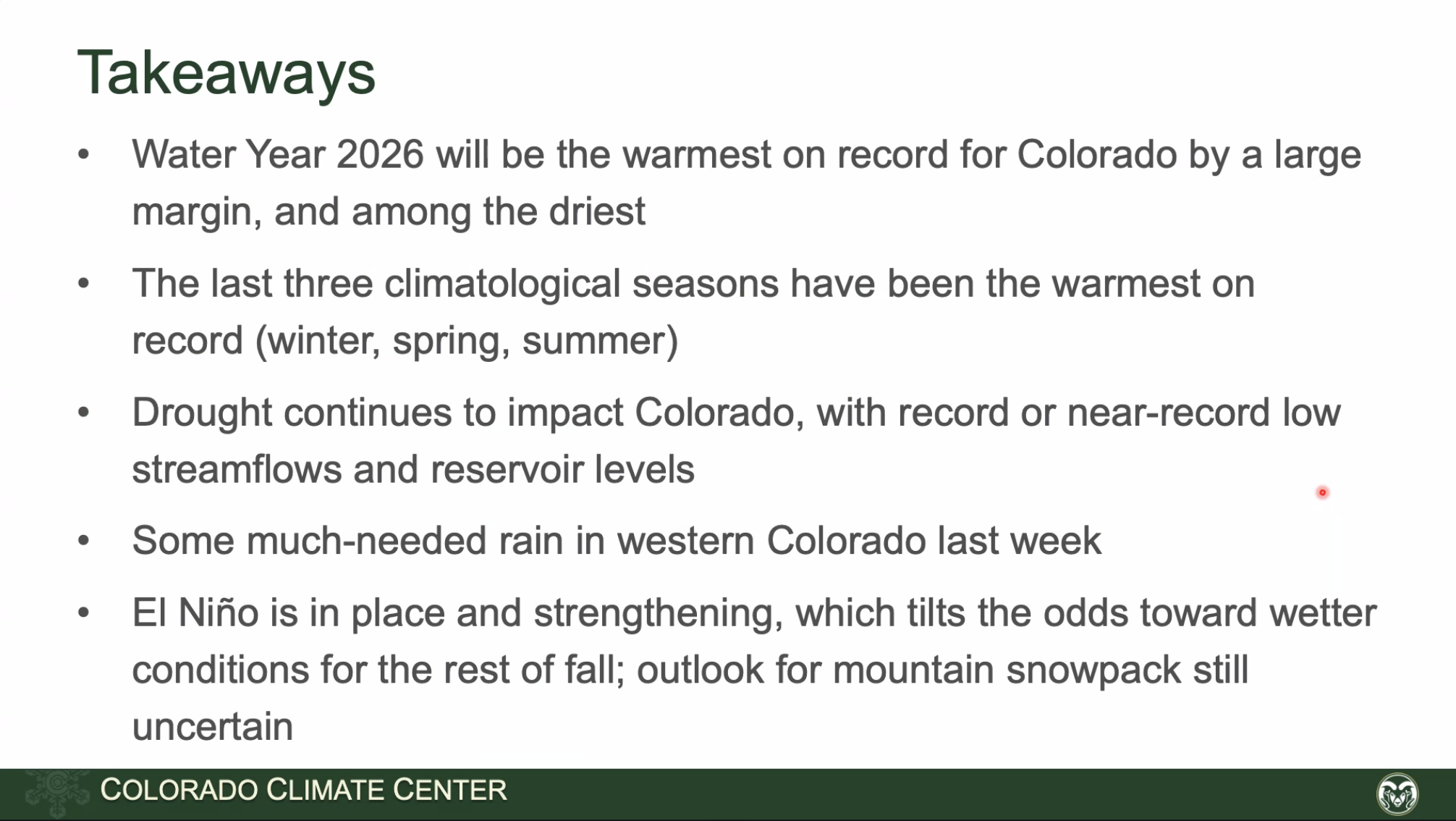
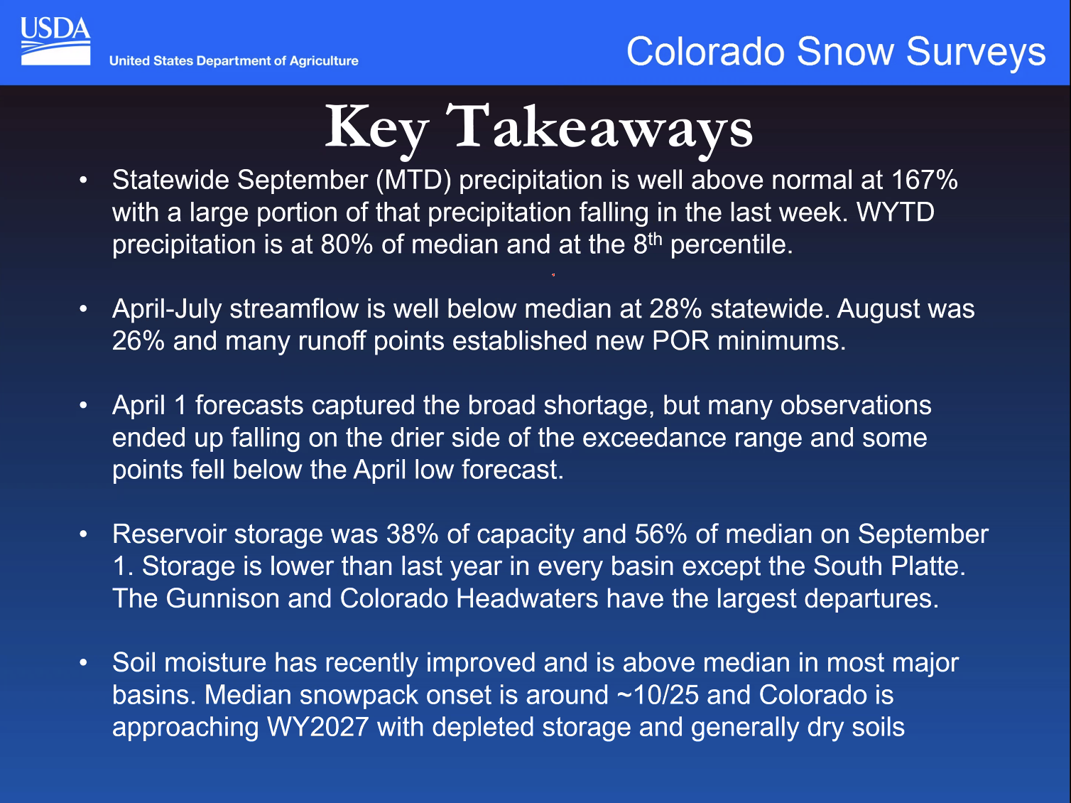
Finally, the Colorado Water Conservation Board hosts a briefing most months of the year, the Water Conditions Monitoring Committee. Regular participants are the Colorado Climate Center, with climate data and insight, and the NRCS, with snowpack and precipitation data from their SNOTEL network, and streamflow forecasts. Click here to view the recording of the September 22, 2026 webinar. Below are some screenshots from the meeting.