
From The Greeley Tribune (Bill Jackson):
Nolan Doesken told a Colorado Farm Show crowd Wednesday afternoon that current El Niño conditions remain strong enough, even though it has weakened somewhat in the past few months, to produce a wet spring. But summer is another situation altogether different. “Summer precipitation is nightmarish to predict. There is no skillful way to predict that yet,” said Doesken, the state’s climatologist.
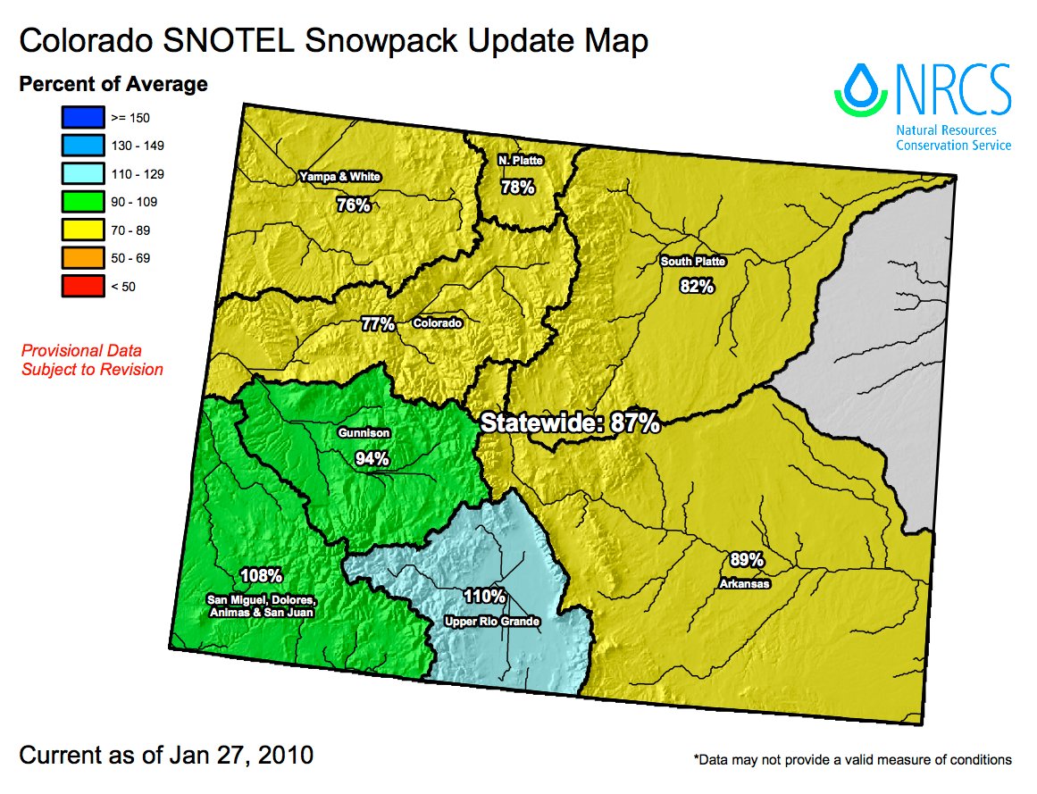
Eastern Colorado in particular is coming off one of the wettest years on record, but it’s not likely that will happen again, he said. In 2009, precipitation in Weld County ranged from 12 to 18 inches, while Greeley and Fort Collins had about 50 percent more moisture than the long-term average. And in Burlington, near the Kansas border, there was more than 30 inches, making it the wettest year in the past 121 years for that city. “That only happens once or twice every 100 years, so the odds of that occurring again this year aren’t good,” Doesken said…
Precipitation during the past four months has been up and down, starting with a lot of snow in October, not much in November, a lot more in December and practically nothing in January. But the eastern part of the state is above the long-term average. Southwest Colorado had been experiencing drought conditions until two major storms hit that part of the state, dumping 4 to 6 feet of snow in some areas. Doesken said that area got one-third of its annual winter precipitation in the past week to 10 days.