Proposed Penley Dam Project reservoir update

A picture named farviewreservoir.jpg

In November, residents in the Indian Creek area, near Sedalia, got together and organized an opposition group to Ventana Capital’s application for the Penley Dam Project, part of the proposed Penley Ranch development. The project’s effects on property values, aesthetics and possibly the flood plain were their main issues.

[Note: I was mistaken about this project. It is on Indian Creek, not Plum Creek. I still don’t know about water rights that would be used to fill the reservoir.]

In December the Douglas County planning staff recommended approval for the project and sent it on the the Douglas County Planning Commission.

On January 10 the Commission voted unanimously (8-0) against the project, according to email from a Coyote Gulch reader.

The hearing before the Board of Commissioners originally scheduled for January 25 has now been continued to February 7. Here’s the notice from Douglas County:

The Douglas County Board of County Commissioners hearing to consider a Use By Special Review application for 3485 N. State Hwy 67-Penley Reservoir (Project File No. US2010-006), noticed for Tuesday, January 25, 2011, at 2:30 p.m., is being continued to Monday, February 7, 2011, at 6:30 p.m. This continuation is necessary to accommodate the numerous requests from citizens for an evening hearing.

Additional hearings are tentatively scheduled for Wednesday, February 23 and Thursday, February 24, 2011, also at 6:30 p.m. All project documents are available on the County’s website here.

More Penley Dam coverage here.

Snowpack news

A picture named snowpackcolorado01192011

From the Glenwood Springs Post Independent:

Overall, the snowpack in the [Roaring Fork] watershed is at 136 percent of average, and all stations are still “significantly above average,” according to the Roaring Fork Watershed Snowpack Report issued by the Roaring Fork Conservancy…

Regional snowpack

Roaring Fork Watershed, 136%
Independence Pass (Roaring Fork), 131%
Ivanhoe (Fryingpan), 132%
Kiln (Fryingpan), 122%
McClure (Crystal), 140%
North Lost Trail (Crystal), 153%
Schofield Pass (Crystal), 137%

Justice Hobbs talks Colorado water history at the state legislature

A picture named farviewreservoir.jpg

Wayne Aspinall is credited with saying, “In the West, when you touch water, you touch everything.” Well, these days you can hardly read an article about our new governor or the General Assembly that doesn’t mention water somewhere so I guess I have to agree with Aspinall.

Colorado Supreme Court Justice Gregory Hobbs was at the capitol building yesterday talking Colorado water history. Here’s a report from Patrick Malone writing for The Pueblo Chieftain. From the article:

Ancestral Pueblo Indians built [water works] in the southwest corner of the state between 750 and 1180 A.D. The San Luis People’s Ditch, the state’s oldest water right dating from 1852, is still honored today. “We didn’t even become a territory until 1861,” Hobbs said…

He discussed the complexities of water source augmentation, the unique role Colorado’s courts play in water decisions (appellate courts are bypassed straight to the Supreme Court on appeal), how Colorado’s neutral decision makers on water disputes — the courts — differ from other states’ more political approaches and the state’s history of consideration to agriculture in structuring water law.

More 2011 Colorado legislation coverage here.

Energy policy — nuclear: Colorado Citizens Against Toxic Waste file amended lawsuit against Cotter Corp over Lincoln Park/Cotter Mill superfund site

A picture named cottercontamination.jpg

From The Pueblo Chieftain (Tracy Harmon):

An amended complaint was filed in Denver District Court Friday by attorneys Travis Stills of the Energy Minerals Law Center in Durango and Jeffrey Parsons with the Western Mining Action Project in Lyons, on behalf of Colorado Citizens Against Toxic Waste. The defendants are the state health department and Steve Tarlton in his capacity as manager of the state’s radiation control program, plus Cotter Corp. also is listed as a party.

Because Colorado radiation regulations require a decommissioning funding plan that outlines a cost estimate for closing the mill, Cotter and state officials have been working since 2009 to try to pin down an updated cost estimate. However, the lawsuit alleges the bond remains inadequate despite the fact that Cotter Corp. has agreed to up the bond from $14.7 million to $20.8 million by June of this year to cover cost of decommissioning the entire mill when it closes. The state estimated cleanup will cost about $43.7 million while Cotter estimated it would be $23.2 million. On Dec. 15, the state health officials agreed to leave the bond at $20.8 million despite public comment that urged it should be $53 million. “We would like to see them (Cotter Corp.) post the entire $43.7 million at least. It is a federal program the state is implementing and adding a 25 percent contingency (an additional $10.9 million) is standard,” Parsons said. “Both the bonding amount and the way it is calculated are serious problems because they are the first line of defense for the taxpayers of Colorado…

The suit also alleges that decommission work on the old mill is being done without benefit of any kind of updated decommissioning plan since the last plan was inked in 2005. Parsons said there is no current decommissioning plan, final closure plan or reclamation plan. “That is the huge elephant in the room, they (Cotter) are demolishing old buildings, old tanks and putting them in the tailings impoundments and what is going to happen with the tailings impoundment? Currently, they are pumping back contaminated water to adjust for leaking.

More coverage from Bruce Finley writing for The Denver Post. From the article:

The lawsuit filed in Denver District Court alleges that recent dismantling activity at Cotter’s Cañon City mill is being done without a required plan, presenting a public-health risk as toxic and radioactive waste is dumped into a waste-storage pond. “We have frequent high winds here. I always worry,” said Cañon City resident Sharyn Cunningham, leader of Colorado Citizens Against Toxic Waste. “We’d like an opportunity to weigh in.”[…]

The lawsuit also contends a plume of toxic groundwater contamination from the mill property — identified in 2008 — is flowing unchecked toward the heart of Cañon City and the Arkansas River…

Cotter president Amory Quinn said the lawsuit “doesn’t have anything to do with us” and confirmed that Cotter is dismantling old structures. He said Cotter hopes to move forward with plans to re-engineer and reopen the mill. The health department’s recent approval of a permit for another company to build a uranium mill in southwestern Colorado should have no effect on Cotter’s plans, Quinn said. “We have done millions of dollars’ worth of remedial work in the past few years, and we are going to continue until it is complete,” he said.

More nuclear coverage here and here.

Arkansas Valley Super Ditch update

A picture named arkbasinditchsystem.jpg

From The Pueblo Chieftain (Chris Woodka):

Water rights holders representing 67 percent of the land and 70-75 percent of the water under seven ditches proposed for inclusion in Super Ditch returned cards indicating they might be interested in selling water through a lease program, said Peter Nichols, water attorney for the district. If those who sign up accept contracts — they’re under no obligation to do so — there would be more than ample water to fill the current demand, Nichols said.

The Super Ditch has letters of agreement to supply water up to 8,000 acre-feet annually to El Paso County water users for 40 years and up to 140,000 acre-feet over the next 37 years to Aurora…

The Lower Ark district mailed cards to all shareholders on the Bessemer, Catlin, Fort Lyon, Holbrook, High Line, Otero and Oxford ditches last fall in order to identify the potential source of water under its application in Water Court. The deadline for returning the cards is Feb. 15. While some in the Super Ditch asked the Lower Ark district to directly contact water rights owners who have not signed on, the district has resisted. “If people don’t participate, we’re not going to twist their arms,” said Jay Winner, general manager. “It’s an individual choice.”[…]

Meanwhile, the district is moving ahead on several fronts to support the Super Ditch. It is requesting a $225,000 grant from the Colorado Water Conservation Board for engineering that would determine how to move water to Lake Pueblo, and a separate $28,000 grant to develop an online tool that would help farmers decide whether a lease program makes sense.

More Arkansas Valley Super Ditch coverage here and here.

San Miguel River Wild and Scenic designation

A picture named sanmiguelriver1109

The Bureau of Land Management is looking over a couple of reaches on the river. The last public meeting is on Thursday in Norwood. Here’s a report from Kathrine Warren writing for The Telluride Daily Planet. From the article:

If designated under the Wild and Scenic Rivers Act, portions of the rivers would enjoy certain protections tailored to keep them wild, free-flowing, beautiful or recreationally valuable. The BLM has conducted several public meetings over the past two months concerning the river’s suitability for Wild and Scenic status in an attempt to collect public comment for or against the possibility. The last meeting is this Thursday from 5:30 to 8:30 p.m. at the Norwood Community Center with a presentation from Roy Smith of the BLM.

This meeting will be the final chance for public comment, but for those who can’t attend, comments can be submitted to the BLM by e-mailing UFORMP@BLM.GOV.

More San Miguel River watershed coverage here and here.

CWCB: Water Availability Task Force meeting recap

A picture named snowpackcolorado01192011

From the Associated Press (Catherine Tsai) via The Colorado Springs Gazette:

Forecasters say this is just the beginning of what could be a two-year La Nina cycle, when the second year is often drier than the first. If that pans out, that could pose problems for farmers already hurting for rain and snow cover this winter.

Still, water planners say it’s too early to be optimistic or pessimistic about water supplies, even just for this year. Colorado typically gets most of its snow in March and April. “If it were a football game, we’d only be in the second quarter,” said Bob Steger, raw water supply manager for Denver Water…

Breckenridge Ski Resort, where at least one trail sign was halfway covered in a snowdrift Tuesday, reported 26 inches of new snow in the past 24 hours…

The storm helped boost the statewide snowpack to 125 percent of the 30-year average Tuesday, but the Upper Rio Grande and Arkansas river basins in southern Colorado are below average, according to the Natural Resources Conservation Service. If the southwest corner of the state hadn’t gotten hit with December storms, it also would be hurting, said NRCS snow survey supervisor Mike Gillespie. Instead, the San Miguel, Dolores, Animas and San Juan basin stands at 120 percent of average, according to NRCS…

In December, moisture from storms that struck California helped the state turn around its snowpack totals, but little of it made its way east of the Continental Divide, said state climatologist Nolan Doesken. In the Arkansas basin, the headwaters are in decent shape, but farmers and ranchers to the east aren’t getting the same moisture, he said.

Summit County: Forest health task force meeting schedule

A picture named blueriver.jpg

Click through for the complete listing from the Summit Daily News (Janice Kurbjun). Times vary but you can get the inside skinny on the Forest Health Task Force website. Here are a couple that might interest you:

March — Watersheds. It’s a meeting hosted by Denver Water, Aurora Water, Blue River Watershed Group, and should have participation from the U.S. Forest Service…

December — Year-end wrapup. All the key players in environmental protection, watershed protection, youth, communications and education, optimizing future forest conditions, understanding beetles and other forest pests, Forest Service, and more will be invited to the discussion.

NIDIS Weekly Climate, Water and Drought Assessment Summary of the Upper Colorado River Basin

A picture named precipcoutwyjanuary2011

Here’s are the notes from the Colorado Climate Center.

Rio Grande Water Conservation District’s quarterly meeting recap

A picture named slvdischargerecharge.jpg

From the Valley Courier (Ruth Heide):

When the state pulls the trigger on groundwater rules and regulations, many Valley irrigators could be shut down. Colorado Division of Water Resources Division Engineer for Division 3 Craig Cotten reported during the Rio Grande Water Conservation District’s quarterly meeting on Tuesday that those rules are very close to being completed. State Engineer Dick Wolfe has been working with a large advisory group for the better part of two years to develop regulations that governing groundwater use in the Rio Grande Basin. Well irrigators who are not part of a water management sub-district or who have not completed individual augmentation plans may find themselves out of business when the rules go into effect and the state begins shutting down wells.

Currently, one water management sub-district of the sponsoring Rio Grande Water Conservation District is on appeal with the Colorado Supreme Court, while five or six other sub-districts throughout the Valley are in various stages of development. Because it appears the state’s rules could be in place before the sub-districts, the state engineer’s office asked legislators like State Senator Gail Schwartz and State Representative Ed Vigil to carry legislation adding language to existing legislation that would give folks within a pending sub-district some protection when the bullets start flying.

“We are going to have a situation, I think, where we will have rules and regulations in place. Those rules and regulations are in draft form right now and the rules and regulations will go into effect May 2012,” Cotten said. “If those rules and regulations go into effect we will have sub-districts that are in court but not through the process, so those people in those sub-districts will be stuck … They could be caught in a position where they are going to be shut down and they don’t have any ability to apply for a substitute supply plan.” He said without an augmentation plan, those folks would have to shut their wells off. Cotten explained that the state has had legislation for nearly a decade that provides for temporary or emergency substitute water supply plans to be approved while an official augmentation plan is pending with the courts. “It allows somebody to go forward and do what they are planning on doing, replace their water, as they wait on the court case to get done,” Cotten explained. He said the statute in place right now provides for several different situations but does not specifically mention sub-districts because it was enacted before the Valley began developing water management sub-districts.

More San Luis Valley groundwater coverage here and here.

Pueblo Board of Water Works board meeting recap

A picture named watertreatment.jpg

From The Pueblo Chieftain (Chris Woodka):

The water board could save $50,000 to $60,000 annually in costs for powdered fluoride if the U.S. Department of Health and Human Services lowers fluoride standards for drinking water, Don Colalancia, division manager for water quality and treatment, told the board at its monthly meeting Tuesday…

This week, the Environmental Protection Agency is recommending stricter testing limits for chromium 6. “It’s an oxidized state of chromium,” Colalancia explained, adding that chromium 6 is not likely to be a problem here, but that to be sure it has to be measured…

Right now, the water board tests for total chromium, under EPA standards of 100 parts per billion. Pueblo’s water has less than 4 parts per billion of total chromium. Chromium 6 is probably a small part of the total chromium. California is looking at chromium 6 levels that are 0.06 ppb, a minute quantity which not all labs can measure, so water managers are scrambling to find qualified labs even as prices for testing go up, Colalancia explained.

More Pueblo Board of Water Works coverage here.

Snowpack/Lake Mead news

A picture named snowpackcolorado01122011

From The Arizona Republic (Shaun McKinnon):

The U.S. Bureau of Reclamation says it now expects runoff from the winter snowpack to raise water levels at Lake Mead later this year, easing drought conditions at the giant reservoir, which last fall sank to its lowest level since 1937. The lake has already risen 5 feet since Dec. 1, after a series of storms drenched southern Utah and southern Nevada. Snowpack in Colorado’s Rocky Mountains is 133 percent of average overall, with some locations reporting amounts 200 percent of average…

In its January water-supply forecast, the bureau says there is now a 76 percent chance that runoff from the snow will allow the agency to release extra water from Lake Powell downstream into Lake Mead, a procedure designed to better balance the contents of the two reservoirs. The extra water, an estimated 3.13 million acre-feet, would raise the lake’s level 30 feet above the first drought trigger. The water won’t erase the effects of a decade of dry conditions – Lake Mead has dropped more than 130 feet since 1999 – but it could be just enough to protect water users from rationing. More significantly, it would give Arizona and Nevada, the states that would be hardest hit by rationing, a chance to better prepare.

Pueblo: Maintenance work on the Arkansas River levee update

A picture named puebloleveearkansasriver.jpg

From The Pueblo Chieftain (Chris Woodka):

Work was supposed to have started in early January, but cold weather delayed that. Plus, there were details in contracts with the U.S. Army Corps of Engineers to work out. “Any time you’re dealing with the federal government and four contractors, there’s going to be some uncertainty,” said Gus Sandstrom, president of the Pueblo Conservancy District.

The first step in the project will be to build a small levee in the Arkansas River channel to divert water away from the concrete levee on the north side of the river…

On Monday, there were crews working to install rip-rap on the embankments of the newly completed Fourth Street bridge, a Colorado Department of Highways project, but no work in the river channel itself…

The levees are being damaged by flows from the kayak gates, which double as fish shelters, that have been built along the levee. The water is undermining the base of the levee. After the flows are diverted, vents will be installed at the base of the levee to allow water to flow through without washing away soil

More Arkansas River basin coverage here.

Upper Arkansas Valley Water Conservancy District board meeting recap

A picture named upperarkansasvalley.jpg

From The Mountain Mail (Joe Stone):

Witte said he believes the vast majority of seep water affected by the new rules is in southeast Colorado “because there are big ditch companies out there with large canals that cross dry arroyos.” Witte explained water from the big ditches seeped into arroyos through time and people claimed rights to that water instead of allowing it to return to the river. Because seep rights are more recent or junior rights, failure to administer them under the priority system has deprived senior rights holders of their water – particularly in the Upper Arkansas River Basin, Witte said. “I’m absolutely convinced we’re doing the right thing,” Witte said, adding he sees no basis for distinguishing between ditch seepage and natural springs.

On a separate topic, Witte said water storage in the basin is down about 15 percent because of dry fall weather. He said an environmental impact statement process is under way for the Arkansas Valley Conduit.

More Arkansas River basin coverage here.

Martin Luther King Day

A picture named mlk.jpg

Enjoy your day today. Take time to reflect on King’s legacy and contributions to freedom in the U.S.

Fort Collins: Proposed floodplain rules update

A picture named coloradoflooddss.jpg

From the Fort Collins Coloradoan (Kevin Duggan):

The latest proposal from city stormwater officials for upgrading the regulations — allowing non-residential development in the floodplain as long as it has “no adverse impact” on other properties — might be the solution sought by riverside property owners who hope to develop their land, she said. Or it may create a regulatory environment in which development would become cost prohibitive because of the need for engineering studies to show no harm would come from a project, she said. Mitigation efforts needed to prevent water from one property going to another during a flood event, such as channeling the river, could be too costly except for the largest and wealthiest developers, she said.

More Stormwater coverage here.

2010 Colorado election gubernatorial transition: Governor Hickenlooper’s first official tour recap

A picture named roadteasttolaplatas032004

I’m feeling sorry for the new governor. Chasing across the valleys, crossing pass after pass, bracing against twists and turns up and down canyons and gazing out the window at timeless vistas, it must be tough to get psyched for your first official tour of Colorado. Here’s a report from NewsFirst5.com. From the article:

As part of his state wide tour, Governor Hickenlooper made his first official trip to Southern Colorado Sunday with stops in Pueblo and Colorado Springs. He says bringing more growth into the state economy is going to be a tricky task. “The whole state has to be more pro-business, but this is Colorado so we have to hold ourselves to the highest standards of protecting our land and water, making sure we hold our businesses to the highest ethical standards.” he says, “But as we do that we want to be more pro-business.”

More coverage from the Associated Press via CBS Denver:

Hickenlooper began in Edwards in Eagle County. He told the audience made up of hundreds that he wanted their ideas. “This can only really work if we get more people involved, not usual suspects but different suspects,” said Hickenlooper.

More coverage from the Longmont Times-Call:

Gov. John Hickenlooper is to discuss economic development and job creation Monday afternoon with northern Colorado business leaders, community members and local officials.

The Loveland meeting, which is open to the public, will conclude a four-day tour that Hickenlooper began Friday to promote what the governor calls his “bottom-up economic development plan.” Hickenlooper has proposed local creation of economic development plans for each of Colorado’s 64 counties. Those county plans would then be rolled into 14 regional plans, which collectively would amount to a statewide economic development plan.

Monday’s meeting is set for 3 p.m. in the McKee Community Building at The Ranch, 5280 Arena Circle, Loveland.

Here’s a look at Governor Hickenlooper’s vision for the Department of Natural Resources, from Bobby Magill writing for the Fort Collins Coloradoan. From the article:

“We’re going to have to focus on making sure that Colorado is open for business and we’re working well with folks in the tourism industry and the oil and gas industry,” he said. The Department of Natural Resource’s, or DNR, 11 divisions oversee state parks, forestry, wildlife, water resources, oil and gas, state land, mining, minerals and enforcement of the state’s natural resources rules and regulations, including new rules created governing in situ leach uranium mining in Northern Colorado.

Under Gov. Bill Ritter, King helped oversee the creation of legislatively mandated oil and gas rules hailed by environmentalists but detested by the energy industry, which said the rules would send jobs to other states. King, who continues as DNR executive director after assuming that position eight months ago in the Ritter administration, said the department’s primary focus is on jobs and economic development. The DNR, he said, will work with state tourism officials to figure out how to use state parks to generate more tourism revenue.

More coverage from The Pueblo Chieftain (Matt Hildner):

Costilla County Commissioner Crestina Martinez said residents in her county have only one company that offers both voice and data services. She noted that some people don’t even like to travel over La Veta Pass because its a black hole for service of any kind.

While a fairly solid agricultural economy helped the valley stave off the worst of the recession this year, according to a recent state report, local officials emphasized the problem of connecting some products — such as locally grown food and livestock — to niche markets.

More coverage from John Schroyer writing for The Colorado Springs Gazette. From the article

His [Hickenlooper’s] aim, he said, is simple — create jobs. After pointing out that the state is flat broke, and Coloradans aren’t in the mood for a tax hike, he repeated what has become his political mantra. “There’s no other solution than to be more pro-business.” He heard from dozens of area residents Sunday, ranging from self-described “interested citizens” to local CEO’s, government officials, attorneys, activists, teachers, and even a filmmaker.

More 2010 Colorado elections coverage here.

2011 Colorado legislation: Will the General Assembly tackle the vise grip of TABOR, the Gallagher Amendment and Amendment 23?

A picture named fishladderpricestubbsdamcoloradoriver.jpg

Here are some recommendations from former and current state budget wonks, from The Denver Post:

STRUCTURAL CHANGES: Colorado has some of the easiest requirements in the nation for citizen-initiated constitutional changes. This has led to problematic additions to the Constitution that have had unexpected and drastic consequences.

• Ask the voters to reform the state’s initiative process to make it more difficult for people to put changes to the state’s constitution on the ballot. The panel’s suggested changes are in line with 2008’s Referendum O. With no real supportive campaign, the measure failed 52 percent to 48 percent.

• Ask voters to revise the Taxpayer’s Bill of Rights to preserve the essential elements that were used to sell it to voters in 1992. The panel agreed that TABOR should be distilled to its basic tenet: no new or increased taxes without a vote of the people.

A revision would include keeping the requirement that voters have to approve tax rate hikes, any new taxes, and bonded indebtedness. The idea is to preserve voter approval while ridding our constitution of artificial restraints, such as the hard revenue cap, that prevent governments from keeping funds raised from existing taxes to provide core services.

• Ask voters to revise Amendment 23 (guarantees minimum levels of funding for K-12) that was passed as a response to TABOR and legislatively enacted permanent tax cuts.

Despite Amendment 23, the K-12 education budget is not protected. The majority of panelists supported amending the provision that directs 0.33 percent of state income tax to the state education fund as follows: reduce the amount to 0.25 percent and redirect the funds into the State Land Board Trust Fund, which is designated for education support in the Constitution. The interest from the collected funds would be used to support K-12 and could not be raided for other uses.

The Gallagher amendment was passed in 1982 as a way to maintain a constant ratio between property tax revenues coming from residential and business parcels. However, TABOR’s prohibition on assessment-rate increases without a popular vote has distorted the intent of Gallagher. One of the results has been a vast and unsustainable shift in responsibility for K-12 funding away from the local level to the state. Thus, funding for K-12 now takes up the lion’s share of the general fund.

• Ask voters to repeal Gallagher but freeze the assessment rate on residential properties at the current 7.96 percent. The ratio between the state and the local districts would remain constant, and there would be no increase in property tax rates, yet revenues could increase with increased values.

More 2011 Colorado legislation coverage here.

Pueblo: Stormwater seminar January 27

A picture named southplatteflood.jpg

From The Pueblo Chieftain (Chris Woodka):

The city will host a seminar on stormwater discharges from 8 to 11 a.m. Jan. 27 at the Pueblo Convention Center. The seminar intends to answer questions from the business sector, contractors and developers about the city’s stormwater system, and cover ordinances, best management practices and maintaining construction sites and private homes. “If it’s not stormwater, it does not belong in the system. Rainwater and snowmelt are two examples of stormwater,

More stormwater coverage here.

La Niña update

A picture named typicallaninanoaa.jpg

From the Summit County Citizens Voice:

“The solid record of La Niña strength only goes back about 50 years and this latest event appears to be one of the strongest ones over this time period,” said Climatologist Bill Patzert of [NASA Jet Propulsion Laboratory]. “It is already impacting weather and climate all around the planet.”

“Although exacerbated by precipitation from a tropical cyclone, rainfalls of historic proportion in eastern Queensland, Australia have led to levels of flooding usually only seen once in a century,” said David Adamec, Oceanographer at NASA’s Goddard Space Flight Center, Greenbelt, Md. “The copious rainfall is a direct result of La Niña’s effect on the Pacific trade winds and has made tropical Australia particularly rainy this year.”

Fort Morgan flooding discussion

A picture named fortmorganrainbowbridge.jpg

From The Fort Morgan Times (John La Porte):

Residents of the Eighth Avenue area near Main Street blame flooding in the last two years at least partially on the downtown improvement project completed in the summer of 2009. The project has moved a flooding problem from downtown to Eighth, some residents said at a meeting called by city officials Wednesday to discuss the flooding and try to reassure residents that they were working on a solution.

And while city engineer Brad Curtis acknowledged that runoff from the downtown area “didn`t help” the long-standing flooding situation on Eighth, Scott Bryan of the city council pointed out that the area had not seen in a long time rainstorms like it has seen the last two years. Bryan, who owns a cleaning and service business, said that flooding problems in Fort Morgan are not isolated to Eighth. He said he and his workers pump out 50 to 60 houses after every big storm. He has had the business since 1995, he said, and has not seen anything to compare with the storms of the last two years.

More stormwater coverage here.

USFS: Gunnison District to host two presentations about the Mt. Emmons Mine

A picture named gunnisonriverbasin.jpg

From the Montrose Daily Press:

[U.S. Energy Corp] The company wants to undertake geologic studies, using test pits and shallow holes, to analyze the soils and geology in the area, which has molybdenum.

The first meeting will be from 5:30 to 8:30 p.m. Jan. 25 in the South Ballroom (Room 215) at the Western State College Student Center in Gunnison. (Park in the north parking lot.) Another meeting will be from 7 to 9:30 p.m. Jan. 26 at the Lodge at Mountaineer Square, Mountaineer Conference Center, in Crested Butte.

The U.S. Forest Service wants to present more information on what is proposed for the baseline studies and the agency’s role in the projects and proposals, said Gunnison District Ranger John Murphy. “It’s important for folks to know the sideboards of our authority, as well as to provide them an opportunity to discuss the proposed work with resource specialists,” he said.

More Gunnison River basin coverage here.

Bureau of Land Management’s Southwest Colorado Resource Advisory Council meeting January 28

A picture named uncompahgrewatershed.jpg

From the Montrose Daily Press:

The open meeting will be from 9 a.m. to noon ,” with a public comment period at 11 a.m. ,” on Jan. 28 at the Holiday Inn Express Jordan Room, 1391 S. Townsend Ave. The Southwest Colorado RAC subgroup is composed of area residents representing diverse interests within the Uncompahgre Field Office. The seven-member subgroup will provide recommendations to the BLM Southwest Colorado RAC regarding development and implementation of the public lands within the field office.

More Uncompahgre River watershed coverage here.

2010 Colorado election gubernatorial transtion: State of the state address recap

A picture named blackcanyoninnercanyonnps.jpg

From the Cortez Journal (Joe Hanel):

The new Democratic governor at times sounded like a Republican, calling for a “regulatory impact statement” on bills to keep the Legislature from bothering businesses with more paperwork.

At other times, though, he had Democrats cheering by pledging to defend two of former Gov. Bill Ritter’s proudest accomplishments: the conversion of coal power plants to natural gas and the expansion of government-provided health care for low-income families.

But, befitting of the bipartisan tone Hickenlooper tried to strike in his first address to the Legislature, he received the loudest ovation from both sides of the aisle for his challenge to legislators to cooperate.

“A lot of people don’t think the state can operate in a nonpartisan way for the benefit of Colorado,” he said. “We don’t agree.”

More 2010 Colorado elections coverage here.

Cortez Sanitation District names new manager

A picture named wastewatertreatmentwtext.jpg

From the Cortez Journal:

The Cortez Sanitation District has selected Kyle Schreckenbach of Bryan, Texas, as its new district manager. Schreckenbach will be charged with interpreting district rules and regulations, seeking compliance and planning for the long-term future of the district.

More wastewater coverage here and here.

Animas-La Plata project: Lake Nighthorse recreation plan is taking shape

A picture named lakenighthorsesummer2010

From The Durango Herald (Dale Rodebaugh):

In a couple of months, planners at Durango-based DHM Design will return a completed picture for review by the public and water authorities. Final approval will take a few more months…

Here’s a rough sketch of the plan:

– The lake will have places for water craft ranging from power boats to canoes and kayaks. Only Jet Skis would be banned.

– A beach will be available for swimmers, and other areas will be designated for nonboating activities.

– Trails will accommodate hikers, cyclists and equestrians.

– A boat ramp, already installed on the northeast shore, will provide access for boaters and anglers.

– Campgrounds will be phased in, but definite sites have not been chosen.

– The entrance to the recreation area from County Road 210 will have a ticket booth and a station to check water craft for invasive species, particularly quagga mussels and zebra mussels.

Visitors arriving on foot or bicycle will not pay an admission fee. Motorists will be charged, and additional charges will be levied for launching a boat or camping.

More Animas River watershed coverage here and here.

Denver public policy research firm report says that state severance tax policy is short changing Colorado water projects

A picture named fountainpavementdrawing.jpg

From The Pueblo Chieftain (Chris Woodka):

[Dick Brown, of San Dollar Research] looked at the state’s reliance on mineral severance taxes to fund water projects and concluded they are inadequate to meet the large backlog of projects and future needs. “I wish my conclusions had gone the other way,” Brown said. “But I am not very confident about the state being able to marshal the resources that will be necessary — at least not for the next several years.”

As the state has sought to balance its budget for the past two years, mineral severance funds that traditionally funded many water projects in Colorado were reviewed, and in some cases diverted, to cover shortfalls elsewhere in the budget. Big water projects, such as Southern Delivery System and the proposed Flaming Gorge diversion from Wyoming to Colorado’s Front Range, will cost billions of dollars to build. At the same time, the state has nearly $5 million in needs for an aging infrastructure.

The state also is struggling to come up with ways to fill a municipal gap in water supplies identified by the Colorado Water Conservation Board. The effort, called the Statewide Water Supply Initiative, started after the historic drought of 2002…

[Brown] reached three conclusions:

– Water managers should not look to the state for primary funding commitments for projects.
– State elected officials don’t have the resources or time in office to develop long-term capital financing programs for water projects.
– The water community has to make an effort to preserve current levels of state support to prevent funds from shifting to other high-priority needs in the state.

More infrastructure coverage here.

Coyote Gulch outage

A picture named stevensarchfromcoyotegulch19951

I’m on deadline at Colorado Central Magazine. I’ll see you on Monday morning.

Creede: Town Board meeting recap

A picture named creede1920

From The Mineral County Miner (Toni Steffens-Steward):

The Creede Town Board learned that water line work is on budget and faced more questions on special event permits and water tank access at the regular meeting on Jan. 4.

More infrastructure coverage here.

Arkansas Valley Super Ditch Company update

A picture named arkbasinditchsystem.jpg

From The La Junta Tribune-Democrat (Bette McFarren) via the Ag Journal:

The Super Ditch is a plan whereby the farmer/landowner retains the land, but the water is leased by the acre-foot to an urban area for a period of one year. Whatever part of the farmer’s land which would have been watered by that portion of his irrigation rights is then fallowed (not planted) for that year. This plan makes sense particularly in dry years in which the price of the farmer’s major crop is low. By leasing a portion of his water rights, he is guaranteed an income from his land although actually growing the crop probably would not have been profitable.

More Arkansas Valley Super Ditch coverage here.

Rifle: Middle Colorado River Partnership seminar recap

A picture named roanplateau1

Fromthe Glenwood Springs Post Independent (Heidi Rice):

Friday morning, about 25 people — including city and county officials and concerned citizens — attended a meeting in Rifle to listen to a presentation by Eric Kuhn, general manager of the Colorado River Water Conservation District, and Mike Wilde, a former teacher for Glenwood Springs High School on water education and member of the MCRWP steering committee. The presentation, which was the third in a series of educational meetings held by the group, was titled: “The Colorado River: People, Policies and Plumbing.”

“This was about the plumbing of the Colorado — what goes in and out,” Wilde said. “The Colorado River is incredibly used and is a spoken for river today.”

“The oil and gas industry is not a large user of water,” Kuhn summed up. “But oil shale potentially is.”[…]

At this time, the [Middle Colorado River Partnership] is applying for 319 funding for watershed planning activities and waiting to hear whether it will receive a $64,600 federal grant, with a $72,200 matching grant, for a total of $136,800. The money will allow the group to complete studies that will hopefully increase awareness of the Middle Colorado River Watershed and the state of the river.

More Colorado River basin coverage here.

USGS: Characterization of Hydrology and Salinity in the Dolores Project Area, McElmo Creek Region, Southwest Colorado, Water Years 1978—2006

A picture named mcpheereservoiroverlook.jpg

Here’s the abstract from the report [Richards, R.J., and Leib, K.J., 2011, Characterization of hydrology and salinity in the Dolores project area, McElmo Creek Region, southwest Colorado, 1978—2006: U.S. Geological Survey Scientific Investigations Report 2010–5218, 38 p.].

Increasing salinity loading in the Colorado River has become a major concern for agricultural and municipal water supplies. The Colorado Salinity Control Act was implemented in 1974 to protect and enhance the quality of water in the Colorado River Basin. The U.S. Geological Survey, in cooperation with the Bureau of Reclamation and the Colorado River Salinity Control Forum, summarized salinity reductions in the McElmo Creek basin in southwest Colorado as a result of salinity-control modifications and flow-regime changes that result from the Dolores Project, which consists of the construction of McPhee reservoir on the Dolores River and salinity control modifications along the irrigation water delivery system.

Flow-adjusted salinity trends using S-LOADEST estimations for a streamgage on McElmo Creek (site 1), that represents outflow from the basin, indicates a decrease in salinity load by 39,800 tons from water year 1978 through water year 2006, which is an average decrease of 1,370 tons per year for the 29-year period. Annual-load calculations for a streamgage on Mud Creek (site 6), that represents outflow from a tributary basin, indicate a decrease of 7,300 tons from water year 1982 through water year 2006, which is an average decrease of 292 tons per year for the 25-year period. The streamgage Dolores River at Dolores, CO (site 17) was chosen to represent a background site that is not affected by the Dolores Project. Annual load calculations for site 17 estimated a decrease of about 8,600 tons from water year 1978 through water year 2006, which is an average decrease of 297 tons per year for the 29-year period. The trend in salinity load at site 17 was considered to be representative of a natural trend in the region.

Typically, salinity concentrations at outflow sites decreased from the pre-Dolores Project period (water years 1978—1984) to the post-Dolores Project period (water years 2000—2006). The median salinity concentration for site 1 (main basin outflow) decreased from 2,210 milligrams per liter per day in the preperiod to 2,110 milligrams per liter per day in the postperiod. The median salinity concentration for site 6 (tributary outflow) increased from 3,370 milligrams per liter per day in the preperiod to 3,710 milligrams per liter per day in the postperiod. Salinity concentrations typically increased at inflow sites from the preperiod to the postperiod. Salinity concentrations increased from 178 milligrams per liter per day during the preperiod at Main Canal #1 (site 16) to 227 milligrams per liter per day during the postperiod at the Dolores Tunnel Outlet near Dolores, CO (site 15).

Calculation of the historical flow regime in McElmo Creek was done using a water-budget analysis of the basin. During water years 2000—2006, an estimated 845,000 acre-feet of water was consumed by crops and did not return to the creek as streamflow. The remaining 76,000 acre-feet, or 10,900 acre-feet per year for the 7-year postperiod, was assumed to represent a historical flow condition. The historical flow of 10,900 acre-feet per year is equivalent to 15.1 cubic feet per second.

Average total dissolved solids concentrations for water in each type of sedimentary rock were used to estimate natural salinity loads. Most surface-water sites used to fit the criteria needed to achieve a natural TDS concentration were springs. An average spring TDS value for sandstones geology in the basin was 350 milligrams per liter, and the average value for Mancos Shale geology was 4,000 milligrams per liter. The natural salinity loads in McElmo Creek were estimated to be 29,100 tons per year, which is 43 percent of the salinity load that was calculated for the postperiod.

More San Juan River basin coverage here. More Dolores River watershed coverage here.

Snowpack news

A picture named snowpackcolorado01122011

From The Mountain Mail (Paul Goetz):

Allen Green of the National Resources Conservation Service said Wednesday that by Jan. 5, statewide snowpack was 136 percent of average. He said that’s the highest Jan. 1 snowpack measured since 1997 when the state reported overall snowpack at 160 percent of average. Snowpack in the Arkansas River Basin was 105 percent of average while reservoir storage was 93 percent of average. Snotel sites maintained by the conservation service reported depths ranging from 30-45 inches in the Upper Arkansas River Basin. Water content ranged from 6.8-10.3 inches. Gunnison River Basin snowpack averaged 156 percent, Colorado River Basin was 147 percent, South Platte River Basin has 126 percent, North Platte Basin has 147 percent, Yampa and White river drainages show 145 percent. In addition, the Rio Grande drainage has 107 percent and the basin of the San Miguel, Dolores, Animas and San Juan rivers was 144 percent of average.

Meanwhile, many eyes are focused on the water level at Lake Mead. Here’s a report from the Las Vegas Sun (Dylan Scott):

Snow accumulation in the Colorado River Basin above Lake Powell in Utah is more than 30 percent above historical levels, the bureau estimated. If that number holds steady through the spring, Lake Powell’s depth could rise to 3,643 feet, a trigger point that would prompt the bureau to release at least an additional 3.13 million acre-feet of water into Lake Mead over the summer. As part of the Colorado River Compact, Lake Powell annually releases 8.23 million acre-feet of water into Lake Mead. According to agency statistics, if the higher threshold were reached at Lake Powell, a total of 11.36 million acre-feet of water or more would flow into Lake Mead by September. Andrew Munoz, spokesman for the Lake Mead National Recreation Area, said 100,000 acre-feet is equal to about 1 foot of elevation on the lake. If 3.13 million additional acre-feet of water was pumped into the lake at once, the surface level would rise more than 30 feet…

The Bureau of Reclamation projected a 76 percent chance that Lake Powell would reach the 3,643-feet threshold by April 1, the deadline for a decision to be made.

Click through for the photo slideshow showing the flooded town of St. Thomas. In the recent past the town was part of the lake bottom but these days it sits on the shore of the Colorado River.

From the Valley Courier (Ruth Heide):

Recent snowstorms brought the Rio Grande Basin (San Luis Valley) up to almost average levels of snowpack, Division of Water Resources Staffer Pat McDermott reported in the Rio Grande Roundtable meeting on Tuesday…

At the same time, precipitation has been down in recent years. Last year’s precipitation was only 6 inches, for example, more than an inch lower than the 7 1/4 inches average precipitation, and in 2008 the annual precipitation was only 5 1/2 inches…

As far as snowpack on January 11, the Upper Rio Grande Basin sat at 114 percent of normal, with some areas such as Wolf Creek much higher. Wolf Creek Summit’s SNOTEL site showed 136 percent of normal snowpack as of Tuesday, the Upper San Juan site 130 percent, Beartown 104 percent and Cumbres Trestle 131 percent…

The Valley’s east side, the Sangre de Cristo Mountain Range, was showing a different picture, however. McDermott pointed out that as of Tuesday, the Sangre de Cristo Mountain Range basinwide was showing only 62 percent of normal snowpack. The Culebra near San Luis, for example, was at 58 percent of normal. Medano Creek was sitting at 53 percent of normal, and North Costilla was 45 percent of normal. The highest snowpack in the Sangres was Ute Creek at 70 percent of normal…

The Rio Grande nearly “broke even” but ultimately appeared to have over-delivered about 300 acre feet, McDermott reported. That’s a pretty close call, considering the annual index supply on the Rio Grande totaled more than 539,000 acre feet. Of that, the river owed about 26 percent of the flow to downstream states New Mexico and Texas under its Rio Grande Compact agreement.

The Conejos River system over-delivered to downstream states by a much larger amount, about 2,300 acre feet, but part of that was by design, according to McDermott. He explained that because Colorado is storing water in the post-compact reservoir Platoro when it is not supposed to be (but cannot help doing so), it will basically trade its credit water from the Conejos River system with New Mexico and Texas to make up for the water it is storing in Platoro.

(When the Rio Grande Compact reservoirs in New Mexico reach a project storage level of less than 400,000 acre feet, post-compact reservoirs upstream are not allowed to store water, and that includes Platoro Reservoir. The reservoir storage in New Mexico is currently much lower than 400,000 acre feet. Because of current conditions at Platoro, however, the water cannot be released downstream.)

Energy policy — oil and gas: Garfield County ‘Mamm Creek hydrological study’ update

A picture named derrick.jpg

From the Glenwood Springs Post Independent (John Colson):

Known as the “Mamm Creek Hydrological Study,” the current investigation involves the use of a group of monitoring wells to determine the amount of “thermogenic” methane present at depths of 300-600 feet. “It’s not clear where the methane that we found came from,” said Judy Jordan, Garfield County’s oil and gas liaison, referring to thermogenic methane gas that had been detected in domestic water wells in past studies. The county is paying for the roughly $370,000 cost of the study.

Thermogenic hydrocarbons, including methane, typically are found much deeper than the reach of a normal domestic water well. The thermogenic compounds, which can be either liquid or gaseous, often appear as far as 8,000 feet below the surface, where they often are linked with deposits of natural gas and oil. Another type of methane, called “biogenic,” is found at much shallower depths and is related to the decomposition of organic material…

Jordan explained that GeoTrans recently completed the installation of six monitoring wells, at varying depths, in the Mamm Creek Basin, the same general region where previous consultants have taken samples from domestic water wells. Those domestic water wells, Jordan said, are typically much shallower, perhaps 300 feet deep or less, than the monitoring wells. And the domestic wells, she said, yielded only “chemical data” regarding what substances were present in the water. The monitoring wells are paired, with one well at a specific depth and a second well at a different depth. The data obtained by the pairs of wells, Jordan said, is meant to provide a three-dimensional profile of the movement of groundwater in the Wasatch Formation. The Wasatch Formation, Jordan said, lies between the earth’s surface and a depth of 2,000 feet, and is the source of most domestic drinking water supplies in Garfield County. By mapping the direction of movement in the groundwater flows, she said, experts can determine the direction contamination may be coming from.

According to Jordan, there are three possible sources of the methane — either it is seeping upward into groundwater reservoirs from formations deeper in the earth, using natural faults; it is from naturally occurring gas deposits within the Wasatch Formation; or it is migrating upward into the Wasatch Formation using faults linked to gas-drilling activities, perhaps even the well bores themselves.

Meanwhile the debate over disclosure of chemicals used in hydraulic fracturing goes on. Here’s a report from David O. Williams writing for the Colorado Independent. From the article:

Forty-six members of Congress, including Colorado Democratic Reps. Jared Polis and Diana DeGette, sent a letter to former Colorado senator and current Interior Secretary Ken Salazar Thursday backing the disclosure of secret chemicals used in the controversial natural gas drilling process called hydraulic fracturing, or “fracking.” Polis and DeGette, along with Rep. Maurice Hinchey, D-N.Y., co-sponsored the Fracturing Responsibility and Awareness of Chemicals (FRAC) Act in 2009, only to see it languish in the overall gridlock over energy policy and climate-change legislation. Dubbed the “Haliburton Loophole” for the oil services company that perfected the process, fracking was granted an exemption from the Safe Drinking Water Act during the Bush-Cheney administration in 2005.

More oil and gas coverage here and here.

Orchard City: Butte Ditch annual meeting recap

A picture named orchardmesa1911

From the Delta County Indpendent (Hank Lohmeyer):

[Andy] Wick, who served as board president during 2010, reported that the Butte Ditch Company completed a lengthy and involved process of getting about six cfs of tail water, called the Cedar Run Tributary, decreed for company ownership and use. Final word of the decree came on Nov. 11, Wick said. Also during 2010, new company bylaws were approved, and an elegant, hand drawn map from the early 20th century showing the original Butte Ditch has been matted, framed, and hung in the town hall community room. The map display is accompanied by two other original documents: a handwritten letter from 1916 and a list of water users from that same time…

Widener and some shareholders discussed the need for a new water wagon that would be used during ditch burning operations. The condition of the current wagon has raised concerns about the unit’s effectiveness and safety…

Mike Thomas, president of the OCID board, reported there are currently 2,310 acre feet of water stored in Fruitgrowers Reservoir. That is “very encouraging,” he said. The snowpack on Grand Mesa is also looking good for this year’s water supply.

More Gunnison River basin coverage here.

Energy policy — hydroelectric: Telluride is assessing micro-hydroelectric potential in its wastewater and water systems

A picture named microhydroelectricplant.jpg

From the Telluride Watch (Karen James):

The first project is a feasibility study of the town’s existing wastewater and water systems to determine where it would make the most sense to install turbines to generate electricity. “The goal is to have the whole system analyzed and have most promising locations highlighted…and to learn how much it would cost,” said Public Works Project Manager Karen Guglielmone, who anticipated the town will issue a Request for Proposal for the analysis in the coming weeks. As it stands now, valves found throughout the system are used to bleed off pressure from the town’s existing, gravity-fed system. “That energy could be used in the right circumstances,” she explained.

In addition to its ability to generate power using existing infrastructure, retrofitting the existing system for micro-hydro would not require additional staffing for monitoring, would have no adverse environmental impacts, and would not require potentially controversial institutional or public process elements, according to a list of project benefits identified by Guglielmone in a memo to council…

The second micro-hydro project slated for completion in the coming year would be to install a continuous discharge monitoring station upstream of the Jud Wiebe Bridge as recommended in the 2009 Stillwell Micro-Hydro Feasibility Study. Its goal would be to obtain real-world discharge data to refine the study’s cost-benefit analysis and to better quantify its potential adverse environmental impacts, including drying up approximately 1,800 feet of Cornet Creek and Cornet Falls for a portion of the year. “We have to find out what is the actual discharge in Cornet Creek,” explained Guglielmone, who indicated that the existing studies have so far relied on hydrologic modeling. “It would be useful to have more refined data.” A first, recommended option being considered by the town would repair an existing diversion dam on Cornet Creek above the falls and run a new, pressurized pipe to a small powerhouse near the Jud Wiebe trailhead. Preliminary production estimates suggest the project could produce between 780,000 and 980,000 kilowatt hours of energy annually, or about one-third of the town government’s 2009 electric use. It would also eliminate 22 percent of its 2009 carbon emissions, for roughly $1.1 million. A second option would require a new diversion dam be build on Cornet Creek above the Stillwell adit and replacing the existing water line from the adit with pressurized pipe to the same powerhouse site near the Jud Wiebe trailhead.

More hydroelectric coverage here and here.

Southern Delivery System update

A picture named fountaincreek.jpg

From The Pueblo Chieftain (Chris Woodka):

The state’s certification of the Southern Delivery System under the federal Clean Water Act is a way to attain better monitoring and protection of water quality, says a local member of the state board that approved the action. “Our purpose is to protect water quality, and it affects me because I’ve experienced the negative impacts,” said John Klomp, a member of the Water Quality Control Commission and a former Pueblo County commissioner…

Klomp sees numerous positive impacts for state certification of SDS. Among them:

– The alternative will be the least damaging to the environment, with annual reviews and continued oversight from the Water Quality Control Division.
– Colorado Springs will comply with the Upper Arkansas and Pueblo flow programs.
– More monitoring stations — 13 on Fountain Creek — may help identify and prevent adverse changes in water quality.
– A fish and wildlife plan approved by the Wildlife Commission provides additional protection for water.

More Southern Delivery System coverage here and here.

Longmont: Public Works Deparment reduces the level of fluoride in treated water

A picture named waterfromtap.jpg

From the Longmont Ledger (Bruce Leaf):

Based on new federal recommendations, Longmont began reducing the amount of fluoride to 0.7 milligrams per liter from the 0.9 to 1.2 milligrams per liter the city had been doing since 1958, Dale Rademacher, director of the city’s Public Works and Natural Resources Department, said Tuesday at the City Council meeting.

More water treatment coverage here.

Aspen: Sanitary sewer rate hikes

A picture named wastewatertreatmentwtext.jpg

From The Aspen Times (Andre Salvail):

Bruce Matherly, manager for the quasi-public entity that handles sewer maintenance and wastewater treatment for Aspen and outlying areas, said the district board approved a 10 percent rate increase in early December. He said some customers have called to question the hike over the past few days, and most have expressed understanding of the reason once it was explained…

The rate hike was necessary, he said, because the downturn in the economy over the last few years has led to a construction slowdown. New construction means new business for the sanitation district, and pumps money into the entity’s capital fund, which pays for various repair and maintenance projects for the area’s sewer and wastewater-treatment systems. Capital revenues have fallen steadily since 2007, when they amounted to $3 million. They totaled an estimated $800,000 in 2008, $500,000 in 2009 and $350,000 in 2010. This year, the district has budgeted $478,000 for capital projects, but that’s a loose projection, and not all of the tasks outlined in the budget will be tackled…

The board decided to raise rates 10 percent as a method of garnering extra money to cover the cost of 2011 projects — whether scheduled or unforeseen. The district has a rainy-day fund to cover emergencies but didn’t feel it would be fiscally prudent to tap it, he said. The increase will generate about $280,000 over the year, Matherly said. “It’s not much money, but every bit helps,” he said. “The board is trying to stay proactive and increase the revenue stream just in case. We’ll see if the increase keeps us in the black.”[…]

Currently the district is having some issues with its aeration system. The problem is a lack of consistency in getting enough air to microorganisms used to treat wastewater before it’s released into the Roaring Fork River. The water the district releases has to be extra sanitary because the river is a gold-medal trout-fishing stream.

More wastewater coverage here and here.

Gunnison River basin: CPDHE orders U.S. Energy Corp. to clean up water from the Mt. Emmons mine

A picture named mountemmons.jpg

From The Crested Butte News (Mark Reaman):

The first thing to know is that the town of Crested Butte drinking water is fine…

The state is demanding that U.S. Energy Corp, the company that ultimately owns the Mt. Emmons Project molybdenum mine, correct the situation immediately. U.S. Energy CEO Keith Larsen said the company is confident the situation will be rectified. “We can work through the issues. We want to have a face-to-face meeting with the state to talk about the things found in the report,” he said. “But the crux of the issue is, what is the obligation of a landowner to treat those waters that are contaminated with heavy metals that migrate onto your property during a heavy runoff?”

The state’s Water Quality Control Division of the Colorado Department of Public Health and Environment has given U.S. Energy until this week to respond to findings outlined by the department. An official “Compliance Advisory letter” was sent to U.S. Energy at the end of December. That letter “is intended to advise US Energy Corp. of possible violations of the Colorado Water Quality Control Act, its implementing regulations and permits, so that it may take appropriate steps to avoid or mitigate formal enforcement action.” The company must begin increased monitoring of the water immediately and “prepare a plan to reduce concentrations to below the standard, review with the Division and implement the plan as approved by the Division.” A progress report is expected by February 1 with regular updates expected throughout the year.

According to the letter from the state, sampling conducted by the mine company on its property between the fall of 2008 and the fall of 2010 showed violations in water quality standards. In May 2009, huge violations of the water quality standards in terms of heavy metals including aluminum, cadmium, copper, iron, lead manganese, pH and zinc were found. The samples in some cases were more than 30 times the upper limit of the state’s standards. For example, the upper limit for cadmium is 4.3 micrograms per liter but 140.6 micrograms per liter were found. The upper limit for aluminum is 750 micrograms per liter. But the sample showed 11,497.9 micrograms per liter…

“I think what happened was that naturally occurring seepage from the mountain after the snowfall runoff picked up some metals,” Larsen continued. “We are the ones monitoring the situation.” “I think what it gets down to is, what is the obligation of any landowner to treat offsite heavy metals that migrate onto your property with heavy runoff. Is that our obligation?

Other landowners in the Crested Butte area might be subject to the same responsibility.” [High Country Citizens’ Alliance executive director Dan Morse] said HCCA feels the polluted water is coming off U.S. Energy’s private land and unpatented mining claims. “We understand there is a bulkhead in the 2000 level of the Keystone mine [2,000 feet below the Mt. Emmons peak] that is holding back about 170 vertical feet of water,” said Morse. “The question is, does all that water create artificial seeps and springs that allows polluted water to reach the surface? Are there fractures in the rock causing this water to get to the surface and ultimately pollute Coal Creek? The fact is, Coal Creek is contaminated with heavy metals… and the question remains, are they from this source?”

More Gunnison River basin coverage here.

The Colorado Water Quality Control Division asks for more dough and personnel

A picture named effluent.jpg

From The Pueblo Chieftain (Chris Woodka):

John Klomp, a former Pueblo County commissioner who now sits on the state Water Quality Control Commission, said there aren’t enough people working in the division to police every waterway. At the same time, there needs to be emphasis on Fountain Creek and Klomp is working to assure the manpower is available to evaluate information provided to the state. “Fountain Creek is a higher priority. It needs to be monitored and monitored regularly,” Klomp said.

The Water Quality Control Division listed the primary “workload drivers” that will lead to the shortage of manpower in the memo:

– Population growth, that increases demand for a static or declining water supply and increases the number of permits needed. The state has nearly doubled the number of stormwater permits since 2004, for example.

– New and revised rules and regulations from the Environmental Protection Agency will mean more complex permit enforcement.

– The number of samples requiring evaluation jumped from about 640,000 in 2002 to more than 1 million last year. Court rulings require more things be monitored. For example, a 2009 ruling by the 6th Circuit Court of Appeals overturned an EPA rule exempting pesticide applications from discharge permits. That action alone will increase the number of discharge permits by 2,000, or 20 percent of the state total.

– Aging and failing water and wastewater infrastructure will increase demand for funds, as well as state oversight.

The impacts of trying to keep up with the required work would mean the division has to prioritize inspections, focusing primarily on emergencies. That would reduce protection, the memo states. The division responds to 40 to 60 emergency situations annually.

Right now, the state annually inspects less than 3 percent of 5,500 activities covered under stormwater permits, and less than half of the state’s 2,000 wastewater discharge facilities. About 200 wastewater facilities are discharging domestic waste to groundwater without a permit, endangering the quality of groundwater.

More water pollution coverage here and here.

2010 Colorado election gubernatorial transition: Governor Hickenlooper — ‘…the natural resource that may, in the end, have the greatest impact on Colorado’s economic growth, is water’

A picture named barkermeadowdam.jpg

From The Pueblo Chieftain (Patrick Malone):

Gov. John Hickenlooper said during his first State of the State address on Thursday that water will be a priority for his administration, and he believes the state’s first master plan for the future of water use in Colorado is a sturdy foundation…

He praised the Interbasin Compact Committee’s report released last month that for the first time articulated a strategy for sustained availability of water in Colorado. It supports conserving water for agriculture, but balances that with ideas to keep water flowing to urban population hubs. The report called for drastic departures in conservation from the status quo. “It’s not the total solution, but it’s within reach,” Hickenlooper said of the report, which he described as “the essential building blocks of a long-term, viable solution.”

Keeping water available to farmland is key to the state’s future, he said. “You hold highest and most sacred agriculture,” in his water philosophy, Hickenlooper said.

At the same time, ignoring urban needs for water could doom the state’s economy. “The bottom line is if Douglas County runs out of water or Aurora runs out of water and they suspend building permits for a year and that gets into Time or Newsweek, it affects the values of every person’s home in the state,” he said “We’re all joined at the hip already.”

To preserve a water supply that meets the state’s agricultural and urban needs, Hickenlooper wants to explore shifts in thinking, like subsidized rotational fallowing. “They get paid just like they would have, but they don’t farm a piece of land that year,” he said. “Ranchers and farmers are pretty receptive to this.”

More 2010 Colorado elections coverage here.

Pueblo: Stormwater seminar January 27

A picture named cherrycreekflood08031933castlewooddamfailure.jpg

From KKTV.com (Jason Aubry):

The seminar will be held at the Pueblo Convention Center’s Fortino Grand Hall A. It starts at 8:00 a.m. and run until 11:00 a.m. with the intent of answering question from the business sector, contractors and developers regarding storm water discharges that end up draining downstream.

More stormwater coverage here and here.

CWCB: Next Water Availability Task Force meeting January 18

A picture named smithreservoir.jpg

From email from the Colorado Water Conservation Board (Ben Wade):

The next Water Availability Task Force (WATF) is scheduled for Tuesday, January 18, 2011 from 9:30-11:00am at the Colorado Division of Wildlife, 6060 Broadway, Denver, CO, in the Bighorn Room.

More CWCB coverage here.

Telluride: City council gives a thumbs up to the proposed instream flow right for the San Miguel River

A picture named sanmiguelriver1109

From The Telluride Watch (Karen James):

As the Colorado Water Conservation Board prepares to decide whether or not to file for an instream water right on the lower San Miguel River at a meeting in Denver later this month, the Town of Telluride has added its voice to that of San Miguel County’s and others in support of the filing.

“The health of the San Miguel River is important to the Telluride community in terms of economic and environmental factors. The outdoor recreation industry in this area is quite dependent upon flows within the river system necessary to sustain fishing, whitewater and related activities. The health of the river ecosystem is intrinsically tied to wildlife habitat, wetland and riparian values that truly define this beautiful part of Colorado,” states a letter to the CWCB and approved by the council when it met on Tuesday.

If approved, the instream flow would establish minimum flows in a 16.5-mile stretch of the river located in Montrose County reaching from Calamity Draw west of Naturita to the Dolores River confluence, primarily to prevent three dwindling species of native fish there from being listed for federal protection under the Endangered Species Act.

The CWCB considered filing for the appropriation this time last year, but delayed its decision at the request of the San Miguel County BOCC and other entities in order to allow downstream water users time to figure out off-stem water storage to meet their future needs and to file for any additional water rights they might require.

“We wanted to try and guarantee that the instream flow is what it should be,” said Fraser of the town government’s support. “Some people may not agree, but we are doing what we think is right for the community and the region.”[…]

And speaking of the San Miguel River, council would also like to see sections of the waterway that have been determined eligible for inclusion in the National Wild and Scenic Rivers System actually protected as such.

In a letter to the US Bureau of Land Management Uncompahgre Field Office, which is currently seeking public comment concerning 11 segments of the San Miguel that were determined to be eligible for the designation following an exhaustive inventory process throughout the 675,000-acre Uncompahgre Planning Area, the town underscored its support for “prompt, extensive and reliable protection,” for every eligible segment in the river, and those segments and tributaries within proximity to the Telluride community, in particular.

“The San Miguel River system as a whole, and certainly those segments and tributaries identified, are inclusive of outstandingly remarkable values in terms of natural flows, river health, riparian habitat, recreational opportunities and scenery,” reads a letter to the agency approved by council on Tuesday.

Accordingly, the town believes that the majority of those stream segments found eligible for protection would be best preserved with designations as suitable for protection.

More San Miguel watershed coverage here and here.

The University of Wyoming’s ‘King Air’ research aircraft is being used for the Colorado Airborne Multiphase Cloud Study

A picture named cloudswiki.jpg

Here’s the release from the University of Wyoming:

King Air, the University of Wyoming’s uniquely-instrumented research aircraft, is working on a first-of-its-kind experiment over the skies of Colorado that could help scientists to better understand the changing climate of the Intermountain West.

The Colorado Airborne Multiphase Cloud Study (CAMPS), led by University of Colorado professor Linnea Avallone, is working in partnership with a five-month, multiple-elevation study sponsored by the U.S. Department of Energy’s Atmospheric Radiation Measurement Climate Research Facility. Researchers will work to capture a vertical profile of the clouds that are common across mountain slopes.

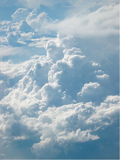
King Air will fly up to 100 hours through February, collecting data from inside mixed-phase clouds (containing both liquid and ice particles) with its numerous specialized meteorological sensors and data recording equipment.

“The overriding idea is to find out if the models that people use to understand climate really represent what happens in clouds and in these types of winter storms,” says Gannet Hallar, director of Storm Peak Laboratory, a permanent atmospheric research facility atop Mount Werner in Steamboat Springs, Colo.

Adds Avallone, “Our climate is changing and people want to know, ‘What’s it going to look like in the winter here 15 years from now? Are these types of clouds going to become more common? Are they going to precipitate more or less?'”

Data from King Air will be combined with results from STORMVEX (Storm Peak Laboratory Cloud Property Validation Experiment) to allow scientists to study how clouds, especially those that produce rain and snow, evolve in mountainous terrain. The data will also be used to verify the accuracy of measurements used in computer models of the Earth’s climate system.

The ground-based STORMVEX campaign, which began in November, will obtain data about liquid and mixed-phase clouds from remote-sensing instruments at four sites at the Steamboat Ski Resort. All instrumentation on the ground will be replicated on King Air, providing what Avallone calls an “amazing opportunity to measure the properties of the clouds.”

The instrumentation aboard King Air will, among other things, measure air temperature, count and measure the size of cloud particles and measure the amount of water contained in the particles.

“Some of the largest uncertainties in climate change models have to do with clouds, and, in particular, these mixed-phase clouds that are part ice and part water. Those clouds are the most difficult to model,” Hallar says. “This is the first time we’ll see (these clouds), from the top to the bottom. We have the entire mountain covered with remote-sensing instruments and we also have above the mountain covered with the aircraft. This is a very unique opportunity.”

The CAMPS project, funded through the National Science Foundation, also represents a unique opportunity for three students.

Undergraduate students Aaron Piña, from Texas A&M University, and Erica Strom, from the University of Wisconsin-Milwaukee, are actively involved with data collection and flight forecasting for the project. Both students will spend time aboard King Air during flight.

Piña is being funded through the National Center for Atmospheric Research’s SOARS (Significant Opportunities in Atmospheric Research and Science) program; Strom is being funded through Storm Peak Laboratory’s GRASP (Geoscience Research at Storm Peak) program.

“This is such a rare opportunity, especially for an undergraduate,” Strom says. “I just don’t think many undergraduates get to do something like this.”

Another student, Dimauro Edwards, a mechanical engineering graduate student from Stony Brook University in New York, is also working on the project. He is studying instrumentation aboard King Air.

Additionally, Avallone says some UW students will assist with forecasting throughout the project.

CAMPS is the second major research mission for King Air in the past six months. Last fall, King Air returned to international skies for the first time in more than a decade, logging 52 flight hours over Finland for five weeks on a NASA-funded experiment.

2010 Colorado gubernatorial election transition: Governor Hickenlooper’s State of the State address

A picture named coloradorivereaglecounty.jpg

From KMGH

Colorado’s future depends upon how we cultivate our intellectual treasures and our natural resources. Much attention has been devoted to a debate about energy, the right balance between developing natural gas, coal and renewable energies.

But the natural resource that may, in the end, have the greatest impact on Colorado’s economic growth, is water.

A recent report by the Inter-Basin Compact Committee makes clear that a “status quo” approach to water will inevitably lead to pressures that harm our environment and dry up precious agricultural land. We cannot let that happen.

The IBCC and other water leaders and stakeholders across Colorado are ready to work in a comprehensive way to develop strategies, especially conservation, to ensure that our cities and rural communities are both protected.

We want this effort close to the Governor’s Office but to send a clear and unambiguous message that water is a top priority in this administration.

We’ll take this ethic of collaboration and the search for common-ground to other issues besides water. Protecting our environment, keeping our air clean, conserving the natural beauty that defines Colorado – these are values we cherish and we won’t sacrifice them.

In this regard, we are surely on the right path as we implement legislation that was signed into law last year, the Clean Air Clean Jobs Act. This law places Colorado at the forefront in reducing pollutants, creating jobs and while it hasn’t been without controversy, we shouldn’t move backwards.

More 2010 Colorado elections coverage here.

Rifle: Middle Colorado River Partnership seminar ‘The Colorado River: People, Policies, and Plumbing’ tomorrow

A picture named coloradorivereaglecounty.jpg

From the Glenwood Springs Post Independent:

The Middle Colorado River Watershed Partnership (MCRWP) will host a seminar on the Colorado River titled “The Colorado River: People, Policies, and Plumbing” on Friday, Jan. 14, at 8:30 a.m., at the Garfield County School District Re-2 administration building, 839 Whiteriver Ave. in Rifle…

Eric Kuhn, general manger of the Colorado River Water Conservation District, will discuss how the Colorado River is managed, what water goes where (and why), and the major issues facing the long-term viability of the river and its resources…

Friday’s seminar is the most recent in a series that the watershed partnership is hosting. Upcoming seminars will cover trends in regional water management, municipal water systems, agricultural water issues, and connections between water, growth and development. Local educator Mike Wilde, who also sits on the MCRWP steering committee, said education is a “top priority” for the Middle Colorado River Partnership. “Understanding our local rivers and watersheds, as well as the larger Colorado River system, is critical to a collaborative approach to watershed management and stewardship,” added Wilde.

More Colorado River basin coverage here.

The World’s Best Photos of acequia

A picture named acequiadelcerro.jpg

We’re going to thaw out today in Denver according to the NOAA but if you still find yourself longing for summer when the water starts running in the ditches you can click here for a Flickr Hive Mind display of acequia photos and imagine yourself sitting under the cottonwoods with a cool drink watching the water move to the fields. Thanks to TaosAcequias.org for the link