
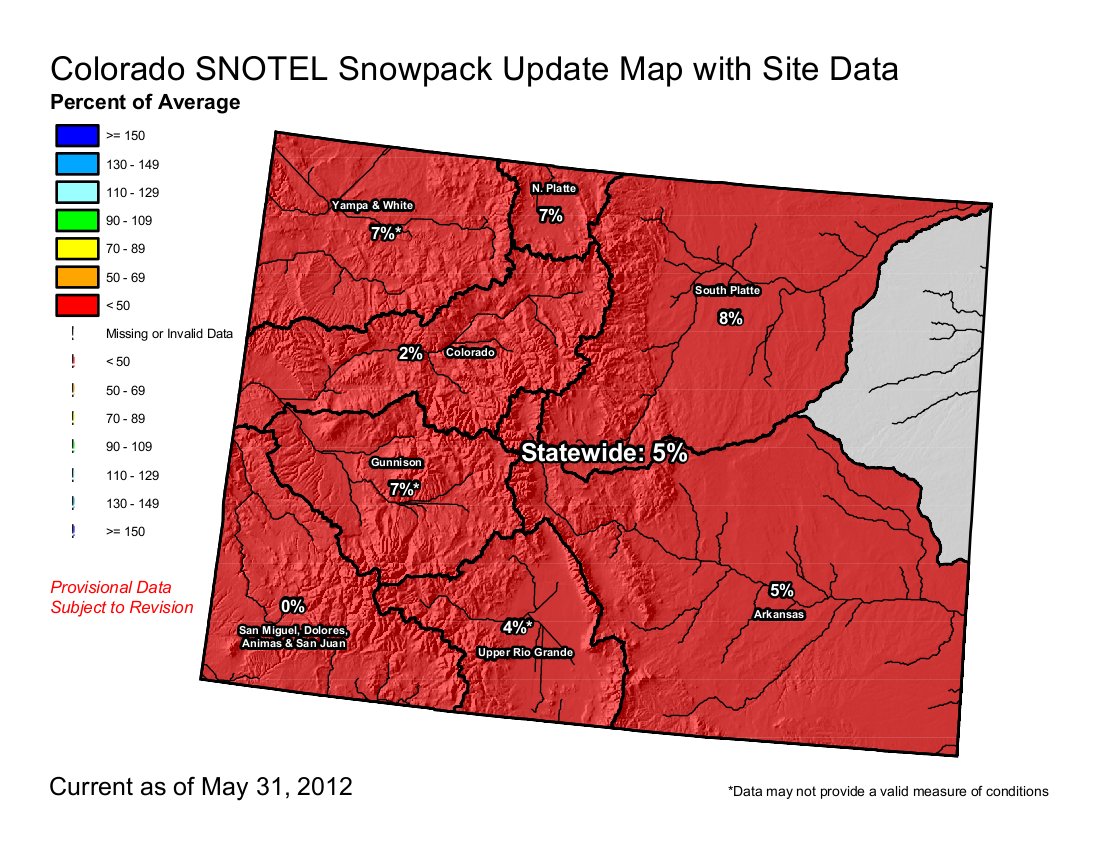
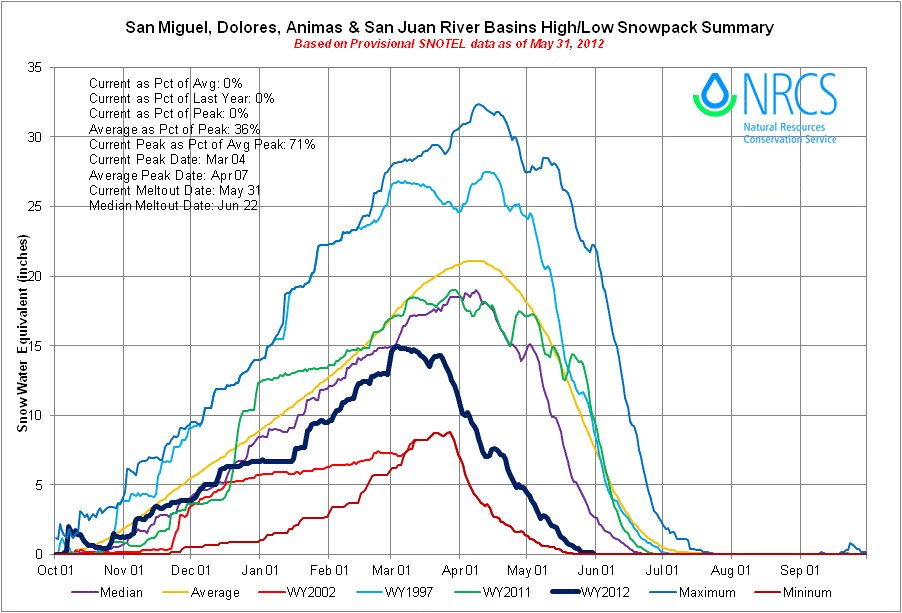

Click on the thumbnail graphics for the current U.S. Drought Monitor map, the Basin High/Low graph for the San Miguel/Dolores/Animas and San Juan basins and the current statewide snowpack map. Snowpack across Colorado is in single digits. All of the state is in one stage of drought or another except parts of the South Platte basin which are merely abnormally dry.
From the Associated Press via the Fort Collins Coloradoan:
The U.S. Drought Monitor says severe drought conditions covered about a quarter of Colorado at the end of May, encompassing nearly every place north and west of Salida. A pocket of that area is even worse, with severe drought conditions.
The rest of the state is either abnormally dry or in a moderate drought. The Drought Monitor says a severe drought means crop or pasture losses are possible and water shortages are common. An extreme drought means major crop and pasture losses are possible and water shortages could become widespread.
The National Weather Service predicts June temperatures will be above normal and rainfall will be below normal statewide…
The Poudre River, seeing some of its most dismal spring flows ever recorded, was running at 569 cubic feet per second on Friday at the gauge at the mouth of Poudre Canyon. The average flow for the date is about 2,000 cubic feet per second.
March through May was the driest spring on record in Boulder, with 3.01 inches of moisture. The average is 7.85 inches…Boulder Creek was flowing at a rate of 100 cubic feet per second Thursday. The creek’s average flow this time of year is 400 to 500 cubic feet per second.