
From The Summit County Citizens Voice (Bob Berwyn):
“Next week may be the peak of fire danger, then there is a hint the monsoon may come early … it’s going to be very interesting to watch,” said Boulder-based NOAA scientist Klaus Wolter, a researcher with the Earth Systems Research Laboratory.
The Rocky Mountain monsoon season usually starts in mid-July and lasts for about a month, with moisture from the Gulf of Mexico and subtropical eastern Pacific streaming into the region from the south. Since formation of the monsoonal flow is partially dependent on large-scale regional surface heating, a year with early snowmelt, — like this year — can sometimes bring an early start to the season. And in the larger-scale weather pattern, a shift from La Niña to El Niño boosts the chances of monsoon rains, Wolter said.
“The possible onset of a La Niña can be good for us along the Divide and Eastern Plains, but my concern is, this year is very similar to 2002, when the efficiency of the monsoon season was reduced,” Wolter said, referring to what he called a “feeble” monsoon, despite generally favorable conditions. Similar conditions prevailed in 2000, when, after a seemingly promising setup, the monsoon fizzled.
Simply put, a regional blanket of haze may prevent the intense, localized heating needed to form the most productive thunderclouds, Wolter explained. Additionally, the haze may also become trapped in mid-atmospheric inversion, three miles high, that makes it harder for the thunderclouds to build vertically to their full potential.
“It reduces the sunshine that reaches the ground … that’s not a good thing if you’re trying to create thunderstorms,” he said, emphasizing that, at this point, the impact of haze on the monsoon is still a “back-of-the-envelope” concept.
Here’s the 8:45 AM forecast from the Colorado Flood Threat Portal (John Henz):
Daily high temperature records were set in many parts of the state as afternoon temperatures soared into the 100 – 105F range. The prospects of another hot day with gusty southwest winds of 15-35mph prompted the National Weather Service to hoist RED FLAG warnings for high fire danger for the Front Range foothills and mountains and the northwest and west-central portions of the state. Evening satellite photos showed a new fire plume in La Plata County and a large plume from the continuing High Park fire. Today’s heat and winds may cause those fires to spread and intensify.
While no flooding was reported in the state, several rounds of severe thunderstorms occurred over the northeastern corner of the state. These storms did drop 0.25 – 0.75 inches of rain in a few small swaths of moisture with 0.75 – 1.50 inch diameter hail and wind gusts to 65 mph. In most respects these storms did more harm than good. A few weak storms rumbled in Huerfano and Las Animas Counties.
Look for another day with late evening and night thunderstorms along the Colorado-Wyoming and Colorado-Kansas borders. Today’s storms will form further east and not be as severe as Friday night’s storms. NO FLOODING is expected from these storms. A stronger surge of low level moisture is expected to move onto the northeastern plains Sunday morning and reach the Front Range foothills and the north face of the Palmer Ridge by late Sunday afternoon. This moisture will set the stage for a potentially stormy, wet Sunday night that will cool the area after another day of 100F heat.
High-based and mostly dry thunderstorms will begin to rumble this afternoon over other portions of the state as sub-tropical moisture arrives from Arizona. Activity will be most noticeable along a line from Durango to Limon. Gusty winds of 25-55mph, a sprinkle of rain and active cloud-to-ground lightning will be produced by these storms. Look for the fetch of moisture headed into Colorado from Arizona to deepen steadily through mid-week creating a potential for strong storms by Monday-Wednesday.
Colorado hikers, campers, climbers and bikers should be vigilant today for lightning at elevations above 9,000 feet in the central and southern mountains. Teller, Fremont, Custer, Huerfano and Las Animas Counties will be especially prone to brief but active thunderstorms over the popular recreation areas by mid-afternoon.
Monsoon 2012 IPW Tracker
This past week we shared some information about using IPW to track the development of the Arizona monsoon. The Integrated Precipitable Water (IPW) is a measure of how much water the atmosphere holds from the surface to ~30,000 feet. IPW is derived from the speed that GPS signals communicate with satellites. The figure below shows the IPW for Tucson AZ (Green) and Tempe AZ (Green) from June 20 to today. IPW values have doubled each of the past two days as the monsoon begins to surge northward. As values reach and exceed 1.25 inches of water the monsoon will establish itself over Arizona and begin to flow into western Colorado for the start of next week.
Here’s the 15 day Flood Threat Outlook posted last Thursday: (John Henz):
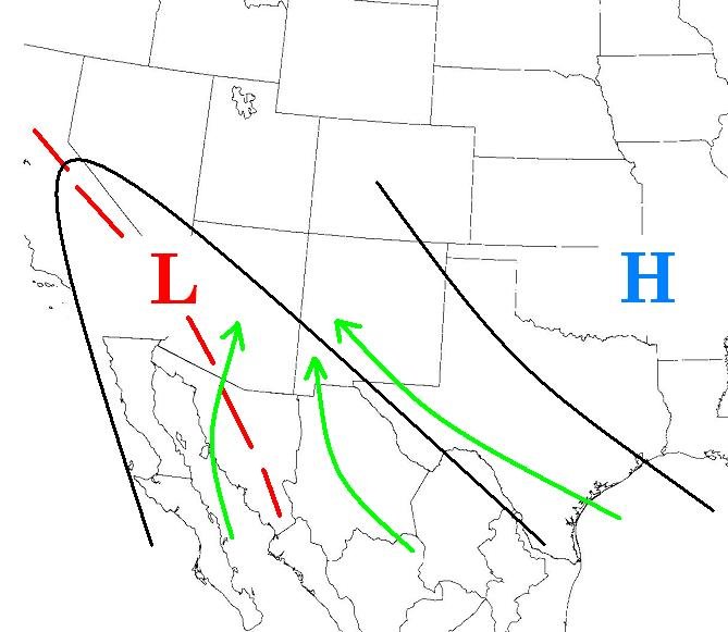
The Northern Hemisphere’s storm track is starting to slow down and turn over the weather reins to the sub-tropic’s warmth and humidity. The primary weather force on our summer weather is the development and strength of the Southwestern Monsoon. The monsoon refers to the development of a moist low level wind flow off the Gulf of Mexico and sub-tropical eastern Pacific into the heated land areas of northern Mexico, Arizona and New Mexico. Surges of moist disturbed air bring active thunderstorms with the threat of flash flooding rain, vivid lightning storms, dust storms and damaging winds. Lulls between the moist stormy surges are marked by periods of very hot dry weather.
Our outlook shows the Arizona Monsoon ready to send its first surge of moist air into Colorado later this weekend into next week. It’ll bring several active days of thunderstorms to the western half of the state before spilling over into the eastern half of the state by the middle of next week. A LOW THREWAT of flooding will exist in the eastern half of the state from June 28 to July 2 before a dry heat settles in for the 4th of July weekend. Read on for the details.
From the Summit County Citizens Voice (Bob Berwyn):
West Slope streams have been hit a triple whammy this year. Along with the usual impoundments and diversions to the Front Range, this year’s scant snowpack melted many weeks earlier than usual, and above-average temperatures have persisted for months. In the Yampa, wildlife managers have already measured temperatures of 71 degrees and flows as low as 81 cubic feet per second. The median flows for this time of year are about 1,400 cfs. In these conditions, already severely stressed fish weakened by warm waters often die when caught, even if they are quickly released back into the water.
Warm water is oxygen-poor to begin with, and the warmer temperatures also promote the growth of algae, which adds oxygen during the day when there’s sunlight for photosynthesis, but uses up all the available oxygen during the night. That’s why fish kills often are evident first thing in the morning. Anglers and other outdoor enthusiasts can help document the impacts of low flows by reporting fish kills. Some Colorado streams are subject to minimum flows set to protect aquatic life, those flows are often barely adequate.
“There appears to be little chance of precipitation adding measureable volume to the stream flow in the immediate future,” said Senior Aquatic Biologist Sherman Hebein.
Wyoming is on the ropes, as well. Here’s a release from Governor Matt Mead’s office:
Governor Matt Mead has asked U.S. Secretary of Agriculture, Tom Vilsack, to issue an agricultural disaster declaration for all of Wyoming, except Teton County. If granted, such a declaration could provide some federal emergency assistance to Wyoming producers.
“Wyoming farmers and ranchers are struggling to work through serious impacts caused by drought,” Governor Mead wrote. “Over the past month, County Commissioners throughout Wyoming have requested agricultural disaster designations for the 2012 agricultural production year. After consultation with the Wyoming Farm Service Agency it is clear that every Wyoming county with the exception of Teton County has suffered grazing loss and dryland hay loss in excess of the disaster threshold.”
From The Pueblo Chieftain (Chris Woodka):
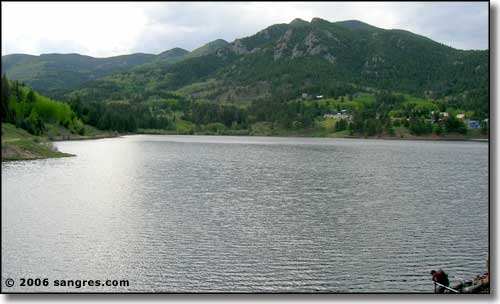
“We are again managing the lake [Lake Isabel] for release,” said Paul Crespin, San Carlos District ranger. “We’ll try to maintain the lake level so it is suitable for fishing and recreation.”
The lake was constructed by CF&I Steel in the 1930s and filled once through the company’s water rights. Since then, it has been the Forest Service’s responsibility to provide water. Last year, the Colorado Division of Water Resources ordered a strict accounting of evaporative losses at Lake Isabel, which is located on the Pueblo-Custer county line near Rye. Levels dropped about 2 feet last year, and were restored in the fall when the Forest Service was able to lease water from the Pueblo Board of Water Works.
“Because it’s a dry year, finding water to lease is difficult. The water is scarce and costly,” Crespin said.
From The Denver Post (Jason Blevins):
…the mighty Yampa — host to as many as 50,000 Steamboat Springs tubers, fishermen, rafters and kayakers each summer — slipped to a languid 77 cubic-feet-per-second as it dribbled through downtown Friday. That’s too low to support a healthy river, and this week local officials closed it to commercial tubing, which accounts for the vast majority of Yampa users in town. Authorities also issued a voluntary closure for fishing, kayaking, private tubing and swimming.
Steamboat is the first to succumb to the parched summer of 2012, featuring a statewide snowpack a mere 2 percent of average on June 1. Rivers are flowing at record-low levels, threatening not only river habitat and wildlife but the communities that have built economies around the recreation provided by rolling waters…
Jarett Duty pulled the plug on fishing the downtown stretch of the Yampa earlier this week. He’s bringing his Bucking Rainbow Outfitters clients to the Elk River and other high-country fishing holes. “A lot of the other surrounding waters around here are still fishing, but the writing is on the wall,” Duty said. “This summer is going to be brutal. I think by the middle of July a lot of our valley rivers are going to be done and we’ll just be in the high country. This will be our worst year in 20 years in business for sure.”
Finally, in New Mexico, 81% of the state is in D3 severe drougnt. Here’s a report from the Albuquerque Journal (John Fleck):
“Things are pretty desperate,” Warren Harkey of Mesilla Park told me Friday. Harkey’s a small fry in the ag world down south, with a couple of dozen pecan trees. He’s got no hope of a crop, and is just hoping at this point to keep the trees alive.
New Mexico’s ranchers must deal with the unpleasant fact that the state has the driest grazing land in the nation. Federal officials have rated 85 percent of the rangeland in “poor” or “very poor” condition, meaning little or no grass for cattle to eat. “We’re topping the nation in bad conditions,” Les Owen of the New Mexico Department of Agriculture said during a meeting Friday of the state’s Drought Monitoring Working Group…
If there’s a hope, it’s for robust monsoon rains. But even that comes with a price. More than 300,00 acres, mostly in southern New Mexico, have burned in wildfires and are now vulnerable to flooding during monsoon rains. “If they get a lot of rain real quick, it’s going to bring down a lot of sediment and be a real problem for the folks downstream,” Owen said.


