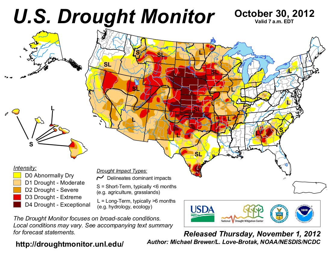
Latest map from the U.S. Drought Monitor shows continued widespread dryness west of the Mississippi #CODrought Click on the thumbnail graphics for the latest map and the November 1, 2011 map from the U.S. Drought Monitor . Share this: Share on Bluesky (Opens in new window) Bluesky Share on LinkedIn (Opens in new window) LinkedIn Share on Facebook (Opens in new window) Facebook Email a link to a friend (Opens in new window) Email Print (Opens in new window) Print Share on X (Opens in new window) X Like this:Like Loading…