
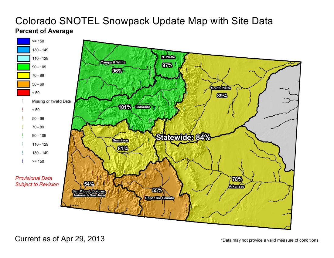
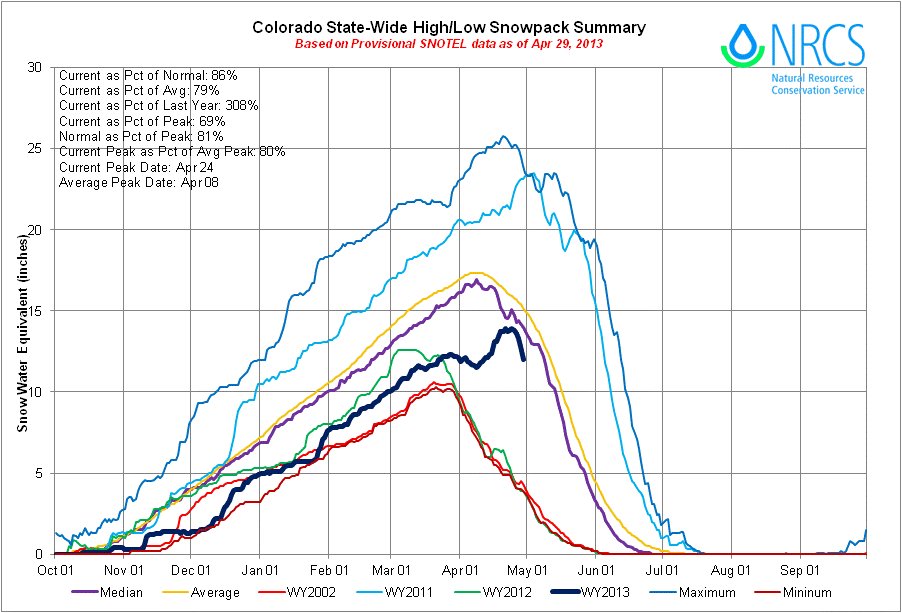
Click on the thumbnail graphics for the current statewide snowpack map and the statewide basin high/low graph from the Natural Resources Conservation Service.
From the Glenwood Springs Post Independent (John Stroud):
The weekly Roaring Fork snowpack report issued by the Roaring Fork Conservancy on Friday indicated that current snowpack for the watershed is 112 percent of normal for April 26. However, that statistic is a bit misleading and needs to be put in perspective with the winter season as a whole, the conservancy also said in its report. “Due to cold temperatures and late season snows, snowpack has been rising instead of falling,” according to the report.
Snowpack usually peaks around April 6 before the seasonal melt-off begins. However, this year’s peak snowpack within the Roaring Fork watershed came on April 24 following a recent series of snowstorms that brought heavy, wet snows to the high country.
But, “At peak, we still only had 87 percent of average snowpack” for the season, the report emphasized. The snow-water equivalent also ranged in the most recent report from 96 percent of the to-date median on Schofield Pass in the upper Crystal River drainage, to 118 percent of the median in the upper Fryingpan Valley. “As a result of all these factors, every river in the watershed is flowing less than 50 percent of the median flow,” the report also said.
Statewide, the high country snowpack was still at 95 percent of normal for Friday’s date, and 87 percent of average for the season, according to Mage Hultstrand of the Natural Resources Conservation Service in Denver. As of Friday, the Colorado River Basin remained just above the 100 percent threshold for both the normal and seasonal average, Hultstrand said.
Compared to last year, though, there’s more than three times as much snow still packed away in the high country than there was on April 26, 2012. Colorado had one of its earliest peak runoffs ever last spring.