
From the Longmont Times-Call (Scott Rochat):
“I thought it was really useful to see how it all fits together, the roads and the creeks and how they all influence each other,” said county transportation director George Gerstle. “The creeks go where they want to go, and we need to remember that as we rebuild.”
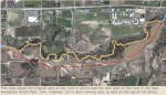
One of the biggest rebuilding projects will be taking place over the next five to 10 years. Longmont plans to deepen and widen the St. Vrain’s channel and replace all of its bridges from Hover Street to Martin Street, to make the river capable of carrying a 100-year flood through the city — 10,000 cubic feet per second. Prior to the flood, the channel could hold 5,000 cfs; these days, choked and clogged from the disaster, its limit is about 2,500 cfs.
To aid the $65 million to $80 million project, Longmont is putting a $20 million storm drainage project on the ballot June 24.
“Folks in town are going to love us, and they’re going to hate us,” said Longmont public works director Dale Rademacher, referring to the coming construction. “Traveling north-south in Longmont is going to be difficult over the next five to 10 years.”
Simonsen said she was relieved at the level of Ralph Price, currently at about 6,000 acre-feet. (Its maximum is about 8,000.)
“That makes me feel good,” she said. “That tells me there’s a bit of room in there for spring runoff.”
The water level has been adjusted up and down to help the flood work, with the reservoir holding back water while repairs went on to the area’s ditches and river banks, and also letting water go so that the logs left in the reservoir by the flood could be safely grounded before they sank in the lake.
Runoff began about two weeks ago and, despite high snowpacks, has not yet hit the levels some feared. A river gauge at Lyons showed the flow at about 255 cfs over the weekend; its highest levels so far have been around 350 cfs, right at the start of runoff.