“It seems to me the best policy is to put the water to beneficial use” — Jerry Sonnenberg

Sprawl
Sprawl

From The Pueblo Chieftain (Chris Woodka):

El Paso County communities tried last week to convince the state’s interim water resources review committee that water rights they purchase are “eroded” when growth fails to materialize as soon as expected. Lawmakers listened, but took no action.

Lawyers for Fountain and the Pikes Peak Regional Water Authority told the committee last week that agricultural rights they purchased are diminished if the water is not immediately used when growth does not materialize.

They proposed two changes in the law:

  • A measure which would remove the need for a water right that has been changed to be taken to water court again for actions such as a new point of diversion.

    “Any change will shrink a senior water right, not ratchet them up,” said Denver water lawyer Rick Fendel, representing the Pikes Peak group. “We’re looking for ways to get us through the gauntlet of water court.”

  • A proposal to quantify changes on a ditch equally so the most recent changes aren’t penalized by generous assumptions in the past.

    “The last guy on the ditch suffers because the historic consumptive use is all used up by the guys who came before you,” said Denver water attorney Cynthia Covell, representing Fountain.

  • Cities that buy farm water and don’t immediately use it are subject to a reduction of use, but not the loss of the water right, Deputy State Engineer Kevin Rein explained.

    Cities often obtain conditional water rights that allow them to grow into their supplies, but in recent years courts have put limits on how far into the future they can plan.

    The legislators were not receptive to change the laws solely to accommodate cities.

    “It seems to me the best policy is to put the water to beneficial use,” said state Rep. Jerry Sonnenberg, R-Sterling, adding that cities should not “mismanage” their supplies.

    Covell said Fountain’s growth is largely determined by the pace of expansion at Fort Carson, something the city cannot control. “You don’t want to have to get the supply after the future arrives,” Covell said. “This would bring certainty based on the water rights’ decreed purpose.”

    More water law coverage here.

    Aspen aims for all hydro and wind by 2023 — The Aspen Times

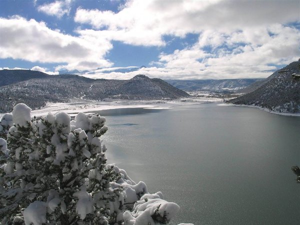
    Ridgway Reservoir during winter
    Ridgway Reservoir during winter

    From The Aspen Times (Karl Herchenroeder):

    Aspen officials hope to supply municipal operations entirely with hydroelectric and wind energy by 2023, projections from the city’s renewable energy manager show.

    But the success of that lofty projection — along with the city’s 100 percent renewable-energy goal in 2015 — will be based largely on current negotiations with its energy provider, Municipal Energy Agency of Nebraska.

    Doubling the hydro supply at Ridgway Reservoir and phasing out landfill-gas purchases are two things Municipal Energy Agency of Nebraska will have to approve for Aspen to meet 2023 projections, but Aspen’s Renewable Energy Manager Will Dolan is confident he can reach agreement on both.

    “I think there’s a way to do it,” Dolan said Monday. “I think they’ve voiced an interest in additional Ridgway energy, and they’ve also voiced a willingness to taper off the landfill-gas energy if we needed to.”[…]

    Dolan said the city will look to phase out landfill gas in 2023, when Aspen has the option to double its output at Ridgway, boosting supply from 9,800 megawatt hours to about 19,000 megawatt hours. As negotiations proceed, Dolan said it will be key to find some flexibility.

    “We don’t want to hem any future councils in,” he said. “As highly desirable resources like Ridgway become available, we want to be able to take advantage of those.”[…]

    According to Dolan, Aspen’s energy portfolio is currently made up of 49 percent hydro, 28 percent wind, 20 percent coal/gas and 2 percent nuclear. Dolan’s 2015 projections show 47 percent hydro, 41 percent wind, 11 percent coal/gas and 1 percent nuclear. The 8,500 megawatt hours of coal/gas would be offset in 2015 by the purchase of about 9,300 megawatt hours of landfill gas in the Midwest.

    City projections for 2023 show 58 percent hydro and 42 percent wind.

    Dolan said that if the Aspen City Council elects to revisit the controversial Castle Creek Energy Center, the city could explore the possibility of tapering back its wind supply. To date, the city has invested about $7 million in the estimated $10.5 million project, which was halted in 2012 when 51 percent of Aspen voters shot it down during an advisory election.

    More hydroelectric/hydropower coverage here.

    Environment: Pharmaceutical pollutants elude water treatment, make their way into groundwater

    Hoover Dam delivered, but Nevada could have gotten more — Las Vegas Review-Journal #ColoradoRiver

    Las Vegas circa 1915
    Las Vegas circa 1915

    From the Las Vegas Review-Journal (Henry Brean @RefriedBrean):

    The most important structure ever built in Nevada is barely in Nevada at all.

    As large as it is, the entirety of Hoover Dam — the power plant, spillways, support structures and the dam itself — covers less than one square mile, and roughly half of that is in Arizona.

    But its impact touches every square inch of the Silver State and a great deal of the Southwest. Take away all the water, power and revenue generated by that 6.6 million-ton concrete plug in Black Canyon and there would be no modern-day Las Vegas, no Boulder City, no Henderson. The state’s largest population center and its economic powerhouse simply would not exist, at least not as it does today.

    This Oct. 31 would still be Nevada’s 150th birthday, of course, but without that dam you can bet there would be far fewer Nevadans around to celebrate it.

    “If you’re looking for a single structure that had the largest impact on Nevada, it would be Hoover Dam,” state archivist Jeff Kintop said. “All the other big structures built down there (on the Strip) wouldn’t be possible without Hoover Dam.”

    But as much as Nevada has gotten from the dam, it didn’t get as much as it could have. Back when the project was conceived and built, state leaders actually turned down the chance to secure more water for Southern Nevada.

    “They didn’t think they needed it,” Kintop said.

    WATER WASN’T A PRIORITY

    Talk of trying to tame and harness the Colorado River began before Nevada earned its statehood, but Nevadans didn’t have a direct stake in the idea until 1867. That’s when the young state took possession of a mostly empty, triangle-shaped slice of the Arizona Territory just west of the Colorado. The acquisition included all of present-day Nevada south of 37 degrees latitude, including what is now Clark County.

    The push to develop the river began soon after, though back then it was mostly seen as a potential route for Southern Nevada’s miners and farmers to ship products to market by way of the Gulf of Mexico.

    When the focus shifted to diverting or damming the Colorado, state leaders mostly saw it as an opportunity to irrigate more cropland and power more mines. Providing river water to the tiny railroad town of Las Vegas wasn’t even part of the discussion, said Dennis McBride, director of the Nevada State Museum at the Springs Preserve, which was covered in free-flowing springs and streams in the 1920s.

    Back then, “there were only about 5,000 people in Southern Nevada, and we had plenty of water that came right out of the ground,” said McBride, a Boulder City native who has written extensively about Hoover Dam.

    Locals first embraced plans to build what would be the world’s tallest dam just east of town not for any long-term benefits but for an immediate economic boost. McBride said Las Vegas was in the midst of a financial slump and “an identity crisis” in the wake of a 1922 railroad strike. Local leaders and civic boosters began lobbying hard for the dam because of the jobs and investment it would bring.

    Kintop said it wasn’t a lack of enthusiasm that kept Nevada from getting all it could from the project. It was a failure of imagination.

    When construction began in Black Canyon in 1931, Nevada was home to fewer than 100,000 people, most of them in the northern half of the state. That Clark County, population 8,500, would one day support 2 million residents and 40 million annual visitors was beyond belief.

    “It exceeded all expectations and agreements,” Kintop said.

    So when the time came to divvy up the spoils from the dam, namely cheap water and power, Nevada officials were more interested in electricity. They wanted as much of it as they could get to power the mines and convert the local railroad to an electric line, Kintop said.

    “They had a shot at more water, and they didn’t go after it,” he said. “They turned it down.”

    As a result, Nevada wound up with an annual river allotment of 300,000 acre-feet, just seven percent of California’s 4.4 million acre-foot stake and the smallest by far among the seven states that share the Colorado.

    It seemed like plenty at the time, but within 60 years of the dam’s completion water managers in Las Vegas already were floating plans to tap groundwater across a 300-mile swath of rural Nevada. By pushing for just a few hundred thousand acre-feet more back in the 1920s and ’30s, that controversial, multibillion-dollar scheme might not be needed for decades, if ever.

    UNEXPECTED EXPLOSION

    It didn’t take long for the state’s early lack of foresight to reveal itself.

    The dizzying expansion of the Las Vegas Valley began during World War II and continued almost unabated through the economic collapse in 2007. Clark County’s population more than doubled, to 48,289, between the federal census of 1940 and 1950, then it nearly tripled to 127,016 in 1960. It would double or nearly double every decade after that, until 2010.

    By some estimates, the community outgrew what the local groundwater supply could sustain sometime in the late 1940s. After that, valley residents spent 20 years busily pumping the aquifer beneath them into oblivion before finally tapping Lake Mead in 1971.

    The role the lake would play in Southern Nevada’s future was well known long before then. During a speech at the Las Vegas Convention Center on Sept. 28, 1963, President John F. Kennedy said that “supplementary water from Lake Mead — this is what is going to govern the growth of Las Vegas. It’s needed to guarantee the future growth of this city and community.”

    Today, 90 percent of the community’s water supply comes from the Colorado River by way of the reservoir formed by Hoover Dam.

    “You wouldn’t have been able to sustain any of the growth without the dam,” Kintop said.

    And not just here. Hoover Dam is now the linchpin for a tightly managed and regulated river system that sustains billions of dollars in crops and supplies water and power to roughly 40 million people across the Southwest United States and northern Mexico.

    Terry Fulp, regional director for the U.S. Bureau of Reclamation in Boulder City, said the dam made Los Angeles and Phoenix grow as surely as it did the winter vegetables in California’s Imperial Valley.

    But its impact arguably has been greatest in Southern Nevada, a place with few other options for slaking its thirst.

    “I can’t imagine what the Las Vegas Valley would look like if Hoover Dam hadn’t been built. Clearly it would be much different than it is today,” Fulp said.

    More Colorado River Basin coverage here.

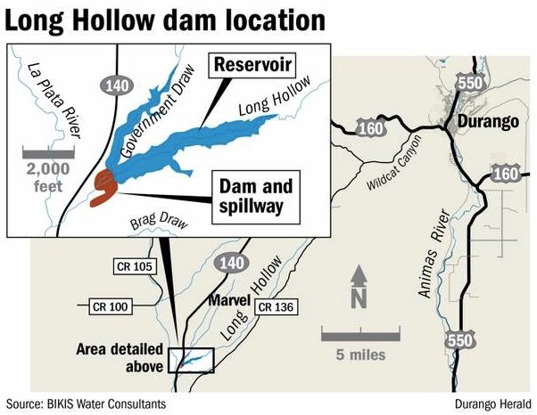
    Long Hollow Dam dedicated, brings hope of a more reliable supply to La Plata River irrigators

    Long Hollow Reservoir location map via The Durango Herald
    Long Hollow Reservoir location map via The Durango Herald

    From The Durango Herald (Dale Rodebaugh):

    The traditional ribbon cutting Thursday officially brought on line the Long Hollow Reservoir, raising the hopes of irrigators for a more consistent supply of water.

    Already the reservoir, capacity 5,300 acre-feet, has seen a little accumulation of water from recent heavy rain funneled into it via Long Hollow Creek and Government Draw.

    “We released that water,” said Brice Lee, president of the La Plata Water Conservancy District, sponsors of the project. “But today we start storing.”

    The main purpose of the reservoir, named for the late landowner Bobby K. Taylor, whose ranch house sat scant yards from the toe of the dam, is the storage of water to meet contractual obligations with New Mexico.

    Colorado must share La Plata River water fifty-fifty with New Mexico. But the fickle nature of the river makes living up to requirements difficult. Now reservoir water can satisfy New Mexico demands, allowing Colorado irrigators more use of the La Plata River.

    “The real beneficiaries are our irrigators,” Lee said. “We hope we can develop sustainable agriculture on Fort Lewis Mesa.”[…]

    Seemingly, anyone connected to the project – from early visionaries to construction workers who labored during the two years it took to build the dam – attended.

    Representatives from the Ute Mountain Ute Tribe, which contributed $3 million to the cost of construction, were on hand. Priscilla Rentz, a member of the Ute Tribal Council, gave invocation.

    Three current legislators were in the audience – state Sen. Ellen Roberts, R-Durango; state Rep. Michael McLachlan, D-Durango; and U.S. Rep. Scott Tipton, R-Cortez.

    Judging from the names announced, the entire board of the Colorado Water Resources and Power Development Authority accompanied agency director Mike Brod,

    At least a half-dozen members of the extended Taylor family stood to acknowledge applause…

    Water is gold here, given the inconsistent nature of the La Plata River and the requirement that what flow there is must be shared fifty-fifty with New Mexico.

    Irrigators saw hopes shrivel when the Animas-La Plata Project, or A-LP, the last big water undertaking in the West, was downsized in the late 1990s, eliminating water for agriculture.

    In spite of the disappointment, project advocates found three sources to keep the project alive – $15 million from the Colorado Water Resources and Power Development Authority, $3 million from the Ute Mountain Ute Tribe and $1.575 million from the state Legislature this year.

    Groundbreaking took place in summer 2010. The labor force of the Weeminuche Construction Authority, which built the dam, was 71 percent Ute Mountain Ute.

    The Long Hollow Reservoir will serve as a water bank, to be drawn on by New Mexico. The reserve allows Colorado irrigators to use La Plata River water that otherwise would go south.

    More La Plata River coverage here.

    Tying water to growth, sort of — The Pueblo Chieftain #COWaterPlan

    Colorado Water Plan website screen shot November 1, 2013
    Colorado Water Plan website screen shot November 1, 2013

    From The Pueblo Chieftain (Chris Woodka):

    A proposal to link local land use to state water planning through better education about water issues will be discussed at this week’s meeting of the Arkansas Basin Roundtable. The question often has been the elephant in the room during discussions in the past decade by roundtables and the state Interbasin Compact Committee. The groups were formed in 2005 to address an impending gap in municipal water supplies.

    While strategies such as storage, water projects, conservation and sharing water supplies have been discussed, the interconnection of growth and water supply was seldom brought up. Until the September roundtable meeting, when several members openly wrestled with the question of “carrying capacity” for cities — similar to federal guidelines for the number of cattle allowed under grazing permits.

    A draft paper prepared since then by consultants, sent in advance to members of the roundtable, outlines the relationship local control, land-use planning and water supply planning. It explores legal decisions that give cities the right to hold future supplies, but limit the time span and conditions water can be tied up. It also looks at measures ranging from proof of water ownership before allowing a development to enforcing conservation measures in new development. The paper could be incorporated into a basin implementation plan presented to the Colorado Water Conservation Board as part of the state water plan.

    “Existing Colorado law empowers land-use authorities to weigh the adequacy of an applicant’s water supply when making land-use decisions. However, the effectiveness of such a statute requires a well-informed decision making body, with some depth of knowledge regarding the subtleties of an adequate water supply,” the paper states.

    Recommendations are to incorporate water planning with land use at the local level at the earliest possible time, keeping in mind that one size does not fit all users.

    Proposed state legislation takes the same tack by recommending promoting water conservation in land-use planning under a coordinated approach among state agencies.

    More Colorado Water Plan coverage here.

    The Western Slope, however, can’t afford to be blinded by parochial interests — John Harold #ColoradoRiver #COWaterPlan


    From The Grand Junction Daily Sentinel (Gary Harmon):

    Western Slope agriculture should have the same heft in water discussions as diverters to the east and populous states to the south, the head of a Grand Valley water agency said Friday.

    “Western Slope agriculture and Western Slope water cannot be considered as a simple, easy-to-go-to solution to the water-supply concerns of others,” Mark Harris, general manager of the Grand Valley Water Users’ Association, told about 300 people at the Colorado River District’s annual water seminar at Two Rivers Convention Center.

    The Western Slope, however, can’t afford to be blinded by parochial interests, John Harold of Tuxedo Farms in Olathe said.

    “If we ever have a vote, there are 40 million people who would just run us over in a flash,” Harold said.

    Harris and Harold were among several speakers who were asked how to deal with the water quandaries that now confront water users.

    Those problems range from increased demands for water from the Front Range to insistence from the southwest that Colorado is running dangerously close to falling short of meeting its requirements under the 1922 compact that governs the use of the Colorado River.

    Participants were asked whether Gov. John Hickenlooper’s comment that “Every conversation about water should begin with conservation” might understate the value of efficient use of water.

    The terms are virtually interchangeable in common usage, said Dr. Perry Cabot, a research scientist and extension specialist at Colorado State University.

    On a more technical level, however, conservation “is about doing less with less,” Cabot said, while efficiency improvements are aimed at “doing the same with less” water.

    An experiment comparing yields of traditional furrow irrigation against sprinkler irrigation and drip irrigation on onions showed that drip irrigation was twice as efficient as furrow irrigation.

    Sprinkler irrigation was in between.

    Efficiency is likely to become more significant in coming years as demand for food grows, Cabot said.

    “There hasn’t been enough emphasis on efficiency,” said Aaron Citron, project manager and attorney for the Environmental Defense Fund’s Colorado River Project in Boulder.

    “In the next 50 years, we’re going to have to produce as much food as we ever have in history,” Cabot said.

    And that will be against the backdrop of increased competition from improved agricultural practices worldwide, Harris said.

    More Colorado River Basin coverage here.

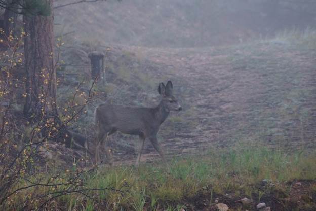
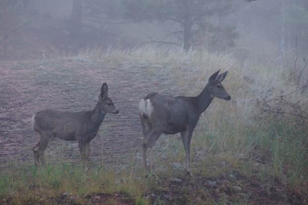
    Last Spring’s Fawn — Greg Hobbs

    Greg Hobbs sent this along in email the other day. He’s been hanging out closer to the headwaters.

    Last spring’s fawn

    lastspringsfawngreghobbs09292014

    still tags with Mom

    stilltagswithmomgreghobbs09292014

    Last spring’s buds

    lastspringsbudsgreghobbs09292014

    a golden scamper

    agoldenscampergreghobbs09292014

    Last night’s rain

    lasnightsraingreghobbs09291014

    a roiling boil

    arioingboilgreghobbs09292014

    blue blue mountains

    bluebluemountainns

    sailing wisps.

    sailingwisps

    Greg Hobbs 9/29/2014

    New storage project aims to ease demand for West Slope water — Grand Junction Daily Sentinel #COWaterPlan #ColoradoRiver

    Proposed reallocation pool -- Graphic/USACE
    Proposed reallocation pool — Graphic/USACE

    From The Grand Junction Daily Sentinel (Dennis Webb):

    The state of Colorado has signed an agreement to boost Front Range water storage, one of the things a growing chorus of Western Slope voices has been calling for to ease the demand for more transmountain diversions. Gov. John Hickenlooper on Friday announced the agreement between the state and the U.S. Army Corps of Engineers to provide for greater water storage at Chatfield Reservoir in Chatfield State Park. The action will result in an increase of up to 75 percent in storage for uses other than flood control.

    It comes after Club 20’s board last month weighed in on an ongoing state water planning process by calling for measures including prioritizing “the storage of Front Range water on the Front Range.” That’s a position that also was endorsed earlier as part of a position paper on the state water plan that was signed by numerous headwaters counties, towns, water utilities and other entities. That paper specifically mentioned Chatfield as an example of such a project that could be undertaken.

    The storage project announcement comes amid increasing Western Slope concern that the new state water plan will result in yet more transmountain diversion projects being pursued. In August, Associated Governments of Northwest Colorado sent Hickenlooper and Colorado Water Conservation Board director James Eklund a letter urging them to oppose any more diversions of water across the Continental Divide.

    “The Western Slope in Colorado has no more water to give,” said the letter, signed by AGNC Chair Mike Samson, a Garfield County commissioner, and Vice Chair Jeff Eskelson, a Rio Blanco County commissioner.

    It also was signed by former Western Slope state lawmakers Ron Teck and Jack Taylor, several local office holders in the region including Mesa County Commissioner John Justman, and ranching, energy and other business interests.

    The AGNC refers to a letter from several Front Range water interests this spring calling for assurance that a new water project involving Colorado River water will be part of the state plan for meeting future needs.

    “This would be too much of the same old story,” says the AGNC letter, which argues that for too long the thirst of the Front Range has been quenched “at the sacrifice of Western Slope communities.” It notes that western Colorado already provides more than 400,000 acre-feet of water a year to the Front Range.

    Club 20 didn’t specifically oppose more diversions, but said the state plan should contain provisions including prioritizing municipal conservation, “including a statewide conservation goal and measurable outcome, and a higher goal for water providers that are using water supplies of statewide concern such as permanent dry-up of agricultural land and/or need a new transmountain diversion from the Colorado River basin.”

    The idea of more Front Range storage of water originating there has received additional attention after last September’s Front Range flooding caused some to lament about water running downstream that might have been stored instead.

    The Chatfield project has been in the planning and permitting stages for more than a decade, Hickenlooper’s office said in a news release.

    “The Chatfield Reservoir Storage Reallocation Project will help farmers irrigate crops and assist communities working to replace limited groundwater with sustainable surface supplies. The project also has the benefit of storing more Front Range water and easing demand for water from the Western Slope. Importantly, as well, the project increases the capacity of an existing reservoir, reducing the impacts to the environment that could be associated with an entirely new reservoir site,” the news release said.

    The state water plan principles endorsed by the headwaters jurisdictions don’t include outright opposition to more transmountain diversions, but lay out numerous conditions for more diversions occurring, including that existing diversion water first be “re-used to extinction to the extent allowed by law.”

    More Chatfield Reservoir coverage here.

    Water For Energy: Challenges to Produced Water Reuse

    Gov. Hickenlooper announces agreement for greater Front Range water storage

    Here’s the release from Governor Hickenlooper’s office:

    Gov. John Hickenlooper announced today that the State of Colorado and the U.S. Army Corps of Engineers have signed an agreement that will provide for greater water storage – up to a 75 percent increase for uses other than flood control – at Chatfield Reservoir, a project in the planning and permitting stages for well over a decade and one securing important new water supplies for the Front Range and northeast Colorado.
    The Chatfield Reservoir Storage Reallocation Project will help farmers irrigate crops and assist communities working to replace limited groundwater with sustainable surface supplies. The project also has the benefit of storing more Front Range water and easing demand for water from the Western Slope. Importantly, as well, the project increases the capacity of an existing reservoir, reducing the impacts to the environment that could be associated with an entirely new reservoir site.

    Possible impacts that may occur from the project, located within the popular Chatfield State Park, will be mitigated to highest standards required by the Army Corps and State of Colorado. Water providers purchasing new storage space in the reservoir are required to mitigate impacts and to place funds for such mitigation in escrow before construction begins. Additionally, no new water will be stored until key on-site recreational and environmental mitigation milestones are complete.

    With the signing of the storage agreement, the early phases of mitigation work can begin. The State of Colorado now has the ability to contract with water providers who wish to purchase space in the reservoir. The project will support agricultural partners including the Central Colorado Water Conservancy District and municipal partners, such as the Centennial Water and Sanitation District and other members of the South Metro Water Supply Authority.

    More Chatfield Reservoir coverage here and here.

    Good intentions gone awry on the #ColoradoRiver — Mountain Town News

    Lake Mead water levels via NOAA
    Lake Mead water levels via NOAA

    From the Mountain Town News (Allen Best):

    For Brad Udall, family history and public policy in the Colorado River mingle. His father was Morris K. Udall, a congressman from Arizona who pushed hard for the Central Arizona Project, which was approved by Congress in 1968. His uncle Stewart Udall, a former Arizona congressman, was secretary of Interior when CAP was approved.

    Interior is the primary federal agency overseeing water affairs in the Southwest and the parent agency for the Bureau of Reclamation, which has built and administered this hydraulic infrastructure.

    Looking back now, he can conclude that both his late father and late uncle as well as many other well-intentioned politicians and policy makers erred in pushing the massive diversion of water from the Colorado River, helping lead to the existing “structural problem” in the basin.

    The problem is most evident at Lake Mead, the giant reservoir near Las Vegas created by construction of Hoover Dam in the 1930s. The reservoir would be losing 12 feet a year if only the so-called “normal” releases upstream from Lake Powell had occurred. Powell, in fact, has been releasing more.

    Because of upper basin drought more years than not since 2000, Powell is facing challenges of its own, leading to a still-small probability that there will be too little water in the next 10 to 20 years to drive the giant turbines in Glen Canyon Dam. That electricity yields $120 million in revenues for the federal government, paying for everything from transmission lines to the endangered fish recovery program in several of the basin’s rivers.

    At Lake Mead, the emergency arrives more rapidly. It now appears the reservoir will be unable to provide water for all existing commitments to the lower-basin states of Arizona, California, and Nevada, said Udall at the recent Colorado River Water Conservation District’s annual seminar.

    In his talk, Truth and Consequences of the 1968 CAP Act,” Udall was most focused on 1968, the year that Congress finally approved the CAP along with a variety of other smaller projects in Colorado and other states.

    Central Arizona Project map via Mountain Town News
    Central Arizona Project map via Mountain Town News

    The CAP is a huge project, even now requiring 400 megawatts, such as would be produced by a good-sized coal-fired plant, simply to move the water from the Colorado River uphill to Phoenix and Tucson. With it, Arizona has grown in population form 1.8 million in 1970, about the time construction of the CAP began, to 6.5 million today.

    Udall’s talk was fast, rich in history and dense with information alluding to both the complex water history and intricate “plumbing” of the Southwest. You can study his PowerPoint here.

    He draws on not only family history, but his own extensive engaged with water issues. He was a guide in the Grand Canyon and a hydraulic engineer in Boulder, Colo., before becoming director of the Western Water Assessment. He recently affiliated with the Colorado Water Institute at Colorado State University.

    In 1968, he said, it was clear that waters of the Colorado River Basin were being developed beyond the assured capacity of the river to provide. Politicians and policy-makers nonetheless were working without complete knowledge.

    “I’m actually humbled about how little we knew in 1968,” he said.

    It wasn’t that Udall’s family and others in Colorado, Arizona and other states of the Southwest set out to make bad decisions. “These were actually well-meaning people,” he said.

    The structural deficit exhibited by the inexorable draw-down of Lake Mead will only be exacerbated by the drying effect predicted by most computer climate-change models. Climate change, he said, makes the structure deficit apparent sooner and “it probably makes it greater.”

    Udall then quoted the late Norris Hundley Jr., who wrote a magisterial history of water projects in the Colorado River Basin and updated it in 2008. “A limited supply of water in a vast, arid … region is hardly a recipe for tranquility,” Hundley had written. “The drafters of the Central Arizona Project were mesmerized by their desire for haste, their personal and political goals.”

    “Without authoritative data, they had an opportunity to pick and choose information that best suited their interests and uncertainties, and that’s what they did,” said Hundley.

    And the lesson for today?

    “I think it’s possible we could be making mistakes based on incomplete knowledge,” said Udall.

    Postscript:

    After this story was first posted, Brad Udall responded to the questions I [Allen Best] should have asked him in the Q&A in Grand Junction:

    “Yes, the (Colorado River) Compact is going to have to be revised. This is as clear as can be,” he said in an e-mail.

    Two key elements of the compact are both under Article III:

    (a) There is hereby apportioned from the Colorado River System in perpetuity to the Upper Basin and to the Lower Basin, respectively, the exclusive beneficial consumptive use of 7,500,000 acre-feet of water per annum, which shall include all water necessary for the supply of any rights which may now exist.

    (d) The States of the Upper Division will not cause the flow of the river at Lee Ferry to be depleted below an aggregate of 75,000,000 acre-feet for any period of ten consecutive years reckoned in continuing progressive series beginning with the first day of October next succeeding the ratification of this compact.

    Udall explains that he has studied minutes of the meetings held in Santa Fe, N.M., in 1922, when the compact was drawn up. In his inspection of the meeting minutes, he finds that Colorado representative Delph Carpenter, known as the father of the compact, “was really clear that he wanted a number in III d that would never be operational. And yet that is where we find ourselves, which tells you that something has seriously gone wrong with the allocation.”

    As for what mistakes we’re making today, “I would say that the jury is out, but any agreement over fixing the CAP legislation needs to be looked at very carefully,” he says.

    “I am worried that any fixes will put states’ preferences first, at the potential expense of the nation. This basin now needs to think about allocations in the context of a healthy regional social/economic/environmental system, not solely just seven states vying for their share of the pie. Everyone who uses this system is guilty of creating the situation we are in now, and everyone is going to have to contribute to a solution.”

    Udall’s latter statements about collaboration are similar to those made many times in recent years by Pat Mulroy, the long-time general manager of Southern Nevada Water Authority.

    Expect to see something written by Udall in the relatively near future.

    More Colorado River Basin coverage here.

    McPhee Reservoir update: “…inflow from the Dolores River is helping us tremendously” — Vern Harrell


    From the Cortez Journal (Jim Mimiaga):

    Recent rains are filling McPhee Reservoir, improving its outlook for next season.The reservoir’s elevation is 4½ feet higher than this time last year, reports Vern Harrell, a Bureau of Reclamation engineer.

    “This latest storm produced 1,676 acre-feet of storage,” he said. “Irrigation outflow is pretty much done, and the inflow from the Dolores River is helping us tremendously.”

    Carryover storage as of Oct. 1, 2014, is at 34,185 acre-feet, compared with 21,943 acre-feet for the same day last year, an increase of 12,242 acre-feet.

    Last year, farmers suffered shortages, receiving just 25 percent of their normal water allocation because of poor snowpack and early hot weather.

    This year, farmers from Dove Creek to Towaoc received 90-100 percent of their allocation, and monsoon rains reduced overall irrigation demand.

    “It turned out to be a good water year,” Harrell said.

    On Sept. 29, the Dolores River hit a record peak of 1,060 cubic feet per second — up from 100 cfs the day before — because of a massive rainfall event in the San Juan Mountains over the weekend. The previous record on that day was 626 cfs in 1927. On Oct. 1, the river at Dolores was flowing at 456 cfs, a boatable level.

    Also this fall, significant upgrades to McPhee’s irrigation infrastructure will begin. The Bureau and the Dolores Water Conservancy District secured $4.5 million in funding for the improvements.

    Automated pumping stations at Fairview, Pleasant View, Ruin Canyon, Cahone, and Dove Creek are all slated for upgrades, said DWCD engineer Ken Curtis.

    The majority of the funding ($4 million) for the upgrades comes from revenues generated at the Glen Canyon hydro-electric power plant. DWCD pitched in $465,000.

    “The Colorado Basin Power funds were used to pay for new reservoir projects, but there are no more of those, so now it distributes the money for upgrades and maintenance of existing facilities,” Curtis said.

    The Fairview Pumping plant, which feeds off the Dove Creek canal, will receive the first overhaul at a cost of $1.6 million.

    “The $500,000 needed for installation came in and construction is slated to begin in November,” Harrell said.

    Now that the farming season is over, three variable-speed pumps and their 500-horsepower motors will be replaced, along with electronics and transformers.

    The Fairview station delivers irrigation water through underground pipelines to 8,000 acres of farmland southwest of Yellow Jacket…

    A wet fall and some carryover storage is a good sign for boaters as well. Officials say the reservoir needs an above-average winter snowpack to fill.

    More Dolores River watershed coverage here.

    Colorado’s river economy worth $9 billion — High Country News #COWaterPlan #ColoradoRiver


    From the High Country News (Sarah Tory):

    When Governor Hickenlooper issued his executive order last year to create a state Water Plan, he charged the Colorado Water Conservation Board with the task and they, in turn, looked to the Basin Roundtables for their ideas about what the overall plan should include. The goal said, James Eklund, the Board’s Director, was to tackle Colorado’s water problems “as one unit.”

    That’s the theory at least. But with the Roundtables dominated by municipal and agricultural interests, other groups are struggling to make their voices heard.

    On September 10, a group of Colorado business leaders made their case for the “river-based economy” at the Colorado Water Conservation Board meeting in Glenwood Springs, where members of the public could comment on draft sections of the plan.

    The setting was fitting: nearby, the rugged Glenwood Canyon runs alongside the busy I-70 corridor. A good portion of the town’s economy revolves around people coming to fish and raft on the Colorado River which carves through the canyon walls, but that river, like so many on the West Slope – where the majority of Colorado’s water lies – is shrinking. Every year, 180 billion gallons of water are sucked from rivers flowing west of the Continental Divide through a vast system of tunnels and pipes to thirsty farms and cities along the dry Front Range.

    Now, faced with a growing gap between water supply and demand, they need more. In their draft plans, released in July, East Slope Basins like the South Platte emphasize the need “to consider new Colorado River supply options to meet future water demands” – which means keeping open the possibility of pulling more water from west to east through new transmountain diversions. But those plans, say members of Colorado’s outdoor recreation, real estate, and tourism industries, jeopardize a $9 billion dollar economy that hinges on healthy rivers – and supports more than 80,000 jobs in the state.

    Graphic via the High Country News
    Graphic via the High Country News

    A report commissioned by Protect The Flows found that if the Colorado River was a company, it would rank 155th on the 2011 Fortune 500 list (those numbers are based just off of the revenue and jobs provided by the outdoor recreation industry), ahead of General Mills and US airways. It would also be the 19th biggest employer on the list.

    “It’s really pure economics for us,” says Dennis Saffell, a realtor from Grand County. Factoring in all the indirect beneficiaries of Colorado’s rivers means the true economic value is likely much greater, he added, citing a recent report that found declining river flows across the Southwest could significantly hurt home prices…

    Protect Our Flows wants the statewide plan to place more emphasis on smart water management and remove the option of building new transmountain diversions. The group is pressing the Colorado Water Conservation Board to set concrete statewide conservation goals in the Water Plan, especially for towns and cities – something most other Western states have, but Colorado is lacking.

    Both Mackey and Saffell noted that although most of the Basin Roundtables recognize the economic value of healthy rivers, far fewer have actually quantified those benefits – or included specific language to protect stream flows. Since each Basin’s recommendations lay the foundation for the statewide plan, it’s essential that all of them include concrete standards.

    But the river advocates are up against some strong, well-entrenched political forces. They pointed to the big agriculture and municipal interests that drive a large chunk of Colorado’s economy – and hold much of the power at the Basin Roundtables.

    In comparison, the recreation economy is “the new kid on the block,”, says Mackey, who grew up skiing on wood skis and cable bindings. “I’m a sixty year old man and Patagonia, The North Face, the Vail Ski Resort – these companies grew up in my lifetime,” he added. “So we really need to push our way into the conversation.”

    And there’s another challenge: Colorado’s water laws. Most were written in the late 1800’s and though a few modifications have occurred over the years, the laws still reinforce a “use it or lose it” mentality, which makes it difficult to implement conservation strategies. Thanks to those laws, says Saffell, farmers and cities have a legal right to keep using more water.

    Think of it this way, he added: if we had the same traffic laws as we did 150 years ago when the water laws were written, it would be utter chaos. Most laws change to accommodate new realities, says Saffell, “but for some reason our water laws are untouchable.”

    Instead, “we need to get away from this concept that any water left in the river is wasted water because it’s not being put to beneficial use,” he said.

    More Colorado Water Plan coverage here.

    Six water bills on their way to #COleg for 2015 session but not water flex-marketing

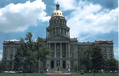
    Colorado Capitol building
    Colorado Capitol building

    From The Pueblo Chieftain (Chris Woodka):

    A flex marketing bill, similar to one that stalled in the state Legislature earlier this year, failed to make it out of the interim water resources review committee this week. Discussion of the bill snagged on a section that would prohibit transfers between basins in the state, as members of the committee deadlocked in a 5-5 tie at a meeting in Denver Tuesday. Seven votes were needed to move the legislation forward in 2015.

    The legislation still could be brought forward if an individual sponsor is found. The idea came out of a South Platte study of water use co-sponsored by the Colorado Corn Growers, Aurora and Ducks Unlimited, and is being promoted primarily by water lawyer Andy Jones.

    The flex water right proposed in the legislation would allow agricultural water rights to be used for multiple purposes — including municipal, industrial and recreation — under either a court decree or in a substitute water supply plan. It would allow water to be taken off the land through fallowing or deficit irrigation — a largely untested concept — for five years in every 10. The bill has raised concerns about speculation, which were addressed in the revised version by adding that continuation of agriculture would be the primary purpose of the water right. It also contains a section that would allow a judge to review whether a flex water right would harm other water rights after it has been decreed, presumably placing the filing of a protest and burden of proof on the owner of the water right claiming injury.

    Water rights now are decreed after applicants prove or reach agreements that assure other rights will be mitigated for possible damages.

    More:

    WATER BILLS

    Six bills dealing with water issues are headed for the Colorado General Assembly in 2015, following action by the interim water resources review committee. Bills are not yet numbered.

    Water issues in land-use planning: Directing the Colorado Water Conservation Board and Department of Local Affairs to provide water education to land-use planners.

    Rain harvesting: Refining legislation in 2009 that allowed the CWCB to conduct up to 10 pilot projects for collection of rainwater by new developments. It would reduce the amount of replacement water required.

    Dawson aquifer: Repeals an augmentation requirement for the Dawson Aquifer (part of the Denver Basin aquifers) to continue the current standard of replacing actual depletions.

    Water-table lowering: Requires CWCB and the state engineer to administer two pilot projects to lower South Platte water tables in northeastern Colorado.

    Invasive phreatophytes: Creates a five-year grant program from the noxious weed management fund to control invasive species such as salt cedars and Russian olives.

    Groundwater appeals: Allows additional evidence to be presented when appealing decisions by the state groundwater commission or the state engineer.

    More 2015 Colorado legislation coverage here.

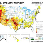
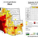
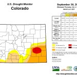
    Drought news: D3 expansion in Kansas spills over to SE Colorado #COdrought

    Click here to go to the US Drought Monitor website. Here’s an excerpt:

    Summary

    A large upper-level low pressure system slowly moved across the western CONUS (contiguous United States) this U.S. Drought Monitor (USDM) week, forcing a strong upper-level ridge ahead of it over the central and eastern CONUS. The upper low, and its associated surface lows and fronts, dropped an inch or more of rain across many parts of the West, with local amounts ranging 3-5 inches or more. The upper ridge brought dry weather to much of the country east of the Rockies and much warmer-than-normal temperatures to the north central states. Two low pressure systems, one at the beginning of the week and the other near the end, brought rain to parts of the East, while a front draped across central Florida dumped over 5 inches of rain on many locations…

    The Plains and Midwest

    As the upper low in the West approached the northern Plains, it triggered heavy storms which dumped 3+ inches of rain over parts of western Nebraska and southwest South Dakota. Local storms also dropped an inch or more of rain over parts of central and southeast Nebraska, parts of Kansas, and central to south central Iowa. Lesser amounts of rain fell in other parts of the Plains and Upper Midwest, but Missouri and the Ohio Valley, all the way to the Central Appalachians, were mostly dry. The Nebraska rains shrank the D0 in the southeast and obliterated it in the panhandle. But D0 expanded in southern Missouri and a spot of D1 was added in southwest Missouri as the state’s soils further dried out. September 29 USDA reports had 27% of the topsoil and 32% of the subsoil rated short or very short of moisture, both increases compared to last week, and 16% of the pasture and rangeland rated poor to very poor. In nearby Kansas, showers kept the statewide values generally constant at 36% of the topsoil and 47% of the subsoil short or very short of moisture and 23% of the pasture and rangeland poor to very poor. But D2 and D3 expanded in southern Kansas. Low streamflows and drying soils expanded D0 in West Virginia, where 46% of the topsoil and 51% of the subsoil were short to very short. D0 was added to southern Ohio, extreme northern Kentucky, and northeast Minnesota, and D0 expanded in southwest Wisconsin. Over 40% (42%) of Kentucky’s topsoil was rated short or very short, a jump of 16% compared to last week…

    The West

    The upper low swept bands of heavy rain into the coastal Northwest and northern California, with over 3 inches of rain reported at several stations. But the rains had little impact on the ongoing drought, especially in California, where deficits are huge and the normal annual precipitation in parts of the northern coastal areas can reach 75-100 inches. Topsoil in a few areas benefited, wildfires were hindered, and streamflow increased, but the streamflow recovery was short-lived as streams rapidly returned to the low flows they had prior to the rain event, and reservoir levels did not improve. Statewide, California soil moisture conditions were the same as last week, with 80% of topsoil and 85% of subsoil rated short or very short of moisture by the USDA. Consequently, only D2 was pulled back in Del Norte County (California) and Curry County (Oregon), and D0 was trimmed in Washington’s eastern Olympic Peninsula. An inch or more of rain fell from southeast Oregon to central Idaho and southwest Montana, with heavier rainfall (3+ inches) in southeast Idaho and adjoining parts of Wyoming. But the weekly precipitation amounts were below normal across much of northwest Montana, where D0 expanded. D0 also expanded in Skamania County, Washington, to reflect 4-month dryness, and D2 expanded in north central Washington to better match short-term and long-term dryness.

    The low continued a trend of above-normal monsoon rainfall for parts of the Great Basin and Southwest. D2 was removed in southwest Arizona and the nearby D1 was pulled back, D1 was contracted in southwest Utah and D0-D1 shrank in eastern Utah, D0 contracted and D1 was deleted in southwest Wyoming, D0-D2 were pulled back in southwest Colorado, and D3 slightly trimmed in northwest New Mexico. Even though 3+ inches of rain was reported in parts of Arizona, Colorado, and Utah, many of the reservoirs in these states remained depleted, and long-term precipitation deficits remained huge (especially in the Southwest), so no other changes were made to the drought depiction. Statewide soil moisture conditions in Colorado changed very little compared to last week, with 43% of the topsoil and 50% of the subsoil still rated short or very short of moisture, and 27% of the pasture and rangeland rated in poor to very poor condition. Some of the D3 expansion from southwest Kansas and the Oklahoma panhandle bled into the very extreme southeast corner of Colorado…

    Looking Ahead

    An upper-level ridge of high pressure will build over the West during October 2-9, bringing a return of dry and warmer-than-normal weather, while the upper-level trough of low pressure slowly moves east of the Rockies. The trough will funnel cooler-than-normal air into the north central and eastern states, with widespread areas of rain forecasted along fronts and surface lows from the Mississippi River to the East Coast, and in parts of the Plains. The heaviest rain, 1-4 inches, is expected from Missouri to the Great Lakes, with areas of about an inch in parts of Nebraska, the Tennessee Valley to Southern Appalachians, and parts of the Northeast.

    The upper-level circulation pattern will become stalled during October 9-15, with a ridge over the western CONUS and trough over the east. Dry and warm weather should dominate the West, while colder-than-normal air masses frequent the Plains to Midwest states. Gulf of Mexico moisture is expected to feed weather systems which bring above-normal precipitation to the Plains, Midwest, and Northeast states. The Southeast is forecast to have near to below-normal precipitation during this period. Alaska should be wetter than normal in the south and drier than normal in the north, warmer than normal in the west and near to below normal in the southeast.

    The Headwaters Conference – Celebrating 25 Years — Colorado Central Magazine

    George Sibley
    George Sibley

    Here’s a recap of the recent Headwaters Conference held at Western State University, from Tyler Grimes writing for Colorado Central Magazine. Click through and read the whole article. Here’s an excerpt:

    The 25th Headwaters Conference, The Working Wild, began Friday, Sept. 20 at Western State Colorado University in Gunnison. The auditorium was full in anticipation of the keynote speaker, Gary Snyder. One spectator mused, “It’s the gathering of the eagles,” with community leaders from all over the Headwaters region in attendance. After a poem by Art Goodtimes and a song by Alan Wartes, Conference Director John Hausdoerffer introduced Snyder. He revealed that Snyder, a beat generation poet, inspired Jack Kerouac’s famous character from the Dharma Bums, Japhy Ryder.

    Snyder began by dissecting the words of the theme: wild and wilderness. Wilderness, he said, came from the Old English words meaning self-willed, beast and place. What does it mean for land to be self-willed, Snyder asked the audience. Wild in Germanic and Chinese, which Snyder studied, meant self-ordered or self-managed. He explained that when he thought of wilderness he looked at the percentage of wild processes. Snyder went on to give a few opinions on land management before moving into reading. He read mostly from Mountains and Rivers Without End, a collection of poetry he had written over the last 40 years. He lulled the audience into meditative stillness as he described white water and rivers, trees and forests, and rocks and mountains. Hausdoerffer said later, “It was like listening to a mountain speak.”

    Near the end of his Keynote address, Snyder read from his famous poem For the Children, which ends, “Stay together/Learn the Flowers/Go light.”

    The Headwaters Conference was started 25 years ago by former Western faculty member George Sibley. He recalled the years leading up to the Conference during his address Saturday afternoon. He said universities all over the country were struggling after the baby boomers were completing higher ed. He recalled a time when there were talks of turning Western into a medium-security prison. Sibley went to faculty meetings that “he didn’t belong in” to push his idea of a conference. He described thinking that Gunnison was just a few hours’ drive to the start of many major rivers. “We were the headwaters school,” he said. The Headwaters Conference was a way for headwaters communities to gather, network and collaborate…

    Sibley ended the day’s events by addressing the Conference. “We’ve barely scratched the surface,” he said, on what the Headwaters Conference could be. “We hope for another 25 years.” In summary, Sibley turned to a table of students and built upon Snyder’s poem, “‘Stay together, learn the flowers, go light,’ and I would add to it, work wild.”

    Feds: 2013-14 water year slightly above average in Aspen-area — The Aspen Times

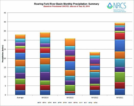
    roaringforkwatershedwateryear2014precipitationvianrcs

    From The Aspen Times (Scott Condon):

    A snowy January and February plus a rainy May and August boosted total precipitation in the Roaring Fork River basin to slightly above average for the 2013-14 water year, according to the Natural Resources Conservation Service.

    The federal agency tracks snow and rain at seven automated sites at the headwaters of the Roaring Fork River as well as the Fryingpan and Crystal river valleys. The water year is considered from Oct. 1 through Sept. 30.

    “Things were pretty normal until January, when it looked like it might be drying up. Then we started to get all that snow, which put us above average for a while,” Mage Hultstrand, assistant snow survey supervisor for the conservation service in Lakewood, said via email. “June was very dry, but thankfully we got some good rain in July and August and ended up right at normal precipitation for the water year.”

    The conservation service’s website shows that total precipitation at the Independence Pass site east of Aspen was at 104 percent of average for the year. There were 32.4 inches of precipitation recorded. The average at that site between 1981 and 2000 was 31.2 inches.

    The site with the highest reading for the year was Kiln, at an elevation of 9,600 feet in the Fryingpan Valley. It recorded 28 inches of precipitation for the year compared with an average of 25 inches. That was 112 percent of average.

    McClure Pass in the Crystal River Valley was the only site in the Roaring Fork Basin that was below average for the year. The 33 inches recorded there was 96 percent of average.

    Schofield Pass received 50.4 inches of precipitation for the water year, 102 percent of average.

    The Roaring Fork Basin as a whole ended at 103 percent of average, according to the conservation service’s data.

    Above-average precipitation in January, February, May and August kept the basin at average conditions despite the dry months of December, April and June, Hultstrand noted.

    More Roaring Fork watershed coverage here.

    The Special District Association of Colorado recognizes Parker Water and Sanitation for collaboration

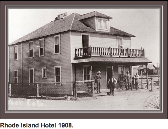
    Rhode Island Hotel 1908 Parker via Best of Parker
    Rhode Island Hotel 1908 Parker via Best of Parker

    From the Parker Chronicle:

    The Parker Water and Sanitation District is one of three special districts to be given a collaboration award this year.

    The award was given by the Special District Association of Colorado during an annual conference Sept. 10-12 in Keystone. The collaboration award is given to districts “that have effectively and efficiently partnered with other entities and local governments” to benefit water users, according to a news release.

    The PWSD joined with the Rampart Range and Sierra Ridge metro districts on a sewer system for the RidgeGate development in Lone Tree, which is served by Parker Water. The joint effort resulted in reduced infrastructure costs for citizens and an award for all three districts.

    Ann Terry, the executive director of the Special District Association, said the project is a “true testament to the success that can be achieved through partnerships.”

    More Parker coverage here and here.

    Gordon Jacoby and the #ColoradoRiver: “predicting hydrologic bankruptcy” — John Fleck

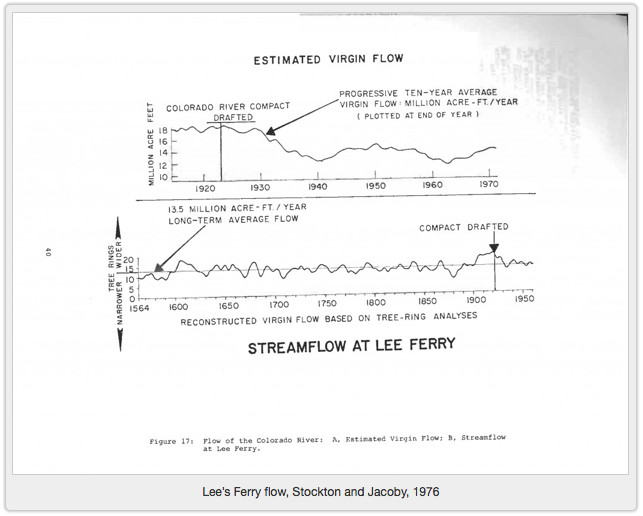
    stocktonandjacobyvirginflowatleesferrytreerings1976viajohnfleck

    From Inkstain (John Fleck):

    In my world, the 1976 tree ring analysis of the Colorado River’s long term flow done by Charles Stockton and Gordon Jacoby stands as one of the great works of policy-relevant science. But by the time I came on the scene, “Stockton and Jacoby”* (pdf) was just a marker, a signpost along our path to understanding the mistakes we made in allocating the Colorado River’s flow. I’d never looked at the details of how the work came about until we got news today of Jacoby’s death, and some reminiscing by some of Jacoby’s colleagues sent me down the rabbit hole of history to the wonderful story Jacoby told to oral historian Ronald Doel in 1996.

    The National Science Foundation was funding a broad research effort into the impacts of the completion of Glen Canyon Dam and the filling of Lake Powell. Jacoby thought tree rings might be an interesting tool for understanding the long term history of flows on the river:

    Douglas Fir tree rings via the Western Water Assessment
    Douglas Fir tree rings via the Western Water Assessment

    [I]n doing some of the water aspects, I heard somewhere — I can’t really cite a specific reference — this idea of using tree rings to find out about water supply. They realized first you have to know how much water is going to come into this reservoir. And I heard somewhere this concept of using growth rings of trees to estimate stream flow. And so I went and talked to Chuck [Charles] Stockton at the tree ring lab in Arizona and he’d been working on the Colorado River flow. So in the next contract that I put in, I put in a subcontract for us to work together on this.

    Their findings were disconcerting.

    The Colorado River’s allocation of 7.5 million feet annually for the Upper Basin, 7.5 million for the Lower Basin, with another 1.5 million acre feet tacked on for Mexico, had been negotiated during an unusually wet time. A very unusually wet time. [ed. emphasis mine]

    More Colorado River Basin coverage here.

    How will CSU’s $50 million for Fountain Creek mitigation be spent?

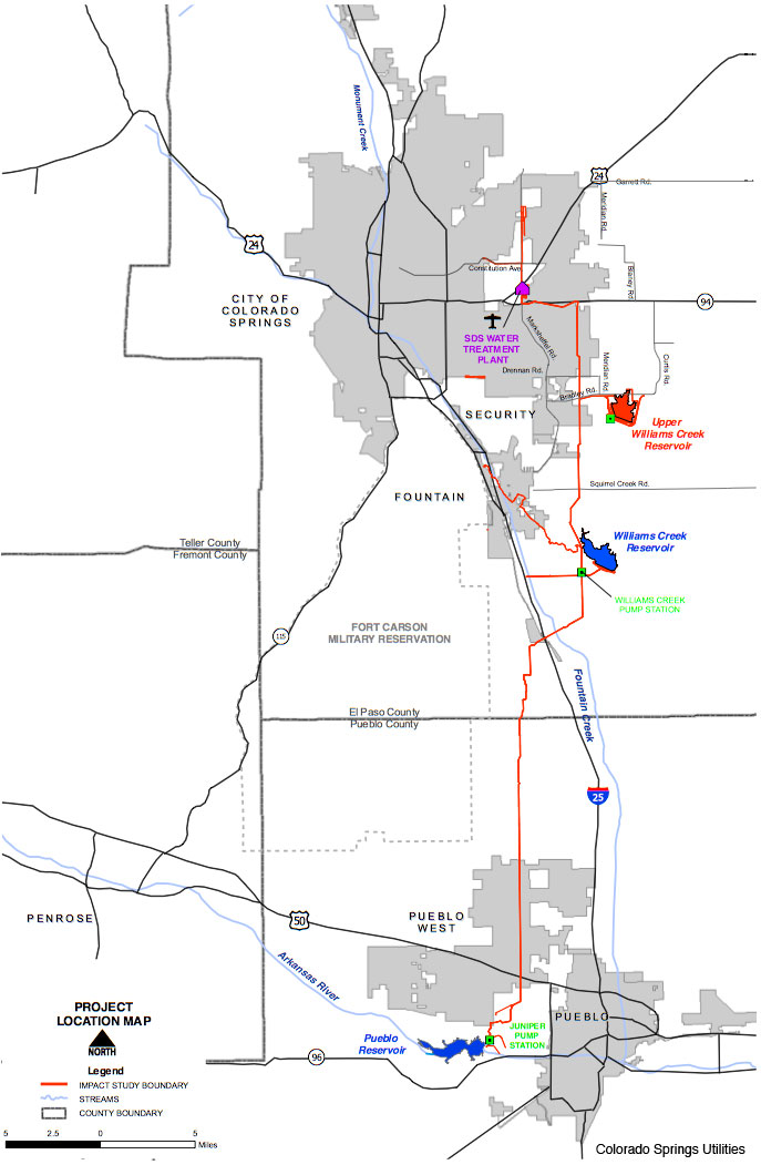
    Southern Delivery System route map -- Graphic / Reclamation
    Southern Delivery System route map — Graphic / Reclamation

    From The Pueblo Chieftain (Chris Woodka):

    While the decision of how to spend $50 million for flood control on Fountain Creek to benefit Pueblo will be made by the parties directly involved, other input will be needed.

    “Anyone who wants to come to the table and says, ‘We want to find out where money for these projects will be available,’ is welcome,” Pueblo County Commissioner Terry Hart said.

    Last week, Hart made a pitch to the Fountain Creek Watershed Flood Control and Greenway District to begin planning now for the arrival of $50 million in payments from Colorado Springs Utilities after Southern Delivery System goes online in 2016. That money is seen as seed money for projects that could amount to $150 million or more identified in a corridor master plan. The money was negotiated by Pueblo County under its 1041 agreement with Utilities in 2009 for the construction of the SDS water supply pipeline through the county. It is to be used for flood control projects on Fountain Creek that benefit Pueblo County. When the district was established later in 2009, it became the recipient of the money.

    “At a minimum, Pueblo County, CSU and the Fountain Creek district need to be involved, and they will have the final say,” Hart said.

    But the city of Pueblo and the Lower Arkansas Valley Water Conservancy District also should have input about how the money will be used, Hart said.

    The greatest potential damage from Fountain Creek flooding is within the city of Pueblo and in the communities of the Lower Ark Valley downstream from Fountain Creek.

    “The Lower Ark District was instrumental in developing the corridor plan, and we definitely need the technical input from the city of Pueblo,” Hart said.

    The corridor plan, a joint effort of Utilities and the Lower Ark district, identifies projects between Fountain and Pueblo that could cost several times the $50 million that was earmarked under the 1041 agreement. Pueblo already has participated in pilot projects to demonstrate flood control techniques.

    In addition to technical assistance, Pueblo County’s attorneys will have to be involved to determine whether projects meet the conditions of the 1041 permit. This will be important to avoid the kinds of dispute that developed when the Lower Ark raised objections about how its contributions to the district were being spent.

    “I see this new committee working in concert with the steering committee (Utilities, Lower Ark and the Fountain Creek District),” Hart said.

    More Fountain Creek coverage here.

    Boulder unveils flood mitigation plans; Council not on board

    Surfing Boulder Creek September 2013 via @lauras
    Surfing Boulder Creek September 2013 via @lauras

    From the Boulder Daily Camera (Erica Meltzer):

    The leading version of the South Boulder Creek flood mitigation project would remove 893 homes in southeast Boulder from the 100-year floodplain, but it would also involve building a 23-foot berm through a recognized state natural area with endangered tall-grass prairie habitat.

    That was a step too far for Boulder City Council members, and on Tuesday night, they asked the city’s flood engineers to take up discussions with the University of Colorado about using land the university owns for its future south campus instead.

    The council heard an update Tuesday on the city’s flood mitigation efforts in the aftermath of 2013’s damaging floods. Boulder remains one of the cities at highest risk for flash flooding in Colorado.

    The most likely flood scenarios — and the ones the city’s mitigation efforts are designed to limit — involve intense rainfall over a short period of time, not the days of sustained rain the city experienced last year.

    Several council members asked what the city could do about flooding from groundwater, which caused 47 percent of the damage last year, either directly or indirectly in the form of sanitary sewer backups.

    The city’s wastewater utility has developed plans to line older clay pipes to reduce groundwater infiltration during large rain events, but there’s no practical or legal way to lower the groundwater table, Jeff Arthur, director of public works for utilities, told the council…

    But Arthur stressed that the flood scenarios modeled by the city’s engineers and reflected in floodplain maps are both more likely to occur than an event like the 1,000-year rain of 2013 and more likely to produce significant damage and loss of life.

    The flooding in most of Boulder’s major drainageways in 2013 was the equivalent of a 10- to 25-year flood event. Only Twomile Canyon Creek experienced a greater than 100-year flood, while South Boulder Creek, Goose Creek and Fourmile Canyon Creek experienced 50- to 100-year flooding.

    The city is in the planning stages of four flood mitigation efforts: Boulder Creek, Bear Canyon Creek, Gregory Canyon Creek and South Boulder Creek.

    Mitigation planning efforts on Upper Goose and Twomile creeks, Skunk Creek, King’s Gulch and Bluebell Creek will start in 2016, after floodplain map revisions along those watersheds are complete.

    Gregory Canyon will present significant challenges because so many homes are so close to the creek, and it will be impossible to do a mitigation plan that takes those homes out of the 100-year floodplain, short of simply removing the homes, engineers told the council. Instead, engineers are looking for ways to break up the channels to reduce the impact of flooding there.

    The South Boulder Creek mitigation planning process has been underway for several years, and consultants and the city’s Water Resources Advisory Board had settled on a $46 million recommendation that would involve a major regional detention area south of U.S. 36 and smaller detention areas near Manhattan Middle School and on the Flatirons Golf Course.

    Modeling of likely flood scenarios indicate a 100-year flood of South Boulder Creek would cause $215 million in damage. City Council members watched an animated simulation that showed much of southeast Boulder filling with water.

    However, the large detention facility would have a significant impact on open space owned by the city that includes endangered tall grass prairie habitat, wetlands areas and a number of endangered and threatened plant and animal species.

    The open space board officially objected to the plan as proposed, and the water resources board revised its position, recommending that the upstream and downstream pieces of the project be separated.

    The two smaller detention areas could be built for $23 million with relatively few regulatory hurdles and would still take 294 dwelling units out of the floodplain…

    Councilman George Karakehian said building the berm through open space was not politically feasible.

    “I think that would be a tough one to get built in our community,” he said.

    A revised version of the South Boulder Creek mitigation plan is expected to be presented to the City Council later this fall.

    More Boulder Creek coverage here.

    Fountain Creek District: Good tour of Fountain Creek channel improvements by Colorado Springs Utilities at Clear Springs Ranch yesterday

    Waters of the U.S. video: Agriculture — EPA

    Weekly Climate, Water and Drought Assessment of the Upper #ColoradoRiver Basin

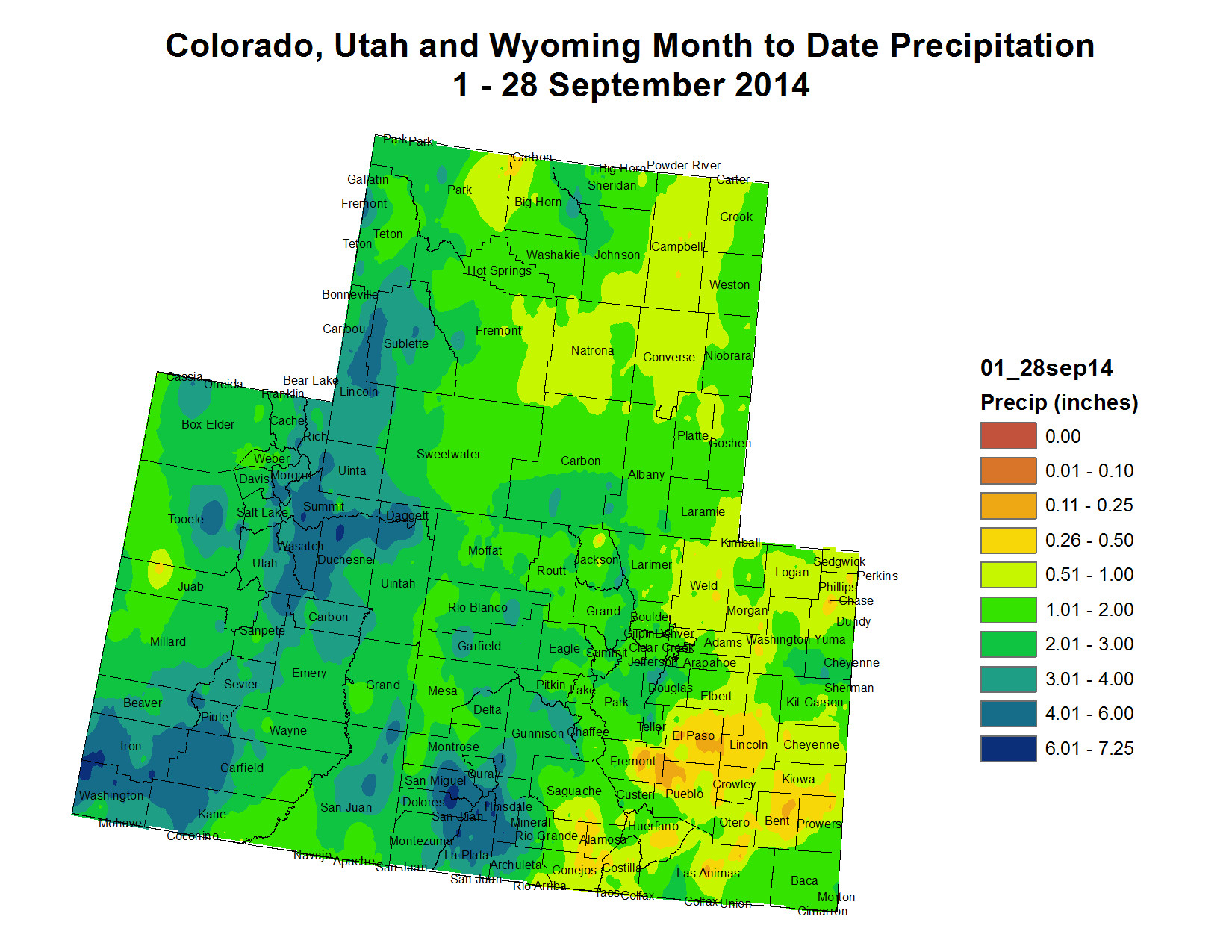
    Upper Colorado River Basin month to date precipitation thru September 28, 2014
    Upper Colorado River Basin month to date precipitation thru September 28, 2014

    Click here to read the current assessment. Click here to go to the NIDIS website hosted by the Colorado Climate Center.

    Green River dams get little support in survey — @WyoFile

    Lower IQ in Children Linked to [perchlorate] in Water — Scientific American

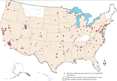
    Perchlorate Pollution by State
    Perchlorate Pollution by State

    From Scientific American (Brian Bienkowski):

    Babies born to mothers with high levels of perchlorate during their first trimester are more likely to have lower IQs later in life, according to a new study.

    The research is the first to link pregnant women’s perchlorate levels to their babies’ brain development. It adds to evidence that the drinking water contaminant may disrupt thyroid hormones that are crucial for proper brain development.

    Perchlorate, which is both naturally occurring and manmade, is used in rocket fuel, fireworks and fertilizers. It has been found in 4 percent of U.S. public water systems serving an estimated 5 to 17 million people, largely near military bases and defense contractors in the U.S. West, particularly around Las Vegas and in Southern California.

    “We would not recommend action on perchlorate levels from this study alone, although our report highlights a pressing need for larger studies of perchlorate levels from the general pregnant population and those with undetected hypothyroidism,” the authors from the United Kingdom, Italy and Boston wrote in the study published in The Journal of Clinical Endocrinology & Metabolism.

    The Environmental Protection Agency for decades has debated setting a national drinking water standard for perchlorate. The agency in 2011 announced it would start developing a standard, reversing an earlier decision. In the meantime, two states, California and Massachusetts, have set their own standards.

    EPA officials said they expect to unveil their proposed standard in the summer of 2015, missing their deadline by two years. They would not comment on the new findings.

    More water pollution coverage here.

    Denver Water: Did you know? Much of Earth’s Water Is Older Than the Sun

    Final Cotter report released — The Pueblo Chieftain

    From The Pueblo Chieftain (Tracy Harmon):

    Federal public health representatives who studied health concerns for Lincoln Park Superfund site residents living near the Cotter Uranium Mill issued a final report last week. The 260-page report includes comments made by citizens following its initial 2010 release. Many of the comments from citizens indicated the report was confusing, so o’cials with the Agency on Toxic Substances and Disease Registry attempted to clarify some of the confusion.

    The Cotter Uranium Mill processed yellowcake uranium from 1958 to 1987 before going into sporadic operations. The mill has not processed uranium since 2006 and Cotter officials, along with state and federal health officials, are working toward a full cleanup of the site which has been on the Environmental Protection Agency’s Superfund list since 1984.

    The health report concludes that drinking water for many years from a private well that contains elevated levels of molybdenum and uranium could harm people’s health. Although nearly all residents who have contaminated wells have been hooked up to the city water supply, some still use the wells to irrigate.

    During 2008 testing, one of the seven wells exceeded the drinking water standard for molybdenum. The owner of that well declined to be connected to the municipal water system, according to the report.

    “The groundwater remains contaminated and the contaminant plume can migrate to previously uncontaminated wells. Therefore, a future potential pathway also exists for other private wells until the contamination is cleaned up and no one is drinking contaminated well water,” according to the report.

    The State Engineer’s Office is required to tell all well applicants who want to drill for water that there is potential contamination.

    The report also concludes that accidentally ingesting or touching soil or sediment in the Lincoln Park community will not harm people’s health.

    “However, there is not enough information for the agency to determine if exposures to lead will harm people’s health in residential communities immediately northwest of the Cotter Mill,” the report indicates.

    Although soil north and west of the Cotter Mill is contaminated with high levels of lead, there were no elevated levels of lead in the blood of children and residents tested.

    The report also concludes that a person eating an average amount of homegrown fruits and vegetables defined as approximately 1cups per day will not experience harmful health effects. However, people who eat a lot of fruits and vegetables, defined as approximately 5 cups per day from their Lincoln Park gardens over a long period of years, may be at risk from exposure to arsenic.

    The agency, “was unable to determine the source of the arsenic found in the fruits and vegetables; it could originate from natural sources. The agency recommends that residents who have gardens wash their homegrown produce thoroughly before eating it,” according to the report.

    Finally, the agency’s report concludes that, “Air emissions of particle bound radionuclides have not resulted in exposures to the public at levels known to cause adverse health outcomes. Outdoor radon concentrations will not harm people’s health.”

    “With the exception of thorium-230 levels observed in 1981 and 1982 that were associated with excavation of contaminated tailings, every radionuclide monitored has been more than a factor of 10 below annual dosebased health limits to the public. The excavation releases appear to have only exposed onsite workers, but that exposure still was below occupational limits at that time,” according to the report.

    To view the final report, go to http://recycle4colorado.ipower.com/Cotter/Lincoln%20Park/140922lincolnparkpublichealthassessment.pdf.

    From the Colorado Independent (Bob Berwyn):

    When rainstorms sent a surge of muddy debris down Sand Creek late this summer, people living near the defunct Cotter Uranium Mill were thinking, “Here we go again!”

    A big 1965 flood washed radioactive sludge toward the nearby Lincoln Park neighborhood, a foothill community near Cañon City where residents have horses and apples trees in their backyards. The plume of poisoned water spread underground. Fifty years later, there are still three wells in Lincoln Park where the uranium concentrations are above state standards set to protect human health.

    This year’s late summer rainstorms gummed up critical pumps and pipes, part of a system built to prevent radioactive waste from escaping the polluted 2,600-acre Cotter property, which has been designated as a high priority federal Superfund cleanup site for the past quarter century.

    The fact that a series of checks on dams and underground barriers showed they apparently worked the way they’re supposed to during the recent floods is small comfort to some Lincoln Park residents who worry about continued health risks and complain that state and federal regulators are still dragging their feet on the long-mandated cleanup.

    “I realize the surface water is getting captured pretty well, but we’ve asked for better monitoring of groundwater, and we’ve been refused over and over again,” said Lincoln Park resident Sharyn Cunningham.

    “We’ve asked them to do scientific studies to show there is no underground movement of water and they’ve refused numerous times,” she added, noting that uranium levels in the groundwater on the Cotter property are “horrendously high.”

    In the wake of the most recent flooding, concerned locals say Cotter and the government officials tasked with overseeing the cleanup seemed to be defying a new state law that sets deadlines for inspections and reporting.

    Kindergarten Rules

    Cunningham and other residents want the U.S. Environmental Protection Agency and the Colorado Department of Public Health and Environment to lean on the Cotter Corporation harder to accelerate the cleanup effort. The company is a Denver-based subsidiary of General Atomics, a corporation with lucrative federal nuclear contracts. Cotter owns or controls 15 uranium and vanadium mines in southwest Colorado with an estimated 100 million pounds of ore. Watchdogs say the company has plenty of money to pay for a cleanup, and that big corporations — especially ones with government contracts — ought to play by the same simple kindergarten rules that apply to the rest of us.

    “You make a mess, you clean it up,” said Travis Stills, an environmental attorney representing Colorado Citizens Against Toxic Waste. At the Cotter site — which is so close to Cañon City and upstream from the Arkansas River — the best option would be to dig up most of the toxic radioactive waste and move it to a geologically stable and remote site where it would pose the least threat to people and the environment, watchdogs say.

    The mill started producing uranium oxide, or yellowcake in 1958 as part of the Cold War nuclear arms buildup. The concentrated uranium powder is the raw material for fissionable nuclear fuel. According to Cunningham, who curates an extensive library of documents related to the site, some of the waste came from the Manhattan Project, America’s WWII atom bomb effort.

    Up until 1980, Cotter dumped radioactive waste into unlined ponds. It wasn’t until 1988, 30 years after Cotter started operation, that the state required the company to build a groundwater barrier to trap tainted water and pump it back up into evaporation ponds on its property.

    Along with uranium, toxic materials at the Cotter site include radium, polonium, thorium and heavy metals like mercury, molybdenum, thorium and radioactive lead. Intermittently, Cotter processed those materials with other toxic chemicals, including nitric acid and hydrochloric acid — all combining into a poisonous brew. Many of the pollutants are known to have human health impacts, including an increased cancer risk.

    “It makes fracking fluid look good enough to drink,” Stills said.

    In 2010, monitoring revealed a potential new threat — volatile organic compounds had started showing up in the site’s groundwater. Specifically, testing detected Trichloroethylene, a known cancer-causing chemical used mainly as an industrial solvent, suggesting the chemical may have been introduced to the water as Cotter dismantled some of the old facilities on the site.

    An updated federal health assessment completed earlier this month details potential health risks linked with exposure to the toxic materials stored at Cotter. The report was published by the U.S. Department of Health and Human Services, and includes a detailed timeline of the decades-long, on-and-off efforts to decontaminate property.

    The Colorado Department of Public Health and Environment defends its work overseeing the cleanup, including diligent groundwater monitoring that shows the plume of contaminated groundwater beneath Lincoln Park has shrunk in recent years.

    “We take our mission to protect public health and environment seriously,” said Warren Smith, the state’s liaison at the Cotter site. Smith said two inspections, on Aug. 25 and Sept. 23, showed no sign that contaminated water leaked off the property. Aside from the pumpback failure, he said the rest of the site’s containment system, including key dams, worked as intended during the recent floods.

    “Cotter is required to report these incidents and they have been.”

    Smith said there are three wells in Lincoln Park where the uranium concentration is above the state standard of 30 micrograms per liter. The concentrations in these wells are less than 40 micrograms per liter.

    Snail-Paced Cleanup

    Environmental concerns about the Cotter Mill are nothing new. The state started demanding a cleanup way back in 1983 by filing a complaint under the Superfund law, formally called the Comprehensive Environmental Response, Compensation, and Liability Act of 1980.

    The Cotter Corporation challenged the move in court, setting the tone for decades of mistrust. Years of missteps and withheld information has done nothing to convince residents that the company is meeting its cleanup obligation, Stills said. This year’s breakdown of the pumpback system is just the latest in a long list of snafus at the mill site, including previous pipe failures 2010, 2012 and 2013.

    “The same people have been making the same mistakes for decades,” said Stills, noting that the string of contaminated waste releases shows that state and federal oversight have been lax at best. As he sees it, Cotter has been gaming the system for 30 years, and that state health officials have played along.

    “To me, it suggests consistent contempt by CDPHE staff for the community perspective,” Stills said.
    The biggest concern is that the mill’s entire aging containment system could be vulnerable to catastrophic failure that could put thousands of people at risk. The site is about 1.5 miles north of Cañon City. The closest neighbor is a quarter-mile away. About 6,000 people live within about a two-mile radius of the mill, and about 20,000 people live within five miles.

    About Time?

    In July, Cotter Corporation, the Colorado Department of Public Health and the Environment and EPA signed a deal that spells out Cotter’s legal obligation to start working on a final cleanup plan. The agreement is a required step in the federal Superfund process. The public can comment on the proposed agreement until October 27 at Regulations.gov or in writing to by contacting EPA Enforcement Specialist Virginia Phillips.

    “EPA is aware of recent incidents involving the pumpback system at the Cotter facility, including incidents related to flooding events and an occurrence of pipe damage which has since been repaired,” said Rich Mylott, a spokesman for the EPA, which will work with the CDPHE to investigate the pumpback system breakdown.

    Cunningham and other residents are skeptical that the Cotter Corporation will do a thorough cleanup unless state and federal officials keep a close, diligent watch.

    “The community doesn’t trust Cotter and CDPHE to do these things in private,” she said. “Two years ago, they promised us a roadmap toward cleanup, and we haven’t put one foot on that road yet.”

    The Superfund cleanup deal may also have some loopholes.

    Watchdogs want the state and feds to investigate what other companies besides Cotter may have contributed to contamination at the mine. That would help identify all the toxic materials at the site. They also want Cotter and government regulators to gather more detailed information on groundwater movement, including a tracer study, which involves adding a chemical marker to the water upstream, then monitoring when and where it appears downstream — a common way of tracking pollutants.

    The EPA and the CDPHE are now on the same page on the Cotter cleanup so Cunningham is more hopeful that there will, someday, be a final resolution, said Cunningham, who lives less than a mile from the contaminated site.

    Until then, she plans to keep watching the agencies closely. History has shown, she said, that somebody needs to keep watch and keep pressing for completion of the cleanup in the face of Cotter’s continued resistance and delays. Both Stills and Cunningham said they think the company has too much sway with regulators, who seem to be more responsive Cotter than to residents living near its mill’s mess.

    “You just get up every day and do what you can,” Cunningham said. “This is a terribly contaminated site, and somebody has to make sure the authorities in charge are doing the right thing and are not just being influenced by Cotter.”

    More Lincoln Park/Cotter Mill superfund site coverage here and here.