“The #YampaRiver is a unique, irreplaceable resource” — Kristin Green #COWaterPlan


From the Craig Daily Press (Kristin Green):

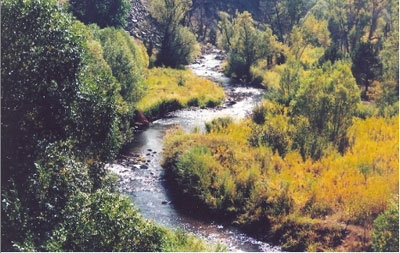
Recently, over burritos and margaritas at Vallarta’s Restaurant, I was asked what the number one thing is that I should know about rivers in Colorado. Like a deer in the headlights, I sat in silence. His brusque follow up was, “the Yampa is the last wild river in Colorado, and it had better stay that way.” I quickly nodded in agreement.

The man is certainly not alone in his opinion. The Yampa has a dedicated following of boaters, anglers, sportsmen and conservationists who don’t want to see the heart of Northwest Colorado dammed and diverted. As Soren Jespersen, of the local group Friends of the Yampa, recently stated in a Steamboat Today article on the Colorado Water Plan, “The Yampa is one of the last major untamed waterways in the entire Colorado River system. If we were to start diverting its waters to the Front Range, we wouldn’t just be diminishing its flows; we’d be killing the very thing that makes the Yampa River unique.”

Unfortunately, there is good reason to be concerned about the future of the Yampa. In an era viewed by some as the last “water grab” in Colorado, attention is shifting towards the Yampa under the presumption of having water to spare. That opens up a debate about what qualifies as excess water. Anyone who has enjoyed a day on the Yampa will attest water left in the river is still water being put to good use, albeit a non-consumptive one.

It isn’t just about the quantity of water that places a target on the Yampa Basin. Colorado is a prior appropriation state, which means the seniority of a water right is everything. The older the date on a water right, the further towards the front of the line you get to stand. Some municipalities, such as Steamboat Springs, have junior water rights putting their ability to meet demand during drought conditions at jeopardy. Luckily the issue of a “call” from senior water rights holders on the Yampa is fairly rare occurrence, but in a warmer, drier future, things could get more complicated if we don’t have a plan in place.

So, to head off those problems here and to alleviate existing issues elsewhere, Colorado is in the process of crafting its first ever state water plan. This plan will shape how we manage water well into the future. Every interest group, from municipalities, agricultural producers, industries, outdoor recreation professionals and conservationists, is fighting for their interests to be protected within the plan.

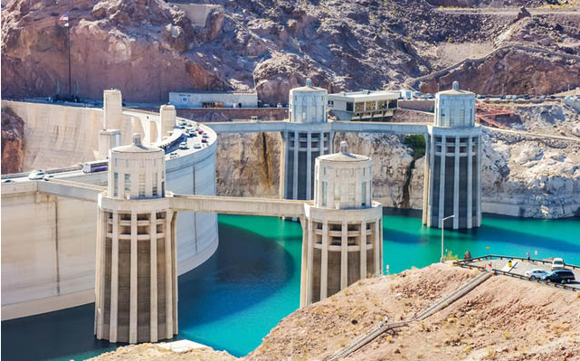
Few would dispute that we need a Colorado Water Plan that protects agricultural, municipal and recreational needs — and the $9 billion economy river related recreation supports. However, when it comes down to how the water is managed, tensions rise quickly. The hot-button issues of cities buying agricultural water rights leaving an alfalfa field to wither and transmountain diversions creating huge reservoirs and pipeline systems to send water across the continental divide get most of the attention. The risks and consequences of both those ideas are just too great for rivers like the Yampa, so we need to look elsewhere.

The most obvious answer is to maximize the water we currently have available before looking to develop additional new supply. The idea of living within our means isn’t new, especially in a blue-collar town like Craig. Conservation is effective and costs significantly less than new, large pipelines and other projects. The bright new shiny thing might look good on paper, but the environmental damage and huge costs to taxpayers makes them a dream to developers and a nightmare for everyone else.

The Yampa is a unique, irreplaceable resource not just for the residents of northwest Colorado, but the nation. The last major free-flowing river on the Colorado Plateau deserves every bit of deference, because it’s the last of its kind. Many other parts of west slope and the west in general have their own “Yampa.” We’ve seen the Dolores turned into a trickle and the majority of the Fraser’s water sent over the divide, not to mention everything that has happened to the Blue, Eagle, Roaring Fork, etc.

With a draft of the Colorado Water Plan already in motion, it’s time to step up and protect local resources across our state. As Rep. Don Coram quipped at the closing of a CLUB 20 debate, “Empty your bladder before you go. No water leaves the Western Slope.” It drew a good chuckle from the crowd, but if we really want to protect our west slope rivers, we need to step up and make sure the plan prioritizes them too.

You can submit comments on the Colorado Water Plan at http://coloradowaterplan.com/.

Please vote

Farmers adapt to #drought and increase productivity — National Young Farmers Coalition

From the National Young Farmers Coalition:

The National Young Farmers Coalition released a report today highlighting innovative farmers who are adapting to record drought in the arid Southwest. “Sustaining Farming in the Arid West: Stories of young farmers, water and resilience” demonstrates how Western farmers are saving water, stewarding the land and enhancing productivity in increasingly dry times.

“All too often, water is taken off the land for growing cities at the expense of agriculture, the health of the land and the economic vitality of rural communities,” says Kate Greenberg, Western Organizer for the National Young Farmers Coalition. “Irrigated agriculture is central to our communities in the Southwest. We need to keep it productive, vibrant and viable for today and the generations ahead while responding to existing and future pressures on our limited water supply. We all have a shared responsibility to protect this critical resource, and these farmers are helping lead the way.”

Highlights from the report, which profiles farmers from Arizona, Colorado, New Mexico and Utah, include:

Marana, AZ: Jason Walker, cotton-turn-grain farmer. Walker irrigates through a combination of wells and surface water provided by the Central Arizona Project, which delivers water from the Colorado River. Spurred by drought, Walker laser-leveled 175 acres of his 2,850-acre operation, a practice noted to be 20-30% more water efficient. Walker is lining ditches, reducing run-off and utilizing conservation tillage to save water, retain topsoil, and enhance his grain crops and what remains of his cotton crop. As Walker says, “It’s absolutely our responsibility to conserve our finite resources. Farming takes everyone. We are all in this together and we have to protect the opportunity for the future.”

Bosque Farms, NM: Mike De Smet, organic, raw dairy farmer. In response to drought, De Smet laser-leveled all his fields and transitioned to no- and minimum-till planting to support the productivity of his herd and save water. Mike says, “We have changed our entire operation due to the lack of water. Our planting dates have changed, double cropping wheat and corn have stopped, and we are planting shorter maturity date varieties.” By enhancing his irrigation efficiency and stewardship, Mike expects to grow his herd to full capacity—around 100 head—in the next five years while simultaneously saving water.

San Luis Valley, CO: Brendon Rockey, certified seed and specialty potato grower. When drought hit hard seven years ago, Rockey replaced his barley rotation with a cover crop. Not only did this reduce that years’ water use, but also reduced the water needs of the following potato harvest as the cover crop retained moisture in the soil throughout the year. His healthy soil also enhanced the effectiveness of his center pivot irrigation. In the last seven years, Rockey’s pumping costs from the shallow aquifer have decreased—his cumulative annual consumptive use cut nearly in half—while his crop quality increased. What income he lost from his barley crop he more than makes up for in reduced input expenses due to enhanced nutrient availability in healthy soil. His neighbors now come to him for advice on maintaining a productive business through drought. As Rockey says, “Farmers need to become biologists again,” as supporting life in the soil builds resilience.
Background

The Colorado River is one of the most dammed, diverted and in-demand rivers in the world. From its headwaters in the Rockies to its dry Delta, the Colorado travels through seven states, two countries and brings water to over 36 million people. In addition, it provides irrigation for nearly one fifth of our nation’s produce, including 80% of winter vegetables. Now entering its 14th year of drought, residents of the Colorado River Basin face challenging questions of what kind of West we want and can sustain.

The agriculture industry is the largest user of water in the West, consuming over 70% of surface water. As precipitation patterns shift, climate trends lean toward hotter, drier times, and cities continue to grow, many are looking to farmland for new supplies of water.

But taking agriculture out of the West is not the answer. Alternatives to what is known as “buy-and-dry,” or buying water from agriculture, which leaves the land unproductive, exist. These alternatives promote a vibrant agricultural economy and land that is being made better for the next generation of farmers and ranchers who grow our food.

It is a Herculean achievement that farmers and ranchers are able to save water while enhancing productivity in a period of unprecedented drought. As stewards making a life and a living off the land, these producers are exploring solutions to some of the most daunting challenges facing the Colorado River Basin and the West as a whole. It is time we work together as farmers and ranchers lead in the innovation and stewardship of the Wests’ most valuable resources.

Download the report here: http://youngfarmers.org/sustaining-farming-in-the-arid-west

From The National Geographic (Sandra Postel):

Sipping raw, whole, grass-fed milk is a bit like tasting fine wine: a familiar experience, but much more special.

That was my feeling when I drank a glass this week from De Smet Dairy in Bosque Farms, New Mexico, a small town nestled in the middle Rio Grande Valley.

With his wife Erica, Mike De Smet, a mid-thirties, third-generation farmer, owns and operates the state’s only Grade A dairy farm and bottling facility for raw milk.

After locals had come by to stock up – at $10 a gallon, it’s not cheap – De Smet would load up his truck and transport that day’s bottled production up to Albuquerque, about 20 miles (32 kilometers) north. His milk sells out every week.

De Smet Dairy is one of six western farm operations profiled in a new report just released by the National Young Farmers Coalition (NYFC) that showcases how these young farmers are adapting to drought and water stress, and raising productivity on their lands.

New #RepublicanRiver deal hints at cooperation — Scott’s Bluff Star-Herald

Republican River Basin by District

From the Associated Press via the Scott’s Bluff Star-Herald:

A new agreement about managing the Republican River’s water this winter suggests more cooperation is possible in the long-running dispute between Kansas, Nebraska and Colorado. The Lincoln Journal Star reports the states signed a one-year deal last month that allows Nebraska to keep some water in Harlan County Reservoir this fall, so it will be there next spring to help farmers downstream.

Without the new agreement, the 1943 compact between Kansas, Nebraska and Colorado would have required the water to be released this fall when farmers couldn’t use it…

But the new agreement could signal the states might be more willing to settle their water disputes cooperatively in the future but it’s still early, said Don Blankenau, who represents Nebraska in Republican River litigation.

“Until an arrangement like that becomes permanent, my enthusiasm is a bit contained, but I think it is a good start,” he said.

Kansas Secretary of Agriculture Jackie McClaskey agreed the pact appears promising.

To help make sure Kansas receives enough water, natural resource districts in Nebraska have bought thousands of acres of land along the Republican River and ended irrigation there. The water that had been used for irrigation is being pumped into the river to boost its flow.

Before last month’s agreement, Nebraska wasn’t getting credit for all the water being pumped into the river and the compact called for more water to be released this fall and winter, said Jim Schneider, deputy director of the Nebraska Department of Natural Resources.

“We basically went to them and said this water is going to have to get released if we’re going to follow the compact accounting as it is currently written. If you would like to avoid that, we’d like to talk about these augmentation plans as well,” Schneider said.

Now Kansas irrigators can receive between 20,000 and 25,000 acre feet of water next year when it will be more useful to farmers. And Nebraska farmers in the Bostwick Irrigation District will be able to use some of the water being kept in the reservoir.

The new agreement will also allow Colorado irrigators to use wells to pump water into the river to make up for that state’s overuse this year. [ed. emphasis mine]

Schneider said the states are close to finalizing a similar agreement for 2015. That should allow time for the states to work on a long-term compromise.

More Republican River Basin coverage here.

‘Art of Water’ comes to gallery in Littleton, November 6 to January 5 — the Parker Chronicle

This is what it looks like when it starts snowing in Colorado in October!
From the Parker Chronicle (click through for the photo gallery):

Four area painters will combine their works in a show called “The Art of Water” at Town Hall’s Stanton Gallery in Littleton from Nov. 6 to Jan. 5. A meet-the-artists reception is planned from 5:30 to 7:30 p.m. on Nov. 22. The four are: Colette Brooks, Kay Juricek, Joanne Sisun and Kate Wyman.

Brooks, who paints with oils, is a graduate of the Colorado Institute of Art. She has studied with Dennis R. Pendleton, Ken Velastro and Chuck Ceraso, who traces his training to French and American impressionists through his instructor, Charles Hawthorne. Brooks’ paintings include European subjects, animal portraits, and Colorado landscapes.

Kay Juricek said that her paintings in this exhibit “are of barrier islands: low-lying, narrow strips of land that sit precariously off the coastline. They’re lovely, secluded tropical places to shell, watch wildlife such as pelicans and other birds, soak up sun and relax. We visit southwest Florida often and especially love these beautiful, unpopulated beaches.”

She grew up in Nebraska and graduated from the University of Nebraska at Lincoln, where she studied with landscape artist Keith Jacobshagen. A master’s degree in library science from Columbia University followed, and she has been a faculty member at the university of Wyoming and at Colorado School of Mines in Golden. She began painting portraits on commission in 1990, as well as landscapes and still lifes in acrylics, oils and pastels, and has exhibited locally and nationally. She now paints in her Denver studio and enjoys travel in the American West.

Joanne Sisun has bachelor’s and master’s degrees and an MBA, and worked in business before she began studying at the Art Students League of Denver in 2000. She has studied with Ron Hicks since 2001 and is an assistant for his Atlier group at ASLD. She writes that she “is interested in the challenge of creating atmosphere and narrative in paintings of figures, landscapes and objects. In the musical, `Anything Goes,’ dressing up in disguises is a recurrent theme.” Her “Theatrical Figure #1” illustrates her interest in painting figures in theatrical disguises, which offer opportunities for “creating narrative and atmosphere.” (Perhaps her masked figure appeared along Venice canals during Carnival?)

Kate Wyman said she grew up on the Jersey Shore, although she has lived in Colorado most of her adult life. She has always enjoyed art and “creating” and is mainly self-taught, although she has enjoyed workshops and classes in Colorado, Pennsylvania and Virginia. She likes to work in watercolors because of the clean, fresh look and is a Signature member of the Colorado Watercolor Society and a member of Park Hill Artists, Roxborough Arts Council, Grace Gallery (Santa Fe Arts District) and Shadow Mountain Gallery in Evergreen.

IF YOU GO:
“The Art of Water” exhibit runs through Jan. 5 in the Stanton Gallery at Town Hall Arts Center, 2450 W. Main St. in downtown Littleton. The Stanton Gallery is open from 10 a.m. to 5 p.m. and during performances. An artists’ reception will be held from 5:30 to 7:30 p.m. on Nov. 22. 303-794-2787.

“This will make your day! Made mine, and I was on a pretty determined bummer” — John Perry Barlow

Water rules: Be prepared or stop pumping — the Valley Courier #RioGrande

From the Valley Courier (Ruth Heide):

It’s not a broken record; the needle’s just stuck. Sounding like a broken record, for several years the Colorado Division of Water Resources has warned well users that rules would be coming soon. Several years’ worth of advisory committee meetings and groundwater model runs later, it appears the well regulations are finally close to completion.

“We anticipate one more advisory committee meeting ,” Division of Water Resources Division Engineer for Division 3 Craig Cotten told attendees of the Rio Grande Water Conservation District meeting on Tuesday.

“We are fairly close on the rules, just some last minute tweaks.”

He said the peer review team working on the groundwater model that is providing crucial data for the regulations will be meeting again on Friday in Denver. He said he hoped everyone would come to a consensus on the model and go forward.

“We are fairly close to having that model done,” Cotten said.

Once groundwater rules are in place, well users will have to either be covered by a sub-district of the Rio Grande Water Conservation District or their own augmentation plan, which must be approved by the water court. Well users’ other option would be to shut down.

Subsequent sub-districts after the first one are going with an opt-in policy where only those who are interested in being included in the subdistrict are part of it. RGWCD staff stressed on Tuesday, however, that well owners opting out of any of the subdistricts would either have to come up with their own augmentation plan to comply with the new groundwater rules or quit pumping.

“If you want to continue to use water from your well you need to be thinking about how you are going to participate in a sub-district or create an augmentation plan,” said RGWCD Program Manager Cleave Simpson. “It’s that simple.”

RGWCD Attorney David Robbins added, “If you don’t do a sub-district or augmentation plan, Craig’s guys will come out and red tag the well. They have done it in the Arkansas Valley ” People have choices to make.”

Cotten said, “One thing’s very important for people to realize these rules aren’t going to be only for irrigation wells. It will be for large capacity wells and even some small subdivision wells in South Fork ” commercial wells ” municipal wells. It’s not just irrigation wells.”

He said his office is trying to get that word out to folks and has held a meeting in South Fork already to alert folks to the pending well rules and how they would affect them.

RGWCD staff has also been meeting with water users around the Rio Grande Basin (San Luis Valley) regarding their options in light of imminent groundwater rules. They are trying to work with municipalities and agencies not otherwise qualifying for sub-district inclusion so they can contract with subdistricts to comply with the new rules requiring replacement of injurious depletions to surface water rights. The water district’s first sub-district is already in operation, and four or five others are in the works. Subdistrict #1 is replacing 1,784 acre feet to remedy its injurious depletions this year, with 61 percent of that through forbearance agreements with ditches and canals, RGWCD Program Manager Rob Phillips told the water district board on Tuesday. He said a larger percentage of the sub-district’s replacement water would come through forbearance agreements in the future.

RGWCD General Manager Steve Vandiver said forbearance agreements have worked well, especially since there is “not enough water in the right places at the right time to offset depletions.”

He said the sub-district has forbearance agreements with six of the major ditches this year.

Phillips said the Conservation Reserve Enhancement Program (CREP) was successful this year with 3,400 acres in CREP 1,800 acres in temporary fallowing contracts and 1,600 in permanent retirement.

Simpson updated the group on the status and size of future sub-districts . The first sub-district encompasses more than 3,000 wells involving more than 300 well owners. A legal challenge to the sub-district’s 2012 annual replacement plan is still pending with the Colorado Supreme Court, which heard arguments on September 30 and could announce a decision sometime between the end of next month and the first of the year, according to Robbins.

Statistics on the other proposed sub-districts include:

• #2, Rio Grande alluvium; unconfined aquifer; encompassing about 300 wells, half of which are active and are owned by about 60 individual well owners, with 10 non-irrigation wells in that area including Colorado State Veterans Center, City of Monte Vista, City of Del Norte and school districts; ready for the petition drive; unlike the first sub-district will go with an opt-in approach where only those wanting to be in the subdistrict will be in it; meeting next week will kick off the petition drive; hope to have petitions collected by January 31; next meeting of the work group is 3 p.m. on Oct. 30 in the basement of the Methodist Church in Monte Vista

• #3, Conejos response area; confined aquifer; about 200 wells, 117 of which are active; 50-55 well owners ; private wells including towns of Manassa, Sanford and La Jara; biggest delay is clarity on sustainability; work session set next week to finalize conceptual plan of water management

• #4, Alamosa/La Jara response area; confined aquifer wells; 600 wells with 300-400 of them active owned by about 200 individual well owners; more than 40 nonirrigation wells such as the City of Alamosa and wells owned by U.S. Fish and Wildlife and Colorado Parks & Wildlife; conceptual plan essentially completed; community meeting Thursday, Oct. 23, in Carson Auditorium at 6 p.m.

• #5, Saguache Creek; RGWCD stopped working with this group due to lack of progress but on Tuesday resumed district support after seeing renewed interest in moving forward; working on developing conceptual plan; meeting at 7 p.m. Nov. 6 at the Saguache County Road & Bridge building

• #6 San Luis Creek; 157 wells, about half active; about 35 individual well owners ; next meeting at 6:30 p.m. on Nov. 5 in Moffat

Robbins said there is also a way legally to form a subdistrict of well owners within Costilla County but there has not been much interest from Costilla County well owners to do that at this point.

More San Luis Valley groundwater coverage here.

“The cheap and abundant water supplies are not there anymore” — Jacob Bornstein #COWater Plan

Colorado transmountain diversions via the State Engineer's office
Colorado transmountain diversions via the State Engineer’s office

From The Grand Junction Daily Sentinel (Dennis Webb):

A statewide panel’s conceptual agreement on a framework for negotiations on possible transmountain diversions was “a major victory” for the group, a Mesa County member of the panel says. But that Interbasin Compact Committee member, Carlyle Currier, acknowledges that the devil is in the details.

“Getting down in those weeds, in the details, I think is where the discussion is going to take us in the next year,” Currier told representatives of the Colorado Basin Roundtable at a meeting in Glenwood Springs this week.

That discussion ensued in earnest at that meeting, as roundtable members scrutinized aspects of the framework at length.

“It’s a Front Range plan with a couple things tossed in the bottom for the Western Slope,” groused roundtable member Mike McDill, deputy utilities director for the city of Aspen.

The Interbasin Compact Committee exists to facilitate conversations between basins and on statewide issues about water. It has proposed that its new, seven-point framework for diversion negotiations, which it finalized in June, be included in the new state water plan being drafted by the Colorado Water Conservation Board. That board is asking for input from the roundtables on the IBCC concept.

The first of the framework’s points is that the Eastern Slope “is not looking for firm yield” from a new transmountain diversion project “and would accept hydrologic risk for that project.”

The concept that is emerging for such diversions is that they would occur only in wet years and not in dry ones. But Louis Meyer, a Glenwood Springs engineer whose company has been assisting the Colorado Basin Roundtable in providing input on the state water plan, said he worries that that approach “puts the risk on people” relying on those water projects, rather than on big water suppliers.

Jacob Bornstein, a program manager with the CWCB, said that concern is addressed by another of the framework’s principles, which calls for any new diversion to be used conjunctively with backup resources such as the Denver Basin water aquifer and interruptible supplies for agriculture.

“It takes that risk of the citizens and puts it on the water provider, saying we have a redundant system here,” he said.

He acknowledged that such a dual system is expensive to build, but added, “The cheap and abundant water supplies are not there anymore … the choices are really expensive.”

A concern for roundtable member and conservationist Ken Neubecker is that taking water in wetter years will leave parts of the Western Slope subject to a permanent drought condition.

“How is that going to be dealt with and mitigated?” he wondered.

The IBCC framework also indicates that triggers will be needed to determine when new diversions occur.

“But what are those triggers?” Currier said. “Finding those triggers is going to be (subject to) a lot of discussion from here on out.”

Roundtable member and Pitkin County Commissioner Rachel Richards worried that diverting water in wetter years reduces Colorado’s ability “to build up extra credit” in the form of additional storage in Lake Powell, which helps it fulfill its water delivery obligations to states in the lower Colorado River Basin under an interstate compact.

The last four components of the seven-point framework include:

■ providing an insurance policy against involuntary curtailment of Colorado River water use in Colorado under that interstate compact should flows fall too low;

■ accommodating future West Slope needs as part of a new diversion;

■ continuing Colorado’s commitment to improving conservation and reuse;

■ addressing environmental resiliency and recreational needs both before, and in conjunction with, a new diversion.

Bornstein called that last provision “a bit of a breakthrough.” But the concern for some, including McDill, is the listed order of the seven points, which he worries seem to make things such as conservation less of a priority than a new diversion. Bornstein sought to assure that the list’s order wasn’t priority-based.

Bornstein also heard concerns about the sustainability of continued growth on the Front Range.

“It’s a good question,” but one the state water plan can’t solve, he said. Rather, it can only lay out scenarios for responding to varying amounts of growth, he said.

Some roundtable members wonder about the insistence of some on the Front Range that new homeowners should be entitled to have grass lawns rather than landscaping that reflects that Colorado is a dry state and keeps more water in streams. Richards finds it contradictory to hear the contention that a lot of growth is coming to Colorado because people want to live here, but at the same time property values will decline if they can’t grow lawns.

If people are going to move to the state because of its lifestyle, “then the new homes need to be created in a way that supports the Colorado lifestyle,” she said.

Bornstein said he thinks the desire for green grass in new Front Range developments reflects a desire to provide people with a “reasonable experience” that provides them access to parks and the ability to toss a ball in their yards, and that also reduces “the heat signatures of cities.”

For all the concerns voiced this week, Neubecker said he finds a lot of good intention in the seven-point framework.

“It’s a place you can start the discussion from. Hopefully it could be meaningful. … I would hope in the end that it doesn’t turn into a roadmap to hell,” he said.

More Colorado Water Plan coverage here.

Denver, South Metro purchase pipeline to move finished water to customers (WISE Project)

From The Pueblo Chieftain (Chris Woodka):

A pipeline that will tie metro areas together has been purchased by Denver and the South Metro Water Supply Authority. The purchase will delay other efforts by metro water providers to take water from other parts of the state by allowing water suppliers to be used more effectively.

The 20-mile long East Cherry Creek Valley Water and Sanitation District’s western pipeline was purchased for $34 million, connecting Denver’s supply line to Aurora’s Prairie Waters Project. South Metro will pay 85 percent and Denver 15 percent. The ECCV pipeline originally was built to move water from a well field to the west to the community located between Denver and Aurora. It was built with excess capacity and will be modified to serve several other districts along its route.

The move will allow districts in the South Metro group to receive water from Prairie Waters and give Denver and Aurora a source of emergency supply.

Those districts are largely dependent upon Denver Basin groundwater, but need surface supplies in order to sustain underground resources. By cooperating with neighbors, they are able to reduce the costs of new supplies.

Denver, Aurora and 10 members of South Metro entered the Water Infrastructure and Supply Efficiency partnership in order to share water resources. Other projects have included reallocation of Chatfield Reservoir water, opening of Rueter-Hess Reservoir at Parker and other projects by individual members.

“With those successes, we’re taking another look at our long-term plan,” said Eric Hecox, general manager of the South Metro District.

That could be good news for the Arkansas River basin, which was targeted among future sources of water supply in South Metro’s 2007 water plan. Since then, conservation efforts have reduced demand. In addition, growth slowed during the recession, giving the water providers a little breathing room, Hecox said.

“With WISE moving ahead, it complements other water supply efforts. It doesn’t meet all of our needs, but moves things forward,” Hecox said. In the next few months, the Colorado­Wyoming Coalition, led by South Metro, will be completing an analysis of whether to launch a feasibility study for the Flaming Gorge pipeline, which would deliver water from Wyoming to cities within that state as well as Colorado’s Front Range.

One of the South Metro’s members is the Rangeview district east of Aurora, backed by Pure Cycle, a company which has proposed piping water from shares it owns on the Fort Lyon Canal near La Junta to the northern cities.

The groups also will be looking at coordinating its plan with the upcoming state water plan.

“Many of the options in the state water plan are the same options we’re looking at,” Hecox said.

More WISE Project coverage here.

Telluride: New Pandora treatment plant awaiting final state approvals to go online

From The Telluride Daily Planet (Mary Slosson):

The Pandora Water Treatment Plant valves were opened up on Oct. 24 and everything worked, Telluride Public Works Director Paul Ruud said. The plant will not plug into the municipal water supply until a few remaining state certifications are completed, he added. Those final approvals from the Colorado Department of Public Health and Environment will probably be finalized in the new two weeks, Ruud said. Town officials were obligated to have the plant functional by a Nov. 1. deadline.

But the plant works, a fact that Ruud and members of the Telluride Town Council and town staff have heralded this week.

“We’re quite pleased after 20-some years of working on it, we finally have a functional water plant,” Ruud said. “It’s been quite an undertaking. We’re happy to be at the place we are now.”

The facility, located off Bridal Veil Road on the east end of the box canyon, has been under construction for three years. The plant can produce one million gallons of water per day, and has the capacity to be expanded to double that – two million gallons of water per day – if the need ever arises in the future, Ruud said.

“It is our expectation that once the Pandora Water Plant comes online and is functioning as it is designed… we will basically be in a very good position with water for the foreseeable future, possibly the next 50 years,” Ruud said.

City planners realized 20 years ago that neither Corner Creek nor Mill Creek would be sufficient sources of water, Ruud said, especially if the region went into a drought scenario.

“We’re very, very fortunate that our elected officials 20 years ago got the ball rolling. Projects this big take 20 years to accomplish. They had a lot of foresight to start thinking about this way back when,” Ruud added. “For a small town like ourselves, that’s a fairly ambitious undertaking.”

They began working to acquire water rights in the Bridal Veil Basin and converting those rights to municipal water rights. But that effort sometimes caused delays.

After voters approved a $10 million bond in 2005 to fund the construction of the project, it stalled for years as the town and Idarado Mining Company, which owns much of the land and infrastructure involved, tussled over water rights.

Work on the project finally began in earnest in the summer of 2011. In 2013 the town had to add around $4.7 million to the project after a budgetary shortfall.

Now the town will be able to take water out of Blue Lake, Lewis Lake or even Bridal Veil Creek.

The San Miguel Power Association has agreed to purchase electricity generated by a hydropower generator in the treatment plant, Ruud added, so the facility can also contribute to the electrical grid.

“It’s very, very exciting. Anytime a community can take care of some of their really, really important infrastructure needs, it’s a tremendous milestone for the community,” Ruud said.

More infrastructure coverage here.

Reslicing a smallish pie: Changes for the shrinking #ColoradoRiver — the Mountain Town News

Colorado River Basin including out of basin demands -- Graphic/USBR
Colorado River Basin including out of basin demands — Graphic/USBR

Allen Best is doing some great writing over at the Mountain Town News. Here’s his report about the current state of the river according to Eric Kuhn (Click through for the photographs):

What gives on the Colorado River? A recent study in Colorado, which provides half of the water in the river, found no trend in precipitation. Yet reservoirs on the river and its tributaries, especially the giant impoundments of Mead and Powell, have been declining such that water agencies from Denver to Los Angeles have formulated emergency measures.

Eric Kuhn suspects that rising temperatures—such as are predicted by climate change models—may explain at least part of this discrepancy. In other words, we’re seeing the future happen before our eyes as water levels in the reservoirs drop.

“We are seeing a declining long-term average inflow, and that is where I don’t think there has been any research,” said Kuhn, general manager of the Colorado River Water Conservation District, in an interview. [ed. emphasis mine]

Kuhn would like to see statistical studies that examine the link between rising temperatures in recent decades, increased evaporation and transpiration, and reduce flows of rivers in the Colorado River Basin.

Conducting this research would not be easy, he said, as determining natural flows of rivers is a “tough calculation,” due to the many diversions.

Also in play may be the dust-on-snow phenomenon. Research during the last decade in Colorado’s San Juan Mountains has revealed the impact of wind-borne dust on snow. With the dust from winter and spring storms on the snow, it melts more rapidly. The snow is more vulnerable to evaporation through a process called sublimation and more water is also lost through transpiration. See National Snow & Ice Data Center story.

Studies by Tom Painter and others (and assisted by the Center for Snow & Avalanche Studies) has suggested that dust on snow may be causing the loss of 5 percent of water in the Colorado River to evaporation/sublimation and transpiration. A study by Janice Brahney, formerly of the University of Colorado and now of the University of British Columbia, further documented increased dust-on-snow depositions since the 1990s. The dust is believed to be the result of more intense use of lands in the desert Southwest.

Why does this matter? In a recent presentation in Ouray before the Colorado Association of Ski Towns, Kuhn sketched out the big picture of the Colorado River. It is literally a river with nothing left over.

The average flow of the Colorado River is 15 million acre-feet. This compares with 16.5 million acre-feet for the Hudson River, 164 million for the Columbia, and 520 million for the Mississippi River. All except the Colorado routinely flow almost entirely into the oceans.

Since 1998, none of the Colorado made it into the Pacific Ocean—until last year. But the feat required special circumstances. Kuhn doesn’t expect it to happen often—if ever.

“What we don’t know is whether that will happen just once, or whether it will happen again,” he said.

Too, Kuhn sees a zero-sum situation. “When somebody uses more, somebody else will use less,” he observes

Agriculture currently uses a majority of water, but Kuhn sees a reduction in coming decades. Currently, the Colorado River Basin and adjoining areas—including Denver, Cheyenne, Salt Lake City, Albuquerque and Los Angeles—have 35 million people who depend, at least in part, on water from the basin. That will grow to 80 million.

The Colorado River currently irrigates 4.6 million acres, which is likely to decrease by 15 percent in coming decades. Much of that will be due to new houses and other municipal development on existing agriculture lands. This is particularly prominent in Arizona. However, there will also be continued purchase of farms for their water rights, what is called buy-and-dry.

The most dynamic growth will occur not in the Colorado River Basin, but in adjacent areas.

This will include Colorado. The Western Slope—which is drained by the Colorado River—currently has 500,000 people and is projected o grow at a 7 percent clip. The Front Range of Colorado is projected to grow more slowly, at around 5 percent, but from a much larger base of 4.3 million people. As such, most of Colorado’s growth will be outside of the Colorado River Basin—but dependent upon water from the basin.

Much of that future population growth will be accomplished by reallocating existing water diversions. That transition is well underway. For example, the Colorado-Big Thompson project diverts water from Grand Lake to the Fort Collins-Boulder-Greeley area. When constructed in the 1950, 85 percent of that water was used for agriculture purposes and 15 percent for urban uses. Today, only a third goes to agriculture, with two-thirds used for municipal and industrial purposes. In northern Colorado, as elsewhere, most of the municipal water is devoted to irrigation of landscaping turf.

This same transfer has occurred within the context of mountain valleys. In the Roaring Fork Valley from Aspen to Glenwood Springs, today there are a few ranches tied up in conservation easements and a whole lot of golf courses.”

In coming decades, water uses will continue to be transferred. Within agriculture, for example, remaining water may be used for more high-value crops, such as vegetables, as compared to low-value crops, such as hay for livestock.

A more advanced market mechanism might help expedite the transfer of water uses. “Many people don’t want to see a market solution,” he observed. [ed. emphasis mine]

More Colorado River Basin coverage here.

A Halloween treat: Lake Mead’s not quite as empty as we expected — John Fleck #ColoradoRiver

Drought affected Lake Mead via the Mountain Town News

From InkStain (John Fleck):

I was wrong when I wrote in April that Lake Mead would continue to set “lowest ever for this point in the year” records for all of 2014. As I write this, with a few hours left in October, Mead’s surface elevation is 1,082.79 feet above seal level. That is more than five whole inches above the last really dry year, 2010! (data here)

But don’t get too excited. There’s a one in ten chance that Lake Mead will drop into the low 1,060s by the summer of 2016, according to the Bureau of Reclamation (data here, in pdf). That’s still above the trouble point for Vegas, which starts to have difficulty getting its water out of the lake at 1,050. But Southern Nevada Water Authority managers worry about water quality impacts well before that point [ed. emphasis mine].

More Colorado River coverage here.

Circle of Blue: US govt builds a home for water data, but construction will take patience

Bear Creek mystery: Water testers seek source of E.coli contamination — The Denver Post

Bear Creek near Evergreen

From The Denver Post (Bruce Finley):

Twice a month, Metropolitan State University student biologists David Watson and Stephen Aderholdt have been slogging through contaminated Bear Creek testing the water, at work on a mystery of how its once-pure currents turned foul.

They’ve documented E.coli bacteria levels up to 19 times higher than the state health limit.

“Why is there so much E.coli? Where is it coming from?” Aderholdt, 31, said on the banks on a recent Saturday.

While government agencies have done their own testing and in 2008 deemed Bear Creek officially “impaired,” expanding data gathered by the students — trained by the Environmental Protection Agency and a community group called Groundwork Denver — may be crucial in crafting a cleanup.

Denver, Lakewood and Sheridan taxpayers would be on the hook, facing federal Clean Water Act penalties, if Bear Creek water quality isn’t improved.

This is a vexing problem because Bear Creek begins as a clear, clean trickle in wilderness snow atop 14,271-foot Mount Evans, visible to residents around metro Denver. The creek cascades through forests unsullied.

But starting in foothills near Evergreen, pristine water reaches suburban homes, roads, reservoirs, septic tanks, parks used by dog-walkers, golf courses, commercial sites. Denver Environmental Health water quality scientist Jon Novick, a public health analyst, said contamination is worst as Bear Creek approaches the South Platte River, which also is contaminated with E.coli and other pollutants.

Watson and Aderholdt have recorded E.coli contamination in Bear Creek as high as 2,400 colony-forming units (cfus) per 100 milliliters. The state health limit is 126 cfus.

The data collected by the Metro State team is useful, Novick said.

“It is helpful to understand where E.coli levels are increasing and the potential sources,” he said.

Denver conducts its own tests on the creek, four times a year, and has documented E.coli during summer as high as 770 cfu.

The Metro State students conduct tests at 18 locations twice a month. They started in May 2013. The work can be difficult, clambering up and down muddy banks, kicking through ice during winter. (Bear Creek E.coli levels during winter, when E.coli often decreases, have veered above the limit as high as 325 cfu.)

Watson and Aderholdt’s boots sink into creek-bottom muck as they stand in the creek, first measuring temperature and turbidity, then filling two clear containers. They cover an 8.2- mile stretch of the creek from the South Platte to Bear Creek Reservoir.

EPA scientists who trained them analyze the samples in a federal lab and review the data for accuracy. They occasionally accompany the students and Groundwork Denver supervisor Rachel Hansgen, who also coordinates community-driven water-sampling along other creeks and rivers.

EPA project manager Karl Hermann, a senior water quality analyst, said he’s been impressed with students’ seriousness over more than a year and sees their monitoring data as helpful in moving toward a solution that could avert penalties.

Bear Creek has remained on Colorado’s list of impaired waterways for years, Hermann said. Ramped-up EPA lab work this year, using the expanding data, may help pin-point sources of the pollution.

E.coli indicates a variety of different bacteria that come from people and animals. When E.coli levels exceed 235 cfu, the Colorado Department of Public Health and Environment orders waterways closed for swimming.

“We know dogs are involved and that humans are involved,” Hermann said. “We don’t have wastewater treatment plants along Bear Creek. If there’s a human element, it may be septic systems that are not working quite right. We have a number of other possibilities.”

University and community science groups, when trained, can make a difference, he said.

“There are protocols. Groundwork Denver and Metro State have gone through the process of learning to do things right,” Hermann said. “They’ve refined their methods and we are really happy with the collaborative approach.”

Groundwork Denver staffers also are developing a restoration plan for the Lower Bear Creek watershed, where greenway trails already are established. They’re hoping, if all goes well and the creek can be cleaned, that this plan will be a model for dealing with contaminated urban waterways, Hansgen said.

“The scientific method is something we use purposefully,” she said. “This is work that needs to be done.”

More Bear Creek coverage here.