#AnimasRiver: Acid mind drainage, “almost impossible to fix and it lasts forever” — High Country News

Bonita Mine acid mine drainage via Animas River Stakeholders Group
Bonita Mine acid mine drainage

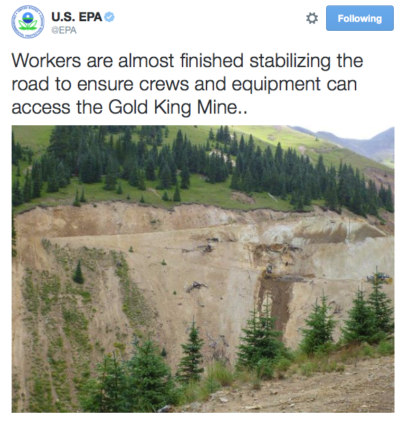
Here’s a report from Jonathan Thompson writing for the High Country News. Click through and read the whole thing and check out Thompson’s drawings explaining acid mind drainage and the geology of the area. Here’s an excerpt:

While there are a variety of ways that mining can pollute watersheds, the most insidious and persistent is acid mine drainage, which is really a natural phenomenon exacerbated by mining. Acid mine drainage was the root cause of the Gold King blowout, and it plagues tens of thousands of abandoned mines across the West. It’s almost impossible to fix, and it lasts forever…

…the early settlers also were struck by the reddish orange color (like the Animas River after the “spill”) of some of the mountains. They were also struck by the same orange in some streams during times of high runoff, streams that were lifeless even then. Indeed, an observer in 1874 noted that Cement Creek was “so strongly impregnated with mineral ingredients as to be quite unfit for drinking.”[…]

Mining begins. The tunnels follow veins of gold or silver deep underground. The adits (horizontal tunnels) and shafts (vertical tunnels) intersect the cracks and faults through which groundwater had run toward springs. The groundwater follows the path of least resistance: The new mine adit. Whereas the cracks and faults are mostly anaerobic, or free of oxygen, the mine is relatively rich in oxygen. Meanwhile, the water as it flows through the mine runs over deposits of pyrite, or iron sulfide. Water (H2O) meets up with oxygen (O2) and pyrite (FeS2). A chain of reactions occurs, one of the products being H2SO4, otherwise known as sulfuric acid. The result is acid mine drainage, water that tends to have a pH level between 2 (lemon juice) and 5 (black coffee).

So now there is acidic water running through the mine. And since the mine follows the metals, so does the water, picking up the likes of zinc, cadmium, silver, copper, manganese, lead, aluminum, nickel and arsenic on the way. The acidic water dissolves these metals, adding them to the solution. After the water pours from the portal (mine opening), it percolates through metal-rich waste rock piled up outside the portal, picking up yet more metals. Next, the water may run through old tailings or leftovers from milling ore and pick up yet more nasty stuff. The soup that eventually reaches the stream is heavily laden with metals and highly acidic. It is acutely and chronically toxic to fish and the bugs they eat.

#AnimasRiver: EPA crews have cleaned up access road issues after Gold King mine release

Gold King Mine access road  August 2015 via the EPA/Twitter
Gold King Mine access road August 2015 via the EPA/Twitter

Fountain Creek: Study recommends designing flood control structures to allow 10,000 cfs through Pueblo

Fountain Creek
Fountain Creek

From The Pueblo Chieftain (Chris Woodka):

There would be little impact on water rights if flood control structures on Fountain Creek were designed to allow 10,000 cubic feet per second of water to pass through Pueblo.

That’s the conclusion of a draft report by engineer Duane Helton commissioned by the Fountain Creek Watershed Flood Control and Greenway District, released this week.

The district is looking at the issue as part of its investigation into the feasibility of building either a large dam or series of detention ponds on Fountain Creek. A U.S. Geological Survey study shows those are the most effective way to stop high flows from inflicting more damage on the waterway through Pueblo.

A study for Pueblo County by Wright Water Engineering indicates those flows have been worsened by development in Colorado Springs for the past 35 years — from both more impervious surfaces and the introduction of imported water. About 363,000 tons of additional sediment each year are deposited between Colorado Springs and Pueblo.

Helton’s study, which is now under review by interested parties, indicates that water rights during extremely large floods would not be affected because water would be stored in John Martin Reservoir. That same situation occurred this year during six weeks of moderate, but prolonged flows on Fountain Creek.

“Although the owners of the ditches and reservoirs on the Arkansas River are appropriately concerned about the effects of the Fountain Creek flood remediation project on their diversions under the priority system, a conclusion from this analysis is that the operation of the Fountain Creek Flood Remediation Project will not have significant effects on the diversions into the ditches and reservoirs on the Arkansas River in at least some of the years,” Helton’s report states.

Helton analyzed data since 1921, with about 75 years of flow records for Fountain Creek. The records were unavailable for some years. There were 18 years where the peak flow exceeded 10,000 cfs.

He modeled floods in 1999 and 2011, concluding that about 5,291 acre-feet would have been impounded during the 1999 flood and 368 acre-feet in the 2011 event if flood control was managed for everything above 10,000 cfs. In the 1999 flood, there would have been little if any impact on downstream rights, since John Martin storage was active.
The report also concluded that a method could be developed to ensure downstream water users would get water they otherwise would have been entitled to receive.