Aurora: “We have more water in our system than we’ve ever had since we’ve been recording” — Joe Stibrich


From The Aurora Sentinel (Rachel Sapin):

“We have more water in our system than we’ve ever had since we’ve been recording,” Aurora Water Resources Management Advisor Joe Stibrich told congressional aides, city council members, city staff and Aurora residents on a tour of the city’s vast water distribution system last week. “We hit 99 percent of our storage capacity about a week ago.”

In total, Aurora Water has more than 156,000 acre-feet of water storage, which could supply the city with years of emergency supply in case of a drought.

The city gets water from three river basins. Half of the city’s water comes from the South Platte River Basin, a quarter comes from the snow melt flows from Colorado River Basin, and a quarter from the Arkansas River Basin.

But Aurora was not always a municipal water powerhouse.

In 2003, Aurora’s water supply level was at 26 percent capacity, the lowest in the city’s history. The idea for the at-the-time innovative Prairie Waters Project came about in the wake of that severe drought.

The $653-million Prairie Waters Project increased Aurora’s water supply by 20 percent when it was completed, and today provides the city with an additional 3.3 billion gallons of water per year.

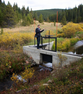
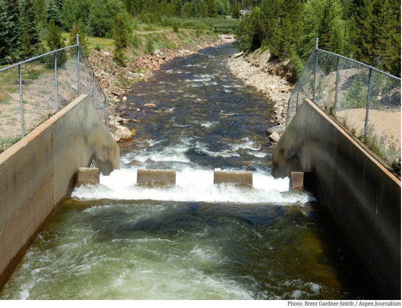
The entire system pumps water from wells near Brighton, where it’s then piped into a man-made basin and filtered through sand and gravel. From there, the water is then piped 34 miles through three pumping stations to the Binney Water Purification Facility near Aurora Reservoir, where it’s softened and exposed to high-intensity ultraviolet light. The water is then filtered through coal to remove remaining impurities.

“It’s the crown jewel of our system,” said Stibrich during the tour. “Prairie Waters almost creates a fourth basin for us.”

But even before Prairie Waters, the first “crown jewel” project that allowed Aurora to grow and become the state’s third-largest city, was the one that allowed Aurora to cut most of its water ties with Denver.

Throughout the 1900s and into the 1960s, Aurora relied on the Denver Water Board for its supply. But the partnership between the neighboring cities grew contentious when, in the 1950s, Denver Water imposed lawn watering restrictions on a booming metropolitan area. Part of those restrictions included a “blue line” that prevented some Aurora suburbs from getting permits for new tap water fees.

In 1958, Aurora partnered with Colorado Springs to construct the Homestake Project, located in southern Eagle County in the Colorado River basin. The project was designed to use water rights purchased on the Western Slope that could supply the two cities.

For nearly a decade after the project was conceived, it was mired in legal battles with Denver and Western Slope entities. The first phase of the dam wasn’t even completed until 1967. In the 1980s, Aurora and Colorado Springs unsuccessfully attempted to expand the water collection system within the Holy Cross Wilderness area as part of a phase two plan.

The issue to this day is divisive, said Diane Johnson, a spokeswoman with the Eagle River Water and Sanitation District during the city’s tour of the reservoir.

“For people to think we might be having some other dam up here and impacting their access to wilderness is an emotional issue,” she said.

It was a memorandum of understanding created in 1998 between Eagle County and the two Front Range cities that identifies 30,000 acre-feet of water in the Eagle River basin to be divided into thirds between the three entities that helped alleviate tensions and put the project back on track.

Today Homestake Reservoir provides Aurora with 25 percent of its water, and Aurora Water officials are looking at various ways to expand their storage to satisfy the Eagle River MOU.

One idea is a small reservoir in the Homestake Valley near the Blodgett Campground. Aurora Water officials said the issue with that plan is having to relocate the winding Homestake Road to a portion of the Holy Cross wilderness to accommodate it. Another alternative, which Aurora Water officials said they prefer, is to create a holding facility called a forebay, in the same valley, along Whitney Creek, that would hold water pumped back from a former World War II military site known as Camp Hale. From the holding facility, water could be further pumped up the valley to Homestake Reservoir.

Aurora Water officials are still working through the various politics of the alternatives, and repeatedly emphasized during the tour that there is no “silver bullet’ when it comes to water storage.

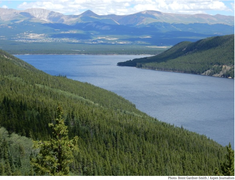
From Homestake, water travels east through the Continental Divide and tunnel where it’s sent to Turquoise Lake, then to Twin Lakes Reservoir near Leadville.

Aurora only owns the rights to a limited amount of storage in Twin Lakes, and that water has to be continuously lifted 750 feet via the Otero Pump Station to enter a 66-inch pipeline that leads to the Front Range.

The Otero Pump station — located on the Arkansas River about eight miles northwest of Buena Vista — is another impressive facet of Aurora’s vast water system, and the last stop on Aurora’s water journey before it is delivered to the Spinney Mountain Reservoir in South Park. With the ability to pump 118 million gallons per day, Otero provides half of Aurora’s and 70 percent of Colorado Springs’ drinking water, delivered from both the Colorado and Arkansas basins to the South Platte River Basin.

Tom Vidmar, who has served as the caretaker at Homestake for nearly 30 years and lives right next to the pump station, said the biggest issue facing Aurora’s water system is storage.

“We actually spilled water out of Homestake this year and didn’t collect (the) full amount we were eligible to take, simply because the reservoirs are at capacity,” Vidmar said during a tour of the massive pump facility. He said the electricity costs alone for Aurora to pump the water add up to around $450,000 a month.

A project Aurora Water officials hope to see come to fruition in 15 years is turning land the city purchased at Box Creek north of Twin Lakes in Lake County into additional storage space so water can be pumped more efficiently through Otero.

“Box Creek is an important project. It gives us more breathing room,” said Rich Vidmar, who is Tom Vidmar’s son and an engineer with Aurora Water, during the tour. “As we look at storage and where to develop storage, right now we’re looking at spots where we have chokepoints in our system where we’re not able to operate perfectly to get as much water as possible.”

Just as the state anticipates that its population of 5 million will double by 2050, so does Aurora — and storage will be key to providing water for a city that could potentially grow to more than 600,000 residents in the coming decades.

But the mountains aren’t the only place where Aurora hopes to expand its reservoirs. The city also is looking to expand Aurora Reservoir even further east.

At a July study session, Aurora Water Officials described a feasibility study being conducted to determine just how much water Aurora could store at a future reservoir, which would sit on the former Lowry Bombing and Gunnery Range.

More Aurora coverage here.

Denver Water gets pressured to end fluoride dosing

The water treatment process

From the Associated Press (Ivan Moreno) via the Fort Collins Coloradan:

The discussion at Denver Water, which serves about one out of five of Colorado’s 5 million residents, comes as other utilities in the state and the country debate fluoridation. In some cases, fluoridation opponents are pressuring them to do so, claiming that it damages teeth and bones.

Two weeks ago, the mountain community of Snowmass Village, about 165 miles west of Denver, decided to stop water fluoridation, joining a handful of other Colorado municipalities that have discontinued the practice in recent years.

“The ultimate goal is to stop this absolutely insane process,” said Paul Commett, a retired chemistry professor and director of the New York-based Fluoride Action Network. About 200 places worldwide have stopped putting fluoride in drinking water since 2010, according to the group.

The movement has caught the attention of Colorado Gov. John Hickenlooper and his chief medical officer, Dr. Larry Wolk. They released a joint statement Wednesday, hours before the Denver Water Board met for public discussion.

“More than 70 years of research has proven that community water fluoridation is a safe, effective and inexpensive method of improving the oral health of all Coloradans,” the statement said.

Denver Water plans to decide Aug. 26 what to do about adding fluoride to water, a practice it has maintained since 1953…

About 72 percent of Colorado residents consume fluoridated water through their drinking systems. Nationally, 75 percent of people have access to fluoridated water.

“One of the benefits of having fluoride in the water system is that everybody in the community can benefit from it regardless of their age, their income, their race, their gender, because all you have to do is drink the water and have access to that benefit,” said Katya Mauritson, Colorado’s dental director.

She said fluoride in water reduces cavities and leads to savings of about $61 per year in dental costs, she said.

“We really do have a large number of children and adults that have untreated cavities that are preventable. We need water fluoridation in order to ensure that they stay healthy. Oral health does affect overall health,” Mauritson said.

Fluoride is a mineral found in the soil and water. Some areas naturally have the dosage recommended by the government, and in others, utilities add it.

Commett said that amounts to delivering medication without consent.

More water treatment coverage here.

Colorado State University receives $12 million award to establish urban water sustainability research network

Sloans Lake at sunrise via Redbubble.com

From Colorado State University (Kate Jeracki):

A consortium of 14 academic institutions and key partners across the country is addressing the challenges that threaten urban water systems in the United States and around the world. With support from a $12 million cooperative agreement from the National Science Foundation, Colorado State University leads the effort to establish the Urban Water Innovation Network (UWIN).

The mission of UWIN is to create technological, institutional, and management solutions to help communities increase the resilience of their water systems and enhance preparedness for responding to water crises.

UWIN builds on long-standing programs at CSU for research and training, and trusted leadership in all facets of water resources. These programs include urban water conservation, sustainable urban drainage systems and flood control, drought management, pollution control, water resources planning and management, ecological engineering, climate sciences, and urban biodiversity.

Mazdak Arabi, associate professor of Civil and Environmental Engineering at CSU, serves as the director of UWIN. Other CSU faculty involved with UWIN include professors Sybil Sharvelle, Brian Bledsoe, Neil Grigg, Jorge Ramirez, Dan Baker, and Scott Denning from the CSU College of Engineering, and LeRoy Poff with the Department of Biology.

According to the 2014 Global Risks Perception Survey by the World Economic Forum, water crises are the top global risk to the viability of communities throughout the world. From the crippling droughts and water shortages in the West to the devastating floods in the East and South, water systems in the U.S. have been impacted by changes in climate, demographics, and other pressures. Our absolute reliance on water is why Americans express greater concern about threats to water than about any other environmental issue and why more than half of all Americans worry a great deal about it, according to latest Gallup poll of environmental concerns.

Extreme events and global climate change can have profound impacts on water security, shattering the most vulnerable communities and instilling enormous costs on governments and economies. Effective response to these challenges requires transitioning to both technological and management solutions that protect water systems from pressures and enhance their resilience.

The vision of UWIN is to create an enduring research network for integrated water systems and to cultivate champions of innovation for water-sensitive urban design and resilient cities. The integrated research, outreach, education and participatory approach of UWIN will produce a toolbox of sustainable solutions by simultaneously minimizing pressures, enhancing resilience to extreme events, and maximizing co-benefits. These benefits will reverberate across other systems, such as urban ecosystems, economies and arrangements for environmental justice and social equity.

The network will establish six highly connected regional urban water sustainability hubs in densely populated regions across the nation to serve as innovation centers, helping communities transition to sustainable management of water resources. Strategic partnerships and engagement with other prominent U.S. and international networks will extend UWIN’s reach to more than 100 cities around the world.

Key UWIN partners and collaborators include the Water Environment Research Foundation (WERF), the Urban Sustainability Directors Network (USDN), and the Network for Water in European Regions and Cities (NETWERC H2O).

This innovative and adaptive research approach will ultimately produce an Urban Water Sustainability Blueprint, outlining effects and tradeoffs associated with sustainable solutions for cities of all sizes. It will also provide steps and guidance for action based on the collective knowledge gained by the research and the collaborative approach of the SRN. The Blueprint will be rigorously vetted by regional stakeholders across the U.S. and the global urban water community.

The UWIN consortium includes:

Colorado State University
Arizona State University
Cary Institute of Ecosystem Studies
Florida International University
Howard University
Oregon State University
Princeton University
University of Arizona
University of California-Berkeley
University of California-Riverside
University of Maryland Baltimore County
University of Miami
University of Oregon
University of Pennsylvania

For more information please contact UWIN coordinator Meagan Smith at meagan.smith@colostate.edu

More education coverage here.

#Drought news: Monsoon poised to set up again for Colorado

Click here to go to the US Drought Monitor website. Here’s an excerpt:

Summary

An upper-level ridge dominated the southern Plains, bringing hot and dry weather, while an active storm track triggered areas of rain across the northern tier States during this U.S. Drought Monitor (USDM) week. Cool fronts sliding southward brought showers and thunderstorms to parts of the central Plains to Southeast. Moderate to exceptional drought maintained its hold on the West. Low streams, parched soils, and the risk of wildfires helped extreme drought to tighten its grip on the Pacific Northwest, while the lack of tropical cyclone rainfall in the Caribbean continued to worsen drought conditions in Puerto Rico. Florida to southeastern Georgia was blanketed with areas of 2+ inches of rain. Hit or miss showers and thunderstorms across the rest of the Southeast gave local downpours to some localities while their neighbors remained parched…

The Northern and Central Plains and Midwest

Storms moving along cool fronts dropped areas of 2+ inches of rain, with locally 4+ inches, mostly in drought-free regions. But the storms largely missed the Great Lakes region. Areas of D0 were added to the Arrowhead of Minnesota, northern parts of Michigan, and northeast Wisconsin to reflect recent dryness as well as longer-term deficits. Green Bay, Wisconsin is nearly 5 inches below normal for the year-to-date. Meanwhile, local storms (dropping 2+ inches of rain) trimmed D0 in west central Minnesota, eastern South Dakota, and northwest Iowa.

Showers and thunderstorms gave parts of Nebraska and Kansas 1+ inches of rain, while neighboring counties received little rain. July 27 USDA NASS reports indicated that 30% of the topsoil and 26% of the subsoil in Nebraska was rated short or very short of moisture, and 35% of winter wheat was rated in poor to very poor condition, a result of dryness earlier in its growing season. In Kansas, 24% of topsoil and 25% of subsoil was rated short or very short of moisture. While most crops in Nebraska were weathering the recent dry spell well, sandier soils were beginning to show signs of stress. D0 expanded into central Kansas and southwestern to central Nebraska, and D0 ovals were added to parts of the Nebraska panhandle and southeast Nebraska, where the last 30-60 days have seen below-normal precipitation. An SL drought impacts area was added to northwestern Kansas and southwestern Nebraska where precipitation deficits were longer-term and stream levels were below normal…

The Southern Plains to Southeast

Hot and dry weather continued across parts of eastern and southern Texas, increasing evaporation and the risk of wildfires. July 27 USDA NASS reports indicated rapid drying of topsoil and subsoil moisture in eastern and southern Texas and the Trans-Pecos. In the Northeast district, 54% of the topsoil and 47% of the subsoil were rated short or very short of moisture. The values were 57% and 49%, respectively, for the Southeast district, 63% and 37% for the Upper Coast district, 66% and 57% for the South district, and 48% and 56% for the Trans-Pecos district. As a result, D0 was expanded across parts of eastern Texas, spots of D0 were added in southern Texas, and an oval of D1 introduced in northeast Texas. But most crops across the state were rated in fair to good condition, except 33% of oats and 20% of wheat were rated in poor to very poor condition…

The West

Frontal rains and leftover moisture from Hurricane Dolores brought above-normal precipitation to parts of California, Nevada, Montana, and the Pacific Northwest this week. The heavier rainfall amounts ranged from half an inch to 2 inches, with less than half an inch common. This is the dry season for the Far West, so even minor amounts of rain equate to well above normal.

While the rains in southern California during the past couple weeks have caused local flooding and inhibited wildfire development, reservoirs saw no increase in storage. A frontal low near the end of the week gave parts of Montana 3+ inches of rain, resulting in contraction of D0-D2 east of the Rockies. In northern Nevada, D3 was pulled back over Humboldt County due to above-normal precipitation at many time scales and improving range land conditions. The SL/L impacts boundary was shifted westward a bit in southern California to reflect the impact of rains the last two weeks from the remnants of Hurricane Dolores.

In New Mexico, 52% of the topsoil and 39% of the subsoil was rated short or very short of moisture, but recent rainfall aided crop development, with most crops in fair to good condition. D1 was deleted from Rio Arriba County due to above-normal precipitation at many time scales and improved soil moisture conditions. The D0 and D1 in western New Mexico reflected long-term hydrological impacts, with reservoir levels at Caballo, Elephant Butte, and Heron reservoirs still well below normal.

The lack of mountain snowpack has contributed to record and near-record low streamflows across much of the Pacific Northwest, with tinder-dry conditions resulting in the closing of the forests in northern Idaho. According to July 27 USDA NASS reports, topsoil and subsoil moisture continued to decline, with topsoil short or very short of moisture across 80% of Oregon, 65% of Washington, and 52% of Idaho, and subsoil short or very short of moisture across 80% of Oregon, 65% of Washington, and 46% of Idaho. Pasture and range conditions were rated poor to very poor across 47% of Oregon, 41% of Washington, and 14% of Idaho, which were slight increases compared to the previous week. Crop harvesting continued, and while most crops were in fair to good condition across the region, 32% of the winter wheat crop in Oregon was rated in poor to very poor condition.

The stream and soil moisture conditions prompted expansion of D3 across the Idaho panhandle and into eastern Washington, and the introduction of D3 and fill-in of D2 along coastal Oregon and Washington. D3 expanded into the upper John Day of Oregon and further in west central Idaho due to fish kills caused by warm temperatures and low streamflows. Warm stream temperatures due to low flows and hot weather caused fish trauma and disease, and fish kills, which prompted the closing of streams to all fishing along the Washington Cascades. D3 was added to the Washington Cascades to reflect these impacts as well as agricultural and water supply impacts. In Idaho, the Salmon Falls Tract that irrigates from Salmon Falls Creek was shut down for the season on July 19th with an allotment that was estimated to be between the 6th and 10th of the 1910-2015 historic record, and a shutdown date that was much earlier than normal. This shutdown cuts off irrigation water which will have a serious impact on agriculture in the region for the remainder of the season. D1-D2 were expanded in southern Idaho as a result. Improved water supply conditions along the Snake River and cooler temperatures prompted improvement of D2 to D1 in southwest Idaho…

Looking Ahead

Monsoon showers and thunderstorms will bring rain to the Southwest during July 30-August 5, while frontal rains will moisten parts of the country east of the Rockies. A tenth of an inch or more of rain, with locally 2+ inches, is expected across the Southwest and into the southern Plains. A quarter of an inch to locally over an inch is forecast to fall from the central Plains to the Northeast and parts of the Southeast, with parts of Florida expecting locally 4+ inches. It will be dry across much of northern California and the Pacific Northwest, as well as the Mid-Mississippi Valley, and into the Northern Rockies. Near- to cooler-than-normal temperatures shift to the Great Lakes, while hotter-than-normal temperatures return to the Northwest and continue over the South.

The 6-10 day and 8-14 day outlooks keep the area of below-normal temperatures across the Northern Rockies to Northeast, with warmer-than-normal temperatures expected for the southern tier States, West Coast, and most of Alaska. The greatest chances for above-normal precipitation during August 6-12 are expected to be across the Rockies, central to northern Plains, Midwest, and into the Northeast. Below-normal precipitation is expected over the southern Plains to Southeast, Far West, and most of Alaska.

August 4 thru August 9 precipitation probability outlook via the Climate Prediction Center

Colorado River System Conservation Program off to a good start #ColoradoRiver #COriver

Colorado River Basin including Mexico, USBR May 2015

From the Las Vegas Review-Journal (Henry Brean):

Water officials insist a pilot program designed to save Colorado River water and boost Lake Mead and Lake Powell is off to such a promising start that they are already looking to pour more money into it.

The Southern Nevada Water Authority is poised to chip in as much as $1.5 million on top of the $2 million it already committed to the Colorado River System Conservation Program, which was established last year among the U.S. Bureau of Reclamation and the water suppliers from the four largest communities served by the Colorado.

“I think it’s working very well. We were very pleased with the level of interest in the lower basin and the upper basin … and the diversity of the proposals,” said Colby Pellegrino, the authority’s Colorado River programs manager.

Pellegrino said the program has received about 20 proposals for conservation projects so far, more than a dozen of which came from the lower basin states of Nevada, Arizona and California. Negotiations are now underway on five of those projects — three in Arizona and two in California — to determine how much money they should receive and how much water they might save.

To date, the only project to receive final approval is one actually proposed by the Southern Nevada Water Authority. Pellegrino said the authority has agreed to leave 15,000 acre-feet of water in Lake Mead over the next two years instead of storing it for future use.

The water in question is being leased by the authority from water-right holders on the Virgin and Muddy rivers. In return for leaving that water in Mead and relinquishing any claim to it, the authority will be paid $2.25 million — or about $150 per acre-foot — out of the conservation program’s coffers to recoup its costs…

The Colorado River System Conservation Program’s interstate conservation program was originally seeded with $11 million — $3 million from the Bureau of Reclamation, the federal agency that oversees the river and many of its dams, and $2 million each from the water authority, the Central Arizona Water Conservation District, the Metropolitan Water District of Southern California and Denver Water. The Bureau of Reclamation recently agreed to contribute another $3 million.

The money is being used to help cities, farms, factories and power plants pay for efficiency improvements and conservation measures that reduce their use of river water.

But unlike previous conservation collaborations on the Colorado, the water saved under this program is being left in the river to help bolster lakes Mead and Powell, its two largest reservoirs.

More Colorado River Basin coverage here.

The latest newsletter from the Water Center at CMU is hot off the presses #ColoradoRiver #COriver


Click here to read the newsletter. Here’s an excerpt:

COLORADO RIVER CLEAN-UP IN GJ

The Western Association to Enjoy Rivers (WATER) invites the public to participate in the annual cleanup of the Colorado River in the Grand Valley on August 8. For the event website, click here; for an article giving details and background on the event, click here.

From The Grand Junction Free Press (Bob Richardson):

It is time to think about the Summer Colorado River Cleanup on Saturday, August 8th 2015 in the Grand Valley. Find a boat, find a team and join the fun!

The Colorado River is an important part of the identity of Grand Junction as well as a contributor to the quality of life in Mesa County. With commercial outfitters, fishermen, locals and tourists all using the river, it is vital to keep it as pristine as possible.

This will be the 11th official river cleanup coordinated by the Western Association to Enjoy Rivers Club, but for many years prior to that, the WATER Club organized informal cleanups.

Are you compelled to participate in this year’s cleanup? There will be three crews cleaning the river from Corn Lake to the Loma boat launch. The first crew will put in at Corn Lake State Park and go to the Blue Heron boat ramp at the Redlands Parkway. The second crew will put in at Blue Heron and go to Fruita State Park. A third crew will put in at Fruita State Park and go to the Loma boat launch. If there is enough water in the river, a section may be added from Palisade to Corn Lake.

On August 8th, each crew will meet at their respective put-in at 9:00 A.M. and organize a shuttle. There will be dumpsters at each take out provided by the City of Grand Junction, Town of Fruita and the Bureau of Land Management. The WATER Club does not supply boats, so you will need a raft, canoe or kayak and a tarp to protect the boat. Also, a bucket for sharp items is useful. Participants should wear sturdy shoes that can get wet, gloves and wear a life jacket.

The WATER club will supply trash bags, State Park entry tags, and beautiful t-shirts funded by 5-2-1 Drainage Authority. Amec Foster Wheeler will provide an appreciation BBQ at Canyon View Park at the “handball shelter” at the southwest corner of the park at 5:00 P.M. Donated items from Cabelas, REI and Edgewater Brewery will be given away by raffle.

In the past we have found a lost dog, a hot tub and even a kitchen sink. So be prepared for an interesting day!

You can sign up for a section of river at Whitewater West (418 South 7th St.) 970-241-0441. You can also contact Bob Richardson at 970-261-5061 with questions.

While the river cleanup is currently the WATER Club’s main activity, the group has a long history of activities to help people enjoy rivers. The group was started in the early 1980s by a local sporting goods store when kayaking was first starting to get popular. When that shop closed, volunteers took over.

Projects included organizing the Westwater volunteer ranger program and working with public lands agencies to talk with local boaters about the paper permit system. Back in those days you couldn’t get information about permits on the web and the paper system was complicated, so they had meetings to educate folks about how to work their way through the system.

The WATER club was also instrumental in the proposal to try to get a whitewater park at the Price-Stubb dam near Palisade, which ultimately failed, and they helped organize against a major fee increase by Dinosaur National Monument because the fees wouldn’t have gone back to the river.

The WATER Club is currently organized by Dennis Adams and Bob Richardson.

This is part of a series of articles coordinated by the Water Center at Colorado Mesa University in cooperation with the Colorado and Gunnison Basin Roundtables to raise awareness about water needs, uses and policies in our region. To learn more, go to http://www.coloradomesa.edu/WaterCenter. You can also find the Water Center on Facebook at https://www.facebook.com/WaterCenter.CMU or on Twitter at https://twitter.com/WaterCenterCMU.

Bleak to Bright: Future of the Land and Water Conservation Fund — Public News Service NM

A forested lava dome in the midst of the Valle Grande, the largest meadow in the Valles Caldera National Preserve

From the Public News Service NM:

The future appears positive for the Land and Water Conservation Fund, a federal government program that in New Mexico has helped to create Valle de Oro National Wildlife Refuge and the Valles Caldera National Preserve.

A bipartisan deal recently reached in the Senate would extend funding for the 50-year-old program, which is set to expire at the end of September. Carrie Hamblen, executive director of the Las Cruces Green Chamber of Commerce, said preserving public lands can help create tourism opportunities.

“The Land and Water Conservation Fund really helps us ensure that public lands will be protected,” she said, “and then from there, the local communities can go ahead and explore all of the different options on how to really reap the economic benefits.”

Outdoor recreation contributes an estimated $6 billion to New Mexico’s economy each year and supports about 70,000 jobs. Created by Congress, money for the Land and Water Conservation Fund comes from fees paid by oil and gas companies for drilling offshore.

U.S. Interior Department Deputy Secretary Michael Connor said climate change is another factor in the mix, adding pressure to better protect dwindling water supplies.

“The dramatic droughts going on in the West, and just the fact that water resources are most affected by increasing temperatures – there is a renewed focus within the LWCF to specifically look at investments that protect watersheds,” he said.

U.S. Sens. Martin Heinrich and Tom Udall, both D-N.M., are longtime supporters of permanently reauthorizing and fully funding the LWCF at $900 million per year. Even when full funding has been recommended, Congress typically raids the fund for other purposes.

Big Thompson remembrance Friday

Looking west into the narrows after the Big Thompson Flood July 31, 1976

From the Fort Collins Coloradoan (Kevin Duggan):

The annual remembrance service for victims of the 1976 Big Thompson Canyon Flood will be held at 7 p.m. Friday next to the Big Thompson Canyon Volunteer Fire Department station a mile east of Drake on U.S. Highway 34.

This year’s event will honor firefighters, law enforcement officers and other emergency services workers who responded to the disaster. The flash flood hit July 31, 1976, taking the lives of 144 people and causing hundreds of millions of dollars in damage.

The program will include speakers, music and light refreshments. Participants are welcome to bring a chair and a snack to share.

I was backpacking in the Flat Tops Wilderness that week with Mrs. Gulch. Monsoon drizzle in between downpours pushed us to hole up in Steamboat Springs to get a room at a place with a hot tub.

I called my mother the night of July 31 to check in. She asked, “Johnny, are you anywhere near the Big Thompson? There’s been a terrible flood.”

More Big Thompson River coverage here.

Drip irrigation for your xeriscape — Colorado Springs Utilities

Drip irrigation graphic via Sonoma County Nurseries Resource

From the Colorado Springs Utilities Re:Sources blog:

I thought I knew enough about xeriscape to feel I could successfully convert a portion of my lawn to low-water plants and shrubs. That is, until I was reminded that my irrigation system will need to change too.

Whether you’re replacing grass or establishing new planting areas, xeriscape plants only need water those plants at their root zone. Drip irrigation is an efficient way to deliver water directly to the soil at the root zone of each plant, eliminating most evaporation. When used properly, drip irrigation systems can increase your water efficiency by up to 50 percent.

If you’re the handy type, you might try retrofitting your current system to drip irrigation. Take a few minutes to watch our drip irrigation video to learn more.

When you make the switch, remember that we offer a drip irrigation conversion rebate. Residential customers can save up to $200 and business customers up to $1,000, when you convert a portion of your lawn irrigation system to a drip irrigation system.

Get started today to start soaking in the savings.

Fluoride dosing: “Why should we impose it on people?” — Paul Connett

Calcium fluoride
Calcium fluoride

From The Denver Post (Bruce Finley):

Anti-fluoridation activists blitzed the Denver Water Board on Wednesday, pressing their case that adding fluoride to water to cut cavities is harmful “mass medication.”

“Why should we impose it on people?” Fluoride Action Network director Paul Connett said.

Denver is the latest target of a campaign that in the past five years has persuaded 200 cities worldwide — including Snowmass Village, Pagosa Springs, Palisade and Montrose — to stop adding fluoride to water.

Water board members told the roughly 130 activists who packed a hearing that they are reviewing current practices and will make a decision by Aug. 26.

The campaign run by FAN and “We Are Change Colorado” has gained enough traction that Colorado public health director Larry Wolk and Gov. John Hickenlooper launched a counter-attack before the hearing. They issued a statement recommending that all communities add fluoride to water supplies.

Today about 72 percent of Coloradans on municipal systems receive water containing natural or added fluoride…

Activists contend fluoride is “neurotoxic” and weakens bones. They say children are grossly over-exposed. Too much sugar, not lack of fluoride, is the problem, Connett said. They denounced government assertions that fluoride is necessary to prevent tooth decay as propaganda…

In April, federal health officials changed the national standard for the first time since 1962, citing recent studies finding people get fluoride from other sources such as toothpaste. Instead of a range between 0.7 and 1.2 milligrams per liter, the feds now recommend a concentration of 0.7 milligrams per liter.

State dental director Katya Mauritson cited a 2005 state study that found adding fluoride saves residents $61 a year for dental care at a cost of less than $2 per customer to utilities.

More water treatment coverage here.

Weekly Climate, Water and Drought Assessment of the Upper #ColoradoRiver Basin #CORiver

Upper Colorado River Basin  month to date precipitation July 1 through July 26, 2015
Upper Colorado River Basin month to date precipitation July 1 through July 26, 2015

Click here to read the current assessment. Click here to go to the NIDIS website hosted by the Colorado Climate Center.

More Colorado River Basin coverage here.

Colorado Springs City Council okays funds for Fountain Creek District

Colorado Springs circa 1910 via GhostDepot.com

From The Colorado Springs Gazette (Billie Stanton Anleu):

A City Council resolution approved Tuesday lets Mayor John Suthers start funneling city money to the Fountain Creek Watershed, Flood Control and Greenway District.

“It’s a big deal,” says district Executive Director Larry Small.

It’s a big deal because farmers and ranchers along Fountain Creek lose farmland with every storm. The Air Force Academy is being inundated, too.

Without stormwater mitigation upstream, a 100-year storm could overtop east Pueblo levees and flood neighborhoods there.

Downstream, the Arkansas Valley suffers when Fountain Creek flows too high, such as the 20,000 cubic feet per second it reached on June 15, and Pueblo Reservoir stops releasing water. Then Fountain Creek gushes into the Arkansas River.

Colorado Springs is the watershed’s biggest city with the most impervious area.

“So it generates a huge amount of runoff,” Small said. “Then when you have fire in Black Forest and Waldo Canyon – a two-year storm in that area is equivalent to a 100-year storm – it’s just creating huge flows in that creek.”[…]

The City of Colorado Springs will provide $150,000 toward creating a flood restoration master plan for Monument Creek, the third and last tributary in the watershed without such a plan.

Cheyenne and Upper Fountain creeks’ plans are done. But Monument Creek is the biggest part of the Fountain Creek Watershed and has the most tributaries.

Its plan, like the others, will prioritize projects, identify conceptual designs and estimate budgets.

“The next step will be finding a way to implement those projects and getting funding for those projects,” Small said.

That work is expected to restore the watershed after 2013 floods associated with the Waldo Canyon and Black Forest fires, as well as the May rains and high flows on June 15.

The flood district has built a coalition of El Paso and Teller counties, multiple cities, the Coalition for the Upper South Platte, Colorado Springs Utilities and the Air Force Academy, all working to obtain state grants to remedy the fire- and flood-caused damage.

In addition to the $150,000 Colorado Springs now can provide to match a $300,000 state grant, for example, the Monument Creek restoration plan will get $50,000 each from El Paso County, the Air Force Academy and Colorado Springs Utilities.

“I hope the relationships are going to get better between Pueblo and Colorado Springs with the initiatives John Suthers has proposed,” Small said.

That appears to be happening already. Pueblo threatened to sue Colorado Springs but rescinded that threat after repeated visits by the mayor and Council President Merv Bennett.

“We’re in negotiations with Pueblo County commissioners as to putting together an intergovernmental agreement that puts some teeth into this so they have confidence we’ll follow through with it,” he said.

Suthers has vowed that $19 million a year will be spent on stormwater problems: $8 million from retiring bonds in the Springs Community Improvement Program, $3 million from Colorado Springs Utilities and $8 million he says he’ll squeeze out of city coffers.

“The problem is, as you’ve seen, there’s about $500 million of need. So $20 million a year – you can do the math and see how many years it would take,” Small said.

Colorado Springs Utilities agreed in 2009 to spend $50 million on waterway improvement projects, $75 million to upgrade its own wastewater or water-reuse systems and $2 million to dredge the creek at Pueblo’s levees.

Those promises were made in conjunction with getting a 1041 permit from Pueblo County to build the Southern Delivery System to pump water from Pueblo Reservoir to residents of Colorado Springs, Fountain, Security and Pueblo West.

The $50 million comes when SDS starts operating in 2016. But $50 million “is just a drop in the bucket for taking care of the corridor from Colorado Springs to the Arkansas.”

Nonetheless, said Councilman Don Knight, “Any progress is a move in the right direction. … We’re all moving in the same direction. We don’t have a stormwater task force and mayor with different solutions. We realize we have to come together with one solution.”

More Fountain Creek coverage here.

Reclamation Awards $37 Million Contract to Replace Glen Canyon Powerplant Transformers #ColoradoRiver #COriver

A high desert thunderstorm lights up the sky behind Glen Canyon Dam -- Photo USBR
A high desert thunderstorm lights up the sky behind Glen Canyon Dam — Photo USBR

Here’s the release from the US Bureau of Reclamation (Kerry Schwartz):

The Bureau of Reclamation today announced that it has awarded a $37 million contract to Yellowstone Electric Co. of Billings, Mont., to replace the 12 single-phase transformers and appurtenant equipment at Glen Canyon Powerplant that have reached the end of their service life.

“Reclamation is the nation’s second-largest producer of clean, renewable hydropower,” said Commissioner Estevan López. “We’re excited to award this contract and begin the work that will continue the performance of Glen Canyon Powerplant well into the future.”

Design, manufacture and installation work for the new transformers will take place between August 2017 and the spring of 2020. The project is a first for Reclamation, as it will be the first to use transformers of this size filled with natural ester oils derived from seed and nut oils as the insulating liquid rather than petroleum-based mineral oils typically used in most transformers. The sustainable, bio-based ester oils are safer because of the higher flash-point, which reduces the risk of fire, and they are environmentally beneficial because they disperse quickly in water and bio-degrade readily in oxygen and sunlight in the unlikely event of an oil spill.

“Bringing sustainable design to our powerplants is key to guaranteeing their length of service,” said Upper Colorado Regional Director, Brent Rhees. “It is important to our region and across Reclamation that we support green initiatives when and where we are able.”

Each of the transformers being replaced is original equipment that has been in service since the powerplant became operational in 1964. The plant’s eight generation units are connected to the transmission grid through these transformers that increase the voltage to allow the electrical power generated at the dam. The power is efficiently sent hundreds of miles to several communities throughout the southwest.

All powerplant maintenance and replacement activities are scheduled in full coordination with the Western Area Power Administration, which sells power to municipalities, rural electric cooperatives, Native American Tribes and government agencies in Arizona, Colorado, New Mexico, Nevada, Utah and Wyoming.

Glen Canyon Powerplant has a total capacity of 1,320 megawatts and annually produces approximately five billion kilowatt-hours of power to help sustain the electrical needs of about 5.8 million customers.

For more information about Glen Canyon Dam and Powerplant please visit: http://www.usbr.gov/uc/rm/crsp/gc/index.html

More Colorado River Basin coverage here.

The July 2015 Northern Water E-Waternews is hot off the presses

Map of the Northern Integrated Supply Project via Northern Water

Click here to read the newsletter. Here’s an excerpt:

Supporters Gather at NISP Rally

More than 150 Northern Integrated Supply Project supporters rallied at Northern Water’s headquarters on July 2 to celebrate momentum created by the recent release of the project’s Supplemental Draft Environmental Impact Statement.

Speakers U.S. Sen. Cory Gardner, U.S. Rep. Ken Buck, State Senators Mary Hodge and Jerry Sonnenberg, Chris Smith (Left Hand Water District general manager and NISP participants Committee chairman) and Eric Wilkinson (Northern Water general manager) addressed an enthusiastic audience comprised of NISP participant representatives, mayors, county commissioners, lawmakers and private citizens.

Several speakers warned that without NISP, more farmland will be dried up as water providers find necessary supplies for their needs. The SDEIS studies show this could lead to a dry-up of an additional 100 square miles of irrigated farmland – an area approximately twice the size as the City of Fort Collins.

“That would mean a $400 million loss of agricultural output,” said Gardner. “That is economic devastation. We can’t keep pushing it down the road. The longer this takes, the higher the cost, and the more acres that get dried up,” he added.

More Northern Integrated Supply Project coverage here and here.

Kansas’ invisible water crisis — The Wichita Eagle

ogallalahighplainsdepletions2011thru2013viausgs

From The Wichita Eagle (Lindsay Wise):

…But irrigation soon could end on [Brant] Peterson’s southwest Kansas farm. The wells under his land in Stanton County are fast running dry as farmers and ranchers across the Great Plains pump the Ogallala faster than it can be replenished naturally.

Three of his wells are already dry.

Within five years, Peterson estimates, he likely won’t be able to irrigate at all.

Wet and dry: A country divided

While the east half of the country generally receives at least 25 inches of rain a year, much of the west is dryer.

This means much of our country’s corn and hogs are farmed west of the 100th meridian. Meanwhile, in the Great Plains, milo, or grain sorghum, has become a popular crop due to its reduced need for water, and cattle farming has long been popular out west…

Western Kansas’ only significant water source is the Ogallala…

The vast freshwater reservoir beneath the prairie formed 5 million to 10 million years ago as streams draining from the Rocky Mountains deposited water in the clay, sand and gravel beneath the Great Plains.

The water lay there undisturbed for epochs until enterprising homesteaders who settled the West discovered the liquid bonanza that would make their arid land bloom.

Now, in a geological blink of an eye, the Ogallala, which made the Great Plains the nation’s breadbasket, is in peril…

The disappearing water supply poses a twofold danger. It could end a way of life in a region where the land and its bounty have been purchased by the toil and sweat of generations of farmers.

It also threatens a harvest worth $21 billion a year to Kansas alone and portends a fast-approaching, and largely unstoppable, water crisis across the parched American West.

With water levels already too low to pump in some places, western Kansas farmers have been forced to acknowledge that the end is near. That harsh reality is testing the patience and imagination of those who rely on the land for their livelihoods.

As they look for survival, farmers are using cutting-edge technologies to make the most efficient use of the water they have left. They’re contemplating something almost unimaginable just a generation ago: voluntary pacts with their neighbors to reduce irrigation.

And many are investing their long-term hopes in an astronomically expensive water transportation project that isn’t likely ever to be built.

The Arkansas River, which once flowed out of Colorado into western Kansas, is nothing but a dry ditch now, its riverbed reduced to a rugged obstacle course for all-terrain vehicles.

And average rainfall here is just 14 to 16 inches a year, nowhere near enough to replace the water that farmers draw from the Ogallala.

Kansas enjoyed a rainier-than-normal spring this year, easing several years of drought conditions throughout the state. But the relief is temporary.

The storms that soaked the state in recent months won’t alter the Ogallala’s fate, experts say…

Once emptied, it would take 6,000 years to refill the Ogallala naturally…

The Ogallala Aquifer supplies water for 20 percent of the corn, wheat, sorghum and cattle produced in the U.S.

It sprawls 174,000 square miles across eight states, from South Dakota to Texas, and can hold more than enough water to fill Lake Huron and part of Lake Ontario.

But for every square mile of aquifer, there’s a well. About 170,000 of them. Ninety percent of the water pumped out is used to irrigate crops…

Over the years, there have been multiple attempts to address the rapid decline of the aquifer. Water rights holders in much of western Kansas had to install flow meters in all their wells starting in the mid-1990s. Soon all wells in Kansas will have to be metered. And the state government has stopped issuing new permits to pump water from the Ogallala in areas of western Kansas where water levels have dropped the most.

Now, Kansas Gov. Sam Brownback has pledged to make water policy a central pillar of his administration. The final draft of his 50-year “water vision” for the state, released in January, outlines an incentive and education-based approach focused on encouraging voluntary, coordinated conservation efforts by the farmers who have the most to lose by the aquifer’s decline.

So far, however, farmers have agreed to limit water use in just part of two northwestern counties. A group of farmers in Sheridan and Thomas counties established a Local Enhanced Management Area, or LEMA, in 2012 to cut water use by 20 percent over five years.

It seems to be working: In the first year, participants in the LEMA used about 2.5 inches less water for irrigation than their neighbors and produced just two bushels less per acre, on average.

A proposal to create another LEMA in west-central Kansas was voted down last year by water rights holders.

“The problem is everybody wants to be democratic, and you have people for and you have some people against,” said Bill Golden, an agricultural economist at Kansas State.

It isn’t easy to convince individuals to put their profits at risk to preserve a common resource, especially when some farmers have more water left than others, Golden said.

“But I think that we will probably see more LEMAs in the coming years,” he said. “That is the most acceptable answer. I mean, we’re going to run out of water. Nobody’s talking about saving the aquifer and not using the water. The question is, can we extend the life of the aquifer and make it a soft landing?”

For now, that leaves individual farmers making their own decisions about how best to manage water on their land.

Ten miles east of Peterson’s farm, in Grant County, Kan., Clay Scott parked his Dodge pickup on a country road and reached for his iPad.

A few hundred feet away, a solar panel planted in a field of wheat powered a probe that measures soil moisture at different depths.

Right now the probe told Scott’s iPad that he could hold off on watering the field. His sprinklers lay idle.

“People think that we waste our water out here,” Scott said, “and we just kind of grin because we work so hard to use that water.”

In addition to the soil moisture probes linked to his iPad, Scott consults satellites and radar data to track every shift in the weather and drop of rain that falls in his fields so he can minimize irrigation. He uses low-till techniques to preserve the soil and experiments with genetically engineered drought-resistant corn. He installed more efficient nozzles on his center-pivot sprinklers.

And he’s trying out a new device called a “dragon line,” which drags perforated hoses behind a center pivot to deposit water directly on the ground, reducing pooling and evaporation.

Scott’s version of high-tech farming would be unrecognizable to his great-grandfather, who homesteaded in nearby Stanton County around the turn of the century.

Still, despite all his efforts, Scott knows there will come a day – sooner rather than later if nothing is done – when irrigation is no longer viable in this part of Kansas.

The effects of the depleted aquifer already can be felt on Scott’s farm, where he’s had to reduce irrigation by 25 percent.

Some of his two dozen wells are pumping just 150 gallons per minute now, down from thousands of gallons per minute when they were first drilled. And as the water table drops, the energy costs of pumping from deeper underground have become higher than the cash rents Scott pays on the fields he leases.

“We’ve gone through periods where we re-drilled and tapped all but the very lowest water,” Scott said. “There are places we don’t pump the wells anymore.”

As an elected board member for the local Groundwater Management District, Scott hopes that he’ll be able to shape conservation policies that will enable his children to continue farming after him. He sees the situation in California, where the state has forced farmers to cut water use, as a cautionary tale. If farmers in Kansas don’t find ways to conserve enough water on their own, the state could enforce water rationing.

“I’ve got three boys, and a couple of them have already talked very seriously about coming back to the farm, and I’d like them to have the opportunity and ability that I’ve had to grow crops and livestock, even in a drought,” he said.

Kansas Aqueduct route via Circle of Blue

Scott’s long-term hopes rest in the construction of an $18 billion aqueduct that would import high flows off the Missouri River to water crops grown in western Kansas.

As conceived by the U.S. Army Corps of Engineers, the concrete ditch would stretch 360 miles from east to west across Kansas with 16 lift stations and massive reservoirs on either end. The proposal was met with opposition – and not a little ridicule – by the legislature in Topeka, as state lawmakers struggled to close a $400 million budget hole.

“We’re not working on it at this point,” Earl Lewis, assistant director of the Kansas Water Office, said in an interview.

Missouri Gov. Jay Nixon dismissed the aqueduct as a “harebrained” scheme that would divert river water needed for barge traffic and municipal use.

But in western Kansas, it doesn’t seem like such a crazy idea.

“When they’re flooding in the Missouri River and cities are sandbagging, it sure seems to us like we have an answer to their problems,” Scott said. “Nobody wants to build a house and see it flooded; nobody wants to plant a field and watch it wither.”

Fervent support for the project speaks to the urgency felt by Scott, Peterson and other farmers and ranchers whose livelihoods and communities depend on irrigation. They’re hoping to convince the federal government to kick in funds for the aqueduct. And they’re looking into the possibility of building it through a public-private partnership, like a toll road. Farming cooperatives in California and Colorado have expressed interest in the project, they say, and want to explore extending it farther west.

A federal engineering bailout for western Kansas isn’t very likely, however.

Kansas Sen. Pat Roberts, the Republican chairman of the Senate Agriculture Committee, said in an interview that such a costly project would be a nonstarter under Congress’ current budget caps.

“In all honestly, it’s a front-burner issue for folks in southwest Kansas, but to build that kind of aqueduct would be billions of dollars, and I just don’t think that’s feasible at this point,” Roberts said.

Barring the construction of an aqueduct, rural communities that depend on the Ogallala face a bleak future.

The state would have to cut its irrigated acres in half today to get anywhere close to sustainability, said Golden, the agricultural economist from Kansas State.

But it isn’t as simple as turning off the sprinklers.

“People survived out here on dryland farming. I can do it,” Peterson said, using the term “dryland” to refer to growing crops without irrigation. “Here’s the cost: My community is going to wither away.”

An irrigated field in southwest Kansas produces more than eight times more corn per acre on average than a field that isn’t irrigated, according to the Kansas Department of Agriculture. Land values would drop. The loss of equity and tax base would mean fewer farmers and bigger farms, consolidated school districts, and impoverished towns with declining populations.

Like any economy dependent on mining a finite resource, this one is headed for a bust, and the farmers know it.

“We can’t wait another 30 years to get our policy right,” Scott said. “The drought in California is showing what living in denial can do.”

From Science Daily:

Keith Gido, professor in the Division of Biology; Josh Perkin, 2012 Kansas State University doctoral graduate; and several co-authors have published “Fragmentation and dewatering transform Great Plains stream fish communities” in the journal Ecological Monographs.

The article documents a reduction in water flow in Great Plains streams and rivers because of drought, damming and groundwater withdrawals. This is causing a decrease in aquatic diversity in Kansas from stream fragmentation — or stretches of disconnected streams.

“Fish are an indication of the health of the environment,” Gido said. “A while back there was a sewage leak in the Arkansas River and it was the dead fish that helped identify the problem. Children play and swim in that water, so it’s important that we have a good understanding of water quality.”

Several species of fish — including the peppered chub and the plains minnow — were found to be severely declining in the Great Plains during the ecologists’ field research, which compared historic records to 110 sampling sites in Kansas between 2011-2013. Both fish species swim downstream during droughts and return during normal water flow, but the construction of dams, or stream fragmentation, prevents fish from returning upstream.

“The Great Plains region is a harsh environment and drought has always been a problem. Historically, fish were able to recover from drought by moving,” Gido said. “They could swim downstream and when the drought was over, they could swim back. Now, there are dams on the rivers and the fish are not able to recover.”

Streams in the Great Plains region have more than 19,000 human-made barriers. Gido estimates that on average, stretches of streams in the Great Plains are about six miles long. In surveying Kansas’ streams and rivers, the researchers discovered numerous small dams that do not allow enough habitat for the fish to complete their reproductive cycles. Moreover, the fish are unable to migrate in search of suitable habitat.

“Groundwater extraction exasperates the drought, and the damming of the rivers inhibits the fish from being able to recover from those conditions,” Gido said. “This is unfortunate, but there are some things we can do to help.”

Gido suggested a renewed focus to conserve water, reduce dams and make fish passageways like the one on the Arkansas River under Lincoln Street in Wichita. During the planning for the reconstruction of the Lincoln Street Bridge and the dam over the river, the city worked with wildlife agencies to build a passage that would allow fish as well as canoes and kayaks to navigate through the structure.

Similar structures could be constructed on the Kansas River to help fish migrate.

“The plains minnow is still found in the Missouri River and could recolonize the Kansas River — where they used to be the most abundance species — if there was a fish passage through some of the dams.”

More Ogallala aquifer coverage here.

Mountain West Strategies … Program Highlights & Campaign Updates…Summer 2015

coloradclimatesummit2015
Click here to read the newsletter. Here’s an excerpt:

So far 2015 has been a whirlwind of activity and movement on the projects we are working on and following at Mountain West Strategies.

From organizing a climate conference in Paonia and a gourmet food event with a message in Denver, to providing strategic support for community leaders meeting with top decision-makers in DC, running skills workshops, and tabling at neighborhood events; Mountain West Strategies’ effective tactics, communications, and planning have already made a difference for stakeholders, partners, and clients in 2015.

More education coverage here.

CSU releases informational video about NISP and the NEPA process

Here’s the release from Colorado State University (Jennifer Dimas):

What is NISP? What is a supplemental draft environmental impact statement? Why should I care? Colorado State University is today releasing an animated video to answer those questions – “NISP (and its SDEIS) in a Nutshell.”

NISP is the proposed Northern Integrated Supply Project, and the 1500-page Supplemental Draft Environmental Impact Statement (SDEIS), released a month ago by the U.S. Army Corps of Engineers, is part of a federal process to assess the environmental effects of NISP to inform permitting decisions.

CSU hopes the eight-minute video – featuring colorfully animated characters – gives the public a basic understanding of the project and the process. The university has no formal position on the project.

“We produced the video to be an objective resource, knowing that much of what the public hears about the subject comes from either project proponents or opponents, promoting their respective views,” said MaryLou Smith, policy and collaboration specialist with the Colorado Water Institute, part of CSU’s Office of Engagement. “This piece gives the public a foundation from which to dig deeper, if they wish.”

To view the video go to http://www.cwi.colostate.edu/NISP. There are a number of other helpful resources that can be accessed there as well.

More Northern Integrated Supply Project (NISP) coverage here and here.

Map of the Northern Integrated Supply Project via Northern Water

Leave Your Lawn for Life on the Urban Farm — TakePart.com

Mrs. Gulch's vegetable garden 2012
Mrs. Gulch’s vegetable garden 2012

From TakePart.com (Rachel Cernansky):

Urban gardeners have no shortage of motivation to grow food: access to fresh vegetables, a chance to interact with nature in a concrete jungle, an excuse to spend time outdoors and take in some of the depression-alleviating microbes that live in soil. Now there’s another reason to replace your green lawn with leafy greens: water conservation.

Vegetable gardens often use less water than many picturesque green lawns—in some cases, half as much, according to gardening and water experts. In Denver, for instance, residents, schools, and water agencies have started installing vegetable gardens to save water. The push to factor water consumption into the decision to replace lawns with urban gardens seems to be strongest in metropolitan Denver, but the potential exists in just about any drought-prone area…

Denver Water, Colorado’s largest water utility, used to promote xeriscaping—replacing lawns with drought-resistant plants—as the optimal water-saving way to landscape a piece of property. Today, though, the agency encourages people to look not just at the amount of water used but at the overall value that that water will provide.

“I think vegetable gardens are a perfect example: You can save water. You can grow food. You can have organic vegetables for your family at the same time,” said Mark Cassalia, water conservation specialist for Denver Water.

“Our years of data from water bills and our partnership with Denver Water has helped us to understand that community gardens use about 40 percent less water than lawns,” said Jessica Romer, director of horticulture at Denver Urban Gardens, a nonprofit that operates a network of community gardens around the city…

Aurora Water, the water agency that serves the city of Aurora, just east of Denver, is also pushing urban farms. After converting large grass plots that the agency owned to vegetable gardens at two sites, the city noted a 74 percent drop in irrigation. The agency also offers a gardening class for residents interested in learning how to grow vegetables.

Save the Ales! — August 27

savetheales

From the Conservation Colorado website:

Colorado’s water: it’s some of the best in the nation, and it makes some of the best beers in the world.

And it’s limited.

Join us for the 5th annual Save the Ales on Thursday, August 27 to taste beers from 40 Colorado breweries and learn about Conservation Colorado’s efforts to protect one of our most important natural resources — the water that runs through our rivers and sustains our livelihoods.

VIP Tickets: Entry at 6:00 P.M. | $50 for Conservation Colorado members
($60 for non-members)

General Admission Tickets: Entry at 7:00 P.M. | $30 for Conservation Colorado members ($35 for non-members)

Click here to RSVP.

Event Details:

This is one event you won’t want to miss. Need proof? Scroll down to see the list of breweries that will be there! All attendees will enjoy unlimited beer tastings, drawings for beer swag, live music, and access to food trucks throughout the evening. VIP tickets include all that PLUS early entry to the event, food, a commemorative tasting glass, and entry into an exclusive VIP-only drawing.

Last but not least, there will be a beer brewed exclusively for this year’s Save the Ales — the Fir Needle Ale by Crazy Mountain Brewery!

Getting There:

EXDO Event Center
Thursday, August 27
1399 35th St
Denver, CO 80205

We encourage you to bike or take public transportation to the venue. Larimer Street provides a protected bike lane. The RTD Bus Routes 12, 38, and 44 drop off near the venue.

Water Lines: May rains & cooperation benefit endangered fish — Hannah Holm #ColoradoRiver #COriver

Upper Colorado River Endangered Fish Recovery Program

From the Grand Junction Free Press (Hannah Holm):

May rains not only greened up lawns and gardens across western Colorado, but also significantly increased runoff forecasts from Upper Colorado River Basin rivers and streams. The Colorado River Basin Forecast Center increased projections of inflows to Lake Powell from 3 million acre-feet forecast on May 1 to 5 million acre-feet forecast on June 1, up to about 70 percent of average. In the Colorado River’s headwaters, moisture accumulations for the year rose to “normal” and even above average in some locations.

That was good news on two fronts for the four species of endangered fish that dwell in the 15-mile stretch of the Colorado River between Palisade and the mouth of the Gunnison River: the Colorado pikeminnow, humpback chub, boneytail and razorback sucker. In the short term, the fish are benefiting from coordinated releases from reservoirs upstream to maximize peak flows in this critical habitat area. In the longer term, the increased flows help keep Lake Powell above the level needed to keep generating hydropower at Glen Canyon Dam, which in turn generates revenue for the Upper Colorado River Endangered Fish Recovery Program.

High peak flows improve habitat by cleaning sediment out of gravels and connecting the river to its floodplain. As reported in the Summit Daily News on June 4, this was the first time in five years that reservoir releases were coordinated to benefit the fish. In the dry years of 2012 and 2013, not enough water was available to release extra water for the fish without compromising storage needed by water users. In 2011 and 2014, conditions were so wet that enhancing peak flows could have caused flooding.

Coordinated reservoir operations are just part of the Recovery Program, which also includes screens to keep the fish from getting stranded in irrigation canals; fish ladders to reconnect stretches of habitat; technological improvements to keep more water in the river while still maintaining deliveries to water users; raising fish in hatcheries; and managing populations of non-native fish that prey on the endangered species.

The recovery program, initiated in 1988, has a lot moving parts and a lot of partners. As stated on its website (http://www.coloradoriverrecovery.org), the program is “a unique partnership of local, state, and federal agencies, water and power interests, and environmental groups working to recover endangered fish in the Upper Colorado River Basin while water development proceeds in accordance with federal and state laws and interstate compacts.”

The recovery program provides Endangered Species Act compliance for over 2,000 diverters, meaning that they don’t independently have to take action to protect & recover the fish.

In the Grand Valley, the recovery program has funded fish screens, which keep debris as well as fish out of irrigation canals, fish ladders, and a series of check structures in the Grand Valley Water Users Association canal. This enables full service to water users without having to divert as much “carry water” from the river to keep water levels high enough to reach headgates. Similar improvements are underway on the Orchard Mesa Irrigation District system.

According to Mark Harris and Kevin Conrad of the Grand Valley Water Users Association, the technology installed through the recovery program has generally been a benefit to their system, and they would keep most of the upgrades even if the program ended — provided that the maintenance costs were not prohibitive.

The efforts to provide adequate base and peak flows for the fish also involve significant coordination and communication among the entities that divert water above the 15 Mile Reach and other stakeholders. Throughout the irrigation season, weekly conference calls are held to share information on the latest weather forecasts, reservoir levels, and irrigation needs. These calls aid in optimizing river flows to meet multiple needs, not only those of the endangered fish.

So how are the fish doing? According to the program’s 2015 Briefing Book, progress is being made with flow and habitat restoration measures, as well as stocking from hatcheries, but predation by nonnative fish is a growing problem. This has led to setbacks for the Colorado pikeminnow and Humpback chub in recent years, after having previously neared recovery goals. Northern pike, walleye and smallmouth bass are among the non-natives impeding recovery.

The boneytail was essentially absent from the wild when the recovery program was established. Survival rates for stocked boneytail are low, but appear to have improved since 2009. Razorback sucker stocking efforts appear to be more successful.

The goal of the program is to recover all four species to the point where they can be removed from the Endangered Species List by 2023.

This is part of a series of articles coordinated by the Water Center at Colorado Mesa University in cooperation with the Colorado and Gunnison Basin Roundtables to raise awareness about water needs, uses and policies in our region. To learn more about the basin roundtables and statewide water planning, and to let the roundtables know what you think, go to http://www.coloradomesa.edu/WaterCenter. You can also find the Water Center at http://www.Facebook.com/WaterCenter.CMU or http://www.Twitter.com/WaterCenterCMU.

More endangered/threatened species coverage here.

CPW: Hermosa Creek native cutthroat restoration project moving along nicely

Here’s the release from Colorado Parks and Wildlife:

The multi-year project to restore native Colorado River cutthroat trout to more than 20 miles of the Hermosa Creek watershed is continuing this summer. The project is a cooperative effort of Colorado Parks and Wildlife, the U.S. Forest Service and Trout Unlimited.

The Hermosa Creek project is one of the largest native trout restoration project ever done in the state. The work is critical for bringing this species back to western Colorado.

Located about 30 miles north of Durango, wildlife biologists identified the Hermosa Creek area as a prime spot for restoration more than 20 years ago. The first project was completed on the upper East Fork of Hermosa Creek in 1992. Cutthroat trout now thrive in that section. A second part of the project was completed in 2013 on the main stem of Hermosa Creek above Hotel Draw; and the native trout are thriving in that section of water.

All the projects include construction of rock barriers that prevent non-native trout from migrating into the restored sections of stream. Agency officials hope that the entire project will be completed by 2018.

On Aug. 4-5, crews will apply an organic piscicide to a 2-mile long section of East Hermosa Creek below Sig Creek Falls to just above the confluence with the main stem of Hermosa Creek. The piscicide, Rotenone, will eliminate non-native fish species—primarily brook trout. Rotenone has been used for years throughout the world for aquatic management projects because it breaks down quickly in the environment and poses no threat to terrestrial wildlife or humans. CPW biologists also use a neutralizing agent just below the treatment area to prevent any fish kills downstream.

Short sections of Relay Creek and Sig Creek above will also be treated.

The work area will be closed to the public during the operation. An administrative campsite will be reserved for use by CPW and USFS employees during the treatment work. Signs are posted in the closed areas and the public is asked to observe the closure.

Visitors below the treatment area might see rust-colored water–-that is the color of the neutralizing agent. Anglers will still have full access to Hermosa Creek and the upper section of East Hermosa Creek. Any cutthroat trout caught must be returned to the water.

Because of the complexity of the habitat along the East Fork, the section will most likely be treated again next summer to assure elimination of non-native fish. If all goes as planned, native cutthroats will be stocked into the stream late next summer.

While the project is scheduled for the first week of August, project managers will be keeping an eye on the weather as recent rains have swelled the creeks in the area. If the water is running too high, the project could be delayed until next summer.

The Hermosa Creek project is one of the most important native cutthroat trout restoration endeavors in Colorado. After completion of the lower East Fork section, more work will be done in the coming years on the main branch of Hermosa Creek. The end-point of the effort will be just below the confluence of the East Fork and Hermosa Creek.

“This project is especially important because it connects several streams in a large, complex watershed,” said Jim White, aquatic biologist for CPW in the Four Corners area. “The connectivity provides what biologists call ‘resiliency’ to the system. There are more stream miles available to the fish which allows for more genetic exchange. It also makes the fish less susceptible to disease and to large sedimentation events such as fires, mudslides or avalanches.”

Every year Colorado Parks and Wildlife deploys significant resources for native trout restoration efforts. Colorado’s native trout include: the Colorado River cutthroat trout; the Rio Grande cutthroat trout; and the Greenback cutthroat trout.

More restoration/reclamation coverage here.

Longmont to begin building Heron Lake flood mitigation channel — Longmont Times-Call

Heron Lake flood relief channel project vicinity map via Times-Call and the City of Longmont
Heron Lake flood relief channel project vicinity map via the Times-Call and the City of Longmont

From the Longmont Times-Call (John Fryar):

Construction is to start in early August on the project, which will include a spillway and low-flow outlet structure that will be built at Heron Lake — the easternmost pond on Boulder County’s Pella Crossing open space area about ½ mile west of Airport Road — as well as a drainage channel from the lake south to the St. Vrain River and a maintenance road alongside that channel.

In September 2013, a breach on the St. Vrain River’s north bank resulted in floodwaters filling and overtopping the ponds at Pella Crossing, with the sheet of water eventually crossing Airport Road north of the river and affecting more than 400 properties after entering the city’s Longmont Estates Greens, Champion Greens, Golden Ponds Estates and Valley subdivisions.

The Heron Lake Relief Channel drainage system will intercept any floodwaters in Heron Lake and divert that water back to the St. Vrain River rather than having them flow east into Longmont, according to a news release from the city’s Public Works Department and Boulder County’s Parks and Open Space Department…

It will span three property parcels. Two, including Pella Crossing and land adjacent to the river, are owned by Boulder County, and the third is owned by the private Golden Land Company, which eventually plans to mine gravel there.

The city is the lead agency on the project. Boulder County, which assisted in the planning and engineering, is contributing $100,000 in funds it’s getting from the Federal Emergency Management Agency toward the $925,000 estimated total design and construction cost. City officials said Longmont is pursuing federal Community Development Block Grant-Disaster Recovery funds to cover the rest.

More St. Vrain River coverage here.

13 major US companies are pledging $140 billion to fight climate change — Business Insider

arcticoceanecorazzi
Melting Arctic sea ice via Eccorazzi

From Reuters (Valerie Voccovici) via Business Insider:

Google, Apple, Goldman Sachs and 10 other well-known companies joined the White House in launching the American Business Act on Climate Pledge, a campaign that the White House said would inject $140 billion in low-carbon investments into the global economy.

Massive private sector commitments are seen by participants as essential to getting a global agreement on climate change in Paris in December. Emerging nations have demanded that any agreement include tens of billions of dollars in financing from developed nations to help their economies adapt to a low-carbon future.

Although not all the corporate pledges represented new commitments, Monday’s announcement showed the administration’s ability to get private sector buy-in for international climate change financing.

Mindy Lubber, president of environmental investor group Ceres, applauded the announcements but said the White House cannot rely solely on these pledges.

“Voluntary commitments alone will not get us the meaningful reductions we need,” she said. “Strong carbon-reducing policies are hugely important.”

None of the companies involved in Monday’s announcement were from the fossil fuel sector of the economy, though the White House said there could be a second round of pledges in the fall ahead of the Paris conference.

Colorado State University Western Water Symposium recap #COWaterPlan

Flood irrigation in the Arkansas Valley via Greg Hobbs

From The Colorado Springs Gazette (Ryan Maye Handy):

The battle between cities and agriculture for water was the theme for a Monday gathering of water experts from around the West who came to Colorado State University for the institution’s first Western Water Symposium. The all day discussions were timely, as Colorado is in the last few months of approving its first statewide water plan, which is due on Gov. John Hickenlooper’s desk by early December.

The plan, broken up by basins, seeks to prepare for a future with more Colorado residents and less water. The plan’s default solution is that the water will come from Colorado’s agriculture, said Supreme Court Justice Greg Hobbs, who directed the symposium.

“The Colorado Water Plan, it’s really a plan about agriculture, how do we get water for the cities and not destroy agriculture,” he said. “And we’ve got a short water supply, and the farmers can be on the short stick of this if we don’t look out for their water rights.”

While the experts spent much of Monday discussing the future of water in the Rockies, they also reminisced about how the West got here, with its water needs exceeding its resources.

It began in the mid-19th century, when three acts passed under President Abraham Lincoln, the Homestead, Land Grant College and the Pacific Railway Acts, opened the West for settlement.

But what settlers found was not the water-rich land and easily accessed gold mines depicted in popular maps of the day, said Susan Schulten, a professor of history at University of Denver. Instead, they found a sort of “American desert,” an arid plains landscape that needed water to sustain the kind of livelihoods people were accustomed to on the East Coast.

What followed was more than a century of work, building dams and reservoirs, and legal wrangling that transformed Colorado into a place that had enough water for gold miners, farmers and growing cities along the Front Range.

In the 21st century, agriculture in Colorado spans both sides of the Continental Divide, and most of it relies on water coming from the mountains. About 70 percent of the Colorado River allocations to Colorado go to agriculture, which is about average, said Reagan Waskom, the director of CSU’s Colorado Water Institute.

But water headed to Colorado’s farms isn’t the only share being eyed in the negotiations to bolster Colorado’s dwindling water supply. In 2012, the Bureau of Reclamation completed a study of the Colorado River, which has its head waters in Rocky Mountain National Park and is the lifeline for much of the arid states to the west of Colorado. To help preserve the river, the study suggested that agriculture and urban users cut back on their flows by one million acre feet…

But it was hard to figure out how to take from agriculture, which has been plagued by drought, and expanding urban areas, said Waskom, who sat on the agriculture committee.

“This big report I don’t think really got us to the future,” Waskom added.

The report suggested that much of the reduction in agriculture’s water reserves be done through fallowing, or letting farmers’ fields go dry. But that solution comes at too high a cost for Colorado’s farmers, Waskom said.

“The way you are going to get ag water is by reducing consumptive use,” he said. “How can you reduce it in such a way and that you can get water and not hurt a farming operation? There really aren’t too many ways that you can reduce consumptive use other than fallowing. If you are paid enough for that water when you fallow, maybe you come out ahead and go golfing.”

More Colorado Water Plan coverage here.

Yampa River waters a hot commodity — Steamboat Today #COWaterPlan #ColoradoRiver #COriver

From Steamboat Today (Lauren Blair):

Both legislators and members from the Colorado Water Conservation Board appointed by Gov. John Hickenlooper visited Craig on Wednesday to present information on the plan and listen to public input.

Northwest Coloradans have a major stake in the plan, which could allow for the eventual diversion of water from the Yampa River to the Eastern Slope to quench the thirsty lawns of a rapidly growing urban and suburban population.

Several local leaders from the water, agriculture and conservation arenas voiced their opposition to a trans-mountain diversion of Yampa waters.

“The state water plan has probably caused as much angst and apprehension as anything that’s happened in my lifetime,” said Ken Brenner, member of the Upper Yampa Water Conservancy District board of directors and also part of a third-generation ranch family in Routt County. “I am opposed to any new trans-mountain diversion. I don’t believe the water supply exists, and we are certainly having enough trouble meeting our compact obligations.”[…]

The Upper Yampa Water Conservancy District board, which includes Brenner and eight other members, issued a letter Wednesday to the CWCB asking for “an equitable apportionment of the native flow within the Yampa,” relative to native flows used by other basins in the state that empty into the Colorado River.

The concern is that, because Colorado is only allowed to use a certain portion of its river flows, and because Northwest Coloradans have junior water rights relative to regions that developed earlier, the state may limit local use of water in the Yampa/White/Green Basin in order to meet its obligations downstream.

State water planners are seeking public comments on the plan through Sept. 17. The legislative Water Resource Review Committee is also currently juggling how to weigh in on the plan. Committee-sponsored bills are due in October, two months prior to the deadline for the final water plan’s completion.

“As legislators, myself included, we feel very strongly that the water plan will only be successful if we have widespread public input,” said Committee Chair, Sen. Ellen Roberts, R-Durango, District 6.

Roberts, who is one of a four-person Western Slope majority on the committee, hopes the visit to Craig and other locations will help better inform legislative water policy in the future.

“Getting them over here, driving our roads, seeing our forests and seeing that agriculture really is strong and viable. … They’re not necessarily aware of that if they live in the urban corridor,” Roberts said. “I think part of the value of the water plan … is to make urban dwellers more conscious of the tradeoffs that have occurred and that we live in a high altitude, arid environment.”

More Colorado Water Plan coverage here.

CWCB/DNR: July 2015 #Drought Update


From the Colorado Water Conservation Board (Tracy Kosloff):

Following the wettest May since record keeping began in1895, June and July have continued to provide beneficial moisture to the state. For the first time since August 2009, 97% of the state is drought free. As of July 20, the state has received 200% of average in precipitation based on SNOTEL sites. The year-to-date precipitation totals for the state have risen from 80% on May 1 to 97% of average as of July 1.

  • Water year-to-date precipitation at mountain SNOTEL sites statewide, as of July 21, is at 97% of normal. Southwestern Colorado and the Rio Grande Basin, which did not receive as much moisture over the winter, have had a wet spring and early summer. All eight basins have experienced above average precipitation so far in July with the Gunnison basin experiencing 270% of average.
  • June was the 14th warmest June on record (1985-2014) but so far in July, the state has experienced near normal temperatures with a few pockets on the west slope and the Front Range that are two to five degrees below average.
  • All of the CoAgMet sites measuring evapotranspiration (ET) continue to report below average ET and the Olathe and Lucernce stations are reporting record low ET. These stations have been collecting & reporting ET data since the early 1990s.
  • Reservoir Storage statewide is at 112% of average as of July 1st, up five percent from last month. Seven out of eight basins have over 100% of average. The Rio Grande has the lowest value at 89% of average, however, storage has improved since last month when they were at 66% of average. Storage in the Arkansas Basin is the highest since 2000. Between May 1 and July 1, John Martin reservoir, in the Lower Arkansas River basin gained over 250,000 acre feet of additional storage.
  • The NRCS Surface Water Supply Index (SWSI) shows improvements in all but two SWSI values in the Upper Arkansas and South Platte. Several SWSI values in the Southwest basins increased nearly five index points. Only three SWSI values remain below normal, two in the North Platte basin and the other in the Rio Grande.
  • Agriculture officials in attendance reported 131,000 prevented planted acreage due to such wet conditions. The crops that have been planted are expected to do well as soil moisture has greatly improved.
  • The Division of Water Resources announced the completion of the SWSI Automation Project. They will discontinue the 1980’s era SWSI and will begin reporting the automated SWSI, which is similar to the NRCS SWSI, which has been produced since 2011. Additional information is available at: http://water.state.co.us/DWRDocs/Reports/Pages/SWSIReport.aspx
  •  According to water providers in attendance, their respective systems are in good shape as reservoirs are full and customer water demand is low.

    Water bosses: Colorado will have enough water if managed right — Colorado Public Radio #COWaterPlan #ColoradoRiver #COriver

    From Colorado Public Radio (Rachel Estabrook):

    Even in the face of climate change and a growing population, Colorado can have enough water in the future. That’s according to three water managers from around the state. But abundance won’t happen by accident; the state will have to steward the water it has and plan its growth smartly.

    Jim Lochhead, CEO of Denver Water; Eric Hecox, executive director of the South Metro Water Supply Authority; and Eric Kuhn, general manager of the Colorado River District in Glenwood Springs spoke with Colorado Matters host Ryan Warner. They talked about the second draft of the state’s first water plan, which is available now. It will be finalized in December…

    Jim Lochhead on the “action plan” included in the water plan’s second draft

    “At this point I would characterize it as a compendium of ideas. It doesn’t set out priorities, it doesn’t set out timelines, it doesn’t set who will do what by when… For example, right now the plan speaks to municipalities saving 400,000 acre feet of water. I think that we need a statewide water efficiency goal that applies across the state, across all sectors. Whether it’s agriculture, industry or municipalities, we all need to be sharing in achieving greater efficiency. Right now it’s simply targeted at municipalities.”

    Eric Kuhn on “the big issue” on the Colorado River

    “Every drop of water today is used. Except for manmade exports of water that was saved in Mexico due to the accident of an earthquake, no water has gotten to the gulf of Baja California since 1999. So, if a city is going to use new water supplies from the Colorado River, somebody else in the Colorado River system is going to use less…

    [But] look at some of the success stories in the Colorado River Basin. Las Vegas is serving 2.1 million today with two thirds of the water that they were using 10 years ago and serving 500,000 or 600,000 people less…

    We have enough water in the system, even if climate change reduces our supplies. But we have to use it in a much smarter way.”

    Eric Hecox on what South Metro communities have done to reduce water use

    “We have historically had an over-reliance on non-renewable groundwater, which is essentially groundwater in wells. Our access to that water supply has been diminishing… for all intents and purposes, they’re drying up.

    “[Out of necessity], our members have reduced collectively in the area water use by about 30 percent… We have two members, that are two of only a few in the state, that put individual customers on water budgets. We have a number of members that are paying current customers to transform their outdoor landscaping. We have members that are really pushing the boundaries of what they can do with new development, and giving significant incentives to new developers to put in place development that uses less water. In addition to that our members, for all intents and purposes, are reusing their supplies.”

    More Colorado Water Plan coverage <a href="

    How This El Niño Is And Isn’t Like 1997 — Climate Central

    El Niño November 1997 and July  2015
    El Niño November 1997 and July 2015

    From Climate Central (Andrea Thompson):

    It was the winter of 1997-1998 when the granddaddy of El Niños — the one by which all other El Niños are judged — vaulted the climate term to household name status. It had such a noticeable impact on U.S. weather that it appeared everywhere from news coverage of mudslides in Southern California to Chris Farley’s legendary sketch on “Saturday Night Live.” Basically, it was the “polar vortex” of the late ‘90s.

    So it’s no wonder that it is the touchstone event that people think of when they hear that name. And naturally, as the current El Niño event has gained steam, the comparisons to 1997 have been increasingly bandied about.

    The most recent came this week in the form of an image [above] from the National Oceanic and Atmospheric Administration that compares satellite shots of warm Pacific Ocean waters — a hallmark of El Niño — from this June to November 1997, when that El Niño hit its peak…

    In the, albeit very short, modern record of El Niños, “we cannot find a single El Niño event that tracked like another El Niño event,” Michelle L’Heureux, a forecaster with NOAA’s Climate Prediction Center, said.

    Forecasters like L’Heureux cringe at comparisons because there’s no guarantee the impacts of one El Niño will be just like that of a previous one, even if they look broadly similar. And it’s those impacts — like potential rains in drought-stricken California — that most really care about…

    Stormy Weather

    El Niño is not, as Farley’s sketch had it, an individual storm, like a hurricane. Rather it is a shift in the background state of the climate brought about by the sloshing of warm ocean water from its normal home in the western tropical Pacific over to the east. That redistribution affects how and where ocean heat is emitted into the atmosphere, which can alter the normal patterns of winds and stormy weather in the region.

    Those more local shifts can telegraph through the atmosphere and, in the case of the U.S., can alter the position of the jet stream over the country during the winter months, typically leading to wetter-than-normal conditions over the southern tier of states and warmer temperatures over the north.

    Those are the effects of El Niño very broadly speaking, though. Such teleconnections, as they are called, tend to be more reliable when the El Niño is a strong one…

    ‘Not the Only Ball Game’

    There are other factors, from the inherent chaos of the atmosphere, to other large-scale climate signals, that can potentially override any push provided by El Niño.

    This is exactly what happened with the El Niño of 2009-2010, which while it wasn’t as strong as 1997, was still significant. But other climate signals helped blunt its effects in the U.S., particularly in terms of temperatures, L’Heureux said. Events like that make forecasters cautious about comparing the current El Niño to 1997. (NOAA acknowledged as much by changing out the original image it used and noting that it did so to avoid confusion).

    “We think that the strength of [El Niño] is important,” L’Heureux said, but the exact strength it achieves is no guarantee of impacts similar to 1997, “and that’s simply because there’s other stuff going on,” she said. “El Niño is not the only ball game in town.”

    So where does that leave us in terms of looking ahead to what El Niño might bring this winter? We have an event that is looking more and more robust (when comparing June 2015 to June 1997, the broad ocean temperature patterns are very similar) and forecasting models are in pretty good agreement that that event will strengthen as we head towards winter and El Niño’s typical peak. But exactly when it will peak and what its final strength will be is still uncertain. Even more uncertain is what those other influences on U.S. weather will be.

    So what forecasters can say for now is that the likelihood of those typical El Niño impacts, including rains in Southern California, are higher, but exactly where those rains might fall isn’t yet known.

    One factor that may influence that is the remarkable pool of very warm waters that has been parked off the West Coast for a couple years now, a feature that was not present back in 1997. That feature could impact the typical changes El Niño brings to the jet stream, Daniel Swain, a PhD student in climate science at Stanford University, said in an email. It is possible that if the El Niño builds up enough strength, it could overcome that influence, though, he added.

    “If El Niño really does make [it] into record territory during the coming winter, it’s hard to envision California not experiencing a wetter-than-average winter, at least to some degree,” he said.

    The only real guarantee that forecasters can make, though, is that this El Niño event “will evolve in its own way,” L’Heureux said. “It may be similar to certain past events,” but it won’t be exactly the same.

    Writers on the Range: Can leasing irrigation water keep Colorado farms alive?

    Straight line diagram of the Lower Arkansas Valley ditches via Headwaters
    Straight line diagram of the Lower Arkansas Valley ditches via Headwaters

    From The Denver Post (Joshua Zaffos):

    Cities have siphoned more than 100,000 acre-feet of ag water — enough for about 200,000 Colorado homes — from the Arkansas River Basin alone since the 1970s. In neighboring Crowley County, farming has vanished, school-class sizes are half what they were 50 years ago, and tumbleweeds from dried-up fields pile up along fences and block roads.

    “That’s what they’re stuck with, because there’s no more water,” [John Schweizer] says. “It’s gone forever.”

    Schweizer is president of the 35-mile-long Catlin Canal, which irrigates about 18,000 acres of farms. He’s hoping that the trial run of something called the Arkansas Valley Super Ditch will save the basin’s remaining communities and farms.

    The initiative is not actually a big ditch, but rather a scheme that allows six of the valley’s irrigation canals to pool their water rights and temporarily lease them to cities. Starting in March, five Catlin irrigators “leased” a total of 500 acre-feet of water, which would normally supply their fields, to nearby Fowler and the cities of Fountain and Security, 80 miles away. Under the agreement, communities can use the farm water to supply homes and recharge wells for up to three years out of every decade.

    During those years, the irrigators will have to fallow, or rest, some fields, yet will still be able to earn money from the water itself and farm the rest of their land.

    Supporters believe the Super Ditch could eventually enable farms and cities to share up to 10,000 acre-feet of water. “We look at leasing water just like raising a crop,” says Schweizer, who is avoiding any potential conflict of interest by keeping his own farm out of the pilot. “It is a source of income, and anybody who’s doing that can have the water next year if they want to farm with it. And they are still in the valley, so the community stays viable.”

    More Arkansas Valley Super Ditch coverage here.

    Landowner challenges state’s interpretation of old decree — The Pueblo Chieftain

    Fountain Creek Watershed
    Fountain Creek Watershed

    From The Pueblo Chieftain (Chris Woodka):

    A Fountain Creek landowner has filed a complaint in Pueblo water court saying he has a right to the Fountain Creek underflow, as well as surface water.

    Ralph “Wil” Williams, trustee of the Greenview Trust, filed the complaint in June, saying the state has incorrectly administered the water right to the 313-acre farm as solely surface water.

    The property, located 8 miles north of Pueblo on Fountain Creek is emblematic of man’s interaction with Fountain Creek throughout recorded history. It was first settled by “Uncle Dick” Wooten in 1862 and has always been in farmland.

    In the 1990s, it began to experience severe erosion from growth upstream, particularly the development in Colorado Springs.

    Problems with the ditch came to a head after the 1999 flood, leading the owners to sue Colorado Springs for dumping more water in the creek, only to be locked out when the Legislature granted governmental immunity for flood damages.

    In the most recent floods of the past five years, the Greenview has continued to lose land, including about 10 acres of trees to the storms in May and June.

    “We’re trying to conserve the farm,” Williams said. Pueblo County, through a program in conjunction with the Fountain Creek Watershed Flood Control and Greenway District, is interested in purchasing the property as a restoration project.

    The water rights are crucial to determining land value, Pueblo County Commissioner Terry Hart said.

    “We weren’t successful in a Great Outdoors Colorado grant this cycle, and one of the things we have to do is shore up the land and water value,” Hart said.

    Williams contends that past owners always intended to use the underflow of Fountain Creek as an alternate source to irrigate 315 acres of the property. Fountain Creek had intermittent flows, so the underflow would have been used during dry times when surface water could not be diverted, he claims.

    Other water users employed the strategy in the early 1900s, when well technology was more limited. Most famously, the Ball brothers — who found success in the canning jar and aerospace industries — used the underflow of Fountain Creek to fill reservoirs in hopes of selling the water to Puebloans. The quality was unsuitable for drinking, however.

    In preparing for the water court case, Williams collected old plats that show the location of underflow structures, basically horizontal wells that draw water by gravity.

    The Colorado Division of Water Resources does not recognize the dual water right, and says Greenview Trust needs a substitute water supply plan if it plans to irrigate with wells.

    “It’s based on an old statement that was not picked up in the decree itself,” said Division 2 Engineer Steve Witte. “It appears to us that there never was the intention to have a well.”

    Williams disagrees, saying he spent two years collecting information in state files that he was initially told did not exist. “For me to have to spend two years researching the archives is ridiculous,” Williams said. “We are decreed against the source and the underflow. It’s one natural stream.”

    More Fountain Creek coverage here.

    The Fountain Creek Watershed Flood Control and Greenway District meeting recap

    Fountain Creek erosion via The Pueblo Chieftain
    Fountain Creek erosion via The Pueblo Chieftain

    From The Pueblo Chieftain (Chris Woodka):

    It may be time to pass the hat again for the district trying to fix Fountain Creek.

    The Fountain Creek Watershed Flood Control and Greenway District Friday looked again at a dismal funding picture or a model for government austerity, depending on point of view.

    The discussion came up as Cole Emmons, El Paso County’s assistant attorney, reviewed the formation and operation of the district for new board members. One key point was the district’s reliance on member governments to get things done. For example, Emmons’ time are legal fees donated by El Paso County.

    But even in this administrative barter system, real cash is sometimes needed.

    In 2013, a plan to collect $50,000 by Executive Director Larry Small worked fairly well. The largest members of the district — El Paso and Pueblo counties, Colorado Springs and Pueblo — each contributed $10,000. Fountain, a mid-sized city, chipped in $5,000. Four smaller incorporated communities in El Paso County contributed $1,400 of the $5,000 expected from them.

    Prior to that, the district had been on life support under a master corridor agreement jointly funded by Colorado Springs and the Lower Arkansas Valley Water Conservancy District.

    “These are anemic funds for the work we have to do,” Pueblo County Commissioner Terry Hart said.

    The district is waiting for $50 million from Colorado Springs Utilities to begin arriving once the Southern Delivery System is turned on. But Hart pointed out that money is required to be spent on flood control projects that exclusively benefit Pueblo County.

    “The real focus is taking on projects that are larger than the $50 million can fund,” Hart said. “We are in the sixth year, and we are doing the best we can. Sometimes we discount the work we’ve done. It’s been spectacular.”

    The district has channeled $1.5 million in grants into Fountain Creek projects in the past two years, as well as cooperating with its members to line up other projects since being formed in 2009. But it has backed off its role in commenting on land-use decisions because it lacks qualified staff to review applications, Small said.

    In its first year, the district held hearings on projects that could impact the flood plain of Fountain Creek. Small now reviews applications filed in either county, although most come from El Paso County.
    The district could do more.

    It has the authority to levy up to 5 mills in property taxes on all residents in El Paso and Pueblo counties, if voters approve the tax. Discussions on a strategy to obtain approval were shelved in 2012 as El Paso County moved toward an unsuccessful attempt to form a regional stormwater authority last year.

    “At the last two meetings, we got an earful from landowners on Fountain Creek,” Hart said. “I’d like to take a realistic look at what we should be doing.”

    More Fountain Creek coverage here.

    Rio Grande Water Conservation District quarterly meeting recap

    Pond on the Garcia Ranch via Rio Grande Headwaters Land Trust
    Pond on the Garcia Ranch via Rio Grande Headwaters Land Trust

    From the Valley Courier (Ruth Heide):

    In spite of more moisture from “Mother Nature,” plus the efforts of farmers to manage irrigation through self-governed sub-districts and other good intentions, it will take more hard work and painful decisions to get the San Luis Valley’s aquifer back to where it needs to be.

    “From the very beginning, I think everybody was under the illusion this wasn’t going to hurt,” Rio Grande Water Conservation District (RGWCD) Board President Greg Higel said during the board’s quarterly meeting on Tuesday in Alamosa. “It’s going to hurt. Some people are going to go out of business. There’s nothing anybody can do about it. Some wells are not going to come back.”

    RGWCD Board Member Dwight Martin said, “Nobody said it would be easy.”

    He said the sub-districts will keep the Valley alive and “without it, it’s going to die.”

    Sub-districts are not an easy fix , but they are making progress, he and other members of the sub-district’s sponsoring board said.

    RGWCD Attorney David Robbins said one of the programs that can help ease the pain is CREP (Conservation Reserve Enhancement Program) “because CREP provides the soft landing.”

    CREP is a federal program providing incentives to farmers willing to temporarily or permanently fallow acreage, and the sub-district board of managers has offered additional incentives to those willing to sign up for CREP.

    “The sub-district has struggled to get as much acreage into CREP as possible,” Robbins said.

    RGWCD Board Member Peggy Godfrey said CREP incentives have to be higher than the commodity prices farmers can get for their crops in order to get them to sign up. That has not been the case to this point. Godfrey said if the Valley’s first sub-district is going to meet its mandated goal of taking 40,000 acres out of production and bringing the underground aquifers up to legislatively required levels within 20 years, then the sub- district will need to provide stronger encouragement to farmers to retire acreage. She suggested the sponsoring district board give that kind of direction to the sub-district .

    “We can’t force the board of managers,” Higel said. “You are wanting this board to be policing them to push CREP.”

    “To do something,” Godfrey responded, “make some sort of decision to get them to move forward.”

    “That’s not our job, and I am not going to do it,” RGWCD Board Member Lewis Entz said.

    Higel said, “I really don’t feel as a board that’s our place to police them. We are not a police force.”

    Godfrey said that’s not what she was asking, but she believed the sub-district board wanted some direction from its sponsoring board.

    “They have sat here and said ‘we would really want to know what the board thinks’ .”

    “They know what we think,” Martin said.

    He said the sub-district has made monumental efforts to reduce pumping and continues to make progress, and that progress will take time.

    “We have approved their rules of management, and now we need to let them manage themselves,” Martin said.

    RGWCD Engineer Allen Davey addressed the sustainability issue. He said if the aquifer does not recover naturally through really wet years, the only solution to bring it back up is to reduce irrigated acreage.

    “That’s going to be very painful,” he said. He added that even if normal runoff occurs and continues to occur, “there has to be even with average conditions significant dry up in that area.”

    RGWCD Board Member Lawrence Gallegos said the pending state groundwater rules and regulations would put some teeth into the mandate to bring this basin’s aquifer back up to sustainable levels. However, if irrigators did not address the mandate sooner than later, they might find themselves up against a deadline and requirement they could not meet, and their wells might be shut off.

    “I think that would be a tragedy,” he said.

    Gallegos added, “if we had more years like this year I think it would solve the problem. If it doesn’t happen, if it goes back to the way we have been having the last few years before this year, I think it would make it really hard for them to meet sustainability . I don’t know it’s our job to go in there and tell them they have to do something, but at the same time they have to be aware if they don’t meet sustainability, the state engineer has said their solution is to come in and shut everybody off.”

    Higel said, “They are grown people and they will have had 20 years to figure it out.”

    Higel added that the RGWCD board could not make anyone form a sub-district .

    Godfrey said at the same time, however, the board could encourage folks to take some actions such as increasing CREP incentives to help the sub-districts succeed and let them know the sponsoring board supports them.

    RGWCD Board Member Kent Palmgren said, “Those guys understand they have an issue, but they also want to come up with the best possible plan they can.”

    He said the sub-district board has been dealing with very challenging issues, and the sponsoring board cannot fault them or push them.

    “They have gone over every issue there is several times,” he said. “They know there’s an urgency there.”

    Higel said this is a heated subject, and the RGWCD board needed to be careful about what it decided to push. The only power the sponsoring board has at this point is not to approve the subdistrict’s plan, he explained, and that is not an option he wanted to pursue.

    “We have set up an avenue for them to take care of themselves,” he said. “I am not going to sit on the south side of the river and tell guys north of the river how to do things.”

    The RGWCD board will try to meet with the Sub-district #1 board this fall.

    From the Valley Courier (Ruth Heide):

    For the first time in seven years, the Rio Grande will likely experience an above-average year.

    The river is currently running at slightly above average, Division of Water Resources Division 3 Engineer Craig Cotten said during Tuesday’s Rio Grande Water Conservation District (RGWCD) board meeting in Alamosa.

    “If this holds true, and this is an above average year,” he said, “it will be the first time in the last seven years that we have had an above average year.”

    He said the current predicted annual flow for the Rio Grande is 675,000 acre feet, which is about 25,000 acre feet above average. The Conejos River system will likely not quite reach average this year, with its projected annual index flow of 270,000 acre feet just under the average of about 300,000 acre feet, “but it’s a lot better than we anticipated earlier in the season,” Cotten said.

    The Natural Resources Conservation Service (NRCS) and the water division that relies on NRCS forecasts have had to increase their predictions as the spring and summer progressed, Cotten added, because the water kept coming. He said early in the season, in May, NRCS was not predicting an average year on the Rio Grande, and it looked like they would be right, based on the flows in the river at that time. By June 1, however, the Rio Grande spiked above average and has remained above average since that time.

    The Rio Grande was not the only river experiencing a spike in June, he added. Saguache Creek, which experiences an average flow of 200 cubic feet per second (cfs) nearly reached 600 cfs in June. Saguache Creek continued to exceed average flows and even experienced some flooding , Cotten said.

    Sharon Vaughn, who oversees the U.S. Fish and Wildlife Service’s three refuges in the San Luis Valley, said all three refuges experienced flooding this year. In fact the new visitors center office at the Baca refuge was flooded, she said, and the Service had to apply for emergency funding to create a berm around the facility.

    The Alamosa refuge did not have as much surface flooding on the river but had some swell events, Vaughn added, that placed water in areas that had not had water for years.

    The Monte Vista refuge experienced pretty major flooding , Vaughn said, but that provided good habitat for the waterfowl that rely on the refuge.

    Vaughn said people told her they had not seen water like this on the three refuges in many years.

    Great Sand Dunes National Park Superintendent Lisa Carrico said the dunes have also benefited from the increased moisture. Precipitation in June was the seventh highest recorded for that month since 1951 when data was first logged at the dunes and the 12th warmest June since that time.

    Medano Creek typically peaks at 37 cfs but this year exceeded 40 cfs, Carrico added. Visitor numbers have been higher this summer, in large part due to the creek’s levels, she said. In June, 60,757 visitors came through the entrance gate, which was 22 percent higher than last June.

    The increased moisture this year also transformed San Luis Lake, which until this year was literally dry to the bottom.

    RGWCD General Manager Steve Vandiver said the plan for this year was to keep Head Lake dry and fill wetlands around Head and San Luis Lakes and if there was excess water, San Luis Lake would receive some. However , Mother Nature had other plans, and Sand Creek charted its own course, filled Head Lake and the wetlands and starting filling San Luis Lake back up.

    Richard Roberts, reporting for the Bureau of Reclamation , added, “Before this year, San Luis Lake was dry. It’s been a great year.”

    He said the total depth of the lake now is about 6 feet.

    “The water is nice and clear and cool.”

    He said the water quality is also good, and if the lake continues to fill , it can expect to host a new fish population. It’s too late to stock fish this year, he added, but it is looking promising for the future.

    Vandiver said the RGWCD’s first sub-district had based its deliveries to make up for its injurious depletions this year on early river forecasts but because water flows have turned out greater than anticipated, the sub-district will have a significant overdelivery this year and can expected to be reimbursed, water wise.

    RGWCD Engineer Allen Davey also reported good news in the long-term water study he has conducted in the closed basin area in the west central area of the Valley . He said the unconfined aquifer experienced recovery of almost 71,000 acre feet in June and nearly 47,000 acre feet in May.

    Cotten said the weather service’s moisture prediction for the next three months, August through October, for this area is in the aboveaverage range.

    “That’s what we are looking at for the rest of the summer,” he said. Looking ever farther out, the weather service is predicting above-average precipitation in this area for the months of December, January and February.

    One of the drawbacks to increased flows on the Valley’s rivers, Cotten reminded the water leaders, is the increased obligation on those flows to downstream states under the Rio Grande Compact. That means higher curtailments on ditches to meet the higher compact requirement to New Mexico and Texas.

    For example, the curtailment right now is nearly 40 percent on the Conejos River system ditches and 20 percent on the Rio Grande. Because forecasts were lower in May, the curtailments on ditches were only 0-5 percent at the beginning of the irrigation season but have had to go up as predictions rose.

    More San Luis Valley groundwater coverage here and here.

    #Drought news: Southeast Colorado is drought free

    From The Prowers Journal (Russ Baldwin):

    Spring rains have upgraded the drought status of south central and southeast Colorado as Drought Free, according to the report released July 16 by the U.S. Drought Monitor. June precipitation totals across that region were near to slightly below normal across most of the southeast plains with slightly to well above normal precipitation experienced over and near the higher terrain. This, along with above normal to well above normal precipitation across the area for the 2015 water year thus far, has helped erase drought conditions across all of south central and southeast Colorado.

    Widespread precipitation across the area over the last few months has helped to replenish soil moisture across the area. The latest CPC and VIC Soil Moisture calculations indicated normal to slightly above normal conditions for this region with well above normal conditions indicated over and near the eastern mountains. The rainfall has kept faire danger generally low across most of south central and southeast Colorado as well.

    The latest USDA Colorado Crop Report indicated 16% of topsoil moisture conditions across the state were rated at short or very short with 84% of top soil conditions rated at adequate or better. This compares to 53% of top soil moisture conditions rated at short or very short and 47% rated at adequate or better at this same time last year. Subsoil moisture indicated similar results with 19% being rated at short or very short and 81% rated at adequate or better. This compares to 53% of subsoil moisture rated at short or very short and 47% rated at adequate or better at this same time last year.

    Statewide reservoir storage levels at the end of June came in at 112% of average overall. This is up from the 107% of average overall from last month and remains above the 94% of average storage levels at this same time last year. In the Arkansas Basin, storage levels at the end of June were at 140% of average overall, up from the 108% reported last month and remains well above the 66% reported at this same time last year. Much of the increase can be attributed to the John Martin Reservoir which was at 208 of average storage levels at the end of June. Last year at this time, the John Martin Reservoir reported only 16% of average storage overall. As of May 1, 2015 acre feet storage was at 46,100 and as of July 20, storage is at 317,000.

    Transmountain diversion concepts discussed in Rifle — Aspen Journalism #COWaterPlan #ColoradoRiver #CORiver

    Homestake Dam via Aspen Journalism
    The dam that forms Homestake Reservoir on Homestake Creek, a tributary of the Eagle River. An agreement allows for more water to be developed as part of this transmountain diversion project.

    From Aspen Journalism (Brent Gardner-Smith):

    James Eklund, the director of the Colorado Water Conservation Board, invoked his Western Slope heritage at a “Summit on the Colorado Water Plan” hosted Saturday in Rifle by the Garfield County commissioners.

    “The mantra I grew up with in Plateau Valley was not one more drop of water will be moved from this side of the state to the other,” said Eklund, whose mother’s family has been ranching in the Plateau Creek valley near Collbran since the 1880s.

    Eklund was speaking to a room of about 50 people, including representatives from 14 Western Slope counties, all of whom had been invited by the Garfield County commissioners for a four-hour meeting.

    The commissioners’ stated goal for the meeting was to develop a unified voice from the Western Slope stating that “no more water” be diverted to the Front Range.

    “That argument had been made, probably by my great-grandparents, my grandparents and my parents,” Eklund said. “And I know there are a lot of people who still want to make that argument today, and I get that. But it has not done us well on the Western Slope.

    “That argument has gotten us to were we are now, 500,000 to 600,000 acre feet of water moving from the west to the east. So I guess the status quo is not West Slope-friendly. We need something different. We need a different path. And these seven points provides that different path.”

    The “seven points” form the basis of a “draft conceptual framework” for future negotiations regarding a potential transmountain diversion in Colorado.

    The framework is the result of the ongoing statewide water-supply planning process that Eklund is overseeing in his role at the CWCB.

    Eklund took the helm two years ago at the CWCB after serving as Gov. John Hickenlooper’s senior deputy legal counsel, and he’s been leading the effort to produce the state’s first water plan, which is due on the governor’s desk in December.

    The second draft of the plan includes the seven points, even though the Colorado River Basin Roundtable, which meets monthly in Glenwood Springs under the auspices of the CWCB, is still on the record as opposing their inclusion in the water plan. That could change after its meeting on Monday.

    The outflow of the Bousted Tunnel just above Turquoise Reservoir near Leadville. The tunnel moves water from tributaries of the Roaring Fork and Fryingpan rivers under the Continental Divide for use by Front Range cities, and Pitkin County officials have concerns that more water will someday be sent through it.
    The outflow of the Bousted Tunnel just above Turquoise Reservoir near Leadville. The tunnel moves water from tributaries of the Roaring Fork and Fryingpan rivers under the Continental Divide for use by Front Range cities, and Pitkin County officials have concerns that more water will someday be sent through it.

    Not legally binding

    The “seven points” seeks to define the issues the Western Slope likely has with more water flowing east under the Continental Divide, and especially how a new transmountain diversion could hasten a demand from California for Colorado’s water under the 1922 Colorado River Compact.

    “The seven points are uniquely helpful to Western Slope interests because if you tick through them, they are statements that the Front Range doesn’t necessarily have to make,” Eklund said in response to a question. “If these were legally binding, the Western Slope would benefit.”

    Under Colorado water law a Front Range water provider, say, can file for a right to move water to the east, and a local county or water district might have little recourse other than perhaps to fight the effort through a permitting process.

    But Eklund said the points in the “conceptual framework” could be invoked by the broader Western Slope when negotiating a new transmountain diversion.

    As such, a diverter might at least have to acknowledge that water may not be available in dry years, that the diversion shouldn’t exacerbate efforts to forestall a compact call, that other water options on the Front Range, including increased conservation, should be developed first, that a new transmountain diversion shouldn’t preclude future growth on the Western Slope, and that the environmental resiliency of the donor river would need to be addressed.

    “We’re just better off with them than without them,” Eklund said of the seven points.

    The downstream face of the dam that forms Homestake Reservoir on Homestake Creek, a tributary of the upper Eagle River. A tunnel moves water from Homestake Reservoir to Turquoise Reservoir, near Leadville.
    The downstream face of the dam that forms Homestake Reservoir on Homestake Creek, a tributary of the upper Eagle River. A tunnel moves water from Homestake Reservoir to Turquoise Reservoir, near Leadville.

    A cap on the Colorado?

    Eric Kuhn, the general manager of the Colorado River District, which is based in Glenwood Springs and represents 15 Western Slope counties, told the attendees that three existing agreements effectively cap how much more water can be diverted from the upper Colorado River and its tributaries above Glenwood Springs.

    The Colorado Water Cooperative Agreement, which was signed in 2013 by 18 entities, allows Denver Water to develop another 18,000 acre-feet from the Fraser River as part of the Moffat, or Gross Reservoir, project, but it also includes a provision that would restrict other participating Front Range water providers from developing water from the upper Colorado River.

    A second agreement will allow Northern Water to move another 30,000 acre feet of water out of the Colorado River through its Windy Gap facilities, but Northern has agreed that if it develops future projects, it will have to do so in a cooperative manner with West Slope interests.

    And a third agreement known as the Eagle River Memorandum of Understanding will allow Aurora and Colorado Springs to develop another 20,000 acre feet of water as part of the Homestake project in the Eagle River basin, but will also provide 10,000 acre feet for Western Slope use.

    “So effectively these three agreements, in effect, cap what you’re going to see above Glenwood Springs,” Kuhn said.

    The Moffat, Windy Gap and Eagle River projects are not subject to the “seven points” in the conceptual agreement, and neither is the water that could be taken by the full use of these and other existing transmountain projects.

    “So when you add all that up, there is an additional 100,000 to 150,000 acre-feet of consumptive use already in existing projects,” Kuhn said.

    But beyond that, Kuhn said Front Range water providers desire security and want to avoid a compact call, just as the Western Slope does.

    “We’ve been cussing and discussing transmountain diversions for 85 years,” Kuhn added, noting that the Colorado Constitution does not allow the Western Slope to simply say “no” to Front Range water developers.

    “So, the framework is an agenda,” Kuhn said, referring to the “seven points.” “It’s not the law, but it is a good agenda to keep us on track. It includes important new concepts, like avoiding over development and protecting existing uses.”

    rquoise Reservoir, which stores water brought under the Continental Divide from the Eagle, Fryingpan and Roaring Fork river headwaters.
    rquoise Reservoir, which stores water brought under the Continental Divide from the Eagle, Fryingpan and Roaring Fork river headwaters.

    Vet other projects too?

    Rachel Richards, a Pitkin County commissioner, told the attendees that she would like to see more water projects than just new transmountain diversions be subject to the seven points.

    As part of the state’s water-supply planning efforts, state officials have designated a list of projects as already “identified projects and processes,” or IPPs, which are not subject to the seven points.

    “We would like to see the same environmental standards, and community buy-in standards, applied to increasing existing transmountain diversions or IPPs,” Richards said, noting that the “IPPs” seem to be wearing a halo.

    “They need to go through just as much vetting for concern of the communities as a new transmountain diversion would, and we’re probably going to see a lot more of them first,” she said.

    At the end of the four-hour summit on the statewide water plan, Garfield County Commissioner Mike Sampson said he still had “real concerns” about the long-term viability of Western Slope agriculture and industry in the face of growth on the Front Range, but he offered some support for the seven points.

    “I think the seven points is probably a good starting position,” Sampson said.

    He also said Garfield County would make some edits to a draft position paper it hopes will be adopted by other Western Slope counties.

    On Saturday, the draft paper said “the elected county commissioners on the Western Slope of Colorado stand united in opposing any more major, transmountain diversions or major changes in operation of existing projects unless agreed to by all of the county(s) from which water would be diverted.”

    But Sampson was advised, and agreed, that it might be productive to reframe that key statement to articulate what the Western Slope would support, not what it would oppose.

    Editor’s note: Aspen Journalism is collaborating with the Glenwood Springs Post Independent and The Aspen Times on coverage of rivers and water. The Post published this story online on July 25, 2015.

    More Colorado Water Plan coverage here.

    #COWaterPlan better 
than brinksmanship, representatives say — Grand Junction Daily Sentinel #ColoradoRiver #COriver

    Colorado Water Plan website screen shot November 1, 2013
    Colorado Water Plan website screen shot November 1, 2013

    From The Grand Junction Daily Sentinel (Gary Harmon):

    A West Slope attitude that not one more drop of water should be diverted to the East Slope is an approach that’s likely to fail at the worst of times, several speakers said Saturday at a West Slope water summit.

    Representatives from 15 of 22 West Slope counties attended the summit at Colorado Mountain College, which focused on a framework of principles contained in the second draft of the Colorado water plan, set to be complete by the end of the year.

    Organizers suggested that the West Slope counties and cities sign letters outlining a common position on the water plan and the potential for transmountain diversions.

    Much of the framework outlines the conditions under which a new transmountain diversion could be discussed, though proponents of the framework acknowledge that the framework doesn’t have the force of law.

    Still, the not-one-more-drop approach “has gotten us where we are today, where 500,000 to 600,00 acre-feet of water go from the West Slope to the East Slope,” said James Eklund, director of the Colorado Water Conservation Board, which is responsible for drafting the water plan.

    The West Slope is better off with the framework contained in the water plan than without the framework, Eklund said.

    The final version is to be complete by the end of the year and comments are due to the agency by Sept. 17.

    The framework is “probably a good starting position,” for discussions with the Front Range about water management, said Garfield County Commissioner Mike Samson, who said the west side of the Continental Divide needs protection.

    “If they take water for people who live on the East Slope versus water to raise crops, when it comes to a curtailment, who’s going to lose that battle? Ag will dry up.”

    The water plan should recognize the existing conservation and water-quality improvements that the West Slope already has undertaken, Mesa County Commissioner John Justman said.

    One principle in the framework calls for the East Slope to assume the “hydrologic risk” of a new diversion, meaning that East Slope water users would be affected by a call on the river as West Slope residents would be.

    The West Slope has to take into account the needs of the rest of the state, however, said Dave Merritt of Garfield County.

    “We are all part of one state,” Merritt said. “We need a healthy Front Range economy. These seven points (in the framework) make a very strong statement as to what needs to be addressed.”

    More Colorado Water Plan coverage here.

    Senate Agriculture Committee Chairman Jerry Sonnenberg to Chair Hearing on Conservation Easements

    Saguache Creek
    Saguache Creek

    From The Prowers Journal (Russ Baldwin):

    Senate Agriculture Committee Chairman Jerry Sonnenberg (R-District 1) today announced the holding of a special August 5 public hearing, focused on the state’s conservation easement program. It’s scheduled for between 9:00 a.m. and noon in SCR 356 at the state Capitol.

    “This conservation easement process continues to be confusing and somewhat challenging,” said Sonnenberg. “We need to figure out why after a number of years some of these easements are still in limbo.”

    More conservation easements coverage here and here.

    “The Western Slope in Colorado has no more water to give” –WestSlopeWater.com #COWaterPlan #ColoradoRiver #COriver

    Colorado transmountain diversions via the State Engineer's office
    Colorado transmountain diversions via the State Engineer’s office

    From The Aspen Daily News (Collin Szewczyk):

    That theme of cooperation, including striking a balance between consumption and conservation, quickly rose to the surface Friday, as members of the whitewater, conservation and political communities met at Colorado Mountain College in Glenwood Springs to discuss the future of state water policy.

    “To the best of our ability, we don’t want it to be West Slope against East Slope, “ said Heather Lewin, watershed action director for the Roaring Fork Conservancy. “We want to be working together to understand where water comes from, and how to use it most efficiently … so that we can do the best we can for the people who live here and for the environment.”

    Members of the environmental group Conservation Colorado hosted the confab, which was set to coincide with Colorado River Day. The discussion largely revolved around local water issues and the recent release of the draft Colorado Water Plan. As water levels dwindle throughout the West, Colorado is formulating its first state water plan…

    A benefit of the state effort is that many interest groups have gotten together to discuss the issue, creating new partnerships that before may never have been possible, said Kristin Green, Front Range field manager for Conservation Colorado.

    “I think it’s important to recognize the diversity of holders we do have in this state, particularly in this area, that feel very direct effects from how we are managing our rivers,” she said. “Now more than ever we need to make sure all those different voices are being heard.”

    More than 24,000 comments have been made concerning the draft water plan, and the public comment period doesn’t end until Sept. 17, Green said.

    She noted that the second draft of the water plan begins to delve into potential solutions, and suggests a conservation goal of saving 400,000 acre feet by 2050. It’s the start of establishing the criteria officials may want to discuss, she said.

    “There definitely was more meat on the bones,” Green said of the second draft…

    Roaring Fork watershed increases 
quality of the Colorado

    Lewin said that while the Roaring Fork River may be a small component of the overall Colorado River Basin, it still contributes around 1 million acre feet of water to the larger river each year.

    She said the quality and quantity of that water can be very significant farther downstream in both an ecological sense and for its value to industries, municipalities and agriculture. But diversions strain that resource.

    “Having high-quality water in the Roaring Fork makes a big difference of the water quality overall in the Colorado,” Lewin said.

    She added that the river’s gold medal fishing designation is a huge economic boost to the valley. That lofty standard is met when there are at least 60 pounds of trout per acre of water, including at least 12 fish that are 14 inches or longer.

    “That’s a lot of fat fish,” Lewin said. “But [keeping] those fish growing fat, healthy and swimming doesn’t happen in a vacuum.”

    These conditions occur when a river or stream consists of clean water, and is home to an abundant insect population and a healthy riparian area. Lewin said surrounding riparian areas provide shade to cool river temperatures; food for aquatic creatures; erosion control; and help to filter pollutants.

    “As you increase development, and as we diminish stream flows, riparian vegetation becomes one of the first things to really suffer,” she said. “So it’s hard to regenerate cottonwoods without overbanking flows. Cottonwoods are a key part to that riparian vegetation piece.”

    Lewin said the recent wet spring led to the term “miracle May,” a month with a huge amount of precipitation that helped make up for a dry and warm winter. The heavy flows also helped to clear out sediment that built up in areas of the Roaring Fork.

    “One of the biggest transmountain diversions out of the basin, the Independence Pass Tunnel, was shut down for nearly two months,” she said (that was because the East Slope had ample water supplies). “It just started operations about a week ago or so. By closing down that tunnel we were able to really see the full effects of the spring flushing flow and the benefits to the river.”

    Lewin added that old oxbows in the North Star Nature Preserve east of Aspen were again filled with water this spring, putting the wetland area in a more natural state.

    The Roaring Fork Conservancy has also engaged residents in the Crystal River Valley to work on addressing low stream flows. That effort has focused on looking at best practices to manage diversions and return flows, and studying the area’s physical features.

    “We’re trying to see if we can use all of those pieces together in cooperation with the people who live on and around the river, and use that water to do the best we can for the Crystal,” Lewin said.

    Dean Moffatt, a local architect, inquired about efforts to bestow the federal “Wild and Scenic” designation and its protections on the Crystal River.

    “As an organization, we’re certainly supportive of the process,” Lewin replied. “We think that it’s really important and has the potential to be really beneficial.”[…]

    ‘No more water to give’

    Aron Diaz, a Silt town trustee, said there’s a lot of interest among local leaders in the Colorado Water Plan.

    “We’re really in a unique position and have the opportunity to craft Colorado’s water policy at the larger state level,” he said. “But we need to keep in mind how that affects the Western Slope.”

    Diaz said the biggest point of concern is that Front Range basins are still adding placeholders, indicating that they may need more West Slope water to meet demands.

    “We’re pretty tapped out for the amount of water that we have available to us,” he said. “Both with our obligations to stakeholders along the Colorado and those environmental, recreational, agricultural, industrial, municipal needs … as well as our downstream obligations with the compact, we’re really at the limit.”

    There’s a need to set “achievable, but very aggressive conservation goals” to assure every avenue is studied before looking at new diversions, Diaz said. He urged the public to visit westslopewater.com to sign a petition that will be delivered to Gov. Hickenlooper and Colorado Water Conservation Board director James Eklund. It requests that no new diversions of water be made to the Front Range…

    “The Western Slope in Colorado has no more water to give. We, the undersigned western Colorado residents, strongly urge you to oppose any new trans-mountain diversion that will take more water from the Western Slope of Colorado, as you develop Colorado’s Water Plan,” the petition states. “We cannot solve our state’s future water needs by simply sending more water east.”

    No flouride dosing for Snowmass

    Calcium fluoride
    Calcium fluoride

    From The Aspen Times (Jill Beathard):

    With no members of the public present other than two dental professionals and a journalist, the Snowmass Water and Sanitation District board of directors voted Friday to stop fluoridating its drinking water.

    The board began reconsidering its practice in May after the federal government revised its recommendations regarding public-water fluoridation. Snowmass already followed the new standards, but the announcement sparked a debate that continued for three board meetings.

    Friday’s meeting began with public comment from Ward Johnson, a Snowmass Village resident who practices dentistry in Aspen.

    “Being a dentist in Aspen since 1992, of course I am in favor of continuing the fluoridation in the water,” Johnson said, citing a reduction in the rate of cavities in areas of the valley that have fluoridated drinking water. “In my opinion, the only thing that has changed is we have toothpaste with fluoride now. Without systemically ingesting that fluoride, … you do not get the lifetime of benefit that you get when fluoride is in your enamel.”

    A report prepared by Glenwood Springs-based engineering company SGM agreed with Johnson’s statement on the dental-health benefits of fluoridation but noted that ingesting too much has proven to have negative health consequences and that research is limited on other potential impacts.

    “Only recently have the studies been done on the effects of fluoride beyond your teeth,” board member Dave Dawson said Friday. “People can fluoridate if they wish. I don’t see it as our business to medicate the public.”

    Board members Michael Shore and Willard Humphrey said they agreed with Dawson’s position, but board President Joe Farrell, who said he has many dentists in his family, did not.

    More water treatment coverage here.

    Browns Canyon National Monument celebration


    From The Chaffee County Times (Mason Miller) via The Leadville Herald:

    After an effort spanning several decades, a commemorative ceremony was held for Browns Canyon Saturday to celebrate its national monument status.

    The event was held at Buena Vista High School gym after rain and wind relocated the ceremony from the Buena Vista River Park.

    Browns Canyon was officially designated a national monument in February by President Obama.

    Speakers included Colorado Gov. John Hickenlooper, U.S. Secretary of the Interior Sally Jewell, and U.S. Sen. Michael Bennet, as well as other state, federal and local representatives.

    “We did it,” Jewell proclaimed to the crowd of more than 700 supporters, summarizing the theme of many of the speeches made.

    “I feel like the guy who kicked the field goal at the end of the game,” Executive Director for Friends of Browns Canyon Keith Baker said. “There were so many people involved throughout the years. This wouldn’t be possible without all of them.”

    Jewell, a former CEO of Recreational Equipment Inc., a retail company for sporting goods and outdoor recreation gear, said the economic impact that national monuments like Browns Canyon have on local economies should not be underestimated.

    “In Browns Canyon alone, as I understand it, it’s nearly a $60 million dollar business per year in the rafting industry,” Jewell said.

    “When you think about the impact on the community that having a national monument has, there is no question that specially protected landscapes like this are very good for local economies.”
    Buena Vista Mayor Joel Benson expressed similar sentiments.

    “I’ve talked with many people at my own business and so many of them tell me they’ve come all the way to our community just to visit Browns Canyon.”

    Both Hickenlooper and Bennet spoke about the divisiveness the declaration of national monuments creates politically, but in spite of these differences citizens and government officials have to persevere to protect these places for generations to come.

    “We have to make sure these wilderness areas are accessible for our children and their children,” Hickenlooper said.

    “Keep doing what you’re doing, because it’s working,” Bennet exclaimed during his speech. “It’s no surprise that D.C. is gridlocked when it comes to issues like this, but you see what’s possible when we come together to work with all of the stakeholders.”

    Tom Tidwell, chief of the U.S. Forest Service, talked about what’s next for Browns Canyon.

    “We have three years to develop a land management plan,” he said. “It’s important to take our time. We’ll have to work closely with the Bureau of Land Management and Colorado Parks and Wildlife to see this plan through to the end.”

    Tidwell said the management plan will involve surveying the area to see what additional recreational facilities might be needed. Additionally, his staff will work closely with organizations like Friends of Browns Canyon to finish the plan in a timely manner.

    Many of the speakers gave a special thanks to former U.S. Sen. Mark Udall for his tireless efforts as a supporter of both national monuments throughout the nation and of Browns Canyon. Udall was not in attendance.

    More Arkansas River Basin coverage here.

    Fishing to be a big part of Rueter-Hess recreation — The Parker Chronicle

    Rueter Hess Reservoir
    Rueter Hess Reservoir

    From the Parker Chronicle (Chris Michlewicz):

    Parker Water has begun the first phase of a fish-stocking program that will excite anglers for years to come.

    The district’s initial purpose in stocking the reservoir is to follow through with an aquatic vegetation management plan, required by the district’s environmental impact statement.

    “The reservoir’s volume has now reached a point that we are comfortable with implementing the stocking plan,” said Ron Redd, district manager.

    The approved fish-stocking strategy was developed by Aquatics Associates Inc., with the initial plan being implemented from 2015-19. The recommended phased approach is to first stock the reservoir with forage species, including fathead minnows and bluegill.

    Each stocking phase, at an anticipated cost of $27,000-$29,000, will span four consecutive years, with populations expanding on their own as the reservoir increases with size. Other game fish will be introduced in 2016 or later, including, but not limited to, channel catfish and rainbow trout. Stocking largemouth bass in 2017 will help to maintain a balanced and successful fishery.

    The fishery biologists at Aquatics Associates predict that in future years, the reservoir will be able to support up to 20-pound rainbow trout.

    To find out more about recreation at Rueter-Hess Reservoir, click here.

    More Rueter-Hess Reservoir coverage here and here.

    Southwestern youth organize to conserve the #ColoradoRiver — The Colorado Independent #COriver

    Two dozen college kids from all over the Southwest have flocked to Denver this weekend to learn about the history and future of the Colorado River – their source of water.
    Two dozen college kids from all over the Southwest have flocked to Denver this weekend to learn about the history and future of the Colorado River – their source of water.

    From The Colorado Independent (Nat Stein):

    “… the Colorado River system is not bounded by state lines, but by history, culture, and watersheds, and … everyone in the basin needs to be committed to working together to solve the challenges facing the river.”

    Two dozen college kids from all over the Southwest have flocked to Denver this weekend to learn about the history and future of the Colorado River – their source of water.

    The event, the Nuestro Rio Youth Leadership Summit, was put on by Nuestro Rio (Our River), a nonprofit that organizes Latinos in the Southwest to conserve the Colorado River.

    From July 23-25, at Denver Metro University, participants will learn about the river’s history, its critical role in the region’s ecosystem, the strain it’s under and how to engage communities in conservation efforts.

    “Not only is the Colorado River a great source for life in the western deserts, it is also a “book” with countless tales of America’s natural and cultural history,” said Adrian Hernandez Lopez, a participant from southern California, in a release.

    Nuestro Rio bills the summit as representative of “the growing engagement of Latino and Native Americans, who recognize that the Colorado River system is not bounded by state lines, but by history, culture, and watersheds, and that everyone in the basin needs to be committed to working together to solve the challenges facing the river.”

    Photo credit: Denny Armstrong, Creative Commons, “>Flickr.

    Celebrate #ColoradoRiver Day tomorrow

    colorado-river-day-final-colored-logo

    From the Colorado News Connection (Eric Galatas) via The Durango Herald:

    Saturday is Colorado River Day, marking the date in 1921 when the river was officially renamed from the Grand River to the Colorado. The future of the river is uncertain because of water shortages and increasing demand, and it features prominently in an emerging Colorado water plan.

    Steve Ela, a fourth-generation organic fruit farmer on the Western Slope, said the river is a critical part of the state’s heritage and way of life.

    “Whether it’s the mountains and the recreational opportunities there, whitewater rafting or the fruit that I grow and we all eat, Colorado as a state and especially with it being the headwaters to the Colorado River, we use that water in so many ways,” he said.

    A celebration on Saturday in Denver will focus on urban conservation measures outlined in the plan and the need for state leaders to do more. Ela said that in the plan’s second draft, delivered earlier this month, the chapter on actions the state would take was heavy on goals but light on specifics.

    More Colorado River Basin coverage here.

    Colorado’s water plan: an end to mega projects? — High Country News #COWaterPlan

    From the High Country News (Sarah Tory):

    The latest draft of the plan sets strict guidelines for approving new diversions over the Rocky Mountains.

    Underneath the surface of Colorado’s new water plan is an unspoken acknowledgment: the days of moving large amounts of water up and over the Rockies are probably done.

    On July 7, the second draft of the statewide plan was released, the latest step in a decade-long process that will direct how Colorado’s water should be managed for years to come. The new draft sets a statewide water conservation target of 400,000 acre-feet and incorporates input from Colorado’s nine Basin Roundtables, groups of citizens and experts tasked with thinking about their region’s water needs. But the biggest addition is a revised set of guidelines for making decisions about new supply projects that could spell the end of any new big water transfers over the Continental Divide.

    The guidelines acknowledge what for years seemed unthinkable to many Coloradans: there may not be any water left to develop, without cutting into the water rights already in use.

    That admission represents a huge shift in what the state publicly acknowledges about Colorado’s water supply, says Eric Kuhn, the general manager of the Colorado River District and one of the people who helped draft the guidelines. “Just a few years ago no one was questioning whether there was more Colorado River water to develop,” he says…

    That new mindset, encapsulated in the guidelines, challenges a long-held assumption that the state can and should develop its full allotment of water from the Colorado River under the 1922 Compact. The law requires that the Upper Basin states send 7.5 million acre-feet annually to the Lower Basin plus an additional 750,000 acre-feet for Mexico before splitting the remainder among themselves. According to the most recent study by the Colorado Water Conservation Board on the availability of supplies in the Colorado River Basin, Colorado has anywhere from one million to zero acre feet left to develop — depending on which climate model plays out.

    On the West Slope, home to 84 percent of Colorado’s water supply, that possibility is driving calls for “not one more drop” of water diverted to the Front Range. Even Denver Water, the largest municipal water utility in the state with 1.3 million customers, acknowledges that protecting existing supplies is paramount. Their comments on the second draft state: “Denver Water receives about 50 percent of its total supply from the Colorado River. Therefore avoiding a ‘Colorado River Compact Call’ is critical to our ability to meet our obligations to our customers.”

    But the lingering uncertainty over just how dry or wet Colorado’s future will be means Denver Water is covering both bases. Another section in its comment letter maintains that “the ability to develop new projects should be protected.”

    More Colorado Water Plan coverage here.

    NISP water project hearing draws support at Greeley hearing — The Greeley Tribune

    Click on a thumbnail graphic for a gallery of NISP maps.

    From The Greeley Tribune (Catherine Sweeney):

    A Northern Colorado water project had its second public hearing in Greeley on Thursday night, and speakers were overwhelmingly in favor.

    About 150 people attended the meeting for the Northern Integrated Supply Project, which aims to cure the region’s water woes by diverting from the Cache la Poudre River via pipeline into two newly constructed reservoirs.

    The Army Corps of Engineers held the meeting. The agency is acting as the project’s federal supervisor, making sure it is in compliance with the National Environmental Policy Act, and it will ultimately decide whether the plan will come to fruition.

    More than 30 people offered to speak, and less than a handful voiced opposition to the project. Those who spoke in favor — which included local farmers, government officials speaking on behalf of their constituents, water policy experts and environmentalists — were passionate. Some were angry, others on the verge of tears.

    The project, which has been in the planning process for 12 years, had its first public meeting in Greeley seven years ago. The Corps had released its first report on the project’s potential environmental impacts. Participants in that meeting and a similar one in Fort Collins raised enough concerns to prompt the Corps to conduct a second report. It was published this year.

    In 2008, the Greeley meeting’s speakers were predominantly in favor of the project, according to Tribune reports from the time.

    Fort Collins’ speakers were staunchly opposed, said Weld County Commissioner Sean Conway. This time, he said, it was 60-40 in support.

    The commissioner chalked it up to two changes since 2008: the Corps’ second environmental report and natural events that have transpired since the last meeting.

    He said the second report calmed some fears residents might have had. But more importantly, since 2008, Colorado faced one of the worst droughts in its history, as well as some of the worst floods.

    It made people realize the need for a water system like NISP, he said…

    Proponents voiced their support for a variety of reasons; fear for future generations’ water needs, the damage of “buy and dry” deals, and the effect of population growth. Opponents were inspired by environmental concerns and lifelong love for the Poudre River.

    Josh Cook, a speaker who said he has worked for several water districts, approached the stand with a shaking voice.

    “I don’t know what we’ll do without NISP,” he said. “I don’t know where my children are going to get food. I don’t know where farmers are going to get water.”

    There is already a water shortage in Colorado, said Conway said in his speech. He was speaking on behalf of the South Platte Roundtable.

    The current water gap is estimated at 190,000 to 630,000 acre-feet across Colorado, he said.

    The gap illustrates the difference between how much water the state needs and how much is available. One acre-foot is 325,851 gallons.

    NISP is projected to add 40,000 acre-feet to the region’s water supply.

    One solution Coloradans have used to cure water shortages is “buy and dry” deals. Here, municipalities and water districts lease land from farmers to use their water.

    These arrangements render farmland useless.

    U.S. Congressman Ken Buck’s area representative, Wes McElhinny, was one of the many who raised population growth concerns.

    “The population has doubled since 1970, but our storage abilities have barely increased,” McElhinny said.

    The region is one of the fastest-growing in the nation, and the discrepancy is only going to get worse.

    One of the opponents was Gina Jannet, a Fort Collins resident and Save the Poudre member. She raised water quality concerns. Namely, reducing the amount of water in the river could lead to a higher concentration of pollutants.

    “What may appear to be modest changes to water quality… can have significant impacts on the bottom line of Fort Collins,” she said.

    This was the last open meeting the Corps has scheduled, but the public input period, during which people can write in to the agency, lasts until September 3rd.

    The Corps will take about a year to analyze all of that input and public the final environmental impact report, said John Urbanic, a project manager for the Corps. It’ll be another year until a final decision is made.

    “We’re feeling confident,” said Brian Werner, a spokesman for Northern Water, which is overlooking the project.

    More Northern Integrated Supply Project (NISP) coverage here and here.

    Pueblo Board of Water Works approves participation in #ColoradoRiver conservation pilot program

    Alan Ward stands at the Ewing Ditch headgate,
    Alan Ward stands at the Ewing Ditch headgate,

    From The Pueblo Chieftain (Chris Woodka):

    A pilot program that would leave some of Pueblo’s water on the Western Slope — for a fee — was approved by the Pueblo Board of Water Works Tuesday.

    The program would pay Pueblo Water about $400,000 over the next two years to leave 600 acre-feet (195 million gallons) in the Colorado River basin. It’s part of an $11 million pilot project to test tools that could be part of a Colorado River drought conservancy plan.

    The program is sponsored by the Upper Colorado River Commission, Bureau of Reclamation, Southern Nevada Water Authority, Denver Water, Central Arizona Water Conservation District and the Metropolitan Water District of Southern California.

    About $2.75 million is set aside for conservation programs in the Upper Colorado states, which are Colorado, New Mexico, Utah and Wyoming. Pueblo would contribute the water in a fairly painless way by shutting down the diversion of the Ewing Ditch, which brings water into the Arkansas River basin from Piney Gulch in the Eagle River basin.

    The diversion is one of the oldest in the state, constructed in 1880 at Tennessee Pass.

    The diversion ditch originally was dug by the Otero Canal and was purchased in 1954 by Pueblo Water. It delivers an average of about 920 acre-feet, but in wet years like this one, not all of the water is taken.

    Pueblo’s storage accounts are full this year, with 52,174 acre-feet in storage, equivalent to two years of potable water use in the city. Pueblo’s total water use annually, including raw water leases and other obligations, is usually 70,000-80,000 acre-feet.

    Typically, about 14,700 acre-feet would be brought across the Continental Divide, but this year, only about 5,760 acre-feet has arrived from all transmountain sources.

    “There’s no place to put it,” Water Resources Manager Alan Ward told the water board this week. “It’s close to as much as we’ve ever had in storage.”

    The Ewing Ditch contribution is about 37 percent of average this year, similar to Twin Lakes, which was shut down when the reservoir near Leadville reached capacity in May. Pueblo Water brought over 71 percent of its Busk-Ivanhoe water even though it was trying not to take any, Ward said.