Thornton Water Project update

Cache la Poudre River watershed via the NRCS

From the Fort Collins Coloradan (Kevin Duggan):

Thornton officials are developing plans to build a pipeline that would move water from north of Fort Collins to the city’s water treatment plant roughly 60 miles away.

A preferred route for the pipeline could be identified by early next year, said Mark Koleber, water project director for Thornton. Construction on the underground pipeline could begin in 2018…

Thornton water serves about 122,000 city residents plus another 16,000 in unincorporated Adams County, said Emily Hunt, the city’s water resources manager. The city’s population at “build out” is projected to be about 242,000.

The pipeline could deliver up to 14,000 acre feet of water per year to Thornton…

“That’s not how much we would be bringing down to the city on day one,” Koleber said. “That would be the total in the future.”

Thornton officials have finished an initial round of meetings with representatives of counties and cities that would be crossed by the pipeline to discuss its potential route and places to avoid.

The feedback will be used in developing alternative routes for the pipeline that will be presented to the cities and counties in the next round of meetings, Koleber said.

“Instead of drawing a line on the map and saying, ‘here is where it’s going,’ we want to work with them,” he said…

Thornton came looking for Poudre River water in the mid-1980s after checking into the availability of resources to meet its future needs in the Clear Creek, Boulder Creek and South Platte River basins.

The city bought about 100 farms, primarily in Weld County, for their water. Thornton wound up with about 21,000 acres in Northern Colorado and the rights to 30,263 acre feet of water.

The purchases left Thornton owning 47 percent of shares in Water Supply and Storage Co., which has diverted from the Poudre River to serve farmers since 1891, and 17 percent of the Jackson Ditch Co. The move stunned Northern Colorado residents, governments and water providers…

Thornton’s Farm Management keeps track of the city’s properties and leases the land to farmers who keep them in production. Over the years, some of the land has been sold to school districts in Weld County.

The Water Court decree requires Thornton to revegetate the farmland from which it removes water with dryland grasses. The non-irrigated farms must be certified by the Natural Resources Conservation Service as being self-sustaining native grasslands.

So far, Thornton has converted about 7,000 acres of its property to grasslands. Of the 1,590 acres on eight farms owned by the city in Larimer County, 721 acres have been converted to dryland farming.

A couple of converted farms northwest of Fort Collins are used to graze cattle. A dryland farm west of the Anheuser-Busch brewery is used to grow hay that is regularly harvested and sold to local farmers.

Just east of Interstate 25, the city owns farms that are still irrigated by Poudre River water and wells to produce a variety of crops, including sugar beets and corn.

“For the near term at least, more farms won’t be converted until Thornton grows and needs that water,” Koleber said.

The city expects to eventually to sell all of its properties in Larimer and Weld counties.

New owners could develop the land as housing or for commercial or industrial uses, depending on local zoning, Koleber said. They also could continue farming by bringing water from other sources to the land…

Water Supply and Storage Co. draws water from the Poudre River using a large diversion structure and headgate near Bellvue. The water is carried east to farms and small storage reservoirs by the Larimer County Canal.

The irrigation company’s draw won’t be changed by the pipeline, which will likely start at a reservoir north of Fort Collins, Koleber said.

“There won’t be any additional water taken out of the Poudre than what is currently being delivered out of the Poudre to the farms under Water Supply and Storage system,” he said…

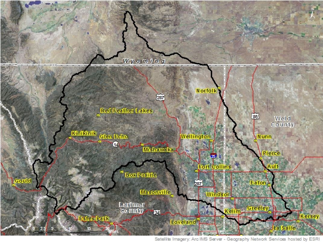
Communities that potentially would be crossed by the pipeline, such as Larimer and Weld counties, Fort Collins, Timnath, Windsor, and points south, have varied concerns about the impact of constructing the pipeline, Koleber said.

Thornton will likely have to acquire 300 to 500 permits for project as it crosses under private and public property, roads and highways, rivers, streams and ditches, and railroad tracks…

The basics

For the city of Thornton’s proposed water pipeline:

•55 to 65 miles: Length depending on alignment

•48 inches: Potential diameter

•14,000 acre feet: Maximum annual amount of water it could deliver to Thornton

•$400 million: Preliminary cost estimate

•2025: When the pipeline could go online

Source: City of Thornton

Eagle River cleanup: Steady progress over 30 years as a superfund site

Eagle Mine
Eagle Mine

From the Eagle River Watershed Council (Kate Burchenal):

As we all know, Colorado has a rich and fascinating history of mining that dates back to the late 1800s. Between 1991 and 1999, the Colorado Geological Survey inventoried abandoned and inactive mine sites on National Forest lands across the state. Of the 18,000 mine features they inventories, 900 presented environmental problems significant enough to warrant future study. About 250 of those were found to be causing significant or extreme environmental degradation.

For those of you who read the previous installment of this series and have been thinking that the story of the Gold King Mine and the Animas River sounds familiar, you’re correct. One of these abandoned mines happens to be in our backyard, right here in Eagle County. In 1984, that particular mine spilled thousands of gallons of metal-laden water into the Eagle River. The river ran orange, wiping out fish populations and causing Vail Resorts to blow orange snow on their mountains.

But where our story differs somewhat from the Gold King Mine is that we have been fortunate to have willing partners in the cleanup effort. In some parts of the state, mine owners will spend millions of dollars in court to avoid cleaning up harmful mines; here, those millions have gone to greatly improving the situation.

The Eagle mine has been listed as a Superfund site for the better part of three decades. Much progress has been made in that time thanks to coordinated efforts from entities such as the Eagle Mine Limited, Eagle River Watershed Council, Eagle River Water and Sanitation, CBS (the mine owner), Colorado Department of Public Health and Environment and the U.S. Environmental Protection Agency.

Water Treatment

The main goal is and has been to treat all contaminated water before putting it back into the Eagle River, and to divert fresh, clean water around the mine so it remains uncontaminated and out of the water treatment plant. The water treatment facility treats 250 gallons of water every minute and removes 251 pounds of metals from the water passing through each day.

That is not to say, however, that the problem has been solved. Quite the opposite actually, since the mine tunnels and metal-rich rocks below Gilman aren’t going anywhere. This is an issue that will be with our community in perpetuity and so we must guard against complacency. We haven’t seen any large-scale, dramatic spills recently, but that doesn’t mean it couldn’t happen.

Our Best Defense

From here, the best defense we have against a spill like the one at the Gold King Mine is to emphasize existing and augmented preventative measures. While we can’t rule out the possibility of future spills from the Eagle Mine, we can do our best to implement preventative and proactive measures that safeguard our river and our community.

The cleanup contractors have a regular maintenance and monitoring schedule to keep the pipeline – which carries contaminated water to the treatment facility – functioning properly, free of leaks and other issues. This aspect is critical, and very much achievable. Adding in satellite technology will provide remote, real-time monitoring for spills and leaks. This equipment will not eliminate the need for having people on the ground inspecting the mine and pipeline, but rather will provide an added layer of security.

The initial, catastrophic spill from the Eagle Mine in 1984 made the river uninhabitable for the entire fishery that once called it home. Today, hardier fish such as brown trout have returned, while species more sensitive to metals – such as rainbow trout and sculpin – are less prevalent. Though the species diversity is not what we would like to see, this return is a big accomplishment in and of itself.

We have seen this progress because our community pushed for it. The stakeholders in the mine cleanup listened, collaborated and took action. But we can’t pat ourselves on the back too heartily; as a community, we must stay engaged. The Gold King Mine spill is a reminder of what could happen and why we can’t let our guard down.

Kate Burchenal is the education and outreach coordinator for the Eagle River Watershed Council. The council has a mission to advocate for the health and conservation of the Upper Colorado and Eagle River basins through research, education and projects.

#AnimasRiver: Gold King Mine bleeds $100,000 daily; the leak’s still not fixed — The Colorado Independent

Gold King mine treatment pond via Eric Vance/EPA and the Colorado Independent

From the Colorado Independent (Nancy Lofholm):

The snow is beginning to fly in Silverton’s high country, and a temporary water treatment plant has been completed – in the nick of time – to handle the discharge from the Gold King Mine over the winter.

That hurry-up, stop-gap treatment option for the hundreds of gallons of heavy metal-laced water still draining each minute from the old mine comes with a hefty price tag – about $100,000 per day. That daily amount is being added to the $14.8 million already spent on the huge three-million-gallon spill that turned the Animas River an acid yellow on Aug. 5 and triggered emergency declarations in four states.

An EPA spokeswoman said she doesn’t know how long the temporary fix on the leaking mine will continue to rack up high daily costs. But she does expect that cost to drop as a command center in Durango is dismantled by the end of November and the crew at the Gold King high in the San Juan Mountains is chased out by winter conditions. The treatment facility sits at 10,500 feet in an area where temperatures regularly drop to -20, making any manual work at the treatment plant unsafe.

EPA spokeswoman Christie St. Clair said the treatment facility that pipes bad water from holding ponds at the mine to a treatment area nearby at the mining ghost town of Gladstone is being fine-tuned this week for “optimal performance.” It should then be able to operate through the winter without the 33 workers who have been at the site recently and the 29 officials who have been tackling the problem of the Aug. 5 leak from an office downstream in Durango.

The officials and the workers on the ground have included personnel from the EPA, the Army Corps of Engineers, the U.S. Geological Survey, the Bureau of Reclamation, U.S. Fish & Wildlife and the Coast Guard. Four State of Colorado and New Mexico agencies have also had officials involved in the work.

The exodus of many of those leak responders, and the start-up of the treatment plant, doesn’t indicate the problem is solved, or even near to being solved.

Over the winter, federal, state and local officials will be tackling the tough question of what to do in the long term about this and other leaking mines that have troubled the Silverton area for decades. The EPA is waiting on reports from the Inspector General and the Department of Interior. Those entities are examining the leak that was caused by an EPA contractor when a plug was breached in a long abandoned mine.

The leak at the Gold King didn’t just put alarmed focus on a waterway in southwest Colorado, southeast Utah and northern New Mexico and Arizona. It drew attention to the tens of thousands of old hard-rock mines that pock the West’s landscape and, in thousands of cases, leak contaminated water that has collected in shafts and tunnels.
Some are being mitigated through Superfund designations that bring federal dollars – and federal decision-making – but that is not a universally popular option in Silverton.

Last week, the Sunnyside Gold Corp. renewed its pledge to put $10 million into building a permanent water treatment plant for acid drainage that runs into Cement Creek through Silverton and on into the Animas River. Sunnyside never operated the Gold King Mine, but the company did operate the nearby Sunnyside Mine and American Tunnel that are all part of an interconnected drainage problem. Sunnyside proposes using lime to treat contaminated water and is asking for no Superfund designation and no liability for the company in exchange.

Sunnyside’s option will be one of many kicked around this winter as officials try to come to an agreement on how to move forward with the spring thaw.

In the meantime, the EPA and some of the other involved agencies will continue to have a presence in Silverton sampling and monitoring water quality below the Gold King.

Colorado Water Congress 2016 Annual Convention — January 27-29

cwc2015annualconvention

Click here to go to the convention webpage.

From the CWC website:

The Colorado Water Congress Annual Convention is the premier water industry event in the state, attracting 500+ attendees that convene for networking and collaboration on the important water issues of the day…

Highlights of the Annual Convention include:

  • Keynote Presentations
  • Unique workshops
  • Top secret POND Reception
  • Fresh Local Food from CWC Members
  • Opportunities to earn CLE credits!
  • CSU Water Tables 2016
    Once again, the Water Congress is pleased to announce that CSU will host their 2016 Water Tables Dinner “The Historic One Hundred”, Thursday, January 28 at 6:15 p.m. This is an excellent way to support the Water Resources Archive. See the Annual Convention Registration above to register. The 25 Table Host selection is coming soon. If you register before the Table Host selection is available, you will be contacted to make your choice.

    Click here to register. Click here to reserve a hotel room.

    The Republican River Water Conservation District Board of Directors elects new president

    South Fork of the Republican River
    South Fork of the Republican River

    From The Yuma Pioneer (Tony Rayl):

    The Republican River Water Conservation District Board of Directors has a new president for the first time in its history.

    Dennis Coryell of Burlington has held that position since the RRWCD was formed one decade ago. Fellow Burlington resident Tim Pautler also has been a board officer since the inception, the only holdovers from the original executive committee.

    However, that changed a bit last week when the board held its annual officer elections, during its regular quarterly meeting held in Wray.

    The board voted Rod Lenz as the president, but that was the only change to the Executive Committee. Greg Larson was the only candidate for vice president. Pautler remains as secretary, beating a challenge from Rod Mason. Incumbent Byron Weathers and Wil Bledsoe were the candidates for treasurer, with Weathers voted to remain in that role…

    Six board seats also were up for appointment for new three-year terms. All the current board members were appointed to new terms — Stan Laybourn, representing Washington County; Wil Bledsoe, Lincoln County; Wayne Skold, Sedgwick County; Jack Dowell, W-Y Ground Water Management District; Brent Deterding, Central Yuma Ground Water Management District; and Coryell as the Plains District’s representative.

    Pipeline

    Dick Wolfe, Colorado’s State Engineer, reported to the board about negotiations with Kansas and Nebraska in regards to Colorado’s compact compliance pipeline, as well as credit to be received for draining Bonny Reservoir.

    He said if the states can agree to an action plan by November 1, the agreement of operating the pipeline will automatically renew for 2016. He said the three states have met monthly all year, and came to a “conceptual agreement” on September 26, on the action plan. Wolfe said he expects it will be finalized when the three states meet October 28-29 in Manhattan, Kansas.

    #ElNino: “The Four Corners area is on the northern boundary of the El Niño impact” — Joe Ramey

    Precipitation - U.S. Winter Outlook: 2015-2016  (Credit: NOAA)
    Precipitation – U.S. Winter Outlook: 2015-2016
    (Credit: NOAA)

    From the Cortez Journal (Jim Mimiaga):

    The Four Corners is still trending toward a wetter, cooler winter thanks to a strong El Niño, reports the National Weather Service in Grand Junction.

    The 2015-16 winter forecast from December to February shows a 33 to 40 percent chance that the Four Corners will be wetter than normal. New Mexico and Texas have a 50 percent probability of a wetter-than-normal winter.

    But NWS forecaster Joe Ramey cautions that the strong El Niño does not guarantee an above-average winter for the Dolores and San Miguel basins.

    “It shifts the Pacific jet stream south, which favors more of the Southern states,” he said. “The Four Corners area is on the northern boundary of the El Niño impact.”

    For example, the last strong El Niño was the winter of 1997-1998, which produced below-average snowpack for the Dolores Basin…

    Ramey added that the current west-to-east weather patterns indicates that El Niño has kicked in, bringing additional moisture to the Southwest because of the southern shift in the jet stream.

    “The monsoons that bring up moisture from the tropical south have ended,” Ramey said. “These recent storms are coming from the west, which coincides with the El Niño signal.”

    Current weather corresponds to the trend as well, said Jim Andrus, a local weather watcher for the NWS.

    October moisture 112 percent of normal for Cortez. And year-to-date moisture for the Cortez area is 137 percent of normal at 14.9 inches of precipitation.

    According to the NWS, the 30-day precipitation outlook is above normal for Arizona, Colorado, New Mexico, and Texas. The 90-day forecast is slated for normal to above normal precipitation for those same areas.

    Southern Delivery System moving along

    Southern Delivery System route map -- Graphic / Reclamation
    Southern Delivery System route map — Graphic / Reclamation

    From The Pueblo Chieftain (Chris Woodka):

    Colorado Springs Utilities got a clean bill of health from Pueblo County’s weed manager Monday and answered questions raised at a Sept. 25 hearing about revegetation along the 17-mile route of the Southern Delivery System through Pueblo County.

    Still, commissioners want more time to study documents submitted and continue a public hearing on SDS 1041 permit commitments to 9 a.m. on Dec. 8.

    Utilities needs to fulfill conditions of Pueblo County’s 1041 permit for SDS in order to turn on its pipeline from Pueblo Dam to Colorado Springs next April. Revegetation compliance also would release $674,000 Pueblo County is holding under of the permit.

    Utilities revealed it has spent more than $5.3 million on revegetation work already.

    Colorado Springs provided point-by-point assurances on 17 issues raised on Sept. 25, when experts from both camps agreed Utilities had tackled the problem with state-of-the-art methods. Utilities also provided documentation from contractors that the work was done correctly, and that most landowners were satisfied with the work.

    “We need to work through the (final) issues to protect the citizens of Pueblo County,” said Commissioner Terry Hart, who made a motion to take the comments under advisement and continue the hearing. “What we’re trying to do is look at the work in its totality.”

    Hart, along with Commissioners Liane “Buffie” McFadyen and Sal Pace, had little criticism of Utilities’ report, which pledged further work with landowners as well as reviewing procedures already put in place to bring land disturbed by SDS construction back to its original condition or better.

    “It’s light years ahead of other projects,” Hart said.

    Bill Alt, who manages Pueblo County’s weed control program through the Turkey Creek Conservation District, agreed. Alt toured the pipeline route last week and said Colorado Springs has lived up to its responsibilities to reseed ground disturbed by SDS.

    “The grass is up and doing well,” Alt said.

    “Some of the tamarisk has been dug up by the roots and removed, and the topsoil has been replaced as in any mining operation.”

    The problem is that the areas on either side of the 150-foot path of SDS are still susceptible to tumbleweeds (Russian knapweed) and tamarisk, which could still find their way back onto the treated area, particularly on the route north of U.S. 50, Alt said.

    Some landowners have mowed or grazed the revegetated areas prematurely instead of allowing new grasses a chance to get established, he added.

    “Everything is fine for what we looked at,” Alt said. “We did not go on Walker Ranches, although I would like to go because that’s where the erosion is.”

    The Walker Ranches crossing is being handled under a $7.4 million settlement as a result of a jury verdict.

    Colorado Springs also said it is working on a settlement with Dwain Maxwell, a Pueblo West resident who complained about the project at an earlier hearing. Utilities also has taken on a separate project to divert floodwater around a property just south of Walker Ranches in Pueblo West.

    From KOAA.com (Jessi Mitchell):

    As part of the deal, the utility company had to repair the land after digging up 50 miles of dirt to bury the 66-inch pipe, restoring at least 90% of the vegetation that was in place before. CSU showed the county that they have gone above and beyond the requirements, but commissioners have not yet released them from the commitment.

    “The work that we’ve got done so far is already light-years ahead of other projects,” admits commissioner Terry Hart. Pueblo County commissioners applauded CSU for its nearly $5.4 million efforts to re-seed and irrigate the lands it plowed through to plant the SDS pipeline.

    Landowners agree, giving high praise in a report to the way workers left things better than before.

    CSU’s SDS permitting and compliance manager Mark Pifher says, “We put in a very extensive irrigation system. If I had to guess, it’s probably the biggest irrigation system ever installed in Colorado.

    Commissioners had lots of questions when they first met to review the re-vegetation process in September, many of which addressed future concerns over erosion and management of the property. Pifher says doing a good job is about more than protecting the pipeline; it is about respecting the landowners as well. “It’s important that you do it with a mindset that this is like your property,” says Pifher, “how would you like it restored and put back into its historic condition, if you will.”

    Bill Alt has been working closely with the group to oversee the management of noxious weeds throughout the easements, which have been removed on the property in question, but remain nearby and are likely to spread. Alt suggests CSU send a notice to the owners about maintaining the landscaping moving forward. “It needs some tender, loving care,” says Alt, “and it’s good for your property because it keeps the property value up. It’s not something you’re ashamed to show a realtor or other people.”

    Commissioners will meet with Colorado Springs Utilities again Dec. 8 to make sure no other questions arise before checking re-vegetation off the long SDS checklist. The only other big issue standing in the way of water flowing north is Colorado Springs’ stormwater management efforts.

    To access all official documents on the SDS, including CSU’s latest report, click here.

    The October 2015 Headwaters Pulse is hot off the presses from the Colorado Foundation for Water Education

    Headwaters Pulse October 2015 cover

    Click here to read the newsletter. Here’s an excerpt from Greg Hobbs’ column:

    There is no vacation for Colorado’s farm families this time of year. As gold starts to settle into aspen-covered upslopes, the harvest requires the dawn-to-dusk toil necessary to bring the crops in. Dan and his partner [farmers below the Bessemer Ditch, Dan is Greg’s son], Jaime, send us on our way with a cooler full of summer heat packed into the peppers we’ll break out of the freezer in December onto our breakfast plates.

    Arkansas Valley organic farmer Dan Hobbs photo via the Pueblo Chieftain
    Arkansas Valley organic farmer Dan Hobbs photo via the Pueblo Chieftain

    “Climate is what you expect…Weather is what you get” — Kerry Jones

    Here’s a look at the difference between climate and weather in New Mexico from Laura Paskus writing for New Mexico in Depth. Click through for all the graphics. Here’s an excerpt:

    “Climate is what you expect,” says the meteorologist with the National Weather Service in Albuquerque. “Weather is what you get.”

    Climate represents general conditions in a particular region — 30 years is the standard time period experts use for talking about it. Weather happens on a day-to-day basis, and is the fluctuating state of the atmosphere characterized by temperature, precipitation, wind, clouds, and other elements, he says.

    Think about it another way, he says: Climate trains the boxer, while weather throws the punches.

    Science Senator. It's called science.
    Science Senator. It’s called science.

    Dry August and September leaves Horsetooth at 61% of capacity

    Horsetooth Reservoir
    Horsetooth Reservoir

    From the Fort Collins Coloradan (Jacy Marmaduke):

    …consistently hot temperature and little rain put the big drain on in late summer, as farmers called for more irrigation water. The reservoir on Friday was 61 percent of capacity, which is 125 percent of the average for Oct. 16.

    Northern Water spokesman Zach Allen said what all that means is the reservoir is in good shape heading out of the agricultural irrigation season.

    High reservoir levels at the end of 2014 coupled with a wet spring meant farmers diverted less water from the reservoir during the spring and most of the summer, water resources manager Sarah Smith said. That allowed for an excellent boating season for most of the summer.

    Irrigation reservoirs, like Horsetooth, generally fill up in spring with rain and snowmelt. As summer progresses, they are drawn down as farmers’ need for irrigation increases.

    While Horsetooth is doing well, the Poudre River is flowing more slowly than usual for this time of year. On Friday at the mouth of the Poudre Canyon, the river was flowing 74.6 cubic feet per second. The average for this time of year is 92 cfs.

    Slower flows are likely due to the dry weather and lack of rainfall during the last several months, Smith said.

    Denver: National Water Resources Association 84th Annual Conference, November 4-6

    nationalwaterresourcesassoc2015annualconference

    Click here for all the inside skinny.

    Denver: 2015 AWRA Annual Winter Water Resources Conference, Nov 16-19

    2015awraconference

    Click here for all the inside skinny.

    EPA: Colorado mine spill water treatment system proving effective — The Denver Post

    The EPA's wastewater treatment plant near Silverton, Colorado, on Thursday, Oct. 16, 2015 -- photo via Grace Hood Colorado Public Radio
    The EPA’s wastewater treatment plant near Silverton, Colorado, on Thursday, Oct. 16, 2015 — photo via Grace Hood Colorado Public Radio

    From The Denver Post (Jesse Paul):

    A newly-installed temporary wastewater treatment system at the Gold King Mine site is already proving very effective, the Environmental Protection Agency said Monday.

    “The system is now operating 24 hours a day,” the EPA said in a statement to The Denver Post. “It is treating flows from 200 to 800 (gallons per minute), which includes all the flow from the mine, plus water that has been stored in ponds prior to start-up.”

    The EPA on Friday began water treatment operations at the site above Silverton, where the agency on Aug. 5 spilled 3 million gallons of contaminants.

    The temporary system, erected by Alexco Environmental Group Inc., is expected to operate throughout the winter and is capable of working in minus-20-degree temperatures. It will remove about 85 percent of “metals of concern,” according to the EPA, and discharged water will have a pH ranging from 6 to 9.

    Neutral water has a pH of 7.

    The EPA says the new system will only address contaminants still flowing from the Gold King. While it will make some improvement to Cement Creek, the agency says the system is “not intended to be a solution to the broader problem of a discharging mine in the Upper Animas.”

    #COWaterPlan: Economic success — “The water plan is our first step” — Kelly Brough

    Colorado Water Plan website screen shot November 1, 2013
    Colorado Water Plan website screen shot November 1, 2013

    From The Colorado Statesman (Marianne Goodland):

    Among the critical issues identified by the panelists: storage and the permitting process for building or expanding reservoirs. Former Commissioner of Agriculture Don Ament told the audience the state cannot spent another 10 years waiting on federal permits.

    James Eklund, director of the Colorado Water Conservation Board, said it’s also about innovation, whether with storage, conservation, agriculture or the environment. “We have to utilize the innovative community at our disposal,” including the business community, he said.

    Eric Kuhn, director of the Colorado River District, said everyone needs to recognize that every drop of the Colorado River has been used since 1998, and there isn’t any more water coming into the system. In fact, he said, there will probably be less water available from the river in the future, and what does flow between its banks is fully appropriated. It’s a cautionary note to those on the Eastern Slope who want another transmountain diversion of water from the Colorado through the Continental Divide, as has been suggested in the plan…

    Robert Sakata of Brighton’s Sakata Farms noted that innovation in agricultural technology is helpful but also expensive. He showed off a GPS receiver, part of a system that helps with his farm’s water use. The receiver alone cost $8,000, and he has to sell half a million onions to cover that cost, he said.

    The test of the state’s water plan will be whether it can be financed, said Ament, adding that he’s nervous about how the state will find the money and meet the regulatory requirements…

    [Kelly] Brough also laid out the chamber’s wish list for the water plan. The business community must lead on this, she said. The days are gone “when we can look to somebody else to solve the challenges we face.” And this is one of those issues where Coloradans don’t want someone else to step in and solve it for them, she said.

    Among the solutions: changing how Coloradans use water. As a business community, “we must lead,” by showing a commitment to conservation and efficiency, Brough said. Colorado needs to do more to support the population growth that is coming. The state also needs to move forward beyond conservation and work toward maximum economic use of water, she said. That includes more “green” infrastructure, use of recycled “grey water,” underground storage, reservoir expansion, improved permit processes and even rain barrels, she said. Brough also called on Gov. John Hickenlooper to take the lead improving the permitting process, arguing that problems with the process have caused years and even decades of delay building or expanding water storage in Colorado.

    “We don’t have limited choices,” Brough said. “We have many choices.” She added that there’s a real cost to doing nothing. “I don’t know what it is,” she said, “but we can’t afford it.” State water policy must find cost-effective solutions to ensure economic success for Colorado she said. “The water plan is our first step.”

    AccuWeather says El Niño will bring lots of snow to Aspen — The Glenwood Springs Post Independent #ElNino

    From The Aspen Times (Scott Condon) via Glenwood Springs Post Independent:

    [Steve] Root has one hell of a winter forecast for Aspen and the mountains of Colorado. It’s not hype, he said, just a look ahead based on evidence from the past…

    Root said he sees the winter getting off slowly with lower than usual snowfall this month, but then it will hit with a vengeance. There will be somewhat a lull in mid-winter, then the “opportunity” for a second, prolific peak of snowfall in March and April.

    Here are the eye-popping numbers from Root’s forecast:

    * He forecasted snowfall 150 to 170 percent of average in November.

    * He foresees December to start good and remain good through the holidays. The snowfall for the month will be 190 to 200 percent of average.

    * The El Niño effect will likely “wane” in January and February, though Root’s definition of wane will still make skiers and riders smile. He foresees snowfall at 110 to 120 percent of average in January and 110 to 130 percent of average in February. Both months will be cloudy and cold with intermittent snow, he said.

    * Late in February comes the wildcard, according to Root. The patterns from past El Niño winters suggest a second peak of prolific snowfall starting in late February and March. There is the potential for snowfall 120 to 160 percent of average, he said.

    * He expects winter to hang around well into April with snowfall approaching 200 percent of average.

    Root placed a caveat on his end-of-winter forecast, starting in March. He said there is a chance the atmosphere will respond to the warm Pacific Ocean water temperatures that create the El Niño. The uncertainty of that reaction makes it “risky” to make a late winter forecast, he said.

    “All El Niños are not the same,” Root said. “In fact, I look at El Niños as a four-inch fire hose. When somebody turns that fire hose on, you don’t really know where that thing is going to spray. It can spray where it did last time or it can spray in a completely different area.”

    To try to figure where the hose will spray this winter, he studied the El Niño winters of 1957-58; 1965-66; 1986-87; 1987-88; 1991-92 and 1997-98, the latter being particularly strong. He risk weighted each of those winters based on factors such as whether the El Niño set up the same way and at the same time of year as this year, he said.

    He concluded from the patterns in those six winters that the Aspen area will be among the lucky winners, certainly for early winter.

    Average influence of El Niño on US temperature and precipitation
    Average influence of El Niño on US temperature and precipitation

    The Arkansas Basin Roundtable and the Arkansas River Forum pony up $50,000 for water education

    Arkansas River Basin via The Encyclopedia of Earth
    Arkansas River Basin via The Encyclopedia of Earth

    From The Pueblo Chieftain (Chris Woodka):

    Each month, a roomful of water wonks has convened monthly to iron out the Arkansas Valley’s water issues for the past decade.

    Soon, if a state grant is approved, more people may be able to join in the fun.

    The Arkansas River Basin Water Forum and the Arkansas Basin Roundtable want to spend $50,000 annually for a three-year program to increase public awareness.

    Specifically, the grant would fund a water video specific to the Arkansas Valley, increase the number of water festivals, public library activities and host community meetings to explain water policies. In addition, it would be used to hire a part-time coordinator for the events.

    “You can hit a broader audience than any one organization can do,” said Julia Gallucci, water educator for Colorado Springs Utilities. She spoke at Wednesday’s roundtable meeting.

    The roundtable moved the grant request to the Colorado Water Conservation Board, which will consider funding it. The program would require about $72,000 in matching funds and $24,000 in in-kind services from area water groups as well.

    It builds on existing activities. The water forum has been held each year for more than 20 years. The Pueblo Children’s Water Festival at Colorado State University-Pueblo in May began as a water education tool for fourth-graders 18 years ago. Ironically, rain canceled the event this year. Several valley water groups have had other water education efforts over the years.

    The idea is to create toolkits for minifestivals and add large water festivals in Salida and Colorado Springs

    Now, with the state water plan and the accompanying basin implementation plan nearing completion, the roundtable wants more chances for water education.

    Don’t worry. It’ll be fun.

    ROUNDTABLE OFFICERS

    The Arkansas Basin Roundtable Wednesday elected officers for the coming year.

    Sandy White, a water attorney now with the Huerfano Conservancy District, will be the chairman.

    Terry Book, executive director of Pueblo Water, and SeEtta Moss, of the Arkansas Valley Audubon Society, are vice chairs. Jay Winner, of the Lower Arkansas Valley Water Conservancy District, and Jeris Danielson, of the Purgatory Water Conservancy District, are representatives to the Interbasin Compact Committee.

    Terry Scanga, of the Upper Arkansas Water Conservancy District, is secretary-recorder.

    Alan Hamel is a member of the Colorado Water Conservation Board.

    Jim Broderick, executive director of the Southeastern Colorado Water Conservancy District, is past-president and IBCC alternate.

    Grand Valley Drainage District board sets fees

    Grand Valley Drainage District boundaries -- Robert Garcia The Grand Junction Daily Sentinel
    Grand Valley Drainage District boundaries — Robert Garcia The Grand Junction Daily Sentinel

    From The Grand Junction Daily Sentinel (Mike Wiggins):

    Tens of thousands of Grand Valley residents and business owners will begin paying an annual fee next year to manage stormwater that drains off their properties.

    The Grand Valley Drainage District board voted unanimously Wednesday to institute a $3-per-month base fee on the more than 44,000 tax parcels within its boundaries and a $500-per-unit impact fee on new development. The $3 fee is based on a parcel containing 2,500 square feet of impervious surface.

    Property owners will begin receiving bills from the drainage district in January and will have 60 days to pay them or face potential legal action.

    “Once people see that (bill) is collectible, we expect the issue (of not paying) will go away,” said Dan Wilson, the attorney for the drainage district.

    The district had asked Mesa County Assessor Ken Brownlee to include the charges in tax bills his office mails out, but he declined, so the district will spend $120,000 next year to mail the bills itself.

    Geology, drainage, laws decrease odds of toxic mine spill in Teller, El Paso counties — The Colorado Springs Gazette

    Cripple Creek via RVTravel.com
    Cripple Creek via RVTravel.com

    From The Colorado Springs Gazette (Ryan Maye Handy):

    Once a booming mining region, Teller County remains punctured by more than a thousand abandoned mines, but state officials say none are likely to poison the environment with toxic waste…

    …in Teller County, the dangers of abandoned mines are different, said Bruce Stover, director of the inactive mine reclamation program for the Colorado Division of Reclamation, Mining and Safety. More than a century ago Cripple Creek was one of the most thriving gold mine sites in the world. In the 21st century, nearly all of the mines have been abandoned, and Stover is more concerned about people falling down shafts and dying of asphyxiation.

    “We are not talking about any environmental issues in the Cripple Creek district,” he said.

    Despite its extensive mining history, a few things ensure that Teller County mines are less prone to an environmental disaster, unlike areas of the San Juan mountains, where abandoned mines continue to pour toxic metals into nearby water sources.

    Teller is home to one of the state’s largest mines, the Cripple Creek & Victor gold mine, which operates under heavy regulations passed in Colorado after the last mining disaster in the early 1990s. Unlike the San Juans, underground water networks in Teller are regulated and monitored, making the likelihood of toxic waste pooling unlikely.

    But another thing that sets Teller County apart from the San Juans is geological luck. The formation of mountains millions of years ago made gold mining in Teller less toxic than in the San Juans, Stover said.

    “There is really no comparison at all between the two districts,” he said.

    Buffering minerals

    Volcanic eruptions millions of years ago formed gold deposits in the San Juans and Teller County, and ancient reactions between lava and rock created the kind of minerals still found in local mines.

    In the Gold King Mine, which was last operational in the 1920s, an underground lake of toxic sludge had been pooling for decades before a barrier broke on Aug. 5 and released 3 million gallons into the Animas. The Environmental Protection Agency was trying to address the pooling, and the agency has accepted blame for a reclamation job gone awry.

    That level of toxicity is unlikely to occur in the Cripple Creek mining district, thanks in part to those ancient volcanoes. In Cripple Creek, the eruptions created a layer of minerals known as telluride ore, which does not have as much pyrite as the rock formations in the San Juans, Stover said. When it decomposes, pyrite can transform into a type of toxic acid.

    The Cripple Creek formation also contains what Stover calls “buffering minerals,” which decrease the levels of acidity in the rock.

    “It’s just the geology of the district,” he said. “It’s far less conducive to acid rock drainage. There are some but it’s not much.”

    The Cripple Creek landscape is relatively young in terms of geological formation – about 35 million years old, said Christine Siddoway, a professor at Colorado College who specializes in the geological development of the Front Range.

    The mountainous border between El Paso and Teller counties shows all the signs an economically profitable region for gold mining. According to Siddoway, western El Paso County sits on a fault system that allows underground fluid to heat, circulate and bring metals to the surface.

    “Those high-temperature fluids are successful at carrying any metals, which leads to economic-scale mineral deposits,” Siddoway said. “In Colorado, gold, silver, precious metals are on ancient faults where there is much circulation of geothermal waters.”

    But in the early mining days when prospecting was an unregulated free-for-all, separating gold from other minerals in a rock formation often came at a high cost. Sometimes chemical reactions using cyanide were used, but the reactions left behind toxic metals. To this day, even the most heavily regulated mines legally produce millions of pounds a year of lead and other carcinogenic elements as a by-product of the mining process, according to data from the EPA’s Toxic Release Inventory.

    But chemical means of extracting gold were less common in Cripple Creek, Siddoway said.

    “Historically in (the Colorado Springs area), those mines did not use any chemical reactions to liberate the gold,” she said.

    But that doesn’t mean that the Pikes Peak Region was spared repercussions from decades of active mining. Decades ago, miners shipped ore to Colorado Springs, where it was mechanically crushed. The remaining mineral tailings were deposited in west Colorado Springs in modern-day Bear Creek Regional Park.

    “Those historical deposits are still here in the Colorado Springs city limits,” Siddoway said. “There are some elevated concentrations of heavy metals. There is still particulate gold in those tailings.”

    Tunnel network

    In addition to the area’s geological makeup, heavy regulation of underground water tunnels and active mining will help the Pikes Peak Region avoid a toxic disaster like that in the Animas River.

    Beneath Cripple Creek, a network of underground tunnels shuttle water away from mines, Stover said.

    “The district is already completely drained from underground by large drainage tunnels drilled by large mines,” he said. “Those do have permits, discharge is meeting water quality. (The area) doesn’t have water collecting in pits and mine shafts.”

    The Carlton Tunnel drains the entire Cripple Creek mining district into Fourmile Creek, a tributary of the Arkansas River, said Stover. Discharge from the Carlton Tunnel is monitored under a National Pollutant Discharge Elimination System permit, issued by the state of Colorado, EPA records show. The permit was first issued in 1992, and while documents show that the permit expired in 2011, the latest inspections of the tunnel were done in 2014. For 2015, permit data for the tunnel and the Cripple Creek mine showed that manganese, iron and zinc were the main pollutants released in the watershed.

    While the tunnel network takes care of shuttling away and treating any toxic waste, Colorado’s mining regulations ensure that the still-active Cripple Creek and Victor mine complies with environmental standards, Stover said.

    The environmental protections were borne of yet another Colorado mine project gone wrong: In the 1980s and 1990s, the Summitville gold mine in Rio Grande County was found to be poisoning the Alamosa River with heavy metals and acid from its tailings.

    When the mine’s owners declared bankruptcy and were forced to abandon reclamation, the federal government took over and declared the mine a Superfund site, opening the door to federal funds for the clean up.

    “Summitville was a slow-motion sort of thing that unfolded as the mine was being constructed,” Stover said. “That was a permitted site that went horribly wrong.”

    The disaster sparked massive changes in Colorado law.

    “It caused a lot of changes in Colorado mining reclamation rules and regulations,” Stover said. “So we have some much more stringent laws.”

    The regulations came decades too late to impact many abandoned districts, like the Gold King mine, which had been mined and shuttered long before the state cracked down on mining. The Colorado Division of Reclamation, Mining and Safety estimates there are 22,000 inactive mines around Colorado, more than 6,000 of which have been reclaimed.

    In Teller County there are 1,100 mines, nearly 500of which have been reclaimed and are blocked off with metal grates, Stover said. In El Paso County there are 153 mines, one of which has been reclaimed. The area mines that have been reclaimed and safeguarded are those that needed it most, Stover said.

    “We started working concentrically out from Cripple Creek, we did around 493 mine closures in and around the towns,” Stover said. “And of course that all changed when the mine came in. A lot of the closures are gone, they would be hanging in space because of the new mine.”

    Even so, mine disasters are possible in southern Colorado, even if the odds have been decreased by geology and regulations, Siddoway said.

    “Because the mine is not in our watershed – it’s off away on the southwest corner of the Pikes Peak elevated area – it’s not of immediate concern. But the mine is on a drainage that follows a tributary of the Arkansas River, and the Arkansas River flows into Pueblo Reservoir, and soon into the Southern Delivery System,” Siddoway said.

    “There is kind of a daisy chain there, were any accident to happen at the Cripple Creek mine.”

    The Unexpected Downside Of Ag Water Efficiency — KUNC

    Flood irrigation -- photo via the CSU Water Center
    Flood irrigation — photo via the CSU Water Center

    From KUNC (Stephanie Paige Ogburn):

    Until about 10 years ago, rancher Jim Yahn would water his hilly hayfield near Sterling by flooding the land. But as Yahn, who heads North Sterling Irrigation District, points out, about half of that water didn’t even stay on his field.

    “A lot of it just ran quickly to the bottom, and then ran back to the creek, and ran back to the river.”

    Flooding is how most farmers out here used to water their fields — some still do. Yahn, however, has changed watering strategies. He, and about three-quarters of the farmers around him, have installed center pivot sprinklers. Think of them as long arms that sit in the middle of the field and rotate in a giant circle, like the second hand of a clock, sprinkling the crops underneath. This has made Yahn a lot more efficient.

    “I just apply a little bit of water, really nothing runs off,” he says.

    To be more precise, only about 15 percent runs off. Compared to the 50 percent he was losing before, that’s a big savings. It’s certainly increased his hay yields. And that’s the catch: Yahn is using more water.

    Remember, half the water Yahn was entitled to used to run off his field and back to the river. Now, only a trickle runs back off. So by changing how he irrigates, Yahn is actually using more. In the arid West, that means someone else is getting less.

    That someone is Larry Frame, and the farmers he represents as head of the Julesberg Irrigation District, just downstream of North Sterling and Jim Yahn.

    From the Fort Collins Coloradan (Adrian D. Garcia):

    Hundreds of homes sprung up from the land [Ronald] Ruff and his neighbors once farmed south of Harmony Road. By 2006, new construction encircled the five acres where he lived and operated his cattle feedlot.

    The longtime Fort Collins resident wasn’t the first to experience the sweeping effects growth can have on a place. With more than 1 million residents projected for Northern Colorado by 2040, he won’t be the last.

    Taller projects are planned for Old Town Fort Collins, development is creeping farther north in Loveland, and residents are flocking to small towns in Larimer County. To the east, Weld County and Greeley are seeing similar changes.

    For Ruff, growth was embodied in new houses, schools — Fossil Ridge High School in 2004, Kinard Middle School in 2006 and Zach Elementary in 2002 — and streets that were expanded in the southeast portion of the city.

    “The money got to be pretty big,” Ruff said. “We all joke about a farmer when he sells his farm — the last crop you sell is the best and that’s houses. That’s the best return you ever get off of farm ground.”

    Mountains warming faster, scientists report — CIRES

    At 12, 218 feet (3,724 m), Mount Cook is the highest mountain in New Zealand. An international team of scientists, including two from CIRES, is calling for better monitoring of temperature patterns in Earth's highest altitude regions, because of compelling evidence that these places are warming faster than others. Photo: Birgit Hassler, CIRES/NOAA.
    At 12, 218 feet (3,724 m), Mount Cook is the highest mountain in New Zealand. An international team of scientists, including two from CIRES, is calling for better monitoring of temperature patterns in Earth’s highest altitude regions, because of compelling evidence that these places are warming faster than others. Photo: Birgit Hassler, CIRES/NOAA.

    From (CIRES):

    An international team of scientists is calling for urgent and rigorous monitoring of temperature patterns in mountain regions after compiling evidence that high elevations could be warming faster than previously thought.

    Without substantially better information, people risk underestimating the severity of a number of already looming environmental challenges, including water shortages and the possible extinction of some alpine flora and fauna, according to the research team, which includes Henry Diaz and Imtiaz Rangwala from CIRES, the Cooperative Institute for Research in Environmental Sciences at the University of Colorado Boulder. Both researchers are part of NOAA’s Earth System Research Laboratory.

    The team’s report is published in the journal Nature Climate Change.

    “There is growing evidence that high mountain regions are warming faster than lower elevations and such warming can accelerate many other environmental changes such as glacial melt and vegetation change,” said lead author, Nick Pepin of the University of Portsmouth. But scientists urgently need more and better data to confirm this, because there are so few observations from 11,000 feet or higher, he and his co-authors said.

    “It’s understandable. Mountains are difficult to study, they are remote and often inaccessible, and it is expensive and often challenging to find ways of effectively monitoring what is happening,” Pepin said. “Mountains are also very complicated landscapes, and have a wide variety of microclimates which makes it hard to see the overall picture.”

    The most striking evidence that mountain regions are warming more rapidly than surrounding regions comes from the Tibetan plateau, according to the new paper. There, temperatures have risen steadily over the past 50 years and the rate of change is speeding up. But masked by this general climate warming are pronounced differences at different elevations. For example, over the past 20 years temperatures above 13,000 ft (4,000 m) have risen nearly 75 percent faster than temperatures in areas below 6,500 ft (2,000 m).

    The picture is more complicated in other regions. In the Rocky Mountains, for example, there are so few data that reach back more than a decade, researchers have not been able to make broad conclusions about warming trends at various altitudes, said CIRES’ Diaz, who works in the NOAA Earth System Research Laboratory.

    However sparse, existing monitoring has been a huge help to scientists trying to understand how various physical processes act to change climate at high altitudes, said Rangwala, who works in NOAA’s Earth System Research Laboratory and also the Western Water Assessment (see sidebar).

    Records of weather patterns at high altitudes are “extremely sparse,” the researchers found. The density of weather stations above 4,500 m is roughly one-tenth that in areas below that elevation. Long-term data, crucial for detecting patterns, doesn’t yet exist above 5,000 m anywhere in the world. The longest observations above this elevation are 10 years on the summit of Kilimanjaro.

    The team of scientists came together as part of the Mountain Research Initiative, a mountain global change research effort funded by the Swiss National Foundation. The team includes scientists from the UK, United States, Switzerland, Canada, Ecuador, Pakistan, China, Italy, Austria and Kazakhstan. Between them, they have studied data on mountain temperatures worldwide collected over the past 60-70 years.

    Improved observations, satellite-based remote sensing and climate model simulations are all needed to gain a true picture of warming in mountain regions, said Raymond Bradley, a climatologist at the University of Massachusetts and one of the report’s co-authors. “We are calling for special efforts to be made to extend scientific observations upwards to the highest summits to capture richer data on what is happening across the world’s mountains,” Bradley said. “We also need a strong effort to find, collate and evaluate observational data that already exists wherever it is in the world. This requires international collaboration.”

    The world’s highest mountain, Mt Everest, stands at 8,848 m (29,029 feet). More than 250 other mountains, including Mt Elbrus in Russia, Mt Denali in Alaska, Mt Aconcagua in Argentina and Mt Kilimanjaro in Africa also all top the 5,000-m (16,000-feet) mark.

    Wearing Chief Engineer J.C. Ulrich’s hat at the reservoir — Greg Hobbs

    David Robbins and J.C. Ulrich (Greg Hobbs) at the 2013 Colorado Water Congress Annual Convention
    David Robbins and J.C. Ulrich (Greg Hobbs) at the 2013 Colorado Water Congress Annual Convention

    Here’s a history lesson from Greg Hobbs on the 100th anniversary of Rio Grande Reservoir (celebrated in 2012) where Ulrich grumbled through the construction. Here’s an excerpt:

    Ulrich served as Chief Engineer for the reservoir’s construction between the years 1905 to 1912. He wore a gentleman’s hat when on the construction site. I did the same for this year’s August 23 celebration. I spoke for Ulrich in his own words from letters he wrote 100 years ago. He was a stickler for detail and a worrier. He had cause to worry much.

    When the Farmers Union Irrigation Company asked him in 1905 to design a reservoir, he had two major worries. First, the United States had embargoed the construction of any reservoirs on the Upper Rio Grande Reservoir within Colorado, as it sorted out the water needs of Texas, New Mexico and the Republic of Mexico.

    Second, because the reservoir site sits high above Creede in wild country, Ulrich worried about a possible flood during construction.

    In a 1905 letter he wrote, “No reliable information exists as to the maximum discharge of the Rio Grande River at or near the site of this dam, and I do not pretend to know what it is. It presents the appearance, however, of being a very formidable stream when in flood, and it would be very imprudent to undertake the construction of an earthen dam at the point under consideration without making ample provision for the discharge of a very large volume of water while the construction of the dam is under execution.”

    A few years later, the United States lifted the embargo, but the Farmers Union Irrigation Company could not afford to build the reservoir. It nevertheless directed Ulrich in 1908 to draw up specifications for the on-site surveys necessary to put out a call for contractor bids.

    Colorado Springs councillors get a look at Fountain Creek flood damage after a rough early summer

    Fountain Creek Watershed
    Fountain Creek Watershed

    From KOAA.com (Jessi Mitchell):

    $2 million in damage remains in Pueblo’s Fountain Creek after unrelenting flooding earlier this year. It will cost much more to repair. The rain fell throughout southern Colorado, but the southern part of the river has arguably the most visible effects…

    The rushing water coursed its way wherever it could find a path, destroying cement trails and creating a vast wasteland of dead trees and silt. Those from farther north say they now understand why Pueblo is asking for millions of dollars to help fix it. Colorado Springs city council president Merv Bennett says, “This is important for us in Colorado Springs to come down and see this. They’ve come up to Colorado Springs. That’s what neighbors do. We come and share in this and share in a dialogue as to finding solutions.”

    The Springs council members admit there is a difference between driving down I-25 and looking at the creek, and actually getting up close to see it firsthand. The add, however, that their lack of stormwater management is not totally to blame. “A lot of this damage, a lot of this water comes in above Colorado Springs, and some of it comes in below Colorado Springs, so this is a regional issue,” says Bennett.

    What they took away from the tour is a sense of cooperation. Looking to the future, Colorado Springs and Pueblo plan to work together in finding and creating the best solutions to keep this from happening again.

    “It was just good to have them down here so they could see firsthand the devastation and they reassured us about their commitment,” says Pueblo city council vice president Ed Brown.

    Colorado Springs mayor John Suthers told Pueblo city council in July that he plans to restart the city’s stormwater management enterprise program, and dedicated $19 million a year for mitigation efforts in Fountain Creek.

    McElmo Flume restoration project update

    From the Cortez Journal (Jim Mimiaga):

    “It could take a year or longer for construction to be completed,” once bids are approved, said county planner James Dietrich.

    The roadside attraction will have an entrance and egress road, parking lot, sidewalks, information kiosk and a handicap-accessible trail to an overlook of the flume, built in 1890.

    Two grants are helping to pay for the project.

    A $253,000 grant from the Federal Highways Administration was awarded to the Trails of the Ancients Scenic Byway, a section of which includes U.S. 160 that goes by the flume.

    The Colorado State Historic Fund provided a $123,840 grant to restore the flume foundation.

    Several groups chipped in for a $41,280 match, including Montezuma County, Southwest Water Conservancy District, Ballantine Family Fund, Montezuma County Historical Society and Southwest Roundtable.

    The flume is the last of 104 built in the area from 1890 to 1920. It delivered irrigation water south of Cortez and to the Ute Mountain Tribe.

    McElmo Creek Flume via the Cortez Journal
    McElmo Creek Flume via the Cortez Journal

    Arkansas River winter storage program update: “We can’t predict where the water will be stored” — Phil Reynolds

    Pueblo Dam
    Pueblo Dam

    From The Pueblo Chieftain (Chris Woodka):

    Conditions are right for a big year of winter water storage, but the problem may be where to put it all.

    “We can’t predict where the water will be stored,” Phil Reynolds of the Colorado Division of Water Resources told the annual meeting of the winter water storage group.

    The group is made up of the large canals east of Pueblo. After Pueblo Dam was completed in 1975, irrigators were able to curtail flows during the winter months and use the water later in the season. Under a court decree, water is stored from Nov. 15-March 15 under the program administered by the Southeastern Colorado Water Conservancy District.

    Last year, more than 128,000 acre-feet (41.7 billion gallons) of water was stored in Lake Pueblo, John Martin Reservoir or oŸ-channel reservoirs operated by some of the ditch companies. That’s more than the five-year average and close to the 20-year average.

    The problem this year is that record rains in May and early June filled up most reservoirs.

    While some of the water was used during the relatively dry months at the end of summer, reservoirs in the Lower Arkansas Valley are well above normal.

    Winter conditions could be wet because of a strong El Nino condition. In similar years, that has meant a heavy spring runoff, said Terry Dawson of the Bureau of Reclamation.

    Lake Pueblo is already at 138 percent of capacity — a capacity that recently was deemed smaller because of sedimentation in the reservoir.

    “We are afraid at this point we may be in danger of spilling,” Dawson said.

    But it won’t be the farmers’ water that spills. There are still 22,723 acre-feet of this year’s winter water that will be released next spring, and an estimated 50,000 acre-feet of new water that could come into Lake Pueblo this winter.

    Before that could spill, however, water stored in temporary accounts or under long-term municipal contracts would be released.

    Anticipating that, Aurora, whose water would spill first, already is making plans to drain its account through leases to Colorado Parks and Wildlife, which will use the water in the Great Plains Reservoirs that are part of the Amity Canal system.

    Reynolds identified more than 100,000 acrefeet of practical storage space that could be used downstream of Lake Pueblo. There are also 140,000 acre-feet available in the Great Plains Reservoirs.

    However, winter water must be distributed equally to canal companies, and John Martin or the large reservoirs operated by Amity and the Fort Lyon Canal cannot be used by everyone.

    The space in Lake Pueblo will get even tighter during the winter water program because Reclamation plans to run some water from Turquoise and Twin Lakes into the reservoir to make room for next year’s Fryingpan-Arkansas imports.

    “We’ll need to know where and how much you plan to store, so we know what’s stored in Lake Pueblo and what can be moved,” said Jim Broderick, Southeastern executive director.

    Straight line diagram of the Lower Arkansas Valley ditches via Headwaters Magazine, Colorado Foundation for Water Education
    Straight line diagram of the Lower Arkansas Valley ditches via Headwaters Magazine, Colorado Foundation for Water Education

    Arctic Ocean oil and gas lease auctions canceled

    #ColoradoRiver: Grand Canyon Waters, at the Abyss — Mark Udall (The New York Times)

    Here’s a opinion piece about protecting the Grand Canyon from Mark Udall writing in The New York Times Here’s an excerpt:

    [President Theodore Roosevelt] proclaimed the Grand Canyon a national monument in 1908. In so doing, he specifically intended to prevent mining and tourist development from harming one of our nation’s most treasured landscapes. “Keep it for your children, your children’s children and all who come after you,” he said, “as the one great sight which every American should see.”

    But mar it we have. An abandoned uranium mine on the canyon’s South Rim has cost taxpayers more than $15 million to remove toxic wastes from the surface. And contaminated water — flowing underground through the mine’s radioactive ore — continues to poison a spring-fed creek deep within the canyon. It is a permanent loss at an unconscionable cost that should never be borne again.

    Roosevelt’s proclamation set aside only a fraction of the Grand Canyon as a national monument. His decision rankled mining and tourist businesses in the booming Arizona territory. Local politicians and profiteers fought the postage-stamp-size monument’s further protection as a national park in 1919.

    In 1975, Congress nearly doubled the park’s size, declaring that the entire Grand Canyon “including tributary side canyons and surrounding plateaus, is a natural feature of national and international significance.” Senator Barry Goldwater of Arizona, a Republican, introduced the bill. My dad, Congressman Morris Udall, a Democrat from Arizona, helped unite bipartisan support to better protect Arizona’s and America’s most famous natural wonder.

    The Grand Canyon Enlargement Act, signed into law by President Gerald Ford four decades ago, returned more than 100,000 acres of federal land to the Havasupai tribe. It also effectively banned the building of two new dams in the canyon’s upper and lower gorge. But it, too, fell short in protecting the Grand Canyon in its entirety.

    Today, four uranium mines operate within the watershed that drains directly into Grand Canyon National Park. Arbitrary boundaries and antiquated rules permit these mines to threaten hundreds more life-giving seeps and springs in the desert basins below. Thousands of new mining claims on public lands that surround the canyon were put on hold by a 20-year moratorium imposed in 2012 by Ken Salazar, then the interior secretary. The National Mining Association and the Nuclear Energy Institute are suing in federal court to end the ban.

    Achieving this hard-won hiatus on new uranium claims took more than five years and one of the broadest coalitions ever aligned to protect the Grand Canyon. The Havasupai, “people of blue-green water,” whose sole source of drinking water is at risk, led the way. They were joined then by county supervisors, chambers of commerce, ranchers, hunters, bird-watchers, artists, scientists, Arizona’s governor, game and fish commissioners and business owners. All united to stop uranium mining from permanently polluting the Grand Canyon and undermining the region’s tourism-driven economy.

    But the 2012 victory to halt new claims was temporary. Our challenge now is to rebuild that coalition and make the ban permanent. There’s no reason to wait. President Obama can protect it now…

    This past summer, President Obama used this authority to protect over one million acres of federal land in California, Nevada and Texas. Now we must prevail upon the president to permanently protect the Grand Canyon’s sacred waters.

    Earlier this year, my wife and I were invited to join native leaders on a rafting trip through the Grand Canyon. We’ve made many such trips before. But this time, at nearly every spring along the way, we stopped to pray.

    All water is sacred to those who have learned to live where it is scarce. We must defend the Grand Canyon’s sacred waters from unconscionable loss.

    Stakeholder Briefing: Western impacts of El Niño — NOAA #ElNino #drought

    Average influence of El Niño on US temperature and precipitation
    Average influence of El Niño on US temperature and precipitation

    From Climate.gov:

    Monday, October 19, 2015 – 01:00 to 03:00 EST

    As much of the western US continues to grapple with historic drought, an El Niño event has emerged in the Pacific Ocean. What does this mean for the upcoming winter’s weather? NOAA is monitoring and studying this problem using its weather, water, and climate data and forecasting services and scientific capabilities.

    A webinar led by NOAA experts has been scheduled for Monday, October 19, 2015, at 1:00 p.m. Eastern/10 a.m. Pacific to share and discuss the latest conditions, forecasts, and uncertainties for winter climate in the West, including but not exclusive to, central and southern California. This webinar is be open to anyone, and formatted to inform the public, farmers, resource managers, and anyone interested in understanding more about the ongoing El Niño event.

    If interested please register at this link. This webinar will also be recorded and available to review later.

    EPA: Water sent to Navajo Nation met standards — the Farmington Daily Times #AnimasRiver

    Health and environmental officials in San Juan County are evaluating the Animas River after roughly 1 million gallons of mine waste water were released Wednesday. August 6, 2015. (Photo courtesy San Juan Basin Health Department)
    Health and environmental officials in San Juan County are evaluating the Animas River after roughly 1 million gallons of mine waste water were released Wednesday. August 6, 2015. (Photo courtesy San Juan Basin Health Department)

    From the Associated Press (Dan Elliott) via the Farmington Daily Times:

    New tests on water sent to Navajo Nation farmers after millions of gallons of waste spilled from a Colorado mine indicate that the emergency supply met federal and tribal standards for livestock and irrigation, federal officials say.

    The U.S. Environmental Protection Agency released the results Tuesday, two months after farmers and Navajo officials said the water delivered by a contractor contained oil and was not suitable for use. The new results were consistent with earlier tests, the agency said.

    The water was delivered in tanks after mustard-yellow wastewater laced with heavy metals spewed from the inactive Gold King Mine in southwestern Colorado on Aug. 5, polluting the Animas and San Juan rivers in Colorado, New Mexico and Utah, including on the Southern Ute Reservation and the Navajo Reservation.

    It was sent for Navajo farmers who use water from the San Juan for irrigation. An EPA-led crew inadvertently triggered the 3 million-gallon spill while doing cleanup work at the mine.

    Navajo Nation President Russell Begaye said Thursday that he was glad the EPA released the test results, but he again said a number of the tanks contained petroleum residue, rust and other contaminants.

    “Navajo farmers and ranchers could not use the water without further assurances,” he said in an email to The Associated Press. “All told, Navajo farmers were left without water for over two weeks while the (Navajo) Nation awaited preliminary test results from the tanks.”

    Separately, the EPA said a temporary treatment plant is ready to start cleansing metals from wastewater still draining from the mine.

    #AnimasRiver: Gold King water treatment to begin — The Durango Herald

    From The Durango Herald (Jonathan Romeo):

    On Friday, EPA officials expect to finally turn on operations at a temporary treatment facility that will last the winter. The retention ponds built in the immediate aftermath of the Aug. 5 blowout were located in an avalanche zone and were never intended to operate beyond a few weeks.

    The treatment facility, in an area 10 miles north of Silverton, will begin to take in acid mine drainage from the Gold King Mine, which is discharging about 500 to 600 gallons of the mine wastewater per minute.

    A 4,800-foot pipe from the portal of the Gold King Mine will direct the drainage down a steep slope into the treatment system. The water is then treated with lime to raise the pH and systemized to separate heavy metals.

    Lime treatment is the most effective system for handling acid mine drainage, but it is also regarded as a costly one, which leaves behind solid waste that operators are tasked with handling.

    “The solid disposal is always a challenge,” said Steve Way, on-scene coordinator for the EPA. “That’s why treatment with lime addition is something any corporation, any agency wants to avoid if they can. It’s an expensive treatment process.”

    Way said the EPA is still weighing its options on how to manage the solid waste, but it’s likely the material will be stored on site. He estimated that the facility will generate about 2,500 cubic yards over the next 10 to 12 months.

    The water released from the facility over winter into Cement Creek, a tributary of the Animas River, will reduce the metals of concern – namely zinc, copper and cadmium – 90 to 95 percent, at minimum, Way said.

    However, the site at this time is taking in acid mine drainage from only the Gold King Mine. The adjacent Red and Bonita and Mogul mines, as well as the American Tunnel, together are still discharging about 500 gallons per minute into Cement Creek. Down the line, Way said there is an option to collect that water into the system.

    And despite the launch of the new treatment system, the Animas River is still not expected to meet water-quality standards. An entire network of abandoned, leaking mines poses a more complicated and expensive problem to environmental experts…

    The facility cost about $1.5 million – lower than the estimated $1.78 million the EPA projected – and runs about $16,000 a week to operate. That money will come out of a fund related to the Superfund program.

    Harrington said the system is designed to endure the area’s harsh winter weather. An average of two staff members will monitor the site through that time, and each will be issued with the proper equipment to notify downstream communities in case of an emergency.

    From Colorado Public Radio (Grace Hood):

    The EPA had been treating the water laced with heavy metals in small ponds, manually treating the water, and releasing into nearby Cement Creek. But Way said that system wouldn’t work through the cold winter months.

    “There may be a couple of people through the winter here as needed. It’s not a 24-hour a day staffing [need],” said Way.

    Work on the treatment plant was happening on a tight deadline; snow has already fallen on peaks in the San Juan Mountains.

    An executive at Alexico, the company that designed the plant, told the Durango Herald the facility could be expanded on should regulators decide to employ it in their long-term plans for the site. Way said that decision will be made over the winter months.

    Video: “The Drive” Broncos v. Browns (01/11/1987)

    Sorry, not water related, but I can’t help myself. I loved watching this video of “The Drive.”

    Southeastern Water board meeting recap: Lake Pueblo sedimentation discussed

    Pueblo dam releases
    Pueblo dam releases

    From The Pueblo Chieftain (Chris Woodka):

    Lake Pueblo is slowly filling with sediment that has reduced its capacity to hold water by about 7 percent over the last 40 years.

    The equivalent of 19 feet of dirt over a football field, or 19 acre-feet, is coating various parts of the bottom of the reservoir, a natural consequence for any lake fed by streams and rivers.

    The capacity for conservation storage — accounts that can be emptied and refilled — is down to 245,800 acre-feet.

    The Bureau of Reclamation made the determination to apply the new limits at the beginning of the water year on Oct. 1 based on data collected in 2012, said Roy Vaughan, manager of the Fryingpan- Arkansas Project. It’s the first detailed look at sedimentation since 1994, when Reclamation found deposits were less than expected because the Arkansas River maintained its current at the bottom of the lake.

    At Thursday’s meeting of the Southeastern Colorado Water Conservancy District board, the impact on future storage was discussed.

    “We’re looking at water for the next generation,” said Jim Broderick, executive director of the Southeastern district. “We’ve been in a wetter period for the last couple of years, and reservoir levels have been near the top.”

    About 25,000 acre-feet — nearly the amount Pueblo Water pumps in a year — could spill next spring if weather conditions are normal through the winter months and water is used in the same fashion as in the past. Lake Pueblo water levels still are about 138 percent of average, even though some water has been released over the past three months.

    “What are the solutions?” Broderick asked Vaughan.

    “Enlargement or dredging,” Vaughan replied quickly. “It’s been a 7 percent reduction over (40) years. That’s not to say something could be put in place. But what are the costs and who’s willing to pay?”

    A third option would be to time storage and releases among users of the dam.

    Two of the options, enlargement and re-operations, were considered in the district’s Preferred Storage Options Plan, largely abandoned when it stalemated after a decade of contention among Arkansas Valley water users.

    Re-operations have largely been addressed by long-term federal contracts that overlay the basic protocol for Pueblo Dam’s operation.

    Physical enlargement of the dam likely would mean reopening negotiations.

    Dredging has its own issue. For one thing, the sediment is broadly spread over the floor of the lake, and is not lying in a big chunk that could be scooped out. According to the Reclamation report, it’s not settling in the area immediately above the lowest outlet on the dam.

    Dredging might also worsen water quality, adding costs for treatment.
    There are other economic considerations.

    “The Fry-Ark water will stay in place because it’s cheap,” Broderick said. “But can you get your water out if you bring it in from transmountain sources? How much is the water worth? If we lose storage, how do we replace that?”

    Board member Vera Ortegon said water users have managed water in the past so it does not spill. Water does not actually shlosh out of the dam, but is released to keep levels low enough to contain potential floods from upstream.

    “We have not spilled much, have we?” Ortegon asked.

    “No,” Vaughan said. “But we use additional storage in wet years, and then it’s pulled down in a dry cycle. You have to figure out what to do in wet years, so enlargement still comes into play.”

    More from the Chieftain:

    Lake Pueblo

  • Lake Pueblo began storing water in January 1974 and released water the next year.
  • Its total crest is almost 2 miles long, with 23 concrete buttresses in the center of the earthen dam.
  • Its original capacity to store 265,000 acrefeet for conservation use has been reduced to 245,800 acrefeet
  • The 550foot spillway at an elevation of 4,898 feet is designed to carry 191,500 cubic feet per second when the reservoir is at maximum elevation, 4,919 feet. That has never happened.
  • There are five outlets on the dam, all with multilevel intakes: Bessemer Ditch (393 cfs), the north outlet works (1120 cfs), the spillway outlets (8,190 cfs), the fish hatchery (30 cfs) and the south outlet works (345 cfs). To reduce flooding downstream, releases to the river are usually kept below 6,000 cfs.
  • Flows below the dam are timed to match water coming into the reservoir, except when water is being released from accounts or stored by exchange or in the winter water program.
  • Sedimentation could be accelerated if erosion increases on tributaries above Lake Pueblo, including runoff from areas damaged by large wildfires (such as the Royal Gorge Fire in 2013) or prolonged rain (such as road washouts in Fremont County earlier this year).
  • #COWaterPlan: “A plan isn’t any good unless something gets done” — Alan Hamel

    Basin roundtable boundaries
    Basin roundtable boundaries

    From The Pueblo Chieftain (Chris Woodka):

    The state is looking at an early release of the Colorado Water Plan, possibly as soon as the November Colorado Water Conservation Board meeting.

    “The board worked on the final draft of the plan last week,” Alan Hamel, who represents the Arkansas River basin on the board, told the Arkansas Basin Roundtable Wednesday.

    The CWCB staff is working to get the final document ready for presentation to Gov. John Hickenlooper by its Nov. 19 meeting in Denver, Hamel said.

    “The meeting will be at History Colorado, and this is history,” he said.
    Hickenlooper ordered the CWCB to develop the water plan by Dec. 10 back in 2013. The board wants to complete it sooner after collecting input for the past two years on how to satisfy the water demand of a growing population.

    Some changes are coming, based on more than 30,000 comments from the public as the plan was being developed. Some of them criticized the plan for not whittling down a long list of actions to a manageable number in order to prioritize projects.

    The board directed staff to streamline the critical action item contained in Chapter 10 of the plan to just 36, down from a suite of 200 total actions. All of the actions are included in earlier chapters, but the board wanted to focus on the most important tasks.

    “The other thing we heard was that it was important to have measurable objectives,” Hamel said.

    He gave the roundtable some of the specific things that will be included in the final plan:

  • Reducing the municipal gap from 560,000 acre-feet annually to zero by 2030.
  • Setting a goal of 400,000 acre-feet of urban conservation by 2050.
  • Obtaining an additional 400,000 acre-feet of storage by 2050.
  • Maximizing the productivity of agriculture while identifying 50,000 acre-feet of voluntary alternative transfers that will not permanently dry up farmland.
  • Setting an objective to have 75 percent of the state’s population living in communities that have incorporated water-saving options by 2025.
  • Covering 80 percent of locally prioritized streams and watersheds with management plans by 2030. About 48 percent are covered now.
  • “It is an exciting time,” Hamel said. “A plan isn’t any good unless something gets done.”

    Fountain Creek District study: Flood control will not affect water rights

    Fountain Creek photo via the Fountain Creek Watershed Flood Control and Greenway District
    Fountain Creek photo via the Fountain Creek Watershed Flood Control and Greenway District

    From The Pueblo Chieftain (Chris Woodka):

    An e‹ort to advance flood control on Fountain Creek surged ahead Wednesday with the completion of a study of how water rights would be a‹ected if a dam or side detention ponds were built.

    The Fountain Creek Watershed Flood Control and Greenway District wrapped up the yearlong e‹ort with a presentation to those most concerned about the project — the state of Kansas, the Amity Canal, junior water rights holders and even some Fountain Creek irrigators.

    “This is the first step in what we originally wanted to accomplish,” said Larry Small, executive director of the district. “There are two things we need to accomplish, flood control and controlling sedimentation and erosion. We can’t do flood control until we get rid of the sedimentation and erosion.”

    The district originally approached the Arkansas Basin Roundtable in July 2014 with a more detailed feasibility study, but was told to solve the water rights issue first.

    It will go back to the roundtable in January with a proposal similar to the earlier draft, Small said.

    Engineer Duane Helton determined that it would be possible to satisfy all downstream water rights if 10,000 cubic feet per second were allowed to flow down Fountain Creek during a flood event. Water would then be released as quickly as possible as flow levels dropped.

    He modeled the September 2013 flood, and used actual diversions in the following two weeks to determine how and when water would be distributed.

    “It could work with lower or higher thresholds,” Helton said.

    There were questions about whether senior rights downstream would be satisfied as junior rights took water. Helton said they would, depending on how the Division of Water Resources administers the Arkansas River.

    “That’s always going to be a challenge,” said Bill Tyner, assistant division engineer. “That’s not going to change with flood detention.”

    There could be exceptions, such as when a canal is breached during the flood event and cannot divert water.

    There have been at least 18 events where flows exceeded 10,000 cfs on Fountain Creek since 1948. In eight cases, the volume of water was so high that it triggered conservation storage in John Martin Reservoir — basically “free river” conditions.

    Irrigators on Fountain Creek are interested in erosion issues.

    “I had a 12-foot diversion that went 300 feet,” said Tracy Tolle of the Wood Valley Ditch at Pinon in Pueblo County. “From what I’ve seen on Fountain Creek this year, whatever you put in is going to get washed out. I’d like to see the plan to control erosion.”

    Small replied that so far, the district has only $50 million in funding coming, but its purpose is for flood control that benefits Pueblo under Pueblo County’s 1041 permit for Southern Delivery System.

    Comments are still being solicited on the study and will be incorporated into the final report.

    EcoFlight gives students bird’s-eye view of ‘mega-drought’ — The Aspen Times

    ecoflightlogo

    From The Aspen Times (Scott Condon):

    Aspen resident Bruce Gordon has flown countless hours over the Four Corners region, but something struck him as different Tuesday as he gazed at one of the most prominent features of the landscape.

    “I saw Lake Powell as just a river,” Gordon said Thursday while recounting the flight. The water level is so low that Lake Powell resembles the Colorado River that it dammed rather than a mighty reservoir feeding the growth of the Southwest.

    Gordon made the flight as one of the pilots in EcoFlight’s Flight Across America program — where promising college students with an interest in conservation issues are given a whirlwind air tour to study in-depth a topic affecting the Rocky Mountains or the Colorado Plateau. This year’s topic was “Mega-Drought: Exploring the Future of Water Across the Western United States.”

    The students — four undergraduates and four graduates — convened in Aspen on Sunday and got a perspective on the supply and demand on the Colorado River from the Roaring Fork Conservancy. They took to the air Monday on the first leg of a tour that would cover 1,200 miles in three days…

    [A]…highlight of the trip for [Emilio Mateo] was flying the Animas River corridor north of Durango on Wednesday and getting a bird’s-eye view of the Gold King Mine spill. The rock lining the riverbank remains stained an orange hue even though the river has flushed the heavy metals downstream.

    The students witnessed how oil and gas development has fragmented the Roan Plateau outside Rifle. They flew over major industrial complexes such as a potash plant outside Moab, Utah, and open-pit coal mining in the Navajo Nation.

    Katie Junghans, who is pursuing her master’s degree in environmental science and policy at the University of Northern Arizona in Flagstaff, said she never realized how small the Colorado River is until seeing the ribbon snaking through the rocky landscape while in the air.

    Ryan Lima, also pursuing his master’s degree at the University of Northern Arizona, said he was struck by how the cities and towns in the high, barren desert pop up as little green spots…

    Gordon founded EcoFlight with his friend, musician John Denver. A variety of programs are designed around the concept of getting current and future policymakers or influencers in the air for a different perspective on issues. Gordon and Denver intended to launch Flight Across America in 2000 as a way to highlight environmental issues. They planned to coordinate flights piloted by celebrities, launching from Alaska and landing in Washington, D.C., on Earth Day. Denver died before they were able to pursue the dream. Gordon chuckled that people didn’t return his calls as frequently after his star collaborator was gone.

    Gordon refashioned the program nine years ago with the idea of getting students up in the air to study issues. They get roughly 25 applications per year and select eight or so students. Other pilots and aircraft owners contribute their efforts to make the program work.

    #Drought news: D0 shows up in the White, Yampa, Colorado, South Platte, and Arkansas basins #ColoradoRiver

    Click here to go to the US Drought Monitor website. Here’s an excerpt:

    Summary

    A more tranquil weather pattern emerged this week, with light to moderate precipitation falling on the Pacific Northwest, southern High Plains and Rio Grande Valley, western Tennessee Valley, southern Appalachians, and South Carolina, and most of New England. Heavier totals (more than 2 inches) were limited to extreme western Washington, parts of the Rio Grande Valley and southern High Plains, central South Carolina, and along the southeastern Alaskan coast. Elsewhere in the lower 48 States, mostly dry and warm weather was observed, with temperatures averaging more than 6 degrees Fahrenheit above normal across the Far West and the northern halves of the Rockies and Plains. The first 12 days of October have seen little or no rain from eastern Texas to Mississippi and northward from the eastern Dakotas into southern Minnesota and Wisconsin. Unfortunately, this dry pattern has persisted for at least 3 consecutive months in the southern Great Plains and Delta, leading to severe to extreme short-term drought. While a limited period of dry and warm conditions is ideal for the maturation, dry down, and harvesting of summer crops, too much time under such conditions degrades topsoil moisture, pasture conditions, and winter grains growth while creating ideal wild fire conditions…

    California and Great Basin

    After last week’s widespread and unseasonably heavy (0.5-1.5 inches) rains in southern and eastern California and western and northern Nevada (locally to 2 inches), more typical dry and warm weather returned to the region. There were no changes made this week. The recent wet weather did nothing to offset the long-term drought, but may have aided in the suppression of wild fires as September and October are normally the biggest months for fires in California…

    Northern and Central Plains

    Short-term dryness (less than 25% of normal precipitation at 30-days, less than 50% at 60-days) warranted an expansion of D0 westward into south-central North Dakota and southward into northeastern South Dakota. The dryness, combined with strong winds and high temperatures, quickly dried out crops and produced blowing dust, with some wind-driven fires over the weekend. Several stations in northeastern South Dakota had one of the ten driest Septembers on record, ranging from Watertown (0.27”) to Clear Lake (0.63”), while stations in the southwest were similarly dry (Rapid City 0.25”, Newell 0.04”, Hill City 0.26”). Several locations in the Plains also set record October highs (degF) including 98 at Broken Bow and Norfolk, NE; 97 at Grand Island and Hastings, NE, Wheaton, MN, and Fargo, ND; 95 at Sisseton, SD; 94 at Pueblo, CO; and 88 at International Falls, MN. Farther south, light rains during the past 2 weeks were not enough to offset development of short-term dryness in northern and southeastern Kansas as warm and windy weather is impacting fall planted crops such as winter wheat and canola. In northwestern Colorado, D0 was introduced to Grand, Routt, Moffat, and Rio Blanco counties based upon low SPIs at 30- and 90-days, and degrading vegetative health and soil moisture conditions…

    Pacific Northwest and Northern Rockies

    Moderate to heavy precipitation (2-5 inches) fell on western Washington, especially the Olympic Peninsula and northern Cascades, continuing a trend of consistent precipitation (near to above normal amounts) during the past 3 months. Since these two areas had 90-day surpluses and near to above normal average USGS stream flow values, they were improved a category (from D2 to D1), and the Impact type changed to L (from SL). Elsewhere, the precipitation was not great enough (less than an inch) to make any improvements to the drought (coastal Oregon, southern Cascades, extreme northern Rockies), while little or no precipitation fell (interior Oregon and Washington, southern Idaho), keeping them status-quo…

    Southwest

    Scattered light showers (less than 0.5 inches) were observed across most of Arizona and southwestern New Mexico, with heavier totals (0.5-2 inches, locally to 4.5 inches) measured in southern and eastern New Mexico (in association with the rains in west Texas and the Rio Grande Valley). Nearly all of the significant rains, however, fell on non-drought areas, except for D0 in southern Chaves and eastern Otero counties. This small D0 was trimmed somewhat as the heavier rains fell to its east and west, still leaving deficits at 60-, 90-, and 180-days, and year-to-date. Elsewhere, decent precipitation from last week was enough to offset this week’s drier weather, keeping conditions unchanged…

    Looking Ahead

    For the upcoming 5-day period (October 15-19), a rather dry weather pattern should exist east of the Rockies, with only light to moderate precipitation expected in the Great Lakes region and New England, and extreme southern Florida. In the West, however, widespread and heavy rainfall (1-3 inches) is possible in the Southwest (southeast California, Nevada, Arizona, Utah, western New Mexico, southwest Colorado) and western Washington, with lighter amounts in Idaho, Oregon, and western Wyoming and Montana. Temperatures should average below normal in the eastern third of the Nation, with much above normal readings from the Plains westward.

    For the ensuing 5 days (October 20-24), the odds favor above-median precipitation throughout much of the middle third of the U.S., in the Northwest and Southeast, and southern Alaska, with a tilt toward sub-median precipitation in California, along the mid-Atlantic and New England coasts, and western Alaska. Above-normal temperatures are favored in much of the lower 48 States and southern Alaska, with only near-normal readings expected in northern Alaska, the Carolinas, and New Mexico.

    Strong El Niño sets the stage for 2015-2016 winter weather — NOAA

    Here’s the release from NOAA:

    emperature - U.S. Winter Outlook: 2015-2016  (Credit: NOAA)
    emperature – U.S. Winter Outlook: 2015-2016 (Credit: NOAA)

    Forecasters at NOAA’s Climate Prediction Center issued the U.S. Winter Outlook today favoring cooler and wetter weather in Southern Tier states with above-average temperatures most likely in the West and across the Northern Tier. This year’s El Niño, among the strongest on record, is expected to influence weather and climate patterns this winter by impacting the position of the Pacific jet stream.

    “A strong El Niño is in place and should exert a strong influence over our weather this winter,” said Mike Halpert, deputy director, NOAA’s Climate Prediction Center. “While temperature and precipitation impacts associated with El Niño are favored, El Niño is not the only player. Cold-air outbreaks and snow storms will likely occur at times this winter. However, the frequency, number and intensity of these events cannot be predicted on a seasonal timescale.”

    Precipitation - U.S. Winter Outlook: 2015-2016  (Credit: NOAA)
    Precipitation – U.S. Winter Outlook: 2015-2016
    (Credit: NOAA)

    Other factors that often play a role in the winter weather include the Arctic Oscillation, which influences the number of arctic air masses that penetrate into the South and nor’easters on the East Coast, and the Madden-Julian Oscillation, which can impact the number of heavy rain storms in the Pacific Northwest.

    The 2015 U.S. Winter Outlook (December through February):

    Precipitation Outlook:

    Wetter-than-average conditions most likely in the Southern Tier of the United States, from central and southern California, across Texas, to Florida, and up the East Coast to southern New England. Above-average precipitation is also favored in southeastern Alaska.

    Drier-than-average conditions most likely for Hawaii, central and western Alaska, parts of the Pacific Northwest and northern Rockies, and for areas near the Great Lakes and Ohio Valley.

    Temperature Outlook:

    Above-average temperatures are favored across much of the West and the northern half of the contiguous United States. Temperatures are also favored to be above-average in Alaska and much of Hawaii. Below-average temperatures are most likely in the southern Plains and Southeast.

    Drought Outlook:

    The U.S. Drought Outlook shows some improvement is likely in central and southern California by the end of January, but not drought removal. Additional statewide relief is possible during February and March. Drought removal is likely across large parts of the Southwest, while improvement or removal is also likely in the southern Plains. However, drought is likely to persist in the Pacific Northwest and northern Rockies, with drought development likely in Hawaii, parts of the northern Plains and in the northern Great Lakes region.

    While it is good news that drought improvement is predicted for California, one season of above-average rain and snow is unlikely to remove four years of drought,” said Halpert. “California would need close to twice its normal rainfall to get out of drought and that’s unlikely.”

    This seasonal outlook does not project where and when snowstorms may hit or provide total seasonal snowfall accumulations. Snow forecasts are dependent upon the strength and track of winter storms, which are generally not predictable more than a week in advance.

    seasonaldroughtoutlook101520115thru01312015cpc

    A shift to renewable water in south metro area — The Denver Post

    WISE Project map via Denver Water
    WISE Project map via Denver Water

    From The Denver Post (Eric Hecox and Diane Hoppe):

    After decades of drawing down nonrenewable groundwater aquifers, the region of 300,000 people spanning most of Douglas County and some of Arapahoe County is transitioning to sustainable supplies. This provides much-needed security to future generations hoping to call south Denver home.

    The latest success came last month when a first-of-its-kind partnership among the metro region’s three major water entities — Denver Water, Aurora Water and South Metro Water Supply Authority — received unprecedented statewide support.

    The Water Infrastructure and Supply Efficiency (WISE) project now stands alone as the only water project in Colorado to receive funding from basin roundtables across the state. The Colorado Water Conservation Board, the state of Colorado’s lead agency on water, also provided grant money in support of WISE.

    The reason for the broad support lies in the collaborative approach that has been the hallmark of South Metro Water’s plans. WISE is widely seen as a way for a growing part of the metro area to cooperatively help solve some of its own water supply issues…

    When WISE water deliveries begin in 2016, some of Colorado’s fastest-growing communities will receive a new sustainable water supply. Participating South Metro members include Highlands Ranch (served by Centennial Water), Cottonwood, Dominion, Inverness, Meridian, Parker, Pinery Water, Rangeview, Stonegate and Castle Rock.

    At the same time, Denver Water will receive a new back-up supply, and Aurora Water will receive funding to help offset costs of its Prairie Waters project.

    WISE is a significant part of South Metro’s plan for a sustainable water future. Combined with other infrastructure investments in supply, storage and reuse, and aggressive conservation efforts that have seen per capita use drop by 30 percent in the past decade, we are witnessing a seismic transition.

    In 2003, the Rocky Mountain News ran an explosive three-day series, “Running Dry,” on what many perceived as a looming water crisis in the south metro region. At the time, aquifers in some parts of the region were being drawn down at a rate of about 30 feet per year and the vast majority of the region’s water came from nonrenewable sources. A year later, local water providers joined together to create the South Metro Water Supply Authority and started creating the plan that is being executed now.

    Today, annual aquifer declines are one-sixth of what they used to be and continue to decrease. And while areas such as Highlands Ranch are already mostly renewable, the region as a whole is on track to receive the majority of its supplies from renewable sources by 2020.

    That’s remarkable headway in a short period of time given the complexities of water planning.

    The region still has more work ahead. But given the progress to date and with continuing support for South Metro Water’s plans and projects, we can feel confident in predicting that the days of alarming headlines around the south metro region’s water future are in the past.

    Eric Hecox is the director of the South Metro Water Supply Authority. Diane Hoppe is a former state representative and current chair of the Colorado Water Conservation Board.

    The October 2015 ENews is hot off the presses from Northern Water

    Site of proposed Chimney Hollow Reservoir -- Windy Gap Firming Project via the Longmont Times-Call
    Site of proposed Chimney Hollow Reservoir — Windy Gap Firming Project via the Longmont Times-Call

    Click here to read the newsletter. Here’s an excerpt:

    South Platte Forum

    Register today for the 26th Annual South Platte Forum, which is Oct. 28-29 at the Embassy Suites in Loveland. The South Platte Forum is an avenue for timely, multidisciplinary exchange of information and ideas important to resource management within the South Platte River Basin. A special screening of The Great Divide will be immediately following the luncheon on Oct. 29 followed by a South Platte Water Related Activities Program meeting…

    Windy Gap Water Year Ends

    The Windy Gap water year ended Sept. 30. For the second year in a row, Windy Gap water was not pumped due to lack of storage in the Colorado-Big Thompson Project system. In total, 32,300 acre-feet of Windy Gap water was ordered while only 13,967 AF was delivered. The need for additional storage is becoming more apparent. When constructed, the Windy Gap Firming Project will provide additional storage in Chimney Hollow Reservoir for years like 2014 and 2015 when water was available but storage was not.

    EcoFlight Flight Across America 2015 engages Fort Lewis College students

    ecoflightlogo

    From The Durango Herald (Jonathan Romeo):

    On Wednesday, a handful of environmental studies students from Fort Lewis College took part in EcoFlight’s Flight Across America 2015, which engages college students about environmental issues, both in the air and on the ground. This year’s focus is the “mega-drought” occurring in the West, drawing attention to conservation concerns as the region’s tenuous water supply is increasingly threatened.

    “Our mission is to educate and advocate for the environment,” said Bruce Gordon, executive director for EcoFlight. “This is a great way to get more bright young adults involved.”

    Crews took the students up the San Juan Skyway to Silverton as Olson explained the events of the Aug. 5 Gold King Mine blowout, and the other risks to the vital headwaters of the Animas River.

    “It was a unique opportunity to fly over the watershed,” said FLC professor Brad Clark, who added he has incorporated the Gold King Mine spill in his curriculum. “I wanted them to understand how the watershed and basin are connected, and what happens here affects the entire basin.”

    Afterward, students received a short lecture from Olson, as well as members of Mountain Studies Institute, Trout Unlimited and the Southwestern Water Conservation District. Joe Ben Jr., a representative from the Shiprock Farmers Board, said the spill revealed the imperative responsibility for keeping the waters of the Animas healthy. He explained the farmers have still not received water test samplings from the Navajo Nation’s environmental experts – a reason why many have still not turned on their irrigation channels.

    “There is still a continuous discharge of uncolored metal coming through,” he said. “On this Earth there is a shortage of clean water for humanity. We all, equally, should take care of this.”

    Anna Amidon, a senior at FLC, said she was backpacking in the San Juan Mountains when the plume cascaded downstream, and her group actually had to wade across the orange waters. An environmental studies major, she’s followed the issues of the Upper Animas mining district closely, and Wednesday was a good chance to see it from above. “I’ve spent a lot of time thinking about it, and it’s interesting to see the different organizations looking at the issues,” she said. “And that airplane ride was sweet.”

    John Deere to partner with Colorado company on cloud platform for farmers — the Denver Business Journal

    Cloud computing diagram via Information Q
    Cloud computing diagram via Information Q

    From the Denver Business Journal (Mark Harden):

    The maker of John Deere tractors is forming a joint venture with Greenwood Village-based DN2K to further develop the Colorado company’s cloud software platform to analyze agricultural data and help farmers make better growing decisions.

    The joint venture — dubbed SageInsights — by DN2K and Moline, Illinois-based Deere & Co. (NYSE: DE) will “initially serve the agriculture industry with further development of DN2K’s existing cloud software platform, MyAgCentral, for agricultural retailers and others who provide consulting services to growers,” Deere said in a statement…

    DN2K’s MyAgCentral tool allows farmers as well as “precision farming” consultants and retailers to more easily collect, store and evaluate a host of information — some of it gathered “machine to machine” by remote monitors — and use it to improve farm productivity. The platform was established in 2012.

    “The agriculture industry has significant opportunities to increase productivity by understanding and leveraging the operational intelligence that is already available,” said Susan Lambert, DN2K’s president and CEO. “Creating SageInsights allows us to serve a broader range of the agricultural community.”

    Weekly Climate, Water and Drought Assessment of the Upper #ColoradoRiver Basin

    Upper Colorado River Basin month to date precipitation October 1 through October 12, 2015 via the Colorado Climate Center
    Upper Colorado River Basin month to date precipitation October 1 through October 12, 2015 via the Colorado Climate Center

    Click here to read the current assessment. Click here to go to the NIDIS website hosted by the Colorado Climate Center.

    Scholars want science-based review of Colorado River study — The Deseret News

    From The Deseret News (Amy Joi O’Donoghue):

    The scholars want the bureau’s 2012 Colorado River Basin’s Supply and Demand Study to get an analysis by the National Academy of Sciences that specifically probes key areas they assert aren’t getting adequate attention.

    In a letter sent Tuesday to Interior Secretary Sally Jewell, the scholars cite lack of information regarding groundwater depletion, flood management, water demand forecasts, ecology, water quality and climate change.

    “If ever there was a time to undertake the first basinwide independent review of this vital natural resource, that time is now,” said John Weisheit, conservation director of Living Rivers and Colorado Riverkeeper. “Decisions should be based on the best available information and the National Academy is well positioned to ensure that.”

    The letter’s signatories include six faculty members from the University of Utah, among them Pat Shea and Dan McCool, who have argued for less diversions on the river and fewer water development projects.

    The bureau’s supply and demand study, initiated in 2010 and released at the end of 2012, addressed both current and future supply and demand imbalances on the river in light of growing populations, increasing urbanization and potential climate shifts…

    More than 150 study proposals were submitted to counter that shortfall, and the bureau is in the midst of another phase of implementing strategies that embrace environmental considerations, agricultural use, and municipal and industrial supplies.

    The letter indicates that as this phase moves forward, there are key concerns that need to be addressed.

    “Clearly (the Department of Interior) should seek the best available science for the management of this critical natural resource while taking a comprehensive look at the processes by which this important information will be integrated into Colorado River management.”

    As an example, the signatories to the letter say they are fearful there are supply options on the table that fail to adequately consider growing conservation trends throughout the basin states. The letter stressed the need to more fully understand stream flow forecasts in light of a changing climate and the vulnerability of the Colorado River system as a whole.

    “The National Academy of Sciences, through its National Research Council, has assisted the (Department of Interior) in the past on several Colorado River management issues,” the letter stated. “As scientists, we appreciate the peer review methods of the (National Academy of Sciences).”

    TR-B_Water_Supply_Assessment_FINAlreclamation

    US Senator Bennet calls for passage of SB 384 — The ditch irrigation bill

    Greeley Irrigation Ditch No. 3 construction via Greeley Water
    Greeley Irrigation Ditch No. 3 construction via Greeley Water

    From The Greeley Tribune (James Redmond):

    Bennet visited a farm west of Eaton early Monday afternoon to learn about ditch irrigation, hoping to take what he learned back to Washington to help pass Senate Bill 384, known as the ditch irrigation bill, an effort to amend the tax code to facilitate water leasing and water transfers to promote conservancy and efficiency. The bill would allow mutual ditch irrigation companies, which are nonprofits generally owned by local farmers, to lease water to local entities to earn revenue. The revenue would go toward the repairs and replacement of irrigation ditches.

    Under the tax code, implemented in 1986, the companies would lose their nonprofit status by profiting from water leasing.

    Brian Kuehl, director of federal affairs for K-Coe Isom, a national food and agriculture consulting firm, said losing the nonprofit status would be detrimental to the companies.

    Kuehl explained the bill is important because when something goes wrong with a ditch system it’s on the mutual ditch irrigation company, or the local farmers, to fund the very expensive repair — even in the case of a natural disaster, such as the big floods in 2013, which caused a lot of ditch damage in Weld.

    Local producers know the repairs and updates are necessary in northern Colorado.

    “The reservoirs and canals were constructed in the late 1800s, so our facilities are in need of major repairs, and the revenue to make those repairs comes from shareholder assessments,” said Russ Leffler of Vic Leffler and Sons, where Bennet was visiting.

    “The revision in the tax code is going to allow us to use other revenue to make repairs and replacements of deteriorating facilities,” Leffler said.

    The bill made it through the Senate last year before it was killed in the House. It was attached to the highway bill, which was stripped of any extras before begrudgingly passing through the House.

    Supporters of the bill would like to see SB 384 go through with either the highway bill or some tax credit extenders next year. Bennet, along with U.S. Sen. Cory Gardner, will have their names on the bill when it’s introduced to the Senate in February.

    El Niño: “This baby is too big to fail” — Bill Patzert (NASA) #ElNino

    elnino19972015vianasa

    From NASA:

    The latest analyses from the National Oceanic and Atmospheric Administration and from NASA confirm that El Niño is strengthening and it looks a lot like the strong event that occurred in 1997–98. Observations of sea surface heights and temperatures, as well as wind patterns, show surface waters cooling off in the Western Pacific and warming significantly in the tropical Eastern Pacific.

    “Whether El Niño gets slightly stronger or a little weaker is not statistically significant now. This baby is too big to fail,” said Bill Patzert, a climatologist at NASA’s Jet Propulsion Laboratory. October sea level height anomalies show that 2015 is as big or bigger in heat content than 1997. “Over North America, this winter will definitely not be normal. However, the climatic events of the past decade make ‘normal’ difficult to define.”

    The maps above show a comparison of sea surface heights in the Pacific Ocean as observed at the beginning of October in 1997 and 2015. The measurements come from altimeters on the TOPEX/Poseidon mission (left) and Jason-2 (right); both show averaged sea surface height anomalies. Shades of red indicate where the ocean stood higher (in tens of millimeters) than the normal sea level because warmer water expands to fill more volume. Shades of blue show where sea level and temperatures were lower than average (contraction). Normal sea-level conditions appear in white.

    “The trade winds have been weakening again,” Patzert said. “This should strengthen this El Niño.” Weaker trade winds out of the eastern Pacific allow west wind bursts to push warm surface waters from the central and western Pacific toward the Americas. Click here to watch a video of Kelvin waves propagating across the ocean in the first seven months of 2015.

    In its October monthly update, scientists at NOAA’s Climate Prediction Center stated: “All multi-model averages predict a peak in late fall/early winter. The forecaster consensus unanimously favors a strong El Niño…Overall, there is an approximately 95 percent chance that El Niño will continue through Northern Hemisphere winter 2015–16.”

    seasurfaceanomalywith2015

    The July–September average of sea surface temperatures was 1.5°C above normal, NOAA reported, ranking third behind 1982 (1.6°C) and 1997 (1.7°C). The plot above shows sea surface temperatures in the tropical Pacific for all moderate to strong El Niño years since 1950.

    Both Patzert and NOAA forecasters believe the southern tier of North America, particularly southern California, is likely to see a cooler and wetter than normal winter, while the northern tier could be warmer and drier. But the sample of El Niños in the meteorological record are still too few and other elements of our changing climate are too new to say with certainty what the winter will bring.