After accepting Colorado’s first-ever water plan at a press conference in Denver on Thursday, Gov. John Hickenlooper downplayed the prospect of future transmountain diversions of water from the Western Slope to the Front Range.
“What comes through loud and clear again and again in that water plan is that there ought to be ways to make sure that we have sufficient water to satisfy the growth along the Front Range without diverting the water across the mountains,” Hickenlooper said.
The need for more water from Western Slope rivers to meet growing population needs between Fort Collins and Pueblo has dominated much of the discussion among various river-basin roundtables in Colorado over the last two years as the water plan was developed.
Colorado has more than 25 such transmountain diversions in place today, including in the headwaters of the Colorado, Roaring Fork and Fryingpan rivers, and up to 600,000 acre-feet can be moved east in a given year.
But a number of Front Range water providers want to leave the option for more Western Slope water to meet their increasing demands, as they see the continued “buy and dry” of ag lands in eastern Colorado as the otherwise “default solution.”
“There is nothing in here that is trying to take someone’s private property or saying they can’t do this or can’t do that,” Hickenlooper said about potential future diversions. “But what we are trying to do is create a system where that is the last possible use and in most cases, if we are successful in going through this water plan, will not be necessary. We’ve addressed storage, conservation, you go down the list of all the approaches here, our goal from the very beginning was trying to make sure that where the water is, the water stays, but within the realm of the legal system that we operate in.”
The governor’s remarks seemed to please representatives from American Rivers and Western Slope Resources on Thursday, as they sent tweets quickly noting the governor’s take on diversions.
Differing views
Thursday’s press conference came during a break in a regular meeting of the Colorado Water Conservation Board, which is charged with managing the state’s water supply and whose staff has worked intensely hard on developing the water plan, which was due on the governor’s desk by Dec. 10.
At the CWCB meeting after the press conference, Joe Stibrich, the water resources policy manager of Aurora Water, and a member of the Metro basin roundtable, offered to the board members a different take on the future than the governor, and did so through something of a manifesto from Front Range water interests.
“I’ve had the privilege of working with CWCB staff, and other roundtable and other Interbasin Compact Committee members, in the collaborative, and I’d say often spirited, discussions that has lead to Colorado’s Water Plan,” Stibrich said. “These discussions have taken place since 2005 over the course of literally hundreds of meetings.
“And I believe these discussions have lead me, and I hope the other participants, to a deeper understanding of the water-related needs for all river basins and for all beneficial uses of Colorado’s water resources, and also the solutions to address those needs.
“The Metro roundtable represents water interests in the Denver metro area, but within the S. Platte basin. While those interests are predominantly municipal and industrial, or M&I, our membership also includes agricultural, environmental, recreational and other interests. This has given us the opportunity to learn from each other and work toward common goals.
“Once development of the basin implementation plans began as part of the roundtable role in Colorado’s Water Plan, the Metro and S. Platte realized that a basin implementation plan (BIP) for the combined roundtables and the entire S. Platte basin made sense, as we had many common interests and that successfully meeting the needs of the basin could only occur if we worked together.
“We especially recognized that without a unified BIP, agricultural buy and dry would continue as the default solution to addressing the basin’s M&I gap. The S. Platte BIP identified areas of focus whose successful completion will be integral to meeting the basin’s gap and ensuring that Colorado’s future needs are met.
“These are predicated on finding balanced solutions that equally promote conservation and resource, development of identified projects and processes, agricultural transfers, and preserving the ability to utilize Colorado’s entitlement under the Colorado River compact for the benefit of entire state. The development of additional storage was also identified as an essential tool for implementing these balanced solutions.
“The Metro roundtable will concentrate its future efforts on implementing its BIP, prioritizing balanced solutions. And in doing so, we fully expect to continue working collaboratively with the S . Platte basin roundtable.
“The IBCC offered us all an opportunity to identify issues and concerns that went beyond geographic and political borders. We openly discussed potential solutions, identified no-and-low regret alternatives that should be pursued in the interest of the state, and explored and developed the framework for exploring and discussing the potential development of future transbasin diversions.
“Frankly, the members of the IBCC faced criticism among many members of their respective roundtables, with many believing that their representatives went to far in implying any agreement to this framework. But I believe the framework is an important piece of the plan. It protects the ability of the state to develop our compact entitlement on the Colorado River, providing a balanced approach to meeting the state’s overall needs.
“We obviously still have many challenges ahead. While the plan provides an overall approach to move forward, we need to recognize that the many and varied water interests in this state will not stand still waiting for someone else to address their futures.
“For example, buy and dry is still the least expensive and only viable option for many smaller water providers, and without additional help from others, including support from the state, they will continue as they have in the past.
“Another challenge we face is meeting the M&I gap in a meaningful way, while recognizing the vital importance of preserving the quality of life associated with the urban landscape.
“Benefits from urban landscape range from better air, surface water and groundwater quality … providing surfaces for leisure activities, to enhanced aesthetics and improved mental health. Solutions that compromise the valuable contributions of these benefits to our local and state economy need to be considered cautiously.
“Slow but significant progress was made by the IBCC and basin roundtables since the year 2005. Frankly, I think this was set back some by the deadlines imposed by the executive order to develop Colorado’s Water Plan in a short time frame. And it caused many of the parties to pull back to earlier positions that were more directed toward protecting their own interests rather than moving forward with collaborative solutions.
“The plan did force us all to realize that we have a way to go to truly address the state’s need on a statewide basis. But now that the plan is final, I believe we can now move forward again with the cooperation and support of the state to develop and implement solutions using the plan as a guide that will address Colorado’s needs,’ Stibrich said.
The goal of “preserving the ability to use Colorado’s entitlement under the Colorado River Compact to the benefit of the entire state” is one way referencing the future ability to use more Western Slope water on the Front Range.
And Joe Frank, the chair of the S. Platte River basin roundtable, told the CWCB board that members of the S. Platte and Metro roundtables wanted to see “a balanced program to investigate, preserve and develop Colorado River supply options.”
“We truly believe that we need to solve our issues not just as a basin, not just as a Metro and S. Platte basin, but collectively as a state,” Frank said. “We take an “all-of-the-above approach,” he added, “including storage, which we believe holds all of the other solutions together.”
Now go to work
While the publication of the Colorado Water Plan clearly did not end the conversation about the possibility of moving more water to the Front Range, the plan does list eight primary goals, or “measurable outcomes,” that give something for every water professional in Colorado to work on.
“Now we all share the responsibilities of implementation,” Hickenlooper told the crowd of over 100 people gathered on Thursday at History Colorado for the release of the plan.
A screenshot from the website for Colorado’s Water Plan.
The top goal is eliminating a projected 560,000-acre-foot gap between water supply and demand, and doing so in large measure by setting a goal of “400,000 acre-feet of municipal and industrial water conservation by 2050.”
The plan also calls for the development of 400,000 acre-feet of water storage, saying “Colorado must also develop additional storage to meet growing needs and face the changing climate.”
Another goal, relating to land use, is that “by 2025, 75 percent of Coloradans will live in communities that have incorporated water-saving actions into land-use planning.”
The plan also includes an environmental goal to “cover 80 percent of the locally prioritized lists of rivers with stream management plans, and 80 percent of critical watersheds with watershed protection plans, all by 2030.”
And it seeks to “investigate options to raise additional revenue in the amount of $100 million annually” in order to help pay for new water projects.
Editor’s note: Aspen Journalism is collaborating the Glenwood Springs Post Independent and The Aspen Times on coverage of rivers and water in Colorado. The Times and the Post Independent published this story on Friday, Nov. 20, 2014.
FromThe Grand Junction Daily Sentinel (Dennis Webb):
Coloradans have spent years in discussion and in many cases debate about what should be in the state’s first-ever water plan.
And they’ll have years to wrangle over how to implement it.
But on Thursday, for a day anyway, residents on both sides of the Continental Divide took a break to simply celebrate the completion of the historic document.
“I think this is a moment that we should relish, savor,” Gov. John Hickenlooper said at a press conference.
The Colorado Water Conservation Board unanimously approved the plan, and immediately presented it to Hickenlooper, who had ordered its creation.
He declared, “We now have a plan with measurable objectives, concrete goals and detailed critical actions, all driven by our statewide water values, our system of how we think about water.”
James Eklund, director of the CWCB, said in an interview, “It’s a big deal because it demonstrates a new paradigm, a new way forward and certainly a heck of a lot of work.”
The plan looks at potential gaps between supply and demand in future decades and addresses conservation, reuse, storage and other means of filling those gaps. A key, and controversial, component of the plan provides a framework for discussing possible further diversions of more Western Slope water to the Front Range.
Those involved in the plan say it is the product of the largest act of civic engagement in the state. Roundtable groups from individual river basins held numerous meetings on the plan, which also elicited more than 30,000 comments submitted by the public.
Carlyle Currier, a Mesa County rancher who sits on the Interbasin Compact Committee, which addresses state water issues, said the plan’s completion is “certainly” historic.
He said it represents “a lot of years of work coming to, I shouldn’t say coming to fruition, because I think as someone would say it’s the end of the beginning, not the end. The work really starts now.”
Hickenlooper also spoke at length about the work ahead, including the need for “the Legislature’s help to make sure we have the right funding in the right places.”
The plan sets goals including 400,000 acre feet of water saved by urban conservation, and 400,000 acre feet of new storage, by 2050. It also calls for identifying 50,000 acre feet of agricultural water for voluntary alternative transfers that don’t permanently dry up farmland, and for having management plans cover 80 percent of locally prioritized streams and watersheds by 2030.
Jim Pokrandt, who works for the Colorado River District and chairs the Colorado Basin Roundtable, notes that the plan doesn’t back any specific project. Rather, it creates a plan for addressing a future with millions of more Coloradans in it, and with climate change expected to result in increasing drought.
The first low-hanging fruit from the Colorado River Basin’s perspective is urban conservation, which mostly means conservation on the Front Range, where most Coloradans live, he said.
“The Western Slope’s going to have to participate, but the big numbers (in terms of population and potential for conservation savings) are on the Front Range, no doubt about it,” he said.
One of the points of contention in recent months during the plan’s finalization has regarded whether the Front Range should cut back more on its watering of lawns and parks, and what that might do to quality of life.
Jim Lochhead, chief executive officer of Denver Water, said at Thursday’s press conference that his utility has reduced water use 20 percent over the last decade despite 10 percent growth in population in its service area.
“We can go a lot lower without sacrificing quality of life. We can still have landscaping, we can still have trees through efficiency and use.”
The prospect of further transmountain diversions also has dominated discussion this year, with Front Range water agencies saying more diversions must remain a possibility and many on the Western Slope saying the Colorado River has no more water to give.
The plan’s framework for transmountain diversion discussions says in part that any new diversions would occur only in wet years, environmental and recreational needs would be addressed in conjunction with any new diversion, and future Western Slope needs would be accommodated.
Hickenlooper said the state’s water rights law must be respected, but by addressing things like conservation and storage, the goal is to create a system where diversions are the last possible approach.
“Our goal from the very beginning was to try and make sure that where the water is the water stays, but within the realm of the legal system that we operate in,” he said.
Currier said he thinks no one is entirely happy with the plan, but it represents a lot of collaborative thinking and compromise.
“I think it provides a very good base from which to build on from here,” he said.
He believes the roundtable and Interbasin Compact Committee processes that date back a decade, to when Russell George pushed for their creation while director of the state Department of Natural Resources, have been important in that they forced people to talk and recognize the importance of various stakeholders. These range from agricultural, to municipal and industrial, to recreational and environmental interests.
“There are things that must be protected and we need to work in a way that we can to meet the future needs of a wide variety of stakeholders in the future,” said Currier, who believes the process has led to an increased appreciation of agriculture’s role in the state.
Eklund believes that through the roundtable process, “people have learned how to listen to each other in a greater capacity that I think no one thought possible.”
Eklund straddles both sides of the Continental Divide because of his job in Denver and his family roots in Collbran. He believes a lot has been learned in the planning process about the economic and other connections between the Western Slope and the Front Range. A lot was said during the water plan process about the importance of the Western Slope’s tourism and recreation economy to the state, and that economy’s reliance on water that fills rivers and irrigates scenic valleys.
“It’s really the Western Slope that’s a big, big part of our brand as a state,” Eklund said.
The Yampa River flows through the Carpenter Ranch. Photo courtesy of John Fielder from his new book, “Colorado’s Yampa River: Free Flowing & Wild from the Flat Tops to the Green.”
Gov. John Hickenlooper has made public Colorado’s first statewide water plan. Though the document is intended to save the state from a looming water crisis, neither he nor state lawmakers have any specifics on how to implement it.
With only one generation until Colorado’s water supply is projected to fall short, the administration set out two years ago to craft a strategy, which Hickenlooper had hoped to start putting in action immediately.
But, as the effort has taken shape, critics have blasted it as a plan without a plan — more of a snapshot of Colorado’s water woes than a blueprint for long-term fixes. The first draft promised a chapter on legislation recommendations, but that chapter was left blank. The second draft proposed “critical action items” that, although replete with goals, lacked concrete steps for real action.
In touting his final draft — a 560-page document that’s as thick as a phone book — Hickenlooper assured the crowd at his press conference Thursday morning that Colorado now has “a plan with measurable objectives, concrete goals and detailed critical actions, all driven by our statewide water values.”
But what the plan doesn’t have, still, are specifics on how the state will be able to quench its many water thirsts by 2050, when water demand is projected to vastly exceed supply. What it doesn’t say is who’s responsible for making sure the plan’s “goals and critical actions” move from paper into reality. In response to criticisms that earlier drafts lack substance, the administration went heavy on the term “measurable objectives” in its final draft. Problem is, there’s no strategy for how to meet those objectives.
Members of Hickenlooper’s water team say the plan is a guide for moving forward, even if it doesn’t exactly lay out just how to get there.
Water Conservation Board member Russell George, who served as executive director of the Department of Natural Resources in Gov. Bill Owens administration, has been looking at the state’s water shortages since the 2002 drought and played a major role in helping create “water roundtables” whose suggestions form the heart of the plan. George lauds the effort, even though he acknowledges the plan offers no actionable solutions for living within the state’s water means.
“It shouldn’t,” he said. “That’s a political decision. This is not a political document. This is a collaborative, almost scientific document, including social science and hydrology.”
As George tells it, Coloradans shouldn’t expect an actual plan in the water plan as much a “foundation to begin having the political conversation.”
Surrounded Thursday by dozens of people from across the state who worked on the document, Hickenlooper emphasized that the plan is only the beginning, saying all Coloradans must share in its implementation and make sure the work is “transformed into meaningful action.”
“Time is of the essence, and we have to get right to work,” he said. “Now’s the time to prepare bipartisan, collaborative legislation that will allow us to make progress on the plan’s measurable objectives, and to do so in the upcoming session.”
Asked what’s on his 2016 legislative agenda for water planning, he demurred, saying, “I’ve learned not to come up with specific requests until I’ve had a chance to talk to legislative leadership.”
The session is less than seven weeks away and lawmakers are already hurrying to submit legislation by December 1, the first of two deadlines for bills for 2016.
Critics point out that the plan is heavy on thinky concepts, but lacks specifics such as a list of water projects, funding mechanisms and hard-set requirements for water users. In a September 30 letter to the Colorado Water Conservation Board, Sen. Ellen Roberts, R-Durango, who chairs the state’s interim Water Resources Review Committee, summarized public concerns voiced in a series of meetings held throughout the state this summer.
“The committee heard strong support for including more specifics in the plan that would explain how the state will help implement” solutions, she wrote. Roberts said the plan should address how the state will fund the estimated $20 billion it will cost to pay for the water needed to make up for the projected shortfall.
The final draft doesn’t come much closer to addressing her — and the public’s — concerns.
Among the goals that don’t have concrete solutions: conserving 400,000 acre-feet per year by 2050. (One acre-foot of water is 352,851 gallons, about the amount of water used by two families of four per year). It’s what the administration calls a “stretch goal,” meaning it’s merely aspirational, with no requirements behind it and no details on how to achieve it on a volunteer basis.
Another goal without a solution: 400,000 acre-feet of water that should come from new or expanded reservoirs. There are several already in the works, including two new reservoirs planned for the Poudre River, expansion of two reservoirs in Grand County and Chatfield reservoir in Jefferson County. James Eklund, director of the Colorado Water Conservation Board, which drafted the plan, told The Colorado Independent that these projects alone could bring in 300,000 acre-feet of water. But, for reasons the administration hasn’t explained, these projects are mentioned only briefly in the water plan, and are absent in the chapter on water storage and what the regional water groups would do about it. Eklund indicated that listing projects in the plan, especially ones not in the works, would give ammo to those who oppose them.
Business leaders have complained that the plan, in previous drafts, doesn’t ask enough of agriculture, which uses 89 percent of the state’s water. No matter how many low-flow toilets you install or how much you cut back on watering lawns in the cities and suburbs, they point out, it’s just a drop in the proverbial bucket.
Those criticisms are scoffed at by some in agriculture, including state Sen. Jerry Sonnenberg, R-Sterling, who chairs the Senate’s powerful Agriculture, Natural Resources and Energy Committee. In his view, the plan doesn’t do enough for Colorado’s farms and ranches and gives merely “lip service” to agriculture. Instead of avoiding “buy and dry” — the practice of buying and fallowing agricultural land for its water rights — the plan embraces vague, conceptual new ways to do it, such as through temporary transfers of water rights that would cut the amount of productive agricultural land.
The plan estimates a cost of up to $20 billion to implement all its goals, but again, without a sense of where that money would come from. And, although Hickenlooper spoke Thursday of the need to address funding issues to implement it, he didn’t say whom he has in mind to foot the bill — or how. He said there are laws currently on the books that are counterproductive to the plan, but either couldn’t or wouldn’t specify which ones.
Hickenlooper’s office long has stayed mum about its water strategy, deferring questions to Eklund, who points to the plan’s list of 185 to 200 proposed “actions,” many of them legislative, but won’t say which, if any, he has in mind to push this session.
Alan Salazar, the governor’s chief strategist, told The Independent Thursday that the administration may have to rush to form a legislative agenda on water, given that lawmakers already are well in the process of figuring out what bills they want to carry in 2016.
Salazar noted that members of the legislature — specifically those on the House and Senate agriculture committees and the Interim Water Resources Review Committee, which takes the lead on water legislation each year — have been kept informed of the plan all along. The governor has asked them to “get behind the plan, see where you view opportunities.”
“We’re not trying to impose bills,” Salazar said. “The purpose of the plan is not to have a legislative blueprint. It’s to show the state’s collective vision for the next 50 years.”
“The governor is trying to be very diplomatic. The worst thing he can do is say, ‘Here’s the plan, and I already have a legislative agenda to implement it.’ That won’t work well with legislators,” especially with split control between the House and Senate, he added.
Some critics see Hickenlooper’s diplomatic approach as a cover for inaction.
Jim Lockhead, head of Denver Water — Colorado’s biggest municipal water agency — said this week that it’ll take leadership from the governor to unite “West Slope, East Slope, agriculture, municipalities and environmentalists – putting aside our individual interests and coming together to do what’s best for Colorado.”
Given the bitter divisions between those water users, some at the Statehouse want to see Hickenlooper use his political clout and status as a lame-duck to actively move the plan forward. Rep. Ed Vigil, D-Fort Garland, vice chair of the water resources review committee, told The Independent that Hickenlooper will need to take an active lead on bridging long, deep divisions between water users on both sides of the Continental Divide.
Senate Minority Leader Lucia Guzman, D-Denver, told The Independent Thursday that the water plan isn’t likely to get major traction in the 2016 session, and that it’s more likely it’ll be more of a focus in the 2017 General Assembly. As she sees it, lawmakers will need time to “unpack” the plan, learn what’s in it, and figure out their role in implementing it.
“I wouldn’t be surprised if we didn’t have any major bills” on the plan this session, Guzman said.
That would leave Hickenlooper, who’s term-limited out of office in three years, two legislative sessions to solve some of the state’s most longstanding, contentious and perplexing problems, including how to balance water usage between the West Slope farmers and ranchers who have first legal rights to water and the growing Front Range communities and businesses that can’t survive without it.
Some say the governor has done his job simply by ordering the state water plan and now needs to step back.
“Conservation and storage targets, funding, watershed health, they all sound pretty good on the surface,” said Doug Kemper, executive director of the Colorado Water Congress, a statewide association of more than 400 member organizations. The real work of building water projects, setting rules for conservation and otherwise implementing the plan will fall mostly to a host of regional water groups and water providers, not to the state, he argues.
“Colorado is fiercely decentralized, and that includes water,” added Chris Treese of the Colorado River District. He calls the water plan a positive step forward, but he also hopes the governor remains true to the plan’s bottom-up approach, which is to let local officials who sit on water roundtables in Colorado’s eight river basins and in Metro Denver take charge of implementation.
Said Sonnenberg, whose ag committee will take the lead on reviewing water bills tied to the plan: “It’s a great idea if we can figure out how to make it work.”
Last month, the Pagosa Area Water and Sanitation District (PAWSD) refinanced its 2006 enterprise revenue and improvement bonds through the issuance of series 2015 enterprise revenue refunding bonds. The refinancing is slated to save the district $528,000 in interest payments over the next nine years.
According to Assistant Manager Shellie Peterson, PAWSD took advantage of interest rates that have dipped to historic lows to refinance the bonds, which total $5.26 million. With the refinancing, PAWSD will be paying an average true interest cost of just under 1.94 percent.
In addition to the savings over the next nine years due to the refinancing, PAWSD will also shorten its outstanding debt service payments by two years.
According to Peterson, the savings from the refinancing are realized directly by the district’s ratepayers.
Draft budget
PAWSD is currently working to finalize its 2016 budget. The district began budget talks in October, holding a public hearing on Oct. 15.
The draft budget was published online prior to the hearing. Some changes were made during budget talks in October, and changes will continue to be made until the budget is adopted in December.
The calculations are made based on the anticipated 2015 revenues and expenditures as compared to the projected 2016 revenues and expenditures.
Nearly a year after settling long-running legal battles over oil and gas drilling on the Roan Plateau in western Colorado, the federal government on Tuesday issued a draft plan for how to manage recreation and drilling in the area.
The federal Bureau of Land Management issued a new plan to implement the agreement and announced it would be published in the Federal Register on Nov. 20, which will kick off a 90-day public comment period.
The document is called the “Draft Supplemental Environmental Impact Statement (SEIS) for the Roan Plateau Resource Management Plan Amendment.”
“For many years the Roan Plateau was a symbol of conflict in the American West,” said BLM Director Neil Kornze, in the BLM’s announcement.
Kornze credited local groups, state and industry representatives, as well and environmental and wildlife advocates for working to create a new future for the plateau.
“This draft document moves that vision forward and protects some of the state’s most important fish and wildlife habitat while also allowing for oil and gas development in places where it makes sense,” Kornze said.
Last year’s agreement canceled 17 of the 19 existing oil and gas leases that allowed drilling on top of the plateau, and refunded about $47.6 million that Denver’s Bill Barrett Corp. (NYSE: BBG) had paid for those leases.
The remaining two leases on the top of the plateau, as well as 12 leases around the base of the plateau, would remain in place.
Following the outline of last year’s agreement, the new plan bars drilling on top of the plateau, while retaining the others, the BLM said Tuesday.
The new draft plan also included two elements — “more robust” air quality analyses and an analysis of the request by nearby communities to require natural gas buried under the plateau to be accessed via wells started on private land or areas below the plateau. The second element was part of a 2012 order from federal district court…
Sportsmen’s groups said they were reviewing the draft EIS, but they hailed the BLM’s designation of last year’s settlement as its “preferred option” to manage the plateau’s resources.
“This keeps us moving toward a balanced, fair solution to protecting the Roan Plateau,” said David Nickum, executive director of Colorado Trout Unlimited, in a statement.
“We’re hopeful that the final management plan will preserve last year’s settlement, which protects the Roan’s best hunting and fishing habitat while allowing careful, responsible development of its energy reserves. Done right, we can meet both goals,” Nickum said.
This plan can protect the roan for all Coloradans,”
Pete Maysmith, the executive director of Conservation Colorado, said in a statement that the plan could protect the plateau “for all Coloradans.”
“We were very happy to reach a settlement last fall and seeing this plan move forward is a highly anticipated and encouraging next step to protect this amazing area,” Maysmith said.
The BLM said it plans to hold two public meetings in January 2016 to answer questions and accept written comments…
Public comments on the Draft SEIS need to be received by February 18, 2016.
Roan Plateau settlement map via The Grand Junction Daily Sentinel
Drilling sites in a valley on the Roan Plateau via The Grand Junction Daily Sentinel
Oil and gas development on the Roan via Airphotona
Roan Cliffs Aerial via Rocky Mountain Wild
Drilling rig above waterfall Roan Plateau via The Grand Junction Daily Sentinel
From the Glenwood Springs Post Independent (Brent Gardner-Smith):
While the Colorado Water Plan does not contain a list of water-supply projects endorsed by the state, the plan’s adoption still gives a boost to at least $2 billion worth of potential projects, as recently prioritized by regional water-supply planning committees, or basin roundtables.
“The old truck is on its way, and we’ve shifted a gear today,” said Russell George of Rifle, who represents the Colorado River basin on the Colorado Water Conservation Board, after the water plan was approved Thursday by the CWCB board.
“It’s projects, projects, projects,” George said of the CWCB’s new “gear.” “And our job here is keep the resources coming for the projects, because that answers need.”
The roundtables, through their “basin implementation plans,” have identified 880,000 acre-feet worth of new water supplies that could be developed across 91 projects, according to chapter 6.5 of the water plan, which focuses on water-storage.
The Yampa/White’s basin plan identified the potential to develop the most of any basin, with 317,316 acre-feet of new water supply from 12 projects.
The South Platte/Metro’s plan identified 191,980 acre-feet that could be developed from 23 projects, the Arkansas 166,500 acre-feet from 17 projects, and the Gunnison 139,406 acre-feet from 21 projects.
The Southwest basin identified 30,354 acre-feet of developable water from eight projects, the Colorado River basin 24,082 acre-feet from three projects, the North Platte 11,993 acre-feet from five projects and the Rio Grande 6,030 acre-feet from eight projects.
For a sense of scale, Ruedi Reservoir uphill from Basalt holds about 100,000 acre-feet of water.
The three potential water-supply projects in the Colorado basin plan include expanding Hunter Reservoir near Grand Junction to 1,340 acre-feet; expanding Monument Reservoir, near Collbran, to 5,255 acre-feet; and building Kendig Reservoir on West Divide Creek south of Silt, which could hold around 18,000 acre-feet of water.
Implementation of, yes, the basin implementation plans, or BIPs, is now a major theme of the water planning process in Colorado.
Consider that the first item in the water plan’s vaunted “critical action plan” says that the state will “support and assist the basin roundtables in moving forward priority … projects … in their basin implementation plans through technical, financial and facilitation support when requested by a project proponent and pertinent basin roundtable.”
After the water plan was approved Thursday, the CWCB board heard from representatives of various roundtables, including Michael “Sandy” White, a water attorney who represents Huerfano County on the Arkansas roundtable and is the group’s new chair.
“From our viewpoint, the Colorado Water Plan is, in the Arkansas basin, the basin implementation plan,” White said. “We are just beginning to implement it.”
“I know from your vantage point here, what happens at the state level is very important, and that’s where your focus will be,” White told the CWCB board. “But I encourage you not to forget that the basins are the locations of where the action will be. And we need your help in implementing the BIPs.”
James Eklund, the director of the CWCB, suggested after presentations from representatives of the Arkansas and Gunnison basin roundtables that Coloradoans could become fans of various water projects.
“Just like we had baseball cards, maybe we need to have water-project cards that show people where these projects are, how long they’ve been in the works, why they are important and what the stats are on them,” Eklund said.
And after hearing from all of the roundtable representatives, Russell George again put an emphasis on projects.
“I think we heard, as the representatives of the basins talk, it’s projects, projects, projects, and that’s as it should be,” George said.
Another sign of the rising importance of the roundtables in Colorado’s water-supply process is that they are now moving from groups of volunteers lightly overseen by CWCB staff to groups that can hire contractors to work on, yes, implementing their specific plans.
For example, on Wednesday the CWCB approved a three-year $150,000 grant for a part-time public relations coordinator for the Arkansas basin roundtable who will “undertake a structured public relations effort” to generate public acceptance of new water projects and “move these projects forward toward implementation.”
The Arkansas roundtable plans to focus on three projects a year.
“In the first year, identified projects will be chosen that focus on storage, multi-purpose storage projects and meeting the ‘gap’ in the Arkansas basin,” the roundtable said in its grant application.
When roundtable representatives do come forward to seek assistance for new water-supply projects from the CWCB, they will be expected to show that their projects are consistent with the newly adopted Colorado Water Plan.
George suggested to his fellow CWCB board members that “anyone that comes to CWCB asking for assistance — and we’ll continue to have many, many customers and we want to serve them — they will now be expected to research the state water plan and tell us where their project fits in the plan.”
Applicants seeking support for new storage projects will have find plenty of language in the Colorado Water Plan to work with.
“Colorado will require the implementation of many identified projects, storage, other infrastructure and methods to meet future municipal, industrial and agricultural needs,” the plan states, for example, in chapter 6.5.1.
Aspen Journalism is collaborating with the Post Independent and The Aspen Times on coverage of rivers and water. More at http://www.aspenjournalism.org.
A $22.5 million budget was reviewed Thursday by the Southeastern Colorado Water Conservancy District board.
The board will meet at 11 a.m. Dec. 3 to give final approval to the budget.
Most of the budget, about $12.3 million, goes toward repaying the federal government for construction of the Fryingpan-Arkansas Project. Of that, $5.3 million repays the Fountain Valley Conduit through an assessment only on the portion of the district in El Paso County, according to a presentation by Leann Noga, finance coordinator.
Districtwide, a 0.9 mill levy will collect about $7 million to repay the Fry-Ark debt. The rate will not change.
A total operating budget of $4 million is projected, funded by a 0.035 mill levy, specific ownership tax, enterprise contract revenues and grants.
The district’s primary projects in the coming year will be continued work on the Arkansas Valley Conduit, negotiating a federal contract for an excess capacity master contract to store water in Lake Pueblo and adding hydropower to the North Outlet Works at Pueblo Dam.
The hydropower project is a joint venture with Colorado Springs Utilities and Pueblo Water and is expected to total $5.2 million, but the cost is reflected in the Southeastern district budget since it is the lead agency.
San Pedro Acequia. The headgate of the second oldest acequia in Colorado. Photo by Devon G. Peña
FromThe Grand Junction Daily Sentinel (Eric Kuhn and Jim Lochhead):
We should all truly celebrate. Two years after the governor’s executive order, we finally have a Colorado Water Plan that lays out measurable objectives and metrics to help guide us toward a secure water future.
In the face of future challenges that include population growth and climate change, Colorado’s first-ever water plan is a call to action to all Coloradans to work collaboratively to ensure we protect our scarce water resources by using and developing our water supplies in the most efficient and responsible manner possible.
We applaud those who contributed to this plan, including those involved with the critical work of the basin roundtables. But, we are far from done.
The success of this plan will depend upon all of us — Western Slope, East Slope, agriculture, municipalities and environmentalists — putting aside our individual interests, and coming together to do what’s best for Colorado. This plan must be implemented. If not, all the years of effort would be wasted.
It won’t be easy. Each of us must be willing to change. We must be willing to experiment, try new ideas and even risk failure. But we can learn from our mistakes and find ideas and projects that will help prepare us for an uncertain future. It will require leadership, collaboration and energy. It may be uncomfortable at times, and everyone isn’t going to get everything they want. But if we’re willing to roll up our sleeves, we can realize much of what is proposed in this plan, from conservation to land use planning to storage.
The stakes are high. What makes Colorado great are our cities, agricultural economies, recreational opportunities and environment. What will keep Colorado great depends upon what we do today.
The Colorado Water Plan is a road map to help us all prepare for an uncertain climate future and pending water shortages. If we don’t prepare, we only have ourselves to blame for the cost to our citizens, to our economy, to our environment and to our future. So the question we now must ask is: Do we collaborate and implement this plan, or do we do nothing and hope tomorrow takes care of itself? Here’s to a move in the right direction.
Although it’s way too early to make a prediction, the water year so far is shaping up better than last year.
“We’re in much better shape than we were at this time last year,” Alan Ward, water resources manager for Pueblo Water, said Tuesday.
All the indicators are good — maybe too good if there is such a thing when it comes to water supply.
Snowpack, boosted again by a storm this week, is above average in both the Arkansas and Colorado river basins.
Pueblo is storing nearly 50,000 acre-feet of water (16.3 billion gallons) in four reservoirs (Lake Pueblo, Clear Creek, Turquoise and Twin Lakes).
“We have more than we’d like at Twin Lakes, but we’re waiting to see how likely a spill (at Lake Pueblo next spring) will be before we move it down,” Ward said.
Lake Pueblo began storing winter water Sunday and is likely to reach capacity in April, when water above a certain level has to be evacuated to make room for flood control.
That depends, however, on whether conditions stay wet over the next few months. The National Weather Service Climate Prediction Center shows it is likely that conditions will be wetter than average through next May.
Lake Pueblo is likely to fill to the brim and some water stored there released to make room for flooding next spring.
The prognosis came Thursday at the meeting of the Southeastern Colorado Water Conservancy District.
“The bad news is the (Army) Corps (of Engineers) will not provide deviation this year,” said Jim Broderick, executive director of the Southeastern district. “The good news is they would be glad to take an informal look at our requests.”
The Corps has granted a deviation from a regimen that requires a certain level in Lake Pueblo by April 15, allowing water to remain in the reservoir until May 1, when flows increase and calls for water typically increase.
By that time, the reservoir is usually swollen from winter water storage and more water from upstream reservoirs that has been moved by the Bureau of Reclamation or other users.
Going into the winter, Lake Pueblo is at 138 percent of average, storing about 185,000 acre-feet of water. If average amounts of water are moved in over the winter, almost 20,000 acre-feet of water stored in Lake Pueblo by then could “spill,” or be released early.
One of the ideas Broderick mentioned was to use a sliding pool, based on the likelihood of flooding, that would allow for additional storage later in the season.
Opening the concept up formally could have the drawback of the need for an environmental impact statement that potentially could result in an even more restrictive storage regime.
This year resulted in nearly record flows on the Arkansas River, said Bill Banks, new chief of the U.S. Geological Survey in Pueblo. Nearly 1 million acre-feet of water flowed past the gauge at Avondale this year, which is at the top of the range over the past 40 years and nearly twice the typical year.
The Corps has granted deviation in storage criteria in recent years, partly for repairs and construction on the Arkansas River levee. That would not be needed this year.
Last spring’s high flows resulted in filling some of the flood-control capacity in Lake Pueblo.
Solar panels, such these at the Garfield County Airport near Rifle, Colo., need virtually no water, once they are manufactured. Photo/Allen Best
From the Glenwood Springs Post Independent (Heather McGregor):
Bill Nelson and Michelle Foster, members of the Battlement Mesa Metro District board, cut a bright yellow ribbon Thursday to celebrate the completion of a solar array that will power the district’s water treatment plant.
“I am pleased with the fact that we have clean energy involved here. Solar is a wonderful source of energy,” said Nelson.
The array of 1,422 panels, rated at 440 kilowatts, will power all of the water treatment plant’s electrical demand on a yearly basis. Battlement’s is the fourth water plant in Garfield County to be net-zero for electricity, along with plants in Rifle, Silt and Carbondale.
“Solar energy is good for Garfield County,” said Garfield County Commissioner Mike Samson, noting that solar arrays create employment and pay for themselves with energy production.
“Renewable energy diversifies and builds the economy,” said Stuart McArthur, Parachute Town Administrator and chair of Garfield Clean Energy.
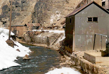
Southwestern Colorado officials said Friday that they are ready to talk to the Environmental Protection Agency about a federally financed Superfund cleanup of inactive mines, including one that spewed millions of gallons of wastewater and polluted rivers in three states this summer.
It would be an important step toward cleaning up hundreds of idle mines that have been pouring acidic wastewater into the Animas River north of Silverton for years. No laws required mine operators to mitigate environmental damage, and in many cases, the owners simply walked away when mining ceased.
“It’s a direction we’re heading in,” San Juan County Administrator Willie Tookey said of a Superfund designation…
“There really isn’t another process out there that could provide the financial resources for the environmental mitigation that’s needed,” Tookey said.
The Silverton Town Board and San Juan County commissioners are expected to vote Monday on resolutions that would formally open discussions with the EPA and state officials on a Superfund designation.
The EPA and the state have said they would not initiate a Superfund cleanup unless residents agreed.
Town and county officials visited four existing Superfund sites in Colorado this month and found that the process could be difficult but successful.
“When it’s all said and done, the improvements wouldn’t have been able to happen without Superfund, and ultimately it was worth the effort,” Tookey said.
Metropolitan Water District of Southern California, the nation’s largest drinking water distributor, bought nearly 13,000 acres of remote farms in July for $256 million, rattling farmers but giving it prized rights to the Colorado River.
___
WHY IS THE COLORADO RIVER SO IMPORTANT?
The river, which travels 1,400 miles from Colorado to northern Mexico, is the main source of water for an extremely dry region. In 1922, Upper Basin states of Colorado, New Mexico, Utah and Wyoming agreed to split deliveries with Lower Basin states of Arizona, California and Nevada. A 1944 treaty gave a fixed amount of water to Mexico.
The Colorado’s reservoirs — including the nation’s largest, Lake Mead, at Hoover Dam — can store 60 million acre feet of water, allowing wet years to position the region for drought.
When I first heard about a state water plan, I was skeptical as to how useful it would be. I thought about how notoriously difficult it can be to change water policy in Colorado; meetings are long, technical, and only have one person (among as many as 50) representing environmental interests.
However, two things made me optimistic about the plan.
First, the Executive Order required that the plan, and our water policies, reflect our water values. Second, the Colorado Water Conservation Board (CWCB) stated that we needed a water plan because “our current statewide water trajectory is neither desirable nor sustainable.” So the plan presented an opportunity for change.
Since Coloradans overwhelmingly prefer solving water challenges through conservation and recycling over diverting more water from our Western Slope rivers, we set out with four basic principles that guided our outreach to citizens and decision makers alike. The plan needed to:
Keep Colorado’s rivers healthy and flowing
Increase water conservation and recycling in our cities and towns (e.g., statewide conservation goal)
Modernize agriculture and water sharing practices
And avoid a new, large transmountain diversion.
We advocated strongly for these principles at water planning hearings, one-on-one meetings with designated planning representatives, and the public. We heard from roundtable members that they needed more information and data on how to best protect their streams. We heard pushback that a statewide conservation goal was impossible because it would be seen as a “mandate” and “one size fits all” requirement. We heard that more Colorado River water needed to be transported to the Front Range. We kept hearing these things but we kept pushing our principles.
We persevered.
Paddle Salute via The Weekender — Avery Johnson
This first iteration of Colorado Water Plan is an important step forward for Colorado because it reflects Coloradans’ values and priorities. The plan:
Sets the first-ever statewide urban water conservation goal;
Addresses the importance of preserving and restoring our rivers and streams including proposing annual funding for river assessments and restoration work;
Makes new, large, and controversial large trans-mountain diversions, which harm rivers and local communities, a lot less likely.
We are seeing conservation prioritized as never before, expanded language on reuse and water banking, and incentives and funding toward “alternative transfer methods” which replace water providers buying up agricultural land and then taking the irrigation water for municipal use. There is broad support for and a greater focus on stream health across the state including funding and the importance of preserving and restoring the environmental resiliency of our rivers and streams.
We’re excited about the plan and are now focusing our attention to getting it implemented.
The plan must be executed properly to be effective for Colorado. We also need more detailed and thorough water project evaluation criteria that determine which projects get state support (and which do not). We need to ensure that any tweaks to the state’s permitting authority maintains the strong environmental safeguards that protect our rivers and drinking water.
As the state implements this plan and looks to make changes to it, we will continue to advocate for what is best for Colorado and best for our rivers. Thanks to Governor Hickenlooper for tackling such a contentious issue as water and developing the first ever state plan!
In 2002, he left the lush southeast to become the landscape manager for the University of Northern Colorado right as the state hit a historic drought.
Water allowances plummeted. The football field was in such bad shape, the Broncos quit training there. And yet McDonald didn’t condemn the campus to crunchy brown shrubs and dead grass. He invested in drought-resistant native plants.
More than a decade later, almost 10 percent of the campus landscape is covered in these plants. Although there are a few cacti, there are tons of sage plants, prairie grasses and colorful bushes.
“That stuff’s thriving without extra water,” he said.
All of these practices fall under a gardening philosophy called xeriscape. Although the term can conjure images of a lawn full of gravel, most xeriscapes instead feature flora appropriate for limited and efficient water use.
Landscaping soaks up about half of Greeley’s water, and as demand continues to creep up on a stagnant supply, officials hope that sooner than later, more residents, even the bulk of them, can transform their own yards using the same kind of plants that a drought inspired McDonald to use at UNC.
According to Greeley’s records, per capita water consumption has decreased by 22 percent since 2002. Even so, as more people flock to the Front Range, officials now realize replacing shower heads and toilets won’t cut it.
Various departments teamed up to write the Landscape Policy Plan, a guidebook to establishing the programs and regulations needed to reduce outdoor water use. The guidebook, among other recommendations, asks residents to think beyond their thirsty bluegrass lawns and plant native, drought-resistant greenery.
The Greeley City Council hasn’t seen the plan. Department heads will present it later this month, and the council should decide whether to sign off on it by year’s end.
Although planners want to maintain a lot of what we’re used to seeing — tall shade trees, grassy fields for kids and pets — they’d like to see some change too.
These changes don’t have to be as drastic as one might think, City Manager Roy Otto said. The term “xeriscape” can dredge up images of a yard full of rocks and cacti. But that’s not what it means for northern Colorado.
Xeriscape calls for replacing imported plants with native ones, not getting rid of them altogether. The High Plains aren’t in a parched desert, Otto said, but they aren’t in the rain-drenched Midwest either.
FEEDING THE NEED
Greeley started as an agricultural community in a semi-arid climate.
Given that, officials always knew the value of conserving water: They put together the city’s first conservation plan in 1905, said Eric Reckentine, deputy director of Greeley Water and Sewer. The plan limited how often residents could water their lawns.
In the past 11 decades, ways to conserve have advanced. Greeley still has watering restrictions, but they’re more organized. Companies have developed more efficient toilets, washers, shower heads and irrigation systems, and the city issues rebates for residents who use them. The water and sewer department offers various educational materials and services, from DVDs to water audits.
Greeley has offered xeriscape services for years, and even has a few demonstration gardens, but as the demand for water continues to grow, it is getting more attention.
Planners project the Denver region’s population will grow from 3.5 million to almost 6.6 million people by 2050, according to city documents. That will grow water demand by 110,000 acre-feet. An acre-foot is roughly 326,000 gallons, how much an average household uses in a year. Even if all water storage projects are permitted and constructed — which studies show happens only 70 percent of the time — water suppliers can only get access to about 64,000 more acre-feet. Greeley officials, and others, are getting the message: There isn’t any more water.
STICKING AROUND
Natural brushes and prairie grasses won’t be the only green left in Greeley. Planners want to maintain some high water-use plants.
No one, for instance, is going to chop down all the trees, said Community Development Director Brad Mueller said.
“We know that trees perform an important function beyond looking nice,” he said.
Tree cover is one way to prevent what environmental scientists call heat islands.
When buildings, roads, and other infrastructure replace open land and vegetation, the surfaces that once let water soak through and stay moist become impermeable and dry. They soak up the heat and let it fester. These changes cause urban regions to become warmer than their rural surroundings, according to the Environmental Protection Agency.
It’s unreasonable to think there should be no areas with bluegrass, Mueller said. Wood chips and rough lavender gardens don’t make for a fun place to sit or play. People with children or pets should have some grass on their properties. Parks will have it, as well.
HOW XERISCAPE WORKS
Ruth Quade, the director of water conservation for Greeley, assembled a xeric demonstration garden outside of the city hall annex at 1100 10th St. to show residents they can start small.
It’s only a few yards long and about a yard wide. There are a few demonstration gardens in town, most of which are almost an acre in size, Quade said.
“It can be overwhelming,” she said.
Xeriscape as a practice has seven principles: plan ahead, limit turf areas, improve soil, irrigate efficiently, choose low water use plants, use mulch and maintain the landscape.
It sounds like a lot of work, but Quade said the downtown garden took about three days to set up.
Instead of working with a landscape architect on a plan or working to design one herself, she used a Garden in a Box kit from the Center for Resource Conservation. The sustainability-focused nonprofit offers a catalogue of xeric plant packages for about $100 (Greeley residents get a discount). It offers the plants, “plant-by-number” design instructions and a manual on how to care for them.
They also sell drip irrigation kits, which are a vital part of xeriscape. Instead of spraying the entire space, little hoses leak into a plant’s roots.
Using this system on a xeric garden instead of a traditional sprinkler on turf can reduce water use by up to 60 percent.
Another vital component is mulching. Although some xeric gardens use rock and gravel, many planners prefer organic mulches, such as wood chips. The mulch reduces weeds while protecting plants from harsh weather.
WHAT’S IN THE PLAN
The document going to city council this year doesn’t have any regulatory power. It defines policy goals to get each department and the city council on the same page going forward, Mueller said.
The plan has three parts: education, incentives and regulation.
Quade has worked on xeriscape education for years, she said. Her materials started getting more attention in 2002, when a harsh drought started.
Now she gets to expand her efforts. The demonstration garden was just the first in a line of projects she’s going to tackle.
One of the undertakings she’s most excited about is a website that would give landscapers and residents a guide to more than 300 drought-resistant, native plants.
Teaching people how to maintain those gardens is one of the city’s biggest opportunities, he said. After all, if you don’t know how to care for those plants, it won’t matter that you set it up.
Tearing up and replacing landscape is expensive, and officials hope to ease the burden by offering incentives like they do now for toilets and washing machines.
Regulations will change slowly.
Greeley already requires lawns be half covered in plants. That’s not going to change, Mueller said. Covering a lawn entirely in rocks would not only make the area hotter, but it would also look ugly.
New rules haven’t been pinned down. Officials are tossing a few ideas around, such as a cap on the amount of land the thirstiest plants can cover and a xeriscape certificate requirement for landscapers.
Many new regulations will only affect businesses at first, Mueller said. City agencies have more control over commercial projects than they do over private ones.
WHO ELSE?
UNC’s xeric goals were codified years ago in its own landscape master plan. It gave McDonald a directive: At least 25 percent of the new or renovated landscape has to be xeric. Now almost 8 percent of the campus is covered in low-water use plants, including a 5-acre demonstration garden.
Plants native to the Front Range are pretty easy to come by, he said.
That might be because xeriscape is becoming more popular.
Xeriscape demonstration garden at Denver Water
“We’re seeing a lot of improvement in the area,” said Mark Cassalia, a conservation specialist for Denver Water. “They’re really getting the bigger picture.”
The organization coined the term “xeriscape” in 1981 while working with Associated Landscape Contractors of Colorado. Now it’s taking off throughout the state and country.
“We’re actually paying a little money to help people change their landscape,” said Renee Davis, a water conservation specialist at the city of Fort Collins.
The city started a pilot program this summer to help residents change over to xeriscape. They focused on helping with design and helping buy plants. Next year, Davis said, they’re going to narrow their focus to plant acquisition and maintenance.
Rebates cover a small part of the plant cost. The goal: get residents who are on the fence to fall to the right side.
“We try to put in just a little money to get people excited and help them out,” Davis said.
They also offer guidance on keeping the plants healthy, especially regarding watering them.
“Replacing a toilet is something you can pay someone to do and it can take less than an hour,” Davis said. “Changing a landscape? Well, that’s more like a bathroom remodel.”
THE BEST way to protect Southern Colorado’s land and water from being dried up by urban development is the strategic use of conservation easements to preserve both environmental quality and the local economy.
Conservation groups already are investing wisely in preserving the environment, land and water in the San Luis Valley.
In the early years of this century, the Nature Conservancy, a national conservation group, supplied the impetus to permanently protect the Baca Ranch from greedy water speculators by jump-starting the $30 million purchase of the ranch. Congress followed by establishing the nearby Great Sand Dunes National Park and Preserve, thus preserving the valley’s great natural asset forever.
Other large ranches in the San Luis Valley are being protected by similar conservation efforts.
On Nov. 3, the Del Norte-based Rio Grande Headwaters Land Trust, Colorado Open Lands and the Western Rivers Conservancy announced creation of a $2 million San Luis Valley Conservation Fund. The goal is to take care of the land and water, as well as fish and wildlife habitat along the Rio Grande, through the valley.
Conservation will have a positive lasting effect on the San Luis Valley.
Now conservation groups need to cast their eyes east and north to the Lower Arkansas Valley. This agricultural region is living proof that farmers have been the first human contributors to conserving land and water of irreplaceable value to the economy, food production and natural wildlife habitat.
We appreciate the Palmer Land Trust’s promising plan that, in the trust’s own words, “focuses on a 1.75-million acre landscape in the western Lower Arkansas Valley. Delineated by the Arkansas River and its southern tributaries, the planning area extends from Canon City in the west to Rocky Ford in the east, and from the city of Pueblo in the north to Colorado City in the south.”
The Lower Arkansas Valley looks to Palmer Land Trust success and also needs others, such as the Nature Conservancy and Colorado Cattlemen’s Trust, to add their considerable weight to more extensive conservation easements.
Remember, farming and ranching are the most time-tested contributors to conservation of the environment — wildlife habitat, recreation and scenic vistas — that draw people to the beautiful state of Colorado.
The advantages of conservation easements are numerous, extending to farmers and ranchers, especially. They can receive outside income to commit to staying on the land in irrigated agriculture in perpetuity. It’s a great disincentive to settling for a one-time payoff from selling their permanent water rights to be transferred north to urban areas.
Conservation easements are a win-win proposition. Now we need the conservation experts to pitch in and help save the future of the Lower Arkansas Valley.
There are 16 pages in the Colorado Water Plan devoted to the “Critical Action Plan.”
With the action plan’s language lightly rinsed and boiled down, a recipe of potential solutions emerges. See below.
Reduce the projected 560,000 acre-foot gap between water supply and demand to zero.
To do this, the state will support new supply projects through the regional basin roundtables and will collaboratively manage the Colorado River against a compact call.
Achieve 400,000 acre-feet of water conservation by 2050.
To do this, the state suggests that cities develop integrated water conservation plans and that the legislature require efficient residential sprinklers.
By 2025, 75 percent of Coloradoans will live in communities that have incorporated water-savings actions into land-use planning.
To do this, the state will train interested local government officials on the subject.
Share at least 50,000 acre-feet of agricultural water using voluntary alternative transfer methods by 2030.
To do this, the state will educate farmers and ranchers about lease and sale options, encourage ditch-wide planning, fund irrigation repairs, develop “flow agreement” language, figure out how to track saved water in the river, and explore additional funding.
Attain 400,000 acre-feet of water storage through projects in the works.
To do this, the state will provide financial support for storage projects, prioritize loans and grants, try and streamline the permitting process, participant in the NEPA process, assign a lead state agency and sign an MOU with other involved state agencies.
Cover 80 percent of the locally prioritized lists of rivers with stream management plans by 2030.
And cover 80 percent of critical watersheds with watershed protection plans by 2030.
To do these things, the state will work to prevent listing under the Endangered Species Act, study recreation and develop stream management plans.
The state will also “develop common metrics for assessing the health and resiliency of watersheds, rivers and streams,” along with trying innovative techniques, providing support for watershed master plans, and prioritizing projects in master plans.
Investigate options to raise $100 million ($3 billion by 2030) starting in 2020.
To do this, the state will seek an amendment to expand the CWCB loan program to cover other projects, explore private-public partnerships, provide lower interest loans for projects, provide $1 million a year for stream management plans, and create a new all-in funding plan.
Engage Coloradoans statewide on at least five water challenges (identified by Colorado Water Conservation Board) that should be addressed by 2020.
To do this, the state will create a fund so basin roundtables can spend money on public relations, survey Colorado citizens on water, and create an innovation award program.
Under a category called “additional” the CWCB says it will produce the Statewide Water Supply Initiative 2016, which is already underway.
And that it will continue to work with the basin roundtables on their regional basin plans.
The CWCB will also plan for climate change disaster, work on re-use projects and quietly pursue necessary legislation.
Colorado adopted a landmark $20 billion water plan Thursday to try to accommodate rapid population growth by conserving more, reusing more, storing more and sharing more between farmers and cities — and diverting less from west to east across the mountains.
“Now is the time to rethink how we can be more efficient,” Gov. John Hickenlooper said at a ceremony embracing the roughly 480-page document…
State officials emphasized a practical consensus that emerged after a decade of river basin negotiations. In a drought-and-flood-prone West where clean water increasingly is coveted, they contend Colorado residents are best served by rallying around a common plan.
Hickenlooper urged immediate work with everybody chipping in to implement the plan: residents shortening showers, lawmakers cooperating to ensure funds and fine-tune laws, utilities thinking regionally about effects of diversions, and farmers forging alternatives to selling their water rights to cities.
And the governor swiftly placed the plan into the context of an intensifying Western water struggle.
“The Western governors have agreed that we’re all going to work on water together,” Hickenlooper said, referring to pressure California’s water crunch puts on an over-subscribed Colorado River. “None of us knows with any certainty how that drought is going to continue and spread.”
Front Range cities rely on 24 tunnels and ditches to divert an average of 262 billion gallons of water a year west-to-east across the Continental Divide. This practice depletes streams and rivers, hurting ecosystems.
Diverting more to satisfy growing Front Range urban needs ought to be “the last possible use,” Hickenlooper said, adding state leaders’ goal is “where the water is, it stays.”
Environment groups and utility officials agreed a unified state stand may help prevent the federal government and other Colorado River Basin states from driving water decisions.
“Colorado has the ability to greatly influence what happens along other stretches of the Colorado River,” said Jon Goldin-Dubois, president of Boulder-based Western Resource Advocates.
Putting forth an unprecedented, detailed state plan “gives Colorado leverage in those interstate conversations,” he said…
Denver Water manager Jim Lochhead, pointing to a 20 percent drop in water consumption over the past 10 years despite population growth, said water-saving goals can be reached “without sacrificing quality of life.”
Lochhead anticipated benefits of changing land use in cities. “As we get denser … that’s going to reduce our overall water use.”
The plan depends on voluntary compliance since the Colorado Water Conservation Board lacks regulatory power. Colorado’s state engineer and the state Department of Public Health and Environment are the main state regulators around water.
Hickenlooper said the plan, if implemented, will “create a motivating context” for using water more efficiently out of self-interest.
“I’m not a huge fan of regulation,” he said. “This is designed so that we won’t need as much of the formal regulation we have now.”
Colorado transmountain diversions via the University of Colorado
Hickenlooper’s administration encouraged water managers — and users — from around Colorado to formulate the plan over a two-year period. James Eklund, head of the Colorado Water Conservation Board, led the effort. He told Colorado Matters on Wednesday the state favors more “carrot” and less “stick” in its approach to achieving the storage, conservation, distribution and management.
For example: The plan sets a specific conservation goal for cities but not for agriculture.
“The reason we don’t set a conservation goal for agriculture is because the [agricultural] user has got to produce a crop,” he said. “And if you’re asking them to conserve water, that means they are fundamentally diverting less water and growing less crop. That is a private property right in Colorado.”
“The challenges that we face as a state on water are so large that we have to really be hitting on all cylanders.” Eklund said. That includes pushing for new legislation and executive rulemaking, starting with his request for more flexibility in how the Colorado Water Conservation Board can spend the money it gets in appropriations from lawmakers each year.
“This is a moment for Coloradans to be proud,” Eklund, said Thursday at the plan’s unveiling. “For 150 years water has been a source of conflict in our state.”
“Now is the time when you rethink how you can be more efficient in the water you use,” Hickenlooper said during a ceremony at History Colorado, which was chosen as a location to highlight the historical significance of the water plan.
“I do think the cultural shift is underway, and I think those conversations, and everyone looking at how they can use water more efficiently, is critical,” the governor said…
Even with the collaboration, fights emerged, with a group of Western Slope officials recently expressing concerns that the plan would lead to transmountain diversion, in which water from western Colorado is used for municipalities along the Front Range. But the governor said the plan would actually minimize a need to divert water from rural Colorado, which is critical to agricultural needs.
“There ought to be ways to make sure we have sufficient water to satisfy the growth along the Front Range without diverting the water across the mountains,” Hickenlooper said. “If we are successful in going through this water plan, it will not be necessary.”
April Montgomery, a member of the Water Conservation Board representing the San Miguel, Dolores, Animas and San Juan rivers in Southwest Colorado, who attended the ceremony, said a process has now been established in the hopes of avoiding transmountain diversion. Steps must first be taken before diversions are agreed upon, including considering protecting future growth, development and the environment…
In some ways, the work of the plan begins now. Officials must pursue projects that meet the municipal water gap, provide safe drinking water, prioritize conservation and promote reuse strategies. Ideas include reducing lawn watering and evaluating storage options.
But with a $20 billion price tag, crossing the finish line will be difficult. State lawmakers this year have been encouraged to get the ball rolling with funding and outlining projects. The Hickenlooper administration has been careful not to prescribe too much in the plan, instead creating a vision for policymakers to act on.
Sinjin Eberle, with Durango-based American Rivers, also attended the ceremony, expressing optimism the water plan will help agricultural interests in Southwest Colorado.
“Keeping more water in the rivers keeps more security and more predictability for agriculture and making agriculture more sustainable,” he said.
FromThe Grand Junction Daily Sentinel (Dennis Webb):
Years of efforts by countless Coloradans reached fruition this morning with the completion of Colorado’s first water plan.
The Colorado Water Conservation Board unanimously approved the plan.
The plan looks at potential gaps between supply and demand in future decades and addresses conservation, reuse, storage and other means of filling those gaps. A key, and controversial, component of the plan provides a framework for discussing possible further diversions of more Western Slope water to the Front Range.
Those involved in the plan say it is the product of the largest act of civic engagement in the state. Roundtable groups from individual river basins held numerous meetings on the plan, which also elicited more than 30,000 comments submitted by the public.
Gov. John Hickenlooper promised a “speedy review of this plan” Thursday morning after receiving Colorado’s first ever comprehensive state-wide water plan.
In remarks during a press conference at Historic Colorado, Hickenlooper emphasized the spirit of cooperation among Colorado’s disparate water interests in formulating the plan. He said that no longer will Colorado’s water needs be met at the expense of agriculture…
After the formal presentation, Diane Hoppe, chairwoman of the CWCB board of directors, told the Journal-Advocate that the plan is “a good way to look at our future.”
“This is a way forward,” Hoppe said. “This is how we deal with a growing population, and stretching our limited water resources.”
Joe Frank, general manager of the Lower South Platte Water Conservancy District, said he’s happy with the emphasis the plan places on off-channel water storage.
“The only way to capture all of the water that we’re losing is to dam the river, and that’s just not going to happen,” Frank said. “But water storage doesn’t have to be above ground, either. Underground storage, recharge and augmentation are also important.”
Don Ament, former Colorado Agriculture Commissioner who has represented Colorado in water negotiations with Nebraska, Wyoming, and the Department of the Interior in developing a recovery plan for the South Platte River, said he likes the plan because it dovetails with his group’s work.
“This is a big piece of the puzzle for what my group is doing,” Ament said after the news conference. “There is a lot of excitement (in the water community) about this, and I think it provides some good momentum to carry forward with developing our water resources. This is a real good thing.”
This morning [November 19, 2015] the final version of Colorado’s Water Plan was presented to Governor Hickenlooper. This final plan comes after a long history of water development in the state, a decade of state-coordinated cooperation between and within Colorado’s river basins and a 2013 directive from Governor Hickenlooper setting the Colorado Water Conservation Board on a hard-working fast-paced course to develop the water plan. The plan is a roadmap that intends to put the state and its eight major river basins on a more collaborative and cooperative path toward managing water in the face of constrained supplies and growing population.
Colorado’s population is predicted to grow exponentially, rising from around 5.4 million people in 2014 to between 8.3 and 9.1 million by 2050, according to predictions by Colorado’s State Demographer, as reported in the Colorado’s Water Plan issue of CFWE’s Headwaters magazine. If population grows as expected, and the state continued to fill those emerging needs without planning, the status quo would result in a water supply gap of up to 500,000 acre-feet by 2050, leaving the equivalent of some 2.5 million people’s water needs unmet, or met in undesirable ways. Then pile on the challenges of rising temperatures, drought, the unpredictability of climate change, and others… and the state’s water future looks increasingly uncertain.
So Colorado’s Water Plan set out to grapple with those water supply challenges and today reflects agreement from water interests statewide on broad, near-term actions needed to secure Colorado’s water future, according to the Colorado Water Conservation Board. Those actions include efforts to conserve and store water, additional water reuse and recycling, and providing options to agriculture to avoid permanent dry-up of farm and ranch operations. The plan includes a set of measurable objectives that provide goals regarding water for farms, for the environment, and for cities and industry. The Denver Post reports:
The plan contains:
• A water-saving target of 130 billion gallons a year for cities and industry, left largely on their own to cut water consumption using methods from low-flow appliances to limits on lawn irrigation.
• A goal of increasing reservoir and aquifer storage space for 130 billion gallons and encouraging re-use of wastewater.
• A framework for assessing possible unspecified new trans-mountain diversions of water from the western side of the Continental Divide, when conditions permit, to Front Range cities and suburbs.
• A proposal to develop stream and river protection plans to cover 80 percent of “critical watersheds” by 2030.
• A strategy for slowing the loss of irrigated agricultural land as Front Range utilities buy up water rights — which state officials said threatens 700,000 more acres, or 20 percent of currently irrigated acres statewide. The strategy is to facilitate temporary transfers during wet years with farmers and ranchers retaining water ownership.
• A goal of linking county land use planning with water supply planning so that, by 2025, 75 percent of residents live in communities where new development is tied to water availability.
• Proposals for streamlined permitting of water projects designated by state planners for official support.
And so implementation will begin, and as the state moves forward, the plan will continue to be a living document that will adapt to ever-changing circumstances. From ABC News:
WHAT’S NEXT?
State government doesn’t have the power to force the plan on anyone. Instead, it will depend on the help of local governments, water utilities and farmers and ranchers. The Legislature would also have to pass laws and appropriate money, and the executive branch would have to steer some of the initiatives.
The plan would also require cooperation between the eastern and western halves of the state, which are often at odds over water.
Still, the plan holds promise, said Jim Lochhead, manager of Denver Water, the state’s largest utility.
“The Colorado water plan is our state’s best hope for a secure water future,” he said.
Be sure to read the full plan here, stay involved as implementation begins, and thank the Colorado Water Conservation Board and Governor Hickenlooper for taking action toward a secure water future.
Here’s the release from Governor Hickenlooper’s office:
Gov. John Hickenlooper today was joined by James Eklund, Colorado Water Conservation Board (CWCB) Director, Dr. John Stulp, Senior Adviser to the Governor, CWCB Board members and many members of Colorado’s water community to celebrate the completion of Colorado’s Water Plan, calling the project a historic step for the state.
The plan is the product of an unprecedented level of collaboration and public participation spanning two and a half years.
“This is how Colorado works: together, in partnership, to tackle head-on our toughest challenges,” said Hickenlooper. “Today we turn a new page on Colorado’s long and adversarial history on water. Colorado’s Water Plan shows us how we can move forward together to ensure we continue to enjoy sufficient supplies for our vibrant cities, productive farms and incomparable environment.”
In the spring of 2013, Hickenlooper directed the Colorado Water Conservation Board to develop Colorado’s Water Plan, a roadmap that would put the state and its eight major river basins on a more collaborative and cooperative path to manage our water in the face of constrained supplies and growing population.
The Plan reflects grassroots discussions that began with the Basin Roundtable process in 2005. Key to the plan’s success, too, has been the steady participation and counsel of water providers, agricultural organizations, environmental groups, the General Assembly, local governments and the business community as well as more than 30,000 public comments geared specifically to Colorado’s Water Plan since 2013.
The completed Plan represents the consensus view from this process that Colorado must take a strategic, proactive and statewide approach to water or face or risk leaving the fate of our water to decisions and actions from outside interests, the federal government and other states within the Colorado River Basin.
“This is a moment for Coloradans to be proud,” said James Eklund, director of the CWCB. “For 150 years water has been a source of conflict in our state. More recently, that story is changing, and Colorado’s Water Plan – a product of literally thousands of meetings and conversations across our state – is the best evidence yet for a new way of doing our water business. We are talking to one another. We are forging relationships. Even those who may see water-related issues from very different perspectives have worked hard to understand other points of view. And that kind of understanding leads to an environment of civility that helps us cooperate in fashioning solutions.”
Colorado’s Water Plan grapples directly with water challenges and highlights necessary near-term actions, including efforts to conserve and store water, additional reuse and recycling of water and providing more options to agriculture to avoid permanent dry-up of our valuable farm and ranch operations. It also sets out a framework for discussion of any future projects that may propose to move water between basins.
The final version of the plan, building on comments across interests and geography, includes a set of measurable objectives that help us move forward and provide a sense, statewide, of the goals Colorado should set for addressing our water challenges.
“Colorado’s Water Plan leaves no mystery as to what Colorado’s water challenges are and why we have to address them as we grow the next five million people in the state,” said Jim Pokrandt, chairman of the Colorado River Basin Roundtable. “It is now up to all of us to take this information and fashion a balanced approach to meeting the water supply gap while protecting current water users on the Colorado River system, the West Slope’s recreational economy and the environment.”
“We all need to be willing to experiment, try new ideas, and even be willing to fail,” said Jim Lochhead, CEO/Manager of Denver Water. “The important thing is that this is our opportunity to move the state forward to chart a path toward water security.”
“Water’s not just one of our most valuable natural resources, it is, without question, our most valuable resource,” Hickenlooper said during the official release of the final water plan.
While the plan is complete, a number of the recommendations will need a law to make them a reality.
“There’s going to be issues around funding for some of the implementation we’re going to need the legislature’s help to make sure we have the right funding in the right places,” the governor said.
That means the upcoming legislative session could see some of the plan’s suggestions come up as proposed bills.
“In the short-term, near-term here, we need to address funding of water infrastructure in Colorado. We need to address conservation,” said James Eklund, director of the Colorado Water Conservation Board, which helped shape the plan.
So far, leaders aren’t specifying which recommendations may come up in the session.
“Better not to come up with specific requests until I’ve had a chance to talk to legislative leadership,” Hickenlooper said.
There’s also the question of how to fund potential water projects. The plan itself calls for a potential $20 billion in infrastructure work and programs during the coming decades.
“We’re certainly going to see all the details as we go forward, different suggestions for funding, but at a large price tag for not only environmental needs, but for infrastructure needs, we’re going to have to become innovative in how we look at this funding source,” said Abby Burk, with Audubon Rockies.
Map of the Northern Integrated Supply Project via Northern Water
From the Fort Collins Coloradoan (Jacy Marmaduke):
The final version of the Colorado Water Plan, unveiled Thursday in a standing room only Denver press conference, has some interesting, if uncertain, implications for the Northern Integrated Supply Project.
The plan is Colorado’s first statewide attempt to confront a projected water supply shortage of 560,000 acre-feet — enough to fill Horsetooth Reservoir three and a half times — by 2050.
Sources were reluctant to speculate on whether the plan’s water storage goals — adding 400,000 acre-feet of storage by 2050 and an 80 percent success rate for a group of proposed storage projects that includes NISP — mean the state will back NISP. The state cannot legally give NISP a thumbs-up until federal review of the long-debated proposal is complete.
But the pro-storage aspect of the plan, coupled with the state’s suggestions for increased permitting efficiency for large-scale storage projects like NISP, means the state is not openly opposed to this kind of project. That lack of opposition on principal could bode well for Northern Water’s plan to create two reservoirs yielding 40,000 acre feet of water annually to 15 participants. Most of the water would come from the Poudre River.
“They recognize the need for 400,000 additional acre-feet of storage,” Northern Water general manager Eric Wilkinson said. “We feel that NISP … would help meet a significant portion of that goal.”
Colorado’s government has two points of entry for NISP: The Colorado Parks and Wildlife Commission and the Colorado Water Conservation Board have to review and approve a Northern Water-produced fish and wildlife mitigation plan for the project. Wilkinson said that process is in the early stages.
And the Colorado Department of Public Health and Environment decides whether to grant the project a 401 certification, a safeguard measure for states to block dams and diversions if they interfere with the health of wetlands. The 401 certification process will come after — and if — the U.S. Army Corps of Engineers rules in favor of building NISP…
Groups including American Rivers, Audubon Rockies, Conservation Colorado, the Environmental Defense Fund and Western Resource Advocates praised the plan for its urban conservation goal, river health focus, collaborative nature and action-oriented methodology.
“There’s a lot of kumbaya,” said Western Resource Advocates’ water policy manager Drew Beckwith, who also commended the plan’s “higher hurdles” for controversial trans-mountain diversion projects and push for funding to meet water goals. The plan projects a $20 billion funding shortfall during the next 30 years but estimates that water providers will meet most of it…
In an emailed statement, WildEarth Guardians’ Wild Rivers Program Director Jen Pelz said the plan isn’t all “unicorns and rainbows.”
“The plan tries to be all things to all people,” she wrote. “To meet the projected ‘gap’ in Colorado water supply and demand, all water users need to be at the table in order to solve the problem. Even though agriculture uses 80 percent of the water from our state, somehow water leasing and acquisition programs to make up shortfalls or put water back in our rivers are not strongly committed to in the final plan.”
Rather, the plan sets a goal to share at least 50,000 acre-feet of agricultural water with municipalities via voluntary alternative transfer methods by 2030…
Carlyle Currier, vice president of the Colorado Farm Bureau and vice chairman of the Colorado Agricultural Water Alliance, said the absence of a conservation goal for agriculture was intentional. Agriculture focuses on efficient use of existing water supply rather than conservation, which Currier described as “doing less with less.”
“That’s not really an option with agriculture,” he said. “If you’re using less water, you’re producing less crops. Is that really what our goal should be? Producing less?”
Now that the plan is completed, the Colorado Water Conservation Board will oversee the completion of the plan’s critical action items. The board will provide annual progress reports to the governor and the Colorado General Assembly.
“Water in the West isn’t rocket science,” said James Eklund, director of the Colorado Water Conservation Board. “It’s more complicated, and it can be more volatile.”
Eklund said that like President John F. Kennedy, who set a goal for rocket scientists to reach the moon within a decade, the water plan sets a lofty expectation of bridging the gap of an estimated 500,000-acre-feet shortfall of water in 2050.
“It’s clear that without the vision, courage and the will of the chief executive, it wouldn’t have happened,” Eklund said. He thanked the governor for initiating the water planning in the spring of 2013.
The plan, however, isn’t binding to anyone or anything.
Hickenlooper called on everyone to pick up their portion of the plan and run with it.
Lawmakers will likely address some of the issues during the 2016 legislative session that begins Jan. 12. He asked lawmakers to draft bipartisan legislation that can realistically be passed in a bicameral General Assembly.
“We all share the responsibility of implementation,” Hickenlooper said. “Of taking all of this work and making sure that it is transformed into meaningful action.”
He said all Colorado water users need to rethink their consumption.
“My son and I last night discussed the length of showers,” he joked.
Hannah Holm, the coordinator of the Hutchins Water Center at Colorado Mesa University, has followed the plan’s development since 2013. As 80 percent of the the state’s water lies on the Western Slope, Holm said the Western Slope had two major concerns for the plan.
The first: will agriculture areas be dried up to go urban areas? Holm said the plan is attempting to implement tools for alternative transfer methods, which is when farms provide a portion of water on a temporary basis to urban areas, instead of selling water rights permanently. Holm said this prevents buying out and drying up specific pieces of land.
The second: transmountain diversion, where water is taken from the Western Slope and brought to the Eastern Slope. Holm said the plan does not contain any endorsement for any project like it.
After years of preparation, the Colorado Water Plan was released on Thursday, and local water officials are pleased.
The plan lays out the state’s water policy goals: more conservation and more storage. Instead of legislating, the plan is designed to get leaders at all levels on the same page about Colorado’s water future.
“Everybody’s happy today,” said Northern Water Spokesman Brian Werner. “This is a good thing.”
Northern Water is a public agency that services about 880,000 people in northern Colorado and supplies irrigation water for 640,000 acres of farmland.
“The part that we’re most pleased with is the piece about storage,” Werner said.
Northern is involved in the federal permitting process for two proposed projects: the Windy Gap Firming Project and Northern Integrated Supply Project, or NISP. These two projects jointly include three new storage reservoirs in northern Colorado.
He said he’s hoping the plan will encourage officials to work with the federal government to update the permitting process for projects such as NISP and Windy Gap. Now, the processes are expensive and time consuming.
“We’re going to be (spending) 12-15 years on these projects,” he said.
Time is of the essence when it comes to water supply in the West.
With its growing population, Colorado faces a shortfall of about 182 billion gallons a year by 2050, according to state projections.
The plan will set specific goals for water storage and conservation, which environmental experts herald.
“Coloradans overwhelmingly support water conservation, and we are pleased to see this plan proposing our state’s first ever urban conservation goal,” Theresa Conley of Conservation Colorado said in a news release. “The plan recognizes that to meet our future water needs we must change the status quo from focusing on new, large trans-mountain diversions to prioritizing conservation, reuse and recycling. We look forward to the governor moving forward and carrying out our state’s water plan to better protect our rivers and wildlife.”
It will also propose a way to let farmers and ranchers sell their water to municipal utilities for a specific length of time but allow them to resume using that water themselves in the future. That would avoid a practice called “buy and dry,” where utilities buy farms and ranches to get their water, permanently taking the land out of agricultural production.
The plan encourages local governments to combine their water planning and land use planning to reduce outdoor uses such as lawn watering and encourage water recycling.
It also encourages management plans for rivers and streams to keep their ecosystems healthy.
Gov. John Hickenlooper started the process in spring 2013, according a release from his office. He directed the Colorado Water Conservation Board to develop Colorado’s Water Plan, a road map that would put the state and its eight major river basins on a more collaborative and cooperative path to manage water in the face of constrained supplies and growing population.
State government doesn’t have the power to force the plan on anyone. Instead, it will depend on the help of local governments, water utilities and farmers and ranchers. The legislature also would have to pass laws and appropriate money, and the executive branch would have to steer some of the initiatives.
“Russell George was instrumental in developing the bill, HB 1177, which established the basin roundtables and started the process of each basin talking to the others,” Treese said. He added that there was still much work to be done. “It is a milestone, not the end result, of Russell’s vision.”[…]
The plan is non-binding, and Eklund said it will require several legislative, executive and perhaps even judicial actions to implement it, noting that Colorado is the only state in the country with a water court.
Hickenlooper agreed that the Legislature will have to play a part but stopped short of suggesting any specific bills. “I have learned over the last several legislative sessions that it is better not to come up with specific legislation until I speak to legislative leadership,” he said. However, he acknowledged that there will be “issues around funding and around projects that we will need legislative help on.”
Eklund spoke to a number of potential areas where the General Assembly could take action. During the press conference, he noted a bill signed by the governor two years ago, SB 14-103, to phase in high-efficiency water options for indoor water and suggested that a bill to expand that to outdoor water fixtures could be a possibility.
Eklund said that funding was likely to be the biggest legislative issue. He said that one action that could be pursued is a measure to provide “agility to the Conservation Board to fund infrastructure projects,” saying that, “if your issue isn’t protected in the constitution, the funding for it gets squeezed out by other items.” He added that, in order to implement the various aspects of the water plan, “We need that agility quickly.” He said the Board would use new funding to deploy loans and grants to individual districts for projects. He also noted, “Water has to be a part of any TABOR fix.”
Another potential legislative measure could include what Eklund called “more market competitive alternatives to ‘buy-and-dry’” transactions.
John McClow, a CWCB board member and representative for the Gunnison-Uncompahgre River District, said that he thinks that it may be premature for the upcoming session to take much action on the plan.
“We need a chance for legislators to digest this,” McClow said. “We need to get the big picture, and make sure that everyone’s interests are represented in the conversations. We don’t want to be helter-skelter on this.”
Former state Sen. Gail Schwartz agreed, saying the state needs to be very thoughtful. Calling the plan a “working document”, she said, “The General Assembly needs to be careful how it weighs in.” On the funding issue, Schwartz, whose senate district covered a large part of the inter-mountain West Slope, including Eagle, Gunnison and Pitkin Counties, said that severance tax needed to be part of the conversation.
“We need to protect severance tax, especially as we see it diminish,” she said, adding that severance funds “need to be put into water infrastructure.”[…]
Early reactions to the plan were generally favorable, including a statement from Denver Metro Chamber of Commerce President and CEO Kelly Brough. “I applaud the Colorado Water Conservation Board for leading a truly collaborative process that took feedback from business and the broader community and integrated it into the plan,” she said, adding that “the planners recognized there is no silver bullet to facing this challenge and take a holistic, all-of-the-above approach.”
Craig Mackey, co-director of Protect the Flows, a nonpartisan business coalition advancing water conservation, innovations and technologies, said in a statement, “We congratulate the governor and the Colorado Water Conservation Board on the release of this plan, an important first step in managing and conserving Colorado’s most precious resource.”
A difficult, two-year slog to every corner of the state has produced the state’s first water plan.
“This is how Colorado works: together, in partnership, to tackle head-on our toughest challenges,” said Gov. John Hickenlooper. “Today we turn a new page on Colorado’s long and adversarial history on water. Colorado’s Water Plan shows us how we can move forward together to ensure we continue to enjoy sufficient supplies for our vibrant cities, productive farms and incomparable environment.”
Hickenlooper received the plan he asked for in 2013 from the Colorado Water Conservation Board on Thursday, shortly after the board gave the plan its final blessing.
The final plan promotes a list of projects identified during the process, but does not give priority or funding to any of them. But it does establish measurable outcomes and timetables to meet general goals.
Among those:
Reducing the projected 2050 municipal and industrial water gap of 560,000 acre-feet to zero by 2030. This reflects the gap first identified in the 2004 Statewide Water Supply Initiative.
Achieving 400,000 acre-feet of urban conservation by 2050. It also sets a goal of 75 percent of Coloradans living in communities that have incorporated water-saving ideas into land use.
Developing voluntary temporary transfers to share at least 50,000 acre-feet of agricultural water by 2030. That opens the door to programs like the Arkansas Valley Super Ditch.
Attaining 400,000 acre-feet of additional storage by 2050. Much of that would come from projects already on the drawing board that have bobbed along in a sea of controversy for a decade or more.
Raising $100 million annually in additional revenue to fund water projects from 2020-50, a total of $3 billion. That addresses aging infrastructure issues that have continued to worsen.
Covering 80 percent of critical watershed health needs by 2030.
Developing the water plan involved numerous meetings throughout the state and generated 30,000 public comments. Along the way, it was criticized as cumbersome and not specific enough in its outcomes — adjustments the CWCB staff tried to correct along the way.
Even more importantly, the water plan presents a framework for continued discussions.
“We are talking to one another. We are forging relationships,” said James Eklund, CWCB executive director. “Even those who may see water-related issues from very different perspectives have worked hard to understand other points of view. And that kind of understanding leads to an environment of civility that helps us cooperate in fashioning solutions.”
The plan also soothed the ruffled feathers of most environmental groups, who say they have been ignored or discounted in previous water planning efforts.
“The plan represents a needed change from historic management practices,” said Carlos Fernandez, Colorado director of the Nature Conservancy. “In the face of diminishing supplies and increasing demands on our state’s water resources, the plan identifies innovative solutions for water management that reflect nearly a decade of grass-roots discussions.”
“Coloradans overwhelmingly support water conservation, and we are pleased to see this plan proposing our state’s first-ever urban conservation goal,” said Theresa Conley of Conservation Colorado. “The plan recognizes that to meet our future water needs we must change the status quo from focusing on new, large transmountain diversions to prioritizing conservation, reuse and recycling. We look forward to the governor moving forward and carrying out our state’s water plan to better protect our rivers and wildlife.”
Colorado- Governor John Hickenlooper Feb. 26, 2012. USDA Photo by Lance Cheung.
From email from Governor Hickenlooper’s office:
Gov. John Hickenlooper will be joined by James Eklund, Colorado Water Conservation Board (CWCB) Director, Dr. John Stulp, Senior Adviser to the Governor, CWCB Board members and many members of Colorado’s water community to present the final draft of Colorado’s Water Plan at the CWCB meeting at History Colorado Center on Thursday, Nov. 19.
The plan, representing feedback from thousands of stakeholders in both urban and rural communities and an array of agricultural interests, environmentalists, local governments, state lawmakers, business groups and water providers is the end result of the governor’s executive order issued in May of 2013.
WHAT:
Press conference with Gov. Hickenlooper and CWCB Director Eklund following the Colorado Water Conservation Board meeting.
WHEN:
Thursday, Nov. 19, 2015 at 10:00 a.m.
WHERE:
History Colorado Center, The Colorado Room, 1200 Broadway St., Denver.
Colorado officials are unveiling an unprecedented water plan, after a decade of statewide negotiations, that prioritizes water-saving in a $20 billion push to allow population growth in the face of huge projected shortfalls.
State water planners on Thursday will present a roughly 480-page document to Gov. John Hickenlooper.
“Our footing is better now than it has ever been,” Colorado Water Conservation Board director James Eklund said Wednesday.
Priority action for the coming year: figuring out funding. Most of the $20 billion needed by 2050 would be paid by Front Range water providers. State costs of $3 billion to $6 billion — or $100 million a year, Eklund said — could come from new fees, private funders or a water tax if voters approve.
The plan contains:
• A water-saving target of 130 billion gallons a year for cities and industry, left largely on their own to cut water consumption using methods from low-flow appliances to limits on lawn irrigation.
• A goal of increasing reservoir and aquifer storage space for 130 billion gallons and encouraging re-use of wastewater.
• A framework for assessing possible unspecified new trans-mountain diversions of water from the western side of the Continental Divide, when conditions permit, to Front Range cities and suburbs.
• A proposal to develop stream and river protection plans to cover 80 percent of “critical watersheds” by 2030.
• A strategy for slowing the loss of irrigated agricultural land as Front Range utilities buy up water rights — which state officials said threatens 700,000 more acres, or 20 percent of currently irrigated acres statewide. The strategy is to facilitate temporary transfers during wet years with farmers and ranchers retaining water ownership.
• A goal of linking county land use planning with water supply planning so that, by 2025, 75 percent of residents live in communities where new development is tied to water availability.
• Proposals for streamlined permitting of water projects designated by state planners for official support.
[…]
“The plan is as actionable as it politically can get,” said Eric Kuhn, manager of the Colorado River District, representing the western side of the state.
The key is how it will be carried out, Kuhn said. “Who decides what they will subsidize?”
Eklund said other priorities for the coming year include working out and facilitating an economically competitive way for farmers to transfer surplus water to cities.
“And we need to fix the permitting system,” Eklund said. “Everyone agrees it is broken.”
Denver Water manager Jim Lochhead noted measurable objectives in the plan. “Now we need to look toward implementation. The plan’s success will depend upon all of us — West Slope, East Slope, agriculture, municipalities and environmentalists — putting aside our individual interests and coming together to do what’s best for Colorado.”
Environment groups welcomed the plan as an important step forward.
It lays out “a new path for water management, a chance to change the status quo approaches,” Western Resources Advocates water program director Bart Miller said. “This will help us be better prepared for the future.”
On November 19, Colorado’s first state water plan will arrive on Governor John Hickenlooper’s desk. The final document is the product of discussions that began more than a decade ago in every corner of the state about how to use — and protect — Colorado’s rivers, lakes and aquifers.
The plan is significant in other ways as well. Colorado is among the last Western states to develop a comprehensive water plan, a sign that the realities of drought, climate change and growing populations are creating a new urgency for state-level planning.
In the West, water is a private commodity so the tendency used to be to “let things happen as they happen,” says Anne Castle, a senior fellow at the University of Colorado Boulder law school and former assistant secretary for water and energy at the Department of the Interior. Rights-holders could do whatever they wanted with their water, municipalities could go dig a tunnel or buy up farmland to serve their customers and, by and large, states didn’t interfere.
In Colorado, that attitude comes as no surprise. The state aborted its first attempt at a water plan back in early 1980s, a time when Denver Water, the largest – and most powerful – water provider in the state, was pushing to build the massive Two Forks Reservoir…
“They wanted to control their own destiny,” says Eric Kuhn, the general manager of the Colorado River District, which tries to protect Western Slope water.
The hands-off approach meant there was no overarching vision for how water development occurred in the region. But leaving everyone to their own devices only works for a while, says Castle. “It doesn’t work when your supplies are getting tighter and particularly when you’re projecting a gap in supply and demand.”
Colorado finally began planning efforts in 2013, after 14 years of drought and new forecasts that predicted as many as 2.5 million Coloradans could be without sufficient water supplies by 2050. So Governor Hickenlooper directed the Colorado Water Conservation Board (CWCB) to oversee the first statewide water plan.
At the time, other Western states were taking similar steps: Idaho and Oregon published state plans in 2012. California, whose plan dates back to 1957, released an updated version last year. But where other states did things top-down, Colorado took a more grassroots approach, asking committees in each of the state’s eight river basins, plus the Denver metropolitan area, to assess their needs, their gaps, and propose solutions. Colorado also opted for extensive public participation – soliciting tens of thousands of comments from across the state.
For Castle, that fact alone makes Colorado’s water plan stand out. In the old days, discussions about water took place behind in smoke-filled backroom meetings without public input. “The public process has been an important and unique part of it – messy though it is,” she says.
The plan itself is broad but thin. Though Colorado has a long history of local control over development, the Colorado plan is a first attempt to write a comprehensive narrative about water use that boosts the state’s influence in deciding actions to ensure water supply.
The need is urgent. Colorado, like other western states, is experiencing rapid ecological and social change. It is one of the fastest growing states in the country. Snowfall and precipitation are increasingly erratic and temperatures are rising. State planners forecast a municipal water supply shortfall by 2050 that could equal 560,000 acre-feet, or 60 percent more than current demand. Farmers and rural communities, accustomed to controlling most of the state’s water, now feel the pressure of urban growth as cities vie for new water supplies. Rafting guides, fishing groups, and environmental advocates worry that protections for river flows are too weak.
To ensure adequate water is available for all uses, the Colorado plan recommends a range of responses: increasing reservoir storage by raising the height of existing dams, investing in water-saving practices, and facilitating transfers of water from farms to cities in ways that do not shatter rural economies. The plan also attempts to calm the conflict between several combative constituencies: politically powerful cities on the Front Range that want more water diverted across the Continental Divide, mountain towns on the Western Slope of the Rockies that are leery of an urban water-grab, and the farm sector, which consumes 89 percent of the state’s water.
The plan will not endorse specific projects, such as a controversial diversion of water across the Rockies, according to James Eklund, the state’s chief water planner…
A number of changes were made to Colorado’s water plan since a second draft was published in July. The water board added a list of “measurable objectives,” which establish targets for the plan’s main strategies. The targets include:
400,000 acre-feet of municipal and industrial water conservation by 2050
400,000 acre-feet of new storage capacity by 2050
50,000 acre-feet of agricultural water transfers that do not permanently dry up farmland
Develop protection plans for 80 percent of critical watersheds by 2030
Raise $US 3 billion in state funding by 2050 to help implement the plan
Incorporate water planning into local land-use plans that cover at least 75 percent of the state’s population
“If we hit the measurable objectives, we’re going in the right direction,” Eklund told Circle of Blue. “We think that by addressing the supply side with storage and the demand side with conservation we can cut that deficit by 2030.”[…]
To implement the plan, a mix of new legislation, board policies, and local responses will be necessary. A number of actions will take place immediately following approval, to “strike while the iron is hot,” Eklund said. The state will begin assessing potential locations for storing water underground and for expanding existing reservoirs. Officials will work with local districts and utilities to boost conservation. They will also seek to lower the legal barriers for land fallowing agreements, temporary leases, and other means of temporarily moving water from farms to cities. Currently these methods require more paperwork and bureaucratic maneuvers than outright purchases of a water right.
The measures are necessary because consequential changes are coming. Colorado’s population is expected to swell by 73 percent by 2050, to 9.2 million. If the world keeps pumping carbon into the atmosphere, Denver’s climate may be more like Albuquerque’s by then. As such, completing the water plan only opens the door to more discussion and debate.
“It feels like we’re ending a marathon, crossing the finish line and having the gun go off for the next marathon,” Eklund said.
Efforts to restore the Alamosa River passed another milestone earlier this month when the water court in the San Luis Valley signed off on an in-stream-flow right.
The decree issued to the Alamosa Riverkeeper allows the storage of up to 2,000 acre-feet in Terrace Reservoir that can be released after irrigation season when the dam’s headgates would otherwise be closed.
“The development of a fishery has already started to revitalize the local economy and reconnect the community to the river,” said Cindy Medina of Alamosa Riverkeeper.
Medina’s group, along with the Colorado Water Conservation Board, applied for the right.
The restoration of the fishery comes more than three decades after pollution from the Summitville Mine created a dead zone on a stretch of the river above the reservoir.
The cleanup of Summitville and the installment of a permanent water-treatment plant there thanks to federal stimulus funds in 2009 improved water quality above the reservoir to allow for fish stocking.
The return of the fishery even prompted Jose Trujillo to open a bait and tackle in Capulin.
“The locals are very excited to see what the fishing conditions will be in the lower part of the river near town,” she said.
The in-stream-flow right could allow the fishery to improve below the reservoir by providing water to the river after the end of the traditional irrigation season.
The group currently holds about 500 acre-feet and would have to buy more water to reach the limit of the right.
Medina said the flows, which have been operated on a temporary permit, have extended the river enough to reach Gunbarrel Road, which sits roughly a mile west of Capulin.
She’s hopeful that once the riverkeeper has bought enough water to fulfill the right it would extend the river another 4 miles outside irrigation season.
In addition to restoring the river, Medina said the in-stream flows also would bolster groundwater levels in the area.
She said that fact helped gain the support of the Terrace Irrigation Co., which owns the reservoir, and other irrigators in the area.
Click on a thumbnail graphic below to view a gallery of snowpack data from the Natural Resources Conservation Service. At Tuesday’s CWCB Water Availability Task Force meeting Karl Wetlaufer reported that the NRCS has had some network problems this week so I haven’t included the Basin High/Low for the San Miguel, Dolores, Animas, and San Juan basins. The Westwide Snotel maps shows the sw corner of Colorado as coming in at 142% of the 1981-2010 median.
Westwide snotel map via the NRCS
Arkansas River Basin High/Low graph via the NRCS
Upper Colorado River Basin High/Low graph via the NRCS
Gunnison River Basin High/Low graph via the NRCS
Laramie and North Platte Basin High/Low graph via the NRCS
Upper Rio Grande River Basin High/Low graph via the NRCS
South Platte River Basin High/Low graph via the NRCS
Additional vital riverfront property is in the works to be permanently conserved along the Rio Grande.
Rio Grande Headwaters Land Trust (RiGHT), which has already conserved more than 25,000 acres along the Rio Grande and its tributaries , is currently working with Wayne and Sharon Nash on a conservation easement for the 200-acre Nash Ranch near Del Norte in Rio Grande County.
RiGHT Executive Director Nancy Butler presented an initial proposal to the Rio Grande Roundtable, which will be followed by a formal proposal in January, for funding support for the Nash Ranch conservation easement. RiGHT is seeking $100,000 towards the estimated $560,000 easement total from local and statewide Water Supply Reserve Accounts, funds derived from severance tax funds set aside for water projects throughout the state. Of the $100,000 request, $10,000 would be requested from the Rio Grande Roundtable basin funds and $90,000 from water funds administered statewide through the Colorado Water Conservation Board (CWCB.)
The remainder of the funds for the easement would come from landowner donation, about $200,000, and $100,000 grants each from the Gates Foundation, which has already been secured, and from Great Outdoors Colorado, which has not yet reviewed or approved funding.
“We have been really fortunate to bring a good match to our projects,” Butler said.
CWCB staffer Craig Godbout shared the amounts of funds available in the basin and statewide accounts and estimated how much would be added to those accounts in January. He said the Rio Grande Basin’s fund balance currently is more than $318,000, and this basin roundtable should receive $120,000 additional funding in January, if the severance tax is fully funded. The statewide account currently contains about $1.9 million and will double in January if the severance tax trust fund is fully funded.
Godbout added that the CWCB will consider the next round of requests from around the state in March and he knows of more than $1.8 million worth of requests that will be coming before that statewide water board at that time.
Butler reminded the Rio Grande Roundtable group of the multiple benefits generated through conservation easements on properties like the Nash Ranch and others that have been conserved already, such as the Gilmore, 4UR, Rainbow Trout and Garcia ranches.
These easements protect working farms and ranches, which are permitted and encouraged under the easements to continue with their historic uses. The landowner still owns and manages the property but complies with some stipulations laid out in the conservation easement.
The easements provide wildlife habitat, preserve scenic landscapes and protect water, one of the primary focuses pertinent to the Rio Grande Roundtable’s mission. The easements also protect the land from development.
Butler explained that all of the easements completed through RiGHT have been voluntary and incentive based. The Nashes approached RiGHT with a desire to protect their land and water, Butler added.
Natural arch in lava flow near Del Norte via the USFWS
So far, the only “statement of objection” filed in connection to the proposed Rio Grande Basin groundwater rules is one in favor of them.
Because of the way the response process is set up, all reactions to the rules must be submitted as “statements of objection.” However, “statements of objections” may be submitted in support of the rules.
Colorado Division of Water Resources Division 3 Engineer Craig Cotten said on Monday the only response filed so far in regard to the basin groundwater rules was a “statement of objection in support” by the Rio Grande Water Conservation District.
He said no objections against the rules have yet been filed.
During a recent water meeting Pat McDermott from the Division 3 office explained that if there are no objections to the rules as written, they will move forward through that meticulously worked its way through the rules over the course of about six years to try to iron out any problematic “wrinkles” in the rules before they were promulgated.
The public has also been involved during that process, with all of the advisory group meetings open.
Wolfe officially filed the groundwater rules on September 23 at the Alamosa County courthouse. The rules apply to hundreds of irrigation and municipal wells in the Rio Grande Basin, which encompasses the San Luis Valley. They set up the means to halt the drawdown of the Valley’s underground aquifers and restore the aquifers to more robust levels. They also are designed to protect senior surface water rights and Rio Grande Compact compliance. the water court for approval and implementation.
Objectors have a specific amount of time to file responses after the rules have been published. The rules have been published in newspapers as well as in the water court resume.
If there is opposition to the rules, the water division will try to work out issues with objectors short of a water court trial.
State Engineer Dick Wolfe is hoping to eliminate or at least minimize the number of objections to the rules and has gone to great lengths to accomplish that goal. He developed a large advisory group, for example, The rules are clear “that nothing in the rules is designed to allow an expanded or unauthorized use of water .”
The rules are also clear that they “are designed to allow withdrawals of groundwater while providing for the identification and replacement of injurious stream depletions and the achievement and maintenance of a Sustainable Water Supply in each aquifer system, while not unreasonably interfering with the state’s ability to fulfill its obligations under the Rio Grande Compact. The rules apply to all withdrawals of groundwater within Water Division No. 3, unless the withdrawal is specifically exempted by the rules, and the rules pertaining to the Irrigation Season apply to all irrigation water rights.”
McDermott reminded folks attending a recent Rio Grande Roundtable meeting that once the rules go into effect which could be sooner than later if there are no objections well irrigators will have a limited time to either join a water management sub-district or submit their own augmentation plans. Those measures will have to be taken in the next year or two.
By 2018, he added, the water division will have the ability to shut down wells that have not come into compliance under the rules.
“This is an exciting time,” he said. “It’s time for us to do the right thing. We have done it in Division 1 and 2, South Platte and the Arkansas, and it’s very important to get it down here.”
Part of the groundwater rules define the irrigation season for this basin, which ended in most parts of the Valley at midnight on November 1. Unless Cotten has good reason to decide otherwise, the irrigation season will run from April 1 to November 1 for all irrigators, including those using wells as their irrigation water sources.
On another note, McDermott said Colorado is in good shape with Rio Grande Compact compliance this year and may in fact over deliver the amount of water it is required to send downstream to New Mexico and Texas. This winter should bring a fair amount of moisture, McDermott added. He said the National Oceanic and Atmospheric Administration (NOAA) is predicting above normal precipitation and slightly below normal temperatures for the next several months in this region.
Pond on the Garcia Ranch via Rio Grande Headwaters Land Trust
Moderator’s Note: This is the first in a three part series plus a source bibliography. The author is Co-Founder and President of The Acequia Institute and prepared this report during August- September 2015. The report is intended as a contribution to local agricultural, scientific, and environmental education for Costilla County residents, farmers, and public officials. The information or views presented in this report do not reflect the official views or policies of The Acequia Institute or its Board of Directors and Officers or the University of Washington.
Geographical, Ecological, and Historical Context
Costilla County is in south central Colorado in an alpine desert steppe region known as the San Luis Valley (SLV); Figure 1 below. The county seat of San Luis is 60 miles north of Taos, New Mexico. Average annual rainfall is the same as California’s Death Valley (about 6 to 7 inches). The SLV steppe is ringed by the Sangre de Cristo Mountains (east) and the San Juan Mountains (west). The high country sustains deep snow pack used by farmers during the spring and summer snowmelt runoff season.
Emerging abruptly from the Valley floor, the frontal edge of the mountains presents dozens of peaks exceeding 3962 meters (13,000 ft) and 10 exceeding 4267 meters (14,000 ft) above sea level. The SLV intermountain ‘park’ itself has an average elevation of 2,407 meters (7,900 ft).
Fig. 1. San Luis Valley. In this perspective, S is on top. Costilla County is along the edge of the southeastern side of the Valley between the Sangre de Cristo sub-range known as the Culebra Mountains (on the E) and the Rio Grande (on the W); upper left quadrant within SLV on this map. Source: http://geogdata.scsun.edu.
The rapid elevation gain means that nearly every major life zone in North America is represented within an average ten-mile walk from Upper Sonoran (or cold) Desert to alpine tundra above timberline. These environmental conditions result in an average growing season of 100 to 120 days but the region is home to a robust agricultural sector and also hosts a significant source of indigenous agrobiodiversity in the form of local land race cultivars including maize, bean, and pumpkin/squash varieties.
The SLV is within ancestral Ute first nation territory and members of the Capote bands hunted bison, mule deer, antelope, and elk across the high steppe well into the 1850s. Armed entry by white settler cavalry began during the same period with the establishment of Ft. Massachusetts (1852-58) near present day Ft. Garland and resulted in the permanent expulsion of the Ute people from the Valley.
Today, the Southern Ute tribal reservation is limited to 1059 square miles in an area centered around the vicinity of Ignacio, and due southeast of Durango, Colorado. This is about 181 miles due west from San Luis, Costilla County across the San Juan Mountains. Some descendants of Ute-Mexican marriages still reside in the Valley’s diverse Indo-Hispano, Chicana/o and Mexicana/o rural villages and communities.
La merced
The Mexican government issued the Sangre de Cristo Land Grant in 1844 as part of a decades- long, liberal inspired process to confirm and secure Native Pueblo and community land grant rights involving common lands and private vara strips. The Colorado section of the grant is just north of the New Mexico border at Amalia-Costilla but strong cross-border family, social, and cultural ties prevail. The 1 million-acre land grant includes what today constitutes the entirety of the Culebra Mountain Range and associated acequia-irrigated agricultural bottomlands within Costilla County; see Figure 2 below.
Fig. 2. Mexican Land Grants in Colorado and New Mexico. The Baumann map depicted here mislabels these Mexican land grants as “Spanish”. Source: Paul R. Baumann 2001. SUNY-Oneonta.
The land grant (merced) led to the establishment of a diverse community of people whose ancestry can be traced to a bewildering amalgamation comprised of a minority of Spanish (mostly Mexican- or New Mexican-born Spaniards, or criollos) and a majority comprised of P’urhépecha, Tlaxcalteca, and Mestiza/o (Native Mexicans); Pueblo, Diné, and Jicarilla Apache (Native Americans); and Sephardic and other Mediterranean peoples; all of whom moved up from Mexico and New Mexico to permanently settle in the area comprising today’s Costilla and Conjeos County in Colorado as part of a combined native settler and indigenous diaspora.
These are deeply rooted place-based communities and many acequia farm families hail from mixed mestizo/o and genizaro (qua Christianized Indian) communities like Abiquiú which were established as ‘frontier border’ outposts when the area was still part of hotly contested New Mexico Territory prior to the U.S. invasion and usurpation of 1848. Pueblo intermarriages also run deep across the history of these families.
The 1848 Treaty of Guadalupe Hidalgo essentially defined Mexicans that chose to remain north of the new border as part of a pre-existing indigenous population with distinct rights. This included rights to common and private property in land and water, preservation of native language(s) and dialects, and full U.S. citizenship status.
The customary laws associated with the exercise of these rights, many of which were actually rooted in Pueblo Indian and other indigenous cultural traditions, were abrogated and systematically violated during one of the most scandalous episodes in the history of colonial dispossession and enclosure of Native Pueblo and Chicana/o land grants (Ebright 1994). Northern New Mexicans faced the notorious Santa Fe Ring and San Luis Valley acequieros had the U.S. Freehold Land and Immigration Co. as principal interloping usurper.
This was all part of a violent process of illegal expropriation and appropriation of Mexican land grants, in violation of Treaty rights, and reshaped the political geography of land tenure in what are now the U.S. Southwestern states of Colorado, New Mexico, and Arizona in addition to parts of the adjacent states of California, Texas, and Utah.
Despite cycles of enclosure and dispossession, the mostly mestiza/o and indigenous Culebra acequia villages established the first community irrigation ditch systems — or acequias — in the what is now the State of Colorado and did so well before the establishment of Colorado Territory (1861). The acequias are sustained to this day in part because of the power vested in militant attachment to the first 23 adjudicated water rights in the State, beginning with the San Luis Peoples Ditch which was dug by hand and draught animals in 1852.
Most of the upland common areas of the Sangre de Cristo Land Grant have been privatized. The one exception involves 80,000 acres in northeastern Taos County that are managed by land grant heirs as a common property in the New Mexico stretch of the merced. These heirs established the Rio Costilla Cooperative Livestock Association (RCCLA) and eventually purchased the acres in 1942. Livestock grazing (mostly cattle) was the primary focus at the start of this community- based cooperative endeavor but in the 1950’s the land began to be seen for its unique recreational values. In 1983, visitors were given the opportunity to hunt, fish and camp in designated portions of the ranch.
‘La Sierra’ portion of the land grant comprising originally all of what is now Costilla County, Colorado is the watershed that pertains to our struggles, and it also comprises approximately 80,000 acres (as seen in Appendix 1). This section has been the subject of a protracted land rights case that dates back to 1981 and is a response to violation of due process rights provoked during the violent 1960 enclosure by a North Carolina timber man and land speculator by the name of Jack T. Taylor.
Today, the heirs and successors of the Culebra acequia farm villages have access to La Sierra for the exercise of some of the original historic use rights (no subsistence hunting or fishing are allowed). But this instance of usufruct occurs within the enclosed boundaries of a ranch property that is still privately owned, now by wealthy billionaire investors from Texas.
In a historic 2002 ruling addressing the famous Lobato v. Taylor land rights case, the Colorado Supreme Court restored historic use rights to the heirs and successors to the 80,000-acre Colorado common lands of the Sangre de Cristo Land Grant (i.e., La Sierra). The veritable common lands of this merced, perhaps the largest to be restored in this manner anywhere in the world, are vital to the survival of the watershed-dependent acequia farmers and to the protection of the area residents’ strong sense of place and bioregional values. Some 500 families comprised of heirs and successors have access to the mountain range to gather fuel wood and construction materials and to use as pasture for livestock grazing.
Fig. 3. Sangre de Cristo Land Grant, La Sierra Common, and Subdivisions. La Sierra is the 80,000-acre common land or ejido. Map courtesy of High Country News at URL: https://www.hcn.org/issues/104/3250.
Finally, absentee real estate speculators have ruthlessly subdivided the dry land llanos (prairies) of central and far western Costilla County and while most of these lots remain vacant, in 2015 conflicts arose over land use regulations governing permits for septic tanks and home construction, camping rights and other issues; see Figure 3 above. These conflicts are the long shadow cast by the legacy of the enclosure of the common lands of the Sangre de Cristo land grant; under local customary law these lands were never intended or considered appropriate to permanent settlement by humans. Many of the inhabited lots are close to industrial monocultures in center-pivot sprinkler circles, some sown with GMO crops that present a landscape of polka- dot uniformity (Peña 2005).
Acequia Systems
The acequias are gravity driven snowmelt dependent community irrigation ditches. They are also among the oldest collective action institutions as constituted by the practices of local self- governance by tribal and non-tribal indigenous peoples in the U.S. Southwest. This is especially evident in the Rio Arriba or Upper Rio Grande watershed where Pueblo Indian and Chicana/o communities of northern New Mexico and south central Colorado sustain the acequia institution across a nine county area.
Acequia flood irrigated technology and the civic association of farmers for self government tied to water allocation practices both are rooted in antiquity with parallel and interlaced origins in the kuhls of Kangra (India), as-Saquiyas of the Middle East (Yemen) and North Africa, acequias of Andalusia, Spain, zanjas of Mexico (and the Philippines), and KwVo of Native American ancestral civilizations including nearby historic Pueblo communities at Taos, Okay Owingeh (San Juan), and other northern Pueblos. Research scholars have long celebrated the acequia as a sustainable, equitable, and resilient irrigation technology and an effective institution of collective action for farmer-directed management of local water resources.
Fig. 4. San Pedro Acequia. The headgate of the second oldest acequia in Colorado. Photo by Devon G. Peña
The acequia association is a self-organized instance of political and legal autonomy; Rivera (1998) has noted how in some cases the acequia is the only daily form of local government present in more remote and isolated mountain villages of New Mexico and Colorado. Acequias are widely celebrated as deeply rooted, time-tested “water democracies” and are considered a significant national and world heritage resource (Rivera 1998; Peña 1999, 2003, 2005; Hicks and Peña 2003, 2010; Rodriguez 2007).
In Colorado context, the customary common law of the acequia is “prior” to the dominant settler doctrine of prior appropriation, which arrived with Anglo settlers and specifically the hard rock miners of the ‘59er ‘Pikes Peak or Bust’ gold and silver rush. Acequia customary law and the post-territorial settler legal regime of prior appropriation are distinct and in many ways incompatible. For example, under acequia law voting rights on a given community irrigation ditch are based on the principle of “one irrigator, one vote”, which is indicative of an indigenous preoccupation with governance through consensus and equity.
In contrast, under prior appropriation, voting rights are allocated on the basis of proportional shares in the ditch (company) and this means that larger landowners tend to dominate governance and decision-making processes. Another key difference is that acequia customary practices for water allocation respect the ancient principle of “shared scarcity” while the prior doctrine imposes a newer inequitable system of priority calls in which only senior water rights receive water in times of drought.
Given this cultural, ecological, historical, and legal context, the Costilla County Land Use Code and the Costilla County Comprehensive Plan prioritized the adoption of rules and regulations to protect acequia farms and associated watershed values which are therein broadly construed as matters of legitimate state interest in order to promote the preservation of acequias as significant state and national cultural heritage resources; see Costilla County Land Use Code at §1.20.A.2 and Costilla County Comprehensive Plan at Policy ENR-14 (p. 24), Policy ENR-16 and Policy ENR-17 (p. 25).
These differences, and especially the historical status of acequia law as older than prior appropriation, were to some extent recognized and codified in 2009 when the Colorado legislature approved and the governor signed HB 09-1233, the Colorado Acequia Recognition Law. One local consequence of this new law is that the acequias are now able to act as bona fide sub-county consulting authorities involved in the review of county land use planning and zoning actions and regulations, especially those that impact watershed functioning in acequia-dependent agricultural communities like the Culebra watershed in Costilla County.
Testimony in support of the 2009 law recognized the value of the “ecosystem services” provided by acequias including the production of wetlands, creation of wildlife habitat and migration corridors, regeneration of soil horizons, and preservation of native agricultural biodiversity through the seed saving and plant breeding practices of acequia farmers (Peña 1999, 2003, 2005:81-85, 2009; 2015; Hicks and Peña 2003; Fernald, et al 2014).
Today, there are an estimated 200 acequias irrigating approximately 5000 farms distributed across the four counties of southern Colorado designated as eligible for inclusion under the 2009 law (Costilla, Conejos, Huerfano, and Las Animas). These farmers collectively irrigate some 70,000 acres of prime farmlands with significant additional acreage in wetlands created by the subsurface flows associated with acequia flood irrigation methods. Costilla County, the heart of acequia farming in Colorado, hosts 73 acequias managed by more than 350 family farmers who sustain 23,000 acres of field and row crops and more than 10,000 acres of sub-irrigated wetlands (Peña 2003; acreage estimates are based on official Costilla County Clerk data).
Moderator’s Note: This is the second in a three part series plus a source bibliography. The author is Co-Founder and President of The Acequia Institute and prepared this report during August- September 2015. The report is intended as a contribution to local agricultural, scientific, and environmental education for Costilla County residents, farmers, and public officials. The information or views presented in this report do not reflect the official views or policies of The Acequia Institute or its Board of Directors and Officers or the University of Washington.
What we are working to protect. Culebra-Gallegos maíz de concho grown at Acequia Institute farm in Viejo San Acacio. Photograph by Devon G. Peña
The Culebra Center of Origin and Agrobiodiversity
The acequia farmers of the southern SLV (Costilla and Conejos counties) are among the oldest non-tribal indigenous family farmers in the U.S. and are renowned for unique place-adapted heirloom land race maize, bean, and pumpkin/squash varieties.
These native crops are considered part of the land race populations of the extended Mesoamerican Center of Origin. The concept of ‘center of origin’ was first developed by the Russian scientist Nicolai Vavilov who identified several distinct biogeographical regions across the globe that are home to the wild ancestors of crops domesticated and diversified by indigenous farmers over millennia and remain places where the co-evolution of crops and wild ancestors persists as a direct result of surviving indigenous cultural selection and agroecological practices [our emphasis].i[i]
According to noted ethnobotanist, Gary P. Nabhan:
In the U.S. Southwest and northwestern Mexico, much of the land is arid. Indigenous agriculture persists here, in some places beyond where conventional modern agriculture is successful. In addition to the reason usually given for genetic conservation to preserve for future generations genes that may make commercial crop varieties less vulnerable to stresses and maladies there are others worth considering with regard to native crops of this binational region. (1985: 387-8).
Nabhan illustrates how “Aridoamerica” is an overlooked center of origin and diversity. Vavilov’s travels included vast stretches of Aridoamerica where he searched for and identified dozens of native land race crops developed and sustained by indigenous farmers with at least 25 plant species in advanced stages of domestication cultivated since well before European invasion and conquest (Nabhan 2011).
Centers of origin are also centers of diversity. We propose that this includes the San Luis Valley. Nabhan appears to include the Upper Sonoran desert country of the San Luis Valley (SLV) as a northern periphery sub-basin of Aridoamerica (1988: 393). More recent scientific research by Matsuoka, et al. (2002) squarely places the SLV within the center of origin and diversity of maize; see Figure 5 below.
Fig. 5. Center of origin teocintle and maize land race populations. The light blue dots include accessions from northern New Mexico and the San Luis Valley in Colorado. Source: Matsuoka, et al (2002).
As a center of origin and agrobiodiversity, the Culebra watershed acequia farms are recognized, above all, for their contributions to heirloom maize diversity and for sustaining several vanishing artisan production methods and practices involving the use of native crops. This is especially true of a maize white flint variety known as maíz de concho.
The ethnobotany of this white flint maize, which is used to make chicos del horno (adobe oven- roasted corn), is still a matter of research in-progress and only a very few published sources are available (for e.g., see Peña 2015). The Upper Rio Grande Hispano Farms study (1995-99) — co-directed by Dr. Devon G. Peña with funding from the National Endowment for the Humanities (NEH Grant RO-22707-94) and the Ford Foundation — included what is likely the first scientific field and lab research on the local white flint maize grown by acequia farmers in the Culebra watershed of Colorado.
The maize geneticist Ralph Bertrand-García of Colorado College did the field study in 1995. Bertrand-García (in-press) found that the white flint maize produced by the Corpus A. Gallegos amily in San Luis is a highly in-bred parent line, implying genetic purity and an absence of genes from commercial conventional hybrids. We note that when the field study was done there were no commercial plantings of GMO maize in the SLV.
Bertrand-García further suggests (in personal communication to the author) that Culebra maíz de concho shares morphological qualities and possibly gene sequence patches derived from ancient Anasazi corncob remnants found at sites across the desert Southwest (Mesa Verde, Chaco, Grand Gulch). Bertrand-García’s study supports oral histories in Costilla County declaring that the local white flint maize originally came from Anasazi ancestral maize populations via the modern-day Taos, San Juan, San Idelfonso, Picuris, and other northern Pueblos (Corpus A. Gallegos interview with Devon G. Peña, July 18, 1996; archived at The Acequia Institute). Today, seed exchanges with indigenous farmers in those communities continue.
The principal traits identified by Bertrand-García include three that are adaptive responses to conditions in high altitude cold desert environments with short growing seasons and late spring and early fall frosts. These include: (1) rapid development with average of 74-80 days to maturity (between sowing and harvesting); (2) resistance to desiccation and tissue damage from intense UV solar radiation at high altitude and early or late frosts; and (3) adaptation to diurnal temperature extremes with a daily average range between lows of 40°F and highs of 80°F during the growing season.
These qualities are significant traits, especially given the context of today’s climate change challenges. It would seem that the genomic integrity of the Culebra bioregional land race maize populations could be recognized as a national agrobiodiversity conservation priority.
Santistevan (2003) also describes the specific heirloom white flint used by acequia farmers as maíz de concho. Adopting the scientific name Zea mays clibanus for this population, he notes that the heirloom variety is grown in rotation or intercropped with maíz de diente, another local flint so named because farmers describe the kernels as “horse’s teeth”.
In our own field observations, we are seeing a variety of inbred parent lines as well as a constantly shifting mosaic of native chimera varieties incorporating morphological, adaptive, forage/biomass, nutritional, and culinary qualities valued by acequia communities. Some chimeras of two or more parent lines from local land races often have features expected separately in flint, dent, and flour maize land races. One of our own heirloom varieties, gifted to The Acequia Institute by Joe Gallegos of San Luis, Colorado, can be described as a “floury flint” because it can be used, depending on the timing of harvest, to produce chicos or pozol (hominy) as well as corn meal for masa harina through a process known as nixtamalization.ii[ii]
Chicos del horno has been listed by Slow Food USA as an endangered food in the Ark of Taste project. This designation includes concern for disappearing artisan craft skills to construct and maintain the crucial adobe ovens and place-based knowledge required to prepare the oven- roasted chicos for consumption or sale. Chicos remain a significant part of our “First Foods” and as an icon of our heritage cuisine. As such, chicos sit at the center of the ethnic foodways of bioregional acequiera/o culture.
Finally, maíz de concho varieties bred and sown by the acequia farmers of Costilla County bear living evidence of genetic affinity with wild ancestral forms. During the 2010 harvest cycle of maíz de concho at Almunyah de las Dos Acequias, the home of the Acequia Institute’s farm school and grassroots agroecological and permaculture field station, we sowed a seventh generation of Gallegos family heirloom white flint, the same parent line studied by Bertrand- García (in-press); we found two stalks that produced tunicate florescence instead of whole cob alignments of the maize kernels.
Figure 6 and 7 below present two images: First is a diagram from the classic study by Noble Laureate geneticist George W. Beadle (1980) on “The Ancestry of Corn”. In the diagram, (a) and (b) are designated ‘teocintle’; (c) is designated as a ‘tunicate’ (a mutation in which individual kernels remain aligned in separate single- or double-file instead of clustered on a cob); (d) is designated as a ‘primitive’ ear, and (e) is designated as ‘modern’ maize. Second is a photograph of the tunicate florescence that we keyed as an example of a tendency in our maíz de concho to revert back to wild ancestral forms. These occurrences are indicative of the close genomic affinity our in-bred land race varieties have with wild and intermediary relatives.
Fig. 6. Diagram of teocintle, tunicate, primitive, and modern maize. Source: Beadle (1980).Fig. 7. Tunicate white flint. From 2010 harvest at Almunyah Dos Acequias. Viejo San Acacio, CO. Compare with (c) in Fig. 6. Photograph by D. G. Peña
The photograph in Fig. 7 above shows the tunicate white flint mutation from our own accession of the Gallegos family parent line of Culebra maíz de concho and was collected during the 2010 harvest at Almunyah de las Dos Acequias Farm in Viejo San Acacio. Comparing this mutation with Beadle’s 1980 diagram suggests that the occurrence depicted in Fig. 7 above is an example of the regression/mutation of a local land race to an intermediate wild stage. This is substantive evidence of the legitimacy of center of origin land race status for Costilla County maize varieties like Culebra-Gallegos maíz de concho.
Local youth participate in the production of chicos del horno at Corpus A. Gallegos Ranch. San Luis, CO Photograph by Devon G. Peña
i[i] See Nabhan 2011 for a detailed study of Vavilov’s journey through northwestern Mexico and the American Southwest, a bioregion Nabhan describes as “Aridoamerica”.
ii[ii] A process for the preparation of maize in which the grain is soaked and cooked in an alkaline solution, usually limewater, and hulled; the process makes the lysine and other essential amino acids available to the human digestive system, maximizing the nutritional value of maize consumption, a point overlooked by many scientific specialists studying maize who repeat the mythic refrain about the malnourished state of so-called maize-dependent consumers.
…when climate scientists start predicting a loss of snow for Colorado’s high country, the ski resorts take notice. A Colorado Water Conservation Board report projects a “precipitous decline” in snowpack at elevations below 8,200 feet in the West by the middle of this century, and declines of about 10-20 percent at higher elevations. (The base of Arapahoe Basin is 10,780 feet. In Aspen, it’s about 7,800 feet.)
A different report by the National Resources Defense Council, a conservation advocacy group, paints one scenario in which the snowpack on Aspen Mountain, at 10,700 feet, will be confined to the top quarter of the peak.
Some Colorado ski resorts have long lobbied for climate change action. With the Paris Climate Talks kicking off at the end of the month, an alliance of snowsports businesses sounded the alarm to President Barack Obama:
2014 was the warmest year in the temperature record, and 2015 is on track to surpass it. Failure to act now on climate is unacceptable, and will result in damage to the environment, tourism and the economy. This is the greatest opportunity of our Jme. We need meaningful action from all, and it is time to act. The snowsports industry is doing our part as well to address climate change. We not only advocate for a stronger climate policy, but we’ve broadly implemented clean energy and energy efficiency measures throughout our businesses.
On one level, Colorado’s mountain resorts are trying to do their part to reduce waste and emissions that contribute to greenhouse gasses by adopting renewable energy systems like solar panels, changing snowmaking equipment to be more energy efficient, or introducing composting programs aimed at guests and workers alike to cut back on garbage sent to landfills. That’s what’s going on at Arapahoe Basin, as it tries to influence the ways in which its visitors think about climate change.
“We really just want people to have it in their mind, think about how their individual actions and day-to-day lifestyle choices really can have a big impact in a good or a bad way,” said Mike Nathan, A-Basin’s assistant manager of sustainability.
The Aspen Skiing Company is going one step further. On opening day this Thanksgiving, Vice President of Sustainability Auden Schendler says skiers will see signs on the mountain and on lifts that map out carbon dioxide emissions and rising temperatures. People will be encouraged to contact Congress and ask for action.
“It’s going to force a conversation about climate change, and it’s going to be a friendly conversation and an easy one. But it will be in your face,” said Schendler.
A $38.7 million budget that will mean a 3 percent rate increase for customers was approved Tuesday by the Pueblo Board of Water Works.
The rate increase will mean a little more than $1 per month increase for the typical customer.
The budget also sets rates for private fire protection, the Downtown water dispensing station and metered hydrant sales. Rates for water used outside service boundaries are 1.5 times higher.
Included in items related to the budget are a 0.79 cost-of-living increase for employees and other employee benefits. The benefits are negotiated year-round by committee and generate little friction.
“The staff should be commended for working year-round on the employee benefits package,” said board member Jim Gardner.
No one showed up to comment at the budget hearing, and most of the details already had been explained to the board at a workshop last week.
When planning suburban neighborhoods, for instance, a developer might buy land to set aside as habitat in exchange for encroaching on existing habitat. Image Credit: Roger Auch, USGS.
FromThe Colorado Statesman (State Sen. Ray Scott and state Rep. Don Coram):
As state senators and representatives from the Western Slope, we believe three policies must be given priority in the forthcoming Colorado’s Water Plan and this month we (along with Republican state Sens. Ellen Roberts and Randy Baumgardner and Republican state Reps. J. Paul Brown, Bob Rankin, Dan Thurlow, Yeulin Willett) sent a letter outlining these priorities to Gov. Hickenlooper on behalf of our constituents:
Keep Western Slope rivers healthy and flowing to protect the economic, environmental, and social well being of our communities. The Colorado Water Plan cannot place Front Range development interests over the autonomy, heritage and economy of Western Slope communities. New transmountain diversions of Western Slope water to the Front Range will damage our recreation-based economy, agriculture and the environment. The Front Range must demonstrate a commitment to effective conservation measures and exhausting its own available water supplies.
Prioritize water efficiency and conservation in Colorado’s cities and towns, including a municipal water conservation goal. Aggressive conservation and efficiency measures are necessary to stretch Colorado’s finite water supply, minimize agricultural buy-and-dry, and reduce the need for any additional transmountain diversions from the Western Slope. Many West Slope communities are already working to set high conservation standards. Setting municipal water conservation goals will reduce urban dependency on rural water rights, improve stream health, and protect water on the Western Slope.
Continue efforts to build consensus on creating voluntary flexible water-sharing agreements between farmers, ranchers and other water interests, while respecting property rights. The Colorado Water Plan discusses alternative transfer methods in some detail, although it mostly calls for further research and data measurement. We must find low cost solutions to voluntary actions that minimize litigation and water court costs, and facilitate the promotion of water-sharing agreements to minimize permanent water transfers from agricultural use.
These three water priorities mirror a consensus of many major Western Slope groups and others across our state. Club 20, Northwest Colorado Council of Governments Water Quality/Quantity Committee, the Associated Governments of Northwest Colorado, the Grand Valley water users, and the Western Slope Basin Roundtables have recognized agriculture, recreation and tourism as critical attributes to life on the Western Slope, and named conservation a top priority.
The Colorado Water Plan can be a much-needed blueprint for our water policy in the coming decades. The plan’s release later this month will mark only the beginning of a dialogue among Colorado residents and leaders about how best to implement that plan.
As we proceed with collective decisions to answer the needs of the Western Slope, our shared environment, and the state of Colorado, may all of us who love being here make our guiding principle an ever-present awareness that “we are in this together.”
State Sen. Ray Scott and state Rep. Don Coram were joined by state Sens. Randy Baumgardner and Ellen Roberts and state Reps. J. Paul Brown, Bob Rankin, Dan Thurlow, and Yeulin Willett in signing a letter to Gov. John Hickenlooper outlining these priorities for the Colorado Water Plan.
Eklund on why the plan sets a specific conservation goal for cities but not for agriculture:
“The reason we don’t set a conservation goal for agriculture is because the [agricultural] user has got to produce a crop. And if you’re asking them to conserve water, that means they are fundamentally diverting less water and growing less crop. That is a private property right in Colorado. So, if you want to ask them to get more efficient on the other hand, they can amortize that out over time, that investment to move from, you know, flood irrigation to sprinkler irrigation, they can absorb that cost over time and make a business case as to why they should improve their efficiency.”
On how the plan tries to protect flows in rivers across the state:
“We have about 1.5 percent of our rivers under some sort of a management plan… it’s very small… Yet that is where we find ourselves with watershed health and stream flow management. We’ve got to get better at that and we need to do it really rapidly, so that we know where we need to spend our money on environmental projects.”
On why the plan does not include penalties for falling short of the goals it sets:
“You look just to the West… California ended their year at 5 percent average snowpack, so we know that if you have to plan in a crisis, you sometimes have a really hard time at making everybody happy… Our plan, we believe, does quite a bit with the carrot approach.”
On what he hopes will happen after the plan’s release on Thursday:
“The challenges that we face as a state on water are so large that we have to really be hitting on all cylanders.” Eklund says that includes pushing for new legislation and executive rulemaking, starting with his request for more flexibility in how the Colorado Water Conservation Board can spend the money it gets in appropriations from lawmakers each year.
This image was taken during the peak outflow from the Gold King Mine spill at 10:57 a.m. Aug. 5. The waste-rock dump can be seen eroding on the right. Federal investigators placed blame for the blowout squarely on engineering errors made by the Environmental Protection Agency’s-contracted company in a 132-page report released Thursday [October 22, 2015]
For roughly two decades, Silverton has rebuffed federal Superfund dollars to clean up the scores of abandoned mines leaching contaminants into its surroundings.
But in the wake of the Gold King Mine spill, and under immense pressure from its downstream neighbors, the southwestern Colorado town’s leaders are now leaning toward endorsing the controversial remedy.
“If we want some remediation immediately, we’re going to have to go that way,” said Ernie Kuhlman, chairman of the San Juan County Commission. “I think our downstream partners — Durango, La Plata County and the Indian tribes — want something done immediately.”
The change in heart was tangible last week as Silverton’s elected officials, accompanied by representatives from neighboring communities, spent three days touring four of Colorado’s largest mine Superfund sites.
The weighing of a national hazard priority listing represents a major paradigm shift for the town, which up until the last several weeks had been working to find alternatives to Superfund. In August, Silverton officials sought an unprecedented congressional appropriation but were told it wasn’t viable.
The town has long worried a designation would bring with it negative economic impacts, bureaucratic red tape and stigma. While those fears remain, leaders now say Superfund appears their best — and perhaps only — option…
Visiting Superfund sites
State health officials say last week’s Superfund tour, requested by Silverton’s leaders, was an unusual but important measure to show those wary of the program how well it has worked elsewhere.
Colorado has a handful of Superfund sites in which the EPA has targeted mine pollution for cleanup. They include Leadville, Clear Creek and Gilpin counties, Minturn and a site near Creede.
All four, where work has led to dramatic increases in water quality and aquatic life, were visited by the Silverton group.
“We can talk about Superfund until we are blue in the face,” said Bill Murray, who oversees the EPA’s regional management of the program. “But what they really need to do is talk to people to know what it’s been like.”
While some officials — particularly in Leadville — told the contingency from Silverton that a Superfund designation can bring with it headaches, stakeholders all agreed it is the only option…
The sprawling, 18-square-mile Leadville Superfund project was one of the first to land on EPA’s national priorities list when it was designated in 1983. The initiative centers on efforts to address water and soil contamination.
While Leadville and Lake County leaders told Silverton representatives that Superfund has drastically removed waste, they also complained about disagreements with the agency and how long the EPA’s efforts have taken…
Over Tennessee Pass in the Eagle County town of Minturn, 65 miles of tunnels along the Eagle River turned the winding waterway orange for years until the site was designated Superfund in 1986. In 1991, a water treatment plant was built at the site to siphon the copper, zinc and cadmium leeching from the mine.
Brown trout populations have returned, and water quality has been improving.
“People here are thrilled,” said Willy Powell, Minturn’s interim town manager.
In Idaho Springs, where a treatment plant paid for with Superfund dollars cleans contaminated water, stakeholders said their inclusion on the national priorities list was unpopular but needed.
Clear Creek was soured by heavy metals before EPA remediation efforts began in 1983. The waterway now serves as a drinking source for more than 250,000 in the Denver area.
“We had no other choice,” said Nelson Fugate, a former Clear Creek County commissioner…
Sweetening the deal
The EPA is working to sweeten the Superfund deal for Silverton, agreeing not to include the town within any areas designated in a national priority listing.
State health officials say town leaders would have to endorse Superfund by the end of January for the town to be considered for designation in the spring.
The EPA says preliminary studies of the Upper Animas Mining District have shown it reaches the hazard threshold for a Superfund designation. However, more research would be needed to determine the scope of contamination.
Some in San Juan County complained that the solution is coming before the extent of the problem is known.
“We are being asked to put this on Superfund and be put on the national priorities list,” said Scott Fetchenhier, a San Juan County commissioner. “I want to see some scientific data that says, ‘This is a good idea.’ I think we are putting the chicken before the egg.”[…]
“We have to kind of look at the larger picture for the future,” said Monica Sheets, remediation program manager for the Colorado Department of Public Health and Environment, who led the tour. “We’re not going to push this approach on you. We just wanted to show you how this works in other communities.”
Honeybees are important pollinators, an ecosystem service that is not always adequately accounted for in traditional markets. Image credit: Marisa Lubeck, USGS.
From the United States Geological Survey (Alex Demas):
The invisible hand of the market might seem a strange player for environmental science, but it’s an emerging force for regulators and land managers. It’s these markets that have inspired USGS scientists Emily Pindilli and Frank Casey to explore how earth science and economics can join forces to achieve meaningful impacts for decision-makers.
Their research falls under a concept known as environmental markets. These markets won’t be found in Wall Street, but rather out on the landscape, as the natural environment provides many amenities that aren’t included in traditional markets. For example, when bees pollinate farmers’ crops, they’re providing an ecosystem service that benefits the farmer and society with a higher crop yield.
Emissions trading is one example of a market-based solution to an environmental problem. Image credit: Arnold Paul/Gralo via Wikipedia.
The Economics of Earth Science
So how does earth science fit in with the idea of environmental markets? The answer is information. Markets function most efficiently when buyers and sellers have as much information as possible. In the realm of environmental markets, that takes the form of scientific information about ecosystems, habitats, animals and plants, and other ecological players that help the environment operate.
USGS, then, is perfectly situated to provide information along those lines to emerging environmental markets. From water levels, use, and quality data from thousands of streamgages across the country to bird surveys that have spanned decades, USGS can provide important materials for these markets to function as effectively as possible. Agencies like the USDA’s Office of Environmental Markets can then take USGS data and use it to help foster and coordinate environmental markets.
However, that then raises the question of what kind of markets are being implemented and how do they work? Pindilli and Casey decided to take that on, using the lens of biodiversity to frame their investigation.
Sagebrush landscapes are important habitat for maintaining biodiversity in much of the United States. Image credit: Steve Knick, USGS.
In the Market for a Solution
Biodiversity is under increasing threat, both in the United States and all around the world. Species are going extinct at a rapid rate, which is an indication of the larger issue of biodiversity and habitat loss. Biodiversity and habitat provide important ecosystem functions and their loss represents a significant risk to the stability of these systems.
So how can environmental markets help protect biodiversity? A first, and significant, step is to understand the economic values associated with biodiversity. Even more important is to align those values with reasons to actually protect and restore biodiversity. Enter the concept of environmental markets. These markets are designed to allow environmental goods and services to be produced and traded similar to goods and services in traditional markets.
A good example of a created environmental market is the sulfur dioxide trading market. Here, a set number of sulfur dioxide credits are issued which caps sulfur dioxide emissions at a certain level each year. These credits can be traded between parties, with the idea being that some facilities can reduce emissions at a lower cost than others. Those facilities can then sell those credits to facilities who would otherwise have to pay even more money to reduce emissions. By making money from the sale of the credits, those facilities that could most cost-effectively reduce emissions have a good reason to do so. This is a win-win, whereby the environmental goal is attained and it is accomplished at the lowest cost.
In the United States, there are a number of other developing environmental markets and similar mechanisms that seek to leverage market forces to achieve environmental goals. There are emerging markets in water quality, carbon emissions, wetland preservation, and for species and habitat protection. Among these are a number of market-based or market-like approaches that can benefit biodiversity. The USGS has recently evaluated the status and potential of the following mechanisms:
Bats provide important pest control by eating insects, and threats to their biodiversity imperil that ecosystem service. Photo credit: Paul Cryan, USGS.
Getting What You Pay For
The first approach is known as “Payments for Ecosystem Services.” Here, a “buyer” pays a “seller” for the ecosystem service of biodiversity. The “buyer” may be anyone, such as the Federal government, a State agency, a local community, a non-profit, or even a business, while the “seller” is the individual or business that will supply protections for species and their habitats. An example of this approach might be a conservation stewardship program that pays farmers to set some land aside for wildlife, or maintain the riverbanks with trees to shelter fish. The least like a traditional market, payments for ecosystem services are essentially contracts that provide incentives to potential biodiversity suppliers with payments that don’t necessarily reflect a market-value.
The Ohlone Reserve Conservation Bank in California, one of the many conservation banks run by the U.S. Fish and Wildlife Service. Photo credit: Robert Fletcher, Ohlone Preserve Conservation Bank
Conservation Banking
The next approach is explicitly market-based: regulations are set up that lay the foundations for a market that includes property rights to an environmental amenity and the ability to trade. One of the best examples for biodiversity is the Conservation Banking Program run by the U.S. Fish and Wildlife Service. Conservation banks are areas of habitat that are protected and managed to meet the needs of one or more threatened species in perpetuity. These banks must be approved by the FWS under stringent protocols. With this approval, the banks can sell ‘habitat’ or ‘species’ credits. Demand for credits comes from developers that are required to mitigate actions like building roads that may negatively affect threatened species and their habitats under the authority of the Endangered Species Act.
When planning suburban neighborhoods, for instance, a developer might buy land to set aside as habitat in exchange for encroaching on existing habitat. Image Credit: Roger Auch, USGS.
Beyond the Bank
Taking the concept of the conservation banks even further, there’s the idea of habitat exchanges. The concept of a habitat exchange is to extend the conservation banking approach to protect species or habitats that are not currently federally listed as threatened. Habitat exchanges also seek to streamline the conservation bank approval process by developing and implementing Habitat Quantification Tools. These tools are used to standardize the evaluation of the number of credits on a given plot of land and increase certainty and transparency for landowners. Habitat exchanges are an emerging concept and demonstration on the landscape has yet to be fully implemented.
Organic labeling is one such example of using a label to educate consumers.
It’s all in the Label
The last market-based approach evaluated goes in a different direction: the idea of eco-labeling, similar to the concepts of organic and fair-trade labeling currently seen in grocery stores. Farmers, ranchers, and others can take actions that help protect biodiversity, and in so doing receive an accreditation and label their products to signify that they are protecting biodiversity. People can then reward these businesses by selecting these ‘green products’ over comparable items, even if they cost a bit more. That extra cost compensates the farmers, ranchers, and others for implementing biodiversity protecting practices. Eco-labelling is the most like a traditional market.
The confluence of Cement Creek, at right, and the Animas River, left, as seen September 2015 in Silverton, Colo. This is where the plume of contaminated water from the Gold King Mine entered the Animas River. (Jon Austria — The Daily Times)
From the Associated Press (Dan Elliot) via ABC News:
A federal agency on Monday stood behind its assertion that Colorado officials signed off on a cleanup project that led to a 3 million-gallon toxic waste spill from an inactive gold mine.
The U.S. Bureau of Reclamation’s statement was the latest twist in a dispute between state and federal agencies over what role Colorado officials had in the spill.
The federal agencies have said two state mining experts endorsed the project and agreed with federal officials from the scene that there was little threat of a massive spill. But in a letter made public last week, Colorado officials denied those claims…
In separate reports, the EPA said the state experts agreed the water inside the mine was under little or no pressure, and the Bureau of Reclamation — which conducted an outside technical review of the spill — said the state experts signed off on the plan to insert the drain pipe.
The state experts were from the Division of Reclamation, Mining and Safety, part of the state Department of Natural Resources. Natural Resources Director Mike King wrote in a Sept. 2 letter to the EPA’s inspector general that the state experts didn’t make any determination of the water pressure and didn’t approve or disapprove of the drain pipe plan.
The Associated Press obtained the letter last week through an open records request.
The Bureau of Reclamation had not previously commented on King’s letter. On Monday, bureau spokesman Peter Soeth said the information in the report came from the Division of Reclamation, Mining and Safety. He said he couldn’t be more specific.
EPA officials have said they’re reviewing King’s letter.
Joe Frank, general manager of the Lower South Platte Water Conservancy District, was involved in writing the plan. He was on one of two South Platte Basin roundtable committees — the other represented the interests of the Denver metro South Platte users — that helped the IBCC formulate the plan.
Frank said while he hasn’t yet seen the final draft of the plan — no one will until it’s unveiled later this week — he’s happy with the direction it is taking. He said he thought a previous draft, on which the public has been commenting for several months, didn’t put enough emphasis on new storage projects.
“I’ve heard through staff members that they’ve taken our comments to heart,” Frank said. “The state has written a whole new chapter on storage (for the final draft.) Of course, funding is a big question on that, but at least now there is a direction.”
Frank said the importance of the comprehensive water plan can’t be overstated.
“It’s out there, and it’s a living document, and I hope stakeholders in water will take a piece of it and say, ‘I’m interested in that,’ and go out and implement it,” he said.
While the plan signals a new direction in cooperation, especially among the state’s eight river basins, it can’t replace necessary water litigation.
“Litigation is necessary to protect water rights, but with the plan out there, hopefully this is the new norm of groups getting together and negotiating it and not just fighting over it,” he said.
Don Ament, former Colorado Agriculture Commissioner who has represented Colorado in water negotiations with Nebraska, Wyoming, and the Department of the Interior in developing a recovery plan for the South Platte River, said he likes the plan because it dovetails with his group’s work.
“I like it because the governor has said we’re not going to make agriculture the default for our shortages,” Ament said. “We have shortages, primarily for municipalities, and they’ve bought water and will continue to (buy water) if we don’t harness some of that leaving the state. We’re faced with buy and dry on ag land.”
Ament referred to the practice of municipalities buying agricultural land with senior irrigation water rights and using the water to supplement domestic water use. Cities like Parker and Sterling have bought thousands of acres of river-irrigated farmland in Logan County for the purpose of using the water and allowing the land to “go dry.”
Ament said current management practices have allowed 4 million acre feet of water to run out of Colorado on the South Platte in the past six years. Only 500,000 acre feet was attributed to flooding in 2013.
“The water plan asks each basin to come up with their own plans on how to make up shortages in their own basins,” Ament said.
The water plan will be delivered to Gov. Hickenlooper Thursday morning at a press conference at 10 a.m. at History Colorado in downtown Denver.
Colorado Water Plan website screen shot November 1, 2013
Pikes Peak with Garden of the Gods in the foreground FromThe Colorado Springs Gazette (Ryan Maye Handy):
…despite the painstaking work of people in nine water basins, multiple drafts, dozens of public meetings, and pushback from utility companies, the water plan is not a panacea. To the question of where Colorado’s extra water will come from, there is no simple answer.
“We know there is not a silver bullet, at least not one that we have found,” Eklund said.
Colorado is one of the last Western states to develop a water plan, although water planning on a smaller scale has been going on for decades. Colorado’s Rocky Mountain spine is the headwaters for several major rivers that flow into 18 states, and water here has always been carefully watched.
The state has been credited as the birthplace of water law, after battles between miners and farmers over water rights broke out in the 19th century.
In the modern era, water uses are heavily regulated and litigated – but the state has never had a comprehensive plan for future water use, one that balances its opposing interests.
Since the plan began to compile information in 2013, it has had to juggle the disparate interests of nine water basins, which are home to big cities, rivers, farmland and rural communities. Residents in the Western Slope basins closely watch the Colorado River – which provides much-needed water to California – and push against channeling their water over to the Front Range. The South Platte basin, the state’s largest that covers the entirety of northern Colorado, is desperate for more water for it’s growing cities, and is looking to the Western Slope and to agriculture to provide some of it. Meanwhile, the Arkansas basin, home to Colorado Springs, has a little bit of everything – a dependence on Western Slope water, the state’s second largest city and agriculture that gives $1.5 billion every year to the local economy.
The solution to filling the water gap will come from a mixture of all of these – water from the Western Slope, from farmlands and from cities.
Some of the most scathing commentary of the plan has come from Colorado Springs Utilities, a water manager for the state’s second largest watershed, the Arkansas River basin. Despite the years of work, Utilities feels that the plan has done little more than create a rushed document that delivers a list of “don’ts” instead of a path forward for the future of water.
While Eklund defends the plan as something that is meant to be acted on, the plan’s suggestions are not binding without executive orders or legislation, he said. Because of this, Utilities believes that plan falls short of giving the state a clear direction when it comes to water.
“Without a firm and clear policy statement … the rest of the document is a directionless recitation of guardrails without a road,” wrote Utilities officials in a public commentary submitted in September, when the last draft of the plan was released.
The commentary also criticized the plan as being biased against municipal water use, and not having enough detail on building more water storage, one of Utilities’ preferred methods for girding the state’s growing population against water loss.
Utilities did praise the plan for putting together an impressive collection of water information. However, it also has said that the plan also slowed it’s regular water planning processes.
Despite Utilities’ tone, many of its suggestions resonated with concerns from others around the state. One major consensus to come out of the water plan is that the permitting system for building projects like the Southern Delivery System is broken, Eklund said. Projects like that can take decades and millions of dollars to get approved, both things that need to be cut.
For Eklund, the plan is more than just a collection of problems – it does offer solutions and ways forward for Colorado’s diverse water community. Eklund also thinks of the plan as a living document; once water board members vote on the plan on Thursday, it will continue to be updated and changed. To Eklund’s knowledge, the plan is also the largest civic engagement process the state has undertaken, a process that involved responding to every single one of the 30,000 comments received.
He is confident that Utilities will be happy with the final plan.
“We will just have to wait and see,” said Steve Berry, a spokesman for Utilities, on Sunday night.
“You know how these things go – they never reflect all of your feedback. The good thing is that we have a record of our thoughts on it, and that’s permanent, and that always been looked back on.”
From the Colorado College State of the Rockies Project:
Wednesday, November 18th, 2015 at 7:00 pm, Richard F. Celeste Theater, Cornerstone Arts Center
The Great Divide: The Destiny of the West is Written in the Headwaters of the Colorado
Jim Havey, Producer of The Great Divide, Havey Productions
The Great Divide, a feature length documentary film from the Emmy award winning team of Havey Productions, in association with Colorado Humanities, will illustrate the timeless influence of water in both connecting and dividing an arid state and region. From Ancient Puebloan cultures and the gold rush origins of Colorado water law to agriculture, dams, diversions and conservation; the film will reveal today’s critical need to cross “the great divide,” replacing conflict with cooperation. Producer Jim Havey will discuss the making of the film and answer questions after the showing.
From the Eagle River Watershed Council (Kate Burchenal):
While the West has transformed and evolved greatly since the pioneer days, mining laws remain largely unchanged. Hardrock mining and extraction is, to this day, governed by President Ulysses S. Grant’s General Mining Law of 1872.
Five U.S. Senators, including Sen. Michael Bennet of Colorado, have introduced the Hardrock Mining and Reclamation Act of 2015 in an attempt to reform that 140-year-old law and provide a modern mechanism by which we might cleanup abandoned mines throughout the West.
Colorado’s past and present are intricately tied to the hardrock mining industry. In the late-1800s, pioneers ventured West in search of storied riches awaiting discovery beneath the earth. The pioneers were by no means the first people to occupy the land, but their capacity for appropriating and shaping the land far exceeded the practices of their Native American predecessors. Beginning with the Pike’s Peak Gold Rush in 1858 and lasting for decades, Colorado experienced an enormous population boom as people flocked to the area in search of gold, silver and other valuable minerals.
Today, mining still plays a large role in our economy, and active as well as abandoned mines dot the landscape. It is estimated that there are currently 7,100 abandoned mines in Colorado, more than 200 of which are collectively leaking thousands of gallons of acid mine drainage every minute.
“Disastrous spills like the Gold King Mine blowout are easy to see, but the unnoticed toxins leaking out of thousands of abandoned mines are doing enormous damage to our watersheds every day,” said Sen. Martin Heinrich of New Mexico.
Throughout the West, estimates soar upwards of 500,000 abandoned mines.
Under current law, companies can extract gold, silver, copper, uranium and other minerals from public land without paying any federal royalties. This is one of the last vestiges of the old public land giveaways that enticed and encouraged people to settle the Wild West. Oil, gas and coal companies, on the other hand, pay annual rental payments for extraction activities on public lands.
“Hardrock mining companies have enjoyed a sweetheart deal for nearly 150 years, leaving taxpayers on the hook to clean up hundreds of thousands of abandoned mines leaking toxins and threatening communities across the West,” said Sen. Tom Udall of New Mexico, who has been pushing for mining reform since he gained federal public office in 1998.
Current funding mechanisms fall far short of the tens of billions of dollars needed to clean up harmful mines around the West. A major component of the new bill would be the creation of a Hardrock Minerals Reclamation Fund, under which new mining companies would pay annual royalties into fund totaling 2 to 5 percent of gross income. In addition, new and existing active mines would pay reclamation fees totaling 0.6 to 2 percent of gross income. The fees alone are expected to generate upwards of $100 million annually. The Reclamation Fund would provide resources to aid abandoned mine reclamation projects and would be distributed to states, tribes and other organizations through a grant program.
WON’T IMPACT EAGLE MINE
Before the questions come pouring in, I will make it plain that this law would have zero impact on the cleanup effort underway at the Eagle Mine.
First of all, the new act has no retroactive power. Owners of inactive and abandoned mines would not pay fees or royalties; only active mining operations, both new and existing, would contribute to the Reclamation Fund.
Secondly, the royalties would not be sufficient to cover all abandoned mine cleanups, thus the distribution of funds will be prioritized to reflect immediate needs. We are extremely fortunate to have a willing and able responsible party at the Eagle Mine who has been an active partner in the cleanup effort for nearly three decades. In places around the state where there is no active responsible party, taxpayers (read: you and me) are footing the cleanup bill. The 2015 Act aims to shift the financial responsibility from taxpayers to mine operators; it is not intended to help responsible parties conduct ongoing cleanup efforts.
The Colorado Mining Association has released statements expressing concern with the new law. Stuart Sanderson, President of CMA, says the proposed legislation “doesn’t provide workable solutions associated with abandoned historic mines that operated prior to the era of modern mining regulation.”
While the Hardrock Mining and Reclamation Act of 2015 will not be a panacea capable of reversing the harmful legacy of mining in the West, we believe it is a step in the right direction.
Kate Burchenal is the education and outreach coordinator for Eagle River Watershed Council. The Watershed Council has a mission to advocate for the health and conservation of the Upper Colorado and Eagle River basins through research, education and projects. Contact the Watershed Council at 970-827-5406 or visit http://www.erwc.org.
From the Crested Butte Land Trust (Mark Reaman) via The Crested Butte News:
Heavy equipment started rumbling around Peanut Lake this week for a fall restoration project.
Work has begun by the Crested Butte Land Trust (CBLT) to shore up the lake. The Riparian Restoration Project is meant to reduce the risk of a breach of the lake, located just west of Crested Butte below the Lower Loop trail. A natural riparian floodplain buffer between the lake and the Slate River will be created through the $130,000 project.
“We broke ground yesterday [October 28, 2015] morning with an excavator and loader, amidst the wind and rain, after a year of studying and planning with a team of ecologists,” said CBLT stewardship director Danielle Beamer. “Things are going well on the ground—we’ve been able to transplant large, whole mats of willows and vegetation, which will really benefit the regrowth of the wetlands and the river banks. We were running out of time, so we are really grateful that the community stepped up to help us out.”
A team of ecologists had informed the land trust that a breach was likely sometime in the next ten years, but when it would occur was impossible to predict. The lake is there primarily as a result of beaver dams and is actually about three feet above the Slate.
“There are three main components of this week’s project,” explained Beamer. “First, we’ll remove a manmade gravel berm on the eastern side of the river. This berm has prevented the Slate’s natural migration, and forced it towards Peanut Lake’s eastern bank, so much so that the lake’s bank is seriously eroding. At the same time, we’ll realign a short segment of the Slate River, which will widen the area between the river and Peanut Lake, significantly lessening the likelihood that the river will break through the lake’s fragile bank. This will return the river and lake to a more natural environment. Finally, we’ll plant willows and other wetland plants—some this week, and more early spring, to restore acres of healthy wetlands, and ultimately benefit the wildlife of the wetlands, including the blue heron, beavers and elk.”
The work is expected to take about ten days. “We expect to finish the restoration work by the end of next week at the latest—it’s a little weather-dependent, but the crew is ready and willing to work through the weekend if need be. We’ll also monitor the area closely for the next five years,” said Beamer.
“Preventing a breach of Peanut Lake is one of our main objectives,” continued Beamer. “By increasing the extent of the wetlands between the river and the lake, the wetlands can act as a sponge, absorbing the heavy flows of spring run-off. We’ll do what we can, and hope that the landscape can return to a more natural system that will protect the lake as well.”
The work is expected to create about an additional 2.5 acres of wetlands in the area after volunteers help plant approximately 1,000 willows.
Funding sources include the Colorado Water Conservation Board, Great Outdoors Colorado, the Upper Gunnison River Water Conservancy District, Tip for the Trust, the Colorado Healthy Rivers Fund, and New Belgium Brewery. CBLT executive director Ann Johnston said the CBLT also received some very generous gifts from community members.
As for any trail reroutes, Johnston said, “We’re working closely with CB Nordic to reroute a portion of the winter Beaver Trail.”
You have probably heard of the Gold King Mine near Silverton and the spill of 3 million gallons of acidic, heavy-metal-laden mine wastewater into the Animas River that took place Aug. 5.
A lot of us here in Colorado are well aware of water quality issues resulting from historic hard rock mining operations. The mines and subsequent processing are what made this state, and particularly the mountainous mineral belt, flourish during the late 1800s through mid-1900s.
The events that took place after the Gold King incident made international news, while making the general public aware of how abandoned mines are a detriment to our water quality.
How much of a problem, you ask? According to a recent study completed by Colorado Division of Reclamation Mining and Safety (CDRMS), a total of 230 mines are discharging contaminated acid mine drainage (AMD) to our Colorado waterways. Of these, 47 are being addressed with active water treatment efforts, 35 mines are under investigation or being remediated, and 148 mines, well over half, are likely having a negative effect on water quality.
This number does not include abandoned mine waste or tailings piles that also pose a threat via surface water interaction and runoff.
My job got a little bit busier in the wake of this incident. Trout Unlimited has several staff members across the Western U.S., like myself, who work to remediate abandoned mine sites and improve associated water quality.
In 2015 my program alone has put almost $800,000 in private, grant and federal funds in the ground at abandoned mine sites.
These projects have included maintenance, mine tailings removal and revegetation, channel construction and slope stabilization. Most of these projects deal with non-point sources of pollution, which are not easily attributed to a single source.
For example, precipitation and runoff interacting with a mine tailings pile would be considered a non-point source of pollution. On the other hand, point sources are a single, identifiable source of pollution that must possess a discharge permit under the Clean Water Act (CWA). A draining mine discharging AMD would be an example of a point source.
There are several disincentives and liability concerns for nonprofits, watershed groups, local governments and environmental organizations (Good Samaritans) looking to attempt a discharge cleanup. Under the current legislative conditions, a Good Samaritan would assume permanent liability if they chose to install a treatment system at an abandoned mine.
Another roadblock often incurred in this process is the stringent EPA water quality standards applied to the discharge of a selected treatment system. Even if a Good Samaritan is removing 80-90 percent of the pollution from a given draining mine, but not attaining water quality standards, additional liability can be a deterrent for cleanup efforts.
Good Samaritan legislation would help create a mechanism for groups, like TU, to add capacity to perform point source cleanups at abandoned mine sites. A special “Good Sam” permit under the current CWA permit system would be a good first step, in addition to relaxed standards for water quality and required mitigation plan, engineering, sufficient funding and emergency response plan.
Several attempts at this legislation have been introduced in the last 15-20 years. Fear of creating a loophole for industry and amending the CWA were the unfavorable factors for previous bills.
Capitalizing on the increased publicity in the wake of the Gold King incident could help Good Samaritan legislation gain traction. Currently, Colorado Sens. Bennet and Gardner and Rep. Tipton are gathering input from key stakeholders to develop language for a Good Samaritan bill that can excel where past attempts have failed.
This change in legislation would open the door for more funding mechanisms and expertise to an industry already fighting an uphill battle. With an estimated 500,000 abandoned hard rock mines in the Western United States resulting in contamination of 40 percent of Western headwater streams, now is the time for increased awareness and applicable legislation to help improve our water quality for future generations.
Some Arkansas Valley farmers remember — and not too fondly — the cold, blustery and sometimes snowy days around this time of year when they’d venture out to irrigation headgates and fight the ice to move water.
For the past 40 years, most have not had that chilly experience. The water is stored either in Lake Pueblo, John Martin Reservoir or along the Arkansas River in a ditch company’s reservoir.
On Sunday, winter water storage began this year, reflecting one of those unusual cases when all of the water interests in the Arkansas River basin appear to be rowing in the same direction.
“The best thing we did was the winter water program,” said Carl Genova, a Pueblo County farmer, when he left the Southeastern Colorado Water Conservancy District board in 2009. “The district was able to get all those people together.”
To be fair, achieving harmony in the program was no simple task. Ditch companies that had snarled at each other for a century came together in 1975 when Pueblo Dam had been completed to fulfill a vision from the Dust Bowl days of the 1930s.
The idea isn’t complicated: You hold back the flows of the Arkansas River for a few months when no crops are growing for use later in the season.
But the execution of that concept is as complicated as the hit-or-miss, use-it-or-lose-it water conditions farmers in Southeastern Colorado have always labored under.
The winter water storage program was voluntary for the first 12 years, until a court decree was issued in 1987. The decree required participation not only by ditch companies, but by Pueblo and Colorado Springs as well. The Southeastern district administers and the U.S. Bureau of Reclamation and Corps of Engineers operate two of the reservoirs used in the program.
And, oh yeah, Kansas also accused Colorado of violating the Arkansas River Compact when it filed suit in the U.S. Supreme Court in 1985. The special master in the case threw out that claim a decade later.
Winter water has operated every year since 1975, with the exception of 1978, when the Catlin Canal refused to join because of a lawsuit with the Colorado Game and Fish Department. The program was diminished in 1998-99, when the safety of dams program lowered the level of Lake Pueblo temporarily so the dam could be reinforced.
In most years, it boils down to a math problem for farmers to contemplate during the chilly months. The water is allocated to the participating ditch companies and stored where they can best use it.
Over the past 20 years, it has stored an average of about 130,000 acrefeet (40 billion gallons) of water annually for use in the following irrigation season. The water is stored from Nov. 15-March 15.
During wet years, some winter water spilled — about 300,000 acre-feet total — from Lake Pueblo because there was no place to store it. Priority storage in Lake Pueblo goes to ditch companies that do not have their own reservoirs.
In recent years, there have been some quirky ripples surrounding the winter water program.
The release of water through Pueblo to support its Gold Medal trout fishery in the winter months became an issue during negotiations surrounding Pueblo Water, Aurora and Colorado Springs use of Lake Pueblo in 2004. The cities agreed not to exchange water into Lake Pueblo during low-flow periods.
The city of Pueblo had placed boulders in the river below Pueblo Dam to improve fish habitat, and having water during the river months became more critical. Pueblo already was gaining a reputation as a winter fishing mecca during times when other sites were less accessible.
The very next year, Arkansas River flows dried up as the winter water program sought to balance its accounts in Lake Pueblo because too much water had been stored in reservoirs below Pueblo.
After the same thing happened briefly in 2007, water users agreed to leave 100 cubic feet per second in the river and sort out the accounting later.
Three years later, the Pueblo Conservancy District needed to make emergency repairs to the levee through the Downtown Whitewater Park, partly caused by concrete anchors of parts of the kayak course that were attached to the levee.
By storing winter water in Lake Pueblo, flows in the Arkansas River are kept artificially low, making for favorable construction conditions.
That lesson was remembered last year, when the district began a complete rebuild of the levee through Pueblo and timed the work in the river bottom to the reduced flow period.
Winter water storage also places a very junior call on the river, 1910, that allows many junior rights in the Arkansas River basin — both upstream and downstream — to use or store water that might otherwise not be available.
Here’s the release from the Subsurface Irrigation Efficiency Project (Brenna Wieker):
On a 165acre plot of land, donated by United Water and Sanitation District President Bob Lembke, and located off of U.S. 34 and Weld County Road 63 a multimillion dollar project is underway that will point the way to improved efficiencies for both agriculture and municipal water users.
The Subsurface Irrigation Efficiency Project (SIEP) partners researchers from CSU with Jewish Colorado, Netafim, 70 Ranch, the Platte Water Development Authority and United Water and Sanitation District on a project inspired by the irrigation techniques used in Israel’s Negev Desert.
SIEP is the brainchild of Bob Lembke who found his inspiration for the project during a 2011 trip to Israel with Jewish Colorado.
“When I saw what they were able to do with far less, I was amazed and thought, ‘Why won’t this work here?’ This area continues to grow at a rapid pace and our current efforts to improve water efficiency and conservation just don’t work. This could be the solution to not only improve water efficiency, but also improve productivity, crop quality and overall profitability.”
The US Department of Agriculture estimates that the agricultural sector of the economy reasonably consumes around 90 percent of available surface and ground water in the West. At the same time, Colorado’s Front Range municipalities are growing at a rapid pace and are expected to attract over one million new residents in the next few decades. Subsurface drip irrigation presents the opportunity for rural landowners, farmers and ranchers and municipal users to efficiently conserve and use one of Colorado’s most valuable resources.
SIEP utilizes a system perfected by Netafim where water, fertilizer and pesticides are supplied directly to the plant roots by polyethylene lines that are located 1016 inches below the surface. Subsurface irrigation allows for better control of water resources and fertilizers and is more efficient than center pivots and furrow systems.
Phase one of SIEP consisted of a Netafim designed 82.5acre parcel divided into 19 zones. Sorghumsudangrass was selected as the first year’s crop for the entirety of that parcel and yielded 297 bales at a combined weight of over 215 tons from a single cutting Construction of a new research building will be completed in early spring, this building will be used as an office for the CSU Researchers and will operate as an educational facility for farmers, students and public who wish to learn more about drip irrigation. The SIEP research facility will provide a realtime demonstration of subsurface irrigation and the water savings the technology can bring to residential lawns.
If you would like to learn more about SIEP please visit our new website http://www.siepwater.com.
Here’s the release from the United States Geological Survey:
Soil acidification from acid rain that is harmful to plant and aquatic life has now begun to reverse in forests of the northeastern United States and eastern Canada, according to an American-Canadian collaboration of five institutions led by the U.S. Geological Survey.
The new research shows that these changes are strongly linked to acid rain decreases, although some results differ from expected responses.
“Reduced acid rain levels resulting from American and Canadian air-pollution control measures have begun to reverse soil acidification across this broad region,” said Gregory Lawrence, a USGS soil and water chemist and lead author. “Prior to this study, published research on soils indicated that soil acidification was worsening in most areas despite several decades of declining acid rain. However, those studies relied on data that only extended up to 2004, whereas the data in this study extended up to 2014. ”
As acid rain acidifies soils, it depletes soil calcium reserves, which are important in preventing the formation of aluminum that is toxic to plants and aquatic life. Calcium is also a nutrient essential for healthy ecosystems. Results of this study show that soils are no longer being depleted of calcium and that toxic aluminum levels have substantially decreased.
The uppermost soil layers have shown a strong recovery response, but deeper layers are actually increasing in aluminum, which suggests further acidification. However, this may be part of the recovery process as aluminum moves downward in the soil to be stored in a non-toxic form.
“The start of widespread soil recovery is a key step to remedy the long legacy of acid rain impacts on terrestrial and aquatic ecosystems,” according to Lawrence.
The results were obtained by resampling soils that had been originally sampled eight to 24 years earlier. The collaboration among the USGS, U.S. Department of Agriculture, U.S. Forest Service, University of Maine, Canadian Forest Service and the Quebec Ministry of Forests, Wildlife and Parks, was developed through the Northeast Soil Monitoring Cooperative, a group of scientists focused on how soils are responding to our rapidly changing environment.
Click here to read the current assessment. Here’s an excerpt:
Latest Monthly Briefing – November 12, 2015
Highlights
October saw wetter-than-average conditions over most of Utah and Colorado, while dry conditions prevailed for most of Wyoming. Temperatures were extremely warm for the month across all three states.
The seasonal snowpack is off to a slow start in mountain areas in northern Utah and most of Wyoming. Snowpack conditions in Colorado, southern and eastern Utah, and southeastern Wyoming are near normal to well above normal.
El Niño conditions have strengthened further by some indicators, but this event is likely near its peak. The El Niño event is very likely to continue through the spring, with varying influences on weather across the region.
Upper Colorado River Basin October 2015 precipitation as a percent of Normal via the Colorado Climate Center


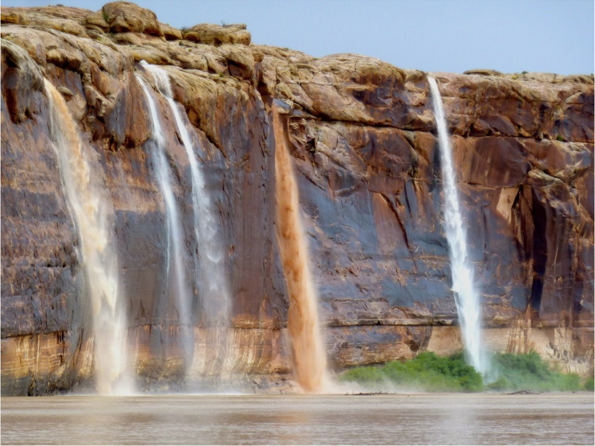
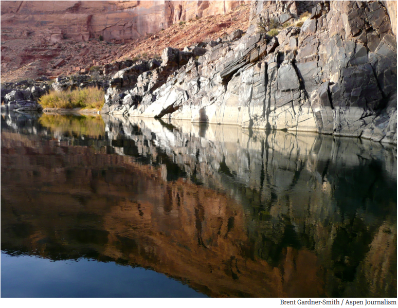
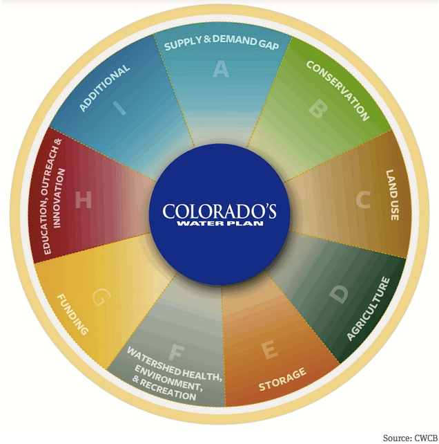

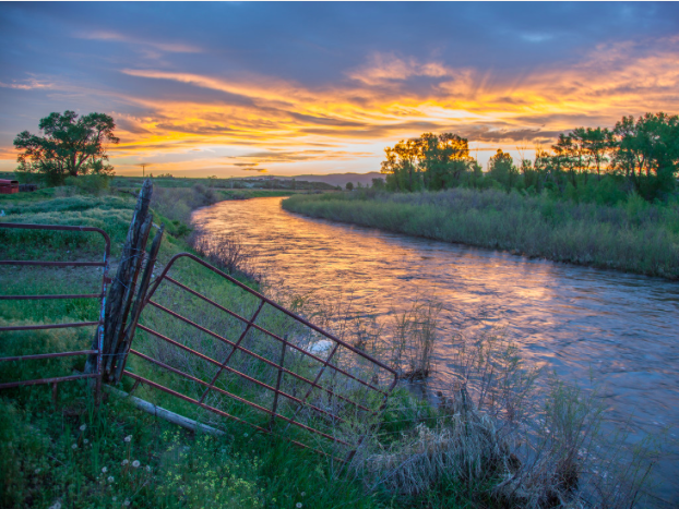


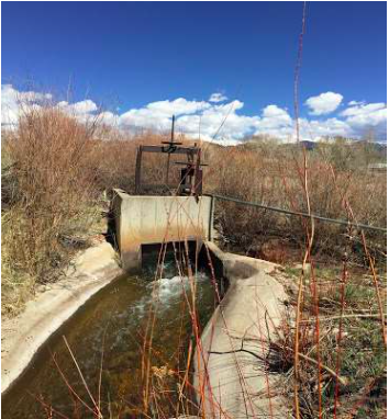


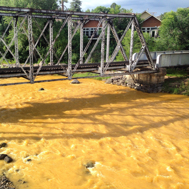


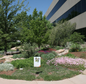
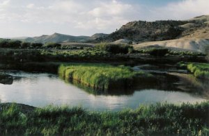

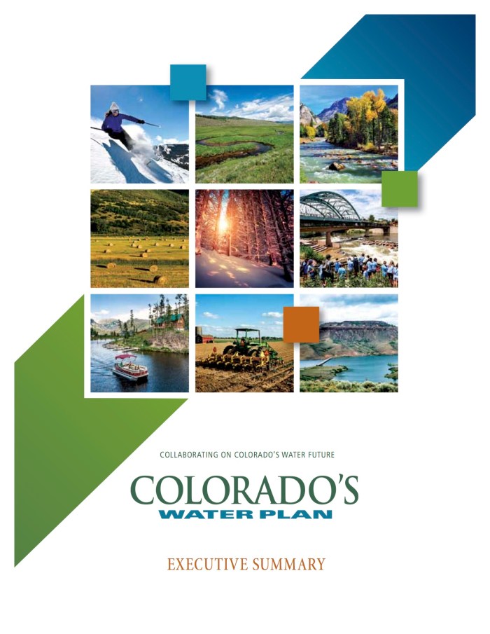

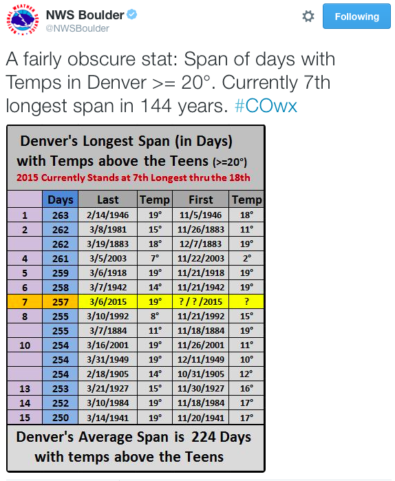


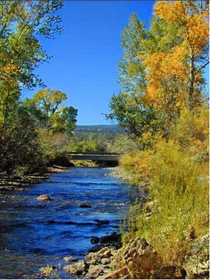


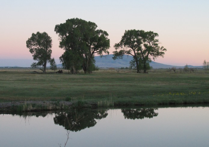


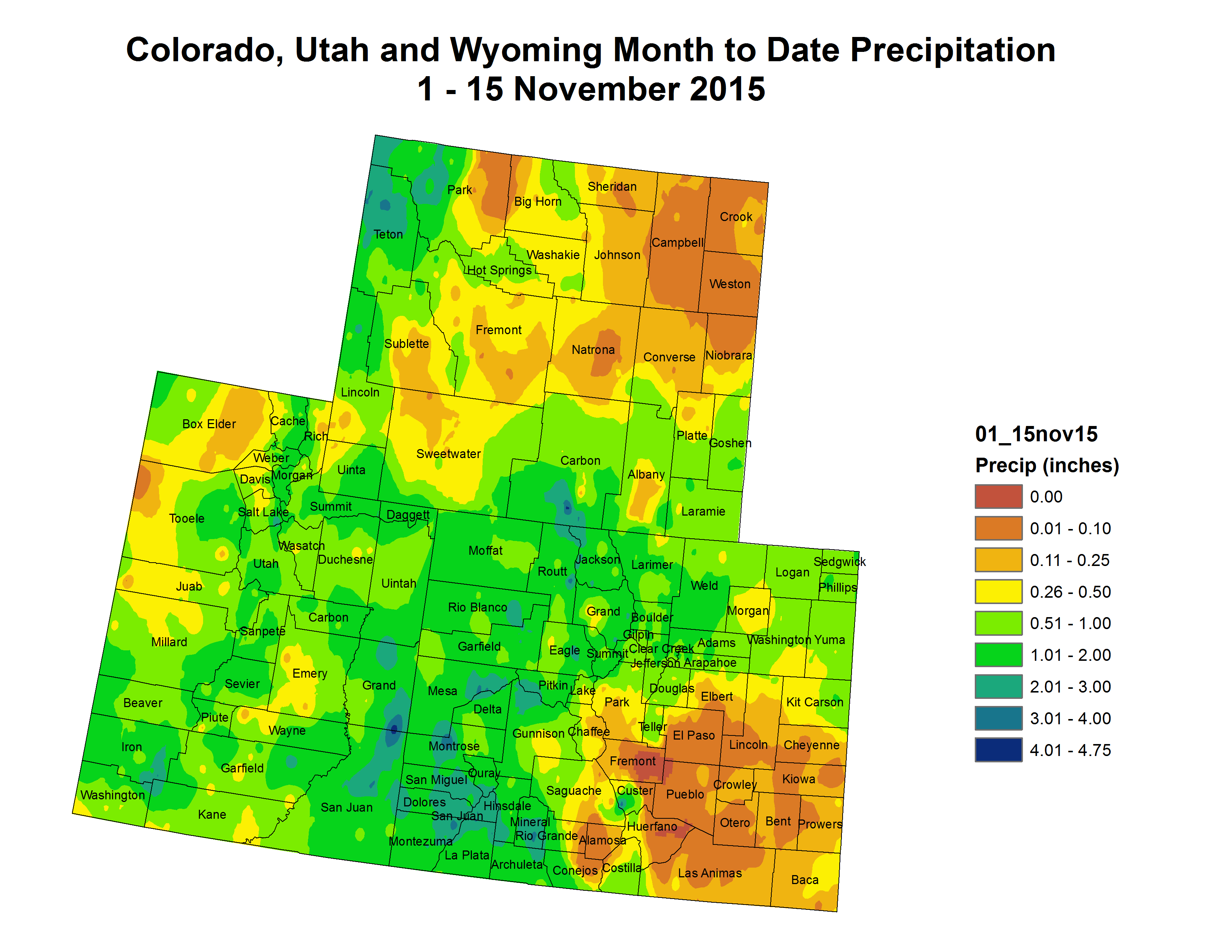


![This image was taken during the peak outflow from the Gold King Mine spill at 10:57 a.m. Aug. 5. The waste-rock dump can be seen eroding on the right. Federal investigators placed blame for the blowout squarely on engineering errors made by the Environmental Protection Agency’s-contracted company in a 132-page report released Thursday [October 22, 2015]](https://coyotegulch.blog/wp-content/uploads/2015/10/goldkingminespill1057am08052015viaepa.png)