#AnimasRiver: Water-treatment system announced for #GoldKing — The Durango Herald

New settlement ponds at Gold King Mine August 2015

From The Durango Herald (Peter Marcus):

The $1.78-million portable treatment facility will be located in Gladstone, according to EPA officials. It will be operational by Oct. 14 and operate during the coming winter. The contract provides for 42 weeks of treatment, with the option to start or stop treatment as needed…

Water continues to flow from the mine at approximately 550 gallons per minute. Without the plant, officials have had to rely on a series of settling ponds to capture the dirty water before being discharged to Cement Creek.

Authorities constructed four ponds at the mine site, which are treating water to remove as much metal loading as possible. The treatment plant will replace the ponds.

EPA officials estimate the plant will cost $20,000 per week to operate, with another $53,200 for demobilization and bonding. EPA will use money from its Superfund coffers to pay for the project. Superfund money is used to clean up blighted areas that could be toxic to humans. Gold King still has not officially been listed as a Superfund site.

The bidding process for the plant was conducted by St. Louis-based Environmental Restoration, LLC, the contractor that was working with the EPA when the spill occurred. The treatment-system contract was awarded to subcontractor Alexco Environmental Group Inc., which has an office in Denver.

Officials said the transition to the plant is necessary as winter temperatures at high elevations can reach well below zero, making it unsafe to manually treat water at the mine site. The system is designed to handle up to 1,200 gallons per minute.

“The objective of the treatment system is to neutralize the mine discharge and remove solids and metals,” stated an EPA news release announcing the facility. “Although the Gold King Mine discharge is just one of many into Cement Creek, the treatment will remove a portion of the metal loading to Cement Creek.”

Though the system is temporary, long-term treatment will be decided after further evaluation of mine discharge, said an EPA spokeswoman.

#AnimasRiver: A silver lining to a toxic orange legacy? — Environment America

silverlininganimasenvironmentamerica

Here’s a call to action from Environment America (Russell Bassett):

“Catastrophe!” read the local headlines after 3 million gallons of metal-laden muck spilled into Colorado’s Animas River earlier last month.

The spill forced the city of Durango to close its drinking water intake, and local business that depend on the river were shut down for weeks. The spill traveled through Colorado into New Mexico and Utah, creating concerns for drinking water, crops, and wildlife all along its path.

The orange river made international news, but it also helped highlight a problem that is long overdue for a solution. Hard rock metal mining is the most destructive industry in the world. According to the U.S. Environmental Protection Agency’s Toxics Release Inventory, metal mining is the nation’s top toxic water polluter.

Mining in the western United States has contaminated headwaters of more than 40 percent of the watersheds in the West. Remediation of the half-million abandoned mines in 32 states may cost up to $35 billion or more.

The main reason for this wide-scale degradation of our waterways is an antiquated law that still governs hard rock mining throughout the country. The 1872 Mining Law allows foreign and domestic companies to take valuable minerals from our public lands without paying any royalties, and it still allows public land to be purchased and spoiled for mining at the 1872 price of less than $5 an acre — that’s the price of one mocha for an acre of public land.

Gold King Mine entrance after blowout August 2015

This outdated law contains no environmental provisions, allowing the mining industry to wreak havoc on water supplies, wildlife and landscapes. For example, abandoned mines are still leaking 540 to 740 gallons a MINUTE of acid drainage into the Animas River headwaters, degrading miles of the watershed. This was the case before the Gold King Mine spill and is still the case after the spill, and there are many more examples throughout much of the West. In fact, it’s estimated that there are half a million abandoned mines throughout the nation.

While the Animas River spill was a tragedy of the first order — and some polluters friends in Congress want to turn it into a witch-hunt of the Environmental Protection Agency — the spill should be the much-needed motivation to enact a solution to clean up after mining’s toxic legacy.

The Hardrock Mining Reform and Reclamation Act of 2015 (HR 963) would fix the problem, but, unfortunately, due to the current political situation in both houses of Congress, this bill has basically zero chance of getting passed. And we need action now because several proposed mines throughout the country could be approved before a real solution to mining’s toxic legacy is passed by Congress.

The Pebble Mine in the headwaters of Alaska’s Bristol Bay, Upper Peninsula Mine near Lake Michigan, Black Butte Mine on Montana’s Smith River, and the Canyon Mine near the Grand Canyon are just a few examples of proposed mines that could wreak havoc on local ecosystems and potentially contaminate watersheds for generations to come.

People from across the country travel to raft and fish in these rivers and lakes. It’s time to protect them from toxic mining pollution. Tax payers are bearing the brunt of cleaning up after the mining industry through superfund designation and other federal funding programs. Using public funds to clean up after a toxic industry, while at the same time allowing that industry to continue to create new mines, is unacceptable. Since Congress won’t do what’s needed, our president should act quickly and decisively.

President Obama has the authority to put a moratorium on all new mines near our waters on public lands. The mining industry should not be allowed to use our public lands to build new mines in and around our cherished waterways until it cleans up from past mining operations. Please tell President Obama to reject all new mine proposals near our rivers until the mining industry cleans up its act. Let’s find the silver lining to the toxic orange river. Please add your voice now.

From The Durango Herald (Peter Marcus):

U.S. Rep. Scott Tipton on Thursday [October 1, 2015] expressed concerns with the prospect of federal officials moving forward with a Superfund listing for Silverton near the inactive Gold King Mine.

A divide has emerged over the Superfund question, with some residents and officials of Silverton worried the listing would be a stain on the community. Silverton and San Juan County officials in August clarified their perspective, suggesting that they are open to a listing but that they have not “foreclosed any options.”

In comments before the U.S. Senate Small Business and Entrepreneurship Committee, Tipton, a Cortez Republican, stated: “Designating Silverton a Superfund site … could severely damage the town’s reputation and prove costly to the local economy.”[…]

Andy Corra, owner of 4Corners Riversports in Durango, who spoke at the same hearing, pushed officials to pursue a Superfund listing.

“Right now, adding the Animas Basin’s offending mines to the EPA’s Superfund National Priorities List is really the only clear path forward,” Corra said.

Listening to the hearing was Colorado U.S. Sens. Cory Garner, a Republican, and Michael Bennet, a Democrat. They joined Tipton in pushing for good Samaritan legislation, which would allow private and state entities to restore inactive mines without the fear of liability. [ed. emphasis mine]

From the Associated Press via The Colorado Springs Gazette:

A rafting company owner, a county commissioner and a chamber of commerce official told the Senate Small Business and Entrepreneurship Committee that they don’t yet know the full economic impact of the spill, but it has been devastating so far, scaring away visitors and triggering layoffs at travel-related businesses…

La Plata County Commissioner Bradford Blake said outdoor recreation companies, farms, greenhouses and other businesses that rely on the river and its water suffered immediate losses ranging from $8,600 to $100,000 each. “Clearly, we do not know yet what the long-term impact of the Gold King spill, and the publicity generated by it, might be,” he said.

From The Denver Post (Jesse Paul):

Navajo Nation leaders on Friday announced they are asking the federal government for a preliminary damage assessment in the wake of the August Gold King Mine spill upstream in Colorado.

Navajo President Russell Begaye on Thursday sent a letter to the Federal Emergency Management Agency seeking the estimation.

Begaye said it is the first step in the application process for public assistance for recovery from a disaster for eligible applicants.

“The spill caused damage to the water quality of the San Juan River to such a massive extent that a state of emergency was declared by the Navajo Nation,” Begaye in the letter. “All of the economic, health, cultural and other impacts to the Navajo people are not yet known.”

#COWaterPlan “…lays out a path by which we may start saving our rivers” — Ken Neubecker

Colorado transmountain diversions via the State Engineer's office
Colorado transmountain diversions via the State Engineer’s office

From The Grand Junction Daily Sentinel (Ken Neubecker):

It has been pointed out several times that the recent mine spill into the Animas River was, in one sense, a good thing. It re-awoke the public to Colorado’s checkered mining heritage, and the damage done to our rivers for more than a century. But Colorado’s mining legacy is more than old mines polluting mountain streams. It also gave us the fundamental laws and traditions that govern our rivers and the water they hold.

In 1859, David Wall dug a small ditch from Clear Creek to irrigate his two-acre garden, from which he sold produce to the miners up stream in Gregory Gulch. People back east objected to Wall’s diversion to land not directly adjacent to Clear Creek. But the miners from California who had come to Colorado brought with them a new idea of water allocation called prior appropriation. On November 7, 1859, the territorial legislature passed a law making Wall’s and any other agricultural diversion legal under the “rules of the diggings.”*

For the next 114 years dams and diversion projects were built with no concern for rivers or the health of the ecosystems they support. Water left in the stream was considered a waste and many rivers were severely degraded from altered flows and lack of water. That began to change in 1973, with the passage of Colorado’s in-stream flow water rights program. While not perfect, and not as protective as some might want to think, it recognized the natural environment as a beneficial user of water.

Now Colorado is developing a coordinated plan for the growing water needs of farms, ranches, communities, and — for the first time — the environment and the recreational economy that supports so much in Colorado. Rather than a simple endorsement for more projects that could further harm rivers, this water plan lays out all of the anticipated needs and myriad ideas for meeting them. Indeed, it lays out a path by which we may start saving our rivers.

The Colorado Water Plan has been in the making for more than 10 years, crafted by water stakeholders and the public from all across the state through the Basin Roundtables. Ranchers, farmers, municipal water providers and utilities have worked closely with many from the environmental and recreational communities to make sure that the plan incorporates serious consideration of the health of rivers, including bringing them back from the damage caused by past projects.

This has not been an easy task, and completion of the Colorado Water Plan does not guarantee success. A lot of time has been spent simply building trust after a long history of distrust between people with competing needs and values, and there are still stark differences between competing water uses that must be overcome. Colorado faces a daunting future — balancing the needs of agriculture, cities and rivers will not be easy. Growth, climate change, new economies and values, the need to fulfill downstream compact obligations and the simple reality of living in an arid region where water supply is shrinking, all make the transition from the Colorado of Dave Wall’s irrigation ditch to 21st century water management complex and challenging. Solving the puzzle of our water needs and restoring rivers will take all of us, working together, looking to the future, not the past.

From the Boulder Daily Camera (Nick Payne):

As important as the Colorado Water Plan is to the future of our state and its hunting and angling heritage, we can’t lose sight of what is happening in Washington, D.C. Several pieces of legislation are working their way through Congress to respond to drought in California and throughout the West. Federal agencies are pumping millions of dollars into drought-relief efforts and scrambling to find ways to make our country more resilient to future droughts, too.

Lawmakers can help sportsmen by spurring and supporting state and local solutions that work for entire watersheds, making it less likely that we will reach a crisis point in future droughts. We can build in assurances by using federal water programs to create:

Flexibility. In an over-allocated system like the Colorado River, we need federal programs that allow the transfer of water voluntarily and temporarily to other users in times of need without jeopardizing property rights, sustainable farming and ranching, or healthy fish and wildlife populations.

Incentives. Watershed groups demonstrating successful drought solutions on the local level — where they work best — should be rewarded, and the federal government should encourage the development of similar groups in other watersheds.

Access. With dozens of programs available across multiple federal agencies to improve water resources, it is difficult for Coloradans to know where to turn for assistance or how to navigate the different bureaucracies. We can get more out of limited resources by making these programs more accessible and decreasing the transaction costs of working with the federal government.

Healthier watersheds, overall. It’s the most cost-effective means of increasing water supply, reducing wildfire threats, protecting against floods, and improving drought resilience, and improving watersheds is something we can start doing right now.

From the fisherman pulling trout out of a high mountain reservoir to the Front Range city responsible for providing drinking water to its residents, we are all in this together. Colorado’s representatives in Congress must advance widely-supported conservation and efficiency measures, along with creative financing mechanisms, to meet water demands while protecting and restoring healthy river flows. Sacrificing species or targeting agriculture are not lasting solutions.

Grizzly Reservoir update

Grizzly Reservoir via Aspen Journalism

From The Aspen Daily News (Chad Abraham):

The effort to repair the gate at Grizzly Reservoir that forced the lake to be drained, sending water laden with heavy metals into the Roaring Fork River in August, began Friday.

And there are now protocols in place so officials, residents and river users are not caught off guard, as they were when the river turned from its usual gin-clear shade to an ugly yellowish-brown on Aug. 11, if future reservoir work is expected to impact the Roaring Fork.

There could again be some discoloration in the Fork and Lincoln Creek from silt stirred up during the “dewatering” of the work site, according to a Roaring Fork Conservancy press release. The dewatering must occur so the gate can be fixed.

But crews with the Twin Lakes Reservoir and Canal Co., the owner and operator of the Independence Pass Transmountain Diversion System that has purview over Grizzly Reservoir, have set up a silt fence and straw bales and wattles (a formation involving stakes interlaced with slender tree branches) to trap sediment.

Grizzly Reservoir had to be drained because the nonfunctioning gate could have led to a much more serious incident in which the dam failed, said Scott Campbell, the reservoir company’s general manager, shortly after the drainage.

Tests of water and soil samples showed there were levels of iron and aluminum that exceeded state standards for aquatic life. But officials do not believe the material from the 19th-century Ruby Mine will have a long-term impact on the Roaring Fork ecosystem.

Still, the fact that the drainage and discoloration happened so soon after the Animas River pollution disaster alarmed many people, and Campbell has acknowledged that notification about the reservoir work should have been better.

More coverage from The Aspen Times (Jason Auslander):

Those who criticized Grizzly Reservoir officials for draining the lake in August and sending polluted water down the Roaring Fork River for days take note: You’ve been heard.

“I get it,” said Scott Campbell, general manager of the Twin Lakes Reservoir and Canal Co. “And I’m sorry I didn’t make those calls” in August warning downvalley communities of the impending drainage.

Now, as repair work is slated to begin on a broken reservoir gate — the reason for the drainage in the first place — officials from Twin Lakes and from downvalley governments and other organizations have established protocols designed to prevent similar surprises in the future.

The new protocols were laid out in a meeting Tuesday at Grizzly Reservoir. They call for government officials in Aspen and Pitkin County as well as those with the Roaring Fork Conservancy to be notified if any changes occur in the operation of Grizzly Reservoir that might affect the Roaring Fork Valley, said April Long, stormwater manager for the city of Aspen.

“They were apologetic and wanted to take the proper steps to make sure it doesn’t happen again,” Long said.

Long said she’s satisfied that the new protocols will prevent another surprise discharge from occurring.

More coverage from Jason Auslander writing for The Aspen Times:

Grizzly Reservoir is a “toxic waste pond,” and if it is ever drained again, people and governments downstream need to know in advance.

That was the word Thursday from Healthy Rivers and Streams Board Chairman Andre Wille, though his fellow board members seemed to agree with the sentiment.

“This is the single biggest water-quality disaster we’ve ever seen in the Roaring Fork River,” Wille said during the board’s meeting Thursday evening. “I just don’t think it was thought through.”

Officials with the Twin Lakes Reservoir and Canal Co., which runs Grizzly Reservoir, decided to drain the lake around Aug. 8 in order to fix an outlet gate that was jammed by a tree, according to a report that analyzed water samples taken from the discharge.

Future of public lands fund in doubt after D.C. inaction — The Grand Junction Daily Sentinel #electionsmatter

Black Canyon via the National Park Service

From The Grand Junction Daily Sentinel (Dennis Webb):

Outdoors advocates are lamenting the failure of Congress to extend the life of a program that has helped fund public-land projects for half a century, including many in western Colorado.

But some members of the U.S. House of Representatives, including U.S. Rep. Scott Tipton, R-Cortez, say the Land and Water Conservation Fund program is in need of reform.

Congress failed to reauthorize the program before it expired on Wednesday, despite hopes from some in Congress, including U.S. Sen. Michael Bennet, D-Colo., that reauthorization be included in a stopgap funding bill that was passed before that same deadline.

Bennet and U.S. Sen. Cory Gardner, R-Colo., also signed a bipartisan letter from dozens of senators calling for permanent reauthorization of the fund. The letter calls it “America’s most successful conservation and recreation program.”

The letter adds, “Investments in LWCF support public land conservation and ensure access to the outdoors for all Americans, in rural communities and cities alike.”

The program uses no taxpayer dollars, and instead is funded primarily by royalties paid to the government by companies doing off-shore oil and gas development.

According to Bennet’s office, the fund “supports the conservation of parks, open spaces, and wildlife habitat for the benefit of hunting, fishing, and outdoor recreation.”

Regionally, some of the program’s beneficiaries have included the Colorado and Dinosaur national monuments, Mesa Verde and Black Canyon of the Gunnison national parks, and White River and Uncompahgre national forests.

Will Roush, conservation director for the Carbondale-based Wilderness Workshop group, said that statewide the fund has paid for more than $250 million in conservation and recreation projects.

According to the Center for Western Priorities conservation group, more than half of members in the U.S. House of Representatives support the program. But it says U.S. Rep. Rob Bishop, R-Utah, chairman of the House Natural Resources Committee, “is holding LWCF hostage,” having vowed to block the program unless reforms are made, but not introducing a bill or allowing consideration of the program’s renewal.

In a statement released Sept. 25, Bishop countered that it’s special interests who “seek to hijack LWCF to continue to expand the federal estate and divert even more monies away from localities.”

He said any reauthorization of the fund will prioritize funding for local communities as originally intended under the program.

Bishop has been an advocate of transferring federal lands to state control.

In a statement, Tipton said that the Land and Water Conservation Fund “is a valuable tool for conservation, but after 50 years, some reforms are needed to ensure it is still achieving its original mission and that the federal government is properly managing the lands it already has.

“Managing nearly 640 million acres in the United States, the federal government is by far the largest landowner in most Western states. Rather than increasing LWCF funding in order to obtain more federal property, land management agencies should focus on managing the lands they already have. LWCF reauthorization provides an opportunity for reforms that support addressing the growing maintenance backlogs for national parks, roads, trails and facilities.”

Building a new vision for the High Line Canal — The High Line Canal Conservancy

Highline Canal Denver

Here’s the release from the High Line Canal Conservancy:

High Line Canal Conservancy launches a public outreach planning process to create future visions for the High Line Canal, preserving the recreational and environmental amenity for generations to come.

With the support of Denver Water, Arapahoe County and other governmental organizations along the High Line Canal (Canal), The High Line Canal Conservancy (Conservancy) is building a strong coalition of community leaders and stakeholders to support region wide, long-term planning for the future of the Canal. Over the past several years, these organizations have discussed a vision for the long-term care of the entire Canal corridor, comprising 71 miles long and 100 feet wide, focusing on its critical importance as a recreational and natural amenity to the Denver metro region. The Canal is at a turning point in its future that calls for reassessment and planning that will preserve and protect the Canal for all people forever.

“The 71 miles of the High Line Canal urban trail surpasses the scale and impact of any similar existing or proposed initiative in the U.S. today. The High Line Canal is a unique opportunity to create a significant enduring recreation and cultural greenway legacy – celebrating the rich and diverse physical and social mosaic that we call Denver.” – Tony Pickett, Conservancy Board Member, Vice President, Master Site Development The Urban Land Conservancy.

The Conservancy has commenced the planning initiative through the release of a request for qualifications for a visioning process consisting of extensive public outreach. This broad visioning process will collect the interests, attitudes and needs of citizens – resulting in an exciting future vision for preserving and enhancing the Canal along its entire reach. The Conservancy recognizes the role of the Canal as an invaluable recreational and environmental resource for the Denver metro region and is committed to:

  •  enhancing its recreational opportunities;
  •  preserving the vegetation and wildlife along the corridor; and,
  •  providing practical solutions for the water channel.

“Through the generosity of Denver Water and the stewardship of the Conservancy and its partners, we see a tremendous opportunity to fully realize the potential of the Canal as an extraordinary amenity for the metropolitan community. Much like the national Rails to Trails program, a historic utility shall be repurposed as a regional recreational treasure.” – Nina Itin, Conservancy Board Chair, Community Leader.

For information on the RFQ process, please visit the Conservancy blog: http://www.highlinecanalconservancy.wordpress.com. The Conservancy seeks planning teams to submit qualifications for the upcoming High Line Canal Outreach and Visioning Phase of the greater master planning process by October 12, 2015. A group of teams will be selected for a follow-up request for proposals process.
About the High Line Canal Conservancy

The Conservancy was formed in 2014 by a passionate coalition of private citizens to provide leadership and harness the region’s commitment to protecting the future of the High Line Canal. With multijurisdictional support and in partnership with Denver Water, the Conservancy is connecting stakeholders in support of comprehensive planning to ensure that the High Line Canal is protected and enhanced for future generations.

High Line Canal Regional Context map via the High Line Canal Conservancy

Progress restoring Tenmile Creek, Peru Creek and other streams in Summit County

From the Summit Daily News (Ali Langley):

Mining, logging and railroad and highway construction in generations past dumped sediment in the Tenmile Creek near Copper Mountain.

“It was just sort of 100 years of abuse,” said Jim Shaw, board treasurer for the nonprofit Blue River Watershed Group, which led the restoration effort.

Climax Molybdenum was the biggest offender. The mine’s dams, built to contain toxic drainage from waste rock, failed, and blowouts caused tons of sediment to rush down the steeper parts of the creek and settle in the flatter parts, destroying habitat and wiping out native flora and fauna.

The 1970 Clean Water Act forced Climax to improve its water treatment process, and the mine was no longer an issue, but the damage remained, Shaw said.

In 2013, a multi-year $800,000 effort began to restore the roughly 2,800 feet of stream impacted. Contributing partners included Climax, Copper Mountain Resort, the Forest Service, Colorado Parks and Wildlife, the Colorado Water Conservation Board, CDOT, Friends of the Dillon Ranger District, the National Forest Foundation and the town of Frisco.

Now Shaw said the project is essentially done except for three days of re-vegetation work next week and some planting of shrubs and willows in June. The wetlands have been created, and the oxbows — or U-shaped river bends — have been completed…

PREVENTING ORANGE RIVERS

As the Tenmile closes on completion, so does another watershed improvement project across the county.

The U.S. Environmental Protection Agency (EPA) and the Colorado Department of Reclamation and Mining Safety (DRMS, pronounced dreams) have been leading a collaborative cleanup effort of the Pennsylvania Mine for the last few years.

In early September, the partners installed a second bulkhead deep inside the mine above Peru Creek east of Keystone. The two bulkheads, or giant concrete plugs, will greatly reduce or eliminate negative impacts from the mine’s acid drainage to water quality and fish habitat.

About eight years ago, the Penn Mine experienced a blowout and sent orange water down into the Snake River and Dillon Reservoir. It’s not the latest mine in Summit County to do so.

The Illinois Gulch Mine above the Stephen C. West Ice Arena blew out a couple years later, and the Blue River ran orange and red through Breckenridge and again into Dillon Reservoir.

Now the EPA and DRMS are doing preliminary investigative work in Illinois Gulch, in partnership with the private property owner who owns the land where the mine pollution is coming from, in hopes of starting a cleanup.

“That issue everybody understands, but there hasn’t been a group to take it on yet,” Shaw said. “The state has made it clear that they’ll find money to help.”

ONTO THE SWAN

For now, the water quality restoration focus in Summit is shifting to the Swan River.

The Colorado Water Conservation Board and Colorado Basin Roundtable together awarded a $975,000 grant to the county to support a large-scale restoration project on the Swan in March.

The restoration area includes about 3,500 feet of river along Tiger Road, 11 miles northeast of Breckenridge, on public land jointly managed by the county and the town of Breckenridge where dredge mining turned the riverbed upside down.

Over the last month or two, the same contractors who did the Tenmile project studied the first quarter of the Swan River project. Work on that section will start in 2016 and finish in 2017, said Brian Lorch, director of the county Open Space and Trails Department.

The county is leading the project with many of the same partners as the Tenmile stakeholders as well as the town of Breckenridge, Trout Unlimited and two private landowners. The $2 million project is also supported in part by a tax increase voters passed in 2014.

The plan for the rest of the Swan River restoration is less certain as the upper three-quarters is covered by rocks about 40 feet high.

Shaw said the project partners could tackle restoration over perhaps 15 years as an excavation company removes and sells the rock. The other option is to pursue larger grant funds and private donations that would expedite the effort but mean maybe 10 times higher costs and more complicated logistics…

Another restoration project in the works lies on the Blue River north of Breckenridge.

The town plans to start a restoration project in the coming years through a 128-acre town parcel known as the McCain property, which borders Highway 9 to the west, north of Coyne Valley Road.

Lorch said the collectives that have made local restoration projects possible deserve credit as do the various stakeholders, which include nearly every government agency and nonprofit concerned about water quality or fisheries in Summit County.

The West Salt Creek Landslide: A Catastrophic Rockslide and Rock/Debris Avalanche in Mesa County, Colorado

Click here to download the report from the Colorado Geological Survey. From the website:

On May 25th, 2014 the longest landslide in Colorado’s historical record occurred in west-central Colorado, 6 mi southeast of the small town of Collbran in Mesa County. Three local men perished during the catastrophic event. The landslide was 2.8 miles long, covered almost a square mile of the West Salt Creek valley and the net volume displacement was 38 million yd3. The fast-moving (40-85 MPH), high-mobility landslide was caused by an initial rotational slide of a half-mile-wide block of Eocene Green River Formation. The resultant rock failures, rockmass disaggregation, and mostly valley-constrained rock avalanche, dropped approximately 2,100 ft in elevation as a rapid series of cascading surges of chaotic rubble composed of fragments of pulverized rock, vegetation, topsoil, and mud. Local seismometers recorded a magnitude 2.8 earthquake from the event with a seismic wave train duration of approximately 3 minutes. The toe of the landslide came within 200 ft of active gas-production wellheads and loss of irrigation ditches and water impacted local ranches and residents.

From The Grand Junction Daily Sentinel (Gary Harmon):

The West Salt Creek landslide changed over the summer, as a water course formed to drain much of a pond formed by the slide and as the slide itself compacted and settled into place, according to scientists who are studying the event.

“Continuing threats to nearby residents remain,” warns the Colorado Geological Survey in a new report on the landslide, which took the lives of three men on May 25, 2014.

Clancy and Dan Nichols — father and son — and Wes Hawkins died in the slide while they worked to clear an irrigation ditch. The Colorado Geological Survey report is dedicated to their memory.

Collbran, six miles below the slide, is in no danger, but ranchers and others in the area should be aware of the threat looming high above, especially in the spring, when the “sag pond” is most likely to refill, said Colorado State Geologist Karen Berry.

“The biggest unknown is what will happen when the sag pond fills and spills” into the West Salt Creek Valley, most likely with the spring thaw, Berry said.

The sag pond was formed when 35 million cubic yards of the Green River Formation faltered and slid down, the report said.

The slide covers nearly a square mile atop the West Salt Creek valley and in some cases is as much as 123 feet [deep], the report says.

The slide left a 65 million cubic-yard slump block tipped 15 degrees toward the mesa, creating a “V,” the bottom of which is the pond. according to the report.

The sag-pond water percolated through the slump block forming what geologists call a “pipe,” or conduit that lowered the level of the pond by about eight feet.

“At some point, the stream (West Salt Creek) is going to try to re-establish itself,” Berry said.

How that will work is still an unknown, said Jeff Coe, a U.S. Geological Survey geologist who has studied the slide.

“We don’t know where it will stop and we don’t know what the response will be” as snows melt and feed into the West Salt Creek drainage, Coe said. “That slump block continues to evolve. I’d like to get through a few more springs before I say we’re off the hook.”

Mesa County has built a sophisticated monitoring system intended to detect changes in the slide.

The most recent study cleared up a lingering question for Tim Hayashi, senior engineer for Mesa County, who has led the county’s monitoring of the landslide.

It wasn’t clear why the slide traveled three miles down West Salt Creek Valley, Hayashi said, until the study made it clear that more was going on than just a single slide.

“It wasn’t one enormous slide,” Hayashi said. “It was several large slides” that pulsed down the mountain, one after the other.

The Jet Propulsion Laboratory in Pasadena, California, also has been monitoring the north side of the Mesa with special radar, Coe said.

“Those data are still showing shifts, not real large ones,” Coe said. “The whole West Salt Creek slide is compacting and small areas on the slump block are changing.”

There is no evidence that a catastrophic change is imminent, Coe noted.

The USGS is preparing its own report on the landslide, he said.

The 2014 landslide took place at the same place as a slide that occurred in the Holocene period as it transitioned into the Eocene, at least 11,700 years ago, the report noted.

Studies of the slide could shed light on similar looming threats, Berry said.

“What we hope to do is, take what we’ve learned and look at landslide susceptibility for Grand Mesa and Mesa County in general,” Berry said.

From The Denver Post (Jesse Paul):

The 55-page Colorado Geological Survey study says risks remain specifically because of water that has collected in a depression near the slide’s head, creating a “sag pond.”

“A failure of the sag pond or the remaining rock slide could create a similar event to what happened,” Karen Berry, the state geologist, told The Denver Post on Thursday…

The report also highlights how there are areas throughout the Grand Mesa and Colorado that are also at risk for breaking away.

“Mesa County, and especially Grand Mesa, contain hundreds of active and inactive landslides,” the report says. “Fortunately, many of these features are in remote or underdeveloped areas and have caused little damage.”

CPW is restoring Greenbacks to Herman Gulch in Clear Creek County

Herman Gulch via TheDenverChannel.com

From CBS Denver (Matt Kroschel):

Colorado Parks and Wildlife set up a camp with more than 20 people working around the clock along the banks of the Herman Gultch in Clear Creek County. They are working to kill all the fish that live in the waterway currently, and then restock that waterway with the greenback cutthroat trout, Colorado’s state fish.

Presumed to be extinct by 1937, several wild populations of what were thought to be greenback cutthroat trout were discovered in the South Platte and Arkansas river basins starting in the late 1950s. According to the CPW, those discoveries launched an aggressive conservation campaign that replicated those populations across the landscape so that they could be down-listed from endangered to threatened under the Endangered Species Act.

Momentum for preserving the native jewels continued to build, and in 1996 the greenback was designated as Colorado’s state fish. Efforts to establish new populations were proceeding along a track that suggested the recovery plan benchmarks might soon be met, and the subspecies could be delisted entirely.

Currently, biologists estimate there are less than 5,000 wild greenback cutthroat in the state, but once this project is complete, they hope to double or triple that number.

“We choose this creek in particular because once we clear out the invasive fish species that live in these waters it will be impossible they will be able to get back into the creek to compete with the greenback cutthroat once we stock them here,” Ken Kehmeier, senior aquatic biologist, South Platte River basin, Colorado Parks and Wildlife, said.

Biologists are using a substance called rotenone to kill the fish that currently call the creek home. They add the liquid upstream of a temporary water treatment and testing center at the bottom of the stream. Once the substance does its job they then dilute and consternate the deadly substance. The process turns the water a purple color for a few hundred yards downstream of the treatment center, but water samples taken downstream from that location show the water quality is back to safe levels as it enters Clear Creek.

Right now, biologists are raising thousands of greenback cutthroats in fish hatcheries in Lake and Chaffee counties.

Cutthroat trout historic range via Western Trout

CMU: Water Center renamed Ruth Powell Hutchins Water Center to honor west slope water rights activist

ruthpowellhutchinswatercentercmuviakjct8

From The Grand Junction Daily Sentinel:

Several members of the community came together Thursday at Colorado Mesa University to celebrate the renaming of the school’s water center in honor of Ruth Powell Hutchins, a longtime proponent of the preservation of water rights on the Western Slope.

The newly named Ruth Powell Hutchins Water Center at CMU performs and facilitates interdisciplinary and collaborative research, education, outreach and dialogue to address water issues facing the Upper Colorado River Basin.

Hutchins, who died in 1997, worked to protect the water rights of small farmers and other water users, according to the university. She was one of the founders of the Mesa County Water Association, which evolved into the Water Center at CMU.

Hutchins’ children recently established an endowment for the center in honor of their mother.

The unveiling of the center’s new name was held on the third floor terrace of Dominguez Hall to a full crowd, including three generations of the Hutchins family, members of the Colorado Mesa University Board of Trustees and CMU President Tim Foster.

Her son, Will Hutchins, spoke at the event about his mother’s work.

“I want to thank CMU for honoring our mother,” Will Hutchins said. “With respect to my mother, there are two things to keep in mind — she was a straight-laced Vermonter and her dream.”

He said his mother grew up in a community where the traditional New England town meeting was a way for people to get involved in their town government.

“Public service meant exactly that — not a way for a person to financially better themselves at the public trough,” he said.

He said his mother and father, John, met at a dude ranch and had a dream to own a “farm to raise their family on.”

In 1955, the Hutchinses bought a farm in Fruita, he said. There, Ruth Hutchins began to get involved in the community through volunteer work.

“Any time you have money in the public sector, there are a lot of people trying to get their hands on (it),” Will Hutchins said, referring to water rights issues. And, he added, the result was not necessarily for the benefit of the public.

He said his mother studied water rights issues and eventually was able to “go to the water buffaloes — people like politicians, prestigious lawyers, lobbyists, engineers — and talk to them on her own terms” about these issues and her concerns.

Foster said the university “gets to name” a number of its facilities after people in the community, but “few as iconic as Ruth.”

“Ruth Hutchins was one of my very favorite people. She was a combination of Annie Oakley, Margaret Thatcher and Mary Poppins,” Foster said in a news release issued by the university. “She truly cared about water issues, not only in the Grand Valley but statewide and nationally. She was committed to making the system work better and to the importance of meeting agricultural water needs. We are honored to have the water center carry her name and are deeply appreciative of her family’s generosity.”

Hutchins’ son, Tad, said he was honored to be at the naming.

“(It shows) that the good deeds you do will outlive you as an issue,” he said.

“I’d like to think Mom would be proud of this (center)” that provides information to anyone interested in water issues.

CMU spokeswoman Dana Nunn said the renaming of the center was not a condition of the endowment.

Land and Water Conservation Fund expires #electionsmatter

From The Aspen Daily News (Collin Szewczyk):

A long-running conservation fund that helped to fund the creation of numerous parks and trails in the Roaring Fork Valley was allowed to expire on Wednesday, a casualty of Congress’ inability to agree on a long-term budget.

The Land and Water Conservation Fund was not included in recently passed legislation that will only keep the government running until Dec. 11.

The fund’s expiration is a “significant loss for citizens across the country,” says a statement released Thursday by the Carbondale-based Wilderness Workshop.

“The LWCF pays for recreation and conservation projects at no cost to the American taxpayer,” the statement says. “Congressional inaction is unacceptable and is a disservice to the public.”

Will Roush, conservation director for WW, said the opposition to the fund’s continuance came from a small group of congressmen led by Utah Republican U.S. Rep. Rob Bishop, chairman of the House Natural Resources Committee.

The fund typically receives bipartisan support in Congress and by itself would likely have been continued. But by being part of the larger bill, it was sacrificed…

At the state level, the LWCF subsidizes pools, parks, baseball diamonds and trail systems, WW’s statement says. Colorado has received close to $250 million in funding since the LWCF’s inception. On the federal level, it focuses on land acquisition, especially private inholdings located within national parks and forests.

The LWCF has long been in the crosshairs of Bishop, who would like to see ownership of federal lands be handed over to the states. The ideology stems from what has been coined a new “Sagebrush Rebellion,” a movement propped up by conservative nonprofit organizations like the American Legislative Exchange Council and the American Lands Council.

Bishop has said he won’t support any proposal that looks to place more land under federal ownership.

“Both Republicans and Democrats support the original intent of the Land and Water Conservation Fund, but the program has drifted far from the original intent,” Bishop said last week in a press release. “Any reauthorization of LWCF will, among other improvements, prioritize local communities as originally intended.”

Colorado Sens. Cory Gardner and Michael Bennet, and U.S. Rep. Jared Polis have come out in support of the fund.

“The LWCF is one of the most critical tools we have for protecting our nation’s natural treasures,” said Gardner, a Republican, in a recent prepared statement. “Its permanent reauthorization is supported by sportsmen, hunters and many other Coloradans who appreciate the outdoors. It’s a responsible fiscal partnership and provides countless benefits. I’ve supported making the LWCF’s authorization permanent throughout my time in the Senate, and I will continue to work toward making that goal a reality.”

Bennet echoed Gardner’s call for reauthorization, saying urban and rural communities throughout Colorado benefit from the fund.

“This program is a crucial tool that has been used to help preserve dozens of landscapes across Colorado,” he said in a statement last week. “There is strong bipartisan support for the LWCF, and we’re extremely disappointed that reauthorization was not included in the funding bill.”

Bennet said the fund should have been renewed before it expired “to ensure that future generations of Coloradans will continue to enjoy these areas.”

In all, 214 congressional representatives of both parties have signed a letter in support of reauthorizing the LWCF, the WW statement says.

Roush said that while there are no current projects in the Roaring Fork Valley that will be affected by the fund’s expiration, two other projects in Colorado could be in jeopardy.

Those are one looking to attain conservation agreements in the Sangre de Cristo Mountains to protect wildlife habitat and another on the Colorado-New Mexico border along the Continental Divide that seeks to acquire land for trail connections.

“This is a sad moment for conservation and recreation across the country,” Roush noted in the WW statement. “The Land and Water Conservation Fund is one of the country’s greatest conservation programs, protecting iconic landscapes and provided recreational opportunities in people’s back yards, all at no cost to the taxpayer.”

Enacted in 1965, the fund uses revenues from offshore oil and gas extraction to support conservation efforts protecting land and water. It’s supposed to claim around $900 million in revenues annually, but that figure varies greatly as Congress often reappropriates its funding elsewhere.

“The money is intended to create and protect national parks, areas around rivers and lakes, national forests and national wildlife refuges from development, and to provide matching grants for state and local parks and recreation projects,” the fund’s website says.

The LWCF has furthered projects in Rocky Mountain, Mesa Verde, Great Sand Dunes and Black Canyon of the Gunnison national parks. It also has provided funding for projects at Colorado National Monument, Ruby Canyon National Conservation Area, the White River National Forest, and the Arapahoe and Roosevelt National Forests.

Thirty-six percent of land in Colorado is under federal ownership, and managed by a combination of the Bureau of Land Management, the U.S. Forest Service, the National Park Service, the U.S. Fish and Wildlife Service, and the Department of Energy. Federal lands make up 83 percent of Pitkin County.

“It’s heartening to see Sens. Bennet and Gardner and Rep. Polis fight hard for this important program,” Roush said. “It’s clear they understand the value of conserving land to Coloradans and to our economies, which are so connected to public lands, recreation and wild places. I only hope that their colleagues in Congress will realize the importance of this program to all Americans and re-authorize the LWCF during the next budgeting process in December.”

Town watching Coal Creek study — The Crested Butte News

Crested Butte
Crested Butte

From The Crested Butte News (Mark Reaman):

Crested Butte will ask the state to allow the town to be directly involved in the Colorado Water Quality Control Commission’s proceedings dealing with Coal Creek and temporary modifications currently in place.

The request for so-called “Party Status” comes at the request of the Coal Creek Watershed Coalition (CCWC). Coalition board president Steve Glazer came to the council Monday, September 21 with the request.

Temporary modifications of in-stream water quality standards have been in place for Lower Coal Creek for more than 20 years. Those standards are reviewed every three years by the state.

At the 2012 hearing, the state required U.S. Energy, the mining company responsible for the potential molybdenum mine and current water treatment plant on Mt. Emmons, to develop a study plan to address uncertainty regarding pollution sources impacting Coal Creek. Data collection from the study will culminate this year.

The Water Quality Control Commission is set to review the temporary modifications and evaluate progress on the study. Glazer feels the process will likely be continued into 2016 and may include new rule-making involving new standards for Coal Creek.

Given the town’s inherent interest in the watershed, CCWC felt it appropriate to have the town participate.

#ColoradoRiver: Grand County rancher uses 2013 law to leave water in Willow Creek without penalty — Hannah Holm #COriver

From the Grand Junction Free Press (Hannah Holm):

A Grand County rancher has become the first person in Colorado to use a 2013 state law to intentionally leave water in a stream without fear of diminishing his water right. Working with the Colorado Water Trust , Witt Caruthers developed a plan to curtail diversions from Willow Creek when its flows drop to critical levels.

The additional flows will benefit half a mile of Willow Creek and then four and a half miles of the upper Colorado River before encountering the next downstream diversion, where another water user could potentially take the water. This stretch of the Colorado River has been heavily impacted for decades by upstream diversions across the Continental Divide to Front Range cities and farms.

The 2013 law, Senate Bill 13-019, allows some Western Slope water right holders to reduce their water use in up to five out of any consecutive ten years without having the use reductions count against them in water court calculations of “historic consumptive use.” This reduces the “use it or lose it” disincentive for conservation in Colorado water law.

The law applies only to water users in Colorado Division of Water Resources Divisions 4 (Gunnison River Basin), 5 (Colorado River Basin) and 6 (Yampa, White and North Platte River Basins). In order to qualify for the law’s protections, the water use reductions must be the result of enrolling land in a federal land conservation program or participating in an officially-sanctioned water conservation or banking program.

Jim Pokrandt of the Colorado River District, which approved Caruthers’s conservation program, told the Sky Hi Daily News that “we’re glad to be in the vanguard and helping the agricultural community protect their water rights when they want to lend the water rights to environmental purposes.” The same article quotes Caruthers as saying that he and his partners sought to “one, preserve our water rights but also to contribute to the overall maintenance of the ecosystem there by leaving water in the stream when it wasn’t needed.”

The Colorado Water Trust has also pioneered the use of other voluntary and market-based tools for landowners to share water with streams without diminishing their water rights. These include a 2003 law that created a streamlined process for water users to make short-term leases of water to the state for environmental purposes. The Trust first used this tool in 2012 by brokering a deal to support flows in the Yampa River. It has since been used in several other places.

Support and funding for such innovative water conservation efforts is rising as Colorado and the other states and cities that share the Colorado River are seeking ways to prop up water levels in Lakes Powell and Mead in the face of long-term drought.

This is part of a series of articles coordinated by the Water Center at Colorado Mesa University in cooperation with the Colorado and Gunnison Basin Roundtables to raise awareness about water needs, uses and policies in our region. To learn more, go to http://www.coloradomesa.edu/WaterCenter. You can also find the Water Center on Facebook at https://www.facebook.com/WaterCenter.CMU or on Twitter at https://twitter.com/WaterCenterCMU.

Willow Creek via the USGS

#ColoradoRiver: Middle #Colorado Watershed Council Shoshone Power Plant Tour October 26 #COriver

From email from the Middle Colorado Watershed Council:

Come join the Middle Colorado Watershed Council for a tour of the Shoshone Hydroelectric Power Plant east of Glenwood Springs. The Plant plays a pivotal role in western water not because of the power it generates, but because it holds the one of the oldest, largest water rights on the river. The senior right to 1,250 CFS means that water must flow down the Colorado, and it’s a non-consumptive use, so that water is flowing right back into the river for later use. We will learn about the Plant’s legacy over the past century, and what the water right means to us on the Western Slope. Registration is only open through October 12, and all participants must submit a facility waiver form at registration.

Location: Shoshone Power Station, Glenwood Canyon, CO
Date: October 26, 2015
Registration Deadline: October 12, 5:00pm
Time: 9:00am – 12:00pm
Cost: Free
Registration: Online through Eventbrite
Contact: For more information, contact Dan at info@midcowatershed.org

Click here to register.

Link to waiver form.

#Drought news: Abnormal dryness (D0) increased over eastern #Colorado in areas where 60-day <=50% of normal

Click here to go to the US Drought Monitor website. Here’s an excerpt:

Summary

Although increasingly wet weather has been noted over parts of the East, any rain falling after Tuesday morning (8 a.m., EDT) will be incorporated into next week’s U.S. Drought Monitor. For this week’s analysis, above-normal temperatures prevailed across much of the country, though heavy rain and near-normal temperatures were observed over parts of the Gulf Coast and Southeast. In addition, moderate to heavy rain was noted in western portions of the Corn Belt. In contrast, protracted dryness prevailed over the Northeast, while seasonably dry weather continued over the western U.S…

Central Plains

Above-normal temperatures accompanied scattered showers, with little widespread change to this week’s drought depiction. Abnormal Dryness (D0) was increased over eastern portions of Colorado, coinciding with locales where 60-day rainfall has tallied 50 percent of normal or less. There were no changes to the Moderate Drought (D1) in Kansas, where this week’s light shower activity (generally 0.5 inch or less) was insufficient for drought reduction…

Northern Plains

Hot, dry conditions prevailed, with temperatures averaging more than 10°F above normal. Despite the 90-degree readings and a lack of rain during the period, changes to this week’s drought designation were generally minor. Abnormal Dryness (D0) was expanded over southeastern Wyoming into northwestern Nebraska, where pronounced short-term precipitation deficits (60-day rainfall totaling 30 to 50 percent of normal) has led to locally pronounced topsoil shortages…

Southern Plains and Texas

Despite areas of beneficial rain in the west and along the Gulf Coast, the overall trend toward intensifying “flash drought” continued. The intensity and coverage of Abnormal Dryness (D0) to Extreme Drought (D3) increased from southern Oklahoma southwestward across central Texas to the Big Bend. Daytime highs reaching into the upper 90s coupled with another dry week continued to accelerate soil moisture losses, with 90-day rainfall tallying a paltry 5 to 20 percent of normal over many of the Lone Star State’s central drought areas. Pronounced short-term dryness has also intensified over central and southern Oklahoma, where 60-day rainfall has totaled mostly less than 30 percent of normal. Meanwhile, widespread showers and thunderstorms (0.4 to 2 inches, locally more) boosted soil moisture for winter crops and pastures on the southern High Plains and eased D0 along the Texas-New Mexico border. Likewise, 1 to 4 inches of rain reduced D0 to D3 in southern and southeastern Texas, though the heaviest rain largely bypassed the core Texas drought areas…

Western U.S.

The overall trend toward drought persistence continued, though isolated showers were noted in the Pacific Northwest and lower Four Corners. After last week’s cool down, much-above-normal temperatures returned to California and the Great Basin. In the north, most of the region’s core Extreme Drought (D3) areas were dry. However, light to moderate showers on Washington’s Olympic Peninsula (mostly an inch or less) coupled with last week’s heavier rain continued to stave off D3 expansion. Across the California and the Great Basin, drought remained unchanged as the region continued through its climatologically dry summer season. However, heat exacerbated the impacts of the region’s historic drought, with daytime highs reaching or eclipsing 100°F from central California into the southern Great Basin. In the Four Corners States, additional assessment from the field in the wake of last week’s locally heavy rain resulted in further reductions of Abnormal Dryness (D0) and Moderate (D1) in southeastern Arizona and southwestern New Mexico…

Looking Ahead

The complex interaction between a blocking high over eastern Canada, a stationary upper-air low over the Southeast, and Hurricane Joaquin (or the remnants of) will bring the threat of heavy rain to the eastern third of the nation. Rainfall may total 3 to 4 inches (locally much more) across the Southeast, Mid Atlantic, and Northeast, pending the final track of Joaquin. Meanwhile, dry weather is expected from Texas into the upper Midwest. Farther west, a Pacific storm system will move ashore, bringing the potential for locally heavy showers from central and northern California into the northern Rockies. Dry weather is expected over the Southwest, though some late-season showers may arrive in the Four Corners at the end of the period. The NWS 6- to 10-day outlook for October 6 – 10 calls for above-normal precipitation and near- to above-normal temperatures nationwide, with drier-than-normal conditions confined to the lower Southeast.

Just for grins here’s a slideshow of late September early October US Drought Monitor maps for the past few years:

This slideshow requires JavaScript.

NASA to test [snowpack] data technique in upper Rio Grande Basin — The Santa Fe New Mexican

Combined lidar and aerial mapping

From the Associated Press (Dan Elliott) via the Santa Fe New Mexican:

NASA is providing drought-stricken California with valuable data about how much water is locked up in the scant Sierra Nevada snow, and now Colorado is trying the technique in the mountains where the Rio Grande begins its journey to New Mexico and Texas.

An airplane called the Airborne Snow Observatory flies over California’s Tuolumne River Basin east of San Francisco during peak snow months, using scanners to collect data on how deep the snow is and how much of the sun’s warming rays are bouncing off. That helps project when the snow will melt and how much water it will release into rivers for cities, farms and wildlife…

“Once the water managers get a look at the data, they say, ‘I like that,’ ” said Frank Gehrke, chief of the California Cooperative Snow Surveys Program. NASA has been providing California with snow data from the Tuolumne Basin since 2013, and flights will resume there next spring.

Colorado signed up for three flights over the Rio Grande Basin in the south-central part of the state. The first were in March and September of this year. The third will be next spring…

Estimating how much Colorado snow will melt into the Rio Grande is difficult. The mountains block weather radars that could help gauge how much precipitation is falling, said Joe Busto of the Colorado Water Conservation Board.

Colorado will use the NASA data to improve computer modeling for runoff forecasts…

The Airborne Snow Observatory, a propeller-driven plane, sweeps back and forth over mountain snowfields scanning with lidar — the term combines “light” and “radar” — and an imaging spectrometer.

Lidar measures snow depth by bouncing a laser off the surface and comparing that to an aerial survey done without snow. Coupled with snow density data from ground sites and computer modeling, researchers can project how much water is in the snow.

The spectrometer measures how much sunlight the snow is reflecting and absorbing. That allows researchers to project when it will melt.

The ground sites, scattered across the West, are the primary source of data for most snowmelt projections. U.S. Department of Agriculture employees trek to some sites to measure and weigh the snow. Other sites are automated.

Painter said the airborne survey won’t eliminate ground sites, but he foresees a day when aerial surveys become the standard. Satellites might also play a role, but airplanes can provide a level of detail and frequency that spacecraft cannot, Painter said.

“At least not yet. Maybe in 50 years,” he said.

jplaircraftsnowsurveytuolommebasin

#COWaterPlan: “There is a lot of misunderstanding on water issues” — Leroy Garcia

Colorado Water Plan website screen shot November 1, 2013

From The Pueblo Chieftain (Chris Woodka):

One of the outcomes of the Colorado water plan has been to draw new voices to talk about a question that’s older than the state itself: How can a sparse resource be used to meet the needs of a growing population?

So, a group primarily concerned with the Colorado River recently reached out to Pueblo to gather perspective.

Nuestro Rio — “our river” in Spanish — invited Puebloans to talk about water on the last day for comments on the final plan recently.

“My concern was that people could become more familiar with it and to make sure Southern Colorado knew it has a voice,” said state Sen. Leroy Garcia, D-Pueblo, who helped set up the meeting.

About 50 people, ranging from elected o_cials to farmers, attended. Also present was state Rep. Ed Vigil, D-Fort Garland, a member of the Interim Water Resources Review Committee.

“One of the goals of Nuestro Rio is to remind people of the importance of the river but to also involve more young people,” Garcia said.

While Nuestro Rio formed to emphasize the importance of the Colorado River to Latinos, a series of statewide outreach meetings showed there are concerns common to all rivers in the state, said Nita Gonzales, Colorado director for the organization.

“The main thing we heard was that diverting water cannot be the only solution,” Gonzales said. “Rivers are critical to Latino families, and before we move to big projects, we have to ask how do you protect the rivers.”

That includes maintaining agricultural uses that are the foundation for the economic wellbeing of many Latinos, Gonzales said.

“The other thing we heard is that elected officials are not as involved in water, but it is so important to the communities to make sure it is addressed in policy and budgets,” she said.

Garcia agreed.

“My own colleagues have to see this as one of the most important issues in the state,” he said. “We talk about transportation, education and economic development, but none of those things happens without water.”

On the state water plan, Garcia said he favors some of its openended approaches.
“There is a lot of misunderstanding on water issues,” he said. “The plan is very basin specific.”

@NWSPueblo: The September 2015 Climate Review and October Preview across Southern Colorado

From the National Weather Service Pueblo office:

September of 2015 was very warm and mainly dry across much of Colorado. A moist Pacifc weather system brought some rain to southwest and central portions of the state through the first couple days of month, with another Pacific weather system moving across the state on September 22nd and 23rd, bringing beneficial rain to portiions of the southeast Plains. The following graphics depict monthly temperature and precipitation departures from normal across the state for the month of September.

departurefromnoralpreciptemp0901thru09292015nwspueblo

The preliminary average temperature over the past month of September in Pueblo was 71.9 F. This is 7.2 degrees above normal and makes September of 2015 the warmest September on record in Pueblo, smashing the previous record average temperature of 71.0 degrees recorded in September of 1931. Pueblo recorded only 0.03 inches of precipitation through out the month of September. This is 0.74 inches below normal and makes September of 2015 tied with September of 1895 as the 6th driest September on record in Pueblo, remaining just below the trace of precipitation recorded through out September of 1956, 1916 and 1892. Pueblo recorded no snow through out the month of September, which is 0.3 inches below normal.

The preliminary average temperature over the past month of September in Colorado Springs was 67.3 F. This is 6.4 degrees above normal and makes September of 2015 the warmest September on record in Colorado Springs, besting the average temperature of 67.0 degrees recorded in September of 2010. Colorado Springs recorded 0.30 inches of precipitation throughout the month of September. This is 0.89 inches below normal and makes September of 2015 the 19th driest September on record, though remains well above the trace of precipitation recorded in September of 1953 and 1919. Colorado Springs recorded no snow through out the month of September, which is 0.2 inches below normal.

The preliminary average temperature over the past month of September in Alamosa was 58.4 degrees. This is 3.4 degrees above normal and makes September of 2015 tied with September of 1939 as the 3rd warmest September on record in Alamosa, though remains just behind the average temperature of 59.0 degrees recorded in September of 1933. Alamosa recorded 0.78 inches of precipitation through out the month of September, which is 0.13 inches below normal. Alamosa recorded no snow through out the month of September, which is normal.

September 2015 climate data and records for other select locales across south centrral and southeast Colorado can be found here:

http://www.weather.gov/pub/adryandwarmseptembersofar

Looking ahead into October, in Pueblo, the average high and low temperatures of 75 degrees and 40 degrees on October 1st, cool to 64 degrees and 29 degrees by the end of the month, yielding an average monthly temperature of 51.8 degrees. Pueblo averages 0.72 inches of precipitation and 1.3 inches of snow through out the month of October.

In Colorado Springs, the average high and low temperatures of 68 degrees and 41 degrees on October 1st, cool to 58 degrees and 31 degrees by the end of the month, yielding an average monthly temperature of 49.4 degrees. Colorado Springs averages 0.82 inches of precipitation and 2.9 inches of snow through out the month of October.

In Alamosa, the average high and low temperatures of 68 degrees and 30 degrees on October 1st, cool to 55 degrees and 19 degrees by the end of the month, yielding an average monthly temperature of 43.1 degrees. Alamosa averages 0.68 inches of precipitation and 2.1 inches of snow through out the month of October.

Below is the Climate Prediction Center’s (CPC) temperature and precipitation outlook for the month of October, which gives a slight nod to above normal precipitation and equal chances of above, below and near normal temperatures for the month across south central and southeast Colorado.

onemonthetempprecip102015cpc

#ColoradoRiver: Hoover (Boulder) Dam dedication anniversay

hooverdamdedicationtweetusbr

Click here to go to the Hoover Dam FAQ webpage from the US Bureau of Reclamation.

Click on a thumbnail to view a gallery of Hoover Dam photos from the Coyote Gulch archives.

Weekly Climate, Water and Drought Assessment of the Upper #ColoradoRiver Basin

Click here to read the current assessment. Click here to go to the NIDIS website hosted by the Colorado Climate Center.

Upper Colorado River Basin water year 2015 precipitation as a percent of normal through August 31, 2015

#ColoradoRiver: Southwestern Water Conservation District Water 101 session recap #COWaterPlan #COriver

From The Pine River Times (Carole McWilliams):

The nightmare scenario for West Slope water nerds is a “call” on the Colorado River, meaning that Colorado, Wyoming, and Northwest New Mexico are not delivering a legally required amount of water to California, Nevada, Arizona, and Utah.

If or when that happens, some water users in the three Upper Basin states will have their water use curtailed so that the Lower Basin states get their share. Water banking as a concept being proposed on the West Slope to minimize curtailment and huge water fights between holders of pre-1922 water rights, which would not be curtailed, and holders of post-1922 rights that would be curtailed.

Durango water engineer Steve Harris spoke to this at the Sept. 25 Water 101 seminar in Bayfield.

The idea started in 2008 with the Southwest Colorado Water Conservation District and the Colorado River Conservation District. Those two entities cover the entire West Slope, Harris said. The idea of water banking is “to provide water for critical uses in cases of compact curtailment.”

West Slope agricultural water users would voluntarily and temporarily reduce their water use and be compensated for it. The water would go to Lake Powell to satisfy the legal requirement for the three Upper Basin states to deliver 7.5 million acre feet of water each year (averaged over 10 years for a total 75 million AF) to the four Lower Basin states and avert curtailment…

All this is dictated by a water compact signed in 1922. It committed 15 million AF per year divvied up between the Upper and Lower Basin states. “Average flow now is around 13 million AF in the Colorado,” Harris said. The result has been continued draw-down of Lake Powell and Lake Mead.

“Right now we are at around 90 million AF versus the 75 million AF over 10 years,” Harris said. If the amount delivered goes below the 10 year requirement, perfected water rights before 1922 would not be curtailed. Most of that is West Slope ag water.

About half of Bayfield’s and Durango’s municipal water is pre-1922 rights, he said. More than 90 percent of the 1-plus million AF of pre-1922 West Slope water is used to grow grass or alfalfa hay.

Post-1922 rights include area reservoir storage, water for coal-fired power plants, a lot of municipal and industrial water, and 98 percent of West Slope water diversions to Front Range urban areas. “So they would be curtailed. But that’s not going to happen,” Harris said, because Front Range residents aren’t going to have their water supply cut to grow hay.

“We want to set up a water bank so the pre-1922 users would set aside water for the post-1922 users. Otherwise, pre-1922 rights could be targeted for acquisition by post-1922 users,” he said.

Water banking is still an idea at this point. “We don’t know if the water bank will work,” Harris said. Two studies have been done, one is under way, and a fourth will be conducted by Colorado State University to look at the impacts on eight small farms of full irrigation, reduced irrigation, and no irrigation.

Harris said 50,000 to 200,000 AF of West Slope pre-1922 water might be able to go into a water bank, based on land that could be fallowed. But there is concern that some other senior water right holder could take the water before it gets to Lake Powell. Also, he said, “It’s very hard to measure water saved through fallowing. Every year is different.”

In contrast, there is an estimated 55,000 AF of critical post-1922 municipal and industrial use on the West Slope and 295,000 AF of critical diversions to the East Slope. “The amount of pre-compact water that might be available is much smaller than the demand,” Harris said. He cited another local issue: “If you don’t irrigate on Florida Mesa, people don’t have water wells.”

An assortment of water entities in the Colorado River Basin have contributed $11 million to do demand management pilot projects to get more water to Lake Powell. Durango applied to change their water billing to “social norming,” meaning how much water you use compared to your neighboors. Harris quipped that he’d pull the norm down because he made a show of removing his lawn back in the spring.

State Sen. Ellen Roberts also spoke at the seminar. “Even though we are a headwaters state, there’s a limited amount of water, and if the population is going to double by 2040 or 2050, where will the water come from? … Every direction from Colorado, there’s a neighboring state that has a legal right to some of our water.”

Eighty-seven percent of the state population lives between Fort Collins and Pueblo, and they like their Kentucky blue grass, she said, adding, “Kentucky is a much better place for it. … On the Front Range, all they care about is does the water come out when they turn on the tap.”

She noted the heated reaction to the bill she introduced in 2014 to limit the size of lawns in new residential developments that use water converted from ag, leaving the ag land dry. Harris initiated that idea. Roberts commented, “To feed their lawns, they need our water.”

As with population, 87 of 100 state legislators also live betwween Fort Collins and Pueblo, she said. “If they don’t come out here to know our world, they don’t appreciate why water is so important. … Water is our future.”

Roberts gave an update on the Colorado Water Plan, which is intended to address the projected gap between water demand and supply. Community meetings on the plan were held around the state last year and earlier this year. “The number one thing we heard was the need for storage,” Roberts said. “If we can’t capture and hold the water we have, we are hurting ourselves.” The next question is how to pay for storage projects. “That’s where the fighting begins,” she said.

The water plan needs more specifics on recommended actions, Roberts said. And after the Gold King spill of toxic mine waste, it needs something about water quality threats from abandoned mines.

The 470-plus page plan is being done by the Colorado Water Conservation Board and is supposed to be presented to the governor by Dec. 10. It’s available on-line at http://www.coloradowaterplan.com.

Colorado River Basin including Mexico, USBR May 2015

Children’s World Water Day activities at Littleton-Englewood treatment plant

littletonenglewoodplantbrowncaldwell

From the Centennial Citizen (Tom Munds):

Excited laughter and conversations among young voices created a different atmosphere at the Littleton/Englewood Wastewater Treatment Plant as more than 500 students from Englewood, Littleton and Denver made a field trip there for World Water Day activities.

“We have expanded the event this year and have more students attending it,” said Brenda Varner, plant employee and event coordinator. “We have gotten help in expanding the event from a number of agencies that are providing volunteers and displays. Each school’s student group is scheduled to visit every station. The stations provide the opportunity to check out displays, listen to presentations and do hands-on activities. I am sure one of the more popular hand-on activities will be at the booth where each student can create a special T-shirt.”

She said the school groups arrived at different times Sept. 23. Each group then followed a schedule from station to station.

Sixth-graders from Littleton Preparatory Charter School took part in the event. At one of the tour stations, Lily Stinton and other Littleton Prep students were divided into small groups and ran a number of tests on water from the South Platte River.

“I am learning a lot of things I didn’t know about water,” Stinton said. “I am learning about what has to be done to water so it is safe for us to drink. I am glad I came today.”[…]

Fellow student Charles Childers said it was fun testing river water.

“The water looks OK when you have it in the flask,” he said. “Then with the tests and the displays you learn about all the stuff that is in the river and in the river water. I didn’t know much about the river and the water in it so it is cool to learn about those things.”

Basalt approves whitewater kayak park — The Aspen Daily News

Proposed Basalt whitewater park via the Aspen Daily News

From The Aspen Daily News (Collin Szewczyk):

Pitkin County plans to install concrete structures and place boulders in the Roaring Fork River near the intersection of Two Rivers Road and Elk Run Drive to create the wave feature for kayakers, and help secure an in-stream diversion water right to keep more of the precious liquid in the river.

But whitewater enthusiasts will have to wait just a bit longer to ride the waves, after construction was delayed until next year so that more public input can be taken into account and amorous trout have time to do their thing.

John Ely, Pitkin County attorney, told the council that Colorado Parks and Wildlife officials had concerns over spawning trout in the river where the construction is to occur. This sentiment was echoed by members of the local angling community who urged caution on moving forward, and asked that the project be delayed.

David Johnson, member of the Roaring Fork Fishing Guide Alliance and guide at the Crystal Fly Shop in Carbondale, said more public input needs to be reeled in before construction occurs.

“Our official position on this issue is that, as an entity, we’d like to see the town of Basalt delay construction on this project so the public can be more fully informed and engaged,” he said. “Pitkin County has had this on the drawing board for a long time, many years, but there hasn’t been outreach to the fishing community.”

Johnson added that the “washing-machine effect” of the feature could be detrimental to fish in the river, and that many locals are skeptical of just how much water the junior right would put in the river, even though any would be a benefit…

Laura Makar, assistant Pitkin County attorney, noted that the cubic feet per second associated with the right would entail an extra 240 CFS from April 15 to May 7; 380 CFS from May 8 to June 10; 1,350 CFS June 11 to June 25; then down to 380 CFS June 26 to Aug. 20; and 240 CFS from then until Labor Day…

Ely said that construction will be delayed until 2016, and that the Army Corps of Engineers, which provides the 404 permit for the project, has been amenable to a delay. The permit has already been granted but is scheduled to expire on Dec. 7…

Denise Handrich, an adjunct professor at Colorado Mountain College’s Aspen campus, said the whitewater park will provide a wonderful location to teach her students how to kayak…

Basalt Mayor Jacque Whitsitt said that while safety must still be addressed in the area, she was relieved by the delay to allow for the spawning trout to procreate, calling fishing the top economic driver for Basalt.

“I’m really happy that we’re going to slow down,” she said. “I think this issue with the spawning is a big deal. … Fishing is a really, really big deal for this community.”

Map of the Roaring Fork River watershed via the Roaring Fork Conservancy

Bayfield: Water 101 session recap

gregbobbihobbs
From the Pine River Times (Carole McWilliams):

Two-thirds of the water that originates in the Colorado mountains must go to downstream states and Mexico, recently retired State Supreme Court Justice Gregory Hobbs noted at the Water 101 seminar on Sept. 25 at the Pine River Library in Bayfield.

This includes Kansas, Nebraska, and New Mecico as well as Arizona, Utah, Nevada, and California.

Herbert Hoover presides over the signing of the Colorado River Compact in November 1922.  (Courtesy U.S. Department of Interior, Bureau of Reclamation)
Herbert Hoover presides over the signing of the Colorado River Compact in November 1922. (Courtesy U.S. Department of Interior, Bureau of Reclamation)

“The legal doctrine is equitable sharing of interstate waters,” Hobbs said. This is governed by an assortment of interstate compacts, starting with the 1922 compact with three upper basin (Western Colorado and parts of Wyoming and New Mexico) and four lower basin states. Compacts are between states, but they become federal law when approved by Congress.

The 1922 compact dictates that 75 million acre feet, averaged over 10 years, must be delivered to the lower basin states. That’s measured at Lee’s Ferry in the Grand Canyon below Glen Canyon dam and Lake Powell. Seventy percent of that water comes from Colorado, Hobbs said.

There are nine interstate compacts governing Colorado water, he said…

Colorado transmountain diversions via the State Engineer's office
Colorado transmountain diversions via the State Engineer’s office

Within Colorado, the hot issue for many years, at least on the Western Slope, has been trans-mountain water diversions to the Front Range. “We are one Colorado. Isn’t that the problem?” Hobbs asked. Before his 19 years on the State Supreme Court, he represented the Northern Colorado Water Conservancy District (northern Front Range) for 17 years.

“The water in these rivers is available to Colorado. There’s an overlay of federal supremacy,” he said. There are trans-basin diversions within the Colorado River Basin and around 24 diversions that go from Colorado headwaters to the east, he said.

Colorado water law is based on prior appropriation (first in time, first in right) and putting the water to beneficial use. A water right is conditional until it’s put to beneficial use.

The problem is, “If you can’t get your structure permitted by the Corps (of Engineers) or permits to cross federal land, you can’t put the water to beneficial use,” he said. “Getting the right is one thing; getting the permit to build the project is something else.”

Hobbs also listed a progression of federal laws – the 1862 Homestead Act to promote Western settlement, the 1866 Mining Law that severed water from federal lands and turned it over to states, and the 1902 Reclamation Act that opened the way for Western dam construction projects.

Colorado became a territory in 1861, he said. That year the territoriaal legislature created the right for settlers to build ditches to get water to their land that wasn’t next to the stream. It prevented corporations, railroads and land barons from buying up the river banks to control the water. In 1864, the legislature made prior appropriation the basis for water diversion and use.

San Luis People's Ditch via The Pueblo Chieftain
San Luis People’s Ditch via The Pueblo Chieftain

The earliest ditch right was the 1852 People’s Ditch near San Luis. Ute water rights date to 1868, the basis for constructing the Animas/La Plata Project.

“Our (state) constitution from 1876 says the public owns the water. You get a right to use it by prior appropriation,” Hobbs said. “The most valuable rights in the state are water and ditch rights.”

He showed pictures of several historical hand drawn maps of rivers in the mountain region. One from 1841 showed a big blank space of unknown land. The land was considered vacant, at least to settlers coming from back East, he said, noting that Native Americans already lived “from sea to shining sea.”

Farview Reservoir Mesa Verde NP

Before all those maps, Hobbs showed a picture of Far View Village on Chapin Mesa at Mesa Verde and a nearby structure that he said was a water reservoir. There are four reservoirs at Mesa Verde and one at Hovenweep, Hobbs said. Paleohydrology is one of his interests. “I can’t teach about water law without talking about history, culture, governance. There are enduring problems that go way back,” he said.

“Everywhere across this country there are water features, because water is the basis of life,” he added

Hobbs was just appointed as Jurist in Residence at Denver University. He also serves on the Colorado Foundation for Water Education that publishes the quarterly Headwaters magazine and the Citizens’ Guide to Colorado Water Law.

El Niño: “The fact of the matter is it’s always unpredictable” — Nolan Doesken

Average influence of El Niño on US temperature and precipitation

From the Fort Collins Coloradoan (Jacy Marmaduke):

…there’s another factor at play this season to complicate an already inexact science regarding El Nino. And it’s leaving even seasoned forecasters unsure what this winter will look like.

It’s called the Pacific Decadal Oscillation, and it only happens about every two decades. The combination of the PDO with a historic El Nino means the normal El Nino pattern might be thrown off course.

“In my 27 years, I don’t know if I’ve ever seen anything like this,” said Mike Baker, meteorologist and climate service focal point with the National Weather Service in Boulder…

The last two big-time El Ninos took place in 1997-98 and 1982-83. Both periods started out warmer and drier than usual for Northern Colorado but were punctuated by a small number of heavy snowfalls in the area.

Fort Collins averages 15 inches of rain and 47 inches of snow a year. Looking at each of the four years individually, those years brought above to well-above rain and two well-above average, one average and one below average snowfall. The most rain was in 1997, when Fort Collins last experienced a major flood, with 25.24 inches. That year also saw 75.9 inches of snow, second in those years only to 1983’s total of 81.7 inches.

A Christmas Eve blizzard in 1982 dropped about 24 inches of snow on Denver, although Fort Collins only received about 4 inches. A late October snowstorm in 1997 slammed Denver with more than 24 inches of snow and Fort Collins with about 18 inches.

Northern Colorado is less affected by El Nino than southern and southwestern Colorado, and even Denver. That’s because it’s further from the storm track, or the Pacific jet stream —a river of wind in the upper atmosphere that picks up storms.

“These little weather disturbances are carried along like leaves in a river, and these little disturbances when they move across an area produce the weather,” Baker said. “That’s why we don’t see weather all the time. We have to wait for one of those little leaves of energy to come by in the jet stream.”

The Pacific jet stream sets itself up along the coast where the water is relatively warmer, which is why storms come from the south during El Nino years.

Here’s where things get weird, though. Remember the Pacific Decadal Oscillation, the thing that happens every 20 years? It causes warmer water in the northern part of the Pacific, all the way from the Pacific Northwest up to Alaska.

So right now, the entire Pacific coast is warm and there’s no temperature gradient, which means the jet stream is wandering around like an awkward party guest, unsure where to sit down.

Whether Fort Collins gets any big snows depends on where the jet stream eventually finds a seat.

“We always tell the media, if the jet stream sags 50 miles, we’re gonna see nothing here along the Front Range,” Baker said. “If it sags a little farther north, we’re gonna get clobbered.”

Forecasters say the precipitation outlook for the next three months is indeterminable. The jet stream’s location might be farther north than normal for an El Nino period, its movement toward the U.S. might be delayed, or it may not set up at all.

“The fact of the matter is it’s always unpredictable,” said Nolan Doesken, state climatologist at the Colorado Climate Center. “People get all excited about a strong El Nino as if this will absolutely predict the rest of the late fall and winter … But it’s just one modifier of the otherwise beautiful and complex atmospheric-oceanic circulation system.”

mid082015plumeofensopredictionscpc

EPA doesn’t expect ‘adverse effects’ from Boulder County mine discharge — Longmont Times-Call

The Arcade Saloon in 1898 Eldora Colorado via WikiPedia

From the Longmont Times-Call (John Bear):

EPA spokeswoman Laura Williams said the agency is continuing to investigate samples taken from the creek to see whether the metal content in the water is higher than historic levels.

Officials said that samples collected did not show the presence of some of the metals the EPA tests for, but, as of Monday, they had not explained what metals were present in the samples and in what concentration.

The tests look for aluminum, antimony, arsenic, barium, beryllium, cadmium, calcium, chromium, cobalt, copper, iron, lead, manganese, magnesium, nickel, potassium, selenium, silver, sodium, thallium, vanadium and zinc.

The deluge of water from the Swathmore Mine on Sept. 21 temporarily turned the creek orange and led officials to briefly shut down water intake systems downstream.

Boulder and Nederland use the creek as part of their water supplies.

EPA officials said soon after the spill that the discharge from the mine was not toxic, but sent water samples for testing. They expect further results to be available later this week.

Todd Hartman, a spokesman for the Colorado Department of Natural Resources, said the mine has discharged at a “low flow rate,” less than 15 gallons a minute, for as long as the landowner can remember, but had apparently never surged before…

The Colorado Division of Reclamation, Mining and Safety has identified six old or abandoned mining sites in the county that impact water quality or likely do: Bueno, Emmett, Evening Star, Fairday, Captain Jack and Golden Age.

Four of the mines — Bueno, Emmett, Evening Star and Fairday — likely impact water quality, but currently have no active water treatment programs, records show.

Hartman said the six mines are designated as “legacy mines” because they were mined prior to modern mining reclamation laws that came into effect in the 1970s.

The Captain Jack Mill is designated as a Superfund site because of multiple contaminants, including lead, arsenic and thallium, along with several other heavy metals, according to the EPA.

Mary Boardman, a project manager with the Colorado Department of Public Health and Environment, said the Captain Jack Mill Superfund Site was added to the national priorities list in 2003 and a decision was made to begin clean-up in 2008. That project remains ongoing.

Hartman said the Golden Age Mine is still in the investigative stage, so officials can determine the best approach to managing it.

Boulder County has several waterways deemed “mine related impaired streams” and one state-run “nonpoint source mine reclamation project” that includes removing mine tailings, waste piles and restoring streams, according to the Colorado Division of Reclamation, Mining and Safety.

Hartman said “mining impacted” means the streams have been degraded by acidity or metals from a combination of mining sources and natural background geological sources in such a way that they fall below Clean Water Act Standards.

He said it’s difficult to determine how many old or abandoned mines are in Boulder County, but nearly 1,200 safety closures have been conducted in the last 25 years, and the owner of Swathmore Mine has asked that one be installed by the Colorado Division of Reclamation, Mining and Safety.

“Those are grates and other measures to prevent people and animals from entering (or) falling into old mines,” Hartman said.

Fountain Creek District board meeting update: Trail system from Colorado Springs to Pueblo?

Fountain Creek photo via the Fountain Creek Watershed Flood Control and Greenway District

From The Pueblo Chieftain (Chris Woodka):

Sure, Fountain Creek is going to flood from time to time.

But one landowner says that’s inevitable, and a district formed to improve the creek should be looking at using conservation easements to build a trail system from Pueblo to Colorado Springs.

“You could create an easement to connect the two cities,” said Jerry Martin, a Pueblo West Metropolitan District board member who owns property on Fountain Creek about 5 miles north of Pueblo. “It doesn’t solve flooding, but it helps mitigate the damage.”

Martin spoke at Friday’s meeting of the Fountain Creek Watershed Flood Control and Greenway District board.

Martin’s idea is for the district to secure easements, either through donations such as he is willing to do or by purchasing them. Martin, who chose to live in Pueblo West after working in Colorado Springs, said state funding is more likely if Pueblo and Colorado Springs can pull together for a common goal.

“My whole point is that we have a sow’s ear, but you can make a silk purse,” Martin said.

The district was receptive, and in fact already on the case.

Already, the district has secured Great Outdoors Colorado funding for trails in both El Paso and Pueblo counties, as well as recreational activities such as the wheel park on Pueblo’s East Side, slated to open in November.

Executive Director Larry Small noted that recreation has always been a purpose of the district, and is included in the strategic plan and corridor master plan.
Board member Richard Skorman added that the district is working to include the Fountain Creek trail as part of Gov. John Hickenlooper’s recently announced $100 million critical connections program for hike and bike trails.

“The designation would help,” Skorman said.

The idea of connecting Pueblo to the Front Range Trail via Fountain Creek goes back to then-Sen. Ken Salazar’s “Crown Jewel” vision in 2006. Skorman was a staffer for Salazar at the time.

“What can I do?” Martin asked. “I know it’s not a new idea, but one that I hope gets to the top of the list.”

“We’ve always felt we’ve been a stepchild,” Skorman said. “Colorado Springs and Pueblo need to push together. If we could get that (critical connection) designation, it could go a long way. We’re on a roll here if we can get this to work.”

‘Recharge Ponds’ Show How Water Needs Of Animals And Ag Can Align — KUNC

Recharge pond
Recharge pond

From KUNC (Shelly Schlender):

Colorado’s South Platte River basin is a powerhouse for crops and cattle. Massive reservoirs quench the region’s thirst, with farm fields generally first in line. Wildlife? It’s often last.

A small win-win though is giving waterfowl a little more room at the watering hole. It’s a program that creates warm winter ponds for migrating ducks — then gives the water back, in time for summer crops…

Dabbling ducks need shallow water. In a nearby hayfield you’ll find some mud flats, each about the size of a city dweller’s yard and only two feet deep. Yahn calls them “recharge” ponds, but they could also be described as mud holes, or maybe soggy hollows.

“Recharge pond,” though, is their official name, and they don’t just happen; they’re intentionally made from natural depressions that previously did not hold much water…

To transform these features into recharge ponds, farmers must first earn a water right through Colorado water court. Then, documenting every drop, farmers pump water into their recharge ponds starting around November, when groundwater is plentiful. They keep refilling them until March, as water constantly seeps out of them. The water then percolates through the soil, slowly heading back to “recharge” the South Platte River.

“The goal,” says Yahn, “is to have it during those critical times – July, August, and September. That’s really where there’s a demand for water above what the supply is.”

A farmer who legally captures winter water through a recharge pond has essentially retimed it, making it possible to add that same amount to summer crops.

As a side effect, during the winter, ducks benefit.

During winter on Colorado’s northeastern plains, ducks can bob up and down in the recharge ponds because the pumped up groundwater is so warm that it doesn’t freeze.

“Most people … are very used to seeing that duck butt sticking straight up in the air with the bill kind of grazing off the bottom of the pond,” says Denver nature lover Kent Haybourne. “So you really want this water to be at a depth where the duck can tip its head under water and eat.”

Heybourne, a doctor, is so impressed by recharge ponds, he’s contributed land and money for creating them. He donates his water credits to nearby farmers, who use them for summer crops. Assisting him financially and with legal and engineering expertise is Ducks Unlimited, one of the nation’s oldest and largest conservation groups.

“We did about $20 million worth of those grants. And there was probably about 26 different landowners and about 40,000 acres conserved,” says Greg Kernohan, who leads the Ducks Unlimited recharge pond efforts. “It’s been a pretty incredible impact over a 10-year period.”

Kernohan teams up with hunting groups, farmers, and even businesses that provide matching grants, to help offset their corporate water use. Companies helping range from carmakers and software giants, to brewers.

As for the ponds, Kent Heybourne says that visiting one during the winter is kind of a miracle.

“You go out there when it’s 10 or 15 degrees below zero . . . and there’s this beautiful open water with steam rising off of it, and of course, you know, that’s fabulous habitat for the ducks.”

Nature lovers like Kernohan and Heyborne hope the success of recharge ponds will inspire more Coloradans to find win-win ways to share water with wildlife.

CWCB: September 2015 Drought Update

Click here to read the current update. Here’s an excerpt:

Warm dry conditions have continued across much of eastern Colorado, while the mountains have seen near average precipitation so far this month. Drier conditions have resulted in declining soil moisture levels, but overall evapotranspiration rates are below average for the season, and pasture conditions and harvest yields are reportedly good. Water providers are also reporting increased demands during August and September, however system-wide storage levels remain above average and providers have no immediate concerns.

The abnormally dry conditions along the eastern plains and Front Range are not serious enough to require action.

  • The Colorado Drought Mitigation and Response Plan was formally deactivated by Governor Hickenlooper on September 15, 2015 due to improved conditions. Additional information on this can be found at http://cwcb.state.co.us/water-management/drought/Pages/DroughtResponse.aspx
  • Statewide water year-to-date precipitation is 94 percent of average, a slight decline since last month. Statewide August received only 62 percent of average precipitation while September to-date have seen only 71 percent of average. Generally, the west slope has seen greater precipitation than the eastern plains.
  • August temperatures were above average by 1.6 degrees Fahrenheit, with the warmest temperatures along the southern Front Range. September to-date has seen slightly above average temperatures on the west slope and well above average temperatures on the eastern plains. Warmer temperatures typically drive up demand for irrigation water during the growing season.
  • Reservoir Storage statewide is at 115 percent of average as of September 1st. The Arkansas has the highest levels in the state at 145 percent of average. The Upper Rio Grande has the lowest storage levels at 92 percent of average, this is also the only basin with below average storage. However, the Rio Grande levels are 31 percent greater now than this time last year.
  • The Surface Water Supply Index (SWSI) is highly variable across much of the state. The majority of the sub-basins remain near normal, however most have seen declines over the last month. Portions of the South Platte and Arkansas have abundant supplies due largely to reservoir storage levels. The greatest declines have been in the Colorado and Yampa River basins.
  • The state has recently complete an automation tool for the SWSI index and a revised detailed monthly report can be found at http://water.state.co.us/DWRDocs/Reports/Pages/SWSIReport.aspx
  • El Niño has gained strength over the last few months and continues to be forecasted as a strong event, which is likely to persist through winter. Strong El Niño events typically result in above average precipitation in the fall, but not necessarily in the winter, with the highest risk of a dry winter for the northern and central mountains. The best combination would be for the El Niño to weaken over the winter, and then come back strong in spring.
  • #ColoradoRiver: Reclamation Awards a $1 Million Contract to Upgrade Four Dolores Project Pumping Plants

    Mcphee Reservoir
    Mcphee Reservoir

    Here’s the release from the US Bureau of Reclamation:

    The Bureau of Reclamation announced that it has awarded a $1 million contract to PAF Electrical, LLC, Oregon, on September 17 to replace nine existing variable frequency drives that will upgrade the Cahone, Dove Creek, Pleasant View and Ruin Canyon Pumping Plants near Cortez, Colorado.

    “Replacing the variable frequency drives will increase the energy conservation where there is a need to vary the flow in distribution systems,” said Western Colorado Area Manager Ed Warner. “The new frequency drives will lessen the mechanical and electrical stress on the motors, reduces maintenance and repair costs and extend the life of the motor.”

    The Dolores Water Conservancy District provides seasonal irrigation and delivers vital water to Montezuma and Dolores Counties as part of the Dolores Project which is owned by Reclamation and operated by the District. The contract provides upgrades for four pumping plants by replacing the nine existing variable frequency drives with modern drives which provides more reliability with increased flow flexibility.

    The Pleasant View and Ruin Canyon Pumping Plants currently use medium 2400 VAC drives and motors that require the use of old technology and are significantly aged. To support the change in pump operating voltage to 480 VAC at these pumping plants, the equipment at each plant will include a new section of 5 kilovolt metal-enclosed switchgear, a new station service transformer, as well as new a distribution switchboard. New 480 VAC inverter duty motors will replace the four 2400 VAC motors on the existing pumps at those two plants and provide one spare. These new motors will be a hollow shaft design.

    The Cahone and Dove Creek Pumping Plants were originally constructed using 480 VAC drives and motors. The contract will replace the old 480 VAC variable frequency drives.

    For more information about Dolores Project, please visit: http://www.usbr.gov/projects/Project.jsp?proj_Name=Dolores+Project

    You can see the South Platte Basin dry-out in the Clear Creek at Golden gage

    Clear Creek at Golden gage April 1 through September 27, 2015
    Clear Creek at Golden gage April 1 through September 27, 2015

    Can pure science co-exist with robust tourism at lab near Crested Butte? — The Mountain Town News

    During July, the gravel road through Gothic looks like commuter traffic in Denver, says a local newspaper editor. On a Saturday evening in late August, traffic had slackened considerably. Photo/Allen Best
    During July, the gravel road through Gothic looks like commuter traffic in Denver, says a local newspaper editor. On a Saturday evening in late August, traffic had slackened considerably. Photo/Allen Best

    From The Mountain Town News (Allen Best):

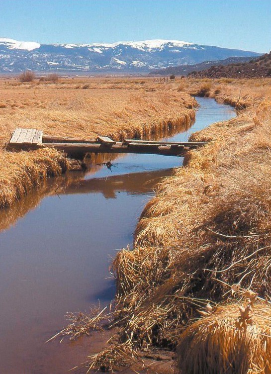
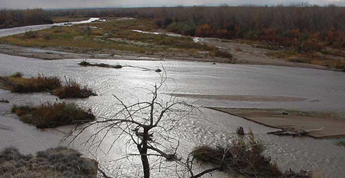
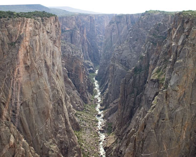
    The Rocky Mountain Biological Laboratory can best be understood as a 1,000-acre island of scientific research in a sea of public lands. Whether experiments can continue unblemished at the outdoor laboratory is the vital question as use of the public lands near Crested Butte has grown in recent years.

    Some think that Crested Butte’s summer busyness can be explained by the congestion of Interstate 70.

    Others point to the lingering “hangover” of Whatever, the festival sponsored by Budweiser last year that received prominent national attention by … well, by drinkers of Bud.

    Yet another cause may be winter promotions at the ski area that have drawn return visitors in summer or even rising temperatures in places like Oklahoma and Texas. For that matter, summer seems longer, the aspen leaves turning yellow perhaps a week later than they used to.

    Sales tax figures in Crested Butte, the old mining town, attest to the growing bulk of the summer economy.

    “Last year, our sales taxes for June and September were only slightly lower than for March and December. July and August are much bigger than anything during winter,” says Jim Schmidt, a town council member.

    Schmidt has been in Crested Butte since 1976, and he describes a reduced presence of the Forest Service. “There are fewer campgrounds here than when I moved here 39 years ago,” he says.

    But there are more people. “It’s astounding how many people are out there on weekends, especially in July,” he says.

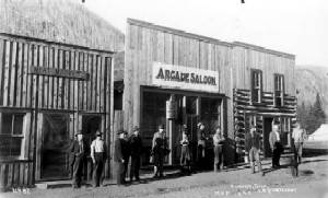
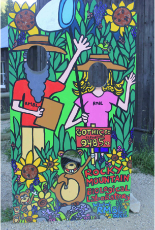
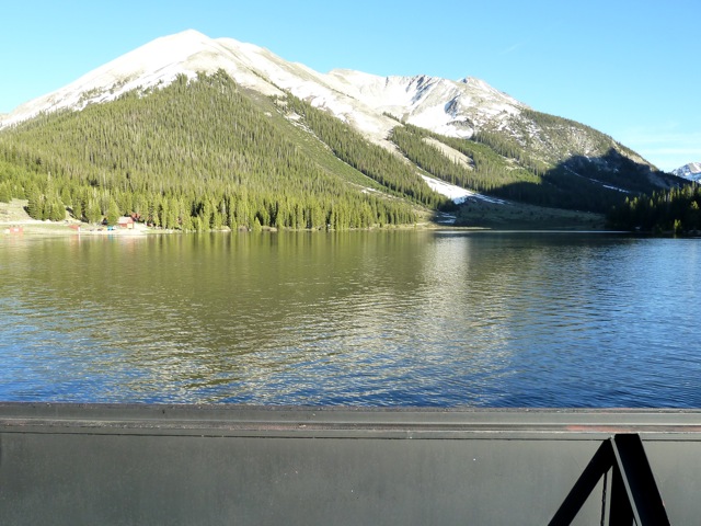
    Schmidt describes seeing 100 cars parked at one trailhead this summer, 70 at another—both miles off the nearest paved road. And, in both cases, the road taking them there goes through Gothic, the flash-in-a-path mining town from the 1880s that is the headquarters for the Rocky Mountain Biological Laboratory.

    A scientist in Colorado first visited Gothic in 1919 and recognized its potential. The lab was formally established in 1928, and it now draws scientists from across the United States—the world, too—to study butterfly genetics, bee pollination, and wildflower meadows turning to sagebrush. Some have returned faithfully every summer for decades. The longest current track record goes back to 1956. Among repeat visitors is the prominent Berkeley team, Paul and Anne Ehrlich. Currently the lab draws 160 people, but at peak season, some 200 to 250 people can be in the area, taking quarters in Mt. Crested Butte, located 3 miles away at the base of the ski area, or at Crested Butte, the old mining town, which is 8 miles away.

    Over time, important research has emerged from the laboratory at 9,485 feet in elevation. Much of what we know about pollination biology comes from the laboratory.

    Now, research continues into how rising temperatures will affect the climates of mountain valleys into the future.

    One experiment, being funded by the Department of Energy, explores effects of rising temperatures in the Colorado River Basin during the next 25 to 50 years. Individual mountain valleys have proven tremendously challenging to climate modelers. The series of questions being explored seeks to understand very complicated hydrological modeling. For example, if temperatures cause meadows to change over time into shrublands, wildflowers into sagebrush, how does that affect water runoff?

    rockymountainbiologicallaboratorysigh072015allenbest

    Another ongoing experiment involves bees and pollination. But there was a bump in that research. One study site, located on nearby Forest Service land, had become sullied. There was just too much fecal matter in the area.

    That’s just one of many blatant examples of recreational visitors, mostly innocent in their pursuits, creating conflicts with scientific research. While scientists—and valley ranchers like Bill Trampe—have complained of intrusions for many years, the scale has picked up in just the last few years. Property lines don’t mean quite as much. Fences don’t necessarily make good neighbors. One local rancher described a “flood” of visitors.

    “People were literally defecating in the woods. Traffic on the old dirt Gothic Road at times looked like a work commute in Denver,” writes Mark Reaman in the Crested Butte News. “Campsites and fire rings were every 50 feet in spots in July and attitudes were less respectful than we here in the valley are used to.”

    Ian Billick, the manager of the laboratory since 2000 and, before that, a researcher beginning in 1988, can point to any number of annoyances and disruptions. He also sees a pattern. The Forest Service, he says, does not have the money nor the framework for managing large amounts of dispersed recreation, as is now occurring in the Crested Butte area.

    That observation was reinforced this summer in Crested Butte when the Forest Service reported they didn’t have the money for backcountry outhouses. Crested Butte is helping pony up the money for the toilets next year.

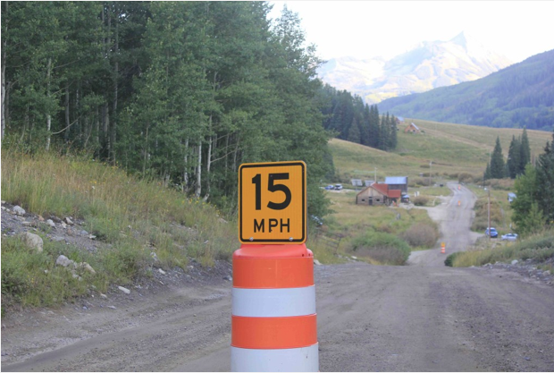
    Russell Forrest, the assistant Gunnison County manager, has experience from Vail and Snowmass Village. In part, this is an upward tick after the Great Recession. A traffic counter on the road to Gothic shows an 81 percent increase in traffic from 2013 to 2015. There were concerns during the last boom period, of 2005-2006, so the problem is not new.

    Hiking trails to the Maroon Bells area, on the other side of the Elk Range, are a draw. Hanging around the visitors’ center one day, Forrest said 95 percent of the people were asking directions for those trails.

    At a retreat held this summer at Gothic, many ideas were suggested, and there are both small and easier short-term steps as well as long-term strategies, says Forrest, if none are yet firm. One of the bolder ideas involves providing bus service to the hiking trails, somewhat similar to what occurs on the opposite side of the range, to the base area for the Maroon Bells.

    Still another idea, also implemented in the Maroon Bells area, is to limit traffic altogether during mid-day and during mid-season. But that would be hard to effect in the Crested Butte-Gothic area, because the road through Gothic is part of a long loop past Paradise Basin. The devil is always in the details.

    What seems more certain are small steps: more backcountry privies next summer and stepped-up enforcement, for example.

    Have things gone to hell in a hand-basket at Crested Butte and Gothic? Again, everything is relevant. To most visitors, the valley remains heavenly.

    And I’m reminded of a conversation. Somebody had moved from the Aspen area to Crested Butte, to get away from the “noise,” or general high level of activity. I asked him how he liked it now. “I said I wanted to turn down the noise, not turn it off,” he replied with a smile.

    Fountain Creek watershed: That pesky stormwater was around much of the summer

    Here’s a photo gallery from The Colorado Springs Gazette

    #ColoradoRiver District Annual Seminar recap: El Niño looks promising for southwest Colorado

    mid082015plumeofensopredictionscpc

    From The Grand Junction Daily Sentinel (Dennis Webb):

    Western Coloradans might consider keeping an umbrella handy this fall thanks to the development of a strong El Niño weather system.

    Less clear is the degree to which snow-sport enthusiasts and those concerned with the adequacy of water supplies should count on a heavier-than-average overall snowpack this winter. But the weather trend is inspiring optimism among some.

    “It looks like we’re going to have a heavier-than-normal snowfall this year, is what we’re hoping,” said Dusti Reimer, a Powderhorn Mountain Resort spokeswoman who noted that cooler-than-normal temperatures also are in the forecast.

    “We’re definitely excited with those possibilities to make this pretty much an epic ski year.”

    Klaus Wolter is a research scientist in Boulder with the National Oceanic and Atmospheric Administration’s Earth Systems Research Laboratory Physical Sciences Division. He said that while chances are good in western Colorado for above-average precipitation this fall thanks to El Niño, mid-winter is likely to be drier than normal in Colorado’s central and northern mountains. Southern Colorado, by contrast, is more likely to continue benefiting in mid-winter from the moisture El Niños typically deliver to the southwestern United States.

    “Basically if you want to have a lot of snow this winter the San Juans (San Juan Mountains in southwest Colorado) are the place to go,” Wolter said recently at the Colorado River District’s Annual Water Seminar in Grand Junction.

    For western Colorado as a whole, whether it can finish the snowpack season with net above-average precipitation depends on whether there’s a wet enough spring, he said. The good news is that El Niños typically boost spring snowfall levels, and the fact that the current one is a strong one increases the likelihood it will still be around by spring, Wolter said.

    It was late-season moisture during another strong El Niño season, in 1982-83, that threatened to cause Lake Powell to overfill that spring.

    Jim Pokrandt, a spokesman with the Colorado River District, said that from everything he hears from Wolter and other experts, “Colorado is kind of a no-man’s land” when it comes to El Niño winters. El Niños tend to be a strong predictor of above-average snow in southwest Colorado, while only sporadically providing benefits farther north, he said.

    “We’ve seen El Niños produce good winters and we’ve seen El Niños leaving people saying, ‘Hey, what happened?’ It’s just not as sure-fire a thing as it is for other parts of the country,” Pokrandt said.

    Given the concern over the adequacy of snowpack levels in the Colorado River Basin in recent years, Pokrandt would be happy to see El Niño at least produce average snows in coming months, even if it doesn’t deliver a whopper of a winter.

    “The way things are going, 100 percent of average would look like a good year and act like a good year. I’ll take average,” Pokrandt said.

    “… I hope as skiers and water managers we get at least an average year, if not better.”

    El Niños are associated with warmer-than-average surface water temperatures in the eastern equatorial Pacific Ocean. Data to date suggests the current one could be one of the strongest since 1950.

    For California and the Southwest, it should provide relief from drought, although possibly with negative side effects such as mudslides. El Niños also tend to result in below-average moisture for the Northwest and northern Rockies — making the current one bad news for places such as Washington state that already have been coping with wildfires and other effects of drought.

    Predicting the impacts on Colorado is made difficult because of its location, somewhat on the border between the Southwest and the northern Rockies. While Interstate 70 is sometimes referred to as a typical rough dividing line between areas of above-average and lesser moisture during El Niños, Wolter more specifically puts it around Crested Butte and the Elk Mountains area.

    If nothing else, the current El Niño looks promising for southwest Colorado, an area that has been particularly dry in several recent years.

    “If this outlook pans out, that will be really good for the water supply situation in southwest Colorado,” said Jim Pringle, a warning-coordination meteorologist with the National Weather Service in Grand Junction.

    Wolter said that even if the mid-winter is drier in the central mountains, ski areas may benefit from having good conditions to open their seasons, and hopefully also good conditions come spring. That might bode well for spring break business and offer the possibility for pushing off their closing dates if the economics warrant staying open longer, he said.

    Reimer said Powderhorn is scheduled to open Dec. 17 and close April 3, but those dates could be reconsidered if conditions warrant an earlier opening or later closing. She said the resort will further benefit from work this summer to expand its snowmaking coverage from 25 acres to 42 acres.

    California Drought Monitor September 22, 2015
    California Drought Monitor September 22, 2015

    From The Grand Junction Daily Sentinel (Dennis Webb):

    California’s water-supply problem is by default the problem of the entire Colorado River Basin, and basin states ignore it at their own peril, two speakers warned Thursday.

    “You have to keep track of what’s going on in California. California affects the Colorado River and vice versa,” Jennifer Gimbel, principal deputy secretary for water and science at the U.S. Department of Interior, said during the Colorado River District’s annual water seminar in Grand Junction.

    Pat Mulroy, retired general manager of the Southern Nevada Water Authority, warned that Lake Mead is dropping ever closer to a point at which it would no longer be capable of releasing water for downstream uses. That will lead to panic and irrational behavior, she predicted, and federalization of a river system under which water is now governed and allocated by interstate compact.

    “We will have all-out chaos,” said Mulroy, now senior fellow for climate adaptation and environmental policy at the University of Nevada, Las Vegas’ law school.

    California is coping with a severe drought, the effects of which have been amplified by the inability of varying interests there to build flexibility into water management, store water in wet years and otherwise prepare for dry times, Mulroy said.

    “The story of California is the story of missed opportunities, and of the inability, the human inability, to find solutions,” she said.

    Gimbel, former director of the Colorado Water Conservation Board, said part of California’s problem is a lack of sufficient in-state water storage capability to help it prepare for dry years, as opposed to the high-capacity storage provided by Lake Mead and Lake Powell on the Colorado.

    “It’s quite honestly what’s saved our bacon over these last 15 years of the drought,” Gimbel said.

    She said the heavy precipitation during what’s being called the “Miracle May” earlier this year helped stabilize water levels in Lake Powell. That has provided some breathing room for dealing with what’s an ongoing drought, and efforts to deal with it must continue, Gimbel said.

    She said Lower Basin states have had “difficult discussions” in this regard, “and when things get bad people tend to go back to their positions.”

    “… I think that we have to do better on this river. We cannot give up, and it means that when we get scared we cannot retreat to our corners and close the door. We can’t do it alone.”

    She hopes that Colorado learns from California’s experience “about drawing lines in the sand, litigating and being unable to move forward.” She said as work began on Colorado’s state water plan, she worried about the rhetoric she was hearing, and about people falling back to their standard positions.

    “You can protect what you want to protect, go after what you want to go after,” but everyone has to work together, said Gimbel, who praised the progress that since has been made on the plan.

    Said Mulroy, “It is not easy to try to find a new balance point, it is not easy to try to understand your adversary’s position or your fellow stakeholder’s position.”

    That is something that has yet to occur in California, she said.

    Mulroy sees a need for people to view themselves as citizens of the Colorado River Basin. Everyone has to conserve water and participate in the management of the system, and water needs to be viewed not just as a right but a responsibility, she said.

    “If we each take a little bit less in times when we can … and we set limits on how far we’re comfortable letting the system drop before we start recharging the system, then we won’t be sitting in front of dry reservoirs,” Mulroy said.

    Asked about concern on the Front Range that conservation measures could mean fewer green lawns and reduced property values, she talked about the initial resistance in the Las Vegas area to efforts to have homeowners convert to more desert landscaping, before they realized it could be beautiful and also end the need to mow lawns.

    “It is a real cultural shift, but people need to understand there is a need to conserve,” Mulroy said.

    She said that in considering the challenges river basin states face in the years ahead, it’s important to keep in mind the “amazing transformation” that has occurred in connection with the Colorado River’s management over the last 20 years. Parties in Colorado and other states have overcome acrimony and finger-pointing to forge agreements that have drawn attention from people in other parts of the world who have river systems facing similar challenges.

    “We need to look at the successes in order to keep the challenges that we face in perspective and not perceive them as insurmountable,” Mulroy said.

    El Niño: One of Nature’s Biggest Weather Makers — Weather-Ready Nation

    El Niño has arrived, according to forecasters with NOAA’s Climate Prediction Center, and it’s making big news. But why? It simply comes down to the extensive impact El Niño has on the world’s weather patterns.

    Average influence of El Niño on US temperature and precipitation
    Average influence of El Niño on US temperature and precipitation

    When an El Niño develops, it can start a chain reaction in the atmosphere influencing the weather in places much farther away from the tropical equatorial Pacific Ocean, including the United States. This means certain changes to the typical climate, or long-term average for temperature or precipitation, for folks in some parts of the U.S. Climate is like the tides. Just like the tides roll in and out, our climate warms during the summer and cools during the winter. El Niño’s would be like changing the level of those tides in some places. Perhaps they come in a little higher or earlier now, getting you wet before you have a chance to move your blanket back.

    The map above highlights areas of the U.S. that experience temperature or precipitation conditions that may be different from normal when an El Niño is present. Impacts from El Niño are most noticeable during the late fall through early spring months. During late spring and summer, climate patterns may not be affected at all.

    Not every El Niño event leads to the same climate conditions, however, and the strength of the El Niño event can have an impact on just how warm, cool, dry, or wet the affected areas become. As of summer 2015, the current El Niño has strengthened over the past few months, with a strong event currently favored during the late fall and early winter, according to the latest report from the Climate Prediction Center.

    In instances when a strong El Niño occurs, there can be large impacts to communities and the U.S. economy. Strong El Niños are often associated with heavy winter rains across California, which could bring much needed moisture to a region devastated by drought. Even if above normal precipitation falls across California, one season of above-normal rain and snow is very unlikely to erase four years of drought.

    Meanwhile, heavy rains in the southern half of the U.S. could lead to flooding causing widespread damage to towns and communities, lives and livelihoods. In addition, El Niño could elevate the risk for severe weather across the Southeast during winter. On the other hand, above-average late fall to winter temperatures across the northern tier of the U.S. might mean a milder winter and lower energy costs. It’s important to understand that a strong El Niño only favors these impacts, but doesn’t guarantee they will happen…

    For more information on El Niño, visit http://www.climate.gov/.

    CWCB board meeting recap: Horse Creek flume gets state funding

    Fort Lyon Canal
    Fort Lyon Canal

    From The Pueblo Chieftain (Chris Woodka):

    The Fort Lyon Canal Co. will rebuild its aging Horse Creek Flume this winter in a $2.2 million project designed to save both cropland and wildlife habitat.

    The Colorado Water Conservation Board approved a $1.69 million loan and $500,000 grant at its meeting in Montrose this week. The grant was from the Water Supply Reserve Account endorsed by the Arkansas Basin Roundtable.

    The 400-foot long, 10foot diameter steel pipe flume crosses Horse Creek about 8 miles west of Las Animas and was originally designed to carry 1,800 cubic feet per second when it was built in 1938. The flume has been repaired many times, but is at the end of its useful life. Its loss would affect farm revenues of $50 million and 14,000 acres of wildlife habitat.

    Work on the project is scheduled to begin in November and be completed by March.

    The CWCB also approved several other loans and grants that affect the Arkansas River basin:

    A $533,000 project will replace the Evans Bypass Flume, a 450-foot long, 6-by-5foot structure with an underground pipeline at Evans Reservoir near Leadville. The Parkville Water District got a $180,000 loan and $300,000 grant from CWCB.

    Lamar Water received a $100,000 loan and $161,000 grant toward a $400,000 project to repurpose two wells to provide non-potable water to irrigate public parks and fields. The wells previously were part of the city’s drinking water system until 2012, when they were taken out of service over water quality issues.

    The Box Springs Canal and Reservoir Co., near Ordway, received a $200,000 grant toward a $300,000 project to replace several traditional wells with horizontal wells to restore production under water rights already claimed.

    The Huerfano County Water Conservancy District won approval for a $220,000 grant toward a $250,000 project to assess the viability of storage in about 70 small dams in the Cucharas River basin.

    The CWCB approved a $98,000 grant for the Arkansas Basin Roundtable to hire a coordinator to put the basin implementation plan into action. The plan identifies 300 projects — many of which meet multiple needs — that have been identified in the past 10 years.

    Straight line diagram of the Lower Arkansas Valley ditches via Headwaters
    Straight line diagram of the Lower Arkansas Valley ditches via Headwaters

    The Pueblo Board of Water Works is looking at options to enlarge Clear Creek Reservoir

    Clear Creek Reservoir
    Clear Creek Reservoir

    From The Pueblo Chieftain (Chris Woodka):

    One of the most popular sayings surrounding the upcoming state water plan has been “one size does not fit all.”

    Pueblo Water is taking that to heart in its own planning for the future of Clear Creek Reservoir, located in northern Chaffee County.

    “Clear Creek is an important part of our future,” said Alan Ward, water resources manager for Pueblo Water. “We’re looking to see if there’s a sweet spot so we can look at enlargement that is most costeffective.”

    The Pueblo Board of Water Works Tuesday approved a $97,600 contract with GEI Consultants to look at various sizes for enlargement of the reservoir.

    The reservoir now holds 11,500 acre-feet (3.7 billion gallons). GEI did a study in 2001 on what it would cost to enlarge the reservoir to 30,000 acre-feet.

    But those numbers are out of date by now, and there may be some intermediate sizes that are less costly and more practical.

    The biggest factor is land acquisition. U.S. Forest Service and some private land lies behind the reservoir and would be inundated as reservoir levels rise. If the storage were increased to less than 30,000 acrefeet, not as much land would be needed, Ward explained.

    While the dam is not unsafe, Pueblo Water is studying seepage issues and the effectiveness of corrective measures that have been performed. The risk assessment by Black & Veatch will be complete in October.

    The study also will look at improving the outlet works in order to maintain large releases when necessary.

    Pueblo Water purchased Clear Creek Reservoir and Ewing Ditch from the Otero Canal Co. in 1954, and uses it to store primarily transmountain water by exchange. There is an in-basin water storage right that occasionally comes into priority during wet conditions, such as this spring.

    #Drought news: 25% of #Colorado is abnormally dry

    From The Denver Post (Jesse Paul):

    The U.S. Drought Monitor report shows that the abnormal dryness is centered around Denver, and the state’s northeast and southeast.

    “We’ve been dry August and September,” said Bob Koopmeiners, a meteorologist with the National Weather Service in Boulder. “Way below normal.”

    The new dryness percentage follows a report last week in which only about 10 percent of Colorado was listed as abnormally dry.

    In July, a drought monitor report showed that Colorado was nearly free of the thirst that had affected the state — particularly the Western Slope and southeastern counties — for years.

    The dry conditions have led to open-burn bans across the Front Range, including in Jefferson, Boulder and Clear Creek counties.

    From KUSA via the Fort Collins Coloradan:

    Larimer County, parts of Boulder County, unincorporated Arapahoe County, unincorporated Jefferson County, Lincoln County and Gilpin County are under some level of fire ban. On Thursday afternoon, Clear Creek County became the latest one to impose fire restrictions.

    Along the western edge of the metro area, it is not hard to find evidence of just how dry it is…

    That sight repeated around the Colorado, where grass fires of varying sizes have broken out in the past few weeks. It is a far cry from what we saw earlier this spring and summer…

    Last week, the U.S. Drought Monitor map showed a state with a few abnormally dry spots. Fast forward to now and those dry conditions have grown, encompassing large swaths of the Eastern Plains and up and down the I-25 corridor. Firefighters say it’s evidence of a state that is rapidly drying out.

    #AnimasRiver: NM and #Colorado Congressmen draft mining legislation after Gold King mine spill

    Gold King Mine entrance after blowout August 2015
    Gold King Mine entrance after blowout August 2015

    From MiningTechnology.com:

    US Senators have introduced a new bill to help the Navajo Nation and communities in north-west New Mexico and south-west Colorado recover from the Gold King Mine spill.

    The bill was introduced by US Senators Tom Udall and Martin Heinrich and Representative Ben Ray Luján of New Mexico, and Senator Michael Bennet of Colorado…

    Outlining allowable damages, the bill will is aimed at ensuring spill victims can receive compensation for their losses.

    An Office of Gold King Mine Spill Claims will also be established within the EPA to carry out the compensation process under the Federal Tort Claims Act.

    Under the new legislation, the EPA is required to work with affected states and tribes, as well as other relevant agencies to identify the dangerous abandoned mines across the west and establish a priority plan for cleanup.

    Agencies have to alert nearby communities and develop a contingency plan in case of a spill before deciding on any cleanup or remediation in an abandoned mine…

    Ensuring that the Environmental Protection Agency (EPA) continues to work with affected communities, the Gold King Mine Spill Recovery Act of 2015 would also require the agency to work with the states and tribes to fund and implement long-term monitoring of water quality from the mine.

    Michael Bennet said: “In addition to the acid mine drainage that polluted our river, the disaster took its toll on businesses throughout the region, particularly our recreation and tourism industry.

    “This bill ensures that those businesses, individuals, water districts, farmers, and local and tribal governments will be compensated by the EPA for costs they incurred due to the spill.”

    Meanwhile, the Animas River Stakeholders Group meets in Durango for the first time in two years. Here’s a report from Jonathan Romeo writing for The Durango Herald. Here’s an excerpt:

    The Animas River Stakeholders Group made its way downstream Tuesday, holding its first meeting in Durango in almost two years.

    The decision to hold the group’s monthly meeting at the La Plata County Administrative Building was directly related to the Aug. 5 Gold King Mine spill that has drawn a renewed interest in the mine waste pollution occurring in the Upper Animas watershed.

    Peter Butler, one of the coordinators of the group, said it’s now important to weigh the risks of managing a one-time major blowout as opposed to continuous metal loading. He said the ARSG is aware of four other major blowouts in the last 20 years, but preventing such an event can become very complicated. Sites at risk can be hard to identify, because sometimes a mine entrance can appear stable, and a collapse can occur further back in the workings, triggering a blowout.

    In the aftermath of the Gold King spill, several departments compiled a preliminary “midnight list” for Gov. John Hickenlooper, identifying the most at-risk mine sites. Of the 230 potential risk sites statewide, 44 are located in the Upper Animas mining district.

    But even with those sites identified, the question then becomes what method do you use to prevent such an event, and how much money are you going to spend? Stakeholders also called into question whether efforts should be directed toward continual acid mine drainage, which has longer-lasting impacts on the environment.

    “People are focused on a blowout, but when you start talking about what physically you can do about it, it becomes a hard issue,” Butler said. “I’m trying to put that a little bit to the side so we can focus on continuous flow.”

    Doug Jamison with the Colorado Department of Public Health and Environment admitted he is in support of a Superfund, but he said the Environmental Protection Agency and the state health department are offering the designation as only a potential solution. As in past meetings, officials for the two agencies were unable to answer specific questions related to site boundaries, timelines and the promise of funding – stressing the need for more data…

    Only a little more than a month since the Gold King Mine discharged 3 million gallons of acid mine drainage, most communities have not reached a consensus on whether to choose a Superfund. Jamison said the community around the state’s most recent Superfund site, Colorado Smelter, took almost a year to decide. However, which communities will factor in to the decision for the Upper Animas mining district’s treatment is still unclear.

    From the Associated Press (Dan Elliott) via The Durango Herald:

    Researchers say they found scattered accumulations of heavy metals along a 60-mile stretch of riverbank in Colorado and New Mexico a month after the Gold King Mine wastewater spill and say that any potential threat to crops and livestock should be studied further.

    David Weindorf of Texas Tech University and Kevin Lombard of New Mexico State University said they found patches of discolored sludge containing elevated levels of iron, copper, zinc, arsenic and lead along the Animas River from around Farmington to just north of Durango.

    The concentrations of those metals were higher than at other sites they tested on the riverbank and on nearby irrigated and non-irrigated land, Weindorf said.

    None of the high readings was found in ditches that carry irrigation water to crops, Weindorf said. Irrigation systems along the Animas were closed before the mustard-colored plume of tainted wastewater drifted downstream after the Aug. 5 blowout at the Gold King…

    EPA spokeswoman Laura Allen said the agency will review the researchers’ findings. She said the EPA plans its own long-term monitoring project and has asked the affected states and tribes for their input.

    Weindorf described his and Lombard’s work as a pilot study and said he didn’t want to cause undue alarm, but he believes soils need to be tested over the long term. Over time, the metals they found along the riverbank could be washed into the river, get into irrigation ditches and gradually build up in the soils of land used to grow food and to graze livestock.

    “There’s a risk those metals could work their way into our food chain or the food chain for animals. That’s why we want to do this long-term study,” he said.

    Weindorf and Lombard have asked the Natural Resources Conservation Service, part of the U.S. Department of Agriculture, to fund a three-year study that would closely monitor five or six sites along the river. They estimated it would cost $750,000 to $1 million. No decision has been made.

    Weindorf and Lombard conducted their pilot study Sept. 1-3.

    Lombard, who works at the NMSU Agricultural Science Center in Farmington – where the Animas joins the San Juan River – said researchers also took soil samples from irrigation ditches before the polluted plume passed to compare with future tests…

    Asked about that kind of cleanup, the EPA said it doesn’t anticipate any human health problems from contacting or accidentally ingesting river water, and that the risk to livestock was low.

    Colorado officials believe risks are low for most human exposure and don’t warrant removing sediment, health department spokesman Mark Salley said.

    The department advised avoiding any contact with discolored sediment and water and washing after any exposure.

    The New Mexico Environment Department hasn’t reviewed Weindorf and Lombard’s findings but believes contaminated sediment is one of the more serious risks, spokeswoman Allison Majure said. New Mexico is planning its own long-term monitoring.

    Gold King Mine’s temporary treatment plant to open by Oct. 14 — The Denver Post

    From The Denver Post (Kirk Mitchell):

    The portable plant will treat 550 gallons per minute of water still discharging from the mine in southwest Colorado, according to an Environmental Protection Agency news release. The system, intended to meet treatment needs through the coming winter, will replace temporary settling ponds constructed by the EPA in August…

    The portable system is necessary because winter temperatures at the mine’s elevation of 10,500 feet north of Silverton can drop to 20 degrees below zero.

    EPA’s contractor, ER LLC, awarded a subcontract on Sept. 22 to Alexco Environmental Group Inc. to do the work.

    The treatment system will neutralize the mine discharge and remove solids and metals, the news release says. The EPA continues to evaluate data to determine the impact of the Gold King Mine on water quality.

    Confluence of Cement Creek and the Animas River from the Coyote Gulch archives (11/21/2010)
    Confluence of Cement Creek and the Animas River from the Coyote Gulch archives (11/21/2010)

    Does optimism have a place in Western water politics? — High Country News

    John Fleck photo via State of the Rockies Project -- Colorado College
    John Fleck photo via State of the Rockies Project — Colorado College

    Here’s an interview with John Fleck from the High Country News (Sarah Tory). Click through and read the whole thing. Here’s an excerpt:

    Writer John Fleck wants us to abandon our dried-up narratives of doom.

    When John Fleck began covering water (among other things) in 1995 for New Mexico’s Albuquerque Journal, he assumed he’d be writing stories about dried out wells and cracked mud. After all, as a Los Angeles native who grew up in a suburb that had replaced an irrigated citrus orchard, he’d grown up reading books like A River No More, by Philip Fradkin, and Cadillac Desert, by Marc Reisner, essential reading for water nerds.

    As a journalist, he went looking for the kinds of stories these authors promised: stories of “conflict, crisis, and doom.” But he found a very different narrative and after nearly 30 years spent covering some of the most pressing water issues in the West, Fleck is now writing a book, which is due to be published by Island Press next year. He recently spoke to HCN about the dilemma water journalists face these days— and why the West’s water problems aren’t as bad as we think…

    HCN: Where did the idea for your book come from?

    JF: The thesis is that when it comes to our perception of water in the West, we’ve inherited this narrative of crisis, conflict and doom, from literature of the ’60s, ’70s, and ’80s, and especially from Cadillac Desert. Growing up reading those books, I really embraced that narrative. I thought that was our story — that we were headed for this great crash because we’d made the mistakes that Reisner wrote about.

    HCN: But that’s not what you found?

    JF: When I came to New Mexico, which is a mostly desert state living on the edge of its water supply, I kept looking for those stories that showed people running out of water. But over and over I found communities instead showing a lot more adaptive capacity than I think the traditional narrative gave them credit for. Albuquerque’s water use, for instance, is close to half what it was per capita in the mid ’90s. We’ve grown a bunch and are using less water than we were 30 years ago. And I saw these farm communities — which are really strong cultural underpinnings of the West — who have adapted to use less water.

    It took me a long time to come around to the idea that people have actually succeeded in using less water. And how do communities do that? That’s really what my book is about — how do these places use less water and still succeed in being the kind of communities they want to be, in the midst of this pretty remarkable change?[…]

    HCN: Are there places that are still struggling with that transition?

    JF: I think in every community there’s tension between that old way of thinking about water, which just wants to use it all, and the new way of thinking that recognizes conservation. At the regional level, I think the continued talk in Colorado among a lot of people in the populated east side of the state, about the desire to divert more water out of the Colorado River Basin—to meet growing cities on the Front Range—is one place that hasn’t received the message yet, that there isn’t more water to take out, that there’s in fact going to be less…

    thewaterknifecover

    HCN: So, in a way, your book is the anti-Water Knife?

    JF: Exactly. My book is saying, “Let’s look at how we might take advantage of the steps we’ve already taken in addressing our water problems and create a future for ourselves that we’d really like.” Because if we take the narrative of crisis and conflict to its extreme, we’re going to be sending out squadrons of armed helicopters against our neighbors, and that’s not a West that any of us wants.

    WISE: Project will impact metro area’s water supply — 7News

    Click on a thumbnail below for the WISE system map and Prairie Waters map.

    @OmahaUSACE to begin ecosystem restoration project along Lower Boulder Creek

    Lower Boulder Creek Restoration site map via Boulder County Open Space
    Lower Boulder Creek Restoration site map via Boulder County Open Space

    Here’s the release from the US Army Corps of Engineers (Omaha District):

    The U.S. Army Corps of Engineers, Omaha District, in partnership with the Boulder County Parks and Open Space Department, will hold a groundbreaking ceremony to celebrate the start of construction of an ecosystem restoration project along an approximately one-mile stretch of Lower Boulder Creek. The ceremony will take place on Thursday, October 8, starting at 12:30 p.m. MDT at the project site, which is located between N 109th Street and Kenosha Road in Boulder County approximately 3.5 miles west of the Boulder County-Weld County line and 8 miles east of the city of Boulder. Limited parking will be available along the Boulder County property access road located just east of the 109th Street Bridge. See attached map. In case of inclement weather, the ceremony will take place at the Goodhue Farmhouse located at the Carolyn Holmberg Preserve, 2009 S. 112th Street, Broomfield, Colorado.

    BACKGROUND: Lower Boulder Creek once meandered across a broad floodplain that supported numerous wetlands, streamside vegetation, and associated native fish and wildlife populations. Since European settlement, the project reach and its associated habitats have been dramatically degraded by activities including upstream development, water diversions, pollution, non-native species, and gravel mining. During past on-site mining activities, the project reach of Lower Boulder Creek was channelized, and earthen levees were constructed along portions of its banks, thus disconnecting the channel from its historic floodplain and creating an impoverished stream and riparian environment. The project area is currently in a highly degraded state, which without active ecological restoration would take decades or longer to improve.

    In 2011, the Omaha District completed a feasibility study which identified a feasible project to restore habitat for migratory birds and other wildlife, restore wetland and stream values, reduce invasive species and provide other ecosystem improvements. A construction contract was awarded to American West Construction LLC of Denver, Colo. for $2.6 million, which includes realigning the one-mile section of Lower Boulder Creek to restore natural meanders, in-stream habitat, and the creek’s floodplain and planting native riparian, wetland, and upland grasses, forbs, trees and shrubs along the stream and within the floodplain to greatly improve wildlife habitat. The project is expected to be complete by Fall 2016.

    Click here to go to the Boulder County Open Space website for all the inside skinny.

    #Drought news: The Front Range and parts of the South Platte and Arkansas basins are drying out

    Click here to go to the US Drought Monitor website. Here’s an excerpt:

    Summary

    Large sections of the nation experienced dry weather, reducing topsoil moisture but promoting summer crop maturation and harvesting. On the Plains, some producers awaited rain before planting winter wheat. Pastures in portions of the Southern and Mid-Atlantic States continued to suffer from the effects of late-summer and early-autumn dryness. In contrast, locally heavy showers soaked Florida’s peninsula and the immediate southern Atlantic Coast. Significant rain also fell—albeit briefly—in parts of the Midwest, providing localized relief from recent dryness. Above-normal temperatures dominated the Plains and upper Midwest, favoring fieldwork and helping to push summer crops toward maturity. The late-season warmth also extended across the Great Lakes region and into the Northeast. Meanwhile, cool air settled across the southeastern and northwestern U.S. for several days, helping to hold weekly temperatures more than 5°F below normal in a few locations. Elsewhere, locally heavy showers dotted the West, with the most significant rain falling in the lower Southwest, southern California, and the northern Intermountain region. California’s rain, heaviest along and near the coast, fell mostly on September 15 in conjunction with tropical moisture associated with former Hurricane Linda, while Southwestern rainfall was courtesy of Tropical Depression 16E later in the period…

    Central Plains

    Dry, unseasonably warm weather maintained or worsened dryness over the central Plains. With sunny skies and temperatures topping 80°F from Colorado into Kansas and central Nebraska, Abnormal Dryness (D0) and Moderate Drought (D1) remained or expanded. Precipitation deficits are most pronounced at 60 days, with rainfall tallying less than 50 percent of normal in D0 areas, and locally less than 25 percent of normal in the D1 region of central Kansas. The rain which has since fallen over the central Plains will be accounted for in next week’s drought assessment, as the data cutoff for inclusion into the assessment is Tuesday morning…

    Northern Plains and Dakotas

    Warm, dry conditions in eastern and southern portions of the region contrasted with showery, chilly weather farther west. Despite year-to-date precipitation averaging near to above normal, Abnormal Dryness (D0) expanded over southeastern South Dakota and immediate environs where 90-day rainfall has totaled 60 percent of normal or less (locally less than 40 percent). Similar precipitation deficits were noted in the newly introduced D0 over eastern Wyoming, while 60-day rainfall totaling a meager 15 to 40 percent of normal led to the expansion of Abnormal Dryness into southwestern South Dakota and northwestern Nebraska. Farther west, below-normal temperatures were accompanied by periods of rain (1-2 inches, locally more), though rain was generally not sufficient to alleviate longer-term (9 months and beyond) precipitation deficits…

    Southern Plains and Texas

    Despite areas of beneficial rain in the north and west, the overall trend toward intensifying “flash drought” continued. After record-setting rainfall over central and eastern Texas in May, sharply drier weather over much of the state during the summer resulted in rapidly deteriorating conditions despite longer-term precipitation surpluses. To illustrate, the 6-month precipitation in Texas’ core Extreme Drought (D3) area from just east of Austin to Nacogdoches still stands at 120 to 150 percent of normal. However, over the past 3 months, this same area has received a meager 10 to 20 percent of normal. With another hot, dry week, the drought intensity and coverage expanded over much of the Lone Star State. Exceptions included the Red River Valley, where rain totals greater than an inch resulted in localized reductions in drought intensity and coverage. Farther north, widespread moderate to heavy showers (1-3 inches) eased Abnormal Dryness (D0) and Moderate Drought (D1) over central and southern Oklahoma. At the end of the period, showers and thunderstorms were overspreading northern Texas and western Oklahoma, areas generally devoid of drought at this time…

    Western U.S.

    The overall trend toward drought persistence continued, though pockets of beneficial rain were noted in the northern Rockies, Pacific Northwest, and lower Four Corners. The west was generally cooler than normal, easing stress on pastures, crops, and livestock.

    In the north, most of the region’s core Extreme Drought (D3) areas were dry. However, moderate to heavy rain on Washington’s Olympic Peninsula (2-4 inches, locally more) staved off D3 expansion. Farther east, 1 to 3 inches of rain eased drought intensity and coverage over central and southern Idaho, though northern portions of the state remained dry.

    Across the California and the Great Basin, drought remained unchanged as the region continued through its climatologically dry summer season. Some showers associated with the remnants of Hurricane Linda were noted along the coastal regions of southern California, though the totals (mostly less than 2 inches) were not sufficient to warrant any reductions to the Extreme (D3) to Exceptional (D4) Drought.

    In the Four Corners States, a late-season surge in monsoon rainfall was enhanced by moisture associated with Tropical Depression 16E, whose remnants tracked from Baja, Mexico onto the central Plains. While passing over the Southwest, the remnants of 16E generated 1 to as much as 4 inches of rain, resulting in reductions of Moderate (D1) and Severe Drought (D2) coverage in southeastern Arizona and southwestern New Mexico…

    Looking Ahead

    A cold front infused with tropical moisture will remain the focus for locally heavy showers, primarily from the southern High Plains into the upper Midwest. Additional rainfall in the vicinity of the front could reach 1 to 3 inches in a few spots. Meanwhile, a low-pressure system will drift westward toward the middle and southern Atlantic Coast, bringing a mid- to late-week increase in rainfall. Five-day rainfall totals could reach 2 to 5 inches or more in the Carolinas and parts of neighboring states. Warm, mostly dry weather will cover the remainder of the country, except for some late-week showers in the Northwest. The NWS 6- to 10-day outlook for September 29 – October 3 calls for the likelihood of above-normal temperatures nationwide, with near-normal temperatures confined to the Pacific Coast States. Meanwhile, wetter-than-normal conditions over the Southeast and from the north-central Plains into the western Corn Belt will contrast with drier than normal conditions across the central and eastern Great Lakes Region and from the lower Four Corners into central and northern Texas.