Arkansas River: Voluntary flow program renewed — The Pueblo Chieftain

Caddis fly hatch photo via http://ValiValleyAnglers.com

From The Pueblo Chieftain (Chris Woodka):

Flows on the Upper Arkansas River support the most rafted river in the country and gold medal fisheries on a 102-mile reach.

A large part of that is the voluntary flow management agreement that has been in place for 25 years among Colorado Parks and Wildlife, the Southeastern Colorado Water Conservancy District and other water users.

The Southeastern district board unanimously renewed the agreement [April 21].

“Some of us have concentrated on the rafting, but there’s an awful lot of fishing going on,” said Jim Broderick, executive director.

The agreement maintains flows at Wellsville, just outside Salida, at 700 cubic feet per second from July 1 to Aug. 15 to support rafting. That’s achieved by timing the release of up to 10,000 acre-feet of Fryingpan- Arkansas water from Turquoise and Twin Lakes in Lake County.

“What a backyard we have here!” said Bob Hamel, an outfitter representing the Arkansas River Outfitters Association. “July is our busiest month, so the help you can give us is much appreciated.”

The program also helps fish by stabilizing flows during late summer, winter and spring.

For instance, during the caddis fly hatch which began this week, the flows on the Arkansas River are kept lower than they might naturally be, and even though it might be advantageous to move water in April.

“It’s an amazing balance. All these things are benefiting from the way you’ve been operating,” Hamel said.

Browns Canyon via BrownsCanyon.org

EPA Bonita Peak Mining District superfund team lays out 2016 work plan

From The Durango Herald (Jessica Pace):

Environmental Protection Agency officials say by next month they intend to provide La Plata and San Juan counties a list of tasks it expects to complete in 2016 at the proposed Bonita Peak Mining District Superfund site.

“Next month, we could provide a more comprehensive briefing on 2016 activities, where we will collect data and figure out what questions that data will answer,” Superfund project manager Rebecca Thomas said in a brief meeting with Durango city councilors and La Plata County commissioners Thursday afternoon.

The rest of the year includes plans for a hydrology study to evaluate risks to human health and water quality as well as an evaluation of historic and cultural resources in the area.

Thomas said the sampling will answer the question of which mining sites, if any, can be quickly remedied and removed from the National Priorities List, such as those contributing to Mineral Creek, which is less complex than the areas surrounding the Upper Animas River and Cement Creek.

Thursday’s meeting was largely a repeat of information from the EPA, though local officials had questions and comments about the process.

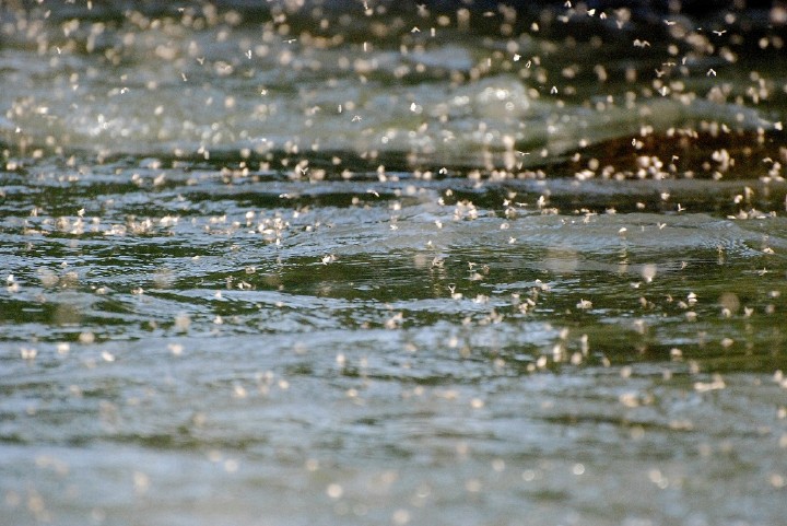
“There are a lot of people in Durango concerned it could happen again,” City Councilor Sweetie Marbury said, referring to the EPA-triggered Gold King Mine spill on Aug. 5 that ejected 3 million gallons of metal-laden water into regional watersheds.

“How will you identify the risk areas to prevent another spill happening?”

Thomas said one of the leading priorities for the Superfund team will be to examine draining adits to assess their structural stability.

Thomas said the EPA is deciding whether to expand the Gold King Mine treatment facility to treat other nearby drainage sources.

The Bonita Peak Mining District near Silverton contains 48 mine-related sites and was recommended for placement on the Federal Register for Superfund designation on April 7. The EPA now seeks comments from the public, which can be submitted online at the EPA Superfund Program Bonita Peak Mining District page.

The Superfund managerial team will return for updates the week of May 23.

Meanwhile, Animas River pollution has many sources. Here’s a report from Jonathan Romeo writing for The Durango Herald

With much of the recent focus on the Cement Creek drainage, the major sources for metal loading into the reaches of the Upper Animas River remain a bit of a mystery for researchers.

Yet Sunnyside Gold Corp.’s four massive tailings ponds along the Upper Animas River – about a mile northeast of Silverton, above the confluence with Cement Creek – have long been under suspicion.

“From Arrastra Gulch down to Silverton, there is a substantial amount of metal loading, and it’s not clear where that is coming from,” said Peter Butler, a coordinator with the Animas River Stakeholder’s Group. “The sources are not as identifiable as Cement Creek.”

From the late 19th century to the early 20th century, miners routinely dumped any by-product from metal extraction directly into rivers or lakes throughout the highly productive Silverton caldera.

In the 1930s, Sunnyside began hauling ore from Gladstone through Silverton and up what is now County Road 2 to the Mayflower Mill for processing. Only 5 percent of the ore contained precious metals.

The leftover 95 percent of waste rock, which usually contained heavy metals that included cadmium, copper and lead, was dumped beside the mill until 1992. The four piles now stretch about a mile and a half.

Sunnyside over the years has conducted numerous projects to reduce the leeching of metals into the Upper Animas, including covering the piles with clay to reduce the entry of water and digging diversions to prevent groundwater from seeping into the ponds.

Still, high concentrations of metals continue to load, according to data collected by the stakeholder’s group. Butler said in March and April, more concentrations of metals can enter the river along that stretch than all the loading that discharges from Cement Creek, considered the worst polluter in the mining district.

On Tuesday, Silverton native Larry Perino, a spokesman for Sunnyside, revealed the results of sampling conducted last year during high-flow and low-flow points to the stakeholder’s group.

Water samples taken within the tailings pond showed levels of cadmium, copper and six other metals that exceeded Colorado Department of Public Health and Environment standards. Within the Animas River along that stretch, cadmium and copper were the only metals in excess.

However, the results leave many gaps for researchers characterizing the watershed. Testing occurred only a few days in May and September, and neglected the historically high period of metal concentrations that occur in March and April.

When questioned, Perino doubted the veracity of the historical data and cited the company’s tight time frame for testing. He later added those months would have been difficult to take samples given the inclement weather.

“I think it’s impossible (to draw conclusions) unless you’re out there weekly,” said Perino, adding the company has no further plans to test this summer.

Regardless, the next steps for remediating the tailings ponds are unknown. The site, owned mostly by Sunnyside, a subsidiary of mining conglomerate Kinross, is included on the Environmental Protection Agency’s proposed Superfund listing, raising uncertainty over jurisdiction and responsibility. Sunnyside, one of the region’s largest and longest running mining operations, could be targeted as a potentially responsible party, despite years of undergoing voluntary cleanup projects aimed at being cleared of further liability.

“Right now, there are no formal agreements between EPA and Sunnyside,” said Rebecca Thomas, the EPA’s manager for the Superfund site. “So if they chose to collect data, that’s certainly their prerogative. We’ve had a cooperative relationship historically, and I think that will stay.”

Doug Jamison with the state health department said it’s too early to draw conclusions on just how much Sunnyside’s tailings contribute to the overall metal loading in the Animas watershed.

“I think there’s a lot of evaluation that needs to be done,” he said. “On the other side of the valley, there are also some potential sources.”

Indeed, of the 48 mine-related waste sites included in the Superfund listing, nearly 30 are along the stretches of the Upper Animas.

Perino said testing was done at Howardsville, above the tailings, to compare how water quality changed during its flow downstream, but he did not have that information available.

In the coming summer months, the tailings – designated a National Historic Landmark in 2000 – will be the subject of further scrutiny.

“In general, I think people were hoping (Tuesday) for a more definitive answer,” Butler said. “But I think what we learned is that it’s a difficult thing to figure out.”

NISP proponents plan to release 14,000 acre-feet per year from Glade through Fort Collins

Map of the Northern Integrated Supply Project via Northern Water

From The Fort Collins Coloradan (Kevin Duggan):

Proponents of building Glade Reservoir as part of a massive water storage project have devised a different way of moving its water to thirsty Northern Colorado communities while putting more water into the Poudre River through Fort Collins.

The proposal from Northern Water and participants in the long-sought Northern Integrated Supply Project calls for releasing about 14,000 acre feet of water each year from Glade Reservoir into the Poudre and running it through Fort Collins.

The goal would be to put more water in the river to benefit its ecosystem and aquatic life, said Brian Werner, Northern Water spokesperson. It would ensure minimum flows of 18 to 25 cubic feet per second, or cfs, in the river throughout the year.

The proposed change is in response to comments received from the public and local entities, including the city of Fort Collins, about a supplemental draft Environmental Impact Statement, or EIS, for the project being reviewed by the U.S. Army Corps of Engineers.

“A lot of what we’ve heard was about having a healthier river,” Werner said. “This benefits the river.”

The move would do away with “dry up” spots on the river downstream from where irrigation companies divert water. Passage structures would be built near the diversions to allow fish to move up and down the river.

Water would still be taken from the Poudre River during times of peak flow and stored in Glade Reservoir, which would be built north of Ted’s Place at the intersection of Colorado Highway 14 and U.S. Highway 287. But the proposed release plan would address concerns about maintaining flows in the river, especially during dry years.

There is no “magic number” for flows that translates to a healthy river, said Jerry Gibbens, water resources engineer with Northern Water, but what’s proposed would be an improvement over current conditions.

“Eliminating these dry-up points and having a minimum flow above 20 cfs would have tremendous benefits to the aquatic habitat, and that’s really what we were going after,” Gibbens said.

NISP would yield 40,000 acre feet of water a year to participants. An acre-foot is about 326,000 gallons, enough to meet the water needs of three to four urban households for a year.

Northern Water announced the new conveyance plan during its annual water users meeting April 13. Conversations with local entities about the proposal have begun, Werner said.

Fort Collins officials are aware of the proposal but have not had time to evaluate it, said John Stokes, director of Natural Areas for the city.

Among the city’s concerns about the draft EIS was projected reduced flows on the river and the impact to aquatic life. Water temperature variations in the river was another issue.

The environmental group Save the Poudre, which has been fighting NISP for years, plans to carefully scrutinize Northern Water’s proposal before stating an opinion, director Gary Wockner said.

Adjusting plans for NISP is part of the EIS review process, Werner said. The Army Corps of Engineers, which has permitting authority over the project, is expected to release the final document for NISP in 2017. The EIS process has been delayed numerous times over the years.

Ken Kehmeier, a senior aquatic biologist with the Colorado Department of Parks and Wildlife, said the proposed operational change would improve conditions for aquatic life along the Poudre through Fort Collins.

“This is just one step, but it’s a big step,” he said.

More needs to be done to address conditions downstream, Kehmeier said, where water quality is a major issue.

Under the plan, water released from Glade would be diverted from the river near Mulberry Street to a pipeline that would connect with another pipeline from the reservoir carrying water to NISP participants.

The refined conveyance method is expected to add $30 million to $40 million to the price of NISP, Werner said.

But the 15 communities and water districts participating in, and paying for, the project told Northern Water to “go for it if it gets us closer to the finish line,” Werner said.

Find more information at Northern Water’s website, and the Army Corps of Engineers’ project page.

nisp

Webinar — Managing #Drought: Learning from Australia — Alliance for Water Efficiency

Click graphic to go to the Alliance for Water Efficiency website to download the report (Scroll down to the bottom).

From the Alliance for Water Efficiency:

AWE President and CEO Mary Ann Dickinson, Dr. Stuart White, Director of the Institute for Sustainable Futures, and Heather Cooley, Water Program Director of the Pacific Institute will present on their recent report, “Managing Drought: Learning from Australia.” The report provides an overview of the key initiatives implemented by Australia’s four largest cities during an extended period of extreme drought, and outlines how those measures could help California through its current water crisis. On top of successes in urban water efficiency, other key findings in the report include:

  • Broad community involvement across sectors – households, business, industry and government – fosters a sense of fairness and collaboration in saving water.
  • Clear, credible communication about the drought situation and response is needed to maximize public participation and support.
  • Innovative water-pricing mechanisms, not employed during Australia’s millennium drought, could be used to incentivize water savings in California.
  • Click here to download the full report.

    Day/Date: Monday, May 2, 2016
    Start Time: 11 a.m. PDT | 12 p.m. MDT | 1 p.m. CDT | 2 p.m. EDT
    Duration: 1 hour
    Presenters: Mary Ann Dickinson, President and CEO, Alliance for Water Efficiency; Dr. Stuart White, Director, the Institute for Sustainable Futures; Heather Cooley, Water Program Director, Pacific Institute.

    Cost: Free.

    Click here to register.

    FEMA open house draws large crowd in Buena Vista — The Chaffee County Times

    From The Chaffee County Times (Mason Miller):

    Representatives from the Federal Emergency Management Agency, Colorado Water Conservation Board, Chaffee County and the town of Buena Vista were in attendance April 27 for an open house meeting and presentation on the recently completed preliminary Flood Insurance Study and its accompanying Draft Flood Insurance Rate Maps.

    The maps includes base flood information and areas subject to significant flood hazards along Cottonwood Creek within Chaffee County and the town of Buena Vista.

    Before the presentation, representatives from FEMA and CWCB met with residents to go over impacts the FIRM and FIS will have on property owners.

    During the presentation, Thuy Patton with CWCB said the map updates had been ongoing for 7 years and said the primary focus of the updates was to digitize the maps and provide information on flood risks.

    She said the map updates were currently in the post-preliminary processing phase and said the town and county’s 90-day appeal period had begun March 10, noting it would be around another year before the FIRM and FIS became effective, following a 6-month compliance period after the 90-day appeal window. Town administrator Brandy Reitter said the compliance period was required for the Buena Vista board of trustees to pass and adopt an ordinance approving the FIRM.

    During the appeal period, Patton said residents will need scientific evidence proving FEMA’s original flood hazard determinations were technically or scientifically incorrect.

    “With our new studies and hydrology, we’ve been able to put that on a map so you can know what the (flood) risks are,” Patton said about the map updates and said the FIRM and FIS allows for current and future residents to assess flood risks on their property.

    During the question and answer portion of the meeting, residents expressed frustration over the amount of time left in the 90-day appeal period and the fact that town and county administration were not more proactive in informing residents sooner about the potential impacts the studies will have on their properties.

    “Our 90 days is halfway over and we’re just getting good information,” one resident said.

    While there were several questions submitted throughout the meeting, organizers did not ask residents to state their name or write their name on question cards, so question askers remained anonymous.

    “This is probably a lesson for us,” Diana Herrera with FEMA said. “We need to look at the timing of our community meetings and (consider) moving those up.”

    While going over information on flood insurance rates through the National Flood Insurance Program residents asked why property owners in the high risk flood areas would be paying the same rates as residents in places like New Orleans and Houston, some of which are below sea level. Herrera said it was a national rate and said the potential for flooding was the same.

    “This area is nothing like Houston, yet we’ll be paying the same rate?” one resident asked, noting places like Houston and New Orleans flood more frequently and more significantly than Buena Vista. Herrera said depending on the FIS and FIRM, residents may pay the same rates as those areas.

    In regards to if residents would be able to rebuild or build on a floodway or floodplain, Jamie Prochno with CWCB said residents would be able to rebuild on the same footprint as the previous structure if flooding was to happen, but said if residents want to expand or build within a floodplain or floodway, they would need to work with local government to obtain a permit.

    “There’s nothing that says you can’t build in a floodplain. However, you have to get a permit from your local government, meet all those standards, meet any local standards that could be higher than our state standards,” Prochno said. “Generally in a floodplain that’s going to be much simpler because you just have to build your structure high enough … if it’s in a floodway, it’s a little more difficult because that’s a hazardous area, you have to show that there’s no rise to the base flood elevation. Keep in mind, these aren’t just lines on a map, that water has to go somewhere.”

    Doering said in March that according to the maps, there are 276 residents inside of Buena Vista town limits affected by the floodways or floodplains. He said the majority of those residents are on the east side of the railroad, along Cottonwood Creek.

    Buena Vista
    Buena Vista

    History in the Making: SDS Starts Water Delivery [April 28]

    Here’s the release from Colorado Springs Utilities:

    One of the largest water infrastructure projects completed in the U.S. this century started delivering water today to homes and businesses in Colorado Springs, Colo. The commencement of the Southern Delivery System (SDS) culminates decades of planning and nearly six years of construction.

    See video.

    “The Southern Delivery System is a critical water project that will enable the continued quality of life southern Coloradans enjoy. The water provided through SDS means future economic growth for our community,” said Jerry Forte, Chief Executive Officer of Colorado Springs Utilities.

    Not only does SDS meet the immediate and future water needs of Colorado Springs and its project partners Fountain, Security and Pueblo West through 2040, it also increases system reliability should other parts of the water system need maintenance or repairs. The project will also help provide drought protection, a significant benefit in the arid west.

    Construction started in 2010 and concluded in 2016. Originally forecast to cost just under $1 billion, SDS is started on time and more than $160 million under budget costing $825 million.

    “On time and under budget are words rarely used to describe large infrastructure projects,” said John Fredell, SDS Program Director. “We adopted a philosophy that ‘these are ratepayer dollars’ and managed the project with exceptional rigor. It was the responsible approach to spending hundreds of millions of dollars of public money.”

    Components of SDS
    SDS is a regional project that includes 50 miles of pipeline, three raw water pump stations, a water treatment plant (pictured above), and a finished water pump station. It will be capable, in its first phase, of delivering 50 million gallons of water per day and serving residents and businesses through 2040.

    Key permits and approvals for SDS required $50 million in mitigation payments to the Fountain Creek Watershed District, funding for sediment control, habitat improvements and other environmental mitigation measures. Additionally, Colorado Springs and Pueblo County, just this week, both approved an intergovernmental agreement requiring Colorado Springs to invest $460 million over 20 years to improve the management of stormwater that makes its way into Fountain Creek.

    Early on in the project, SDS program leaders agreed to spend at least 30 percent of construction dollars on local contractors. More than $585 million, or about 70 percent of the SDS budget, went to Colorado businesses.

    “SDS is one of the most important projects many of us will ever work on,” said Forte. “This is a legacy project – one that benefits so many people today, tomorrow and for generations to come. This is an amazing day for our organization and for southern Colorado.”

    The new north outlet works at Pueblo Dam -- Photo/MWH Global
    The new north outlet works at Pueblo Dam — Photo/MWH Global

    From the Associated Press via The Aurora Sentinel:

    Water has begun flowing into Colorado Springs through a new 50-mile pipeline from the Arkansas River.

    The city says the $825 million Southern Delivery System started operating Thursday.

    The system is designed to handle growth in the state’s second-largest city until 2040 and provide a backup for its current aging system.

    Pueblo West, Fountain and Security also get water from the pipeline.

    The project includes modifications to Pueblo Dam on the Arkansas River, three pumping stations and a treatment plant.

    Separately, Colorado Springs had to commit $460 million to reduce sediment in Fountain Creek. The sediment harms downstream communities in Pueblo County, and the county threatened to revoke a required permit for the pipeline if the issue wasn’t addressed.

    Arkansas River Basin Water Forum recap

    Arkansas River Basin via The Encyclopedia of Earth
    Arkansas River Basin via The Encyclopedia of Earth

    Pressures on Colorado’s water supply are leading to innovative approaches that reduce the risk to cities, farms and the environment, and good examples can be found in the Arkansas River basin.

    The Arkansas River basin has felt the pinch from growth along the Front Range for decades, and like a sponge being squeezed, new ideas are emerging.

    There’s no better illustration than the way Pueblo Water is approaching its newest purchase on the Bessemer Ditch. In the past, the Board of Water Works practiced buy-and-dry, where water-rich farms were dried up permanently to supply the city, said Alan Ward, water resources manager. The attitude has changed.

    “Pueblo Water would like to see agriculture continue,” Ward told the Arkansas River Basin Water Forum this week. “It’s an important part of our heritage.”

    The water board bought about 28 percent of the shares on Bessemer Ditch from 2009-11, and agreed to allow irrigation to continue for at least 20 years under all of its contracts.

    The purchase and lease-back method is not new. Other cities, and Pueblo itself, have used it before. The farmers get large upfront payments, which in the short-term increase local economic benefits. But eventually, past sales of water have led to dry-ups.

    Pueblo Water now is looking at ways to ensure water would still be available to irrigate the farms on the Bessemer Ditch, with the city using the water when it’s needed.

    “Pueblo Water wants to add a municipal use to the agricultural use,” Ward said of the current court process, which will take years to complete. “But we want to move it back and forth and continue leases to farmers.”

    The same dynamics are at work with the Arkansas Valley Super Ditch, but the difference is that farmers would keep control.

    “This project is trying to incorporate a number of existing components, so we can have a viable lease-fallowing program,” said Leah Martinsson, an attorney for the Lower Arkansas Valley Water Conservancy District and Super Ditch.

    She explained that state laws over the past 15 years have not been used much, because the traditional market forces that drive agricultural sellers and municipal buyers are easier for both sides. Some require storage, while others lead to long-term changes in water court that could reduce the amount of water under a water right.

    But that’s changing.

    In 2013, House Bill 1248 created a new process on a trial basis that would allow water to be leased from farms to cities (or other farms) under an administrative process. The water rights themselves would not change, as required under other laws, and farms would not be dried up.

    Water could only be leased for three years in 10 for the same parcel of farmland, or only 30 percent of a farmer’s ground could be included in any given year, assuring availability of water throughout the 10-year period of the pilot program.

    The new law was first used last year when six farms on the Catlin Canal were enrolled in a lease agreement with Fountain, Security and Fowler.

    “It’s voluntary, but all of the farmers wanted to participate again,” Martinsson said. “They said they wished they’d included more land.”

    The forum also looked at the possibility that less water would be available for imports from the Colorado River basin in the future. Under the 1922 Colorado River Compact, there is not enough water in average annual flows to meet all of the appropriations, said Aaron Derwingson of the Nature Conservancy.

    Some initial programs, funded by cities outside the basin that export water, are looking at ways to keep more water in the basin, reducing the risk that supplies would be curtailed, he said.
    Meanwhile, the Colorado Water Trust is working to preserve in-stream flows by brokering deals between high-country irrigators and the Colorado Water Conservation Board, said Amy Beatie, executive director.

    Gary Barber, project coordinator for the Arkansas Basin Roundtable, said all of the ideas tie into the Colorado Water Plan and the Statewide Water Supply Initiative, which both work to balance all of the state’s water needs.

    “The idea is to have a cycle where we’re getting projects completed as we’re planning,” Barber said.

    Straight line diagram of the Lower Arkansas Valley ditches via Headwaters
    Straight line diagram of the Lower Arkansas Valley ditches via Headwaters