
Click the link to read the article on the Climate Prediction Center website:
ENSO Alert System Status: El Niño Advisory
Synopsis: There is a greater than 90% chance that El Niño will continue through the Northern Hemisphere winter.
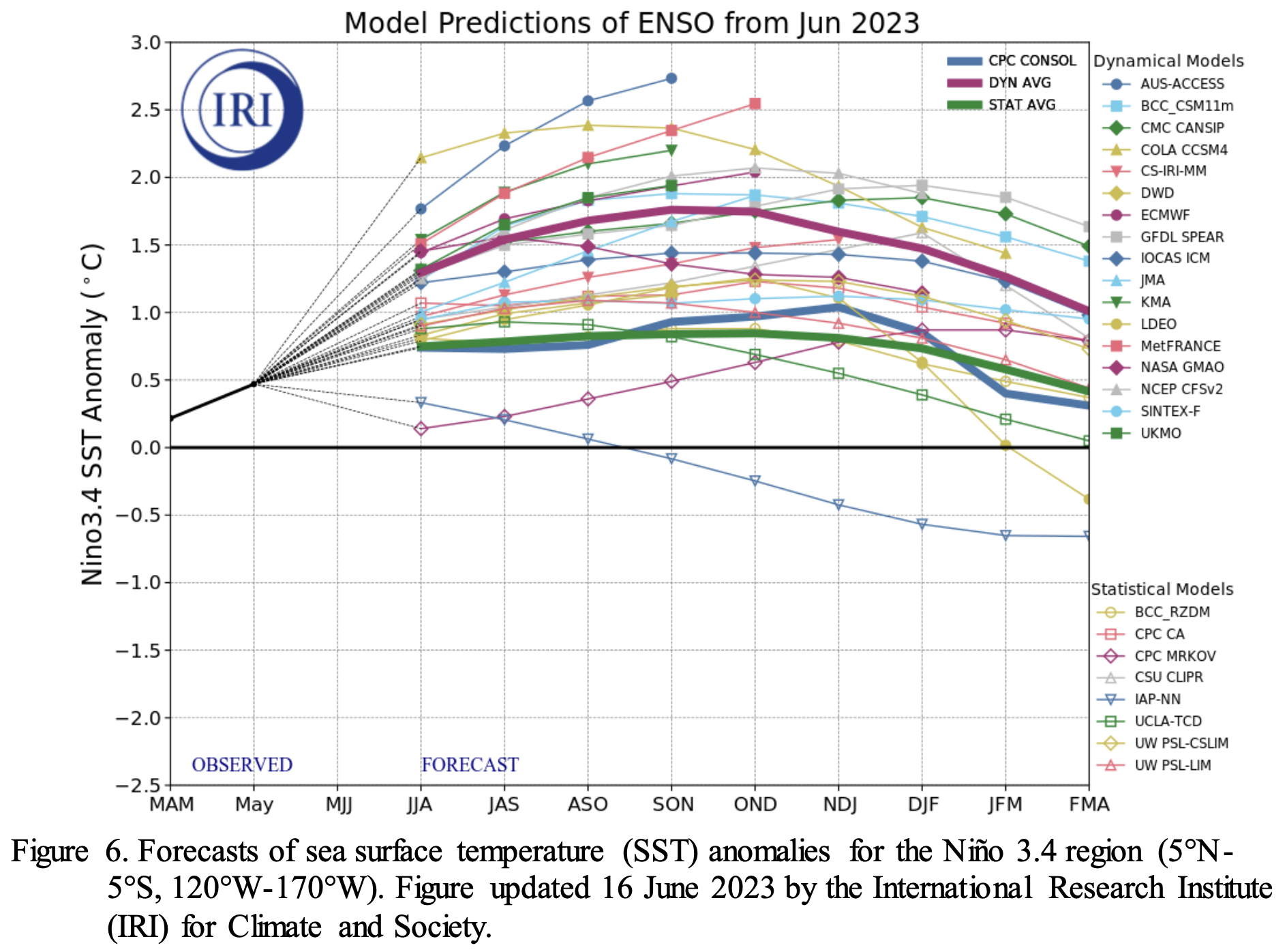
In June, a weak El Niño was associated with above-average sea surface temperatures (SSTs) across the equatorial Pacific Ocean. Nearly all of the weekly Niño indices were at or in excess of +1.0ºC: Niño-3.4 was +1.0ºC, Niño-3 was +1.5ºC, and Niño1+2 was +3.3ºC. Area-averaged subsurface temperatures anomalies increased compared to May, with positive anomalies below the surface of the equatorial Pacific Ocean. In contrast, the tropical atmospheric anomalies were weaker compared to the oceanic anomalies. For the June monthly average, low-level winds were near average over most of the equatorial Pacific. Upper-level wind anomalies were easterly over the western Pacific and westerly over the eastern Pacific. Convection and rainfall were enhanced around the International Date Line and were weakly suppressed in the vicinity of Indonesia. The equatorial Southern Oscillation Index (SOI) remained negative (0.5 standard deviations below average), while the traditional, station-based SOI was near zero. Collectively, the coupled ocean-atmosphere system reflected a weak El Niño.
The most recent IRI plume indicates El Niño will persist through the Northern Hemisphere winter 2023-24. Forecasters favor continued growth of El Niño through the fall, peaking this winter with moderate-to-strong intensity (81% chance of November-January Niño-3.4 >= 1.0C). An event that becomes “historically strong” (seasonally averaged Niño-3.4 2.0C), rivaling the winters of 1997-98 or 2015-16, has an approximately 1 in 5 chance. In summary, there is a greater than 90% chance that El Niño will continue through the Northern Hemisphere winter.