
Click on a thumbnail graphic to view a gallery of drought data from the US Drought Monitor website.

Click the link to go to the US Drought Monitor website. Here’s an excerpt:
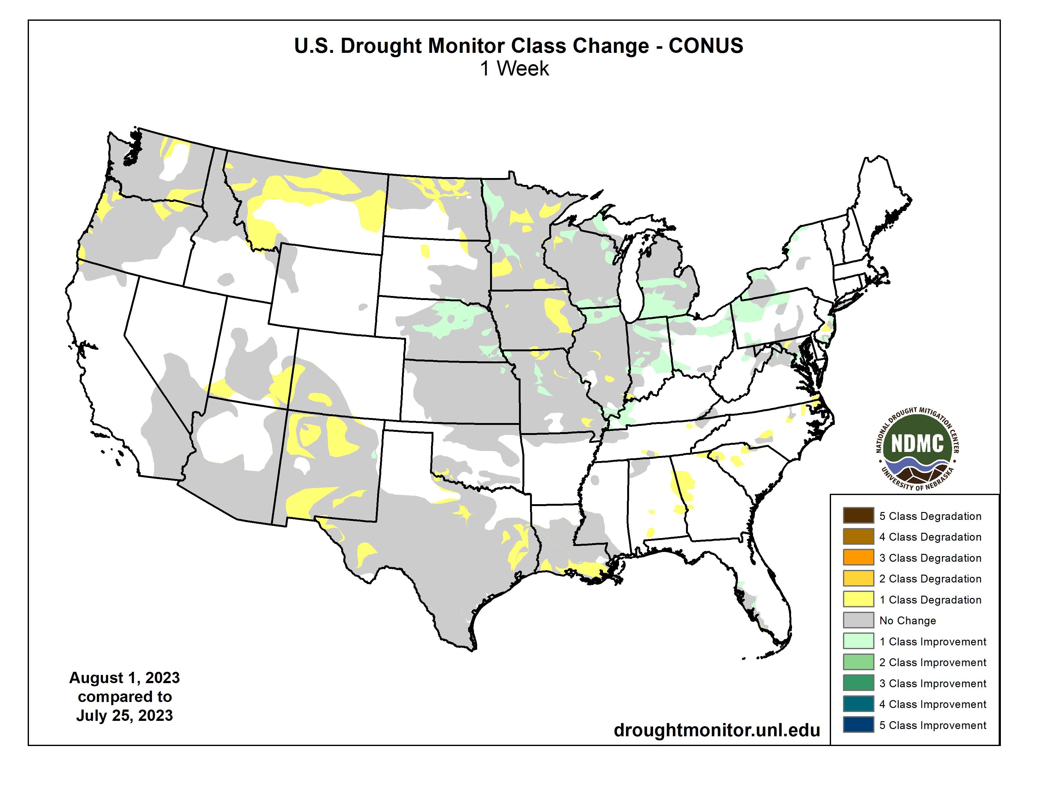
This Week’s Drought Summary
Dry conditions dominated the West and southern Plains, coupled with above-normal temperatures. Precipitation was most widespread throughout much of the upper Midwest and central Plains and into the Northeast. Almost the entire country had near- to above-normal temperatures this last week, with the greatest departures over the Southwest and central Plains where temperatures were at least 4-7 degrees above normal. Cooler-than-normal temperatures were recorded in the Pacific Northwest with departures of 3-6 degrees below normal. At the end of the current U.S. Drought Monitor period, significant rains developed over portions of the Midwest and central Plains, and they will be accounted for in the next analysis…
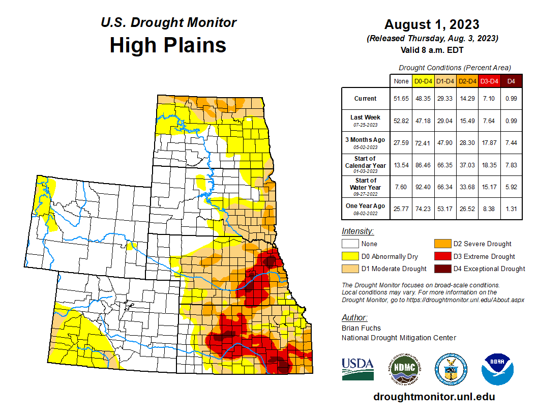
High Plains
Precipitation was mixed in the region for the week. Areas of northwest North Dakota and throughout much of Nebraska recorded above-normal precipitation while most of Kansas, eastern South Dakota and eastern Colorado were below normal for the week. Temperatures were above normal for the week along with some areas of high dew point temperatures too. Departures were generally 2-4 degrees above normal for the week, with areas of central Kansas, western North Dakota and eastern Nebraska 6-8 degrees above normal. The recent trend of wetter conditions over Nebraska allowed for improvements to be made to the drought depiction this week. Extreme and severe drought were improved over north central Nebraska and southeast Nebraska. Drought expanded and intensified over most of northern North Dakota where moderate drought conditions now cover much of the northern tier of the state. Abnormally dry conditions expanded over northern South Dakota…
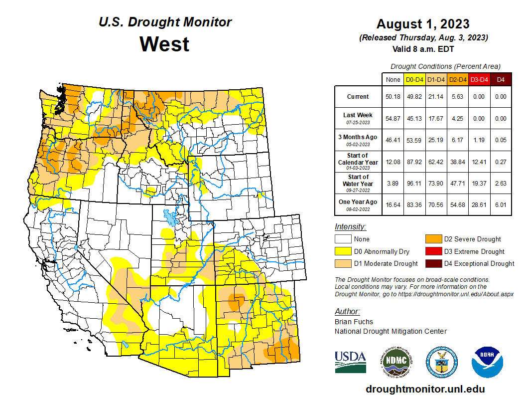
West
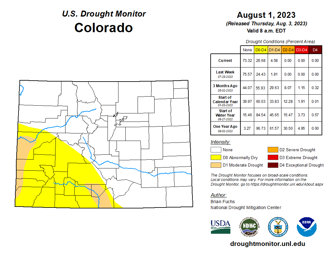
Temperatures were mixed in the region with areas of the Pacific Northwest recording below-normal temperatures with departures of 3-6 degrees below normal. Most of the rest of the region was near normal to above normal, with the greatest departures over the Southwest with temperatures generally 3-6 degrees above normal. The monsoon moisture became more widespread throughout the Southwest, with areas of the Four Corners states all seeing scattered rain events. The central valley of California as well as the Pacific Northwest also recorded above-normal precipitation. Moderate drought was introduced in southeast Utah into southwest Colorado and expanded in southern New Mexico. Abnormally dry conditions expanded over northern New Mexico and southwest Utah and southwest Colorado. Montana had an expansion of severe and moderate drought and a large expansion of abnormally dry conditions. In the Pacific Northwest, severe drought was expanded in Washington and Oregon, moderate drought expanded in northeast and southwest Oregon and abnormally dry conditions expanded into more of central Washington…
South
Temperatures were near normal to slightly above over most of the region, with the greatest departures from normal in west Texas and the Texas and Oklahoma panhandles, where departures were 4-6 degrees above normal. It was an incredibly dry week over the region with only a few pockets of showers over northern Arkansas and coastal areas of Texas. Most of the region recorded zero precipitation for the week. Severe drought expanded over east Texas and southern Louisiana and a new area of severe drought was introduced over far west Texas. Moderate drought expanded over southwest Oklahoma and northern Texas…
Looking Ahead
Over the next 5-7 days, precipitation chances are anticipated to be best over the northern Rocky Mountains, central Plains and into the Southeast where forecasted rain totals could approach 3-4 inches in places. Dry conditions will dominate the southern Plains, Southwest and along the West Coast. Temperatures will be 12-15 degrees below normal over the central Plains to the northern Rocky Mountains and 8-12 degrees above normal in the southern Plains and Southwest.
The 6–10 day outlooks show a high probability of cooler-than-normal temperatures over the Northern Rocky Mountains, central and northern Plains and into the Midwest. The best chances of above-normal temperatures are over the Southwest, southern Plains and into the Southeast. Much of the country is showing an above-normal chance of above-normal precipitation, with only the Southwest and far southern Plains having high probabilities of below-normal precipitation.
Just for grins here’s a slideshow of US Drought Monitor maps for early August for the past few years.
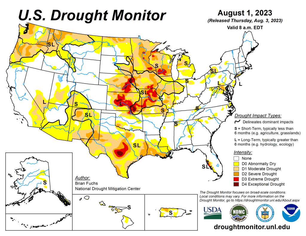
US Drought Monitor map August 1, 2023. 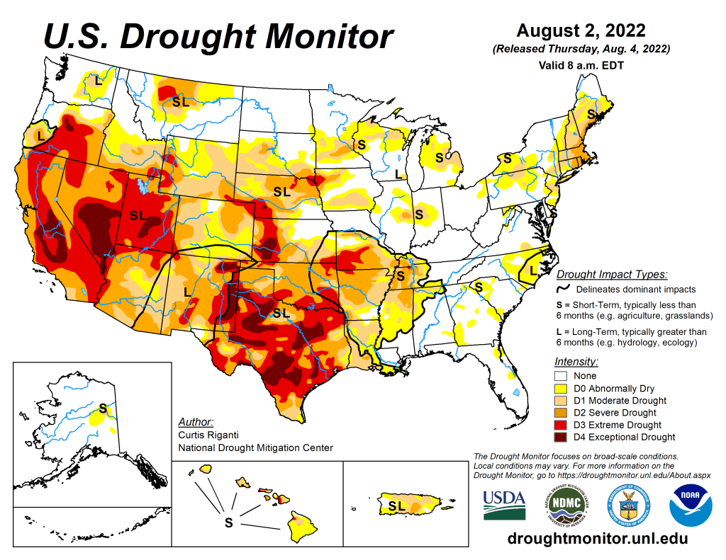
US Drought Monitor map August 2, 2022. 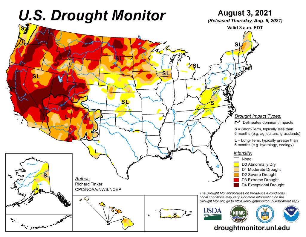
US Drought Monitor map August 3, 2021. 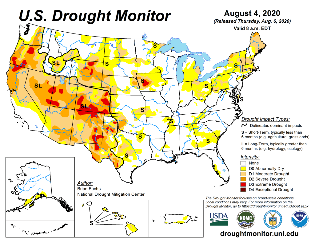
US Drought Monitor August 4, 2020. 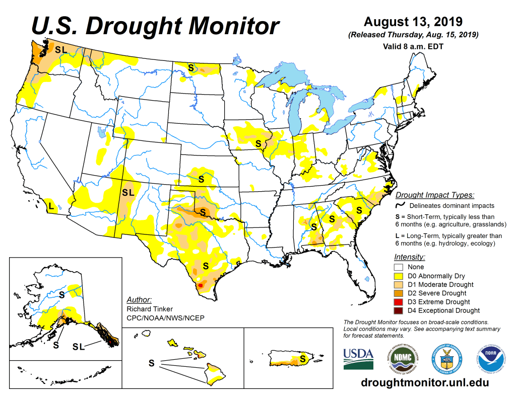
US Drought Monitor August 13, 2019. 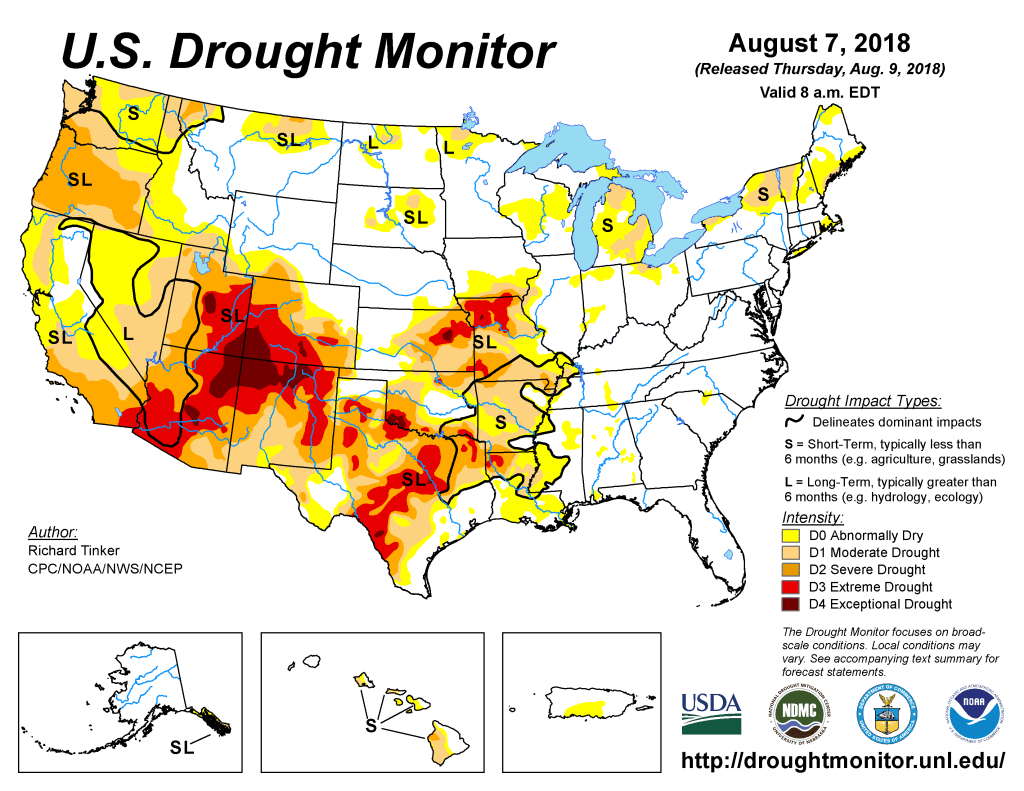
US Drought Monitor August 7, 2018. 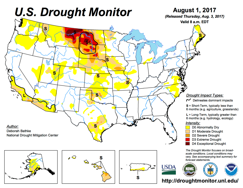
US Drought Monitor August 1, 2017. 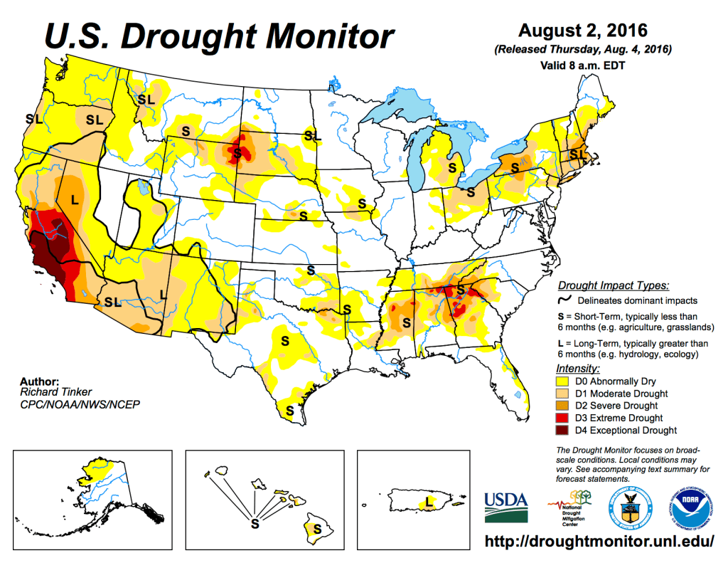
US Drought Monitor August 2, 2016. 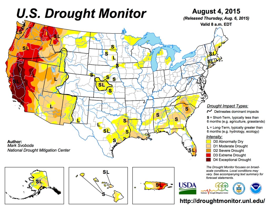
US Drought Monitor August 4, 2015 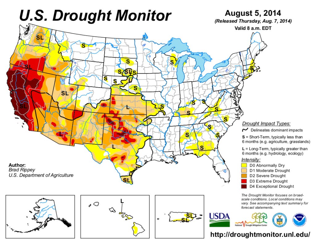
US Drought Monitor August 5, 2014 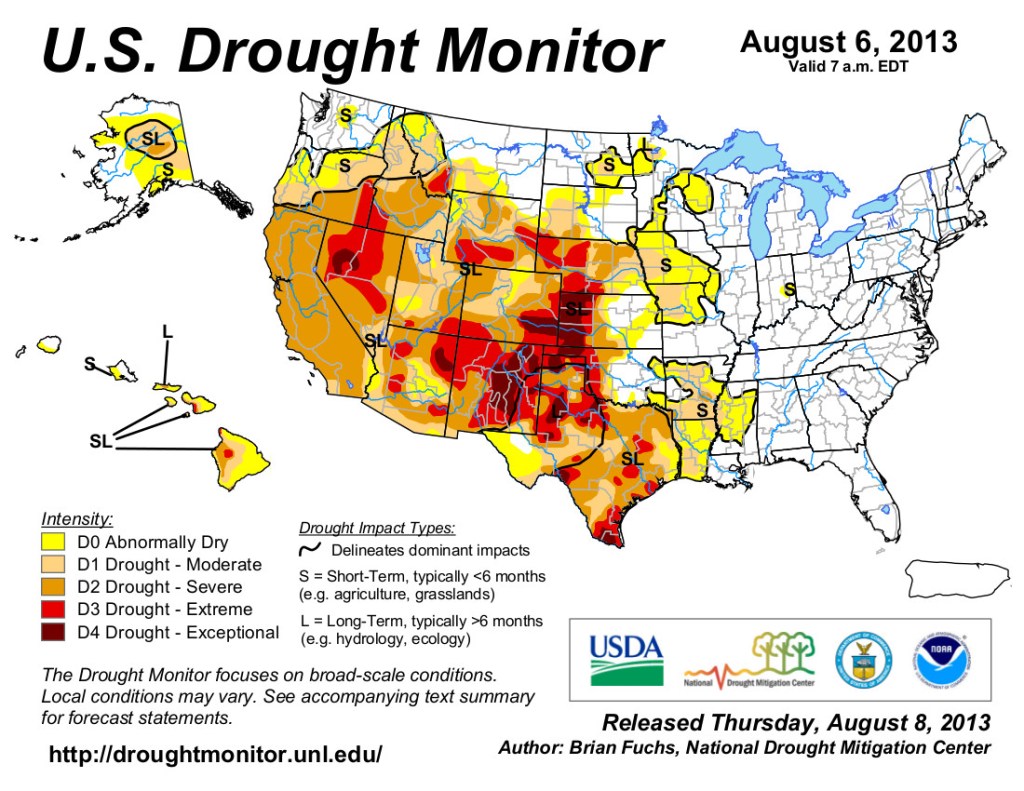
US Drought Monitor map August 6, 2013. 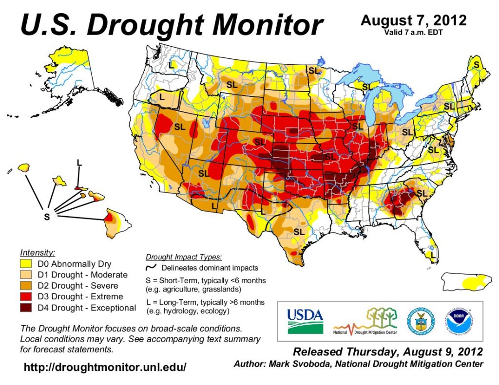
US Drought Monitor August 7, 2012 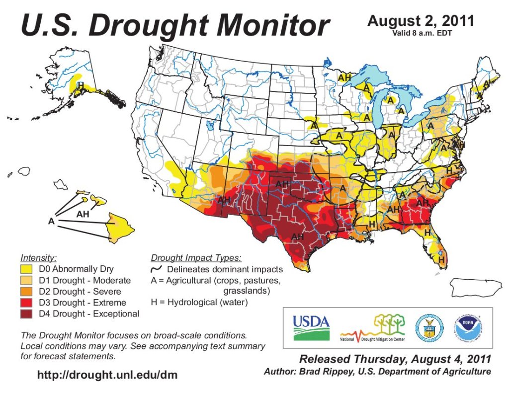
US Drought Monitor August 2, 2011

