
Click on a thumbnail graphic to view a gallery of drought data from the US Drought Monitor website.
Click the link to go to the US Drought Monitor website. Here’s an excerpt:
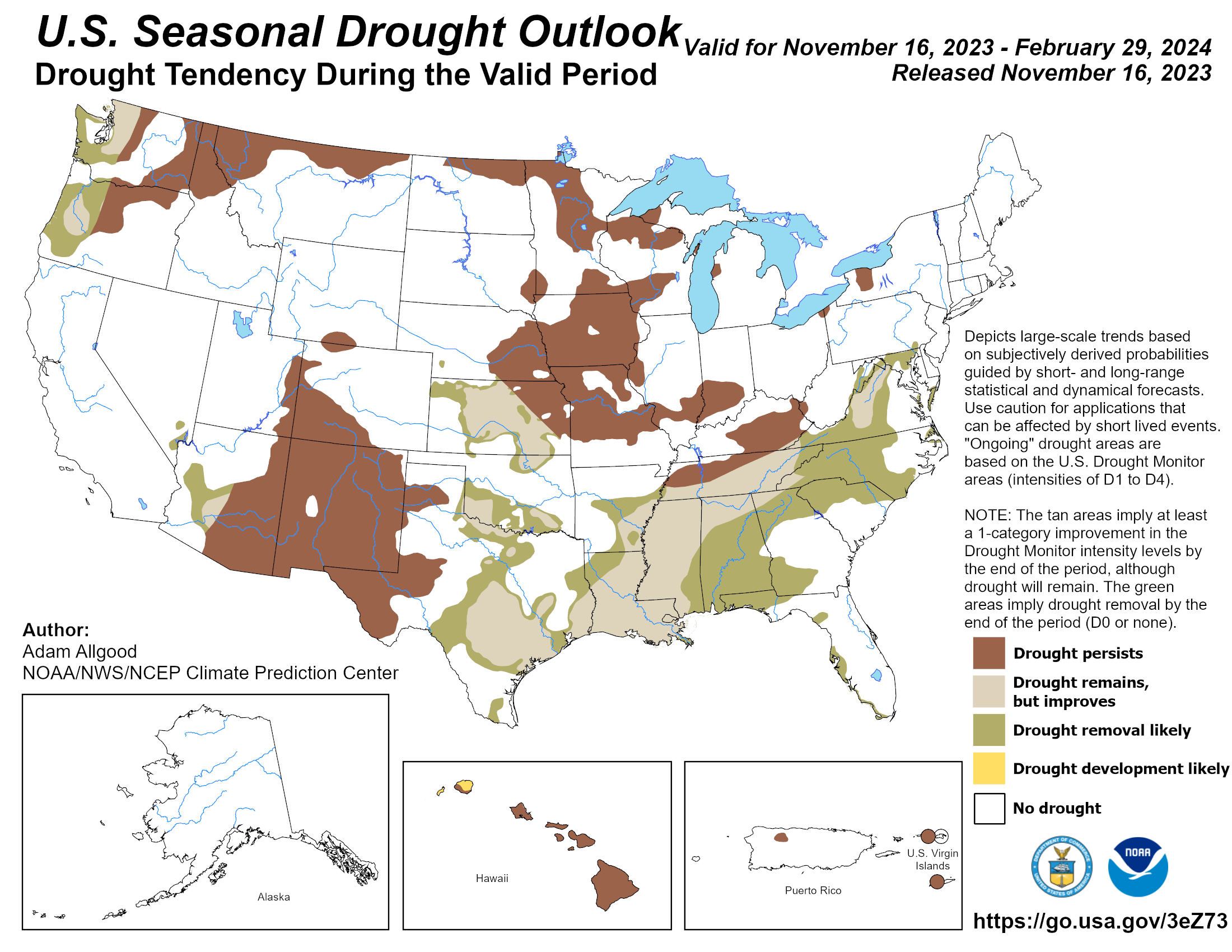
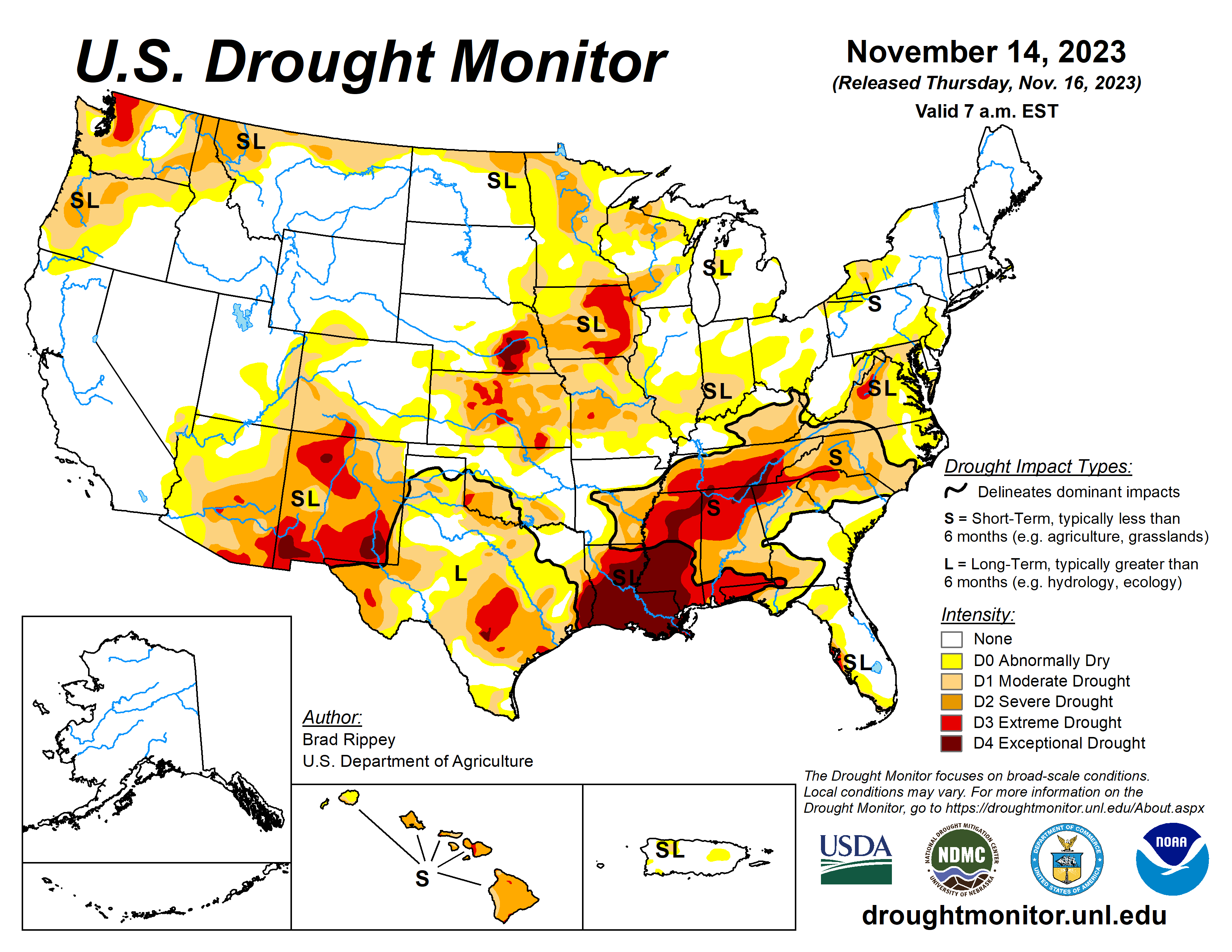
This Week’s Drought Summary
During the drought-monitoring period ending November 14, precipitation was focused across a few geographic areas, including portions of the Northwest, South, and Great Lakes region. In places where precipitation fell, winter grains, cover crops, and rangeland and pastures generally benefited from the boost in topsoil moisture. That was especially true in the South, which has been contending with serious “flash drought” issues, including a rash of autumn wildfires. However, Southern rainfall coverage was spotty, with many areas receiving only light showers. Elsewhere, Northwestern precipitation was heaviest from the Cascades westward, although key agricultural areas farther inland received some moisture. Following a nearly nationwide cold outbreak in late October and early November, warmth returned across most of the country, amplifying drought impacts in some of the driest areas…
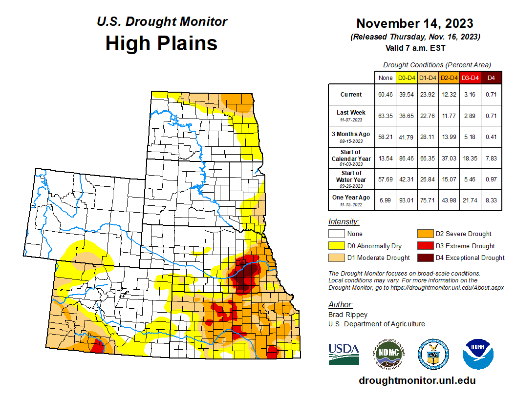
High Plains
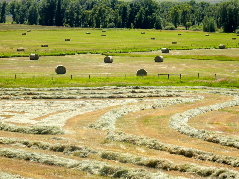
Pockets of drought were mainly focused across eastern and southern sections of the region, with worsening conditions noted in parts of Kansas and neighboring states. According to the U.S. Department of Agriculture, topsoil moisture was rated more than one-half very short to short on November 12 in Kanas (69%), Nebraska (61%), and Colorado (60%). On the same date, 17% of the U.S. winter wheat crop was rated in very poor to poor condition, although state-level numbers were higher in Kansas (33% very poor to poor) and Nebraska (18%)…
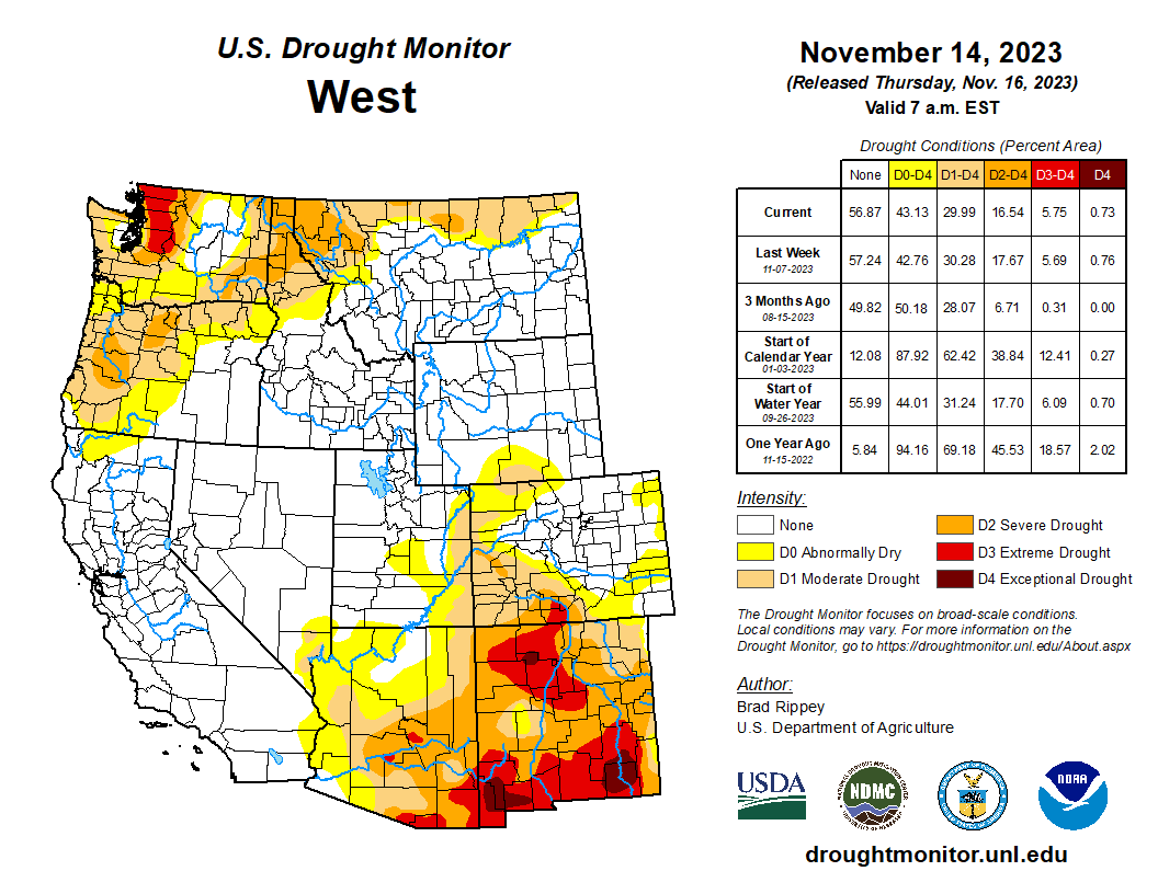
West
Aside from modest improvements in the Northwestern drought situation, there were few changes in the depiction. Despite the recent Northwestern precipitation, some interior agricultural areas remained dry, with topsoil moisture rated (on November 12, by the U.S. Department of Agriculture) 55% very short to short in Washington, along with 41% in Oregon. In addition, more than one-quarter (29%) of Oregon’s winter wheat was rated in very poor to poor condition on that date. Farther south, New Mexico led the region on November 12 with topsoil moisture rated 75% very short to short, despite patchy precipitation during the drought-monitoring period…
South
Heavy rain in parts of Texas and along the Gulf Coast contrasted with mostly dry weather farther north and inland. Accordingly, one- to locally two-category improvements in the drought depiction were noted in western, central, eastern, and southern Texas, while other areas experienced either no change or one-category drought deterioration. In fact, exceptional drought (D4) expanded further into the Tennessee Valley and environs. On November 12, the U.S. Department of Agriculture rated topsoil moisture 88% very short to short in Louisiana, along with 84% in Mississippi. On the same date, pastures were rated 71% very poor to poor in Mississippi, along with 57% in Louisiana and 56% in Tennessee…
Looking Ahead
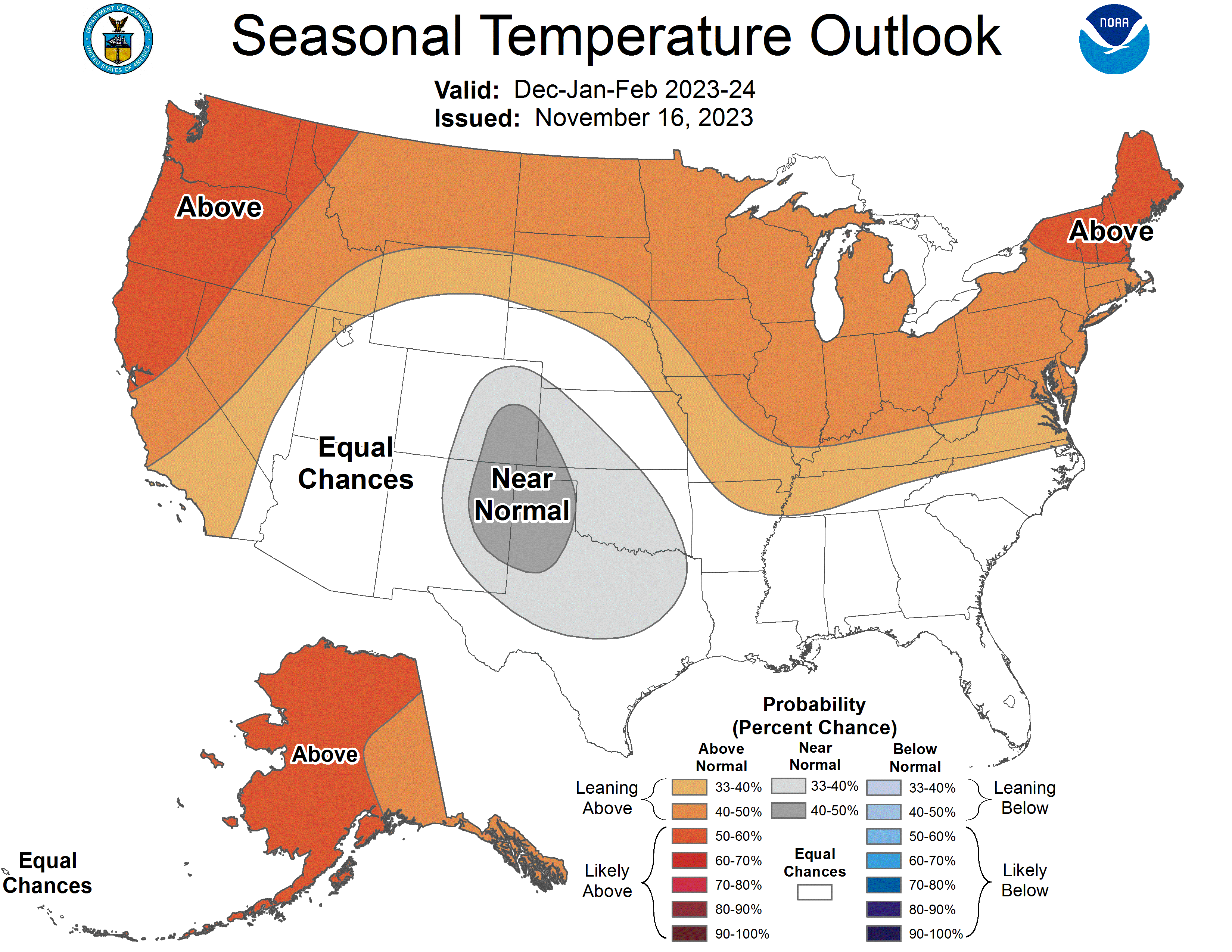
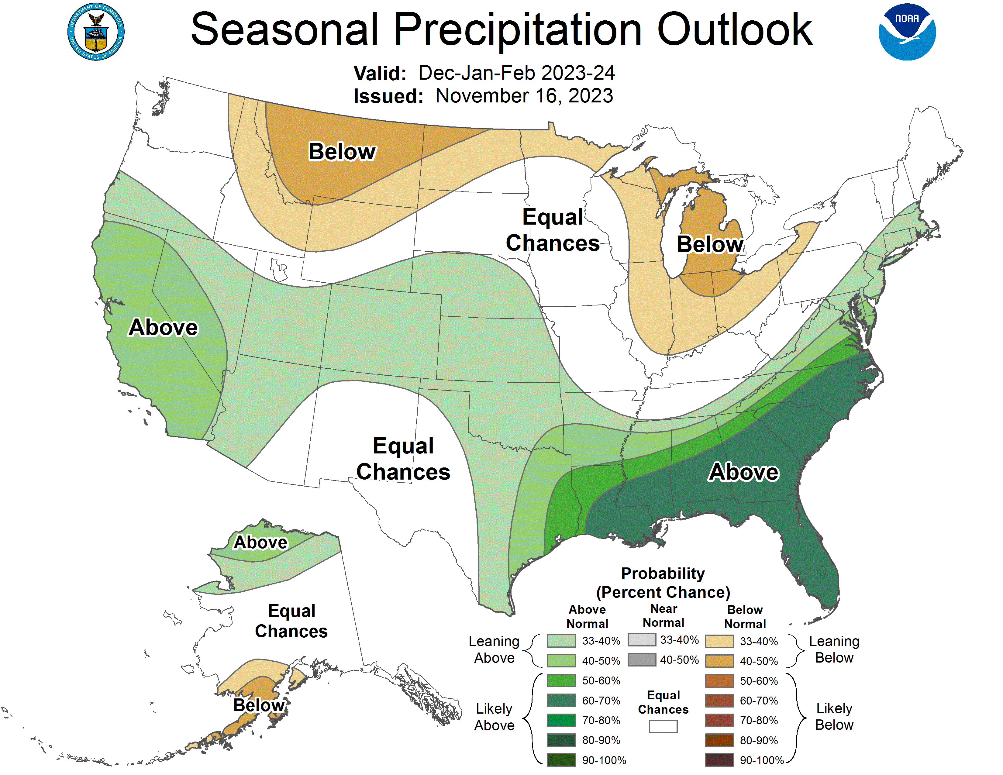
Mostly dry weather will prevail during the next several days across the nation’s mid-section, including the Plains and upper Midwest. Farther south, showers will continue to shift eastward along and near the Gulf Coast, with the potential for late-week rain and gusty winds in parts of Florida. During the weekend, a low-pressure system accelerating northward near the Atlantic Seaboard could result in coastal wind and rain in New England. Elsewhere, a storm system parked west of California will remain offshore for the next couple of days, although rain and snow showers will spread inland at times. Late in the weekend, some of the Pacific storm energy interacting with a surge of cold air arriving from western Canada should lead to an increase in rain and snow shower activity across parts of the western and central U.S., although precipitation will initially be light. The NWS 6- to 10-day outlook for November 21 – 25 calls for the likelihood of below-normal temperatures east of the Rockies, while warmer-than-normal weather will prevail in the West. Meanwhile, below-normal precipitation in most areas west of the Mississippi River should contrast with wetter-than-normal weather in the East, as well as northern sections of the Rockies and High Plains.
Click the link to read the release on the Department of Interior website:
President Biden’s Bipartisan Infrastructure Law investing in environmental projects to increase water availability
11/15/2023 WASHINGTON — The Department of the Interior today announced $51 million from President Biden’s Investing in America agenda for 30 new Environmental Water Resource Projects in 11 states through the Bureau of Reclamation. The collaborative projects focus on water conservation, water management and restoration efforts that will result in significant benefits to ecosystem or watershed health.
“Adequate, resilient and safe water supplies are fundamental to the health, economy and security of every community in our nation,” said Secretary Deb Haaland. “The Interior Department is focused on ensuring that funding through President Biden’s Investing in America agenda is going to collaborative projects throughout the West that will benefit the American people.”
As part of the Biden-Harris administration’s commemoration of the two-year anniversary of the Bipartisan Infrastructure Law, Principal Deputy Assistant Secretary for Water and Science Michael Brain announced the selections during a visit to Grand Junction, Colorado, where eight of the selected projects are located.
“These locally led initiatives utilize the investments from President Biden’s Bipartisan Infrastructure Law to demonstrate quantifiable and sustained water savings, all while providing a direct benefit to the surrounding ecosystems,” said Principal Deputy Assistant Secretary Michael Brain. “These types of projects and robust cooperation with stakeholders are helping to improve watershed health and increase water reliability and access for families, farmers, and Tribes.”
President Biden’s Investing in America agenda represents the largest investment in climate resilience in the nation’s history and is providing much-needed resources to enhance Western communities’ resilience to drought and climate change. Through the Bipartisan Infrastructure Law, Reclamation is investing a total of $8.3 billion over five years for water infrastructure projects, including rural water, water storage, conservation and conveyance, nature-based solutions, dam safety, water purification and reuse, and desalination. Over the first two years of its implementation, Reclamation selected 372 projects to receive almost $2.8 billion.
The WaterSMART program also advances the Justice40 Initiative, part of the Biden-Harris administration’s historic commitment to environmental justice, which aims to ensure 40 percent of the overall benefits of certain climate, clean energy and other federal investments flow to disadvantaged communities that have been marginalized by underinvestment and overburdened by pollution.
Arizona
Altar Valley Conservation Alliance, Surface Water Conservation for Drought and Climate Resilience in the Altar Valley Watershed
Reclamation Funding: $1,213,809
The Altar Valley Conservation Alliance, in partnership with the Pima County Regional Flood Control District, will use a series of nature-based features in the Altar Wash watershed, southwest of Tucson, Arizona, to slow flows, improve groundwater infiltration, and create surface water habitat for wildlife. The Alliance will install low-tech natural infrastructure in dryland streams facilities across 8,985 acres of the wash, which will slow the runoff, reducing erosion and retaining water in the wash for longer periods. The project will enhance drought and climate change resilience, reduce downstream flood impacts and increase the sustainability of agricultural operations.
California
San Bernardino Valley Municipal Water District, Hidden Valley Creek Aquatic and Riparian Habitat Restoration Project
Reclamation Funding: $3,000,000
San Bernardino Valley Municipal Water District will implement the Hidden Valley Creek Aquatic and Riparian Habitat Restoration Project within the Upper Santa Ana River Watershed, a tributary of the Santa Ana River, in southern California. The project will restore and improve the condition of 21.7 acres of degraded aquatic and riparian habitat, including habitat for the threatened Santa Ana Sucker. The district will construct new and restored stream channel, establish a buffer of native riparian vegetation on each side of the stream, and enhance a 1.2 acre floodplain bench. The project will include non-native plant removal and site revegetation efforts. This restoration will improve water quality, increase habitat connectivity, and provide crucial support for recovering endangered and sensitive species.

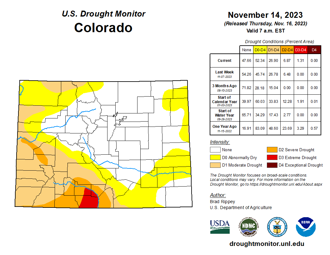
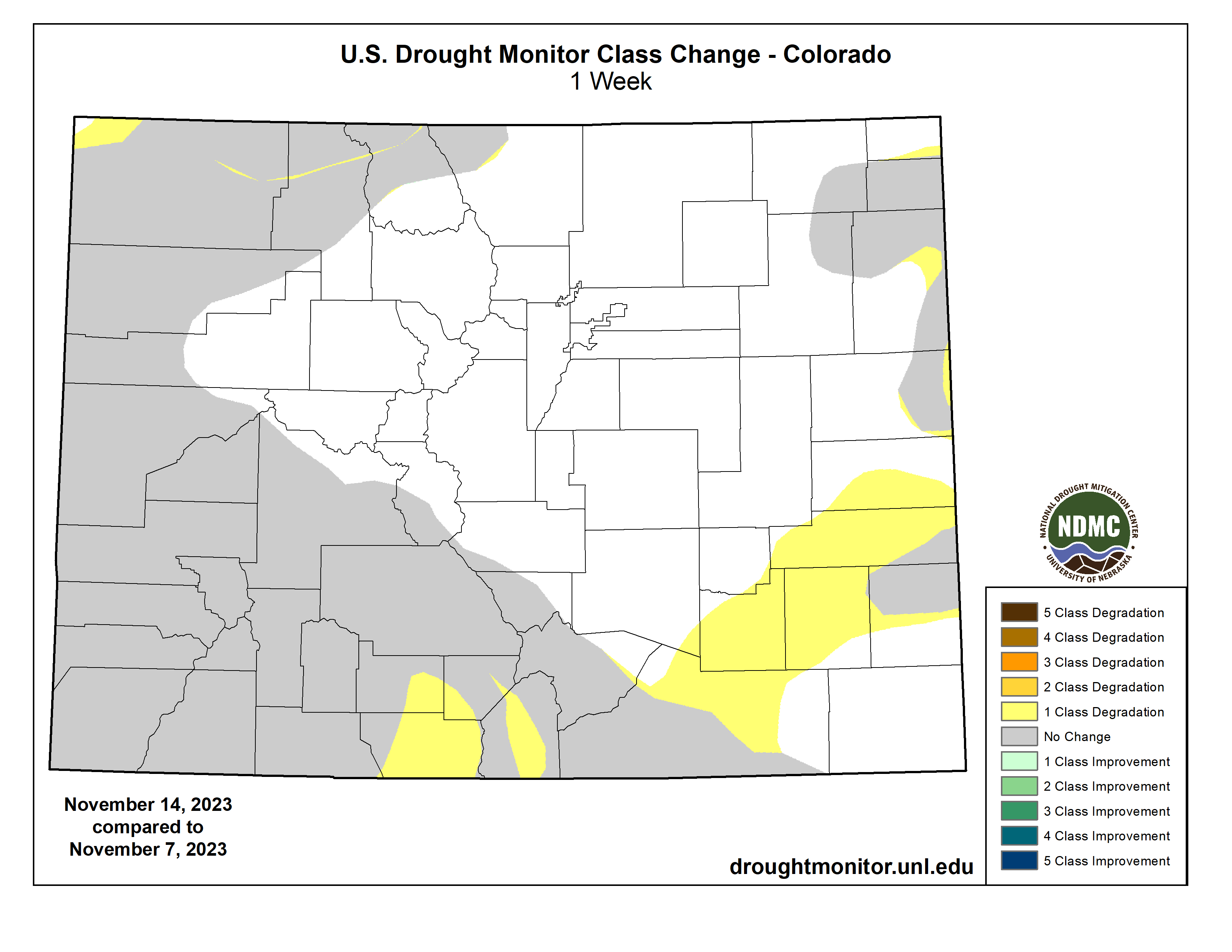
Colorado
American Rivers, Inc, Uncompahgre River Multi-Benefit Project
Reclamation Funding: $ 1,198,376
American Rivers, in partnership with the Ward Water Group and local landowners, will upgrade irrigation infrastructure and enhance aquatic and riparian habitats along one mile of the Uncompahgre River in western, Colorado. The current push-up diversion dam structure has caused channel widening, reduction of aquatic habitat diversity, and a decrease in floodplain connectivity. American Rivers will improve the Ward Irrigation Ditch infrastructure by constructing 2 cross-vane weirs, installing a new concrete stoplog bypass at the headgate, and piping 5,600 linear feet of open irrigation ditches. The project will improve aquatic and riparian habitat within the channel by constructing cross-vane weirs, J-hook vanes, rock vanes, and boulder clusters; revegetating the banks and meanders using willow pole clusters and riparian plant species plugs; and removing invasive vegetation.
Colorado Rio Grande Restoration Foundation, Farmers Union Multi-Benefit Diversion Infrastructure Improvement Project
Reclamation Funding: $1,274,625
The Colorado Rio Grande Restoration Foundation, in partnership with the San Luis Valley Irrigation District, will upgrade the diversion infrastructure for the Farmers Union Canal and Rio Grande #1 Ditch, in southwestern Colorado, to meet agricultural, ecological, recreational, and community needs. The current diversion infrastructure creates a barrier to fish passage, is hazardous for boaters, and requires frequent maintenance. The partners will construct a new diversion structure, incorporating fish passage that will allow fish to access an additional 1.42 river miles of habitat. The project also includes restoration of streambank through the installation of rock and root wad structures and streambed and aquatic habitat through improved sediment transport at the diversion structure. The diversion upgrade will provide safe boat passage and more efficiently deliver water to the Farmers Union Canal and Rio Grande #1 Ditch.

Mancos Conservation District, Riparian Restoration and Infrastructure Improvements to Better the Ecological Processes of the Mancos Watershed
Reclamation Funding: $2,482,686
The Mancos Conservation District, in partnership with the Town of Mancos, will implement a multi-benefit project consisting of a suite of infrastructure improvements and nature-based solutions along the Mancos River, a tributary of the San Juan River, in southwestern, Colorado. The partners will upgrade three agricultural diversion structures, install remote metering and telemetry equipment on 10 agricultural pipeline headgates, complete fire mitigation work on 650 upland acres and replace invasive riparian plants with native species adjacent to the Mancos River. The project is downstream of Reclamation’s Jackson Gulch Reservoir and will mitigate wildfire risk to the reservoir and water supplies in the Mancos River Watershed.

Middle Colorado Watershed Council, Roan Creek Fish Barrier and Diversion Infrastructure Upgrade
Reclamation Funding: $746,423
The Middle Colorado Watershed Council, working in partnership with Garfield County, will install a fish barrier to prevent non-native fish migration, and upgrade a diversion structure on Roan Creek, in western Colorado. The upper portion of Roan Creek, a tributary of the Colorado River, contains a unique native fish assemblage comprised of Colorado River cutthroat trout, bluehead sucker, Paiute sculpin, and speckled dace. Non-native fish in the Roan Creek watershed harm the river system’s ecology by predating on or hybridizing with the unique native species. Construction of a fish barrier will effectively eliminate the upstream movement of non-native fish to improve Roan Creek’s aquatic and riparian habitat and protect the native fish.
Purgatoire Watershed Partnership, Purgatoire River Fish Passage
Reclamation Funding: $2,403,748
The Purgatoire Watershed Partnership will improve fish passage at the Baca-Picketwire diversion dam on the Purgatoire River in downtown Trinidad, Colorado. The Purgatoire River supports a robust assemblage of fish species and is of local and regional interest for conservation. Currently, ecological function is impaired because the existing concrete diversion dam is not passable to fish. This project will restore fish habitat connectivity and enhance recreation opportunities by adding a low-gradient engineered riffle feature that mimics a natural channel. The upgrade will allow fish access to 3.3 miles of main river, wetlands, 20 miles of Raton Creek, and many stream miles within ephemeral drainages, including approximately 4 miles of Moore’s Canyon and 9 miles of Colorado Canyon. The project is also expected to have flood mitigation, sediment transport, and bank stabilization co-benefits.
Southern Ute Tribe, Nannice Canal Diversion and Fish Passage Project
Reclamation Funding: $651,920
The Southern Ute Tribe, in partnership with the Bureau of Indian Affairs (BIA) and The Nature Conservancy, will implement the Nannice Canal Diversion and Fish Passage project on the Southern Ute Indian Reservation in southwestern, Colorado. Part of the BIA-owned and operated Pine River Indian Irrigation project that receives water from Reclamation’s Vallecito Dam, the Nannice Canal Diversion is a low-head dam that sweeps across the Los Pinos River and creates a significant fish barrier. Fish get entrained in the Nannice Canal during low flows and during irrigation season. The Southern Ute Water Resources Division will upgrade the diversion structure and install a fish screen and fish ladder. The project will restore river connectivity, improve fish passage, and eliminate fish entrainment during low flows, while continuing to allow the diversion of Nannice Canal’s decreed water.
Trout Unlimited, Inc, Middle Colorado River Agriculture Collaborative: 4 Fish Passage/ Irrigation Diversion Upgrade Projects on Elk Creek-a tributary to the Colorado River
Reclamation Funding: $2,999,595
Trout Unlimited and the Middle Colorado Agriculture Collaborative will upgrade, relocate, or combine six diversion structures to remove instream barriers to fish passage in the Elk Creek west of Glenwood Springs, Colorado. These upgrades will open approximately five miles of aquatic habitat in Elk Creek to fish passage. The project is anticipated to improve stream morphology, increase instream flows, and benefit irrigators by increasing the operational capabilities of the diversions and reducing transmission losses of vital irrigation water.
Western Slope Conservation Center, Farmer’s Ditch Improvement Project
Reclamation Funding: $ 1,594,799
The Western Slope Conservation Center, in partnership with North Fork Farmer’s Ditch Association, located in west-central Colorado, will modernize the Farmers ditch diversion and headgate structures to improve upstream fish passage, increase diversion efficiency, and improve safety for boaters. The project will upgrade the existing concrete headgate structure with a long-lasting alternative headgate that is equipped with remote automation technology, enabling more efficient water deliveries to irrigators while maximizing water that remains in the river. In addition, the Center will install graded riffle and small pools and drops to mimic the natural morphology of the river for approximately 200 feet below the diversion to promote upstream fish passage and allow for safe recreational boating.
Hawaii
Hawaii Department of Land and Natural Resources, Protecting Forests for Water Supply Sustainability in Molokai, Hawai’i
Reclamation Funding: $936,892
The state of Hawai’i Department of Land and Natural Resources, Division of Forestry and Wildlife, will expand protection of native landscapes in the north-eastern portion of Molokai, one of the five Hawaiian Islands. Invasive hooved animals, including feral pigs, deer, and goats, are the main threat to Hawai’i’s original forests, negatively impacting water supply, increasing flood risk and land erosion, and threatening several listed species. The project will reduce populations and associated damage to the forest due to these invasive animals through animal control and installation of fencing to exclude them from 3,340 acres within the Pelekunu Valley. The project will also remove hooved animals from an additional 12,000 acres along the north shore of Molokai in an area with steep terrain that is not possible to fence. The island of Molokai relies on ground water for all fresh water needs and is designated as a groundwater management area by Hawai’i’s Commission of Water Resources Management. The forest provides increased water infiltration into the aquifer and reduces soil erosion and associated water quality issues.
Idaho
City of Pocatello, Rainey Park Stream Restoration and Wetland Creation
Reclamation Funding: $1,635,276
The city of Pocatello, Idaho, will implement a river restoration project on the Portneuf River in downtown Pocatello. The health of the Portneuf River has been severely compromised by flood protection levees and the construction of a concrete channel, which removed hundreds of acres of wetlands when installed. Restoration will be accomplished by moving the river’s existing riprapped levee to an area of city-owned property. A wetland and side channel will be installed adjacent to the levee, along with accessible river access for anglers and floaters. Additionally, a stormwater pond will be installed to capture the first flush of sediment-laden waters from city streets. This project builds on the concepts developed in the 2016 Portneuf River Vision Study and addresses a wide range of environmental goals, including improving hydrologic functions by increasing floodplain, wetland, and riparian habitat areas, and improving water quality.
The Nature Conservancy, Loving Creek Tributaries Restoration and Water Conservation Project
Reclamation Funding: $1,900,217
The Nature Conservancy, in partnership with Idaho Department of Fish and Game and landowners, will complete a suite of nature-based features on four reaches of Loving Creek, located in Blaine County in south central Idaho. The four project locations span the full extent of Loving Creek from its headwaters to the outlet at Silver Creek. Through a combination of in-stream restoration work, sediment removal, and riparian habitat creation, the project will restore 2.75 miles of active stream channel, regenerate riparian and wetland habitat, and remove one fish passage barrier to holistically restore connectivity to 5.72 miles of upstream habitat. The project also will revive upland and agricultural buffer habitat and pipe 1,200 linear feet of open water delivery canal to conserve 9 acre-feet of water, which will remain in Loving Creek as instream flow. Despite improvements in agricultural management and land use practices over the past several decades, water quality and habitat conditions in Silver Creek and its tributaries remain degraded. This project will restore more natural channel morphology, increase habitat complexity, and improve water quality in Loving Creek.
Nez Perce Soil and Water Conservation District, White Road Passage Project
Reclamation Funding: $367,091
The Nez Perce Soil and Water Conservation District will improve anadromous fish habitat for Federally listed Steelhead Trout in the Tom Beall Creek watershed, a tributary to Lapwai Creek, located in northern Idaho. The project will improve watershed health within the boundaries of the Reclamation’s Lewiston Orchard Project. The district will replace an existing culvert with a fish passable structure to support the migration of the Steelhead Trout and additional species including Coho and Chinook Salmon. When completed, the project will provide access to approximately two miles of habitat and reduce area flood risk. The project also will improve water quality to downstream recreational and agricultural water users. The project is supported by the Lapwai Creek Ecological Restoration Strategy developed collaboratively with the Nez Perce Tribe, National Marine Fisheries Service, Idaho Department of Transportation, Nez Perce County, city of Lapwai, city of Culdesac, Lewiston Orchards Irrigation District, a landowner advisory group, and several Idaho state government divisions.
Nez Perce Soil and Water Conservation District, Lower Clearwater Snake Rivers Phase I
Reclamation Funding: $451,889
The Nez Perce Soil and Water Conservation District will undertake the Lower Clearwater Snake Rivers Phase I Project in Culdesac, Nez Perce, and Lewis Counties, in northwest Idaho. The project will improve watershed health within the boundaries of the Reclamation’s Lewiston Orchard Project. The district will enhance anadromous fish habitat for Federally listed Steelhead Trout and improve overall water quality in the Lower Clearwater River Basin. The district will upgrade a culvert for aquatic organism passage, thin approximately 129 acres of forest to mitigate wildfire risk and install over 100 instream wood structures to enhance over 10,000 feet of stream for juvenile steelhead habitat. The project will yield ecological benefits including improved habitat function, optimized flow timing, increased groundwater recharge, and reduced sedimentation.
Trout Unlimited, Inc, Completion of the Alta Harris Creek Boise River Side Channel and Fish Passage Project Along the Boise River
Reclamation Funding: $734,103
Trout Unlimited, together with the city of Boise, Idaho, will improve aquatic ecology in the Boise River by restoring spawning and rearing habitat for salmonid fishes, and providing fish passage connection between the lower Boise River and Barber Pool, downstream of Reclamation’s Arrowrock Dam. The project will enhance 3,800 feet of existing side channel and include construction of 1,600 feet of new side channel, complete riparian revegetation with native plants, and construct of a fish passage facility at Barber Dam. The fishway design will better accommodate fluctuating river flows and variable water surface elevation. Completion of this project will reconnect 2.5 miles of the main-channel Boise River with 5 acres of adjacent riparian habitat and over a mile of side channel for spawning and rearing of juvenile fish. The project also will allow fish to bypass a half mile of the Boise River with a risk for fish entrainment in water delivery canals.
Wood River Land Trust, Warm Springs Preserve Stream Restoration and Irrigation Improvement Project
Reclamation Funding: $1,733,154
Wood River Land Trust, in partnership with the city of Ketchum, Idaho, will enhance and improve the ecological function of the 65 acre Warm Spring Preserve along the Warms Springs Creek in Blaine County, in central Idaho. Warm Springs Creek in the project area has been artificially confined, concentrating flow, and creating incision and floodplain abandonment. There is virtually no floodplain connectivity within the northern half of the project reach. The project will restore 1.3 miles of Warm Springs Creek through instream earthwork to create pools, point bars, and constructed riffles, and installation of woody debris structures to promote in-channel complexity. The project will also create nine acres of adjacent floodplain habitat by lowering the floodplain. The floodplain restoration will be complemented by revegetation with low-water native plant species along the riparian zones and throughout the preserve, which will collectively aid in improvement of water quality and temperature of Warm Springs Creek.
New Mexico
Chama Peak Land Alliance, Increasing Resiliency in the San Juan-Chama Project Headwaters
Reclamation Funding: $3,000,000
The Chama Peak Land Alliance will conduct ecological forest thinning on approximately 2,150 acres to protect source watersheds for Reclamation’s San Juan-Chama Project, the Rio Chama headwaters, and the Rio Brazos headwaters from the impacts of future wildfires. Forests in these headwaters are unnaturally dense and homogenous, putting them at risk of severe wildfires and deterioration of watershed function. These watersheds supply crucial drinking water to the cities of Albuquerque and Santa Fe, and numerous tribes, Pueblos, and rural communities throughout New Mexico. In addition to threatening water supply infrastructure, a severe wildfire could cause water quality impairments, flooding erosion and significant degradation of habitat for fish and wildlife.
Pueblo of Isleta, Restoring Watershed Function and Protecting Sacred Ancestral Sites on the lower Rio Puerco, a tributary of the Rio Grande
Reclamation Funding: $2,487,942
The Pueblo of Isleta will build resilience in the lower Rio Puerco watershed by implementing nature-based watershed restoration techniques to restore natural watershed function on an approximately 30,000 acre parcel of the Comanche Ranch and neighboring lands, in central New Mexico. Forming a part of the Pueblo of Isleta lands, the Comanche Ranch comprises over 90,000 acres of public and private lands and is home to upwards of one hundred sacred ancestral sites, including an important cultural site, the Pottery Mound. The ranch forms an integral part of the Rio Puerco lower watershed, the primary source of sediment to the middle Rio Grande and Reclamation’s Elephant Butte Reservoir. The Pueblo and stakeholders have identified that loss of vegetation and increasingly higher energy monsoonal storms that have resulted in erosion and soil loss throughout the uplands in this region and threaten the cultural sites downstream. The Pueblo will utilize a series of watershed restoration practices that spread and slow runoff flows, increase groundwater infiltration, and reduce erosion, including contour plowing with native seed imprinting, contour stone line and brush weir installation to protect plantings and slow runoff, and riparian restoration and revegetation on a section of the Rio Puerco adjacent to Pottery Mound, including the planting of wild medicinal and traditionally gathered edible plants.
Nevada
Southern Nevada Water Authority, Muddy River Riparian Corridor Improvements at Warm Springs Natural Area
Reclamation Funding: $743,329
The Southern Nevada Water Authority will protect the Warm Springs Natural Area, a 1,250 acre property located in southern Nevada, and downstream habitat from drought impacts. The property is regionally significant as it contains more than 20 perennial springs that form the headwaters of the Muddy River and numerous habitat types. These resources provide habitat for several protected and sensitive species, including the endangered Moapa dace, endangered southwestern willow flycatcher, and threatened yellow-billed cuckoo. The project will widen the riparian corridors along 0.3 miles of the mainstem of the Muddy River and establish mesquite bosques along the corridor, resulting in the creation of 12 acres of new habitat. These actions will increase habitat for listed species, improve hydrologic conditions, lessen wildfire risk, and reduce erosion and sedimentation during flood events. Non-native vegetation will be removed and replaced with native vegetation to restore the area to the natural habitat that existed before the area was converted for agricultural purposes.
Oregon
Crooked River Watershed Council, Lower Crooked River Riparian, Floodplain, and Habitat Restoration Project
Reclamation Funding: $1,400,000
The Crooked River Watershed Council, working in partnership with the Ochoco Irrigation District, will restore habitat and enhance ecological features on two project sites just downstream from Prineville, Oregon. Hydrology in the Crooked River watershed is impacted by upstream Dams, including Reclamation’s Bowman Dam, leading to loss of floodplain continuity, degraded channel structures, and water quality impairments, impacting native Spring Chinook Salmon and Columbia River Steelhead populations that inhabit the watershed. To address these impairments, the Council will strategically place approximately 130 large wood structures to promote habitat complexity, stabilize eroding streambanks on 3,285 linear feet of stream channel, restore approximately 19 acres of floodplain and upland habitat, improve 0.22 acres of alcove habitat, and create 0.42 acres of wetland.
Deschutes Land Trust, Ochoco Preserve Restoration – Phases 2 and 3
Reclamation Funding: $3,000,000
The Deschutes Land Trust, with support from the Oregon Department of Fish and Wildlife, will restore aquatic, floodplain, and upland habitat across 124 acres on the Ochoco Preserve, located in Crook County, Oregon, adjacent to the city of Prineville. The Crooked River and Ochoco Creek support reintroduced spring Chinook salmon and summer steelhead, as well as a host of other native aquatic species. The waterways frequently experience low flows, elevated summer stream temperatures, and poor water quality. These issues are compounded by a lack of suitable habitats for both fish and terrestrial wildlife, and the impacts to river ecology of Reclamation’s Crooked River Project, including Bowman and Ochoco Dams. The Deschutes Land Trust will lead efforts to create over 2 miles of new main baseflow stream channels, 1.5 miles of side channels, over 11 acres of wetland, and restore 37 acres of floodplain and 75 acres of upland habitat, significantly increasing available habitat for native species.
Texas
Menard County Water Control and Improvement District #1, Pipe a 2.5 mile section of the Menard Canal and dedicate 1,100 acre-feet instream
Reclamation Funding: $1,891,500
Menard County Control and Improvements District #1, in central Texas, will upgrade the Menard Canal irrigation water conveyance system to reduce losses so that more water is kept in the San Saba River for fish and wildlife benefit. A water loss study conducted by U.S. Geological Survey in the summer of 2014 showed that the 6-mile long canal experiences an approximately 50% loss over the first 2.5 miles. The project involves replacing the first 4,000 feet of the unlined Menard Canal with pipe, and re-sloping, reshaping and partially filling the next mile of unlined canal to create a narrower channel profile. Following that narrowed span of canal, the district will pipe an additional 2,000 feet of the canal and install gates to control flow. The district has committed to leaving the majority of the conserved water, 1,100 acre-feet per year instream for a 30 year term. The additional instream flows will contribute significantly to baseflow of the San Saba River and create a more reliable supply of water for downstream aquatic habitat. Sections of the San Saba River downstream from the project that will benefit from the increased flows include critical habitat for the Texas fatmucket and Texas pimpleback mussel species.
Washington
The Confederated Tribes and Bands of the Yakama Nation, Lower Yakima River: Anadromous Fish Survival
Reclamation Funding: $2,248,677
The Yakama Nation, in partnership with the Benton County Conservation District, will improve conditions for anadromous fish species in the Prosser, Snively, and Confluence reaches of the lower Yakima River, in central Washington. The project will address two key elements of the Yakima Basin Integrated Plan: fish passage and habitat protection and enhancement. The Yakima Nation will complete instream restoration work to expand a cold-water refuge within the Yakima River mainstem at the confluence of Amon Creek, including construction of 1,400 linear feet of cool water channel habitat and restoration of 20 acres of riparian zone through invasive vegetation removal and revegetation with native species. The Yakima Nation will also complete electrofishing and install a fish trap on the Wanawish Dam to remove and prevent reintroduction of invasive predatory fish species that impede the migration of endangered fish species. These improvements will benefit the federally threatened Middle Columbia River steelhead; spring and fall/summer run Chinook, Coho, and Sockeye salmon; and the Yakima population of Pacific lamprey. The project area is downstream of Reclamation’s Yakima Project, which impacts river flows, temperatures, and habitat conditions in this area.
The Confederated Tribes and Bands of the Yakama Nation, Yakima River Mile 89.5 Side Channel and Floodplain Restoration
Reclamation Funding: $600,000
The Confederated Tribes and Bands of the Yakama Nation will reconnect approximately 9 miles of side channel along the Yakima River within the Yakama Reservation, in south central Washington. Upstream flow regulations tied to Reclamation’s Yakima Project have constricted historical floodplain processes and cut-off side channel access for native fish species, leading to degradation of riparian and wetland habitat areas. The Yakama Nation will excavate five historic side channel sections connecting to the mainstem of the Yakima River, install two constructed logjam inlet structures to ensure fish access to the mainstem of the river, and install three stream ford crossings to access the project site. The excavation of side channels will increase winter and spring off-channel habitat utilized by Middle Columbia River Steelhead and restore hydrologic connectivity to a total of 135 acres of floodplain and wetland habitat. The project is supported by the Yakima Basin Integrated 10-Year Action Plan developed by water and land management stakeholders.
The County of Chelan, Camas Meadows Streamflow and Ecosystem Restoration Project
Reclamation Funding: $468,903
The Chelan County Natural Resource Department, in coordination with the Washington Department of Natural Resources, will restore wet meadow hydrology in Camas Meadows, a unique meadow ecosystem within the steep canyon drainages of north-central Cascade Mountains in Washington. The 1,300 acre meadow flows into Camas Creek, a tributary of Peshastin Creek, in the Wenatchee Watershed. Due to widespread floodplain disconnection and irrigation withdrawals, the Peshastin sub-basin is among the top three flow-limited sub- basins in the Wenatchee Watershed, with chronic low flows and high stream temperatures limiting recovery of ESA-listed steelhead and spring Chinook that reside throughout Peshastin Creek and in the lower reaches of Camas creek. Historic land use practices have resulted in Camas Meadows being confined into ditch-like channels with incision ranging from 4 feet to 8 feet, causing rapid and early drying of the meadow. This projectwill restore the natural hydrology of the meadow by replacing the meadow outlet culvert, re-grading the channel and meadow elevations, installing channel-spanning habitat log structures, and re-planting with native shrubs and plants. The project will restore floodplain connectivity and wet meadow hydrology for a modeled additional water storage of 180 acre-feet and an anticipated year-round baseflow contribution of 0.2 cfs.
Kittitas Conservation Trust, Gold Creek Restoration Phase 2 RM 2-3 Implementation
Reclamation Funding: $2,475,000
Kittitas Conservation Trust will implement an in-stream restoration project on river mile 2-3 of Gold Creek, in Kittitas County, Washington. Located just east of Snoqualmie Pass in Kittitas County, Washington, Gold Creek is the headwaters of the upper Yakima River and flows for approximately 8 miles from the Alpine Lakes Wilderness into Keechelus Reservoir in the Central Cascade Mountains. Upstream fish passage is blocked at Reclamation’s Keechelus Dam on the downstream end of the reservoir. Prolonged dewatering conditions and a century’s worth of anthropogenic channel widening have dramatically impacted the habitat and health of the creek’s Federally threatened Bull Trout. The Trust will install a total of 28 large woody debris structures along the river mile. The instream wood replenishment will create habitat complexity, including deeper pools with shaded cover, provide relief from high velocity flood flows, and ensure optimal habitat for both the successful rearing of juvenile Bull Trout and migration of mature fish. The project also will provide floodplain reconnection, which will improve groundwater recharge from flood flows, and reduce the likelihood of future flood events further harming the channel morphology.
Kittitas Reclamation District, Kittitas Reclamation District – South Branch Piping
Reclamation Funding: $3,000,000
The Kittitas Reclamation District, located in central Washington, will restore in-stream flows and provide benefits to fish and wildlife in Mantash Creek, an over-appropriated tributary of the Yakima River. The project will involve the piping of a 2,656 linear feet section of the currently unlined South Branch Canal, which is part of Reclamation’s Yakima Project. Once piped, the district anticipates conserving approximately 385 acre-feet per year currently lost to seepage. The district will designate this otherwise lost water through an allocation, management, and protection agreement, that involves careful monitoring of stream flow on Mantash Creek to maintain optimal conditions for Yakima Basin fish species, including Coho and Chinook Salmon, Mid-Columbia Steelhead, and Bull Trout. The Washington State Department of Ecology is responsible for water protection and enforcement and will ensure that conserved water stays instream.
Wyoming
City of Casper, North Platte River Restoration — Izaak Walton Reach
Reclamation Funding: $3,000,000
The city of Casper, in collaboration with members of the Platte River Revival Committee, will complete a river and riparian restoration project on the Izaak Walton reach of the North Platte River in Natrona County, Wyoming. The North Platte River is a Blue Ribbon trout fishery, but this reach suffers from significant bank erosion, tight riverbend geometry, a lack of riffle-pool complex development, poor bedform complexity, meager floodplain connectivity, and is characterized by a low quality riparian vegetation community. These conditions have resulted in degraded habitat for trout as well as native aquatic and terrestrial species. These characteristics have also contributed to reduced ecological function, adversely affected the regional municipal water supply, degraded aesthetic values, and impaired river recreation. The city of Casper will restore over 5,150 linear feet of the North Platte River that will involve regrading of the riverbed, banks, and floodplain to create appropriate geometry and bedform complexity, reduce riverbank degradation, and improve instream and riparian habitats.
Trout Unlimited, Inc, Sage Creek Watershed Restoration for Drought Resilience and Sediment Control
Reclamation Funding: $1,513,538
Trout Unlimited, working in partnership with Wyoming Game and Fish, will complete a multi-part restoration project, including nature-based features, in the Sage Creek Watershed, located in southwestern Wyoming. The project will involve the installation of 50 beaver dam analogs, 160 aggradation structures, and an aquatic invasive species barrier along a 5.6 mile stretch of Sage Creek. These installations will be complemented by a robust invasive plant removal and native riparian reseeding along 7.6 miles of both the Sage and Trout Creeks. Together, these actions are estimated to restore 453 acres of valley floor habitat and protect 79.5 linear miles of aquatic habitat from invasive trout that inhabit Reclamation’s Flaming Gorge Reservoir just downstream of the project site. The project is additionally expected to reduce channel incision and erosion to reduce sediment and nutrient delivery to Flaming Gorge Reservoir, protect native trout from hybridization, and increase groundwater recharge and surface water availability.

Click the link to read the article on the Big Pivots website (Allen Best):
The Western Slope delivers 70% of the Colorado River water. So why do Aspen, Vail and other places want to replace thirsty turf?
This story, a collaboration of Big Pivots and Aspen Journalism, is part of a series that examines the intersection of water and urban landscapes in Colorado.
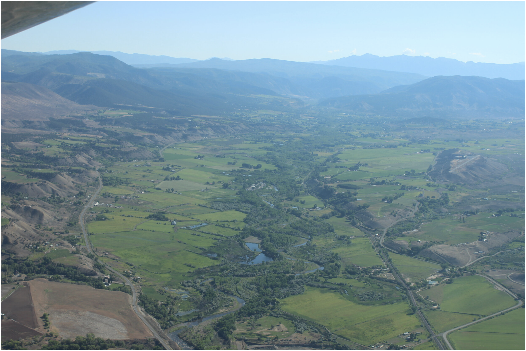
If you’ve ever slipped and spun your way across Vail Pass through a wet, heavy snowstorm, you can be excused for wondering how Eagle River Valley communities could ever have too little water.
Vail and its neighbors do have that problem, though. It has become evident in the growing frequency of drought years in the 21st century.

First came 2002. Water officials, verging on panic, restricted outdoor water use. The drought was believed to be the most severe in 500 years. Fine, thought water officials as rain and snow resumed, we’re off the hook for at least our lifetimes.

In 2012 came another drought, one nearly identical in severity. More bad years followed in 2018 and 2021. The Eagle River normally chatters its way down the valley through Avon and to a confluence with the Colorado River near Glenwood Canyon. In those bad, bad drought years, it sulked. The shallow water was hot enough to endanger fish.

Colorado River flows have declined 20% since 2000. Having water rights is not enough. And the future looks even hotter and, because of that heat, drier. Brad Udall, a senior scientist and scholar at Colorado State University, warns of up to 20% additional flow loss by midcentury.
Average temperatures in the Colorado River Basin are projected by the U.S. Bureau of Reclamation to rise 5 to 6 degrees Fahrenheit during the 21st century. The agency projects slightly greater increases in Colorado and other upper basin states.
In Vail, managers of the Eagle River Water and Sanitation District have decided they need more storage. They plan a 1,200-acre-foot reservoir near Minturn called Bolts Lake. That compares with the 257,034-acre-foot storage of Dillon Reservoir. At that capacity, this new reservoir will be the most cost-effective way to ensure resilience as the climate becomes more variable. With the reservoir, they hope to capture water during high-runoff years for use in the district’s service territory from Vail through Edwards.
Demand reduction will be another tool of growing importance in a hotter, sometimes drier climate. Managers hope to reduce water demand in the district 5% by 2026 even as new housing, especially more affordable units, gets built. That’s 400 acre-feet per year.
The most productive place to wring these savings will be in water used for outdoor landscapes. Only 25% — or even less — of water applied to lawns returns to streams and rivers compared with 95% of water used indoors.
Siri Roman, the district’s general manager, said short-term change, such as restricted lawn watering in drought years, can be a strategy. But her district wants to effect permanent change.
“It’s not about drought years,” she said. “It’s about a drying climate. We have to get people to shift their attitudes, to know that water is getting to be more scarce.”
Roman’s district, like other water utilities in Colorado, is targeting nonfunctional turf. Precise definitions vary, but nonfunctional generally refers to grasses that require large volumes of water to irrigate but rarely see human feet except when mowed. It is also described as aesthetic turf.
Three years ago, Eagle River Water began offering rebates of $1 per square foot to customers willing to replace thirsty lawns with landscapes that use less water. Using state aid, the district this year bumped up the incentive to $2.
“We are not saying it needs to be stone and look like Arizona,” Roman said.
Directors of the district in October also agreed to new tiered rates that will discourage high-volume consumption.
Other Western Slope communities have also set out to discourage thirsty landscape choices. Motivations vary, but for many, there is also acknowledgement of the need to walk the talk of water conservation expected of Front Range communities. “That is something I hear a lot from communities I am working with,” said Marjo Curgus, a consultant.
‘Lawn Begone’ in Durango
Almost a decade ago, Steve Harris, a water engineer in Durango, summoned the local news media to his house to watch him remove sod from his front yard. He also had bumper stickers produced: “Lawn Gone.” In an editorial, the Durango Herald offered an alternative: “Lawn Begone.”
Harris believed that Colorado needed to make clear that decorative lawns had less value than agriculture. He worked with his state legislators to draft a bill that would have limited transfers of agricultural water to cities if that water went to lawns. As for his own lawn, Harris thought that he and others on the Western Slope couldn’t just pay lip service to this idea.
At the Colorado Capitol, the bill introduced in 2014 by then-Sen. Ellen Roberts and then-Rep. Don Coram was quickly shelved. Local governments objected. So did ag producers who thought state legislators had no business blocking their abilities to sell water rights.
Instead, the idea was directed to an interim committee for further study. Bills sometimes get sent there to die. In this case, the conversation continued, as Roberts had intended.
Since then, legislators have adopted several laws. A bill that passed in 2022, House Bill 22-1151, does not institute a prohibition but instead allocated $2 million to the Colorado Water Conservation Board, $1.5 million of which went to local jurisdictions to spur voluntary replacement of irrigated turf.
The law asserts that for every 100 acres of turf converted to water-wise landscaping, up to 200 acre-feet of water can be conserved. The act defines water-wise landscaping as a water- and plant-management practice that emphasizes using plants with lower water needs.
Whether that much water gets saved also depends upon whether irrigation systems are changed to match the lesser water needs of the new landscapes. Grass that needs 12 inches of supplemental water per year need not continue to get 25.
All that funding has now been allocated. On the Western Slope, the municipalities of Cortez, Glenwood Springs and Frisco were awarded funds as was the Eagle County Conservation District. The state agency said 25% of turf-replacement funds were for Western Slope entities.
Rep. Marc Catlin of Montrose and then-Rep. Dylan Roberts of Frisco, two of the four prime sponsors, are from the Western Slope. Another prime sponsor, Sen. Cleave Simpson of Alamosa, now has a district that encompasses southwest Colorado, while Roberts has become a senator.
Without state funding, Montrose County approved grants for seven turf-replacement projects.
“From the start, I thought this initial effort might have more value from an education and outreach perspective than actual water savings,” said Justin Musser, the county’s natural resources manager.
Projects were chosen based on various objectives. For example, do the new landscapes provide energy savings or wildlife benefits? “We are not overly prescriptive,” said Musser. “If you have a good plan that references standards from the Colorado State University Extension or another reputable source, the application gets a higher ranking.”
Why would Montrose County be interested in yanking sod to save water?
“It’s important that we look at these types of things across the Colorado River basin,” Musser said. “We would want people in California and Arizona and Nevada to be looking at these types of programs, too. I think it makes sense for a place like Montrose County to be conserving water as much as we can, too.”
But, he added, this is “one part of a very complex issue.”

Droughts versus aridification
The Western Slope of Colorado produces 70% of the water in the Colorado River, according to the Colorado River Water Conservation District. Some of that water stays in Colorado. About half of the water for Front Range cities comes from the Western Slope. Yet more of the Colorado River gets diverted to farms in the South Platte and Arkansas river valleys.
And, of course, water from the Western Slope flows downstream to farms and cities in Arizona, California and Nevada.
The Colorado River has infamously been falling short of meeting all demands. The river first failed to reach the Sea of Cortez in the 1960s and, as diversions in Arizona and elsewhere expanded, has ceased to reach the sea altogether since the 1990s — save for an especially engineered pulse in 2014.
In 1922, when delegates of the seven states met to negotiate the Colorado River Compact, they assumed that flows of the early 20th century would be the norm, delivering more than 20 million acre-feet. As Eric Kuhn and John Fleck explain in their book, “Science Be Dammed: How Ignoring Inconvenient Science Drained the Colorado River,” it had been a wet period.
It didn’t stay that wet, and in the 21st century it has been delivering far less water, an average 13.2 million acre-feet through 2022. Andy Mueller, general manager of the Glenwood Springs-based Colorado River District, and others have warned that continued warming could depress flows to 9 million acre-feet during coming decades. Or even less.

Grand Junction more recently adopted regulations curbing water needed for urban landscaping. The city has adopted sustainability goals, “and water plays a big part of that,” said Randi Kim, utilities director for the city of 69,000 people.
Cost savings enter into the city’s calculation as it prepares for a projected 91,000 residents by 2040. The municipal utility taps high-quality water from Kannah Creek, which originates on Grand Mesa. When that is insufficient to meet demands, as the city utility projects will be the case by 2040, the city will tap the Gunnison River but will need to pay more to treat the dirtier water.
Rising heat can also drive higher demand. Grand Junction in July reached 107 degrees, tying the record that had been set just two years before. The city’s 13 highest temperatures have occurred this century.
This is but one aspect of the changing and drying climate, a process that many — including Kim — describe as aridification. “I think people realize that we have to change the way we use and manage water, and it really affects every aspect of our lives,” she said.
Grand Junction’s new regulations apply to new developments. Turf that does not meet the city’s definition of “functional” cannot exceed 15% of landscaping. The new regulations also require low-water vegetation in traffic medians and some other common areas.
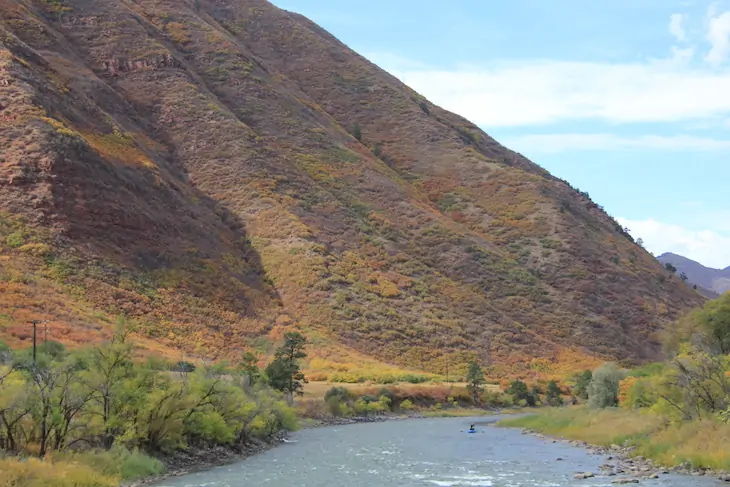
Steamboat Springs, although cooler and wetter than Grand Junction, faces similar challenges. It gets 24 inches of precipitation a year, compared with 10 inches for Grand Junction. Some years, the snow along streets of Steamboat gets piled higher than the head of a rim-rattling professional basketball player.
These prodigious snowfalls have not been yielding equally impressive runoffs in the Yampa River. Several times during the longer, hotter summers of the 21st century, the river slunk to such shallow depths that water officials decreed a temporary end to fishing. It almost happened again in July before temperatures cooled and rain arrived.
“We were one day from the river being shut down again,” said Madison Muxworthy of the Yampa Valley Sustainability Council, a nonprofit. “It was crazy.”
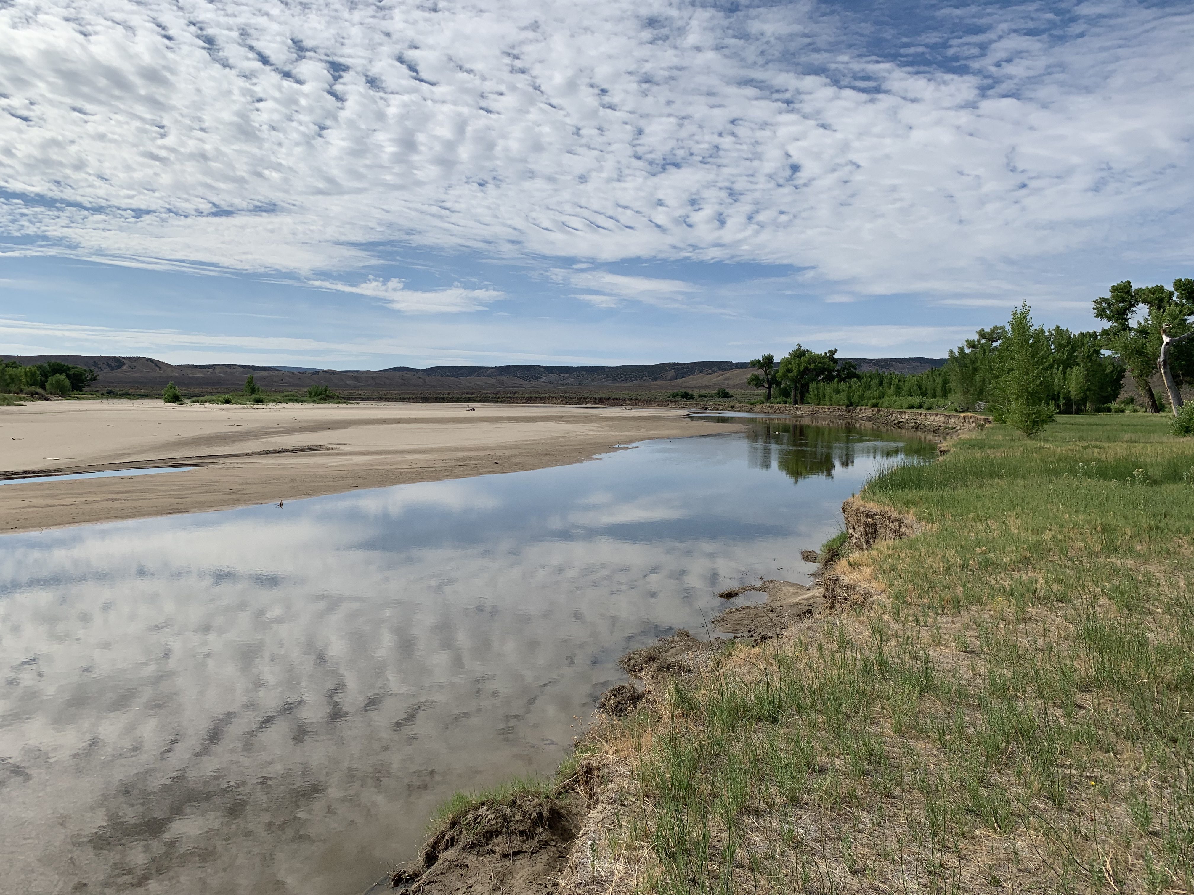
Muxworthy calls the Yampa River the “life beat of our community.” The description is apt. Kayakers paddle amid the waves during runoff months, and anglers drop lines every season. There are always people along the river banks.
In 2021, heeding local sentiment, the sustainability council launched a water-conservation program focused on outdoor use. Working with the city government and Mount Werner Water and Sanitation District, the group created a guidance document for landscapes called “Yampascaping.” Four educational workshops this year were well attended.
“Citizens are really interested in this because they see the impacts from climate change that we’re already having,” said Muxworthy, her organization’s soil moisture, water and snow program manager. “It’s really easy for them to make the connection and want to do something about it.”
The Mount Werner district, which serves the base of the city’s bigger ski area, offers rebates of $1 per square foot for turf removal.
Eighty miles south of Steamboat, at a 131-unit multifamily project along the Eagle River called The Reserve, turf-removal incentives of $2 per square foot have also helped the homeowners association replace a half-acre of thirsty grasses with native vegetation. The homeowners hope to replace another 60% of the more than 4 acres of common area.
Saving water is paramount in the mind of Deb Forsline, a director of the homeowners association. She sometimes lulls her grandchildren to sleep with the soothing sound at river’s edge and, at other times, accompanies her husband on fishing expeditions, knitting while he dangles lines. “It’s about saving water for the river, not the money,” she said of the efforts to reduce water for landscaping.

Diane Johnson, communications and public affairs manager at Eagle River Water and Sanitation District, concurs. The $2 per square foot “helps move the thinking of people who have already been thinking about it,” she said.
Roman, the district’s general manager, points to the innate connection that most of her district’s 31,000 consumers have with the outdoors. “A lot of people who live here year-round know that it is irresponsible to overuse.”
A steeper staircase of water rates
After the 2002 drought, the Eagle River district adopted an inclining block rate structure. The more you use, the more you pay. The district got inconsistent results. Larger homes and those with more expansive and water-intense landscaping dropped their use in smaller percentages than smaller homes. The rate structure had been flawed, allowing larger homes to pay less per 1,000 gallons than smaller homes for the same volume of water. Different rates were needed to snag the attention of high-volume consumers.
Aspen had the same problem. It adopted tiered water rates in 2005. Managers thought the rates would discourage high volumes of consumption. But even in drought years, some properties continued stubbornly high volumes.
In 2017, Aspen adopted a new approach. The regulations require reduced water use in the landscape and irrigation plans for new and redeveloped projects. Such caps are called budgets. Like Denver and Boulder, Aspen has almost no new development of raw land. The law imposes a hard cap of 7.5 gallons per square foot of landscape. That’s about a foot of water, or roughly half of the supplemental water required in Colorado for Kentucky bluegrass. The law also requires so-called “smart” irrigation systems and alternative plants but leaves some flexibility in how developers and their consultants stay within the water budgets.
So far, 110 to 120 projects in Aspen have been reviewed, but only 15 to 20 have been executed – still too soon to discern clear results in water savings for the city, said Rob Gregor, utilities permit coordinator. Still, the city has leveled its water use and hopes to achieve even greater efficiencies in water devoted to residential and commercial landscapes. That could leave more water in Castle Creek and the Roaring Fork River, one of the goals of the program.
Durango, with 19,000 people and a projected population of 25,000 by 2035, has considered using rates to nudge high-volume users to less demanding landscapes. Justin Elkins, utilities manager, said the city hopes to encourage voluntary reductions in water use by allowing water users to monitor the volume of their use and compare it to consumption by their neighbors.
The Ute Water Conservancy District has successfully used rates to encourage water conservation. The Grand Junction-based district delivers water to rural and exurban areas of the Grand Valley from Cameo to the Utah border. Customers tend to be more responsive “when it hits them in the pocketbook,” said Andrea Lopez, the district’s external affairs manager. “As they use more water and enter into tiers that become steeper with the more they use, we usually see a reduction in use.”
That’s what Eagle River Water has done. Like Aspen, the Vail Valley has some wealthy homeowners. Under the old tier system, somebody in a smaller home paid more per gallon than somebody in a larger home, if they both used the same large volume.
Beginning in January, Roman was on the agenda of everybody from Rotary clubs to Eagle County commissioners. “Really, this is targeting our excessive users,” she told the Vail Town Council at a June meeting. “They’re the ones that are going to feel this.”
District directors in October approved the new tiered rates that intend to discourage high-volume consumption.

In Wildridge, a neighborhood on the south-facing slopes of Avon, Linn Brooks has shown what is possible in landscape conversions. Fifteen years ago, before she started transitioning her landscape, her home used 15,000 to 25,000 gallons a month. Now, it uses, at most, 7,000 gallons a month and her landscape is commanding.
The takeaway, she said, is that communities can have vibrant landscapes and protect property values – and still use less water.
Next: How did bluegrass lawns in Colorado become the default? Some trace it to the castles of Europe. Half or more of Coloradans live in neighborhoods governed by homeowners associations. Some have started to curb thirsty bluegrass, but others needed a firm nudge this year from state legislators.
Allen Best, a longtime Colorado journalist, publishes Big Pivots, which tracks the energy and water transitions in Colorado and beyond. Aspen Journalism is a nonprofit, investigative news organization covering water, environment and community. This story is part of a five-part series produced in a collaboration between Big Pivots and Aspen Journalism. Find more at https://bigpivots.com and at https://aspenjournalism.org
