#NewMexico’s Largest Fire Wrecked This City’s Water Source: Era of megafires endangers #water supplies in American West — Circle of Blue

Hermit’s Peak Fire scar. Photo credit: Circle of Blue

Click the link to read the article on the Circle of Blue website (Brett Walton):

October 25, 2023

LAS VEGAS, New Mexico — The largest fire in New Mexico history began with a disastrous government agency blunder. Its consequences for land and a small northern New Mexico city’s water were magnified by man-made climate change. 

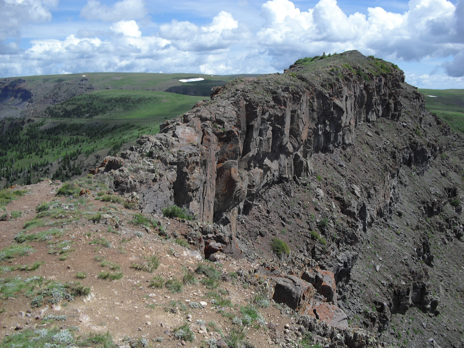
In the first week of April 2022, the U.S. Forest Service was setting a controlled burn in Santa Fe National Forest near the rocky promontory of Hermit’s Peak. A tool to thin overgrown forests, prescribed fires are intended to reduce the risk of hundred-thousand-acre megafires that have recently incinerated the American West.

Fanned by shifting winds blowing across dry timber, the deliberately ignited flames jumped containment lines. Then a dormant fire in nearby Calf Canyon reignited and merged with the blaze beneath Hermit’s Peak. Combined, the fire grew into an uncontrolled juggernaut that burned 341,735 acres of public and private land over four months.

But the collision between government error and climate change that produced a colossal fire disaster in the forests of northern New Mexico didn’t end once the flames were extinguished. The fire was a prelude to a water supply emergency that the city of Las Vegas still reckons with.

New Mexico Lakes, Rivers and Water Resources via Geology.com.

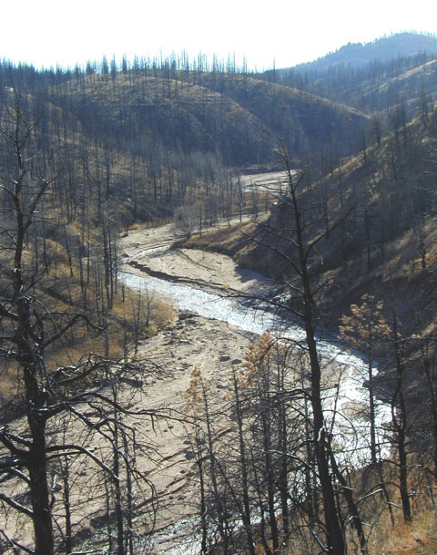
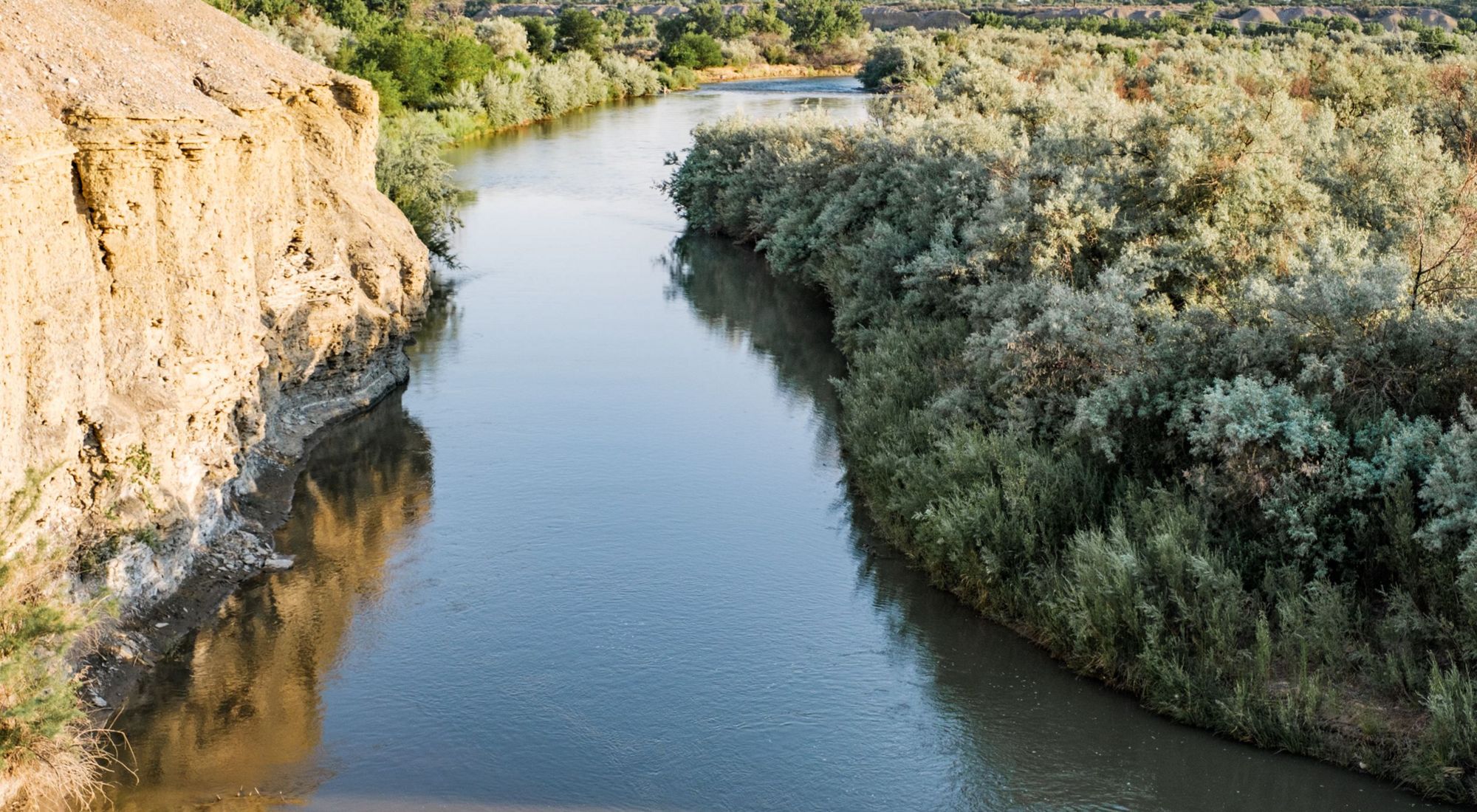
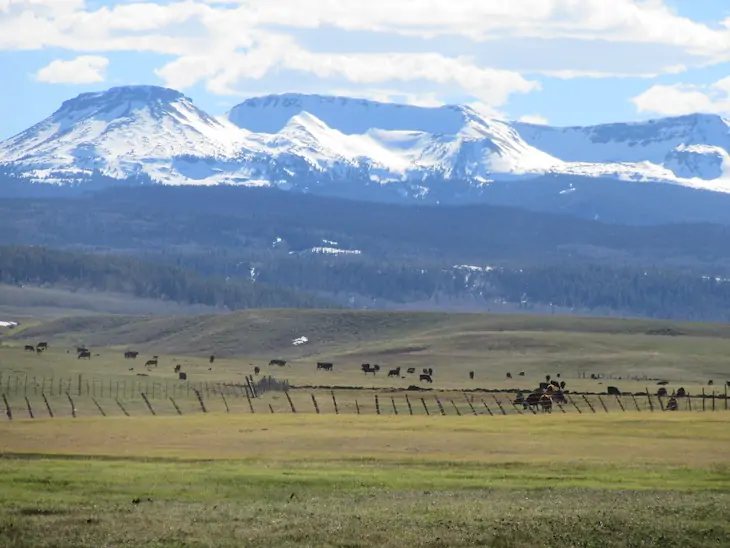
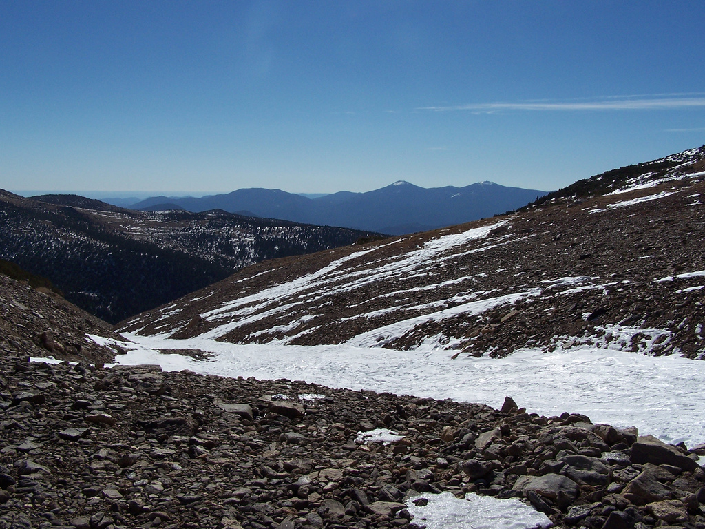
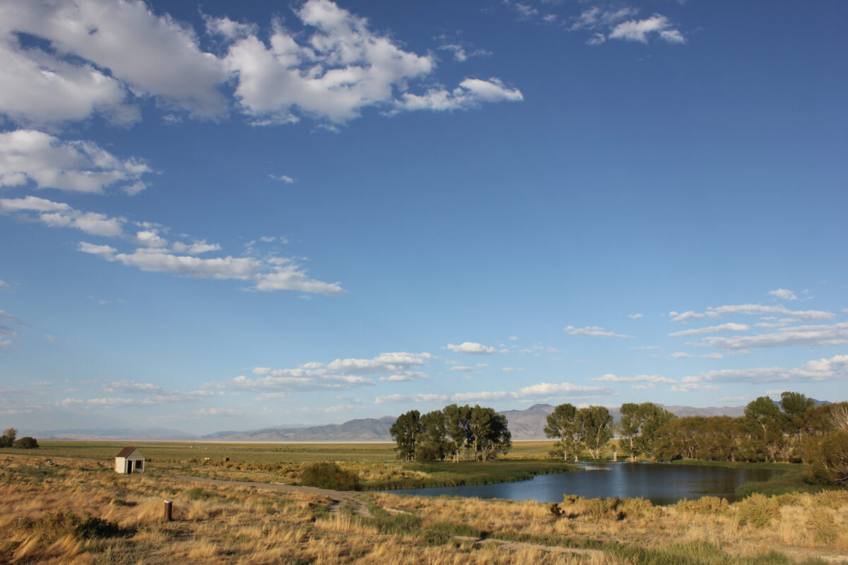
The fire burned the upper reaches of the Gallinas River watershed, the drinking water source for more than 17,000 people in and around Las Vegas. The fire had plenty of fuel — the watershed hadn’t had a major burn in more than a century. Ash and sediment flushed into the river from the bald slopes of the burn scar are undeniable threats to the city’s water treatment system.

By the end of August 2022, amid heavy monsoon rains, Las Vegas had a full-blown menace: a deteriorating river and just 21 days of water remaining in storage.

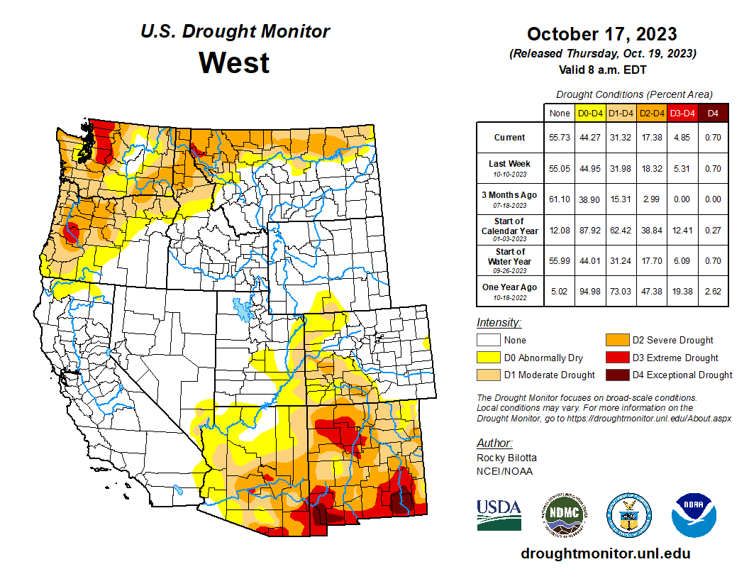
The trials of Las Vegas in the last year and a half are a sharp illustration of climate vulnerability in the American West, the domino effect of climate disasters, and the cost to taxpayers of repairing the damage. Similar cautionary tales dot the region’s map. Fires in recent years have destroyed water systems in Superior, Colorado; Detroit, Oregon; Malden, Washington; and in the California locales of Paradise, Santa Rosa, and the San Lorenzo Valley. 

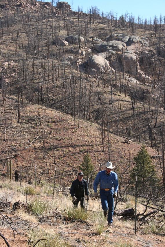
The risk of high-severity fire is growing due to decades of fire suppression combined with a warming planet. A fuels buildup is being conditioned to burn. As the number of burned acres trends upwards, the U.S. Forest Service expects one-third of western U.S. watersheds to experience a doubling of post-fire sediment flows in rivers by mid-century. Towns downstream of flammable terrain are a lightning strike or undoused campfire away from being unable to provide reliable water service.

The seat of San Miguel County, Las Vegas is one of the poorest municipalities in one of the country’s poorest states. The city’s poverty rate is more than 30 percent. The Hermit’s Peak/Calf Canyon fire so damaged the Gallinas watershed – charring the soil and increasing the sediment load in streams – that the drinking water treatment system cannot keep up. It must be replaced. 

Unable to afford such a large expense on its own, Las Vegas turned to Congress. Lawmakers were willing to open the public purse due to the federal government’s role in causing the disaster. The Hermit’s Peak/Calf Canyon Fire Assistance Act was included in a short-term budget extension that President Biden signed on September 30, 2022. It offered $2.5 billion to compensate property owners for fire damage. The final 2023 budget bill added $1.45 billion to the pot, bringing the total federal assistance for injuries and property losses to $3.95 billion. That includes $140 million to replace water treatment facilities damaged by the fire.

Las Vegas intends a complete overhaul: a new water treatment plant, equipment to remove sediment from river water before it enters the treatment facility, and a system to purify wastewater to reuse as drinking water. Full build-out might take seven years, but when all the pieces are in place it will be the largest capital project in the city’s history.

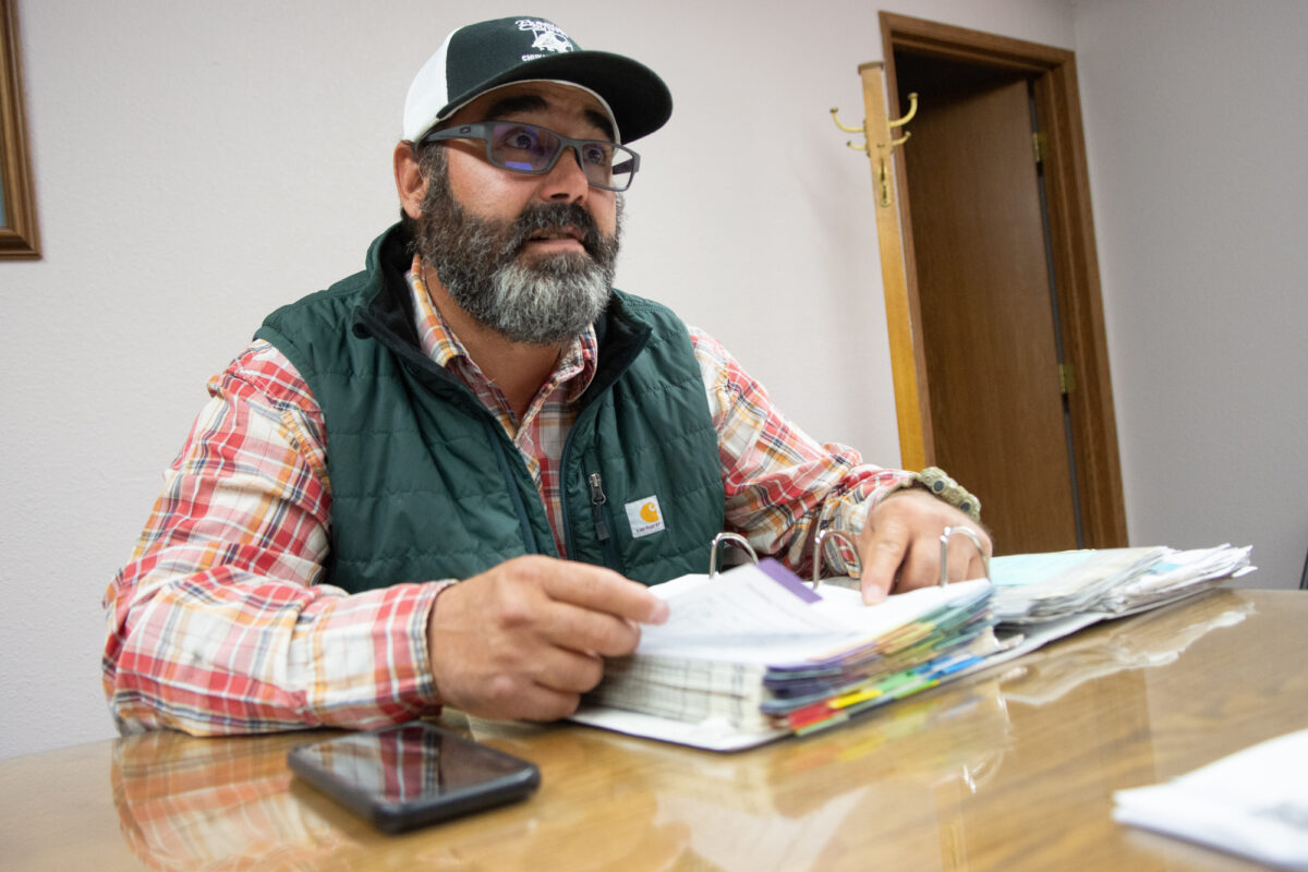
“It’s huge,” Mayor Louie Trujillo told Circle of Blue about the federal assistance. “We could have never done it. We don’t have the budget.”

The muddy Gallinas River just downstream from the water intake for Las Vegas, New Mexico. Photo © Brett Walton/Circle of Blue

A Chaotic Period

As soon as the fire started, Maria Gilvarry knew that her city’s water supply was in jeopardy.

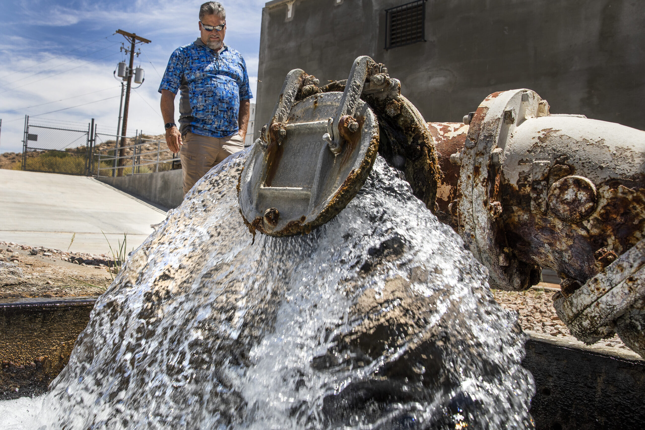
“The watershed is our water system,” Gilvarry, the Las Vegas Utilities Department director, told Circle of Blue. “So the more of the watershed that burns, the more that impacts our ability to treat and provide water.”

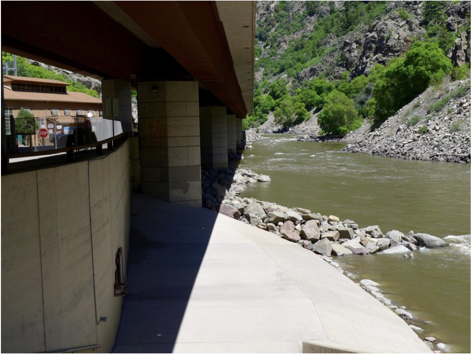
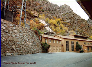
Even as the forests above Las Vegas smoldered, monsoon rains pummeled the burn scar last summer, delivering huge slugs of soil and debris into the Gallinas River. “It was just day after day of brown and black water,” Gilvarry recalled. The sediment load was too thick for the 1970s-era treatment facility. Two of the city’s three reservoirs were incapacitated by the muck.

Forests are on the frontlines of climate disasters. Hotter temperatures are a hair dryer pointed at mountain slopes that bristle with dense stands of trees and understory growth.

Because forests provide a disproportionately large share of the nation’s drinking water, what happens in the woods doesn’t stay in the woods. Though forests are water sources in eastern ranges like the Appalachians and Catskills, the water-forest-fire relationship is especially acute in the drying American West. 

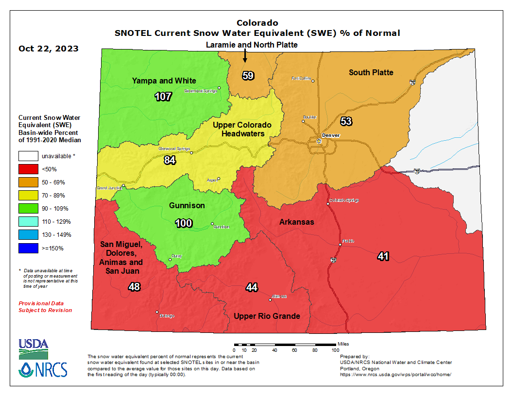
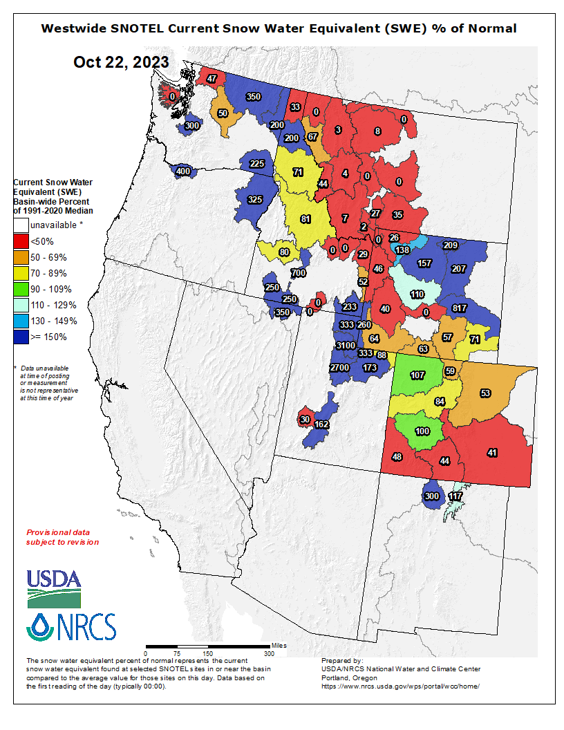
According to U.S. Forest Service research, national forests in the western states account for just 19 percent of the land area. But they contribute 46 percent of the surface water supply. [ed. emphasis mine]

Amanda Hohner, an assistant professor at Montana State University, has spent a decade studying the effect of wildfire on municipal water systems. She says the places most vulnerable to wildfire contamination of drinking water sources share several characteristics. They are small systems with a single, surface water source — usually a river or lake. Who fits that description? The city of Las Vegas, for one.

Las Vegas has a backup groundwater well for emergencies. But Gilvarry said that mechanical problems kept it offline last summer. When the fire started, the Gallinas River was the only option.

It was a chaotic, high-stress period. Evacuated from her property, Gilvarry was running the utility department while staying in a trailer on a co-worker’s property. Her husband volunteered to fight the fire.

The utility crew shifted to round-the-clock operations at the water treatment plant, watching nervously as the fire approached — but never overran — the facility.

“Young staff members could look out and see flames,” Gilvarry said. “And, you know, they wanted to go home with their families at night. So part of my job was to counsel them and keep them safe, while also keeping water flowing for the community. And they did it — those employees were awesome.”

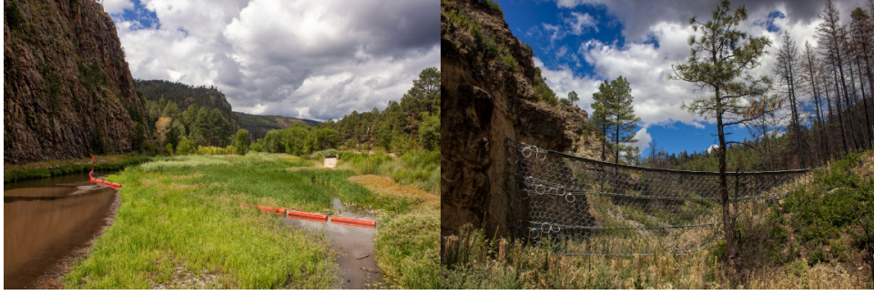
After the fire threat subsided, the task did not get easier. The Army Corps of Engineers installed 10-foot-tall steel Geobrugg netting across side canyons to catch large trees and boulders. The U.S. Geological Survey ramped up its stream monitoring. Straw-filled wattles, rock-filled gabions, berms, and barricades were deployed to prevent ash and sediment from entering the Gallinas. And yet it was not enough. Monsoon rains were severe, and sediment spiked. 

Trujillo and Gilvarry said that Las Vegas made it through the emergency period by focusing on conservation until a temporary state-funded sediment removal system could be installed at Storrie Lake, one of the storage reservoirs. Water department staff talked with restaurants and laundries. They asked car washes to voluntarily shut down. They identified pipe leaks and sealed them. Water was brought in via truck and bottle. Trujillo made frequent appearances on radio, in town hall meetings, at the senior center, at the community college.

“The citizens were ready to help us and they did,” Trujillo said.

After the Hermit’s Peak/Calf Canyon fire, booms and other structures were deployed in and around the Gallinas River to trap large debris and sediment. Photo © Brett Walton/Circle of Blue

‘A Marathon, Not a Sprint’

High-intensity fires do more than scorch trees and destroy homes. They upend the ecological function of entire watersheds. Burned forests become riddled with impairments. Shorn of trees, the land sheds more water than before. Though more water flows downstream, the costs of megafire outweigh this benefit. Without the forest buffer, floods are more destructive and more common. The land erodes easily. More nutrients are flushed downstream. 

For these reasons, the conservation groups American Rivers named the Gallinas one of the country’s most endangered rivers for 2023.

“The recovery of wildfire can be a little bit different from other natural disasters, in that the impacts can be cascading,” explained Madelene McDonald, a water scientist with Denver’s drinking water utility, which has also contended with the ripple effects of wildfires. “They’re not necessarily all at once, but it’s those repetitive storm events that can cause the greatest impact.”

Subsequent rains following the Hayman Fire in 2002 led to erosion problems and silt buildup in the creeks surrounding the Cheesman Reservoir. Photo credit: Denver Water

It happens again and again in the western states. Nitrogen levels in Colorado streams spiked immediately after the 2002 Hayman fire and remained elevated for more than a decade. Nitrogen is a plant vitamin that feeds lake-befouling algal blooms. And that’s not the only contaminant. Carbon, organic matter, heavy metals, and sediment — all accumulate in post-fire streams.

These chemical and physical changes to land and water are impairments that Gilvarry and her staff will face for years. More organic matter in the river can interfere with drinking water treatment. Disinfection chemicals like chlorine can produce toxic byproducts when too much carbon is in the source water. Sediment also clogs reservoirs and reduces water storage capacity.

The risks for Las Vegas were not unknown. The 1994 Gallinas River Watershed Plan, a joint effort with the city, U.S. Forest Service, and Tierra y Montes Soil and Water Conservation District, noted the need to reduce the fuel load in the watershed. The Viveash fire, in year 2000, burned mostly in the adjacent Cow Creek drainage. But some 820 acres of high-intensity fire did creep into the Gallinas watershed.

“A fire of Viveash’s magnitude occurring completely in the Gallinas Watershed would be disastrous for those who depend on Las Vegas’ water quality,” according to a March 2006 environmental assessment of prescribed fire that was prepared by the Santa Fe National Forest. That is exactly what happened with Hermit’s Peak/Calf Canyon.

Though the summer of 2022 was a nightmare, the summer of 2023, in terms of water quality, was much better. Monsoon rains were a trickle, not a flood. Sediment levels have been manageable. All three reservoirs are functioning again.

A bright spot for Gilvarry is that Las Vegas itself did not burn. That means there are no contaminants to flush from drinking water pipes. Cities in California, Colorado, and Oregon had to deal with benzene and other volatile chemicals in their water distribution systems after fires burned within city limits.

Slopes above Cheesman Reservoir after the Hayman fire photo credit Denver Water.

Denver’s experience with wildfire is a template for Las Vegas’s future. Both the Hayman fire and the 1996 Buffalo Creek fire burned the watersheds above Strontia Springs reservoir, a storage facility through which 80 percent of Denver’s drinking water passes. Denver Water is still planting trees in the burn scar. Even today, more than two decades after the fires, McDonald sees sediment levels in the reservoir climb after heavy rain.

“Recovery really is a marathon and not a sprint,” McDonald said.

How can communities like Las Vegas better prepare for the race? McDonald is part of the Wildland Fire Mitigation and Management Commission, a group of more than 50 national and regional fire experts tasked by Congress to recommend policy solutions to the wildfire crisis.

In September the commission submitted its report. Among its many recommendations are five specific to drinking water. In essence, they focus on prevention and response. Before a fire, utilities need to map their vulnerabilities and reduce fire risk in their watersheds by thinning and incorporating low-intensity burns. Risk assessments could identify utilities in need of water infrastructure upgrades – those like Las Vegas that have a sole surface water source or do not have the equipment to handle higher sediment levels. Portland, Oregon, for instance, is building a $1.48 billion water filtration plant, scheduled for completion in 2027, that will filter sediment from post-wildfire erosion in its forested Bull Run watershed.

Congress also has a role, the commission argues. Lawmakers could authorize grant funding for these assessments and amend existing forest restoration programs so that they explicitly target funds to areas with critical sources of drinking water, even though those areas may be far from where people live. Lawmakers could expand the timeline for disaster-relief funding, acknowledging that fire can harm water quality for years.

Gilvarry points to funding as a major obstacle to protecting water for smaller, low-income areas. Even if they are aware of the risks, can they bear the adaptation costs? “For the community to have built a top-of-the-line system ten, twenty, thirty, forty years ago to plan for this would have been multi-million dollars, but it would have come from the residents here,” Gilvarry said. “And I don’t think the residents could have afforded that.”

There are targeted research approaches, too. The Wildfire and Water Security project is investigating how drinking water systems can become more resilient to wildfire. Led by the U.S. Forest Service’s Pacific Northwest Research Station along with academic partners at Montana State, Oregon State, and Washington State, the initiative is considering water treatment options, water quality after fires, and the economic implications of fire damage and risk-reduction costs.

At the state level, the Colorado Water Conservation Board assessed the vulnerability of drinking water infrastructure in the state to wildfire damage. Called Wildfire Ready Watersheds, the program is intended to enable community-level preparation before a fire.

Critical to the effort is the U.S. Forest Service. Armed with $3.5 billion from the two-year-old Infrastructure Investment and Jobs Act to prepare communities for wildfire, the land management agency has adopted a “fireshed” approach in responding to the wildfire crisis. Firesheds are forest and rangeland units of roughly 250,000 acres that, if wildfire erupted, could damage homes, watersheds, water supplies, utility lines, and other critical infrastructure.

The U.S. Forest Service did not make any staff available for an interview. “The agency collaborates in the development and implementation of source water protection plans,” the press office wrote to Circle of Blue in an email. “In many places, we have agreements with local municipalities on how activities in the municipal watershed will be carried out to ensure the drinking water supply is protected; some of these agreements go back decades.”

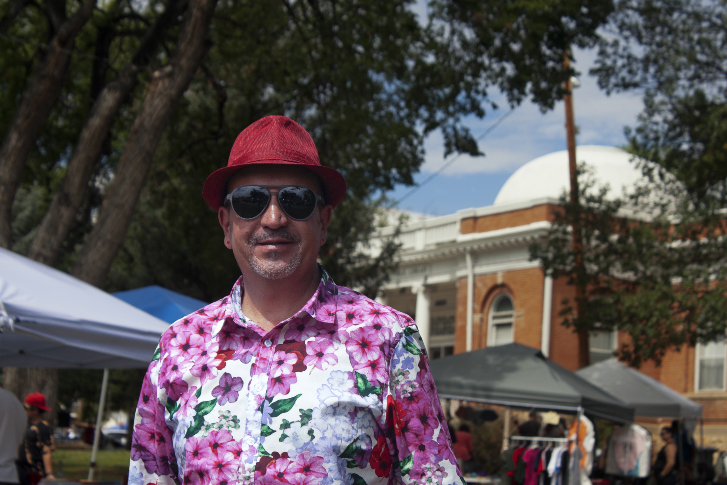
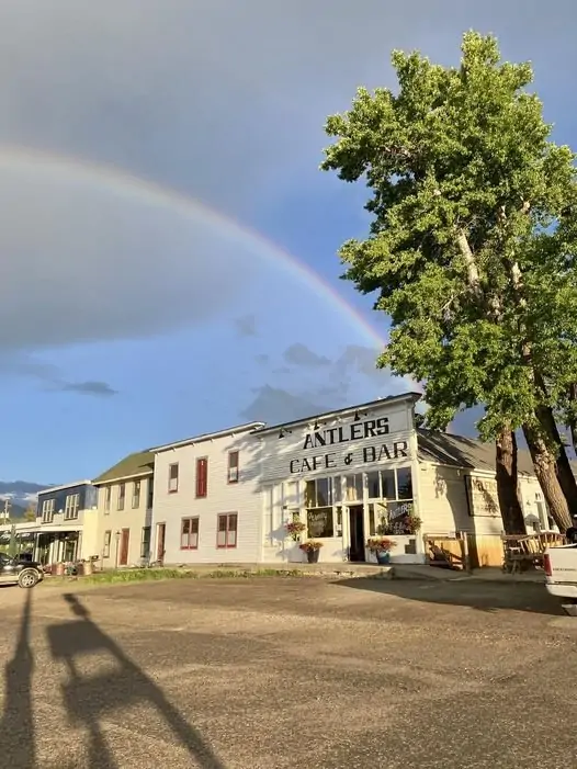
A year after being pushed to the brink, Las Vegas residents celebrated the return of the People’s Faire, a community arts festival held on August 26 that had been absent for three years due to Covid and the fire.

Food and crafts vendors lined the sun-dappled lawn in front of the Monticello-inspired Carnegie Library, while children plotted their moves on a giant chess board.

Trujillo, in sunglasses and a stylish floral shirt, acted as unofficial host, greeting nearly everyone who passed by. For a moment, on a warm late-summer day, the water emergency was a memory and all was right in Las Vegas.

“It’s nice that we have all this,” an older woman told him. 

Her friend, who was shopping for Christmas presents, agreed. “When I lived in Oregon, we didn’t have the parades,” she said. “We didn’t have all this stuff that we have here. So it is nice. This little town does a lot.”

This article was supported by The Water Desk, an independent journalism initiative based at the University of Colorado Boulder’s Center for Environmental Journalism.

Louie Trujillo is the mayor of Las Vegas. “It was couldn’t have happened at a worst time,” Trujillo said about the fire. “We were just surfacing from Covid. And then the fire broke out and then as a result of the fire, of course, it caused a water crisis in our community.” Photo © Brett Walton/Circle of Blue

Short-term outlook for #LakePowell, #LakeMead improves — The #Aspen Daily News #ColoradoRiver #COriver #aridification

The federal government may reduce releases from Glen Canyon Dam (pictured above) in 2023 by an unprecedented 2-3 million acre-feet, a move that would trigger severe cuts in the Lower Basin. (Source: Bureau of Reclamation)

Click the link to read the article on The Aspen Daily News website (Austin Corona). Here’s an excerpt:

A wet winter and strong runoff season have drastically reduced the possibility that water levels in lakes Powell and Mead will drop to “critical elevations” in the next three years, according to a newly updated draft statement released by the federal government on Wednesday [October 25, 2023].  Citing updated hydrological data, the updated draft statement indicates the short-term outlook for the two drought-stricken reservoirs is not as dire as previously thought…

Estimates in the new draft statement, released by the Bureau of Reclamation — the federal agency overseeing dams at the reservoirs — show a 49 and 48 percentage point decrease in the likelihood that water levels in lakes Powell and Mead will drop to critical elevations by 2027. This assumes the bureau and states take no additional action to alter existing reservoir operation guidelines. The decrease is in comparison with estimates from a previous statement released in April. According to the new draft statement, these likelihoods have dropped to only eight and four percent in Powell and Mead, respectively. A Wednesday press release defined “critical elevations” as low water levels that would threaten hydropower production and water releases through the Hoover and Glen Canyon dams. 

Wednesday’s draft statement attributes the reservoir’s brighter short-term outlook to a wet 2022/23 winter and a strong runoff season in the upper Colorado River basin. The newly revised draft statement used hydrological data from June, 2023, for its modeling, whereas the original document used hydrological data from September, 2022. 

The newly revised draft statement, titled the “Near-term Colorado River Operations: Revised Draft Supplemental Environmental Impact Statement,” is the second version of a draft document released in April, which is meant to weigh the impacts of potential adjustments to dam operation guidelines at lakes Powell and Mead through 2026. According to Wednesday’s draft statement, the bureau is considering adjustments to dam operation guidelines because of “extraordinary circumstances” created by dropping water levels in lakes Powell and Mead. In 2022, declining water levels had reached all-time lows in both reservoirs. The bureau has expressed concern that existing dam operation guidelines created in 2007, along with existing drought contingency plans, would not be enough to sustain the reservoirs in the face of extended drought. According to a Wednesday press release, the statement is part of an ongoing effort to “address the ongoing drought and impacts from the climate crisis” and “protect Glen Canyon and Hoover Dam operations, system integrity, and public health and safety through 2026.”

Grand Junction looking at #GunnisonRiver to supplement water supply — The #GrandJunction Daily Sentinel

The confluence of the Colorado River and the Gunnison River in Grand Junction. Credit: Screenshot Google Maps

Click the link to read the article on The Grand Junction Daily Sentinel website (Sam Klomhaus). Here’s an excerpt:

The City of Grand Junction is considering taking water from the Gunnison River to augment its current supply from the Kannah Creek watershed, which is estimated to need bolstering in about 15 years.

“The city’s primary water source is the Kannah Creek watershed,” Utilities Director Randi Kim said at an Oct. 16 City Council workshop. “And we are projecting that that watershed will not yield sufficient supply to carry us into the longer term future.”

Kim said the city could need to supplement the Kannah Creek watershed with additional sources around 2039.

“We’re looking at our water rights on the Gunnison River,” Kim said. “To do that, we’re conducting a feasibility study this year to evaluate the conversion of two gravel pits along the Gunnison River to water storage reservoirs, and the associated piping and pumping to bring that water to our water treatment plant to supplement those supplies.”

[…]

The city is proposing $600,000 in its draft 2024 budget for engineering and design work on converting the gravel pits. Kim said city staffers are looking at grants to help fund the project.

Map of the Gunnison River drainage basin in Colorado, USA. Made using public domain USGS data. By Shannon1 – Own work, CC BY-SA 4.0, https://commons.wikimedia.org/w/index.php?curid=69257550

Navajo Dam operations update October 31, 2023: Bumping releases down to 400 cfs #SanJuanRiver #ColoradoRiver #COriver #aridification

Map credit: USBR

From email from Reclamation (Susan Behery):

In response to reduced irrigation demand and sufficient forecast flows in the San Juan River Basin, the Bureau of Reclamation has scheduled a decrease in the release from Navajo Dam from 450 cubic feet per second (cfs) to 400 cfs for tomorrow, October 31st, at 8:00 AM.  

Releases are made for the authorized purposes of the Navajo Unit, and to attempt to maintain a target base flow through the endangered fish critical habitat reach of the San Juan River (Farmington to Lake Powell).  The San Juan River Basin Recovery Implementation Program recommends a target base flow of between 500 cfs and 1,000 cfs through the critical habitat area.  The target base flow is calculated as the weekly average of gaged flows throughout the critical habitat area from Farmington to Lake Powell. 

#Snowpack news October 30, 2023

Colorado snowpack basin-filled map October 30, 2023 via the NRCS.
Westwide SNOTEL basin-filled map October 30, 2023 via the NRCS.

West Slope water interests make a $98.5M play for a major #ColoradoRiver water right — Fresh Water News #COriver #aridification

The Colorado River in McInnis Canyons National Conservation Area, near Grand Junction, Colorado, on April 26, 2019. Photo by Mitch Tobin/The Water Desk

Click the link to read the article on the Water Education Colorado website (Jerd Smith):

Negotiations are underway in Colorado to purchase one of the oldest, largest water rights on the Colorado River within state lines, expanding that water’s legal use to include environmental benefits, and creating one of the most significant opportunities in the state to protect streamflows for fish, habitat and wildlife.

Led by the Glenwood Springs-based Colorado River District, the proposed $98.5 million deal would allow a coalition of West Slope entities to purchase from Xcel Energy the most senior water right on that segment of the river and lease it back to Xcel’s Shoshone Hydropower Plant eight miles east of Glenwood Springs.

“It feels like the biggest investment we could make for water security for this side of the mountain,” said Kathy Chandler-Henry, chair of the river district board and an Eagle County Commissioner. She was referring to the Western Slope of the Continental Divide.

“I know it’s a big price tag, but in the future it will feel like a bargain,” she said.

That’s true in part because the volume of water is so large. According to Colorado River District documents, the water right generates anywhere from 41,000 to 86,000 acre-feet of water in a dry year. An acre-foot equals nearly 326,000 gallons. For comparison, Cheesman Reservoir, a Denver Water reservoir 50 miles southwest of the metro area, holds 79,000 acre-feet.

Shoshone Hydroelectric Plant back in the days before I-70 via Aspen Journalism

West Slope water interests have been trying for decades to find a way to purchase or at least control the Shoshone plant water right because it provides an important buffer for the river itself and for West Slope water users, Chandler-Henry said. If another electric company or water utility won control of the water right, West Slope interests worried that the water would not be managed in their interests.

Willing partner?

But Xcel has never agreed to a sale of the water right and as recently as 2018 has said it wasn’t interested in changing the status quo.

Xcel declined to comment on this proposed purchase, but Andy Mueller, general manager of the Colorado River District, said a draft agreement with the utility is in place and that Xcel is ready to support the change, in part to help protect the crisis-ridden Colorado River system.

“Xcel has shown a renewed interest in the health and viability of the Colorado River,” Mueller said via email.

In Colorado, water rights are tied to a particular stream segment and are regulated, or administered, based on the date they were first legally established. The Shoshone water right has a 1902 date.

Under the terms of the current proposal from the River District and its West Slope partners, which include 17 local governments and water entities, Xcel would continue to use the water to drive the turbines in the hydropower plant. When the plant isn’t operating, if it’s temporarily shut down for repairs for instance, the water would remain in the river, protected from upstream diverters by its 1902 water right.

Denver Water is one of those upstream diverters and, in years past, when the power plant wasn’t operating, has been able to use water it would otherwise need to leave in the river to flow downstream to fulfill the plant’s more senior water right. Whether the utility will back the purchase isn’t clear. Denver Water declined to comment, saying it was waiting to learn more about the proposal.

In or out of the stream?

In the water arena, a water right can have one of several designated rights to use, including agricultural, industrial, municipal and, just since the 1970s, instream or environmental.

Water rights are also classified based on whether they take water out of the stream for the intended use, termed a consumptive use, or whether they protect water from diversion so it can continue flowing in the stream for a prescribed benefit, which is referred to as a nonconsumptive use. Most uses fall in the consumptive use category. But the Shoshone water right, because the water returns to the stream once it passes through the hydropower plant, is nonconsumptive, as are environmental and recreational flow water rights, which keep water in the stream for the benefit of fish, wildlife, habitat and recreation.

“The whole state benefits from having a good, strong environment. And because this is the most senior nonconsumptive water right on the Colorado River, its ecological and environmental benefits are huge, especially with drought and climate change,” Chandler-Henry said.

The river district has agreed to contribute $20 million to the $98.5 million purchase, and is asking the Colorado Water Conservation Board (CWCB) for an additional $20 million grant. Another $10 million would be contributed by 17 governments and water agencies. The river district is seeking another $48 million from the U.S. Bureau of Reclamation under the Bipartisan Infrastructure Law, which has $4 billion set aside for drought resiliency in the Colorado River Basin, according to the grant proposal submitted to the CWCB.

Andy Mueller, the general manager of the Colorado River District, speaking at the district’s annual seminar on the Colorado RIver, on Sept. 14, 2018 in Grand Junction. Muller expressed concerns about how the state of Colorado might deal with falling water levels in Lake Powell and Lake Mead. Photo credit: Brent Gardner-Smith/Aspen Journalism

The negotiations are likely to take months, Mueller said, and will require approvals from the CWCB and potentially state legislators, as well as the Bureau of Reclamation and eventually a state water court, which will have to approve the expansion of legal uses from industrial to both industrial and environmental.

Another benefit of the Shoshone Water right is that its bountiful flows help support the Upper Colorado River Endangered Fish Recovery Program, a federal initiative that works to protect four endangered fish species on the river. Water utilities are obligated to help support the program as well and can face harsh penalties if there isn’t enough water in the stream to support the fish.

“Importantly, upstream and downstream water users all benefit from Shoshone’s contributions to the Upper Colorado Endangered Fish Recovery Program,” Mueller said.

A unifying effect

Environmental groups such as American Rivers see the proposed purchase as a major opportunity to help stabilize the Colorado River within state lines and across its seven-state basin.

Matt Rice is southwest regional director for American Rivers. “I see this as a real opportunity to do a really big transformative thing for the river and the state, and an opportunity to unify the state around the river. A big thing like this has a way of bringing people together,” he said.

Chuck Ogilby is a long-time river advocate and former member of the Colorado (River) Basin Roundtable, a public group that represents local water users reliant on the Colorado River mainstem within Colorado and that helps decide how state funding is spent within the basin.

“It’s the best news the Western Slope could ever have,” Ogilby said. “All we can do now is cross our fingers and hope the West Slope gets those water rights.”

New plot using the nClimGrid data, which is a better source than PRISM for long-term trends. Of course, the combined reservoir contents increase from last year, but the increase is less than 2011 and looks puny compared to the ‘hole’ in the reservoirs. The blue Loess lines subtly change. Last year those lines ended pointing downwards. This year they end flat-ish. 2023 temps were still above the 20th century average, although close. Another interesting aspect is that the 20C Mean and 21C Mean lines on the individual plots really don’t change much. Finally, the 2023 Natural Flows are almost exactly equal to 2019. (17.678 maf vs 17.672 maf). For all the hoopla about how this was record-setting year, the fact is that this year was significantly less than 2011 (20.159 maf) and no different than 2019.

Water woes, hot summers and labor costs are haunting pumpkin farmers in the West — The Associated Press

Creating a balance of water that’s taken from aquifers and water that replenishes aquifers is an important aspect of making sure water will be available when it’s needed. Image from “Getting down to facts: A Visual Guide to Water in the Pinal Active Management Area,” courtesy of Ashley Hullinger and the University of Arizona Water Resources Research Center

Click the link to read the article on the Aurora Sentinel website (AP — Brittany Petersen). Here’s an excerpt:

For some pumpkin growers in states like Texas, New Mexico and Colorado, this year’s pumpkin crop was a reminder of the water challenges hitting agriculture across the Southwest and West as human-caused climate change exacerbates drought and heat extremes. Some farmers lost 20% or more of their predicted yields; others, like Mazzotti, left some land bare. Labor costs and inflation are also narrowing margins, hitting farmers’ ability to profit off what they sell to garden centers and pumpkin patches. This year’s thirsty gourds are a symbol of the reality that farmers who rely on irrigation must continue to face season after season: they have to make choices, based on water allotments and the cost of electricity to pump it out of the ground, about which acres to plant and which crops they can gamble on to make it through hotter and drier summers. Pumpkins can survive hot, dry weather to an extent, but this summer’s heat, which broke world records and brought temperatures well over 100 degrees Fahrenheit (38 degrees Celsius) to agricultural fields across the country, was just too much, said Mark Carroll, a Texas A&M extension agent for Floyd County, which he calls the “pumpkin capital” of the state…

Steven Ness, who grows pinto beans and pumpkins in central New Mexico, said the rising cost of irrigation as groundwater dwindles is an issue across the board for farmers in the region. That can inform what farmers choose to grow, because if corn and pumpkins use about the same amount of water, they might get more money per acre for selling pumpkins, a more lucrative crop. But at the end of the day, “our real problem is groundwater, … the lack of deep moisture and the lack of water in the aquifer,” Ness said. That’s a problem that likely won’t go away because aquifers can take hundreds or thousands of years to refill after overuse, and climate change is reducing the very rain and snow needed to recharge them in the arid West.

Ventucci Farm pumpkin harvest back in the day. Photo credit: Facebook.com

New 2023 Four Panel Figure for the #ColoradoRiver Basin — Brad Udall #COriver #aridification

New plot using the nClimGrid data, which is a better source than PRISM for long-term trends. Of course, the combined reservoir contents increase from last year, but the increase is less than 2011 and looks puny compared to the ‘hole’ in the reservoirs. The blue Loess lines subtly change. Last year those lines ended pointing downwards. This year they end flat-ish. 2023 temps were still above the 20th century average, although close. Another interesting aspect is that the 20C Mean and 21C Mean lines on the individual plots really don’t change much. Finally, the 2023 Natural Flows are almost exactly equal to 2019. (17.678 maf vs 17.672 maf). For all the hoopla about how this was record-setting year, the fact is that this year was significantly less than 2011 (20.159 maf) and no different than 2019.

Also from Brad in email:

“You asked about Social Media. I’m disgusted with Elon and have been completely quiet on Twitter. It is only a matter of time before I delete my account for good.  I have both BlueSky and Threads accounts but both have only about 10 followers as I have not posted.  Mostly the world gets me down these days and I have a hard time thinking Social Media is a force for the good. Feel free to post this.”

Carbon Monitor global CO₂ emissions updates: January-September of 2023 is +0.7% than that of 2022, +3.5% of 2019 (pre-pandemic level). Data download https://carbonmonitor.org — Zhu Liu @LiuzhuLiu #ActOnClimate

Lobatos Bridge at the intersection of history, recreation — @AlamosaCitizen #RioGrande

Click the link to read the article on the Alamosa Citizen website (Chris Lopez):

One of Colorado’s oldest areas sees renewed interest

Acouple of years back there was a post on Facebook that identified locations of petroglyphs which exist in eastern Conejos County and western Costilla County, near historic Lobatos Bridge.

Vandals took notice and defaced the ancient carvings, and in turn heightened the concern among local land managers and residents who talk about the Facebook episode and fear too much public exposure to one of Colorado’s oldest areas could have a detrimental effect on preserving the cultural heritage of the southern end of the San Luis Valley.

Rio Grande. Photo credit: Ryan Scavo/Big River Collective

The Lobatos Bridge corridor has more than 10,000 years of human occupation and heritage to it, and serves as a gateway for the Rio Grande as it flows into northern New Mexico and then south into El Paso, Texas. It’s the Pass of the North, El Paso del Norte, that is considered the cradle of civilization of the Southwest United States. People followed the Rio Grande north, including into the San Luis Valley.

The traces of history are strong in the southern end of the San Luis Valley, and any efforts to bring attention to the favorite fishing holes and hunting grounds for generations of families is frowned upon and can be met with unfortunate displeasure.

It is with this understanding that two efforts are underway to carefully and thoughtfully showcase the public land corridors of the Lobatos Bridge and the Rio Grande Natural Area. The U.S. Bureau of Land Management is moving forward on creating the Lobatos Bridge Recreation & Interpretive area to showcase its history and to provide boat access and other recreational opportunities on the Rio Grande at Lobatos Bridge. BLM officials, along with champions of the project which include the Sangre de Cristo National Heritage Area and San Luis Valley Great Outdoors, met this month with residents of Conejos County to update them on a timeline for an educational outdoor classroom and public recreation in place come late 2024. Key to the timeline is an upcoming decision from Great Outdoors Colorado to provide grant funding.

A separate push is underway in Conejos County to revive the idea of connecting the Rio Grande corridor for recreational purposes from the Alamosa Wildlife Refuge through the Lobatos Bridge passageway and into northern New Mexico and the Rio Grande Gorge Bridge near Taos. It’s a conversation fraught with lessons learned from the last time the idea of creating a national monument area between the two states and along the Rio Grande was tried and met with distrust.

Both the Lobatos Bridge recreational and educational area and the idea of establishing either a national conservation area designation or national monument designation for the Rio Grande corridor into New Mexico are considered potential boons for Conejos County and its efforts to expand its recreational footprint and the potential for more discovery of the historic landmarks among tourists.

Casting an imposing shadow over all of it is one Ken Salazar, currently the U.S. ambassador to Mexico, and former U.S. senator, former U.S. secretary of the interior, former Colorado attorney general, and always a Valley native who touts his roots. His name came up at the BLM meeting on Lobato Bridge and is on the minds of local organizers working on a Rio Grande national conservation area designation. It’s both his love for his homeland and his concern for the local Conejos County economy that continues to hold his interest and help spur efforts forward, according to those who stay in touch.

Photo credit: Ryan Scavo/Big River Collective

History behind the projects

Sean Noonan, the outdoor recreation planner for BLM’s field office in the San Luis Valley, provided Conejos County meeting attendees in September with the history of the Lobatos Bridge project and why now. He took the crowd back to the late 1970s and how BLM came to swap land with a local property owner to gain control of the Lobatos Bridge area, and then the years of efforts to put in place a wild and scenic river designation for the Rio Grande area from the Valley into New Mexico.

It was during the process of the wild and scenic river designation debate that the federal government’s master planning fell off track due to its efforts to secure a guarantee of a federal water right along the Rio Grande, which raised the ire of local irrigators. Once heads cooled and the federal government backed off the guaranteed water rights concept, the designation became official. Now BLM talks about the recreation and heritage corridor at Lobatos Bridge as a way to keep history alive.

“It starts with millions of years of geology and the river that runs through it, and all the plants and animals, and all the people that have come up that river since time and memorial and the centuries of history that are literally scratched into the walls of the canyon and are still in existence from the recent past till today,” Noonan told the audience at the recent Conejos County meeting held at Our Lady of Guadalupe Parish Hall.

“That’s really the goal of this project,” he said, “to help tell that story and to continue to provide the access to the river to the public and to experience the river and to experience the landscape and to become ingrained in all of that heritage that many of you really carry in your blood.”

Photo credit: Ryan Scavo/Big River Collective

Should the GOCO funding come through, there is expectation that the Lobatos Bridge Recreation & Interpretive Education project will break ground in spring 2024. Local architect and designer Kelly Ortiz is hard at work building the storyboards for the educational area and actively seeking input from residents to bring their family histories to light.

One is the Mondragon Family and the trading post it once ran at the site. It was at the Mondragon Trading Post that people would pay a fee to ride the ferry that crossed through the Rio Grande at Lobatos Bridge and up the river to New Mexico. Providing boating river access once again at Lobatos Bridge is part of the BLM plan.

“At the bridge, the water was as deep as the rim of the gorge,” Julie Chacon, executive director of the Sangre de Cristo National Heritage Area said of the history of the area and the period when the Mondragon store operated. She too is focused on uncovering and telling the stories for the Lobatos Bridge educational project.

Photo credit: Ryan Scavo/Big River Collective

Connecting all the river dots

Later this month another community meeting, this one in Manassa, will be held to continue conversations started in June on requesting either a national conservation area designation or national monument extension for the upper and middle portions of the Rio Grande and across two states.

Chris Canaly, the savvy leader of San Luis Valley Ecosystems Council, is among those in the room. Also helping with the conversations are Anna Vargas, well-known in Conejos County for her environmental activism, and Nathan Coombs, head of the Conejos Water Conservancy District and whose voice in Manassa and Conejos County carries weight through his leadership in the Mormon community. Staff for both Sen. John Hickenlooper and Sen. Michael Bennet are paying attention.
A federal designation has been tried before, back in 2014, and failed to gain consensus after Congress designated the Rio Grande del Norte National Monument which encompasses the Rio Grande Gorge just downstream from Lobatos Bridge. Like the Lobatos Bridge area, BLM manages the public lands of the Rio Grande national monument area and has to deal with the gnarly local issues of private land ownership and historic grazing rights in both neighboring New Mexico and the Valley.

Canaly thinks BLM gets a bad rap for its management of public lands overall. The federal agency, she said, is mindful of the importance of its engagement with community members and takes great care in its management of public lands in the San Luis Valley and Colorado.

“We are paranoid about recreation. We have to take the side of protecting the ecosystem,” Canaly said of her organization. “But we also understand the importance of planning recreation well and if it’s planned well, it’s a huge benefit to the communities nearby.”

There is no better example than the Great Sands Dunes National Park and Preserve and how that designation spurred a growth in tourism through Alamosa County.

Canaly said there appears to be more openness this time around to the idea of creating a federal designation for the Rio Grande corridor through Alamosa, Conejos and into neighboring Taos County.

Photo credit: Ryan Scavo/Big River Collective

Whether the current effort results in a request for a national conservation area or national monument designation, the feeling among environmental and recreational groups is there is enough momentum with the Lobatos Bridge project that it only makes sense to finish connecting the dots of the Rio Grande and let a rich story of the nation’s history come to life.

“The opportunity is there to understand the cultural resources that were here and the continuation of human activity that is well-documented here over the last 10,000 years. It is super, frickin’ interesting. Why not elevate that consciousness?” Canaly said.

Photos by: Ryan Scavo | Big River Collective

Eagle River Watershed Council: Drought Resiliency Task Force offers hope for #Colorado — James Dilzell in the #Vail Daily #ColoradoRiver #COriver #aridification

Recreational vehicle: Photo: Brent Gardner-Smith/Aspen Journalism

Click the link to read the guest column on the Vail Daily website (James Dilzell). Here’s an excerpt:

What are we to do in those years when we’re up against poor snowpack, warmer summers and a lack of a monsoon season? Our fisheries will still need water. Our recreation-based economy relies on the river for both its whitewater and rafting season and its role in snowmaking at resorts. Ranchers will still need to irrigate. Locals, visitors and wildlife across Colorado will need to access clean drinking water. How can we better protect our community’s values when it comes to our rivers? Enter the Colorado River Drought Task Force. Senate Bill 23-295, which passed this spring, created a task force of diverse stakeholders — including representatives of agriculture, recreation, conservation, natural resources, the environment, municipal water providers, state and local agencies, and Colorado’s Indigenous Peoples. The group of 17 stakeholders is tasked with providing recommendations for programs to assist Colorado in addressing drought in the Colorado River Basin and the state’s interstate commitments related to the Colorado River and its tributaries…

Ultimately, the goal is to come up with creative and proactive policies and programs that can benefit river users, the environment, and all Coloradans. Our state has been hard at work to conserve water and find reasonable solutions, but the policies that this group creates will strengthen our abilities and options when it comes to managing water. This group is meeting biweekly on Thursdays, with public comment on the agenda at every meeting. Rivers are at the mercy of Colorado River Water users’ willingness to work together and collaborate to find solutions that benefit the environment and all of us now, and well into the future. To learn more about the Colorado River Drought Task, its members, and meeting topics, visit CRDroughtTaskForce.com. If you’d like to get more involved, reach out to me at ERWC.org.

How should we manage the drying #ColoradoRiver? Here’s what’s at stake in negotiations for its long-term future — The #Denver Post #COriver #aridification

Lake Mead at Hoover Dam, January 2022. Jonathan P. Thompson photo.

Click the link to read the article on The Denver Post website (Elise Schmelzer). Here’s an excerpt:

Federal officials announced this week that last winter’s heavy snowpack and cuts in use likely will be enough to keep the river basin’s two major reservoirs, Lake Mead and Lake Powell, from draining to water levels too low to generate power or move water downstream for at least three years. Federal officials, the seven Colorado River basin states and 30 tribes in the basin are negotiating the future of water management on the Colorado River and creating the next set of guidelines that will govern use of the critical water source in decades to come. The negotiations will be a “rollercoaster ride,” but history shows that the states are capable of coming to a consensus, said Jennifer Gimbel, a senior water policy scholar with Colorado State University’s Colorado Water Center.

“There’s hope,” she said. “But it’s not going to be easy.”

[…]

One of the key problems negotiators must address is overuse by the Lower Basin states, experts said. The three states in the Lower Basin — Arizona, California and Nevada — are allocated 7.5 million acre-feet a year as are the four states in the Upper Basin: Colorado, Wyoming, Utah and New Mexico. Mexico also gets 1.5 million acre-feet. An acre-foot equals the amount of water it would take to cover a football field in one foot of water, which is generally considered enough water for two households’ annual use. The Lower Basin repeatedly has used more than its annual allotment of 7.5 million acre-feet while the Upper Basin uses less than its allotment. Between 2019 and 2021, the Lower Basin used more than 9 million acre-feet every year while the Upper Basin used less than 5 million acre-feet. In both 2020 and 2021, millions of acre-feet more water flowed out of Lake Mead and Lake Powell than flowed in.

“We’re going to have to reduce our water use, no matter what,” Hawes said. “We’re going to have to move away from the current sense of entitlement that a lot of water users have, and that’s not going to be easy.”

Officials also need to re-evaluate expected flows of the river and create a more accurate annual average flow from which to base agreements, Gimbel said. When the 1922 Colorado River Compact was signed, people estimated annual flows of up to 20 million acre-feet. That calculation was an overestimate and climate change has worsened the deficit even further. In recent years flows have been closer to 10 million acre-feet, Gimbel said.

Updated Colorado River 4-Panel plot thru Water Year 2022 showing reservoirs, flows, temperatures and precipitation. All trends are in the wrong direction. Since original 2017 plot, conditions have deteriorated significantly. Brad Udall via Twitter: https://twitter.com/bradudall/status/1593316262041436160

S(no)w pain, S(no)w gain: How does #ElNiño affect snowfall over North America? — NOAA #ENSO

Click the link to read the article on the NOAA website (Michelle L’Heureux and Brian Brettschneider):

Note: The primary writer of this post is Michelle L’Heureux, but it is inspired by and reviewed by Brian Brettschneider, who is the NWS Climate Service Program manager for the Alaska region.

The last several winters have been depressingly bleak for snow lovers in the Washington, D.C. area, where we at the Climate Prediction Center (CPC) are located. Needless to say, when Brian Brettschneider (@Climatologist49) showed me that the D.C. area historically sees above-average snowfall during El Niño winters, I excitedly dusted off our sleds and ordered new mittens because we’re expecting an El Niño this winter 2023–24. With that said, longtime ENSO blog readers will know that I’m wish-casting a bit and there’s S(no)w guarantee in this business! [And, yes, this blog post will include a painful number of snow puns]. El Niño nudges the odds in favor of certain climate outcomes, but never ensures them. There have been some D.C. area snow droughts during past El Niño winters, and climate change is not our friend. 

Sad children trying to scrape together enough snow to make a snowball in the D.C. area last winter. Even worse, they didn’t get a snow day. Photo credit: Michelle L’Heureux.

My next question to Brian was “What exactly is this snowfall dataset you are using?” As Deke Arndt (NCEI) has noted, collecting historical measurements of snow is a tricky endeavor, fraught with measurement errors, so creating a dataset of sufficient quality for climate studies is hard. But, Brian, who is a clever, outside-the-box thinker, realized that the new ECMWF ERA5 reanalysis dataset may be the ticket (footnote #1). About five years ago, my colleague at CPC, Stephen Baxter, published this wildly popular blog post on snow and La Niña winters. The only problem is the dataset he used stopped updating in 2009. Thus, we’ve been adrift, snow-wise, until Brian pointed us to this new snowfall analysis. So, what does it look like?

S(no)w wonder

Who are the snowfall winners (or losers) during El Niño? As Emily shared with us last month, the jet stream tends to extend eastward and shift southward during El Niño winters. You can think of the jet stream as a river of air, which carries more moisture and precipitation along the southern tier of the United States during El Niño. As a result, it is not surprising to see a stripe of increased snowfall (blue shading) over the southern half of the country. Obviously, snowfall is limited in its southernmost reaches because it needs to be cold enough to snow, so the effects are strongest in the higher and colder elevations of the West. To the north, however, there is a reduction in snowfall (brown shading), especially around the Great Lakes, interior New England, the northern Rockies and Pacific Northwest, extending through far western Canada, and over most of Alaska. In fact, El Niño appears to be the great snowfall suppressor over most of North America. 

Snowfall during all El Niño winters (January-March) compared to the 1991-2020 average (after the long-term trend has been removed). Blue colors show more snow than average; brown shows less snow than average. NOAA Climate.gov map, based on ERA5 data from 1959-2023 analyzed by Michelle L’Heureux.

How about snowfall during moderate-to-strong El Niño events like the one expected in winter 2023-24? In the map below, over many regions, the anomalies become stronger (anomaly = difference from the long-term average), which makes sense because El Niño affects the climate. Stronger El Niño events tend to land a larger punch on our atmosphere, thus increasing the chance of seeing expected El Niño impacts. 

Snowfall during moderate-to-strong El Niño winters (January-March) compared to the 1991-2020 average (after the long-term trend has been removed). Blue colors show more snow than average; brown shows less snow than average. NOAA Climate.gov map, based on ERA5 data from 1959-2023 analyzed by Michelle L’Heureux.

Snow is flakey

While the maps we’ve shown above may excite or depress you depending on your situation and snow preferences, it is very important to recognize that the map is the showing the average of all winters with El Niño (footnote #2). Relying on the average is a bit dangerous because a few heavy snowfall winters can give the impression that most winters are above average. Which is why it’s important to recognize there can be large variation from winter-to-winter.

Below is a map showing a count of El Niño winters: Here, we ask how many of the 13 moderate-to-strong El Niño winters had below-average snowfall? If it is in red shading, that means most winters had below-average snowfall. The deepest reds mean almost all past winters had below-average snowfall (black indicates no snowfall at all, which makes sense if you’re sitting on a beach in South Florida). If it is in grey shading, that means most moderate-to-strong winters had above-average snowfall.

Number of years with below-average snowfall during the 13 moderate-to-strong El Niño winters (January-March average) since 1959. Red shows locations where more than half the years had below-average snowfall; gray areas below-average snowfall less than half the time. NOAA Climate.gov map, based on ERA5 data from 1959-2023 analyzed by Michelle L’Heureux.

S(no)w win situation

Another major caveat related to these maps is they are just based on snowfall during El Niño, and I have removed long-term trends. There is also a trend in snowfall, and it looks like this over North America during January-March.

Changes in snowfall (in inches per decade) between 1959 and 2023. Across most of the United States—Alaska being the major exception—snowfall has declined (brown colors). NOAA Climate.gov map, based on ERA5 data from 1959-2023 analyzed by Michelle L’Heureux.

Unsurprisingly, because of climate change, over most of the contiguous United States we have trended toward less snowy winters. This doesn’t mean that it never snows, or we cannot get big snowstorms (footnote #3), but that snowfall has gradually trended downward over time. In contrast, wintertime snowfall may have actually increased somewhat over time over the colder northern latitudes of Alaska and parts of Canada (this trend reverses in the spring; see footnote #4). Why would that be the case? Well, if you think about it, the warming of our planet allows the air to hold more moisture. If the atmospheric circulation allows for it, then that moisture can be wrung out of the air and precipitate. Snowfall also depends on the air temperature remaining below the freezing point. At more northern latitudes, despite warming air temperatures, it still remains cold enough in the winter to fall as snow. But there is no such luck in more southern locations which are often closer to the freezing point. There, the tendency toward warmer winters is a snow killer. 

So, will the expected pattern of El Ni-S(ño)W pan out for us this winter? Time will tell, but in the meantime, it is fun to imagine the possibilities.

Footnotes

(1) We have to be careful to not take any one dataset literally, but this ECMWF ERA5 data seems to pass a few sniff tests. Sniff test #1 was “Does ERA5 snowfall reproduce the winter pattern of snowfall made with other datasets?” The answer, at least when comparing with winter 2022-23, is yes. Sniff test #2 was “Does ERA5 snowfall reproduce the historical ENSO pattern that is found within other datasets?” Here again, the answer is yes, we were able to reproduce ENSO composite maps that were made with the Rutgers gridded snow data in this older ENSO blog post. Sniff test #3 was comparing with our old ENSO snowfall composites made from an even older (not quality controlled) station-based dataset that has been discontinued. With that said, ERA5 is a newer dataset, it is “reanalysis,” which means that a very short-range weather model is used to produce snowfall from in situ observations (from the ECMWF website, it outputs the “mass of snow that has fallen to the earth’s surface”). Essentially a reanalysis is predicting what observed snowfall would have looked like based on past observational inputs from satellites, stations, buoys, and other observing systems. Therefore, we recommend you treat some of the finer details with a healthy degree of suspicion and try to corroborate them in other datasets. Hopefully this blog post will motivate the creation of additional snowfall datasets and scientists will explore how well ERA5 compares with these other snowfall measurements.

(2) Brian emphasizes that composites (average historical maps during El Niño) are retrospectives and they are not a forecast. A forecast takes in account conditions beyond just El Niño, such as long-term climate trends, soil moisture, sea ice, and other global boundary forcings.

(3) In fact, because a warmer atmosphere carries more moisture, there is published evidence that extreme snowfall events can intensify as a response to global warming (e.g. O’Gorman, P., 2014: Contrasting responses of mean and extreme snowfall to climate change. Nature512, 416–418).

(4) This pattern of snow trends drastically changes if you look at the shoulder seasons, say April-June, which is warmer even in those northern latitudes. Rebecca took a look at this in this climate.gov article on spring snow cover in the Northern Hemisphere. In this season, trends are toward less snow cover over Alaska and western Canada. The ERA5 snowfall trends in April-June also reproduce the same features.

Biden-Harris Administration Announces Next Steps to Protect the Stability and Sustainability of #ColoradoRiver Basin — Reclamation #COriver #aridification #LakePowell #LakeMead

View of Glen Canyon Dam from Lake Powell. Photo credit: USBR

Click the link to read the release on the Reclamation website:

Oct 25, 2023

WASHINGTON – The Biden-Harris administration today announced next steps in the Administration’s efforts to protect the stability and sustainability of the Colorado River System and strengthen water security in the West. The Department of the Interior’s Bureau of Reclamation released a revised draft Supplemental Environmental Impact Statement (SEIS) as part of the ongoing, collaborative effort to update the current interim operating guidelines for the near-term operation of Glen Canyon and Hoover Dams to address the ongoing drought and impacts from the climate crisis.

In order to protect Glen Canyon and Hoover Dam operations, system integrity, and public health and safety through 2026 – at which point the current interim guidelines expire – an initial draft SEIS was released in April 2023. Following a historic consensus-based proposal secured by the Biden-Harris administration in partnership with states – which committed to measures to conserve at least 3 million-acre-feet (maf) of system water through the end of 2026 enabled by funding from President Biden’s Investing in America agenda – Reclamation temporarily withdrew the draft SEIS to allow for consideration of the new proposal.

Today’s revised draft SEIS includes two key updates: the Lower Basin states’ proposal as an action alternative, as well as improved hydrology and more recent hydrologic data. The release of the revised draft SEIS initiates a 45-day public comment period.

“Throughout the past year, our partners in the seven Basin states have demonstrated leadership and unity of purpose in helping achieve the substantial water conservation necessary to sustain the Colorado River System through 2026,” said Deputy Secretary Tommy Beaudreau, who led negotiations on behalf of the Administration. “Thanks to their efforts and historic funding from President Biden’s Investing in America agenda, we have staved off the immediate possibility of the System’s reservoirs from falling to critically low elevations that would threaten water deliveries and power production.”

“The Colorado River Basin’s reservoirs, including its two largest storage reservoirs Lake Powell and Lake Mead, remain at historically low levels. Today’s advancement protects the system in the near-term while we continue to develop long-term, sustainable plans to combat the climate-driven realities facing the Basin,” said Reclamation Commissioner Camille Calimlim Touton. “As we move forward in this process, supported by historic investments from the President’s Investing in America agenda, we are also working to ensure we have long-term tools and strategies in place to help guide the next era of the Colorado River Basin.”

Key Components of Revised Draft SEIS

Reclamation conducted updated modeling analyses using June 2023 hydrology for the No Action Alternative, Action Alternatives 1 and 2 from the initial draft SEIS, and the Lower Division proposal. The results of that modeling indicate that the risk of reaching critical elevations at Lake Powell and Lake Mead has been reduced substantially. As a result of the commitment to record volumes of conservation in the Basin and recent hydrology, the chance of falling below critical elevations was reduced to eight percent at Lake Powell and four percent at Lake Mead through 2026. However, elevations in these reservoirs remain historically low and conservation measures like those outlined by the Lower Division proposal will still be necessary to ensure continued water delivery to communities and to protect the long-term sustainability of the Colorado River System.

Based on these modeling results, Reclamation will continue the SEIS process with detailed consideration of the No Action Alternative and the Lower Division Proposal. The revised SEIS designates the Lower Division Proposal as the Proposed Action. Alternatives 1 and 2 from the initial SEIS were considered but eliminated from detailed analysis.

Historic Funding from Investing in America Agenda     

President Biden’s Investing in America agenda is integral to the efforts to increase near-term water conservation, build long term system efficiency, and prevent the Colorado River System’s reservoirs from falling to critically low elevations that would threaten water deliveries and power production. Because of this funding, conservation efforts have already benefited the system this year.

This includes eight new System Conservation Implementation Agreements in Arizona that will commit water entities in the Tucson and Phoenix metro areas to conserve up to 140,000-acre feet of water in Lake Mead in 2023, and up to 393,000-acre feet through 2025. Reclamation is working with its partners to finalize additional agreements. These agreements are part of the 3 maf of system conservation commitments made by the Lower Basin states, 2.3 maf of which will be compensated through funding from the Inflation Reduction Act, which invests a total of $4.6 billion to address the historic drought across the West.

Through the Bipartisan Infrastructure Law, Reclamation is also investing another $8.3 billion over five years for water infrastructure projects, including water purification and reuse, water storage and conveyance, desalination and dam safety.

To date, the Interior Department has announced the following investments for Colorado River Basin states, which will yield hundreds of thousands of acre-feet of water savings each year once these projects are complete:

The process announced today is separate from the recently announced efforts to protect the Colorado River Basin starting in 2027. The revised draft SEIS released today would inform Reclamation’s ongoing efforts to set interim guidelines through the end of 2026; the post-2026 planning process advanced last week will develop guidelines for when the current interim guidelines expire.

Updated Colorado River 4-Panel plot thru Water Year 2022 showing reservoirs, flows, temperatures and precipitation. All trends are in the wrong direction. Since original 2017 plot, conditions have deteriorated significantly. Brad Udall via Twitter: https://twitter.com/bradudall/status/1593316262041436160

Greeley’s #wastewater treatment plant improves water quality with $35.5M project — The #Greeley Tribune

Wastewater Treatment Process

Click the link to read the article on The Greeley Tribune website (Trevor Reid). Here’s and excerpt:

The city recently completed a $35.5 million project expanding the treatment plant’s capacity and improving the quality of water the city discharges into the river. Though the city plans to rebuild and improve the front end of the process, the city’s Nitrification Project mostly expanded the capacity for biological treatment processes that remove nitrogen and phosphorous to meet state and federal regulations…Nitrogen and phosphorus support the growth of algae and aquatic plants, but too much causes algae to grow faster than ecosystems can handle, according to the Environmental Protection Agency. Algae blooms can severely reduce or eliminate oxygen in the water, harming fish populations and elevating toxins and bacterial growth in the water…

The city contracted with Garney Construction to complete the improvements at the plant, which took about 200,000 hours of work. Cadee Oakleaf, the project manager, said everyone involved had to plan carefully to prevent any interruptions in service to Greeley water customers. This included temporary piping throughout the plant and working overnight as wastewater collected in an empty basin when work required the plant to temporarily stop a step in the process.

“It was very meticulous planning, planning for months ahead of time at times,” Oakleaf said. “To bring on the new basins, we actually started talking about it a year in advance.”

Lab testing and real-time measurements at the plant have indicated the project was successful at further removing nitrogen and phosphorus, [Tyler] Eldridge said.

A final environmental report for FortCollins’ Halligan Reservoir expansion is out — The #FortCollins Coloradoan #PoudreRiver

Halligan Reservoir. Photo credit: The City of Fort Collins

Click the link to read the article on the Fort Collins Coloradoan website (Rebecca Powell). Here’s an excerpt:

A final environmental impact statement for Fort Collins’ proposed Halligan Reservoir expansion is out, and now the public has about a month to weigh in on it. The Halligan Reservoir project north of Fort Collins would expand the reservoir from 6,400 acre-feet to 14,600 acre-feet to help the city meet its projected water demands through 2065. The reservoir stores water from the Poudre River, which makes up half of Fort Collins Utilities’ water supply.

“The project will provide added space to store Utilities’ water rights, enabling a more robust, resilient, and reliable water supply for Utilities’ current and future customers,” according to a news release from Fort Collins Utilities.

The project would require excavation and would discharge dredged or fill material into the North Fork of the Cache la Poudre River and adjacent wetlands, so it requires approval from the U.S. Army Corps of Engineers under the federal Clean Water Act. Since a draft environmental impact study, or EIS, came out in 2019, the city has modified its plans to address some challenges in meeting guidelines for dam safety and construction. Rather than raising the height of the current dam by about 25 feet, it now plans to build a replacement dam that is 26 feet higher than the current dam. It would be located about 200 feet downstream. The existing dam, which is more than 110 years old, would be either partially or fully removed.

Water Year 2023 in Context: A Cautionary Tale — Center for #ColoradoRiver Studies (Jack Schmidt) #COriver #aridification

Photo credit: Center for Colorado River Studies

Click the link to read the article on the Utah State University website (Jack Schmidt):

The end of September marked the end of Water Year 2023 (WY2023). This is a good time to take stock of the year’s runoff and to understand how much reservoir storage improved. What kind of a year was WY2023? How long will any added storage last? Can we ease our collective effort to reduce consumptive uses and losses in the basin?

In Summary

The short answer is that WY2023 was certainly a good year for runoff, reservoir inflow, and increases in reservoir storage—but the same amount of inflow would have to occur for several additional years to fully recover storage to what it was in summer 1999 when the system was last full.  Such a string of high flow years has not occurred in the 21st century and is unlikely in the future.

History also warns that we should work to conserve the gains of WY2023. In notably wet WY2011, WY2017, and WY2019, extra storage that accumulated during each year’s snowmelt runoff was totally consumed in approximately two years. Thus, our past shows that there is potential to quickly consume the benefits of a good water year. We’ve done it before. It is imperative to keep a keen eye toward accomplishing significant reductions in water use throughout the basin to save what we have gained. We should not expect Mother Nature to bail us out again.

The Details

Estimates of WY2023 unregulated inflow and natural flow indicate that the year’s runoff was the second largest in the 21st century, exceeded only by WY2011. The Colorado Basin River Forecast Center estimates that the April to July unregulated snowmelt inflow to Lake Powell was 10.6 million acre feet (maf) and that the total unregulated inflow for the year was 13.4 maf. Reclamation estimates that natural flow at Lees Ferry in WY2023 was 17.7 maf (Table 1). Unregulated inflow is the estimated stream flow if little of this year’s runoff had been stored in reservoirs upstream from Lake Powell, and natural flow is the estimated flow at Lees Ferry if there were no reservoirs in the basin and no upstream consumptive uses.

Table 1. Natural flow and total basin consumptive use in the five largest runoff years of the 21st century. Total basin consumptive use includes reservoir evaporation and use by Mexico but does not include use in Lower Basin tributaries.

Data concerning reservoir storage are made available by Reclamation at their comprehensive basin-wide hydrologic data base. Daily water storage data are available for 46 reservoirs in the basin including all the large reservoirs and many small ones.

Figure 1 shows how reservoir storage changed during the 21st century. Total storage in all the reservoirs reported in Reclamation’s database is shown in blue, and storage in the three different parts of the watershed are distinguished. Between 60 and 80% of all reservoir storage in the basin occurs in Lake Mead and Lake Powell (orange line). Between 16 and 32% of basin reservoir storage occurs in the many reservoirs upstream from Lake Powell (green line), and between 4 and 8% of basin storage occurs in Lake Mohave and Lake Havasu (red line) that are downstream from Hoover Dam. Graph showing daily storage contents of reservoirs of the Colorado River basin, as reported by Reclamation,
between 1 January 1999 and 30 September 2023. Data do not include reservoirs on Lower Basin tributaries.

The most striking trend in these data is that reservoir storage decreased greatly between August 1999 and October 2004 when total storage decreased by 27.4 maf and storage in Lake Mead and Lake Powell decreased by 24.5 maf. There was a small amount of recovery in storage between October 2004 and August 2019; total basin storage increased by 4.1 maf, and storage in Lake Mead and Lake Powell increased by 0.9 maf. Between August 2019 and March 2023, storage plunged again, decreasing by 14.8 maf in the entire watershed of which 11.4 maf was lost from Lake Mead and Lake Powell. These trends were described in more detail by Schmidt, Yackulic, and Kuhn (2023, The Colorado River water crisis: its origins and the future. WIREs Water).

On 30 September 2023, the total storage in the watershed’s reservoirs was 28.4 maf, of which 62% was in Lake Mead and Lake Powell. The storage in all reservoirs upstream from Lake Powell was 8.6 maf and comprised 30% of the total basin storage. Total basin storage in WY2023 peaked on 13 July at 29.7 maf, and the combined storage in Mead and Powell peaked on 16 July at 18.0 maf (Table 2).

How does this year’s increase in storage compare to increases in other years of large inflow? At the beginning of the WY2023 runoff season in mid-March, total reservoir storage in the basin had dwindled to 21.3 maf (Table 2), which is approximately 18 months of supply, based on the average basin-wide water consumption rate for 2016-2020. The combined storage contents of Lake Mead and Lake Powell was 12.7 maf.

Between mid-March and mid-July, total basin-wide storage increased by 8.4 maf, of which 5.3 maf accumulated in Lake Mead and Lake Powell. In comparison, the other four large runoff years of the 21st century — 2005, 2011, 2017, and 2019 – resulted in increases in basin reservoir storage between 5.2 and 8.8 maf and increases in storage in Lake Mead and Lake Powell between 3.7 and 6.9 maf (Table 2). Not only was WY2023 the second largest runoff year of this century, but reservoir storage increase was also the second largest of the century.

Nevertheless, the increase in reservoir storage in WY2023 was small in comparison to the total loss in storage that had occurred since summer 1999. Between August 1999 and March 2023, the reservoir system lost 38.1 maf, and the increase in storage in WY2023 was only 22% of that amount.  It would take another 3 to 6 years of very large runoff to fully recover the basin’s reservoirs to what they had been at the turn of the 21st century.

It is unrealistic to expect that the next several years will be similar to the remarkable winter of 2022-2023. No other high flow year of the 21st century was immediately followed by another high flow year. Our best hope for achieving sustainability in water supply is for the Basin States and the federal government to reach new agreements to greatly reduce basin-wide water use so that the modest recovery in reservoir storage in WY2023 might be preserved. Otherwise, our gains may quickly disappear.

Historical data from the previous wet years of this century provide a cautionary tale about how slowly the political process responds to the opportunity provided by a wet winter. Table 3 summarizes the duration of months it took to consume the increased supply of each of the previous years of large runoff. Half of the supply provided by the largest inflow year of WY2011 was gone 11 to 13 months after peak storage had occurred in early August 2011; 8 to 10 months after that, all of WY2011’s large runoff had been consumed (Table 3). The historical story is the same for WY2017 and WY2019.

Since mid-July when the snowmelt season had ended, reservoir storage has begun to decline. The basin’s reservoirs lost 1.3 maf of storage between mid-July and 30 September of which 0.3 maf was lost from Lake Mead and Lake Powell and 0.9 maf from the reservoirs upstream from Lake Powell. The total consumption in these 2.5 months was 16% of the “benefit” of WY2023. Today, the contents of Lake Mead and Lake Powell are about the same as what they were in mid-June 2021.

A Last Thought

One strategy for maintaining a public focus on water conservation would be to widely report—every month—changes in total reservoir storage. The Basin States, and the basin’s citizens, would benefit from knowing the rate at which we are consuming the bounty of the WY2023 supply. It would be especially useful to know the point in time when we consume half of what we gained this year. If we reach that point in less than a year, we would have fair warning that the political process by which we now seek to reduce water consumption is too slow. Hope for a secure and sustainable water supply must rely on nimble and adaptable strategies for reducing water consumption and saving the gains of each wet year.

Colorado River “Beginnings”. Photo: Brent Gardner-Smith/Aspen Journalism

#Drought news October 26, 2023: Little to no precipitation fell over most of #Nebraska, #Kansas, #Colorado and southern #Wyoming

Click on a thumbnail graphic to view a gallery of data from the US Drought Monitor website.

Click the link to go to the US Drought Monitor website. Here’s an excerpt:

This Week’s Drought Summary

A strong upper-level ridge dominated much of the western U.S., providing anomalously warm temperatures, by as much as 20 degrees above average, and dry conditions over the central and western parts of the country. While a front extending from the Great Lakes to the Gulf Coast produced rain over parts of Ohio Valley and Great Lakes before moving eastward and bringing rain to parts of the Northeast and Southeast. The most widespread improvements were made to parts of eastern Texas, central Wisconsin and in parts of the Ohio River Valley, where above-normal precipitation was observed this past week. Dry conditions continued across much of the Southern region, with widespread degradations occurring across the Tennessee Valley, central Mississippi Valley and northern parts of the Southeast. In the Southwest, near- to record-warm temperatures coupled with below-normal precipitation for the month, resulted in degradation in the southern parts of the region. In Hawaii, drought continues to intensify across all islands, while no changes occurred on Kauai…

High Plains

Precipitation fell over the northern and eastern parts of the region, with much of the rain falling outside of the drought areas. For this reason, much of the High Plains remained as status quo this week. Little to no precipitation fell over most of Nebraska, Kansas, Colorado and southern Wyoming. This coupled with above-normal temperatures (around 10-15°F above normal), along with deteriorating conditions shown in short-term SPI/SPEI, streamflow and soil moisture data, justified slight degradations across these states. Severe drought (D2) was expanded in northeast Kansas, while moderate drought (D1) was expanded in the southeast part of the state. D1 was also expanded in parts of southwest Wyoming, while abnormal dryness (D0) was expanded from southwest Nebraska into northeast Wyoming and D0 was introduced along the central border of Kansas and Wyoming…

Colorado Drought Monitor one week change map ending October 24, 2023.

West

Much of the West remained as status quo this week. Precipitation fell across much of the region, which was enough to prevent further degradation but not enough to warrant large improvements. Heavier precipitation fell across parts of Montana, with rain totals up to 300-400% above normal, over the past week. This beneficial rainfall, along with precipitation percentiles and short-term SPI/SPEI, soil moisture and streamflow data, resulted in abnormal dryness (D0) and moderate (D1) to severe (D2) drought improvements along the northern parts of Montana. As for temperature, much of the region was well above normal with temperatures up to 15°F above normal. Parts of the Southwest are experiencing record warm temperatures for this month-to-date period, while Phoenix, AZ, reached 105°F on October 16th and 104°F on October 19th and 20th, setting the three hottest temperatures on record for this time of the year. These above-normal temperatures coupled with below-normal precipitation resulted in the expansion of D1 and D2 in southern Arizona and across the state of New Mexico. Introduction of D3 was also added to northwest New Mexico based on precipitation deficits and short-term SPI/SPEI and soil moisture data…

South

Dry conditions continued across much of the Southern region this week while heavy precipitation fell over parts of eastern Texas to southern Oklahoma. Portions of the Texas Panhandle received up to 4 inches of rainfall (up to 600% above normal) this week, resulting in removal of exceptional drought (D4) while extreme drought (D3) and severe drought (D2) conditions were improved in this region. On the dry side, a broad 1-category degradation was made to Arkansas, Tennessee and in northern parts of Mississippi and Louisiana, where little to no precipitation fell. Extreme drought was expanded in southeast Louisiana, while D3 was expanded in northern Louisiana, northern Mississippi and introduced in parts of central Arkansas and southern Tennessee. Precipitation in these areas are around 2-3 inches below normal for the month. The drought expansion and intensification was based on short-term SPI/SPEI, NDMC’s short-term blend, streamflow and soil moisture data…

Looking Ahead

During the next five days (October 24-28, 2023), remnant energy and moisture from Tropical Storm Norma could stream northward to spread heavy rainfall to parts of the southern and central U.S. early to mid-next week, while chances of snow increase in the northern Rockies and into parts of the northern Plains late next week. The Weather Prediction Center has highlighted a slight risk of excessive rainfall for parts of northern Texas and west-central Oklahoma due to potential flash flooding. Well above normal temperatures will spread from the Midwest into the East (15-20 degrees above normal), while daytime maximum temperatures for the northern portions of the Rockies and Plains could be 10-20 degrees below normal.

The Climate Prediction Center’s 6-10 day outlook (valid October 28-November 2, 2023) favors near to above-normal precipitation throughout much of contiguous U.S., and Alaska with below-normal precipitation most likely from the Pacific Northwest to the northern Plains, across much of Hawaii and in parts of southeast Alaska. Increased probabilities for below-normal temperatures are forecast for much of the contiguous U.S. while above-normal temperatures are likely from Louisiana to New England, as well as much of Alaska and Hawaii.

US Drought Monitor one week change map ending October 24, 2023.

First Peoples 5: Civilized enough to get some water — George Sibley (Sibley’s Rivers) #ColoradoRiver #COriver

Click the link to read the article on the Sibley’s Rivers website (George Sibley):

We’re seeing not just being at the table, but actually having an influence on the agenda. We’re looking at the next step – because you can have a seat at the table, but not be taken seriously. And tribes, especially now in regards to water, we have to be taken seriously. – Stephen Roe Lewis, Governor  Gila Indian River Community

In the last post, I took a closer look at one of the Colorado River Basin’s 30 First People tribes in the Colorado River’s natural basin, the Southern Utes, and the way in which the Ute bands adapted to the civilization that had overrun them. A warrior culture at the time they were overrun and eventually confined to a reservation, they did not take up farming like the Bureau of Indian Affairs trustees wanted them to, although some did engage in cattle and sheep ranching – herding being the least traumatic (agri)cultural transformation from the hunter-forager way of life.

But what really caught the Ute imagination was the idea of taking over the development of their gas and oil reserves, a leap over the usual agricultural transition, right into industrial culture, a competitive field that may have spoken to their residual warrior spirit. They chose, however, to plunge into capital development their way, the ‘Indian way,’ essentially a ‘one for all and all for one’ social capitalism rather than the mainstream’s ‘rugged individualist’ route of private capitalism – enabling them to collectively accumulate wealth from the fat years for the coming lean years.

But what about the other First Peoples in the Colorado River Basin – how have they adapted? Some of the other warrior Peoples retained their lack of enthusiasm for the farming way of life. The Navajo Indian Irrigation Project (NIIP), a system of canals and laterals to irrigate ultimately around 110,000 acres from the Navajo Reservoir on the San Juan River, was begun in the 1960s to facilitate a transition to farming; but when the first allotments of the NIIP land were ready for farming, not very many Navajo were interested. They had come from the far north with herds of sheep, and liked the herding way of life. So what the Navajo leaders decided to do with their irrigated land was to also jump straight to the ‘civilization’ stage. Like the Southern Utes with their fossil fuels, they hired Euro-American consultants and managers to create an agribusiness operation on the reservation, raising food for regional, even national markets as well as themselves. Today, the reservation’s community colleges prepare young Navajos for those management positions in the tribe’s agribusiness, with dividends distributed to the people. Meanwhile many of the Navajo People have individually continued small-scale family herding as their accommodation to agricultural adaptation.

Native America in the Colorado River Basin. Credit: USBR

Many of the other desert-based First Peoples, however, were willing to embrace the farming life – but most of them were already farming Peoples long before the Euro-Americans arrived. This is especially true of some of the First Peoples in Arizona – the Basin state most blessed with First Peoples, 23 of the 30 groups. A large number of those tribal groups could actually be called ‘post-civilization’ farmers, especially the ones in the valleys of central Arizona’s Gila and Salt River Basin: groups now known as the Salt River Pima-Maricopa Indian Community, the Gila River Indian Community, the Ak-Chin Indian Community and the Tohono O’odham Nation. These Peoples all claim descent from the Hohokam (or Huhugam) People, an advanced irrigation culture probably comparable at its peak to the early civilizations of Asia Minor’s Fertile Crescent.

The story of the Hohokam – what we can deduce about it – was probably a classic illustration of the Holocene ‘trauma of success’ cycle: population growth driving a transition from hunter-forager to either warrior cultures fighting over territory and food, or ‘defensive agriculture’ to create defensible food supplies. That transition in turn led to farming surpluses feeding more population growth and forcing them into ever more urbanized and industrialized cultures: the ‘civilization’ stage that eventually, like all civilizations so far, imploded from too much density, complexity, and inequity between managing and working classes. 

Screen shot from episode of “Tom Talks” April 2020.

As best the archaeologists and surviving tribal peoples can estimate, the Hohokam culture probably reached its civilized peak in the 13th and 14th centuries by the European calendar, having spread through the entire Gila River Basin in southern Arizona, with more than 150 miles of canal works good enough to have been cleaned out and reused by early Euro-American settlers, and highly developed towns and cities in the Sonoran Desert with multi-story buildings, probably resulting from cross-fertilization with the master builders of the Ancestral Puebloan civilization in the San Juan River and Mogollon Rim regions. The division of labor to keep everyone busy extended to supporting artists creating beautiful pottery and other ‘high culture’ activities. All accounts of the Hohokam mention their ‘ball courts’; one imagines a kind of ‘professional’ NFL among the Hohokam centers. But by the mid-15th century, barely a century before the Spanish entrada, it all fell apart, probably triggered by a major drought on top of the constant problem of silted canals, and also probably the usual challenges of density, complexity and class inequity.  

Gila River watershed. Graphic credit: Wikimedia

Groups that survived the conflict, chaos and starvation following the collapse, went back to local community subsidence farming, still irrigating from the Gila River and its tributaries. But within the following century, the European invasion commenced, with the new European diseases moving out ahead of the waves of Second Peoples, clearing out half to three-fourths of the First Peoples who were otherwise in the way of the manifest march of Christian industrial civilization. 

Most of the Spanish entrada split around the subtropical Mojave and Sonora deserts, moving up into ‘Alta California’ and into the less forbidding high deserts of the Rio Grande Basin, thus only impacting the Colorado River Basin relatively lightly. But with the end of the War with Mexico, and the Mexican Cession that turned ‘El Norte’ into ‘the American West,’ the pace picked up; the basin became both a highway and stopping-point for gold-rush unsettlers and agrarian settlers.

That was the period when confining the tribal Peoples to reservations began in a serious way in the Colorado River region – get’em outa the way. With the warrior Peoples, the reservations were regarded by both sides as prisons – in 1863 the U.S. Army, angered by the Navajo’s raiding, launched a massive attack on them, burning every village they could find and rounding up the Navajo, putting them on a death march to a barren place in eastern New Mexico far from their adopted homeland. They were prisoners of war, and treated as such, until they were transferred in the late 1860s from care and keeping of the War Department to the new Office of Indian Affairs, and the surviving Navajo were marched back to a piece of their old homeland.

But at that same time – in 1864 – a group of First Peoples who were trying to farm in the floodplain of the Colorado River went to Charles Poston, an Indian agent, and requested that he get the government to create reservations for them. This group, since known collectively as the ‘Colorado River Indian Tribes,’ felt they were going to be pushed out of their homeland by white homesteaders and gold prospectors claiming land and water under laws never really explained to the First People. They were willing to give up their traditional hunting grounds upland from the river if they could be assured that they could continue to have the floodplains for farming. Poston arranged for that, and the People named a village on their reservation for him. 

Wheat fields along the Colorado River at the Colorado River Indian Tribes Reservation. Wheat, alfalfa and melons are among the most important crops here. By Maunus at English Wikipedia, CC BY-SA 3.0, https://commons.wikimedia.org/w/index.php?curid=47854613

Things did not go entirely smoothly for the Colorado River Indian Tribes, however, after their reservations were created; the BIA started crowding them by moving in portions of other tribes  – and during World War II, 17,000 Japanese-Americans were held there as part of the shameful internment policy. The Colorado River Tribes were compensated for all that, however, by getting a weir, Headgate Rock Dam, built across the river to keep water in their canals – both dam and canal being built with Japanese labor during the war. I don’t know whether it is ironic or just interesting to note that one of the few domestic projects built during a time of war production rationing of everything, was a dam for a group of Indians.

But by the time the dust of the Euro-American invasion across the continent had settled after the turn of the 20th century, the First Peoples found themselves – from their perspective – either confined on reservations or protected by the reservation, depending on the life they had lived before the advent of the Second People. 

Either way, though, they found themselves with limited or no legal access to essential water, despite the 1908 Supreme Court Winters decision saying they had ‘federal reserved water rights’ dating from the creation date of their reservation. But during the decades before and after that decision, the Euro-Americans had essentially appropriated most of the West’s water for their own agriculture, towns and cities, and industries under Euro-American laws – at a time when the federal policy on the trust responsibility was to ‘civilize the Indians’ through forced cultural assimilation and dispersion from the reservations into the general populace, thus (they hoped) eliminating any reservation water issues. 

But by the 1970s, after the American Indian Movement had gained more popular support for the First Peoples than for the government agencies trying to control them, it was clear that forced assimilation was not going to workThe government was faced with the fact that the trust relationship obligated them to help the First Peoples carry out the initial purposes of the reservations. 

On the western reservations, this meant getting enough water on the land to nurture ‘civilizing’ agriculture. The federal response to this obligation ran a political spectrum from outright denial of the responsibility (as reflected just this past summer in the Supremes’ decision that the Interior Department had no treaty-specified responsibility for helping the Navajo determine their water rights), to efforts to actually provide water access through projects like the Navajo Indian Irrigation Project – but with no resolution of total reservation water rights. Ambiguity reigned.

Often left to their own devices, the First Peoples knew they could go to court in the wake of the Winters decision and sue for what they believed would be an appropriate quantity of water. But neither the Euro-American courts nor the federal bureaucrats had any appetite for telling other Euro-Americans that they had to give up some or all of their water for the People there first. The court process was usually lengthy, often decades, and tilted toward those already using the water – as the Jicarillo Apaches learned when the court awarded them only a sixth of what they needed. As a Justice Department lawyer put it, ‘When an economy has grown up premised upon the use of Indian waters, the Indians are confronted with the virtual impossibility of having awarded to them the waters of which they have been illegally deprived.’ 

There was the further fact that the courts would only quantify a water right – ‘paper water,’ useless until systems existed to put it to use. So the First Peoples went to an alternative: to sit down with all involved parties, the feds, the state, the current water users, and work something out – with the lurking threat that, if negotiations didn’t work, then everyone should plan to spend a lot of time and money in court. The People knew they would have to give up some of the water they deserved, but would hope to get out of the process some help in developing what water they could get. The ‘bird in hand’ strategy: an acre-foot of ‘wet water’ running to a field is better than two acre-feet of ‘paper water’ in the courthouse.

The settlement process began in the 1970s; by the 1990s, the Interior Department had made it a formalized process, and encouraged it over going to court. Congressional approval of most settlements is required, especially when appropriations are involved for new physical structures or payouts to Second-People farmers or communities who lost water to the tribal Peoples in a settlement. Some of the costs are to be shared by the states, individuals and tribes involved, and the cost of a settlement to the government is supposed to be no greater than a reasonable estimate of the cost of adjudication if it went to the courts.

To date, Colorado River Basin First Peoples have worked through 14 different water rights settlements, most of them in the Gila-Salt-Verde River Basin; the settlements range in size and expense from 1,550 acre-feet of water for the Yavapai-Prescott People near the Verde River with total settlement costs of $200,000, to 653,500 acre-feet for the Gila River Indian Community (including most of Southern Arizona’s Tonono O’odham Nation) at a settlement cost of more than $2 billion. For those interested in pursuing this in more depth, the Congressional Research Service has a good report on ‘Indian Water Rights Settlements.’

What most interests me, however, is how ‘civilized’ this process appears to be: to realize there’s not enough water for everyone to get all they would like, but rather than deciding it on the basis of ‘I was here first,’ or ‘my use is more important than your use’ – let those things be said, but then go on to figure out how to equitably make do with what you all have. Maybe with some new structures, maybe some new efficiencies, maybe general conservation, maybe paying for some water now to avoid paying a lawyer later. But at the end of it all, there’s a settlement that works somewhat for all parties for at least the time being. It seems too simplistic to call such settlements ‘win-win’; a durable settlement will be one in which the parties feel their losses do not exceed by too much what they’ve gained. And that may be as good as it’s going to get in the Anthropocene.

Teresa Pijoan, a Pueblo-raised Indian story-teller, told me years ago that most stories of the First Peoples end with a sense of balance either created or restored. Stories of the Second People, on the other hand, tend to end in a win for the good guys; if they don’t, the story is a tragedy. The seven basin states – each its own idea of ‘the good guys’ – have a history of working for the win; the current efforts to negotiate a new or modified management scheme for post-2026 already have opening positions promising to ‘focus on making our own state stronger’ (Colorado water leader). With the river already reduced by a third from the good old days of the Colorado River Compact, no state is likely to come out ‘stronger’; but we might all come out better (if only ‘better people’) if we work from a whole-river perspective, to balance equitably the losses inevitable in facing Anthropocene realities. I think we need the First People at that table; they already understand negotiation in a harsh environment.

Next post – probably a look at how the ‘2026 project’ is, or isn’t, shaping up, and some unsolicited thoughts that are probably not going to happen, given ‘the way we do things,’ otherwise known as ‘Western Civilization’.….

Updated Colorado River 4-Panel plot thru Water Year 2022 showing reservoirs, flows, temperatures and precipitation. All trends are in the wrong direction. Since original 2017 plot, conditions have deteriorated significantly. Brad Udall via Twitter: https://twitter.com/bradudall/status/1593316262041436160

Sagebrush is suffering, even in #Wyoming. Saving what’s left is complicated — @WyoFile

Brome grass, treated with a herbicide, stands dead in the Kelly hayfields region of Grand Teton National Park. Next year, the land will be tilled and reseeded with a mix of native species that includes sagebrush. (Mike Koshmrl/WyoFile)

Click the link to read the article on the WyoFile website (Mike Koshmrl):

Sagebrush-steppe — the ecological backbone for iconic species like pronghorn and sage grouse — is in decline. How to restore it depends on where you are and who you ask.

GRAND TETON NATIONAL PARK—Laura Jones spoke from the grassy flats at the base of Blacktail Butte, a place where Mormon settlers made a go at homesteading the 6,600-foot-high heart of Jackson Hole nearly a century and a half ago. 

A vegetation ecologist for the National Park Service, Jones was showcasing Teton Park’s long-running effort to do away with one undesired relic of the homesteading era: non-native smooth brome grasses planted by the cattle-raising newcomers who plowed up this slice of the valley. Park managers are trying to go back to what was, reestablishing the natural sagebrush-steppe plant community that elk, bison and other native species evolved alongside over millennia.

Laura Jones, Grand Teton National Park vegetation ecologist, guides Second Gentleman Doug Emhoff through native sagebrush habitat in Grand Teton National Park in August 2023. (Angus M. Thuermer Jr./WyoFile)

Their task isn’t straightforward or easy. 

“There’s no blueprint,” Jones told the Park Service’s regional director, Kate Hammond, and a host of others for a Wyldlife for Tomorrow promotional field trip in late June. “What works? We don’t really know that. Some say, ‘It’s not rocket science — it’s harder.’” 

Weeks later, members of Wyoming’s Sage Grouse Implementation Team, who met 70 miles away in Pinedale, spoke confidently about developing a “white paper roadmap” for successful sagebrush restoration. The process, team leader Bob Budd said, starts with ensuring healthy soils, reestablishing perennial flowers and grasses and then waiting patiently for sagebrush and other native shrubs to reemerge. 

Bob Budd, who chairs Wyoming’s Sage Grouse Implementation Team, addresses a Sublette County audience during a July 2023 meeting to gather public feedback on sage grouse core area revisions. (Mike Koshmrl/WyoFile)

“That will be a game-changer for us, because now we’re looking at areas of the state where we can go in and do restoration,” Budd told residents who gathered for a sage grouse-focused meeting. “I think [the blueprint] is going to be a big step forward for us as far as reclamation and restoration.” 

Which is it? Harder than rocket science or a simple process that requires patience? WyoFile asked around and found that land managers in Wyoming have had markedly different experiences attempting to bring back sagebrush-steppe where the embattled ecosystem has been degraded or lost, whether it was from a historic cattle pasture or expansive natural gas fields. 

In the uninterrupted sagebrush sea of the Green River Basin, which remains dominated by native species, reviving tracts of sage lost to well pads and other industrial activity has come somewhat easier than it has in Teton Park, where millions of annual visitors potentially fling nonnative seeds from mud caked to their tires. Regardless, it’s unlikely that sagebrush restoration is the silver bullet solution to holding the line of a biome that’s in decline, along with its inhabitants.

Sagebrush-steppe within 13 western states is disappearing and degrading at a rate of 1.3 million acres a year, recent research has found. There’s no better place to preserve what’s left than Wyoming.

“The core of the biome is Wyoming,” said Matt Cahill, who directs The Nature Conservancy’s sagebrush sea program. “It has the largest, most intact, least disturbed expanse of productive, resilient sagebrush sea, period.” 

Sagebrush-dominated landscapes, home to 350 species of conservation concern, are declining in the West at a rate of 1.3 million acres per year. Wyoming is a stronghold for remaining sagebrush. (U.S. Fish and Wildlife Service)

Wyoming’s prized, still-uncompromised sagebrush expanse could benefit from more “preventative restoration,” he said. That includes measures like controlling the spread of cheatgrass. “We’ve got to get comfortable with the uncomfortable story of using chemicals to protect biodiversity,” Cahill said. 

But Cahill was less convinced that “intensive traditional restoration” — putting seeds in the ground — is so important today in Wyoming on the landscape level. “There isn’t a huge footprint in Wyoming right now that needs those kinds of tools,” he said, “because there aren’t big expanses that are fully degraded.” 

Saving unsullied sweeps of sagebrush from development and forces like wildfire is the cornerstone of a widely accepted conservation strategy for the biome, dubbed “Defend the core, grow the core.”

The Teton experience

While Wyoming’s sagebrush range is impressively intact, there are places where the biome was decimated or retreated, like in Grand Teton National Park. Along the eastern edge of the park, roughly 4,500 acres — about 7 square miles — of sagebrush was eliminated and replaced with non-native pasture grass a century or so ago. 

Teton Park ecologists have made progress scrubbing out brome and other exotic plants from the Kelly hayfields, as that part of the park is known. But the process has proven costly, long-lasting, labor-intensive and full of ecological wrinkles. Since making hayfield restoration a goal in a 2007 bison and elk management plan, roughly 1,400 acres have been reseeded. That means about a third of the project has been completed some 16 years into the effort, putting it on pace for a half-century completion time.

The fence line separating sagebrush and historic pastureland marks the north end of of the state of Wyoming’s school trust parcel in Grand Teton National Park, a tract known as the Kelly Parcel. (Mike Koshmrl/WyoFile)

There’s no one reason why Teton Park’s sagebrush restoration efforts have been so slow going. Typically, between 50 and 100 acres are being restored annually. But one constraining factor is the availability of native seeds. There’s no commercial market for buying native forb, grass and shrub seeds, and even if there was, Jones isn’t convinced it’d be wise to bring in seedstock from outside the region.

“We take our seeds, we hand collect it, we grow it out just for us,” Jones said. “It’s expensive.”

Grand Teton National Park harvests by hand the native seed mix used to replant pastureland that’s being slowly converted to native sagebrush-steppe. (Mike Koshmrl/WyoFile)

Teton Park does get outside help on the costs. The Wyldife for Tomorrow program — which lets businesses chip in to support environmental causes — has chipped in about $25,000, according to its website. And the Grand Teton National Park Foundation has been a steady supporter, partnering on the project since 2016 and providing  nearly $1 million to date, communications manager Maddy Johnson said.

Still, the most recent annual budget for the restoration program eclipsed $350,000, meaning it’s running tens of thousands of dollars per acre to bring sagebrush back in Grand Teton Park. 

However slowly, the remnant pastureland is gaining more semblance to what would have otherwise grown there, if not for the cattle-rearing residents of the park’s ghost town, once called Grosvont.

“It’s really difficult to do, but at the same time these fields of brome aren’t going to replace themselves,” said University of Wyoming botany professor Dan Laughlin, who’s experimenting with tilling and other techniques to try to get more sagebrush established. 

Where Jones and Laughlin stood at the park’s “Slough South 1” restoration site, brome had been killed off with a herbicide, the ground tilled and the soil subsequently reseeded with the park’s native seed mix.

Oftentimes the first plants that emerge from treated, plowed and seeded hayfields in Grand Teton National Park aren’t the desired species. Instead, non-native plants like prickly lettuce and pennycress can dominate during the early years of sagebrush restoration. (Mike Koshmrl/WyoFile)

In places the native species were indeed coming back, but mostly the bare ground was sprouting with non-native plants that weren’t in the Park Service’s seed mix, like prickly lettuce and pennycress. Those “low priority” species aren’t particularly noxious, and they’re largely left to live and even dominate plots in the early years of restoration.

“They’re so interspersed that you’d be hard pressed to treat them,” Jones said. “That would be expected — that you’re going to have these ‘first arrivers.’”

Meanwhile in gas country

The spread of unwanted plants that aren’t in the seed mix has been less of a factor in the Green River basin, a sagebrush sea stronghold where restoration goes hand-in-hand with natural gas extraction. 

“We’ve been very successful in the Sublette County gas fields at getting sagebrush reestablished,” said Mike Curran, an ecologist who’s worked with Jonah Energy and other companies on restoration research. “The good thing there is we don’t really have a lot of non-natives in that system to begin with.”

Reclamation teams have had success reestablishing sagebrush on gas pads in the Green River basin, like this site pictured. (Mike Curran)

Curran, who’s studied how insect communities have responded to reclaimed gas pads, said that industry reclamation teams have found success steering early successional plant communities, especially with one native flower called Rocky Mountain bee plant. Those flowers, which thrive in disturbed soil, fade as sagebrush sprouts and matures — which has happened relatively rapidly in places like the Jonah Field’s reclaimed pads, he said.

“We’ll see sagebrush come up in year one, year two, but it’s year three, four, five when you actually see it put on height and mass,” Curran said. “By year seven, eight, we have pretty good stands.” 

About 91% of the plant cover in reclaimed swaths of the Jonah Field is taken up by native species, Curran said. Another 8% are non-natives that aren’t particularly concerning, like Russian thistle, he said, and the remaining percent or so are “invasive weeds.” 

“So that’s pretty darn good, I think,” Curran said. 

Tracts of unbroken sagebrush in the Green River basin, pictured, are part of the core of the biome. Restoration efforts have gone relatively smoothly in areas like Sublette County where non-native species haven’t gained major ground. (Mike Koshmrl/WyoFile)

Curran, who’s spearheading the in-the-works restoration white paper for the Wyoming Sage Grouse Implementation Team, is optimistic that sagebrush restoration is a tool that can be deployed widely to help hold the line of a declining ecosystem. About half of the shrubland biome has been eliminated from North America since the European settlement era, and roughly 14 million acres of what remains has been lost in the last quarter century, according to a 2022 multi-agency research report

“The Green River basin, that is one of the harshest environments in the Lower 48,” Curran said. “We’re getting less than 50 frost-free days a year and 4 to 7 inches of precip on average down in the Jonah [Field]. If we’re able to do it there, I feel like it should be easier to do it in places like Colorado and Nevada, which are at a lower latitude and have longer growing seasons.” 

Room for improvement

Wyoming has also been the setting for ongoing experiments intended to optimize sagebrush restoration. Maggie Eshleman, a restoration scientist for The Nature Conservancy’s Wyoming office, has spent years working with the Wyoming Department of Environmental Quality and Bureau of Land Management on seed technologies and habitat modifications to improve sagebrush establishment. 

“There’s a bunch of areas throughout Wyoming that have been reclaimed, and generally speaking grass comes back pretty well, and sagebrush hasn’t,” Eshleman said. “Are there ways we can make grass less competitive in those areas so that we can get sagebrush to establish?” 

Sagebrush seeds are “super small, really weak, and love to fail,” said Cahill, Eshleman’s Nature Conservancy colleague. 

And what Eshleman and others are trying to do is give sagebrush seeds a leg up in the race to establish amid grasses and weeds in soils with limited water and nutrients. They are experimenting with packaging small amounts of fertilizer with small amounts of seeds, ideally so that the added nutrients benefit the sagebrush plant and its root systems without stimulating weeds. It worked in the lab, but less so in their field sites: reclaimed mine land in the Gas Hills east of Riverton.

The trouble has been getting sagebrush seeds to emerge from their fertilizer-based pellet encasement: “Sagebrush needs light to germinate, and when they do germinate, they don’t have a lot of push-power to break out of anything,” Eshleman said. 

Sagebrush seeds germinated better when seeds were bathed in a thin fertilizer film, she said, but that method couldn’t really deliver enough nutrients to stimulate germination and emergence. 

Sagebrush has succesfully matured in one of Grand Teton National Park’s oldest reclamation sites, pictured. (Mike Koshmrl/WyoFile)

The latest method being tested uses “fertilizer balls.” Seeds are essentially painted onto the outside, so they don’t have to break out of anything and have access to light. Results are pending: the sagebrush seed-coated balls are going into the soil this fall. 

“We’ll have some results next summer when we go on our hands and knees and look at tiny sagebrush seedlings that could be there or not,” Eshleman said. “But it could be that next spring and summer there is a horrible drought and then you don’t have seedlings.” 

Then they’ll have to try again.

Whatever Eshleman and her partners devise could someday help improve restoration outcomes in Grand Teton National Park or any number of places in Wyoming. Although Cahill is emphasizing preservation and “preventative restoration” to ensure the persistence of Wyoming sagebrush — the “core of the biome” — he said there are places where more intensive, traditional restoration could play an important role. Sagebrush resources in the Bighorn Basin, for example, are in rough shape and under siege by cheatgrass. 

“It looks like Nevada,” Cahill said. “People aren’t necessarily thinking proactively about what is the risk to the rest of the state? What is the risk to Pinedale, or the Bear River valley? 

It’s worthwhile, Cahill said, to think about putting seeds in the ground in the “connecting corridors” that bridge and buffer compromised areas like the Bighorn Basin from the sagebrush-steppe biome’s intact core. Potential areas to consider, he said, include the Atlantic Rim and the Owl Creek Mountains. 

“You’re going to put a ton of money on a few acres,” Cahill said. “So make sure that those [restoration] acres are just absolutely critical to a much bigger landscape strategy. I think Wyoming has those options in spades.”

Leaders sprout from a sagebrush plant on the flats east of Washakie Reservoir on the Wind River Indian Reservation. (Mike Koshmrl/WyoFile)

New head of state water board (Lauren Ris) talks #conservation programs with River District — @AspenJournalism #ColoradoRiver #COriver #aridification

This hayfield near Rifle is irrigated with water from a tributary of the Colorado River. West Slope water managers say they are being left out of the process to review and approve applications of a water conservation program. CREDIT: HEATHER SACKETT/ASPEN JOURNALISM

Click the link to read the article on the Aspen Journalism website (Heather Sackett):

The newly appointed director of the state water board visited the Colorado River Water Conservation District in Glenwood Springs [October 18, 2023], and their conversation focused on a topic that has long been a concern for the district: temporary, voluntary and compensated water conservation programs.

Lauren Ris, who took over as director of the Colorado Water Conservation Board in August, replaces former CWCB director Becky Mitchell, who is turning her full attention to her position as the Colorado representative to the Upper Colorado River Commission and negotiating on behalf of the state on how to operate the Colorado River system. Ris, a water policy expert, had been deputy director of CWCB since 2017.

At the River District’s quarterly meeting, held Wednesday, Ris talked with board members about two water conservation programs, both of which have long been contentious and critical issues for the district. In 2018, the CWCB adopted a policy statement about demand management that said it would aim to avoid disproportionate negative economic or environmental impacts to any single sub-basin or region in Colorado. Ris assured the River District that was still the case.

“I don’t think anything has changed about our board’s position on that,” Ris said. “That has been our mantra all along.”

At the heart of a demand-management program would be paying Western Slope irrigators on a temporary and voluntary basis to use less water in an effort to boost Lake Powell’s levels, which have fallen to historic lows as a result of overuse, drought and climate change. The participation of Western Slope agriculture is key to creating a workable program, but the River District has said propping up the Colorado River system cannot come solely at the expense of its constituents; impacts must be spread equitably across the state.

The mission of the River District, which is based in Glenwood Springs and spans 15 counties in western Colorado, is to lead in the protection, conservation, use and development of Western Slope water. Paying water users to irrigate less has long been controversial on the Western Slope, with fears that these temporary and voluntary programs could lead to a permanent “buy and dry” situation that would negatively impact rural farming and ranching communities. With roughly 86% of the state’s water use in agriculture, irrigators often say they “have a target on their back” when it comes to finding places to cut water use.

In 2019, the state of Colorado undertook a two-year investigation into the feasibility of a demand-management program, convening nine workgroups, but the investigation has been tabled, and so far, the state has not created a program. The River District also conducted its own parallel study of demand management.

“I think it’s still a question out there whether it makes sense for the state at this time with what we have available to us right now and the information we have, given everything that’s going on at the federal level, if it makes sense to pursue that,” Ris said.

New director of the Colorado Water Conservation Board Lauren Ris and board president Greg Felt spoke to the Colorado River Water Conservation District board at its quarterly meeting in Glenwood Springs on Oct. 18. Board members had questions and concerns about two water conservation programs that could impact the West Slope. CREDIT: HEATHER SACKETT/ASPEN JOURNALISM

System conservation

Although a state demand-management program may not be on the immediate horizon, another upper basin water conservation program — which is conceptually similar — will take place for a second year, in 2024: system conservation. Administered by the Upper Colorado River Commission and funded by the federal Inflation Reduction Act, system conservation pays water users in Colorado, Wyoming, Utah and New Mexico to cut their water use, typically by drying up fields, for one season.

The River District had sought to have a say in the project approval process, going so far as developing its own criteria for projects within its boundaries. But in March, water managers said that the UCRC had sole authority over the program and that the River District could not be involved in approving 2023 projects after all.

A recent study makes the case for River District involvement and points out what many already know: Water users in the Colorado River basin have a preference for local approaches to water conservation and do not trust formal programs run by state or federal officials — such as the UCRC. But despite this evidence, there probably won’t be an oversight role for the River District in system conservation again in 2024.

“Is there a role for the conservation districts to help them in that process of looking at applications?,” River District board president and Eagle County representative Kathy Chandler-Henry asked Ris. “We feel like we’re one level closer to the users on the ground and able to support that process.”

Ris replied that system conservation is being run by UCRC and that even the CWCB’s role is fairly limited.

Greg Felt, CWCB chair and representative from the Arkansas River basin, accompanied Ris at the River District meeting. The CWCB will consider whether to approve system conservation again for 2024 at its November meeting. He said he does not like the idea of paying people not to farm, but the 2024 program will have a narrower scope that explores demand-management concepts and supports innovation and local drought resiliency on a longer-term basis.

“What we were presented with was an additional layer, which was to prioritize projects that either helped enhance drought resiliency or conservation,” Felt said. “All of a sudden, I saw a value there that I hadn’t seen before. … I can get behind this because I think it will really help agriculture.”

Ris said that, going forward, the process would have more transparency, echoing a promise made by Mitchell.

For the 2023 program, the UCRC released few details about the individual projects. Payment amounts, the exact location of projects, names of participating ditches and information about water rights, including priority dates and decreed amounts of water, were redacted in the publicly available contracts between irrigators and the UCRC.

“We’re committed to making some changes based on the feedback that we heard,” Ris said. “We are planning on making as much information as possible available to interested parties. … We will still redact personal identifying information but are going to try and go light on the black pen.”

River District General Manager Andy Mueller said transparency for SCP 2024 was imperative, but he also pushed for a process to protect the district’s water users.

“I know (demand management and system conservation) are two different programs, but they may potentially have the same effect inside of our state, and that is reducing consumptive use and potential injury,” Mueller said. “We’d love to work with you to continue to improve both protections on injury and how we address proportionality. We think those are really important to our water users. This board has voiced great concern.”

Ris said the CWCB shares that concern and that the two agencies should continue to talk about it as they go forward.

This story ran in the Oct. 22 edition of The Aspen Times.

A map showing the boundaries of the Colorado River District, and its 15 member counties

2023 #ArkansasRiver Compact Administration Annual(ARCA) and Committee Meetings

Map of the Arkansas River drainage basin. Created using USGS National Map and NASA SRTM data. By Shannon1 – Own work, CC BY-SA 4.0, https://commons.wikimedia.org/w/index.php?curid=79039596

From email from the Kansas Division of Water Resources (Kevin Salter):

This is the preliminary notice for the upcoming 2023 Arkansas River Compact Administration Annual(ARCA) and Committee Meetings.  Please note that the meeting dates were changed at the ARCA Annual Meeting held in December 2022. 

The Engineering, Operations, and Administrative/Legal Committees of ARCA will meet on Wednesday, December 6, 2023.  

The 2023 ARCA Annual Meeting of will be held on Thursday, December 7, 2023.  

All meetings are to be held at the Otero College Student Center, 2001 San Juan Ave in La Junta, Colorado.  The meeting specifics and draft agendas will be provided at a later date.  

Meetings of ARCA are operated in compliance with the federal Americans with Disabilities Act. If you need a special accommodation as a result of a disability please contact Stephanie Gonzales at (719) 688-0799 at least three days before the meeting.

As information becomes available, it will be updated on ARCA’s website.

The clean-energy transition is ‘unstoppable,’ IEA says — The Washington Post

Click the link to read the article on The Washington Post website (Maxine Joselow and  Vanessa Montalbano). Here’s an excerpt:

The clean-energy transition may be inevitable, but may not happen fast enough, IEA says

The flagship annual report from the International Energy Agency, dubbed the World Energy Outlook, offers a rosy prediction of the growth of clean-energy technologies around the world. It portrays the decline of fossil fuels, the main driver of rising global temperatures, as all but inevitable.

“The transition to clean energy is happening worldwide and it’s unstoppable,” IEA executive director Fatih Birol said in a statement. “It’s not a question of ‘if’, it’s just a matter of ‘how soon’ — and the sooner the better for all of us.”

[…]

The IEA envisions green technologies such as solar panels, wind turbines and electric cars taking off in the coming years, thanks to both supportive governmental policies and market forces. By 2030, it predicts:

  • Renewables’ share of the global electricity mix will approach 50 percent, up from around 30 percent today.
  • Three times as much investment will flow to offshore wind projects as to new coal- and gas-fired power plants.
  • The share of fossil fuels in the global energy supply will fall to 73 percent, down from about 80 percent today.

Still, demand for fossil fuels will remain too high for humanity to meet the goal of the Paris climate accord: limiting global temperature rise to 1.5 degrees Celsius (2.7 degrees Fahrenheit) above preindustrial levels, the report says. On the supply side, the United States is churning out record amounts of oil. Yet negotiators at this fall’s United Nations climate summit, known as COP28, can make certain commitments that help keep the Paris target within reach, the IEA said. They include pledges to triple global renewable energy capacity and double the rate of energy efficiency improvements.

The shiny new cold-weather air source heat pump installed summer 2023 at Coyote Gulch Manor.

The Rio Grande isn’t just a border – it’s a river in crisis

The Rio Grande, viewed from the Zaragoza International Bridge between El Paso, Texas, and Ciudad Juarez, Mexico. Vianey Rueda, CC BY-ND

Vianey Rueda, University of Michigan and Drew Gronewold, University of Michigan

The Rio Grande is one of the longest rivers in North America, running some 1,900 miles (3,060 kilometers) from the Colorado Rockies southeast to the Gulf of Mexico. It provides fresh water for seven U.S. and Mexican states, and forms the border between Texas and Mexico, where it is known as the Río Bravo del Norte.

The river’s English and Spanish names mean, respectively, “large” and “rough.” But viewed from the Zaragoza International Bridge, which connects the cities of El Paso, Texas, and Ciudad Juárez, Mexico, what was once mighty is now a dry riverbed, lined ominously with barbed wire.

Map of the Rio Grande basin, from southwest Colorado to the Gulf of Mexico.
The Rio Grande is one of the largest rivers in the southwest U.S. and northern Mexico. Because of drought and overuse, sections of the river frequently run dry. Kmusser/Wikipedia, CC BY-SA

In the U.S., people often think of the Rio Grande mainly as a political border that features in negotiations over immigration, narcotics smuggling and trade. But there’s another crisis on the river that receives far less attention. The river is in decline, suffering from overuse, drought and contentious water rights negotiations.

Urban and rural border communities with poor infrastructure, known in Spanish as colonias, are particularly vulnerable to the water crisis. Farmers and cities in southern Texas and northern Mexico are also affected. As researchers who study hydrology and transboundary water management, we believe managing this important resource requires closer cooperation between the U.S. and Mexico.

A hidden water crisis

For nearly 80 years, the U.S. and Mexico have managed and distributed water from the Colorado River and the Lower Rio Grande – from Fort Quitman, Texas, to the Gulf of Mexico – under the 1944 Water Treaty, signed by presidents Franklin D. Roosevelt and Manuel Avila Camacho. The Colorado River was the central focus of treaty negotiations because officials believed the Colorado basin would have more economic activity and population growth, so it would need more water. In fact, however, the Rio Grande basin has also seen significant growth.

For the Rio Grande, the treaty allocates specific shares of water to the U.S. and Mexico from both the river’s main stem and its tributaries in Texas and Mexico. Delivery of water from six Mexican tributaries has become the source of contention. One-third of this flow is allocated to the U.S., and must total some 76 million cubic feet (2.2 million cubic meters) over each five-year period.

The treaty allows Mexico to roll any accrued deficits at the end of a five-year cycle over to the next cycle. Deficits can only be rolled over once, and they must be made up along with the required deliveries for the following five-year period. https://www.youtube.com/embed/Ym6m2rZeXPw?wmode=transparent&start=0 Farmers as far north as Colorado rely on water from the Rio Grande for irrigation.

These five-year periods, called cycles, are numbered. Cycles 25 (1992-1997) and 26 (1997-2002) were the first time that two consecutive cycles ended in deficit. Like the Colorado River, the Rio Grande has become over-allocated: The 1944 treaty promises users more water than there is in the river. The main causes are persistent drought and increased water demand on both sides of the border.

Much of this demand was generated by the 1992 North American Free Trade Agreement, which eliminated most border tariffs between Canada, the U.S. and Mexico. From 1993 through 2007, agricultural imports and exports between the U.S. and Mexico quadrupled, and there was extensive expansion of maquiladoras – assembly plants along the border. This growth increased water demand.

Ultimately, Mexico delivered more than the required amount for Cycle 27 (2002-2007), plus its incurred deficit from cycles 25 and 26, by transferring water from its reservoirs. This outcome appeased Texas users but left Mexico vulnerable. Since then, Mexico has continued to struggle to meet its treaty responsibilities and has experienced chronic water shortages.

In 2020, a confrontation erupted in the state of Chihuahua between the Mexican National Guard and farmers who believed delivery to Texas of water from the Rio Conchos – one of the six tributaries regulated under the 1944 treaty – threatened their survival. In 2022, people lined up at water distribution sites in the Mexican city of Monterrey, where the population had doubled since 1990. As of 2023, halfway through Cycle 36, Mexico has only delivered some 25% of its targeted amount.

Border politics overshadow water shortages

As climate change makes the Southwest hotter and drier, scientists predict that water shortages on the Rio Grande will intensify. In this context, the 1944 treaty pits humanitarian needs for water in the U.S. against those in Mexico.

It also pits the needs of different sectors against one another. Agriculture is the dominant water consumer in the region, followed by residential use. When there is a drought, however, the treaty prioritizes residential water use over agriculture.

The Rio Grande is affected by nearly the same hydroclimate conditions as the Colorado River, which flows mainly through the southwest U.S. but ends in Mexico. However, drought and water shortages in the Colorado River basin receive much more public attention than the same problems on the Rio Grande. U.S. media outlets cover the Rio Grande almost exclusively when it figures in stories about immigration and river crossings, such as Texas Gov. Greg Abbott’s 2023 decision to install floating barriers in the river at widely used crossing points.

The compact that governs use of Colorado River water has widely recognized flaws: The agreement is 100 years old, allocates more rights to water than the river holds, and completely excludes Native American tribes. However, negotiations over the Colorado between compact states and the U.S. and Mexico are much more focused than decision-making about Rio Grande water, which has to compete with many other bilateral issues.

Dry, cracked mud with mountains in the background
Dry, cracked mud along the banks of the Rio Grande at Big Bend National Park in Texas, March 25, 2011. In the spring and early summer of 2022, up to 75 miles of the river went dry in the park. AP Photo/Mike Graczyk

Adapting to the future

As we see it, the 1944 water treaty is inadequate to solve the complex social, economic, hydrological and political challenges that exist today in the Rio Grande basin. We believe it needs revision to reflect modern conditions.

This can be done through the minute process, which permits Mexico and the U.S. to adopt legally binding amendments without having to renegotiate the entire agreement. The two countries have already used this process to update the treaty as it pertains to the Colorado River in 2012 and again in 2017.

These steps allowed the U.S. to adjust its deliveries of Colorado River water to Mexico based on water levels in Lake Mead, the Colorado’s largest reservoir, in ways that proportionally distributed drought impacts between the two countries. In the Rio Grande basin, Mexico does not have similar flexibility.

The U.S. also has the ability to proportionally reduce deliveries under a separate 1906 agreement that outlines water delivery from El Paso to Ciudad Juarez. In 2013, for example, Mexico received only 6% of the water it was due under the 1906 Convention.

Enabling Mexico to proportionally reduce Rio Grande deliveries according to drought conditions would distribute drought and climate change impacts more fairly between both countries. As we see it, this kind of cooperation would deliver human, ecological and political benefits in a complex and contentious region.

Vianey Rueda, PhD Student in Resource Ecology Management, University of Michigan and Drew Gronewold, Associate Professor of Environment and Sustainability, University of Michigan

This article is republished from The Conversation under a Creative Commons license. Read the original article.

Article: Forest composition change and biophysical climate feedbacks across boreal North America — Nature #ClimateChange

Typical upland taiga in Quebec. By peupleloup – originally posted to Flickr as Paysage de la taïga / Taïga Landscape, CC BY-SA 2.0, https://commons.wikimedia.org/w/index.php?curid=12049455

Click the link to read the article on the Nature Climate Change website (Richard MasseyBrendan M. RogersLogan T. BernerSol CooperdockMichelle C. MackXanthe J. Walker & Scott J. Goetz). Here’s the abstract:

Deciduous tree cover is expected to increase in North American boreal forests with climate warming and wildfire. This shift in composition has the potential to generate biophysical cooling via increased land surface albedo. Here we use Landsat-derived maps of continuous tree canopy cover and deciduous fractional composition to assess albedo change over recent decades. We find, on average, a small net decrease in deciduous fraction from 2000 to 2015 across boreal North America and from 1992 to 2015 across Canada, despite extensive fire disturbance that locally increased deciduous vegetation. We further find near-neutral net biophysical change in radiative forcing associated with albedo when aggregated across the domain. Thus, while there have been widespread changes in forest composition over the past several decades, the net changes in composition and associated post-fire radiative forcing have not induced systematic negative feedbacks to climate warming over the spatial and temporal scope of our study.

Water usage on the #ColoradoRiver is way down as the West begins planning for a future with less — CNN #COriver #aridification

West snowpack basin-filled map April 16, 2023 via the NRCS.

Click the link to read the article on the CNN website (Ella Nilsen). Here’s an excerpt:

record-breaking winter snowpack last year halted a precipitous downward spiral on the river and raised water levels at the nation’s two largest reservoirs, Lakes Mead and Powell. But something else is also at play this year – farmers, cities and Native tribes are simply using less. Arizona, California and Nevada’s usage of Colorado River water has hit new lows, state officials and US Bureau of Reclamation Commissioner Camille Calimlim Touton told CNN in an interview.

“The record conservation is already seeing its impact within the reservoirs,” Touton said. “It’s easy to see our success within the levels of the reservoirs we manage.” Lake Powell has risen 52 feet since hitting a low point in February of this year, while Mead has risen nearly 23 feet since November…

Part of the reason is last winter’s blockbuster precipitation, which helped replenish levels in reservoirs across the West. In California, southern cities like Los Angeles that are normally more dependent on Colorado River water have been able to pull more from its own refilled reservoirs like Lake Oroville…

[Bill] Hasencamp told CNN the three lower-basin states have only used 5.8 million acre-feet this year of the 7.5 million acre-feet they are allotted annually.

“We’re pretty much at a sustainable level,” Hasencamp said. “It really gives hope for the future. Despite it being a wet winter, we’re going to do everything we can to reduce use and work with the feds.”

Updated Colorado River 4-Panel plot thru Water Year 2022 showing reservoirs, flows, temperatures and precipitation. All trends are in the wrong direction. Since original 2017 plot, conditions have deteriorated significantly. Brad Udall via Twitter: https://twitter.com/bradudall/status/1593316262041436160

@Northern_Water has created a Landscape Conversion Water Savings Calculator

Mrs. Gulch’s landscape September 14, 2023.

Click the link to go to the Northern Water website to score the calculator:

Northern Water has created a beta version of a water savings estimate calculator to assist residents of Northern Colorado to estimate how much water can be saved through landscape conversions. The Excel spreadsheet uses data from Northern Water’s weather network to estimate a given type of landscape’s water need and compare it against that of a proposed landscape to determine approximate water savings. Actual water savings will vary based on several factors including irrigation efficiency, maintenance, and weather. To request a copy of the tool, please email your request using the button below.

Check out the quick screen recording video to see how easy it is to complete the calculator tool.

Navajo Dam operations update: Bumping down to 450 cfs October 24, 2023 #SanJuanRiver #ColoradoRiver #COriver #aridification

SAN JUAN RIVER The San Juan River at the hwy 64 bridge in Shiprock, NM. June 18, 2021. © Jason Houston

From email from Reclamation (Susan Behery)

In response to sufficient forecast flows in the San Juan River Basin, the Bureau of Reclamation has scheduled a decrease in the release from Navajo Dam from 500 cubic feet per second (cfs) to 450 cfs for tomorrow, October 24th, at 4:00 AM.

Releases are made for the authorized purposes of the Navajo Unit, and to attempt to maintain a target base flow through the endangered fish critical habitat reach of the San Juan River (Farmington to Lake Powell).  The San Juan River Basin Recovery Implementation Program recommends a target base flow of between 500 cfs and 1,000 cfs through the critical habitat area.  The target base flow is calculated as the weekly average of gaged flows throughout the critical habitat area from Farmington to Lake Powell. 

Trinchera Subdistrict makes case for SB22-028 Groundwater Compact Compliance Fund money — @AlamosaCitizen #RioGrande #SanLuisValley

Credit: Trinchera Groundwater Management Subdistrict

Click the link to read the article on the Alamosa Citizen website:

Questions raised whether retirement of Trinchera wells would help reduce groundwater use

Monty Smith, president of the Trinchera Groundwater Management Subdistrict, raised objections at last week’s Rio Grande Water Conservation District quarterly board meeting with how two applications to retire groundwater wells from the Trinchera subdistrict are being reviewed through rules the water conservation district adopted to administer the Groundwater Compact Compliance Fund established under Colorado Senate Bill SB22-028.

Smith and Trinchera subdistrict engineer Jason Lorenz said Trinchera irrigators are not getting the same consideration as irrigators in the Valley’s other subdistricts to access the $30 million in the Groundwater Compact Compliance Fund due to how the subdistrict allocates groundwater each irrigation season.

“I’m kind of feeling like our applicants are being treated unfairly because they happen to be part of a subdistrict that took the bull by the horns from the beginning and did something that makes a real difference for the subdistrict as a whole,” said Smith.

The Trinchera subdistrict operates within the Trinchera Water Conservancy District and away from Rio Grande Water Conservation District governance. Two farmers operating in the Trinchera subdistrict have applied to be compensated through the Groundwater Compact Compliance Fund for retiring groundwater wells under the rules the Rio Grande Water Conservation District adopted to access money in the fund.

“You’re changing the rules for Costilla County, you are,” said Lorenz, who designed the water allocation formula the Trinchera subdistrict uses to tell farmers how much they can use each irrigation season. Like irrigators in the six subdistricts of the Rio Grande Water Conservation District, irrigators in the Trinchera subdistrict have to contribute to the overall sustainability of the aquifers under state groundwater pumping rules.

The debate centers around whether the retirement of the groundwater wells in the Trinchera subdistrict will actually contribute to the state’s overall goal to reduce the amount of groundwater pumped by Valley irrigators.

“We have not denied those applications. They are still in the line for the money,” said Amber Pacheco, deputy general manager for the Rio Grande Water Conservation District.

She said the review of the two applications from the Trinchera subdistrict are ongoing in consultation with the Colorado Division of Water Resources, which has to also approve each application to the state’s Groundwater Compact Compliance Fund. 

“The state engineer does have the same concerns as the (Rio Grande Water Conservation District) board in general,” said Craig Cotten, the state water engineer in the Valley. He said State Engineer Kevin Rein is concerned whether the applications from the Trinchera subdistrict farmers will withstand state audits of the money since there are questions whether the retirement of the Trinchera wells would lead to a cutback in groundwater use.

Smith said each of the applicants is nearing retirement and could use the money to help retire farm debt since they likely won’t continue on with farm operations. 

“If you don’t approve these funds, it sucks for them. You’re just hurting them. You’re not hurting the subdistrict,” said Smith. “By reading the rules, we think they are eligible for this money. The rules are clear. I think you did a good job. They are very straight forward. But when it came to the application of them, it feels like the rug got pulled back from us.”

The Rio Grande Water Conservation District has approved at least two contracts with crop producers worth $1.2 million through the Groundwater Compact Compliance Fund. While it reviews additional applications submitted initially, it has opened up a second-round of applications that allows crop producers to submit proposals to get compensated through the fund by retiring groundwater wells.

Culebra Peak via Costilla County

Full sequence of the annular solar eclipse at Shiprock, New Mexico — Alex Spahn @spahn711

#Paonia applies for WaterSMART Planning Grant — The Delta County Independent

Paonia. Photo credit: Allen Best

Click the link to read the article on The Delta County Independent website (Frank Witowski). Here’s an excerpt:

“We learned about the WaterSMART grant pretty late,” Bachran said. “It will supplement the cost to finish the hydrogeology study and move into actionable items. That’s what this grant’s going for…

The hydrogeological study is allegedly the driving force and conduit to discovering all that needs to be done with the town’s water system. So far, $25,000 has been allegedly secured through the Water Supply Reserve Fund and the Colorado River District, while the Colorado Water Conservation Board provides $122,983 in funding. According to Bachran, if the town qualifies for the Water SMART strategic planning grant, staff can secure additional funds for the “full comprehensive plan of our water system” from start to finish, financing the hydrogeology study and completing much more needed work. The planning grant process costs $500,113, but the town has matching funds from the above agencies to cover that cost.

Bachran said the planning grant process would help both in-town and out-of-town water companies, ditch companies, farmers and ranchers, and it’s the first step to applying for other federal grants. Bachran asked for letters of support for as many water companies as possible, and she said they would contact them all in the end. An audience participant said she was glad the study would include all the water companies.

Coca-Cola, Upper #ColoradoRiver irrigators, water agencies join forces in Grand County — Fresh Water News #COriver #aridification

Colorado fly fishing, whitewater and other water-related recreational pursuits contribute significantly to Colorado’s $34.8 billion recreational economy. Photo courtesy of the Winter Park Convention and Visitors Bureau

Click the link to read the article on the Water Education Colorado website (Jerd Smith):

Coca-Cola, several Colorado nonprofits, as well as Denver Water, the Colorado River District, and a group of irrigators have launched a new instream flow effort to help keep the scenic headwaters of the Fraser River wetter in the fall, aiding fish and habitat in the stream near Winter Park.

The Colorado Water Trust is a nonprofit that works to match distressed streams with water right holders interested in selling, donating or leasing water that can be used to boost streamflows. It spearheaded the Fraser’s 10-year instream flow agreement. Participants also include Learning By Doing, an East Slope-West Slope partnership that works on local stream restoration projects

Coca-Cola Corporation, as well as one of its bottlers and distributors, Swire Coca-Cola, have pledged $24,000 annually to pay for the water and the restoration work, according to Tony LaGreca, Colorado Water Trust’s project manager for the Fraser program.

Erica Hansen, external communications manager for Swire, said the Coca-Cola companies have 35 environmental water projects across a 13-state region, including 10 in Colorado that are completed, underway or pending.

“We operate in several states that are high drought risk,” Hansen said. “Any drop we use we’re putting back into nature. The Fraser River project is one of the ways we do that.”

LaGreca said the new initiative represents an important step forward in restorative water management in Grand County and Colorado.

“There was a time,” he said, “when we did not have irrigation companies coming to us to find ways to put water into the river for fish. But more and more we are having successful partnerships to increase flows as part of a larger water management strategy.”

Map of the Colorado-Big Thompson Project via Northern Water
Denver Water’s entire collection system. Image credit: Denver Water.

Grand County is home to the headwaters of the Colorado River and the Fraser River, one of its tributaries. Both waterways are heavily diverted to the Front Range to serve residents and farms from Denver up to Fort Collins and out to the Nebraska border.

Over the years, as droughts have become more common and climate change has sapped flows, Grand County’s rivers have become increasingly stressed.

To help solve the problems, two of the largest transmountain diverters, Denver Water and Northern Water, among others, signed on to the Colorado River Cooperative Agreement in 2013. The agreement gives the water agencies some leeway to develop new water supplies to which they have water rights, while also funding efforts to keep rivers and wetlands in the headwaters region healthier, and to ensure mountain tourist economies have enough water to thrive.

Mike Holmes is president of the Grand County Irrigated Land Company. As part of the restorative work underway, he and his shareholders agreed to sell a portion of their water stored in a small reservoir to benefit the river. Each year the program operates, the ranchers will deliver about 50 acre-feet of water. An acre-foot equals nearly 326,000 gallons of water, the amount used by two to three average households in a year. Holmes said the growers have been working to improve the efficiency of their irrigation systems, freeing up water for the river.

“This year, with the abundant snowpack, we had the water available, and so we worked with the water trust to execute a lease and then went through a review by the Colorado River District. It’s a pretty streamlined process,” Holmes said.

Though 50 acre-feet is not a lot of water, it should make a difference in the Upper Fraser, where Denver is allowed to divert even when the river’s fall flows are already shrinking, LaGreca said.

Denver Water’s role in the restoration effort is to allow the Colorado Water Trust to use the utility’s collection system to put water into distressed stream segments in the headwaters. In turn the irrigators give Denver Water access to water stored in Meadow Creek Reservoir, farther downstream, according to Nathan Elder, Denver Water’s water supply manager.

Work on the program for 2023 wrapped up earlier this month and will begin again next September.

Scott McCaulou is director of the corporate water stewardship program at Business for Water Stewardship. The Portland-based nonprofit is funded by the Bonneville Environmental Foundation and helps connects corporations to environmental water restoration initiatives.

“This first year of the agreement between the [irrigators] and the water trust is a small step but the hope is that it grows into a longer-term partnership and helps develop more flexible water management tools in the Upper Colorado,” McCaulou said. “We see it as a good contribution to something that could grow if it is successful this year.”

Colorado River “Beginnings”. Photo: Brent Gardner-Smith/Aspen Journalism

Department of Justice attorneys object to judge’s nod to settle #RioGrande SCOTUS case — Source #NewMexico @source_nm

A small stream flows alongside the Rio Grande at Isleta Blvd. and Interstate 25 on Sept. 7, 2023. (Photo by Anna Padilla for Source New Mexico)

Click the link to read the article on the Source New Mexico website (Danielle Prokop):

The federal government will fight the 11th hour settlement that came down last year, and will stretch into 2024 at least.

Whether the water is low or high, the Supreme Court fight over Rio Grande water stretches on.

The latest iteration of the legal fights that span decades, is the Texas claim before the U.S. Supreme Court that New Mexico groundwater pumping below Elephant Butte Reservoir shorts the downstream state its rights to the river’s water.

This would be a violation of the 1938 Rio Grande Compact, which splits the water between Colorado, New Mexico and Texas.

A recent settlement proposal between the three states was accepted by a federal judge overseeing the case as special master in July.

Not everyone is on board.

The federal government officially laid out its objections to the special master’s recommendation that the U.S. Supreme Court adopt a compromise to end the lawsuit over the Rio Grande’s water between Texas and New Mexico.

In a 96-page document, Solicitor General Elizabeth Prelogar and other Department of Justice attorneys lay out three legal arguments arguing why the high court should reject the deal.

First and foremost, they argue, settlement is impossible without the federal government’s consent.

A settlement requires consent from each party, and the agreement adds a “host of obligations,” on the federal operation of the Rio Grande Project, which delivers water in a series of canals and ditches to two regional irrigation districts and to Mexico.

Finally, the federal government argues the settlement violates the compact by moving the location of water deliveries, and fails to recognize a “1938 baseline,” of minimal groundwater pumping.

Creating a balance of water that’s taken from aquifers and water that replenishes aquifers is an important aspect of making sure water will be available when it’s needed. Image from “Getting down to facts: A Visual Guide to Water in the Pinal Active Management Area,” courtesy of Ashley Hullinger and the University of Arizona Water Resources Research Center

The proposed settlement uses a mathematical model to determine splitting the water, based on drought conditions from 1951 until 1972, when drought and development pushed pumping to increase significantly. Much of the region’s agriculture and its entire residential use is pumped from groundwater.

The federal government argues using the model violates the Compact.

“But the baseline on which the Compact was predicated was the baseline that existed when the Compact was signed — not decades later, after groundwater pumping in New Mexico had greatly increased and drawn water away from the Project,” the federal government wrote.

The region is already expecting the state government to curb pumping – with the New Mexico Office of the State Engineer announcing the need to cut 17,000 acre feet to meet the settlement using the proposed model.

TheElephant Butte Irrigation District and El Paso County Water Improvement District No. 1 supported the federal government’s position in legal briefs of their own.

They agreed that the state compacts have no authority over the operation of the Rio Grande Project.

The Supreme Court has accepted the federal government’s arguments over a special master’s recommendation in this case before. In 2018, justices unanimously admitted the Department of Justice as a party into the case.

Additional responses and replies from the party will be collected into 2024, and there’s no expectation of scheduling a hearing with the Supreme Court until then.

Rio Grande and Pecos River basins. Map credit: By Kmusser – Own work, Elevation data from SRTM, drainage basin from GTOPO [1], U.S. stream from the National Atlas [2], all other features from Vector Map., CC BY-SA 3.0, https://commons.wikimedia.org/w/index.php?curid=11218868

Aerial view of Chimney Hollow Reservoir — @ChimneyHollow

Protecting West Slope water: Coalition eyes pricy purchase of water rights — The #GrandJunction Daily Sentinel #ColoradoRiver #COriver #aridification

This historical photo shows the penstocks of the Shoshone power plant above the Colorado River. A coalition led by the Colorado River District is seeking to purchase the water rights associated with the plant. Credit: Library of Congress photo

Click the link to read the article on The Grand Junction Daily Sentinel website (Dennis Webb). Here’s an excerpt:

The Colorado River District is leading a coalition in what would be a history-making purchase involving historic water rights that are pivotal to Colorado River flows and water uses in western Colorado. The district and others in the Western Slope coalition are proposing spending potentially $98.5 million to acquire the rights from Xcel Energy for operation of the Shoshone hydroelectric power plant in Glenwood Canyon. According to the river district, Shoshone holds the most senior major water rights on the river, dating back to the early 1900s and totaling 1,408 cubic feet per second…

When river flows drop below 1,408 cfs the plant puts a “call” on the river, preventing access to water by many junior rights holders above the plant to ensure flows to it. That also keeps more water flowing for recreational purposes such as fishing and whitewater boating, and to benefit the environment. Because the flows used by the plant return to the river, they continue downstream, along with the benefits they provide, which also include access to the water by junior water rights holders downstream, and improved water quality for communities and water utilities that rely on the river for their supply. The improved water quality results from higher river flows that dilute pollution. Critically, the water also helps shore up flows in what is called the 15-mile reach of the river starting in the Palisade area, which is important habitat for fish federally listed as endangered or threatened.

”Preserving the Shoshone call permanently secures the flow of the Colorado River and the health of that river for our economies and our environment, literally from the headwaters in Grand County all the way down to the border with Utah,” said river district General Manager Andy Mueller.

New #ColoradoRiver rules will be hard to agree on. A new report shows just how tricky it could be — KUNC #COriver #aridification

The Colorado River and the silt flats left behind by a receding Lake Powell. Note the old Hite Marina boat ramp on the left side of the image. This was once at water’s edge. Jonathan P. Thompson photo.

Click the link to read the article on the KUNC website (Alex Hager). Here’s an excerpt:

Reclamation Commissioner Camille Calimlim Touton said there were some common threads in the feedback her agency received.

“There’s consensus that there needs to be an ability to operate the system more sustainably for the future, that hydrology may lead to drier conditions, and that there needs to be an understanding between supply and demand,” Touton said.

How exactly to bridge that supply-demand gap, though, is the existential question of ongoing river negotiations. State leaders are reluctant to volunteer major water cutbacks, trying to soften the blow that could be dealt to growing cities and agricultural economies if new reductions are rolled out. That’s left them mired in a standoff about how to proceed. For example, in a letter from the Upper Colorado River Commission – a group representing Colorado, Wyoming, Utah and New Mexico – leaders outlined a list of priorities. The first of those points the finger at other states further downstream, saying that Reclamation’s new rules should address the supply and demand gap and “will require permanent Lower Basin reductions under most if not all operating conditions.”

Other letters, signed by state and agricultural leaders in the Lower Basin, say that post-2026 rules need to comply with the “Law of the River,” a longstanding collection of legal agreements that gives preference to the West’s oldest water users, many of whom operate in the Lower Basin.

Elizabeth Koebele, an associate professor of political science at the University of Nevada, Reno, has been reviewing the comments submitted to Reclamation.

“It’s unsurprising that the vast majority of the calls for action and letters describing potential action are focused on changes in the Lower Basin,” she said. “I think there’s a real strong focus on ‘let’s get the Lower Basin’s house in order, and then we can focus on the rest of the system.’”

Updated Colorado River 4-Panel plot thru Water Year 2022 showing reservoirs, flows, temperatures and precipitation. All trends are in the wrong direction. Since original 2017 plot, conditions have deteriorated significantly. Brad Udall via Twitter: https://twitter.com/bradudall/status/1593316262041436160

A bit of help for #Yampa in moving on from #coal dollars — Allen Best (@BigPivots) #ActOnClimate

Photo credit: Allen Best/Big Pivots

Click the link to read the article on the Big Pivots website (Allen “You got the story right, without going too long” Best):

Colorado’s Just Transition legislation intends to help coal-dependent communities like this one ease into an economy after coal

Yampa, the town of 400 near the headwaters of the river of the same name in northwest Colorado, recently got a small grant from the state’s Just Transition program designed for coal-reliant communities.

You won’t immediately see the presence of coal in Yampa. You will quickly recognize that for hunters, wilderness hikers, and anglers, it’s a gateway to the Flat Top mountains with all of their wilds and mysteries plus the reservoirs that store their melted snow. At the head of one of the creeks is a narrow bridge of land above timberline called the Devil’s Causeway. Those with acrophobia need not cross.

The Devil’s Causeway is a unique geological feature and popular hiking destination in the Flat Tops Wilderness. By Lvaughn7 – Own work, CC BY-SA 4.0, https://commons.wikimedia.org/w/index.php?curid=100048517

Yampa also lies amid a valley of hay ranches, emerald in some seasons but always comforting in their relative emptiness. This is a valley that to some is best described as “Colorado as it used to be.” It’s not crowded, nor is there a rush. Not surprisingly, Yampa is on a Colorado Scenic and Historic Byway.

The coal is less obvious. The closest active mine, Twentymile, Colorado’s fourth largest, is actually about 50 minutes to the north along sometimes winding roads choked by oak brush.

Yampa’s economy is intertwined closely with that of coal extraction at Twentymile. Some coal miners and others directly associated with the mine live in Yampa. Others work on the railroad. There’s even a motel for railroaders built in the 1990s and a café, Penny’s Diner, created specifically to ensure that railroaders can get a square meal at all hours of the day.

The coal economy of northwest Colorado is on the decline. Most of the coal mined at Twentymile travels only a short distance, to be burned at the two units at Hayden operated  by Xcel Energy. The same is true for mines in Moffat and Rio Blanco counties, whose coal mostly if not entirely gets burned at the three units of the Craig Generating Station. That plant is operated by Tri-State Generation and Transmission.

All five coal-burning units are scheduled to cease operations from 2025 to 2030.

Will the coal mines continue operations? That’s unclear. Peabody Energy, the owner of Twentymile, has not said for certain what it plans.

Without reservation it can be said that the shipments of coal from Routt County through Yampa and to markets elsewhere have significantly declined in the last 20 years. The official evidence is scant. Coal companies don’t release such reports. But the anecdotal evidence—what locals can report about the frequency of passing trains —is abundant.

In recognition of this impact, Colorado has awarded Yampa a $105,000 grant for implementation of a business support program. The money is to be used for purchase of new and upgraded equipment for local businesses.

Some of the money will also be used to install signs along Highway 131, which passes on the edge of town. Many travelers use the highway to get between Steamboat Springs and the I-70 corridor.

Colorado also awarded a $600,000 grant to the Pioneers Medical Center in Meeker for implementation of a new electronic medical health record system. That was identified as the first step to expand healthcare services and long-term plans to develop medical tourism. See: “Medical tourism in a land of fishing poles & orange vests”

Both grants come from state funding allocated to smooth the transition of coal-dependent communities during the energy pivot underway in Colorado.

New jobs will be the end result of the grants, according to a press release issued by Gov. Jared Polis’s administration.

“As the economy moves away from the high cost of coal power, Colorado is helping local communities diversify their economies and creating new opportunities for their residents to be successful,” said Polis.

Yampa, the town, lies at the head of the Yampa River drainage on the eastern flanks of the Flat Tops. Top, Twentymile Mine in 2022 was Colorado’s four largest coal producer Photos/Allen Best

Paul Bonnifield, a resident, rejects the characterization of the new grant for Yampa as being a “nod of the hat.” In the context of Yampa’s municipal government, “it’s a pretty danged big chunk of money,” he said when asked for his on-the-ground observations.

As a history professor at a college in Oklahoma, he had several books to his credit, including “Dust Bowl: Men, Dirt and Depression,” which was published in 1979.

While never completely abandoning his interest in history, Bonnifield decided to pursue a life of railroading on Colorado’s Western Slope. He was based in the nearby railroad community of Phippsburg for 25 years while working as a conductor on trains from Grand Junction to Denver before retiring in 2002. This writer became familiar with him when we met during the early 1990s at the Turntable, a railroad restaurant located adjacent to newspaper offices of The Vail Trail in Minturn. Both of us were regulars there for awhile.

At one time, far more trains traveled through Yampa, he said. A train from northwest Colorado, for example, delivered coal to a plant along the South Platte River near downtown Denver. That plant, Arapahoe Station, ceased electrical production in 2014. Trains also delivered coal from northwest Colorado to Texas.

Now, maybe one train a month exports coal out of the Yampa Valley. One train a week may travel through the town ferrying wheat and other goods from northwestern Colorado and delivering pipes and other supplies.

But the valley no longer has a maintenance crew and other railroad employees like it once did. As for the diner for railroad employees, it has had trouble finding enough local help to maintain reliable hours.

At the same time, local governments will enormously suffer from the eroded tax base if the mine closes.

These grants are an expression of Colorado’s commitment to ease coal-dependent communities economically as the era of coal, now more than 125 years old in Colorado, ebbs even more rapidly through the end of this decade. By 2031, the state’s remaining last eight coal-fired electricity-generating plants will be closed, casting doubt on the viability of Colorado’s six remaining coal mines.

The legislative roots were in 2019, when Colorado adopted what was then seen as ambitious—too ambitious, in the minds of at least some Republican legislators—decarbonization goals: 50% economy-wide decarbonization by 2030 and 90% by 2050, both compared to 2005 levels. The law was HB 19-1261.

In HB 19-1314, Colorado legislators declared that they did not want to throw coal workers in the mines, power plants, or on the railroad under the energy transition bus. Colorado had been mindful of impacts, the law said, and state government had a role in helping provide a transition for those people and their communities.

The state, Colorado’s law declared, had a “moral commitment to assist the workers and communities that have powered Colorado for generations” by supporting a “just and inclusive transition” away from coal.

It also noted that resources existed at neither the state nor federal levels sufficient to assist workers and communities impacted by the transition. That included the absence of coordinated leadership within Colorado’s state government.

The law appropriated a thin sum for staffing, not quite $157,000, with the understanding that more would come. Wade Buchanan, a veteran of several state positions, was hired to run the new Office of Just Transition.

Meetings in early March 2020 were held in Craig and Hayden. I attended all three. In Craig that first evening, I heard anguish and dismay about the announcement two months before by Tri-State Generation and Transmission that the three coal units it operated there would all be closed by 2030. Only one had been announced previously.

The third day, the governor arrived in Craig. First he toured a small shop, Good Vibes, that produces gear for river boaters. It was just the governor by himself with the two co-owners and me the observer.

That afternoon, he sat in the Hayden Town Hall listening to testimony when the news arrived. One coal miner from Twentymile pleaded with the governor to see a future that included coal. Polis seemed to be listening, but likely he had been told just a few hours before that Colorado had its first case of covid. Surely, he was thinking many thoughts.

Colorado put together a 20-page action plan by the end of 2020 that outlined 13 strategies for communities, workers, and funding. It also gained state funding.

Between the Office of Just Transition and its parent agency, the Office of Economic Development & International Trade, $9.62 million in funding in the form of coal transition community grants had been issued. They were:

  • Yampa Valley, $5,152,538
  • West end of Montrose County (Nucla and Naturita), $3,058,192
  • Pueblo County, $471,423
  • Morgan County, $471,423
  • $471,423 for Delta, El Paso, Gunnison, La Plata and Larimer counties collectively

So, money is getting distributed, lots and lots of meetings are being held now, and the Office of Just Transition is no longer a one-man office, as it was for the first year.

Antlers began operating in 1904, shortly before the rails of what many called the Moffat Road arrived. The principle figure in the railroad was David Moffat, whose name lingers on the tunnel through the Continental Divide, the county in northwest Colorado — and the street on which this business is located. Photo credit: Allen Best/Big Pivots

Yampa’s main street, Moffat Avenue, is wide and still largely without pavement. It has never had a large population, hovering between 300 and 400 in recent decades. None of the busyness of Steamboat Springs 40 miles to the north, or the Vail Valley communities, 40 miles to the south, can be found in Yampa. To most locals, that’s fine.

Still, a little more activity would also suit the locals, and that is how the town intends to use the money, to bolster business activity. Part of that plan is to ensure that the community has a restaurant open to the public on a year-round, not just seasonal basis.

Yampa has had a very fine restaurant called Antlers. The business was established in 1904, just before the rails arrived from Denver through the Moffat Tunnel on their way to Moffat County, and has been in operation continuously since then with the exception of 2005-2009.

The restaurant has now returned to operating hours  year-round with some help from the town government.

The opening of Yampa Garage Eatery is another bright spot in the town’s economic story. The money will also help expand the space and variety of goods at the local grocery store and mercantile.

But 90% of the town’s workers leave to work elsewhere, points out Mary Alice Page-Allen, the town planner and treasurer.

The goal of her work, she said, is to “retain what we have, but also to expand and attract.” The town core lies just a block off the highway, but for many travelers, there may be no particular reason to pause on their journeys.

Oak Creek, a one-time coal-mining town 10 miles to the north, which Page-Allen formerly managed, has had some success in creating more buzz in its commercial district. It even has a parking problem a couple days a week.

That’s a hard problem to imagine for Yampa, but a few more cars on that big, broad street would be welcome.

For even deeper dives:

The first of a two-part primer on Colorado’s nation-leading effort.

Aug. 7, 2020

Aug 14, 2020

April 30, 2021

Also of possible interest

Colorado’s biggest and smallest coal mines

February 18, 2023

Yampa River Basin via Wikimedia.

Reclamation announces $500,000 in funding for Water Supply Forecast Rodeo #runoff

Hungry Horse Dam – one of the potential locations where prize competition solvers will test their contest solutions.. Photo credit: Reclamation

Click the link to read the release on the Reclamation website (Chelsea Kennedy):

WASHINGTON – The Bureau of Reclamation is launching a Water Supply Forecast Rodeo prize competition to spur innovation and advancements in methods for seasonal water supply prediction. Water supply forecasts are crucial for effective water resource management in the Western U.S. Improved forecast accuracy will help water managers mitigate the impacts of drought, improve hydropower generation, and meet environmental targets.

Reclamation is making a $500,000 prize pool available through this competition.
 
“Seasonal water supply forecasts are critical to informing water management and operations across the Western U.S.,” said Reclamation Chief Engineer David Raff. “Improving seasonal forecasts will allow water managers to better meet all of the needs for water including irrigation, hydropower generation, and the environment.”
 
In this challenge, solvers will work as individuals or teams to develop water supply forecast models that predict seasonal runoff volumes at 26 sites across the Western U.S., while also characterizing forecast uncertainty and offering insights into forecasted conditions.

The competition includes both hindcast and forecast stages. The hindcast stage is where solvers will demonstrate skill in predicting past conditions and the forecast stage where solvers will predict water supply during the winter and spring of 2024.

Reclamation is partnering with the U.S. Army Corps of Engineers, USDA – Natural Resources Conservation Service, National Oceanic and Atmospheric Administration, NASA Tournament Lab, and DrivenData for this competition. To learn more about this competition, please visit https://www.drivendata.org/competitions/group/reclamation-water-supply-forecast/

Biden-Harris Administration Advances Long-Term Planning Efforts to Protect the #ColoradoRiver System: Process to develop future guidelines and strategies leverages historic investments from President’s Investing in America agenda — Interior #COriver #aridification

Graphic by Chas Chamberlin, Source: Western Resource Advocates

Click the link to read the release on the Department of Interior website:

WASHINGTON — The Biden-Harris administration today announced next steps in the formal process to develop future operating guidelines and strategies to protect the stability and sustainability of the Colorado River system and strengthen water security in the West. The guidelines under development would be implemented in 2027, replacing the 2007 Colorado River Interim Guidelines for Lower Basin Shortages and the Coordinated Operations for Lake Powell and Lake Mead, which are set to expire at the end of 2026.

The Department of the Interior’s Bureau of Reclamation published the Proposed Federal Action and a Scoping Summary Report related to Colorado River Basin operations post-2026. The Scoping Report, which was supported by a 60-day public scoping period, will inform the post-2026 operating guidelines. This planning process is separate from ongoing efforts to protect the Colorado River Basin through the end of 2026.

These steps to protect the Colorado River Basin now and into the future will leverage the historic investments being deployed through President Biden’s Investing in America agenda to help increase water conservation, improve water efficiency, protect critical environmental resources, and prevent the Colorado River system’s reservoirs from falling to critically low elevations that would threaten water deliveries and power production. These actions form a key pillar of Bidenomics and represent the largest investment in climate resilience in the nation’s history. They provide pivotal resources to enhance the resilience of the West to drought and climate change, including to protect the short- and long-term sustainability of the Colorado River System. Through the Bipartisan Infrastructure Law, Reclamation is investing $8.3 billion over five years for water infrastructure projects, including water purification and reuse, water storage and conveyance, desalination and dam safety. The Inflation Reduction Act is investing an additional $4.6 billion to address the historic drought, including by funding water conservation efforts across the Colorado River Basin.

“President Biden’s Investing in America agenda has deployed historic investments as we’ve worked collaboratively with states, Tribes and communities throughout the West to find consensus solutions in the face of climate change and sustained drought,” said Deputy Secretary Tommy Beaudreau. “As the Department works with those partners to stabilize the Colorado River in the short-term, we are also committed to ensuring the long-term sustainability of the Basin for decades to come based on the best-available science and with robust input from stakeholders across the West.”

The Colorado River Basin provides essential water supplies to approximately 40 million people and 30 Tribal Nations, nearly 5.5 million acres of agricultural lands, and habitat for ecological resources across parts of several Western states (including Arizona, California, Colorado, Nevada, New Mexico, Utah and Wyoming) and Mexico. But prolonged drought, driven by climate change and coupled with low runoff conditions in the last several years, resulted in historically low reservoir levels at Lake Powell and Lake Mead.

The post-2026 planning process builds on the Biden-Harris administration’s ongoing efforts to protect the Colorado River Basin. Earlier this year, Administration leaders brought together stakeholders from across the Basin to build a consensus for water conservation efforts through the end of 2026, enabled by investments from the President’s Investing in America agenda. By the end of October, the Department will issue a draft Supplemental Environmental Impact Statement to revise the December 2007 Record of Decision, which will set interim guidelines through the end of 2026. The post-2026 process being advanced today will develop guidelines for when those interim guidelines would expire.

“The Colorado River Basin has come together over the past year to create a consensus path in the short term that now allows us to focus on the future. Today’s next steps for post-2026 planning helps continue the momentum between all stakeholders across the Basin on what the future operations of this critical system will look like,” said Reclamation Commissioner Camille Calimlim Touton. “As the range of alternatives is developed, Reclamation is committed to a collaborative, inclusive and transparent process with our partners, stakeholders and the public.” 

To date, the Interior Department has announced the following investments for Colorado River Basin states, which will yield hundreds of thousands of acre-feet of water savings each year:

Post-2026 Planning Process

The post-2026 process is a multi-year effort that will identify a range of alternatives and ultimately determine operations for Lake Powell and Lake Mead and other water management actions, potentially for decades into the future. Using the best-available science, Reclamation will develop a draft environmental impact statement (EIS) that will analyze how future operational guidelines and strategies can be sufficiently robust and adaptive to withstand a broad range of hydrological conditions and ultimately provide greater stability to water users and the public throughout the Colorado River Basin.

The completed draft EIS is anticipated by the end of 2024 and will include a public comment period. Reclamation anticipates a final EIS will be available in late 2025, followed by a Record of Decision in early 2026.

As part of Reclamation’s robust and transparent process to gather feedback, three virtual public webinars were held during the scoping period. Reclamation also engaged Basin stakeholders via stakeholder briefings; the formation of a new Federal-Tribes-States working group; two meetings of the Integrated Technical Education Workgroup; and individual communications.

While the post-2026 process will determine domestic operations, the Biden-Harris administration is committed to continued collaboration with the Republic of Mexico. It is anticipated that the International Boundary and Water Commission will facilitate consultations between the United States and Mexico, with the goal of continuing the Binational Cooperative Process under the 1944 Water Treaty.

Photo credit: Bureau of Reclamation

#Arizona, #California and #Nevada commit to record-setting #conservation to protect the #ColoradoRiver: Record-setting volumes of Colorado River water are being saved in #LakeMead — Arizona Department of Natural Resources #COriver #aridification

Map credit: AGU

Click the link to read the release on the Arizona Department of Natural Resources website (Doug MacEachern, Jessica Neuwerth, and Bronson Mack):

The Bureau of Reclamation is moving the process forward to develop new operating guidelines for
the Colorado River that will be in eect after 2026. Simultaneously, states, tribes and water users
across the Colorado River Basin continue to collaborate on a long-term sustainable plan for the
stability of the river.

To that end, the Lower Colorado River Basin states – water users in Arizona, California and Nevada –
are contributing record volumes of water to Lake Mead. By the end of 2023, cumulatively, the Lower
Basin will have voluntarily conserved more than 1 million acre-feet – water that is being held back in
Lake Mead for the benet of the entire system over and above shortage reductions agreed to in 2007
and those of the 2019 Drought Contingency Plan.

In 2023, consumptive use in the Lower Basin States is expected to be around 5.8 million acre-feet, the
lowest consumptive use since 1984.

Arizona
Arizona users are conserving nearly 345,000 acre-feet of water in 2023 through the Central Arizona
Water Conservation District/Arizona Department of Water Resources ICS Preservation program as
well as federally funded CAP subcontractor, tribal contractor and on-river conservation agreements.
This is in addition to the 592,000 acre-foot Tier 2a shortage reduction taken by Arizona.

“Arizona is conserving more water than ever to stabilize the Colorado River Basin and protect our collective water future,” said Tom Buschatzke, Director of the Arizona Department of Water Resources.
“The commitment of our state’s tribes, cities, industries and agricultural districts to Colorado River
conservation eorts is substantial, and builds upon Arizona’s long history of water conservation in
support of a robust economy. I’m condent we will continue this tradition well into the future as we
all adapt to a changing Colorado River.”

California
Colorado River water deliveries to California in 2023 are on track to be the lowest since 1949 – 700,000
acre-feet lower than the state’s 4.4 million acre-foot apportionment. In urban Southern California,
Colorado River use this year is projected to be the third lowest in 60 years, thanks in part to recent
broad eorts to reduce outdoor water use on grass. Last week, Gov. Gavin Newsom signed legislation
prohibiting the use of potable water to irrigate grass that serves no functional purpose at businesses
and other institutions.

“Twenty years ago this year, California permanently reduced its Colorado River water use by 800,000
acre-feet overnight — enough to serve 2.4 million households every year. This year, in addition to that
unparalleled and ongoing eort, we’ve cut our use even further thanks to investments in
conservation and partnerships forged between our agricultural, urban, and tribal water users,” said JB
Hamby, California’s Colorado River Commissioner and Chairman of the Colorado River Board of
California. “California is committed to leading with our water users, Basin States, and Basin Tribes to
ensure sustainability on the Colorado River now and into the future.”

Nevada
Nevada implemented a series of new water eciency measures to further enhance the community’s
progressive and comprehensive conservation program, which has reduced Nevada’s consumption of
Colorado River by 41 percent since 2002. The new water eciency measures include pool size limits,
state laws requiring decorative grass replacement, prohibitions on new evaporative cooling, and
innovative tools to align economic development opportunities with water efficiency.

“With a population of 2.3 million residents, Southern Nevada will use less than 200,000 acre-feet this
year – our lowest annual water use since 1993 when our population was about 900,000 people,” said
John Entsminger, SNWA General Manager. “As a river community, we can all maintain diverse, robust
economies while using less water, and the reductions in municipal and agricultural water use across
the Lower Basin demonstrates that.”

Arizona, California, and Nevada water users continue to conserve and leave roughly 3 million
acre-feet of water in Lake Mead by the end of 2026, ensuring Colorado River system stability.
Collectively, ongoing commitments may exceed the volumes in the Lower Basin consensus proposal
oered to the federal government earlier this year as part of the Supplemental Environmental Impact
Statement process to revise the 2007 Interim Guidelines that operate the Colorado River system.
These contributions provide much-needed stability through 2026 while new operating guidelines
are being developed for the Colorado River system.

#Drought news October 19, 2023: Status quo was maintained across much of the West region this week, one class improvements in W. central #Colorado

Click on a thumbnail graphic to view a gallery of drought data from the US Drought Monitor website.

Click on the link to go to the US Drought Monitor website. Here’s an excerpt:

This Week’s Drought Summary

An intense low-pressure system moved across the contiguous U.S., bringing heavy precipitation (greater than 2 inches) across much of the central Plains and Midwest this week. While in the southeast, upper-level energy moving across the Southeast brought rain over parts of Alabama, Georgia, South Carolina, and northern Florida, before moving into the southern Mid-Atlantic. The most widespread improvements were made to northern Nebraska, eastern South Dakota, southern Minnesota, southern Wisconsin, northern Indiana and southern Texas where more well above normal precipitation was observed this past week. Dry conditions continued across much of the Southern region, with widespread degradations occurring across the Tennessee Valley, central Mississippi Valley and northern parts of the southern Plains. Following a wet September, minor improvements were warranted for parts of Washington. In Hawaii, drought continues to intensify across parts of Kauai and the Big Island…

High Plains

Heavy precipitation brought widespread improvements to the southeastern parts of the region, especially along the South Dakota and Nebraska border. Much of northern Nebraska received at least 2 inches of precipitation, with some areas reporting more than 7 inches this week. Board 1-category improvements were made across northern Nebraska, while 2-category improvements were made where historic rainfall was reported. The heavy precipitation also improved abnormal dryness (D0) and moderate to severe drought (D1-D2) conditions in eastern South Dakota, as shown in short-term SPI/SPEI timescales and soil moisture data. A small area in southwest Nebraska, Chase County, was degraded to D1 due to acute dryness over the past two months and justified by short-term SPI/SPEI data and soil moisture being consistently under the 20th percentile. In Kansas, northern parts of the state received precipitation this past week but not enough to lead to large improvements. Precipitation did improve a small area of extreme drought (D3) in the central part of the state, in the counties of McPherson and Saline. Status quo was maintained across much of the state with some degradation occurring along the eastern part of the state based on SPI/SPEI and soil moisture data…

Colorado Drought Monitor one week change map ending October 17, 2023.

West

Precipitation fell across much of the West with heavy precipitation along the coast from Washington to northern California, where more than 1 inch of precipitation occurred this past week. Above-normal precipitation led to improvements to severe drought (D2) in southwest Washington, along with abnormal dryness (D0) to extreme drought (D1-D3) improvements to western Oregon and D0 to moderate drought (D1) improvements in northern California. Beneficial precipitation led to improvements in moderate drought to extreme drought (D0-D3) in portions of northwest Montana, as shown in SPI/SPEI, streamflow and soil moisture data. Status quo was maintained across the rest of the region this week…

South

Dry conditions continue across much of the Southern region. Exceptional drought (D4) and extreme drought (D3) was expanded in central and northern Mississippi, while D3 was expanded into northern Louisiana. Moderate drought (D1) to severe drought (D2) was expanded in southern Arkansas. Board 1-category degradation occurred over the states of Oklahoma and Tennessee, in addition to parts of western, central and northern Texas, where dryness continues to degrade conditions. Precipitation in these areas are around 1-2 inches below normal for the month. The drought expansion and intensification was based on short-term SPI/SPEI, NDMC’s short-term blend, streamflow and soil moisture data. While heavy precipitation brought improvements to parts of southern and eastern Texas and in southern Mississippi, with some areas reporting over 2 inches of rainfall this week, resulting in exceptional drought being removed from southern Mississippi and extreme drought was removed from southern Texas…

Looking Ahead

During the next five days (October 19-24, 2023), a front extending from the Upper Mississippi Valley to the Southern High Plains will move eastward to the Lower Great Lakes/Mid-Atlantic to the Central Gulf Coast by Friday. The system will produce rain over parts of the Upper/Middle Mississippi Valley on Wednesday evening, moving into the Great Lakes/Ohio Valley by Thursday and continuing eastward into Friday. On October 21, guidance shows potential for significant rainfall over parts of the Northeast, while the West is forecasted to receive rain from the weekend into next week. Some of the precipitation over the West should fall as snow in the higher northern Rockies, with snow levels gradually declining with time.

The Climate Prediction Center’s 6-10 day outlook (valid October 23-27, 2023) favors near to above-normal precipitation throughout much of contiguous U.S., Alaska and Hawaii with below-normal precipitation most likely across the East Coast and in parts of southeast Alaska and on the Big Island in Hawaii. Increased probabilities for above-normal temperatures are forecast from the Plains to the East Coast, as well as much of Alaska and Hawaii, while below-normal temperatures are likely across much of the West.

US Drought Monitor one week change map ending October 17, 2023.

Maine’s new PFAS law draws objections from businesses around the world

Products that contain PFAS. Graphic credit: Riverside (CA) Public Utilities

by Kate Cough, The Maine Monitor
October 15, 2023

Editor’s Note: The following story first appeared in The Maine Monitor’s free environmental newsletter, Climate Monitor, that is delivered to inboxes every Friday morning. Sign up for the free newsletter to stay informed of Maine environmental news.

The devil is in the details, as they say, and when it comes to PFAS regulation, there are a lot of details. That was the message from Maine Department of Environmental Protection staff when they updated lawmakers earlier this month on their efforts to create rules around the first-in-the-nation PFAS reporting law.

The law, passed in 2021, requires manufacturers of products with intentionally added PFAS to report to the DEP beginning in 2025, and eventually bans certain items from being sold in Maine starting in 2030.

PFAS is in, well, basically everything, which makes reporting on it very complicated. A typical car, for instance, might contain 30,000 individual components; with the motor for a power window alone composed of 190 different substances, said DEP staff member Mark Margerum, reading from comments staff have received from industry representatives and environmental advocates since the law’s passage.

Manufacturers are struggling to identify whether their products contain PFAS because supply chains are so complex, and international companies aren’t required to disclose what’s in their products.

At any point in that chain a company may claim that information is confidential and they won’t give it up, said Margerum. “They’re not in Maine, they’re not tuned in to our statute. It becomes a difficulty for the final product manufacturer that does have business in Maine.”

The DEP got comments from around the world. “This has the attention of many organizations and entities on a global scale,” said Tom Graham, who works on rulemaking for the DEP.

Most of the companies are aware that PFAS regulation is coming, said Margerum. Their comments are that it’s really difficult, it will take time and they may not be able to get complete information. (The rule was supposed to go into effect this past January; the legislature has already delayed its implementation once.)

Several representatives, including Rep. Mike Soboleski (R-Phillips) and Rep. Richard Campbell (R-Orrington) asked repeatedly for speakers to identify numbers of people who had died or been harmed by PFAS exposure.

Soboleski, who is running for Congress to unseat Democrat Jared Golden, said he’d spoken to manufacturers who said they’d leave the state if they had to change their products to comply with the law.

“The devastation this is going to cause, without actually having a specific number or a specific of amount of damage that it’s going to cause to human life, is not justifiable.”

But Committee Chair Sen. Stacy Brenner (D-Cumberland) pushed back, saying she felt the line of questioning was “misguided.”

“No one’s death certificate is going to say ‘the cause of death was PFAS.’ It’s going to say the cause of death was cancer, it was a tumor. And the correlation that we’re talking about is the association with the exposure to the PFAS that increases the person’s risk.”

The law provides a carveout for products where there’s no current substitute for PFAS. Staff is attempting to get a list of proposed exempt products by March of 2024.

“We hear from some industries that we really need this now, because if they don’t get [the carveout] they have a multiyear process of replacing some of these chemicals and reworking their manufacturing process.”

“It would be a huge database. Just managing that would be interesting,” said Margerum, recalling a database he’d been involved in with fewer than 30 entities inputting information. “That was very challenging… I think we’re going to get a lot of requests for technical assistance.”

Some places are identifying the “low-hanging fruit” and going after it, said Margerum. Nordic and alpine ski waxes, for instance, have been banned by Park City, Utah (home to the 2002 Winter Olympics). Colorado has prohibited PFAS in broad categories of products, including cosmetics, textile furnishings and indoor and outdoor furniture.

Jonatan Kleimark, who works with a Swedish NGO called ChemSec, gave lawmakers in Maine an overview of what’s being done in the European Union, which is proposing a comprehensive PFAS ban.

ChemSec keeps a list of what it considers safer alternatives that can be used in clothes, cookware, furniture and other products. “For many of the consumer uses I would say there are alternatives,” said Kleimark.

Industrial applications tend to be more complicated, but companies are looking. “There is a business opportunity to find these alternatives,” he added, because “that will be the future.”

The E.U. has been working on restrictions of various PFAS-related substances since 2008, said Kleimark.

“It’s been a long work and there’s still a lot to do.”

Glaciers Becoming Smaller and Disappering, Portland State University Inventory Finds #runoff

An example of a glacier seemingly melting into the talus surrounding the terminus (upper right). The light red dashed line is the digitized perimeter. The glacier is flowing from the lower left-hand corner to the upper right-hand corner. The glacier is located in the Wind River Range, WY, and the base image is from the National Agricultural Image Program, taken in 2015.

Click the link to read the article on the Portland State University website (Cristina Rojas):

The Western United States is losing its glaciers. [ed. emphasis mine]

A new inventory from Portland State University researchers shows that some glaciers have disappeared entirely, some no longer show movement, some are too small to meet the 0.01 square kilometer minimum and some are actually rock glaciers — rocky debris with ice in the pore spaces.

Andrew Fountain, a geology professor emeritus at PSU, and research assistant Bryce Glenn, inventoried glaciers and perennial snowfields in the western continental U.S. using aerial and satellite imagery between 2013 and 2020. The inventory, published in the journal Earth System Science Data, identified 1,331 glaciers and 1,176 perennial snowfields.

It updates a mid-20th-century inventory, derived from U.S. Geological Survey topographic maps made over a 40-year span, and provides a baseline for estimating future changes amid a warming climate.

“Glaciers are disappearing and this is a quantification of how many around us have disappeared and will probably continue to disappear,” Fountain said.

The new inventory excludes 52 of the 612 officially named glaciers because they are no longer glaciers. The official names are those listed in the federal Geographic Names Information System — the nation’s repository for the names and locations of landscape features. Milk Lake Glacier in Washington’s Mt. Baker-Snoqualmie National Forest and Wyoming’s Hooker Glacier have disappeared altogether; 25 were instead classified as perennial snowfields, which unlike glaciers don’t move; 18 had areas smaller than the commonly used threshold of 0.01 square kilometers or roughly the size of two football fields side-by-side; and seven were considered rock glaciers.

The loss of glaciers impacts more than aesthetics. Glaciers act as a natural regulator of streamflow, Fountain said. They melt a lot during hot dry periods and don’t melt much during cool rainy periods. As glaciers shrink, they have less ability to buffer seasonal runoff variations and watersheds become more susceptible to drought. Retreating glaciers also leave behind sharp, steep embankments on either side, which can collapse and result in catastrophic debris flows. Globally, the loss of glaciers is also a major contributor to sea level rise.

Fountain’s co-authors are Bryce Glenn, a PSU alum and research analyst, and Christopher McNeil, a geophysicist with the USGS’ Alaska Science Center. Looking ahead, the group is studying the volume change of the glaciers to see how much ice they’ve lost since the USGS mapping.

Missing Glaciers: List of officially named glaciers not classified as glaciers and excluded from the final inventory

StateRegionGlacier NameReason
CaliforniaSierra NevadaMatthes Glaciersrock glacier
CaliforniaSierra NevadaMount Warlow Glacierrock glacier
CaliforniaSierra NevadaPowell Glacierrock glacier
ColoradoFront RangeIsabelle Glacierperennial snowfield
ColoradoFront RangeMills Glacierperennial snowfield
ColoradoFront RangeMoomaw Glacierperennial snowfield
ColoradoFront RangePeck Glacierperennial snowfield
ColoradoFront RangeRowe Glacier< 0.01km2
ColoradoFront RangeSaint Marys Glacier< 0.01km2
ColoradoFront RangeTaylor Glacierrock glacier
ColoradoFront RangeThe Dove< 0.01km2
IdahoLost River RangeBorah Glacierrock glacier
MontanaBeartooth Mountains–Absaroka RangeGrasshopper Glacierrock glacier
MontanaCabinet MountainsBlackwell Glacierperennial snowfield
MontanaCrazy MountainsGrasshopper Glacierrock glacier
MontanaLewis RangeBoulder Glacierperennial snowfield
MontanaMission–Swan–Flathead rangesFissure Glacier< 0.01km2
MontanaMission–Swan–Flathead rangesGray Wolf Glacierperennial snowfield
OregonCascade RangeCarver Glacierperennial snowfield
OregonCascade RangeClark Glacierperennial snowfield
OregonCascade RangeIrving Glacierperennial snowfield
OregonCascade RangeLathrop Glacier< 0.01km2
OregonCascade RangePalmer Glacierperennial snowfield
OregonCascade RangeSkinner Glacierperennial snowfield
OregonCascade RangeThayer Glacier< 0.01km2
OregonWallowa MountainsBenson Glacierperennial snowfield
WashingtonCascade Range–NorthernLyall Glacierperennial snowfield
WashingtonCascade Range–NorthernMilk Lake Glacierdisappeared
WashingtonCascade Range–NorthernSnow Creek Glacierperennial snowfield
WashingtonCascade Range–NorthernSpider Glacierperennial snowfield
WashingtonCascade Range–NorthernTable Mountain Glacier< 0.01km2
WashingtonCascade Range–SouthernApe Glacier< 0.01km2
WashingtonCascade Range–SouthernDryer Glacierperennial snowfield
WashingtonCascade Range–SouthernForsyth Glacier< 0.01km2
WashingtonCascade Range–SouthernMeade Glacierperennial snowfield
WashingtonCascade Range–SouthernNelson Glacier< 0.01km2
WashingtonCascade Range–SouthernPackwood Glacierperennial snowfield
WashingtonCascade Range–SouthernPinnacle Glacier< 0.01km2
WashingtonCascade Range–SouthernPyramid Glaciers< 0.01km2
WashingtonCascade Range–SouthernShoestring Glacier< 0.01km2
WashingtonCascade Range–SouthernStevens Glacierperennial snowfield
WashingtonCascade Range–SouthernTalus Glacierperennial snowfield
WashingtonCascade Range–SouthernUnicorn Glacier< 0.01km2
WashingtonCascade Range–SouthernWilliwakas Glacierperennial snowfield
WashingtonOlympic MountainsAnderson Glacierperennial snowfield
WashingtonOlympic MountainsLillian Glacier< 0.01km2
WyomingAbsaroka RangeDuNoir Glacier< 0.01km2
WyomingTeton RangePetersen Glacier< 0.01km2
WyomingTeton RangeTeepe Glacierperennial snowfield
WyomingWind River RangeHooker Glacierdisappeared
WyomingWind River RangeHarrower Glacierperennial snowfield
WyomingWind River RangeTiny Glacier< 0.01km2

St. Mary’s Glacier, Colorado. By flickr user: caporaso – https://www.flickr.com/photos/caporaso/53209888/sizes/l/, CC BY 2.0, https://commons.wikimedia.org/w/index.php?curid=4182953

Western States Opposed Tribes’ Access to the Colorado River 70 Years Ago. History Is Repeating Itself — ProPublica

Native America in the Colorado River Basin. Credit: USBR

by Mark Olalde, ProPublica, and Anna V. Smith, High Country News

ProPublica is a Pulitzer Prize-winning investigative newsroom. Sign up for The Big Story newsletter to receive stories like this one in your inbox.

Series: Waiting for Water:Tribes’ Fight for a Promised Resource

The U.S. Supreme Court ruled in 1908 that tribes with reservations have a right to water. But ProPublica and High Country News found that in the drought-stricken Colorado River Basin they face unique obstacles: a state that aggressively opposes them, a process that sometimes doesn’t provide infrastructure to access water and growing competition from other users.

In the 1950s, after quarreling for decades over the Colorado River, Arizona and California turned to the U.S. Supreme Court for a final resolution on the water that both states sought to sustain their postwar booms.

The case, Arizona v. California, also offered Native American tribes a rare opportunity to claim their share of the river. But they were forced to rely on the U.S. Department of Justice for legal representation.

A lawyer named T.F. Neighbors, who was special assistant to the U.S. attorney general, foresaw the likely outcome if the federal government failed to assert tribes’ claims to the river: States would consume the water and block tribes from ever acquiring their full share.

In 1953, as Neighbors helped prepare the department’s legal strategy, he wrote in a memo to the assistant attorney general, “When an economy has grown up premised upon the use of Indian waters, the Indians are confronted with the virtual impossibility of having awarded to them the waters of which they had been illegally deprived.”

As the case dragged on, it became clear the largest tribe in the region, the Navajo Nation, would get no water from the proceedings. A lawyer for the tribe, Norman Littell, wrote then-Attorney General Robert F. Kennedy in 1961, warning of the dire future he saw if that were the outcome. “This grave loss to the tribe will preclude future development of the reservation and otherwise prevent the beneficial development of the reservation intended by the Congress,” Littell wrote.

Both warnings, only recently rediscovered, proved prescient. States successfully opposed most tribes’ attempts to have their water rights recognized through the landmark case, and tribes have spent the decades that followed fighting to get what’s owed to them under a 1908 Supreme Court ruling and long-standing treaties.

The possibility of this outcome was clear to attorneys and officials even at the time, according to thousands of pages of court files, correspondence, agency memos and other contemporary records unearthed and cataloged by University of Virginia history professor Christian McMillen, who shared them with ProPublica and High Country News. While Arizona and California’s fight was covered in the press at the time, the documents, drawn from the National Archives, reveal telling details from the case, including startling similarities in the way states have rebuffed tribes’ attempts to access their water in the ensuing 70 years.

Many of the 30 federally recognized tribes in the Colorado River Basin still have been unable to access water to which they’re entitled. And Arizona for years has taken a uniquely aggressive stance against tribes’ attempts to use their water, a recent ProPublica and High Country News investigation found.

“It’s very much a repeat of the same problems we have today,” Andrew Curley, an assistant professor of geography at the University of Arizona and member of the Navajo Nation, said of the records. Tribes’ ambitions to access water are approached as “this fantastical apocalyptic scenario” that would hurt states’ economies, he said.

Arizona sued California in 1952, asking the Supreme Court to determine how much Colorado River water each state deserved. The records show that, even as the states fought each other in court, Arizona led a coalition of states in jointly lobbying the U.S. attorney general to cease arguing for tribes’ water claims. The attorney general, bowing to the pressure, removed the strongest language in the petition, even as Department of Justice attorneys warned of the consequences. “Politics smothered the rights of the Indians,” one of the attorneys later wrote.

The Supreme Court’s 1964 decree in the case quantified the water rights of the Lower Basin states — California, Arizona and Nevada — and five tribes whose lands are adjacent to the river. While the ruling defended tribes’ right to water, it did little to help them access it. By excluding all other basin tribes from the case, the court missed an opportunity to settle their rights once and for all.

The Navajo Nation — with a reservation spanning Arizona, New Mexico and Utah — was among those left out of the case. “Clearly, Native people up and down the Colorado River were overlooked. We need to get that fixed, and that is exactly what the Navajo Nation is trying to do,” said George Hardeen, a spokesperson for the Navajo Nation.

Today, millions more people rely on a river diminished by a hotter climate. Between 1950 and 2020, Arizona’s population alone grew from about 750,000 to more than 7 million, bringing booming cities and thirsty industries.

Meanwhile, the Navajo Nation is no closer to compelling the federal government to secure its water rights in Arizona. In June, the Supreme Court again ruled against the tribe, in a separate case, Arizona v. Navajo Nation. Justice Neil Gorsuch cited the earlier case in his dissent, arguing the conservative court majority ignored history when it declined to quantify the tribe’s water rights.

McMillen agreed. The federal government “rejected that opportunity” in the 1950s and ’60s to more forcefully assert tribes’ water claims, he said. As a result, “Native people have been trying for the better part of a century now to get answers to these questions and have been thwarted in one way or another that entire time.”

Three Missing Words

As Arizona prepared to take California to court in the early 1950s, the federal government faced a delicate choice. It represented a host of interests along the river that would be affected by the outcome: tribes, dams and reservoirs and national parks. How should it balance their needs?

The Supreme Court had ruled in 1908 that tribes with reservations had an inherent right to water, but neither Congress nor the courts had defined it. The 1922 Colorado River Compact, which first allocated the river’s water, also didn’t settle tribal claims.

In the decades that followed the signing of the compact, the federal government constructed massive projects — including the Hoover, Parker and Imperial dams — to harness the river. Federal policy at the time was generally hostile to tribes, as Congress passed laws eroding the United States’ treaty-based obligations. Over a 15-year period, the country dissolved its relationships with more than 100 tribes, stripping them of land and diminishing their political power. “It was a very threatening time for tribes,” Curley said of what would be known as the Termination Era.

So it was a shock to states when, in November 1953, Attorney General Herbert Brownell Jr. and the Department of Justice moved to intervene in the states’ water fight and aggressively staked a claim on behalf of tribes. Tribal water rights were “prior and superior” to all other water users in the basin, even states, the federal government argued.

Western states were apoplectic.

Arizona Gov. John Howard Pyle quickly called a meeting with Brownell to complain, and Western politicians hurried to Washington, D.C. Under political pressure, the Department of Justice removed the document four days after filing it. When Pyle wrote to thank the attorney general, he requested that federal solicitors work with the state on an amended version. “To have left it as it was would have been calamitous,” Pyle said.

The federal government refiled its petition a month later. It no longer asserted that tribes’ water rights were “prior and superior.”

When details of the states’ meeting with the attorney general emerged in court three years later, Littell, the Navajo Nation’s attorney, berated the Department of Justice for its “equivocating, pussy-footing” defense of tribes’ water rights. “It is rather a shocking situation, and the Attorney General of the United States is responsible for it,” he said during court hearings.

Arizona’s legal representative balked at discussing the meeting in open court, calling it “improper.”

Experts told ProPublica and High Country News that it’s impossible to quantify the impact of the federal government’s failure to fully defend tribes’ water rights. Reservations might have flourished if they’d secured water access that remains elusive today. Or, perhaps basin tribes would have been worse off if they had been given only small amounts of water. Amid the overt racism of that era, the government didn’t consider tribes capable of extensive development.

Jay Weiner, an attorney who represents several tribes’ water claims in Arizona, said the important truth the documents reveal is the federal government’s willingness to bow to states instead of defending tribes. Pulling back from its argument that tribes’ rights are “prior and superior” was but one example.

“It’s not so much the three words,” Weiner said. “It’s really the vigor with which they would have chosen to litigate.”

Because states succeeded in spiking “prior and superior,” they also won an argument over how to account for tribes’ water use. Instead of counting it directly against the flow of the river, before dealing with other users’ needs, it now comes out of states’ allocations. As a result, tribes and states compete for the scarce resource in this adversarial system, most vehemently in Arizona, which must navigate the water claims of 22 federally recognized tribes.

In 1956, W.H. Flanery, the associate solicitor of Indian Affairs, wrote to an Interior Department official that Arizona and California “are the Indians’ enemies and they will be united in their efforts to defeat any superior or prior right which we may seek to establish on behalf of the Indians. They have spared and will continue to spare no expense in their efforts to defeat the claims of the Indians.”

Western States Battle Tribal Water Claims

As arguments in the case continued through the 1950s, an Arizona water agency moved to block a major farming project on the Colorado River Indian Tribes’ reservation until the case was resolved, the newly uncovered documents show. Decades later, the state similarly used unresolved water rights as a bargaining chip, asking tribes to agree not to pursue the main method of expanding their reservations in exchange for settling their water claims.

Highlighting the state’s prevailing sentiment toward tribes back then, a lawyer named J.A. Riggins Jr. addressed the river’s policymakers in 1956 at the Colorado River Water Users Association’s annual conference. He represented the Salt River Project — a nontribal public utility that manages water and electricity for much of Phoenix and nearby farming communities — and issued a warning in a speech titled, “The Indian threat to our water rights.”

“I urge that each of you evaluate your ‘Indian Problem’ (you all have at least one), and start NOW to protect your areas,” Riggins said, according to the text of his remarks that he mailed to the Bureau of Indian Affairs.

Riggins, who on multiple occasions warned of “‘Indian raids’ on western non-Indian water rights,” later lobbied Congress on Arizona’s behalf to authorize a canal to transport Colorado River water to Phoenix and Tucson. He also litigated Salt River Project cases as co-counsel with Jon Kyl, who later served as a U.S. senator. (Kyl, who was an architect of Arizona’s tribal water rights strategy, told ProPublica and High Country News that he wasn’t aware of Riggins’ speech and that his work on tribal water rights was “based on my responsibility to represent all of the people of Arizona to the best of my ability, which, of course, frequently required balancing competing interests.”)

While Arizona led the opposition to tribes’ water claims, other states supported its stance.

“We thought the allegation of prior and superior rights for Indians was erroneous,” said Northcutt Ely, California’s lead lawyer in the proceedings, according to court transcripts. If the attorney general tried to argue that in court, “we were going to meet him head on,” Ely said.

When Arizona drafted a legal agreement to exclude tribes from the case, while promising to protect their undefined rights, other states and the Department of the Interior signed on. It was only rejected in response to pressure from tribes’ attorneys and the Department of Justice.

McMillen, the historian who compiled the documents reviewed by ProPublica and High Country News, said they show Department of Justice staff went the furthest to protect tribal water rights. The agency built novel legal theories, pushed for more funding to hire respected experts and did extensive research. Still, McMillen said, the department found itself “flying the plane and building it at the same time.”

Tribal leaders feared this would result in the federal government arguing a weak case on their behalf. The formation of the Indian Claims Commission — which heard complaints brought by tribes against the government, typically on land dispossession — also meant the federal government had a potential conflict of interest in representing tribes. Basin tribes coordinated a response and asked the court to appoint a special counsel to represent them, but the request was denied.

So too was the Navajo Nation’s later request that it be allowed to represent itself in the case.

Arizona v. Navajo Nation

More than 60 years after Littell made his plea to Kennedy, the Navajo Nation’s water rights in Arizona still haven’t been determined, as he predicted.

The decision to exclude the Navajo Nation from Arizona v. California influenced this summer’s Supreme Court ruling in Arizona v. Navajo Nation, in which the tribe asked the federal government to identify its water rights in Arizona. Despite the U.S. insisting it could adequately represent the Navajo Nation’s water claims in the earlier case, federal attorneys this year argued the U.S. has no enforceable responsibility to protect the tribe’s claims. It was a “complete 180 on the U.S.’ part,” said Michelle Brown-Yazzie, assistant attorney general for the Navajo Nation Department of Justice’s Water Rights Unit and an enrolled member of the tribe.

In both cases, the federal government chose to “abdicate or to otherwise downplay their trust responsibility,” said Joe M. Tenorio, a senior staff attorney at the Native American Rights Fund and a member of the Santo Domingo Pueblo. “The United States took steps to deny tribal intervention in Arizona v. California and doubled down their effort in Arizona vs. Navajo Nation.”

In June, a majority of Supreme Court justices accepted the federal government’s argument that Congress, not the courts, should resolve the Navajo Nation’s lingering water rights. In his dissenting opinion, Gorsuch wrote, “The government’s constant refrain is that the Navajo can have all they ask for; they just need to go somewhere else and do something else first.” At this point, he added, “the Navajo have tried it all.”

As a result, a third of homes on the Navajo Nation still don’t have access to clean water, which has led to costly water hauling and, according to the Navajo Nation, has increased tribal members’ risk of infection during the COVID-19 pandemic.

Eight tribal nations have yet to reach any agreement over how much water they’re owed in Arizona. The state’s new Democratic governor has pledged to address unresolved tribal water rights, and the Navajo Nation and state are restarting negotiations this month. But tribes and their representatives wonder if the state will bring a new approach.

“It’s not clear to me Arizona’s changed a whole lot since the 1950s,” Weiner, the lawyer, said.

Native land loss 1776 to 1930. Credit: Alvin Chang/Ranjani Chakraborty

Topsoil Moisture % Short/Very Short by @usda_oce

47% of the Continental US is Short/Very Short, a 3% decrease since last week. Large deficits remain in the South, PNW, and Midwest. KY, TX, AR, UT, and WY saw the greatest drying since last week. #drought

Aspinall Unit operations update: Bumping down to 1100 cfs #GunnisonRiver #ColoradoRiver #COriver #aridification

Sunrise Black Canyon via Bob Berwyn

From email from Reclamation (Erik Knight):

Releases from the Aspinall Unit will be decreased from 1150 cfs to 1100 cfs on Wednesday, October 18th.  Releases are being decreased in response to declining inflow forecasts for the Aspinall Unit.   

Flows in the lower Gunnison River are currently above the baseflow target of 1050 cfs. River flows are expected to remain above the baseflow target for the foreseeable future. 

Pursuant to the Aspinall Unit Operations Record of Decision (ROD), the baseflow target in the lower Gunnison River, as measured at the Whitewater gage, will be 1050 cfs for October through December. 

Currently, Gunnison Tunnel diversions are 825 cfs and flows in the Gunnison River through the Black Canyon are around 400 cfs. After this release change Gunnison Tunnel diversions will still be 825 cfs and flows in the Gunnison River through the Black Canyon will be near 350 cfs. Current flow information is obtained from provisional data that may undergo revision subsequent to review.

To tackle groundwater overuse, #Nevada takes new approach: buying back farmers’ rights: The state plans to issue $25 million in grants to retire #groundwater rights in places where use exceeds what is sustainable — The Nevada Independent

Fields in the Humboldt River Basin in Lovelock on Oct. 3, 2023. (David Calvert/The Nevada Independent)

Click the link to read the article on Nevada’s only statewide nonprofit newsroom The Nevada Independent website (Daniel Rothberg):

The Pershing County Water Conservation District’s headquarters in Lovelock sits off Interstate 80 a few miles before the Humboldt River disappears into a desert sink. Farmers here have priority rights to water in times of drought, according to the laws that govern the Humboldt River, which rises in northeastern Nevada and cuts a meandering blue line through valleys of sagebrush.

But despite their high-priority rights, these irrigators face shortage after shortage.

In three of the past 20 years, Lovelock farmers received no water from the river. In nine of those years, they received less than 50 percent of their allocations, according to a presentation the water district gave to state lawmakers in May. For some farmers, it meant no crops that year. Lovelock is a town of about 2,000 and the consequences were felt across the local economy.

Recent droughts have hit the Humboldt River hard, yet drought alone is not to blame. Officials with the district point to another factor that’s depleting the river’s flows: groundwater extraction. 

As is true across Nevada and the West, groundwater and surface water — rivers, streams and springs — can act as one interconnected supply. In certain parts of the Humboldt Basin, thirsty wells intercept water that would have otherwise flowed into the river, according to the U.S. Geological Survey, which is working to model and quantify how underground pumping captures surface water. 

All the while, farmers downstream are getting less water. Ryan Collins, the general manager of the water district, said that the pumps have stayed on, even in years of drought and in places where groundwater use exceeds what is considered sustainable. 

When the district’s water allocations are cut to zero, “they’re still getting their full allocation,” Collins said.

Ryan Collins, manager of the Pershing County Water Conservation District in Lovelock on Oct. 3, 2023. (David Calvert/The Nevada Independent)

Since the mid-1900s, extensive groundwater pumping has become stitched into the Northern Nevada economy. It’s the backbone of vast upstream agricultural fields, drinking water supplies and the massive gold mines along I-80. State water regulators have long struggled to keep pumping in check.

The problem extends beyond the Humboldt River watershed. Groundwater stretched far beyond its limits is a nationwide issue, causing the ground to sink in some places, springs to disappear in others and river tributaries to run drier than usual. 

After prodding, lawsuits and rulings (many of which have generated more litigation), the state is trying to do something about the issue of groundwater depletion in the Humboldt and elsewhere, from the Walker River Basin to central Nevada. Exactly how to curtail groundwater pumping has proven to be a headache. Regulatory rules are often contested, and the law is far from settled.

Now, armed with $25 million in federal funds, the state is trying a different tack: Pay irrigators to voluntarily cut back.

Following a handful of other states, Nevada officials are now looking to fund entities that want to facilitate the buyback and retirement of state-issued water rights. Where there is simply not enough water to go around, policymakers want to take water allotments off the balance sheets.

Six entities, from the Southern Nevada Water Authority to the Nevada Land Trust, applied to the state program earlier this month, requesting a total of just over $65 million in funding. 

An advisory committee plans to review the applications and provide feedback to the state’s natural resources agency and Conserve Nevada, which is responsible for allocating the grants. The state expects to issue the grants shortly after the advisory board meets Oct. 26.

The grant applications exceed the funding budget by $40 million, demonstrating the high interest in addressing groundwater overuse across the state. In Southern Nevada, the water authority and Clark County are looking for $18 million to address water rights involved in the Lower White River Flow System, which feeds the Muddy River, a tributary to the Colorado River. The area is the subject of a contentious groundwater dispute before the Nevada Supreme Court.

What happens next is being closely watched by water users in overextended aquifers. Many water managers see the program as a test for a permanent buyback program.

EntityProject NameFunds Requested
Central Nevada Regional Water AuthorityWater Right Retirement Program$15,000,000.00
Nevada Land TrustForest Legacy Eastern Sierra$950,000.00
Humboldt River Basin Water AuthorityWater Right Retirement Program$10,000,000.00
Nevada Land TrustCarson River – Ricci Ranch$3,091,500.00
Walker Basin ConservancyWalker Groundwater Retirement$15,292,570.00
Southern Nevada Water AuthorityLWRFS Water Rights Retirement$3,000,000.00
Nevada Land TrustRed Rock Water Retirement$3,150,000.00
Clark County Desert Conservation ProgramMuddy River Acquisition$15,000,000.00
Grant requests totaled more than $65 million. (Source: Department of Conservation and Natural Resources)

“This is an opportunity to demonstrate that it’s an effective tool for addressing water shortages in the state,” said Jeff Fontaine, who submitted applications on behalf of the Humboldt River Basin Water Authority and Central Nevada Regional Water Authority, two organizations that he leads. 

“We’re looking at the long-term here,” he added. 

The concept of using public funds to retire water rights is not new. Colorado, Kansas and Oregon have set up similar programs. Such buyback programs are meant to provide financial incentives to willing sellers, what Sen. Pete Goicoechea (R-Eureka) has referred to as a “soft landing” for irrigators in areas where groundwater tables are dropping.

When lawmakers met in Carson City earlier this year, Goicoechea introduced legislation to create a permanent water buyback program. It received little formal opposition and backing from a coalition of agricultural and environmental interests. Even though legislators failed to advance the proposal, the state was able to fund a temporary program using $25 million in conservation funds, allocated to Nevada as part of the federal American Rescue Plan. 

“There’s probably a number of different scenarios” that would motivate an agricultural user to participate in a program, according to Doug Busselman, who leads the Nevada Farm Bureau. 

One scenario could be a farmer close to retirement, looking to cash out as they wind down their operation. Another might be someone who sees an opportunity to continue farming with less water. Another reason looming in the background: state action. If the water rights are at risk of being cut-off as state regulators crack down on overuse, irrigators might be willing to sell now. 

Photo from the Smith Valley, Walker River, Yerington area with a focus on the Anaconda copper mine site taken on Thursday, Aug. 15, 2019. (David Calvert/The Nevada Independent)
Infrastructure associated with a groundwater well in the Lower White River Flow System on Aug. 13, 2020. (Jeff Scheid/The Nevada Independent)

The federal funding is a one-time allocation, and even supporters acknowledge that $25 million is not enough to fix the larger problem. State officials are going to have to make difficult choices about how to prioritize the limited funding. Still, Peter Stanton, executive director of the Walker Basin Conservancy, said the program could ease some pressures groundwater overuse puts on a watershed. 

“I see this largely as a demonstration program,” Stanton said . “It’s going to take more work like this — with local solution, state support and probably bringing in federal support — to make long-term movement on the withdrawal [of water] within these groundwater basins.”

Walker Lake, Nevada, with sign in lower-right showing lake elevation in 1908. By Raquel Baranow – Own work, CC BY-SA 3.0, https://commons.wikimedia.org/w/index.php?curid=28993516

The goal of the conservancy is to secure water to restore Walker Lake, and addressing groundwater overuse is a part of those efforts. The Walker River starts in the eastern Sierra and flows through the Nevada communities of Smith Valley, Yerington and Schurz, until it reaches Walker Lake. Once a critical habitat for birds and a tourist draw for Mineral County, the lake has shrunk to a fraction of its former size due to agricultural diversions.

Over time, groundwater withdrawals have depleted water stored underground and affected the river’s efficiency. That could make it harder to move water downstream in the future.

“We want to work with farmers and ranchers who are already at points of transition [and] are facing increased pressure — whether we’re talking about economic development or climatic variation and challenges in farming — to identify willing sellers” of groundwater, Stanton said. 

Several other conservation groups have backed the concept of water buybacks.

If the pilot program is well-executed, the Nature Conservancy’s Laurel Saito said she sees an opportunity to develop a permanent and long-term program in the state. Saito, the group’s water strategy director for Nevada, has advocated for a program that considers ecosystems naturally dependent on the way groundwater interacts with wetlands, springs, playas, rivers and streams. 

“If it’s done right, it could be a stepping stone,” she said.

There are many ways in which future programs could address overuse while prioritizing ecosystem restoration. Oregon’s program in the Harney Basin, just north of the Nevada border, includes incentives for retiring water rights that affect groundwater-dependent ecosystems — a structure she said that the nonprofit could potentially help seek funding for in Nevada. 

In this pilot phase, though, those larger conversations are constrained by a key factor: time.

With limits on federal funding, the $25 million must be spent on a tight turnaround. The state is aiming to have seller contracts in place for the transfer of water rights by next fall. 

One year might sound like a lot of time, yet in the world of water rights, that deadline is already fast-approaching. Once awarded the grant, entities will have to work on developing a price for the water. They will also have to conduct outreach to get the word out that a program is in place. Then they will have to prioritize how to divide up funds.

Figuring out the value of water can be extremely hard, said Fontaine, whose organizations have looked to what other states have done and have worked with a consulting group to model prices.

“That’s the tricky part here,” Fontaine said. “We have to be good stewards of these dollars … We need to make sure we’re not overvaluing the water and paying more than they’re really worth. On the other hand, we want to be fair and respectful to those who are considering selling their water rights — and purchase water rights so we can make a difference in these basins.”

In recent years, state and federal agencies have often looked to publicly funded conservation as a way to address water shortages in the West, particularly in the Colorado River Basin. Many of these programs have implemented temporary conservation measures, such as paying irrigators to fallow their land or to improve farming efficiency when drought conditions were most severe.

What makes buyback programs different is that they are permanent cutbacks to supply in places where there is a structural imbalance, with more rights to water than there is water to go around. 

Low-elevation sprinklers irrigate a field in Diamond Valley in August 2020. Under a management plan, farmers in the valley are required to cut use. (Daniel Rothberg/The Nevada Independent)
Springs on the north side of Diamond Valley on Aug. 26, 2020. The state allowed for pumping water to offset losses to the spring’s natural flow. (Daniel Rothberg/The Nevada Independent)

Taking water rights off the books, Goicoechea said earlier this year, is “better than just ignoring it and looking the other way, and that’s what we’ve kind of been doing over the last 40 years.”

In many places, state and federal officials allowed for excessive water use by issuing rights that exceeded the supply and incentivizing farmers to move to areas where water was scarce. Even when the issue was identified, state regulators sometimes turned a blind eye, deferring action. 

This was particularly pronounced in Diamond Valley outside of Eureka. In 2015, Diamond Valley was designated the state’s first critical management area, and irrigators had to come up with a plan to cut back. Some are eyeing the buyback program as one way to get there.

“They see this as an opportunity to reduce some of the conflict, where the state buys back the water and they are out of the game,” said Jake Tibbitts, who serves as the natural resources manager for Eureka County. “But it’s all going to come down to the dollars and cents.”

Some groundwater users in Diamond Valley are waiting to see what price the buyback program offers and have voiced different opinions about what their water rights are worth. Tibbitts noted that there’s also “concern from quite a few of the agricultural water rights holders about establishing a value for water outside of a typical real estate transaction.”

As for the Humboldt River, the Pershing County Water Conservation District has backed water buyback programs as one potential solution for reducing groundwater use.

During the drought, the district petitioned the state to regulate upstream groundwater overuse, linked to diminishing streamflow in the Humboldt River. But it has also continued to pursue its case through the courts, said Collins, the district’s general manager.

Sitting at a conference room table in the district’s office building — filled with old maps and a bulletin board displaying the ever-important amount of water held in upstream reservoirs — he was hopeful that the buyback program could be one part of the solution.

“It can be a piece of the puzzle,” he said. “But it’s not the silver bullet.”

Union Canal in Lovelock on Oct. 3, 2023. (David Calvert/The Nevada Independent)
Map of Nevada’s major rivers and streams via Geology.com.