Click the link to read the article on the Alamosa Citizen website (Chris Lopez):
One of Colorado’s oldest areas sees renewed interest
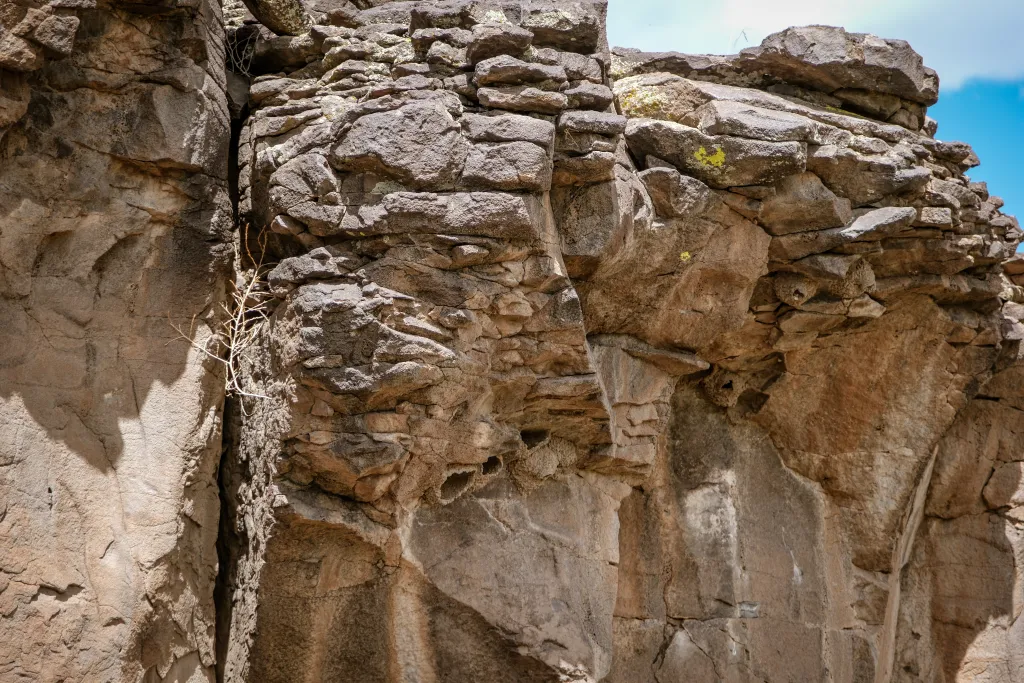
Acouple of years back there was a post on Facebook that identified locations of petroglyphs which exist in eastern Conejos County and western Costilla County, near historic Lobatos Bridge.
Vandals took notice and defaced the ancient carvings, and in turn heightened the concern among local land managers and residents who talk about the Facebook episode and fear too much public exposure to one of Colorado’s oldest areas could have a detrimental effect on preserving the cultural heritage of the southern end of the San Luis Valley.

The Lobatos Bridge corridor has more than 10,000 years of human occupation and heritage to it, and serves as a gateway for the Rio Grande as it flows into northern New Mexico and then south into El Paso, Texas. It’s the Pass of the North, El Paso del Norte, that is considered the cradle of civilization of the Southwest United States. People followed the Rio Grande north, including into the San Luis Valley.
The traces of history are strong in the southern end of the San Luis Valley, and any efforts to bring attention to the favorite fishing holes and hunting grounds for generations of families is frowned upon and can be met with unfortunate displeasure.
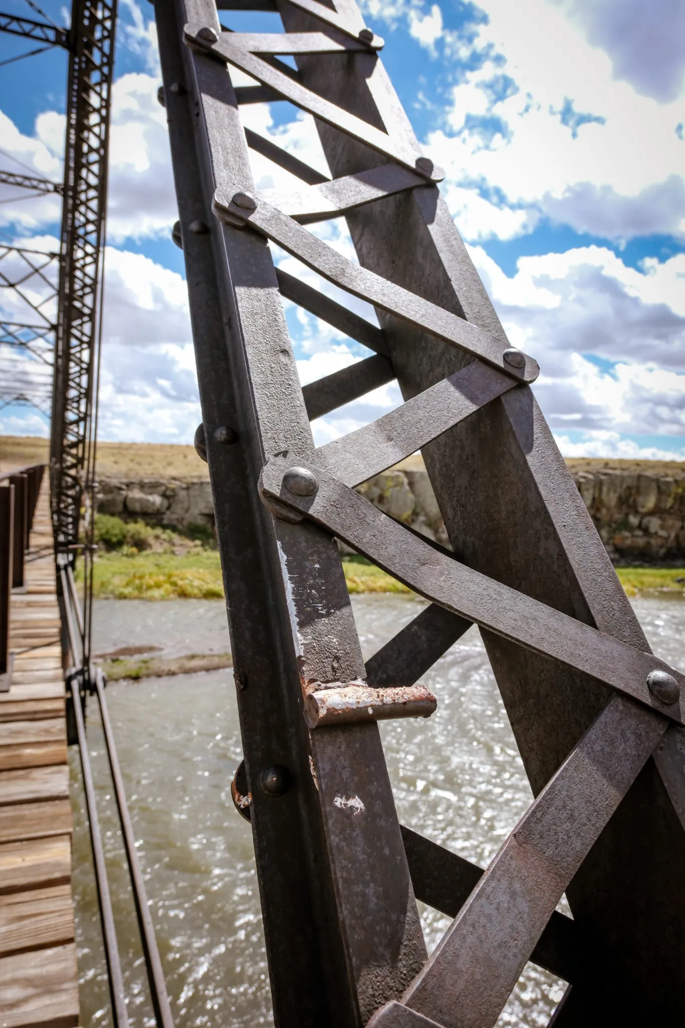
It is with this understanding that two efforts are underway to carefully and thoughtfully showcase the public land corridors of the Lobatos Bridge and the Rio Grande Natural Area. The U.S. Bureau of Land Management is moving forward on creating the Lobatos Bridge Recreation & Interpretive area to showcase its history and to provide boat access and other recreational opportunities on the Rio Grande at Lobatos Bridge. BLM officials, along with champions of the project which include the Sangre de Cristo National Heritage Area and San Luis Valley Great Outdoors, met this month with residents of Conejos County to update them on a timeline for an educational outdoor classroom and public recreation in place come late 2024. Key to the timeline is an upcoming decision from Great Outdoors Colorado to provide grant funding.A separate push is underway in Conejos County to revive the idea of connecting the Rio Grande corridor for recreational purposes from the Alamosa Wildlife Refuge through the Lobatos Bridge passageway and into northern New Mexico and the Rio Grande Gorge Bridge near Taos. It’s a conversation fraught with lessons learned from the last time the idea of creating a national monument area between the two states and along the Rio Grande was tried and met with distrust.
Both the Lobatos Bridge recreational and educational area and the idea of establishing either a national conservation area designation or national monument designation for the Rio Grande corridor into New Mexico are considered potential boons for Conejos County and its efforts to expand its recreational footprint and the potential for more discovery of the historic landmarks among tourists.
Casting an imposing shadow over all of it is one Ken Salazar, currently the U.S. ambassador to Mexico, and former U.S. senator, former U.S. secretary of the interior, former Colorado attorney general, and always a Valley native who touts his roots. His name came up at the BLM meeting on Lobato Bridge and is on the minds of local organizers working on a Rio Grande national conservation area designation. It’s both his love for his homeland and his concern for the local Conejos County economy that continues to hold his interest and help spur efforts forward, according to those who stay in touch.

History behind the projects
Sean Noonan, the outdoor recreation planner for BLM’s field office in the San Luis Valley, provided Conejos County meeting attendees in September with the history of the Lobatos Bridge project and why now. He took the crowd back to the late 1970s and how BLM came to swap land with a local property owner to gain control of the Lobatos Bridge area, and then the years of efforts to put in place a wild and scenic river designation for the Rio Grande area from the Valley into New Mexico.
It was during the process of the wild and scenic river designation debate that the federal government’s master planning fell off track due to its efforts to secure a guarantee of a federal water right along the Rio Grande, which raised the ire of local irrigators. Once heads cooled and the federal government backed off the guaranteed water rights concept, the designation became official. Now BLM talks about the recreation and heritage corridor at Lobatos Bridge as a way to keep history alive.
“It starts with millions of years of geology and the river that runs through it, and all the plants and animals, and all the people that have come up that river since time and memorial and the centuries of history that are literally scratched into the walls of the canyon and are still in existence from the recent past till today,” Noonan told the audience at the recent Conejos County meeting held at Our Lady of Guadalupe Parish Hall.
“That’s really the goal of this project,” he said, “to help tell that story and to continue to provide the access to the river to the public and to experience the river and to experience the landscape and to become ingrained in all of that heritage that many of you really carry in your blood.”

Should the GOCO funding come through, there is expectation that the Lobatos Bridge Recreation & Interpretive Education project will break ground in spring 2024. Local architect and designer Kelly Ortiz is hard at work building the storyboards for the educational area and actively seeking input from residents to bring their family histories to light.
One is the Mondragon Family and the trading post it once ran at the site. It was at the Mondragon Trading Post that people would pay a fee to ride the ferry that crossed through the Rio Grande at Lobatos Bridge and up the river to New Mexico. Providing boating river access once again at Lobatos Bridge is part of the BLM plan.
“At the bridge, the water was as deep as the rim of the gorge,” Julie Chacon, executive director of the Sangre de Cristo National Heritage Area said of the history of the area and the period when the Mondragon store operated. She too is focused on uncovering and telling the stories for the Lobatos Bridge educational project.
Connecting all the river dots
Later this month another community meeting, this one in Manassa, will be held to continue conversations started in June on requesting either a national conservation area designation or national monument extension for the upper and middle portions of the Rio Grande and across two states.
Chris Canaly, the savvy leader of San Luis Valley Ecosystems Council, is among those in the room. Also helping with the conversations are Anna Vargas, well-known in Conejos County for her environmental activism, and Nathan Coombs, head of the Conejos Water Conservancy District and whose voice in Manassa and Conejos County carries weight through his leadership in the Mormon community. Staff for both Sen. John Hickenlooper and Sen. Michael Bennet are paying attention.
A federal designation has been tried before, back in 2014, and failed to gain consensus after Congress designated the Rio Grande del Norte National Monument which encompasses the Rio Grande Gorge just downstream from Lobatos Bridge. Like the Lobatos Bridge area, BLM manages the public lands of the Rio Grande national monument area and has to deal with the gnarly local issues of private land ownership and historic grazing rights in both neighboring New Mexico and the Valley.Canaly thinks BLM gets a bad rap for its management of public lands overall. The federal agency, she said, is mindful of the importance of its engagement with community members and takes great care in its management of public lands in the San Luis Valley and Colorado.
“We are paranoid about recreation. We have to take the side of protecting the ecosystem,” Canaly said of her organization. “But we also understand the importance of planning recreation well and if it’s planned well, it’s a huge benefit to the communities nearby.”
There is no better example than the Great Sands Dunes National Park and Preserve and how that designation spurred a growth in tourism through Alamosa County.
Canaly said there appears to be more openness this time around to the idea of creating a federal designation for the Rio Grande corridor through Alamosa, Conejos and into neighboring Taos County.

Whether the current effort results in a request for a national conservation area or national monument designation, the feeling among environmental and recreational groups is there is enough momentum with the Lobatos Bridge project that it only makes sense to finish connecting the dots of the Rio Grande and let a rich story of the nation’s history come to life.
“The opportunity is there to understand the cultural resources that were here and the continuation of human activity that is well-documented here over the last 10,000 years. It is super, frickin’ interesting. Why not elevate that consciousness?” Canaly said.
Photos by: Ryan Scavo | Big River Collective