
#Colorado #snowpack map November 24, 2023 via the NRCS


Click the link to read the article on the AZCentral.com website (Brandon Loomis). Here’s an excerpt:
The arrival of the winter snow season, which sustains the river and last year bailed out water users facing critically low reservoirs, brings new questions for water managers: Will El Niño conditions in the Pacific Ocean produce a wet winter in the Southwest and parts of the Rockies? And could a second straight wet winter wallop the region with above-average snowfall and again forestall more drastic conservation measures?
[…]
[Jack] Schmidt isn’t predicting the weather, but he has crunched the numbers on the drought or aridification patterns that plunged the Colorado into peril over the last 23 years and they aren’t pretty. Last winter was the second-wettest of that time, behind 2011. There have been a handful of high-snow, high-flow years in that span, but none was followed immediately by another. Each such winter has provided no more than a two-year arrest in the system’s downward slide. Without another one this winter, Schmidt said, the region will be back in crisis despite the states’ agreed cutbacks…And history shows that those who hope another wet winter will forestall tough choices risk disappointment…
Already, the region has used about a fifth of last winter’s windfall, Schmidt said. That’s enough to set water storage back where it was in June of 2021, a time that was better than last year, but still an impending disaster that sent water managers scrambling and forced central Arizona farmers to prepare for a cut off…Like Schmidt, federal forecasters and some water system managers are tamping down optimism for this El Niño…National Weather Service meteorologists reinforced the uncertainty in a Phoenix briefing this week. Their predictions for northern Arizona’s high country, which saw big snows in tandem with the Rockies last winter, amount to essentially even odds…Scanning moderate to strong El Niños in recent decades, [Ken Drozd] found that about half bring wet winters to the state, meaning snow in the north. About 30% are drier than normal, including the winter of 2015-2016. About 20% are near normal. At present, the Weather Service’s Climate Prediction Center gives roughly even odds to all three possibilities: wet, dry and normal.
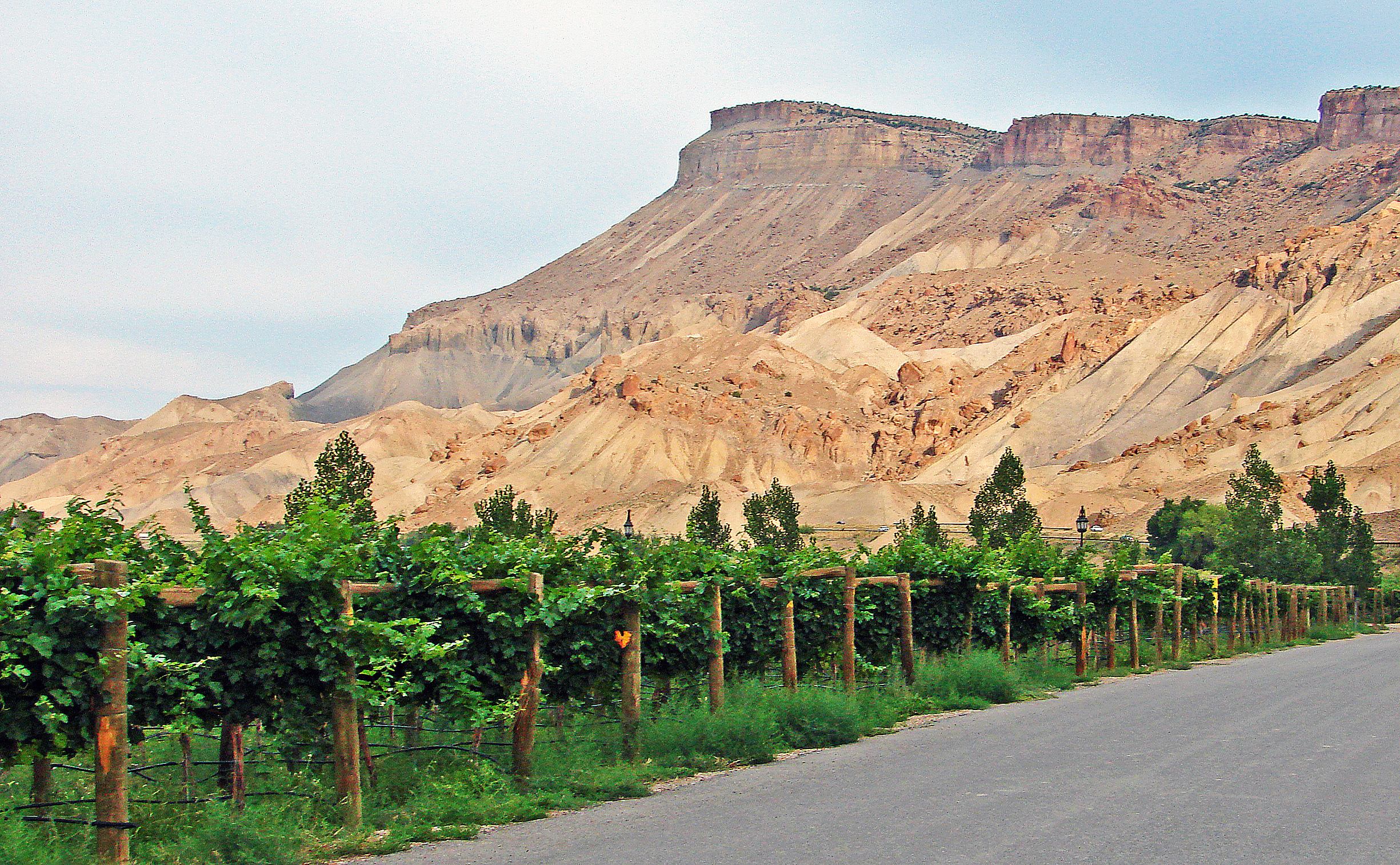
Click the link to read the article on The Grand Junction Daily Sentinel website (Dan West). Here’s an excerpt:
The Palisade Board of Trustees voted unanimously last Tuesday to raise its sewer rates in 2024 to $57.23 from the current single family residential rate of $35.37. The rate increase is intended to pay for a capital project to construct a pipe for Palisade’s waste water to the Clifton Sanitation Districts chemical plant and decommission its sewer lagoons. The rate increase was recommended through a rate study, which was completed and presented to the Trustees earlier this year. The rates will help pay back a $16.5 million loan from the United States Department of Agriculture, which was announced in late April. It also got around $5.6 million in grant funding from the USDA.
The new rates will also come with a new method for determining how much impact individual users have on the wastewater system. That method is called EQU. It is currently used by the Clifton Sanitation District. Palisade has had an EQU ordinance in place for years, but never implemented it, Town Attorney Jim Neu said…A single family home is considered one EQU, while a building with larger use, like a school, could be several EQUs. The Palisade rate in 2024 will be $57.23 per EQU.
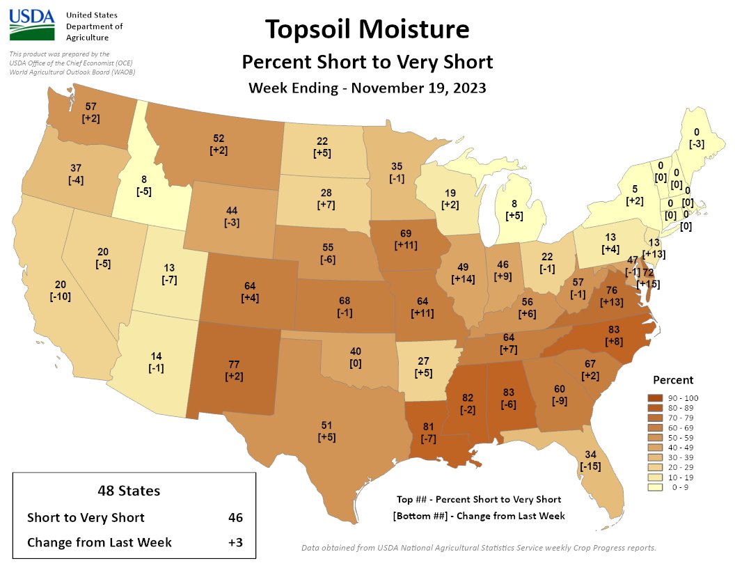
46% of the continental US is short/very short, a 3% increase since last week. A band across the mid-Atlantic and central US dried out, with rapid drying in NJ, DE, VA, IL, MO, & IA. Much of the SE is still dry, but improved.
Thomas S. Bremer, Rhodes College
Abraham Lincoln has an almost saintly place in U.S. history: the “Great Emancipator” whose leadership during the Civil War preserved the Union and abolished slavery.
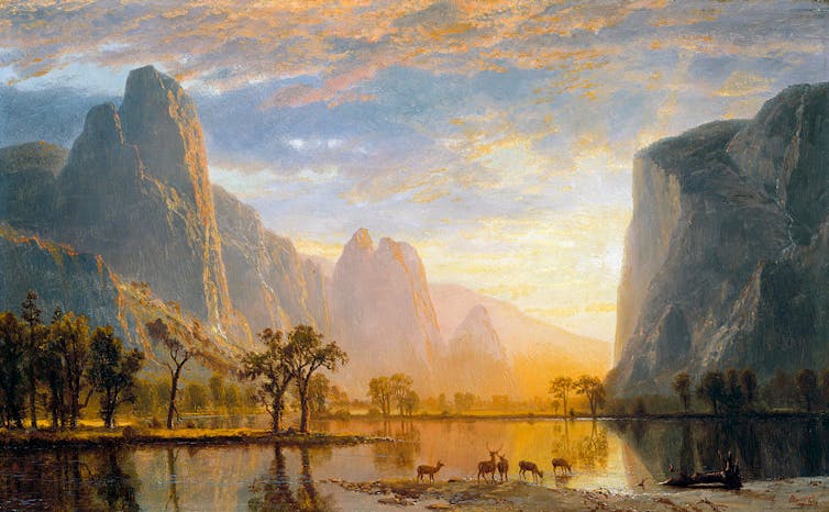
Often overlooked among his achievements is legislation he signed June 30, 1864, during the thick of the war – but only marginally related to the conflict. The Yosemite Valley Grant Act preserved the Yosemite Valley and Mariposa Grove in California as a park “held for public use, resort, and recreation … for all time.”
It was the first time the federal government had set aside land for its scenic value, and it created a model for U.S. national parks, which are themselves hallowed sites in American culture. Originally granted to the state of California, Yosemite formally became the third U.S. national park in 1890, joining a system of picturesque lands that hold spiritual and patriotic significance for millions of Americans.
At the same time, however, the establishment of national parks had severe consequences for Native American peoples across the continent. My research on the religious history of U.S. national parks illustrates how religious justifications for establishing parks contributed to the persecution of Indigenous tribes, a reality that the National Park Service has begun to redress in recent decades.
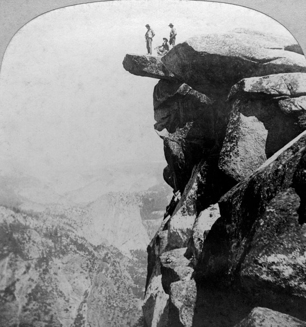
With more than 300 million annual visitors, the U.S. National Park System is a much-valued treasure. It encompasses stupendous scenery, opportunities for encounters with wildlife, outdoor recreation and commemoration of important places and events.
But the parks’ significance goes beyond this. The national parks, historic sites, battlefields and other sites of the National Park Service are sacred places in U.S. civil religion: the symbols, practices and traditions that make the idea of a nation into something sacred, seemingly blessed by a higher power.
First brought attention by sociologist Robert Bellah, civil religion flourishes alongside conventional religious traditions, like Christianity or Buddhism, with its own sacred figures, sites and rituals. In the U.S., these include George Washington and Martin Luther King Jr., the U.S. flag and Pledge of Allegiance, and national holidays such as Independence Day.
I have observed that many of the most sacred places of the nation’s civil religion are found in sites cared for by the National Park Service, from Independence Hall in Philadelphia and the Statue of Liberty in New York to Mount Rushmore in South Dakota.
In addition, the National Park System is a testament to Manifest Destiny, a prominent feature of U.S. civil religion. This 19th-century notion held that Americans had divine blessing to expand the borders of the nation. As historian Anders Stephanson writes in his book about Manifest Destiny, it became “a catchword for the idea of a providentially or historically sanctioned right to continental expansionism.”
This westward expansion came at the expense of Native Americans and other groups that previously inhabited the territory. For many Protestant Christian Americans, the superlative scenery of natural sites like Yosemite and Yellowstone affirmed their belief that God intended for them to conquer and settle the American West in the decades following the Civil War – as I write about in my forthcoming book.
The earliest national parks were established as products of Manifest Destiny, amid the national push to bring land from the Mississippi to the Pacific into the United States, which many white Americans viewed as a mission to expand settled Christian society.
Beginning with Yellowstone in 1872, followed by Sequoia, Yosemite and Mount Rainier, the early parks created in the 19th century had symbolic significance for U.S. civil religion. In many Americans’ eyes, the sites’ beauty affirmed their belief that the U.S. was exceptional and divinely favored.

Westward expansion had severe consequences for American Indian nations, and the earliest national parks played a role in forcing their removal, as historian Mark David Spence has documented. Transforming lands into national parks for visitors’ enjoyment meant dispossessing communities whose ancestors had valued those places for generations.
Following the creation of Yellowstone, the world’s first national park, a band of Shoshone people who had been there for generations – the Tukudika, or Sheep Eater – were relocated to a reservation in Wyoming. A similar situation involved the Nitsitapii, or Blackfeet people, whose treaty rights were abrogated with the establishment of Glacier National Park in 1910.
In contrast, the Yosemite Indians of California, who were mainly a band of Miwok people known as the Ahwahneechee, remained in Yosemite long after it became a national park. By 1969, though, they had been eliminated from the park through decades of onerous regulations, economic pressures and attrition.
Over the past few decades, the National Park Service has made progress in acknowledging Native American connections to parklands, beginning to address the history of Manifest Destiny and Indigenous peoples’ exclusion.
The agency is a key contributor to the Interior Department’s recent initiative to facilitate tribal co-management of federal lands. Though much still needs to be done, national park managers are increasingly consulting and cooperating with tribal authorities on a range of issues.
Deb Haaland, the first Native American in U.S. history to hold a cabinet position, initiated a process to review and replace derogatory names on federal lands – one of her earliest actions as secretary of the interior. For example, she specifically identified the term “squaw” – a slur often directed at Indigenous women – as offensive, declaring that “racist terms have no place in our vernacular or on our federal lands.” Within a year of her directive, 24 places in the National Park System had new names.
Other issues on which the park service is collaborating with tribal communities include adopting Native American strategies of using deliberate fires to maintain healthy, thriving ecosystems. These Indigenous traditions have become a regular part of fire prevention and management efforts throughout the park system.

Tribes have also cooperated with a variety of national parks to restore bison herds. Historically, these animals were central for many tribes not only as a source of food and materials for tools, clothing and blankets but also in traditional spirituality. The Interior Department’s 2020 Bison Conservation Initiative and partnerships with the InterTribal Buffalo Council have helped begin to restore herds on Native American lands with bison from national parks, including Yellowstone, Badlands and Grand Canyon.
Perhaps the most noticeable initiative, from visitors’ perspective, are the stories of Native American culture and history in displays, ranger talks, roadside exhibits and the National Park Service website, amplifying Native voices in the parks. These programs have begun the process of reconciliation and healing – working to make a more inclusive and democratic civil religion.
Thomas S. Bremer, Associate Professor of Religious Studies, American Religious History, Rhodes College
This article is republished from The Conversation under a Creative Commons license. Read the original article.

Click the link to read the article on the Fort Collins Coloradoan website (Rebecca Powell). Here’s an excerpt:
The city says the new application is unique because Thornton asked community members about what was most important when it comes to site selection and used that information to determine the preferred route…The application is not yet available from the Larimer County Planning Division, but the city of Thornton has posted some information and a map of the preferred route on a project website. The city also sent the Coloradoan its executive summary for the application…
Thornton says the new proposed route through the county is about 10 miles long, 16 miles shorter than what was first proposed in 2018. A pump station would be moved two miles north of where it was proposed to land owned by Water Supply and Storage Company…The new proposed placement affects 20 outside property owners, according to Thornton, whereas the last project crossed 40 properties, according to Todd Barnes, communications director for Thornton…The plan incorporates other changes the city proposed after commissioners told the city to go back to the drawing board in late 2018, like locating the pipeline along County Road 56 instead of through Douglas Road and aligning part of it with the proposed pipeline for the Northern Integrated Supply Project, a separate water project…Thornton says the new application provides precise locations for the pipeline and its parts so residents “can have a clear understanding of potential impacts from the project.”
[…]
In the new application, Thornton contends any concerns about how the project affects river levels is an issue outside of the county’s authority and is under the jurisdiction of a water court. The city also asserts that because of the court ruling, Larimer County may not consider Thornton’s potential use of eminent domain and “may not require (or criticize Thornton for not including) inclusion of concept of putting water ‘down the river.’ “